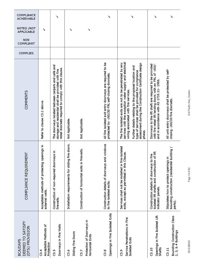
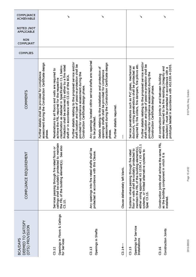
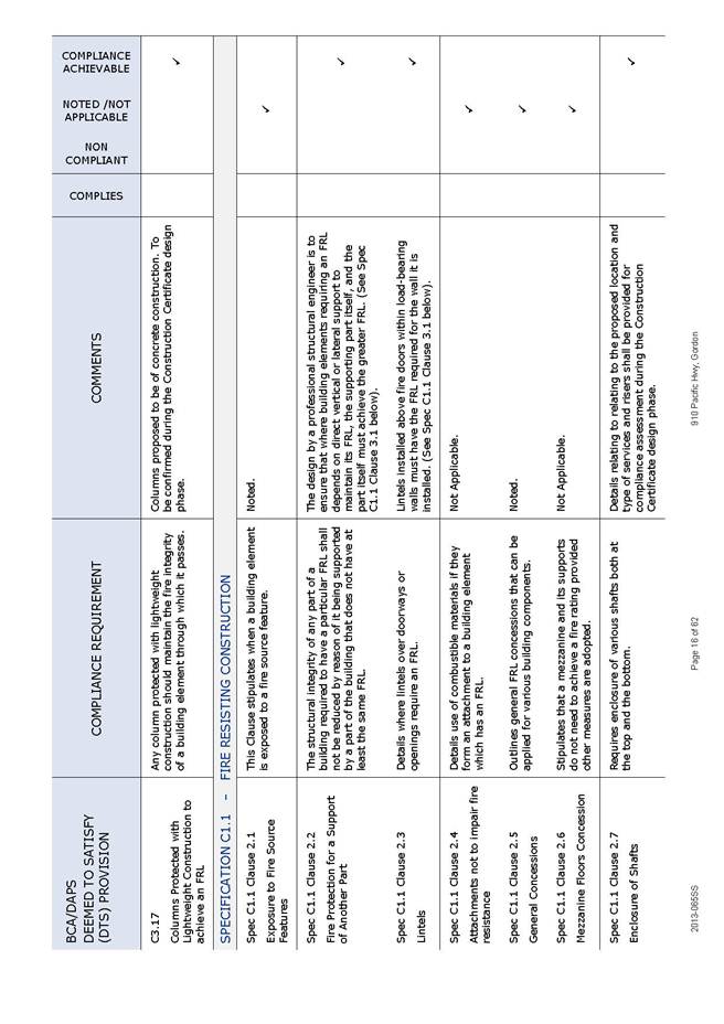
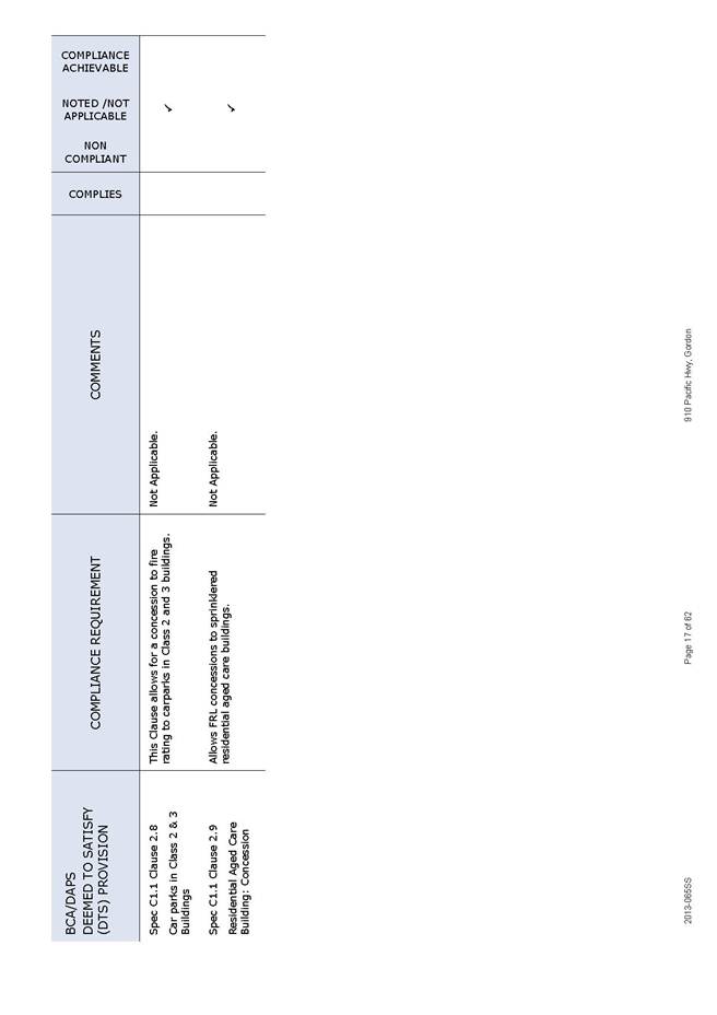
|
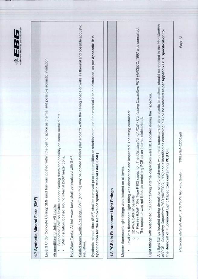
|
Item No: GB.10 |
Ordinary Meeting of Council
TO BE HELD ON Tuesday, 7 October 2014 AT 7.00pm
Level 3 Council Chambers
LATE ITEMS
** ** ** ** ** **
NOTE: For Full Details, See Council’s Website –
www.kmc.nsw.gov.au under the link to business papers
minutes from the Mayor
MM.2 Fit for the Future - Information Session 8
File: S09638
On Monday 29 September, the General Manager and I attended a Fit for the Future Information Session conducted by senior staff from the Office of Local Government for Mayors and General Managers. Hereafter are the notes from the information session:
Invitees: Mayors and GM's from Hornsby, Ku-ring-gai, Pittwater, Warringah, Manly, Ryde, Hunters Hill, Lane Cove, Willoughby, North Sydney, Mosman, Gosford and Wyong.
The session was facilitated by the Acting Chief Executive for the office of Local Government, Mr Steve Orr.
The session was provided as an opportunity to hear more about the "Fit for the Future" package and the one stop shop which has been established by the Office of Local Government to assist Councils.
Introduction from Minister for Local Government, Paul Toole.
Fit for the future package was announced two weeks ago. The package traces back to the destination 2036 workshop held in Dubbo in 2011.
More recently the "Future Directions for LG" paper was undertaken. The paper includes 65 recommendations which have been released in full by the State Government. These recommendations form the core of the fit for the future package.
The Minister reinforced that the current suite of recommendations respond to feedback from LG as an industry.
History of reform review
- 2011 Destination 2036
- 2012 T-Corp Sustainability Review
- 2012 LG Infrastructure Audit
- 2012-2014 Independent LG review
- 2012 -2014 LG Acts Task-force
- 2014 Fit For the Future Package
The "Fit for the Future" package provides significant incentives for those Council's that wish to merge on a voluntary basis (up to $1 billion).
This amount is broken up as follows:
- incentives to encourage mergers - $258 m (will be provided as a grant).
- reductions in red tape - $100m
- cheaper loan borrowings - $600m
- incentives to encourage new regional joint organisations - $5.3m
- local transition committees to support mergers - $13m
- technical support to assist in developing fit for the future submissions
The Minister reinforced that he is committed to reviewing the current system of rating in NSW. This review will be undertaken by IPART.
Review of the FAG Grant - the Government is committed to altering the current method of distributing the FAG grant to ensure that additional funding is provided to those Councils in greatest financial need - i.e. Central Darling in the far West. Larger Urban Councils such as Ku-ring- gai will almost certainly receive less in real terms as a result.
The package will also develop a new performance measurement framework so that Councils and their constituents can easily understand how their Local Council is performing.
The government is currently in the process of reviewing Local Governments interaction with State Government agencies to reduce the level of red tape which currently exists. The burden placed on councils by regulatory requirements was acknowledged.
Governance reform - changes to include 2 year terms for Mayors together with tighter definition as to the roles of Mayors and GM's respectively. The Auditor General will provide an oversight of all Council Audits to ensure greater consistency and reliability of figures contained therein.
The Mayor raised the issue of uncertainty over the accuracy of infrastructure backlog ( special schedule 7). Steve Orr confirmed that from 2015 - 2016, auditors will be required actually audit the schedule (until now the schedule has been unaudited).
The new LG Act will be phased in from 2016-2017. Some minor changes around procurement will be introduced in the shorter term.
The key timeframe for much of the current reform package is centred around the LG elections to be held in 2016. The Minister reinforced that this date will not be put back, the possible exception being where certain Councils are in the midst of merging at that point.
Under the package, Councils will be able to borrow at the same rate as State Government. Over the last 2 years, debt across the industry has increased by $500 million.
Cheaper loan borrowings will only be available to Councils that qualify as being fit for the future. It is envisaged that this scheme will commence from 1July 2015. The question was raised as to whether it will only apply to new debt or will also allow existing debt to be refinanced at cheaper rates.
Transition committees will comprise the Mayor, GM and one other Councillor from each Council who is preparing to merge. Elected members on these committees will be paid $5,000 per month for carrying out this task.
There will be no financial incentives for councils with alternative proposals outside the Fit for the Future plan. However, if the Independent Review Panel recommended councils A,B and C merge but councils would like to propose instead that councils A, B and D merge, that will be open to consideration.
In terms of Joint Regional Organisations, the government’s view is that the size and scale of Councils in metropolitan Sydney should be looked at in the first instance. This does not rule out the establishment of Joint organisations at a point in the future.
The Minister reinforced that Councils must establish financial sustainability to qualify as being fit for the future.
- $10.5 million will be provided to each Council in Sydney who agrees to merge.
- an additional $3m is available for each additional 50,000 in population above 250,000 to a total cap of $22.5m
- The Government does not view 250,000 as a minimum size in a merged Council scenario. This was merely the recommendation in the future directions paper.
What is the government asking Council's to do?
1. Council's to review their current situation 2. Prepare a submission by 30 June 2015.
3. Make the transition ( depending on circumstances).
Becoming fit for the future?
Do you have the right scale and capacity?
This is based on the recommendations of the Independent Local Government review Panel.
If the answer to this is yes, then Council's proceed to establish sustainability and efficiency. If no, then proceed to the structural reform roadmap which is broadly consistent with the recommendations of the panel.
The three independent people who will review the submissions from councils will not include any of the three members of the Independent Review Panel.
A self-assessment tool will be sent to councils by late October as a template to help council submissions. Information on community consultation will be included therein.
The question was raised as to why Councils that demonstrate financial sustainability should be forced to increase their size???
The Minister stressed that no lines have been drawn on a map. It is a genuinely voluntary package, backed by the most comprehensive funding strategy ever developed in this country.
In terms of rating structures, the Minister commented that rates in a merged situation would not necessarily need to be consolidated from day one. It may be phased in over a number of years; i.e. - Councils may be able to maintain a separate rate in the dollar in the short to medium term.
The broad timeframe working to forward to the next LG elections in September 2016 was then outlined. At that point, it is envisaged that all mergers would be complete and the new LG Act will be in place.
Questions were raised about the rushed timeline for mergers before the 2016 local government elections. The response indicated that it was probable not all 152 councils will merge so only the merging councils will be busy meeting the pre-election timeline.
Steve Orr confirmed that the process of boundaries commission will be simplified to avoid a two tiered process. Where Councils agree to merge on a voluntary basis, then there is no need for the boundaries commission to be involved at all.
Petitions
PT.1 Petition to Provide Space for Marian Street Theatre for Young People in Marian Street Theatre at Affordable Rates - (One Thousand, Seven Hundred and Thirty [1,730] Signatures) 12
File: S10095
The following Petition was presented by Councillor David Citer:
“Petition by Marian Street Theatre for Young People, Sydney - BRING MSTYP HOME.
Marian Street Theatre for Young People CMSTYP) i s the oldest children's theatre in Australia. Marian Street Theatre has been its home for 45 years, providing a performance venue and important administration , rehearsal and storage space.
As a not-for-profit organization, MSTYP has helped young people create prize-winnin g theatre for children and their families for generations. Its you ng people take responsibility in all areas of theatre-making and gain invaluable life skills which benefit the community.
In December 2013, Ku-ring-gai Council required MSTYP to leave its home at the theatre at short notice for safety reasons so that the theatre can be renovated. However, Council's current plans are to tum it into a commercial venue for hire. MSTYP will have no class, administration , rehearsal or storage space. We will only be able to perform there at unaffordable rates. This is despite many Council resolutions stating their management model should support MSTYP at the theatre. Without this vital support MSTYP can not survive.
MSTYP has wide-spread passionate community support. Please keep this vital community cultural icon alive by asking Ku-ring-gai Council to keep its word and let MSTYP retum to its home at Marian Street Theatre with the facilities it needs, at prices it can afford.”
** ** ** ** ** **
Agenda - BOOK 2
GENERAL BUSINESS
i. The Mayor to invite Councillors to nominate any item(s) on the Agenda that they wish to have a site inspection.
ii. The Mayor to invite Councillors to nominate any item(s) on the Agenda that they wish to adopt in accordance with the officer’s recommendation allowing for minor changes without debate.
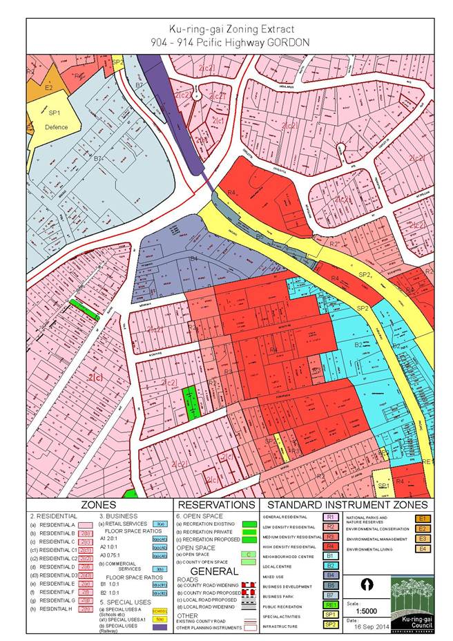
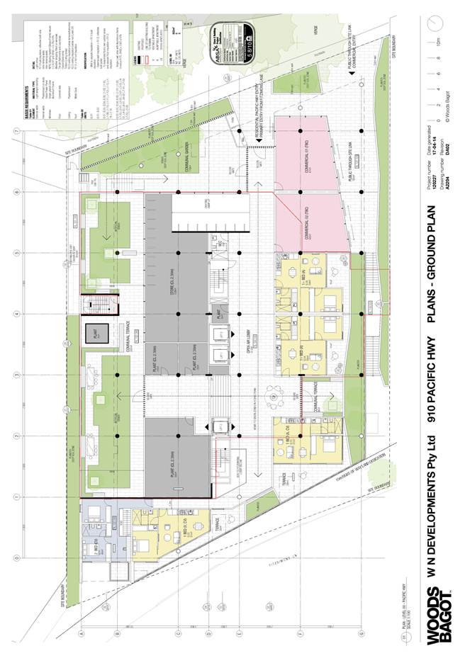
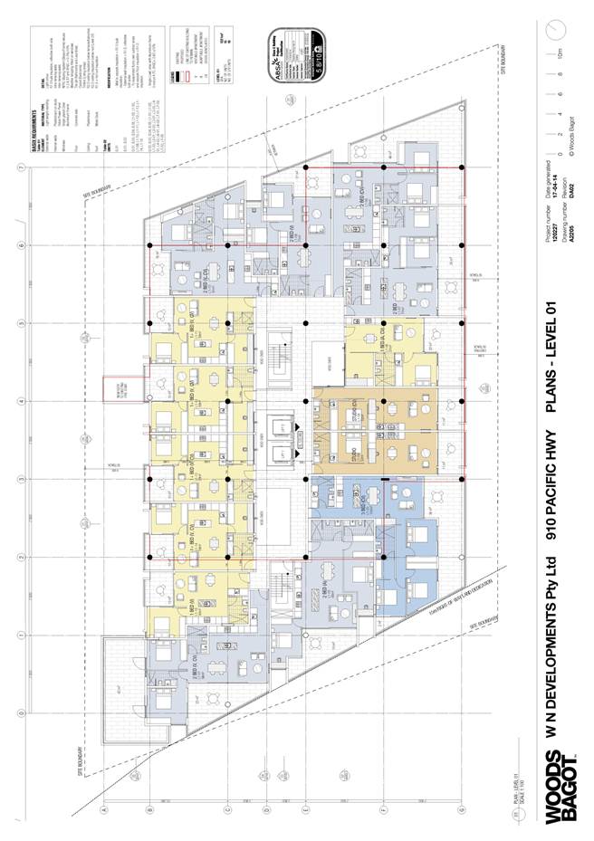
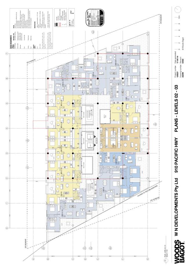
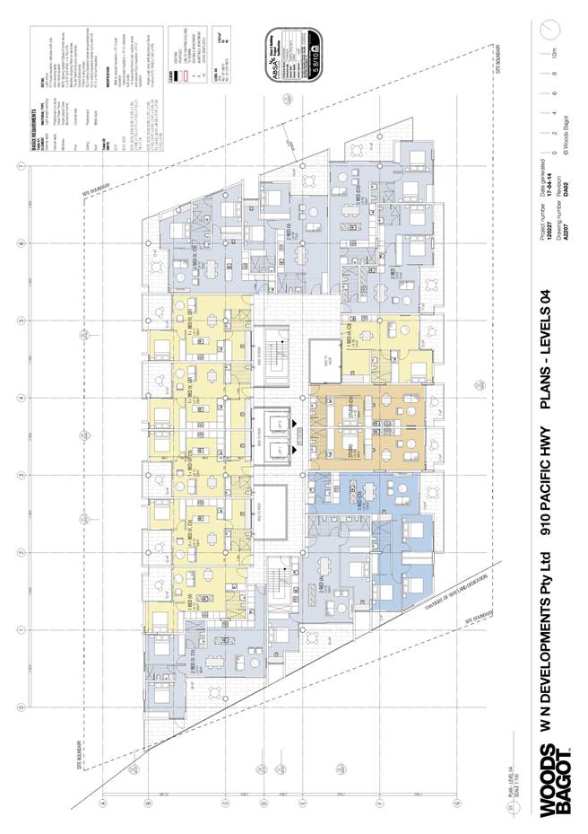
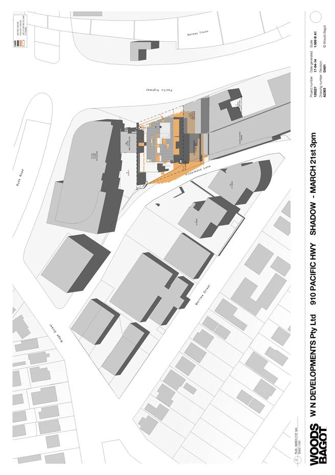
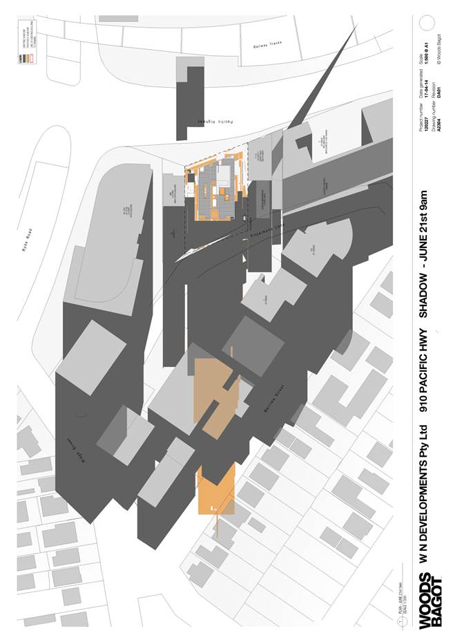
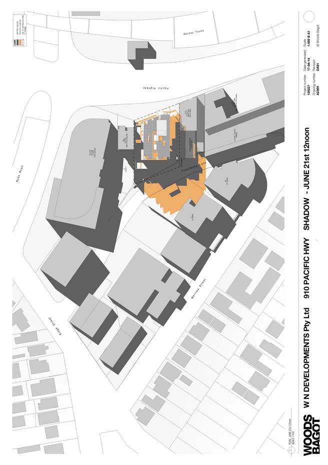
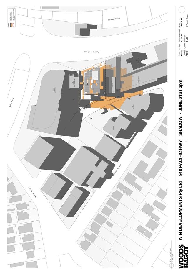
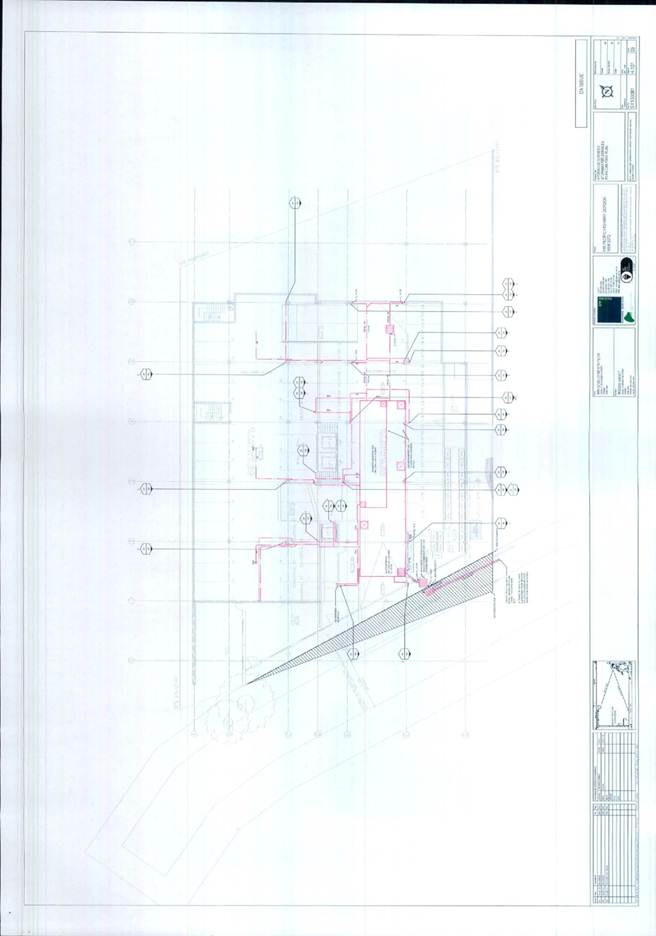
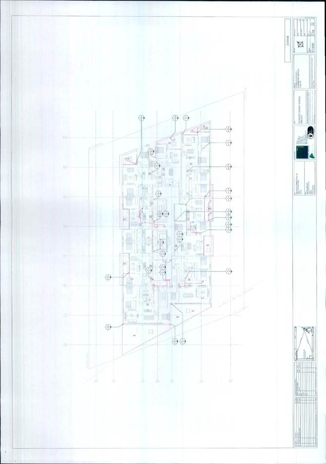
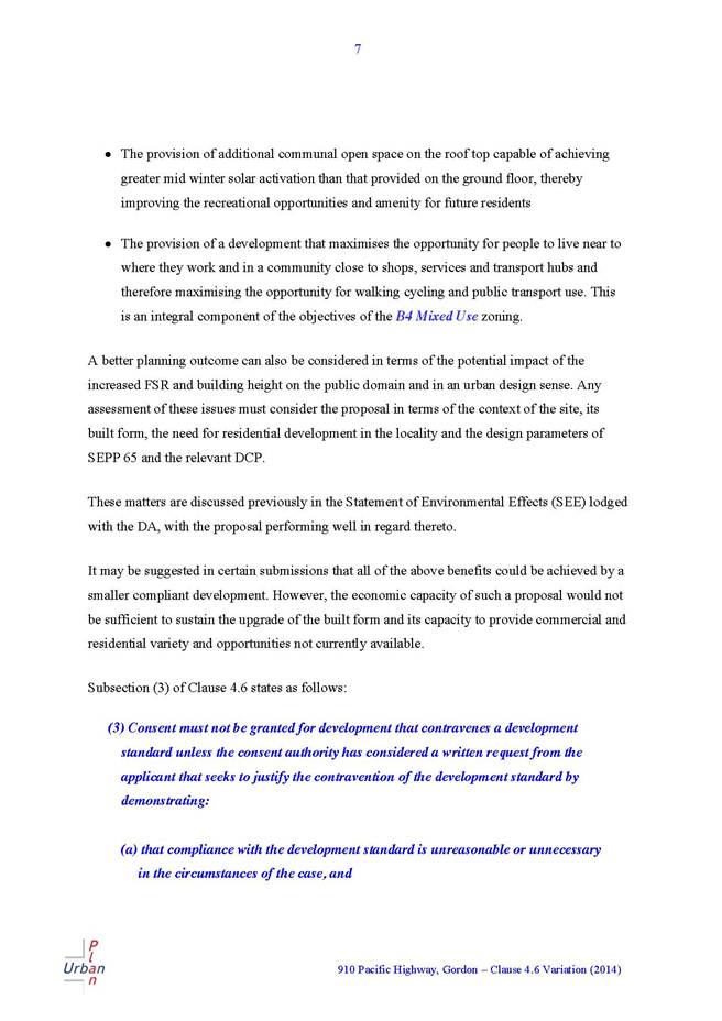
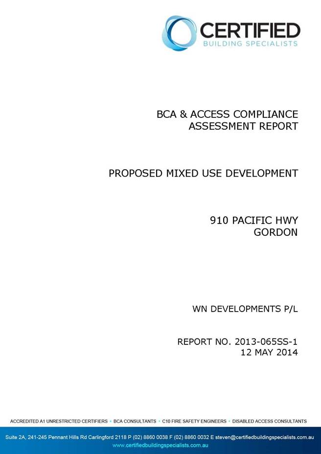
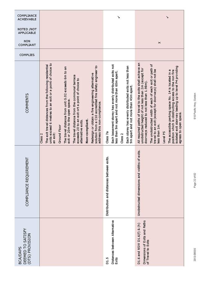
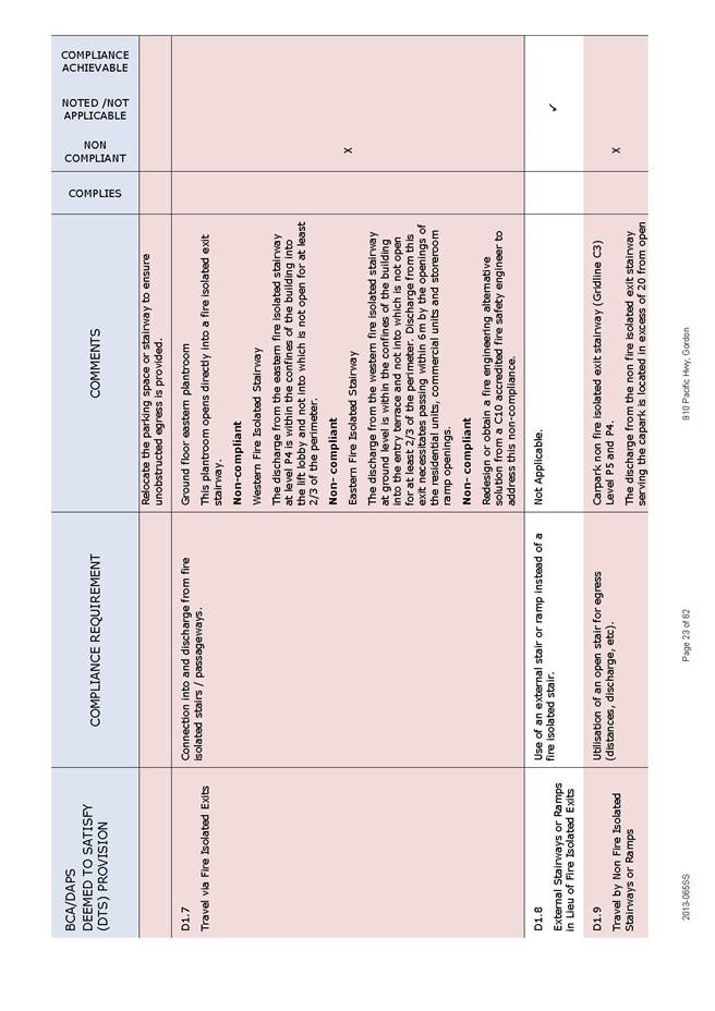
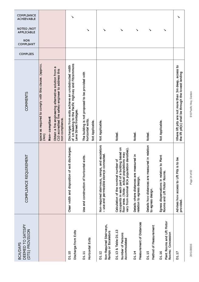
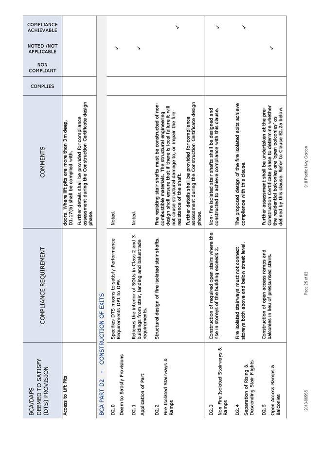
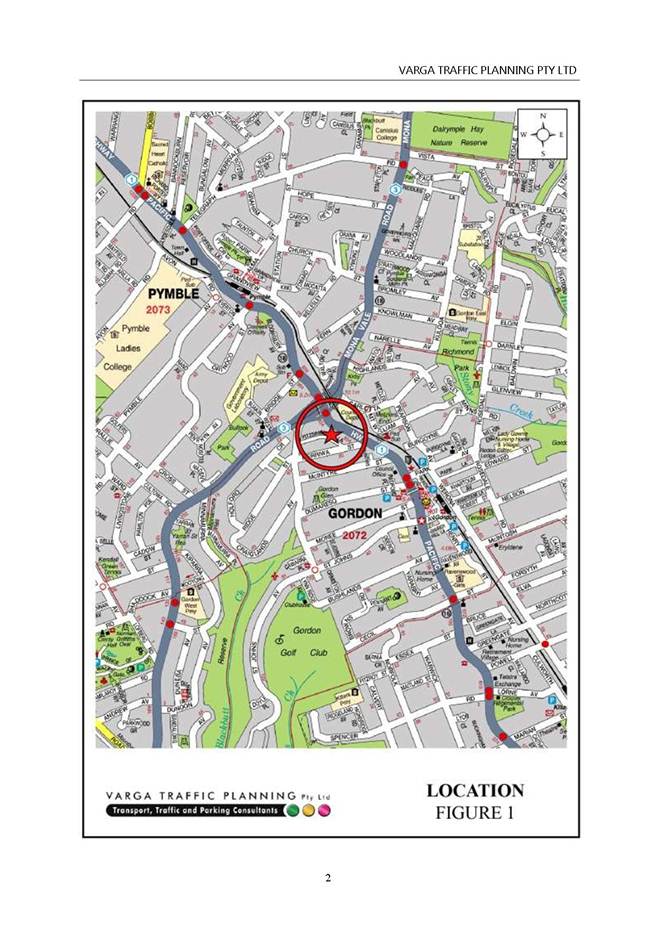
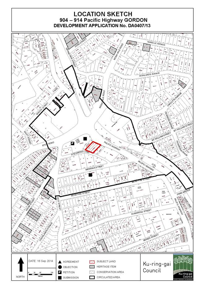
GB.10 904-914 Pacific Highway Gordon - Partial Demolition, Alterations and Additions to a Commercial Building comprising a Cafe, Two Commercial Suites and Ninety Residential Apartments to create a Nine Storey Mixed Use Development. 13
File: DA0407/13
Ward: Gordon
Applicant: WN developments Pty Ltd
Owner: Lochrie Pty Ltd
Partial demolition, alterations and additions to a commercial building comprising a café, two commercial suites and ninety residential apartments to create a nine storey mixed use development.
Recommendation:
Approval.
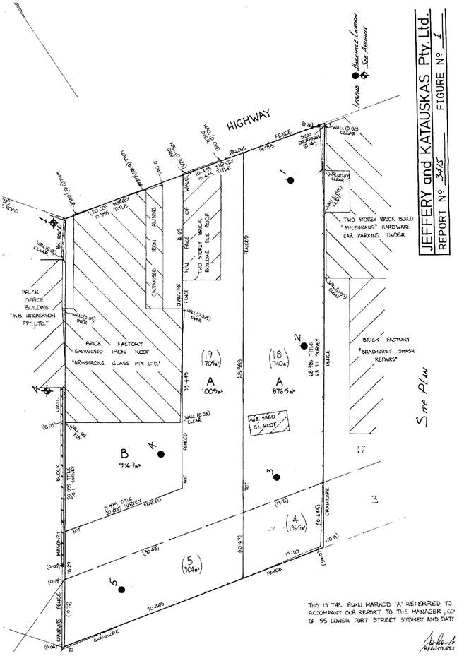
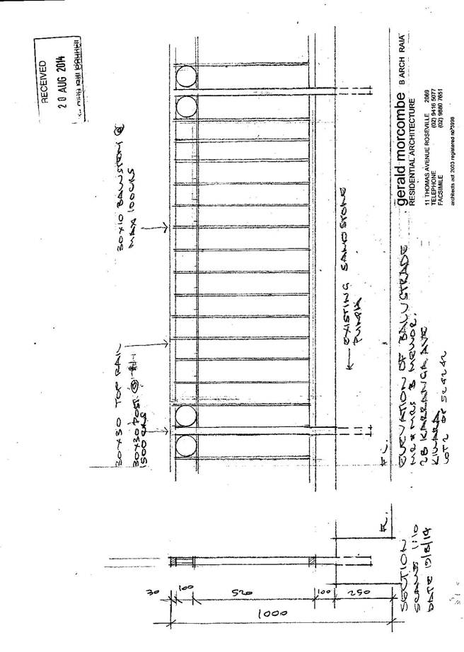
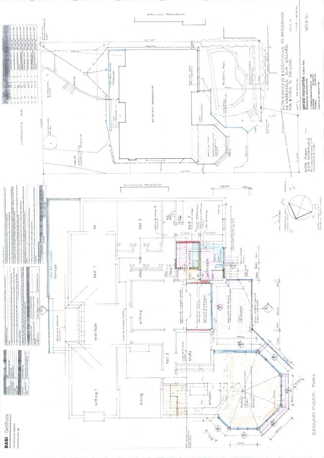
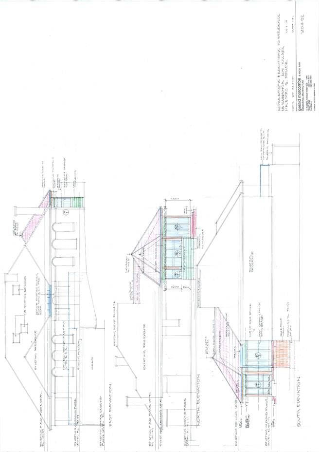
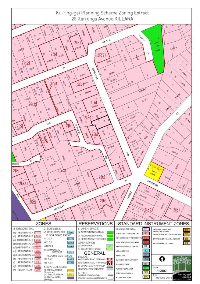
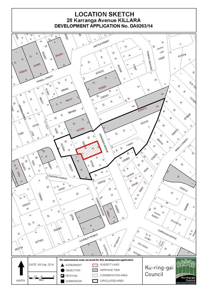
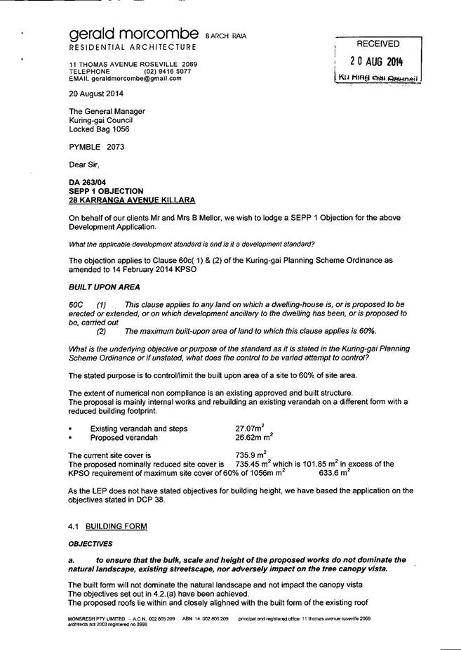
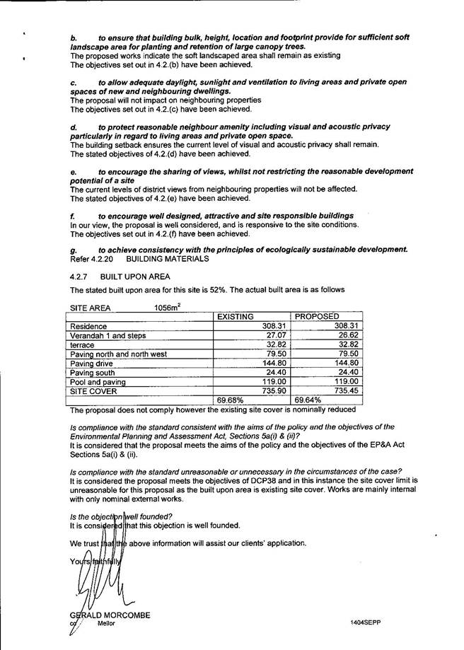
GB.11 28 Karranga Avenue Killara - Alterations and Additions to Dwelling - Heritage Conservation Area 324
File: DA0263/14
Ward: Gordon
Applicant: Catherine and Bruce Mellor
Owner: Mr B B Mellor and Mrs C T Mellor
Alterations and additions to dwelling
Recommendation:
Approval.
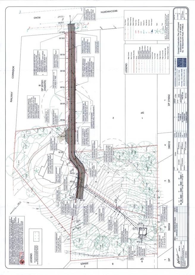
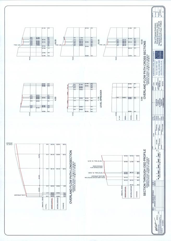
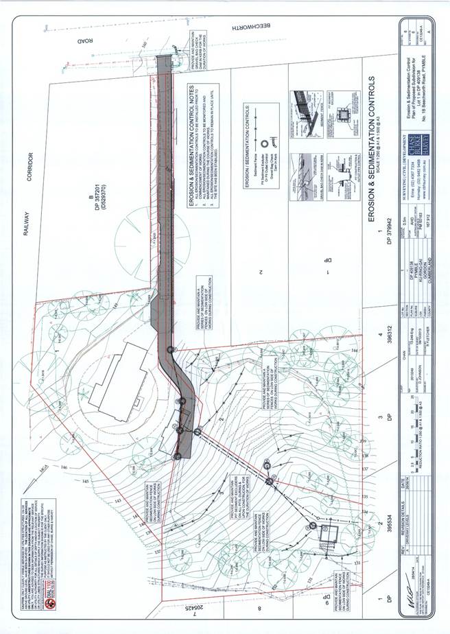
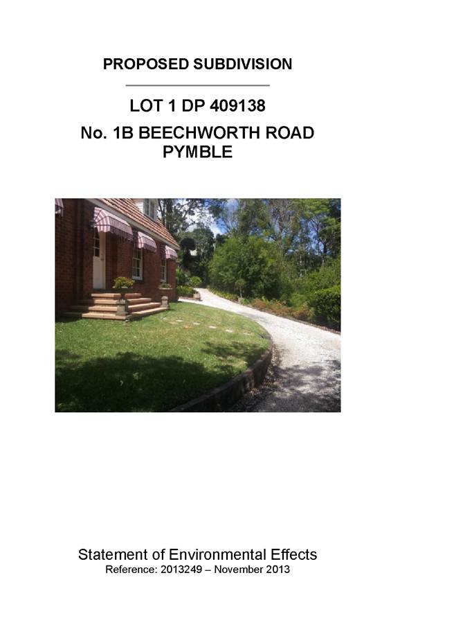
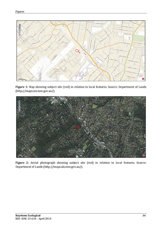
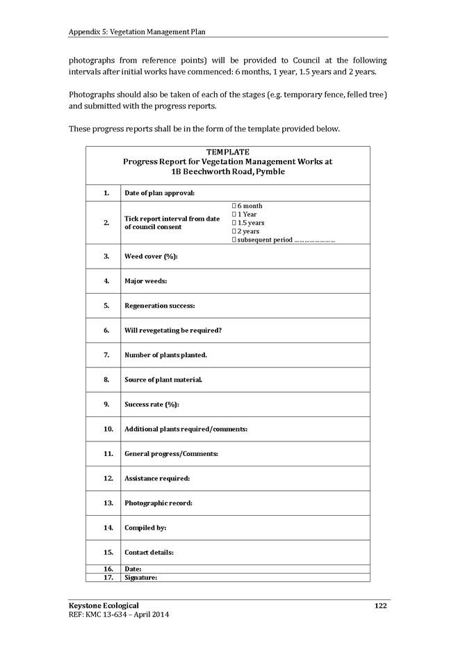
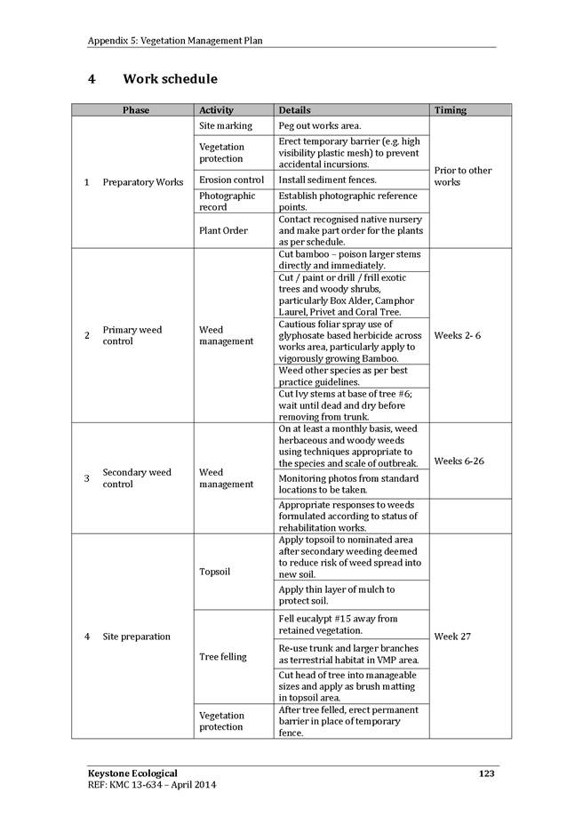
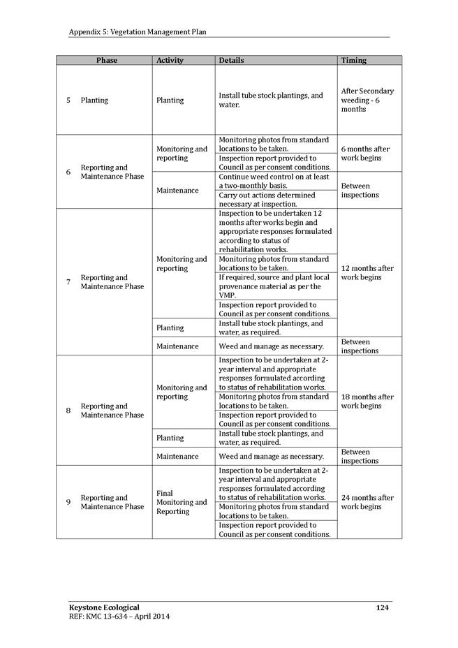
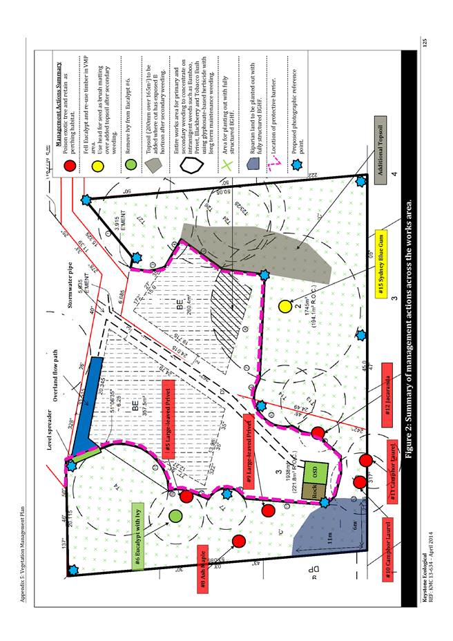
GB.12 1B Beechworth Road Pymble - Subdivide 1 Lot into 3 Lots, Upgrade Access Road, Stormwater Drainage and Ecological Regeneration Works 353
File: DA0518/13
Ward: Comenarra
Applicant: Chase Burke and Harvey
Owner: Mr KS Chan
Subdivide 1 lot into 3 lots, upgrade access road, stormwater drainage and ecological regeneration works
Recommendation:
Approval.
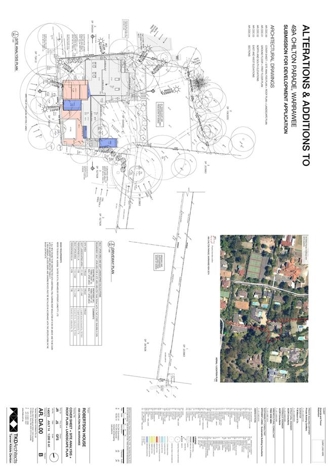
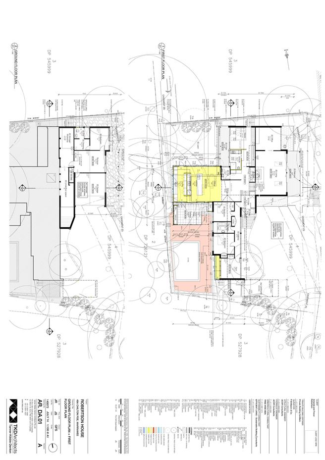
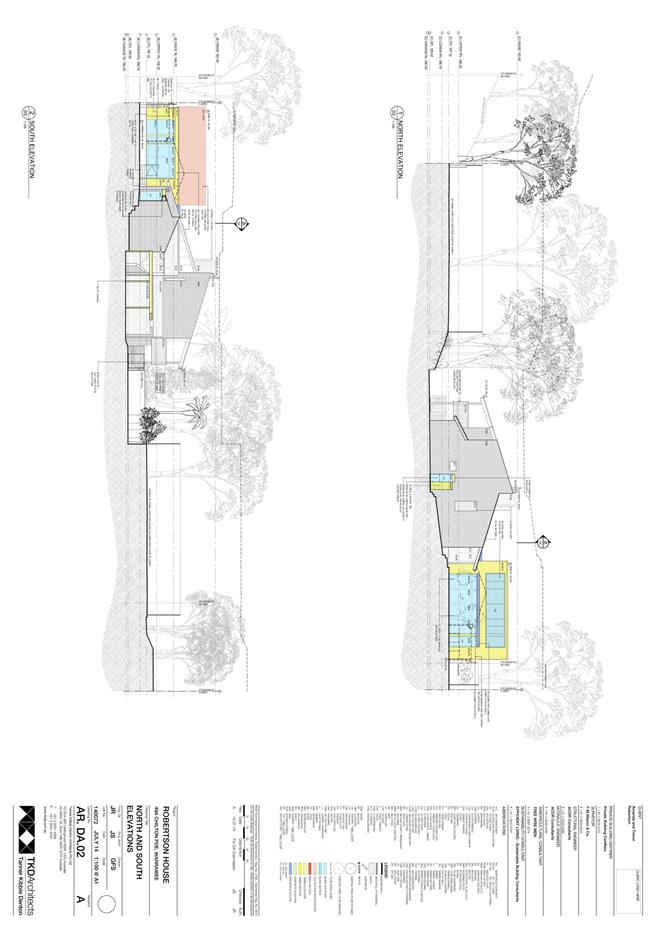
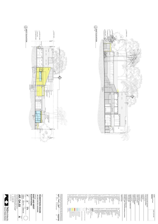
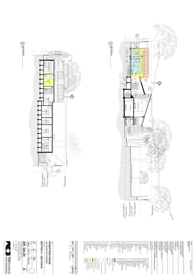
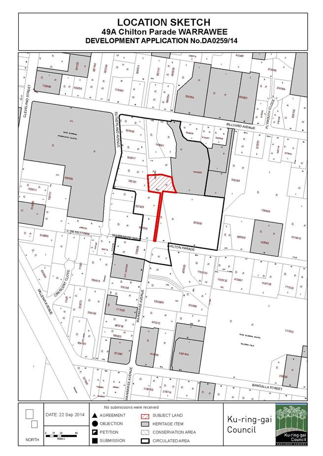
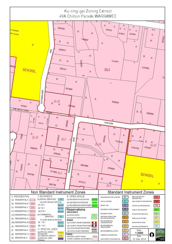
GB.13 49A Chilton Parade Warrawee - Alterations and Additions - Heritage Conservation Area 550
File: DA0259/14
Ward: Wahroonga
Applicant: Trevor & Amanda Robertson
Owner: Trevor & Amanda Robertson
To determine Development Application DA0259/14 for alterations and additions
Recommendation:
Approval.
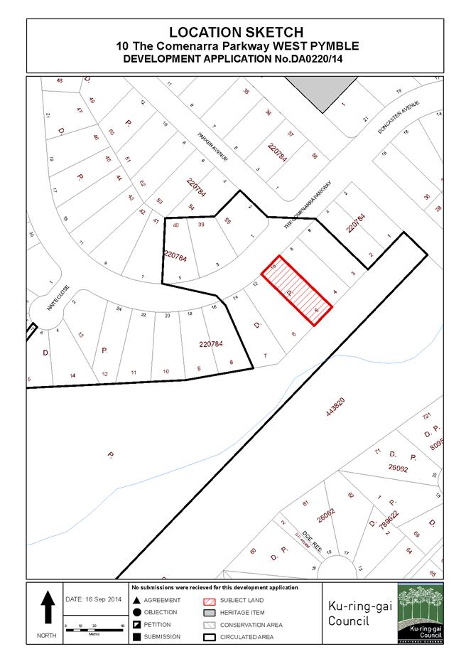
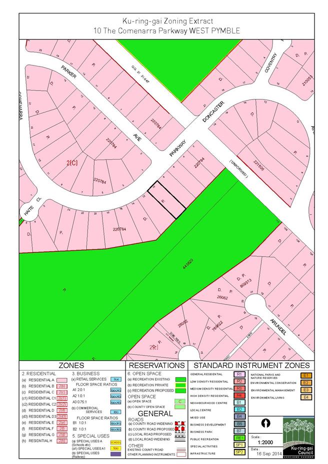
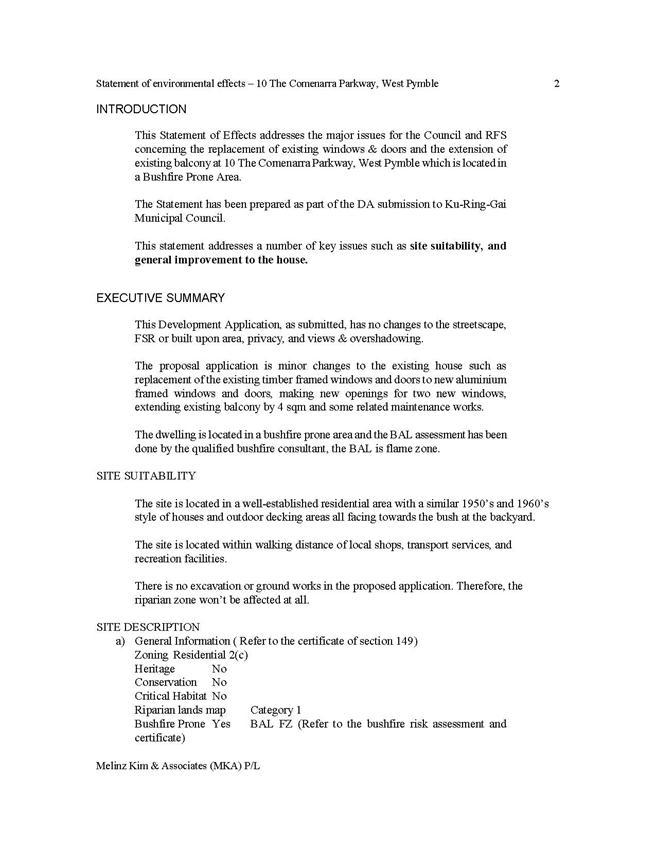
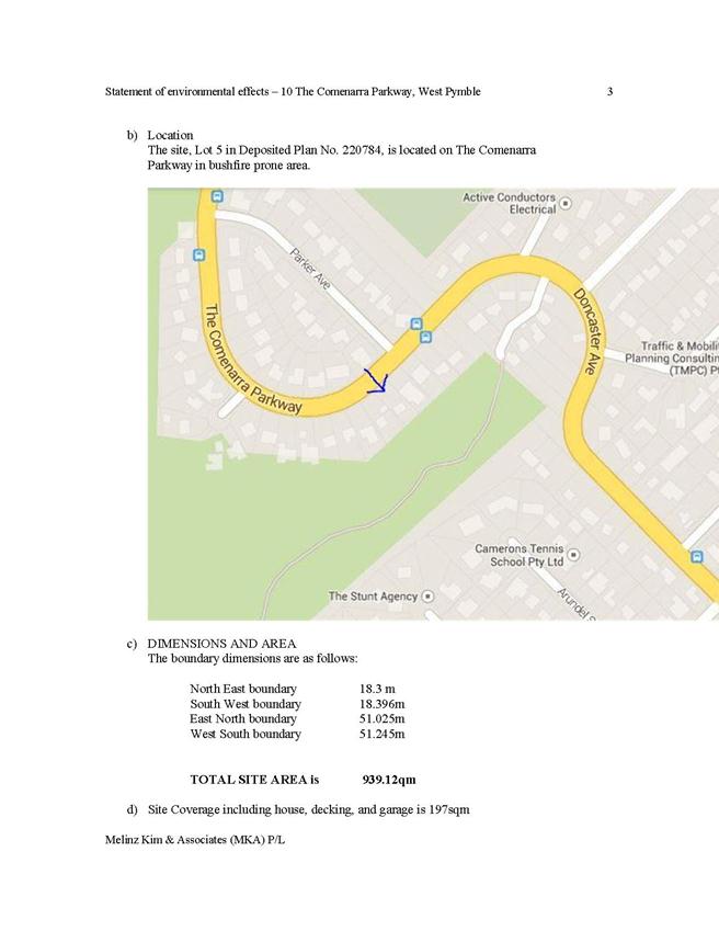
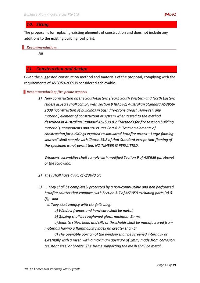
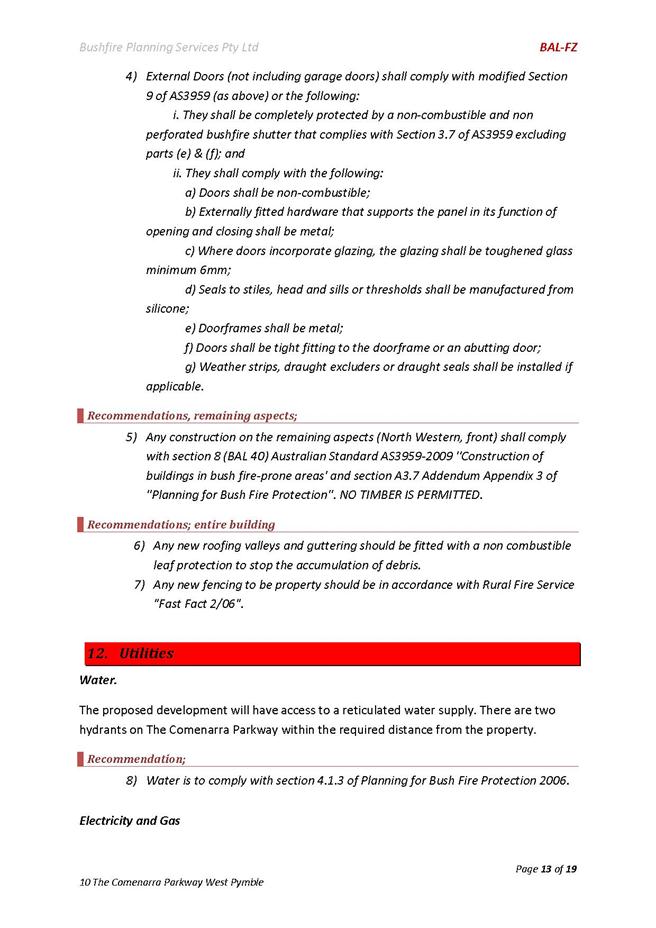
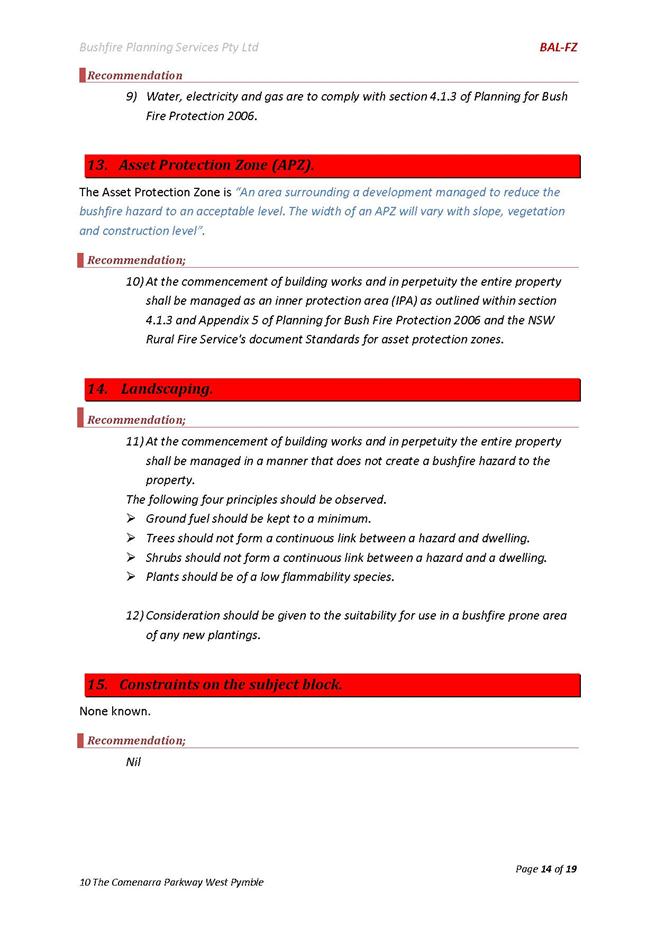
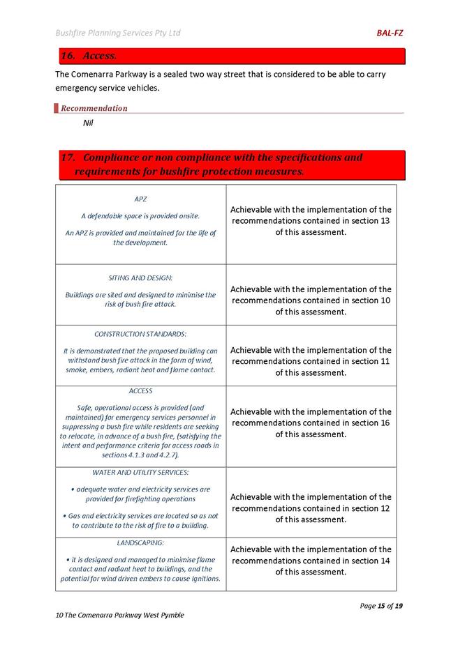
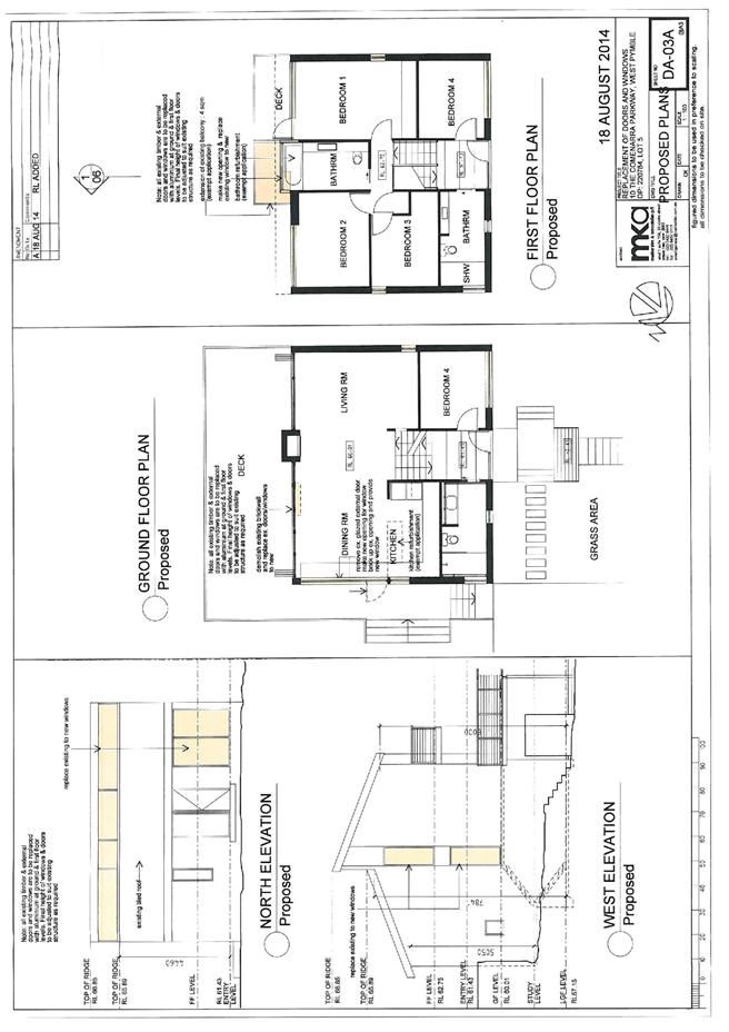
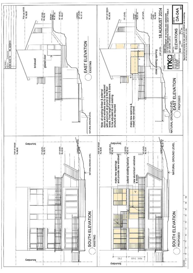
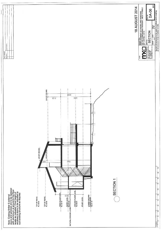
GB.14 10 The Comenarra Parkway West Pymble - Alterations and Additions to a Dwelling House 587
File: DA0220/14
Ward: Comenarra
Applicant: Melinz Kim & Associates Pty Ltd
Owner: Shae Bacales
Alterations and additions to a dwelling house
Recommendation:
Approval.
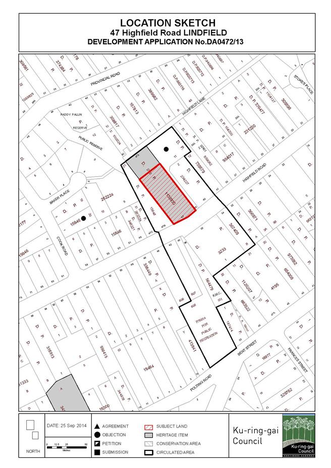
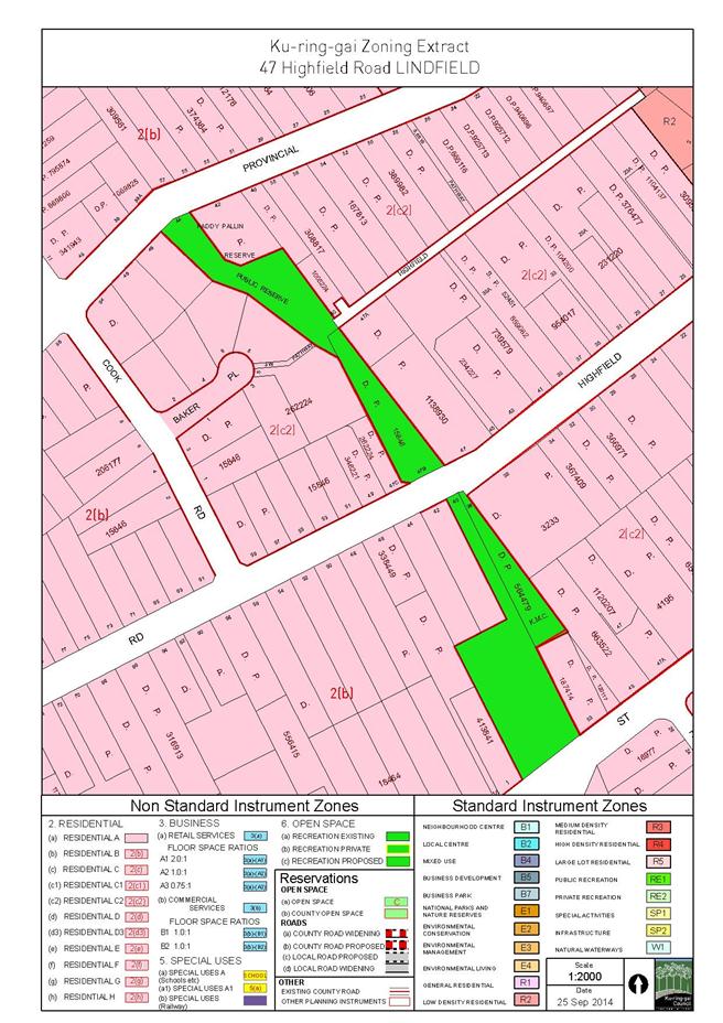
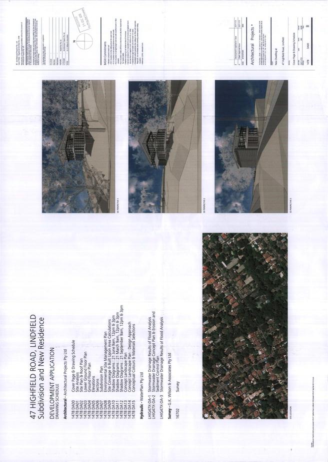
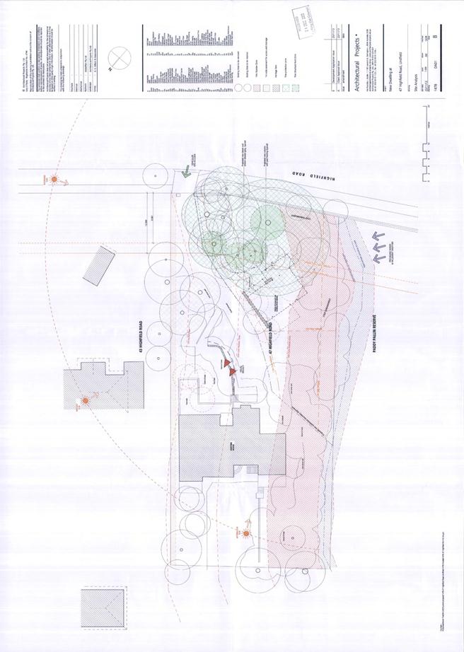
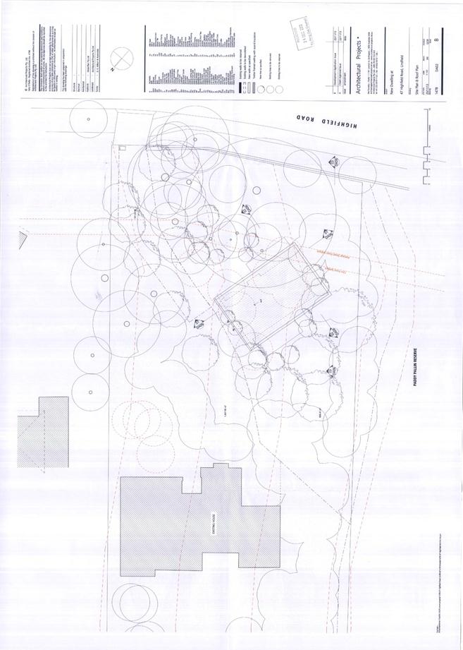
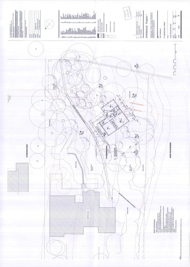
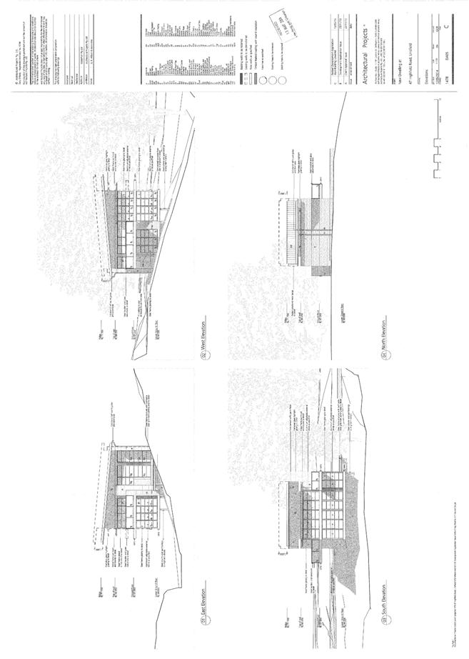
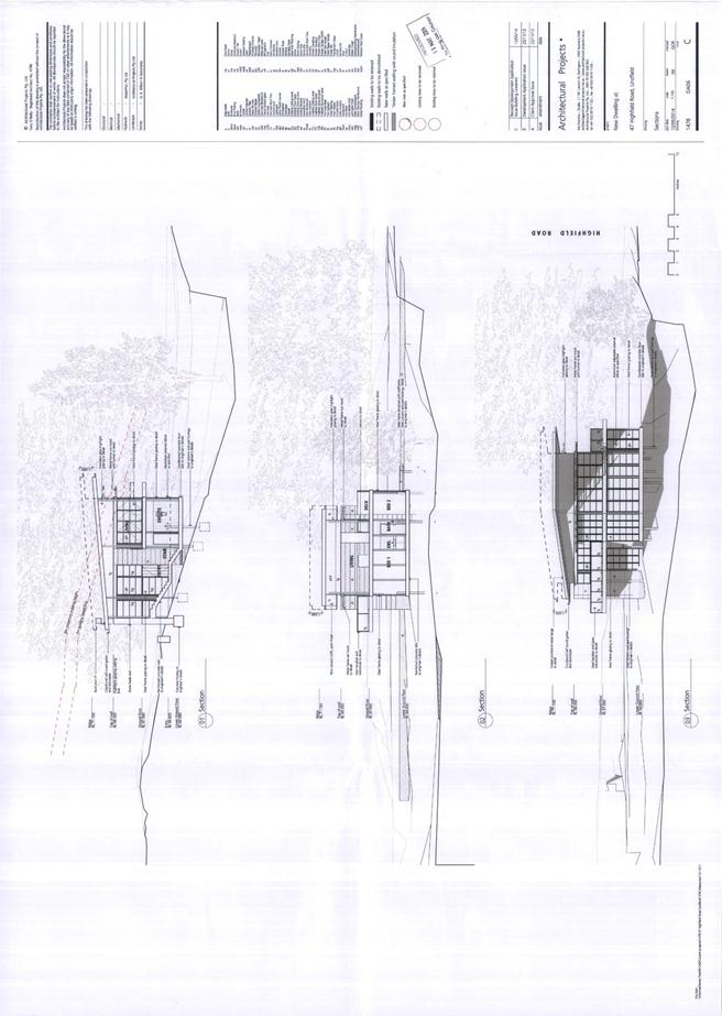
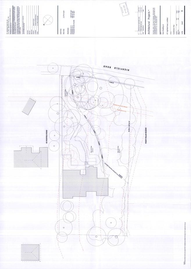
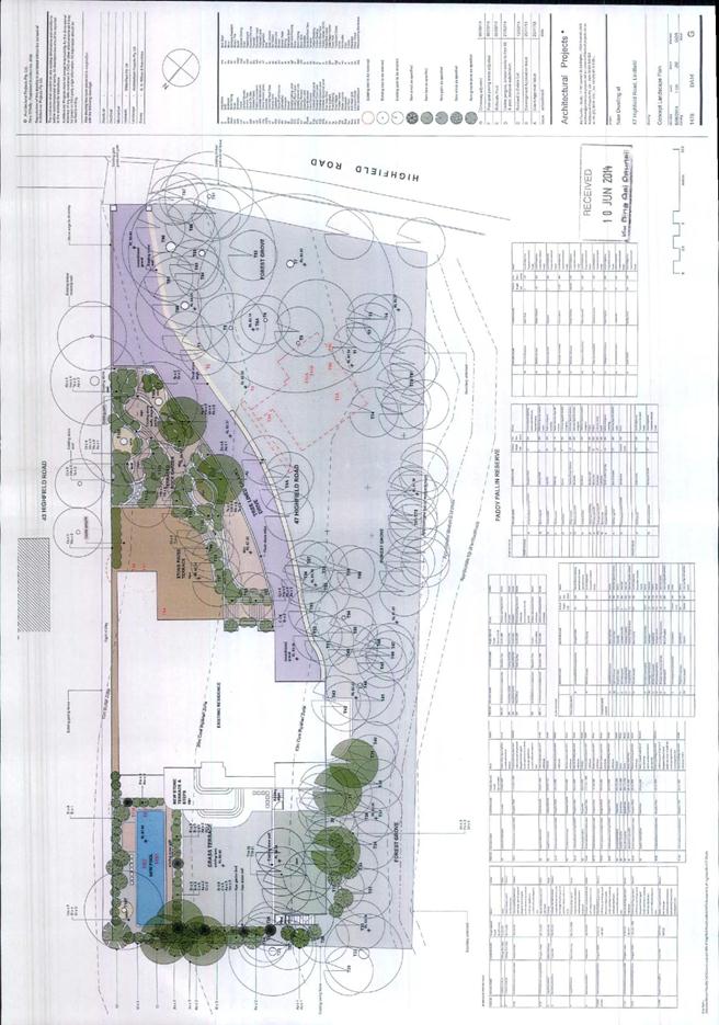
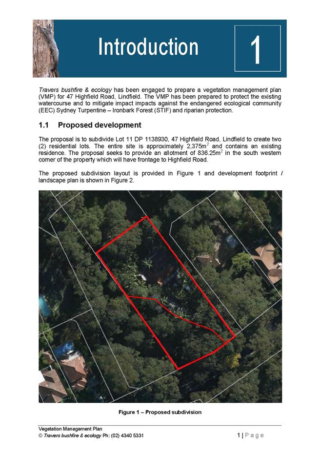
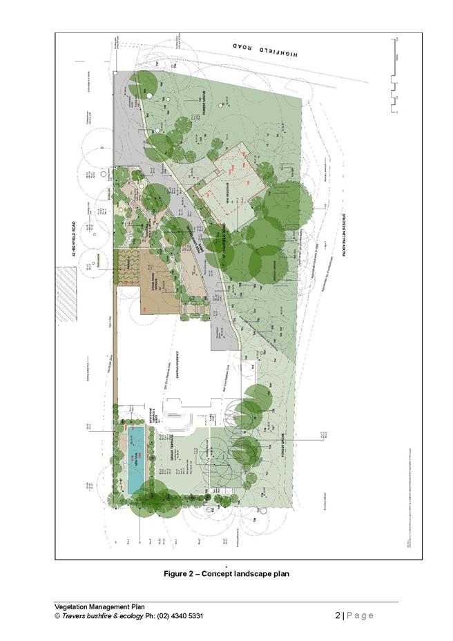
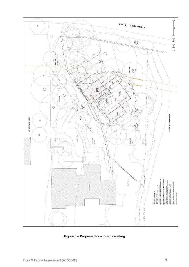
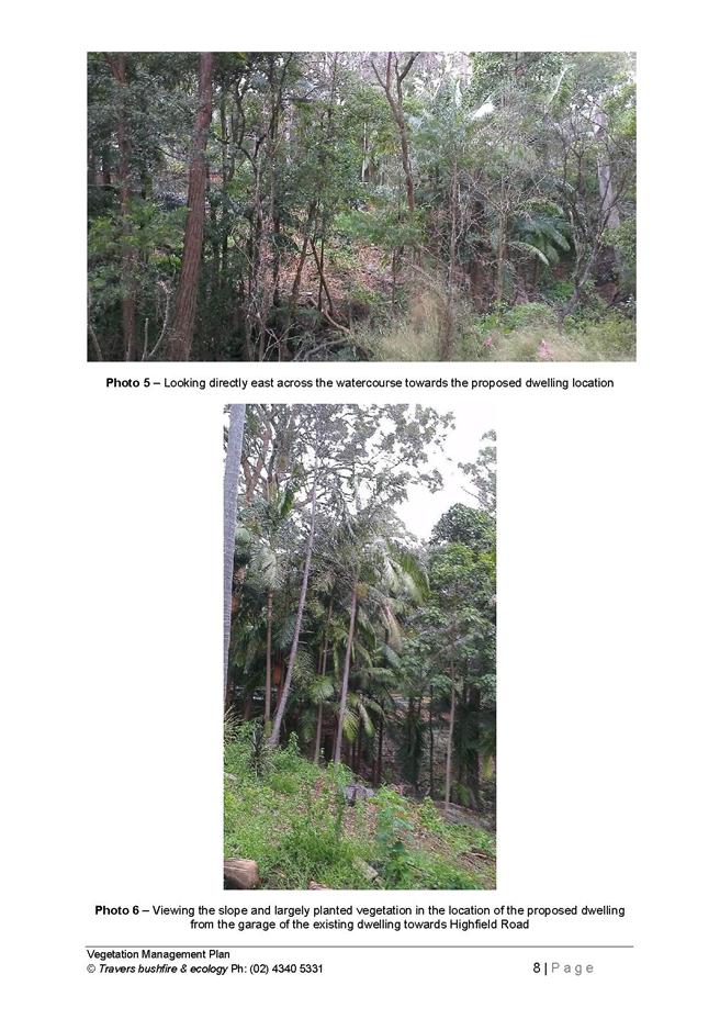
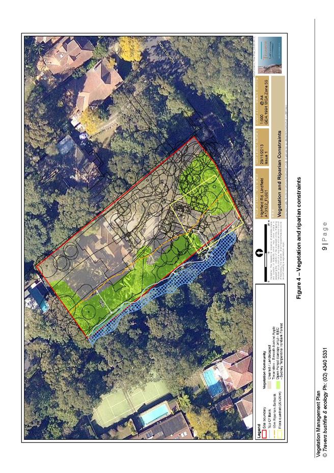
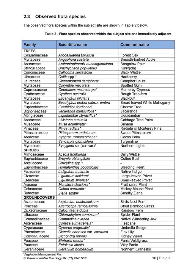
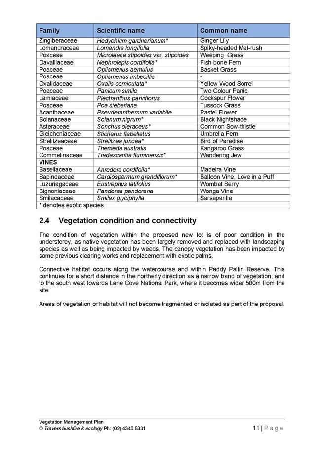
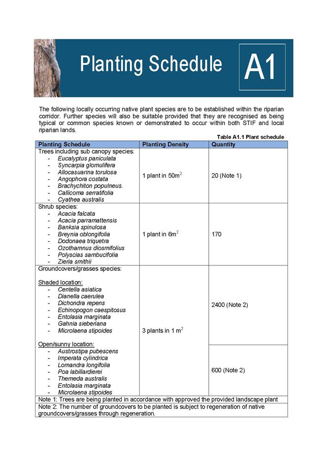
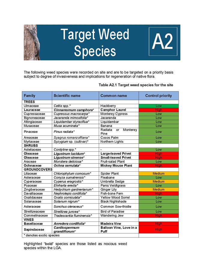
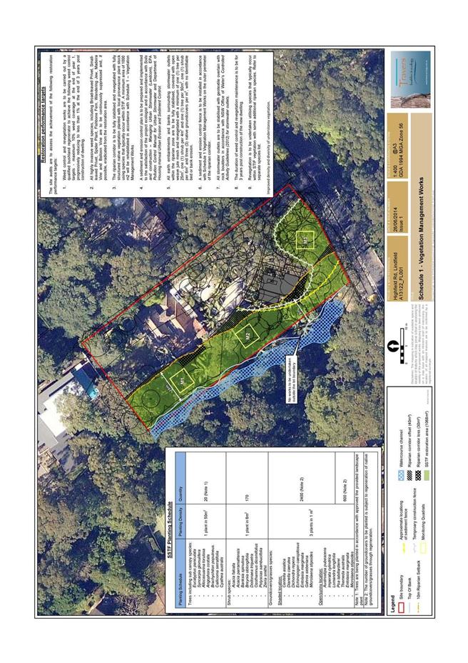
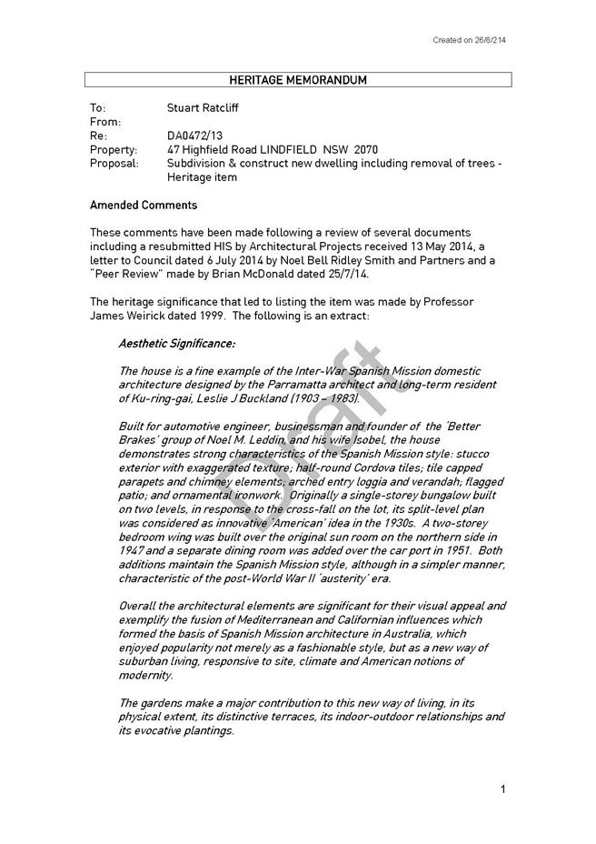
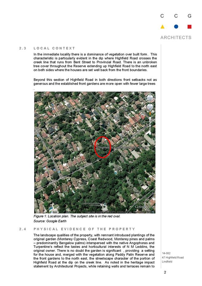
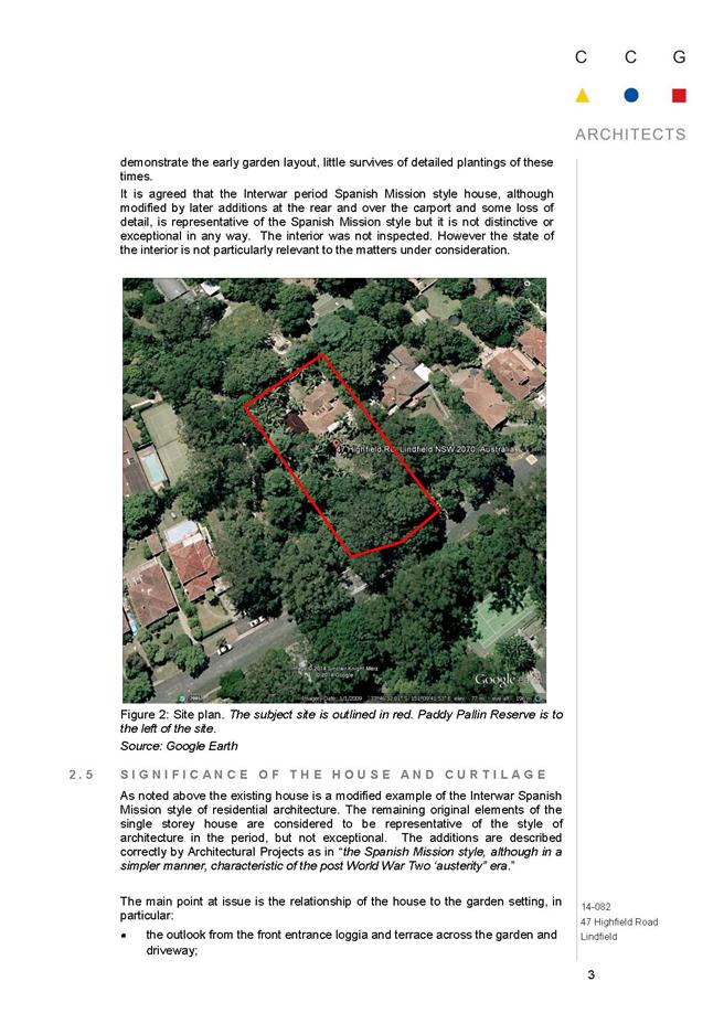
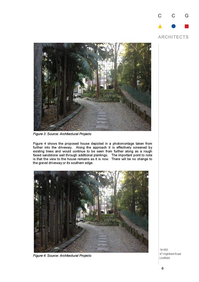
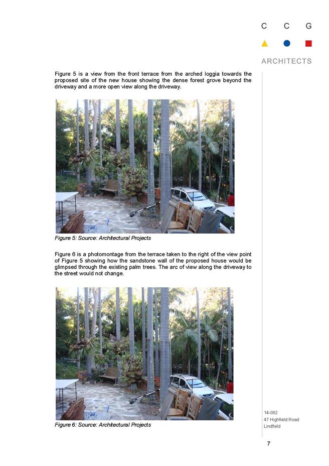
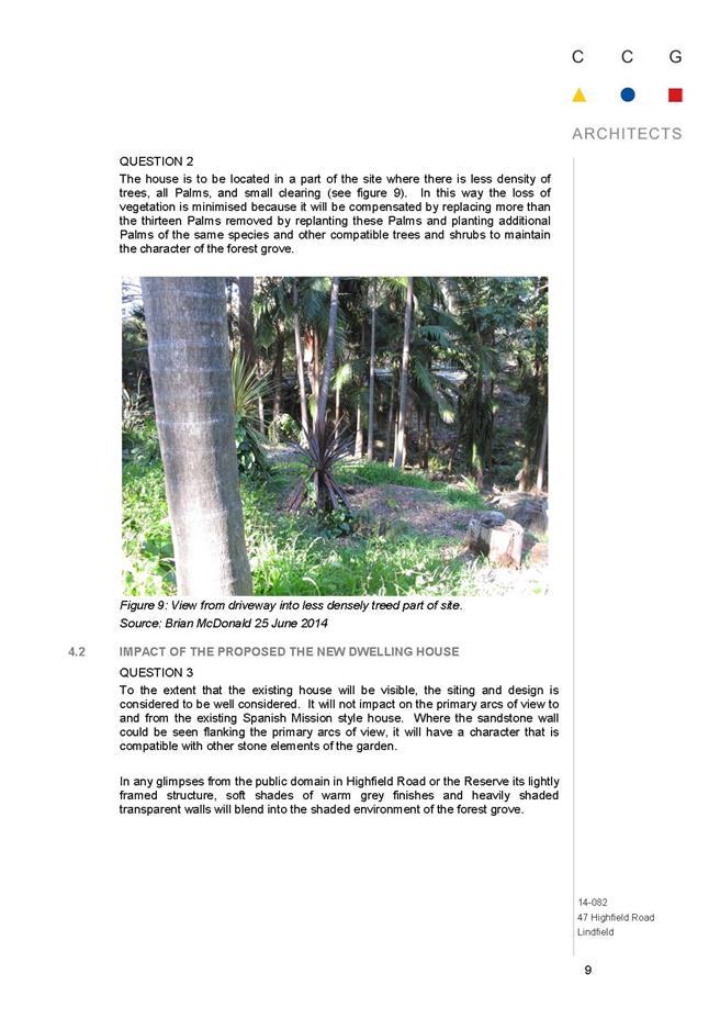
GB.15 47 Highfield Road Lindfield - Two Lot Torrens Title Subdivision of a Heritage Listed Property, Construction of a New Dwelling and Removal of Trees 643
File: DA0472/13
Ward: Roseville
Applicant: Architectural Projects Pty Ltd
Owner: Mr Kaveyan Hosseini-Nasab
To determine Development Application No.0472/13 for a two lot Torrens Title subdivision of a heritage listed property, construction of a new dwelling and removal of trees.
Recommendation:
Refusal
** ** ** ** ** **
|
Ordinary Meeting of Council - 7 October 2014 |
MM.2 / 8 |
|
|
|
|
Item MM.2 |
S09638 |
|
|
7 October 2014 |
Mayoral Minute
Fit for the Future - Information Session
On Monday 29 September, the General Manager and I attended a Fit for the Future Information Session conducted by senior staff from the Office of Local Government for Mayors and General Managers. Hereafter are the notes from the information session:
Invitees: Mayors and GM's from Hornsby, Ku-ring-gai, Pittwater, Warringah, Manly, Ryde, Hunters Hill, Lane Cove, Willoughby, North Sydney, Mosman, Gosford and Wyong.
The session was facilitated by the Acting Chief Executive for the office of Local Government, Mr Steve Orr.
The session was provided as an opportunity to hear more about the "Fit for the Future" package and the one stop shop which has been established by the Office of Local Government to assist Councils.
Introduction from Minister for Local Government, Paul Toole.
Fit for the future package was announced two weeks ago. The package traces back to the destination 2036 workshop held in Dubbo in 2011.
More recently the "Future Directions for LG" paper was undertaken. The paper includes 65 recommendations which have been released in full by the State Government. These recommendations form the core of the fit for the future package.
The Minister reinforced that the current suite of recommendations respond to feedback from LG as an industry.
History of reform review
- 2011 Destination 2036
- 2012 T-Corp Sustainability Review
- 2012 LG Infrastructure Audit
- 2012-2014 Independent LG review
- 2012 -2014 LG Acts Task-force
- 2014 Fit For the Future Package
The "Fit for the Future" package provides significant incentives for those Council's that wish to merge on a voluntary basis (up to $1 billion).
This amount is broken up as follows:
- incentives to encourage mergers - $258 m (will be provided as a grant).
- reductions in red tape - $100m
- cheaper loan borrowings - $600m
- incentives to encourage new regional joint organisations - $5.3m
- local transition committees to support mergers - $13m
- technical support to assist in developing fit for the future submissions
The Minister reinforced that he is committed to reviewing the current system of rating in NSW. This review will be undertaken by IPART.
Review of the FAG Grant - the Government is committed to altering the current method of distributing the FAG grant to ensure that additional funding is provided to those Councils in greatest financial need - i.e. Central Darling in the far West. Larger Urban Councils such as Ku-ring- gai will almost certainly receive less in real terms as a result.
The package will also develop a new performance measurement framework so that Councils and their constituents can easily understand how their Local Council is performing.
The government is currently in the process of reviewing Local Governments interaction with State Government agencies to reduce the level of red tape which currently exists. The burden placed on councils by regulatory requirements was acknowledged.
Governance reform - changes to include 2 year terms for Mayors together with tighter definition as to the roles of Mayors and GM's respectively. The Auditor General will provide an oversight of all Council Audits to ensure greater consistency and reliability of figures contained therein.
The Mayor raised the issue of uncertainty over the accuracy of infrastructure backlog ( special schedule 7). Steve Orr confirmed that from 2015 - 2016, auditors will be required actually audit the schedule (until now the schedule has been unaudited).
The new LG Act will be phased in from 2016-2017. Some minor changes around procurement will be introduced in the shorter term.
The key timeframe for much of the current reform package is centred around the LG elections to be held in 2016. The Minister reinforced that this date will not be put back, the possible exception being where certain Councils are in the midst of merging at that point.
Under the package, Councils will be able to borrow at the same rate as State Government. Over the last 2 years, debt across the industry has increased by $500 million.
Cheaper loan borrowings will only be available to Councils that qualify as being fit for the future. It is envisaged that this scheme will commence from 1July 2015. The question was raised as to whether it will only apply to new debt or will also allow existing debt to be refinanced at cheaper rates.
Transition committees will comprise the Mayor, GM and one other Councillor from each Council who is preparing to merge. Elected members on these committees will be paid $5,000 per month for carrying out this task.
There will be no financial incentives for councils with alternative proposals outside the Fit for the Future plan. However, if the Independent Review Panel recommended councils A,B and C merge but councils would like to propose instead that councils A, B and D merge, that will be open to consideration.
In terms of Joint Regional Organisations, the government’s view is that the size and scale of Councils in metropolitan Sydney should be looked at in the first instance. This does not rule out the establishment of Joint organisations at a point in the future.
The Minister reinforced that Councils must establish financial sustainability to qualify as being fit for the future.
- $10.5 million will be provided to each Council in Sydney who agrees to merge.
- an additional $3m is available for each additional 50,000 in population above 250,000 to a total cap of $22.5m
- The Government does not view 250,000 as a minimum size in a merged Council scenario. This was merely the recommendation in the future directions paper.
What is the government asking Council's to do?
1. Council's to review their current situation 2. Prepare a submission by 30 June 2015.
3. Make the transition ( depending on circumstances).
Becoming fit for the future?
Do you have the right scale and capacity?
This is based on the recommendations of the Independent Local Government review Panel.
If the answer to this is yes, then Council's proceed to establish sustainability and efficiency. If no, then proceed to the structural reform roadmap which is broadly consistent with the recommendations of the panel.
The three independent people who will review the submissions from councils will not include any of the three members of the Independent Review Panel.
A self-assessment tool will be sent to councils by late October as a template to help council submissions. Information on community consultation will be included therein.
The question was raised as to why Councils that demonstrate financial sustainability should be forced to increase their size???
The Minister stressed that no lines have been drawn on a map. It is a genuinely voluntary package, backed by the most comprehensive funding strategy ever developed in this country.
In terms of rating structures, the Minister commented that rates in a merged situation would not necessarily need to be consolidated from day one. It may be phased in over a number of years; i.e. - Councils may be able to maintain a separate rate in the dollar in the short to medium term.
The broad timeframe working to forward to the next LG elections in September 2016 was then outlined. At that point, it is envisaged that all mergers would be complete and the new LG Act will be in place.
Questions were raised about the rushed timeline for mergers before the 2016 local government elections. The response indicated that it was probable not all 152 councils will merge so only the merging councils will be busy meeting the pre-election timeline.
Steve Orr confirmed that the process of boundaries commission will be simplified to avoid a two tiered process. Where Councils agree to merge on a voluntary basis, then there is no need for the boundaries commission to be involved at all.
|
That the Mayoral Minute be received and noted.
|
|
Jennifer Anderson Mayor |
|
|
Ordinary Meeting of Council - 7 October 2014 |
PT.1 / 12 |
|
|
|
|
Item PT.1 |
S10095 |
|
|
8 October 2014 |
Petition
Petition to Provide Space for Marian Street Theatre for Young People in Marian Street Theatre at Affordable Rates - (One Thousand, Seven Hundred and Thirty [1,730] Signatures)
The following Petition was presented by Councillor David Citer:
“Petition by Marian Street Theatre for Young People, Sydney - BRING MSTYP HOME.
Marian Street Theatre for Young People CMSTYP) i s the oldest children's theatre in Australia. Marian Street Theatre has been its home for 45 years, providing a performance venue and important administration , rehearsal and storage space.
As a not-for-profit organization, MSTYP has helped young people create prize-winnin g theatre for children and their families for generations. Its you ng people take responsibility in all areas of theatre-making and gain invaluable life skills which benefit the community.
In December 2013, Ku-ring-gai Council required MSTYP to leave its home at the theatre at short notice for safety reasons so that the theatre can be renovated. However, Council's current plans are to tum it into a commercial venue for hire. MSTYP will have no class, administration , rehearsal or storage space. We will only be able to perform there at unaffordable rates. This is despite many Council resolutions stating their management model should support MSTYP at the theatre. Without this vital support MSTYP can not survive.
MSTYP has wide-spread passionate community support. Please keep this vital community cultural icon alive by asking Ku-ring-gai Council to keep its word and let MSTYP retum to its home at Marian Street Theatre with the facilities it needs, at prices it can afford.”
|
That the petition be received and referred to the appropriate Officer of Council for attention.
|
|
Ordinary Meeting of Council - 7 October 2014 |
GB.10 / 13 |
|
|
|
|
Item GB.10 |
DA0407/13 |
|
|
22 July 2014 |
development application
Summary Sheet
|
Report title: |
904-914 Pacific Highway Gordon - Partial Demolition, Alterations and Additions to a Commercial Building comprising a Cafe, Two Commercial Suites and Ninety Residential Apartments to create a Nine Storey Mixed Use Development. |
|
ITEM/AGENDA NO: |
GB.10 |
Purpose of Report
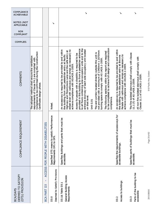
To determine Development Application No. 0407/13 for partial demolition, alterations and additions to a commercial building comprising a café, two commercial suites and ninety residential apartments to create a nine storey mixed use development.
integrated planning and reporting
Places, Spaces & Infrastructure
|
Community Strategic Plan Long Term Objective |
Delivery Program Term Achievement |
Operational Plan Task |
|
P2.1 A robust planning framework is in place to deliver quality design outcomes and maintain the identity and character of Ku-ring-gai
|
Applications are assessed in accordance with State and local plans
|
Assessments are of a high quality, accurate and consider all relevant legislative requirements
|
Executive Summary
|
Issues: |
Land dedication (lane widening), Urban design |
|
Submissions: |
Three submissions received |
|
Land and Environment Court: |
N/A |
|
Recommendation: |
Approval |
History
Site
25 May 2010 Site rezoned to B4 Mixed Use – Ku-ring-gai Town Centres LEP 2010
25 January 2013 Site rezoned to B4 Mixed Use – Ku-ring-gai LEP (Local Centres) 2012
Pre-DA
No Pre-DA consultation was undertaken with Council prior to the lodgement of this Development Application.
DA History
22 October 2013 Application lodged.
31 October 2013 The application was notified to neighbouring property owners for a period of 30 days. Three submissions (two petitions) were received.
4 February 2014 A letter was sent to the applicant seeking additional information and advising of outstanding issues relating to:
· need to consider land dedication and increased building setbacks to Fitzsimons Lane
· excessive floor space
· height and building separation
· Small Office Home Office (SOHO) units and active frontages
· street activation and address to Pacific Highway and Fitzsimons Lane
· clarification over existing public car parking
· unit layouts, solar access and cross ventilation
· amenity of communal open space
· further stormwater detail
· geotechnical report required
· BASIX compliance
31 March 2014 A meeting was held with the applicant to discuss concept amended plans that address the issues raised in Council’s letter of 4 February 2014.
9 April 2014 Collegiate review of conceptual response by Development and Regulation management.
10 April 2014 Council provided a response to the concept and invited formal amendments to the DA.
17 April 2014 Amended plans and additional information were lodged by the applicant.
5 May 2014 The amended application was notified to neighbouring property owners for a period of 14 days. One submission was received.
12 May 2014 Further additional information was received from the applicant which consisted of a plan of the roof communal open space area and a BCA access report.
18 May 2014 Further additional information was received from the applicant being an amended clause 4.6 variation submission.
9 July 2014 Further correspondence was sent to the applicant seeking additional information and advising of outstanding information in relation to:
· drainage information
· geotechnical investigation
· traffic and parking
6 August 2014 Council requested an updated landscape BASIX calculation and certificate.
7 August 2014 Amended plans and additional information were lodged.
27 August 2014 A meeting was held with the applicant to discuss landscape BASIX inconsistencies raised in Council’s letter. An amended BASIX certificate was provided by the applicant.
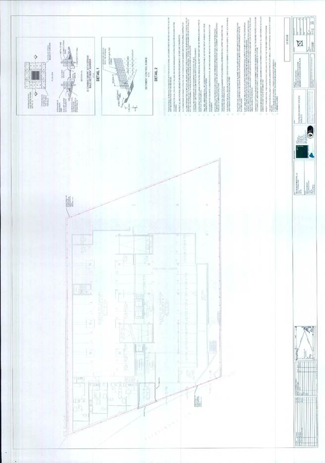
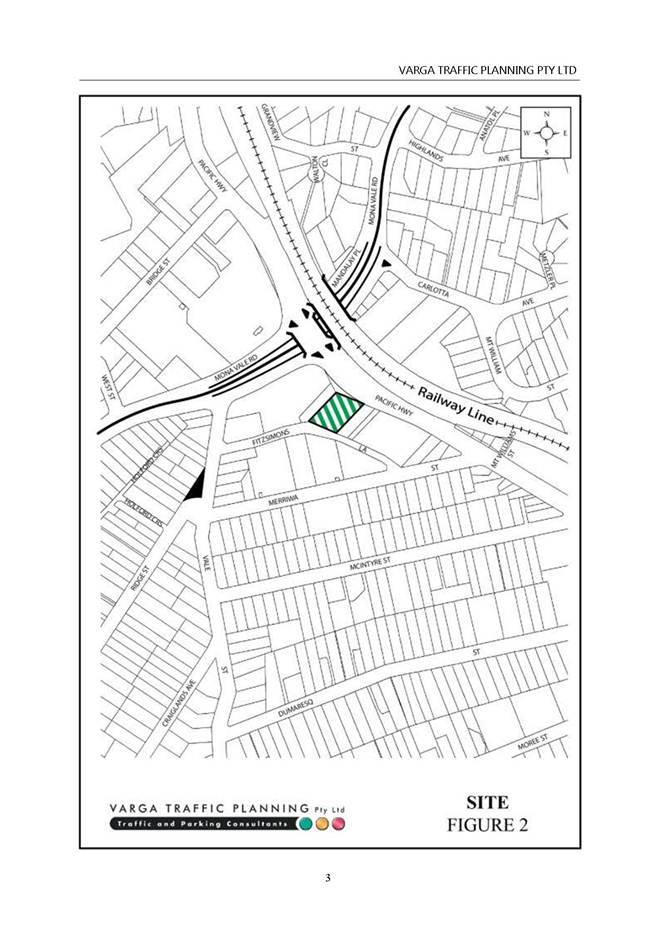
The Site
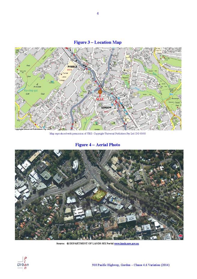
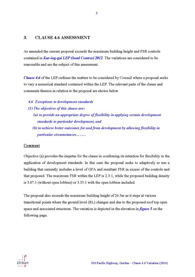
Site description
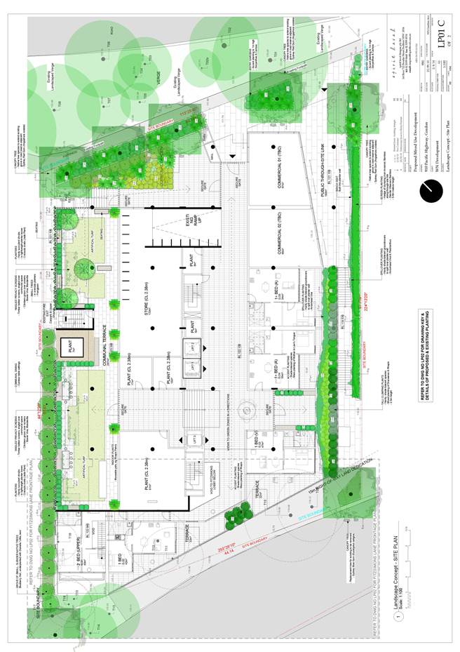
The subject site is identified as Lot 10 in DP 717747 and is situated at 904 to 914 Pacific Highway, Gordon. The property is a regular shaped allotment, being rectangular with splayed frontages, having a depth of 34.54 metres and a total site area of 2382m2.
The site is located on the south-western side of the Pacific Highway. The rear of the site has frontage to Fitzsimons Lane.
The site falls significantly from its Pacific Highway frontage towards Fitzsimons Lane, with a total fall of approximately 5.6 metres along the south-eastern boundary.
The site previously contained public car parking within the existing building through a lease arrangement. The provision of public car parking on this site has been abandoned through the cessation of the lease agreement on the site.
The site is identified for land dedication of variable width to allow for the widening of Fitzsimons Lane under the provisions of Ku-ring-gai Local Centres Development Control Plan.
Existing structures
The site contains an existing vacant concrete and glazed commercial building of 4 storeys with 7 storeys of split level basement parking below. The Pacific Highway frontage is dominated by large open undercroft breezeway entrance spaces and the Fitzsimons Lane frontage presents as basement parking with service and vehicular access points.
Vegetation
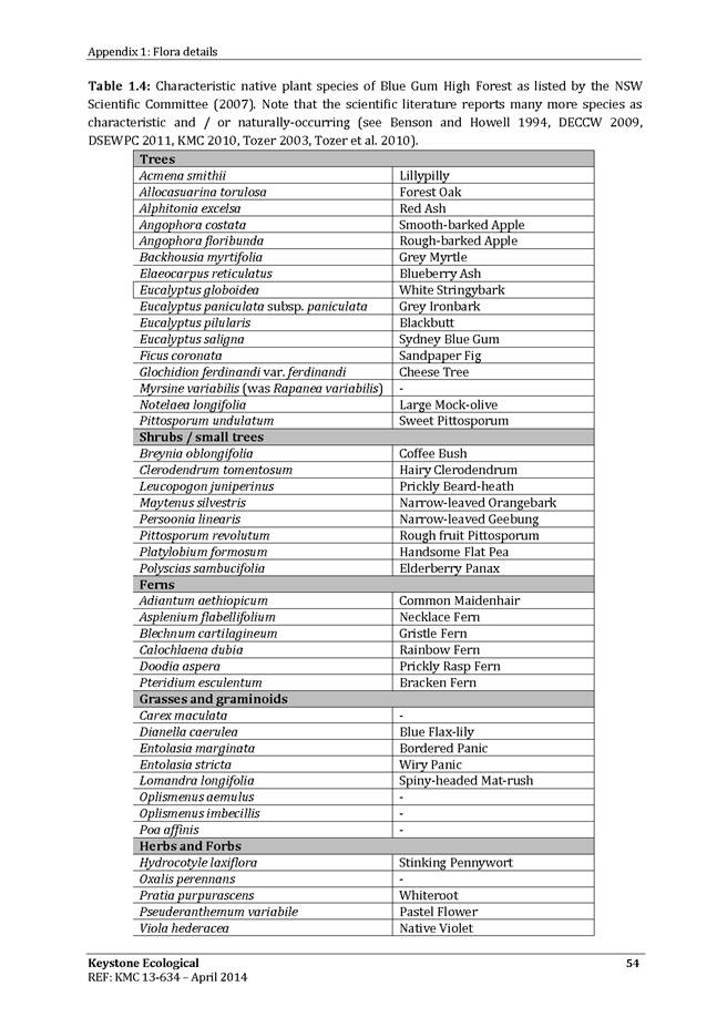
The site contains three trees. A Eucalyptus saligna (Sydney Blue Gum) of 17 metres in height at the south-western corner of the site and two Corymbia maculata (Spotted Gum) of 16 and 18 metres in height located at the south-west and north-west corner of the site, fronting Fitzsimmons Lane.
There are two trees of note within the Fitzsimmons Lane road reserve. Both trees are Eucalyptus microcorys (Tallowood) of 8 and 9 metres in height and located at the north-western corner of the site.
Access
Pedestrian entry is currently provided from the Pacific Highway frontage.
The existing vehicular access is from the Fitzsimons Lane frontage.
Surrounding development
The subject site is mid way along the street block that is bounded by Merriwa Street to Ryde Road. This street block is characterised by commercial and light industrial uses in buildings varying in height from one to five storeys.
Adjoining the site to the north-west is a four storey commercial building fronting the Pacific Highway, with vehicular and service access from Fitzsimons Lane.
Adjoining the site to the south-west is a two storey commercial building of small floor plate tenancies with vehicular and service access from Fitzsimons Lane.
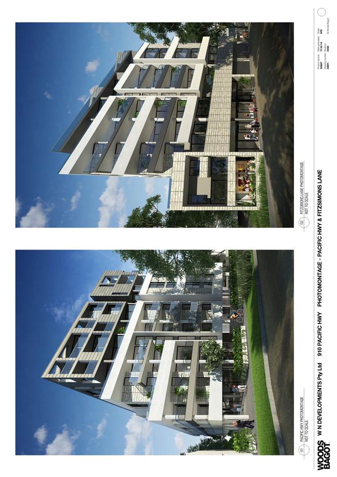
The Proposal
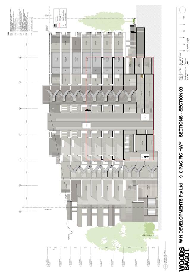
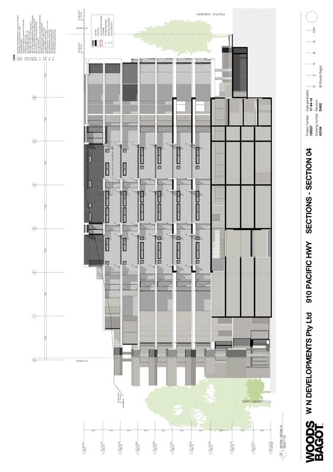
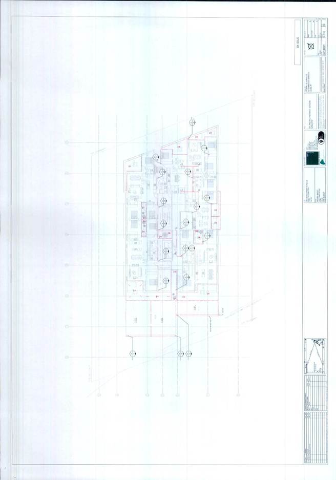
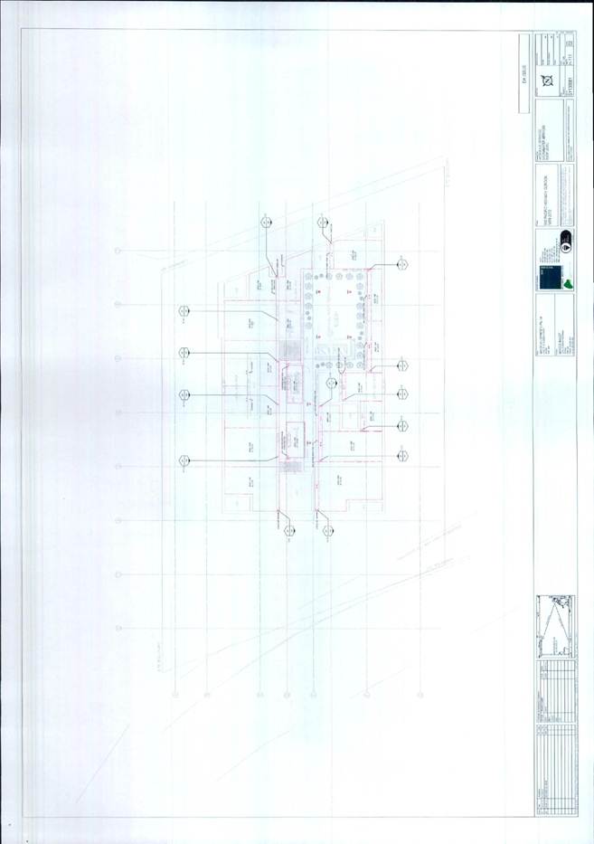
The proposal involves partial demolition, alteration and additions to the existing commercial building for commercial space, construction of ninety residential apartments within a nine storey building and five levels of basement car parking. Details of the proposed development are as follows:
Demolition
The proposal seeks approval for the demolition of sections of the building to create light wells, lift wells, fire exit stairs and ventilation shafts.
Alterations and additions to create a mixed use building with café, commercial units and residential flat building
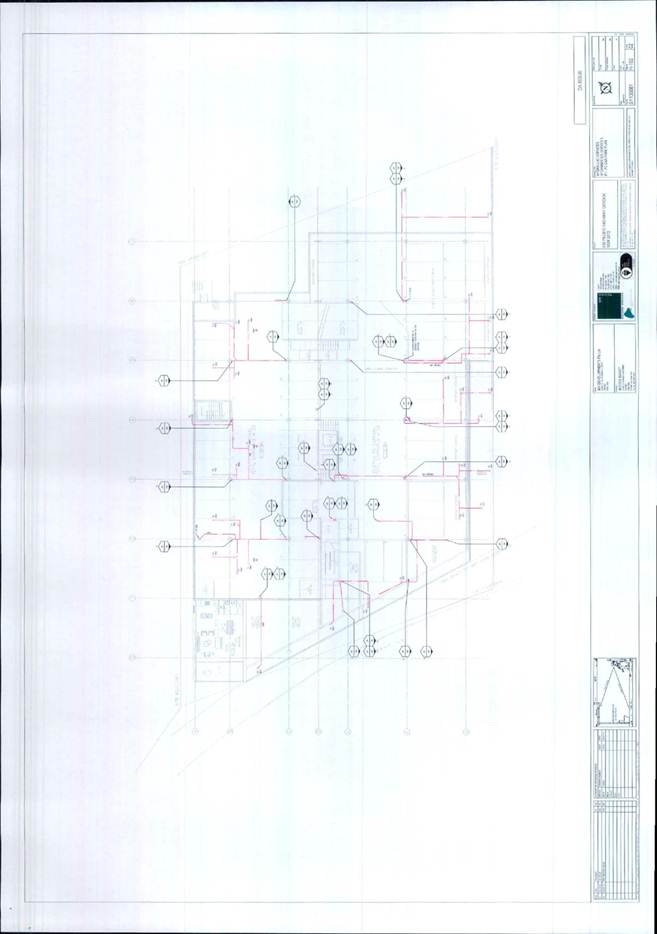
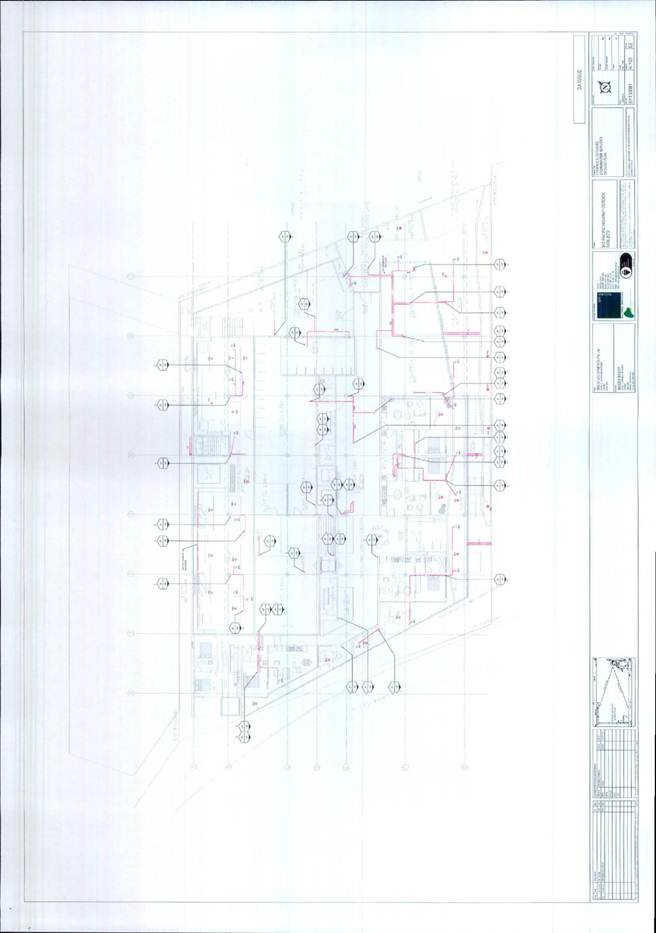
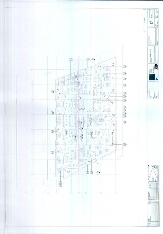
The proposed alterations and additions to the building allow for the adaptive re-use of a commercial building for residential accommodation. The ground floor (Pacific Highway) of the existing building retains commercial uses and residential entries. The existing commercial building fabric for the three levels above is to be altered to support residential units. A further four residential levels are proposed over the existing building. The configuration of the building is as follows:
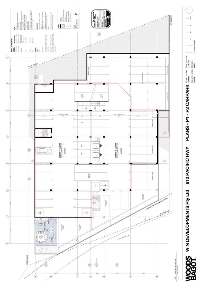
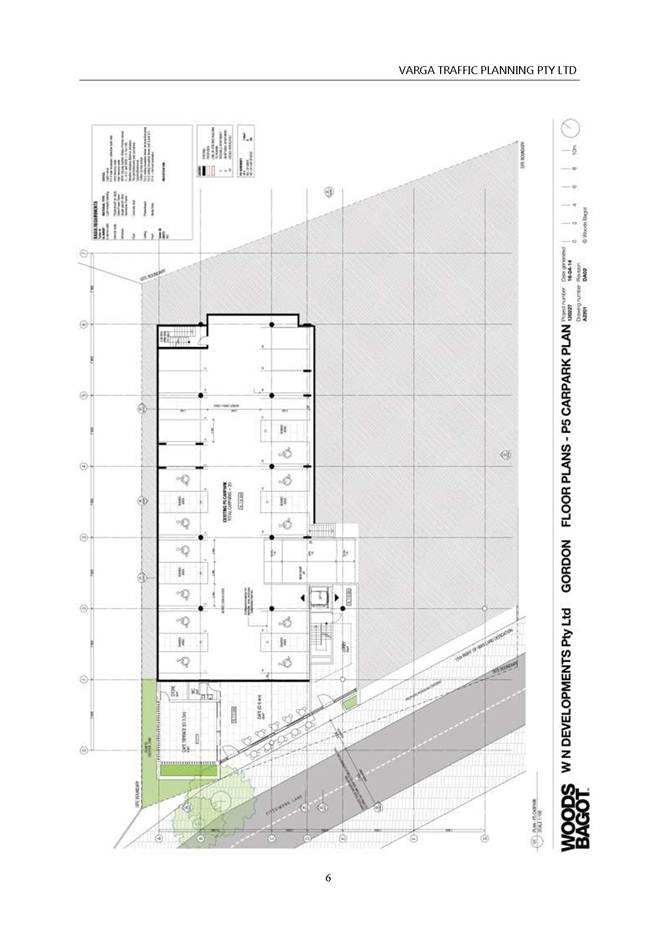
Basement P5:
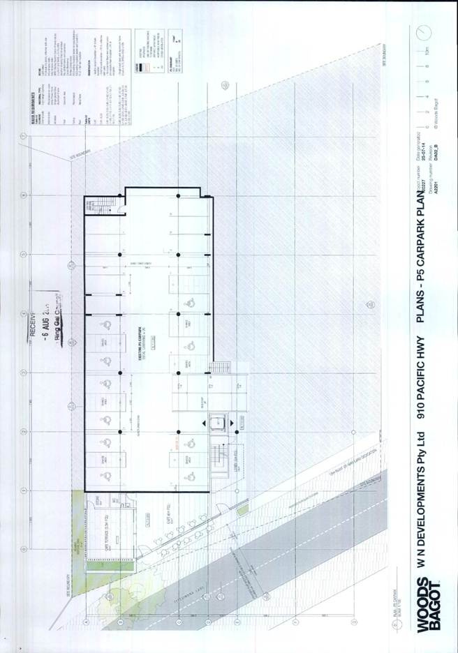
- car accommodation for twenty vehicles (including twelve accessible spaces), lift, fire stairwell, residential lobby and café (40m2 café and 60m2 terrace).
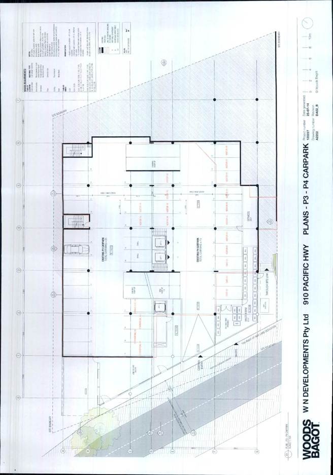
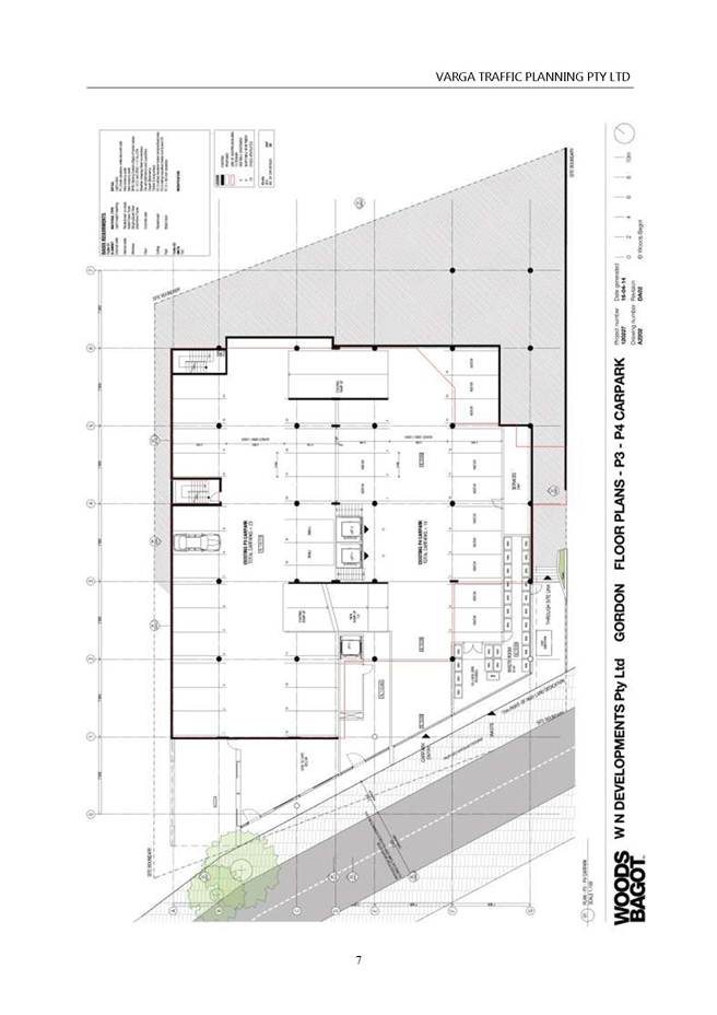
Basement P3 and P4:
- car accommodation for thirty eight vehicles, lift, fire stairwell, services area and waste room.
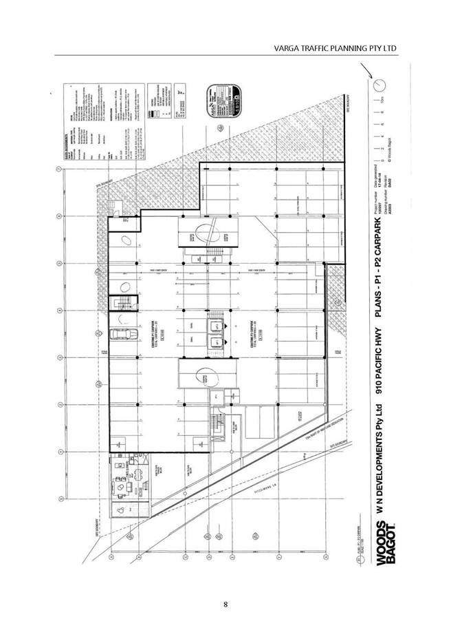
Basement P1 and P2:
- car accommodation for fourty nine vehicles, lift, fire stairwell, apartment storage, motor cycle parking and lower storey of unit G01 with associated residential terrace.
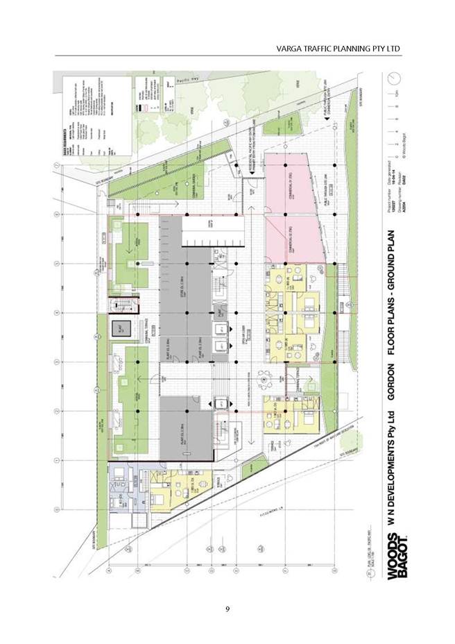
Ground floor:
- entry foyer, commercial units (132m2), storage, plant rooms, public thoroughfare, four x 1 bedroom dwellings, one x two bedroom dwelling (upper storey), communal terrace spaces.
Level 01:
- two x studio dwellings, six x 1 bedroom dwellings, six x 2 bedroom dwellings, one x 3 bedroom dwelling.
Levels 02 and 03:
- two x studio dwellings, six x 1 bedroom dwellings, six x 2 bedroom dwellings, one x 3 bedroom dwelling.
Level 04:
- two x studio dwellings, six x 1 bedroom dwellings, six x 2 bedroom dwellings, one x 3 bedroom dwelling.
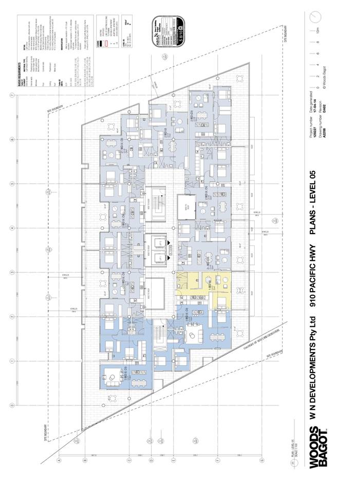
Levels 05:
- one x 1 bedroom dwelling, seven x 2 bedroom dwellings, two x 3 bedroom dwellings.
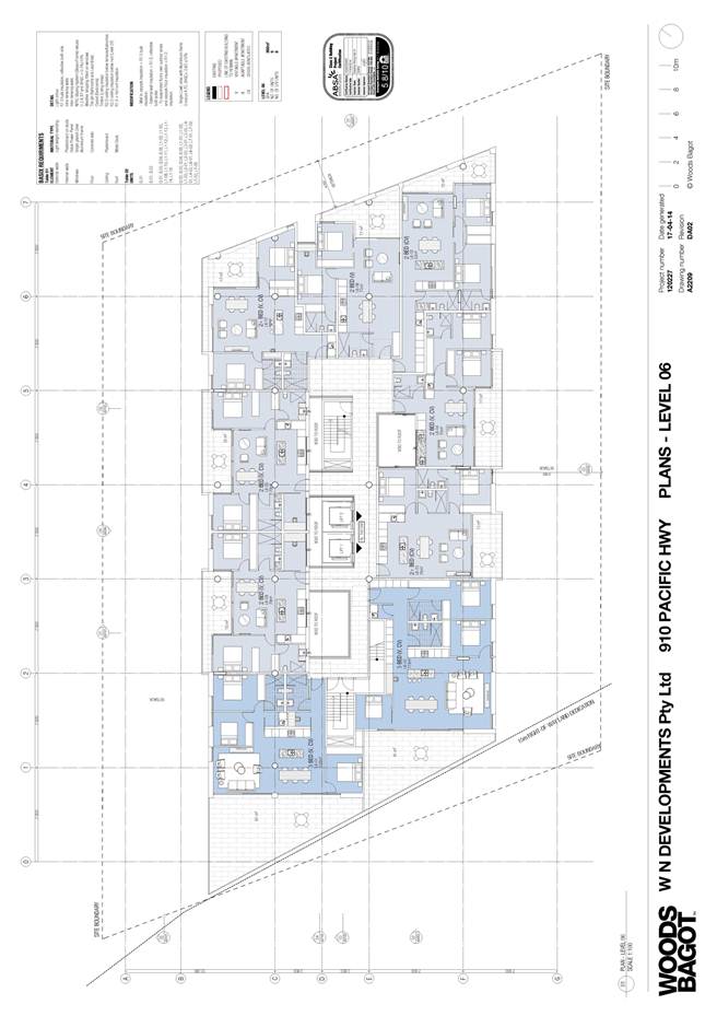
Levels 06:
- seven x 2 bedroom dwellings, two x 3 bedroom dwellings.
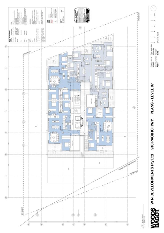
Levels 07:
- three x 2 bedroom dwellings, three x 3 bedroom dwellings.
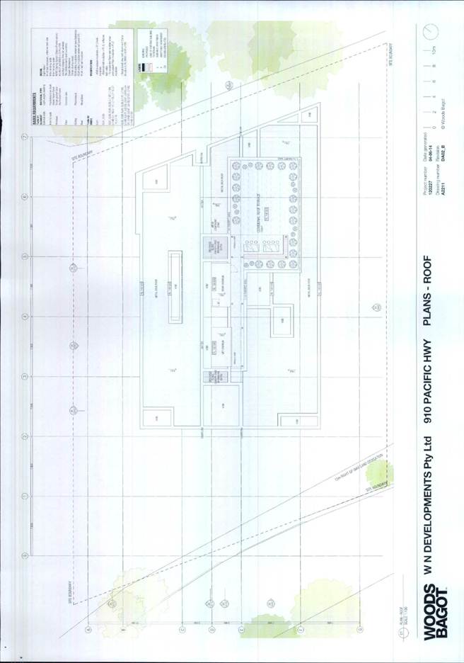
Roof:
- communal roof terrace, lift, fire stair and air conditioning plant.
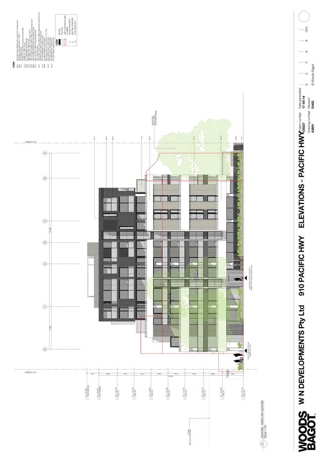
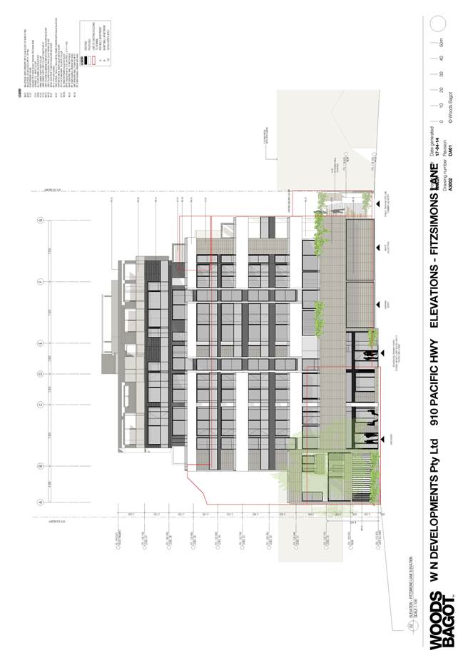
The proposed residential flat building additions will consist of a four storey construction over the original building. The proposed additions will comprise a mix of split face masonry, cement render and aluminium panel cladding.
The proposal incorporates basement parking for one hundred and seven cars, storage and a garbage room. Access to the basement is from the Fitzsimons Lane frontage where a new driveway and crossover will be constructed adjacent to the south-western boundary.
A lift servicing all units is proposed, providing access from the basement to all levels of the development.
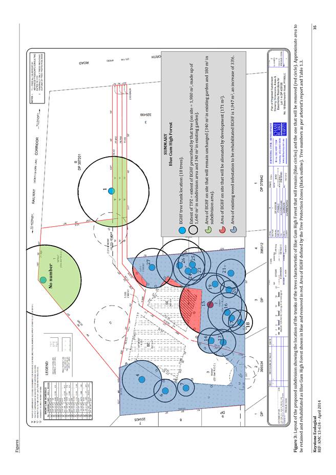
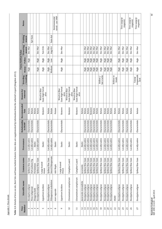
The proposal includes the removal of eight trees. Within the site this includes a Eucalyptus saligna (Sydney Blue Gum) of 17 metres in height at the south-western corner of the site and two Corymbia maculata (Spotted Gum) of 16 and 18 metres in height located at the south-western and north-western corner of the site, fronting Fitzsimmons Lane. The Sydney Blue Gum is a planted tree specimen and is not remnant Blue Gum High Forest plant community.
There are two trees of note within the Fitzsimmons Lane road reserve and these trees are to be retained. Both trees are Eucalyptus microcorys (Tallowood) of 8 and 9 metres in height located at the north-western corner of the site.
Works in the road reserve
The proposal relies upon works in the adjoining public footpath and road reserve within Fitzsimons Lane, including the adjustment of levels, construction of footpath and roadway within the area of the site that is the subject of land dedication.
The south-western boundary of the site is to be re-aligned with land of variable width being dedicated to Council for the purpose of widening of Fitzsimons Lane to achieve a 15m wide carriageway, as identified within the Ku-ring-gai Local Centres Development Control Plan.
The land dedication is identified within the Ku-ring-gai Local Centres Development Control Plan and is to occur through the process of a voluntary planning agreement.
Consultation
Community
In accordance with the requirements of Volume C, Part 5 of the Ku-ring-gai Local Centres Development Control Plan, owners of surrounding properties were given notice of the application. In response, Council received a petition bearing 90 signatures and three submissions from the following:
1. Wendy Wang – 924 Pacific Highway Gordon (Petition - 103 signatures)
2. Richard Schloeffel – 924 Pacific Highway Gordon
3. Railcorp Property – PO Box K349 Haymarket
The submissions raised the following issues:
The loss of 28 public parking spaces will greatly affect the tenants, owners and visitors to 924 Pacific Highway Gordon and surrounding buildings. We ask that the spaces are replaced within the new building or in close proximity.
Submissions have been received in relation to the closure of the public carpark.
The existing building was subject to a lease agreement between the property owners and Council for Council to lease 28 parking spaces, to be provided as public parking.
Upon a request from the owners of the subject property Council resolved to negotiate the surrender of the lease over the public car park on 10 December 2013. In considering the loss of the car park, Council considered the submission of the property owner which included a parking survey, which was compared against the results from Council’s commissioned parking survey. The results of the two surveys indicate a range of occupancy of the short term parking spaces of 54% to 78.8%.
Analysis of Council’s parking survey results by Council’s Strategic Transport Engineer provided the following observations;
· “There are 28 spaces in the car park;
· 14 of the same vehicles were present on both days of the survey, and parked for significant periods of time;
· Of these 14, 6 were parked in exactly the same space;
· Apart from the 14 above, there were another 4-6 vehicles that stayed for significant periods of time on one of the survey days;
· Some of these vehicles were observed to be parked in different spaces across the day.
My conclusion is that the results indicate 18-20 (or 64%-71%) of the vehicles parked in the car park are long stay parking, most likely to be employees from surrounding businesses parking in the car park”.
Further, Council’s adopted Town Centres Parking Management Plan 2010 sets out car parking strategies for the 6 town centres within the Ku-ring-gai LGA. One consideration of the management plan was to evaluate ways to manage existing and future Council car parks.
The management plan acknowledges that "as redevelopment of town centres occurs, new on-site parking would need to be provided to cater for the parking needs of the development. As this on-site provision increases, the role and importance of large at-grade Council car parks would be slowly diminished."
Analysis undertaken by ARUP Consulting in the preparation of the Town Centres Parking Management Plan 2010 indicated that the western precinct of Gordon had spare capacity of 480 short stay parking spaces available during the weekday peak and estimated that a further 280 long stay spaces would also be available.
On this basis, the deed of surrender for the lease of the public parking spaces was settled on 25 May 2014. The cessation of the lease agreement is separate to the development application, and has been facilitated through Council’s property and assets section.
The development provides a total of 107 parking spaces. The DCP requires parking be provided in a range between 89 – 115 spaces. The range of required parking is given having regard for the proximity (within 400m) to the Gordon Railway station, encouraging public transport use and allows for flexibility in the provision of parking for residential developments.
The required parking for the development under the DCP is:
Office and business premises (1 per 33m2 to 1 per 45m2) 4 spaces required
Café (1 per 26m2 to 1 per 33m2) 3 spaces required
Residential studio ( 0 to 0.5 spaces per unit) 0 to 4 spaces required
Residential 1 bedroom apartment (0.6 to 1 space per unit) 7.4 to 29 spaces required
Residential 2 bedroom apartment (1 to 1.25 spaces per unit) 42 to 52.5 spaces required
Residential 3 bedroom apartment (2 spaces per unit) 22 spaces required
Total residential spaces – 82 to 108 spaces required
Visitor spaces required (1 per 6 units) – 15 spaces required
The development meets the parking demand for the uses proposed.
The existing parking within Fitzsimons Lane and Merriwa Street will improve as the area is redeveloped consistent with the development outcomes anticipated in the Ku-ring-gai LEP (Local Centres), through rectifying those existing situations where buildings do not cater to their parking demand. At the time it was developed, the property known as 924 Pacific Highway was required to provide sufficient parking on site at Council’s required parking rates. The building at 924 Pacific Highway does not rely upon the public carpark to meet the required number of staff or visitor parking for the occupants of that building.
The DCP anticipates the widening of Fitzsimmons Lane, to allow for dual carriageway, short term street parking and widened footpaths. The development proposed has recognised this intent within the DCP and has allowed for the land dedication requirement for lane widening. It is anticipated that, as sites are developed in this part of Fitzsimmons Lane, the reconfiguration of the lane will allow for short term on street public parking.
The site is within walking distance of Gordon train station and provides good accessibility to public transport. Council’s Development Engineer has reviewed the applicant’s traffic report and finds the proposed parking provision acceptable.
Noise and vibration - Railcorp is concerned that the future occupants of the development will encounter rail related noise and vibration from the adjacent rail corridor. Rail noise and vibration can seriously affect residential amenity and comfort, jeopardise the structural safety of building, and thus should be addressed early in the development process.
Council has considered an acoustic report in the assessment of the development application. Compliance with the noise reduction recommendations of the acoustic consultant report is required by a condition of consent (Condition No. 81).
Amended plans received 22 April 2014
The amended proposal was notified as per the provisions of Volume C, Part 5 of the Ku-ring-gai Local Centres Development Control Plan. In response, Council received a submission from the following:
John Seckold - Unit 9, 26-30 Merriwa Street Gordon
The submission raised the following issue:
Traffic congestion in Merriwa Street
Council’s strategic traffic section advises there are no current plans to make changes to the intersection of Merriwa Street and Pacific Highway. The restriction to two way traffic due to parking on both sides of Merriwa Street is an acknowledged form of traffic calming. The lane widening of Fitzsimmons Lane will assist in better vehicle circulation in the area. The development meets all parking and vehicle access requirements of the DCP and, in this respect, is consistent with the anticipated strategic outcome for the area.
Amended plans received 7 August 2014
The applicant made further minor amendment of the proposal. In considering the further amendments against the provisions of Part 5, Volume 3 of the Ku-ring-gai Local Centres Development Control Plan, the amendments did not constitute a greater environmental impact and did not require notification.
Within Council
Urban design
SEPP 65 aims to improve the design quality of residential flat buildings across New South Wales and to provide an assessment framework and design code for assessing “good design”.
SEPP65 defines a residential flat building as
'a building that comprises or includes:
(a) 3 or more storeys… and
(b) 4 or more self-contained dwellings.'
As the proposal is eight storeys and contains ninety dwellings, SEPP65 and the Residential Flat Design Code are applicable under this definition. As such, an assessment of the proposal against the ten design principles contained within Part 2 of the SEPP and Council’s development controls has been undertaken by Council’s Urban Design Consultant.
The proposal has been substantially redesigned in response to the comments of Council’s Urban Design Consultant. Council’s initial concerns, along with the Urban Design Consultant’s comments in response to the amended proposal were as follows:
“Site area is 2,382 m2 and proposes a significant alteration and addition to an existing commercial building to become a significantly larger mixed-use development. The amendments have achieved ground level commercial use for both the Pacific Highway and Fitzsimons Lane frontages. Residential units are accommodated over 8 floor levels/part 9 levels and served by two existing lifts with a third lift servicing the basements to ground levels. The amendments have decreased the total number of units from 100 to 90.
Comparing the unit mix to the original, we find the following mix in the amended application:
Studios 8 units 9% (no change from the original DA)
1 bed 29 units 32% (an increase of 11 units from the original DA)
2 bed 42 units 47% (a reduction of 25 units from the original DA)
3 bed 11 units 12% (an increase of 4 units from the original DA)
Car parking for 107 vehicles (includes 14 visitor spaces and 10 disabled spaces), loading dock, garbage truck, and 20 bicycles is proposed over five split basement levels remains unchanged numerically.
Principle 1 - Context
SEPP 65 : Good design responds and contributes to its context. Context can be defined as the key natural and built features of an area. Responding to context involves identifying the desirable elements of a location’s current character or, in the case of precincts undergoing a transition, the desired future character as stated in planning and design policies. New buildings will thereby contribute to the quality and identity of the area.
The subject site is within the Fitzsimons Lane precinct, the most northerly commercial precinct in the Gordon Local Centre.
This application follows gazettal of the Ku-ring-gai Local Environmental Plan (Local Centres) (KLEP(LC) 2012) in which a change to mixed-use buildings of up to a height of 26.5 metres in a high density, upgraded urban environment is planned for the precinct. The new urban context will include public domain improvements to Fitzsimons Lane that are intended to transform a existing rear service lane, typical within an established commercial area, into a more lively mixed-use residential precinct that encourages pedestrian activity in the streets beyond the usual 9am-5pm office hours and shifts the pedestrian focus from the Highway to the residential streets behind.
Existing surrounding urban context comprises commercial buildings to the north, south and west of between 2 and part 5 storeys. To the east is the Pacific Highway and North Shore Railway Line. Development Applications for four sites within the Fitzsimons Lane precinct are currently being considered as the precinct commences its transition.
The subject site is within the mixed-use area bounded to the north by Ryde Road, a busy arterial road that separates the northern edge of the Gordon Local Centre from the southern edge of the Pymble Business Park. To the east lies the Pacific Highway and North Shore Railway Line, the presence of which creates two separate noise sources affecting the subject site. Ridge Street to the west defines the western boundary of the precinct. It also marks a significant zone interface between predominantly modest low-density, low scale one and two storey detached residential dwellings (including the group of cottages mostly constructed in the 1920s listed under the Ku-ring-gai heritage register) on the western side of the Ridge Street and proposed new 8 storey mixed-use buildings on the eastern side now permitted under KLEP (LC) 2012.
In close proximity to the site is a mix of typical commercial and retail building types of 2 and 3 storeys consistent with being on the outer edges of a large local centre comprised of showrooms, offices, funeral home, carwash, bulk goods and the like on generally larger floor-plate types than the more fine grained strip-shopping typology along the Pacific Highway found within the centre of Gordon and closer to Gordon station.
The topography is typical of the north shore context – sloping more gently to the east from the ridge of the Pacific Highway and quite steeply to the west. Sites on the ridge, such as the subject site, therefore, enjoy expansive cityscape views to the west and south-west, and from the upper levels, pleasant district views to the north and north-east across the trees, (and above roads and rail).
The harsh acoustic environment of the Pacific Highway and rail line requires a carefully considered design response in order that future residents can enjoy a reasonable level of amenity within the noise affected part of the site while taking advantage of the potential views and solar access (this is looked at in more detail Principle 7-Amenity).
Local Centres DCP - Urban Precincts and Sites CL1D.3 indicates a setback to the Pacific Highway of 4 metres and a variable land dedication to Fitzsimons Lane to accommodate a road widening that will deliver the intended public domain upgrades (contained within the DCP and Town Centres Public Domain Plan 2010):
“4 metres building setback to Pacific Highway applying to the properties Nos. 870-916 Pacific Highway for [a] landscaped gardens and courtyards. A front fence or wall must be provided on the property boundary or setback a maximum of 1 metre. Fences and walls must comply with Volume A Part 7C.18 in relation to residential buildings.
Properties nos.870-914 Pacific Highway are to provide building variable setbacks as required (up to 5 metres) to Fitzsimmons Lane to achieve a minimum 15 metres wide right-of-way between the property boundary of Nos. 1 and 7-9 Merriwa Street. Land is to be dedicated to Council at no cost. “
The objective being that Fitzsimons Lane becomes the principal active frontage with the Pacific Highway as supporting active frontage. This is to be achieved by providing adequate pedestrian amenity (of which there is none around this site) and an improved streetscape environment of street trees and street level activity. The proposal achieves a 4 metres setback to the Pacific Highway (see also Principle 6 – Landscape) but proposes a zero setback to Fitzsimons Lane. The Fitzsimons Lane reservation narrows at the neighbouring site through to Merriwa Street resulting in the current condition of the subject site’s boundary extending to the kerb with no footpath/landscaping zone between the boundary and roadway consistent with the history of the eastern part of the laneway functioning as the service lane for the properties with highway frontage.
The Local Centres DCP – Urban Precincts and Sites and Town Centres Public Domain Plan are clear in the intent for Fitzsimons Lane to be the primary activated frontage. This is a positive response to the changing environment of the Highway as it has become more heavily trafficked, together with road widening and reconfigurations of car lanes etc that have continually eroded pedestrian amenity over the years and made access to those sites increasingly difficult from the Highway. Therefore, it is important that footpath upgrades, street tree planting, the primary residential entries and small shops/cafes/restaurants/commercial suites and the like are located in Fitzsimons Lane.
As such, the DCP requires a land dedication of up to 5 metres along the Fitzsimons Lane frontage. The amended proposal makes provisions for a future footpath, street tree planting and road widening will result in a good urban design outcome and achieve Council’s objectives for activating the Fitzsimons Lane frontage.
Fitzsimons Lane activation is achieved with a small café and undercroft seating area separated from the boundary by a planter box and low level landscaping. The café shop front is also activated with outdoor seating across the length of the frontage. The amendments have better engaged the residential entry both at the public/private interface and with internal planning amendments that better connect to two foyer levels. The car park entry is also accommodated. The amendments have successfully achieved the objectives of the SEPP 65 Residential Flat Design Code (RFDC) for activated frontages which is consistent with Council’s planning objectives.
Looking at the existing Pacific Highway context, we find there is a distinct change in character south of the subject site where there are one and two storey commercial buildings with most of the smaller buildings having a zero front and side setback, while the larger buildings have a zero side setback with front setbacks ranging from approximately 1 to 3 metres. South of the site is quite a harsh streetscape environment with minimal footpath width, no space for street trees and peak hour traffic moving at speed in the curb-side lane. From the subject site and north to Ryde Road, the streetscape is different. The Pacific Highway road reservation and location of allotment front boundary lines allow for street trees, nature strip landscaping that separates the footpath from the road, as well as existing front setback zones of several metres, all of which allow for generous front landscape zones across the three development site frontages that create a welcome refuge for the occasional pedestrian. There are generous building separations that give a very different character to this part of the block. The existing streetscape character does create the potential for a memorable gateway to the Gordon Local Centre. It is hoped that a future redevelopment of the site at the corner of Ryde Road and the Pacific Highway can create a landmark building to achieve that gateway, (however, this is considered to be unlikely in the foreseeable future given the relatively young age of the existing commercial building on this corner).
The intended future character for this part of the Gordon Local Centre is that the Pacific Highway is activated as a supporting street frontage for retail and commercial activity under DCP Local Centres with KLEP 2012 clause 6.6 (3) stating:
“Development consent must not be granted to development for the purposes of commercial premises or to a mixed use development with a commercial premises component, or a change of use of a building to commercial premises, on land to which this clause applies unless the consent authority is satisfied that the ground floor of the building:
(a) will not be used for the purposes of residential accommodation or a car park or to provide ancillary car parking spaces, and
(b) will provide uses and building design elements that encourage interaction between the inside of the building and the external public areas adjoining the building.”
The amendments have successfully achieved these requirements. The clearly defined commercial component and amended internal planning arrangement have both improved the public/private interface externally as well as achieving clear internal sightlines and internal vistas through the lobby that previously had not been possible.
When analysing the site conditions, it is clear that noise barrier planning principles need to be implemented. There are various ways this can be addressed:
· allocating a narrow floor-plate component of commercial space from ground to the top floor. This acts as both a physical and functional barrier across the Highway frontage, leaving the remainder of the site protected from the noise sources and maximising resident amenity behind. Full commercial frontage is the optimal solution, however, economic conditions indicate this is undesirable in which case a minimum of ground level commercial/retail would assist.
· If minimal commercial use is proposed (as the current application indicates), then ground level retail/commercial and better utilising the frontage for more communal uses is another option. It would then be expected that internal planning layouts from Levels 1 to 7 would need to implement noise barrier planning principles – that is to locate service rooms towards the noise sources, while living rooms primary balconies and bedrooms in particular are oriented away from the noise sources. Also see Principle 3–Built Form.
· While implementing the above are the preferred options for resolution, acoustic amenity should be demonstrated with a combination of passive and/or active acoustic devices such as double glazing, air-conditioning and/or enclosed balconies where noise barrier planning has not been implemented.
The amended scheme has implemented a mix of the second and third options and can be achieves a positive urban context.
Retaining the structure of the existing building also results in the retention of an existing 3.366 metres setback to the south-eastern side boundary adjoining 900-902 Pacific Highway. It is generally accepted that where adaptive re-use of buildings is proposed, some flexibility is required in interpreting the development controls and the urban outcomes achieved.
Such consideration would include whether the adaptive re-use demonstrates it improves the existing context or whether the existing context is superior. A zero side setback for commercial buildings is acceptable where it is consistent with existing or desired future urban character (such as a street wall, slab or podium types in a dense urban condition that are to define a street edge). In the block adjacent to the south (between McIntyre and Merriwa Streets), a street wall is proposed under the DCP.
In this context, it is also acknowledged that there is some ambiguity in the DCP as likely/desirable/required built form along the Highway in the block between Merriwa Street and Ryde Road in which the subject site is located. In this precinct, the location further away from the centre of Gordon, topography, site conditions, economic landscape, subdivision and ownership pattern make it somewhat less predictable than others within Ku-ring-gai. The main objective is to transform a tired commercial area into a desirable urban destination.
Therefore, development controls for the precinct currently provide more scope to encourage redevelopment and are laid out in a context of clear public domain outcomes.
The amended application achieves the objectives of the Gordon Mixed Use precinct urban strategy.
Principle 2 – Scale
SEPP 65 : Good design provides an appropriate scale in terms of the bulk and height that suits the scale of the street and the surrounding buildings. Establishing an appropriate scale requires a considered response to the scale of existing development. In precincts undergoing transition proposed bulk and height needs to achieve the scale identified for the desired future character of the area.
The adaptive re-use of existing building stock is supported in principle as a mechanism to address sustainability.
Variations to permitted density are proposed. It is acknowledged gross floor area (GFA) is being reduced from the existing commercial building and that amendments have reduced the sought GFA of 3.35:1 quite significantly from the original DA at 3.76:1.
The amendments support the variation to the permitted floor space ratio (FSR) on grounds of positive public domain outcomes and high level of internal amenity, communal amenity at lift lobbies and provision of high quality external and internal communal spaces.
It is to be noted that the building type of a residential flat building is very different to the historically big floor plates of office building typology. The functional requirements of RFBs require a much more slender building type to achieve adequate resident amenity or devices that achieve a similar functional outcome.
The inclusion of internal voids is accepted as a device to address achieving cross ventilation to units that are otherwise single aspect. At the Pacific Highway ground level and lower level of Fitzsimons Lane, amendments have successfully provided a type of internal street visually connecting horizontally and vertically through the site. This successfully addresses the suboptimal existing building floorplate to transform it into a visually interesting building both externally and internally that successfully integrates the sense of residential scale.
There are some variations being sought to the RFDC minimum building separations. A 12 metres separation (6 metres setback) is required up to 4 storeys and 18 metres (9 metres setback) required for levels between 5 and 8 storeys. These are accepted as necessary to achieve equitable RFDC minimum building separation between development sites. This is generally addressed by the proposed internal layout so that adequate separations will be achieved to the glazing line of habitable rooms (though not balcony separations). These can be supported on grounds of the positive public domain outcome and the satisfactory handling of any impacts that could affect adjoining sites (by screens and internal planning layouts, orientation of openings).
While the building mass is quite monolithic, the articulation has successfully expressed a scale that will make a positive contribution to the emerging urban character.
Principle 3 - Built Form
SEPP 65 : Good design achieves an appropriate built form for a site and the building’s purpose, in terms of building alignments, proportions, building type and the manipulation of building elements. Appropriate built form defines the public domain, contributes to the character of streetscapes and parks, including their views and vistas, and provides internal amenity and outlook.
As an adaptive re-use, the components of the building being retained are the floor plate and structure, none of which will be visible externally. The amendments have addressed structural columns that had previously been located awkwardly in some units.
The original scheme proposed a very strong language of wrap-around balconies that were a strong sculptural element. This has been refined so that the balcony as a dominant design element is retained but has been further refined so that it relates better to the internal planning of units, breaks the impact of scale of the previously unbroken balconies, and enables a clearer reading of the built form. This is supported.
There remains a clear definition of the tripartite building components of base, middle and roof/top that achieves a positive expression of built form.
Principle 4 - Density
SEPP 65: Good design has a density appropriate for a site and its context, in terms of floor space yields (or number of units or residents). Appropriate densities are sustainable and consistent with the existing density in an area or, in precincts undergoing a transition, are consistent with the stated desired future density. Sustainable densities respond to the regional context, availability of infrastructure, public transport, community facilities and environmental quality.
The amended proposal has demonstrated a level of public and private amenity, and aesthetic quality that on urban design considerations supports the variation to FSR.
The reallocation of unit mix and reduction of unit numbers has also achieved a positive result.
Planners comment:
The proposed FSR has been assessed at 3.35:1. The density as proposed is considered acceptable given the overall design outcome of the development and its relationship to adjoining development and the Fitzsimons Lane public domain.
Principle 5 - Resources, Energy and Water Efficiency
SEPP 65 : Good design makes efficient use of natural resources, energy and water throughout its full life cycle, including construction. Sustainability is integral to the design process. Aspects include demolition of existing structures, recycling of materials, selection of appropriate and sustainable materials, adaptability and reuse of buildings, layouts and built form, passive solar design principles, efficient appliances and mechanical services, soil zones for vegetation and reuse of water.
There are many units proposed with an orientation to south-east which results in an unacceptable number receiving inadequate solar amenity. This places an unacceptable demand on heating during winter months. The RFDC requires units achieve 3 hours of solar access to living areas (and private open space). This is achieved to only 50 % of proposed units. The RFDC also recognises limitations within high-density urban environments that may prevent this being achieved and offers a reduced requirement of 2 hours between the hours of 9am and 3pm.
It is noted that the proposal achieves the reduced requirements of 2 hours solar access to only 60% of units and does not satisfy the requirement that 70% of units achieve minimum solar access.
However, a merit-based review finds that the provision of a rooftop landscaped communal space in addition to improvements to the ground level communal areas will ensure all residents have equitable access to high quality solar amenity.
The proponents provided clarification of the lift lobbies which are to be naturally ventilated and will receive good natural light, particularly to the higher levels due to the reasonably large internal voids that will be open to the sky. In addition, amendment to the Pacific Highway ground floor level achieve openings on all four sides of the building with clear sightlines through the internal spaces that will both assist with convective air flow and attaining natural light to the lower level(s). All of these assist in reducing the energy demands for mechanical ventilation and electric lighting.
The amendments have refined the internal layouts of single aspect units to better relate to the internal voids. It is claimed that 71% of units are cross ventilated. Our review finds that 34 of the 90 units (38%) can demonstrate true cross ventilation as understood in the RFDC as dual aspect (slightly increased from 35% in the original DA). The remaining 33% of units claimed as cross-ventilated are single aspect with windows into the internal lobby space. The proponents have clarified that no bathrooms will be ventilated to this space, rather it will only be habitable rooms with high-light level openings to achieve visual privacy. Achieving adequate RFDC cross-ventilation relies on the internal voids remaining open to the sky as an alternative solution to the RFDC better design practice.
Consideration of acoustic privacy between the communal lobbies and private units may still be an issue with this alternative solution. The overall internal amenity of all units is high with efficient planning layouts and functional rooms sizes and large balconies. Again, these would need to be guaranteed together with provision of the proposed amended communal spaces to ensure all residents have access to high quality amenity.
Planners comment:
The applicant has engaged an alternate solution with regard to cross ventilation. This solution is the result of the adaptive re-use of a bulky commercial floor plate. It is considered that, whilst the solution is outside of the RFDC matrix, it can function to achieve adequate cross ventilation. When the design of the building is considered as a whole, this aspect is countered by excellent unit design, well formed communal spaces and an overall high standard of amenity.
Principle 6 - Landscape
SEPP 65 : Good design recognises that together landscape and buildings operate as an integrated and sustainable system, resulting in greater aesthetic quality and amenity for both occupants and the adjoining public domain. Landscape design builds on the existing site’s natural and cultural features in responsible and creative ways. It enhances the development’s natural environmental performance by co-ordinating water and soil management, solar access, micro-climate, tree canopy and habitat values. It contributes to the positive image and contextual fit of development through respect for streetscape and neighbourhood character, or desired future character. Landscape design should optimise useability, privacy and social opportunity, equitable access and respect for neighbours’
amenity, and provide for practical establishment and long term management.
There is a lack of detailed information for ground levels, top of walls, relationship between internal and external ground planes although amendments indicate a greatly improved relationship between differing ground planes.
The provision of landscape elements within the site is supported in this part of the mixed use precinct, particularly as the street character along the Pacific Highway changes at the site extending north to Ryde Road.
The proposed rooftop gardens and terrace deliver residents a communal area of high quality with shared cityscape views and abundant solar access.
Street activation and provision of an upgraded public domain has been delivered. The amendments address the public domain requirements and deliver an optimal urban interface between the public and private domains.
Ground level amendments to both the Fitzsimons Lane and Pacific Highway have improved the resolution of proposed communal spaces and landscape that have achieved a legible layering of function and outlook, both within the proposed development and looking to the development. This has been achieved with the relocation of bicycle storage to be integrated with the Pacific Highway entry and visible from the communal space, a more positive relationship of walls/fences and landscape as screening that better engage the streetscape.
Planners comment:
The detail regarding relationship between ground levels is included in the landscape plan. The proposal retains, for the most part, the existing footprint of the building and the existing ground levels in the immediate vicinity.
Principle 7 - Amenity
SEPP 65 : Good design provides amenity through the physical, spatial and environmental quality of a development. Optimising amenity requires appropriate room dimensions and shapes, access to sunlight, natural ventilation, visual and acoustic privacy, storage, indoor and outdoor space, efficient layouts, and service areas, outlook and ease of access for all age groups and degrees of mobility.
Adaptive re-use position of existing columns
Adaptive re-use of buildings is supported. The amendments have reduced the number of proposed units allowing for changes to internal layouts that have addressed previously awkward positioning of existing structural columns.
Storage
Kitchens and bedrooms all generally provide adequate storage. Unit sizes are adequate and well arranged, although not all units achieve RFDC storage requirements. The reduction in yield combined with planning amendments generally satisfies previously identified storage deficiencies.
Cross-ventilation
Further detail is required to ensure units with windows into the internal lobby are cross-ventilated. The internal lobby voids cannot be roofed or must retain their current ability to allow convective air movement or otherwise will negate the natural ventilation currently being claimed by affected units. See also Principle 5 – Resources, Energy and Water Efficiency.
Planners comment:
Openable highlight windows are provided to habitable areas addressing the internal lobby. The proposal does not include a roof over the internal lobby, ensuring convective air movement and the natural ventilation of these spaces.
Noise barrier planning principles
Units oriented to the Pacific Highway have not implemented noise barrier planning principles that orient bedrooms and living rooms away from the noise source with service rooms providing the barrier. Other noise reduction measures can be implemented where living rooms and balconies are located to take advantage of solar access or views, however, it is expected that internal layout would be changed to address the noise impact through passive design measures as the first priority. The amendments have provided supporting information that confirms double-glazing of all affected openings to address acoustic amenity. However, it is noted that this will result in increasing the need for mechanical ventilation particularly at lower levels for units facing the Pacific Highway.
Dog-legged hallways
Unit layouts have been amended such that hallways are minimised and do not result in a dog-legged configuration between the entry and living rooms or to bedrooms as identified in the original proposal.
‘Battle-axe’ windows
The use of ‘battle-axe’ (recessed) windows is not acceptable particularly where they are not paired leaving a narrow slot set deep within the building face or resulting in an otherwise deeply internalised room. The amendments still retain this type, but have changed the proportion so they are now wider and shorter and now achieve adequate amenity. The exception is Units L1 to L4.02 typical. However, these represent a minimal number of affected units and can be accepted based on overall amenity throughout the proposed development.
Solar access
The number of single aspect units within the south-west to south-east orientation is high, representing 24 of the 90 units being 26% of the proposed development, which exceeds the 10% permitted under the RFDC.
Generally these units achieve high amenity in that they are wide with good access to large balcony areas and windows for good natural light and outlook at higher levels. The exceptions are 6 studio units that are relatively narrow and deep on Levels 02 to 04. These represent approximately 7% of the proposed development, which could be argued is within the RFDC tolerance for adverse aspect and solar amenity.
It is also acknowledged that the high levels of amenity that will be achieved with the variety of communal open spaces is a sufficient off-set to these affected units.
Communal space
The provision of communal space is supported. The amendments have successfully achieved good direct lines of sight from the lift lobby through to the ground level communal space. There is a more direct clear visual and physical connection between the bicycle storage area and communal open spaces.
The amendments have clarified floor to ceiling levels for the ground level covered area and it can be accepted that although at the minimum, the improved layouts will achieve adequate amenity in combination with the rooftop landscaped terrace that enables all residents to enjoy unencumbered access to solar amenity and city views and maximises amenity (leaving a ground level space now as secondary with a smaller space also proposed along the south eastern side).
Principle 8 - Safety and Security
SEPP 65: Good design optimises safety and security, both internal to the development and for the public domain. This is achieved by maximising overlooking of public and communal spaces while maintaining internal privacy, avoiding dark and non-visible areas, maximising activity on streets, providing clear, safe access points, providing quality public spaces that cater for desired recreational uses, providing lighting appropriate to the location and desired activities, and clear definition between public and private spaces.
The provision of a café and open undercroft seating, resident entry and through-site access along Fitzsimons Lane contributes to an activated frontage and maximises active and passive surveillance opportunities.
The amendments have successfully addressed the relationship to the ground plane and the resolution of the building entry and café floor to ceiling heights to deliver Fitzsimons Lane the upgraded status of primary street address.
Lobbies now achieve clear lines of sight, with axial views through the building promoting a safe environment.
Main building entries have been clearly defined in plan and elevation with good separation of residential and commercial components.
Principle 9 - Social dimensions
SEPP 65 : Good design responds to the social context and needs of the local community in terms of lifestyles, affordability and access to social facilities. New developments should optimise the provision of housing to suit the social mix and needs in the neighbourhood, or, in the case of precincts undergoing transition, provide for the desired future community.
The proposal has the potential to make a significant positive contribution to the urban renewal of the Fitzsimons Lane Mixed Use Precinct (G4) and offers a choice of unit types that will contribute to addressing housing affordability in combination with higher end finished products.
The improvements to the public and communal amenity achieved in the amended application make a positive contribution to social capital.
Principle 10 - Aesthetics
SEPP 65 : Quality aesthetics require the appropriate composition of building elements, textures, materials and colours and reflect the use, internal design and structure of the development. Aesthetics should respond to the environment and context, particularly to desirable elements of the existing streetscape or, in precincts undergoing transition, contribute to the desired future character of the area.
The proposed aesthetic will make a positive contribution to the future urban character of the Fitzsimons Lane precinct.
The amendments have changed the compositional order and dominance of the balcony elements. While these were successful as a sculptural feature in the original DA, they did hide a somewhat dissonant relationship between the internal planning layout and expression of elevations.
The reduction in the number of units has relieved some of this pressure and enabled a more legible ordering of the massing, and clearly defined building elements now grouped to demonstrate a cohesive compositional order that is reinforced with the disciplined use of the materials palette.
The use of colour and materials clearly define the base, middle and roof/top elements.”
Landscaping
Council’s Landscape Assessment Officer, commented on the proposal as follows:
“Local Centre Building Setbacks (Part 1D.3 Volume B Ku-ring-gai (Local Centres)DCP)
The proposal provides a 4 metres setback to Pacific Highway for a landscaped garden or courtyard.
Local Centre Public Domain (Part 1D.5 Volume B Ku-ring-gai (Local Centres)DCP)
The proposal provides a through site link along the southern boundary.
Tree impacts
An arborist report prepared by Earthscape Horticultural, dated October 2013, has been submitted. The tree numbers refer to this report.
Trees to be removed
The proposal will require the removal of three (3) trees of high retention value and five (5) trees of low to moderate retention value. The trees of high retention values are as follows:
Tree 9 Eucalyptus saligna (Sydney Blue Gum) This 17 metres high tree is located at the south-western corner of the site, fronting Fitzsimmons Lane. The tree is considered of very good vigour and has a long safe useful life expectancy. The tree is to be removed for the proposed building. A replacement tree is to be provided as part of the proposed road widening of Fitzsimons Lane. There is no objection to the removal of the tree.
Tree 10 Corymbia maculata (Spotted Gum) This 18 metres high tree is located at the south-western corner of the site, fronting Fitzsimmons Lane. The tree is considered of very good vigour and has a long safe useful life expectancy. The tree is to be removed for the proposed building. There is no objection to the removal of the tree.
Tree 17 Corymbia maculata (Spotted Gum) This 16 metres high tree is located at the north-western corner of the site, fronting Fitzsimmons Lane. The tree is considered of good vigour and has a long safe useful life expectancy. The tree is to be removed for the proposed building. A replacement tree is to be provided as part of the proposed road widening of Fitzsimons Lane. The proposed species is to be substituted with a locally occurring species. There is no objection to the removal of the tree.
Trees to be retained
There are no trees within the site that area to be retained.
Street trees to be retained
All trees within the street frontage to Pacific Highway are proposed to be retained. The two trees proposed to be retained within the Fitzsimmons Lane frontage are as follows:
Tree 13 Eucalyptus microcorys (Tallowood) this 8 metres high tree is located at the north-western corner of the site, fronting Fitzsimmons Lane. The tree is of very good vigour and has a long safe useful life expectancy. The proposed construction of 19% will result in a major encroachment within the tree protection zone. The arborist considers the encroachment acceptable due to all works occurring outside of existing walls/footings.
Tree 14 Eucalyptus microcorys (Tallowood) this 9 metres high tree is located at the north-western corner of the site, fronting Fitzsimmons Lane. The tree is of very good vigour and has a long safe useful life expectancy. No proposed works are within the tree protection zone of this tree.
Communal open space (Part 8C.10 Volume A Ku-ring-gai (Local Centres) DCP, SEPP65)
The development is required to provide at least 10m2 of communal open space per dwelling (900m2) that is well integrated within the development, with at least one single area with a minimum area of 80m2 and a minimum dimension of 8m. At least 50% of the communal open space must receive direct sunlight for at least 3 hours between 9am and 3pm on 21st June.
The development has provided a principal area of communal open space (136m2) on the roof. The accessible space includes a BBQ bench, outdoor dining and lounge areas. The area has good solar access and outlook to the north with shade from a pergola and planters for amenity.
A secondary accessible communal open space (297m2) is provided on the ground floor level with paving, artificial turf and low planting as well as seating, tables and a BBQ. Two angled pergolas or ‘privacy screens’ for climbers provides opportunities for privacy. The communal open space receives poor solar access due to the shadow of the building footprint to the north of the site and approximately half of the communal open space lacks surveillance from apartments or work spaces due to being within an undercroft of the building.
Two additional accessible communal open spaces are provided at ground level, one fronting Pacific Highway (119m2) and a smaller one fronting the lobby (26m2). Both are largely within the building undercroft and receive little or no solar access. The larger area indicates lawn on the architectural plans (conflicting with the landscape plan) however as it would have to be artificially irrigated, this area is not considered viable for lawn. A landscape design incorporating shade tolerant planting has been provided.
The RFDC recommends consideration of public open space in the locality when communal open space is difficult to accommodate. Due to the site being within the urban zone, the provision of public open space in the vicinity of the site is low. The site contributes to public open space with a through link.
Response
The proposal provides an adequate response to the design of an accessible principal communal open space in accordance with the requirements of Ku-ring-gai (Local Centres) DCP and the Residential Flat Design Code.
BASIX compliance
Common area landscape
The landscape areas are consistent with the BASIX Certificate.
Landscape plan
· The proposed planters to the café area differ on the landscape plan and architectural plans. The landscape plan is to be conditioned to be in accordance with the architectural plans (Condition No. 22).
· Unit G01 (upper) and G02 differs on the landscape plan and architectural plan as well as the planter between G02 and G03. The landscape plan is to be conditioned to be in accordance with the architectural plans (Condition No. 22).
Stormwater plan
No landscape issues. The stormwater plans should be amended in accordance with the final architectural plans (Condition No. 28).
Environmental site management plan
The Environmental Site Management Plan refers to the Tree Management Plan prepared by Earthscape Horticultural. This is considered satisfactory.
Conclusion
The proposal is supported, subject to conditions.”
Planner’s comment:
The Sydney Blue Gum proposed for removal under this application is a planted specimen and is not a remnant of the Sydney Blue Gum High Forest plant community.
The redevelopment of the Gordon Local Centre includes the provision of new urban park and recreation spaces, which have been catered for within the hierarchy of LEP and DCP legislation and supporting documentation in accordance with Council’s Open Space Acquisition Strategy 2007. Of particular relevance to the Gordon Local Centre, part 1D.2 of Volume B of Ku-ring-gai Local Centres Development Control Plan references the provision of two new urban parks, one located in Dumaresq Street and one located in Wade Lane. These locations are considered to be within relevant walking distance and proximity to the subject development. In this regard, the proposal includes the provision of 756m2 of open space. The shortfall of communal open space (144m2) when considered against the provisions of the DCP is catered for within public open space areas.
Engineering
Council’s Development Engineer, commented on the proposal as follows:
“Water management
The applicant has submitted amended hydraulic plans and an amended stormwater statement. A demolition staging plan has also been submitted. This appears to indicate that the red line on the architectural plans shows the extent of slab and columns to be retained, rather than walls, which are to be removed.
For engineering assessment, and given the likely intended life of the building, this is a new development and therefore subject to the controls for a Type 6 development, as described in Volume B Part 2.1 of Ku-ring-gai Local Centres Development Control Plan.
I have calculated the Site Storage Requirement for this site to be 72 cubic metres. The proposed detention tank has a volume of 89 cubic metres, which complies.
The documents do not demonstrate that the designer has had reference to Council’s Local Centres DCP. There is no water balance or MUSIC model to demonstrate a reduction in runoff days as required under Volume C Part 4B.3 or achievement of Council’s water quality objectives (Volume C Part 4B.6).
The plans show a proposed 300mm diameter pipe laid in Fitzsimons Lane when Volume C Part 4A.2-10 to 12 specifically requires a 375mm pipe.
The necessary amendments to achieve the above has been included in conditions of consent (Condition No. 28). If the development cannot comply with the reduction in runoff days, then the re-use will have to be increased to include internal use in the units, eg for toilet flushing. (Only non-trafficable roof can then contribute to the rainwater tank). If the water quality objectives are not met, then a proprietary device can be provided beneath the basement.
Design details for the new stormwater pipe in Fitzsimons Lane can be finalised prior to issue of the Construction Certificate (Condition No. 42). These plans will require the approval of Council’s Director Operations under the Roads Act. The risk is that services will be present along the proposed route which can increase the cost of the works. This is a matter for the applicant, as the works will be done at no cost to Council.
Parking
The spaces have been designated on the architectural plans. This is satisfactory.
Submissions have been received in relation to the closure of the public carpark. At the time it was developed, 924 Pacific Highway was required to provide sufficient parking on site at Council’s required parking rates. The building at 924 Pacific Highway does not rely upon public carpark to meet the required number of staff or visitor parking for the occupants of that building.”
Planner’s comment:
The required design details for the new stormwater pipe in Fitzsimons Lane are required via condition of consent (Condition No. 42).
Building
Council’s Building Surveyor is satisfied the proposed development will be compliant with the requirements of the Building Code of Australia and the access to premises standards, subject to conditions (Condition No. 49, 115).
Health
Council’s Environmental Health Officer is satisfied the proposed development will be compliant with the requirements of the Building Code of Australia, subject to conditions (Condition No. 19, 22, 39, 81, 89).
Outside Council
NSW Roads and Maritime Services (RMS)
The site has frontage to the Pacific Highway. The proposed development works do not encroach within the Pacific Highway frontage of the site. Footpath works to the Fitzsimons Lane frontage are the subject of a Voluntary Planning Agreement (VPA). The application was referred to the NSW Roads and Maritime Services (RMS) for consultation and comment.
The RMS provided the following comments in relation to the proposal:
1. “The submitted documents do not detail as to what the access arrangement are for service vehicles including garbage collection, furniture trucks and café servicing with no service bays shown. Council should be satisfied that adequate facilities are provided to service the proposed development.
2. Traffic generation rates should be referred to the new publication TDA 2013/04a which superseded the previous documentation. Consideration should be given to the nearby development at 11 – 15 Merriwa Street and the potential impact of both development on the road network.
3. Given 10 visitor bicycle spaces have been designed, consideration should be given to the bicycle movements along the footpath and the through site link ensuring pedestrian safety.
4. A Construction Traffic Management Plan detailing construction vehicle routes, number of trucks, hours of operation, access arrangement and traffic control should be submitted to RMS for determination prior to the issue of a construction certificate.
5. The swept path of the longest vehicle (to service the site) entering and exiting the subject site, as well as manoeuvrability through the site, shall be in accordance with Austroads. In this regard, a plan shall be submitted to Council for approval, which shows that the proposed development complies with this requirement.
6. The layout of the proposed car parking areas associated with the subject development (including driveways, grades, turn paths, sight distance requirements, aisle widths, aisle lengths, and parking bay dimensions) should be in accordance with AS2890.1 -2004.
7. The proposed development should be designed such that traffic noise from adjacent public roads is mitigated by durable materials and comply with requirements of Clause 102 – (impact of road noise or vibration on non-road development) of State Environmental Planning Policy (Infrastructure) 2007.
8. A Road Occupancy License should be obtained from TMC for any works that may impact on traffic flows on Pacific Highway during construction activities.
9. Should the post development storm water discharge from the subject site into the RMS system exceed the pre-development discharge, detailed design plans and hydraulic calculations of any charges are to be submitted to RMS for approval, prior to the commencement of works.
10. The developer is to submit design drawings and documents relating to the excavation of the site and support structures to RMS for assessment, in accordance with Technical Direction GTD2012/001. If it is necessary to excavated below the level of the base of the footings of the adjoining roadways, the person acting on the consent shall ensure that the owners/s of the roadway is/are given at least seven (7) days notice of the intention to excavate below the base of the footings. The notice is to include complete details of the work.
11. Any proposed landscaping and/or fencing must not restrict sight distance to pedestrians and cyclists travelling along the footpath.
12. All works/regulatory signposting associated with the proposed development are to be at no cost to the RMS.”
RMS have provided conditions of consent (Condition No. 25, 26, 54).
Planners comment:
Council has considered an acoustic report in the assessment of the development application. Compliance with the noise reduction recommendations of the acoustic consultant report is required through a condition of consent (Condition No. 81).
Council’s Development Engineer has considered the issues raised in the above comments 1 to 6, and 9. Traffic generation rates given in the new Technical Direction are less than those used in the applicant’s traffic report. As such, the report that was used for DA assessment is conservative.
With regard to the cumulative effect of nearby developments, this consideration was made at the rezoning stage and has resulted in the works program identified in the contributions plan. As stated in the traffic report, this particular development will result in a reduced traffic generation because of the change from commercial to residential. Further, the development of the site will assist in the provision of road widening for Fitzsimons Lane, which is a strategic outcome identified for the precinct to assist in pedestrian and vehicular traffic flow.
Statutory Provisions
This proposal is ‘Local Development’ under Part 4 of the EP and A Act, 1979 and requires development consent pursuant to the Ku-ring-gai Local Environmental Plan (Local Centres) 2012.
State Environmental Planning Policies
Sydney Regional Environmental Planning Policy (Sydney Harbour Catchment) 2005
SREP 2005 applies to the site as the site is located in the Sydney Harbour Catchment. The Planning Principles in Part 2 of the SREP must be considered in the preparation of environmental planning instruments, development control plans, environmental studies and master plans. The proposal is not affected by the provisions of the SREP which relate to the assessment of development applications as the site is not located in the Foreshores and Waterways Area as defined by the Foreshores and Waterways Area Map.
State Environmental Planning Policy No. 55 - Remediation of Land
The provisions of SEPP 55 require consideration of the potential for a site to be contaminated. The site has a history of commercial uses which is not considered to be a contaminating land use. Upon review, the site is not known to any likely contain contamination. Further investigation is not warranted.
State Environmental Planning Policy (Infrastructure) 2007
The property has a frontage to a classified road, being Pacific Highway, and consideration is required pursuant to Division 17 Clause 101 and 102 of the SEPP. Clause 101 of the SEPP states:
101 Development with frontage to classified road
(1) The objectives of this clause are:
(a) to ensure that new development does not compromise the effective and ongoing operation and function of classified roads, and
(b) to prevent or reduce the potential impact of traffic noise and vehicle emission on development adjacent to classified roads.
(2) The consent authority must not grant consent to development on land that has a frontage to a classified road unless it is satisfied that:
(a) where practicable, vehicular access to the land is provided by a road other than the classified road, and
(b) the safety, efficiency and ongoing operation of the classified road will not be adversely affected by the development as a result of:
(i) the design of the vehicular access to the land, or
(ii) the emission of smoke or dust from the development, or
(iii) the nature, volume or frequency of vehicles using the classified road to gain access to the land, and
(c) the development is of a type that is not sensitive to traffic noise or vehicle emissions, or is appropriately located and designed, or includes measures, to ameliorate potential traffic noise or vehicle emissions within the site of the development arising from the adjacent classified road.
The existing vehicular access arrangement via Fitzsimons Lane is to be retained.
Clause 102 of the SEPP states:
102 Impact of road noise or vibration on non-road development
(1) This clause applies to development for any of the following purposes that is on land in or adjacent to the road corridor for a freeway, a tollway or a transitway or any other road with an annual average daily traffic volume of more than 40,000 vehicles (based on the traffic volume data published on the website of the RTA) and that the consent authority considers is likely to be adversely affected by road noise or vibration:
(a) a building for residential use,
(b) a place of public worship,
(c) a hospital,
(d) an educational establishment or child care centre.
(2) Before determining a development application for development to which this clause applies, the consent authority must take into consideration any guidelines that are issued by the Director-General for the purposes of this clause and published in the Gazette.
(3) If the development is for the purposes of a building for residential use, the consent authority must not grant consent to the development unless it is satisfied that appropriate measures will be taken to ensure that the following LAeq levels are not exceeded:
(a) in any bedroom in the building—35 dB(A) at any time between 10 pm and 7 am,
(b) anywhere else in the building (other than a garage, kitchen, bathroom or hallway)—40 dB(A) at any time.
(4) In this clause, freeway, tollway and transitway have the same meanings as they have in the Roads Act 1993.
To address the above requirements, the applicant has submitted an acoustic assessment. The report includes recommended construction techniques and states that the proposal will achieve the above mentioned noise guideline requirements, subject to those construction techniques. The proposal is therefore considered to be satisfactory in this respect.
State Environmental Planning Policy (Building Sustainability Index: BASIX) 2004
A BASIX certificate was submitted with the application. The application documentation is consistent with the commitments identified in the BASIX certificate. A condition of consent requires minor amendment of the landscape plan to be consistent with, and reflect, the architectural plans (Condition 22).
State Environmental Planning Policy No.65 - Design Quality of Residential Flat Development RFDC)
SEPP 65 aims to improve the design quality of residential flat buildings across NSW and provides an assessment framework, the Residential Flat Design Code (RFDC), for assessing ‘good design’.
Clause 50(1A) of the EPA Regulation 2000 requires the submission of a design verification statement from the building designer at lodgement of the development application. This documentation has been submitted and is satisfactory.
The SEPP requires the assessment of any development application for residential flat development against 10 principles contained in Clauses 9-18 of the SEPP which has been undertaken by Council’s Urban Design Consultant. The SEPP also requires consideration of the matters contained in the publication “Residential Flat Design Code”.
As such, the following consideration has been given to the requirements of the SEPP and Design Code.
Residential Flat Design Code Compliance Table
Pursuant to Clause 30(2) of SEPP 65 in determining a development application for a residential flat building the consent authority is to take into consideration the Residential Flat Design Code (RFDC). The following table is an assessment of the proposal against the guidelines provided in the RFDC.
COMPLIANCE TABLE
|
|
Guideline |
Compliance |
|
PART 02 SITE DESIGN |
||
|
Site Configuration |
|
|
|
Deep Soil Zones |
A minimum of 25 percent of the open space area of a site should be a deep soil zone (148.88m²); more is desirable. Exceptions may be made in urban areas where sites are built out and there is no capacity for water infiltration. In these instances, stormwater treatment measures must be integrated with the design of the residential flat building. |
YES (200.67m² – 33.69%) |
|
Open Space |
The area of communal open space required should generally be at least between 25 and 30 percent of the site area. Larger sites and brown field sites may have potential for more than 30 percent. (595.5m²) |
YES (756m² - 31.7%) |
|
Planting on Structures |
In terms of soil provision there is no minimum standard that can be applied to all situations as the requirements vary with the size of plants and trees at maturity. The following are recommended as minimum standards for a range of plant sizes:
Medium trees (8 metres canopy diameter at maturity) - minimum soil volume 35 cubic metres - minimum soil depth 1 metre - approximate soil area 6 metres x 6 metres or equivalent
|
YES
|
|
Safety
|
Carry out a formal crime risk assessment for all residential developments of more than 20 new dwellings.
Reinforce the development boundary to strengthen the distinction between public and private space
Optimise the visibility, functionality and safety of building entrances
Improve the opportunities for casual surveillance.
Minimise opportunities for concealment
Control access to the development.
|
YES |
|
Visual Privacy |
Refer to Building Separation minimum standards
|
YES (The development achieves acceptable privacy outcomes. The development meets the required building separation minimums to the glazing line. Refer to urban design comments) |
|
Pedestrian Access
|
Identify the access requirements from the street or car parking area to the apartment entrance.
|
YES |
|
|
Follow the accessibility standard set out in Australian Standard AS 1428 (parts 1 and 2), as a minimum.
Provide barrier free access to at least 20 percent of dwellings in the development. |
YES |
|
Vehicle Access
|
Generally limit the width of driveways to a maximum of six (6) metres.
|
YES (6m) |
|
|
Locate vehicle entries away from main pedestrian entries and on secondary frontages.
|
YES |
|
PART 03 BUILDING DESIGN |
||
|
Building Configuration |
|
|
|
Apartment layout |
Single-aspect apartments should be limited in depth to 8 metres from a window. |
NO (four x single aspect studio apartments have a depth of 10m) |
|
|
The back of a kitchen should be no more than 8 metres from a window. |
NO (four x three bedroom apartments have a distance of 8.5m) |
|
|
The width of cross-over or cross-through apartments over 15 metres deep should be 4 metres or greater to avoid deep narrow apartment layouts. |
YES |
|
|
|
|
|
Apartment Mix |
Provide a diversity of apartment types, which cater for different household requirements now and in the future |
YES |
|
Balconies |
Provide primary balconies for all apartments with a minimum depth of 2 metres. Developments which seek to vary from the minimum standards must demonstrate that negative impacts from the context-noise, wind – can be satisfactorily mitigated with design solutions. |
YES |
|
Ceiling Heights |
The following recommended dimensions are measured from finished floor level (FFL) to finished ceiling level (FCL). These are minimums only and do not preclude higher ceilings, if desired. in residential flat buildings or other residential floors in mixed use buildings: in general, 2.7 metres minimum for all habitable rooms on all floors, 2.4 metres is the preferred minimum for all non-habitable rooms, however 2.25 metres is permitted. for two storey units, 2.4 metres minimum for second storey if 50 percent or more of the apartment has 2.7 metres minimum ceiling heights
|
YES (3.1m minimum) |
|
Ground Floor Apartments |
Optimise the number of ground floor apartments with separate entries and consider requiring an appropriate percentage of accessible units. This relates to the desired streetscape and topography of the site.
|
N/A (mixed use zoning – ground floor apartments are not encouraged. Active uses are to be provided at ground floor) |
|
|
Provide ground floor apartments with access to private open space, preferably as a terrace or garden.
|
YES |
|
Internal Circulation |
In general, where units are arranged off a double-loaded corridor, the number of units accessible from a single core/corridor should be limited to eight. Exceptions may be allowed:
for adaptive reuse buildings where developments can demonstrate the achievement of the desired streetscape character and entry response where developments can demonstrate a high level of amenity for common lobbies, corridors and units, (cross over, dual aspect apartments).
|
YES |
|
Storage |
In addition to kitchen cupboards and bedroom wardrobes, provide accessible storage facilities at the following rates:
- studio apartments 6m³ - one-bedroom apartments 6m³ - two-bedroom apartments 8m³ - three plus bedroom apartments 10m³
|
NO (kitchens and bathrooms all comply. Bedroom wardrobes are provided. Some minor variations to storage within units is proposed, particularly to studio apartments. Large storage areas are provided at ground floor and basement levels. Refer to urban design comments) |
|
Building Amenity |
|
|
|
Daylight Access |
Living rooms and private open spaces for at least 70 percent of apartments in a development should receive a minimum of three hours direct sunlight between 9 am and 3 pm in mid-winter. In dense urban areas a minimum of two hours may be acceptable. |
NO (Refer to urban design comments) |
|
|
Limit the number of single-aspect apartments with a southerly aspect (SW-SE) to a maximum of 10% of the total units proposed. Developments which seek to vary from the minimum standards must demonstrate how site constraints and orientation prohibit the achievement of these standards and how energy efficiency is addressed (see Orientation and Energy Efficiency). |
NO (Refer to urban design comments) |
|
Natural Ventilation |
Building depths, which support natural ventilation typically range from 10 to 18 metres.
|
NO (Adaptive re-use building – refer to urban design comments) |
|
|
Sixty percent (60%) of residential units should be naturally cross ventilated.
Twenty five percent (25%) of kitchens within a development should have access to natural ventilation |
NO (38% - alternate solution is utilised)
NO (11%)
|
|
Building Performance |
|
|
|
Waste Management |
Supply waste management plans as part of the development application submission as per the NSW Waste Board.
|
YES |
|
Water Conservation |
Rainwater is not to be collected from roofs coated with lead- or bitumen-based paints, or from asbestos- cement roofs. Normal guttering is sufficient for water collections provided that it is kept clear of leaves and debris.
|
YES |
Apartment layout
Adaptive re-use of buildings is supported. The amendments have reduced the number of proposed units allowing for changes to internal layouts that have addressed previously awkward positioning of existing structural columns.
Kitchens and bedrooms all generally provide adequate storage. Unit sizes are adequate and well arranged.
Four single aspect studio apartments have a depth of ten metres from a window, exceeding the RFDC requirement of a maximum of 8 metres from a window.
Four three bedroom apartments have a distance of 8.5 metres from the rear wall of the kitchen to a window.
Within a development of ninety residential apartments, the ratio of non-compliance is very low. Further, the non-compliances are not significant enough to warrant refusal of the application and, the amenity outcomes resulting from the non-compliance are within an acceptable range.
The majority of units (82 units – 88%) meet the requirements of the RFDC and, as such, the development results in an acceptable outcome.
Daylight access
There are a number of units proposed with a south-eastern orientation that results in inadequate solar amenity. The RFDC requires units achieve 3 hours of solar access to living areas and private open space. This is achieved to 50 % of proposed units. The RFDC also recognises limitations within high-density urban environments that may prevent this being achieved and offers a reduced requirement of 2 hours between the hours of 9am and 3pm.
It is noted that the proposal achieves the reduced requirements of 2 hours of solar access to 60% of units and does not satisfy the requirement that 70% of units achieve minimum solar access.
The number of single aspect units within the south-west to south-east orientation is 24 of the 90 (26%). The units achieve high amenity in that they are wide with good access to large balcony areas and windows for good natural light and outlook. Six narrow and deep studio units on Levels 02 to 04 have less amenity and represent 7% of the proposed development, which is within the tolerance for adverse aspect and solar amenity.
A merit-based review finds that the provision of a rooftop landscaped communal space in addition to improvements to the ground level communal areas will ensure all residents have equitable access to high quality solar amenity.
Natural ventilation
As the building is an adaptive re-use of an existing bulky commercial floor plate, the void/light well/lift lobbies are to be naturally ventilated and will receive good natural light, particularly to the higher levels due to the reasonably large internal voids that will be open to the sky. In addition, amendment to the Pacific Highway ground floor level achieve openings on all four sides of the building with clear sightlines through the internal spaces that will both assist with convective air flow and attaining natural light to the lower level(s). All of these assist in reducing the energy demands for mechanical ventilation and electric lighting.
The applicant asserts that, by using the light/ventilation wells, 71% of units are cross ventilated. Further assessment indicates that 34 of the 90 units (38%) achieve true cross ventilation as understood in the RFDC (being dual aspect). The remaining units rely upon single aspect with windows into the internal lobby space. Achieving adequate RFDC cross-ventilation relies on the internal voids remaining open to the sky as an alternative solution to the RFDC better design practice.
The applicant has engaged alternate solutions with regard to cross ventilation. This solution is the result of the adaptive re-use of a bulky commercial floor plate. It is considered that, whilst the solution is outside of the RFDC matrix, it can function to achieve adequate cross ventilation. When the design of the building is considered as a whole, this aspect is countered by high quality unit design, well formed communal spaces, and overall high standard of amenity.
Local Content (LEP, KPSO, etc)
Ku-ring-gai LEP (Local Centres) 2012
Zoning and permissibility:
The site is zoned B4 Mixed Use. The proposed development is defined as a mixed use building containing a residential flat building, commercial office space and cafe. The alterations and additions to the existing commercial building to incorporate the use of the building for an office, cafe and residential flat building is permissible in the zone.
Mixed use zone objectives:
The development:
· provides a mix of compatible land uses
· integrates business, office, residential, retail and other development in proximity to public transport and encourages walking and cycling through footpath upgrades, through site links, and well designed and planned bicycle facilities
· supports the integrity and viability of adjoining local centres by providing for a range of “out of centre” uses and business activities
The proposed development therefore upholds the zone objectives.
Development standards:
|
Development standard |
Proposed |
Complies |
|
Building height: 26.5m (Area T) |
33.8m |
NO |
|
Floor space ratio: 2.3:1 |
3.35:1 |
NO |
|
Minimum site requirements: 1200m2 and 30m frontage |
2382m2 and 44m |
YES |
|
Ground floor development in business zones: no residential and no parking |
Pacific Hwy – residential Fitzsimons Lane - parking |
NO |
|
Minimum street frontage in business zones: 20m min |
44m |
YES |
Clause 4.3 – Height of buildings
The proposed development has a height of 33.8 metres (measured from the ground level beneath the slab of the existing basement car parking) which exceeds the height control of 26.5 metres. The applicant has made a submission pursuant of Clause 4.6 “Exceptions to development standards” of the LEP requesting a variation to the standard. Refer to discussion under Clause 4.6 below.
Clause 4.4 – Floor space ratio
The proposed development exceeds the maximum permitted floor space ratio of 2.3:1, nominating a floor space ratio of 3.35:1. The applicant has made a submission pursuant of Clause 4.6 “Exceptions to development standards” of the LEP requesting a variation to the standard. Refer to discussion under Clause 4.6 below.
Clause 4.6 Exceptions to development standards
The proposed development breaches the height, FSR and ground floor development standards contained within the LEP. The applicant has made a submission pursuant of Clause 4.6 to vary those development standards. Clause 4.6 provides flexibility in applying certain development standards on the following grounds:
(1) The objectives of this clause are as follows:
(a) to provide an appropriate degree of flexibility in applying certain development standards to particular development,
(b) to achieve better outcomes for and from development by allowing flexibility in particular circumstances.
(2) Development consent may, subject to this clause, be granted for development even though the development would contravene a development standard imposed by this or any other environmental planning instrument. However, this clause does not apply to a development standard that is expressly excluded from the operation of this clause.
(3) Development consent must not be granted for development that contravenes a development standard unless the consent authority has considered a written request from the applicant that seeks to justify the contravention by demonstrating:
(a) that compliance with the development standard is unreasonable or unnecessary in the circumstances of the case, and
(b) that there are sufficient environmental planning grounds to justify contravening the development standard.
(4) Development consent must not be granted for development that contravenes a development standard unless:
(a) the consent authority is satisfied that:
(i) the applicant’s written request has adequately addressed the matters required to be demonstrated by subclause (3), and
(ii) the proposed development will be in the public interest because it is consistent with the objectives of the particular standard and the objectives for development within the zone in which the development is proposed to be carried out, and
(b) the concurrence of the Director-General has been obtained.
Whether compliance with the standard is unreasonable and unnecessary in the circumstances of the case
The applicant has provided justification that strict compliance with height, floor space ratio and ground floor development in business zones standards is unnecessary and unreasonable for the following reasons:
· (Height and FSR) - In this instance a large footprint bulky box type commercial building is being adaptively reused with the design shaving and articulating the floor plates and elevations to achieve a more pleasant building when viewed from the public domain.
· (Height) – The proposed building stays within the envelope created by the height control and DCP setback criteria and reduces the overall GFA and resultant FSR from that currently existing. The buildings surrounding the site are all of similar or greater bulk, with far less articulation.
· (Height and FSR) – The existing building covers a greater area of the subject site and has a greater density than that now proposed. In this context the proposed building will improve the built form relationship with the immediate and wider surroundings through its articulation and setbacks etc. There are no environmental constraints in terms of the site or its surrounds upon which the proposal will impact.
· (FSR) – Development density provides a balanced mix of uses in buildings in the business zones in accordance with the objective of Clause 4.4 via the mixed use nature of the building and the design philosophy, which seeks to provide good amenity for occupants of the residential units as well as commercial opportunities commensurate with the site’s capacity to compete with nearby commercial space.
· In context, and in consideration of the nature of the variations sought, it cannot be argued that the proposal is seeking to effect general planning change. The development, in the main, remains compliant with the principles and general parameters of the built form controls and expectations within the planning framework.
· The proposal will not be out of place with, nor detrimental to the amenity of its surroundings.
· The revitalisation and improvement of the locality can only benefit the community.
· (Ground floor uses) – The existing building contains a public car park that is accessed from Fitzsimons Lane but is to be converted to parking in association with the proposed development. In this case the proposal seeks to adaptively reuse a building that currently includes a public car park, which is to be both privatised and internalised as part of the proposed works. The external driveway is to be deleted and the façade addressed with a café.
· (Ground floor uses) - The flexibility is achieved through the retention of the car park to achieve the needs of the proposed development whilst retaining a people “attracter” in terms of the café.
· (Ground floor uses) - A better planning outcome can also be considered in terms of the potential impact of the retention of the car park in an internalised position on the site. In this instance there are no impacts and only benefits through the location of the café, the deletion of the current driveway to the car park and the promotion of people movement through reallocation of spaces within the Fitzsimons Lane frontage of the site.
The proposed development will not result in any adverse impacts upon the amenity of adjoining properties or public domain areas. The proposed development is of a height, bulk and scale that is envisaged by the Local Centres LEP 2012 and will positively contribute to the revitalisation of the Gordon local centre through the adaptive re-use of a commercial building.
The proposal is consistent with the B4 Mixed Use zone objectives as previously demonstrated and the height, FSR and ground floor development objectives as contained within Local Centres LEP 2012 as demonstrated below.
In these circumstances, compliance with the development standard would be unreasonable and unnecessary.
Environmental planning grounds to justify contravening the development standard
The applicant has provided sufficient grounds/reasons for the proposed variations to the development standards as follows:
· “In considering the environmental amenity one looks at impacts such as overshadowing, privacy/overlooking, view loss, visual domination etc. These provide an indication of the proposal’s suitability and reflect the matters for consideration under Section 79C of the Act. The proposed variation of the LEP controls will not impact on any of those criteria.
· The building is designed to achieve the required height and setback controls with the exception of the roof top open space and transitional points within the site, where ground levels change. It is therefore reasonable to expect that any shadow impact will remain commensurate with that anticipated within the planning controls for a compliant building. The stepping and separation of the built form from the site boundaries will further reduce any actual shadow impact on adjoining sites as reflected in the shadow diagrams prepared for the building.
· The potential for privacy loss and overlooking derive from a building’s orientation and the internal layout. The upper floors of the building are set well back from the boundary, whilst the landscaping of the proposed communal open space area (both ground level and roof top) will provide further screening, noting that the neighbouring sites remain occupied by commercial buildings.
· Visual domination is an issue more generally associated with perceptions from the public domain and from multi storey buildings. In this case, the building will “fit” within its locational setting with the surrounding buildings, which although lower in height presenting as substantial commercial box like buildings. In this context the proposal will actually provide some visual relief when viewed from the public domain.
· In determining the aesthetic character of the area it is reasonable to review the type and form of development existing in the near vicinity of the site and likely to occur in consideration of the future character of the area. The surrounding lands are subject to the same controls, with current building envelopes similar to that now in place.
· Future adaptive reuse of those properties remains possible with similar built form outcomes achievable, provided that the relevant envelope controls of height and setback etc, are adhered to. In this context the proposal will sit well within the expected development outcomes and be commensurate with the desired future character of the area.
· The benefit of the adaptive reuse of the present structure, the proposed widening of Fitzsimons Lane and the improved landscape setting of the building add to the proposal’s environmental amenity and its contribution to the aesthetic character of the area”
Height - The proposal involves the adaptive reuse of an existing commercial building. Given that the height measurement is taken from “ground level (existing)”, the majority of the technical non-compliance is a result of the measurement being taken from the ground level beneath the slab in the basement. There are roof top elements and “corners” of the building that do not fit within the height control. These elements are centrally located within the building and are not discernible from the public domain on Pacific Highway or Fitzsimons Lane.
Floor space ratio – The existing building has an FSR of 3.1:1. The proposal involves the adaptive reuse of an existing commercial building. The adaptive re-use of the building requires large open internal lobbies to achieve good natural light and ventilation into the centre of the building. The proposed FSR of 3.35:1 includes these open lobby spaces within the building, as is technically required. The FSR for the development excluding the internal lobbies is 3.07:1, an overall reduction of the existing FSR on the site. In achieving the required building separation and necessary amenity outcomes for the residential units, the existing non-compliant FSR is reduced. The additional proposed FSR beyond that permitted in the zone does not result in poor amenity outcomes, as evidenced by the strong urban design outcome being achieved on the site.
Ground floor development – The proposed development ensures activating uses where the building relates to the street. To the Pacific Highway this is achieved through residential lobbies, bicycle facilities, communal open space areas and commercial tenancies. To Fitzsimons Lane this is achieved through the location of a café and through provision of a through site link between Fitzsimons Lane and the Pacific Highway.
Public interest – Development consistent with the zone objectives and objectives of the development standard
The zone objectives have already been identified in an earlier section of this report. As previously concluded, the development is consistent with all of the objectives of the zone.
Height - The objectives of the height of building requirement are discussed below:
(a) to ensure that the height of development is appropriate for the scale of the different centres within the hierarchy of Ku-ring-gai centres,
(b) to establish a transition in scale between the centres and the adjoining lower density residential and open space zones to protect local amenity,
(c) to enable development with a built form that is compatible with the size of the land to be developed.
The proposal involves the adaptive reuse of an existing commercial building. The scale of the building is consistent with that anticipated on adjoining development sites and within the B4 zone. The building achieves appropriate scale through the provision of good urban design outcomes that mitigate the essentially technical breaches of the height standard. The building is compatible with the size of the land being developed.
Floor space ratio - The objectives of the floor space ratio requirement are discussed below:
(a) to ensure that development density is appropriate for the scale of the different centres within Ku-ring-gai,
(b) to enable development with a built form and density compatible with the size of the land to be developed, its environmental constraints and its contextual relationship,
(c) to ensure that development density provides a balanced mix of uses in buildings in the business zones.
The proposed density of the development results in a building that is consistent with the scale of the Gordon local centre. The development represents a good urban design outcome that responds well to its context and provides public domain outcomes that are consistent with the desired future character of the area. Further, the development largely complies with the relevant development indicies of the SEPP 65 Residential Flat Design Code and Ku-ring-gai Local Centres DCP, achieves an optimum development outcome for the site, maintains good amenity to the adjoining properties 916 and 902 Pacific Highway and provides a landscaped public domain interface.
Ground floor development - The objectives of the ground floor development in business zones requirement are discussed below:
(1) The objective of this clause is to ensure that active uses are provided at the street level in business zones to encourage the presence and movement of people.
The development provides active uses at those parts of the building that relate directly to the street. To the Pacific Highway this is achieved through residential lobbies, bicycle facilities, communal open space areas and commercial tenancies. To Fitzsimons Lane this is achieved through the location of a café and through provision of a through site link between Fitzsimons Lane and the Pacific Highway. The objective of encouraging the presence and movement of people is met. Further, the development acknowledges the land dedication for lane widening and the provision of footpaths anticipated within the Ku-ring-gai Local Centres DCP.
In this regard, the development is considered to be in the public interest.
Concurrence of the Director General.
Circular PS 08-003 issued on 9 May 2008 informed Council that it may assume the Director-General’s concurrence for exceptions to development standards.
Conclusion
The variations to the development standard are closely related to the adaptive reuse of the existing building and the slope of the site. The development satisfies the criteria outlined in Clause 4.6. The variation is considered acceptable as the proposal has been designed to comply with provisions of the Ku-ring-gai LEP (Local Centres) 2012 and Ku-ring-gai (Local Centres) DCP 2013 and may be supported by Council.
Clause 5.9 – Preservation of trees or vegetation
Council’s Landscape Development Officer is satisfied that the proposed development will not unduly impact upon any existing significant trees or vegetation, subject to conditions.
Clause 5.10 – Heritage conservation
The site is not in the immediate vicinity of any heritage items or heritage conservation areas.
Clause 6.1 – Earthworks
The proposed development will not restrict the existing or future use of the site, adversely impact on neighbouring amenity, the quality of the water table or disturb any known relics. Additionally, the fill to be removed will be disposed of appropriately.
Clause 6.2 - Stormwater and water sensitive urban design
Council’s Development Engineer is satisfied that the proposed development has been designed to control stormwater run-off as per the requirements of the LEP, subject to conditions.
Clause 6.5 – Site requirements for multi dwelling housing and residential flat buildings
Clause 6.5 stipulates that:
“Development consent must not be granted for the erection of multi dwelling housing or a residential flat building on a lot unless the lot has an area of at least 1200 square metres and at least 1 street frontage of not less than:
(a) if the area of the lot is less than 1,800 square metres—24 metres, or
(b) if the area of the land is 1,800 square metres or more—30 metres”
The subject site has an area of 2382m2 and a frontage of 44 metres to the Pacific Highway. The site meets the 1200m2 minimum site requirement and the 30 metres minimum frontage requirement for a residential flat building.
Clause 6.6 – Ground floor development in business zones
Clause 6.6 stipulates (in part) that:
“(3) Development consent must not be granted to development for the purposes of commercial premises or to a mixed use development with a commercial premises component, or a change of use of a building to commercial premises, on land to which this clause applies unless the consent authority is satisfied that the ground floor of the building:
(a) will not be used for the purposes of residential accommodation or a car park or to provide ancillary car parking spaces, and
(b) will provide uses and building design elements that encourage interaction between the inside of the building and the external public areas adjoining the building.
(4) Subclause (3) (b) does not apply to any part of a building that:
(a) faces a service lane that does not require active street frontages, or
(b) is used for 1 or more of the following purposes:
(i) a lobby for a commercial, residential, serviced apartment or hotel component of the building,
(ii) access for fire services,
(iii) vehicular access.”
The objective of clause 6.6 relates this clause to the provision of active uses at street level. The phrase “ground floor of the building” means the floor of the building at about the street level of the building, meaning that on a sloping site the ground floor of a building can be different levels of the building at different parts of the site. Clause 6.6, the provision which sets requirement for the “ground floor of the building” is a development standard amenable to variation pursuant to cl 4.6 of the LEP. The development, whilst providing active uses at those parts of the building that relate directly to the street, includes residential and parking uses at the ground floor of the building. The applicant has made a submission pursuant of Clause 4.6 “Exceptions to development standards” of the LEP requesting a variation to the standard. Refer to discussion under Clause 4.6 above.
Clause 6.7 – Minimum street frontages for lots in business zones
Clause 6.7 stipulates that:
“(2) Development consent must not be granted for the erection of a building of more than 2 storeys on land in Zone B2 Local Centre, Zone B4 Mixed Use or Zone B5 Business Development if the land does not have a primary street frontage of at least 20 metres.”
The subject site has a frontage of 44 metres to the Pacific Highway. The site meets the 30 metres minimum frontage requirement for a building within B4 Mixed Use zone.
Policy Provisions (DCPs, Council policies, strategies and management plans)
Ku-ring-gai Local Centres Development Control Plan
|
COMPLIANCE TABLE |
|||||||||||||||||||||||||||||||
|
Development control |
Proposed |
Complies |
|||||||||||||||||||||||||||||
|
Volume A |
|||||||||||||||||||||||||||||||
|
Part 8 Mixed use development controls |
|||||||||||||||||||||||||||||||
|
8A – Site design |
|||||||||||||||||||||||||||||||
|
8A.1 Building setbacks |
|
|
|||||||||||||||||||||||||||||
|
Street setback 4m to Pacific Highway Nil to Fitzsimons Lane (land dedication for lane widening) |
4m to Pacific Hwy
Nil – A defined public domain/private domain interface is proposed. |
YES
YES |
|||||||||||||||||||||||||||||
|
Side setback Nil required setback
|
South east – 3.36m (balcony + existing) 6.0m (wall)
North west – 6.0m (wall)
|
YES
YES
|
|||||||||||||||||||||||||||||
|
8A.2 Building separation |
|
|
|||||||||||||||||||||||||||||
|
The minimum separation between residential buildings on the development sites and the adjoining sites must be:
Up to 4th storey 12m between habitable rooms/balconies 9m between habitable rooms/balconies and non-habitable rooms 6m between non-habitable rooms
5 to 8 storeys over the podium 18m between habitable rooms/balconies 13m between habitable rooms/balconies and non-habitable rooms 9m between non-habitable rooms
|
Adjoining properties contain commercial buildings.
6m (half of required separation) is provided from the face of the wall of all units to the boundary.
9m (half of required separation) is provided from the face of the wall of all units to the boundary. |
YES
YES |
|||||||||||||||||||||||||||||
|
8A.3 Wind impact |
|
|
|||||||||||||||||||||||||||||
|
10m/second at the footpath |
No change at the Pacific Highway frontage. |
YES |
|||||||||||||||||||||||||||||
|
8A.4 Site coverage |
|
|
|||||||||||||||||||||||||||||
|
In R4 zones - the site coverage must not exceed 35% of the site area |
B4 zone |
N/A |
|||||||||||||||||||||||||||||
|
8A.5 Deep soil landscaping |
|||||||||||||||||||||||||||||||
|
For mixed use development in R4 zonings, residential flat development must have a minimum deep soil landscaping area of 40% for a site area less than 1800m2 and 50% for a site area of 1800m2 or more |
B4 zone |
N/A |
|||||||||||||||||||||||||||||
|
8B – Access and parking |
|||||||||||||||||||||||||||||||
|
8B.1 Vehicle and Service Access and Loading Facilities |
|||||||||||||||||||||||||||||||
|
In accordance with Volume B 1D, being: - All access from Fitzsimons Lane - No vehicular or service access from Pacific Highway |
Access from Fitzsimons Lane. |
YES |
|||||||||||||||||||||||||||||
|
Vehicle access Single entry point, and secure and separate parking between residential/commercial & retail parking |
A single access point to the basement car park is provided. |
YES |
|||||||||||||||||||||||||||||
|
Service access Enter and exit in a forward direction Waste access to have 4.5m finished ceiling height for the path of travel of waste vehicle for commercial/retail and 2.6m for residential |
As the development proposes predominantly residential apartments, with a small commercial component, waste collection will be made with a small collection vehicle. |
NO |
|||||||||||||||||||||||||||||
|
Loading facilities Internal loading facilities to be provided. Loading docks must not be visible public streets. Access and manoeuvring in accordance with AS2890.2 |
The small commercial component does not generate a need for loading facilities. |
YES |
|||||||||||||||||||||||||||||
|
8B.2 Car parking provision |
|||||||||||||||||||||||||||||||
|
Design All parking to be within basement.
|
All parking is within the basement. |
YES |
|||||||||||||||||||||||||||||
|
Car parking shall not project above the fgl for active street frontages. <1m for supporting frontages.
|
A section of the basement projects approximately 3.6m above the Fitzsimons Lane level. This is an existing situation with the current basement fronting Fitzsimons Lane. The basement is predominantly below the existing and finished levels at this part of the site. |
YES |
|||||||||||||||||||||||||||||
|
Car parking to comply with AS2890.1
|
Compliant |
YES |
|||||||||||||||||||||||||||||
|
Floor to ceiling heights for any above ground parking must be 3m to allow for change of use.
|
All parking is below ground basement parking |
YES |
|||||||||||||||||||||||||||||
|
Car parking rates Office, business premises and shops, where the development is within 400m of a train station and within a commercial centre:
Residential component within mixed use developments:
Visitor: 1 per 6 units Accessible spaces provided. |
Office: 4 spaces are required. Café: 3 spaces required
Residential: Studio: 8 units 1B: 29 units 2B: 42 units 3B: 11 units
The car parking range for resident spaces is 82 – 108 spaces. A total of 107 spaces are provided
Accessible spaces required: 9 Accessible spaces provided: 11
Visitor: 15 spaces required. 15 spaces proposed.
|
YES
YES
YES
YES
|
|||||||||||||||||||||||||||||
|
8B.3 Bicycle parking and support facilities provision |
|||||||||||||||||||||||||||||||
|
Commercial - A minimum of 1 bicycle space per 600m2 for staff - A minimum of 1 bicycle space per 2500 m2 for visitors |
The commercial component is small, and does not generate a bicycle parking requirement. |
YES |
|||||||||||||||||||||||||||||
|
Residential - A minimum of 1 bicycle space per 5 units shall be provided within the residential car park area - A minimum of 1 bicycle space per 10 units shall be provided for visitors in the visitor car park area |
18 spaces provided. |
YES |
|||||||||||||||||||||||||||||
|
8C – Building design and sustainability |
|||||||||||||||||||||||||||||||
|
8C.1 – Solar access |
|||||||||||||||||||||||||||||||
|
A minimum of 70% of apartments in each building must receive at least 2 hours direct sunlight to living rooms and adjacent private open space between 9am and 3pm on 21 June |
60% |
NO |
|||||||||||||||||||||||||||||
|
A minimum of 50% of the common open space for residents use must receive direct sunlight for 3 hours between 9m and 3pm on 21 June |
Common open space on the ground level is north west facing however will be affected by shadow impacts from adjoining development. The communal garden of 119m2 at the Pacific Highway frontage is north facing and will receive the 3 hrs. The communal roof of136m2 will receive unimpeded access to direct sunlight, well in excess of the required 3 hrs. |
YES |
|||||||||||||||||||||||||||||
|
The number of single aspect apartments with a southerly aspect (SW to SE) is limited to 10% of the total number of apartments proposed in each building. |
The number of single aspect units within the south west to south east orientation is 24 of the 90 (26%).
Units achieve high amenity (wide with good access to large balcony areas and windows for good natural light and outlook). Six narrow and deep studio units on Levels 02 to 04 have less amenity, and represent 7% of the proposed development, within the tolerance for adverse aspect and solar amenity |
NO |
|||||||||||||||||||||||||||||
|
All developments must allow the retention of 3 hours sunlight between 9am and 3pm on 21 June to living areas and the principal portion of the private and communal open space of residential development on adjoining lots. |
The existing neighbouring buildings are commercial buildings. The proposal is considered acceptable in terms of impacts to future development of neighbouring properties. |
YES |
|||||||||||||||||||||||||||||
|
Developments must allow the retention of a minimum 4 hours direct sunlight to all existing neighbouring solar collectors and solar hot water services |
No impact on neighbouring solar collectors and solar hot water services. |
YES |
|||||||||||||||||||||||||||||
|
All developments must utilise shading and glare control |
Shading devices are proposed. |
YES |
|||||||||||||||||||||||||||||
|
8C.2 – Natural ventilation |
|||||||||||||||||||||||||||||||
|
All habitable rooms are to have operable windows or doors |
Operable windows and doors provided. |
YES |
|||||||||||||||||||||||||||||
|
At least 60% of apartments must have natural cross ventilation |
100% |
YES |
|||||||||||||||||||||||||||||
|
At least 25% of kitchens are to be immediately adjacent to an operable window |
11% |
NO |
|||||||||||||||||||||||||||||
|
Cross ventilation is not to be dependent on skylights or open corridors where it would impact on privacy |
Windows to internal open corridors are highlight windows and do not result in privacy impacts. |
YES |
|||||||||||||||||||||||||||||
|
Commercial workspaces to have operable windows to 30% of window area |
Operable windows are provided. |
YES |
|||||||||||||||||||||||||||||
|
Dual aspect commercial workspaces to be provided where possible |
North east and south east aspects provided. |
YES |
|||||||||||||||||||||||||||||
|
Where natural ventilation cannot be achieved, mechanical ventilation is to be provided to commercial workspaces |
Mechanical ventilation is provided. The hostility of the Pacific Highway prevents use of openable windows on that frontage. |
YES |
|||||||||||||||||||||||||||||
|
8C.3 – Office floor depth |
|||||||||||||||||||||||||||||||
|
Internal plan depth for office floors to be 10m from glass to internal face of wall |
9m |
YES |
|||||||||||||||||||||||||||||
|
Maximise opportunities for external openings – access to daylight and views |
The commercial tenancies are predominantly glazed and are considered satisfactory. |
YES |
|||||||||||||||||||||||||||||
|
8C.4 – Apartment depth and width |
|||||||||||||||||||||||||||||||
|
Dual aspect apartments are to have a maximum internal plan depth of 18m from glass line to glass line |
12m or less |
YES |
|||||||||||||||||||||||||||||
|
Single aspect apartments are to have a maximum internal plan depth of 8m from glass line to internal face of wall of habitable area |
10m to four studio apartments on Levels 01 and 02 |
NO |
|||||||||||||||||||||||||||||
|
The width of dual aspect apartments over 15m deep must be 4m or greater to avoid deep narrow apartment layouts |
No units > 15m in depth |
YES |
|||||||||||||||||||||||||||||
|
All kitchens must not be located more than 8m to the back wall of the kitchen from an external opening |
8.4m (minor non-compliance) |
NO |
|||||||||||||||||||||||||||||
|
8C.5 – Apartment mix and sizes |
|||||||||||||||||||||||||||||||
|
A range of apartment sizes and types must be included in the development |
A mix of studio to 3 bedroom apartments are proposed |
YES |
|||||||||||||||||||||||||||||
|
One bedroom and studio apartments are to have a minimum floor area of 38.5m2 |
Studio = 48m2 to 52m2 1 bedroom = 48m2 to 59m2 |
YES |
|||||||||||||||||||||||||||||
|
Two bedroom apartments are to have a minimum floor area of 70m2 |
2 bedroom = 71m2 to 88m2 |
YES |
|||||||||||||||||||||||||||||
|
Three bedroom apartments are to have a minimum floor area of 95m2 |
3 bedroom = 102m2 to 128m2 |
YES |
|||||||||||||||||||||||||||||
|
A mix of 1, 2 and 3 bedroom apartments are to be provided on the ground level |
A mix of 2 and 1 bedroom apartments are provided at the ground level. |
YES |
|||||||||||||||||||||||||||||
|
At least one apartments for each ten apartments is to be designed as adaptable housing Class C |
Adaptable apartments have been provided (12% - 11 apartments). |
YES |
|||||||||||||||||||||||||||||
|
At least 70% of apartments in the development are to be visitable |
Visitable apartments have been provided (70% - 63 apartments). |
YES |
|||||||||||||||||||||||||||||
|
8C.6 – Room sizes |
|||||||||||||||||||||||||||||||
|
Living areas in apartments with two or more bedrooms are to have living areas with a minimum internal plan dimension of 4m |
>4m |
YES |
|||||||||||||||||||||||||||||
|
Living areas in one bedroom apartments are to have a minimum internal plan dimension of 3.5m |
>3.5m |
YES |
|||||||||||||||||||||||||||||
|
Bedrooms in one and two bedroom apartments must have minimum internal plan dimension of 3m (excluding wardrobes) |
3m min. |
YES |
|||||||||||||||||||||||||||||
|
In apartments with three or more bedrooms at least two bedrooms are to have minimum internal plan dimension of 3m (excluding wardrobes) |
3m min. |
YES |
|||||||||||||||||||||||||||||
|
Built in wardrobes are to be provided to all studio apartments, to all bedrooms in one and two bedroom apartments and to at least two bedrooms in apartments of three or more bedrooms |
Built in wardrobes have been provided. |
YES |
|||||||||||||||||||||||||||||
|
Living areas in apartments with two or more bedrooms are to have living areas with a minimum internal plan dimension of 4m |
>4m |
YES |
|||||||||||||||||||||||||||||
|
8C.7 – Building entries |
|||||||||||||||||||||||||||||||
|
Buildings must address the street either: with main entrances to lift lobbies directly accessible and visible from the street; or with the path to the building entry readily visible from the street where site configuration is conducive to having a side entry. |
The entrances to both commercial and residential are via an entry courtyard space, are visible from the street and directly accessible via the pathways to be provided.
|
YES |
|||||||||||||||||||||||||||||
|
Buildings with facades over 18m long must have multiple entries.
|
The facades of the commercial and residential components together are >18m in length but both provide a single entry. |
NO |
|||||||||||||||||||||||||||||
|
Building entry must be integrated with building facade design. At street level, the entry is to be articulated with awnings, porticos, recesses or projecting bays for clear identification.
|
The entries to the building are identified through open courtyard entry statement to light well lift core, a distinct and purposeful element within the buildings front façade. |
YES |
|||||||||||||||||||||||||||||
|
All entry areas must be well lit and designed to avoid any concealment or entrapment areas. All light spill is prohibited.
|
The entry area does not contain concealment or entrapment areas. Light spill will be minimised by the arrangement of building form. |
YES |
|||||||||||||||||||||||||||||
|
Lockable mail boxes must be provided close to the street. They must be at 90 degrees to the street and to Australia Post standards and integrated with front fences or building entries. |
Mailboxes are located near the front boundary of the site. |
YES |
|||||||||||||||||||||||||||||
|
8C.8 – Internal common circulation |
|||||||||||||||||||||||||||||||
|
The design of internal common circulation space must comply with the provisions in AS1428.1 and AS1428.2 to provide adequate pedestrian mobility and access.
|
An access report which demonstrates compliance with the standards has been provided. |
YES |
|||||||||||||||||||||||||||||
|
All common circulation areas including foyers, lift lobbies and stairways must have: i) appropriate levels of lighting with a preference for natural light where possible; ii) short corridor lengths that give clear sight lines; iii) clear signage noting apartment numbers, common areas and general direction finding; iv) natural ventilation; v) low maintenance and robust materials. |
Appropriate lighting, sight lines, way finding, ventilation and materials to be available to lift lobbies and foyers. |
YES
|
|||||||||||||||||||||||||||||
|
Where artificial lighting is required energy efficient lights are to be used in conjunction with timers or daylight controls. |
This issue is addressed by the BASIX certificate. |
YES |
|||||||||||||||||||||||||||||
|
All single common corridors must: - serve a maximum of 8 units - >1.5m wide - >1.8m wide at lift lobbies |
Due to the central light well lift core, there are no corridors within the development. |
YES
|
|||||||||||||||||||||||||||||
|
8C.9 – Roof forms and podiums |
|||||||||||||||||||||||||||||||
|
Upper storey must be articulated with differentiated roof forms |
The roof form has been amended to include roof top communal open space in response to the comments of the urban designer, and is considered to meet this control. |
YES |
|||||||||||||||||||||||||||||
|
Service elements to be integrated into the design of the roof |
Air conditioning is integrated in the roof design, the location shall form a condition of consent. |
YES |
|||||||||||||||||||||||||||||
|
Roof design must respond to solar access |
The roof design maintains solar access. |
YES |
|||||||||||||||||||||||||||||
|
Lightweight pergolas may be incorporated on roof or podium where integrated into the design |
Roof top terrace includes pergolas and planting. |
YES |
|||||||||||||||||||||||||||||
|
Podiums and roof terraces may be used for communal open space |
136m2 roof top terrace proposed. |
YES |
|||||||||||||||||||||||||||||
|
8C.10 – Communal open space |
|||||||||||||||||||||||||||||||
|
At least 10m2 per dwelling must be provided as communal open space (900m2) |
756m2 |
NO |
|||||||||||||||||||||||||||||
|
A single parcel of communal open space with a minimum area of 80m2, minimum dimensions of 8m and 3 hours solar access to 50% of the space on 21 June must be provided |
Two areas of communal open space have an area exceeding 80m2 and minimum dimension of 8m. The roof top terrace communal open space receives unimpeded solar access. |
YES |
|||||||||||||||||||||||||||||
|
One area of communal open space must be provided for commercial uses |
No common open space provided. |
NO |
|||||||||||||||||||||||||||||
|
Shared facilities such as BBQs, shade structures, play equipment and seating are to be provided in the communal open space |
BBQ, shade and seating provided. |
YES |
|||||||||||||||||||||||||||||
|
Access for people with a disability must be provided to communal open space |
Access provided to all communal open space areas. |
YES |
|||||||||||||||||||||||||||||
|
8C.11 – Private open space |
|||||||||||||||||||||||||||||||
|
Ground floor and podium apartments are to have a terrace or private courtyard with a minimum area of 25m2 |
2 apartments out of 4 have <25m2 .The two non-compliant apartments have 13m2 and15m2 |
NO |
|||||||||||||||||||||||||||||
|
All apartments not at the ground floor or podium level are to include private open space with a minimum area (internal dimension) of:: - 10m2 – 1 bedroom apartment - 12m2 – 2 bedroom apartment - 15m2 – 3 bedroom or larger apartment |
1 bedroom 10m2 to 22m2 2 bedroom 16m2 to 48m2 3 bedroom 14m2 to 86m2 |
YES YES YES |
|||||||||||||||||||||||||||||
|
The primary outdoor open space must have a minimum dimension of 2.4m |
2.4m * refer to urban design comments |
YES |
|||||||||||||||||||||||||||||
|
The primary private open space is to have direct access from the main living areas |
All outdoor spaces are accessed from the main living area. |
YES |
|||||||||||||||||||||||||||||
|
Private open space for ground and podium level apartments is to be differentiated from common areas by: A change in level Screen planting, such as hedges and low shrubs A fence wall to a maximum height of 1.8m, any solid wall component is to be a maximum height of 1.2m with 30% transparent component above plus gate to the common area. |
Changes in level, planting and fencing are used to differentiate ground level private open space from common areas. Where fencing above 1.2 metres is proposed, transparent elements will be used. |
YES |
|||||||||||||||||||||||||||||
|
8C.12 Building facades |
|||||||||||||||||||||||||||||||
|
For building façade street wall controls for mixed use buildings in urban precincts (precinct G4), refer to Volume B Part 1D.3. |
The proposal accords with the building setbacks and public domain outcomes of Volume B Part 1D.3. |
YES |
|||||||||||||||||||||||||||||
|
Building setbacks (1D.3)- 4m building setback to Pacific Highway. A front fence or wall must be provided on the property boundary or setback a maximum of 1m. |
The proposal complies, and provides a defined street boundary. |
YES |
|||||||||||||||||||||||||||||
|
Variable setbacks (up to 5m) to Fitzsimmons Lane to achieve a 15m wide right-of-way between the property boundary of No. 1 and 7-9 Merriwa Street. Land is to be dedicated to Council at no cost. |
The proposal indicates land dedication in accordance with this requirement. All building structures are located outside of the area indicated in the DCP. |
YES |
|||||||||||||||||||||||||||||
|
Built form (1D.4)- Provide active frontages to Fitzsimmons Lane where ever possible. |
The proposal includes a café and associated dining provided at the Fitzsimmons Lane frontage. The proposal includes a building entry and through-site-link, and is considered to result in good activation at the Fitzsimmons Lane frontage. |
YES |
|||||||||||||||||||||||||||||
|
All levels above street wall height are to have a 2m setback. |
2m |
YES |
|||||||||||||||||||||||||||||
|
Public domain (1D.5)– retain and upgrade existing pedestrian link and provide new pedestrian link between Fitzsimmons Lane and the Pacific Highway
|
The proposal includes a through-site-link to achieve the required pedestrian permeability between Fitzsimmons Lane and the Pacific Highway. |
YES |
|||||||||||||||||||||||||||||
|
Building entries, parking and service access (1D.6)– All vehicular service and loading access is to be from Fitzsimmons Lane. No vehicular access from Pacific Highway. Residential lobbies are located on Fitzsimmons Lane and Pacific Highway
|
All service and vehicular access via Fitzsimmons Lane. Residential lobbies are provided to Fitzsimmons Lane and Pacific Highway. |
YES |
|||||||||||||||||||||||||||||
|
The continuous length of a residential building over the podium facing the street or public domain must not exceed 36m. |
33m |
YES |
|||||||||||||||||||||||||||||
|
Street, side and rear building facades must be modulated and articulation with wall planes varying in depth by not less than 0.6m. Defined base, middle and top. Expression of varied floor to floor height. Location of openings to reflect the rhythm and expression of uses within the building. |
The development is well articulated. Refer to urban design comments. |
YES |
|||||||||||||||||||||||||||||
|
Buildings must be designed to incorporate solar protection elements, and must be co-ordinated and integrated with façade design. |
The building outcome achieves these measures. Refer to urban design comments. |
YES |
|||||||||||||||||||||||||||||
|
Air conditioning units must not be located on the building façade or with the private open space |
Air conditioning units are concealed from view behind the rooftop parapets. |
YES |
|||||||||||||||||||||||||||||
|
Balconies that run the full length of the building façade are not permitted |
No balconies that run the full length of the building façade are proposed. |
YES |
|||||||||||||||||||||||||||||
|
Balconies must not project more than 1.2m from the outermost wall of the building facade |
Due to the “wrap around” nature of the new works to the existing building, the balconies provide an essential element in the expression of the building as a whole, and achieve an excellent urban design outcome.
|
NO |
|||||||||||||||||||||||||||||
|
Windows to a habitable room are to be situated to encourage opportunities for passive surveillance to the site and on site areas surrounding the building |
Windows to a habitable room are located to provide for passive surveillance to the site and on site areas surrounding the building.
|
YES |
|||||||||||||||||||||||||||||
|
8C.13 – Corner building articulation |
|||||||||||||||||||||||||||||||
|
Street corners must be emphasised by accentuating parts of the building façade, through: i)changes in height, colour or facade materials; ii)change in building articulation; iii)facade orientation; iv)change in roof expression; v)splayed setbacks or curves; vi)corner entries.
Corner buildings are to address both street frontages. |
The site is not a corner site, although has dual frontages. The proposal articulates all street frontages. The building has a sense of address from all frontages. Refer to urban design comments. |
YES |
|||||||||||||||||||||||||||||
|
8C.14 – Ground commercial uses |
|||||||||||||||||||||||||||||||
|
Buildings on principle active street frontages must provide facades that address the street and public domain with appropriate façade treatments at street level |
The development is considered to comply, and addresses the street and public domain on all frontages. |
YES |
|||||||||||||||||||||||||||||
|
8C.15 – Awnings |
|||||||||||||||||||||||||||||||
|
Continuous awning must be provided to the full length of the principal active street frontage.
Provide awnings along the supporting active street frontages (including mixed use buildings in R4 zones) wherever practical, especially at key pedestrian entrances. |
Awnings are provided at building entries. |
YES |
|||||||||||||||||||||||||||||
|
8C.16 – Colonnades |
|||||||||||||||||||||||||||||||
|
All colonnade spaces must be within the property boundary.
Colonnades are to have a height/width ratio no less than 1.5:1, a minimum width of 2.4m, and a minimum soffit height of 3.6m. |
Colonnades are not proposed as part of the development |
YES |
|||||||||||||||||||||||||||||
|
8C.17 – Internal ceiling heights |
|||||||||||||||||||||||||||||||
|
The minimum ceiling heights are to be: i) 3.3m for ground floor retail or commercial uses; ii) 3m for first floor commercial or residential uses; iii) 2.7m for residential use or 3m for commercial uses on all other floors |
3.3m min ground floor 3.4m first floor 3.1m residential floors |
YES |
|||||||||||||||||||||||||||||
|
8C.18 – Visual privacy |
|||||||||||||||||||||||||||||||
|
Buildings must be designed to ensure privacy for residents of the development and of the neighbouring site. The use of offset balconies, recessed balconies, vertical fins, solid and semi-transparent balustrades, louvres/screen panels and planter boxes is encouraged. |
Privacy for residents of the development and neighbouring sites has been considered. Recessed balconies have been utilised |
YES |
|||||||||||||||||||||||||||||
|
Privacy for ground floor apartments should be achieved by the use of a change in level and/or screen planting. |
Changes in level, fencing and landscaping used to achieve privacy Units G.03, G.04, G.05 |
YES |
|||||||||||||||||||||||||||||
|
Continuous transparent balustrades are not permitted to balconies or terraces for the lower 3 storeys. |
No continuous transparent balconies across the facades |
YES |
|||||||||||||||||||||||||||||
|
Screening between apartments must be integrated with the overall building design. |
Screening devices are integrated into the design of the building |
YES |
|||||||||||||||||||||||||||||
|
Landscaped screening must be provided to adjoining sites.
|
Landscaped deep soil planter zones are provided to South-east and North-west boundaries |
YES |
|||||||||||||||||||||||||||||
|
8C.19 – Acoustic privacy |
|||||||||||||||||||||||||||||||
|
The maximum LAeq (1 hour) noise levels of any development must not exceed the levels as set out in Table 8C.19-1, when measured at the window of a habitable room within a residential occupancy and in any case not more than 5 dB(A) above the background level during the day and evening and not exceeding the background level at night.
|
It is considered that, with the provision of air conditioning, the development can comply with the expected acoustic privacy requirements. Road noise from the Pacific Highway can be achieved through materials and construction. An acoustic impact assessment has been provided to support the proposed development
|
YES |
|||||||||||||||||||||||||||||
|
8C.20 – Late night trading |
|||||||||||||||||||||||||||||||
|
Development for late night trading premises must be designed to minimise the impacts of noise production on nearby and adjoining premises |
No late night trading proposed |
YES |
|||||||||||||||||||||||||||||
|
8C.21 – Apartment storage |
|||||||||||||||||||||||||||||||
|
Storage space shall be provided at the following minimum volumes: - 6m3 for studio and one bedroom apartments - 8m3 for two bedroom units - 10m3 for two bedroom units - 12m3 for units with three or more bedrooms At least 50% of the required storage space must be provided inside the apartment. |
Storage provision complies with these requirements |
YES |
|||||||||||||||||||||||||||||
|
8C.22 – External air clothes drying facilities |
|||||||||||||||||||||||||||||||
|
Each apartment is required to have access to an external air clothes drying area, e.g. a screened balcony, a terrace or common area. |
Provided via condition of consent |
YES |
|||||||||||||||||||||||||||||
|
External air clothes drying areas must be screened from public and common open space areas. |
All external clothes drying area are screened from public and common open space areas |
YES |
|||||||||||||||||||||||||||||
An assessment of the variations to the design controls identified in the compliance table is provided below.
Service access
The DCP requires 4.6m finished ceiling heights to allow for large commercial waste collection vehicles. The commercial component for the development is relatively small and there is a large reduction to the existing commercial floorspace on the site. The proposal retains the existing basement parking and existing basement finished ceiling heights. The existing commercial building is being serviced for waste within a basement that does not meet the required clearances indicated within the DCP. The commercial units and uses proposed do not justify the requirement for a basement designed to cater to a large commercial waste collection vehicle. The development can be adequately serviced with a waste contractor that provides commercial waste collection in a small collection vehicle and this is considered acceptable in this instance.
Solar access
The proposal achieves the DCP requirement of 2 hours of solar access to 60% of units and does not satisfy the requirement that 70% of units achieve minimum solar access.
The number of single aspect units within the south-west to south-east orientation is 24 of the 90 (26%). The units achieve high amenity in that they are wide with good access to large balcony areas and windows for good natural light and outlook. Six narrow and deep studio units on Levels 02 to 04 have less amenity and represent 7% of the proposed development, which is within the tolerance for adverse aspect and solar amenity.
A merit-based review finds that the provision of a rooftop landscaped communal space in addition to improvements to the ground level communal areas will ensure all residents have equitable access to high quality solar amenity.
Natural ventilation
Residential – The development as proposed is generally compliant with the requirements of the DCP with the exception of the location of 25% of the kitchens being immediately adjacent to an operable window. A total of 11% of the kitchens within apartments benefit from an operable window, however, the distance from a kitchen to an external window is substantially compliant with the DCP control. The layout of the apartments in their current form is considered to meet the objectives of the natural ventilation controls, as applicable to the development.
Apartment depth and width
The development is generally compliant with the requirements for apartment depth and width, with the exception of four single aspect studio apartments on Levels 01 and 02. These apartments have an internal plan depth of 10 metres from the glass line to the wall of habitable areas. Given that the development proposes 90 residential units, this tolerance (4% of units) when considered against the development as a whole, is not considered significant, and does not result in an unacceptable urban design outcome.
Building entries
The development results in a building that has a façade that is greater than 18 metres long. The Local Centres DCP stipulates that where buildings have a façade that exceeds 18 metres, multiple entries should be provided. The building contains separate entry points for residential and commercial uses at the Pacific Highway frontage. The proposed commercial tenancies address the through-site-link that provides pedestrian connectivity between the Pacific Highway and Fitzsimmons Lane. The provision of a through-site-link is considered to result in an excellent public domain outcome. When measured against the provision of multiple building entries, the benefits of dedicating part of the frontage to the provision of a through site link is seen to achieve better urban design outcomes on the whole. The development provides good address to both street frontages, providing building entries at both the Pacific Highway and Fitzsimmons Lane.
Communal open space
The proposal is non-compliant with the Local Centres DCP requirements for a communal open space. The development includes a total of 756m2 open space on the site. This comprises four separate areas of communal open space and a through site link. Of the communal open space areas, the two primary areas both exceed the area and dimension requirements of the DCP. The ground floor communal open space areas do not meet the 3 hours solar access provisions of the DCP, however this is countered by the roof top communal open space area, which will receive abundant solar access.
The redevelopment of the Gordon Local Centre includes the provision of new urban park and recreation spaces, which have been catered for within the hierarchy of LEP and DCP legislation and supporting documentation in accordance with Council’s Open Space Acquisition Strategy 2007. Of particular relevance to the Gordon Local Centre, part 1D.2 of Volume B of Ku-ring-gai Local Centres Development Control Plan references the provision of two new urban parks, one located in Dumaresq Street and one located in Wade Lane. These locations are considered to be within relevant walking distance and proximity to the subject development. In this regard, the proposal includes the provision of 756m2 of open space. The shortfall of communal open space against the provisions of the DCP is catered for within public open space areas.
The variation to the DCP numerical area requirement is made acceptable through the provision of generous private open space within each apartment and the public open space improvements anticipated through the LEP and DCP. Considering the good outcomes achieved in the quality of private and communal open space within the development, the proposal is considered to be an acceptable urban design outcome in this instance.
Private open space
The proposal does not meet the minimum 25m2 requirement for terraces as private open space area for two of the ground floor apartments. The proposal as a whole is considered to be an acceptable urban design outcome that is consistent with the objectives of the control.
Building facades
The development is generally compliant with the requirements for balconies to not project more than 1.2 metres from the wall of the building façade. Due to the “wrap around” nature of the new works to the existing building, in some areas the balconies exceed this requirement. The balconies provide an essential element in the expression of the building as a whole, and achieve an excellent urban design outcome. Refer to urban design comments above.
VOLUME B
The site is within the Gordon Centre Urban Precinct. The relevant provisions of Volume B Part 1D Gordon Local Centre are addressed within the mixed use development compliance table above as many aspects the development controls overlap.
Local centre community infrastructure - land dedication (1D.2)
The DCP indicates the reconstruction of Fitzsimons Lane to achieve a 15m wide right-of-way with footpaths both sides of the lane and on street parking. The site is identified upon the local centre building setbacks plan (1D.3-1) as being subject to variable setbacks (up to 5m) to Fitzsimmons Lane to achieve a 15m wide right-of-way between the property boundary of No. 1 and 7-9 Merriwa Street. The DCP specifies that the land is to be dedicated to Council at no cost.
The proposal indicates land dedication in accordance with this requirement. All building structures are located outside of the area indicated in the DCP and the south-western boundary of the site is to be re-aligned with land of variable width being dedicated to Council for the purpose of widening of Fitzsimons Lane to achieve a 15m wide carriageway, as identified within the Ku-ring-gai Local Centres Development Control Plan.
The land dedication is identified within the Ku-ring-gai Local Centres Development Control Plan and is to occur through the process of a voluntary planning agreement.
Council is in receipt of a written offer to enter into a voluntary planning agreement (VPA), dated 23 April 2014. The VPA offer indicates the dedication of land and the carrying out of works as follows:
a) Dedication of an 82m2 strip of the Land adjacent to Fitzsimons Lane as a public road for road widening purposes.
b) Carry out the construction of following works to the Road Land:
i) 7m carriageway;
ii) 3.5m footpath on the northern side of the carriageway including cutouts to allow for street planting;
iii) realignment of the kerb;
iv) landscape footpath to an agreed standard; and
v) relocation of any services, if required.
The Local Centres DCP – Urban Precincts and Sites and Town Centres Public Domain Plan are both clear in the intent for Fitzsimons Lane to be the primary activated frontage. Given the poor pedestrian amenity and difficulty of access from the Highway, it is important that footpath upgrades, street tree planting, the primary residential entries and small shops/cafes/restaurants/commercial suites and the like are located in Fitzsimons Lane. The provision of a future footpath, street tree planting and road widening as part of the development proposal will result in a good urban design outcome and achieve Council’s objectives for activating the Fitzsimons Lane frontage.
The timing of the requirements of the voluntary planning agreement is ensured by a condition of consent (Condition No. 20).
Local centre public domain and pedestrian access (1D.5)
The DCP indicates the provision of a new pedestrian accessway linking the Pacific Highway and Fitzsimons Lane. The site is identified upon the public domain and pedestrian access plan (1D.5-1) as being subject to a pedestrian through site link.
The proposal provides a through site link that provides pedestrian connectivity between the Pacific Highway and Fitzsimmons Lane. The provision of a through site link is considered to result in an excellent public domain outcome. The availability of the through site link for public use is ensured by a condition of consent (Condition No. 100).
Part 2 – Site design for water management
Council’s Development Engineer is satisfied that the proposed development has been designed to control stormwater run-off as per the requirements of the DCP, subject to conditions.
VOLUME C
Part 1 – Site Design
This part relates to earthworks and landscape design.
The proposed development incorporates earthworks, particularly those needed to accommodate the café, through site link and regraded access to existing basement level parking areas. These works are effectively integrated into the natural topography of the site and are consistent with the requirements of this part.
Additionally, the landscaping works of the proposed development will complement the character of the surrounding area. The plantings are sited in a manner that will retain amenity to the dwellings of the site and neighbouring properties.
Part 3.4 – Waste Management
A waste management plan prepared in accordance with the DCP has been submitted and is acceptable.
Part 3.5 and 3.6 – Acoustic privacy and visual privacy
The applicant has submitted an acoustic impact report detailing the measures to be implement to protect resident amenity from noise sources both on and off the site, including vehicular traffic along Pacific Highway, that generated by plant equipment and vehicles using the proposed driveway. This report is acceptable.
The visual privacy impacts of the development have been assessed having consideration of the controls set out under SEPP65 and LEP (Local Centres) 2012 and the underlying DCP. These impacts are also acceptable.
Part 3.7 – Materials, finishes and colours
The applicant has submitted a materials and finishes board. The proposed materials and finishes to be used are acceptable.
Part 4 – Water management
Council’s Development Engineer is satisfied that the proposed development has been designed to control stormwater run-off as per the requirements of the DCP, subject to conditions.
Part 5 – Notification
The application has been notified in accordance with the requirements of the DCP. The submissions received are addressed above.
Section 94 Development Contributions Plan 2010
The development contribution amount has been based upon the following:
- 40m2 café (retail)
- 132m2 commercial (business)
- 8 x studio residential unit
- 29 x 1 bedroom residential unit
- 42 x 2 bedroom residential unit
- 11 x 3 bedroom residential unit
- Credit of 7400m2 existing business floor space (residential conversion and demolition component)
The development attracts a section 94 contribution of $1,734,424.15 which is required to be paid prior to the issue of the Construction Certificate (Condition No. 47).
Likely Impacts
The likely impacts of the development have been considered within this report and are deemed to be acceptable, subject to conditions.
Suitability of the Site
The site is suitable for the proposed development.
Public Interest
The proposal is considered to be in the public interest.
Conclusion
Having regard to the provisions of section 79C of the Environmental Planning and Assessment Act 1979, the proposed development is considered to be satisfactory.
|
A. THAT Council, as the consent authority, is satisfied that the request under Clause 4.6 of Ku-ring-gai Local Centres LEP 2012 to vary the ground floor development, height and floor space ratio development standards is well founded. Council is also satisfied that the proposed development will be in the public interest and is consistent with the objectives of the development standard and the B4 Mixed Use zone.
AND
B. THAT Council, as the consent authority, grant development consent to DA0407/13 for Partial demolition, alterations and additions to a commercial building comprising café, two commercial suites and ninety residential apartments to create a mixed use development at 904 - 914 Pacific Highway Gordon for a period of two years from the date of the notice of determination, subject to the following conditions:
Conditions that identify approved plans:
1. Approved architectural plans and documentation (new development)
The development must be carried out in accordance with the following plans and documentation listed below and endorsed with Council’s stamp, except where amended by other conditions of this consent:
Reason: To ensure that the development is in accordance with the determination.
2. Inconsistency between documents
In the event of any inconsistency between conditions of this consent and the drawings/documents referred to above, the conditions of this consent prevail.
Reason: To ensure that the development is in accordance with the determination.
Conditions to be satisfied prior to demolition, excavation or construction:
3. Asbestos works
All work involving asbestos products and materials, including asbestos-cement-sheeting (ie. Fibro), must be carried out in accordance with the guidelines for asbestos work published by WorkCover Authority of NSW.
Reason: To ensure public safety
4. Notice of commencement
At least 48 hours prior to the commencement of any development (including demolition, excavation, shoring or underpinning works), a notice of commencement of building or subdivision work form and appointment of the principal certifying authority form shall be submitted to Council.
Reason: Statutory requirement.
5. Notification of builder’s details
Prior to the commencement of any development or excavation works, the Principal Certifying Authority shall be notified in writing of the name and contractor licence number of the owner/builder intending to carry out the approved works.
Reason: Statutory requirement.
6. Dilapidation survey and report (public infrastructure)
Prior to the commencement of any development or excavation works on site, the Principal Certifying Authority shall be satisfied that a dilapidation report on the visible and structural condition of all structures of the following public infrastructure, has been completed and submitted to Council:
Public infrastructure
· full road pavement width, including kerb and gutter, of Pacific Highway northbound and Fitzsimons Lane over the site frontage · all driveway crossings and laybacks opposite the subject site in Fitzsimons Lane
The report must be completed by a consulting structural/civil engineer. Particular attention must be paid to accurately recording (both written and photographic) existing damaged areas on the aforementioned infrastructure so that Council is fully informed when assessing any damage to public infrastructure caused as a result of the development.
The developer may be held liable to any recent damage to public infrastructure in the vicinity of the site, where such damage is not accurately recorded by the requirements of this condition prior to the commencement of works.
Note: A written acknowledgment from Council must be obtained (attesting to this condition being appropriately satisfied) and submitted to the Principal Certifying Authority prior to the commencement of any excavation works.
Reason: To record the structural condition of public infrastructure before works commence.
7. Dilapidation survey and report (private property)
Prior to the commencement of any demolition or excavation works on site, the Principal Certifying Authority shall be satisfied that a dilapidation report on the visible and structural condition of all structures upon the following lands, has been completed and submitted to Council:
The dilapidation report must include a photographic survey of adjoining properties detailing their physical condition, both internally and externally, including such items as walls ceilings, roof and structural members. The report must be completed by a consulting structural/geotechnical engineer as determined necessary by that professional based on the excavations for the proposal and the recommendations of the submitted geotechnical report.
In the event that access for undertaking the dilapidation survey is denied by a property owner, the applicant must demonstrate in writing to the satisfaction of the Principal Certifying Authority that all reasonable steps have been taken to obtain access and advise the affected property owner of the reason for the survey and that these steps have failed.
Note: A copy of the dilapidation report is to be provided to Council prior to any excavation works been undertaken. The dilapidation report is for record keeping purposes only and may be used by an applicant or affected property owner to assist in any civil action required to resolve any dispute over damage to adjoining properties arising from works.
Reason: To record the structural condition of likely affected properties before works commence.
8. Construction and traffic management plan
The applicant must submit to Council a Construction Traffic Management Plan (CTMP), which is to be approved by Council and Roads and Maritime Services prior to the commencement of any works on site.
The plan is to consist of a report with Traffic Control Plans attached, and is to detail construction vehicle routes, number of trucks, hours of operation, access arrangements and traffic control.
The report is to contain commitments which must be followed by the demolition and excavation contractor, builder, owner and subcontractors. The CTMP applies to all persons associated with demolition, excavation and construction of the development.
The report is to contain construction vehicle routes for approach and departure to and from all directions.
The report is to contain a site plan showing entry and exit points. Swept paths are to be shown on the site plan showing access and egress for an 11 metre long heavy rigid vehicle.
The Traffic Control Plans are to be prepared by a qualified person (red card holder). One must be provided for each of the following stages of the works:
· demolition · excavation · concrete pour · construction of vehicular crossing and reinstatement of footpath · traffic control for vehicles reversing into or out of the site
Traffic controllers must be in place at the site entry and exit points to control heavy vehicle movements in order to maintain the safety of pedestrians and other road users.
When a satisfactory CTMP is received, a letter of approval will be issued with conditions attached. Traffic management at the site must comply with the approved CTMP as well as any conditions in the letter issued by Council. Council’s Rangers will be patrolling the site regularly and fines may be issued for any non-compliance with this condition.
Reason: To ensure that appropriate measures have been considered during all phases of the construction process in a manner that maintains the environmental amenity and ensures the ongoing safety and protection of people.
9. Work zone
A Works Zone is to be provided
in Fitzsimons Lane subject to the approval of the
No loading or unloading must be undertaken from the public road or nature strip unless within a Works Zone which has been approved and paid for.
In the event the work zone is required for a period beyond that initially approved by the Traffic Committee, the applicant shall make a payment to Council for the extended period in accordance with Council’s schedule of fees and charges for work zones prior to the extended period commencing.
Reason: To ensure that appropriate measures have been made for the operation of the site during the construction phase.
10. Temporary construction exit
A temporary construction exit, together with necessary associated temporary fencing, shall be provided prior to commencement of any work on the site and shall be maintained throughout the duration and progress of construction.
Reason: To reduce or eliminate the transport of sediment from the construction site onto public roads.
11. Sediment controls
Prior to any work commencing on site, sediment and erosion control measures shall be installed along the contour immediately downslope of any future disturbed areas.
The form of the sediment controls to be installed on the site shall be determined by reference to the ‘NSW Department of Housing manual ‘Managing Urban Stormwater: Soils and Construction’. The erosion controls shall be maintained in an operational condition until the development activities have been completed and the site fully stabilised. Sediment shall be removed from the sediment controls following each heavy or prolonged rainfall period.
Reason: To preserve and enhance the natural environment.
12. Erosion and drainage management
Earthworks and/or demolition of any existing buildings shall not commence until an erosion and sediment control plan is submitted to and approved by the Principal Certifying Authority. The plan shall comply with the guidelines set out in the NSW Department of Housing manual "Managing Urban Stormwater: Soils and Construction" certificate. Erosion and sediment control works shall be implemented in accordance with the erosion and sediment control plan.
Reason: To preserve and enhance the natural environment.
13. Tree protection fencing
To preserve the existing tree/s in the vicinity of the works, no work shall commence until the area beneath their canopy is fenced off in accordance with the Tree Protection Plans, Appendix 6, Arborist Report prepared by Earthscape Horticultural, dated October 2013, to prevent any activities, storage or the disposal of materials within the fenced area. The fence/s shall be maintained intact until the completion of all demolition/building work on site.
Reason: To protect existing trees during the construction phase.
14. Tree protective fencing type galvanised mesh
The tree protection fencing shall be constructed of galvanised pipe at 2.4 metre spacing and connected by securely attached chain mesh fencing to a minimum height of 1.8 metres in height prior to work commencing.
Reason: To protect existing trees during construction phase.
15. Tree protection signage
Prior to works commencing, tree protection signage is to be attached to each tree protection zone, displayed in a prominent position and the sign repeated at 10 metres intervals or closer where the fence changes direction. Each sign shall contain in a clearly legible form, the following information:
Tree protection zone.
· this fence has been installed to prevent damage to the trees and their growing environment both above and below ground and access is restricted · any encroachment not previously approved within the tree protection zone shall be the subject of an arborist's report · the arborist's report shall provide proof that no other alternative is available · the Arborist's report shall be submitted to the Principal Certifying Authority for further consultation with Council · the name, address, and telephone number of the developer
Reason: To protect existing trees during the construction phase.
16. Tree protection mulching
Prior to works commencing and throughout construction, the area of the tree protection zone is to be mulched to a depth of 100mm with composted organic material being 75% Eucalyptus leaf litter and 25% wood.
Reason: To protect existing trees during the construction phase.
17. Tree fencing inspection
Upon installation of the required tree protection measures, an inspection of the site by the Principal Certifying Authority is required to verify that tree protection measures comply with all relevant conditions.
Reason: To protect existing trees during the construction phase.
18. Construction waste management plan
Prior to the commencement of any works, the Principal Certifying Authority shall be satisfied that a waste management plan, prepared by a suitably qualified person, has been prepared in accordance with Council’s DCP 40 - Construction and Demolition Waste Management.
The plan shall address all issues identified in DCP 40, including but not limited to: the estimated volume of waste and method for disposal for the construction and operation phases of the development.
Note: The plan shall be provided to the Certifying Authority.
Reason: To ensure appropriate management of construction waste.
19. Noise and vibration management plan
Prior to the commencement of any works, a noise and vibration management plan is to be prepared by a suitably qualified expert addressing the likely noise and vibration from demolition, excavation and construction of the proposed development and provided to the Principal Certifying Authority. The management plan is to identify amelioration measures to achieve the best practice objectives of AS 2436-2010 and NSW Department of Environment and Climate Change Interim Construction Noise Guidelines. The report shall be prepared in consultation with any geotechnical report that itemises equipment to be used for excavation works.
The management plan shall address, but not be limited to, the following matters:
· identification of the specific activities that will be carried out and associated noise sources · identification of all potentially affected sensitive receivers, including residences, churches, commercial premises, schools and properties containing noise sensitive equipment · the construction noise objective specified in the conditions of this consent · the construction vibration criteria specified in the conditions of this consent · determination of appropriate noise and vibration objectives for each identified sensitive receiver · noise and vibration monitoring, reporting and response procedures · assessment of potential noise and vibration from the proposed demolition, excavation and construction activities, including noise from construction vehicles and any traffic diversions · description of specific mitigation treatments, management methods and procedures that will be implemented to control noise and vibration during construction · construction timetabling to minimise noise impacts including time and duration restrictions, respite periods and frequency · procedures for notifying residents of construction activities that are likely to affect their amenity through noise and vibration · contingency plans to be implemented in the event of non-compliances and/or noise complaints
Reason: To protect the amenity afforded to surrounding residents during the construction process.
Conditions to be satisfied prior to the issue of the construction certificate:
20. Voluntary planning agreement
The owner of the land shall enter into a voluntary planning agreement for:-
(a) The dedication of the south-east part of the site as shown on the approved architectural plans; and (b) The carrying out of works including road works, drainage works, footpath works in accordance with these plans and conditions.
In accordance with the terms of the offer made by the owners of the land to Ku-ring-gai Council in their letter to Council, dated 23 April 2014.
Reason: To facilitate the dedication of land.
21. Geotechnical report
A geotechnical report by a suitably qualified and consulting geotechnical engineer must be provided to the Principle Certifying Authority prior to the release of the Construction Certificate for excavation works.
The report is to provide recommendations over geotechnical aspects of the development work including:
· appropriate excavation method and vibration control · support and retention of excavated faces · hydro-geological considerations
Reason: To ensure the safety and protection of property.
22. Waste storage
A fully enclosed waste storage area, sufficient in size to store all garbage and recycling bins from the premises, must be provided in an easily accessible location and close to a waste collection point. The enclosed waste storage area must be easily cleanable; graded and drained to a floor waste which is connected to sewer; and have a water tap in close proximity to facilitate cleaning. Full details of the storage area as above are to be provided to the Principal Certifying Authority at the Construction Certificate stage.
Reason: To protect public health.
23. Basement parking and Intercom system
The basement car park entry must be provided with an intercom system and each ground level entry are to the building must have an intercom system. Details of the intercom system must be provided prior to the issue of a construction certificate.
Reason: To provide security and convenience to residents.
24. Site cranes
Site cranes and hoists may be erected within the boundaries of the site subject to compliance with the relevant provisions of the Australia Standards AS 1418:2005 Crane, hoists and winches, Australian standards AS 2549:1996 Cranes (including hoists and winches) and Australian Standards AS2550:2002 Cranes, hoists and winches.
Cranes must not swing or hoist over any public property unless the relevant approval under the Local Government Act 1993, Crown Lands Act 1989, or the Roads Act 1993 has been obtained prior to the commencement of works.
The use of cranes and hoists must comply and hoists must comply with the approved hours of construction. The cranes must not be illuminated outside approved working hours. No illumination signs are to be erected upon or displayed upon any crane.
Reason: Protection of public places.
25. Roads and Maritime Services - excavation
The developer is to submit design drawings and documents relating to the excavation of the site and support structures to RMS for assessment, in accordance with Technical Direction GTD2012/001.
The developer is to submit all documentation at least six (6) weeks prior to commencement of construction and is to meet the full cost of the assessment by RMS.
The report and any enquiries should be forwarded to: Project Engineer, External Works Sydney Asset Management Roads and Maritime Services PO Box 973 Parramatta CBD 2124
Telephone 8848 2114 Fax 8849 2766
If it is necessary to excavate below the level of the base of the footings of the adjoining roadways, the person acting on the consent shall ensure that the owner/s of the roadway is/are given at least seven (7) days notice of the intention to excavate below the base of the footings. The notice is to include complete details of the work.
Reason: To comply with RMS requirements.
26. Roads and Maritime Services - noise mitigation
The proposed development should be designed such that traffic noise from adjacent public roads is mitigated by durable materials and comply with requirements of Clause 102 (impact of road noise or vibration on non-road development) of State Environmental Planning Policy (Infrastructure) 2007.
Reason: To comply with RMS requirements.
27. Amendments to approved landscape plan
Prior to the issue of a Construction Certificate, the Principal Certifying Authority shall be satisfied that the approved landscape plans, listed below and endorsed with Council’s stamp, have been amended in accordance with the requirements of this condition as well as other conditions of this consent:
The above landscape plan(s) shall be amended in the following ways:
· the planter size and location shown on the landscape plans are to be amended in accordance with the architectural plans.
Prior to the issue of the Construction Certificate, the Principal Certifying Authority shall be satisfied that the landscape plan has been amended are required by this condition.
Note: An amended plan, prepared by a landscape architect or qualified landscape designer shall be submitted to the Certifying Authority.
Reason: To ensure adequate landscaping of the site
28. Amendments to approved engineering plans
Prior to the issue of a Construction Certificate, the Certifying Authority shall be satisfied that the approved engineering plan(s), listed below and endorsed with Council’s stamp, have been amended in accordance with the requirements of this condition as well as other conditions of this consent:
The above engineering plan(s) shall be amended as follows:
1. the rainwater retention and re-use system is to be designed to achieve a 50% reduction in runoff days. If necessary, rainwater re-use is to be extended to include toilet flushing and clothes washing 2. water quality measures are to be provided to achieve Council's pollution reduction targets
The above amendments are required to ensure compliance with the following:
· Ku-ring-gai Local Centres Development Control Plan Volume C Parts 4B.3 and 4B.6.
Note: An amended engineering plan, prepared by a qualified engineer shall be submitted to the Certifying Authority.
Reason: To ensure that the engineering plans are in accordance with the Ku-ring-gai Local Centres DCP.
29. Long service levy
In accordance with Section 109F(i) of the Environmental Planning and Assessment Act a Construction Certificate shall not be issued until any long service levy payable under Section 34 of the Building and Construction Industry Long Service Payments Act 1986 (or where such levy is payable by instalments, the first instalment of the levy) has been paid. Council is authorised to accept payment. Where payment has been made elsewhere, proof of payment is to be provided to Council.
Reason: Statutory requirement.
30. Builder’s indemnity insurance
The applicant, builder, developer or person who does the work on this development, must arrange builder’s indemnity insurance and submit the certificate of insurance in accordance with the requirements of Part 6 of the Home Building Act 1989 to the Certifying Authority for endorsement of the plans accompanying the Construction Certificate.
It is the responsibility of the applicant, builder or developer to arrange the builder's indemnity insurance for residential building work over the value of $20,000. The builder's indemnity insurance does not apply to commercial or industrial building work or to residential work valued at less than $20,000, nor to work undertaken by persons holding an owner/builder's permit issued by the Department of Fair Trading (unless the owner/builder's property is sold within 7 years of the commencement of the work).
Reason: Statutory requirement.
31. Outdoor lighting
Prior to the issue of a Construction Certificate, the Certifying Authority shall be satisfied that all outdoor lighting will comply with AS/NZ1158.3: 1999 Pedestrian Area (Category P) Lighting and AS4282: 1997 Control of the Obtrusive Effects of Outdoor Lighting.
Note: Details demonstrating compliance with these requirements are to be submitted prior to the issue of a Construction Certificate.
Reason: To provide high quality external lighting for security without adverse affects on public amenity from excessive illumination levels.
32. Air drying facilities
Prior to the issue of the Construction Certificate, the Certifying Authority shall be satisfied that a common open space area dedicated for open air drying of clothes is provided. This area is to be located at ground level behind the building line and in a position not visible from the public domain.
In lieu of the above, written confirmation that all units will be provided with internal clothes drying facilities prior to the Occupation Certificate is to be submitted to the Certifying Authority prior to the issue of the Construction Certificate.
Reason: Amenity & energy efficiency.
33. External service pipes and the like prohibited
Proposed water pipes, waste pipes, stack work, duct work, mechanical ventilation plant and the like must be located within the building. Details confirming compliance with this condition must be shown on construction certificate plans and detailed with construction certificate specifications. Required external vents or vent pipes on the roof or above the eaves must be shown on construction certificate plans and detailed with construction certificate specifications. External vents or roof vent pipes must not be visible from any place unless detailed upon development consent plans. Where there is any proposal to fit external service pipes or the like this must be detailed in an amended development (S96) application and submitted to Council for determination.
Vent pipes required by Sydney Water must not be placed on the front elevation of the building or front roof elevation. The applicant, owner and builder must protect the appearance of the building from the public place and the appearance of the streetscape by elimination of all external services excluding vent pipes required by Sydney Water and those detailed upon development consent plans.
Reason: To protect the streetscape and the integrity of the approved development.
34. Access for people with disabilities (commercial)
Prior to the issue of the Construction Certificate, the Certifying Authority shall be satisfied that access for people with disabilities from the public domain and all car parking areas on site to all tenancies within the building is provided. Consideration must be given to the means of dignified and equitable access.
Compliant access provisions for people with disabilities shall be clearly shown on the plans submitted with the Construction Certificate. All details shall be provided to the Principal Certifying Authority prior to the issue of the Construction Certificate. All details shall be prepared in consideration of the Disability Discrimination Act and the relevant provisions of AS1428.1, AS1428.2, AS1428.4 and AS 1735.12.
Reason: To ensure the provision of equitable and dignified access for all people in accordance with disability discrimination legislation and relevant Australian standards.
35. Access for people with disabilities (residential)
Prior to the issue of the Construction Certificate, the Certifying Authority shall be satisfied that access for people with disabilities to and from and between the public domain, residential units and all common open space areas is provided. Consideration must be given to the means of dignified and equitable access.
Compliant access provisions for people with disabilities shall be clearly shown on the plans submitted with the Construction Certificate. All details shall be provided to the Principal Certifying Authority prior to the issue of the Construction Certificate. All details shall be prepared in consideration of the Disability Discrimination Act, and the relevant provisions of AS1428.1, AS1428.2, AS1428.4 and AS 1735.12.
Reason: To ensure the provision of equitable and dignified access for all people in accordance with disability discrimination legislation and relevant Australian Standards.
36. Adaptable units
Prior to the issue of the Construction Certificate, the Certifying Authority shall be satisfied that the nominated adaptable units within the development application, [enter unit nos.], are designed as adaptable housing in accordance with the provisions of Australian Standard AS4299-1995: Adaptable Housing.
Note: Evidence from an appropriately qualified professional demonstrating compliance with this control is to be submitted to and approved by the Certifying Authority prior to the issue of the Construction Certificate.
Reason: Disabled access & amenity.
37. Excavation for services
Prior to the issue of the Construction Certificate, the Principal Certifying Authority shall be satisfied that no proposed underground services (ie: water, sewerage, drainage, gas or other service) unless previously approved by conditions of consent, are located beneath the canopy of any tree protected under Council’s Tree Preservation Order, located on the subject allotment and adjoining allotments.
Note: A plan detailing the routes of these services and trees protected under the Tree Preservation Order shall be submitted to the Principal Certifying Authority.
Reason: To ensure the protection of trees.
38. Noise from road and rail (residential only)
Prior to the issue of the Construction Certificate, the Certifying Authority shall submit evidence to Council demonstrating that the development will be acoustically designed and constructed to ensure that the following LAeq levels are not exceeded:
(a) in any bedroom in the building-35 dB(A) at any time between 10 pm and 7 am, (b) anywhere else in the building (other than a garage, kitchen, bathroom or hallway)-40 dB(A) at any time.
Plans and specifications of the required acoustic design shall be prepared by a practicing acoustic engineer and shall be submitted to the Principal Certifying Authority.
Reason: To minimise the impact of noise from the adjoining road or rail corridor on the occupants of the development.
39. Noise from plant in residential zone
Where any form of noise generating equipment associated with the use of the premises including but not limited to air conditioning systems, mechanical exhaust and ventilation systems, security gates, lift motors and the like, is proposed as part of the development, the Certifying Authority shall be satisfied prior to the issue of the Construction Certificate, that the operation of an individual piece of equipment and the operation of all of the equipment in combination will not exceed more than 5dB(A) above the background level during the day when measured at the nearest affected residence and property boundaries and when in operation will not be audible within a habitable room in any residential premises before 7am and after 10pm on any day.
Note: A certificate from an appropriately qualified acoustic engineer is to be submitted with the Construction Certificate, certifying that all mechanical ventilation equipment or other noise generating plant, including but not limited to the noise sources listed above, in isolation or in combination with other plant will comply with the above requirements.
Reason: To comply with best practice standards for residential acoustic amenity.
40. Location of plant (residential flat buildings)
Prior to the issue of the Construction Certificate, the Certifying Authority shall be satisfied that all plant and equipment (including but not limited to air conditioning equipment) is located within the basement, or alternatively integrated into the roof form such that it is not visible from the public domain or adjoining properties.
C1. Note: Architectural plans identifying the location of all plant and equipment shall be provided to the Certifying Authority.
Reason: To minimise impact on surrounding properties, improved visual appearance and amenity for locality.
41. Basement car parking details
Prior to issue of the Construction Certificate, certified parking layout plan(s) to scale showing all aspects of the vehicle access and accommodation arrangements must be submitted to and approved by the Certifying Authority. A qualified civil/traffic engineer must review the proposed vehicle access and accommodation layout and provide written certification on the plans that:
· a clear height clearance of 2.6 metres (required under DCP40 for waste collection trucks) is provided over the designated garbage collection truck manoeuvring areas within the basement · no doors or gates are provided in the access driveways to the basement carpark which would prevent unrestricted access for internal garbage collection at any time from the basement garbage storage and collection area · the vehicle access and accommodation arrangements are to be constructed and marked in accordance with the certified plans
Reason: To ensure that parking spaces are in accordance with the approved development.
42. Design of works in public road (Roads Act approval)
Prior to issue of the Construction Certificate, the Certifying Authority shall be satisfied that engineering plans and specifications prepared by a qualified consulting engineer have been approved by Council’s Development Engineer. The plans to be assessed must be to a detail suitable for construction issue purposes and must detail the following infrastructure works required in Fitzsimons Lane:
· construction of road works in Fitzsimons Lane as contained in any Voluntary Planning Agreement between the applicant and Council; · extension of the street drainage system in 375mm diameter rubber ring joint concrete pipe between the outlet at the site frontage and the nearest street drainage pit.
Development consent does not give approval to these works in the road reserve. The applicant must obtain a separate approval under sections 138 and 139 of The Roads Act 1993 for the works in the road reserve required as part of the development. The Construction Certificate must not be issued, and these works must not proceed until Council has issued a formal written approval under the Roads Act 1993.
The required plans and specifications are to be designed in accordance with the General Specification for the Construction of Road and Drainage Works in Ku-ring-gai Council, dated November 2004. The drawings must detail existing utility services and trees affected by the works, erosion control requirements and traffic management requirements during the course of works. Survey must be undertaken as required. Traffic management is to be certified on the drawings as being in accordance with the documents SAA HB81.1 - 1996 - Field Guide for Traffic Control at Works on Roads - Part 1 and RTA Traffic Control at Work Sites (1998). Construction of the works must proceed only in accordance with any conditions attached to the Roads Act approval issued by Council.
A minimum of three (3) weeks will be required for Council to assess the Roads Act application. Early submission of the Roads Act application is recommended to avoid delays in obtaining a Construction Certificate. An engineering assessment and inspection fee (set out in Council’s adopted fees and charges) is payable and Council will withhold any consent and approved plans until full payment of the correct fees. Plans and specifications must be marked to the attention of Council’s Development Engineers. In addition, a copy of this condition must be provided, together with a covering letter stating the full address of the property and the accompanying DA number.
Reason: To ensure that the plans are suitable for construction purposes.
43. Energy Australia requirements
Prior to issue of the Construction Certificate, the applicant must contact Energy Australia regarding power supply for the subject development. A written response detailing the full requirements of Energy Australia (including any need for underground cabling, substations or similar within or in the vicinity the development) shall be submitted to the Principal Certifying Authority for approval prior to issue of the Construction Certificate.
Any structures or other requirements of Energy Australia shall be indicated on the plans issued with the Construction Certificate, to the satisfaction of the Principal Certifying Authority and Energy Australia. The requirements of Energy Australia must be met in full prior to issue of the Occupation Certificate.
Reason: To ensure compliance with the requirements of Energy Australia.
44. Utility provider requirements
Prior to issue of the Construction Certificate, the applicant must make contact with all relevant utility providers whose services will be impacted upon by the development. A written copy of the requirements of each provider, as determined necessary by the Certifying Authority, must be obtained. All utility services or appropriate conduits for the same must be provided by the developer in accordance with the specifications of the utility providers.
Reason: To ensure compliance with the requirements of relevant utility providers.
45. Underground services
All electrical services (existing and proposed) shall be undergrounded from the proposed building on the site to the appropriate power pole(s) or other connection point. Undergrounding of services must not disturb the root system of existing trees and shall be undertaken in accordance with the requirements of the relevant service provided. Documentary evidence that the relevant service provider has been consulted and that their requirements have been met are to be provided to the Certifying Authority prior to the issue of the Construction Certificate. All electrical and telephone services to the subject property must be placed underground and any redundant poles are to be removed at the expense of the applicant.
Reason: To provide infrastructure that facilitates the future improvement of the streetscape by relocation of overhead lines below ground.
Conditions to be satisfied prior to the issue of the construction certificate or prior to demolition, excavation or construction (whichever comes first):
46. Infrastructure restorations fee
To ensure that damage to Council Property as a result of construction activity is rectified in a timely matter:
a) all work or activity taken in furtherance of the development the subject of this approval must be undertaken in a manner to avoid damage to Council Property and must not jeopardise the safety of any person using or occupying the adjacent public areas.
b) the applicant, builder, developer or any person acting in reliance on this approval shall be responsible for making good any damage to Council Property, and for the removal from Council Property of any waste bin, building materials, sediment, silt, or any other material or article.
c) the Infrastructure Restoration Fee must be paid to the Council by the applicant prior to both the issue of the Construction Certificate and the commencement of any earthworks or construction.
d) in consideration of payment of the Infrastructure Restorations Fee, Council will undertake such inspections of Council Property as Council considers necessary and also undertake, on behalf of the applicant, such restoration work to Council Property, if any, that Council considers necessary as a consequence of the development. The provision of such restoration work by the Council does not absolve any person of the responsibilities contained in (a) to (b) above. Restoration work to be undertaken by the Council referred to in this condition is limited to work that can be undertaken by Council at a cost of not more than the Infrastructure Restorations Fee payable pursuant to this condition.
e) in this condition:
“Council Property” includes any road, footway, footpath paving, kerbing, guttering, crossings, street furniture, seats, letter bins, trees, shrubs, lawns, mounds, bushland, and similar structures or features on any road or public road within the meaning of the Local Government Act 1993 (NSW) or any public place; and
“Infrastructure Restoration Fee” means the Infrastructure Restorations Fee calculated in accordance with the Schedule of Fees & Charges adopted by Council as at the date of payment and the cost of any inspections required by the Council of Council Property associated with this condition.
Reason: To maintain public infrastructure.
47. Section 94 Contributions - centres.
This development is subject to a development contribution calculated in accordance with Ku-ring-gai Contributions Plan 2010, being a S94 Contributions Plan in effect under the Environmental Planning and Assessment Act, as follows:
The contribution shall be paid to Council prior to the issue of any Construction Certificate, Linen Plan, Certificate of Subdivision or Occupation Certificate whichever comes first in accordance with Ku-ring-gai Contributions Plan 2010.
The contributions specified above are subject to indexation and will continue to be indexed to reflect changes in the consumer price index and housing price index until they are paid in accordance with Ku-ring-gai Contributions Plan 2010 to reflect changes in the consumer price index and housing price index. Prior to payment, please contact Council directly to verify the current payable contributions.
Copies of Council’s Contribution Plans can be viewed at Council Chambers, 818 Pacific Highway Gordon or on Council’s website at www.kmc.nsw.gov.au.
Reason: To ensure the provision, extension or augmentation of the Key Community Infrastructure identified in Ku-ring-gai Contributions Plan 2010 that will, or is likely to be, required as a consequence of the development.
Conditions to be satisfied during the demolition, excavation and construction phases:
48. Road opening permit
The opening of any footway, roadway, road shoulder or any part of the road reserve shall not be carried out without a road opening permit being obtained from Council (upon payment of the required fee) beforehand.
Reason: Statutory requirement (Roads Act 1993 Section 138) and to maintain the integrity of Council’s infrastructure.
49. Prescribed conditions
The applicant shall comply with any relevant prescribed conditions of development consent under clause 98 of the Environmental Planning and Assessment Regulation. For the purposes of section 80A (11) of the Environmental Planning and Assessment Act, the following conditions are prescribed in relation to a development consent for development that involves any building work:
· the work must be carried out in accordance with the requirements of the Building Code of Australia · in the case of residential building work for which the Home Building Act 1989 requires there to be a contract of insurance in force in accordance with Part 6 of that Act, that such a contract of insurance is in force before any works commence.
Reason: Statutory requirement.
50. Hours of work
Demolition, excavation, construction work and deliveries of building material and equipment must not take place outside the hours of 7.00am to 5.00pm Monday to Friday and 8.00am to 12 noon Saturday. No work and no deliveries are to take place on Sundays and public holidays.
Excavation or removal of any materials using machinery of any kind, including compressors and jack hammers, must be limited to between 7.30am and 5.00pm Monday to Friday, with a respite break of 45 minutes between 12 noon 1.00pm.
Where it is necessary for works to occur outside of these hours (ie) placement of concrete for large floor areas on large residential/commercial developments or where building processes require the use of oversized trucks and/or cranes that are restricted by the RTA from travelling during daylight hours to deliver, erect or remove machinery, tower cranes, pre-cast panels, beams, tanks or service equipment to or from the site, approval for such activities will be subject to the issue of an "outside of hours works permit" from Council as well as notification of the surrounding properties likely to be affected by the proposed works.
Note: Failure to obtain a permit to work outside of the approved hours will result in on the spot fines being issued.
Reason: To ensure reasonable standards of amenity for occupants of neighbouring properties.
51. Asbestos works
All work involving asbestos products and materials including asbestos-cement-sheeting (i.e. fibro), must be carried out in accordance with the guidelines for asbestos work published by WorkCover Authority of NSW.
Reason: To ensure public safety.
52. Hazardous materials
All hazardous materials being exposed/disturbed during the demolition and construction work must be managed in accordance with the recommendations of the Hazardous Materials Audit (Report ID: EBG.HMA-02306.rpt) dated June 2013 Prepared by EBG Environmental Geoscience.
Reason: To ensure public safety.
53. Vibration
Vibration emitted from activities associated with the demolition, excavation, construction and fitout of buildings and associated infrastructure shall satisfy the values referenced in Table 2.2 of the Environmental Protection Authority Assessing Vibration - a Technical Guideline.
Reason: To protect the amenity of surrounding properties during the construction process.
54. Roads and Maritime Services - Road Occupancy Licence
A Road Occupancy Licence should be obtained from TMC for any works that may impact on traffic flows on Pacific Highway during construction activities.
Reason: To comply with RMS requirements.
55. Approved plans to be on site
A copy of all approved and certified plans, specifications and documents incorporating conditions of consent and certification (including the Construction Certificate if required for the work) shall be kept on site at all times during the demolition, excavation and construction phases and must be readily available to any officer of Council or the Principal Certifying Authority.
Reason: To ensure that the development is in accordance with the determination.
56. Engineering fees
For the purpose of any development related inspections by Ku-ring-gai Council engineers, the corresponding fees set out in Councils adopted Schedule of Fees and Charges are payable to Council. A re-inspection fee per visit may be charged where work is unprepared at the requested time of inspection, or where remedial work is unsatisfactory and a further inspection is required. Engineering fees must be paid in full prior to any final consent from Council.
Reason: To protect public infrastructure.
57. Statement of compliance with Australian Standards
The demolition work shall comply with the provisions of Australian Standard AS2601: 2001 The Demolition of Structures. The work plans required by AS2601: 2001 shall be accompanied by a written statement from a suitably qualified person that the proposal contained in the work plan comply with the safety requirements of the Standard. The work plan and the statement of compliance shall be submitted to the satisfaction of the Principal Certifying Authority prior to the commencement of any works.
Reason: To ensure compliance with the Australian Standards.
58. Construction noise
During excavation, demolition and construction phases, noise generated from the site shall be controlled in accordance with the recommendations of the approved noise and vibration management plan.
Reason: To ensure reasonable standards of amenity to neighbouring properties.
59. Site notice
A site notice shall be erected on the site prior to any work commencing and shall be displayed throughout the works period.
The site notice must:
· be prominently displayed at the boundaries of the site for the purposes of informing the public that unauthorised entry to the site is not permitted · display project details including, but not limited to the details of the builder, Principal Certifying Authority and structural engineer · be durable and weatherproof · display the approved hours of work, the name of the site/project manager, the responsible managing company (if any), its address and 24 hour contact phone number for any inquiries, including construction/noise complaint are to be displayed on the site notice · be mounted at eye level on the perimeter hoardings/fencing and is to state that unauthorised entry to the site is not permitted
Reason: To ensure public safety and public information.
60. Dust control
During excavation, demolition and construction, adequate measures shall be taken to prevent dust from affecting the amenity of the neighbourhood. The following measures must be adopted:
· physical barriers shall be erected at right angles to the prevailing wind direction or shall be placed around or over dust sources to prevent wind or activity from generating dust · earthworks and scheduling activities shall be managed to coincide with the next stage of development to minimise the amount of time the site is left cut or exposed · all materials shall be stored or stockpiled at the best locations · the ground surface should be dampened slightly to prevent dust from becoming airborne but should not be wet to the extent that run-off occurs · all vehicles carrying spoil or rubble to or from the site shall at all times be covered to prevent the escape of dust · all equipment wheels shall be washed before exiting the site using manual or automated sprayers and/or drive-through washing bays · gates shall be closed between vehicle movements and shall be fitted with shade cloth
Reason: To protect the environment and amenity of surrounding properties.
61. Geotechnical advice and monitoring
A contractor with specialist excavation experience must undertake the excavations for the development and a suitably qualified and consulting geotechnical engineer must oversee excavation.
Geotechnical aspects of the development work, namely:
· appropriate excavation method and vibration control · support and retention of excavated faces · hydro-geological considerations
must be undertaken in accordance with the recommendations of the consulting geotechnical engineer. Approval must be obtained from all affected property owners, including Ku-ring-gai Council, where rock anchors (both temporary and permanent) are proposed below adjoining property(ies).
Reason: To ensure the safety and protection of property.
62. Use of road or footpath
During excavation, demolition and construction phases, no building materials, plant or the like are to be stored on the road or footpath without written approval being obtained from Council beforehand. The pathway shall be kept in a clean, tidy and safe condition during building operations. Council reserves the right, without notice, to rectify any such breach and to charge the cost against the applicant/owner/builder, as the case may be.
Reason: To ensure safety and amenity of the area.
63. Guarding excavations
All excavation, demolition and construction works shall be properly guarded and protected with hoardings or fencing to prevent them from being dangerous to life and property.
Reason: To ensure public safety.
64. Toilet facilities
During excavation, demolition and construction phases, toilet facilities are to be provided, on the work site, at the rate of one toilet for every 20 persons or part of 20 persons employed at the site.
Reason: Statutory requirement.
65. Protection of public places
If the work involved in the erection, demolition or construction of the development is likely to cause pedestrian or vehicular traffic in a public place to be obstructed or rendered inconvenient, or building involves the enclosure of a public place, a hoarding or fence must be erected between the work site and the public place.
If necessary, a hoarding is to be erected, sufficient to prevent any substance from, or in connection with, the work falling into the public place.
The work site must be kept lit between sunset and sunrise if it is likely to be hazardous to persons in the public place.
Any hoarding, fence or awning is to be removed when the work has been completed.
Reason: To protect public places.
66. Recycling of building material (general)
During demolition and construction, the Principal Certifying Authority shall be satisfied that building materials suitable for recycling have been forwarded to an appropriate registered business dealing in recycling of materials. Materials to be recycled must be kept in good order.
Reason: To facilitate recycling of materials.
67. Construction signage
All construction signs must comply with the following requirements:
· are not to cover any mechanical ventilation inlet or outlet vent · are not illuminated, self-illuminated or flashing at any time · are located wholly within a property where construction is being undertaken · refer only to the business(es) undertaking the construction and/or the site at which the construction is being undertaken · are restricted to one such sign per property · do not exceed 2.5m2 · are removed within 14 days of the completion of all construction works
Reason: To ensure compliance with Council's controls regarding signage.
68. Approval for rock anchors
Approval is to be obtained from the property owner for any anchors proposed beneath adjoining private property. If such approval cannot be obtained, then the excavated faces are to be shored or propped in accordance with the recommendations of the geotechnical and structural engineers.
Reason: To ensure the ongoing safety and protection of property.
69. Maintenance period for works in public road
A maintenance period of six (6) months applies to all work in the public road reserve carried out by the applicant - after the works have been completed to the satisfaction of Ku-ring-gai Council. In that maintenance period, the applicant shall be liable for any section of the public infrastructure work which fails to perform in the designed manner, or as would reasonably be expected under the operating conditions. The maintenance period shall commence once the applicant receives a formal letter from Council stating that the works involving public infrastructure have been completed satisfactorily.
Reason: To protect public infrastructure.
70. Road reserve safety
All public footways and roadways fronting and adjacent to the site must be maintained in a safe condition at all times during the course of the development works. Construction materials must not be stored in the road reserve. A safe pedestrian circulation route and a pavement/route free of trip hazards must be maintained at all times on or adjacent to any public access ways fronting the construction site. Where public infrastructure is damaged, repair works must be carried out when and as directed by Council officers. Where pedestrian circulation is diverted on to the roadway or verge areas, clear directional signage and protective barricades must be installed in accordance with AS1742-3 (1996) “Traffic Control Devices for Work on Roads”. If pedestrian circulation is not satisfactorily maintained across the site frontage, and action is not taken promptly to rectify the defects, Council may undertake proceedings to stop work.
Reason: To ensure safe public footways and roadways during construction.
71. Services
Where required, the adjustment or inclusion of any new utility service facilities must be carried out by the applicant and in accordance with the requirements of the relevant utility authority. These works shall be at no cost to Council. It is the applicants’ full responsibility to make contact with the relevant utility authorities to ascertain the impacts of the proposal upon utility services (including water, phone, gas and the like). Council accepts no responsibility for any matter arising from its approval to this application involving any influence upon utility services provided by another authority.
Reason: Provision of utility services.
72. Sydney Water Section 73 Compliance Certificate
The applicant must obtain a Section 73 Compliance Certificate under the Sydney Water Act 1994. An application must be made through an authorised Water Servicing Co-ordinator. The applicant is to refer to “Your Business” section of Sydney Water’s web site at www.sydneywater.com.au <http://www.sydneywater.com.au> then the “e-develop” icon or telephone 13 20 92. Following application a “Notice of Requirements” will detail water and sewer extensions to be built and charges to be paid. Please make early contact with the Co-ordinator, since building of water/sewer extensions can be time consuming and may impact on other services and building, driveway or landscape design.
Reason: Statutory requirement.
73. Arborist’s report
The trees to be retained shall be inspected and monitored by an AQF Level 5 Arborist in accordance with AS4970-2009 during and after completion of development works to ensure their long term survival. Regular inspections and documentation from the project arborist to the Principal Certifying Authority are required at the following times or phases of work. All reports should include dated, a brief description of the trees inspected, and any mitigation works prescribed. An arborist report prepared by Earthscape Horticultural, dated October 2013, has been submitted. The tree numbers refer to this report.
All works as recommended by the project arborist are to be undertaken by an experienced arborist with a minimum AQF Level 3 qualification.
Reason: To ensure protection of existing trees.
74. Canopy/root pruning
Canopy and/or root pruning of the following tree/s which is necessary to accommodate the approved building works shall be undertaken by an experienced Arborist/Horticulturist, with a minimum qualification of the Horticulture Certificate or Tree Surgery Certificate. All pruning works shall be undertaken as specified in Australian Standard 4373-2007 - Pruning of Amenity Trees.
Reason: To protect the environment.
75. Treatment of tree roots
If tree roots are required to be severed for the purposes of constructing the approved works, they shall be cut cleanly by hand, by an experienced Arborist/Horticulturist with a minimum qualification of Horticulture Certificate or Tree Surgery Certificate. All pruning works shall be undertaken as specified in Australian Standard 4373-2007 - Pruning of Amenity Trees.
Reason: To protect existing trees.
76. No storage of materials beneath trees
No activities, storage or disposal of materials shall take place beneath the canopy of any tree protected under Council's Tree Preservation Order at any time.
Reason: To protect existing trees.
77. Tree planting on nature strip
The following tree species shall be planted, at no cost to Council, in the nature strip fronting the property along Fitzsimmons Lane. The tree/s used shall be a minimum 25 litres container size specimen/s:
Reason: To provide appropriate landscaping within the streetscape.
78. Removal of refuse
All builders' refuse, spoil and/or material unsuitable for use in landscape areas shall be removed from the site on completion of the building works.
Reason: To protect the environment.
79. Survey and inspection of waste collection clearance and path of travel
At the stage when formwork for the ground floor slab is in place and prior to concrete being poured, a registered surveyor is to:
· ascertain the reduced level of the underside of the slab at the driveway entry, · certify that the level is not lower than the level shown on the approved DA plans; and · certify that the minimum headroom of 2.6 metres will be available for the full path of travel of the small waste collection vehicle from the street to the collection area. · this certification is to be provided to Council’s Development Engineer prior to any concrete being poured for the ground floor slab. · no work is to proceed until Council has undertaken an inspection to determine clearance and path of travel.
At the stage when formwork for the ground floor slab is in place and prior to concrete being poured, Council’s Development Engineer and Manager Waste Services are to carry out an inspection of the site to confirm the clearance available for the full path of travel of the small waste collection vehicle from the street to the collection area. This inspection may not be carried out by a private certifier because waste management is not a matter listed in Clause 161 of the Environmental Planning and Assessment Regulation 2000.
Reason: To ensure access will be available for Council’s contractors to collect waste from the collection point.
80. On site retention of waste dockets
All demolition, excavation and construction waste dockets are to be retained on site, or at suitable location, in order to confirm which facility received materials generated from the site for recycling or disposal.
· each docket is to be an official receipt from a facility authorised to accept the material type, for disposal or processing. · this information is to be made available at the request of an Authorised Officer of Council.
Reason: To protect the environment.
Conditions to be satisfied prior to the issue of an Occupation Certificate:
81. Noise
All noise generating equipment associated with the use of the premises including but not limited to air conditioning systems, mechanical exhaust and ventilation systems, security gates, lift motors and the like must not exceed the background noise level by more than 5 decibels between 7am and 10pm when measured at the nearest affected residence and property boundary.
Note: Written confirmation from a suitably qualified acoustic consultant that the development achieves compliance with this noise criteria is to be submitted to the Principal Certifying Authority prior to the release of the Occupation Certificate.
Reason: To protect the residential amenity.
All noise generating equipment associated with the use of the premises, including but not limited to air conditioning systems, mechanical exhaust and ventilation systems, security gates, lift motors and the like must not exceed the background noise level at all between 10pm and 7am at the nearest affected residence and property boundary.
Note: Written confirmation from a suitably qualified acoustic consultant that the development achieves compliance with this noise criteria is to be submitted to the Principal Certifying Authority prior to the release of the Occupation Certificate.
Reason: To protect the residential amenity.
Written confirmation is to be submitted to the Principal Certifying Authority from a suitably qualified acoustic consultant that the development complies with Australian Standard AS3671-1989; AS2107-2000; BCA noise requirements between occupancy types; the NSW Planning ‘Development Near Rail Corridors and Busy Roads - Interim Guidelines December 2008’ (DNRCBR 2008) and noise reduction recommendations of the acoustic consultant report (Reference: Wilkinson Murray Road and Rail Acoustic Impact DA Noise Assessment Report No. 13212 Version A - dated October 2013) prior to the release of the Occupation Certificate.
Reason: To protect the residential amenity.
82. Easement for waste collection
Prior to issue of the Occupation Certificate, an easement for waste collection is to be created under Section 88B of the Conveyancing Act 1919. The terms of the easement are to be generally in accordance with Council's draft terms for an easement for waste collection and shall be to the satisfaction of Council's Development Engineer.
Reason: To permit legal access for Council, Council's contractors and their vehicles over the subject site for waste collection.
83. Street/shop number required
A street / shop number must be clearly displayed at the ground level frontage of the building prior to the issue of an Occupation Certificate.
Reason: To identify each lot.
84. Separation of parking in mixed use development
The parking bays proposed for the commercial component of the development shall be clearly identified from the residential component of the development. Parking shall be clearly designated, marked and signed. In addition, the parking bays must be appropriately marked or signed to indicate which residential unit they have been allocated to. Car spaces that are stacked must be allocated to the same residential unit.
Reason: To provide convenience to residents.
85. Gates
Any gates must be installed so they do not open onto Council’s Footpath
Reason: Adequate access and egress and pedestrian safety.
86. Business premises - amenity
The business shall be conducted and patrons controlled at all times so that no interference occurs to the amenity of the area, adjoining occupations and residential premises.
Reason: To protect residential amenity
87. Compliance with BASIX Certificate
Prior to the issue of an Occupation Certificate, the Principal Certifying Authority shall be satisfied that all commitments listed in BASIX Certificate No. 508804M_04 have been complied with.
Reason: Statutory requirement.
88. Clothes lines and clothes dryers
Prior to the issue of the Occupation Certificate, the Principal Certifying Authority shall be satisfied that the units either have access to an external clothes line located in common open space or have a mechanical clothes dryer installed.
Reason: To provide access to clothes drying facilities.
89. Mechanical ventilation
Following completion, installation and testing of all the mechanical ventilation systems, the Principal Certifying Authority shall be satisfied of the following prior to the issue of any Occupation Certificate:
The installation and performance of the mechanical systems complies with:
· The Building Code of Australia · Australian Standard AS1668 · Australian Standard AS3666 where applicable
Reason: To protect the amenity of surrounding properties.
90. Completion of landscape works
Prior to the release of the Occupation Certificate, the Principal Certifying Authority is to be satisfied that all landscape works have been undertaken in accordance with the approved plan(s) and conditions of consent.
Reason: To ensure that the landscape works are consistent with the development consent.
91. Completion of tree works
Prior to the release of the Occupation Certificate, the Principal Certifying Authority is to be satisfied that all tree works, including pruning in accordance with AS4373-2007 or remediation works in accordance with AS4370-2009, have been undertaken in accordance with the approved plan(s) and conditions of consent. All monitoring reports shall be provided to the Principal Certifying Authority prior to the release of the Occupation Certificate.
Reason: To ensure the ongoing health and protection of trees
92. Accessibility
Prior to the issue of an Occupation Certificate, the Principal Certifying Authority shall be satisfied that:
· the lift design and associated functions are compliant with AS 1735.12 & AS 1428.2 · the level and direction of travel, both in lifts and lift lobbies, is audible and visible · the controls for lifts are accessible to all persons and control buttons and lettering are raised · international symbols have been used with specifications relating to signs, symbols and size of lettering complying with AS 1428.2 · the height of lettering on signage is in accordance with AS 1428.1 - 1993 · the signs and other information indicating access and services incorporate tactile communication methods in addition to the visual methods
Reason: Disabled access & services.
93. Retention and re-use positive covenant
If retained roofwater is to be used inside the building, eg for toilet flushing and/or clothes washing, then prior to issue of the Occupation Certificate, the applicant must create a positive covenant and restriction on the use of land under Section 88B or 88E of the Conveyancing Act 1919, burdening the property with the requirement to maintain the site stormwater retention and re-use facilities on the property.
The terms of the instruments are to be generally in accordance with the Council's "draft terms of Section 88B instruments for protection of retention and re-use facilities" and to the satisfaction of Council (refer to Volume C Part 4R.9 of Ku-ring-gai Local Centres Development Control Plan). For existing titles, the positive covenant and the restriction on the use of land is to be created through an application to the Land Titles Office in the form of a request using forms 13PC and 13RPA. The relative location of the reuse and retention facility, in relation to the building footprint, must be shown on a scale sketch, attached as an annexure to the request forms.
Registered title documents showing the covenants and restrictions must be submitted to and approved by the Principal Certifying Authority prior to issue of an Occupation Certificate.
Reason: To protect the environment.
94. Provision of copy of OSD designs if Council is not the PCA
Prior to issue of the Occupation Certificate, the following must be provided to Council’s Development Engineer:
· a copy of the approved Construction Certificate stormwater detention/retention design for the site · a copy of any works-as-executed drawings required by this consent · the Engineer’s certification of the as-built system.
Reason: For Council to maintain its database of as-constructed on-site stormwater detention systems.
95. Certification of drainage works
Prior to issue of the Occupation Certificate, the Principal Certifying Authority is to be satisfied that:
· the stormwater drainage works have been satisfactorily completed in accordance with the approved Construction Certificate drainage plans · the minimum retention and on-site detention storage volume requirements of Ku-ring-gai Local Centres Development Control Plan have been achieved · retained water is connected and available for use · basement and subsoil areas are able to drain via a pump/sump system installed in accordance with AS3500.3 · all grates potentially accessible by children are secured · components of the new drainage system have been installed by a licensed plumbing contractor in accordance with the Plumbing and Drainage Code AS3500.3 2003 and the Building Code of Australia · all enclosed floor areas, including habitable and garage floor levels, are safeguarded from outside stormwater runoff ingress by suitable differences in finished levels, gradings and provision of stormwater collection devices
Note: Evidence from a qualified and experienced consulting civil/hydraulic engineer documenting compliance with the above is to be provided to Council prior to the issue of an Occupation Certificate.
Reason: To protect the environment.
96. WAE plans for stormwater management and disposal
Prior to issue of the Occupation Certificate, a registered surveyor must provide a works as executed survey of the completed stormwater drainage and management systems. The survey must be submitted to and approved by the Principal Certifying Authority prior to issue of the Occupation Certificate. The survey must indicate:
· as built (reduced) surface and invert levels for all drainage pits · gradients of drainage lines, materials and dimensions · as built (reduced) level(s) at the approved point of discharge to the public drainage system · as built location and internal dimensions of all detention and retention structures on the property (in plan view) and horizontal distances to nearest adjacent boundaries and structures on site · the achieved storage volumes of the installed retention and detention storages and derivative calculations · as built locations of all access pits and grates in the detention and retention system(s), including dimensions · the size of the orifice or control fitted to any on-site detention system · dimensions of the discharge control pit and access grates · the maximum depth of storage possible over the outlet control · top water levels of storage areas and indicative RL’s through the overland flow path in the event of blockage of the on-site detention system
The works as executed plan(s) must show the as built details above in comparison to those shown on the drainage plans approved with the Construction Certificate prior to commencement of works. All relevant levels and details indicated must be marked in red on a copy of the Principal Certifying Authority stamped construction certificate stormwater plans.
Reason: To protect the environment.
97. OSD positive covenant/restriction
Prior to issue of the Occupation Certificate, the applicant must create a positive covenant and restriction on the use of land under Section 88B or 88E of the Conveyancing Act 1919, burdening the owner with the requirement to maintain the on-site stormwater detention facilities on the lot.
The terms of the instruments are to be generally in accordance with the Council's "draft terms of Section 88B instrument for protection of on-site detention facilities" and to the satisfaction of Council (refer to Volume C Part 4R.9 of Ku-ring-gai Local Centres DCP). For existing titles, the positive covenant and the restriction on the use of land is to be created through an application to the Land Titles Office in the form of a request using forms 13PC and 13RPA. The relative location of the on-site detention facility, in relation to the building footprint, must be shown on a scale sketch, attached as an annexure to the request forms.
Registered title documents, showing the covenants and restrictions, must be submitted and approved by the Principal Certifying Authority prior to issue of an Occupation Certificate.
Reason: To protect the environment.
98. Sydney Water Section 73 Compliance Certificate
Prior to issue of an Occupation Certificate the Section 73 Sydney water Compliance Certificate must be obtained and submitted to the Principal Certifying Authority
Reason: Statutory requirement.
99. Construction of works in public road - approved plans
Prior to issue of the Occupation Certificate, the Principal Certifying Authority must be satisfied that all approved road, footpath and/or drainage works have been completed in the road reserve in accordance with the Council Roads Act approval and accompanying drawings, conditions and specifications.
The works must be supervised by the applicant’s designing engineer and completed and approved to the satisfaction of Ku-ring-gai Council.
The supervising consulting engineer is to provide certification upon completion that the works were constructed in accordance with the Council approved stamped drawings. The works must be subject to inspections by Council at the hold points noted on the Roads Act approval. All conditions attached to the approved drawings for these works must be met prior to the Occupation Certificate being issued.
Reason: To ensure that works undertaken in the road reserve are to the satisfaction of Council.
Conditions to be satisfied at all times:
100. Through site link
The pedestrian through site link between the Pacific Highway and Fitzsimons Lane shall be made available for use by the public during daylight hours.
Any outdoor lighting of the through site link shall comply with AS/NZ1158.3:1999 pedestrian Area Lighting and AS4282:1997 Control of the Effects of Outdoor Lighting.
Reason: To provide safe pedestrian permeability and street activation.
101. Garbage and recycling facilities
All waste and recycling bins associated with the premises are to be stored within the designated internal waste storage area.
Reason: To prevent pollution of the environment and to protect the amenity of the area.
102. Waste collection
At all times, all storage of waste, collection of waste and loading and unloading of waste collection vehicles in connection with the use of the premises shall be carried out wholly within the building. Occupiers of the building shall not at any time store waste collection receptacles or any form of waste external to the building/ basement.
Reason: To ensure safe traffic movement, neighbourhood amenity and prevent pollution of the environment.
103. Delivery and grease trap pump
Deliveries to and from the commercial/office/cafe are not to occur between 10:00pm and 6:00am. The grease trap is not to be pumped out between 10:00pm and 6:00am. All delivery vehicles shall enter and leave the site in a forward direction.
Reason: To protect residential amenity.
104. Shopfronts
No advertising flags or banners or the like are to be erected on or attached to the shopfront without the consent of Council.
Merchandise, stored materials, A frame signs or the like must not be placed on the footway of other public areas without the consent of Council. This does not apply to development that is “Exempt development”
Reason: Protection of public places.
105. No goods displayed outside the premises
No goods are to be displayed outside the confines of the building, unless separate approval and a licence under the Road Act 1993 is obtained from Council.
Reason: To protect public places.
106. Flashing lights
No flashing, moving or intermittent lighting, visible from any public place may be installed on the premises or external sign associated with the development.
Reason: To protect residential amenity.
107. Signage - illumination
Signage must not be illuminated between the hours of 11.00pm and 7.00am daily.
Signage must not flash or have any moving components.
Any wiring to approved signage must be concealed within the fabric of the building or contained behind the sign and must not be visible on the facade of the building.
Reason: To protect residential amenity.
108. Signage approval
A separate development application for any proposed signs which are either externally fitted or applied must be submitted for the approval of Council, prior to the erection or display of any such signs. This does not apply to signs which are classified as being “Exempt Development”.
Reason: To protect residential amenity.
109. Outdoor lighting
At all times for the life of the approved development, all outdoor lighting shall not detrimentally impact upon the amenity of other premises and adjacent dwellings and shall comply with, where relevant, AS/NZ1158.3: 2005 Pedestrian Area (Category P) Lighting and AS4282: 1997 Control of the Obtrusive Effects of Outdoor Lighting.
Reason: To protect the amenity of surrounding properties.
110. Loading and unloading
At all times, all loading and unloading of service vehicles in connection with the use of the premises shall be carried out wholly within the site.
Reason: To ensure safe traffic movement.
111. Unobstructed driveways and parking areas
At all times, all driveways and parking areas shall be unobstructed. Driveways and car spaces shall not be used for the manufacture, storage or display of goods, materials or any other equipment and shall be used solely for vehicular access and for the parking of vehicles associated with the use of the premises.
Reason: To ensure safe traffic movement.
112. Hours of operation - commercial premises
At all times, the hours of operation for the commercial premises are to be restricted to: Monday to Friday 8.00 am to 7.00 pm Saturday 9.00 am to 4.00 pm Sunday and public holidays No trading permitted
Reason: To protect the amenity of the area.
113. Hours of operation - cafe
At all times, the hours of operation for the commercial premises are to be restricted to: Monday to Friday 7.00 am to 7.00 pm Saturday 9.00 am to 6.00 pm Sunday and public holidays 9.00 am to 4.00 pm
Reason: To protect the amenity of the area.
114. Seating capacity
The seating capacity of the cafe is to be restricted to a maximum of 50 patrons at any one time.
Reason: To protect the amenity of surrounding residents.
115. Annual fire safety statement
Each 12 months after the installation of essential fire or other safety measures, the owner of a building must cause the Council to be given an Annual Fire Safety Statement for the building. In addition a copy of the statement must be given to the NSW Fire Commissioner and a copy displayed prominently in the building.
Reason: To ensure statutory maintenance of essential fire safety measures.
|
||||||||||||||||||||||||||||||||||||||||||||||||||||||||||||||||||||||||||||||||||||||||||||||||||||||||||||||||||||||||||||||||||||||||||||||||||||||||||||||||||
|
Janice Buteux-Wheeler Development Assessment Officer |
Richard Kinninmont Team Leader- Development Assessment - Central |
|
Corrie Swanepoel Manager Development Assessment Services |
Michael Miocic Director Development & Regulation |
|
A1View |
Location sketch |
|
2014/237178 |
|
|
|
A2View |
Zoning extract |
|
2014/237182 |
|
|
A3View |
Site plan |
|
2014/098477 |
|
|
A4View |
Photomontage |
|
2014/098463 |
|
|
A5View |
Architectural plans – P1-2 |
|
2014/098486 |
|
|
A6View |
Architectural plans – Ground |
|
2014/098488 |
|
|
A7View |
Architectural plans – L1 |
|
2014/098489 |
|
|
A8View |
Architectural plans – L2 |
|
2014/098492 |
|
|
A9View |
Architectural plans – L4/3 |
|
2014/098493 |
|
|
A10View |
Architectural plans – L5 |
|
2014/098495 |
|
|
A11View |
Architectural plans – L6 |
|
2014/098497 |
|
|
A12View |
Architectural plans – L7 |
|
2014/098499 |
|
|
A13View |
Architectural plans – roof, P3-4, P5 |
|
2014/195211 |
|
|
A14View |
Architectural elevations |
|
2014/098460 |
|
|
A15View |
Architectural sections |
|
2014/098474 |
|
|
A16View |
Shadow diagrams |
|
2014/098476 |
|
|
A17View |
Landscape concept plans |
|
2014/098507 |
|
|
A18View |
Hydraulic plans |
|
2014/195196 |
|
|
A19View |
Clause 4.6 variation to Clause 6.6 Ground floor development in business zones |
|
2014/237321 |
|
|
A20View |
Clause 4.6 variation to Clauses 4.3 Height and 4.4 FSR |
|
2014/237323 |
|
|
A21View |
Demolition staging plan |
|
2014/195166 |
|
|
A22View |
Hazardous materials audit |
|
2014/195161 |
|
|
A23View |
BCA & access report |
|
2014/114816 |
|
|
A24View |
Traffic report |
|
2014/098509 |
|
|
A25View |
Acoustic report |
|
2013/272972 |
|
|
A26View |
Geotech report |
|
2013/272966 |
|
APPENDIX No: 19 - Clause 4.6 variation to Clause 6.6 Ground floor development in business zones |
|
Item No: GB.10 |
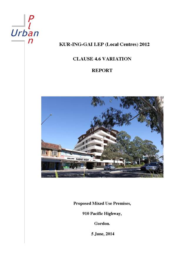

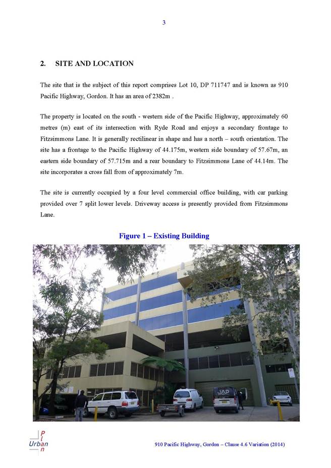


|
Ordinary Meeting of Council - 7 October 2014 |
GB.11 / 316 |
|
|
|
|
Item GB.11 |
DA0263/14 |
|
|
1 September 2014 |
development application
Summary Sheet
|
Report title: |
28 Karranga Avenue Killara - Alterations and Additions to Dwelling - Heritage Conservation Area |
|
ITEM/AGENDA NO: |
GB.11 |
|
Application No: |
DA0263/14 |
|
Property Details: |
28 Karranga Avenue, Killara Lot & DP No: Lot 2, DP524242 Site area (m2): 1056m2 Zoning: Residential 2(c2) |
|
Ward: |
Gordon |
|
Proposal/Purpose: |
Alterations and additions to dwelling |
|
Type of Consent: |
Local |
|
Applicant: |
Catherine and Bruce Mellor |
|
Owner: |
Mr B B Mellor and Mrs C T Mellor |
|
Date Lodged: |
17 July 2014 |
|
Recommendation: |
Approval |
Purpose of Report
To determine Development Application No.0263/14 for alterations and additions to a dwelling.
The application is required to be determined by full Council in accordance with NSW Department of Planning and Infrastructure Planning Circular PS08-14 (attached) which requires all development applications that involve a variation to a development standard greater than 10% under the provisions of SEPP No. 1 to be determined by full Council.
Clause 60C(2) of the Ku-ring-gai Planning Scheme Ordinance (KPSO) sets a maximum Built Upon Area (BUA) requirement of 60% for a dwelling house. The existing Built Upon Area which includes a dwelling house and associated structures including a swimming pool is 69.68% or 735.9m2. The proposed BUA is 69.64% or 735.45m2, which equates to a net reduction of 0.45m2 or 0.04% to the existing BUA. There remains a variation of 16.07% or 101.85m2 to the maximum BUA control. As the non-compliance remains greater than 10%, the application must be reported to full Council for determination.
integrated planning and reporting
Places, Spaces and infrastructure
|
Community Strategic Plan Long Term Objective |
Delivery Program Term Achievement |
Operational Plan Task |
|
P3.1 The built environment delivers attractive, interactive and sustainable living and working environments. |
A high standard of design quality and building environment performance is achieved in new development. |
Assessment of application is consistent with Council’s adopted LEPs and DCPs |
Executive Summary
Issues: Built upon area exceeding 60%, SEPP 1 Objection seeking a variation to the control.
Submissions: Nil.
Land and Environment Court: N/A
Recommendation: Approval
History
Previous DA history
DA0689/00
10 August 2000 Addition of two (2) bedrooms in the roof space. Approved.
Pre-DA
No Pre-DA consultation was undertaken with Council prior to the lodgement of this Development Application.
Current DA history
17 July 2014 Development Application lodged
25 July 2014 Owners of surrounding properties notified of proposal
4 August 2014 Initial Heritage Advisor’s comments received
15 August 2014 Additional information requested from applicant
20 August 2014 Additional information received from the applicant
27 August 2014 Final Heritage Advisor’s comments received
The Site
Site description
The subject site is located on the western side of Karranga Avenue, approximately 100 metres south of the intersection with Wattle Street. The site is located within Heritage Conservation Area C 23. The site contains an existing part one and part two storey dwelling house associated structures and a swimming pool. The site falls approximately 2.6metres from its rear, south-western, corner to the front, south-eastern, corner.
Surrounding development
The surrounding properties comprise single storey bungalows with some later two storey dwellings situated on large landscaped lots. Some of the houses have a swimming pool and/ or a tennis court ancillary to the dwelling.
The site is in the Lynwood Avenue Conservation Area which includes a high proportion of quality houses of the late nineteenth to early twentieth century interwar period. The surrounding houses retain the established landscaped character of the heritage conservation area.
The Proposal
The proposal includes:
· a new balustrade to the eastern, front terrace
· reconstruction of the awning over the front door
· removal and replacement rear veranda
· removal of the split floor level and re-pitching the roof of the family room
· removal and replacement of selected windows to the sitting and family rooms
· minor internal alterations
· new swimming pool safety fencing
The majority of the work is proposed over existing hard covered areas (Built Upon Area) and will result in a slight reduction of 0.04% (0.45m2) to the existing Built Upon Area.
COMMUNITY CONSULTATION
In accordance with Development Control Plan No. 56, owners of surrounding properties were given notice of the application. No submissions were received.
INTERNAL REFERRALS
Heritage
Council's Heritage Advisor commented on the proposal as follows:
Heritage status
The site is not a heritage item but is included in the Lynwood Avenue Conservation Area (C23) in LEP 218. Council is required to take the provisions of the draft KLEP into account when determining the application. The existing single storey Inter-war Bungalow is a contributory item within C23.
The site is in the vicinity of Nos. 21, 29, 32, 36 Karranga Avenue and 30 Lynwood Avenue which are listed Heritage Items.
Clause 61D(4) of the KPSO requires that before granting consent to the proposed works Council must consider the effect of the works on the heritage item, nearby heritage items or conservation area concerned.
Comments
The following is the Statement of Significance;
The Lynwood Avenue HCA is part of the 80 acres Edwin Booker grant purchased by Captain Pockley who established his home ‘Lorne’ and an orchard. The subdivision reflects improved transport connections due to the construction of the North Shore Railway line. HCA has medium historic significance for the Interwar overlay of the subdivision following the death of Sellina Pockley and demolition of Lorne 1924-1925. The later subdivisions reflect improved transport connections due to electrification of the railway in 1927 and the construction of the Sydney Harbour Bridge. The HCA has high aesthetic significance as a highly intact and cohesive late nineteenth century and early twentieth century development.
“The HCA has High aesthetic significance as a cohesive late nineteenth and early twentieth century interwar development and for the high proportion of quality houses.
The neighbouring properties are single storey bungalows and there are some two storey houses in the street.
Most of the proposed alterations and additions are contained within the existing built form at the rear of the house and being only marginally visible from the street, are acceptable.
The proposed zinc clad awning over the front door will be understated and sit within the line of the eaves and is acceptable.
The proposed balustrade on the front terrace is to comply with the BCA. A separate detail has been lodged of the balustrade design.
Conclusion and recommendation
Taking into account the heritage significance of the conservation area, the proposed rear ground floor alterations and additions and awning over the front door are considered to have little impact on the nearby heritage items and surrounding conservation area. The proposed balustrade detail for the front elevation is acceptable on heritage grounds, subject to the paint colour being a dark recessive colour, preferably black (Condition 7).
Landscaping
Council's Landscape and Tree Assessment Officer did not raise concerns with the development.
Engineering
Council's Development Engineer did not raise concerns with the development and relevant conditions of consent are recommended.
Statutory Provisions
The application has been assessed having due regard to the provisions of the Environmental Planning and Assessment Act 1979. In the assessment of Development Applications, particular attention is given to the provisions Section 79C and the stated ‘Matters for Consideration’. This report addresses these matters.
State Environmental Planning Policy No. 1 – Development Standards
SEPP 1 provides flexibility in the application of planning controls operating by virtue of development standards in circumstances where strict compliance with those standards would, in any particular case, be unreasonable or unnecessary or tend to hinder the attainment of the objectives of the EP&A Act as specified under section 5(a)(i) and (ii).
Clause 60C(2) of the Ku-ring-gai Planning Scheme Ordinance states that the maximum Built Upon Area (BUA) of any land on which a dwelling house is erected is 60%. The site has an area of 1056m2 and accordingly the allowable BUA is therefore 633.6m2.
The existing Built Upon Area of the site is 735.9m2 or 69.68% and exceeds the development standard by 102.3m2 or 16.13%. The proposed development results in a reduction in Built Upon Area to 735.45m2 or 69.64% (a reduction of 0.45m2 or 0.04%) as the proposal seeks to remove some of the hard surface paving.
The SEPP No. 1 objection lodged to support the variation to the Built Upon Area standard has been lodged by the applicant and is considered below.
State Environmental Planning Policy No. 55 - Remediation of Land
The provisions of SEPP 55 require Council to consider the potential for a site to be contaminated. The subject site has a history of residential use and as such, it is unlikely to contain any contamination. Further investigation is not warranted in this case.
State Environmental Planning Policy (Building Sustainability Index: BASIX) 2004
A valid BASIX certificate has been submitted. The certificate demonstrates compliance with the provisions of the SEPP and adequately reflects the application.
Ku-ring-gai Planning Scheme Ordinance
The proposed development constitutes alterations and additions to an existing dwelling house. Dwelling houses are a permissible form of development within the Residential 2(c2) zone.
Part A: Development standards
|
Development standard |
Proposed |
Complies |
|
Site area: 836m2 |
1056m2 (existing) |
YES |
|
Building height: 7m (max) |
3.5m |
YES |
|
Built upon area: 60% |
69.64% (existing 69.68%) |
NO |
Built-upon areas:
The non-compliance with the development standard has been addressed through the assessment of the proposed breach against the provisions of SEPP 1 below:
State Environmental Planning Policy No. 1 – Objection to Development Standard (SEPP1)
This policy provides flexibility in the application of development standards within Planning Instruments in circumstances where strict compliance would be unreasonable or unnecessary or tend to hinder the attainment of the objects specified under Section 5(a)(1) of the Act.
Clause 6 of SEPP 1 incorporates the mechanism for making of a SEPP 1 Objection as follows:
Where development could, but for any development standard, be carried out under the Act, the person intending to carry out that development may make a development application in respect of that development, supported by written objection that the development standard is unreasonable or unnecessary in the circumstances of the case, and specify the grounds of that objection.
The applicant has submitted a SEPP1 Objection to the provisions of the Ku-ring-gai Planning Scheme Ordinance (KPSO), in particular, to vary the development standard under Clause 60C(2) for maximum Built Upon Area (BUA). Currently the Built Upon Area is at 69.68% or 735.9m2. Under the proposal the BUA will reduce to 69.64% or 735.45m2. The SEPP 1 Objection provides that compliance with the development standard is unreasonable and unnecessary in this instance as the proposal will:
· decrease the existing Built Upon Area by 0.45m2 or 0.04%
· the overall form, scale and bulk of the built form will remain essentially the same i.e. there is no discernible increase in built form, bulk or scale of the development contained within the site
· There are no adverse amenity impacts to adjoining properties.
The following is the assessment against the provisions of SEPP No.1.
whether the planning control to be varied is a development standard
Clause 60C of the KPSO restricts development on land which dwelling houses are constructed to a maximum Built Upon Area 60%. As the KPSO is a statutory planning instrument, this control is considered to be a development standard as defined under Section 4 of the Environmental Planning & Assessment Act, 1979.
the underlying objective or purpose of the standard
Clause 60C of the KPSO does not have any specified objectives. The same control contained in Development Control Plan 38, which has specified objectives, provides guidance as to the intent of the control. The objectives are:
“Development should maintain a reasonable proportion of the site as soft landscaping to ensure that predominant landscape character of the locality is maintained or enhanced.”
Expanding on the above to ensure a considered review of the control’s intent, it is reasonable to accept that the control seeks to achieve the following:
· to ensure that development provides for sufficient soft landscape area for planting and retention of large canopy trees in scale with proposed development
· to ensure amenity is maintained to surrounding properties and future occupants by limiting the extent of built form on site
· to achieve consistency with the principles of ecologically sustainable development
The proposal is consistent with the purpose of the control. The proposal reduces the existing Built Upon Area and maintains the existing built form in terms of scale, bulk and form (building envelope). The main component of the proposed works seek to rebuild the rear family room. These works will maintain the same footprint as the existing family room. This will retain the overall form/ building envelope of the dwelling and, consequently, its presentation to the public and private areas which surround the site.
Other works will see a slight increase to the area of the rear veranda as a result of ‘squaring off’ the curved edge, however this is compensated by the overall reduction in Built Upon Area and the minor nature of the changes to the site as a result of the proposed development. The remaining works are essentially internal, which have no impacts contrary to the control’s objective. As a result, the proposal will not have any adverse amenity impacts to the adjoining properties. The balance of soft landscaping and built form will remain essentially the same as existing. Therefore, the site’s contribution to the character of the area is maintained and the purpose of the control met.
whether compliance with the development standard is consistent with the aims of the policy and in particular, whether compliance with the development standard hinders the attainment of the objectives specified in Section 5(a)(i) and (ii) of the Environmental Planning and Assessment Act 1979
The aim of SEPP 1 is to:
Provide flexibility in the application of planning controls operating by virtue of development standards in circumstances where strict compliance with those standards would, in any particular case, be unreasonable or unnecessary or tend to hinder the attainment of the objects specified in Section 5(a) (i) and (ii) of the Act.
Strict compliance with the development standard would hinder the attainment of the objectives of Section 5(a) (i) and (ii) of the Act for the reasons given below.
whether compliance with the development standard is unreasonable or unnecessary in the circumstances of the case
The applicant has put forward the following arguments in support of the variation to the development standard:
The existing development on site currently exceeds the nominated BUA for development in the Ku-ring-gai Local Government area. While the proposed development remains non-compliant, it results in an improvement in the BUA by introducing an additional 0.45 m 2 of soft landscaping for development on site. Given that the residence, including verandahs and steps and the swimming pool and associated paving results in a BUA of 46%, the bulk/scale relationship of the development will not dominate the landscaped nature of the area. On this basis, the proposed development will not exacerbate the existing non-compliance and will not result in any significant impacts for the site or surrounding properties.
Insisting on compliance with the development standard is considered to be unreasonable and unnecessary in this instance. The works are essentially over existing hardstand areas and as detailed will maintain the existing bulk, scale and building envelope of the dwelling. This in-turn retains the existing balance of built form to soft landscaping, a key objective of the control. To require compliance with the standard would require a reduction of the Built Upon Area of 102.3m2. This would unreasonably and unnecessarily require the reduction in some or all of the existing paved areas, swimming pool, decks or terrace areas. This is not reasonable given the scope of works that essentially retains the existing built form albeit with a slight reduction of 0.45m2 of BUA.
As a consequence of the above, the overall landscape setting of the site is not detrimentally affected by the proposal and there remains adequate private open space with a satisfactory balance of built form to soft landscaping. Given there is no real change to the balance between the built form and landscaped area it is unreasonable and unnecessary to require compliance with the development standard in this instance.
whether the objection is well founded
The proposed variation is supported as it has been demonstrated that the development will meet the underlying objectives of the standard and requiring compliance would be unreasonable and unnecessary in the circumstances. As a result, it has been concluded that strict compliance with prescribed development standard would unnecessarily hinder the attainment of the objectives specified by Section 5(a) (i) and (ii) of the EP&A Act, 1979. On this basis the request to vary the development standard under the provision of SEPP 1 is considered to be well founded.
whether non-compliance with the development standard raises any matter of significance for State or regional environmental planning
There are no matters of significance for State or regional environmental planning.
whether there is public benefit in maintaining the planning controls adopted by the environmental planning instrument
There is public benefit in maintaining the control as its consistently applied consequently its integrity has not been diminished, however in this instance there is no public benefit in requiring compliance for the reasons given above.
Development in the vicinity of heritage items and in conservation areas
Clauses 61 D (4)
Council’s Heritage Advisor has commented in relation to the development’s impacts on the heritage conservation area and the heritage items and found these to be acceptable.
Division 3: Clause 25C Aims and objectives of Part 3A and Clause 25D Consideration of residential zone objectives and impacts on heritage.
The following aims and objectives are relevant to the proposed development;
· Encouragement for the protection and enhancement of the environmental and heritage qualities of Ku-ring-gai.
· Achieve high quality urban design and architectural design
· To provide rear setbacks that ensure rear gardens are adjacent to rear gardens of other properties and that sufficient ground area is available for tall tree planting.
The proposed alterations and additions are essentially contained within the existing built form at the rear of the house and will be only marginally visible from the street. The development is located in a heritage conservation area and is surrounded by similarly large houses. It is considered that the proposed development is in keeping with the existing character of the locality and equally in keeping with the bulk and scale of surrounding development. The development maintains the streetscape character and the amenity of the adjoining properties.
Consequently, the relevant aims and objectives for residential development as outlined by Part 25C and 25D of Division 3 have been satisfied.
Draft Ku-ring-gai Local Environmental Plan 2013
The draft LEP was on exhibition from 25 March 2013 to 6 May 2013. The Draft is presently
before the Department of Planning pending endorsement and final gazettal. Under the
provision of the Draft LEP, the site is zoned R2 Low Density Residential. Dwelling houses and
ancillary structures are permissible within this zone.
The following are the aims and objectives of R2 Low Density Residential:
Zone R2 Low Density Residential
Objectives of zone
· To provide for the housing needs of the community within a low density residential environment.
· To enable other land uses that provides facilities or services to meet the day to day needs of residents.
· To provide housing that is compatible with the existing environmental and built character of Ku-ring-gai
The proposed alterations and additions are contained within the existing envelope of the dwelling which complies with the maximum height of 9.5 metres development standard having a height of 7.00 metres. A maximum floor space ratio of 0.36:1 applies to the site with the development retaining an existing, non-compliant floor space ratio of 0.42:1 which represents an additional 63.4m2 over the draft standard. Note that the draft standard instrument measures floor space differently from Development Control Plan 38 as the definition of what constitutes gross floor area now reflects that of the standard instrument.
The draft FSR control is the same as the current FSR provisions prescribed by Development Control Plan 38, although measured differently. No issues are raised in relation to this non-compliance as the proposed works will not increase the gross floor area but simply due to a change in what constitutes gross floor area by definition. There is no increase in the building’s scale, bulk or form. The existing building’s envelope will remain the same. As a consequence the site’s contribution to the heritage conservation area will also remain the same and the objectives of the control are met.
The proposed alterations and additions meet the aims and objectives of the Draft Ku-ring-gai Local Environmental Plan 2013, as the works are considered to meet the day to day needs of the residents and is compatible with the existing visual built character of the area.
POLICY PROVISIONS
Development Control Plan No. 38 - Ku-ring-gai Residential Design Manual
|
Development Control |
Proposed |
Complies |
|
4.1 Streetscape: |
||
|
Building setbacks (s.4.1.3) |
|
|
|
Side setback: Ground floor: 2.8m (min) |
1.5m (family room northern side side) |
NO (existing) |
|
Rear setback: 11.7m(min) |
13.2m |
YES |
|
4.2 Building form: |
||
|
FSR (s.4.2.1) 0.36:1(max) |
0.47:1 |
NO |
|
Height of building (s.4.2.2) |
|
|
|
2 storey (max) and 8m (site >200 slope) or 7m (site <200 slope) |
2 storey & 7m |
YES |
|
Building height plane (s.4.2.3) 450 from horizontal at any point 3m above boundary |
|
YES |
|
Roof Line (s.4.2.6) |
|
|
|
Roof height (5m - single storey) (3m - two+ storey) |
2.6m proposed 4m |
YES NO (existing) |
|
Roof pitch 350 (max) |
320 |
YES |
|
Built-upon area (s.4.2.7) 52% (max) |
69.64% (proposed – slight reduction)) |
NO |
|
Unrelieved wall length (s.4.2.8) 12m for walls less than 4m in height 8m for walls more than 4m in height |
13.55m north elevation |
NO (existing – no change) |
|
Solar access (4.2.11) 4h solar access to adjoining properties between 9am to 3pm |
|
YES |
|
Cut & fill (s.4.2.14) |
|
|
|
Max cut 900mm |
400mm |
YES |
|
Max cut & fill across building area of 1800mm and 900mm |
400mm |
YES |
|
No cut or fill within side setbacks |
|
YES |
|
4.3 Open space & landscaping: |
||
|
Soft landscaping area (4.3.3) 48% |
30.36% |
NO |
|
Landscaping cut & fill (4.3.7) |
|
|
|
max cut or fill 500mm relative to natural ground |
400mm |
YES |
|
no cut & fill within 2m of boundary |
300mm cut within 2m of boundary |
NO |
|
Useable open space (s.4.3.8) Min depth 5m and min area 50m2 |
9.5mx24m= 228m2 |
YES |
|
4.4 Privacy & security: |
||
|
See discussion below:
|
||
|
4.5 Access & parking: |
||
|
No. of car parking spaces (s.4.5.1) 2 spaces behind building line |
2 spaces |
YES |
|
Size of car parking space (s.4.5.2) 5.4m x 5.4m |
6.00m x 6.00m |
YES |
|
Driveway width (s.4.5.6) 3.0m |
Min.2.7m existing |
NO (existing) |
Part 4.1 - Streetscape:
The new windows and doors to the northern side of the family room are set back 1.5 metres from the side boundary instead of the required 2.8 metres. The walls of the family room are currently non-compliant at 1.5metres and this will not be altered by the proposed new doors and windows. The objectives of the control seek to ensure there is a sufficient setback for landscaping, minimise the bulk and scale of development particularly when viewed from the adjoining properties and to minimise amenity impacts, particularly in relation to overlooking and overshadowing. The variation to the control is acceptable in this instance as the windows and doors essentially replace the existing openings as part of the rebuilding of the family room. This will maintain the existing amenity to the adjoining development. As a consequence there is no significant increase in overshadowing and the area along the side boundary will maintain the ability to provide landscaping. The development meets the objectives of the control and the variation to the setback control is supported in this instance
Part 4.2 - Building form:
The proposal has a Built Upon Area of 69.64% instead of the maximum 52%. In accordance with subsection 74C (5) of the Environmental Planning and Assessment Act 1979, a provision of a development control plan has no effect to the extent that it is the same or substantially the same as a provision of an environmental planning instrument. The variation to the Built Upon Area development standard has been considered above and is supported.
Part 4.3 - Open space & landscaping:
Excavation for the proposed rear veranda results in 300mm cut less than 2.0 metres from the side boundary. The variation is reasonable in this instance as it is minimal and will not have any significant impact upon the water table and does not have any significant impact upon trees or significant vegetation. As the development meets the objectives of the control the variation is considered acceptable in this instance.
The existing Built Upon Area of 69.68% will be reduced to 69.64% (0.4m2) and prevents compliance with the minimum soft landscaping requirement of 48% of the site.
The site supports a part single and part two storey dwelling, dual driveway and in-ground swimming pool. The site’s primary landscaped area is located within the north-western corner and around the swimming pool, which does support a number of trees and plantings. The site cannot comply with the required 48% soft landscaping requirement or provide additional replenishment canopy trees without removal of significant hard surface areas. This is not considered reasonable in the circumstance.
The site supports a number of trees and vegetation and there is sufficient private open space within the north-western corner that provides an area of recreation for the residents. The swimming pool area also provides additional areas for outdoor recreation and, whilst there is a shortfall in the provision of soft landscaped area, it is considered that the objectives of DCP 38 have been achieved.
Part 4.4 - Privacy and security
The refurbished rear family room sees the replacement of windows and doors which are orientated towards the rear garden at the ground floor level. Given they are at the ground floor level and replacing existing openings, it is not considered the work will impose any significant impact upon the privacy of the adjoining properties. Similarly, the new rear veranda essentially replaces an existing veranda and, as a consequence, will not result in any additional privacy impacts.
Development Control Plan 40 - Construction and Demolition Waste Management
An acceptable waste management plan has been submitted with application.
Development Control Plan 47 - Water Management
Council’s Development Control Engineer considers the proposed to be acceptable in terms of water management.
LIKELY IMPACTS
The likely impacts have been considered in the assessment of the application and are considered to be acceptable.
SUITABILITY OF THE SITE
The site is considered to be suitable for the proposed development.
PUBLIC INTEREST
Approval of the application is considered to be in the public interest.
CONCLUSION
Having regard to the provisions of section 79C of the Environmental Planning and Assessment Act 1979, the proposed development is considered to be satisfactory. Therefore, it is recommended that the application be approved.
|
PURSUANT TO SECTION 80(1) OF THE ENVIRONMENTAL PLANNING AND ASSESSMENT ACT, 1979
A. THAT the Council, as the consent authority, is of the opinion that the objection under State Environmental Planning Policy No.1 – Development Standards to clause 60 C of the Ku-ring-gai Planning Scheme Ordinance in respect of the Built Upon Area development standard is well founded. The Council is also of the opinion that strict compliance with the development standard is unreasonable and unnecessary in the circumstances of this case.
AND
B. THAT Council, being satisfied that the objection under SEPP No. 1 is well founded and also being of the opinion that the granting of consent to DA0263/14 is consistent with the aims of the Policy, grants development consent to DA0263/14 for alterations and additions at 28 Karranga Road, Killara, subject to the following conditions:
Conditions that identify approved plans:
1. Approved architectural plans and documentation
The development must be carried out in accordance with work shown in colour on the following plans and documentation listed below and endorsed with Council’s stamp, except where amended by other conditions of this consent.
Reason: To ensure that the development is in accordance with the determination.
2. Inconsistency between documents
In the event of any inconsistency between conditions of this consent and the drawings/documents referred to above, the conditions of this consent prevail.
Reason: To ensure that the development is in accordance with the determination.
3. No demolition of extra fabric
Alterations to, and demolition of the existing building shall be limited to that documented on the approved plans (by way of notation). No approval is given or implied for removal and/or rebuilding of any portion of the existing building which is shown to be retained.
Reason: To ensure compliance with the development consent.
Conditions to be satisfied prior to demolition, excavation or construction:
4. Asbestos works
All work involving asbestos products and materials, including asbestos-cement-sheeting (ie. Fibro), must be carried out in accordance with the guidelines for asbestos work published by WorkCover Authority of NSW.
Reason: To ensure public safety
5. Notice of commencement
At least 48 hours prior to the commencement of any development (including demolition, excavation, shoring or underpinning works), a notice of commencement of building or subdivision work form and appointment of the principal certifying authority form shall be submitted to Council.
Reason: Statutory requirement.
6. Notification of builder’s details
Prior to the commencement of any development or excavation works, the Principal Certifying Authority shall be notified in writing of the name and contractor licence number of the owner/builder intending to carry out the approved works.
Reason: Statutory requirement.
Conditions to be satisfied prior to the issue of the construction certificate:
7. Front terrace balustrade colour
The paint colour of the front terrace balustrade shall be a dark recessive colour, preferably black.
Reason: To protect the Conservation area.
8. Long service levy
In accordance with Section 109F(i) of the Environmental Planning and Assessment Act a Construction Certificate shall not be issued until any long service levy payable under Section 34 of the Building and Construction Industry Long Service Payments Act 1986 (or where such levy is payable by instalments, the first instalment of the levy) has been paid. Council is authorised to accept payment. Where payment has been made elsewhere, proof of payment is to be provided to Council.
Reason: Statutory requirement.
9. Builder’s indemnity insurance
The applicant, builder, developer or person who does the work on this development, must arrange builder’s indemnity insurance and submit the certificate of insurance in accordance with the requirements of Part 6 of the Home Building Act 1989 to the Certifying Authority for endorsement of the plans accompanying the Construction Certificate.
It is the responsibility of the applicant, builder or developer to arrange the builder's indemnity insurance for residential building work over the value of $20,000. The builder's indemnity insurance does not apply to commercial or industrial building work or to residential work valued at less than $20,000, nor to work undertaken by persons holding an owner/builder's permit issued by the Department of Fair Trading (unless the owner/builder's property is sold within 7 years of the commencement of the work).
Reason: Statutory requirement.
Conditions to be satisfied prior to the issue of the construction certificate or prior to demolition, excavation or construction (whichever comes first):
10. Infrastructure restorations fee
To ensure that damage to Council Property as a result of construction activity is rectified in a timely matter:
a) All work or activity taken in furtherance of the development the subject of this approval must be undertaken in a manner to avoid damage to Council Property and must not jeopardise the safety of any person using or occupying the adjacent public areas.
b) The applicant, builder, developer or any person acting in reliance on this approval shall be responsible for making good any damage to Council Property, and for the removal from Council Property of any waste bin, building materials, sediment, silt, or any other material or article.
c) The Infrastructure Restoration Fee must be paid to the Council by the applicant prior to both the issue of the Construction Certificate and the commencement of any earthworks or construction.
d) In consideration of payment of the Infrastructure Restorations Fee, Council will undertake such inspections of Council Property as Council considers necessary and also undertake, on behalf of the applicant, such restoration work to Council Property, if any, that Council considers necessary as a consequence of the development. The provision of such restoration work by the Council does not absolve any person of the responsibilities contained in (a) to (b) above. Restoration work to be undertaken by the Council referred to in this condition is limited to work that can be undertaken by Council at a cost of not more than the Infrastructure Restorations Fee payable pursuant to this condition.
e) In this condition:
“Council Property” includes any road, footway, footpath paving, kerbing, guttering, crossings, street furniture, seats, letter bins, trees, shrubs, lawns, mounds, bushland, and similar structures or features on any road or public road within the meaning of the Local Government Act 1993 (NSW) or any public place; and
“Infrastructure Restoration Fee” means the Infrastructure Restorations Fee calculated in accordance with the Schedule of Fees & Charges adopted by Council as at the date of payment and the cost of any inspections required by the Council of Council Property associated with this condition.
Reason: To maintain public infrastructure.
Conditions to be satisfied during the demolition, excavation and construction phases:
11. Road opening permit
The opening of any footway, roadway, road shoulder or any part of the road reserve shall not be carried out without a road opening permit being obtained from Council (upon payment of the required fee) beforehand.
Reason: Statutory requirement (Roads Act 1993 Section 138) and to maintain the integrity of Council’s infrastructure.
12. Prescribed conditions
The applicant shall comply with any relevant prescribed conditions of development consent under clause 98 of the Environmental Planning and Assessment Regulation. For the purposes of section 80A (11) of the Environmental Planning and Assessment Act, the following conditions are prescribed in relation to a development consent for development that involves any building work:
· The work must be carried out in accordance with the requirements of the Building Code of Australia · In the case of residential building work for which the Home Building Act 1989 requires there to be a contract of insurance in force in accordance with Part 6 of that Act, that such a contract of insurance is in force before any works commence.
Reason: Statutory requirement.
13. Hours of work
Demolition, excavation, construction work and deliveries of building material and equipment must not take place outside the hours of 7.00am to 5.00pm Monday to Friday and 8.00am to 12 noon Saturday. No work and no deliveries are to take place on Sundays and public holidays.
Excavation or removal of any materials using machinery of any kind, including compressors and jack hammers, must be limited to between 7.30am and 5.00pm Monday to Friday, with a respite break of 45 minutes between 12 noon 1.00pm.
Where it is necessary for works to occur outside of these hours (ie) placement of concrete for large floor areas on large residential/commercial developments or where building processes require the use of oversized trucks and/or cranes that are restricted by the RTA from travelling during daylight hours to deliver, erect or remove machinery, tower cranes, pre-cast panels, beams, tanks or service equipment to or from the site, approval for such activities will be subject to the issue of an "outside of hours works permit" from Council as well as notification of the surrounding properties likely to be affected by the proposed works.
Note: Failure to obtain a permit to work outside of the approved hours will result in on the spot fines being issued.
Reason: To ensure reasonable standards of amenity for occupants of neighbouring properties.
14. Approved plans to be on site
A copy of all approved and certified plans, specifications and documents incorporating conditions of consent and certification (including the Construction Certificate if required for the work) shall be kept on site at all times during the demolition, excavation and construction phases and must be readily available to any officer of Council or the Principal Certifying Authority.
Reason: To ensure that the development is in accordance with the determination.
15. Toilet facilities
During excavation, demolition and construction phases, toilet facilities are to be provided, on the work site, at the rate of one toilet for every 20 persons or part of 20 persons employed at the site.
Reason: Statutory requirement.
16. Road reserve safety
All public footways and roadways fronting and adjacent to the site must be maintained in a safe condition at all times during the course of the development works. Construction materials must not be stored in the road reserve. A safe pedestrian circulation route and a pavement/route free of trip hazards must be maintained at all times on or adjacent to any public access ways fronting the construction site. Where public infrastructure is damaged, repair works must be carried out when and as directed by Council officers. Where pedestrian circulation is diverted on to the roadway or verge areas, clear directional signage and protective barricades must be installed in accordance with AS1742-3 (1996) “Traffic Control Devices for Work on Roads”. If pedestrian circulation is not satisfactorily maintained across the site frontage, and action is not taken promptly to rectify the defects, Council may undertake proceedings to stop work.
Reason: To ensure safe public footways and roadways during construction.
17. Services
Where required, the adjustment or inclusion of any new utility service facilities must be carried out by the applicant and in accordance with the requirements of the relevant utility authority. These works shall be at no cost to Council. It is the applicants’ full responsibility to make contact with the relevant utility authorities to ascertain the impacts of the proposal upon utility services (including water, phone, gas and the like). Council accepts no responsibility for any matter arising from its approval to this application involving any influence upon utility services provided by another authority.
Reason: Provision of utility services.
18. Erosion control
Temporary sediment and erosion control and measures are to be installed prior to the commencement of any works on the site. These measures must be maintained in working order during construction works up to completion. All sediment traps must be cleared on a regular basis and after each major storm and/or as directed by the Principal Certifying Authority and Council officers.
Reason: To protect the environment from erosion and sedimentation.
19. Drainage to existing system
Stormwater runoff from all new impervious areas and subsoil drainage systems shall be piped to the existing site drainage system. The installation of new drainage components must be completed by a licensed contractor in accordance with AS3500.3 (Plumbing Code) and the BCA. No stormwater runoff is to be placed into the Sydney Water sewer system. If an illegal sewer connection is found during construction, the drainage system must be rectified to the satisfaction of Council and Sydney Water.
Reason: To protect the environment.
20. No storage of materials beneath trees
No activities, storage or disposal of materials shall take place beneath the canopy of any tree protected under Council's Tree Preservation Order at any time.
Reason: To protect existing trees.
21. Removal of refuse
All builders' refuse, spoil and/or material unsuitable for use in landscape areas shall be removed from the site on completion of the building works.
Reason: To protect the environment.
22. On site retention of waste dockets
All demolition, excavation and construction waste dockets are to be retained on site, or at suitable location, in order to confirm which facility received materials generated from the site for recycling or disposal.
· Each docket is to be an official receipt from a facility authorised to accept the material type, for disposal or processing. · This information is to be made available at the request of an Authorised Officer of Council.
Reason: To protect the environment.
Conditions to be satisfied prior to the issue of an Occupation Certificate:
23. Compliance with BASIX Certificate
Prior to the issue of an Occupation Certificate, the Principal Certifying Authority shall be satisfied that all commitments listed in BASIX Certificate No.A191425_03 have been complied with.
Reason: Statutory requirement.
24. Infrastructure repair
Prior to issue of the Occupation Certificate, the Principal Certifying Authority must be satisfied that any damaged public infrastructure caused as a result of construction works (including damage caused by, but not limited to, delivery vehicles, waste collection, contractors, sub-contractors, concrete vehicles) is fully repaired to the satisfaction of Council Development Engineer and at no cost to Council.
Reason: To protect public infrastructure.
25. Swimming pool (part 1)
Prior to the issue of the Occupation Certificate, the Principal Certifying Authority shall be satisfied that:
C1 1. Access to the pool/spa shall be restricted by a child resistant barrier in accordance with the regulations prescribed in the Swimming Pools Act, 1992:
(a) The pool shall not be filled with water or be allowed to collect stormwater until the child resistant barrier is installed; and (b) The barrier is to conform to the requirements of AS 1926-1 2012 Fences and Gates for Private Swimming Pools.
Reason: To ensure the safety of children.
2. Any mechanical equipment associated with the swimming pool and/or spa pool shall be located in a sound-attenuating enclosure and positioned so that it is setback a minimum of 2m from the boundary of any adjoining premises. The Principal Certifying Authority shall be satisfied that the sound levels associated with the swimming pool/spa filtration system and associated mechanical equipment do not exceed 5dB(A) above the background noise level at the boundaries of the site.
Reason: To protect the amenity of surrounding properties.
Conditions to be satisfied at all times:
26. Swimming pool (part 2)
At all times:
1. Access to the swimming pool must be restricted by fencing or other measures as required by the Swimming Pools Act 1992. 2. Noise levels associated with spa/pool pumping units shall not exceed 5dB(A) above the background noise level at the boundaries of the site. 3. Devices or structures used for heating swimming pool water must not be placed where they are visible from a public place.
Reason: Health and amenity.
|
|
Graham Bolton Executive Assessment Officer |
Shaun Garland Team Leader Development Assessment South |
|
Corrie Swanepoel Manager Development Assessment Services |
Michael Miocic Director Development & Regulation |
|
A1View |
Elevation of balustrade |
|
2014/208648 |
|
|
|
A2View |
Architectual plans |
|
2014/177058 |
|
|
A3View |
Zoning Extract |
|
2014/231730 |
|
|
A4View |
Notification Plan |
|
2014/231729 |
|
|
A5View |
SEPP 1 Objection |
|
2014/208640 |
|
Ordinary Meeting of Council - 7 October 2014 |
GB.12 / 343 |
|
|
|
|
Item GB.12 |
DA0518/13 |
|
|
8 September 2014 |
development application
Summary Sheet
|
Report title: |
1B Beechworth Road Pymble - Subdivide 1 Lot into 3 Lots, Upgrade Access Road, Stormwater Drainage and Ecological Regeneration Works |
|
ITEM/AGENDA NO: |
GB.12 |
|
Application No: |
DA0518/13 |
|
Property Details: |
Address: 1B Beechworth Road, Pymble Lot & DP No: Lot 1, DP 409138 Site area (m2): 5,356m2 Zoning: Residential 2(c) |
|
Ward: |
Comenarra |
|
Proposal/Purpose: |
Subdivide 1 lot into 3 lots, upgrade access road, stormwater drainage and ecological regeneration works |
|
Type of Consent: |
Integrated (Water Management Act 2000) |
|
Applicant: |
Chase Burke and Harvey |
|
Owner: |
Mr KS Chan |
|
Date Lodged: |
11 December 2013 |
|
Recommendation: |
Approval |
Purpose of Report
To determine Development Application No. 0518/13 for subdivision of 1 lot into 3 lots, upgrade access road, stormwater drainage and ecological regeneration works.
This application is reported to full Council given that Torrens title subdivision is proposed on land that contains endangered ecological species and, as such, delegation is not granted.
integrated planning and reporting
Places, Spaces & Infrastructure
|
Community Strategic Plan Long Term Objective |
Delivery Program Term Achievement |
Operational Plan Task |
|
P2.1 A robust planning framework is in place to deliver quality design outcomes and maintain the identity and character of Ku-ring-gai
|
Applications are assessed in accordance with State and local plans
|
Assessments are of a high quality, accurate and consider all relevant legislative requirements
|
Executive Summary
|
Issues: |
Blue Gum High Forest, Landscaping |
|
Submissions: |
Five submissions received |
|
|
|
|
Zoning: |
Residential 2(c) |
|
Land and Environment Court: |
N/A |
|
Recommendation: |
Approval |
History
Site
The site has a history of residential use.
A search of Council records indicated no history of previous Development Applications or pre-DA meetings held in relation to the site.
Pre-DA
N/A
DA history
11 December 2013 The development application was lodged.
23 December 2013 The application was notified to neighbouring property owners for the extended Christmas/New Year period until 14 February 2014.
23 December 2013 Council sent a letter to the applicant requesting the following:
· heritage assessment in relation to the adjoining heritage listed property (No. 9 Beechworth Road)
· cheque for Integrated Development referral payable to NSW Office of Water
15 January 2014 The applicant lodged a cheque for an Integrated Development referral to NSW Office of Water.
17 January 2014 A Heritage Impact Statement was lodged.
25 February 2014 Integrated Development General Terms of Approval received from NSW Office of Water.
28 March 2014 Council sent a further letter to the applicant requesting the following:
· SEPP No. 1 Objection to address non-compliant access corridor width
· water management documentation
· vegetation management plan (VMP) comprising Blue Gum High Forest (BGHF) vegetation
· landscaping information including details of retaining walls
5 May 2014 Additional plans and information was lodged in response to Council’s letter.
3 June 2014 Landscaping comments were provided to the applicant that requested an amended driveway profile and services location plan for tree protection.
30 June 2014 Amended plans were lodged to address the landscaping comments.
The Site
Site description
The site is an irregular, battleaxe-shaped, allotment with an area of 5,356m2, comprising a 6.095 metres wide frontage to the north-western side of Beechworth Road. The access corridor has a length of approximately 74 metres. The alignment of the north-eastern side boundary is skewed as a result of the alignment of an adjoining railway corridor boundary. The site’s maximum width is approximately 87 metres and maximum length (excluding the access corridor) is approximately 66 metres.
The site has a significant westerly cross fall of approximately 21 metres and average grade of approximately 18% across the widest dimension of the site from the eastern corner to the western corner.
The site contains an existing, two storey, dwelling house with attached garage, detached timber deck/viewing platform and garden shed. The dwelling is surrounded by a landscaped garden and the remainder of the site supports native vegetation including remnant Blue Gum High Forest. Drainage is to a natural watercourse situated within the western corner of the site.
The site does not contain a heritage item and is not located within a heritage conservation area. The site is within the vicinity of a heritage item at 9 Beechworth Road.
Surrounding development
Surrounding residential allotments are of varied shapes and areas, particularly those to the north (fronting Albion Avenue) with common boundaries to the railway corridor. Surrounding development is characterised by residential dwelling houses of a mixture of styles.
The site is located within a 1945-1968 visual character study area on the south-eastern interface with a 1920-1945 visual character study area (properties on the opposite side of Beechworth Road and to the east). A heritage listed property with a T-shaped allotment at No. 9 Beechworth Road adjoins the site for a length of approximately 11m along the south-western side boundary.
The North Shore railway corridor immediately adjoins the site’s north-eastern side boundary, to the rear of the access corridor, which contains a substantial vegetation buffer between the boundary and the railway line.
The western area of the site and adjoining sites is characterised by natural features associated with the watercourse and riparian vegetation.
The Proposal
The proposal is for Torrens title subdivision of one existing lot into three new lots, as follows:
Existing Lot 1, DP 409138:
Site area (exclusive of access corridor): 5010.1m2
Street frontage (Beechworth Road): 6.095m
Vehicular access: Access corridor to Beechworth Road
|
Proposed |
Lot 1: |
Lot 2: |
Lot 3: |
|
Site area: |
1523.1m2 |
1550.9m2 |
1716.2m2 |
|
Street frontage (Beechworth Road): |
2.03m |
2.03m |
2.03m |
|
Vehicular access: |
Access corridor ROC |
Access corridor ROC |
Access corridor ROC |
Proposed Lot 1 will retain the existing dwelling house and shed. The existing detached timber deck/viewing platform will be demolished.
Proposed Lot’s 2 and 3 will be two new vacant allotments. Indicative building envelopes have been provided on plans for Lot’s 2 and 3 to illustrate likely future building footprints (subject to future development applications).
Vehicular access to each proposed new lot will be via a new 3.5 metres wide driveway (upgrade of the existing driveway) along the access corridor with rights of carriageway to Beechworth Road.
An inter-allotment stormwater drainage line is proposed for the new allotments and will service stormwater discharges from the existing dwelling and paved areas.
The proposal also involves revegetation of areas of remnant Blue Gum High Forest (BGHF) and a Restriction on the Use of Land to protect areas of BGHF on site.
Amended engineering plans, dated 26 June 2014
The amended plans proposed the following changes to the application:
· Increased driveway levels in the vicinity of the significant Sydney Blue Gum tree within the access corridor to avoid excavation for service conduits and to protect the tree.
· Increased driveway passing bay width to 5.5 metres.
Consultation
Community
In accordance with Development Control Plan No. 56, owners of surrounding properties were given notice of the application. In response, submissions from the following were received:
1. CS Chee, 1A Beechworth Road, Pymble
2. D Pendergast, J Urquhart and R Urquhart, 9 Albion Avenue, Pymble
3 A & S Seymour, 11 Albion Avenue, Pymble
4. J & R Sindel, 15 Albion Avenue, Pymble
5. B & B Shepherd, 6 Myoora Street, Pymble
The submissions raised the following issues:
The land if approved for building will be prone to water damage and unstable due to erosion.
Council’s Development Engineer made the following comments in relation to the above concerns:
“The land slopes from east to west and does have a relatively steep gradient of over 20% in places. The existing residence is to remain on Lot 1, and all lots will be provided with an interallotment drainage system to convey runoff to the natural watercourse in the western corner of the site. New dwellings on Lot’s 2 and 3 will be subject to separate applications, and water management systems for those lots, designed in accordance with Council’s controls, will protect them from adverse impacts due to surface runoff.
Large areas of Lot’s 2 and 3 are designated as tree protection zones, which will not be subject to increased erosion”.
Any future building works will be required to comply with the Building Code of Australia.
The existing driveway results in vehicular noise to residents at No. 1A Beechworth Road due to gradient and would be exacerbated by increased vehicular access.
Council’s Development Engineer has made the following comments in relation to the driveway:
The driveway gradient is existing, and is not steeper than many driveways in Ku-ring-gai. The traffic volume due to two additional dwellings is likely to be extremely low (less than 2 vehicles in peak hours).
Accordingly, no significant impacts are envisaged having regard to neighbouring amenity.
Privacy compromised from balcony area at No. 1A Beechworth Road which faces driveway.
The proposed driveway will replace an existing driveway within the access corridor and is required for access to each allotment. It will not present any unreasonable privacy impacts to adjoining neighbours given the low traffic volumes as discussed above.
No space provided for rubbish bin collection due to small road frontage.
Council’s Development Engineer made the following comments in response to this concern:
“With regard to garbage bin placement given the site’s small frontage to Beechworth Road, it is likely that bins would be placed in front of neighbouring properties, however, there is sufficient frontage available and on-street parking at this location is sufficiently rare, that blocking of neighbours’ driveways would be unnecessary. There is no alternative, and this issue is not considered to be fatal to the subdivision”.
Impacts to the adjoining properties to the north-west (Nos. 9, 11 and 15 Albion Avenue), including:
· Privacy
· Security
· Property value
· Visual impacts
· Amenity loss/standard of living
· Vehicle movement, lighting (including car headlights) and noise
· Loss of visually significant trees and natural outlook
The proposal involves a Restriction on the Use of Land in the Tree Protection Zone and no trees are proposed to be removed as part of the subdivision works. Moreover, weed management works and revegetation using plantings characteristic of BGHF understorey will assist this endangered ecological community and provide vegetative screening to ensure the suitable retention of neighbouring privacy and visual amenity/natural outlook. Council’s Landscape Assessment Officer and Ecological Assessment Officer have supported the proposal in this regard.
The locations of the indicative future dwellings are not expected to result in any significant impacts to the above (or other) neighbouring properties given the substantial setbacks provided from the building footprints, being a minimum of approximately 16.5 metres and 14 metres to the rear boundaries of Nos. 9 and 11 Albion Avenue, respectively.
Any impacts associated with the driveway and vehicle movement, including lighting and noise are expected to be negligible given the proximity of the driveway from these adjoining properties and substantial vegetative screening provided therein. The likely location of future dwellings on each lot will further mitigate such impacts.
The subdivision and creation of two additional residential allotments would not create any undue security impacts and no new fencing is considered necessary to this end. Such considerations would be subject to future development of each allotment.
Impact on property values is not a relevant planning consideration.
Accordingly, no significant impacts are envisaged having regard to the above matters.
The access corridor width is less than minimum width specified by Council.
Initial assessment applied the minimum corridor width requirement of the Ku-ring-gai Planning Scheme Ordinance (KPSO) assuming the narrow access handle to an individual lot, however this matter has since been resolved as the access corridor represents the combined 6.095 metres wide corridor. Accordingly, the proposal is compliant with the minimum access corridor width standard of 4.6 metres.
Removal of existing riparian buffer zone and tree corridor and associated wildlife/habitat impacts
The proposal does not involve the removal of the riparian buffer zone and tree corridor. The proposal is however expected to enhance ecological aspects of the site (BGHF community) and is supported by Council’s Ecological Assessment Officer with due regard to flora and fauna and habitat. A Flora and Fauna Impact Assessment was submitted with the application to this end and was considered acceptable.
Amended plans
The amended plans were not notified to surrounding residents as the proposed amendments do not result in a greater environmental impact than the original proposal.
Within Council
Heritage
Council’s Heritage Advisor commented on the proposal as follows:
“Heritage status
The existing site at 1B Beechworth Road, Pymble is not a heritage item. The site is in the vicinity of No. 9 Beechworth Road, Pymble which is a Heritage Item.
Clause 61E of the KPSO requires Council to assess and consider impacts of development on the heritage significance of nearby items.
Comments
The nearby heritage item is a one and two storey brick and slate tile Federation style house with a separate brick garage and tile roof. The property abuts the subject (development) land for a distance of approximately 11 metres and has two road frontages; namely, Beechworth Road and Myoora Street.
Conclusions and recommendations
The heritage listed property at No. 9 Beechworth Road cannot be seen from the proposed future dwelling sites on the development land at No. 1B Beechworth Road and is approximately 45 metres away from the nearest corner of the building envelope of the proposed Lot 2. There is a significant stand of Blue Gum Forest trees at various stages of growth which prevent a clear view of the heritage item.
Therefore, the proposed development would have little impact on the heritage item and is considered acceptable.”
Landscaping
Council's Landscape Assessment Officer commented on the proposal as follows:
“Tree impacts
No trees are proposed to be removed as part of the subdivision works. The arborist states that T15 Eucalyptus saligna (Sydney Blue Gum) while having structural issues, poses an acceptable level of risk and is therefore being retained as part of this application.
Tree 1 Eucalyptus saligna (Sydney Blue Gum) is located within the access handle. The tree is outwardly in good health and condition and is a dominant specimen. The tree due to its age and size is considered to be a remnant specimen of the critically endangered BGHF plant community. The existing bitumen driveway is located within the tree’s structural root zone (SRZ) and tree protection zone (TPZ) and there is some evidence of surface cracking and minor upheaval due to tree roots. The new concrete driveway is proposed above existing grade. Services shall be laid on top of existing grades without excavation, thereby minimising tree impact.
Amended plans satisfactorily address previous concerns.
NOTE: Clarification has been provided that the existing retaining wall is to be retained.
Tree 2 Ficus rubignosa (Port Jackson Fig) located adjacent to the driveway within proposed Lot 1. The tree is outwardly in good health and condition. The proposed driveway is located within the trees identified TPZ and SRZ. It is conditioned for the existing driveway location to be maintained and the new driveway to be located on top of existing grade. Standard tree protection measures and supervision of works by an AQF5 Arborist when undertaken within the TPZ can be conditioned (Condition 32).
Tree 10 Cinnamomum camphora (Camphor laurel) located adjacent to the south-western site corner at the bottom of the site. The tree is a weed species and will be required to be removed as per council’s Weed Policy. Drainage works are proposed within the tree’s TPZ. The trees removal can be conditioned (Condition 33).
Tree 12 Jacaranda mimosifolia (Jacaranda) located within the lower portion of the site. Drainage work is proposed within the trees TPZ, however, it is assessed as being less than 10% which is a minor impact and should not adversely impact the trees ongoing health and viability.
Other retained trees are located at appropriate setbacks so as not to be impacted by development works.
Landscape plan/tree replenishment
No landscape plan has been submitted with the application. It is noted that the submitted plans include nominated areas to be revegetation zones and areas that have a restricted area on title, in addition to rights of carriageway and drainage easements.
A VMP (vegetation management plan) has been submitted as requested. Refer to Ecology comments below.
Stormwater plan
Supported on landscape grounds
Riparian
A Category 3 watercourse traverses the site adjacent to the northwest site boundary. The riparian corridor is weed infested although there are mature endemic trees as well. From a landscape viewpoint it is advantageous that restorative riparian planting be undertaken as part of the subdivision works. Refer to Ecology comments below.
The application is acceptable on landscape grounds.
Ecology
Council's Ecological Assessment Officer commented on the proposal as follows:
“The remnant vegetation within the subject property comprises of Blue Gum High Forest (BGHF) a critically endangered vegetation type listed under the Threatened Species Conservation Act 1995. The BGHF community was primarily identified within the lower steeper rear yard of the site and straddles along the Category 3 watercourses that flows adjacent to the north western boundary.
Biodiversity and riparian land controls
The entire site is mapped as an area of “biodiversity significance” under KLEP 218 (2013) section 6.6.
6.6 Biodiversity Protection [local]
(1) The objective of this clause is to protect, maintain and improve the diversity and condition of native vegetation and habitat, including:
(a) protecting biological diversity of native flora and fauna, and
(b) protecting the ecological processes necessary for their continued existence, and
(c) encouraging the recovery of threatened species, communities, populations and their habitats, and
(d) protecting, restoring and enhancing biodiversity corridors.
(2) This clause applies to development on land that is identified as “Areas of Biodiversity Significance” on the Biodiversity Map.
(3) Before granting development consent for development on land to which this clause applies, the consent authority must consider:
(a) the impact of the proposed development on the following:
(i) any native vegetation community,
(ii) the habitat of any threatened species, population or ecological community,
(iii) any regionally significant species of plant, animal or habitat,
(iv) any biodiversity corridor,
(v) any wetland,
(vi) the biodiversity values within any reserve,
(vii) the stability of the land, and
(b) any proposed measure to be undertaken to ameliorate any potential adverse environmental impact, and
(c) any opportunity to restore or enhance remnant vegetation, habitat and
biodiversity corridors.
(4) Development consent must not be granted for development on land to which this
clause applies unless the consent authority is satisfied that the development:
(a) is consistent with the objectives of this clause, and
(b) is designed, and will be sited and managed, to avoid any potential adverse environmental impact or, if a potential adverse environmental impact cannot be avoided:
(i) the development minimises disturbance and adverse impacts on remnant vegetation communities, habitat and threatened species and populations, and
(ii) measures have been considered to maintain native vegetation and habitat in parcels of a size, condition and configuration that will facilitate biodiversity protection and native flora and fauna movement through biodiversity corridors, and
(iii) the development avoids clearing steep slopes and facilitates the stability of
the land, and
(iv) measures have been considered to achieve no net loss of significant vegetation or habitat.
(5) In this clause: biodiversity corridor means an area to facilitate the connection and maintenance of native flora and fauna habitats. Within the urban landscape, biodiversity corridors may be broken by roads and other urban elements and may include remnant trees and associated native and exotic vegetation.
Having consideration to the relevant clauses, it is concluded that the development is consistent with clause 4 (a-b) sections i-iv & clause 5.
Riparian controls
A small area within the north-western portion of the subject property has been mapped as containing a Category 3 riparian corridor under the KLEP 218 (2013). The Category 3 riparian corridor is also mapped under Council’s Riparian Policy which requires a 10m core riparian zone (CRZ).
The proposal complies with the setback both under the KLEP and Council’s Riparian Policy.
The following KLEP 218 (2013) clauses below have been considered. The proposed is consistent with clause 6.7 Riparian land and waterways [local] (1) parts (a)- i-iv & Part 6 (4) –C of the KLEP 218 (2013).
6.7 Riparian land and waterways [local]
(1) The objectives of this clause are:
(a) to protect or improve:
(i) water quality within waterways,
(ii) stability of the bed and banks of waterways,
(iii) aquatic and riparian species, communities, populations and habitats,
(iv) ecological processes within waterways and riparian lands,
(v) scenic and cultural heritage values of waterways and riparian lands, and
(b) where practicable, to provide for the rehabilitation of existing piped or channelised waterways to a near natural state.
(2) This clause applies to development on land that is identified as “Riparian land” on the Riparian Lands Map. Note: Some development types within 40m of these waterways will still require referral to the Office of Water as ‘integrated development’.
(3) Before determining a development application for development on land to which this clause applies, the consent authority must consider:
(a) whether the development is likely to have any adverse impact on the following:
(i) water quality in the waterway,
(ii) the natural flow regime, including groundwater flows to a waterway,
(iii) aquatic and riparian species, populations, communities, habitats and ecosystems,
(iv) stability of the bed, shore and banks of the waterway,
(v) the free passage of native aquatic and terrestrial organisms within or along
the waterway and riparian land,
(vi) public access to, and use of, any public waterway and its foreshores,
(b) any opportunities for rehabilitation or re-creation of the watercourse and its
riparian areas,
(c) any appropriate measures proposed to avoid, minimise or mitigate the impacts
of the development.
(4) Development consent must not be granted for development on land to which this clause applies unless the consent authority is satisfied that the development:
(a) integrates riparian, stormwater and flooding measures,
(b) is sited, designed and managed to avoid potential adverse environmental impacts, and
(c) if a potential adverse environmental impact cannot be avoided by adopting feasible alternatives, the development minimises or mitigates any adverse environmental impact, to a satisfactory extent.
Flora and fauna assessment
A flora and fauna assessment has been prepared by Keystone to assess the impacts of the proposal upon threatened species, endangered populations and endangered ecological communities listed under the Threatened Species Conservation Act 1995.
The impact assessment (7-part test) prepared for threatened species, endangered populations and endangered ecological communities in accordance with section 5a of the Environmental Planning & Assessment Act 1979 is acceptable, the proposed development is unlikely to significantly affect threatened species, endangered populations or endangered ecological communities.
The proposal will not result in the removal of trees or vegetation which comprises part of the onsite BGHF community.
Conclusion
The application is supported on ecological grounds with a condition” (Condition 36).
Engineering
Council's Development Engineer commented on the proposal as follows:
“Amended plans have been received, Chase Burke & Harvey Sheets 1 to 6 Revision A. The initial concerns raised have been addressed as follows, and the application is now acceptable, subject to conditions:
· Calculations for the design of the interallotment drainage system have been provided.
· Detention of driveway runoff has been provided in an above ground basin at the low point of Lot 3.
· Water quality measures are provided.
· The plans show a swale drain and level spreader at the end of the driveway to collect and dispose of surface runoff.
· The plans now show the depression in Lot 2 to be filled.
The proposal is technically acceptable, and, importantly, has also been supported by Council’s Landscape Assessment Officer and Council’s Ecological Assessment Officer.
A submission has been received in regard to water management, driveway gradient and waste management.
The land slopes from east to west and does have a relatively steep gradient of over 20% in places. The existing residence is to remain on Lot 1, and all lots will be provided with an interallotment drainage system to convey runoff to the natural watercourse in the western corner of the site. New dwellings on Lots 2 and 3 will be subject to separate applications, and water management systems for those lots, designed in accordance with Council’s controls, will protect them from adverse impacts due to surface runoff.
Large areas of Lots 2 and 3 are designated as tree protection zones, which will not be subject to increased erosion.
The driveway gradient is existing and is not steeper than many driveways in Ku-ring-gai. The traffic volume due to two additional dwellings is likely to be extremely low (less than 2 vehicles in peak hours).
With regard to garbage bin placement, given the site’s small frontage to Beechworth Road, it is likely that bins would be placed in front of neighbouring properties, however, there is sufficient frontage available and on-street parking at this location is sufficiently rare, that blocking of neighbours’ driveways would be unnecessary. There is no alternative and this issue is not considered to be fatal to the approval of the subdivision.
Outside Council
NSW Office of Water
Under the provisions of section 91 of the Environmental Planning and Assessment Act 1979, the application constitutes Integrated Development on the basis that proposed works require a controlled activity approval under the Water Management Act 2000, due to the proposal involving subdivision of land within 40 metres of a watercourse.
Accordingly, the development was referred to the NSW Office of Water and General Terms of Approval were provided in response (Condition 48).
Statutory Provisions
Acts
Environmental Planning and Assessment Act 1979 and Water Management Act 2000
Under the provisions of section 91 of the Environmental Planning and Assessment Act 1979, the application constitutes Integrated Development on the basis that proposed works require a controlled activity approval under the Water Management Act 2000, due to the proposal involving subdivision of land within 40 metres of a watercourse.
Accordingly, the development was referred to the NSW Office of Water and General Terms of Approval were provided in response (Condition 48).
State Environmental Planning Policies
Sydney Regional Environmental Planning Policy (Sydney Harbour Catchment) 2005
Matters for consideration under SREP (Sydney Harbour Catchment) 2005 include biodiversity, ecology and environmental protection, public access to and scenic qualities of foreshores and waterways, maintenance of views, control of boat facilities and maintenance of a working harbour.
A natural watercourse traverses the north-western boundary of the site, and this part of the site is characterised by a riparian corridor, which is mapped as an area of Natural Resources Riparian Land. As such, the riparian land and waterways provisions of the Ku-ring-gai Local Environmental Plan 218 (2013) apply. The category 3 riparian corridor is also mapped under Council’s Riparian Policy which requires a 10m core riparian zone (CRZ).
The proposal complies with the setback both under the KLEP 218 and Councils Riparian Policy and is supported by Council’s Ecology Officer (including the Vegetation Management Plan) as discussed above.
Accordingly, the proposal is considered satisfactory having regard to the matters for consideration under SREP (Sydney Harbour Catchment) 2005.
State Environmental Planning Policy No. 55 - Remediation of Land
The provisions of SEPP 55 require Council to consider the potential for a site to be contaminated. The subject site has a history of residential use and as such, it is unlikely to contain any contamination and further investigation is not warranted in this case
State Environmental Planning Policy (Infrastructure) 2007
The provisions of SEPP (Infrastructure) 2007 apply to development on land that is in or immediately adjacent to a rail corridor. In particular, Clause 86 specifies that the consent authority must not grant consent to the following development without the concurrence of the chief executive of the rail authority (Sydney Trains):
(1) This clause applies to development (other than development to which clause 88 applies) that involves the penetration of ground to a depth of at least 2m below ground level (existing) on land:
(a) within or above a rail corridor, or
(b) within 25m (measured horizontally) of a rail corridor, or
(c) within 25m (measured horizontally) of the ground directly above an underground rail corridor.
The development site adjoins the North Shore rail corridor, however concurrence from Sydney Trains is not required given the proposed subdivision and associated works do not involve excavation of 2 metres below ground level (existing) on land within 25 metres of the rail corridor.
Ku-ring-gai Planning Scheme Ordinance (KPSO)
Permissibility
Subdivision within the Residential 2(c) zone is permissible under Clause 23 of the KPSO. Clause 58A of the KPSO provides that a person shall not subdivide land to which the Ordinance applies except with development consent.
Clause 58B sets out the subdivision requirements for dwelling house lots and provides the following minimum requirements for Residential 2(c) subdivisions:
Part A: Development standards
|
Development standard |
Proposed |
Complies |
|
Subdivision for dwelling houses – hatchet-shaped (battleaxe) lot
|
|
|
|
Site area (exclusive of access corridor): 1300m2 (min)
|
Lot 1: 1523.1m2 Lot 2: 1550.9m2 Lot 3: 1716.2m2
|
YES YES YES |
|
Access corridor width: 4.6m (min) |
6.095m |
YES
|
|
Boundary to a public road for each separate lot created
|
Boundary to Beechworth Road for each allotment |
YES |
|
Built upon areas 60% max Lot 1 - (1006.8m2)(max) |
Existing built-upon area: 340m2 (33.8%) |
YES
|
Part B: Aims and objectives for residential zones
The development is satisfactory having regard to the following aims of the KPSO:
(i) The application has demonstrated that the development will maintain the amenity and environmental character of the residential zone.
(ii) The development adequately responds to the unique features and constraints of the site and the associated issues that stem from those constraints. As such, the application demonstrates that the development is compatible with the character of the area, is sympathetic and harmonious in its relationship with adjoining development.
The existing site area is 5010.1m2 (exclusive of the access corridor) which is significantly greater than the prevailing allotment sizes in the surrounding area. It is noted that the subject site is considerably constrained by slope and dense vegetation, particularly adjacent to the western corner which also contains a natural watercourse. The adjoining lots range in size from 1031m2 to 1543m2, with an average lot size of 1355m2. The surrounding allotments present a mix of configurations with frontages to Beechworth Road, Albion Avenue or Myoora Street. The proposed lots comply with the Ku-ring-gai Planning Scheme Ordinance minimum allotment size (area) provisions for battleaxe lots and will retain the following areas, greater than the average surrounding allotment area:
· Lot 1: 1523.1m2
· Lot 2: 1550.9m2
· Lot 3: 1716.2m2
Ku-ring-gai Planning Scheme Ordinance – LEP 218 Biodiversity and Heritage
Cl.61L Biodiversity protection
The subject site is mapped as an area of Biodiversity Significance and, as such, the biodiversity protection provisions of the LEP apply.
Council’s Ecological Assessment Officer has provided an assessment of the proposed development against the biodiversity lands controls in accordance with the KLEP 218 2013. The proposal is acceptable in this regard. Refer to comments above.
Cl.61M Riparian land and waterways
The subject site is mapped as an area of Natural Resources Riparian Land and, as such, the riparian land and waterways provisions of the LEP apply.
Council’s Ecological Assessment Officer has provided an assessment of the proposed development against the riparian lands controls in accordance with the KLEP 218 2013. The proposal is acceptable in this regard. Refer to comments above.
Cl.61E Development in the vicinity of heritage items
The existing site at 1B Beechworth Road, Pymble is not a heritage item. The site is in the vicinity of No. 9 Beechworth Road, Pymble which is a Heritage Item.
Clause 61E of the KPSO requires Council to assess and consider impacts of development on the heritage significance of nearby items.
Council’s Heritage Advisor has stated the proposal would have negligible impact on the heritage item and is considered acceptable having regard to Clause 61E. Refer to comments above.
Draft Ku-ring-gai Local Environmental Plan 2013
The draft comprehensive Ku-ring-gai Local Environmental Plan 2013 (DLEP) seeks to replace the Ku-ring-gai Planning Scheme Ordinance by bringing the principal planning instrument of the LGA in line with the standard instrument. The draft LEP was exhibited from 25 March 2013 to 6 May 2013. The particular aims of the draft LEP are to guide the future development of land and the management of environmental, social, economic, heritage and cultural resources within Ku-ring-gai. The subject site is located within an area identified on the statutory maps and as such the draft LEP forms a consideration for the assessment of this application under the provisions of Section 79C of the Act.
As a result of the plan, the subject site is proposed to be zoned E4 Environmental Living and the development is permissible within this zoning. The objectives of the zone are as follows:
· to provide for low-impact residential development in areas with special ecological, scientific or aesthetic values
· to ensure that residential development does not have an adverse effect on those values
· to ensure development does not result in further fragmentation of ecological communities, biodiversity corridors or other significant vegetation or habitat
The subject proposal is compatible with the existing low density character of the area. A small portion of the site is mapped ‘riparian vegetation’. Council’s Ecological Assessment Officer has assessed the development proposal (including the Vegetation Management Plan) in relation to impacts of the development on ecology of the site and nearby reserves and impacts to the vegetation corridor and found it acceptable. The proposal meets the objectives of the draft zone and will maintain the existing prevailing low density subdivision character of the area.
4.1 Minimum subdivision lot size
The proposal meets the objectives of the clause, being;
“(a) to ensure that lot sizes and dimensions are able to accommodate development consistent with relevant development controls
(b) to ensure that lot sizes and dimensions allow development to be sited to protect natural or cultural features including heritage items, remnant vegetation, habitat and waterways, and provide for generous landscaping to support the amenity of adjoining properties and the desired character of the area
(c) to ensure that subdivision of low density residential sites reflects and reinforces the predominant subdivision pattern of the area”
Clause 4.1(3) specifies a minimum lot size of 1500m2 (exclusive of access handle).
The proposed lot sizes comply with the minimum lot size provision of the draft LEP as follows:
· Lot 1: 1523.1m2
· Lot 2: 1550.9m2
· Lot 3: 1716.2m2
The proposal is consistent with the provisions of the draft instrument, including matters of heritage significance, biodiversity protection, riparian land and waterways.
POLICY PROVISIONS
Development Control Plan No. 38 - Ku-ring-gai Residential Design Manual (DCP 38)
The existing dwelling on Lot 1 is compliant with regard to floor space ratio, built upon area and building height provisions of DCP 38. The only structure proposed to be demolished is the stand-alone timber deck/viewing platform to the west of the existing dwelling. The proposal does not involve construction of any new dwellings on proposed Lot’s 2 and 3.
The below table provides a DCP 38 compliance assessment of the existing dwelling on its new, reduced (Lot 1).
|
COMPLIANCE TABLE |
||||
|
Development Control |
Compliance |
Comment |
||
|
Streetscape: |
||||
|
Building setbacks |
YES |
The proposed subdivision would not adversely impact the streetscape. As a consequence of the irregular battle-axe shape and skewed boundaries of Lot 1 in relation to layout of the existing dwelling, the new side setback to the western boundary varies from approximately 3 metres at the southern end of the dwelling (attached garage) to 15 metres at the northern end. The siting of the existing dwelling in relation to the new western boundary would not detract from the amenity of private open spaces and living areas on neighbouring properties and the prevailing setback satisfies the assessment criteria.
|
||
|
Building form |
||||
|
FSR |
YES |
The FSR of the existing dwelling on the smaller Lot 1 will be 0.13:1, which complies with the maximum permissible ratio of 0.31:1.
|
||
|
Built-upon area
|
YES |
The BUA of the new Lot 1 will be 340m2 (33.8%), which complies with the required maximum of 503.4m2 (50%). |
||
|
Open space & landscaping: |
||||
|
Soft landscaping area |
YES |
The soft landscaping area of the new Lot 1 will be 666.8m2 (66.2%), which complies with the required minimum of 503.4m2 (50%).
|
||
|
Tree replenishment |
YES |
No tree replenishment is required.
|
||
|
Useable open space
|
YES |
Suitable open space area is provided well in excess of the required minimum depth of 5m and minimum area of 50m2 |
||
|
Privacy & security: |
||||
|
Privacy |
YES |
The proposed subdivision does not alter the existing privacy and security for the existing dwelling located on Lot 1. It is envisaged that suitable privacy would be retained having consideration to the indicative future dwelling footprints on Lot’s 2 and 3 given the setbacks provided.
|
||
|
Access & parking: |
||||
|
|
YES |
The proposed development will maintain the existing 2 car parking spaces on Lot 1 in compliance with the DCP requirements. Access will be improved by the proposed new concrete formation driveway. Council’s Development Engineer has supported the proposal having regard to vehicular access and parking.
|
||
|
Water management: |
||||
|
|
YES |
As discussed by Council’s Development Engineer, the existing residence is to remain on Lot 1. All lots will be provided with an interallotment drainage system to convey runoff to the natural watercourse in the western corner of the site in compliance with the DCP requirements.
|
||
Development Control Plan No. 40 - Construction and Demolition Waste Management
Waste management aspects of the proposed development are acceptable. A waste management plan in accordance with DCP 40 is required by condition prior to commencement of works (Condition 11).
Development Control Plan No. 43 – Car Parking
The proposal is consistent with the objectives and guidelines for the design of parking and service areas and demonstrates safe and efficient vehicular access, consistent with the desirable characteristics and environmental standards expected in the Ku-ring-gai area.
Council’s Development Engineer has supported the application having regard to the provisions of DCP 43.
Development Control Plan No. 47 – Water Management (DCP 47)
Council’s Development Engineer has assessed the development against the provisions of DCP 47 and has indicated the proposal is acceptable in this regard. Refer to comments above.
Development Control Plan No. 56 – Notification
The development application was notified to neighbouring properties in accordance with the provisions of DCP 56. The issues raised in the submissions received are adressed above (refer to Consultation).
Ku-ring-gai Contributions Plan 2010
The proposal is subject to Council’s Ku-ring-gai Contributions Plan 2010. Pursuant to the plan, the subdivision of one existing lot into three lots would attract a contribution for the creation of two additional lots being $45,831 which is required to be paid by Condition 16.
Likely Impacts
All likely impacts have been considered in the assessment of the application.
Suitability of the Site
The site is considered suitable for the proposed development.
Public Interest
The approval of the application is considered to be in the public interest.
Conclusion
Having regard to the provisions of section 79C of the Environmental Planning and Assessment Act
1979, the proposed development is considered to be satisfactory. Therefore, it is recommended that the application be approved.
|
THAT the Council, as the consent authority, grant development consent to DA0518/13 for subdivision of one lot into three lots, upgrade of access road, stormwater drainage and ecological regeneration works at 1B Beechworth Road, Pymble, for a period of two years from the date of the Notice of Determination, subject to the following conditions:
Conditions that identify approved plans:
1. Approved architectural plans and documentation (new development)
The development must be carried out in accordance with the following plans and documentation listed below and endorsed with Council’s stamp, except where amended by other conditions of this consent:
Reason: To ensure that the development is in accordance with the determination.
2. Inconsistency between documents
In the event of any inconsistency between conditions of this consent and the drawings/documents referred to above, the conditions of this consent prevail.
Reason: To ensure that the development is in accordance with the determination.
Conditions to be satisfied prior to demolition, excavation or construction:
3. Asbestos works
All work involving asbestos products and materials, including asbestos-cement-sheeting (ie. Fibro), must be carried out in accordance with the guidelines for asbestos work published by WorkCover Authority of NSW.
Reason: To ensure public safety
4. Notice of commencement
At least 48 hours prior to the commencement of any development (including demolition, excavation, shoring or underpinning works), a notice of commencement of building or subdivision work form and appointment of the principal certifying authority form shall be submitted to Council.
Reason: Statutory requirement.
5. Notification of builder’s details
Prior to the commencement of any development or excavation works, the Principal Certifying Authority shall be notified in writing of the name and contractor licence number of the owner/builder intending to carry out the approved works.
Reason: Statutory requirement.
6. Dilapidation photos (public infrastructure)
Prior to the commencement of any works on site the applicant must submit to Ku-ring-gai Council and the Principal Certifying Authority a photographic record on the visible condition of Beechworth Road between the site entry and Pacific Highway (in colour - preferably saved to cd-rom in ‘jpg’ format). The photos must include detail of: · The existing footpath · The existing kerb and gutter · The existing full road surface between kerbs · The existing verge area · The existing driveway and layback where to be retained · Any existing drainage infrastructure including pits, lintels, grates. Particular attention must be paid to accurately recording any pre-developed damaged areas on the aforementioned infrastructure so that Council is fully informed when assessing damage to public infrastructure caused as a result of the development (which is not to be repaired by the Applicant as part of the development). The developer may be held liable to all damage to public infrastructure in the vicinity of the site, where such damage is not accurately recorded and demonstrated under the requirements of this condition prior to the commencement of any works.
Reason: To protect public infrastructure.
7. Construction and traffic management plan
The applicant must submit to Council a Traffic Control Plan for vehicles reversing into the site (eg for concrete pours for the new driveway).
Construction vehicles are only to use Beechworth Road north of the site entry for approach and departure to and from all directions.
When a satisfactory TCP is received, a letter of approval will be issued . Council’s Rangers will be patrolling the site regularly and fines may be issued for any non-compliance with this condition.
Separate approvals must be obtained from Council if it is proposed to stand plant or hoist materials across Council's land http://www.kmc.nsw.gov.au/I_want_to/Pay_register_request_or_reply/Find_a_form
Reason: To ensure that appropriate measures have been considered during all phases of the construction process in a manner that maintains the environmental amenity and ensures the ongoing safety and protection of people.
8. Erosion and drainage management
Earthworks and/or demolition of any existing buildings shall not commence until an erosion and sediment control plan is submitted to and approved by the Principal Certifying Authority. The plan shall comply with the guidelines set out in the NSW Department of Housing manual "Managing Urban Stormwater: Soils and Construction" certificate. Erosion and sediment control works shall be implemented in accordance with the erosion and sediment control plan.
Reason: To preserve and enhance the natural environment.
9. Trunk protection
To preserve the following tree/s, no work shall commence until the trunk/s are protected by the placement of 50 x 100mm hardwood timbers spaced at 150mm centres and secured by 2mm wire at 300mm wide spacing over suitable protective padding material as per AS4970-2009. The trunk protection shall be maintained intact until the completion of all work on site.
Any damage to the tree/s shall be treated immediately by an experienced AQF3 Horticulturist/Arborist and a report detailing the works carried out shall be submitted to the Principal Certifying Authority:
Reason: To protect existing trees during the construction phase.
10. Tree fencing inspection
Upon installation of the required tree protection measures, an inspection of the site by the Principal Certifying Authority is required to verify that tree protection measures comply with all relevant conditions.
Reason: To protect existing trees during the construction phase
11. Construction waste management plan
Prior to the commencement of any works, the Principal Certifying Authority shall be satisfied that a waste management plan, prepared by a suitably qualified person, has been prepared in accordance with Council’s DCP 40 - Construction and Demolition Waste Management.
The plan shall address all issues identified in DCP 40, including but not limited to: the estimated volume of waste and method for disposal for the construction and operation phases of the development.
Note: The plan shall be provided to the Certifying Authority.
Reason: To ensure appropriate management of construction waste.
Conditions to be satisfied prior to the issue of the construction certificate:
12. Long service levy
In accordance with Section 109F(i) of the Environmental Planning and Assessment Act a Construction Certificate shall not be issued until any long service levy payable under Section 34 of the Building and Construction Industry Long Service Payments Act 1986 (or where such levy is payable by instalments, the first instalment of the levy) has been paid. Council is authorised to accept payment. Where payment has been made elsewhere, proof of payment is to be provided to Council.
Reason: Statutory requirement.
13. Builder’s indemnity insurance
The applicant, builder, developer or person who does the work on this development, must arrange builder’s indemnity insurance and submit the certificate of insurance in accordance with the requirements of Part 6 of the Home Building Act 1989 to the Certifying Authority for endorsement of the plans accompanying the Construction Certificate.
It is the responsibility of the applicant, builder or developer to arrange the builder's indemnity insurance for residential building work over the value of $20,000. The builder's indemnity insurance does not apply to commercial or industrial building work or to residential work valued at less than $20,000, nor to work undertaken by persons holding an owner/builder's permit issued by the Department of Fair Trading (unless the owner/builder's property is sold within 7 years of the commencement of the work).
Reason: Statutory requirement.
14. Driveway crossing levels
Prior to issue of the Construction Certificate, driveway and associated footpath levels for any new, reconstructed or extended sections of driveway crossings between the property boundary and road alignment must be obtained from Ku-ring-gai Council. Such levels are only able to be issued by Council under the Roads Act 1993. All footpath crossings, laybacks and driveways are to be constructed according to Council's specifications "Construction of Gutter Crossings and Footpath Crossings".
Specifications are issued with alignment levels after completing the necessary application form at Customer Services and payment of the assessment fee. When completing the request for driveway levels application from Council, the applicant must attach a copy of the relevant development application drawing which indicates the position and proposed level of the proposed driveway at the boundary alignment.
This development consent is for works wholly within the property. Development consent does not imply approval of footpath or driveway levels, materials or location within the road reserve, regardless of whether this information is shown on the development application plans. The grading of such footpaths or driveways outside the property shall comply with Council's standard requirements. The suitability of the grade of such paths or driveways inside the property is the sole responsibility of the applicant and the required alignment levels fixed by Council may impact upon these levels.
The construction of footpaths and driveways outside the property in materials other than those approved by Council is not permitted.
Reason: To provide suitable vehicular access without disruption to pedestrian and vehicular traffic.
Conditions to be satisfied prior to the issue of the construction certificate or prior to demolition, excavation or construction (whichever comes first):
15. Infrastructure restorations fee
To ensure that damage to Council Property as a result of construction activity is rectified in a timely matter:
a) All work or activity taken in furtherance of the development the subject of this approval must be undertaken in a manner to avoid damage to Council Property and must not jeopardise the safety of any person using or occupying the adjacent public areas.
b) The applicant, builder, developer or any person acting in reliance on this approval shall be responsible for making good any damage to Council Property, and for the removal from Council Property of any waste bin, building materials, sediment, silt, or any other material or article.
c) The Infrastructure Restoration Fee must be paid to the Council by the applicant prior to both the issue of the Construction Certificate and the commencement of any earthworks or construction.
d) In consideration of payment of the Infrastructure Restorations Fee, Council will undertake such inspections of Council Property as Council considers necessary and also undertake, on behalf of the applicant, such restoration work to Council Property, if any, that Council considers necessary as a consequence of the development. The provision of such restoration work by the Council does not absolve any person of the responsibilities contained in (a) to (b) above. Restoration work to be undertaken by the Council referred to in this condition is limited to work that can be undertaken by Council at a cost of not more than the Infrastructure Restorations Fee payable pursuant to this condition.
e) In this condition:
“Council Property” includes any road, footway, footpath paving, kerbing, guttering, crossings, street furniture, seats, letter bins, trees, shrubs, lawns, mounds, bushland, and similar structures or features on any road or public road within the meaning of the Local Government Act 1993 (NSW) or any public place; and
“Infrastructure Restoration Fee” means the Infrastructure Restorations Fee calculated in accordance with the Schedule of Fees & Charges adopted by Council as at the date of payment and the cost of any inspections required by the Council of Council Property associated with this condition.
Reason: To maintain public infrastructure.
16. Section 94 development contributions - other than identified centres (For DAs determined on or after 19 December 2010).
This development is subject to a development contribution calculated in accordance with Ku-ring-gai Contributions Plan 2010, being a s94 Contributions Plan in effect under the Environmental Planning and Assessment Act, as follows:
The contribution shall be paid to Council prior to the issue of any Construction Certificate, Linen Plan, Certificate of Subdivision or Occupation Certificate whichever comes first in accordance with Ku-ring-gai Contributions Plan 2010.
The contributions specified above are subject to indexation and may vary at the time of payment in accordance with Ku-ring-gai Contributions Plan 2010 to reflect changes in the consumer price index and housing price index. Prior to payment, please contact Council directly to verify the current payable contributions.
Copies of Council’s Contribution Plans can be viewed at Council Chambers, 818 Pacific Hwy Gordon or on Council’s website at www.kmc.nsw.gov.au.
Reason: To ensure the provision, extension or augmentation of the Key Community Infrastructure identified in Ku-ring-gai Contributions Plan 2010 that will, or is likely to be, required as a consequence of the development.
Notwithstanding the total above, in accordance with the s94E Direction issued by the Minister for Planning dated 3 March 2011, for so long as it remains legally in force, the maximum amount payable for the subject development application shall be $20,000 for each residential lot authorised by the consent (3 lots authorised - 1 existing lot = 2 new lots authorised): 2 x $20,000 = $40,000.
Reason: To ensure the provision, extension or augmentation of the Key Community Infrastructure identified in Ku-ring-gai Contributions Plan 2010 that will, or is likely to be, required as a consequence of the development.
Conditions to be satisfied during the demolition, excavation and construction phases:
17. Road opening permit
The opening of any footway, roadway, road shoulder or any part of the road reserve shall not be carried out without a road opening permit being obtained from Council (upon payment of the required fee) beforehand.
Reason: Statutory requirement (Roads Act 1993 Section 138) and to maintain the integrity of Council’s infrastructure.
18. Prescribed conditions
The applicant shall comply with any relevant prescribed conditions of development consent under clause 98 of the Environmental Planning and Assessment Regulation. For the purposes of section 80A (11) of the Environmental Planning and Assessment Act, the following conditions are prescribed in relation to a development consent for development that involves any building work:
· The work must be carried out in accordance with the requirements of the Building Code of Australia · In the case of residential building work for which the Home Building Act 1989 requires there to be a contract of insurance in force in accordance with Part 6 of that Act, that such a contract of insurance is in force before any works commence.
Reason: Statutory requirement.
19. Hours of work
Demolition, excavation, construction work and deliveries of building material and equipment must not take place outside the hours of 7.00am to 5.00pm Monday to Friday and 8.00am to 12 noon Saturday. No work and no deliveries are to take place on Sundays and public holidays.
Excavation or removal of any materials using machinery of any kind, including compressors and jack hammers, must be limited to between 7.30am and 5.00pm Monday to Friday, with a respite break of 45 minutes between 12 noon 1.00pm.
Where it is necessary for works to occur outside of these hours (ie) placement of concrete for large floor areas on large residential/commercial developments or where building processes require the use of oversized trucks and/or cranes that are restricted by the RTA from travelling during daylight hours to deliver, erect or remove machinery, tower cranes, pre-cast panels, beams, tanks or service equipment to or from the site, approval for such activities will be subject to the issue of an "outside of hours works permit" from Council as well as notification of the surrounding properties likely to be affected by the proposed works.
Note: Failure to obtain a permit to work outside of the approved hours will result in on the spot fines being issued.
Reason: To ensure reasonable standards of amenity for occupants of neighbouring properties.
20. Approved plans to be on site
A copy of all approved and certified plans, specifications and documents incorporating conditions of consent and certification (including the Construction Certificate if required for the work) shall be kept on site at all times during the demolition, excavation and construction phases and must be readily available to any officer of Council or the Principal Certifying Authority.
Reason: To ensure that the development is in accordance with the determination.
21. Statement of compliance with Australian Standards
The demolition work shall comply with the provisions of Australian Standard AS2601: 2001 The Demolition of Structures. The work plans required by AS2601: 2001 shall be accompanied by a written statement from a suitably qualified person that the proposal contained in the work plan comply with the safety requirements of the Standard. The work plan and the statement of compliance shall be submitted to the satisfaction of the Principal Certifying Authority prior to the commencement of any works.
Reason: To ensure compliance with the Australian Standards.
22. Construction noise
During excavation, demolition and construction phases, noise generated from the site shall be controlled in accordance with the recommendations of the approved noise and vibration management plan.
Reason: To ensure reasonable standards of amenity to neighbouring properties.
23. Site notice
A site notice shall be erected on the site prior to any work commencing and shall be displayed throughout the works period.
The site notice must:
· be prominently displayed at the boundaries of the site for the purposes of informing the public that unauthorised entry to the site is not permitted · display project details including, but not limited to the details of the builder, Principal Certifying Authority and structural engineer · be durable and weatherproof · display the approved hours of work, the name of the site/project manager, the responsible managing company (if any), its address and 24 hour contact phone number for any inquiries, including construction/noise complaint are to be displayed on the site notice · be mounted at eye level on the perimeter hoardings/fencing and is to state that unauthorised entry to the site is not permitted
Reason: To ensure public safety and public information.
24. Dust control
During excavation, demolition and construction, adequate measures shall be taken to prevent dust from affecting the amenity of the neighbourhood. The following measures must be adopted:
· physical barriers shall be erected at right angles to the prevailing wind direction or shall be placed around or over dust sources to prevent wind or activity from generating dust · earthworks and scheduling activities shall be managed to coincide with the next stage of development to minimise the amount of time the site is left cut or exposed · all materials shall be stored or stockpiled at the best locations · the ground surface should be dampened slightly to prevent dust from becoming airborne but should not be wet to the extent that run-off occurs · all vehicles carrying spoil or rubble to or from the site shall at all times be covered to prevent the escape of dust · all equipment wheels shall be washed before exiting the site using manual or automated sprayers and drive-through washing bays · gates shall be closed between vehicle movements and shall be fitted with shade cloth · cleaning of footpaths and roadways shall be carried out daily
Reason: To protect the environment and amenity of surrounding properties.
25. Use of road or footpath
During excavation, demolition and construction phases, no building materials, plant or the like are to be stored on the road or footpath without written approval being obtained from Council beforehand. The pathway shall be kept in a clean, tidy and safe condition during building operations. Council reserves the right, without notice, to rectify any such breach and to charge the cost against the applicant/owner/builder, as the case may be.
Reason: To ensure safety and amenity of the area.
26. Toilet facilities
During excavation, demolition and construction phases, toilet facilities are to be provided, on the work site, at the rate of one toilet for every 20 persons or part of 20 persons employed at the site.
Reason: Statutory requirement.
27. Protection of public places
If the work involved in the erection, demolition or construction of the development is likely to cause pedestrian or vehicular traffic in a public place to be obstructed or rendered inconvenient, or building involves the enclosure of a public place, a hoarding or fence must be erected between the work site and the public place.
If necessary, a hoarding is to be erected, sufficient to prevent any substance from, or in connection with, the work falling into the public place.
The work site must be kept lit between sunset and sunrise if it is likely to be hazardous to persons in the public place.
Any hoarding, fence or awning is to be removed when the work has been completed.
Reason: To protect public places.
28. Recycling of building material (general)
During demolition and construction, the Principal Certifying Authority shall be satisfied that building materials suitable for recycling have been forwarded to an appropriate registered business dealing in recycling of materials. Materials to be recycled must be kept in good order.
Reason: To facilitate recycling of materials.
29. Road reserve safety
All public footways and roadways fronting and adjacent to the site must be maintained in a safe condition at all times during the course of the development works. Construction materials must not be stored in the road reserve. A safe pedestrian circulation route and a pavement/route free of trip hazards must be maintained at all times on or adjacent to any public access ways fronting the construction site. Where public infrastructure is damaged, repair works must be carried out when and as directed by Council officers. Where pedestrian circulation is diverted on to the roadway or verge areas, clear directional signage and protective barricades must be installed in accordance with AS1742-3 (1996) “Traffic Control Devices for Work on Roads”. If pedestrian circulation is not satisfactorily maintained across the site frontage, and action is not taken promptly to rectify the defects, Council may undertake proceedings to stop work.
Reason: To ensure safe public footways and roadways during construction.
30. Services
Where required, the adjustment or inclusion of any new utility service facilities must be carried out by the applicant and in accordance with the requirements of the relevant utility authority. These works shall be at no cost to Council. It is the applicants’ full responsibility to make contact with the relevant utility authorities to ascertain the impacts of the proposal upon utility services (including water, phone, gas and the like). Council accepts no responsibility for any matter arising from its approval to this application involving any influence upon utility services provided by another authority.
Reason: Provision of utility services.
31. Sydney Water Section 73 Compliance Certificate
The applicant must obtain a Section 73 Compliance Certificate under the Sydney Water Act 1994. An application must be made through an authorised Water Servicing Co-ordinator. The applicant is to refer to “Your Business” section of Sydney Water’s web site at www.sydneywater.com.au <http://www.sydneywater.com.au> then the “e-develop” icon or telephone 13 20 92. Following application a “Notice of Requirements” will detail water and sewer extensions to be built and charges to be paid. Please make early contact with the Co-ordinator, since building of water/sewer extensions can be time consuming and may impact on other services and building, driveway or landscape design.
Reason: Statutory requirement.
32. Cutting of tree roots
No tree roots of 30mm or greater in diameter located within the specified radius of the trunk/s of the following tree/s shall be severed or injured in the process of any works during the construction period. All pruning works shall be undertaken as specified in Australian Standard 4373-2007 - Pruning of Amenity Trees:
Reason: To protect existing trees.
33. Approved tree works
Approval is given for the following works to be undertaken to trees on the site:
Removal or pruning of any other tree on the site is not approved, excluding species exempt under Council’s Tree Preservation Order.
Reason: To ensure that the development is in accordance with the determination.
34. Hand excavation
All excavation within the specified radius of the trunk/s of the following tree/s shall be hand dug:
Reason: To protect existing trees.
35. No storage of materials beneath trees
No activities, storage or disposal of materials shall take place beneath the canopy of any tree protected under Council's Tree Preservation Order at any time.
Reason: To protect existing trees.
36. Vegetation management plan
The Vegetation Management Plan, prepared by Keystone Ecological, dated Revised 30th of April 2014, is endorsed in its entirety.
· All weeding removal (Table 1) weed techniques (Appendix 5), environmental protection measures and ongoing maintenance works are to be carried out in accordance with the VMP.
· All noxious and environmental weeds (Table 1) are to be removed from the Blue Gum High Forest community within the site.
· All works at all times within the Blue Gum High Forest community are to be conducted by a suitably qualified bush regenerator. The minimum qualifications minimum qualifications and experience (for bush regenerator) are a TAFE Certificate 2 in Bushland Regeneration and one year demonstrated experience (for other personnel). In addition the site supervisor is to be eligible for full professional membership of the Australian Association of Bush Regenerators (AABR).
Reason: To ensure the protection and enhancement of Blue Gum High Forest within the site.
37. Removal of refuse
All builders' refuse, spoil and/or material unsuitable for use in landscape areas shall be removed from the site on completion of the building works.
Reason: To protect the environment.
38. On site retention of waste dockets
All demolition, excavation and construction waste dockets are to be retained on site, or at suitable location, in order to confirm which facility received materials generated from the site for recycling or disposal.
· Each docket is to be an official receipt from a facility authorised to accept the material type, for disposal or processing. · This information is to be made available at the request of an Authorised Officer of Council.
Reason: To protect the environment.
Conditions to be satisfied prior to the issue of an Occupation Certificate:
39. Completion of landscape works
Prior to the release of the Occupation Certificate, the Principal Certifying Authority is to be satisfied that all landscape works, including the removal of all noxious and/or environmental weed species, have been undertaken in accordance with the approved plan(s) and conditions of consent.
Reason: To ensure that the landscape works are consistent with the development consent.
Conditions to be satisfied prior to the issue of a Subdivision certificate:
40. Sydney Water Section 73 Compliance Certificate
Prior to release of the linen plan/issue of the subdivision certificate, the Section 73 Sydney Water compliance certificate which refers to the subdivision application must be obtained and submitted to the Council.
Reason: Statutory requirement.
41. Requirements of public authorities for connection to services
Prior to the issue of the Subdivision Certificate, the Principal Certifying Authority shall be satisfied that the applicant has complied with the requirements of any public authorities (e.g. Energy Australia, Sydney Water, Telstra Australia, AGL, etc) in regard to the connection, relocation and/or adjustment of the services affected by the proposed subdivision. All costs related to the relocation, adjustment or support of services are the responsibility of the applicant.
Note: Details of compliance with the requirements of any relevant public authorities are to be submitted to the Principal Certifying Authority.
Reason: To ensure that services are available to the allotments of land.
42. Infrastructure repair - subdivision works
Prior to issue of the Subdivision Certificate, any infrastructure within the road reserve along the frontage of the subject site or within close proximity, which has been damaged as a result of subdivision works, must be fully repaired to the satisfaction of Council’s Development Engineer and at no cost to Council.
Reason: To protect public infrastructure.
43. Provision of services
Prior to issue of the Subdivision Certificate, separate underground electricity, gas and phone or appropriate conduits for the same, must be provided to each allotment to the satisfaction of the utility provider. A suitably qualified and experienced engineer or surveyor is to provide certification that all new lots have ready underground access to the services of electricity, gas and phone. Alternatively, a letter from the relevant supply authorities stating the same may be submitted to satisfy this condition.
Reason: Access to public utilities.
44. Issue of subdivision certificate
The subdivision certificate must not be issued until all conditions of development consent have been satisfied.
Reason: To ensure that the development is completed prior to transfer of responsibility for the site and development to another person.
45. Submission of 88b instrument
Prior to the issue of the Subdivision Certificate, the applicant must submit an original instrument under Section 88B of the Conveyancing Act with the plan of subdivision, plus six (6) copies to Council. Ku-ring-gai Council must be named as the authority whose consent is required to release, vary or modify the burdens.
Reason: To create all required easements, rights-of-carriageway, positive covenants, restrictions-on-use or other burdens/benefits as may be required.
46. Submission of plans of subdivision (Torrens title)
For endorsement of the subdivision certificate, the applicant shall submit an original plan of subdivision plus 6 copies, suitable for endorsement by Council. The following details must be submitted with the plan of subdivision and its copies:
a) the endorsement fee current at the time of lodgement b) the 88B instrument plus 6 copies c) a copy of the Final Certificate of Compliance for the driveway and drainage works d) all surveyor’s and/or consulting engineers’ certification(s) required under this subdivision consent e) The Section 73 (Sydney Water) Compliance Certificate for the subdivision. f) Proof of payment of S94 contribution
Council will check the consent conditions on the subdivision. Failure to submit the required information will delay endorsement of the linen plan and may require payment of rechecking fees. Plans and copies of subdivision must not be folded. Council will not accept bonds in lieu of completing subdivision works.
Reason: Statutory requirement.
47. General easement/R.O.W. provision and certification
Prior to issue of the Subdivision Certificate, a registered surveyor is to provide details to Council that all physical structures are fully contained within the proposed allotments or will be fully covered by the proposed burdens upon registration of the final plan of subdivision. Alternatively, where the surveyor is of the opinion that creation of burdens and benefits is not required, then proof to this effect must be submitted to the Principal Certifying Authority.
Reason: To ensure that all physical structures are fully contained within the proposed allotments or will be fully covered by the proposed burdens upon registration of the final plan of subdivision.
INTEGRATED REFERRAL CONDITIONS:
48. Office of Water
a) The Construction Certificate will not be issued over any part of the site requiring a controlled activity approval until a copy of the approval has been provided to Council.
b) These General Terms of Approval (GTA) only apply to the controlled activities described in the plans and associated documentation relating to DA0518/13 and provided by Council:
(i) Site plan, map and/or surveys
Any amendments or modifications to the proposed controlled activities may render these GTA invalid. If the proposed controlled activities are amended or modified the NSW Office of Water must be notified to determine if any variations to these GTA will be required.
c) Prior to the commencement of any controlled activity (works) on waterfront land, the consent holder must obtain a Controlled Activity Approval (CAA) under the Water Management Act from the NSW Office of Water. Waterfront land for the purposes of this DA is land and material in or within 40 metres of the top of the bank or shore of the river identified.
d) The consent holder must prepare or commission the preparation of:
(i) Vegetation Management Plan (ii) Erosion and Sediment Control Plan (iii) Soil and Water Management Plan
e) All plans must be prepared by a suitably qualified person and submitted to the NSW Office of Water for approval prior to any controlled activity commencing. The following plans must be prepared in accordance with the NSW Office of Water’s guidelines located at www.water.nsw.gov.au/Water- Licensing/Approvals/default.aspx
(i) Vegetation management plans (ii) Outlet structures
f) The consent holder must (i) carry out any controlled activity in accordance with approved plans and (ii) construct and/or implement any controlled activity by or under the direct supervision of a suitably qualified professional and (iii) when required, provide a certificate of completion to the NSW Office of Water.
Rehabilitation and maintenance
g) The consent holder must reinstate waterfront land affected by the carrying out of any controlled activity in accordance with a plan or design approved by the NSW Office of Water.
Reporting requirements
h) The consent holder must use a suitably qualified person to monitor the progress, completion, performance of works, rehabilitation and maintenance and report to the NSW Office of Water as required.
i) The consent holder must not locate ramps, stairs, access ways, cycle paths, pedestrian paths or any other non-vehicular form of access way in a riparian corridor other than in accordance with a plan approved by the NSW Office of Water.
Disposal
j) The consent holder must ensure that no materials or cleared vegetation that may (i) obstruct flow, (ii) wash into the water body, or (iii) cause damage to river banks; are left on waterfront land other than in accordance with a plan approved by the NSW Office of Water.
Drainage and Stormwater
k) The consent holder is to ensure that all drainage works (i) capture and convey runoffs, discharges and flood flows to low flow water level in accordance with a plan approved by the NSW Office of Water; and (ii) do not obstruct the flow of water other than in accordance with a plan approved by the NSW Office of Water.
l) The consent holder must stabilise drain discharge points to prevent erosion in accordance with a plan approved by the NSW Office of Water.
Erosion control
m) The consent holder must establish all erosion and sediment control works and water diversion structures in accordance with a plan approved by the NSW Office of Water. These works and structures must be inspected and maintained throughout the working period and must not be removed until the site has been fully stabilised.
Excavation
n) The consent holder must ensure that no excavation is undertaken on waterfront land other than in accordance with a plan approved by the NSW Office of Water.
Reason: Requirement pursuant to Water Management Act 2000.
|
|
Joshua Daniel Executive Assessment Officer |
Richard Kinninmont Team Leader- Development Assessment - Central |
|
Corrie Swanepoel Manager Development Assessment Services |
Michael Miocic Director Development & Regulation |
|
A1View |
Site Location Sketch |
|
2014/233362 |
|
|
|
A2View |
Zoning Extract |
|
2014/233374 |
|
|
A3View |
Subdivision Plan |
|
2014/234333 |
|
|
A4View |
Engineering Plan |
|
2014/159646 |
|
|
A5View |
Statement of Environmental Effects |
|
2013/318402 |
|
|
A6View |
Flora & Fauna Assessment and Vegetation Management Plan |
|
2014/110064 |
|
Ordinary Meeting of Council - 7 October 2014 |
GB.13 / 537 |
|
|
|
|
Item GB.13 |
DA0259/14 |
|
|
12 September 2014 |
development application
Summary Sheet
|
Report title: |
49A Chilton Parade Warrawee - Alterations and Additions - Heritage Conservation Area |
|
ITEM/AGENDA NO: |
GB.13 |
|
Application No: |
DA0259/14 |
|
Property Details: |
49A Chilton Parade WARRAWEE NSW 2074 Lot 4 & DP 545999 Site area (m2): 1,954.00m2 Zoning: Residential 2 (c) |
|
Ward: |
Wahroonga |
|
Proposal/Purpose: |
To determine Development Application DA0259/14 for alterations and additions |
|
Type of Consent: |
Local |
|
Applicant: |
Trevor & Amanda Robertson |
|
Owner: |
Trevor & Amanda Robertson |
|
Date Lodged: |
16 July 2014 |
|
Recommendation: |
Approval |
Purpose of Report
To determine Development Application No 0259/14, which seeks consent for alterations and additions to the existing dwelling on the subject site. As there would be a variation to a development standard that exceeds 10%, the DA must be determined by full Council.
Consideration of variation pursuant to SEPP No. 1
Council’s attention is directed to the NSW Department of Planning circular PS08-014 concerning the determination by Council of development applications where a variation of a development standard is sought under the provisions of SEPP No. 1.
The circular (Attachment A1) requires all development applications which involve a variation greater than 10% under the provisions of SEPP No. 1 to be determined by full Council and not by Council staff under delegated authority.
Under the provisions of Clause 60C(2) of the Ku-ring-gai Planning Scheme Ordinance the maximum Built-Upon Area (BUA) for the site is 60% of the total site area. The existing development, which consists of a part single and part two storey dwelling, in-ground swimming pool and tennis court, exceeds Council’s BUA, equating to 80% of the site area.
The works proposed result in a net 18.03m² reduction to the existing BUA making the total BUA for the site 79%.
integrated planning and reporting
Places, Spaces & Infrastructure
|
Community Strategic Plan Long Term Objective |
Delivery Program Term Achievement |
Operational Plan Task |
|
P3.1 The built environment delivers attractive, interactive and sustainable living and working environments.
|
A high standard of design quality and building environmental performance is achieved in new development.
|
Assessment of applications is consistent with Council’s adopted LEPs and DCPs.
|
Executive Summary
|
Issues: |
Built Upon Area - Clause 60C(2) of the Ku-ring-gai Planning Scheme Ordinance |
|
Submissions: |
No submissions received |
|
Land and Environment Court: |
N/A |
|
Recommendation: |
Approval |
DA history
16 July 2014 Application lodged
22 July 2014 Internal landscape and heritage referrals sent
24 July 2014 Application notified
4 September 2014 SEPP 1 Objection lodged
THE SITE AND SURROUNDING AREA
Site description:
The site is a battle-axe allotment with two right of carriageways connecting it to Chilton Parade and Billyard Avenue. Currently onsite is an existing part single and part two storey dwelling house, in-ground swimming pool and a tennis court.
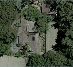
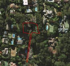
Image 1: Site Image 2: Locality
Surrounding development
The surrounding development consists primarily of residential dwellings with Knox Grammar Preparatory School and grounds located approximately 900 metres away. The majority of the dwellings on surrounding properties are not in close proximity to the subject sites’ dwelling with the exception of the dwelling at 17A Billyard Avenue, which is located adjacent to the northern boundary of the site.
The Proposal
The application proposes alterations and additions comprising of the following:
· Demolition of the existing covered carport along west boundary and extension of the existing dining area towards northern boundary to create a new kitchen/dining wing, with a new laundry/pantry area utilising the existing covered carport’s setback
· new covered and enclosed pergola off the kitchen/dining area, with a new BBQ/fireplace facilities
· new en-suite to the master bedroom
· upgrade of the existing paving to pool deck
· extension of the existing gym
· construction of a new carport over the hardstand parking space towards southern elevation
· upgrade of the existing pool deck and new pool gates
· new driveway gates
· tree removal to allow for the kitchen/dining extension
The majority of the work is proposed over existing hard surface areas, with existing paving to be removed and converted into soft landscaping resulting in the reduction in Built-Upon Area from 80% to 79%.
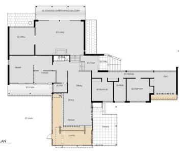
Figure 1: Floor plan identifying extent of works
COMMUNITY Consultation
In accordance with Development Control Plan No. 56, owners of surrounding properties were given notice of the application. No submissions were received.
INTERNAL REFERRALS
Heritage
Council's Heritage Advisor commented on the proposal as follows:
“heritage status
No 49A Chilton Parade, Warrawee, is located within a Heritage Conservation Area (HCA), Wahroonga HCA (C1), listed on the Ku-ring-gai Planning Scheme Ordinance (KPSO), amended by Local Environmental Plan 218 (LEP218).
The site is located adjacent to a KPSO heritage item, No 19 Billyard Avenue.
Compliance with development controls
KPSO Clause 61D
(2) Requirement for consent
Development consent is required for any of the following:
(a) demolishing or moving any of the following or altering the exterior of any of the following (including, in the case of a building, making changes to its detail, fabric, finish or appearance);
(iii) a building, work, relic or tree within a heritage conservation area.
Clause 61D(5) requires Council to consider the impacts of new development in the vicinity of a heritage item.
Heritage significance
Wahroonga HCA (C1) was identified in the Paul Davies Pty Ltd, Ku-ring-gai Potential Heritage Conservation Areas North Review, 2010. The study provides the following summary of heritage significance.
Wahroonga HCA is of heritage significance for its distinctive residential streetscapes which evidence the transformation of early subdivisions of the 1890s into the later rectilinear grid lot street and lot pattern of later subdivisions including the Wahroonga Heights Estate. The area contains a significant collection of grand residences from the Federation and Inter-war periods, built following the opening of the North Shore railway line in 1890, many of these the residences of prominent families of this period, and often designed by prominent architects, for example the 1894 Ewan House (formerly Innisfail) designed by Architect Herbert Wardell for John Thomas Toohey, and eleven houses designed by the Architect Howard Joseland. The western end of Burns Road and western side of Coonanbarra Road are representative streetscapes of intact more modest Federation period houses. The through-block pathways and formal avenues of street trees within the area (in Burns Road, Water Street and Coonanbarra Road) along with the formal landscaping of Wahroonga Park, and its distinctive John Sulman designed shops in Coonanbarra Road facing the Park, are a tribute to the work of the Wahroonga Progress Association in the early 20th century (which included Sulman as a member), and have resulted in a high-quality and distinctive residential landscape.
No 49A Chilton Parade was assessed as making a neutral contribution to the significance of the HCA in the study. The site is a battle-axe allotment.
No 19 Billyard Avenue was identified in the Moore, Pike & Others, Ku-ring-gai Heritage Study, 1987.
Proposed works
The proposal is for alterations and additions as summarised below.
· Single-storey addition to the west of the house to accommodate an open plan kitchen/dining, as well as an entertaining area, facing the existing pool. This would involve the demolition of the existing carport adjacent to the west boundary.
· Small gym extension. This would involve the demolition of the existing windows on the west elevation.
· New open carport, adjacent to the east boundary.
· Internal alterations to accommodate a master bedroom and an ensuite adjacent to the north elevation.
The proposed external finishes are roof tiles, louvres, timber windows and doors, and timber weatherboard cladding, to match existing.
Heritage impact statement
The applicant has included a heritage impact statement (HIS) prepared by a Heritage Consultant with the application. In regard to the significance of 49a Chilton Parade, the HIS provides the following statements.
The site of 49a Chilton Parade is part of the [1940s] subdivision of the grounds of the house known as Berith Park at 19 Billyard Avenue.
The existing house is described as follows.
a one and two-storey brick and timber dwelling with a tiled roof that demonstrates many of the characteristics of the so-called Sydney School, which was a popular architectural idiom of the 1960s and 1970s. The siting of the house on a sloping site in a bush setting is characteristic of Sydney School dwellings.
In regard to the potential impacts of the proposal, the HIS provides the following statements.
The proposed development consists of alterations and additions to a Sydney School style house constructed during the second half of the 1970s. The design of the proposed works retains the significant elements of the original house, maintaining the character of its architecture. There is minimal impact on existing landscaping and no significant trees are being removed.
The proposed addition has been designed to complement the original character of the house, being similar in scale, form and detailing, and using similar materials-roof tiles, brick and timber weatherboards. All new windows and doors are detailed to match the existing.
Comments
The proposed additions generally follow the stylistic features of the house, are compatible in terms of scale and external form and use the same external materials.
The main-kitchen/dining/terrace addition would be located to the west of the house, well removed from the heritage item.
The proposed carport would be located on the principal (south-east) elevation. However, this would be a small, open, lightweight structure, located where car accommodation already exists. It would not visually dominate the existing views of the house and the impacts on the streetscape would be neutral.
Conclusion
The impacts of the proposal on the Chilton Parade streetscape, on the HCA as a whole and on the adjacent heritage item would be negligible."
Landscaping
Council's Landscape and Tree Assessment Officer commented on the proposal as follows:
Tree impacts
There are no significant trees proposed to be removed. The impacts to existing trees are considered acceptable.
Stormwater plan
The proposed works will tap into the existing stormwater system.
BASIX
There are no landscape requirements proposed under the BASIX certificate.
Conclusion
The proposal is supported on landscape grounds
Engineering
Council's Development Engineer has no objection to the application, subject to Conditions 8, 9, 22, 23, 24, 25, 28 and 30.
EXTERNAL REFERRALS
Not applicable.
STATUTORY PROVISIONS
State Environmental Planning Policies
State Environmental Planning Policy No. 1 – Development Standards
This policy provides flexibility in the application of development standards within Planning Instruments in circumstances where strict compliance would be unreasonable or unnecessary or tend to hinder the attainment of the objects specified under Section 5(a)(1) of the Act.
Clause 60C(2) of the Ku-ring-gai Planning Scheme Ordinance states that the maximum built-upon area (BUA) for any land on which a dwelling house is or is proposed to be erected or extended or on which development ancillary to the dwelling has been or is proposed to be carried out is 60% of the total site area.
The existing development, which comprises of a single storey dwelling, in-ground swimming pool and tennis court, exceeds Council’s built-upon area equating to 80% and the proposal will decrease this to 79%. Accordingly, a SEPP 1 objection has been lodged and the departure from the development standard is considered below.
State Environmental Planning Policy No. 55 - Remediation of Land
The provisions of SEPP 55 require Council to consider the potential for a site to be contaminated. The subject site has a history of residential use and as such, it is unlikely to contain any contamination and further investigation is not warranted in this case.
Sydney Regional Environmental Plan No. 20 - Hawkesbury-Nepean River
SREP 20 applies to land within the catchment of the Hawkesbury Nepean River. The general aim of the plan is to ensure that development and future land uses within the catchment are considered in a regional context. The Plan includes strategies for the assessment of development in relation to water quality and quantity, scenic quality, aquaculture, recreation and tourism.
The development has the potential to impact on water quality and volumes to the catchment.
Council’s Development Engineer considers the proposed stormwater system as acceptable. Subject to conditions, the development is unlikely to generate significant additional stormwater and is consistent with the provisions of SREP 20.
State Environmental Planning Policy (Building Sustainability Index: BASIX) 2004
A valid BASIX certificate has been submitted. The certificate demonstrates compliance with the provisions of the SEPP and adequately reflects all amendments to the application.
Ku-ring-gai Planning Scheme Ordinance
Part A: Development standards
|
Development standard |
Proposed |
Complies |
|
Site area: 1300m² (excluding access handle) |
1575m² |
YES |
|
Building height 8m (max) |
6m |
YES |
|
Built upon area: 60% |
79% |
NO |
State Environmental Planning Policy No. 1 (Development Standard)
This policy provides flexibility in the application of development standards within Planning Instruments in circumstances where strict compliance would be unreasonable or unnecessary or tend to hinder the attainment of the objects specified under Section 5(a)(1) of the Act.
Clause 6 of SEPP 1 incorporates the mechanism for making of a SEPP 1 Objection and provides as follows:
Where development could, but for any development standard, be carried out under the Act, the person intending to carry out that development may make a development application in respect of that development, supported by written objection that the development standard is unreasonable or unnecessary in the circumstances of the case, and specify the grounds of that objection.
The applicant has submitted a SEPP1 objection to the provisions of the Ku-ring-gai Planning Scheme Ordinance (KPSO), in particular, to vary the development standard under Clause 60C(2) for the Built Upon Area. Currently the Built Upon Area is at 80% and the proposal will decrease this to 79%. The SEPP 1 Objection provides that compliance with the development standard is unreasonable or unnecessary as the proposal will:
· Decrease the existing Built-Upon Area from 1562.63m² or 80% to 1544.6m² or 79%. This equates to a 1% decrease to the total Built-Upon Area
· Have no discernible change to the existing site development.
· Not result in any adverse amenity impacts to adjoining properties.
The following is a consideration of the applicant’s SEPP 1 Objection.
whether the control is a development standard
Clause 60C(2) of the Ku-ring-gai Planning Scheme Ordinance (KPSO) prescribes a maximum Built Upon Area of 60%. As the KPSO is a statutory planning instrument, this control is a development standard as defined under Section 4 of the Environmental Planning & Assessment Act 1979.
the underlying objectives or purpose behind the standard
Clause 60C(2) does not have any specific objectives, however under DCP 38, which supports the KPSO, the objectives for Built Upon Area are as follows:
“Development should maintain a reasonable proportion of the site as soft landscaping to ensure that predominant landscape character of the locality is maintained or enhanced.”
The above objective is to limit the amount of Built Upon Area to ensure that the landscaped character of the locality is maintained. By providing maximum built upon area requirements, soft landscaping and canopy trees can be adequately provided on a site.
whether compliance with the development standard is consistent with the aims of the policy and, in particular, whether compliance with the development standard hinders the attainment of the objectives specified under Section 5(A)(i), (ii), (iii) and (iv) of the Environmental Planning and Assessment Act 1979
The aim of SEPP 1 is to:
Provide flexibility in the application of planning controls operating by virtue of development standards in circumstances where strict compliance with those standards would, in any particular case, be unreasonable or unnecessary or tend to hinder the attainment of the objects specified in Section 5(a) (i) and (ii) of the Act.
In this regard, the objectives of Section 5(a)(i) and (ii) of the Act are:
(a) To encourage:
(i) The proper management, development and conservation of natural and artificial resources, including agricultural land, natural areas, forests, minerals, water, cities, towns and villages for the purpose of promoting the social and economic welfare of the community and a better environment;
(ii) The promotion and co-ordination of the orderly and economic use and development of land;
The applicant’s SEPP 1 Objection states that the proposal is consistent with the aims of the policy as follows:
· The proposed alterations and additions are for a single storey with the majority of the proposal built upon existing building footprint. The architectural language should be looked upon favourably as it is designed to be in keeping with the form and scale of the existing dwelling and appropriate to the period of the building. The dwelling remains subservient to its natural surrounds and tree canopies, and is designed to improve amenity with regard to natural lighting and ventilation – which is currently compromised by the existing mature vegetation and therefore would require added power usage to maintain a level of comfort and amenity.
· Existing areas of soft landscaping where planting and retention highly visible large trees are not affected by the proposed development. In fact, the works also proposes additional soft landscaped area of 28.9m² to counter the new built-upon area of 10.9m² created by the new extensions. The overall built upon area thus would decrease by 18.03m² overall (1% of the site area).
· The proposed alterations and additions are designed to improve amenity for the inhabitants and make full use of the property’s external zones with improved connectivity and outlook that had been scarcely used due to the existing orientation and configuration of the dwelling. The minimal 1.5m extension allows for a functional living/entertainment zone that is appropriately integrated with existing pool and garden surrounds and that would also encourage upkeep and maintenance. The existing tennis court is also useable high quality open space that should be considered as such.
· Stormwater runoff will not be affected and the proposed additions will connect into existing stormwater channels and watercourses. Impervious surfaces are minimised and new roof areas are of similar area and capacity to the existing as the majority of the additions occupy the same building footprint.
· Existing screen planting surrounding the property is already adequate and proposed to be maintained. There is no encroachment of the proposed additions into existing setbacks, therefore adequate space for screen planting is clearly maintained between buildings. The subject site’s topography is also at a lower RL in comparison to neighbouring properties further screening from neighbouring views.
Compliance with the standard in this case would not change the planning outcome on the site, particularly as the majority of the works are over existing hard surface areas. The works will result in additional soft landscaping being returned to the site and the bulk and scale of the dwelling maintained. Requiring strict compliance with the development standard would not be in keeping with the objectives of Section 5(a) (i) and (ii) of the Act for the reasons given below.
whether compliance with the development standard is unreasonable or unnecessary in the circumstances of the case
Compliance with the development standard, in this instance, is considered to be unreasonable and unnecessary as the site currently has a built upon area of 80% and the proposed development will be constructed over existing hard surface areas with a small amount of existing paving to be removed and converted to soft landscaping.
For the proposal to be fully compliant with the 60% standard, the Built Upon Area would need to be reduced by a total of 390.23m². This would require a large portion of existing paving and part of the tennis court to be removed and replaced with soft landscaping. This is not considered to be reasonable as the site already has a non-compliant built-upon area and the application proposes to reduce this, albeit marginally nor is it necessary given the planning merit of the proposal.
The conversion of the existing open carport and extension to create a new open kitchen/dining area and the new single carport will only increase the built upon area by 10.9m². Whilst the new kitchen/dining area will result in the removal of two trees, Council’s Landscape Assessment Officer has assessed this impact and has found it to be acceptable, as these trees are not considered to be significant trees.
The overall landscape setting of the site is not detrimentally impacted upon as there is still adequate private open space provided which meets the required minimum 50m² of usable open space under section 4.3.8 of DCP 38.
whether the objection is well founded
The proposed non-compliance with the Built Upon Area standard is the product of the existing development on the site and will be slightly reduced due to the proposed works. For this reason and those listed above, the objection is considered to be well founded and it is agreed that compliance with the standard is unreasonable and unnecessary in the circumstances of the case.
whether non-compliance with the development standard raises any matter of significance for State or regional environmental planning
There are no matters of significance for State or regional environmental planning.
whether there is public benefit in maintaining the planning controls adopted by the environmental planning instrument
Compliance with the development standard is unreasonable and unnecessary, the public benefit of maintaining the planning control is outweighed by the merits of the SEPP 1 objection.
Clause 33(a) – Aesthetic appearance
Clause 33(a) of the KPSO requires Council to give appropriate consideration to the visual impacts of a development when viewed from the open space reserve located opposite the site.
The proposed changes to the overall visual presentation of the site’s development to the reserve are not considered to be unreasonable. When viewed from this location, the proposed development is moderate in scale and will not generate any undue bulk, scale, solar access or general amenity impact. Also, the materials and finishes used are consistent with the surrounding environment.
Therefore, in respect of the above, the aesthetic presentation of the development to the reserve is deemed to be acceptable.
Clause 38B – Services
Clause 38B states that consent must not be issued to the carrying out of development on land unless access to a water supply, drainage and a sewerage system will be available.
The site is connected to the sewer system and reticulated water is provided.
Part B: Aims and objectives for residential zones:
The development: (i) provides satisfactory levels of solar access & privacy to surrounding properties; (ii) is of a bulk, scale and design, characteristic of the area; (iii) maintains adequate levels of soft landscaping; (iv) provides suitable egress/ingress for vehicles; and (v) maintains the landscape quality of the municipality. Consequently, the aims and objectives for residential development as outlined by Schedule 9 have been satisfied.
Part C: Heritage /conservation areas:
The site is located within a heritage conservation area and the proposed works have been assessed by Council’s Heritage Advisor and found to be acceptable. The kitchen extension along the western elevation has been designed to be in keeping with the existing dwelling utilising the same design and materials. The extension is also not within the vicinity of the heritage item at 19 Billyard Avenue. The proposed carport is a lightweight single storey structure which is not visible from the street due to the battle-axe nature of the site.
Accordingly, there will be negligible impacts on the streetscape and conservation area.
Draft Ku-ring-gai Local Environmental Plan 2013
The draft LEP and supporting material was exhibited from 25 March 2013 to 6 May 2013. The particular aims of the draft LEP are to guide the future development of land and the management of environmental, social, economic, heritage and cultural resources within Ku-ring-gai. The subject site is located within an area identified on the statutory maps and as such the draft LEP forms a consideration for the assessment of this application.
As a result of the plan, the subject site will be zoned ‘R2 Low Density Residential’ and the development is permissible within this zoning. The objectives of the zone are as follows:
· To provide for the housing needs of the community within a low density residential environment.
· To enable other land uses that provide facilities or services to meet the day to day needs of residents.
· To provide housing that is compatible with the existing environmental and low density character of Ku-ring-gai
The proposal has a built form which is compatible with the existing low density character of the area and the land to be developed. Therefore, the proposal meets the objectives of the draft zone.
POLICY PROVISIONS
Development Control Plan No. 38 - Ku-ring-gai Residential Design Manual
|
Development Control |
Proposed |
Complies |
|
4.1 Streetscape: |
||
|
Building setbacks (s.4.1.3) |
|
|
|
Battle-axe block (s.4.1.4): Rectangular blocks – setback from long boundary 15% of site width: 7.4 (min)
|
8m from northern boundary to proposed kitchen/dining extension 3.4m from western elevation to gym extension |
YES
NO |
|
Rear setback – average of site depth: 7.8m(min) |
Match Existing |
NO |
|
4.2 Building form: |
||
|
FSR (s.4.2.1) 0.3:1 (max) |
0.19:1 |
YES |
|
Height of building (s.4.2.2) |
|
|
|
2 storey (max) and 7m (site <200 slope) |
2 storey & 6.5m |
YES |
|
Building height plane (s.4.2.3) 450 from horizontal at any point 3m above boundary |
Minor encroachment along eastern elevation |
NO |
|
First floor (s.4.2.4) |
|
|
|
FSR: < 40% total FSR |
Subfloor level |
N/A |
|
Roof Line (s.4.2.6) |
|
|
|
Roof height (5m - single storey) |
2.5m at single storey level |
YES |
|
Roof pitch 350 (max) |
Match existing |
N/A |
|
Built-upon area (s.4.2.7) Refer SEPP 1 Objection |
79% |
NO |
|
4.3 Open space & landscaping: |
||
|
Soft landscaping area (4.3.3) 50% (977m2) (min) |
21% (409.4m2) |
NO |
|
Tree replenishment (s.4.3.6) 10 Trees required |
4 required - refer discussion below |
NO |
|
Landscaping cut & fill (4.3.7) |
|
|
|
max cut or fill 500mm relative to natural ground |
None proposed for extension |
N/A |
|
no cut & fill within 2m of boundary |
|
N/A |
|
Useable open space (s.4.3.8) Min depth 5m and min area 50m2 |
5m 70m² |
YES YES |
|
4.4 Privacy & security: |
||
|
|
||
|
4.5 Access & parking: |
||
|
No. of car parking spaces (s.4.5.1) 2 spaces behind building line |
2 spaces existing 1 Carport proposed |
N/A YES
|
|
Size of car parking space (s.4.5.2) Single carport: 5.4m x 2.7m |
3.1m x 6.25m |
YES |
|
Driveway width (s.4.5.6) 3.5m |
Existing |
N/A |
Part 4.1 - Streetscape:
Side and Rear Setbacks
Under section 4.1.3 of DCP 38 the objectives of the setback control are to:
· maintain streetscape character
• ensure the amenity of neighbouring properties is maintained or enhanced
• allow for the provision of landscaping and provide room for additional tree plantings to grow to maturity;
• facilitate solar access;
• protect significant vegetation;
• facilitate efficient use of the site; and
• minimise bushfire hazard by preserving a "fuel free" zone (where development is adjacent to high bushfire hazard areas).
As this site is a battle-axe block the numerical controls are set out under section 4.1.4 of DCP 38, which calculates the rear setback to be 7.8m and the side setback of 7.4m.
The kitchen/dining extension has been proposed along the existing 2m setback of the covered carport and, whilst this does not comply numerically with the control, the variation does not present any additional impacts to the site or neighbouring property.
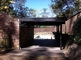
Image 3: existing carport and fence Image 4: Stone wall and landscaping along boundary
The western boundary has an existing boundary brush fence on top of a stone wall which measures higher than the existing carport (refer Image 3 and 4). This boundary adjoins the neighbouring property’s tennis court at 7 Sutherland Avenue, where it is heavily vegetated along the boundary and the dwelling is located a significant distance away. The likelihood of the proposed extension having any impact on the amenity of the adjoining property is therefore minimal as there will be no potential overlooking or bulk and scale impacts.
The gym extension follows the existing 3.7m setback along the southern elevation and this is located within the pool terrace area. This extension is at ground floor level and will not impact the adjoining property with regards to privacy as this boundary has a paling boundary fence which will screen the ground floor extension to the adjoining neighbouring property’s tennis court at 5A Sutherland Avenue.
Image 5: stone wall and fence Image 6: adjacent neighbouring tennis court
Part 4.2 - Building form:
Building height plane (s.4.2.3)
The extension along the western elevation will incur a minor encroachment in the building height plane due to a new skillion roof that matches the existing roof form of the dwelling. The building height of the extension at the top of the skillion roof to the existing ground level is 5m.
However, this encroachment is minimal and does not result in any bulk and scale impact to the neighbouring dwelling, which is located in excess of 30 metres away from the subject dwelling. The overall objectives of the building height plane control have been maintained and there are also no solar access impacts from this single storey addition.
4.3 Open space & landscaping:
Soft landscaping area (4.3.3) and tree replenishment (4.3.6)
The existing built-upon area of 80% will be reduced to 79% (18.03 metres) and prevents compliance with the minimum soft landscaping requirement of 50% of the site.
The site supports a part single and part two storey dwelling, driveway, in-ground swimming pool and tennis court. The site’s primary landscaped area is located within the north-western corner and around the tennis court, which does support a number of trees and plantings. The site cannot comply with the required 50% soft landscaping requirement or provide additional replenishment canopy trees without removal of significant hard surface areas. This is not considered reasonable in the circumstance.
The site supports a number of trees and vegetation and there is sufficient private open space within the north-western corner that provides an area of recreation for the residents. The swimming pool area and the tennis court also provide additional areas for outdoor recreation and, whilst there is a shortfall in the provision of soft landscaped area, it is considered that the objectives of DCP 38 have been achieved.
4.4 Privacy & security:
There will be no privacy or security impacts as a result of the proposed works. The new window to the laundry along the western elevation is at single storey level and is adequately screened by the existing paling fence. The gym extension windows which face both the west and south elevations are also at ground level and are adequately screened by the paling fence and neighbouring screen planting.
Development Control Plan 40 – Construction and Demolition Waste Management
An acceptable Waste Management Plan has been submitted and further conditions are recommended to ensure appropriate practices are undertaken with regard to site management, pollution control, resource/waste management, tree protection and noise control where applicable.
Other stated DCPs or Policies
The development application is satisfactory having regard to the relevant matters for consideration under those stated DCPs or Policies as identified under the “Executive Summary” in this report.
Likely Impacts
As has been determined through the assessment of the application, the proposed development is not deemed to be of any unreasonable impact upon the streetscape, or the amenity of the neighbouring properties.
SUITABILITY OF THE SITE
The site is considered to be suitable for the proposed development.
ANY SUBMISSIONS
No submissions have been received.
PUBLIC INTEREST
The approval of the application is considered to be in the public interest.
CONCLUSION
Having regard to the provisions of section 79C of the Environmental Planning and Assessment Act 1979, the proposed development is considered to be satisfactory. Therefore, it is recommended that the application be approved.
|
PURSUANT TO SECTION 80(1) OF THE ENVIRONMENTAL PLANNING AND ASSESSMENT ACT, 1979
THAT the Council, as the consent authority, is of the opinion that the objection under State Environmental Planning Policy No. 1 - Development Standards to the Built-upon Area development standard in clause 60C of the Ku-ring-gai Planning Scheme Ordinance is well founded. The Council is also of the opinion that strict compliance with the development standard is unreasonable and unnecessary in the circumstances of this case.
THAT the Council, as the consent authority, being satisfied that the objection under SEPP No. 1 is well founded and also being of the opinion that the granting of consent to DA0259/14 is consistent with the aims of the Policy, grant development consent to DA0259/14 for alterations and additions on land at 49A Chilton Parade Warrawee, for a period of two (2) years from the date of the Notice of Determination, subject to the following conditions:
Conditions that identify approved plans:
1. Approved architectural plans and documentation (new development)
The development must be carried out in accordance with work shown in colour on the following plans and documentation listed below and endorsed with Council’s stamp, except where amended by other conditions of this consent.
Reason: To ensure that the development is in accordance with the determination.
2. No demolition of extra fabric
Alterations to, and demolition of the existing building shall be limited to that documented on the approved plans (by way of notation). No approval is given or implied for removal and/or rebuilding of any portion of the existing building which is shown to be retained.
Reason: To ensure compliance with the development consent.
Conditions to be satisfied prior to demolition, excavation or construction:
3. Asbestos works
All work involving asbestos products and materials, including asbestos-cement-sheeting (ie. Fibro), must be carried out in accordance with the guidelines for asbestos work published by WorkCover Authority of NSW.
Reason: To ensure public safety
4. Notice of commencement
At least 48 hours prior to the commencement of any development (including demolition, excavation, shoring or underpinning works), a notice of commencement of building or subdivision work form and appointment of the principal certifying authority form shall be submitted to Council.
Reason: Statutory requirement.
5. Notification of builder’s details
Prior to the commencement of any development or excavation works, the Principal Certifying Authority shall be notified in writing of the name and contractor licence number of the owner/builder intending to carry out the approved works.
Reason: Statutory requirement.
Conditions to be satisfied prior to the issue of the construction certificate:
6. Long service levy
In accordance with Section 109F(i) of the Environmental Planning and Assessment Act a Construction Certificate shall not be issued until any long service levy payable under Section 34 of the Building and Construction Industry Long Service Payments Act 1986 (or where such levy is payable by instalments, the first instalment of the levy) has been paid. Council is authorised to accept payment. Where payment has been made elsewhere, proof of payment is to be provided to Council.
Reason: Statutory requirement.
7. Builder’s indemnity insurance
The applicant, builder, developer or person who does the work on this development, must arrange builder’s indemnity insurance and submit the certificate of insurance in accordance with the requirements of Part 6 of the Home Building Act 1989 to the Certifying Authority for endorsement of the plans accompanying the Construction Certificate.
It is the responsibility of the applicant, builder or developer to arrange the builder's indemnity insurance for residential building work over the value of $20,000. The builder's indemnity insurance does not apply to commercial or industrial building work or to residential work valued at less than $20,000, nor to work undertaken by persons holding an owner/builder's permit issued by the Department of Fair Trading (unless the owner/builder's property is sold within 7 years of the commencement of the work).
Reason: Statutory requirement.
Conditions to be satisfied prior to the issue of the construction certificate or prior to demolition, excavation or construction (whichever comes first):
8. Infrastructure restorations fee
To ensure that damage to Council Property as a result of construction activity is rectified in a timely matter:
a) All work or activity taken in furtherance of the development the subject of this approval must be undertaken in a manner to avoid damage to Council Property and must not jeopardise the safety of any person using or occupying the adjacent public areas.
b) The applicant, builder, developer or any person acting in reliance on this approval shall be responsible for making good any damage to Council Property, and for the removal from Council Property of any waste bin, building materials, sediment, silt, or any other material or article.
c) The Infrastructure Restoration Fee must be paid to the Council by the applicant prior to both the issue of the Construction Certificate and the commencement of any earthworks or construction.
d) In consideration of payment of the Infrastructure Restorations Fee, Council will undertake such inspections of Council Property as Council considers necessary and also undertake, on behalf of the applicant, such restoration work to Council Property, if any, that Council considers necessary as a consequence of the development. The provision of such restoration work by the Council does not absolve any person of the responsibilities contained in (a) to (b) above. Restoration work to be undertaken by the Council referred to in this condition is limited to work that can be undertaken by Council at a cost of not more than the Infrastructure Restorations Fee payable pursuant to this condition.
e) In this condition:
“Council Property” includes any road, footway, footpath paving, kerbing, guttering, crossings, street furniture, seats, letter bins, trees, shrubs, lawns, mounds, bushland, and similar structures or features on any road or public road within the meaning of the Local Government Act 1993 (NSW) or any public place; and
“Infrastructure Restoration Fee” means the Infrastructure Restorations Fee calculated in accordance with the Schedule of Fees & Charges adopted by Council as at the date of payment and the cost of any inspections required by the Council of Council Property associated with this condition.
Reason: To maintain public infrastructure.
Conditions to be satisfied during the demolition, excavation and construction phases:
9. Road opening permit
The opening of any footway, roadway, road shoulder or any part of the road reserve shall not be carried out without a road opening permit being obtained from Council (upon payment of the required fee) beforehand.
Reason: Statutory requirement (Roads Act 1993 Section 138) and to maintain the integrity of Council’s infrastructure.
10. Prescribed conditions
The applicant shall comply with any relevant prescribed conditions of development consent under clause 98 of the Environmental Planning and Assessment Regulation. For the purposes of section 80A (11) of the Environmental Planning and Assessment Act, the following conditions are prescribed in relation to a development consent for development that involves any building work:
The work must be carried out in accordance with the requirements of the Building Code of Australia In the case of residential building work for which the Home Building Act 1989 requires there to be a contract of insurance in force in accordance with Part 6 of that Act, that such a contract of insurance is in force before any works commence.
Reason: Statutory requirement.
11. Hours of work
Demolition, excavation, construction work and deliveries of building material and equipment must not take place outside the hours of 7.00am to 5.00pm Monday to Friday and 8.00am to 12 noon Saturday. No work and no deliveries are to take place on Sundays and public holidays.
Excavation or removal of any materials using machinery of any kind, including compressors and jack hammers, must be limited to between 7.30am and 5.00pm Monday to Friday, with a respite break of 45 minutes between 12 noon 1.00pm.
Where it is necessary for works to occur outside of these hours (ie) placement of concrete for large floor areas on large residential/commercial developments or where building processes require the use of oversized trucks and/or cranes that are restricted by the RTA from travelling during daylight hours to deliver, erect or remove machinery, tower cranes, pre-cast panels, beams, tanks or service equipment to or from the site, approval for such activities will be subject to the issue of an "outside of hours works permit" from Council as well as notification of the surrounding properties likely to be affected by the proposed works.
Note: Failure to obtain a permit to work outside of the approved hours will result in on the spot fines being issued.
Reason: To ensure reasonable standards of amenity for occupants of neighbouring properties.
12. Approved plans to be on site
A copy of all approved and certified plans, specifications and documents incorporating conditions of consent and certification (including the Construction Certificate if required for the work) shall be kept on site at all times during the demolition, excavation and construction phases and must be readily available to any officer of Council or the Principal Certifying Authority.
Reason: To ensure that the development is in accordance with the determination.
13. Statement of compliance with Australian Standards
The demolition work shall comply with the provisions of Australian Standard AS2601: 2001 The Demolition of Structures. The work plans required by AS2601: 2001 shall be accompanied by a written statement from a suitably qualified person that the proposal contained in the work plan comply with the safety requirements of the Standard. The work plan and the statement of compliance shall be submitted to the satisfaction of the Principal Certifying Authority prior to the commencement of any works.
Reason: To ensure compliance with the Australian Standards.
14. Site notice
A site notice shall be erected on the site prior to any work commencing and shall be displayed throughout the works period.
The site notice must:
be prominently displayed at the boundaries of the site for the purposes of informing the public that unauthorised entry to the site is not permitted display project details including, but not limited to the details of the builder, Principal Certifying Authority and structural engineer be durable and weatherproof display the approved hours of work, the name of the site/project manager, the responsible managing company (if any), its address and 24 hour contact phone number for any inquiries, including construction/noise complaint are to be displayed on the site notice be mounted at eye level on the perimeter hoardings/fencing and is to state that unauthorised entry to the site is not permitted
Reason: To ensure public safety and public information.
15. Dust control
During excavation, demolition and construction, adequate measures shall be taken to prevent dust from affecting the amenity of the neighbourhood. The following measures must be adopted:
physical barriers shall be erected at right angles to the prevailing wind direction or shall be placed around or over dust sources to prevent wind or activity from generating dust earthworks and scheduling activities shall be managed to coincide with the next stage of development to minimise the amount of time the site is left cut or exposed all materials shall be stored or stockpiled at the best locations the ground surface should be dampened slightly to prevent dust from becoming airborne but should not be wet to the extent that run-off occurs all vehicles carrying spoil or rubble to or from the site shall at all times be covered to prevent the escape of dust all equipment wheels shall be washed before exiting the site using manual or automated sprayers and drive-through washing bays gates shall be closed between vehicle movements and shall be fitted with shade cloth cleaning of footpaths and roadways shall be carried out daily
Reason: To protect the environment and amenity of surrounding properties.
16. Use of road or footpath
During excavation, demolition and construction phases, no building materials, plant or the like are to be stored on the road or footpath without written approval being obtained from Council beforehand. The pathway shall be kept in a clean, tidy and safe condition during building operations. Council reserves the right, without notice, to rectify any such breach and to charge the cost against the applicant/owner/builder, as the case may be.
Reason: To ensure safety and amenity of the area.
17. Guarding excavations
All excavation, demolition and construction works shall be properly guarded and protected with hoardings or fencing to prevent them from being dangerous to life and property.
Reason: To ensure public safety.
18. Toilet facilities
During excavation, demolition and construction phases, toilet facilities are to be provided, on the work site, at the rate of one toilet for every 20 persons or part of 20 persons employed at the site.
Reason: Statutory requirement.
19. Protection of public places
If the work involved in the erection, demolition or construction of the development is likely to cause pedestrian or vehicular traffic in a public place to be obstructed or rendered inconvenient, or building involves the enclosure of a public place, a hoarding or fence must be erected between the work site and the public place.
If necessary, a hoarding is to be erected, sufficient to prevent any substance from, or in connection with, the work falling into the public place.
The work site must be kept lit between sunset and sunrise if it is likely to be hazardous to persons in the public place.
Any hoarding, fence or awning is to be removed when the work has been completed.
Reason: To protect public places.
20. Recycling of building material (general)
During demolition and construction, the Principal Certifying Authority shall be satisfied that building materials suitable for recycling have been forwarded to an appropriate registered business dealing in recycling of materials. Materials to be recycled must be kept in good order.
Reason: To facilitate recycling of materials.
21. Construction signage
All construction signs must comply with the following requirements:
are not to cover any mechanical ventilation inlet or outlet vent are not illuminated, self-illuminated or flashing at any time are located wholly within a property where construction is being undertaken refer only to the business(es) undertaking the construction and/or the site at which the construction is being undertaken are restricted to one such sign per property do not exceed 2.5m2 are removed within 14 days of the completion of all construction works
Reason: To ensure compliance with Council's controls regarding signage.
22. Road reserve safety
All public footways and roadways fronting and adjacent to the site must be maintained in a safe condition at all times during the course of the development works. Construction materials must not be stored in the road reserve. A safe pedestrian circulation route and a pavement/route free of trip hazards must be maintained at all times on or adjacent to any public access ways fronting the construction site. Where public infrastructure is damaged, repair works must be carried out when and as directed by Council officers. Where pedestrian circulation is diverted on to the roadway or verge areas, clear directional signage and protective barricades must be installed in accordance with AS1742-3 (1996) “Traffic Control Devices for Work on Roads”. If pedestrian circulation is not satisfactorily maintained across the site frontage, and action is not taken promptly to rectify the defects, Council may undertake proceedings to stop work.
Reason: To ensure safe public footways and roadways during construction.
23. Services
Where required, the adjustment or inclusion of any new utility service facilities must be carried out by the applicant and in accordance with the requirements of the relevant utility authority. These works shall be at no cost to Council. It is the applicants’ full responsibility to make contact with the relevant utility authorities to ascertain the impacts of the proposal upon utility services (including water, phone, gas and the like). Council accepts no responsibility for any matter arising from its approval to this application involving any influence upon utility services provided by another authority.
Reason: Provision of utility services.
24. Erosion control
Temporary sediment and erosion control and measures are to be installed prior to the commencement of any works on the site. These measures must be maintained in working order during construction works up to completion. All sediment traps must be cleared on a regular basis and after each major storm and/or as directed by the Principal Certifying Authority and Council officers.
Reason: To protect the environment from erosion and sedimentation.
25. Drainage to existing system
Stormwater runoff from all new impervious areas and subsoil drainage systems shall be piped to the existing site drainage system. The installation of new drainage components must be completed by a licensed contractor in accordance with AS3500.3 (Plumbing Code) and the BCA. No stormwater runoff is to be placed into the Sydney Water sewer system. If an illegal sewer connection is found during construction, the drainage system must be rectified to the satisfaction of Council and Sydney Water.
Reason: To protect the environment.
26. No storage of materials beneath trees
No activities, storage or disposal of materials shall take place beneath the canopy of any tree protected under Council's Tree Preservation Order at any time.
Reason: To protect existing trees.
27. Removal of refuse
All builders' refuse, spoil and/or material unsuitable for use in landscape areas shall be removed from the site on completion of the building works.
Reason: To protect the environment.
28. On site retention of waste dockets
All demolition, excavation and construction waste dockets are to be retained on site, or at suitable location, in order to confirm which facility received materials generated from the site for recycling or disposal.
Each docket is to be an official receipt from a facility authorised to accept the material type, for disposal or processing. This information is to be made available at the request of an Authorised Officer of Council.
Reason: To protect the environment.
Conditions to be satisfied prior to the issue of an Occupation Certificate:
29. Compliance with BASIX Certificate
Prior to the issue of an Occupation Certificate, the Principal Certifying Authority shall be satisfied that all commitments listed in BASIX Certificate No. A193501 have been complied with.
Reason: Statutory requirement.
30. Infrastructure repair
Prior to issue of the Occupation Certificate, the Principal Certifying Authority must be satisfied that any damaged public infrastructure caused as a result of construction works (including damage caused by, but not limited to, delivery vehicles, waste collection, contractors, sub contractors, concrete vehicles) is fully repaired to the satisfaction of Council Development Engineer and at no cost to Council.
Reason: To protect public infrastructure.
|
|
Natalie Piggott-Herridge Development Assessment Officer |
Selwyn Segall Team Leader - Development Assessment North |
|
Corrie Swanepoel Manager Development Assessment Services |
Michael Miocic Director Development & Regulation |
|
A1View |
Department of Planning Circular PS08-014 |
|
2014/236801 |
|
|
|
A2View |
Site Plan |
|
2014/235338 |
|
|
A3View |
Ground and First floor plan |
|
2014/176169 |
|
|
A4View |
North and South Elevations |
|
2014/176171 |
|
|
A5View |
East and West Elevations |
|
2014/176176 |
|
|
A6View |
Sections |
|
2014/176180 |
|
|
A7View |
Location Sketch |
|
2014/238142 |
|
|
A8View |
Zoning Extract |
|
2014/238139 |
|
|
A9View |
SEPP 1 Objection |
|
2014/237278 |
|
Ordinary Meeting of Council - 7 October 2014 |
GB.14 / 572 |
|
|
|
|
Item GB.14 |
DA0220/14 |
|
|
15 September 2014 |
development application
Summary Sheet
|
Report title: |
10 The Comenarra Parkway West Pymble - Alterations and Additions to a Dwelling House |
|
ITEM/AGENDA NO: |
GB.14 |
|
Application No: |
DA0220/14 |
|
Property Details: |
10 The Comenarra Parkway West Pymble NSW 2073 Lot & DP No: Lot 5 DP 220784 Site area (m2): 936.7m2 Zoning: Residential 2(c) |
|
Ward: |
Comenarra |
|
Proposal/Purpose: |
Alterations and additions to a dwelling house |
|
Type of Consent: |
Local |
|
Applicant: |
Melinz Kim & Associates Pty Ltd |
|
Owner: |
Shae Bacales |
|
Date Lodged: |
16 June 2014 |
|
Recommendation: |
Approval |
Purpose of Report
To determine Development Application No. DA0220/14 which seeks consent for alterations and additions to a dwelling house at 10 The Comenarra Parkway, West Pymble.
Council’s attention is directed to the NSW Department of Planning circular PS 08-014 concerning the determination by Council of development applications where a variation of a development standard is sought under the provisions of SEPP No. 1.
The circular (Attachment A5) requires all development applications which involve a variation greater than 10% under the provisions of SEPP No. 1 to be determined by full Council and not by Council staff under delegated authority.
Clause 46(2) of the Ku-ring-gai Planning Scheme Ordinance states that a dwelling-house shall not be erected with a height in excess of 8 metres. The existing height of the dwelling on the subject site is 9.7 metres. Whilst the development proposes no change to the height of the dwelling, a SEPP No. 1 objection is required in the circumstances. The proposal involves a variation of 21.3% to Council’s maximum height requirement and is required to be referred to full Council for determination.
integrated planning and reporting
Places, Spaces & Infrastructure
|
Community Strategic Plan Long Term Objective |
Delivery Program Term Achievement |
Operational Plan Task |
|
P2.1 A robust planning framework is in place to deliver quality design outcomes and maintain the identity and character of Ku-ring-gai
|
Applications are assessed in accordance with State and local plans
|
Assessments are of a high quality, accurate and consider all relevant legislative requirements
|
Executive Summary
|
Issues: |
Height |
|
Submissions: |
No submissions received |
|
Land and Environment Court Appeal: |
N/A |
|
Recommendation: |
Approval |
History
Site
Council records indicate that the site has historically been used for residential purposes.
Pre-DA
There have been no Pre-DA consultations with Council Officers.
The Site
Site description
The site is known as 10 The Comenarra Parkway, West Pymble and is legally described as Lot 5 DP 220784. The regular shaped allotment is located on the south-eastern side of the road. The property has a site area of 936.7m2, a street frontage of 18.2 metres and an average site depth of 51.2 metres. The property has an average fall of approximately 12.13 metres from the front to the rear boundary.
Existing
improvements on site include a single and two storey residential dwelling with
a detached carport within the front setback and an in ground swimming pool in
the rear. The rear, south-eastern elevation of the site adjoins Lane Cove
National Park.
The property accommodates vegetation towards its rear. The property is not
recorded as containing an endangered or critically endangered ecological
community.
The subject property is not listed as a heritage item and is not within a heritage conservation area.
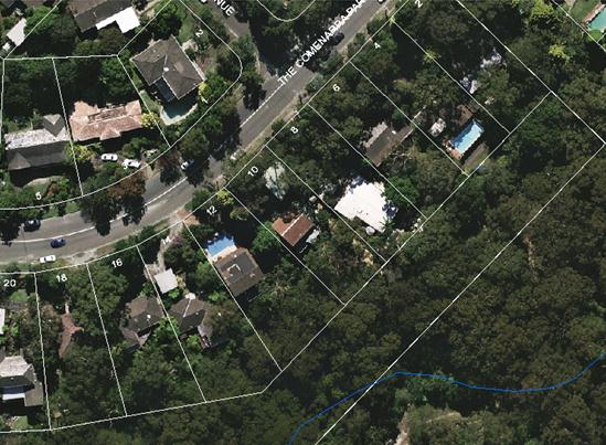
Figure 1: Aerial image of 10 The Comenarra Parkway, West Pymble
Surrounding development
Surrounding development consists of single and two storey residential dwellings sited on large landscaped allotments.
The Proposal
The applicant seeks development consent for alterations and additions to the existing dwelling comprising:
- replacement of ground floor window and first floor highlight windows on the northern elevation
- replacement of ground floor window and first floor window on the western elevation
- new aluminium windows and doors to the ground floor level deck on the southern elevation
- extension of the existing first floor deck on the southern elevation by 4m².
- new glass door and two new windows to the first floor of southern elevation
- two new windows and one new door on the ground floor of the eastern elevation
- new window on the first floor eastern elevation
Consultation
Community
In accordance with Development Control Plan No. 56, owners of surrounding properties were given notice of the application. No submissions were received.
Within Council
Landscaping
Council's Landscape and Tree Assessment Officer has raised no objection to the proposal, subject to conditions (Conditions 26 and 27).
Engineering
Council's Development Engineer has raised no objection to the proposal, subject to conditions (Conditions 22, 23, 24 and 25).
Outside Council
Rural Fire Services
In accordance with the provisions of section 79BA of the Environmental Planning and Assessment Act 1979, Council consulted with the Commissioner of the NSW Rural Fire Service, concerning measures to be taken with respect to the protection of persons, property and the environment from danger that may arise from a bush fire. The recommendations provided by the Rural Fire Service are included in Condition 22.
Statutory Provisions
State Environmental Planning Policies
State Environmental Planning Policy No. 1 – Development Standards
SEPP 1 provides flexibility to development standards and enables Council to vary standards where strict compliance with a standard would be unnecessary, unreasonable or tend to hinder the objectives of the Environmental Planning & Assessment Act, 1979.
Clause 46(2) of the Ku-ring-gai Planning Scheme Ordinance states that a dwelling house shall not be erected with a height in excess of 8 metres.
The existing dwelling has a building height of 9.7 metres at the rear of the dwelling and, although the subject development proposal will not alter the existing building height, there is a departure from the development standard. Accordingly, a SEPP No. 1 objection has been lodged and is considered below.
State Environmental Planning Policy No. 55 - Remediation of Land
The provisions of SEPP 55 require Council to consider the potential for a site to be contaminated. The subject site has a history of residential use and as such, it is unlikely to contain any contamination and further investigation is not warranted in this case.
Sydney Regional Environmental Planning Policy (Sydney Harbour Catchment) 2005
Matters for consideration under SREP 2005 include biodiversity, ecology and environmental protection, public access to and scenic qualities of foreshores and waterways, maintenance of views, control of boat facilities and maintenance of a working harbour. The proposal is not in close proximity to, or within view, of a waterway or wetland and is considered satisfactory.
State Environmental Planning Policy (Building Sustainability Index: BASIX) 2004
The estimated cost of works for the proposed development is $20,000.00. A BASIX Certificate is therefore not required.
Ku-ring-gai Planning Scheme Ordinance
Part A: Development standards
|
Development standard |
Proposed |
Complies |
|
Minimum size allotments |
|
|
|
Site area: 929m2 (min)
|
936.7m2 |
YES |
|
Building height 8.0m (max)
|
9.7m |
NO (No change proposed & SEPP No. 1 Objection provided)
|
|
Built upon areas 60%(562.02m2)(max)
|
35.1% (328.7m2) |
YES |
Height of buildings (clause 46(2))
Where there is a variation to a development standard, the application must be accompanied by a SEPP 1 Objection, a written objection that compliance with that development standard is unreasonable or unnecessary in the circumstances of the case, and specifying the grounds of that objection.
The proposed alterations and additions to the dwelling do not alter the existing height of the building. However, the rear of existing building is 9.7 metres in height.
A SEPP No. 1 objection has been submitted by the applicant and is assessed as follows:
whether the planning control to be varied is a development standard
Clause 46(2) of the KPSO restricts the height to which dwelling houses are constructed to a maximum height of 8 metres. As the KPSO is a statutory planning instrument, this control is considered to be a development standard as defined under Section 4 of the Environmental Planning & Assessment Act, 1979.
the underlying objective or purpose of the standard
The objectives of Clause 46 are unstated in the KPSO.
Schedule 9 of the KPSO does, however, provide general aims for residential zones as follows:
a) to maintain and, where appropriate, improve the existing amenity and environmental character of residential zones; and
b) to permit new residential development only where it is compatible with the existing environmental character of the locality and has a sympathetic and harmonious
relationship with adjoining development.
The specific objectives in Schedule 9 of the KPSO are to ensure that:
a) all new dwelling-houses and additions to dwelling-houses maintain a reasonable level of sunlight to neighbours' living areas and recreation space between 9 a.m. and 3 p.m. during the winter solstice on 22 June; and
b) all new dwelling-houses and additions to dwelling-houses are sited and designed so as to minimise overlooking of neighbours’ living areas and recreation space; and
c) any building or development work shall maintain or encourage replacement of treecover whenever possible to ensure that predominant landscape quality of the Municipality is maintained and enhanced; and
d) any building or development work on a site avoids total or near total site utilisation by maintaining a reasonable proportion of the site as a soft landscaping area; and
e) all new dwelling-houses and additions to existing dwelling-houses are of a height, size and bulk generally in keeping with that of neighbouring properties and, where larger buildings are proposed, they are designed so as not to dominate and so far as possible to harmonise with neighbouring development; and
f) in areas where one period, style or genre of architecture predominates, the new dwelling-house reflects either that style or the main stylistic features such as roof pitch, materials, proportions, setbacks, etc. and additions to existing dwelling-houses reflect the style of and continue the main stylistic features of the existing structure; and
g) all new dwelling-houses and additions provide reasonable space on the site for the forward entrance and existing of vehicles; and
h) all applications will be assessed against the considerations of section 90 of the Environmental Planning and Assessment Act 1979, and section 313 of the Local Government Act 1919
whether compliance with the development standard is consistent with the aims of the policy and, in particular, whether compliance with the development standard hinders the attainment of the objectives specified in Section 5(a)(i) and (ii) of the Environmental Planning and Assessment Act 1979
SEPP No. 1 provides flexibility in the application of planning controls operating by virtue of development standards in circumstances where strict compliance with those standards would, in any particular case, be unreasonable or unnecessary or tend to hinder the attainment of the objects specified in section 5 (a) (i) and (ii) of the Act.
The objects of the Act are:
(i) the proper management, development and conservation of natural and artificial resources, including agricultural land, natural areas, forests, minerals, water, cities, towns and villages for the purpose of promoting the social and economic welfare of the community and a better environment,
(ii) the promotion and co-ordination of the orderly and economic use and development of land,
The proposed development is consistent with the objects of the Act and represents an orderly and economic use of the land.
whether compliance with the development standard is unreasonable or unnecessary in the circumstances of the case
The applicant submits that
compliance with the standard is unnecessary and unreasonable for the following
reasons:
- The proposal is to maintain the quality of the building and amenity – Replacement of rotten timber windows and doors
- The existing building envelope is not altered by the proposal and there are no changes to the bulk and scale of the building
- The proposal does not impact on the neighbours’ privacy
- The proposal maintains the highest architectural and amenity standards to embrace the contemporary lifestyle
- The existing timber framed windows will be replaced by aluminium which is a more suitable building material in bushfire prone areas
whether the
objection is well founded
The non-compliance is existing on the site and will not be at all altered by the alterations and additions proposed to the dwelling under this development application. For these reasons and those listed above, the objection is considered to be well founded and it is agreed that compliance with the standard is unreasonable and unnecessary in the circumstances of the case.
whether non-compliance with the development standard raises any matter of significance for State or regional environmental planning,
It is considered that there are no matters of significance for State or regional environmental planning in this circumstance.
whether there is public benefit in maintaining the planning controls adopted by the environmental planning instrument.
The development standard for the building height within the site
is consistent with the development outcomes promoted by the Ku-ring-gai
Planning Scheme Ordinance. There is public benefit in maintaining this planning
control but, in this instance, requiring compliance would not be considered
reasonable.
Part B: Aims and objectives for residential zones:
The development: (i) provides satisfactory levels of solar access & privacy to surrounding properties; (ii) is of a bulk, scale and design, characteristic of the area; (iii) maintains adequate levels of soft landscaping; (iv) provides suitable egress/ingress for vehicles; and (v) maintains the landscape quality of the municipality. Consequently, the aims and objectives for residential development as outlined by Schedule 9 have been satisfied.
LEP 218 Riparian and Biodiversity
LEP 218 was gazetted on 05 July 2013 and maps biodiversity areas, riparian areas, heritage conservation areas and heritage items. LEP 218 and the Draft KLEP 2013 map the subject site to be within a Category 1 Riparian corridor.
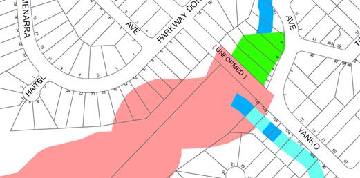
Figure 2: LEP 218 Riparian Map – Category 1 Riparian Corridor
Council’s Team Leader
Landscaping Assessment has raised no concerns as the proposed works will not
encroach into the riparian corridor and are located within the existing
building footprint. Accordingly, there will be no impact of significance to the
Category 1 Riparian Corridor.
With regard to biodiversity, the property is not
recorded as containing an endangered or critically endangered ecological
community.
Draft Ku-ring-gai Local Environmental Plan 2013
In accordance with Section 79C(1) (ii) of the Environmental Planning and Assessment Act 1979, the consent authority is to take into consideration any relevant matter under the above-mentioned draft LEP as it was taken off public exhibition on 6 May 2013.
Under
the provisions of the Draft KLEP, the subject site is zoned ‘E3 Environmental
Management’. The objectives of this zone are as follows:
· To protect, manage and restore areas with special ecological, scientific, cultural or aesthetic values.
· To provide for a limited range of development that does not have an adverse effect on those values.
· To minimise direct and indirect risks to life, property and the environment from bushfire events and bushfire management.
· To ensure that development in this zone on land that adjoins land zoned E1 National Parks and Nature Reserves or E2 Environment Conservation is compatible with the objectives for those zones.
· To enable other land uses that provide facilities or services to meet the day to day needs of residents.
The proposed alterations and additions will not result in adverse impacts to special ecological, scientific, cultural or aesthetic values of the locality. The proposal has been referred to the Rural Fire Service for assessment and subsequently, recommended conditions have been provided which aims to minimise direct and indirect risks to life, property and the environment. The proposal is considered to meet the day to day needs of the residents and consequently, the objectives of the R2 zoning as outlined in the Land Use Table in Part 2 of the Draft KLEP 2013 have been satisfied.
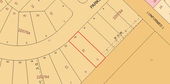
Figure 3: Extract from the Draft KLEP Zoning Map
Policy Provisions
Development Control Plan No. 38 - Ku-ring-gai Residential Design Manual
|
Development Control |
Proposed |
Complies |
|
|
4.1 Streetscape: |
|||
|
Building setbacks (s.4.1.3) |
|
|
|
|
Front setback: 11m (Ave) -75% front elevation 9m (min) – 25% front elevation
|
12.35m existing Carport: 5.9m |
YES NO (existing) |
|
|
Side setback: Ground floor: 2m(min)
1st floor: 2.7m (min)
|
South-west: 1.8m
South-west: 1.8m |
NO (existing)
NO (existing) |
|
|
Rear setback: 12m(min)
|
15.9m |
N/A |
|
|
4.2 Building form: |
|||
|
FSR (s.4.2.1) 0.38:1 (max)
|
0.26:1 |
YES |
|
|
Height of building (s.4.2.2) |
|
|
|
|
2 storey (max) and 8m (site >200 slope) or 7m (site <200 slope)
|
3 storey 9.7m |
NO (existing) NO (existing) |
|
|
Building height plane (s.4.2.3) 450 from horizontal at any point 3m above boundary
|
Non-compliance on south and west corner
|
NO (existing) |
|
|
First floor (s.4.2.4) |
|
|
|
|
FSR: < 40% total FSR
|
33.5% |
YES |
|
|
Roof Line (s.4.2.6) |
|
|
|
|
Roof height (3m – two+ storey) |
300mm |
YES |
|
|
Roof pitch 350 (max) |
220 existing |
YES |
|
|
Built-upon area (s.4.2.7) 54% (505.8m2) (max)
|
35.1% (328.7m2) |
YES |
|
|
Unrelieved wall length (s.4.2.8) 8.0m (min) for walls >4.0m
|
9.8m existing |
YES |
|
|
Solar access (4.2.11) 4h solar access to adjoining properties between 9am to 3pm
|
Remains as existing |
YES |
|
|
4.3 Open space & landscaping: |
|||
|
Soft landscaping area (4.3.3) 46% (430.9m2) (min)
|
64.9% (608m2) |
YES |
|
|
Useable open space (s.4.3.8) Min depth 5m and min area 50m2
|
Depth >5m Area >50m2
|
YES YES |
|
|
4.4 Privacy & security: |
|||
|
Refer to discussion below.
|
|||
Building setbacks (s.4.1.3)
Front setback
Section 4.5.3 of the DCP states that parking spaces must be
located at or behind the required front setback or the building line defined by
the existing dwelling, whichever is lesser. In this instance, the application
of Council’s required setbacks (i.e. 9-11m) is relevant based on the siting of
the existing dwelling only. The objective
of this requirement is to maintain the streetscape character and allow adequate
area for landscaping.
The existing carport is set back 5.9m from the front property boundary. This is
an existing non-compliance which is not, at all, exacerbated by the proposed
works.
Side setbacks
In accordance with Section 4.1.3 of DCP 38, the subject site requires a ground floor set back of 2 metres and a first floor set back of 2.7m. The objective of this requirement is to allow adequate area for a pathway and screen planting.
The existing dwelling has a non-compliant ground and first floor setback of 1.8m from the side south western boundary. The proposed works do not further encroach the existing non-compliance. Furthermore, the setback of the existing dwelling allows adequate area for a pathway and boundary planting. The existing non-compliance is therefore considered reasonable.
Height of building (s.4.2.2)
Section 4.2.2 of DCP 38 states that the maximum height of two storey dwellings being 8 metres.
Due to the slope of the land, the rear of the dwelling presents three storeys and has a maximum ceiling height of 9.7 metres, as measured from the underside of the foundations to the peak of the rake ceiling. This breaches section 4.2.2 of DCP 38 which permits a building on the subject site to have a maximum height of 8 metres and 2 storeys. As discussed previously, this is the result of the existing building configuration on the site which would remain unaltered
Building height plane (s.4.2.3)
Section 4.2.3 of the DCP No. 38 requires any structure within the built-upon area of the site should not exceed a building height plane projected at an angle of 45º from horizontal at any point 3 meters above the boundary.
The south western elevation of the existing dwelling exceeds the building envelope. Notwithstanding, the proposed works are contained within the building footprint, will maintain the existing relationship between buildings and a reasonable amount of solar access to habitable rooms. No additional adverse bulk and scale impacts will result when viewed from adjoining properties.
Privacy and security (s.4.4)
The objectives of DCP No.38 Section 4.4 aim to ensure that the siting and design of buildings provides reasonable visual and acoustic privacy for residents and their neighbours in their dwellings and private open space.
The proposed first floor deck extension will maintain a raised area for use by residents of the subject property. The deck extension will be set back 11 metres from the eastern side boundary. The distance of the deck from the boundary, coupled with the provision of fencing and the existence of significant vegetation, will not afford any opportunity for overlooking into the adjacent properties. It is considered that sufficient privacy and general amenity is retained to the adjoining properties.
All proposed windows and doors are located at an appropriate distance from boundaries and, in conjunction with the existing boundary fence and vegetation; do not afford any overlooking into the adjacent properties. As such, they do not impact unreasonably on the visual and acoustic privacy of the neighbours in their dwellings or private open space or the streetscape.
The proposed works meet the objectives of DCP No. 38 in terms of privacy and security. The proposal is considered acceptable.
Development Control Plan 40 – Construction and Demolition Waste Management
A waste management plan has been submitted and is deemed to be acceptable, subject to conditions relating to the management of waste materials.
Development Control Plan 47 – Water Management
DCP 47 has been developed in order to clearly communicate Council’s requirements for development with respect to water management. Accordingly, Council’s Development Engineer has recommended conditions to be placed on the consent, to ensure compliance with DCP 47.
Development Control Plan 56 - Notification
The proposal has been notified in accordance with the provisions of DCP 56 and no submissions were received.
Section 94 Plan
The nature of the proposed development does not attract the payment of Section 94 contributions under Council’s current plan.
Likely Impacts
As has been determined through the assessment of the application, the proposed development would not have any unreasonable impacts on the streetscape or on the amenity of neighbouring properties.
Suitability of the Site
The site is considered to be suitable for the proposed development.
Public Interest
The approval of the application is considered to be in the public interest.
Conclusion
Having regard to the provisions of section 79C of the Environmental Planning and Assessment Act 1979, the proposed development is considered to be satisfactory. Therefore, it is recommended that the application be approved.
|
PURSUANT TO SECTION 80(1) OF THE ENVIRONMENTAL PLANNING AND ASSESSMENT ACT, 1979
THAT the Council, as the consent authority, is of the opinion that the objection under State Environmental Planning Policy No. 1 – Development Standards to clause 46 of the Ku-ring-gai Planning Scheme Ordinance is well founded. Council is also of the opinion that strict compliance with the development standard is unreasonable and unnecessary in the circumstances of this case.
AND
THAT the Council, as the consent authority, being satisfied that the objection under SEPP No. 1 is well founded and also being of the opinion that the granting of consent to DA0220/14 is consistent with the aims of the Policy, grant development consent to DA0220/14 for alterations and additions to a dwelling house on land at 10 The Comenarra Parkway West Pymble, for a period of two (2) years from the date of the Notice of Determination, subject to the following conditions:
Conditions that identify approved plans:
1. Approved architectural plans and documentation (alterations and additions)
The development must be carried out in accordance with work shown in colour on the following plans and documentation listed below and endorsed with Council’s stamp, except where amended by other conditions of this consent.
Reason: To ensure that the development is in accordance with the determination.
2. Inconsistency between documents
In the event of any inconsistency between conditions of this consent and the drawings/documents referred to above, the conditions of this consent prevail.
Reason: To ensure that the development is in accordance with the determination.
Conditions to be satisfied prior to demolition, excavation or construction:
3. Asbestos works
All work involving asbestos products and materials, including asbestos-cement-sheeting (ie. Fibro), must be carried out in accordance with the guidelines for asbestos work published by WorkCover Authority of NSW.
Reason:
To ensure public safety 4. Notice of commencement
At least 48 hours prior to the commencement of any development (including demolition, excavation, shoring or underpinning works), a notice of commencement of building or subdivision work form and appointment of the principal certifying authority form shall be submitted to Council.
Reason: Statutory requirement.
5. Notification of builder’s details
Prior to the commencement of any development or excavation works, the Principal Certifying Authority shall be notified in writing of the name and contractor licence number of the owner/builder intending to carry out the approved works.
Reason: Statutory requirement.
6. Sediment controls
Prior to any work commencing on site, sediment and erosion control measures shall be installed along the contour immediately downslope of any future disturbed areas.
The form of the sediment controls to be installed on the site shall be determined by reference to the ‘NSW Department of Housing manual ‘Managing Urban Stormwater: Soils and Construction’. The erosion controls shall be maintained in an operational condition until the development activities have been completed and the site fully stabilised. Sediment shall be removed from the sediment controls following each heavy or prolonged rainfall period.
Reason: To preserve and enhance the natural environment.
Conditions to be satisfied prior to the issue of the construction certificate:
7. Long service levy
In accordance with Section 109F(i) of the Environmental Planning and Assessment Act a Construction Certificate shall not be issued until any long service levy payable under Section 34 of the Building and Construction Industry Long Service Payments Act 1986 (or where such levy is payable by instalments, the first instalment of the levy) has been paid. Council is authorised to accept payment. Where payment has been made elsewhere, proof of payment is to be provided to Council.
Reason: Statutory requirement.
8. Builder’s indemnity insurance
The applicant, builder, developer or person who does the work on this development, must arrange builder’s indemnity insurance and submit the certificate of insurance in accordance with the requirements of Part 6 of the Home Building Act 1989 to the Certifying Authority for endorsement of the plans accompanying the Construction Certificate.
It is the responsibility of the applicant, builder or developer to arrange the builder's indemnity insurance for residential building work over the value of $20,000. The builder's indemnity insurance does not apply to commercial or industrial building work or to residential work valued at less than $20,000, nor to work undertaken by persons holding an owner/builder's permit issued by the Department of Fair Trading (unless the owner/builder's property is sold within 7 years of the commencement of the work).
Reason: Statutory requirement.
Conditions to be satisfied prior to the issue of the construction certificate or prior to demolition, excavation or construction (whichever comes first):
9. Infrastructure restorations fee
To ensure that damage to Council Property as a result of construction activity is rectified in a timely matter:
a) All work or activity taken in furtherance of the development the subject of this approval must be undertaken in a manner to avoid damage to Council Property and must not jeopardise the safety of any person using or occupying the adjacent public areas.
b) The applicant, builder, developer or any person acting in reliance on this approval shall be responsible for making good any damage to Council Property, and for the removal from Council Property of any waste bin, building materials, sediment, silt, or any other material or article.
c) The Infrastructure Restoration Fee must be paid to the Council by the applicant prior to both the issue of the Construction Certificate and the commencement of any earthworks or construction.
d) In consideration of payment of the Infrastructure Restorations Fee, Council will undertake such inspections of Council Property as Council considers necessary and also undertake, on behalf of the applicant, such restoration work to Council Property, if any, that Council considers necessary as a consequence of the development. The provision of such restoration work by the Council does not absolve any person of the responsibilities contained in (a) to (b) above. Restoration work to be undertaken by the Council referred to in this condition is limited to work that can be undertaken by Council at a cost of not more than the Infrastructure Restorations Fee payable pursuant to this condition.
e) In this condition:
“Council Property” includes any road, footway, footpath paving, kerbing, guttering, crossings, street furniture, seats, letter bins, trees, shrubs, lawns, mounds, bushland, and similar structures or features on any road or public road within the meaning of the Local Government Act 1993 (NSW) or any public place; and
“Infrastructure Restoration Fee” means the Infrastructure Restorations Fee calculated in accordance with the Schedule of Fees & Charges adopted by Council as at the date of payment and the cost of any inspections required by the Council of Council Property associated with this condition.
Reason: To maintain public infrastructure.
Conditions to be satisfied during the demolition, excavation and construction phases:
10. Road opening permit
The opening of any footway, roadway, road shoulder or any part of the road reserve shall not be carried out without a road opening permit being obtained from Council (upon payment of the required fee) beforehand.
Reason: Statutory requirement (Roads Act 1993 Section 138) and to maintain the integrity of Council’s infrastructure.
11. Prescribed conditions
The applicant shall comply with any relevant prescribed conditions of development consent under clause 98 of the Environmental Planning and Assessment Regulation. For the purposes of section 80A (11) of the Environmental Planning and Assessment Act, the following conditions are prescribed in relation to a development consent for development that involves any building work:
· The work must be carried out in accordance with the requirements of the Building Code of Australia · In the case of residential building work for which the Home Building Act 1989 requires there to be a contract of insurance in force in accordance with Part 6 of that Act, that such a contract of insurance is in force before any works commence.
Reason: Statutory requirement.
12. Hours of work
Demolition, excavation, construction work and deliveries of building material and equipment must not take place outside the hours of 7.00am to 5.00pm Monday to Friday and 8.00am to 12 noon Saturday. No work and no deliveries are to take place on Sundays and public holidays.
Excavation or removal of any materials using machinery of any kind, including compressors and jack hammers, must be limited to between 7.30am and 5.00pm Monday to Friday, with a respite break of 45 minutes between 12 noon 1.00pm.
Where it is necessary for works to occur outside of these hours (ie) placement of concrete for large floor areas on large residential/commercial developments or where building processes require the use of oversized trucks and/or cranes that are restricted by the RTA from travelling during daylight hours to deliver, erect or remove machinery, tower cranes, pre-cast panels, beams, tanks or service equipment to or from the site, approval for such activities will be subject to the issue of an "outside of hours works permit" from Council as well as notification of the surrounding properties likely to be affected by the proposed works.
Note: Failure to obtain a permit to work outside of the approved hours will result in on the spot fines being issued.
Reason: To ensure reasonable standards of amenity for occupants of neighbouring properties.
13. Approved plans to be on site
A copy of all approved and certified plans, specifications and documents incorporating conditions of consent and certification (including the Construction Certificate if required for the work) shall be kept on site at all times during the demolition, excavation and construction phases and must be readily available to any officer of Council or the Principal Certifying Authority.
Reason: To ensure that the development is in accordance with the determination.
14. Construction noise
During excavation, demolition and construction phases, noise generated from the site shall be controlled in accordance with the recommendations of the approved noise and vibration management plan.
Reason: To ensure reasonable standards of amenity to neighbouring properties.
15. Site notice
A site notice shall be erected on the site prior to any work commencing and shall be displayed throughout the works period.
The site notice must:
· be prominently displayed at the boundaries of the site for the purposes of informing the public that unauthorised entry to the site is not permitted · display project details including, but not limited to the details of the builder, Principal Certifying Authority and structural engineer · be durable and weatherproof · display the approved hours of work, the name of the site/project manager, the responsible managing company (if any), its address and 24 hour contact phone number for any inquiries, including construction/noise complaint are to be displayed on the site notice · be mounted at eye level on the perimeter hoardings/fencing and is to state that unauthorised entry to the site is not permitted
Reason: To ensure public safety and public information.
16. Dust control
During excavation, demolition and construction, adequate measures shall be taken to prevent dust from affecting the amenity of the neighbourhood. The following measures must be adopted:
· physical barriers shall be erected at right angles to the prevailing wind direction or shall be placed around or over dust sources to prevent wind or activity from generating dust · earthworks and scheduling activities shall be managed to coincide with the next stage of development to minimise the amount of time the site is left cut or exposed · all materials shall be stored or stockpiled at the best locations · the ground surface should be dampened slightly to prevent dust from becoming airborne but should not be wet to the extent that run-off occurs · all vehicles carrying spoil or rubble to or from the site shall at all times be covered to prevent the escape of dust · all equipment wheels shall be washed before exiting the site using manual or automated sprayers and drive-through washing bays · gates shall be closed between vehicle movements and shall be fitted with shade cloth · cleaning of footpaths and roadways shall be carried out daily
Reason: To protect the environment and amenity of surrounding properties.
17. Use of road or footpath
During excavation, demolition and construction phases, no building materials, plant or the like are to be stored on the road or footpath without written approval being obtained from Council beforehand. The pathway shall be kept in a clean, tidy and safe condition during building operations. Council reserves the right, without notice, to rectify any such breach and to charge the cost against the applicant/owner/builder, as the case may be.
Reason: To ensure safety and amenity of the area.
18. Guarding excavations
All excavation, demolition and construction works shall be properly guarded and protected with hoardings or fencing to prevent them from being dangerous to life and property.
Reason: To ensure public safety.
19. Toilet facilities
During excavation, demolition and construction phases, toilet facilities are to be provided, on the work site, at the rate of one toilet for every 20 persons or part of 20 persons employed at the site.
Reason: Statutory requirement.
20. Protection of public places
If the work involved in the erection, demolition or construction of the development is likely to cause pedestrian or vehicular traffic in a public place to be obstructed or rendered inconvenient, or building involves the enclosure of a public place, a hoarding or fence must be erected between the work site and the public place.
If necessary, a hoarding is to be erected, sufficient to prevent any substance from, or in connection with, the work falling into the public place.
The work site must be kept lit between sunset and sunrise if it is likely to be hazardous to persons in the public place.
Any hoarding, fence or awning is to be removed when the work has been completed.
Reason: To protect public places.
21. Recycling of building material (general)
During demolition and construction, the Principal Certifying Authority shall be satisfied that building materials suitable for recycling have been forwarded to an appropriate registered business dealing in recycling of materials. Materials to be recycled must be kept in good order.
Reason: To facilitate recycling of materials.
22. Road reserve safety
All public footways and roadways fronting and adjacent to the site must be maintained in a safe condition at all times during the course of the development works. Construction materials must not be stored in the road reserve. A safe pedestrian circulation route and a pavement/route free of trip hazards must be maintained at all times on or adjacent to any public access ways fronting the construction site. Where public infrastructure is damaged, repair works must be carried out when and as directed by Council officers. Where pedestrian circulation is diverted on to the roadway or verge areas, clear directional signage and protective barricades must be installed in accordance with AS1742-3 (1996) “Traffic Control Devices for Work on Roads”. If pedestrian circulation is not satisfactorily maintained across the site frontage, and action is not taken promptly to rectify the defects, Council may undertake proceedings to stop work.
Reason: To ensure safe public footways and roadways during construction.
23. Services
Where required, the adjustment or inclusion of any new utility service facilities must be carried out by the applicant and in accordance with the requirements of the relevant utility authority. These works shall be at no cost to Council. It is the applicants’ full responsibility to make contact with the relevant utility authorities to ascertain the impacts of the proposal upon utility services (including water, phone, gas and the like). Council accepts no responsibility for any matter arising from its approval to this application involving any influence upon utility services provided by another authority.
Reason: Provision of utility services.
24. Erosion control
Temporary sediment and erosion control and measures are to be installed prior to the commencement of any works on the site. These measures must be maintained in working order during construction works up to completion. All sediment traps must be cleared on a regular basis and after each major storm and/or as directed by the Principal Certifying Authority and Council officers.
Reason: To protect the environment from erosion and sedimentation.
25. Drainage to existing system
Stormwater runoff from all new impervious areas and subsoil drainage systems shall be piped to the existing site drainage system. The installation of new drainage components must be completed by a licensed contractor in accordance with AS3500.3 (Plumbing Code) and the BCA. No stormwater runoff is to be placed into the Sydney Water sewer system. If an illegal sewer connection is found during construction, the drainage system must be rectified to the satisfaction of Council and Sydney Water.
Reason: To protect the environment.
26. No storage of materials beneath trees
No activities, storage or disposal of materials shall take place beneath the canopy of any tree protected under Council's Tree Preservation Order at any time.
Reason: To protect existing trees.
27. Removal of refuse
All builders' refuse, spoil and/or material unsuitable for use in landscape areas shall be removed from the site on completion of the building works.
Reason: To protect the environment.
28. On site retention of waste dockets
All demolition, excavation and construction waste dockets are to be retained on site, or at suitable location, in order to confirm which facility received materials generated from the site for recycling or disposal.
· Each docket is to be an official receipt from a facility authorised to accept the material type, for disposal or processing. · This information is to be made available at the request of an Authorised Officer of Council.
Reason: To protect the environment.
Conditions to be satisfied prior to the issue of an Occupation Certificate:
29. Infrastructure repair
Prior to issue of the Occupation Certificate, the Principal Certifying Authority must be satisfied that any damaged public infrastructure caused as a result of construction works (including damage caused by, but not limited to, delivery vehicles, waste collection, contractors, sub contractors, concrete vehicles) is fully repaired to the satisfaction of Council Development Engineer and at no cost to Council.
Reason: To protect public infrastructure.
Conditions to be satisfied at all times:
30. Asset Protection Zones
The intent of measures is to provide sufficient space and maintain reduced fuel loads so as to ensure radiant heat levels of buildings are below critical limits and to prevent direct flame contact with a building. To achieve this, the following conditions shall apply:
1. At the commencement of building works, and in perpetuity, the entire property shall be managed as an Inner Protection Area (IPA) as outlined within section 4.1.3 and Appendix 5 of 'Planning for Bush Fire Protection 2006' and the NSW Rural Fire Service's document 'Standards for asset protection zones'.
Design and Construction The intent of measures is that buildings are designed and constructed to withstand the potential impacts of bush fire attack. To achieve this, the following conditions shall apply:
2. New construction on the south-eastern, south-western and north-eastern elevations, and all new roof structures, shall comply with Sections 3 and 9 (BAL FZ) Australian Standard AS3959-2009 'Construction of buildings in bush fire-prone areas'. However, any material, element of construction or system when tested to the method described in Australian Standard AS1530.8.2 Methods for fire tests on building materials, components and structures Part 8.2: Tests on elements of construction for buildings exposed to simulated bushfire attack-Large flaming sources shall comply with Clause 13.8 of that Standard except that flaming of the specimen is not permitted and there shall be no exposed timber.
3. Windows assemblies on the south-eastern, south-western and north-eastern elevations shall comply with modified Sections 3 and 9 of AS3959 (as above) or the following: i. They shall be completely protected by a non-combustible and non perforated bushfire shutter that complies with Section 3.7 of AS3959 excluding parts (e) & (f); and ii. They shall comply with the following: a) Window frames and hardware shall be metal; b) Glazing shall be toughened glass, minimum 6mm; c) Seals to stiles, head and sills or thresholds shall be manufactured from materials having a flammability index no greater than 5; d) The openable portion of the window shall be screened internally or externally with a mesh with a maximum aperture of 2mm, made from corrosion resistant steel or bronze. The frame supporting the mesh shall be metal.
4. External doors on the south-eastern, South-western and north-eastern elevations (not including garage doors) shall comply with modified Sections 3 and 9 of AS3959 (as above) or the following: i. They shall be completely protected by a non-combustible and non perforated bushfire shutter that complies with Section 3.7 of AS3959 excluding parts (e) & (f); and ii. They shall comply with the following: a) Doors shall be non-combustible; b) Externally fitted hardware that supports the panel in its function of opening and closing shall be metal; c) Where doors incorporate glazing, the glazing shall be toughened glass minimum 6mm; d) Seals to stiles, head and sills or thresholds shall be manufactured from silicone; e) Doorframes shall be metal; f) Doors shall be tight fitting to the doorframe or an abutting door; g) Weather strips, draught excluders or draught seals shall be installed if applicable.
5. New construction on the north-western elevation shall comply with Sections 3 and 8 (BAL 40) Australian Standard AS3959-2009 'Construction of buildings in bush fire-prone areas' and section A3.7 Addendum Appendix 3 of 'Planning for Bush Fire Protection 2006'.
General Advice - consent authority to note
The Service recognises that the site is constrained and that the proposed development falls within the Flame Zone. Flame Zone development is high risk development; consequently, in situations such as this, the Service seeks to improve the overall fire safety of the existing development. This requires greater emphasis on construction standards, landscaping, siting, and vegetation management practices to ensure improved levels of protection are afforded to the development, its occupants and fire fighters. The Service has undertaken a merit based assessment of the proposal and provides the above advice in accordance with 'Planning for Bush Fire Protection 2006'.
Reason: To ensure compliance with Rural Fire Service requirements and to minimise fire hazards.
|
|
Shanika Kappagoda Development Assessment Officer |
Richard Kinninmont Team Leader- Development Assessment - Central |
|
Corrie Swanepoel Manager Development Assessment Services |
Michael Miocic Director Development & Regulation |
|
A1View |
Location sketch |
|
2014/235968 |
|
|
|
A2View |
Zoning map |
|
2014/235964 |
|
|
A3View |
Statement of Environmental Effects |
|
2014/146691 |
|
|
A4View |
Bushfire Report and Certificate |
|
2014/146695 |
|
|
A5View |
SEPP 1 Objection |
|
2014/235976 |
|
|
A6View |
Site Plan |
|
2014/146700 |
|
|
A7View |
Architectural plans |
|
2014/235979 |
|
Ordinary Meeting of Council - 7 October 2014 |
GB.15 / 627 |
|
|
|
|
Item GB.15 |
DA0472/13 |
|
|
17 September 2014 |
development application
Summary Sheet
|
Report title: |
47 Highfield Road Lindfield - Two Lot Torrens Title Subdivision of a Heritage Listed Property, Construction of a New Dwelling and Removal of Trees |
|
ITEM/AGENDA NO: |
GB.15 |
|
Application No: |
DA0472/13 |
|
Property Details: |
47 Highfield Road Lindfield Lot & DP No: Lot 11 DP1138930 Site area (m2): 2,375m2 Zoning: Residential 2(c2) |
|
Ward: |
Roseville |
|
Proposal/Purpose: |
To determine Development Application No.0472/13 for a two lot Torrens Title subdivision of a heritage listed property, construction of a new dwelling and removal of trees. |
|
Type of Consent: |
Integrated (Water Management Act 2000) |
|
Applicant: |
Architectural Projects Pty Ltd |
|
Owner: |
Mr Kaveyan Hosseini-Nasab |
|
Date Lodged: |
26 November 2013 |
|
Recommendation: |
Refusal |
Purpose of Report
To determine Development Application No. 0472/13, which proposes a two lot Torrens title sub-division of a heritage listed property, construction of a new dwelling and removal of trees.
The application is required to be determined by full Council in accordance with NSW Department of Planning and Infrastructure Planning Circular PS08-14 (Attachment 11) which requires all development applications that involve a variation to a development standard greater than 10% under the provisions of SEPP No. 1 to be determined by full Council.
Clause 25H (4) of the Ku-ring-gai Planning Scheme Ordinance (KPSO) requires that a lot created as a result of a subdivision must have a minimum street frontage of 18 metres. Proposed Lot 1 is to have a street frontage of 4.6 metres. This non-compliance equates to a 74.4% departure from the street frontage development standard in the KPSO.
integrated planning and reporting
Places, Spaces and Infrastructure
|
Community Strategic Plan Long Term Objective |
Delivery Program Term Achievement |
Operational Plan Task |
|
P2.1 A robust planning framework is in place to deliver quality design outcomes and maintain the identity and character of Ku-ring-gai |
Applications are assessed in accordance with State and local plans |
Assessments are of a high quality, accurate and consider all relevant legislative requirements
|
Executive Summary
|
Issues: |
Heritage impacts, car parking, plan information |
|
Submissions: |
Two submissions received |
|
Land and Environment Court: |
N/A |
|
Recommendation: |
Refusal |
History
Site
Council’s records indicate that the site has been historically used for residential purposes.
Previous Development Application History
DA1777/02 – Torrens title subdivision and construction of a new dwelling and swimming pool
This application was approved by Council on 3 February 2004. The site has since been subdivided to create the new allotment (47A Highfield, Lindfield). The approved dwelling has also been constructed on the newly created property.
DA1591/03 - Alterations and additions, carport, terraces, swimming pool and landscaping
This application was approved by Council on 16 August 2004. The approved works were not undertaken and the consent expired on 25 August 2006.
MOD0029/07 – Deletion of conditions, tree removal and adjustment of right-of-way
This Section 96 application to amend DA1777/02 was approved by Council on 16 April 2007.
DA0365/09 – Alterations and additions including swimming pool and carport
This application was rejected by Council on 23 June 2009 due to insufficient information.
MOD0048/12 – Modification to DA1777/02 proposing addition of a guest bedroom and amended swimming pool levels to the development approved at 47A Highfield Road, Lindfield
This Section 96 application to amend DA1772/02 was approved by Council on 16 May 2012.
MOD0178/12 – Modification to DA1777/02 proposing boundary fence – heritage item
This Section 96 application to amend DA1772/02 was approved by Council on 24 December 2012.
DA0473/13 – Alterations and additions to the existing dwelling, including a paved terrace, swimming pool and pergolas
This application was approved by Council on 2 June 2014. The approved works are yet to commence.
Pre-DA Consultation
PRE0035/13 – Pre-Development Application meeting to discuss the sub-division of 47 Highfield Road, Lindfield to create two lots, alterations and a new pool to the existing house (proposed Lot 1) and a new dwelling house (proposed Lot 2)
A pre-DA consultation to discuss the above works was held with the applicant and Council officers at Council Chambers on 17 May 2013. The key issues identified related to building setbacks, impacts upon endangered ecological communities, impacts upon the riparian corridor that traverses the site and heritage impacts. The applicant was advised that a reduction of the site’s curtilage was not supported on heritage grounds as this curtilage was of key importance to the significance of the heritage character of the property. The applicant was also advised that this significance would be further diminished through the placement of a new dwelling in front of the existing heritage listed dwelling.
PRE0093/13 – Alterations and additions to the existing dwelling, including a swimming pool, sub-division and new dwelling
A meeting to discuss the above works was held with the applicant and Council officers at Council Chambers on 3 September 2013. The key issues raised reflected those identified in the review of PRE0035/13 with particular concern raised in relation to impacts on the heritage, ecological and riparian affectations of the subject site.
Current DA history
|
26 November 2013 |
Application lodged. |
|
|
|
|
29 November 2013 |
The application was notified for a period of 14 days. Two submissions were received. |
|
|
|
|
24 December 2013 |
The applicant submitted additional aborist information and an objection to the proposed rezoning of the site to “E4 – Environmental Living” under Draft Ku-ring-gai Local Environmental Plan 2013 (Draft KLEP 2013). |
|
|
|
|
24 January 2014 |
The applicant submitted a Flora and Fauna assessment. |
|
|
|
|
14 February 2014 |
The applicant submitted an additional Flora and Fauna assessment report. |
|
|
|
|
25 March 2014 |
A letter was sent to the applicant advising of issues relating to:
- street frontage - built-upon area - building height - car parking - inconsistencies with Draft KLEP 2013 - heritage impacts - riparian impacts - ecological impacts - tree impacts - plan inconsistencies - non-payment of fees for an integrated referral
Given the gravity and significance of the above issues, Council officers recommended to the applicant that the application be withdrawn. |
|
|
|
|
2 April 2014 |
The applicant submitted conceptual information in response to the issues raised in Council’s letter of 25 March 2014 and sought a meeting with Council officers. |
|
|
|
|
9 April 2014 |
A meeting was held with the applicant to discuss the issues raised in Council’s letter dated 25 March 2014. The applicant indicated that they were of the opinion that Council’s issues could be satisfactorily addressed and requested an opportunity to submit amended plans and information. |
|
|
|
|
13 May 2014 |
The applicant submitted amended plans and information, including:
- parking area details - an arborist report - a heritage impact statement - revised building height |
|
|
|
|
10 June 2014 |
The applicant submitted a SEPP1 objection in relation to the non-compliant street frontage of Proposed Lot 1 and a concept landscape plan. |
|
|
|
|
16 June 2014 |
The applicant submitted an amended stormwater plan. An Integrated referral was also sent to the NSW Office of Water following the payment of the relevant fees by the applicant and the submission of the necessary plans. |
|
|
|
|
2 July 2014 |
The NSW Office of Water issues General Terms of Approval to the proposed development. |
|
|
|
|
9 July 2014 |
The applicant submitted a Vegetation Management Plan and an additional Heritage Impact Statement. |
|
|
|
|
25 July 2014 |
The applicant submits further information in relation to the heritage issue. |
|
|
|
|
10 September 2014 |
The application was considered at a collegiate review meeting of senior Council assessment officers. The unanimous conclusion of the collegiate was that the application should be refused, primarily due to its unacceptable impacts on the heritage significance of the site. |
The Site
Site description
The subject site is legally described as Lot 11 in DP1138930 and is known as 47 Highfield Road, Lindfield. The site is predominantly rectangular in shape with a splayed frontage of approximately 34 metres to Highfield Road, a rear boundary width of 31.6 metres, an eastern side boundary length of 74.41 metres, a western side boundary length of 70.49 metres and an area of 2,375m2. Vehicular access is provided by a sweeping driveway that has an entry point towards the eastern end of the Highfield Road frontage.
The site is heavily treed and has a considerable cross fall away from the northern (side) boundary towards the southern (side) boundary with a difference of approximately 8 metres in levels. A Category 2 Riparian Corridor traverses the site, running along the western side boundary. The developed and un-developed areas of the site are fairly well defined by a sandstone retaining wall that aligns with the western side of the existing driveway and continues towards the rear boundary.
The site is currently occupied by a part one / part two storey dwelling with a pitched tile roof. The site is a listed local heritage item in Schedule 7 of the KPSO. The house is a fine example of the Inter-War Spanish Mission domestic architecture designed by the Parramatta architect and long-term resident of Ku-ring-gai, Leslie J Buckland (1903–1983). Refer to the comments of Council’s Heritage Advisor below for further details regarding the architectural details and heritage significance of the dwelling.
Surrounding development
Development surrounding the subject site predominately consists of one and two storey dwellings of varying architectural styles. The western (side) boundary of the site is aligned by land zoned for recreational purposes, known as “Paddy Pallin Reserve”.
The Proposal
The application proposes a two lot Torrens title subdivision of a heritage listed property, the construction of a new dwelling and removal of trees, as follows:
Subdivision
Existing Lot 11 in DP1138930
Site area: 2,375m2
Frontage: Approximately 33.8 metres (incorporating a splayed frontage)
Proposed Lot 1 (northern lot) – battle-axe arrangement
Site area: 1,538.75m2 (1,437,53m2 excluding access handle)
Frontage: 4.6 metres
Proposed Lot 1 will contain the existing dwelling and associated structures.
Proposed Lot 2 (southern lot) – fronting Highfield Road
Site area: 836.25m2
Frontage: 29.22 metres
Proposed Lot 2 will contain the proposed dwelling.
New dwelling
Construction of a new, two storey, dwelling within the south-western corner of proposed Lot 2, comprising of the following:
- Ground floor level: three bedrooms, two bathrooms, a hallway and laundry
- First floor: kitchen, living and dining area and deck attached to the eastern side elevation
An open parking area is proposed along the eastern elevation of the dwelling that will be accessed from the access handle of proposed Lot 1 utilising a right-of-carriageway arrangement.
Additional works
The application also proposes the removal of existing trees from within the footprint of the new dwelling, the installation of rainwater storage tanks and associated landscaping works.
Consultation
Community
In accordance with Development Control Plan No. 56, owners of surrounding properties were given notice of the application. Submissions from the following were received:
1. Robert and Nancy Pallin – 45 Highfield Road, Killara
2. Rymill Abell – 1 Cook Road, Lindfield
The submissions raised the following issues:
Inappropriate construction of the dwelling within a flood zone
Council’s Development Engineer is satisfied that the floor levels of the proposed dwelling are above the estimated flood profile along the adjacent watercourse. Indeed, the lower level of the dwelling will be approximately 440mm above Council’s required freeboard level (refer to the comments of Council’s Development Engineer for further information in this regard).
Overdevelopment of the site
The subdivision of the property and introduction of a new dwelling forward of the existing heritage listed dwelling will unduly impact upon the heritage character and significance of the site and is not supported.
Heritage impacts
For the reasons outlined within this report, the proposed development is assessed as having an unacceptable impact upon the heritage character and significance of the subject site.
Tree impacts
Council’s Ecological Assessment Officer and Landscape and Tree Assessment Officer are satisfied that the proposal will not unduly impact upon the significant trees on the site.
Undue visual impacts from Paddy Pallin Reserve
For the reasons outlined within this report, it is agreed that the proposed development will have a detrimental impact the visual presentation of the site from the adjacent reserve.
Amended plans and information received 24 December 2013, 24 January 2014, 14 February 2014, 13 May 2014, 10 June 2014, 16 June 2014, 9 July 2014 and 25 July 2014
The amended plans and information did not alter the proposal in a way that would likely result in a greater environmental impact than the original scheme. Therefore, as per the provisions of Council’s DCP56, notification was not required.
Within Council
Engineering
Council’s Development Engineer provided the following comments:
Stormwater disposal
An open watercourse flows adjacent to the development site in Paddy Pallin Reserve in an approximately north-south direction. The site is also burdened by a Category 2 riparian zone. All the proposed works are within the 30 metres riparian setback.
As part of this proposal, the applicant proposes to have the stormwater runoff from all of the roof areas to be collected and conveyed to four (4) rainwater tanks totalling 4,000L. The amendment to the stormwater plan includes the overflow from rainwater tanks to be directed to a 5.5m level spreader rather than to an OSD tank and direct discharge to the watercourse.
Re-use will be for toilet, laundry use and irrigation as per the BASIX requirements. The BASIX water commitments and site storage requirements have been satisfied.
This design deals appropriately with rainwater and stormwater and is in line with the objectives of Council’s Water Management DCP No.47. The Stormwater Management Plans LHIG47X-DA-1 and DA-3 dated November 2013 and DA-2 issue ‘A’ dated 14 April 2014 prepared by WaterPlan Pty Ltd is considered acceptable for this type of development.
Overland flow
A flood study, dated 25 November 2013 and prepared by WaterPlan Pty Ltd, has been submitted. The overland flow through the subject site is 10.5 cumec/s (100 year ARI) at Highfield Road. The flow rate has been provided by Council and adopted for calculation purposes. It is also identified that the natural watercourses is directed to a culvert under Highfield Road that consists of a 1350 diameter pipe.
A HEC-RAS model was used to estimate the flood profile along the watercourse. Sections have been provided through the site to determine the extent of overland flow for the pre and post development. From the assessment it is expected that the flood surface level adjacent to the proposed development is RL 64.26 and allowing for a 300mm freeboard as required by Council would equate to RL 64.56. The applicant has provided for the lower ground finished floor level to be RL 65.00.
The proposed development would not have any impact on the flood behaviour or adversely affect any other structures or properties. The finished floor level for the dwelling is also well above Council’s freeboard requirements.
Site access
The use of the existing driveway to provide vehicular access to the new dwelling is supported. The proposal only indicates one car stand.
Plan of subdivision
A preliminary plan of subdivision has been submitted which is acceptable for DA purposes. All physical works including the point of discharge are located within the property boundaries.
Submission of an 88B instrument and including Plan of Subdivision is to be created before consent can operate. This is to create all required easements, right-of-carriage-way, positive covenants, restrictions-on-use or other burdens /benefits as may be required.
Recommendation
From an engineering perspective there are no objections to this application, subject to conditions.
Planning comment: As noted by Council’s Development Engineer, the application proposes a single car space to service the new dwelling. This does not comply with Section 3.1 – Car Parking rates of Council’s DCP43 – Car Parking which requires two parking spaces for a single occupancy dwelling.
Landscaping
Council’s Landscape and Tree Assessment Officer has reviewed the amended application and additional information and has advised that several issues remain with regard to:
- the absence of revised floor plans and retaining wall details (needed to establish the impacts of the proposal upon existing trees)
- insufficient information within the submitted landscape plan, particularly in relation to the landscaping works of the Vegetation Management Plan
- potential additional tree impacts that may result from the enlargement of the proposed parking area to accommodate an additional vehicle
- the incorrect plotting of Tree 7 – Angophora costata (Sydney Red Gum) on the submitted plans
These issues form part of the recommendation for refusal.
Ecology
Council’s Ecological Assessment Officer provided the following comments:
During the site inspections Sydney Turpentine Ironbark Forest (STIF) an endangered ecological community (EEC) listed under the Threatened Species Conservation Act 1995 was identified along the watercourse within the site.
The STIF community on site has been impacted upon from past clearing and the establishment of exotic grasses and herbaceous weeds. The STIF community is mostly represented by the presence of remnant canopy trees Syncarpia glomulifera (Sydney Turpentine), Angophora costata (Smooth-barked Apple), Eucalyptus pilularis (Blackbutt) with scattered occurrences of sub-canopy Pittosporum undulatum (Sweet Pittosporum).
A native shrub layer was primarily absent.
Native groundcovers were sparse to absent within the site due to the prevalence of exotic groundcover species and recent underscrubbing and clearing upon the site. Despite this the following native STIF groundcover species were recorded; Calochlaena dubia (False Bracken), Pteredium esculentum (Bracken), Dianella caerulea (Flax Lily), (Sarsaparilla) and Oplismenus aemulus (Basket Grass).
Environmental controls
The native vegetation within the site which occurs primarily adjacent to the watercourse has been mapped as an area of biodiversity significance under the KPSO and also as Category 2 support for Core A biodiversity significance under the Draft Development Control Plan 2013 that will support Draft Ku-ring-gai Local Environmental Plan 2013 once it is gazetted.
The site is also mapped under the KPSO as containing a Category 2 riparian corridor which occurs along the western side of the existing dwelling. The Category 2 watercourse requires a 20m core riparian zone (CRZ) with a 10m vegetated buffer which is also consistent with Council’s Riparian Policy.
Impacts of the proposal
The application does not propose the removal of any trees that comprise part of the onsite Sydney Turpentine Ironbark Forest or from the area identified as “biodiversity significance”.
The proposed dwelling is located within an area of land identified as riparian under KPSO. The proposal will not result in the removal of native vegetation.
The proposed placement of the dwelling below the existing retaining wall has been considered against the riparian policy.
A vegetation management plan (VMP) has been prepared which addresses the required management of the area of land identified as biodiversity and riparian with regards to placement of the dwelling footprint. The VMP ensures that the ecological values of the biodiversity and riparian areas as defined under the KPSO are maintained and are not likely to be detrimentally affected by the proposal.
Review of technical reports
Flora and fauna report
The amended flora and fauna assessment has addressed previous comments and is now considered to be satisfactory. The level of survey effort to detect threatened flora and fauna species is accordance with the Introduction to Amphibians by DECCW (April 2009) and the Biodiversity Survey and Assessment: Guidelines for Development and Activities - Working Draft by DEC (November 2004).
The report, more specifically the impact assessments (7-part tests), which have been prepared for the threatened species and the endangered STIF community are in accordance with section 5a of the Environmental Planning and Assessment Act 1979.
Vegetation management plan
The vegetation management plan (VMP) which has been prepared to manage land identified as biodiversity significance and riparian is sufficient to ensure the enhancement, protection and ensure the long-term viability of the STIF community and channel vegetation upon the site. The VMP demonstrates the retention of vegetation within the Category 2 watercourse to ensure compliance with Council’s KPSO, Riparian and Biodiversity Land controls. The proposal is also considered to meet, in principle, the NSW Office of Water general terms of approval.
The VMP has selected appropriate species which are to be planted that are representative of STIF community. The VMP describes each task necessary for the implementation of the plan, the duration and priority. Maps, diagrams and plant species lists are contained within the plan. The VMP describes the existing vegetation and natural features to be retained, proposed vegetation, sediment and erosion control and land stabilisation works.
There are no objections to the application on ecological grounds.
Heritage
Council’s Heritage Advisor does not support the application. The full comments of the Heritage Advisor are provided as an attachment to this report (Attachment 7). The Heritage Advisor’s conclusions and recommendations are as follows:
The applicant’s HIS and a supporting letter from a heritage consultant and a peer review all take the view that the proposed subdivision is acceptable and that the proposed new house is also acceptable, although the reasons vary.
The applicant’s heritage reports primarily consider the views of the Spanish Mission style building from the narrow viewing corridor from the main entry down the driveway to the house in the distance. All reports consider the item to have a low level of significance. The submitted heritage report considers the view from the adjoining Paddy Pallin Reserve and takes the view that, because it is a lightly framed structure and the colours and finishes will blend into the shaded environment of the forest grove, it will be acceptable.
A key difference in the heritage assessments prepared for Council when the property was proposed for listing as in individual item, is that all reports prepared for Council considered the item to be of high local significance, this includes the Spanish Mission Style house and its landscape setting. Clearly, this item had a landscape setting that is richer in variety and more purposely designed than other properties in the area. The relationship of the building to its landscape is a sophisticated and elegant one and clearly demonstrates its design intent.
This application proposes subdividing one of the key settings of the item – the forest grove along the creek line, which consists of indigenous and exotic plantings and constructing a new dwelling accessed from the existing driveway. Although the view along the driveway may be marginally affected, the open parking area in front of the proposed building would be relatively intrusive particularly the loss of the existing low stone kerb, which the photomontages and submitted heritage report suggest will be retained. This is clearly an error and if built, would remove the southern edge of the driveway.
With subdivision, it cannot be assumed the significance and individual contribution of the existing garden will be retained. Although this application does not propose a boundary fence, it could occur in the future, further impacting the effect of the subdivision and new dwelling. The new dwelling is relatively discrete but its primary orientation is to the south to Highfield Road and it would be seen from the Highfield road frontage with its open elevated hardstand area in front. Views of the heritage building would be obscured, particularly from the approach along Highfield Road from the west to the east (up the hill). Views from the adjoining Paddy Pallin Reserve would also be obscured, particularly the existing large garden setting currently visible from this area.
The proposed subdivision is not supported for the following reasons:
· impact on a key setting of the item, namely the forest grove along the creek line
· loss of important curtilage to the item, - for this site, the curtilage extends to the adjoining Paddy Palin Reserve which is a public area linking Highfield Road to Provincial Road
The proposed two storey building is not supported due to the following reasons:
· it is located in front of the existing heritage building reducing its visibility from the public realm, particularly the views from the western end of Highfield Road while travelling east and the views from the adjoining public reserve
· it would dominate the heritage building which is carefully sited back on its large lot in a carefully planned garden reducing its integration into a sophisticated landscape setting
Outside Council
New South Wales Office of Water
The proposed development is “Integrated Development” under the provisions of Clause 31 of the Environmental Planning and Assessment Act, 1979 as the proposal included the subdivision of land within 40 metres of a water course. The application was referred to the NSW Office of Water (as the applicable approval body) for consideration on 16 June 2014, as per Clause 91A of the Act.
The NSW Office of Water issued General Terms of Approval to the proposed development on 2 July 2014.
Statutory Provisions
This application is deemed to be ‘Local Development’ under Part 4 of the EP and A Act, 1979 and requires development consent pursuant to the KPSO.
State Environmental Planning Policies
State Environmental Planning Policy No. 1 – Development Standards (SEPP 1)
The intent of SEPP 1 is to allow flexibility in the application of a development standard, particularly where strict application of the standard would unreasonably or unnecessarily constrain appropriate development.
Clause 25H (4) of the Ku-ring-gai Planning Scheme Ordinance stipulates a minimum street frontage of 18m for subdivision of a lot for the purpose of a dwelling house on Residential 2 (c2) zoned land. Clause 25H (4) constitutes a development standard which may only be varied by way of an objection made pursuant to SEPP No. 1
Proposed Lot 1 is to have a street frontage of 4.6 metres, breaching the proposed development standard by 74.4%.
An assessment of the SEPP1 objection submitted by the applicant in support of the variation to the minimum street frontage development standard is provided below.
State Environmental Planning Policy No. 19 – Bushland in Urban Areas
The subject site is positioned adjacent to an allotment of land zoned for public open space purposes. This allotment contains remanent bushland. As such, SEPP19 requires Council to consider the likely impact of the proposed development upon this bushland and any that remains on the subject site, particularly with regard to the erosion of soils, the siltation of streams and waterways and the spread of weeds and exotic plants within the bushland.
The proposed development will not be of any material impact upon the vegetation contained within this neighbouring reserve and as such, is consistent with the provisions of SEPP19.
State Environmental Planning Policy (Building Sustainability Index: BASIX) 2004
A valid BASIX certificate has been submitted. The certificate demonstrates compliance with the provisions of the SEPP. The commitments made within the Certificate have been adequately shown on the submitted DA assessment plans.
State Environmental Planning Policy No. 55 – Remediation of Land
The provisions of SEPP 55 require Council to consider the potential for a site to be contaminated. The subject site has a history of residential use and as such, it is unlikely to contain any contamination. Further investigation is not warranted in this case.
Sydney Regional Environmental Planning Policy (Sydney Harbour Catchment) 2005
SREP 2005 applies to the site as the site is located in the Sydney Harbour Catchment. The Planning Principles in Part 2 of the SREP must be considered in the preparation of environmental planning instruments, development control plans, environmental studies and master plans.
The proposal is not affected by the provisions of the SREP which relate to the assessment of development applications as the site is not located in the Foreshores and Waterways Area as defined by the Foreshores and Waterways Area Map.
Ku-ring-gai Planning Scheme Ordinance
Part A: Development standards
Permissibility
Subdivision within the Residential 2(c2) zone is permissible under Clause 23 of the KPSO. Clause 25H (2) of the KPSO requires that a person shall not subdivide land to which the Ordinance applies except with development consent.
Development standards
|
Development standard |
Proposed |
Complies |
|
Site area: 2,375m2 |
||
|
Subdivision for dwelling houses |
|
|
|
Minimum lot size [cl.25H (3)(a)]: 836m2
|
Proposed Lot 1: 1,538.75m2 (1,437.53m2 – excluding access handle)
Proposed Lot 2: 836.25m2 |
YES
YES |
|
Minimum street frontage:[cl.25H (4)]: 18m |
Proposed Lot 1: 4.6m Proposed Lot 2: 29.22m |
NO YES |
|
Height of buildings 8 metres [cl.46(2)]:
|
Existing dwelling of Proposed Lot 1: <8m (existing)
Proposed dwelling on Proposed Lot 2: exact ceiling height indecipherable |
YES
NO |
|
Built upon area 60% max [cl.60C(2)]
Proposed Lot 1 – 862.52m2 Proposed Lot 2 – 501.75m2 |
55.36% (795.9m2) 15.8% (132.02m2) |
YES YES |
Street frontage
Clause 25H (4) stipulates that each allotment created as a result of the proposed subdivision shall have a minimum street frontage of 18 metres. The proposed development would result in a street frontage of 4.6m to Proposed Lot 1, a 74.4% departure from the minimum standard. This non-compliance triggers the need for a SEPP1 objection.
The applicant has lodged a SEPP 1 objection which is assessed against the following considerations:
Whether the control is a development standard
The Ku-ring-gai Planning Scheme Ordinance is a statutory planning instrument. Clause 25H (3-a) contained within the KPSO is a development standard as defined under Section 4 of the Environmental Planning & Assessment Act, 1979.
The underlying objectives or purpose behind the standard
Clause 25H (1) specifies the objectives for sub-division in residential zones to which Part 3A of the KPSO applies, as follows:
(i) To set minimum lot areas that reflect previous minimum lot sizes
(ii) To set minimum lot areas and minimum street frontage lot widths that provide for development to occur in a garden setting by substantial setbacks to enable long term sustainability of trees
(iii) To permit the subdivision of multiunit housing
(iv) To provide for substantial common landscaped area to encourage good streetscape quality and trees for each development
As explained in further detail below, the proposal is not considered to be consistent with the underlying purpose of the standard.
Whether compliance with the development standard is consistent with the aims of the policy and, in particular, whether compliance with the development standard hinders the attainment of the objectives specified under Section 5(A)(i), (ii), (iii) and (iv) of the Environmental Planning and Assessment Act, 1979
The aim of SEPP 1 is to:
Provide flexibility in the application of planning controls operating by virtue of development standards in circumstances where strict compliance with those standards would, in any particular case, be unreasonable or unnecessary or tend to hinder the attainment of the objectives specified in Section 5 (a) (i) and (ii) of the Act.
In this regard, the objects of Section 5 (a) (i) and (ii) of the Act are:
(a) To encourage:
(i) the proper management, development and conservation of natural and artificial resources, including agricultural land, natural areas, forests, minerals, water, cities, towns and villages for the purpose of promoting the social and economic welfare of the community and a better environment;
(ii) the promotion and co-ordination of the orderly and economic use and development of land
It is considered that the non-compliance with the development standard is not consistent with the aims of SEPP 1 as compliance is not unreasonable and unnecessary in this instance (as discussed below). In this particular circumstance, compliance with the development standard would not hinder the attainment of the objectives specified in Section 5(a) (i) and (ii) of the Act.
whether compliance with the development standard is unreasonable or unnecessary in the circumstances of the case
The following is a summary of the arguments provided by the applicant within the submitted SEPP 1 objection in support of the variation to the development standard:
i. The nature of the site and its heritage status and environmental qualities limit the ability to subdivide the site into two blocks with 18 metres frontages
ii. The proposal will maintain rear boundary setbacks exceeding 10 metres and protect existing canopy trees within the Riparian corridor adjoining the creek
iii. The submitted proposal is supported by an arborist report to demonstrate no trees of the trees on the site will be required to be removed to facilitate the construction of new dwellings
iv. The proposed dwelling provides sufficient side boundary setbacks and distances between the dwellings. No trees are removed. Further screen planting and tree planting enhance the setting
v. Car parking and vehicle manoeuvring areas are provided on site in accordance with Council’s DCP38 in two separate locations
vi. The resultant built-upon area for the second allotment at 836.25m2 is easily compliant with Council’s control being less than 35%
vii. The sites already maintain tree planting indigenous to the area and it is proposed to enhance (these plantings)
viii. The development has been shown to meet Council’s standards in relation to Stormwater Management, including on-site detention
ix. To encourage the protection and enhancement of open watercourses by additional vegetation management
x. The indicative dwelling footprints are staggered to assure both dwellings have a northerly orientation and excellent solar access
xi. Dwelling location will facilitate compliance with safety and security provisions
Clause 25H (5) allows for the creation of battle-axe allotments, however, in this instance, the variation not only results in a highly irregular shaped allotment but also impacts on the landscaped setting of the heritage item. This setting will be significantly diminished if the site is subdivided in the manner proposed (including any reduction in the width of the heritage item’s street frontage). Indeed, the proposed subdivision essentially seeks to remove the main component of the site’s forested area from the heritage item (being the grove to the south-west of the existing driveway). As such, the street frontage retained to the heritage item will be predominantly characterised by a driveway with little connection to the natural garden setting that will be primarily incorporated into the proposed new allotment.
Therefore, as the subdivision of the site is not supported due to the substantial resultant heritage impacts, allowing a departure from the development standard is not considered to be reasonable in this circumstance.
whether the objection is well founded
For the reasons outlined above, the SEPP1 objection is not considered to be well founded. The objection has not demonstrated that compliance with the development standard is unreasonable or unnecessary in the circumstances of the case. The objection is not considered to be well founded as the proposed subdivision of the site will have a detrimental impact upon the character and significance of the heritage listed item.
The application has not demonstrated that the variation satisfies the underlying objectives of the development standards or that compliance would hinder the attainment of the objectives specified in Section 5 (a) (i) and (ii) of the Environmental Planning and Assessment Act, 1979.
Whether non-compliance with the development standard raises any matter of significance for State or regional environmental planning
The non-compliance with the development standard will not raise any matters of significance for state and regional planning.
Whether there is a public benefit of maintaining the planning controls adopted by the environmental planning instrument
It is not considered that the development standard has been virtually abandoned or destroyed through the issuing of consents that incorporate a variation to the minimum street frontage development standard. However, due to the impacts upon the heritage character and significance presented by this proposal, allowing a departure from this development standard is not considered to be appropriate in this instance.
Height of buildings
Clause 46(2) of the KPSO prescribes that a dwelling-house shall not have a ceiling height that exceeds 8 metres above the ground level immediately below that point.
The submitted plans are unclear as to whether the new dwelling on Proposed Lot 2 will comply with this requirement. The plans suggest that the first floor of the dwelling will incorporate a cathedral ceiling and as such, the actual ceiling height of the building will exceed the 8 metres maximum height (by approximately 700mm) permitted under Clause 46(2), measured to the underside of the dwelling’s roof.
Clause 46(2) of the KPSO constitutes a development standard. The consent authority is unable to consider a variation to this development standard without the submission of a SEPP1 objection. No such objection has been received.
Clause 25C and 25D – Aims and Objectives
The proposed development does not satisfy the aims and objectives set out under Clauses 25C and 25D of the KPSO. The proposed development will have an adverse impact upon the heritage significance and character of the subject site and is contrary to the aims and objectives which seek to protect these aspects.
Clause 33(a) – aesthetic appearance
Clause 33(a) of the KPSO requires consideration of the aesthetic appearance of the land the subject of the proposed works as viewed from the public reserve adjacent to the site.
As outlined by Council’s Heritage Advisor, the adjacent reserve has a strong connection to the curtilage of the subject site, particularly in terms of its perceived visual extension of the vegetated setting that surrounds the existing dwelling. This visual connection also occurs when viewing the subject site from the reserve.
The introduction of the proposed new dwelling will adversely disrupt this connection and, as such, is contrary to this Clause.
Clause 38B – Services
Clause 38B states that consent must not be issued to the carrying out of development on land unless access to a water supply, drainage and a sewerage system will be available.
Should it be recommended that the application be approved, connection to these services would be available.
Clause 61D – Heritage conservation
The objectives of Clause 61D of the KPSO are as follows:
a) to conserve the environmental heritage of Ku-ring-gai,
b) to conserve the heritage significance of heritage items and heritage conservation areas, including associated fabric, settings and views,
c) to conserve archaeological sites,
d) to conserve Aboriginal objects and Aboriginal places of heritage significance.
In terms of assessment, Clause 61D (4) of the KPSO requires that:
The Council must, before granting consent under this clause in respect of a heritage item or heritage conservation area, consider the effect of the proposed development on the heritage significance of the item or area concerned.
As outlined above, Council’s Heritage Advisor has considered the impacts of the proposed development upon the heritage significance of the site. These impacts are considered to be unacceptable. In particular, the reduction of the landscaped curtilage surrounding the heritage item will remove from the important natural setting of the site. These impacts will be exacerbated through the proposed location of the new dwelling in front of the item, thereby blocking views both to and from the item from the public realm.
Clause 61L – Biodiversity protection
Council’s Ecological Assessment Officer and Landscape and Tree Assessment Officer are satisfied that the proposed development is consistent with the matters for consideration set out under this clause.
Clause 61M – Riparian land and waterways
Council’s Ecological Assessment Officer and Landscape and Tree Assessment Officer are satisfied that the proposed development is consistent with the matters for consideration set out under this clause.
Draft Ku-ring-gai Local Environmental Plan 2013
The draft comprehensive Ku-ring-gai Local Environmental Plan 2013 (draft LEP) seeks to replace the Ku-ring-gai Planning Scheme Ordinance by bringing the principal planning instrument of the LGA in line with the standard instrument. The draft LEP was exhibited from 25 March 2013 to 6 May 2013. The particular aims of the draft LEP are to guide the future development of land and the management of environmental, social, economic, heritage and cultural resources within Ku-ring-gai. The subject site is located within an area identified on the statutory maps and as such the draft LEP forms a consideration for the assessment of this application.
Proposed land use zone
As a result of the plan, the subject site is proposed to be zoned E4 Environmental Living and the development is permissible within this zoning. The objectives of the zone are as follows:
· to provide for low-impact residential development in areas with special ecological, scientific or aesthetic values
· to ensure that residential development does not have an adverse effect on those values
· to ensure development does not result in further fragmentation of ecological communities, biodiversity corridors or other significant vegetation or habitat
With regard to the subject proposal, it is the bio-diversity and Riparian elements of the site that are of particular relevance to these objectives. Council’s Ecological Assessment Officer has assessed the development proposal (including the Vegetation Management Plan) in relation to the impacts of the development on these elements and has found them to be acceptable. Therefore, it is considered that the proposal meets the objectives of the draft zone.
Proposed development standards
The DLEP proposes three development standards of relevance to the subject application, as follows:
4.1 Minimum subdivision lot size
The proposal results in non-compliances with the draft minimum lot size of 1,500m2 and 18 metres width contained within the draft LEP. The objectives of Clause 4.1 of the draft LEP are as follows:
a) to ensure that lot sizes and dimensions are able to accommodate development consistent with relevant development controls
b) to ensure that lot sizes and dimensions allow development to be sited to protect natural or cultural features including heritage items, remnant vegetation, habitat and waterways, and provide for generous landscaping to support the amenity of adjoining properties and the desired character of the area
c) to ensure that subdivision of low density residential sites reflects and reinforces the predominant subdivision pattern of the area
Council’s Ecological Assessment Officer and Landscape and Tree Assessment Officer have advised the proposed development is acceptable with regard to the significant natural characteristics of the site. However, Council’s Heritage Advisor is not satisfied that the proposed subdivision will not unduly impact upon the heritage character and significance of the subject site. In particular, the officer is concerned that the reduced lot size and introduction of the new dwelling will remove from the important landscaped setting of the item. As such, the application is not consistent with the “objective (b)” of the draft LEP.
4.3 Height of buildings
Both the existing dwelling and the proposed dwelling comply with the proposed 9.5 metres maximum building height development standard of the draft LEP.
4.5 Calculation of floor space ratio and site area
Both the existing dwelling and the proposed dwelling comply with the proposed maximum floor space ratios permissible under the proposed development standard of the draft LEP.
Heritage conservation
The Clause 5.10 of the draft LEP seeks to retain the subject site as a heritage item. The matters for consideration under this clause are consistent with those of the KPSO. As outlined above, Council’s Heritage Advisor considers that the proposed development will impact adversely upon the heritage character and significance of the subject site. As such, the application is not consistent with the provisions under this Clause.
Other matters
The proposed development is assessed as consistent with the provisions of the draft instrument in all other respects, including those matters relating to ecology, riparian corridors, stormwater management and earthworks.
Policy Provisions (DCPs, Council policies, strategies and management plans)
Development Control Plan No. 38 – Ku-ring-gai Residential Design Manual
Existing dwelling
The compliance of the existing dwelling located on Proposed Lot 1 (that will be reduced in size as a result of the subdivision) with the development controls of DCP 38 are outlined in the following compliance table:
|
Development Control |
Proposed |
Complies |
|
4.1 Streetscape: |
||
|
Battle-axe block setbacks (s.4.1.4) |
|
|
|
Front setback: Setbacks based on merit with no exact figure set by DCP due to irregular allotment shape |
3.8m to adjacent boundary |
Refer to discussion below |
|
Rear setback: 12m(min) |
>12m |
YES |
|
Side setbacks: 4.74m(min) |
1.6m to eastern side elevation |
NO |
|
Fences (s.4.1.5) |
Not proposed |
N/A |
|
4.2 Building form: |
||
|
FSR (s.4.2.1) 0.31:1 (max) |
0.29:1 |
YES |
|
Height of building (s.4.2.2) |
|
|
|
2 storey (max) and 8m (site >200 slope) or |
2 storey & <8m |
YES YES |
|
Building height plane (s.4.2.3) 450 from horizontal at any point 3m above boundary |
Approximately a 3m breach by the first floor of the existing dwelling along the eastern side elevation |
NO |
|
First floor (s.4.2.4) |
|
|
|
FSR: < 40% total FSR |
<40% |
YES |
|
Roof Line (s.4.2.6) |
|
|
|
Roof height (3m – two+ storey) |
Existing retained |
N/A |
|
Roof pitch 350 (max) |
Existing retained |
N/A |
|
Built-upon area (s.4.2.7) 50% (718.5m2) (max) |
55.36% (795.9m2) |
NO |
|
Unrelieved wall length (s.4.2.8) 12m (min) |
Existing retained |
N/A |
|
Solar access (4.2.11) 4h solar access to adjoining properties between 9am to 3pm |
>4 hours solar access to the sensitive areas of neighbouring properties retained |
YES |
|
Cut & fill (s.4.2.14) |
Not proposed |
N/A |
|
4.3 Open space & landscaping: |
||
|
Soft landscaping area (4.3.3) 50% (718.5m2) (min) |
44.46% (641.63m2) |
NO |
|
Tree replenishment (s.4.3.6) 7 Trees required |
Sufficient canopy trees retained |
YES |
|
Useable open space (s.4.3.8) Min depth 5m and min area 50m2
|
Depth >5m Area 50m2 |
YES YES |
|
4.4 Privacy & security: |
||
|
Refer discussion below. |
||
|
4.5 Access & parking: |
||
|
No. of car parking spaces (s.4.5.1) 2 spaces behind building line |
Existing 1 space behind the building line retained |
NO |
|
Driveway width (s.4.5.6) 3.5m |
Existing retained |
N/A |
|
4.6 Ancillary facilities: |
||
|
Swimming pools (s.4.6.1) |
|
|
|
Setback from boundary: 2m |
1.46m from rear boundary |
NO |
|
Outbuildings (s.4.6.3) |
|
|
|
Setback from boundary: 2m |
1m from rear boundary and 1.6m from east side boundary to pergola |
NO |
While the above table displays several non-compliances, only the setback of the existing dwelling to the relocated south-western boundary line and the ratio of soft landscaping area to built-upon area will be altered as a result of the proposed subdivision. All other noted non-compliances of the existing dwelling already occur.
With regard to the setback of the dwelling to the adjacent, south-western, boundary, the DCP does not set a specific numerical control. Instead, the DCP states that as the proposed allotment is of an irregular shape, this setback is to be considered on merit. Notwithstanding the issues raised in relation to the heritage impacts of the proposal, the 3.8 metres setback to this boundary is not considered to be unreasonable as this setback will not be of any material impact upon streetscape character or neighbouring amenity.
With regard to the increased proportion of built-upon area to soft-landscaping area, it is noted that
in accordance with subsection 74C (5) of the Environmental Planning and Assessment Act 1979, a provision of a development control plan has no effect to the extent that it is the same or substantially the same as a provision of an environmental planning instrument. The development standard for built-upon area in the Ku-ring-gai Planning Scheme Ordinance is substantially the same as the design controls for built-upon area and soft landscaping area in DCP 38. Accordingly the variations to the design controls for built-upon area and soft landscaping area in DCP 38 cannot be taken into consideration in the assessment of the application as the proposal complies with the development standard for built-upon area in the Ku-ring-gai Planning Scheme Ordinance.
Proposed dwelling
The compliance of the proposed dwelling on Proposed Lot 2 with the development controls of DCP38 are outlined in the following compliance table:
|
Development Control |
Proposed |
Complies |
|
4.1 Streetscape: |
||
|
Building setbacks (s.4.1.3) |
|
|
|
Front setback: 14m (Ave) -75% front elevation 12m (min) – 25% front elevation |
36% of front elevation provided behind 14m average setback line
10.3m |
NO
NO |
|
Side setback: Ground floor: 2.46m(min) 1st floor: 3.075m (min) |
East Ground = 3.7m First = 1.5m
West Ground = 5.6m First = 5.6m |
YES NO
YES YES |
|
Rear setback: 12m(min) |
>12m |
YES |
|
Fences (s.4.1.5) |
Not proposed |
N/A |
|
4.2 Building form: |
||
|
FSR (s.4.2.1) 0:39 (max) |
0.17:1 |
YES |
|
Height of building (s.4.2.2) |
|
|
|
2 storey (max) and 8m (site >200 slope) or |
2 storey & Unknown ceiling height |
YES NO |
|
Building height plane (s.4.2.3) 450 from horizontal at any point 3m above boundary |
Breach by eave along western elevation |
NO |
|
First floor (s.4.2.4) |
|
|
|
FSR: < 40% total FSR |
46% |
NO |
|
Roof Line (s.4.2.6) |
|
|
|
Roof height (3m – two+ storey) |
<3m |
YES |
|
Roof pitch 350 (max) |
<350 |
YES |
|
Built-upon area (s.4.2.7) 58% (485m2) (max) |
15.8% (132.02m2) |
YES |
|
Unrelieved wall length (s.4.2.8) 12m (min) |
Adequate architectural articulation along all facades |
YES |
|
Solar access (4.2.11) 4h solar access to adjoining properties between 9am to 3pm |
>4 hours solar access to the sensitive areas of neighbouring properties |
YES |
|
Cut & fill (s.4.2.14) |
Insufficient information provided to allow for an accurate assessment of proposed excavation depths |
NO |
|
4.3 Open space & landscaping: |
||
|
Soft landscaping area (4.3.3) 42% (351.22m2) (min) |
84.2% (704.2m2) |
YES |
|
Tree replenishment (s.4.3.6) 3 Trees required |
>3 trees provided |
YES |
|
Useable open space (s.4.3.8) Min depth 5m and min area 50m2
|
Depth: 3m Area: 27m2 |
NO NO |
|
4.4 Privacy & security: |
||
|
Refer discussion below. |
||
|
4.5 Access & parking: |
||
|
No. of car parking spaces (s.4.5.1) 2 spaces behind building line |
1 space behind building line |
NO |
|
Size of car parking space (s.4.5.2) 5.4m x 5.4m to accommodate two vehicles |
6.2m x 3m |
NO |
|
Driveway width (s.4.5.6) 3.5m
|
Existing driveway width retained utilising right-of-carriageway arrangement |
YES |
Building setbacks (s.4.1.3)
The proposed dwelling does not comply with the required front and side building setbacks. Notwithstanding the issues raised in relation to heritage, the proposed front building setbacks are acceptable with regard to the predominant building setback pattern along Highfield Road and would not materially impact upon neighbouring amenity.
Height of building (s.4.2.2)
As outlined in the assessment of the application against the provisions of the KPSO, above, insufficient information has been submitted to allow for an accurate assessment of the building’s height.
Building height plane (s.4.2.3)
The proposed dwelling breaches the prescribed building height plane along the western elevation where the dwelling faces the adjacent reserve. This non-compliance is largely associated with the large protrusion of the building’s eave line beyond the façade. There are no adverse environmental impacts that arise from this non-compliance and it is supported in this instance.
First floor FSR (s.4.2.4)
The proposed dwelling has been designed in a manner that provides approximately half of the building’s floor area at the first floor level. This is largely attributable to the minimisation of the dwelling’s footprint in order to mitigate impacts upon the natural constraints of the subject site. While the proposed development is not supported, no issue regarding this particular non-compliance is raised.
Cut & fill (s.4.2.14)
The applicant has not submitted sufficient information to allow for an accurate assessment of any potential excavation works (most likely to occur along the northern elevation of the dwelling).
Useable open space (s.4.3.8)
The private open space of the proposed dwelling is to be provided with two deck areas at the first floor level of the building along the eastern and western elevations. No private open space is to be provided at the natural ground level in a landscaped setting. Additionally, the dimensions and combined area of these private open space areas do not comply with the minimums required by the DCP control.
Due to the numerous natural constraints affecting the site, the ability to provide usable open space area (such as an open lawn or ground paving) is restricted. However, the absence of any useable open space at a natural ground level is indicative of the inappropriateness of the proposed subdivision of this site (where the provision of such areas would further remove from the landscaped setting of the heritage item and potentially unduly impact upon the site’s important natural affectations).
Privacy and security (s.4.4)
The proposed dwelling would not result in any unreasonable privacy impacts to neighbouring properties. No issue is raised with regard to any potential security issues.
No. of car parking spaces (s.4.5.1)
The DCP requires that two parking spaces be provided to the proposed dwelling. Only a single, open parking space to be constructed of metal grille has been shown on the submitted plans. This non-compliance is not supported as the ability to park two vehicles on-site is necessary to avoid the need to park vehicles within the surrounding road network.
Size of car parking space (s.4.5.2)
Further to the above, the proposed open parking area is of an insufficient width to accommodate the parking of two vehicles.
Development Control Plan No. 40 – Construction and Demolition Waste Management
A waste management plan has been submitted and is deemed to be acceptable.
Development Control Plan No. 43 – Car Parking
As outlined within this report, the application does not comply with the on-site vehicle parking spaces required by Section 3.1 – Car Parking rates of Council’s DCP43 – Car Parking.
Development Control Plan No. 47 – Water Management
This DCP was considered in the assessment by Council’s Development Engineer and is acceptable in this regard.
Section 94 Development Contribution
The development proposal would be subject to a Section 94 contribution were consent to be granted.
Likely Impacts
The likely impacts of the development have been considered within this report and it is considered that the proposal is unacceptable for the reasons given throughout this report.
Suitability of the Site
The subject site is zoned ‘Residential 2(c2)’. Subdivision and residential development is permitted within this zone, however, given the heritage significance of the subject site, the site is not considered suitable for the development proposed.
Public Interest
The public interest is best served by the consistent application of the requirements of the relevant planning instruments and by Council ensuring that any adverse effects on the surrounding area and the environment are minimised. The proposal has been assessed against the relevant planning instruments and policy provisions and is unsatisfactory. In particular, the impacts to the heritage item are unreasonable and hence, detrimental to the public interest.
Conclusion
The application has been assessed against the heads of consideration of Section 79C of the Environmental Planning and Assessment Act, 1979 and all relevant instruments and policies.
The proposed development will be of an undue impact upon the heritage character and significance of the subject site. Additionally, the application does not provide sufficient parking to the proposed dwelling, is unclear as to the compliance of the proposal with the applicable building height development standard and has not been supported by sufficient information to enable a comprehensive assessment of the development.
|
PURSUANT TO SECTION 80(1) OF THE ENVIRONMENTAL PLANNING AND ASSESSMENT ACT, 1979
THAT Council, as the consent authority, refuse development consent to Development Application No. 0472/13 for a two lot Torrens title sub-division of a heritage listed property and the construction of a new dwelling and removal of trees on land at 47 Highfield Road, Lindfield, for the following reasons:
1. Heritage
The site is listed as a Heritage Item in Schedule 7 of the Ku-ring-gai Planning Scheme Ordinance (KPSO). The objectives Clause 61D of the KPSO seeks to conserve the heritage significance of heritage items, including associated fabric, settings and views. The proposed development will have a detrimental impact upon the heritage character and significance of the subject site.
Particulars
(a) The proposed subdivision is not consistent with the objectives of Clause 61D of the KPSO as: a. The subdivision will result in the loss of important curtilage to the item and will unduly impact upon the forest grove setting of the item. b. The proposed dwelling is to be locatedin front of the existing heritage building, reducing its visibility from the public realm, particularly the views from the western end of Highfield Road while travelling east and the views from the adjoining public reserve. Additionally, the new dwelling would dominate the heritage building which is carefully sited back on its large lot in a carefully planned garden reducing its integration into a sophisticated landscape setting. (b) The proposed development is also inconsistent with the proposed heritage provisions of Draft Ku-ring-gai Local Environmental Plan 2013 that also seek to protect the heritage significance of heritage items. (c) The proposed development does not comply with the minimum subdivision lot size of Draft Ku-ring-gai Local Environmental Plan 2013 and is not consistent with the objective of this proposed development standard that seeks to protect the heritage features of the site.
2. Insufficient information – no objection lodged pursuant to State Environmental Planning Policy No. 1 - Development Standards
The application does not comply with the maximum 8 metres building height development standard prescribed by Clause 46(2) of the KPSO.
Particulars
(d) The first floor of the new dwelling incorporates a cathedral ceiling with a ceiling height in excess of 8 metres which does not comply with the prescribed development standard. (e) Council is unable to consider a variation to a development standard without the submission of an objection from the applicant made pursuant to State Environmental Planning Policy No. 1 – Development Standards. No such objection has been received.
3. Street frontage
The application does not comply with the minimum required 18 metres street frontage development standard prescribed by 25H (4) of the KPSO. The proposed 4.6 metres wide frontage does not respect the importance of the heritage item’s natural setting.
Particulars
(f) The applicant has not successfully demonstrated within the lodged pursuant to State Environmental Planning Policy No. 1 – Development Standards that compliance with the development standard in unnecessary or unreasonable in the circumstances of this case. (g) The natural setting of the heritage item will be significantly diminished if the site is sub-divided in the manner proposed (including any reduction in the width of the heritage item’s street frontage). (h) The proposed subdivision essentially seeks to remove the main component of the site’s forested area from the heritage item (being the grove to the south-west of the existing driveway). (i) The street frontage retained to the heritage item will be predominantly characterised by a driveway with little connection to the natural setting of the site that is to be primarily incorporated into the proposed new allotment.
4. Insufficient car parking
The application does not provide sufficient on-site car parking to the new dwelling to be constructed on Proposed Lot 2.
Particulars
(j) Section 4.5.1 of Council’s Development Control Plan No. 38 – The Ku-ring-gai Residential Design Manual (DCP38) and Section 3.1 of DCP43 – Car Parking requires new dwellings to have two on-site parking spaces behind the front building line. (k) The car parking area of the new dwelling to be constructed on Proposed Lot 2 only provides sufficient area for the parking of a single car. (l) The provision of a single car parking space is not considered to be sufficient to cater for the likely demand associated with the future occupation of the dwelling.
5. Inadequate private open space
Section 4.3.8 – Usable Open Space of Council’s Development Control Plan No. 38 – The Ku-ring-gai Residential Design Manual requires at least one usable private open space area with a minimum depth of 5 metres and a minimum area of 50m2 be provided to the new dwelling. The proposed development does not provide sufficient usable private open space to the new dwelling.
Particulars
(m) The proposed private open space is to be provided by two raised decks with a maximum depth of 3 metres (2 metres less than the required minimum) and a combined total area of 27m2, (23m2 less than the required minimum). No usable private open space is provided at the natural ground level. (n) The absence of any usable private open space at the natural ground level and the notable shortfall of usable private open space at a raised level is demonstrative of the inappropriateness of the proposed subdivision of this site (where the provision of such areas would further remove from the landscaped setting of the heritage item and potentially unduly impact upon the site’s important natural affectations).
6. Insufficient and inaccurate plan information
Insufficient plan information has been submitted to allow Council to undertake a comprehensive assessment of the application.
Particulars
(o) The applicant has not provided amended floor plans reflecting the changes made to the height of the proposed new dwelling or any necessary retaining wall structures needed to provide the for the finished floor level of the building. (p) The applicant has not clearly detailed the extent of cut required for the lower level of the proposed dwelling. (q) An amended landscape plan detailing the landscape works recommended in Section 3 and Schedule 1 of the submitted Vegetation Management Plan has not been provided. (r) The location of Tree 7 – Angophora costata (Sydney Red Gum) has been incorrectly plotted on the submitted plans.
|
|
Stuart Ratcliff Senior Development Assessment Officer |
Shaun Garland Team Leader Development Assessment South |
|
Corrie Swanepoel Manager Development Assessment Services |
Michael Miocic Director Development & Regulation |
|
A1View |
Location Sketch |
|
2014/242741 |
|
|
|
A2View |
Zoning Extract |
|
2014/242129 |
|
|
A3View |
Architectural plans |
|
2014/242455 |
|
|
A4View |
Landscape plan |
|
2014/140661 |
|
|
A5View |
SEPP1 Objection |
|
2014/140659 |
|
|
A6View |
Vegetation Management Plan |
|
2014/242417 |
|
|
A7View |
Council's Heritage Advisor's comments |
|
2014/245714 |
|
|
A8View |
Statement of Heritage Impact |
|
2014/117023 |
|
|
A9View |
Supplementary heritage statement |
|
2014/242430 |
|
|
A10View |
Heritage peer review |
|
2014/245571 |
|
|
A11View |
Planning circular |
|
2014/164409 |