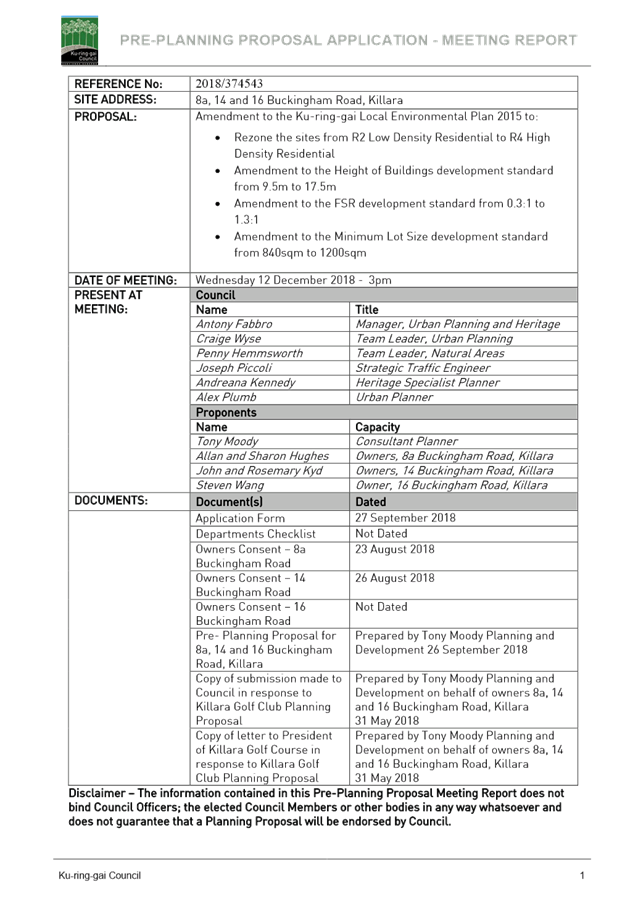
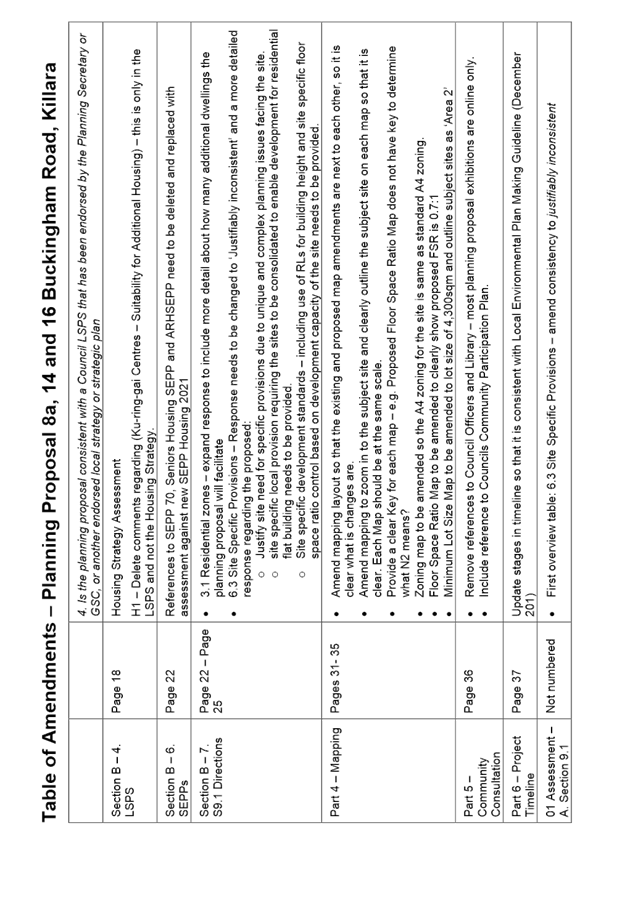
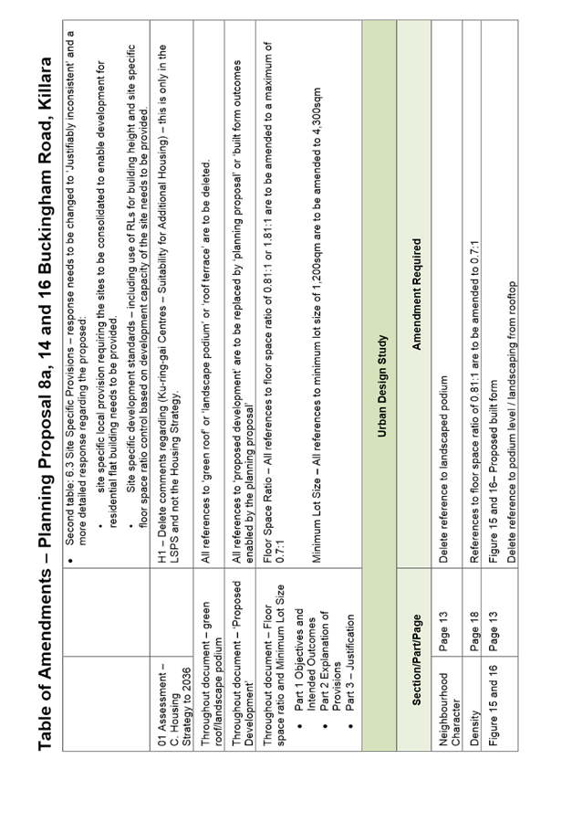
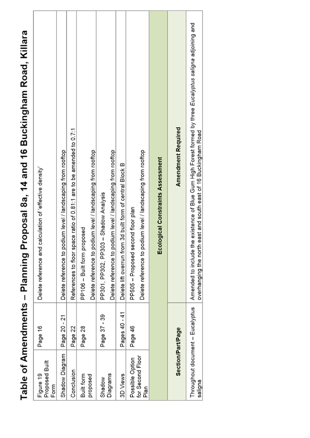
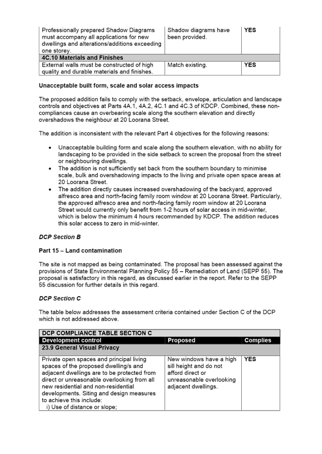
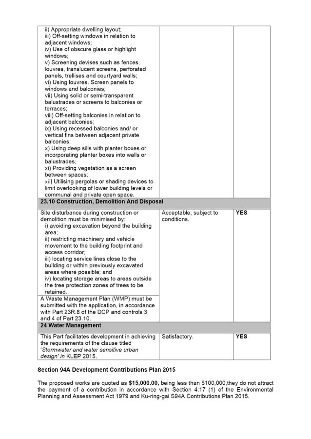
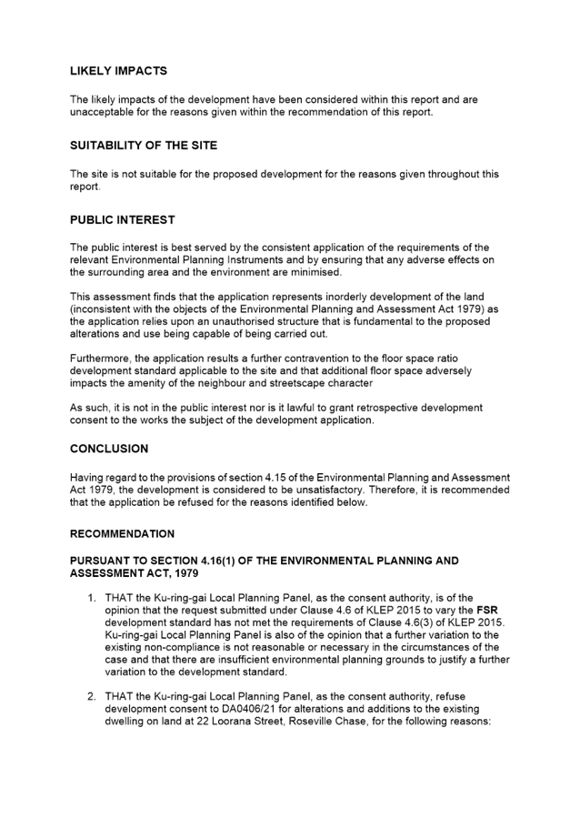
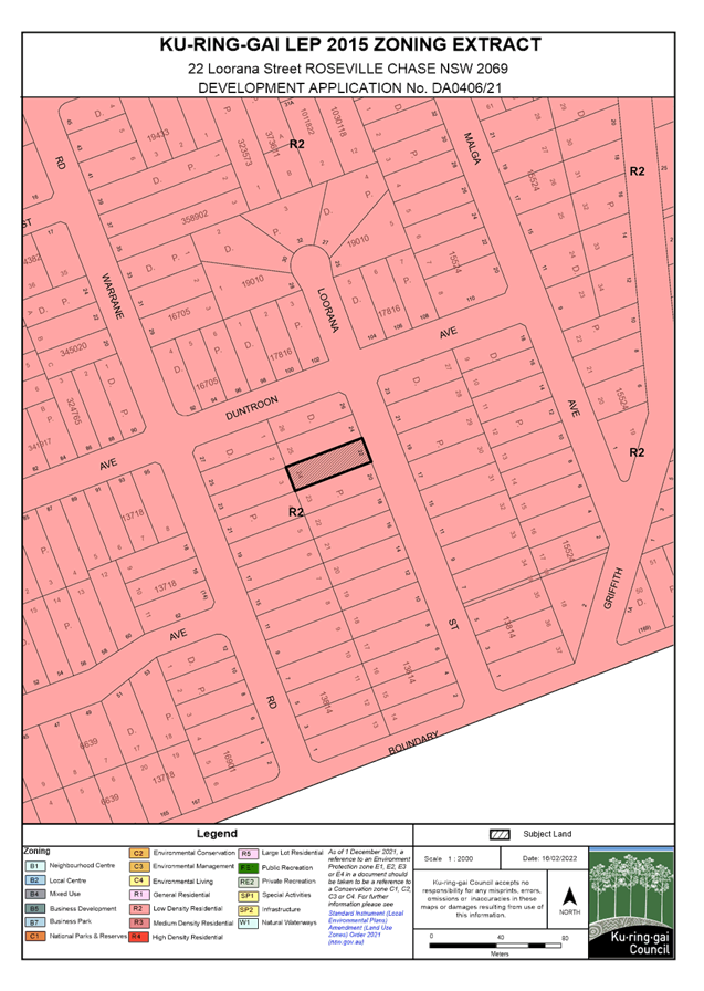
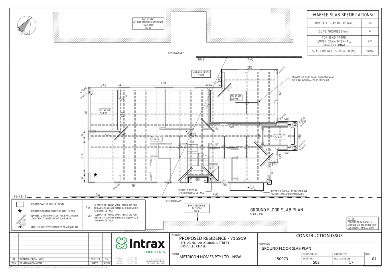
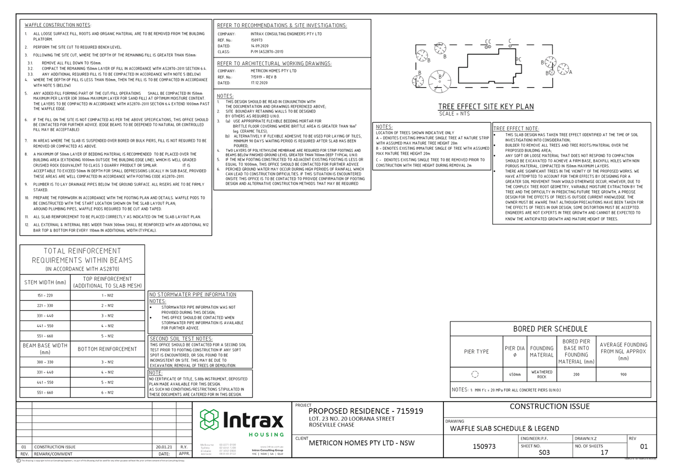
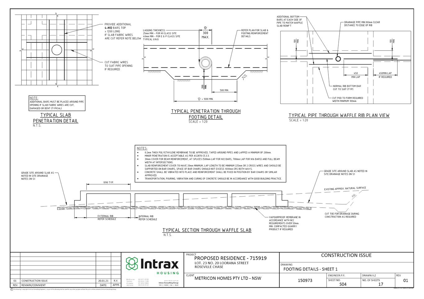
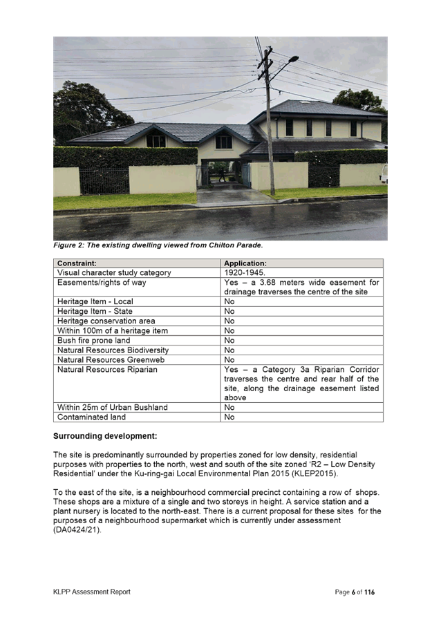
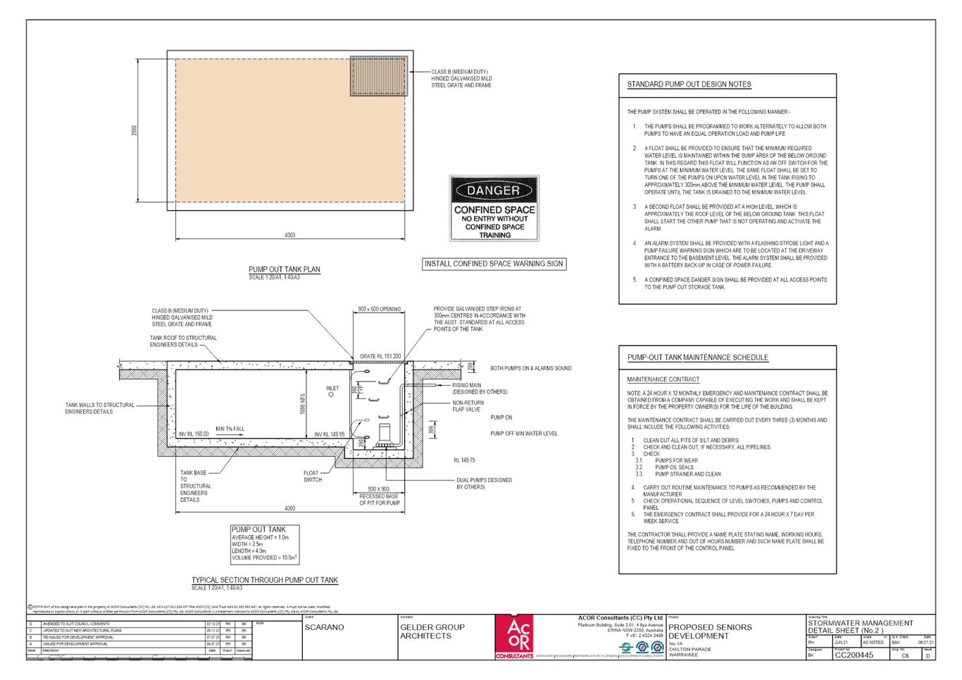
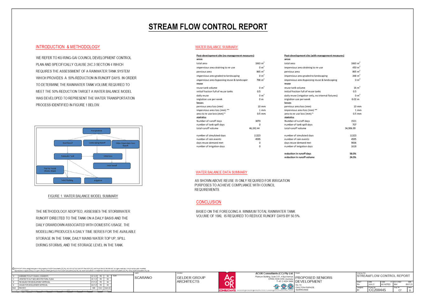
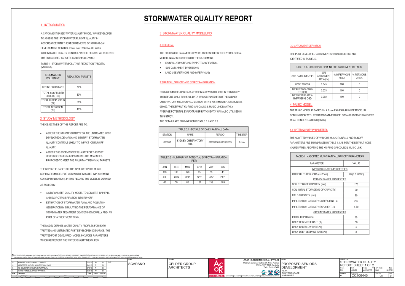
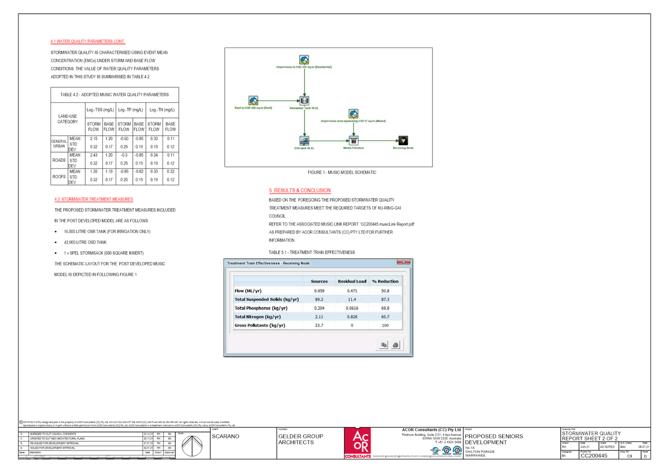
|
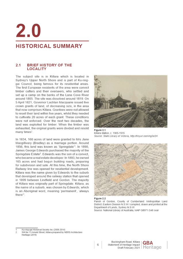
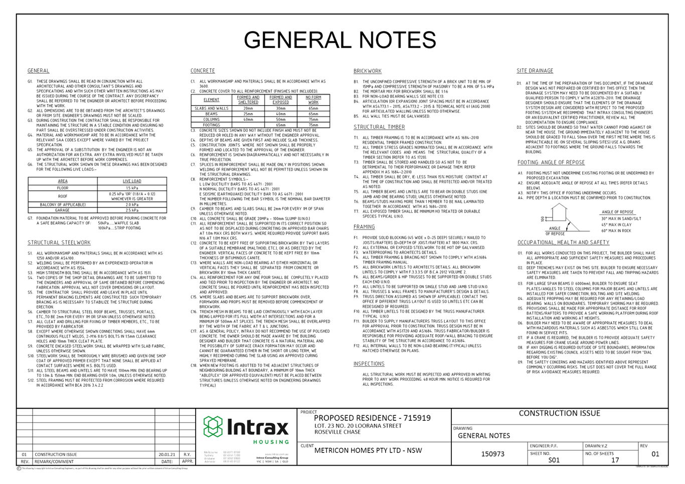
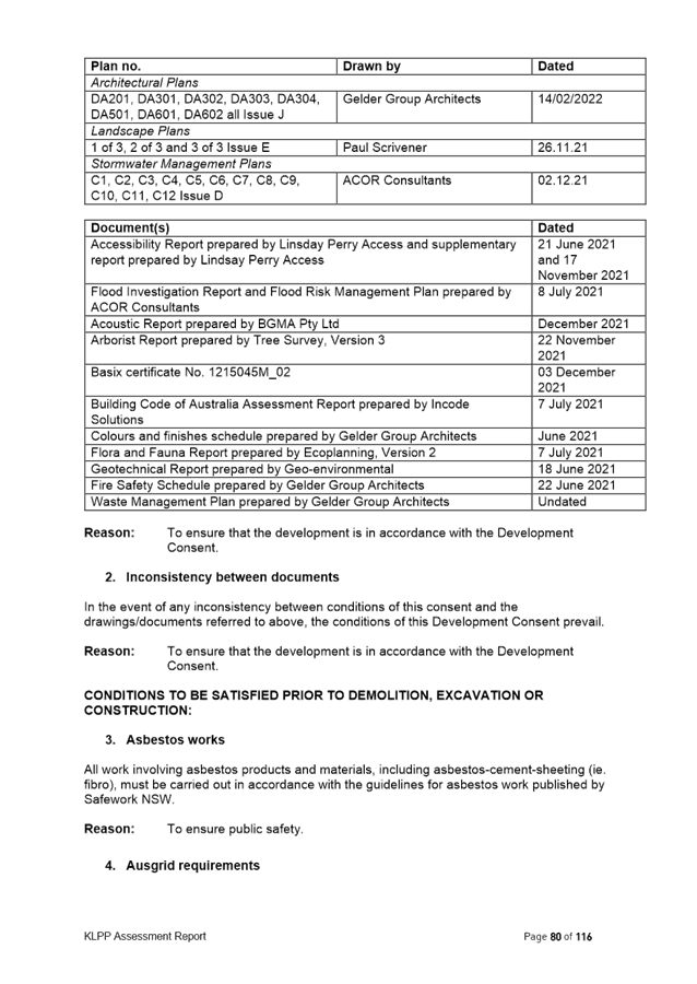
Ku-ring-gai Local Planning Panel Meeting - 14 March 2022 |
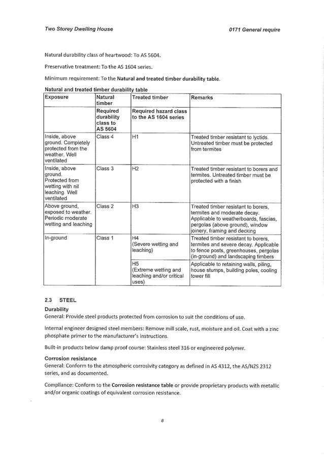
GB.1 / 1 |
|
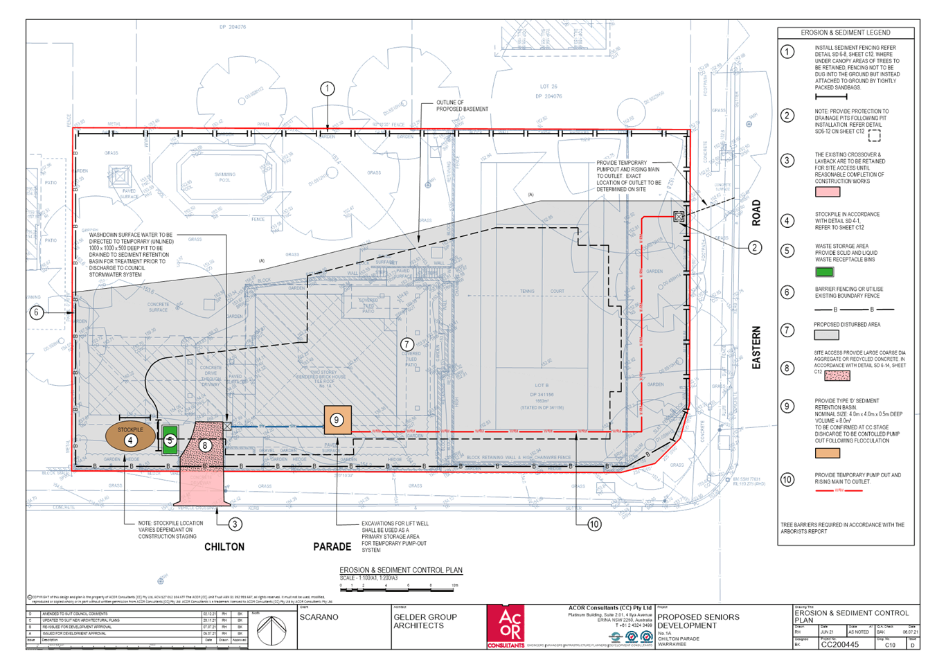
|
|
|
Item GB.1 |
S13022 |
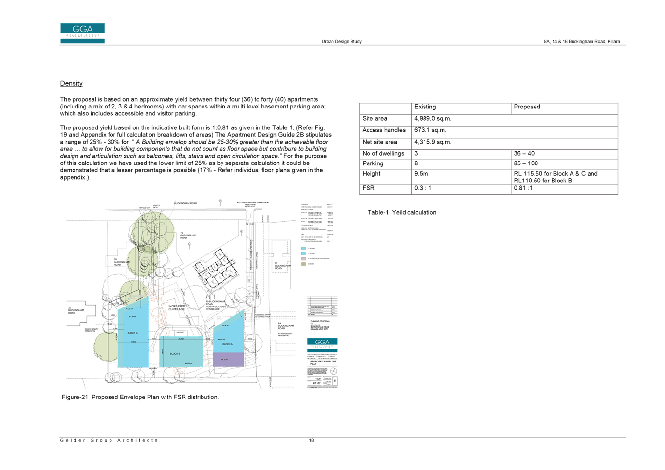
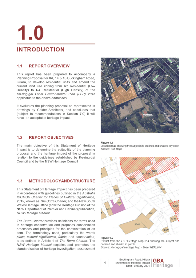
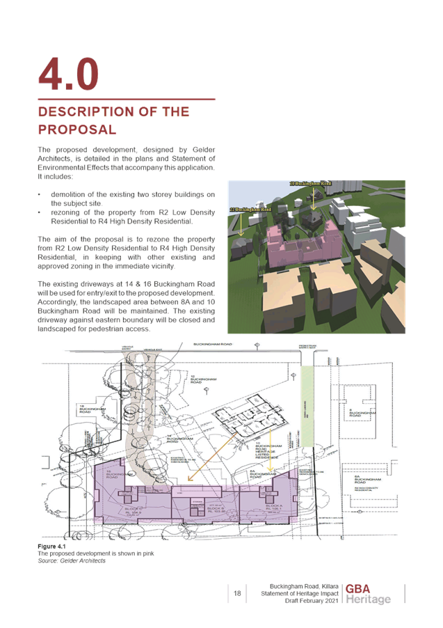
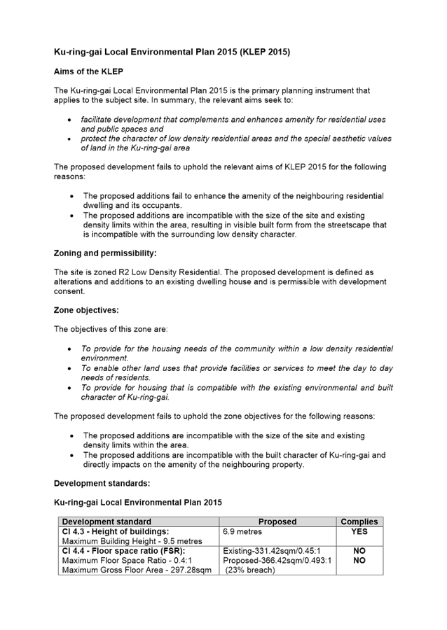
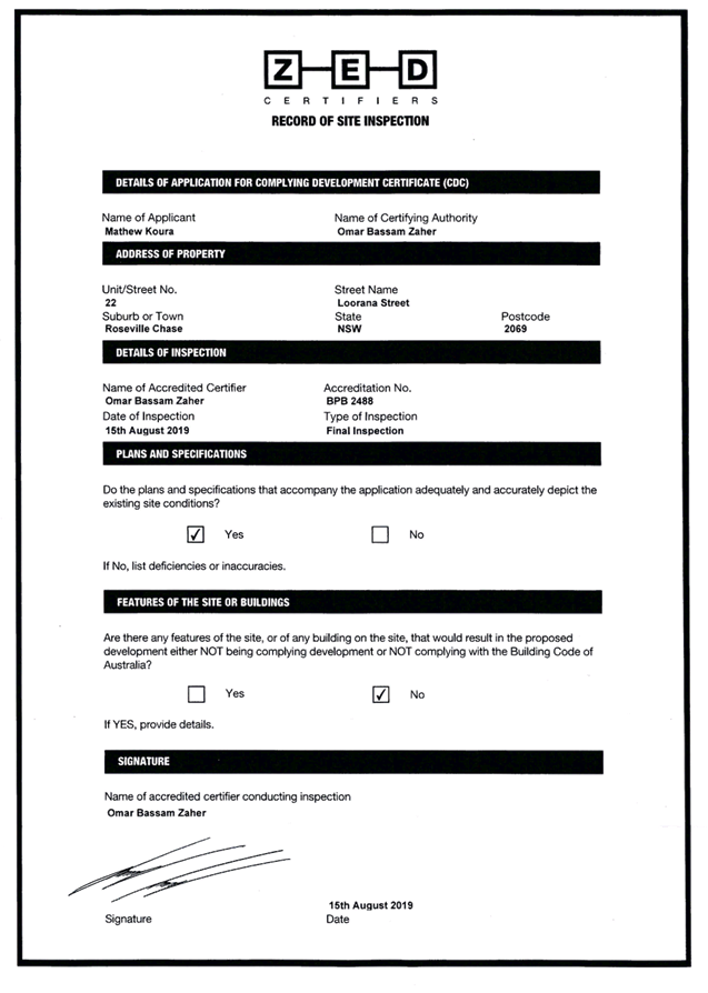
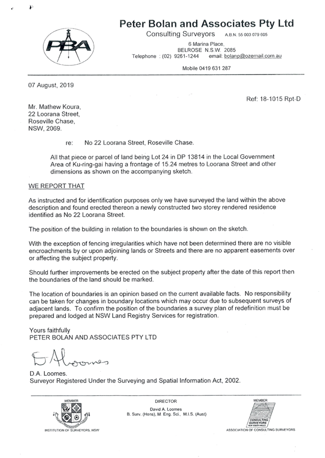
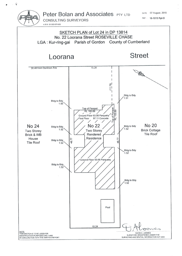
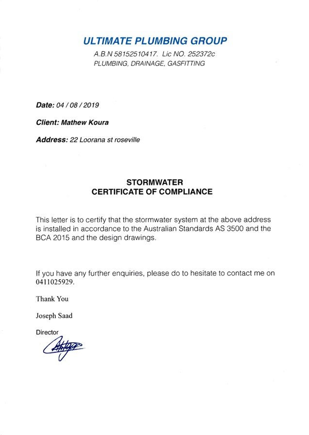
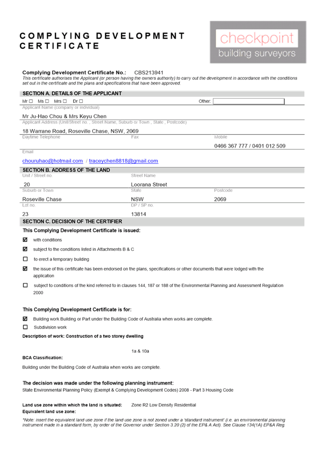
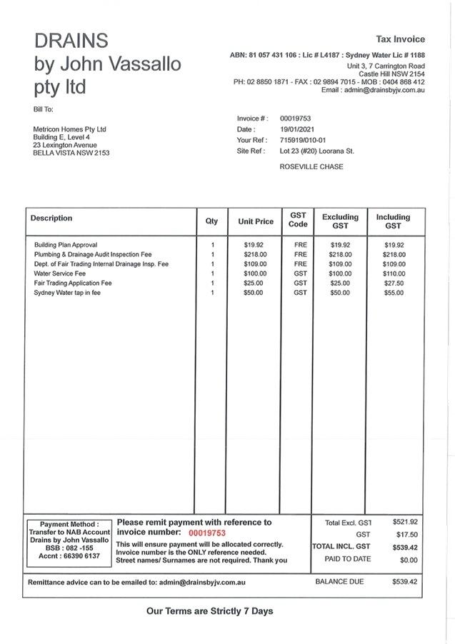
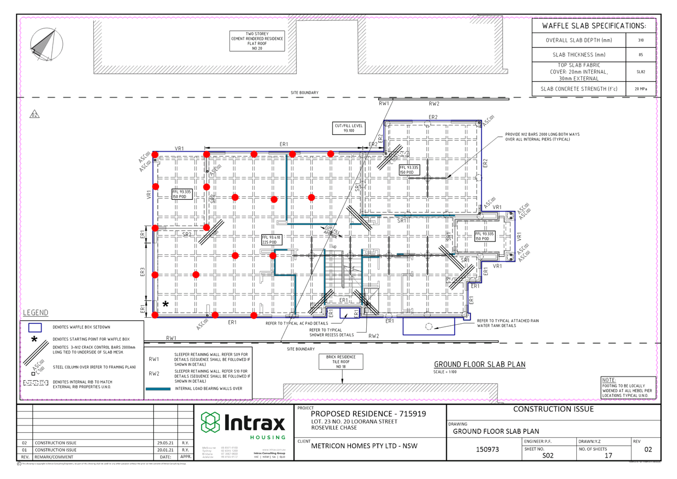
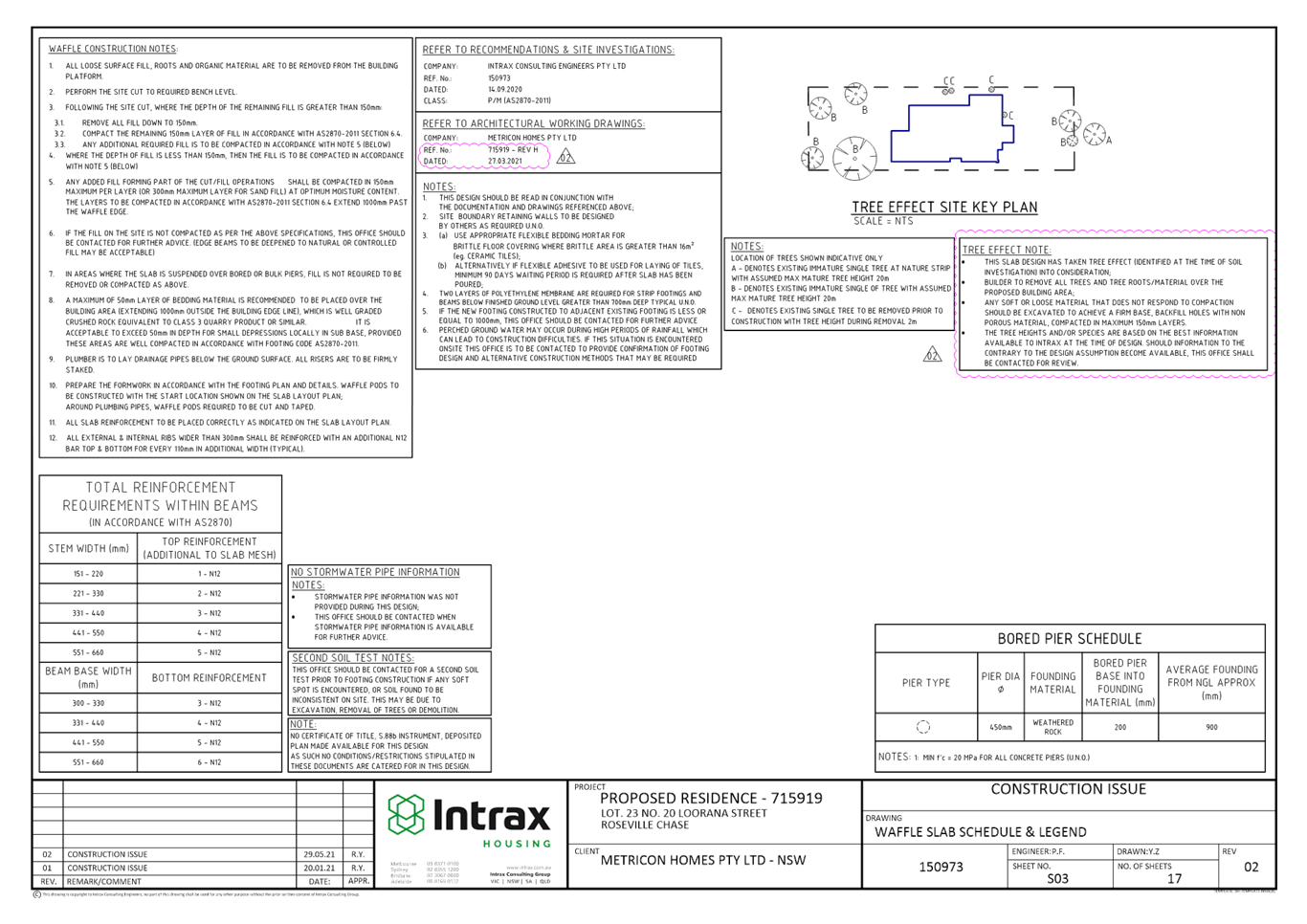
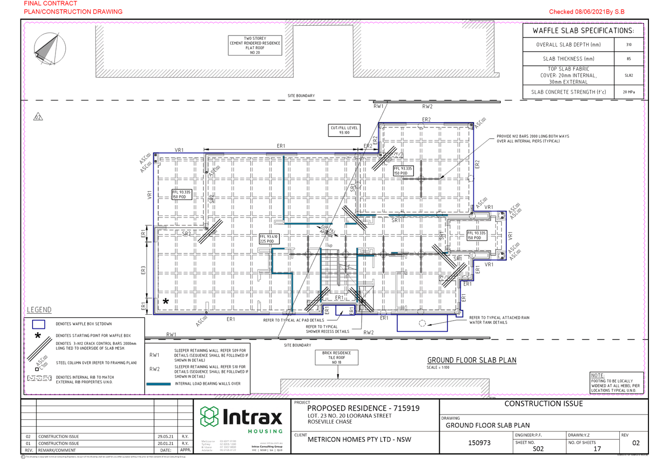
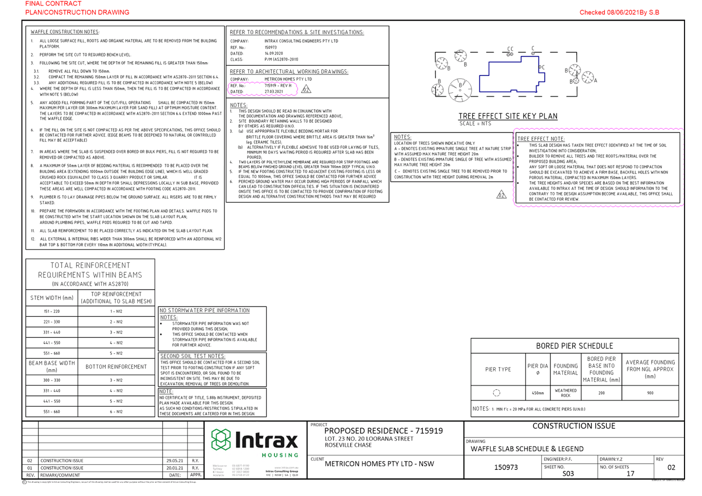
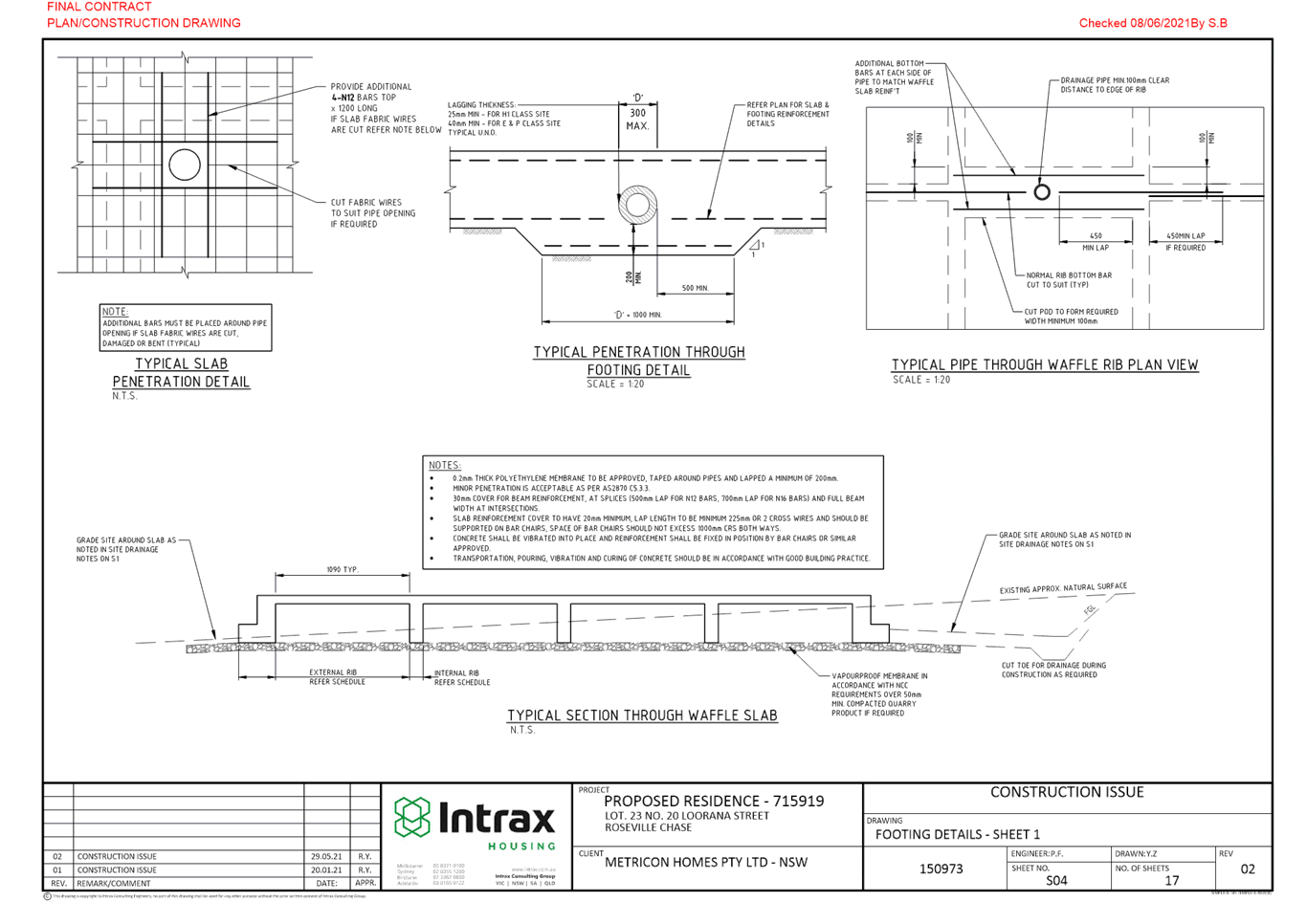
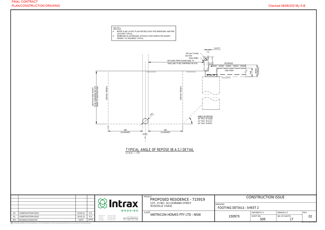
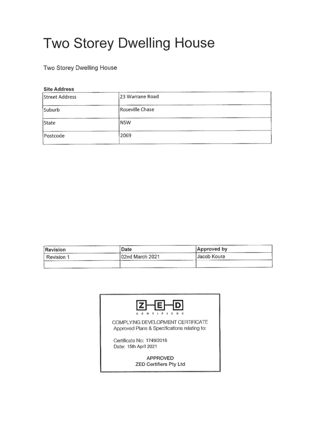
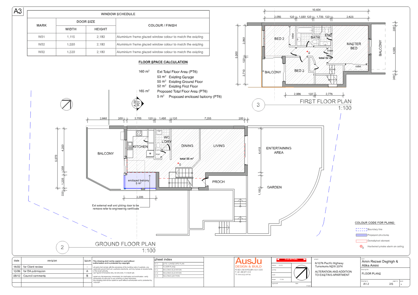
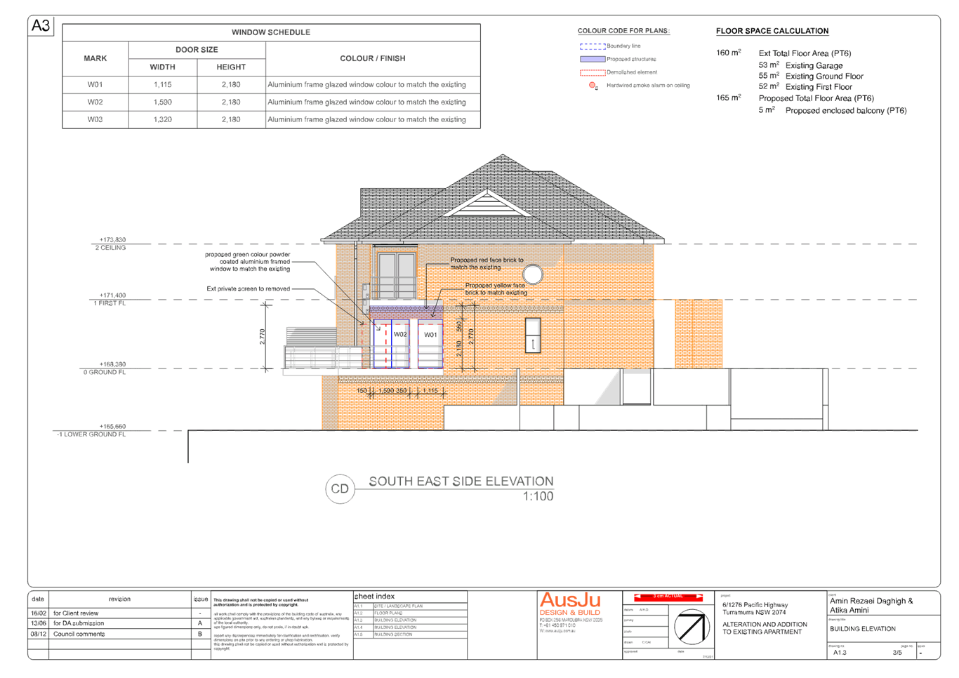
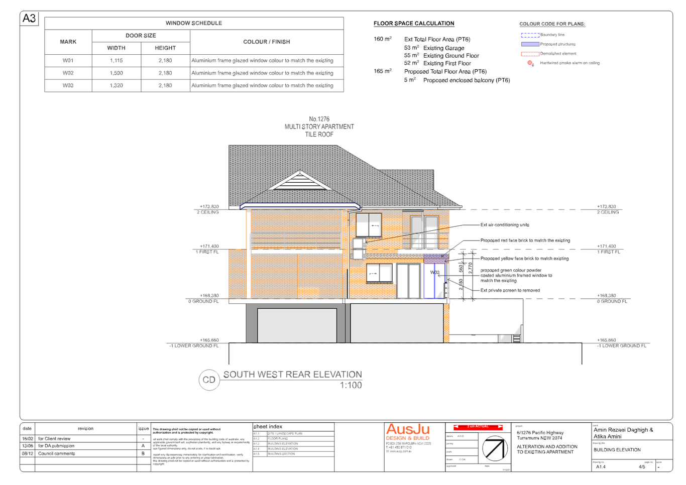
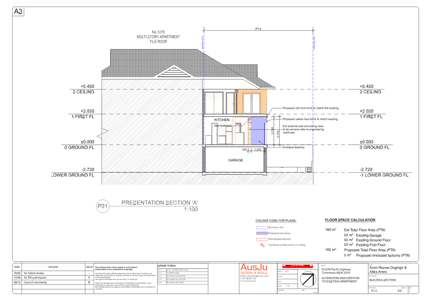
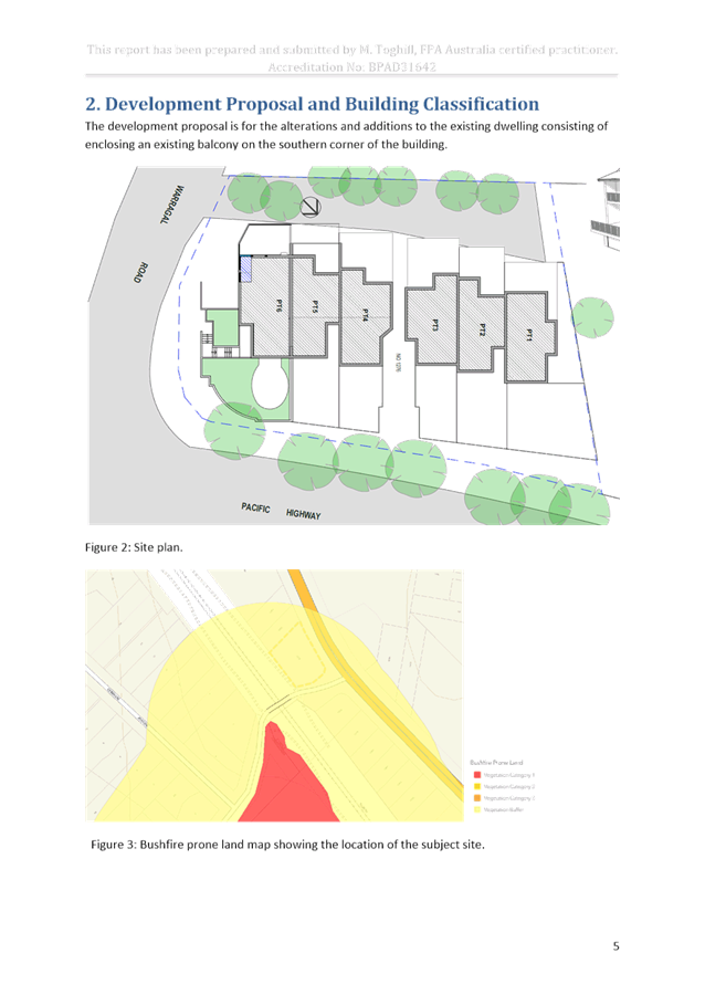
Planning Proposal for 8a, 14 and 16 Buckingham Road, Killara
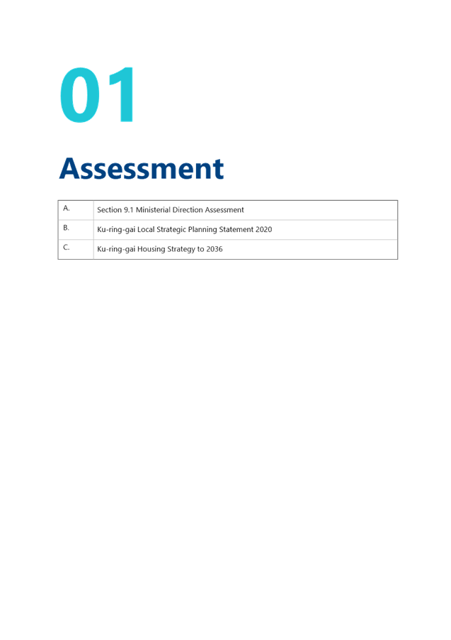
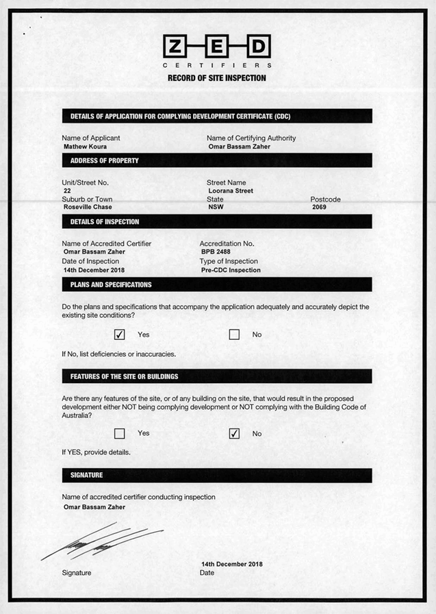
EXECUTIVE SUMMARY
Purpose of Report
To refer the Planning Proposal for 8a, 14 and 16 Buckingham Road, Killara to the KLPP for advice as required by the Local Planning Panels Direction – Planning Proposals issued by the Minister for Planning under Section 9.1 of the Environmental Planning and Assessment Act 1979
Background
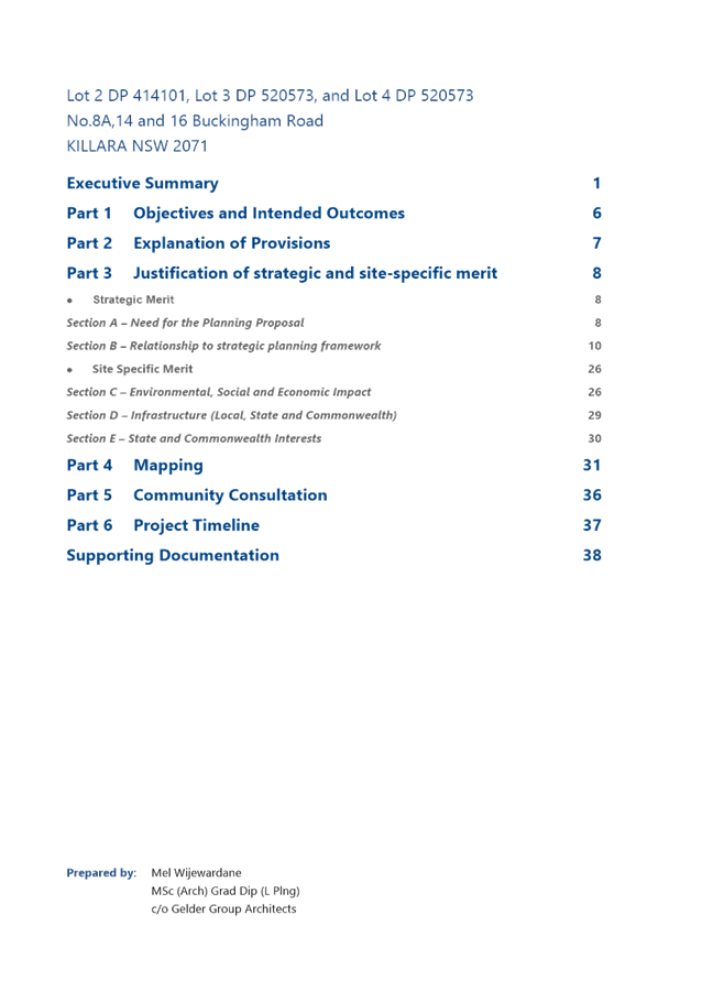
A formal pre-Planning Proposal meeting was held with the proponent and Council staff on 12 December 2018 to discuss the proposal to the amend the zoning of the site. The pre-Planning Proposal meeting report is included at Attachment A1.
The Planning Proposal was submitted on 26 October 2020. The Planning Proposal documentation was incomplete. Following the submission of revised documentation and payment of fees, the assessment of the Planning Proposal formally commenced on 3 August 2021.
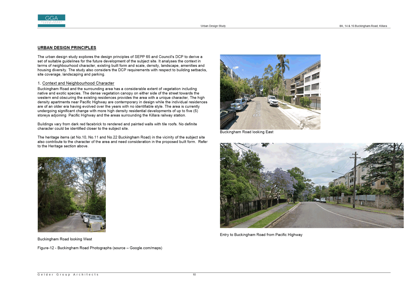
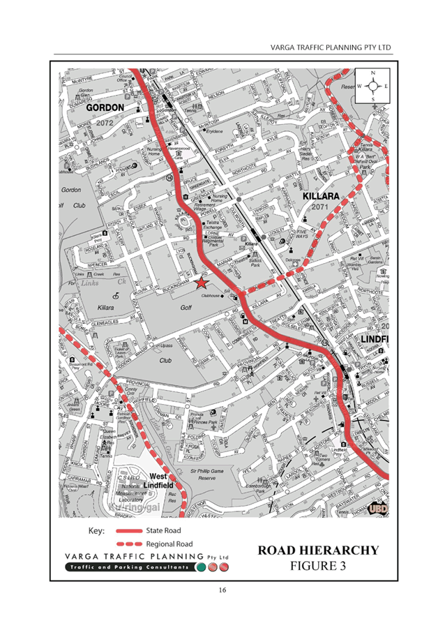
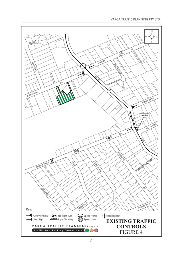
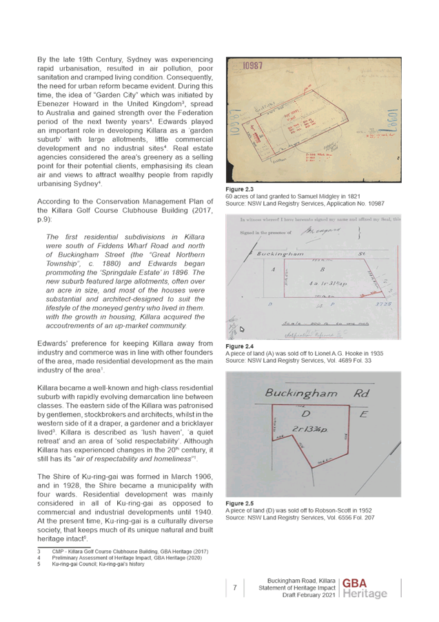
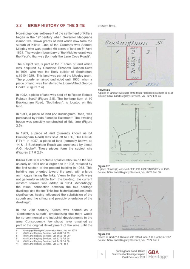
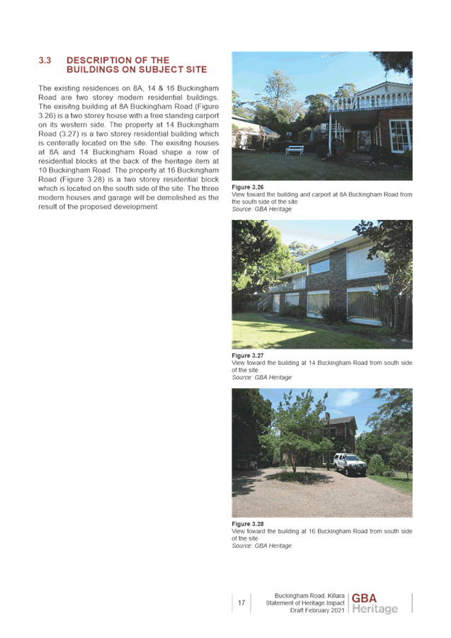
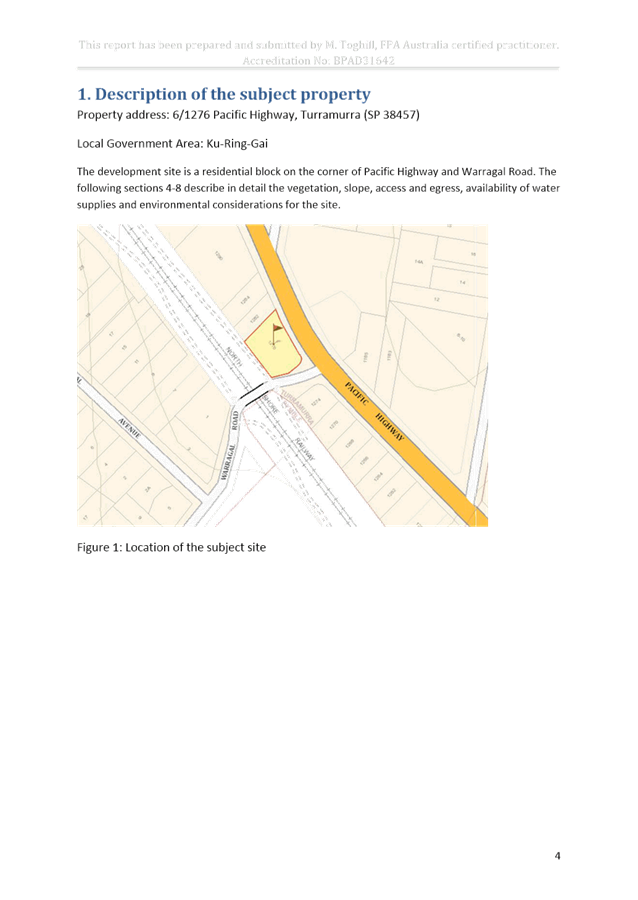
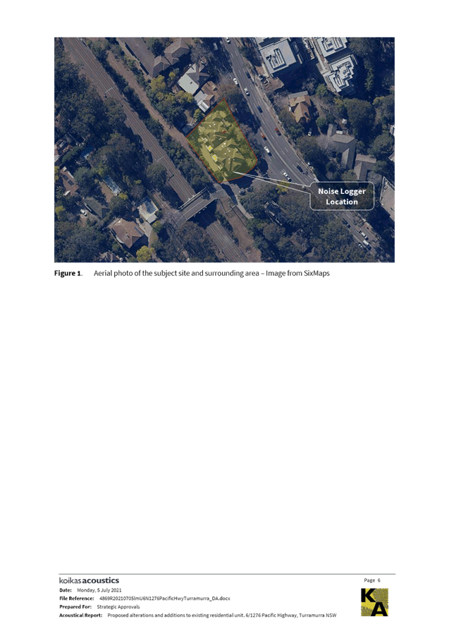
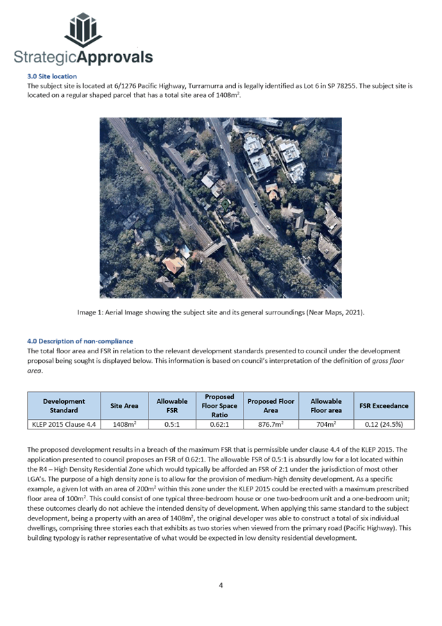
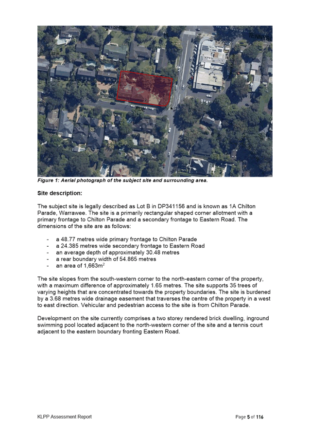
Site Description and Local Context
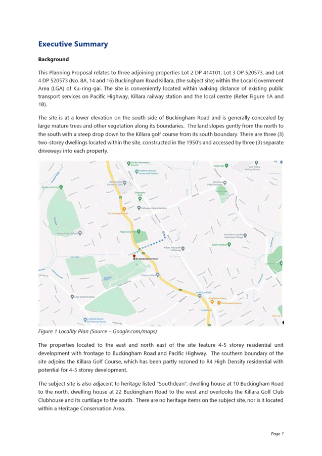
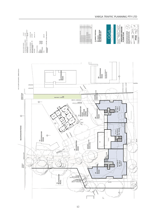
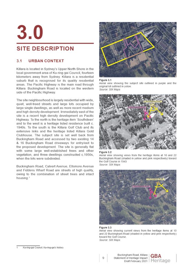
The sites that are the subject of this Planning Proposal are:
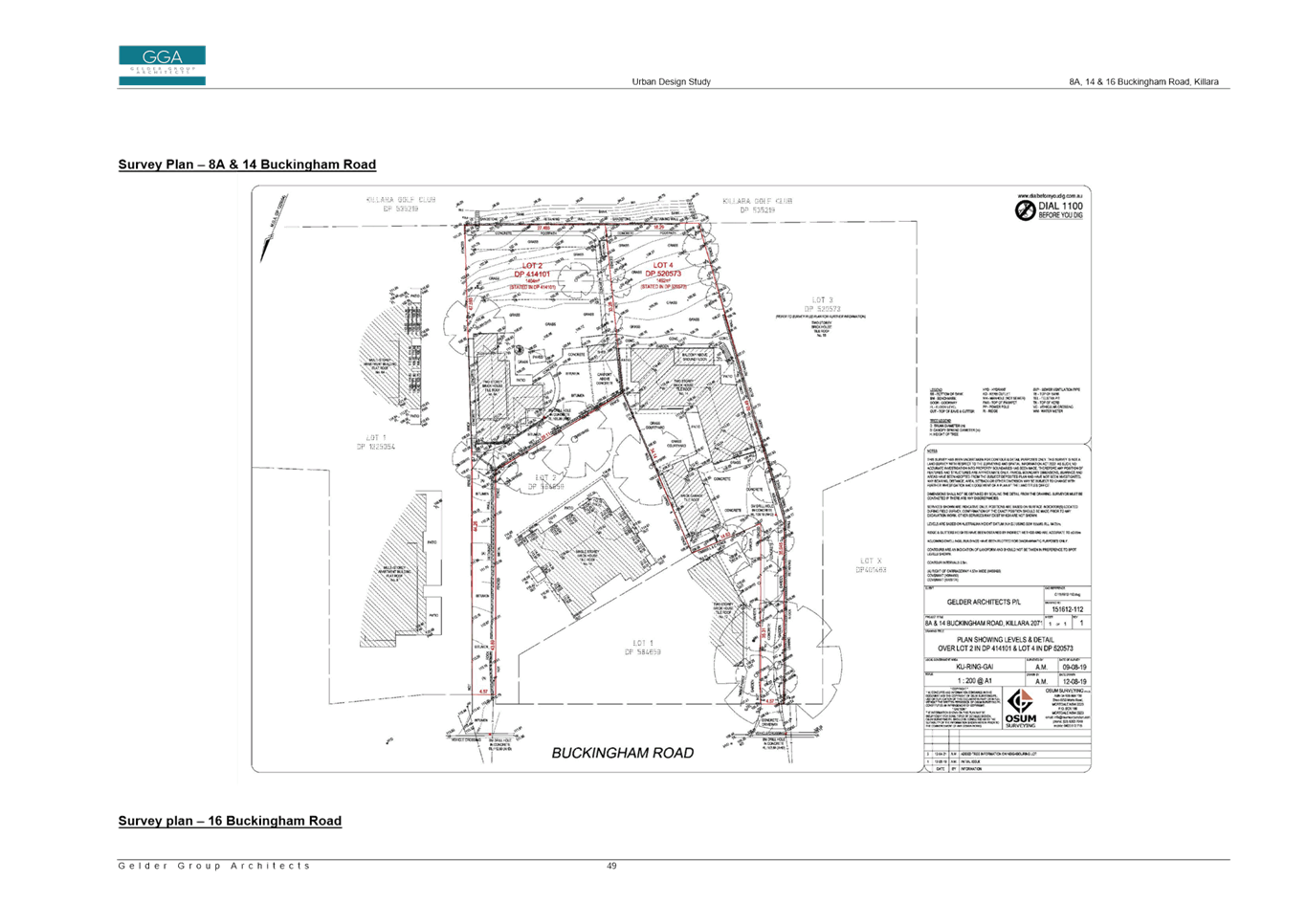
· 8a Buckingham Road, Killara (Lot 2 DP414101)
· 14 Buckingham Road, Killara (Lot 4 DP520573)
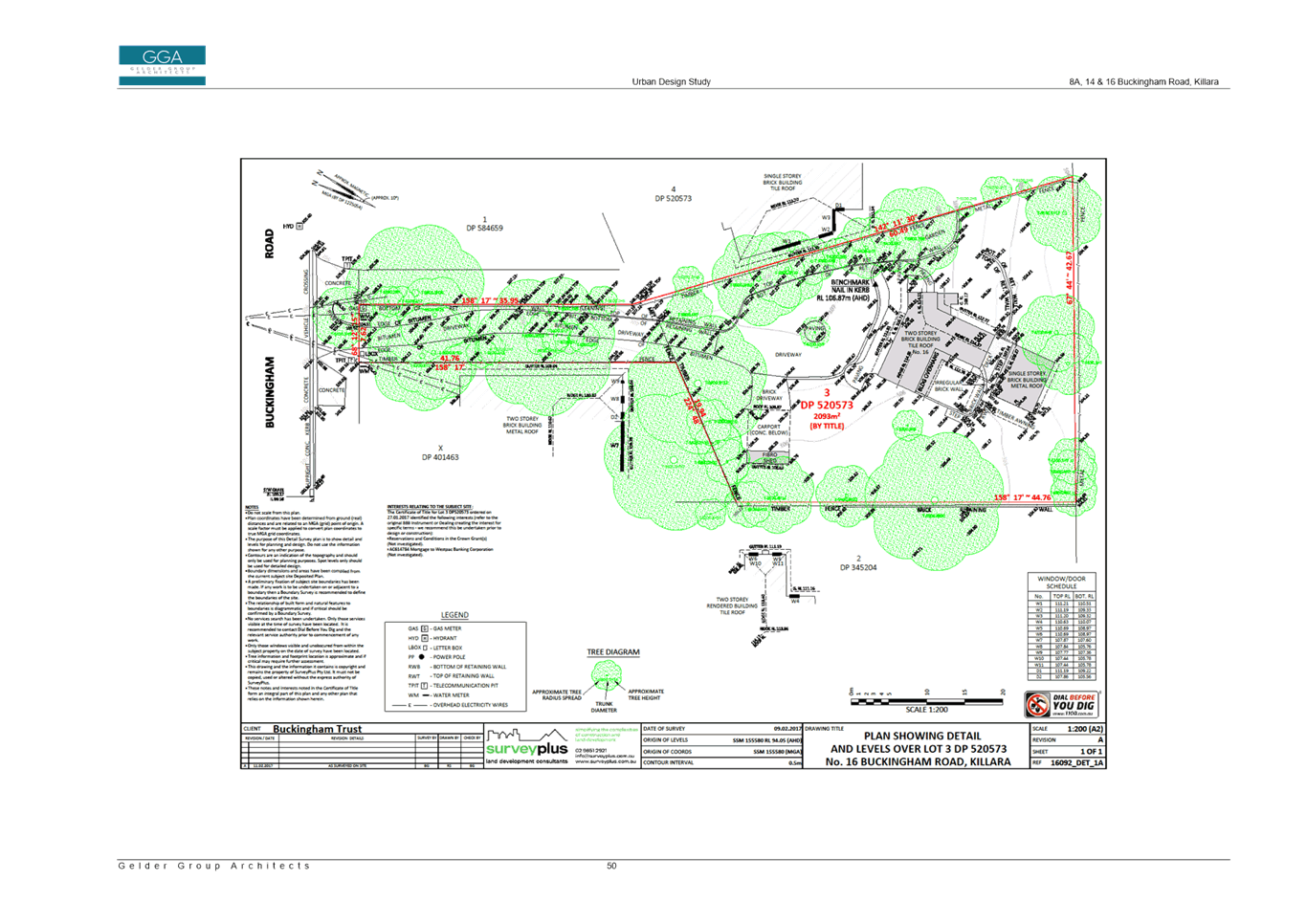
· 16 Buckingham Road, Killara (Lot 3 DP520573)
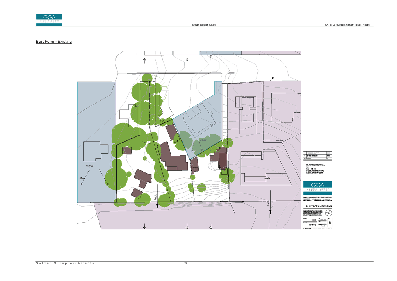
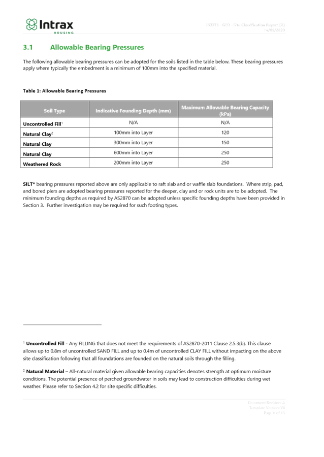
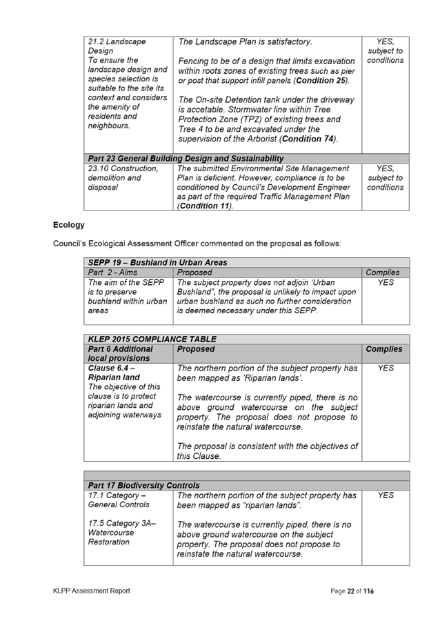
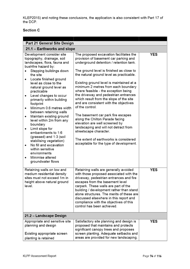
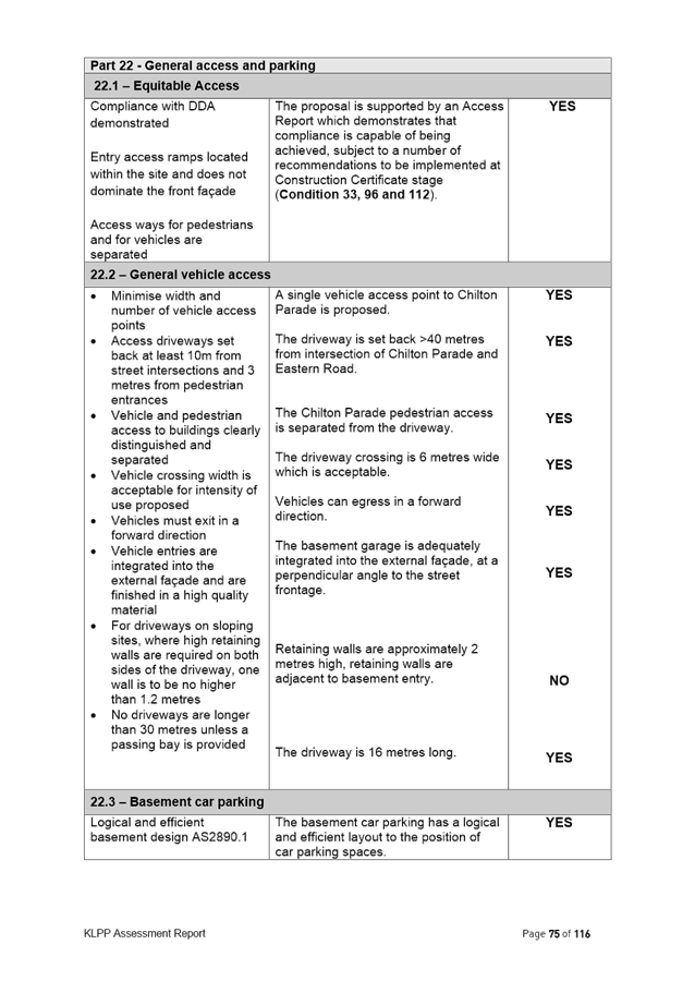
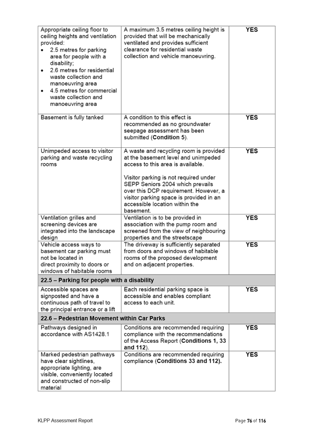
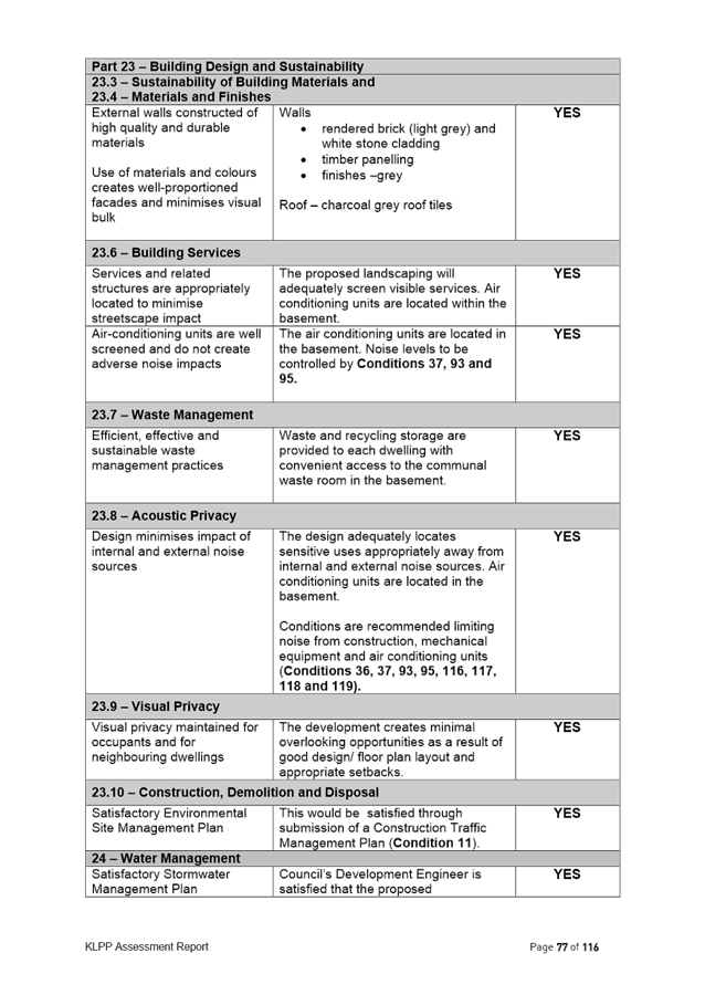
The site the subject of the Planning Proposal comprises three battle-axe allotments, on the southern side of Buckingham Road. The site has a combined site area of 4,989sqm.
The topography of the sites falls from the north to the south, with the battle-axe handle of 8a Buckingham Road having a steep fall from the street and the site being significantly lower than the heritage item and dwellings at 10 and 12 Buckingham Road. The subject sites then have a significant fall to the Killara Golf Club.
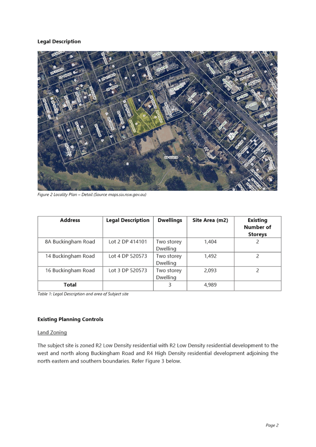
The subject sites are currently zoned R2 Low Density Residential and developed with two storey dwelling houses.
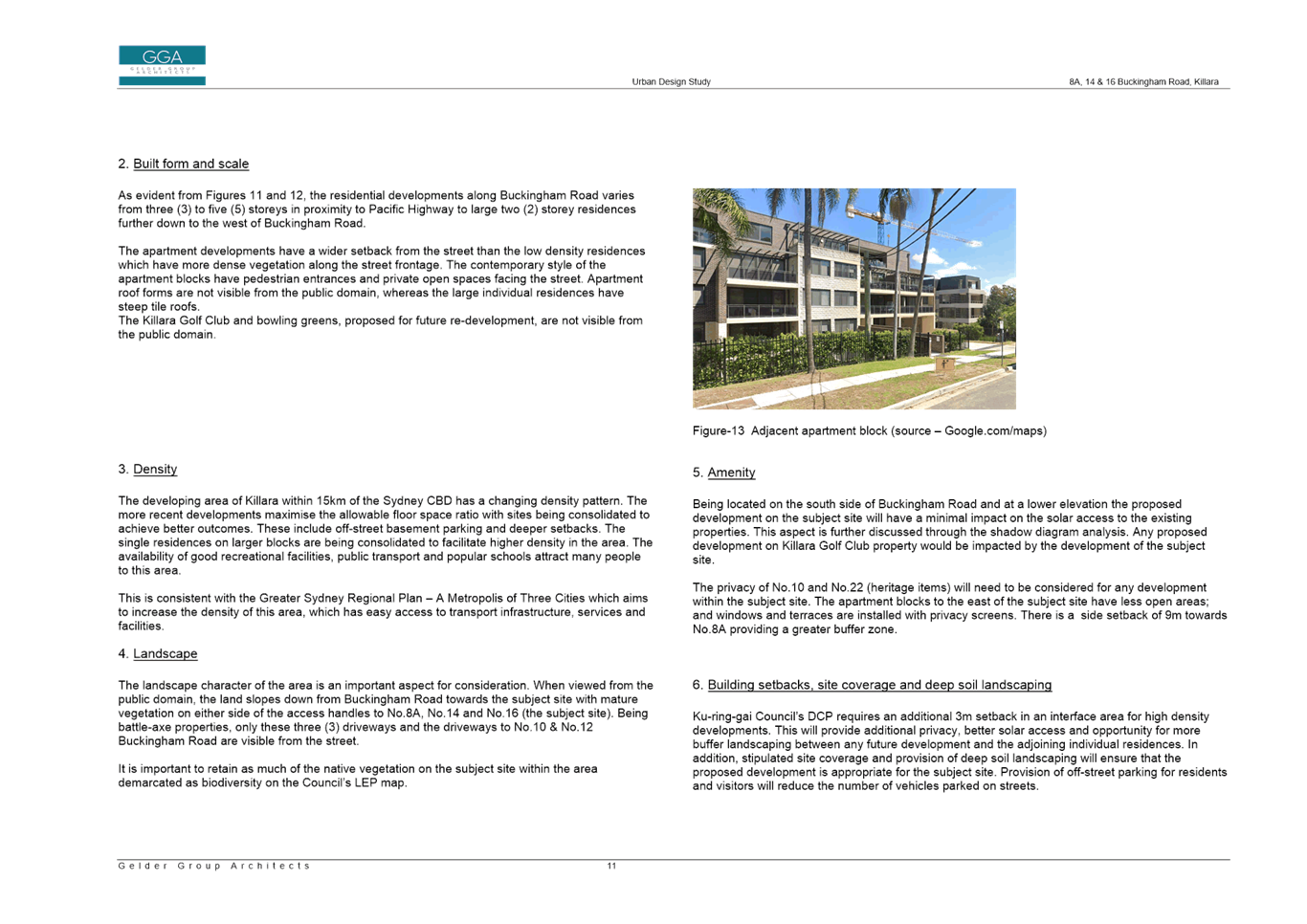
To the west and north of the site is also zoned R2 Low Density Residential and comprises low density residential development. To the east of the site is a 4-5 storey residential flat building zoned R4 High Density Residential.
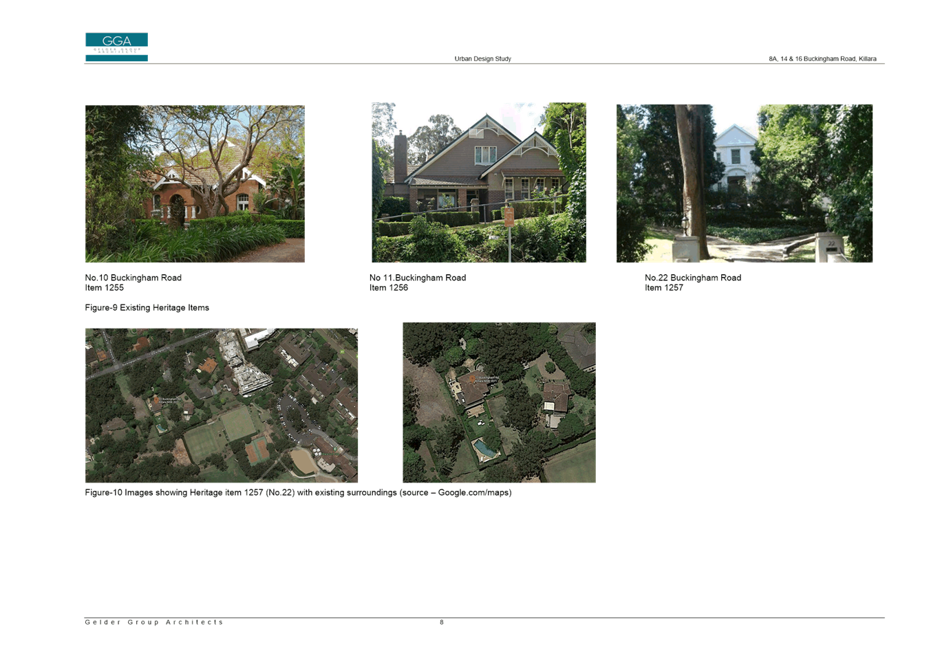
The site adjoins two local heritage items:
· To the north – I255 ‘Southdean’ dwelling house, 10 Buckingham Road, Killara
· To the west – I257 dwelling house, 22 Buckingham Road, Killara
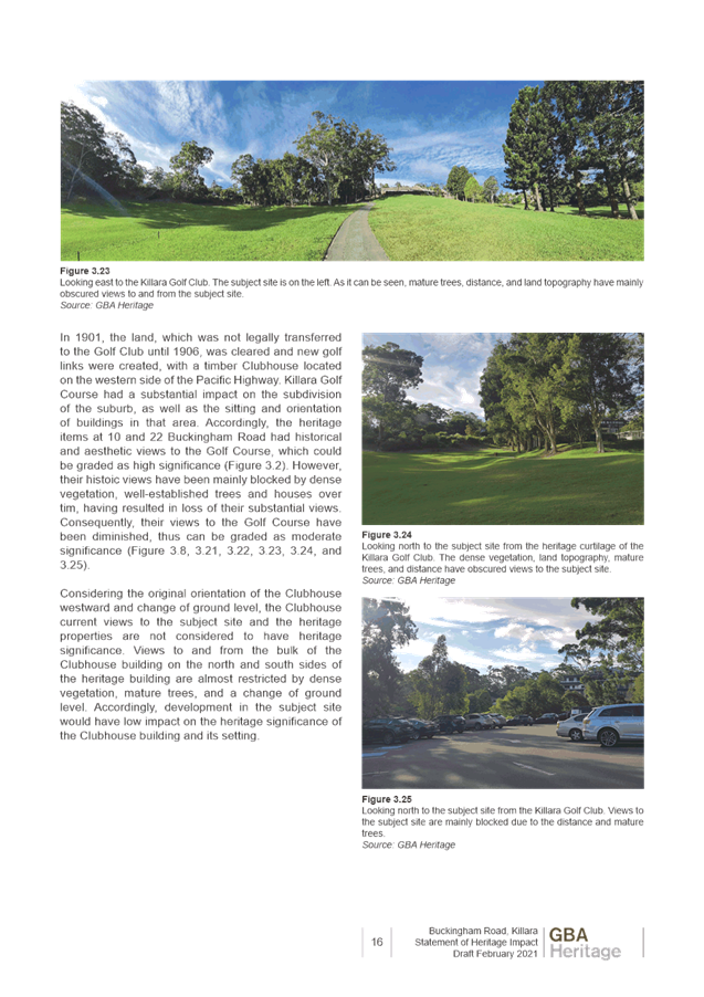
Also within the immediate vicinity is the Killara Golf Club Clubhouse, putting green, fairway and gardens which are listed as a local heritage item.
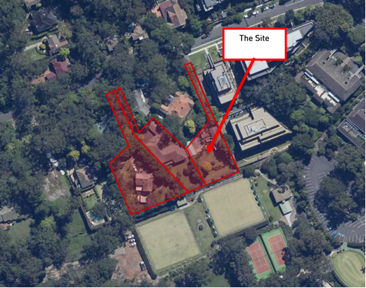
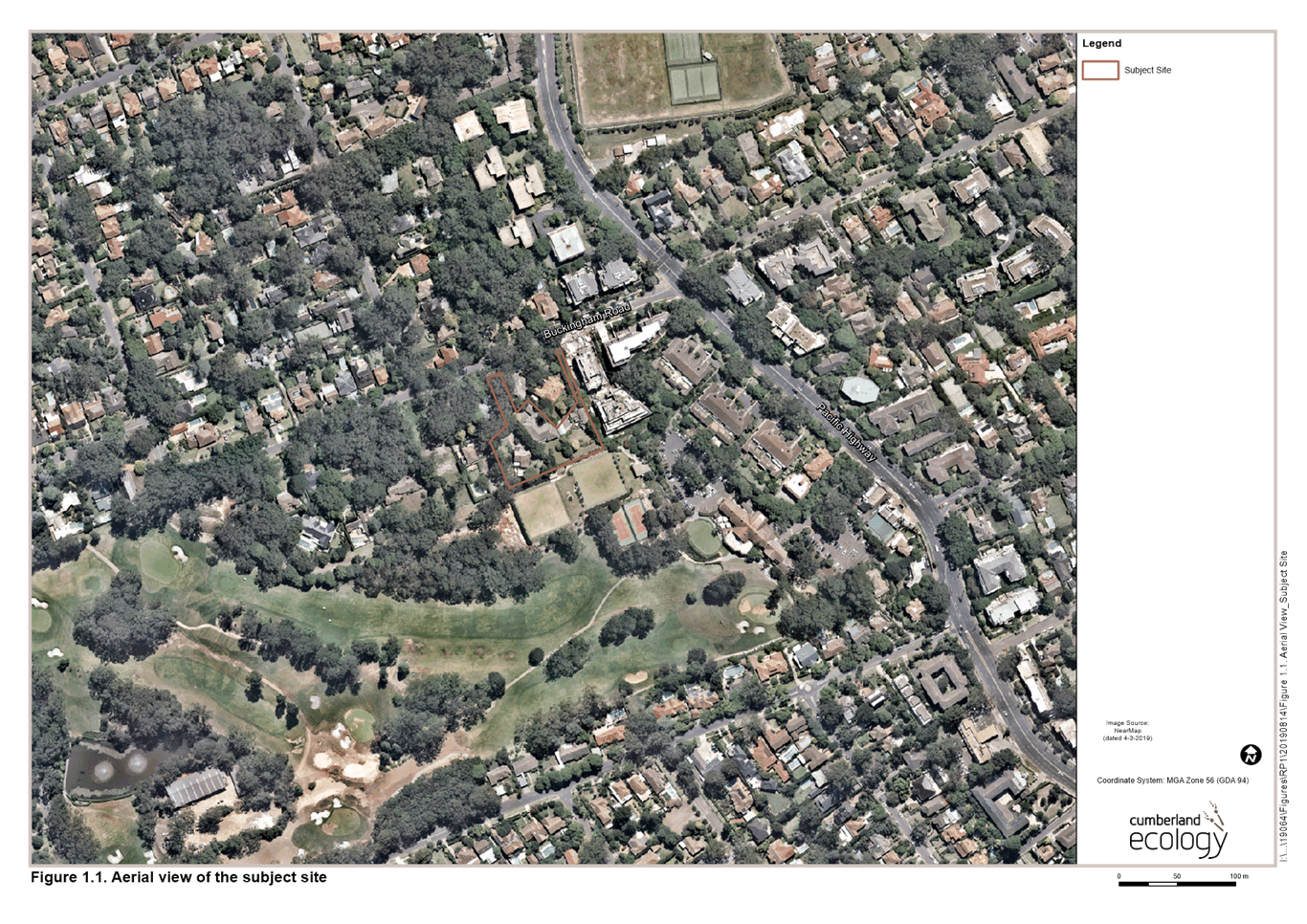
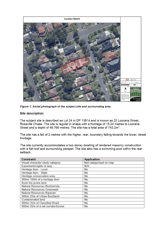
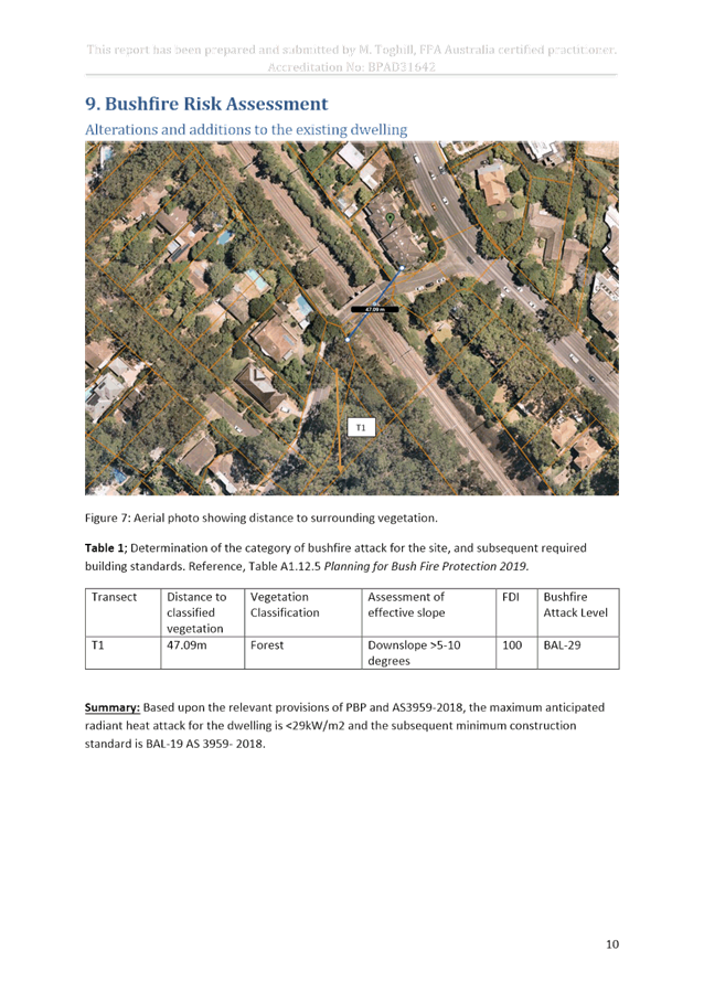
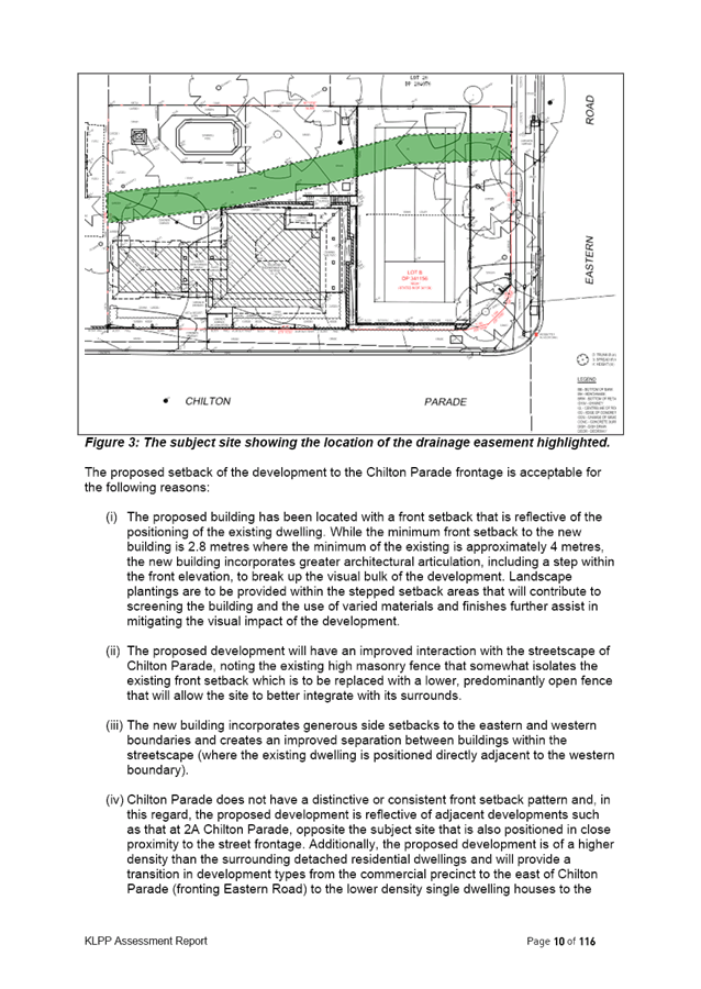
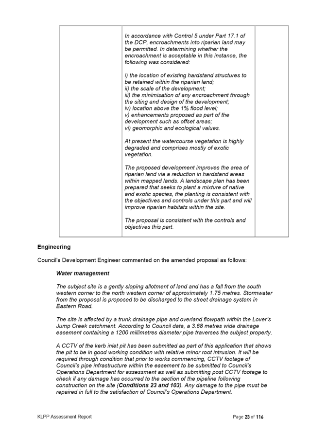
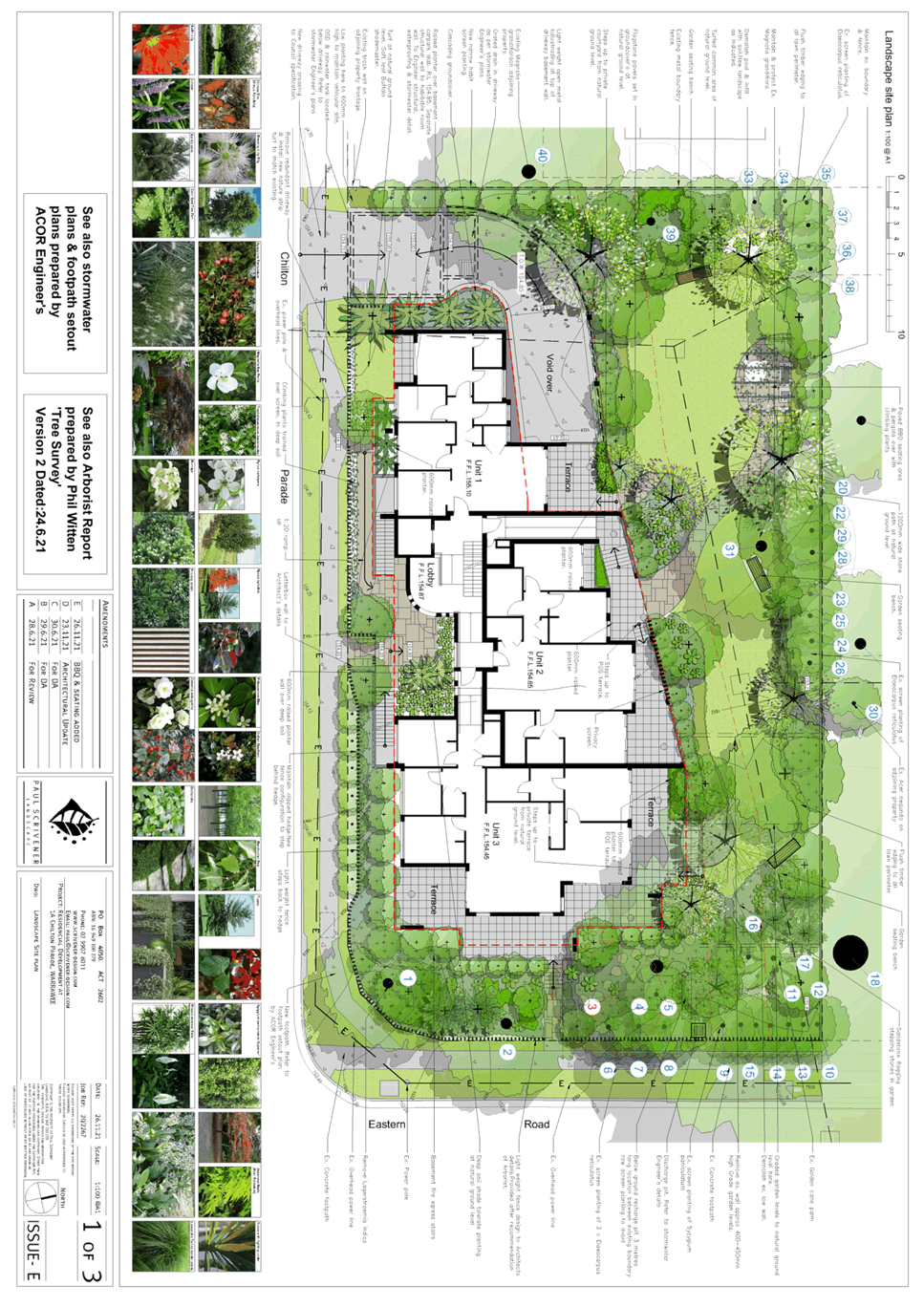
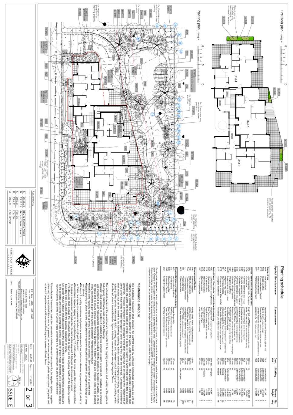
Image 1: Subject site aerial view
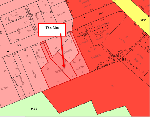
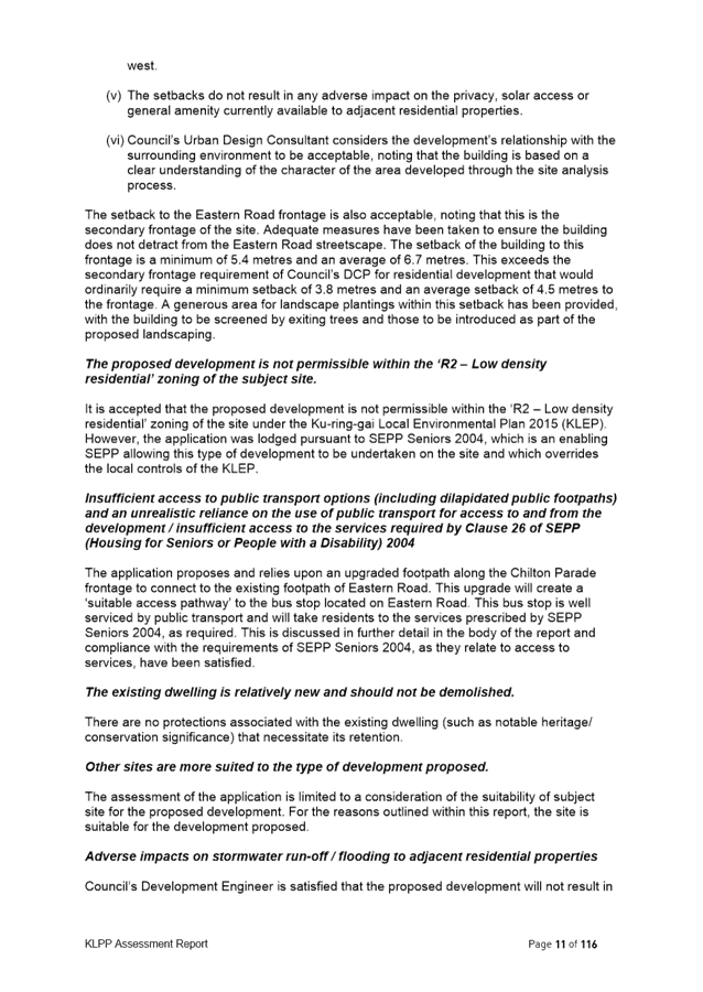
Image 2: Subject site and surrounding zoning
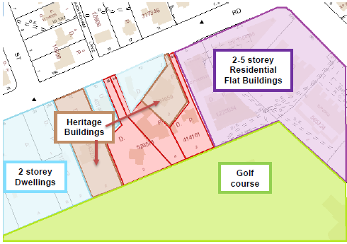
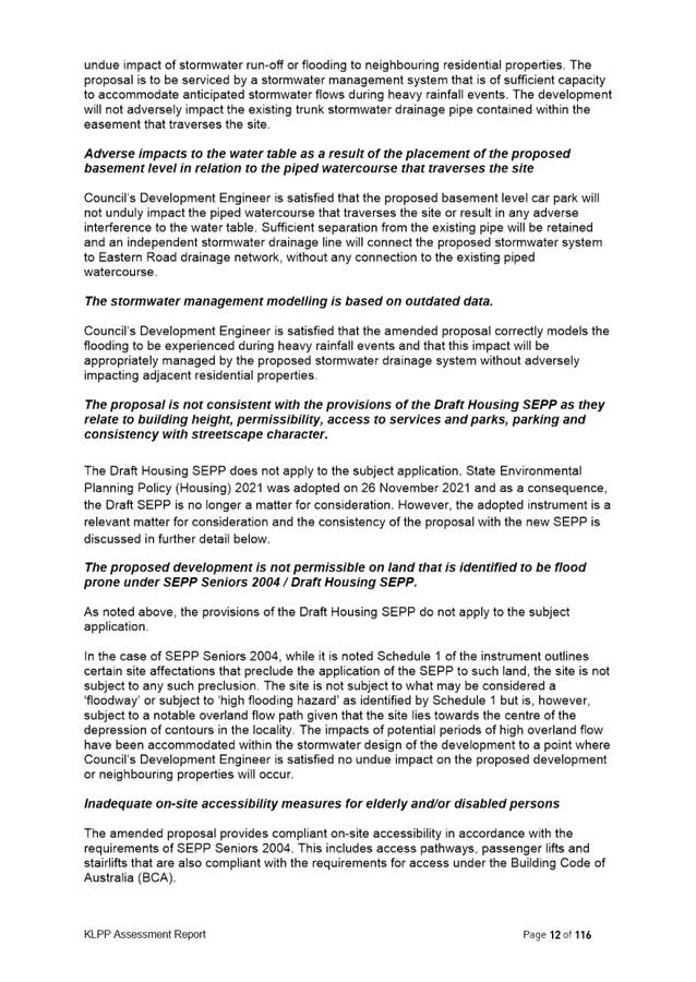
Image 3: Subject site and existing surrounding context
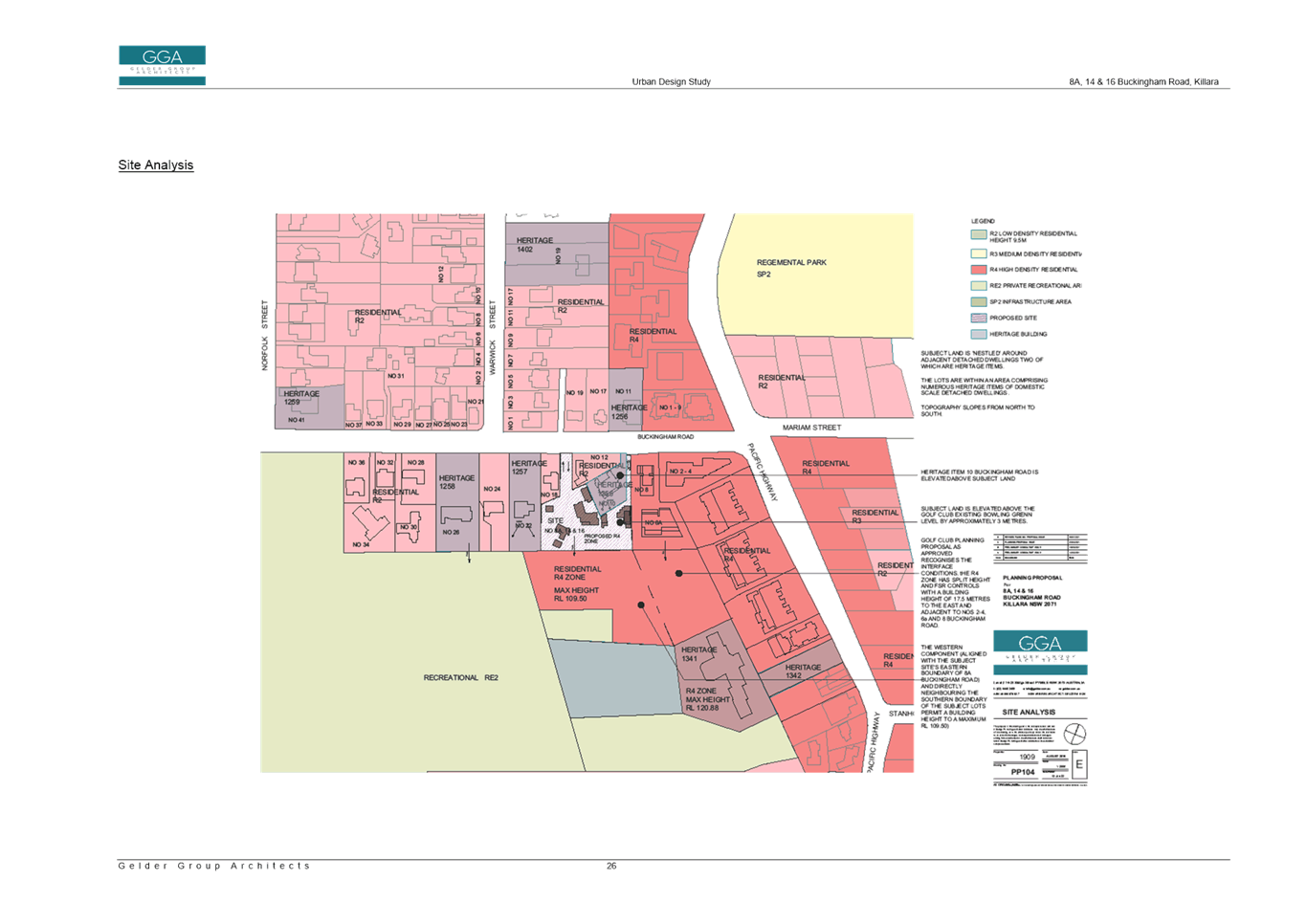
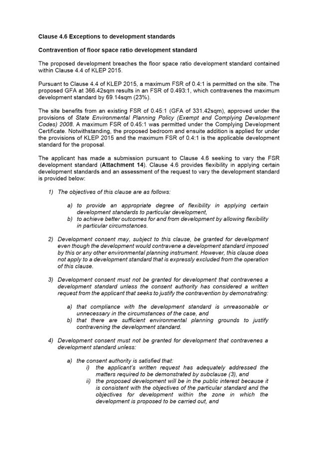
Killara Golf Course Planning Proposal and Potential Development
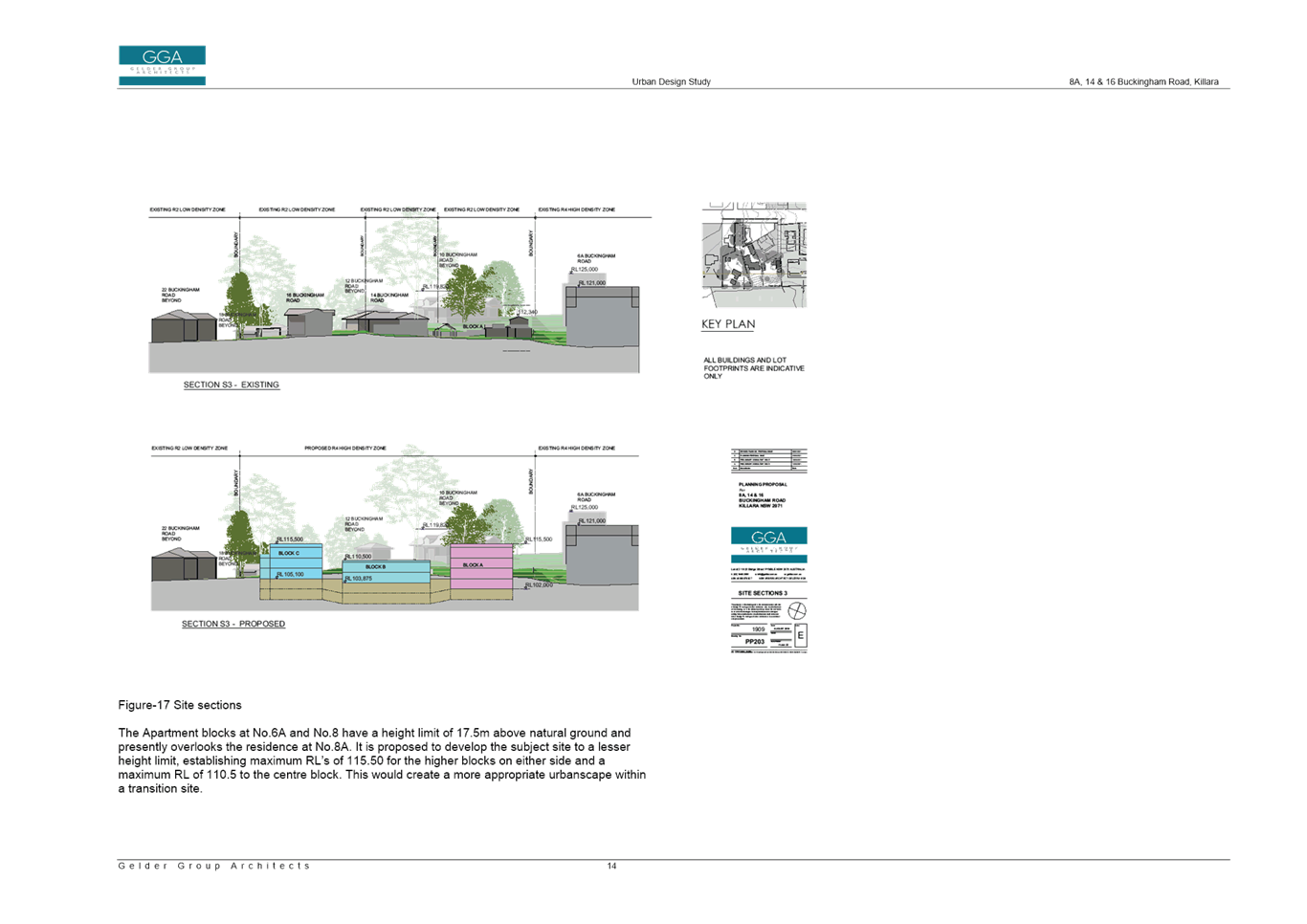
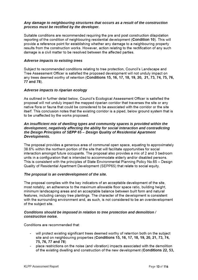
The southern boundary of the subject site adjoins the Killara Golf Club. This area of the Killara Golf Club adjoining the site was subject to a private Planning Proposal and in 2019 was rezoned to R4 High Density Residential and associated development standards which would enable development of residential flat buildings to a maximum height of 5 storeys adjoining 6a Buckingham Road, and to a maximum height of 3 storey along the boundary shared with the subject site.
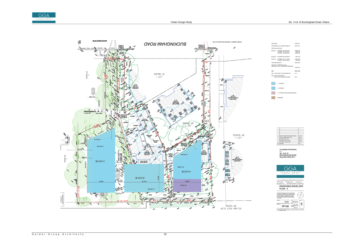
An excerpt from the Urban Design Study submitted with the Killara Golf Club Planning Proposal is included at Image 4 (below) and shows the development outcomes enabled on the Golf Course site adjoining 8a, 14 and 16 Buckingham Road.
The rezoning by the Killara Golf Club was to preserve the club’s options in the future as to how it may wish to use the land. To date, no Development Application has been lodged for residential development on the Killara Golf Club site.
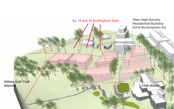
Image 4: Excerpt from Killara Golf Planning Proposal
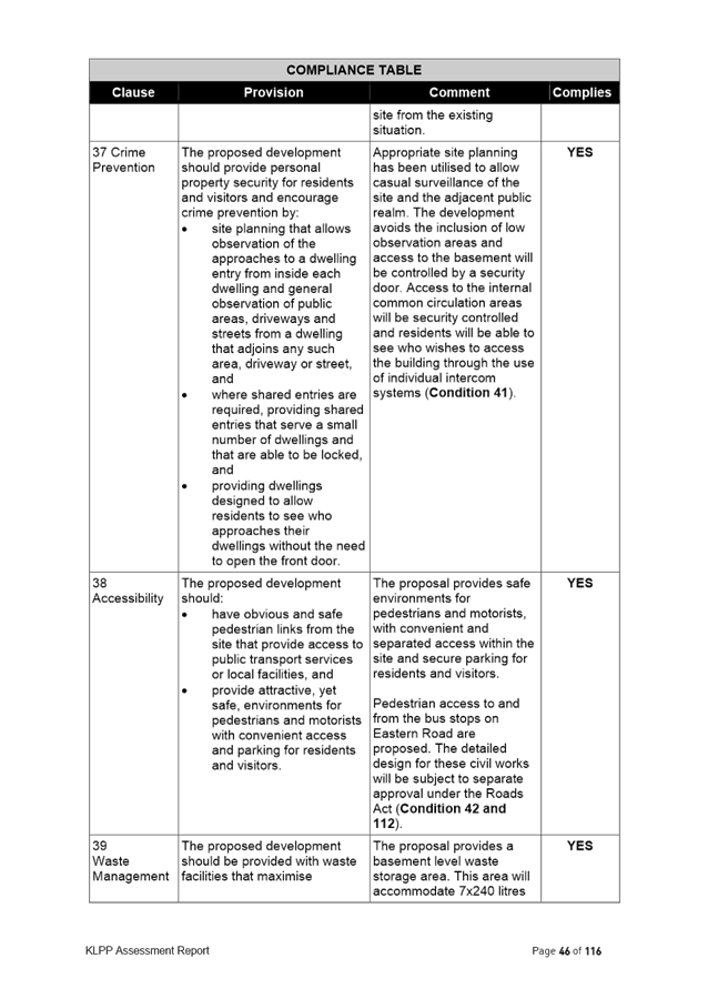
Comments
Original Proposal and Initial Assessment
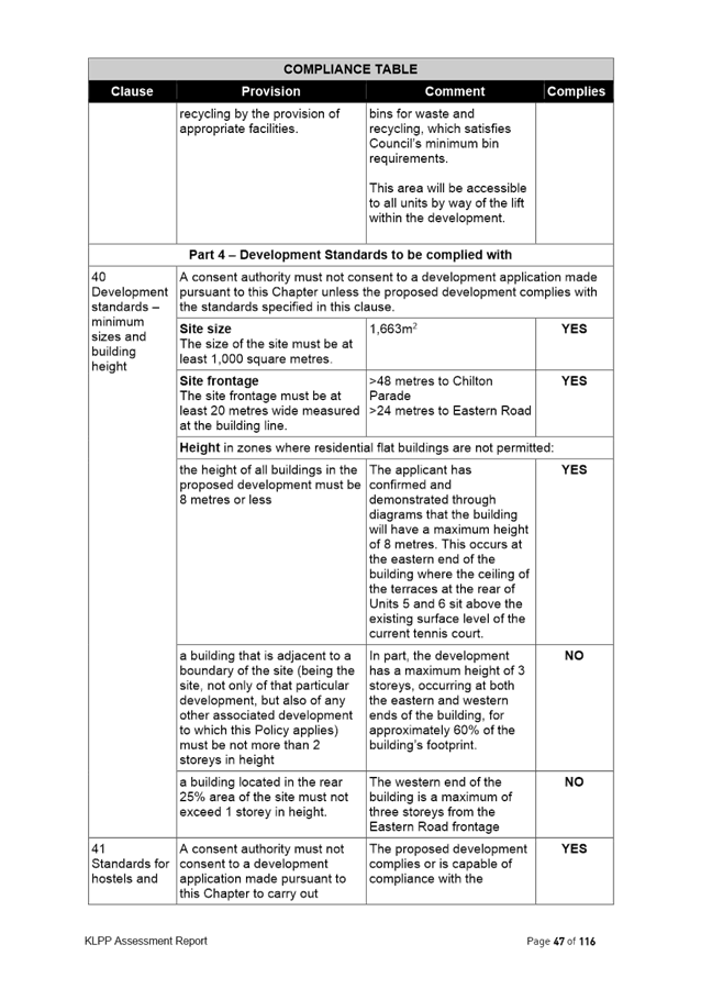
The Planning Proposal that was originally submitted to Council sought to:
· Rezone to R4 High Density Residential;
· apply a Height of Buildings development standard of 17.5m (5 storey) on 8a and 16 Buckingham Road, and retain the 9.5m (2 storey) on 14 Buckingham Road;
· apply a Floor Space Ratio of 1.3:1 on all sites;
· apply a Minimum Lot Size of 1,200sqm on all sites.
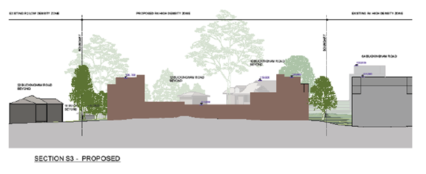
Image 5: Excerpt from original submitted Urban Design Study - Indicative Built Form
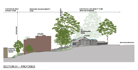
Image 6: Excerpt from original submitted Urban Design Study - Indicative Built Form
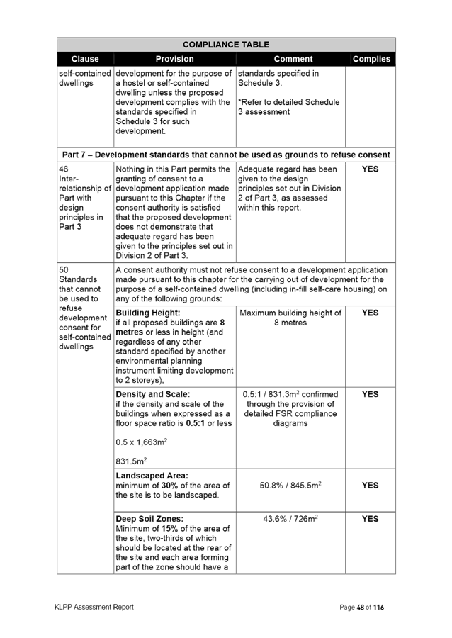
Following a site inspection and preliminary assessment, Council notified the applicant that it had significant concerns with the built form outcomes enabled by the proposed amendments sought within the Planning Proposal, specifically the 17.5m height and 1.3:1 floor space ratio which do not provide an appropriate interface or transition to the adjoining sites which include heritage items and low density dwellings. The applicant was advised that the Planning Proposal in its current form would not be supported and was given the option to either proceed with the assessment of Planning Proposal as originally submitted or invited to submit amended documents to address Councils concerns.
Envelope testing was undertaken by Council’s Urban Designer to understand what would be appropriate development standards across the site and recommended that:
· Building heights reduced on the eastern and western ends of the site, to allow for up to 3 storey at western end and part 3/part 4 on eastern end due to topography. The two storey component in the centre of the site is suitable as it permits view lines to be retained from the heritage item at 10 Buckingham Road over the site and future development on the golf course.
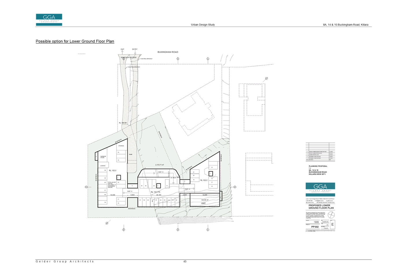
· Floor space ratio should be a result of working back from height, setbacks, deep soil to determine what can be achieved, not just the standard 1.3:1 applied across all the sites. The testing found an indicative a gross floor area of 3225sqm (based on a deduction of 30% for wall thickness, services, balconies, lifts and stairs from the total building envelopes) and an indicative FSR of 0.64:1.
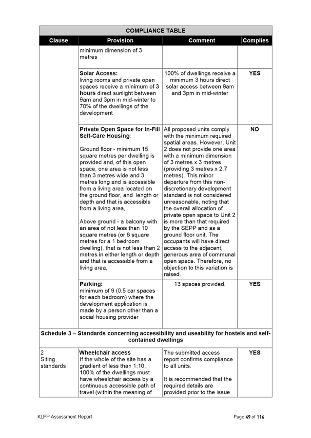
· Building envelope broken up into three separate sections across the site in order to reflect the pattern of subdivision and surrounding low density development context.
· 2 storey built form adjoining the low density residential dwellings and heritage items, with 3rd storey component having greater setback.
Amended Proposal and Proposed Amendments to KLEP 2015
The applicant submitted an amended Planning Proposal, Urban Design Study and Heritage Impact Statement Addendum to address Council’s concerns.
The amended Planning Proposal is included at Attachment A2. Several supporting studies form appendixes to the Planning Proposal, and have been provided to justify the amendments. The Appendixes are included at Attachment A3-A11.
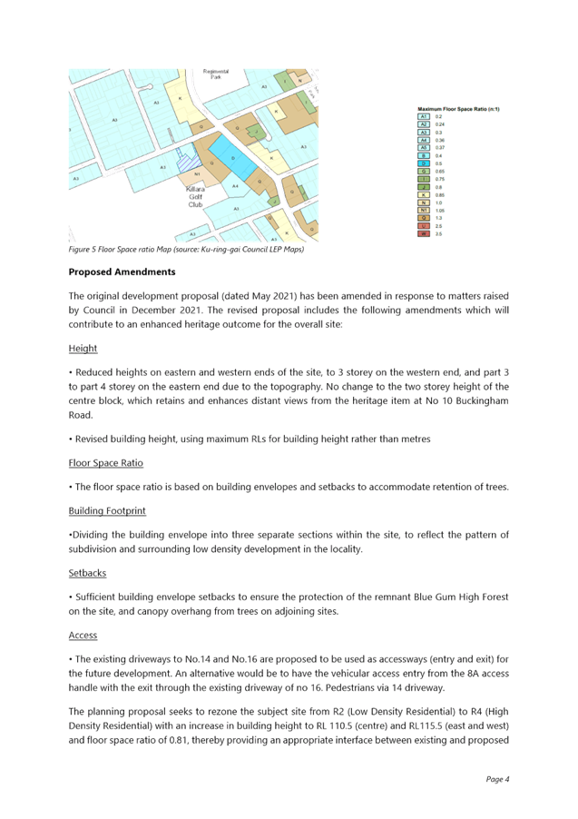
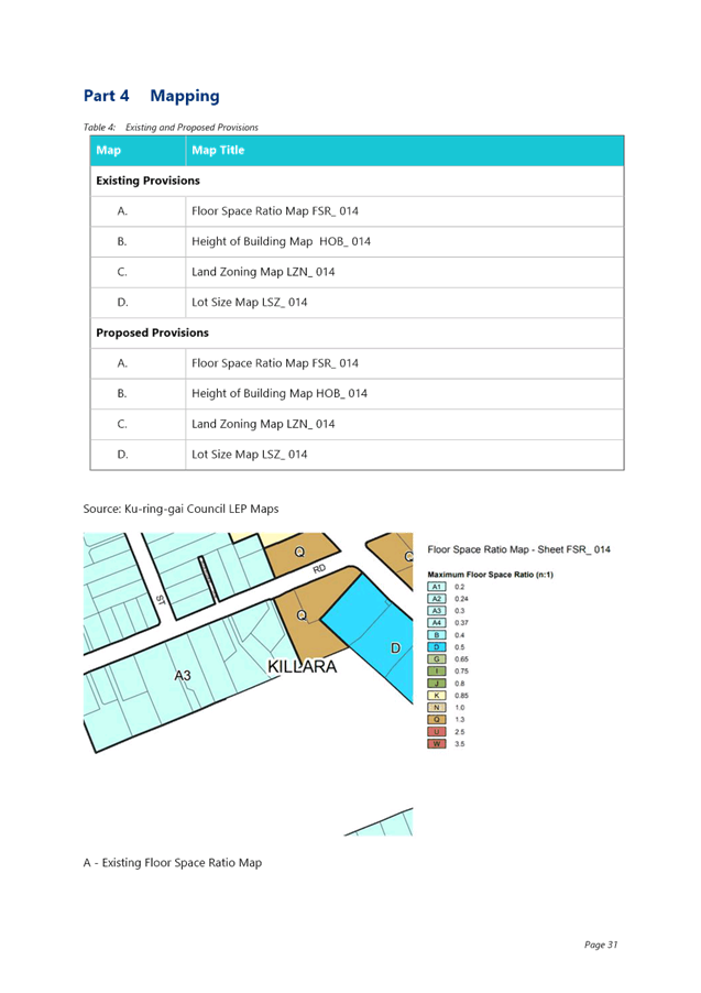
The Planning Proposal seeks to amend the Ku-ring-gai Local Environmental Plan 2015 to rezone the sites from R2 Low Density Residential to R4 High Density Residential and amend the development standards applying to the site as follows:
|
KLEP 2015 – Zoning and Development Standards – 8a, 14 and 16 Buckingham Road, Killara |
||
|
|
Existing |
Proposed |
|
Zoning |
R2 Low Density Residential |
R4 High Density Residential |
|
Floor Space Ratio |
0.3:1 |
0.81:1 |
|
Height of Buildings |
9.5m |
RL115.50 for western and eastern sides of site RL110.50 for central portion of site |
|
Minimum Lot Size |
840sqm |
1,200sqm |
|
Site Specific Provision |
N/A |
Site-specific local provision or map for amalgamation of subject lots prior to redevelopment for purposes of a residential flat building |
Merit
A Planning Proposal is not a Development Application and does not consider the specific detailed matters for consideration under Section 4.15 of the Environmental Planning and Assessment Act 1979. A Planning Proposal only relates to an LEP amendment and cannot be tied to a specific development. The proposed amendments need to be acceptable as an outcome on the site regardless of the subsequent approval or refusal of any future Development Application.
A Planning Proposal must demonstrate the site specific and strategic merit of the proposed amendments. The following is an assessment of the relevant merits of the Planning Proposal:
Site Specific Assessment
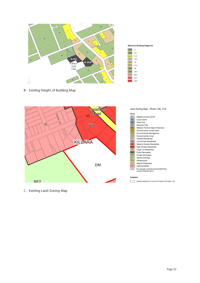
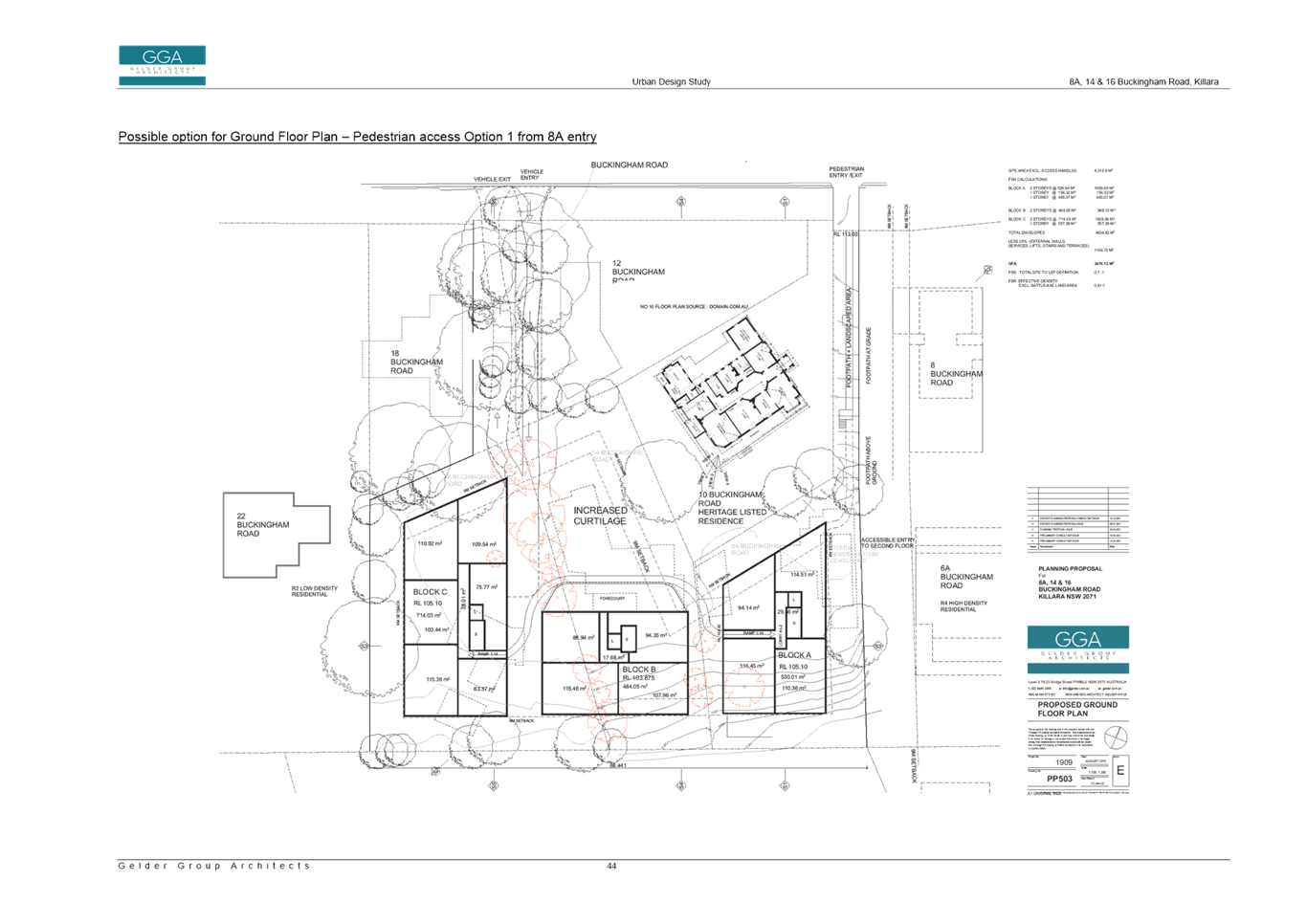
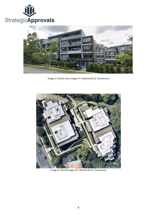
· Zoning – History, Surrounding Context and Proposed
The subject sites are currently zoned R2 Low Density Residential. To the west and north of the site is also zoned R2 Low Density Residential. To the east and south of the site is zoned R4 High Density Residential.
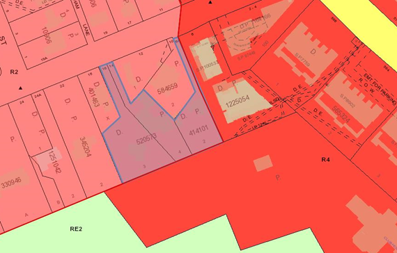
Image 7: Excerpt from KLEP 2015 zoning map
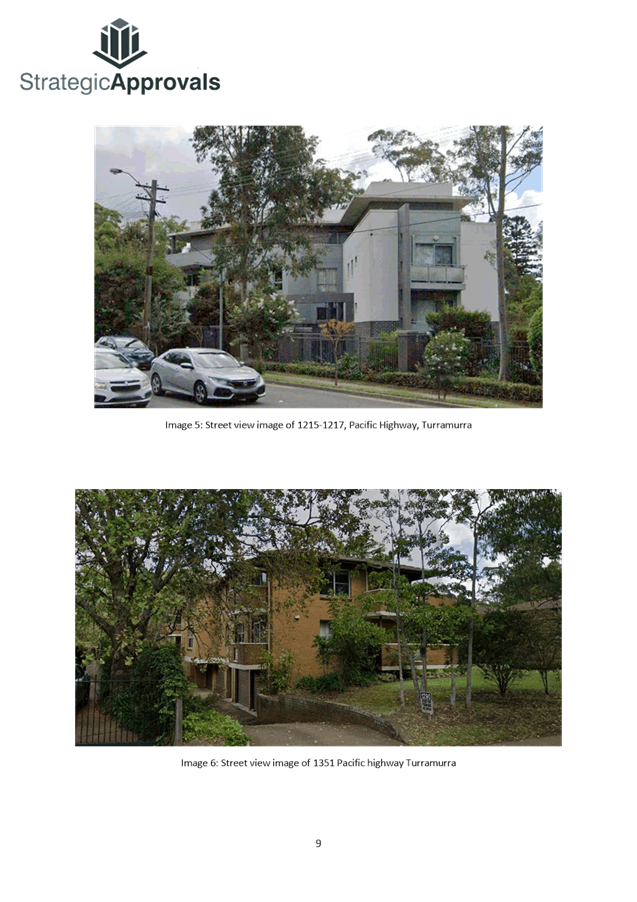
The Minister’s gazettal of LEP No 194 and No 200 in 2004 made provisions which allowed development up to 5 storeys to occur on land zoned Residential 2(d3). This created the situation where 4-5 storey apartment buildings could be developed immediately adjacent to single residential houses. This is what occurred to 8a Buckingham Road, Killara, and the site is known as an interface site.
An Interface Study was undertaken by in 2011 to understand the impact of the existing and potential 5 storey development on the identified interface sites, and to recommend planning solutions for the interface sites. The most common approach was the use of the R3 Medium Density Residential zone to enable the development of townhouses on the interface sites to act as a transition between the high density and low density.
The interface study assessed 8a Buckingham Road and noted:
This property is located to the west of the high density residential zone. It is also located down slope of the potential development site. Future development would potentially cause overlooking and overshadowing issues due to the accentuated height of the development. The vegetation on the common boundary will provide limited privacy screening.
The interface study assessed the potential for overshadowing to be medium-high, the potential for overlooking to be high and the overall impact to be significant. Despite this, the assessment found that the upzoning of 8a Buckingham Road (as a single site) to R3 Medium Density was not suitable due to the site providing a curtilage to the adjoining heritage item and due to the size and configuration the site would not be able to develop successfully on its own.
The area of the Killara Golf Club adjoining the subject site to the south was rezoned through a private Planning Proposal to R4 High Density Residential in 2019, which took into specific consideration the potential impacts on the adjoining low density residential dwellings of 8a, 14 and 16 Buckingham Road.
It is acknowledged that the subject sites are interface sites, as they adjoin R4 High Density Residential zoned land to the east and south. However, the context of the adjoining low density residential zoned land and dwellings to the west and north, including heritage items needs to be taken into consideration, alongside the residential flat building at 6a Buckingham Road and the potential development outcomes on the Killara Golf Course site.
The proposed R4 High Density Residential zone, with a reduced height limit (i.e. not the standard 17.5m/5 storey as discussed in greater detail below) is considered appropriate in the surrounding context as it provides an appropriate transition and interface to surrounding sites. The proposed R4 High Density Residential zone is considered more appropriate than using an R3 Medium Density Residential zone on the sites, as the R4 zone permits residential flat buildings which have a reduced development footprint and facilitates greater setbacks, compared to a townhouse style development under an R3 Medium Density Residential zone. This is especially important for the adjoining heritage items, low density dwellings and significant trees.
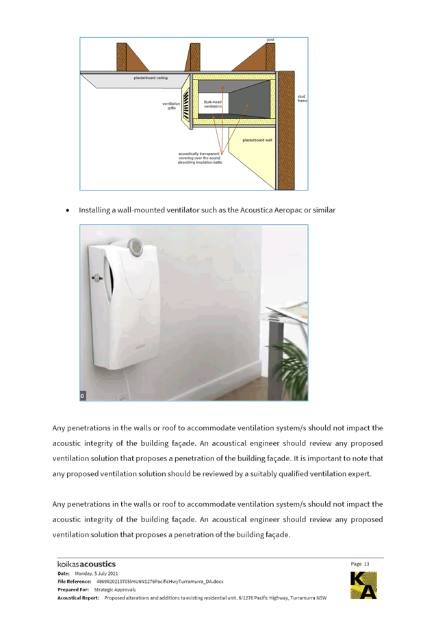
An R4 zoning with a reduced height limit has been used elsewhere in Ku-ring-gai as a response to address interface impacts between high density sites and heritage items/low density sites.
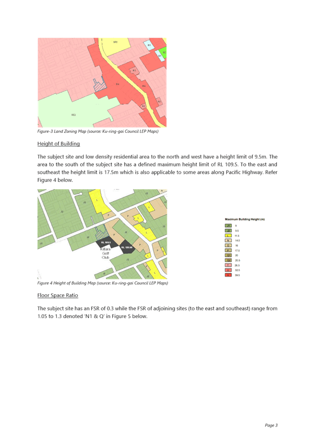
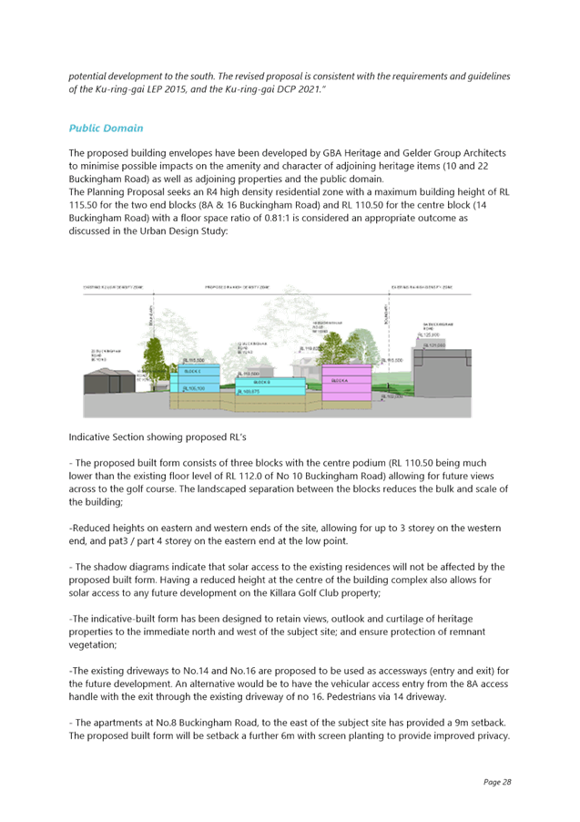
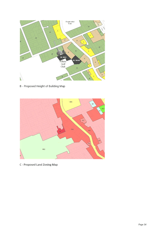
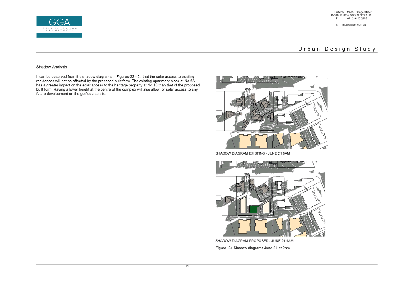
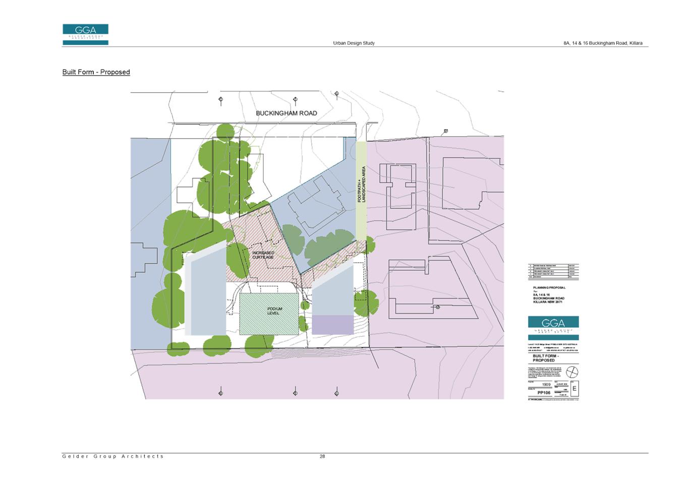
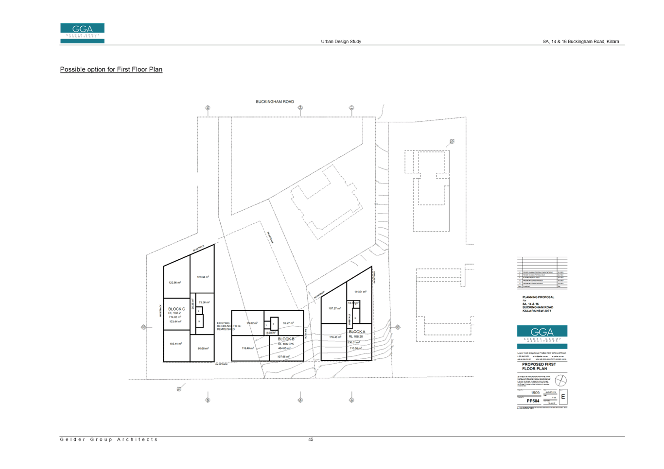
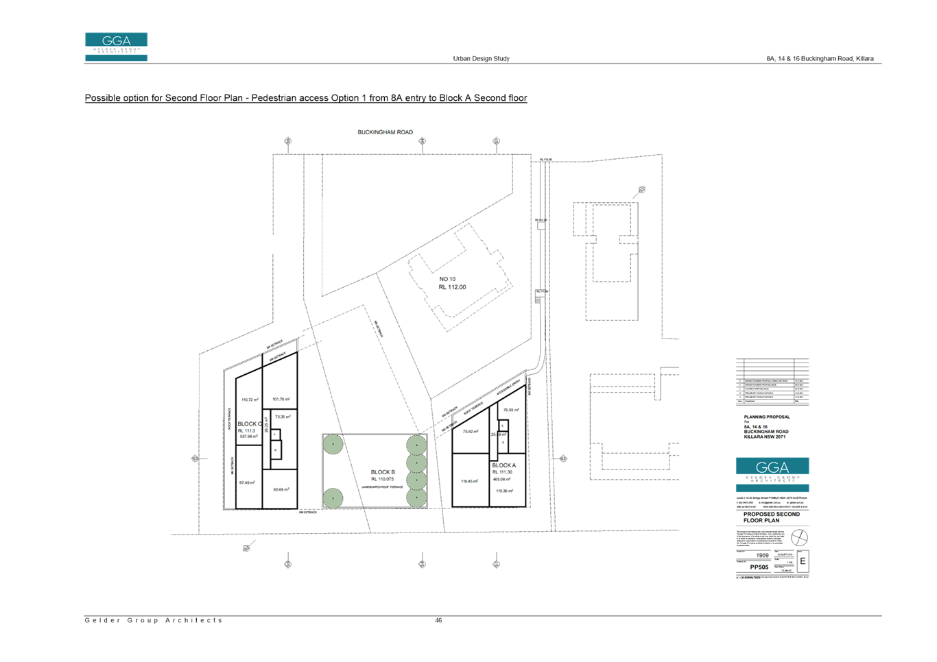
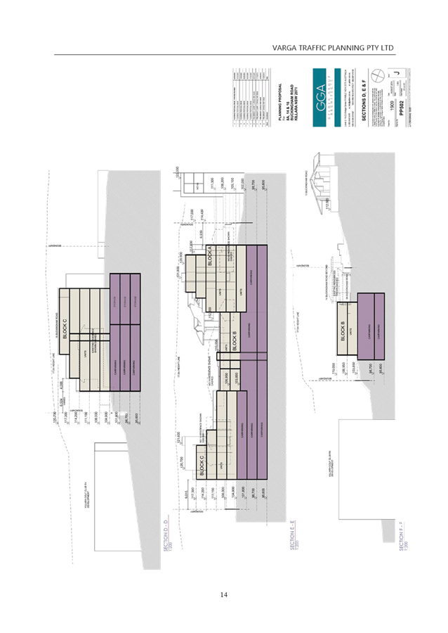
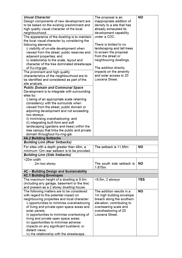
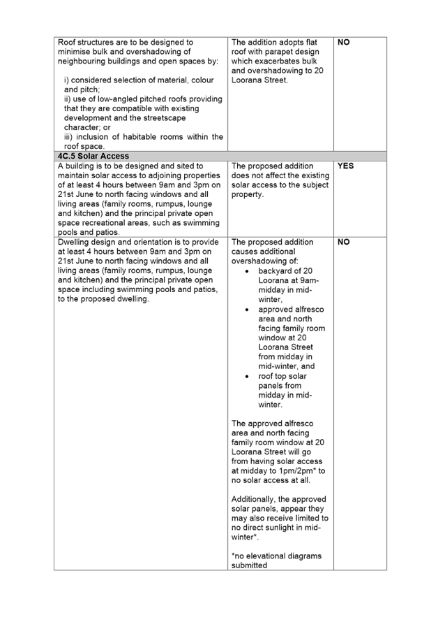
· Height
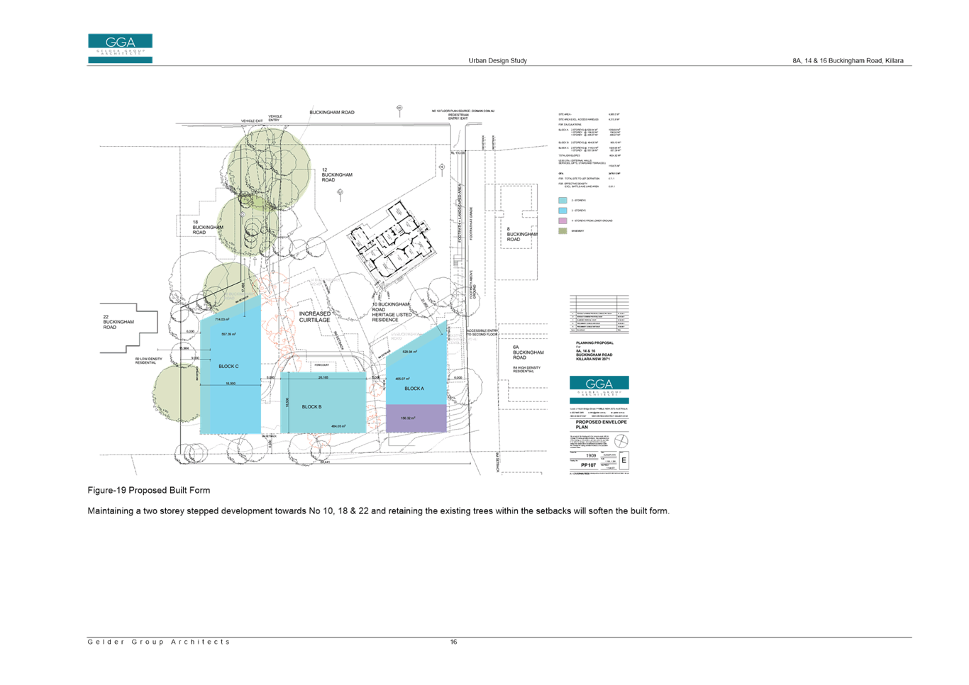
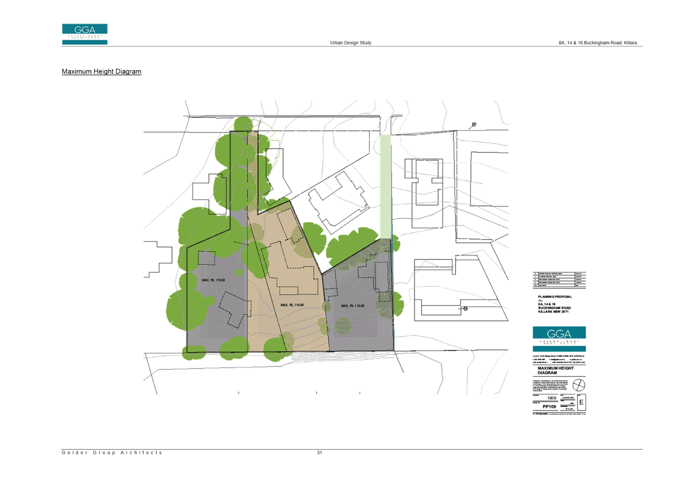
The Planning Proposal seeks to amend the Height of Buildings development standard on the site from 9.5m to a maximum RL115.50 for western and eastern portions of the site and a maximum RL110.50 for central portion of site. The proposed boundaries of the RLs follow the existing lot boundaries (see Image 9 – proposed height of building map below).
o 8a Buckingham Road – maximum RL115.50
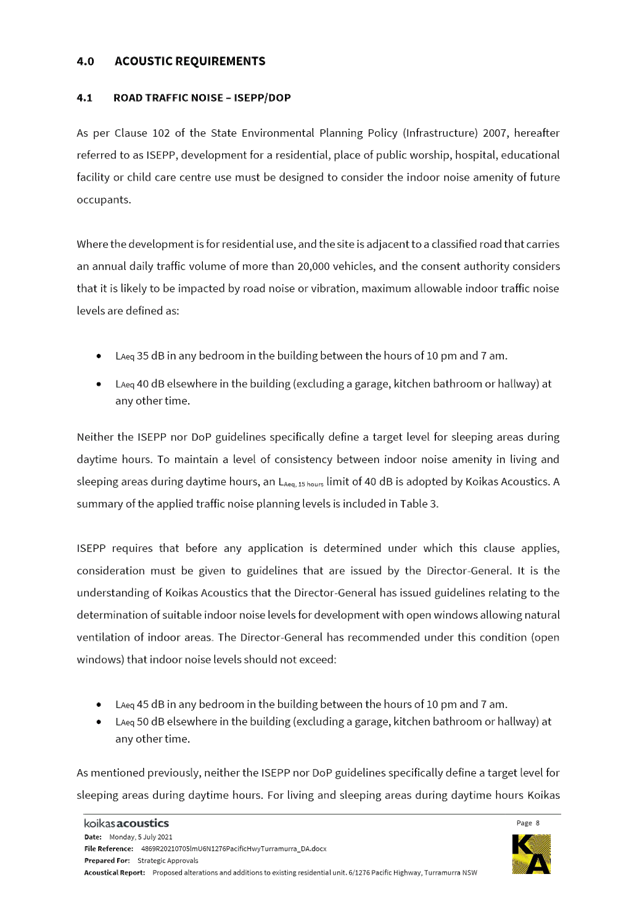
o 14 Buckingham Road – maximum RL110.50
o 16 Buckingham Road - maximum RL115.50
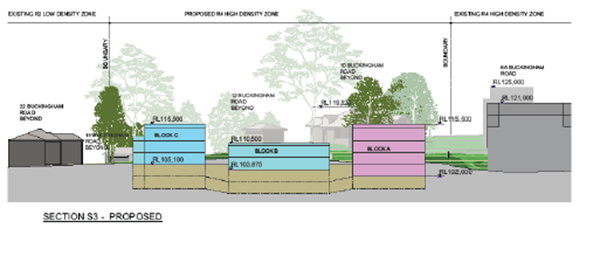
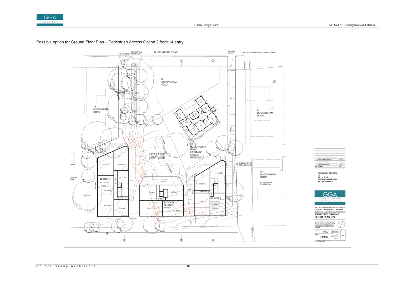
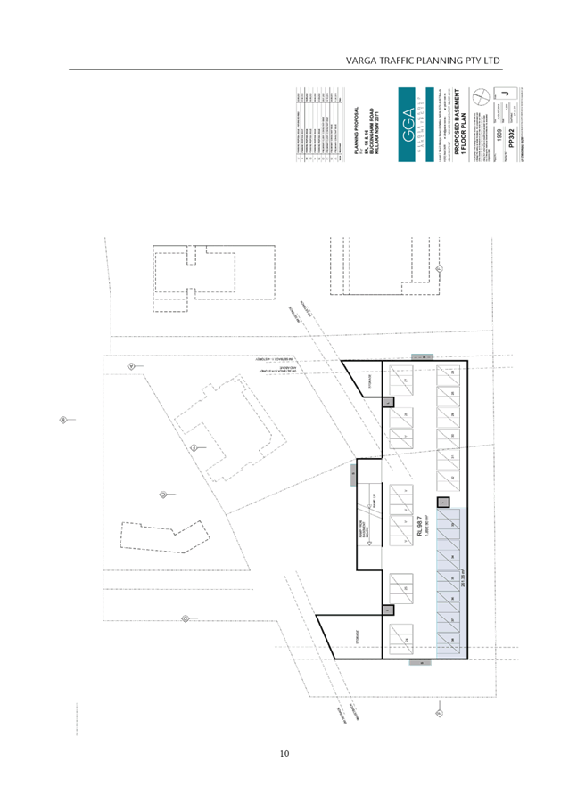
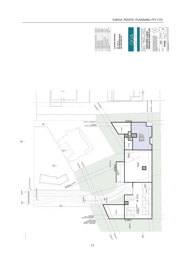
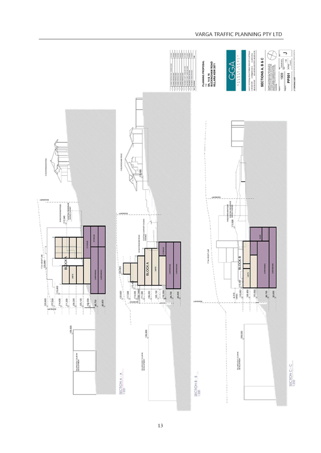
Image 8: Excerpt from Urban Design Study
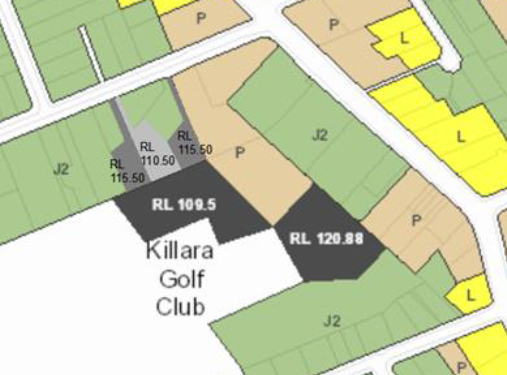
Image 9: Proposed Height of Buildings Map – Planning Proposal
The use of maximum RLs across the site rather than a just proposing a standard 9.5m/11.5m height is supported as it provides greater certainty and control over the development outcomes enabled by the Planning Proposal.
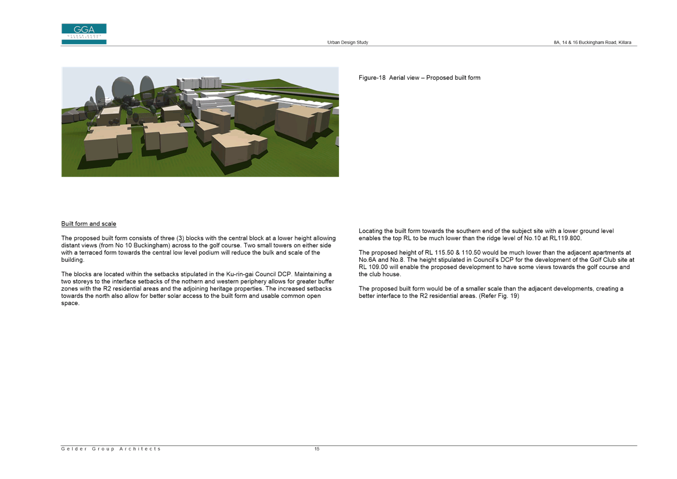
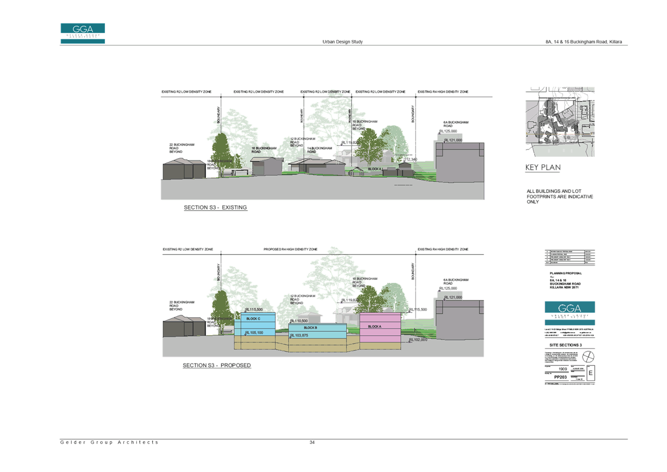
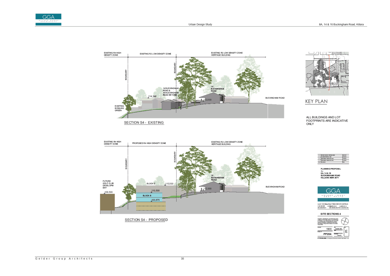
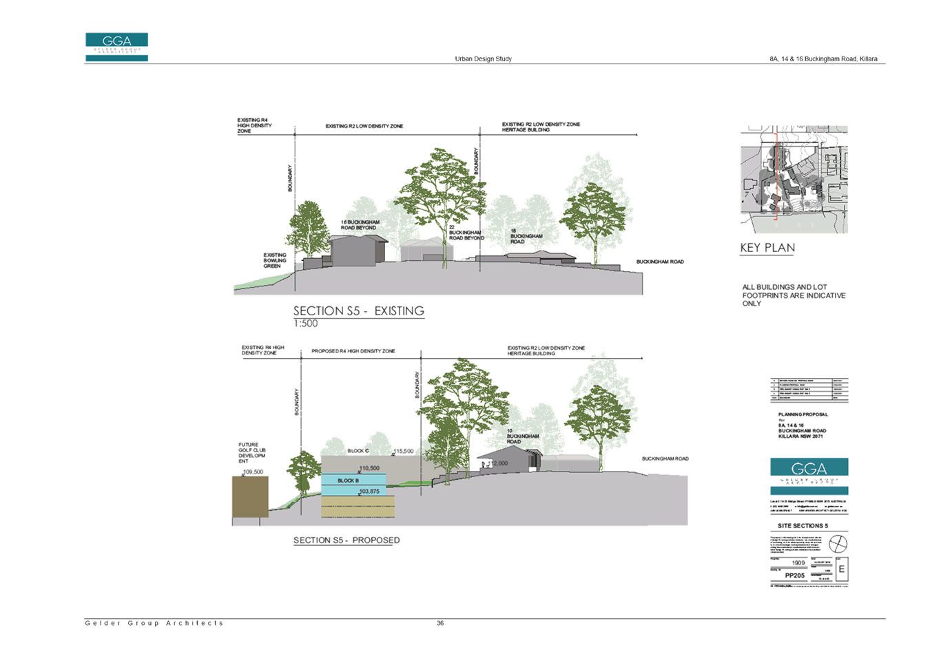
The proposed RLs of a maximum RL115.50 for western and eastern sides of site and a maximum RL110.50 for central portion of site, would enable development for at part 3/part 4 storey building at the eastern end of the site, up to 3 storeys on the western end of the site, and 2 storey component within the central portion of the site.
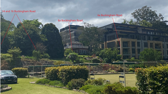
Image 10: Context of subject sites, existing residential flat building development and golf course
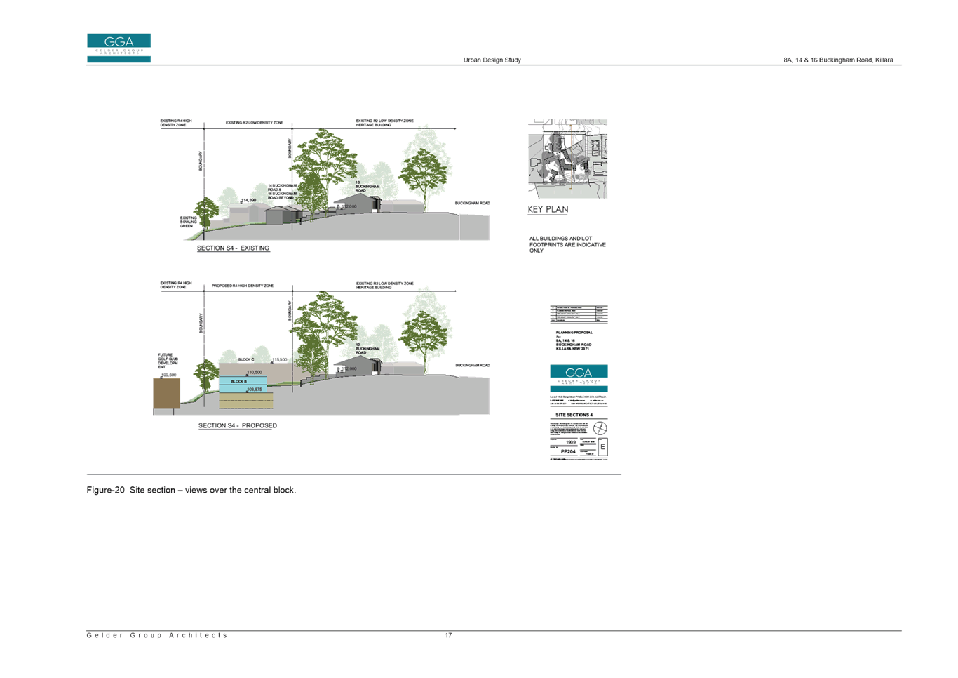
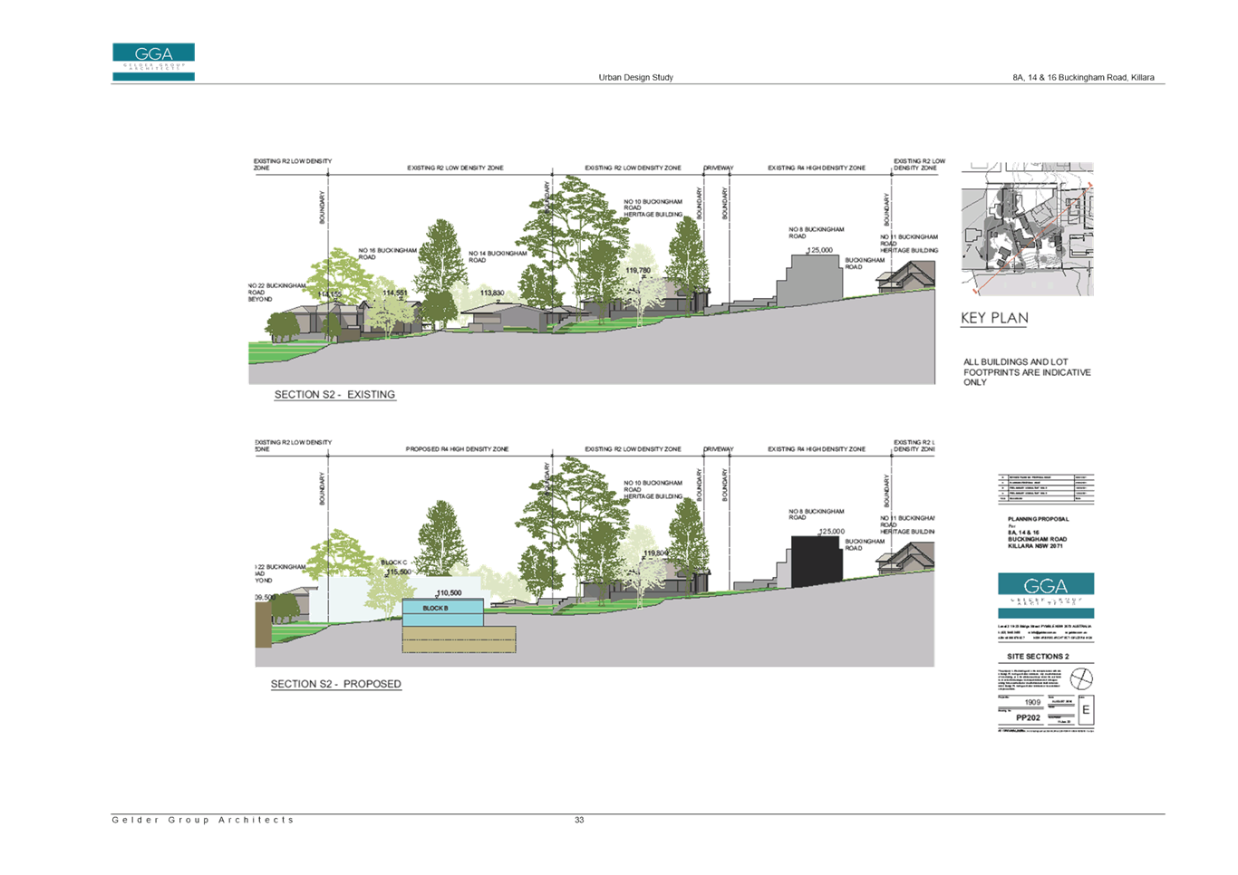
In the assessment of the Planning Proposal for the Killara Golf Course, due to impacts on the adjacent low density dwellings at 8a, 14, 16 and 22 Buckingham Road, Killara an amendment was required which required a reduction in height adjacent to the Buckingham Road properties boundary to a maximum RL109.5, which would enable development of residential flat buildings to a maximum 3 storey height.
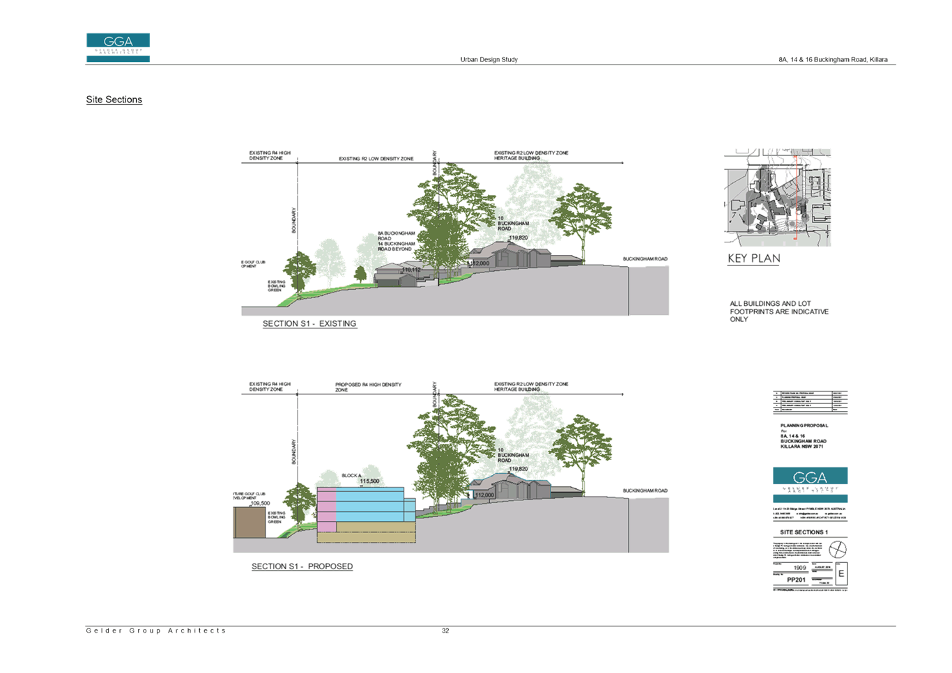
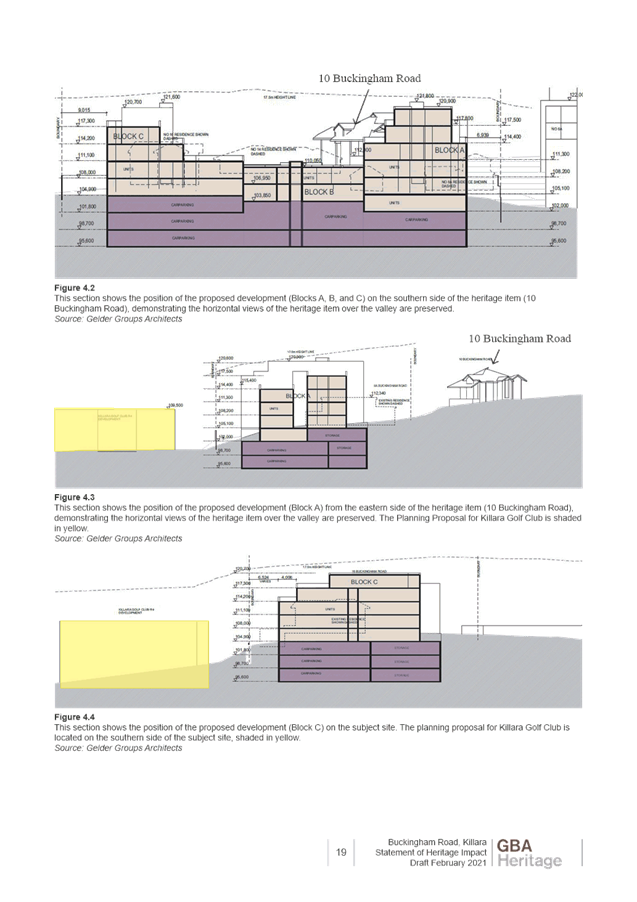
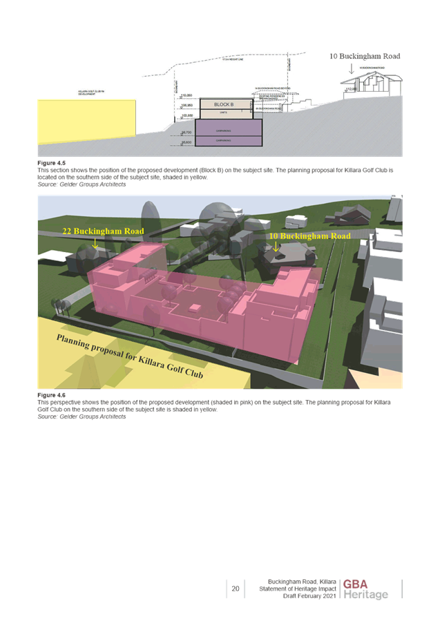
Images 11 and 12 (below) are excerpts from the Urban Design Study submitted with the Planning Proposal for the subject site and demonstrates the relationship between built form enabled on the Killara Golf Course, the proposed built form enabled on the subject sites, and the adjoining heritage item at 10 Buckingham Road.
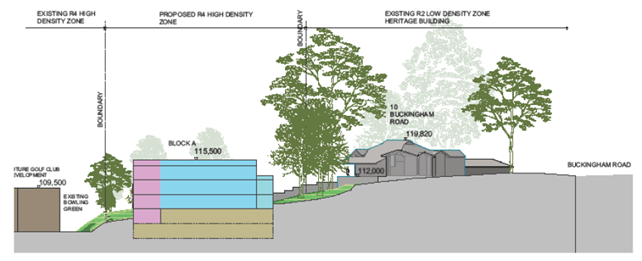
Image 11: Relationship between Planning Proposal on subject sites, potential development on golf course and 10 Buckingham Road.
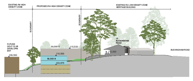
Image 12: Relationship between Planning Proposal on subject sites, potential development on golf course and 10 Buckingham Road.
The proposed maximum building height development standards across the site respond to the surrounding context and provide an appropriate step down and transition of height from the adjoining residential flat building development at 6a Buckingham Road to the adjoining R2 Low Density Residential zoned properties to the north and west. The maximum RL110.50 in the central portion of the site will enable the setting of the heritage item to be maintained, with views over Block B towards the south and Killara Golf Couse.
The proposed maximum building height development standards also respond appropriately to the changes in topography between the subject site, the adjoining low density residential sites and the Killara Golf Course.
The proposed maximum building height development standards are appropriate in the context of the adjoining development.
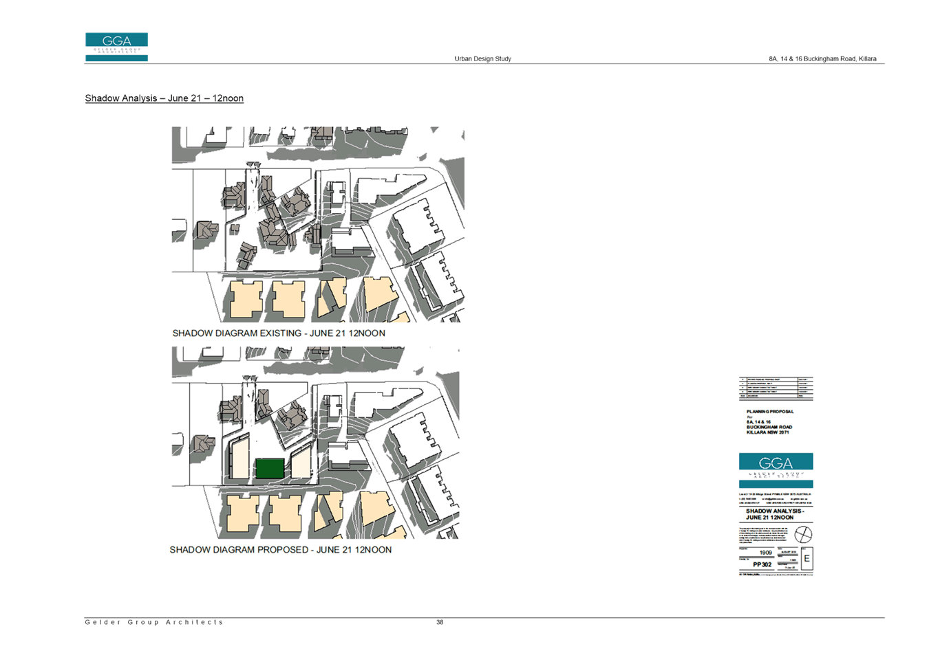
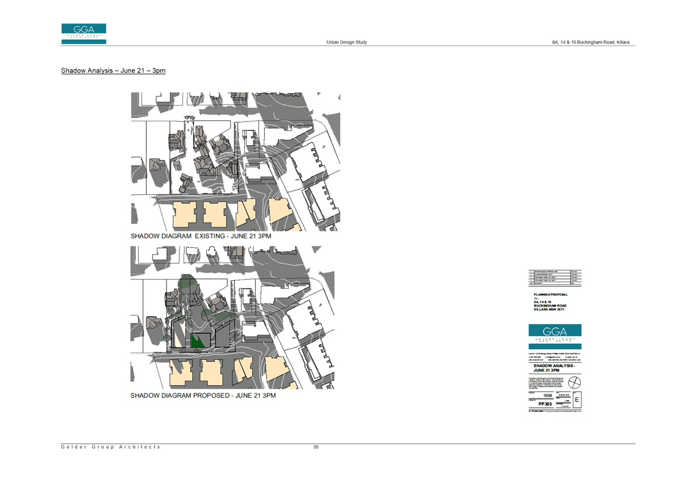
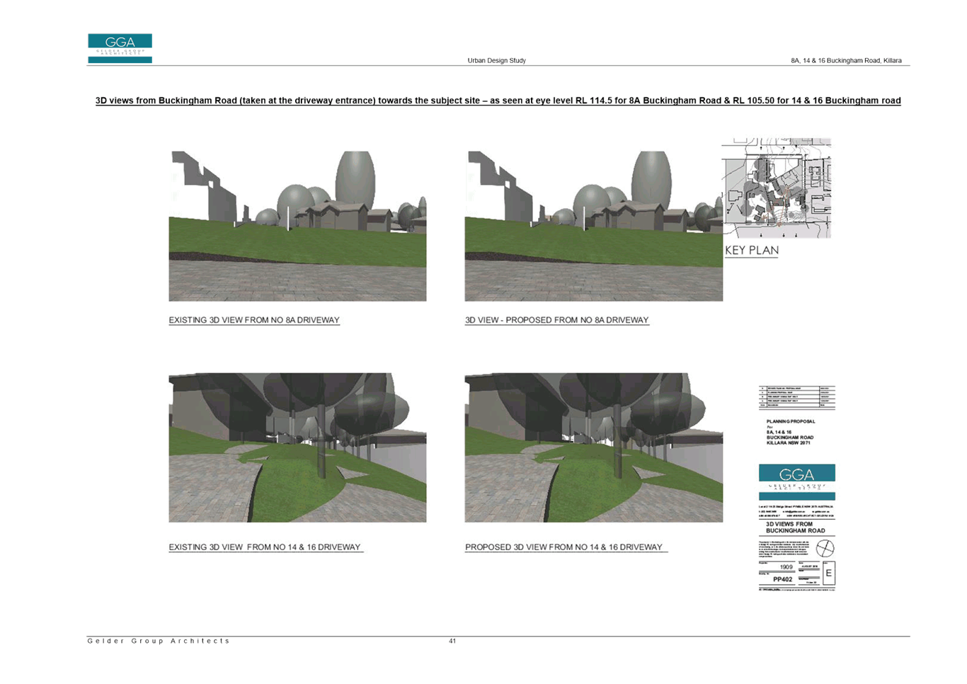
While it is noted that the Planning Proposal is proposing a maximum RL of 110.50 for the central portion of the site, the 3D View Perspective (PP401 of the Urban Design Study) shows a lift overrun exceeding above the proposed maximum height of buildings. The lift overrun does not appear on any other plan drawings or sections in the Urban Design Study. The Urban Design Study also includes references to and annotations of a ‘landscape podium’ on the rooftop within the central portion of the site (PP301, 302 and 303). It is assumed that the lift overrun is to access this ‘landscape podium’. As this is a Planning Proposal, and not a Development Application, consideration of detailed design is not appropriate and is not considered as part of the assessment. A Planning Proposal cannot be tied to a particular development design outcome on the site. It is recommended that the references and images of the lift overrun and landscape podium be deleted from the Urban Design Study and Planning Proposal.
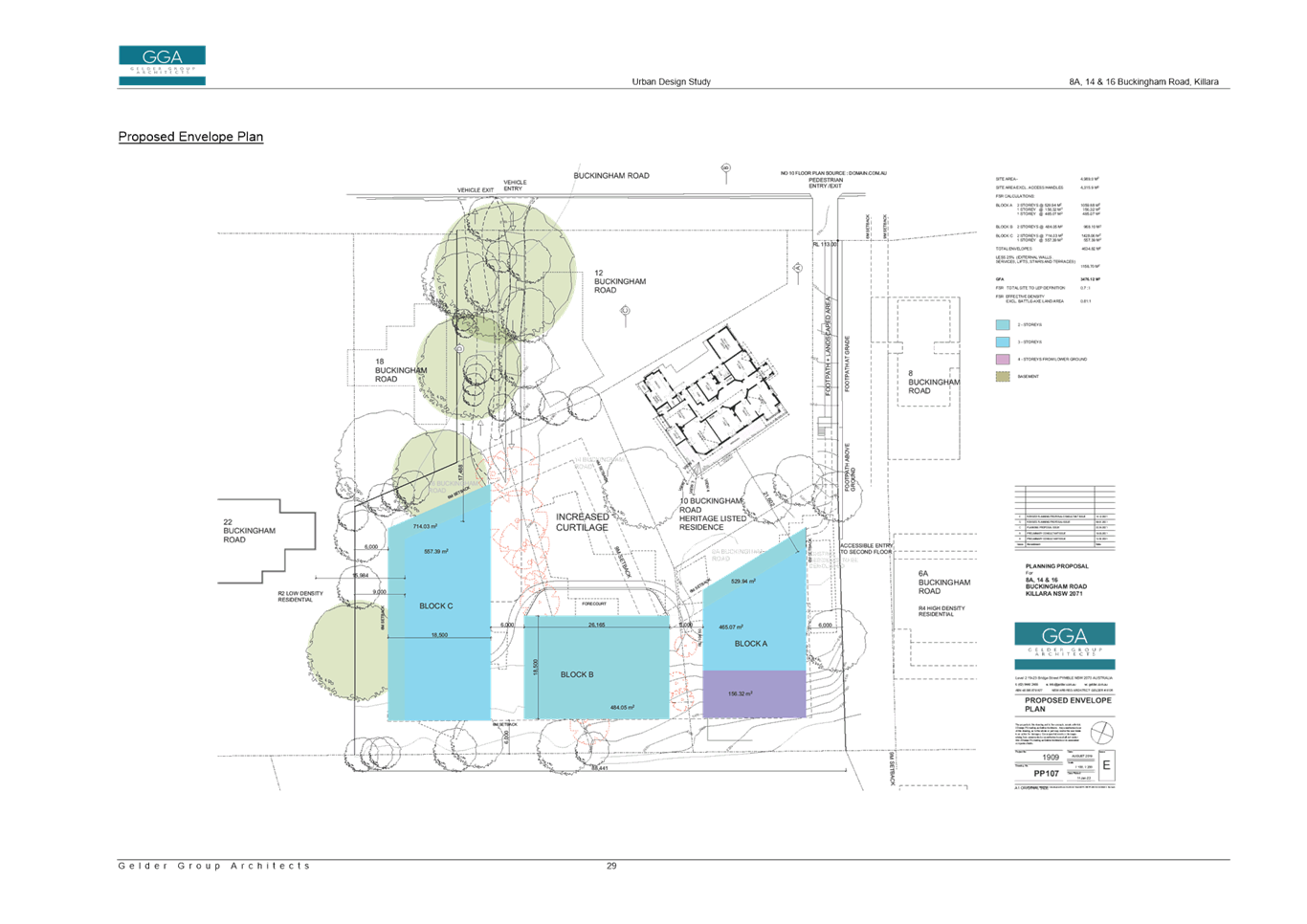
· Floor Space Ratio
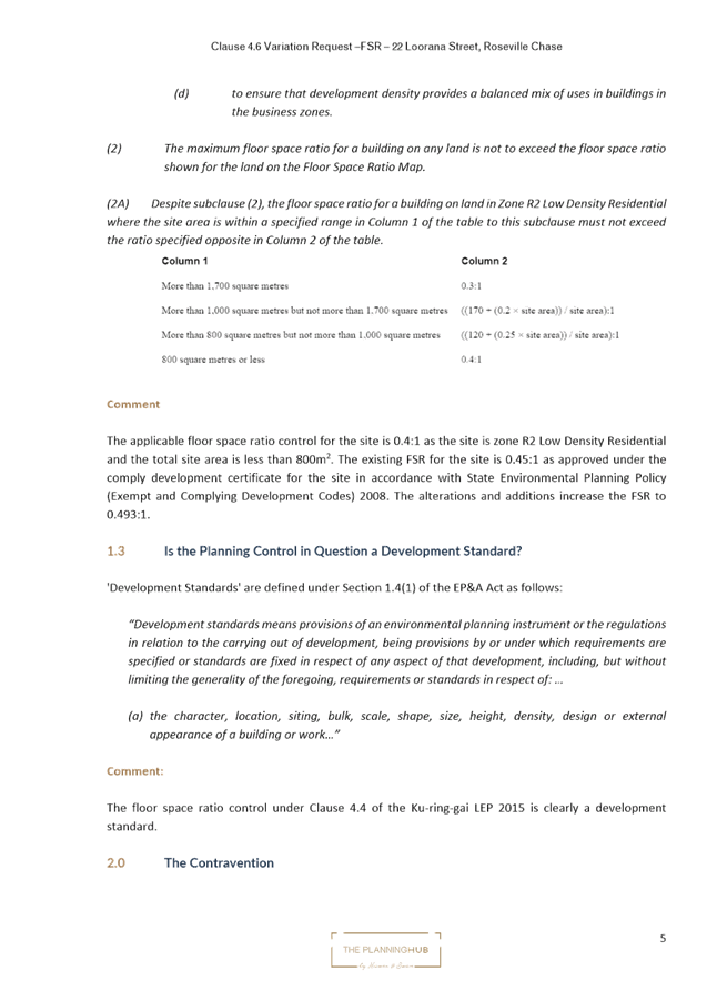
The Planning Proposal seeks to amend the KLEP 2015 floor space ratio development standard applying on the sites from 0.3:1 to 0.81:1.
(Note: Part 2 Explanation of Provisions of the Planning Proposal states the proposed floor space ratio is 1.81:1 – however all other parts of the Planning Proposal and Urban Design Study state 0.81:1 is proposed).
The Urban Design Study includes a breakdown of how the floor space ratio was derived (Proposed Envelope Plan PP107). The total area of the building envelopes are very similar to the testing undertaken by Council’s Urban Designer, however the Urban Design Study has allowed for a 25% reduction for wall thickness, services, balconies instead of the 30% used by Councils Urban Designer. The Apartment Design Guide indicates that a building envelope should be 25-30% greater than the achievable floor area to allow for building components that do not count as floor space but contribute to building design and articulation. In this regard the use of 25% is acceptable.
The Urban Design Study outlines that the total building envelopes – 25% provides a Gross Floor Area of 3476.12m2. This results in a floor space ratio of 0.7:1 across the entire subject site in accordance with the LEP definition.
The Urban Design Study then provides a floor space ratio for the ‘effective density’, whereby the area of the battle-axe handles have been excluded from the total site area, which results in a floor space ratio of 0.81:1.
The Planning Proposal is seeking to use the ‘effective density’ of 0.81:1 as the proposed amendment to the maximum floor space ratio on the site. This is incorrect and not supported. A maximum floor space ratio of 0.81:1 across the site would result in a development outcome that is bigger, bulkier and more dense than that modelled in the Urban Design Study, and is not appropriate for the surrounding context.
The Urban Design Study analysis of testing the building envelopes and site area as per the LEP definition supports a maximum floor space ratio of 0.7:1. A floor space ratio of 0.7:1 will deliver an ‘effective density’ of 0.81:1 on the area of the site that is developable.
It is recommended that Planning Proposal be amended to a maximum floor space ratio of 0.7:1.
· Site Specific Local Provision for Site Amalgamation
The Planning Proposal seeks to include a site-specific local provision or map to require amalgamation of the lots (8a, 14 and 16 Buckingham Road) prior to a redevelopment for the purposes of a residential flat building. No further detail or analysis is provided in the Planning Proposal as to the site-specific provision for site amalgamation.
It is a concern that lots, which are all over 1,200sqm, could be developed individually without any consolidation. Due to the battle axe nature of the lots and constraints such as topography and heritage, the best outcome is for the lots to be amalgamated and developed as one consolidated site. This will ensure that any the any future residential development on the site allows for generous landscaped areas and setbacks to ensure the amenity and adjoining properties and curtilage to the heritage item is maintained.
The inclusion of a site-specific local provision which requires the subject sites to be amalgamated to enable development of a residential flat building is supported. However, as both multi dwelling housing and residential flat buildings are permitted within the proposed R4 High Density Residential zone, the site-specific provision should require lot consolidation for both these uses, not just residential flat buildings as proposed.
Clause 6.6 of the KLEP 2015 currently requires that development consent must not be granted for multi dwelling housing or a residential flat building unless the lot has an area of at least 1,200m2.
An amendment to Clause 6.6 Requirements for Multi Dwelling Housing and Residential Flat Buildings could be made, which requires that development for the purposes of multi dwelling housing or a residential flat building on the site would need a minimum lot size of 4,300m2.
(Note: 6.6(4) outlines that the area of access handles is not including in calculating the lot size for the purpose of this clause, so accordingly the minimum lot size proposed is 4,300sqm which is the site area excluding the access handles and not 4,989 which is the total site area).
Clause 6.6 already contains a site-specific provision for sites at Turramurra on the Pacific Highway, which sets a minimum lot size of 5,000sqm for the erection of multi dwelling housing or a residential flat building, as outlined below:
3) Despite subclause (2), development consent must not be granted for the erection of multi dwelling housing or a residential flat building on a lot on land identified as “Area 1” on the Lot Size Map unless the lot has an area of at least 5,000 square metres.
A similar site-specific provision could be made for the subject site, as follows:
3a) Despite subclause (2), development consent must not be granted for the erection of multi dwelling housing or a residential flat building on a lot on land identified as “Area 2” on the Lot Size Map unless the lot has an area of at least 4,300sqm.
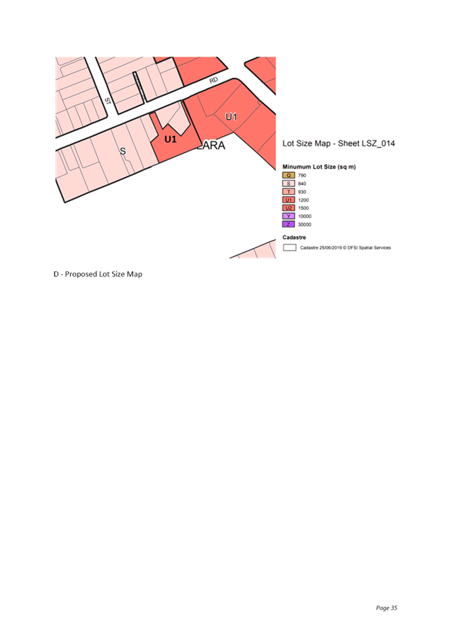
It is recommended that the Planning Proposal be amended to include the draft site-specific provision (above), which requires a minimum lot size of 4,300sqm for the development of either multi dwelling housing or a residential flat building on the site. The Minimum Lot Size Map in Part 4 Mapping of the Planning Proposal is also required to be amended to identify the subject sites as ‘Area 2’ for the purpose of this clause.
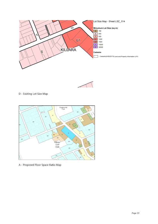
· Minimum Lot Size
The Planning Proposal seeks to amend the KLEP 2015 minimum lot size development standard from 840sqm to 1200sqm.
A lot size of 1200sqm is the standard minimum lot size that has been applied throughout Ku-ring-gai for sites zoned R4 High Density Residential, and this is consistent with the 1,200sqm minimum lot size required under Clause 6.6 for the development of multi dwelling housing or residential flat buildings permitted in the R3 Medium Density and R4 High Density zones.
As discussed above under Site-Specific Local Provision for Site Amalgamation, the Planning Proposal seeks to include a site-specific local provision requiring the amalgamation of the three sites for the development of a residential flat building, and a minimum lot size of 4,300sqm is recommended. To reinforce the requirement for lot consolidation and ensure consistency between the minimum lot size required under Clause 6.6 for the development of multi dwelling housing and residential flat buildings and the minimum lot size under Clause 4.1 and the Minimum Lot Size Map, it is recommended that the Planning Proposal be amended to propose a minimum lot size of 4,300sqm.
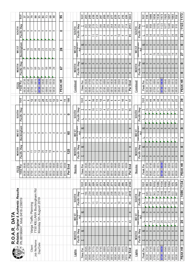
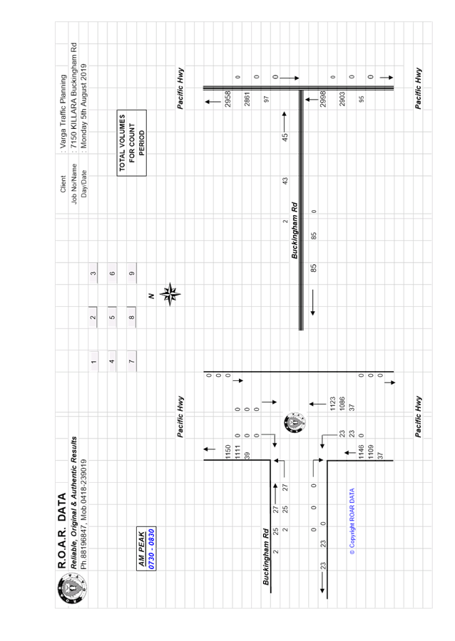
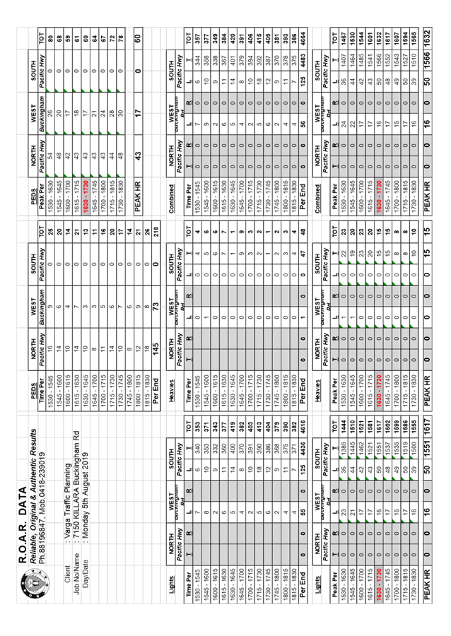
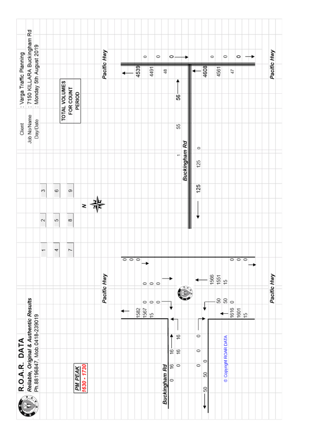
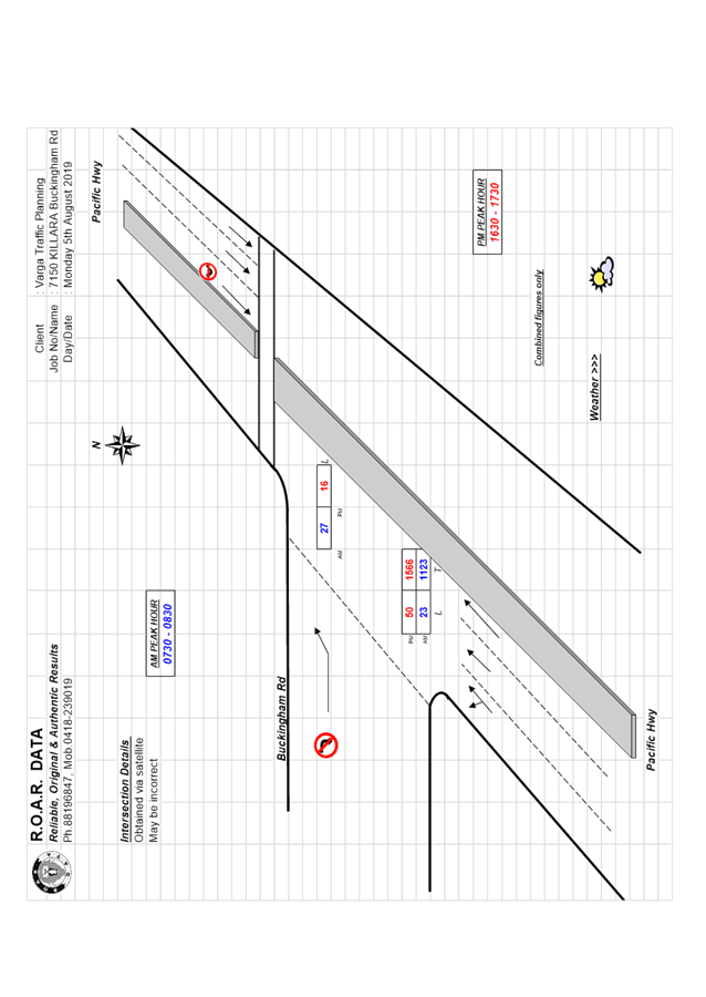
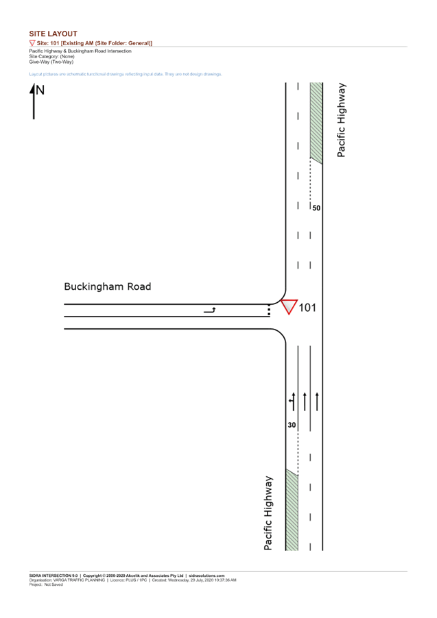
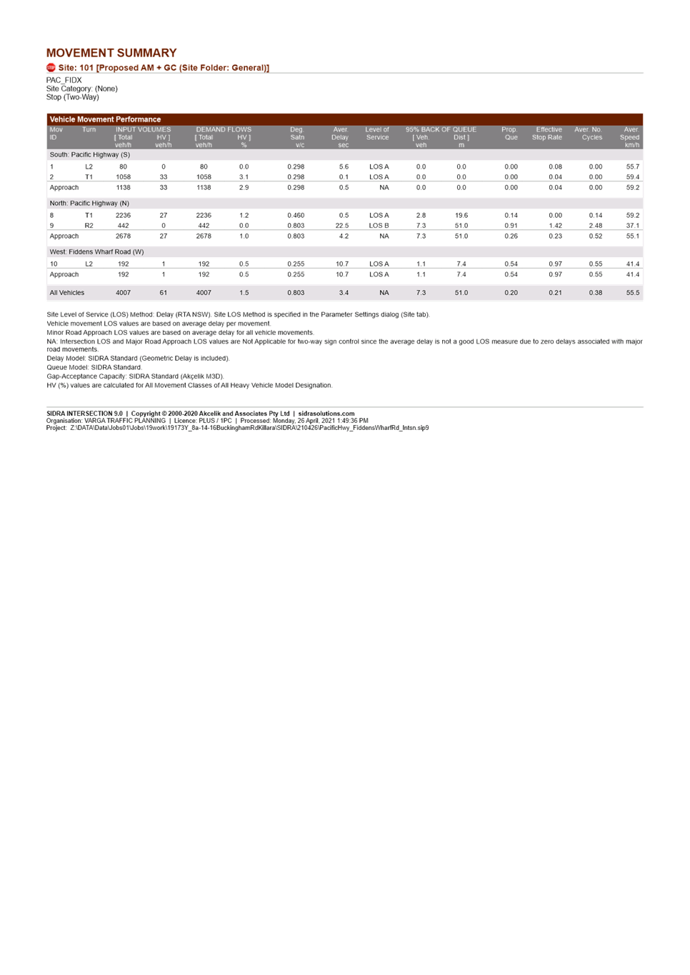
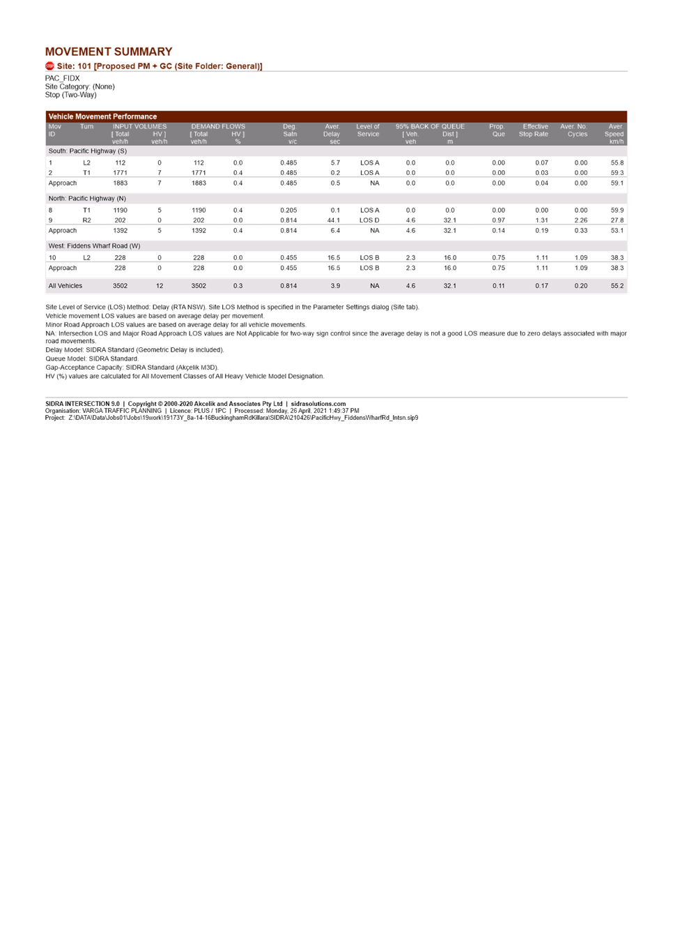
· Traffic and Transport
A Traffic and Transport Study was submitted with the original Planning Proposal, and has not been updated with the amended Planning Proposal, however the amended dwelling yield is 36-40 apartments (vs 34-40 in the original proposal) so there is no real change to the traffic study in terms of traffic generation. The Traffic and Transport Study includes diagrams from the original Urban Design Study and should be amended so as to include the revised diagrams in order to avoid confusion.
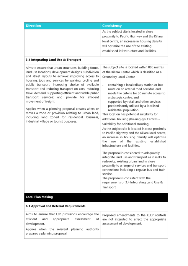
In assessing the Planning Proposals impact on traffic and transport matters, consideration is had to s9.1 Ministerial Directions related to:
o 3.1 Residential zones
The objectives of this direction are (in part):
(b) to make efficient use of existing infrastructure and services and ensure that new housing has appropriate access to infrastructure and services;
o 3.4 Integrating Land Use and Transport
The objective of this direction is to ensure that urban structures, building forms, land use locations, development designs, subdivision and street layouts achieve the following planning objectives (in part):
(a) improving access to housing, jobs and services by walking, cycling and public transport;
(b) increasing the choice of available transport and reducing dependence on cars;
(c) reducing travel demand including the number of trips generated by development and the distances travelled, especially by car;
Councils Strategic Transport Engineer has reviewed the proposal and provided the following key points:
Public Transport, and Journey to Work
Image 13 (below) shows the catchment within 30 minutes of public transport travel time of the subject site.
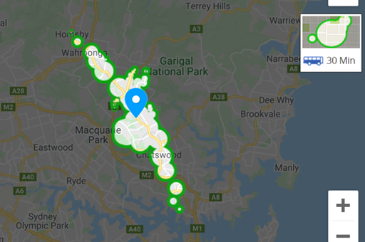
Image 13: Travel Time Map – 30minute Public Transport Catchment
Source: Walkscore.com. Includes walking distance/time to access public transport
The travel catchment extends (in a north-south direction) to employment areas and strategic centres of Chatswood, St Leonards and nearly as far as south as North Sydney. Northerly, it extends as far as Hornsby. The 30 minute catchment is much more limited in the east-west direction, barely extending to the eastern edge of Macquarie Park.
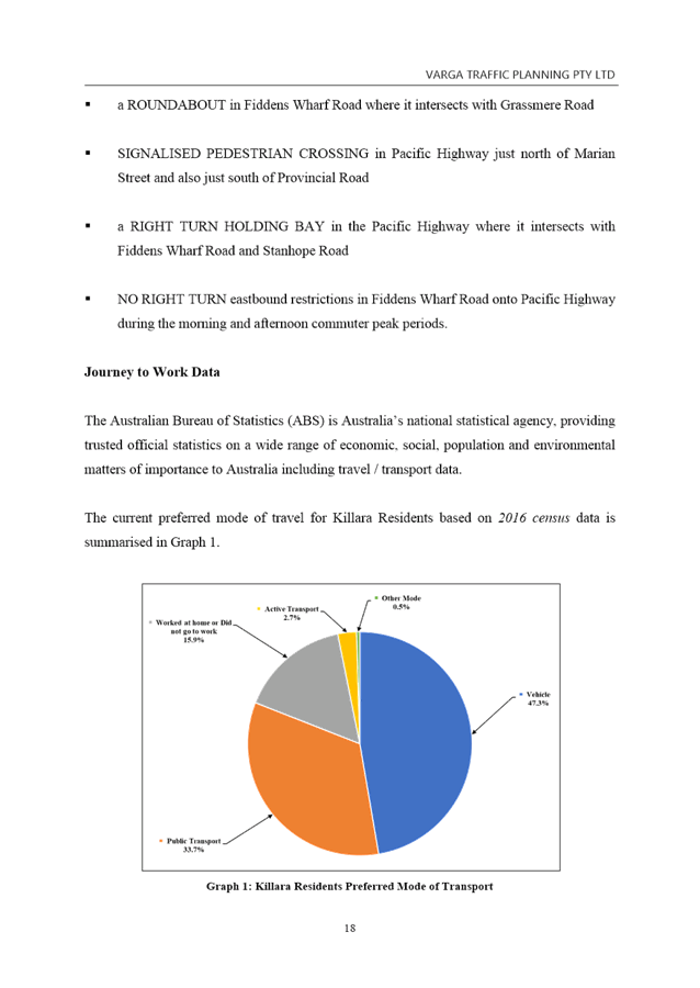
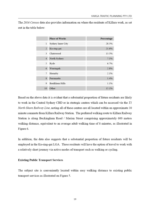
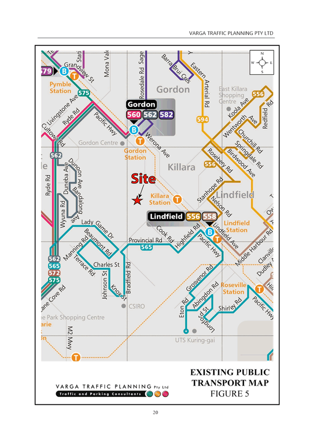
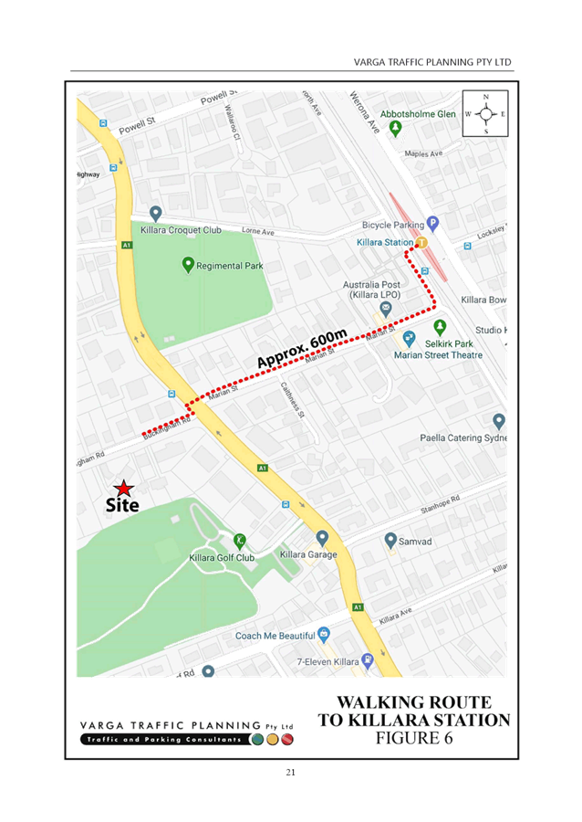
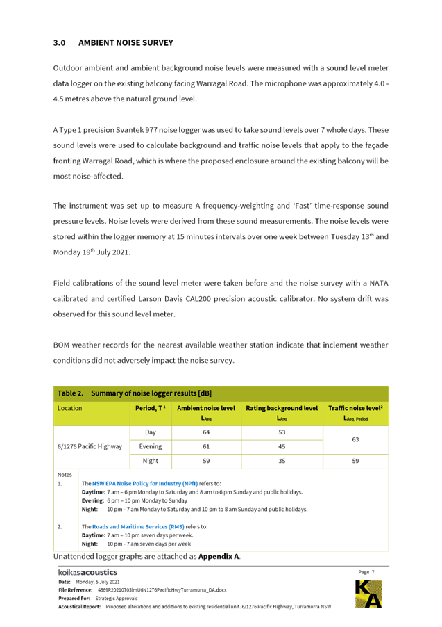
The Table – Journey to Work (below) is an extract from the 2016 Census of Journey to Work that the majority of residents living in the area travel to work destinations largely in the City, and to destinations generally along the North Shore railway. As a result, a relatively high proportion of trips to work are undertaken by rail due to the proximity to Killara railway station, and the places of work are shown in the catchment map above as generally being within 30 minutes travel by public transport. There are also approximately 12% of work trips that were made by walking and cycling.
Overall, the subject site would provide relatively good access to jobs by public transport.
|
Mode of Travel |
|||||||
|
Car, as driver |
Train |
Bicycle |
Walked only |
Worked at home |
Total |
||
|
Destination |
Blacktown |
6 |
|
|
|
|
6 |
|
City and Inner South |
9 |
11 |
|
|
|
20 |
|
|
North Sydney and Hornsby |
18 |
7 |
|
4 |
6 |
35 |
|
|
Ryde |
|
3 |
4 |
|
|
7 |
|
|
Total |
33 |
21 |
4 |
4 |
6 |
68 |
|
Table: Journey to Work
Walkability
Improving Transport Choice – Guidelines for planning and development (DUAP 2001) suggests best practice is achieved when key land uses are located within walking distance of each other (e.g. shops, library, childcare centres, cinemas, bus/rail interchange).
Image 14 (below) shows an indication of the 10 minute walking catchment from the subject site.
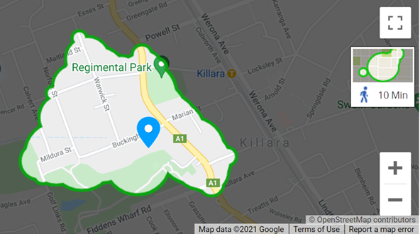
Image 14: Travel Time Map – 10m Walking Catchment
Source: Walkscore.com
The 10 minute walking catchment is relevant when assessing access to shops and services by walking, and therefore discouraging the number of trips generated and the distances travelled by car.
Page 7 of the Planning Proposal makes the following comments in relation to access to employment, shops, services/facilities and leisure/recreation: …
Local Killara shops are located to the north and local Lindfield shops are located to the south of the subject site. Larger centres are located to the north at Gordon and Hornsby; Chatswood to the south and the City within 30 minutes of the site.
The subject site is close to educational facilities such as the Lindfield and Killara Public Schools and independent schools such as Ravenswood School for Girls, Holy Family Catholic School and Newington College Preparatory School.
The proposed increase in housing density in proximity to existing well established infrastructure will optimise its use.
The table below lists the distance and walking time to key facilities:
|
Key land use |
Walking distance* |
Walking time* |
|
Killara Golf Club |
0.45km |
6 mins |
|
Selkirk Park |
0.5km |
7 mins |
|
Marian Street Theatre |
0.5km |
7 mins |
|
Regimental Park |
0.55km |
8 mins |
|
Daystars Child Care Centre |
0.75km |
10 mins |
|
Greengate Hotel |
0.75km |
11 mins |
|
Holy Family Catholic School |
1.1km |
14 mins |
|
Killara Public School |
1.1km |
14 mins |
|
Coles Lindfield |
1.3km |
15 mins |
|
Lindfield Medical Practice |
1.3km |
16 mins |
|
Ravenswood School |
1.4km |
18 mins |
|
Lindfield Village Hub (future library, community facilities, supermarket, childcare, urban open space) |
1.5km |
18 mins |
|
Commonwealth Bank |
1.5km |
18 mins |
|
Harris Farm Lindfield Avenue (future) |
1.5km |
19 mins |
|
Australian Post Lindfield |
1.6km |
20 mins |
|
Lindfield Executive Centre (medical suites) |
1.7km |
21 mins |
|
Lindfield Village Pharmacy |
1.6km |
21 mins |
|
Lindfield Library (current) |
1.7km |
22 mins |
|
Lindfield Public School |
2.1km |
26 mins |
Table: Key facilities – Distance and Time from subject site
*source: Google Maps
The majority of these basic facilities are located outside the convenient 10 minute walking catchment. Some nearby parks and a child care centre are located in close proximity to the site, while other key services and facilities such as supermarkets, pharmacies, medical centres and the majority of schools are located some distance further. It is likely, therefore, that future residents of this site will likely be using cars to access basic services and facilities more than would a residential site located in the either Lindfield or Gordon local centre.
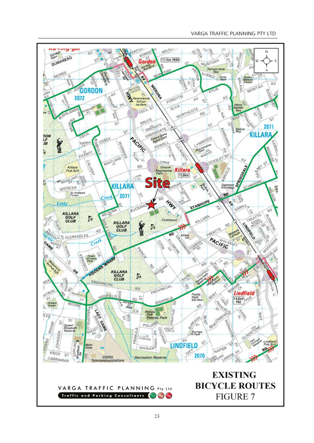
Cycling Accessibility
Image 15 (below) shows the 30 minute cycling catchment from the subject site.
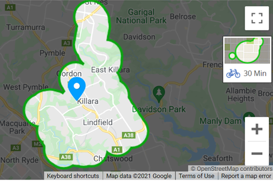
Image 15: Travel Time Map – 30minute Cycling Catchment
Source: Walkscore.com
The 30 minute cycling catchment is larger than the pedestrian catchment, but the bicycle network in the catchment is largely undeveloped, with very few dedicated facilities currently provided. The majority of current cycling is expected to be confined to either on-road/mixed use cycling or cycling on footpaths (where permissible). This catchment borders Chatswood, and after verifying on Google Maps, is also within 30 minutes bike ride to Macquarie Park. While there is a relatively high proportion of trips to work by bicycle from this travel zone, the absence of useful lengths of safe, separated cycling facilities anywhere near the site is unlikely to further encourage cycling as an alternative means of local transport or travel to work in the short to medium term.
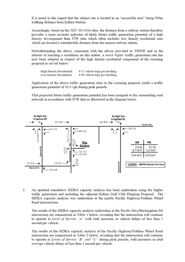
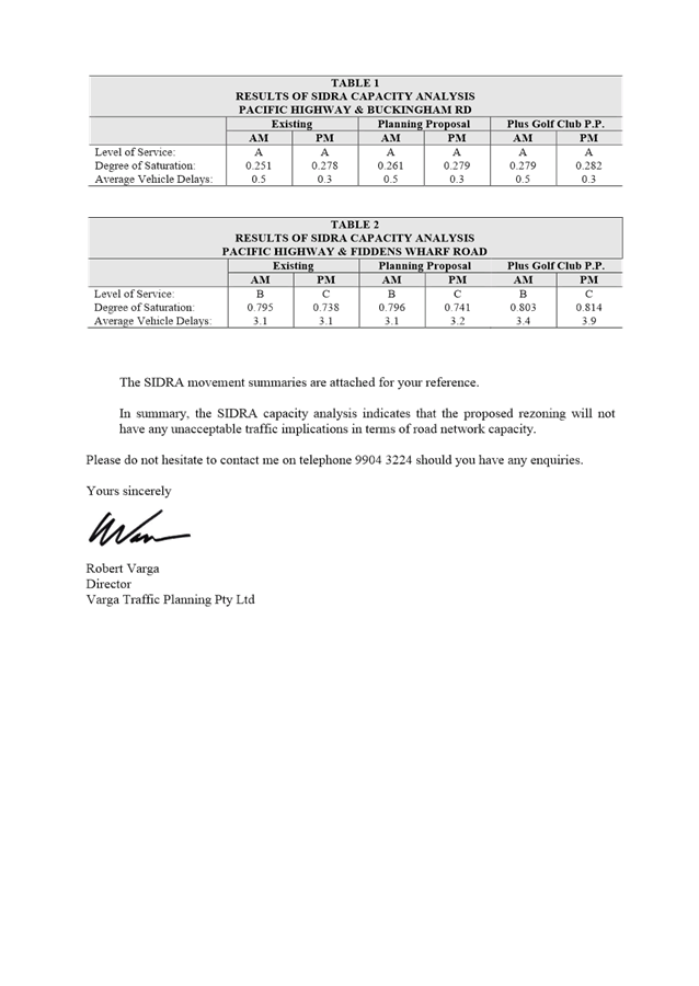
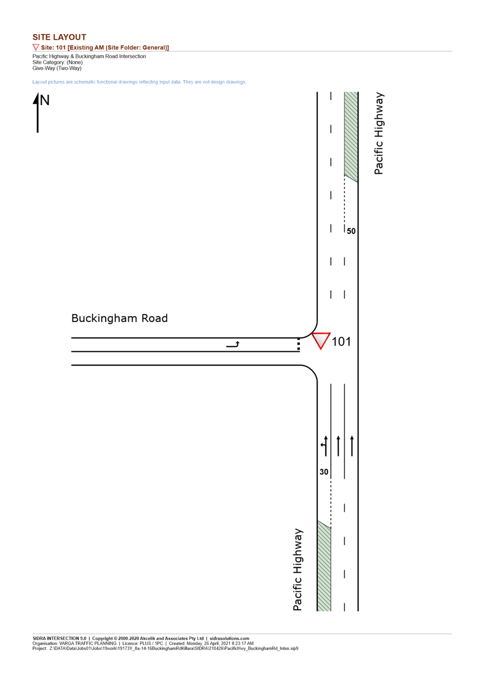
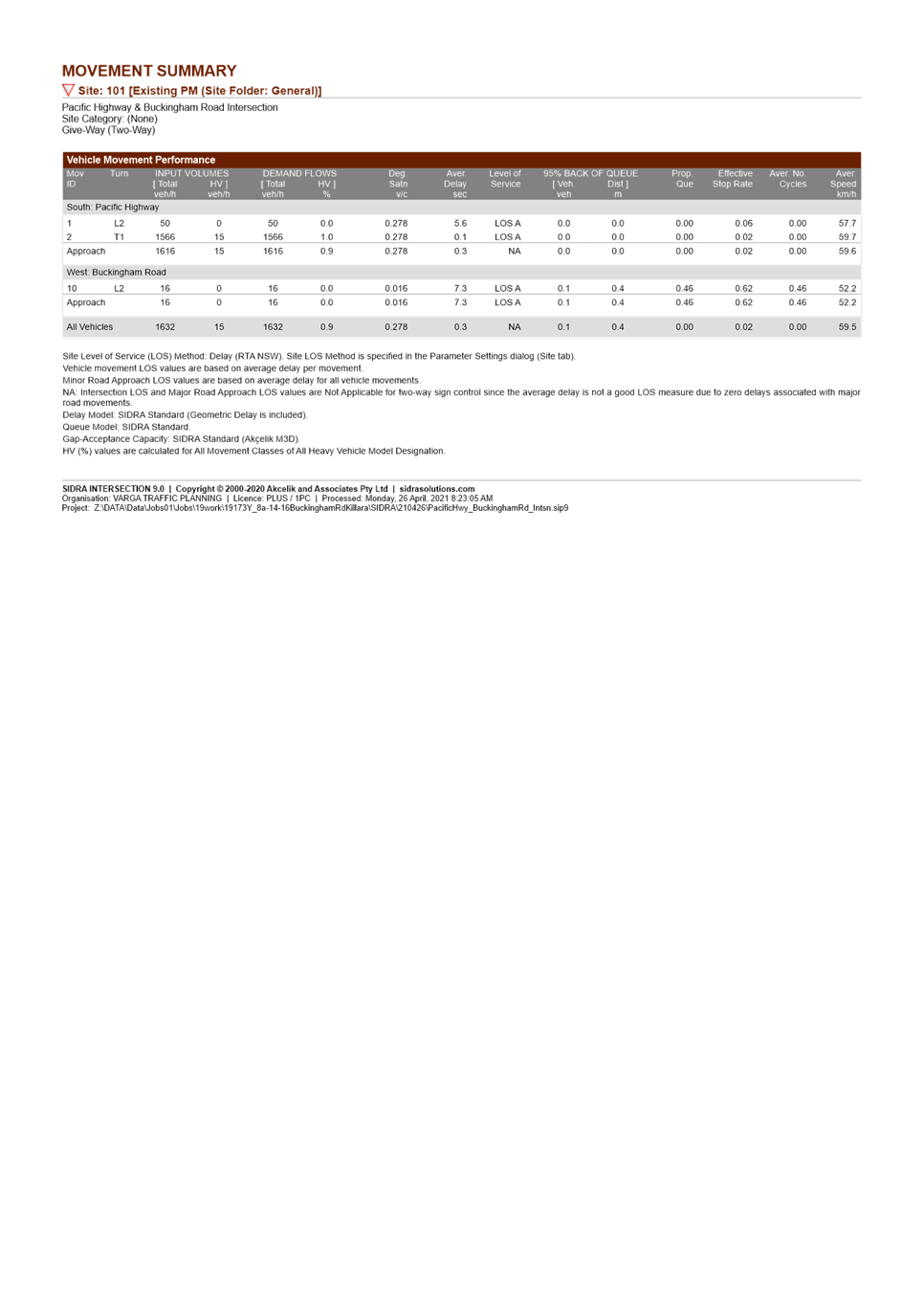
Traffic Generation
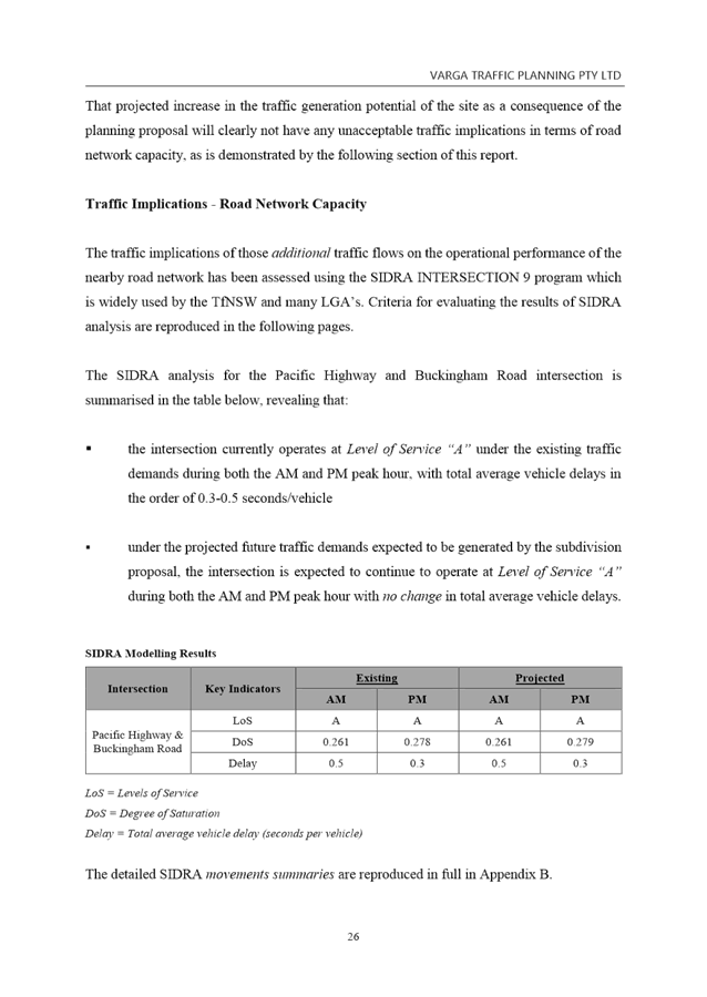
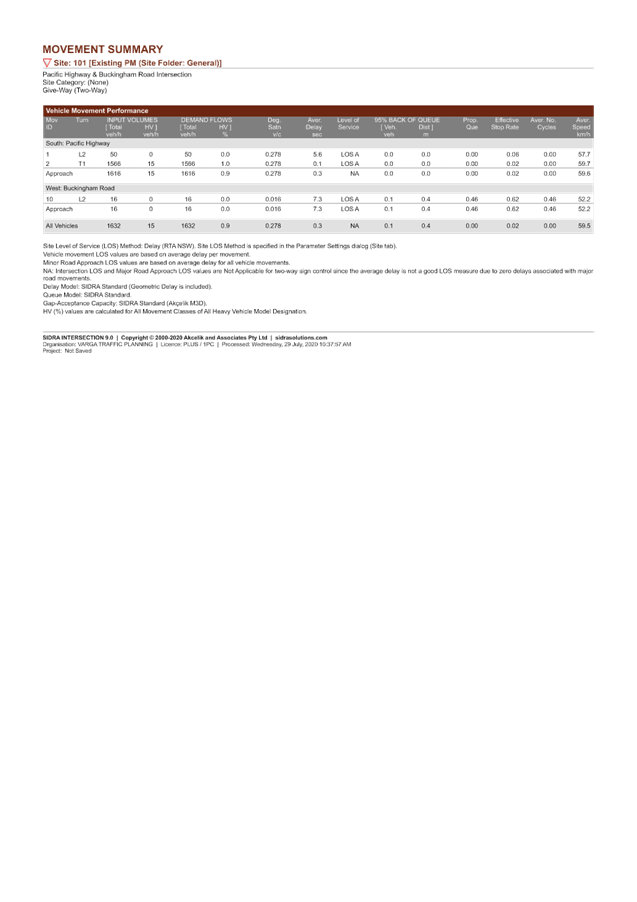
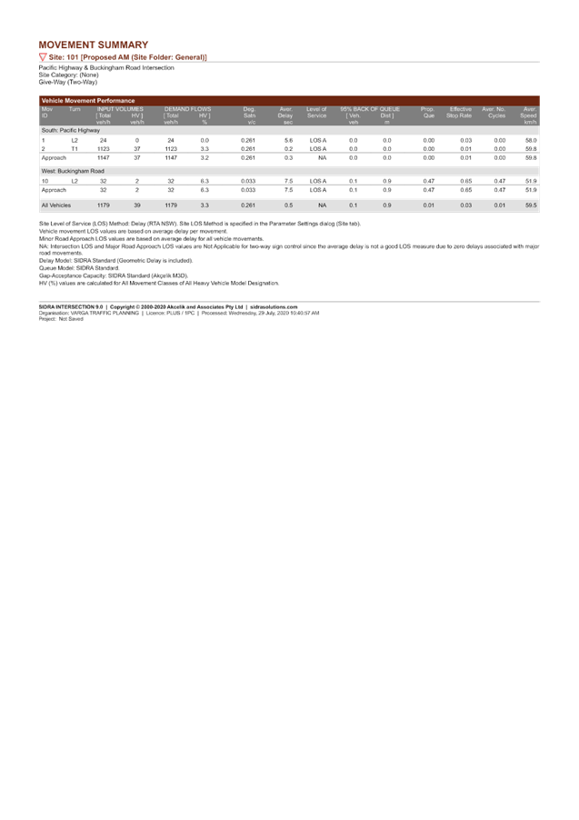
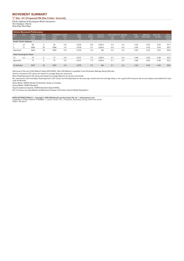
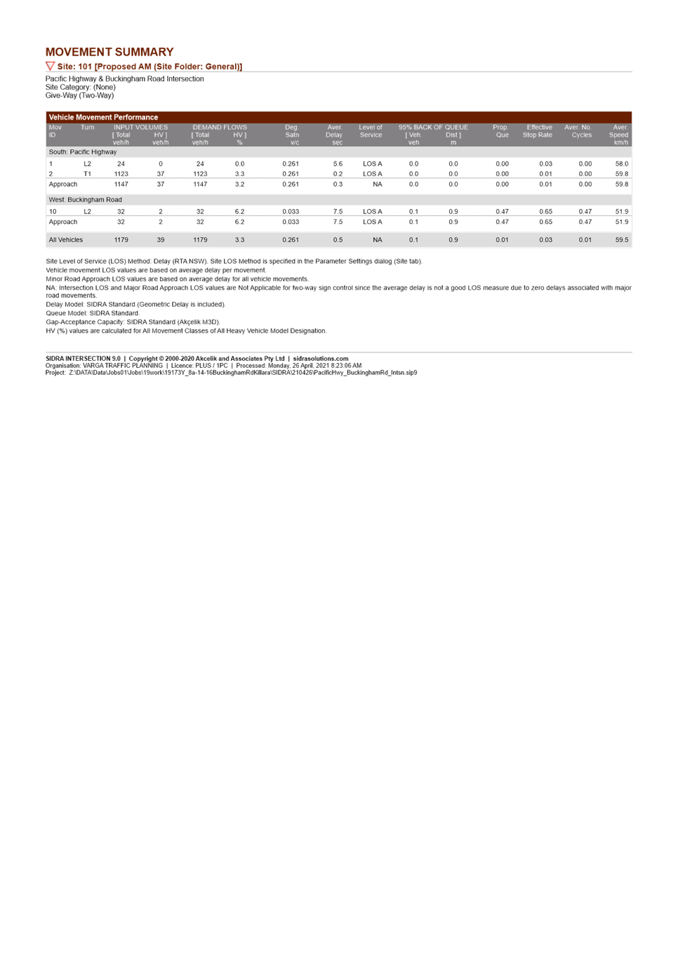
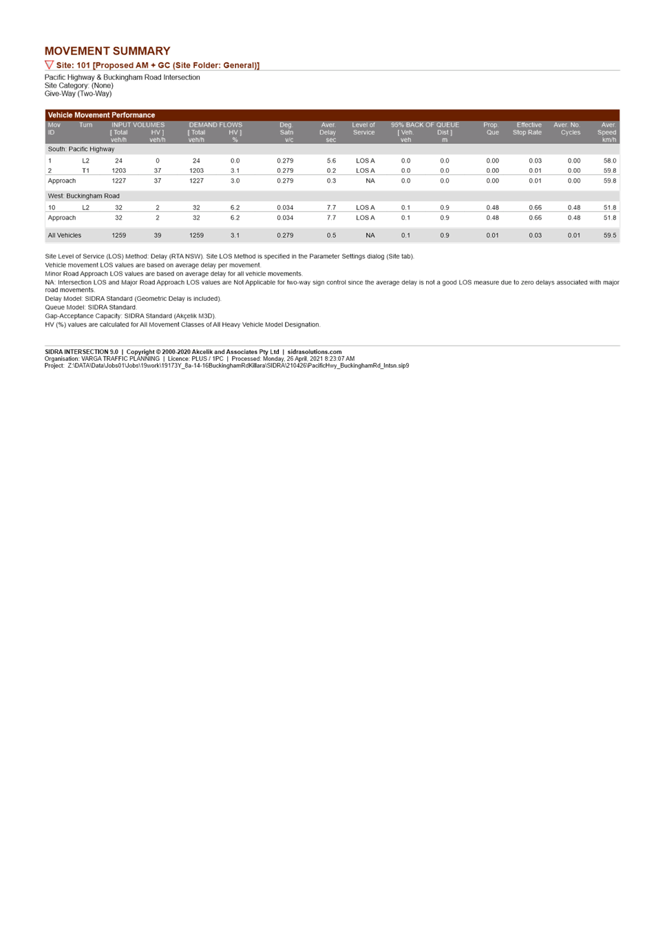
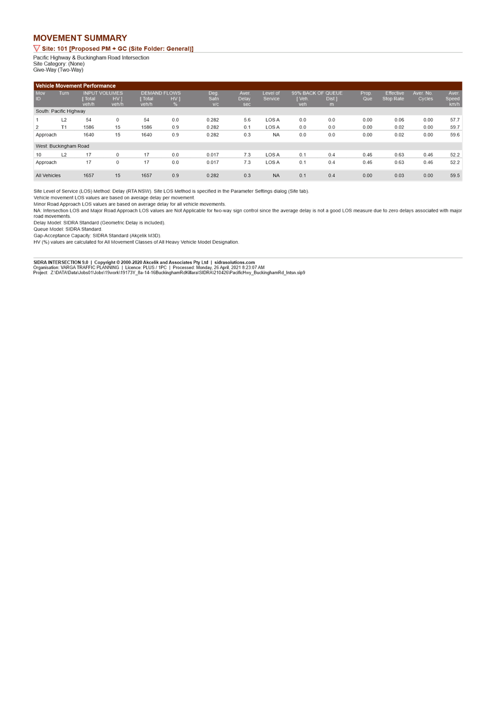
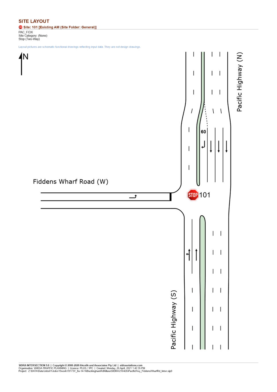
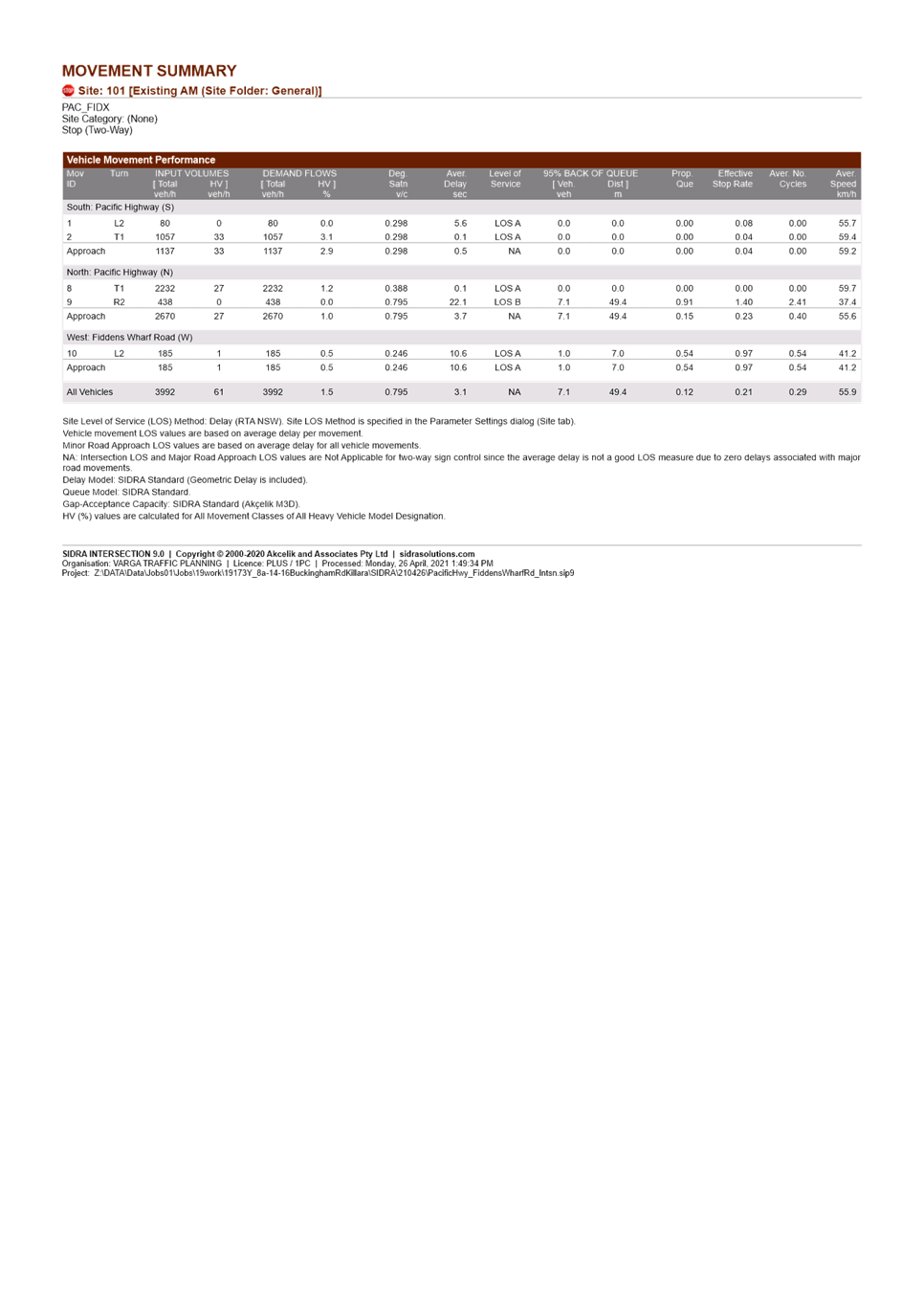
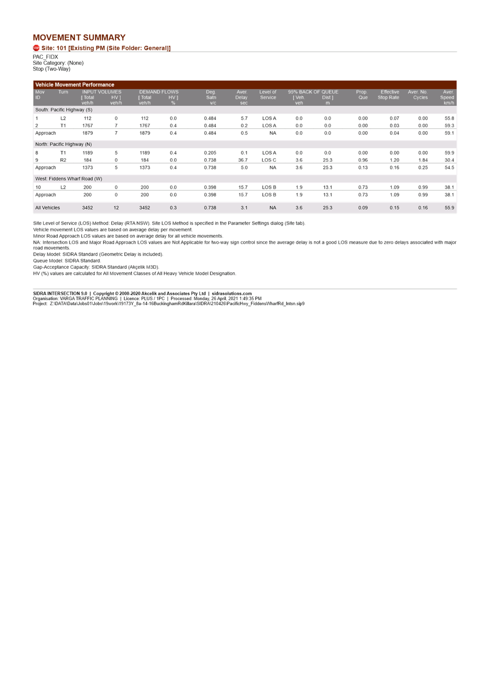
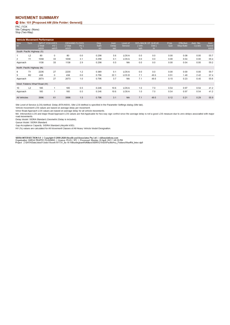
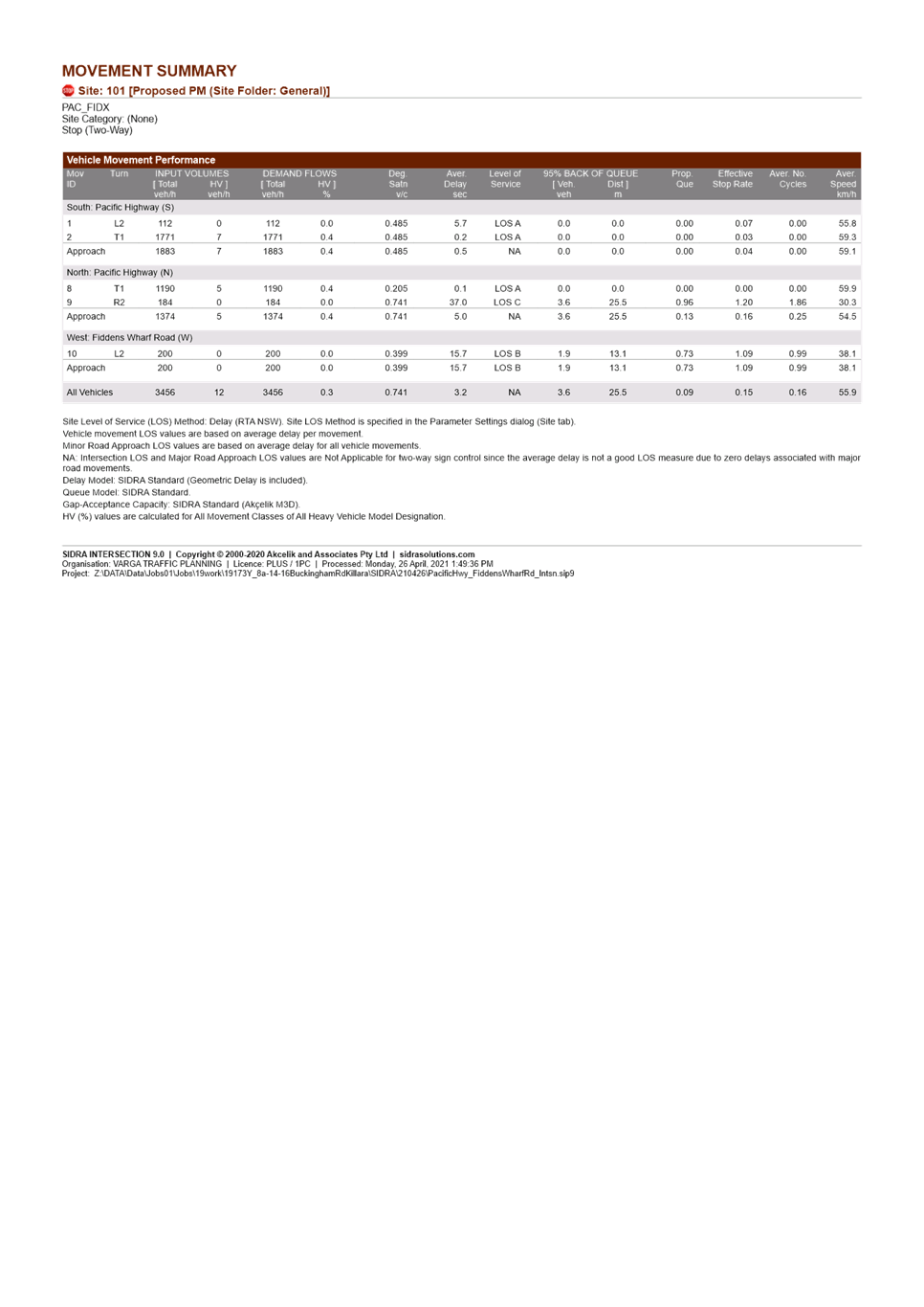
The assessment estimates traffic generation of 11 vehicle trips during the am and pm commuter peaks. Analysis of the impacts of the generation of this proposal and the traffic generation from the recently gazetted land use changes at Killara Golf Club suggests the intersection of Pacific Highway and Buckingham Road and intersection of Pacific Highway and Fiddens Wharf Road would continue to operate at satisfactory levels of service.
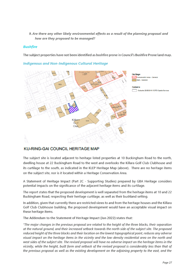
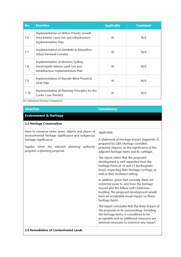
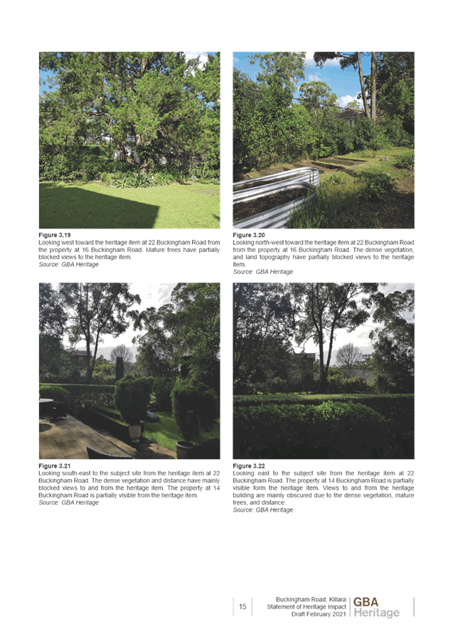
· Heritage
The site adjoins two local heritage items:
o To the north – I255 ‘Southdean’ dwelling house, 10 Buckingham Road, Killara
o To the west – I257 dwelling house, 22 Buckingham Road, Killara
Also within the immediate vicinity is the Killara Golf Club Clubhouse, putting green, fairway and gardens which are listed as a local heritage item.
A Heritage Impact Statement was submitted with the original Planning Proposal, and an addendum heritage statement was submitted alongside the amended proposal. Councils Heritage Planner has reviewed the amended proposal the following is a summary of the key issues:
Setbacks
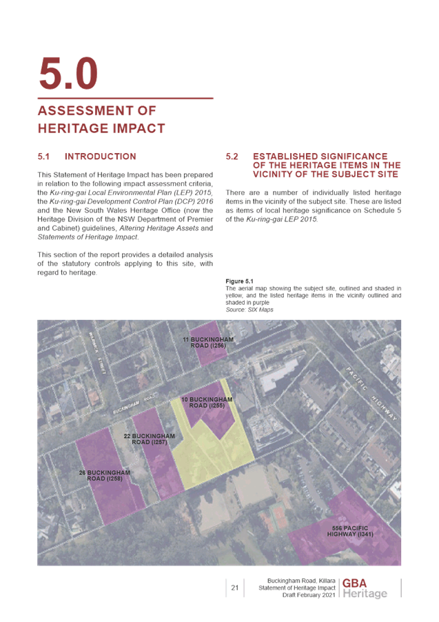
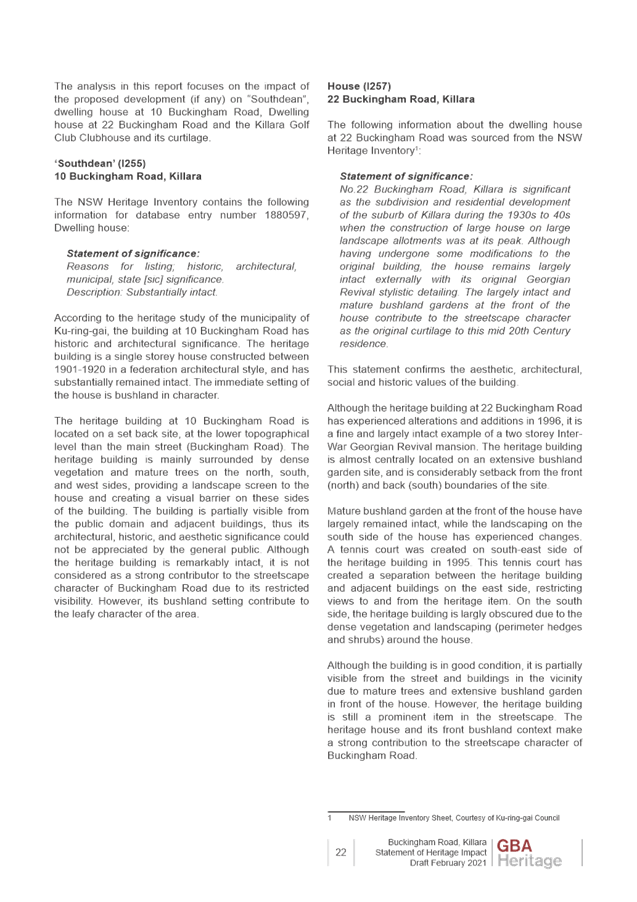
Block C is proposed to be a minimum of almost 13m from the heritage item at 22 Buckingham Road, which would be an acceptable lineal distance. However, the distance needs to be managed in relation to the overall height, massing and envelope.
Block A is proposed to be a minimum of approximately 18.6m from the heritage item at 10 Buckingham Road at the point indicated on the urban design concept drawings. Whilst this may vary depending on how the dimension is measured, the separation is likely to exceed 15m at any given point.
Whilst the topography places the development in a visually prominent location when viewed over the Golf Course from the south, the entirety of the development is substantially physically distanced from Killara Golf Club.
Building Envelopes
As noted in the Urban Design Study section (Images 8, 11 and 12 of this report) , the form of the proposed building envelopes has been amended and improved from a heritage perspective to reflect the comments provided by Council, principally in relation to heritage and urban design.
The setting of the heritage item at 10 Buckingham Road appears to be well maintained with views over Block B towards the south and Killara Golf Course indicated.
The relationship of Block C to the heritage item at 22 Buckingham Road is challenged. Whilst more than 12m setback is likely to be achieved on the ground, the relationship of the building massing and height above 8m (aligned within the principles of the DCP) may need to be refined and guided in the site specific DCP. The overall wall lengths and distribution of massing needs to be sensitive to the adjoining heritage item.
Additional building massing between the subject sites and heritage item that is Killara Gold Club and its expanded curtilage is permitted by the Killara Golf Club Planning Proposal. There is an expectation therefore, that any impacts of a development in the subject location are negated by the intervening development. Notwithstanding this and as noted above, the heritage item at No.10 Buckingham Road maintains views over the new building massing towards the Golf Course.
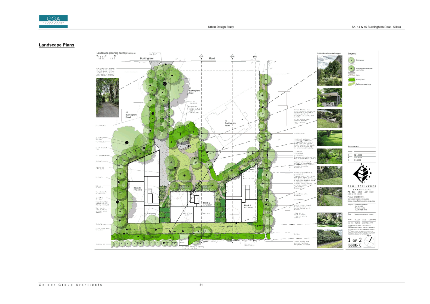
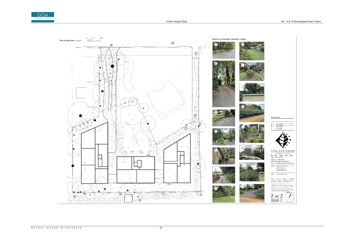
Landscape
The revised landscape concept plan prepared by Paul Scrivener indicates that considerable vegetated buffers are envisaged along the west, south and east boundaries of the site. In addition, vegetation provided along the northern boundary to the heritage item at 10 Buckingham Road and flanking the access driveway from Buckingham Road. Such vegetation is essential to support an overall Planning Proposal of the scale on these sites from a heritage perspective. This will be a requirement that should be carefully articulated in the site specific DCP.
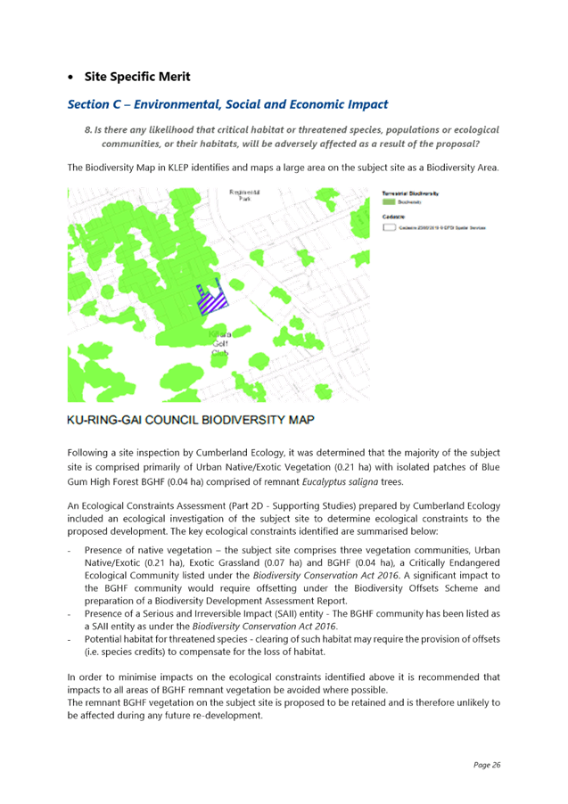
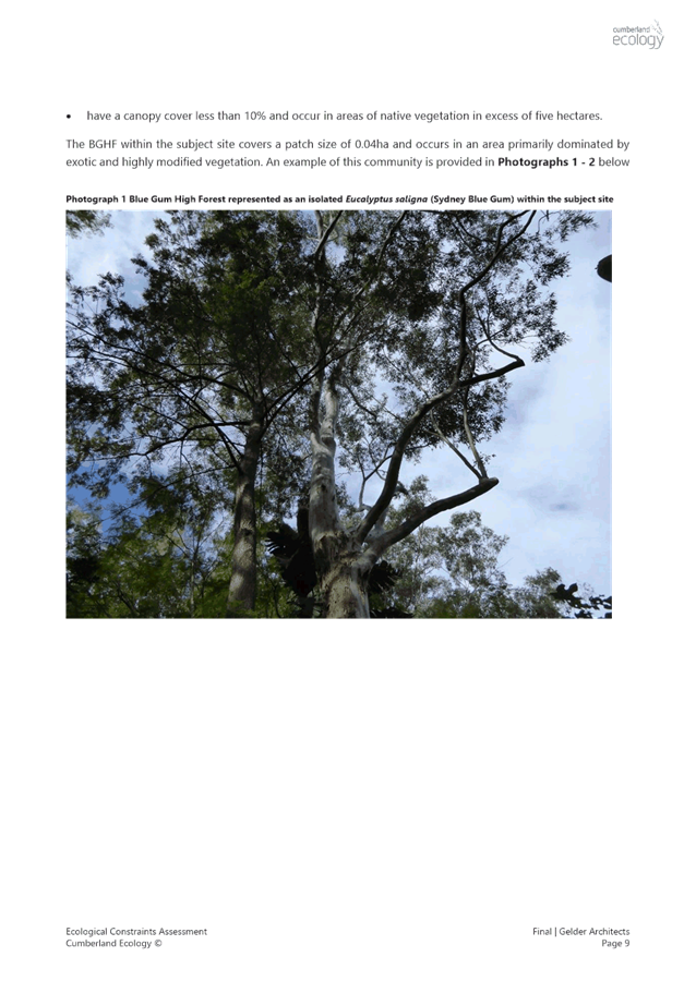
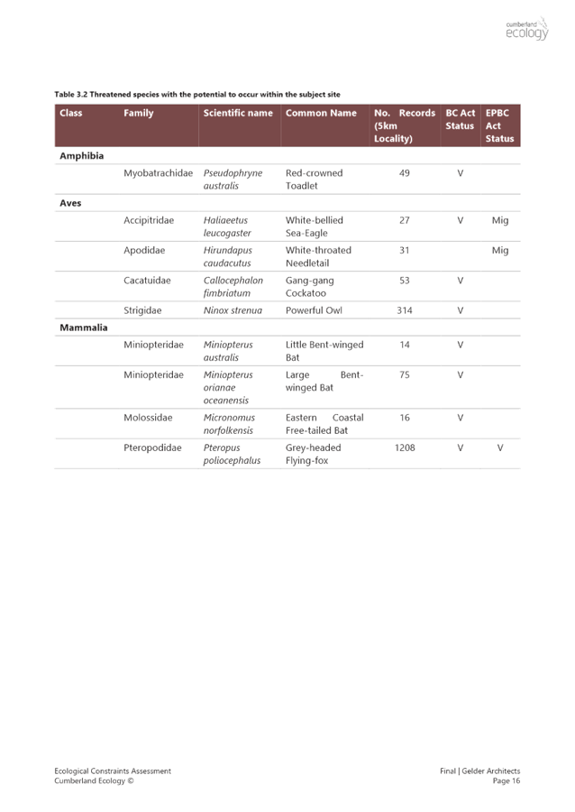
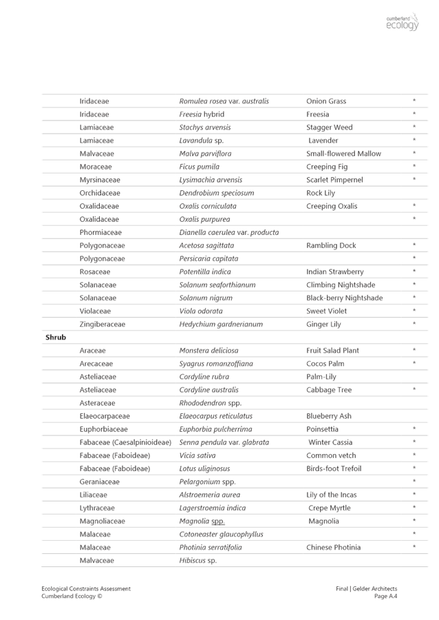
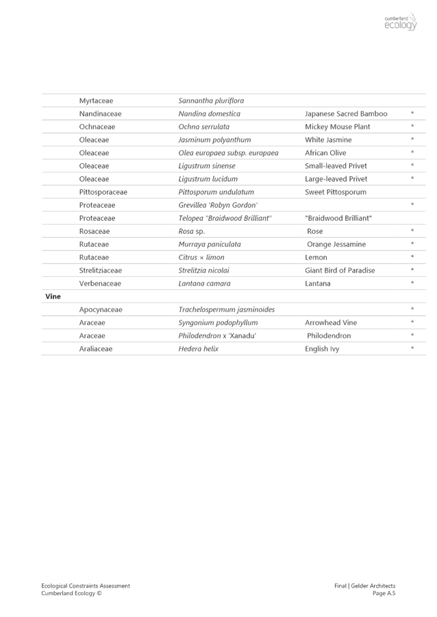
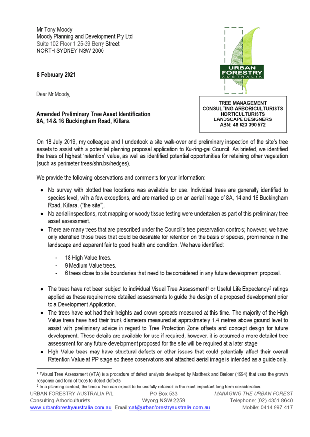
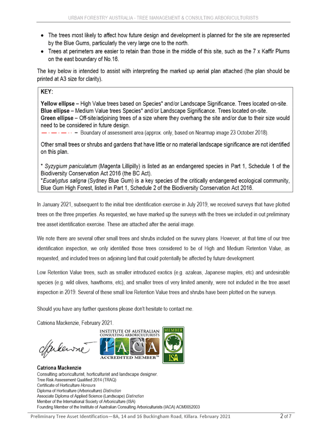
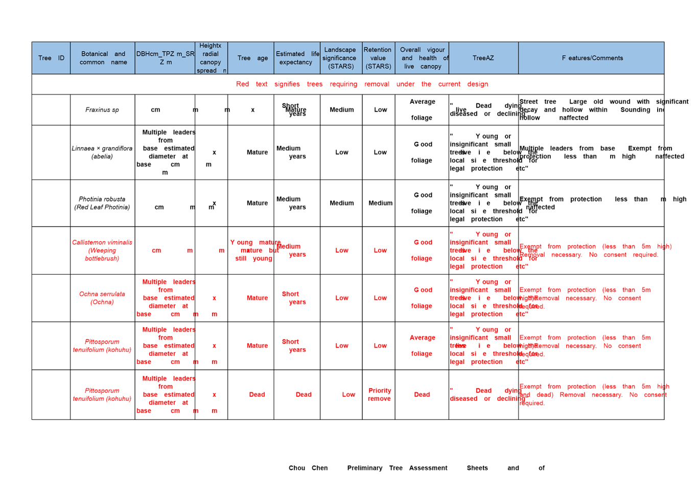
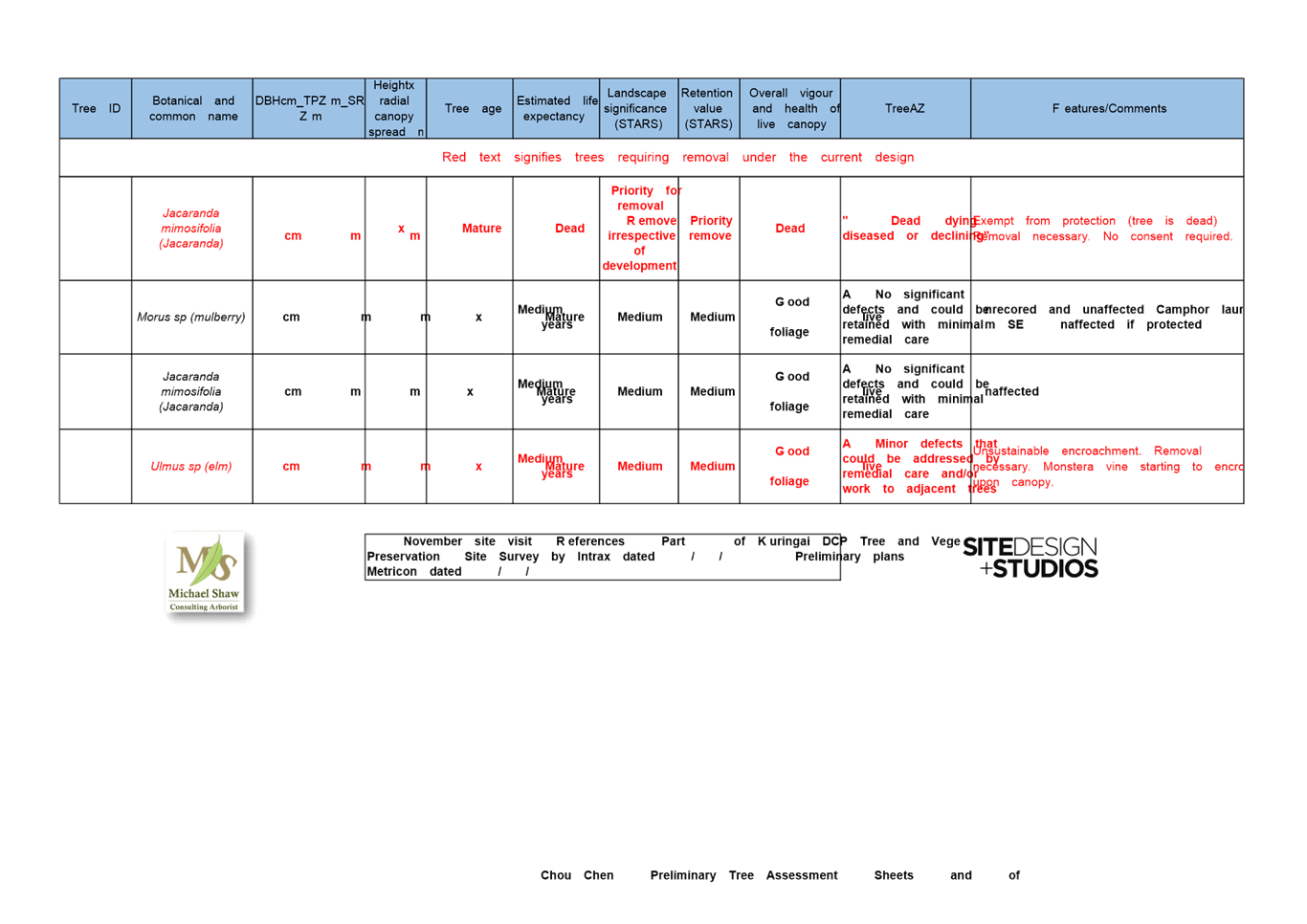
· Biodiversity
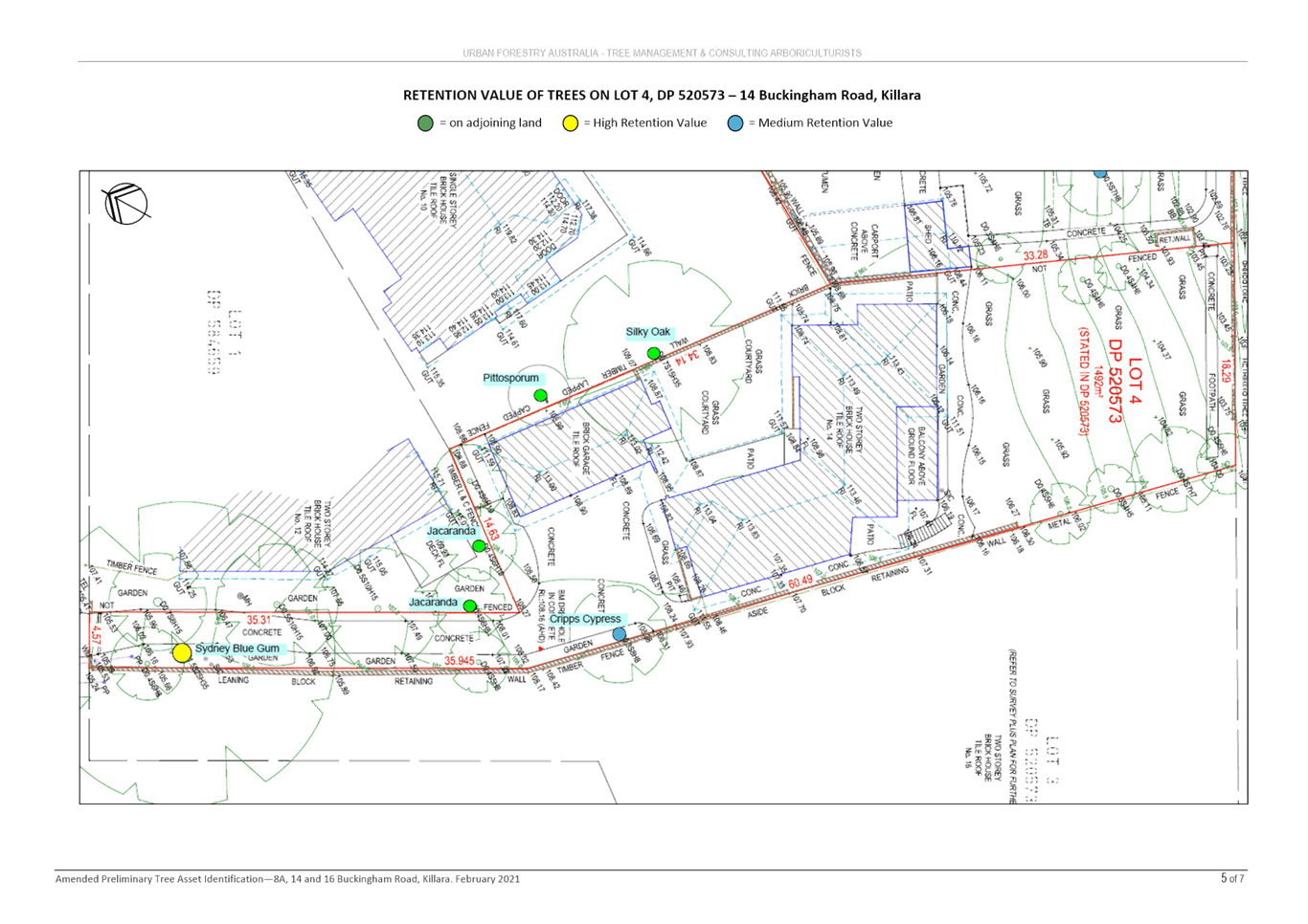
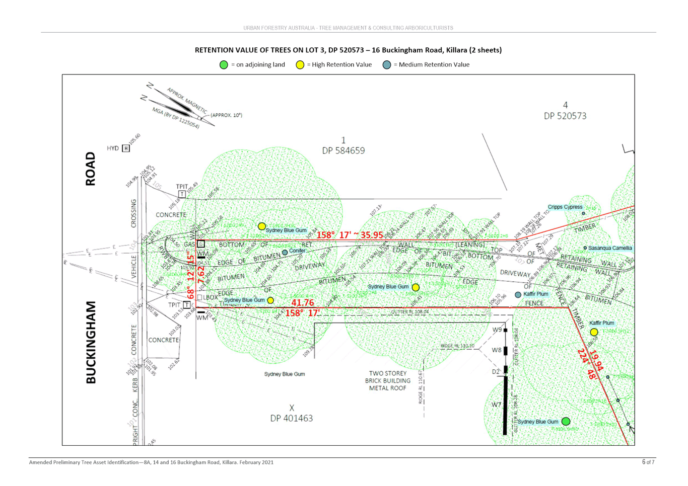
The site includes areas mapped on the KLEP 2015 Biodiversity map (Clause 6.3) and Greenweb within the Ku-ring-gai DCP (Part 18). An Arborist Report and Ecological Constraints Assessment have been submitted with the Planning Proposal. Councils Team Leader Natural Areas has reviewed the Planning Proposal and provided the following key points:
Arborist Report
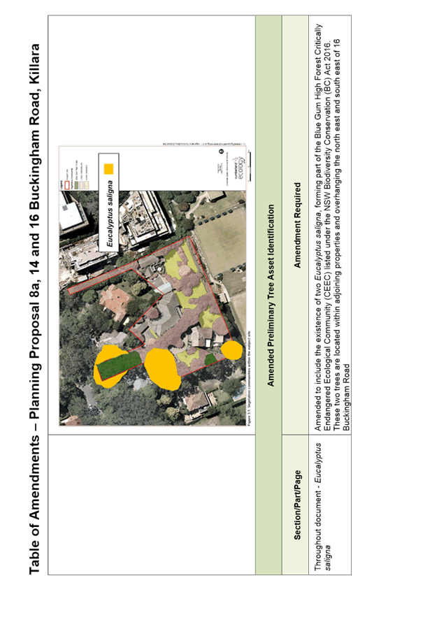
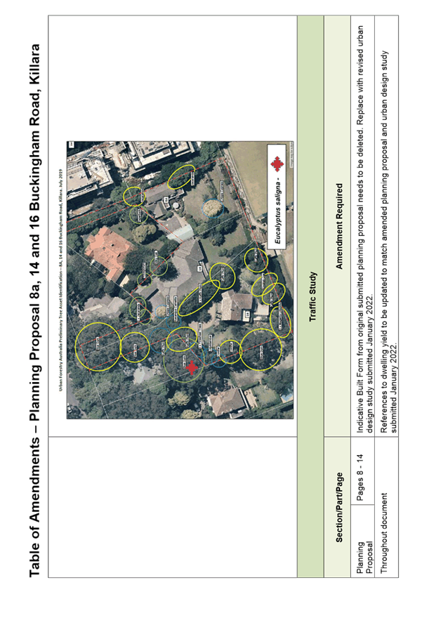
The arborist report does not map the existence of two Eucalyptus saligna, forming part of the Blue Gum High Forest Critically Endangered Ecological Community (CEEC) listed under the NSW Biodiversity Conservation (BC) Act 2016. These two trees are located within adjoining properties and overhanging the north east and south east of 16 Buckingham Road
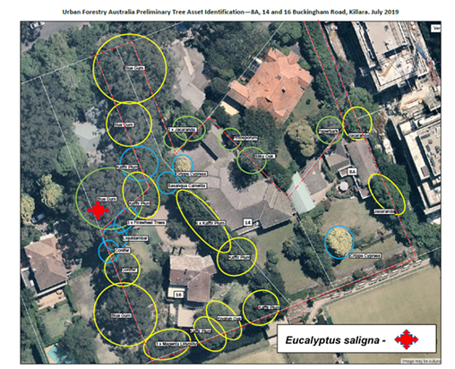
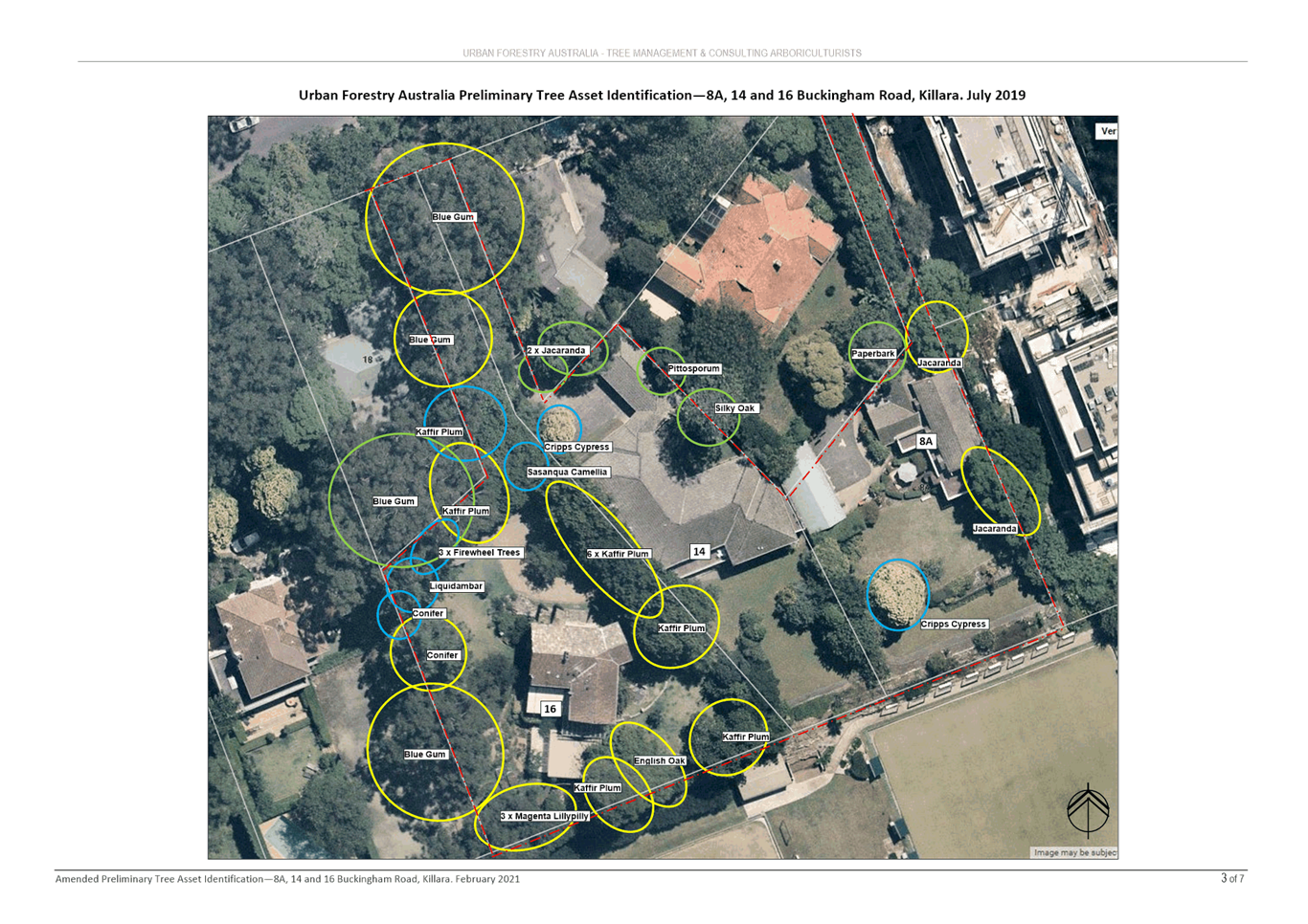
Image 16: Amended Preliminary Tree Asset Identification Map – plus missing Eucalyptus
saligna, forming part of the Blue Gum High Forest CEEC listed under the NSW BC Act 2016.
Source: base map, Amended Preliminary Tree Asset Identification (Urban Forestry 2021)
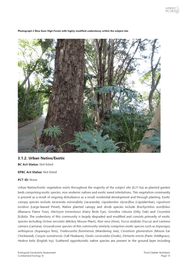
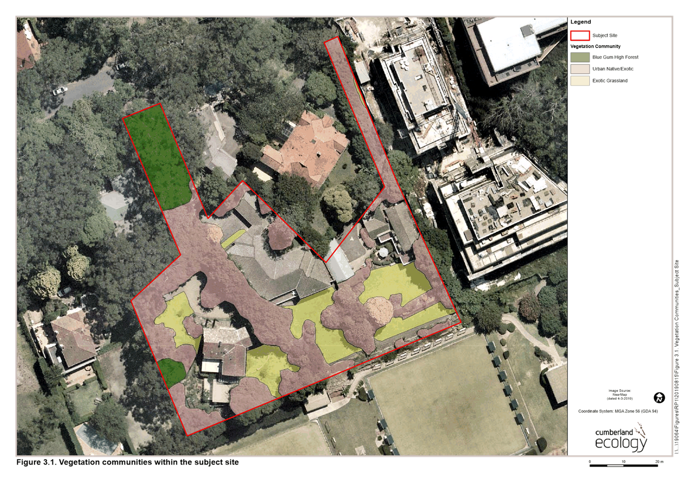
Ecological Constraints Assessment
The Ecological Constraints Assessment (Cumberland Ecology 2020) report maps only trees within the site and does not include canopy overhanging the subject site. As such it fails to map in the existence of Blue Gum High Forest formed by three Eucalyptus saligna adjoining and overhanging the north east and south east of 16 Buckingham Road.
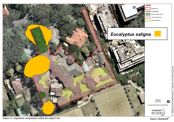
Image 17: Ecological Constraints Assessment – Showing Eucalyptus saligna,
forming part of the Blue Gum High Forest CEEC listed under the NSW BC Act 2016.
Source: Base map, Ecological Constraints Assessment (Cumberland Ecology 2020)
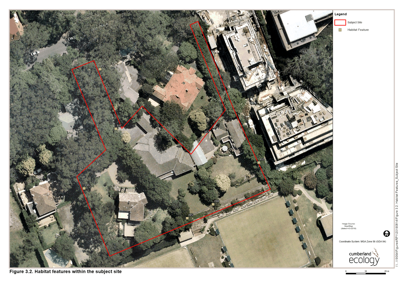
Impacts on Blue Gum High Forest - Building Footprint and Driveway
Assessment of the indicative building footprint as outlined in the Urban Design Study suggest that impacts to the existing Blue Gum High Forest adjoining and within the site can be avoided. However, as no detailed tree protection zones are provided, it is uncertain. Further assessment at DA stage will need to be undertaken to assess and protect these trees. As such it is important to note that future reduction of this building area may be required to avoid impact / encroachment upon this tree (including both root impacts and the need to prune and allow for future growth and space between building and tree – thereby reducing future need to prune).
Furthermore, deliberate designing and retention of the separated driveways should enable long term retention of the existing Blue Gum High Forest (forming part of the CEEC listed under the NSW BC Act 2016).
This will primarily be done through application of Councils Ku-ring-gai LEP Part 6.3 and Ku-ring-gai DCP Part 8, Biodiversity provisions.
Biodiversity Mapping and Greenweb Mapping
It has been identified that Biodiversity mapping within these provisions is more extensive than occurring within the site. Updating the Biodiversity (Greenweb) mapping through a site specific DCP would provide greater clarify for future developers.
Site Specific DCP
Should a site-specific DCP be proposed additional factors that would benefit Ku-ring-gai’s Urban Forest and protect Blue Gum High Forest include:
o updated Greenweb mapping (DCP biodiversity provision mapping);
o a requirement for deliberate designing and retention of the separated driveways to protect large canopy trees; and
o a landscape plan including planting of native trees (including Blue Gum High Forest species).
· Site Access
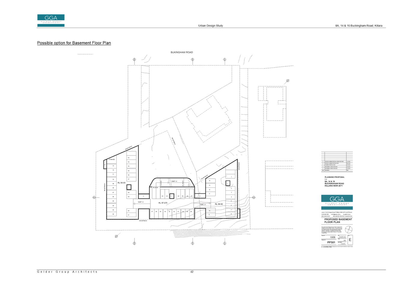
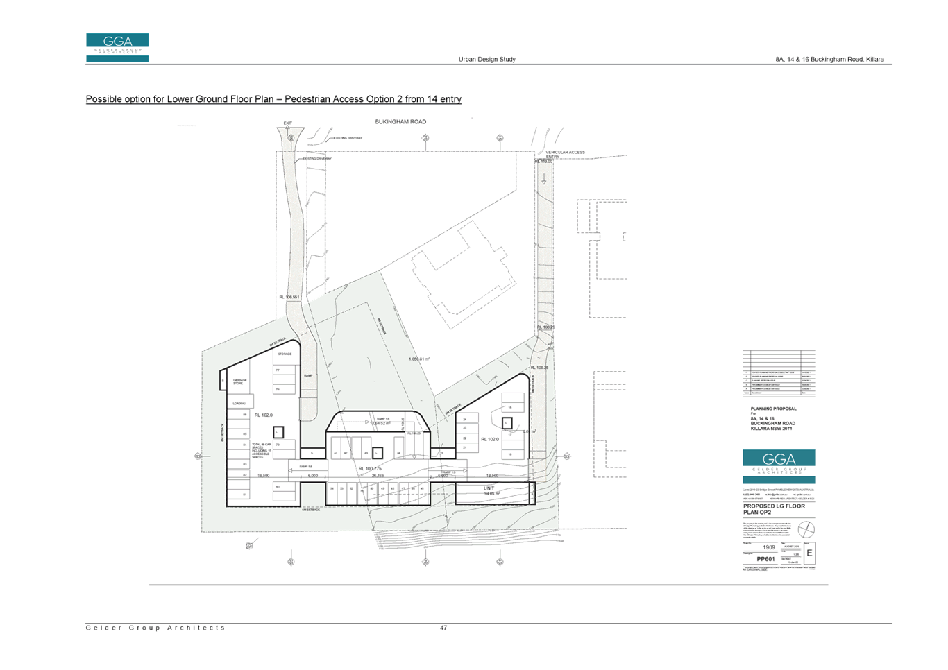
The Urban Design Study provides two options for vehicle and pedestrian access into the site:
o Entry and exit via the access handles at 14 and 16 Buckingham Road (west) and pedestrian access via 8a Buckingham Road access handle (east); or
o entry via 8a Buckingham Road access handle (east) and exist via 16 Buckingham Road access handle (west), with pedestrian entry and exit via 14 Buckingham Road access handle.
Site access is not a matter for consideration in the assessment of a Planning Proposal other than ensuring the site will have the opportunity to provide access to the road should development on the sites under the proposed LEP amendments be realised in the future.
Site access and the preferred configuration and location it is something that could be addressed as part of the site-specific DCP to support the Planning Proposal.
Key considerations in the location of the vehicle and pedestrian entry and exit are:
o tree protection requirements to ensure the significant trees and vegetation located along the existing battle axe driveways of 14 and 16 Buckingham Road are able to be retained;
o travel paths when walking to/from Killara Station;
o minimum widths and accessibility requirements; and
o impacts on heritage items, and landscape buffering requirements.
Strategic Merit Assessment
· Greater Sydney Region Plan and North District Plan
The Planning Proposal is consistent with the objectives of the Greater Sydney Region Plan – A Metropolis of Three Cities, in particular:
o Objective 4. Infrastructure use is optimised
o Objective 10. Greater housing supply
o Objective 11. Housing is more diverse and affordable
o Objective 13. Environmental heritage is identified, conserved and enhanced
o Objective 14. Integrated land use and transport creates walkable and 30-minute cities
o Objective 27. Biodiversity is protected, urban bushland and remnant vegetation is enhanced
o Objective 30. Urban tree canopy cover is increased
A Metropolis of Three Cities outlines that liveability incorporates access to housing, transport and employment, as well as social, recreational, cultural and creative opportunities. Provision of housing close to public transport and services and facilities improves the opportunity for people to walk and cycle to local shops and services. Heritage and biodiversity is protected and enhanced. The proposal is consistent with these principles.
The Planning Proposal is consistent with the planning priorities of the North District Plan, in particular:
o Planning Priority N1. Planning for a city supported by infrastructure
o Planning Priority N5. Providing housing supply, choice and affordability, with access to jobs, services and public transport
o Planning Priority N6. Creating and renewing great places and local centres, and respecting the districts heritage
o Planning Priority N12. Delivering integrated land use and transport planning and a 30-minute city
o Planning Priority N16. Protecting and enhancing bushland and biodiversity
The Planning Proposal will allow for additional housing supply in a location that enables good access via public transport to key strategic centres such as Chatswood, St Leonards and Hornsby. The Planning Proposal has been amended to ensure the built form outcomes on the site are compatible with the protection of the adjoining heritage items and protection of significant trees on the site and adjoining sites. The Planning Proposal is therefore in accordance with the North District Plan priorities to focus housing in locations that support the 30-minute city and provide access to jobs, services and public transport, as well as the priorities to respect heritage and protect biodiversity.
· Ku-ring-gai Local Strategic Planning Statement
The Ku-ring-gai Local Strategic Planning Statement (LSPS) came into effect on 19 March 2020 and provides a 20 year vision and local planning priorities and associated actions for land use planning in Ku-ring-gai. The Planning Proposal is consistent with the following local planning priorities:
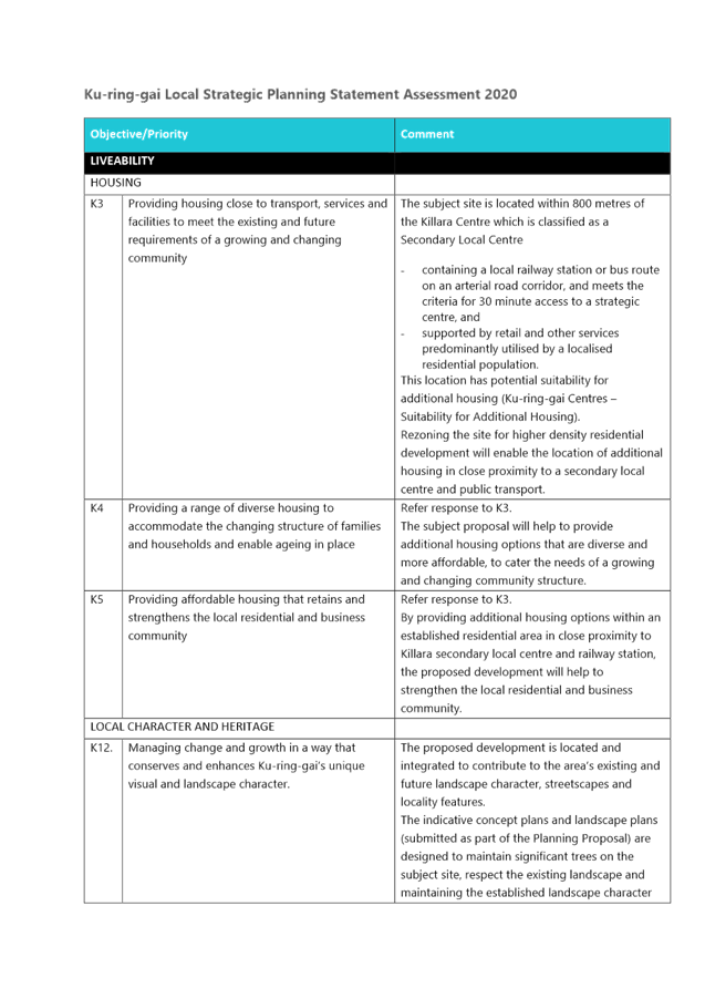
o K3. Providing housing close to transport, services and facilities to meet the existing and future requirements of a growing and changing community
o K4. Providing a range of diverse housing to accommodate the changing structure of families and households and enable ageing in place
o K12. Managing change and growth in a way that conserves and enhances Ku-ring-gai’s unique visual and landscape character
o K13. Identifying and conserving Ku-ring-gai’s environmental heritage
o K21. Prioritising new development and housing in locations that enable 30minute access to key strategic centres
o K28. Improving the condition of Ku-ring-gai’s bushland and protecting native terrestrial and aquatic flora and fauna and their habitats
o K29. Enhancing the biodiversity values and ecosystem function services of Ku-ring-gai’s natural assets
o K30. Improving the quality and diversity of Ku-ring-gai’s urban forest
o K31. Increasing, managing and protecting Ku-ring-gai’s urban tree canopy
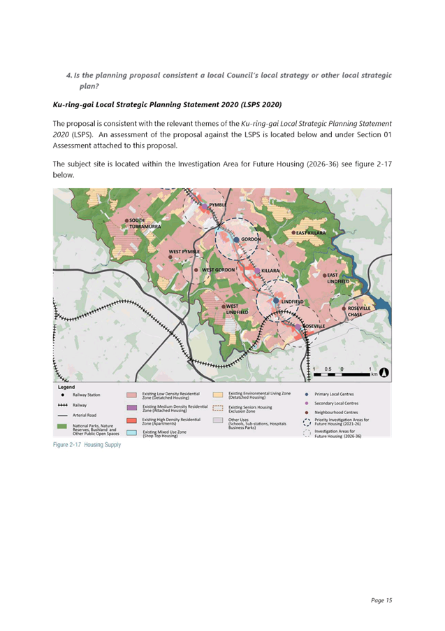
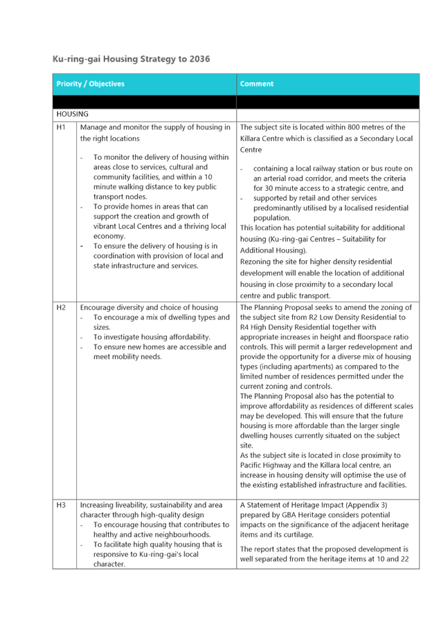
While the Planning Proposal is consistent with the overarching local planning priority to provide housing close to transport, services and facilities, the LSPS provides specific details about each centre, its suitability for additional housing and timing.
The LSPS sets out that the Killara Secondary Local Centre is suitable for additional housing, and it contains a local railway station or bus routes on an arterial road corridor, and meet the criteria for 30minute access to a strategic centre and is supported by retail and other services. The timing for future housing delivery in the Killara centre is identified as 2031-2036. This Planning Proposal seeks to bring forward the timing of housing delivery in the centre, which is inconsistent with the LSPS. The Planning Proposal seeks to provide an ‘interface solution’ for the subject sites and respond to the immediate surrounding context of the subject sites, including the adjoining high density development at 6a Buckingham Road, as well as the potential future high density development on the adjoining Killara Golf Course. It is considered that there is sufficient justification to support the Planning Proposal and delivery of housing in this location prior to the 2031-2036 period, as it will result in a better planning outcome.
The Planning Proposal is consistent with the principles for the location of additional housing as set out in the LSPS:
o Locate high density housing types within a 10min walk (800m radius) of Primary and Secondary Local Centres: Gordon, Lindfield, Turramurra, St Ives (subject to the provision of priority bus infrastructure), Roseville, Killara, Pymble and Wahroonga
o Locate medium density built forms and other housing types on interface and transition areas where they function as a buffer between differing scale of building or differing land use types
o In considering areas for future medium and high density housing form, the following areas are to be avoided:
o Heritage conservation areas.
o Areas of visual or aesthetic quality and character.
o Areas within or affecting scenic and cultural landscapes.
o Areas of intact tree canopy where the built form does not sit under the canopy.
o Areas with multiple constraints including steep topography.
o Areas with environmental values.
o Areas that are bushfire prone and with evacuation risk.
o Centres with limited transport and service access until improvements are implemented.
The sites the subject of the Planning Proposal are interface sites, whereby they already adjoining high density development at 6a Buckingham Road, and will adjoining future high density development on the Killara Golf Course. The Planning Proposal seeks to provide an interface and appropriate transition between the high density developments, and the adjoining low density residential area. The development standards proposed and the built form outcomes enabled by the Planning Proposal will function as a buffer and transition between differing scale of building, while respecting and conserving the heritage significance of adjoining heritage items and amenity of low density residential dwellings. The sites the subject of the Planning Proposal are not constrained by a Heritage conservation area, scenic or cultural landscape or bushfire prone land. While the site does have areas of intact tree canopy and environmental values, the proposed scale of the built form will be 3 storeys which will comfortably sit under the canopy and located outside of areas of environmental value to ensure significant trees will be retained and protected.
· Ku-ring-ai Housing Strategy and Housing Strategy Approval Letter Conditions
Council’s adopted Ku-ring-gai Housing Strategy provides all new dwellings to 2036 from capacity within the existing planning controls and zoning. As the Planning Proposal is seeking to upzone the site and amend the development controls to enable delivery of more housing on the site, it is inconsistent with the Housing Strategy.
The amendments sought by the Planning Proposal will enable the delivery of an addition 36-40 dwellings on the site.
In approving the Ku-ring-gai Housing Strategy, the Department of Planning, Industry and Environment issued a number of approval conditions, one of which is:
6. Council is to commit to a work program to identify areas for additional medium density housing opportunities outside of primary local centres such as Roseville Chase, Killara, Pymble, Wahroonga, West Gordon and North St Ives as identified in the Ku-ring-gai LSPS for potential delivery in the 2031 to 2036 period. A Planning Proposal(s) for these centres is to be submitted to the Department for a Gateway determination by December 2023. Where this work is not pursued by Council the Department welcomes place-based approaches by landowner/developers to explore opportunities for additional medium density housing in locations that are well serviced by transport, services and facilities
At OMC 16 November 2021 Council resolved to reject the Housing Strategy conditions of approval. As Council has not committed to a work program, the subject Planning Proposal submitted by the landowners is consistent with the requirements of Condition 6. The Planning Proposal will enable a medium density built form outcome on the site in an area that is close to public transport, services and facilities.
(Note: While the Planning Proposal seeks to rezone the site to R4 High Density Residential, the development standards proposed, 3 storey and an FSR of 0.7:1, are consistent with and in the case of the FSR lower than the development standards for medium density development throughout Ku-ring-gai).
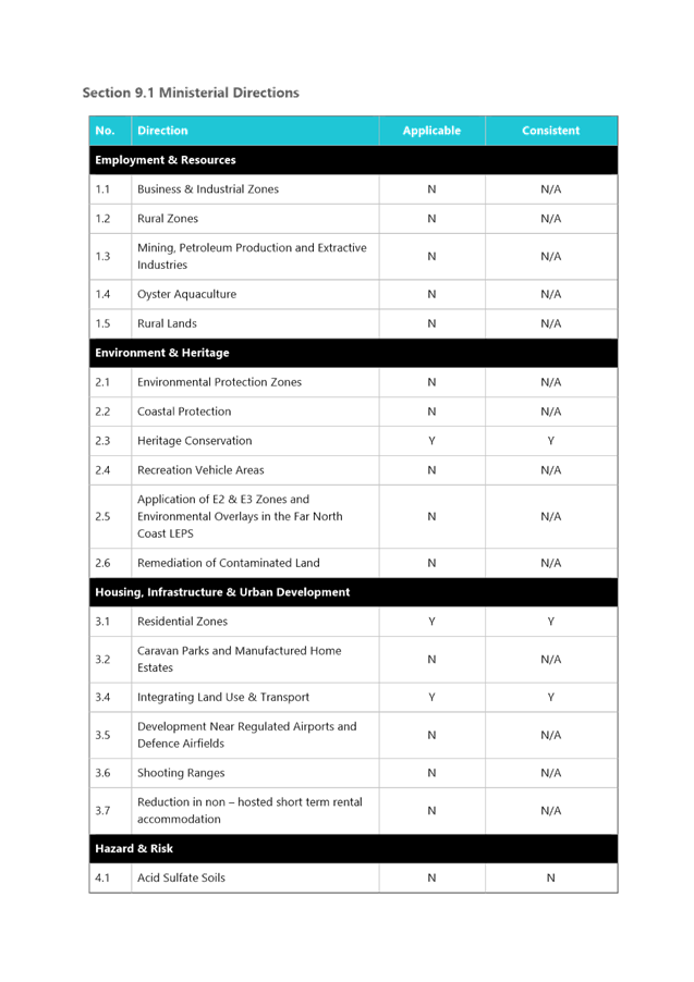
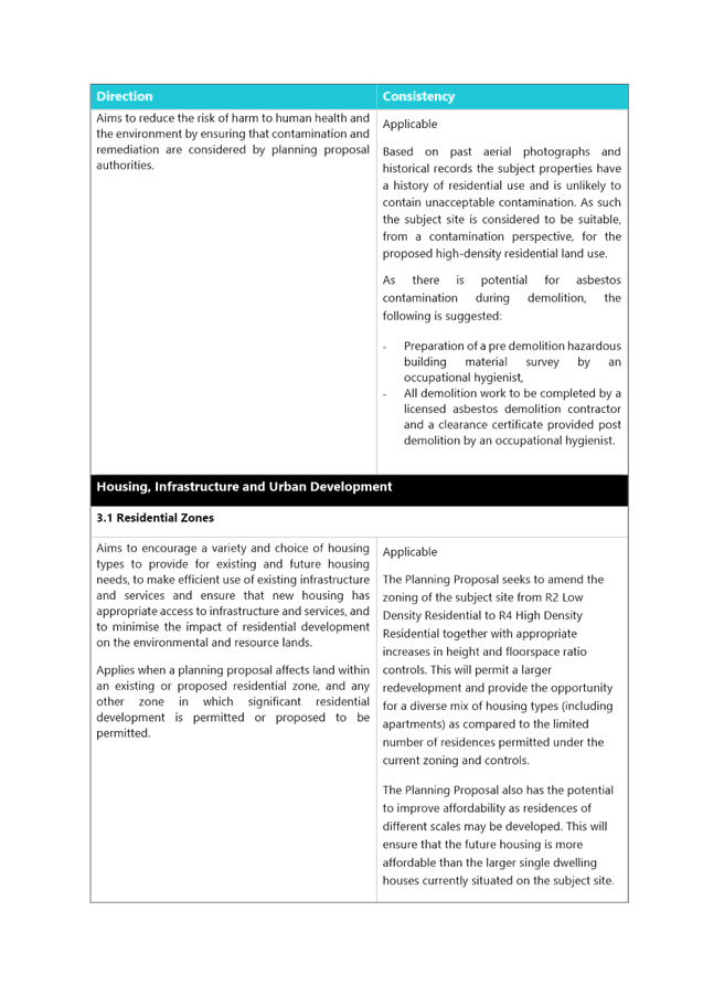
· Section 9.1 Ministerial Directions and State Environmental Planning Policies (SEPPs)
The Planning Proposal is not inconsistent with the State Environmental Planning Policies (SEPPs) applicable to the site. Many of these SEPPs contain detailed provisions and controls which would only apply at the Development Application stage. It is noted that the Planning Proposal contains assessment against SEPPs that have been repealed – specifically the Affordable Rental Housing SEPP, SEPP Seniors and SEPP 70. These SEPPs have been replaced by SEPP Housing 2021, and it is recommended that the Planning Proposal be amended to include assessment against the new SEPP Housing 2021. This is noted in the Table of Amendments at Attachment A12.
The Planning Proposal is consistent with the applicable s9.1 Ministerial Direction, specifically those relating to:
o 2.3 Heritage Conservation
o 3.1 Residential Zones
o 3.4 Integration of Land Use and Transport
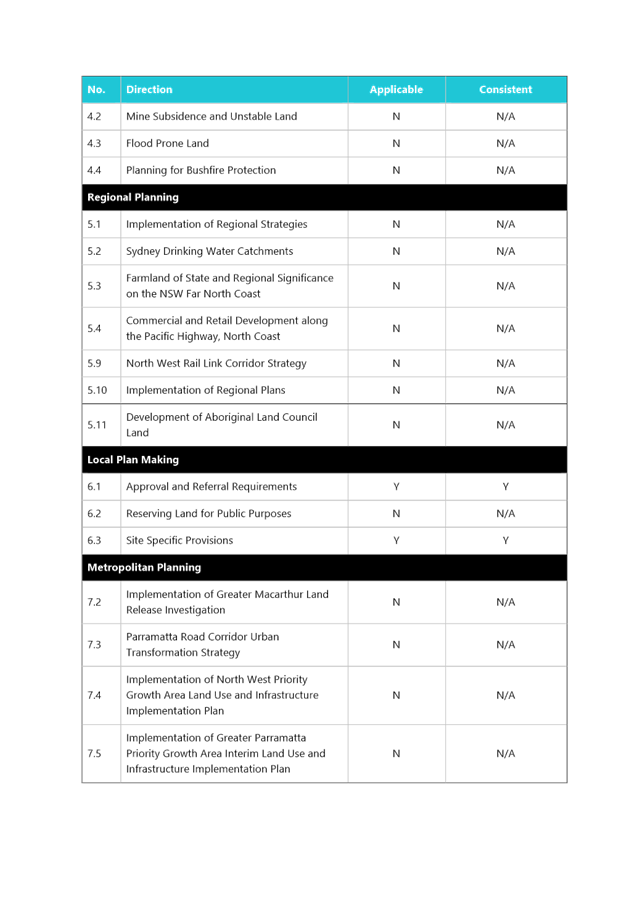
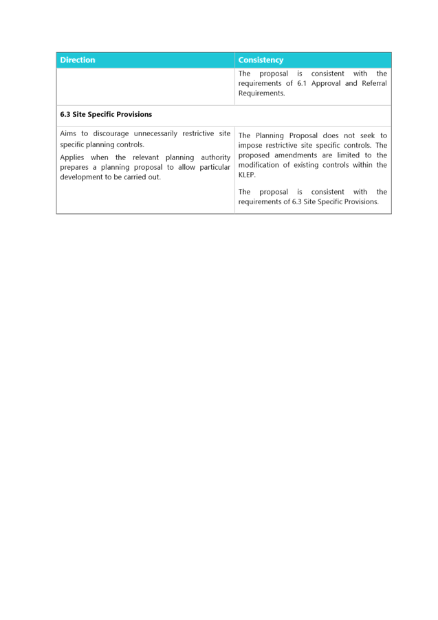
The Planning Proposal is justifiably inconsistent with direction 6.3 Site Specific Provisions. The Planning Proposal seeks to include a site-specific provisions which would require:
o a minimum lot size which is larger than usually required in Ku-ring-gai for the development of a residential flat building. The purpose of the site-specific provision for the site is to ensure that the 3 sites the subject of the Planning Proposal are developed together as one consolidated site, rather than potentially 1 or 2 out of the three being developed.
o Site-specific development standards including height of buildings using RLs and floor space ratio
The objective of direction 6.3 is to discourage unnecessarily restrictive site-specific planning controls, and 4(c) outlines that a Planning Proposal must allow that land use on the relevant land without imposing any development standards or requirements in addition to those already contained in the principal environmental planning instrument being amended.
(6) notes that a Planning Proposal may be inconsistent with this direction, if the provisions are of a minor significance.
In order to ensure that future development on the site enabled by the Planning Proposal responds appropriately to the surrounding context, comprising high density, low density and heritage items, as well as responding appropriately to site constraints such as changes in topography, there is a need for site-specific provisions and development standards. It is considered the inconsistency with direction 6.3 is minor in nature and justifiable in order to ensure the best built form outcomes on the site.
Amendments required to be made to Planning Proposal Documents
The assessment of the Planning Proposal has found that there are a number of errors, inconsistencies and lack of detail or analysis provided within the documents. There are other amendments required as a result of Council’s assessment, such as the amendment to the Floor Space Ratio and Minimum Lot Size development standards.
A table of amendments is included at Attachment A12 which details the required amendments to be made to the Planning Proposal if Council is to support it being submitted to the Department of Planning and Environment for a Gateway Determination and proceed to public exhibition.
Site-Specific DCP
In order to provide more certainty and clarity regarding the built form outcomes on the site under the amendments proposed within the Planning Proposal, it is recommended that a site-specific Development Control Plan (DCP) be prepared and exhibited concurrently with the Planning Proposal, should it receive a Gateway Determination.
The site-specific DCP should include detailed controls regarding:
· Built form, including wall lengths and massing;
· setbacks from adjoining heritage items, low density residential dwellings and significant trees including canopy to be retained;
· upper level setbacks of building envelopes;
· ensure appropriate curtilage areas to adjoining heritage items;
· pedestrian and vehicle access to the site ensuring retention and protection of large canopy trees;
· building envelope to ensure it is broken up into 3 separate section across the site in order to reflect the pattern of subdivision and surrounding low density development context;
· roof forms;
· landscaping, including buffer areas to heritage items and requirement for landscape plan including planting of native trees (including Blue Gum High Forest species);
· updated Greenweb mapping (DCP biodiversity provision mapping).
integrated planning and reporting
Theme 3: Places, Spaces and Infrastructure
|
Community Strategic Plan Long Term Objective |
Delivery Program Term Achievement |
Operational Plan Task |
|
P1.1 Ku-ring-gai’s unique visual character and identity is maintained
|
P1.1.1 Strategies, plans and processes are in place to protect and enhance Ku-ring-gai’s unique visual and landscape character
|
P1.1.1.1 Continue to review the effectiveness of existing strategies, plans and processes across all programs.
|
|
P2.1 A robust planning framework is in place to deliver quality design outcomes and maintain the identity and character of Ku-ring-gai |
P2.1.1 Land use strategies, plans and processes are in place to effectively managed the impact of new development |
P2.1.1.2 Continue to review the effectiveness of existing strategies, local environmental plans, development control plans and processes across all programs |
Governance Matters
The process for the preparation and implementation of Planning Proposals is governed by the provisions contained in the Environmental Planning and Assessment Act 1979 and the Environmental Planning and Assessment Regulation 2000.
If Council fails to make a decision within 90 days (from the commencement of the review of the application) or if Council makes a decision to not support the Planning Proposal, the proponent can request the Department of Planning and Environment for a Rezoning Review.
Local Planning Panels Direction – Planning Proposals issued by the Minister for Planning under Section 9.1 of the Environmental Planning and Assessment Act 1979 requires Council to refer all Planning Proposals prepared after 1 June 2018 to the Local Planning Panel for advice, before the Planning Proposal is forwarded to the Minister for a Gateway Determination under Section 3.34 of the Environmental Planning and Assessment Act 1979.
Risk Management
This is a privately initiated Planning Proposal. Council needs to determine its position on the matter as to whether the Planning Proposal should be sent to the Department of Planning and Environment for a Gateway Determination and proceed to public exhibition.
Council risks damage to its reputation if it does not undertake strategic land use planning in an effective and timely manner.
Financial Considerations
The Planning Proposal was subject to the relevant application fee under Council’s 2021/2022 Schedule of Fees and Charges. The cost of the review and assessment of the Planning Proposal is covered by this fee.
Social Considerations
The amendments sought by the Planning Proposal will enable the delivery of 36-40 dwellings on the subject site to meet the existing and future requirements of a growing and changing community.
Environmental Considerations
The subject site includes areas mapped on the KLEP 2015 Biodiversity map (Clause 6.3) and Greenweb within the Ku-ring-gai DCP (Part 18). An Arborist Report and Ecological Constraints Assessment have been submitted with the Planning Proposal. Council’s Team Leader Natural Areas has reviewed the Planning Proposal and the potential environment impacts of the Planning Proposal have been considered in this assessment. Further detailed consideration of environmental impacts will be included in the site-specific DCP, and any future development that may occur on the site as a result of the proposal.
Community Consultation
In the event that the Planning Proposal is issued a Gateway Determination by the Department of Planning and Environment, the Planning Proposal would be placed on statutory public exhibition in accordance with the requirements of the Gateway Determination, and Council’s Community Participation Plan.
Internal Consultation
The assessment of the Planning Proposal has included internal consultation with Council’s staff with expertise in planning, heritage, traffic and transport and biodiversity and has informed the recommendations of this Report. External Urban Design advice was provided on the assessment of the Planning Proposal.
Summary
A Planning Proposal has been submitted for 8a, 14 and 16 Buckingham Road, Killara which seeks to make the following amendments to the Ku-ring-gai Local Environmental Plan 2015:
· Rezone from R2 Low Density Residential to R4 High Density Residential;
· amend Height of Buildings development standard;
· amend Floor Space Ratio development standard ;
· amend Minimum Lot Size development standard;
· site specific local provision requiring amalgamation of lots prior to development for the purposes of a residential flat building.
The Planning Proposal has been assessed and found to have sufficient strategic and site-specific merit to enable it to proceed to Gateway Determination and public exhibition, subject to the amendments outlined in Attachment A12.
That the Ku-ring-gai Local Planning Panel advise Council that:
A. The Planning Proposal, amended as per the Table of Amendments Attachment A12, be submitted to the Department of Planning and Environment for a Gateway Determination.
B. That a site-specific Development Control Plan be prepared for the site and exhibited concurrently with the Planning Proposal, should it receive a Gateway Determination.
|
Alexandra Plumb Acting Senior Urban Planner |
Craige Wyse Team Leader Urban Planning |
|
Antony Fabbro Manager Urban & Heritage Planning |
Andrew Watson Director Strategy & Environment |
|
Attachments: |
A1 |
PRE-PLANNING PROPOSAL MEETING REPORT - 8A, 14 & 16 BUCKINGHAM ROAD, KILLARA |
|
2022/045679 |
|
|
A2 |
PLANNING PROPOSAL JANUARY 2022 - 8A, 14 16 BUCKINGHAM ROAD KILLARA |
|
2022/045678 |
|
|
A3 |
A. URBAN DESIGN STUDY REV 2 - January 2022 - Planning Proposal 8A 14 16 BUCKINGHAM ROAD KILLARA |
|
2022/045692 |
|
|
A4 |
B. TRAFFIC REPORT - Planning Proposal 8A, 14 & 16 BUCKINGHAM ROAD, KILLARA |
|
2022/045697 |
|
|
A5 |
B. Additional TRAFFIC RESPONSE - Planning Proposal - 8A, 14 & 16 BUCKINGHAM ROAD, KILLARA |
|
2022/045698 |
|
|
A6 |
C. STATEMENT OF HERITAGE IMPACT - Planning Proposal 8A, 14 & 16 BUCKINGHAM ROAD, KILLARA |
|
2022/045700 |
|
|
A7 |
C. ADDENDUM TO STATEMENT OF HERITAGE IMPACT - 8A 14 & 16 BUCKINGHAM ROAD KILLARA - January 2022 |
|
2022/045702 |
|
|
A8 |
D. ECOLOGICAL CONSTRAINTS ASSESSMENT - Planning Proposal 8A, 14 & 16 BUCKINGHAM ROAD, KILLARA |
|
2022/045714 |
|
|
A9 |
E. TREE ASSET IDENTIFICATION - Planning Proposal 8A, 14 & 16 BUCKINGHAM ROAD, KILLARA |
|
2022/045717 |
|
|
A10 |
SURVEY - 8A & 14 BUCKINGHAM ROAD, KILLARA |
|
2022/045707 |
|
|
A11 |
SURVEY - 16 BUCKINGHAM ROAD, KILLARA |
|
2022/045711 |
|
|
A12 |
Table of Amendments |
|
2022/045362 |