|
Ku-ring-gai Local Planning Panel Meeting - 19 November 2018 |
GB.1 / 3 |
|
|
|
|
Item GB.1 |
S11688 |
Planning Proposal for the Consolidation of the Ku-ring-gai Local Environmental Plan 2015 and Ku-ring-gai Local Environmental Plan (Local Centres) 2012
EXECUTIVE SUMMARY
Purpose of Report
To refer the Planning Proposal for the consolidation of the Ku-ring-gai Local Environmental Plan 2015 and Ku-ring-gai Local Environmental Plan (Local Centres) 2012 to the Ku-ring-gai Local Planning Panel for advice as required by the Local Planning Panels Direction – Planning Proposals issued by the Minister for Planning under Section 9.1 of the Environmental Planning and Assessment Act 1979.
Background
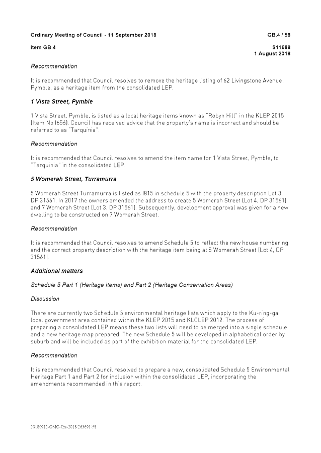
On 11 September 2018 Council resolved:
A. That a Planning Proposal be prepared for the consolidation of Ku-ring-gai Local Environmental Plan 2015 and of Ku-ring-gai Local Environmental Plan (Local Centres) 2012. The Planning Proposal is to include the mapping changes identified in Attachment A1 and the amendments to the Written Instrument identified in Attachment A2.
B. That the Planning Proposal be forwarded to the Department of Planning and Environment for a Gateway Determination in accordance with the provisions of the EP&A Act and Regulations.
C. That Council requests the plan making delegation under Section 2.4 of the EP&A Act for this Planning Proposal.
D. That upon receipt of a Gateway Determination, the exhibition and consultation process is carried out in accordance with the requirements of the EP&A Act and with the Gateway Determination requirements.
E. That a report be brought back to Council at the conclusion of the exhibition period.
F. That the Killara Golf Club Planning Proposal not be part of the consolidation until such time as Councillors can review it.
Background and Context
Ku-ring-gai currently has three environmental planning instruments in force:
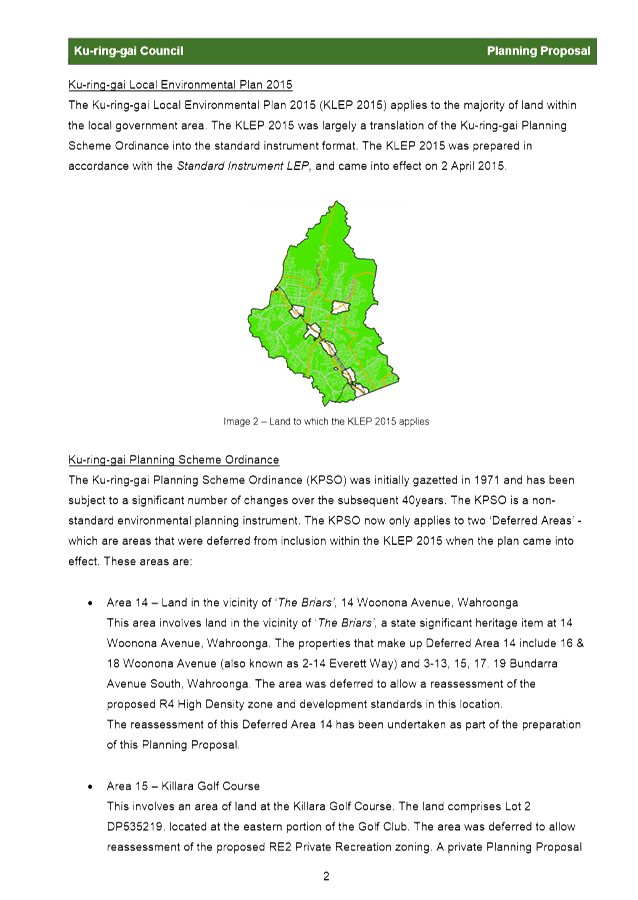
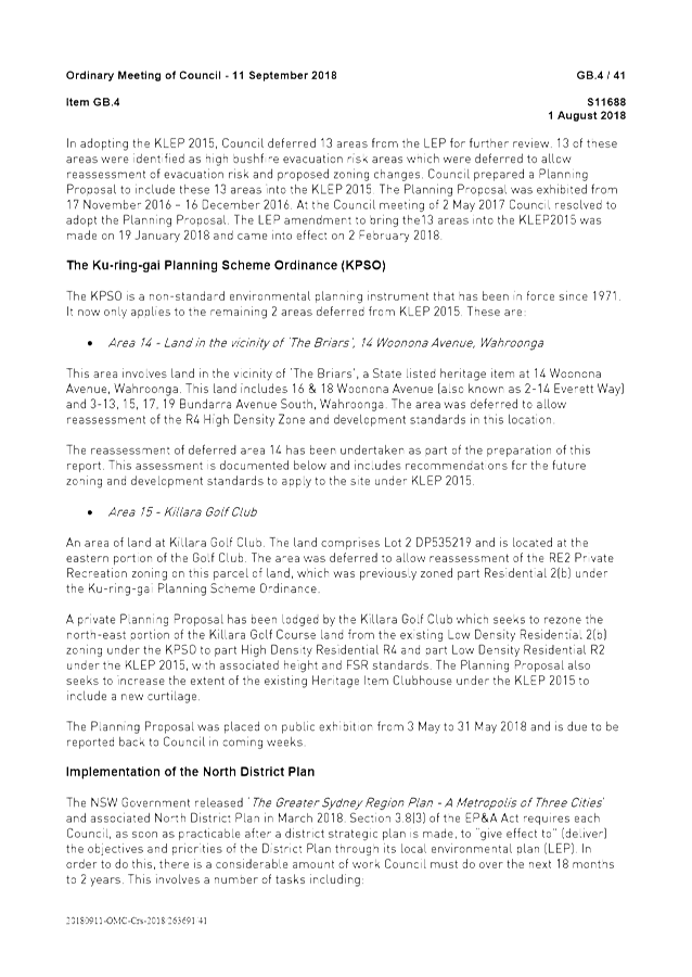
· Ku-ring-gai Local Environmental Plan 2015 - The KLEP 2015 applies to the majority of land within Ku-ring-gai. The KLEP 2015 was largely a translation of the Ku-ring-gai Planning Scheme Ordinance into the standard instrument format. The KLEP came into effect on 2 April 2015.
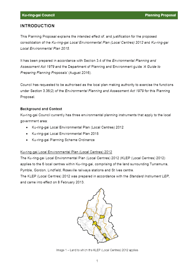
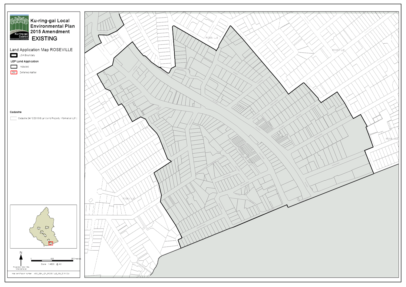
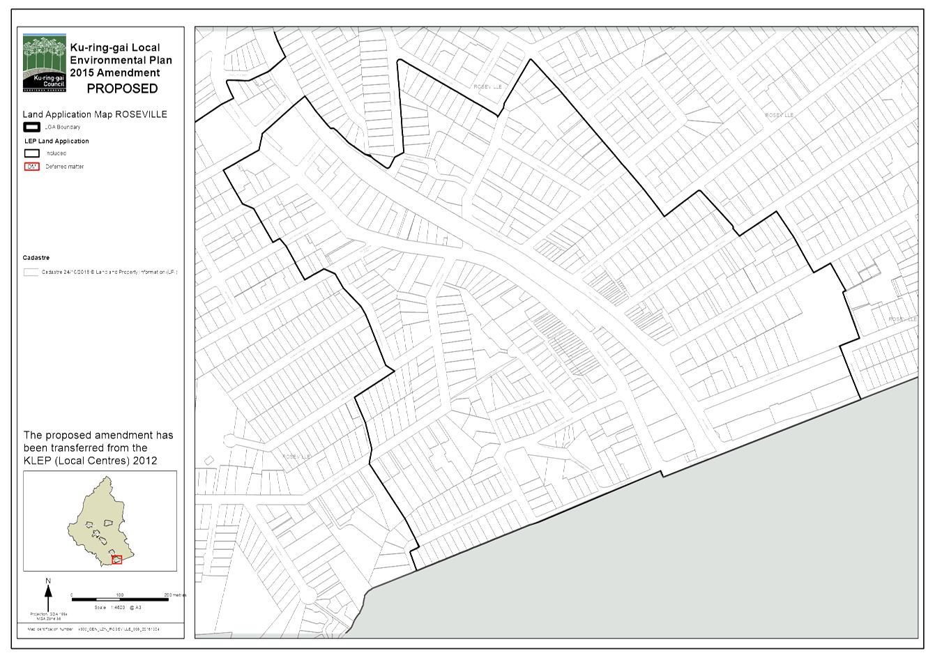
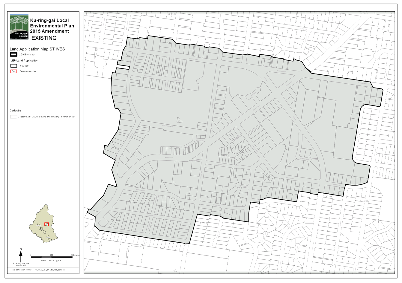
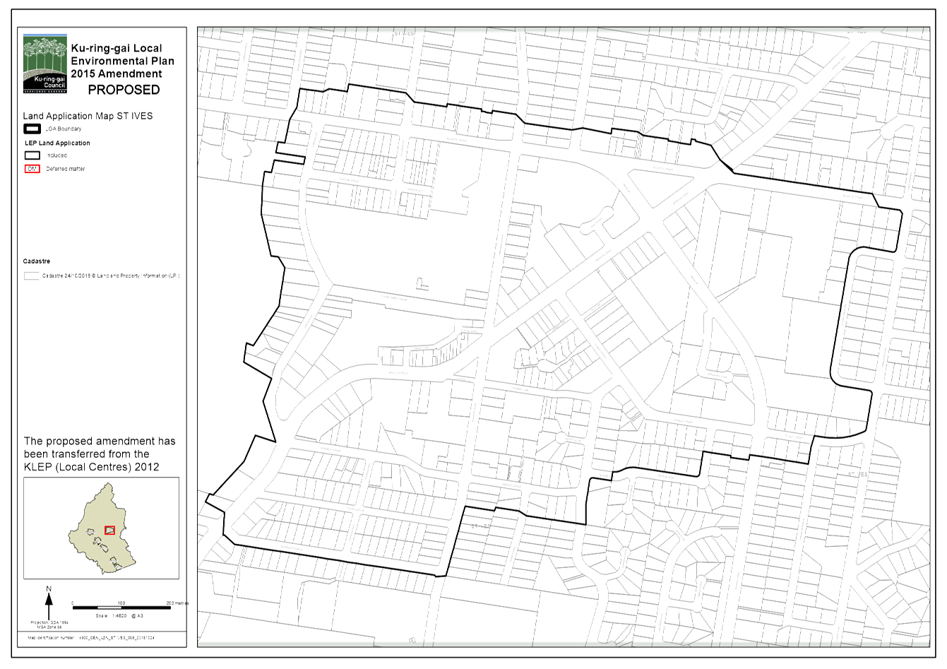
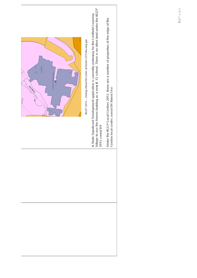
· Ku-ring-gai Local Environmental Plan (Local Centres) 2012 - The KLEP (Local Centres) 2012 applies to the 6 local centres within the local government area, which comprises of the land surrounding Turramurra, Pymble, Gordon, Lindfield and Roseville railway stations’, and St Ives. The KLEP (Local Centres) 2012 was prepared in accordance with the NSW Government’s Standard Instrument LEP. The KLEP (Local Centres) 2012 came into effect on 8 February 2013.
· Ku-ring-gai Planning Scheme Ordinance - The KPSO is a non-standard environmental planning instrument that has been in force since 1971. The KPSO now only applies to two ‘Deferred Areas’, - which are areas that were deferred from inclusion within the KLEP 2015 when it came into effect. The deferred areas are:
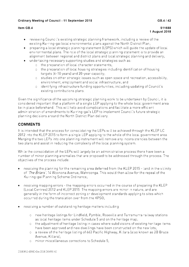
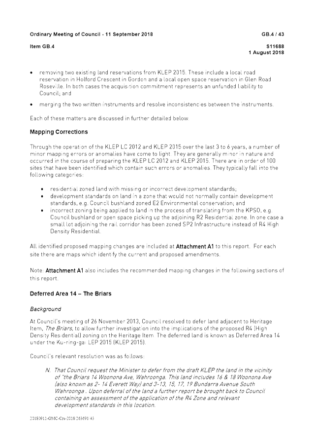
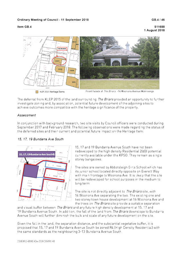
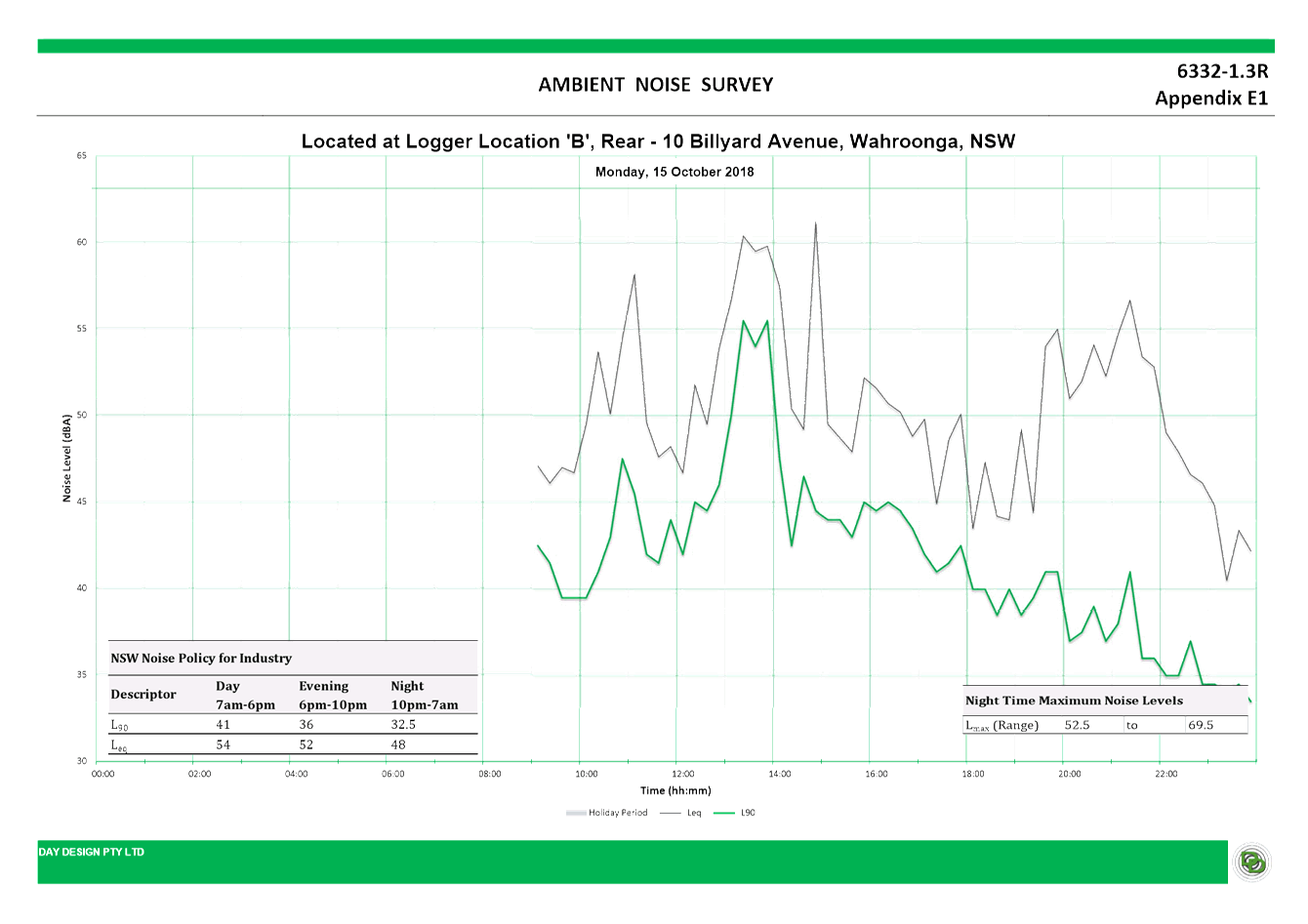
o Area 14 – Land in the vicinity of ‘The Briars’, 14 Woonona Avenue, Wahroonga
o Area 15 – Part of Killara Golf Course
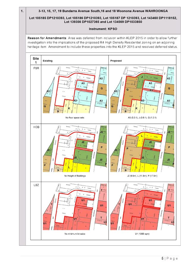
This Planning Proposal seeks to resolve Deferred Area 14 – Land surrounding ‘The Briars’, Wahroonga by incorporating this area into the KLEP 2015.
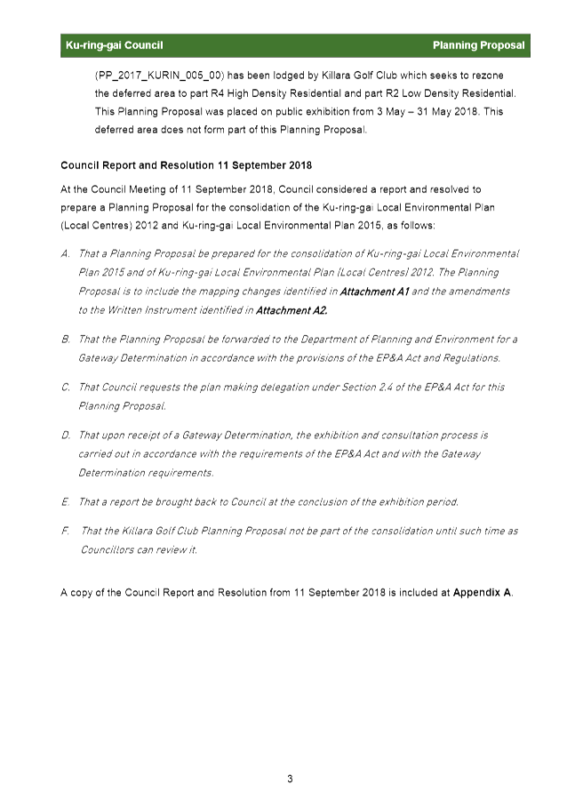
Deferred Area 15 – Killara Golf Course is subject to its own Planning Proposal (PP_2017_KURIN_005_00) which has been lodged by Killara Golf Course, and does not form part of this Planning Proposal.

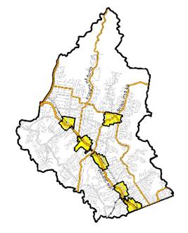
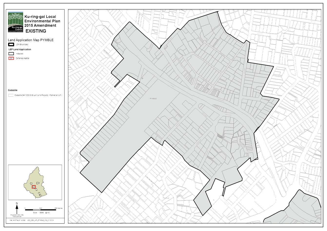
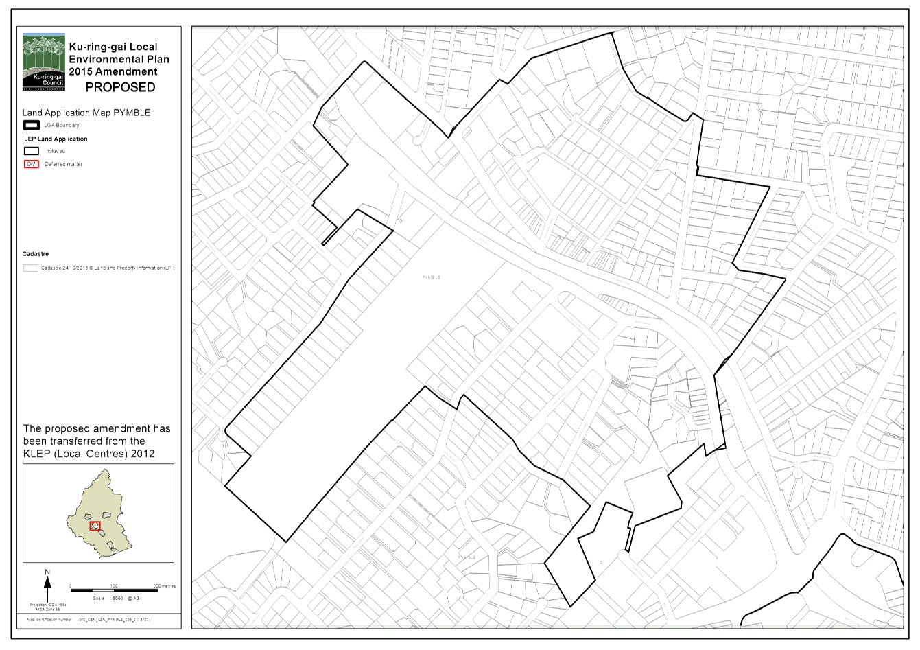
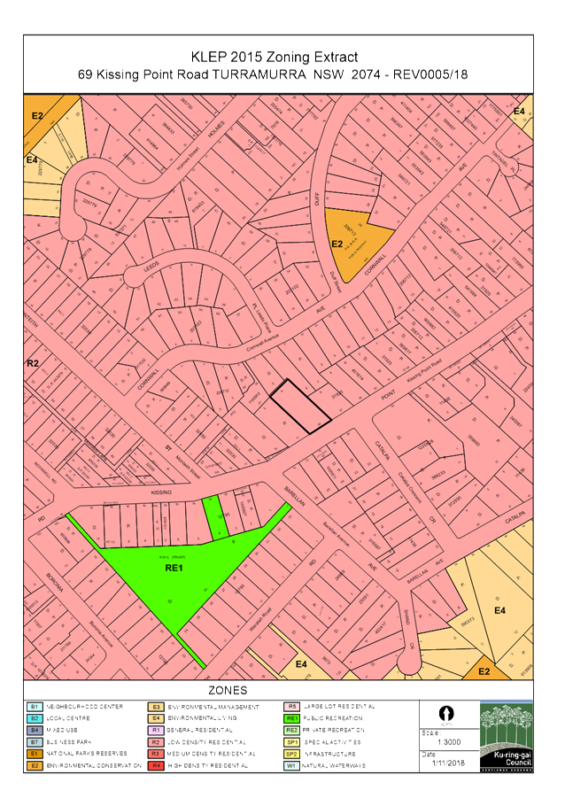
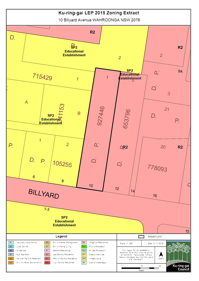
Image 1 – Land covered by KLEP 2015 Image 2 – Land covered by KLEP (Local Centres) 2012
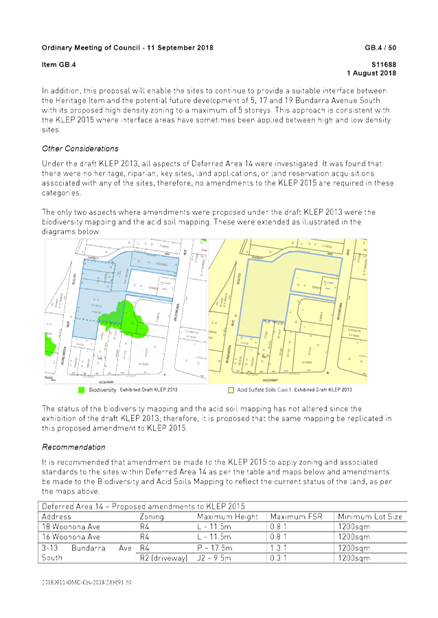
Comments
Planning Proposal – Objectives and Proposed Amendments
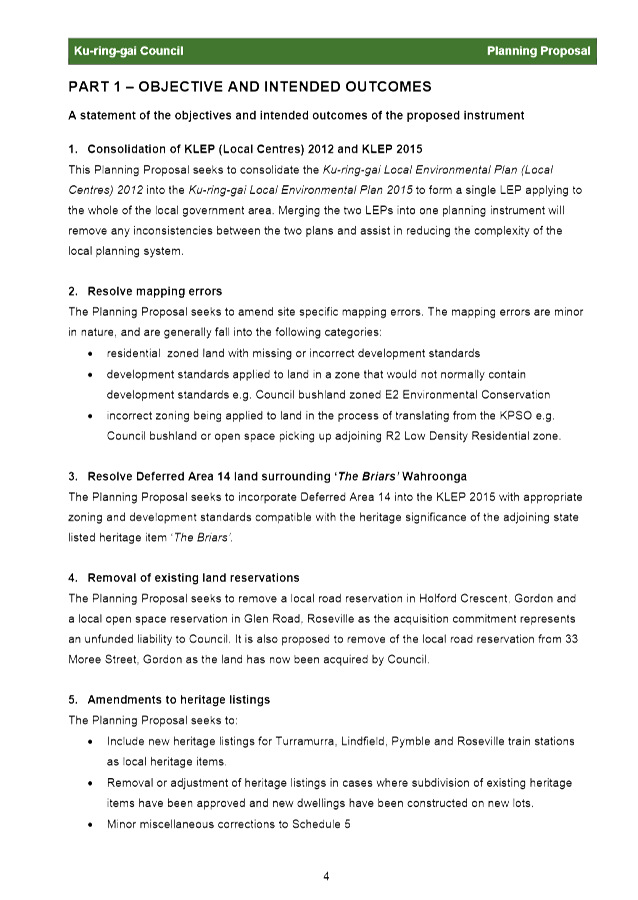
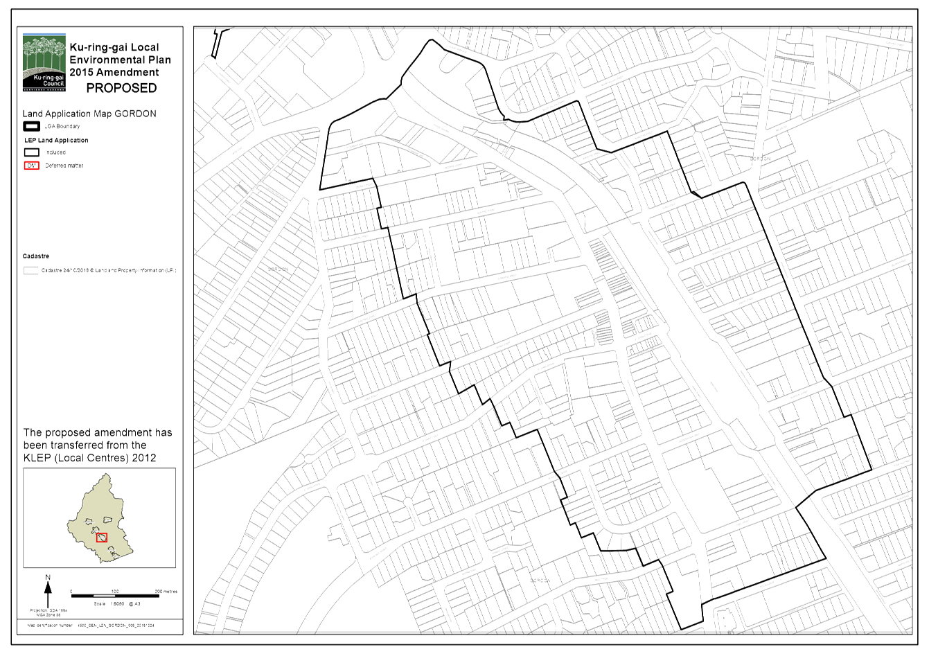
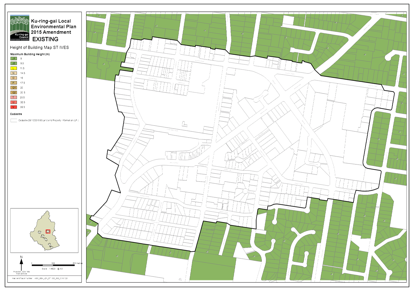
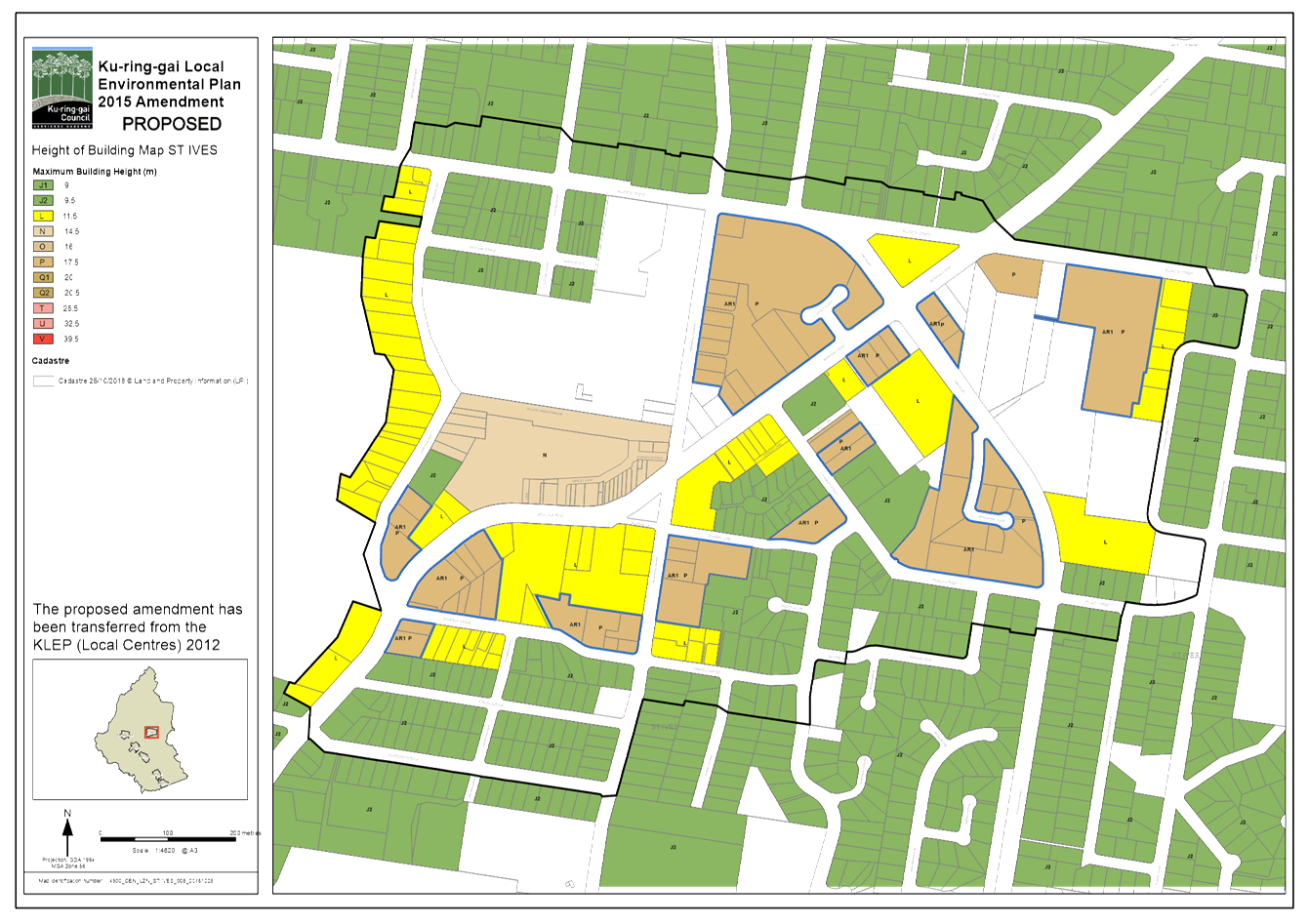
The objective of the Planning Proposal is to consolidate the KLEP (Local Centres) 2012 into the KLEP 2015 to form a single LEP applying to the whole local government area. It is intended that the process for consolidating the LEPs will be achieved through an amendment to the KLEP 2015 and result in the repeal of the KLEP (Local Centres) 2012.
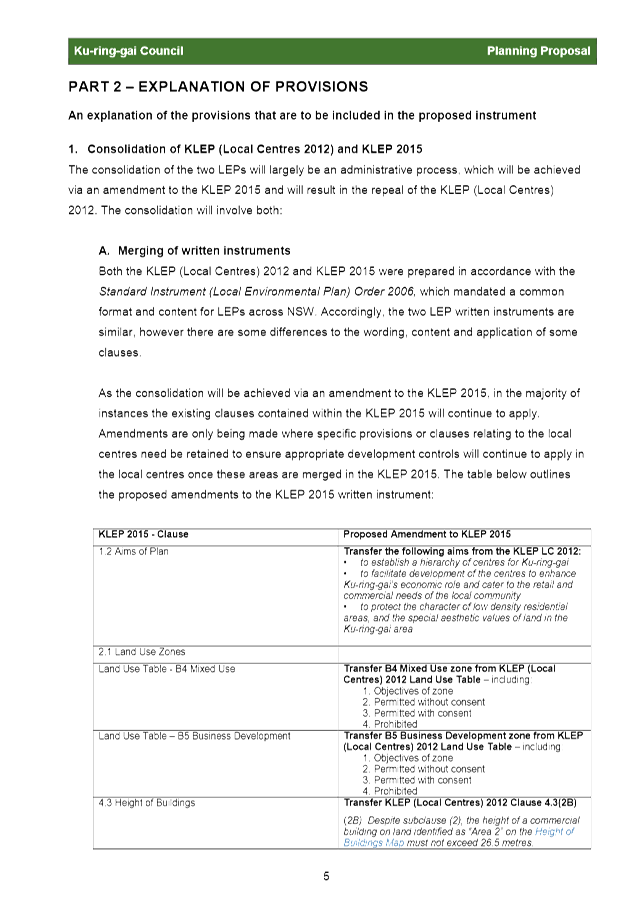
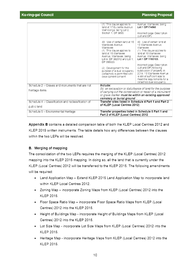
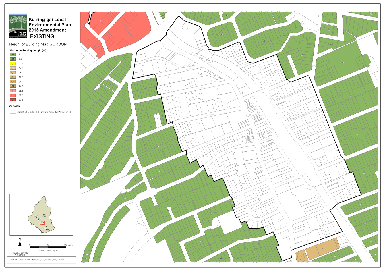
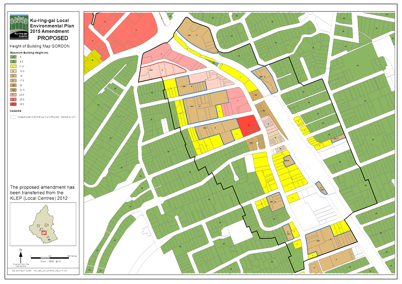
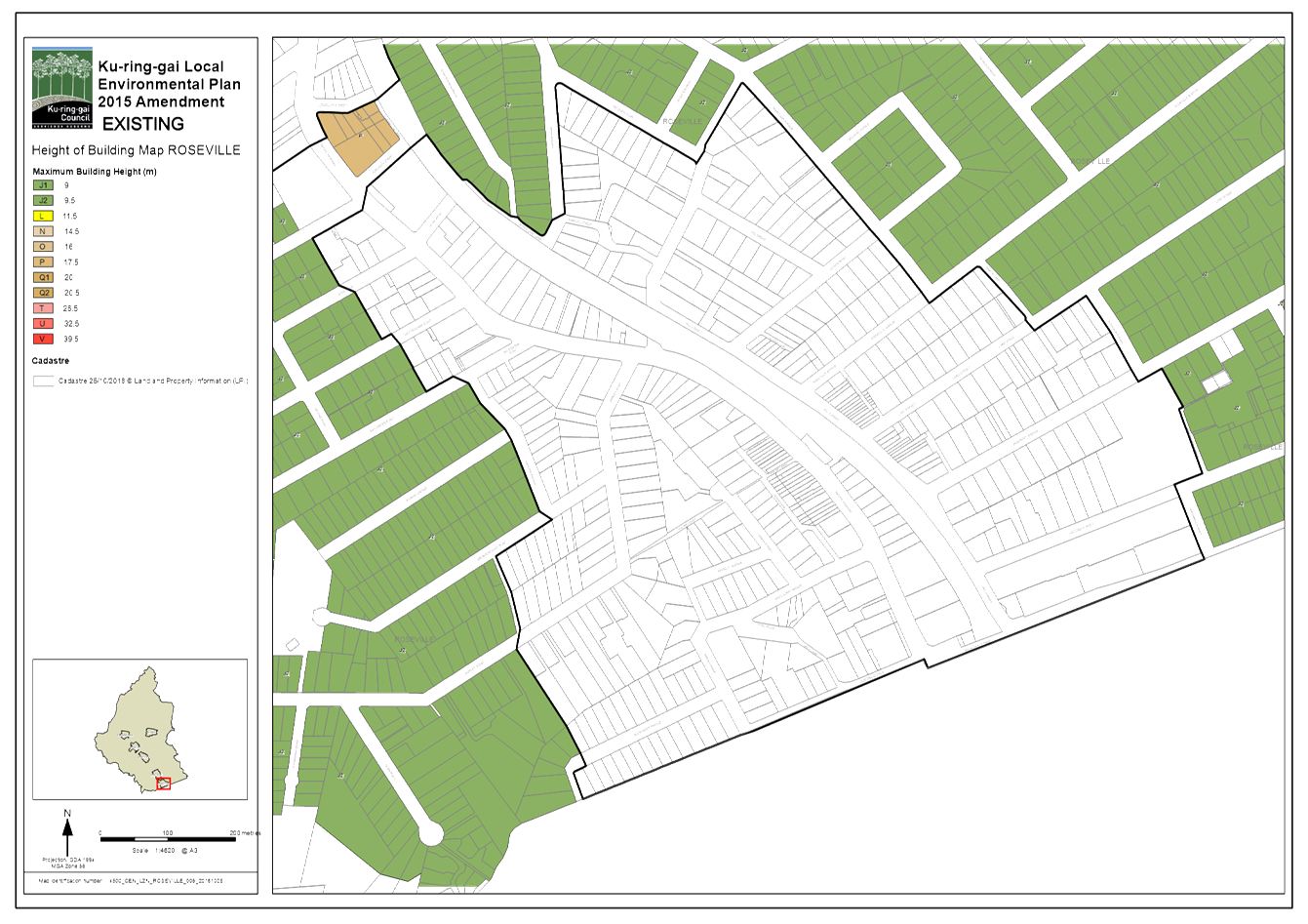
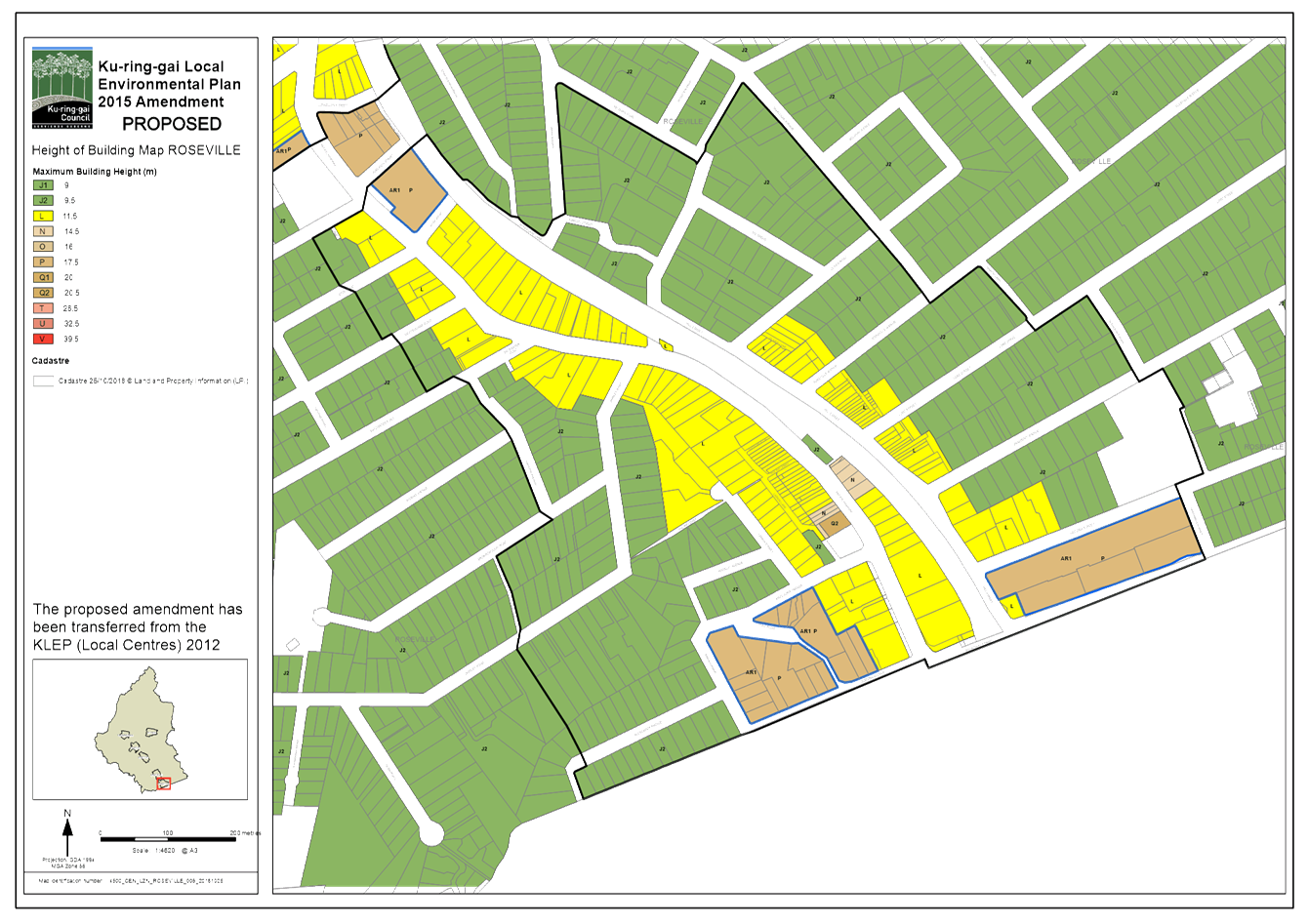
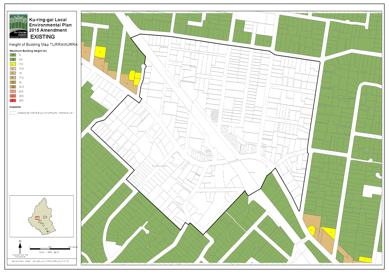
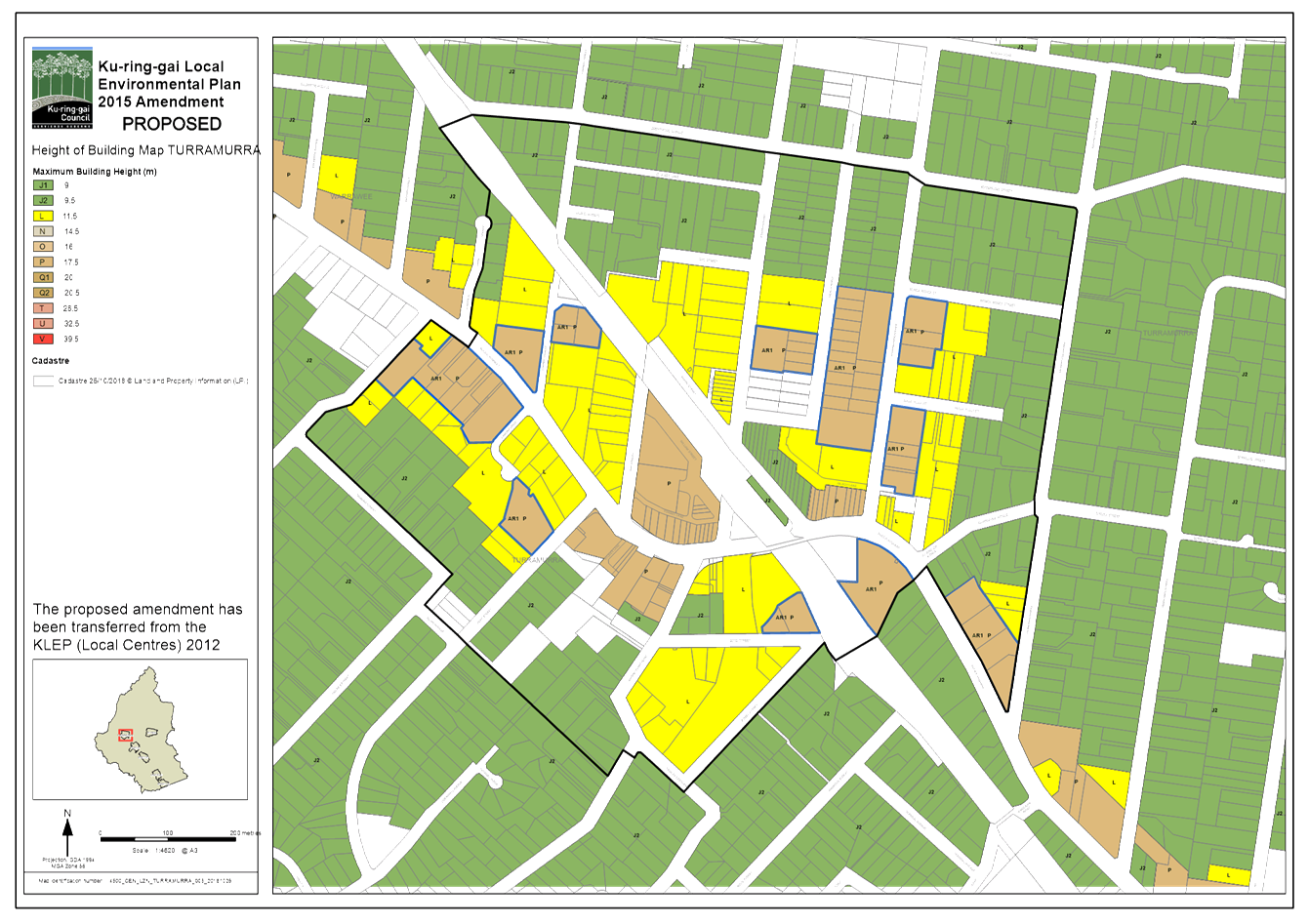
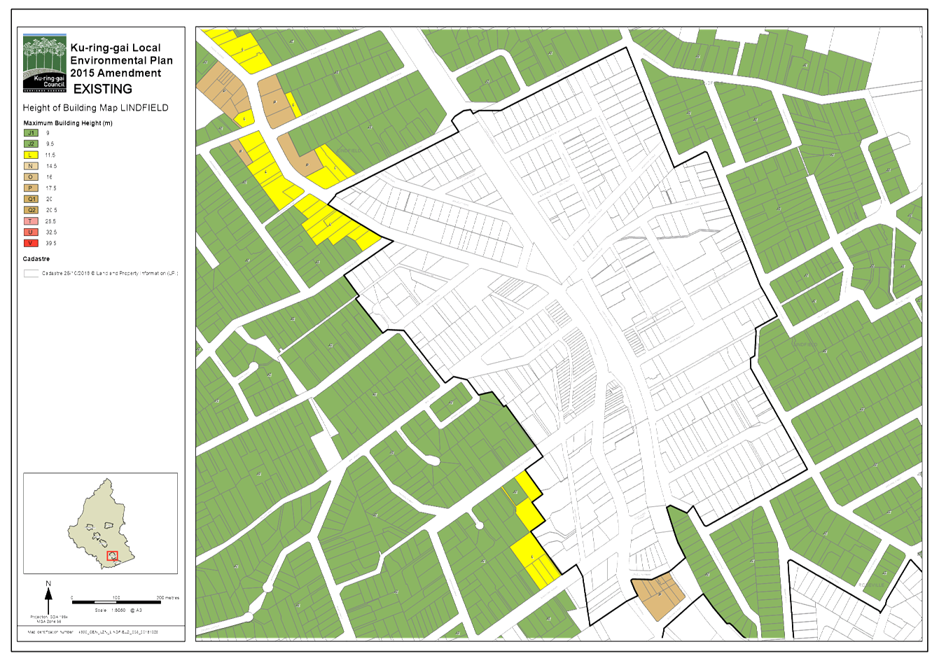
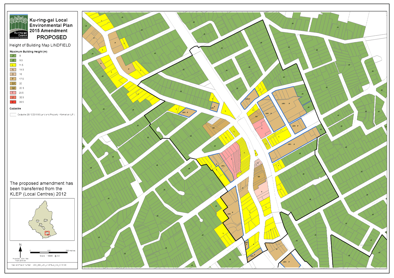
The consolidation of the two LEPs will largely be an administrative process, and will involve the merging of the written instruments, and merging of the mapping.
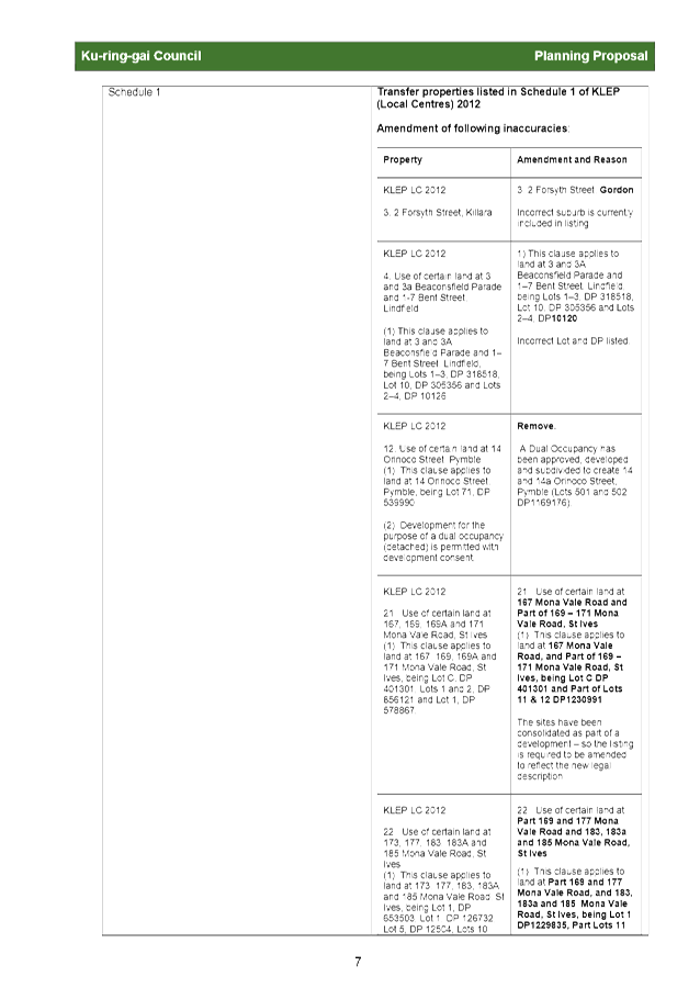
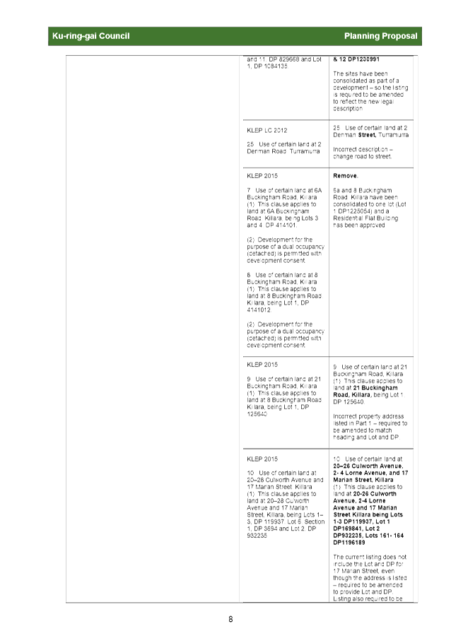
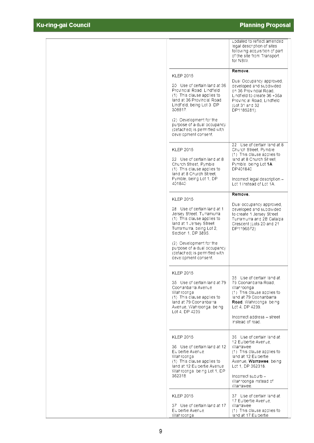
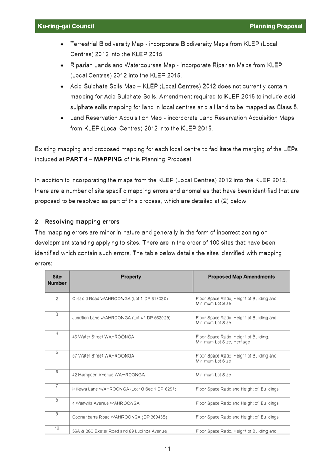
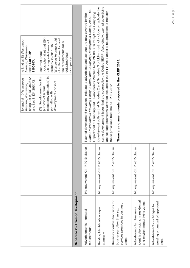
The Planning also seeks to address a number of minor planning anomalies and errors, including:
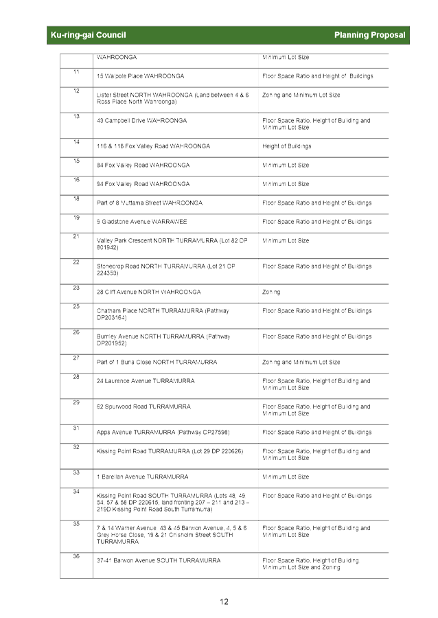
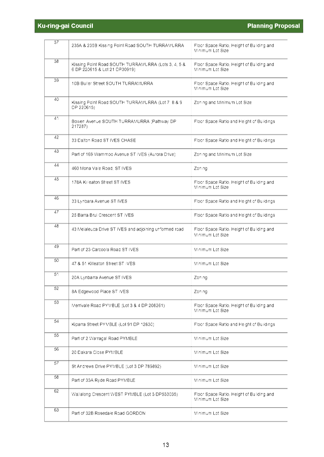
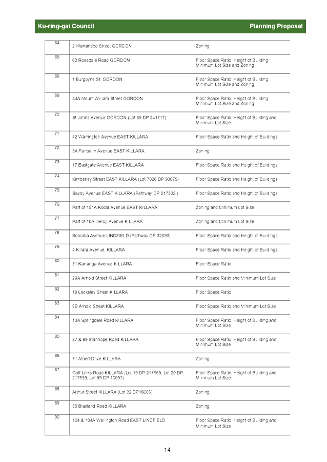
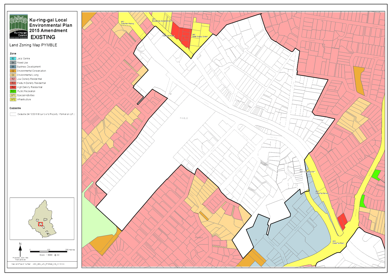
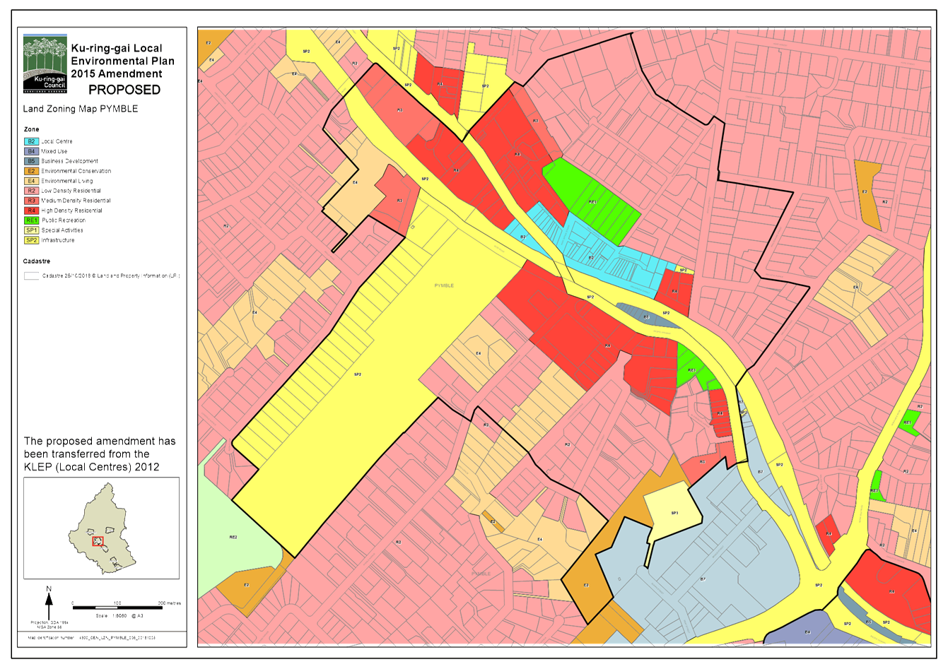
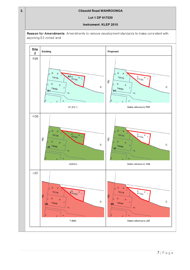
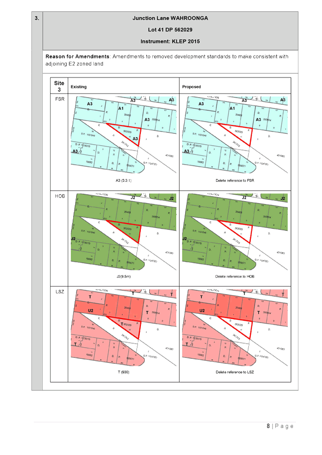
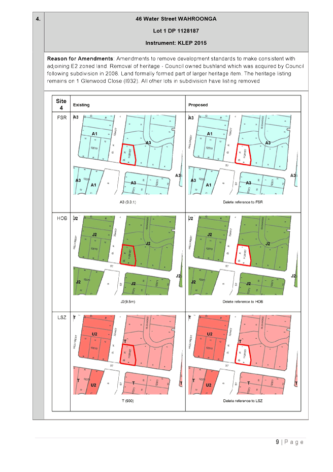
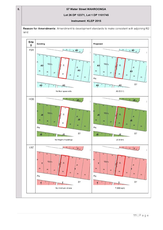
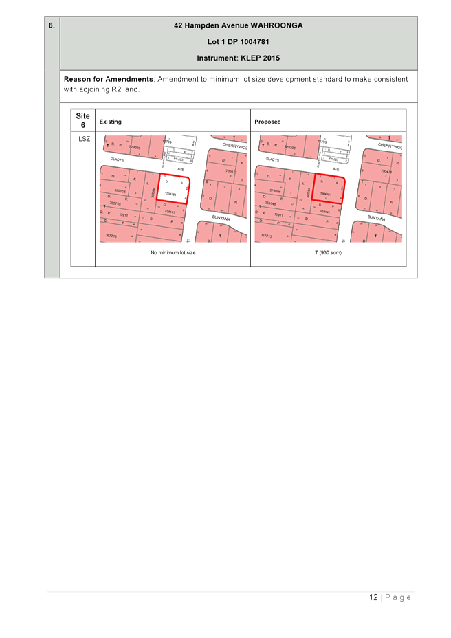
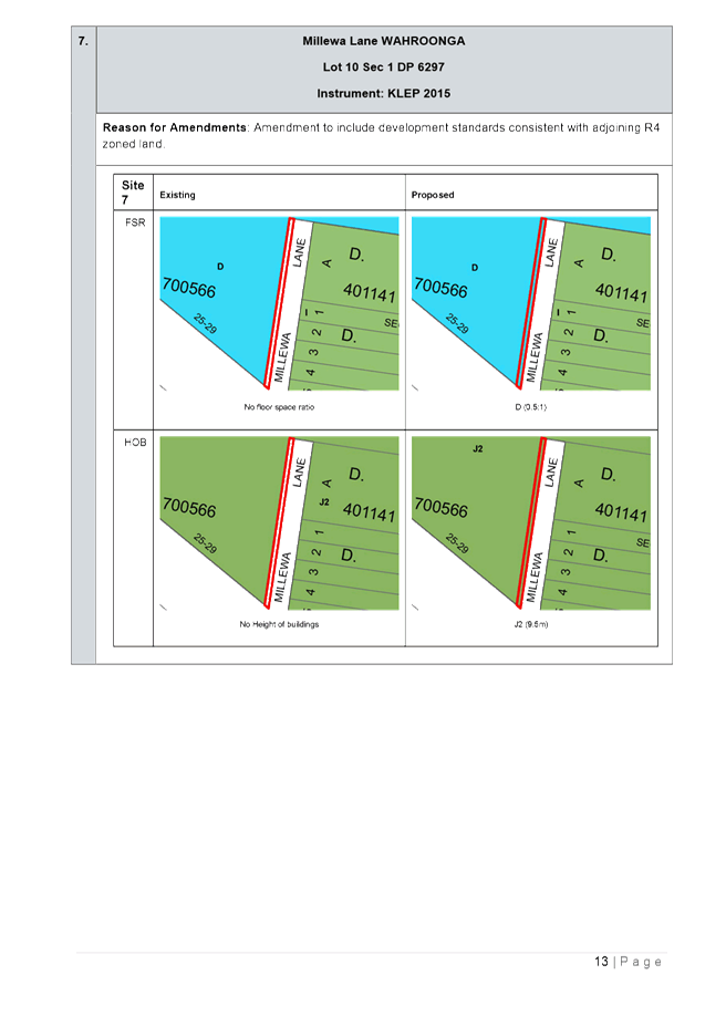
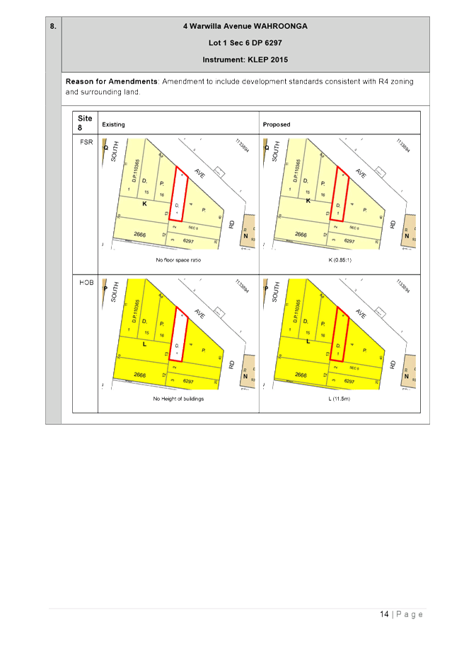
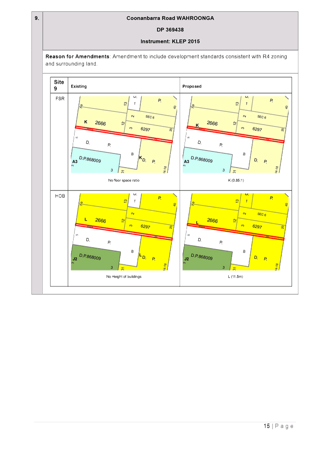
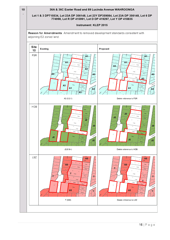
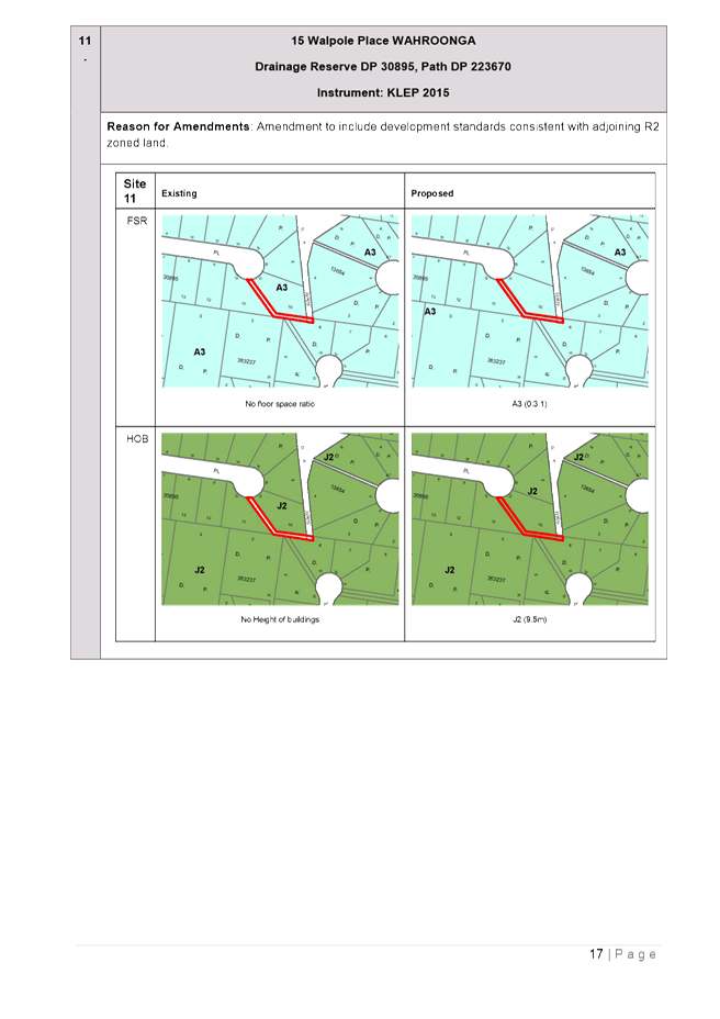
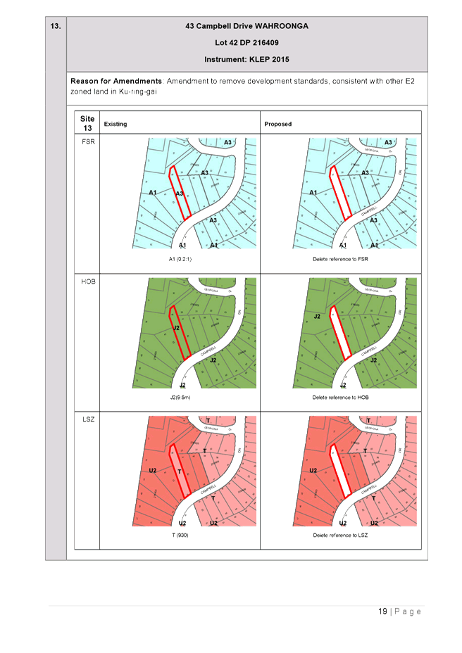
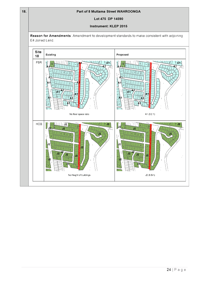
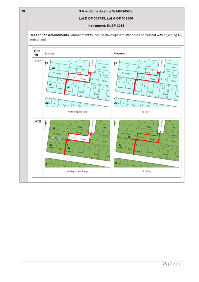
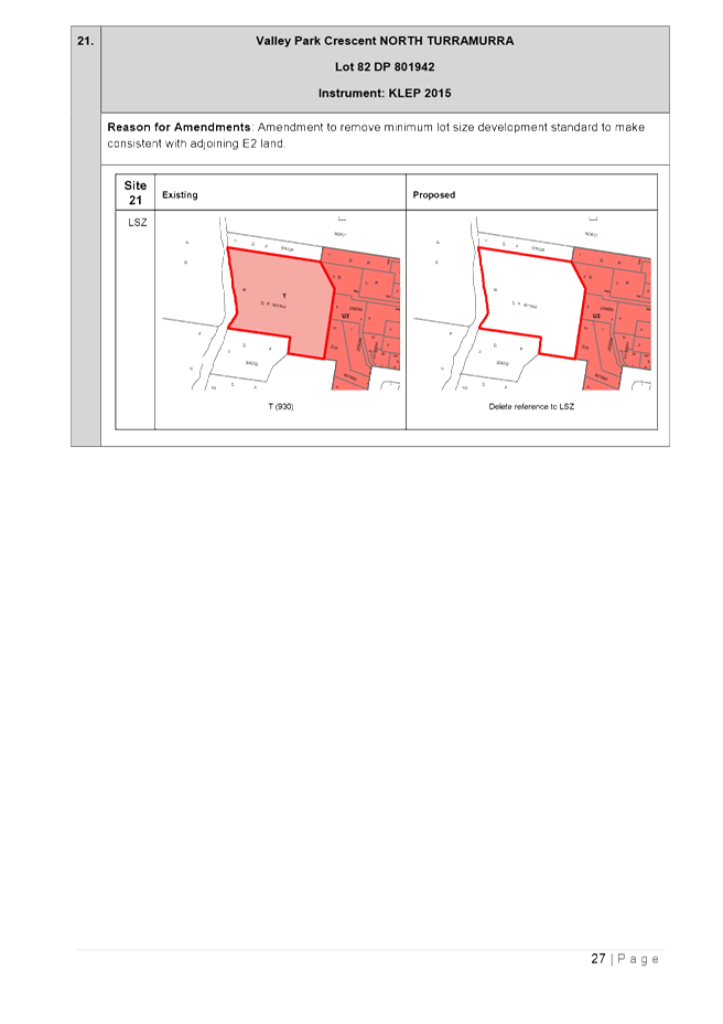
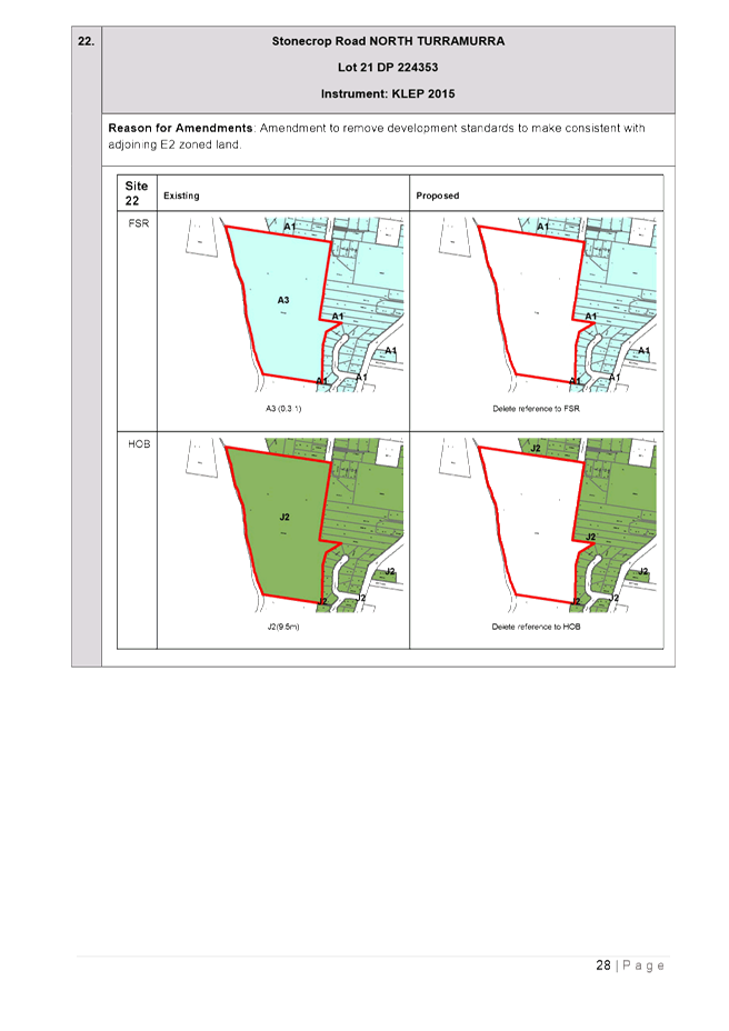
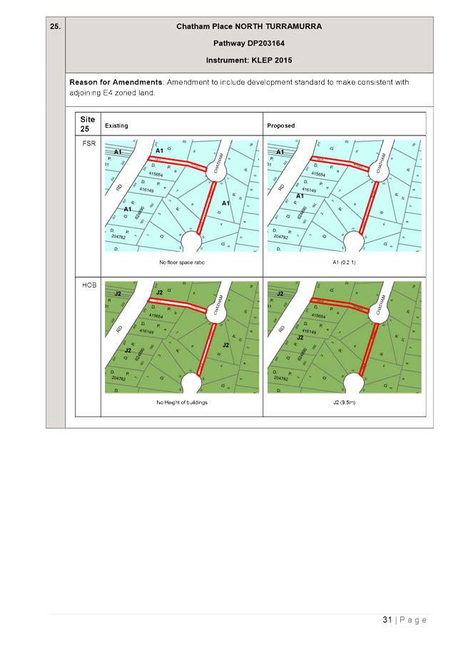
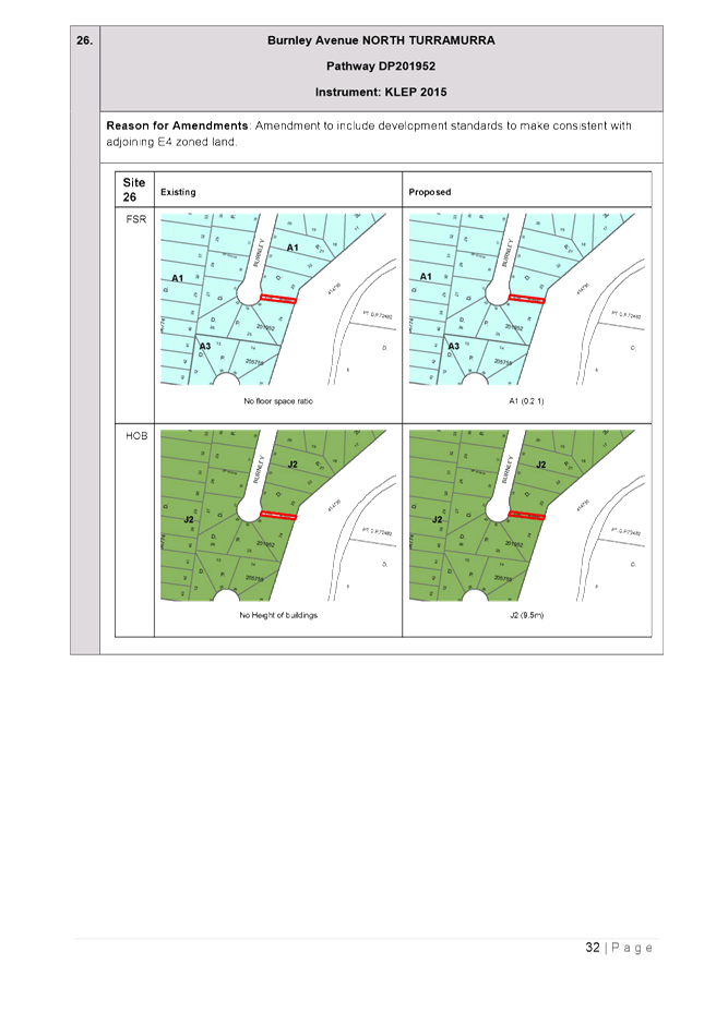
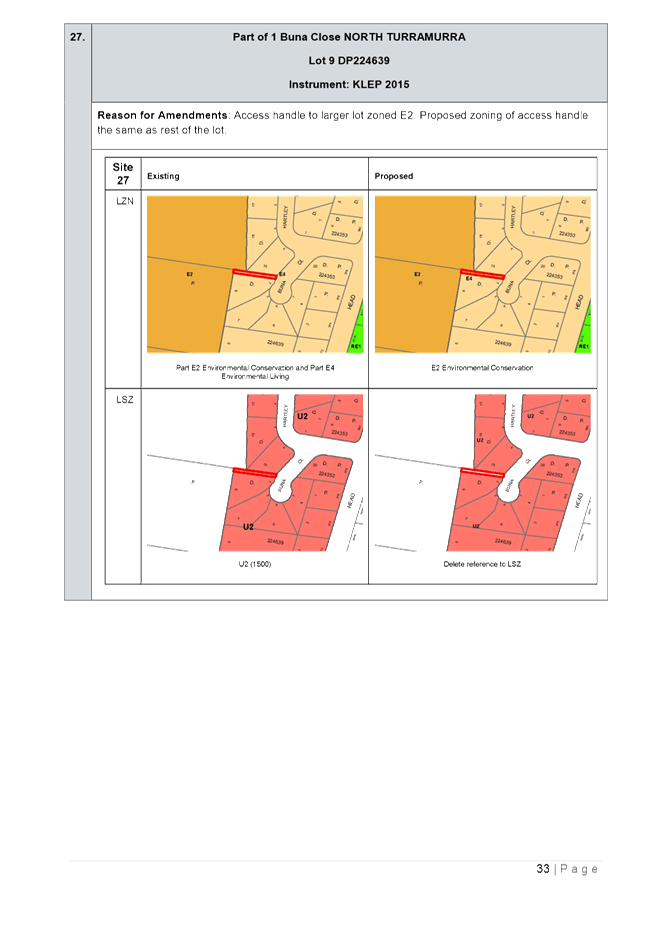
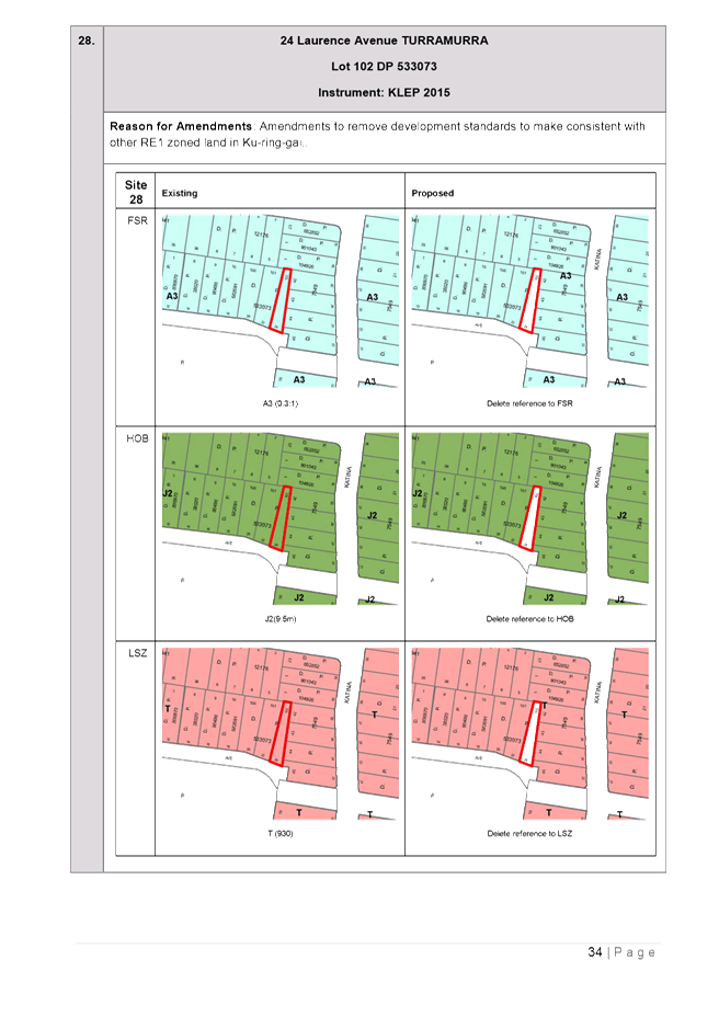
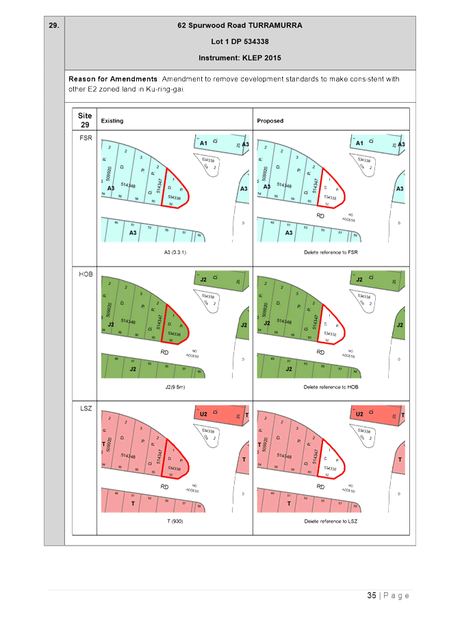
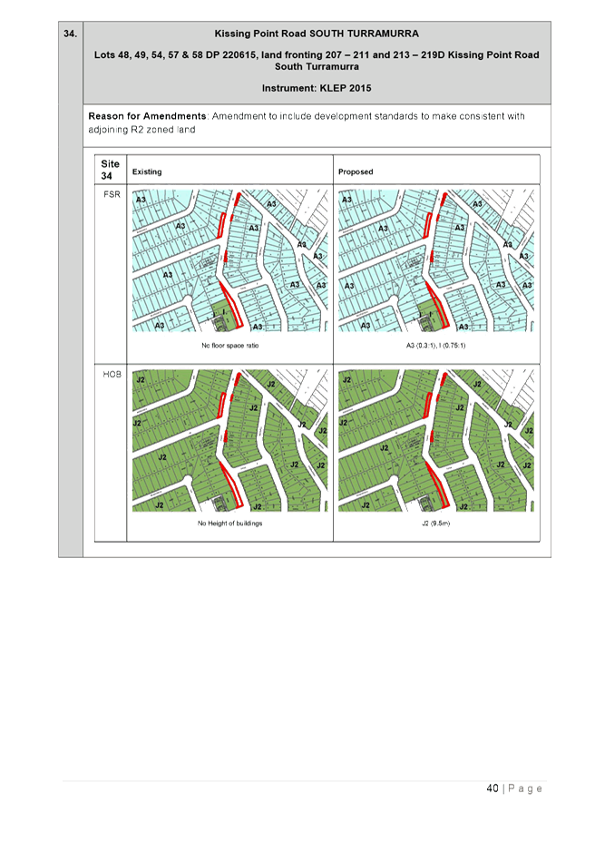
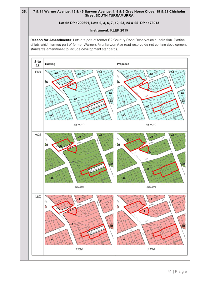
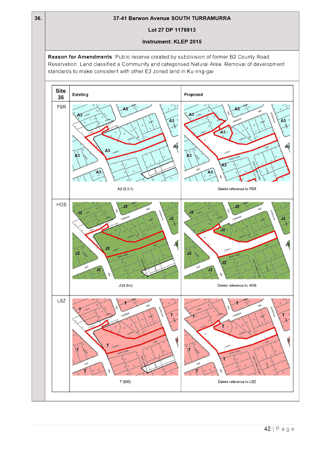
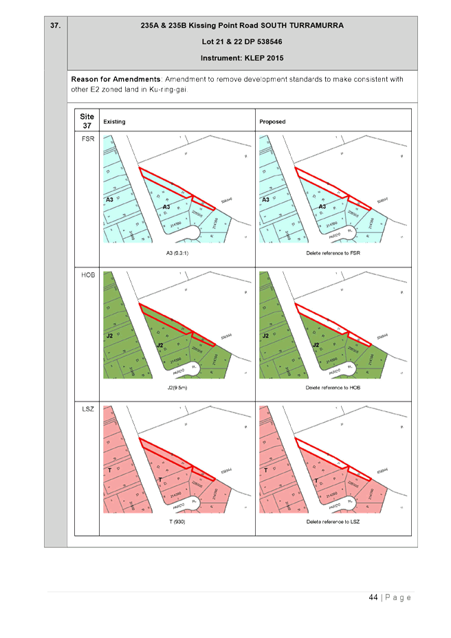
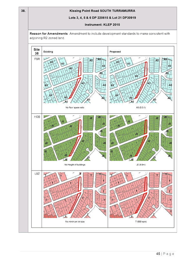
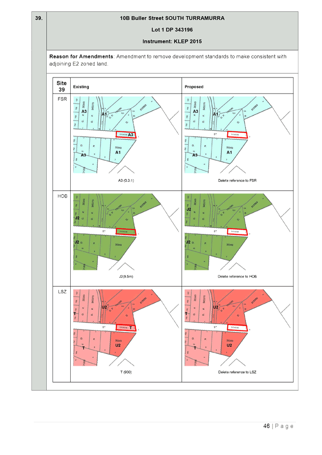
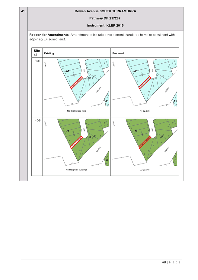
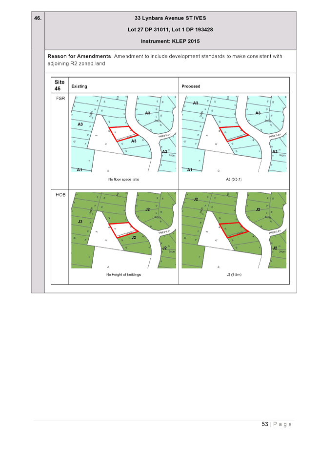
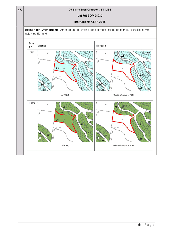
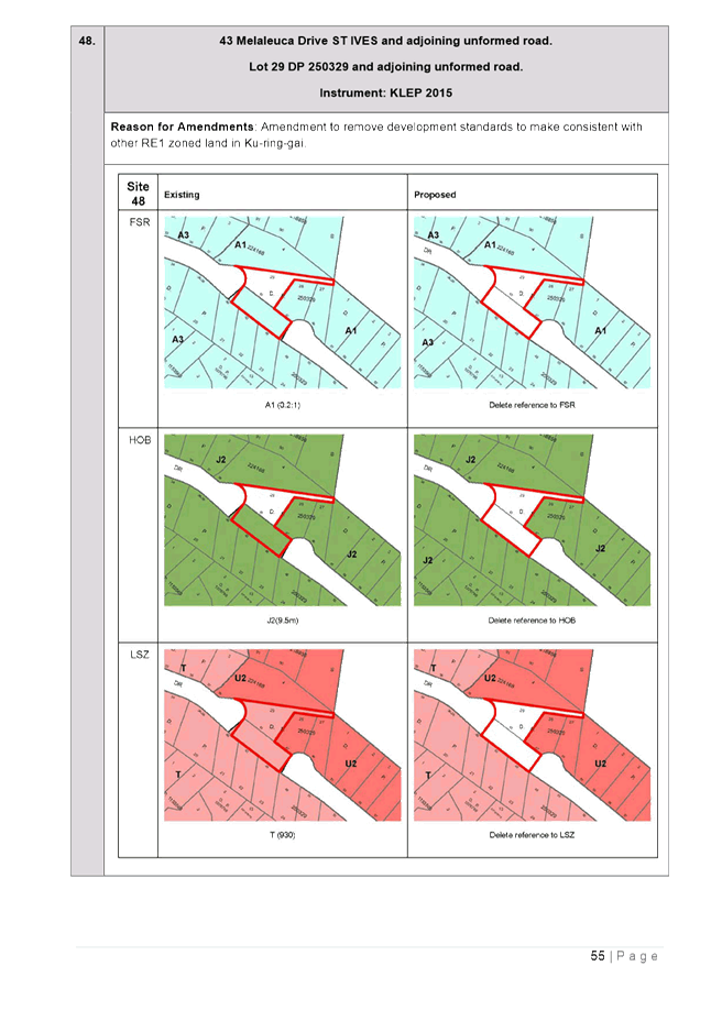
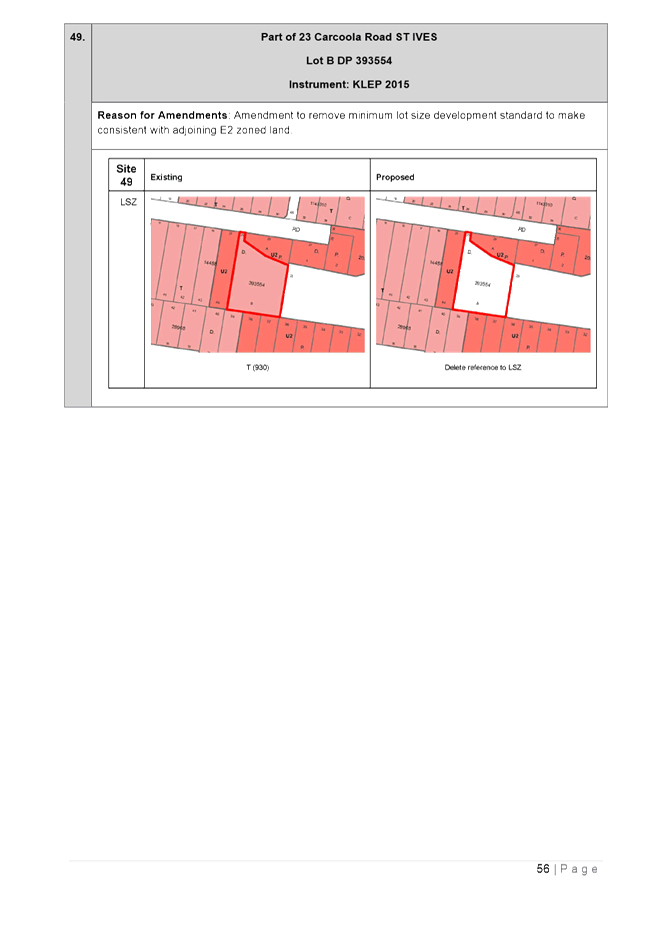
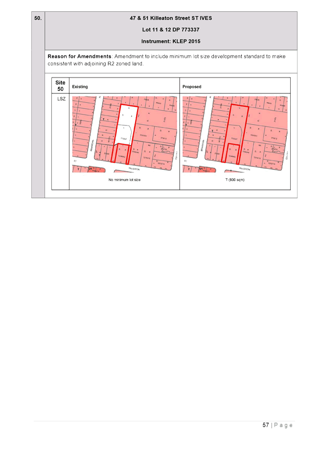
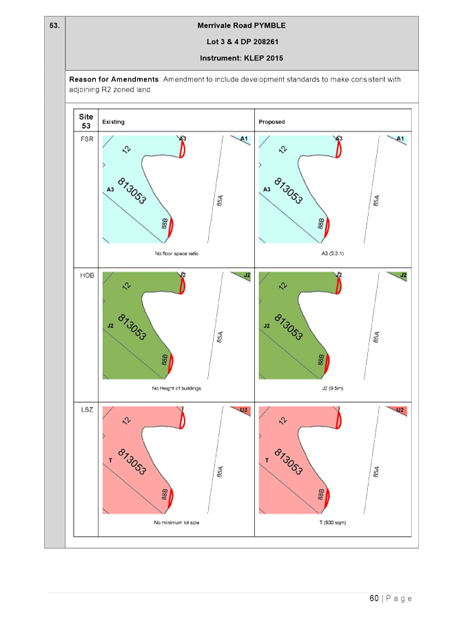
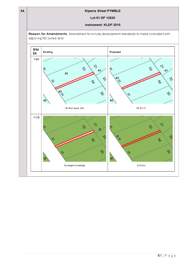
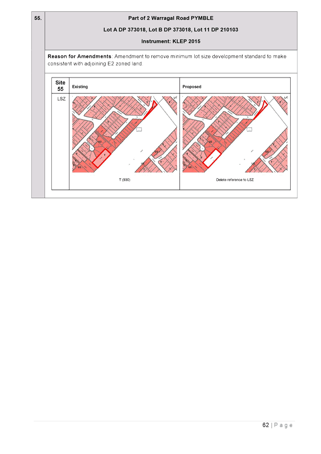
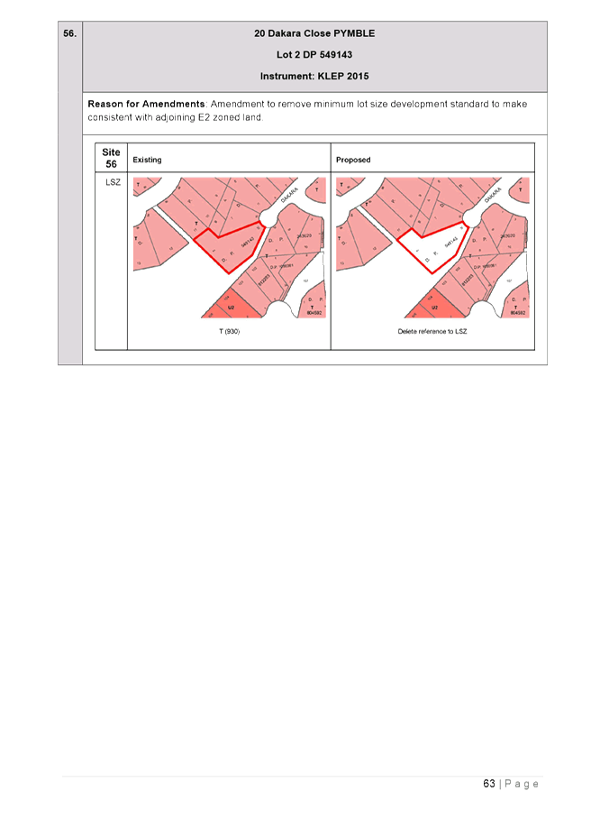
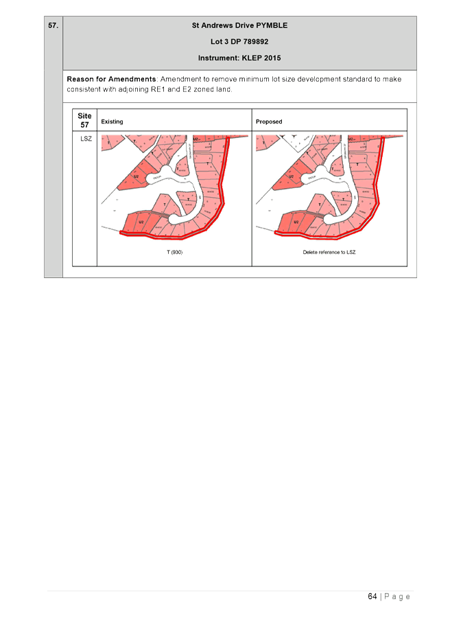
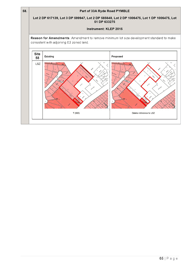
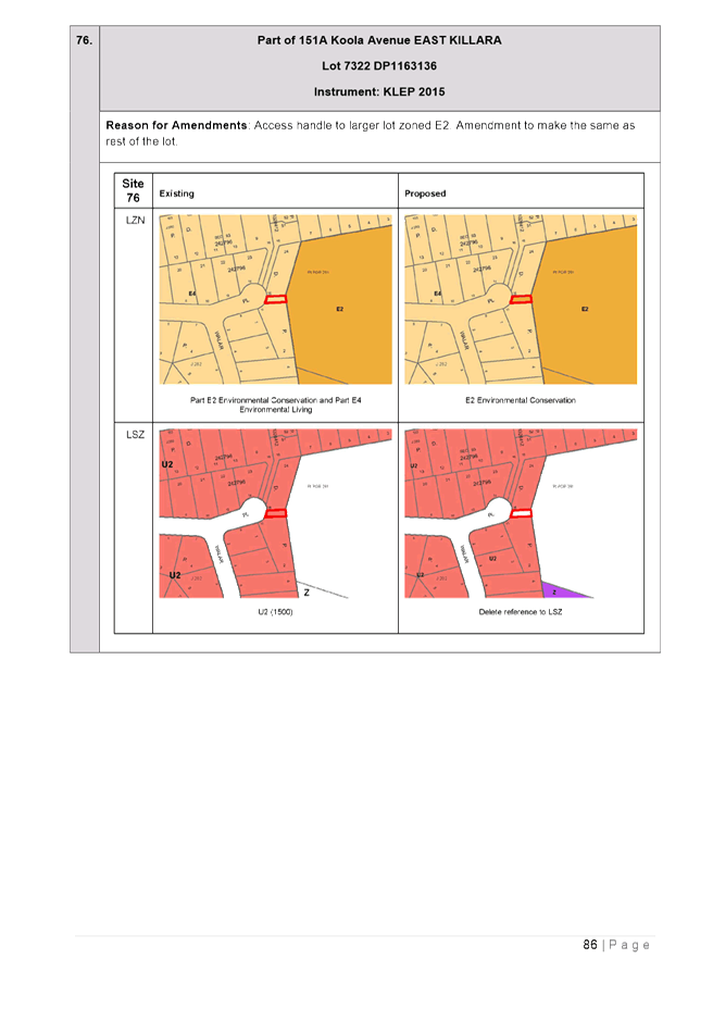
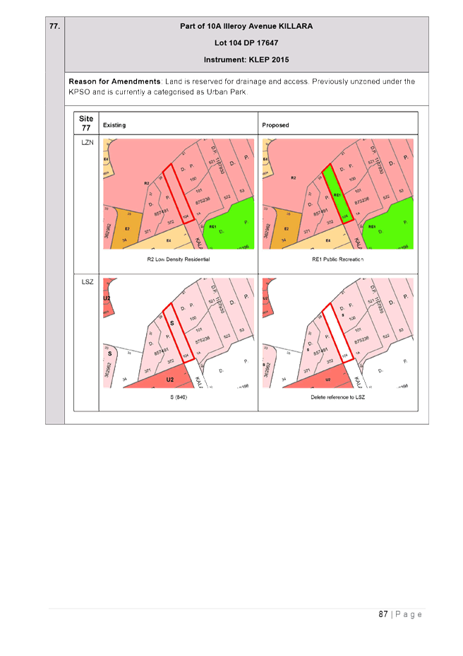
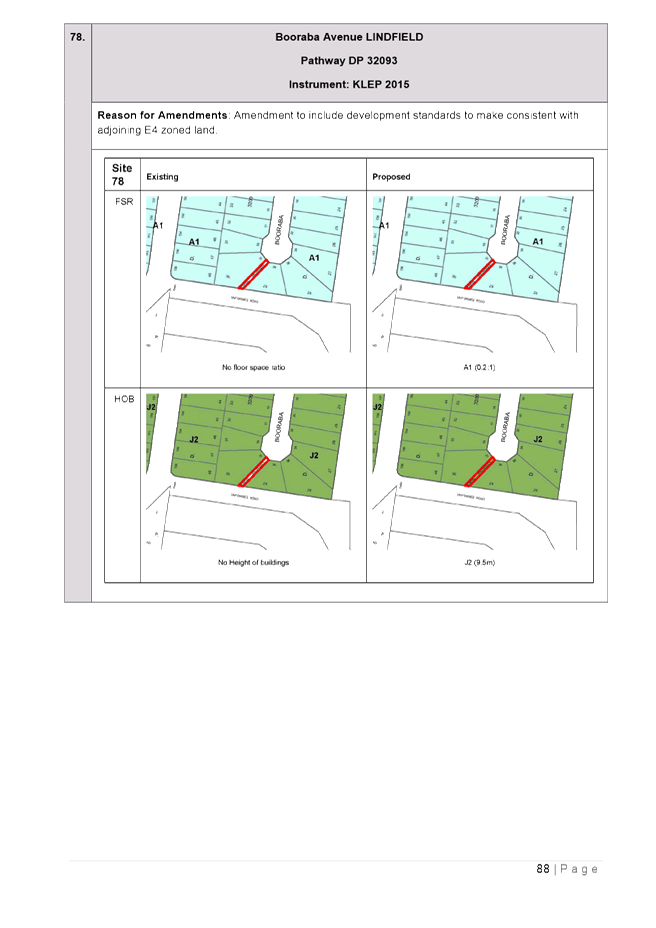
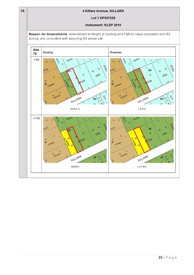
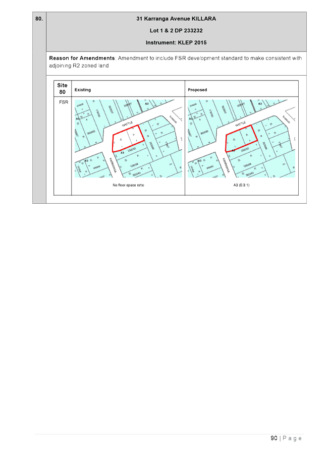
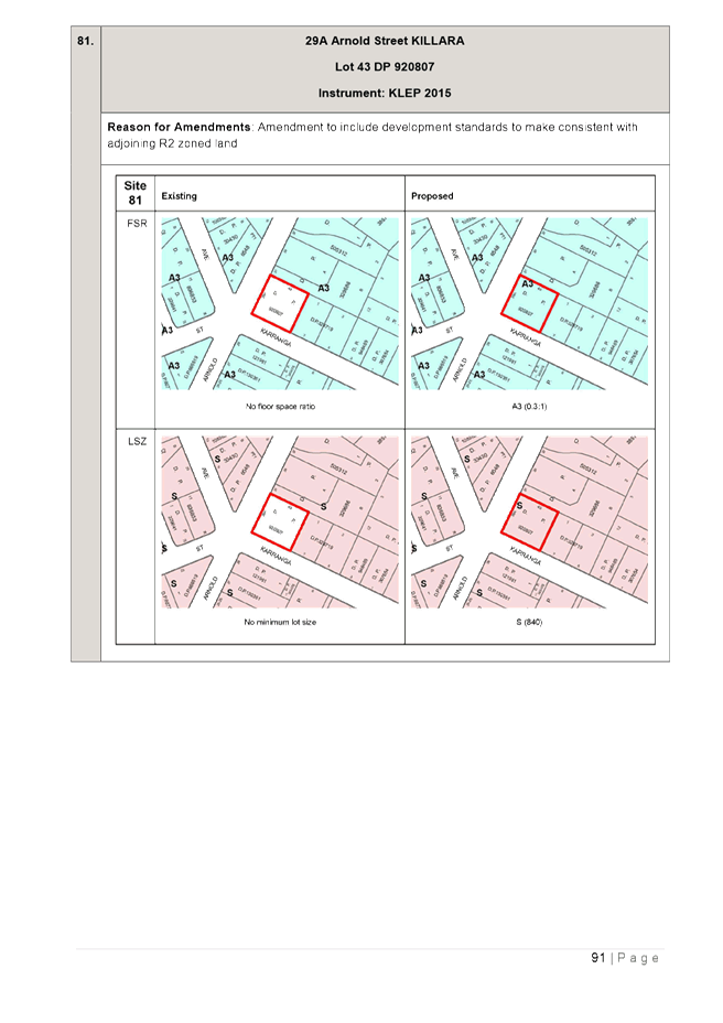
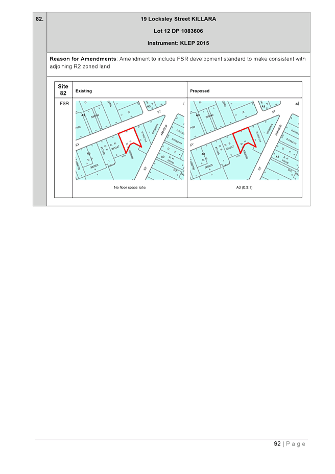
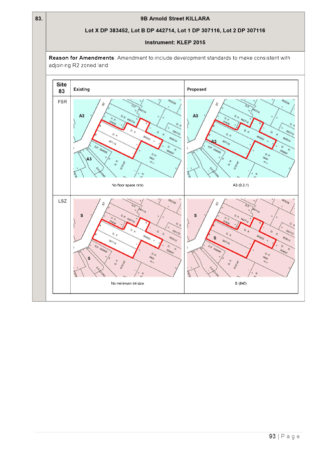
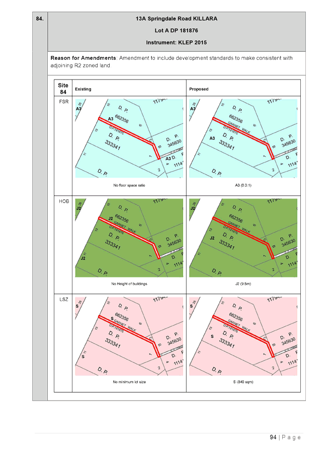
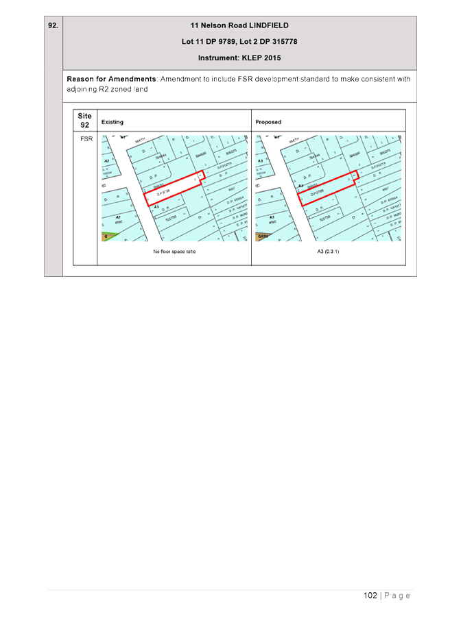
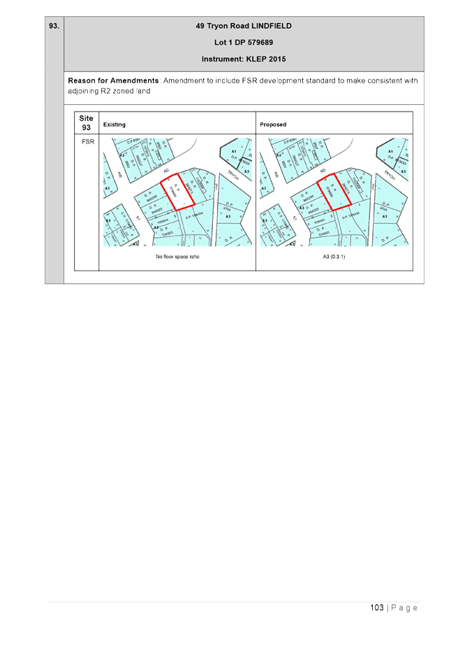
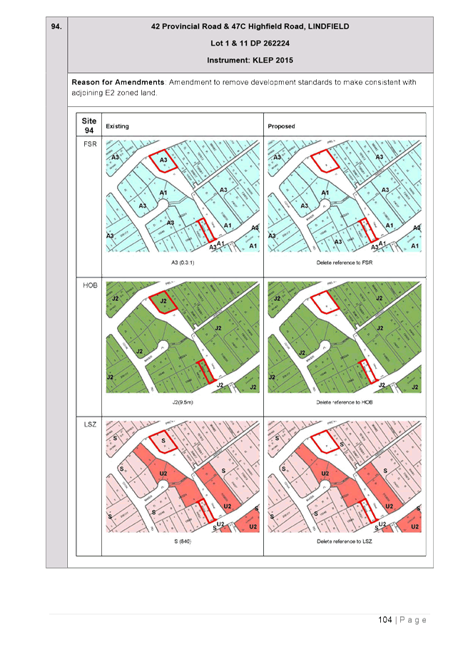
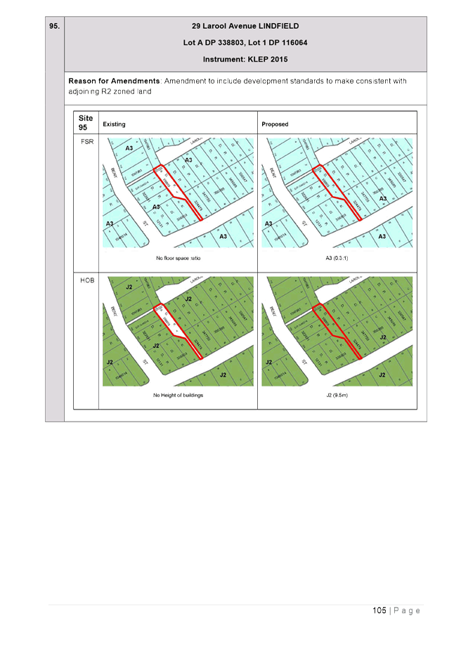
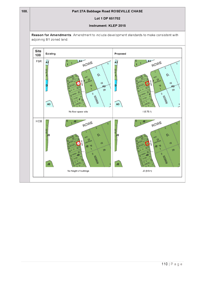
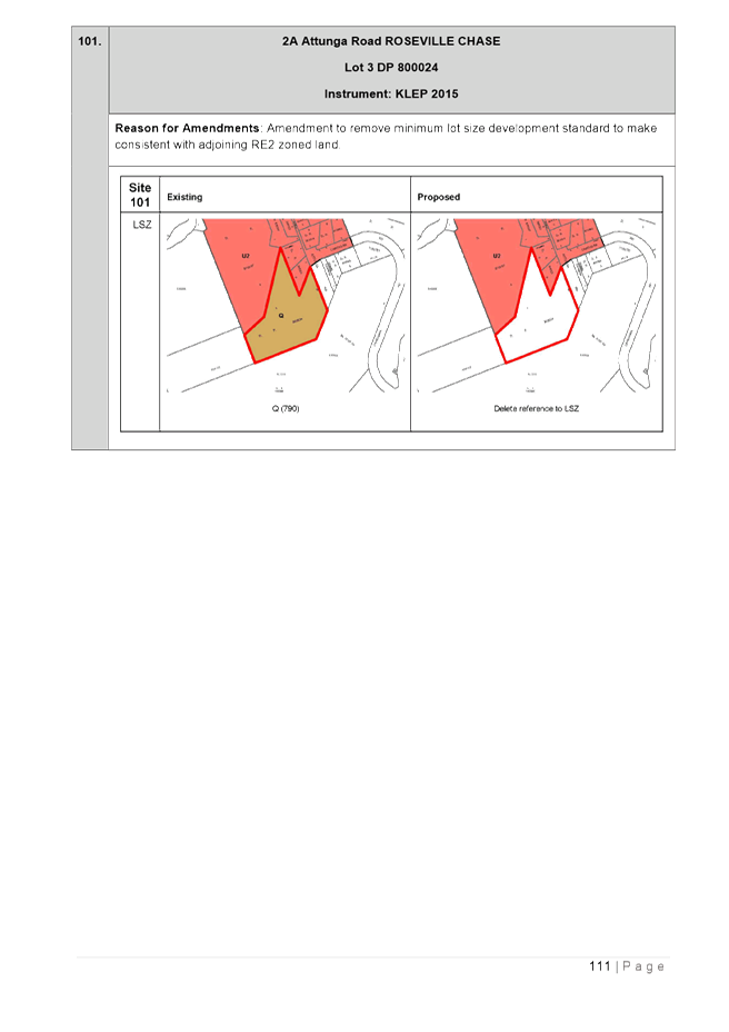
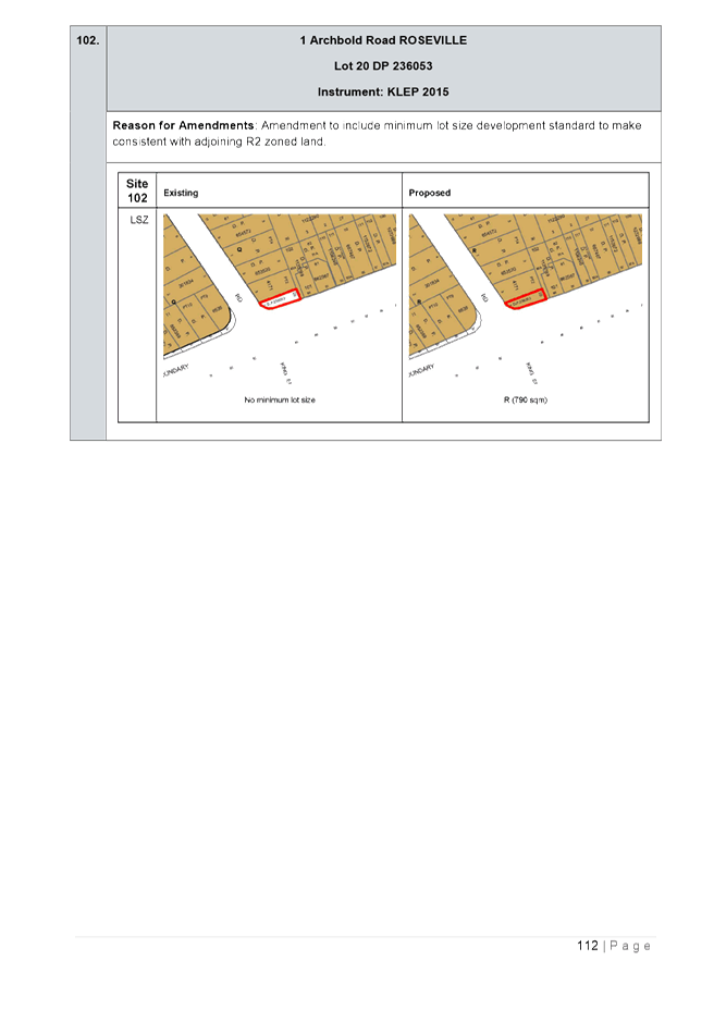
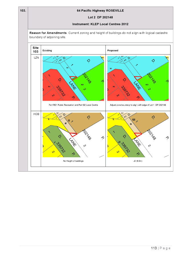
· Resolving mapping errors – the mapping errors are minor in nature and generally fall into the following categories:
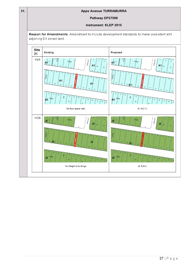
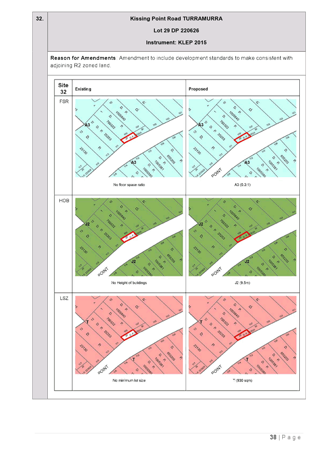
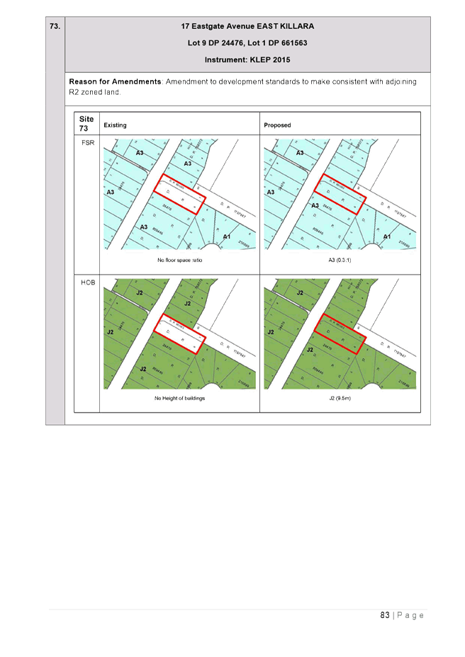
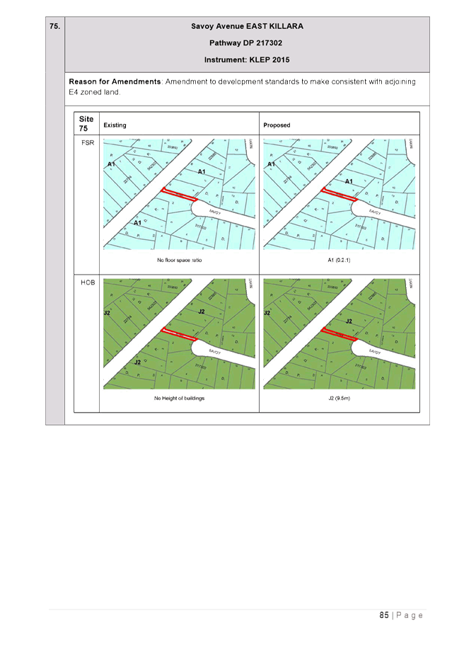
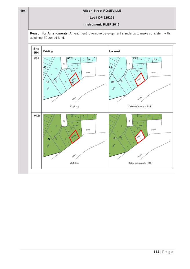
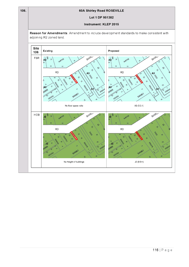
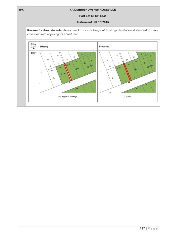
o Residential zoned land with missing or incorrect development standards;
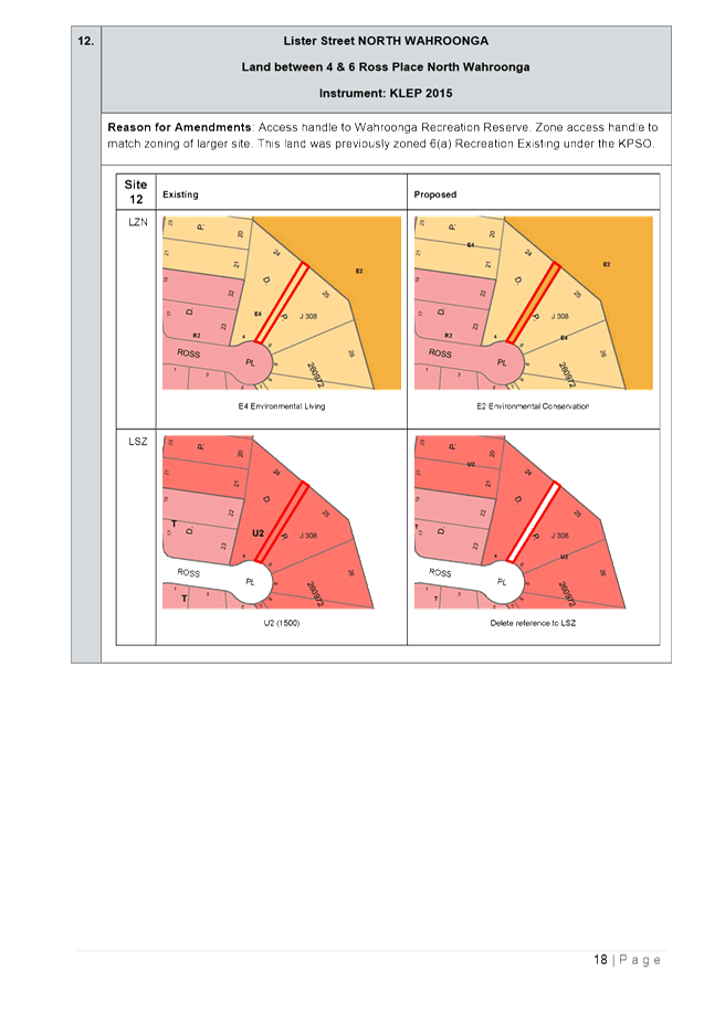
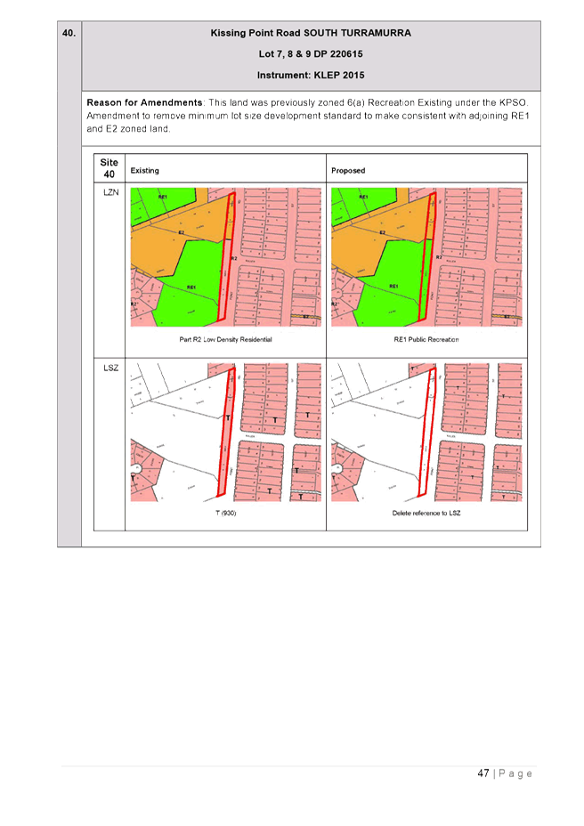
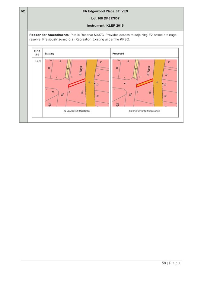
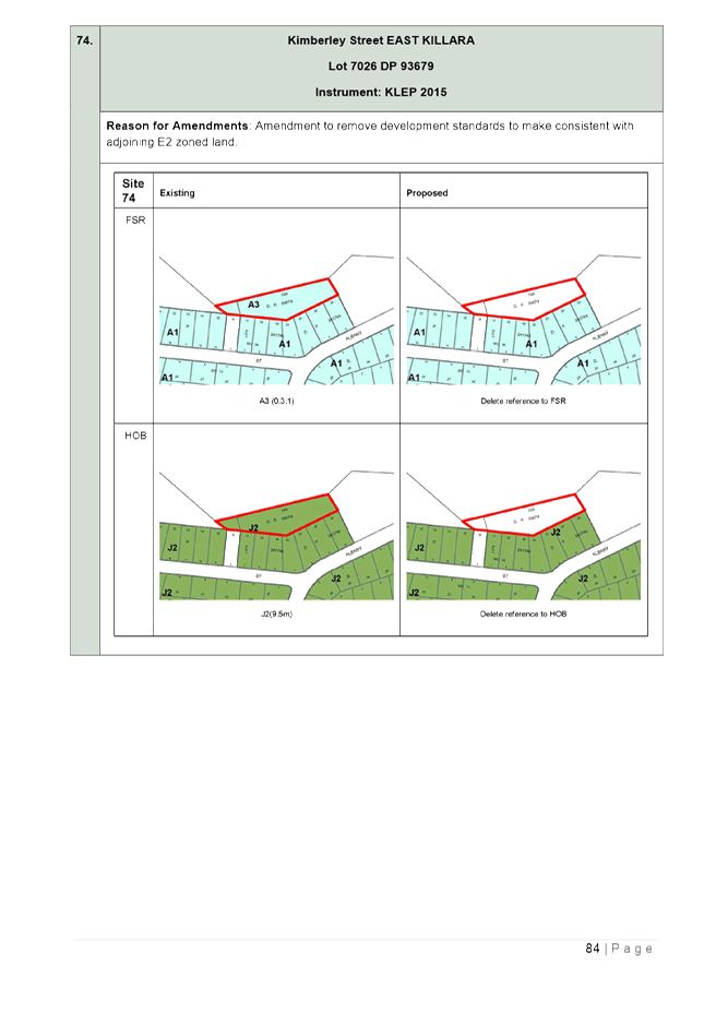
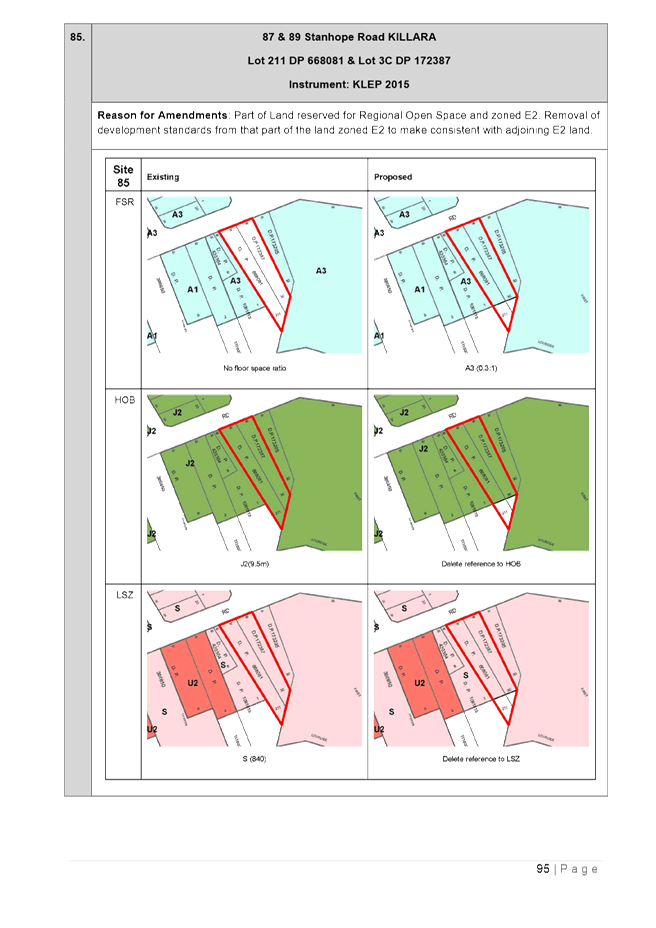
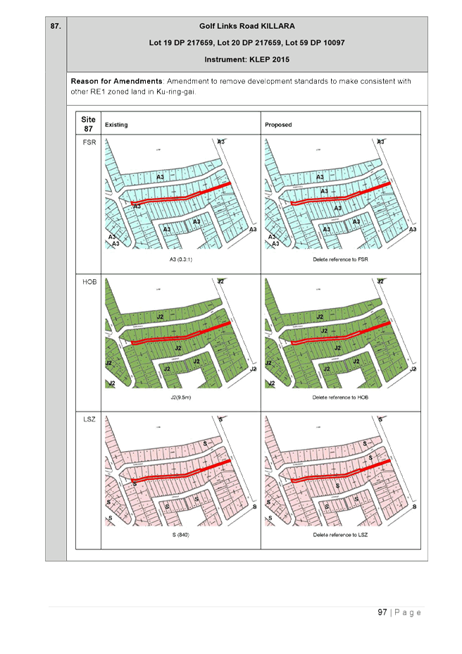
o development standards applied to land in a zone that would not normally contain development standards, for example Council bushland zoned E2 Environmental Conservation;
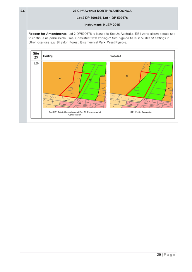
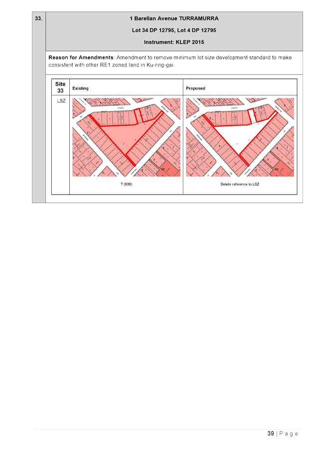
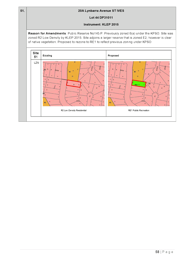
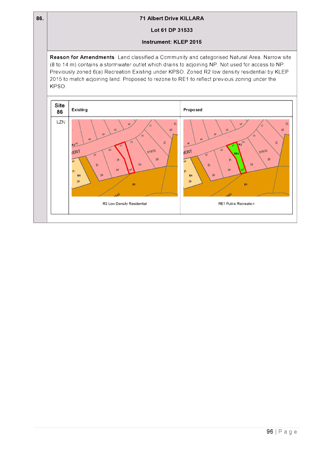
o incorrect zoning applied to land in the process of translating from the KPSO, for example Council bushland or open space picking up adjoining R2 Low Density Residential zoning.
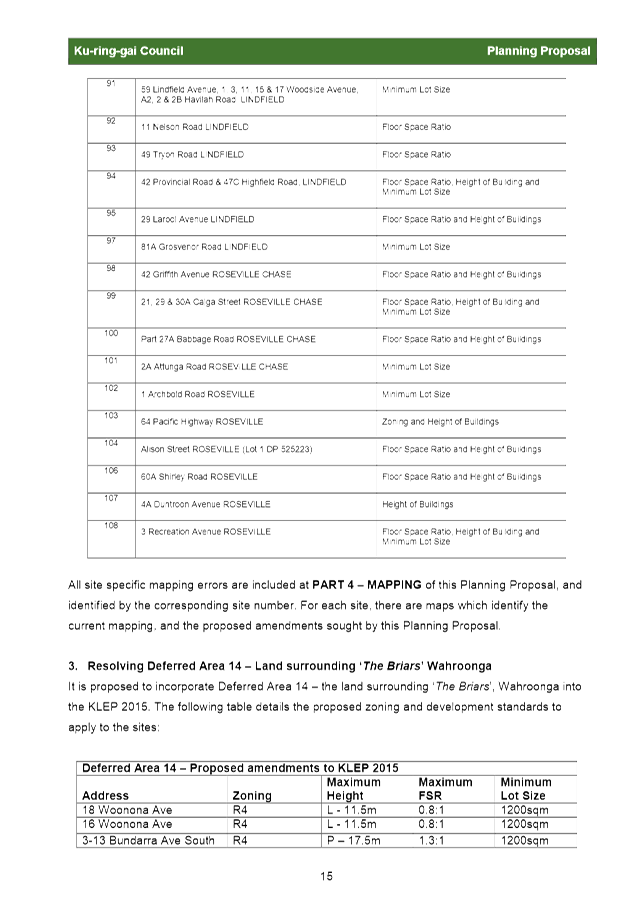
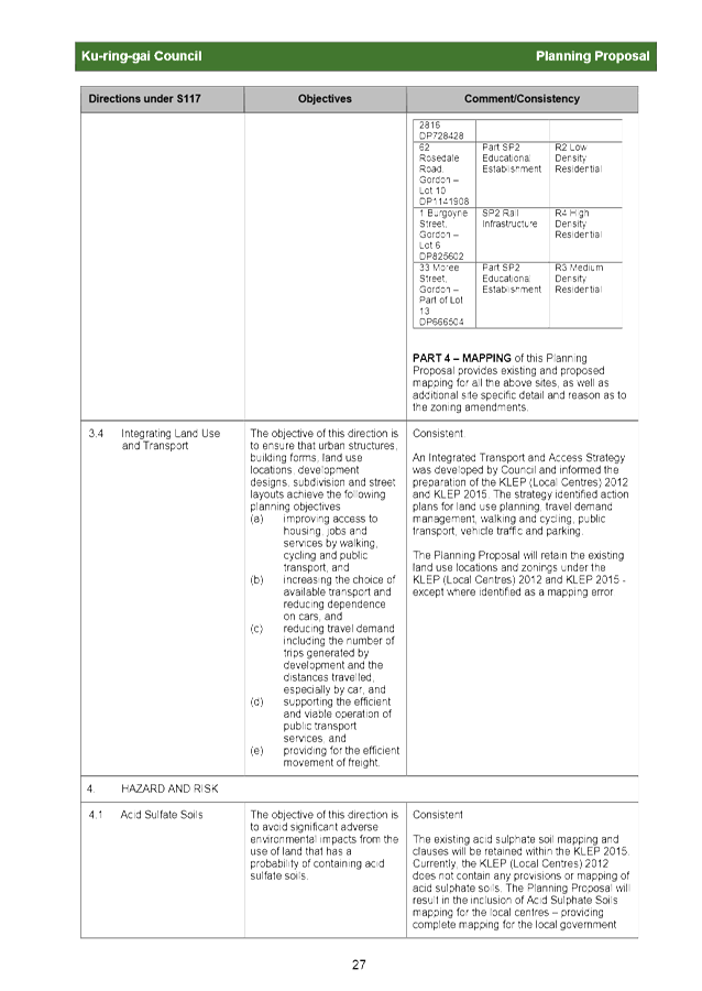
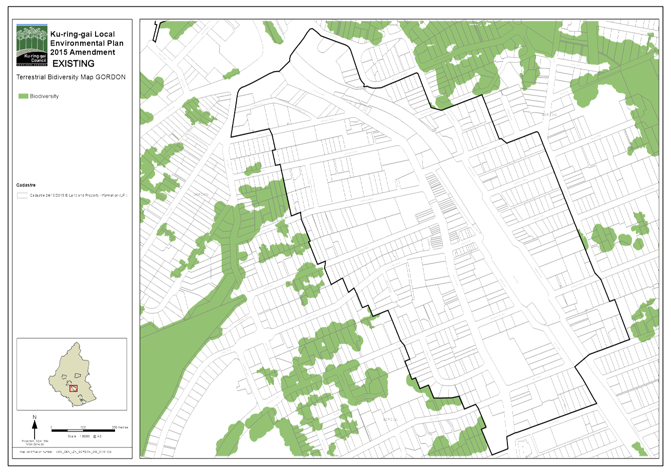
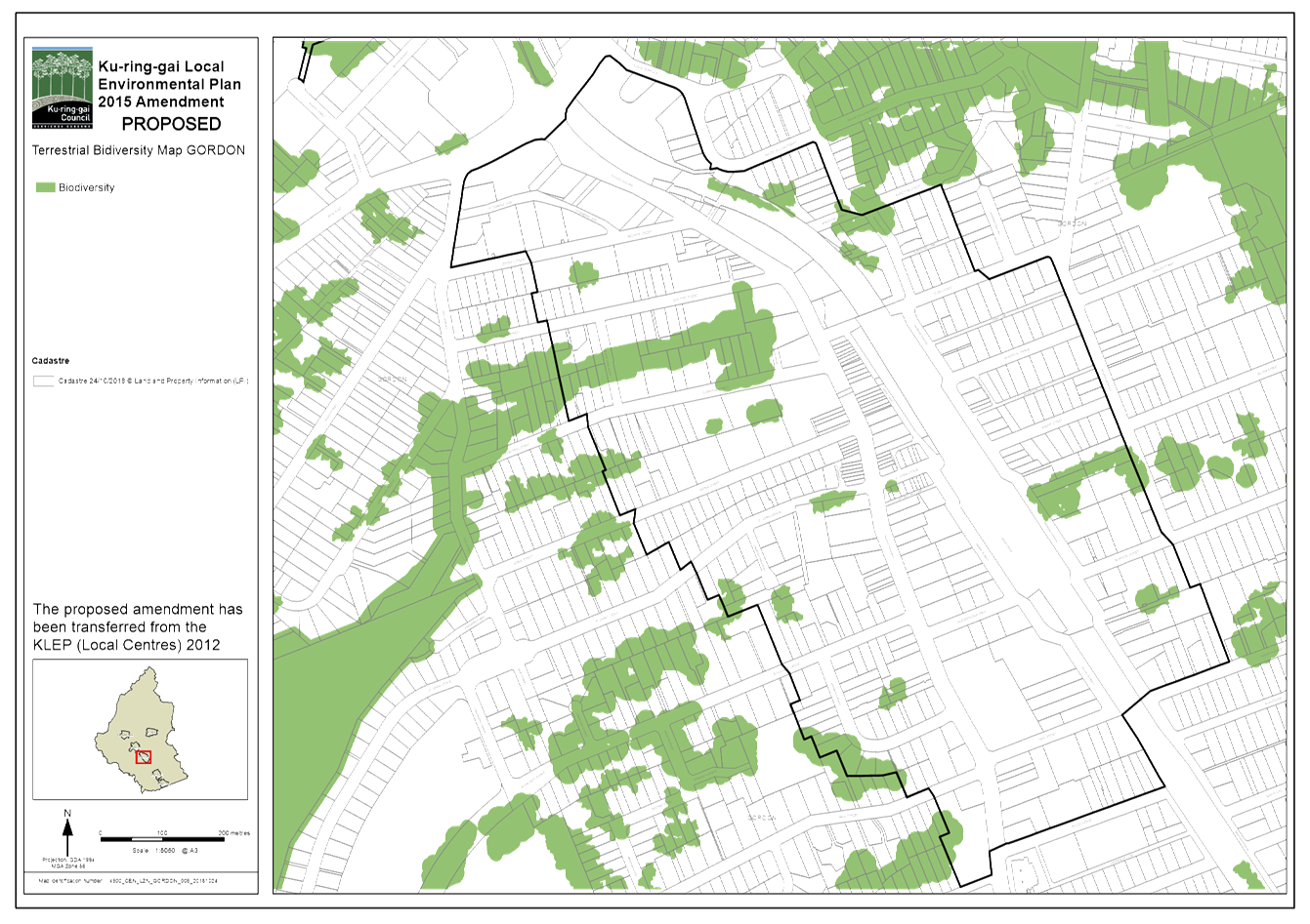
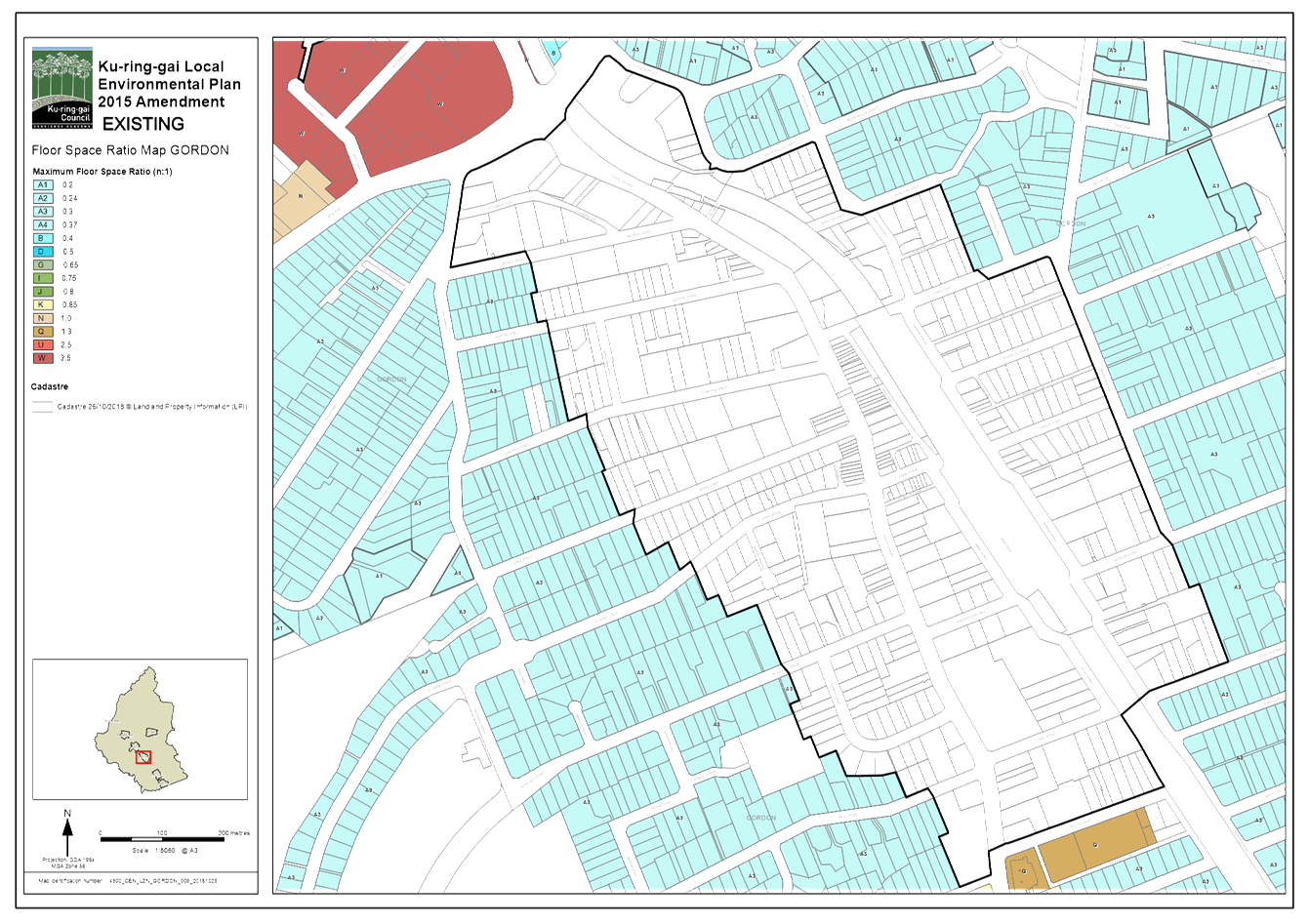
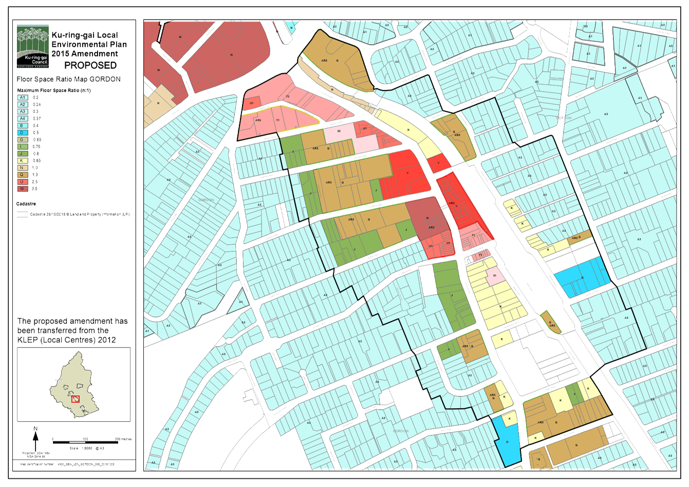
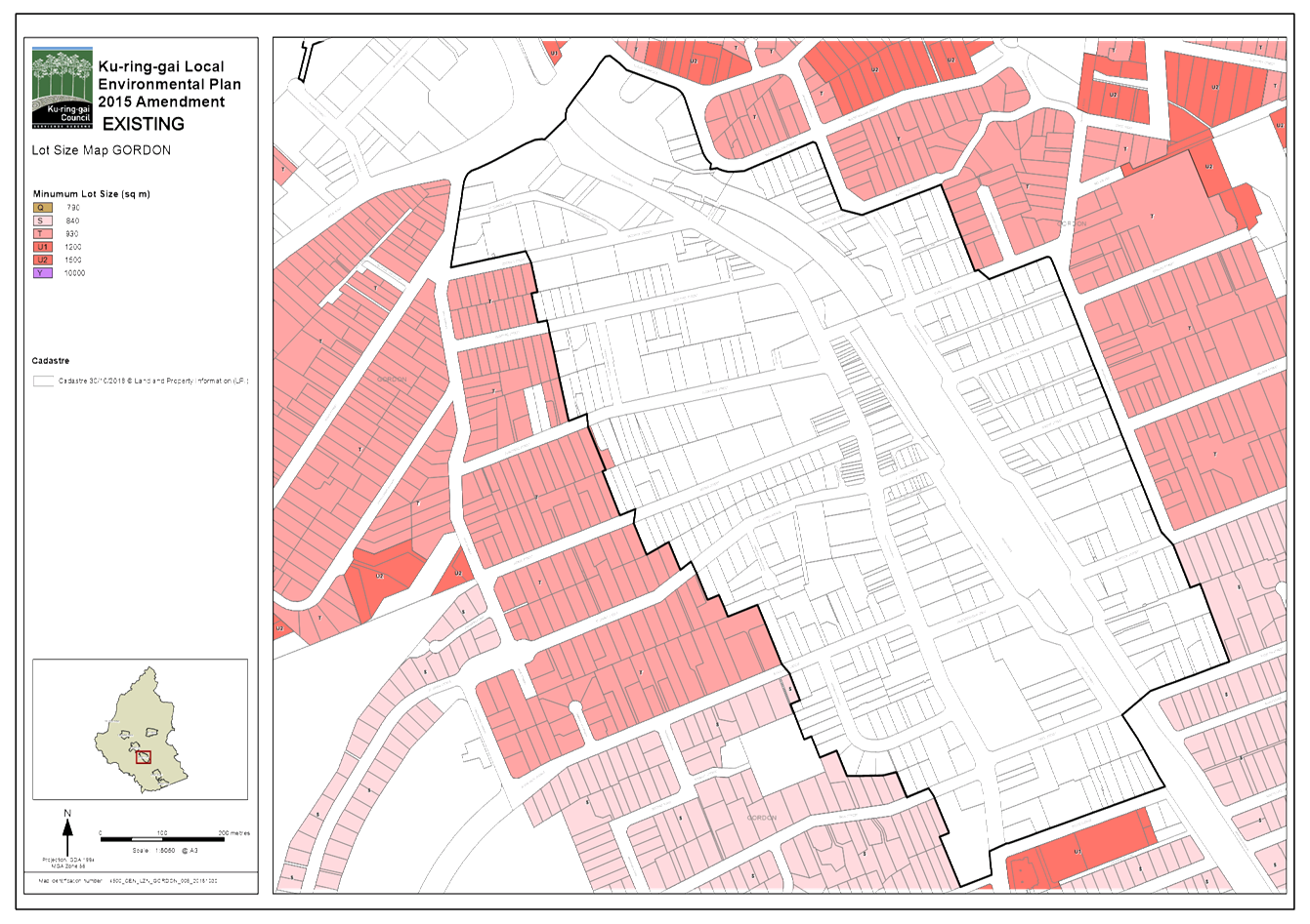
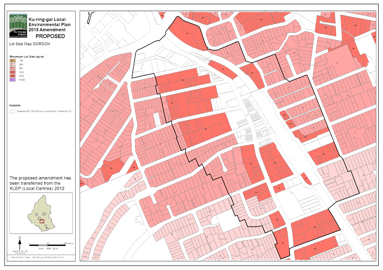
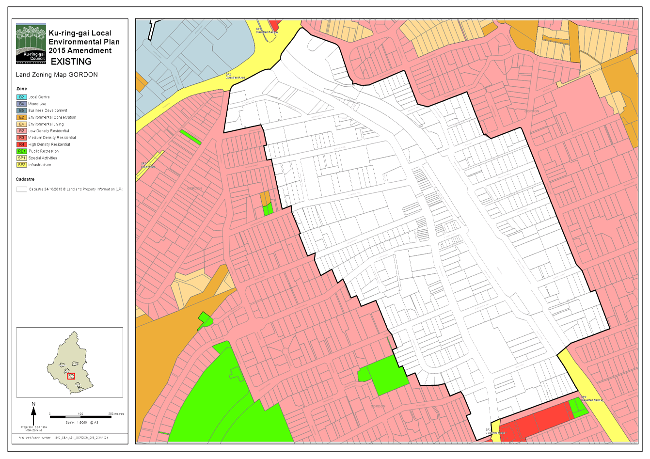
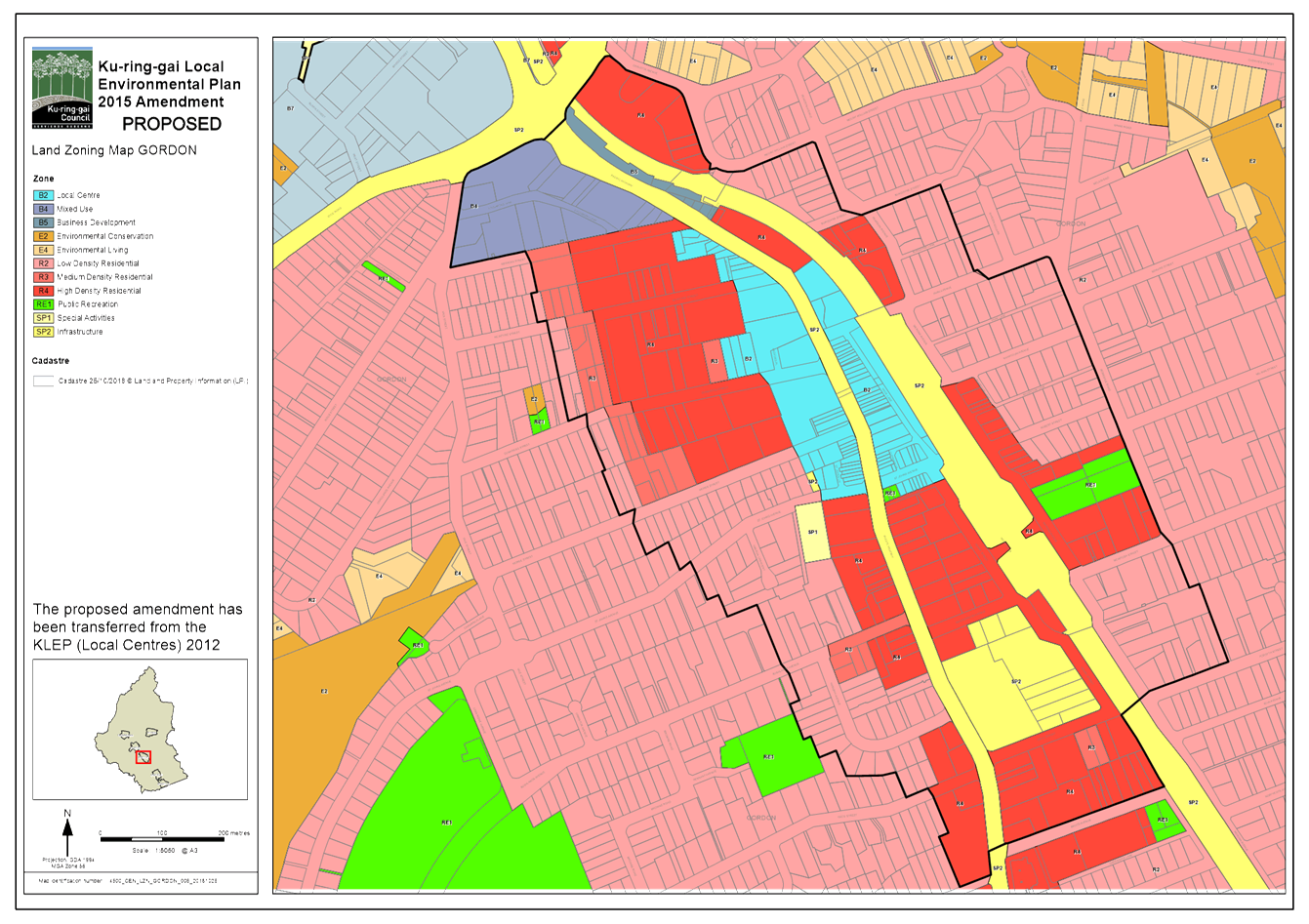
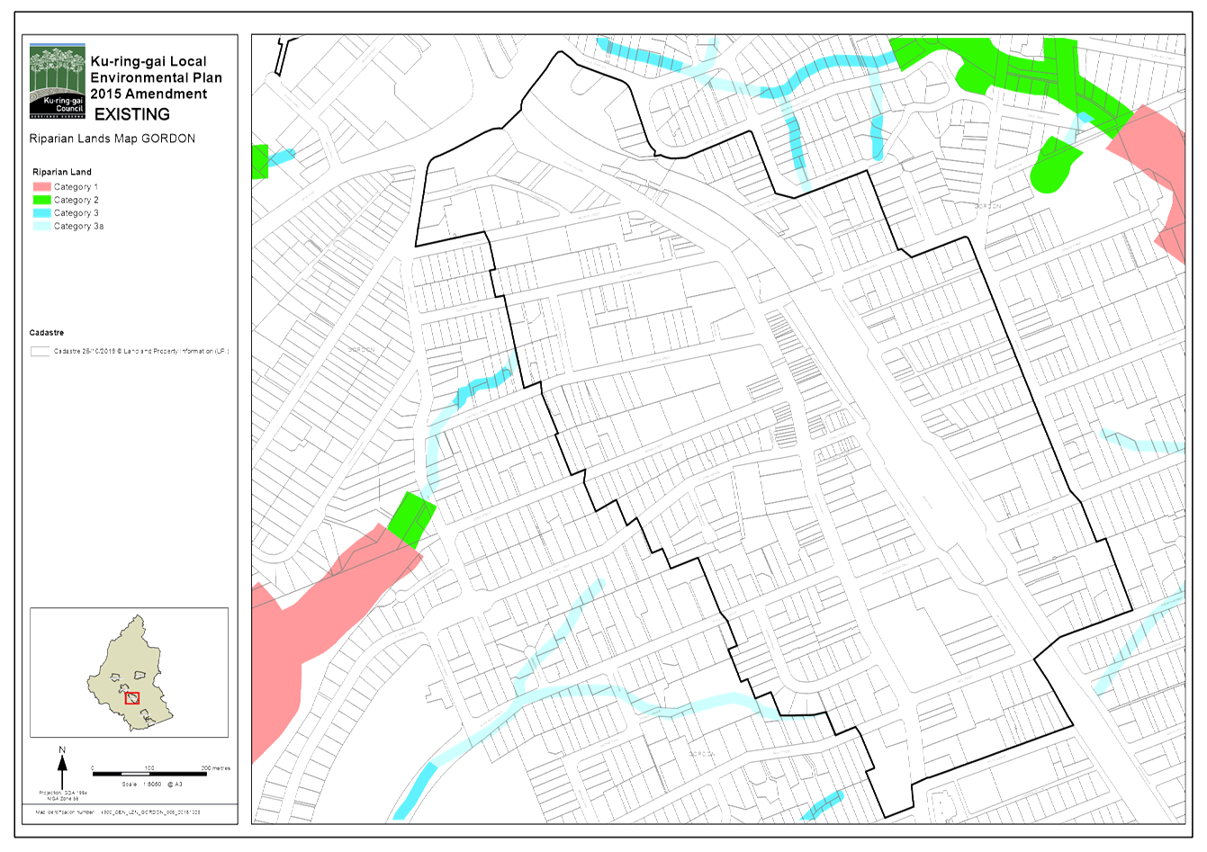
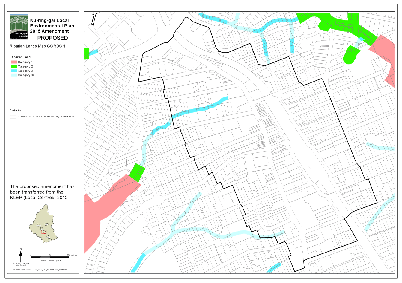
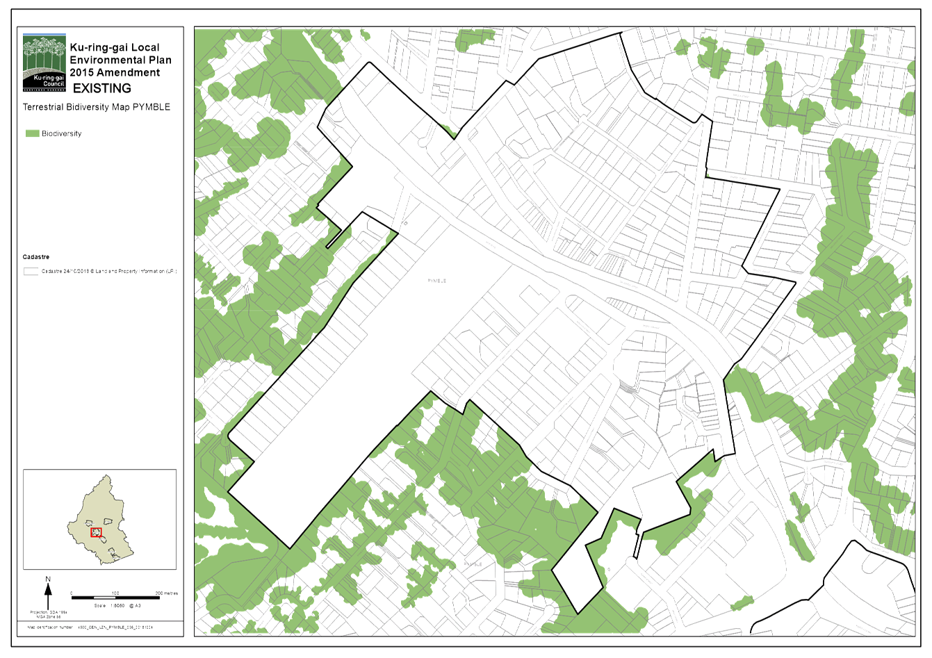
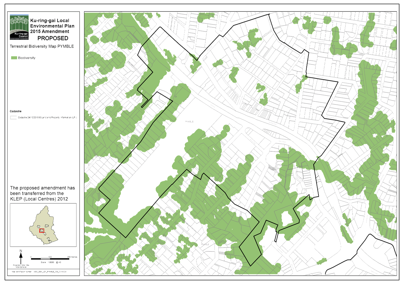
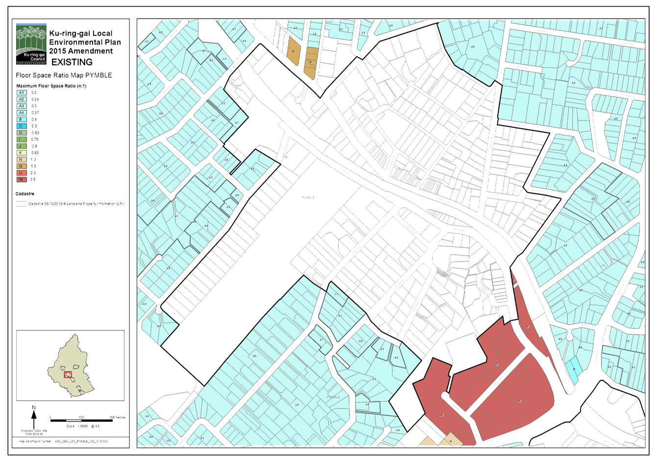
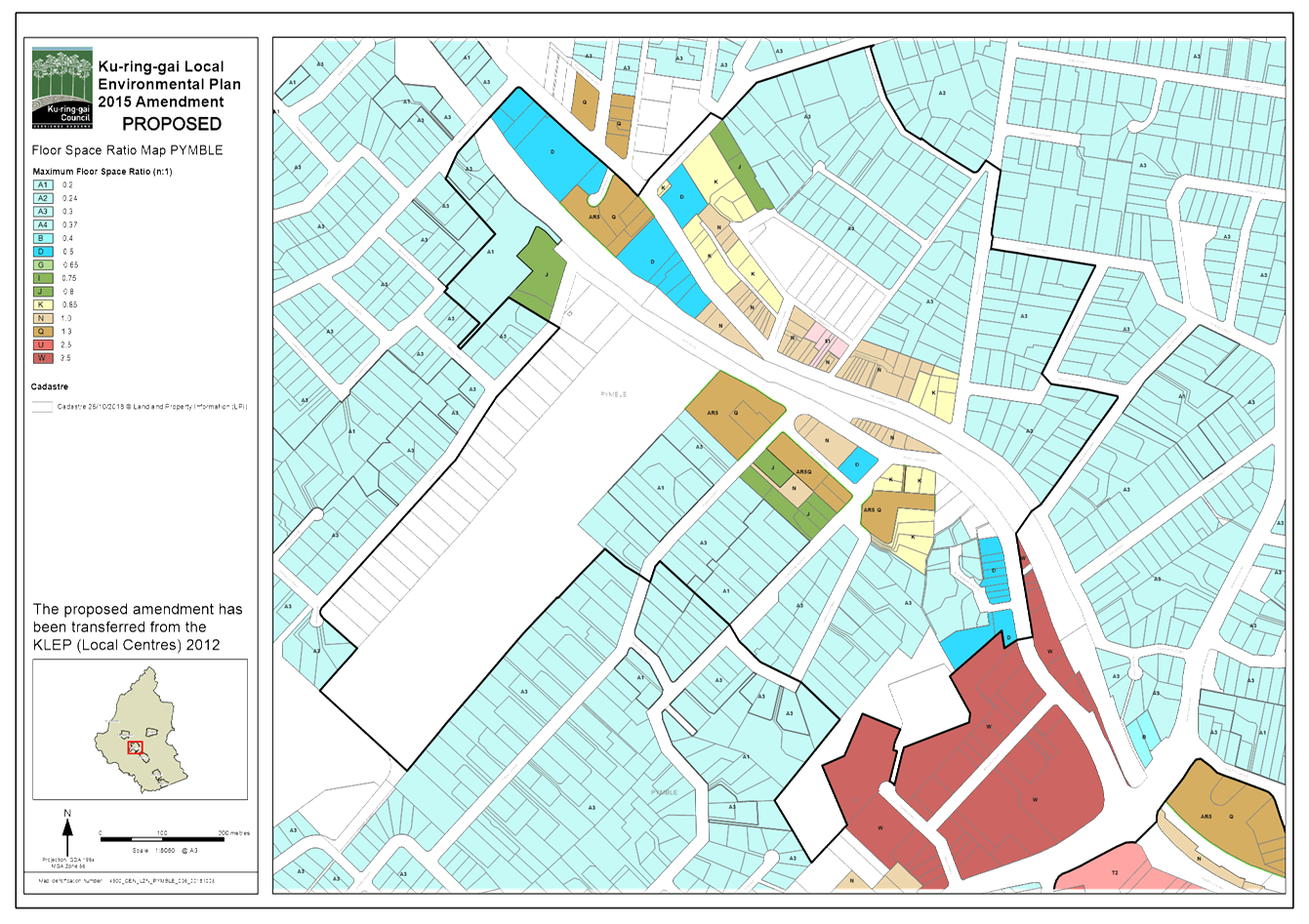
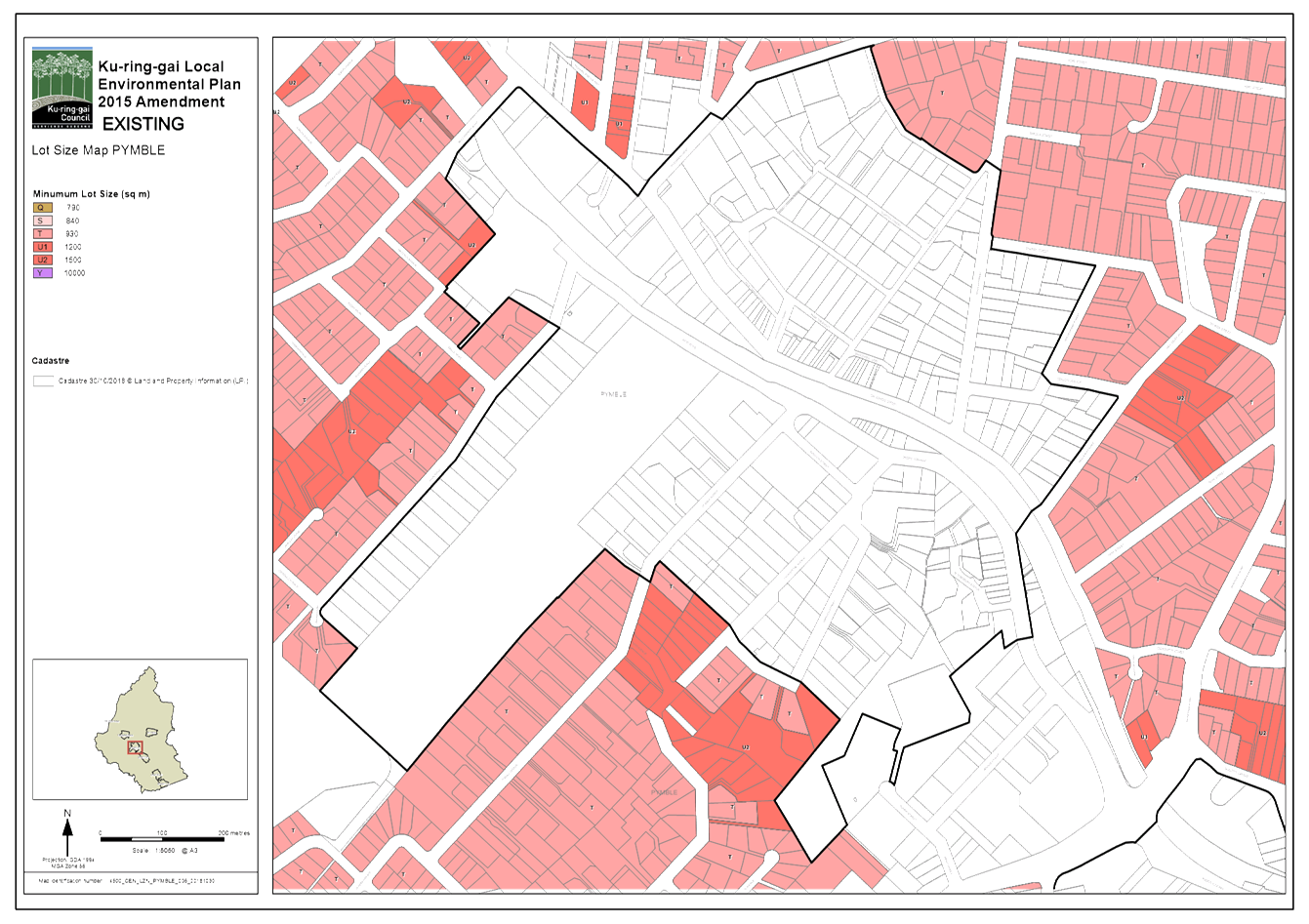
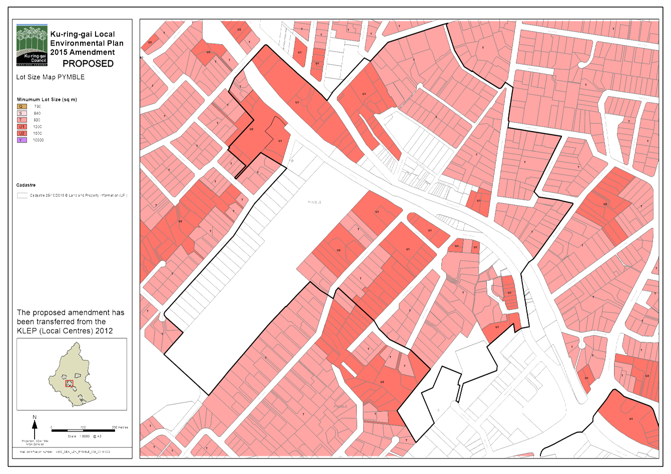
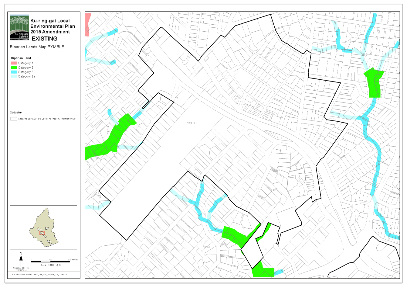
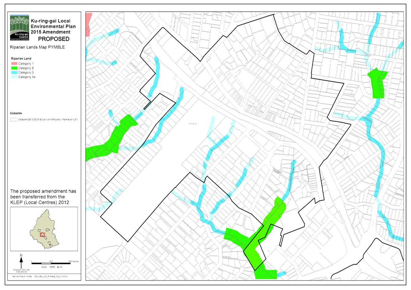
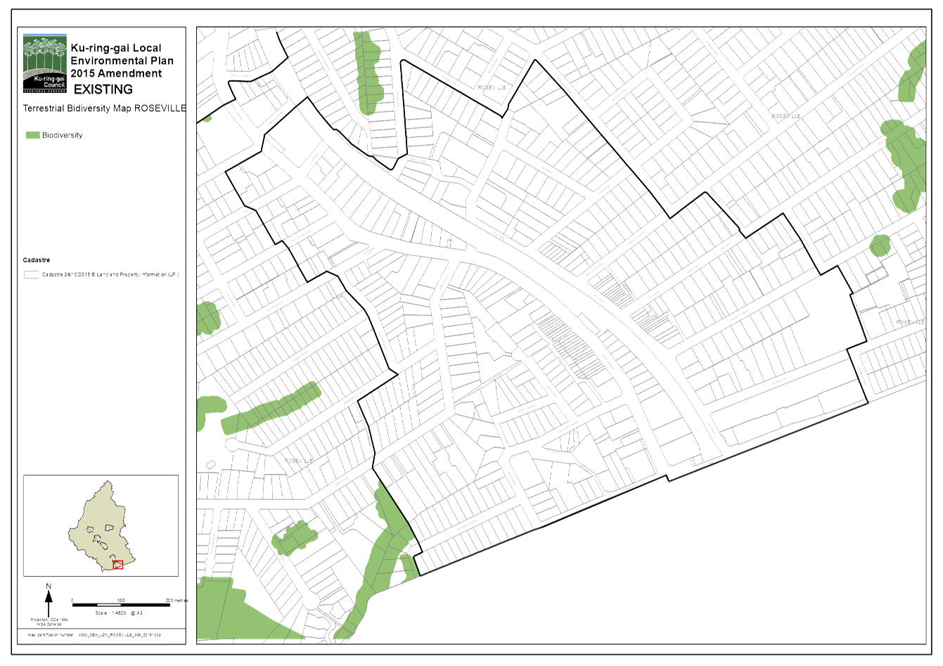
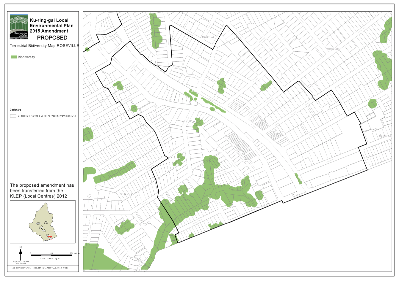
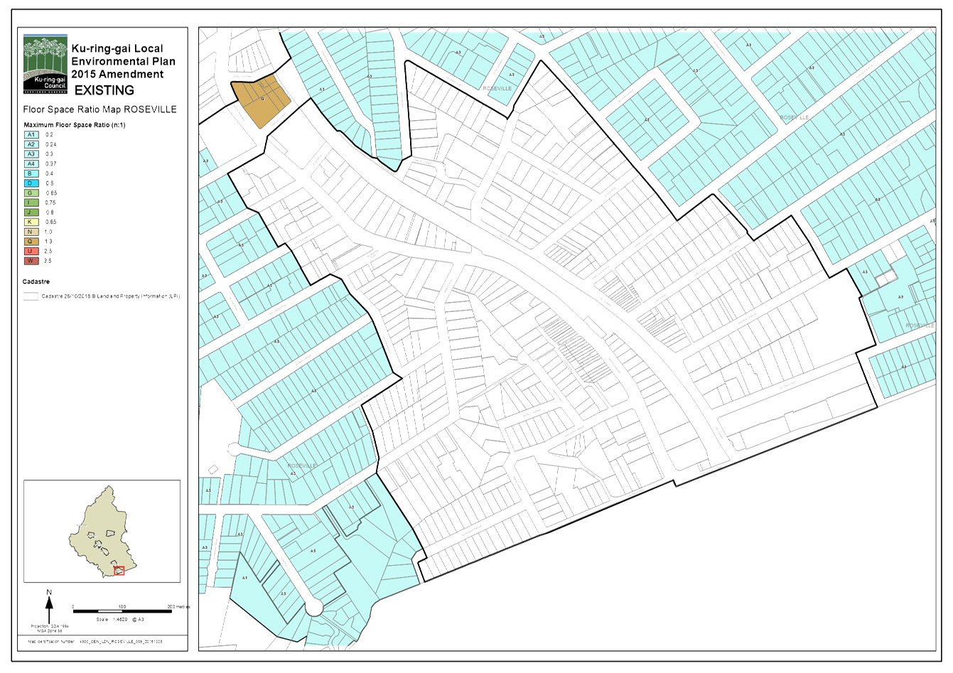
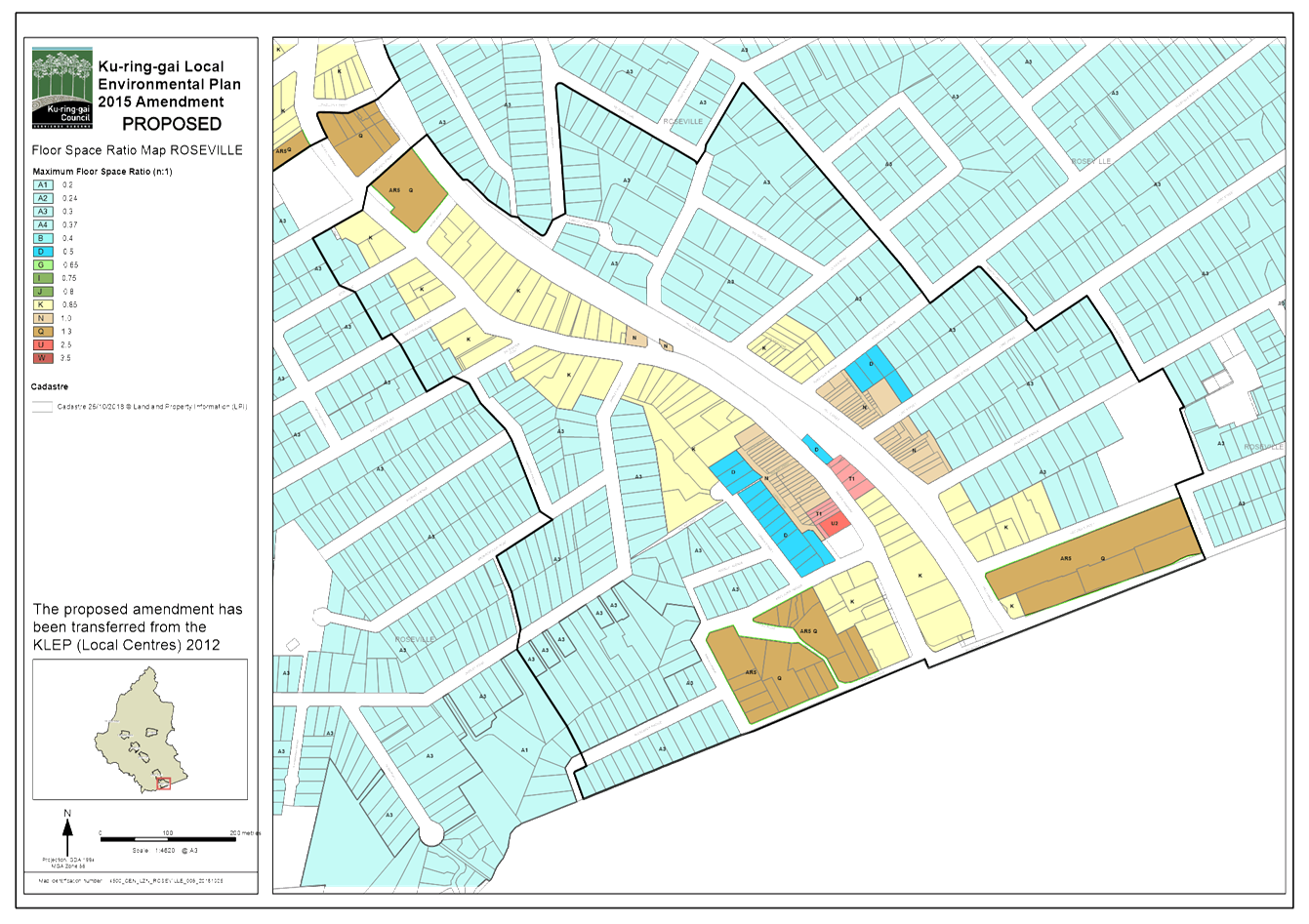
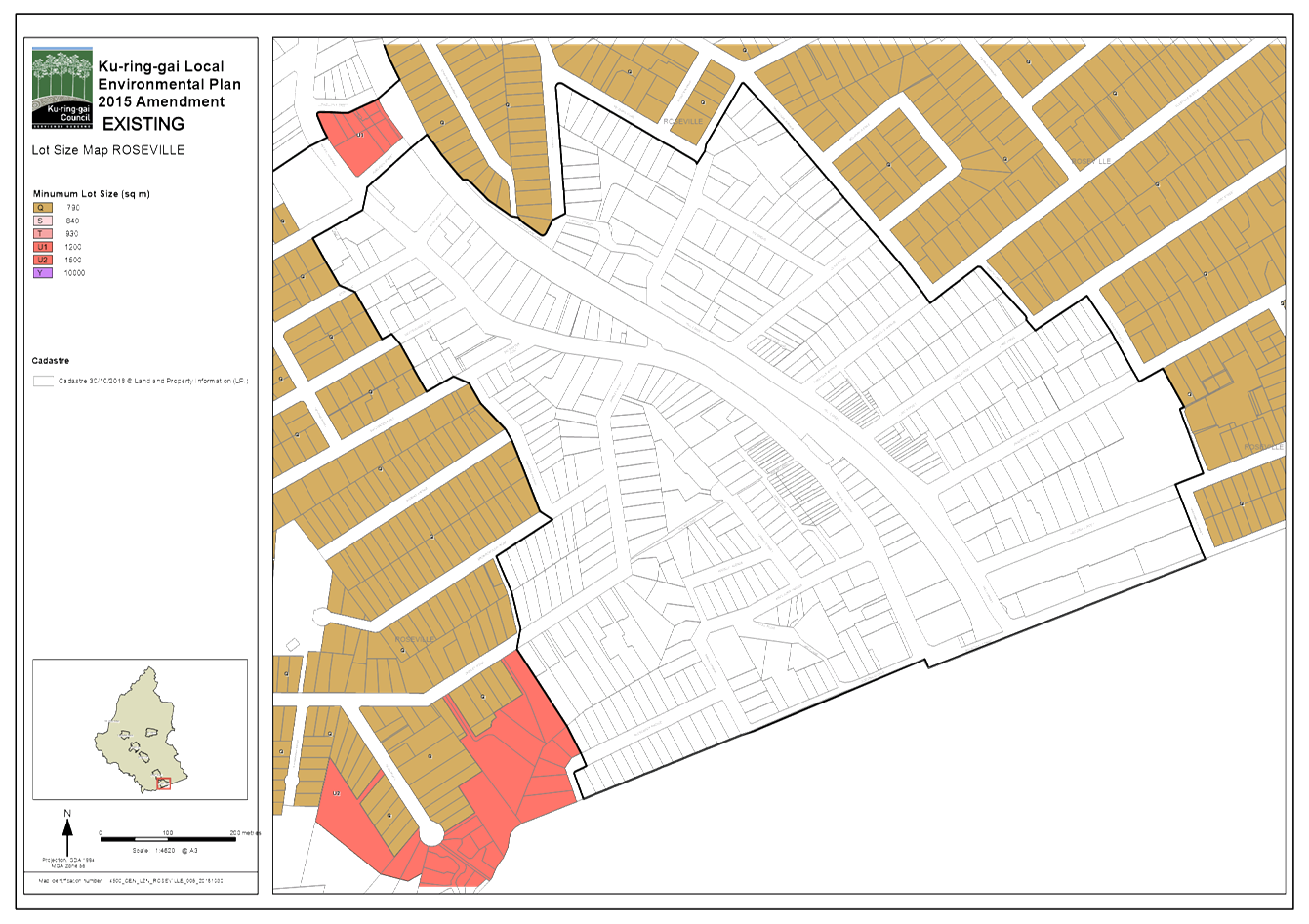
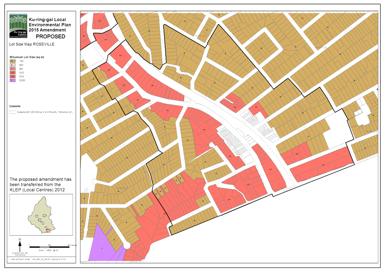
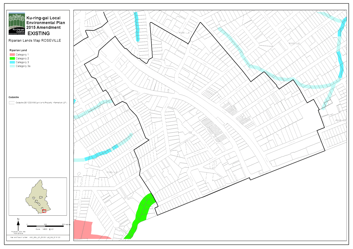
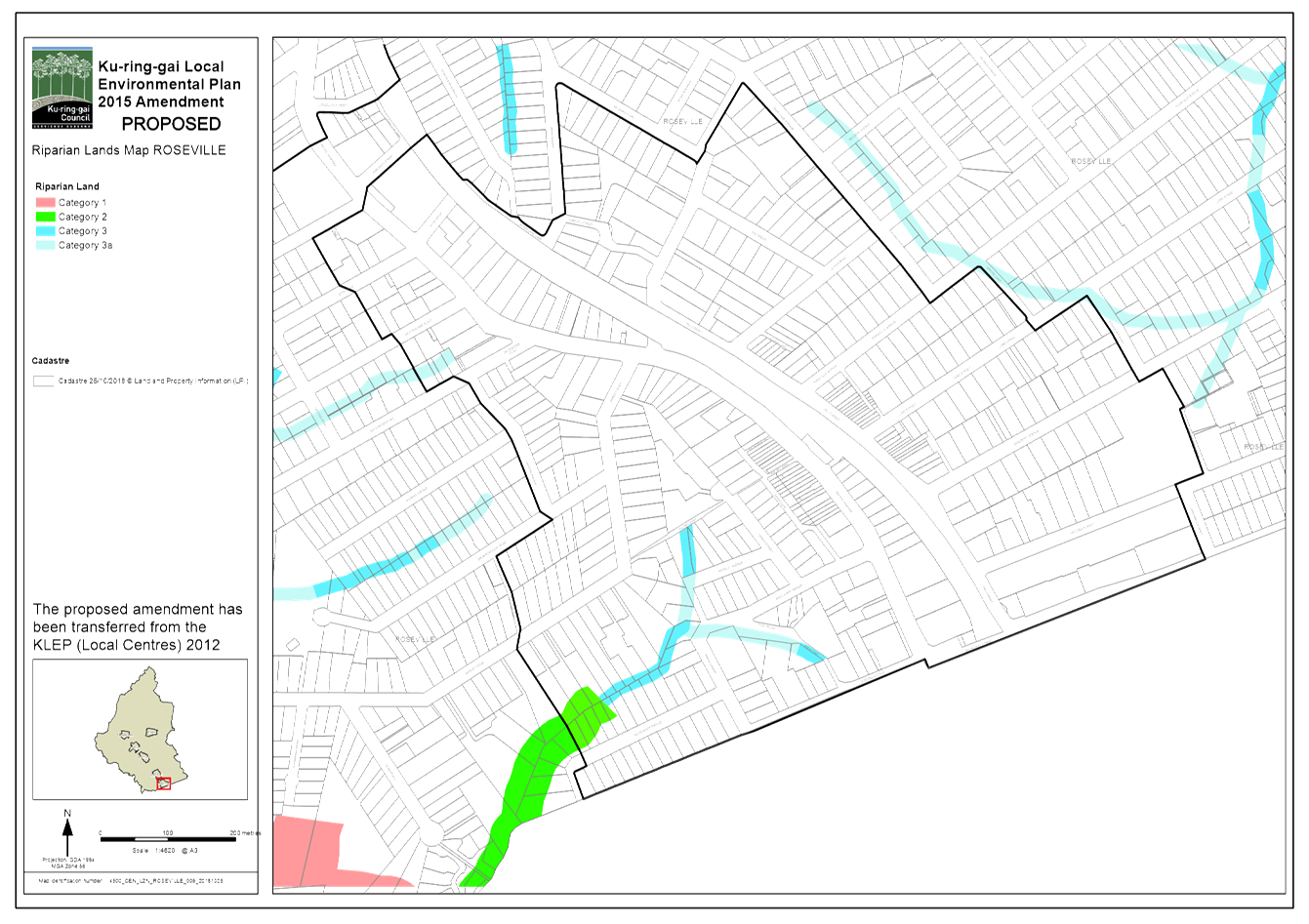
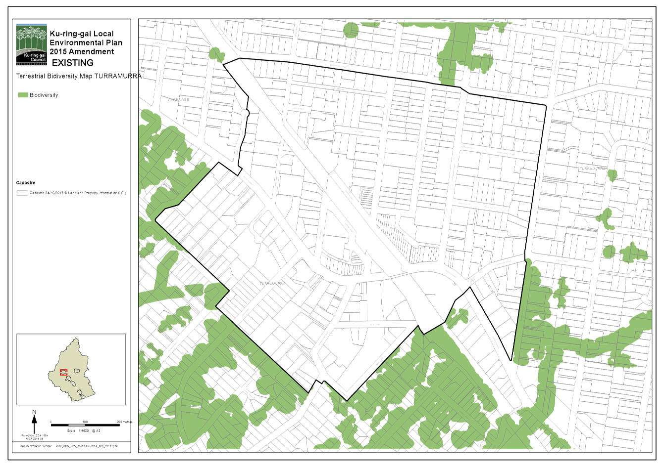
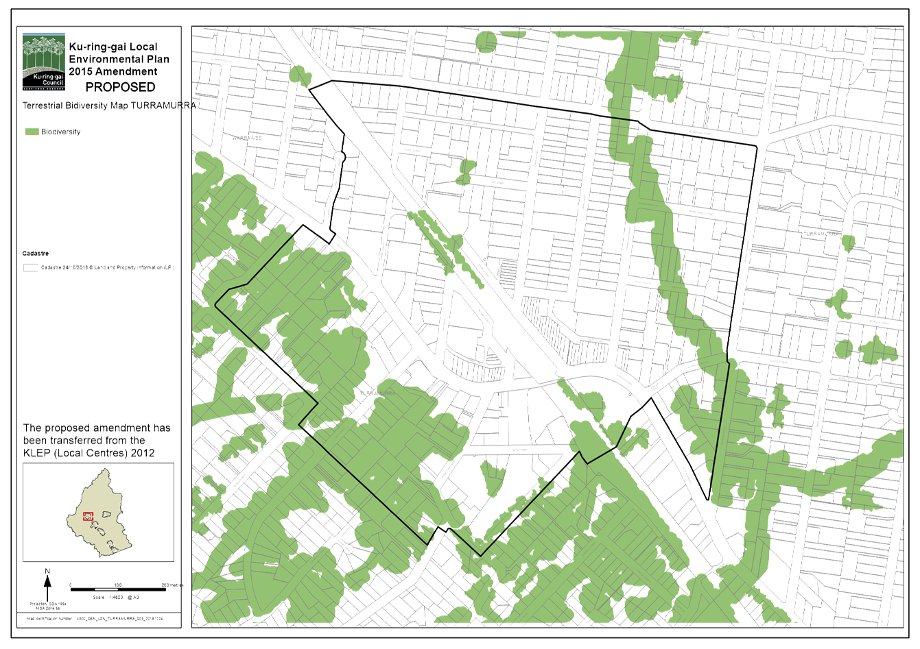
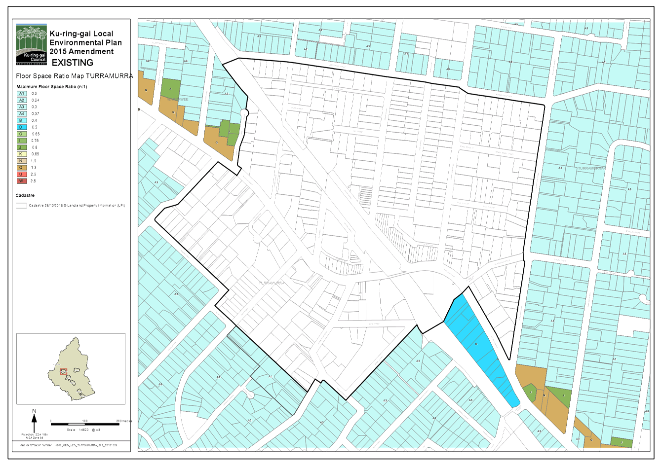
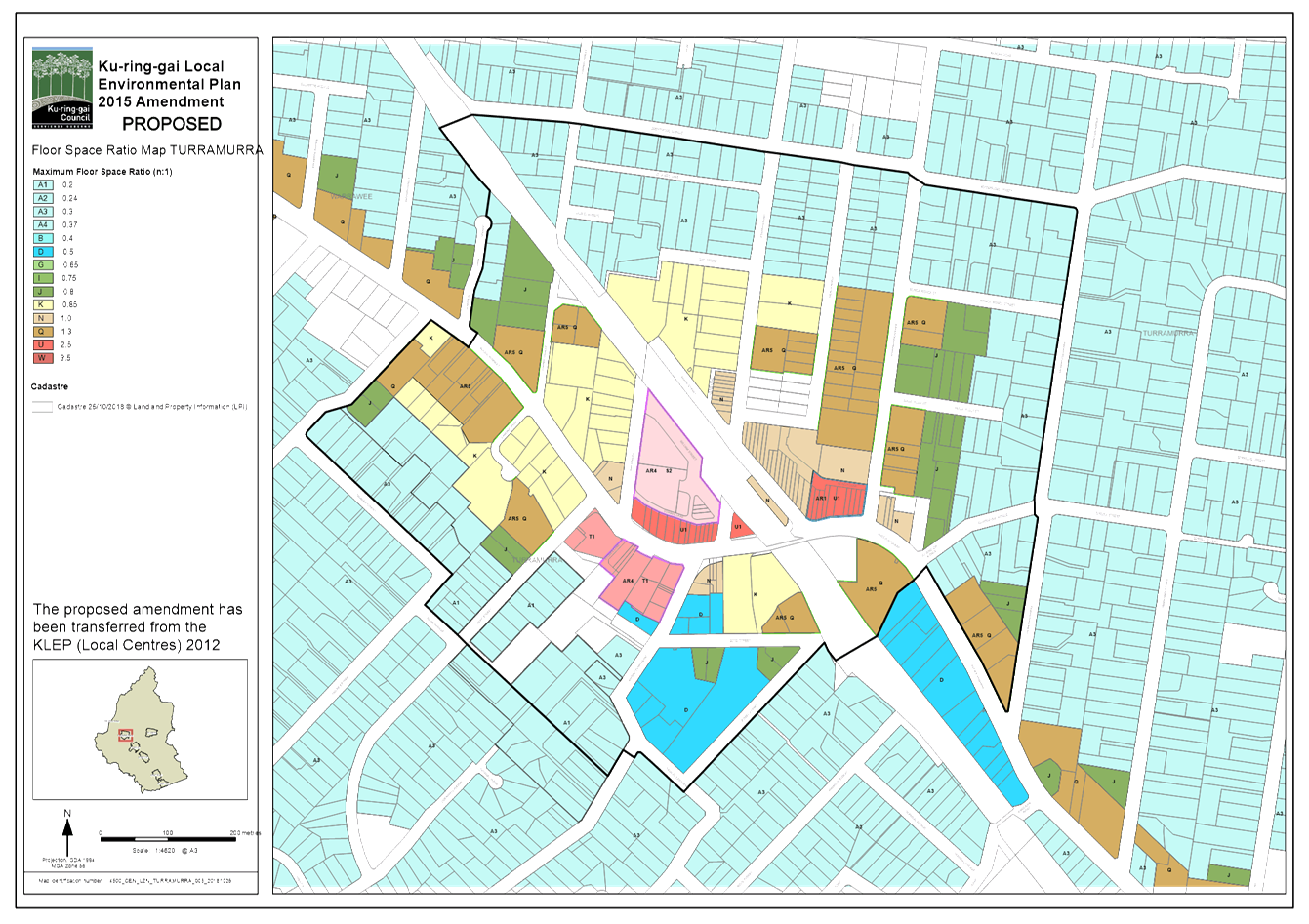
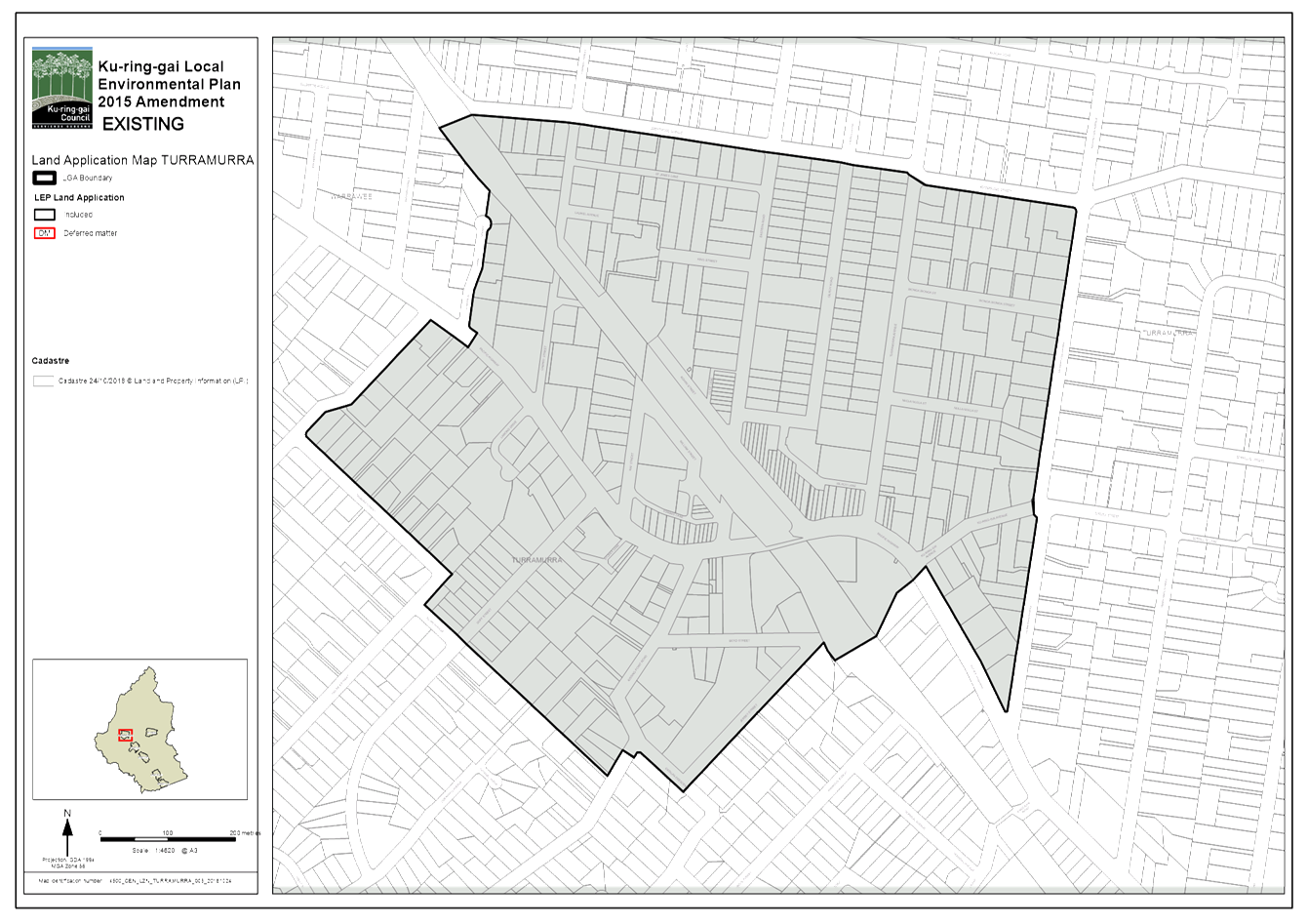
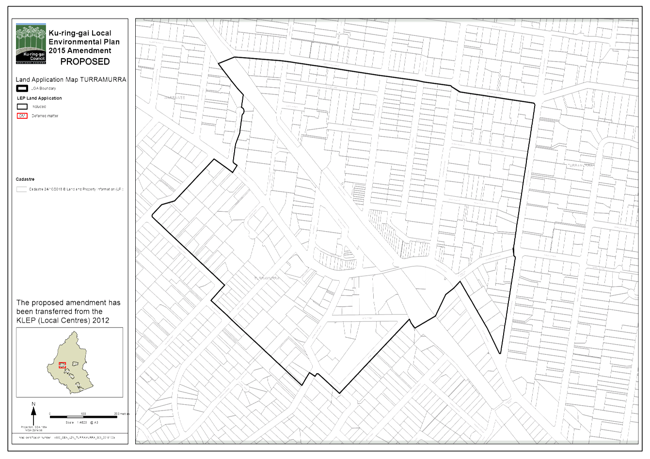
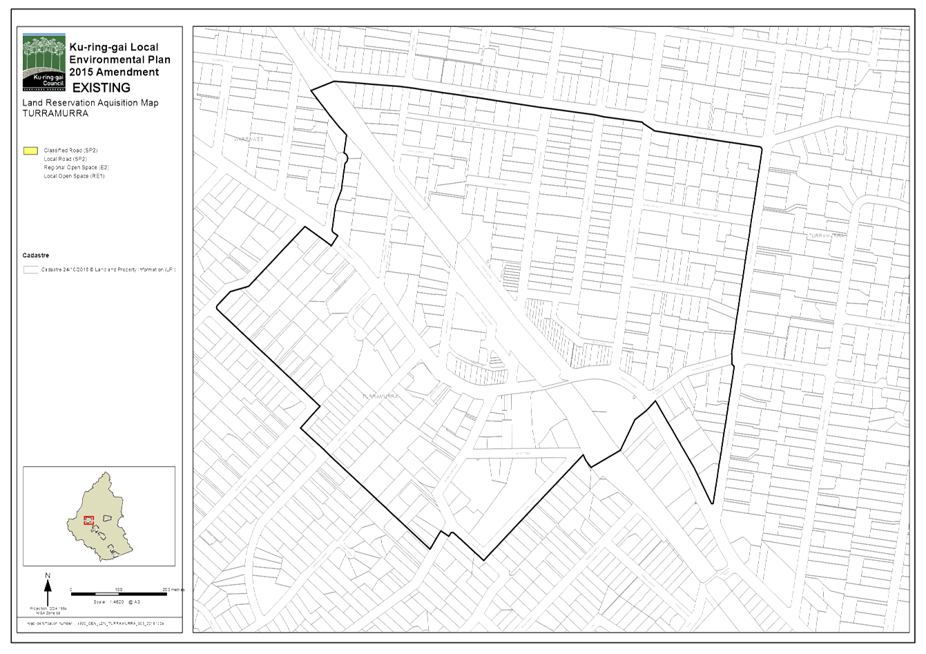
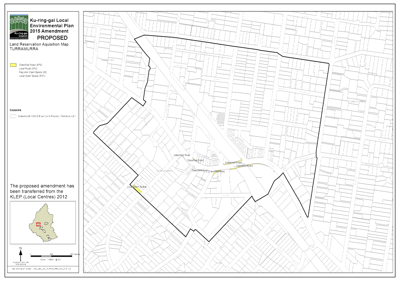
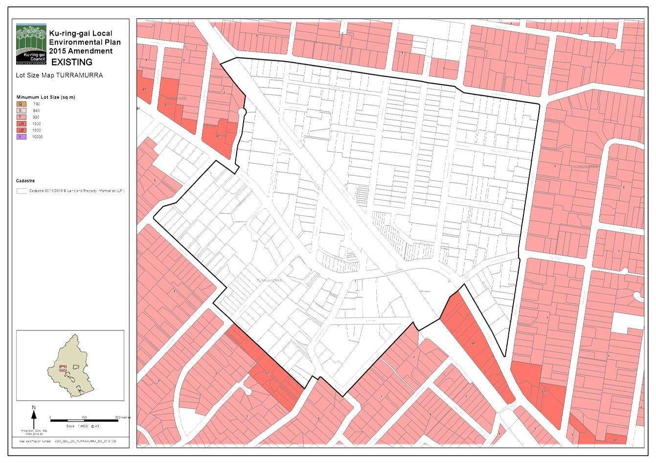
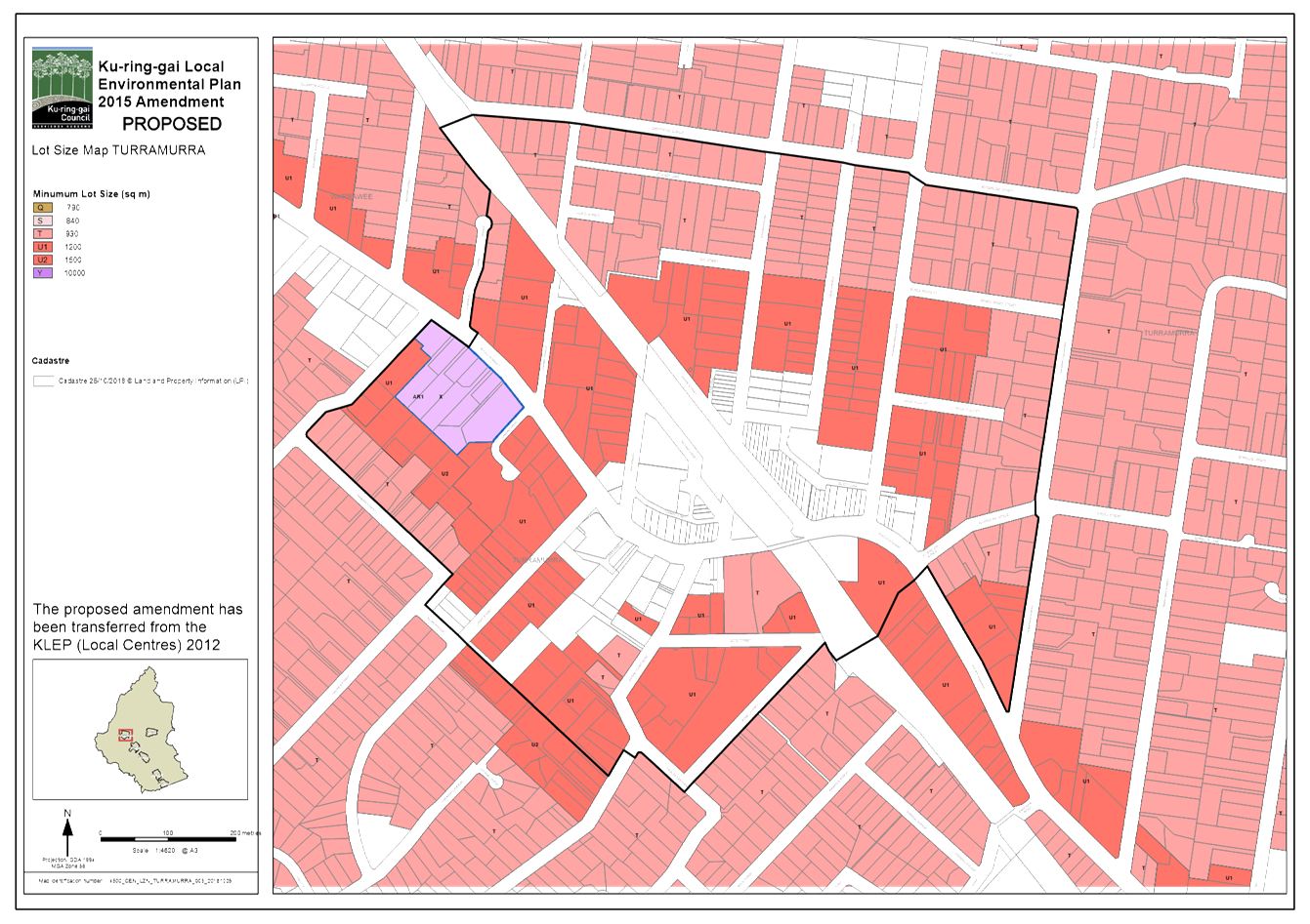
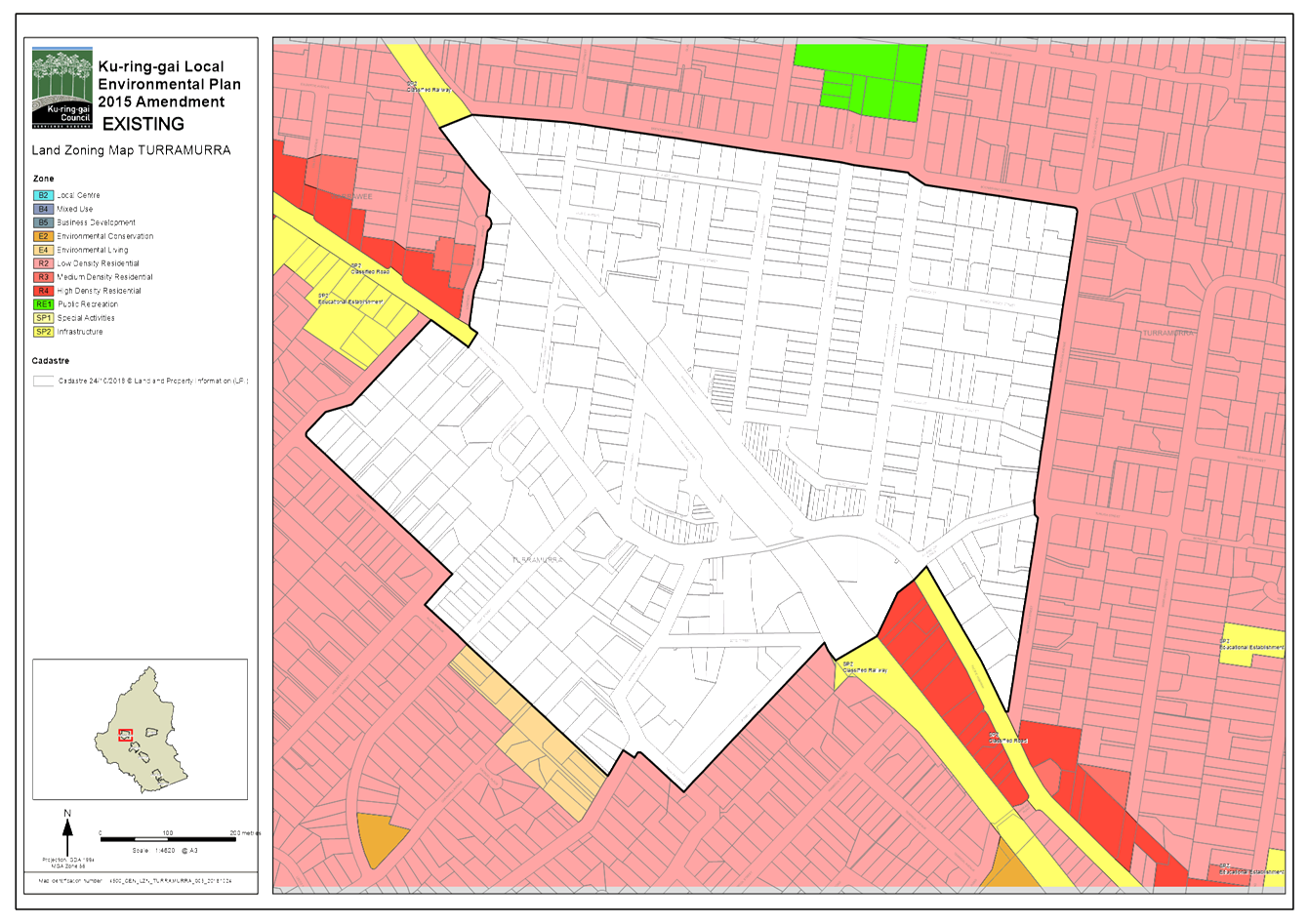
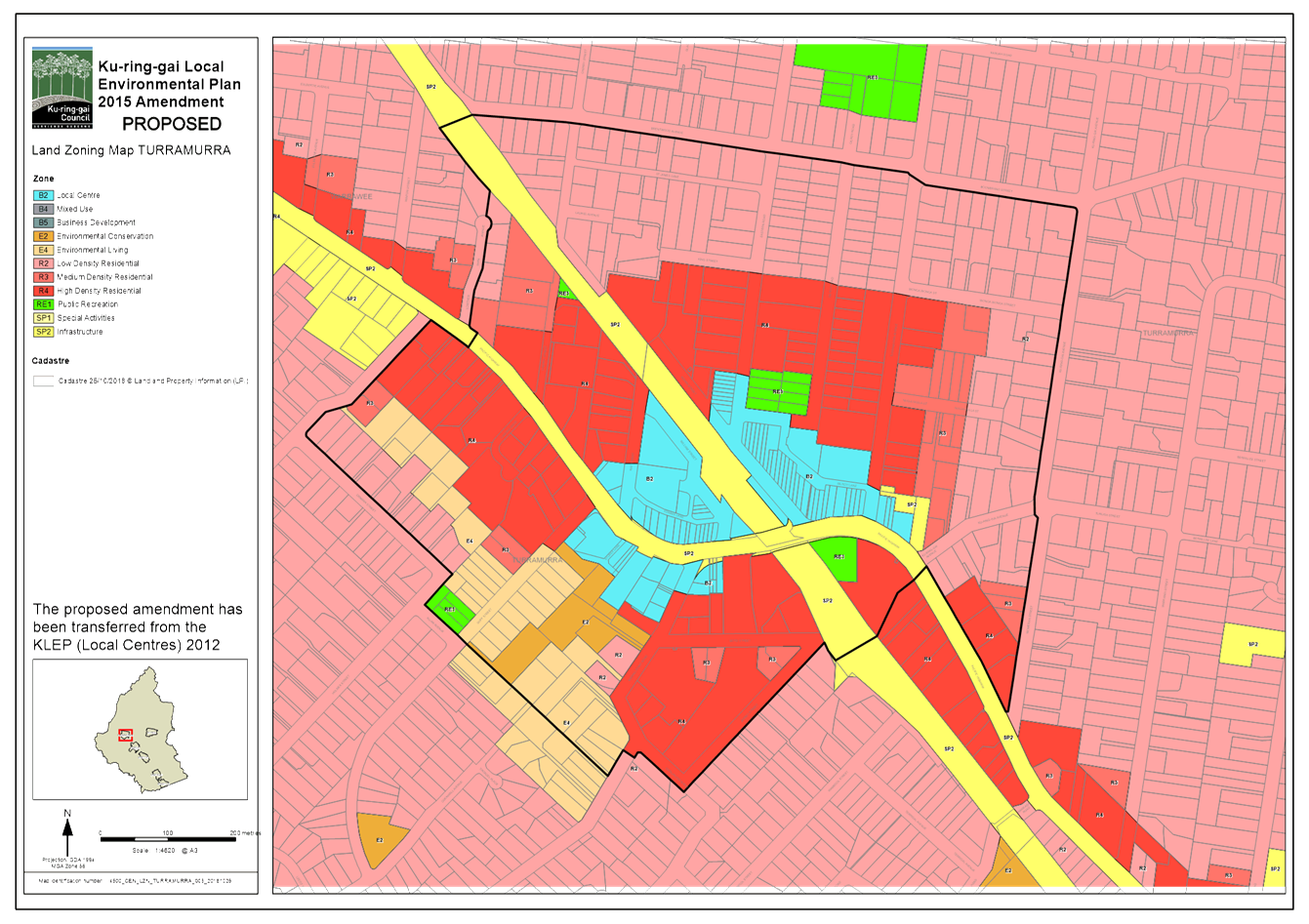
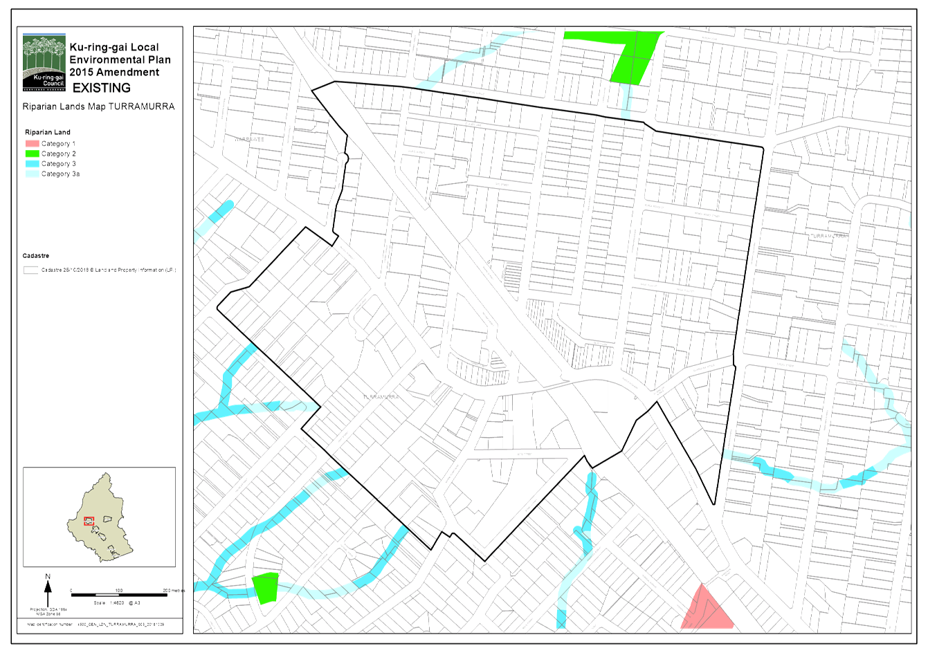
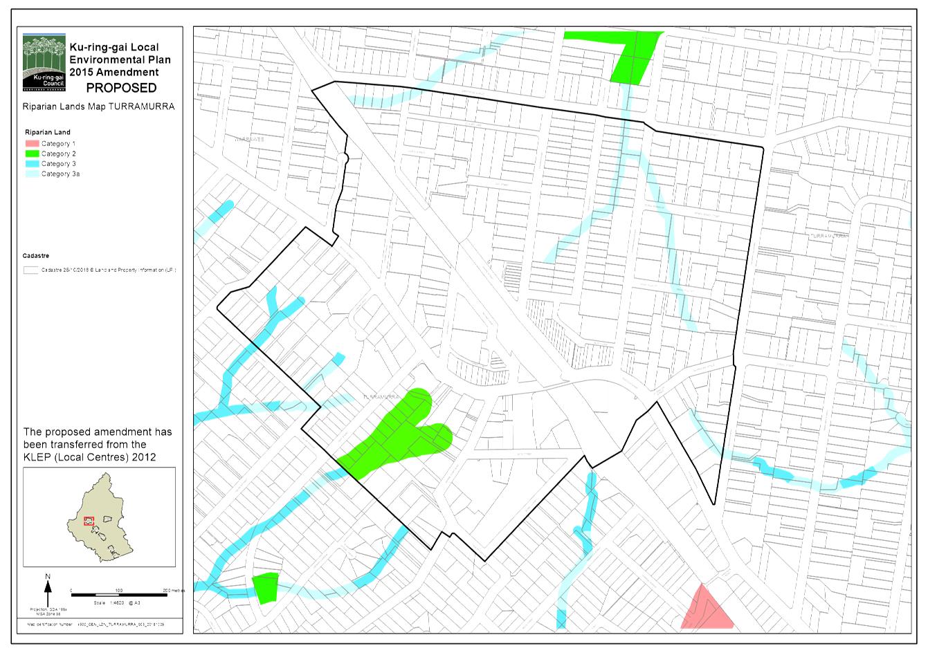
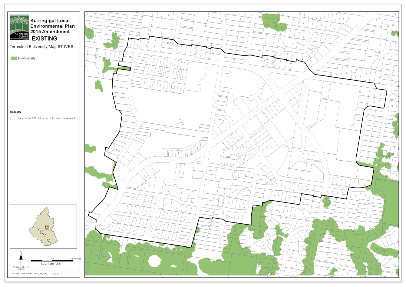
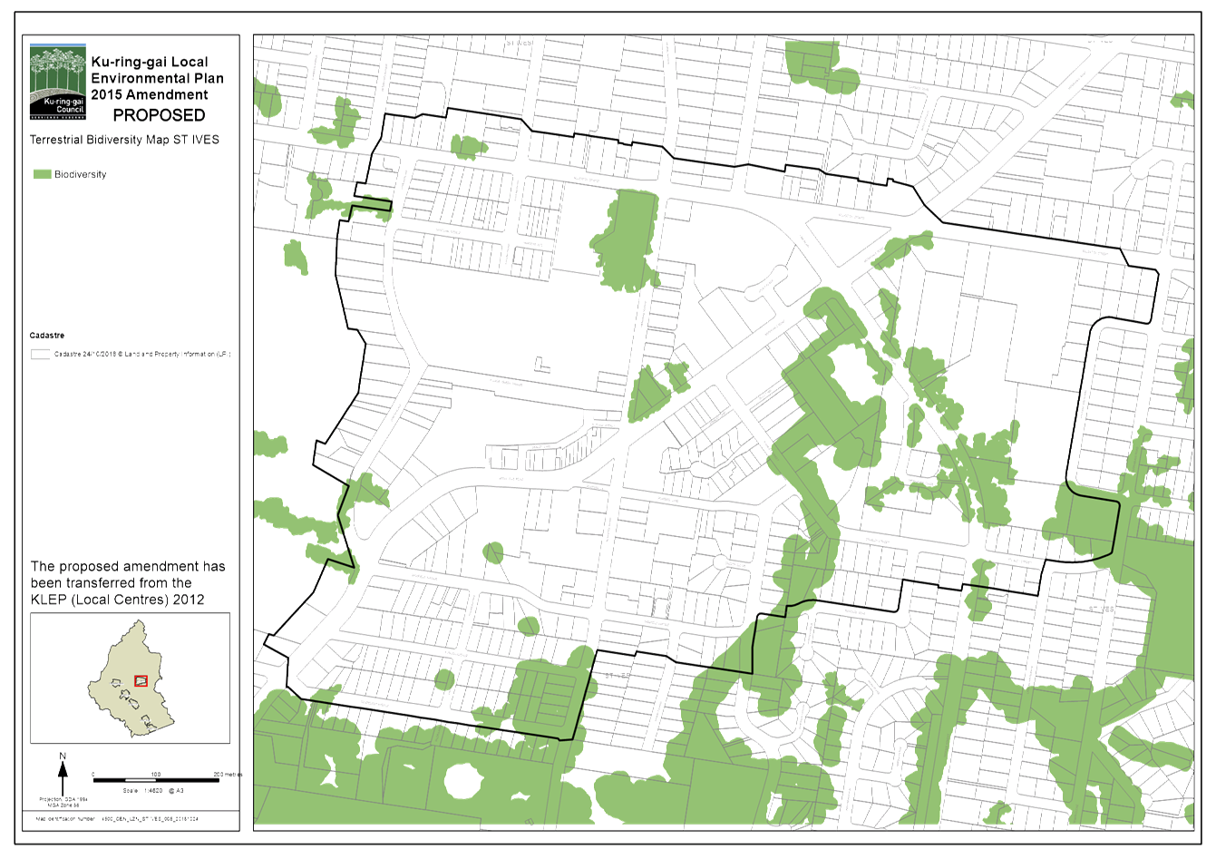
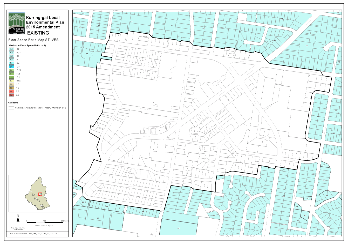
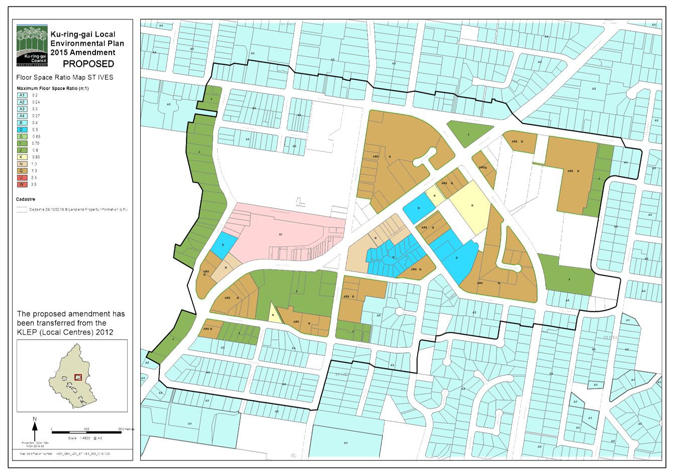
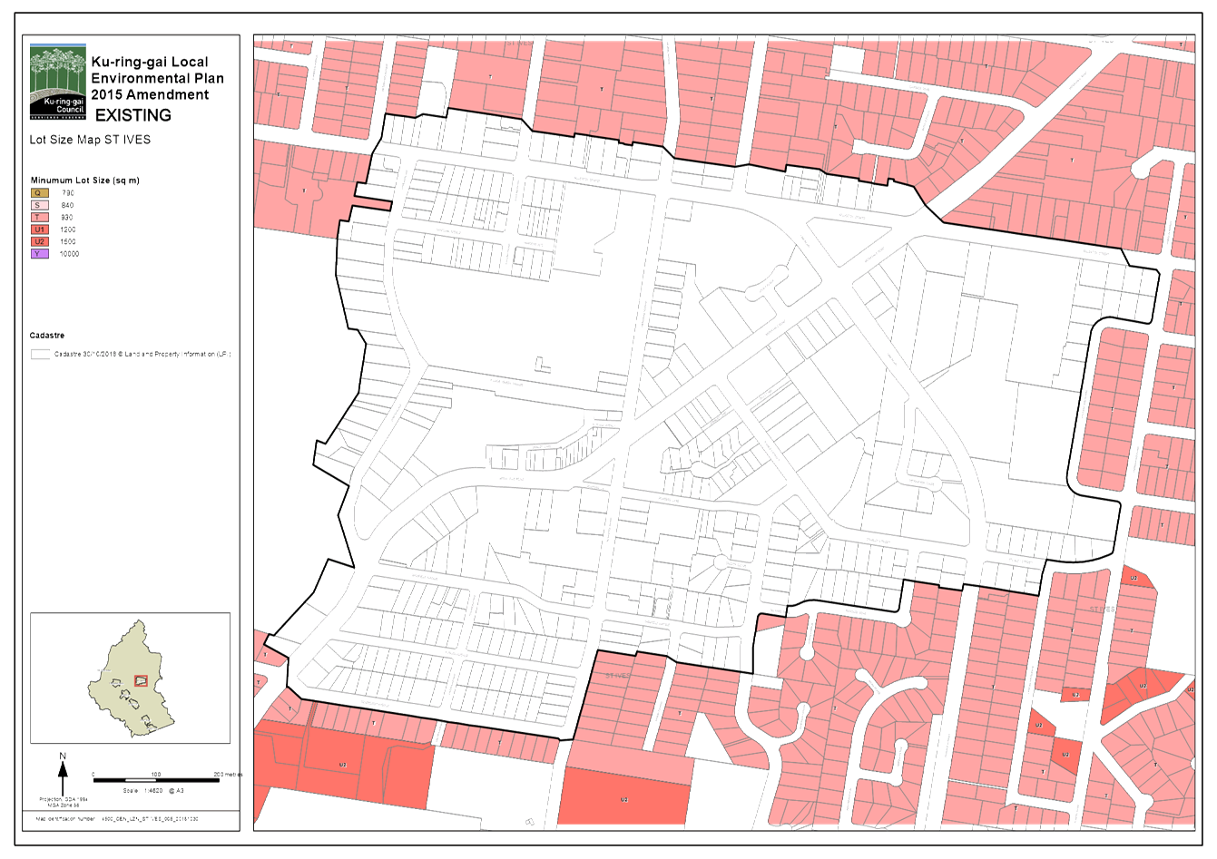
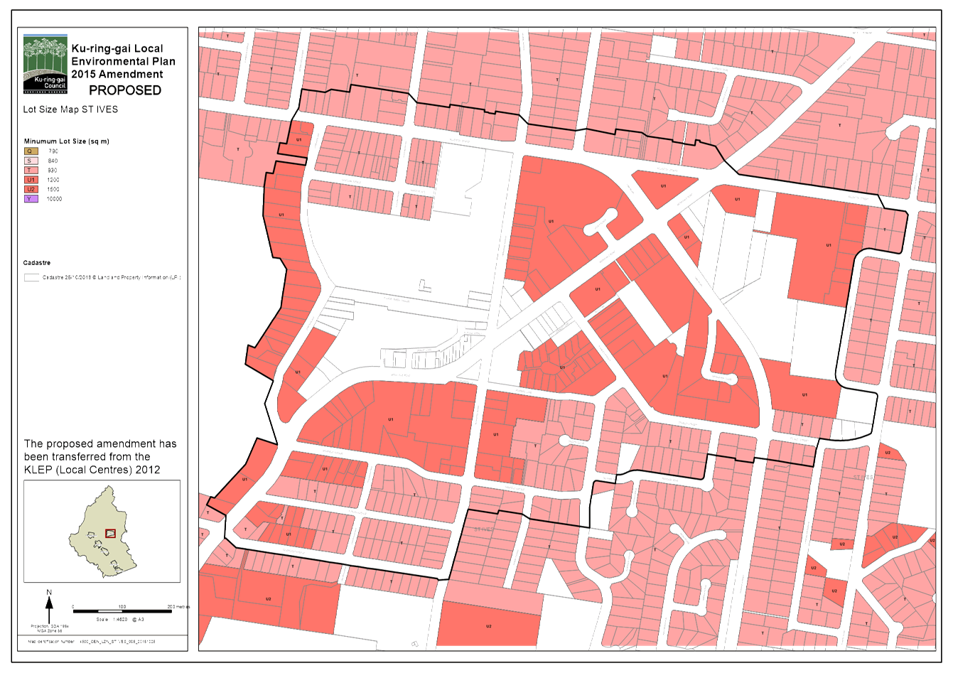
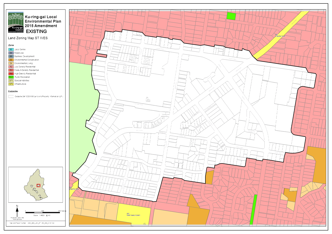
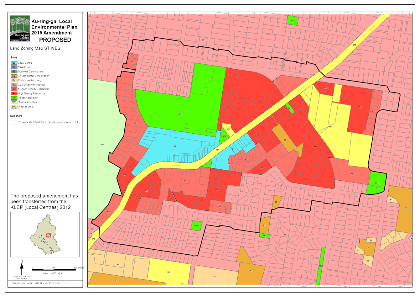
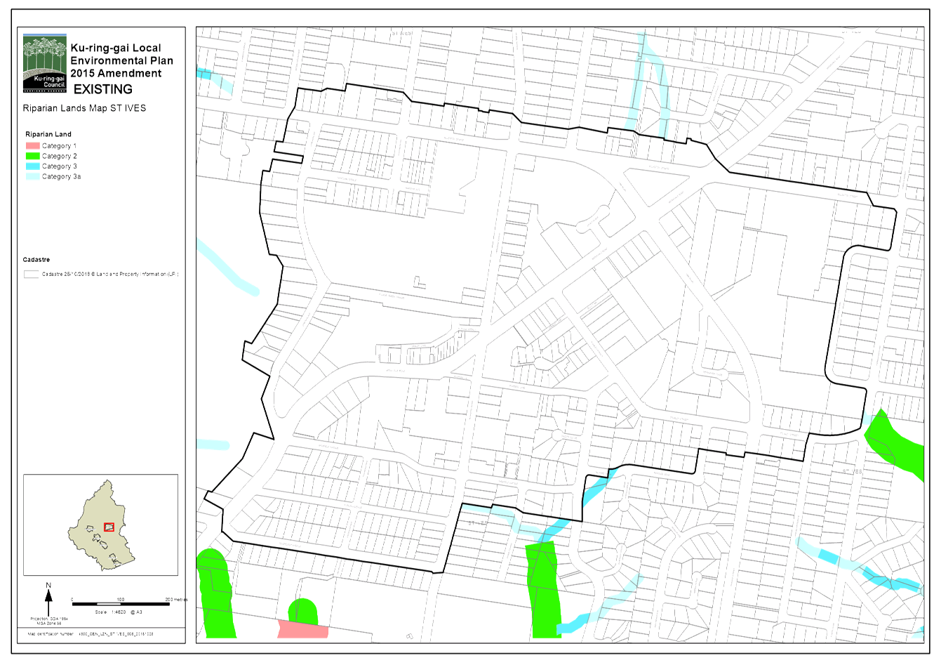
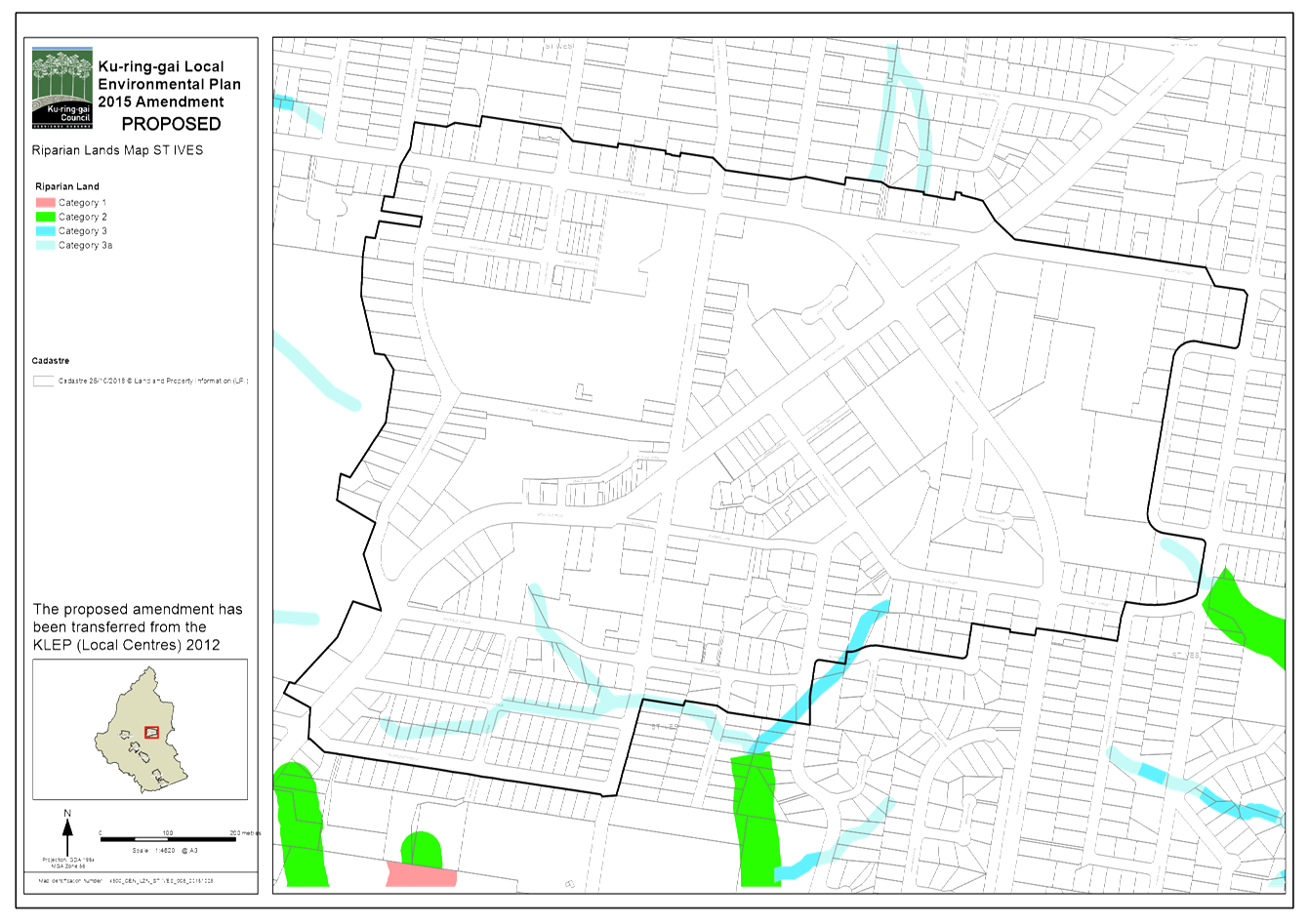
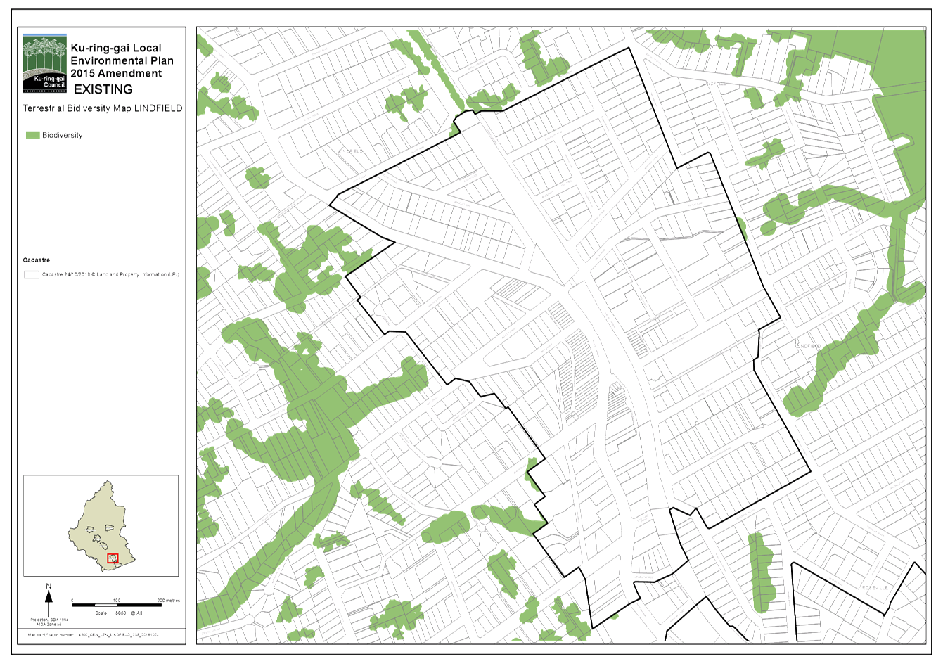
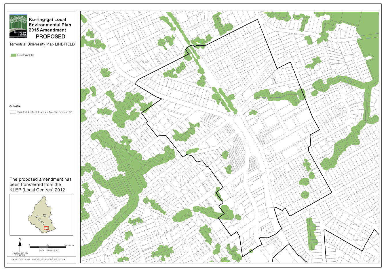
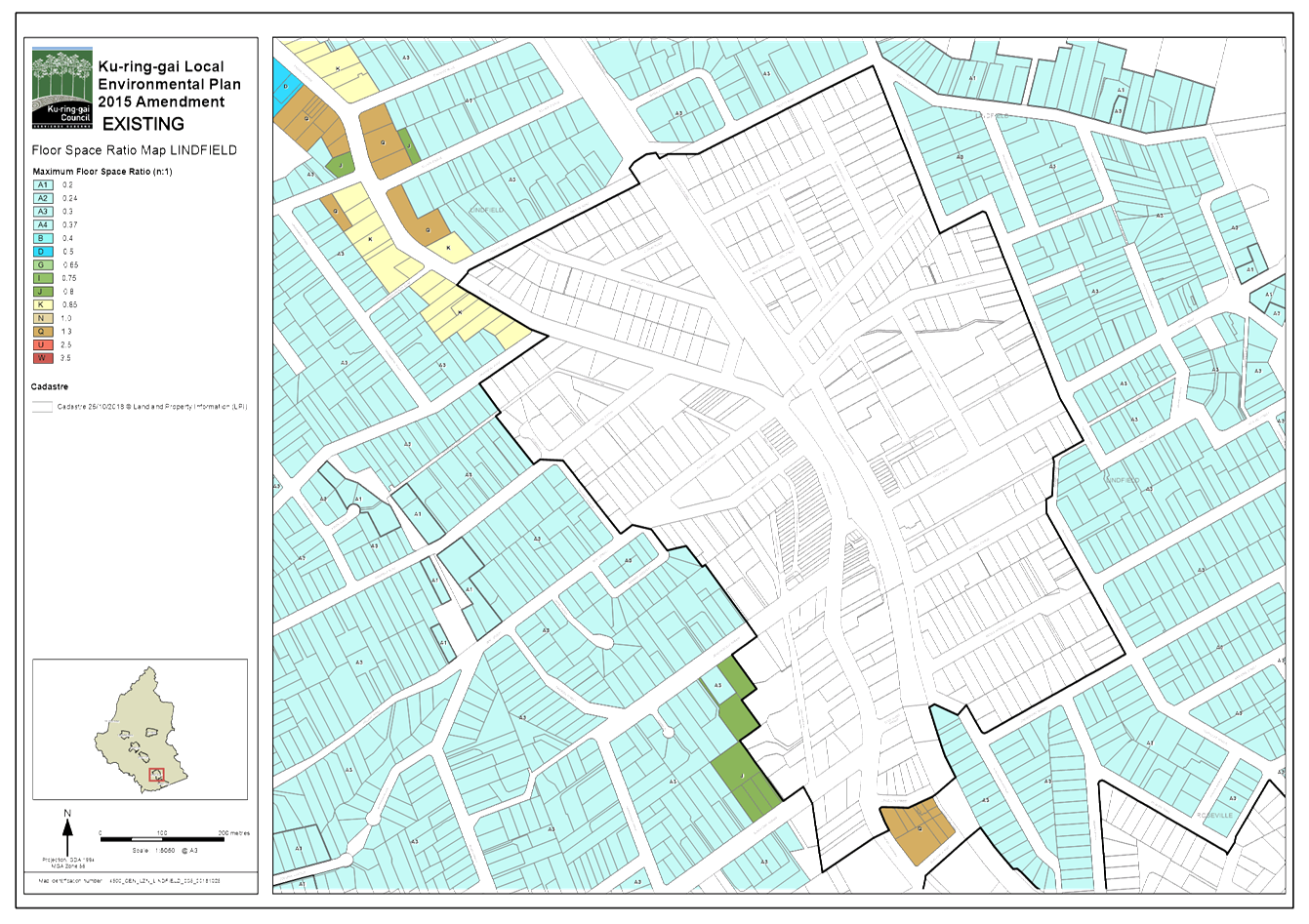
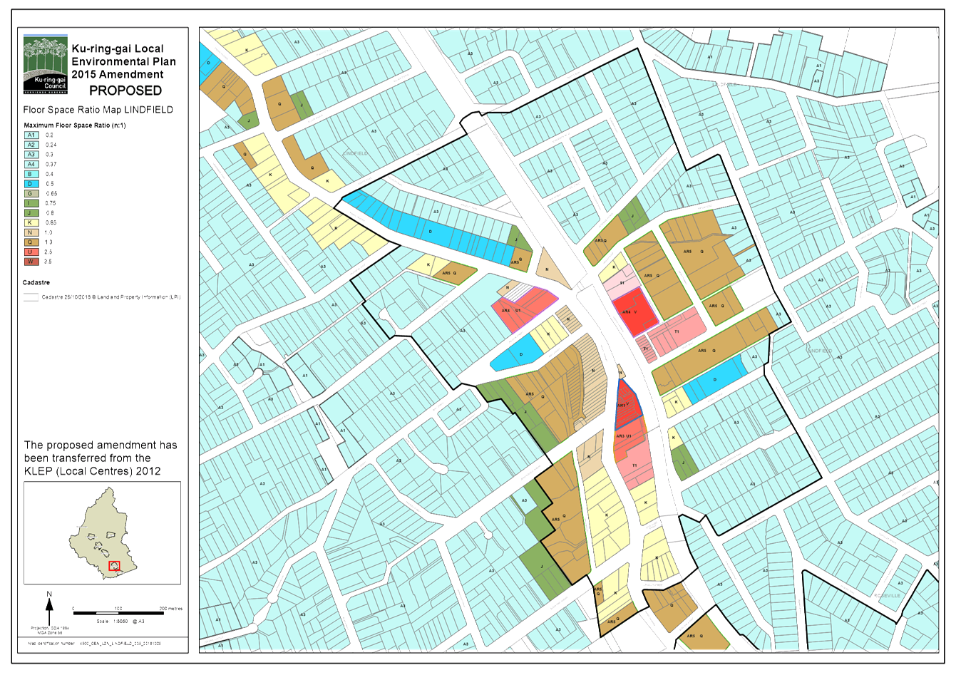
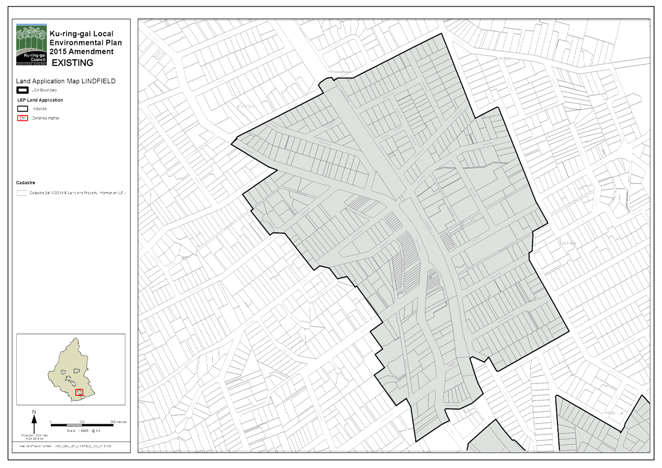
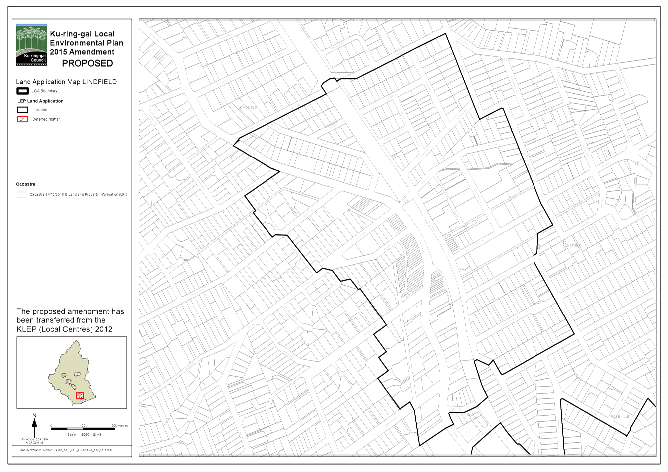
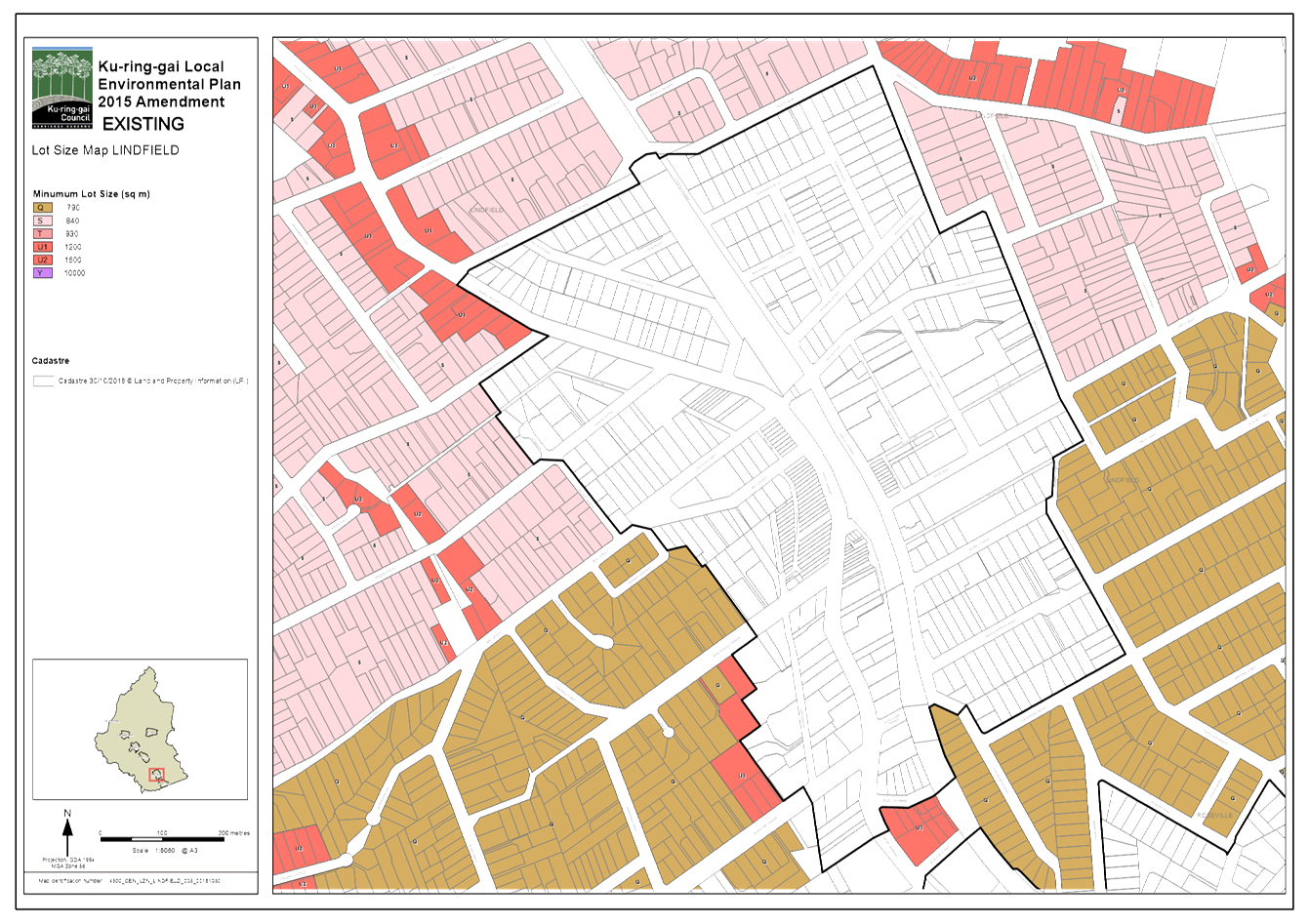
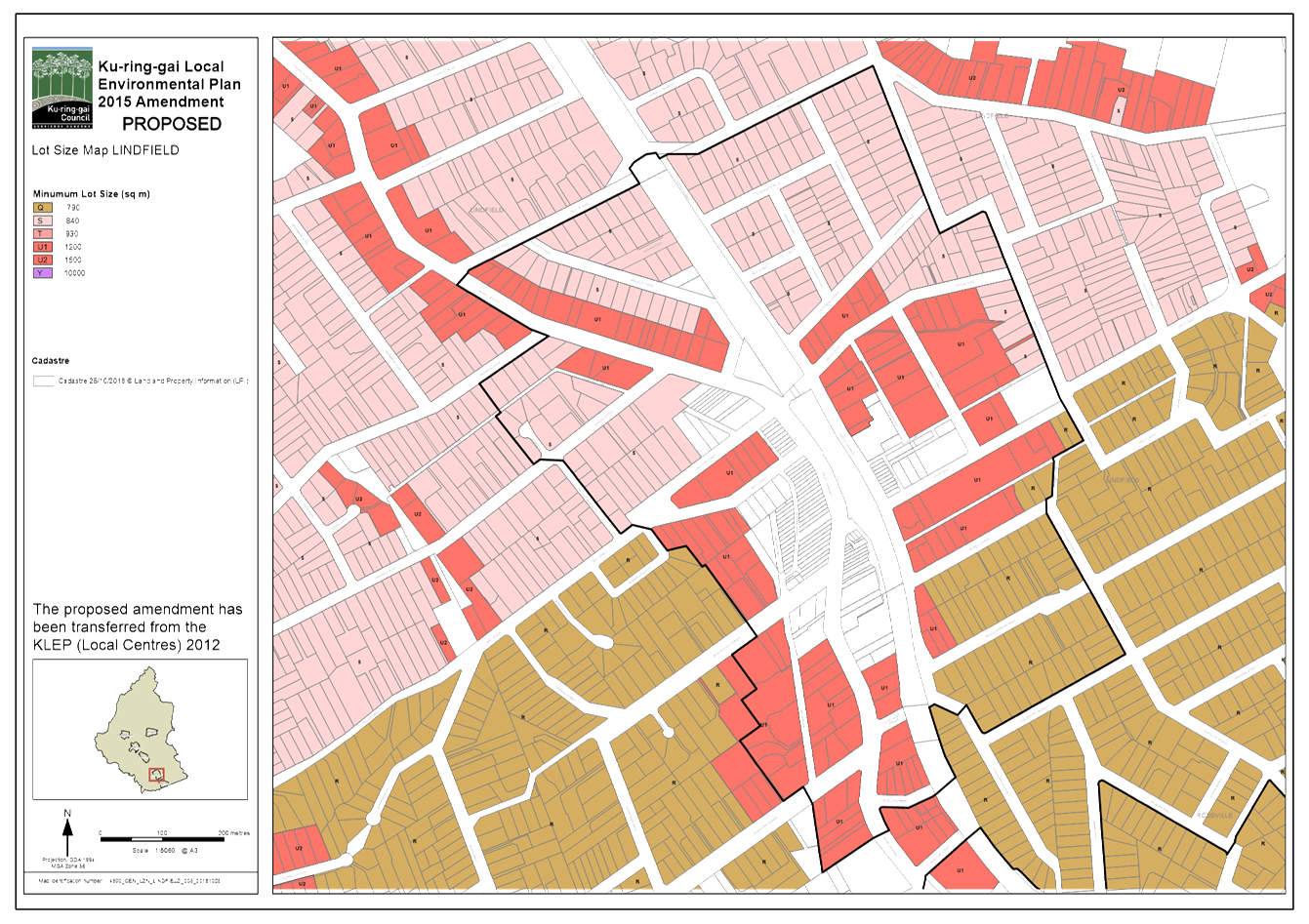
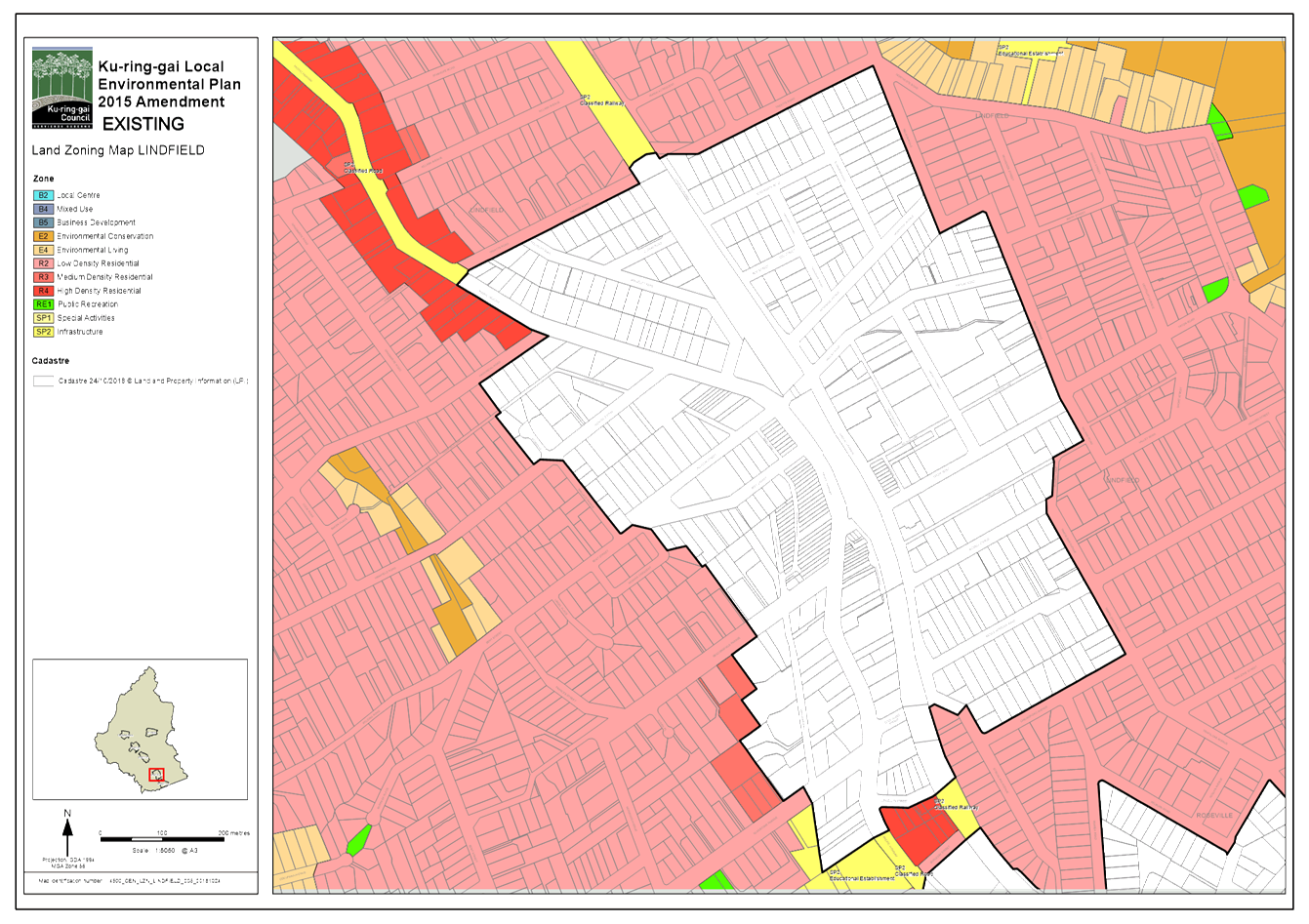
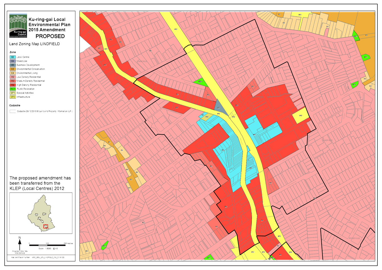
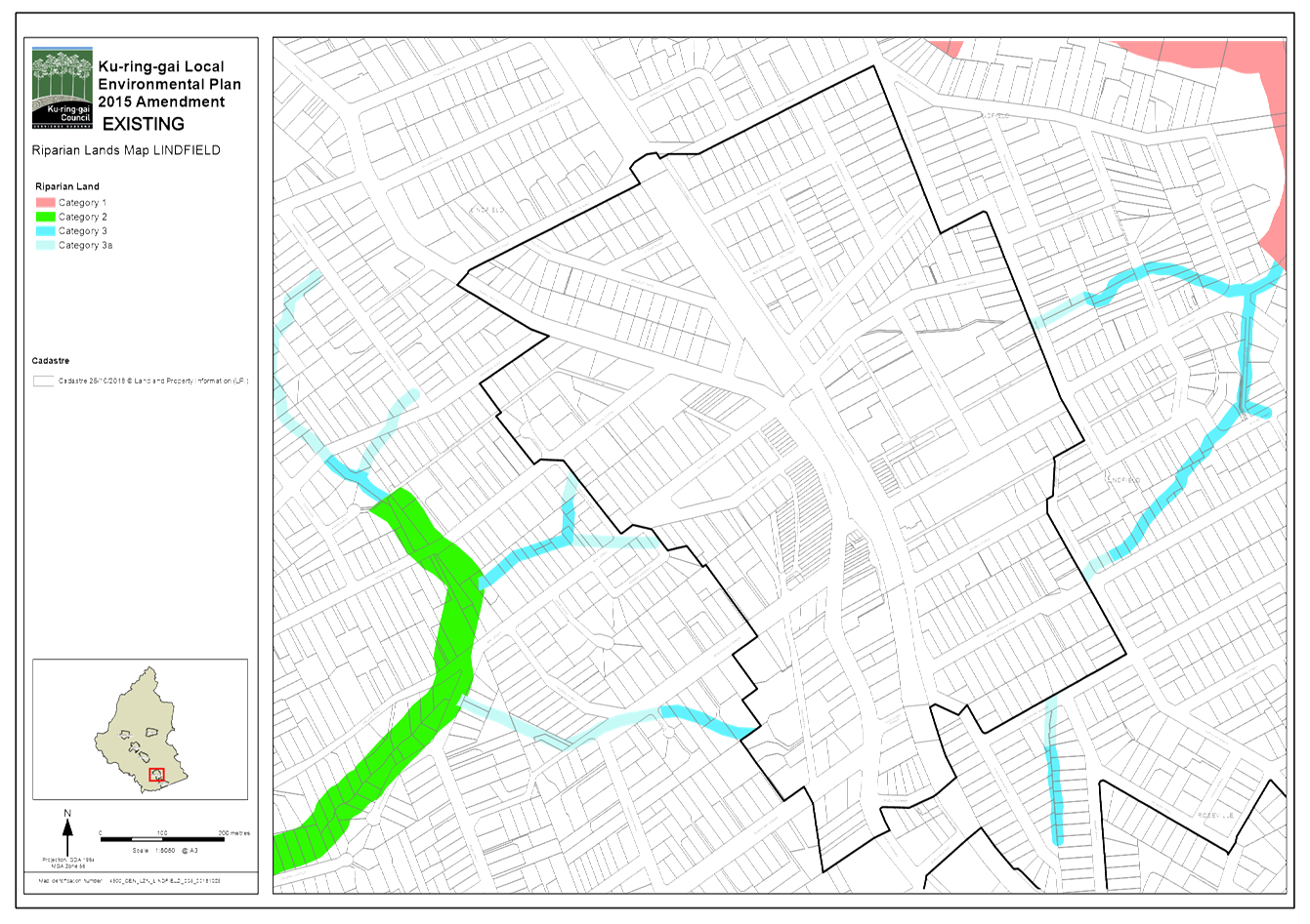
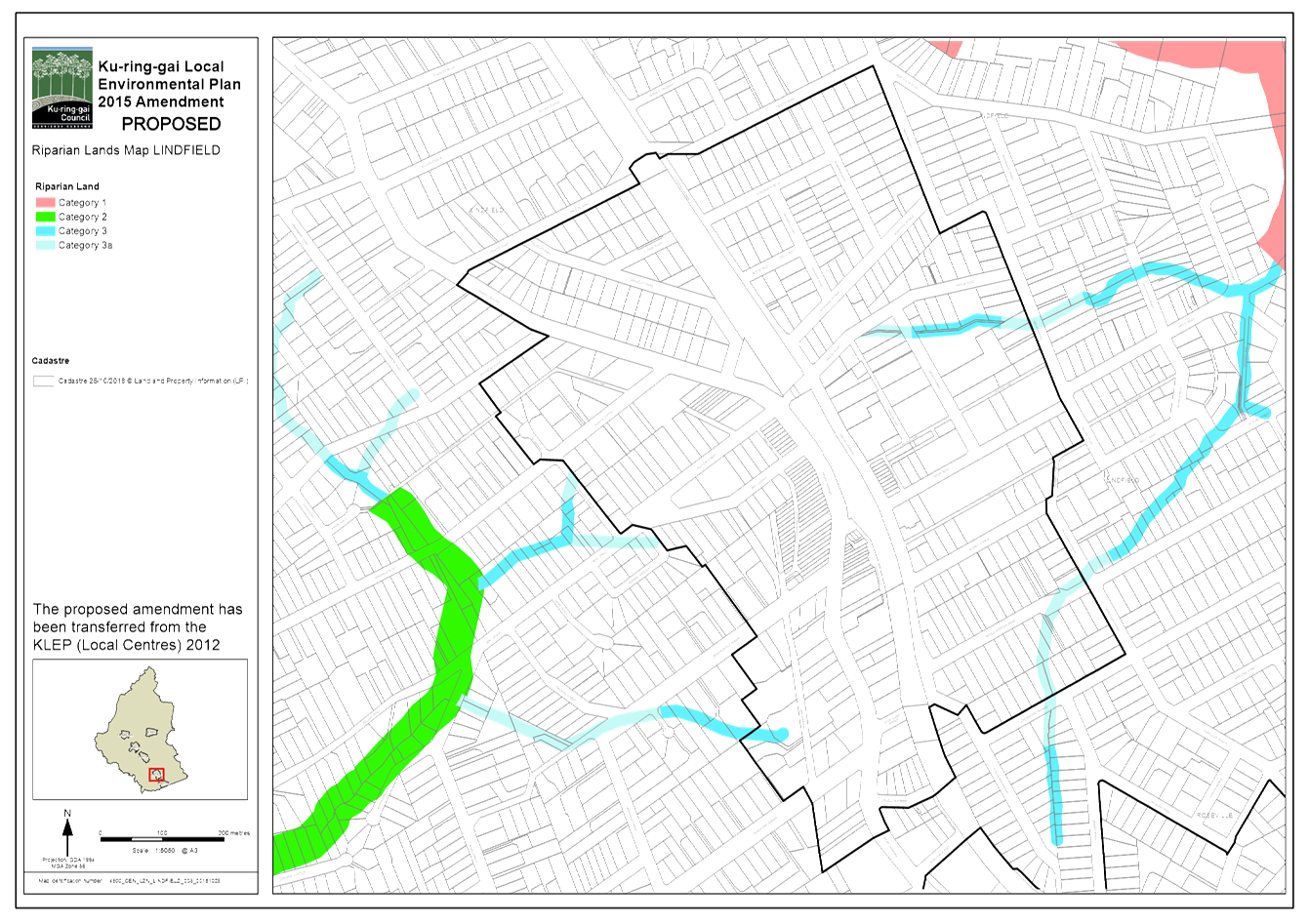
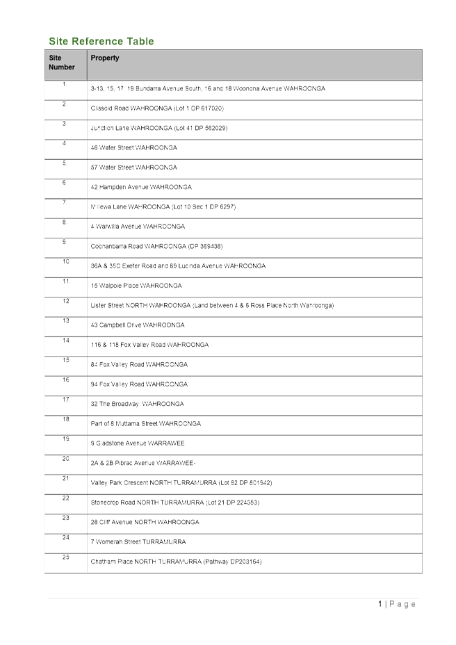
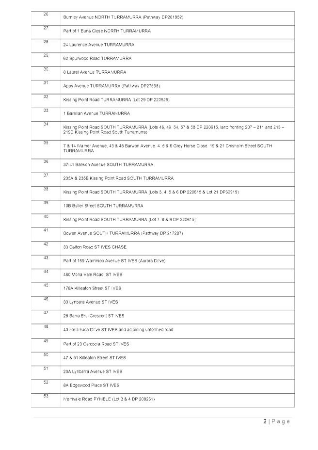
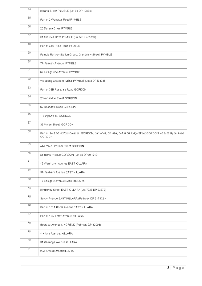
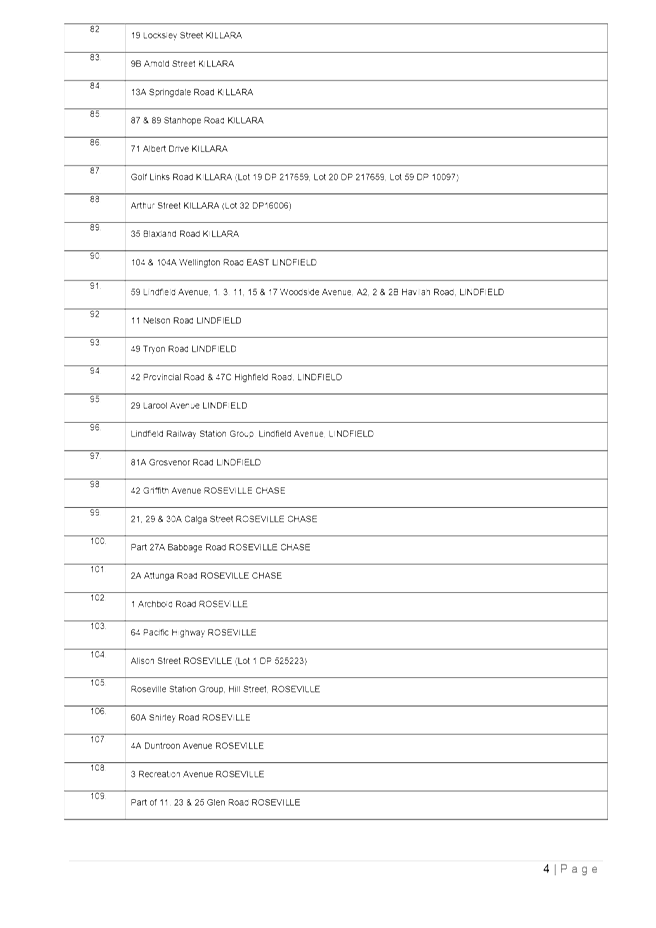
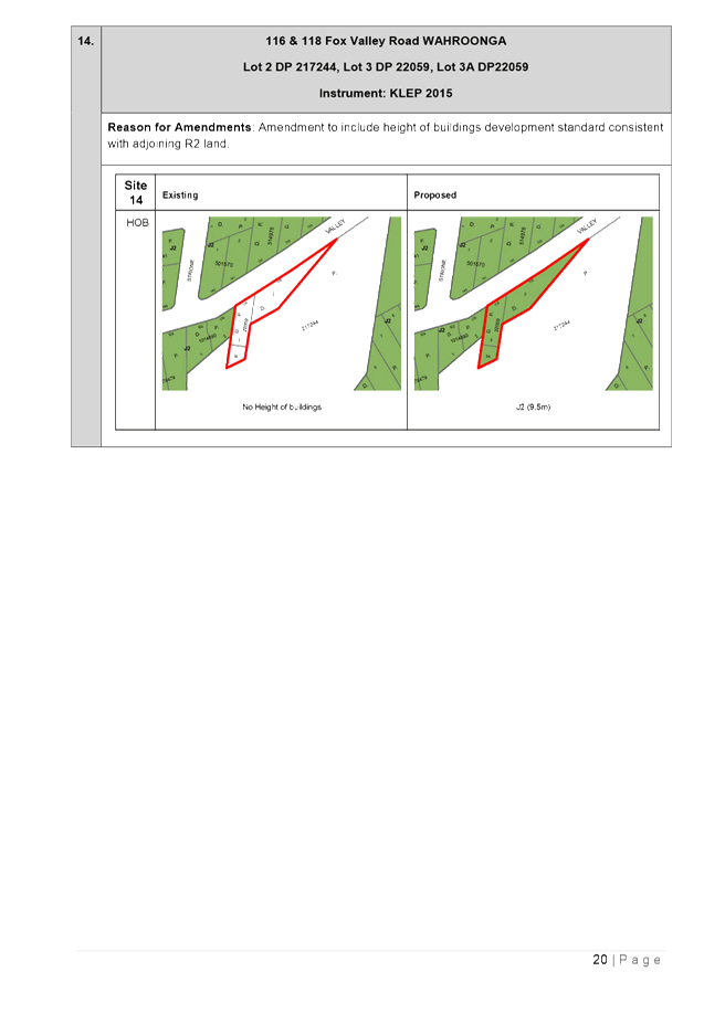
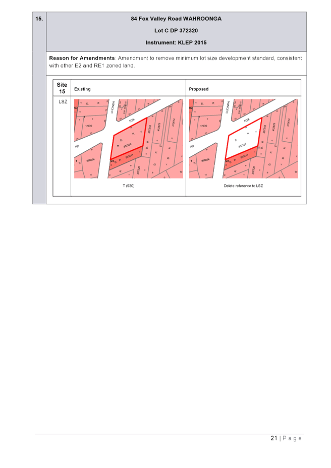
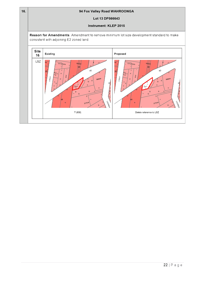
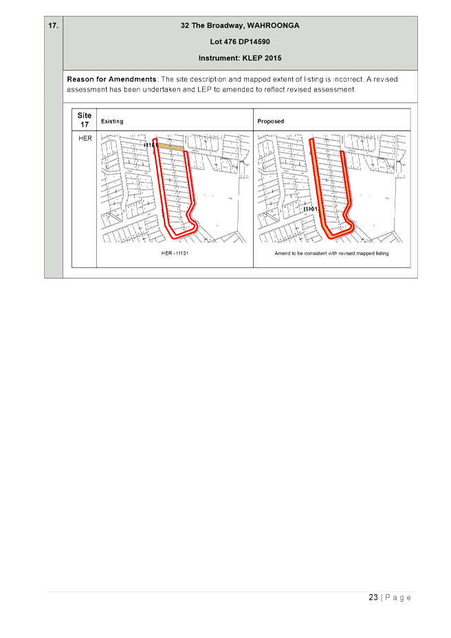
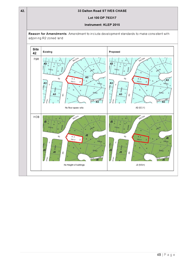
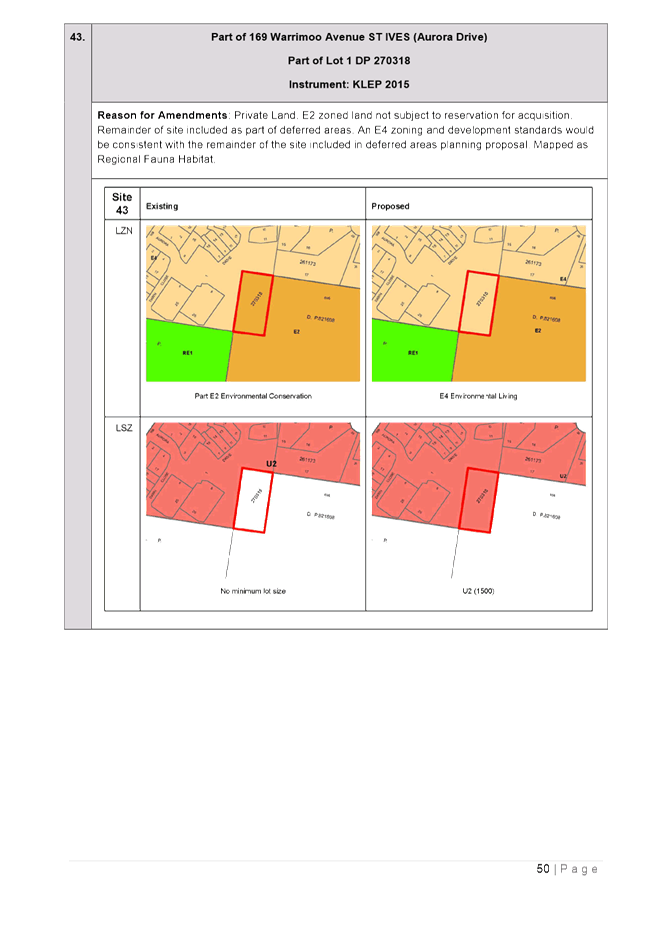
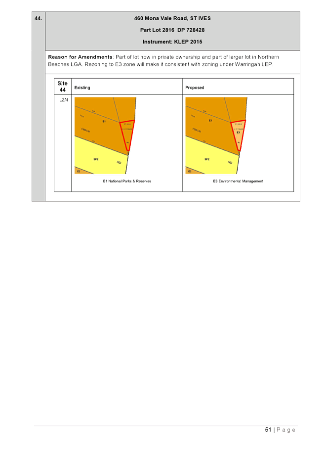
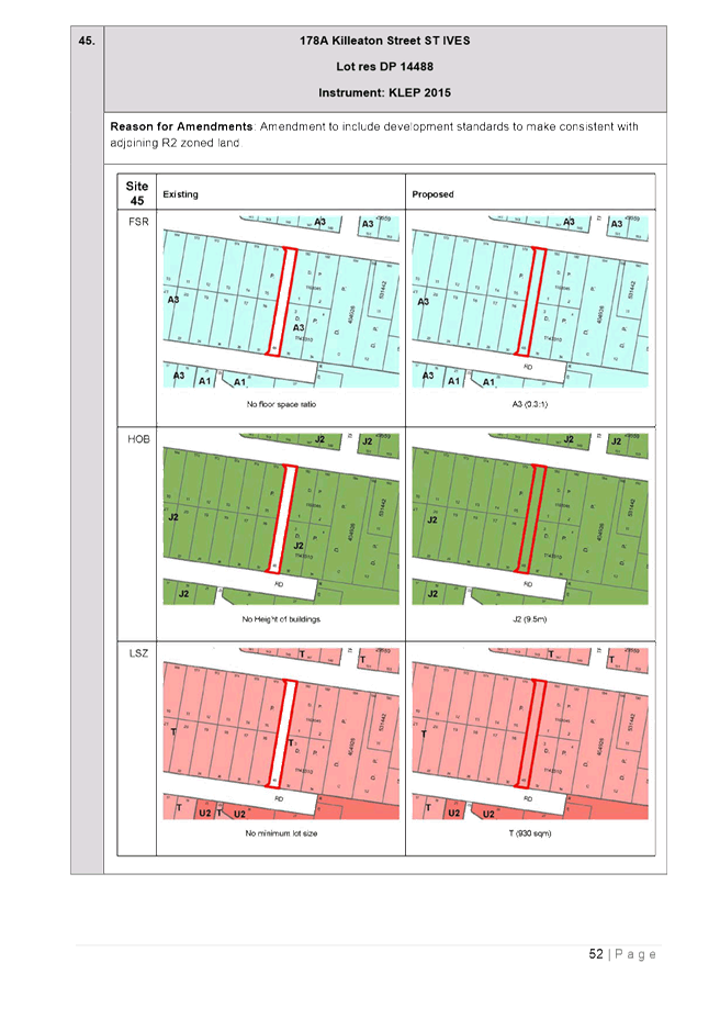
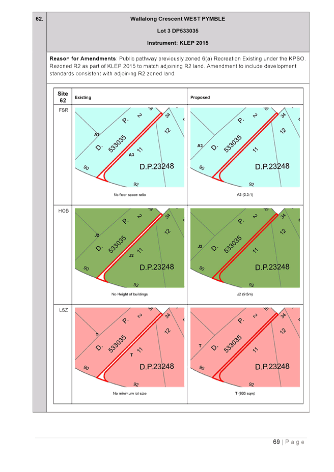
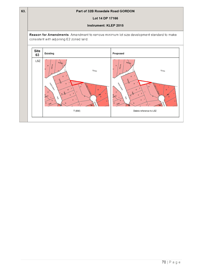
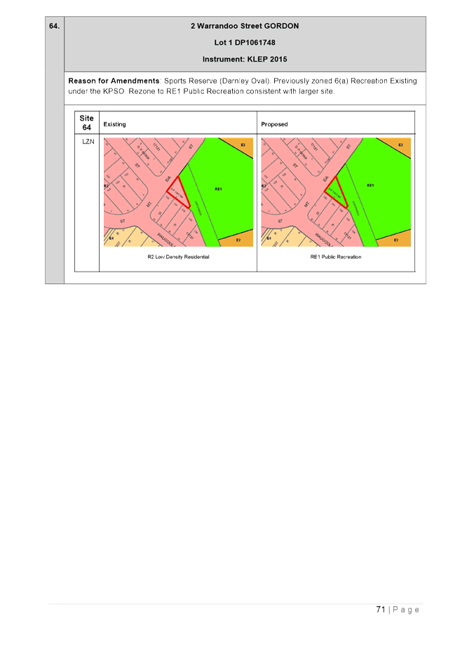
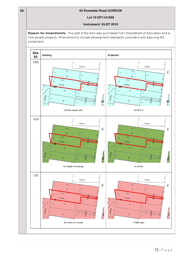
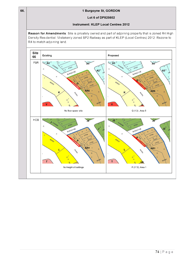
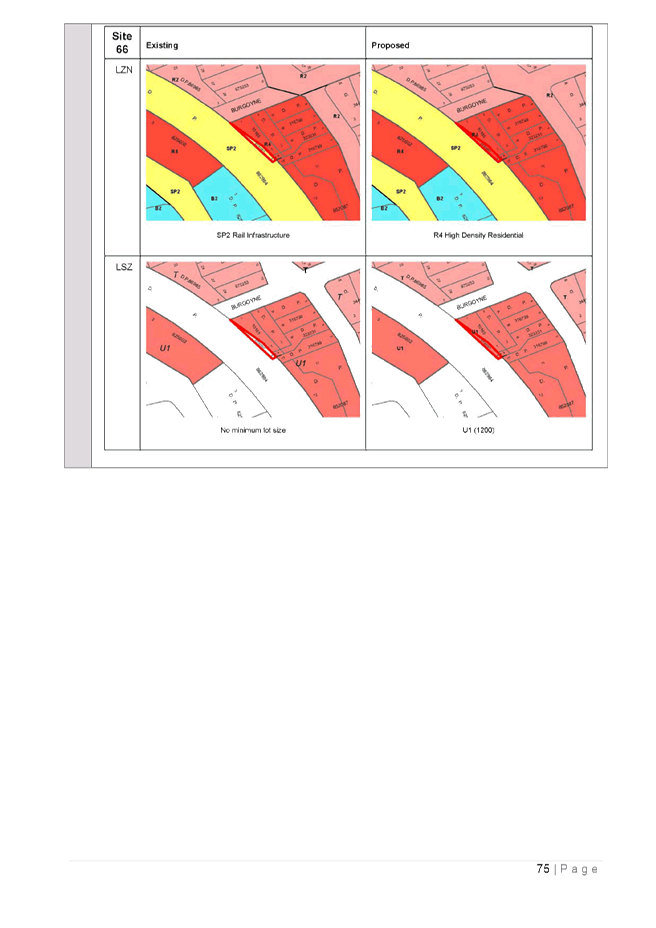
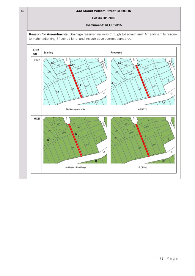
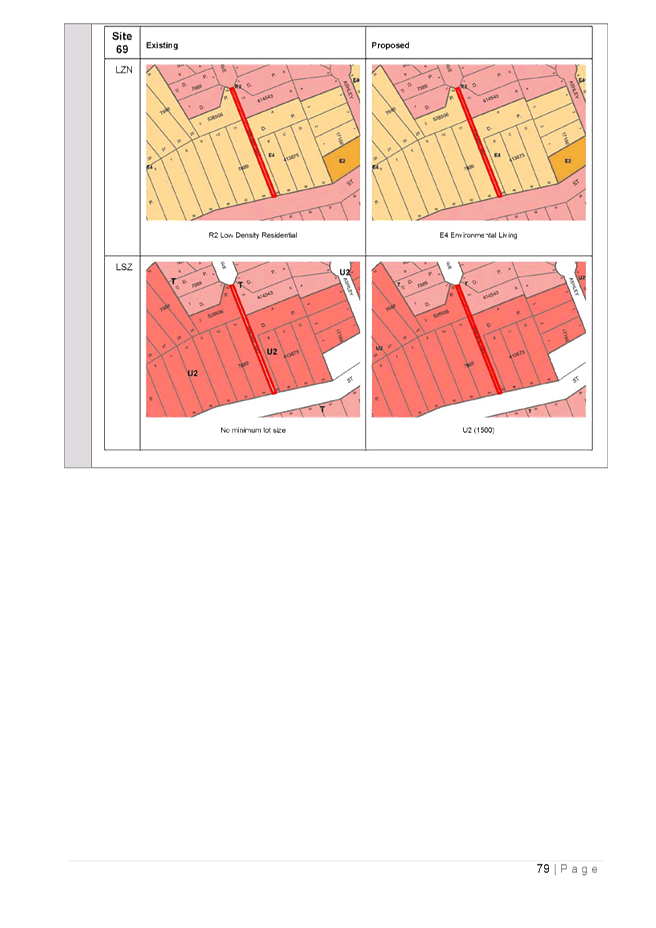
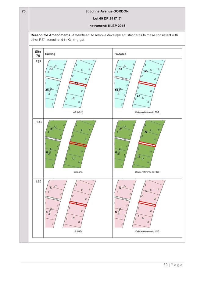
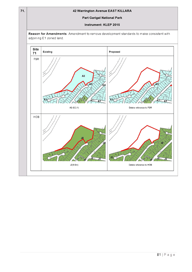
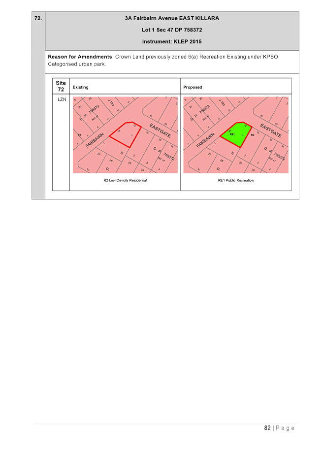
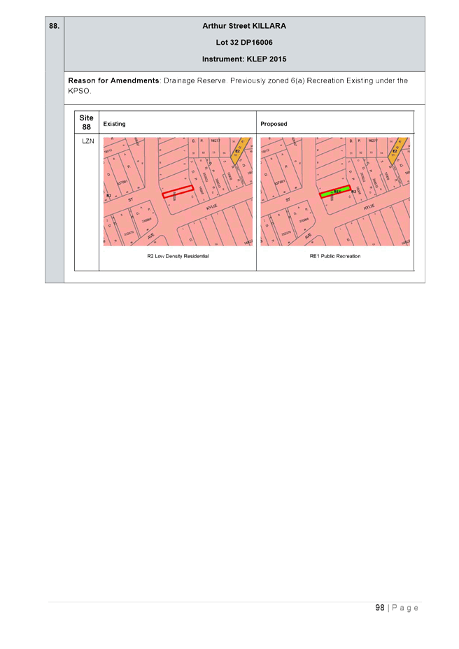
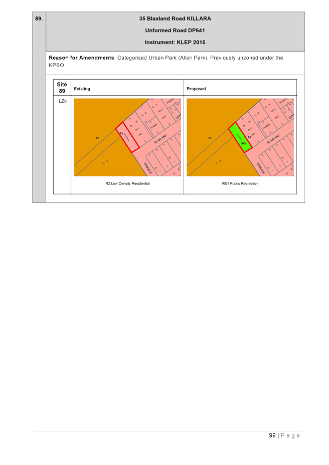
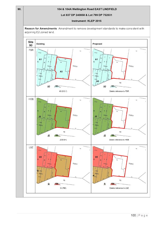
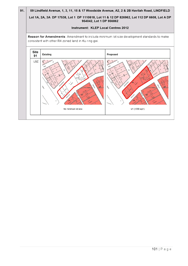
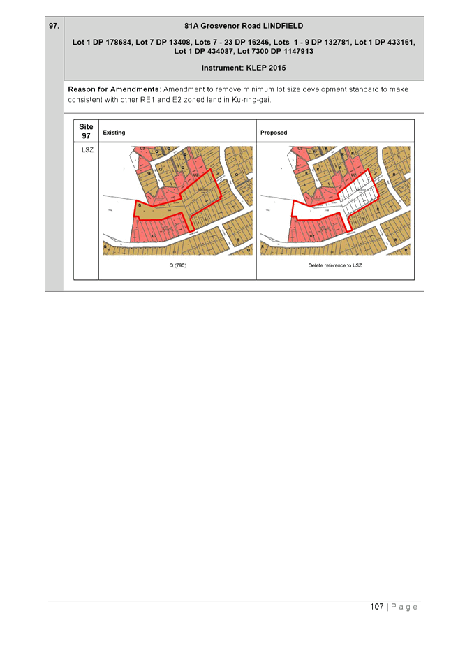
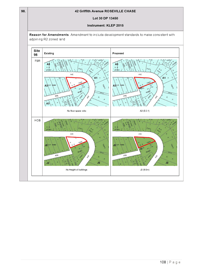
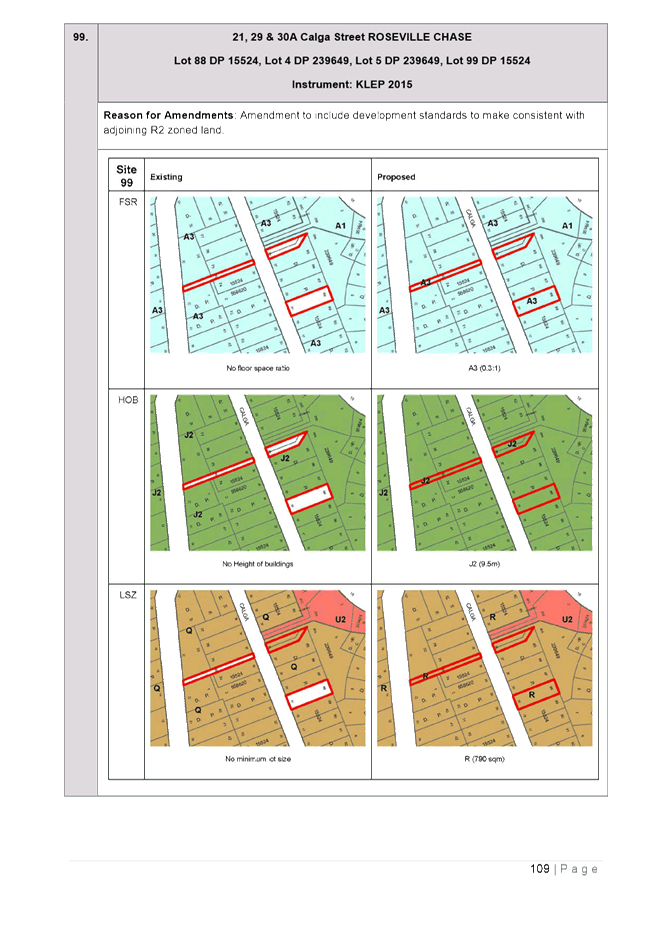
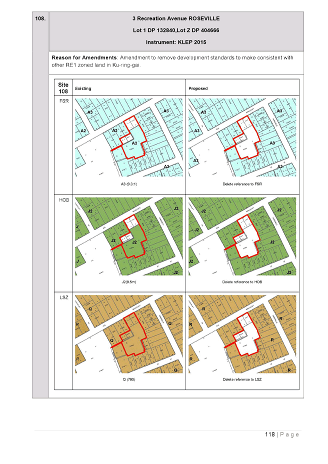
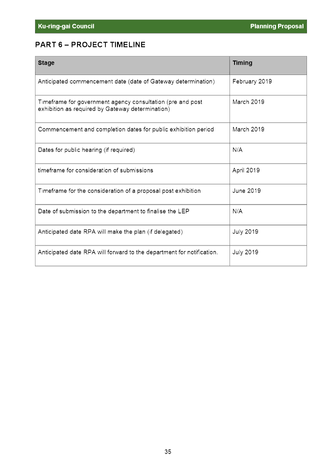
There are in the order of 100 sites that have been identified with such errors. PART 4 - Mapping of the Planning Proposal includes maps to show the current mapping of each of the sites, and the proposed amendments sought by the Planning Proposal.
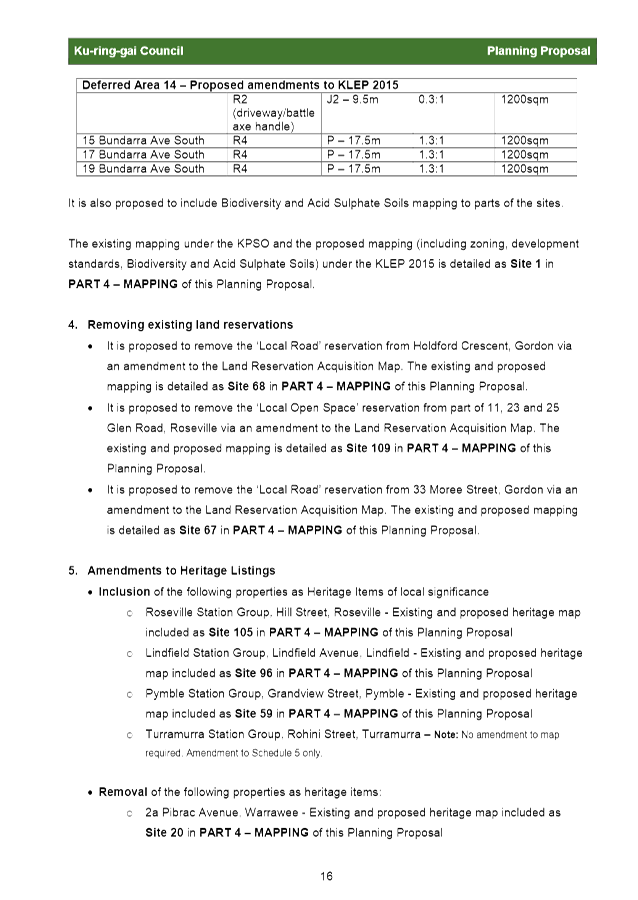
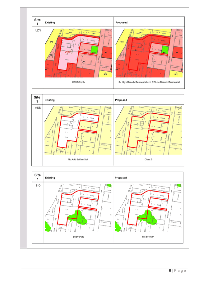
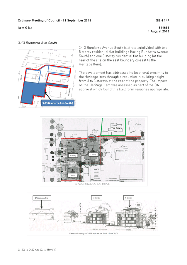
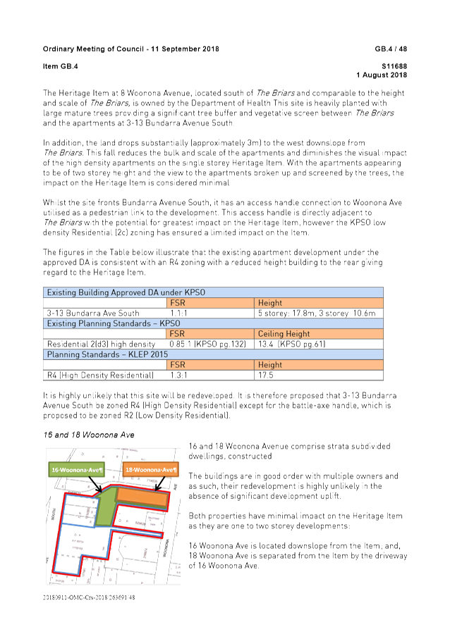
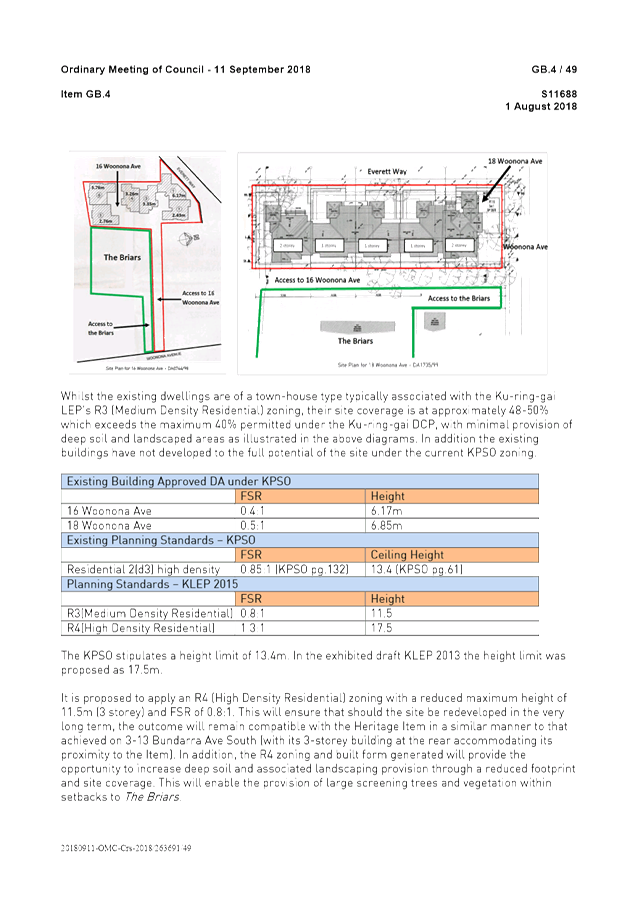
· Resolving Deferred Area 14 – the Planning Proposal seeks to incorporate Deferred Area 14 into the KLEP 2015 with appropriate zoning and development standards compatible with the heritage significance of the adjoining state listed heritage item ‘The Briars’.
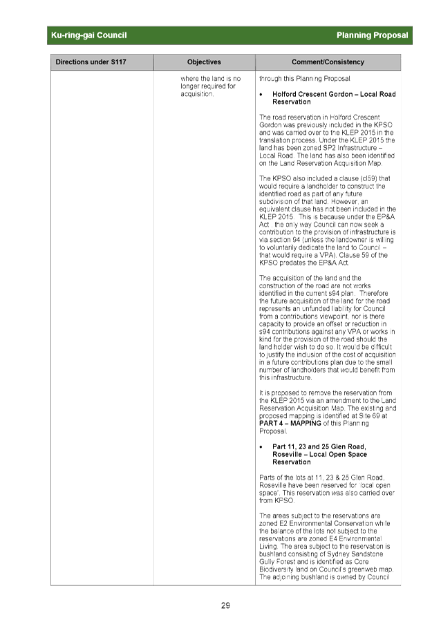
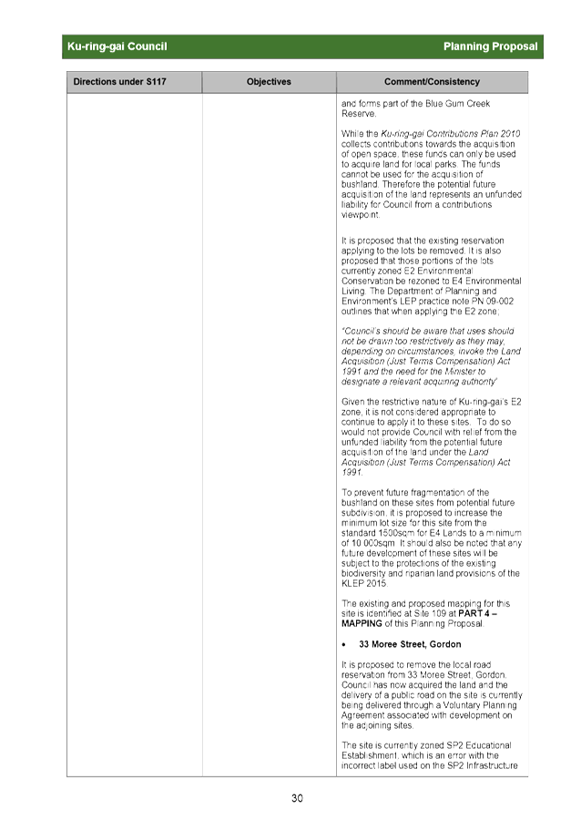
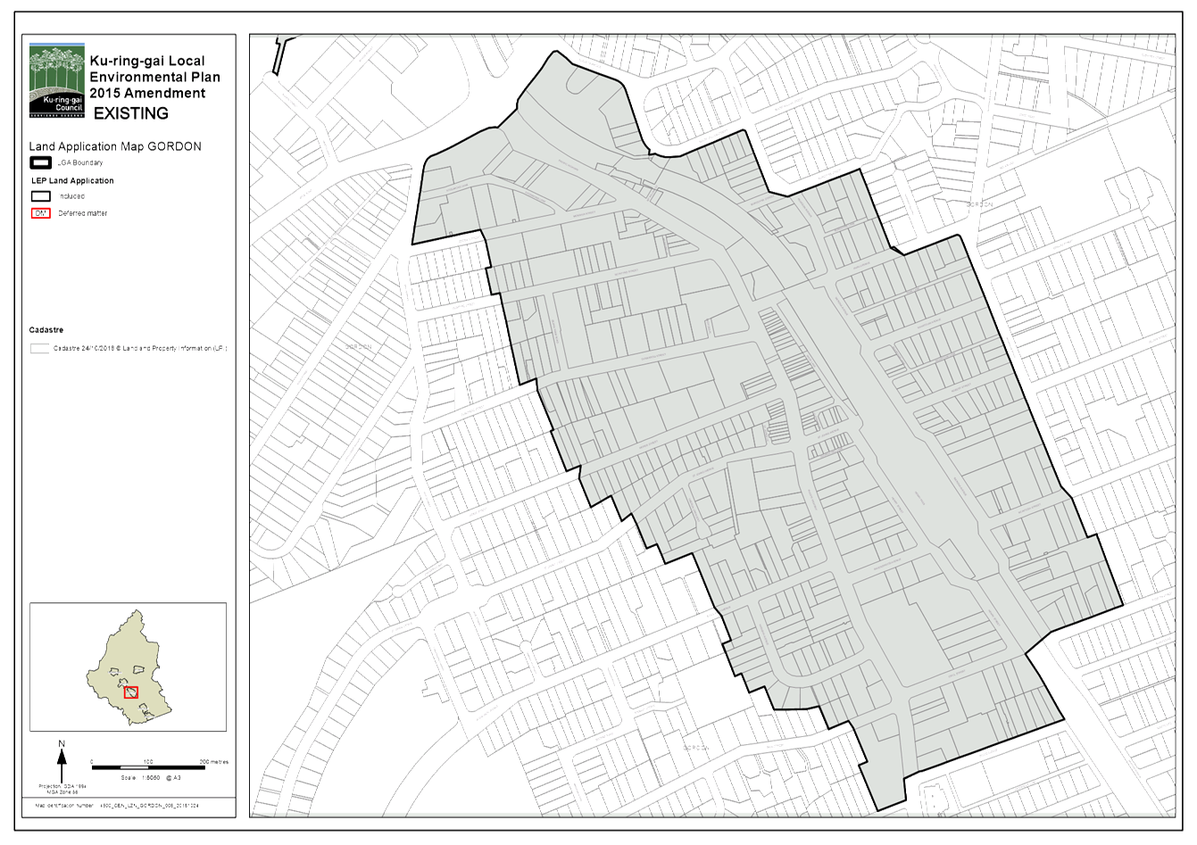
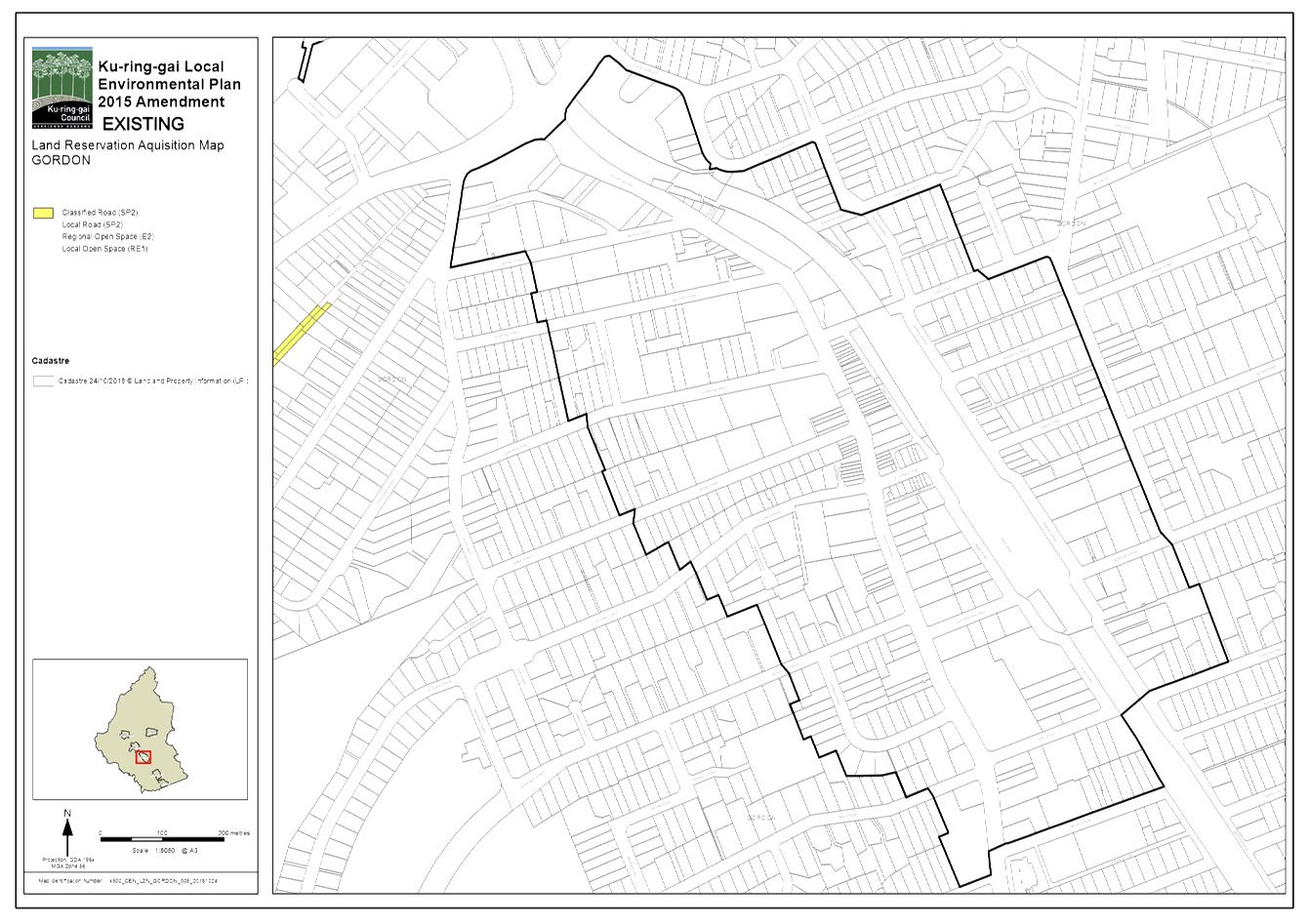
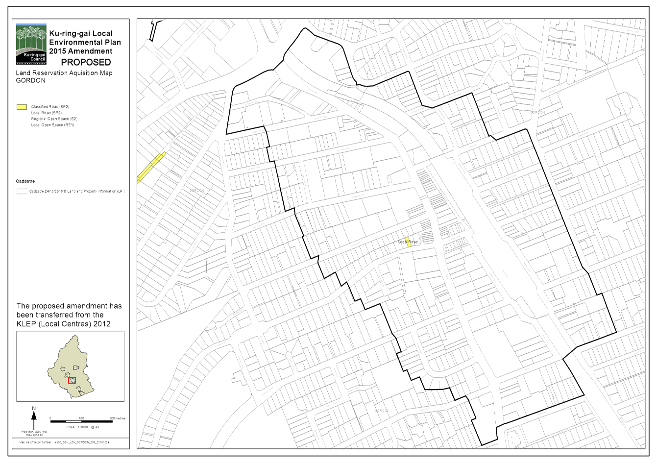
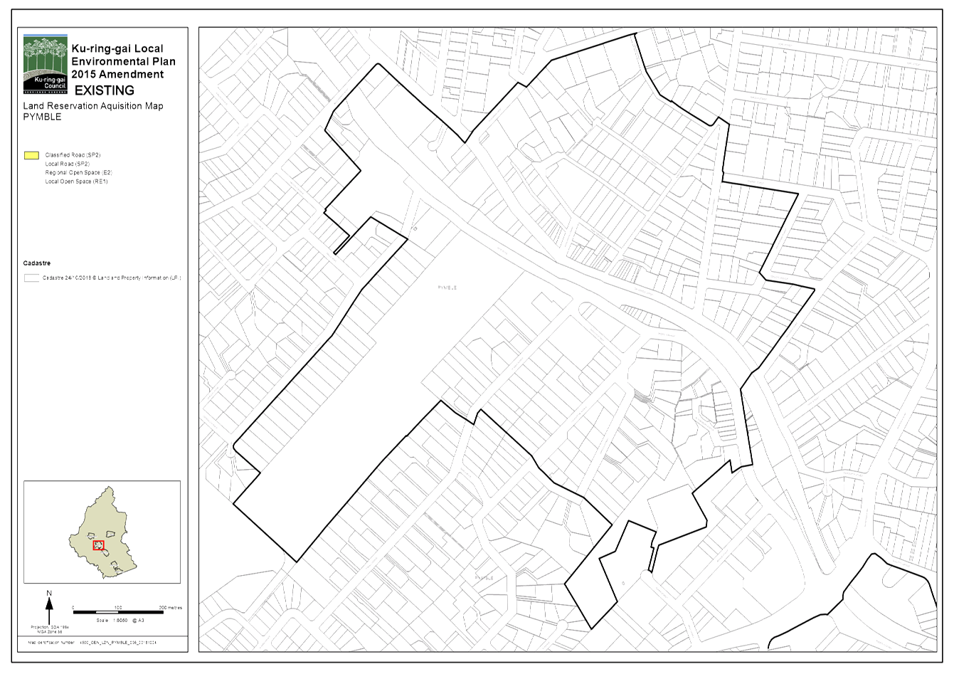
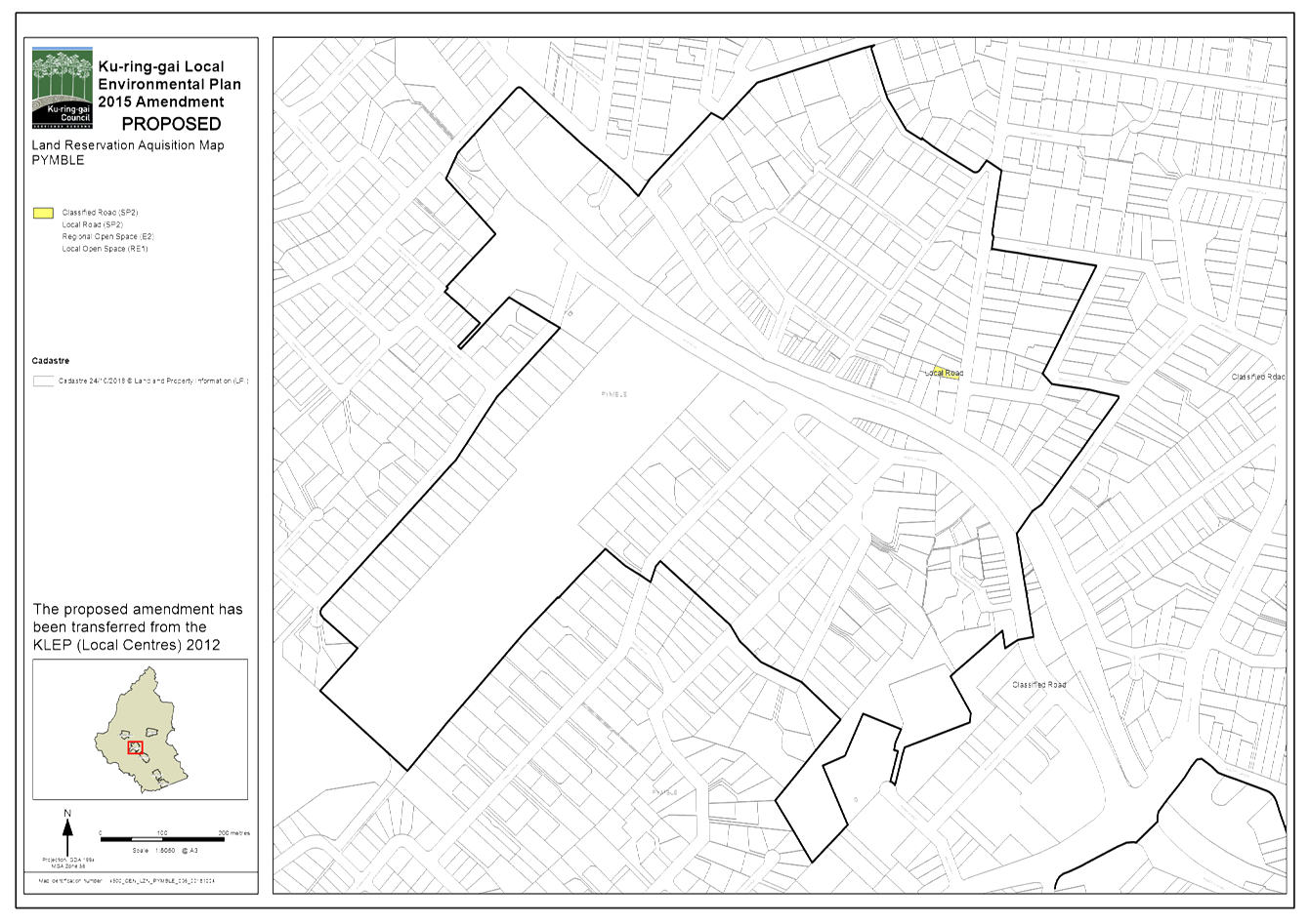
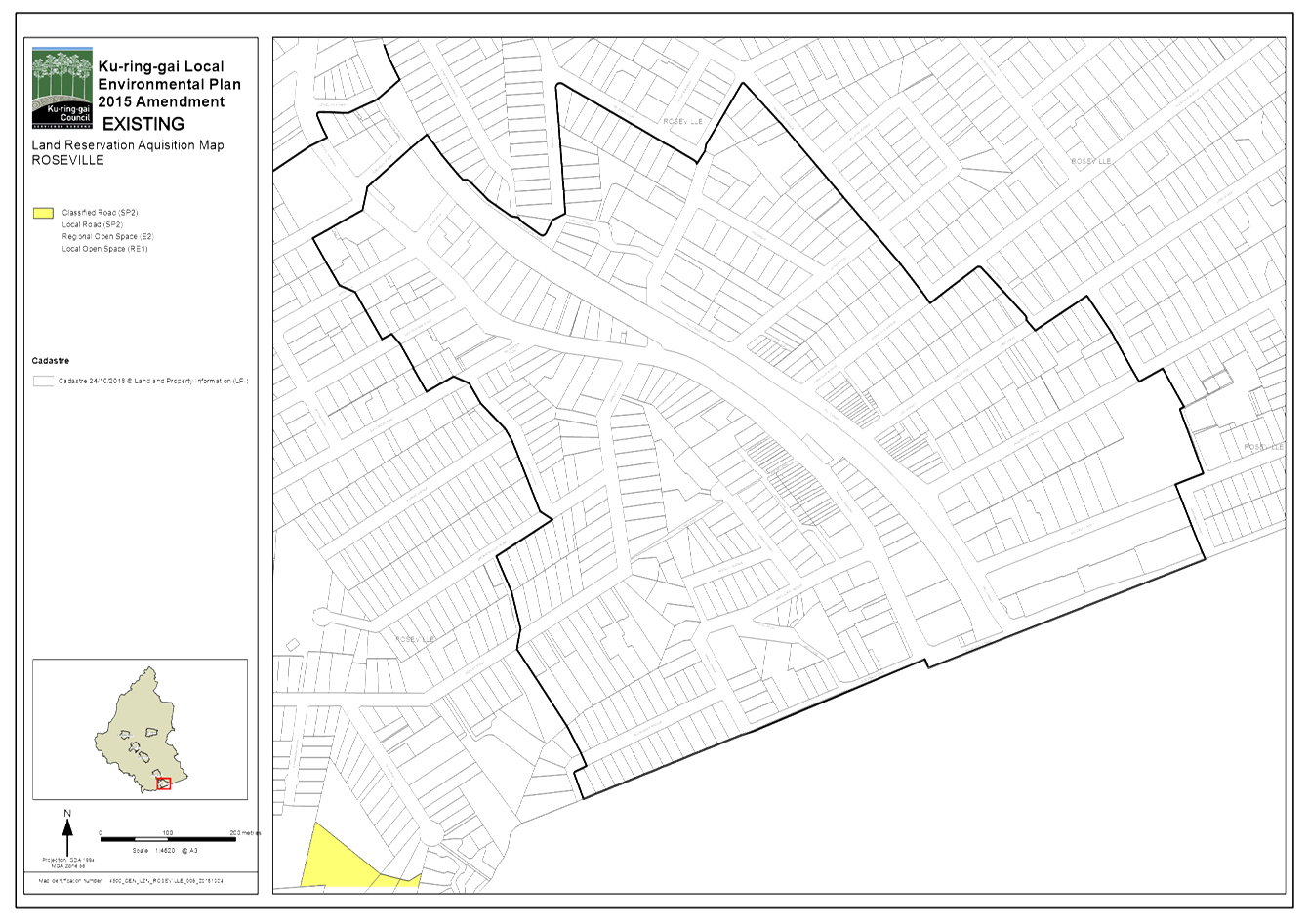
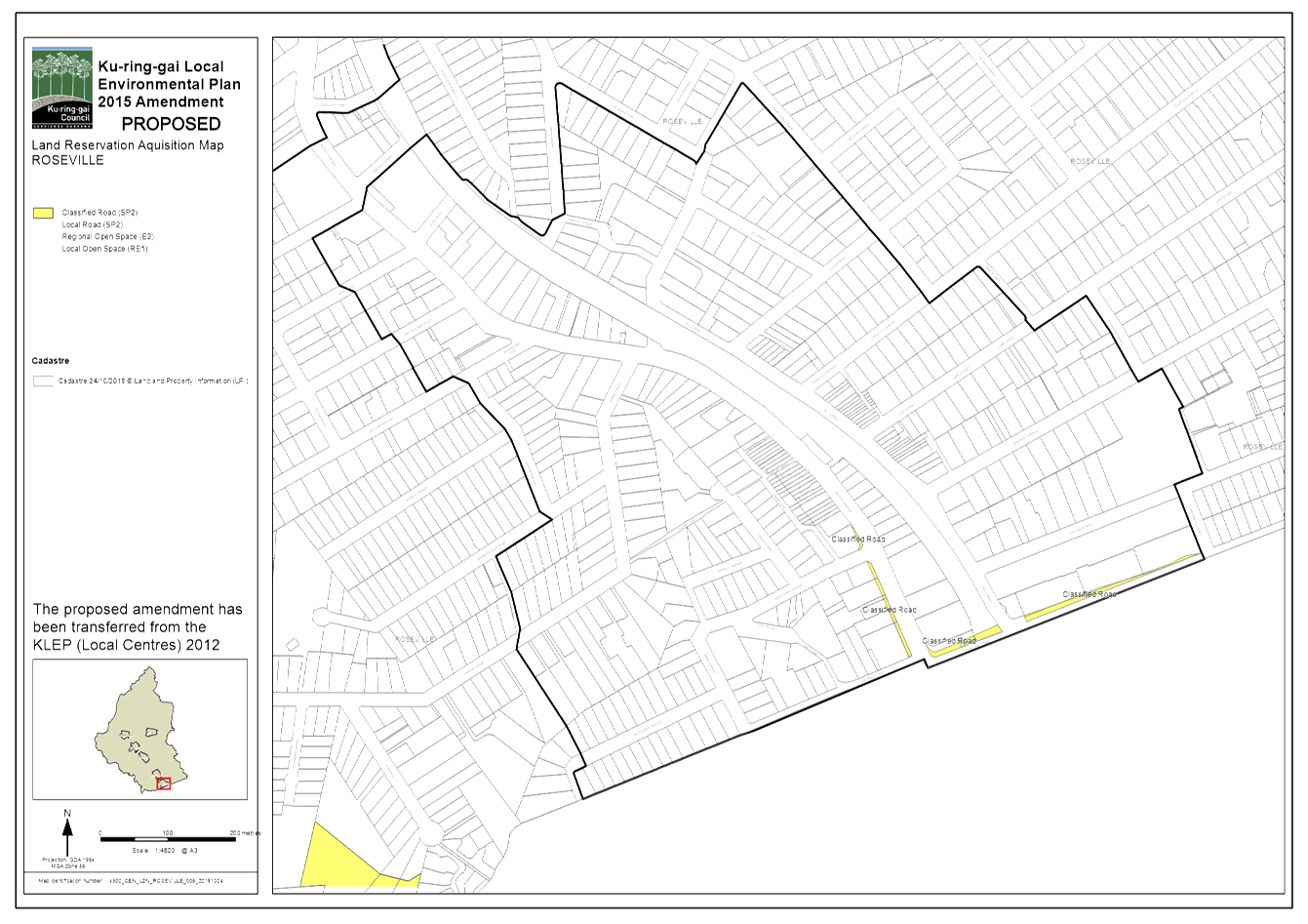
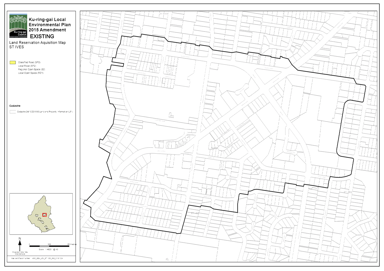
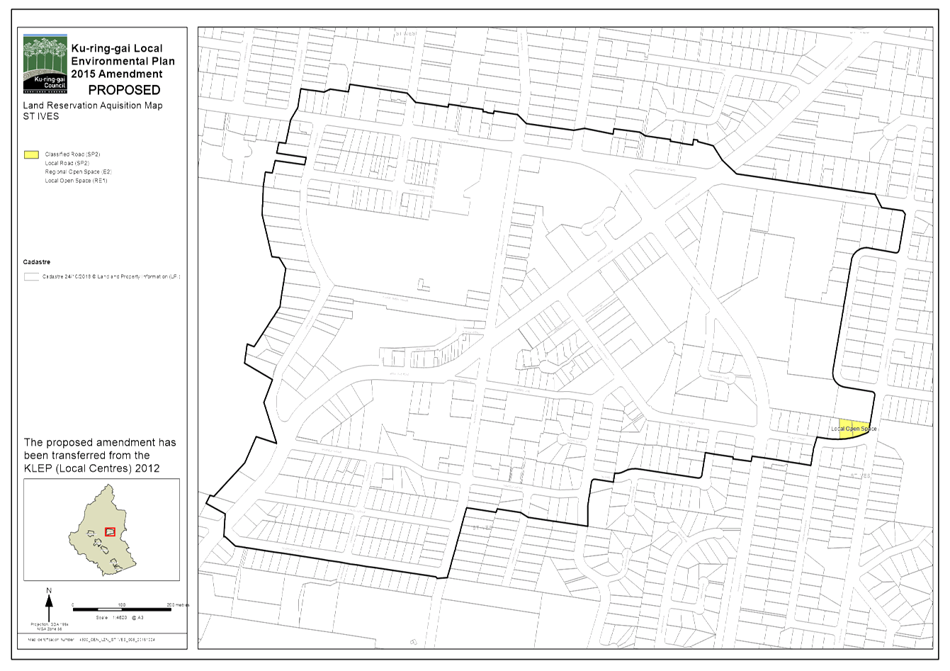
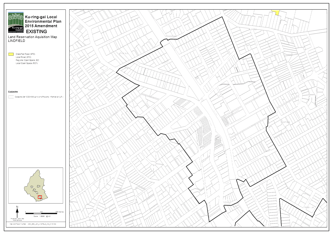
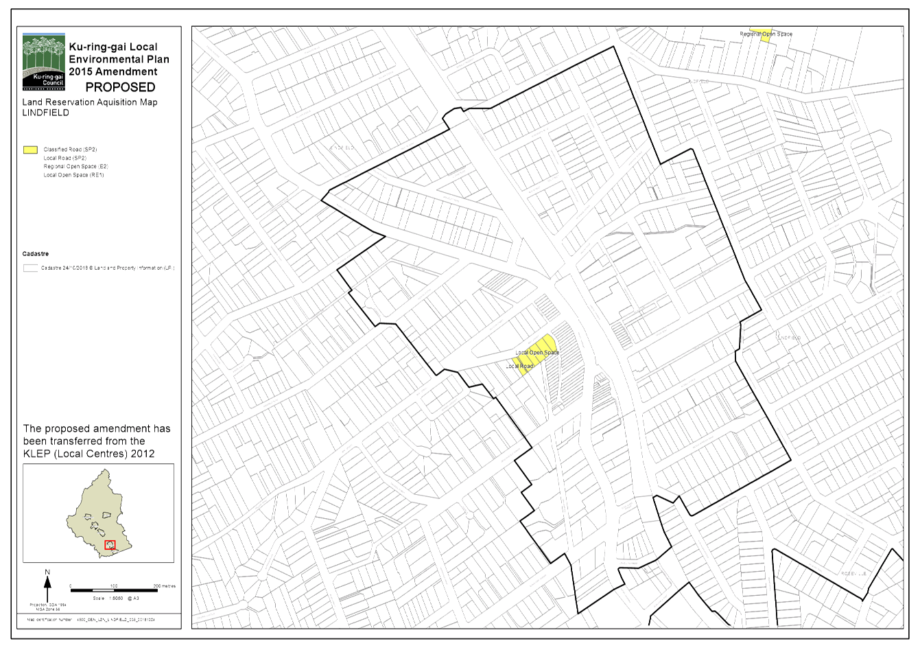
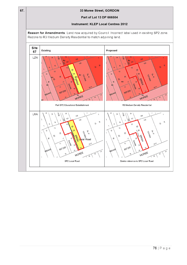
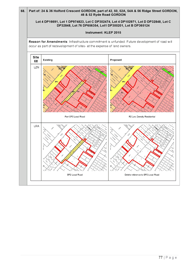
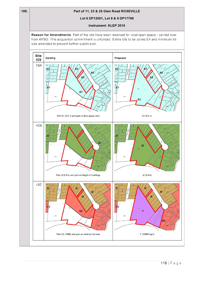
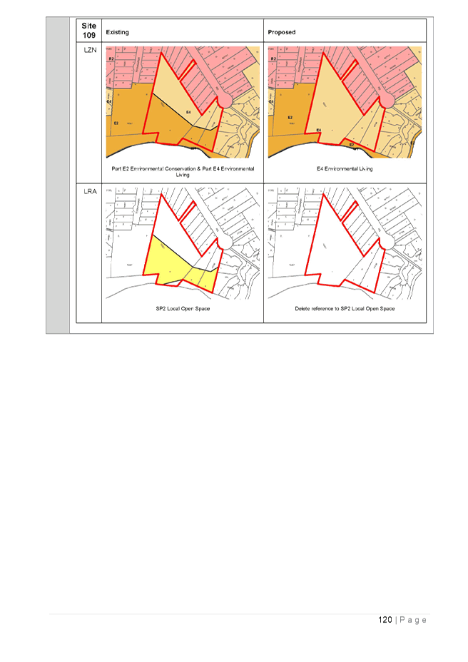
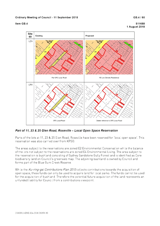
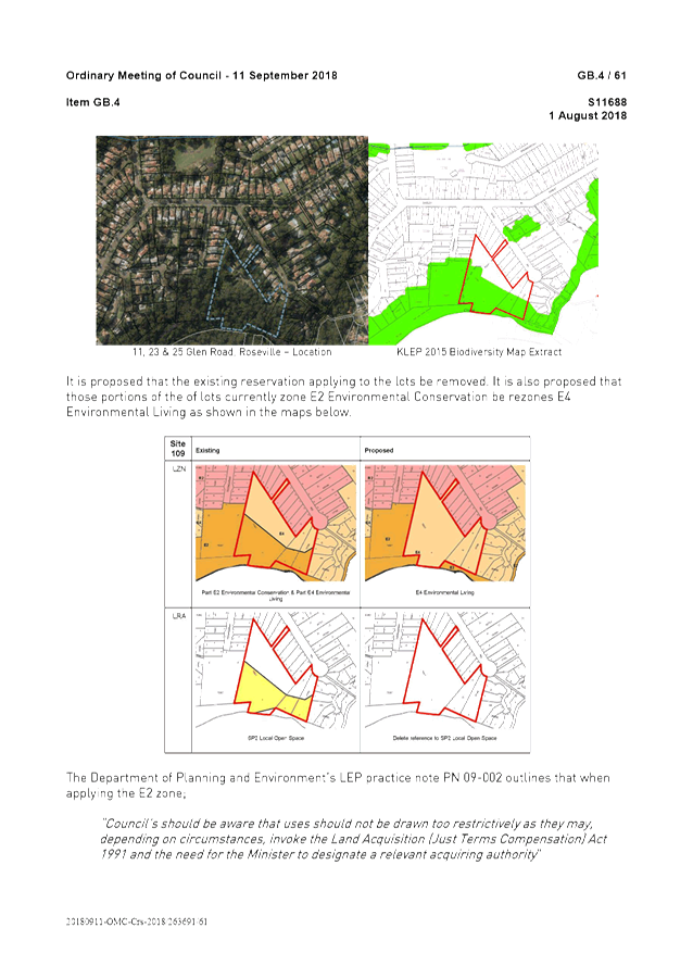
· Removing existing land reservations – the Planning Proposal seeks to remove a local road reservation in Holford Crescent, Gordon and a local open space reservation in Glen Road, Roseville as the acquisitions commitment represents an unfunded liability to Council. It is also proposed to remove a local road reservation from 33 Moree Street, Gordon as this land has now been acquired by Council.
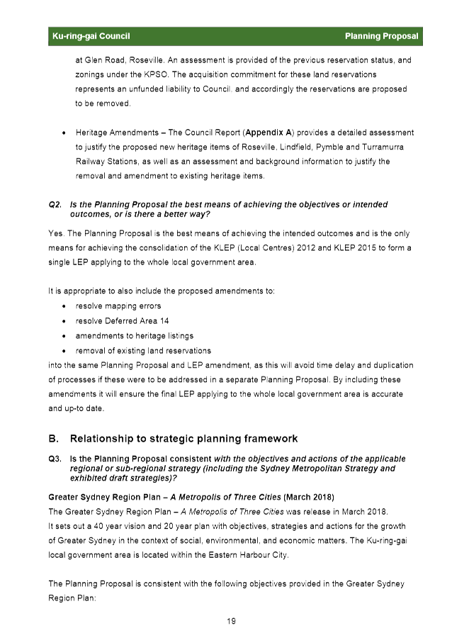
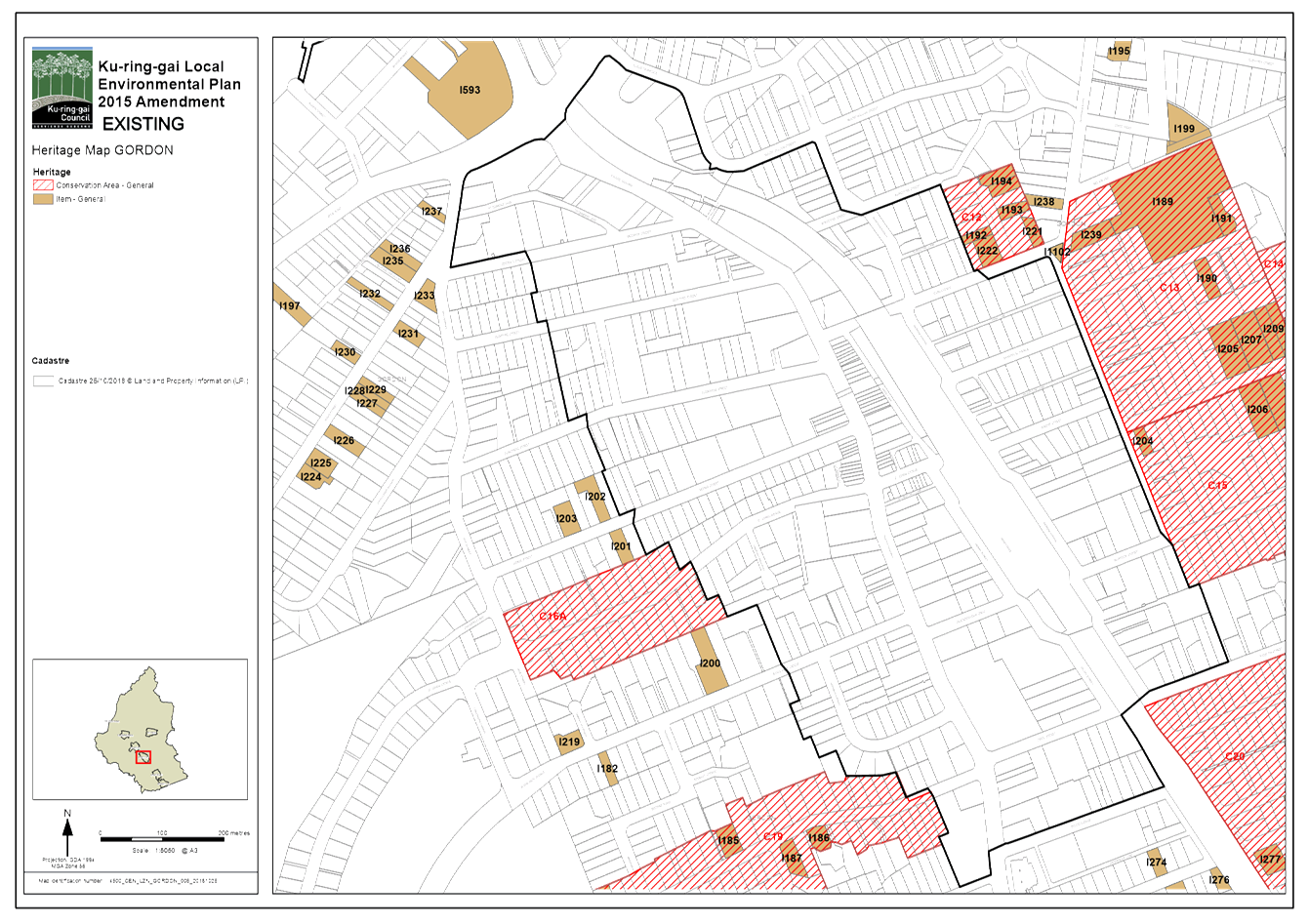
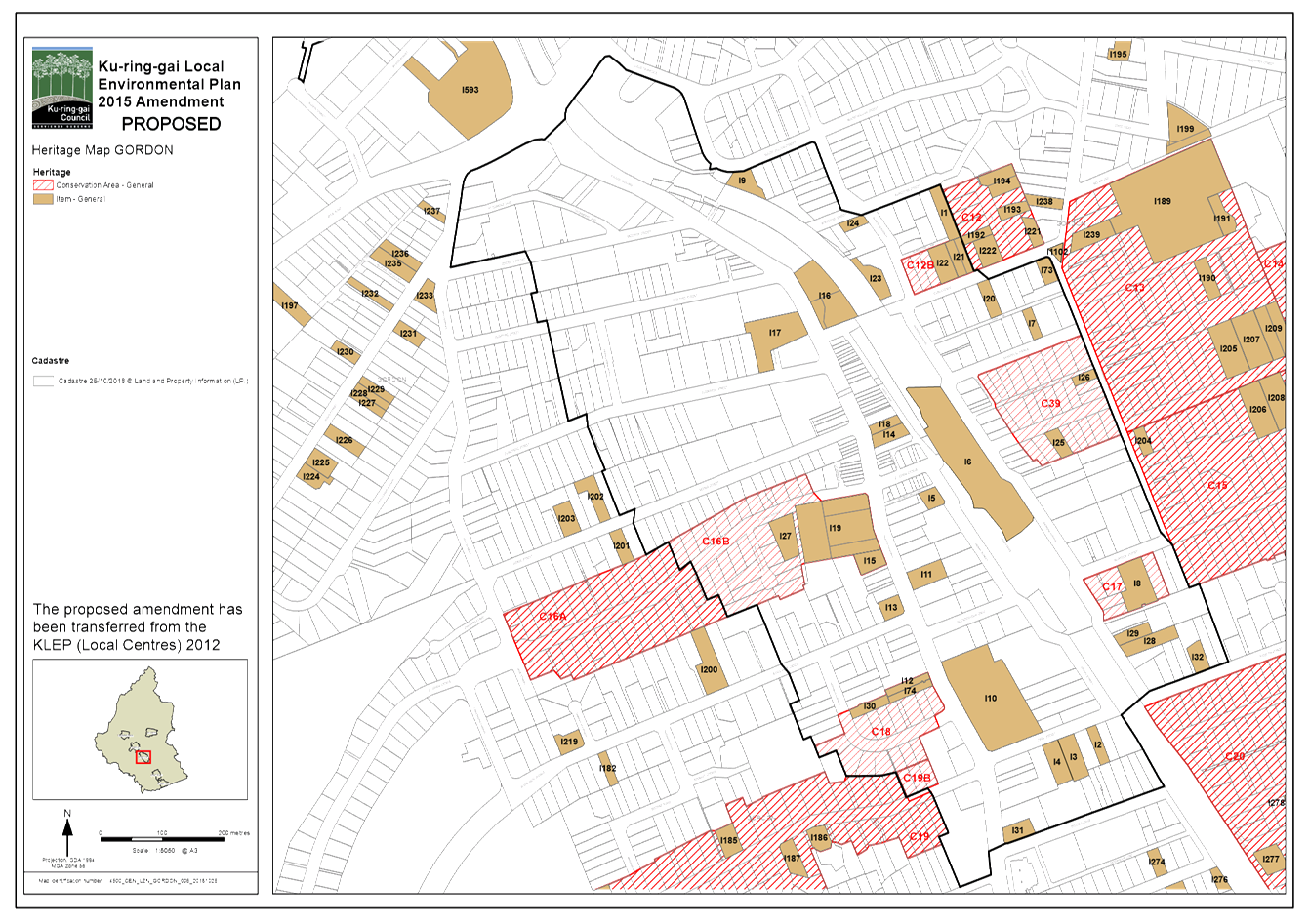
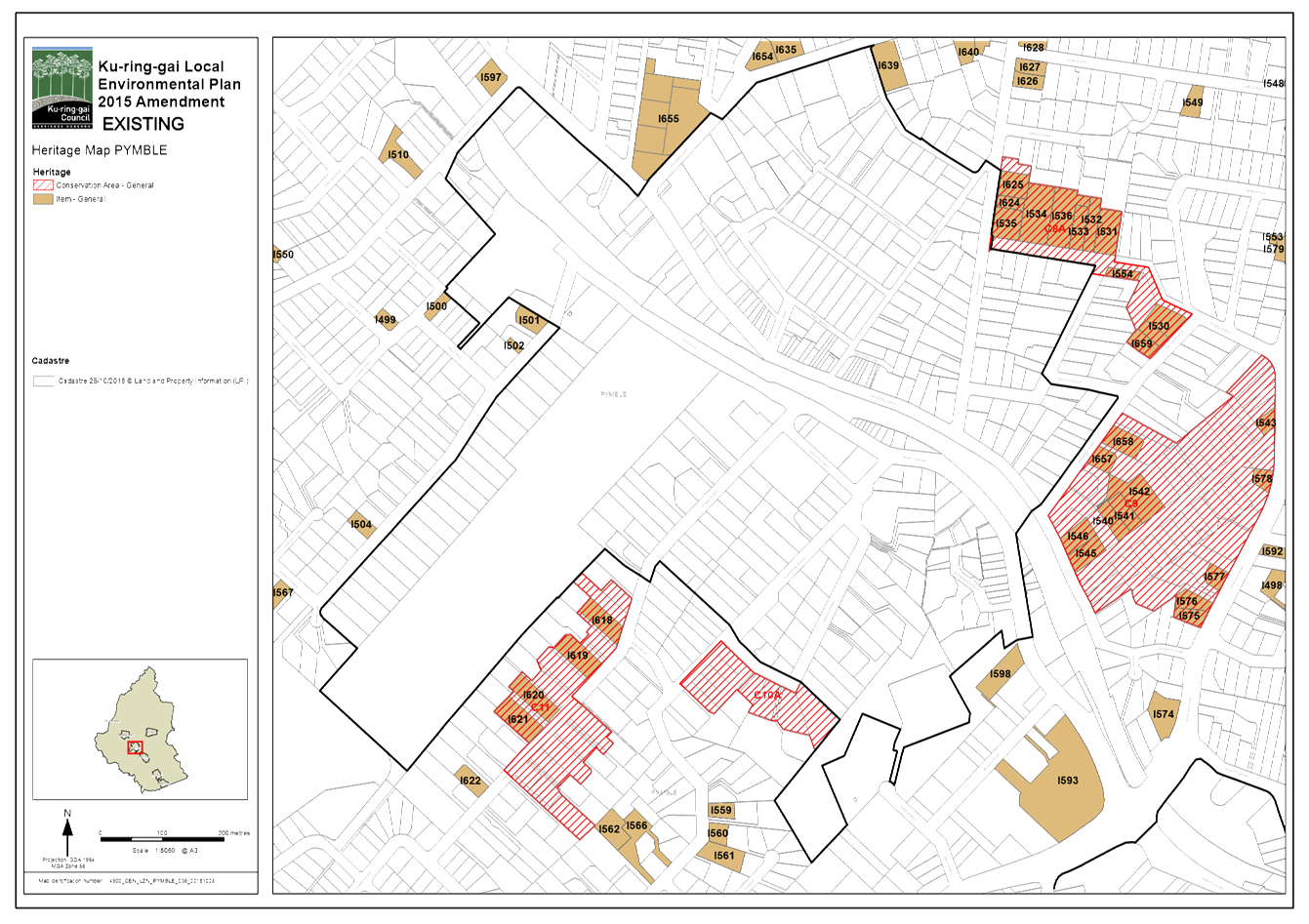
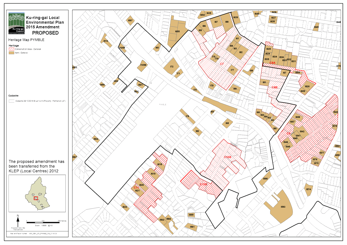
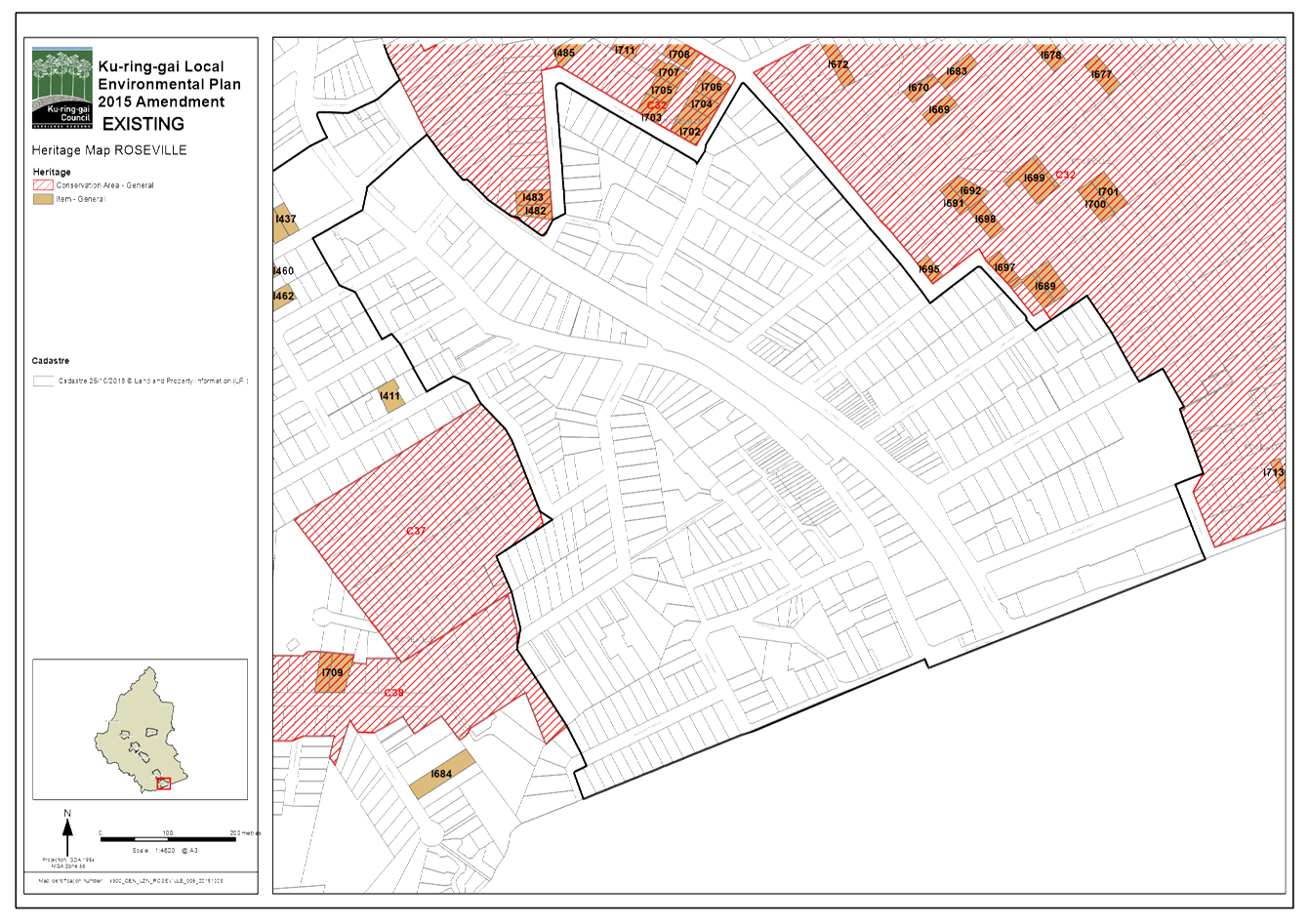
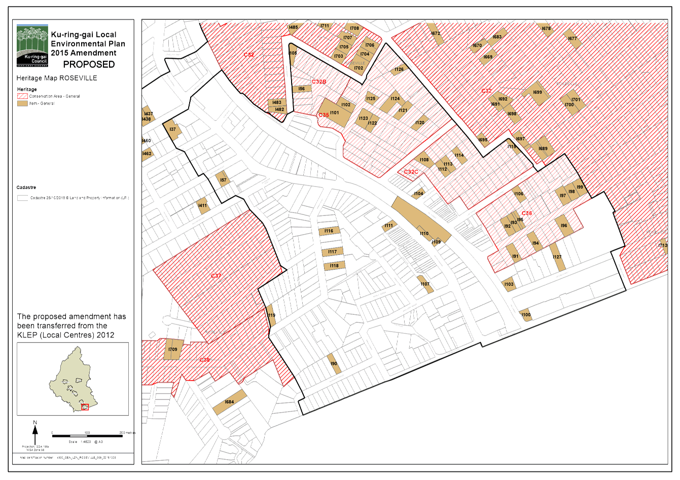
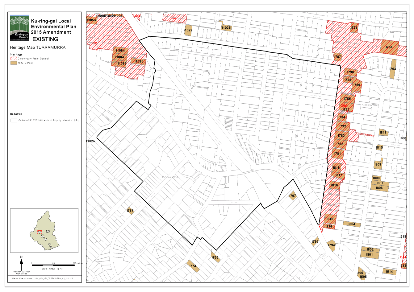
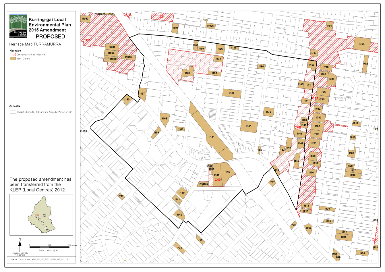
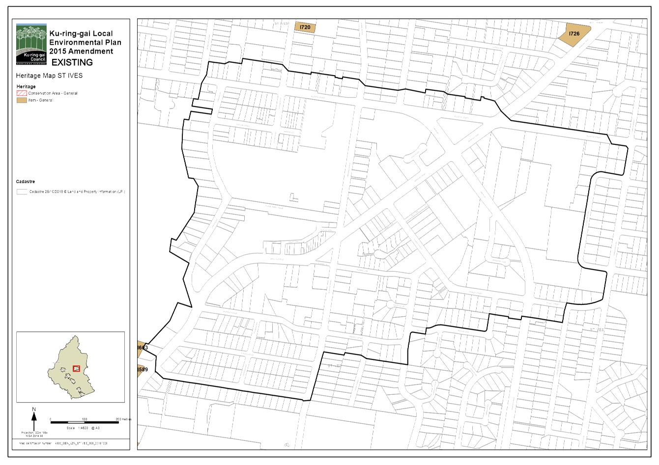
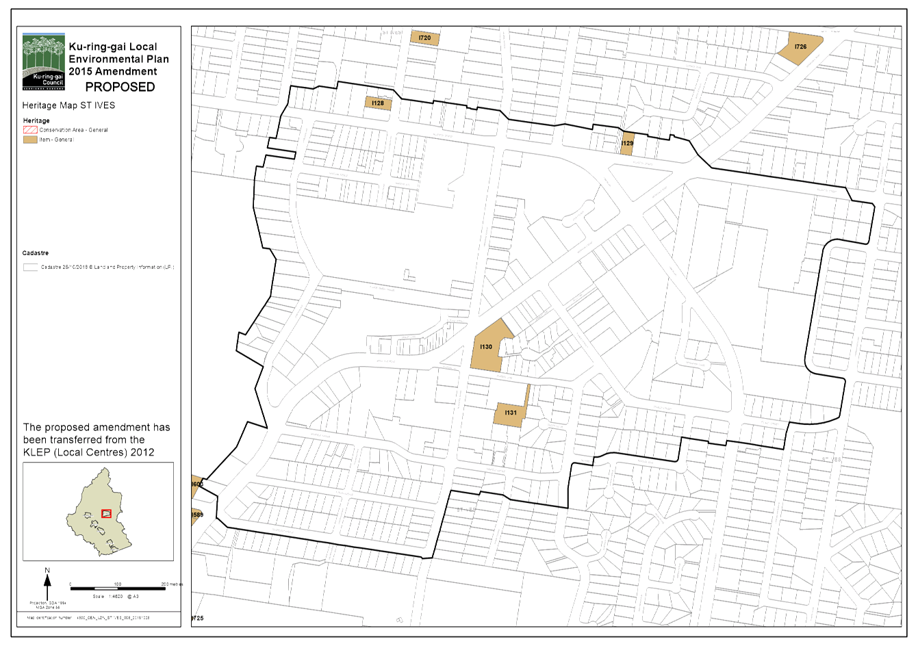
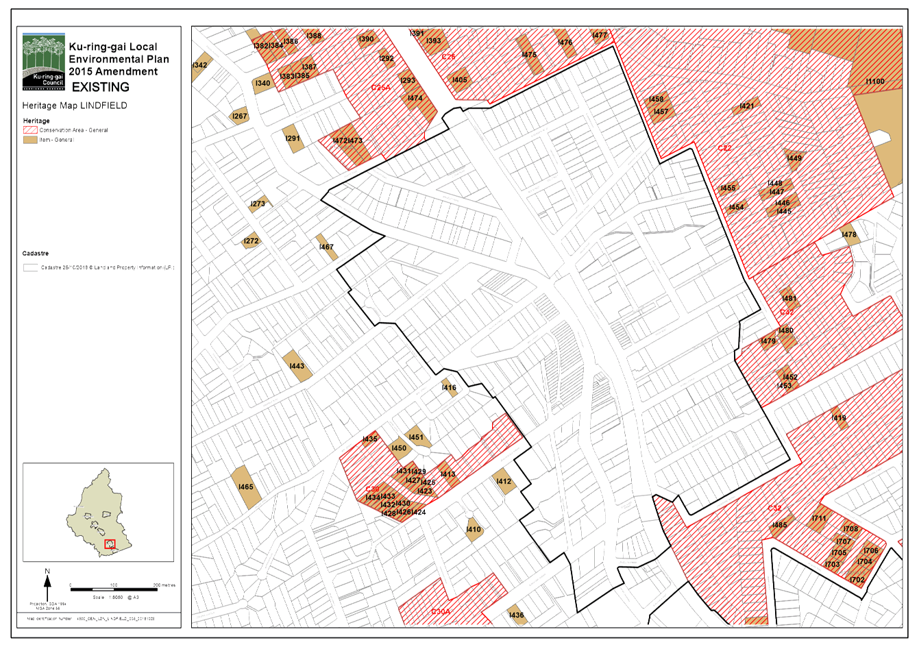
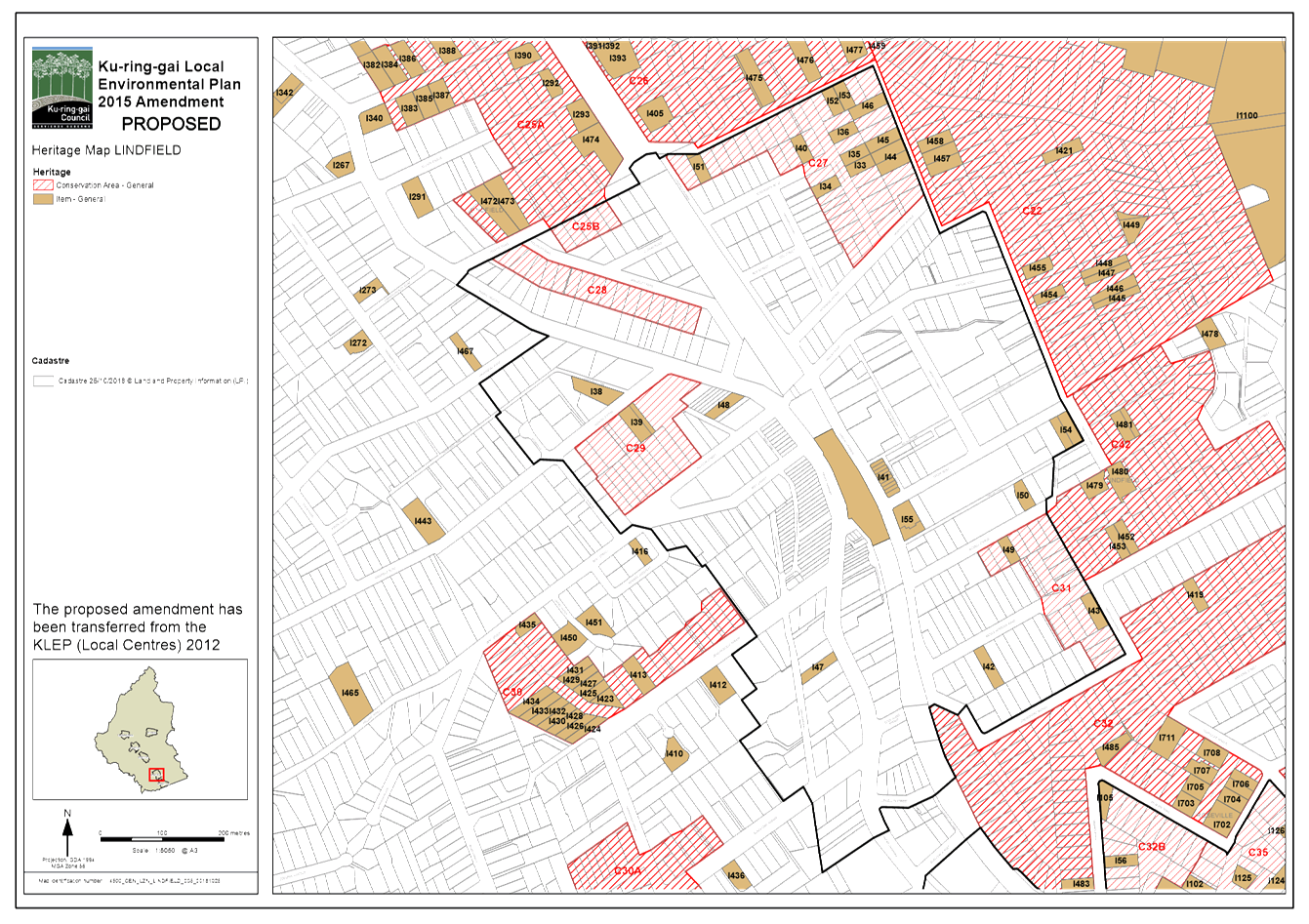
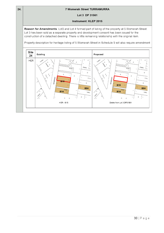
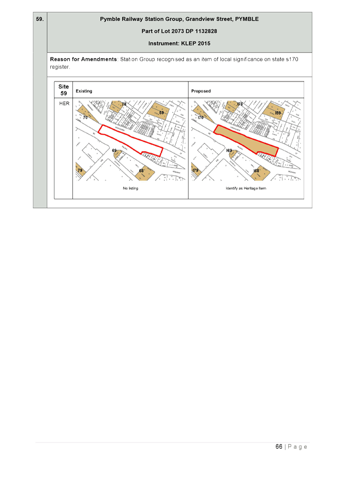
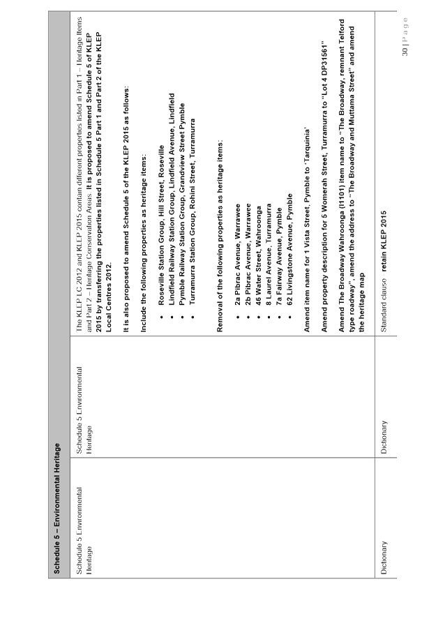
· Heritage amendments – the Planning Proposal seeks to:
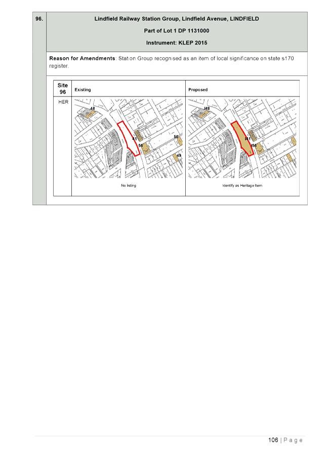
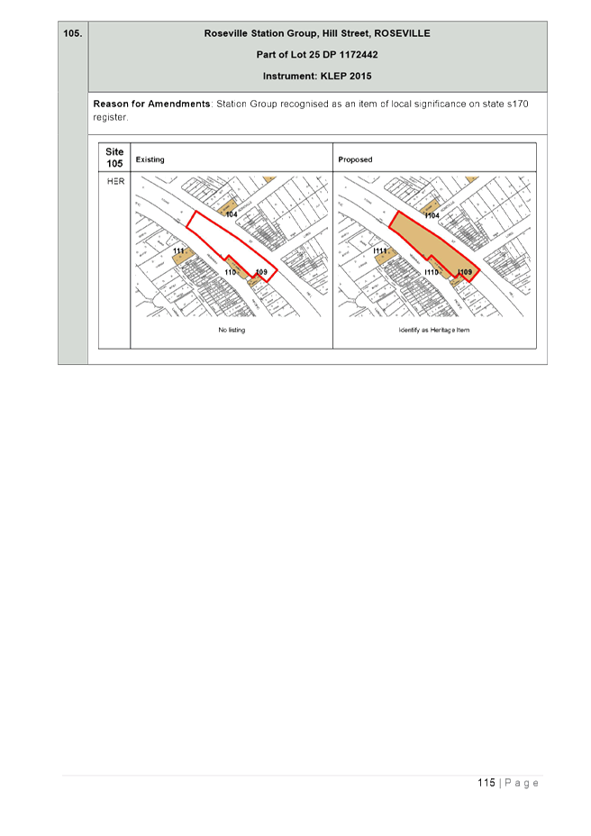
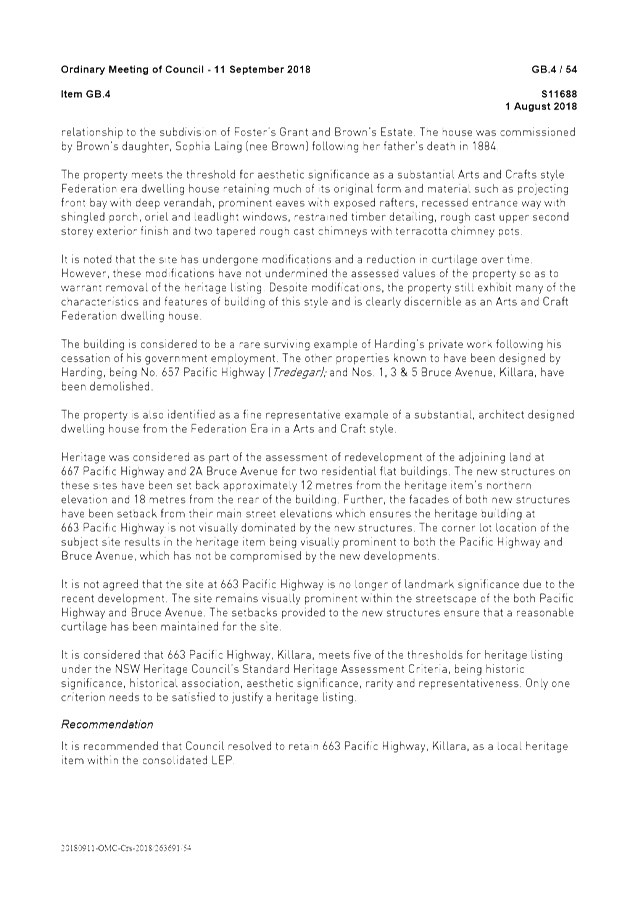
o Include new heritage listings for Turramurra, Lindfield, Pymble and Roseville train stations as local heritage items;
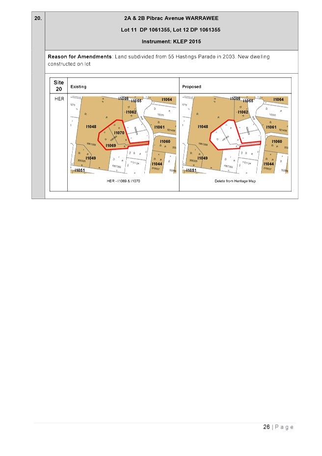
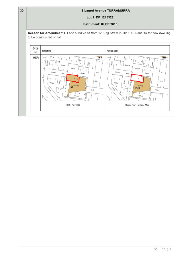
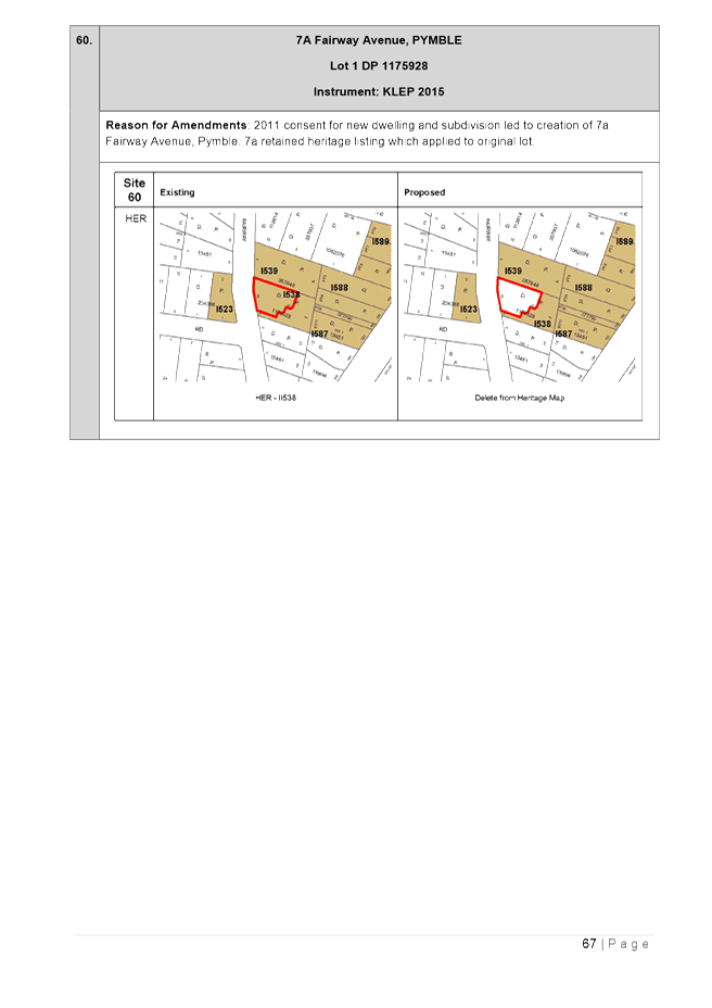
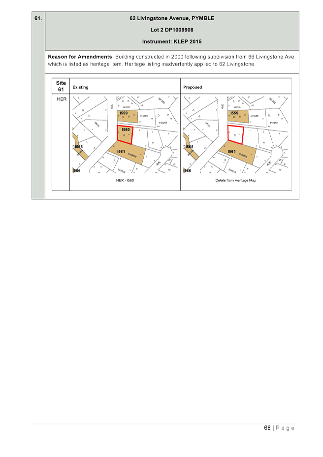
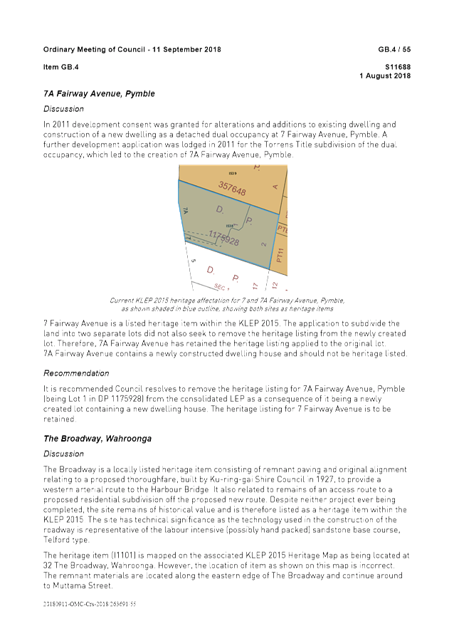
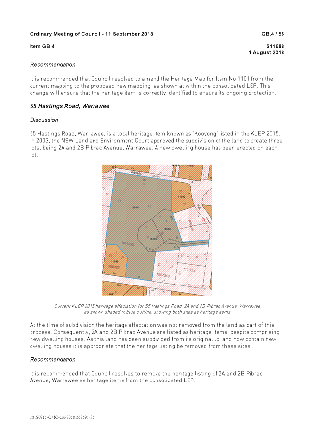
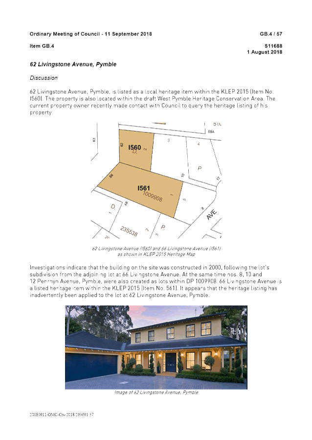
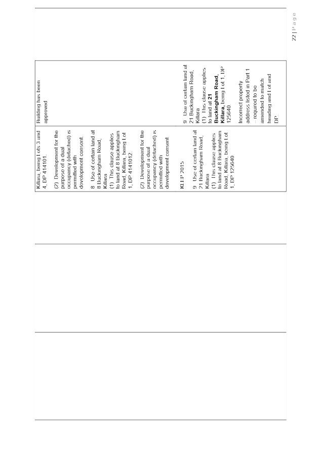
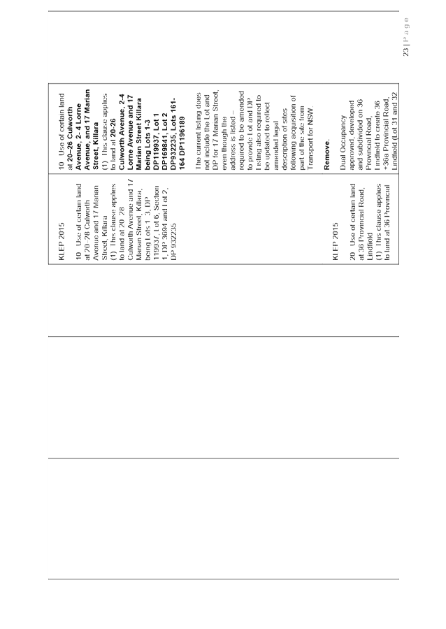
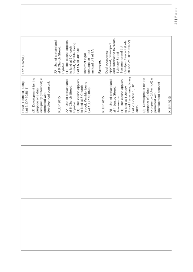
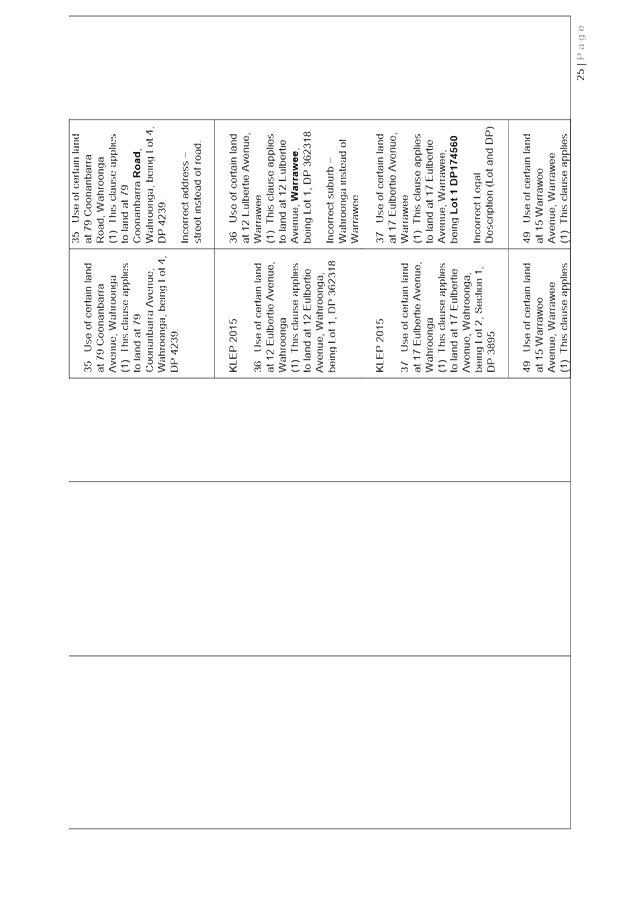
o removal or adjustment of heritage listings in cases where subdivision of existing heritage items have approved or new dwellings have been constructed on new lots;
o minor miscellaneous corrections to Schedule 5.
It is appropriate to include these additional amendments to resolve mapping errors, resolve Deferred Area 14, removal of land reservations and amendments to heritage listings into the same Planning Proposal as the consolidation of the LEPs as this will avoid time delay and duplication of processes, and by including these amendments it will ensure the final LEP applying to the whole local government area is accurate and up-to-date.
The Planning Proposal is included at Attachment A1. Appendix A – Council Meeting Report and Resolution OMC 11 September 2018 and Appendix B – Written Instrument Comparison Table of the Planning Proposal are included at Attachment A2 and Attachment A3 respectively.
Strategic Merit
The Planning Proposal is consistent with the following objectives from the Greater Sydney Region Plan – A Metropolis of Three Cities and the North District Plan:
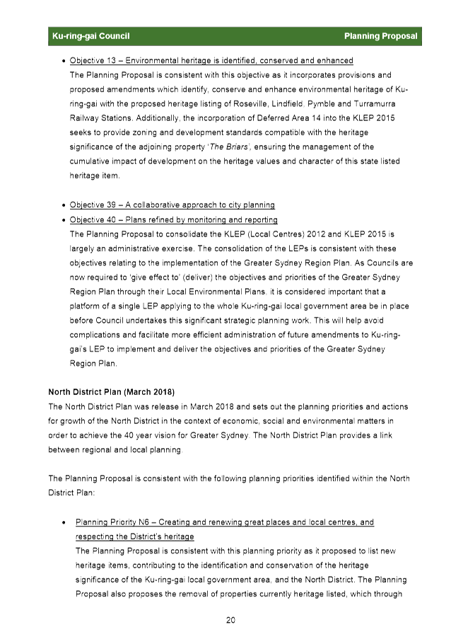
· Objective 13 - Environmental heritage is identified, conserved and enhanced (Greater Sydney Region Plan);
· Planning Priority N6 - Creating and renewing great places and local centres and respecting the Districts heritage (North District Plan).
The Planning Proposal includes provisions for new heritage listings of Turramurra, Pymble, Lindfield and Roseville rail stations leading to the protection and conservation of these locally significant places, and through the incorporation of Deferred Area 14 into the KLEP 2015 the Planning Proposal seeks to provide zoning and development standards that are compatible with the state heritage significance of the adjoining property ‘The Briars’ , ensuring the heritage significance is conserved and enhanced.
· Objective 39 – A collaborative approach to city planning (Greater Sydney Region Plan);
· Objective 40 – Plans refined by monitoring and reporting (Greater Sydney Region Plan);
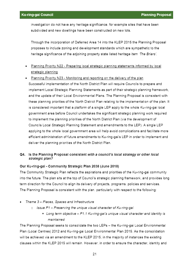
· Planning Priority N22 – Preparing local strategic planning statements informed by local strategic planning (North District Plan);
· Planning Priority N23 – Monitoring and reporting on the delivery of the plan (North District Plan).
The Planning Proposal is consistent with the objectives and planning priorities relating to the implementation of the Greater Sydney Region Plan and the North District Plan. As Councils are now required to ‘give effect to’ (deliver) the objectives and priorities of these strategic plans through their LEPs, it is considered important that a platform of a single LEP applying to the whole Ku-ring-gai local government area be in place before Council undertakes this significant strategic planning work. This will help avoid complications and facilitate more effective administration of future amendments to the LEP.
The Planning Proposal is consistent with the following objectives from Councils Community Strategic Plan 2038:
· Issue P1 – Preserving the unique visual character of Ku-ring-gai
o Long term objective – P1.1 Ku-ring-gai’s unique visual character and identity is maintained
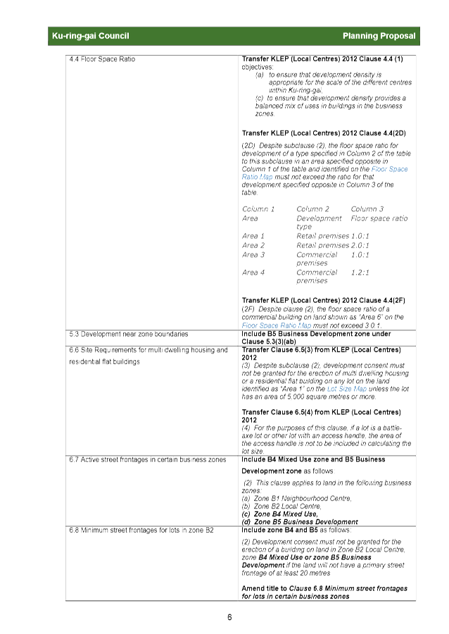
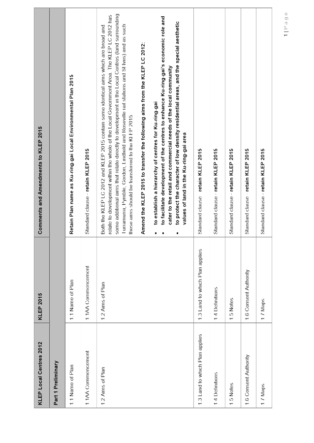
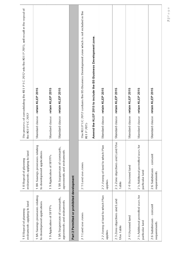
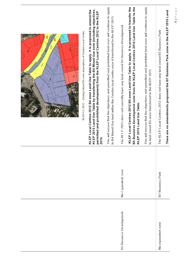
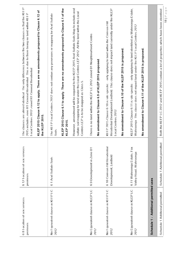
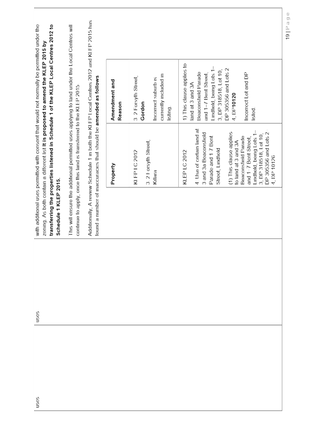
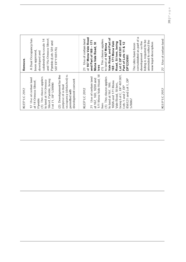
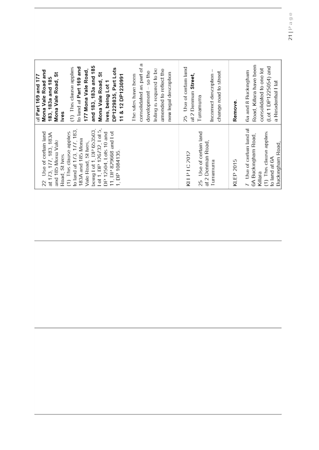
The Planning Proposal seeks to consolidate the KLEP (Local Centres) 2012 and KLEP 2015 to form a single LEP. As the consolidation will be achieved via an amendment to the KLEP 2015, in the majority of instances the existing clauses within the KLEP 2015 will remain. However, in order to ensure the character, identity and development outcomes within the local centres are retained, some specific provisions and clauses will be transferred into the KLEP 2015. Appendix B of the Planning Proposal contains a detailed comparison table of both LEP written instruments. The table details how any differences between the clauses will be resolved.
· Issue P2 – Managing Urban Change
o Long term objective – P2.1 A robust planning framework is in place to deliver quality design outcomes and maintain the identity and character of Ku-ring-gai
The consolidation of the LEPs will result in a single LEP applying to the local government area, which will assist in reducing the complexity of the local planning system. As part of the process of merging the two LEPs, identified errors and inconsistencies between the two plans will be removed. The consolidation of the LEPs will ensure a robust local planning framework is in place to maintain the identity of Ku-ring-gai, and form a basis for the delivery of the North District Plan and Greater Sydney Region Plan.
· Issue P5 – Heritage that is protected and responsibly managed
o Long term objective – P5.1 Ku-ring-gai’s heritage is protected, promoted and responsibly managed
The Planning Proposal seeks to ensure that Ku-ring-gai’s heritage is protected, through the listing of Roseville, Lindfield, Pymble and Turramurra railways stations. The Planning Proposal also seeks to ensure that Ku-ring-gai’s heritage is responsibly managed, through the removal of heritage listings from properties where it has been identified that there is no heritage significance, for example in cases where subdivisions of existing heritage items have been approved and new dwellings have been constructed on the new lots.
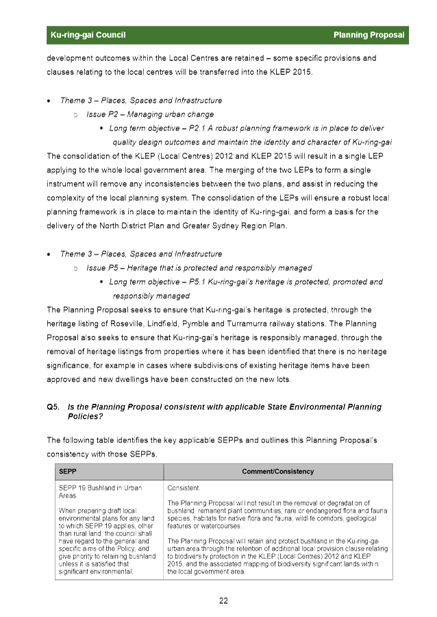
The Planning Proposal has addressed the following relevant Section 9.1 Ministerial Directions:
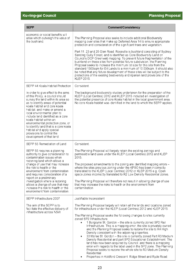
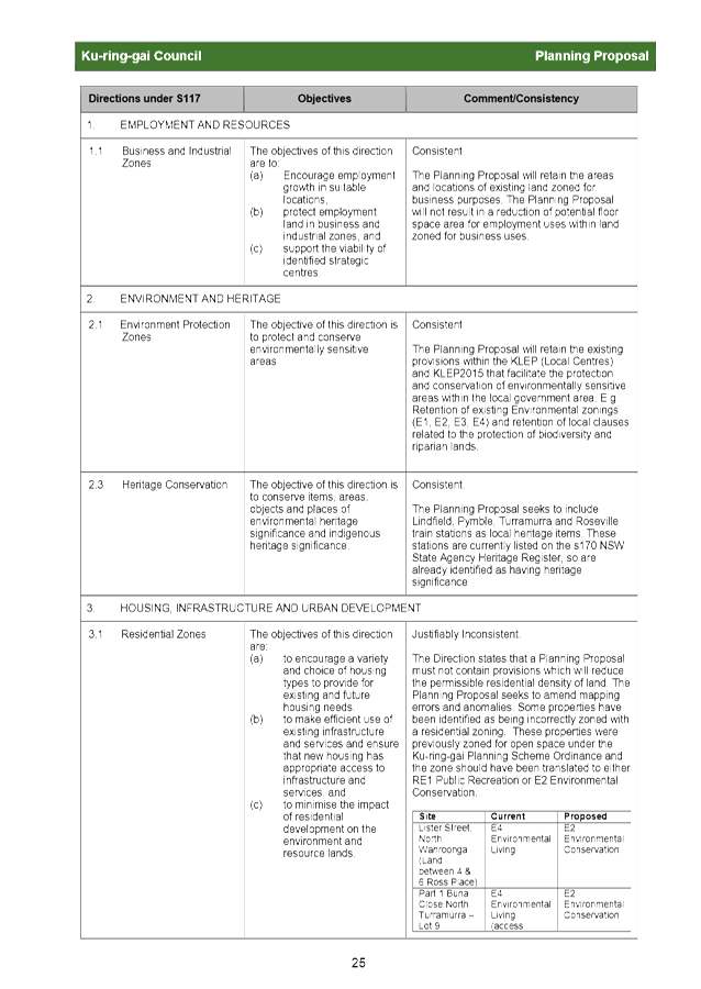
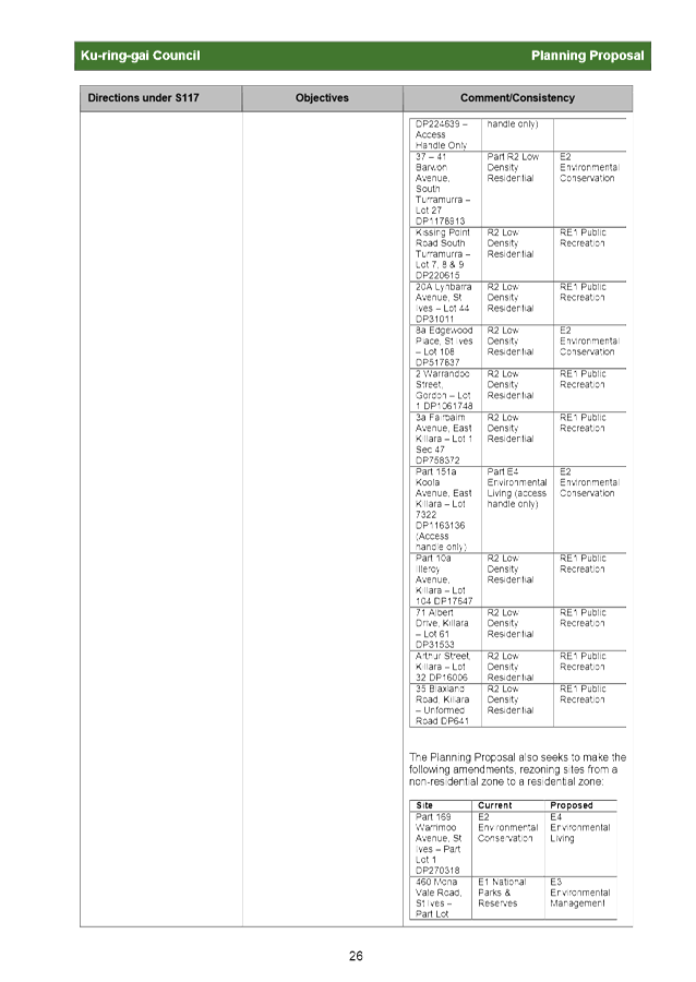
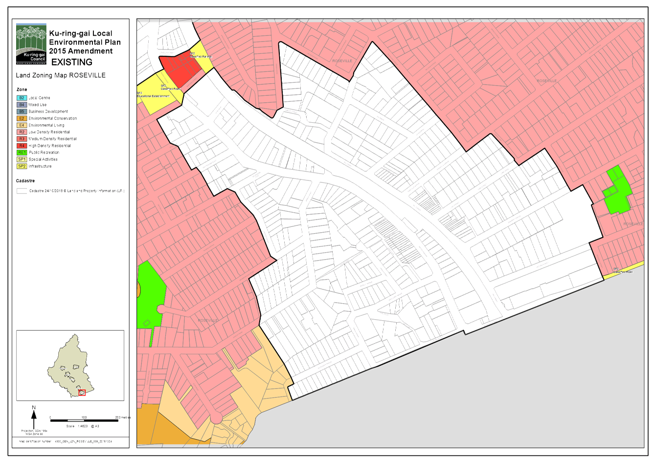
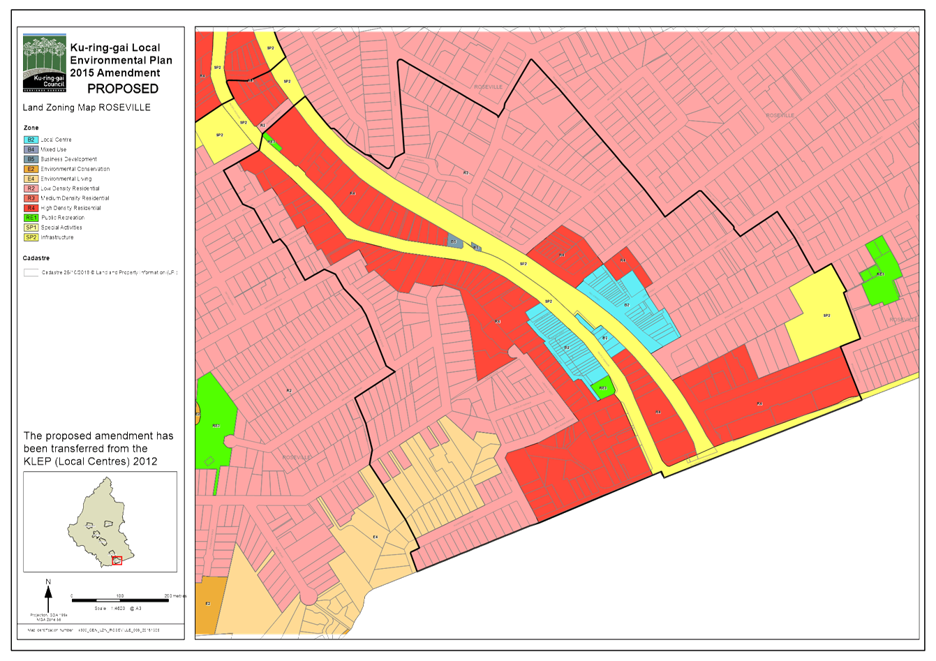
· 3.1 Residential zones – The Planning Proposal has justified the inconsistency this direction which states that a Planning Proposal must not contain provisions which reduce the permissible residential density of land. The Planning Proposal includes the correction of mapping errors, which include some properties that have been incorrectly zoned with a residential zoning. These properties were previously zoned for open space under the Ku‑ring-gai Planning Scheme Ordinance, and the zone should be either translated to RE1 Public Recreation or E2 Environmental Conservation.
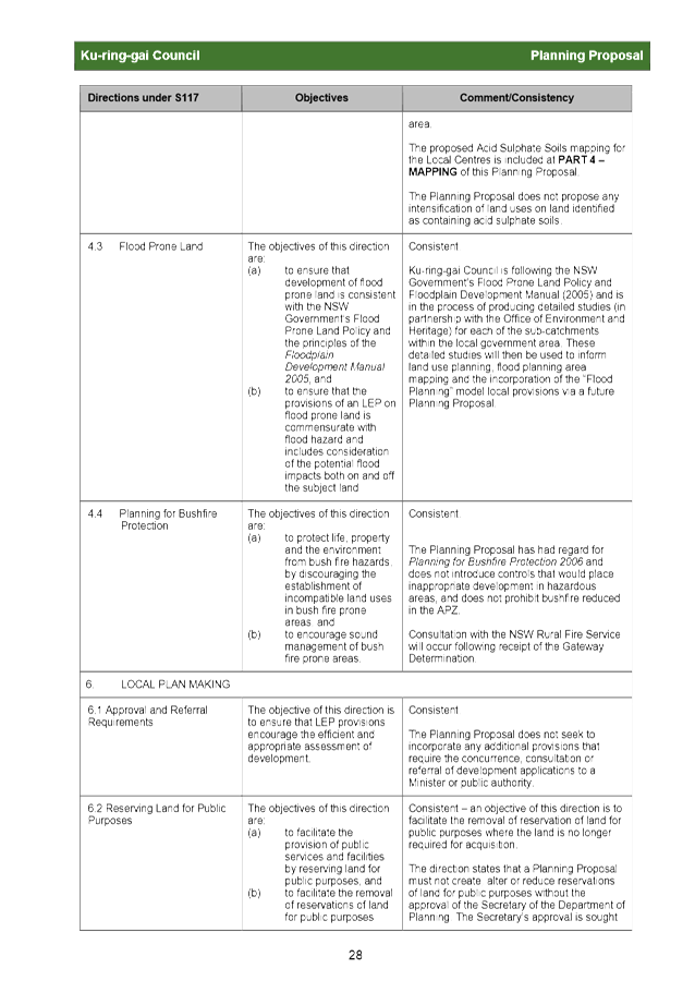
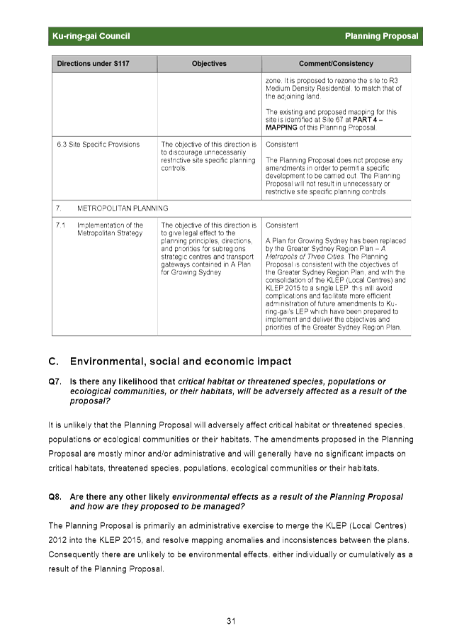
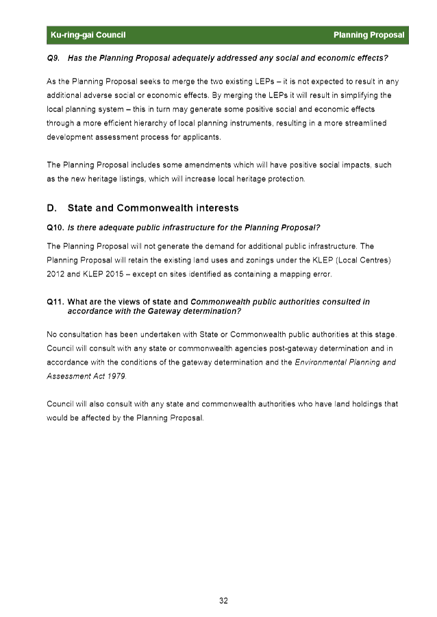
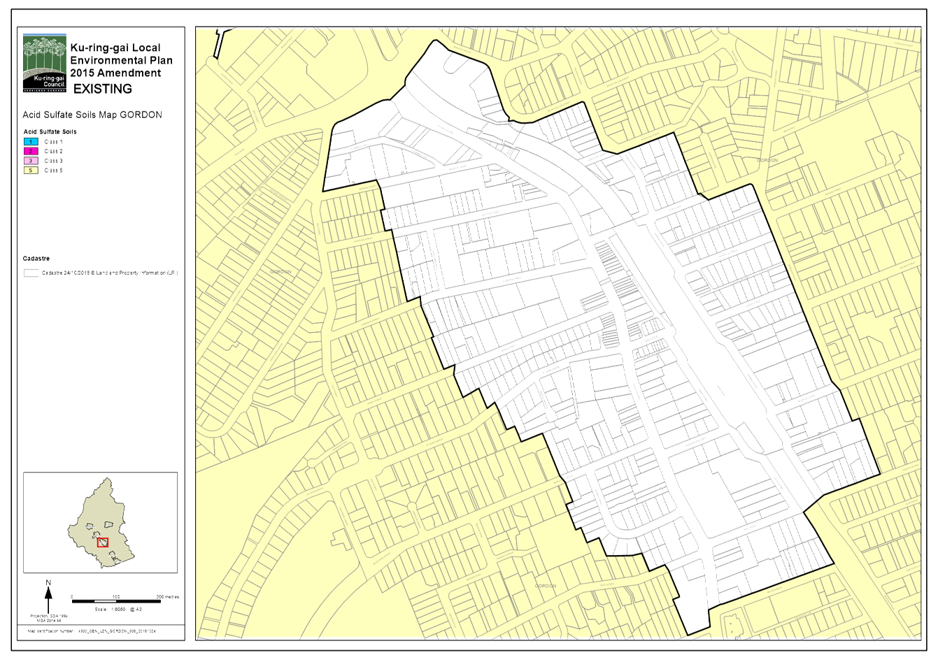
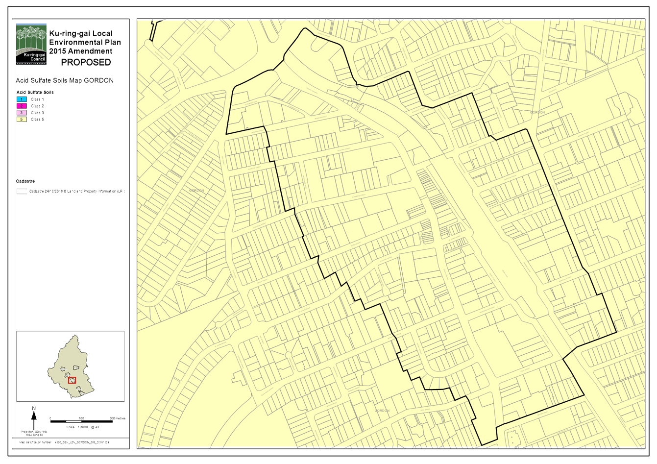
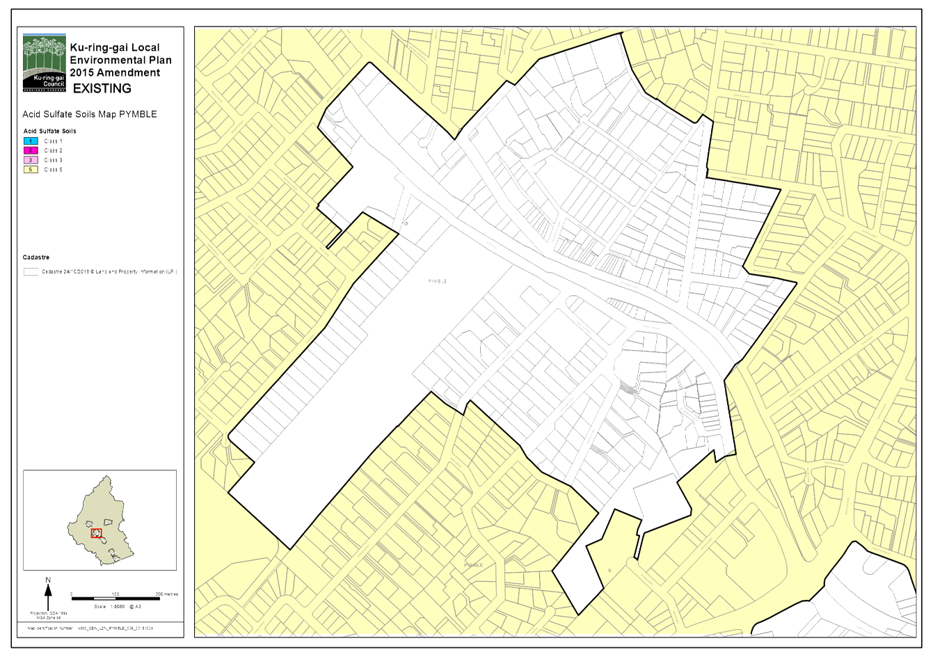
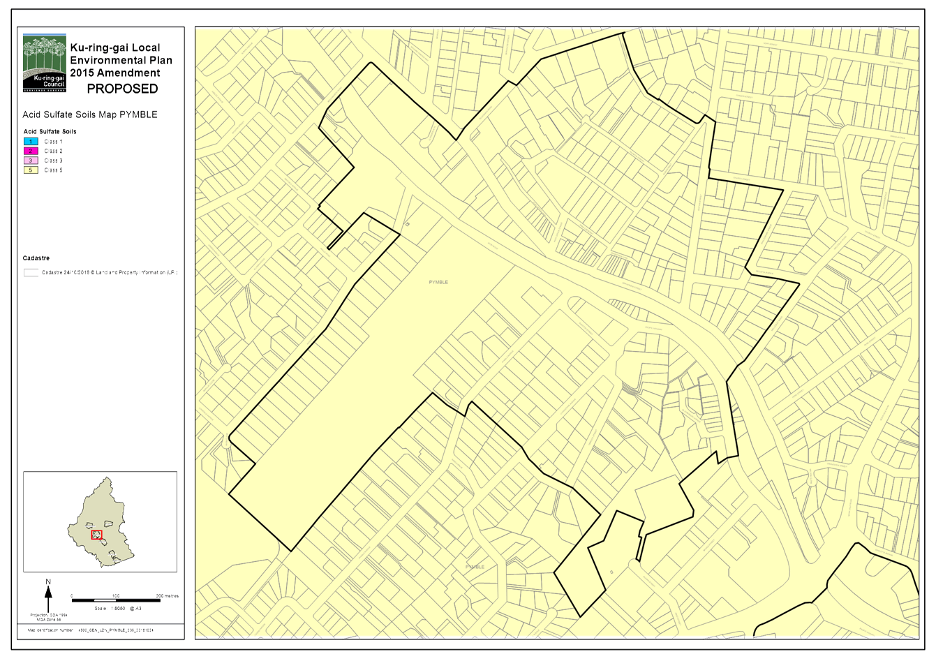
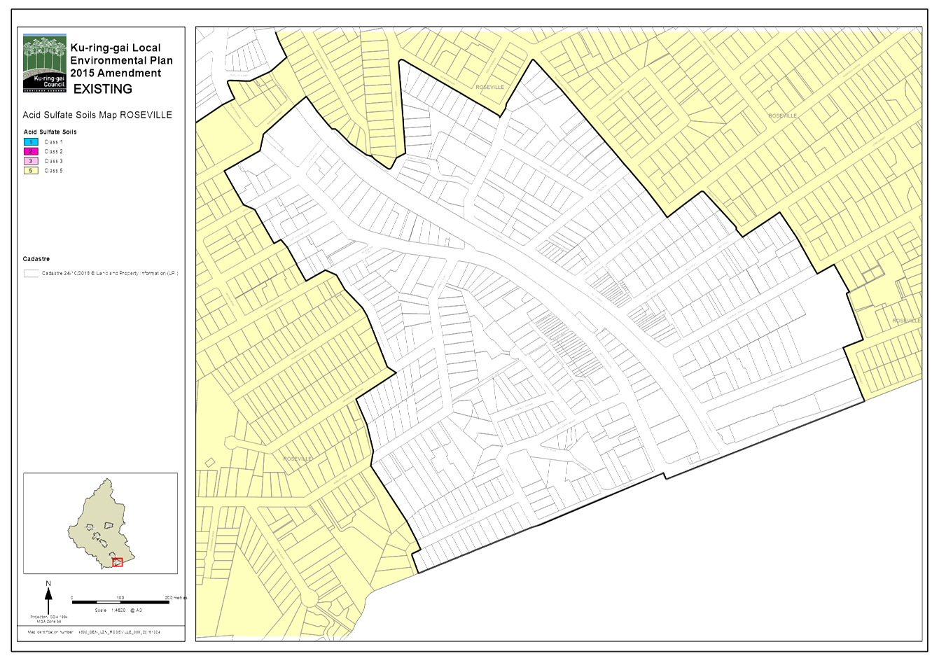
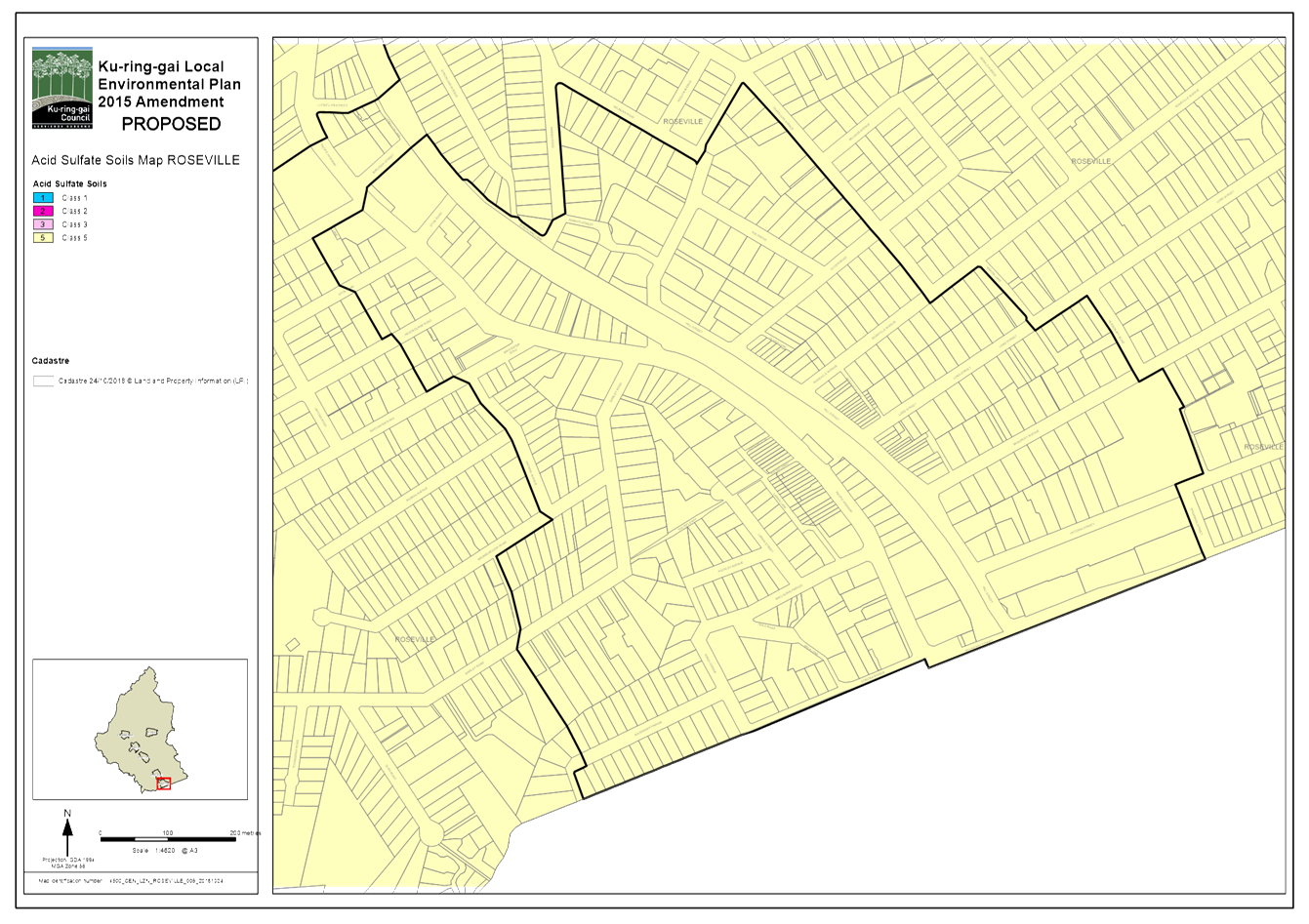
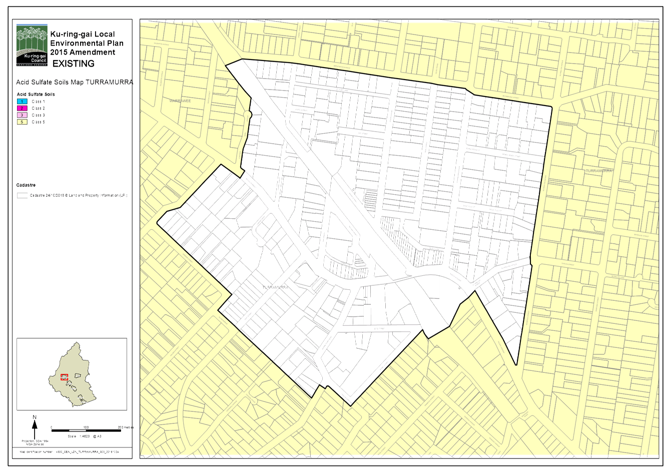
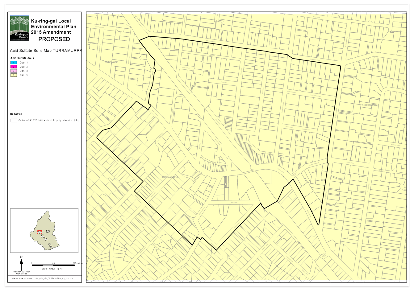
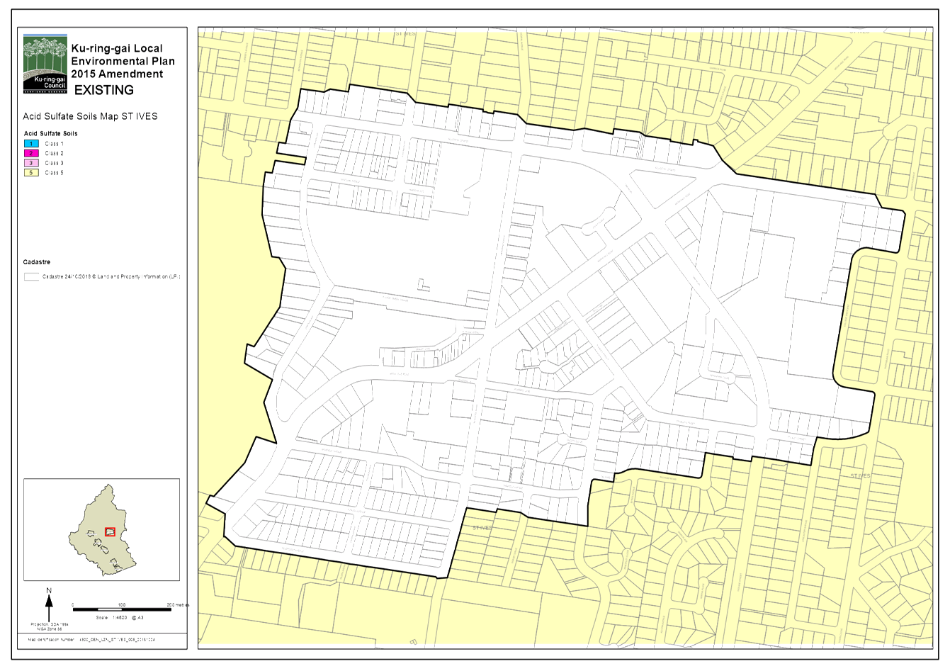
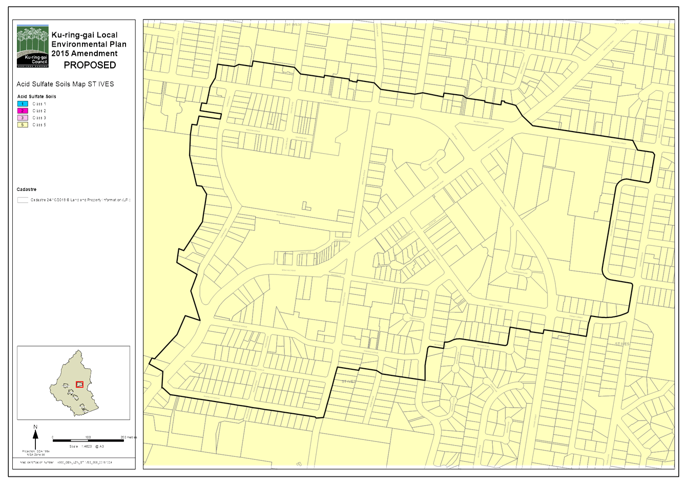
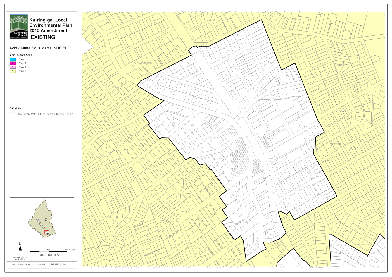
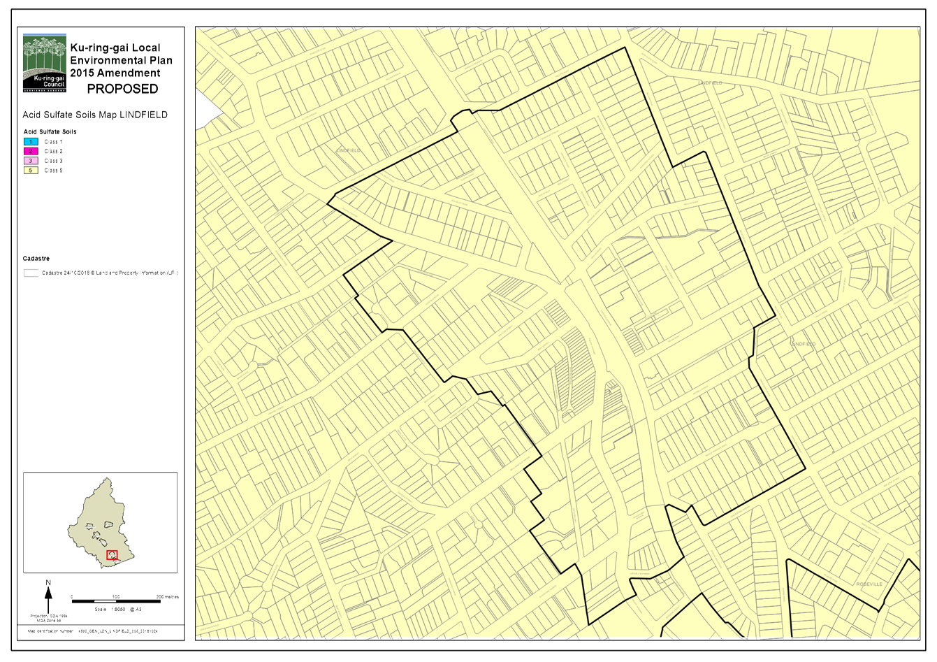
· 4.1 Acid Sulphate Soils – The existing acid sulphate soils mapping and clause will be retained within the KLEP 2015. Currently, the KLEP (Local Centres) 2012 does not contain any provisions or mapping of acid sulphate soils. The Planning Proposal includes acid sulphate soil mapping for the local centres areas, which will result in a complete acid sulphate soils map for the whole local government area.
· 6.2 Reserving land for public purposes – The Planning Proposal is consistent with the objectives of this direction which is to facilitate the removal of reservations of land for public purposes where the land is no longer required for acquisition. The Planning Proposal seeks to remove a local road reservation in Holford Crescent, Gordon and a local open space reservation in Glen Road, Roseville as the acquisition commitment represents an unfunded liability to Council. The Planning Proposal also seeks to remove the local road reservation from 33 Moree Street, Gordon as the land has now been acquired by Council.
integrated planning and reporting
Theme 3 – Places, Spaces and Infrastructure
|
Community Strategic Plan Long Term Objective |
Delivery Program Term Achievement |
Operational Plan Task |
|
P1.1 Ku-ring-gai’s unique visual character and identity is maintained |
P1.1.1 Strategies, plans and processes are in place to protect and enhance Ku-ring-gai’s unique visual and landscape character |
P1.1.1.1 Continue to review the effectiveness of existing strategies, plans and processes across all programs |
|
P2.1 A robust planning framework is in place to deliver quality design outcomes and maintain the identity and character of Ku-ring-gai |
P2.1.1 Land use strategies, plans and processes are in place to effectively manage the impact of new development |
P2.1.1.2 Continue to review the effectiveness of existing strategies, local environmental plans, development control plans and processes across all programs |
|
P5.1 Ku-ring-gai’s heritage is protected, promoted and responsibly managed |
P5.1.1 Strategies, plans and processes are in place to effectively protect and preserve Ku-ring-gai’s heritage assets |
P5.1.1.1 Implement, monitor and review Ku-ring-gai’s heritage planning controls |
Governance Matters
The process for the preparation and implementation of Planning Proposals is governed by the provisions contained in the Environmental Planning and Assessment Act 1979 and the Environmental Planning and Assessment Regulation 2000.
Local Planning Panels Direction – Planning Proposals issued by the Minister for Planning under Section 9.1 of the Environmental Planning and Assessment Act 1979 requires Council to refer all Planning Proposals prepared after 1 June 2018 to the Local Planning Panel for advice, before it is forwarded to the Minister for Gateway Determination under Section 3.34 of the Environmental Planning and Assessment Act 1979. A revised s9.1 Direction was made by the Minister on 27 September 2018 that clarified that Planning Panel must provide its advice on a planning proposal before Council resolves to forward it for a Gateway Determination under Section 3.34.
As Council had already resolved to forwarded this planning proposal to the Minister for Gateway Determination under Section 3.34 prior to the revised direction being made, clarification has been sought from the Department of Planning and Environment as to whether or not the planning proposal will need to be reported again back to Council following the Planning Panel has provided its advice.
The Department’s advice is that if the Panel’s recommendation was the same as Council’s, then the Department would be satisfied that the intent of the Direction has been satisfied. However, if the recommendation was different to what Council resolved, or seeks to alter the proposal, then referral back to Council may be expected. Minor further advice (for example the recommendation of the panel to prepare a DCP from an anticipated redevelopment at a site, etc) could be referred back to Council for Council’s consideration, but the proposal itself could still be forwarded to the Department.
Risk Management
Having a single consolidated and up-to-date Local Environmental Plan in place will help avoid complications and help Council to more efficiently implement future strategic planning decisions around the delivery of the North District Plan planning priorities.
Financial Considerations
The cost of preparing the Planning Proposal is covered by the Strategy and Environment budget.
Social Considerations
It is not expected that the consolidation of the KLEP 2015 and KLEP (Local Centres) 2012 will result in any adverse social impacts.
Environmental Considerations
The consolidation of the KLEP 2015 and KLEP (Local Centres) 2012 will not result in any adverse environmental impacts as all existing environmental provisions within the LEPs will be retained.
Community Consultation
Should the Planning Proposal be granted a Gateway Determination by the Department of Planning and Environment, the Planning Proposal will be placed on statutory public exhibition in accordance with the requirements of the Gateway Determination and the Departments publication ‘A Guide to Preparing Planning Proposals’ (August 2016).
During the statutory public exhibition, the community will be invited to make submissions on the proposal.
Internal Consultation
Consultation has been undertaken with relevant internal sections of Council where required for the preparation of the Planning Proposal, and this report.
Summary
On 11 September 2018 Council resolved to prepare a Planning Proposal to consolidate the Ku-ring-gai Local Environmental Plan (Local Centres) 2012 into the Ku-ring-gai Local Environmental Plan 2015.
The consolidation of the LEPs will largely be an administrative process requiring merging of the written instruments, and mapping. As part of the consolidation process, the Planning Proposal also seeks to:
· Resolve mapping errors – the mapping errors are occurred in the course of preparing the KLEP (Local Centres) 2012 and KLEP 2015. The mapping errors are minor in nature, and are generally in the form of incorrect zoning or development standards applying to sites.
· Resolve Deferred Area 14 – by incorporating the deferred area in to the KLEP 2015 with appropriate zoning and development standards compatible with the heritage significance of the adjoining state listed heritage item ‘The Briars’.
· Removal of existing land reservations – removal of local road reservation in Holford Crescent, Gordon and Glen Road, Roseville, as the acquisition commitment represents un unfunded liability to Council . The removal of local road reservation from 33 Moree Street, Gordon as the land as now been acquired by Council.
· Amendments to heritage listings – including listing of Turramurra, Pymble, Roseville and Lindfield railway stations as local heritage items, the removal and/or adjustment of heritage listings in cases where subdivision of heritage items have been approved and new dwellings constructed on lots, and other minor miscellaneous corrections to Schedule 5.
The consolidation of the LEPs will ensure a robust local planning framework is in place to maintain the identity of Ku-ring-gai, and form a basis for the delivery of the North District Plan and Greater Sydney Region Plan.
There is sufficient strategic merit for the Planning Proposal to be submitted to the Department of Planning and Environment for a Gateway Determination.
|
That the Ku-ring-gai Local Planning Panel makes a recommendation that the Planning Proposal for the consolidation of the Ku-ring-gai Local Environmental Plan 2015 and Ku-ring-gai Local Environmental Plan (Local Centres) 2012 be submitted to the Department of Planning and Environment for a Gateway Determination. |
|
Alexandra Plumb Urban Planner |
Craige Wyse Team Leader Urban Planning |
|
Antony Fabbro Manager Urban & Heritage Planning |
Andrew Watson Director Strategy & Environment |
|
A1 |
Planning Proposal - Consolidation of KLEP LC 2012 and KLEP 2015 - October 2018 |
|
2018/330545 |
|
|
|
A2 |
Planning Proposal Appendix A - Council Report and Resolution - OMC 11 September 2018 |
|
2018/304858 |
|
|
A3 |
Planning Proposal Appendix B - Written Instrument Comparison Table - KLEP LC 2012 & KLEP 2015 |
|
2018/242825 |