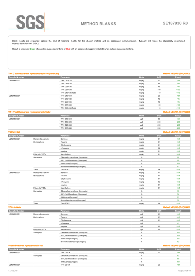
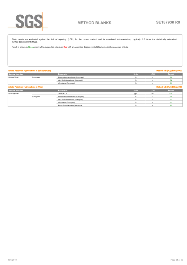
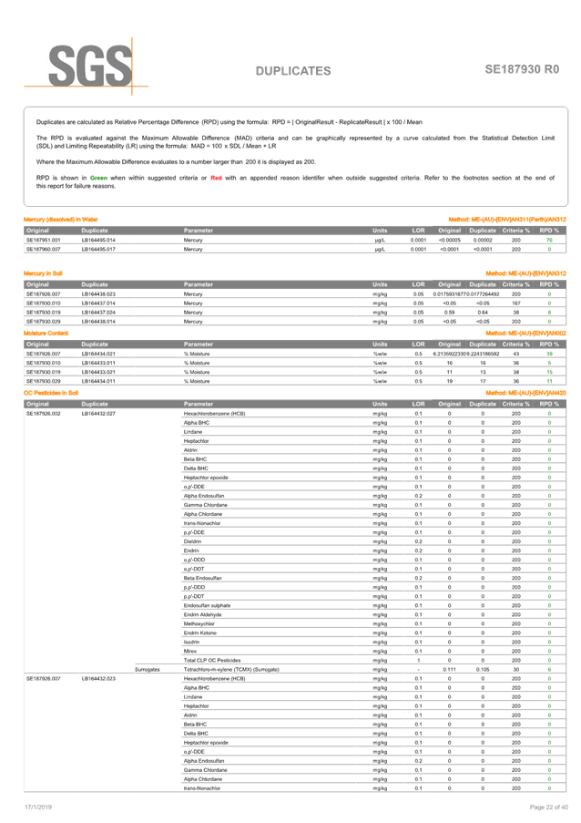
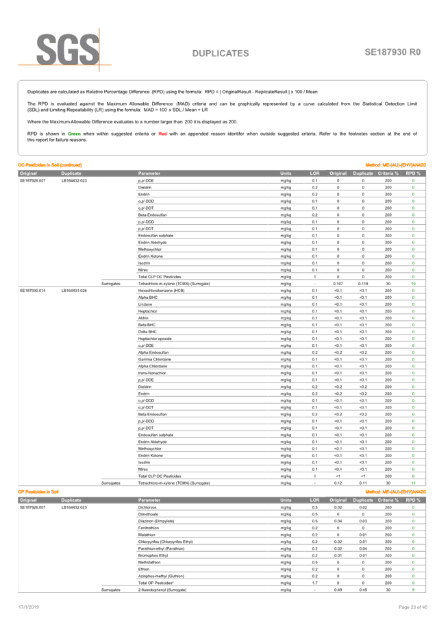
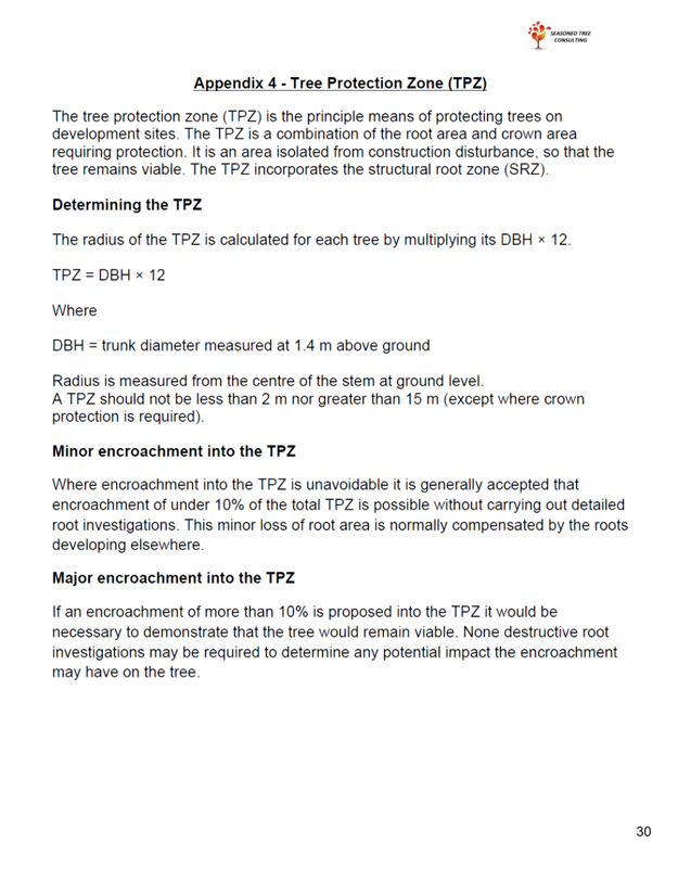
|
Ku-ring-gai Local Planning Panel Meeting - 24 April 2023 |
GB.1 / 0 |
|
|
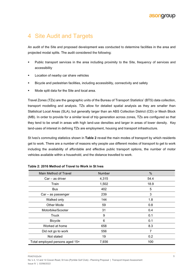
|
|
Item GB.1 |
S12645 |
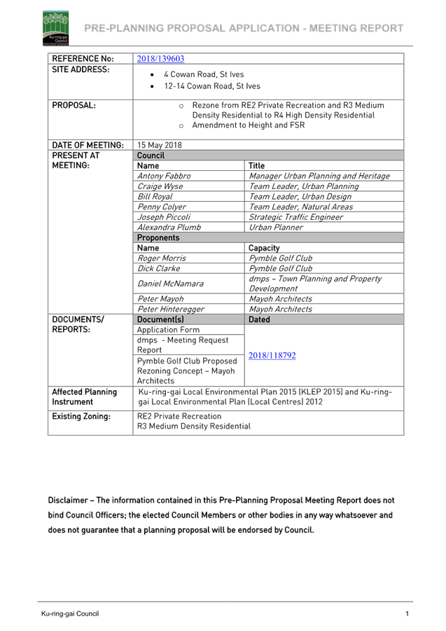
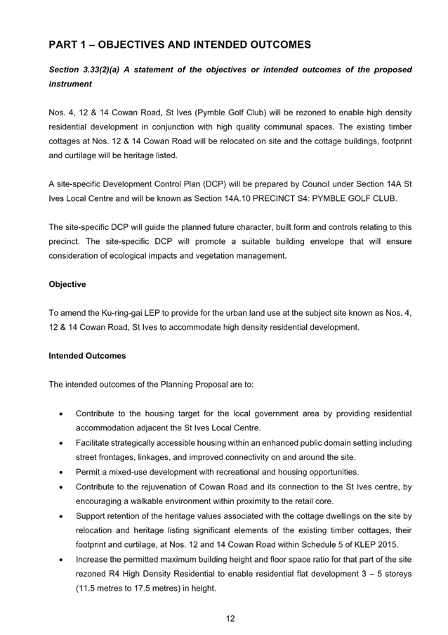
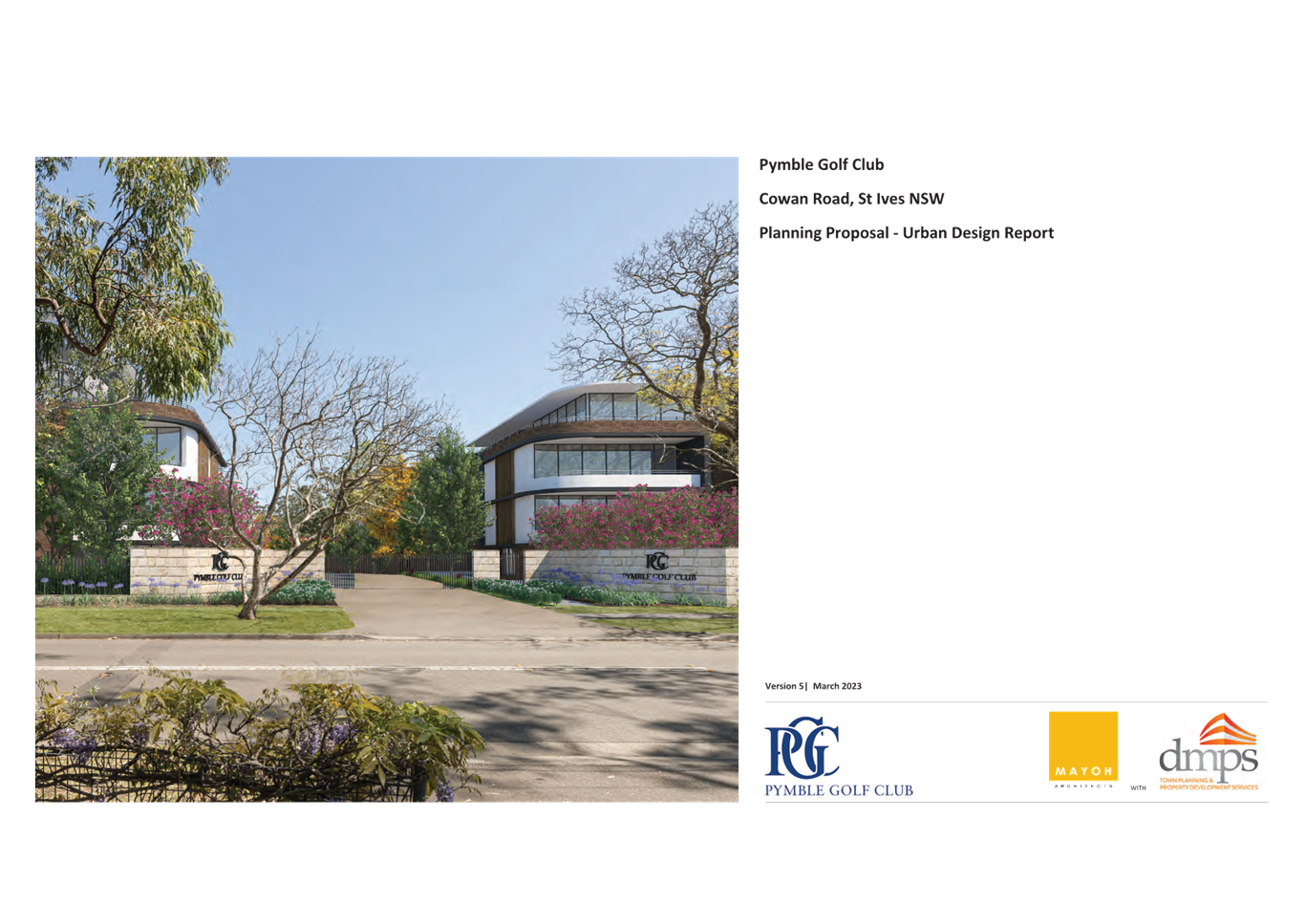
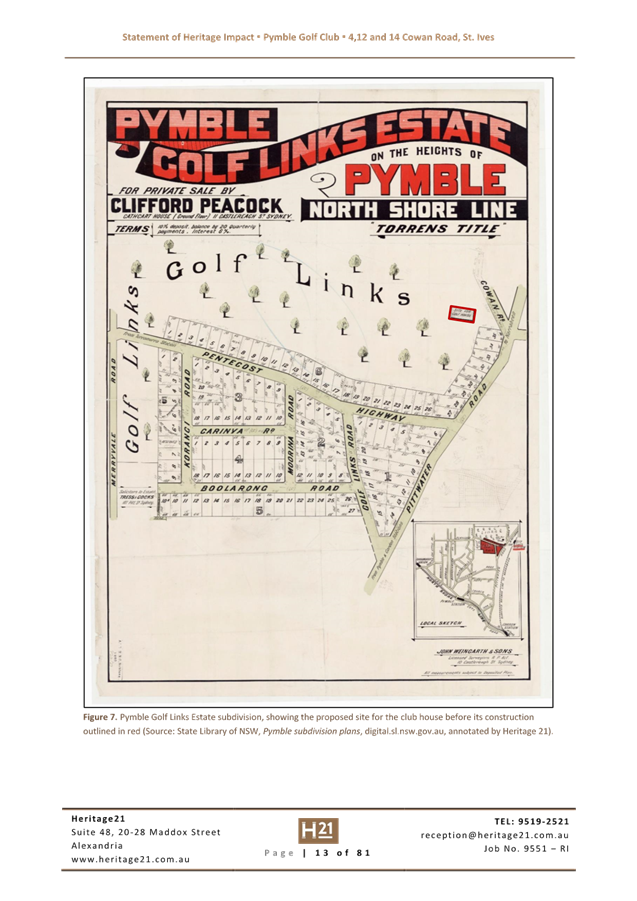
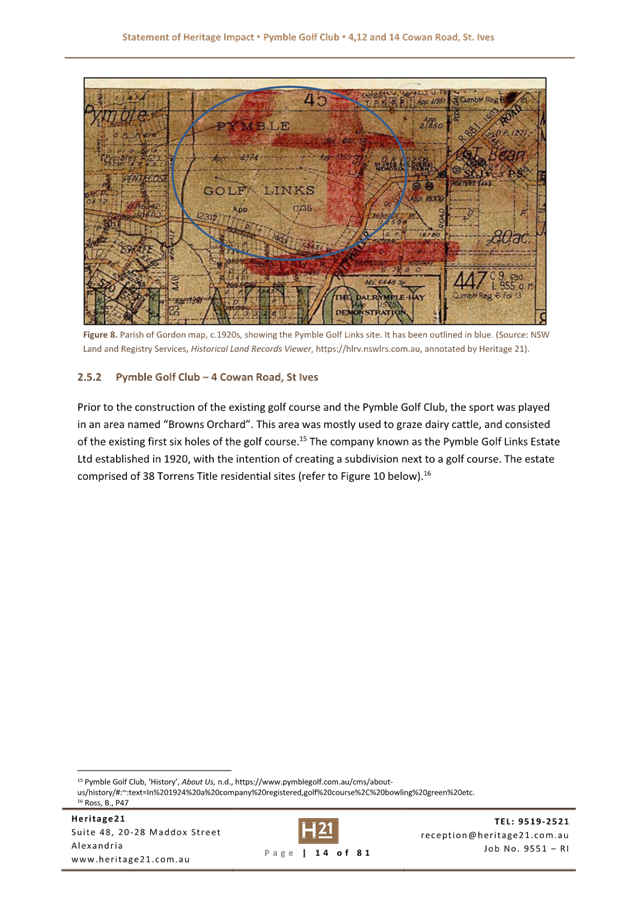
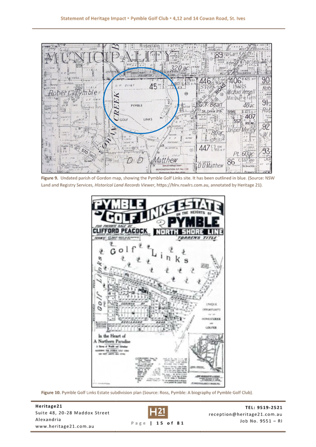
Planning Proposal for 4, 12 & 14 Cowan Road, St Ives - Pymble Golf Club
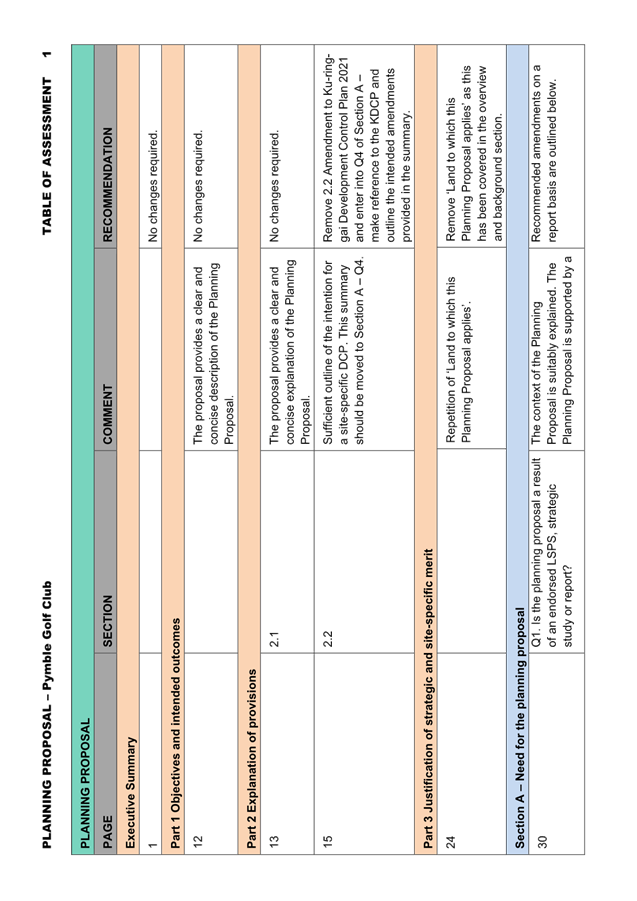
EXECUTIVE SUMMARY
Purpose of Report
To refer the Planning Proposal for 4, 12 & 14 Cowan Road, St Ives (Pymble Golf Club) to the Ku-ring-gai Local Planning Panel (KLPP) for advice as required by the Local Planning Panels Direction – Planning Proposals issued by the Minister for Planning under Section 9.1 of the Environmental Planning and Assessment Act 1979.
Background
A formal pre-Planning Proposal meeting was held on 15 May 2018 (Attachment A1). The Planning Proposal was submitted in January 2020. The Planning Proposal was incomplete. Following the submission of revised documentation and payment of fees, the assessment of the Planning Proposal formally commenced in April 2020.
Throughout the assessment process, the Planning Proposal has been updated by the proponent in accordance with advice provided by Council officers throughout 2020-2022.
The Planning Proposal is included at Attachment A2 and the appendices to the Planning Proposal are included at Attachment A3-A10.
Site Description and Local Context
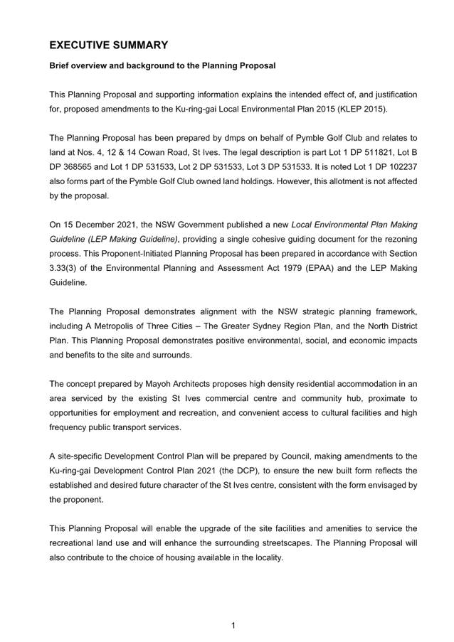
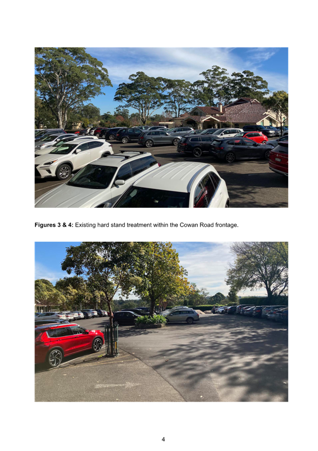
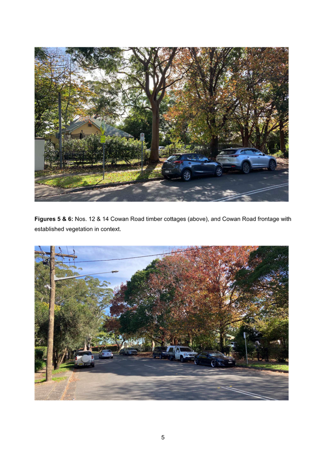
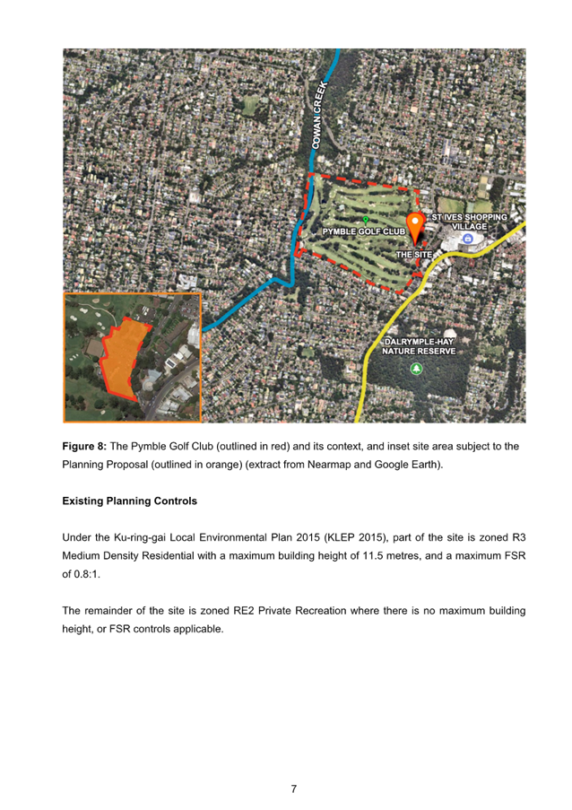
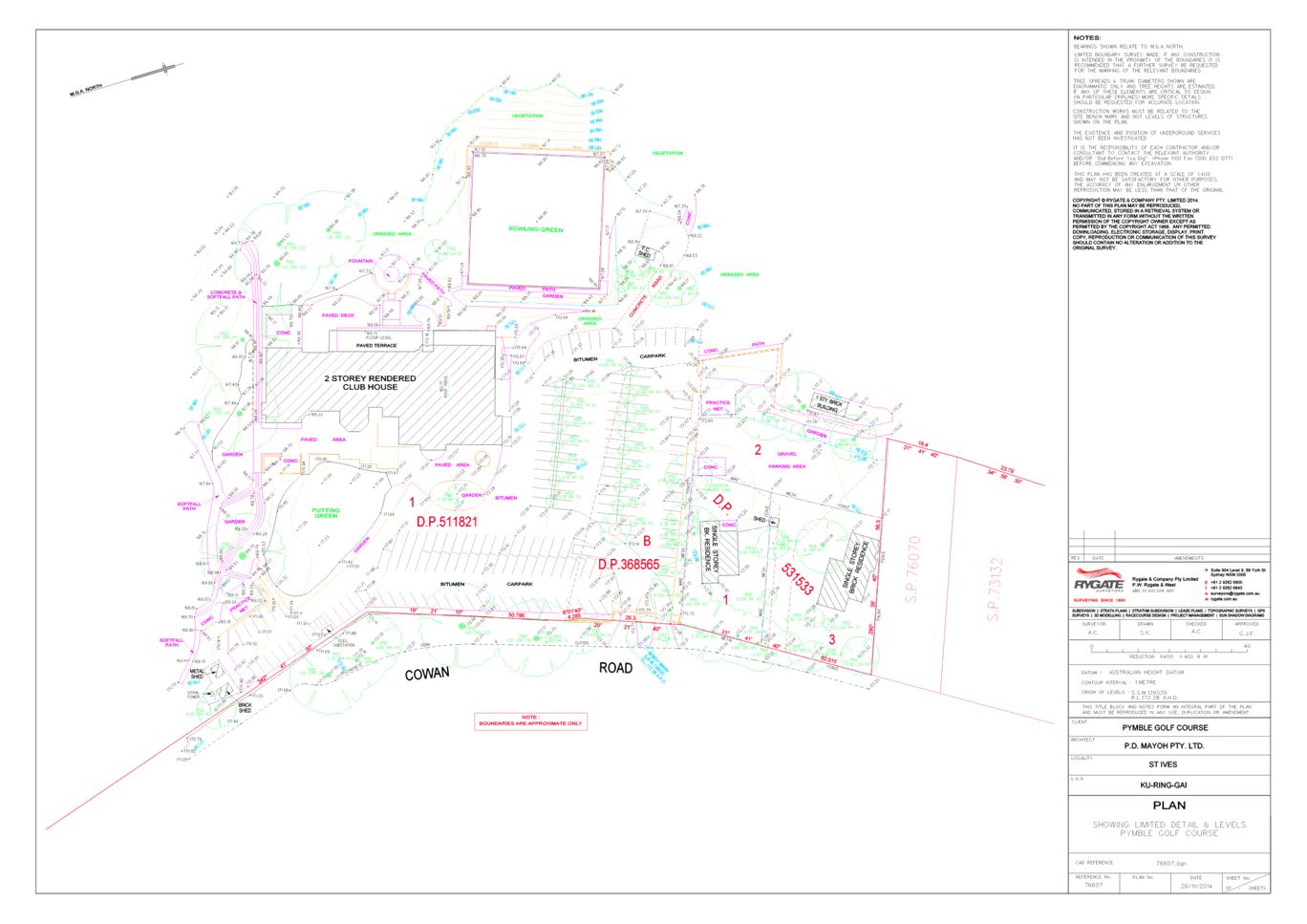
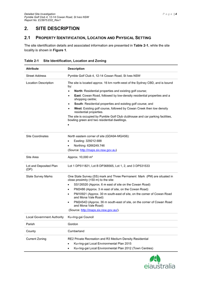
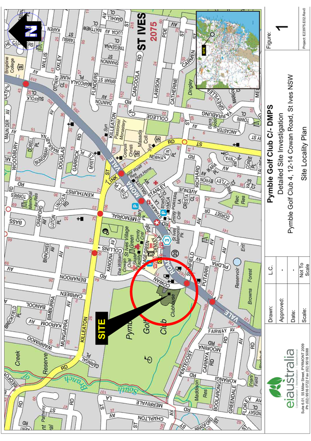
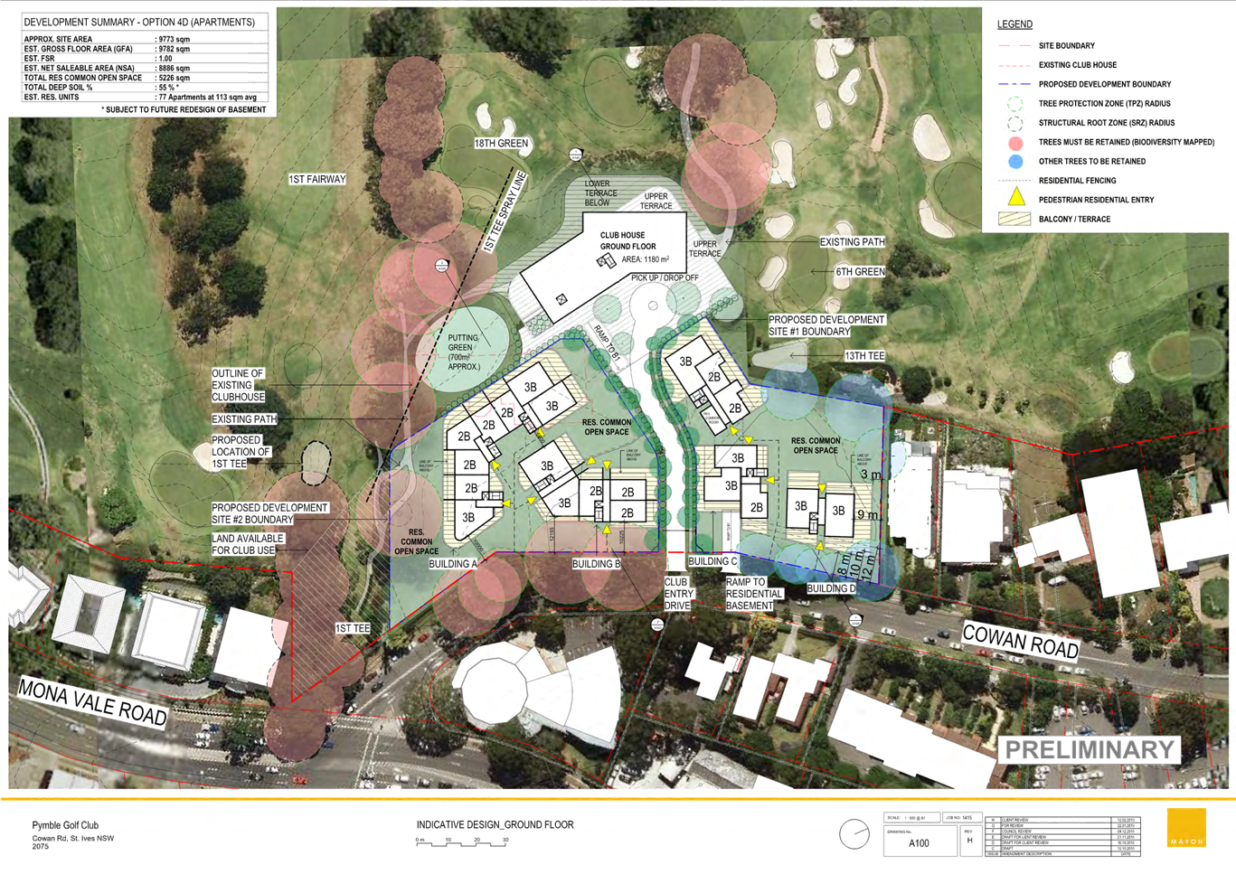
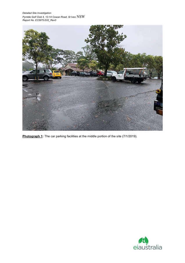
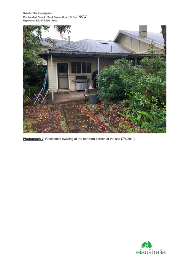
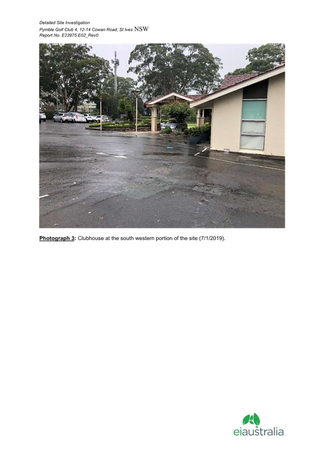
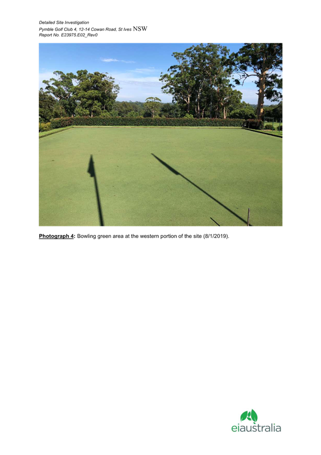
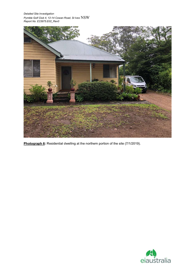
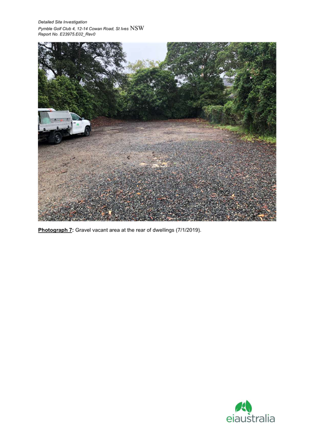
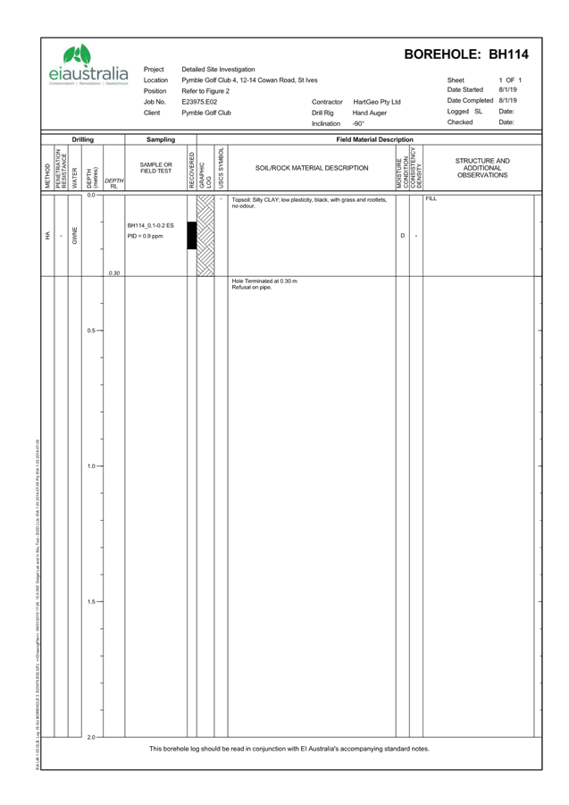
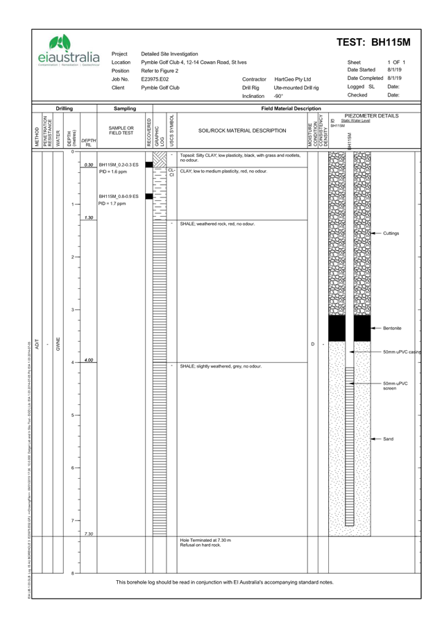
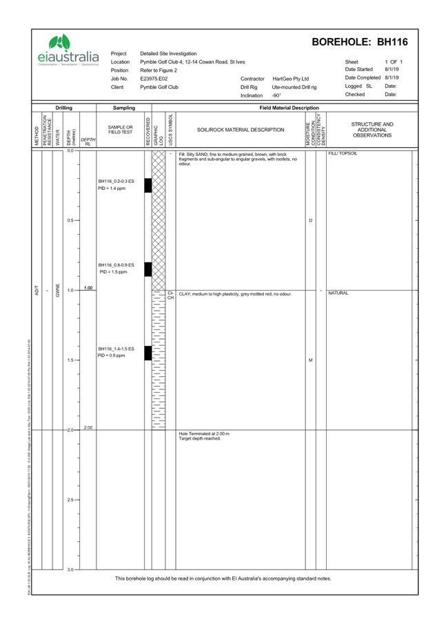
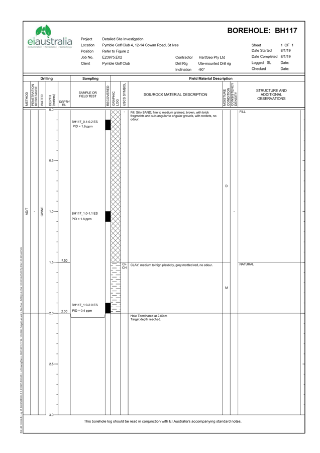
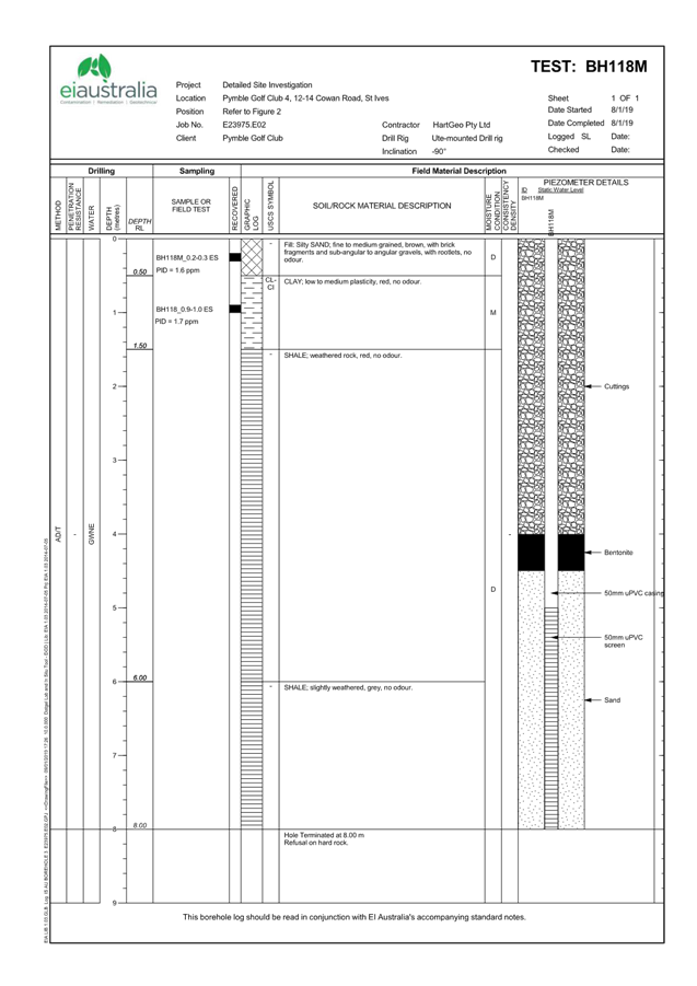
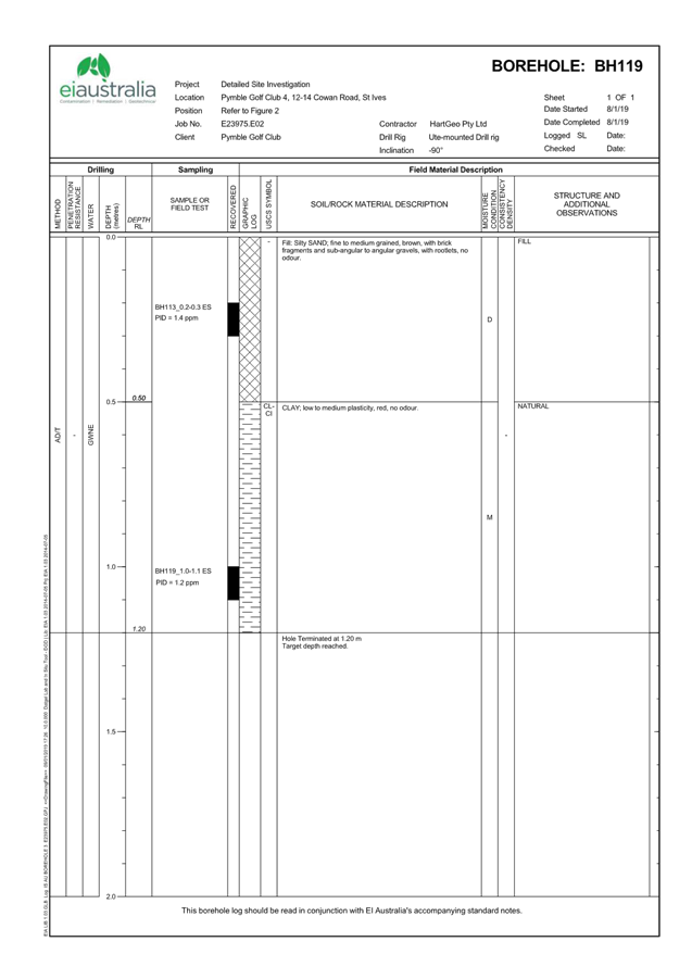
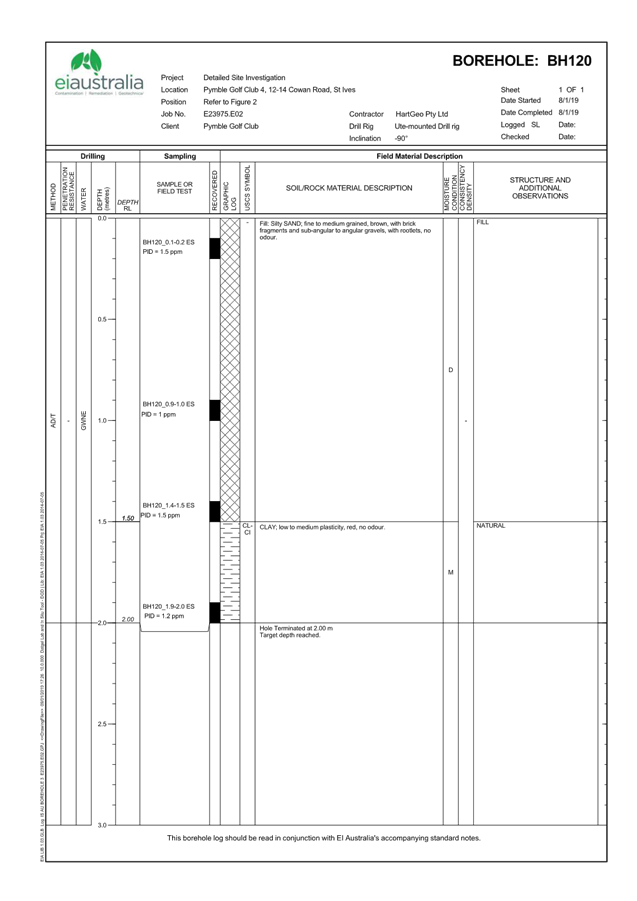
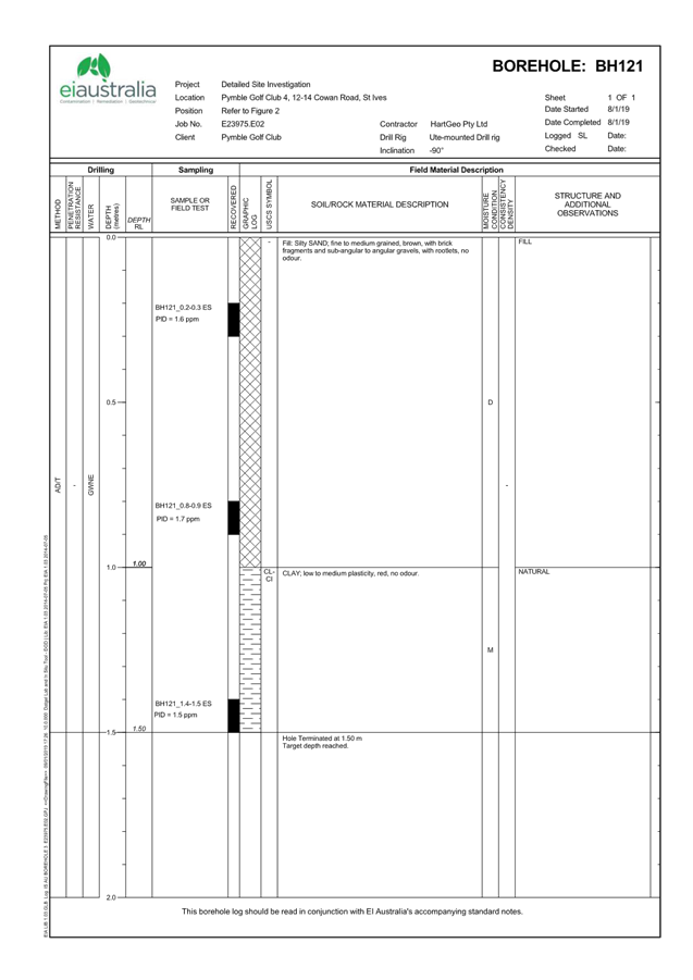
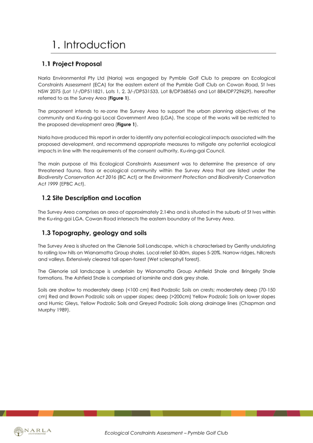
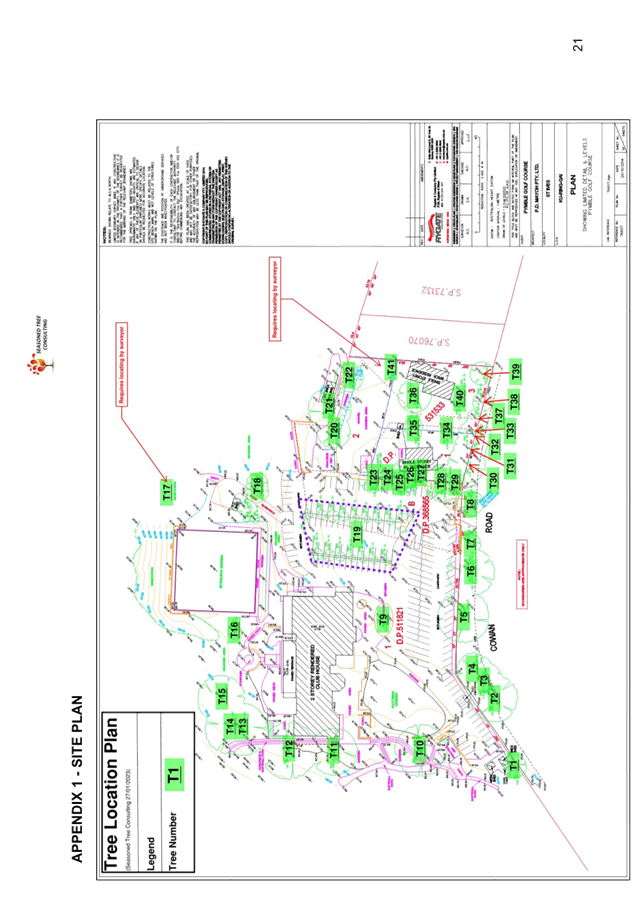
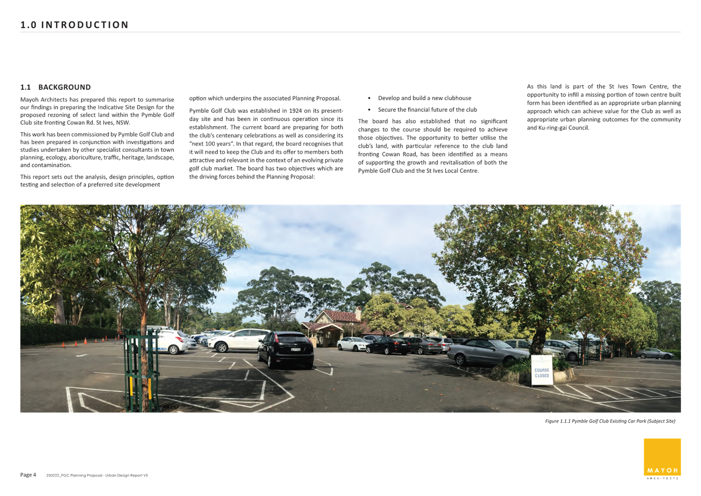
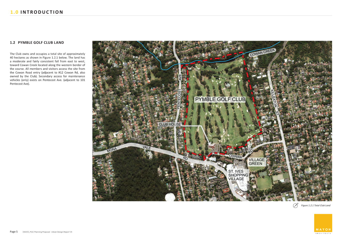
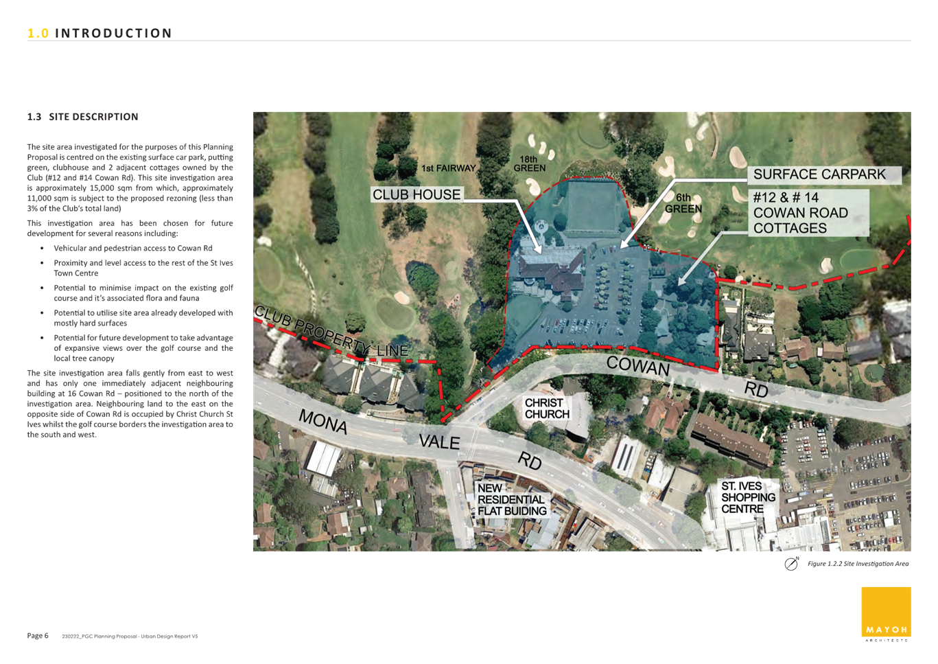
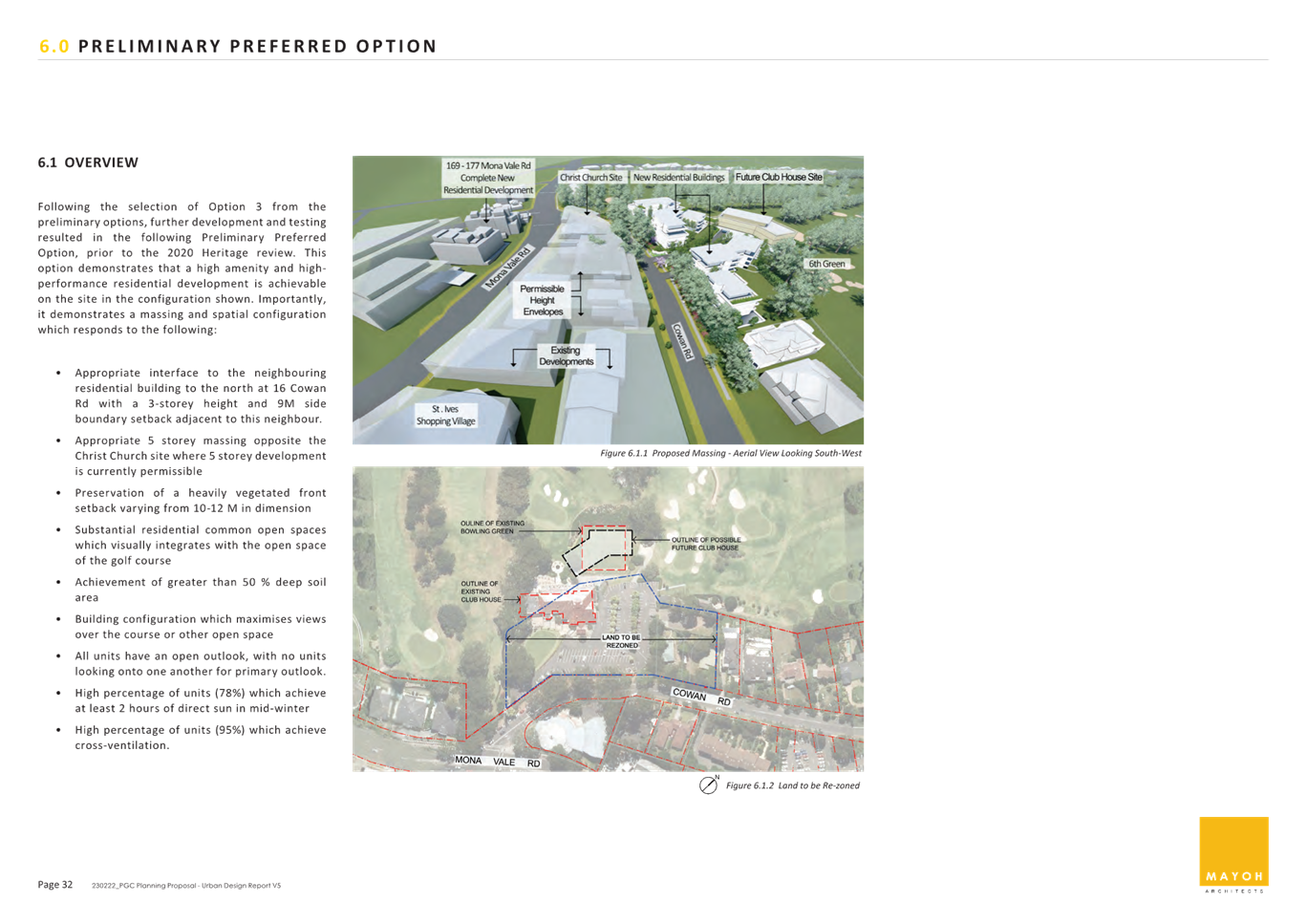
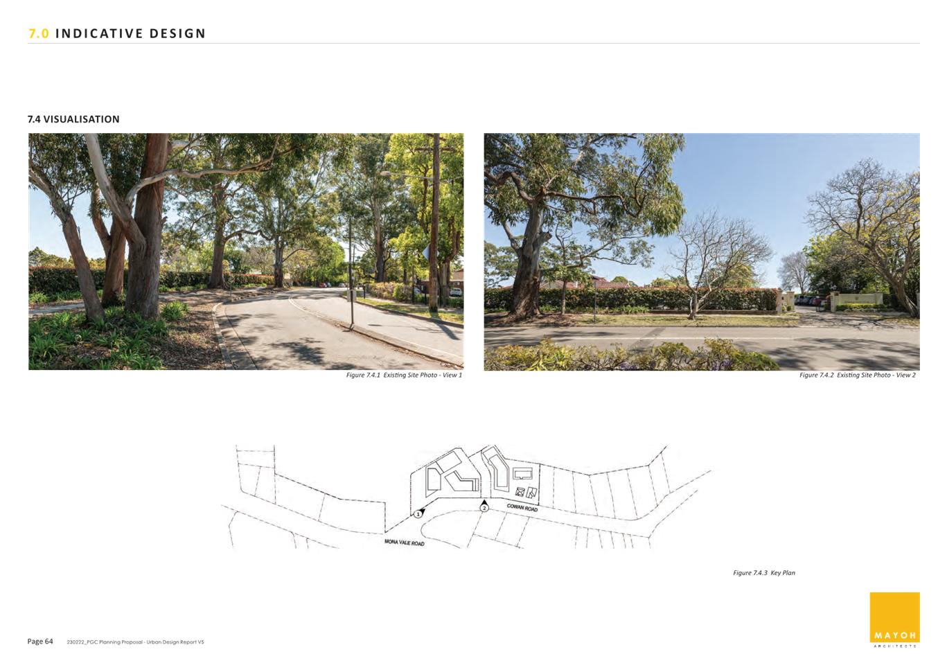
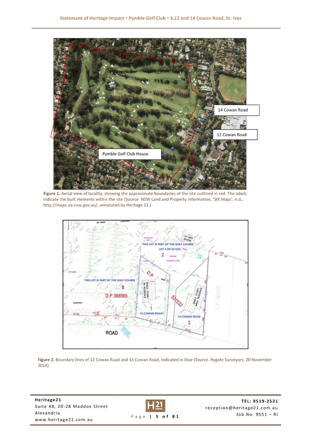
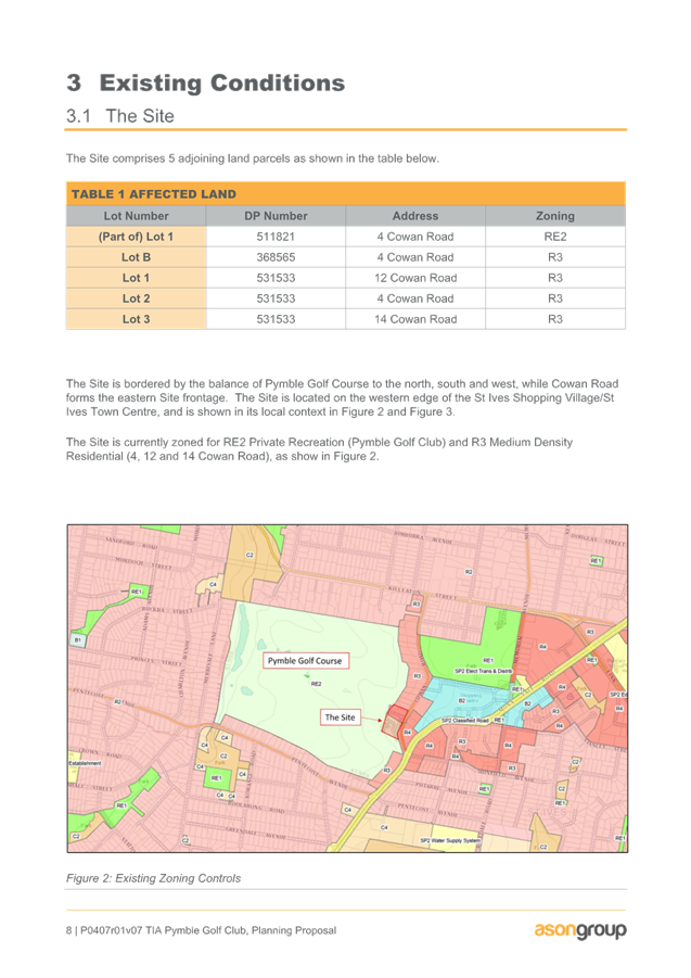
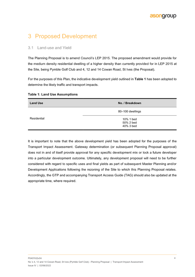
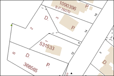
The site that is the subject of the Planning Proposal is located at 4, 12 and 14 Cowan Road, St Ives. The legal description of the site is part Lot 1 DP 511821, Lot B DP 368565, and Lot 1 DP 531533, Lot 2 DP 531533, Lot 3 DP 531533. It is noted that Lot 1 DP 102237 (part of the Club land) is not affected by the proposal. The land that is the subject of this Planning Proposal has an area of approximately 10,000m2 and is located immediately adjacent to Cowan Road. The land comprises the existing club house, car park and single storey timber cottages at 12 and 14 Cowan Road.
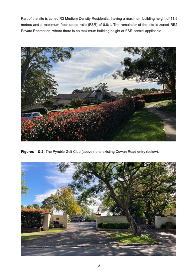
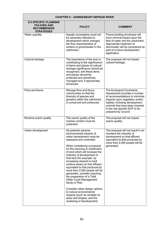
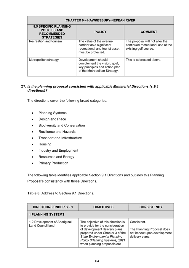
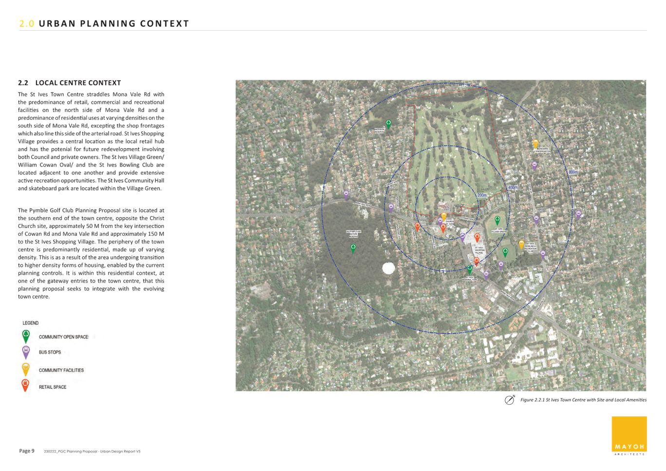
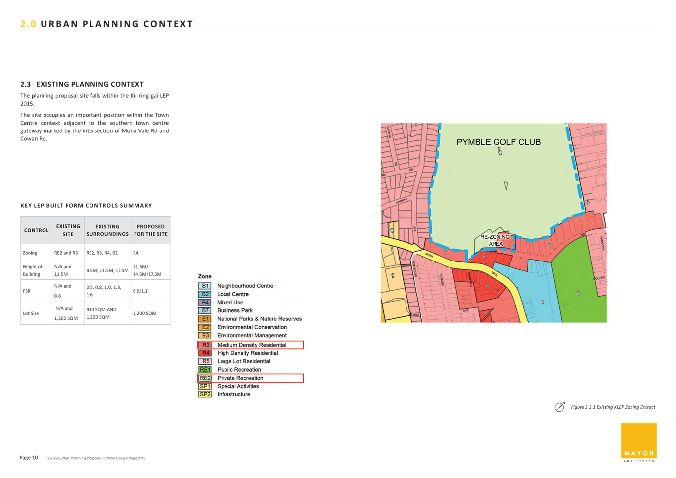
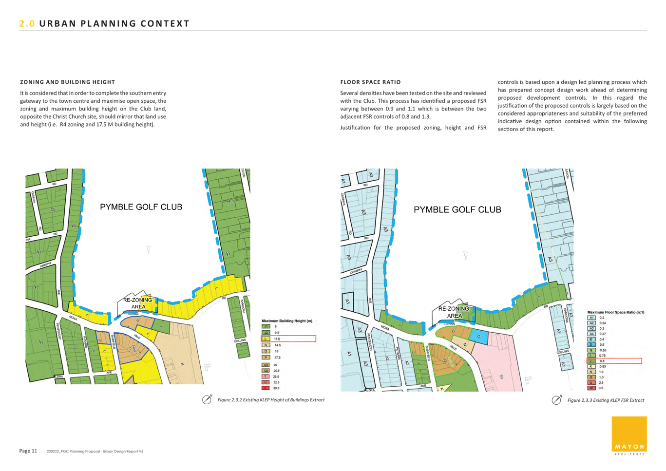
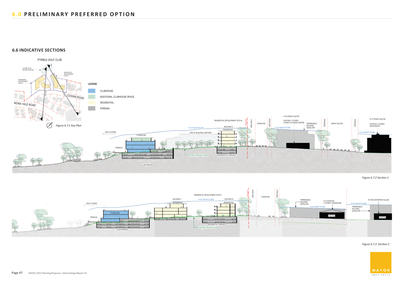
Part of the Pymble Golf Club site is within the St Ives Local Centre. The centre comprises the St Ives Shopping Village zoned B2 Local Centre, the adjacent Village Green zoned RE1 Public Recreation, and supporting residential land zoned R3 Medium Density Residential and R4 High Density Residential. While the centre is generally characterised by low scale development (2-3 storeys in height), the planning controls enable development up to 17.5 metres (5 storeys) in height, including land directly opposite the site’s frontage along Cowan Road. Several developments of this scale have recently been constructed along Mona Vale Road. Part of the site is zoned R3 Medium Density Residential, having a maximum building height of 11.5 metres and a maximum floor space ratio (FSR) of 0.8:1. The remainder of the site is zoned RE2 Private Recreation, where there is no maximum building height or FSR control applicable.
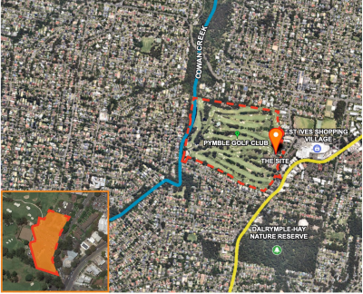
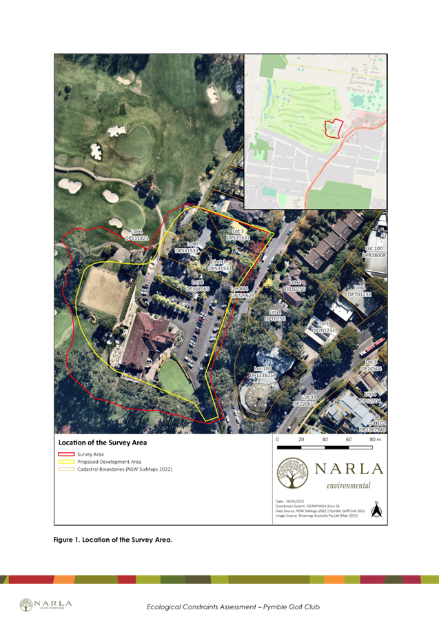
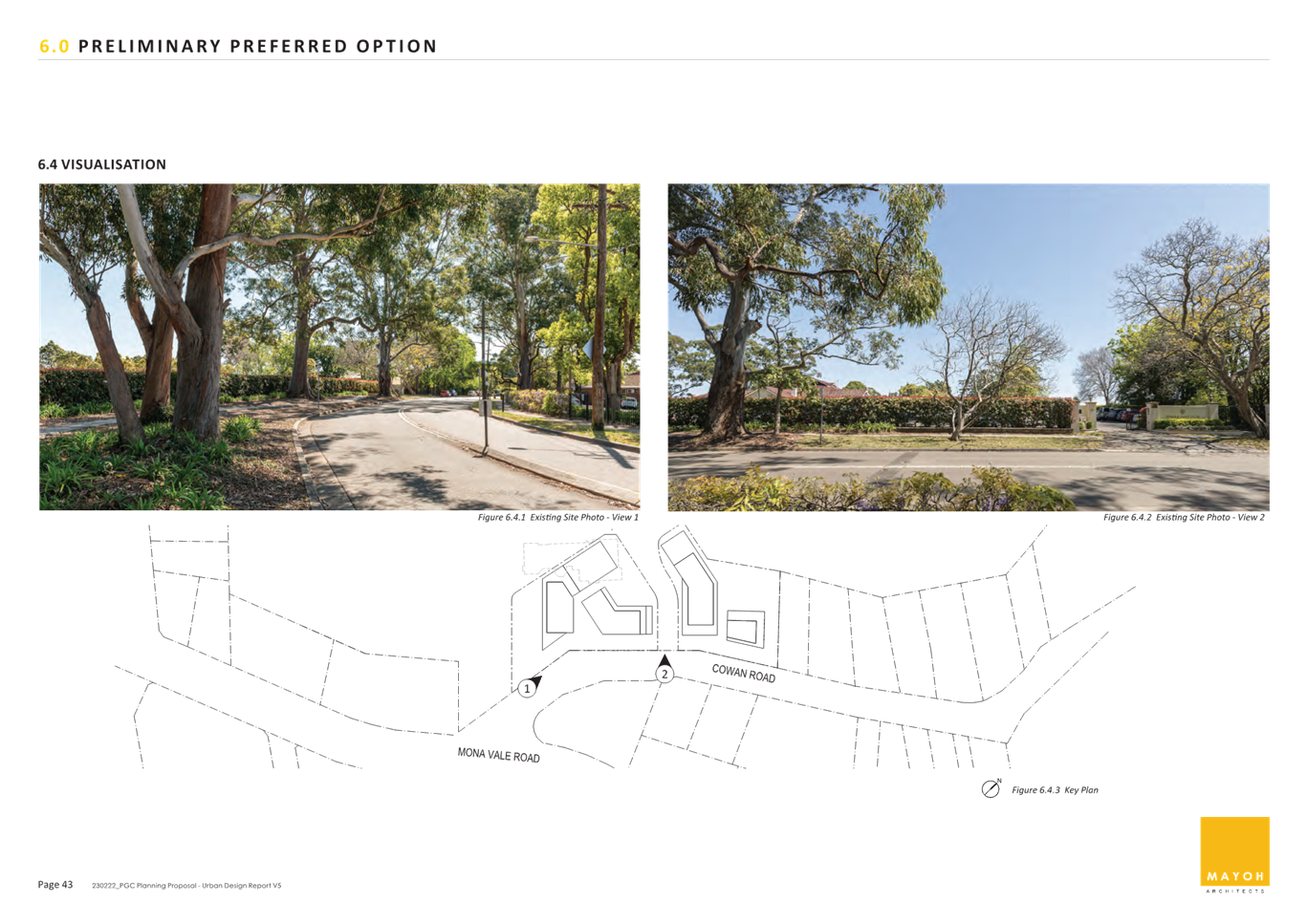
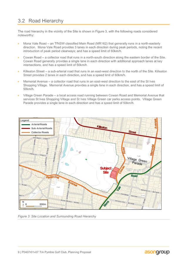
Figure 1. Subject site aerial view
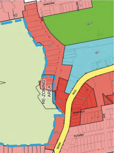
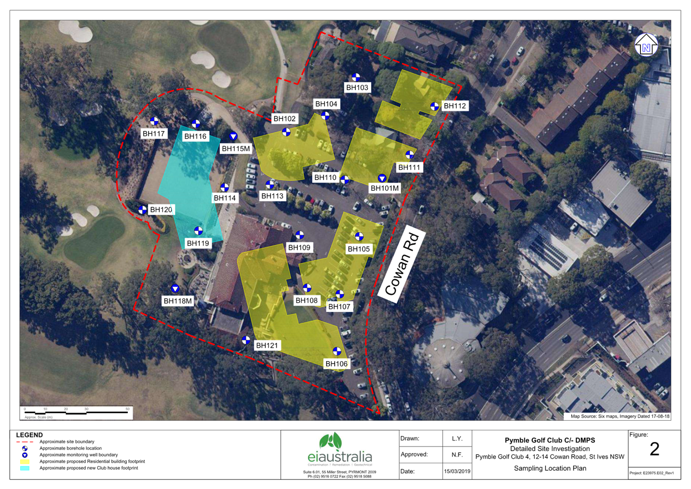
Figure 2. Subject site and existing surrounding context
Comments
Planning Proposal and the Proposed Amendments to KLEP 2015
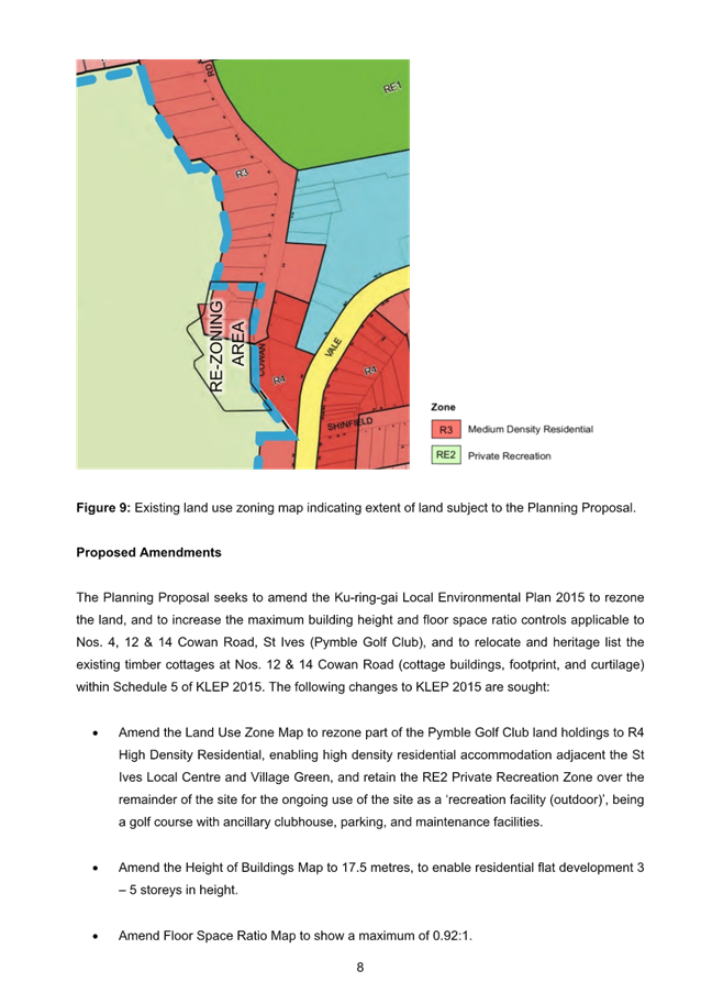
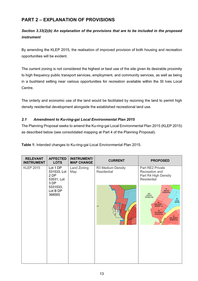
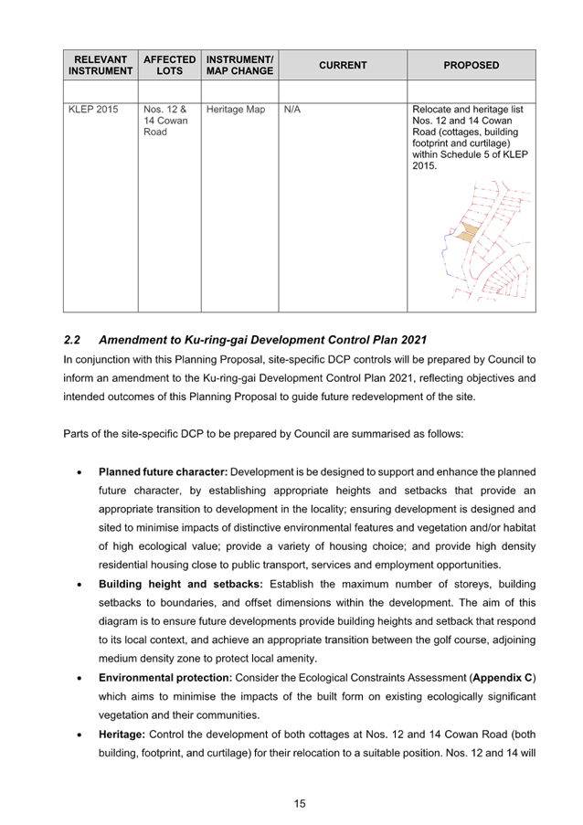
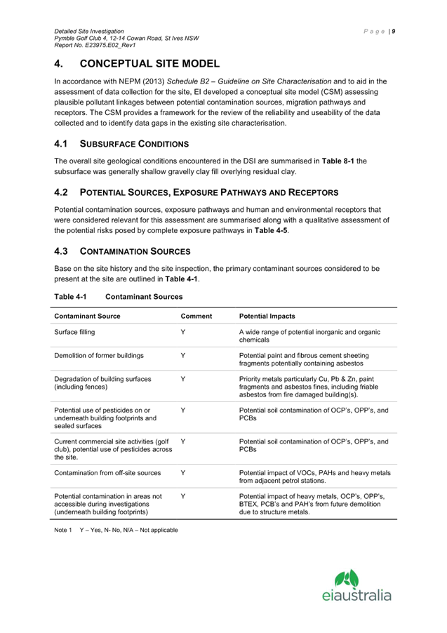
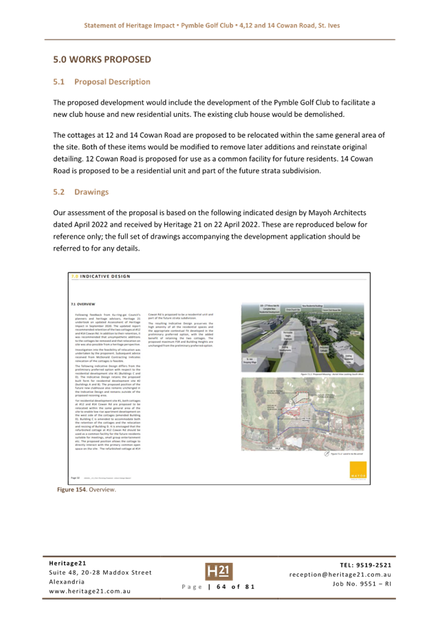
The Planning Proposal for 4, 12 and 14 Cowan Road, St Ives (Pymble Golf Club) that was submitted to Council for assessment seeks to amend the KLEP 2015 to rezone the land, and to increase the maximum building height and floor space ratio controls applicable to 4, 12 & 14 Cowan Road, St Ives (Pymble Golf Club), and to relocate and heritage list the existing timber cottages at 12 & 14 Cowan Road (cottage buildings, footprint, and curtilage) within Schedule 5 of KLEP 2015.
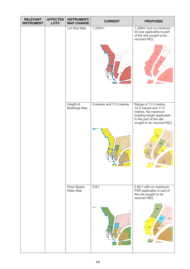
The following changes to KLEP 2015 are sought:
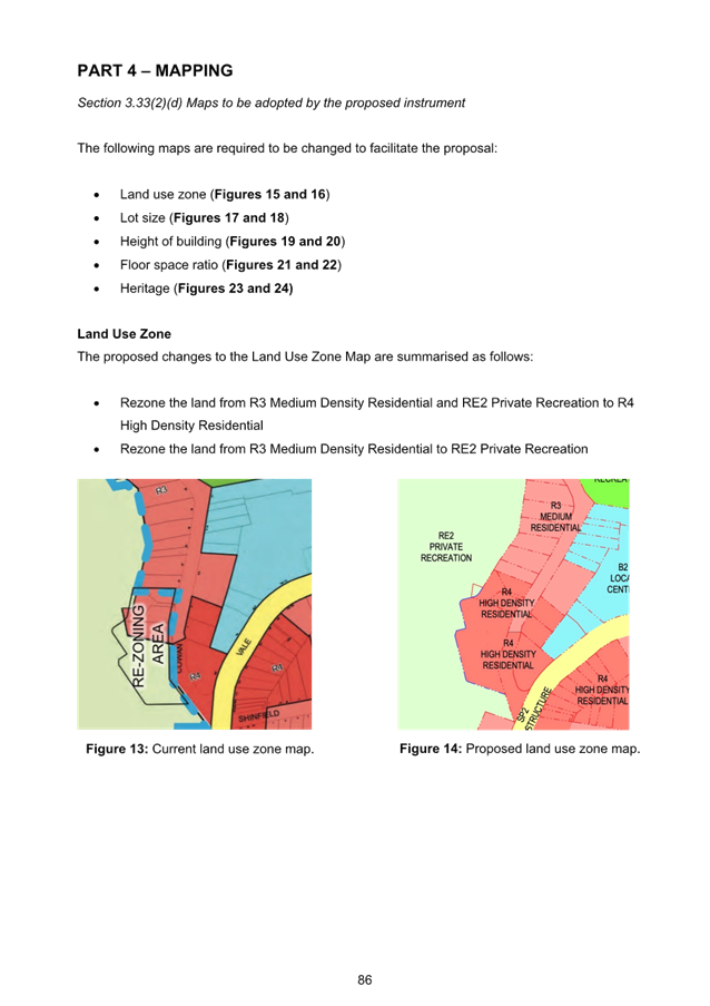
• Amend the Land Use Zone Map to rezone part of the Pymble Golf Club land holdings from RE2 Private Recreation and R3 Medium Density Residential to R4 High Density Residential and extend part of the RE2 Private Recreation zone over existing R3 Medium Density Residential;
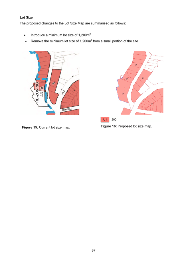
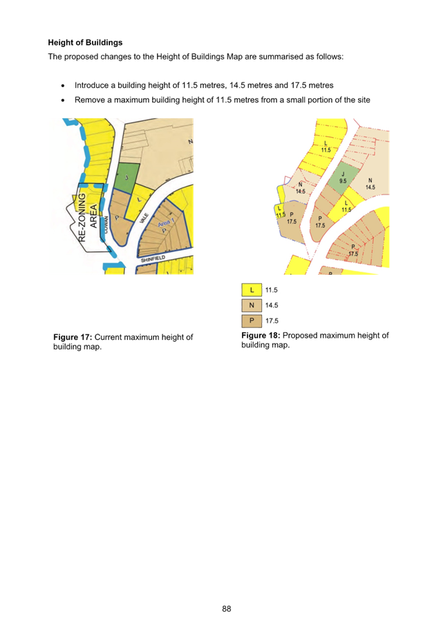
• Amend the Height of Buildings Map to a combination of 11.5, 14.5 and 17.5 metres, to enable residential flat development 3-5 storeys in height;
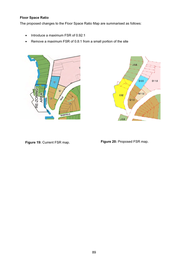
• Amend Floor Space Ratio Map for the R4 High Density Residential Zoned land to show a maximum of 0.92:1; and
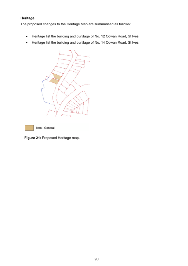
• Amend the Heritage Map and Schedule 5 Environmental Heritage to heritage list 12 and 14 Cowan Road.
Merit
A Planning Proposal is not a Development Application and does not consider the specific detailed matters for consideration under Section 4.15 of the Environmental Planning and Assessment Act 1979. A Planning Proposal only relates to a Local Environmental Plan (LEP) amendment and cannot be tied to a specific development. The proposed amendments need to be acceptable as an outcome on the site regardless of the subsequent approval or refusal of any future development application.
A Planning Proposal must demonstrate the site specific and strategic merit of the proposed amendments. The following is an assessment of the relevant merits of the Planning Proposal:
Site Specific Merit Assessment
· Urban Design
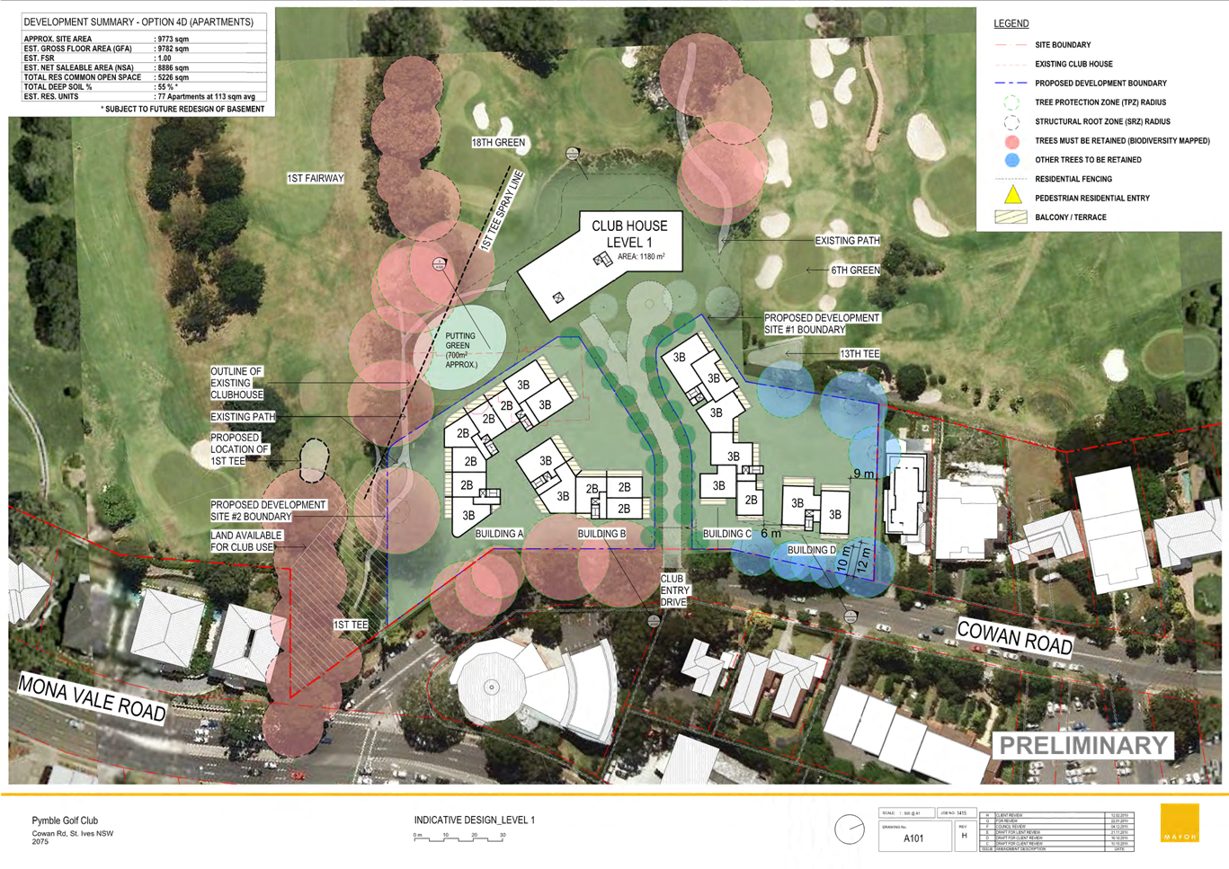
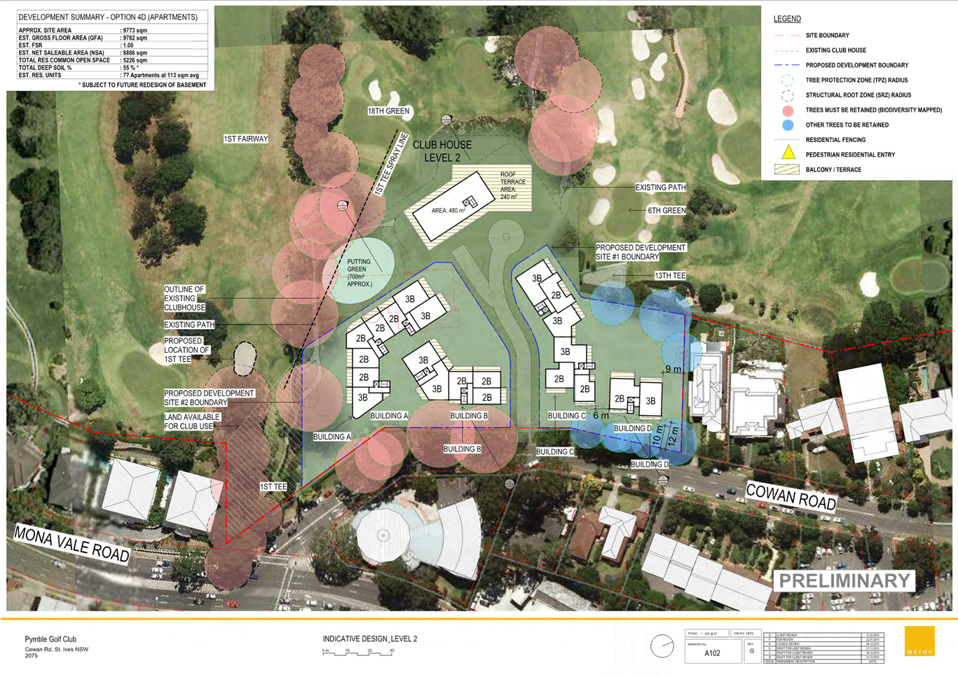
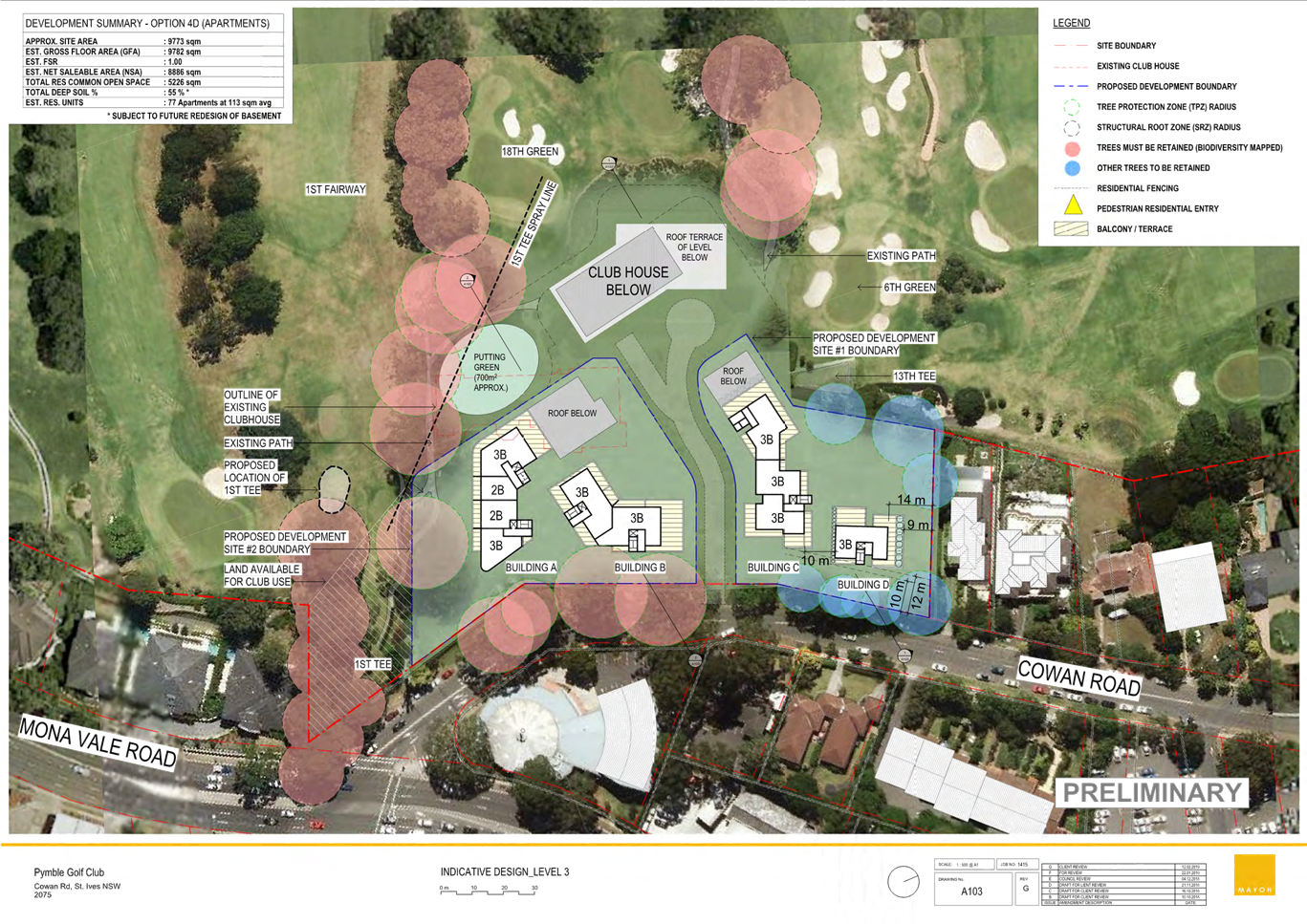
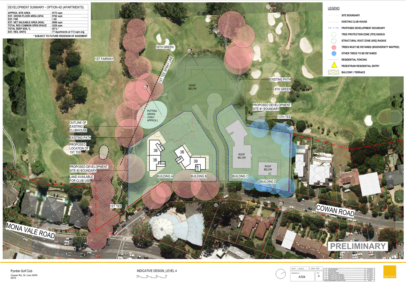
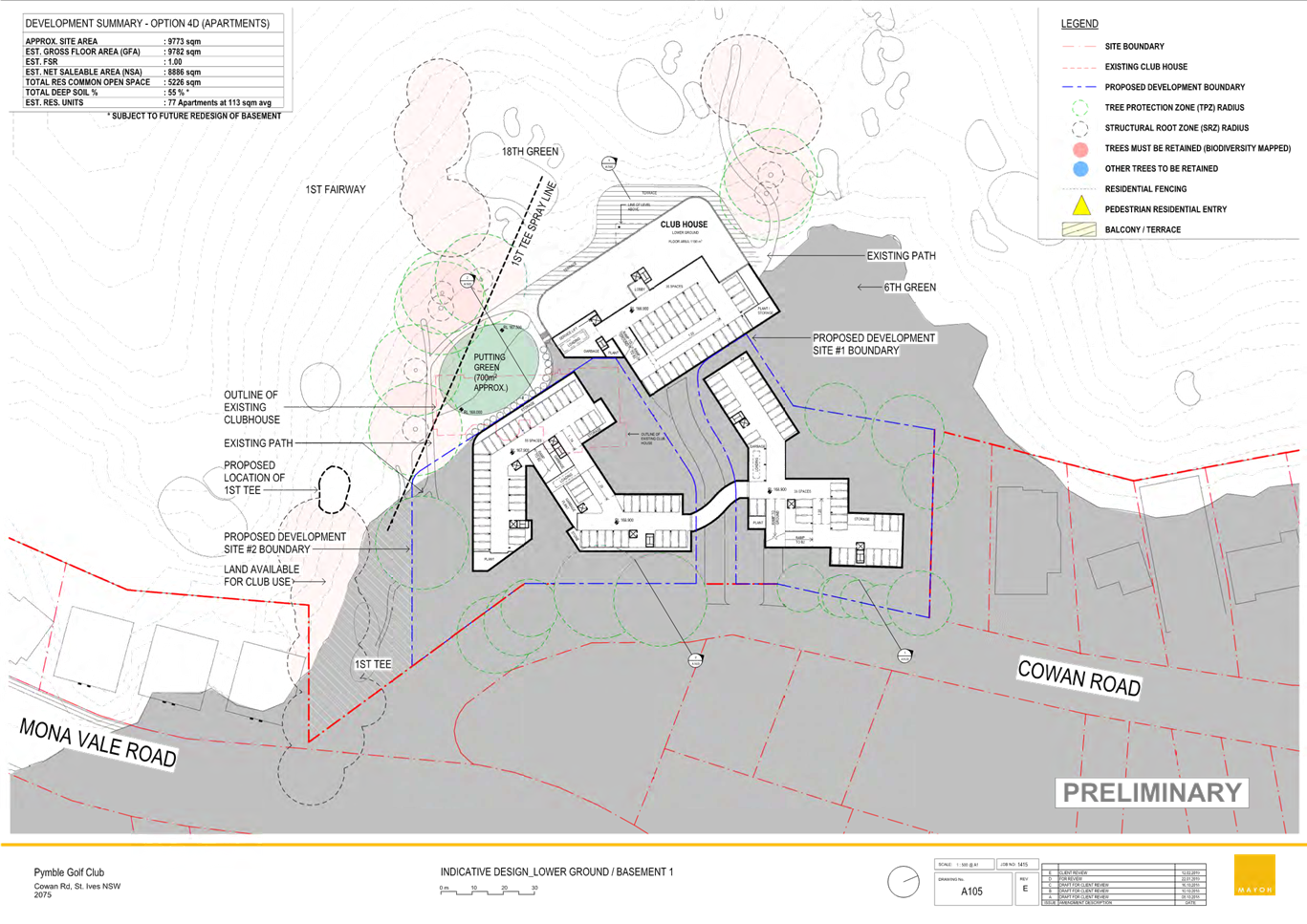
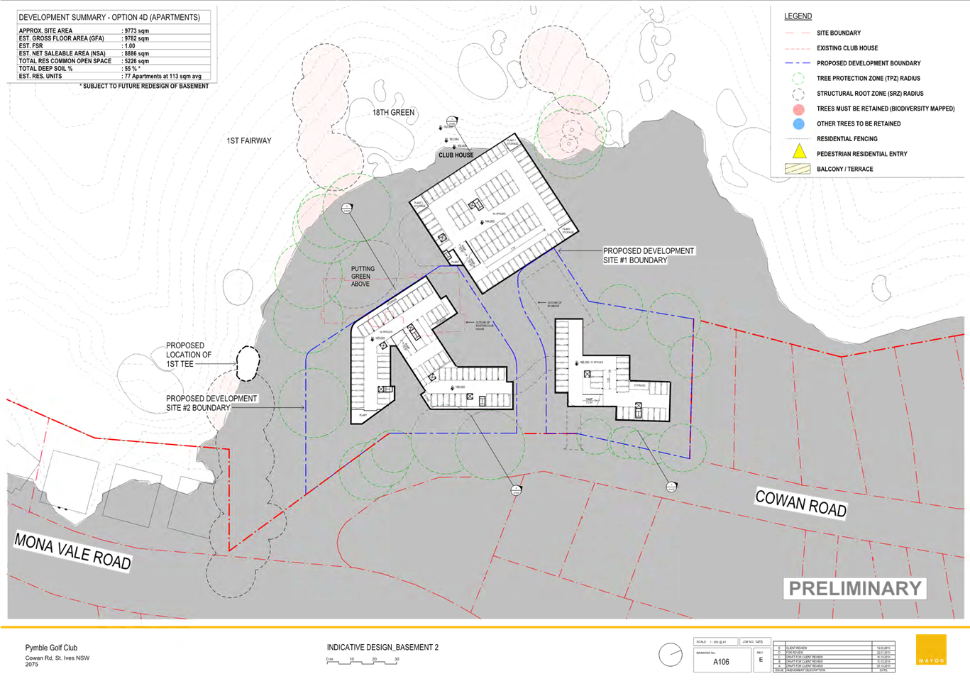
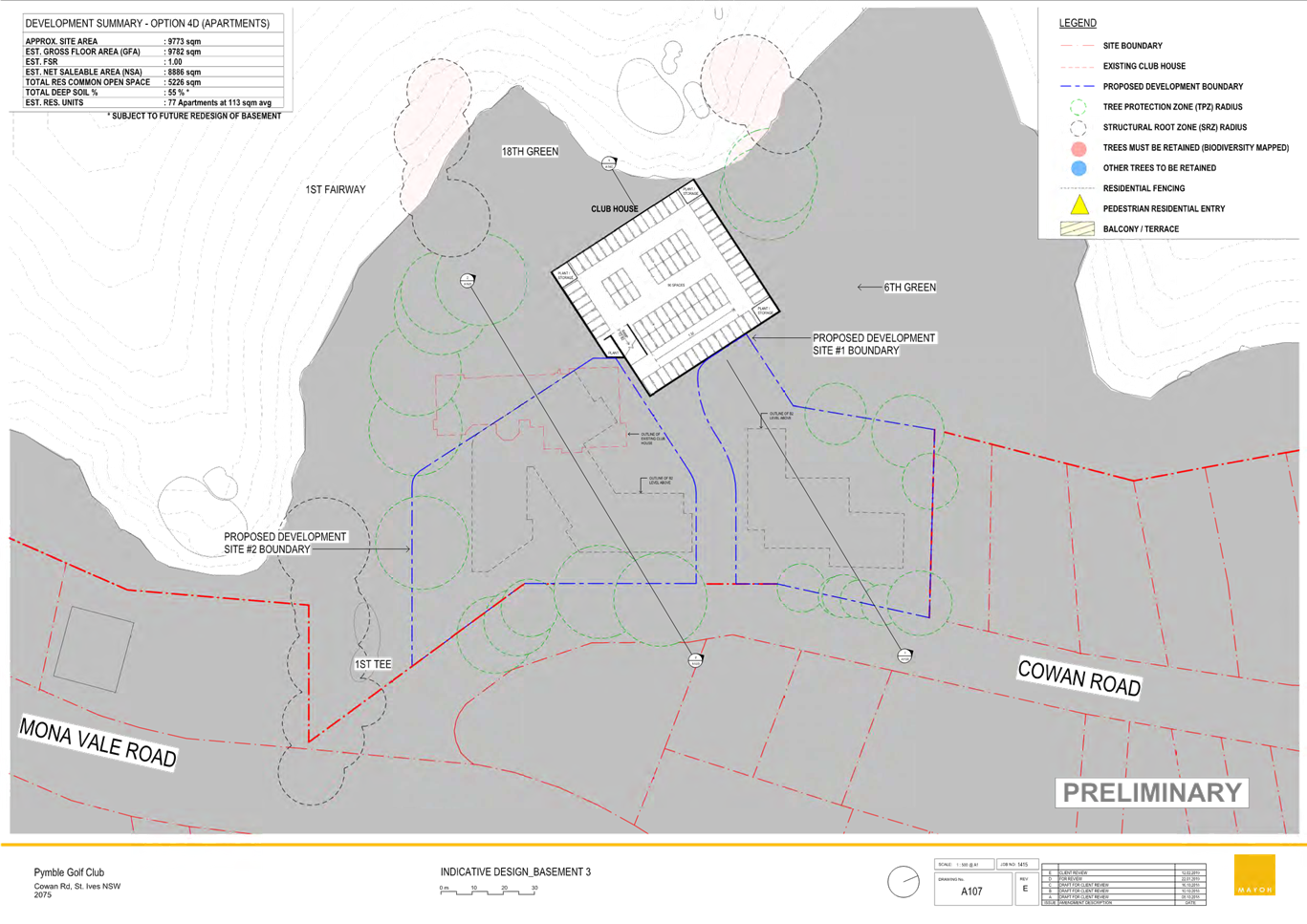
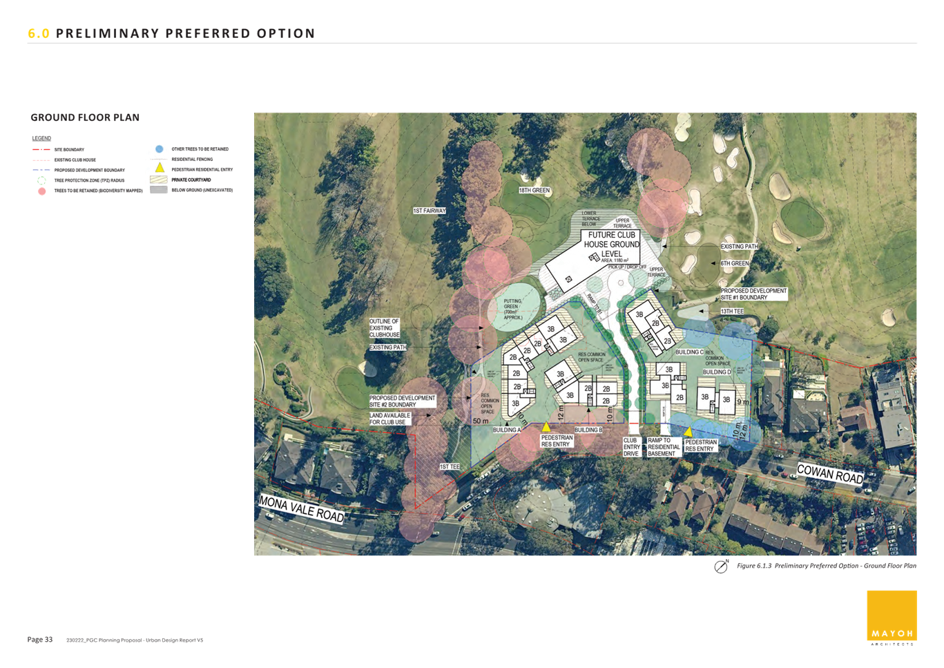
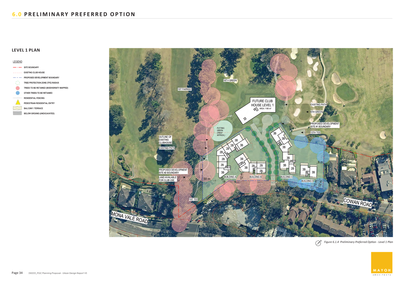
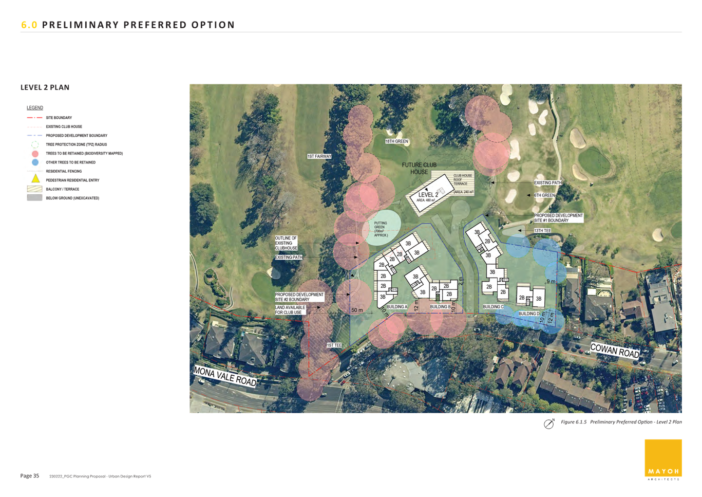
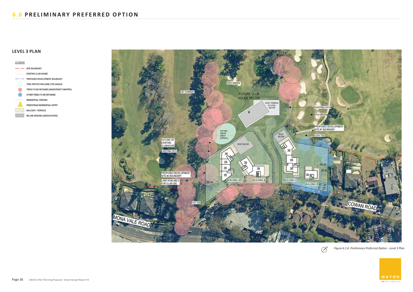
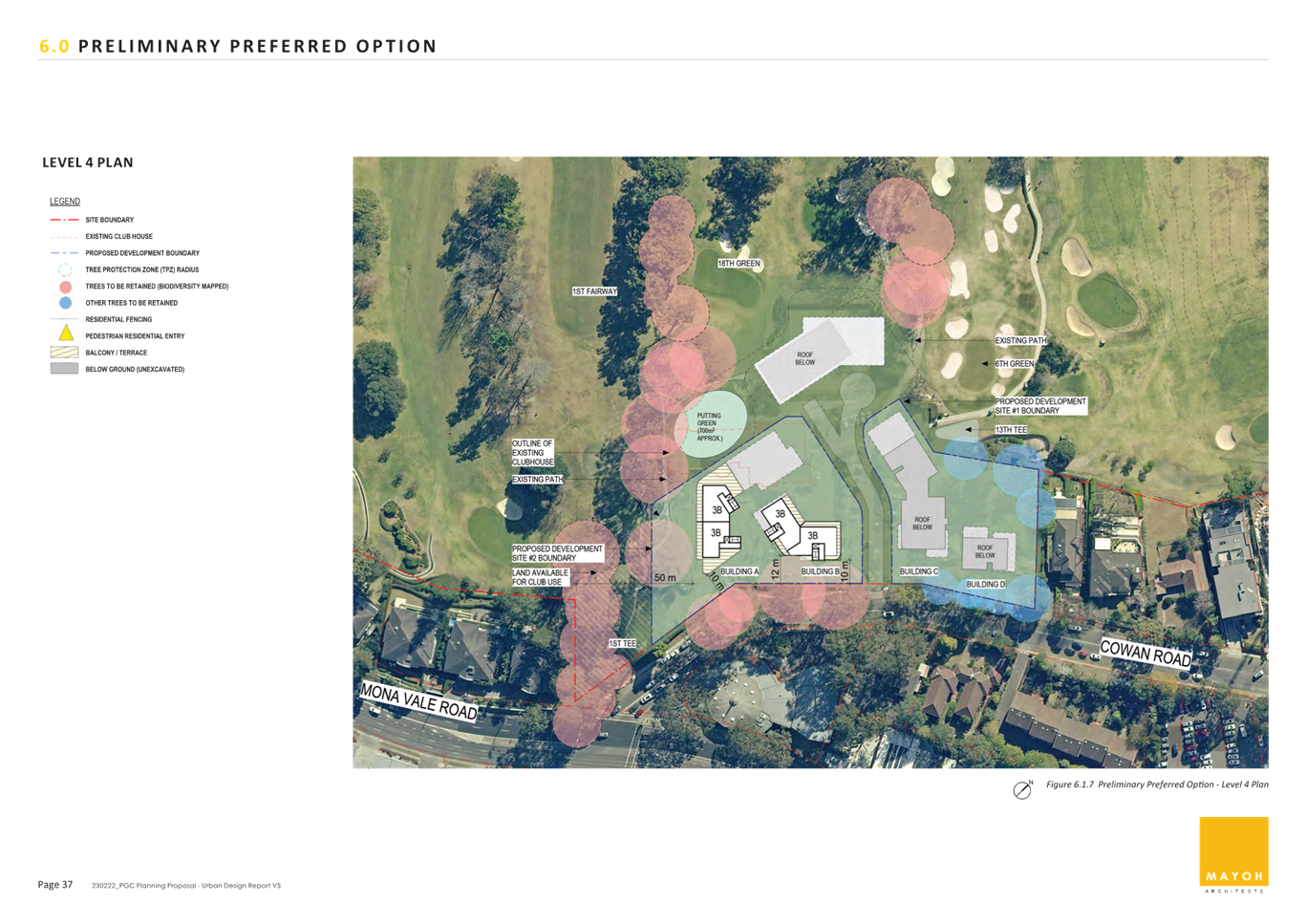
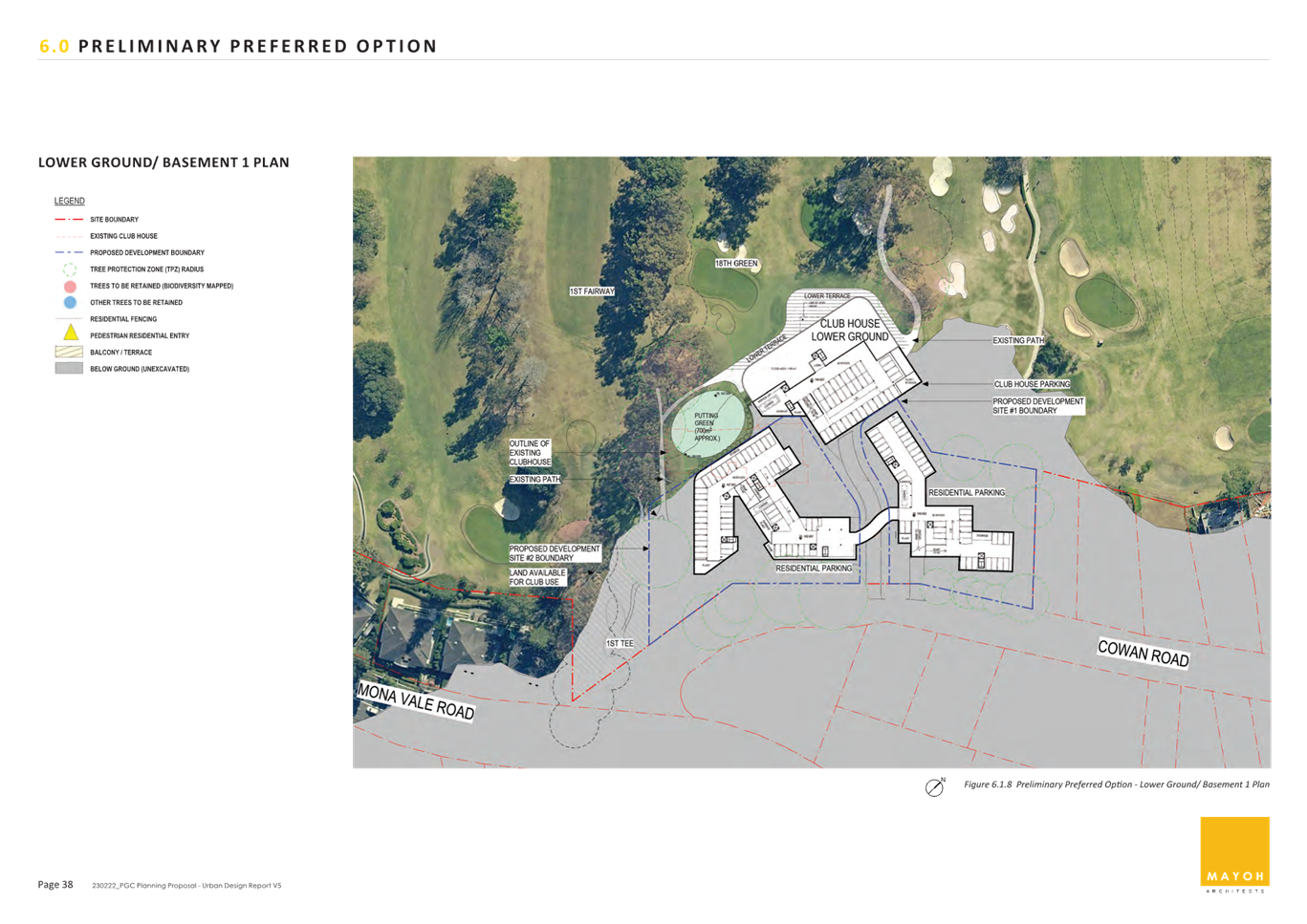
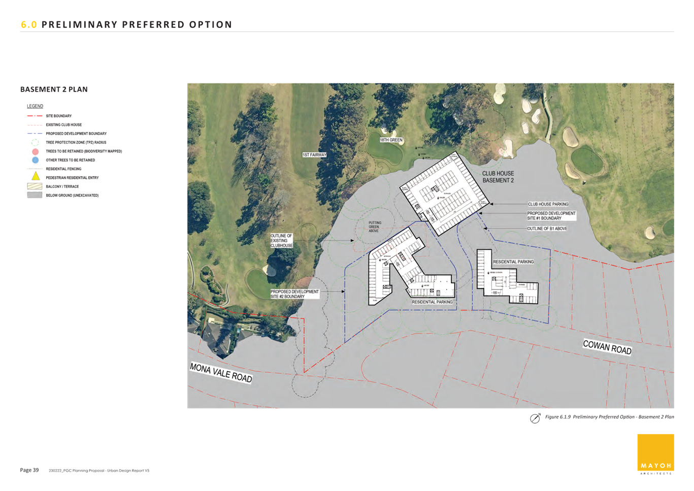
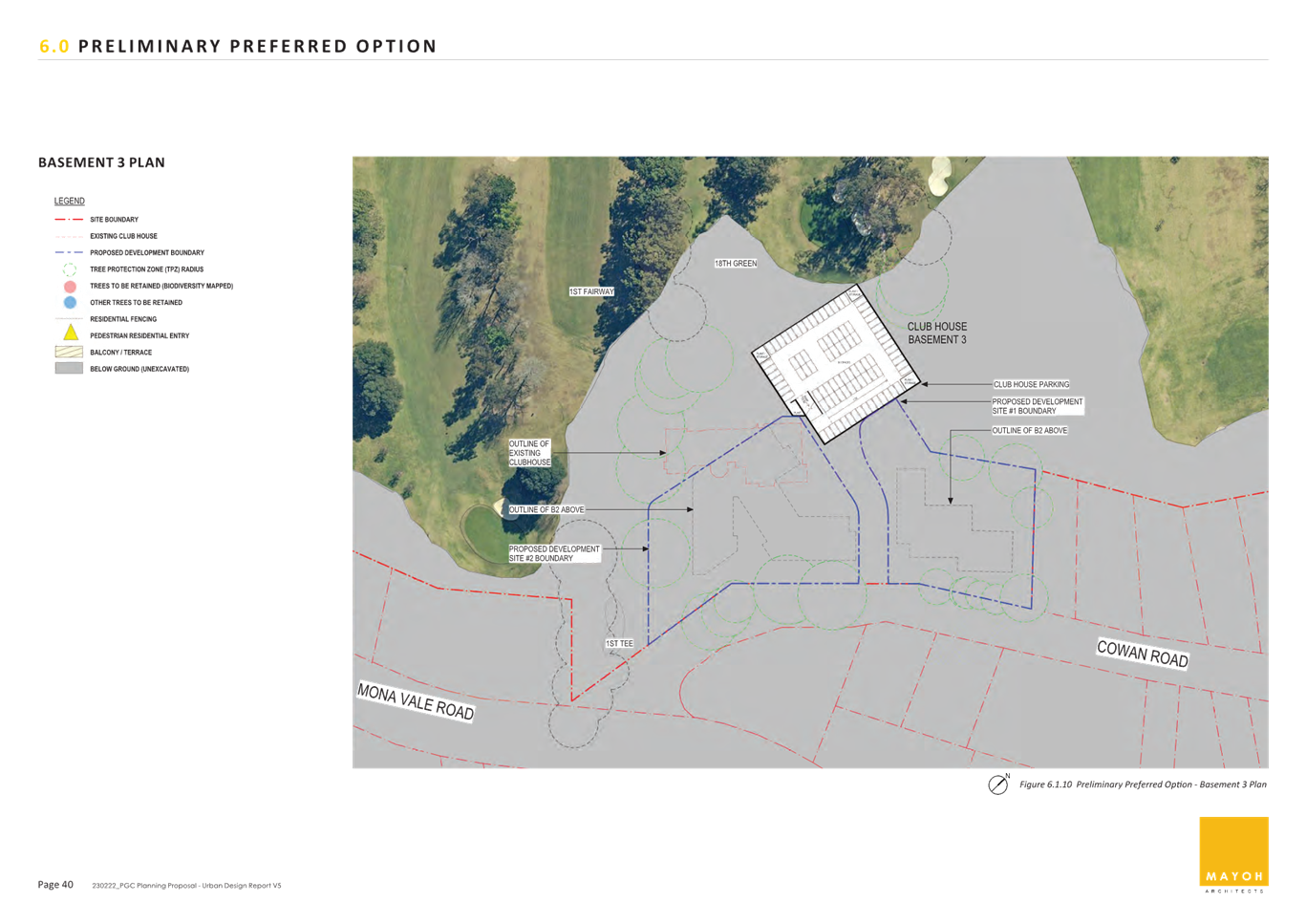
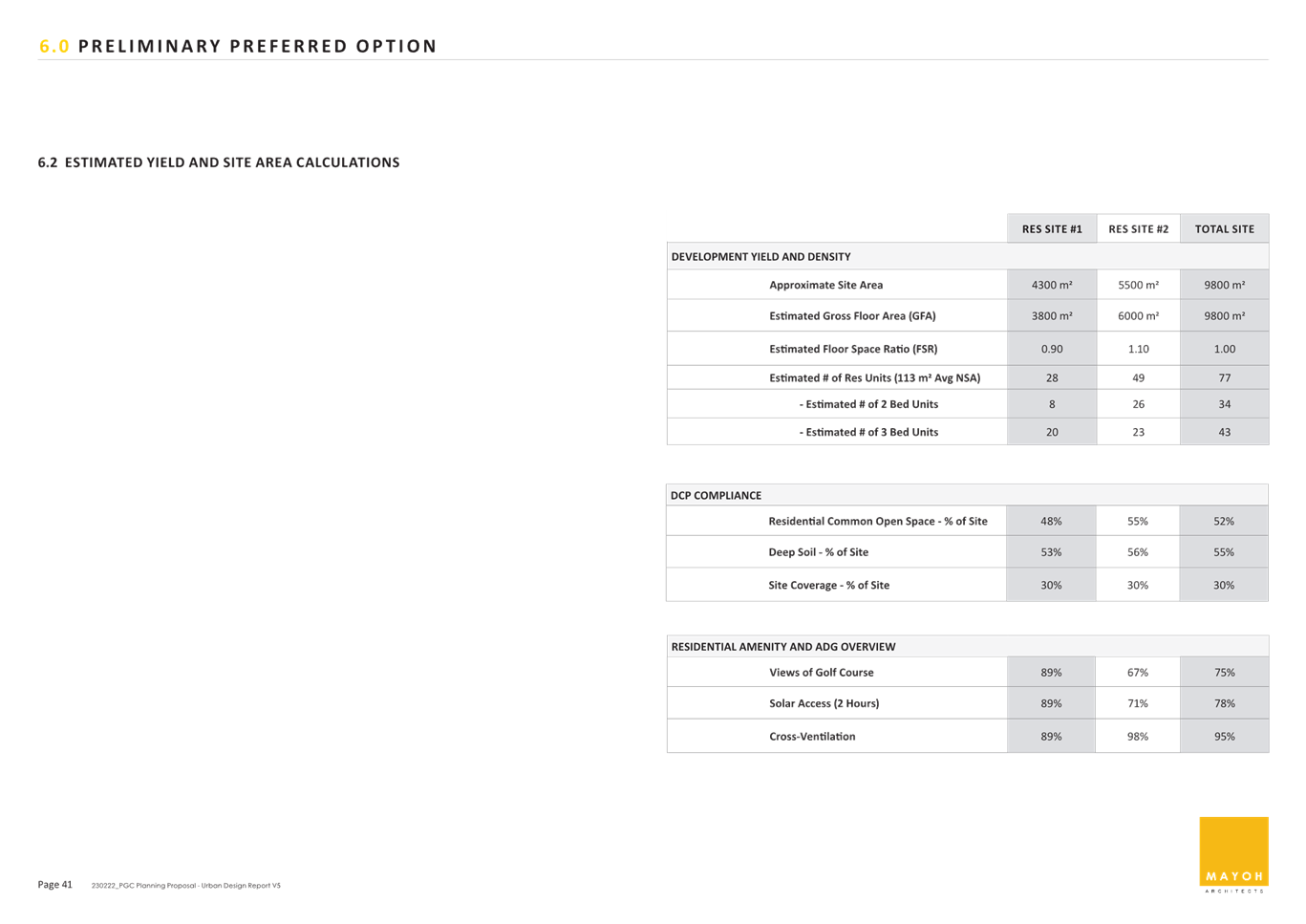
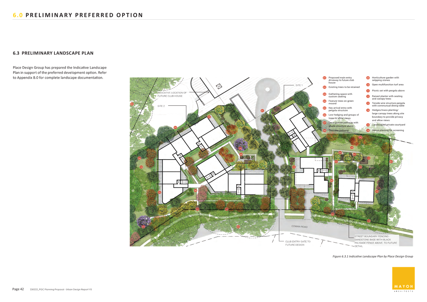
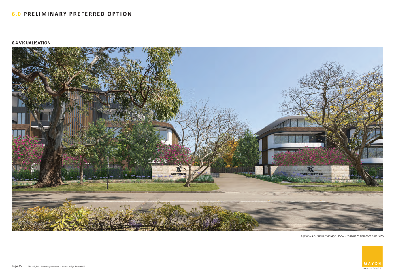
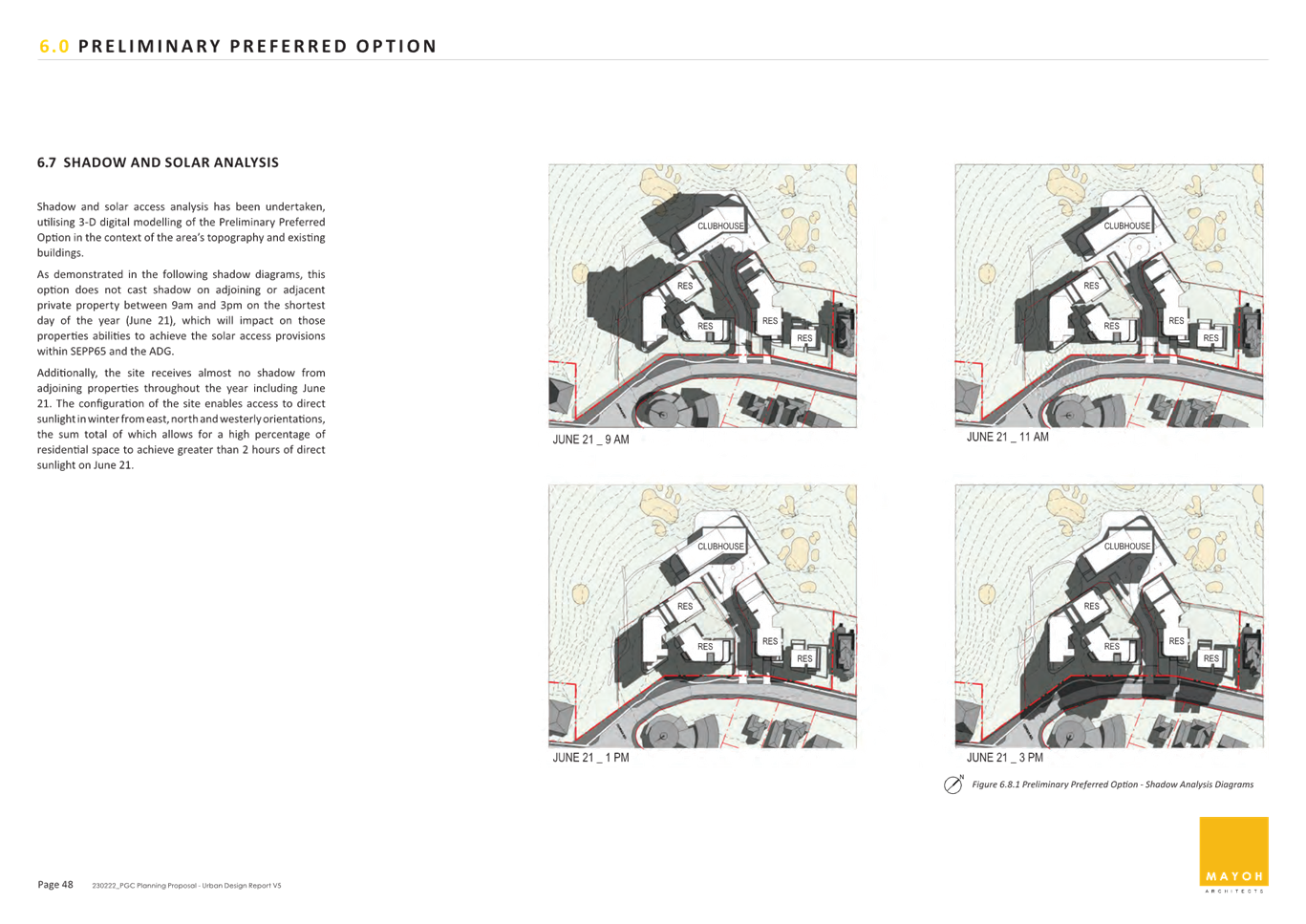
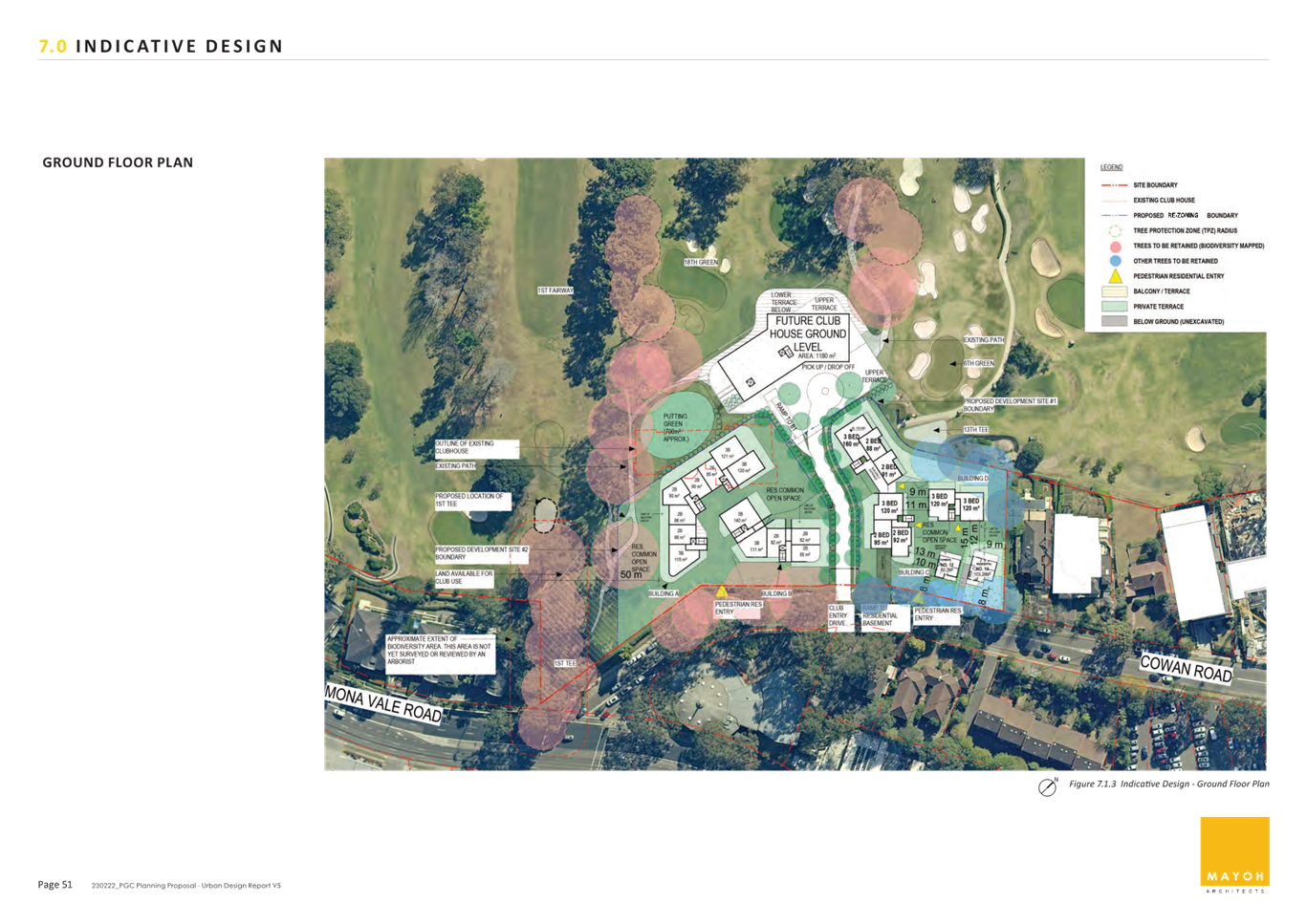
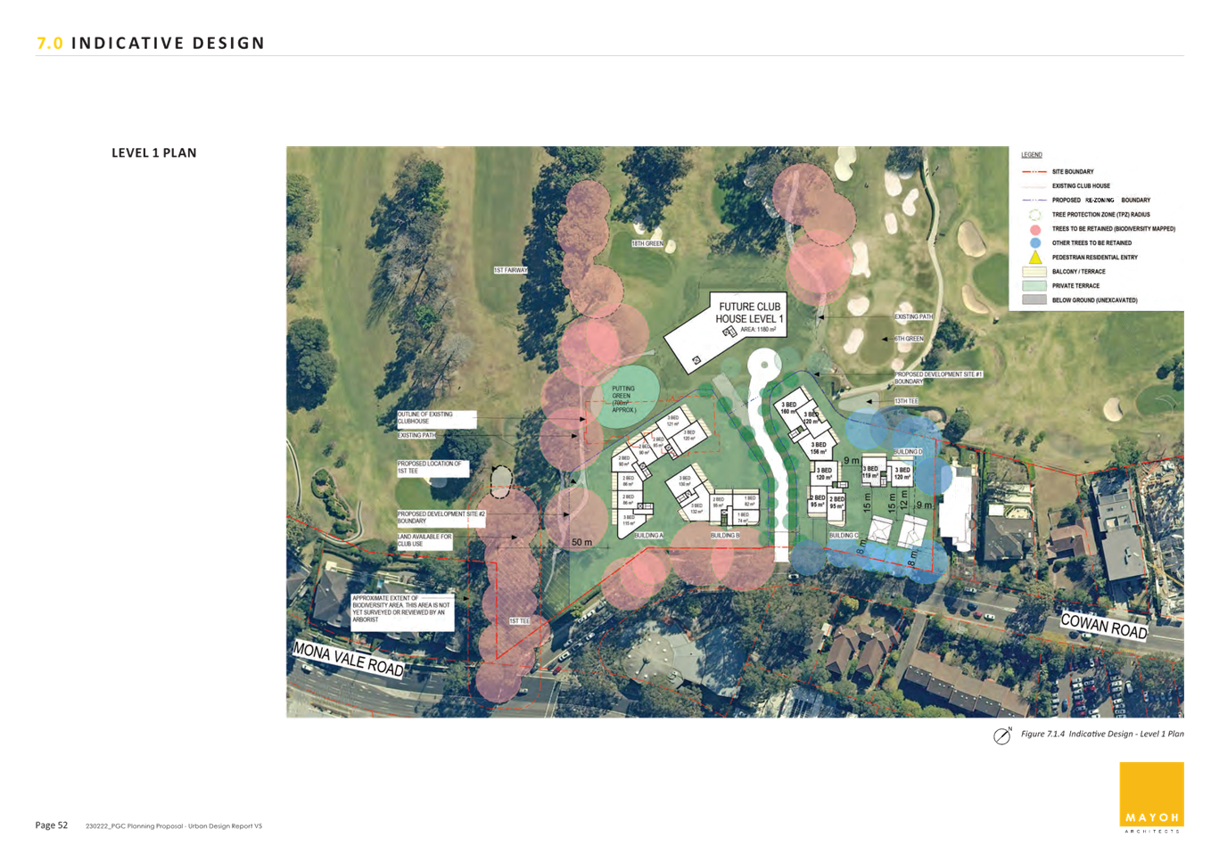
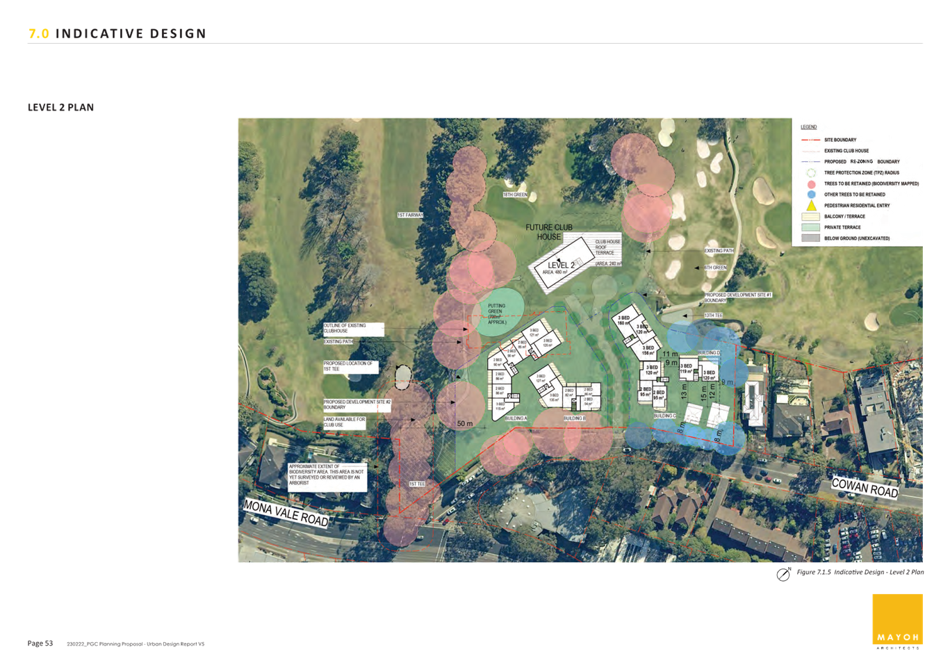
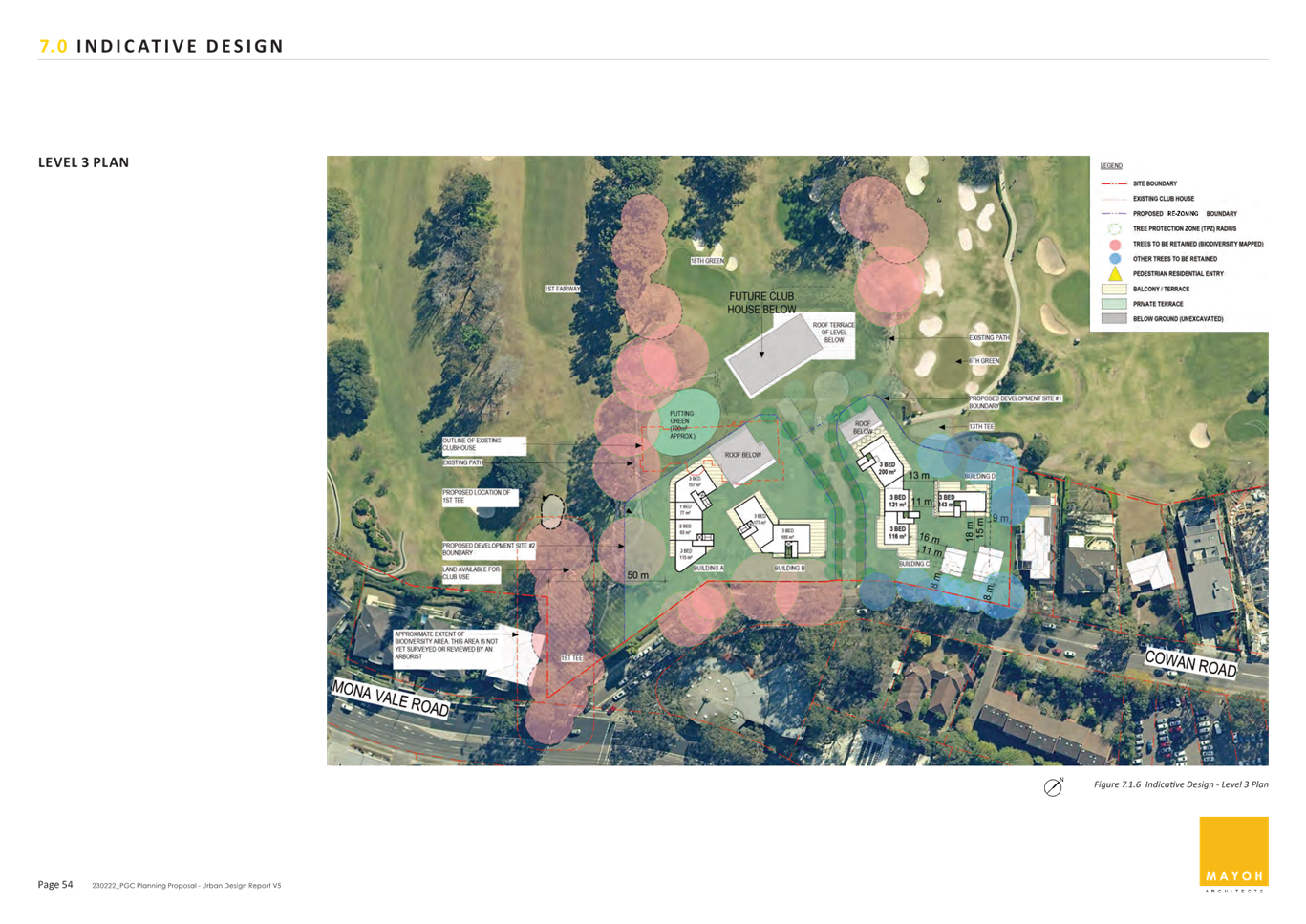
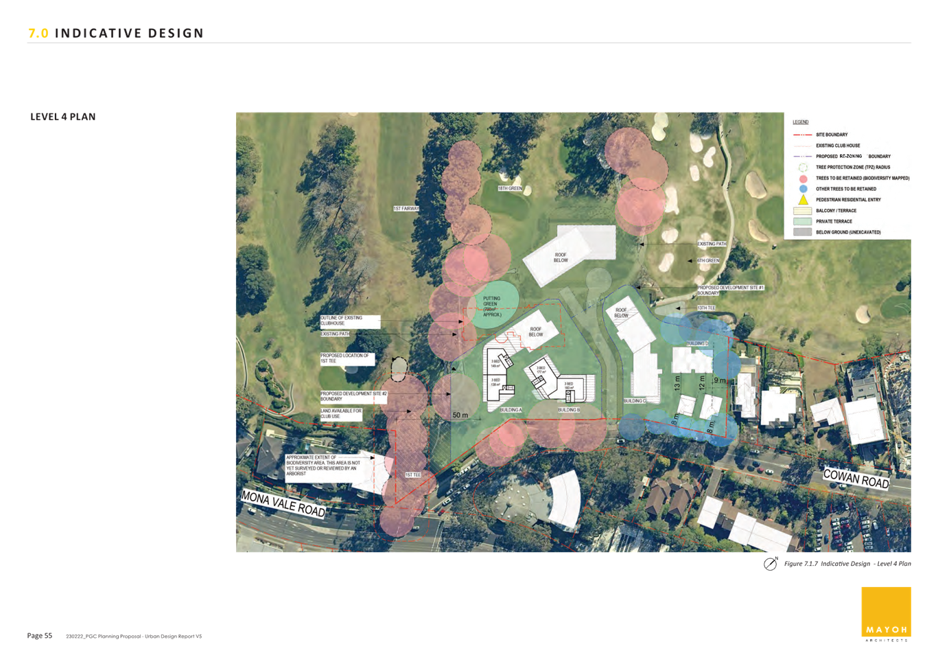
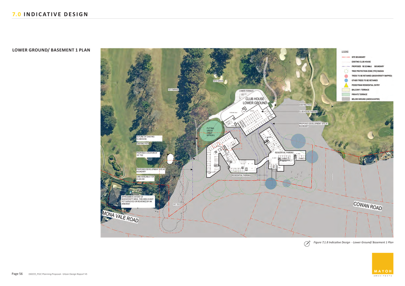
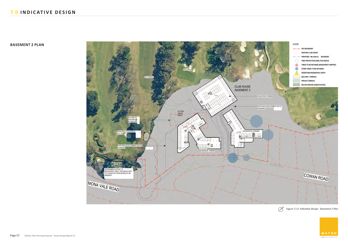
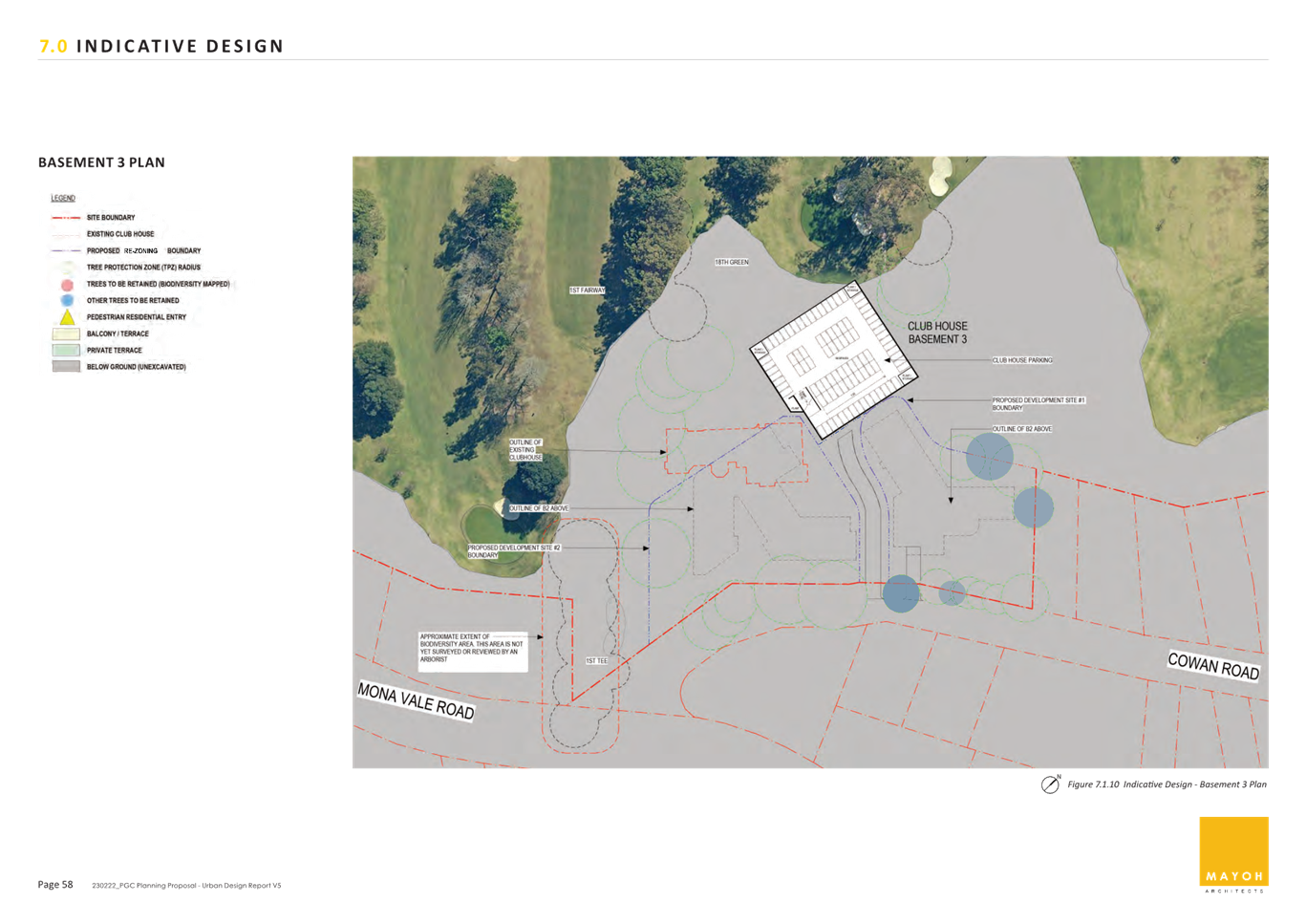
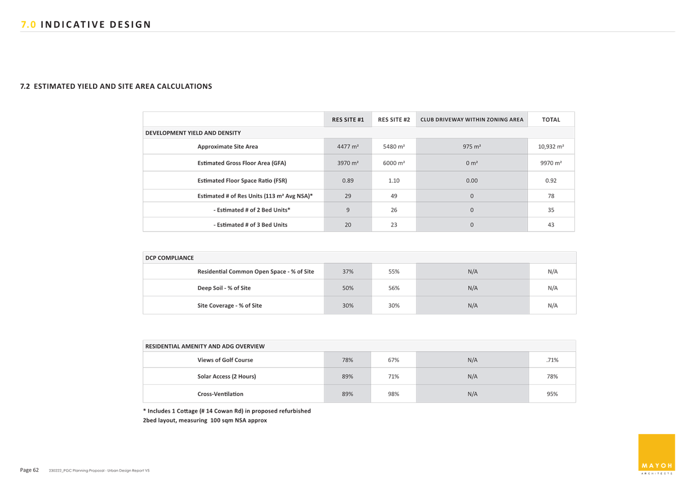
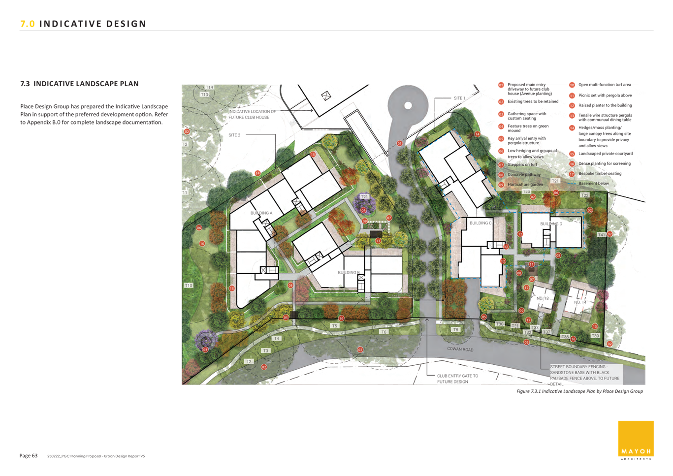
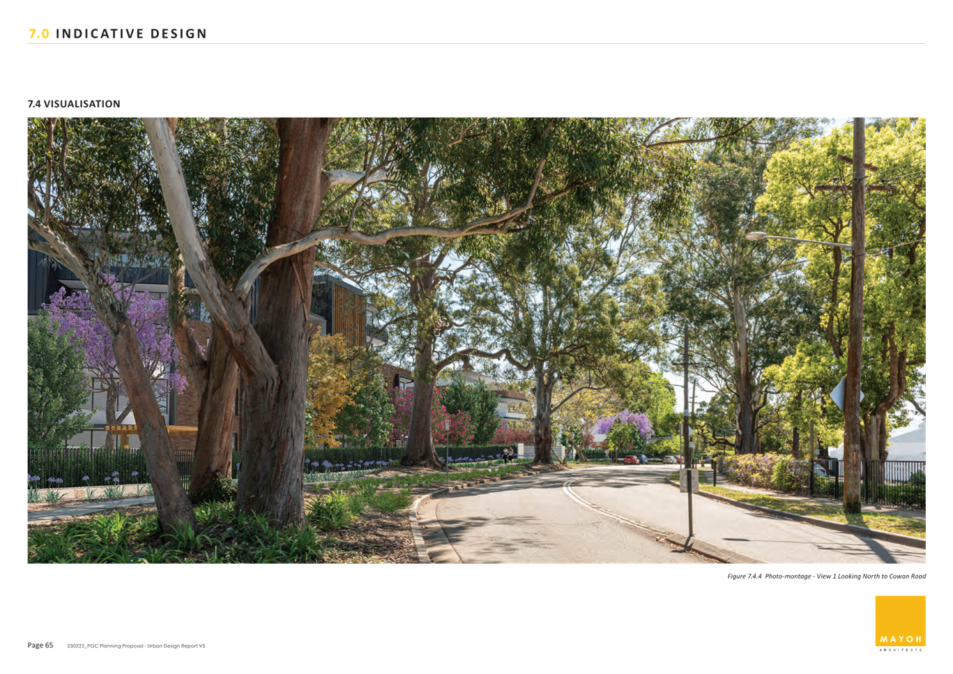
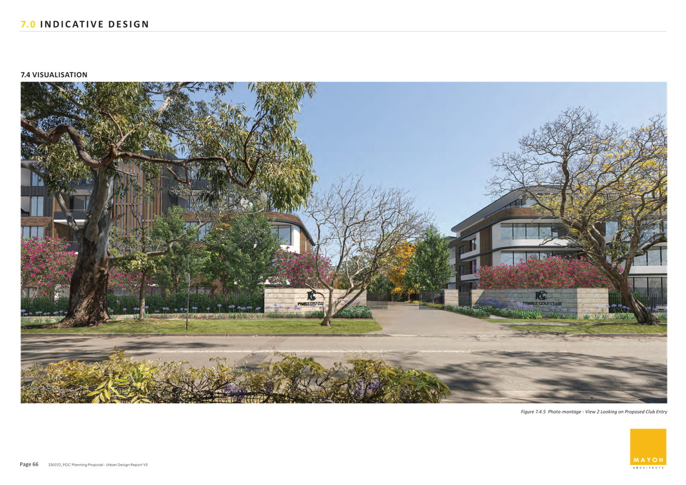
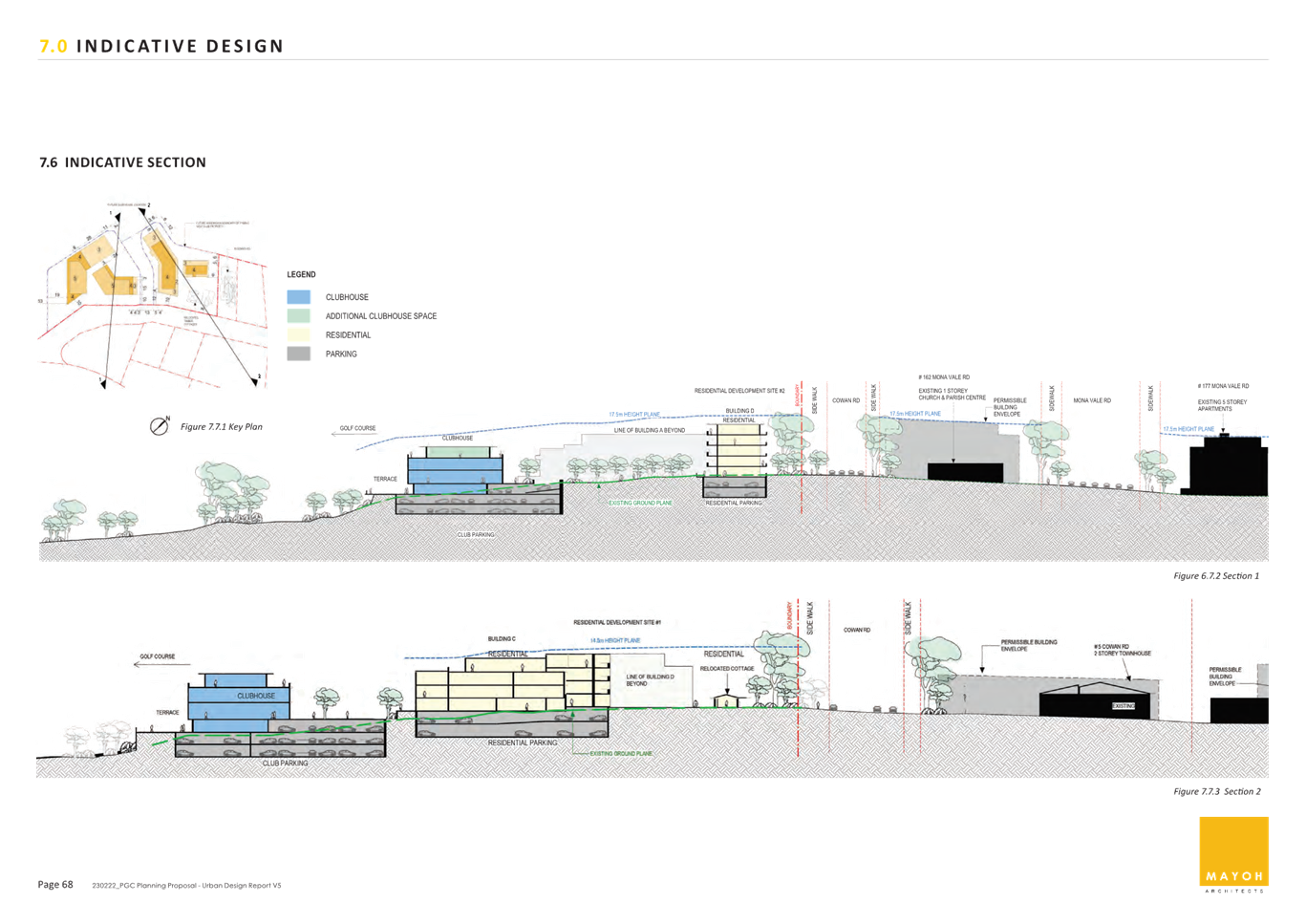
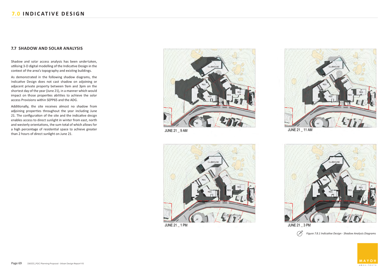
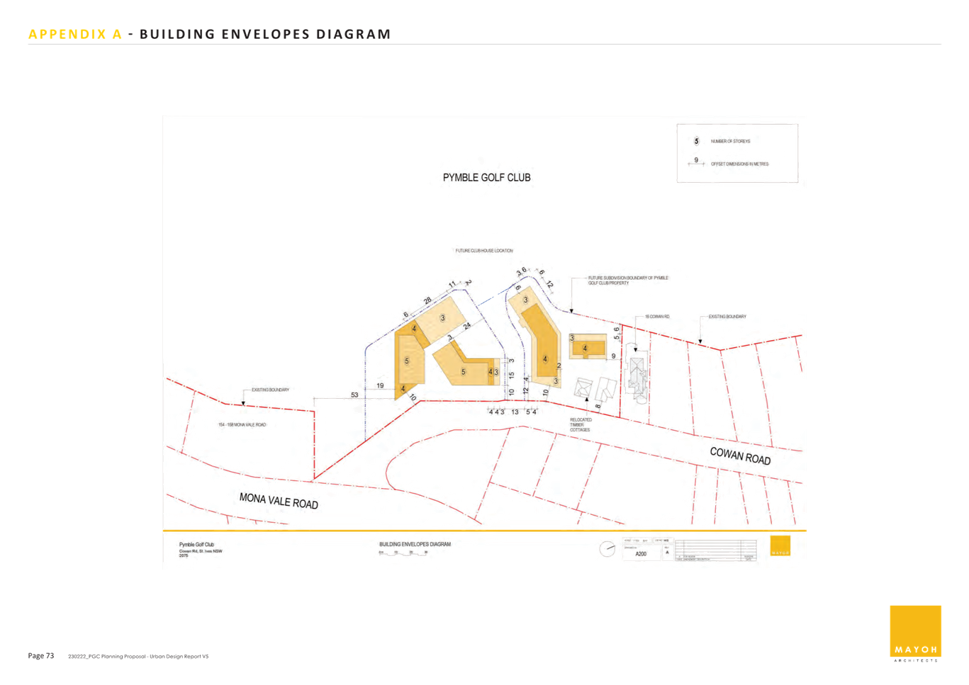
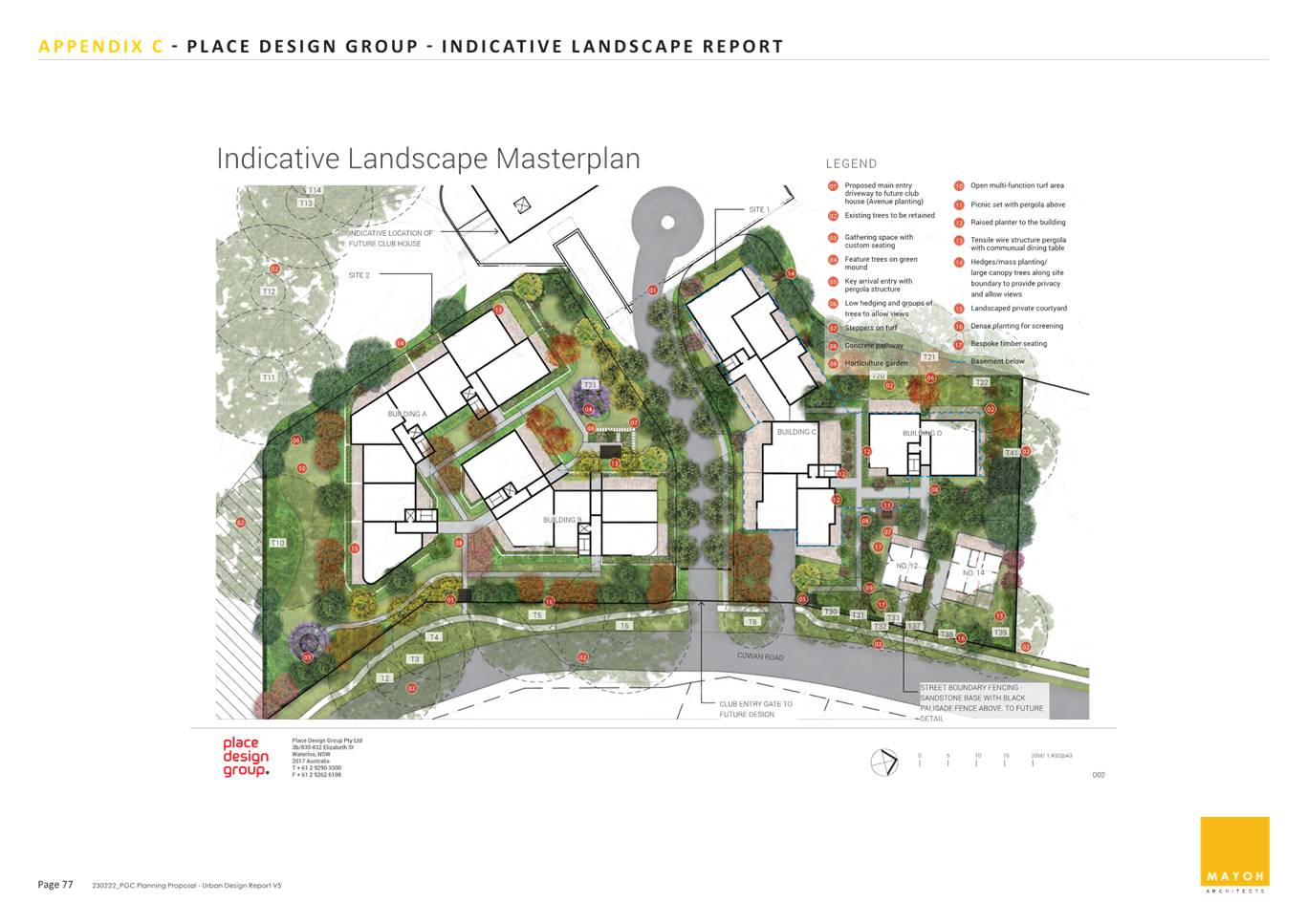
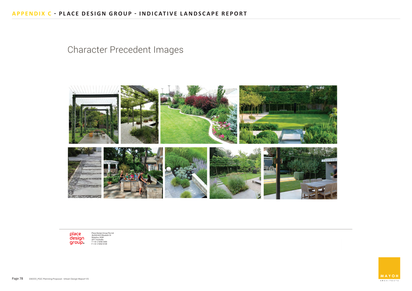
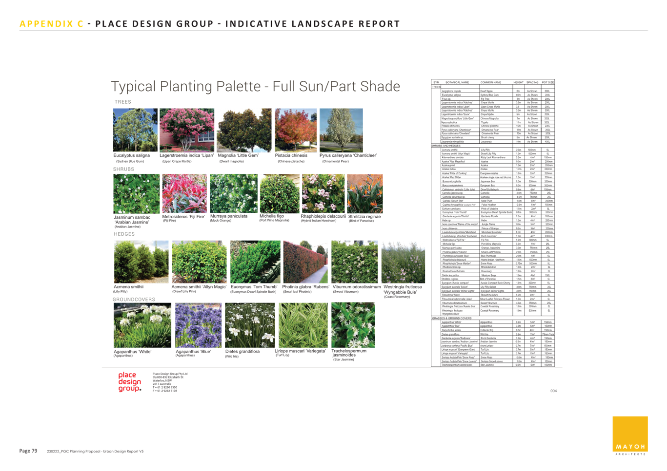
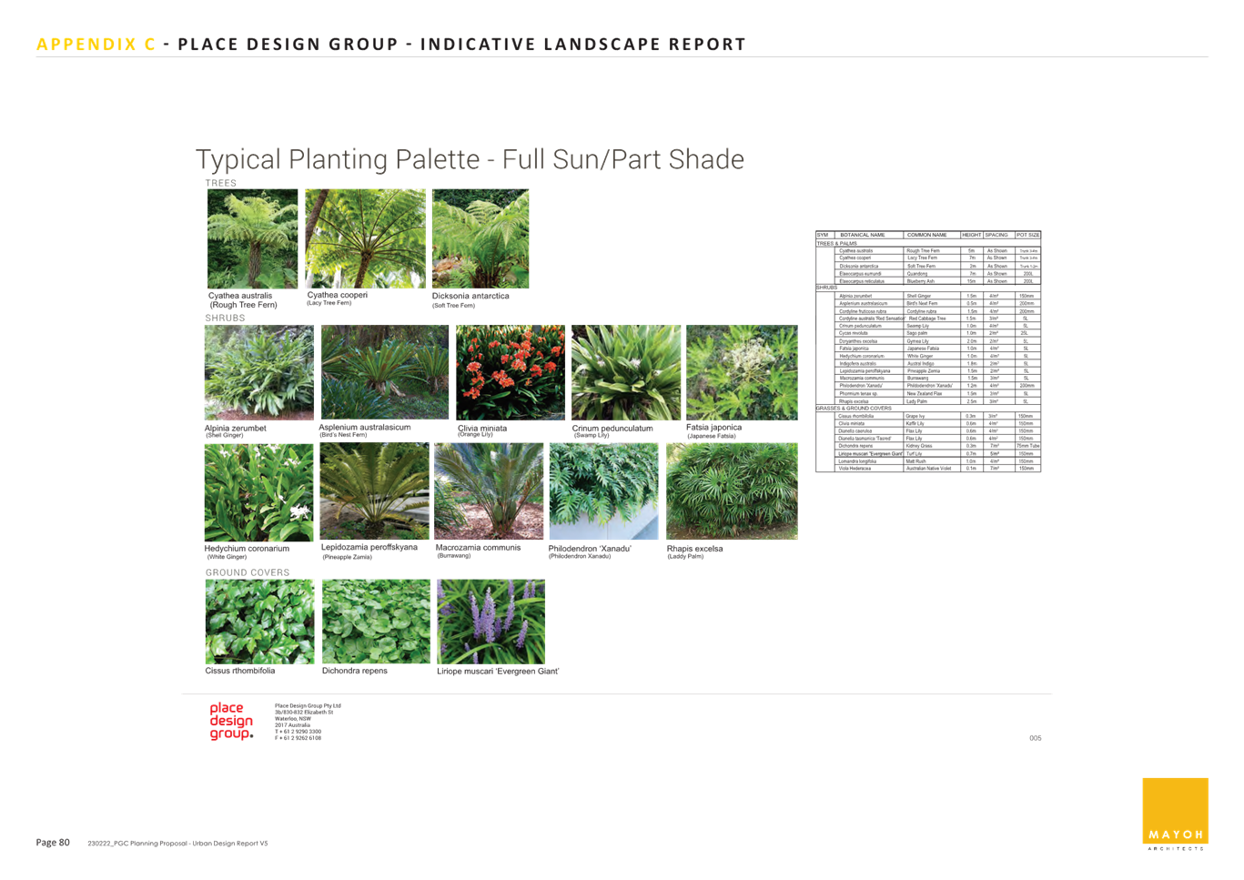
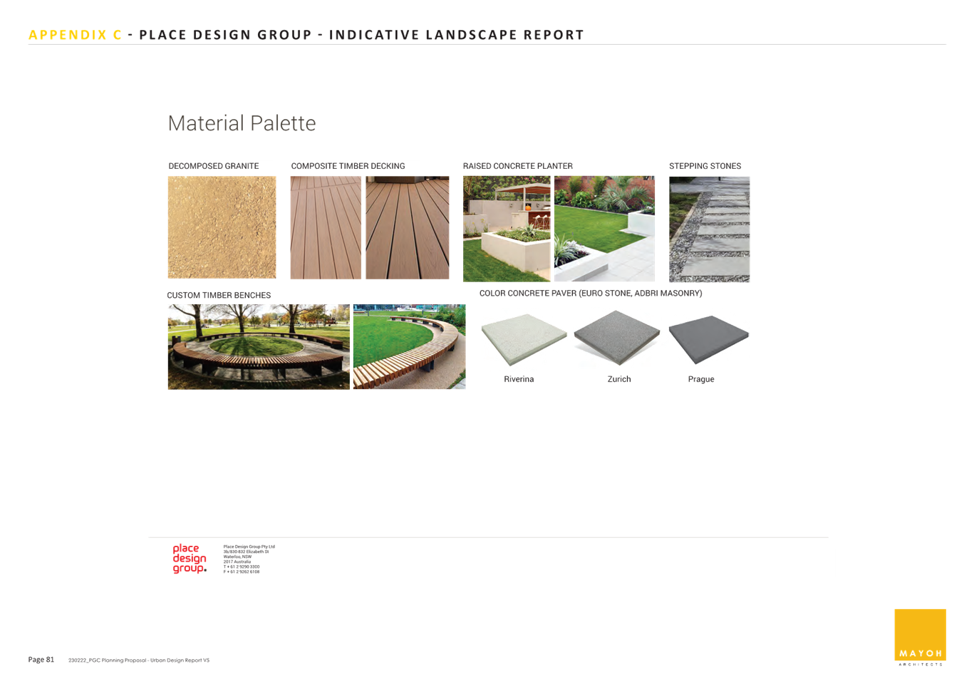
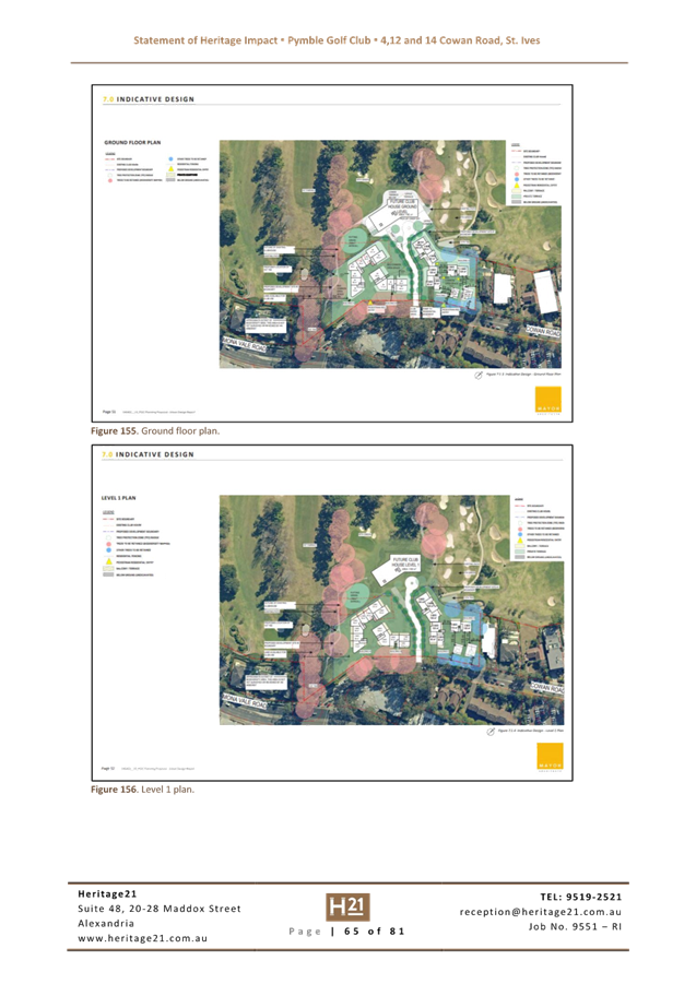
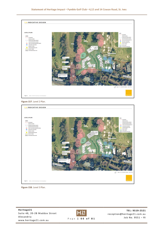
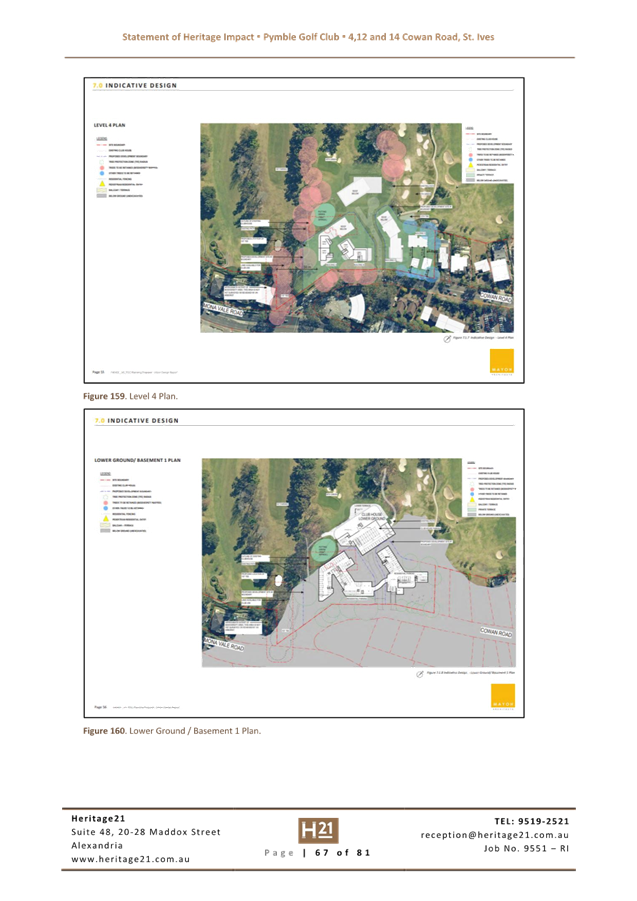
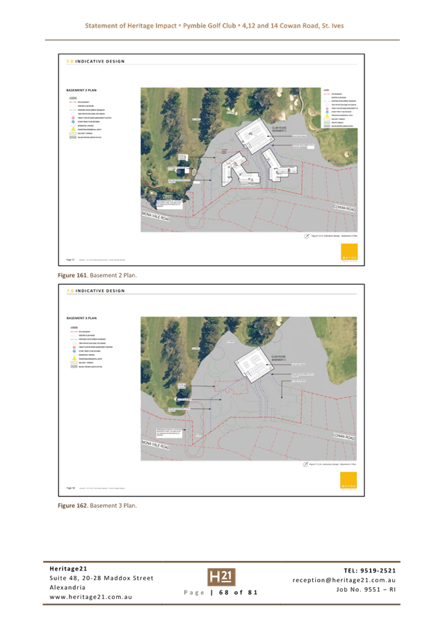
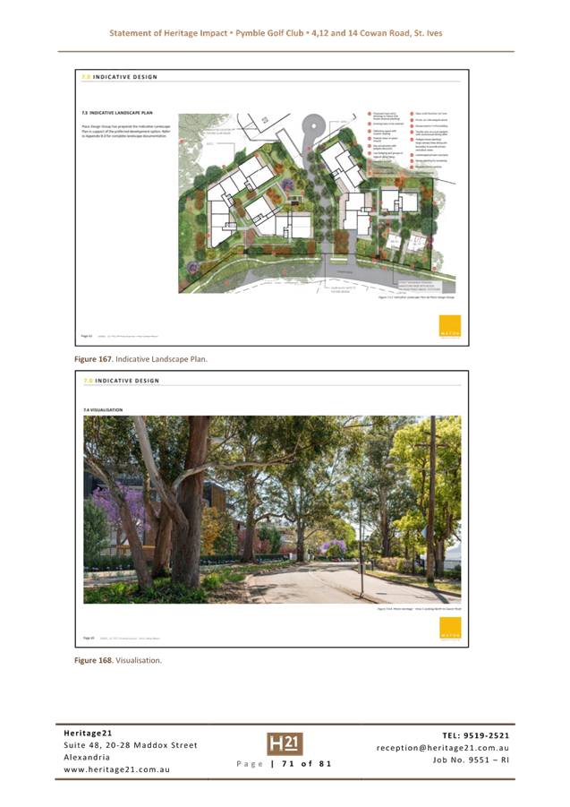
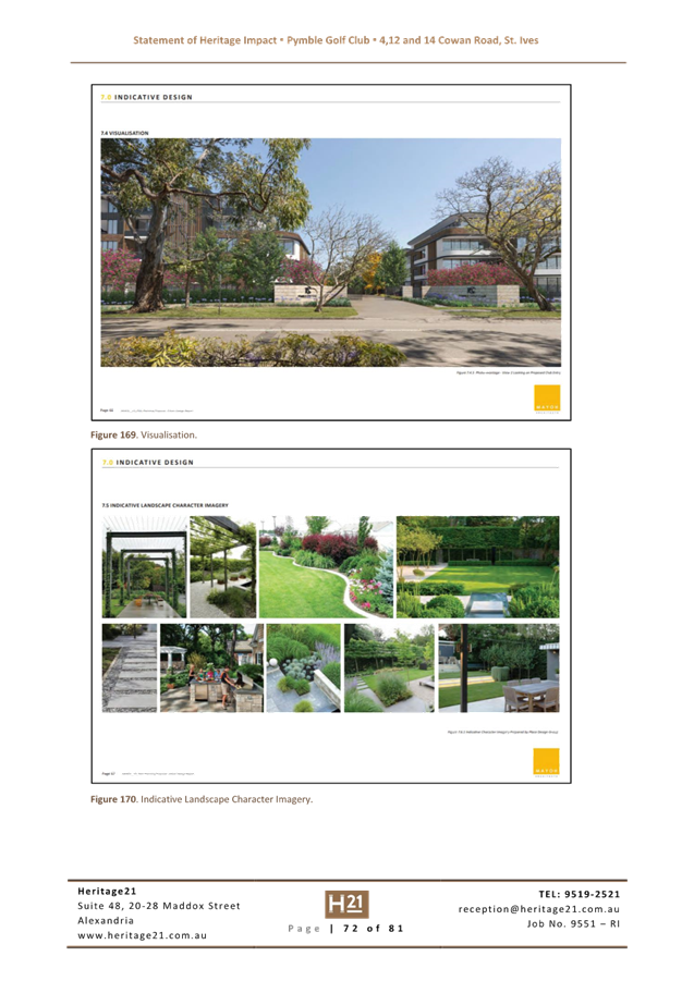
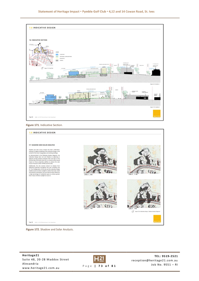
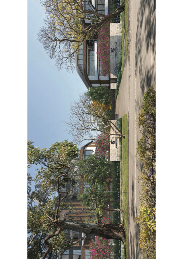
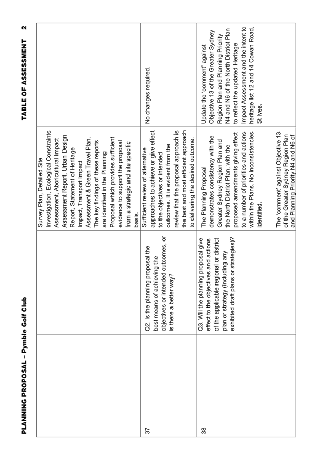
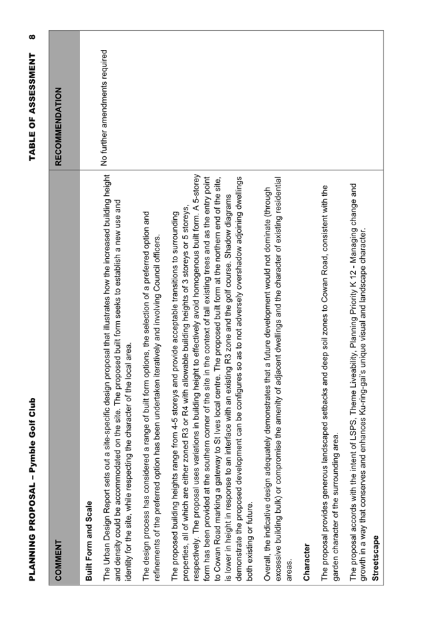
An Urban Design Report is included at Attachment A7. An analysis of the Urban Design Report has been undertaken by Council’s Urban Design Project Officer. This assessment concludes that the Planning Proposal and Indicative Design are considered appropriate for this well-located site. the Urban Design Report demonstrates that the indicative design could satisfy the controls detailed in KDCP Part 7 - Residential Flat Buildings as well as the nine design quality principles which are to be achieved by residential flat developments under SEPP 65 Design Quality of Residential Apartment Development.
A more detailed analysis is included in Table of Assessment at Attachment A11.
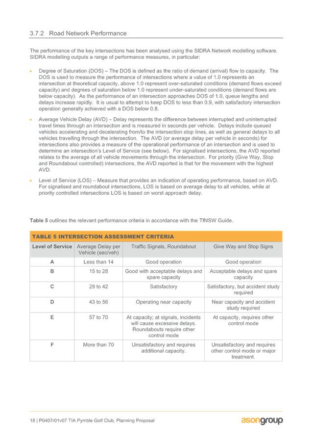
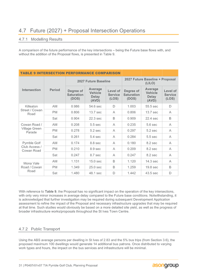
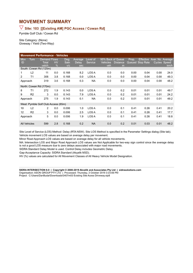
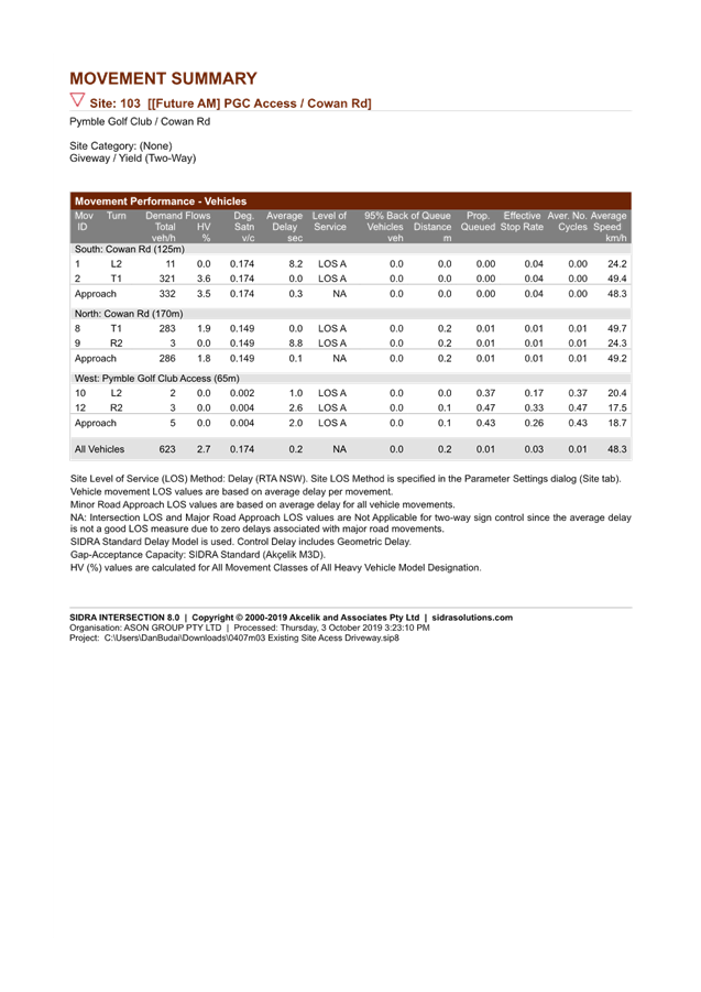
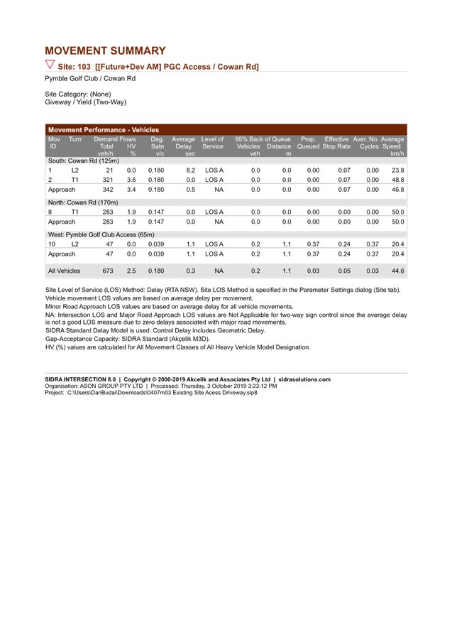
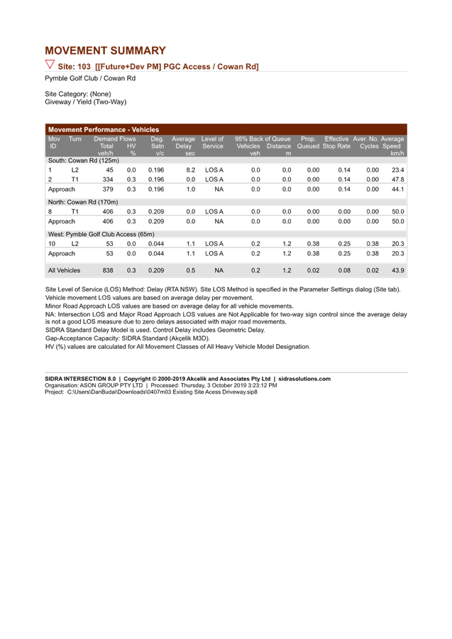
· Traffic and Transport
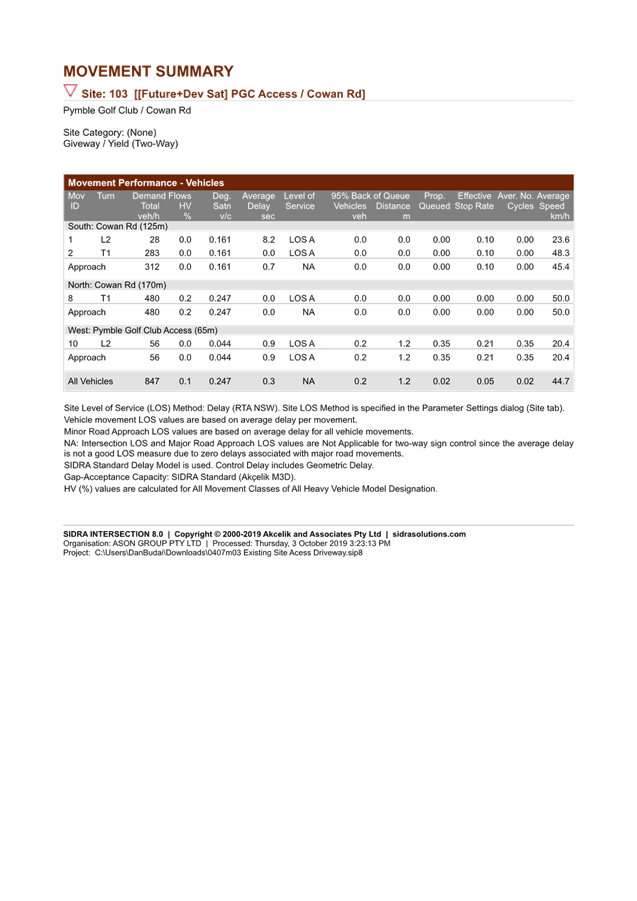
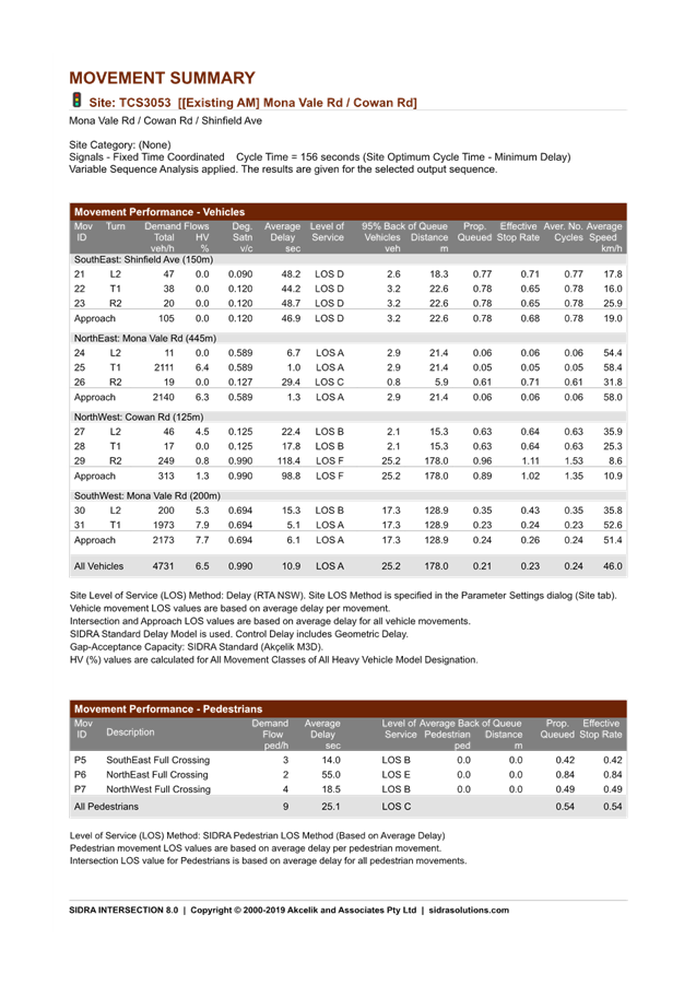
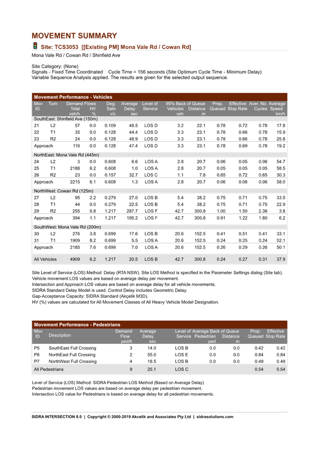
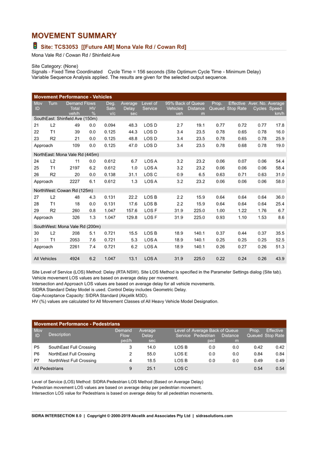
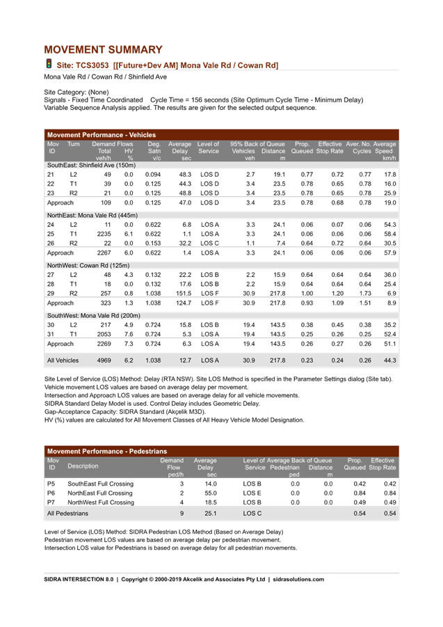
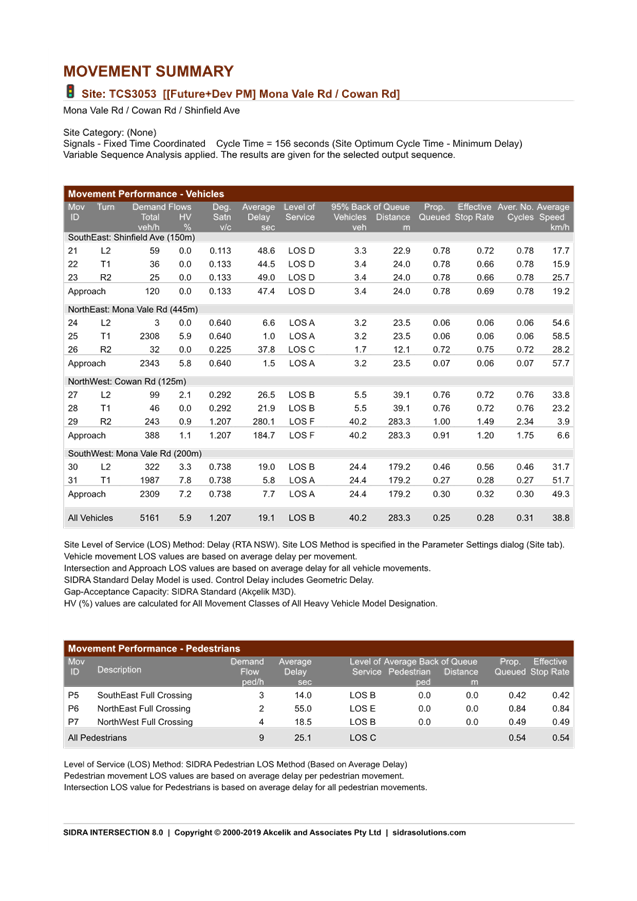
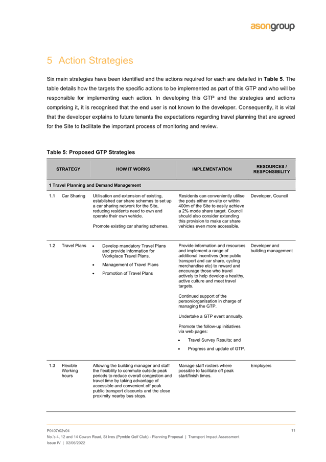
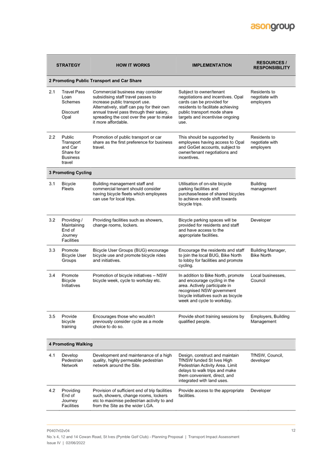
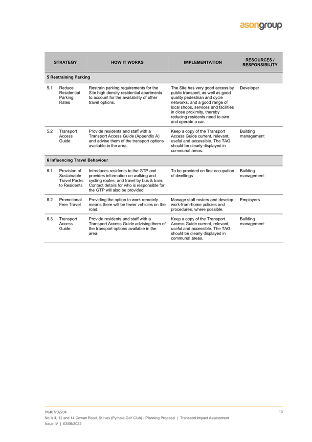
A Transport Impact Assessment is included at Attachment A9. An analysis of the Transport Impact Assessment has been undertaken by Council’s Strategic Transport Engineer has reviewed the documents and provided the following key points. A more detailed traffic and transport analysis is included in the Table of Assessment, at Attachment A11.
The Planning Proposal has the following favourable transport aspects:
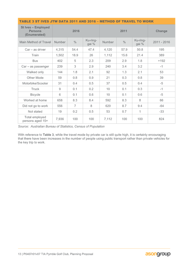
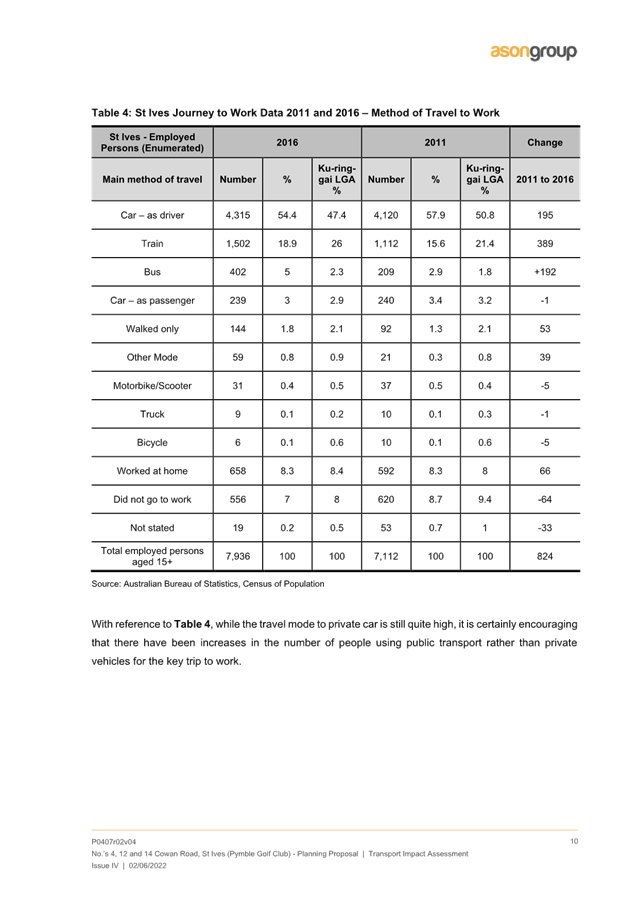
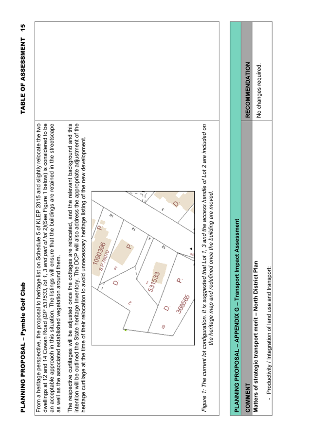
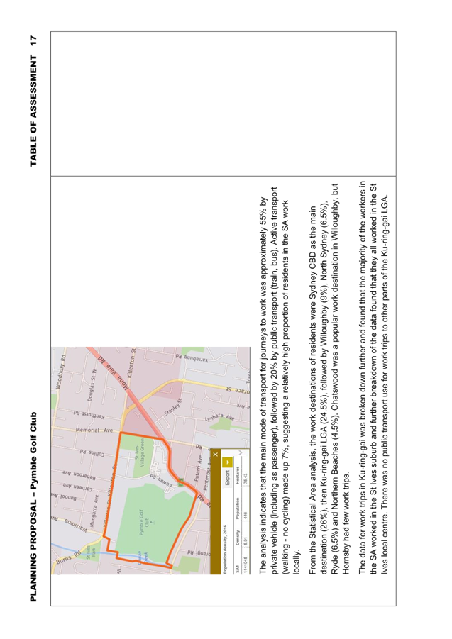
o Workers in the Statistical Area of the site that work within the Ku-ring-gai LGA (approximately a quarter of all workers in the Statistical Area) worked in the St Ives local centre and walked to work;
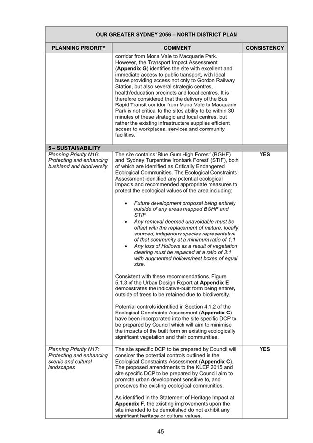
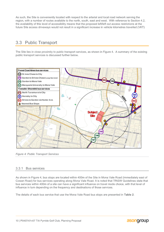
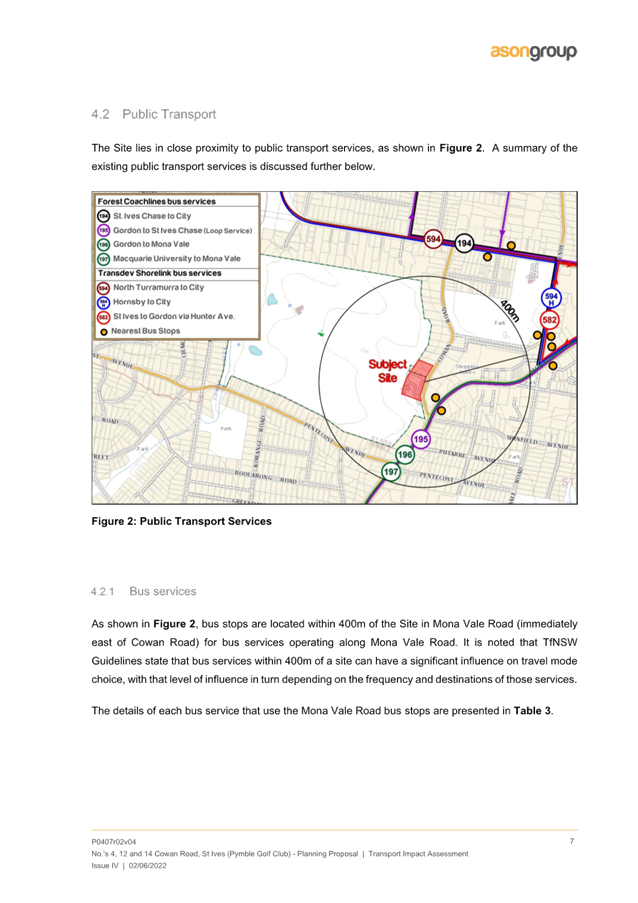
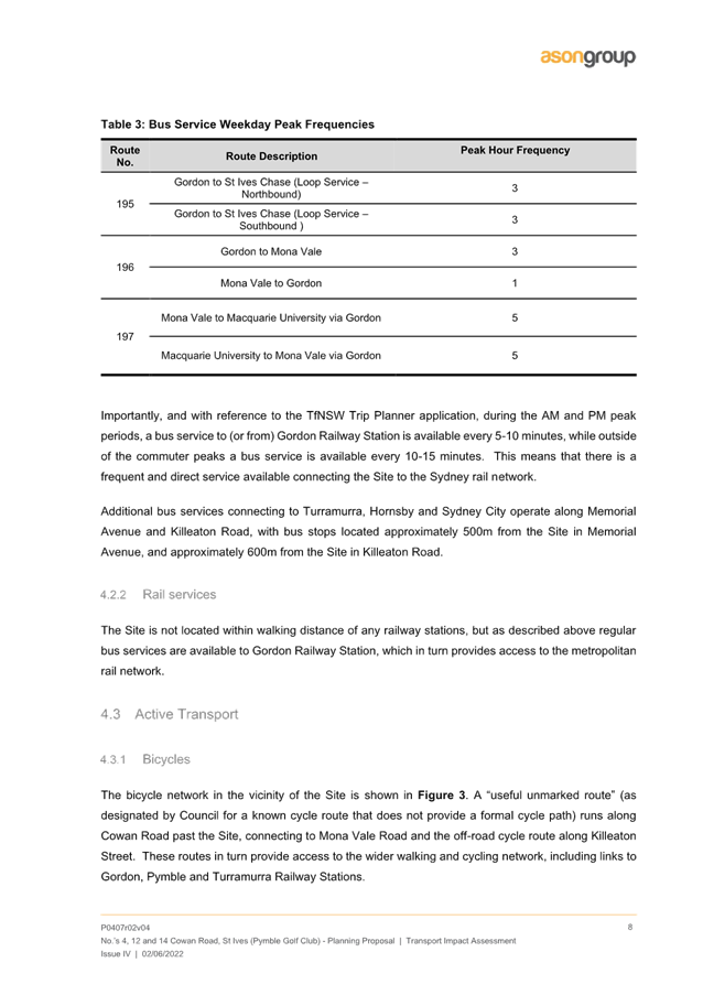
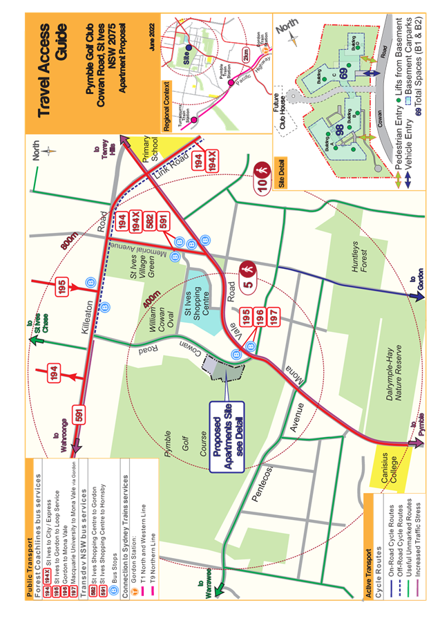
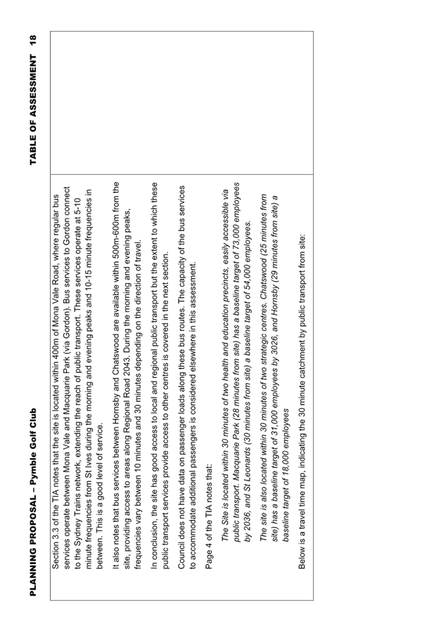
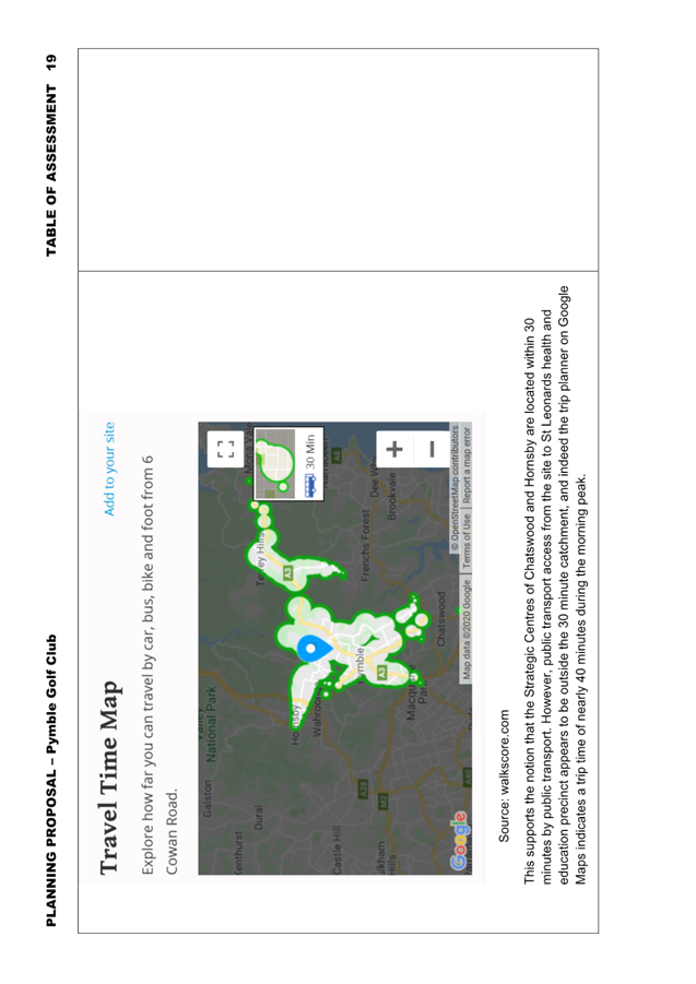
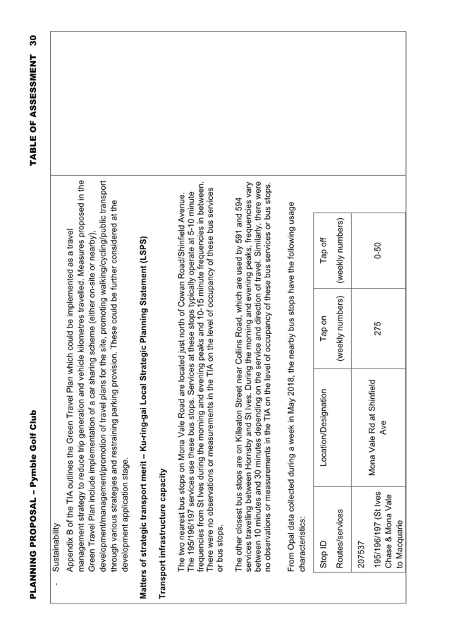
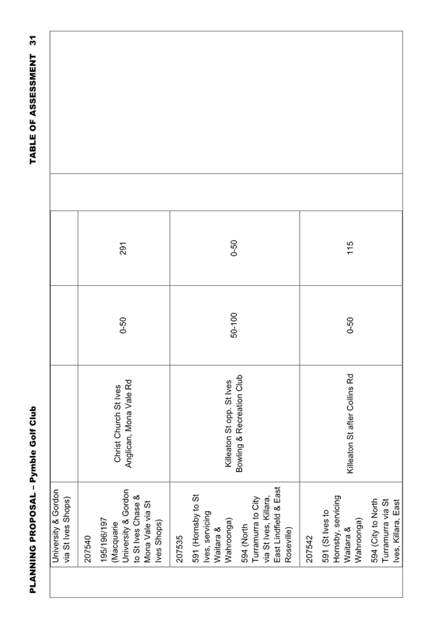
o The site is located within 400m of Mona Vale Road, where regular bus services operate between Mona Vale and Macquarie Park (via Gordon). Bus services to Gordon connect to the Sydney Trains network. There is currently sufficient capacity in these bus services and nearby bus stops to accommodate additional bus passenger demand resulting from the Planning Proposal;
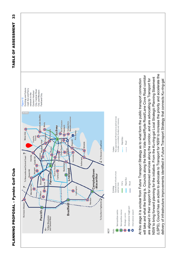
o The site is well positioned to take advantage of improved bus services between Mona Vale and Macquarie Park which are foreshadowed in Future Transport Strategy and the Macquarie Park Strategic Infrastructure and Services Assessment;
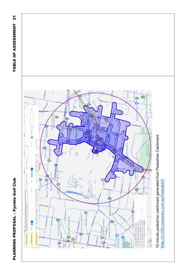
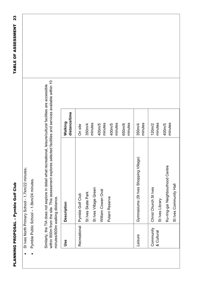
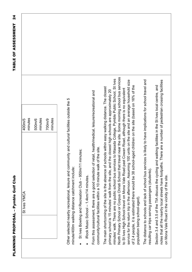
o There is a good selection of retail, health/medical, leisure/recreational and community/cultural facilities within a 10 minute walk of the site, mostly located within the St Ives Shopping Village, St Ives Village Green/Cowan Oval and within the site itself;
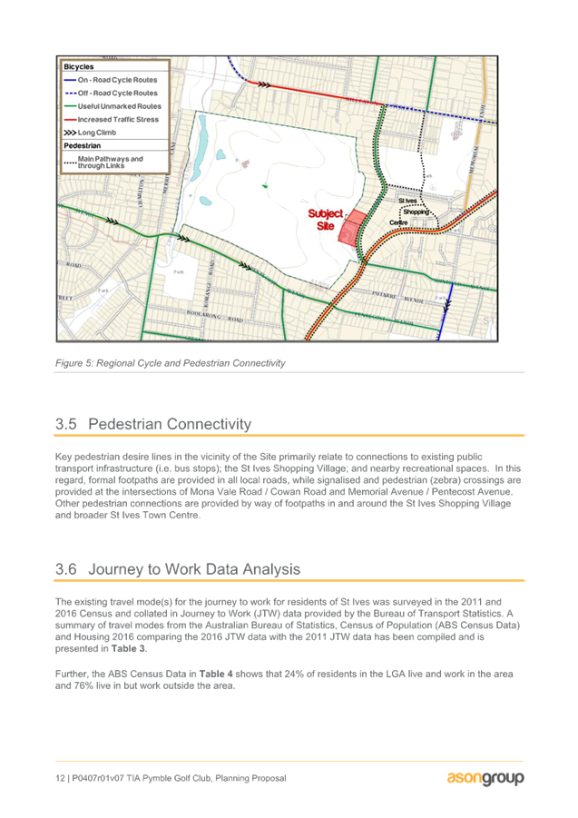
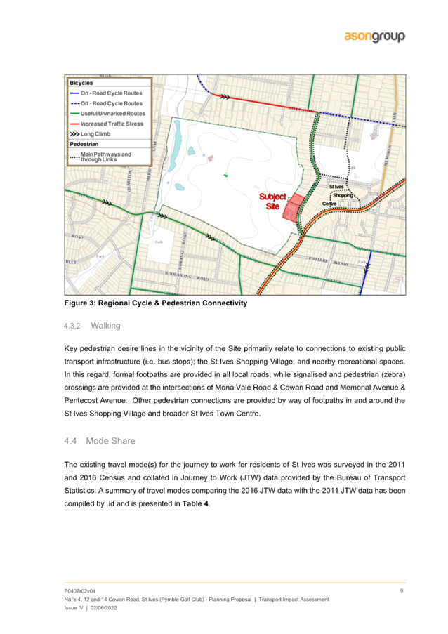
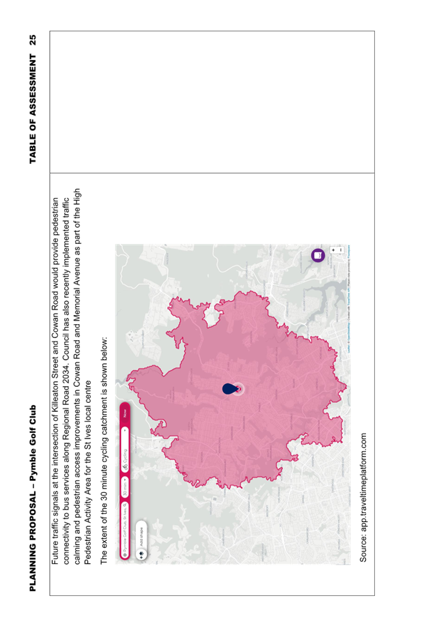
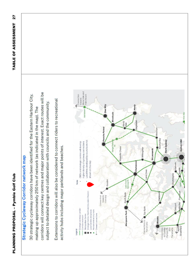
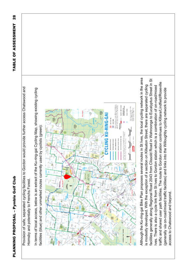
o The local cycling network in the area is modestly developed, providing a degree of local and regional cycling connectivity;
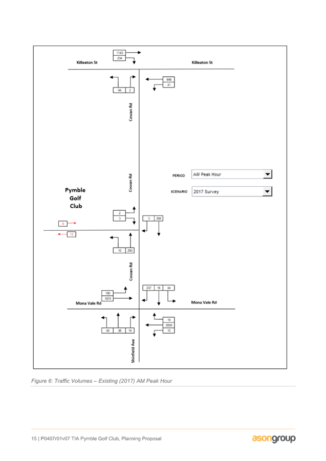
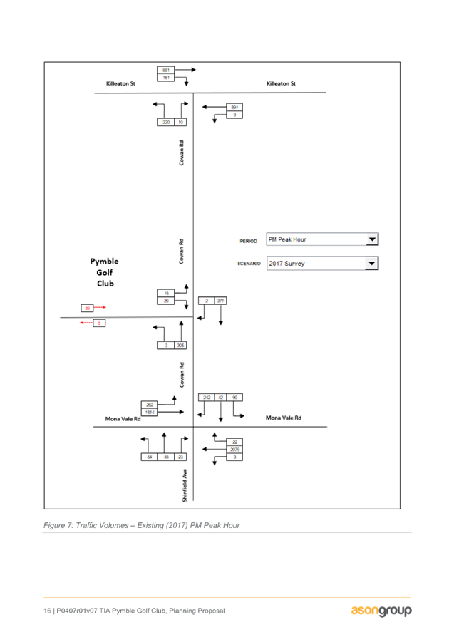
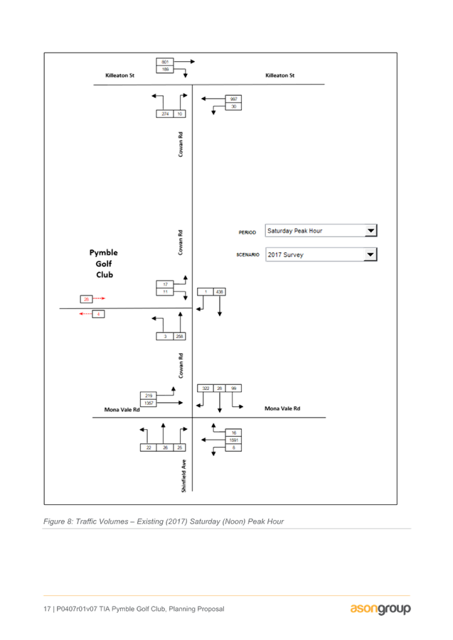
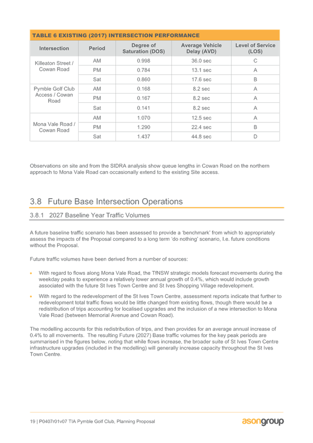
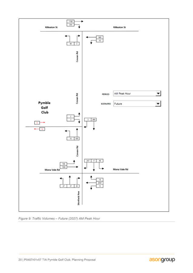
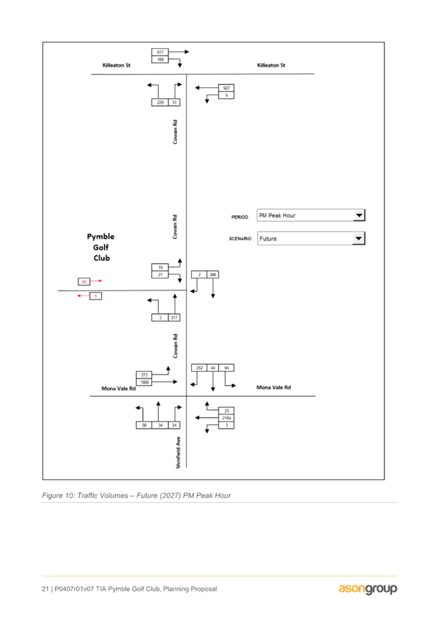
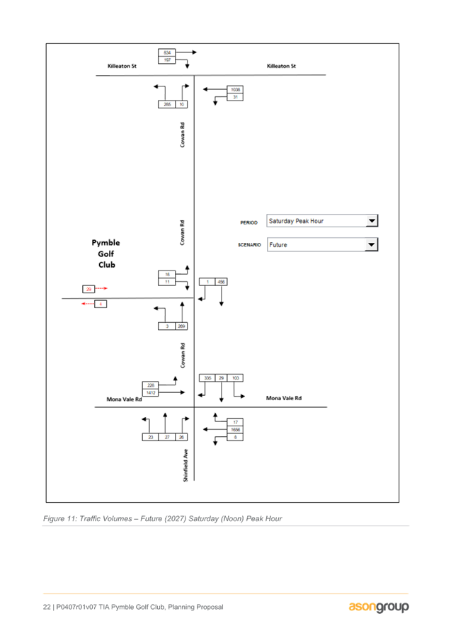
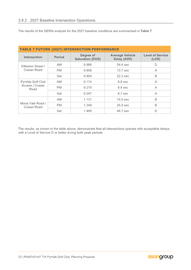
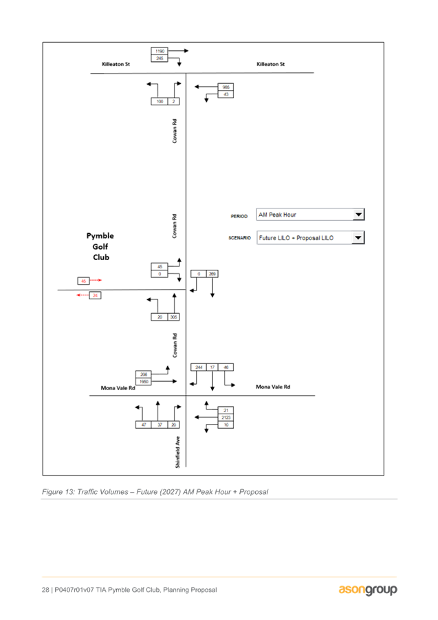
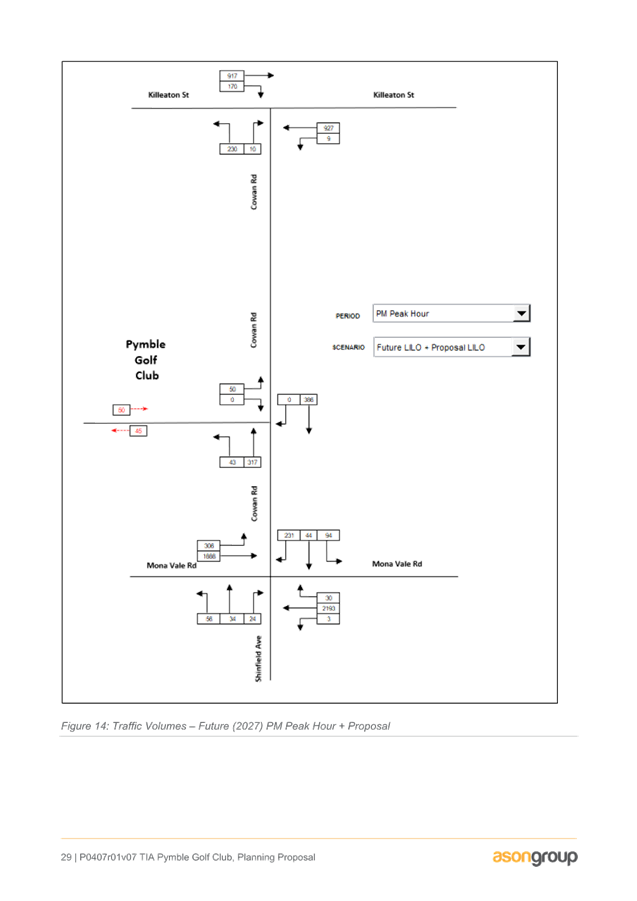
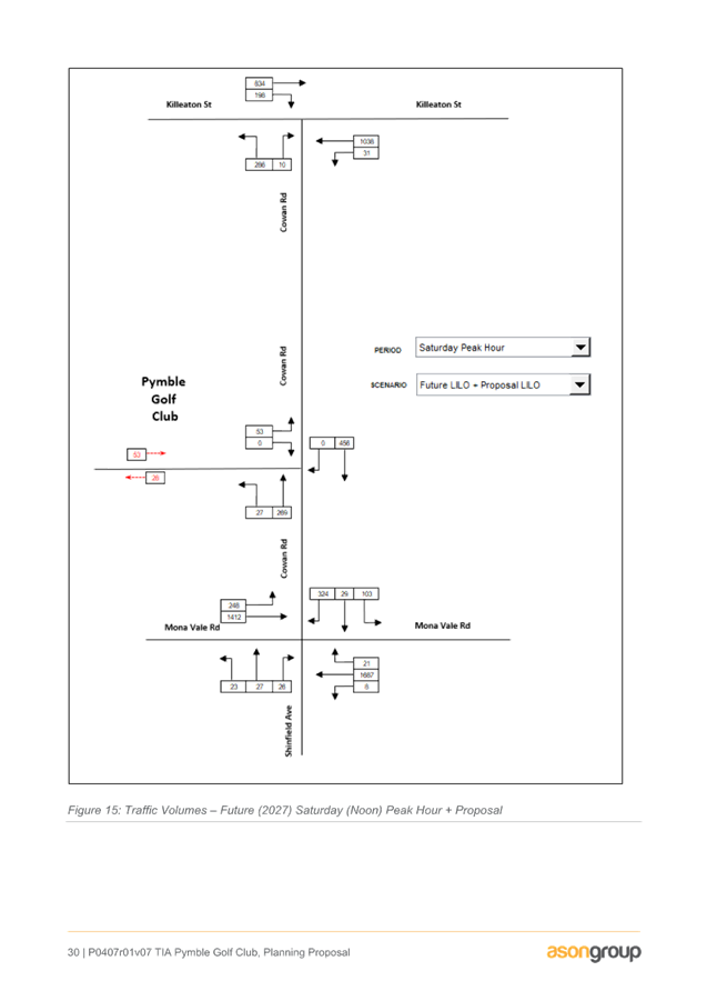
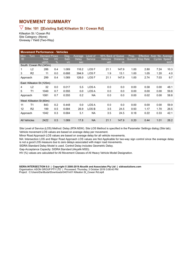
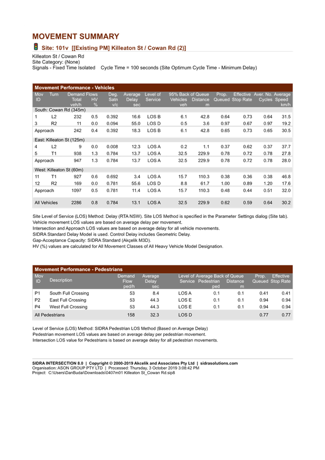
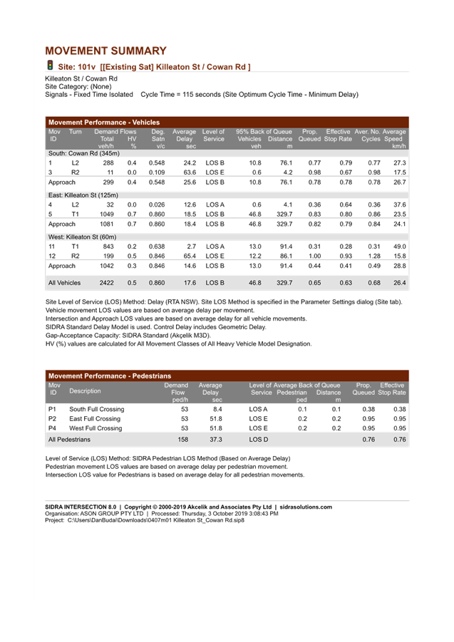
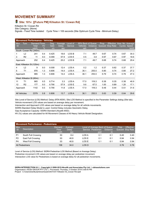
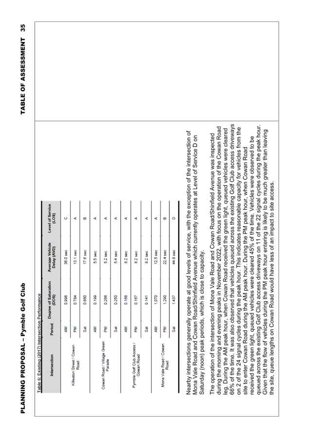
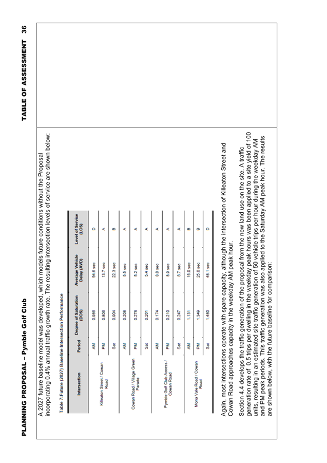
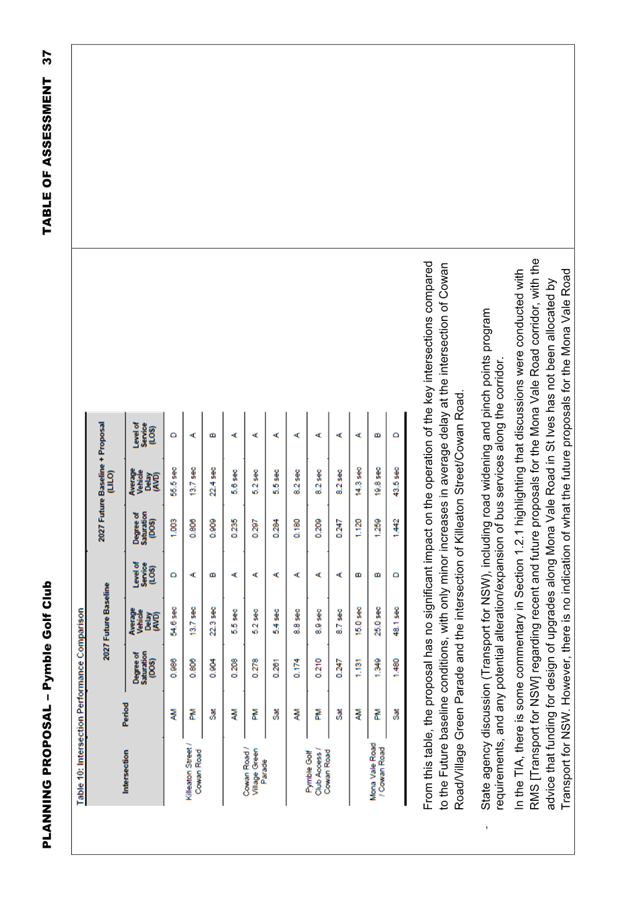
o The proposal is not expected to have significant additional impact on the operation of the key nearby intersections, with only minor increases in average delay at the intersection of Cowan Road/Village Green Parade and the intersection of Killeaton Street/Cowan Road.
The following transport constraints were found with respect to the Planning Proposal:
o The site has access to only a modest number of Strategic Centres (and therefore jobs) within 30 minutes by public transport, compared to other centres located further south in Ku-ring-gai;
o While existing bus services provide good connections between St Ives and Gordon, bus access to Macquarie Park is currently constrained by congestion on Ryde Road and Lane Cove Road;
o There is a notable absence of schools within easy walking distance of the site. The closest primary school is 15 minutes’ walk from the site, and the closest high schools are approximately 20 minutes’ walk. There is also limited route bus and school bus services connecting the site with nearby schools. Depending on the future demographic of the site, this could result in a higher reliance on cars being used as a mode of travel between the site and nearby schools.
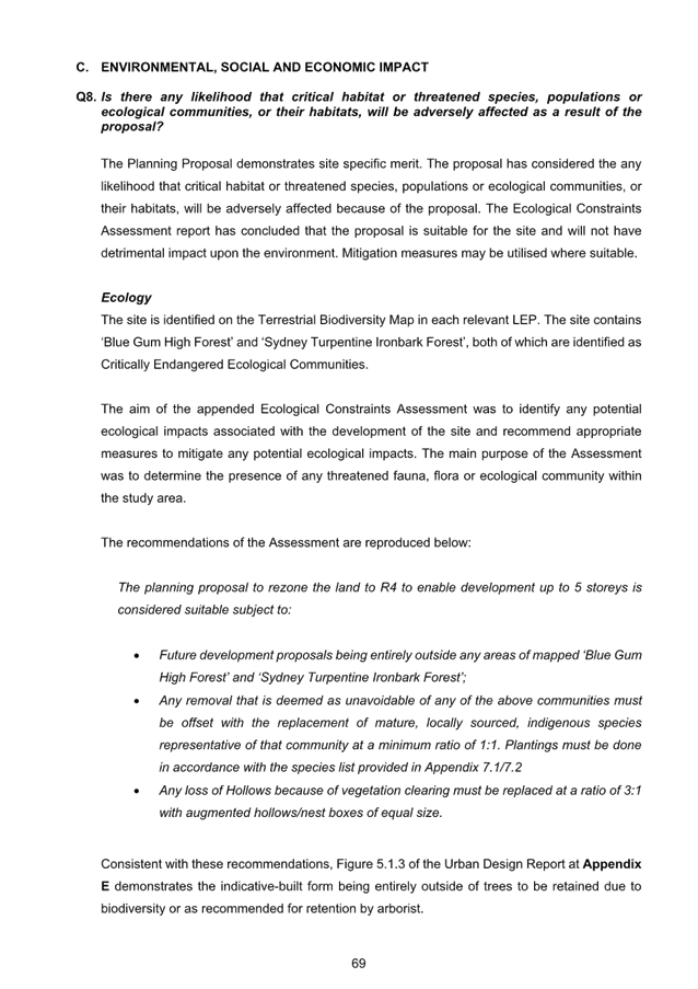
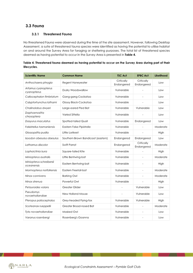
· Biodiversity
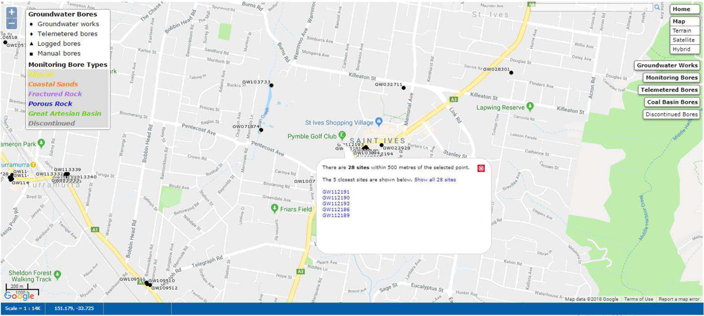
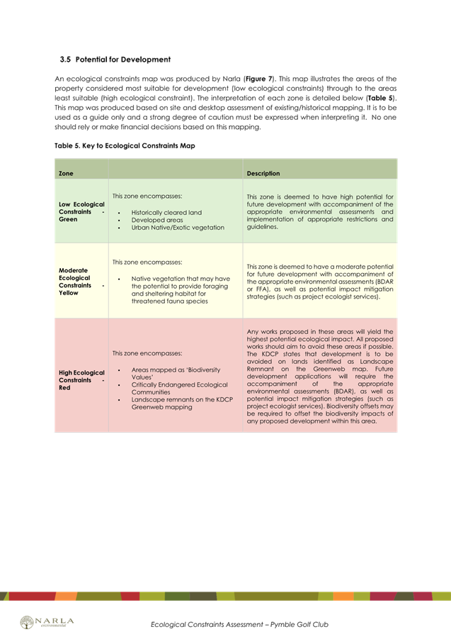
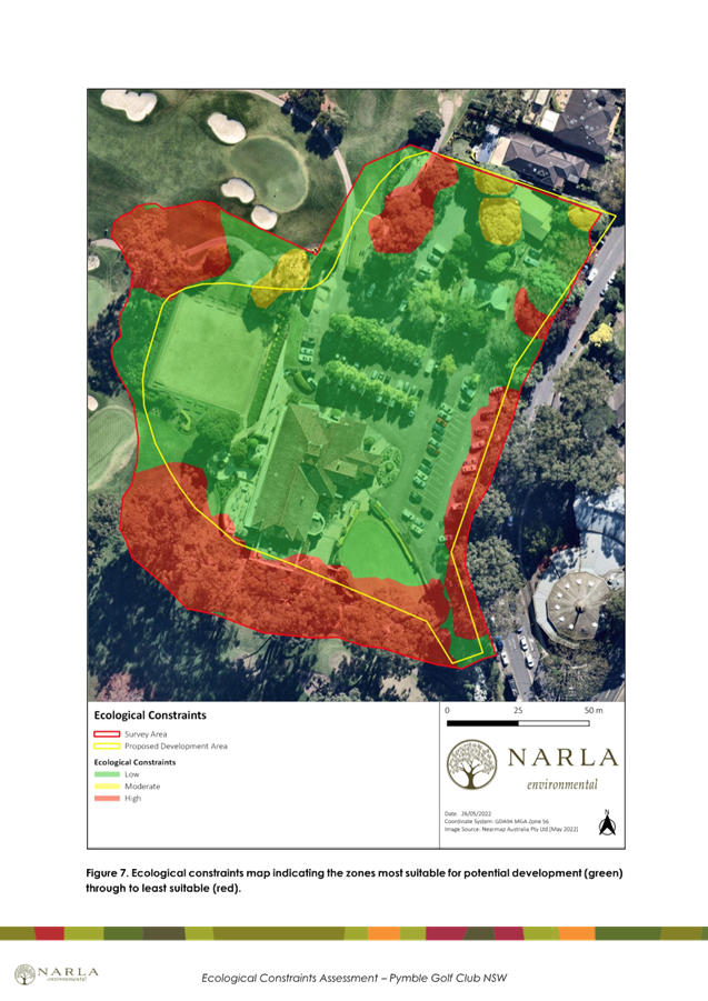
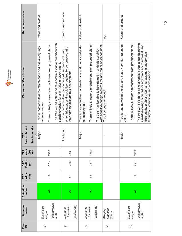
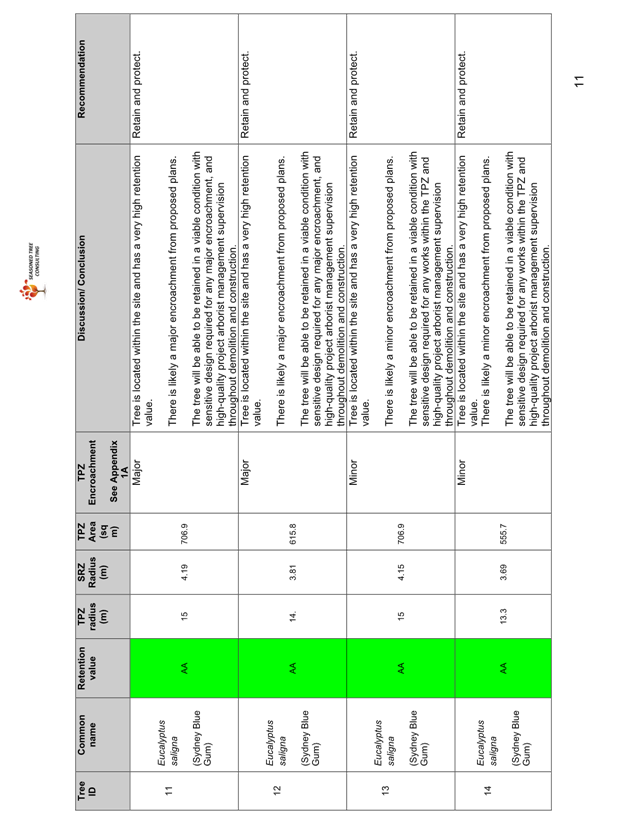
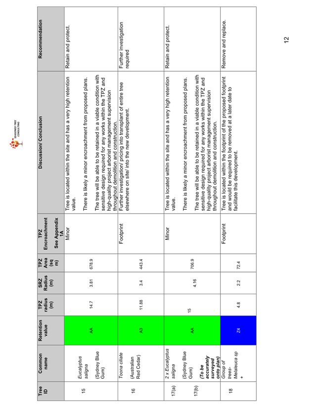
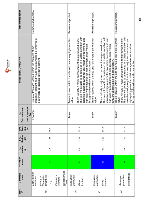
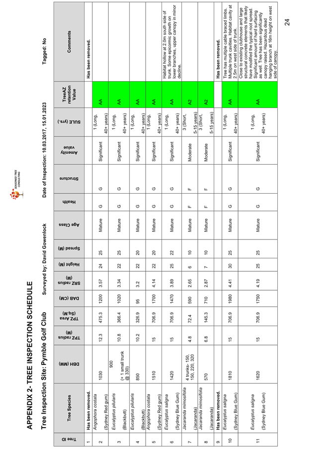
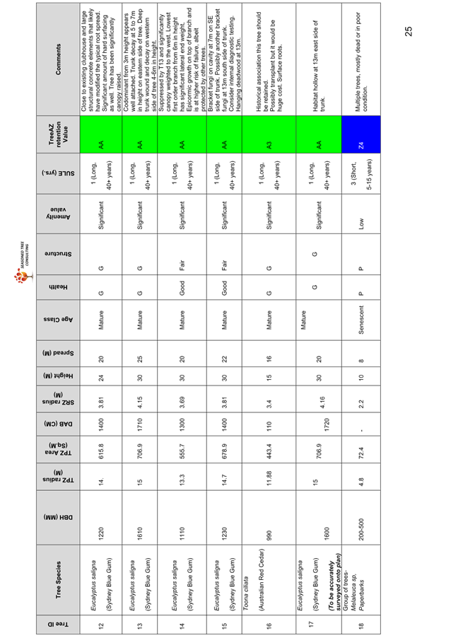
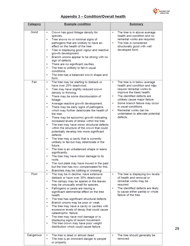
An Ecological Constraints Assessment is included at Attachment A5, and an Arboricultural Impact Assessment Report is included at Attachment A6. Council’s Natural Areas Program Leader has reviewed the documents and provided the following key points.
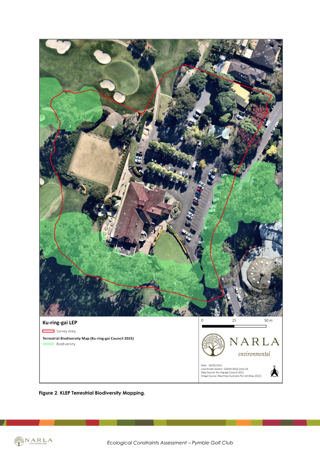
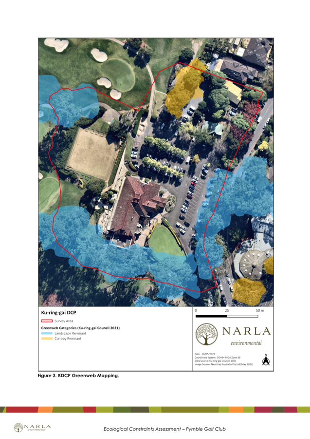
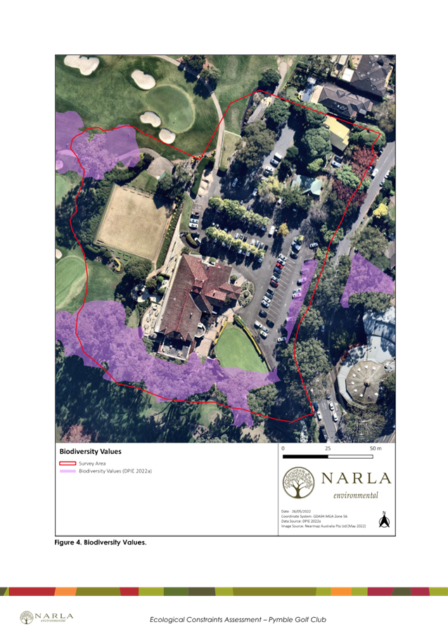
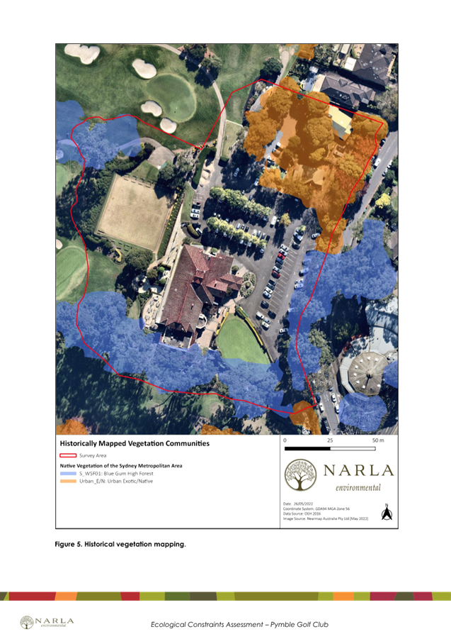
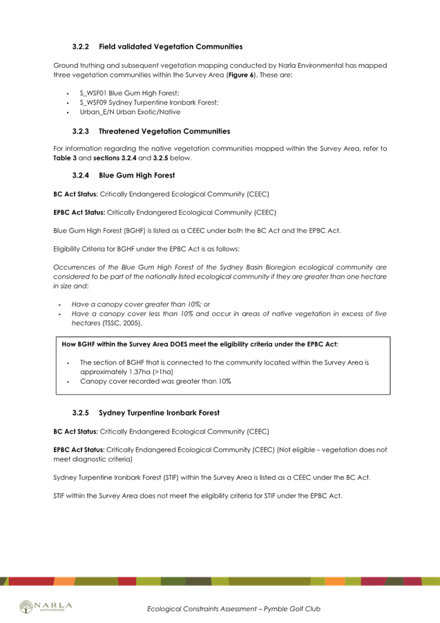
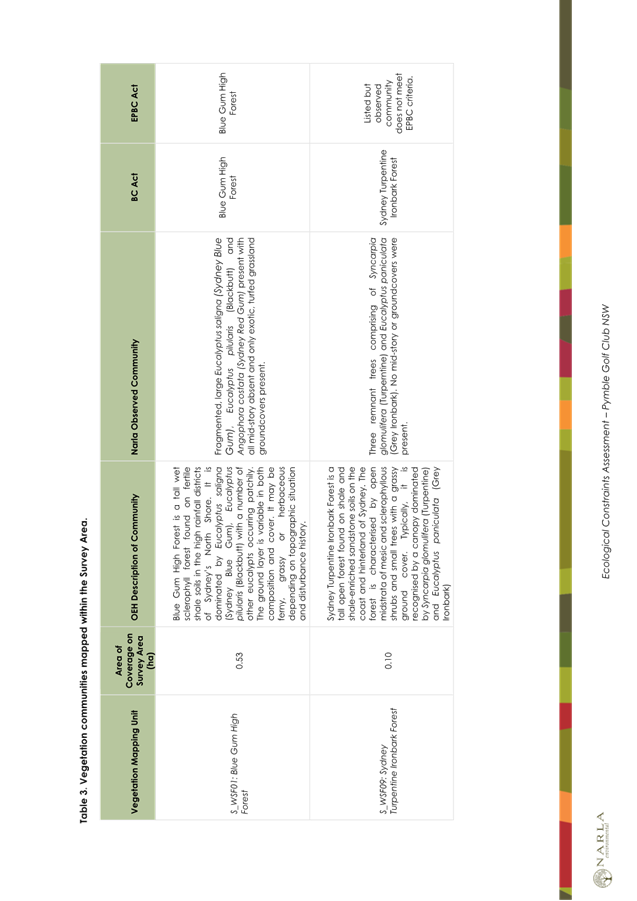
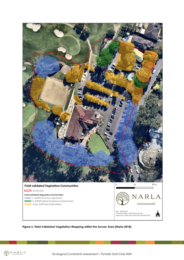
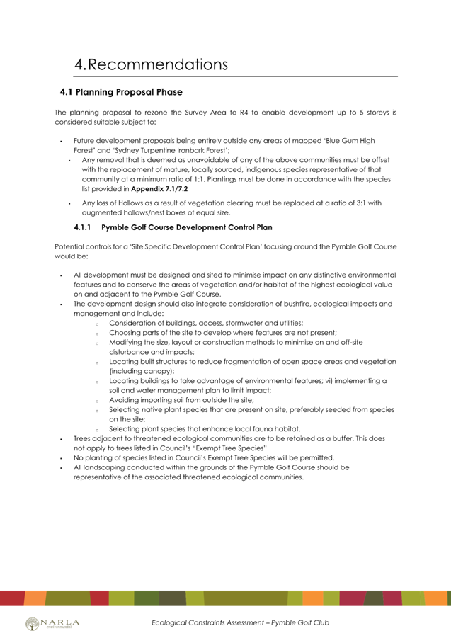
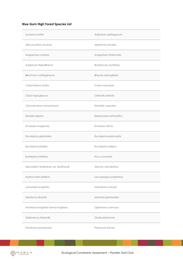
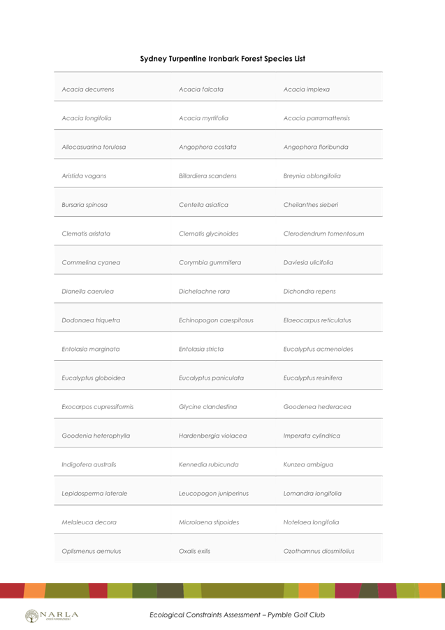
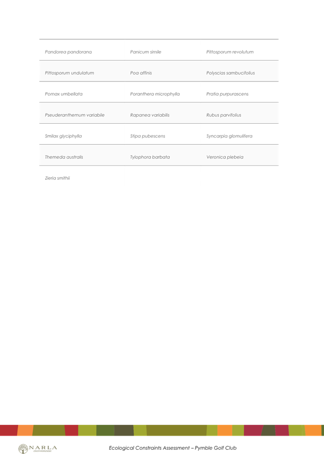
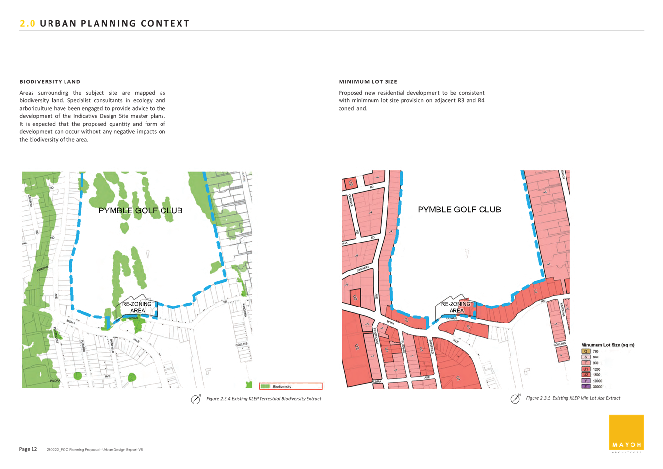
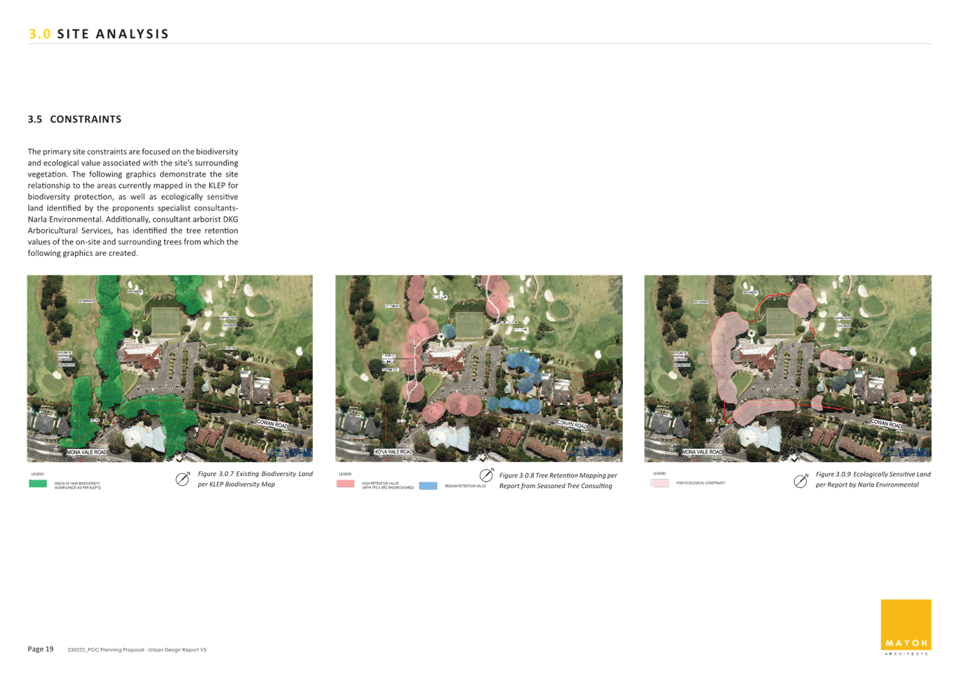
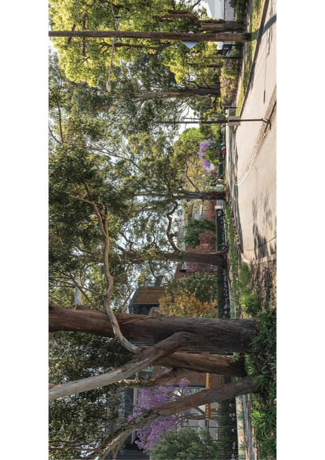
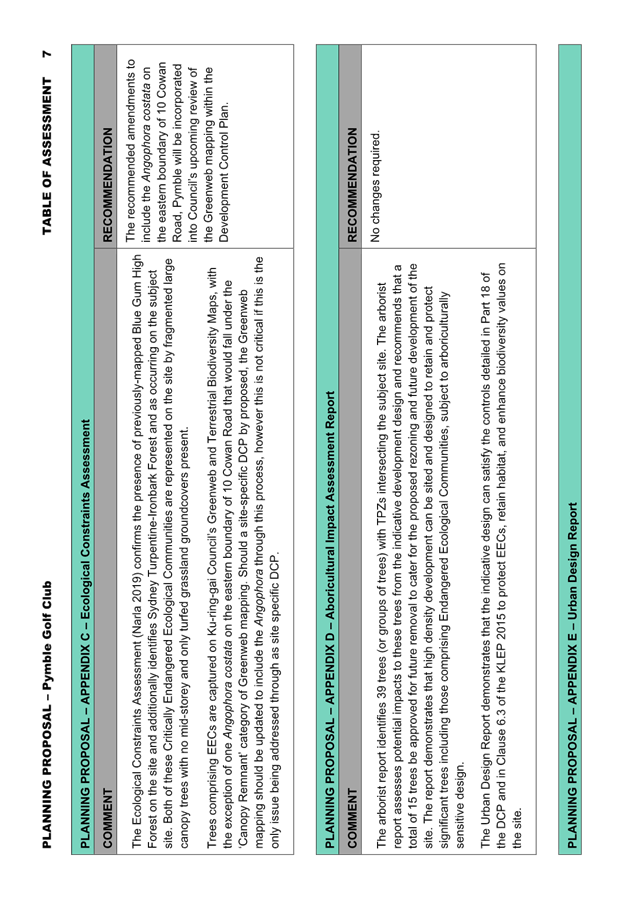
The Ecological Constraints Assessment confirms the presence of previously-mapped Blue Gum High Forest on the site and additionally identifies Sydney Turpentine-Ironbark Forest and as occurring on the subject site. Both of these Critically Endangered Ecological Communities (EECs) are represented on the site by fragmented large canopy trees with no mid-storey and only turfed grassland groundcovers present.
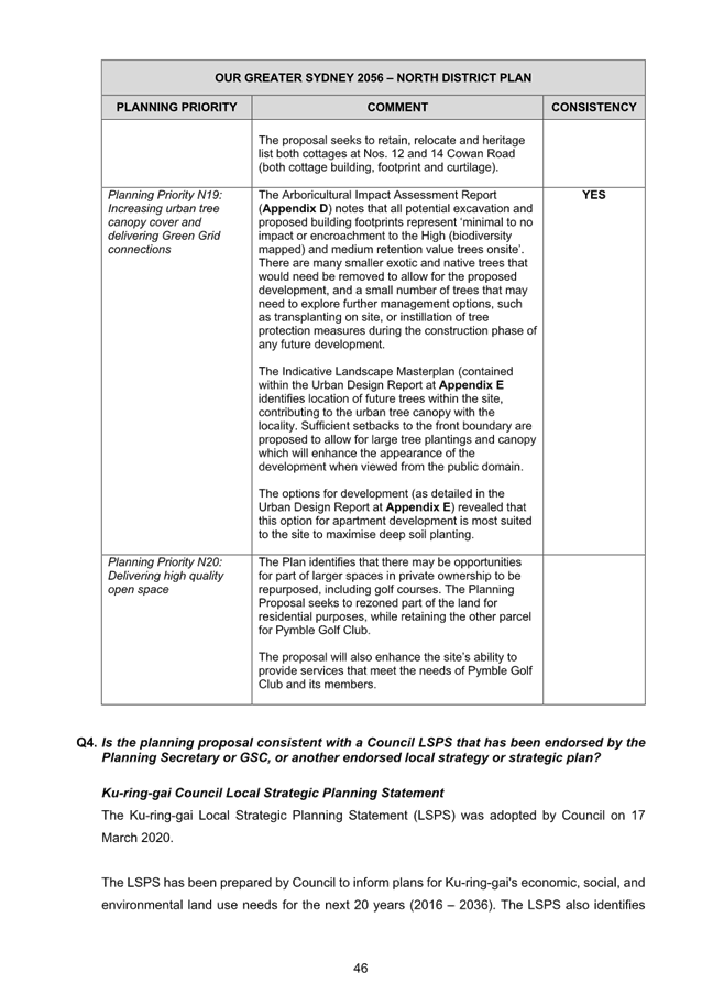
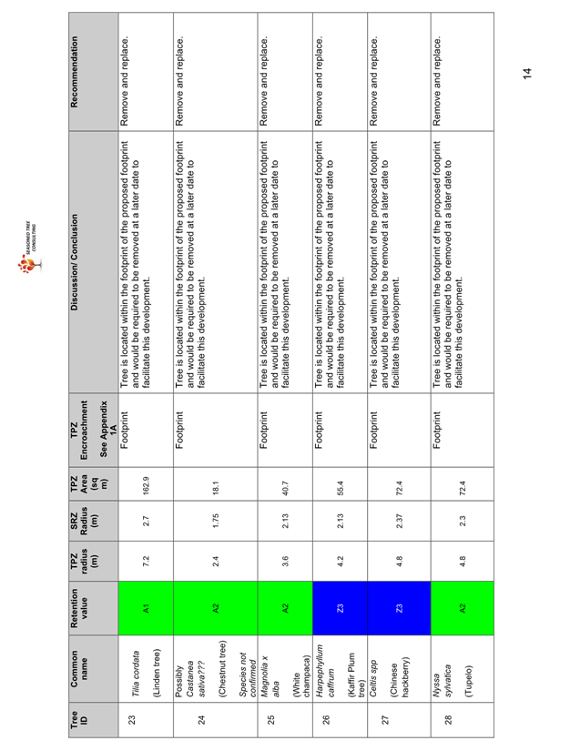
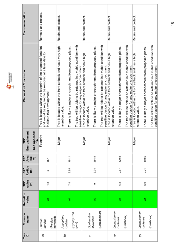
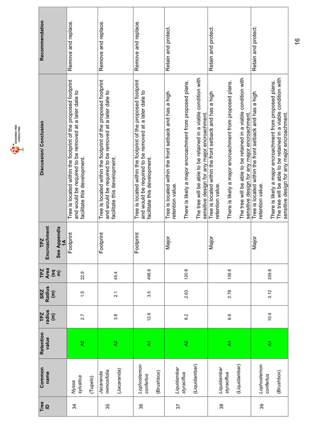
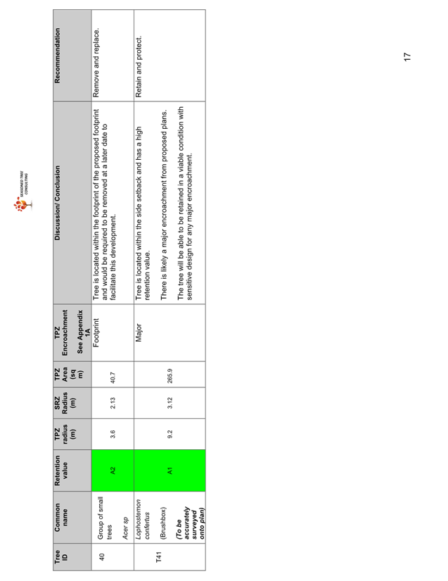
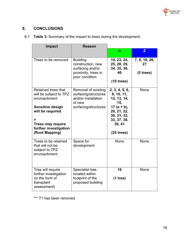
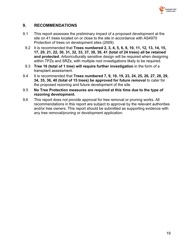
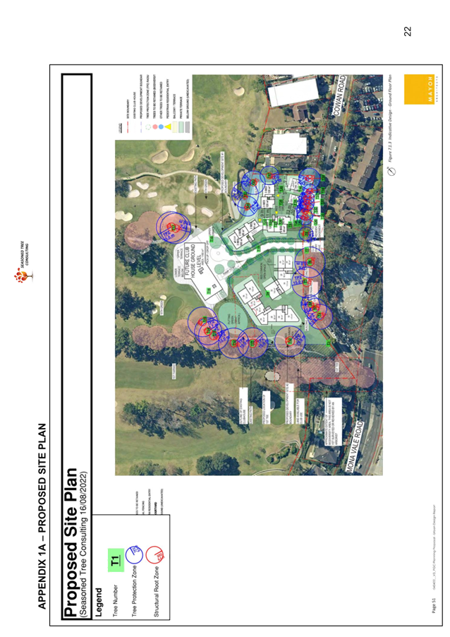
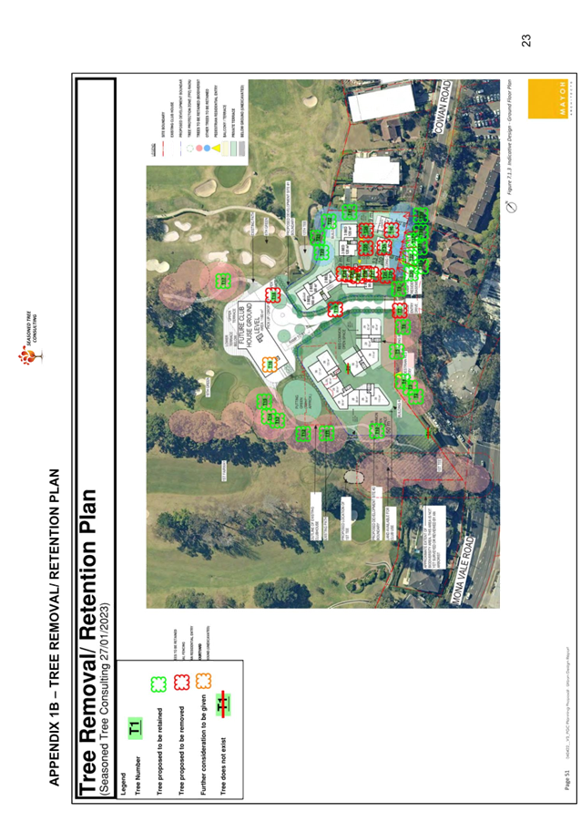
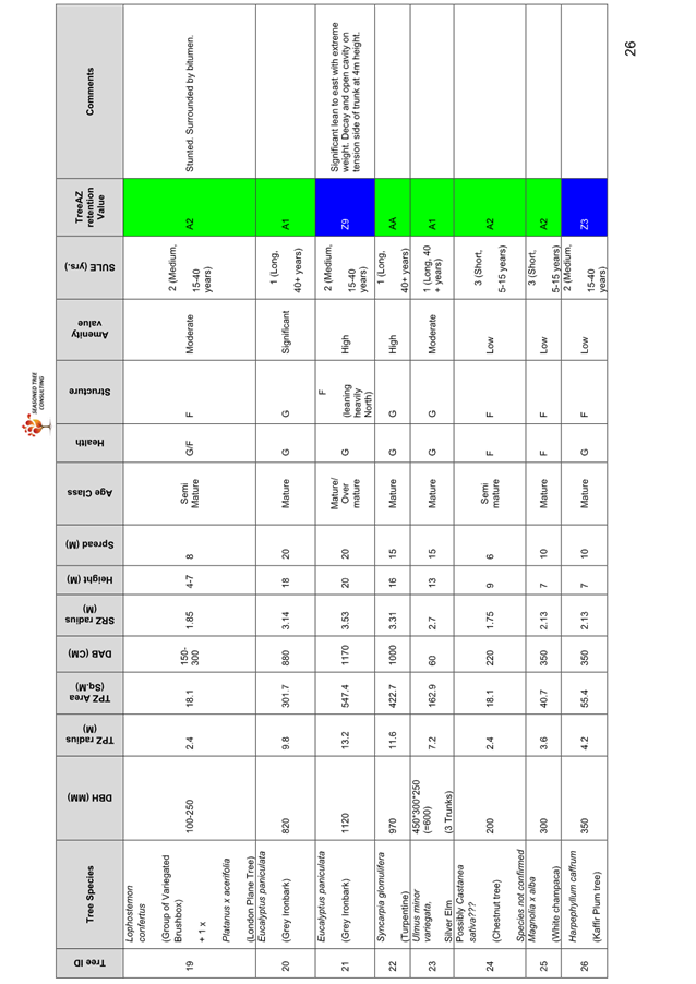
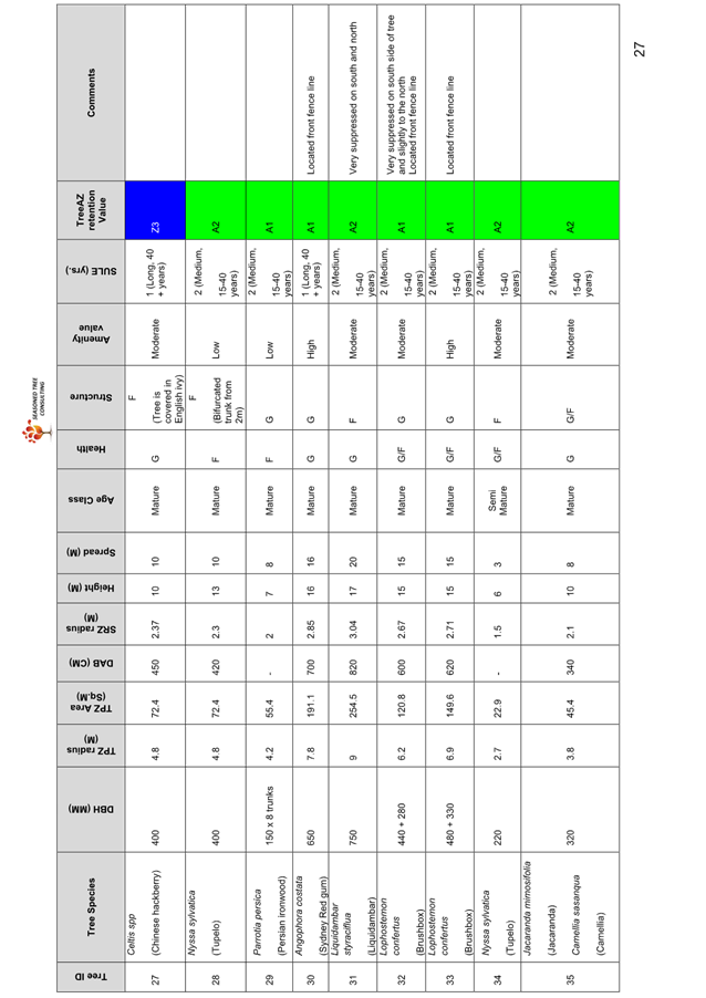
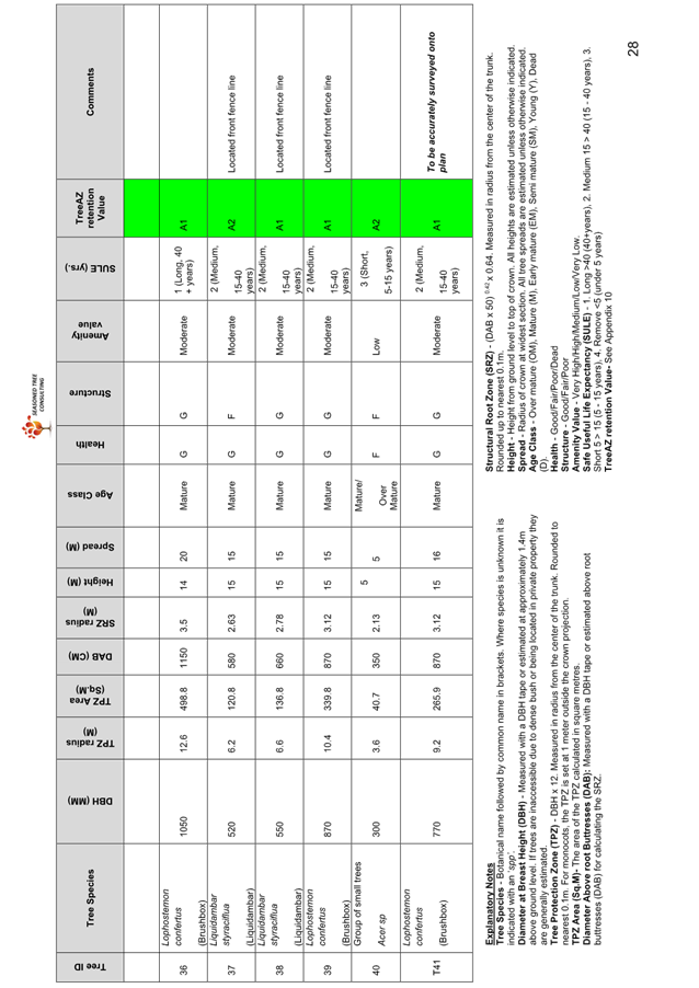
The arborist report identifies 39 trees (or groups of trees) with Tree Protection Zones (TPZs) intersecting the subject site. The arborist report assesses potential impacts to these trees from the indicative development design and recommends that a total of 15 trees be approved for future removal to cater for the proposed rezoning and future development of the site. The report demonstrates that high density development can be sited and designed to retain and protect significant trees including those comprising Endangered Ecological Communities, subject to arboriculturally sensitive design.
The Urban Design Report demonstrates that the indicative design can satisfy the controls detailed in Part 18 of the DCP and in Clause 6.3 of the KLEP 2015 to protect EECs, retain habitat, and enhance biodiversity values on the site.
The recommended amendment to include the Angophora costata on the eastern boundary of 10 Cowan Road, Pymble in the Greenweb mapping will be incorporated into Council’s upcoming review of the Development Control Plan, which involves other updates to the Greenweb mapping. This will ensure the tree is identified in Councils DCP separately to this Planning Proposal process.
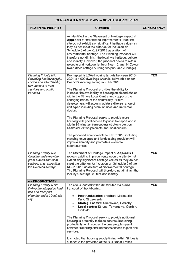
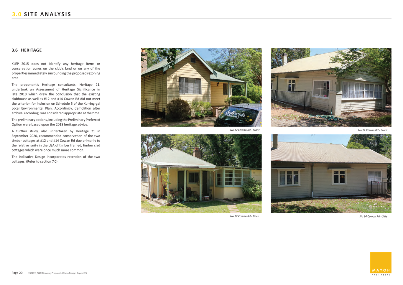
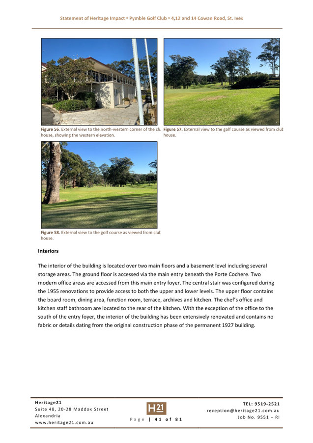
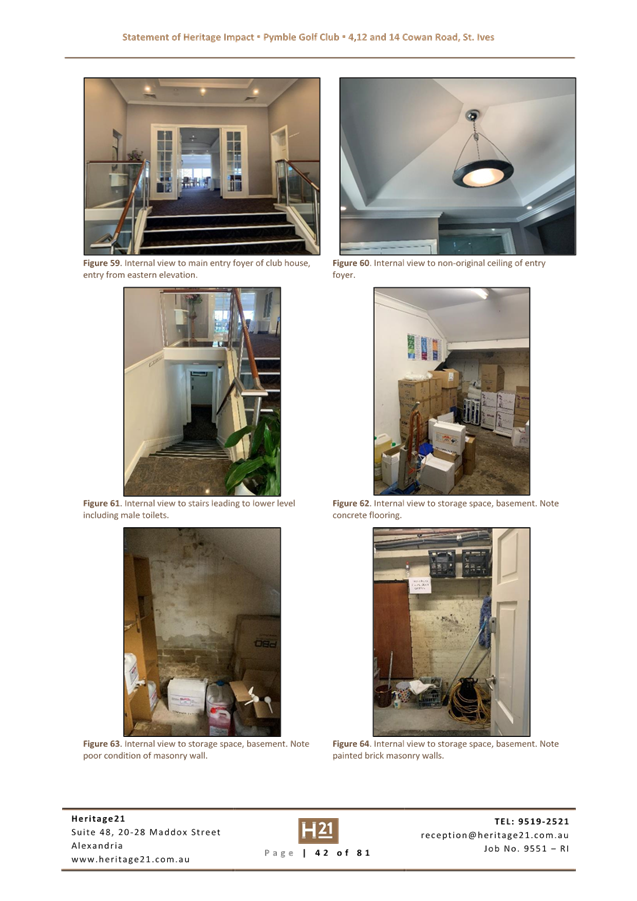
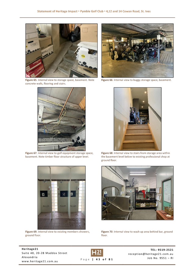
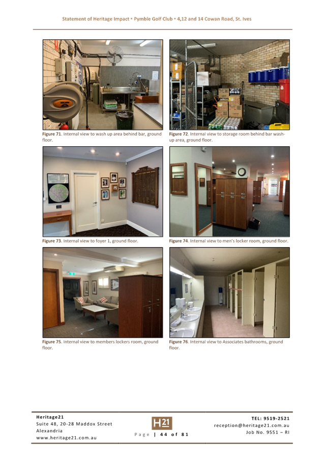
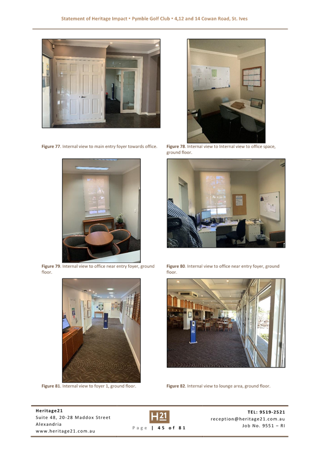
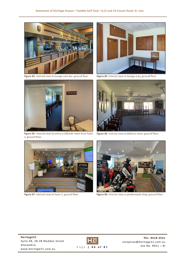
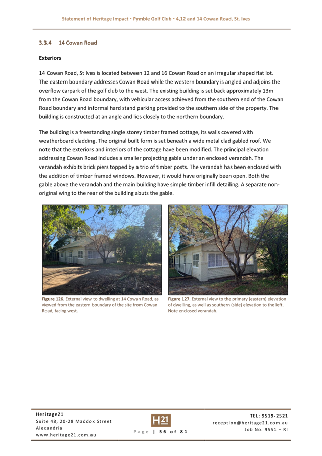
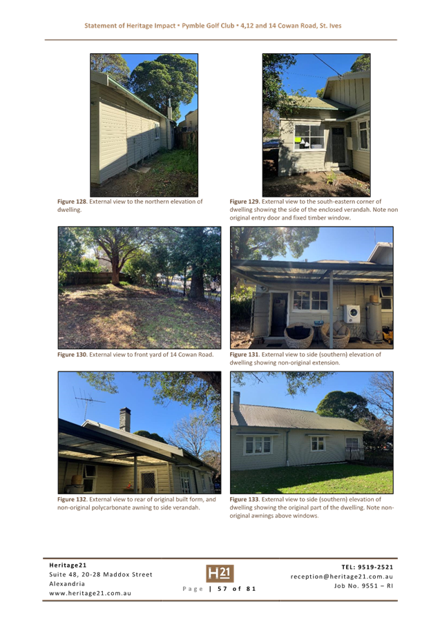
· Heritage
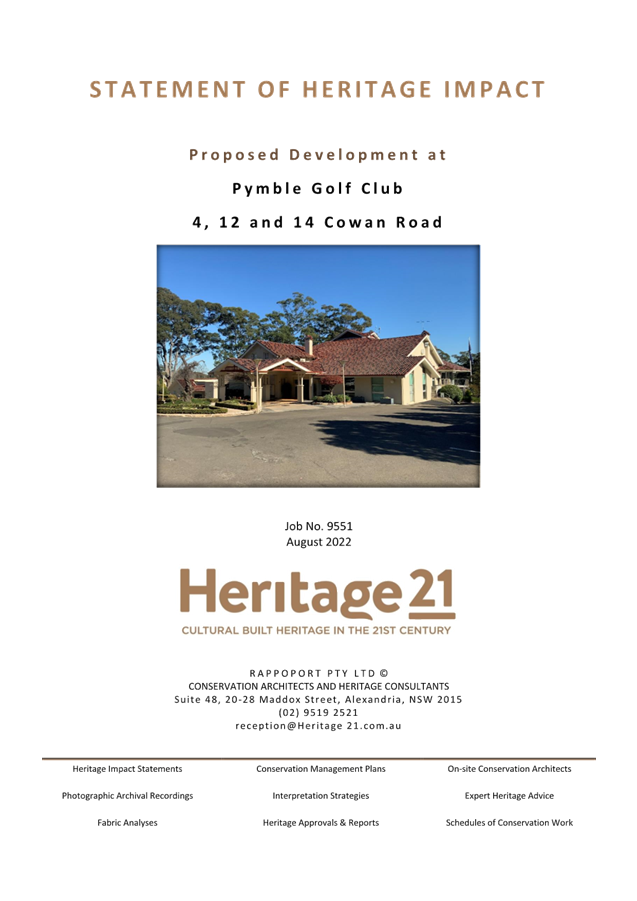
A Statement of Heritage Impact is included at Attachment A8. Council’s Heritage Consultant has reviewed the documents and provided the following key points. A more detailed analysis is included in the Table of Assessment at Attachment A11, which includes an overview of the information and comments that have flowed between the proponent and Council in relation to heritage since 2018.
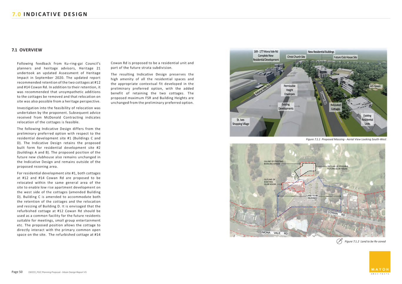
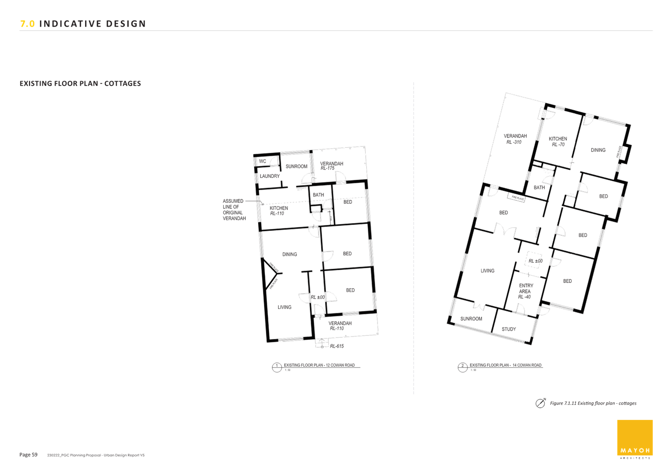
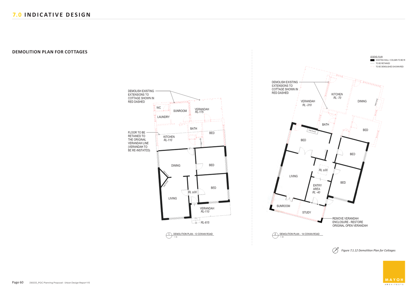
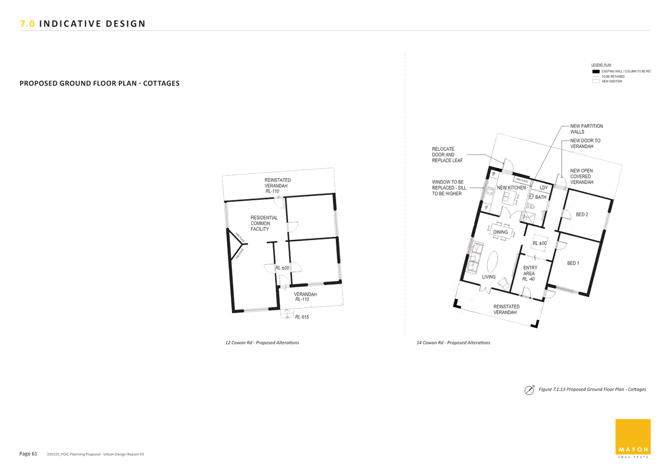
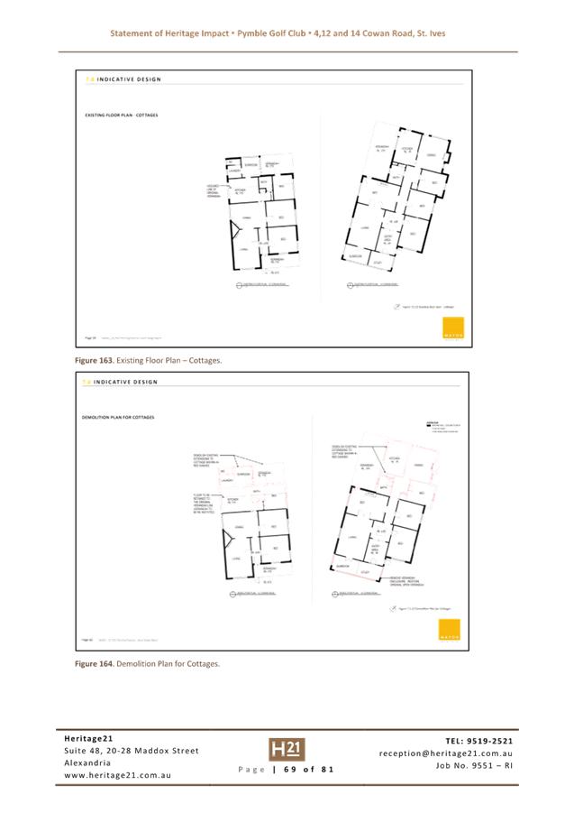
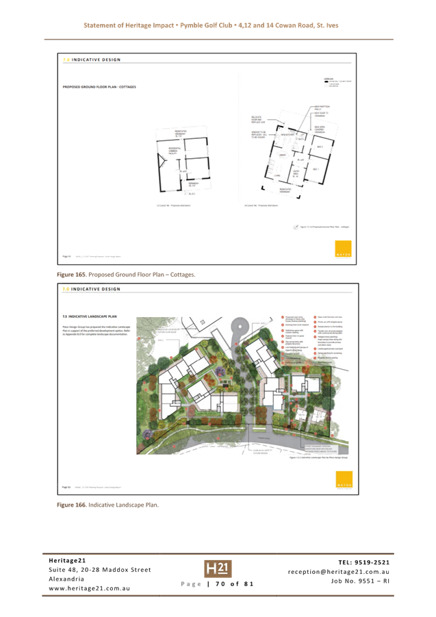
The applicant has provided documentation to suggest and substantiate the heritage listing of the two dwellings at 12 and 14 Cowan Road, St Ives as part of the Pymble Golf Club Planning Proposal. Council has supported this recommendation and accordingly, the overall planning proposal has been adjusted to respond to the recommendation and so that the dwellings can be retained, albeit in slightly adjusted locations within their current settings.
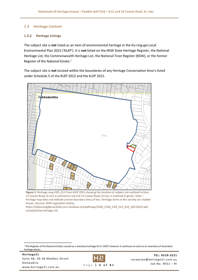
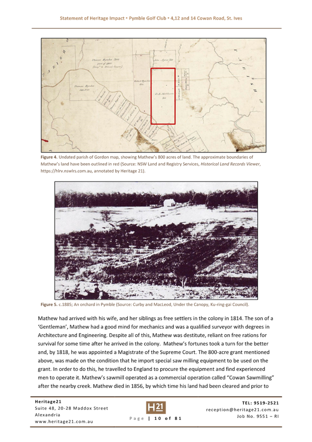
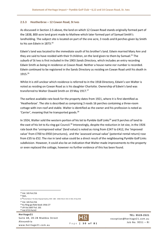
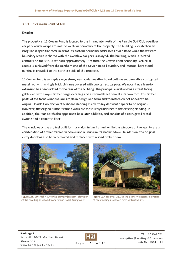
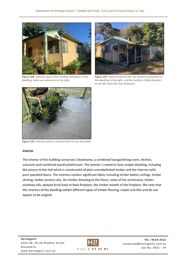
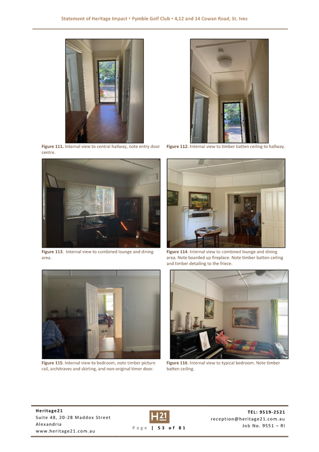
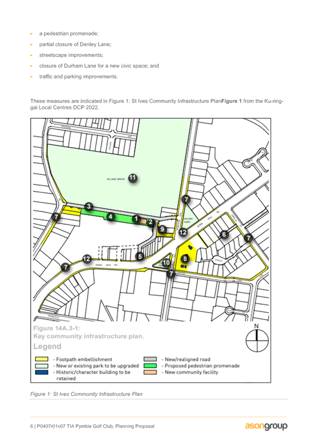
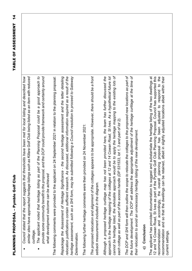
From a heritage perspective, the proposal to heritage list on Schedule 5 of KLEP 2015 and slightly relocate the two dwellings at 12 and 14 Cowan Road (DP 531533, lot 1, 3 and part of lot 2) (See Figure 1 below) is considered to be an acceptable approach in this situation. The listings will ensure that the buildings are retained in the streetscape as well as the associated established vegetation around them.
The respective curtilages will be adjusted once the cottages are relocated, and the relevant background and this intention will be outlined the State heritage Inventory. The DCP will also address the appropriate adjustment of the heritage curtilage at the time of their relocation to avoid unnecessary heritage listing of the new development.
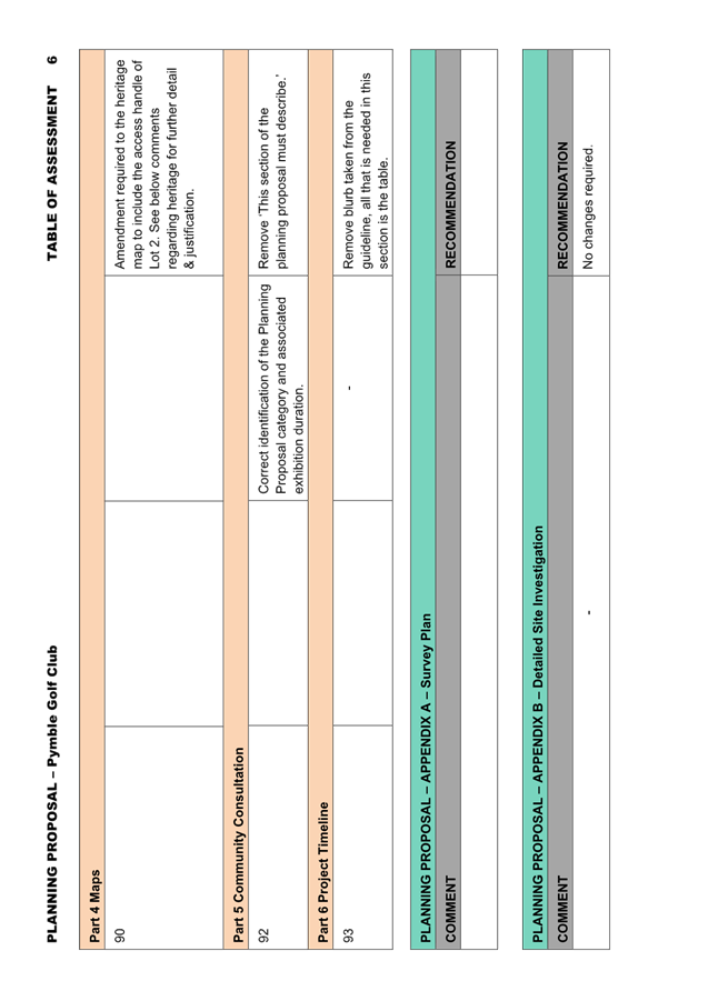
As a result of this heritage assessment, it is recommended that the proponent amend the proposed heritage map in Part 4 of the Planning Proposal to include the access handle of Lot 2 following the diagonal line.
Strategic Merit Assessment
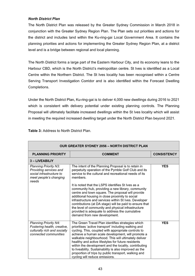
· Greater Sydney Region Plan and North District Plan
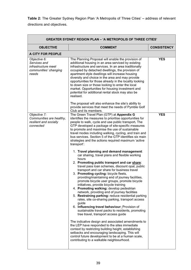
The Planning Proposal is consistent with the objectives of the Greater Sydney Region Plan – A Metropolis of Three Cities, in particular:
o Objective 6: Services and infrastructure meet communities’ changing needs
o Objective 7: Communities are healthy, resilient and socially connected
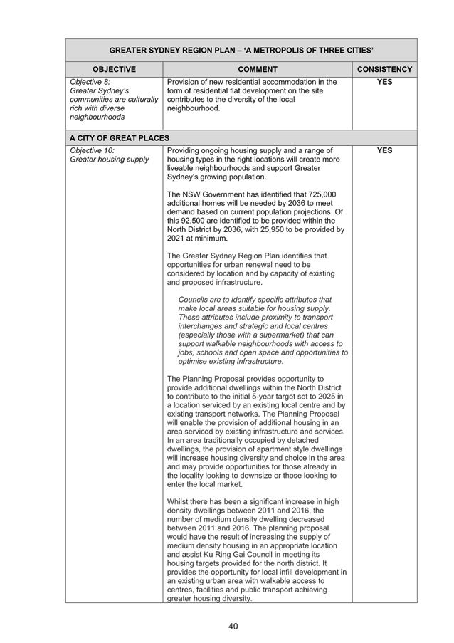
o Objective 8: Greater Sydney’s communities are culturally rich with diverse neighbourhoods
o Objective 10: Greater housing supply
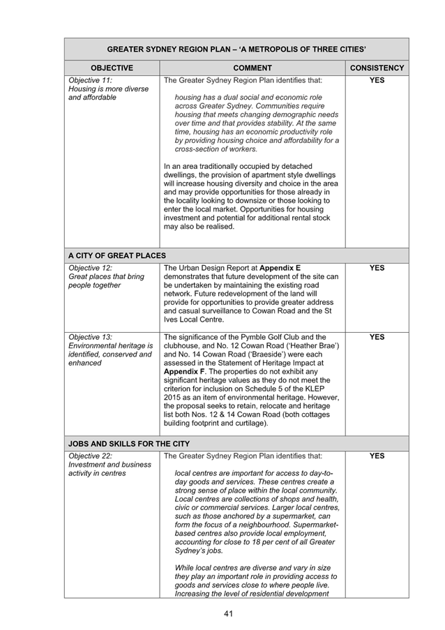
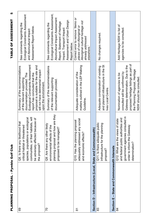
o Objective 11: Housing is more diverse and affordable
o Objective 12: Great places that bring people together
o Objective 13: Environmental heritage is identified, conserved and enhanced
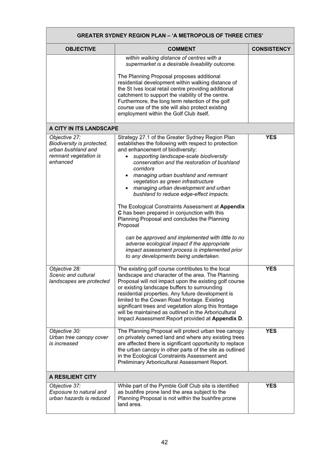
o Objective 22: Investment and business activity in centres
o Objective 27: Biodiversity is protected, urban bushland and remnant vegetation is enhanced
o Objective 28: Scenic and cultural landscapes are protected
o Objective 30: Urban tree canopy cover is increased
o Objective 37: Exposure to natural and urban hazards is reduced
A Metropolis of Three Cities outlines that liveability incorporates access to housing, transport and employment, as well as social, recreational, cultural and creative opportunities. Provision of housing close to public transport and services and facilities improves the opportunity for people to walk and cycle to local shops and services. The plan advocates for the protection and enhancement of biodiversity values. The proposal is consistent with these principles.
The Planning Proposal is consistent with the planning priorities of the North District Plan, in particular:
o Planning Priority N3: Providing services and social infrastructure to meet people’s changing needs
o Planning Priority N4: Fostering health, creative, culturally rich and socially connected communities
o Planning Priority N5. Providing housing supply, choice and affordability, with access to jobs, services and public transport
o Planning Priority N6. Creating and renewing great places and local centres, and respecting the districts heritage
o Planning Priority N12. Delivering integrated land use and transport planning and a 30-minute city
o Planning Priority N16. Protecting and enhancing bushland and biodiversity
o Planning Priority N17: Protecting and enhancing scenic and cultural landscapes
o Planning Priority N19: Increasing urban tree canopy cover and delivering Green Grid connections
o Planning Priority N20: Delivering high quality open space
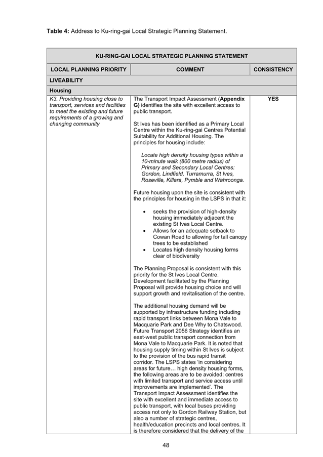
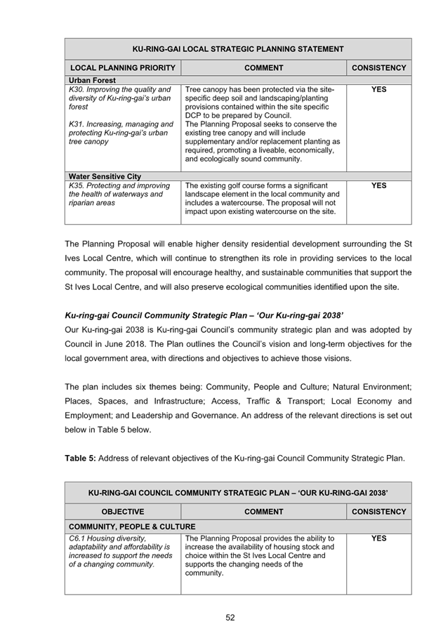
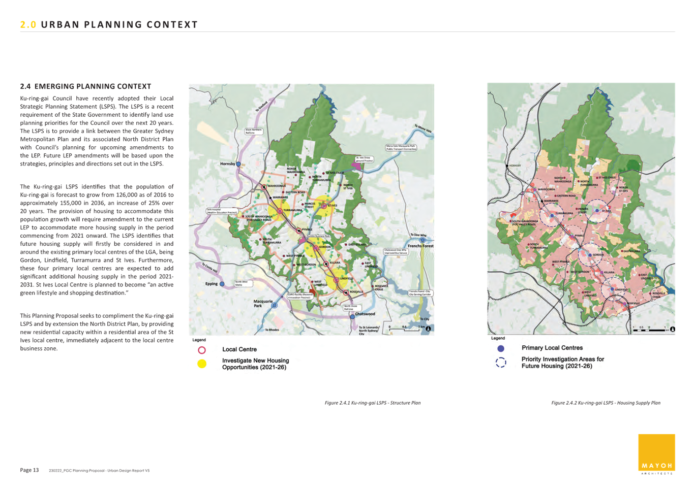
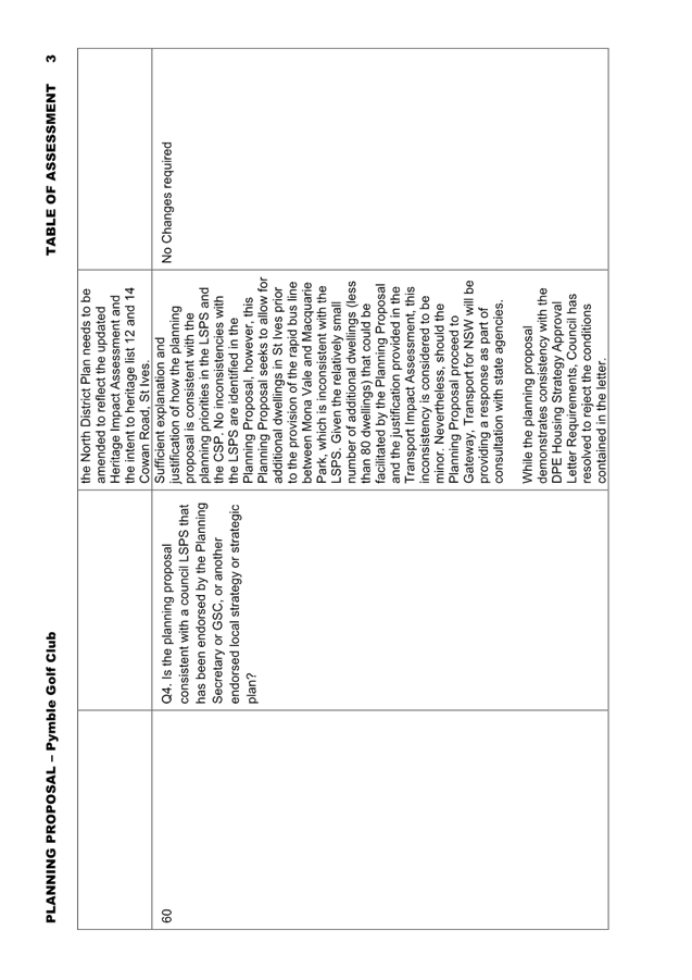
· Ku-ring-gai Local Strategic Planning Statement
The Ku-ring-gai Local Strategic Planning Statement (LSPS) came into effect on 17 March 2020 and provides a 20 year vision and local planning priorities and associated actions for land use planning in Ku-ring-gai. The Planning Proposal is consistent with the following local planning priorities:
o K3. Providing housing close to transport, services and facilities to meet the existing and future requirements of a growing and changing community.
o K4. Providing a range of diverse housing to accommodate the changing structure of families and households and enable ageing in place.
o K5. Providing affordable housing that retains and strengthens the local residential and business community
o K6. Revitalising and growing a network of centres that offer unique character and lifestyle for local residents.
o K9. Promoting St Ives as an active green lifestyle and shopping destination.
o K12. Managing change and growth in a way that conserves and enhances Ku-ring-gai’s unique visual and landscape character.
o K13. Identifying and conserving Ku-ring-gai’s environmental heritage.
o K17. Providing a broad range of open spaces, sporting and leisure facilities to meet the community’s diverse and changing needs.
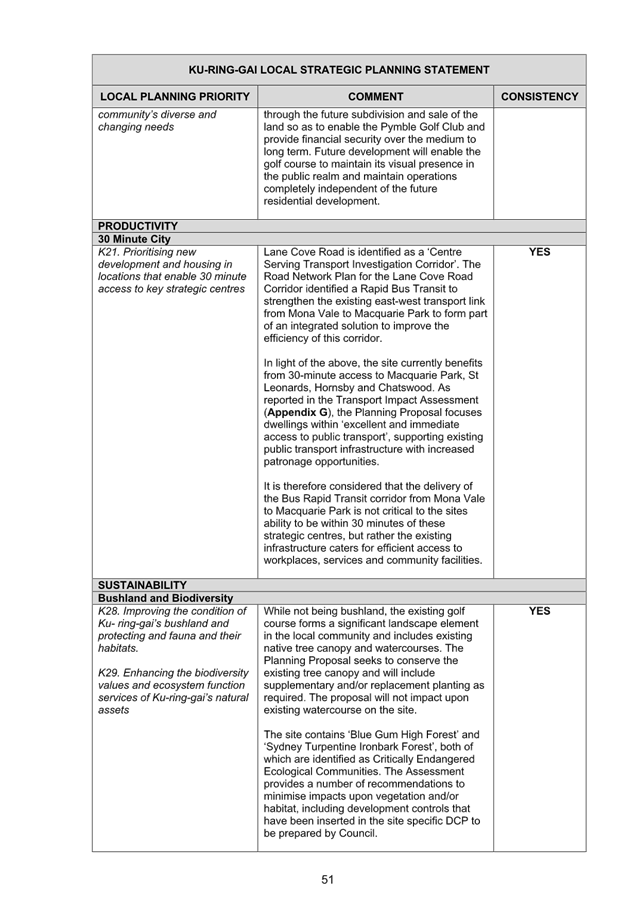
o K21. Prioritising new development and housing in locations that enable 30minute access to key strategic centres.
o K28. Improving the condition of Ku- ring-gai’s bushland and protecting and fauna and their habitats.
o K29. Enhancing the biodiversity values and ecosystem function services of Ku-ring-gai’s natural assets.
o K31. Increasing, managing and protecting Ku-ring-gai’s urban tree canopy.
o K35. Protecting and improving the health of waterways and riparian areas.
This Planning Proposal seeks to allow for approximately 78 additional dwellings in the centre prior to the provision of the rapid bus line between Mona Vale and Macquarie Park, which is inconsistent with the LSPS. Should the Planning Proposal proceed to Gateway, Transport for NSW will be providing a response as part of consultation with state agencies. Clarification regarding future upgrade to bus services and the Rapid Bus Line would be provided by Transport for NSW as part of that process.
Council’s Strategic Transport Engineer has reviewed the Transport Impact Assessment submitted with the Planning Proposal, which indicates that the proposal is not expected to have significant additional impact on the operation of the key nearby intersections, with only minor increases in average delay at the intersection of Cowan Road/Village Green Parade and the intersection of Killeaton Street/Cowan Road.
It is noted that Council’s LSPS includes an action to advocate to Transport for NSW to increase the priority and accelerate the delivery of infrastructure improvements identified in Future Transport 2056 that connects Ku-ring-gai internally and with nearby centres, including improvements to bus connections from Mona Vale to Macquarie Park (followed by the Bus Rapid Transit).
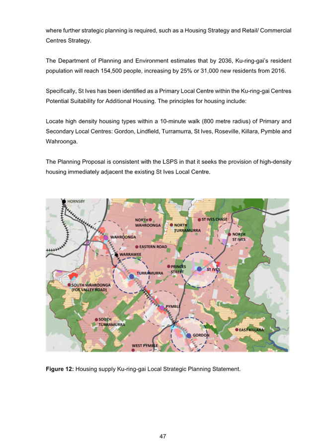
The Planning Proposal is generally consistent with the principles for the location of additional housing as set out in the LSPS:
- Stage housing delivery around centres of retail and economic activity that are serviced by the North Shore railway line or major bus routes along arterial roads, including provision of housing diversity, affordability and accessibility.
- Locate high density housing types within a 10min walk (800m radius) of Primary and Secondary Local Centres: Gordon, Lindfield, Turramurra, St Ives (subject to the provision of priority bus infrastructure), Roseville, Killara, Pymble and Wahroonga.
- In considering areas for future medium and high-density housing form, the following areas are to be avoided:
o Heritage conservation areas.
o Areas of visual or aesthetic quality and character.
o Areas within or affecting scenic and cultural landscapes.
o Areas of intact tree canopy where the built form does not sit under the canopy.
o Areas with multiple constraints including steep topography.
o Areas with environmental values.
o Areas that are bushfire prone and with evacuation risk.
o Centres with limited transport and service access until improvements are implemented.
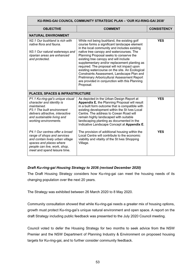
· Ku-ring-gai Council Community Strategic Plan ‘Our Ku-ring-gai 2038’
The Ku-ring-gai Community Strategic Plan was adopted by Council in June 2019. The Plan outlines the Council’s vision and long-term objectives for the local government area, with directions and objectives to achieve those visions. The Planning Proposal is consistent with the following objectives:
o C6.1 Housing diversity, adaptability and affordability is increased to support the needs of a changing community.
o N2.1 Our bushland is rich with native flora and fauna.
o N3.1 Our natural waterways and riparian areas are enhanced and protected.
o P1.1 Ku-ring-gai’s unique visual character and identity is maintained.
o P3.1 The built environment delivers attractive, interactive and sustainable living and working environments.
o P4.1 Our centres offer a broad range of shops and services and contain lively urban village spaces and places where people can live, work, shop, meet and spend leisure time.
· Ku-ring-gai Housing Strategy Approval Letter Conditions
Council’s adopted Ku-ring-gai Housing Strategy provides all new dwellings to 2036 from capacity within the existing planning controls and zoning. As the Planning Proposal is seeking to rezone the site and amend the development controls to enable delivery of residential housing on the site, it is inconsistent with the Housing Strategy. The amendments sought by the Planning Proposal will enable the delivery of approximately 78 dwellings on the site. In approving the Ku-ring-gai Housing Strategy, the Department of Planning, Industry and Environment issued a number of approval conditions, one of which is:
6. Council is to commit to a work program to identify areas for additional medium density housing opportunities outside of primary local centres such as Roseville Chase, Killara, Pymble, Wahroonga, West Gordon and North St Ives as identified in the Ku-ring-gai LSPS for potential delivery in the 2031 to 2036 period. A Planning Proposal(s) for these centres is to be submitted to the Department for a Gateway determination by December 2023. Where this work is not pursued by Council the Department welcomes place-based approaches by landowner/developers to explore opportunities for additional medium density housing in locations that are well serviced by transport, services and facilities.
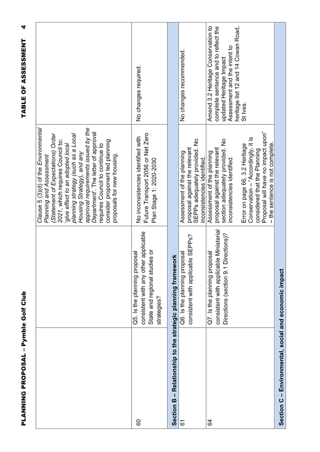
At OMC 16 November 2021 Council resolved to reject the Housing Strategy conditions of approval. However, clause 5 (3)(d) of the Environmental Planning and Assessment (Statement of Expectations) Order 2021, which requires Council to: ‘give effect to an adopted local planning strategy (such as a Local Housing Strategy), and any approval requirements issued by the Department’. The subject Planning Proposal submitted by the landowners is consistent with the requirements of Condition 6. The Planning Proposal will enable a higher density built form outcome on the site in an area that is close to public transport, services and facilities.
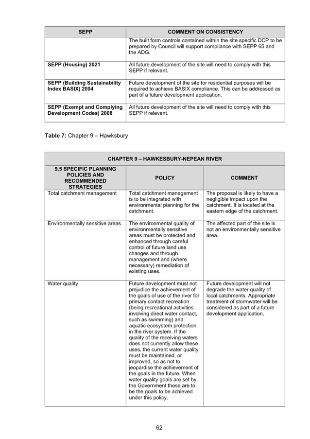
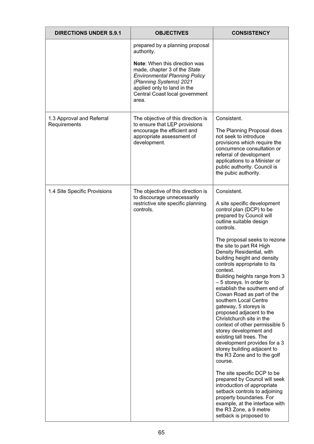
· Section 9.1 Ministerial Directions and State Environmental Planning Policies (SEPPs)
The Planning Proposal is not inconsistent with the State Environmental Planning Policies (SEPPs) applicable to the site. Many of these SEPPs contain detailed provisions and controls which would only apply at the Development Application stage.
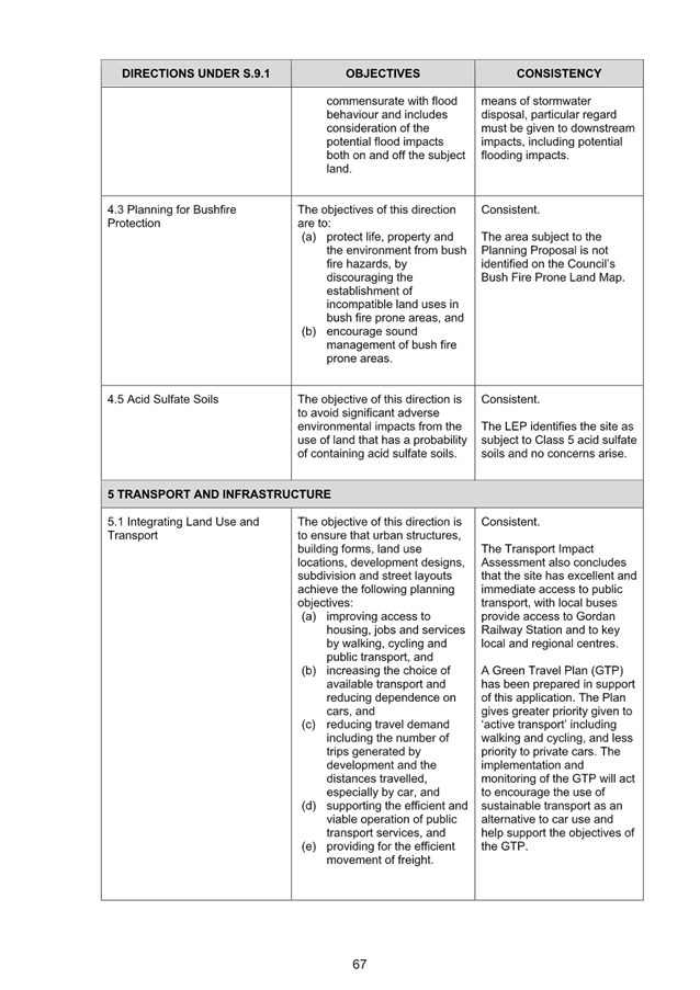
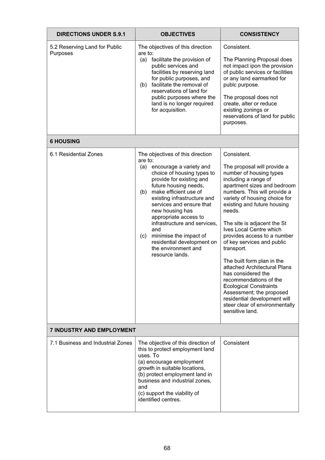
The Planning Proposal is consistent with the applicable s9.1 Ministerial Direction, specifically those relating to:
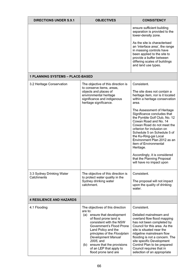
- 3.2 Heritage Conservation
- 5.1 Integrating Land Use and Transport
- 6.1 Residential Zones
The objective of direction 6.3 is to discourage unnecessarily restrictive site-specific planning controls, and 4(c) outlines that a Planning Proposal must allow that land use on the relevant land without imposing any development standards or requirements in addition to those already contained in the principal environmental planning instrument being amended - (6) notes that a Planning Proposal may be inconsistent with this direction, if the provisions are of a minor significance. If the creation of a Site Specific DCP is inconsistent with this direction, it is considered minor in nature and justifiable to ensure the best built form outcomes on the site.
Amendments required to be made to the Planning Proposal and supporting documentation
The Table of Assessment included at Attachment A11 details the required amendments to be made to the Planning Proposal if Council is to support it being submitted to the Department of Planning and Environment for a Gateway Determination and proceed to public exhibition.
integrated planning and reporting
Theme 3: Places, Spaces and Infrastructure
|
Community Strategic Plan Long Term Objective |
Delivery Program Term Achievement |
Operational Plan Task |
|
P1.1 Ku-ring-gai’s unique visual character and identity is maintained
|
P1.1.1 Strategies, plans and processes are in place to protect and enhance Ku-ring-gai’s unique visual and landscape character |
P1.1.1.1 Continue to review the effectiveness of existing strategies, plans and processes across all programs.
|
|
P2.1 A robust planning framework is in place to deliver quality design outcomes and maintain the identity and character of Ku-ring-gai |
P2.1.1 Land use strategies, plans and processes are in place to effectively managed the impact of new development |
P2.1.1.2 Continue to review the effectiveness of existing strategies, local environmental plans, development control plans and processes across all programs |
Governance Matters
The process for the preparation and implementation of Planning Proposals is governed by the provisions contained in the Environmental Planning and Assessment Act 1979 and the Environmental Planning and Assessment Regulation 2000.
If Council fails to make a decision within 90 days (from the commencement of the review of the application) or if Council makes a decision to not support the Planning Proposal, the proponent can request the Department of Planning and Environment for a Rezoning Review.
Local Planning Panels Direction – Planning Proposals issued by the Minister for Planning under Section 9.1 of the Environmental Planning and Assessment Act 1979 requires Council to refer all Planning Proposals prepared after 1 June 2018 to the Local Planning Panel for advice, before the Planning Proposal is forwarded to the Minister for a Gateway Determination under Section 3.34 of the Environmental Planning and Assessment Act 1979.
Risk Management
This is a privately initiated Planning Proposal. Council needs to determine its position on the matter as to whether the Planning Proposal should be sent to the Department of Planning and Environment for a Gateway Determination and proceed to public exhibition.
Council risks damage to its reputation if it does not undertake strategic land use planning in an effective and timely manner.
Financial Considerations
The Planning Proposal was subject to the relevant application fee under Council’s 2021/2022 Schedule of Fees and Charges. The cost of the review and assessment of the Planning Proposal is covered by this fee.
Social Considerations
The amendments sought by the Planning Proposal will enable the delivery of approximately 40 dwellings of varying sizes on the subject site to meet the existing and future requirements of a growing and changing community.
Environmental Considerations
The planning proposal includes an Ecological Constraints assessment and an Arboricultural Assessment. These reports conclude that the proposal is suitable for the site and will not have detrimental impact upon the environment and demonstrates that high density development can be sited and designed to retain and protect significant trees including those comprising Endangered Ecological Communities, subject to arboriculturally sensitive design.
Community Consultation
In the event that the Planning Proposal is issued a Gateway Determination by the Department of Planning and Environment, the Planning Proposal would be placed on statutory public exhibition in accordance with the requirements of the Gateway Determination, and Council’s Community Participation Plan.
Internal Consultation
The assessment of the Planning Proposal has included internal consultation with Council’s staff with expertise in planning, urban design, traffic and transport, heritage and biodiversity and has informed the recommendations of this Report.
Summary
The Planning Proposal has been assessed and found to have sufficient strategic and site-specific merit to enable it to proceed to Gateway Determination and public exhibition. The Table of Assessment included at Attachment A11 details the required amendments to be made to the Planning Proposal if Council is to support it being submitted to the Department of Planning and Environment for a Gateway Determination and proceed to public exhibition. The amendments include:
· Planning Proposal (Attachment A2)
o Update the relevant sections to reflect the updated Heritage Impact Assessment and the intent to heritage list 12 and 14 Cowan Road, St Ives.
o Nominate Heritage NSW to the list of agencies to be consulted.
o Amend the proposed heritage map in Part 4 to include the access handle of the lot in between 12 and 14 Cowan Road, St Ives.
That the Ku-ring-gai Local Planning Panel advises Council that the Planning Proposal, amended as per the Table of Assessment at Attachment A11, be submitted to the Department of Planning and Environment for a Gateway Determination.
|
Craige Wyse Team Leader Urban Planning |
Antony Fabbro Manager Urban & Heritage Planning |
|
Andrew Watson Director Strategy & Environment |
|
|
Attachments: |
A1 |
Pre Planning Proposal Meeting Report |
|
2023/125848 |
|
|
A2 |
Planning Proposal - 4, 12 &14 Cowan Rd St Ives |
|
2023/125851 |
|
|
A3 |
Appendix A - Survey Plan |
|
2023/125853 |
|
|
A4 |
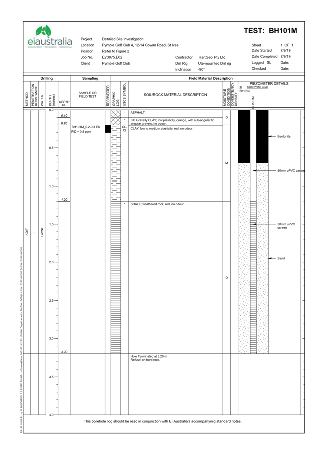
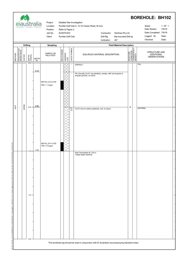
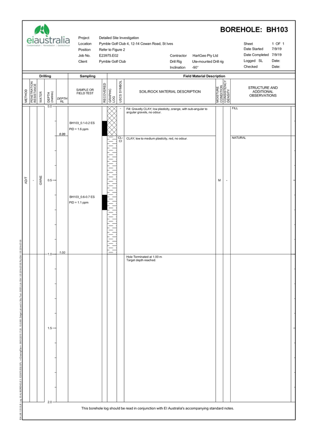
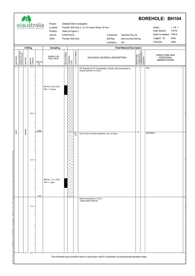
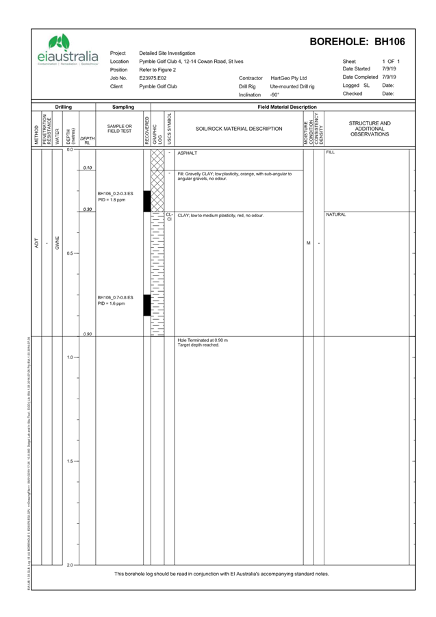
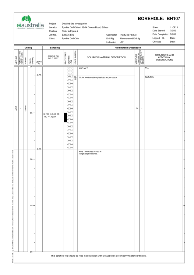
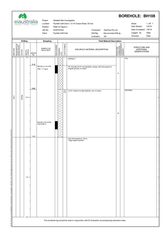
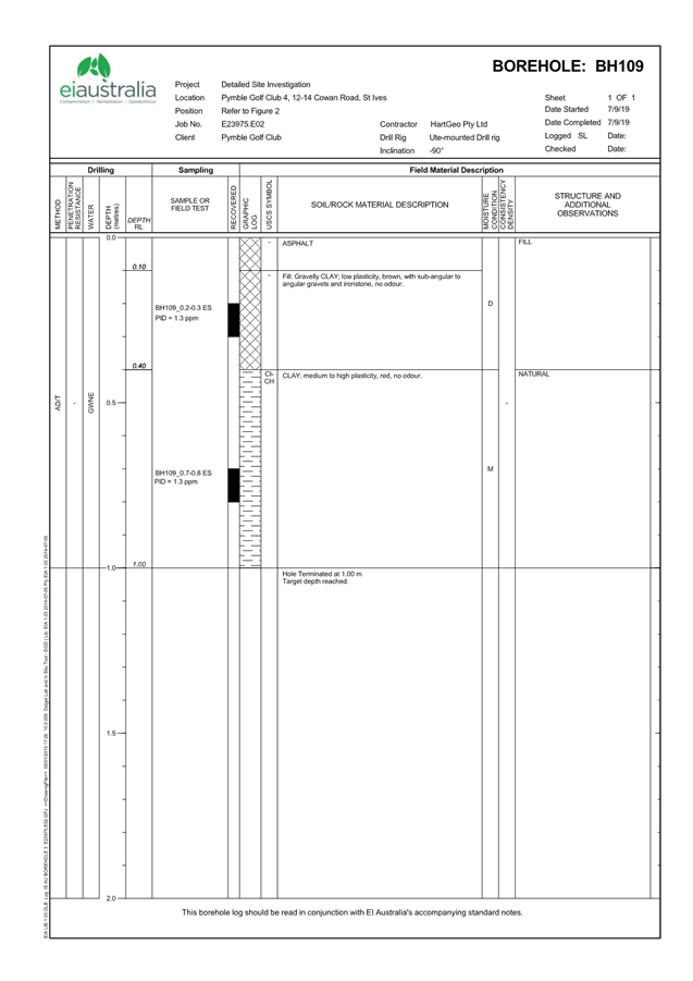
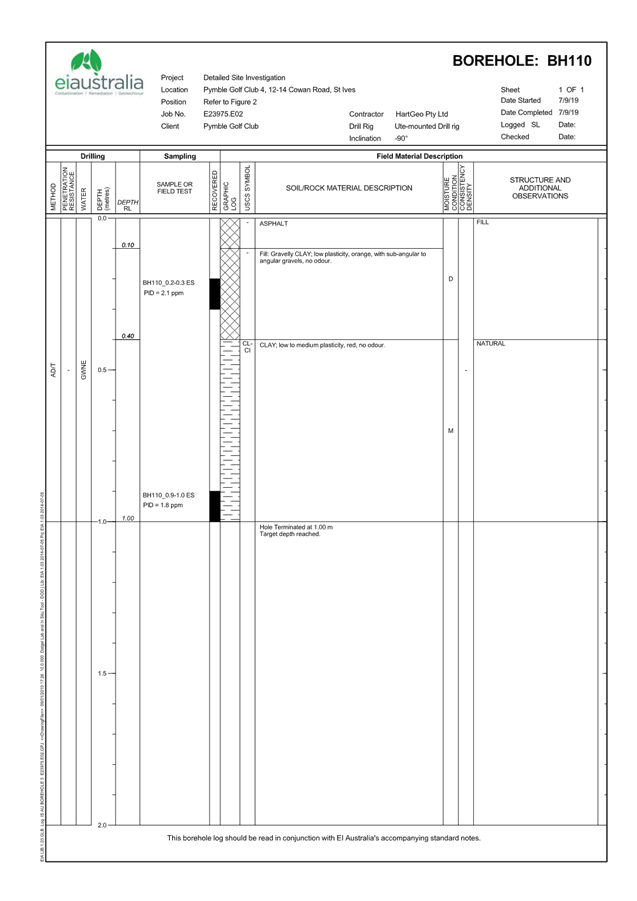
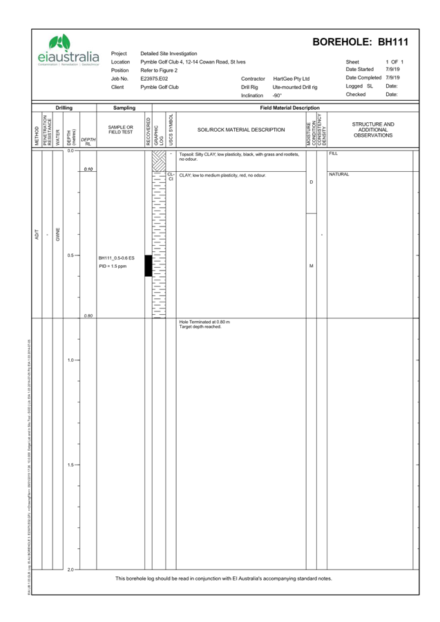
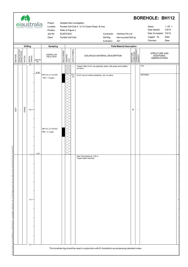
Appendix B - Detailed Site Investigation |
|
2023/125854 |
|
|
A5 |
Appendix C - Ecological Constraints Assessment |
|
2023/125855 |
|
|
A6 |
Appendix D - Arboricultural Impact Assessment |
|
2023/125857 |
|
|
A7 |
Appendix E - Urban Design Report |
|
2023/125860 |
|
|
A8 |
Appendix F - Statement of Heritage Impact |
|
2023/125866 |
|
|
A9 |
Appendix G - Traffic Impact Assessment and Green Travel Plan |
|
2023/125872 |
|
|
A10 |
Appendix H - Photo Montage Images |
|
2023/125873 |
|
|
A11 |
Table of Assessment |
|
2023/125874 |