Ordinary
Meeting of Council
TO
BE HELD ON Tuesday, 16 May 2023 AT 7:00PM
Level
3, Council Chamber
Agenda
** ** ** ** ** **
NOTE:
For Full Details, See Council’s Website –
https://www.krg.nsw.gov.au
under the link to business papers
The Livestream can be viewed here:
https://www.krg.nsw.gov.au/Council/Council-meetings/Council-meeting-live-stream
Disclaimer: All Ku-ring-gai Council Ordinary Meetings of
Council are livestreamed for on-demand viewing on the KRG website. Although
Council will do its best to ensure the public is excluded from the livestream,
Council cannot guarantee a person’s image and/or voice won’t be
broadcast. Accordingly, attendance at Council meetings is considered consent by
a person for their image and/or voice to be webcast. Council accepts no
liability for any damage that may result from defamatory comments made by
persons attending meetings. As per clause 15.21 of Council’s Code of
Meeting Practice, a person must not live stream or use an audio recorder, video
camera, mobile phone or any other device to make a recording or photograph of
the proceedings of a meeting of the council or a committee of the council
without the prior authorisation of the council.
In accordance with clause 3.23 of the Model Code of Meeting Practice,
Councillors are reminded of the oath or affirmation of office made under
section 233A of the Act, and of their obligations under the Council’s
Code of Conduct to disclose and appropriately manage conflicts of interest.
Please refer to
Part 4 of Council’s Code of Conduct for Pecuniary Interests and Part 5 of
Council’s Code of Conduct for Non-Pecuniary Interests.
The Oath or
Affirmation taken is as below:
Oath:
I [name of
Councillor] swear that I will undertake the duties of the office of
Councillor in the best interests of the people of the Ku-ring-gai Local
Government area and the Ku-ring-gai Council, and that I will faithfully and
impartially carry out the functions, powers, authorities and discretions vested
in me under the Local Government Act 1993 or any other Act to the best
of my ability and judgement.
Affirmation:
I [name of
Councillor] solemnly and sincerely declare and affirm that I will undertake
the duties of the office of Councillor in the best interests of the people of
the Ku-ring-gai Local Government area and the Ku-ring-gai Council, and that I
will faithfully and impartially carry out the functions, powers, authorities
and discretions vested in me under the Local Government Act 1993 or any
other Act to the best of my ability and judgement.
APOLOGIEs
DECLARATIONS OF INTEREST
Documents Circulated to Councillors
Confirmation of Reports to be
Considered in Closed Meeting
NOTE:
That in accordance with the provisions of Section 10 of the Local
Government Act 1993, all officers’ reports be released to the press and
public, with the exception of confidential attachments to the following General
Business reports:
GB.10 RFT6-2023
ELECTRIC VEHICLE CHARGERS SUPPLY / INSTALL / MAINTAIN / MANAGE
In accordance with 10A(2)(d)(ii):
Attachment 1: Electric Vehicle Chargers RFT6-2023
In accordance with 10A(2)(d)(ii):
Attachment 2: Electric Vehicle Chargers RFT6-2023
CONFIRMATION OF MINUTEs
Minutes
of Ordinary Meeting of Council 7
File: EM00041/3
Meeting held 18 April 2023
Minutes numbered 43 to 55
minutes from the Mayor
Petitions
GENERAL BUSINESS
i.
The Mayor to invite Councillors to
nominate any item(s) on the Agenda that they wish to have a site inspection.
ii.
The Mayor to invite Councillors to
nominate any item(s) on the Agenda that they wish to adopt in accordance with
the officer’s recommendation allowing for minor changes without debate.
GB.1 2022 - 2023
Budget Review - 3rd Quarter ended March 2023 20
File: S09112/11
To inform Council of the results
of the second quarter budget review of 2022/23 and proposed adjustments to the
annual budget based on the actual financial performance and trend for the
period 1 July 2022 to 31 March 2023.
Recommendation:
That the 2022/23 March Quarterly
Budget Review and the recommended changes are received and noted.
GB.2 Analysis of
Land and Environment Court Costs - 3rd Quarter 2022 to 2023 45
File: FY00623/5
To report legal costs in relation
to development control matters in the Land and Environment Court for the
quarter ended 31 March 2023.
Recommendation:
That the analysis of Land and
Environment Court costs for the quarter ended 31 March 2023 be received and noted.
GB.3 Investment
Report as at 30 April 2023 59
File: FY00623/5
To present Council’s
investment portfolio performance for April 2023.
Recommendation:
That the summary of investments
performance for April 2023 be received and noted; and that the Certificate of
the Responsible Accounting Officer be noted and the report adopted.
GB.4 Planning
Proposal for 4-10 Bridge Street, Pymble 67
File: S13905
For Council to consider whether
to submit the private Planning Proposal for 4-10 Bridge Street, Pymble to the
Department of Planning and Environment for a Gateway Determination.
Recommendation:
That the Planning Proposal, as
amended by this report, be submitted to the Department of Planning and
Environment for a Gateway determination.
GB.5 Planning
Proposal for 130 Killeaton Street, St Ives 362
File: S13685
For Council to consider whether to submit the Planning
Proposal for 130 Killeaton Street, St Ives to the Department of Planning and
Environment for a Gateway Determination.
Recommendation:
GB.6 Planning
Proposal for 4, 12 & 14 Cowan Road, St Ives - Pymble Golf Club 647
File: S12645
For Council to consider the
private Planning Proposal that has been lodged for 4, 12 & 14 Cowan Road,
St Ives (Pymble Golf Club).
Recommendation:
That the Planning Proposal, as
amended by this report, be submitted to the Department of Planning and
Environment for a Gateway Determination.
GB.7 Consideration
of Submissions - 10 Park Crescent, Pymble - Heritage Listing 889
File: S14024
For
Council to consider submissions received in response to the exhibition of the
planning proposal to amend the Ku-ring-gai Local Environmental Plan 2015 to heritage
list 10 Park Crescent, Pymble and its interiors as a local heritage item.
Recommendation:
That
Council adopts the Planning Proposal to amend
Schedule 5 of the Ku-ring-gai Local Environmental Plan 2015 to
heritage list 10 Park Crescent, Pymble and its interiors as a local heritage
item.
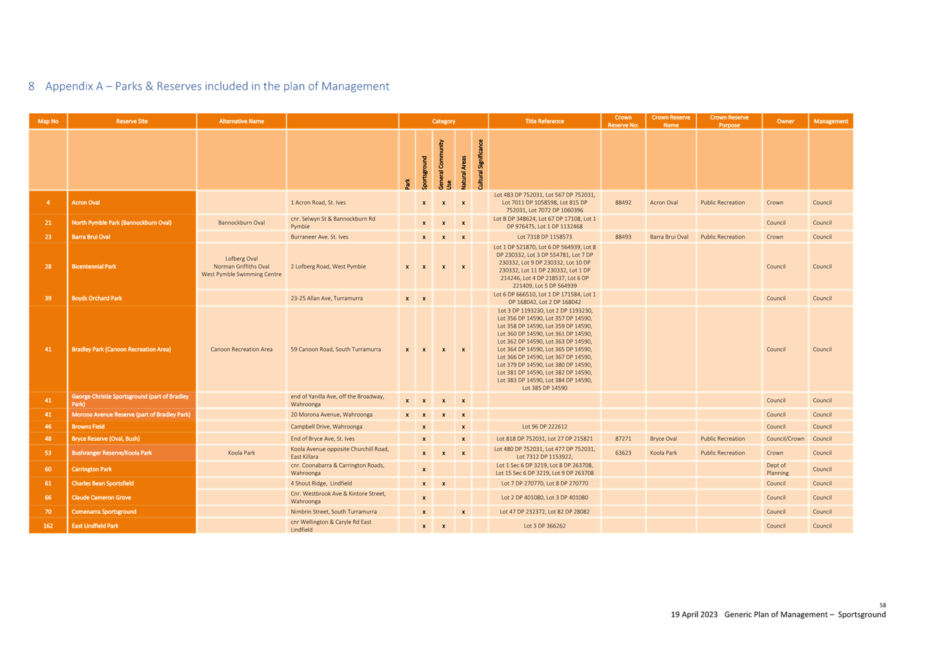
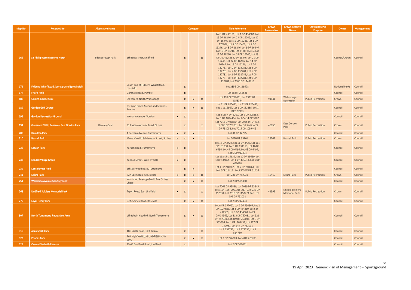
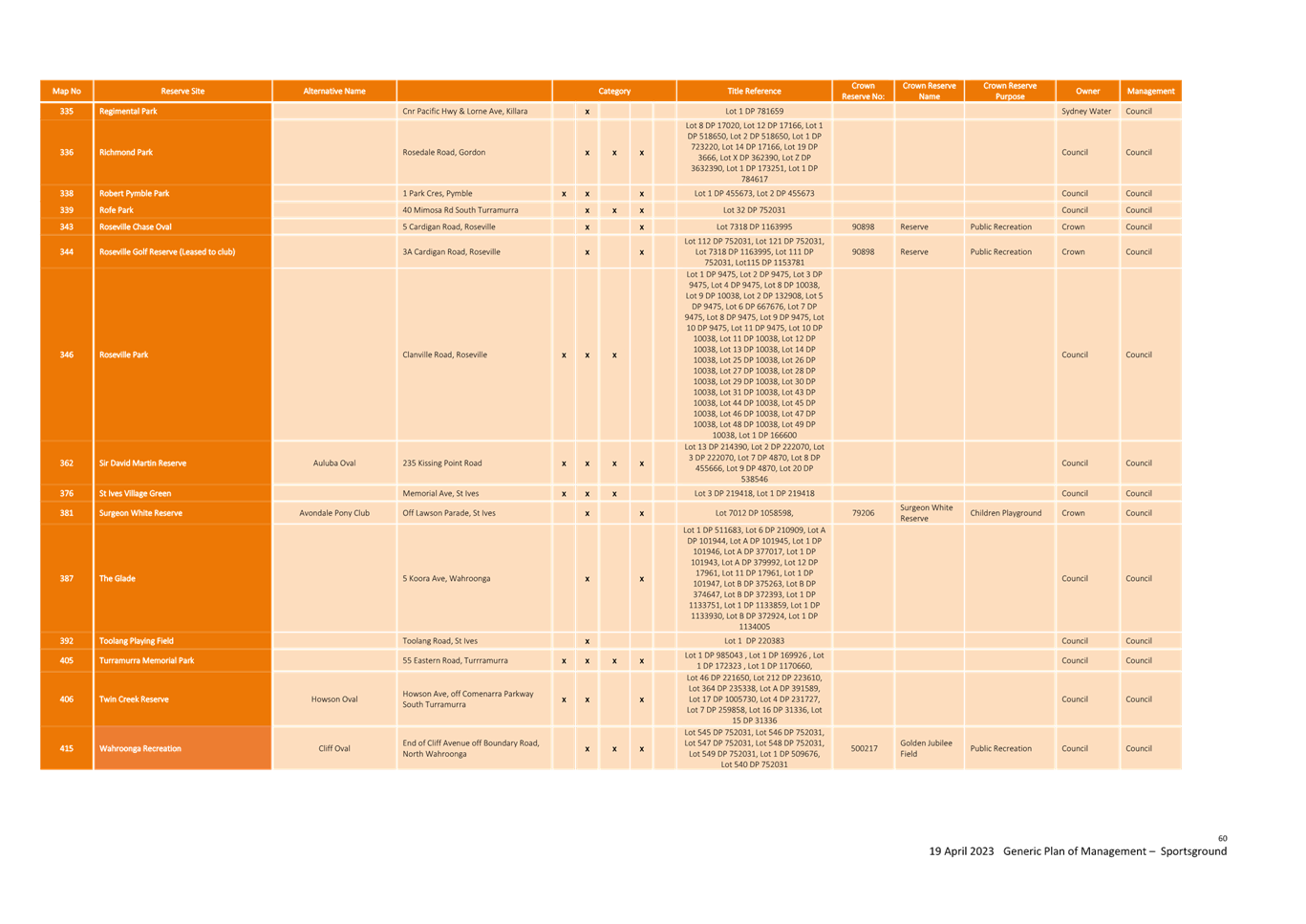
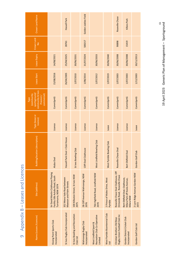
GB.8 Generic
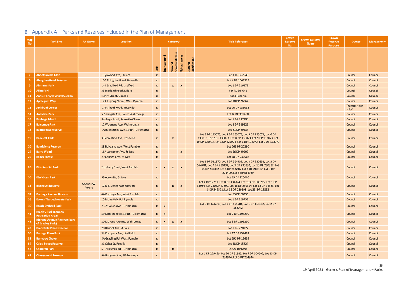
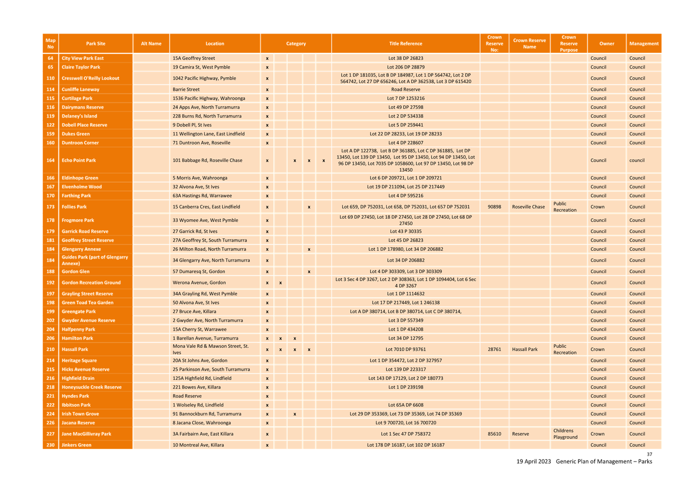
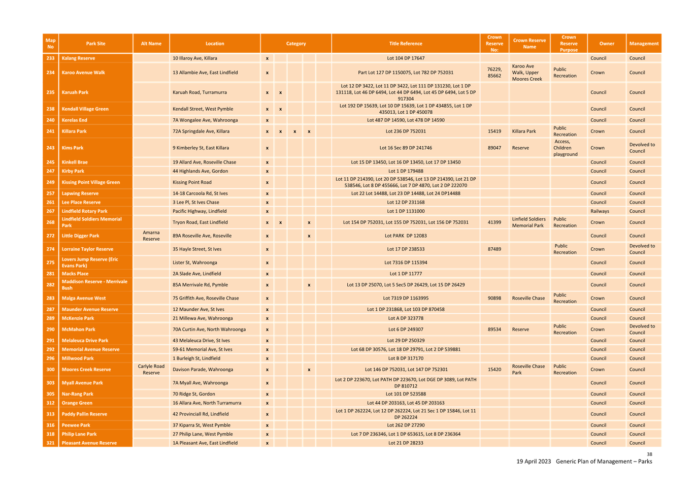
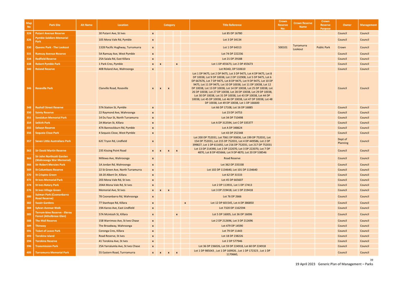
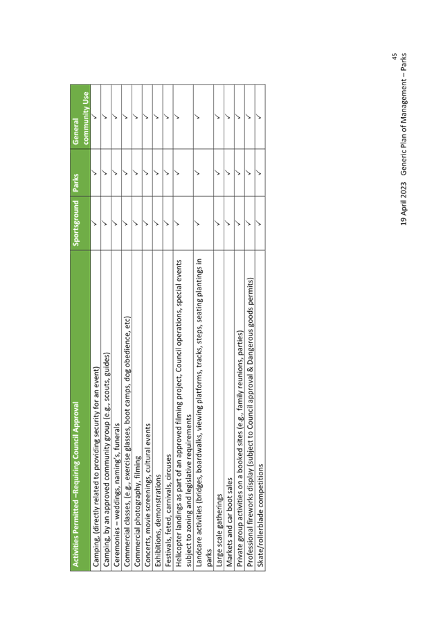
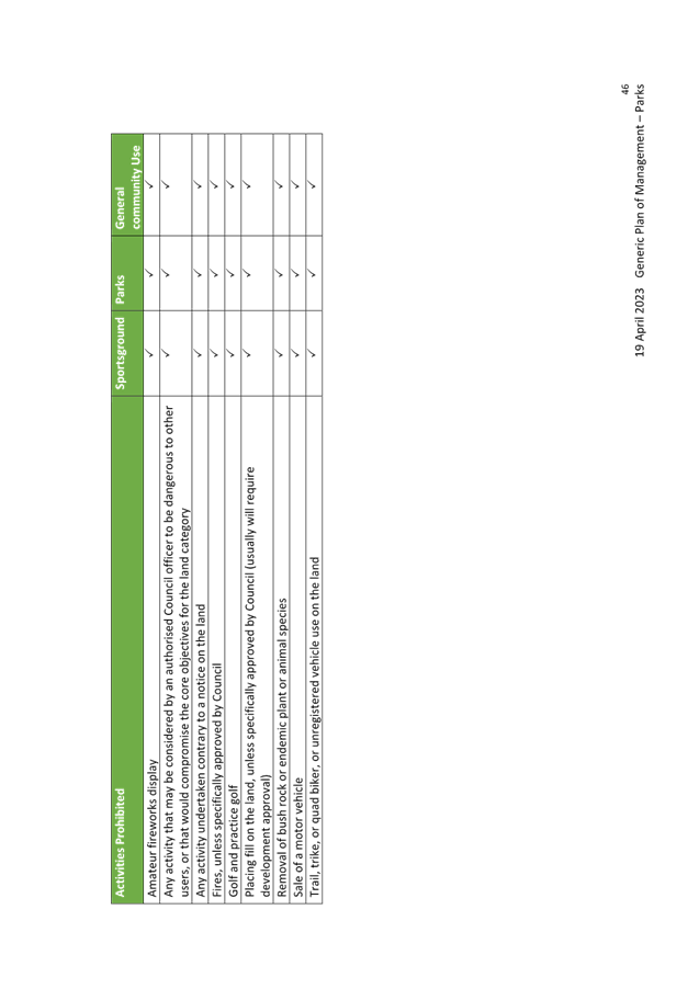
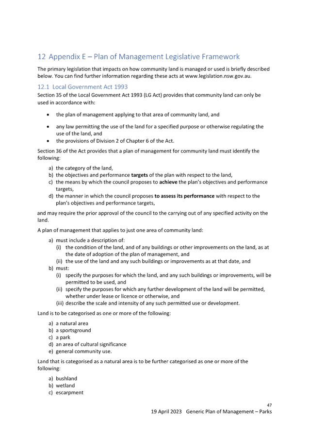
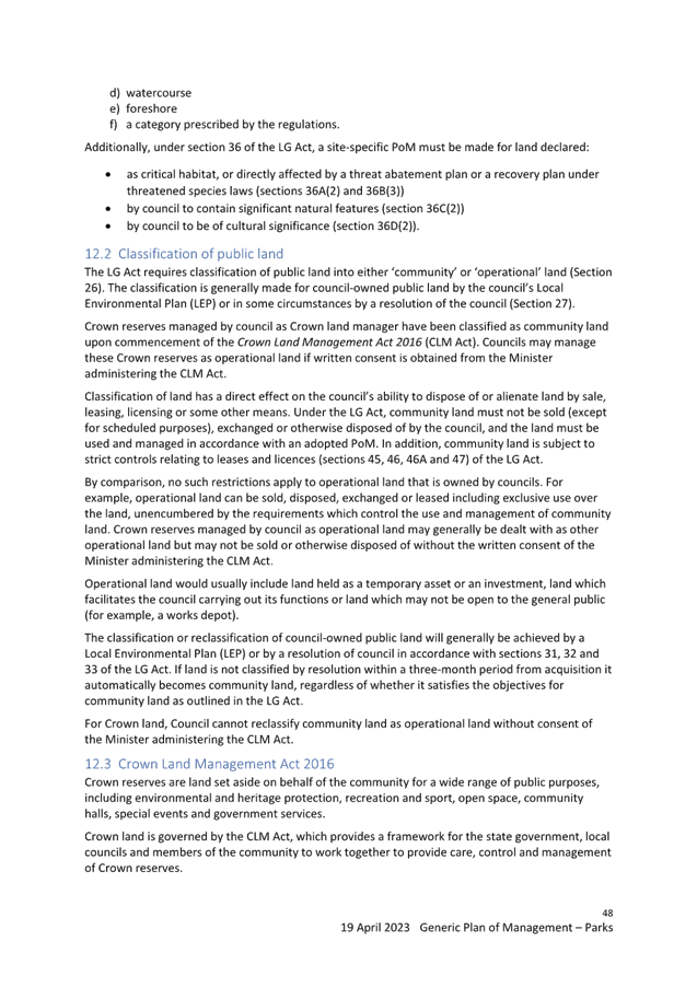
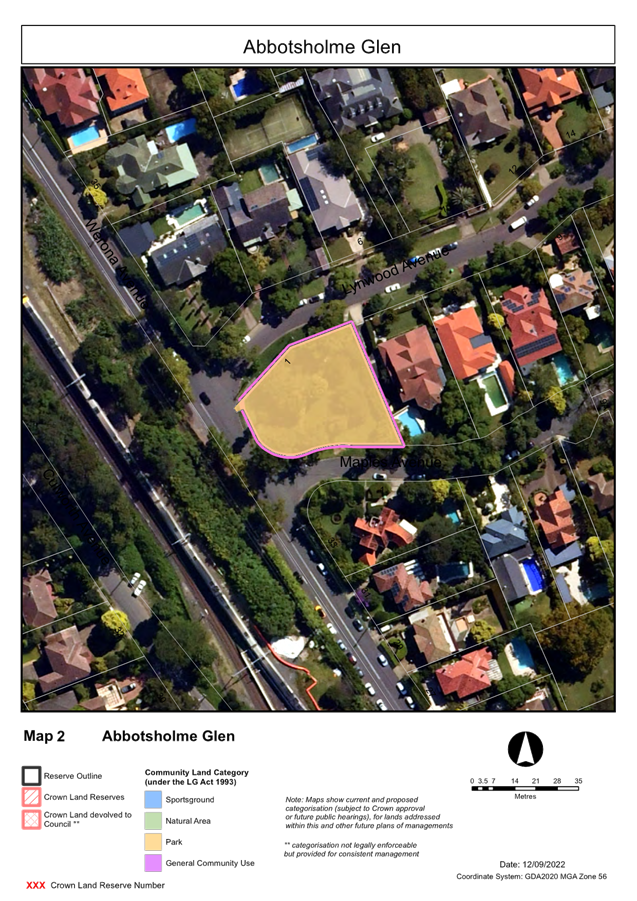
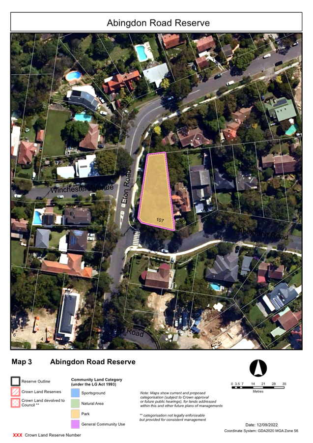
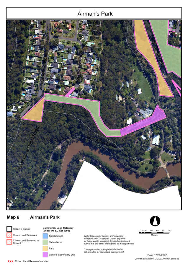
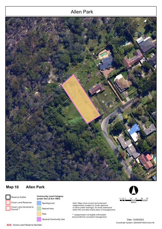
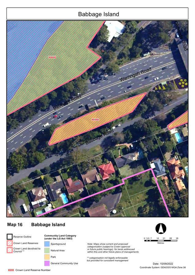
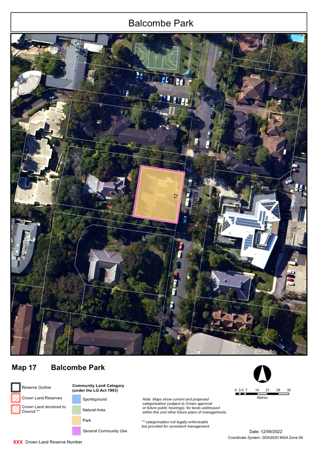
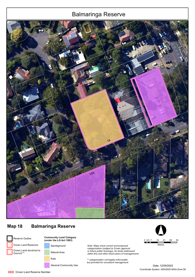
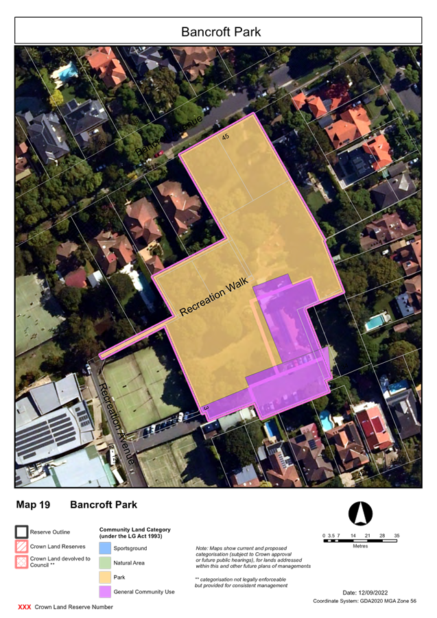
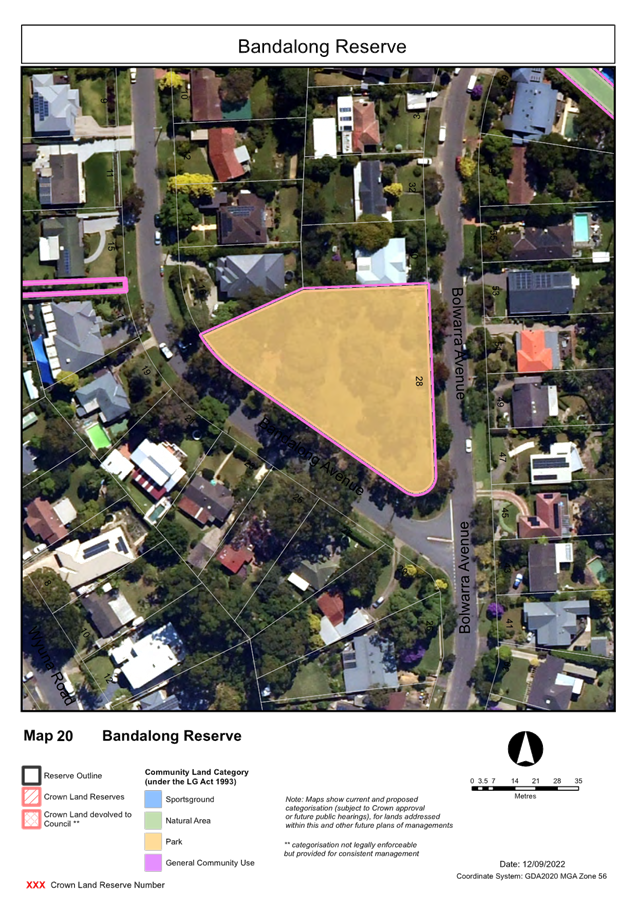
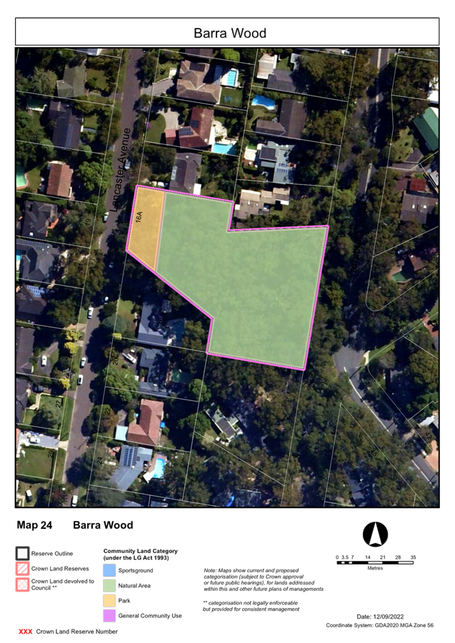
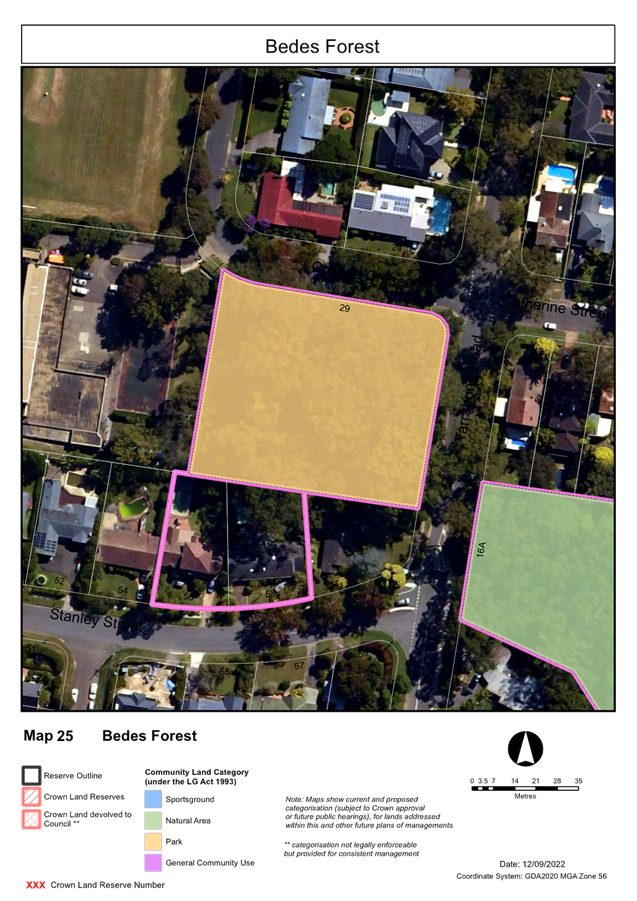
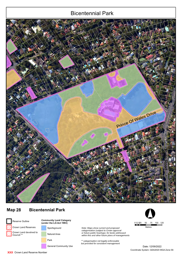
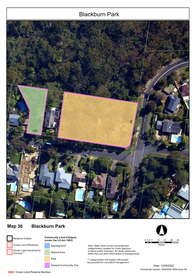
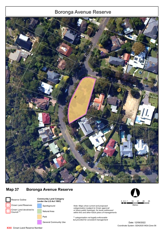
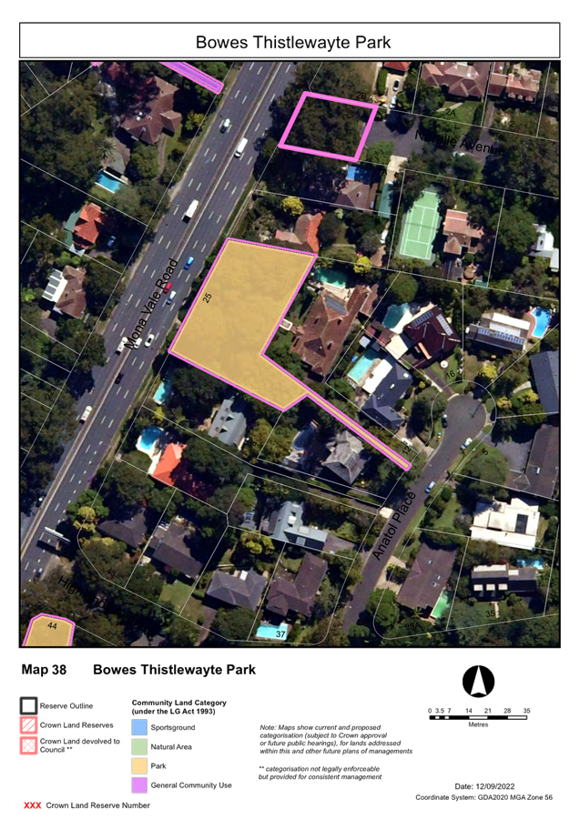
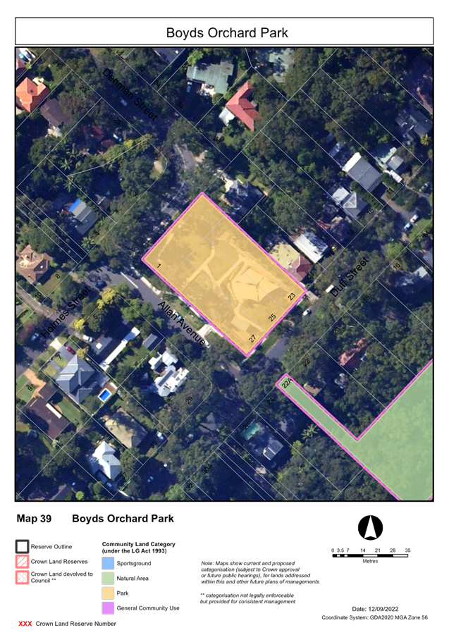
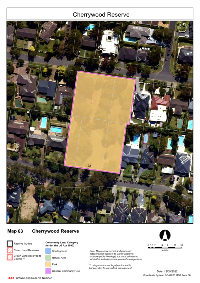
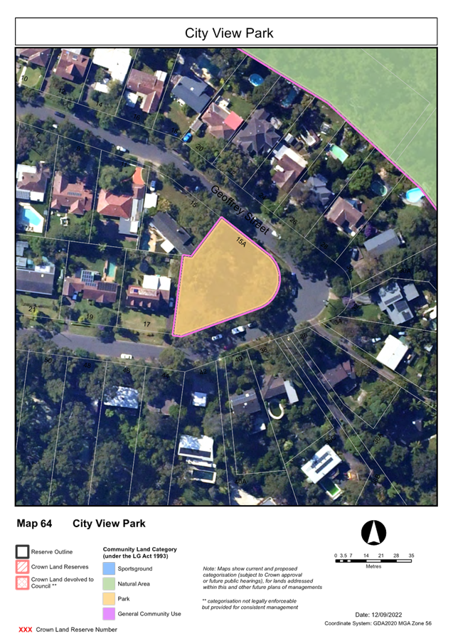
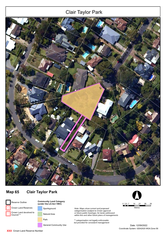
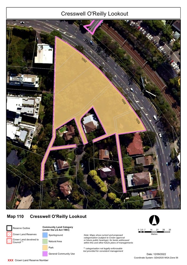
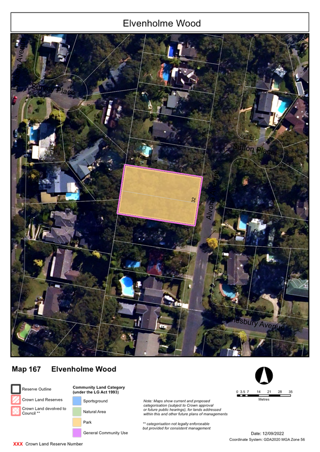
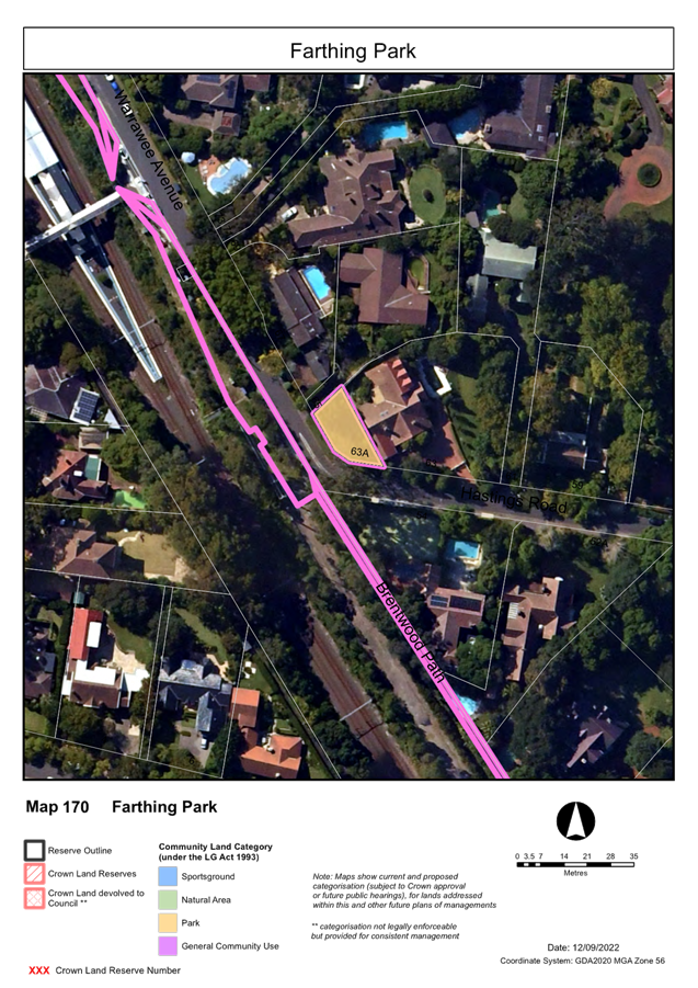
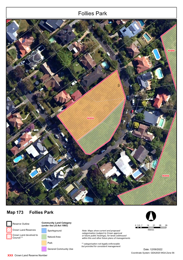
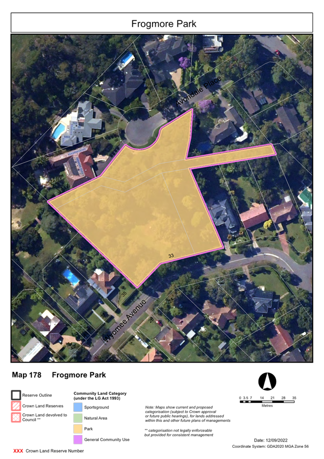
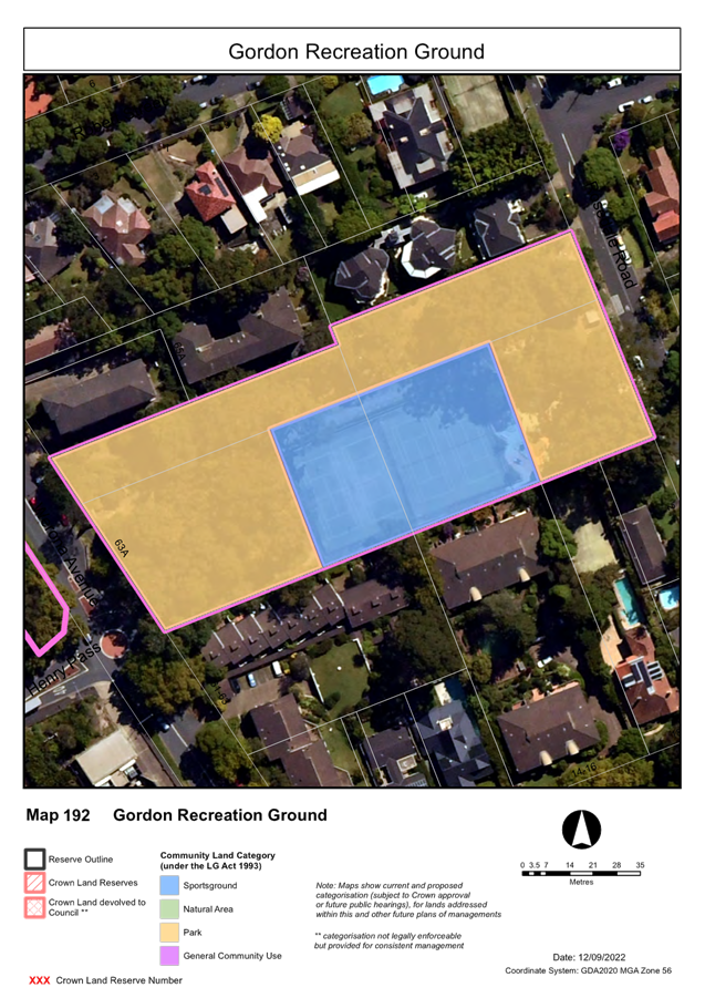
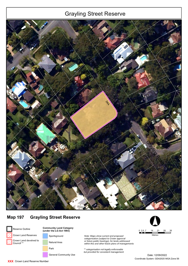
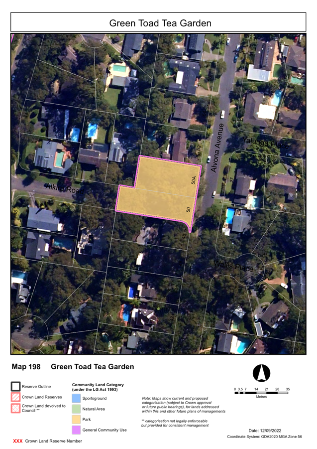
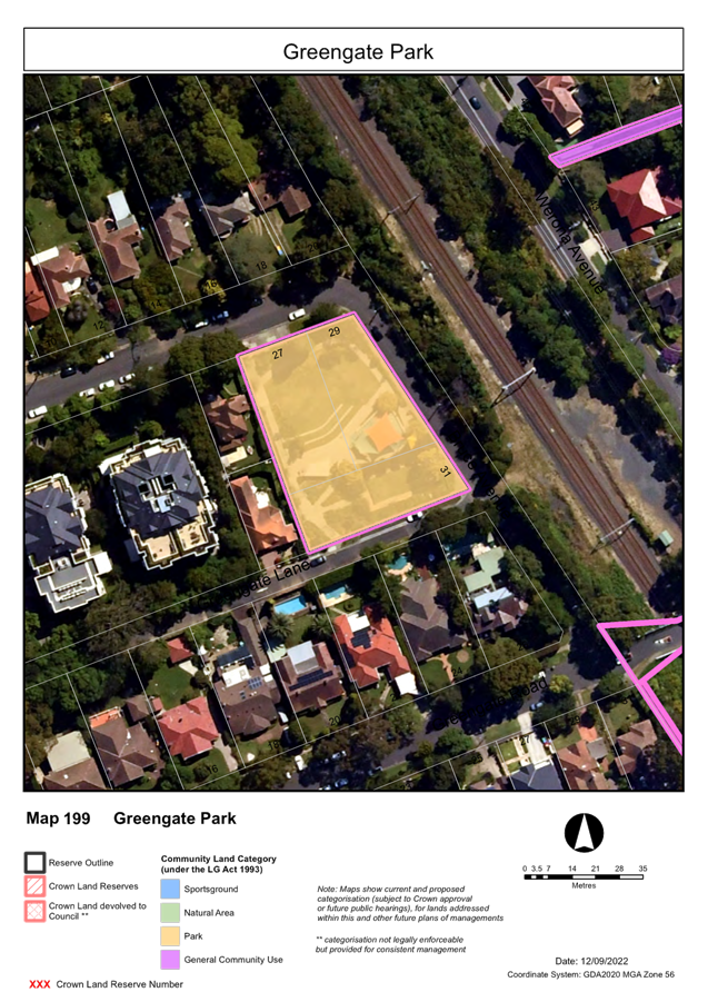
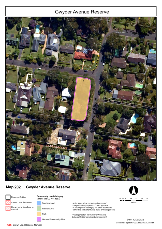
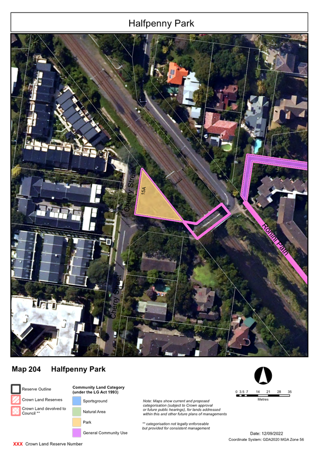
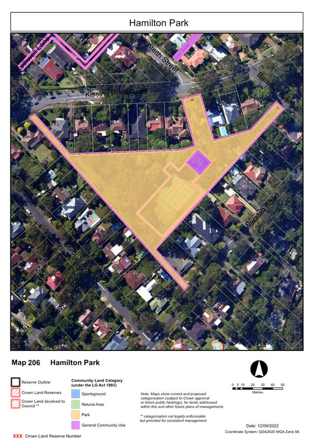
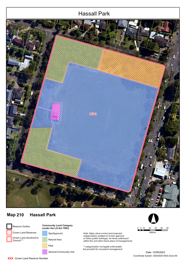
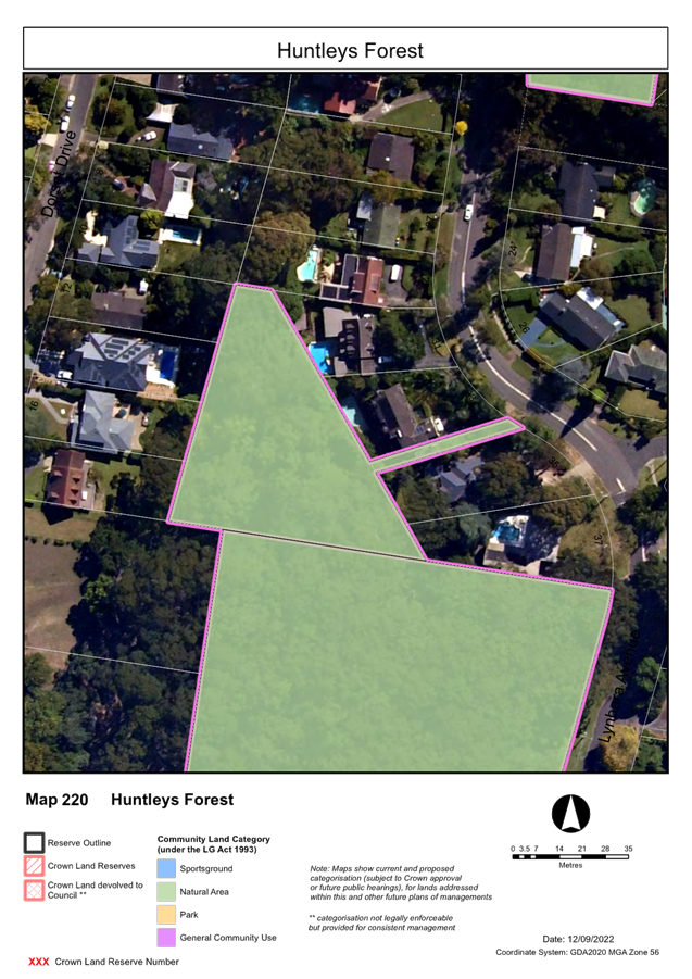
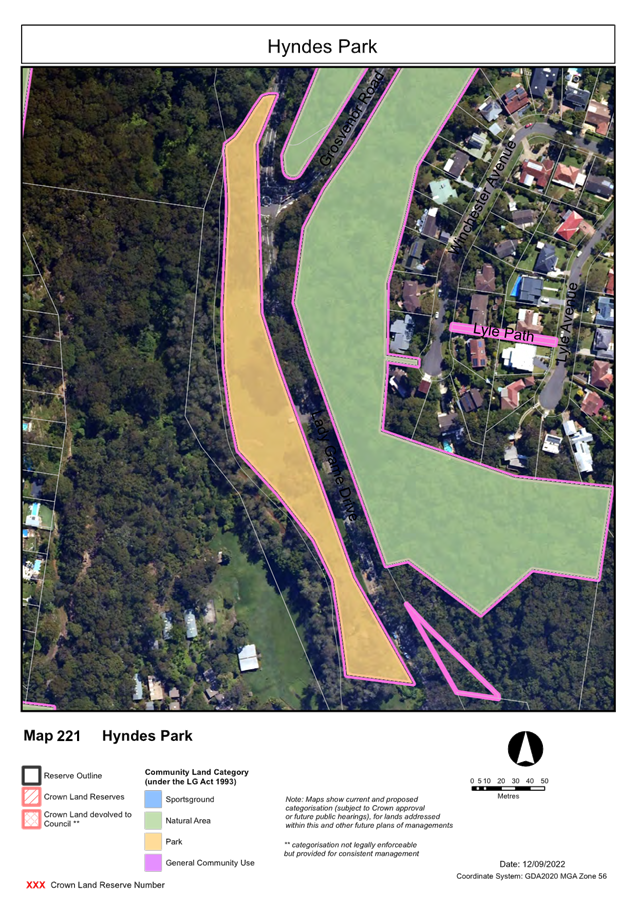
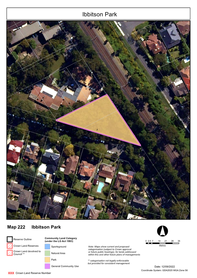
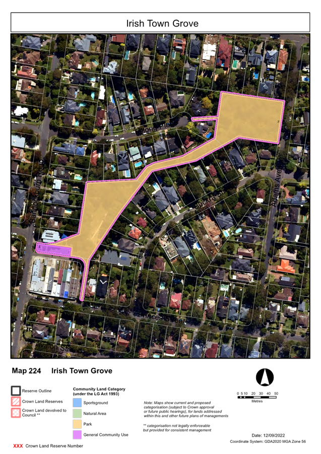
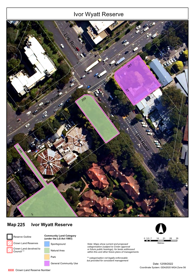
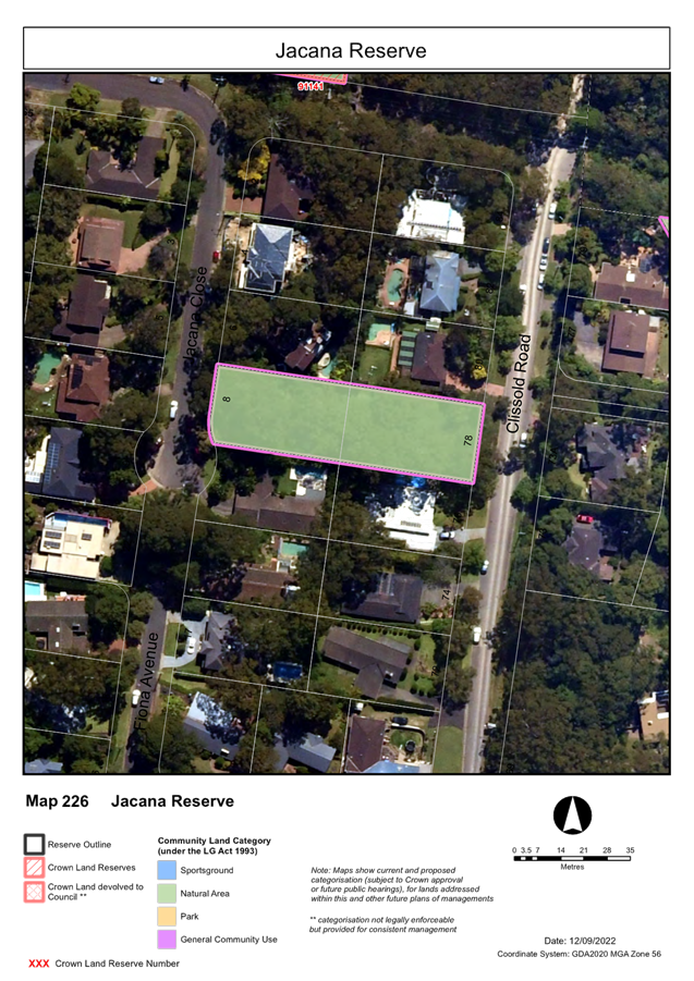
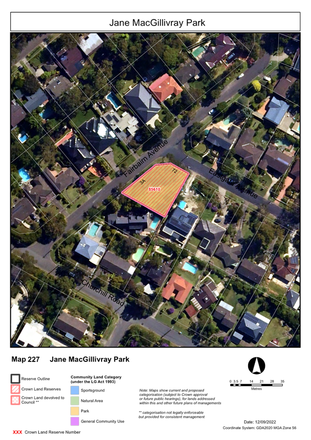
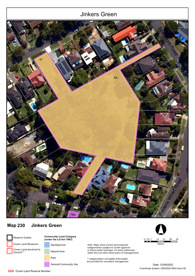
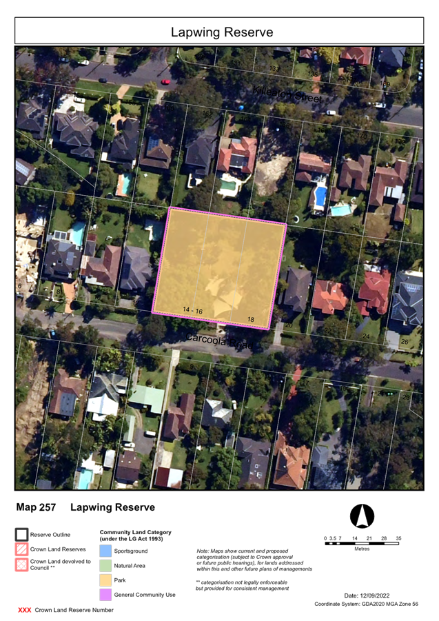
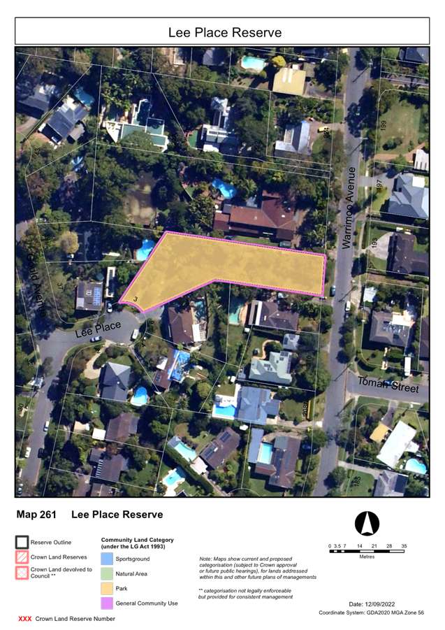
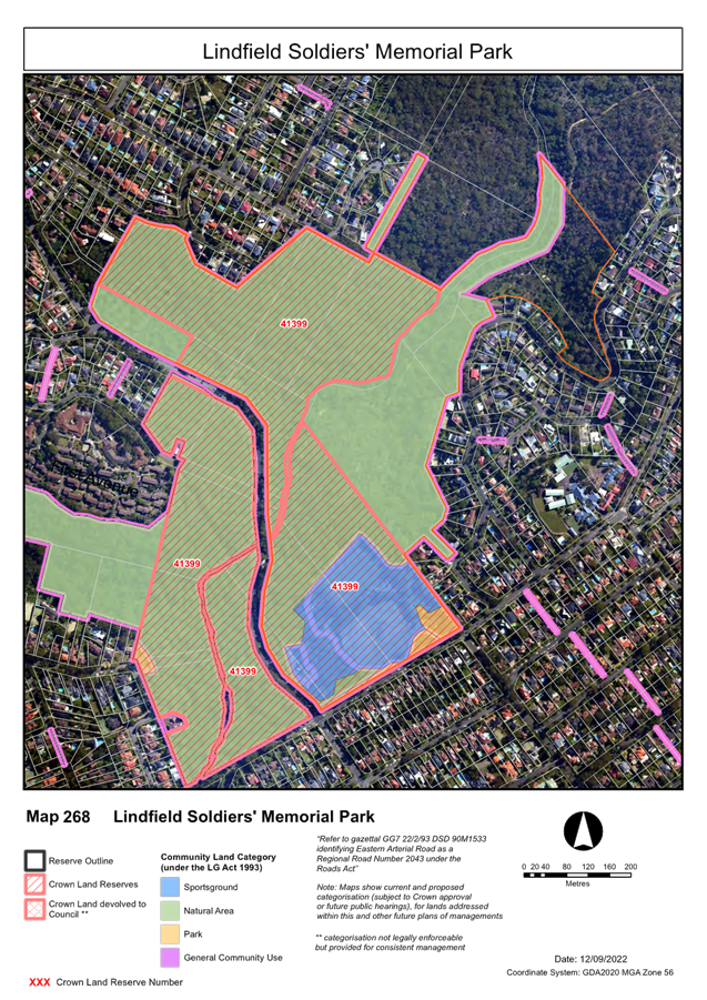
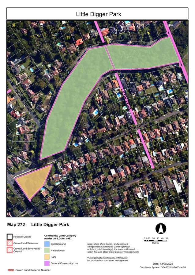
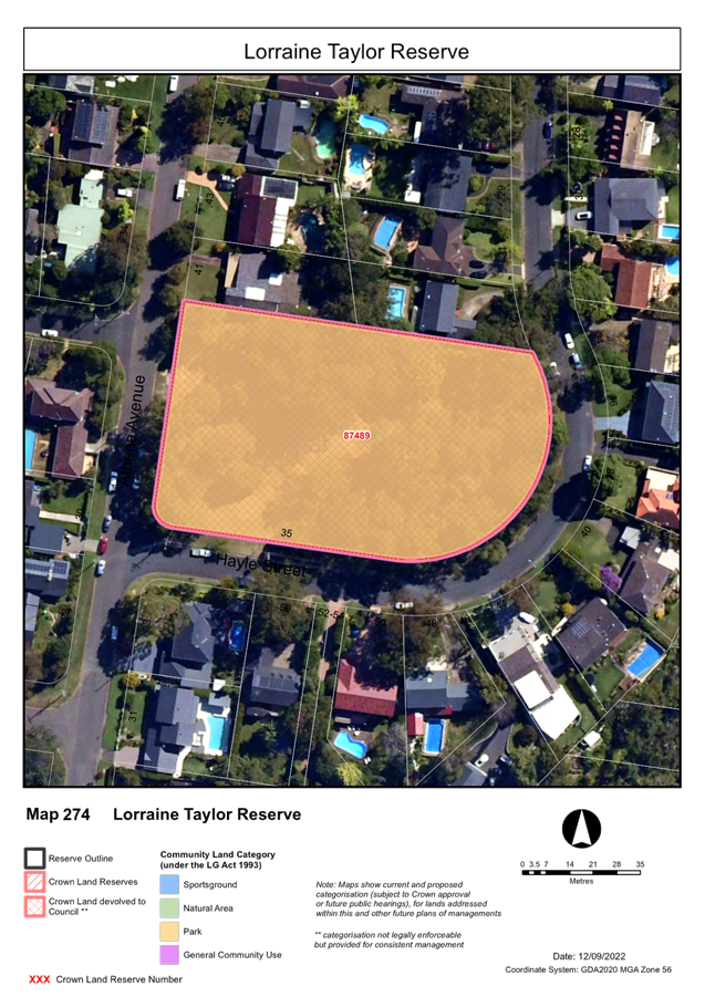
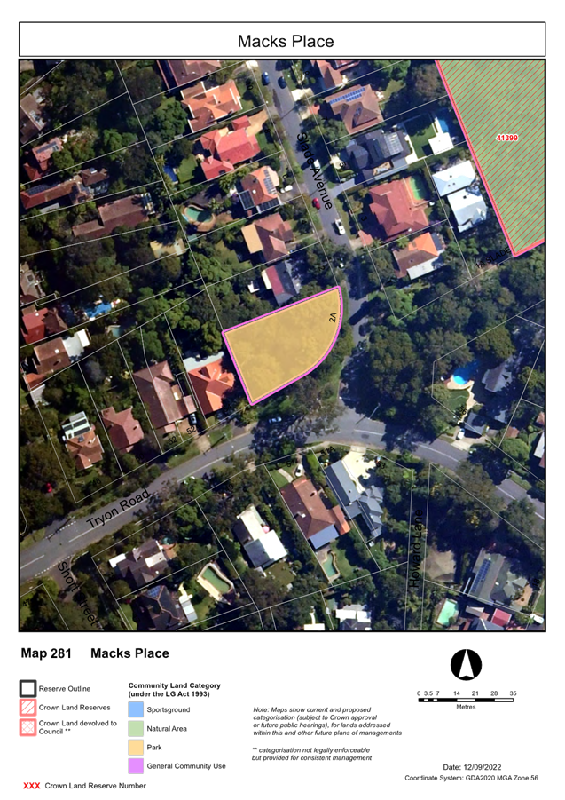
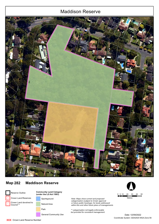
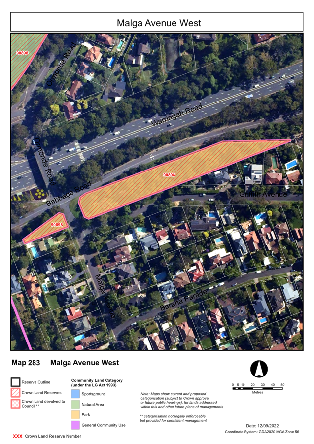
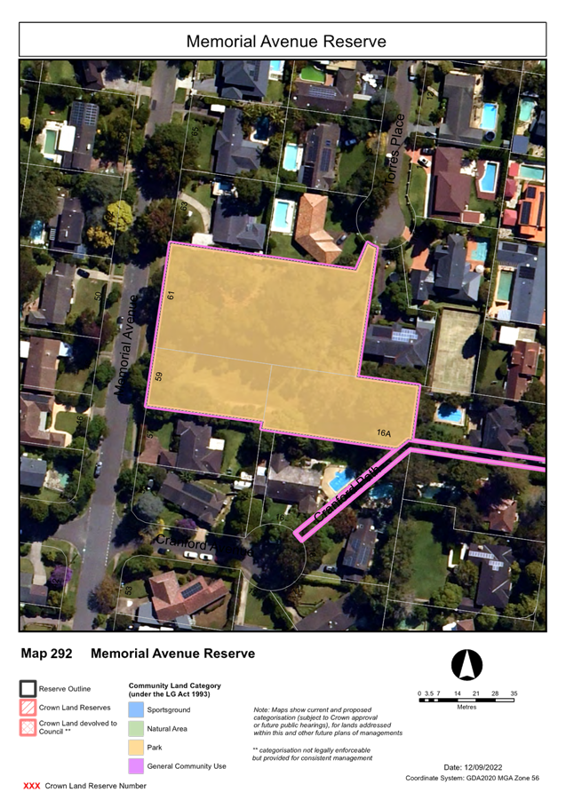
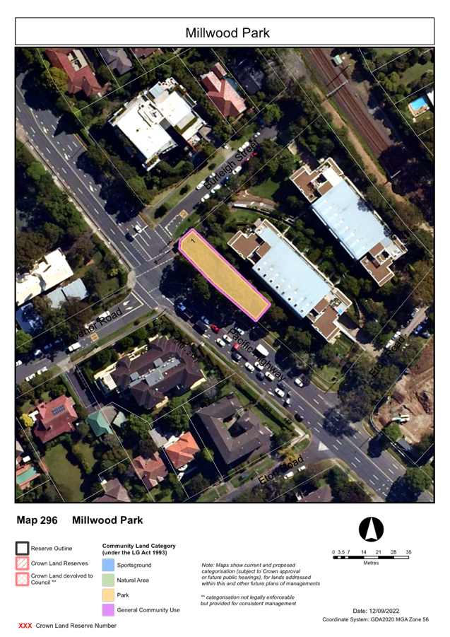
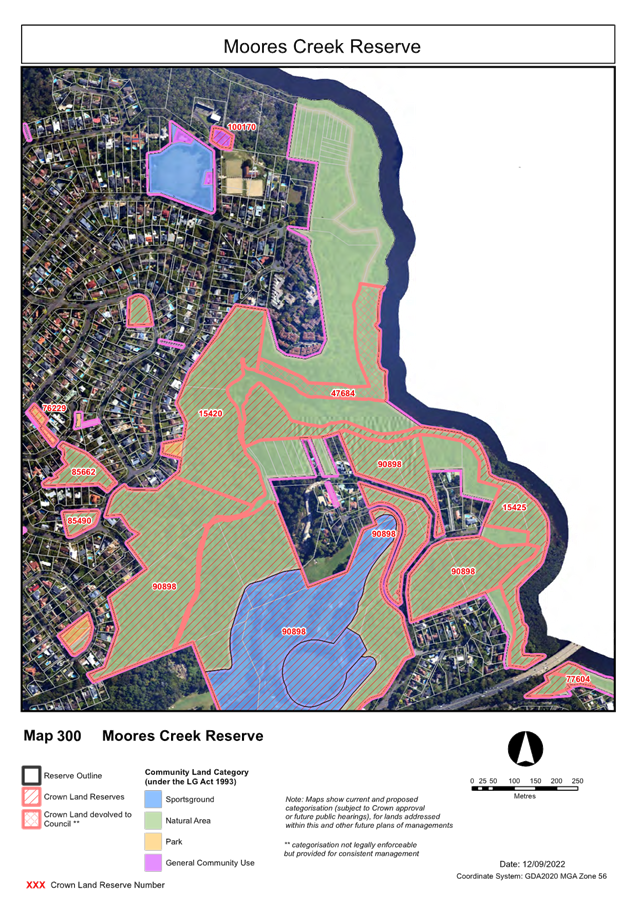
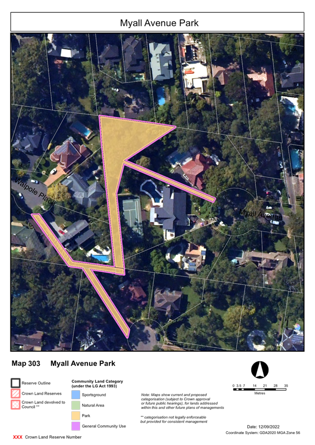
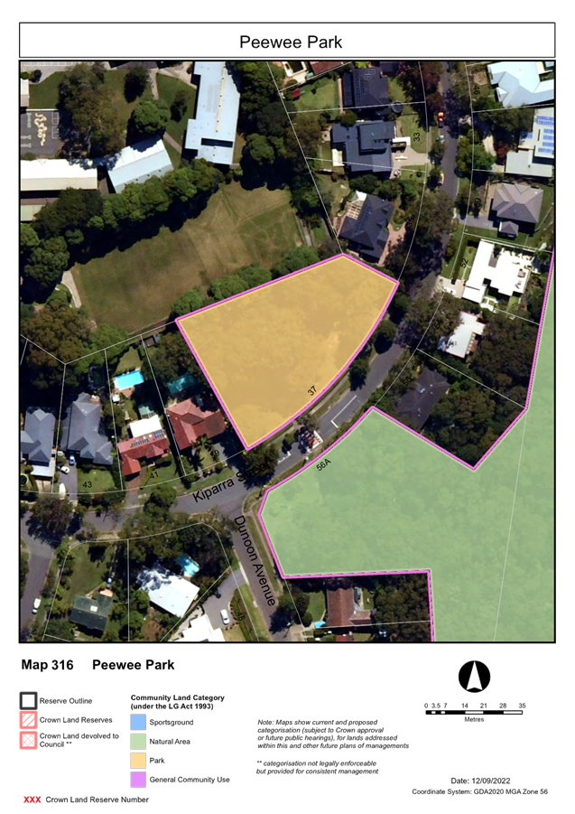
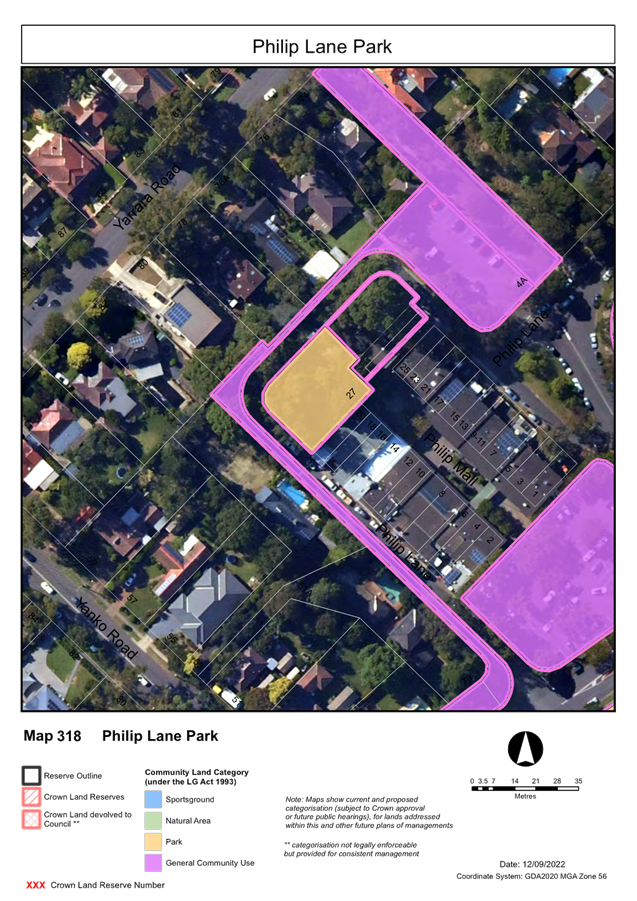
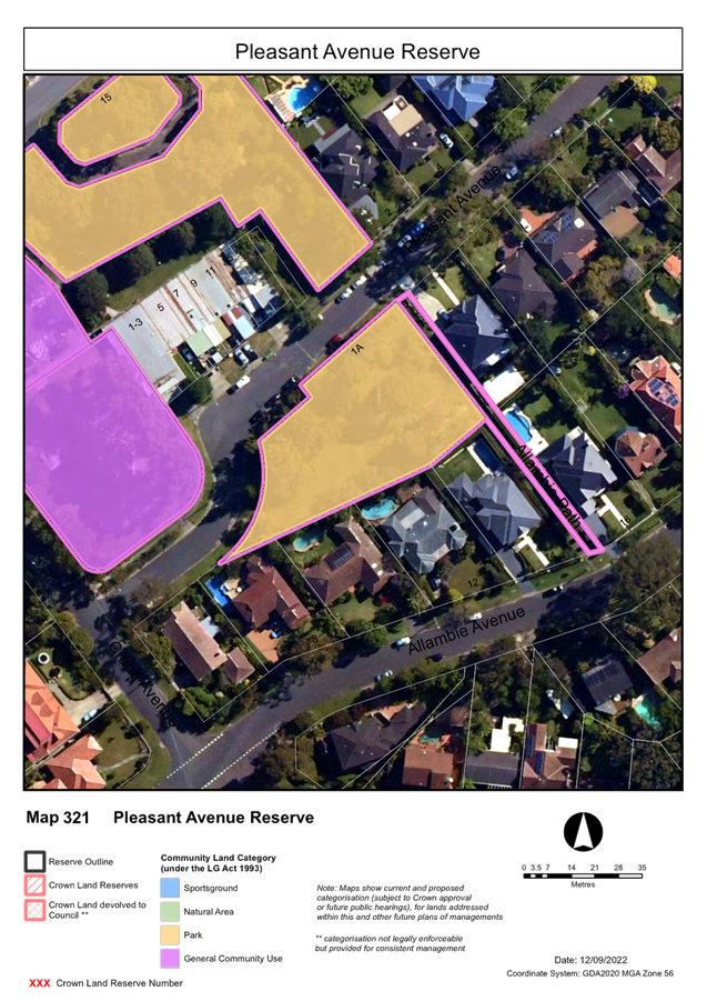
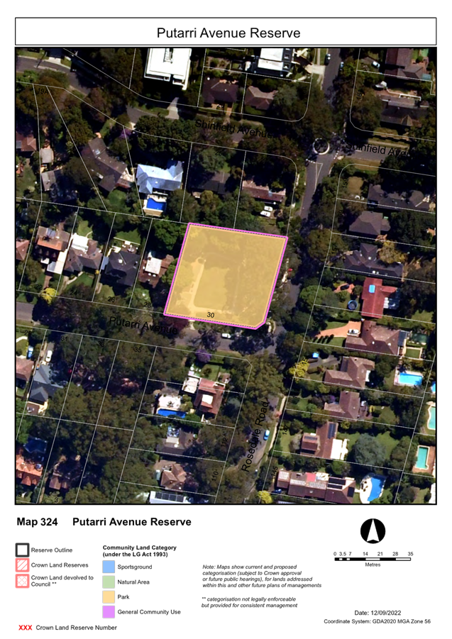
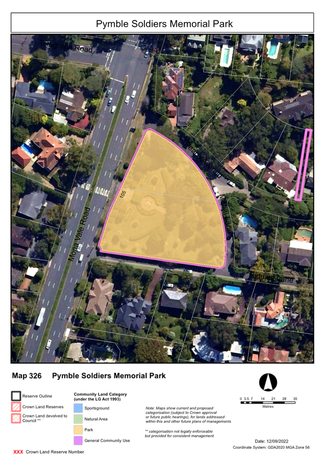
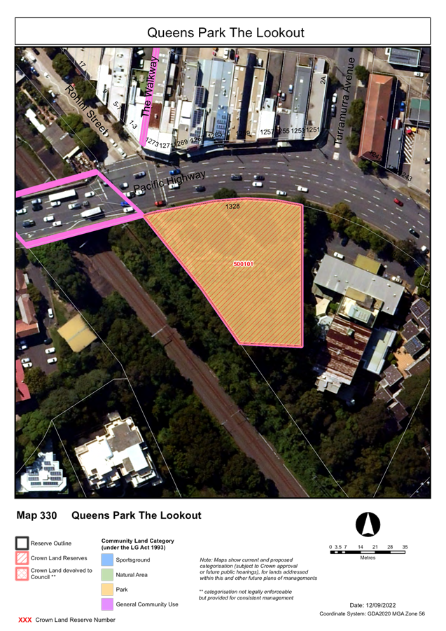
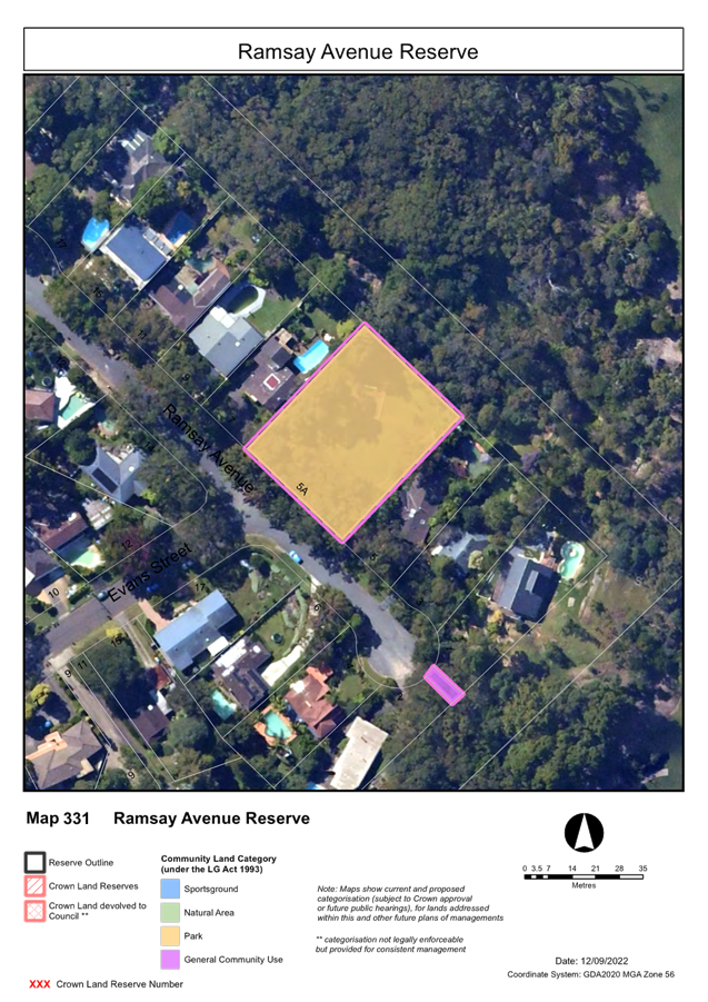
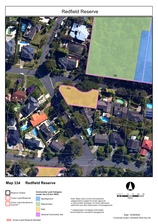
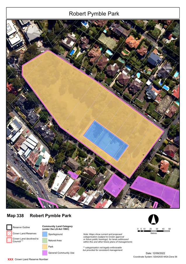
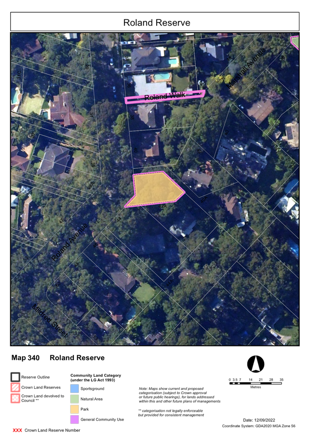
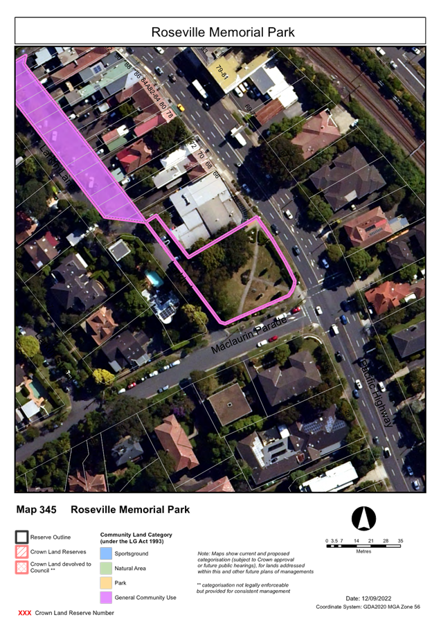
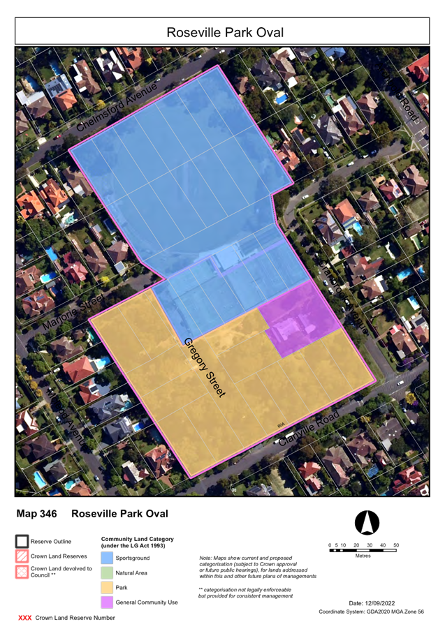
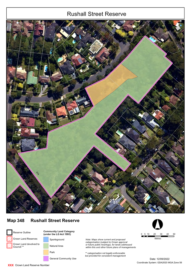
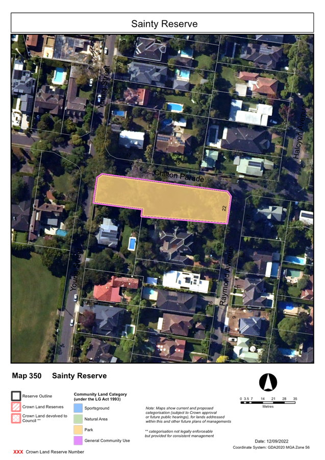
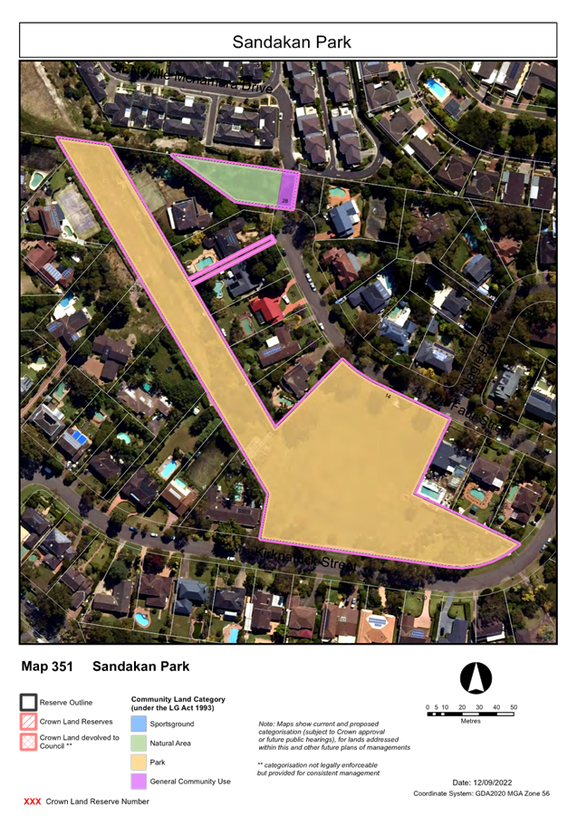
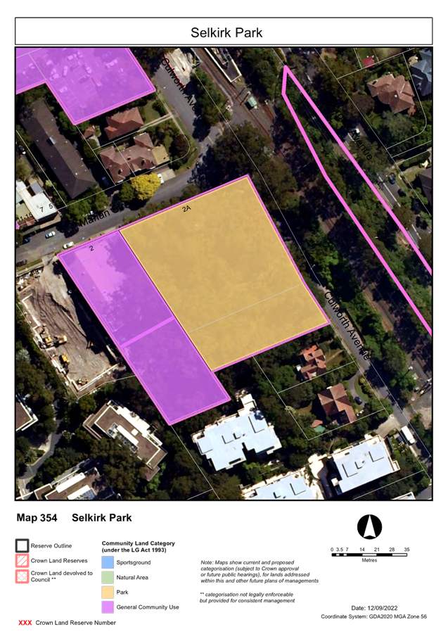
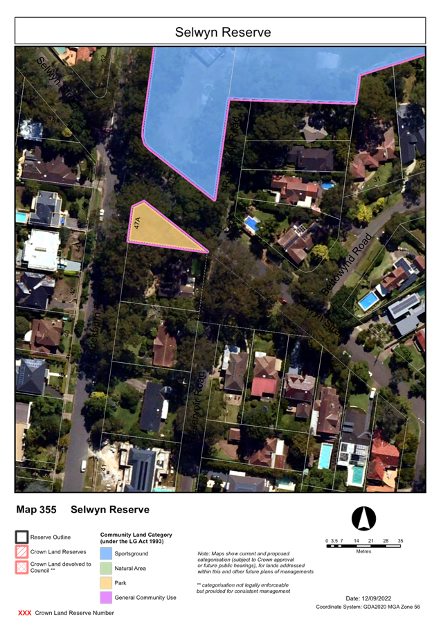
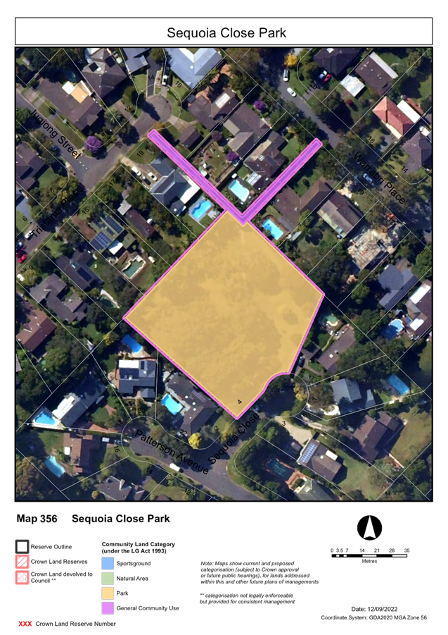
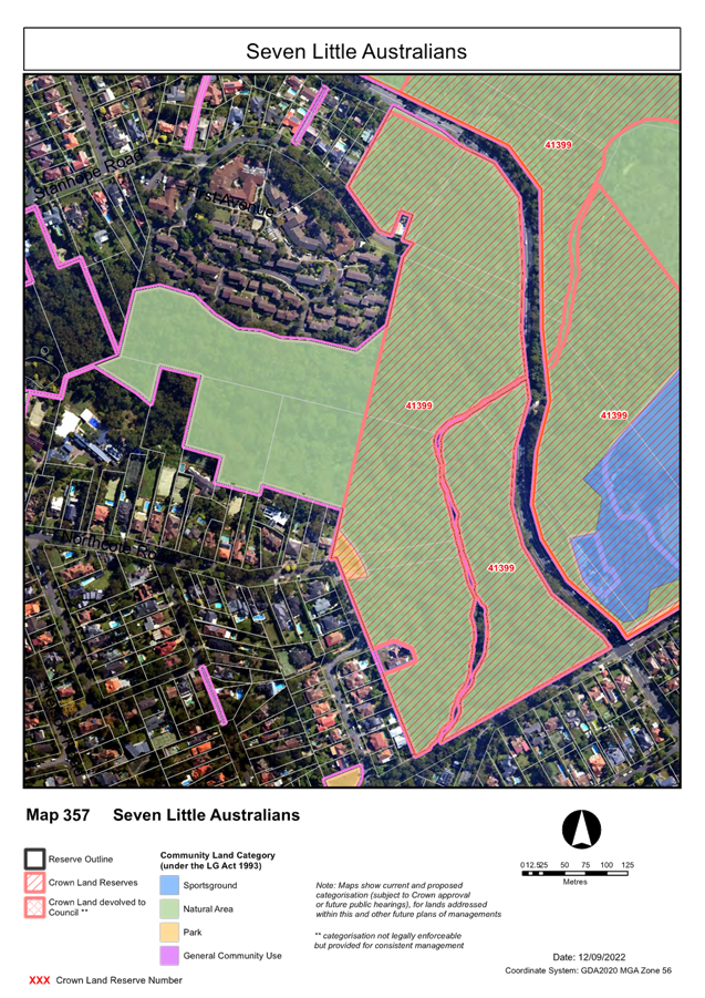
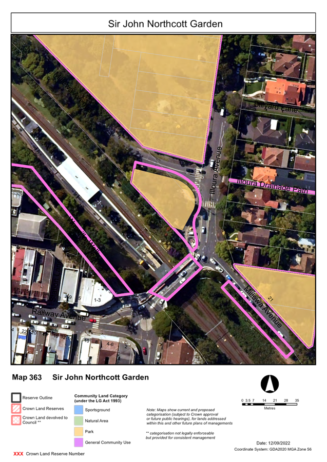
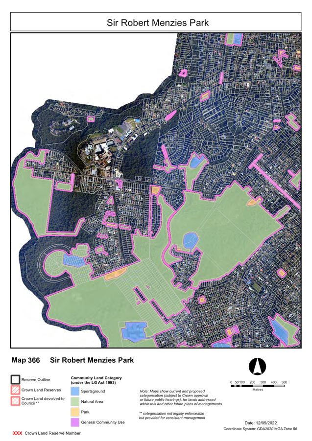
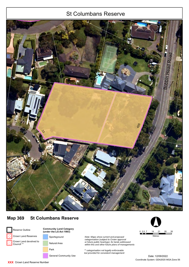
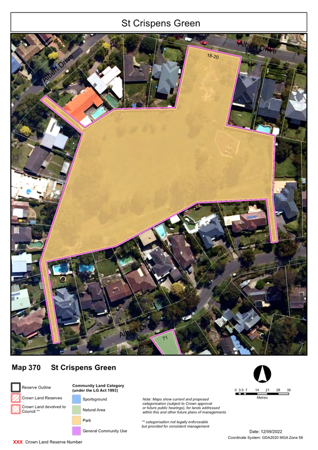
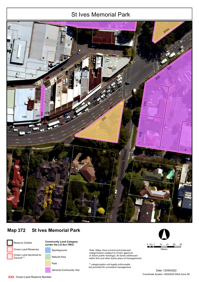
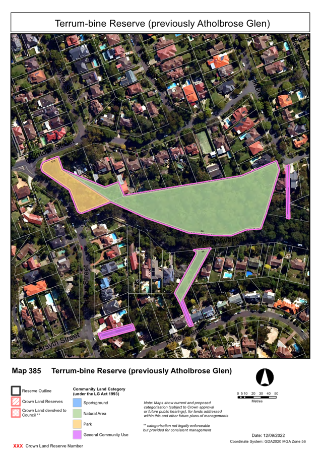
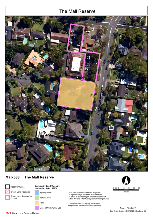
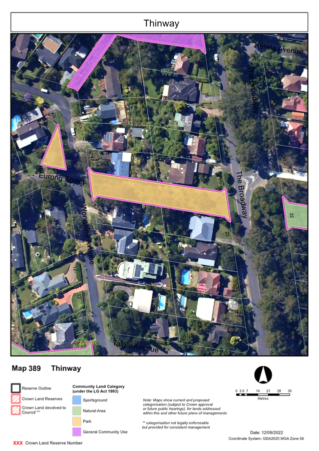
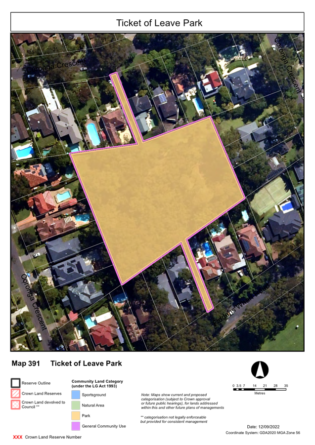
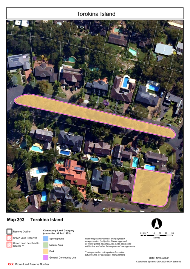
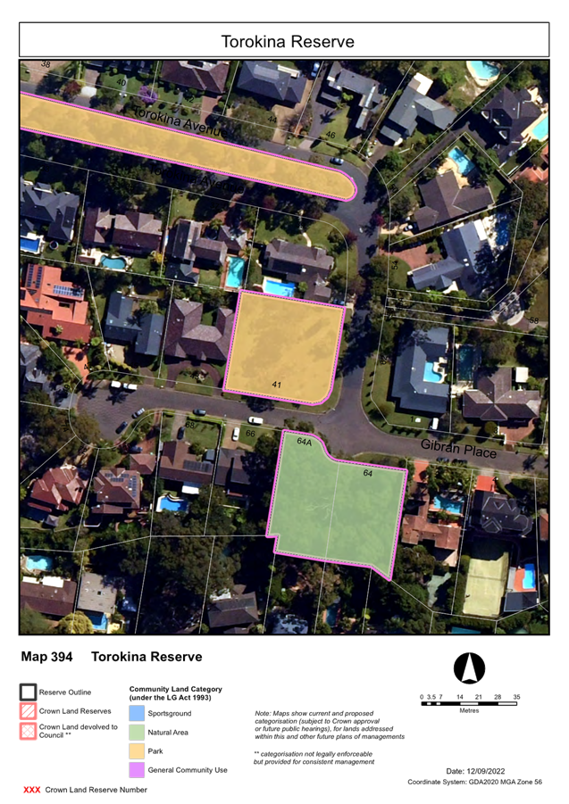
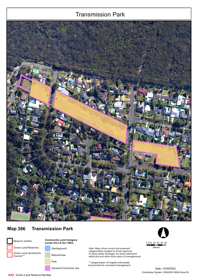
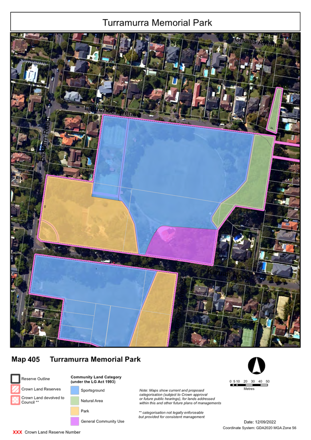
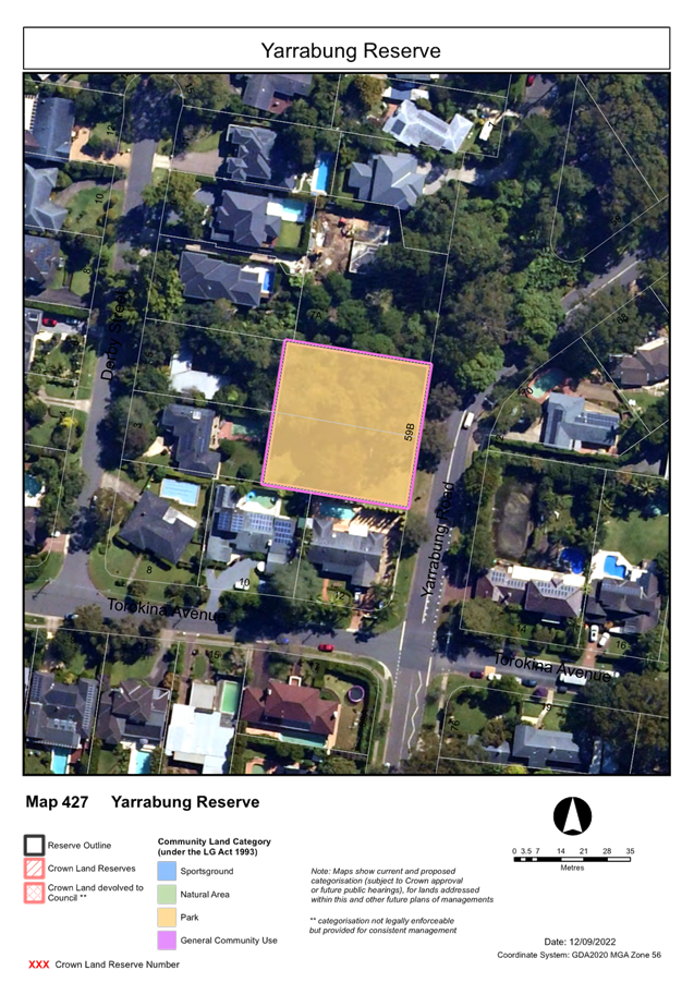
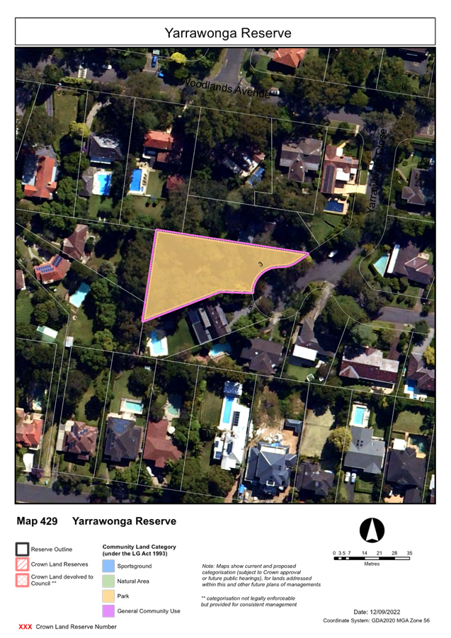
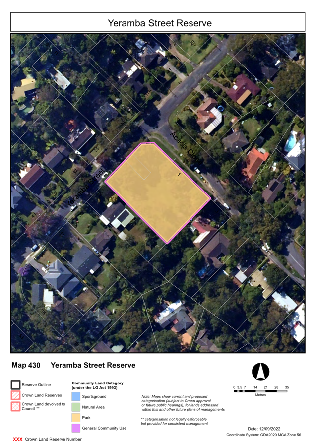
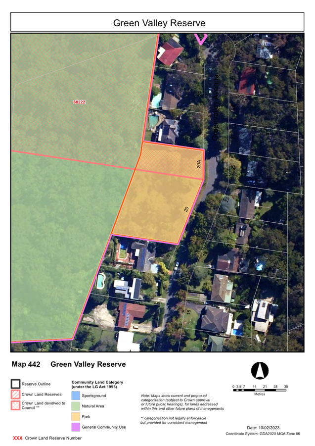
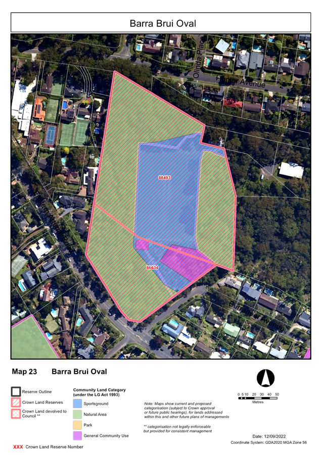
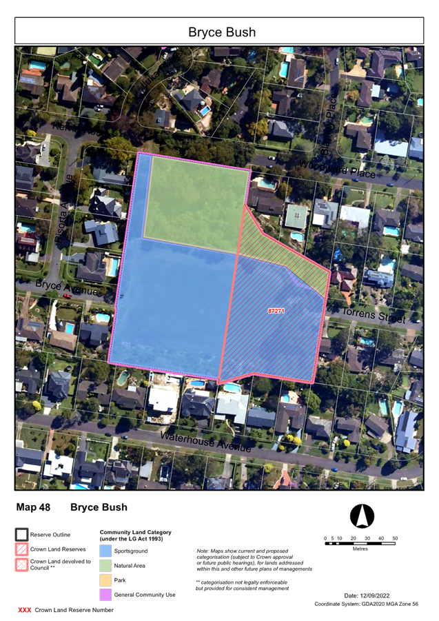
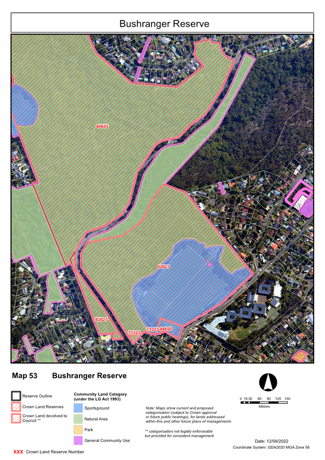
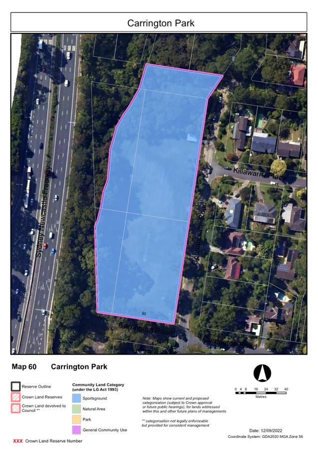
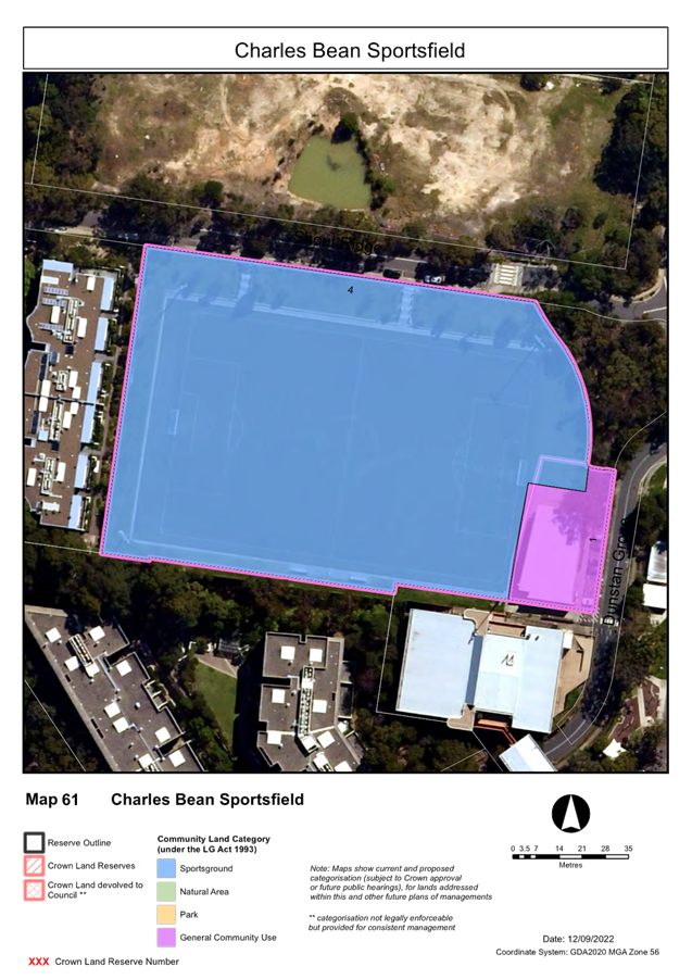
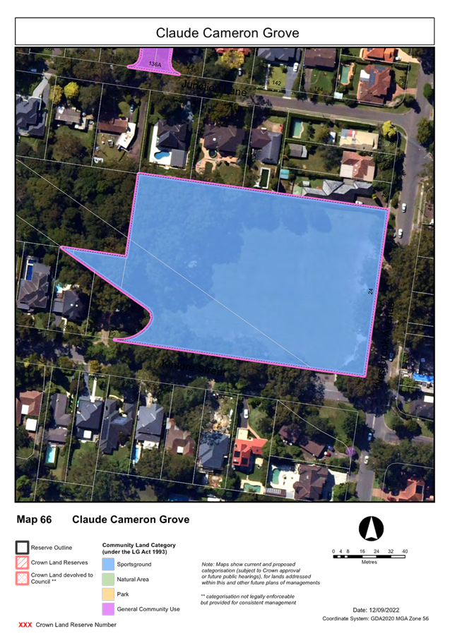
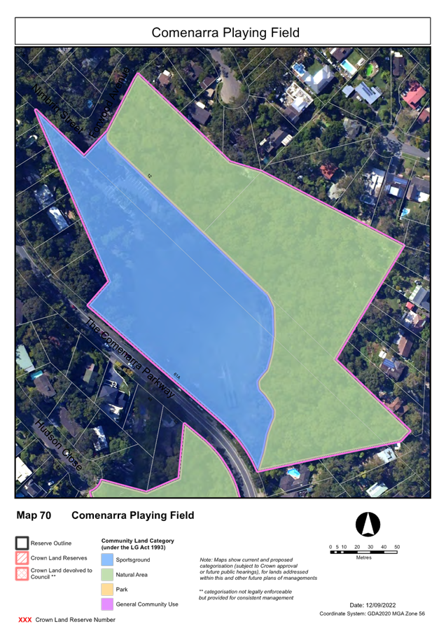
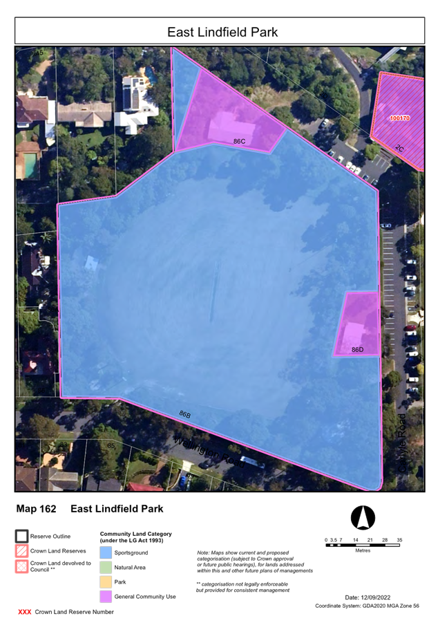
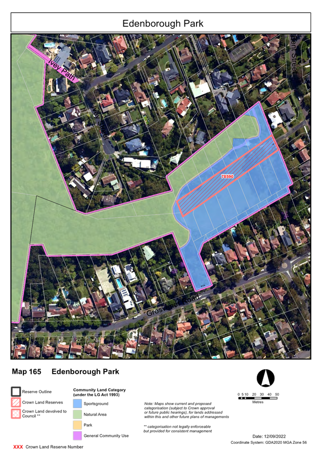
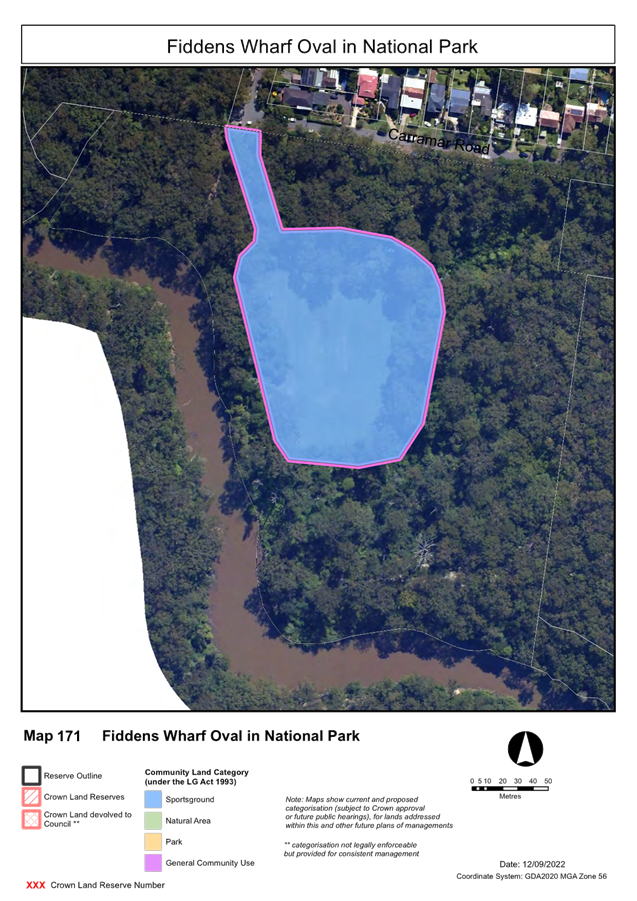
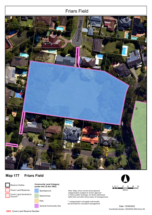
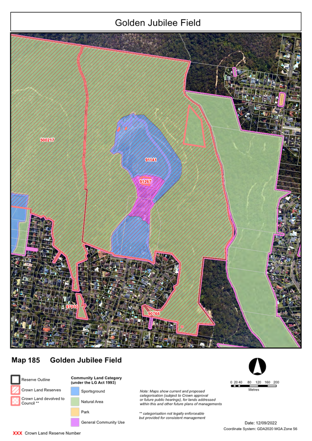
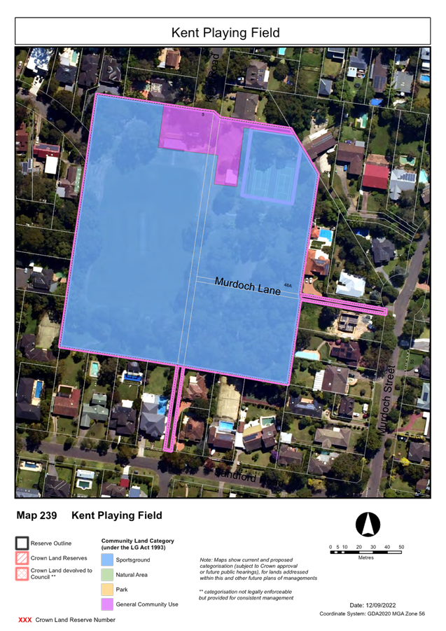
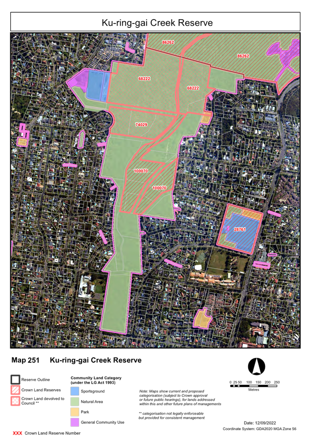
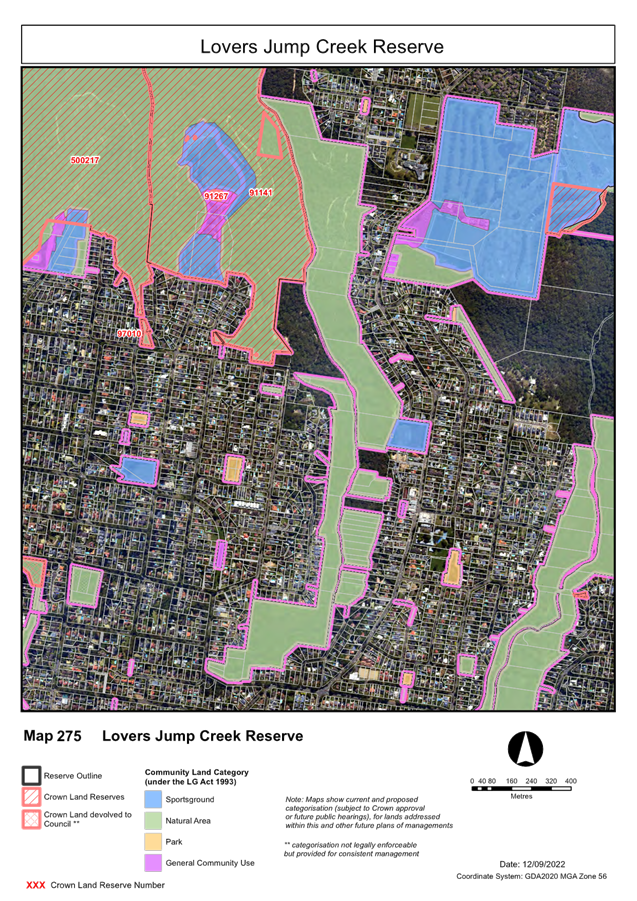
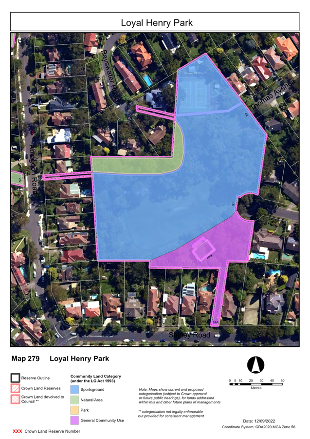
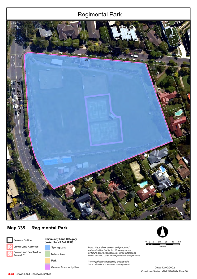
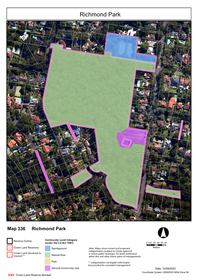
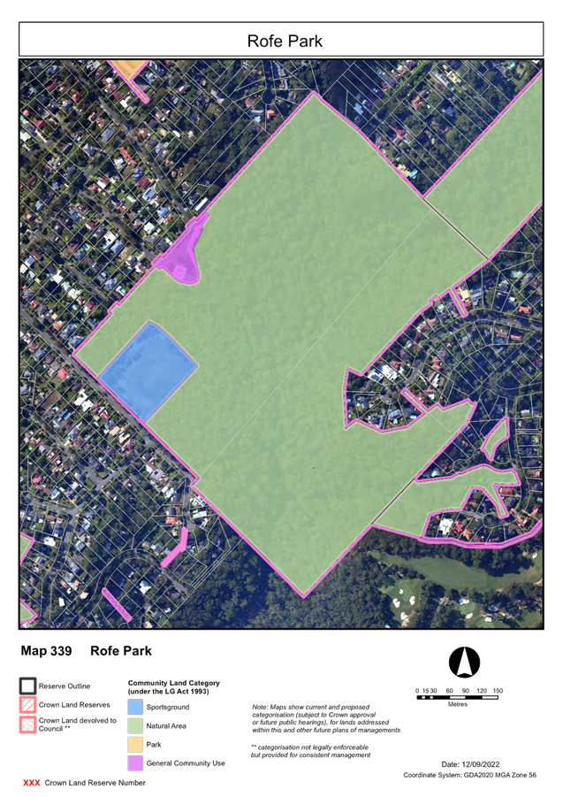
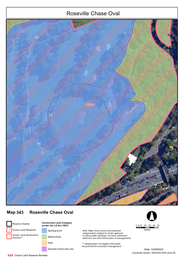
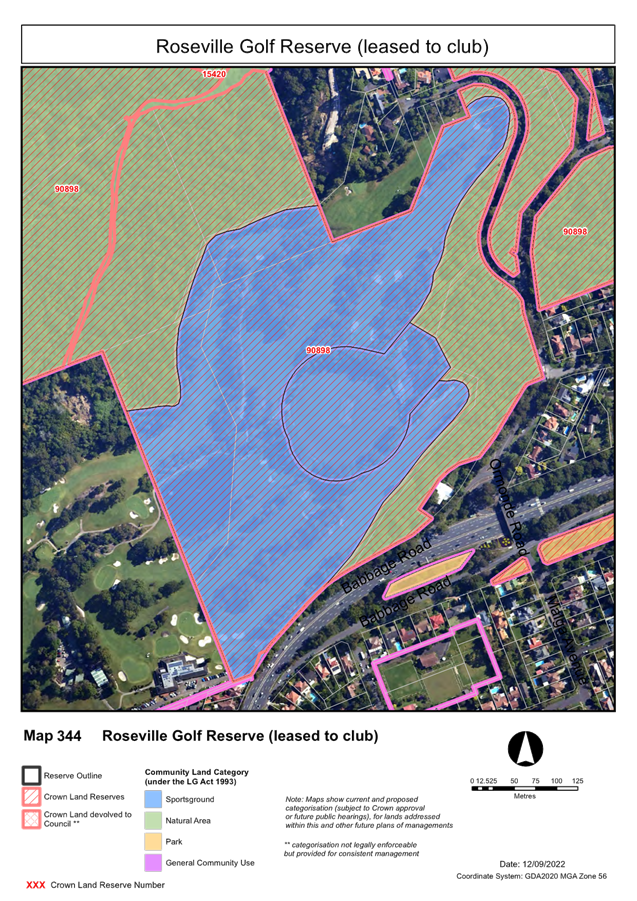
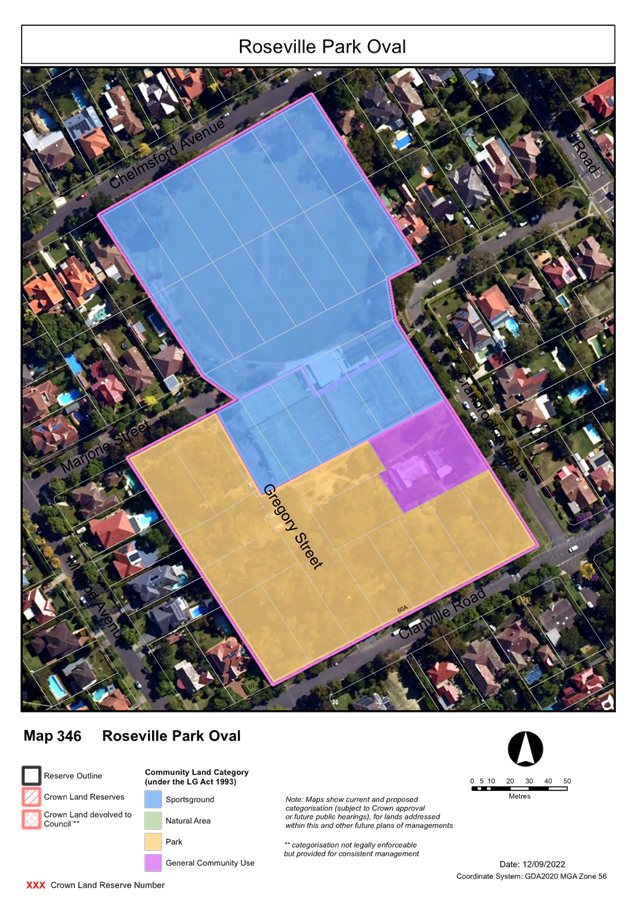
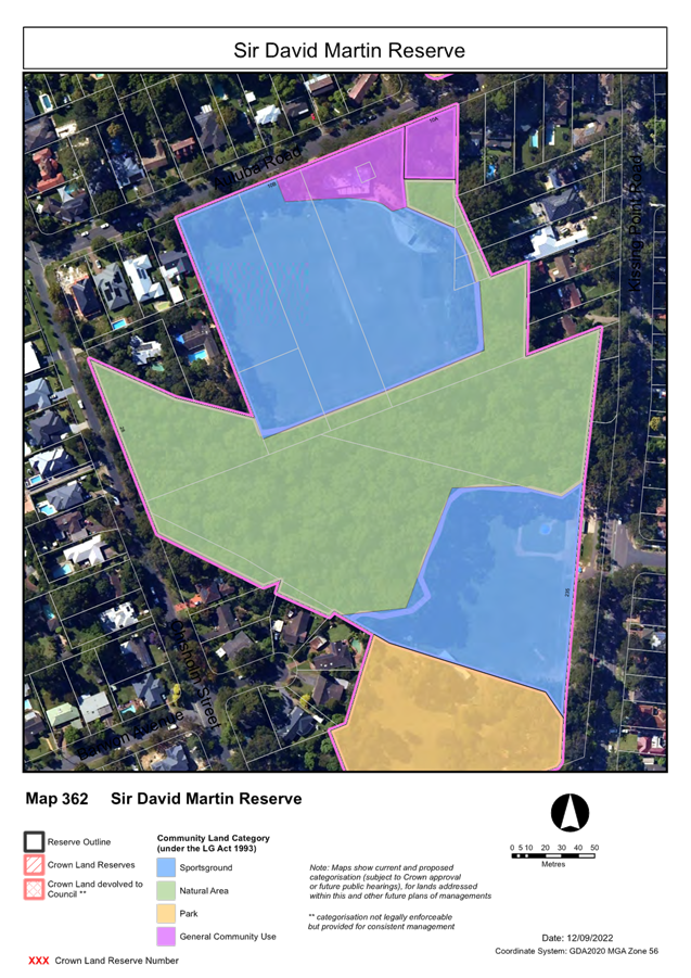
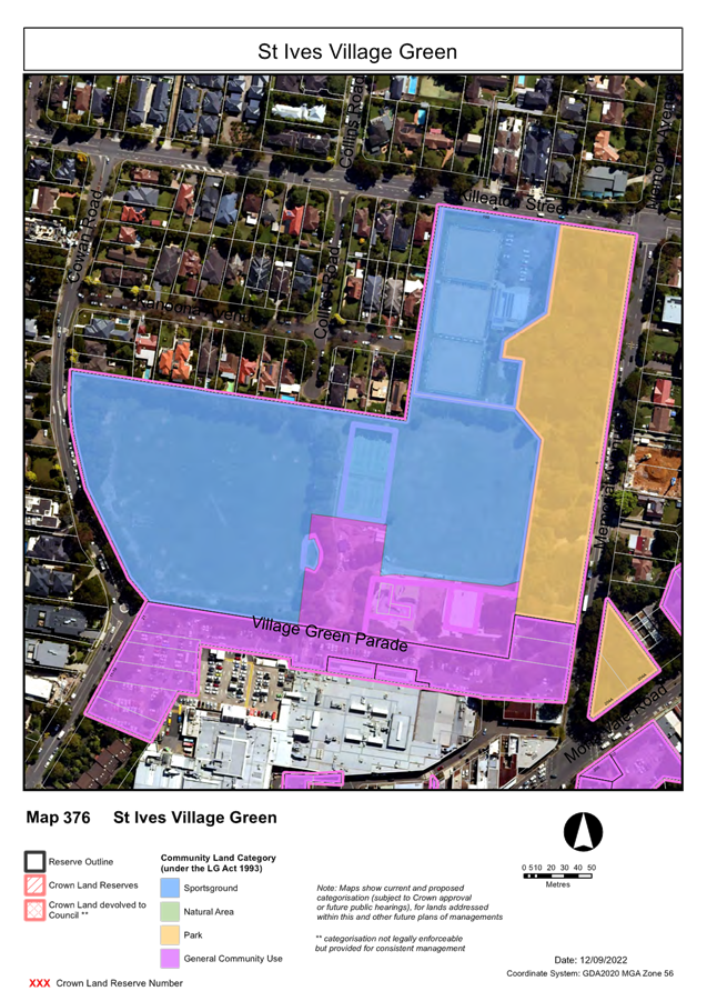
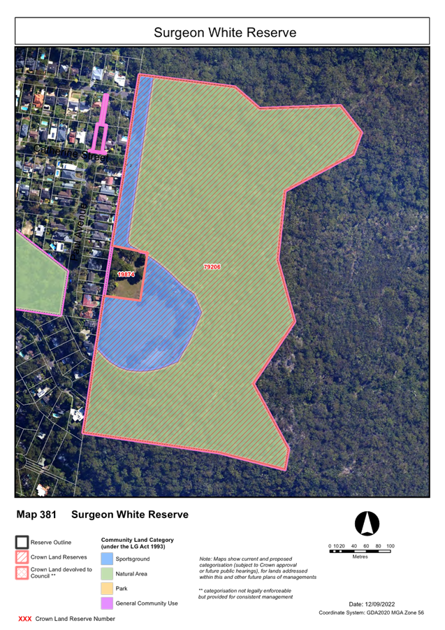
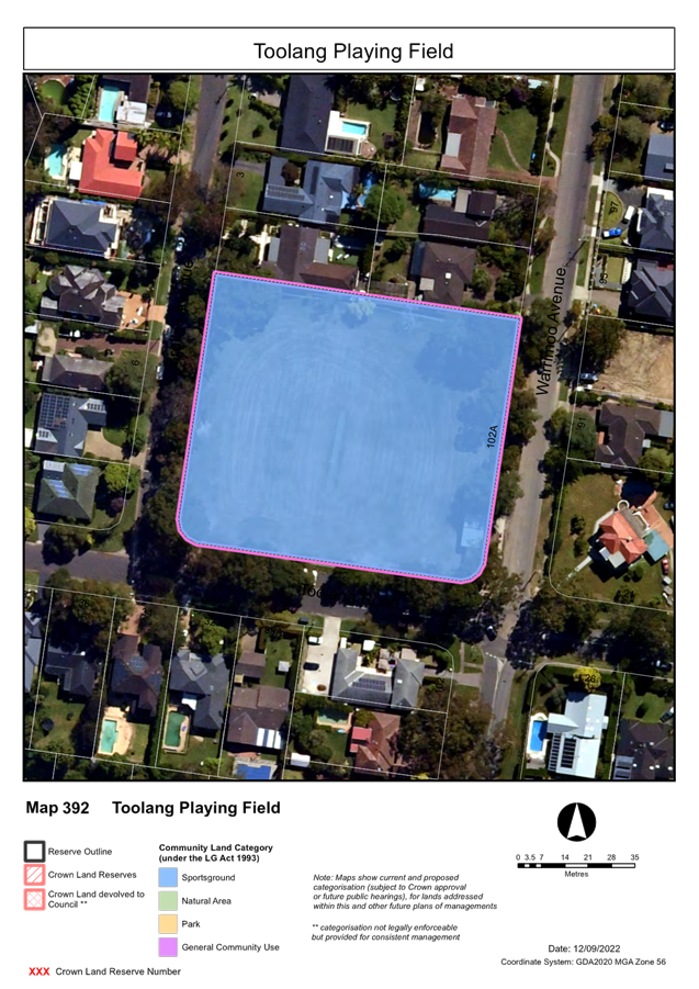
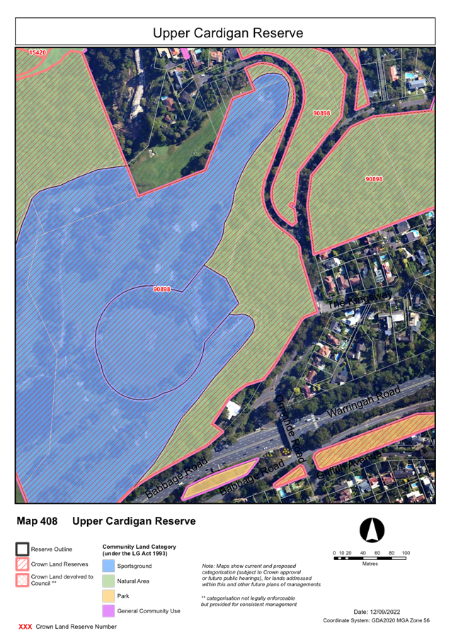
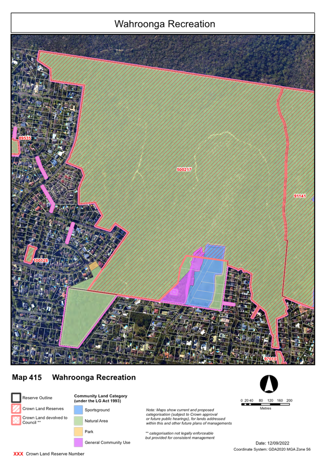
Plans of Management, Parks and Sportsgrounds - for adoption 1025
File: S13463
To have Council adopt the Generic
Plan of Management – Sportsgrounds & Parks, both dated April 2023.
Recommendation:
That Council adopt the final
Generic Plan of Management – Parks & Generic Plan of Management
– Sportsgrounds, dated April 2023 in accordance with clause 70B of the Crown
Land Management Regulation 2018.
GB.9 Policy for
Electric Vehicle Charging Infrastructure on Public Land – for adoption 1393
File: S13127
For Council to consider the Policy
for Electric Vehicle Charging Infrastructure on Public Land (updated in
response to public exhibition comments), and to seek endorsement of the updated
policy.
Recommendation:
That Council adopt the Policy
for Electric Vehicle Charging Infrastructure on Council Land.
GB.10 RFT6-2023
ELECTRIC VEHICLE CHARGERS SUPPLY / INSTALL / MAINTAIN / MANAGE 1412
File:
RFT6-2023/R
To consider
the tenders received for RFT6-2023 Electric Vehicle chargers – Supply /
Install / Maintain / Manage and to appoint the preferred tenderer.
Recommendation:
Based on the assessment undertaken, the TEC recommends the
following:
RFT6-2023 Electric
Vehicle chargers – Supply / Install / Maintain / Manage - Tender
Evaluation Committees recommendation to reject all tenders under Clause 178(1)
of the Local Government Regulation 1995 and seek to negotiate under
Clause 178(3)(e) of the Regulation to ensure Council has the best value for
money.
Extra Reports Circulated to Meeting
BUSINESS WITHOUT NOTICE – SUBJECT TO CLAUSE 9.3 OF code
of meeting practice
Questions With Notice
InspectionS– SETTING OF TIME, DATE AND RENDEZVOUS
** ** ** ** ** **
Minute Ku-ring-gai
Council Page
MINUTES OF Ordinary Meeting of Council
HELD ON Tuesday, 18 April 2023
|
Present:
|
The Mayor, Councillor J Pettett (Chairperson)
Councillors S Lennon & B Ward (Gordon Ward)
Councillors S Ngai & A Taylor (Roseville Ward)
Councillors C Kay & M Smith (St Ives Ward)
Councillor C Spencer & K Wheatley (Wahroonga Ward)
|
|
|
|
|
Staff Present:
|
General Manager (John McKee)
Director Community (Janice Bevan)
Director Corporate (David Marshall)
Director Development & Regulation (Michael
Miocic)
Director Operations (George Bounassif)
Director Strategy & Environment (Andrew Watson)
Corporate Lawyer (Jamie Taylor)
Group Lead Major Projects (Geoffrey Douglas)
Manager Corporate Communications (Virginia Leafe)
Manager Governance and Corporate Strategy (Christopher M
Jones)
Acting Manager Finance (Mette Kofoed)
Governance Support Officer (Nicole Kratochvil)
|
|
|
|
The Meeting
commenced at 7:00PM
The Mayor offered
the Prayer
|
43
|
Apologies
File: S02194
Mayor Pettett advised of an apology from Councillor Greg
Taylor as remote audio-visual technology was not available at his location.
|
|
|
Resolved:
(Moved: Councillors Pettett)
That the apologies be
accepted and leave of absence granted.
CARRIED UNANIMOUSLY
|
DECLARATIONS
OF INTEREST
The Mayor
referred to the necessity for Councillors and staff to declare a Pecuniary
Interest/Conflict of Interest in any item on the Business Paper.
No Interest
was declared.
DOCUMENTS
CIRCULATED TO COUNCILLORS
The Mayor referred to the
documents circulated in the Councillors’ papers and advised that the
following matters would be dealt with at the appropriate time during the
meeting:
|
Memorandums:
|
Correction to Minutes of Extraordinary Meeting of Council
– 16 March 2023
Memorandum
from Manager Governance and Corporate Strategy to Councillors, General
Manager and Directors regarding a correction to the minutes of the
Extraordinary Meeting of council held on 16 March 2023 for apologies.
|
|
44
|
CONFIRMATION
OF ATTACHMENTS TO BE CONSIDERED IN CLOSED MEETING
File: S02499/9
|
|
|
Resolved:
(Moved: Councillors Spencer/Kay)
That in accordance with the
provisions of Section 10 of the Local Government Act 1993, all
officers’ reports be released to the press and public, with the
exception of confidential attachments to the following General Business
reports;
GB.8 Active
Transport Reference Committee – recruitment of members
In accordance with 10A(2)(a):
Attachment
1: List of nominees, and recommended members
Attachment
2: Consolidated Submission Nomination Forms
|
CONFIRMATION
OF MINUTEs
|
45
|
Minutes
of Extraordinary Meeting of Council
File: S02131
|
|
|
Meeting held 16 March 2023
Minutes numbered 26 to 26
|
|
|
Resolved:
(Moved: Councillors Spencer/A.
Taylor)
That Minutes numbered 26 to 26
circulated to Councillors were taken as read and confirmed as an accurate
record of the proceedings of the Meeting, subject to the correction noted in
the Memorandum.
CARRIED UNANIMOUSLY
|
|
46
|
Minutes
of Ordinary Meeting of Council
File: S02131
|
|
|
Meeting held 21 March 2023
Minutes numbered 27 to 42
|
|
|
Resolved:
(Moved: Councillors Ward/Smith)
That Minutes numbered 27 to 42 circulated
to Councillors were taken as read and confirmed as an accurate record of the
proceedings of the Meeting.
CARRIED UNANIMOUSLY
|
GENERAL
BUSINESS
|
47
|
Multicultural
Advisory Committee Meeting 20 February 2023 Minutes from Meeting
File: S04141
Vide: GB.1
|
|
|
For Council to consider and adopt the minutes from
Multicultural Advisory Committee meeting held on 20 February 2023.
|
|
|
Resolved:
(Moved: Councillors Spencer/Kay)
That Council adopt the
minutes from the Multicultural Advisory Committee meeting held on 20 February
2023.
CARRIED UNANIMOUSLY
|
|
48
|
Investment
Report as at 31 March 2023
File: FY00623/5
Vide: GB.3
|
|
|
To present Council’s investment portfolio
performance for March 2023.
|
|
|
Resolved:
(Moved:
Councillors Spencer/Kay)
That:
A. The
summary of investments and performance for March 2023 received and noted.
B. The
Certificate of the Responsible Accounting Officer be noted and the report
adopted.
CARRIED UNANIMOUSLY
|
|
49
|
St
Edmund’s College community fundraising event
File: S11703/5
Vide: GB.4
|
|
|
To advise Council of the opportunity to purchase
tickets for St Edmund’s College’s community fundraising event
(Eddie’s Big Night Out: Time to Shine) on 3 June 2023.
|
|
|
Resolved:
(Moved: Councillors Spencer/Kay)
That:
A. Council
purchase a sponsorship package for St Edmund’s College’s
community fundraising event (Eddie’s Big Night Out).
B. Councillors
interested in attending advise the General Manager by 21 April 2023.
CARRIED UNANIMOUSLY
|
|
50
|
Project
Status Report - March 2023
File: FY00621/5
Vide: GB.5
|
|
|
To provide Council with the Project Status Report
reflecting results for January, February, and March 2023.
|
|
|
Resolved:
(Moved: Councillors Spencer/Kay)
That:
A. Council receive and note the Project
Status Report for February 2023.
B. The Project Status Report be placed on
Council’s website.
CARRIED UNANIMOUSLY
|
|
51
|
Car
Share Policy - Post exhibition
File: S02527
Vide: GB.7
|
|
|
To consider submissions to the exhibition of the draft
Car Share Policy
|
|
|
Resolved:
(Moved: Councillors Spencer/Kay)
A. That the recommended amendments be made to
the draft Car Share Policy, and that the policy be adopted.
B. That Council seek expressions of interest
from car share operators.
C. That persons who made a submission during
the exhibition be notified of Council’s decision.
CARRIED UNANIMOUSLY
|
|
52
|
Resourcing
Strategy 2023-2033, Delivery Program 2022-2026 and Operational Plan 2023-2024
File: FY00382/15
Vide: GB.2
|
|
|
To obtain Council’s endorsement to place the
revised Resourcing Strategy 2023-2033, revised Delivery Program 2022-2026 and
draft Operational Plan 2023-2024 (incorporating the budget, capital works and
fees and charges for 2023-2024) on public exhibition.
|
|
|
MOTION:
(Moved: Councillors
Smith/Wheatley)
That
Council:
A.
Endorse the revised Resourcing
Strategy 2023-2033, revised Delivery Program 2022-2026 and draft Operational
Plan 2023-2024 (including Fees and Charges 2023-2024) for public exhibition
for 28 days.
B.
Note that a report will be provided
to Council in June 2023 for further consideration of any submissions and
adoption of the plans.
C.
Note that the scenarios for special rate
variations are preliminary examples only, based on the recommendations of the
Financial Sustainability Review. These scenarios are likely to change based
on further analysis, future decisions by Council and extensive community
consultation before settling on a way forward and making an application to
IPART. The Marian St Theatre project is to be removed
from Scenario 1 for a special rates variation.
|
|
|
PROCEDURAL
MOTION:
(Moved: Councillors
Pettett/Spencer)
That the motion be put in seriatim (sequentially and voted
on separately) as A to B, and C.
CARRIED
UNANIMOUSLY
|
|
|
MOTION:
(Moved:
Councillors Smith/Wheatley)
That
Council:
A.
Endorse the revised Resourcing
Strategy 2023-2033, revised Delivery Program 2022-2026 and draft Operational
Plan 2023-2024 (including Fees and Charges 2023-2024) for public exhibition
for 28 days.
B.
Note that a report will be provided
to Council in June 2023 for further consideration of any submissions and
adoption of the plans.
CARRIED
UNANIMOUSLY
|
|
|
MOTION:
(Moved:
Councillors Smith/Wheatley)
That
Council:
C.
Note that the scenarios for special rate
variations are preliminary examples only, based on the recommendations of the
Financial Sustainability Review. These scenarios are likely to change based
on further analysis, future decisions by Council and extensive community
consultation before settling on a way forward and making an application to
IPART. The Marian St Theatre project is to be removed from
Scenario 1 for a special rates variation.
AMENDMENT:
(Moved:
Councillors Lennon/Ward)
C.
Note that the scenarios for special rate
variations are preliminary examples only, based on the recommendations of the
Financial Sustainability Review. These scenarios are likely to change based
on further analysis, future decisions by Council and extensive community consultation
before settling on a way forward and making an application to
IPART.
Due to the occurrence of
disorder, the Mayor adjourned the meeting and left the chair during debate on
this item. A member of the public was expelled from the gallery. On reassembling,
Council proceeded with business.
PROCEDURAL MOTION:
(Moved: Councillor Spencer)
That the amendment be now put.
CARRIED UNANIMOUSLY
The Amendment was put and declared CARRIED:
For the
Amendment:
Councillors Kay, Lennon, Ngai, A. Taylor and
Ward
Against the Amendment: The
Mayor, Councillor Pettett, Councillors
Smith, Spencer and Wheatley
The Amendment became the Motion.
The Motion was put and declared
CARRIED.
|
|
|
Resolved:
(Moved: Councillors Smith/Wheatley)
That Council:
A.
Endorse the revised Resourcing
Strategy 2023-2033, revised Delivery Program 2022-2026 and draft Operational
Plan 2023-2024 (including Fees and Charges 2023-2024) for public exhibition
for 28 days.
B.
Note that a report will be provided
to Council in June 2023 for further consideration of any submissions and
adoption of the plans.
CARRIED UNANIMOUSLY
(Moved: Councillors Lennon/Ward)
C.
Note that the scenarios for special rate
variations are preliminary examples only, based on the recommendations of the
Financial Sustainability Review. These scenarios are likely to change based
on further analysis, future decisions by Council and extensive community
consultation before settling on a way forward and making an application to
IPART.
For the
Resolution:
Councillors Kay, Lennon, Ngai, A. Taylor and
Ward
Against the Resolution: The
Mayor, Councillor Pettett, Councillors
Smith, Spencer and Wheatley
CARRIED
|
|
53
|
Marian
Street Theatre - Project Update
File: S12062-3
Vide: GB.6
|
|
|
To review the intention to proceed with the Marian
Street Theatre project as recommended by the January 2023 Financial
Sustainability Review (FSR).
|
|
|
MOTION:
(Moved: Councillors Lennon/Ward)
That
Council:
A.
Note that Council unanimously
resolved in December 2022 to fund the repayment of the loan necessary to fund
the construction of the St Ives Indoor Sports Centre (basketball courts) by a
future Council rates increase (a special rates variation).
B.
Incorporate within that special rates
variation an additional amount to fund the repayment of the loan to fund the
construction necessary to revive the Marian Street Theatre.
C.
In parallel with the above, explore
federal government, New South Wales state government, philanthropic, and
public funding for repayment of the loan to fund the construction necessary
to revive the Marian Street Theatre.
|
|
|
AMENDMENT:
(Moved: Councillors Spencer/Smith)
A. That
Council notes that due to the lack of an identifiable funding strategy to
replace asset sales as a means of funding the Marian Street Theatre upgrade
in the short term, the project will not commence in the 2022/2023 financial
year.
B. That
Council notes that Delivery Program Term Achievement “P7.1.2: The
renewal of Marian Street Theatre is substantially completed” will
not be achieved even if a funding strategy to replace asset sales is
identified in the short term, given the time required to recommence the
project and revise and resubmit a further Capital Expenditure Review to the
Office of Local Government for consideration.
C. That
Council notes that future funding for the Marian Street Theatre upgrade could
be from an increase to rates via a special rates variation, possibly taking effect on 1 July 2025 if this is supported
by Council and approved by IPART.
D. That
Council notes that development consent for the Marian Street Theatre upgrade was
granted 20 August 2021 and will lapse in August 2026 in the event substantial
commencement is not achieved.
The
Amendment was put and declared CARRIED:
For the
Amendment: The
Mayor, Councillor Pettett, Councillors Kay, Ngai, Smith, Spencer and Wheatley
Against
the Amendment: Councillors Lennon, A.
Taylor and Ward
The
Amendment became the Motion.
The Motion was put and declared CARRIED
|
|
|
Resolved:
(Moved: Councillors
Spencer/Smith)
A. That Council notes that due to the lack of an
identifiable funding strategy to replace asset sales as a means of funding
the Marian Street Theatre upgrade in the short term, the project will not
commence in the 2022/2023 financial year.
B. That Council notes that Delivery
Program Term Achievement “P7.1.2:
The
renewal of Marian Street Theatre is substantially completed” will not be achieved even if a funding strategy to replace asset sales is identified in
the short term, given the time required to recommence the project and revise
and resubmit a further Capital Expenditure Review to the Office of Local
Government for consideration.
C. That Council notes that future funding for the Marian
Street Theatre upgrade could be from an increase to rates via a special rates
variation, possibly taking effect on 1 July 2025 if this is supported by
Council and approved by IPART.
D. That Council notes that development
consent for the Marian Street Theatre
upgrade was granted 20 August 2021 and will
lapse in August 2026 in the event substantial commencement is not achieved.
For the Resolution: The
Mayor, Councillor Pettett, Councillors Kay, Ngai, Smith, Spencer, A.Taylor
and Wheatley
Against the Resolution: Councillors
Lennon and Ward
CARRIED
|
|
54
|
Active
Transport Reference Committee - recruitment of members
File: S02696
Vide: GB.8
|
|
|
To consider nominations for community representatives
to the Active Transport Reference Committee.
|
|
|
Resolved:
(Moved:
Councillors Spencer/Kay)
That Council:
A.
Re-advertise calling for external
nominations for the active transport reference committee and encourage
applications from a broad cross section of the community.
B. Advise the current applicants that their nominations will
be kept on file and used when council staff recommend a future list of
committee members.
C.
Contacts and requests nominations from the
following groups that were approved at the October 2022 meeting: Peloton
Sports Inc, Northern Suburbs Triathlon Club, Northern Sydney Cycling Club,
Knights of Surburbia, Veloroos.
D. That Council seek further nominations from community
members with an emphasis on encouraging more women to apply and a wider
geographical representation.
CARRIED UNANIMOUSLY
|
Motions
of which due Notice has been given
|
55
|
Lindfield
Village Hub site - Analysis of trees and habitat
File: S10973
Vide: NM.1
|
|
|
Notice of Motion from Councillors Smith and
Pettett dated 31 March 2023
As Ku-ring-gai Council plans to potentially build its
largest ever major project being the Lindfield Village Hub on the site of the
car park at Woodford Lane, Lindfield, it is important to the community that
they are informed of what is being lost on this site. Over 40 trees are to be
removed resulting in the potential loss of a number of critically endangered
trees as well as native habitat. It is important to do this assessment now
rather than later so that councillors and the community are aware of what is
onsite in order to assess whether they feel this project is appropriate or
not at this location. The project is no longer a self-funding project as it
appears to require at least one additional asset sale, being the sale of the
old library site, to make up for the shortfall of funds.
In Ku-ring-gai we have seen a rise in illegal tree removal
and destruction, and it is important that Council takes the lead in ensuring
that we do our best to preserve the tree canopy we do have.
We, therefore, move:
That a report to Council be prepared to include but not be
limited to the identification and cataloguing of the trees and habitat onsite
and the opportunities to relocate or use in any subsequent redevelopment of
this site
|
|
|
Councillor Spencer left Chambers between 8:45pm- 8:47pm
during the discussion of NM.1
MOTION:
(Moved: Councillors Smith/Pettett)
That a report to Council be prepared to include but not be
limited to the identification and cataloguing of the trees and habitat onsite
and the opportunities to relocate or use in any subsequent redevelopment of
this site.
|
|
|
Amendment:
(Moved: Councillors A.Taylor/Ngai)
That Council staff report back
to council on available options for environmental offsets including
reasonable restoration of the locally indigenous canopy onsite, in line with
the existing process and timeline for the project.
The
Amendment was put and declared LOST
For the
Amendment: Councillors
Lennon, Ngai, and A.Taylor
Against
the Amendment: The Mayor, Councillor
Pettett, Councillors Kay, Smith, Spencer, Ward and Wheatley
|
|
|
amendment:
(Moved: Councillors Ngai/A.Taylor)
That:
A. A
report to Council be prepared to include but not be limited to the
identification and cataloguing of the trees and habitat onsite and the
opportunities to relocate or use in any subsequent redevelopment of this
site.
B.
Council staff report back to
council on available options for environmental offsets including reasonable
restoration of the locally indigenous canopy onsite, in line with the
existing process and timeline for the project.
PROCEDURAL MOTION:
[Moved: Councillor A. Taylor]
That the Amendment be now put.
CARRIED
UNANIMOUSLY
The Amendment was put and declared CARRIED:
For the Amendment: Councillors
Kay, Lennon, Ngai, A.Taylor and Ward
Against
the Amendment: The Mayor,
Councillor Pettett, Councillors Smith, Spencer and Wheatley
The
Amendment became the Motion.
The Motion was put and declared CARRIED
|
|
|
Resolved:
(Moved: Councillors Ngai/A.
Taylor)
That:
1. A report to Council be prepared to include but not be
limited to the identification and cataloguing of the trees and habitat onsite
and the opportunities to relocate or use in any subsequent redevelopment of
this site.
2. Council staff report back to council on available
options for environmental offsets including reasonable restoration of the
locally indigenous canopy onsite, in line with the existing process and
timeline for the project.
CARRIED UNANIMOUSLY
|
|
The Meeting closed
at 10:00PM
The Minutes of the
Ordinary Meeting of Council held on 18 April 2023 (Pages 1 - 19) were confirmed
as a full and accurate record of proceedings on 16 May 2023.
__________________________ __________________________
General
Manager Mayor
/ Chairperson
|
Ordinary
Meeting of Council - 16 May 2023
|
GB.1 / 1
|
|
|
|
|
Item
GB.1
|
S09112/11
|
|
|
18 April 2023
|
2022 - 2023 Budget Review - 3rd Quarter
ended March 2023
EXECUTIVE
SUMMARY
|
Purpose of report:
|
To inform Council of the results of the second
quarter budget review of 2022/23 and proposed adjustments to the annual
budget based on the actual financial performance and trend for the period 1
July 2022 to 31 March 2023.
|
|
|
|
|
background:
|
Section 203(1) of the Local Government Regulation
2005 requires that at the end of each quarter, a Budget Review Statement
be prepared and submitted to Council that provides the latest estimate of
Income and Expenditure for the current financial year.
|
|
|
|
|
comments:
|
Budget adjustments proposed in this review will
improve the net operating result (excluding capital grants) by $507k. This is
mainly due to additional income from investments (partly restricted to
external reserves) and other minor adjustments. After adjusting for capital
and operational grants, deferred expenditure and restricted items, the net
working capital will remain unchanged.
|
|
|
|
|
recommendation:
|
That the 2022/23 March Quarterly Budget
Review and the recommended changes are received and noted.
|
Purpose of Report
To inform Council of the results of the second quarter
budget review of 2022/23 and proposed adjustments to the annual budget based on
the actual financial performance and trend for the period 1 July 2022 to 31
March 2023.
Background
In accordance with Part 9, Division
3, Clause 203 of the Local Government (General) Regulation 2005
(“The Regulation”):
(1) Not later than 2 months after
the end of each quarter (except the June quarter), the responsible accounting
officer of a council must prepare and submit to the council a budget review
statement that shows, by reference to the estimate of income and expenditure
set out in the statement of the council’s revenue policy included in the
operational plan for the relevant year, a revised estimate of the income and
expenditure for that year.
(2) A budget review statement must
include or be accompanied by:
a) a report as to whether or
not the responsible accounting officer believes that the statement indicates
that the financial position of the council is satisfactory, having regard to
the original estimate of income and expenditure, and
b) if that position is unsatisfactory,
recommendations for remedial action.
(3) A budget review statement must
also include any information required by the Code to be included in such a
statement.
The Office of Local Government has developed a set of
minimum requirements that assists councils in meeting their obligations as set
out in legislation.
At the Council meeting held on 28
June 2022, Council adopted the Revised Delivery Program 2022-2026 &
Operational Plan 2022-2023, which incorporated the Annual Budget for 2022-2023.
Comments
This review analyses Council’s financial performance
for the third quarter of 2022/23 and forecasts an end of financial year
position by recommending budget adjustments to operating and capital budget.
Budget adjustments proposed in this review will improve the
net operating result (excluding capital grants) by $507k. This is mainly due to
additional income from investments (partly restricted to external reserves) and
minor adjustments in recurrent budget.
From a funding position, after adjusting for capital and
operational grants movements, deferred expenditure and restricted items, the
net working capital will remain unchanged.
Proposed
adjustments to forecast budget
Operating Income
The proposed increase to the operating income of $6.4m
is mainly from operating grants and contributions received, increased interest
on investments (partly externally restricted) and other revenue:
· Decrease
in other revenue ($151k) due to an adjustment to parking fines.
· Increase
in interest and investment income ($1.2m) due to larger than forecast
investment portfolio and more competitive interest rates, of which ($743k) is
restricted to S7.11 reserves and ($178k) to Infrastructure & Facilities
internal reserve.
· Net
increase in operating grants and contributions ($5.36m) mainly from:
o Regional
Roads Repair grant ($5.17m),
o Loan
interest subsidy ($102k),
o Community
development grants (90k),
o West
Pymble Community Garden grant ($6k),
o Partly
offset by decrease to Insurers WHS contribution ($13k).
Operating expenditure
The change (net increase) to the operating expenditure
($5.9m) is mainly due operational project expenditure funded from grants and
other revenue and other adjustments in materials and contracts as detailed
below:
· Net
increase in materials and contracts ($214k):
o Increase
due to fuel expenses ($231k)
o Decrease
due to Library transfer to other expenses ($17k),
· Increase
in other expenses ($17k) due to:
o Increased
library licence costs funded from a budget transfer from materials and
contracts.
· Increase
in depreciation ($400k), mainly due to:
Timing adjustments to current
year depreciation due to early revaluation.
· Net
increase to operational projects expenditure ($5.3m) mainly due to:
o Increased
Regional and Local Roads Repair ($5.17m) funded from grant,
o Increased community
development ($90k) funded from grants,
o Increased
community garden project ($24k) funded grants,
o Decreased
WHS project ($13k) funded from contribution from insurer,
o Decreased
($5k) – net transfer to capital projects.
Capital Budget
Major adjustments to the capital budget are due to:
· Decrease due to deferral of Marian Street Theatre
Upgrade to future year ($22m)
· Allocation of expenditure for capital grants
and contributions received ($2.4m), mainly for footpath and traffic
facility grants ($974k), walking track grants ($636k), Hassall Park grant
($600k), Warrimoo Oval Lighting Upgrade ($148k) contribution from St Ives
Football Club, ($45k) for Wahroonga SES shade structure from SES, ($32k) for
shade sail at St Ives Village Green from Lions Club and $18k grant for
Turramurra Lookout community garden.
· Increase to Lindfield Village Hub Car Park ($38k)
funded from unexpended grant reserve.
· Net
transfer from operating projects ($5k).
Other budget adjustments
to capital projects are detailed further in the report and listed in Attachment
A2.
Quarterly
Budget Review Statements (QBRS)
The Quarterly Budget Review
Statements (QBRS) as prescribed by the OLG guidelines are composed of the following budget review reports:
· Operating and Capital Budget Review Statement (Table 1)
· Proposed Operating and Capital Budget Adjustments by
Resource Group (Table 2)
· Income and Expenses Statement by Theme (Table 3)
· Cash and Investments position (Table 4)
· Contracts and Consultancy Expenses (Table 5)
· Capital and Operational Projects Summary (Table 6)
· Statement by the Responsible Accounting Officer
These statements are shown below.

Proposed Budget Adjustments
The table below lists
the proposed budget adjustments, including comments for the March Quarterly
Budget Review.

Attachment A2 summarises all
proposed budget adjustments for Projects.
The table below splits the current
budget by six themes identified within Council’s Delivery Program 2022
– 2026. These themes are used as a platform for planning our activities
to address the community’s stated needs and aspirations.

Cash and Investments
position
Restricted funds are invested in accordance
with Council’s Investment Policy. Total investments portfolio as at the
end of March quarter is $227.16m.

A detailed Restricted Assets Report as at March 2023
(Actual) is shown in Attachment A1.
Contracts and Consultancy
Expenses


Capital & Operational
Projects Summary
Actual expenditure for
capital and operational projects for the period ending 31 March 2023 is ($35m)
against the full year revised budget of ($145m). The March review decreases the
forecast project budget by ($14.3m), the decrease is mainly due to deferral for
Marian Street Theatre upgrade to a future year partly offset by projects funded
from new grants received ($7.7m) and funding from unexpended grants brought
forward ($38k).
The table and chart
below show the YTD actual project expenditure against 2022/23 full year revised
budget and projected forecast.


The proposed budget
changes to operational and capital projects represent a decrease of ($14.3m).
The most significant variations and projects proposed for adjustment are listed
below:
· Allocation of expenditure budget due to operating
grants and contributions received from the Federal and State government
($5.38m), mainly for:
o Regional and local roads repair grant ($5.17m),
o Unsung heroes – community volunteer grant
($50k),
o Community Builders Transition grant ($40k),
o West Pymble community garden grant ($6k),
o Partly offset by decreased WHS contribution
($13k).
· Deferral of Marian Street Theatre upgrade funded
from loan ($22m),
· Allocation of expenditure budget due to capital grants
and contributions received from the Federal and State government ($2.4m),
mainly for:
o Footpath program ($652k),
o Traffic facility program ($322k),
o Hassall Park master plan implementation ($600k) from
Office of Sport,
o Caley’s Pond and Banks track boardwalk
(572k),
o Two Creek walking track upgrade ($60k),
o Warrimoo Oval lighting upgrade ($148k),
o Wahroonga SES shade sail structure ($45k),
o St Ives Village Green shade sail ($32k),
o Turramurra Lookout community garden ($18k).
· Project funded from unexpended grant
brought forward:
o Lindfield Village Hub Car Park ($38k).
All Proposed Budget adjustments
for each Project and explanation for the changes are detailed in
Attachment A2 –
Summary of Capital and Operational Project Budget Adjustments
Statement
by Responsible Accounting Officer
It is my opinion that the Quarterly Budget Review Statement
for Ku-ring-gai Council for the quarter ended 31 March 2023 indicates that
Council’s projected financial position at 30 June 2023 will be
satisfactory, having regard to the projected estimates of income and
expenditure and the original budgeted income and expenditure.
integrated
planning and reporting
Theme 6: Leadership and Governance
|
Community Strategic Plan Long Term Objective
|
Delivery Program
Term Achievement
|
Operational Plan
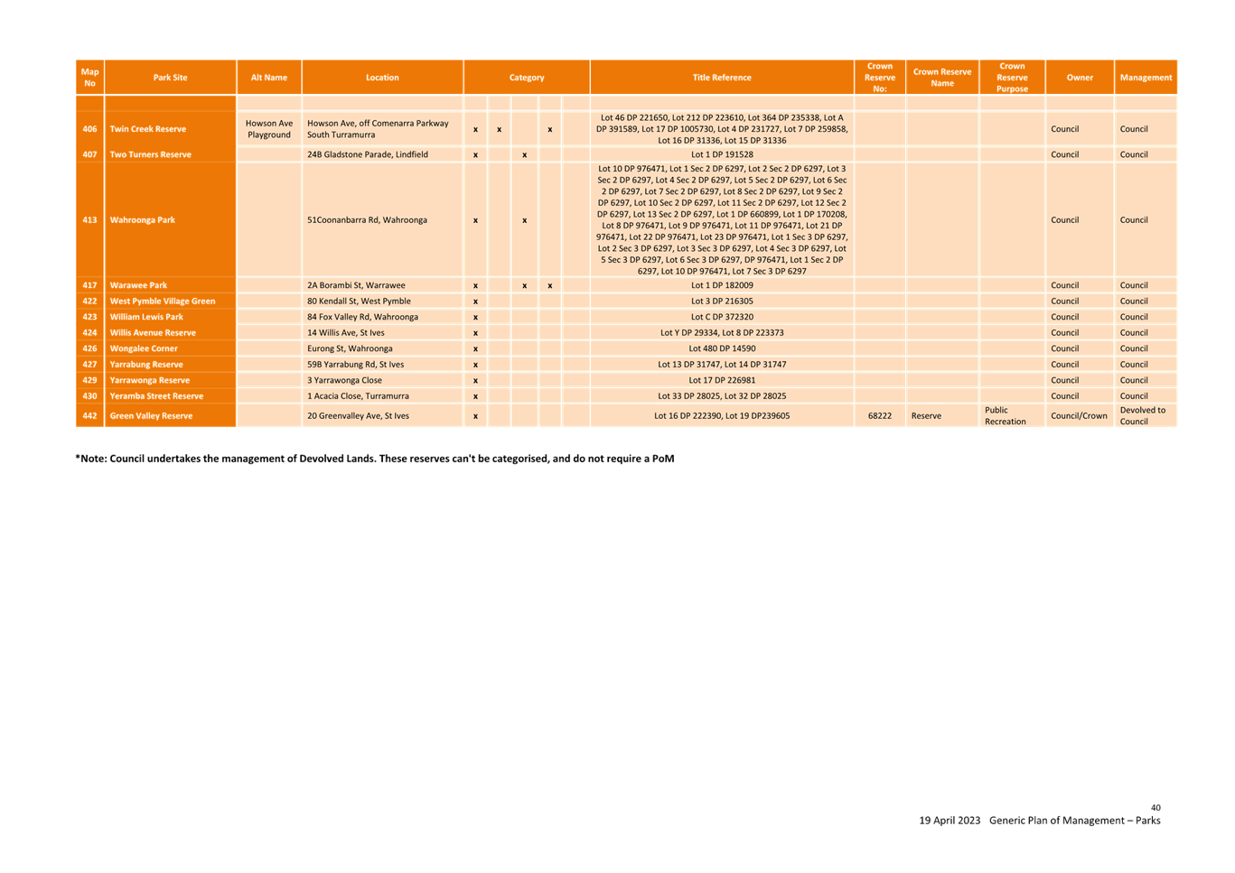
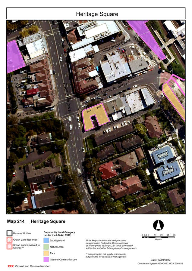
Task
|
|
L2.1 Council rigorously manages its financial resources
and assets to maximise delivery of services.
|
L2.1.2 Council’s financial services provide
accurate, timely, open and honest advice to the community.
|
Manages financial performance to achieve targets as defined
in the Long Term Financial Plan.
|
Governance Matters
Section 203(1) of the Local Government Regulation 2005
requires that at the end of each quarter, a Budget Review Statement be prepared
and submitted to Council that provides the latest estimate of Income and
Expenditure for the current financial year.
Risk Management
Income and expenditure is managed through the quarterly
budget review process. Although some income and expenditure cannot be directly
controlled, it can be monitored, and action taken to mitigate potential
financial or budgetary risk. Further, Council staff utilise monthly management
reporting for managing operational and project income and expenditure, and any
budget variations are reported to the Director. The executive team are also
provided with monthly financial reports that allow Directors to make informed
decisions and plan ahead to ensure budget targets are met.
Financial Considerations
Financial impacts from
recommended budget adjustments are discussed in detail in other sections of
this report.
Social
Considerations
Not applicable.
Environmental
Considerations
Not applicable.
Community
Consultation
Not applicable.
Internal
Consultation
Finance met with directors and managers as part of the
Quarterly Budget Review process to ensure departmental budget targets reflect
current forecasts.
Summary
Budget adjustments proposed in this review will improve the
net operating result (excluding capital grants) by $507k. This is mainly due to
additional income from investments (partly restricted to external reserves),
minor adjustments in recurrent budget and transfer to/from capital projects.
After adjusting for capital and operational grants and
restricted items, the net working capital will remain unchanged.
|
Recommendation:
That the March 2023 Quarterly Budget Review and the
recommended changes be received and noted.
|
|
Ann Wang
Acting Manager Finance
|
David Marshall
Director Corporate
|
|
Mette Kofoed
Strategic Management Accountant
|
|
|
Attachments:
|
A1 ⇩ ⇩
|
Attachment
A1 - Restricted Assets Report - March 2023
|
|
2023/139810
|
|
|
A2 ⇩ ⇩
|
Attachment
A2 - Summary of Capital and Operational Projects Budget Adjustments - March 2023
|
|
2023/139671
|
|
ATTACHMENT No: 1 - Attachment
A1 - Restricted Assets Report - March 2023
|
|
Item No: GB.1
|

|
ATTACHMENT No: 2 - Attachment
A2 - Summary of Capital and Operational Projects Budget Adjustments - March
2023
|
|
Item No: GB.1
|


|
Ordinary
Meeting of Council - 16 May 2023
|
GB.2 / 1
|
|
|
|
|
Item
GB.2
|
FY00623/5
|
|
|
16 April 2023
|
Analysis of Land and Environment Court
Costs - 3rd Quarter 2022 to 2023
EXECUTIVE
SUMMARY
Purpose of Report
To report legal costs in relation to development control
matters in the Land and Environment Court for the quarter ended 31 March 2023.
Background
A
person may commence proceedings in the Land and Environment Court in relation
to a development application which has either been refused by Council or is
deemed to have been refused (a development application is deemed to have been
refused if it has not been determined within a period of 40 days or such longer
period that may be calculated in accordance with the Act). An appeal may also
be commenced in relation to conditions of development consent and the issue of
building certificates and orders. Council is a respondent to such
proceedings.
Comments
Appeals
Lodged
In the quarter ended 31 March 2023 there were 10 new appeals
lodged with the Land and Environment Court. The number of appeals
received in prior years is as follows:
|
Financial year
|
Number of appeals
received (whole year)
|
|
2018/2019
|
44
|
|
2019/2020
|
25
|
|
2020/2021
|
13
|
|
2021/2022
|
18
|
|
2022/2023 (as at 31
March 2023)
|
23
|

The appeals commenced during the quarter to 31 March 2023
concerned the following subject matters:
· Single dwelling
· Multi-dwelling
housing
· Subdivision
· Modification of development
consent
Council was also in receipt of appeals against a Development
Control Order, and against the deemed refusal of a building information
certificate.
costs
For the quarter ended 31
March 2023, Council made payments of $1,098,781 on appeals and associated
expenses in relation to Land & Environment Court matters. This compares
with the annual budget of $1,315,300.
In addition to expenditure on appeals, a further amount of
$14,371 was spent in obtaining expert advice regarding development assessment
matters.
|
Land & Environment
Court Costs
2018/2019
- 2022/2023
|
|
Financial Year
|
Total Costs
|
1st quarter September
|
2nd quarter December
|
3rd quarter March
|
4th quarter June
|
|
2018/2019*
(41 appeals lodged)
|
$1,648,229
|
$372,972
|
$491,788
|
$336,336
|
$447,133
|
|
2019/2020*
(25 appeals lodged)
|
$1,892,040
|
$417,046
|
$446,071
|
$543,218
|
$485,705
|
|
2020/2021*
( 13 appeals lodged)
|
$1,512,459
|
$356,735
|
$501,925
|
$278,510
|
$375,289
|
|
2021/2022 *
(18 appeals lodged)
|
$1,114,447
|
$402,328
|
$258,053
|
$226,500
|
$227,566
|
|
2022/2023
(23 appeals lodged)
|
$1,098,781
|
$324,397
|
$300,017
|
$474,367
|
$0
|
* Costs reported to Council in previous reports
The costs
incurred in the period to 31 March 2023 represent 83.57% of the annual budget
of $1,315,300. In recent reported periods, there has been a trend of increasing
numbers of appeals.
The
commencement of appeals does not lie within the control of Council, however
there a number of factors that appear to have influenced the volume of appeals:
· Amendments to the Environmental Planning and Assessment
Act made in 2013 and then reintroduced in 2022 reduced the timeframe for
lodgement of an appeal from twelve months to six months. This had the
effect of applicants for more substantial and complex development proposals
lodging appeals for no other reason than as a mechanism to preserve early
appeal rights. The number of development applications received by Council in
recent periods has itself been high.
· In addition, the prospect of changing economic market
conditions in recent periods appears to have led to urgency on the part of
developers, with a particularly high number and proportion of appeals commenced
at an early stage on the basis of deemed refusal. As a result, Court
listings are currently heavily booked and long delays for several months for
the holding of both mediation conferences and hearings are occurring. Most
recently, this situation has been exacerbated as a result of disruption caused
by measures associated with COVID-19.
· Due to the abovementioned delays in the listing of
Court-convened mediation conferences, the Court has in some matters required
parties to participate in without-prejudice meetings in the meantime.
These meetings have tended to result in additional iterations of amended plans
being provided by applicants during the appeal process and therefore,
additional costs.
· The additional pressure on application processing times
arising from the Statement of Expectations issued to all NSW councils by the
Minister for Planning in December 2021.
Notwithstanding
these factors, Council’s overall success rate in appeals has been high.
In
relation to costs recovered, the amount of $83,500 had been recovered as at the
end of the quarter to 31 March 2023 compared to an annual budget for costs
recovered of $107,400.
Outcomes
At an early stage of each appeal, Council as respondent, is
required to file with the Court a Statement of Facts and Contentions outlining
the grounds which Council asserts as warranting refusal of a development, or
alternatively, that may be addressed by way of conditions of consent.
In cases
where issues raised by Council are capable of resolution by the provision by
the applicant of additional information or amendment of the proposal, it is the
Court’s expectation that this should occur. The Court’s current
practice of listing appeals for a preliminary mediation conference before a
Commissioner of the Court pursuant to section 34 of the Land &
Environment Court Act, strongly encourages this.
In this
context, any of three outcomes can be regarded as favourable, namely:
1. If the appeal is in
relation to a deemed refusal of an application which, upon assessment, is
appropriate for approval: that the development is determined by Council,
allowing the appeal to be discontinued by the applicant and avoiding as much as
is practicable the incurring of unnecessary legal costs;
2. If the issues raised
by Council are capable of resolution by the applicant providing further
information, or amending the proposal: that this occurs, so that
development consent should be granted, either by Council or the Court;
3. If the issues raised
by Council are either not capable of resolution or the applicant declines to
take the steps that are necessary to resolve them: that the appeal is
either discontinued by the applicant, or dismissed (refused) by the Court.
Four matters were concluded during the quarter. A favourable
outcome was achieved in all matters:
· one appeal was
discontinued;
· two appeals were
dismissed by the Court;
· one appeal was
resolved by agreement in relation to an amended proposal.
integrated
planning and reporting
Leadership & Governance
|
Community Strategic Plan Long Term Objective
|
Delivery Program
Term Achievement
|
Operational Plan
Task
|
|
L2.1 Council rigorously manages its financial
resources and assets to maximise delivery of
services.
|
Achieve financial sustainability targets
identified in the Long Term Financial
Plan.
|
Undertake quarterly reporting to Council on the financial
performance of the
organisation.
|
Governance Matters
Under
Section 428 of the Local Government Act 1993, Council is required to report
legal costs, and the outcome of each case in its Annual Report.
Risk Management
Quarterly reporting of legal
costs to Council together with information about the number, character and
outcomes of proceedings enable ongoing oversight of this area of
Council’s activity.
Financial Considerations
Land
& Environment Court legal costs form part of Council’s recurrent
operating budget.
Social Considerations
None undertaken or required.
Environmental Considerations
None undertaken or required.
Community Consultation
None undertaken or required.
Internal Consultation
This
report has been developed with input from Council’s Corporate Lawyer,
Director Corporate and Director Development & Regulation.
Summary
For the
quarter ended 31 March 2023, Council made payments of $1,098,781 on Land &
Environment Court appeals. This compares with the annual budget of $1,315,300.
|
Recommendation:
That the analysis of Land and Environment Court costs
for the year ended 31 March 2023 be received and noted.
|
|
Tony Ly
Financial Accounting Officer
|
Jamie Taylor
Corporate Lawyer
|
|
Michael Miocic
Director Development & Regulation
|
David Marshall
Director Corporate
|
|
Attachments:
|
A1 ⇩ ⇩
|
Individual
Case Summary March 2023 - Land and Environment Court Costs
|
|
2023/143967
|
|
ATTACHMENT No: 1 - Individual
Case Summary March 2023 - Land and Environment Court Costs
|
|
Item No: GB.2
|


|
Ordinary
Meeting of Council - 16 May 2023
|
GB.3 / 1
|
|
|
|
|
Item
GB.3
|
FY00623/5
|
Investment Report as at 30 April 2023
EXECUTIVE
SUMMARY
Purpose of Report
To present Council’s investment portfolio performance
for April 2023.
Background
Council’s investments are reported monthly to Council
in accordance with the Local Government Act 1993, the Local Government
(General) Regulation 2005 and Council’s Investment Policy.
Comments
Investment Portfolio Performance Snapshot
The table below provides the investments portfolio
performance against targets identified in Council’s Investment Policy as
well as other key performance indicators based on industry benchmarks.

Cumulative
Investment Returns against Revised Budget
The net return on investments for the financial year to 30
April 2023 was $5,550,000 against the revised budget of $3,481,000 giving a
year-to-date favourable variance of $2,069,000 as shown in the table below. The
favourable variance is mainly due to higher interest rates than budgeted and a
larger than forecast investments portfolio. Further adjustments of $1,280,000
will be considered and proposed in the March 2023 Quarterly Budget Reviews to
Council.

A comparison of the cumulative investment returns against
year-to-date revised budget is shown in the Chart below.

Cash
Flow and Investment Movements
Council’s total cash and
investment portfolio as at 30 April 2023 was $221,041,000
compared to $227,160,000 at the end of March 2023, a net cash outflow of
$6,119,000 was mainly due to creditor payments.
One investment has matured
during April 2023.

Investment
Performance against Industry Benchmark
Overall during the month of
April 2023, the investment performance was above the industry benchmark. The
benchmark is specific to the type of investment and the details are provided
below. AusBond Bank Bill Index is used for all Council’s investments.
Table 1 - Investments Performance against Industry
Benchmarks

Table 2
below provides a summary of all investments by type and performance during the
month.
Table 2 - Investments Portfolio Summary during April 2023

*
Weighted average returns.
**
Funds in at-call/short term accounts are working funds kept for the purpose of
meeting short term cash outflows. At-call investments portfolio is being
monitored on a regular basis to ensure funds are reinvested at higher rates
when opportunities arise, whilst also keeping and adequate balance for
short-term cash outflows.
***
Market Values as at 30 April 2023 were not available at the time of writing the
report.
Investment
by Credit rating and Maturity Profile
The allocation of Council’s investments by credit
rating and the maturity profile are shown below:


integrated planning and reporting
Leadership & Governance
|
Community Strategic Plan Long Term Objective
|
Delivery Program
Term Achievement
|
Operational Plan
Task
|
|
L2.1 Council rigorously manages its financial resources
and assets to maximise delivery of services
|
Council maintains and improves its long-term financial
position and performance
|
Continue to analyse opportunities to expand the revenue
base of Council
|
Governance Matters
Council’s investments are made in accordance with the
Local Government Act (1993), the Local Government (General) Regulation 2005 and
Council’s Investment Policy.
Section 212 of the Local Government (General) Regulation
2005 states:
(1) The
responsible accounting officer of a council:
(a) must
provide the council with a written report (setting out details of all money
that the council has invested under section 625 of the Act) to be presented:
(i) if
only one ordinary meeting of the council is held in a month, at that meeting,
or
(ii) if
more than one such meeting is held in a month, at whichever of those meetings
the council by resolution determines, and
(b) must
include in the report a certificate as to whether or not the investment has
been made in accordance with the Act, the regulations and the council’s
investment policies.
(2) The report must be made up to
the last day of the month immediately preceding the meeting.
Risk Management
Council manages the risk associated with investments by
diversifying the types of investment, credit quality, counterparty exposure and
term to maturity profile.
Council invests its funds in accordance with The Ministerial
Investment Order.
All investments are made with consideration of advice from
Council’s appointed investment advisor, CPG Research & Advisory.
Financial Considerations
The revised budget for interest on investments for the
financial year 2022/2023 is $4,482,100. Of this amount approximately $2,774,600
is restricted for the benefit of future expenditure relating to development
contributions, $663,700 transferred to the internally restricted Infrastructure
& Facility Reserve, and the remainder of $1,043,800 is available for
operations.
Social Considerations
Not applicable.
Environmental Considerations
Not applicable.
Community Consultation
None undertaken or required.
Internal Consultation
None undertaken or required.
Certification -
Responsible Accounting Officer
I hereby certify that the investments listed in the attached
report have been made in accordance with Section 625 of the Local Government
Act 1993, clause 212 of the Local Government General Regulation 2005 and
Council’s Investment Policy.
Summary
As at 30 April 2023:
· Council’s
total cash and investment portfolio is $221,041,000.
· The
net return on investments for the financial year to the end of 30 April 2023
was $5,550,000 against the revised budget of $3,481,000 giving a year-to-date
favourable variance of $2,069,000. The favourable
variance is mainly due to higher interest rates than budgeted and a larger than
forecast investments portfolio. Further adjustments of $1,280,000 will be
considered and proposed in the March 2023 Quarterly Budget Reviews to Council.
Recommendation:
That:
A. The
summary of investments and performance for April 2023 received and noted.
B. The
Certificate of the Responsible Accounting Officer be noted and the report
adopted.
|
Tony Ly
Financial Accounting Officer
|
Ann Wang
Acting Manager Finance
|
|
David Marshall
Director Corporate
|
|
|
Ordinary
Meeting of Council - 16 May 2023
|
GB.4 / 1
|
|
|
|
|
Item
GB.4
|
S13905
|
Planning Proposal for 4-10 Bridge Street,
Pymble
EXECUTIVE
SUMMARY
Purpose of Report
For Council to consider whether to submit the private
Planning Proposal for 4-10 Bridge Street, Pymble to the Department of Planning
and Environment for a Gateway Determination.
Background
Planning
Proposal and the Proposed Amendments to the KLEP 2015
The
Planning Proposal for 4-10 Bridge Street, Pymble that was submitted to
Council for assessment seeks to:
· amend Schedule
1 of the KELP 2015 to include Specialised Retail Premises (Bulky Goods) as
a site-specific additional permitted use; and
· specifically
exclude the site from inclusion in Clause 6.7 Active Street Frontages as
proposed by the Employment Zone Reforms for all land to be zoned E3 –
Productivity Support.
A formal
pre-Planning Proposal meeting was held on 28 July 2021. A follow up pre-Planning
Proposal meeting was held on 24 February 2022.
The Planning Proposal was
submitted in September 2022. The Planning Proposal was incomplete and
additional information was required. Following the submission of revised
documentation and payment of fees in October 2022, the assessment of the
Planning Proposal formally commenced on 14 October 2022. The Planning Proposal
is included at Attachment A1 and the appendices to the Planning Proposal
are included at Attachment A2 – Attachment A16.
Site Description and Local
Context
This Planning Proposal applies to
land at 4-10 Bridge Street, Pymble and is legally described as Lot 41 in DP
630346. The site is located within the Ku-ring-gai Local Government Area (LGA)
in the southern half of the Pymble Business Park. The site has an area of
2,873sqm with a 50m frontage to Bridge Street and a 60m site depth. The site is
situated 660m south-east of Pymble Train Station, 3.95km north-east of
Macquarie Metro Station, 6.2km north-west of Chatswood CBD, and 14.3km
north-west of the Sydney CBD.
The site has a varying topography with an approximate 4.9m
cross fall along the Bridge Street frontage from north-east to south-west.
There is also a 7m slope towards the rear of the site from the north-west
corner to the south-east corner. Mature perimeter trees are currently located
on the site; however, the south-western boundary is dominated by at-grade
parking and presents limited planting.
The site currently comprises a three-storey building
comprising approximately 2,473sqm of low-grade commercial office floorspace
with basement parking. Existing access to the subject site is via Bridge Street
only. The driveway and at-grade parking is located along the southern boundary
and includes access to the basement parking. The site to the rear comprises the
newly completed Bunnings Pymble Hardware Store (Bunnings). Access driveways to
the new Bunnings from Bridge Street are located immediately adjacent to both
side boundaries.
The site’s immediate local context is characterised
primarily by office uses within the business park setting. Building heights
along Bridge Street are typically 2-5 storeys but appear larger due to several
of these buildings having exposed basement parking that is visible from the
street. Residential uses are located to the north-west of the business park and
are separated by a heritage conservation area. Residential uses are also
located to the south and east, separated by Ryde Road and Pacific Highway,
respectively.
Employment
Zones Reform
As part of the broader planning reform program that is
being undertaken by the Department of Planning and Environment, the Employment
Zones Reform was announced in November 2020. The reforms apply to all Councils
and seeks to:
· Reduce the number of existing business and industrial
zones;
· increase flexibility by expanding the land uses permitted;
and
· support productivity and job creation.
A report detailing the Employment Zones Reform was received
and noted by Council on 15 March 2022. The new employment zone amendments
commenced on 26 April 2023
Under
the reform, the existing B7 Business Park zoning withing the Pymble Business
Park has been translated to the E3 Productivity Support Zone. The E3 Zone
includes Specialised Retail Premises as a permissible use and the application
of Clause 6.7 Active Street Frontage has been extended to apply to E3
Productivity Support street frontages.
Comments
Merit
A
Planning Proposal is not a Development Application and does not consider the
specific detailed matters for consideration under Section 4.15 of the Environmental
Planning and Assessment Act 1979. A Planning
Proposal only relates to an LEP amendment and cannot be tied to a specific
development. The proposed amendments need to be acceptable as an outcome on the
site regardless of the subsequent approval or refusal of any future development
application.
A Planning Proposal must
demonstrate the site specific and strategic merit of the proposed amendments.
The following is an assessment of the relevant merits of the Planning Proposal: The detailed Table of Assessment is included at Attachment A17
Site Specific Merit
Urban
Design
Architectural
Plans and an Urban Design Study have been submitted with the Planning Proposal
and are included at Attachment A2 and Attachment A3.
· Bulk and scale
Section
9C.8 of the KDCP states that:
“5. Monolithic
structures with repetitive elements are to be avoided by segmenting building
facades into vertical elements with individual modulations.
6. Building
elements are to be expressed through use of rhythm and patterns of windows,
material, colour and texture to create dynamic facades.
7. The
building layout or structure is to be expressed within the facade.”
The proposed development
demonstrates inadequate articulation to mitigate the perception of building
bulk. The excessive bulk and scale on the western elevation adjoining Bridge
Street is overwhelming in scale due to the long façade with limited
articulation and poor design quality.

Figure 1.
Excerpt from Urban Design Study - Lower Bridge Street Perspective
The apparent size and scale of building must be modulated by
stepping down a portion of the facade from the predominant building height.
This will provide the opportunity to organize a long building into two sections
which will reduce the visual bulk and scale and avoid the appearance of a
“block-long building.”
Recommendation: It is recommended that the design of
the proposed development be amended to comply with Building Form and Facade
controls within Section 9C.8 of the Development Control Plan.
· Active street frontages
Section
9C.10 of the KDCP states that, “Ground floor frontages are to provide for
active uses that contribute to the active street frontage”.
Section
14G.5 of the KDCP states that:
“Buildings are to be designed in
accordance with Figure 14G.5-1.
1. Provide active street frontages along
Pacific Highway, Bridge Street, Suakin Street and West Street in line with Part
9C.10 of this DCP.
2. Ground
floor frontages are to provide for active uses that contribute to the active
street frontage.
3. Building
slabs are to be stepped on sloping sites to ensure ground floor level does not
exceed 0.3m above or below finished footpath level. Note: Variations may be
permitted on very steep streets.
4. Building
entries to each individual commercial premises are to be level with adjoining
footpaths, with openings (doors and windows) that allow a direct visual
connection between the building and the street. Note: Variations may be
permitted on very steep streets.”

Figure 2. Excerpt from the KDCP - Built Form Plan
The KDCP Controls require active street frontages within
Pymble Business Park. Under the Employment Zones Reforms the application of the
KLEP 2015 Clause 6.7 Active Street Frontage have been extended to apply to E3
Productivity Support and will apply to the site. The proposal, however, does
not appear to provide active frontage to 80% of the length of the building
facade at street level. The submitted architectural plans indicate a split
frontage whereby the northern half of the frontage is provided as a 5m
landscaped setback fronting the car park on upper ground level. The southern
half is provided as active frontage with level pedestrian entrance from the
adjacent footpath and active uses (café) and public seating provided.

Figure 3.
Excerpt from the Urban Design Study
Despite the non-compliance of the proposal with the
DCP’s active frontage controls and proposed Employment Zones Reform, this
variation is supported because of the following reasons:
1) Significant
Level Changes across the Site
The site is subject to significant topographic variations
ranging from RL116.5m in the northern boundary down to RL109.5 on the southern
boundary which constitutes a level change of 7m. The steep topography of the
site and the length of frontage to Bridge Street will pose a significant
challenge in achieving a continuous active frontage along this street. In such
a scenario, a split-level approach to the ground plane treatment is an
acceptable design solution for this site.
2) Surrounding
Context
Based on the visual assessment of the existing character of
the Bridge Street, it has been observed that there are limited active edges
along the extent of this Street. Multiple pedestrian/vehicular access points
and above ground parking areas further exacerbate the fragmentation of the
active edges. The slope of the Bridge Street and existing local context
warrants an alternative approach to be considered for the treatment of ground
plane of buildings along this street, particularly on steeply sloping sites.
· Above ground car park
As per
Section 9B.2 of the DCP, the Car Parking Design is to comply with the following
controls:
“1. All
car parking areas are to be provided within the basement of development.
2. Basement
car parking areas are to be consolidated under building footprints. Note:
Basements may be permitted to extend under the space between buildings on the
same site.
3. The
basement car park is not to project more than 1m above existing ground level to
the floor level of the storey immediately above. See Figure 9B.2-1
5. Multi-storey
car parking above ground level may be permitted where it is housed within the
building and concealed behind office or other active uses, so that the parking
structure is not visible from the street or adjacent properties. Refer to
Figure 9B.2-1 and 9B.2-2”
|

Figure 4. Excerpt from KDCP
– Figure 9B.2-1 Controls for basement car park to facilitate active
street frontages
|

Figure 5. Excerpt from KDCP
– Figure 9B.2-2: Multi-storey car park is housed within building
projection above existing ground level.
|
The submitted architectural drawings indicate the provision
of a car on the upper ground floor level, with access off Bridge Street. The
proposed location of the carpark does not meet the requirements for car parking
provision as stated in the KDCP. It has also been observed that the car parking
area on UG Levels has not been included in the FSR Calculations.

Figure 6. Excerpt from Urban
Design Study
Recommendation: It is recommended that the floor
plans must be amended to comply with the requirement of Section 9B.2 of the
DCP. If the location of the above ground car parking area is not amended, then
the following requirements will have to be complied with:
1) Update
FSR Calculations to reflect the inclusion of UG Level Car Park GFA.
2) Incorporate
innovative screening methods to conceal the above ground car parking areas in
an aesthetically pleasing way as shown below.
· Communal open space
Section
9C.7 of the DCP provides the controls related to the provision of a Communal
Open Space Area as follows:
“1. An
area of communal open space is to be provided for staff recreation, appropriate
to the needs of the particular premises.
2. Communal
open space is to be located at ground level behind the building line or on roof
terraces and podiums.”
Recommendation: It has been observed the proposed
architectural drawings do not indicate the provision of a separate communal
open space area. It is recommended that the proposed design scheme be updated
to reflect the same.
· Setbacks, landscape and existing trees
Section
14G.4 of the DCP provides the Setback controls for the Pymble Business Park
“1. All
buildings within the Pymble Business Park must comply with the setback controls
illustrated in Figure 14G.4-1.
2. Setbacks
on properties adjacent to the Heritage Item must comply with the controls in
Part 19 of this DCP.
3. Building
setbacks stipulated in Figure 14G.4-1 respond to the location within the
business park. They are:
i) zero setbacks to sites that
are constrained or where an urban frontage would benefit the location;
ii) landscaped setbacks to sites
where a landscaping element within the setback is required to enhance the
character of the streetscape.’

Figure 7. Excerpt from KDCP
As mentioned above, the KDCP requires 5m setbacks on front,
rear and side boundaries. However, the Planning Proposal seeks a
variation to the setback controls as follows:
§ Bridge
Street (west): 5m
§ North:
2.5m
§ Rear
(east): 7m
§ South:
1m

Figure 8.
Excerpt from Urban Design Study
The following justification has been provided in the
Planning Proposal for the proposed variation to the setbacks:
1. “By virtue of the
adjoining use of land surrounding the site, these setbacks will serve little
purpose other than to restrict development of the site, particularly given the
proposal complies with the minimum building separation requirements and the
side boundaries directly abut driveways associated with the Bunnings
development. The location of the adjacent access driveways necessitates a
site-specific response to the side setbacks given the change in urban context
which enables the site to be viewed as integrated into the Bunnings precinct
rather than a separate, isolated site.
2. The design also
requires variation to the lower-level side setbacks to achieve the required
floor plates for specialised (large format) retail, basement carparking,
building core, lobbies and internal circulation areas.”
It is acknowledged that “the
setbacks prescribed by the KDCP 2021 were intended primarily for standard
business park uses and are not suitable for larger format retail floor plates
as sought by the Planning Proposal. The reduced setbacks do not result in
amenity impacts to adjacent land given the use of the site and distance to the
nearest buildings on Bridge Street to the north-east and south-west.” Details
regarding tree retention will be subject to Ecological and Arboricultural
assessment during the development assessment process and may result in a
variation to setback controls. In addition, it is also recommended that
Greenweb mapping be incorporated the DCP support specific tree retention. This
is discussed further in the biodiversity assessment below.
Urban Design Review Summary
While a
Planning Proposal only relates to an LEP amendment and cannot be tied to a specific
development outcome, it is important that the urban design study supporting the
Planning Proposal presents a concept development scheme that is compliant with
Council’s DCP and the Apartment Design Guide (ADG) as
well as responds to any specific development constraints on the site. An
analysis of the Concept Architectural Plans and Urban Design Study has been
undertaken by Council’s Urban Design Project Officer and is included in
Table of Assessment at Attachment A17. This analysis
identifies the following required amendments to the concept plans and Urban
Design Study:
· Amend
the urban design of the proposed plan to comply with the controls for
façade and articulation within Section 9C.8 of the Development Control
Plan.
· Amend
the floor plans to comply with the requirement of Section 9B.2 of the DCP. If
the location of the above ground car parking area is not amended, then the
following requirements will have to be complied with:
o Update FSR Calculations
to reflect the inclusion of UG Level Car Park GFA.
o Incorporate innovative
screening methods to conceal the above ground car parking areas in an
aesthetically pleasing way as shown below.
· It has
been observed the proposed architectural drawings do not indicate the provision
of a separate communal open space area. It is recommended that the proposed
design scheme be updated to reflect the same.
Biodiversity
A Landscape Plan (Attachment A4), an Arboricultural
Development Impact Assessment Report and an Ecological Constraints Assessment
were submitted with the Planning Proposal. Council’s Natural Areas
Program Leader has reviewed the documents, identifying a number of errors and
omissions. Following further consultation with the proponent, revised
documentation was submitted. The revised Arboricultural Development Impact
Assessment Report and an Ecological Constraints Assessment are included as,
Attachment A10 and Attachment A13 respectively. Council’s
Natural Areas Program Leader’s assessment of the revised documents is as
follows:
· Arboricultural Development Impact Assessment Report
The
Arborist report erroneously states that none of the subject trees are
identified as threatened species or elements of endangered ecological
communities.
Trees 10 and 11 (both recommended
for removal) are Eucalyptus scoparia, listed as a threatened species under both
the Biodiversity Conservation Act 2016 and the Environment Protection
and Biodiversity Conservation Act 1999. This species does not occur
naturally in the Sydney region but is commonly planted as a street and garden
tree. The protections conferred by the threatened species listings may not
apply to planted trees outside the natural range. Any required statutory assessment
of these trees under the BC Act and EPBC Act will occur at the DA stage.
The
Ecological Constraints Assessment determines that vegetation at the rear of the
site comprises Blue Gum High Forest, a Critically Endangered Ecological Community.
The table below lists trees on site that are characteristic of this community:
|
Tree ID No.
|
Species
|
Retention Value
|
Recommendation
|
|
19
|
Eucalyptus saligna
|
H
|
Retain
|
|
20
|
Eucalyptus saligna
|
H
|
Retain
|
|
22
|
Eucalyptus saligna
|
H
|
Retain
|
|
23
|
Pittosporum undulatum
|
M
|
Retain
|
|
24
|
Eucalyptus saligna
|
H
|
Retain
|
|
25
|
Pittosporum undulatum
|
M
|
Retain
|
|
26
|
Eucalyptus saligna
|
H
|
Retain
|
|
27
|
Eucalyptus saligna
|
H
|
Retain
|
|
30
|
Eucalyptus saligna
|
H
|
Retain
|
|
31
|
Angophora costata
|
H
|
Remove
|
|
32
|
Eucalyptus saligna
|
H
|
Retain
|
The Landscape Significance scores,
and in turn Tree Retention Values, of Trees 10 11, 19, 20, 22, 23, 24, 25, 26,
27, 30, 31 and 32 may be affected by the legal status of these trees as
threatened species or elements of an endangered ecological community. However,
any alteration of these trees’ Retention Values would be unlikely to
alter the recommendation to remove or retain trees.
The Arborist Report identifies 48
trees within the subject Lot. The Report finds that retention of 35 trees is
not viable under the proposed development. In most cases this is due to the
footprint of the proposed development encroaching on trees’ TPZs beyond
10%. An increase in setbacks would result in increased scope to retain and
replace trees. For example, increasing setbacks to 5 m on the north-eastern,
north-western, and south-western boundaries (as per Standard DCP controls)
would likely facilitate retention of an additional 14 trees.
The proposed development is likely
to result in net loss of tree canopy cover within the subject Lot. The proposal
retains an area of deep soil on the south-eastern boundary, facilitating the
retention of thirteen large trees. Additionally, the proposed development
retains an area of deep soil on the north-western boundary, facilitating
replacement of two large trees in this area. However, replacement of all trees
proposed for removal with vegetation of similar size is not feasible due to
limited available soil volumes.
It is noted that net loss of tree
canopy is a likely outcome of redevelopment of the site within existing
development controls and the amendments to the KLEP that the Planning Proposal
seeks are not likely to result in additional losses.
· Ecological Constraints Assessment
The
Ecological Constraints Assessment determines that Blue Gum High Forest occurs
on the site. The Blue Gum High Forest vegetation on the site is likely to have
been planted and is in poor condition. The Environment Protection and Biodiversity
Conservation Act 1999 lists ‘Blue Gum High Forest of the Sydney Basin
Bioregion’ as a Critically Endangered Ecological Community, however the
EPBC Act listing only applies to remnant patches that meet specific condition
criteria, including patch size and canopy cover. Vegetation within the subject
site does not meet these criteria and therefore is not recognised under and
protected by the EPBC Act 1999. The protections conferred by the BC Act listing
do apply to the area of the subject site occupied by BGHF.
The Ecological Constraint
Assessment identifies eight Eucalyptus saligna as comprising the occurrence of
BGHF on the site, however three additional trees characteristic of the
community occur within the same patch of vegetation: one Angophora costata and
two Pittosporum undulatum. The Angophora is recommended for removal due to the
proposed building footprint encroaching on its crown. Statutory assessment of
impacts to BGHF vegetation will need to be completed at the DA stage.
The Ecological Constraints
Assessment does not address the presence of Eucalyptus scoparia, a threatened
species, on the site. This species does not occur naturally in the Sydney
region but is commonly planted as a street and garden tree. The protections
conferred by the threatened species listings may not apply to planted trees
outside the natural range. Any required statutory assessment of these trees
under the BC Act and EPBC Act will occur at the DA stage.
The Ecological Constraints
Assessment identifies Grey-headed Flying-fox and Superb Fruit Dove, both
threatened species, as having been recorded from within 1km of the subject
site. The subject site contains several trees of species known to provide
foraging resources to Grey-headed Flying-fox, including trees recommended for
removal. The site may also contain foraging resources for the Superb Fruit
Dove. Grey-headed Flying-fox are a highly mobile species with a diverse diet so
it is unlikely that removal of forage trees on the subject site would have a
significant impact on the species. The Superb Fruit Dove is an occasional
visitor to Sydney and has not been recorded within the Ku-ring-gai LGA in over
twenty years. Assessment of potential impacts to Grey-headed Flying-fox and the
Superb Fruit Dove including their habitat will be required at the DA stage.
It is noted that potential impacts
to biodiversity arising from redevelopment of the site is unlikely to be
exacerbated by the amendments to the KLEP that the Planning Proposal seeks.
Recommendation: It is recommended that Council’s Greenweb mapping be
updated to capture the occurrence of BGHF on the subject site, facilitating
protection of the vegetation under Part 18 of the Development Control Plan at
the DA stage. The vegetation does not meet the criteria for inclusion on
Council’s Terrestrial Biodiversity map.
The recommended updated greenweb
map for incorporation into the DCP is included as Attachment A19
Traffic and Transport
A Green
Travel Plan and a Traffic Impact Assessment have been submitted with the
Planning Proposal and are included at Attachment A6 and Attachment A8. Council’s
Strategic Transport Engineer has revied the documents and provided the
following key points. A more detailed traffic and transport analysis is
included in the Table of Assessment at Attachment A17.
· Transport Infrastructure Capacity
No assessment of bus stops or bus service capacity was
undertaken in the GTP or TIA, probably due to low current usage. For
Council’s review, the four nearest/most practical bus stops were
considered, which are on Ryde Road and Pacific Highway. Since it is anticipated
that a modest number of workers from the proposal would use a bus for journeys
to work during the peak period, even if the targeted mode shift in the Green
Travel Plan is achieved it is unlikely that there would be insufficient
capacity on buses or at the stops to accommodate additional demand from the
proposal.
In the
shorter term, Transport for NSW have advised that prior to the last State
election the Government made a commitment prior to 2023 to introduce new
weekday peak hour express services between Mona Vale and Macquarie Park that
bypass Gordon (known as the 197X Mona Vale – Macquarie Park service).
These new services would save some travel time for passengers travelling
between Macquarie Park and St Ives/Northern Beaches, as the service would not
have to divert to Gordon station.
Improvements
to bus services and new rapid bus services to Macquarie Park would improve
public transport connectivity to the site for employees originating from
Northern Beaches, St Ives or from the Macquarie Park/North Ryde area. The
Future Transport Strategy identifies future rapid bus services between Mona
Vale and Macquarie: At this stage, though, it is unclear from the Future
Transport Strategy as to what form the public transport connection will take.
Councils along the Mona Vale Road/Ryde Road/Lane Cove Road corridor are aligned
in their support for improved services along the corridor and are advocating to
Transport for NSW to bring forward planning for the initiative.
From
the Ku-ring-gai Local Strategic Planning Statement (LSPS), Council has an
action to advocate to Transport for NSW to increase the priority and accelerate
the delivery of infrastructure improvements identified in Future Transport 2056
that connects Ku-ring-gai internally and with nearby centres, including
improvements to bus connections from Mona Vale to Macquarie Park (followed by
Bus Rapid Transit). In September 2022, the Greater Cities Commission released
the Macquarie Park Strategic Infrastructure and Services Assessment ( SISA )
Final Report, which was prepared by the Department of Planning and Environment
(DPE) to inform the Macquarie Park Innovation Precinct Place Strategy (Place
Strategy) and Macquarie Park Innovation Precinct Strategic Master Plan (Master
Plan). This report provides some clarity around timeframes for some projects
that have been identified in TfNSW's Future Transport Strategy that are
relevant to Ku-ring-gai, and in particular mentions the Mona Vale to Macquarie
Park public transport improvements for rapid services, with a delivery
timeframe of 2027–2036.
Section
8 of the Traffic Impact Assessment considers traffic generations and impacts to
the road network. The above analysis takes into account the effects of the
Bunnings Development as forecast in the lodged development application,
although the analysis does not apply any reductions from the existing site. The
result of the assessment is that nearby intersections currently operate at good
levels of service, based on average delay per vehicle on all approaches.
However Pacific Highway and Ryde Road carry the majority of traffic so the
average delay for those approaches is relatively low compared to the side
roads. Sidra intersection analysis provided in the TIA shows minimal delays and
queues on West Street and Bridge Street approaches during the weekday PM peak
hour.
However,
internal observations show that on weekdays from 5pm, there are significant
queues and delays both on Bridge Street and West Street from office staff
leaving their workplace between 4pm - 5pm. The traffic generation and
assignment in Section 8.3 of the TIA indicates that 75% of vehicle trips (or additional
84 vehicles) are directed to the West Street approach during the peak hour,
which is likely to extend queues further at this location.
Council
had investigated the potential for traffic signals at the intersection of Ryde
Road and West Street, but these were not supported by Transport for NSW at the
time of the Bunnings Pymble development application. Also, in the RMS/TfNSW
response to the Bunnings Pymble development application, while TfNSW
specifically did not support new signals at West Street/Ryde Road at that point
in time, they were also silent on the proposed pedestrian facilities across
Pacific Highway at the intersection with Bridge Street (which is
infrastructure/works identified in the Ku-ring-gai Contributions Plan 2010).
Section
4 of the TIA notes that Transport for NSW was contacted by the proponent in
relation to any existing and future Transport for NSW road widening and pinch
points program requirements that may affect the proposal, and that a response
was not received. There was no evidence provided of discussion with Transport
for NSW regarding any potential alteration/expansion of bus services along the
corridor.
If the
Planning Proposal proceeds to Gateway, Transport for NSW will be providing a
response as part of consultation with State agencies. Therefore, any
clarification regarding the potential for upgrades to the intersection of Ryde
Road and West Street, as well alterations to the traffic signals at Pacific
Highway at the intersection with Bridge Street to incorporate pedestrian
facilities could be provided by Transport for NSW as part of that process.
Traffic
and Transport Review Summary
The Planning Proposal has the following favourable
transport aspects:
· It is
likely that a good proportion of future workers of the proposal would originate
from the Ku-ring-gai LGA;
· The
site has good access to local and regional public transport and has the
capacity to take advantage of a future workforce that would be located with
convenient public transport access.
· Given
the relatively high number of future workers likely to be originating from the
Ku-ring-gai LGA, the site is well placed to take advantage of encouraging
walking as a mode of travel to work and increasing its share compared to other
modes.
· Implementation
of travel initiatives in a Green Travel Plan for the site would enhance
walking, cycling and public transport access to the site, and potentially
reduce traffic impacts particularly during the weekday pm peak
· It is
anticipated that a modest number of workers from the proposal would use a bus
for journeys to work during the peak period, and it is therefore unlikely that
there would be insufficient capacity on buses or at the stops to accommodate
additional demand from the proposal.
· Due to
non-conflicting times of peak parking demand of the 2 proposed uses of the site
(office, bulky goods), there is merit in considering reduced parking provision
through the efficient shared use of the parking resource.
· The
proposed bulky goods retail component has the potential to take advantage of
future last mile freight operations, when/where available.
· Future
improvements to bus services and new rapid bus services to Macquarie Park would
improve public transport connectivity to the site for employees originating
from Northern Beaches, St Ives or from the Macquarie Park/North Ryde area.
The
following transport constraints were found with respect to the Planning
Proposal:
· There are significant vehicle queues and delays in both on
Bridge Street and West Street during the weekday pm peaks. Without any proposed
upgrade of Bridge Street and West Street at their intersections with the
surrounding arterial road network, the proposal is likely to extend queues and
delays further at these locations.
· Heritage
A Heritage Impact Assessment has been submitted with the
Planning Proposal and is included as Attachment A11. Council’s
Heritage Specialist Planner has reviewed the document and provided the
following key points.
The heritage impact statement by Design 5 Architects is
considered an adequate assessment of heritage issues. The conclusions of this
statement are supported. There are no current heritage issues for this site.
The listing for the adjacent site of the “3M Building (former)”, at
950 Pacific Highway, is proposed for removal because the building has been
demolished. It is agreed this listing is no longer a relevant heritage
consideration for development in the vicinity.
The nearby Gordon Fire Station, at 966 Pacific Highway,
Pymble, is listed on the NSW Fire and Rescue Section 170 register of
State-owned heritage assets. Note this is erroneously entered in this register
under the suburb of Gordon, like the building name, when it is located in
Pymble. It is not currently listed a local heritage item on KLEP 2015, but is
considered a potential local heritage item. This listed fire station has not
been addressed in the submitted heritage statement. However, further assessment
of the impacts on this building are not considered necessary as the fire
station is situated on a corner site shares little visual relationship to the
subject site that is located on the opposite side and further down the street.
The proposal does not alter
building envelopes in a way that could potentially have more widespread impacts
to extend into the view corridor of the fire station.
Draft Site Specific DCP
· Setbacks
The
setbacks prescribed by the KDCP 2021 were intended primarily for standard
business park uses and are not suitable for larger format retail floor plates
as sought by the Planning Proposal. Given the context of the site which is
constrained by the Bunnings access driveways immediately adjacent to north-east
and south-west of the site, the only way to accommodate large format retail
floor plates is through the reduction in the side setback requirements.
Therefore, the proposed variation to the side setbacks is supported as it will
facilitate the permissible land uses on the site without resulting in amenity
impacts to adjacent land, given the use of the site and distance to the nearest
buildings on Bridge Street to the north-east and south-west.
The proposed increase in rear setback is also supported as
it will be beneficial in terms of tree protection. However, it should be noted
that subject to the recommendations of the detailed Ecological and
Arboricultural assessment at Development Assessment stage, larger site setbacks
may be required.
· Active Frontage Requirements
The steep topography of the site
and the length of frontage to Bridge Street will pose a significant challenge
in achieving a continuous active frontage along this street. In such a scenario,
a split-level approach to the ground plane treatment, as sought by the Planning
Proposal, is an acceptable design solution for this site.
However, it is important to ensure that blank walls are not
provided along the Bridge Street Frontage and any above ground car parking
areas are appropriately screened. Detailed controls regarding the acceptable
screening methods/ materials will be prepared by Council staff as a part of the
Site Specific DCP to be exhibited with the Planning Proposal.
· Greenweb
Mapping
The
Ecological Constraint Assessment identifies eight Eucalyptus saligna as
comprising the occurrence of BGHF on the site. Statutory assessment of
impacts to BGHF vegetation will need to be completed at the DA stage. It is
recommended that Council’s Greenweb mapping be updated to capture the
occurrence of BGHF on the subject site, facilitating protection of the
vegetation under Part 18 of the Development Control Plan at the DA stage.
A draft greenweb map for inclusion in the DCP is included as
Attachment A19
Strategic
Merit Assessment
· Greater Sydney Region Plan and North District Plan
The
Planning Proposal is consistent with the objectives of the Greater
Sydney Region Plan – A Metropolis of Three Cities, in
particular:
o Objective 4.
Infrastructure use is optimised;
o Objective 7: Communities
are healthy, resilient and socially connected;
o Objective 13.
Environmental Heritage is identified, conserved and enhanced
o Objective 14. Integrated
land use and transport creates walkable and 30-minute cities;
o Objective 22: Investment
and business activity in centres;
o Objective 24: Economic
sectors are targeted for success;
o Objective 27.
Biodiversity is protected, urban bushland and remnant vegetation is enhanced;
o Objective 34: Energy and
water flows are captured, used and re-used.
The Planning Proposal is
consistent with the planning priorities of the North District Plan, in
particular:
o Planning Priority N1.
Planning for a city supported by infrastructure;
o Planning Priority N6.
Creating and renewing great places and local centres, and respecting the
districts heritage;
o Planning Priority N12.
Delivering integrated land use and transport planning and a 30-minute city;
o Planning Priority N21.
Reducing carbon emissions and managing energy, water and waste efficiently.
· Ku-ring-gai Local Strategic Planning Statement
The
Ku-ring-gai Local Strategic Planning Statement (LSPS) came into effect on 17
March 2020 and provides a 20 year vision and local planning priorities and
associated actions for land use planning in Ku-ring-gai. The Planning Proposal
is consistent with the following local planning priorities:
o K13. Identifying and conserving Ku-ring-gai’s
environmental heritage
o K25. Providing for the retail and commercial needs of the
local community within Ku-ring-gai’s centres.
o K26. Fostering a strong local economy that provides future
employment opportunities for both residents and workers within key industries
o K36. Enhancing the
liveability of Ku-ring-gai’s urban environment through integrated water
infrastructure and landscaping solutions
o K37. Enabling water
resource recovery through the capture, storage and reuse of water, alternative
water supplies and increased water efficiency
o K41. Reducing the
generation of waste
The current provision of large format retail floorspace
across Pymble is approximately 25,000sqm, indicating an undersupply of around
51,000sqm. The proposal will provide for almost 7% of the current undersupply,
contributing to the strong need for large format retail floorspace. The
proposal is estimated to generate 313 ongoing jobs and 166 jobs during the
construction phase, directly creating a total of 479 jobs. Overall, the
development will directly and indirectly result in a total of approximately
1,043 jobs from multiplier effects flowing through the local economy.
· Section 9.1 Ministerial Directions and State Environmental
Planning Policies (SEPPs)
The
Planning Proposal is not inconsistent with the State Environmental Planning
Policies (SEPPs) applicable to the site. Many of these SEPPs contain detailed
provisions and controls which would only apply at the Development Application
stage.
The Planning Proposal is
consistent with the applicable s9.1 Ministerial Direction, specifically those
relating to:
- 5.1
Integrating Land Use & Transport
- 7.1
Business and Industrial Zones
· Ku-ring-gai Retail and Commercial Centres Strategy
The
‘Ku-ring-gai Retail and Commercial Centres Strategy’
(AEC,2020) was received and noted by Council in December 2020. The Strategy
identifies a significant undersupply of large format retail floor space within
Ku-ring-gai. Even taking into consideration the approx. 15 000 sqm of
floorspace in the recent Bunnings development, there is projected to be an
undersupply of approx. 91 600 sqm large format retail floorspace by 2036.
However, it is also noted that, while locating large format retail facilities
in Pymble Business Park would add destinational appeal for cross-shopping
purposes, it may be at odds with the employment uses within this precinct and
there is limited other significant commercial and related employment lands
across the Ku-ring-gai LGA.
The ‘Ku-ring-gai Retail
and Commercial Centres Strategy’ also notes that, whilst
Council’s current planning controls for the Pymble Business Park align to
the North District’s Plan to retain and protect employment lands from
more financially attractive uses, the lack of development, low take-up rates
and deteriorating quality of buildings within the Park indicates that a change
in the land use should be considered to better accommodate growth in the LGA.
The Strategy recommends to allow ‘Specialised Retail Premises’ as a
specific land use within the B7 Business Park Zone as it would allow for Bulky
Good Retailing to occur to complement the approved Bunnings Warehouse. However,
it also recommends that Council should undertake further investigations into
Pymble Business Park to determine the opportunities, trade-offs and ultimate
impacts of allowing specialised, large-format retail and/or mixed-use
residential developments for this precinct.
Based on the findings of the
proponents Retail and Economic Impact Assessment (Attachment
A9) and the ‘Ku-ring-gai Retail and
Commercial Centres Strategy, the proposal to permit Specialised Retail Premises
(Bulky Goods) as a site-specific additional permitted use is supported.
It is noted that Specialised Retail Premises are now permissible in the
new E3 Productivity Support Zone which commence on 26 April 2023 under the
state government’s employment zones reforms. Therefore, this additional
permitted use is no longer required and all references should be removed from
the planning proposal.
Ku-ring-gai Local Planning
Panel Advice
In
accordance with Local Planning Panels Direction – Planning Proposals
issued by the Minister for Planning under Section 9.1 of the Environmental
Planning and Assessment Act 1979, the Planning Proposal was referred
to the Ku-ring-gai Local Planning Panel (KLPP) on 5 December 2022.
The KLPP provided the following
advice (Attachment 18):
“The Ku-ring-gai Local
Planning Panel advises Council that the Planning Proposal, amended as per the
Table of Assessment at Attachment A17, be submitted to the Department of
Planning and Environment for a Gateway Determination.
The Panel advises that it
supports the recommendation to proceed to Gateway subject to the changes to the
supporting documentation as identified under Attachment A17.
The Panel advises that the
ecological constraint assessment issues should be addressed prior to the
Council’s endorsement of this planning proposal and that any
recommendations associated with that assessment, including any further LEP
amendments, be incorporated in this planning proposal.
It is noted that the
Council’s DCP will need to be amended to reflect the set backs proposed
as per this planning proposal.”
Voting:
Unanimous
The KLPP support for the submission
of the Planning Proposal, subject to the changes to the supporting
documentation outlined in Attachment A17, for a Gateway Determination is
noted.
In alignment with the KLPP advice,
the proponent has amended the Arboricultural Development Impact Assessment
Report (Attachment A10) and the Ecological Constraints Assessment (Attachment
A13) according to Council Officers advice prior to this report to Council.
The assessment of these revised documents is addressed under the Biodiversity
section of this report above.
Amendments required to be
made to the Planning Proposal and the supporting documentation
The
assessment of the Planning Proposal has found that there are several
inconsistencies and elements that do not comply with Ku-ring-gai’s
Development Control Plan, that require adjustment.
The key recommended change to the planning proposal is as a
consequence of ‘Specialised Retail
Premises’ now being permissible in the new E3 Productivity Support
Zone which commence on 26 April 2023 under the state government’s
employment zones reforms. Therefore, this additional permitted use is no longer
required, and all references should be removed from the planning proposal. The
planning proposal should focus on the proposed exemption from the application
of Clause 6.7 Active Street Frontage.
The Table of Assessment included
at Attachment A17 details the required amendments to be made
to the Planning Proposal if Council is to support it being submitted to the
Department of Planning and Environment for a Gateway Determination and proceed
to public exhibition.
integrated planning and reporting
Theme 3: Places, Spaces and Infrastructure
|
Community Strategic
Plan Long Term Objective
|
Delivery Program
Term Achievement
|
Operational Plan
Task
|
|
P1.1 Ku-ring-gai’s unique
visual character and identity is maintained
|
P1.1.1 Strategies, plans and
processes are in place to protect and enhance Ku-ring-gai’s unique
visual and landscape character
|
P1.1.1.1 Continue to review the
effectiveness of existing strategies, plans and processes across all
programs.
|
|
P2.1
A robust planning framework is in place to deliver quality design outcomes
and maintain the identity and character of Ku-ring-gai
|
P2.1.1
Land use strategies, plans and processes are in place to effectively managed
the impact of new development
|
P2.1.1.2
Continue to review the effectiveness of existing strategies, local
environmental plans, development control plans and processes across all
programs
|
Governance Matters
The process for the preparation
and implementation of Planning Proposals is governed by the provisions
contained in the Environmental Planning and Assessment Act 1979 and
the Environmental Planning and Assessment Regulation 2000.
If Council fails to make a
decision within 90 days (from the commencement of the review of the
application) or if Council makes a decision to not support the Planning
Proposal, the proponent can request the Department of Planning and Environment
for a Rezoning Review.
Local Planning Panels Direction
– Planning Proposals issued by the Minister for Planning under Section
9.1 of the Environmental Planning and Assessment Act 1979 requires
Council to refer all Planning Proposals prepared after 1 June 2018 to the Local
Planning Panel for advice, before the Planning Proposal is forwarded to the
Minister for a Gateway Determination under Section 3.34 of the Environmental
Planning and Assessment Act 1979.
Risk Management
This is a privately initiated
Planning Proposal. Council needs to determine its position on the matter as to
whether the Planning Proposal should be sent to the Department of Planning and
Environment for a Gateway Determination and proceed to public exhibition.
Council risks damage to its
reputation if it does not undertake strategic land use planning in an effective
and timely manner.
Financial Considerations
The
Planning Proposal was subject to the relevant application fee under
Council’s 2021/2022 Schedule of Fees and Charges. The cost of the review
and assessment of the Planning Proposal is covered by this fee.
Social Considerations
The Planning Proposal will not result in any adverse social
impacts.
Environmental Considerations
The Ecological Constraint Assessment identifies the
occurrence of BGHF on the site. Statutory assessment of impacts to BGHF
vegetation will need to be completed at the DA stage. It is recommended that
Council’s Greenweb mapping be updated to capture the occurrence of BGHF
on the subject site, facilitating protection of the vegetation under Part 18 of
the Development Control Plan at the DA stage. The vegetation does not meet the
criteria for inclusion on Council’s Terrestrial Biodiversity map.
Community Consultation
In
the event that the Planning Proposal is issued a Gateway Determination by the
NSW Department of Planning and Environment, the Planning Proposal would
be placed on statutory public exhibition in accordance with the requirements of
the Gateway Determination, and Council’s Community Participation Plan.
Internal Consultation
The assessment of the Planning
Proposal has included internal consultation with Council’s staff with
expertise in planning, urban design, traffic and transport and biodiversity and
has informed the recommendations of this Report.
At the time of finalising this
report, a Councillor site inspection was being organised for early May.
Summary
The Planning Proposal for 4-10
Bridge Street, Pymble that was submitted to Council for assessment seeks
to:
· amend
Schedule 1 of the KELP 2015 to include Specialised Retail Premises (Bulky
Goods) as a site-specific additional permitted use; and
· specifically
exclude the site from inclusion in Clause 6.7 Active Street Frontages as proposed
by the Employment Zone Reforms for all land to be zoned E3 – Productivity
Support.
Specialised
Retail Premises are now permissible in the new E3 Productivity Support Zone
which commence on 26 April 2023 under the state government’s employment
zones reforms. Therefore, this additional permitted use is no longer required,
and all references should be removed from the planning proposal. The planning
proposal should focus on the proposed exemption from the application of Clause
6.7 Active Street Frontage.
The
Planning Proposal has been assessed and found to have sufficient strategic and
site-specific merit to enable it to proceed to Gateway Determination and public
exhibition, subject to the amendments outlined in Attachment A10 including
the following:
Planning
Proposal (Attachment A1)
· Amend
the planning proposal to remove the proposed amendment to Schedule 1 of the
KELP 2015 to include Specialised Retail Premises (Bulky Goods) as a
site-specific additional permitted use;
Architectural
Plans and Urban Design Report (Attachment A2 and A3).
· Amend the design
of the proposed development to comply with the controls for façade and
articulation within Section 9C.8 of the Development Control Plan.
· Amend the floor
plans to comply with the requirement of Section 9B.2 of the DCP. If the location
of the above ground car parking area is not amended, then the following
requirements will have to be complied with:
o Update FSR Calculations to
reflect the inclusion of UG Level Car Park GFA.
o Incorporate innovative
screening methods to conceal the above ground car parking areas in an
aesthetically pleasing way as shown below.
· Amend the proposed
design scheme to be consistent with the architectural drawings regarding the
provision of a separate communal open space area.
Draft Site Specific DCP
A site
specific DCP is recommended for the site facilitate the orderly development of
the site and address identified site constraints. The key elements of the site
specific DCP should address the following:
· Setbacks
The
setbacks prescribed by the KDCP 2021 were intended primarily for standard
business park uses and are not suitable for larger format retail floor plates
as sought by the Planning Proposal. The proposed variation to the side setbacks
is supported as it will facilitate the permissible land uses on the site
without resulting in amenity impacts to adjacent land.
The proposed increase in rear
setback is also supported as it will be beneficial in terms of tree protection.
However, it should be noted that subject to the recommendations of the detailed
Ecological and Arboricultural assessment at Development Assessment stage,
larger site setbacks may be required.
· Active Frontage Requirements
The steep topography of the site and
the length of frontage to Bridge Street will pose a significant challenge in
achieving a continuous active frontage along this street. In such a scenario, a
split-level approach to the ground plane treatment, as sought by the Planning
Proposal, is an acceptable design solution for this site.
· Greenweb
Mapping
The
Ecological Constraint Assessment identifies the occurrence of BGHF on the site.
Statutory assessment of impacts to BGHF vegetation will need to be completed at
the DA stage. It is recommended that Council’s Greenweb mapping be
updated to capture the occurrence of BGHF on the subject site, facilitating
protection of the vegetation under Part 18 of the Development Control Plan at
the DA stage.
A draft greenweb map for
inclusion in the DCP is included as Attachment A19.
Recommendation:
A. That the Planning
Proposal be amended in accordance with the recommendations in this report and
Table of Assessment (Attachment A17).
B. That the Planning Proposal (as amended) be submitted
to the NSW Department of Planning and Environment for a Gateway Determination
in accordance with section 3.34 of the Environmental Planning and Assessment
Act 1979.
C. That delegation be given to the General Manager and
Director of Strategy and Environment to verify all amendments are in accordance
with the recommendations in this report and Table of Assessment (Attachment
A17) prior to forwarding to the Department of Planning and Environment.
D. That
Council requests to be authorised as the local plan-making authority to
exercise the functions under Section 3.36(2) of the Environmental
Planning and Assessment Act 1979.
E. That
a site-specific DCP be prepared by Council in accordance with the details in
this report and paid for by the proponent in accordance with Council’s
Fees and Charges.
F. That upon receipt of a Gateway Determination, the public
exhibition of the planning proposal and site-specific DCP is carried out in
accordance with the requirements of the Environmental Planning and
Assessment Act 1979, Environmental Planning and Assessment Regulation 2000, the
Gateway Determination and the Ku-ring-gai Community Participation Plan.
G. That a report be brought back to Council at the end of the
exhibition process.
|
Craige Wyse
Team Leader Urban Planning
|
Antony Fabbro
Manager Urban & Heritage Planning
|
|
Andrew Watson
Director Strategy & Environment
|
|
|
Attachments:
|
A1 ⇩ ⇩
|
Planning
Proposal - amended following KLPP Advice
|
|
2023/044325
|
|
|
A2
|
Appendix
A - Architectural Plans
|
Excluded
|
2022/336581
|
|
|
A3 ⇩ ⇩
|
Appendix
B - Urban Design Report
|
|
2022/336583
|
|
|
A4
|
Appendix
C - Landscape Plan
|
Excluded
|
2022/336584
|
|
|
A5
|
Appendix
D - Environmentally Sustainable Development Report
|
Excluded
|
2022/336587
|
|
|
A6
|
Appendix
E - Green Travel Plan
|
Excluded
|
2022/336588
|
|
|
A7 ⇩ ⇩
|
Appendix
F - Draft Site Specific DCP
|
|
2022/336589
|
|
|
A8
|
Appendix
G - Updated Traffic Report
|
Excluded
|
2022/336591
|
|
|
A9
|
Appendix
H - Economic Report
|
Excluded
|
2022/336593
|
|
|
A10 ⇩ ⇩
|
Appendix
I - Arborist Report - amended following KLPP Advice
|
|
2023/044329
|
|
|
A11
|
Appendix
J - Heritage Impact Statement
|
Excluded
|
2022/336597
|
|
|
A12
|
Appendix
K - Geotechnical Report
|
Excluded
|
2022/336599
|
|
|
A13 ⇩ ⇩
|
Appendix
L - Ecological Constraints Assessment - amended following KLPP Advice
|
|
2023/144513
|
|
|
A14
|
Appendix
M - Noise Report
|
Excluded
|
2022/336605
|
|
|
A15
|
Appendix
N - Survey Plan
|
Excluded
|
2022/336606
|
|
|
A16
|
Appendix
O - Water Servicing Requirements
|
Excluded
|
2022/336607
|
|
|
A17 ⇩ ⇩
|
Table
of Assessment
|
|
2023/144880
|
|
|
A18 ⇩ ⇩
|
Ku-ring-gai
Local Planning Panel - Minutes - 5 December 2022
|
|
2023/044997
|
|
|
A19 ⇩ ⇩
|
Proposed
DCP Greenweb Map
|
|
2023/144310
|
|
ATTACHMENT No: 1 - Planning
Proposal - amended following KLPP Advice
|
|
Item No: GB.4
|


|
ATTACHMENT
No: 3 - Appendix
B - Urban Design Report
|
|
Item No: GB.4
|


|
ATTACHMENT
No: 7 - Appendix
F - Draft Site Specific DCP
|
|
Item No: GB.4
|


|
ATTACHMENT
No: 10 - Appendix
I - Arborist Report - amended following KLPP Advice
|
|
Item No: GB.4
|


|
ATTACHMENT No: 13 - Appendix
L - Ecological Constraints Assessment - amended following KLPP Advice
|
|
Item No: GB.4
|


|
ATTACHMENT
No: 17 - Table
of Assessment
|
|
Item No: GB.4
|


|
ATTACHMENT
No: 18 - Ku-ring-gai
Local Planning Panel - Minutes - 5 December 2022
|
|
Item No: GB.4
|

|
ATTACHMENT No: 19 - Proposed
DCP Greenweb Map
|
|
Item No: GB.4
|

|
Ordinary
Meeting of Council - 16 May 2023
|
GB.5 / 1
|
|
|
|
|
Item
GB.5
|
S13685
|
Planning Proposal for 130 Killeaton
Street, St Ives
EXECUTIVE
SUMMARY
|
purpose of report:
|
For Council to consider whether to submit the Planning
Proposal for 130 Killeaton Street, St Ives to the Department of Planning and
Environment for a Gateway Determination.
|
|
|
|
|
background:
|
A
pre-planning proposal meeting was held on 15 December 2021. The Planning
Proposal was submitted on 31 March 2022. The Planning Proposal was
incomplete. Following the submission of revised documentation, the
assessment of the Planning Proposal commenced on 15 June 2022. The
Planning Proposal was referred to the Ku-ring-gai Local Planning Panel on 19
September 2022 for advice. At the OCM of 18 October 2022, Council
resolved to defer the matter for a site inspection, which was held on
9 November 2022. The matter was reported to Council at the 15 November
2022 OMC, where no decision was taken as the lost Motion was not substituted
with an alternative. The matter was next reported to Council at the 13
December 2022 OMC alongside a supplementary report. Council resolved that the
proponent amend the supporting documentation and for Council staff to
reassess the Planning Proposal.
|
|
|
|
|
comments:
|
The Planning Proposal seeks
to amend the Ku-ring-gai Local Environmental Plan 2015 as
follows:
· Rezone
the site from SP2 Infrastructure (Educational Establishment) to R4 High
Density Residential;
· amend
Height of Buildings development standard to provide a maximum building height
of 17.5m; and
· amend
Floor Space Ratio standard to provide a maximum floor space ratio of 1.3:1.
Amendments
to the Planning Proposal are recommended, including amendments to the
Terrestrial Biodiversity Map.
|
|
|
|
|
recommendation:
|
That
the Planning Proposal, as amended by this report, be submitted to the
Department of Planning and Environment for a Gateway Determination.
|
Purpose of Report
For Council to consider whether to
submit the Planning Proposal for 130 Killeaton Street, St Ives to the
Department of Planning and Environment for a Gateway Determination.
Background
At the Ordinary Meeting of Council
on 18 October 2022, Council resolved that the matter be deferred pending a site
inspection. A Councillor site inspection was held at
the site on 9 November 2022. The matter was reported to Council at the 15
November 2022 OMC, where Council voted against the officer’s
recommendation. Council did not put forward an alternative motion which would
have been to not support or refuse the planning proposal. The matter was
reported to Council at the 13 December 2022 OMC alongside a supplementary
report. Council resolved for the proponent be requested to amend the supporting
documentation and for Council staff to reassess the Planning Proposal.
The proponent has resubmitted the
requested documentation and Council staff has reassessed the Planning Proposal
accordingly. This report outlines the assessment of the Planning Proposal with
consideration given to the updated Biodiversity Impact
Assessment and Arborist Report. The Table of Assessment and the proposed
amendments to the Ku-ring-gai Local Environmental Plan 2015 Terrestrial
Biodiversity Map and the Ku-ring-gai Development Control Plan Greenweb Map have
been updated and amended accordingly.
At the
time of writing this report, an investigation is being undertaken into the
circumstances and processes around the proponent’s submission of an
erroneous Biodiversity Impact Assessment and Arborist Report with the original
Planning Proposal.
On 28 April 2023, Council was
notified by the Department of Planning and Environment (DPE) that a request for
a Rezoning Review was submitted on the NSW Planning Portal on 6 April 2023 for
consideration by the Sydney North Planning Panel. Council is invited to comment
on the proposal and/or provide further detail on Council’s position
within 21 days of the notification from DPE.
Site Description and Local
Context
The site that is the subject of
the Planning Proposal is 130 Killeaton Street, St Ives Lot 1 DP 748682.
The site has an area of 2,803m2 with a frontage of 35m to Killeaton Street and
a depth of 84m. The site currently contains a two-storey brick dwelling and is
accessed from Killeaton Street to the north.
The site sits within an
established residential area characterized by new residential flat buildings to
the east and west on R4 High Density Residential zoned land and a two storey
aged care facility that is currently under construction to the north of the
site. The site adjoins the Corpus Christi Catholic Church and Primary School to
the south-west and the Kehillat Masada Synagogue and College to the south-east
on SP2 Educational Establishment zoned
land.

Figure 1. Subject site aerial
view

Figure 2. Subject site and
existing surrounding context
Comments
Planning Proposal and the Proposed Amendments to the KLEP
2015
The Planning Proposal for 130 Killeaton Street, St Ives that
was submitted to Council for assessment seeks to:
· amend
the Ku-ring-gai LEP 2015 Land Zoning Map for the subject site (Sheet LZN_013)
to rezone the site from SP2 Infrastructure (Educational Establishment) to R4
High Density Residential;
· amend
the Ku-ring-gai LEP 2015 Height of Buildings for the subject site (Sheet
HOB_013) to provide a maximum building height of 17.5m (P) consistent with the
adjoining sites; and
· amend
the Ku-ring-gai LEP 2015 Floor Space Ratio for the subject site (Sheet FSR_013)
to provide a maximum floor space ratio of 1.3:1 (Q) consistent with the
adjoining sites.
The Planning Proposal and
supporting documentation is included as Attachments A2 to A9.
Merit
A Planning Proposal is not a Development Application and
does not consider the specific detailed matters for consideration under Section
4.15 of the Environmental Planning and Assessment Act 1979. A
Planning Proposal only relates to an LEP amendment and cannot be tied to a
specific development. The proposed amendments need to be acceptable as an
outcome on the site regardless of the subsequent approval or refusal of any
future development application.
A Planning Proposal must
demonstrate the site specific and strategic merit of the proposed amendments.
The following is an assessment of the relevant merits of the Planning Proposal:
Site Specific Assessment
· Zoning – Surrounding context and proposed amendments
The subject site is currently
zoned SP2 Infrastructure (Educational Establishment), with R4 High Density to
the east and west and SP2 Infrastructure (Educational Establishment) to the
south.
The Planning Proposal seeks to
rezone the site to R4 High Density Residential. The proposed R4 High Density
Residential zone is considered appropriate in the surrounding context.

Figure 3. Excerpt from Urban
Design Study – Proposed Zoning Map
· Height, Built Form and Scale
Being currently zoned SP2 Infrastructure
(Educational Establishment) the Height of Buildings and Floor Space Ratio
development standards do not currently apply to the site. The Planning Proposal
seeks to amend the Height of Buildings development standard on the site to
17.5m and the Floor Space Ratio standard to provide a maximum floor
space ratio of 1.3:1.

Figure 4. Excerpt from Urban
Design Study - Proposed Height of Buildings Map

Figure 5. Excerpt from Urban
Design Study – Proposed Floor Space Ratio Map
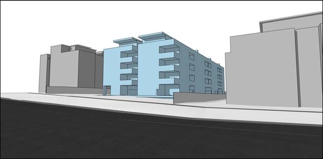
Figure
6. Excerpt from Urban Design Study – concept massing
The Concept Architectural Plans are included at Attachment
A4 and the Urban Design Study is included at Attachment A5. The
massing proposes a 5-storey rectangular built form with the main part of the
building aligned to an east-west orientation. Given the scale of the adjoining
developments which comprise of 4-5 storey apartment developments, the proposed
height of 5-storeys is a suitable response to this site and context.
While a Planning Proposal only relates to an LEP amendment
and cannot be tied to a specific development outcome, it is important that the
urban design study supporting the Planning Proposal presents a concept
development scheme that is compliant with Council’s DCP and the Apartment
Design Guide (ADG) as well as responds to any specific development
constraints on the site. An analysis of the Concept Architectural Plans and
Urban Design Study has been undertaken by Council’s Urban Design Project
Officer and is included in Table of Assessment at Attachment A10. This
analysis identifies the following required amendments to the concept plans and
Urban Design Study:
· amend
the urban design of the proposed plan by varying the depth of the wall planes,
supplemented with architectural elements;
· modify
the western elevation of the building to comply with controls 16 and 17 of
Section 7C.6 of the DCP;
· amend
the design to ensure compliance with the top floor GFA allowance within the
DCP;
· include
a separate diagram showing Site Coverage Calculations required to be submitted;
and
· amend
the location of the driveway and the proposed basement layout to comply with
the requirements of Section 7A.3 of the DCP as well as tree protection as noted
in the comments provided on the Biodiversity Impact Assessment.
· Traffic and
Transport
A Traffic and Transport Report has been submitted with the
Planning Proposal and is included at Attachment A7.
Council’s Strategic Transport Engineer has reviewed
the documents and provided the following key points. A more detailed traffic
and transport analysis is included in the Table of Assessment, at Attachment
A10.
Public Transport and Journey to Work
An assessment of the 30-minute Public Transport Catchment
and 2016 Census Journey to Work Data has determined that, overall, the subject
site would provide relatively good access to jobs by public transport.
Walkability
Improving Transport Choice – Guidelines for
planning and development (DUAP 2001) suggests best practice is achieved
when: “key land uses are located within walking distance of each other
(e.g. shops, library, childcare centres, cinemas, bus/rail interchange)”.
An assessment of the 10-minute Walking Catchment has identified that, while some
nearby parks, child care centres, schools and churches are located within 10
minutes’ walk from site, other key services and facilities such as
supermarkets, pharmacies, medical centres, open space/recreation and other
schools are located some distance further. It is likely, therefore, that future
residents of this site will likely (to a large degree) be using private cars to
access basic day-to-day services and facilities.
Cycling Accessibility
An assessment of the 30-minute Cycling Catchment has
determined that the bicycle network in the catchment is only somewhat
developed. This catchment extends to Hornsby and most of the main centres in
Ku-ring-gai along the T1 North Shore railway line. The site is located
close to an existing shared user path which runs around the outskirts of the St
Ives centre. Completion of missing links would provide better connections to
Gordon, Wahroonga and the Barra Brui locality, as well as the St Ives centre
itself (as part of the draft Public Domain Plan). Otherwise, the majority of
current cycling activity is expected to be confined to either on-road/mixed use
cycling or cycling on footpaths (where permissible).
Transport Infrastructure Capacity
There is a bus stop within 150m
(2 minutes’ walk) from the site, on Mona Vale Road. The corresponding
stop is on the opposite side of Mona Vale Road and is approximately 300m (4
minutes’ walk) from the site. These
bus stops provide convenient access to routes 194 (St Ives to City), 194X (St
Ives to City Express), 195/196 (Belrose and St Ives Chase to Gordon), 197 (Mona
Vale to Macquarie University via Gordon) and 582 (St Ives Shopping Centre to
Gordon) services. The stop on the eastern side of Mona Vale Road is equipped
with a shelter, while the stop on the western side is provided with a seat and
concrete pad.
To access
the Hornsby strategic centre, bus stops on Killeaton Street near Memorial
Avenue provide the closest access to the route 591 service, which connects St
Ives and Hornsby. These stops are 550m (7 minutes) and 650m (9 minutes) walk
from the site. These stops also provide access to the 594 service (North
Turramurra to City). There are no dedicated passenger facilities (e.g. bench seats
or shelters) at these stops.

Figure 7. Bus Stops and Service near the Site
Strategic Transport Planning
Improvements to the 194 service
(St Ives – City) were made approximately 2 years ago, which include
increased off-peak and weekend daytime service frequency, and extended span of
hours later in the evening.
Transport for NSW have advised
that prior to the last State election the Government made a commitment prior to
2023 to introduce new weekday peak hour express services between Mona Vale and
Macquarie Park that bypass Gordon (known as the 197X Mona Vale –
Macquarie Park service). These new services would save some travel time for
passengers travelling between Macquarie Park and St Ives/Northern Beaches, as
the service would not have to divert to Gordon station. To date, there has been
no update from Transport for NSW regarding the 197X service.
The Traffic, Transport and
Parking Report notes that Future Transport 2056 identifies a rapid bus line
between Mona Vale and Macquarie Park by 2036. Other than acknowledge the future
rapid bus line, the Traffic, Transport and Parking Report does not discuss its
timing or present any discussion/consultation with Transport for NSW regarding
timeframes or implementation. If the Planning Proposal proceeds to Gateway,
Transport for NSW will be providing a response as part of consultation with
state agencies. Clarification regarding future upgrade to bus services and the
Rapid Bus Line would be provided by Transport for NSW as part of that process.
Councils along the Mona Vale
Road/Ryde Road/Lane Cove Road corridor are aligned in their support for
improved services along the corridor and are advocating to Transport for NSW to
bring forward planning for the initiative. From the Ku-ring-gai Local Strategic
Planning Statement (LSPS), Council has an action to advocate to Transport for
NSW to increase the priority and accelerate the delivery of infrastructure
improvements identified in Future Transport 2056 that connects Ku-ring-gai
internally and with nearby centres, including improvements to bus connections
from Mona Vale to Macquarie Park (followed by Bus Rapid Transit).
Travel time on Ryde Road/Lane
Cove Road portion of the corridor (between Pacific Highway and Waterloo Road)
during morning peak periods can be up to 30 minutes, and currently, journey
times of buses travelling between St Ives and Macquarie Park are significantly
impacted by these delays, resulting in travel times longer than timetabled. It
is likely, therefore, that the new 197X Mona Vale – Macquarie Park
service will be impacted by delays on the Ryde Road segment of the route. Bus
service improvements along this corridor, including extension of operating
times, bus priority measures and journey time reliability are important to ensure
public transport is competitive with private vehicles, as well as enhance
connectivity and bring significant Strategic Centres (such as Macquarie Park)
and Health/Education Precincts within 30 minutes by public transport.
In recognition of this, one of
the actions to address Planning Priority K2 of the LSPS (to provide housing
close to transport, services and facilities to meet the existing and future
requirements of a growing and changing community) is to: “Implement
planning responses in St Ives subject to infrastructure improvements
(medium-long term).”
Traffic generation and intersection analysis
Traffic surveys were undertaken
by the proponent in February 2022 at the intersection of Mona Vale Road and
Killeaton Street during the AM and PM peak periods. This intersection operates
as a left in/left out arrangement.
A traffic
generation rate of 0.29 vehicle trips per dwelling during the AM and PM peak
hours was used to assess the traffic impacts of the proposal. For an expected
yield of 40 residential dwellings, this resulted in a traffic generation of 12
vehicle trips (two-way) during the AM and PM peak hours. These were distributed
to the surrounding road network based on expected destinations guided by the
Journey to Work data. The resulting levels of service at the intersection of
Mona Vale Road and Killeaton Street from the Traffic,
Transport and Parking Report are shown in Figure 8 below.
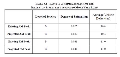
Figure 8. Excerpt from Traffic, Transport and Parking
Report – SIDRA analysis
Given the low additional traffic
generation at the intersection, the proposal has very minimal impacts to its
operation, continuing to operate at Level of Service B. However, in the
Traffic, Transport and Parking Report, there is no commentary or evidence of
discussions with Transport for NSW regarding future proposals for the Mona Vale
Road corridor in St Ives. If the Planning Proposal proceeds to Gateway,
Transport for NSW will be providing a response as part of consultation with
state agencies. Any further details or clarification on planned upgrades to the
Mona Vale Road corridor through St Ives would be provided by Transport for NSW
as part of that process.
Yarrabung Road has been
identified as a road which would form part of a vehicle trip to access the site
from the south. Yarrabung Road is a collector road in Council’s road
hierarchy, and Council’s most recent traffic counts in Yarrabung Road
were undertaken in 2016 and indicate average weekday traffic flows of 4,800
vehicles per day (two-way) and 85% traffic speeds of 54km/h. Indicatively, the
peak hour traffic flows would be in the order of 450-480 vehicles per hour.
For residential collector roads,
RMS (now Transport for NSW) guidelines indicate that traffic flows of 300
vehicles per hour is an environmental goal, and 500 vehicles per hour is a
suggested maximum performance standard.
As a result of the proposal,
traffic flows are expected to increase by up to 8 vehicle trips per hour in
Yarrabung Road (which would occur in the PM peak period). This equates to an
average of 1 additional vehicle trip in Yarrabung Road every 7-8 minutes which
is a modest amount of traffic increase and unlikely to result in significant
additional impacts.
· Biodiversity
This assessment considers the updated Biodiversity Impact
Assessment and Arborist Report submitted to Council in February 2023.
These reports are included as Attachment A6 and Attachment A9 respectively.
Arborist Report
The original Arborist Report dated 3 March 2022 identified
27 trees on the subject Lot as Flooded Gum (Eucalyptus grandis). An
updated Arborist Report dated 7 February 2023 revises the identity of 26 of
these trees to Blue Gum (Eucalyptus saligna).
The Tree Schedule in Section 5.0 of the updated Arborist
Report incorrectly identifies the following trees:
· Tree
20 is identified in the Schedule as a Eucalyptus pilularis but is a Liquidambar,
an exotic species likely to have been planted.
· Tree
75 is identified in the schedule as a Ficus rubiginosa but is a Callitris
rhomboidea, a locally native species likely to have been planted.
Callitris rhomboidea is not characteristic of STIF.
It is recommended that the
identification of these two trees are corrected. Other values in the Tree
Schedule and results of the VTA remain valid for Trees 20 and 75.
The following trees occur
within adjoining lots and are likely to have TPZs extending into 130 Killeaton
St:
|
|
Species/Description
|
Location
|
|
A
|
Very large Eucalyptus microcorys
|
Within 263 Mona Vale Rd, located ~5 m south of the
south-western corner of 130 Killeaton St.
|
|
B
|
Multi-stemmed Syncarpia glomulifera
|
ln the north-eastern corner of 263 Mona Vale Rd, ~0.5 m
from the boundary of 130 Killeaton St.
|
|
C
|
Multi-stemmed Syncarpia glomulifera
|
ln the north-eastern corner of 263 Mona Vale Rd, ~0.5 m
from the boundary of 130 Killeaton St.
|
|
D
|
Angophora costata
|
In the north-western corner of 9-15 Link Rd, ~1 m from the
boundary of 130 Killeaton St.
|
|
E
|
Syncarpia glomulifera
|
In the north-western corner of 9-15 Link Rd, ~1 m from the
boundary of 130 Killeaton St.
|
|
F
|
Melaleuca styphelioides
|
Within 132-138 Killeaton St, located ~20 m south of the
north-east corner of 132-138 Killeaton St, approximately 2 m from the
boundary of 130 Killeaton St.
|
|
G
|
Melaleuca styphelioides
|
Within 132-138 Killeaton St, located ~20 m south of the
north-east corner of 132-138 Killeaton St, approximately 2 m from the
boundary of 130 Killeaton St.
|
Whilst these trees’ TPZs are likely to be within
boundary setbacks, these trees should be incorporated into the Tree Schedule at
the DA stage to facilitate complete assessment and appropriate protection.
The Arborist Report assesses the impact of the proponent’s
concept development on trees. Recommendations relating to tree removals and
tree protection should be reviewed against the final development plan at the DA
stage.
Biodiversity Impact Assessment
Vegetation on the subject site is comprised of mostly
planted trees and lawns of turf grasses and native groundcovers. The trees are
predominantly Australian natives, including several locally native species.
An updated Biodiversity Impact Assessment dated 4 February
2023 assesses the vegetation based on the updated Arborist Report and
specifically addresses the potential for Blue Gum High Forest to occur on the
site. Despite the prevalence of Blue Gums across the site, the Biodiversity
Impact Assessment determines that the vegetation is more closely aligned with
Sydney Turpentine-Ironbark Forest (STIF) than Blue Gum High Forest. This
assessment was based on Biodiversity Assessment Method analysis of floristic
data, remnant and naturally occurring vegetation on the site being highly
characteristic of STIF, pre-European plant community type modelling, and
analysis of the distribution of plant communities at the local landscape scale.
This determination of vegetation communities on the site uses industry-standard
methodology and makes sound findings based on accurate
data.
The Biodiversity Conservation Act 2016 lists
‘Sydney Turpentine-Ironbark Forest in the Sydney Basin Bioregion’
as a Critically Endangered Ecological Community. The BC Act listing applies to
all instances of vegetation within the area defined by the listing and with a
species assemblage consistent with that described in the listing, regardless of
size, condition, and/or method of vegetation establishment. Therefore, the
protections conferred by the BC Act listing apply to the area of the subject
site occupied by STIF.
The Environment Protection and Biodiversity Conservation
Act 1999 lists ‘Turpentine-Ironbark Forest of the Sydney Basin
Bioregion’ as a Critically Endangered Ecological Community, however the
EPBC Act listing only applies to remnant patches that meet specific condition
criteria, including patch size and canopy cover. Vegetation within the subject
site does not meet these criteria and therefore is not recognised under and
protected by the EPBC Act 1999.
The vegetation on the subject site is not mapped as STIF or
any other recognisable community in Ku-ring-gai or NSW databases, likely due to
the presence of exotic and non-locally native canopy species obfuscating the
identity of the small and discontinuous areas of STIF on the site. To
facilitate accurate environmental assessment, it is recommended that
Ku-ring-gai’s Terrestrial Biodiversity Map and Greenweb mapping be
updated to include STIF vegetation on the subject Lot. STIF vegetation has been
mapped for this purpose in accordance with the Ku-ring-gai Biodiversity and
Riparian Lands Study Version 5 using methodology consistent with other
Terrestrial Biodiversity and Greenweb mapping such as defining the extent of
Key Vegetation Community patches by the canopy of tree species characteristic
of the community as per the Final Determination.
The updated Biodiversity Impact Assessment identifies that
20 individual trees of 7 species within the site comprise STIF. However, the
BIA does not identify 4 Eucalyptus pilularus amongst these (Trees 30,
43, 44, and 66). Eucalyptus pilularis is characteristic of STIF as per
the Sydney Turpentine-Ironbark Forest in the Sydney Basin Bioregion Final
Determination 2019. Additionally, the BIA does not identify 3 Syncarpia
glomulifera and 1 Angophora costata growing in adjoining Lots but
with TPZs likely to extend into 130 Killeaton St. These trees form part of the
local occurrence of STIF and should be captured in updated Terrestrial
Biodiversity mapping on The KLEP 2015 and Greenweb mapping in the Ku-ring-gai
DCP. This proposed mapping is included as Attachment A11 and Attachment
A12 respectively
The Biodiversity Impact Assessment recommends that Spotted
Gum (Corymbia maculate) be planted on the site to enhance foraging
habitat for Grey-headed Flying-foxes. The inclusion of this species in a
planting plan is not supported as this species will not aid in the conservation
of STIF and alternative STIF species can provide equal habitat value.
A floorspace ratio of 1.3:1 will likely result in some loss
of STIF vegetation. The BIA calculates a loss of STIF totalling approximately
287 square metres resulting from the proposed development. Given the degraded
condition of the STIF vegetation on site and its isolation from significant
vegetation patches and corridors, this impact to STIF vegetation is considered
acceptable with the proviso that losses are offset in accordance with relevant
legislation and Council’s DCP requirements. It’s desirable that
impacts to STIF be minimised, which would require redesign to reduce the number
of STIF trees the building footprint encroaches on. In addition to minimising
impacts to STIF, such a redesign would also support the retention of threatened
species habitat on the site.
The proposed design does not identify utility locations.
Utilities would need to be located within the driveway and building footprint
to avoid further impacts to trees and biodiversity.
· Contamination
The Preliminary Site Investigation submitted with the
Planning Proposal is included at Attachment A8. The report
identifies a potential for contaminants that may present a risk to terrestrial
ecosystems. However, the Preliminary Site Investigation assumes that the nature
of the proposed development will result in loss of potential ecological
receptors (i.e. fauna) from the site, and on that basis determines that further
assessment of terrestrial ecosystem risks is not warranted. However, the
recommendations of the Biodiversity Impact Assessment seek to retain biota
comprising potential receptors on site. Therefore, potential contamination and
associated terrestrial ecological risks should be characterised in a Detailed
Site Investigation at the DA stage.
Strategic Merit Assessment
· Greater Sydney
Region Plan and North District Plan
The Planning Proposal is consistent with the objectives of
the Greater Sydney Region Plan – A Metropolis of Three Cities, in
particular:
- Objective 4. Infrastructure use is optimised
- Objective 10. Greater housing supply
- Objective 11. Housing is more diverse and affordable
- Objective 14. Integrated land use and transport creates
walkable and 30-minute cities
- Objective 27. Biodiversity is protected, urban bushland and
remnant vegetation is enhanced
A Metropolis of Three Cities outlines that liveability incorporates access to housing,
transport and employment, as well as social, recreational, cultural and
creative opportunities. Provision of housing close to public transport and
services and facilities improves the opportunity for people to walk and cycle
to local shops and services. The plan advocates for the protection and
enhancement of biodiversity values. The proposal is consistent with these
principles.
The Planning Proposal is
consistent with the planning priorities of the North District Plan, in
particular:
- Planning Priority N1. Planning for a city supported by
infrastructure
- Planning Priority N5. Providing housing supply, choice and
affordability, with access to jobs, services and public transport
- Planning Priority N6. Creating and renewing great places
and local centres, and respecting the districts heritage
- Planning Priority N12. Delivering integrated land use and
transport planning and a 30-minute city
- Planning Priority N16. Protecting and enhancing bushland
and biodiversity
The Planning Proposal will allow
for additional residential land that can be developed to provide housing choice
and supply for the existing and future population in the area. The site is
located in an accessible area in proximity to a range of services, facilities
and public open space as well as public transport. The Planning Proposal is therefore in accordance with the
North District Plan priorities to focus housing in locations that support the
30-minute city and provide access to jobs, services and public transport, as
well as the priorities to protect biodiversity.
· Ku-ring-gai
Local Strategic Planning Statement
The Ku-ring-gai Local Strategic Planning Statement (LSPS)
came into effect on 17 March 2020 and provides a 20 year vision and local
planning priorities and associated actions for land use planning in
Ku-ring-gai. The Planning Proposal is consistent with the following local
planning priorities:
- K3. Providing housing close to transport, services and
facilities to meet the existing and future requirements of a growing and
changing community;
- K4. Providing a range of diverse housing to accommodate the
changing structure of families and households and enable ageing in place;
- K12. Managing change and growth in a way that conserves and
enhances Ku-ring-gai’s unique visual and landscape character;
- K21. Prioritising new development and housing in locations
that enable 30minute access to key strategic centres;
- K31. Increasing, managing and protecting
Ku-ring-gai’s urban tree canopy.
While the
Planning Proposal is consistent with the overarching local planning priority to
provide housing close to transport, services and facilities, the LSPS provides
specific details about each centre, its suitability for additional housing and
timing. The LSPS sets out that the St Ives Primary Local Centre is suitable for
additional housing as it contains a bus route on an arterial road corridor and
meets the criteria for 30-minute access to a strategic centre, and is supported
by Council’s community hub projects with retail services and community
facilities. The LSPS outlines the timing for future housing delivery in the St
Ives centre as 6-10 year (2021-2026) and 11-15 year (2026-2031) subject to the
provision of priority bus infrastructure from Mona Vale to Macquarie Park.
This
Planning Proposal seeks to allow for approximately 40 additional dwellings in
the centre prior to the provision of the rapid bus line between Mona Vale and
Macquarie Park, which is inconsistent with the LSPS. Should the Planning
Proposal proceed to Gateway, Transport for NSW will be providing a
response as part of consultation with state agencies. Clarification regarding
future upgrade to bus services and the Rapid Bus Line would be provided by
Transport for NSW as part of that process. Council’s Strategic Transport
Engineer has reviewed the Transport and Parking Report submitted with the
Planning Proposal, which indicates a modest amount of traffic increase as a
result of the proposal which is unlikely to result in significant additional
impacts. It is noted that Council’s LSPS
includes an action to advocate to Transport for NSW to increase the
priority and accelerate the delivery of infrastructure improvements identified
in Future Transport 2056 that connects Ku-ring-gai internally and with nearby
centres, including improvements to bus connections from Mona Vale to Macquarie
Park (followed by the Bus Rapid Transit).
The Planning Proposal is generally consistent with the
principles for the location of additional housing as set out in the LSPS:
- Stage housing delivery around centres of retail and
economic activity that are serviced by the North Shore railway line or major
bus routes along arterial roads, including provision of housing diversity,
affordability and accessibility.
- Locate high density housing types within a 10min walk (800m
radius) of Primary and Secondary Local Centres: Gordon, Lindfield, Turramurra,
St Ives (subject to the provision of priority bus infrastructure), Roseville,
Killara, Pymble and Wahroonga.
- In considering areas for future medium and high density
housing form, the following areas are to be avoided:
o Heritage conservation areas.
o Areas of visual or aesthetic quality and character.
o Areas within or affecting scenic and cultural landscapes.
o Areas of intact tree canopy where the built form does not
sit under the canopy.
o Areas with multiple constraints including steep topography.
o Areas with environmental values.
o Areas that are bushfire prone and with evacuation risk.
o Centres with limited transport and service access until
improvements are implemented.
Given that the scale of the
adjoining developments that comprise of 4-5 storey apartment developments, the
proposed height of 5-storeys is a suitable response to this site and context.
The development standards proposed and the built form outcomes enabled by the
Planning Proposal are consistent with the adjoining R4 High Density Residential
zoned sites. The sites, the subject of the
Planning Proposal, are not constrained by a Heritage conservation area, scenic
or cultural landscape or bushfire prone land.
The vegetation on the
subject site is comprised of planted trees and lawns of turf grasses and native
groundcovers. The trees are predominantly Australian natives, including several
locally native species. The species composition of parts of the garden is consistent
with Sydney Turpentine-Ironbark Forest (STIF), as determined by Biodiversity
Assessment Methodology surveys. The floorspace ratio
of 1.3:1 will result in some loss of STIF vegetation resulting from the
proposed development. Given the degraded condition of the STIF
vegetation on site and its isolation from significant vegetation patches and
corridors, this impact to STIF vegetation is considered acceptable with the
proviso that losses are offset in accordance with relevant legislation and
Council’s DCP requirements. As detailed in the
proposed amendments, relocation of the driveway would ensure the impact to STIF
vegetation is minimised.
This Planning Proposal seeks to
allow for approximately 40 additional dwellings in the centre prior to the
provision of the rapid bus line between Mona Vale and Macquarie Park, which is
inconsistent with the LSPS. Given the relatively small number of additional
dwellings that could be facilitated by the Planning Proposal, this
inconsistency is considered to be minor. Nevertheless, should the Planning
Proposal proceed to Gateway, Transport for NSW will be providing a response as
part of consultation with state agencies
· Ku-ring-gai
Housing Strategy and Housing Strategy Approval Letter Conditions
Council’s adopted Ku-ring-gai
Housing Strategy provides all new dwellings to 2036 from capacity within the
existing planning controls and zoning. As the Planning Proposal is seeking to
rezone the site and amend the development controls to enable delivery of
residential housing on the site, it is inconsistent with the Housing Strategy.
The amendments sought by the
Planning Proposal will enable the delivery of approximately 40 dwellings on the
site. In approving the Ku-ring-gai Housing Strategy, the Department of
Planning, Industry and Environment issued a number of approval conditions, one
of which is:
4. Consistent with
Priority K3 of the Ku-ring-gai LSPS, Council is to prepare a masterplan, or
accommodate a proponent-led planning proposal with good planning outcomes, for
the St Ives local centre. Planning is to occur in consultation with TfNSW
and align with its Movement and Place Framework.
Subject to TfNSW advice, the planning proposal is to be submitted to the
Department for Gateway Determination by December 2022. This proposal will help
to create future housing capacity and contribute to medium supply and support
the longer term 20-year strategic housing target for the District.
At OMC 16 November 2021 Council
resolved to reject the Housing Strategy conditions of approval. However, clause
5 (3)(d) of the Environmental Planning and Assessment (Statement of
Expectations) Order 2021, requires Council to: ‘give effect to an
adopted local planning strategy (such as a Local Housing Strategy), and any
approval requirements issued by the Department’.
Council has not prepared a
Masterplan for the St Ives Local Centre as required by Condition 4, and
accordingly the Planning Proposal is consistent with the requirements of
Condition 4, which requires Council to accommodate proponent-led planning
proposals with good planning outcomes within the St Ives local centre. Should
the Planning Proposal receive a Gateway Determination, then consultation would
occur with TfNSW and clarification regarding any future upgrade to bus
services, the Rapid Bus Line and Movement and Place Framework would be provided
as part of that process.
The Planning Proposal will enable
a higher density built form outcome on the site in an area that is close to
public transport, services and facilities.
· Section 9.1
Ministerial Directions and State Environmental Planning Policies (SEPPs).
The Planning Proposal is not
inconsistent with the State Environmental Planning Policies (SEPPs) applicable
to the site. Many of these SEPPs contain detailed provisions and controls which
would only apply at the Development Application stage.
The Planning Proposal is
consistent with the applicable s9.1 Ministerial Direction, specifically those
relating to:
- 5.1 Integrating Land Use and Transport
- 6.1 Residential Zones
The objective of direction 6.3 is
to discourage unnecessarily restrictive site-specific planning controls, and
4(c) outlines that a Planning Proposal must allow that land use on the
relevant land without imposing any development standards or requirements in
addition to those already contained in the principal environmental planning
instrument being amended. (6) notes that a Planning Proposal may be
inconsistent with this direction, if the provisions are of a minor
significance.
In order to ensure that future
development on the site enabled by the Planning Proposal responds appropriately
to the biodiversity values identified on the site, there is a need to update
the Terrestrial Biodiversity Map in the KLEP 2015 and Greenweb Maps in the DCP.
It is considered that if this action is inconsistent with direction 6.3, it is
minor in nature and justifiable to ensure the best built form outcomes on the
site.
Amendments required to be made to the Planning Proposal and the
supporting documentation
The assessment of the
Planning Proposal has found that there are a number of errors, inconsistencies
and lack of detail or analysis provided within the documents that require
adjustment. There are other amendments required as a result of Council’s
assessment, such as incorporating an amendment to the KLEP 2015 Terrestrial
Biodiversity Map as part of the Planning Proposal and amending the Greenweb
Maps in the DCP. The proposed amendments to the maps are included as Attachment
A11 and Attachment A12.
The Table of Assessment included at Attachment A10 details
the required amendments to be made to the Planning Proposal if Council is to
support it being submitted to the Department of Planning and Environment for a
Gateway Determination and proceed to public exhibition.
Ku-ring-gai Local Planning
Panel Advice
In accordance with Local Planning
Panels Direction – Planning Proposals issued by the Minister for Planning
under Section 9.1 of the Environmental Planning and Assessment Act
1979, the Planning Proposal was referred to the Ku-ring-gai Local
Planning Panel (KLPP) on 19 September 2022.
The KLPP provided the following
advice (Attachment A13):
“The
Panel has reviewed the Planning Proposal and the information provided
in Attachment A10 and concurs that it has strategic and site specific
merit. The Panel supports the Planning Proposal being referred to the DPE
for Gateway Determination subject to the amendments in the table of
assessment Attachment A10.
The
proposed rezoning to R4 High Density Residential is consistent with surrounding
residential development and will provide for additional housing in close
proximity to shops, services and transport. The proposed height and FSR
controls are consistent with adjoining residential development and considered
appropriate.
The
Panel notes the purpose of the concept plan is to inform the Planning Proposal
with a potential scheme. The Panel’s recommendation is not an
endorsement of the concept scheme and matters such as future building
envelopes, apartment design guidelines and trees to be retained/removed are all
matters to be considered and addressed at a future development application
stage.”
Voting:
Unanimous
The KLPP support for the
submission of the Planning Proposal for a Gateway Determination is noted. The
KLPP’s concern over the concept scheme presented with the planning
proposal is also acknowledged. To this end, there are a number of recommended
amendments to the Urban Design Report in Attachment
A10 that will ensure that the concept
scheme is more consistent with the requirements of the Ku-ring-gai DCP,
addressing some of the concerns raised by the KLPP. Nevertheless, it should be
noted that the concept scheme in the Urban Design Report is only an indicative
design. Any future redevelopment of the site under the proposed amendments to
the KLEP will be subject to a formal development application assessed under
Council’s existing development controls. This will include assessment
against the biodiversity provisions of the KLEP and DCP. The Urban Design
Report attached to the Planning Proposal will have no effect on that
assessment.
integrated planning and reporting
Theme 3: Places, Spaces and
Infrastructure
|
Community Strategic
Plan Long Term Objective
|
Delivery Program
Term Achievement
|
Operational Plan
Task
|
|
P1.1 Ku-ring-gai’s unique
visual character and identity is maintained
|
P1.1.1 Strategies, plans and
processes are in place to protect and enhance Ku-ring-gai’s unique
visual and landscape character
|
P1.1.1.1 Continue to review the
effectiveness of existing strategies, plans and processes across all
programs.
|
|
P2.1 A robust planning framework
is in place to deliver quality design outcomes and maintain the identity and
character of Ku-ring-gai
|
P2.1.1 Land use strategies,
plans and processes are in place to effectively managed the impact of new
development
|
P2.1.1.2 Continue to review the
effectiveness of existing strategies, local environmental plans, development
control plans and processes across all programs
|
Governance Matters
The process for the preparation
and implementation of Planning Proposals is governed by the provisions
contained in the Environmental Planning and Assessment Act 1979 and
the Environmental Planning and Assessment Regulation 2000. A
flow chart of the planning proposal process is included at Attachment
A14, which indicates what stage this planning proposal is currently at, and
the next steps involved.
If Council fails to make a
decision within 90 days (from the commencement of the review of the
application) or if Council makes a decision to not support the Planning
Proposal, the proponent can request the Department of Planning and Environment
for a Rezoning Review.
On 28 April 2023, Council was
notified by the Department of Planning and Environment (DPE) that a request for
a Rezoning Review was submitted on the NSW Planning Portal on 6 April 2023 for
consideration by the Sydney North Planning Panel. Council is invited to comment
on the proposal and/or provide further detail on Council’s position
within 21 days of the notification from DPE. A copy of the letter from DPE is
included as Attachment A15.
Local Planning Panels Direction
– Planning Proposals issued by the Minister for Planning under Section
9.1 of the Environmental Planning and Assessment Act 1979 requires
Council to refer all Planning Proposals prepared after 1 June 2018 to the Local
Planning Panel for advice, before the Planning Proposal is forwarded to the
Minister for a Gateway Determination under Section 3.34 of the Environmental
Planning and Assessment Act 1979.
Risk Management
This is a privately initiated
Planning Proposal. Council needs to determine its position on the matter as to
whether the Planning Proposal should be sent to the Department of Planning and
Environment for a Gateway Determination and proceed to public exhibition.
Council risks damage to its
reputation if it does not undertake strategic land use planning in an effective
and timely manner.
Financial Considerations
The
Planning Proposal was subject to the relevant application fee under
Council’s 2021/2022 Schedule of Fees and Charges. The cost of the review
and assessment of the Planning Proposal is covered by this fee.
Social Considerations
The
amendments sought by the Planning Proposal will enable the delivery of approximately
40 dwellings of varying sizes on the subject site to meet the existing and
future requirements of a growing and changing community.
Environmental Considerations
The vegetation on the subject site
is not currently mapped as STIF or any other recognisable community in
Ku-ring-gai or NSW databases, likely due to the presence of exotic and
non-locally native canopy species obfuscating the identity of the small and
discontinuous areas of STIF on the site. A Biodiversity Impact Assessment and
an Arborist Report have been submitted with the Planning Proposal.
Council’s Natural Areas Program Leader has reviewed the Planning Proposal
and the potential environmental impacts of the Planning Proposal have been
considered in this assessment.
To facilitate accurate
environmental assessment, it is recommended that an amendment to the relevant
Terrestrial Biodiversity Map Sheet in the Ku-ring-gai Local
Environmental Plan 2015 be incorporated into the Planning Proposal as
well as a variation to the DCP’s Greenweb Maps in accordance with
the Ku-ring-gai Biodiversity and Riparian Lands Study Version 5 to
include and categorise this occurrence of STIF. Updating the Terrestrial
Biodiversity Map Sheet to include the occurrence of STIF on the site will
ensure that Clause 6.3 Biodiversity protection will apply to
the site and any future development must be consistent with the provisions of
the clause. The proposed amendment to the KLEP 2015 Terrestrial Biodiversity
Map is included as Attachment A11. The proposed amendment to the
KDCP Greenweb Map is included as Attachment A12.
Community Consultation
In
the event that the Planning Proposal is issued a Gateway Determination by the
NSW Department of Planning and Environment, the Planning Proposal would be
placed on statutory public exhibition in accordance with the requirements of
the Gateway Determination, and Council’s Community Participation Plan.
Internal Consultation
The assessment of the Planning
Proposal has included internal consultation with Council’s staff with
expertise in planning, urban design, traffic and transport and biodiversity and
has informed the recommendations of this Report.
A Councillor site inspection was
held at the site on 9 November 2022.
Summary
A Planning Proposal has been
submitted for 130 Killeaton Street, St Ives which seeks to make the following
amendments to the Ku-ring-gai Local Environmental Plan 2015:
· amend the Ku-ring-gai LEP 2015 Land Zoning Map for the
subject site (Sheet LZN_013) to rezone the site from SP2 Infrastructure
(Educational Establishment) to R4 High Density Residential;
· amend the Ku-ring-gai LEP 2015 Height of Buildings for the
subject site (Sheet HOB_013) to provide a maximum building height of 17.5m (P)
consistent with the adjoining sites; and
· amend the Ku-ring-gai LEP 2015 Floor Space Ratio for the
subject site (Sheet FSR_013) to provide a maximum floor space ratio of 1.3:1
(Q) consistent with the adjoining sites.
The Planning Proposal has been
assessed and found to have sufficient strategic and site specific merit to
enable it to proceed to Gateway Determination and public exhibition, subject to
the amendments outlined in Attachment A10 including the
following:
· Planning Proposal (Attachment A2)
o Include an analysis that considers the objectives of the
Greater Sydney Region Plan in Section B of the Planning Proposal.
o Include the amendment to the Terrestrial Biodiversity Map
in Part 4 of the Planning Proposal (see Attachment A11).
· Concept Architectural Plans and Urban Design Report (Attachments
A4 and A5)
o Amend the urban design of the proposed plan by varying the
depth of the wall planes, supplemented with architectural elements.
o Modify the western elevation of the building to comply with
controls 16 and 17 of Section 7C.6 of the DCP.
o Amend the design to ensure compliance with the top floor
GFA allowance within the DCP.
o Include a separate diagram showing Site Coverage
Calculations.
o Amend the location of the driveway and the proposed
basement layout to comply with the requirements of Section 7A.3 of the DCP as
well as tree protection as noted in the comments provided on the Biodiversity
Impact Assessment.
· Biodiversity Impact Assessment (Attachment A6)
o Amend the planting palette to be comprised of STIF species
· Arborist Report (Attachment A9)
o Amend the Tree Schedule within the Arborist Report to
incorporate the identified trees to facilitate appropriate protection
o Amend to Arborist Report to rectify the two incorrectly
identified trees (Tree 20 and Tree 75).
Should the Planning Proposal proceed,
it should be accompanied by the updated amendment to the Ku-ring-gai
Development Control Plan to update the Greenweb Map to be consistent to the
proposed amendments to the Terrestrial Biodiversity map in the KLEP 2015,
included as Attachment A11 and Attachment A12.
Recommendation:
A. That the planning proposal be amended in
accordance with the recommendations in this report and Table of Amendments (Attachment
A10).
B. That the Planning Proposal (as
amended) be submitted to the NSW Department of Planning and Environment for a
Gateway Determination in accordance with section 3.34 of the Environmental
Planning and Assessment Act 1979.
C. That delegation be given to the General
Manager and Director of Strategy and Environment to verify all amendments are
in accordance with the recommendations in this report and Table of Amendments (Attachment
A10) prior to forwarding to the Department of Planning and Environment.
D. That Council requests to be authorised as
the local plan-making authority to exercise the functions under Section 3.36(2)
of the Environmental Planning and Assessment Act 1979.
E. That upon receipt of a Gateway
Determination, the public exhibition of the planning proposal and site-specific
DCP is carried out in accordance with the requirements of the Environmental
Planning and Assessment Act 1979, Environmental Planning and Assessment
Regulation 2000, the Gateway Determination and the Ku-ring-gai
Community Participation Plan.
F. That a report be brought back to Council at
the end of the exhibition process.
|
Craige Wyse
Team Leader Urban Planning
|
Antony Fabbro
Manager Urban & Heritage Planning
|
|
Andrew Watson
Director Strategy & Environment
|
|
|
Attachments:
|
A1
|
Pre-Planning
Proposal Meeting Report
|
Excluded
|
2022/014813
|
|
|
A2 ⇩ ⇩
|
Planning
Proposal for 130 Killeaton Street, St Ives
|
|
2022/222442
|
|
|
A3
|
Survey
Plan
|
Excluded
|
2022/222456
|
|
|
A4 ⇩ ⇩
|
Concept
Architectural Plans
|
|
2022/222459
|
|
|
A5
|
Urban
Design Report
|
Excluded
|
2022/222460
|
|
|
A6 ⇩ ⇩
|
Updated
Biodiversity Impact Assessment
|
|
2023/043708
|
|
|
A7
|
Traffic
and Transport Report
|
Excluded
|
2022/222472
|
|
|
A8
|
Preliminary
Site Investigation
|
Excluded
|
2022/222475
|
|
|
A9 ⇩ ⇩
|
Updated
Arborist Report
|
|
2023/043559
|
|
|
A10 ⇩ ⇩
|
Updated
Table of Assessment
|
|
2023/069825
|
|
|
A11 ⇩ ⇩
|
Proposed
Terrestrial Biodiversity Map
|
|
2023/145225
|
|
|
A12 ⇩ ⇩
|
Proposed
Greenweb Map
|
|
2023/145226
|
|
|
A13 ⇩ ⇩
|
Ku-ring-gai
Local Planning Panel Advice - 19 September 2022
|
|
2022/267164
|
|
|
A14 ⇩ ⇩
|
Planning
Proposal Process Flowchart
|
|
2022/257692
|
|
|
A15 ⇩ ⇩
|
DPE
Letter - Notification of Zoning Review Request for 130 Killeaton Street St
Ives
|
|
2023/145224
|
|
ATTACHMENT No: 2 - Planning
Proposal for 130 Killeaton Street, St Ives
|
|
Item No: GB.5
|


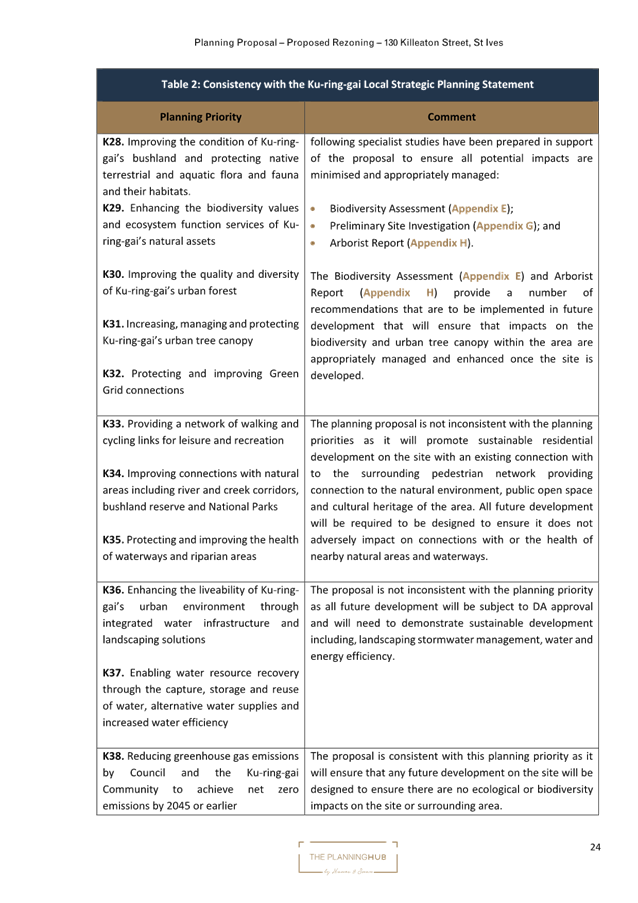

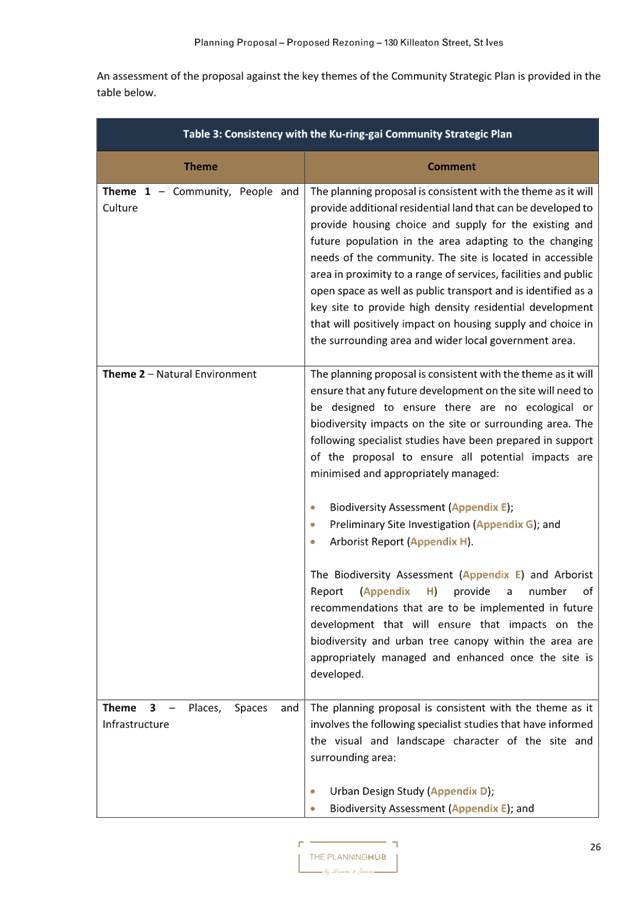
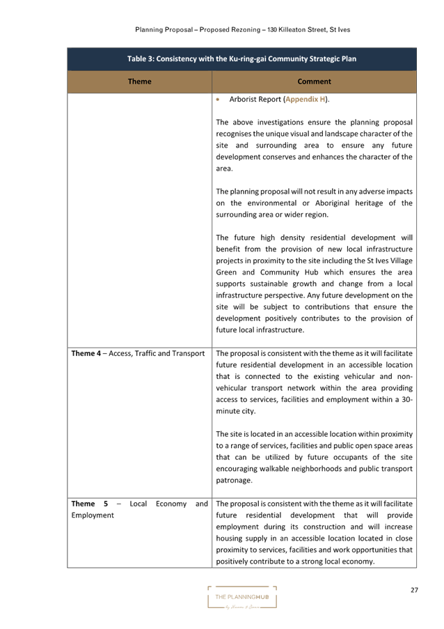


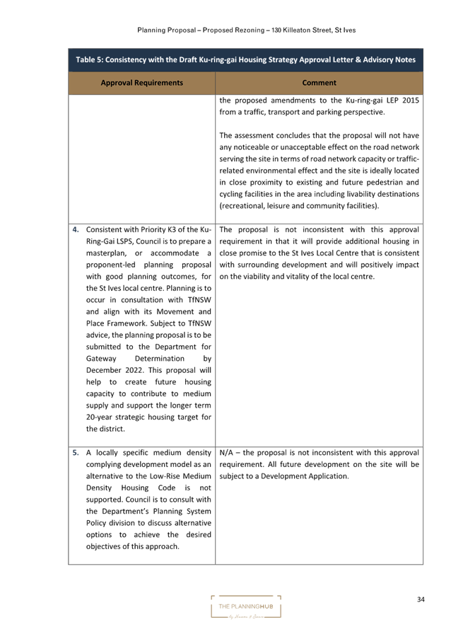

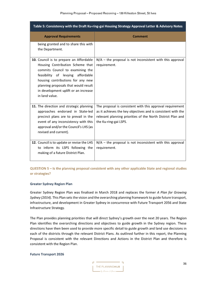
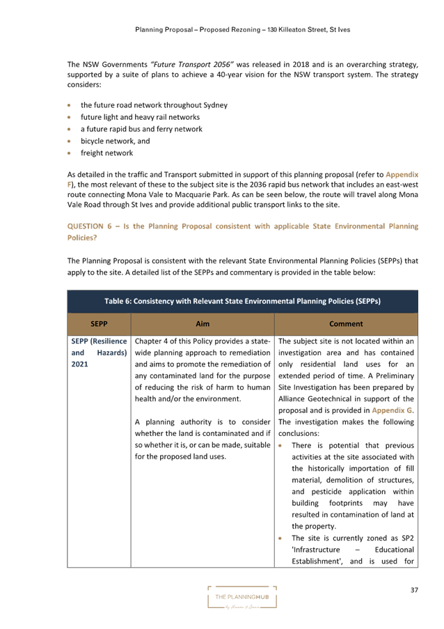
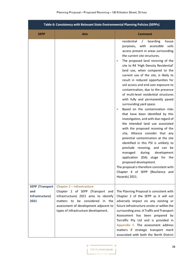
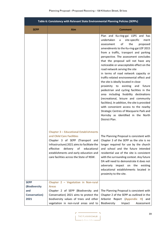
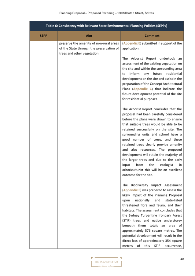
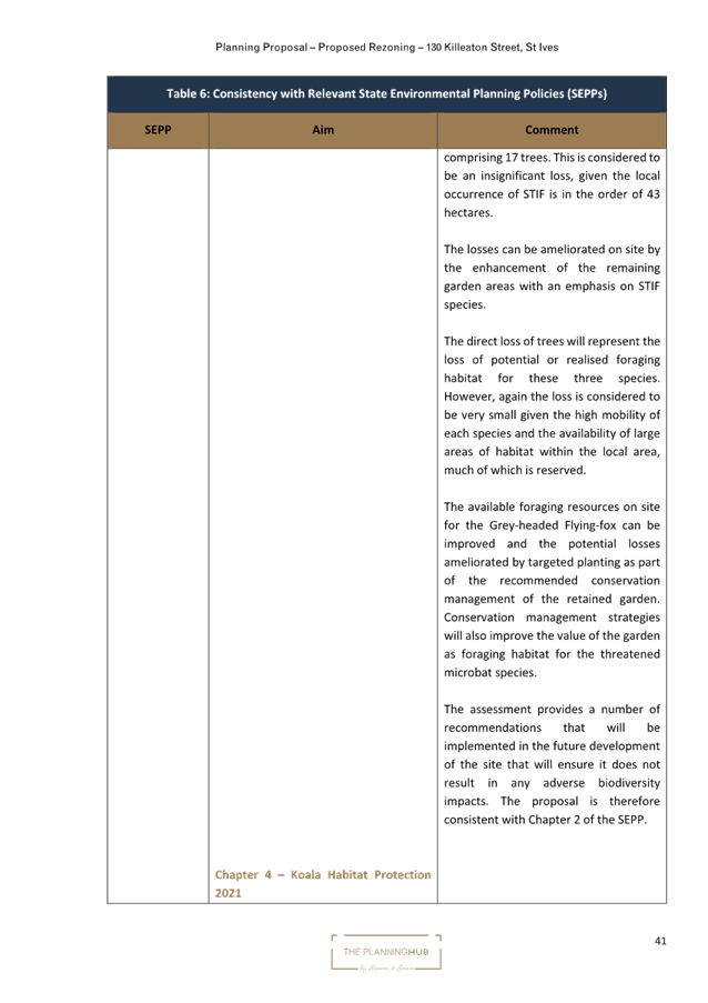
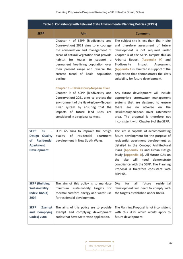
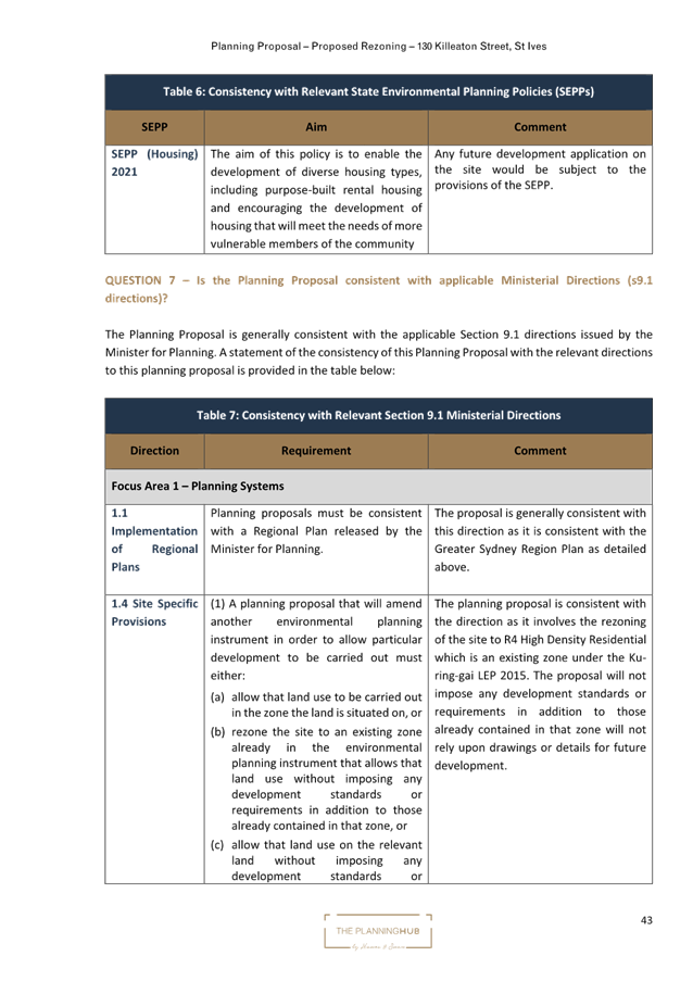
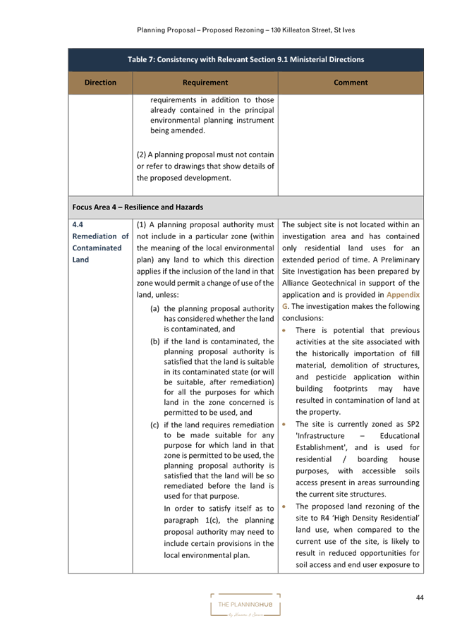
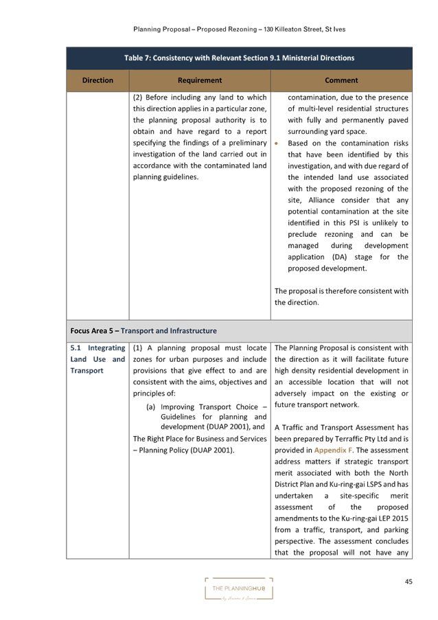
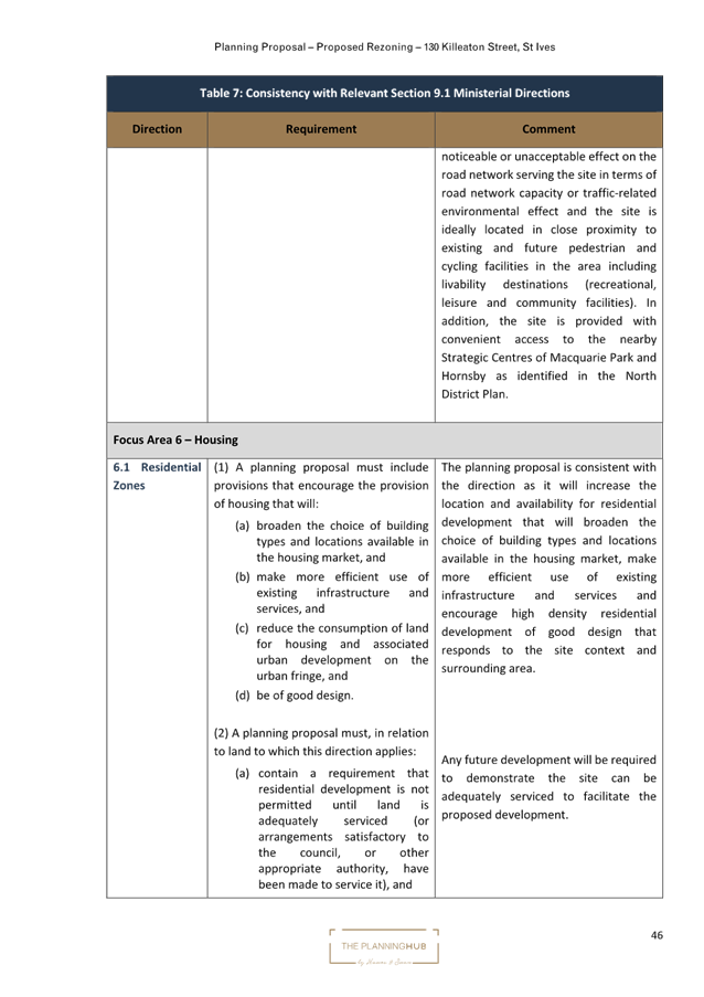
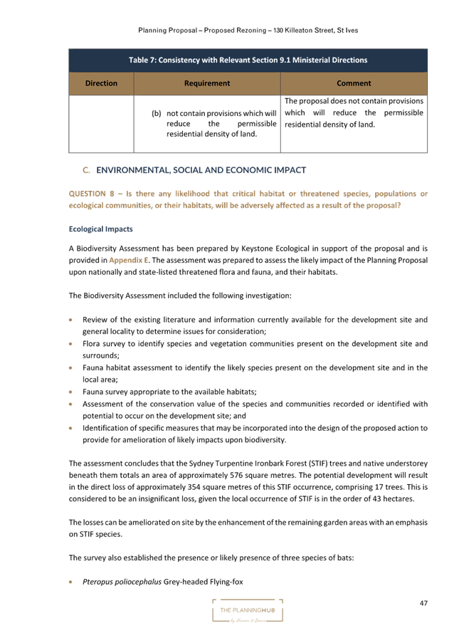
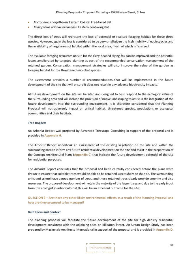
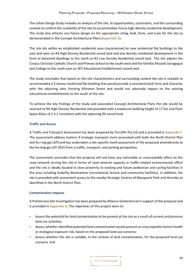
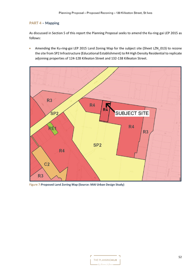
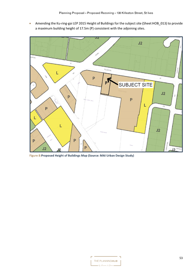
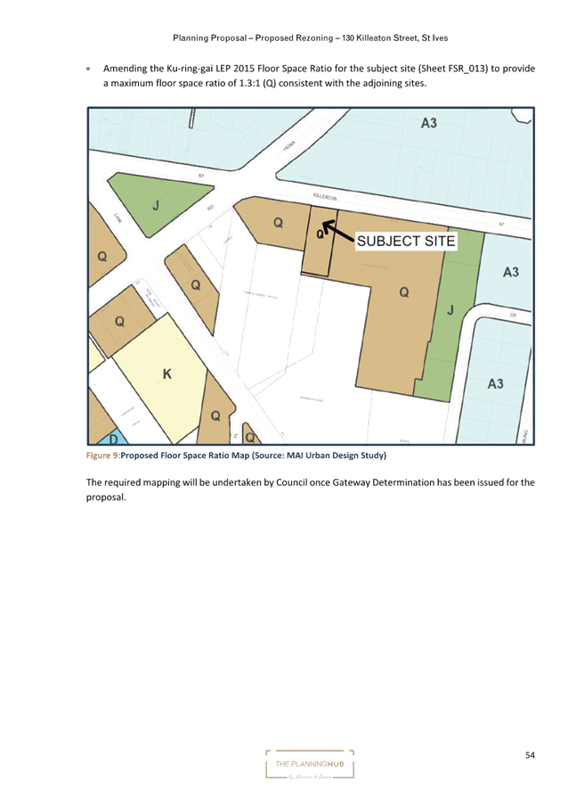

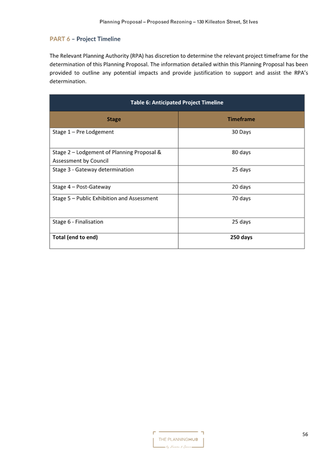
|
ATTACHMENT
No: 4 - Concept
Architectural Plans
|
|
Item No: GB.5
|
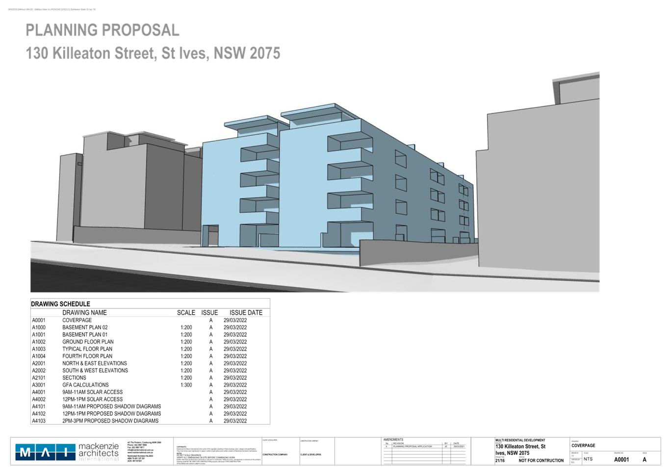
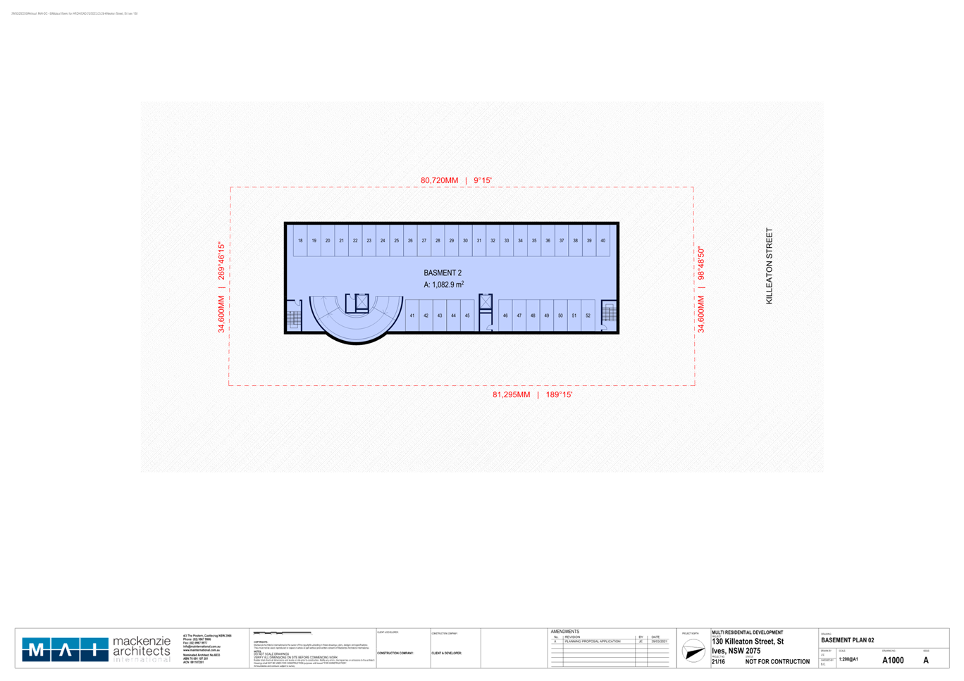
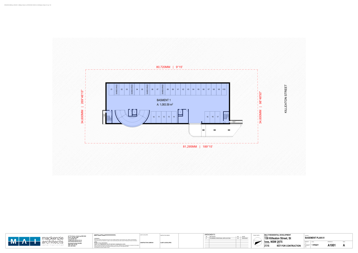
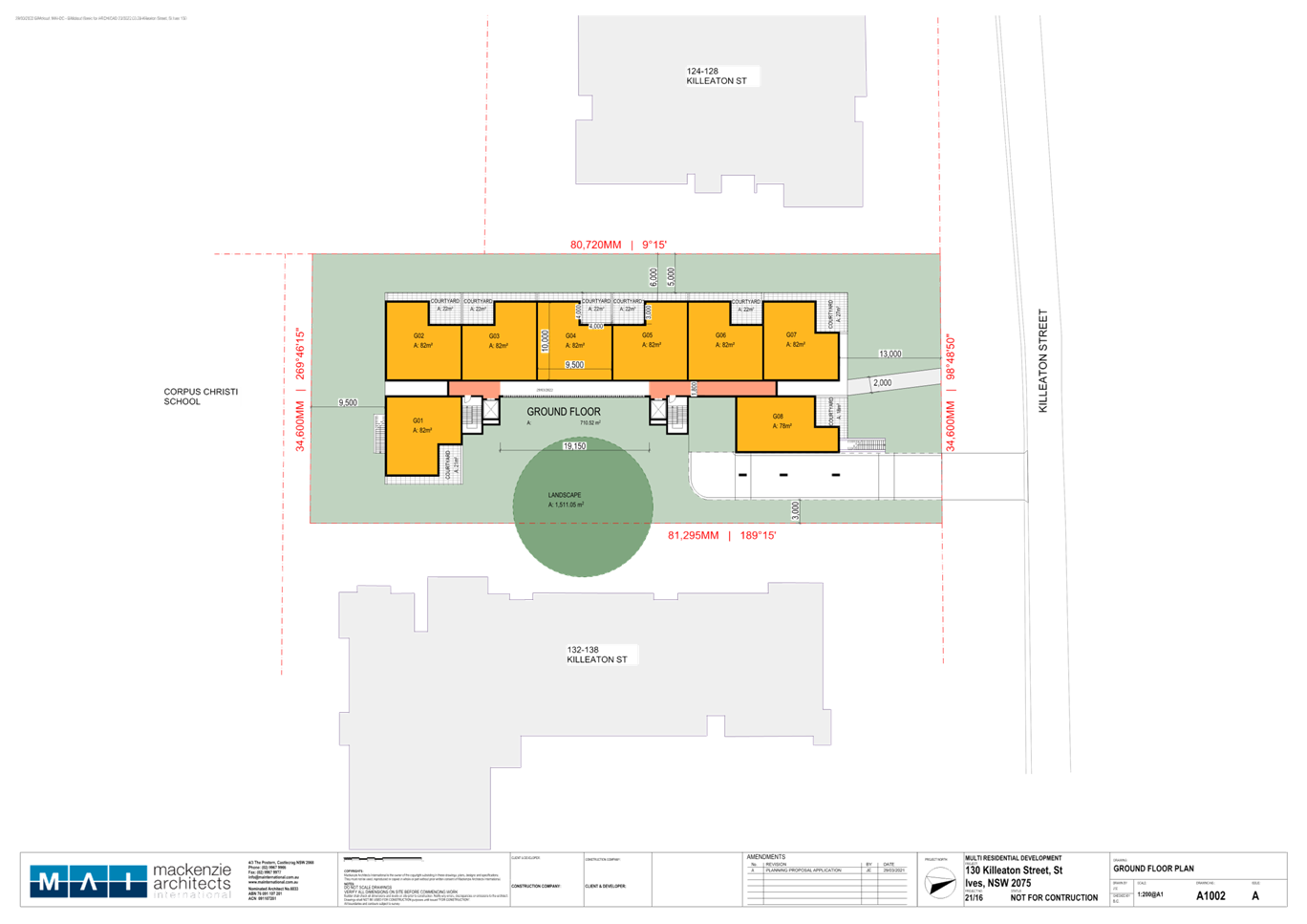
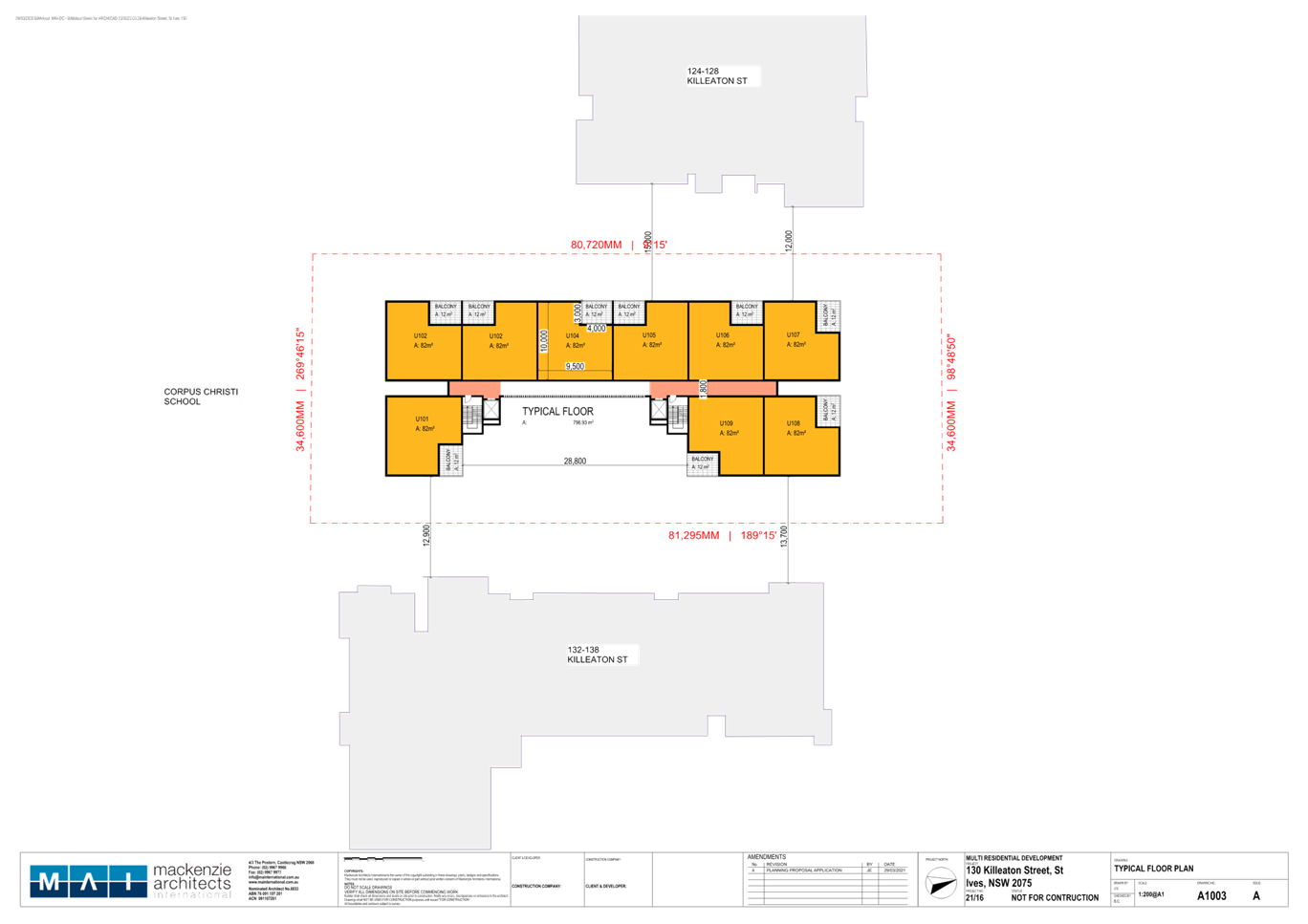
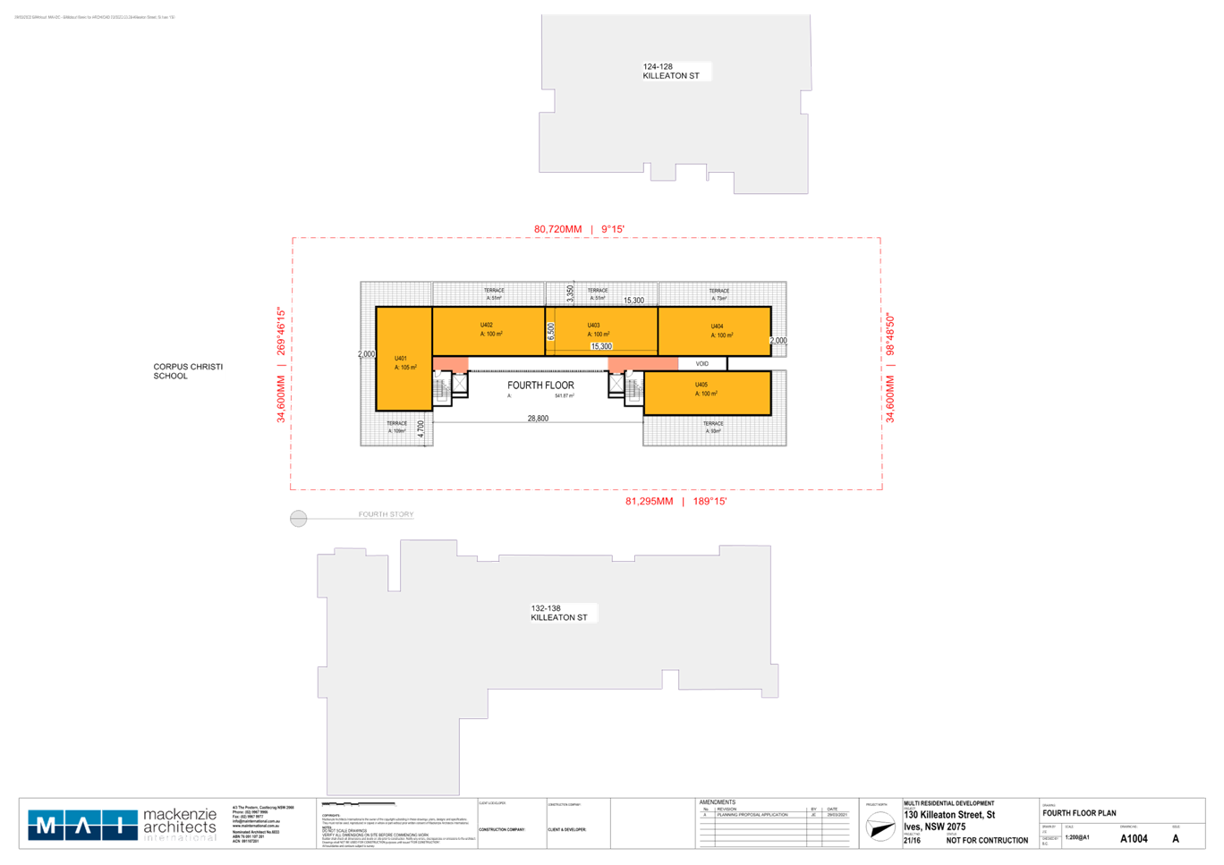
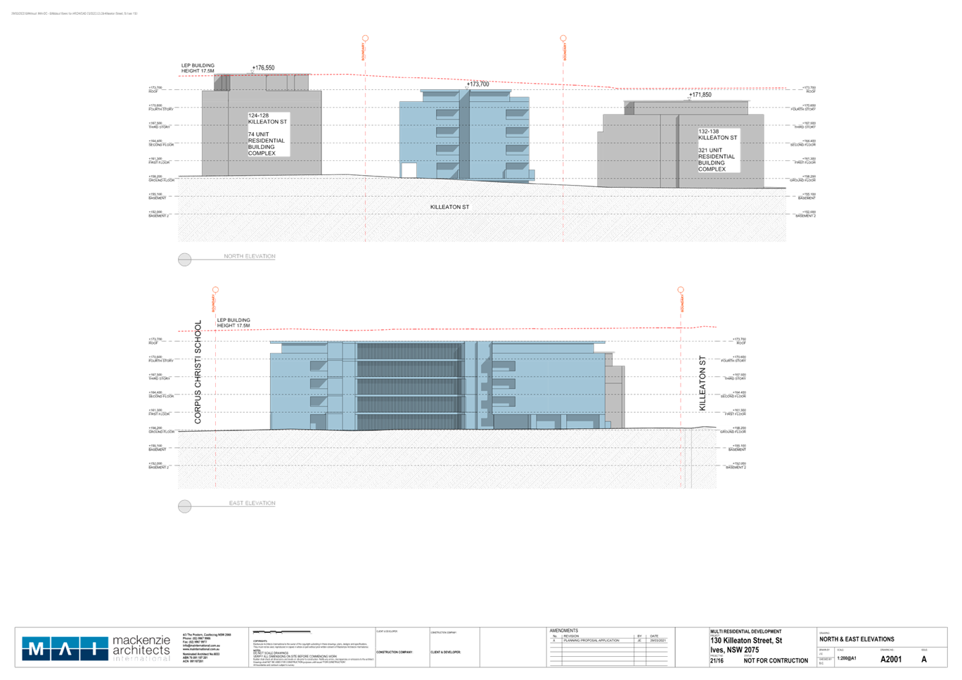
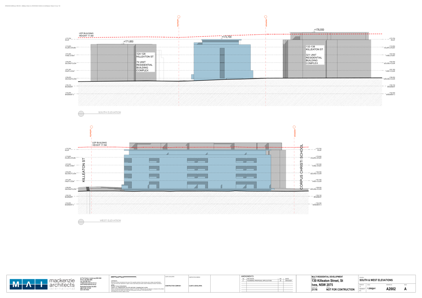
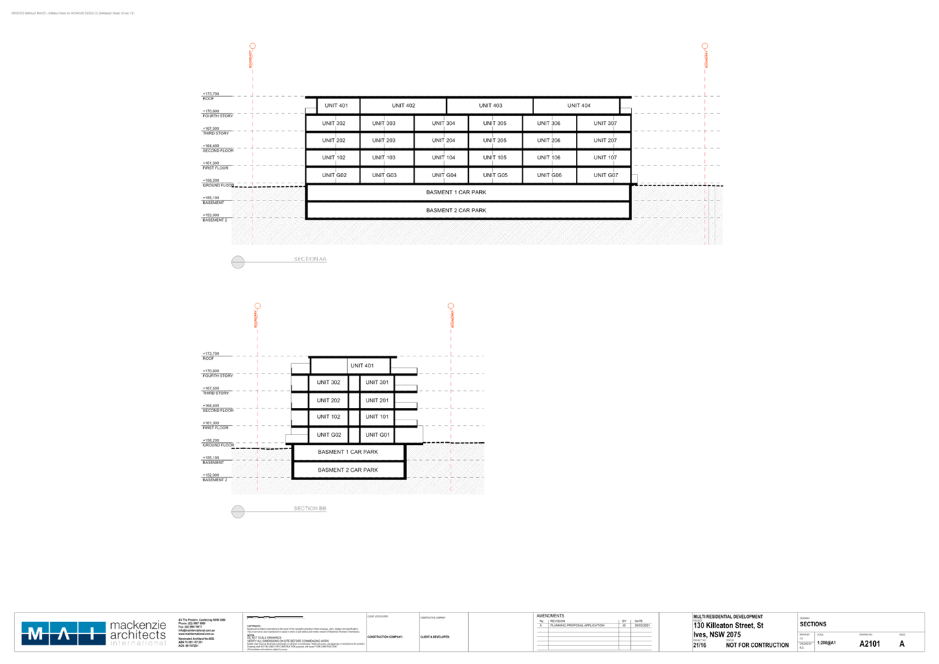
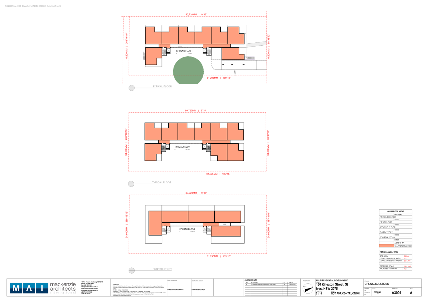
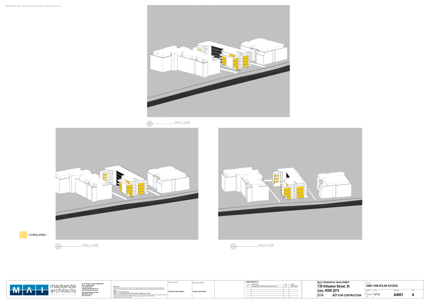
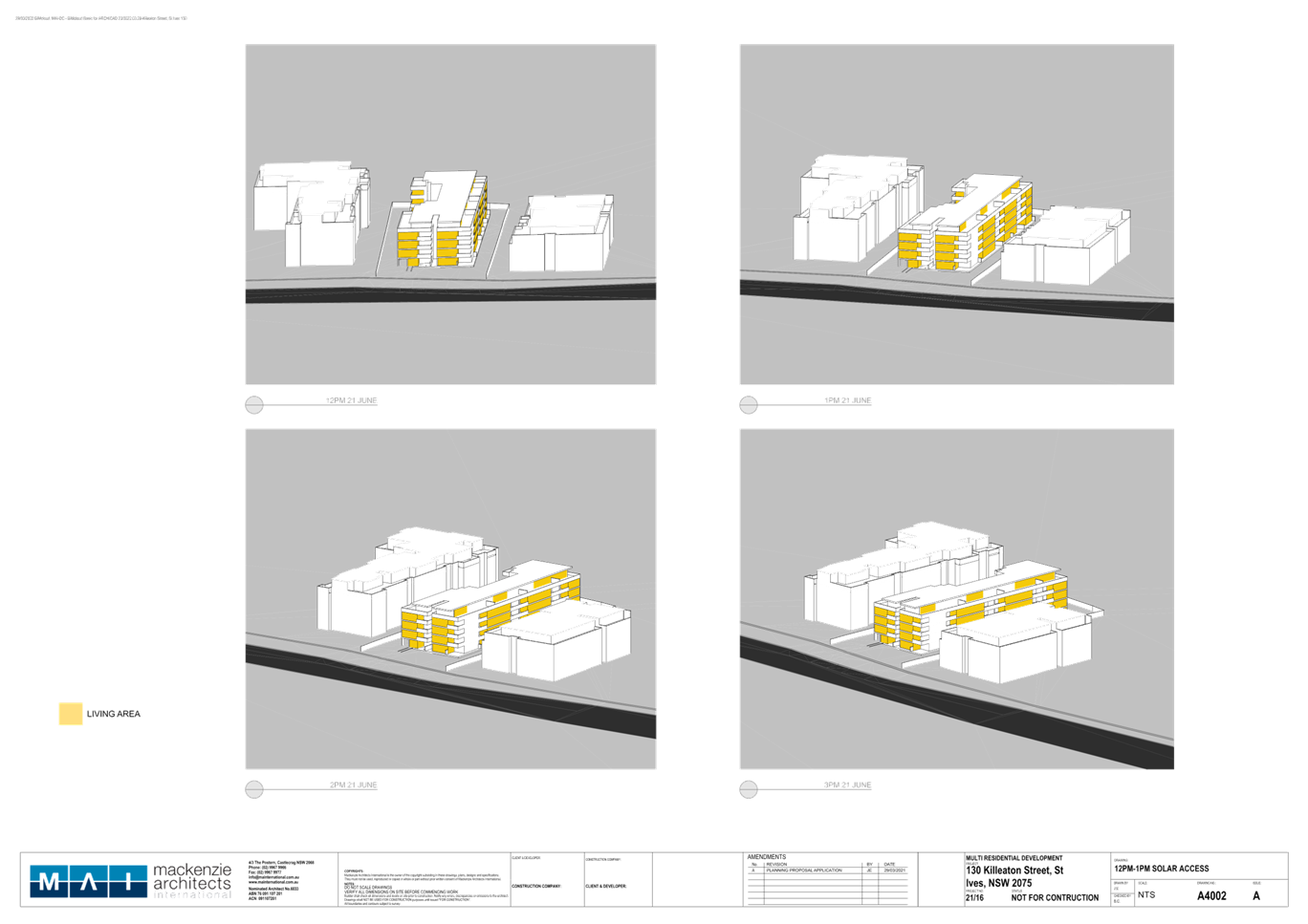
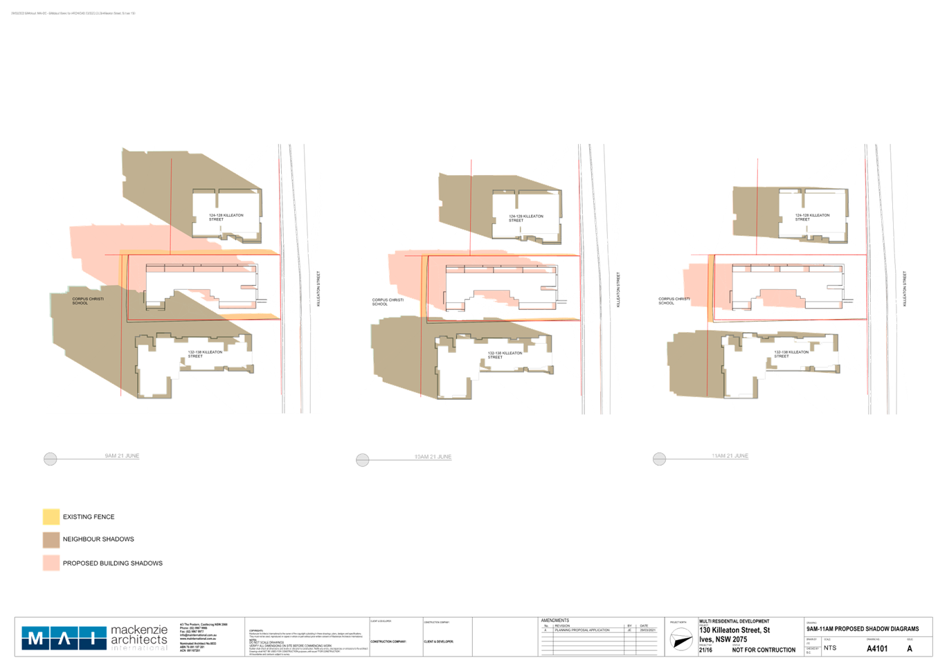
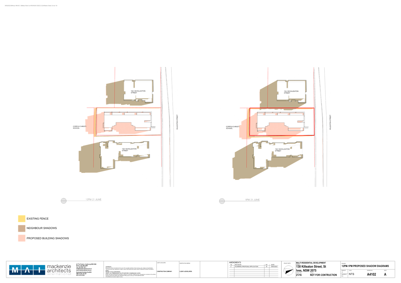
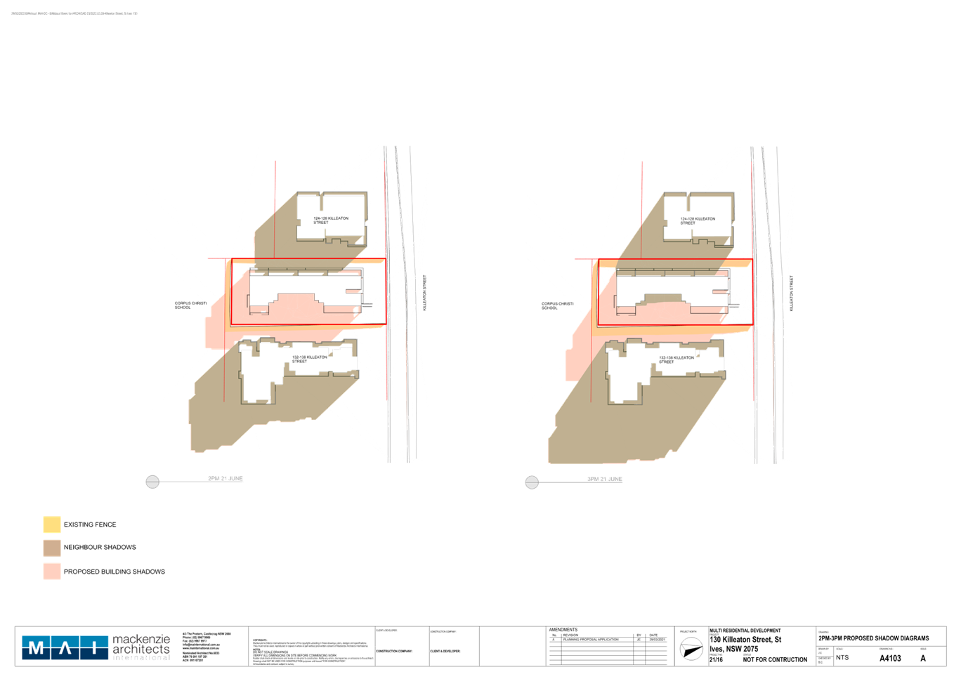
|
ATTACHMENT
No: 6 - Updated
Biodiversity Impact Assessment
|
|
Item No: GB.5
|
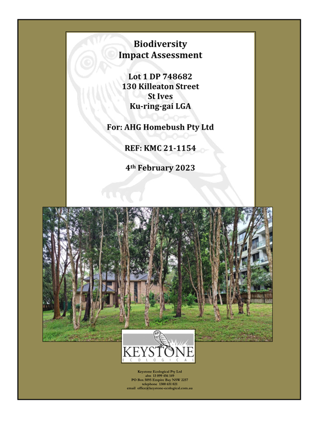
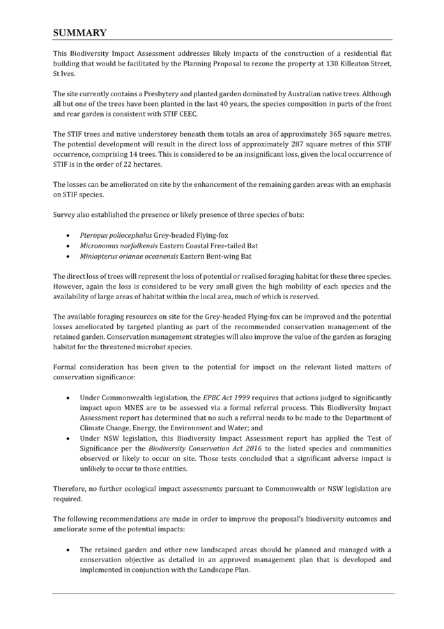
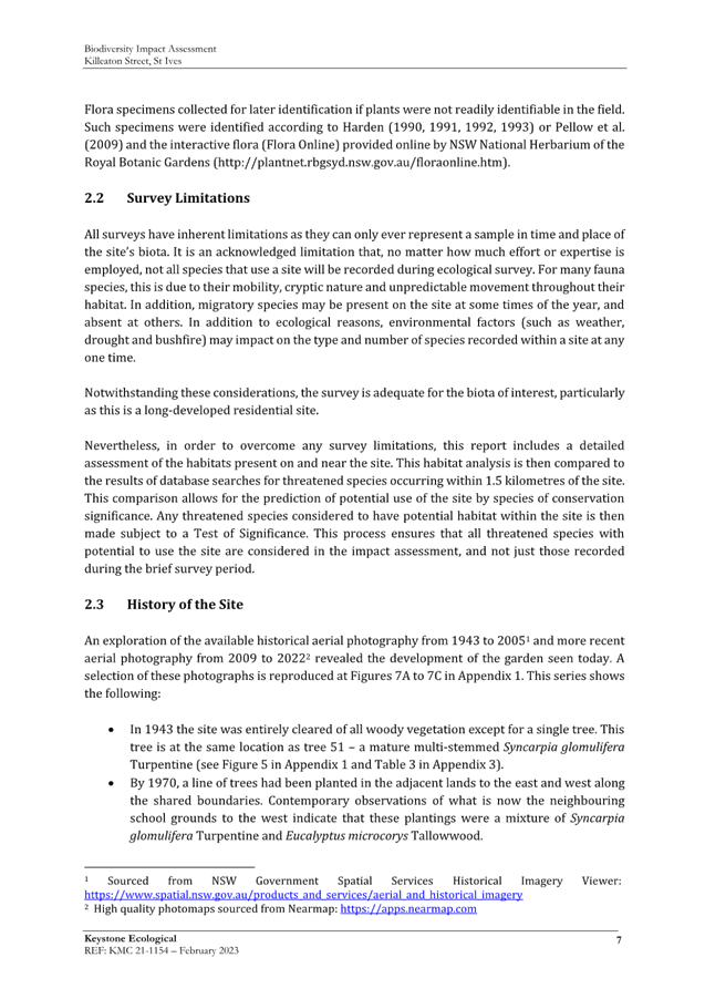
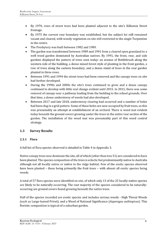
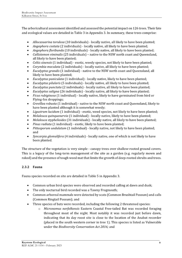
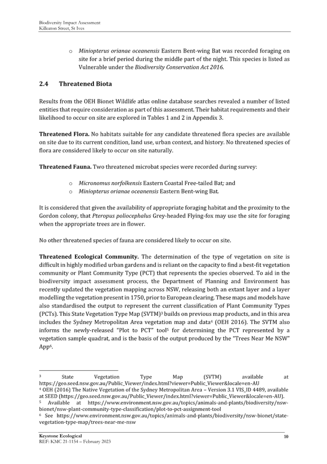



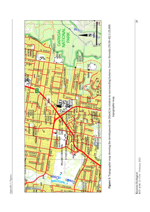
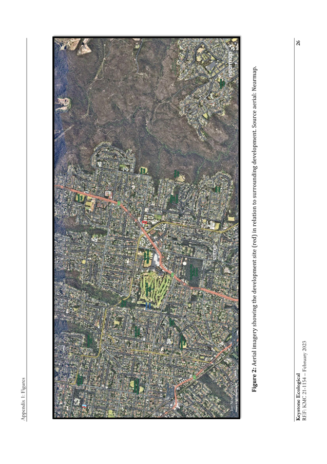
|
ATTACHMENT
No: 9 - Updated
Arborist Report
|
|
Item No: GB.5
|
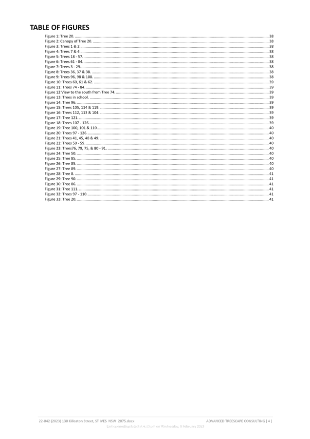
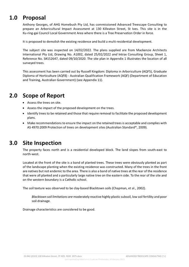
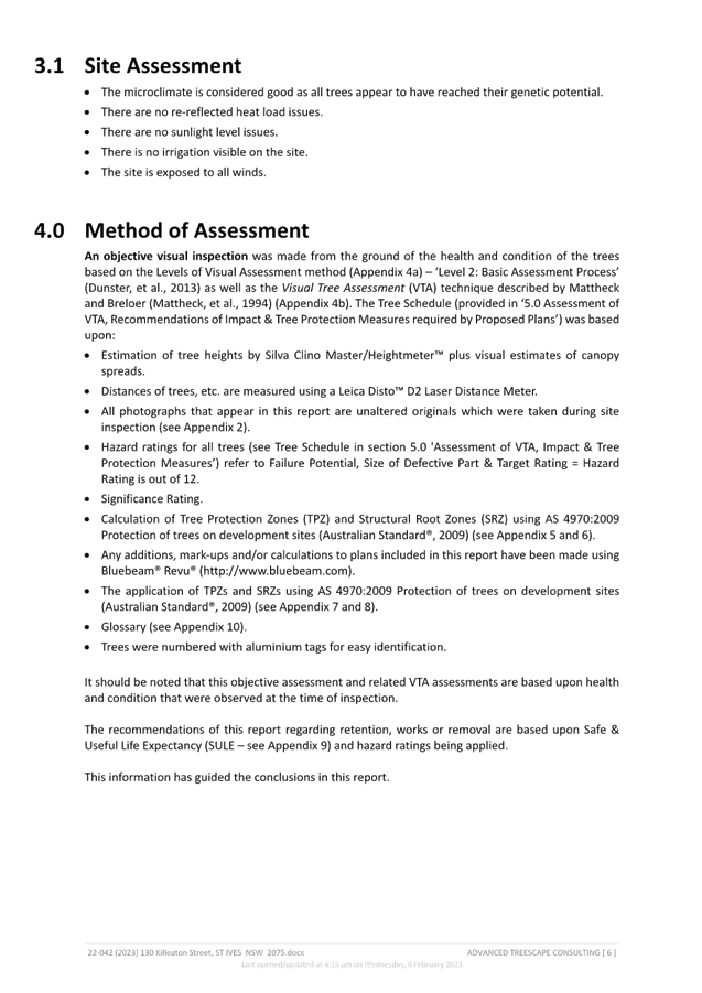
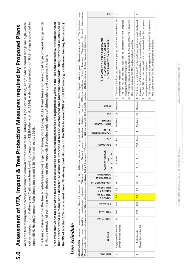
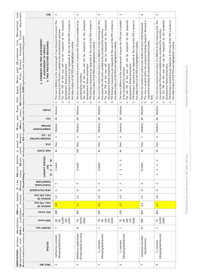
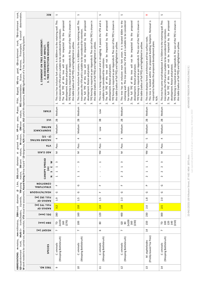
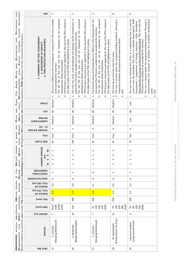
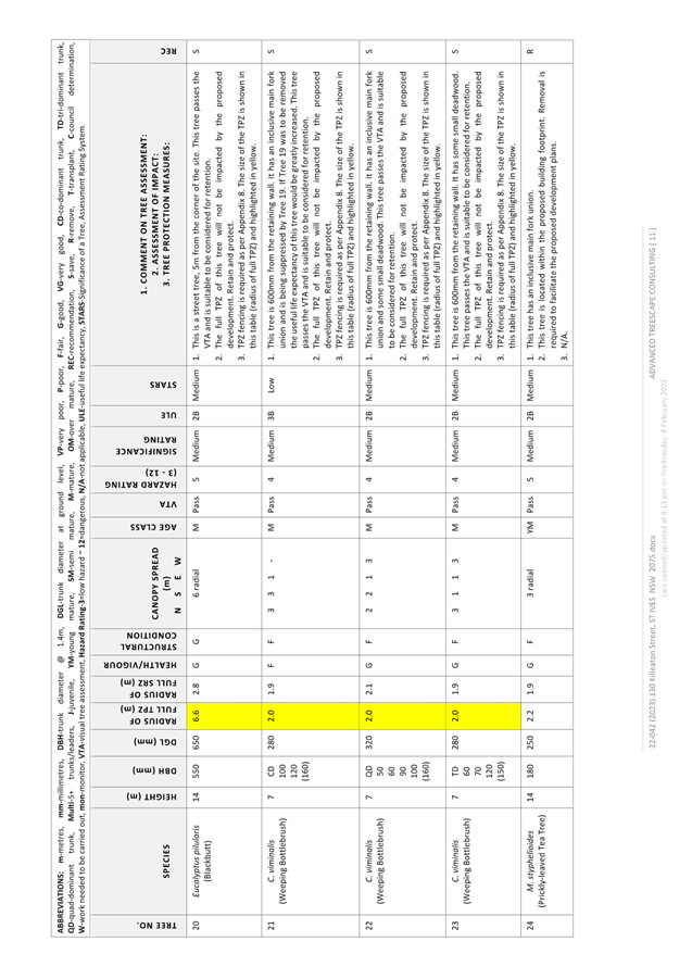
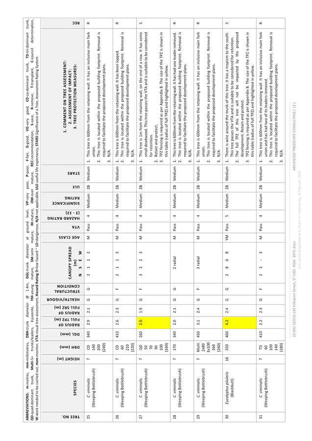
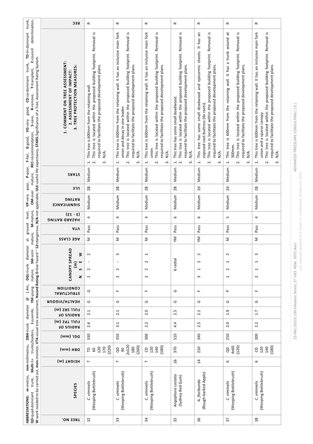
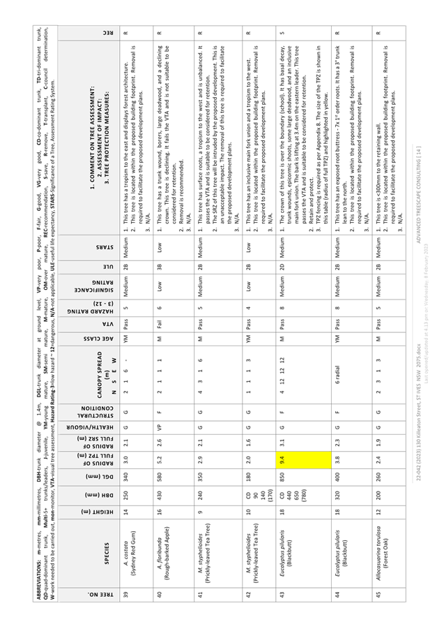
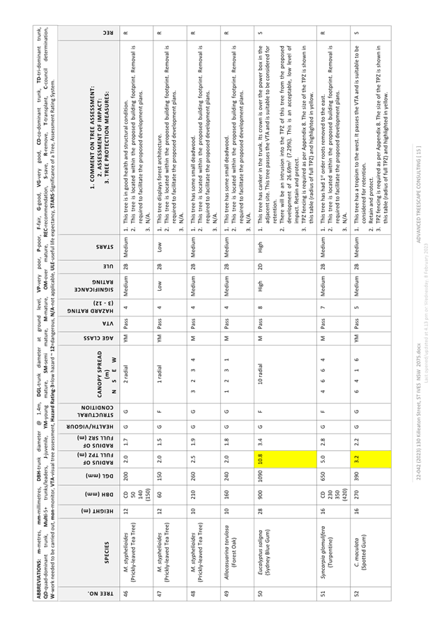
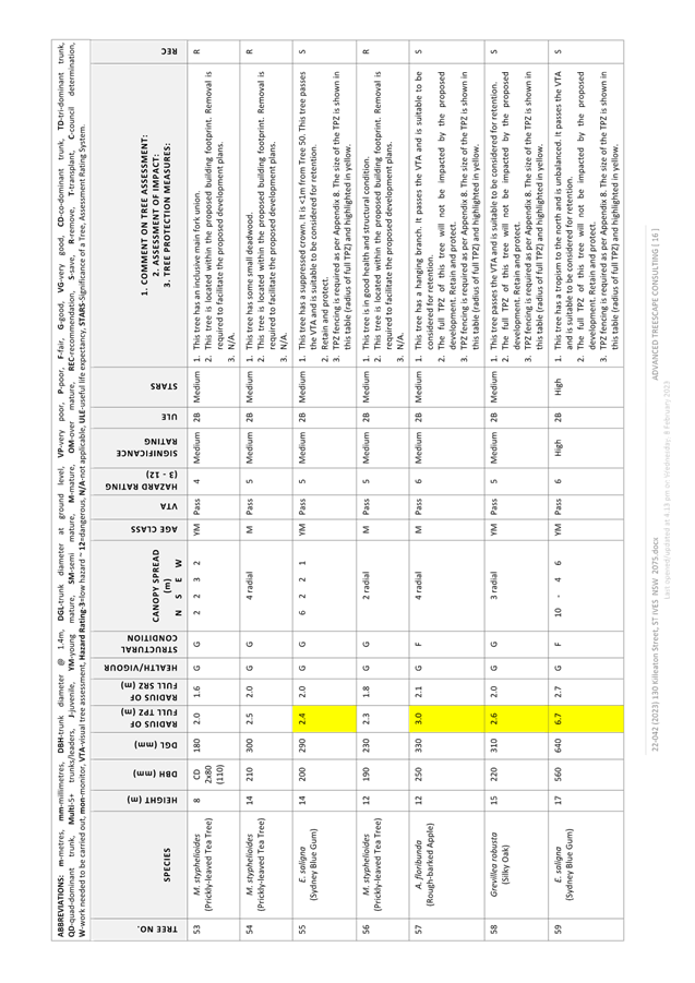
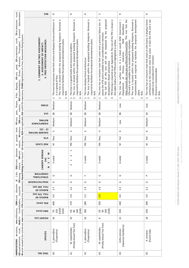
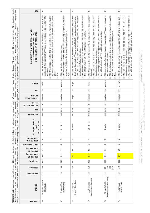
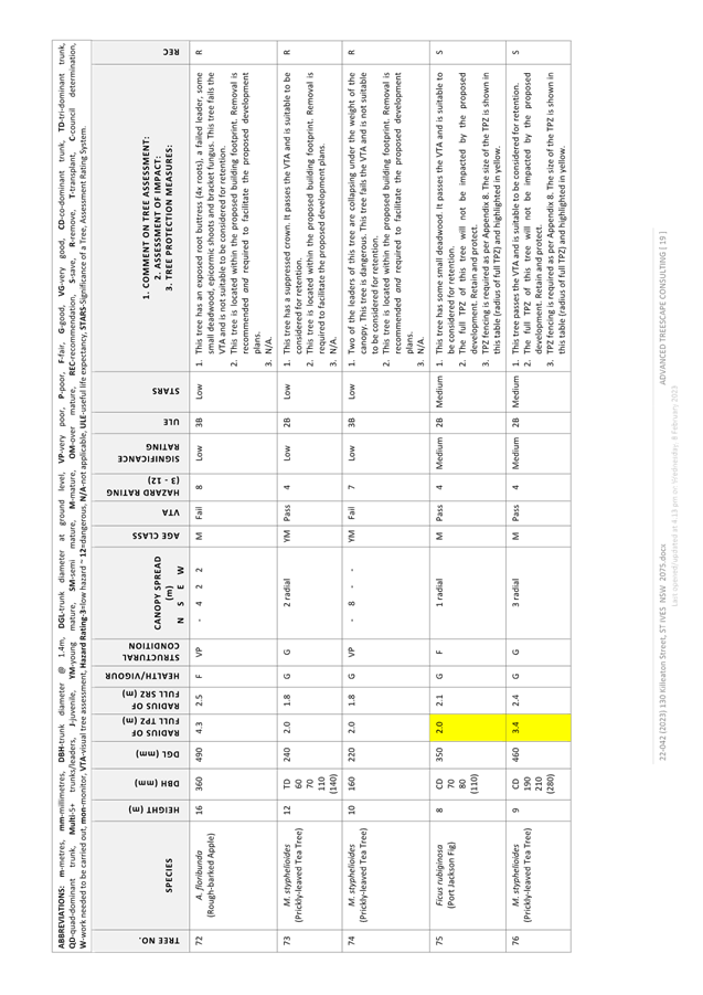
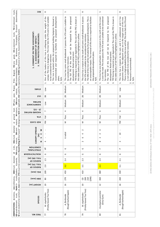
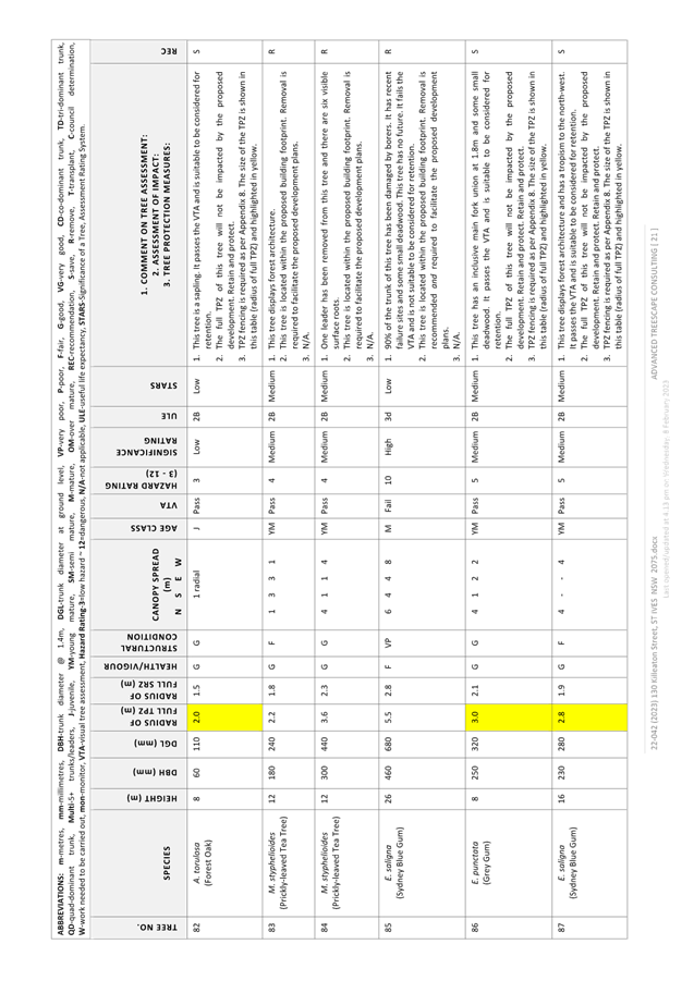
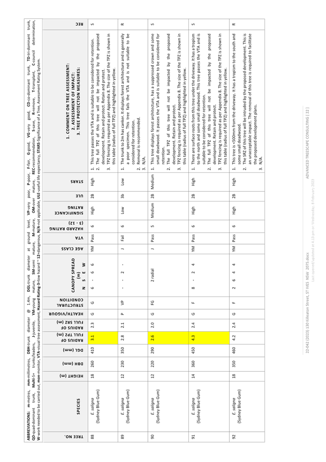
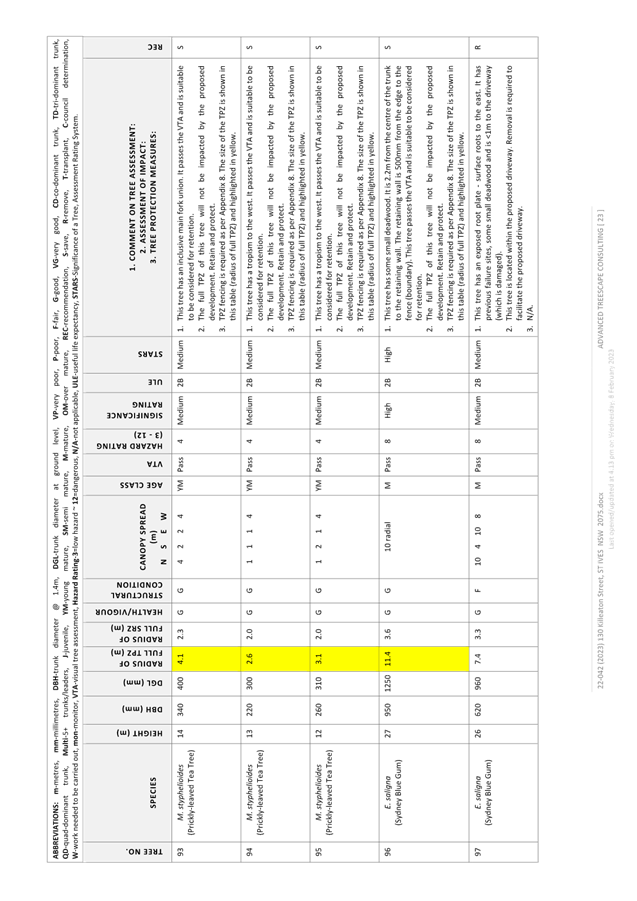
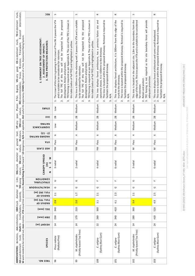
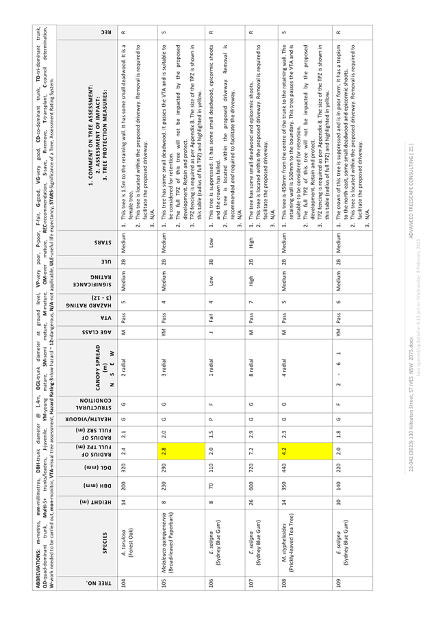
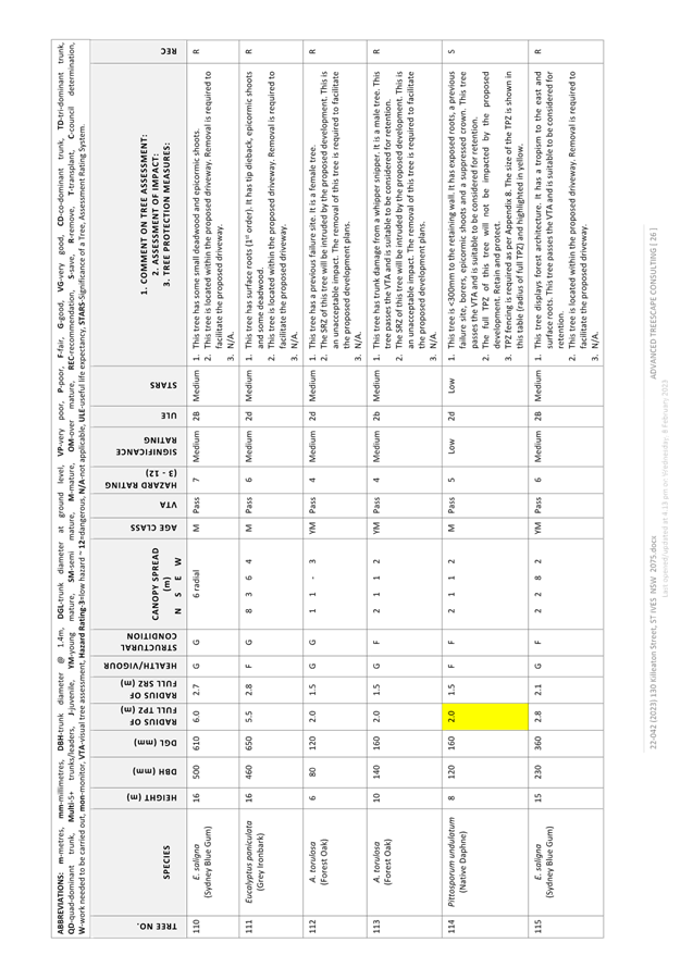
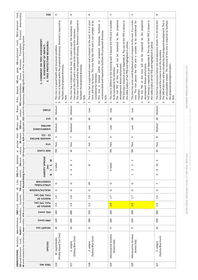
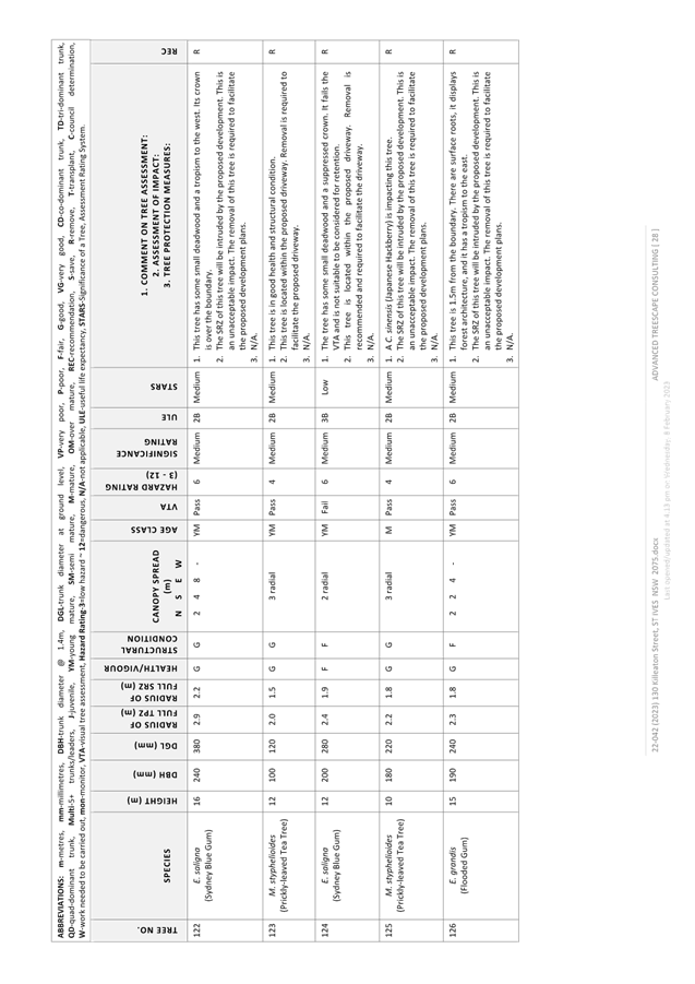
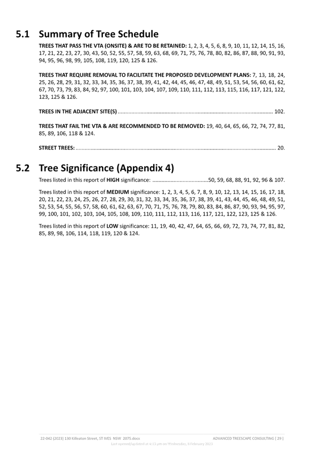
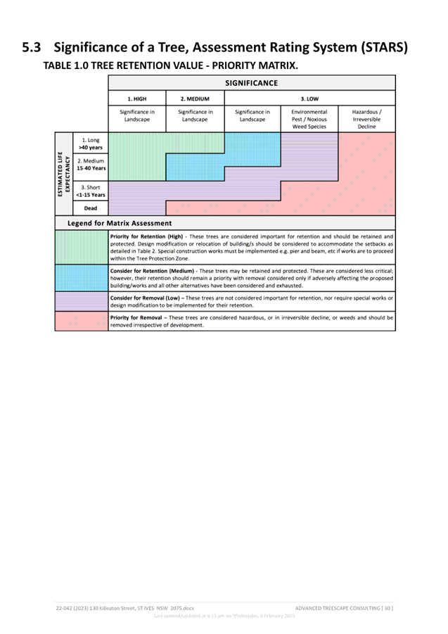
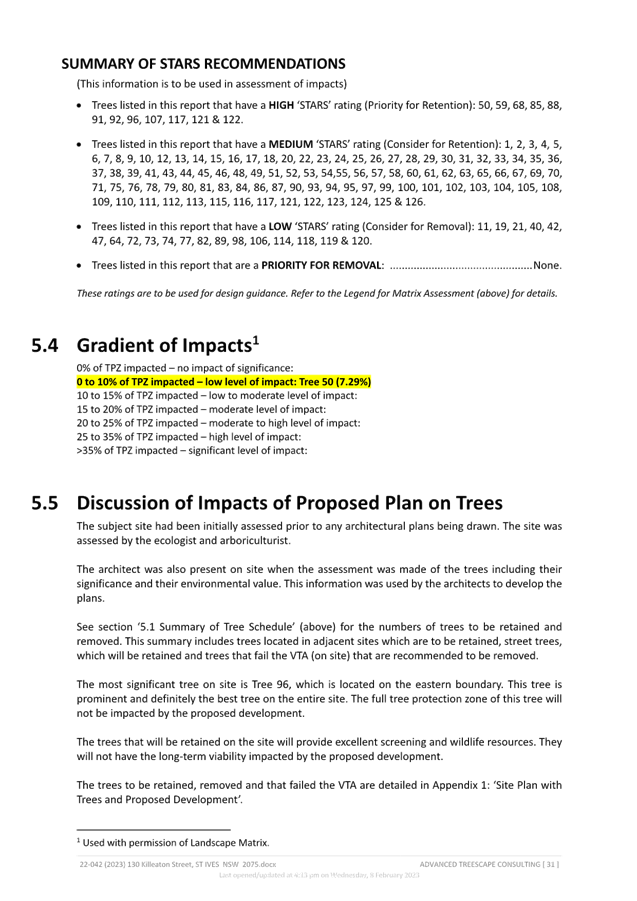
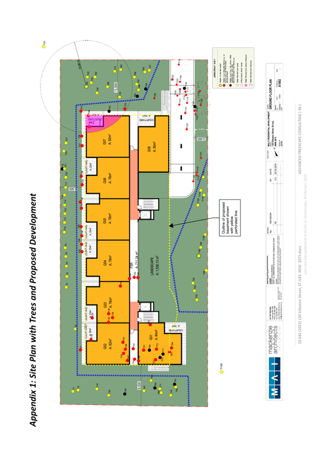
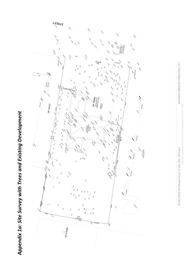
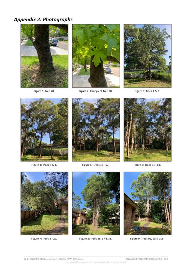
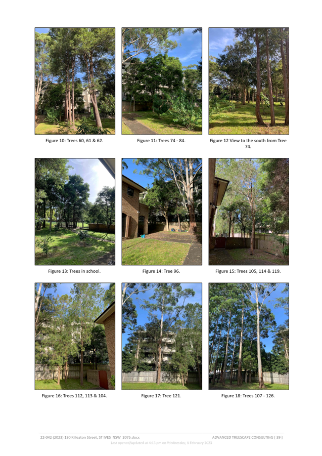
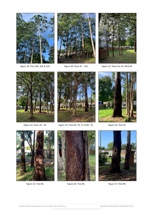
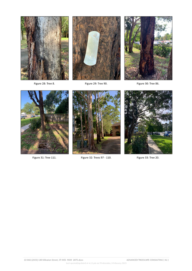
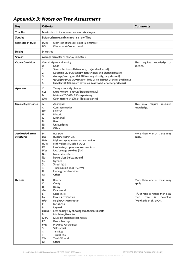
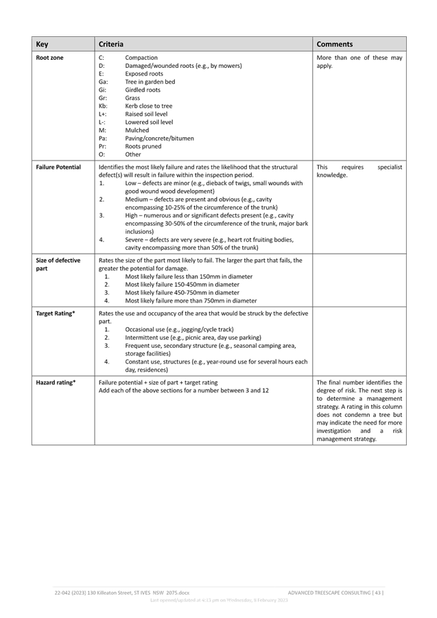
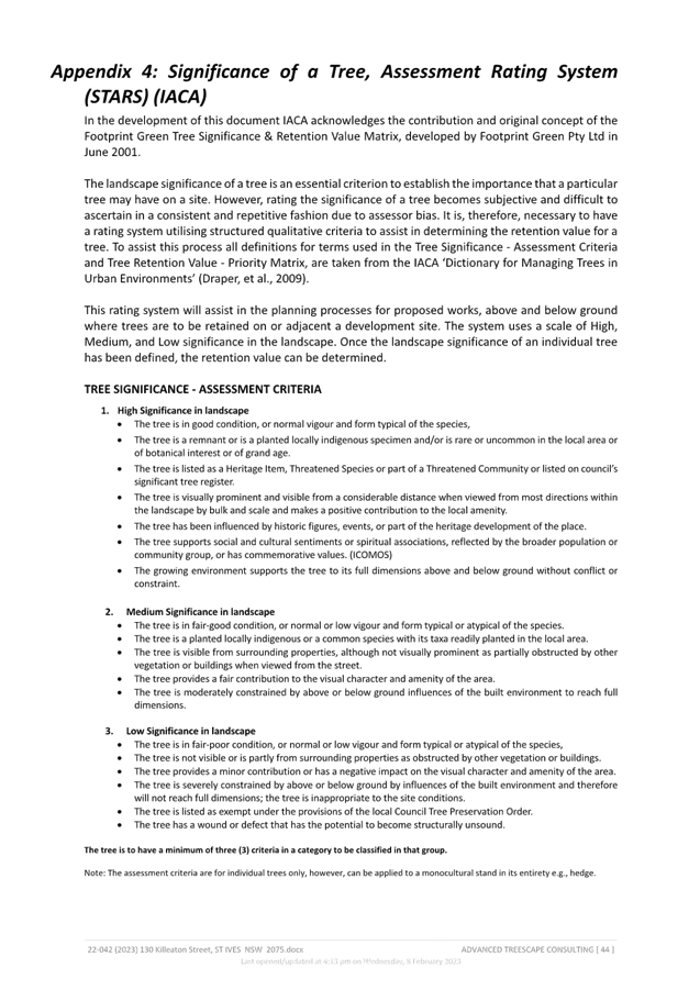
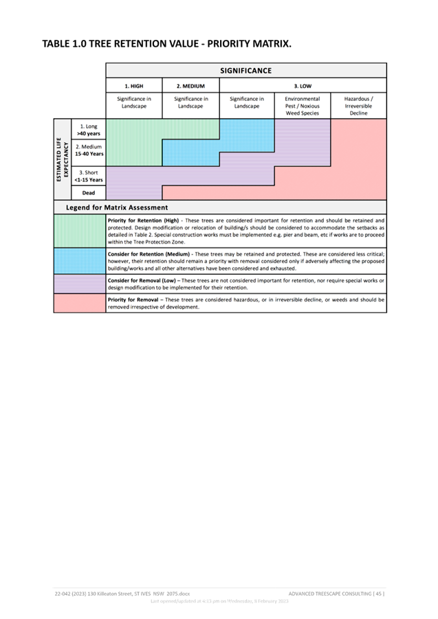
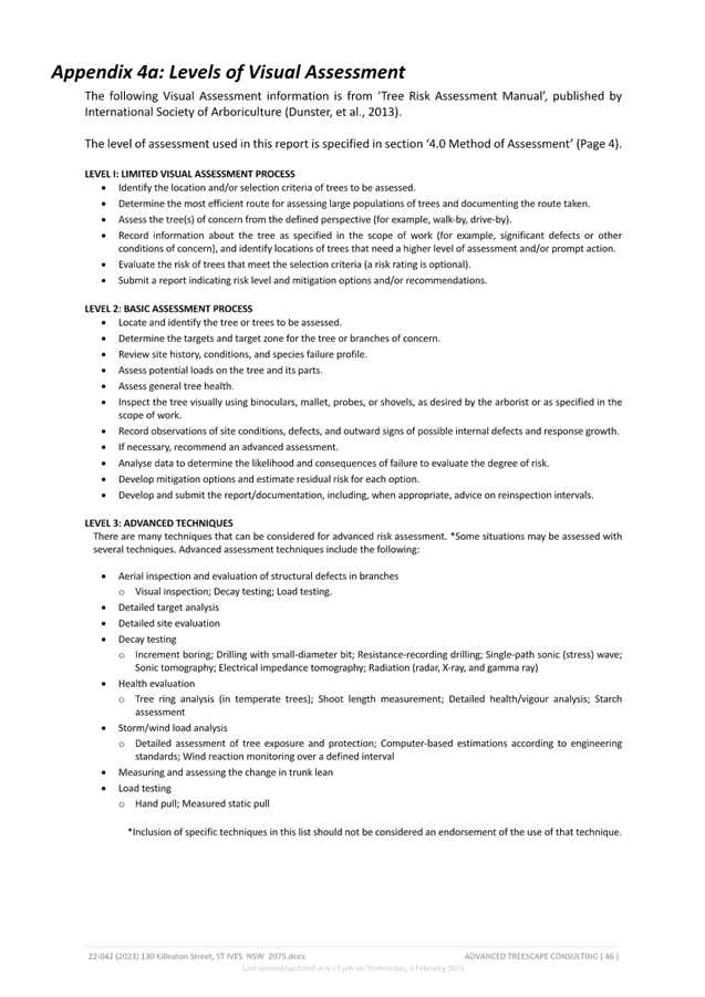
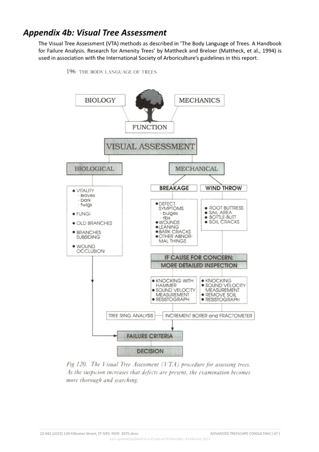
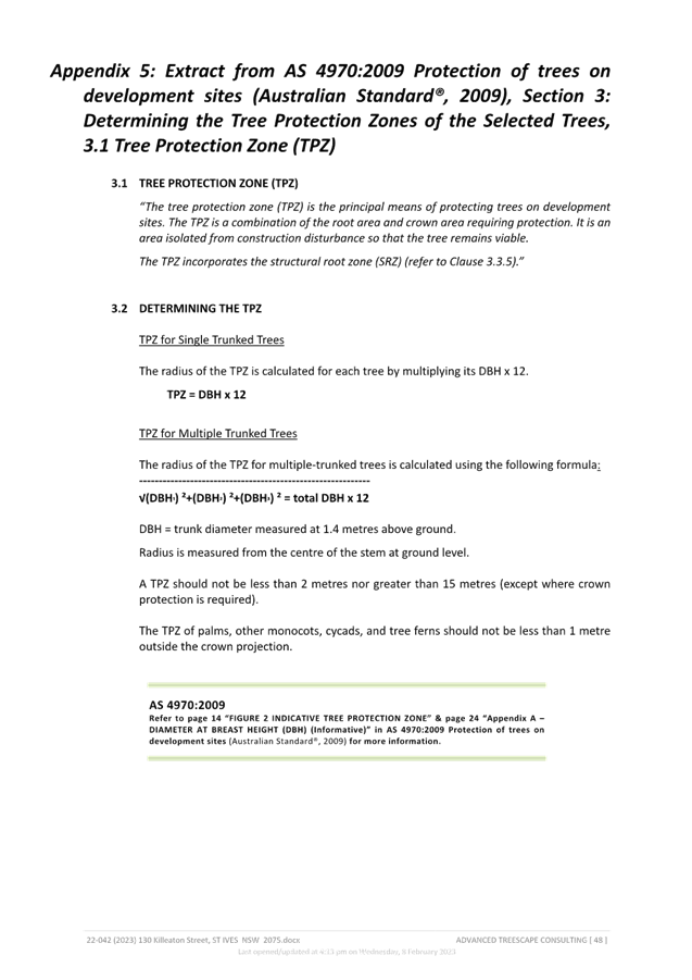
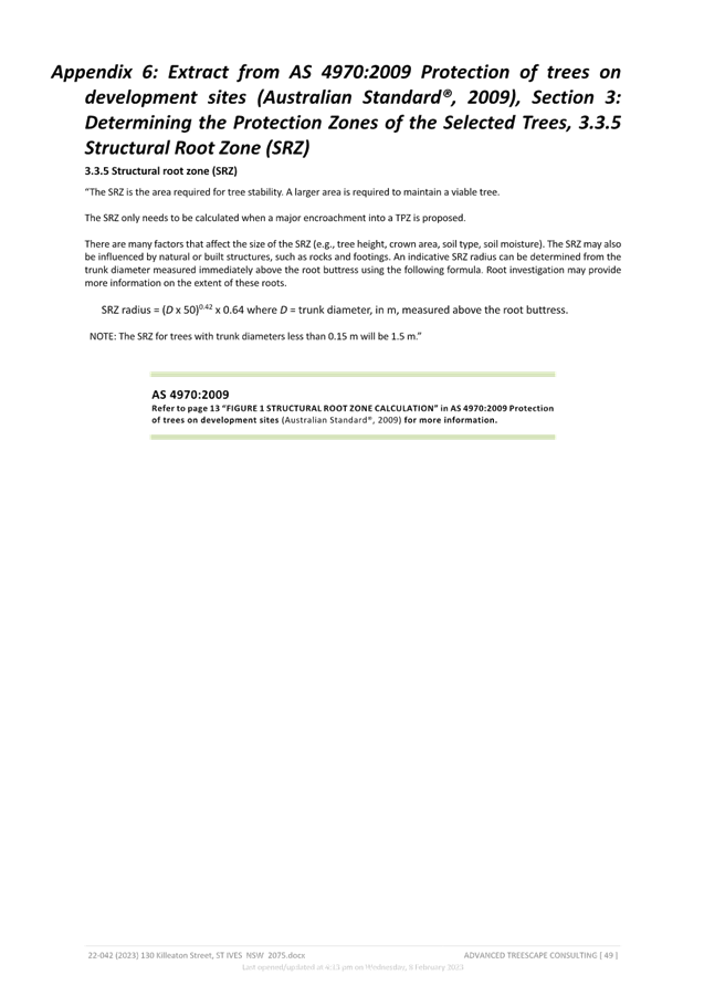
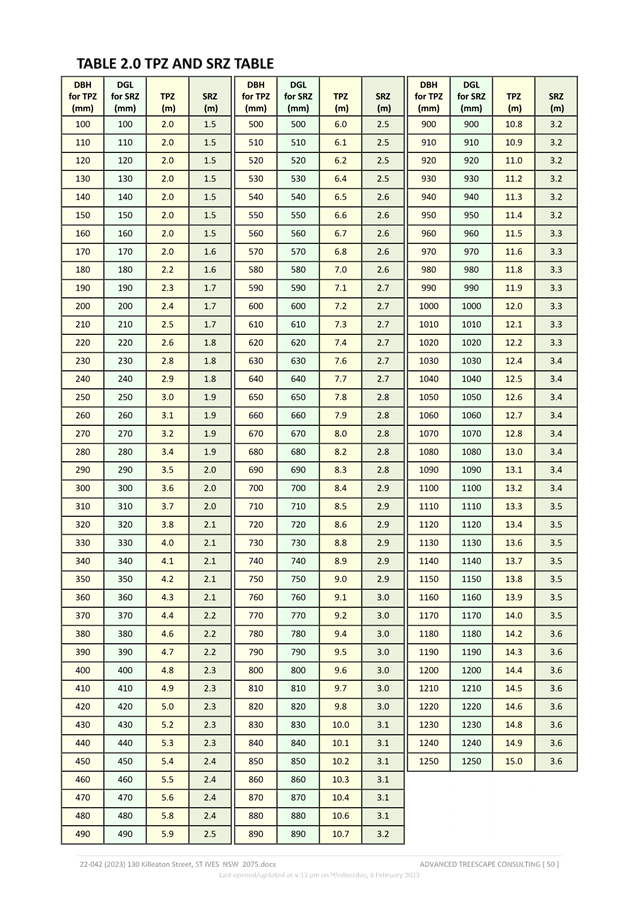
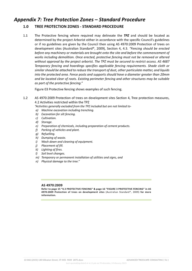
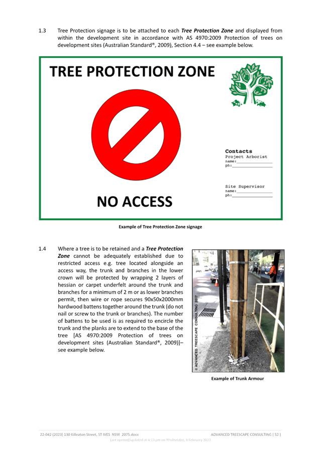
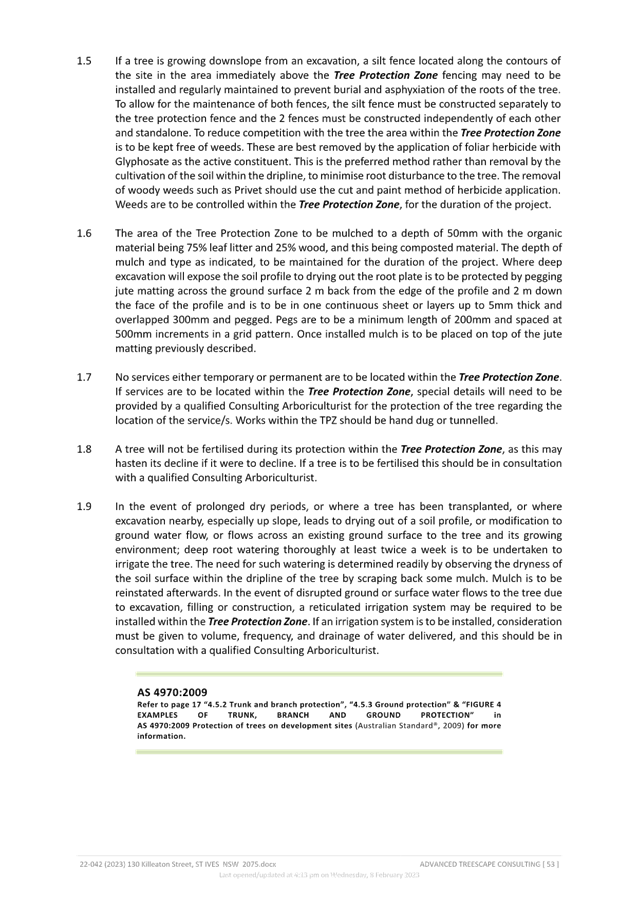
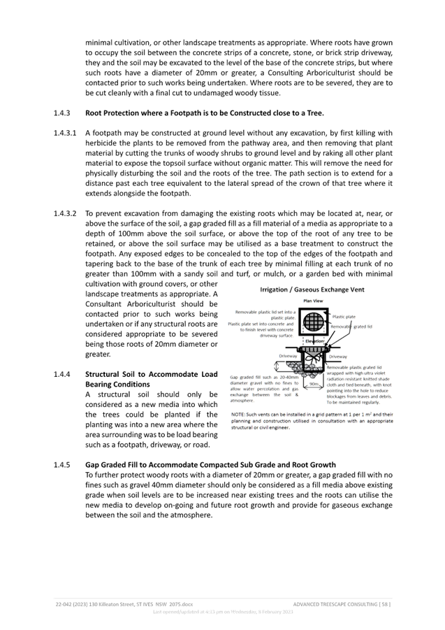
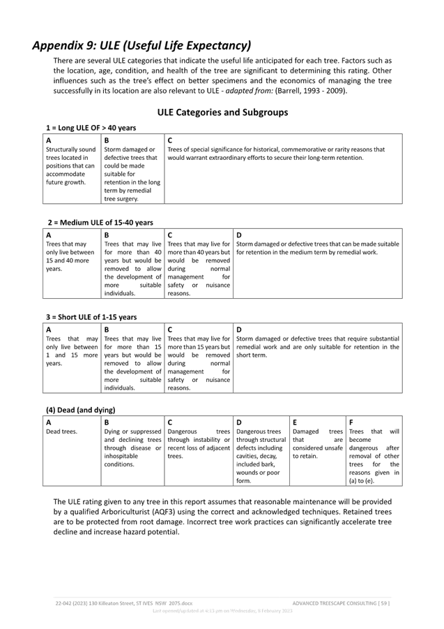
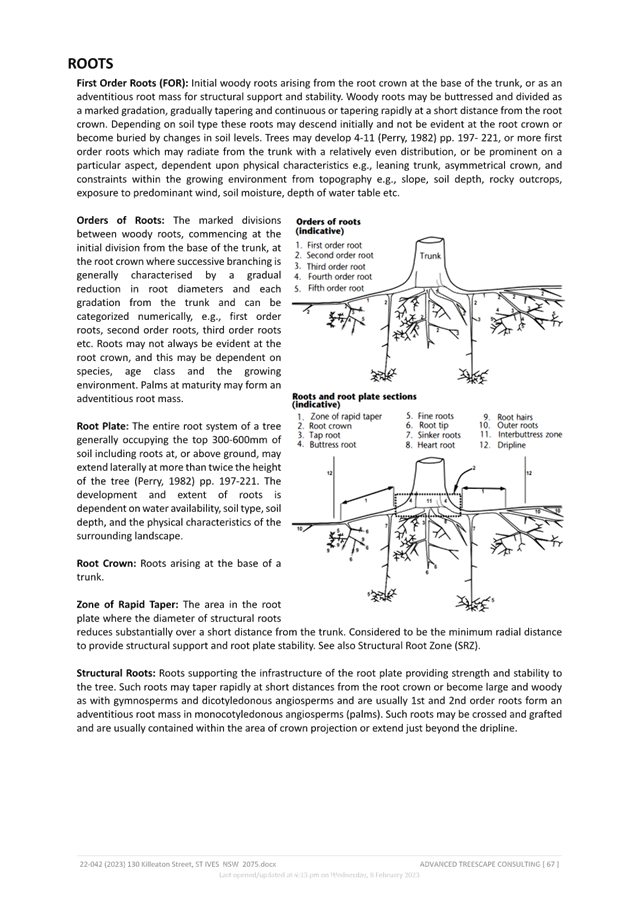
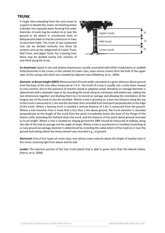
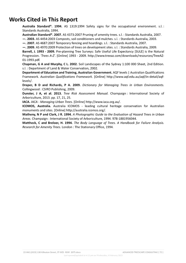
|
ATTACHMENT
No: 10 - Updated
Table of Assessment
|
|
Item No: GB.5
|
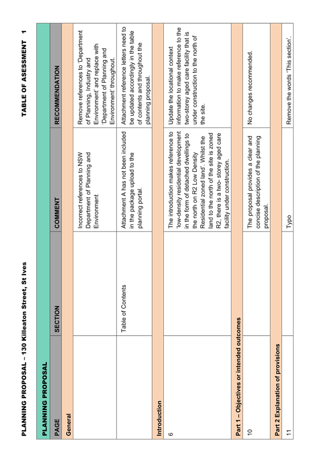
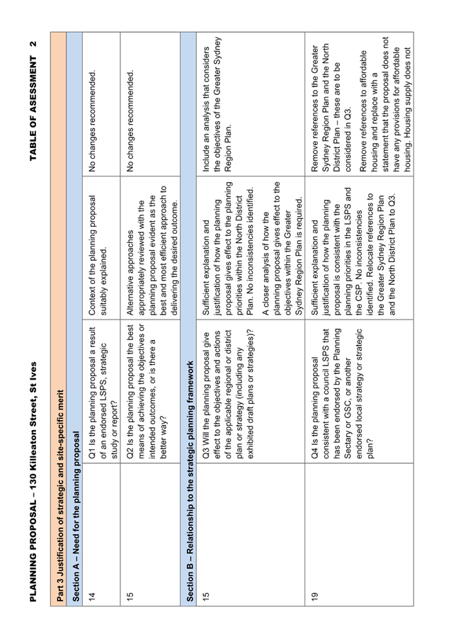
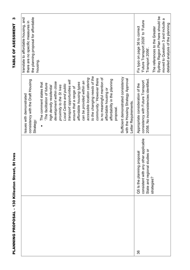
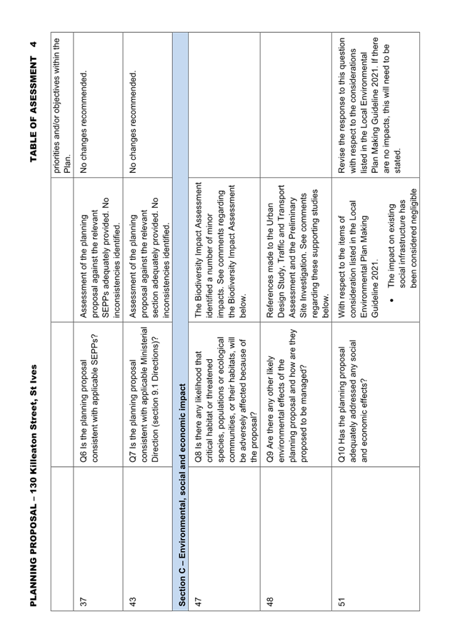
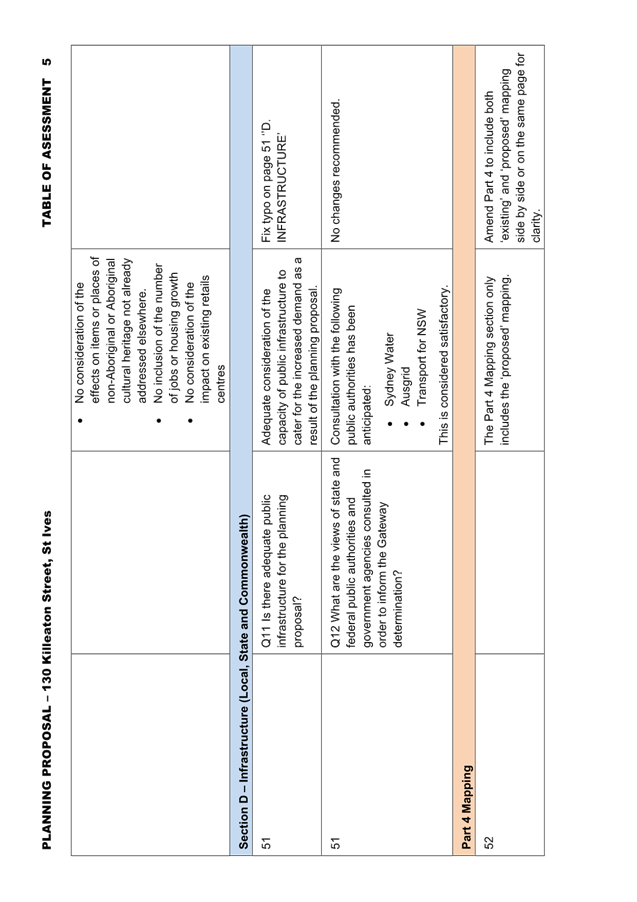
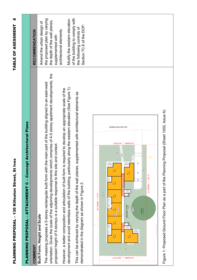
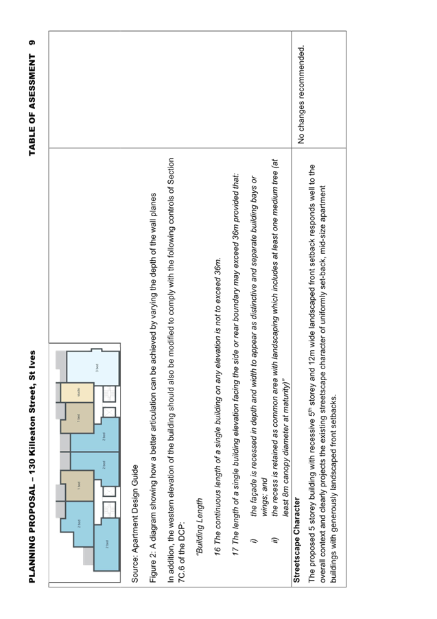
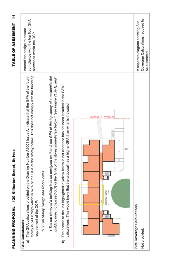
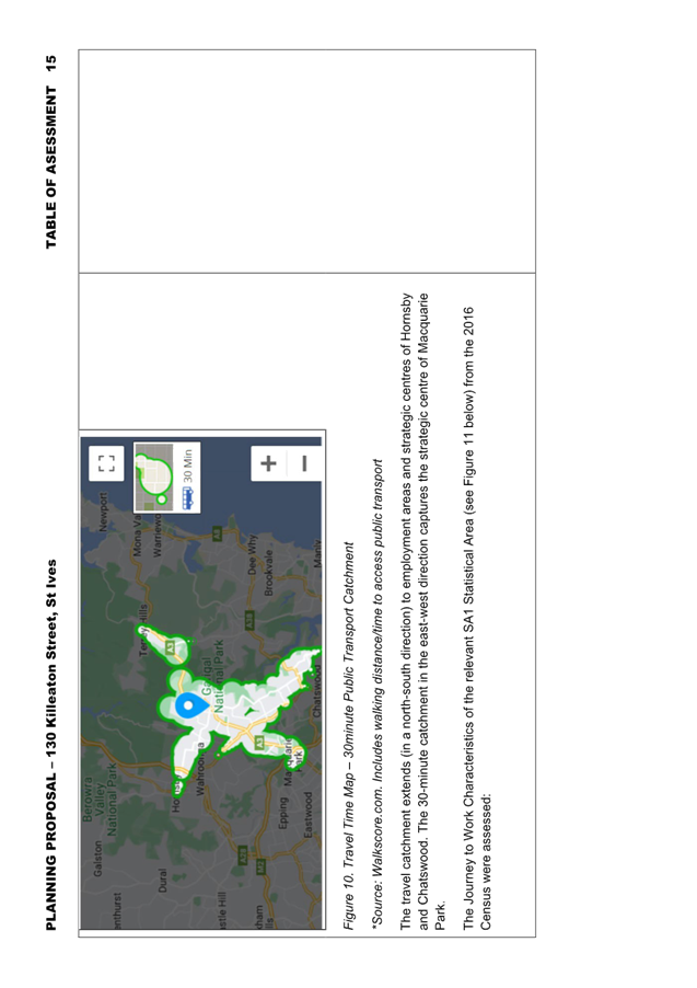
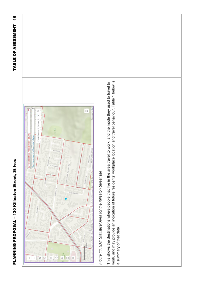
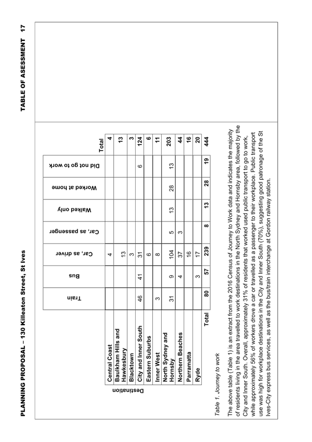
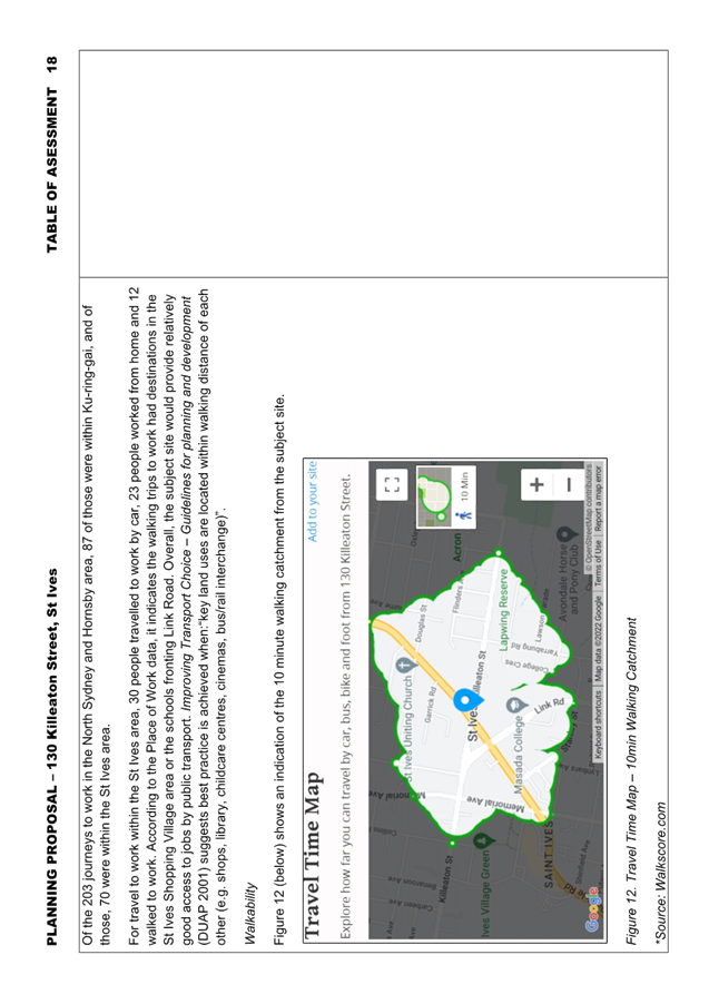
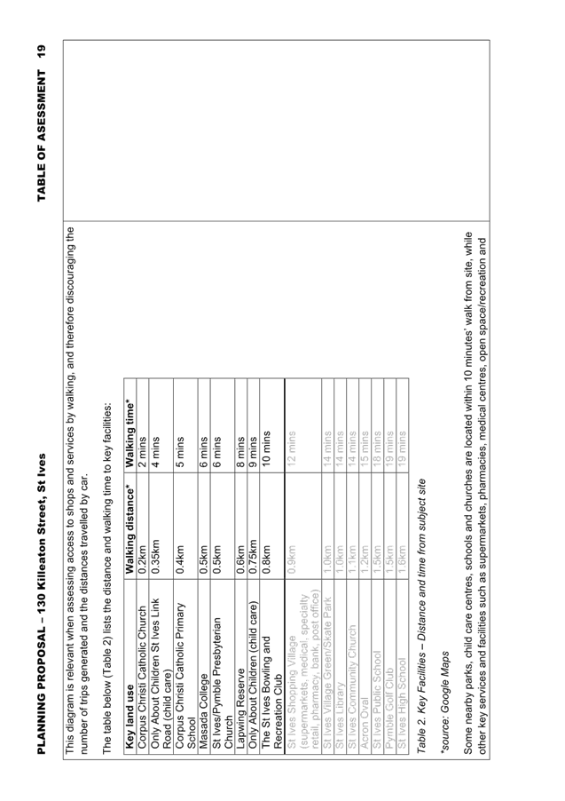
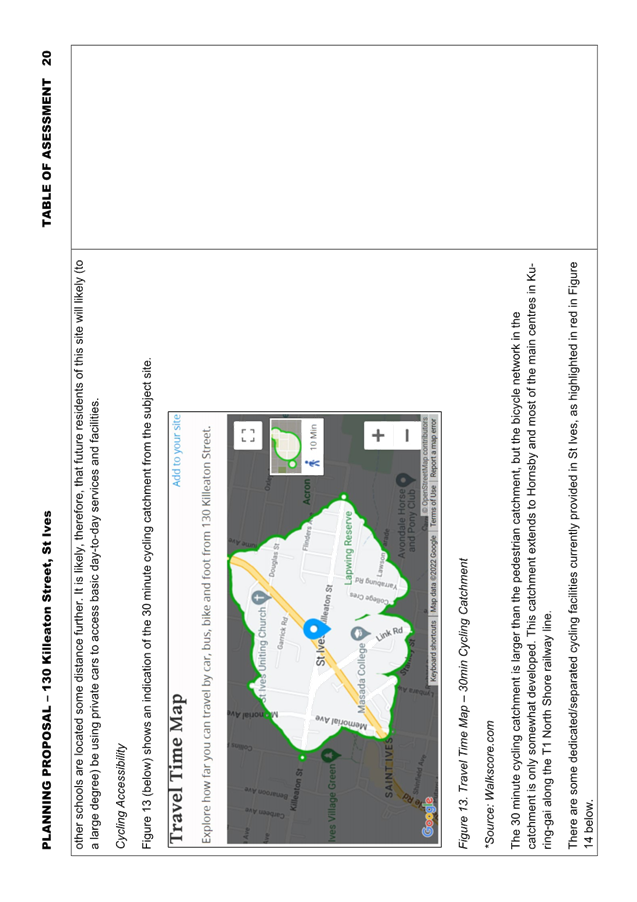
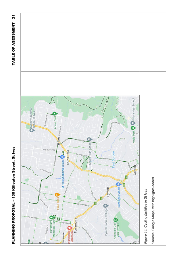
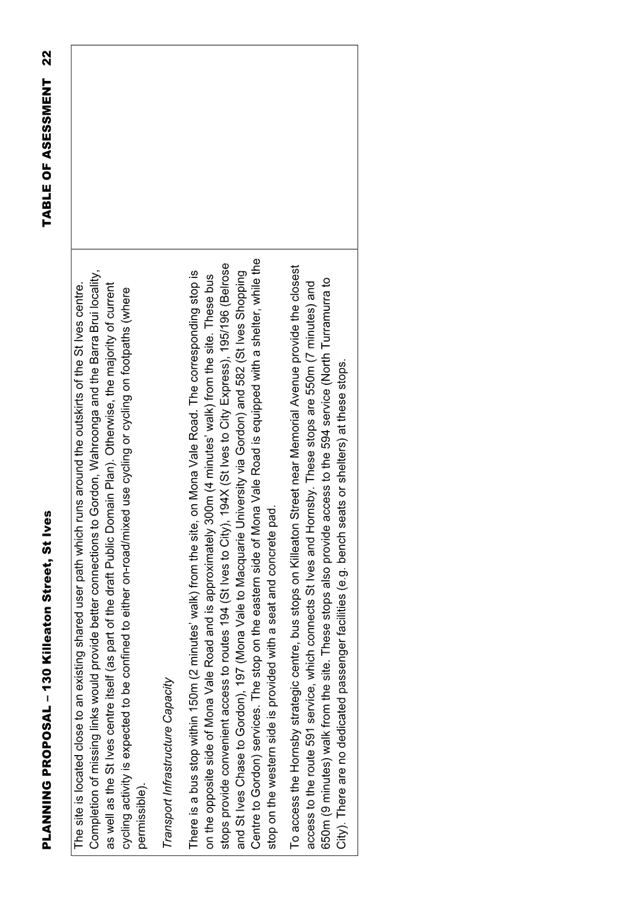
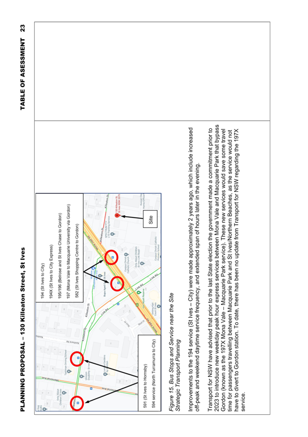

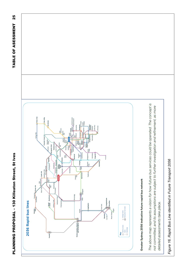
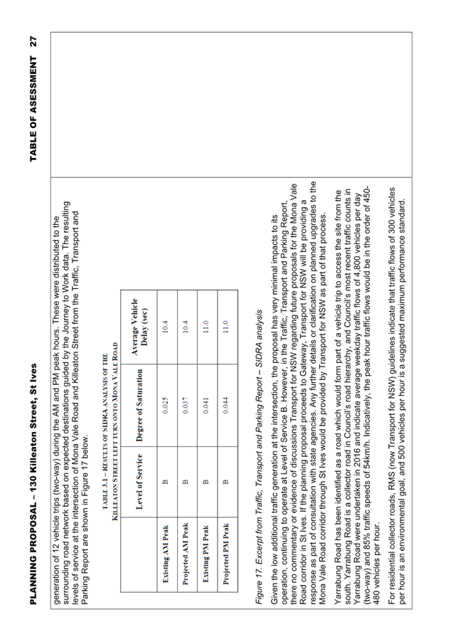

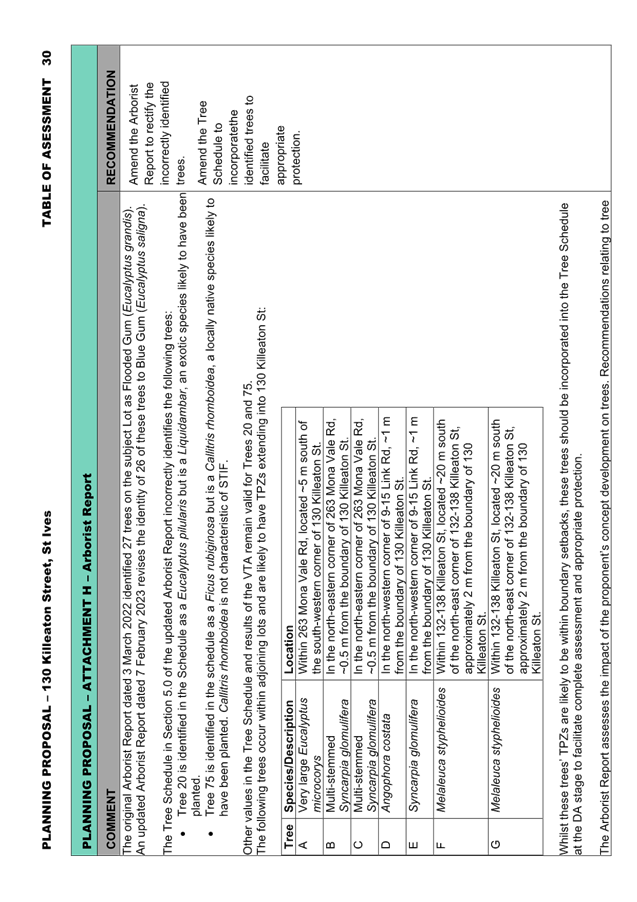

|
ATTACHMENT
No: 11 - Proposed
Terrestrial Biodiversity Map
|
|
Item No: GB.5
|
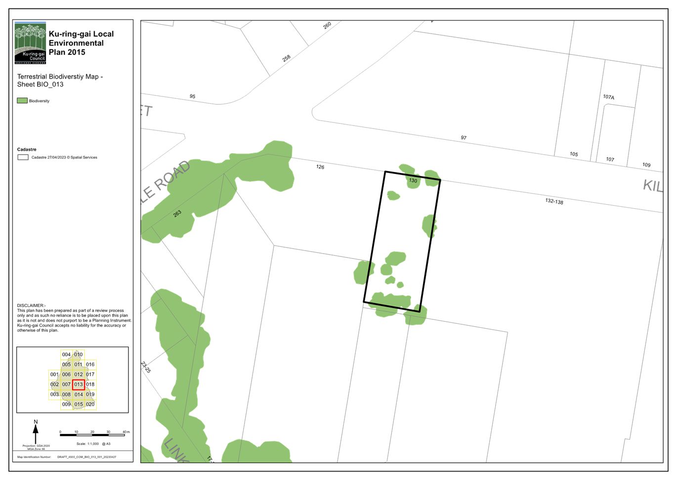
|
ATTACHMENT No: 12 - Proposed
Greenweb Map
|
|
Item No: GB.5
|
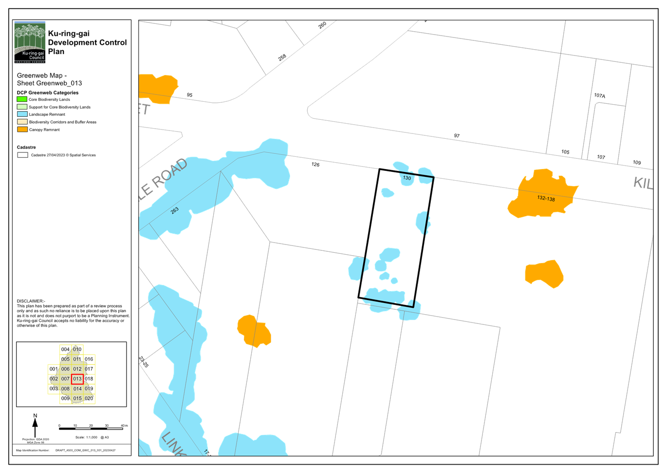
|
ATTACHMENT No: 13 - Ku-ring-gai
Local Planning Panel Advice - 19 September 2022
|
|
Item No: GB.5
|
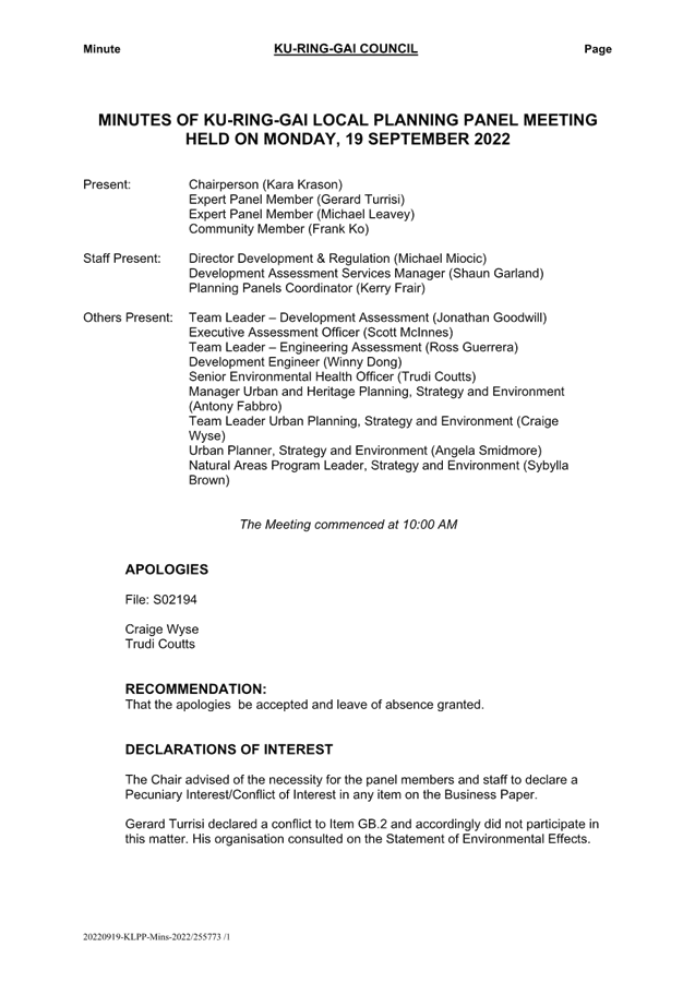
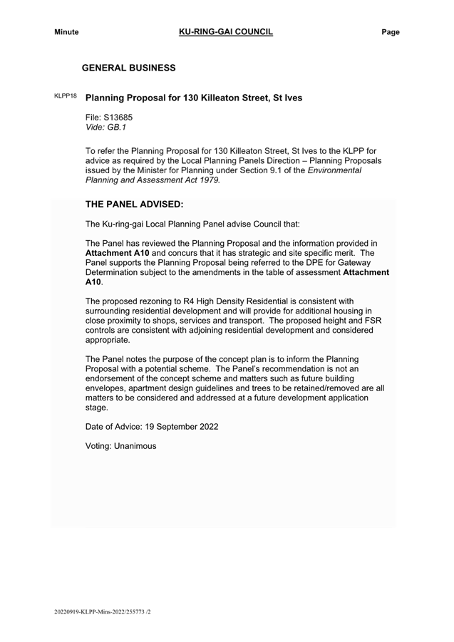
|
ATTACHMENT
No: 14 - Planning
Proposal Process Flowchart
|
|
Item No: GB.5
|
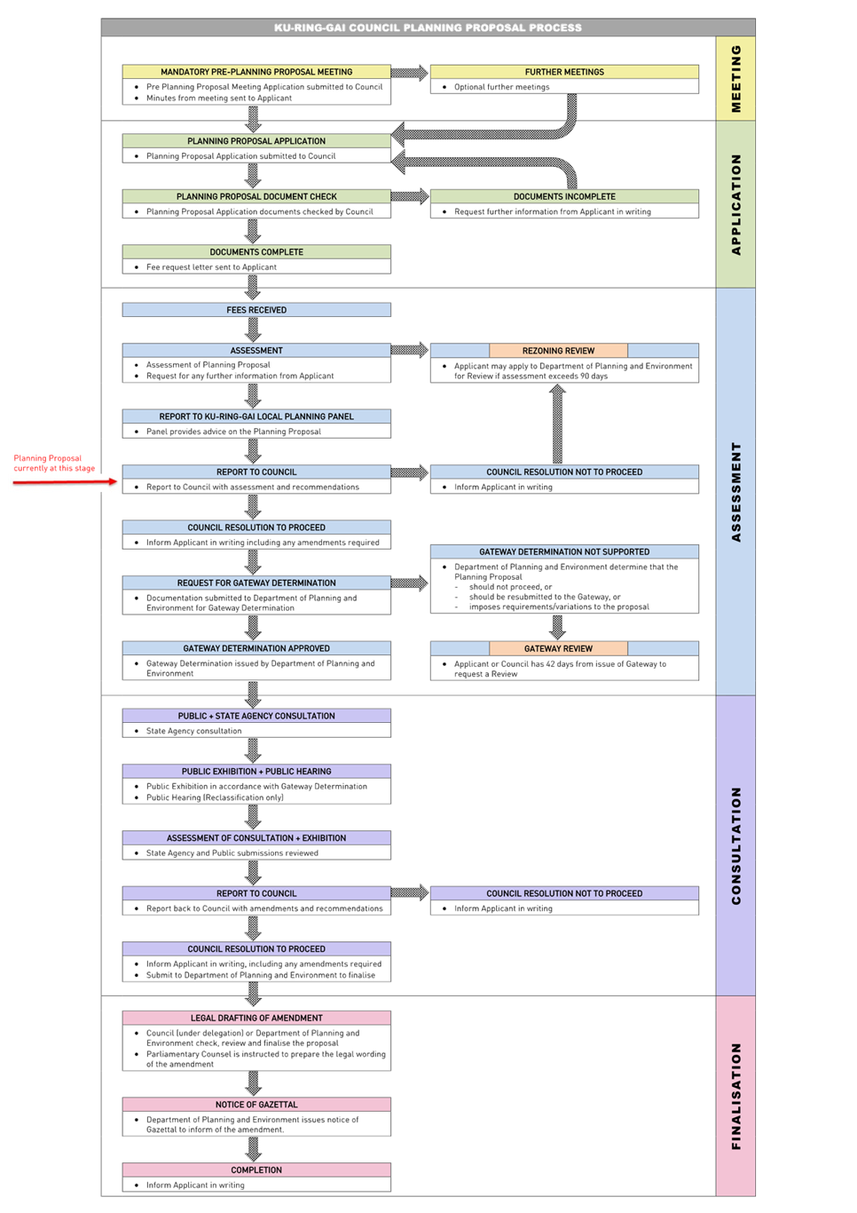
|
ATTACHMENT No: 15 - DPE
Letter - Notification of Zoning Review Request for 130 Killeaton Street St
Ives
|
|
Item No: GB.5
|
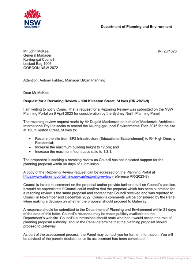
|
Ordinary
Meeting of Council - 16 May 2023
|
GB.6 / 1
|
|
|
|
|
Item
GB.6
|
S12645
|
Planning Proposal for 4, 12 & 14
Cowan Road, St Ives - Pymble Golf Club
EXECUTIVE
SUMMARY
|
purpose of report:
|
For Council to consider the
private Planning Proposal that has been lodged for 4, 12 & 14 Cowan
Road, St Ives (Pymble Golf Club).
|
|
|
|
|
background:
|
A formal pre-Planning Proposal meeting was held on
15 May 2018.
The Planning Proposal was
submitted in January 2020, however, was incomplete. Following the submission
of revised documentation and payment of fees, the assessment of the Planning
Proposal formally commenced in April 2020.
The Planning Proposal was
referred to the Ku-ring-gai Local Planning Panel on 24 April 2023 for advice.
|
|
|
|
|
comments:
|
The Planning Proposal seeks to amend the Ku-ring-gai
Local Environmental Plan 2015 (KLEP 2015):
· Rezone
part of the Pymble Golf Club land holdings to R4 High Density Residential and
extend part of the RE2 Private Recreation Zone;
· amend
the Height of Buildings Map to a combination of 11.5, 14.5 and 17.5 metres,
to enable residential flat development 3-5 storeys in height;
· amend
Floor Space Ratio Map for the R4 High Density Residential Zoned land to show
a maximum of 0.92:1;
· amend
the Heritage Map and Schedule 5 Environmental Heritage to heritage list 12
and 14 Cowan Road.
|
|
|
|
|
recommendation:
|
That the Planning Proposal, as
amended by this report, be submitted to the Department of Planning and
Environment for a Gateway Determination.
|
Purpose of Report
For Council to consider the private Planning Proposal that
has been lodged for 4, 12 & 14 Cowan Road, St Ives (Pymble Golf Club).
Background
A formal pre-Planning Proposal meeting was held on 15 May
2018 (Attachment A1). The Planning Proposal was submitted in January
2020. The Planning Proposal was incomplete. Following the submission of revised
documentation and payment of fees, the assessment of the Planning Proposal
formally commenced in April 2020.
Throughout the assessment process, the Planning Proposal has
been updated by the proponent in accordance with advice provided by Council
officers throughout 2020-2022.
The Planning Proposal is included at Attachment A2
and the appendices to the Planning Proposal are included at Attachments
A3-A10.
Site
Description and Local Context
The site that is the subject of the Planning Proposal is
located at 4, 12 and 14 Cowan Road, St Ives. The legal description of the site
is part Lot 1 DP 511821, Lot B DP 368565, and Lot 1 DP 531533, Lot 2 DP
531533, Lot 3 DP 531533. It is noted that Lot 1 DP 102237 (part of the Club
land) is not affected by the proposal. The land that is the subject of this
Planning Proposal has an area of approximately 10,000m2 and is located immediately
adjacent to Cowan Road. The land comprises the existing club house, car park
and single storey timber cottages at 12 and 14 Cowan Road.
Part of the Pymble Golf Club site is within the St Ives
Local Centre. The centre comprises the St Ives Shopping Village zoned B2
Local Centre, the adjacent Village Green zoned RE1 Public Recreation, and
supporting residential land zoned R3 Medium Density Residential and R4 High
Density Residential. While the centre is generally characterised by low scale
development (2-3 storeys in height), the planning controls enable development
up to 17.5 metres (5 storeys) in height, including land directly opposite the
site’s frontage along Cowan Road. Several developments of this scale have
recently been constructed along Mona Vale Road. Part of the site is zoned R3
Medium Density Residential, having a maximum building height of 11.5 metres and
a maximum floor space ratio (FSR) of 0.8:1. The remainder of the site is zoned
RE2 Private Recreation, where there is no maximum building height or FSR
control applicable.
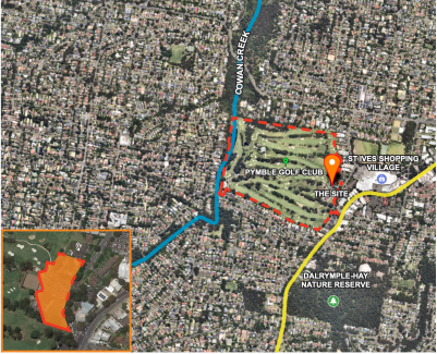
Figure
1. Subject site aerial view
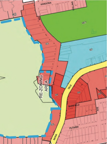
Figure 2. Subject site and existing
surrounding context
Comments
Planning
Proposal and the Proposed Amendments to KLEP 2015
The Planning Proposal for 4, 12 and 14 Cowan Road, St Ives
(Pymble Golf Club) that was submitted to Council for assessment seeks to amend
the KLEP 2015 to rezone the land, and to increase the maximum building height
and floor space ratio controls applicable to 4, 12 & 14 Cowan Road,
St Ives (Pymble Golf Club), and to relocate and heritage list the existing
timber cottages at 12 & 14 Cowan Road (cottage buildings, footprint,
and curtilage) within Schedule 5 of KLEP 2015.
The following changes to KLEP 2015 are sought:
• Amend
the Land Use Zone Map to rezone part of the Pymble Golf Club land holdings from
RE2 Private Recreation and R3 Medium Density Residential to R4 High Density
Residential and extend part of the RE2 Private
Recreation zone over existing R3 Medium Density Residential;
• amend the
Height of Buildings Map to a combination of 11.5, 14.5 and 17.5 metres, to
enable residential flat development 3-5 storeys in height;
• amend Floor
Space Ratio Map for the R4 High Density Residential Zoned land to show a
maximum of 0.92:1; and
• amend
the Heritage Map and Schedule 5 Environmental Heritage to heritage list 12 and
14 Cowan Road.
Merit
A Planning Proposal is not a Development Application and
does not consider the specific detailed matters for consideration under Section
4.15 of the Environmental Planning and Assessment Act 1979. A
Planning Proposal only relates to a Local Environmental Plan (LEP) amendment
and cannot be tied to a specific development. The proposed amendments need to
be acceptable as an outcome on the site regardless of the subsequent approval
or refusal of any future development application.
A Planning Proposal must demonstrate
the site specific and strategic merit of the proposed amendments. The following
is an assessment of the relevant merits of the Planning Proposal:
Site Specific Merit Assessment
· Urban Design
An Urban Design Report is
included at Attachment A7. An analysis of the Urban Design Report has
been undertaken by Council’s Urban Design Project Officer. This
assessment concludes that the Planning Proposal and Indicative Design are
considered appropriate for this well-located site. the Urban Design Report
demonstrates that the indicative design could satisfy the controls detailed in KDCP
Part 7 - Residential Flat Buildings as well as the nine design
quality principles which are to be achieved by residential flat developments
under SEPP 65 Design Quality of Residential Apartment Development.
A more detailed analysis is
included in Table of Assessment at Attachment A11.
· Traffic and Transport
A
Transport Impact Assessment is included at Attachment A9. An analysis of
the Transport Impact Assessment has been undertaken by Council’s
Strategic Transport Engineer has reviewed the documents and provided the
following key points. A more detailed traffic and transport analysis is
included in the Table of Assessment, at Attachment A11.
The
Planning Proposal has the following favourable transport aspects:
o Workers in the Statistical Area of the site that work
within the Ku-ring-gai LGA (approximately a quarter of all workers in the
Statistical Area) worked in the St Ives local centre and walked to work;
o the site is located within 400m of Mona Vale Road, where
regular bus services operate between Mona Vale and Macquarie Park (via Gordon).
Bus services to Gordon connect to the Sydney Trains network. There is currently
sufficient capacity in these bus services and nearby bus stops to accommodate
additional bus passenger demand resulting from the Planning Proposal;
o the site is well positioned to take advantage of improved
bus services between Mona Vale and Macquarie Park which are foreshadowed in
Future Transport Strategy and the Macquarie Park Strategic Infrastructure and
Services Assessment;
o there is a good selection of retail, health/medical,
leisure/recreational and community/cultural facilities within a 10 minute walk
of the site, mostly located within the St Ives Shopping Village, St Ives
Village Green/Cowan Oval and within the site itself;
o the local cycling network in the area is modestly
developed, providing a degree of local and regional cycling connectivity;
o the proposal is not expected to have significant additional
impact on the operation of the key nearby intersections, with only minor
increases in average delay at the intersection of Cowan Road/Village Green
Parade and the intersection of Killeaton Street/Cowan Road.
The
following transport constraints were found with respect to the Planning
Proposal:
o The site has access to only a modest number of Strategic
Centres (and therefore jobs) within 30 minutes by public transport, compared to
other centres located further south in Ku-ring-gai;
o while existing bus services provide good connections
between St Ives and Gordon, bus access to Macquarie Park is currently
constrained by congestion on Ryde Road and Lane Cove Road;
o there is a notable absence of schools within easy walking
distance of the site. The closest primary school is 15 minutes’ walk from
the site, and the closest high schools are approximately 20 minutes’
walk. There is also limited route bus and school bus services connecting the site
with nearby schools. Depending on the future demographic of the site, this
could result in a higher reliance on cars being used as a mode of travel
between the site and nearby schools.
· Biodiversity
An
Ecological Constraints Assessment is included at Attachment A5, and an
Arboricultural Impact Assessment Report is included at Attachment A6.
Council’s Natural Areas Program Leader has reviewed the documents and
provided the following key points.
The Ecological Constraints
Assessment confirms the presence of previously-mapped Blue Gum High Forest on
the site and additionally identifies Sydney Turpentine-Ironbark Forest and as
occurring on the subject site. Both of these Critically Endangered Ecological
Communities (EECs) are represented on the site by fragmented large canopy trees
with no mid-storey and only turfed grassland groundcovers present.
Trees
comprising EECs are captured on Ku-ring-gai Council’s Greenweb and
Terrestrial Biodiversity Maps, with the exception of one Angophora costata
on the eastern boundary of 10 Cowan Road that would fall under the
‘Canopy Remnant’ category of Greenweb mapping. Should a
site-specific Development Control Plan (DCP) be proposed, the Greenweb mapping
should be updated to include the Angophora through this process, however
this is not critical if this is the only issue being addressed through as site
specific DCP.
The arborist report identifies 39 trees (or groups of trees)
with Tree Protection Zones (TPZs) intersecting the subject site. The arborist
report assesses potential impacts to these trees from the indicative
development design and recommends that a total of 15 trees be approved for
future removal to cater for the proposed rezoning and future development of the
site. The report demonstrates that high density development can be sited and
designed to retain and protect significant trees including those comprising
Endangered Ecological Communities, subject to arboriculturally sensitive
design.
The Urban Design Report
demonstrates that the indicative design can satisfy the controls detailed in
Part 18 of the DCP and in Clause 6.3 of the KLEP 2015 to protect EECs, retain
habitat, and enhance biodiversity values on the site.
The recommended amendment to
include the Angophora costata on the eastern boundary of 10 Cowan
Road, Pymble in the Greenweb mapping will be incorporated into Council’s
upcoming review of the Development Control Plan, which involves other updates
to the Greenweb mapping. This will ensure the tree is identified in Councils
DCP separately to this Planning Proposal process.
· Heritage
A Statement of Heritage Impact is included at Attachment
A8. Council’s Heritage Consultant has reviewed the documents and
provided the following key points. A more detailed analysis is included in the
Table of Assessment at Attachment A11, which includes an overview of the
information and comments that have flowed between the proponent and Council in
relation to heritage since 2018.
The applicant has provided
documentation to suggest and substantiate the heritage listing of the two
dwellings at 12 and 14 Cowan Road, St Ives as part of the Pymble Golf Club
Planning Proposal. Council has supported this recommendation and accordingly, the
overall planning proposal has been adjusted to respond to the recommendation
and so that the dwellings can be retained, albeit in slightly adjusted
locations within their current settings.
From a heritage perspective, the
proposal to heritage list on Schedule 5 of KLEP 2015 and slightly relocate the
two dwellings at 12 and 14 Cowan Road (DP 531533, lot 1, 3 and part of lot 2)
(see Figure 1 below) is considered to be an acceptable approach in this
situation. The listings will ensure that the buildings are retained in the
streetscape as well as the associated established vegetation around them.
The respective curtilages will be
adjusted once the cottages are relocated, and the relevant background and this
intention will be outlined the State heritage Inventory. The DCP will also
address the appropriate adjustment of the heritage curtilage at the time of
their relocation to avoid unnecessary heritage listing of the new
development.
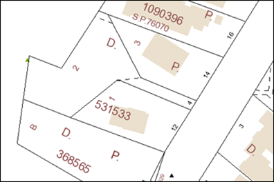
Figure
3. The current lot configuration. It is suggested that Lot 1, 3 and the access
handle of Lot 2 are included on the heritage map and redefined once the
building are moved.
As a result of this heritage assessment, it is recommended
that the proponent amend the proposed heritage map in Part 4 of the Planning
Proposal to include the access handle of Lot 2 following the diagonal line.
Strategic Merit Assessment
· Greater Sydney Region Plan and North District Plan
The Planning Proposal is consistent with the objectives of
the Greater Sydney Region Plan – A Metropolis of Three Cities, in
particular:
o Objective 6: Services and infrastructure meet
communities’ changing needs
o Objective 7:
Communities are healthy, resilient and socially connected
o Objective 8:
Greater Sydney’s communities are culturally rich with diverse
neighbourhoods
o Objective 10:
Greater housing supply
o Objective 11:
Housing is more diverse and affordable
o Objective 12:
Great places that bring people together
o Objective 13:
Environmental heritage is identified, conserved and enhanced
o Objective 22:
Investment and business activity in centres
o Objective 27:
Biodiversity is protected, urban bushland and remnant vegetation is enhanced
o Objective 28:
Scenic and cultural landscapes are protected
o Objective 30:
Urban tree canopy cover is increased
o Objective 37:
Exposure to natural and urban hazards is reduced
A Metropolis of Three Cities outlines that liveability incorporates access to housing,
transport and employment, as well as social, recreational, cultural and
creative opportunities. Provision of housing close to public transport and
services and facilities improves the opportunity for people to walk and cycle
to local shops and services. The plan advocates for the protection and
enhancement of biodiversity values. The proposal is consistent with these
principles.
The Planning Proposal is
consistent with the planning priorities of the North District Plan, in
particular:
o Planning
Priority N3: Providing services and social infrastructure to meet
people’s changing needs
o Planning Priority
N4: Fostering health, creative, culturally rich and socially connected communities
o Planning Priority
N5. Providing housing supply, choice and affordability, with access to jobs,
services and public transport
o Planning Priority
N6. Creating and renewing great places and local centres, and respecting the
districts heritage
o Planning Priority
N12. Delivering integrated land use and transport planning and a 30-minute city
o Planning Priority
N16. Protecting and enhancing bushland and biodiversity
o Planning Priority
N17: Protecting and enhancing scenic and cultural landscapes
o Planning Priority
N19: Increasing urban tree canopy cover and delivering Green Grid connections
o Planning Priority
N20: Delivering high quality open space
· Ku-ring-gai Local Strategic Planning Statement
The Ku-ring-gai Local Strategic Planning Statement (LSPS)
came into effect on 17 March 2020 and provides a 20 year vision and local
planning priorities and associated actions for land use planning in
Ku-ring-gai. The Planning Proposal is consistent with the following local
planning priorities:
o K3. Providing
housing close to transport, services and facilities to meet the existing and
future requirements of a growing and changing community.
o K4. Providing a
range of diverse housing to accommodate the changing structure of families and
households and enable ageing in place.
o K5. Providing
affordable housing that retains and strengthens the local residential and
business community
o K6. Revitalising
and growing a network of centres that offer unique character and lifestyle for
local residents.
o K9. Promoting St
Ives as an active green lifestyle and shopping destination.
o K12. Managing
change and growth in a way that conserves and enhances Ku-ring-gai’s
unique visual and landscape character.
o K13. Identifying
and conserving Ku-ring-gai’s environmental heritage.
o K17. Providing a
broad range of open spaces, sporting and leisure facilities to meet the
community’s diverse and changing needs.
o K21. Prioritising
new development and housing in locations that enable 30 minute access to key
strategic centres.
o K28. Improving the
condition of Ku- ring-gai’s bushland and protecting and fauna and their
habitats.
o K29. Enhancing the
biodiversity values and ecosystem function services of Ku-ring-gai’s
natural assets.
o K31. Increasing,
managing and protecting Ku-ring-gai’s urban tree canopy.
o K35. Protecting
and improving the health of waterways and riparian areas.
While the Planning Proposal is
consistent with the overarching local planning priority to provide housing
close to transport, services and facilities, the LSPS provides specific details
about each centre, its suitability for additional housing and timing. The LSPS
sets out that the St Ives Primary Local Centre is suitable for additional
housing as it contains a bus route on an arterial road corridor and meets the
criteria for 30-minute access to a strategic centre and is supported by
Council’s community hub projects with retail services and community
facilities. The LSPS outlines the timing for future housing delivery in the St
Ives centre as 6-10 year (2021-2026) and 11-15 year (2026-2031) subject to the
provision of priority bus infrastructure from Mona Vale to Macquarie Park.
This Planning Proposal seeks to
allow for approximately 78 additional dwellings in the centre prior to the
provision of the rapid bus line between Mona Vale and Macquarie Park, which is
inconsistent with the LSPS. Council’s Strategic Transport Engineer
has reviewed the Transport Impact Assessment submitted with the Planning Proposal,
which indicates that the proposal is not expected to have significant
additional impact on the operation of the key nearby intersections, with only
minor increases in average delay at the intersection of Cowan Road/Village
Green Parade and the intersection of Killeaton Street/Cowan Road.
Given the relatively small
number of additional dwellings (less than 80) that could be facilitated by the
Planning Proposal and the justification provided in the Transport Impact
Assessment, this inconsistency is considered to be minor.
Should the Planning Proposal
proceed to Gateway, Transport for NSW will be providing a response as
part of consultation with State agencies. Clarification regarding future
upgrade to bus services and the Rapid Bus Line would be provided by Transport
for NSW as part of that process.
It is noted that Council’s
LSPS includes an action to advocate to Transport for NSW to increase the
priority and accelerate the delivery of infrastructure improvements identified
in Future Transport 2056 that connects Ku-ring-gai internally and with nearby
centres, including improvements to bus connections from Mona Vale to Macquarie
Park (followed by the Bus Rapid Transit).
The Planning Proposal is generally consistent with the
principles for the location of additional housing as set out in the LSPS:
- Stage housing delivery around centres of retail and
economic activity that are serviced by the North Shore railway line or major
bus routes along arterial roads, including provision of housing diversity,
affordability and accessibility.
- Locate high density housing types within a 10min walk (800m
radius) of Primary and Secondary Local Centres: Gordon, Lindfield, Turramurra,
St Ives (subject to the provision of priority bus infrastructure), Roseville,
Killara, Pymble and Wahroonga.
- In considering areas for future medium and high-density
housing form, the following areas are to be avoided:
o Heritage conservation areas.
o Areas of visual or aesthetic quality and character.
o Areas within or affecting scenic and cultural landscapes.
o Areas of intact tree canopy where the built form does not
sit under the canopy.
o Areas with multiple constraints including steep topography.
o Areas with environmental values.
o Areas that are bushfire prone and with evacuation risk.
o Centres with limited transport and service access until
improvements are implemented.
· Ku-ring-gai Council Community Strategic Plan ‘Our
Ku-ring-gai 2038’
The Ku-ring-gai Community
Strategic Plan was adopted by Council in June 2019. The Plan outlines the
Council’s vision and long-term objectives for the local government area,
with directions and objectives to achieve those visions. The Planning Proposal
is consistent with the following objectives:
o C6.1 Housing
diversity, adaptability and affordability is increased to support the needs of
a changing community.
o N2.1 Our bushland
is rich with native flora and fauna.
o N3.1 Our natural
waterways and riparian areas are enhanced and protected.
o P1.1
Ku-ring-gai’s unique visual character and identity is maintained.
o P3.1 The built
environment delivers attractive, interactive and sustainable living and working
environments.
o P4.1 Our centres
offer a broad range of shops and services and contain lively urban village
spaces and places where people can live, work, shop, meet and spend leisure
time.
· Ku-ring-gai Housing Strategy Approval Letter Conditions
Council’s adopted
Ku-ring-gai Housing Strategy provides all new dwellings to 2036 from capacity
within the existing planning controls and zoning. As the Planning Proposal is
seeking to rezone the site and amend the development controls to enable
delivery of residential housing on the site, it is inconsistent with the
Housing Strategy.
The amendments sought by the
Planning Proposal will enable the delivery of approximately 78 dwellings on the
site. In approving the Ku-ring-gai Housing Strategy, the Department of
Planning, Industry and Environment issued a number of approval conditions, one
of which is:
4. Consistent with
Priority K3 of the Ku-ring-gai LSPS, Council is to prepare a masterplan, or
accommodate a proponent-led planning proposal with good planning outcomes, for
the St Ives local centre. Planning is to occur in consultation with TfNSW and
align with its Movement and Place Framework.
Subject to TfNSW advice, the planning proposal is to be submitted to the
Department for Gateway Determination by December 2022. This proposal will help
to create future housing capacity and contribute to medium supply and support
the longer term 20-year strategic housing target for the District.
At OMC 16 November 2021 Council
resolved to reject the Housing Strategy conditions of approval. However, clause
5 (3)(d) of the Environmental Planning and Assessment (Statement of
Expectations) Order 2021, requires Council to: ‘give effect to an
adopted local planning strategy (such as a Local Housing Strategy), and any
approval requirements issued by the Department’.
Council has not prepared a
Masterplan for the St Ives Local Centre as required by Condition 4, and
accordingly the Planning Proposal is consistent with the requirements of
Condition 4, which requires Council to accommodate proponent-led planning
proposals with good planning outcomes within the St Ives local centre. Should
the Planning Proposal receive a Gateway Determination, then consultation would
occur with TfNSW and clarification regarding any future upgrade to bus
services, the Rapid Bus Line and Movement and Place Framework would be provided
as part of that process.
The Planning Proposal will enable
a higher density built form outcome on the site in an area that is close to
public transport, services and facilities.
· Section 9.1
Ministerial Directions and State Environmental Planning Policies (SEPPs)
The Planning Proposal is not
inconsistent with the State Environmental Planning Policies (SEPPs) applicable
to the site. Many of these SEPPs contain detailed provisions and controls which
would only apply at the Development Application stage.
The Planning Proposal is
consistent with the applicable s9.1 Ministerial Direction, specifically those
relating to:
- 3.2 Heritage Conservation;
- 5.1 Integrating Land Use and Transport;
- 6.1 Residential Zones.
The objective of direction 6.3 is
to discourage unnecessarily restrictive site-specific planning controls, and
4(c) outlines that a Planning Proposal must allow that land use on the
relevant land without imposing any development standards or requirements in
addition to those already contained in the principal environmental planning
instrument being amended - (6) notes that a Planning Proposal may be
inconsistent with this direction, if the provisions are of a minor
significance. If the creation of a Site Specific DCP is inconsistent with this
direction, it is considered minor in nature and justifiable to ensure the best
built form outcomes on the site.
Amendments required to be
made to the Planning Proposal and supporting documentation
The Table of Assessment included at Attachment A11 details
the required amendments to be made to the Planning Proposal if Council is to support
it being submitted to the Department of Planning and Environment for a Gateway
Determination and proceed to public exhibition.
Site Specific Development
Control Plan (DCP)
In order to provide more certainty
and clarity regarding the built form outcomes on the site under the amendments
proposed within the Planning Proposal, it is recommended that a site-specific
Development Control Plan (DCP) be prepared and exhibited concurrently with the
Planning Proposal, should it receive a Gateway Determination.
The site-specific DCP should be based on the Urban Design
Report (Attachment A7) and include detailed controls regarding:
· Built form,
building massing and envelopes to ensure appropriate development on an
interface site;
· ensuring
development on the site is consistent with the established and desired future
character of St Ives centre;
· appropriate
setbacks from heritage items, adjoining residential sites and significant trees
including canopy to be retained;
· relocation and
development of cottages and an appropriate curtilage area;
· pedestrian and
vehicle access to the site ensuring retention and protection of trees;
· landscaping,
including landscape setbacks and deep soil setbacks to Cowan Road;
Ku-ring-gai Local Planning
Panel Advice
In accordance with Local Planning
Panels Direction – Planning Proposals issued by the Minister for Planning
under Section 9.1 of the Environmental Planning and Assessment Act 1979, the
Planning Proposal was referred to the Ku-ring-gai Local Planning Panel (KLPP)
on 24 April 2023.
The KLPP provided the following advice (Attachment A12):
That the
Ku-ring-gai Local Planning Panel advises Council that the Planning Proposal,
amended as per the Table of Assessment at Attachment A11 of
the Officers Assessment report, be submitted to the Department of Planning and
Environment for a Gateway Determination.
Prior
to the matter being recommended to Council, the Panel advises that further
clarification be sought (refer Page 10-12), to justify the inconsistency with
the LSPS and the Ku-ring-gai housing strategy.
The
Panel advises Council should investigate whether a community title and or other
mechanism be sought to achieve a long term objectives for delivery of the
development and the maintenance of the design quality of the site and its
heritage items into the long term future.
The
Panel advises Council that prior to the development of the site, a Conservation
Management Plan be prepared for the two proposed heritage items.
The
Panel advises that Council investigate further the bonus provisions that
generally apply to the sites containing heritage items, should not extend to
the whole of the development site but should only apply to curtilage lots of
the heritage items.
Date
of Advice: 24 April 2023
Voting:
unanimous
The KLPP support for the
submission of the Planning Proposal (as amended) for a Gateway Determination is
noted. Council comment is provided below in response to the additional KLPP
advice, noting this is advice only and Council is not bound to adopt in
considering the Planning Proposal:
KLPP Advice: Prior to the matter being recommended to Council, the
Panel advises that further clarification be sought (refer Page 10-12), to
justify the inconsistency with the LSPS and the Ku-ring-gai housing strategy.
Council Comment: Additional detailed clarification has been provided in the
body of this report under ‘Ku-ring-gai Local Strategic Planning
Statement’ and ‘Ku-ring-gai Housing Strategy Letter of
Approval’ as well as in the Table of Assessment (Attachment A11)
which justify the inconsistency with the LSPS and the Ku-ring-gai Housing
Strategy.
In summary, the Planning Proposal
is consistent with the overarching local planning priority within the LSPS to provide housing close to transport, services and
facilities in the St Ives local centre. The LSPS also ties the provision of
additional housing in the St Ives local centre with the future delivery of
priority bus infrastructure from Mona Vale to Macquarie Park, and accordingly,
the Planning Proposal is inconsistent as it seeks to bring forward the delivery
of housing prior to the delivery of priority bus infrastructure. This
inconsistency is considered minor in nature due to the relatively small number
of dwellings enable by the Planning Proposal and the fact that the Planning
Proposal would not result in any significant traffic impacts on the surrounding
road network and formal consultation will be undertaken with TfNSW should a
Gateway Determination be issued.
The Planning Proposal is
inconsistent with Council’s adopted Housing Strategy which does not
provide for any additional housing from the rezoning of new sites. However, the
Planning Proposal is consistent with the Housing Strategy Letter of Approval
Conditions, specifically Condition 4 relating to accommodating proponent-led
Planning Proposals in the St Ives local centre. Council is required by clause 5 (3)(d) of the Environmental
Planning and Assessment Act 1979 to
give effect to Housing Strategy Letter of Approval Conditions issued by the
Department of Planning.
KLPP Advice: The Panel advises Council should investigate whether a
community title and or other mechanism be sought to achieve a long term
objectives for delivery of the development and the maintenance of the design
quality of the site and its heritage items into the long term future.
Council Comment: The Panel’s advice seeks to control future delivery
of development on the site by ensuring that the site is developed as a whole,
and not sold off in separate lots for piecemeal development.
Council has no legal ability to require the site to be
developed under a community title scheme as part of a future Development
Application process.
The Planning Proposal and Urban
Design Study anticipate the future development of the site as a whole, and
proposes that the Development Standards, such as Floor Space Ratio, apply
across the site as a whole. Additionally, it is in the Club’s best
interests to ensure the site is developed as a whole, as it is the most
efficient method and would ensure the Club has more control of the outcome.
If the intention is to require the
site to be developed as a whole, then other mechanisms could be put in place
such as a site specific minimum lot size requirement for the development of
multi dwelling housing or residential flat buildings on the site such as under
Clause 6.6 of the KLEP 2015, or the requirement of a large minimum lot size
which would prevent the site from being subdivided into smaller lots.
KLPP Advice: The Panel advises Council that prior to the development of
the site, a Conservation Management Plan be prepared for the two proposed
heritage items.
Council Comment: Council supports the
preparation of a Conservation Management Plan for the proposed heritage items,
being the cottages at 12 and 14 Cowan Road
as part of the development application, which would address any issues of
curtilage and relocation of the cottages.
KLPP Advice: The Panel advises that Council investigate further the
bonus provisions that generally apply to the sites containing heritage items,
should not extend to the whole of the development site but should only apply to
curtilage lots of the heritage items.
Council Comment: The ‘bonus provisions’ referred to in the
Panel’s advice are the Heritage Conservation Incentives under Clause
5.10(10) of the KLEP 2015. This clause only applies at the Development
Application stage and is not a matter for consideration of a Planning Proposal.
Council staff understand that the
Clause is focused on conserving heritage first and foremost and allowing some
flexibility around development standards, i.e. land use, FSR and height, to
"facilitate" this. There are a number of qualifications that need to
be met to enable the use of the Clause and they are set out clearly within the
clause itself (emphasis added below). There are a few terms that have been
debated, including what is meant by "land" and "building"
because this determines how the clause can be applied.
Ku-ring-gai Local Environmental
Plan 2015 Clause 5.10 (10) provides:
(10) Conservation incentives
The consent authority may grant consent to development for any purpose of a
building that is a heritage item or of the land on which such a building is
erected, or for any purpose on an Aboriginal place of heritage
significance, even though development for that purpose would otherwise not be
allowed by this Plan, if the consent authority is satisfied that—
(a)
the conservation of the heritage item or Aboriginal place of heritage
significance is facilitated by the granting of consent, and
(b)
the proposed development is in accordance with a heritage management
document that has been approved by the consent authority, and
(c)
the consent to the proposed development would require that all necessary
conservation work identified in the heritage management document is carried
out, and
(d)
the proposed development would not adversely affect the heritage
significance of the heritage item, including its setting, or the heritage
significance of the Aboriginal place of heritage significance, and
(e)
the proposed development would not have any significant adverse effect on
the amenity of the surrounding area.
In the case of Pymble Golf club,
Council has suggested a discrete listing for the cottages, enough mapped
curtilage to ensure they are protected within an appropriate setting but to
stop the heritage sterilising the rest of the development. Interpreting the
"land on which such a building is erected" could either mean the land
immediately under each cottage and no more or the entire curtilage of the
cottages (as shaded area on the map). In either case, Council does not believe
that this opens up any opportunities for the applicant to use the clause to
breach development standards and advantage future development because if
enabled within the mapped curtilage, which is such a small area, the said
development would result in adverse amenity and heritage impacts. The only
loophole for the applicant may be if the whole site was mapped as a heritage
item, which is not suggested by Council staff. However, even then, it would be
open for legal debate as to why, how and to what extent development standards
could be flexed before and heritage impacts (d) or adverse amenity (e)
resulted, disqualifying the use of the Clause.
Further legal advice could be
sought if Council feel this is appropriate given the complex nature of the
issue.
integrated planning and reporting
Theme 3: Places, Spaces and Infrastructure
|
Community Strategic
Plan Long Term Objective
|
Delivery Program
Term Achievement
|
Operational Plan
Task
|
|
P1.1 Ku-ring-gai’s unique
visual character and identity is maintained
|
P1.1.1 Strategies, plans and
processes are in place to protect and enhance Ku-ring-gai’s unique
visual and landscape character
|
P1.1.1.1 Continue to review the
effectiveness of existing strategies, plans and processes across all
programs.
|
|
P2.1 A robust planning framework
is in place to deliver quality design outcomes and maintain the identity and
character of Ku-ring-gai
|
P2.1.1 Land use strategies,
plans and processes are in place to effectively managed the impact of new
development
|
P2.1.1.2 Continue to review the
effectiveness of existing strategies, local environmental plans, development
control plans and processes across all programs
|
Governance Matters
The process for the preparation
and implementation of Planning Proposals is governed by the provisions
contained in the Environmental Planning and Assessment Act 1979 and the Environmental
Planning and Assessment Regulation 2000.
If Council fails to make a
decision within 90 days (from the commencement of the review of the
application) or if Council makes a decision to not support the Planning
Proposal, the proponent can request the Department of Planning and Environment
for a Rezoning Review.
Local Planning Panels Direction
– Planning Proposals issued by the Minister for Planning under Section
9.1 of the Environmental Planning and Assessment Act 1979 requires
Council to refer all Planning Proposals prepared after 1 June 2018 to the Local
Planning Panel for advice, before the Planning Proposal is forwarded to the
Minister for a Gateway Determination under Section 3.34 of the Environmental
Planning and Assessment Act 1979.
Risk Management
This is a privately initiated
Planning Proposal. Council needs to determine its position on the matter as to
whether the Planning Proposal should be sent to the Department of Planning and
Environment for a Gateway Determination and proceed to public exhibition.
Council risks damage to its
reputation if it does not undertake strategic land use planning in an effective
and timely manner.
Financial Considerations
The
Planning Proposal was subject to the relevant application fee under
Council’s 2021/2022 Schedule of Fees and Charges. The cost of the review
and assessment of the Planning Proposal is covered by this fee.
Social Considerations
The
amendments sought by the Planning Proposal will enable the delivery of
approximately 78 dwellings of varying sizes on the subject site to meet the
existing and future requirements of a growing and changing community.
Environmental Considerations
The planning proposal
includes an Ecological Constraints assessment and an Arboricultural Assessment.
These reports conclude that the proposal is suitable for the site and will not
have detrimental impact upon the environment and demonstrates that high density
development can be sited and designed to retain and protect significant trees
including those comprising Endangered Ecological Communities, subject to
arboriculturally sensitive design.
Community Consultation
In
the event that the Planning Proposal is issued a Gateway Determination by the
Department of Planning and Environment, the Planning Proposal would be placed
on statutory public exhibition in accordance with the requirements of the
Gateway Determination, and Council’s Community Participation Plan.
Internal Consultation
The
assessment of the Planning Proposal has included internal consultation with
Council’s staff with expertise in planning, urban design, traffic and
transport, heritage and biodiversity and has informed the recommendations of
this Report. At the time of preparing this report a Councillor Site
inspection was being arranged in early May 2023 prior this matter coming before
Council.
Summary
The
Planning Proposal has been assessed and found to have sufficient strategic and
site-specific merit to enable it to proceed to Gateway Determination and public
exhibition.
The Table of Assessment
included at Attachment A11 details the required amendments to be made to
the Planning Proposal if Council is to support it being submitted to the
Department of Planning and Environment for a Gateway Determination and proceed
to public exhibition. The amendments include:
· Planning Proposal (Attachment A2)
o Update the relevant sections to reflect the updated
Heritage Impact Assessment and the intent to heritage list 12 and 14 Cowan
Road, St Ives.
o Nominate Heritage NSW to the list of agencies to be
consulted.
o Amend the proposed heritage map in Part 4 to include the
access handle of the lot in between 12 and 14 Cowan Road, St Ives.
Recommendation:
A. That
the Planning Proposal be amended in accordance with the recommendations in this
report and Table of Assessment (Attachment A11).
B. That
delegation be given to the General Manager and Director of Strategy and
Environment to verify all amendments are in accordance with the recommendations
in this report and Table of Assessment (Attachment A11) prior to
forwarding to the Department of Planning and Environment.
C. That
the Planning Proposal (as amended) be submitted to the Department of Planning
and Environment for a Gateway Determination in accordance with section 3.34 of
the Environmental Planning and Assessment Act 1979
D. That
Council requests to be authorised as the local plan-making authority to
exercise the functions under Section 3.36(2) of the Environmental Planning
and Assessment Act 1979.
E. That
a site-specific DCP be prepared by Council in accordance with the details in
this report, paid for by the proponent in accordance with Council’s Fees
and Charges.
F. That
upon receipt of a Gateway Determination, the public exhibition of the planning
proposal and site-specific DCP is carried out in accordance with the
requirements of the Environmental Planning and Assessment Act 1979, Environmental
Planning and Assessment Regulation 2000, the Gateway Determination and the
Ku-ring-gai Community Participation Plan
G.
That a report be brought back to Council following the conclusion of the public
exhibition process.
|
Alexandra Plumb
Acting Senior Urban Planner
|
Craige Wyse
Team Leader Urban Planning
|
|
Antony Fabbro
Manager Urban & Heritage Planning
|
Andrew Watson
Director Strategy & Environment
|
|
Attachments:
|
A1
|
Pre
Planning Proposal Meeting Report
|
Excluded
|
2023/125848
|
|
|
A2 ⇩ ⇩
|
Planning
Proposal- 4, 12 & 17 Cowan Rd St Ives
|
|
2023/125851
|
|
|
A3
|
Appendix
A - Survey Plan
|
Excluded
|
2023/125853
|
|
|
A4
|
Appendix
B - Detailed Site Investigation
|
Excluded
|
2023/125854
|
|
|
A5
|
Appendix
C - Ecological Constraints Assessment
|
Excluded
|
2023/125855
|
|
|
A6
|
Appendix
D - Arboricultural Impact Assessment
|
Excluded
|
2023/125857
|
|
|
A7 ⇩ ⇩
|
Appendix
E - Urban Design Report
|
|
2023/125860
|
|
|
A8
|
Appendix
F - Statement of Heritage Impact
|
Excluded
|
2023/125866
|
|
|
A9
|
Appendix
G - Transport Impact Assessment
|
Excluded
|
2023/125872
|
|
|
A10
|
Appendix
H - Photomontage
|
Excluded
|
2023/125873
|
|
|
A11 ⇩ ⇩
|
Table
of Assessment
|
|
2023/125874
|
|
|
A12 ⇩ ⇩
|
KLPP
Advice 24 April 2022 - Planning Proposal for 4, 12 & 14 Cowan Road, St
Ives - Pymble Golf Club
|
|
2023/141377
|
|
ATTACHMENT No: 2 - Planning
Proposal- 4, 12 & 17 Cowan Rd St Ives
|
|
Item No: GB.6
|
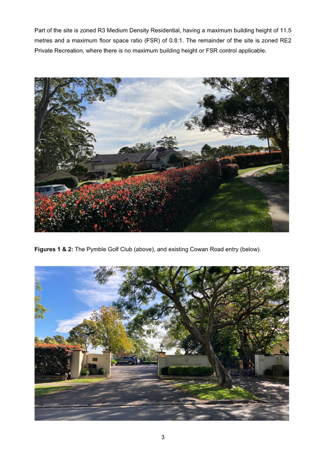
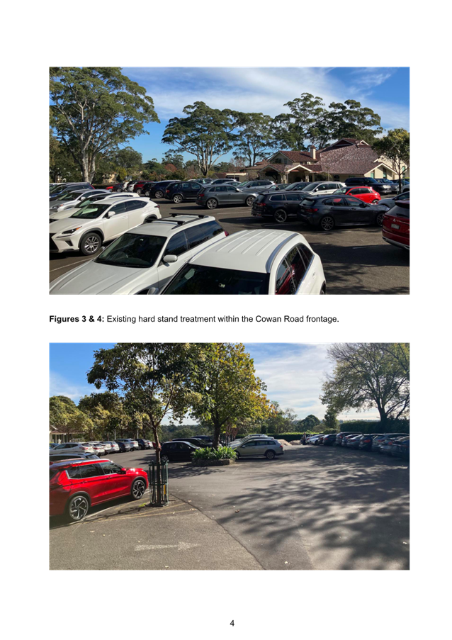
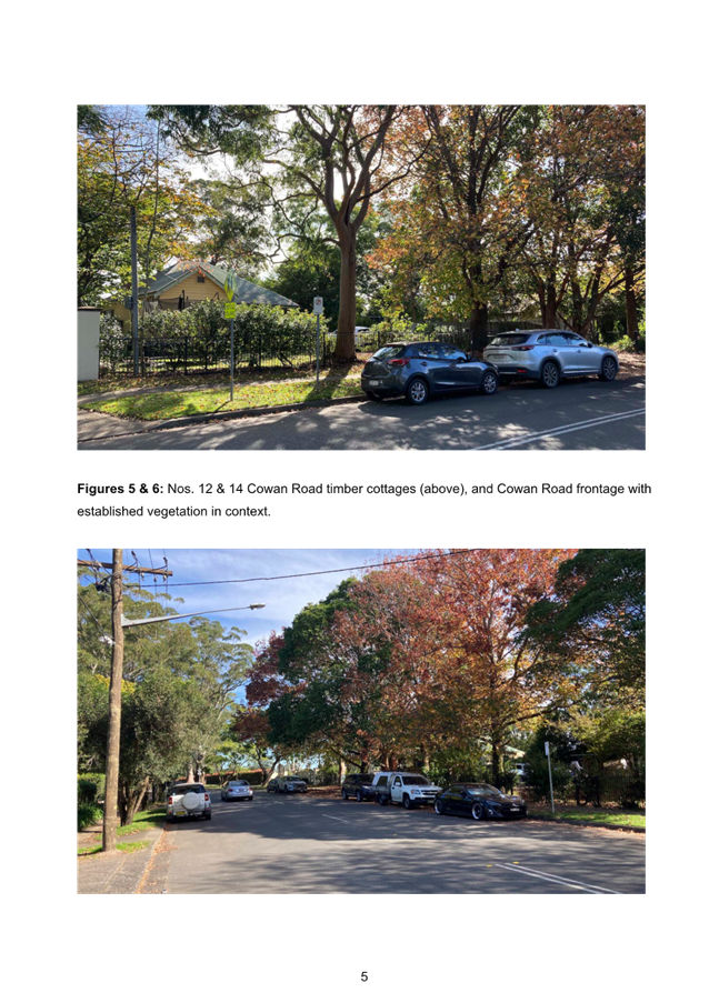
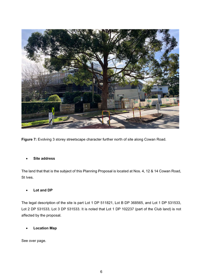
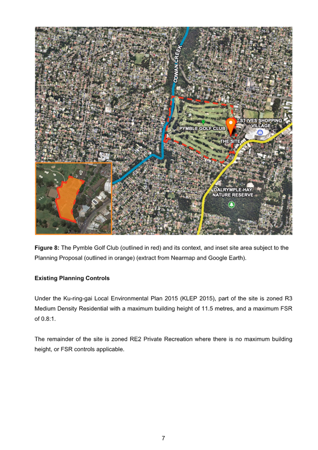
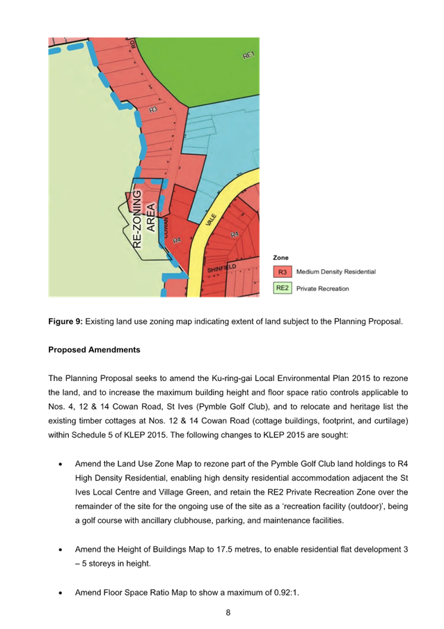
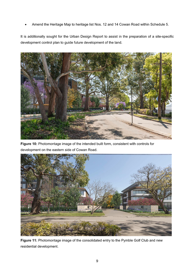
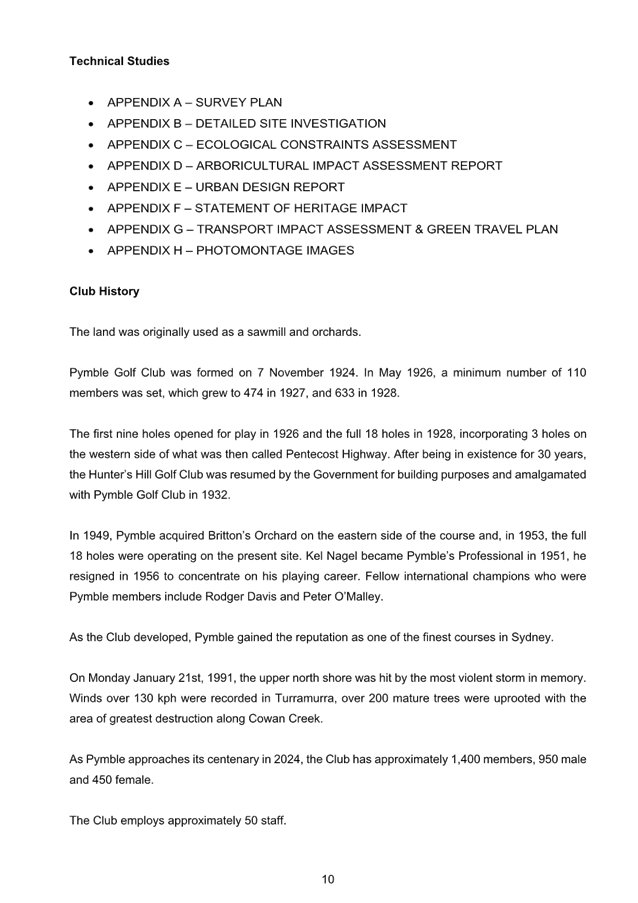
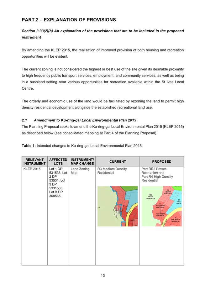
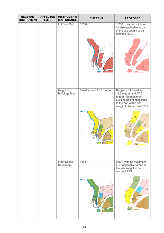
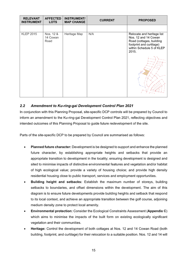
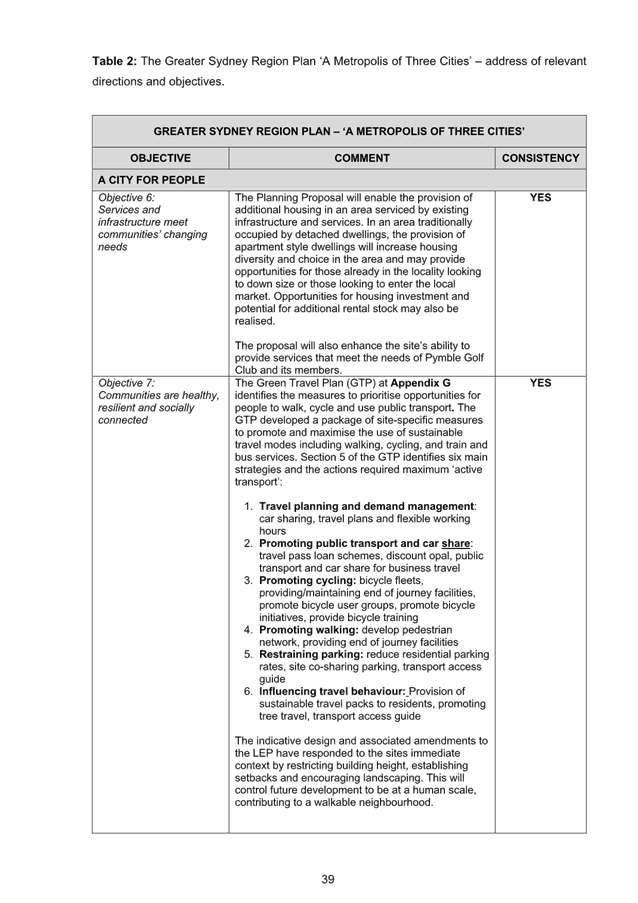
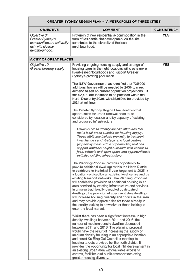
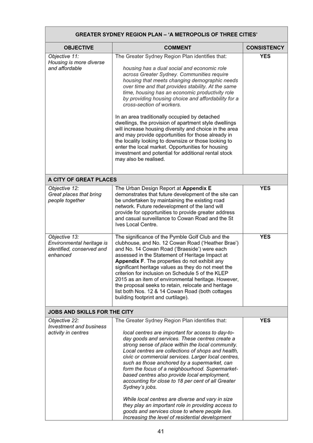
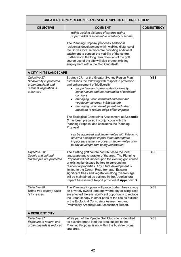
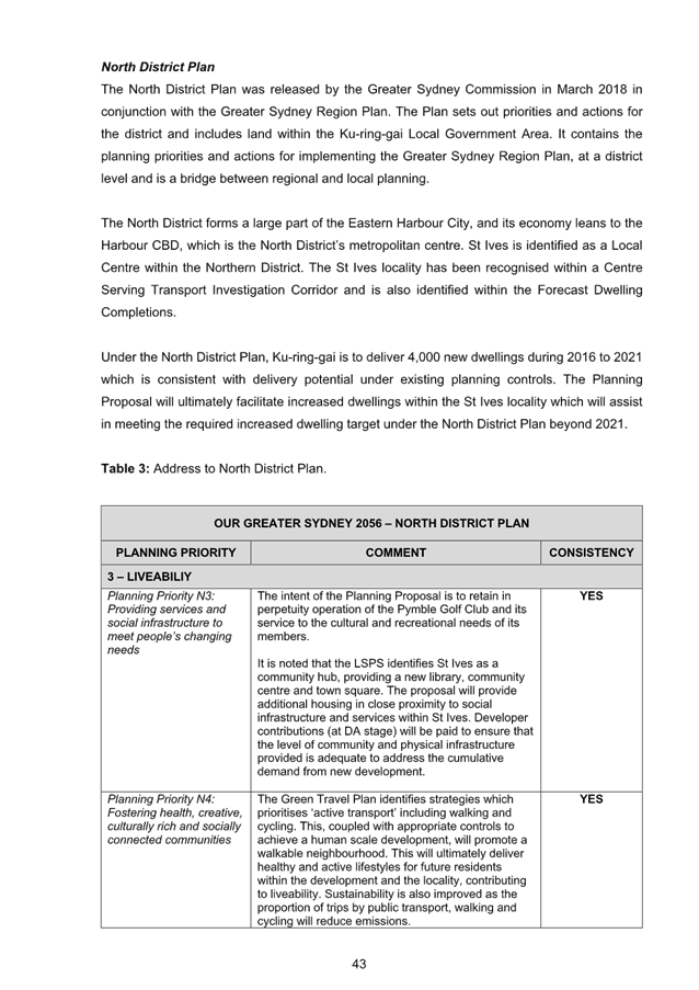
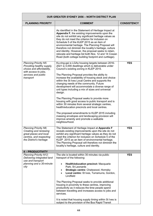
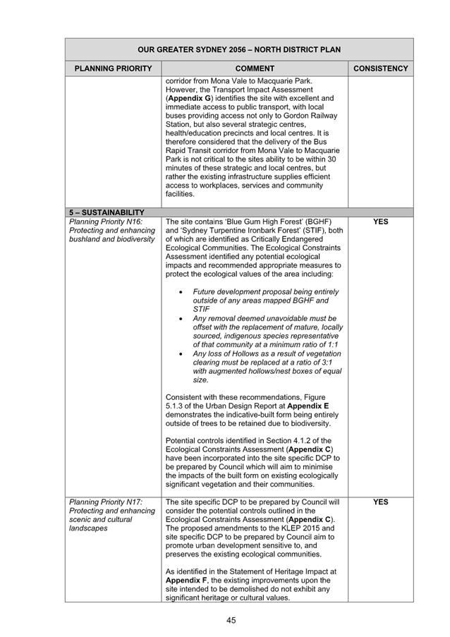
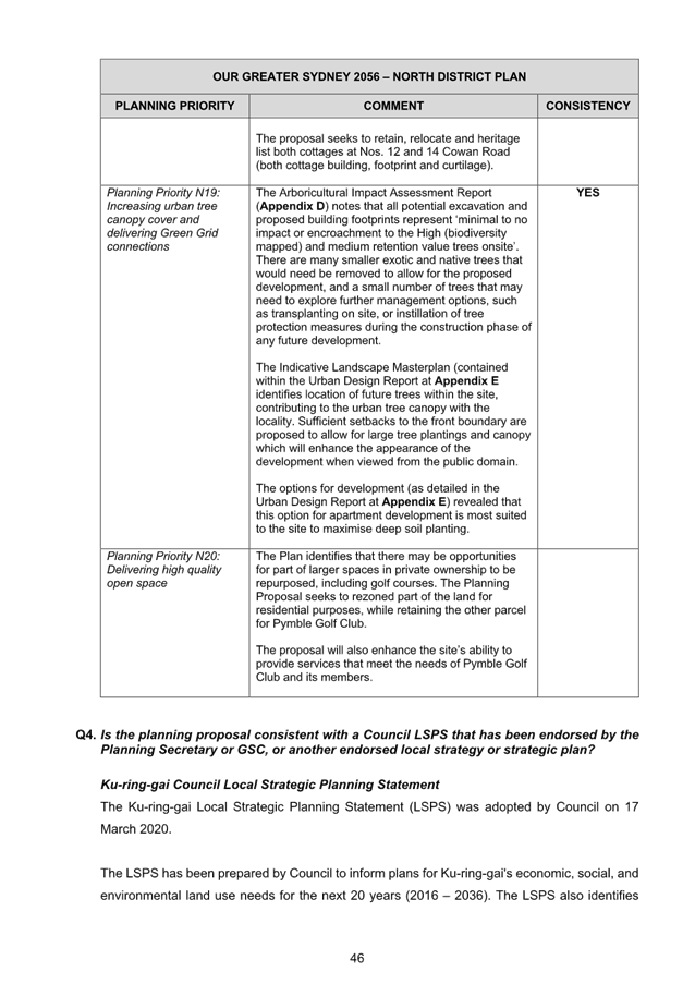
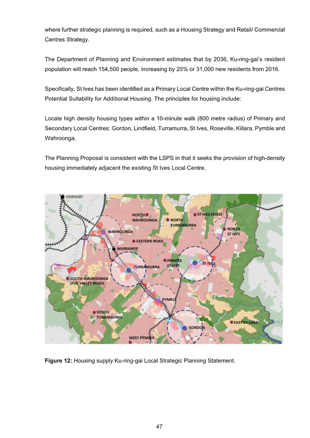
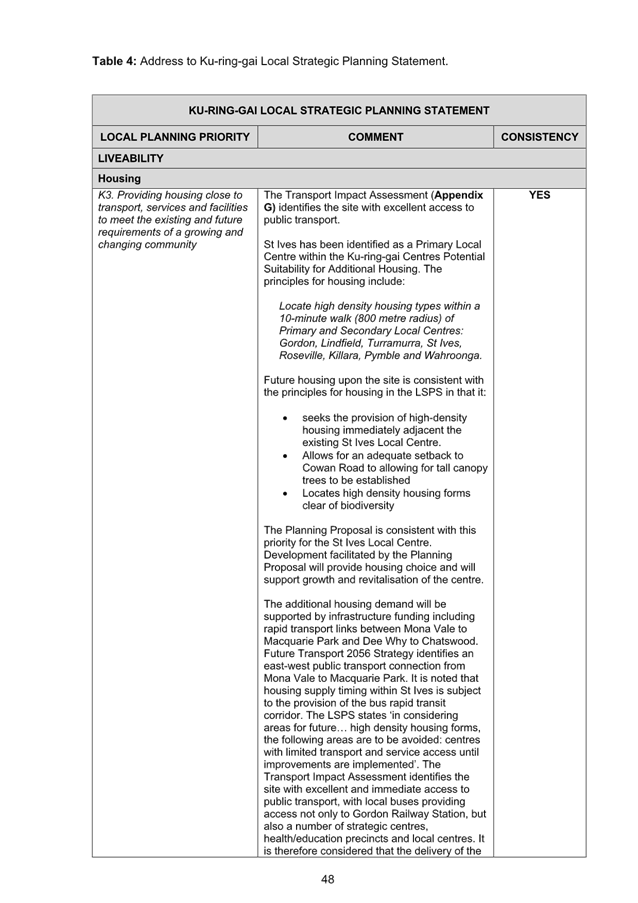
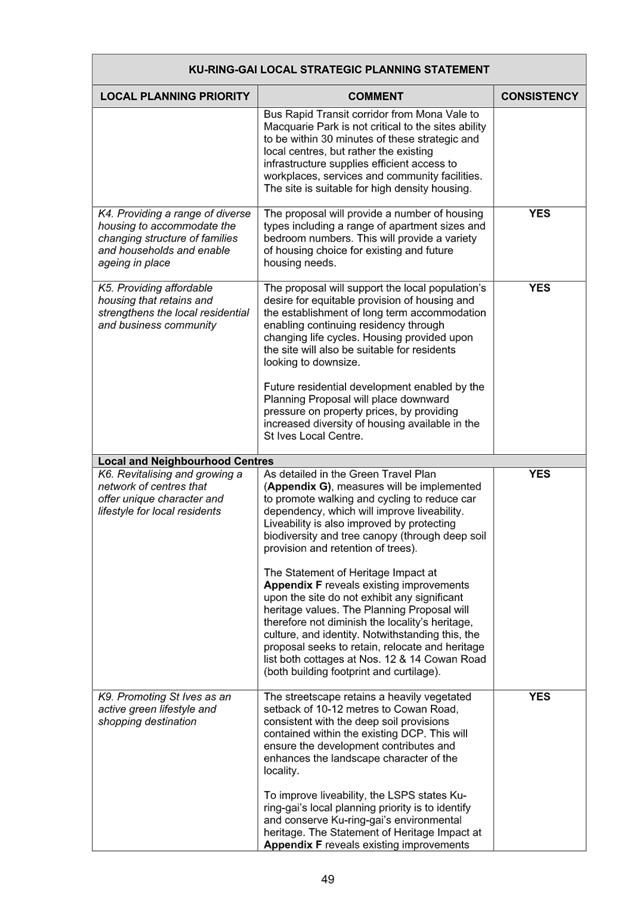
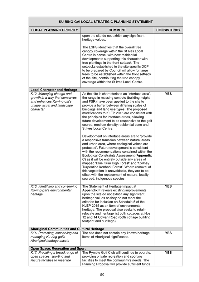
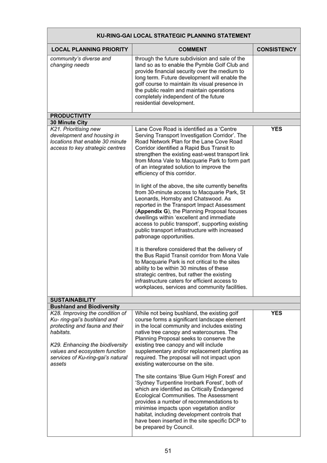
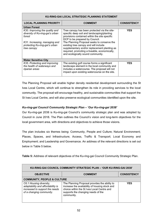
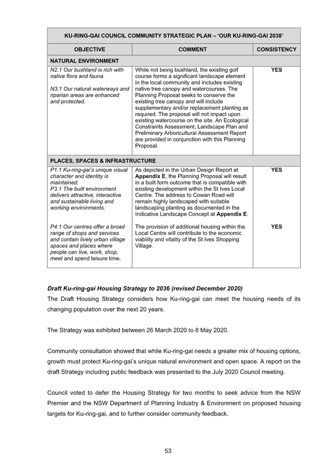
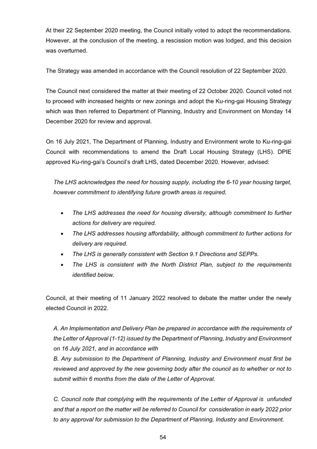
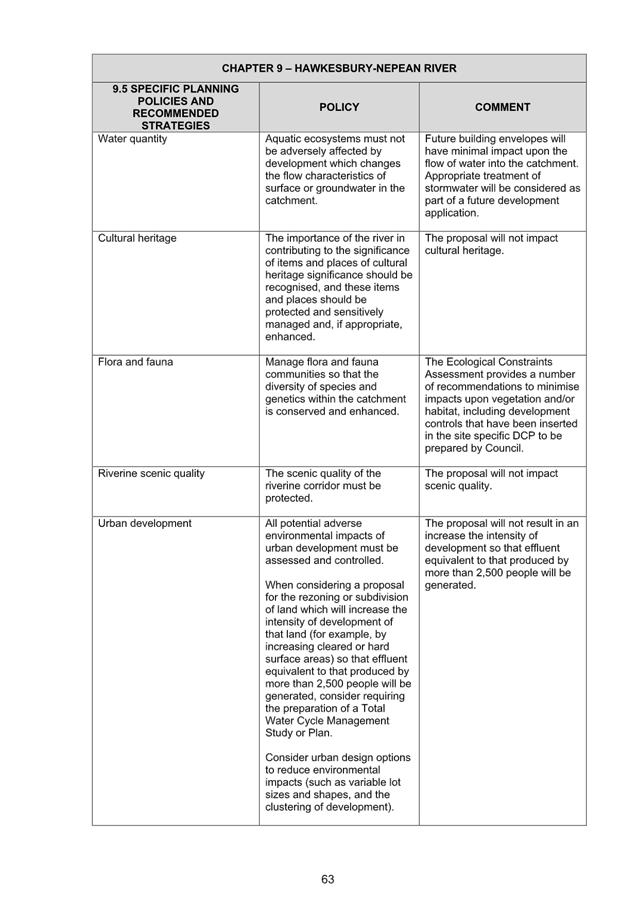
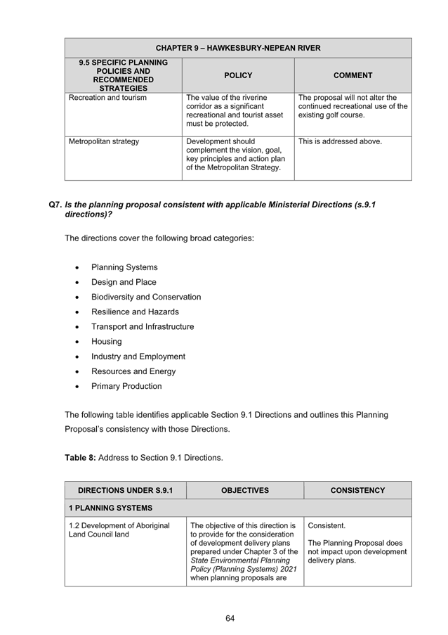
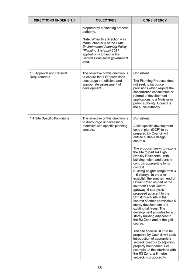
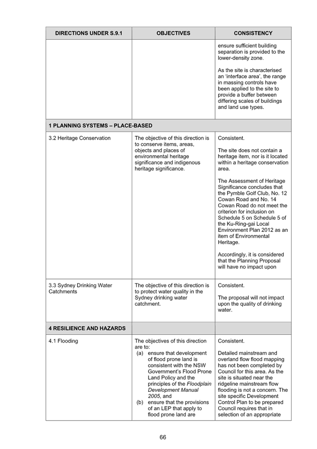
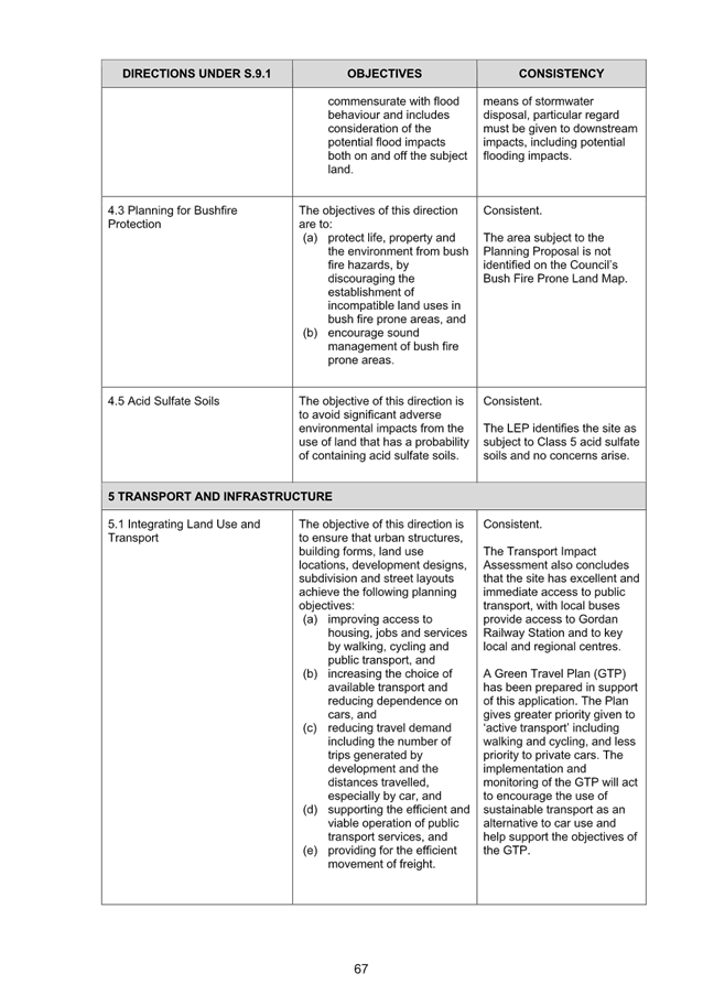
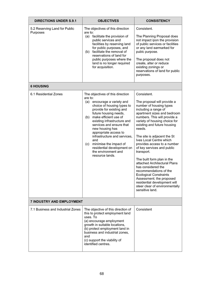
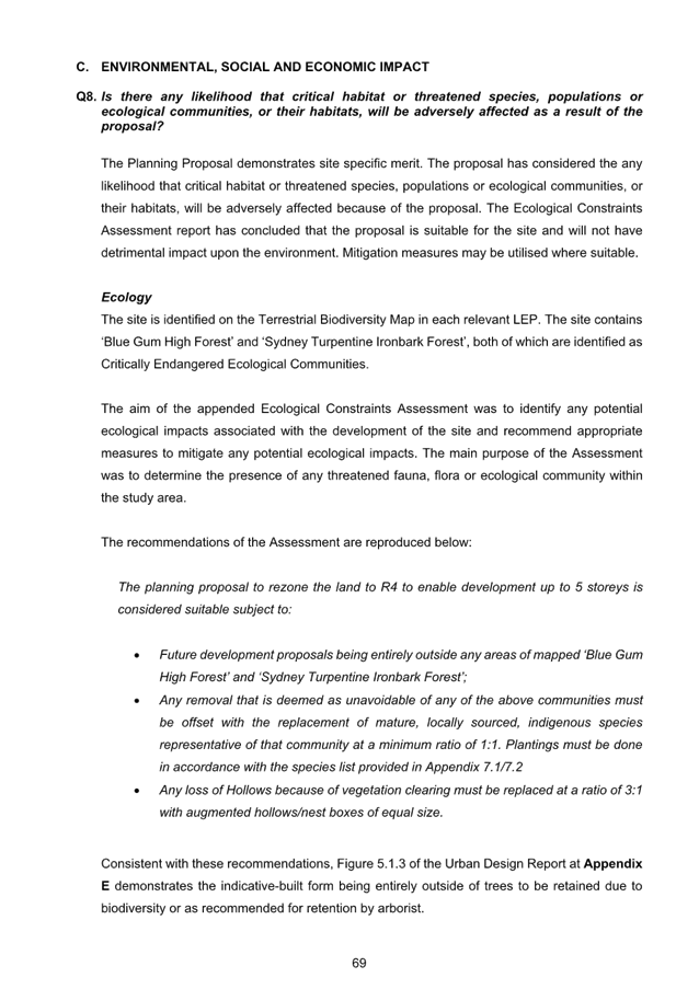
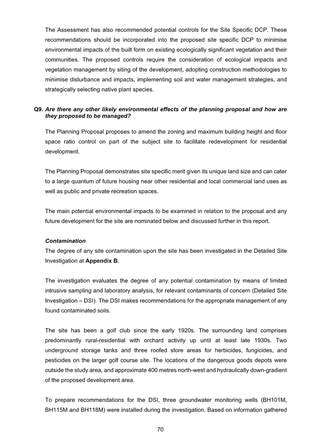

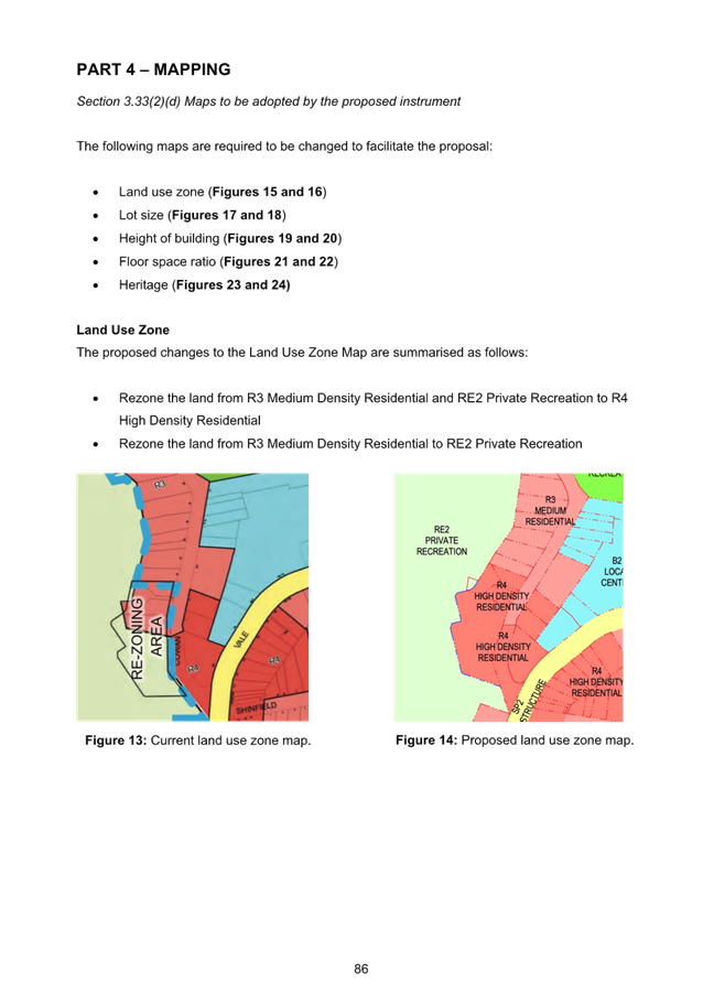
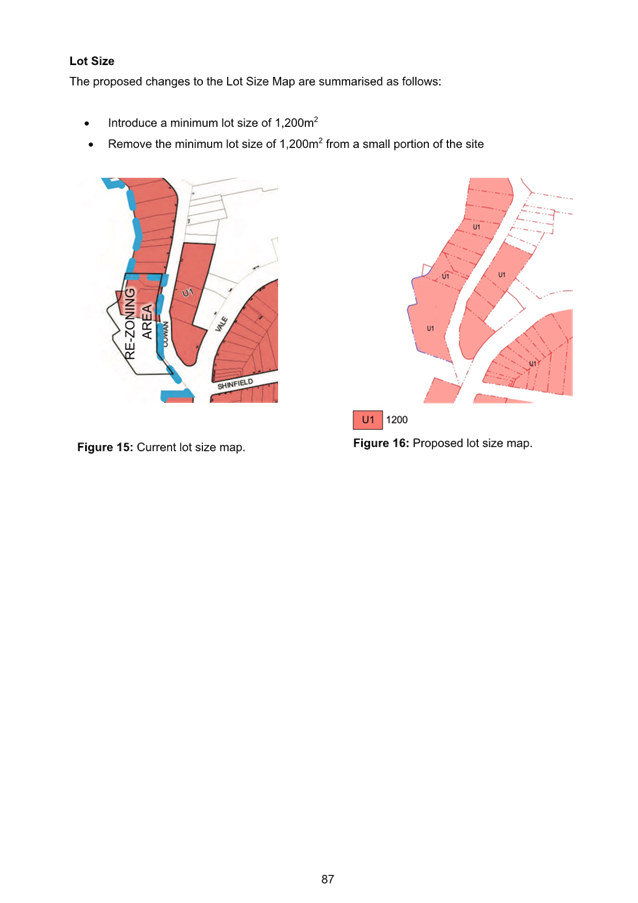
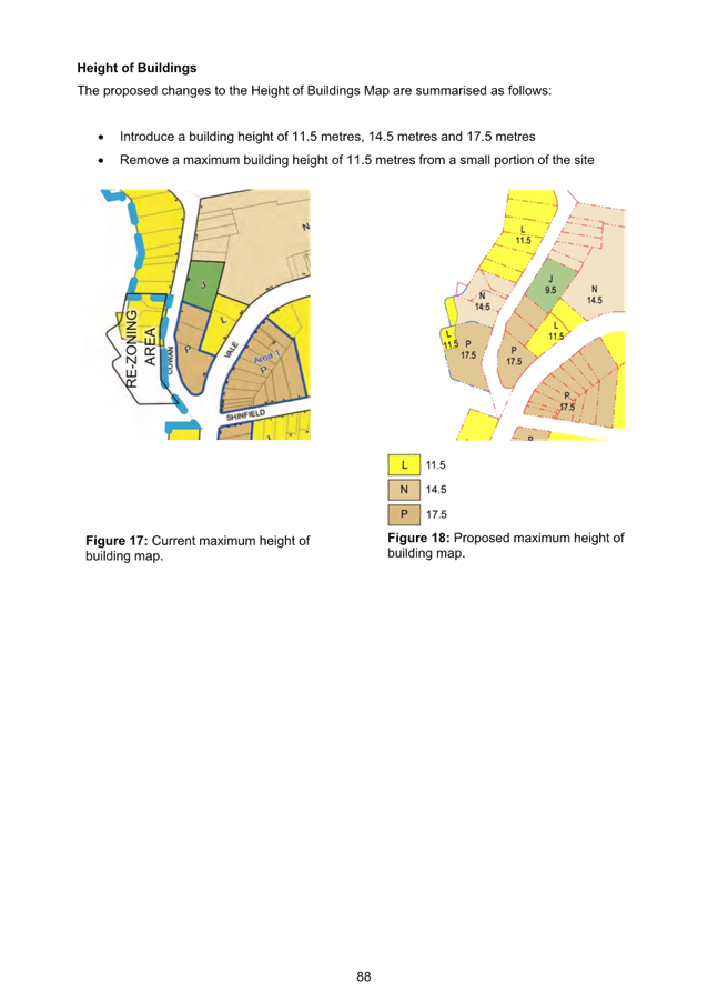
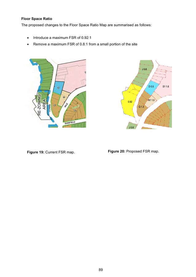
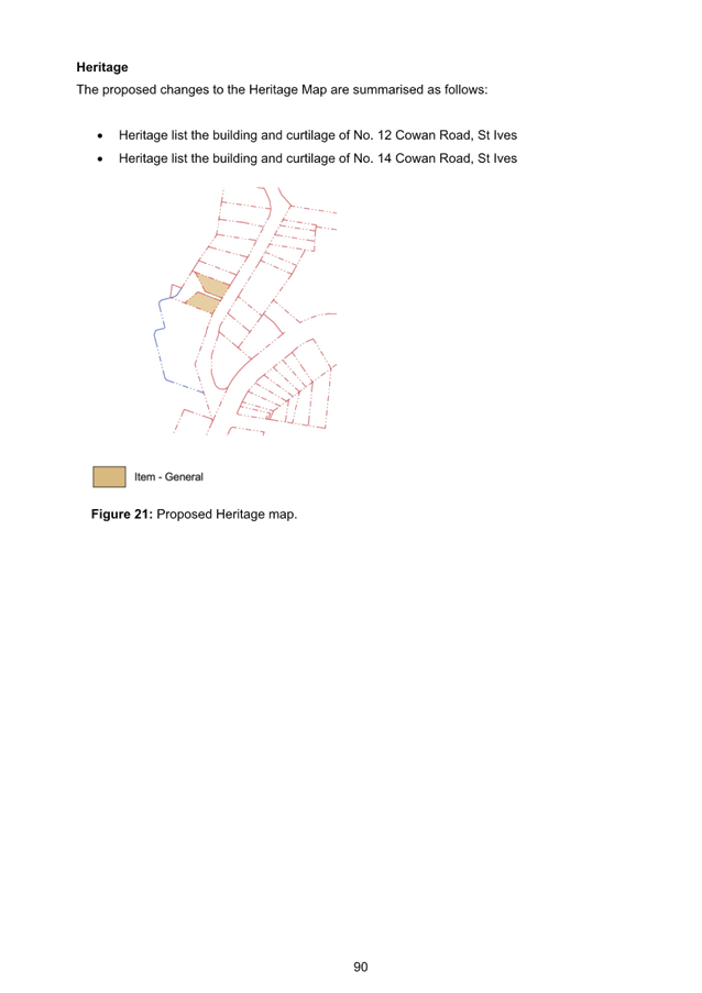
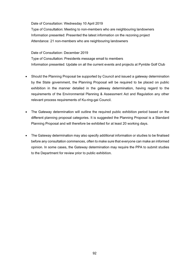
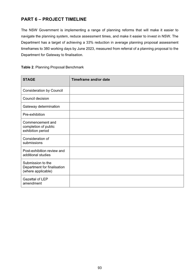


|
ATTACHMENT
No: 7 - Appendix
E - Urban Design Report
|
|
Item No: GB.6
|
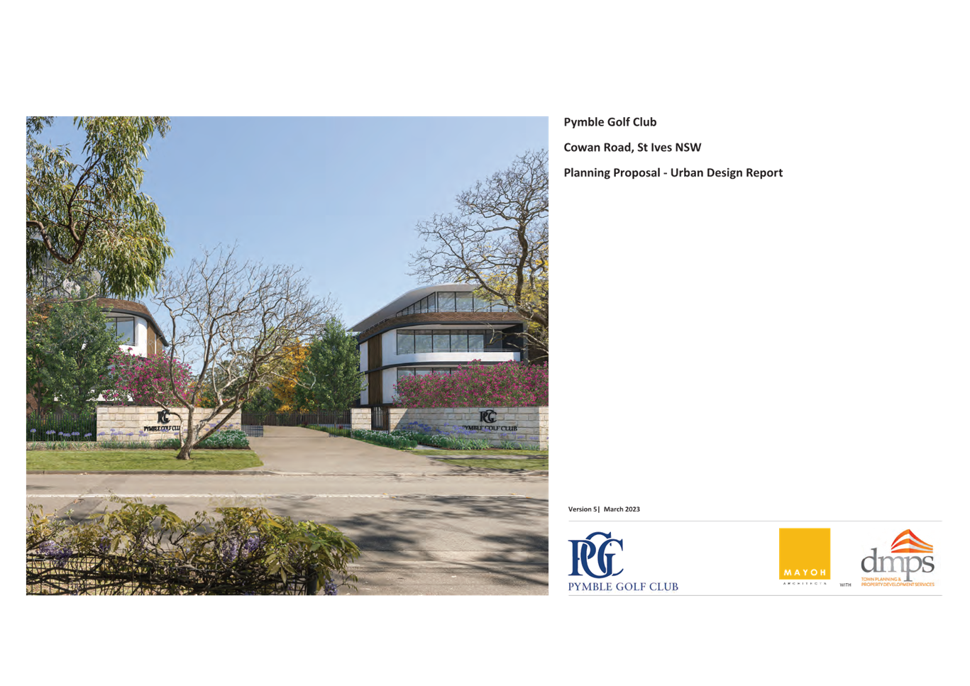
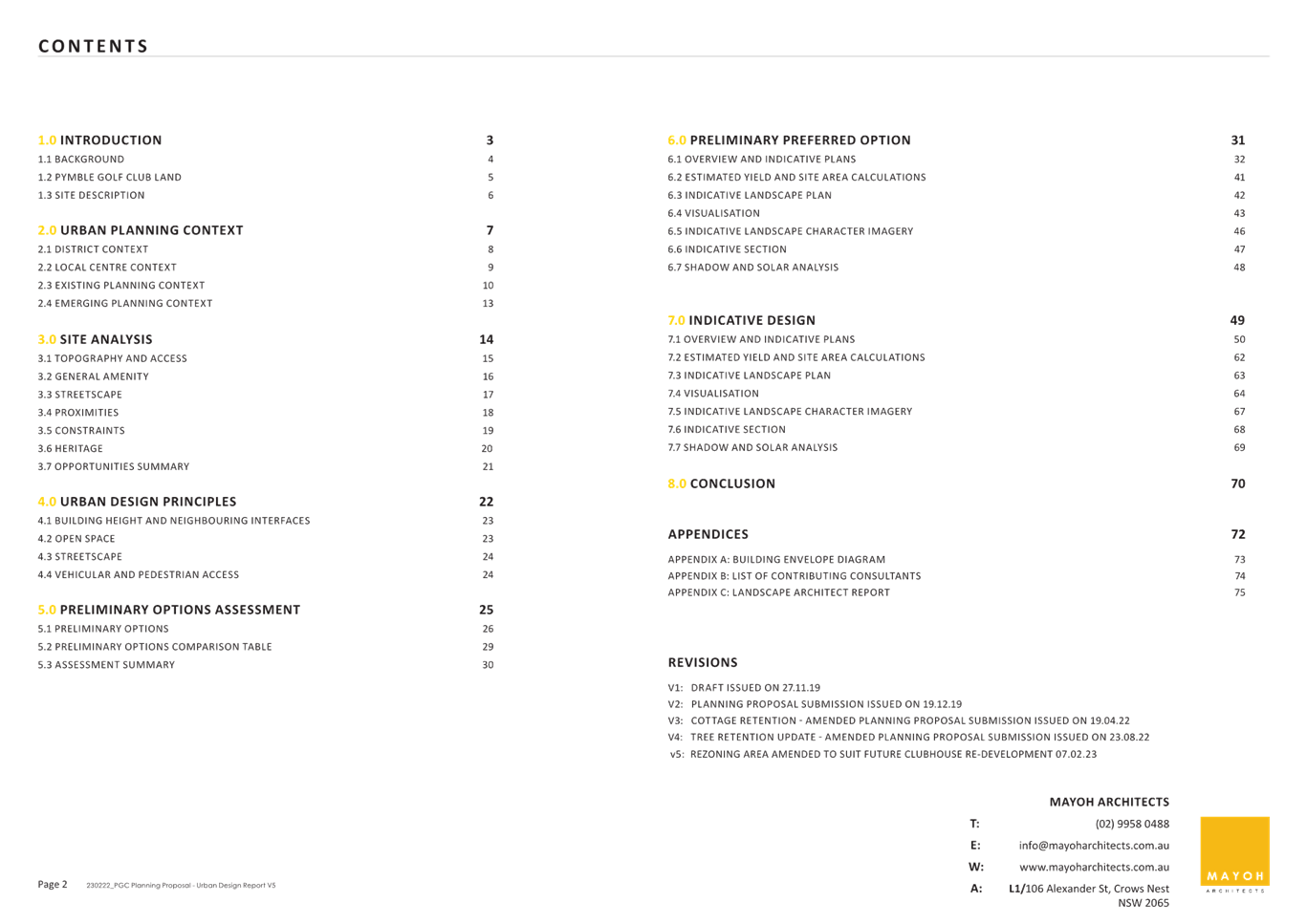
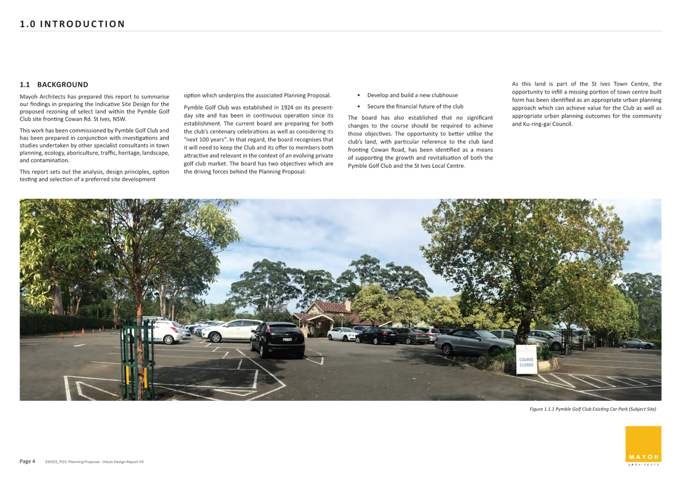
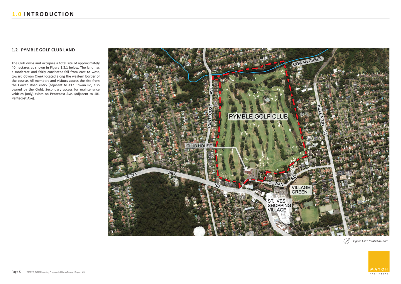
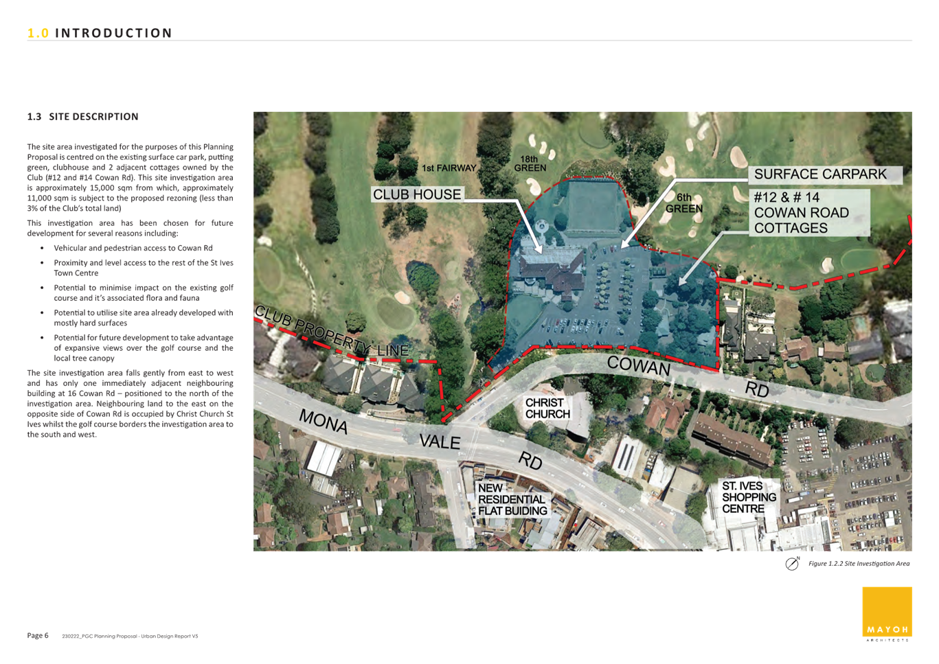
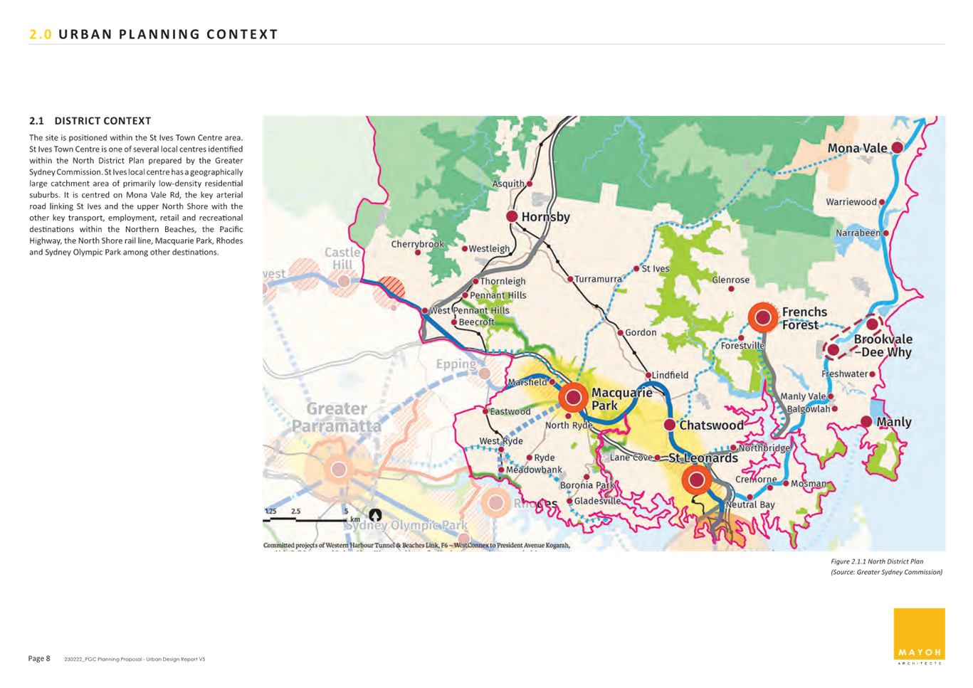
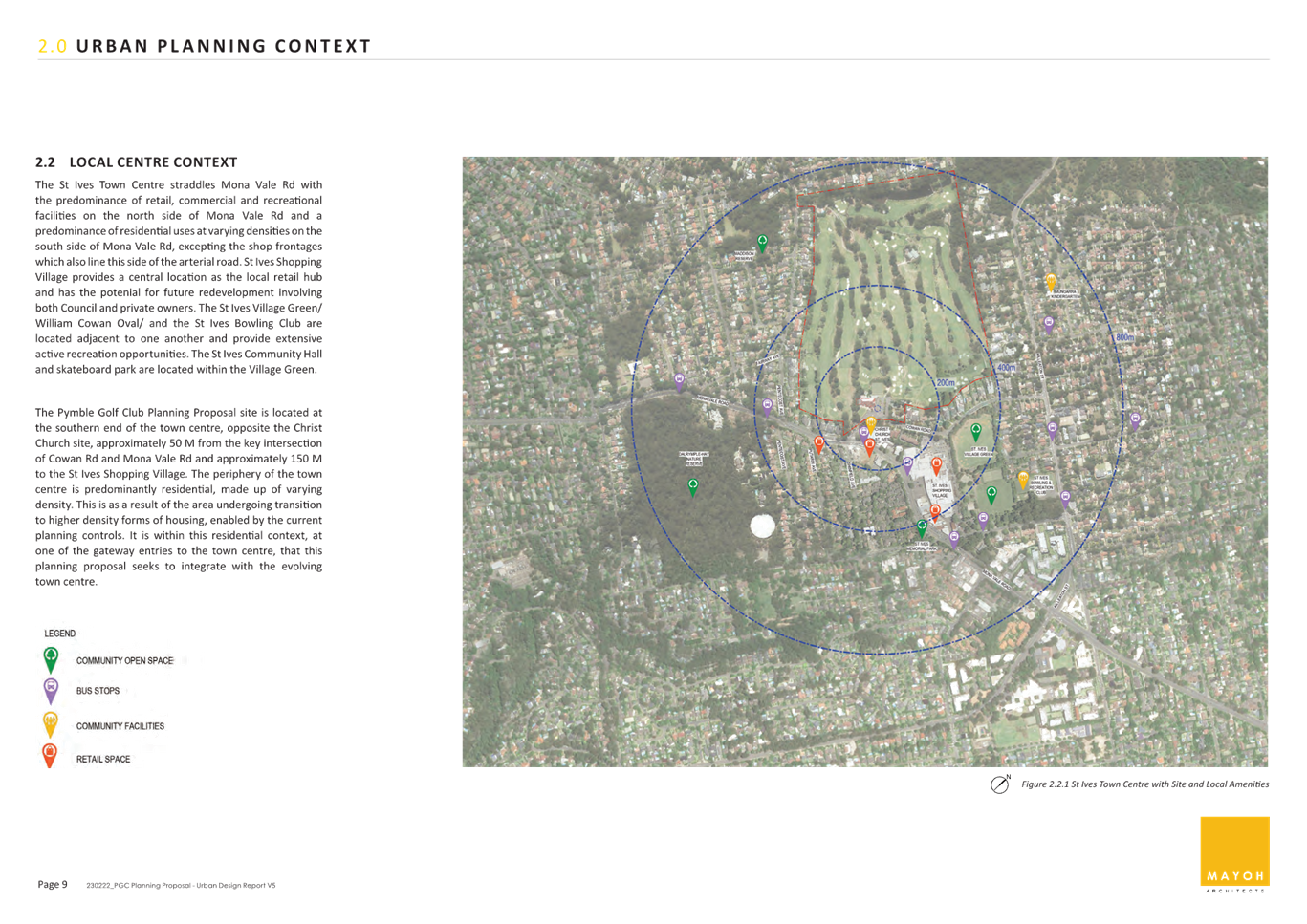
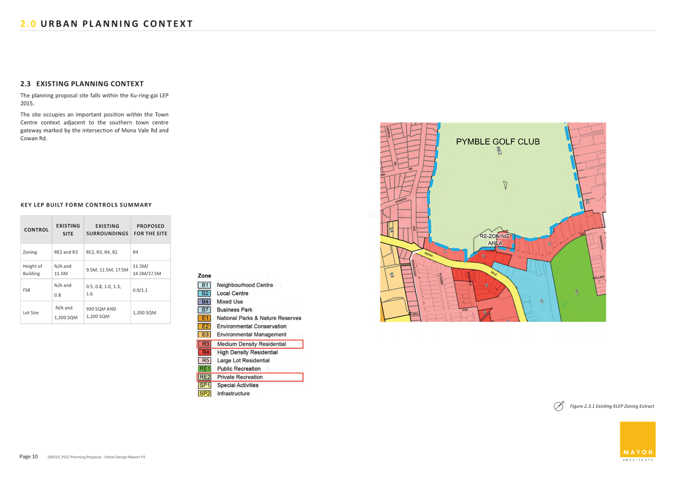
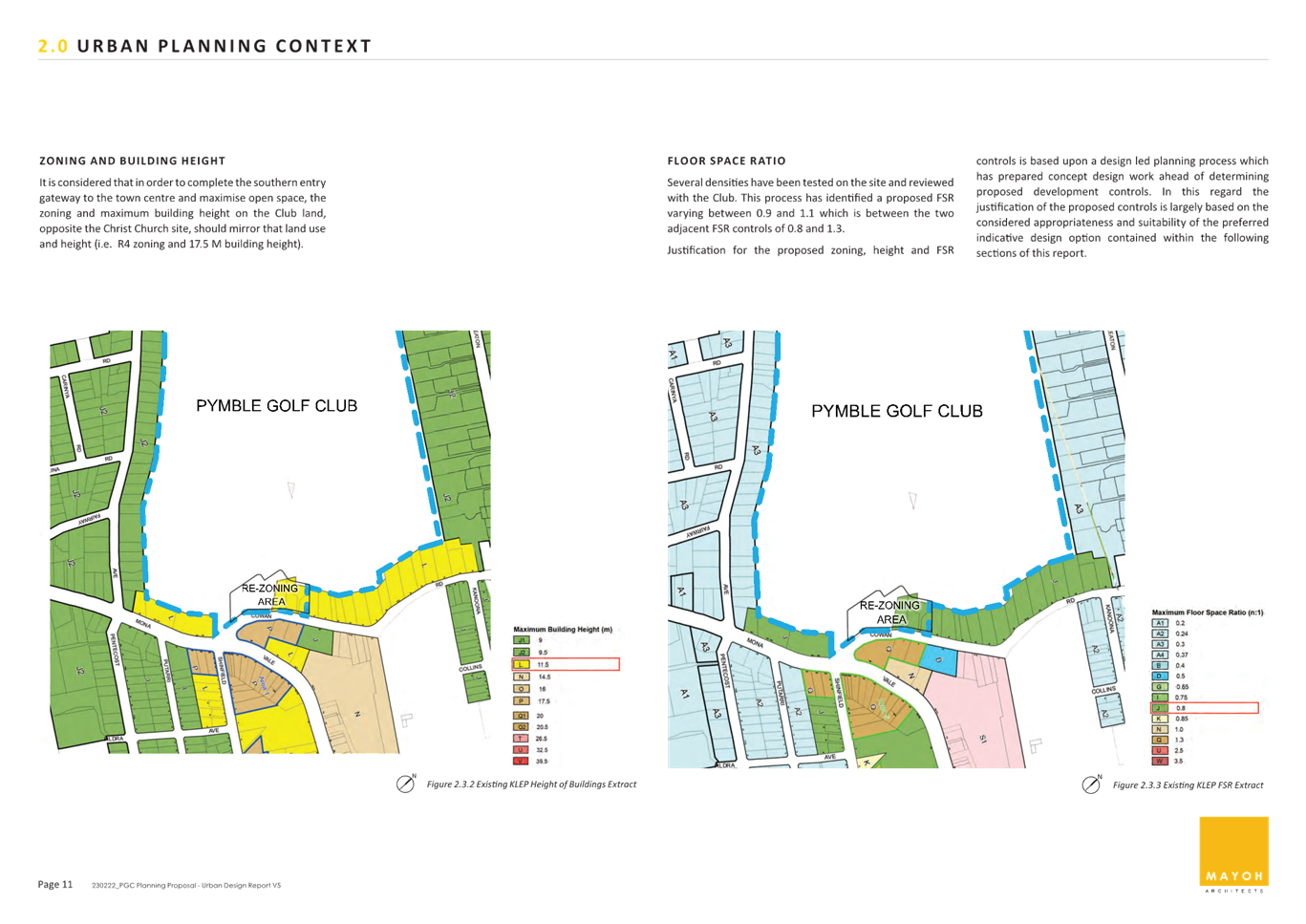
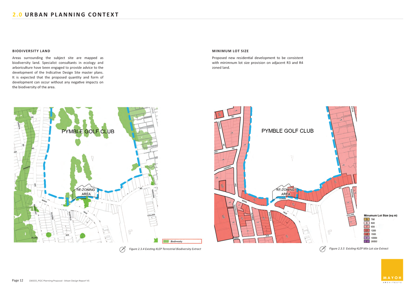
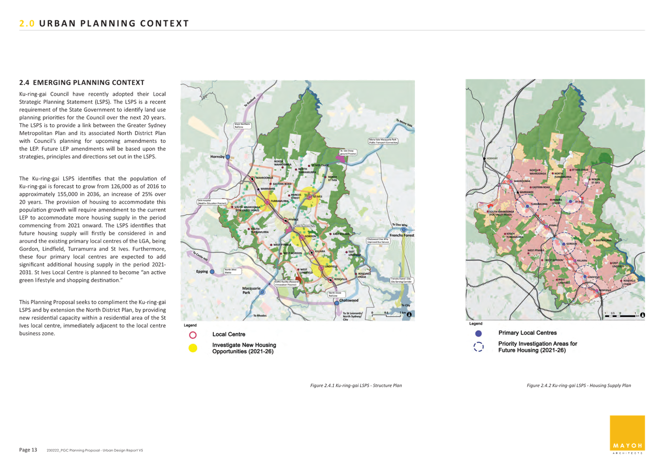
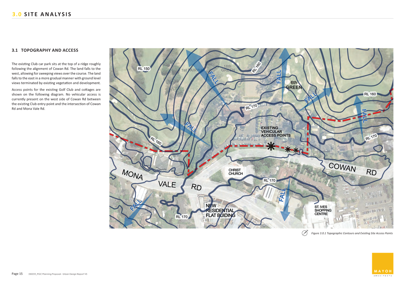
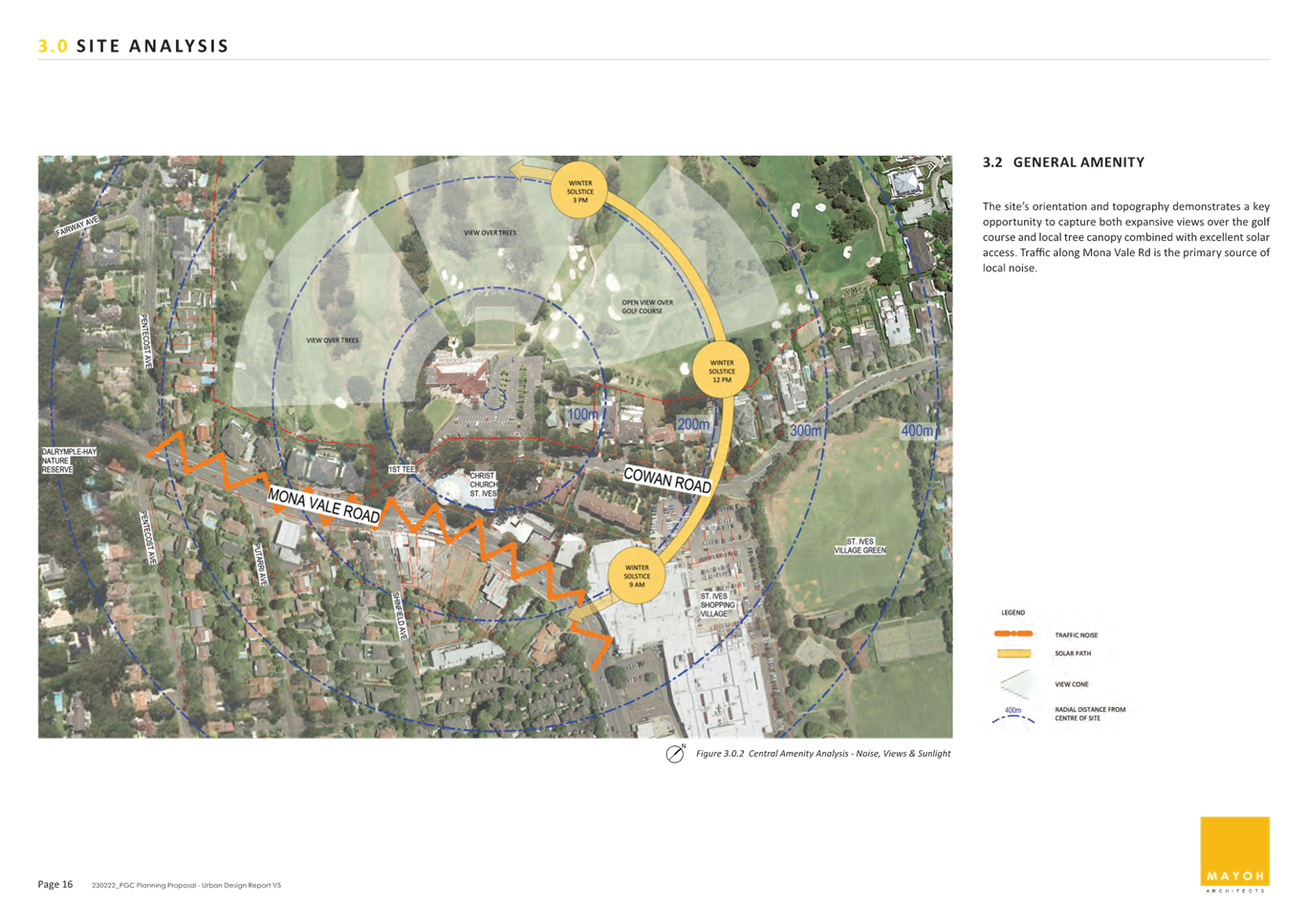
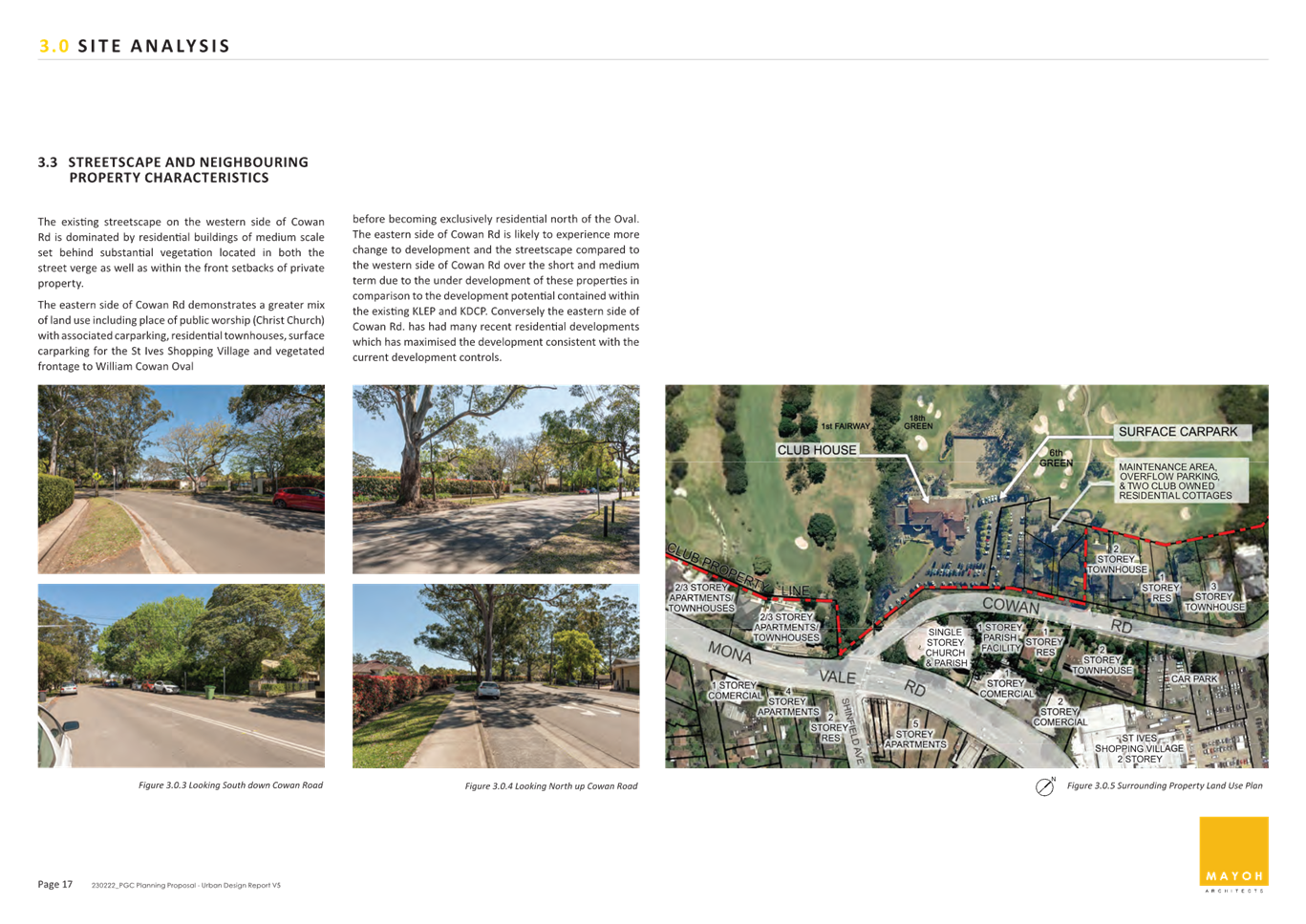
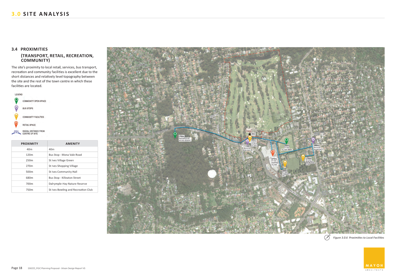
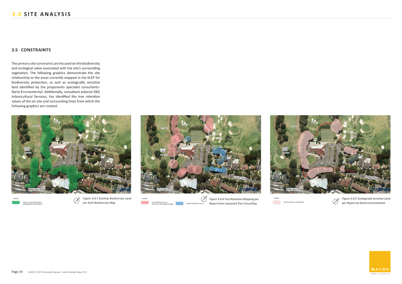
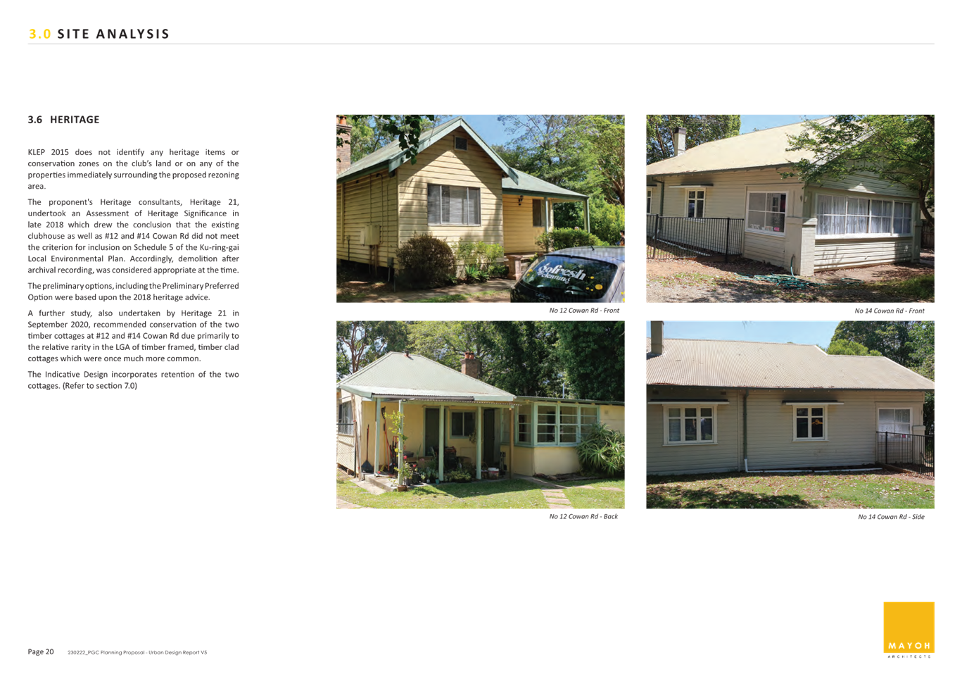
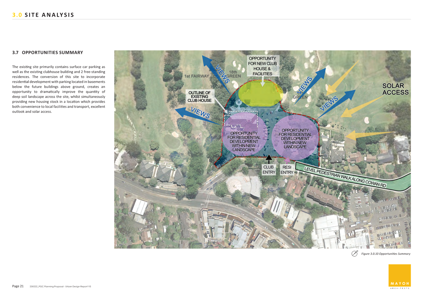

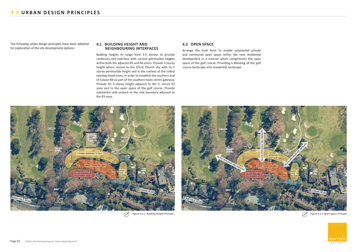
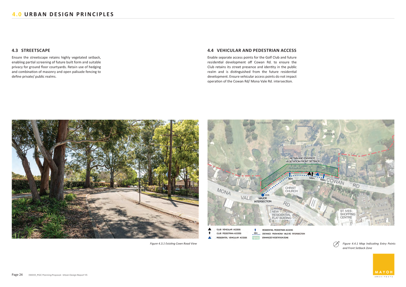
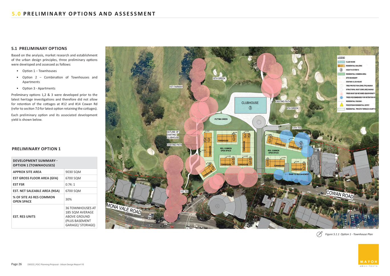
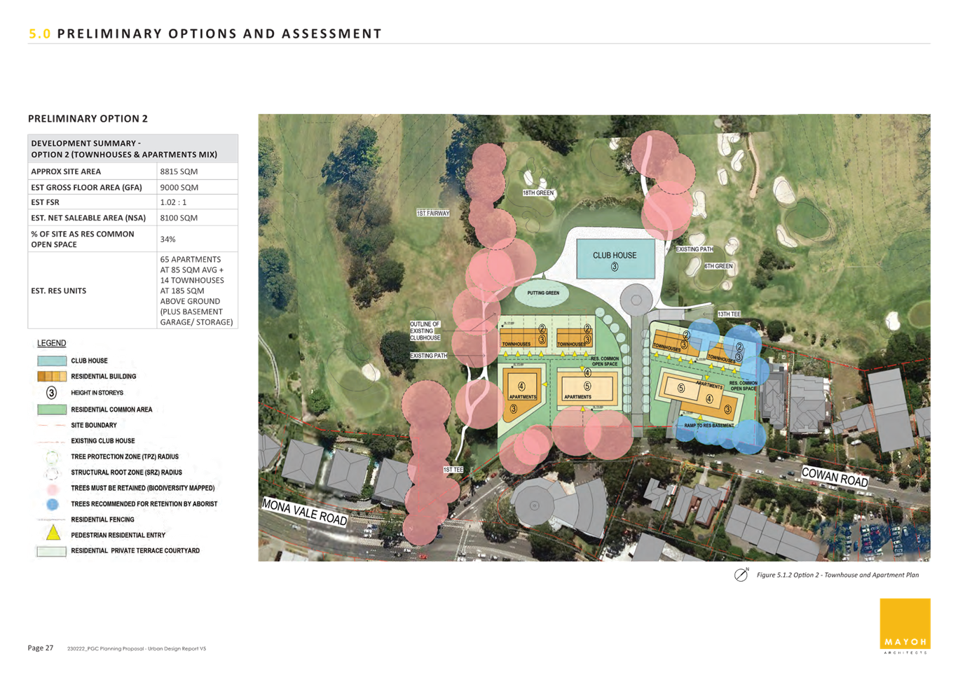
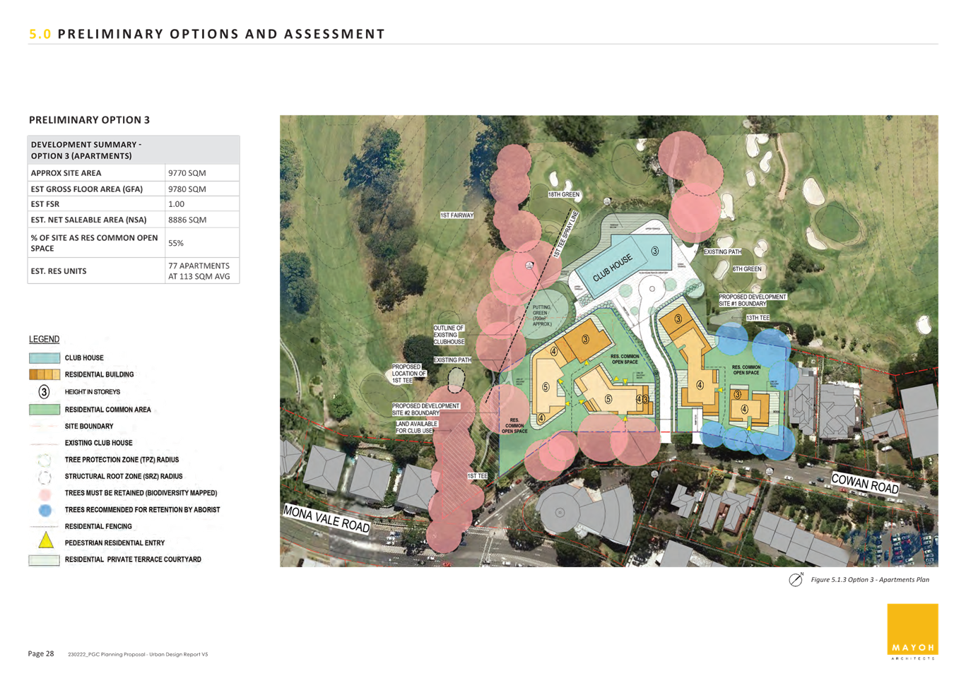
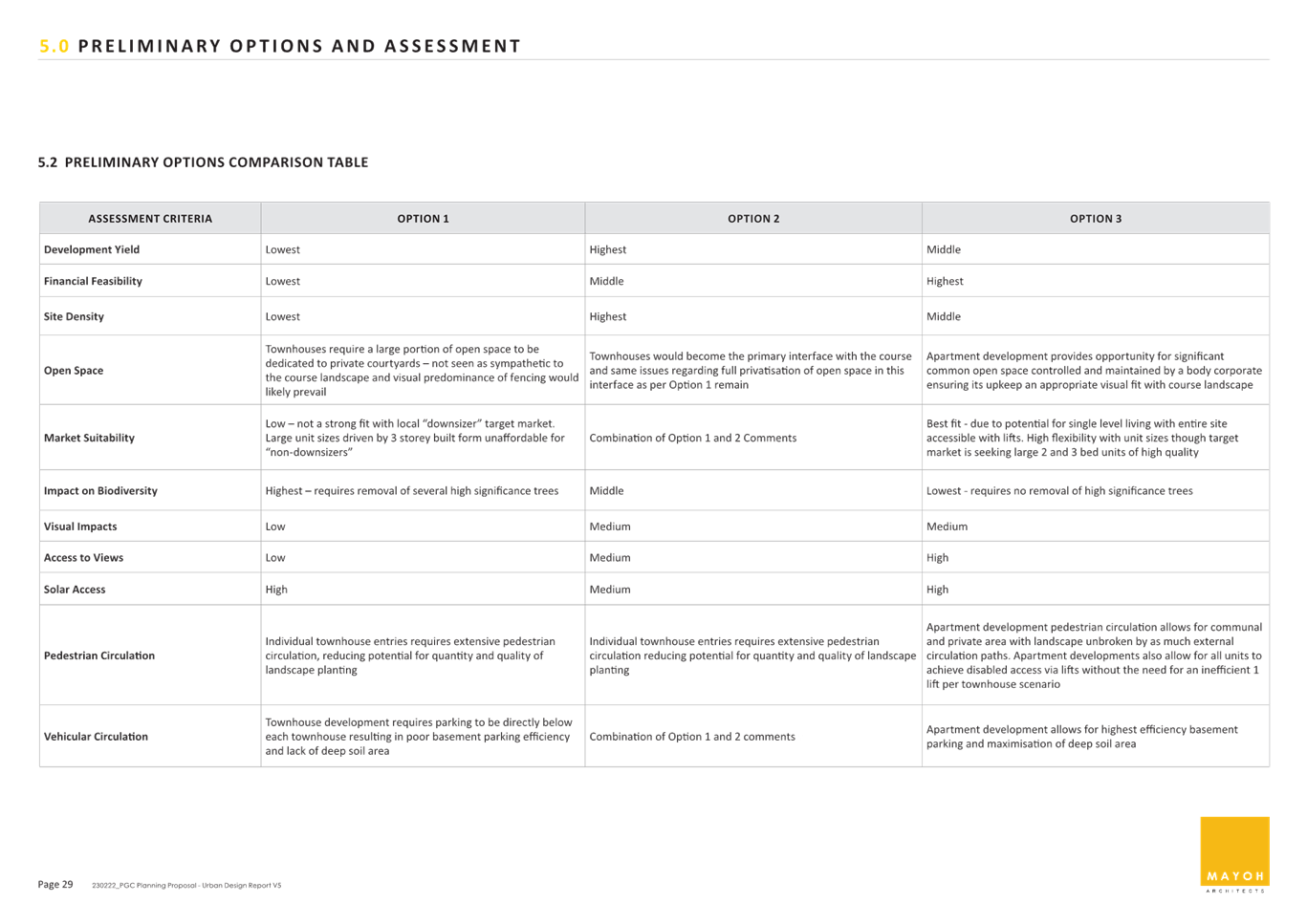
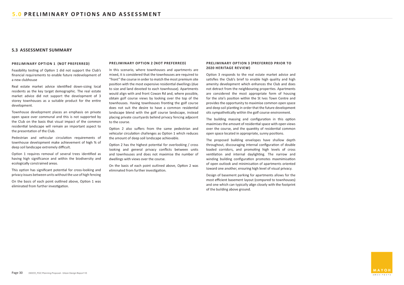
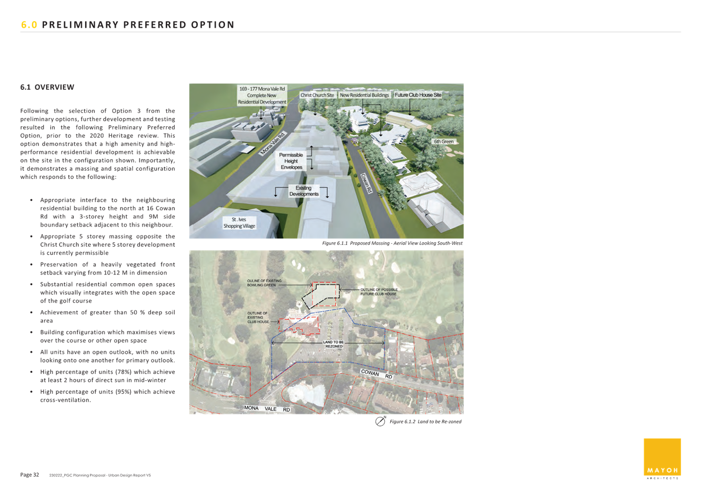
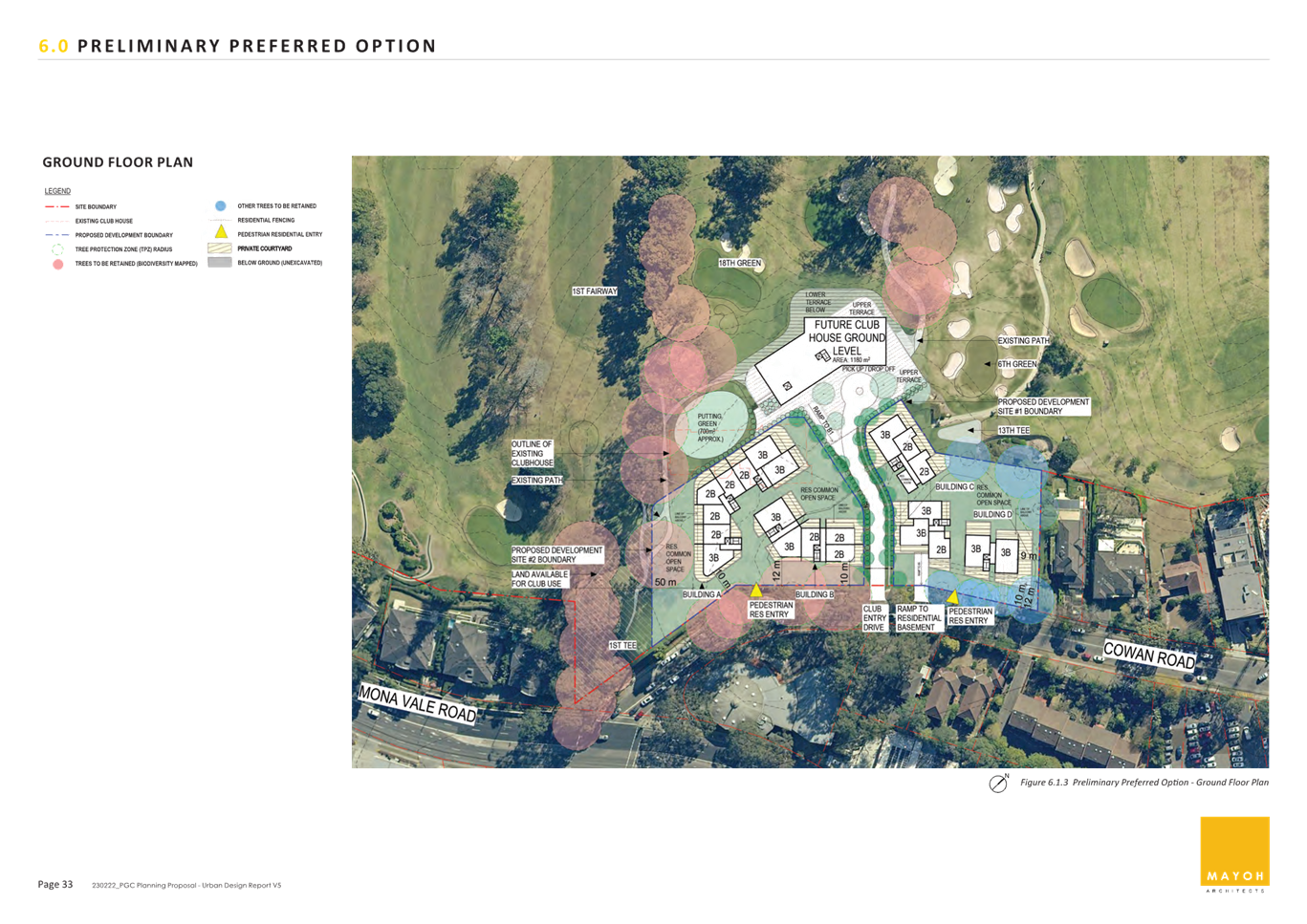
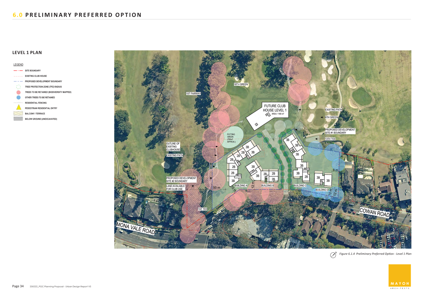
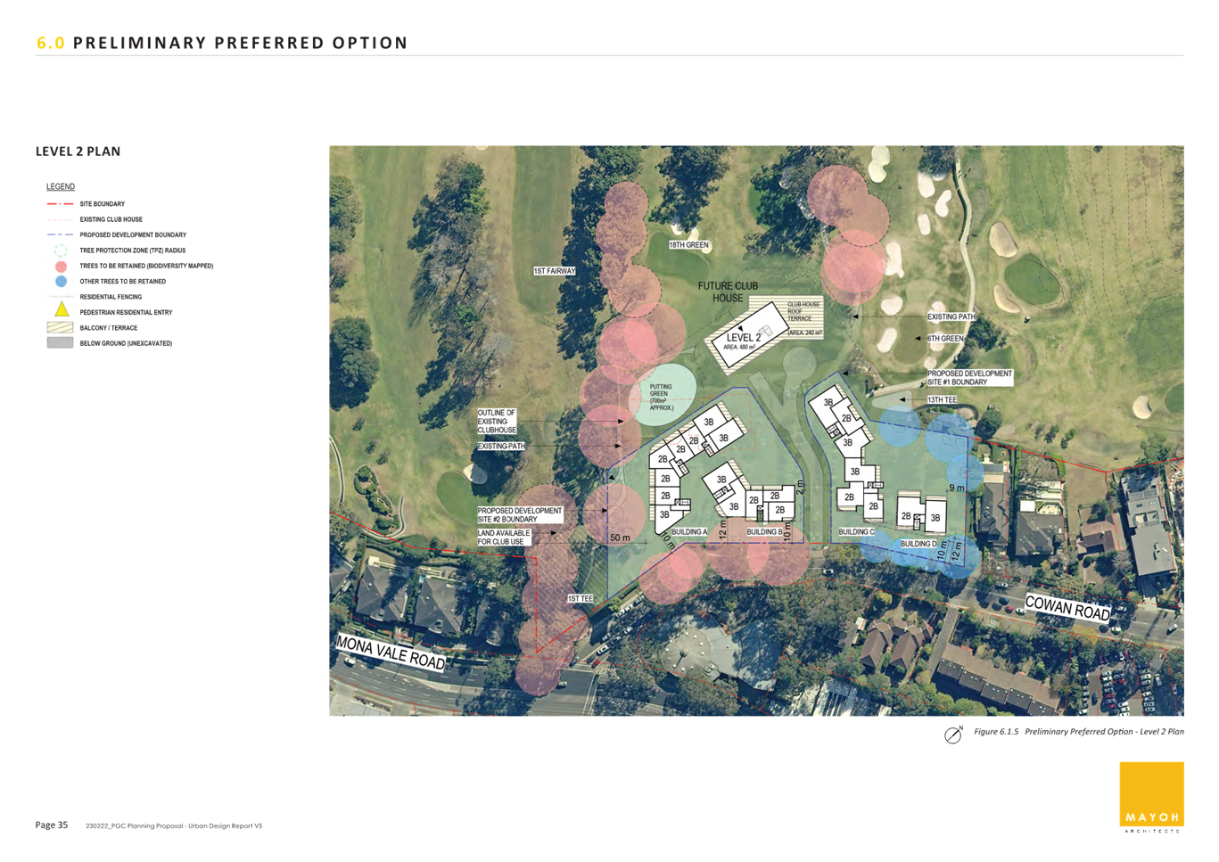
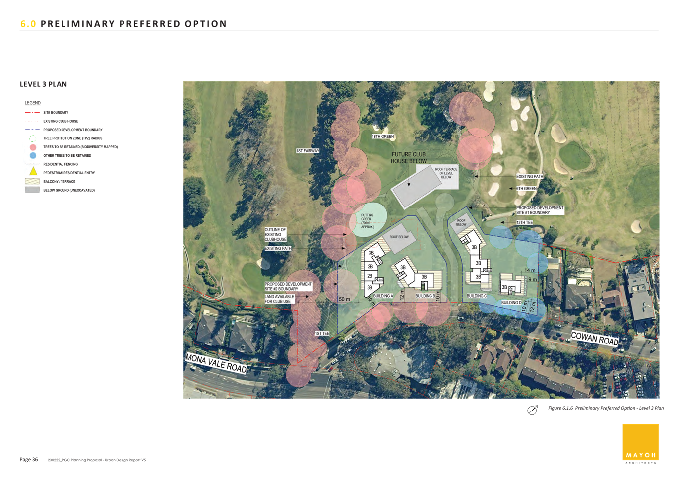
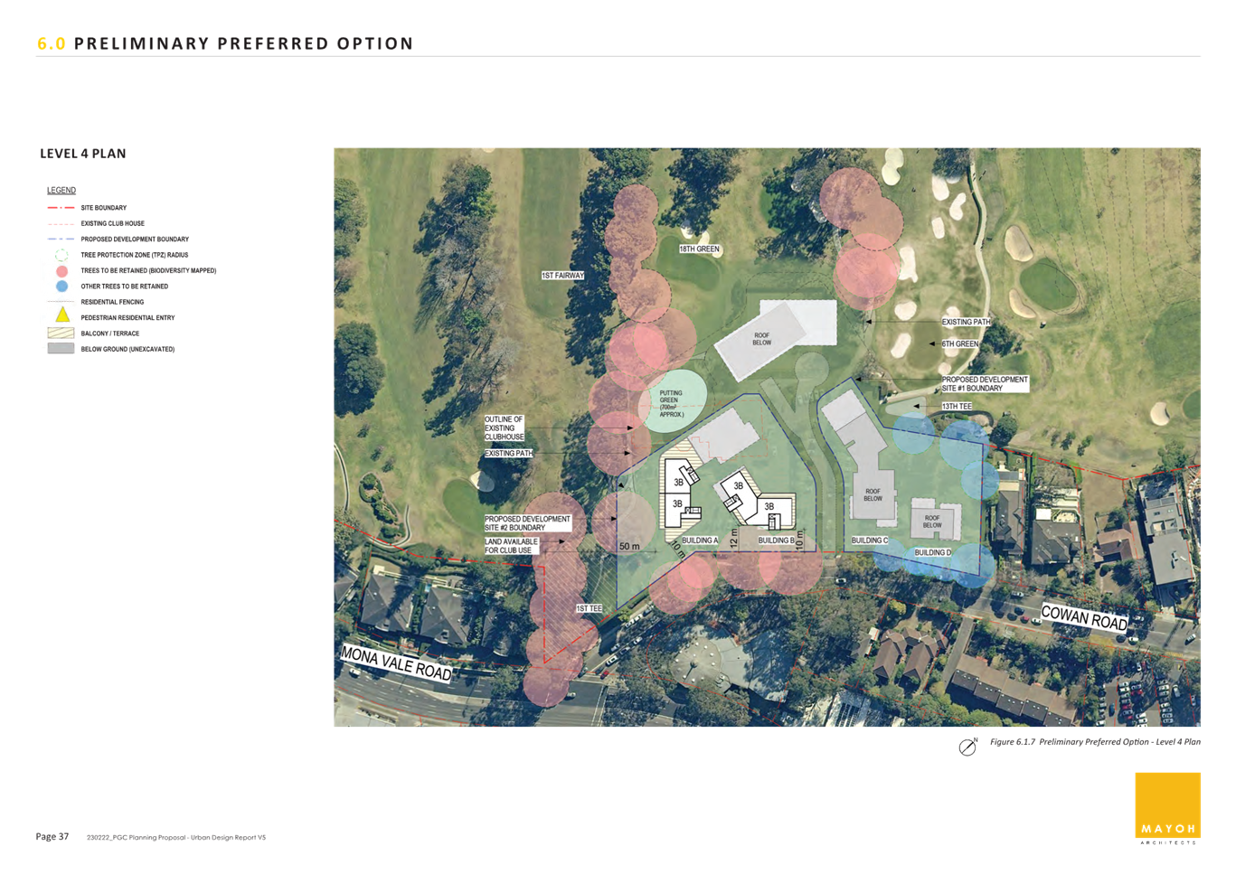
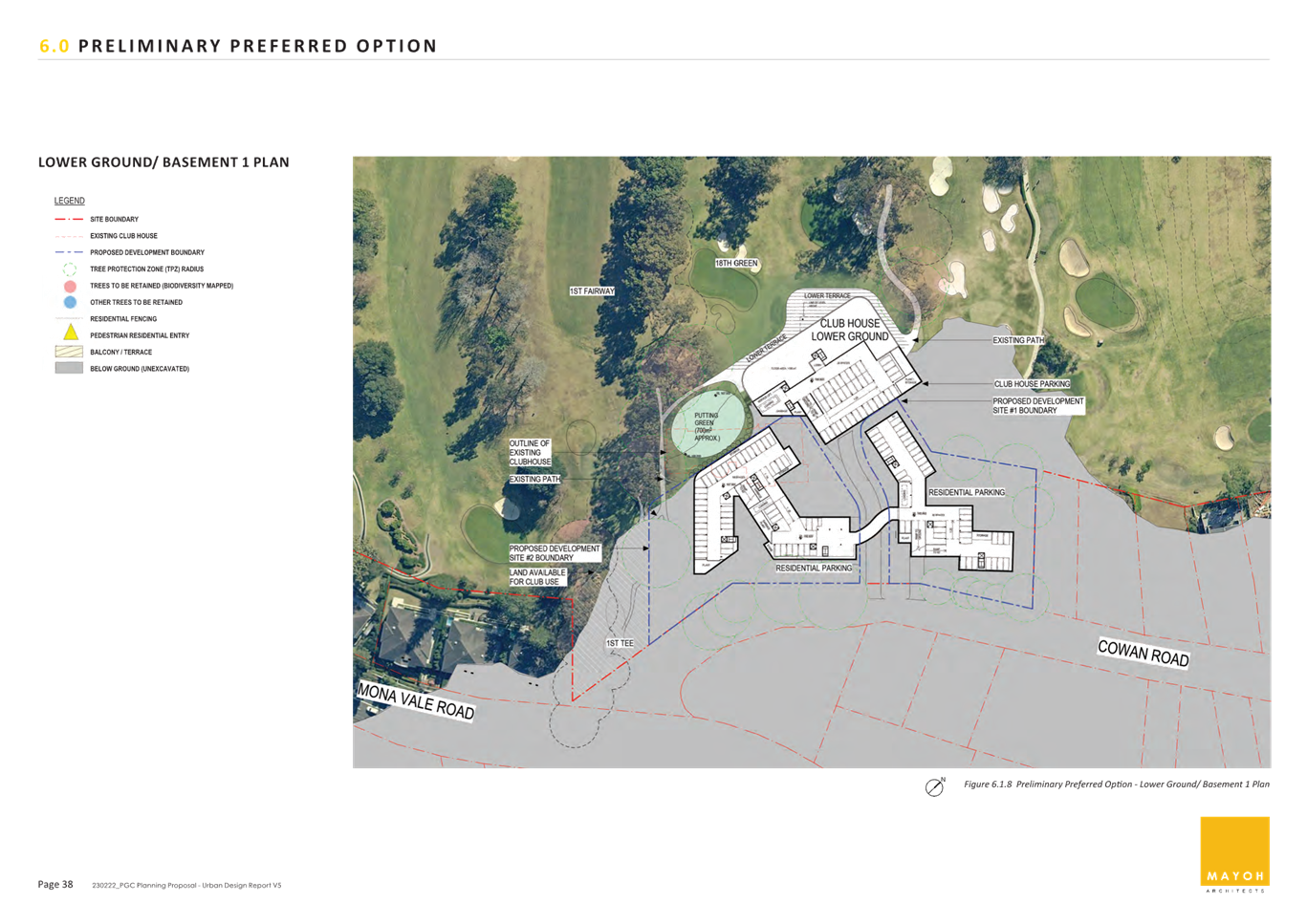
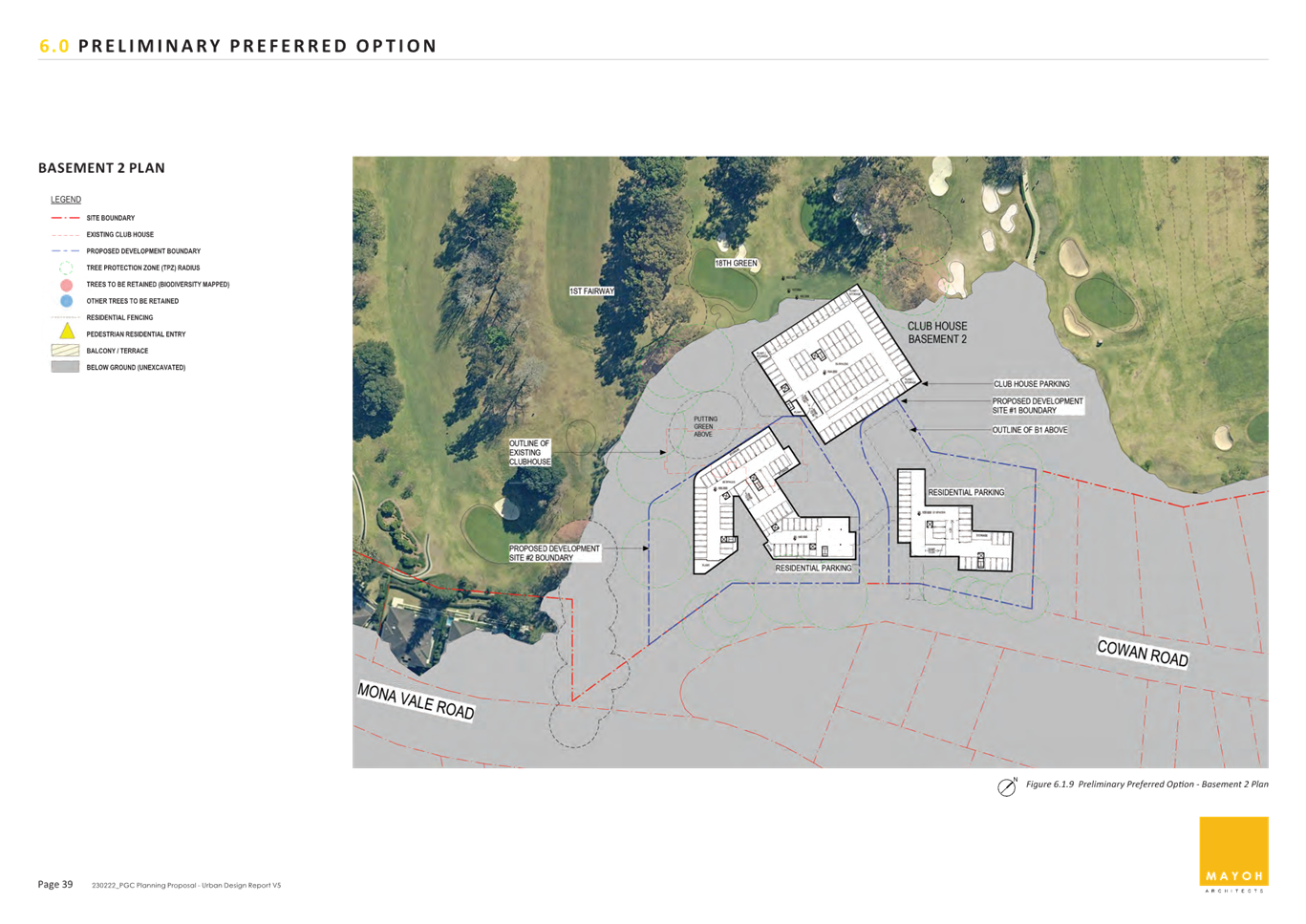
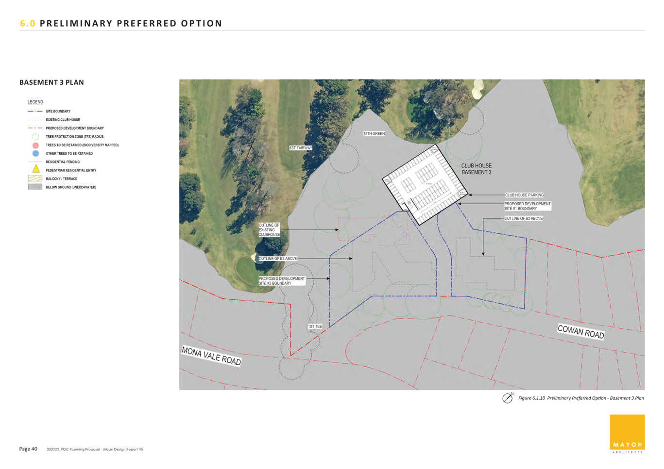
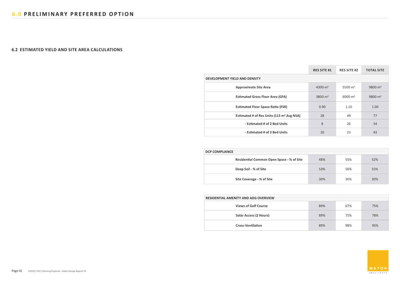
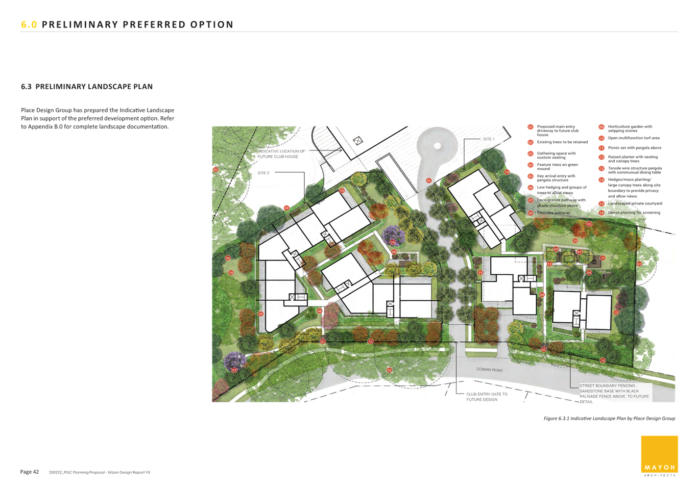
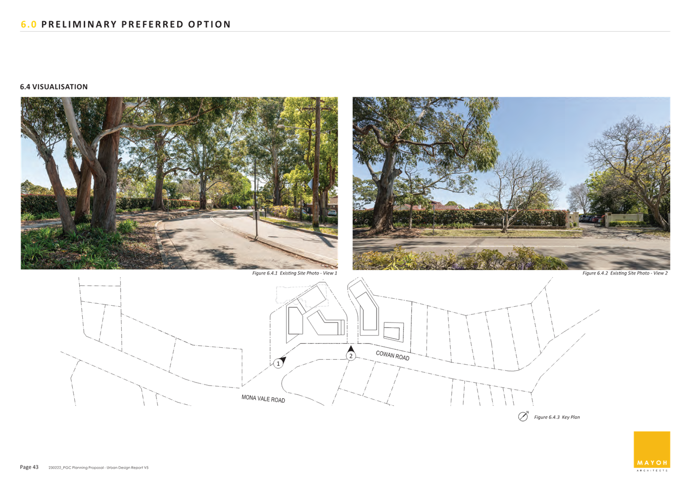
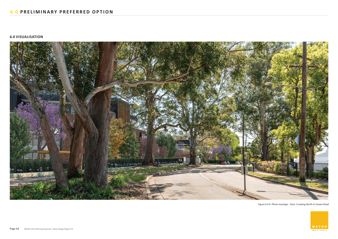
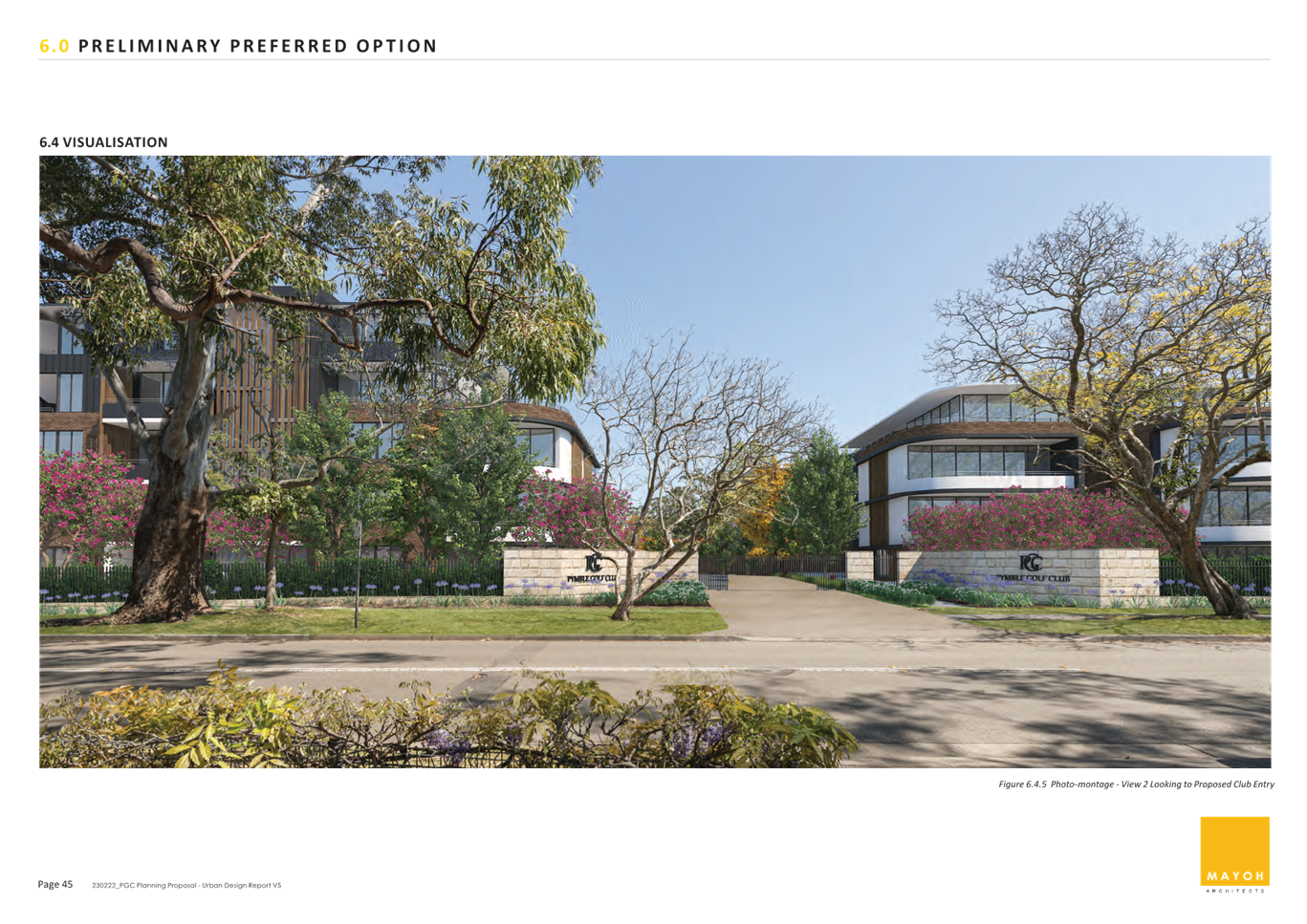
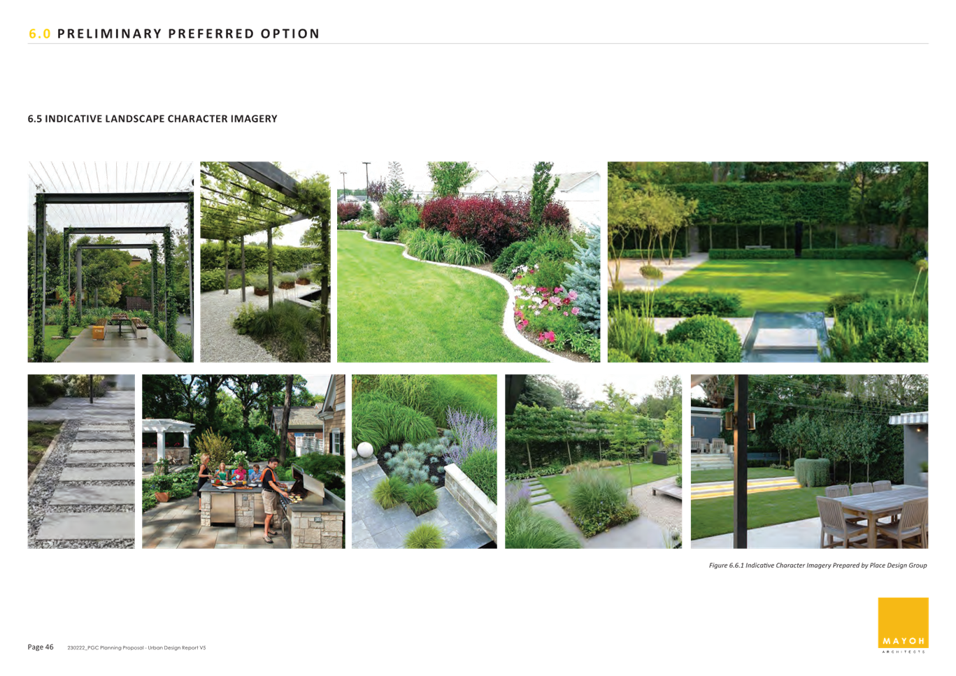
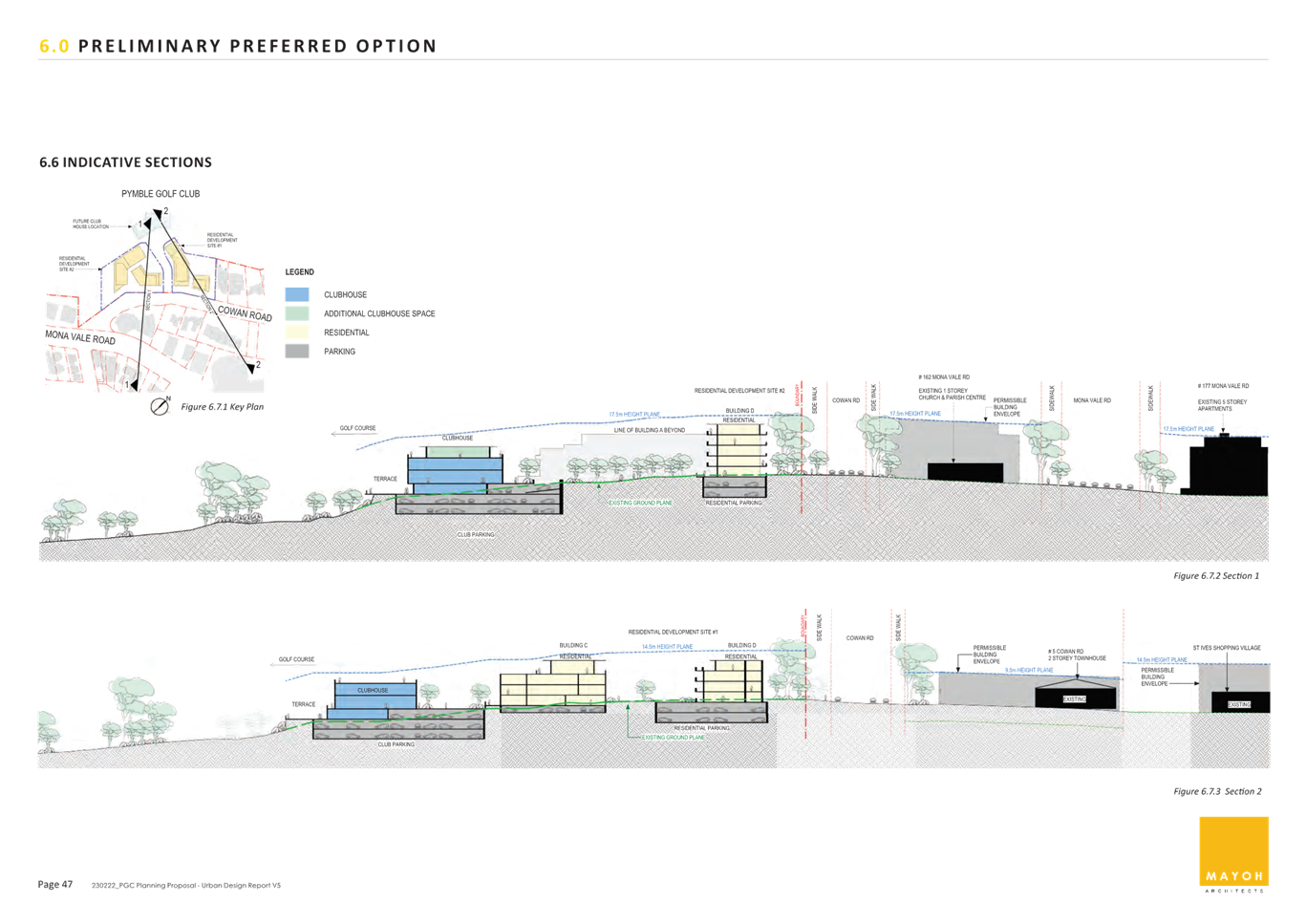
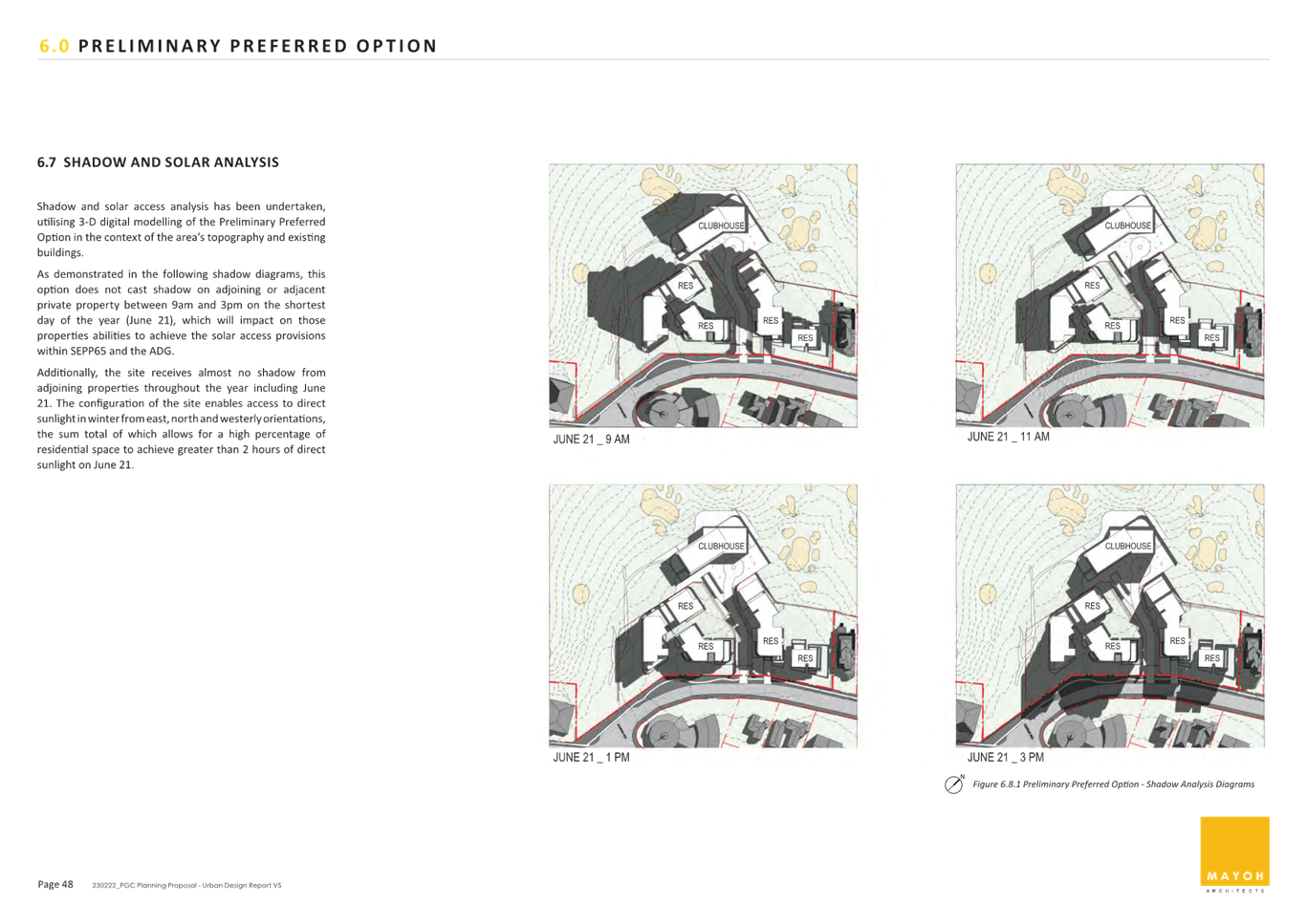
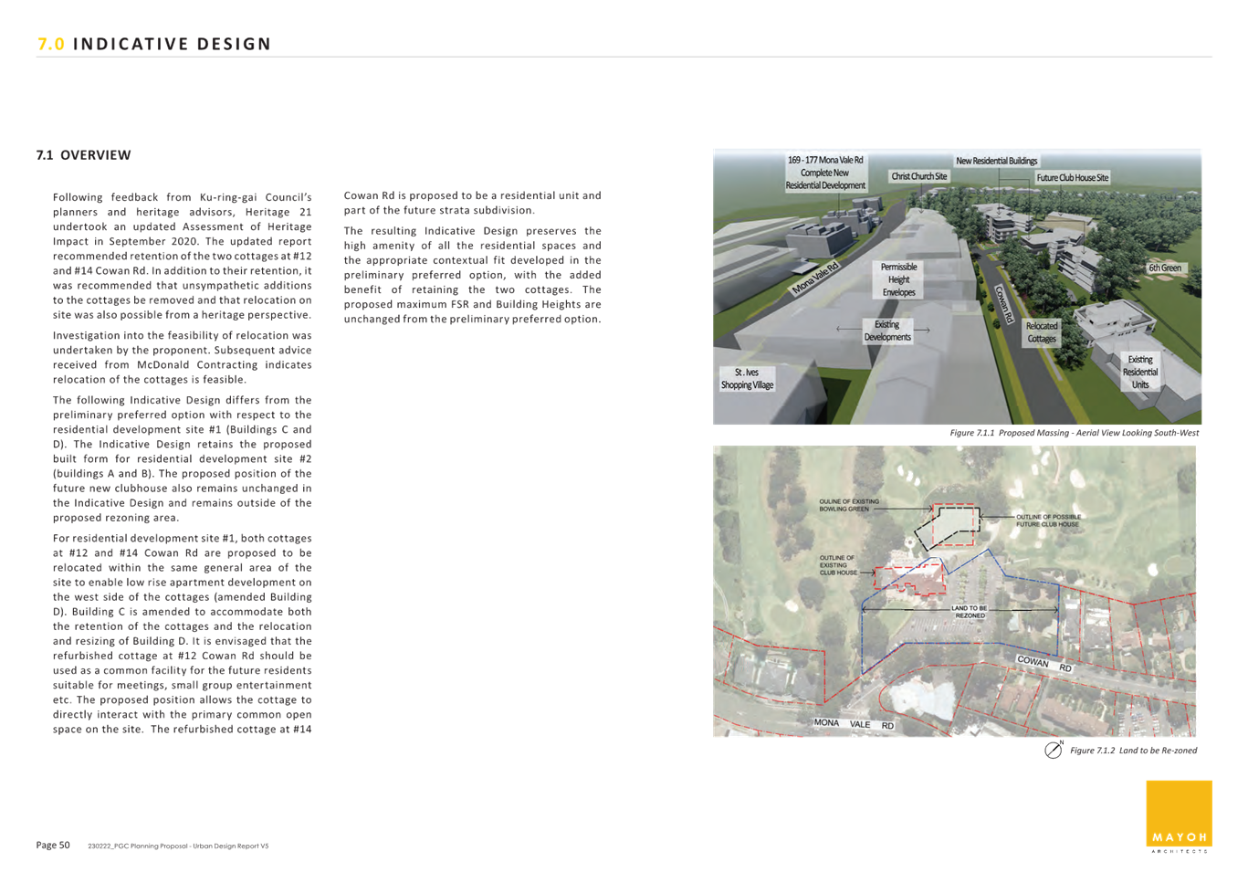
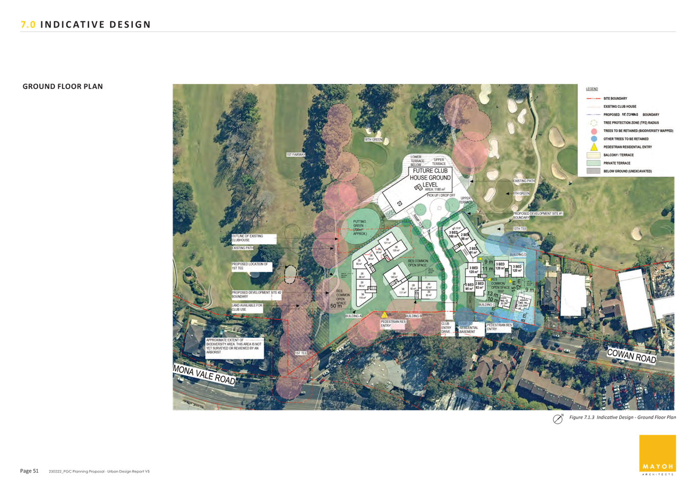
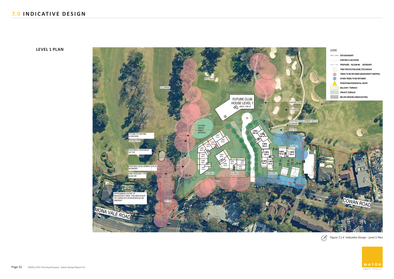
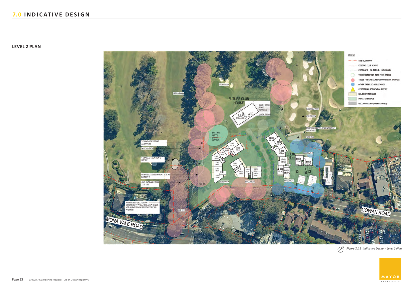
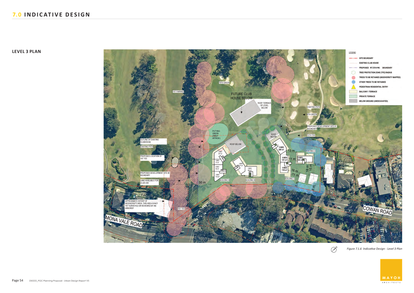
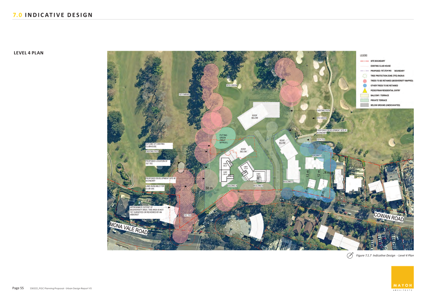
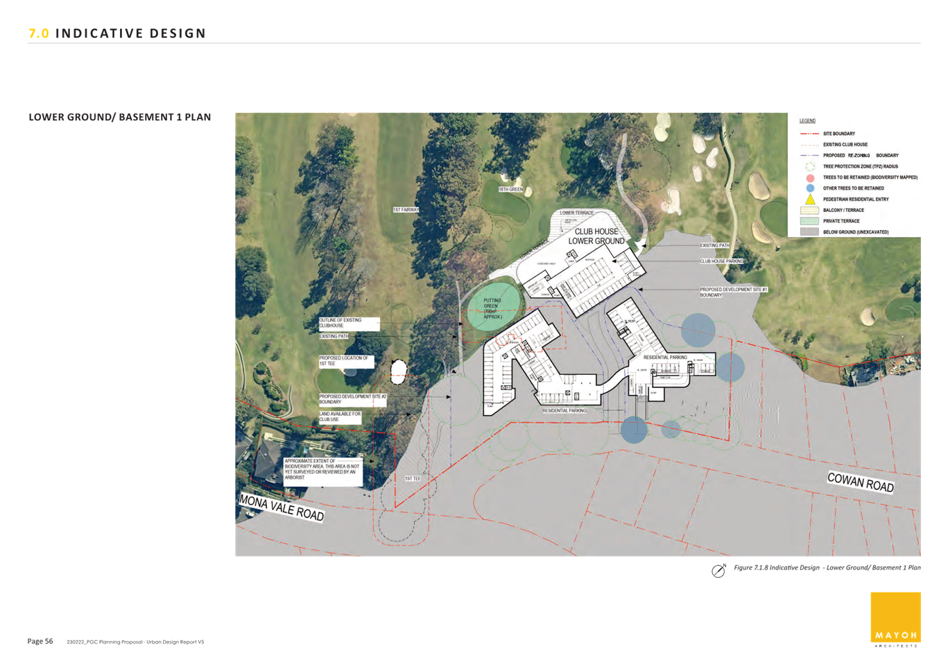
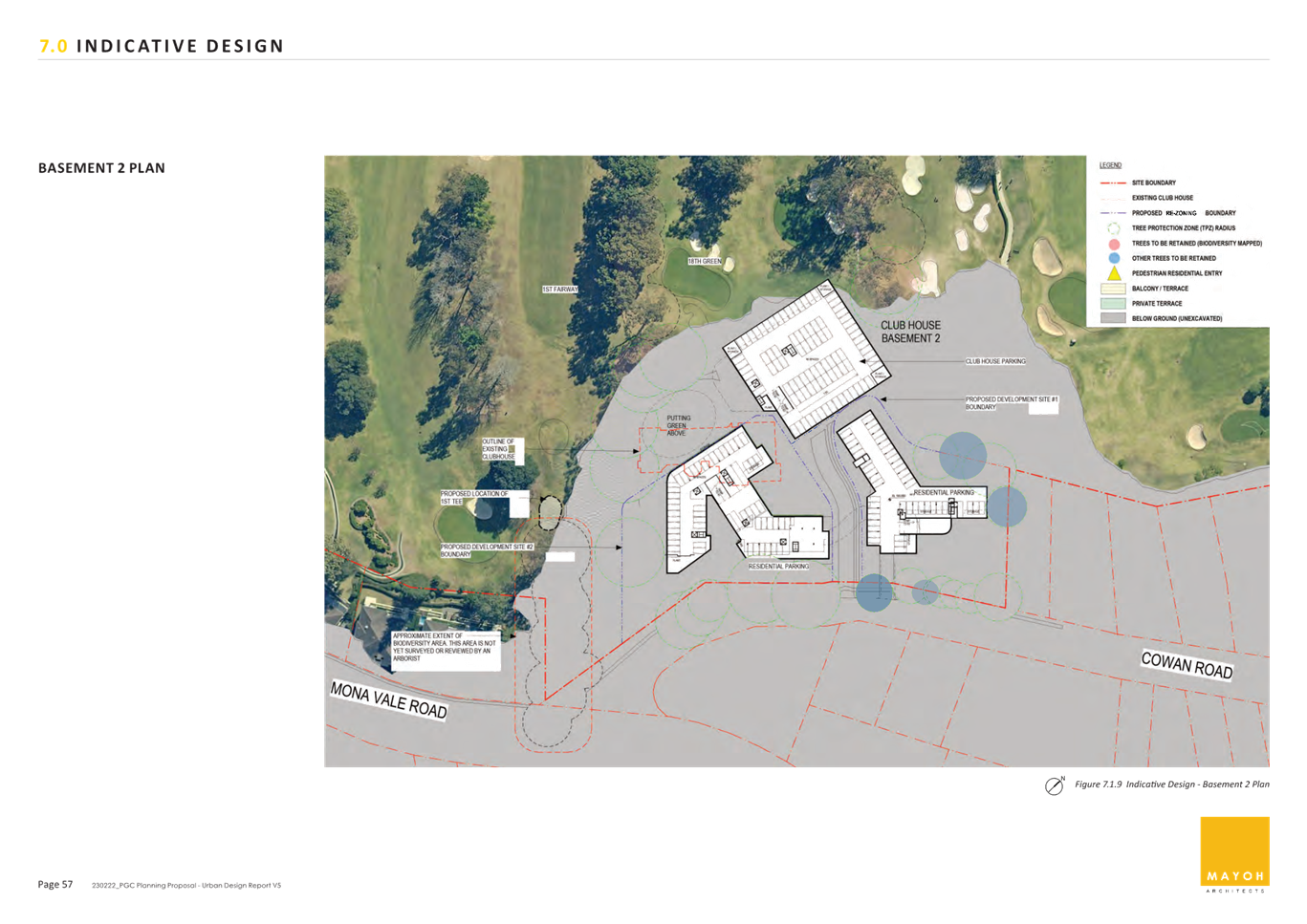
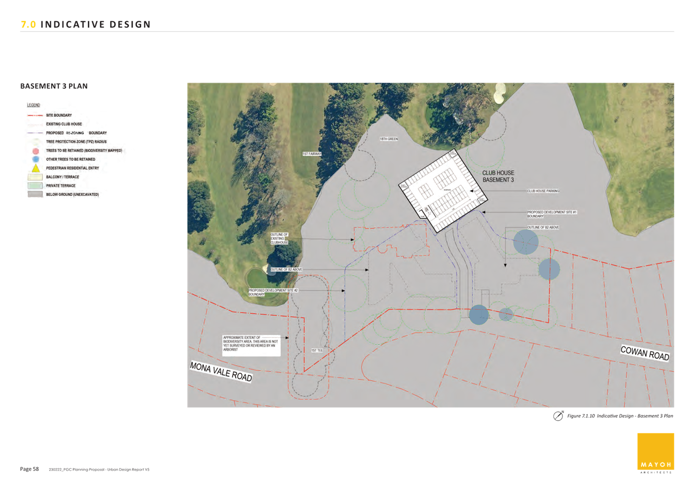
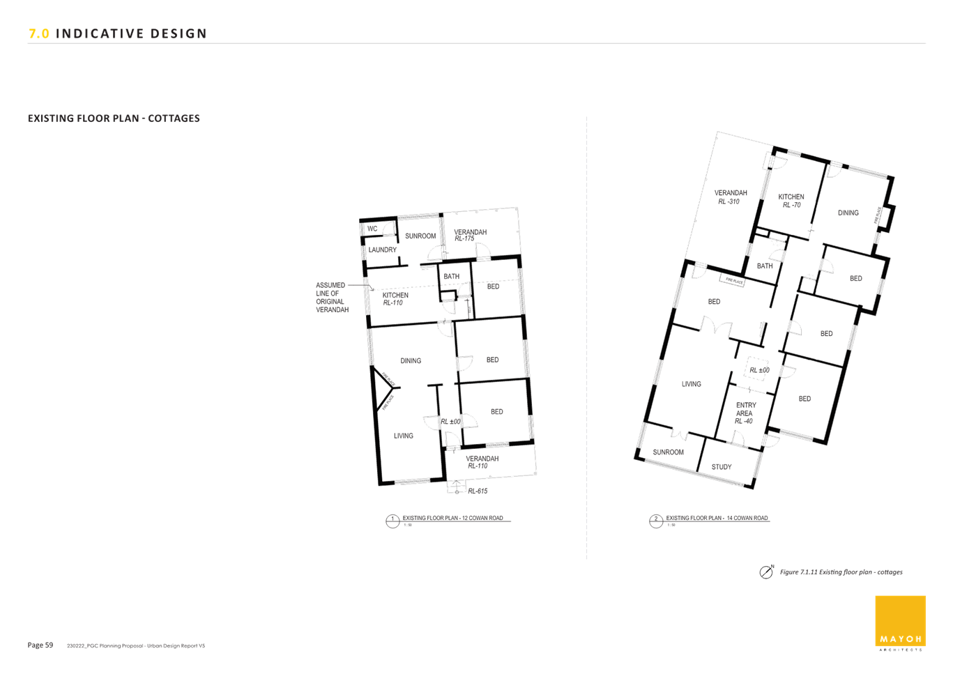
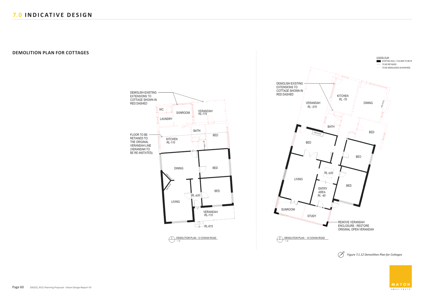
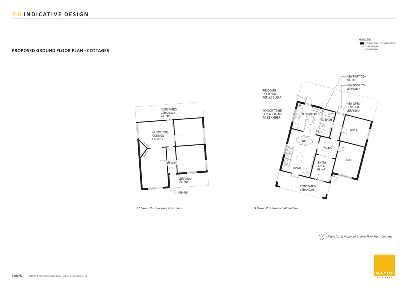
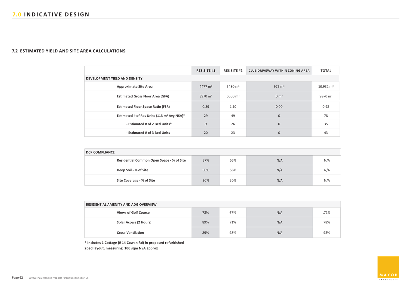
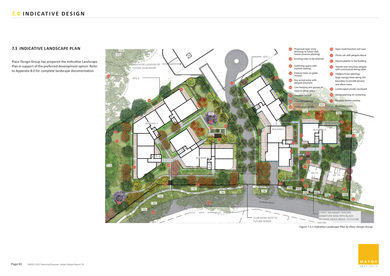
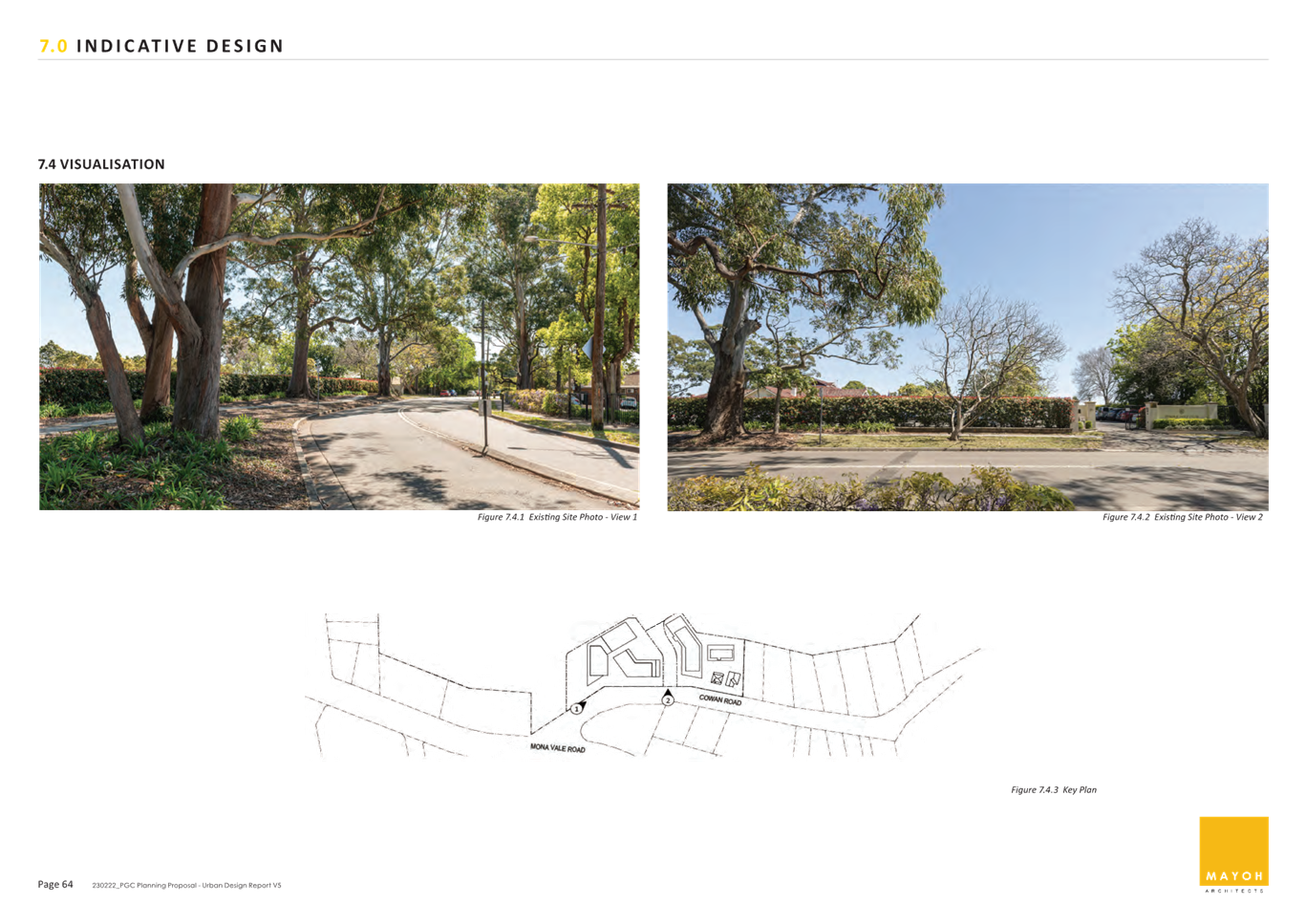
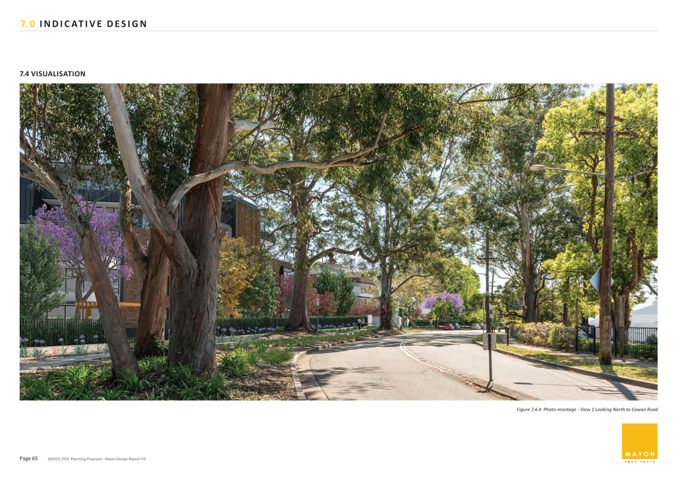
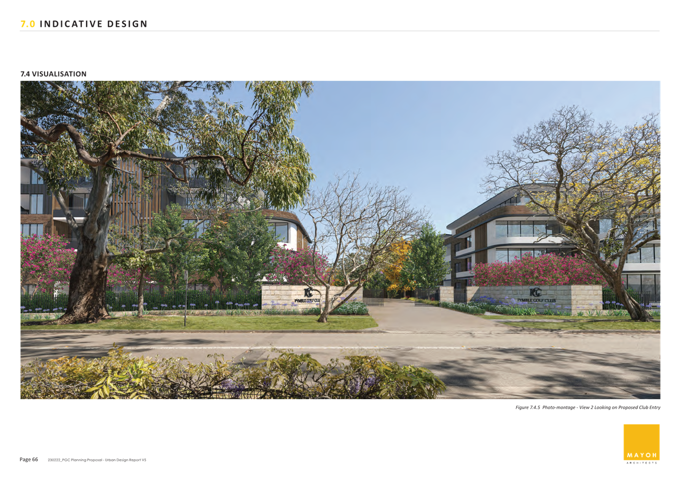
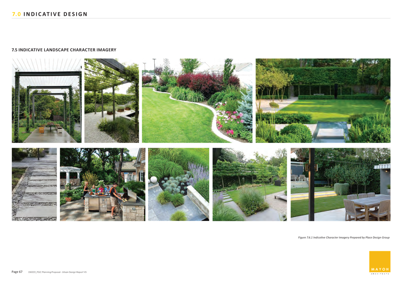
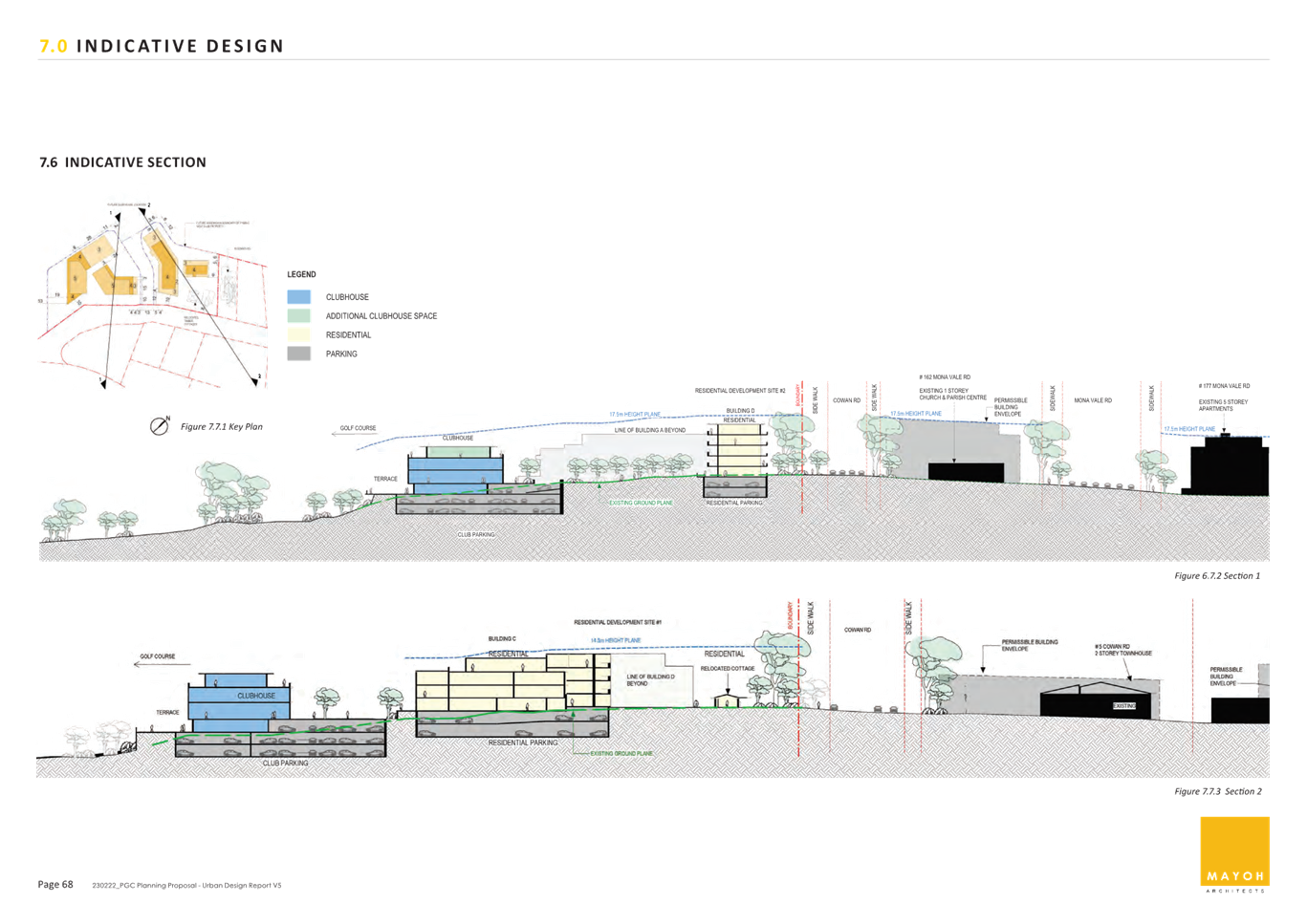
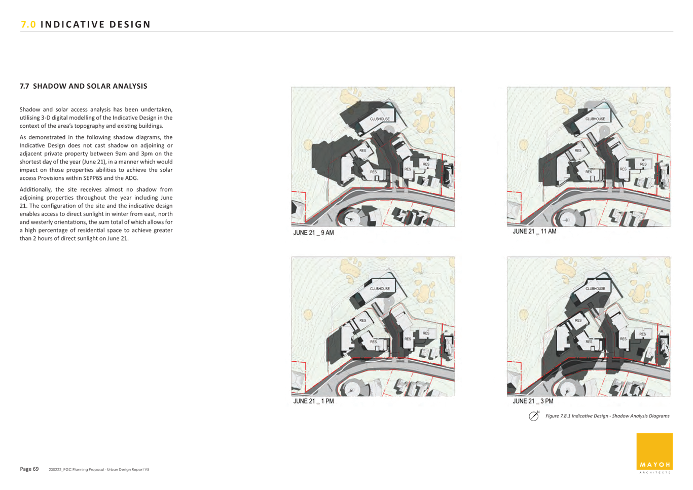

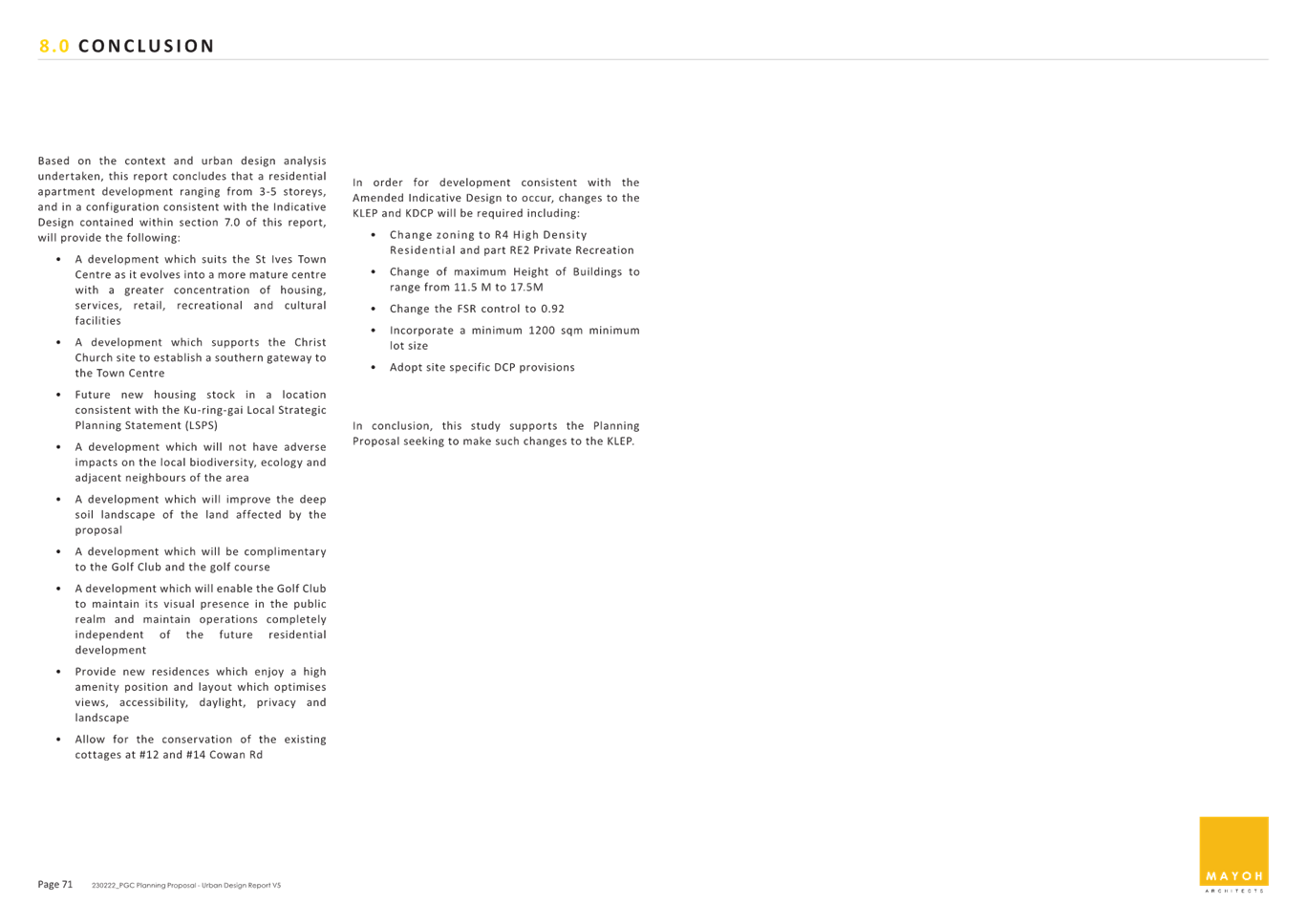

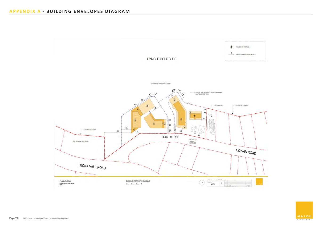
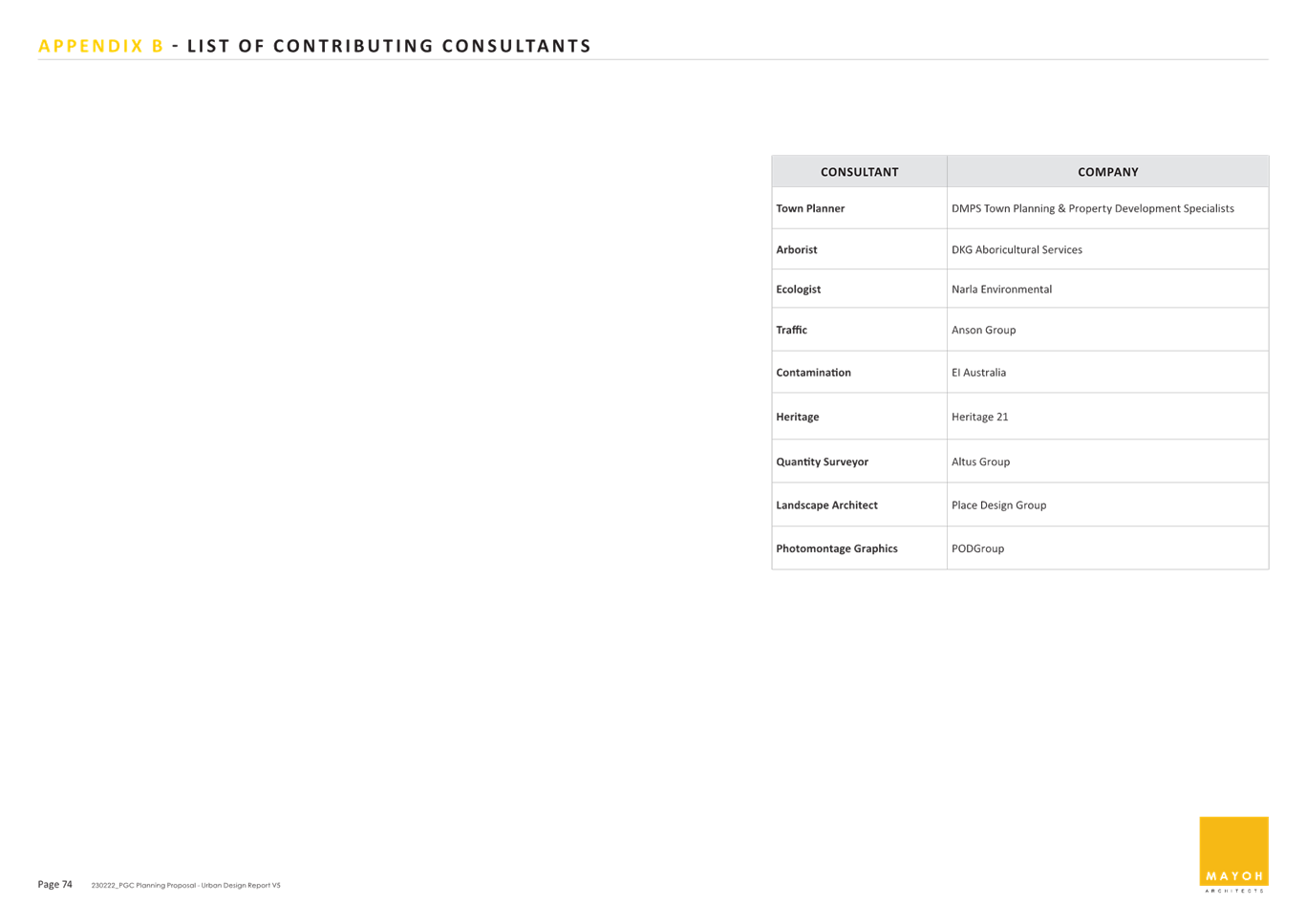
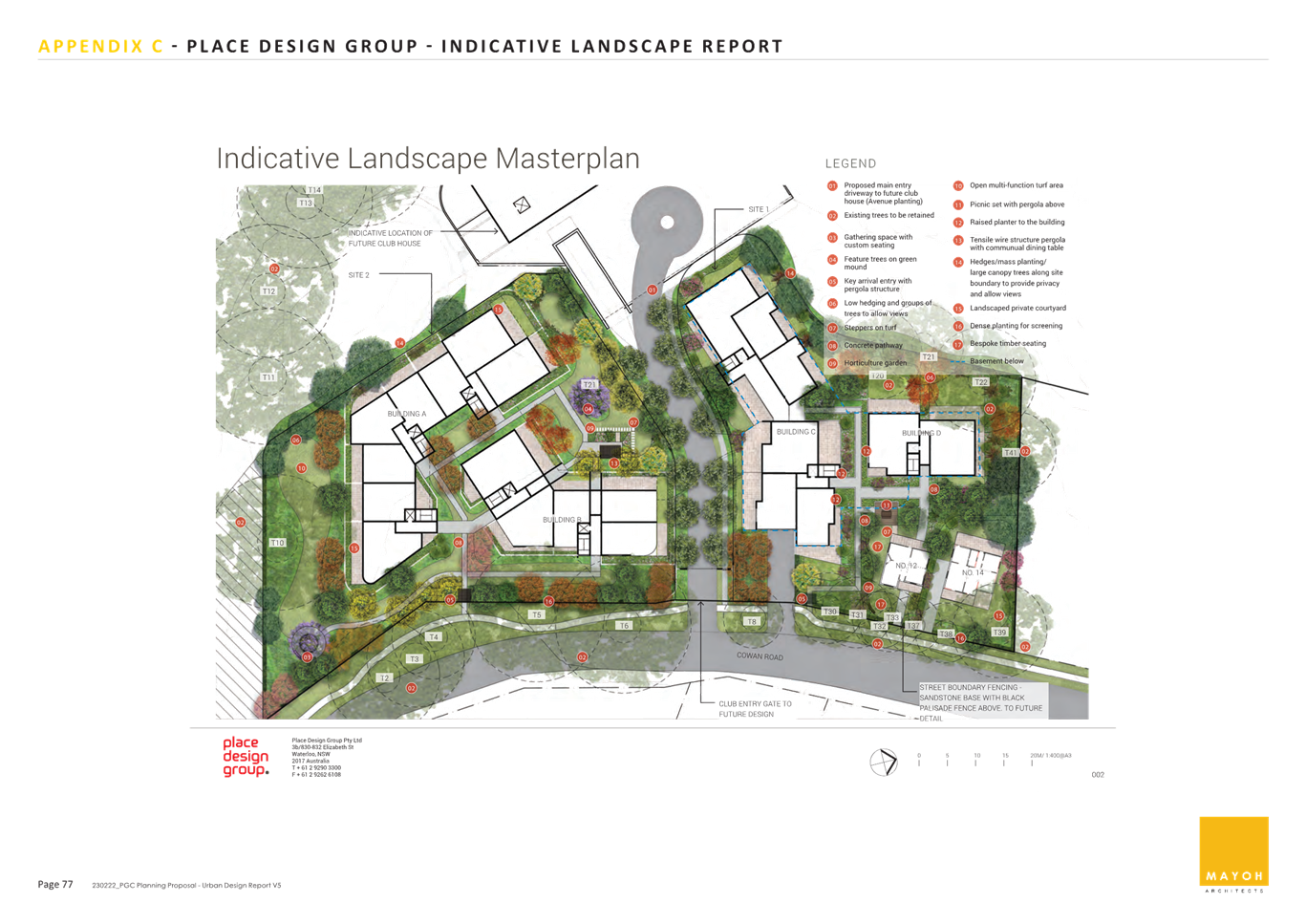
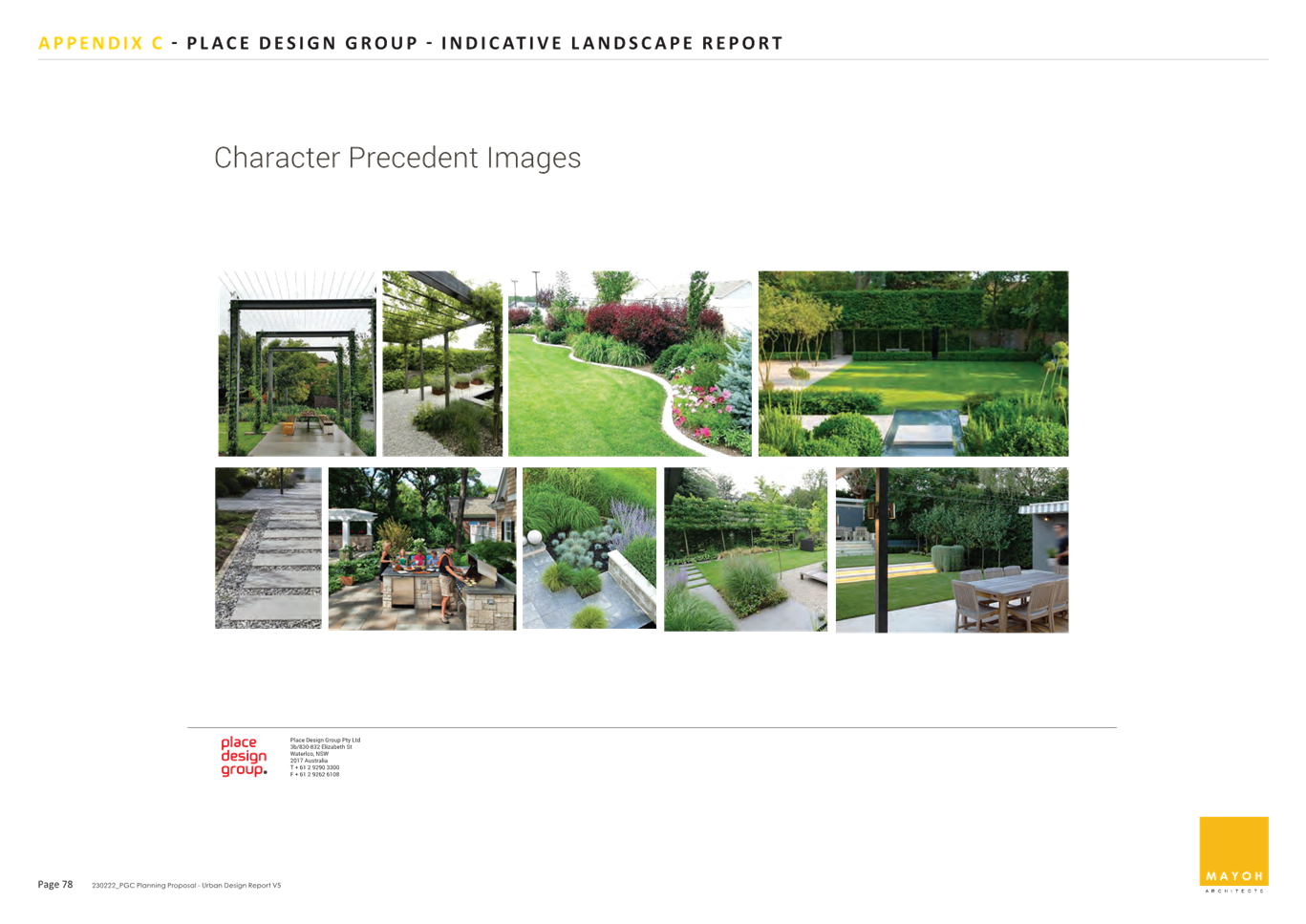
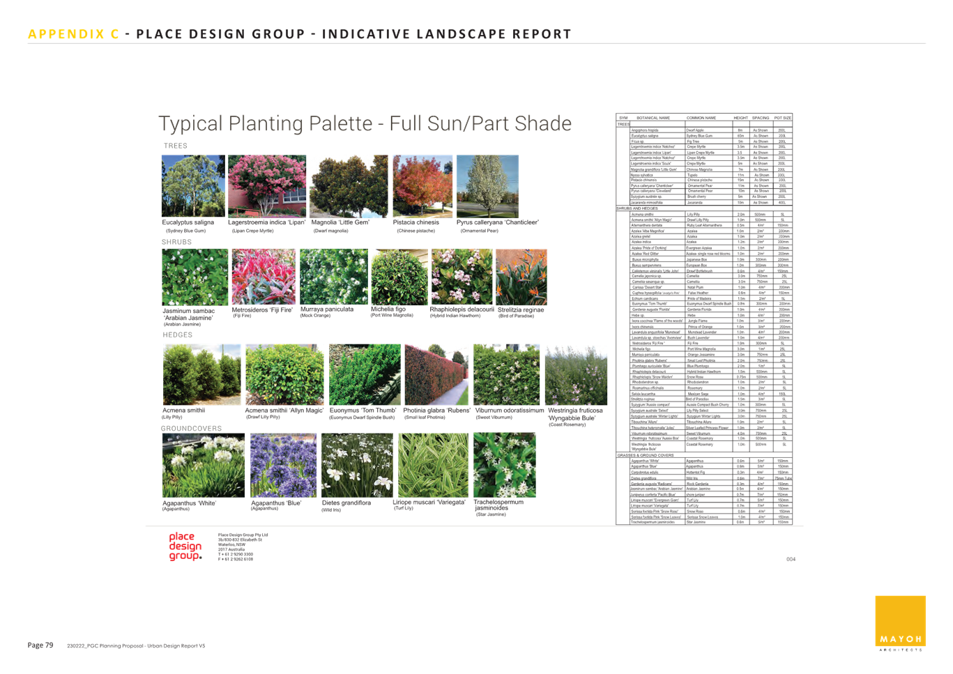
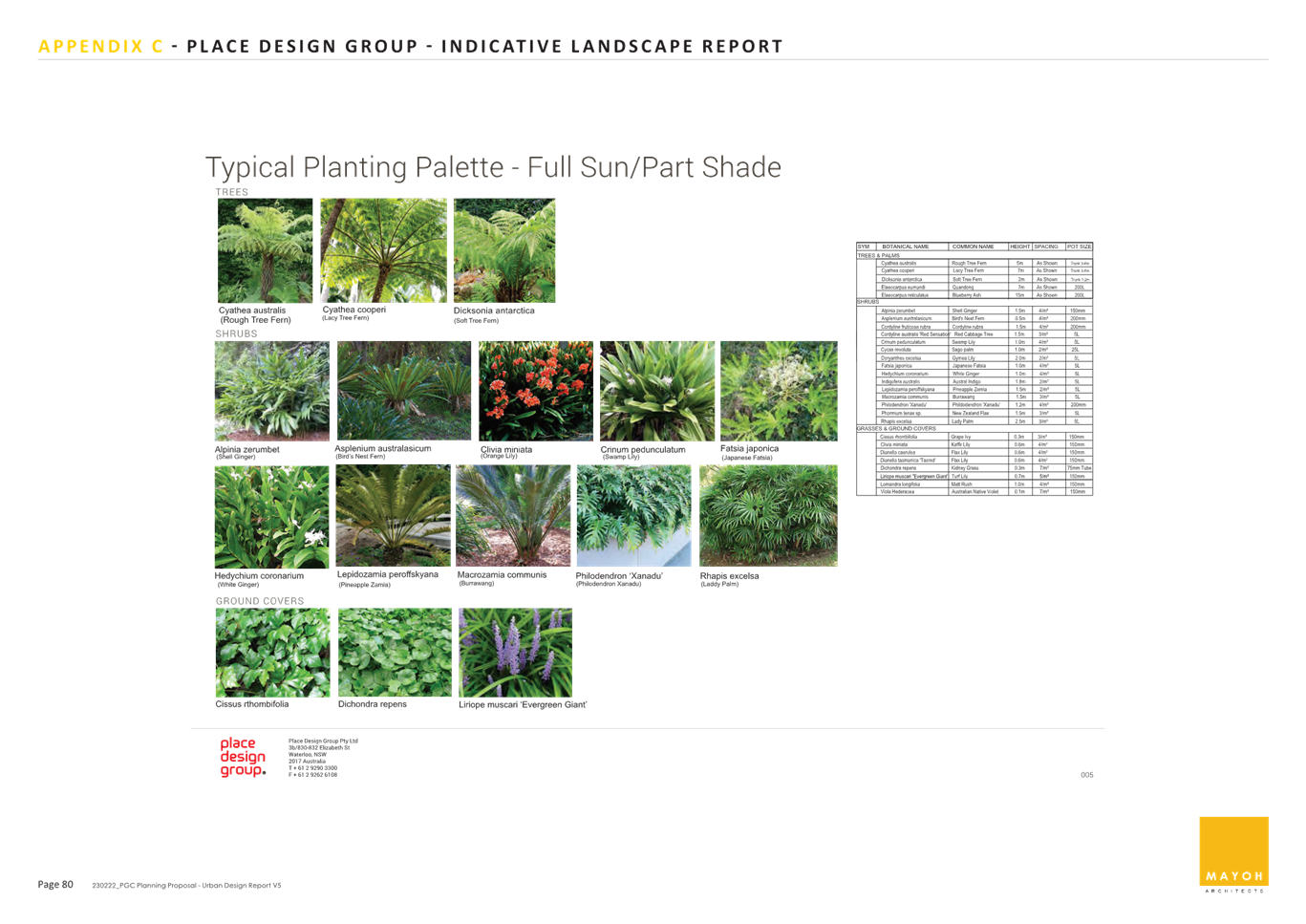
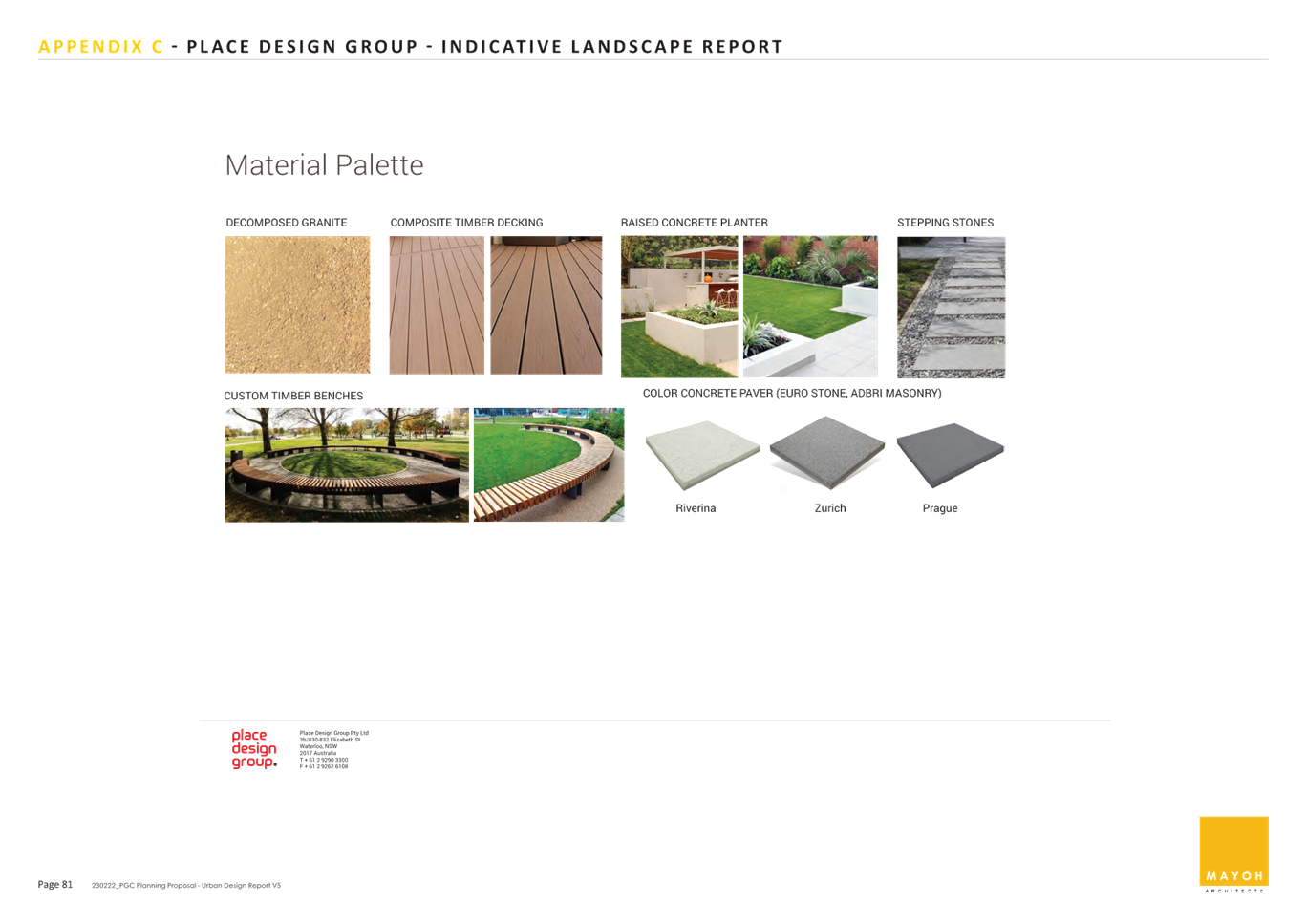
|
ATTACHMENT
No: 11 - Table
of Assessment
|
|
Item No: GB.6
|
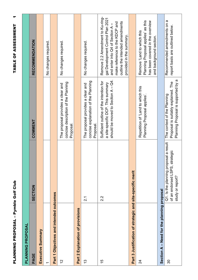
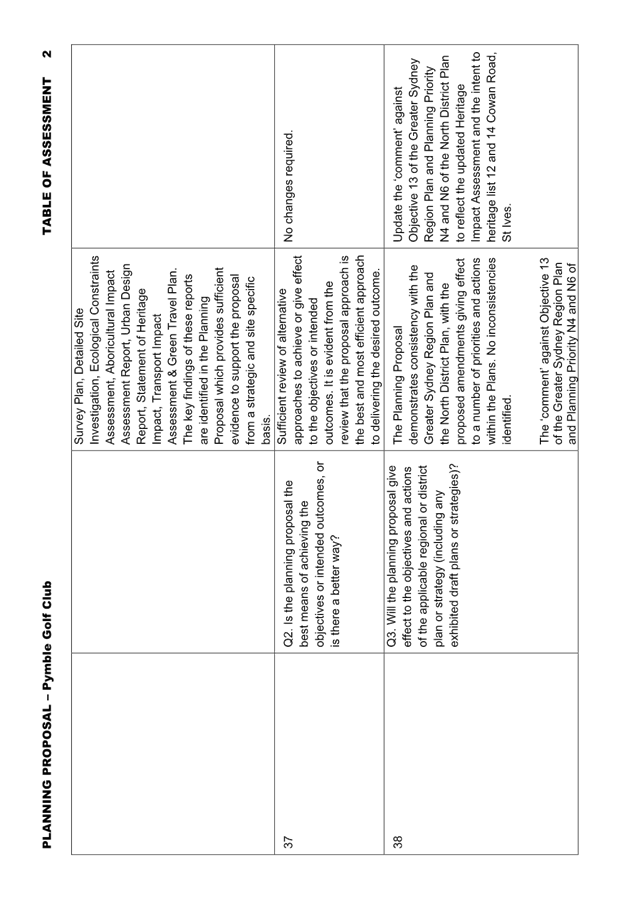
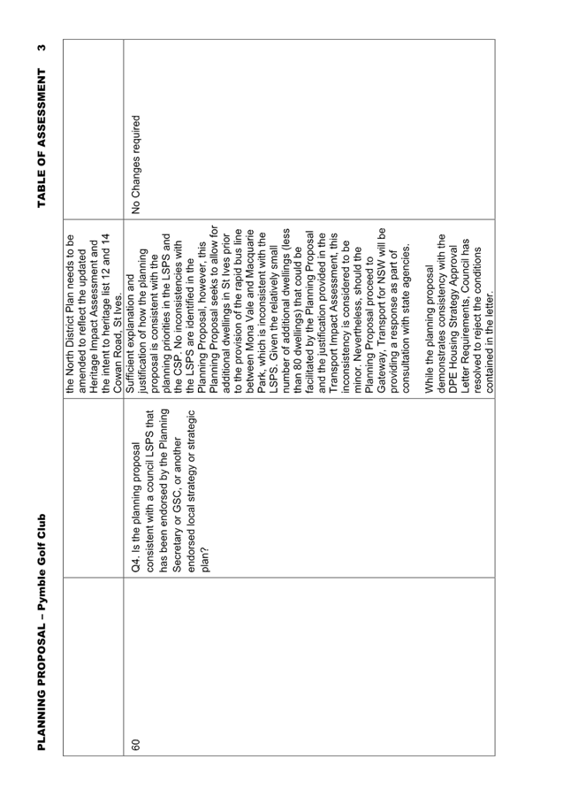
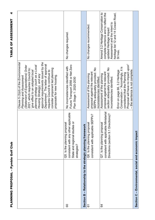
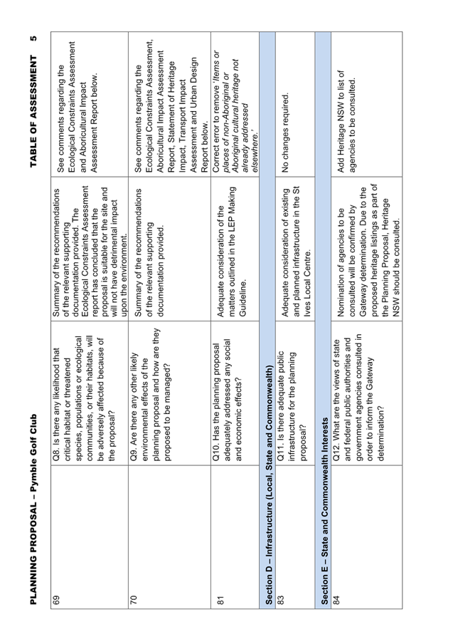
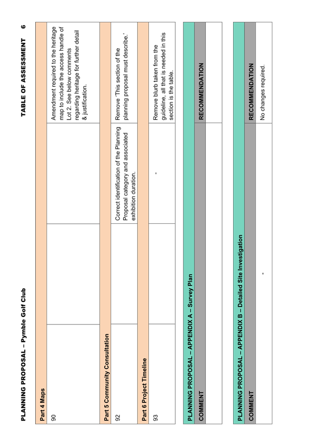
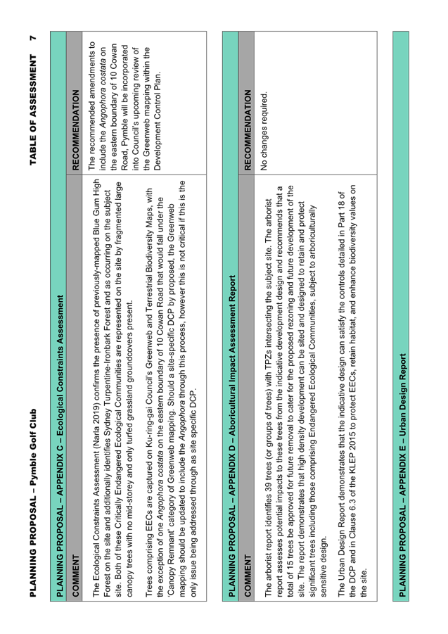
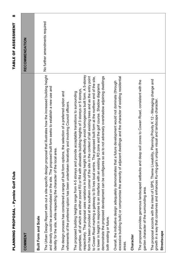
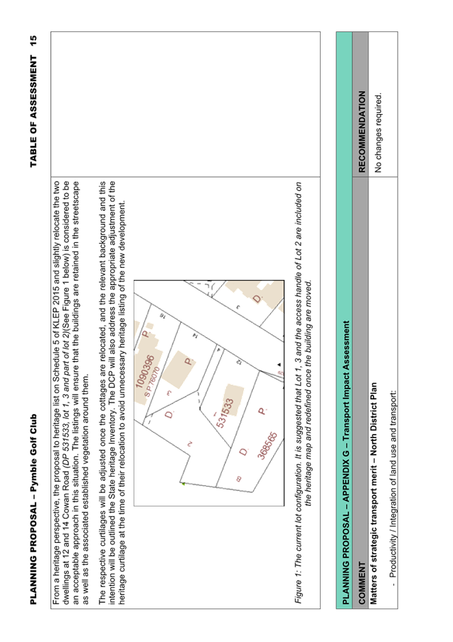

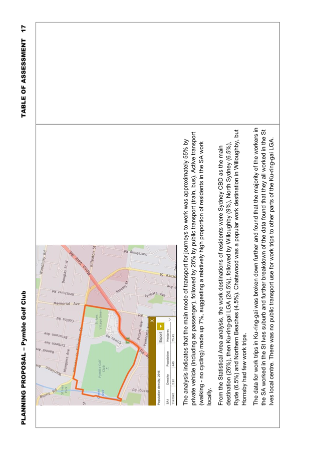
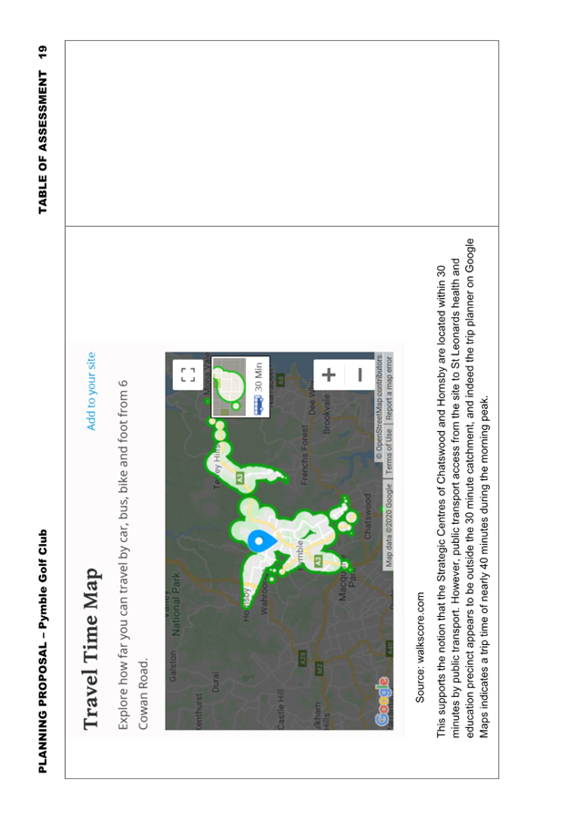
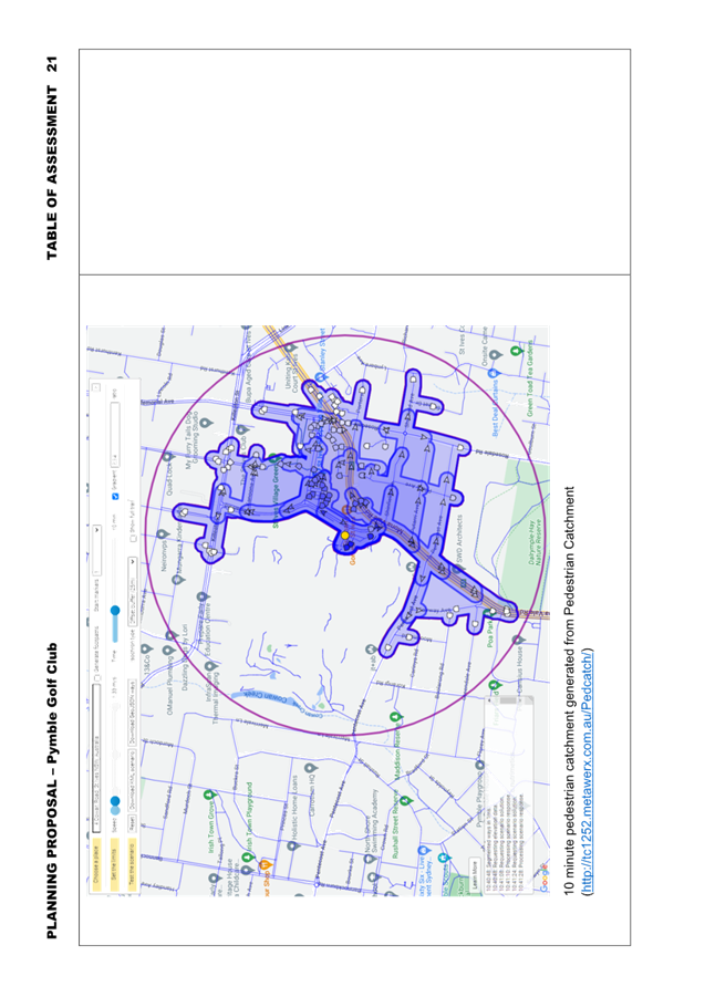
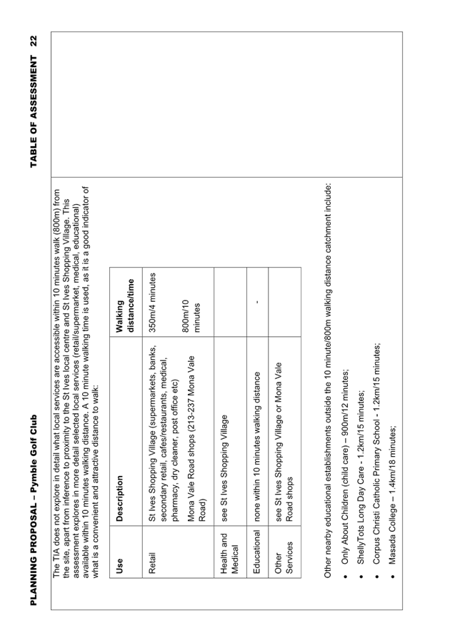
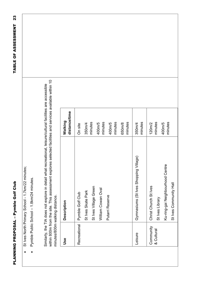
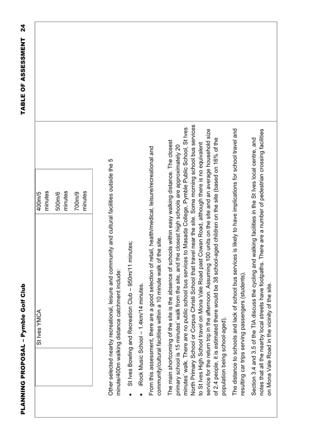
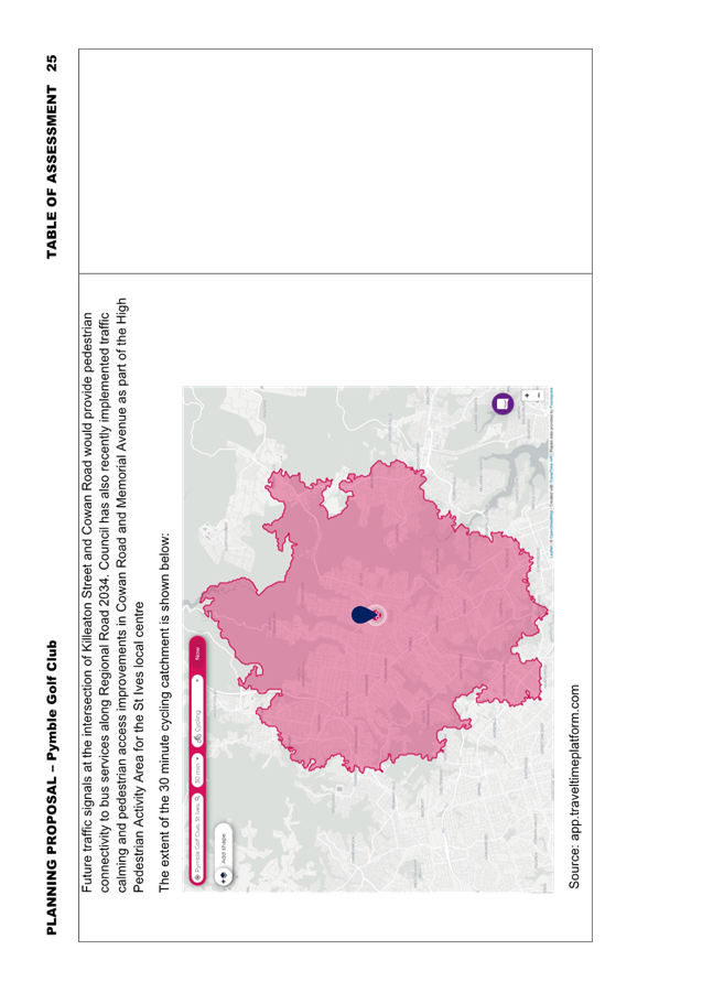

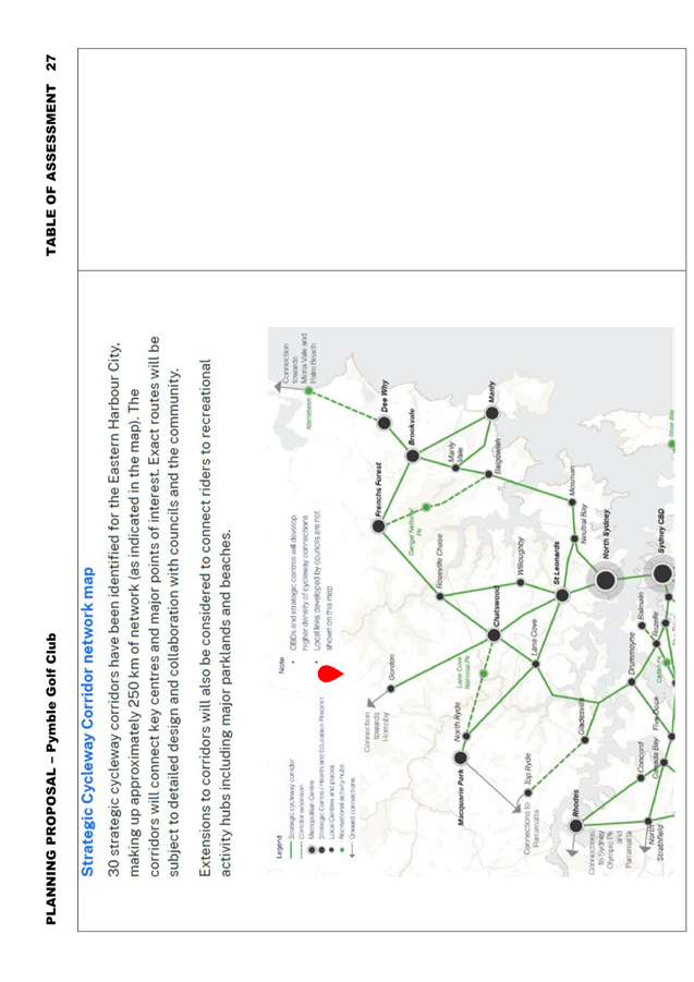
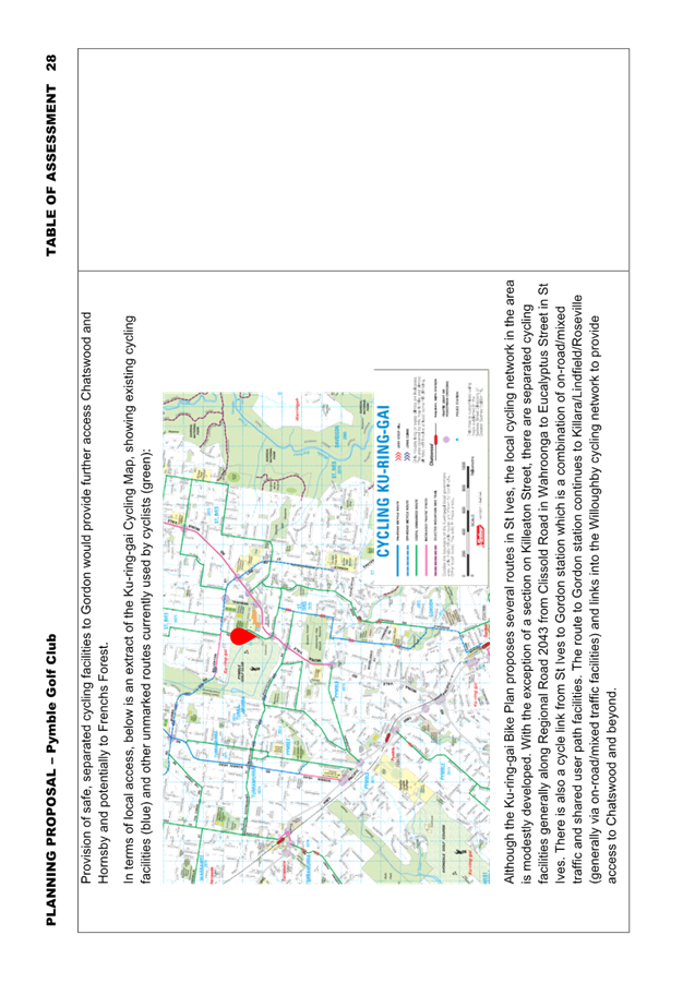
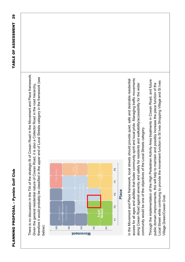
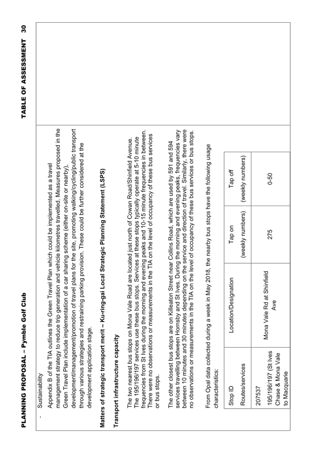
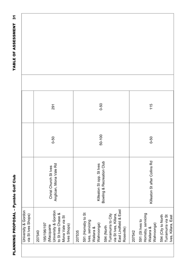
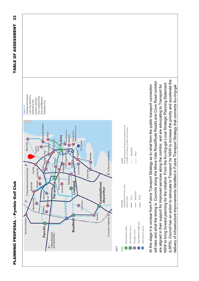
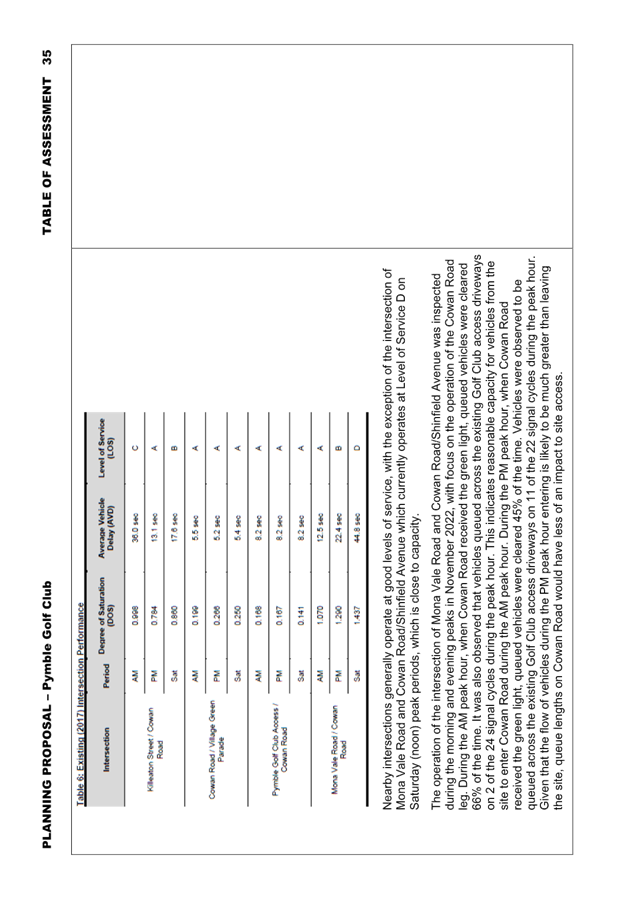
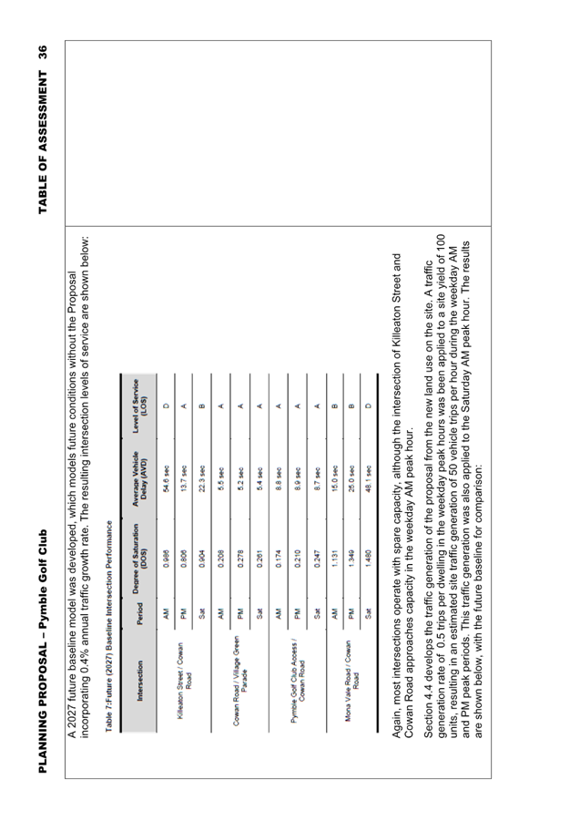
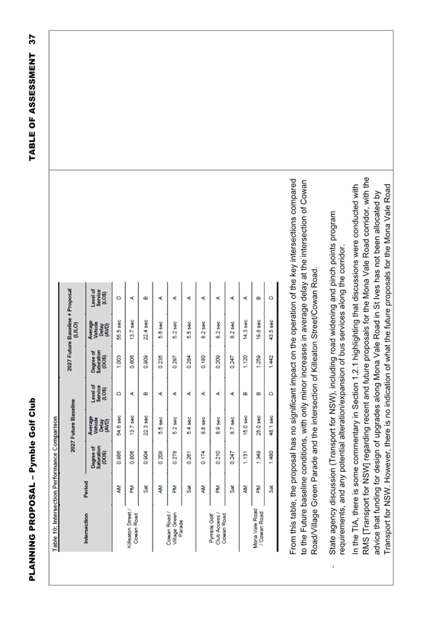
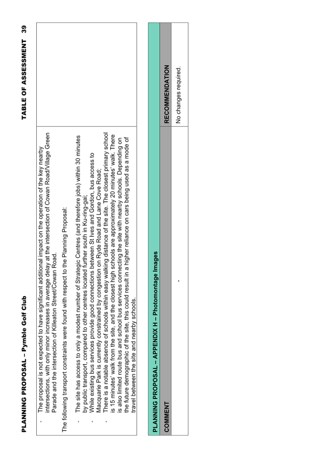
|
ATTACHMENT
No: 12 - KLPP
Advice 24 April 2022 - Planning Proposal for 4, 12 & 14 Cowan Road, St
Ives - Pymble Golf Club
|
|
Item No: GB.6
|
|
Ordinary
Meeting of Council - 16 May 2023
|
GB.7 / 1
|
|
|
|
|
Item
GB.7
|
S14024
|
Consideration of Submissions - 10 Park Crescent,
Pymble - Heritage Listing
EXECUTIVE
SUMMARY
Purpose of Report
For Council to consider submissions received in response to
the exhibition of the planning proposal to amend the Ku-ring-gai Local
Environmental Plan 2015 to heritage list 10 Park
Crescent, Pymble and its interiors as a local heritage item.
Background
Site Context
‘Covington’, 10
Park Crescent, Pymble (‘the site’) is associated with one land
parcel (Lot 26 DP 7427), located approximately
300 metres north-west of Pymble station. The site is
currently zoned R4 High Density Residential and is adjacent to the Park Estate
(C7) Conservation Area. The site currently contains a two storey
dwelling that is not heritage listed.
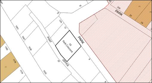
Heritage significance of
Covington, 10 Park Crescent, Pymble
The following information was
gathered from the planning proposal to include 10 Park Crescent,
Pymble and interiors as a heritage item in Schedule 5 of the Ku-ring-gai Local
Environmental Plan 2015 (‘planning proposal’) and its
appendices. The exhibited planning proposal and its appendices can be
seen in Attachment A1.
Covington is a locally rare, one
storey, Inter-War Old-English style building with largely intact exteriors and
interiors with identified heritage significance. Covington was designed by
prominent architect Percy James Gordon (of the architecture firm DT Morrow and
Gordon) on behalf of their former neighbour for the purpose as a family home.
The dwelling was completed in 1936.
Covington retains a number of
rare, highly intact interior spaces (see Figure 1 and 2 below). Most notably
are the in-built radiators with decorative metal grilles, which are evidence of
a rare and technically significant 1930s decorative central heating system,
representing the middle-class lifestyle and aspirations during the 1930s (see
Figure 2 below). Externally the dwelling is still largely intact and retains
much of its original setting, such as its original relationship and views to
the adjacent Robert Pymble Park, further contributing to its heritage
significance.
|
Images of rare, highly intact
interiors – 10 Park Crescent, Pymble
Source: Planning Proposal
(Attachment A1)
|
|
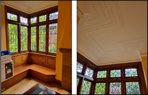
Figure 1 – (left) Built-in timber
panelled seat in dining room, (right) leadlight glass windows and original
ceiling and cornice details
|
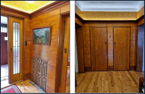
Figure 2 - (left) Electro-plated copper
sidelight, extensive timber electro-plated copper sidelight, extensive timber
panelling and decorative grilles to radiators and (right) built-in timber
panelled cupboards in hall
|
As outlined in the Planning
Proposal, the October 2022 Heritage Assessment by TKD Architects
recommended 10 Park Crescent, Pymble and its interiors be listed as a heritage
item at the local level. This recommendation and its assessment of heritage
significance was the justification for the planning proposal. A summary
of TKD Architect’s assessment of heritage significance is shown below
(see Table 1). The full assessment can be seen in Question 1, Part 3 of the
planning proposal, or in Appendix A of the planning proposal (Attachment A1).
TKD Architects heritage assessment
found that the site meets five of the seven heritage significance criteria. A
potential item only requires one of seven criteria to be met for it to have
heritage significance.
Table 1 - Summary of TKD
Architects Heritage Significance Assessment
|
Heritage
Significance Criteria
|
Assessment
Outcome
|
Reasoning
for Assessment Outcome
|
|
Criterion A
– Historical Significance
|
ü
|
10 Park Crescent, Pymble is
illustrative of the suburban consolidation of Pymble over the early to
mid-twentieth century.
|
|
Criterion B –
Historic Associations
Significance
|
ü
|
10 Park
Crescent, Pymble has associations with architect Percy James Gordon and the
firm of Morrow and Gordon as a residential commission during a period of
growth for the firm, when a number of their most notable designs were
produced.
|
|
Criterion C
– Aesthetic or Technical Significance
|
ü
|
10 Park Crescent, Pymble is
a representative and largely intact example of a residence designed in the
Interwar Old English style. The dwelling retains high-quality intact interior
features of aesthetic and technical significance.
|
|
Criterion D
– Social or Community Significance
|
X
|
10 Park
Crescent, Pymble is unlikely to have strong or special associations with
particular communities or groups in NSW. However, the social significance of
the place has not been assessed or tested.
|
|
Criterion E
– Research Significance
|
X
|
10 Park Crescent, Pymble
may retain some evidence of 1930s central heating systems of some technical
significance, however, it is unlikely that the systems have research
potential or would yield evidence of such systems which is not already well
documented.
|
|
Criterion F
– Rarity
|
ü
|
10 Park
Crescent, Pymble is likely to have rarity value for the in-situ evidence of 1930s
central heating systems it provides.
|
|
Criterion G
– Representative Significance
|
ü
|
10 Park Crescent, Pymble is
a largely intact example of an Interwar Old English style dwelling, retaining
its key external features and typical form, as well as high-quality interior
features and finishes.
|
The Planning Proposal
The Planning Proposal seeks to
heritage list 10 Park Crescent Pymble and its interiors, under Schedule 5 of
the KLEP 2015, with associated amendment to the Heritage Map as indicated in
the below table.
|
Ku-ring-gai Local Environmental
Plan 2015 (KLEP 2015)
|
|
EXISTING
|
PROPOSED
|
|
Heritage Map, Sheet HER_007
|
|
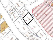
|
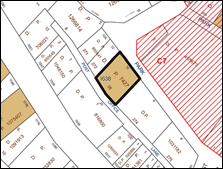
|
|
Schedule 5 Environmental heritage, Part
1 Heritage items
|
|
Suburb
|
Item Name
|
Address
|
Property Description
|
Significance
|
Item No.
|
|
Pymble
|
‘Covington’, dwelling house and
interiors
|
10 Park Crescent, Pymble
|
Lot 26 DP 7427
|
Local
|
I638
|
|
History of Planning Proposal
Key
milestones in the planning proposal are as follows:
· The
site was first listed under the Ku-ring-gai Planning Scheme Ordinance
1971.
· The
site was de-listed during the creation of the Ku-ring-gai Local
Environmental Plan (Local Centres) 2012 following the recommendation for
de-listing in the 2006 Pymble Heritage Review. This recommendation was not
based on an internal inspection of the dwelling on site, and only considered
the external heritage significance of the site.
· In
June 2021, Council was approached by a third party in relation to the
possibility of heritage listing the property.
· On 27
April 2022 a development application was lodged for demolition of the dwelling
on site and construction of a residential flat building.
· On 6
June 2022, Council officers inspected the property, including the internals of
the house. The inspection revealed a number of key intact and original internal
features of the house that were not originally evident.
· On 26
July 2022, Council resolved to recommend an Interim Heritage Order (IHO) to be
placed on the site to allow proper evaluation of its heritage significance and
prevent any harm to the site in the interim. The IHO commenced
29/07/2022.
· On 15
November 2022, Council considered a report to initiate a Council-led planning
proposal to heritage list the site. Council resolved to defer the matter for a
Councillor site inspection.
· On 13
December 2022, initiating a Council-led planning proposal for the heritage
listing of 10 Park Crescent, Pymble and its interiors, Council resolved:
A. Planning Proposal be prepared to
include Schedule 5 of the KLEP 2015- Lot 26 DP 7427, 10 Park
Crescent Pymble, and Interiors.
B. The Planning Proposal be forwarded to the Department of
Planning and Environment for Gateway determination.
C. Council requests the plan making delegation under
Section 3.36(2) of the EP&A Act for this Planning Proposal.
D. Upon receipt of a favourable Gateway determination, the
exhibition and consultation process is to be carried out in accordance with the
Gateway determination and requirements of the Environmental Planning and
Assessment Act, 1979.
· Gateway
Determination
- In
accordance with the Council resolution, on 13 December 2022 the heritage
listing Planning Proposal was submitted to the Department of Planning and
Environment.
- On 22 February 2023, a Gateway
Determination (Attachment A2) was received from the Department of
Planning and Environment to proceed to public exhibition.
The Gateway required completion of the process within by 22 August 2023.
· The Planning Proposal was placed on public exhibition from
8 March 2023 to 22 March 2023.
Comments
Public
Exhibition
The Planning Proposal was placed on public exhibition from
Wednesday, 8 March 2023 to Wednesday, 22 March 2023, in accordance with the
conditions of the Gateway Determination and Council’s Community
Participation Plan. A copy of the exhibited Planning Proposal and appendices is
included at Attachment A1.
Submissions to the exhibition were received from the
community, including from the landowner. All submissions have been assessed to
find the Planning Proposal upholds its merit for local heritage listing as
described in the exhibited proposal.
Submissions to the Public Exhibition
A total of fourteen
submissions were received from the community, thirteen in support and one in
objection. The submissions in support were predominantly made by neighbouring
residents. The objecting submission was made by the owner of the subject land.
Key comments are listed below with
detailed response presented in the Submission Summary Table at Attachment
A3.
Support for the Planning Proposal
The following points were made in support of the planning
proposal:
· General support of
the heritage listing of 10 Park Crescent, Pymble, and its interiors.
· The need to
preserve heritage in Ku-ring-gai for future generations.
· Statements on how
the site has been preserved by previous owners.
· Admiration of the
intact interiors and exteriors of the dwelling.
· General concern
that the site will be redeveloped.
· The positive
impact the dwelling has on the surrounding character of Park Crescent.
· Acknowledgement
that the site meets threshold for local heritage listing when assessed against
the NSW Heritage Criteria framework.
· Acknowledgement
that the previous de-listing of the site did not investigate the interiors of
the house and thus was de-listed without sufficient investigation of the
dwelling’s heritage significance
Ø Comment
The following statements are
noted by Council staff:
- general
support of heritage listing 10 Park Crescent Pymble and its interiors.
- support
to preserve the site for future generations.
- comments
on the preservation of the site by previous owners.
- the
positive impact the site has on its surrounding character.
It is also acknowledged by
Council staff that:
- the
previous de-listing of the site was based on a heritage review that did not
consider the internal significance of the dwelling.
- the
site meets the threshold for heritage significance as stated in the October
2022 Heritage Assessment by TKD Architects.
Some submissions also expressed
their concern for potential redevelopment of the site. It should be noted that
the planning proposal considers the heritage significance of 10 Park Crescent,
Pymble, any potential redevelopment of the site is not relevant to the planning
proposal.
Objection to the Planning Proposal
One submission, from the owner of the land subject of this
planning proposal, objected to the proposal. The submission makes the following
key points:
· Council is undoing
10-plus years of strategic planning in the area.
Ø Comment
Heritage
is a key aspect in retaining the desirable Ku-ring-gai built environment. As
such, heritage is a significant consideration for Council in the future
strategic planning of the area. This consideration is outlined in
Council’s Local Strategic Planning Statement with the identification and
conservation of heritage stated in planning priority K13. Council has received
new information regarding the heritage significance of the dwelling on the
subject site. It would be inconsistent with Council’s strategic planning
policy to not properly assess the dwellings heritage significance.
· The heritage
listing is inconsistent with the R4 High Density Residential zoning of the site
and street.
Ø Comment
All potential heritage items
should be individually assessed on their merits regardless of the zoning on
which an item may be located.
The dwelling is currently
consistent with the higher density streetscape due to the sloping topography to
the west of the site and modest heights and floor space ratios for surrounding
R4 High Density Residential zoned land mitigating potential bulk and scale
impacts from adjacent developments providing an acceptable interface with
adjacent low-density developments.
· Inconsistent with
Council’s heritage planning principles due to the surrounding high
density developments.
Ø Comment
The existing development context
demonstrates an appropriate transition between different densities of
development and the heritage item.
· Process of
heritage de-listing and listing of the site.
Ø Comment
Refer to the History of Planning
Proposal section above.
· The site has
previously been de-listed as recommended by the Council funded 2006 Pymble Town
Centre Heritage Review to de-list the site.
Ø Comment
This recommendation was not based
on an internal inspection, which is essential to understand the heritage
significance in relation to the subject dwelling.
· Inconsistencies
between the 2006 Pymble Town Centre Heritage Review and the 2022 TKD Architects
Heritage Assessment.
Ø Comment
The TKD Heritage Assessment
considers the heritage significance of the dwelling in its current condition
and context against the NSW Heritage Criteria. Considering heritage
significance against the NSW Heritage Criteria is standard practice when
considering heritage significance.
· Recent
changes to the surrounding context of the site.
Ø Comment
The preliminary and full heritage
assessments have been based on the current condition of the dwelling within its
current context. The TKD Heritage Assessment found much of the dwellings
original context has been retained, particularly its views to Robert Pymble
Park.
· Current
Surrounding context of the site.
Ø Comment
The preliminary and full heritage
assessments have been based on the current condition of the dwelling within its
current context. The TKD Heritage Assessment found much of the dwelling’s
original context has been retained, particularly its views to Robert Pymble
Park.
The adjacent higher density
developments have negligible bulk and scale impacts on the subject site. The
more significant developments (e.g. 14 to 18 Park Crescent) are not directly
adjacent to the subject site and therefore do not create significant impacts
bulk and scale impacts on the subject site.
Furthermore, much of the heritage
significance of the site is due to the rare, highly intact interiors. It is
unlikely that the surrounding context of the site would impact the heritage
significance of the interiors.
· Quality
of living standards of 10 Park Crescent if the site is heritage listed.
Ø Comment
There has been no expert evidence
provided to indicate the surrounding higher density developments have created
unliveable or unsafe conditions for the subject site. The surrounding higher
density developments have negligible bulk and scale impacts on the subject
site, and would likely have minimal, if any, impacts on future living
standards. If the site were to be heritage listed all potential future
development from surrounding sites would likely have to address potential
heritage impacts on the subject site prior to development consent been
provided.
· Financial
Hardship on owners.
Ø Comment
The potential for any reduction
or increase in an individual’s property values or financial status is not
a planning matter for consideration under the Environmental Planning and
Assessment Act 1979.
Conclusion
All submissions to the public exhibition of the planning
proposal have been given due consideration. The submissions do not provide any
new evidence to warrant amendment to the exhibited planning proposal.
Therefore, it is recommended that the planning proposal proceed to finalisation.
integrated planning and reporting
Theme 3: Places, Spaces and Infrastructure
|
Community Strategic
Plan Long Term Objective
|
Delivery Program
Term Achievement
|
Operational Plan
Task
|
|
P5.1 Ku-ring-gai’s
heritage is protected, promoted and responsibly managed.
|
P5.1.1 Strategies, plans and
processes are in place to effectively protect and preserve
Ku-ring-gai’s heritage assets.
|
P5.1.1.1 Implement, monitor and
review Ku-ring-gai’s heritage planning controls including the development
of a heritage strategy.
|
Governance Matters
The preparation and implementation
of planning proposals is governed by the provisions within the Environmental
Planning and Assessment Act 1979 and Environmental Planning
and Assessment Regulation 2000 with guidance provided in the Department of
Planning and Environment’s Local Environmental Plan making
Guideline, September 2022.
On 13 December 2022 Council
resolved to request that Council be authorised as the local plan-making
authority to exercise the functions under section 3.36(2) of the Environmental
Planning and Assessment Act 1979 to finalise the planning proposal. In
issuing the Gateway Determination on 22 February 2023, the Department of
Planning and Environment considered the nature of the Planning Proposal and
authorised Council as the local plan-making authority. A 6 month period (until
22 August 2023) was allocated to complete the proposal.
This report addresses the post
exhibition stage of the planning proposal process, to consider State agency and
community feedback. Council can resolve to make the plan in accordance with
section 3.36(2) of the EP&A Act and liaise with Parliamentary
Counsel’s Office (PCO) to draft the required Local Environmental Plan to
give effect to the Planning Proposal, as well as apply the Ministers function
in making the plan.
Risk Management
There
is a community expectation that places of heritage significance within the
Ku-ring-gai Council Local Government Area will be identified and protected.
There is a strategic risk of damaging the reputation of Council if these
culturally significant places are not identified and considered for protection.
Financial Considerations
The cost
of preparing this report is covered by the Ku-ring-gai draft Principal Local
Environmental Plan - Urban Planning & Heritage Budget – Strategy and
Environment Department.
Social Considerations
The identification and protection of
Ku-ring-gai’s heritage places contributes to the ongoing conservation of
Ku-ring-gai’s historic period features that are valued by the community
now and will continue to be valued into the future.
Environmental Considerations
The
retention and conservation of heritage places has an important role in
protecting the environment. The environmental sustainability benefits afforded
by the retention of heritage places includes the substantial reduction in
building demolition and new construction waste, and the conservation of
embodied energy in the existing buildings.
Community Consultation
The Planning Proposal was placed
on public exhibition between Wednesday, 8 March 2023 to Wednesday, 22 March
2023 in accordance with the requirements of the Gateway Determination and
Ku-ring-gai’s Community Participation Plan. Property owners and
neighbouring residents were notified of the public exhibition and invited to
provide feedback on the exhibited documentation.
The Gateway Determination made no
requirement for any State Agency consultation. The Planning Proposal and
supporting information was made available on Council’s website in
accordance with Ku-ring-gai’s Community Participation Plan.
As a result of the public
exhibition, a total of 14 submissions were received: 13 in support of the
proposal and 1 submission in opposition.
All persons who made a submission
have been notified of this matter being reported back to Council.
Internal Consultation
Consultation
with relevant Departments of Council has taken place in preparing this report.
In particular heritage specialists. On 28 July 2022, the matter was presented
to Council’s Heritage Reference Committee (‘HRC’). The HRC
resolved to support an Interim Heritage Order to be placed on 10 Park Crescent,
Pymble. The matter was also received and noted at the Heritage Reference
Committee on 27 October 2022.
Post public exhibition of the
planning proposal further referrals were sent to internal Council heritage
staff.
Summary
The
Planning Proposal to heritage list 10 Park Crescent, Pymble and its interiors
was granted a Gateway Determination to proceed to public exhibition on 22
February 2023, and was placed on public exhibition from Wednesday, 8 March 2023
to Wednesday, 22 March 2023. A total of 14 submissions were received, 13
in support and 1 in opposition to the planning proposal.
This report has considered the
submissions to the public exhibition and recommends proceeding the planning
proposal to heritage list 10 Park Crescent, Pymble and its interiors under
Schedule 5 of the Ku-ring-gai Local Environmental Plan 2015 and to
resolve to make the Plan under section 3.36 of the Environmental
Planning and Assessment Act 1979.
Recommendation:
A. That Council adopt the planning proposal to amend
Schedule 5 of the Ku-ring-gai Local Environmental Plan 2015 to
heritage list 10 Park Crescent, Pymble and its interiors as a local heritage
item.
B. That Council proceed to make the Plan, using
its delegated authority under section 3.36(2) of the Environmental Planning and
Assessment Act 1979.
C. That those who made submissions be notified of
Council’s decision.
|
Matthew Le Guay
Student Urban Planner
|
Craige Wyse
Team Leader Urban Planning
|
|
Antony Fabbro
Manager Urban & Heritage Planning
|
Andrew Watson
Director Strategy & Environment
|
|
Attachments:
|
A1 ⇩ ⇩
|
Exhibited
Planning Proposal and Appendices
|
|
2023/140865
|
|
|
A2
|
Gateway
Determination - 10 Park Crescent, Pymble
|
Excluded
|
2023/140866
|
|
|
A3
|
Summary
of Submissions - 10 Park Crescent, Pymble
|
Excluded
|
2023/140867
|
|
ATTACHMENT No: 1 - Exhibited
Planning Proposal and Appendices
|
|
Item No: GB.7
|
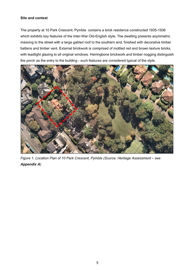
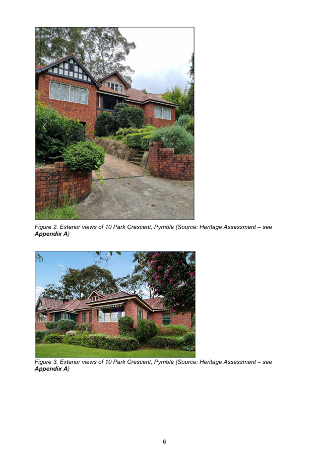
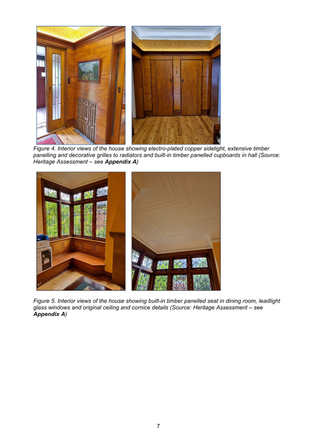
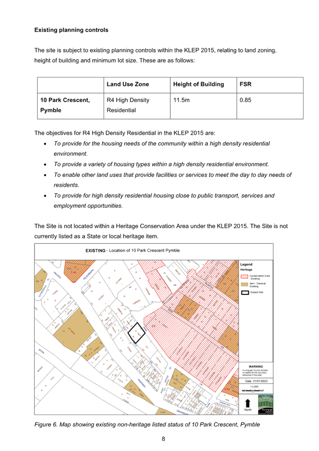

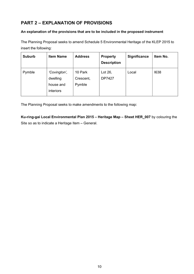
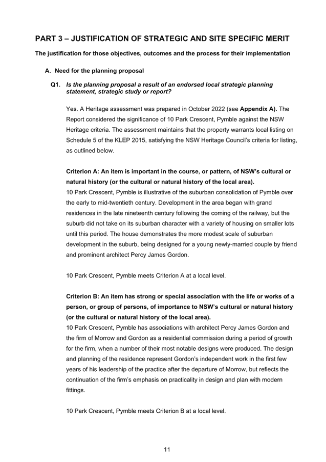
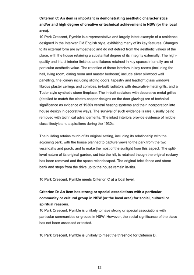
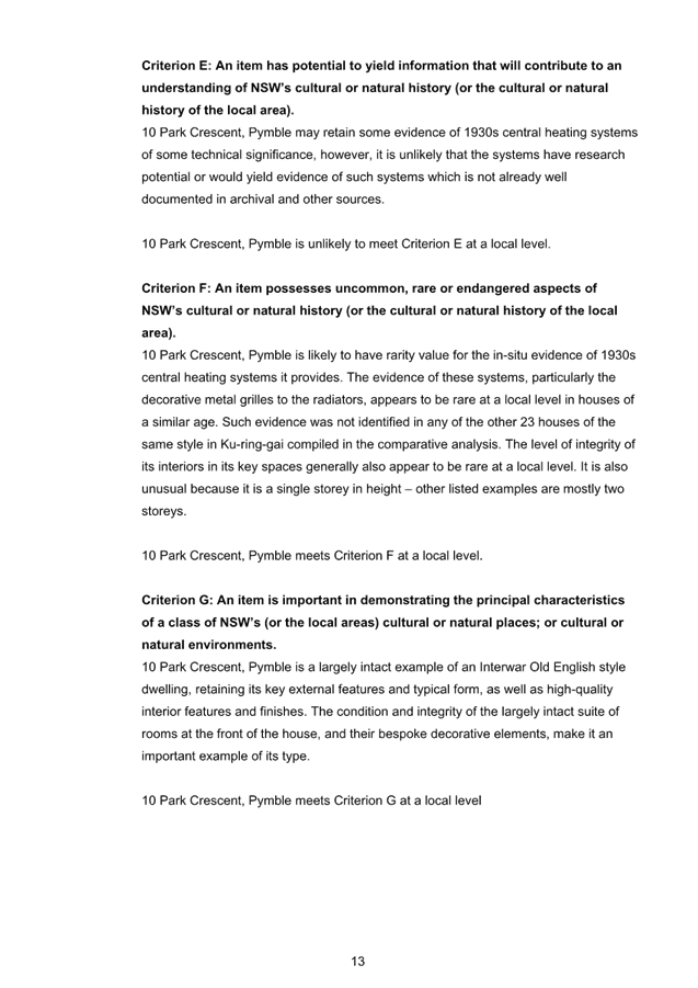

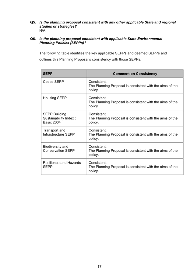
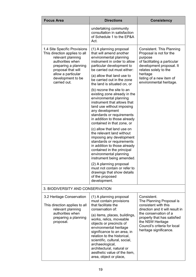
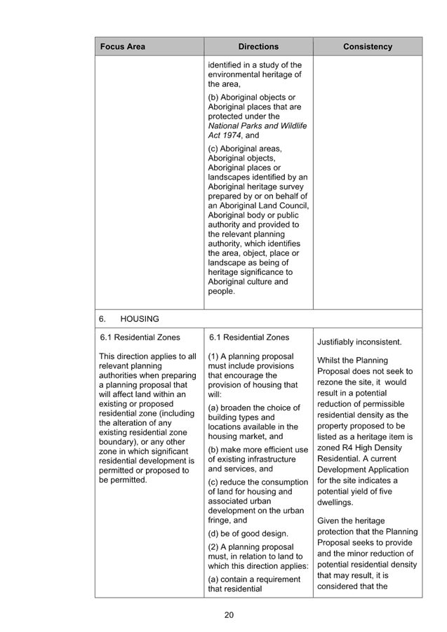
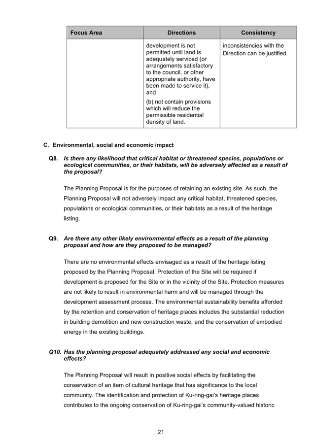
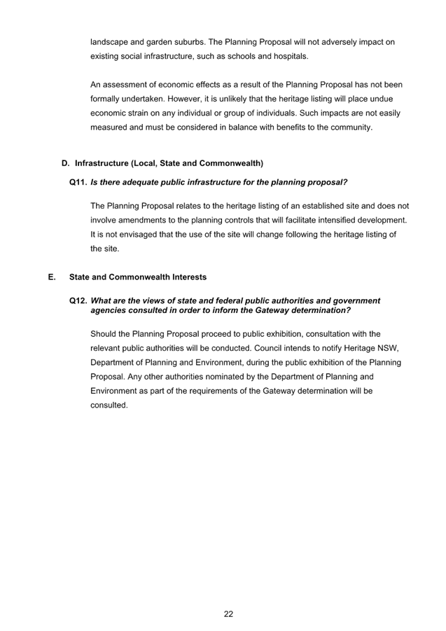
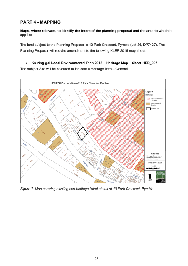
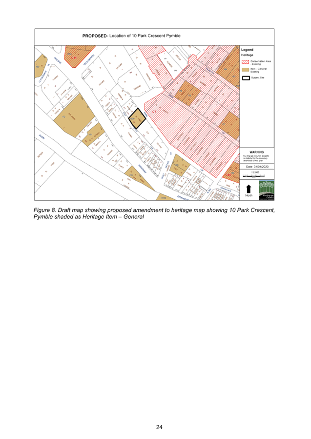

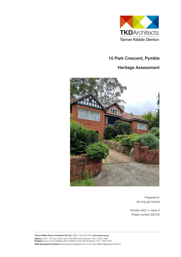
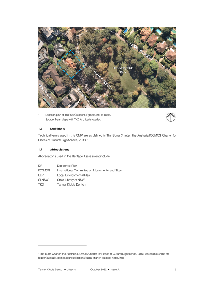
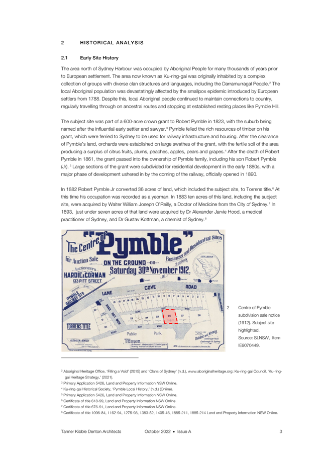
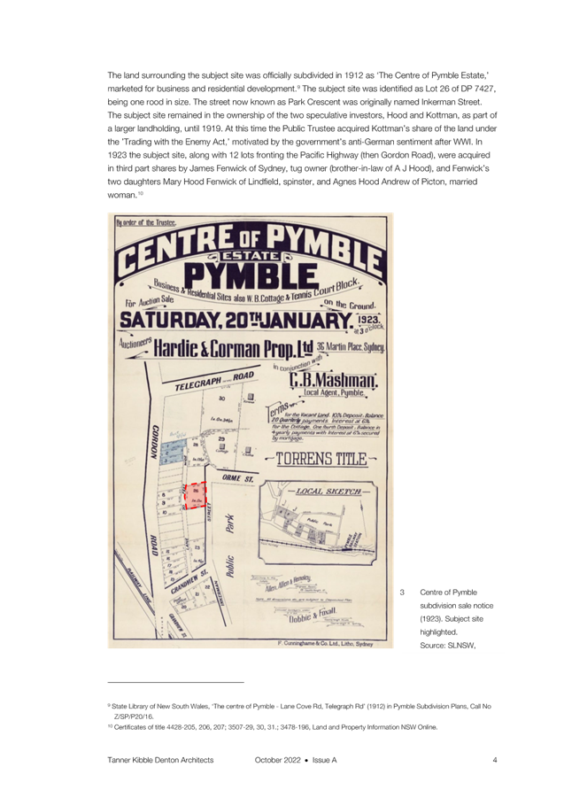
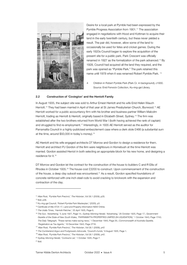
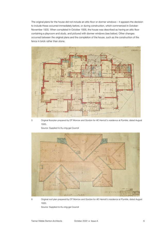
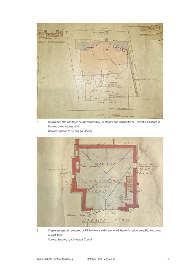

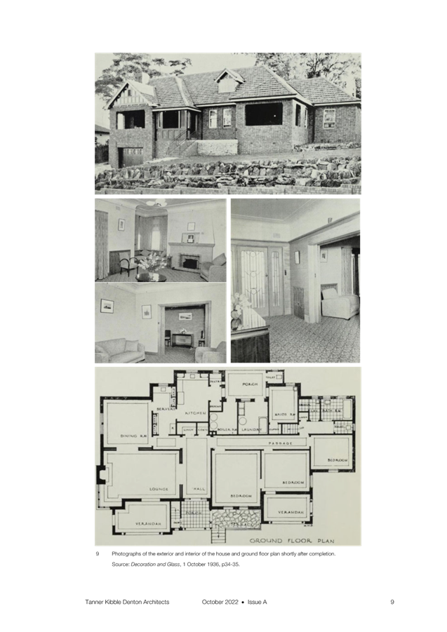
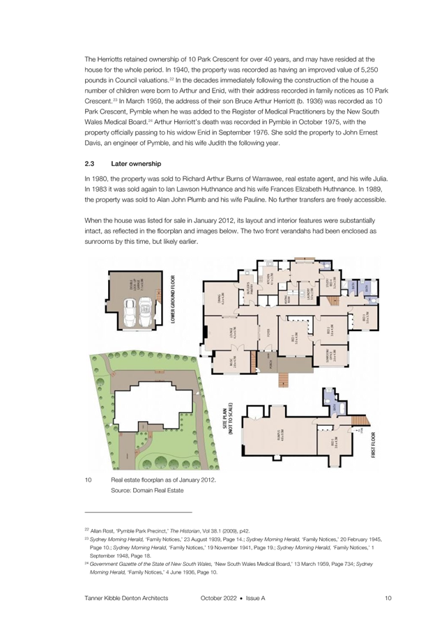
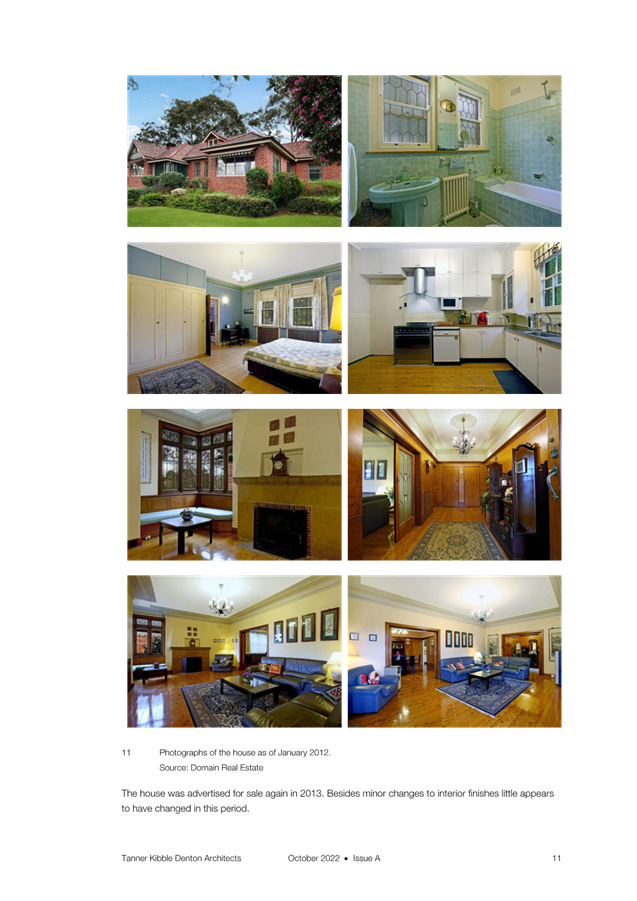
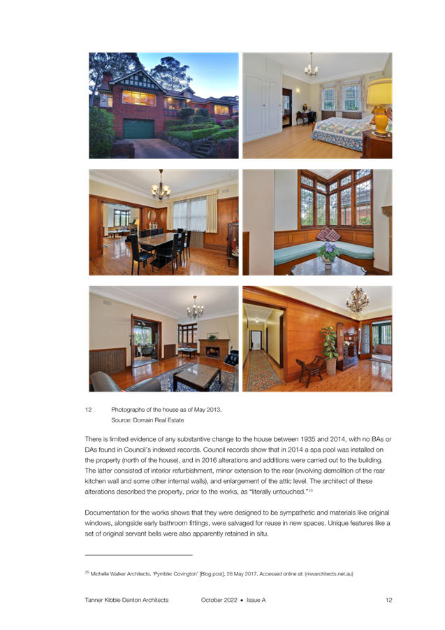
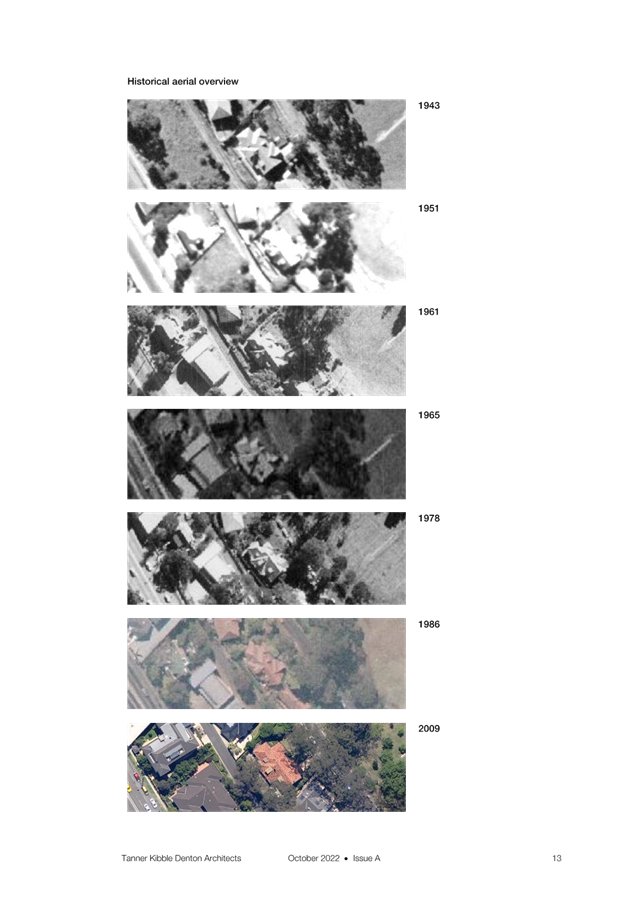
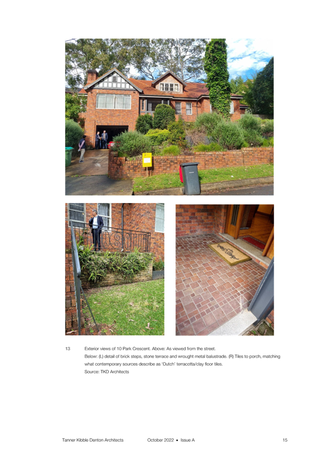
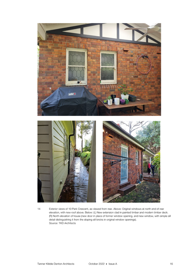
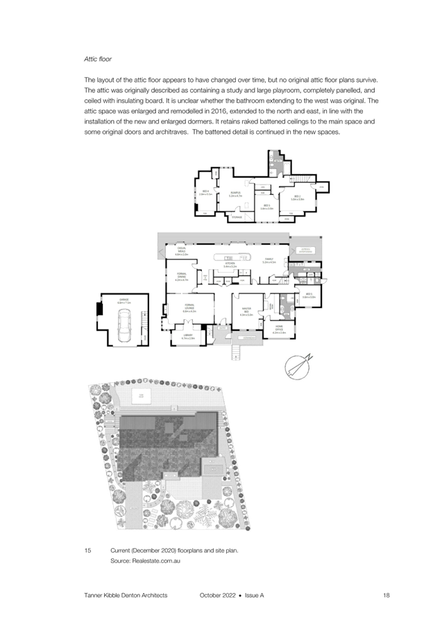
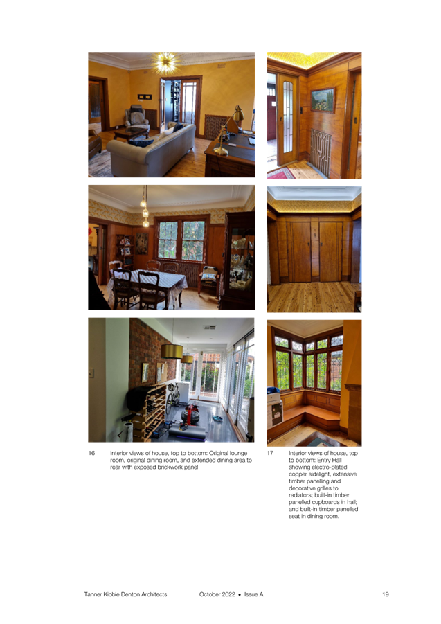
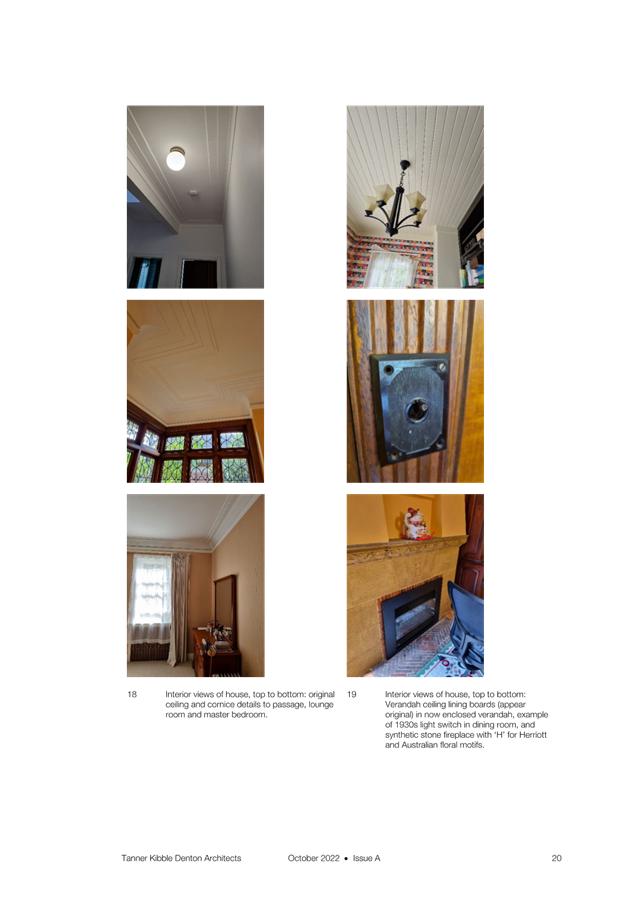
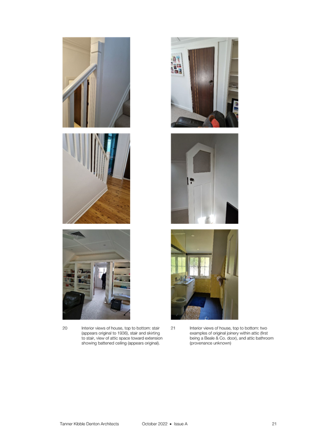
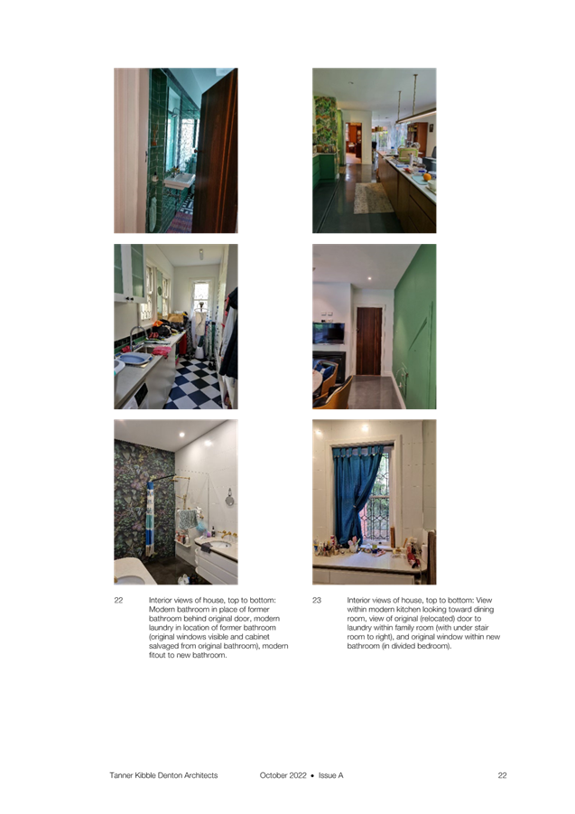
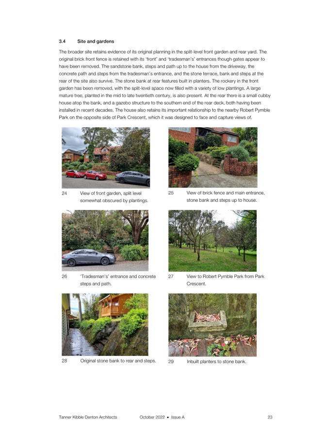

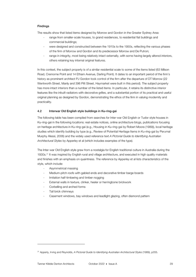
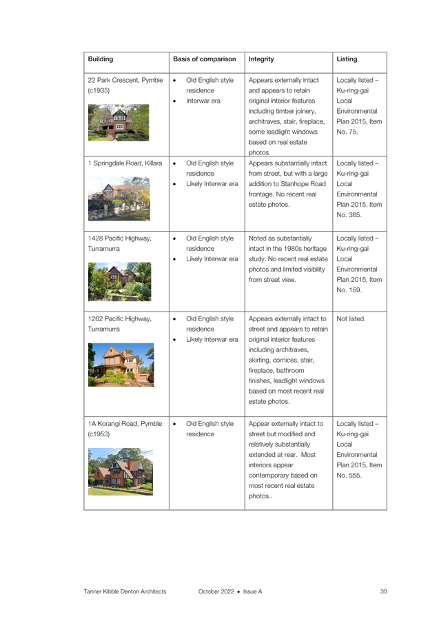
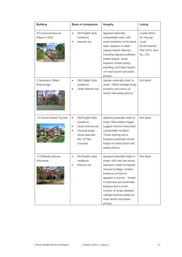
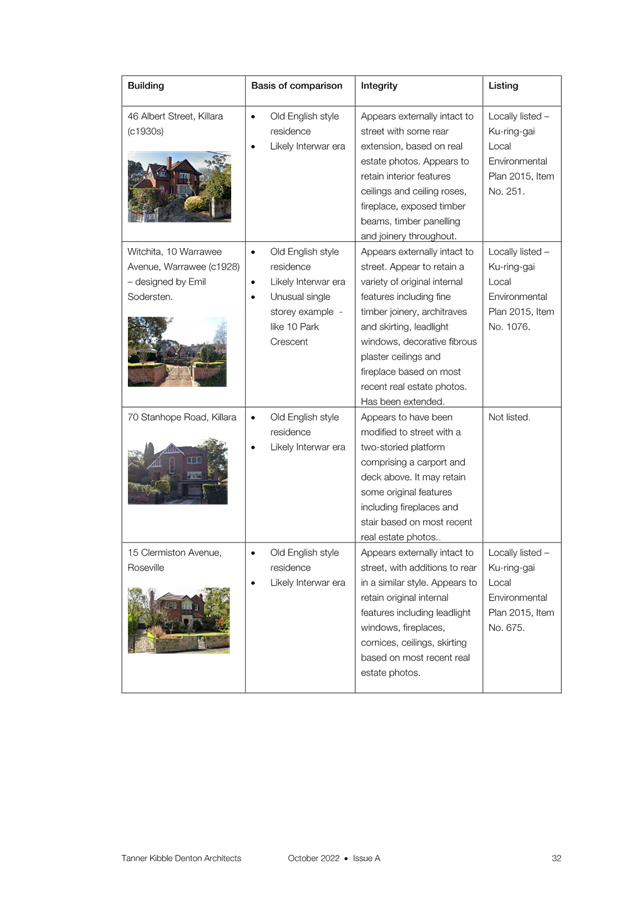
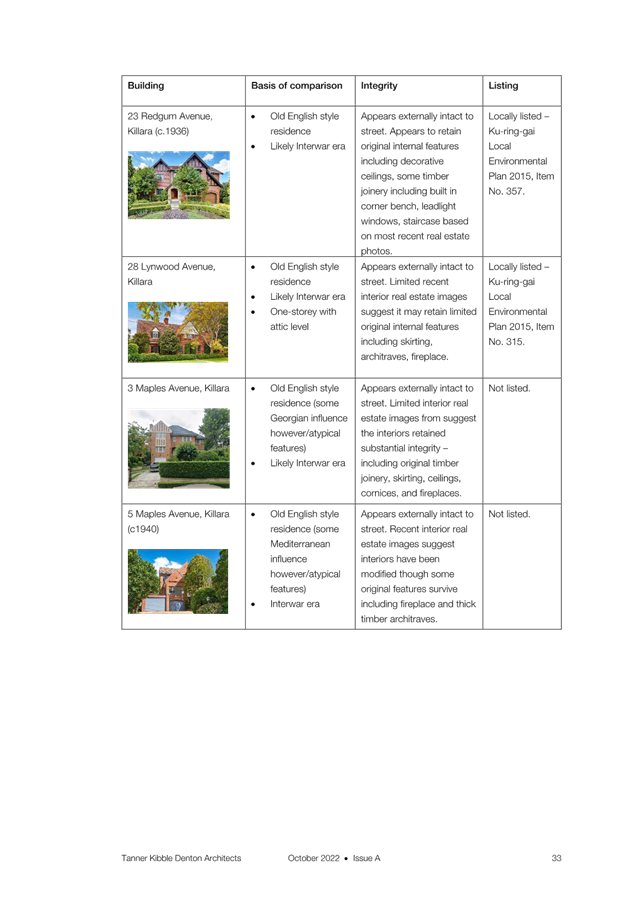
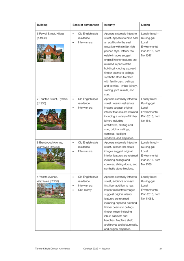
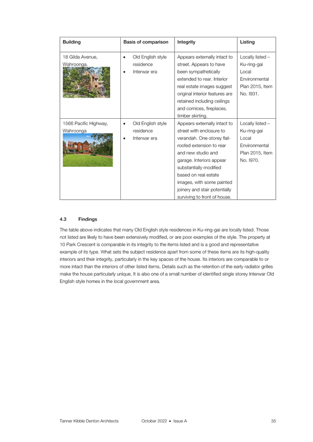
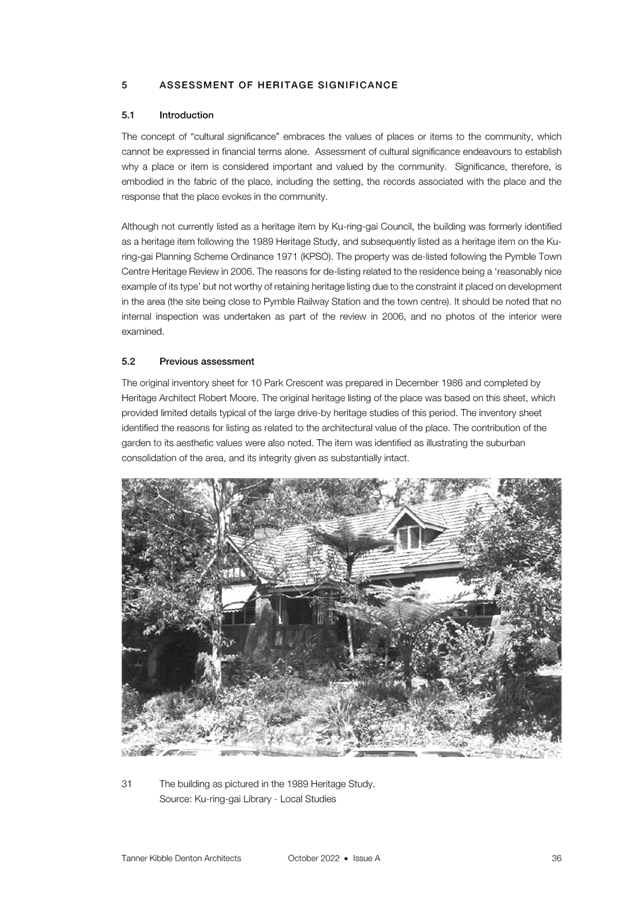



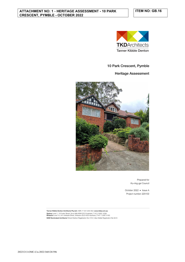
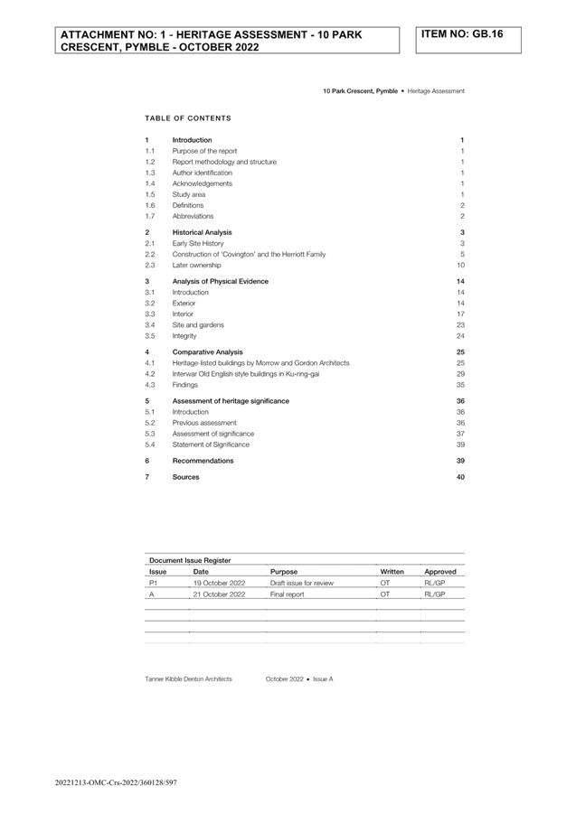
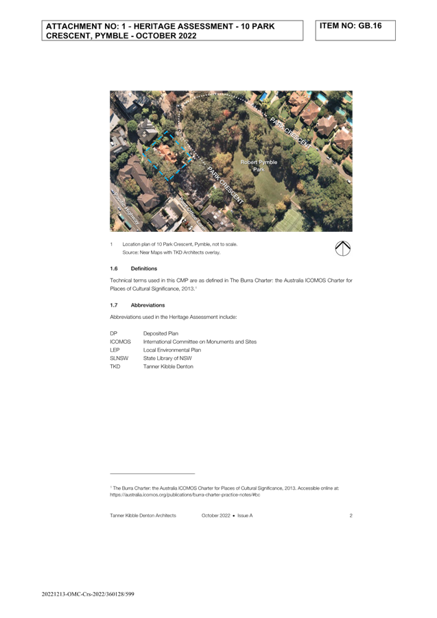
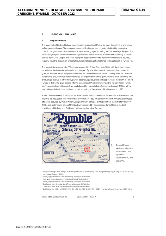
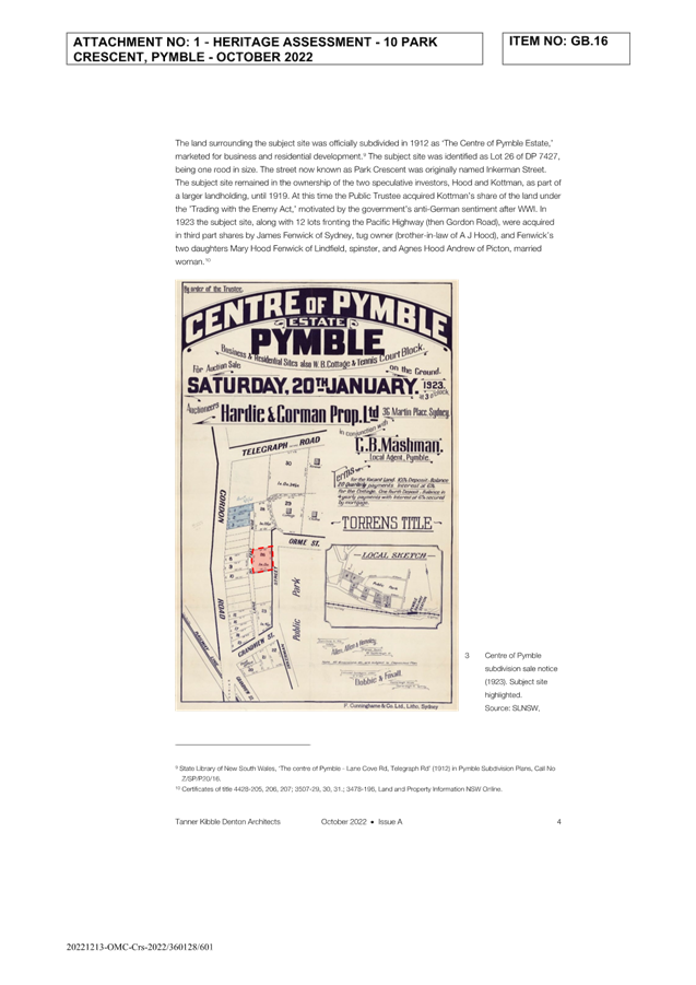
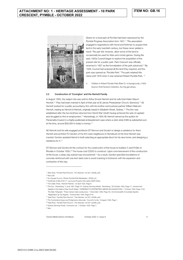
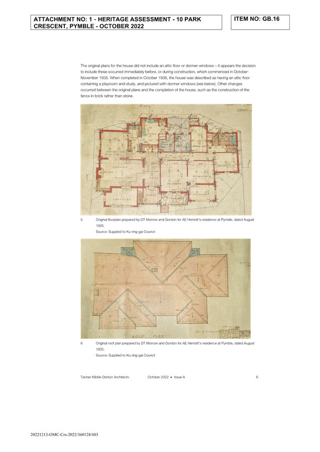
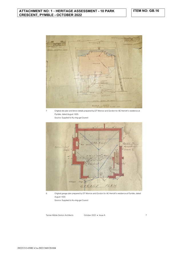
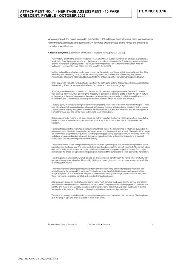
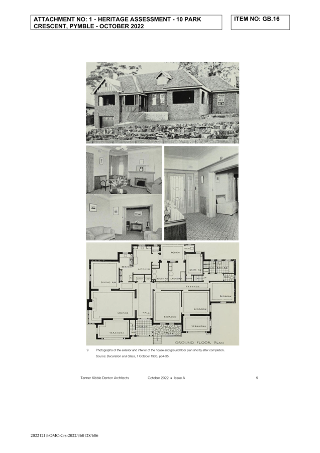
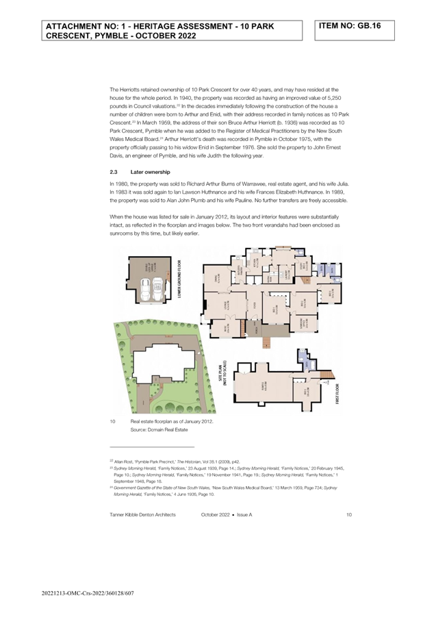
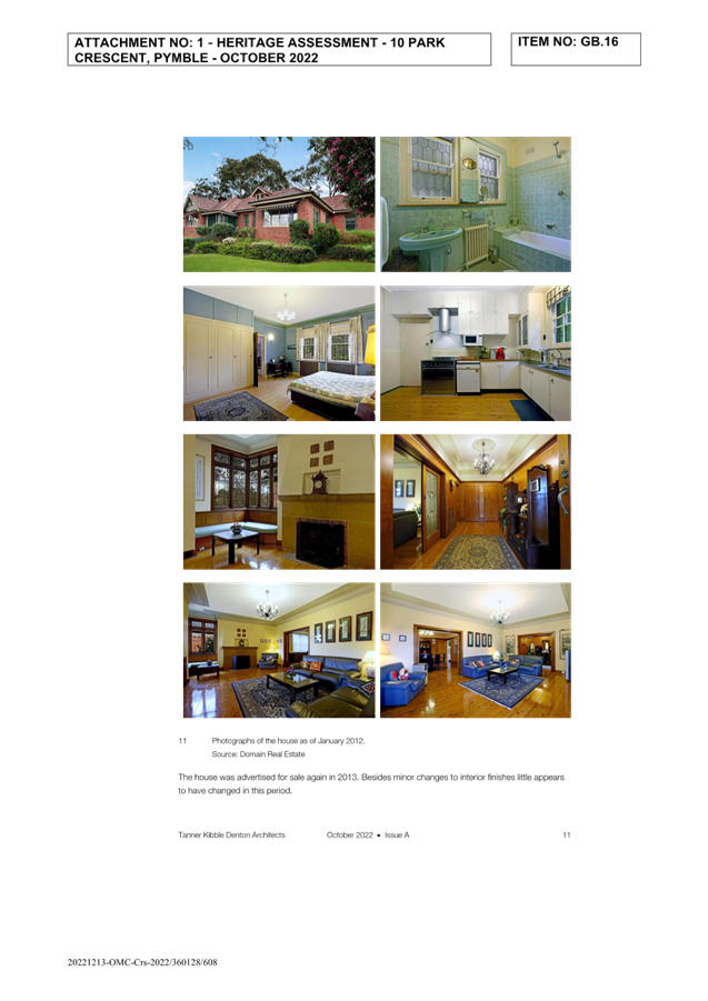
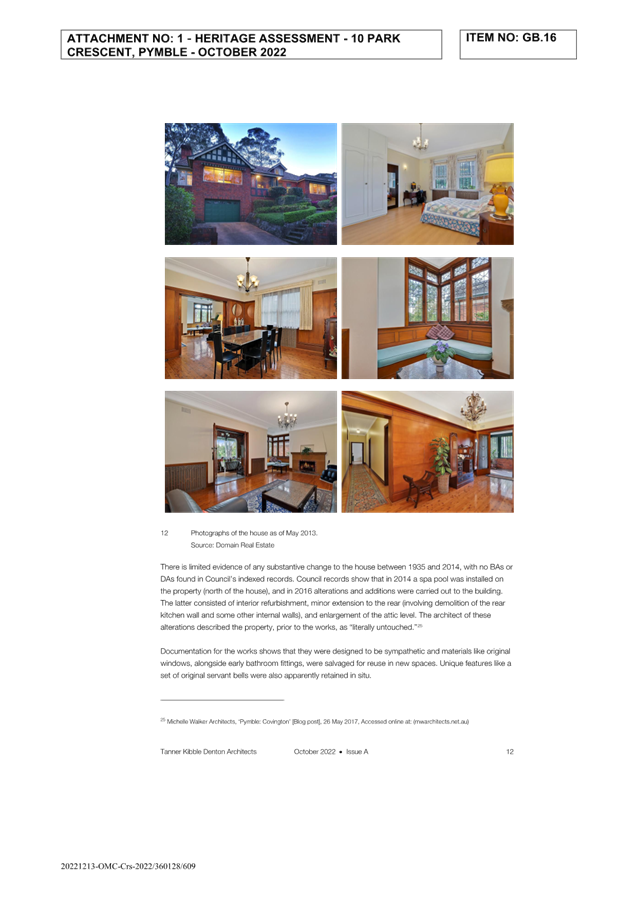
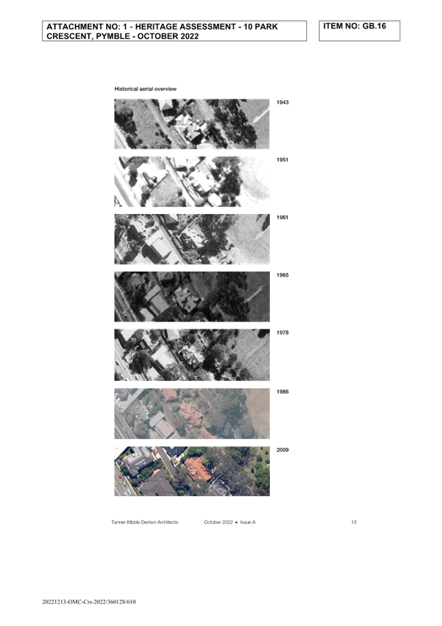
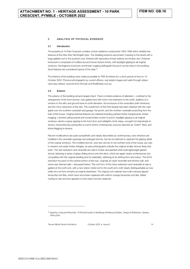
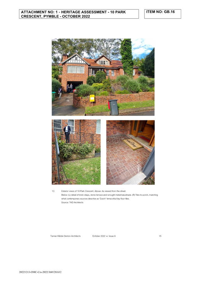
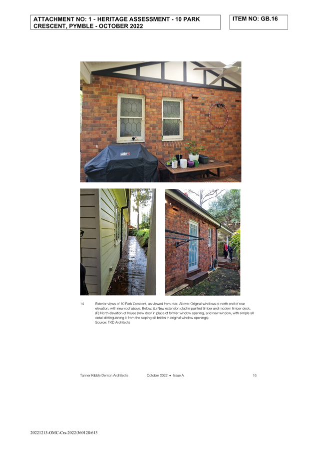
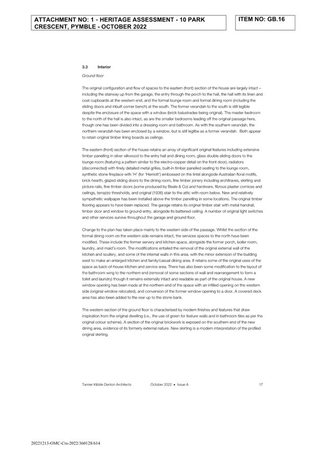
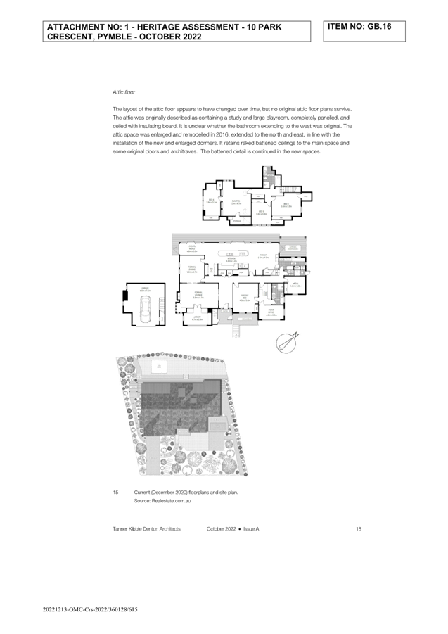
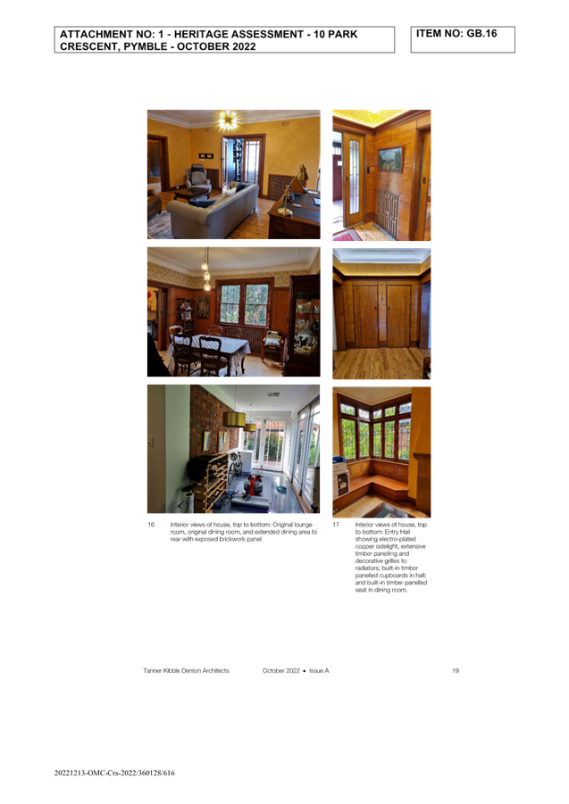
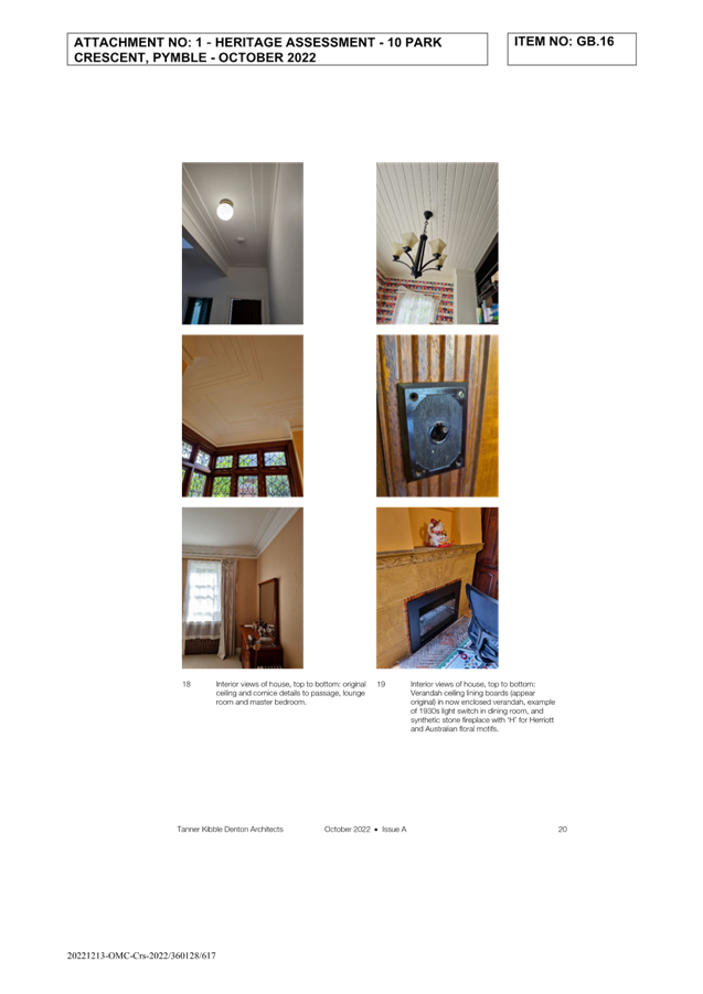
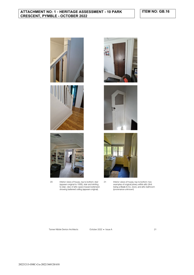
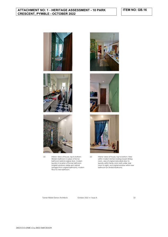
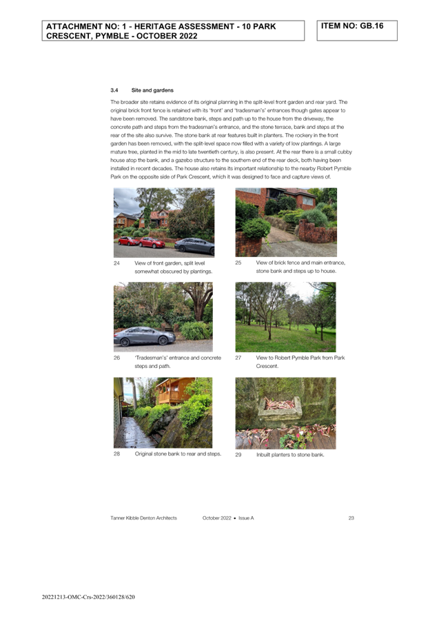

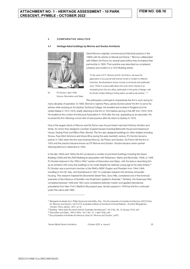
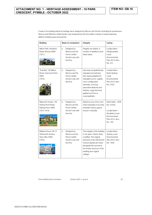
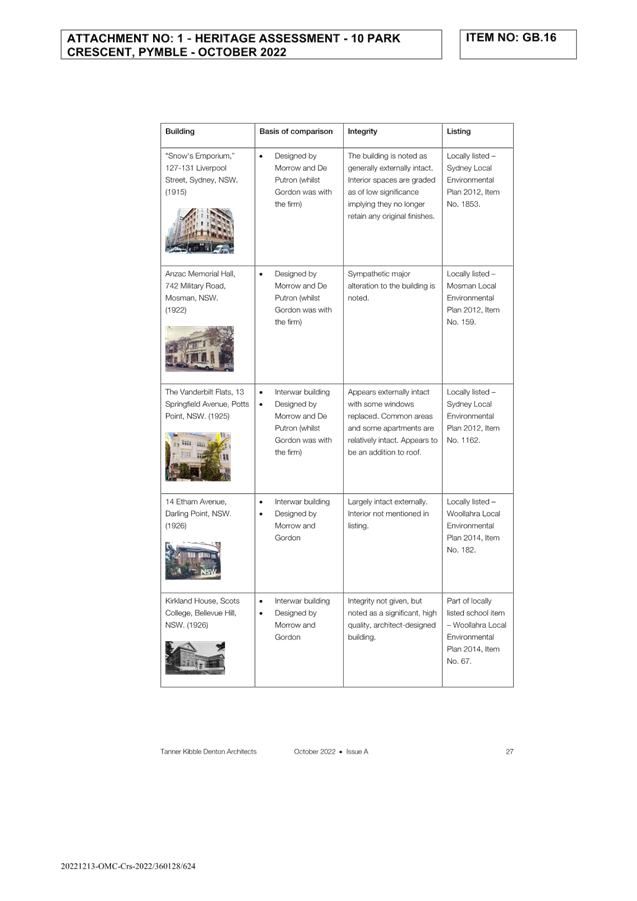
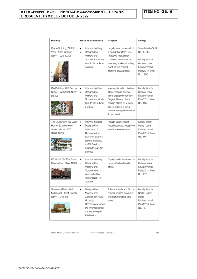
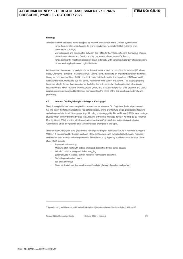
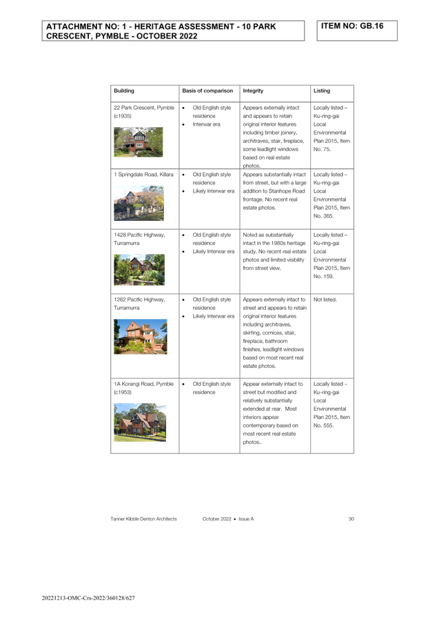
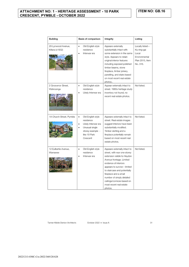
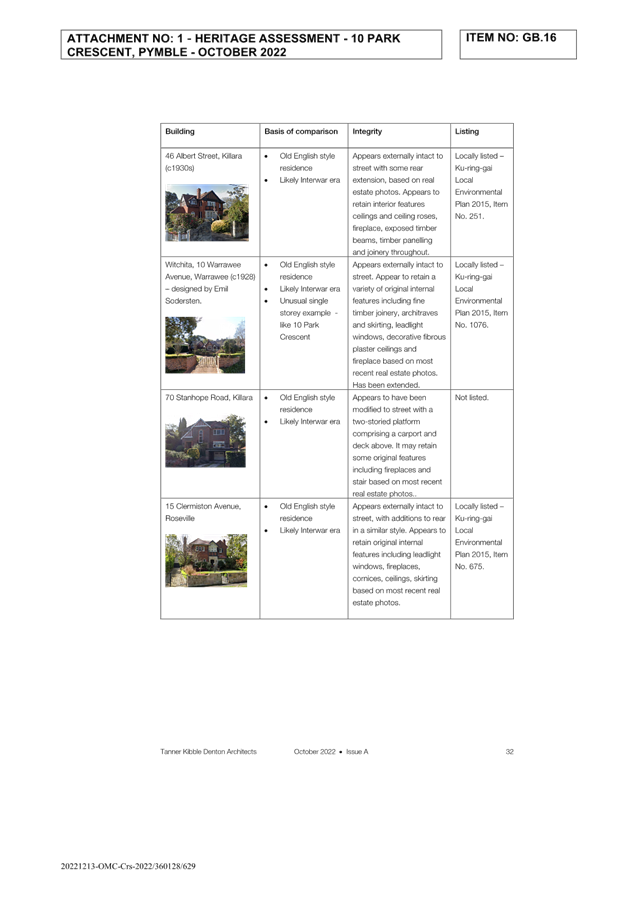
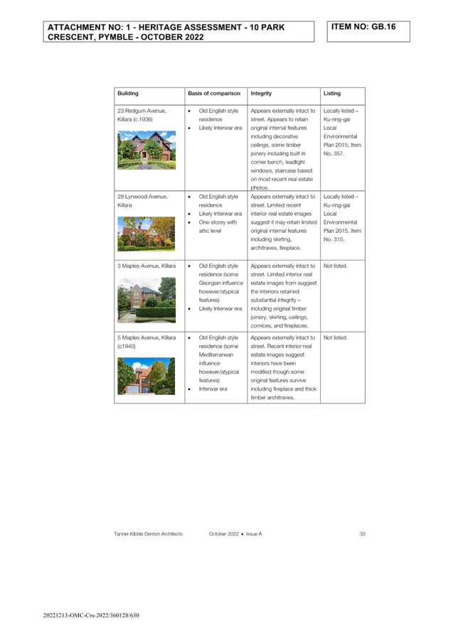
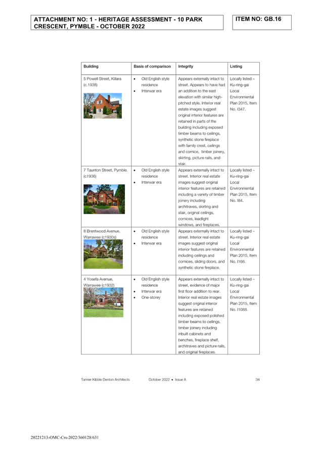
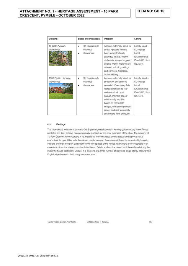
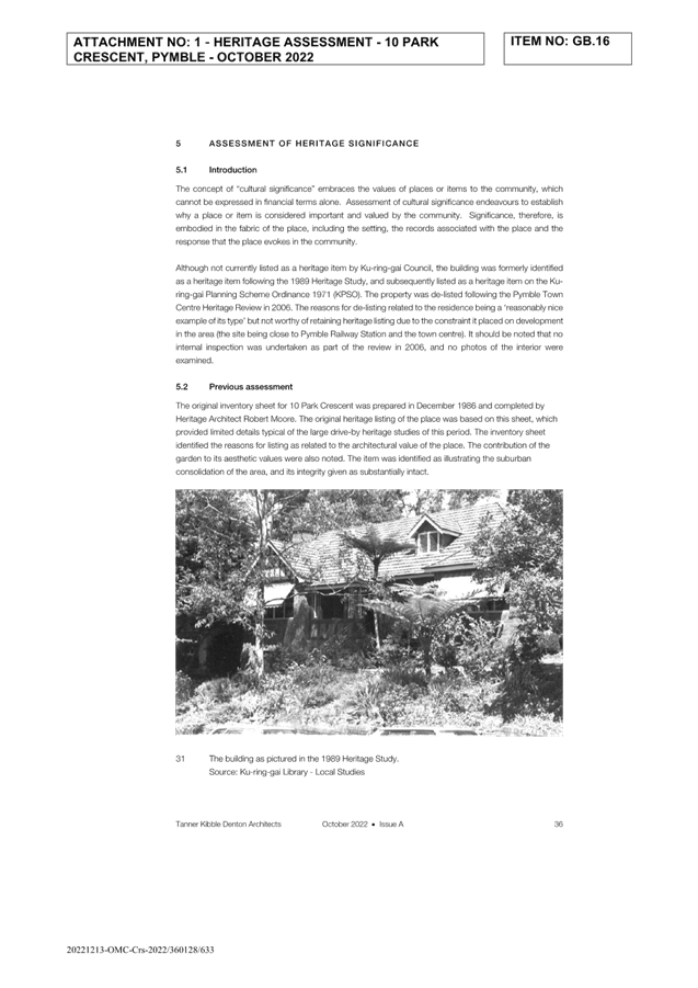
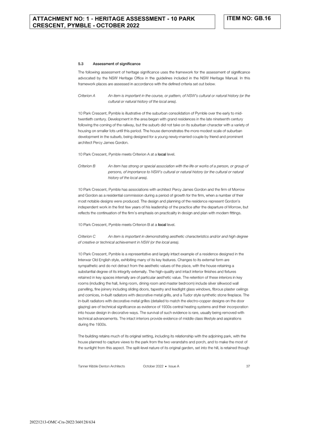
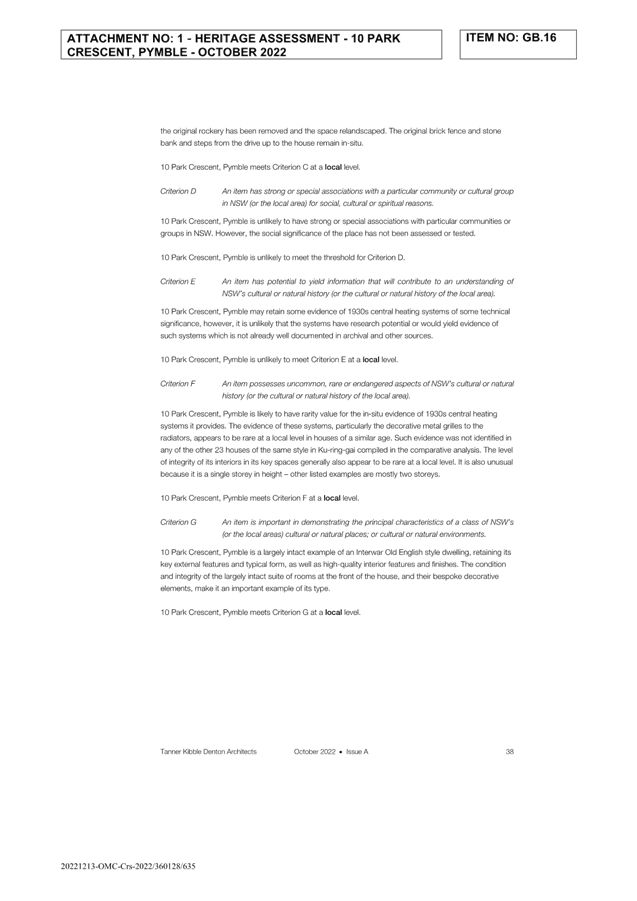
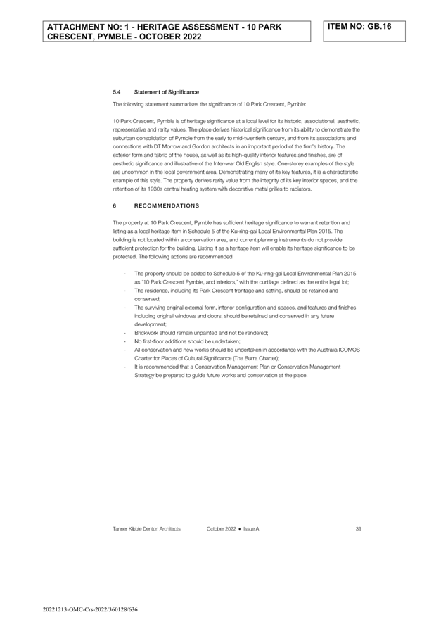
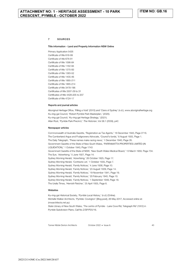
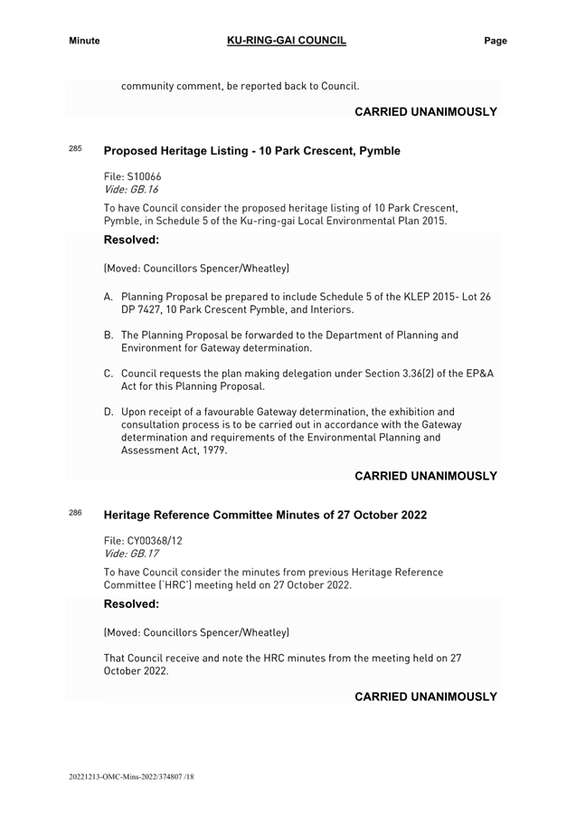
|
Ordinary
Meeting of Council - 16 May 2023
|
GB.8 / 1
|
|
|
|
|
Item
GB.8
|
S13463
|
Generic Plans of Management, Parks and
Sportsgrounds - for adoption
EXECUTIVE
SUMMARY
|
purpose of report:
|
To have Council adopt the
Generic Plan of Management – Sportsgrounds & Parks, both dated
April 2023.
|
|
|
|
|
background:
|
The Local Government Act 1993 and Crown Land
Management Act 2016 set out a range of requirements that Ku-ring-gai
Council is legally bound to adhere to in managing community land owned by
Ku-ring-gai Council and Crown land for which Council is Crown Land Manager.
Section 2.23(6) & (7) of the Crown Land Management Act 2016
requires all NSW councils to adopt plans for management for all reserves for
which they are the appointed Crown Land Manager. The new plans of management
must meet both the requirement for the Crown Land Management Act 2016
and the Local Government Act 1993.
|
|
|
|
|
comments:
|
The Generic Plans of Management
for Parks & Sportsgrounds has been developed in consultation with Crown
Lands and the community and considers the changes to the environment,
legislation, and Council Management of these areas.
In October 2022, Council received approval from Crown
Lands to place both Generic Plans of Management on public exhibition.
Subsequently the revised draft Generic Plans of Management were placed on
public exhibition from 7 November 2022 to 21 December 2022.
The required Crown Land
amendments, along with community feedback and minor errors in the Generic
Plans of Management – Parks & Sportsgrounds have been
addressed. Both are now ready for final adoption.
|
|
|
|
|
recommendation:
(Refer to the full Recommendation at the end of this
report)
|
That Council adopt the final
Generic Plan of Management – Parks & Generic Plan of Management
– Sportsgrounds, dated April 2023 in accordance with clause 70B of the Crown
Land Management Regulation 2018.
|
Purpose of Report
To have Council adopt the Generic Plan of Management –
Sportsgrounds & Parks, both dated April 2023.
Background
The Local Government Act 1993 and Crown Land
Management Act 2016 set out a range of requirements that Ku-ring-gai
Council is legally bound to adhere to in managing community land owned by
Ku-ring-gai Council and Crown land for which Council is Crown Land Manager.
Section 36 of the Local Government Act 1993 requires all NSW
councils to have in place and adopted plans of management for all reserves
classified as community land.
Section 2.23(6) & (7) of the Crown Land Management
Act 2016 requires all NSW Councils to adopt plans of management for all
reserves for which they are the appointed Crown Land Manager. The new plans of
management must meet both the requirement of the Crown Land Management Act
2016 and the Local Government Act 1993.
A Plan of Management (PoM) provides a framework for the
management of public land that is owned or managed by a Council. It identifies
issues affecting public land and sets out how that land is intended to be used,
managed, maintained and enhanced in the future. They:
· are written by a
council in consultation with the community;
· clarify how a
council will manage the land; and
· indicate how the
land may be used or developed, such as leasing or other commercial
arrangements.
Until a PoM for an area of community land is adopted by a
council, the nature and use of the land must not be changed. A council cannot
approve a new development on the land nor grant a lease, licence or other
estate over the land until a plan of management is in place.
Council is currently reviewing the draft Generic Plans of
Management (PoMs) for Sportsgrounds and Parks. These documents were last
reviewed in 2005 and 2015 respectively, and with changes in the Crown Land
Management Act 2016 a review of all plans is required.
The generic plans of management has undergone extensive
external and internal consultation including public exhibition and submission
to the Crown Land for landowner approval for adoption.
Comments
The generic plans of management for Parks & Sportsgrounds
have been developed in consultation with Crown Lands and the community and
consider the changes to the environment, legislation, and Council management of
these areas.
In February 2022, Council resolved to adopt the draft
Generic Plan of Management – Sportsgrounds to be placed on public
exhibition following review and approval of Crown Lands.
August 2022, Council resolved to adopt the draft Generic
Plan of Management – Parks to be placed on public exhibition following
review and approval of Crown Lands.
In October 2022, Council received approval from Crown Lands
to place both generic Plans of Management on public exhibition. Subsequently
the revised draft PoMs were placed on public exhibition from Wednesday, 7
November2022 through to the closing date for submissions on Wednesday, 21
December 2022.
Within the submission period under Section 40A of the LG
Act a public hearing was held to inform where there are any changes in
categorisations of community land. The public hearings require an independent
chairperson to conduct a public hearing and provide a report to Council with
recommendations on the proposed categorisation of community land.
The public hearing was held Monday, 28 November 2022 from
6.30pm - 8.30pm at Council Chambers. The final report following the hearing was
made available to the public consistent with statutory timeframes, (see
Attachment A1).
The recommendations from the Independent Chair, based on the
representations to the public hearing on 28 November 2022 and written
submissions made to Council by Wednesday, 21 December 2022, regarding the
proposed categorisation/categorisations of the 14 sites considered at the
public hearing are as follows:
· adopt the proposed
categorisation of Charles Bean Sportsfield as Sportsground, and.
· adopt the
following proposed re-categorisations shown on the maps in Section 3 of the
report because there is no compelling reason(s) as set out in Sections 5 and 6
of this report to change the proposed re-categorisations as identified at all
additional 13 sites.
Council received 11 submissions in relation to both plans
and is summarised in the table below:
|
Key Matter Raised
|
Comment
|
Recommendation
|
|
EV Charging
Submission notes demand for electric vehicle charging
stations
Submission requests public DC charging stations in
Ku-ring-gai
|
This matter is not directly relevant to plans of
management.
The draft POM does not specifically prohibit charging stations
within Councils open space
|
No amendment to the Plan of Management
|
|
Sportsground Key Issues
The Generic Draft Plan of Management – Sportsgrounds
document includes statements in relation to sportsground service standards,
maintenance and usage with the assumption turf fields have a limited capacity
to fulfil the needs of the community.
|
This matter is not directly relevant to plans of
management.
The draft POM does not specify or limit the type of
surface of a sports field
It is acknowledged that properly designed and constructed
fields can increase the capacity and hours of use of a facility, However, it
is noted that increased capital and maintenance budgets would be required to
upgrade fields to maintain higher carrying capacity and to maintain higher
levels of service.
The Recreation Needs Study will identify strategic
consideration of funding relation to field management
|
No amendment to the Plan of Management
|
|
Toolang Oval, St Ives
Ensure that parking is improved. Attendees park all over
the place and have damaged the embankment on Warrimoo
|
This matter is not directly relevant to plans of
management.
The draft POM does not address site-specific parking
arrangements.
However, the comments relating to limited parking
availability at Toolang Oval are noted for future reference and can be
incorporated with any future development of the site
|
No amendment to the Plan of Management
|
|
St Columbans Reserve, North Turramurra
Submission claims that the proposed Categorisation of St
Columbans Reserve is inaccurate.
It is a stormwater drainage area with a very tiny part
approximately 5 metres x 3 metres allocated as a children’s play area
with only two pieces of play equipment.
Submission also notes that there is no additional green
space within 400m available of where? to residents with BBQs, picnic areas,
playgrounds and walking trails to join National Parks.
|
St Colombans Reserve was not included in the Parks Plan of
Management, 2005 as the land was acquired by Council after this time.
St Columbans Reserve comprises two parcels of land with a
total area of approximately 6,430sqm; a portion of this area (1,400sqm or 26%
of total) is identified as drainage reserve The drainage area is approximately
1,400sqm (26%).
Categorisation of the reserve as park is considered the
most appropriate response as this will ensure consistent management regime
across the whole area.
Sandakan Memorial Park exists within 400m radius of the
reserve as with North Turramurra Recreation Area.
Matters relating to open space provision are not directly
relevant to Plans of Management
The Recreation Need Study currently being undertaken will
review required recreation provisions for the area.
|
No amendment to the Plan of Management
|
|
General Plan of Management Structure
Submissions noted the plan of management document
structure is complicated
|
The content and structure of the Plan of Management is
guided by the Local Government Act 1993, and Crown Land Act.
Crown Land Template frameworks were used to streamline the documents to make
the documents consistent with Crown Lands Requirements
|
Amendments to both plans been undertaken to reflect
document structure, and amend any errors and omissions
|
|
Consultation
Submissions noted that community consultation needs to be
done meaningfully and acknowledge community feedback in the final decisions.
Some submissions also noted that there has been a lack of community
consultation
|
Council is required to consider submissions received
during the public exhibition prior to adoption of the plan of management.
The community consultation undertaken for both the plan of
management and public hearing into the re-categorisation have been undertaken
in accordance with the relevant legislation and Councils Community
Participation Plan.
The re-categorisation of public land requires a public
hearing to be held by an independent chairperson to give the community an
opportunity to provide written or oral submissions. A public hearing was held
on 28 November 2022 in accordance with the requirements of the Local
Government Act 1993
|
Both Plans of Management have been amended to reflect
feedback received, with the submission table forwarded to Crown Land to
reflect the agreed amendments
|
|
Reserve Naming
Submission states, Confusion to the naming of specific
parks and reserves
|
Concern noted
As part of the updating generic plan of managements,
Council is undertaking a review and audit of all reserves to determine a
consistent naming protocol. This process has involved Council working with
Crown Lands and the Geographical Names Board to identify and correctly name
all reserves
|
Noted and updating of correct reserves names will be a
continual process
|
|
Sportsgrounds
Hours of operation to extend Sundays – Request to
extend Sunday hours from currently 9am to 6pm, to 8am to 7pm, allowing
extension of Football competition games
|
Hours of operations are consistent with previous usage of
sports facilities and is based on the usage requests and minimising impacts
on adjoining residents
Hours for Saturday is 8am to 8.30pm with weekdays 8am to
9.30pm for all floodlight sites.
Increasing hours of operation can have a detrimental
impact of field quality and recovery.
|
No amendment to the Plan of Management
|
|
Sir David Martin Reserve
Query to Re-categorisation of amenities area and surrounds
from Sportsground to General Community Use
|
Changing the Amenities and surrounds to General Community
use aligns with the core objective for General Community use:
Promote, encourage and provide for the use of the land,
and to provide facilities on the land, to meet the current and future needs
of the local community and of the wider public in relation to:
- purposes for which a lease, licence or other
estate may be granted in respect of the land (other than the provision of
public utilities and works associated with or ancillary to public utilities).
This change has no impact to the operational function of
the site and to be consistent with current legislation
|
No amendment to the Plan of Management and is consistent
with the Public Hearing Submission and Recommendations
|
|
Green Valley Reserve
Omission from the Generic Plan of Management – Parks
|
Site is adjacent to Ku-ring-gai Creek Reserve and included
in the overall site. Review of the GNB park register the site is identified
as it is known
|
Amend Plan to include Green Valley Reserve as a separate
reserve
|
|
Garrick Road Reserve
Justification on Reserve Categorisations. Garrick Road
Reserve in the 2005 Generic Plans of Management is categorised as a park and
seeking justification on the merits to change to GCU
|
The existing Parks Generic Plan of Management was
completed in 2005,
Categorisation as Park was considered the most appropriate
at this time.
|
Amend the Plan of Management to include Garrick Road
Reserve as Park
|
|
Transmission Park
Justification on Reserve Categorisations
|
The existing Parks Generic Plan of Management was
completed in 2005,
Categorisation as Park was considered the most appropriate
at this time.
|
Transmission Park consideration of amending the categorisation
will be undertaking in the future following initial adoption of the plan
|
In addition, Crown Lands through the review process has
identified further amendment to both plans of which are consider minor
amendments prior to Ministerial Approval. In April 2023, the NSW Department of
Planning & Environment – Crown Lands provided consent for Council
adopt both plans.
The required Crown Land amendments, along with community
feedback and minor errors and inconsistencies in the Generic Plans of Management
– Parks & Sportsgrounds have been addressed, and is now ready for
adoption, (see Attachments A2 & A3).
integrated planning and reporting
|
Community Strategic
Plan Long Term Objective
|
Delivery Program
Term Achievement
|
Operational Plan
Task
|
|
Recreation, sporting and leisure facilities are available
to meet the community’s diverse and changing needs
|
A program is being implemented to improve existing
recreation, sporting and leisure facilities and facilitate the establishment
of new facilities
|
Progressively review and update Community Plans of
Management
|
Governance Matters
Ku-ring-gai Council amended and completed the draft Generic
- Plans of Management under section 3.23(6) of the Crown Land Management Act
2016 (CLM Act) and section 39 of the Local Government Act 1993 (LG
Act). On February 2023, following public exhibition, the Plans of Management
(PoM) was sent back to NSW Department of Planning, & Environment - Crown
Lands for final review and consent.
Crown Lands advised on 13 April 2023 that they consent to
Council adopting the PoM’s under clause 70B of the Crown Land Management
Regulation 2018 (CLM Reg).
All amendments have been made to the generic plans of
management, which is are ready for final adoption by Council.
Risk Management
Council needs to have a final
Crown endorsed plans of management in place to ensure the lawful use and
occupation of Crown land. Any activities to be undertaken on the Reserve must
be expressly authorised in the PoMs prior to implementation.
Financial Considerations
The cost of preparing the
draft PoMs is covered by the Strategy & Environment Department budget.
Implementation of the draft
PoMs would largely be achieved within annual operational budget
allocations. Specific proposals or actions within the plan would be the
subject of separate submissions to Council as part of future integrated
planning and reporting processes, including the Long-Term Financial Plan and
annual budgets.
Social Considerations
Parks and reserves provide
the community the spaces to engage with family and the community at
large. Spaces for unstructured recreation are becoming more important as
people are realising the benefits of recreation in any form in achieving
quality of life. Parks provide a significant amount of recreation opportunity
to the community such as regular participation in physical activity which can
improve overall mental and physical health. It also mitigates the risks
associated with obesity and sedentary lifestyles. Through Council’s
visioning exercise, our community identified a need to strive for healthier
lifestyle practices to achieve physical, mental, and social wellbeing.
Environmental Considerations
Ku-ring-gai’s parks
constitute a significant section of Council’s open space reserve system.
Many of our parks are associated with natural areas and sportsgrounds that
provide environmental functions including habitat and bio-linkage opportunities
for flora and fauna.
Our parks also provide attractive visual amenity with native
vegetation and landscaping which breaks up the urban landscape. In addition to
this, the vegetation and canopy trees on our parks provide microclimate effects
to the local area through mitigating wind velocity and the heat island effect
created within urbanised areas.
Community Consultation
Community consultation has
been undertaken with approval of Crown Lands. The draft PoMs were placed
on public exhibition for the statutory periods required under the LG Act and
the CLM Act.
Council is required to
undertake community consultation in accordance with Section 38 of the Local
Government Act 1993:
· Public
notice of a draft plan of management;
· public
exhibition of the draft plan for a minimum of 28 days; and
· the
public notice must also specify a period of not less than 42 days after the
date on which the draft plan is placed on public exhibition during which
submissions may be made to the council.
Council, will following adoption of the PoMs place the
Adopted PoMs on Council Website for community access.
Internal Consultation
Consultation
between Council teams (Property, Urban Planning & Heritage, and Operations)
has taken place in preparation of this report.
Summary
The Generic Plan of
Management – Parks & Generic Plan of Management – Sportsgrounds
have been prepared and exhibited in accordance with the Crown Land
Management Act 2016 and the Local Government Act 1993.
As landowner, the NSW Department of Planning & Environment - Crown Lands
has provided consent to Council to adopt the PoM’s under clause 70B of
the Crown Land Management Regulation 2018 (CLM Reg).
Recommendation:
That Council adopt the:
A. final
Generic Plan of Management – Parks, dated April 2023 in accordance with
clause 70B of the Crown Land Management Regulation 2018.
B. final
Generic Plan of Management –Sportsgrounds, dated April 2023 in accordance
with clause 70B of the Crown Land Management Regulation 2018.
|
Craig Johnson
Strategic Recreation Planner
|
Bill Royal
Team Leader Urban Design
|
|
Antony Fabbro
Manager Urban & Heritage Planning
|
Andrew Watson
Director Strategy & Environment
|
|
Attachments:
|
A1 ⇩ ⇩
|
Ku-ring-gai
Parks Sportsgrounds Proposed Categorisation Recategorisation Public Hearing
and Submissions Report - FINAL 11-01-2023
|
|
2023/013944
|
|
|
A2 ⇩ ⇩
|
Generic
Plan of Management - Parks - April 2023 - Final
|
|
2023/140510
|
|
|
A3 ⇩ ⇩
|
Generic
Plan of Management - Sportsgrounds - April 2023 Final
|
|
2023/140517
|
|
ATTACHMENT No: 1 - Ku-ring-gai
Parks Sportsgrounds Proposed Categorisation Recategorisation Public Hearing
and Submissions Report - FINAL 11-01-2023
|
|
Item No: GB.8
|
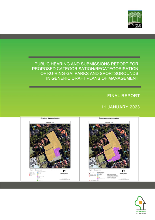
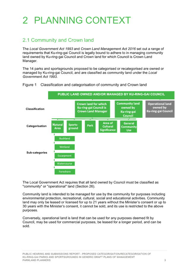
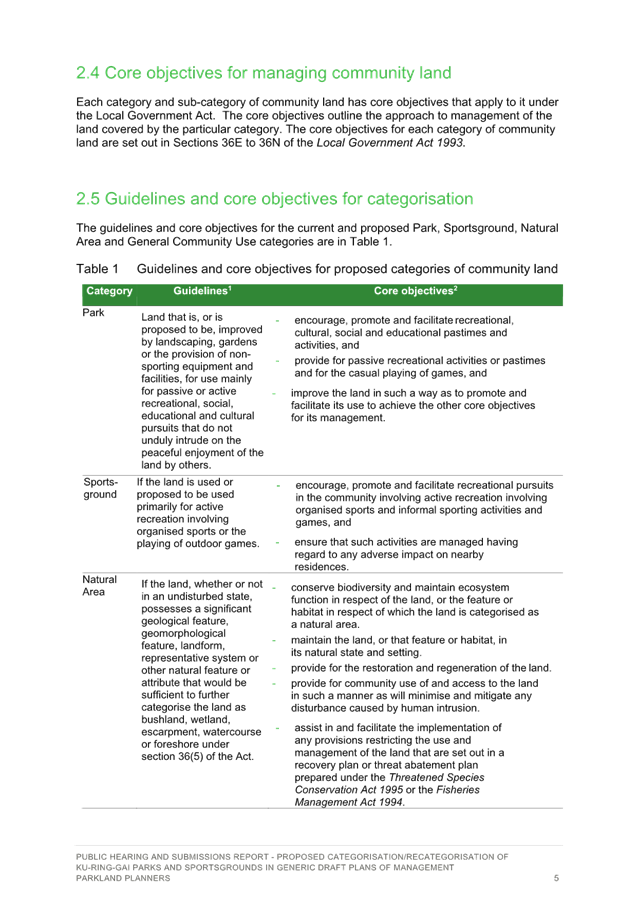
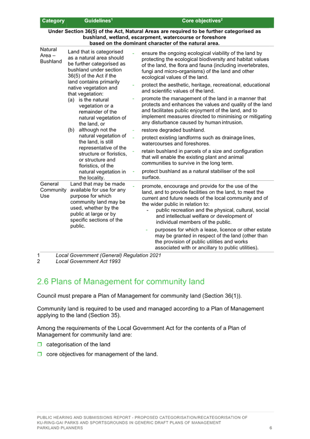

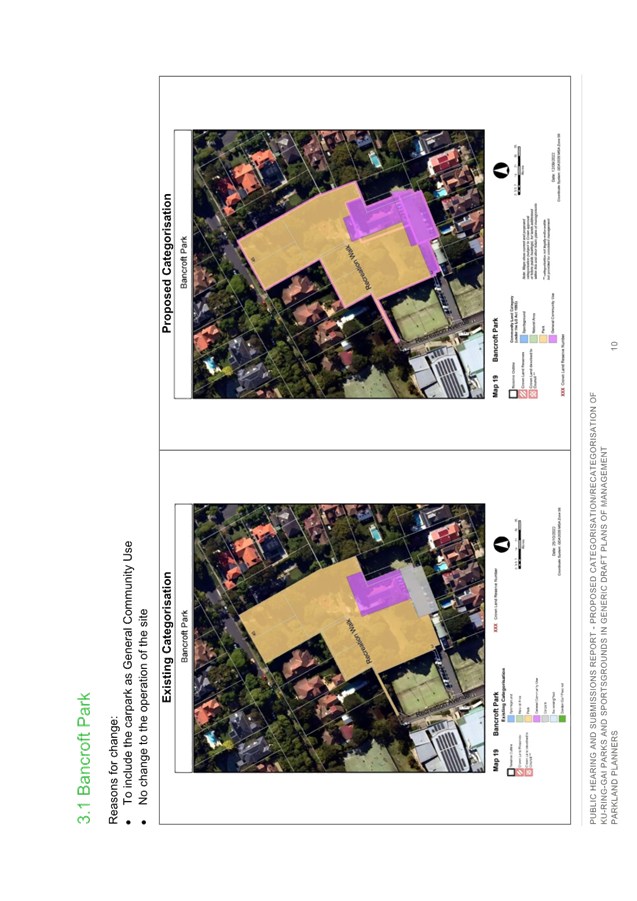
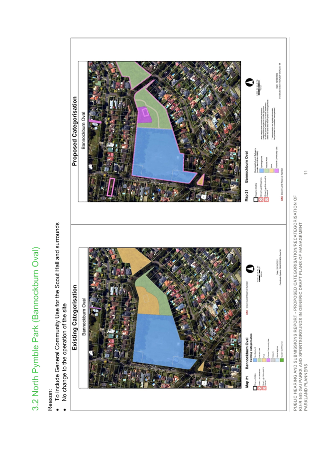
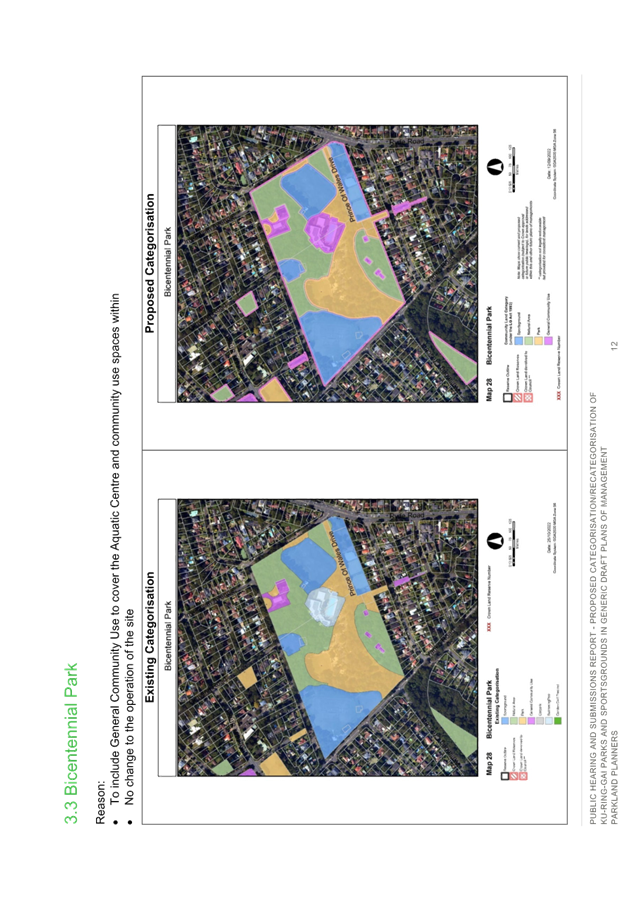
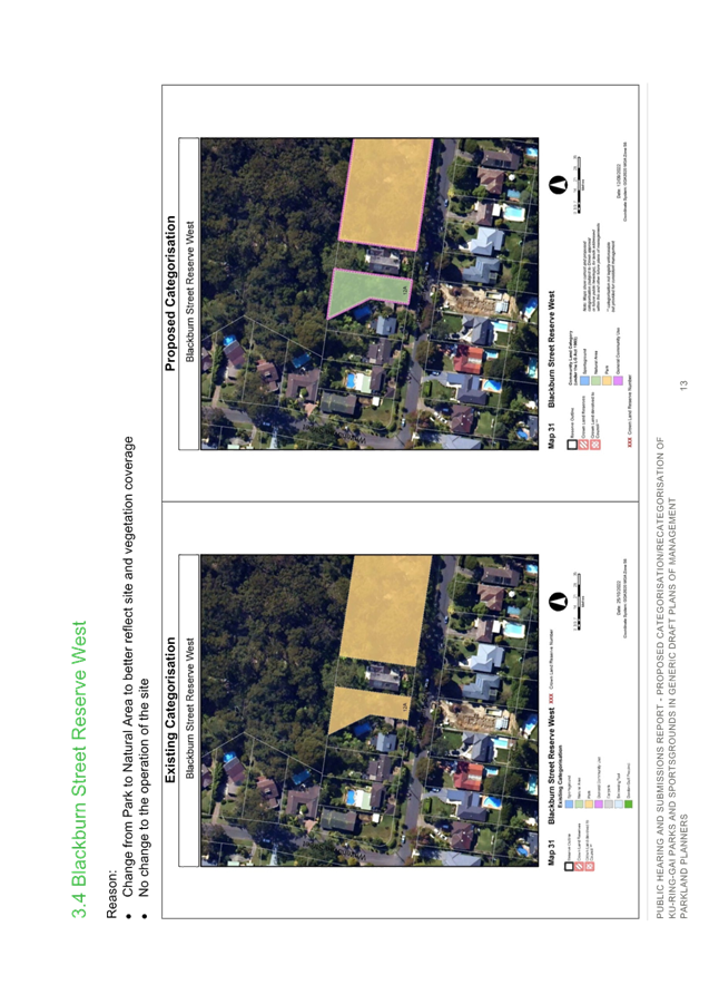
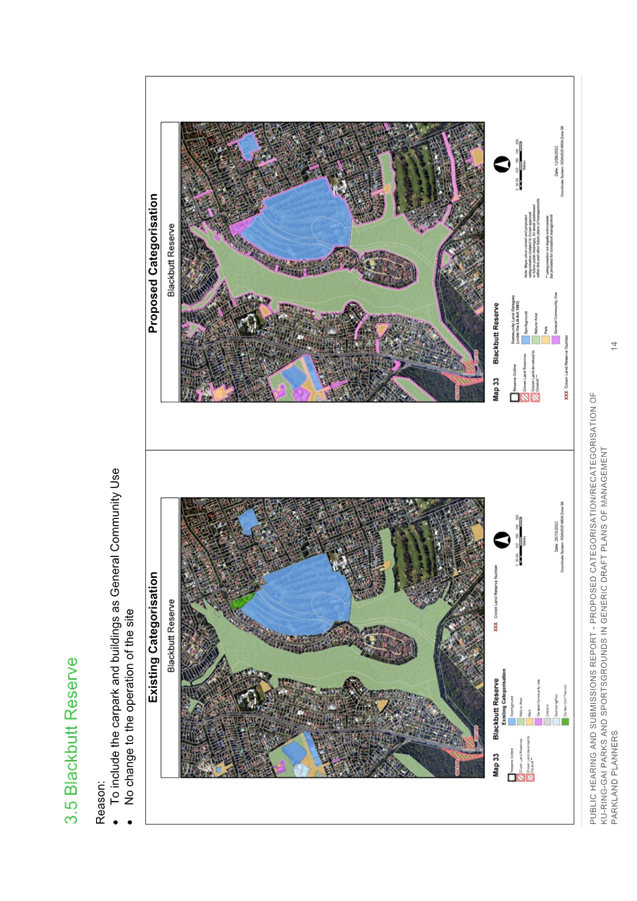
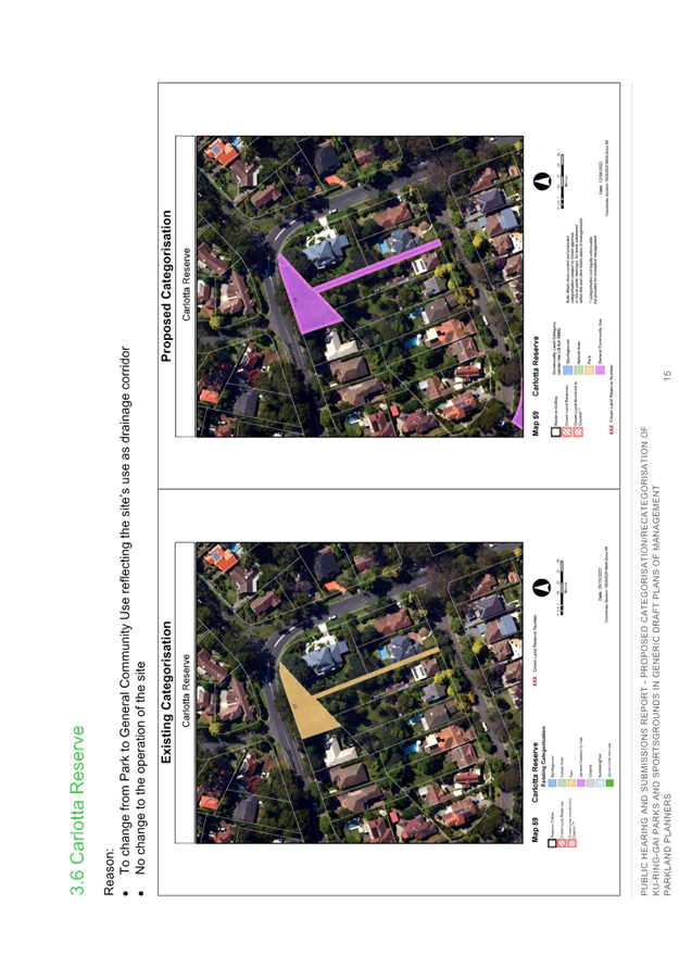
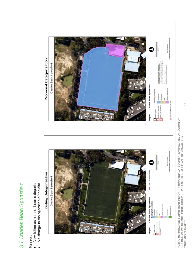
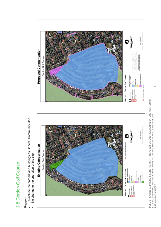
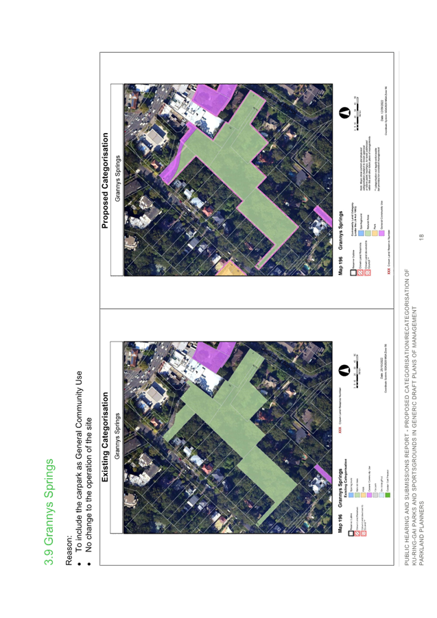
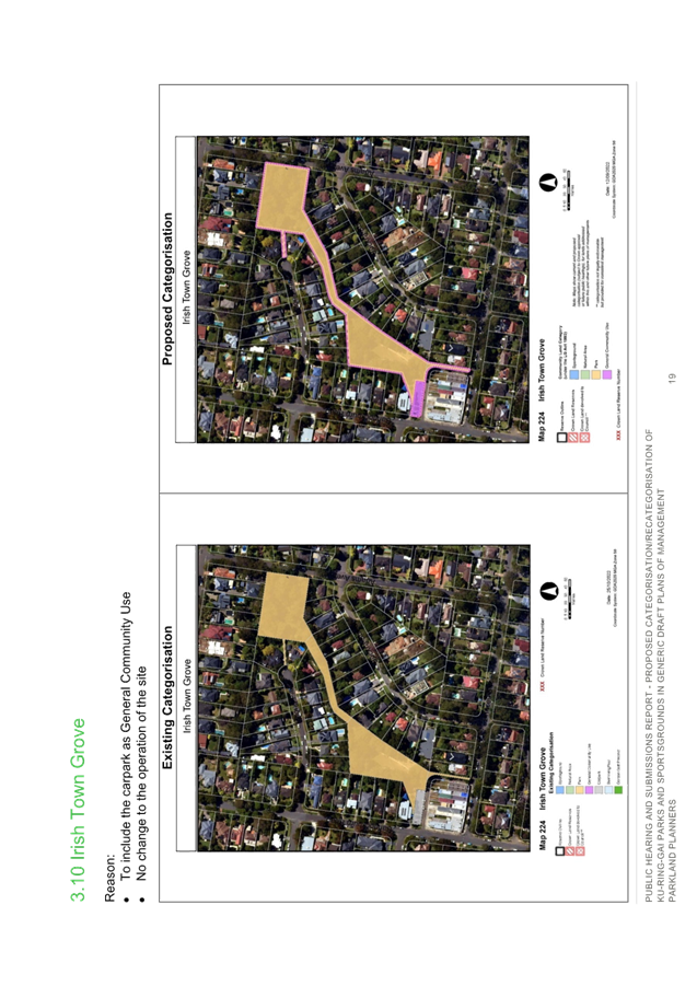
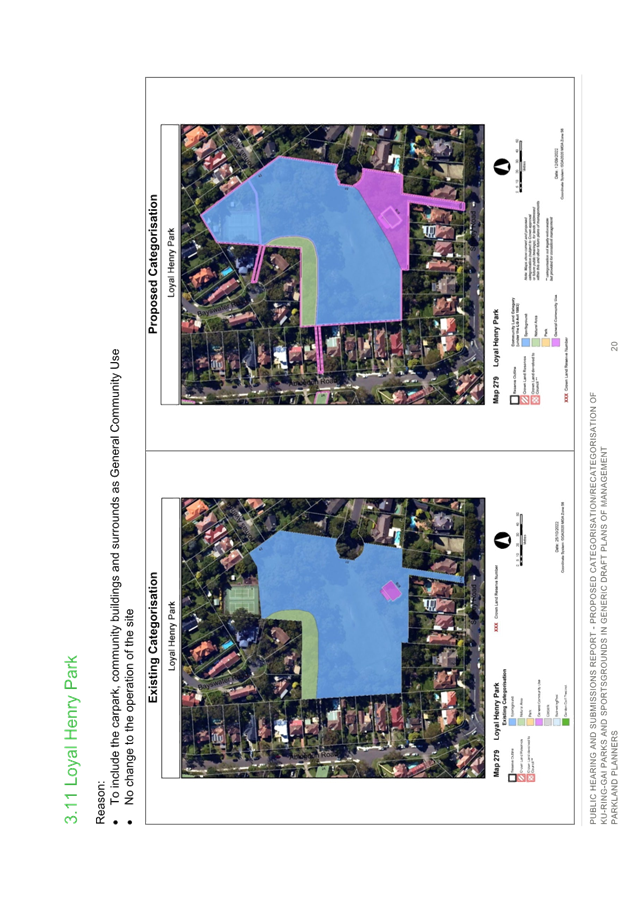
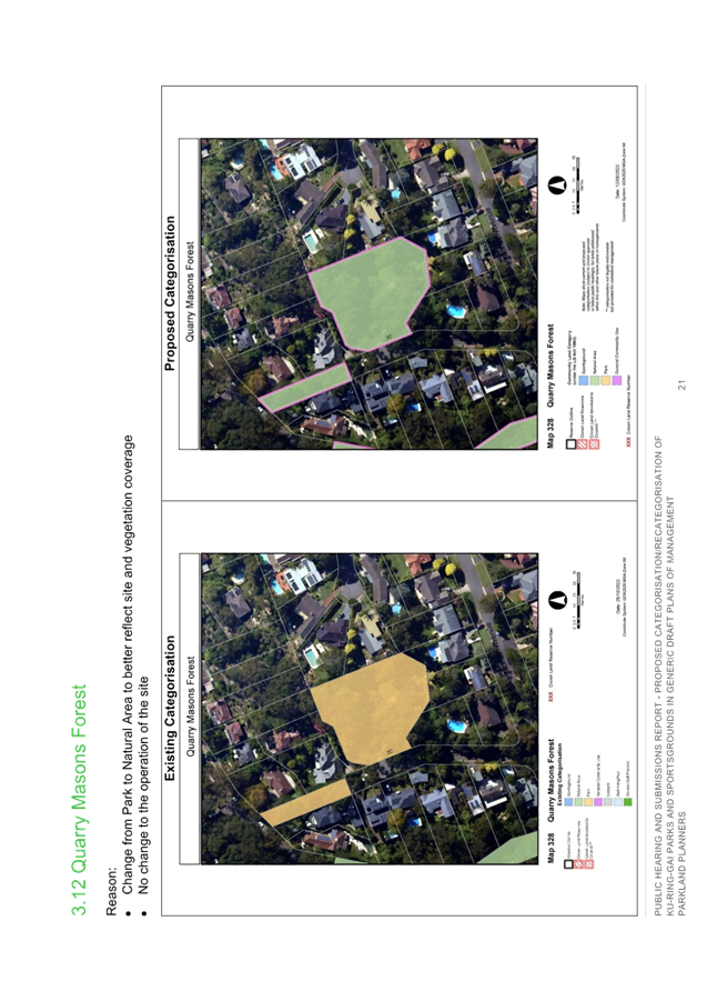
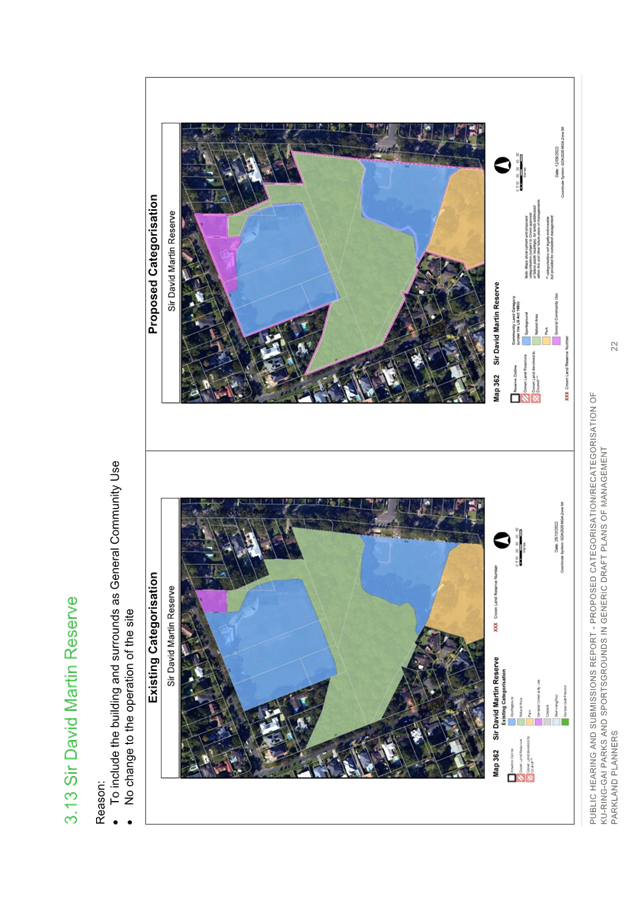
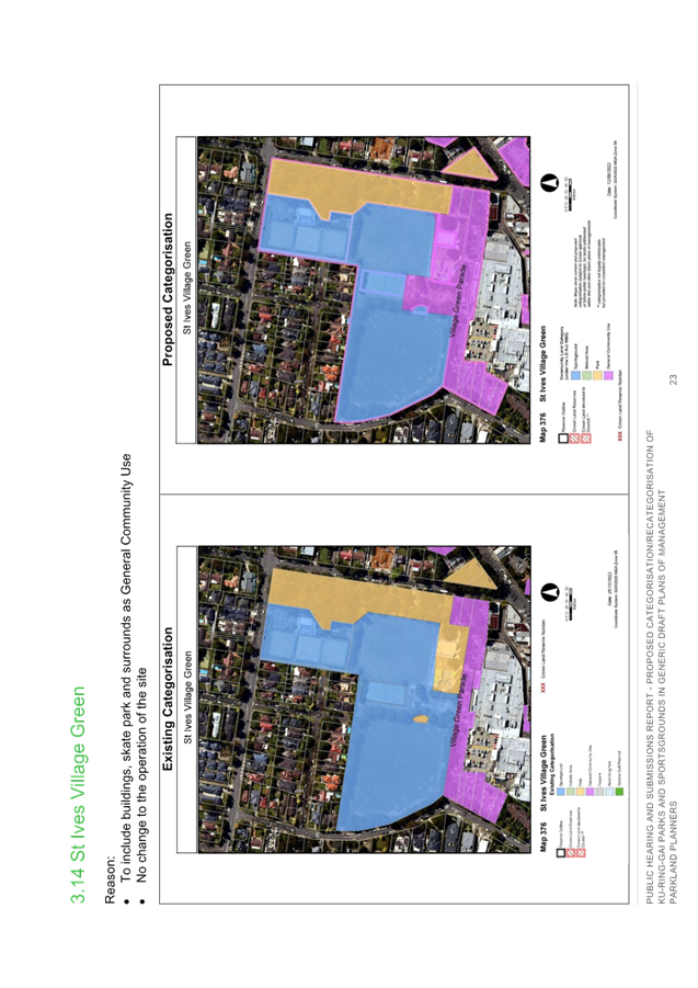

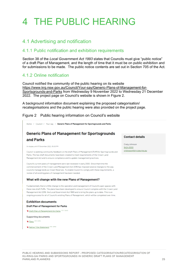
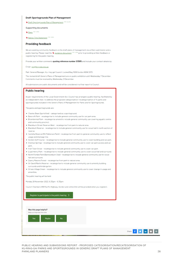
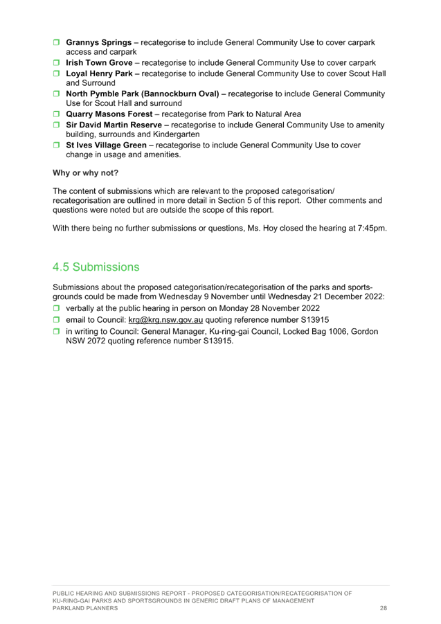
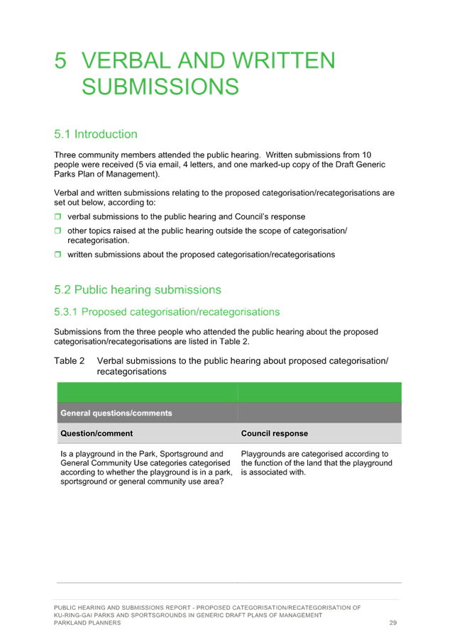
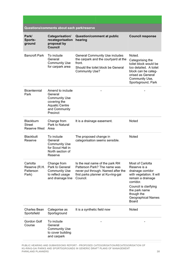
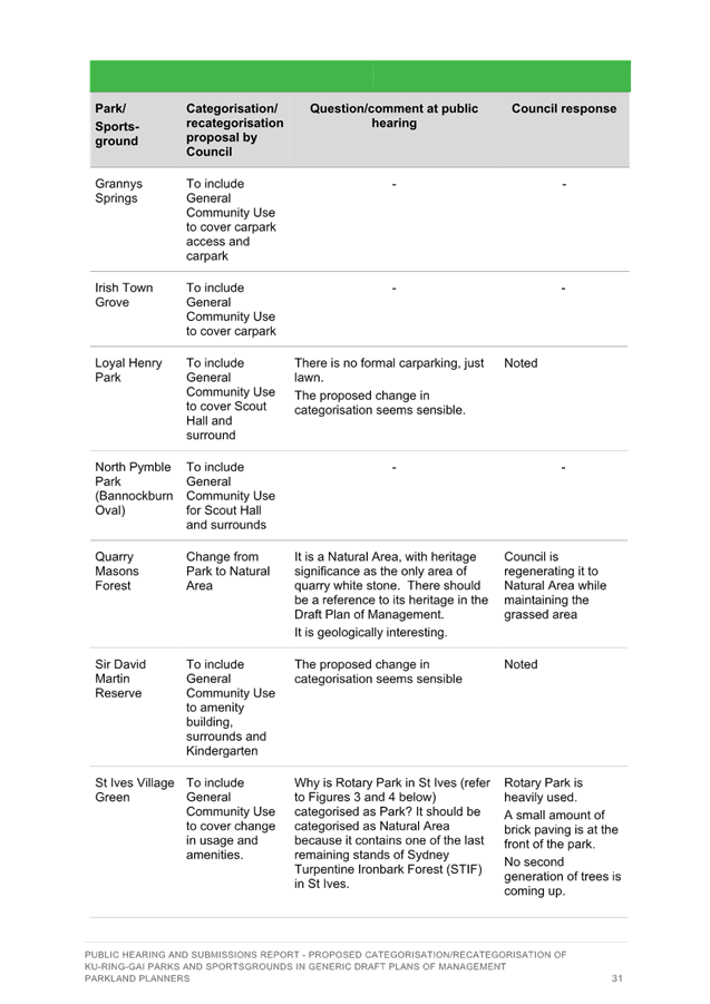
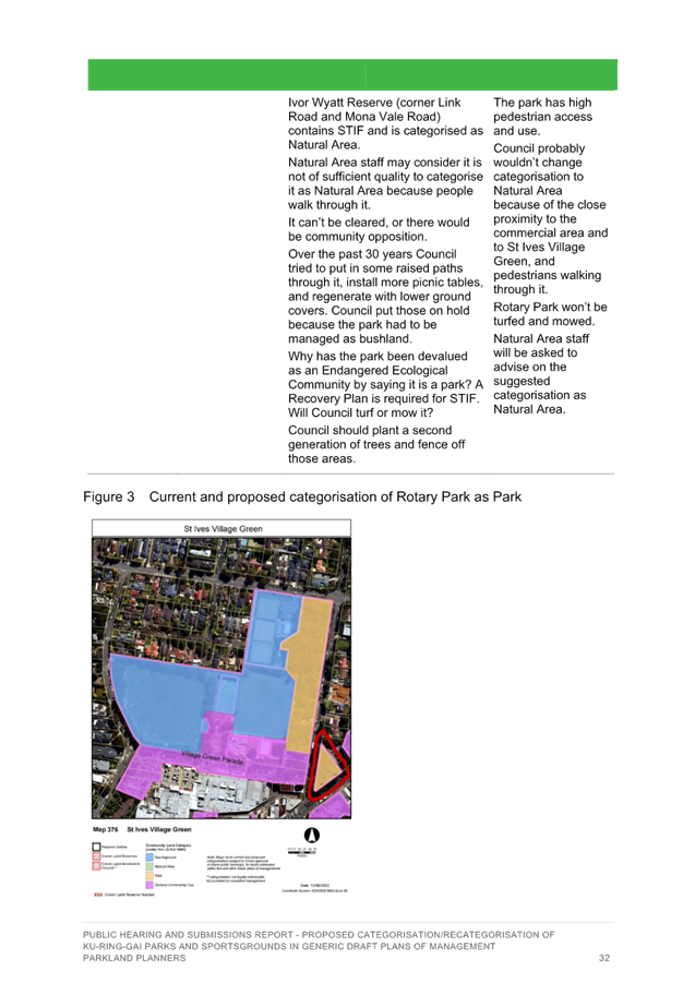
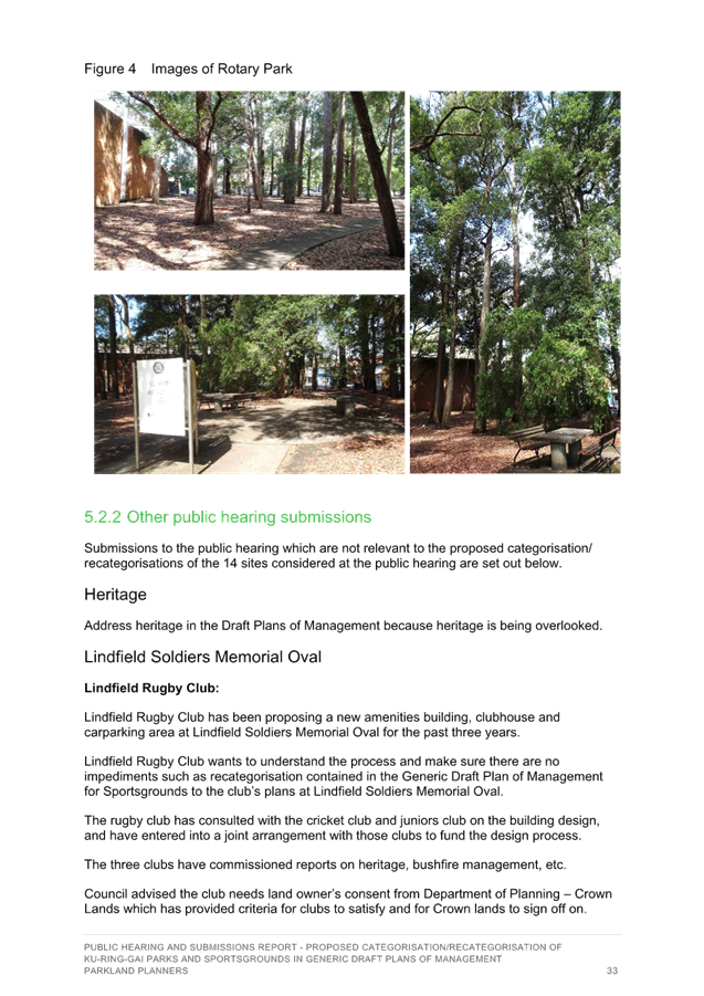
|
ATTACHMENT
No: 2 - Generic
Plan of Management - Parks - April 2023 - Final
|
|
Item No: GB.8
|
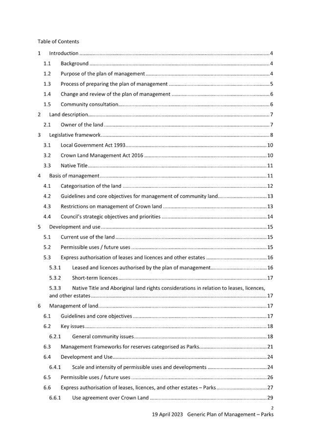
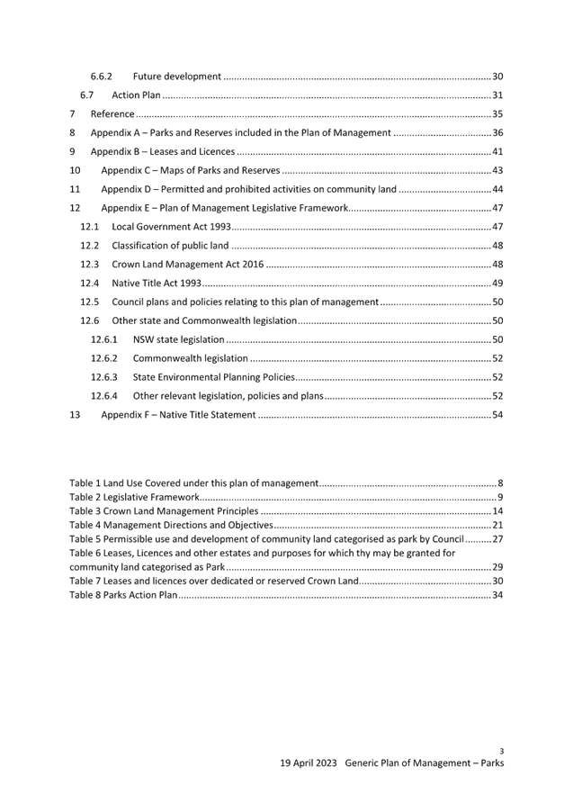
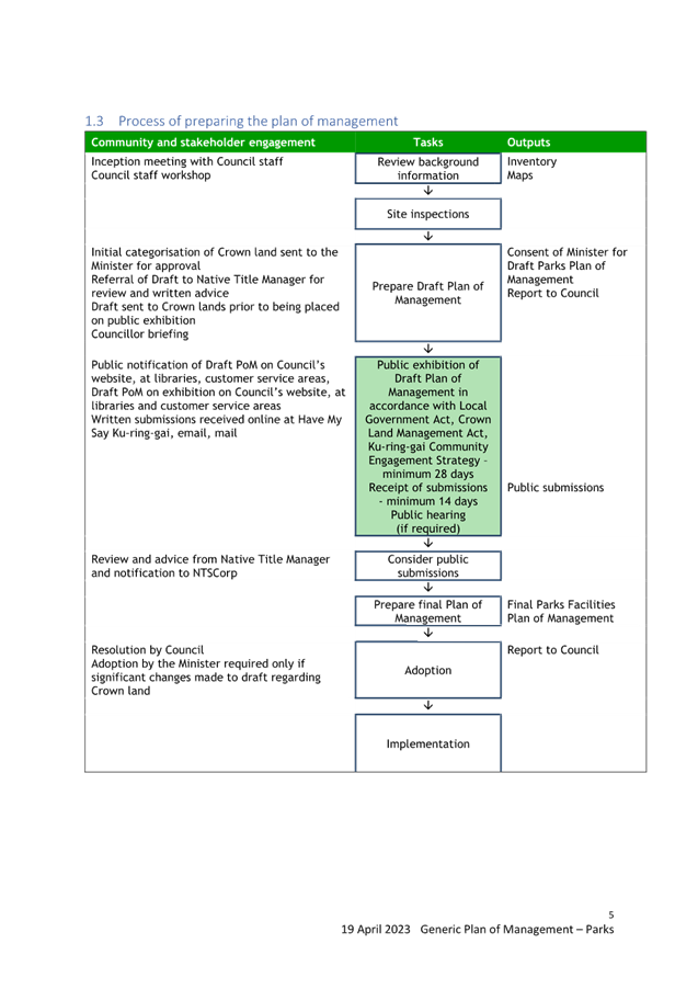
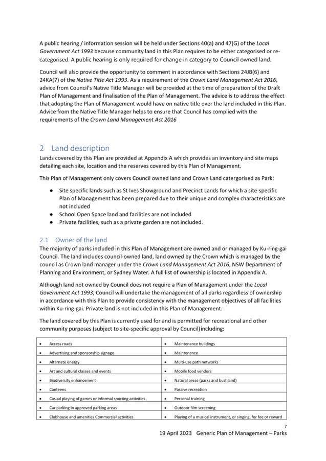
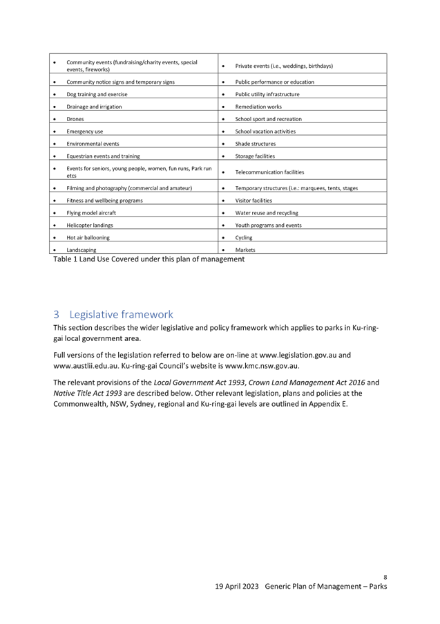
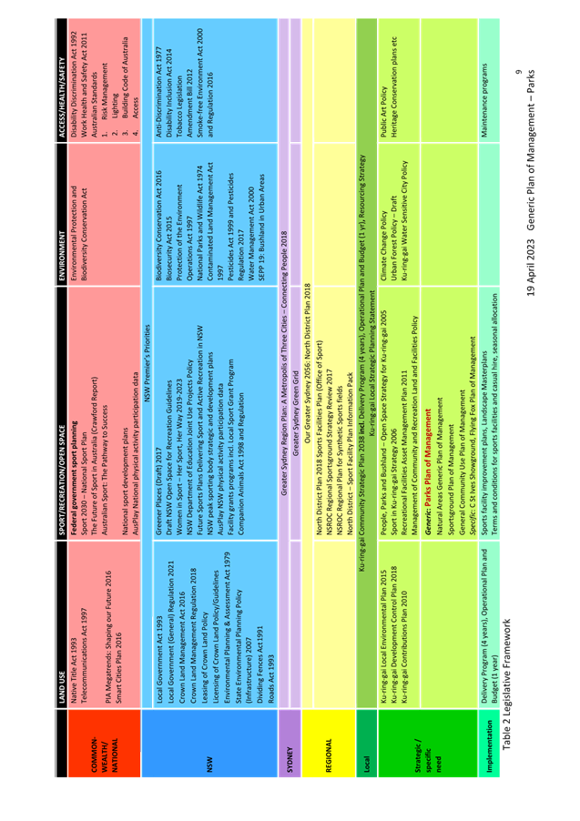
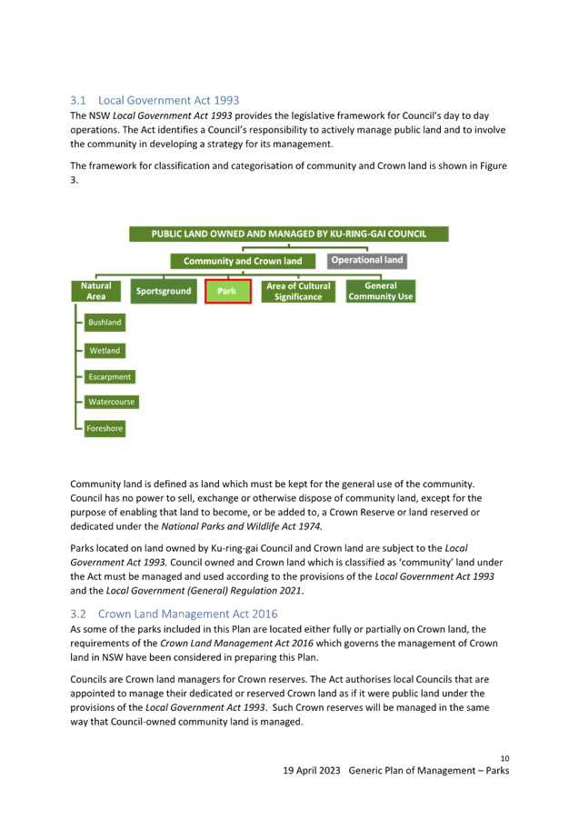
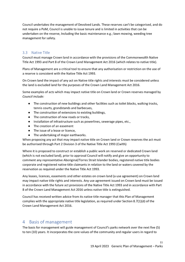
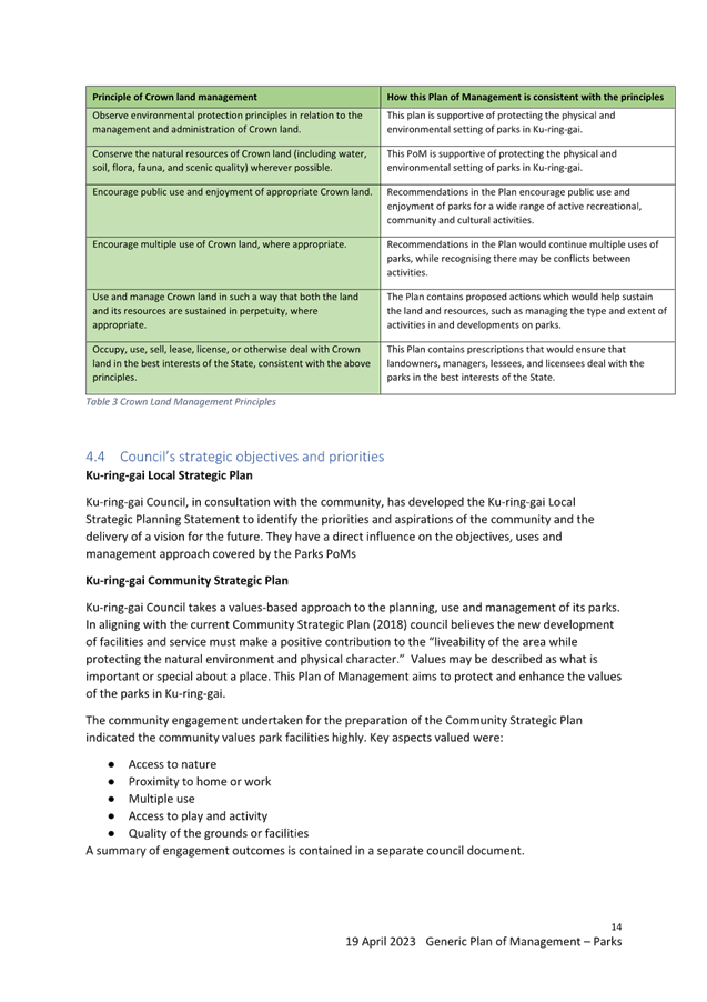
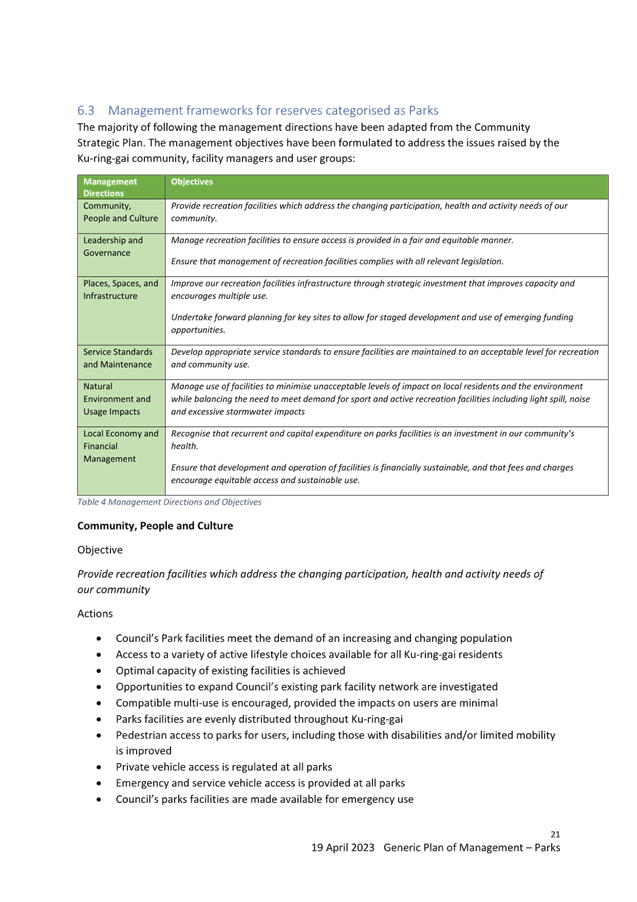
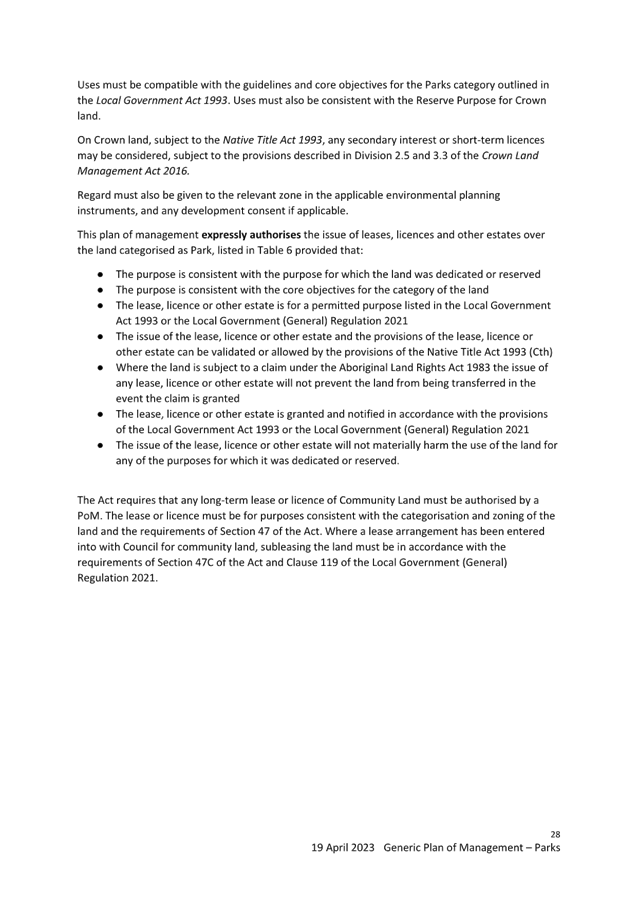
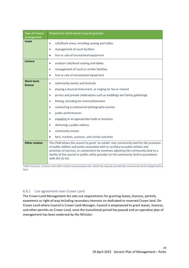
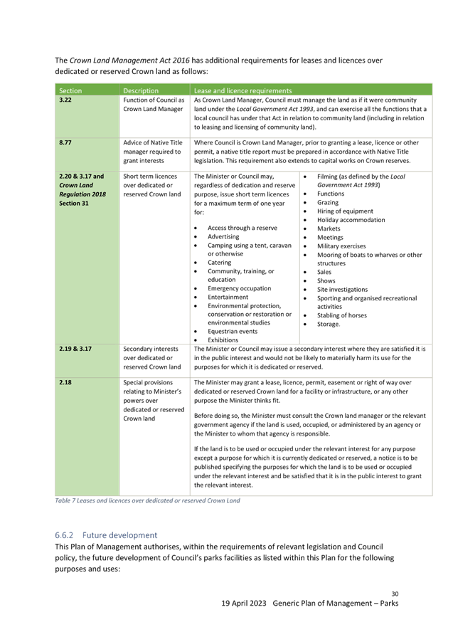
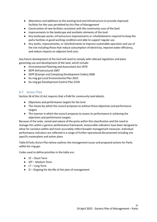
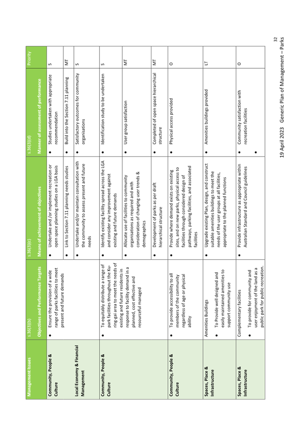
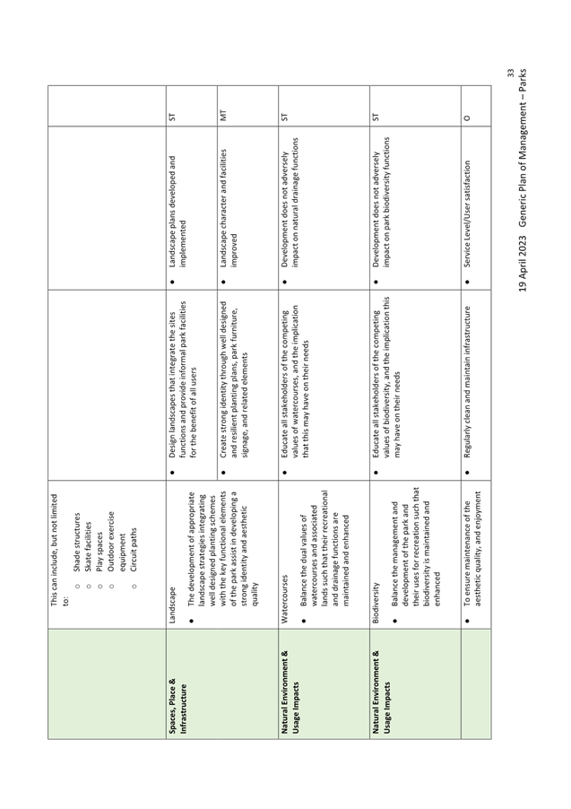
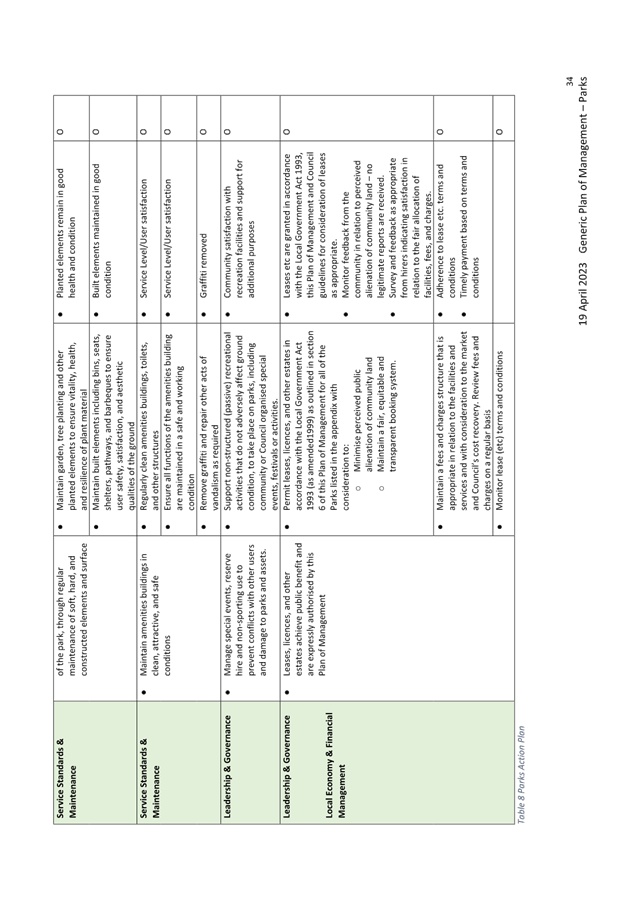
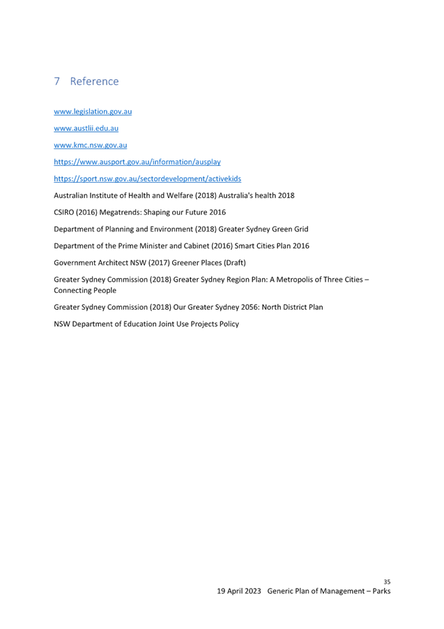
|
ATTACHMENT
No: 3 - Generic
Plan of Management - Sportsgrounds - April 2023 Final
|
|
Item No: GB.8
|
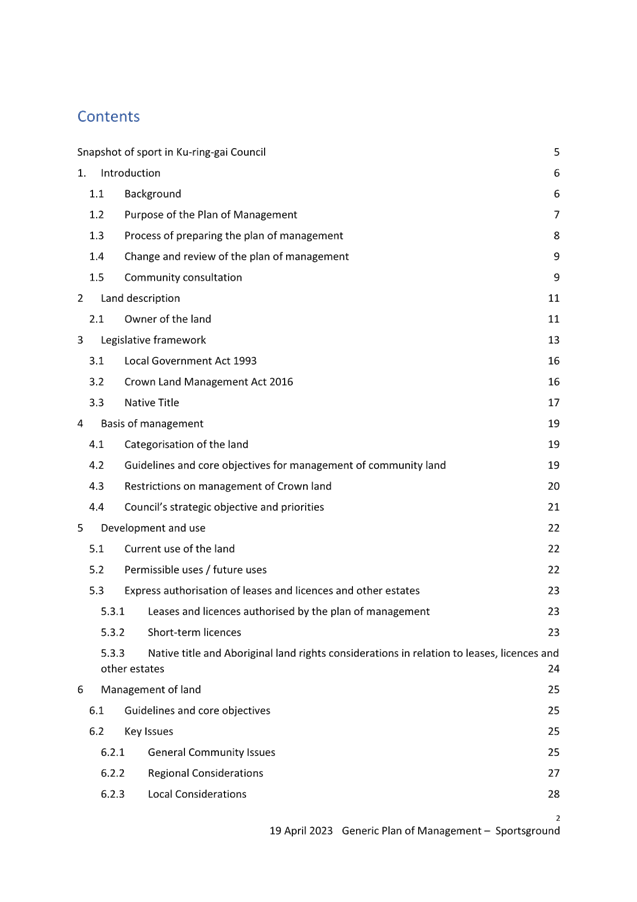
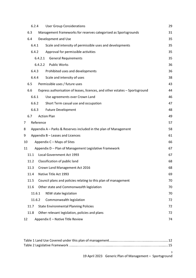

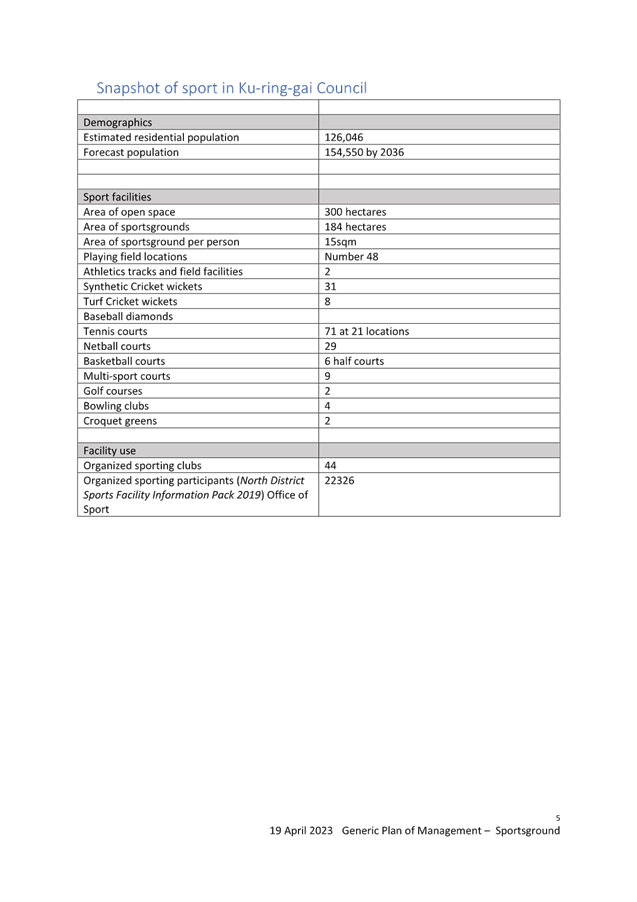
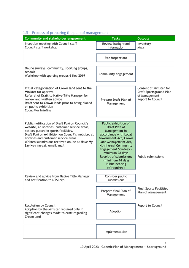

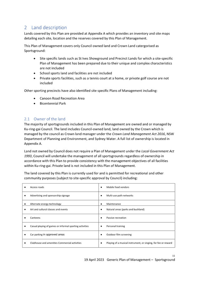
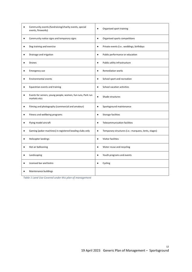

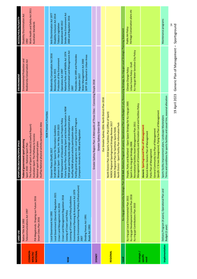

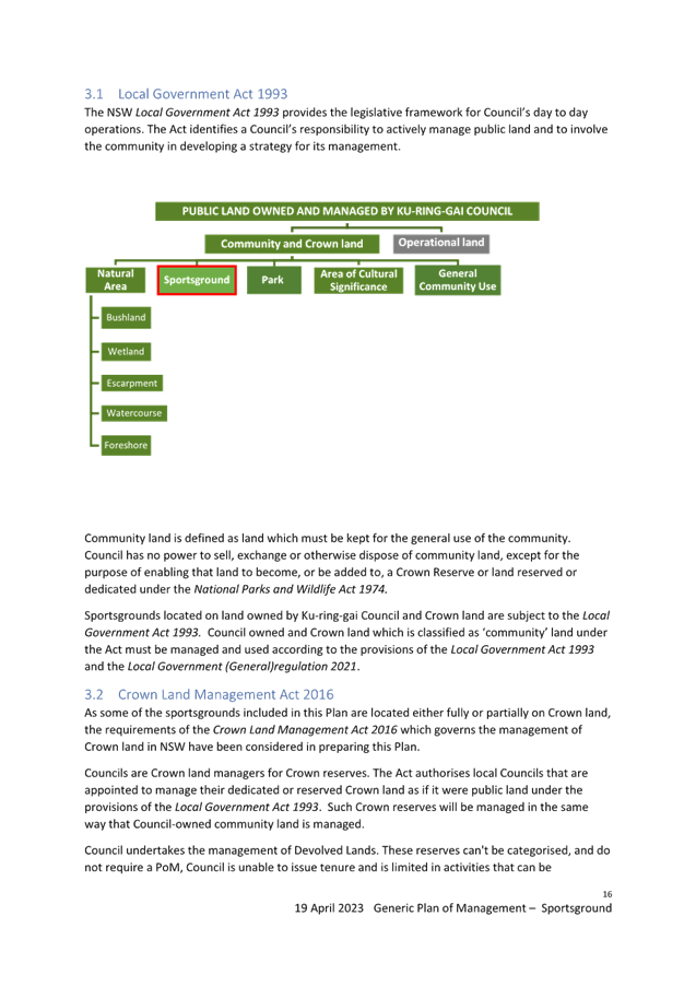

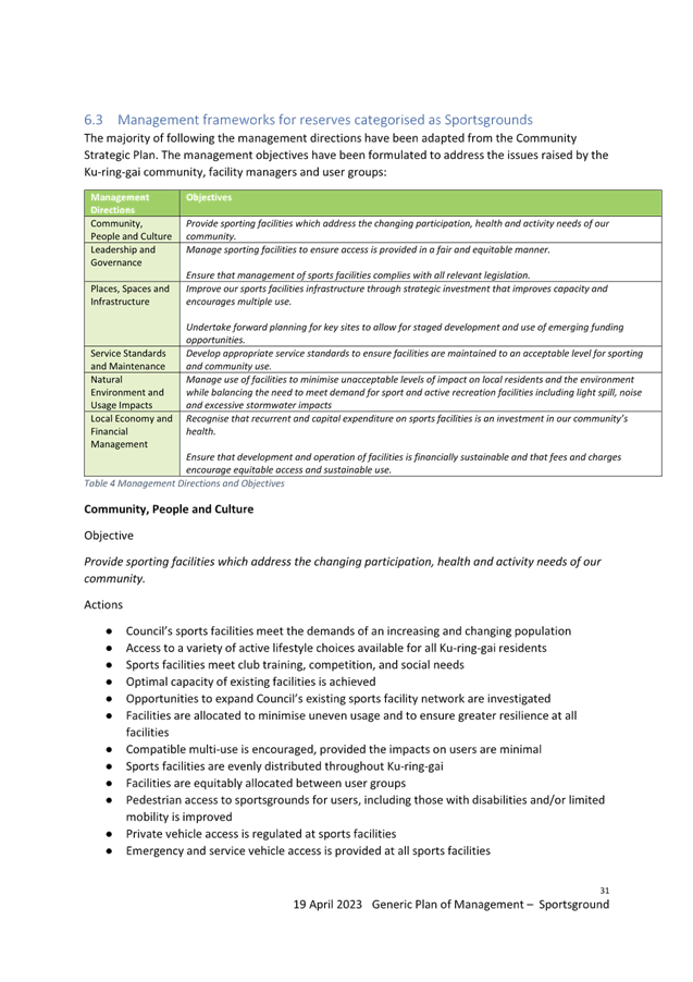

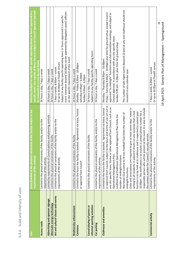
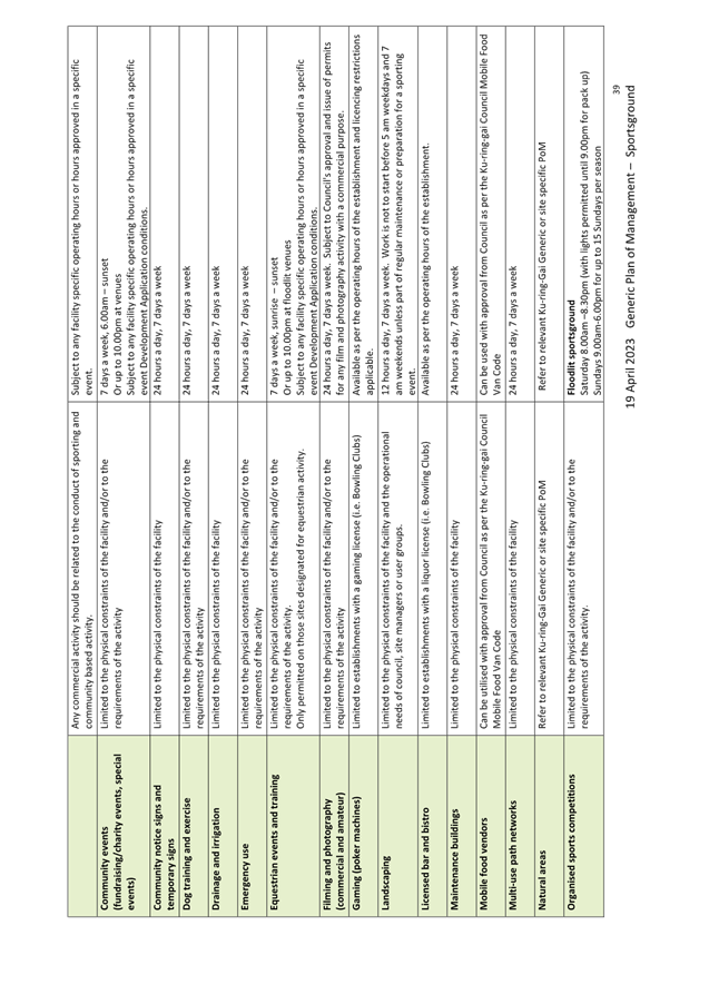
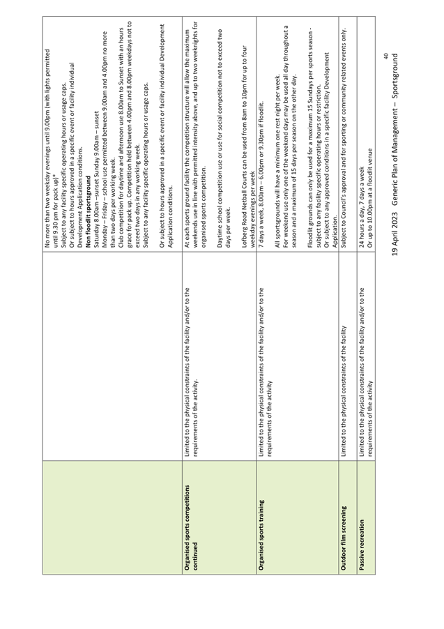
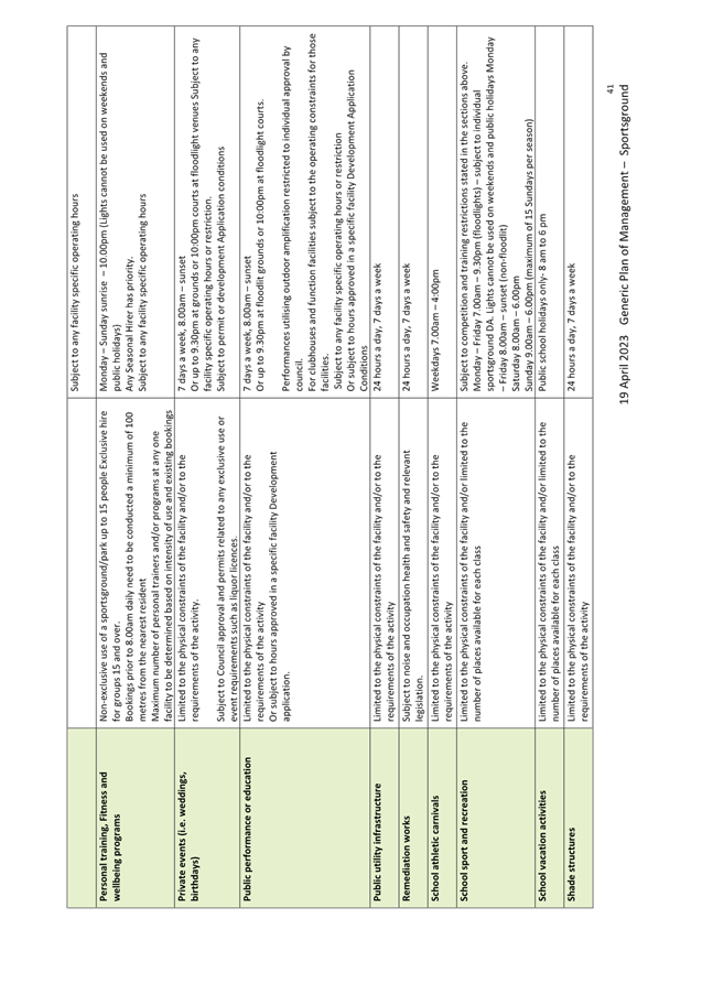
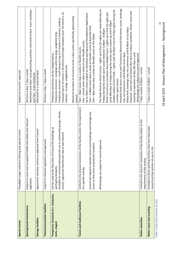
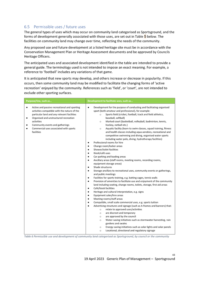
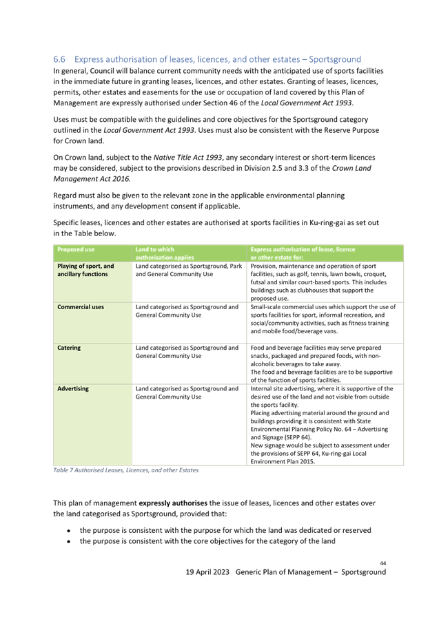
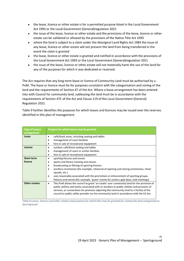
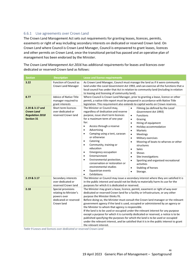
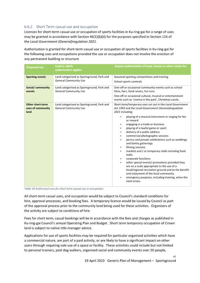
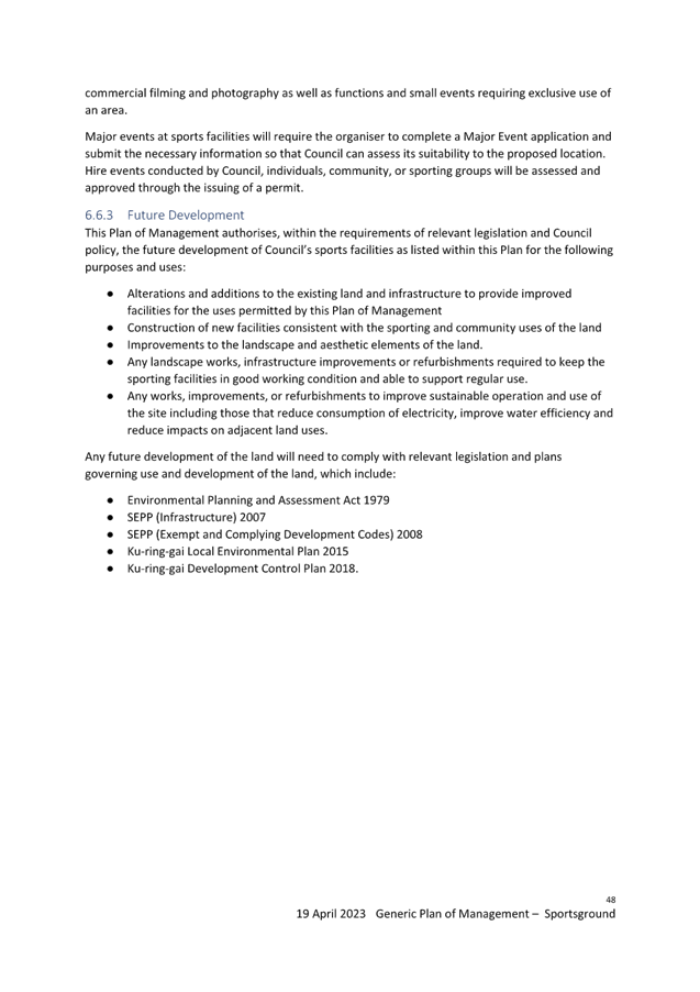
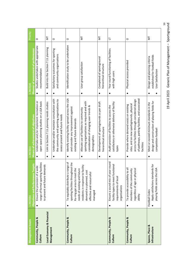
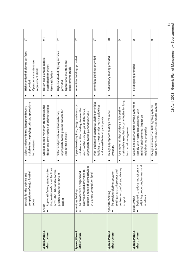
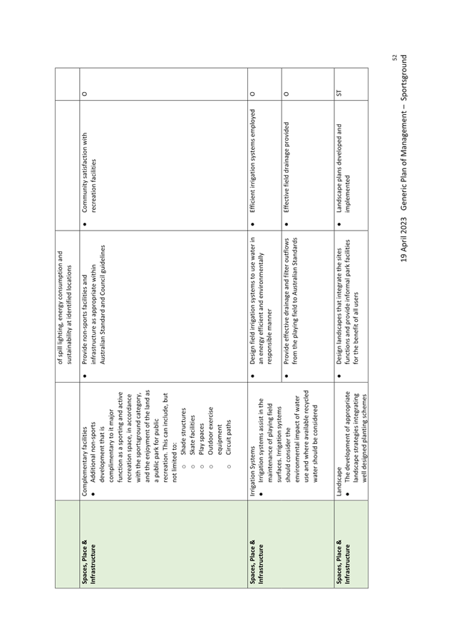
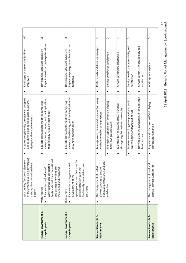
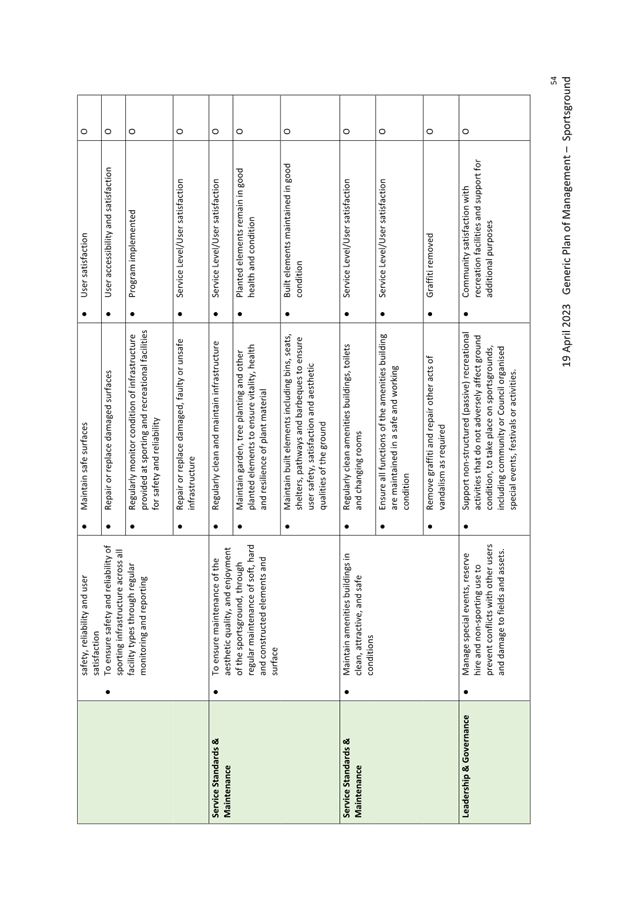
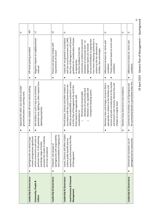
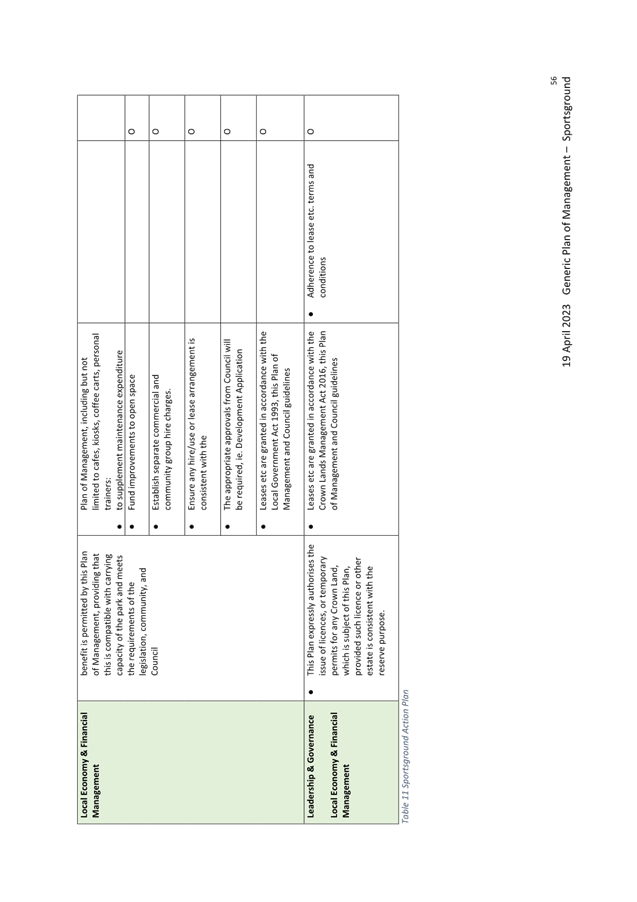
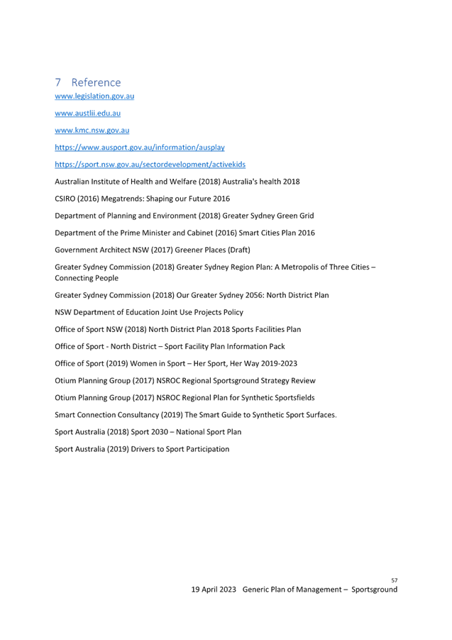
|
Ordinary
Meeting of Council - 16 May 2023
|
GB.9 / 1
|
|
|
|
|
Item
GB.9
|
S13127
|
Policy for Electric Vehicle Charging Infrastructure
on Public Land – for adoption
EXECUTIVE
SUMMARY
|
purpose of report:
|
For Council to consider the Policy
for Electric Vehicle Charging Infrastructure on Public Land (updated in
response to public exhibition comments), and to seek endorsement of the
updated policy.
|
|
|
|
|
background:
|
As outlined in its Climate Change Policy and Towards
Zero Emissions – 2030 Action Plan, Council has adopted a target of supporting
the local community to reach Net Zero emissions by 2040, or earlier. The Plan
identifies zero emissions transport as a key component for Ku-ring-gai to
achieve Net Zero, requiring increasing uptake of electric vehicles (EVs) over
time. The plan notes the provision of public EV chargers as a supporting
action for this objective.
|
|
|
|
|
comments:
|
The purpose of the proposed policy is to provide
conditions for the provision, installation, management, maintenance, and
removal of Electric Vehicle (EV) charging infrastructure on public land in
the Ku-ring-gai Council Local Government Area (LGA). This is to allow for
consistency in approach and execution and ensure that providers are aware of
Council’s requirements and expectations.
|
|
|
|
|
recommendation:
|
That Council adopt the Policy
for Electric Vehicle Charging Infrastructure on Council Land.
|
Purpose of Report
For Council to consider the Policy for Electric Vehicle
Charging Infrastructure on Public Land (updated in response to public
exhibition comments), and to seek endorsement of the updated policy.
Background
As outlined in its Climate Change Policy and Towards
Zero Emissions – 2030 Action Plan, Council has adopted a target of
supporting the local community to reach Net Zero emissions by 2040, or earlier.
The plan identifies zero emissions transport as a key component for Ku-ring-gai
to achieve Net Zero, requiring increasing uptake of electric vehicles (EVs)
over time. The plan notes the provision of public EV chargers as a supporting
action for this objective.
EVs are expected to become more established in the
Australian market in the coming decades, with EVs predicted to be similar in
terms of upfront costs as early as 2024. Research shows that the main barriers
currently stalling greater uptake of EVs in Australia are the high cost of the
vehicles, inadequate incentives, inadequate policy supports and the lack of
public charging infrastructure away from home (this leads to ‘range
anxiety’). A suitable network of EV charging infrastructure will be
required across Australia to support the use of EVs now and in the future.
EV charging locations may also increase visitation to our
local town centres and retail hubs improving the Ku-ring-gai LGA’s economic
development and tourism opportunities.
The NSW Government also has a number of initiatives aimed to
facilitate the up-take of EVs in NSW including:
· NSW Electric Vehicle Strategy;
· Future Transport 2056 – NSW Electric and
Hybrid Vehicle Plan;
· State Infrastructure Strategy 2018-2038.
Additionally, the NSW Transport and Infrastructure SEPP 2021
supports multiple planning pathways for electric vehicle chargers.
Comments
The purpose of the policy is to provide conditions for the
provision, installation, management, maintenance, and removal of Electric
Vehicle (EV) charging infrastructure on public land in the Ku-ring-gai Council
Local Government Area (LGA). This is to allow for consistency in approach and
execution and ensure that providers are aware of Council’s requirements
and expectations.
The policy also supports the planning pathways for electric
vehicle chargers in the NSW State Environmental Planning Policy (Transport
and Infrastructure) 2021. Should any conflict exist between the conditions
of this policy and the Transport and Infrastructure SEPP, the provisions of the
Transport and Infrastructure SEPP prevail.
integrated planning and reporting
Issue N4: Climate Change
|
Community Strategic Plan
Long Term Objective
|
Delivery Program
Term Achievement
|
Operational Plan
Task
|
|
Long Term Objective N4.1: A community addressing and
responding to the impacts of climate change and extreme weather events.
|
N4.1.2: Council’s vulnerability to climate change is
reduced.
|
N4.1.2.3: Identify opportunities to support the
uptake of low and zero emission vehicles within the community.
|
Governance Matters
By providing the conditions
for provision, installation, management, maintenance, and removal of EV charging
infrastructure, the policy will provide a governance framework for managing EV
charging initiatives in Ku-ring-gai, particularly regarding the components
noted below under Risk Management.
Risk Management
By providing the conditions
for provision, installation, management, maintenance, and removal of EV
charging infrastructure the Policy outlines Council expectations with regards
to the following:
· site
selection;
· visibility
and identification;
· parking
configuration;
· charging
technology; and
· leasing
arrangements.
Financial Considerations
The proposed policy includes
provisions relating to costs and ongoing Fees and Charges, to ensure Council is
able to appropriately manage the financial implications of EV charging stations
on public land.
Accordingly, a new item was
included in the draft 2023/2024 Fees and Charges outlining fees (per annum, per
space) for use of dedicated car spaces, including (but not limited to)
authorised fixed-space parking for electric vehicle charging.
Desktop investigations were
undertaken into other councils’ fees and charges for similarly located,
commercial dedicated car spaces on public land. Consideration has also been
given to potential fees for similar long-term commercial uses of Council car
parking spaces (on-street and within Council car parks), and it is envisaged
that the annual fee per space would be in the order of $500.00 - $3,000.00
(incl. GST).
Social Considerations
Development of appropriate
public EV charging networks is an important step to ensure community members
can access EV charging infrastructure where off-street parking and private
charging infrastructure is not possible. As well as for visitors to Ku-ring-gai
who may require additional vehicle charge as part of their journey to the local
area.
Environmental Considerations
The proposed policy is a key
measure required to support Council’s Net Zero objectives in the Climate
Change Policy - specifically, the uptake of electric vehicles in Ku-ring-gai.
Community Consultation
The draft policy was placed on public exhibition in July
2022 for 28 days. Minor amendments to the policy have been made in response to
the submissions, which are noted in the attachment to this report.
Internal Consultation
Throughout the public
exhibition period, internal stakeholders were invited to provide input on the
draft Policy, with these comments incorporated into the final revision of the
Policy.
Summary
As outlined in its Climate
Change Policy and Towards Zero Emissions – 2030 Action Plan, Council
has adopted a target of supporting the local community to reach Net Zero
emissions by 2040, or earlier. The plan identifies zero emissions transport as
a key component for Ku-ring-gai to achieve Net Zero, requiring increasing
uptake of electric vehicles (EVs) over time. The plan notes the provision of
public EV chargers as a supporting action for this objective.
The purpose of the policy is
to provide conditions for the provision, installation, management, maintenance,
and removal of Electric Vehicle (EV) charging infrastructure on public land in
the Ku-ring-gai Council Local Government Area (LGA). This is to allow for
consistency in approach and execution and ensure that providers are aware of
Council’s requirements and expectations.
Recommendation:
That Council adopt the Policy
for Electric Vehicle Charging Infrastructure on Public Land.
|
Peter Vun
Program Leader – Energy Management and Net Zero
Strategy
|
Craige Wyse
Team Leader Urban Planning
|
|
Jacob Sife
Manager Environment & Sustainability
|
Andrew Watson
Director Strategy & Environment
|
|
Attachments:
|
A1 ⇩ ⇩
|
Controlled
Document Number 202 - Guidelines for Electric Vehicle Charging Infrastructure
on Council Land - Version 1 - Draft
|
|
2022/147861
|
|
|
A2 ⇩ ⇩
|
Public
Exhibition Feedback - Policy for Electric Vehicle Charging Infrastructure on
Council Land
|
|
2023/112278
|
|
ATTACHMENT No: 1 - Controlled
Document Number 202 - Guidelines for Electric Vehicle Charging Infrastructure
on Council Land - Version 1 - Draft
|
|
Item No: GB.9
|
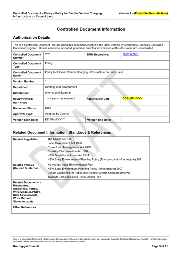
|
ATTACHMENT
No: 2 - Public
Exhibition Feedback - Policy for Electric Vehicle Charging Infrastructure on
Council Land
|
|
Item No: GB.9
|
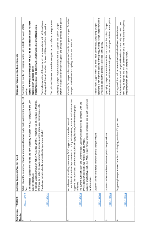
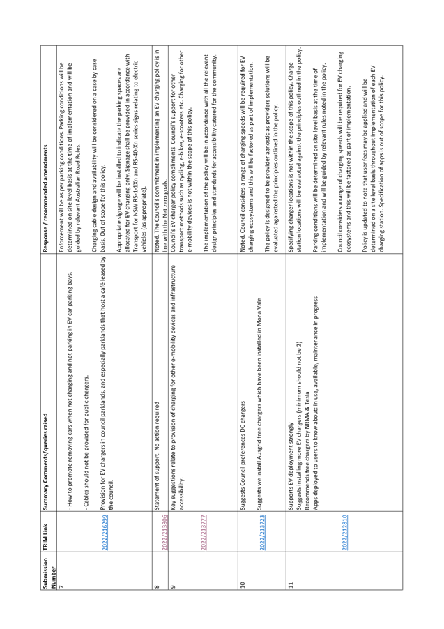
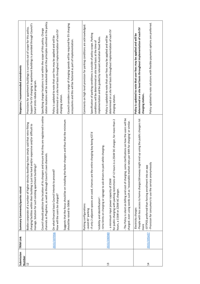
|
Ordinary
Meeting of Council - 16 May 2023
|
GB.10 / 1
|
|
|
|
|
Item
GB.10
|
RFT6-2023/R
|
RFT6-2023 ELECTRIC VEHICLE CHARGERS SUPPLY
/ INSTALL / MAINTAIN / MANAGE
EXECUTIVE
SUMMARY
|
purpose of report:
|
To consider
the tenders received for RFT6-2023 Electric Vehicle chargers –
Supply / Install / Maintain / Manage and to appoint the preferred tenderer.
|
|
|
|
|
background:
|
Council
seeks to engage a suitable contractor to supply and install seven (7)
electric vehicle chargers in four (4) locations in the public domain. In
addition, Council is seeking to engage a suitable contractor to maintain and
manage an overall twenty two (22) electric vehicle charging stations which
include the above four (4) locations and a further fifteen (15) electric
vehicle chargers at an additional location.
Tender
documents were released through Tenderlink on 7th March 2023 and
closed on the 4th April 2023.
|
|
|
|
|
comments:
|
Council received four (4) tenders.
The tenders were assessed using agreed criteria which identified the best
value for money to Council.
The approved evaluation plan
has been followed and the award of a contract has been put on hold due to one
(1) tender submission being non – conforming and the remaining three
(3) tenders being above the allocated budget.
The Tender Evaluation Committee
sought advice from Council asset managers and an industry expert and it was
recommended to reduce the scope to negotiate a price within the budget.
The Tender Evaluation Committee
is recommending to reject all tenders under Clause 178(1) of the Local
Government Regulation 1995 and negotiate under Clause 178(3)(e) of the
regulation to ensure Council has the best value for money.
|
|
|
|
|
recommendation:
|
Based on the assessment undertaken, the TEC recommends
the following:
RFT6-2023 Electric Vehicle
chargers – Supply / Install / Maintain / Manage - Tender Evaluation
Committees recommendation to reject all tenders under Clause 178(1) of the Local
Government Regulation 1995 and seek to negotiate under Clause 178(3)(e)
of the Regulation to ensure Council has the best value for money.
|
Purpose of Report
To consider the tenders received for RFT6-2023 Electric
Vehicle chargers – Supply / Install / Maintain / Manage and to appoint
the preferred tenderer.
Background
Council seeks
to engage a suitable contractor to supply and install seven (7) electric
vehicle chargers in four (4) locations in the public domain. In addition,
Council is seeking to engage a suitable contractor to maintain and manage an
overall twenty two (22) electric vehicle charging stations which include the
above four (4) locations and a further fifteen (15) electric vehicle chargers
at an additional location.
As the cost
of the works was estimated to be over $250,000, Tenders were called using Tenderlink
in accordance with the tender requirements of the Local Government Act and
Regulation. Tender documents were released through Tenderlink on 7th
March 2023 and closed on the 4th April 2023.
Comments
Council received four (4) tenders. The tenders
were assessed using agreed criteria which identified the best value for money
to Council.
The approved evaluation plan has
been followed and the award of a contract has been put on hold due to one (1)
Tender submission being non – conforming and the remaining three (3)
tenders being above the allocated budget.
The Tender Evaluation Committee
sought advice from the Council asset managers and an independent industry
expert and it was recommended to reduce the scope and under negotiation seek
revised pricing to allow submissions to be within allocated budget.
The Tender Evaluation Committee
is recommending to reject all tenders under Clause 178(1) of the Local
Government Regulation 1995 and negotiate under Clause 178(3)(e) of the
Regulation to ensure Council has the best value for money.
It is anticipated that the
negotiation will provide Council the flexibility of redesigning the scope of
work to suit Council’s budget and deliver the project within the current
funding constraints.
Confidential attachments
to this report include:
1. List
of tenders received (Attachment 1),
2. Tender
Evaluation Report and recommendation (Attachment 2)
integrated planning and reporting
Issue N4: Climate Change
|
Community Strategic
Plan Long Term Objective
|
Delivery Program
Term Achievement
|
Operational Plan
Task
|
|
Long Term Objective N4.1: A community addressing and
responding to the impacts of climate change and extreme weather events.
|
N4.1.2: Council’s vulnerability to climate change is
reduced.
|
N4.1.2.3: Identify opportunities to support the
uptake of low and zero emission vehicles within the community.
|
Governance Matters
Tender
documents were prepared and released through Tenderlink 7th March
2023 and closed on the 4th April 2023. At the close of tender, four
(4) tenders were received. All submissions were recorded in accordance with
Council’s Tendering Policy. A Tender Evaluation Panel consisting of staff
from the Operations Department and Strategy and Environment Department was
formed to assess the four (4) tenders received. The evaluation considered:
1. Conformity
of submission,
2. Total
Lump sum fee totalled from the range of services to be provided,
3. Capacity
and Capability
4. Experience
5. Risk
Management/Environmental and Work Health and Safety
6. Performance
and Financial Assessment.
Confidential attachments to this
report include the list of tenders received and the Tender Evaluation Report
and recommendation. The attachments are considered to be confidential in
accordance with Section 10A (2)(d)(iii) of The
Local Government Act 1993 as
they are considered to contain commercial in confidence information.
Risk Management
Three (3) key areas of risk were identified in relation to the proposed
contract:
1. That
the Electric Vehicle Chargers Supply, Installation, Maintenance and Management
be carried out by a contractor with the ability to provide a full range of
services with suitably qualified staff.
2. Risk
Management, Environmental and WHS.
3. That
Council should not be exposed to financial risk - as part of the evaluation
process, tenderers were assessed on providing all information and costs
requested within the tender document. Prior to awarding a contract, an
independent Performance and Financial Assessment will be carried out on the
preferred contractor to ensure that they are trading responsibly and have the
financial capacity to undertake the contract as detailed within the tender
documents.
Financial Considerations
Funding for this project will be sourced from the Net Zero
program within Council’s Environmental Levy programs.
Social Considerations
The
supply, installation, maintenance and management of the electric vehicle
chargers is in line with Council’s
Community Strategic Plan, Our Ku-ring-gai 2038 and the Plan’s long
term directions.
Development of appropriate public
EV charging networks is an important step to ensure community members can
access EV charging infrastructure where off-street parking and private charging
infrastructure is not possible. As well as for visitors to Ku-ring-gai who may
require additional vehicle charge as part of their journey to the local area.
Environmental Considerations
The initiative directly supports Council’s Net Zero
objectives in the Climate Change Policy - specifically, the uptake of electric
vehicles in Ku-ring-gai.
An
exempt development environmental assessment for the installation was undertaken
and no environmental impacts were identified.
Community Consultation
Consultation undertaken for
Council’s Net Zero Communities strategy identified strong community
support for the measures that encourage electric vehicle uptake.
All
relevant stakeholders for each of the locations have been consulted.
Internal Consultation
All
relevant departments were consulted.
Summary
Tender RFT6-2023
Electric Vehicle Chargers – Supply / Install / Maintain / Manage was
released through Tenderlink on 7th March 2023 and closed on the 4th
April 2023. A Tender Evaluation Panel was formed consisting of representatives
from the Operations Department and Strategy and Environment Department. Council
received four (4) tenders. All tenders were recorded in accordance with
Council’s Tendering Policy.
The approved evaluation plan has
been followed and the award of a contract has been put on hold due to one (1)
Tender submission being non – conforming and the remaining three (3)
tenders being above the allocated budget.
The Tender Evaluation Committee
sought advice from the Council asset managers and it was recommended to reduce
the scope and under negotiation seek revised pricing to allow submissions to be
within allocated budget.
The Tender Evaluation Committee
is recommending to reject all tenders under Clause 178(1) of the Local
Government Regulation 1995 and negotiate under Clause 178(3)(e) of the
Regulation to ensure Council has the best value for money. It is anticipated
that the negotiation will provide Council the flexibility of redesigning the
scope of work to suit Council’s budget and deliver the project within the
allocated budget.
|
Recommendation:
That:
1. As
a result of considering the tenders submitted for the proposed RFT6-2023
Electric Vehicle Chargers – Supply / Install / Maintain / Manage
contract, and pursuant to Clause 178(1) of the Local Government (General)
Regulation 1995 (“the Regulation”), Council declines to
accept any of the tenders.
2. Fresh
tenders as referred to in clause 178(3)(b)-(d) of the Regulation not be
invited. Negotiations to extend to all interested parties that downloaded the
Tender documents.
3. Pursuant
to clause 178(3)(e) of the Regulation, the General Manager enter into
negotiations with any person (whether or not the person was a tenderer) with
a view to entering into a contract in relation to the subject matter of the
tender in terms acceptable to Council’s requirements.
4. The
Mayor and the General Manager be delegated authority to execute all documents
on Council’s behalf in relation to any contract formed as a result of
the above.
5. The
Seal of Council be affixed to all necessary documents.
6. All
tenderers be advised of Council’s decision in accordance with clause
178 of the Regulation.
|
|
Craig Roberts
Project Manager
|
Peter Lichaa
Manager Technical Services
|
|
George Bounassif
Director Operations
|
Andrew Watson
Director Strategy & Environment
|
|
Attachments:
|
A1
|
Electric
Vehicle Chargers RFT6-2023
|
|
Confidential
|
|
|
A2
|
Electric
Vehicle Chargers RFT6-2023
|
|
Confidential
|


