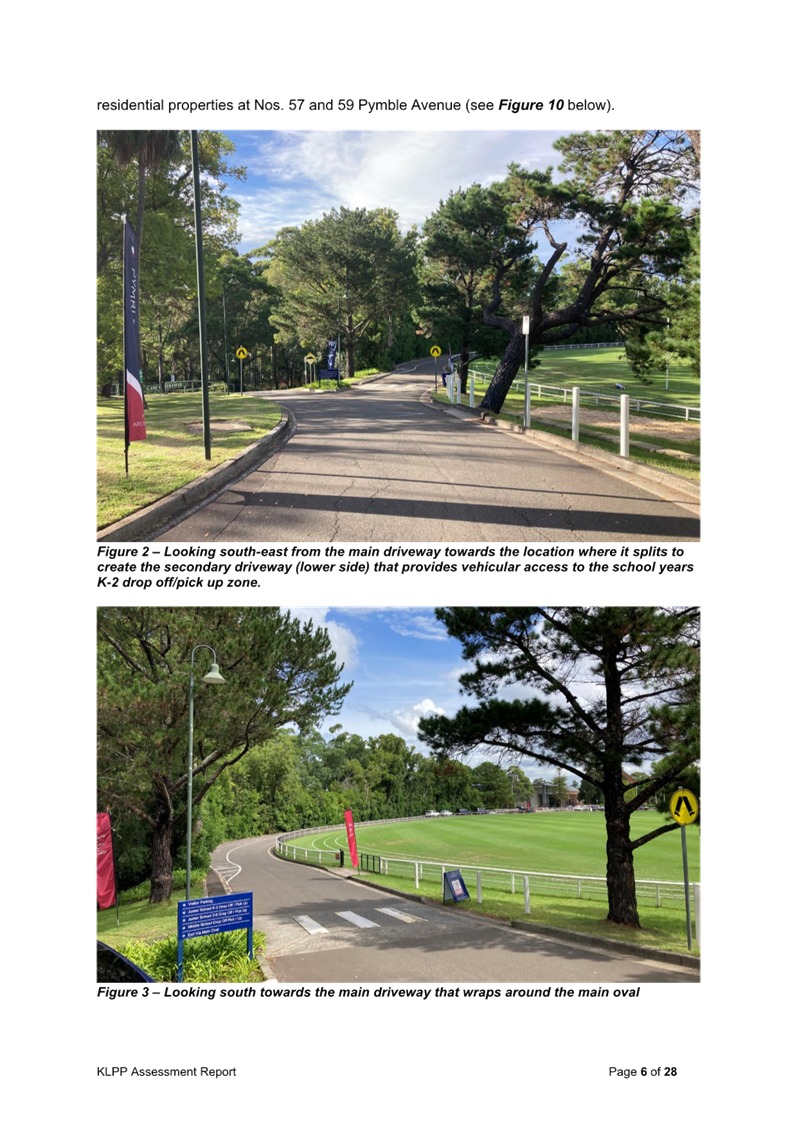
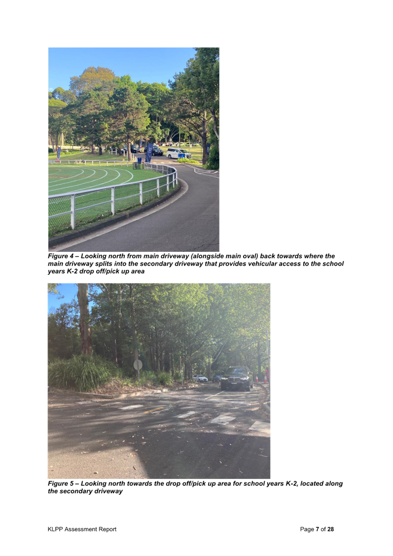
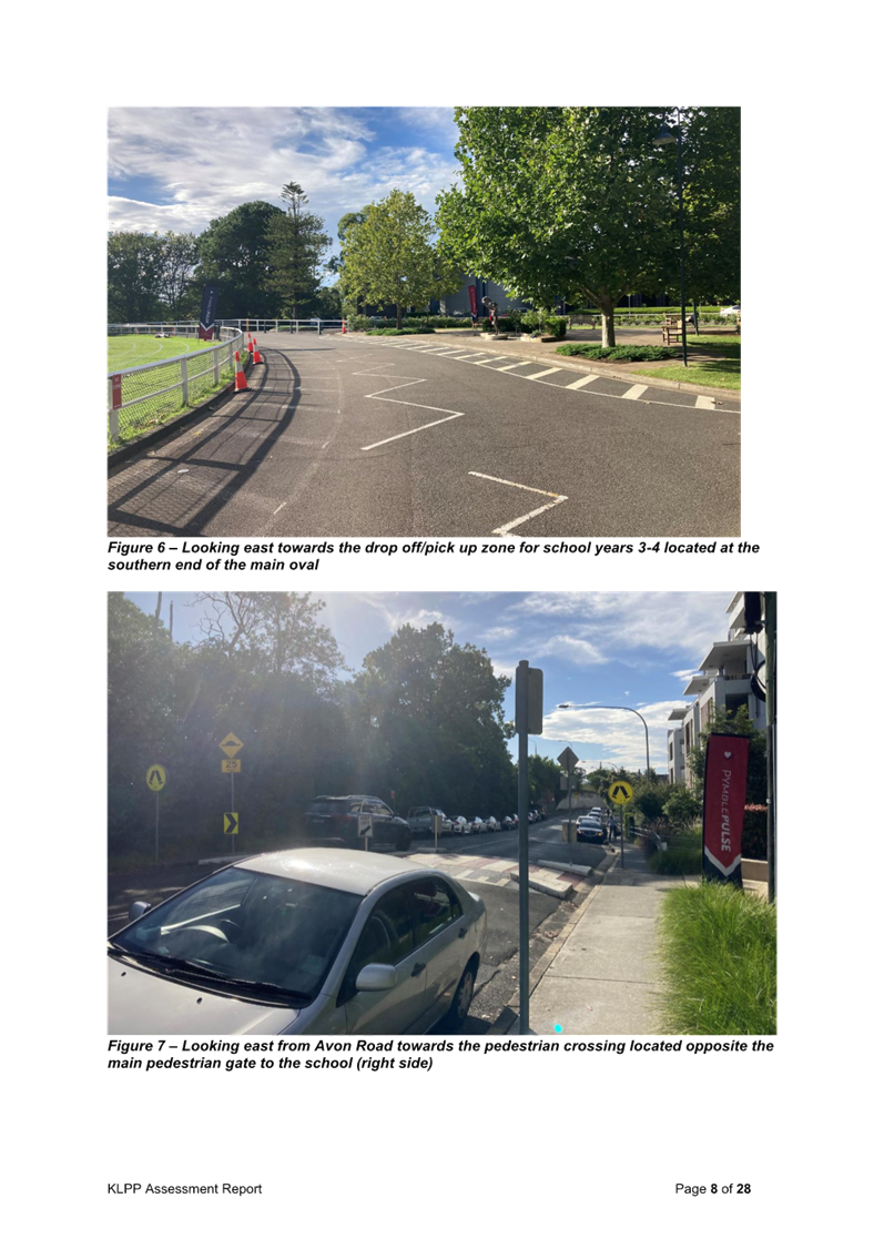
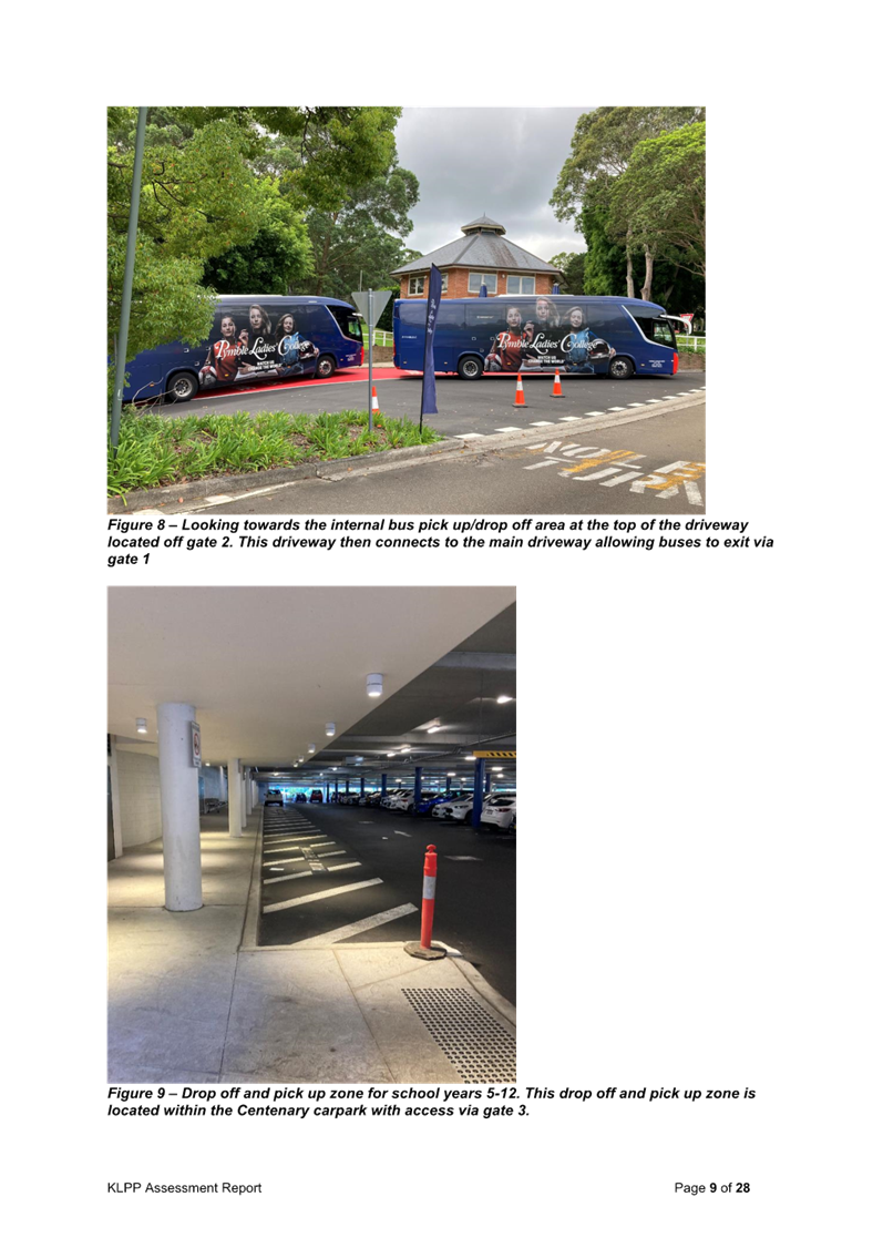
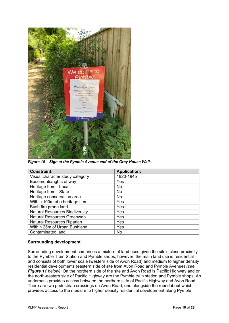
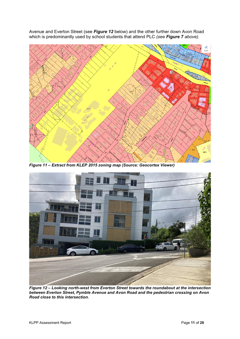
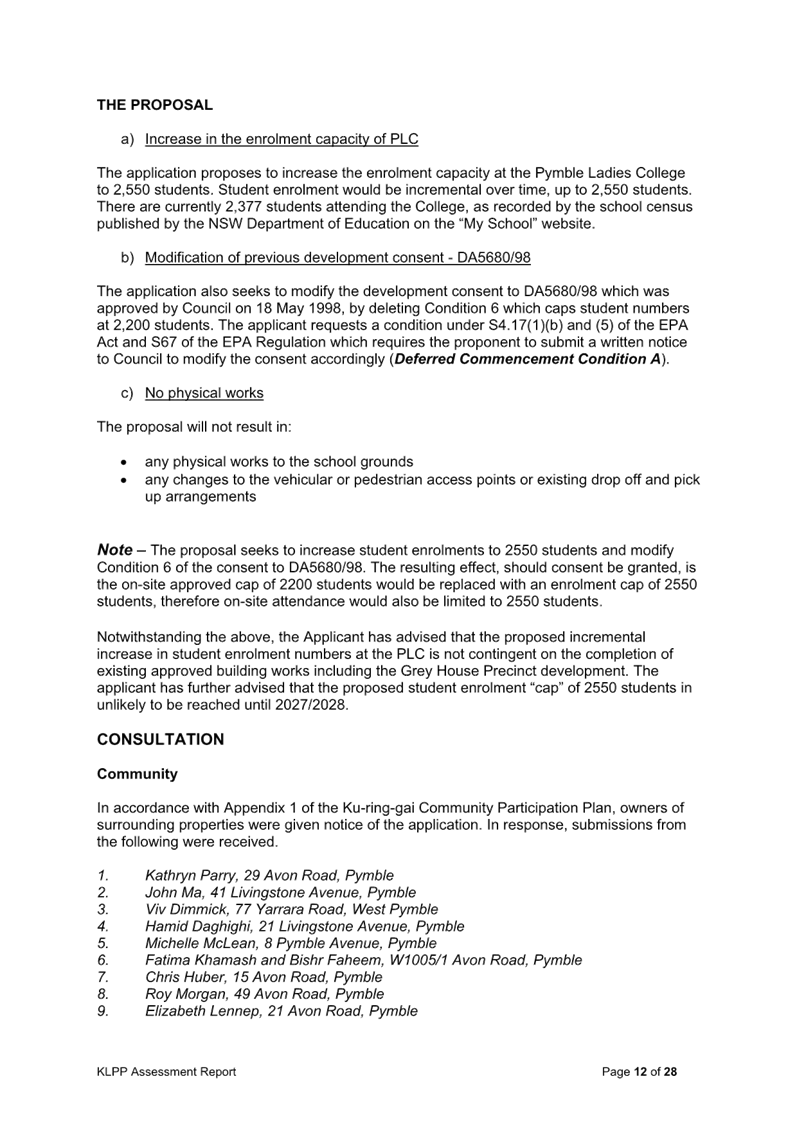
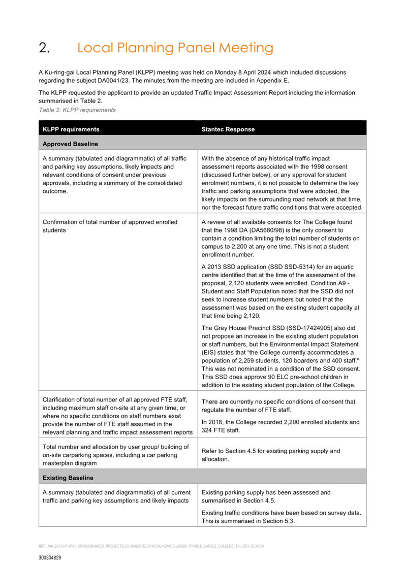
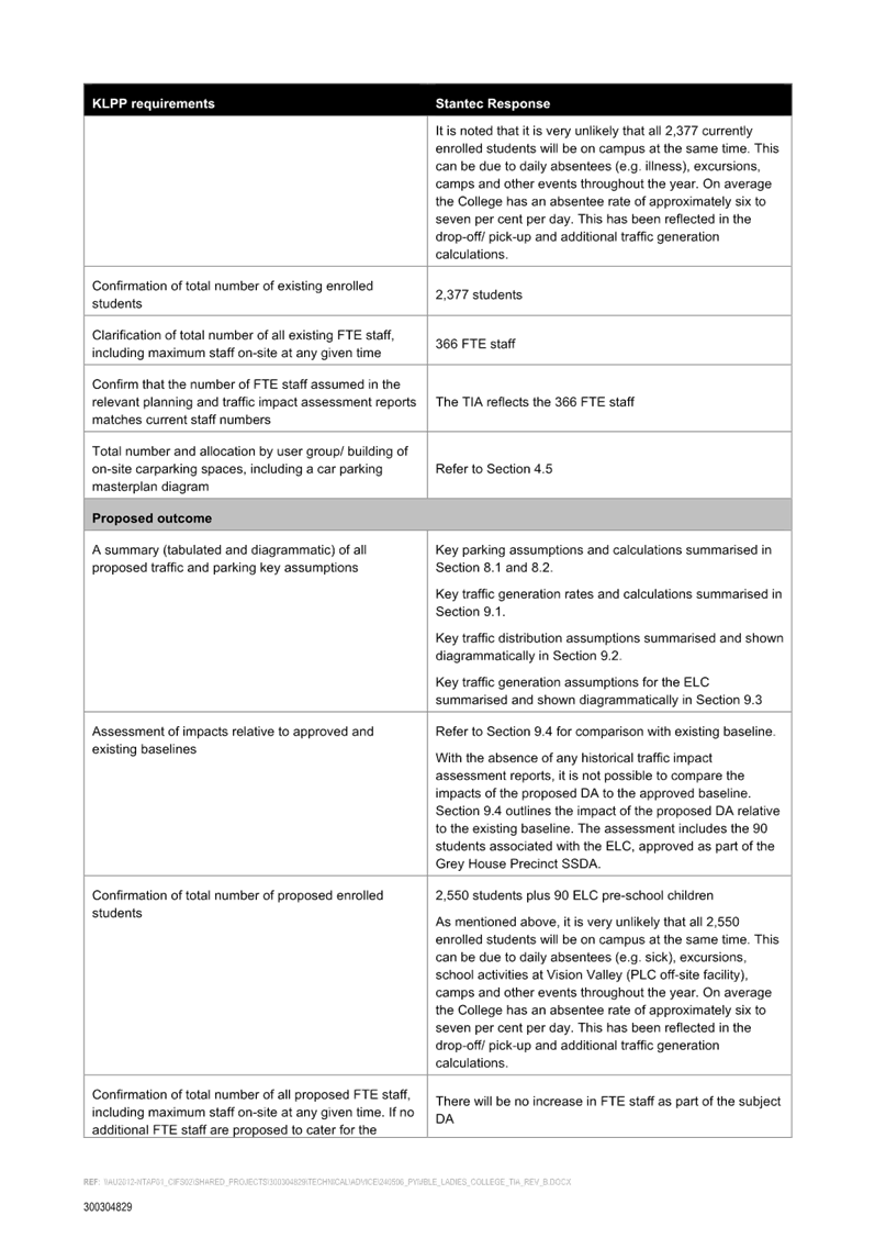
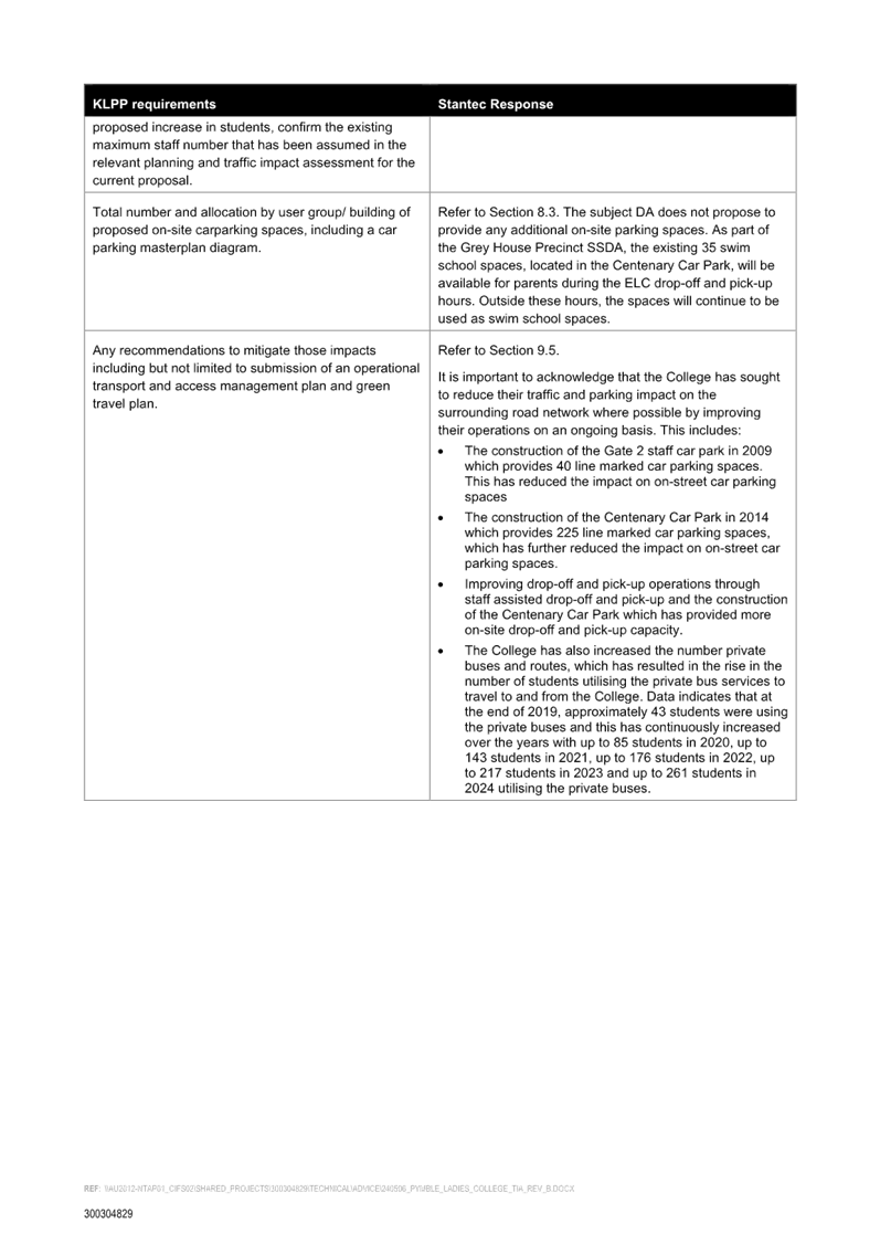
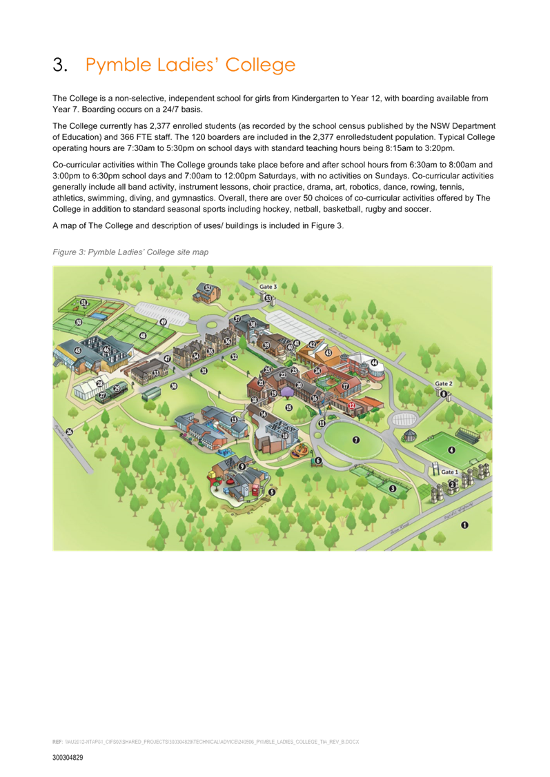
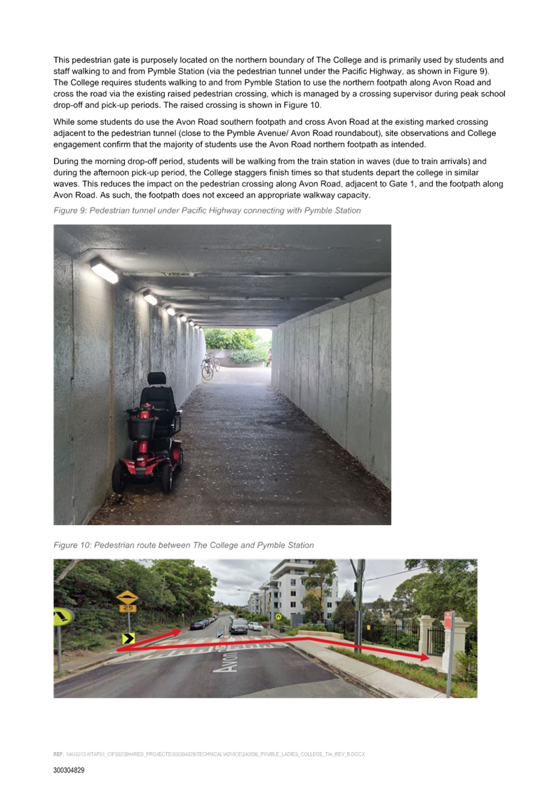
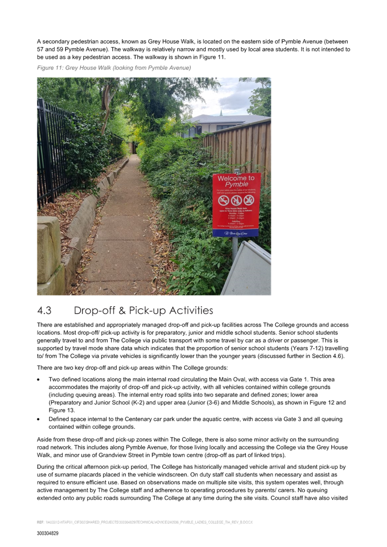
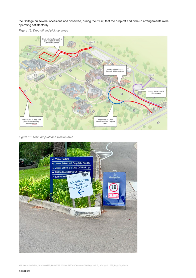
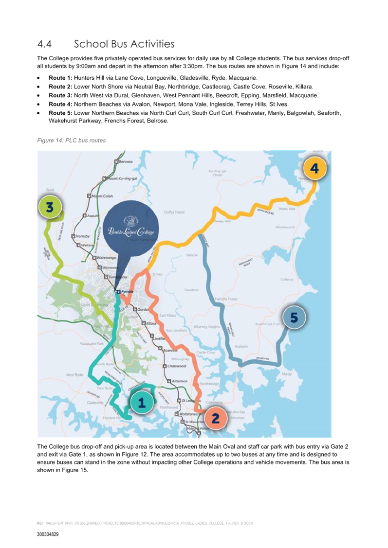
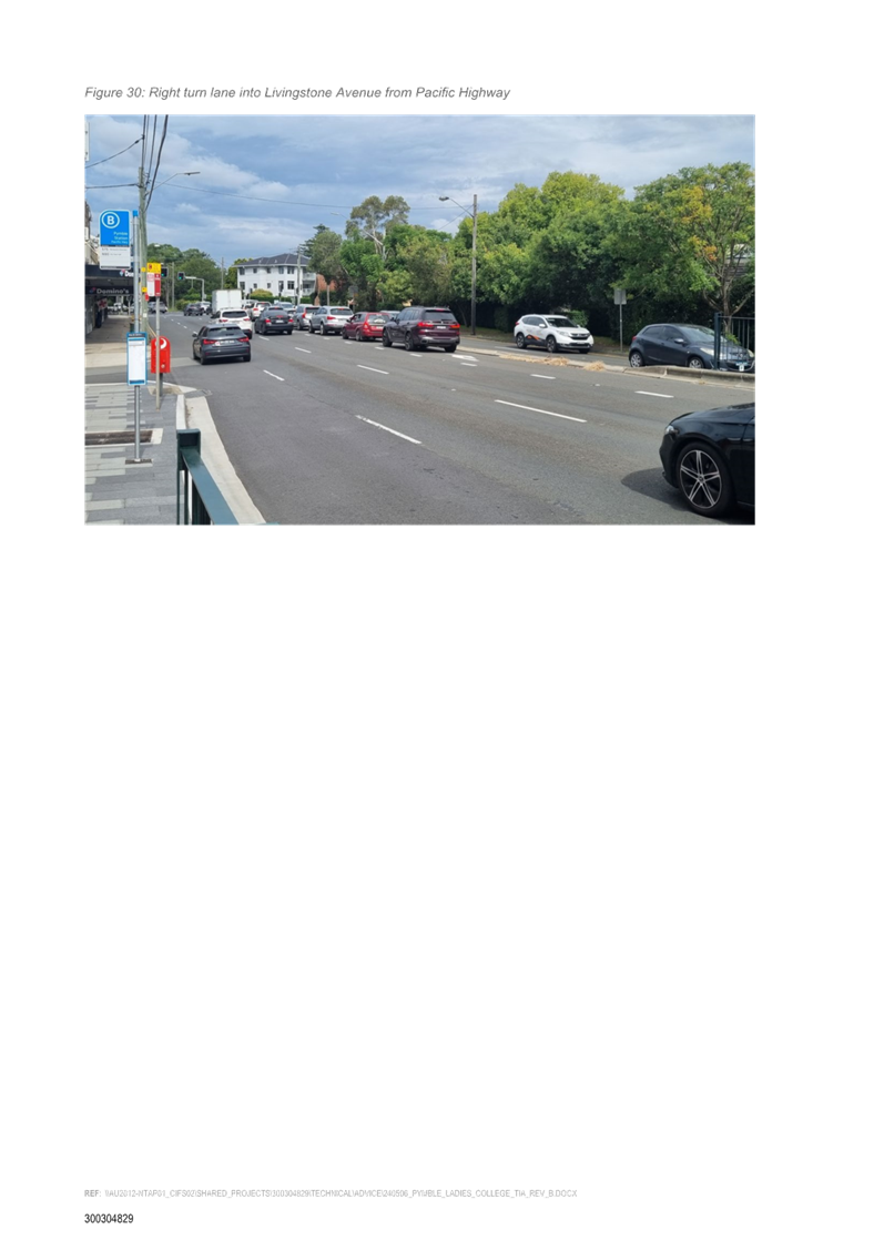
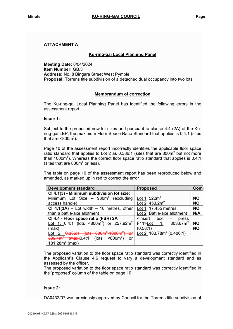
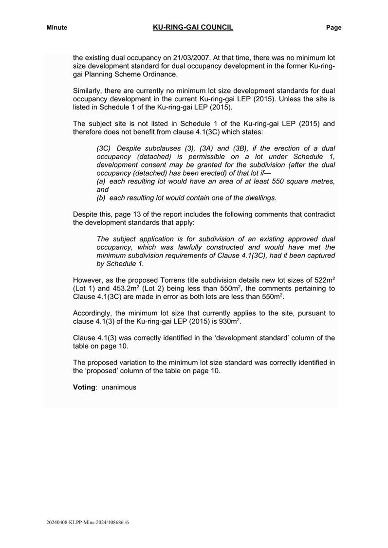
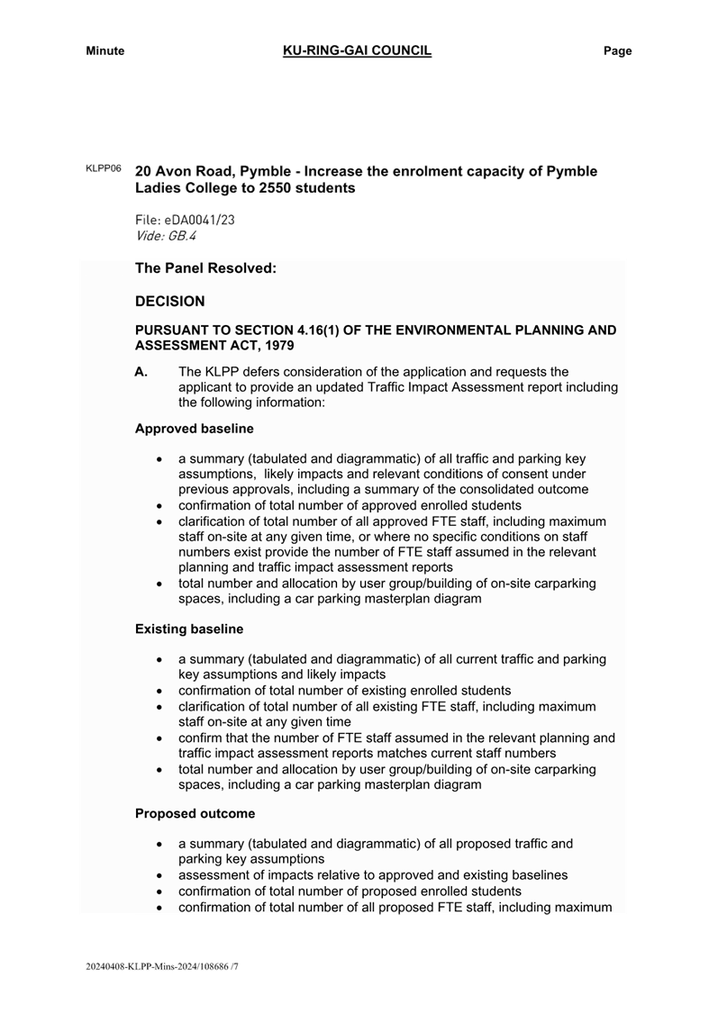
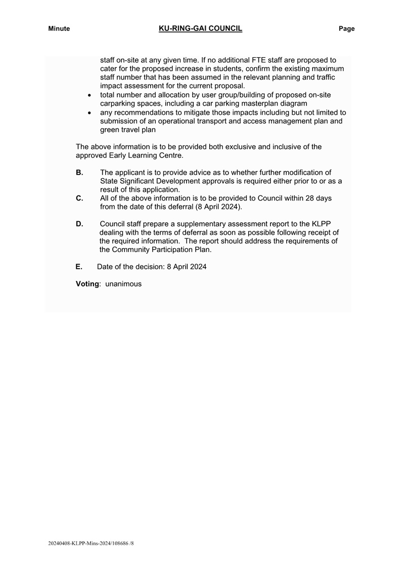
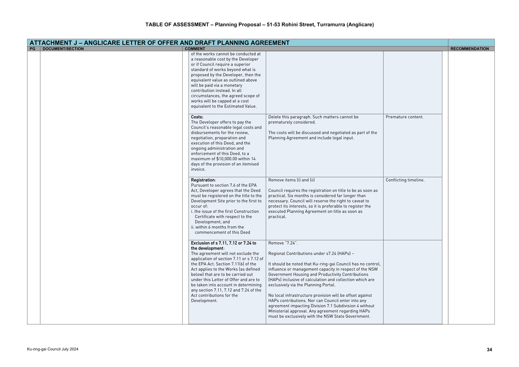
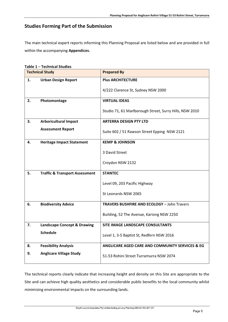
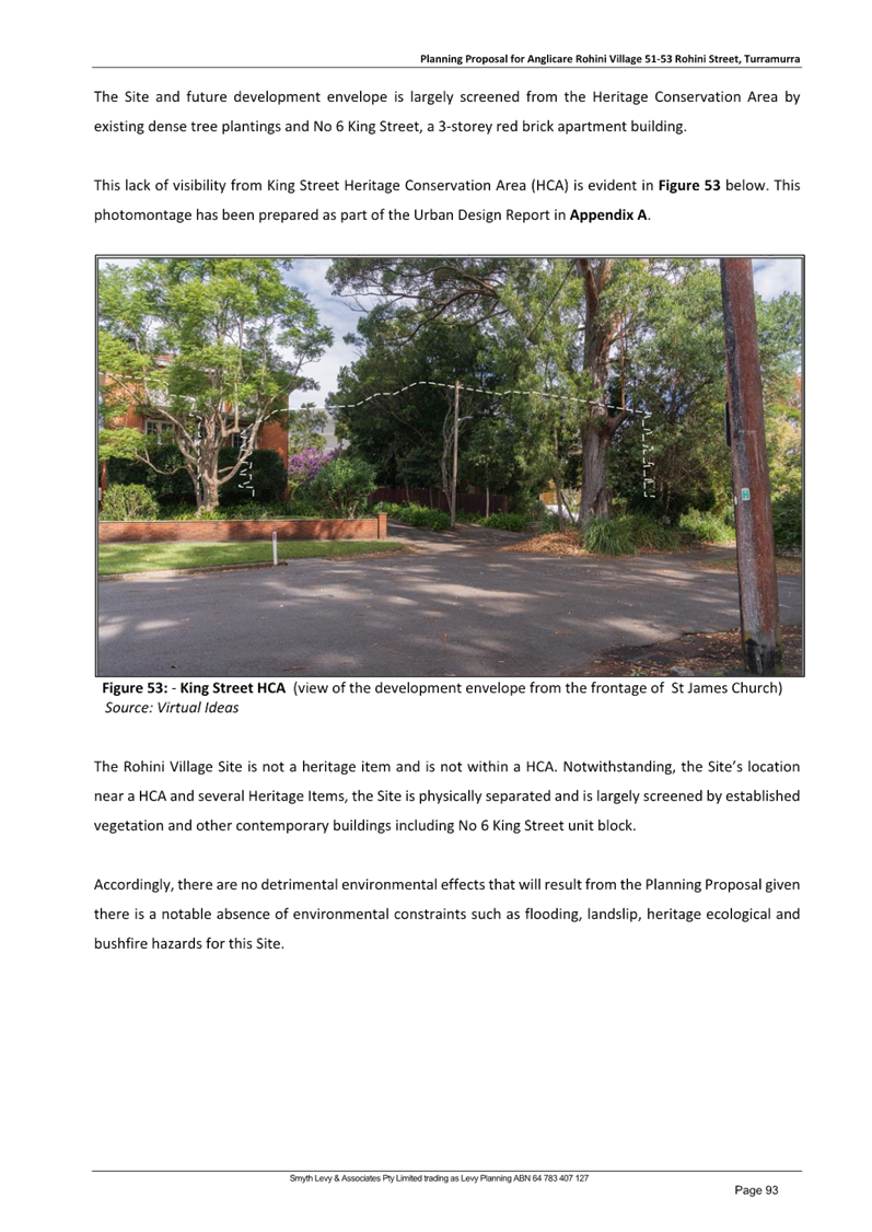
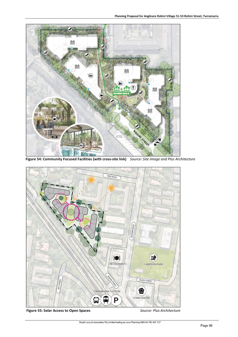
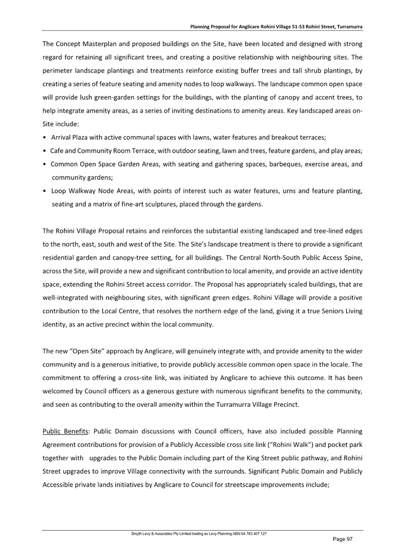
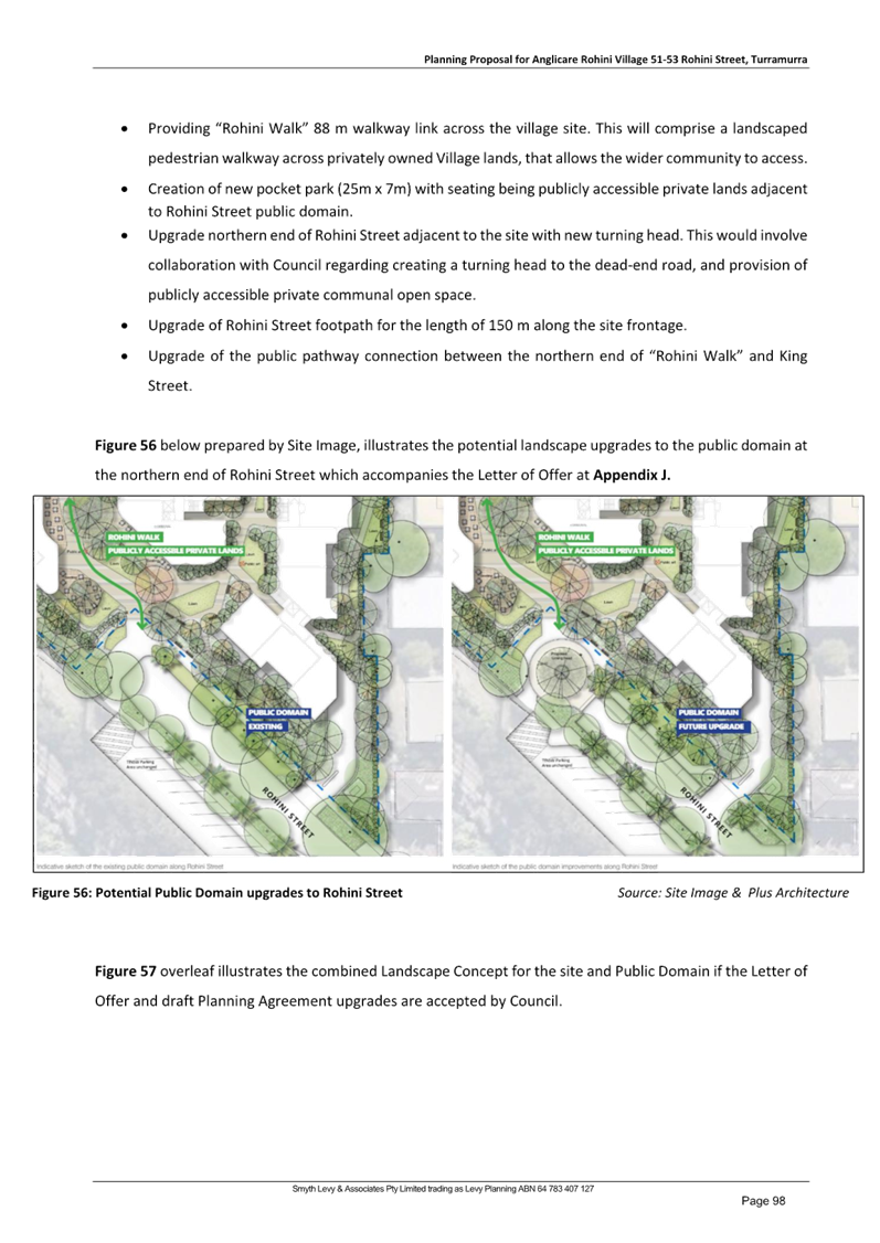
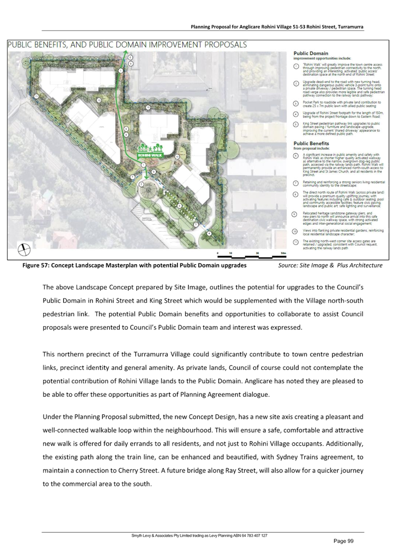
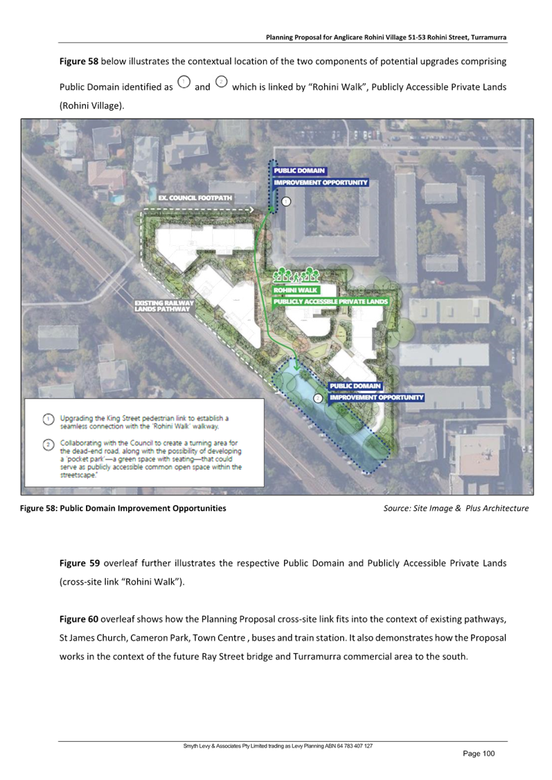
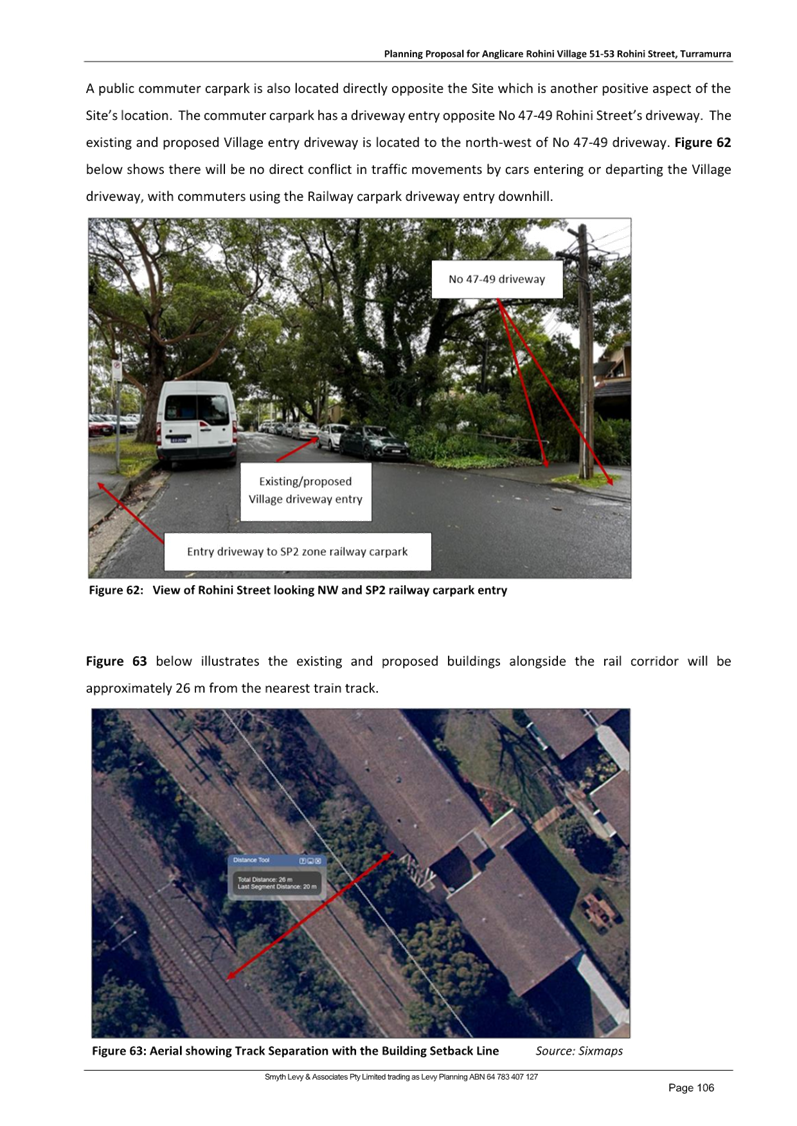
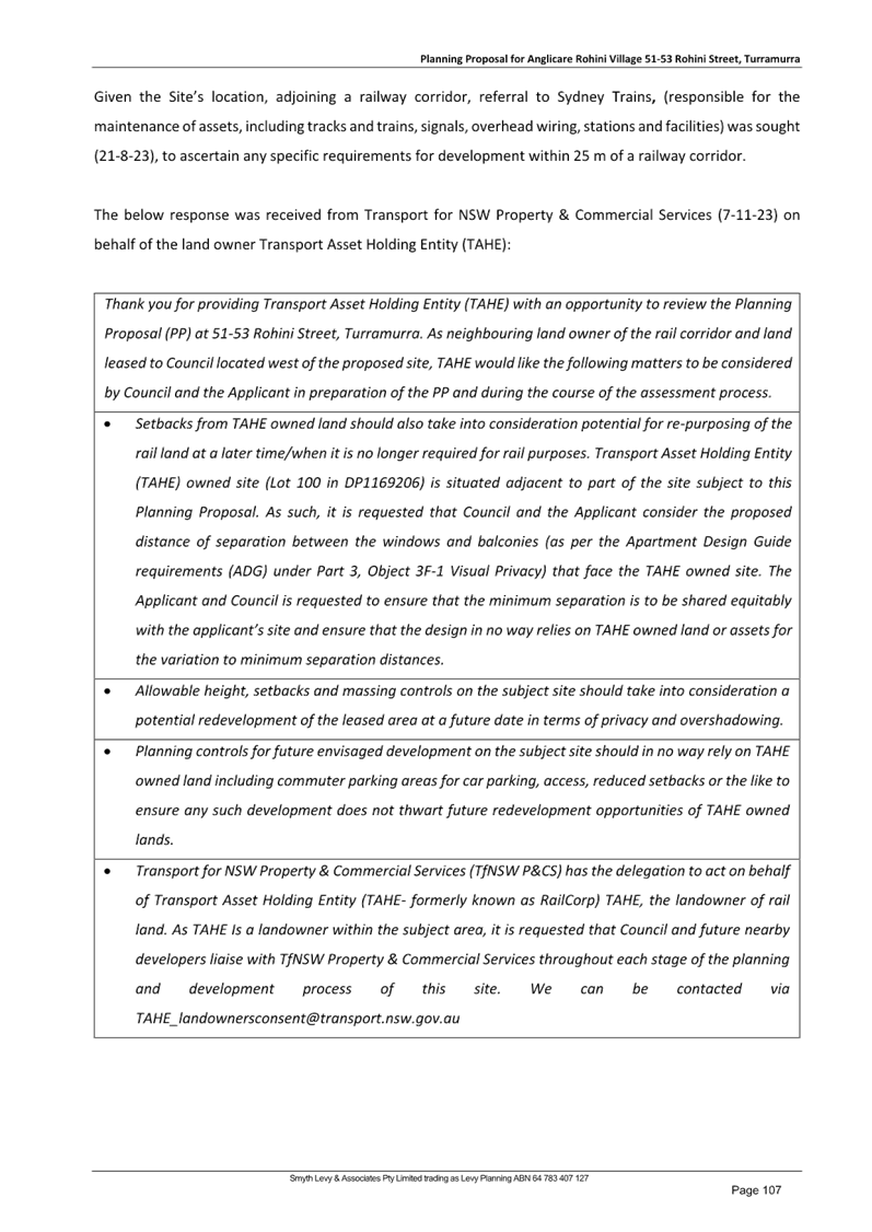
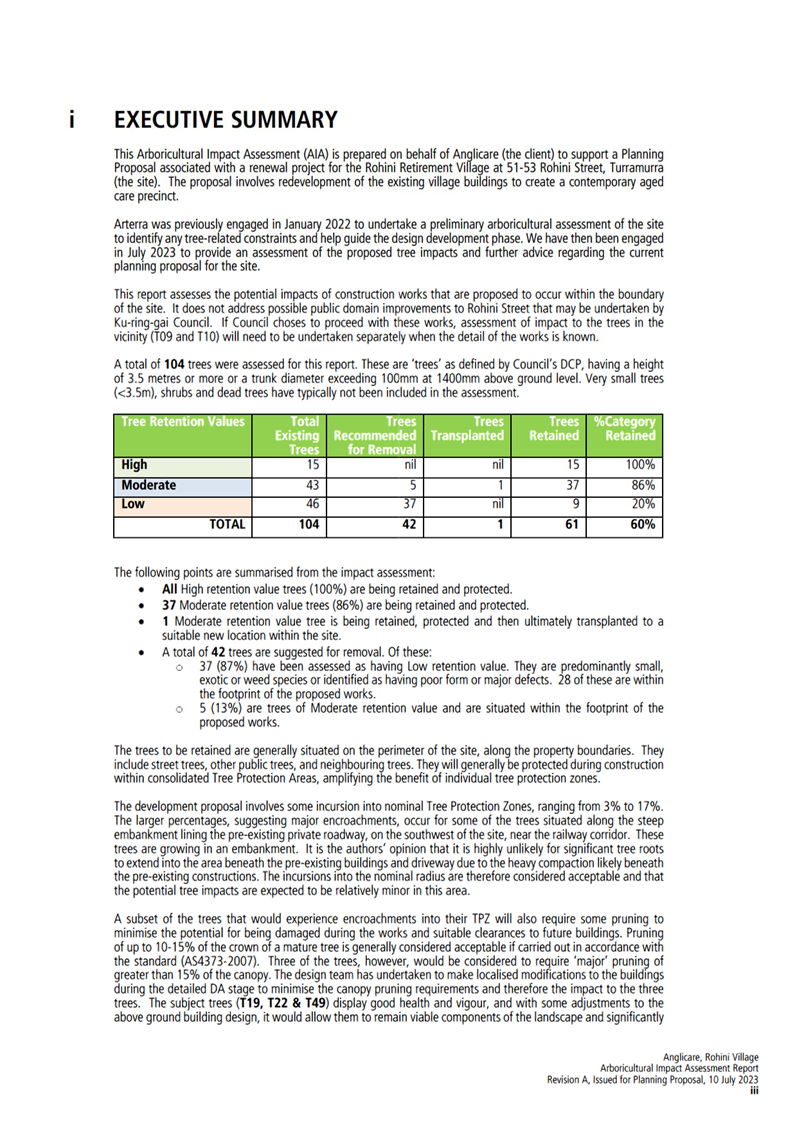
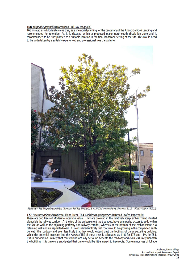
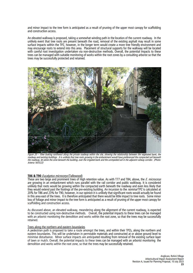
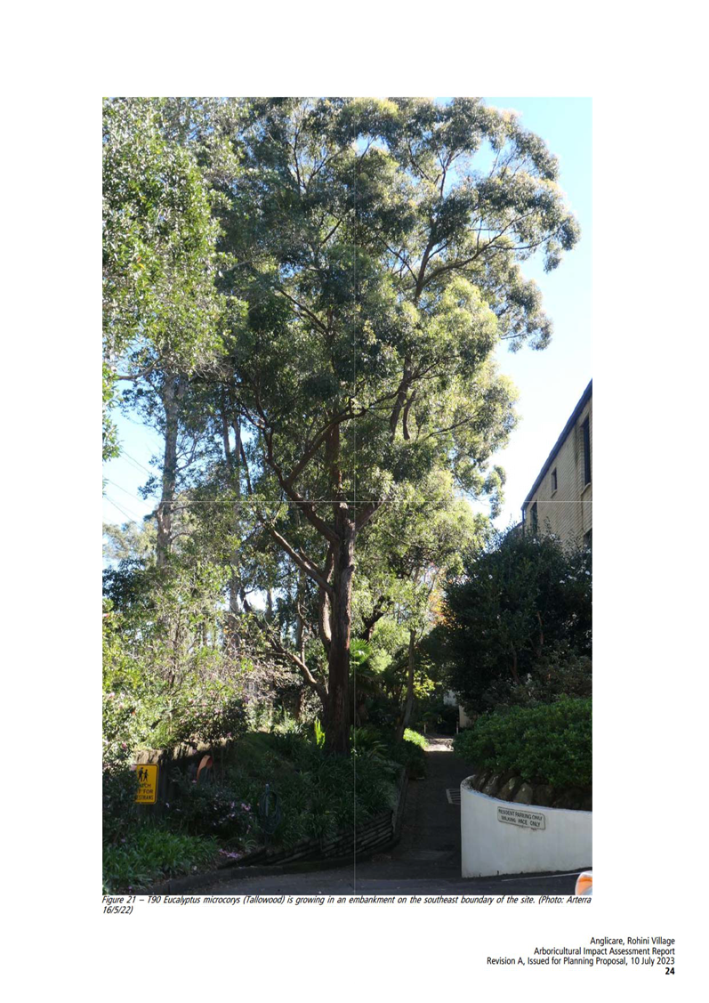
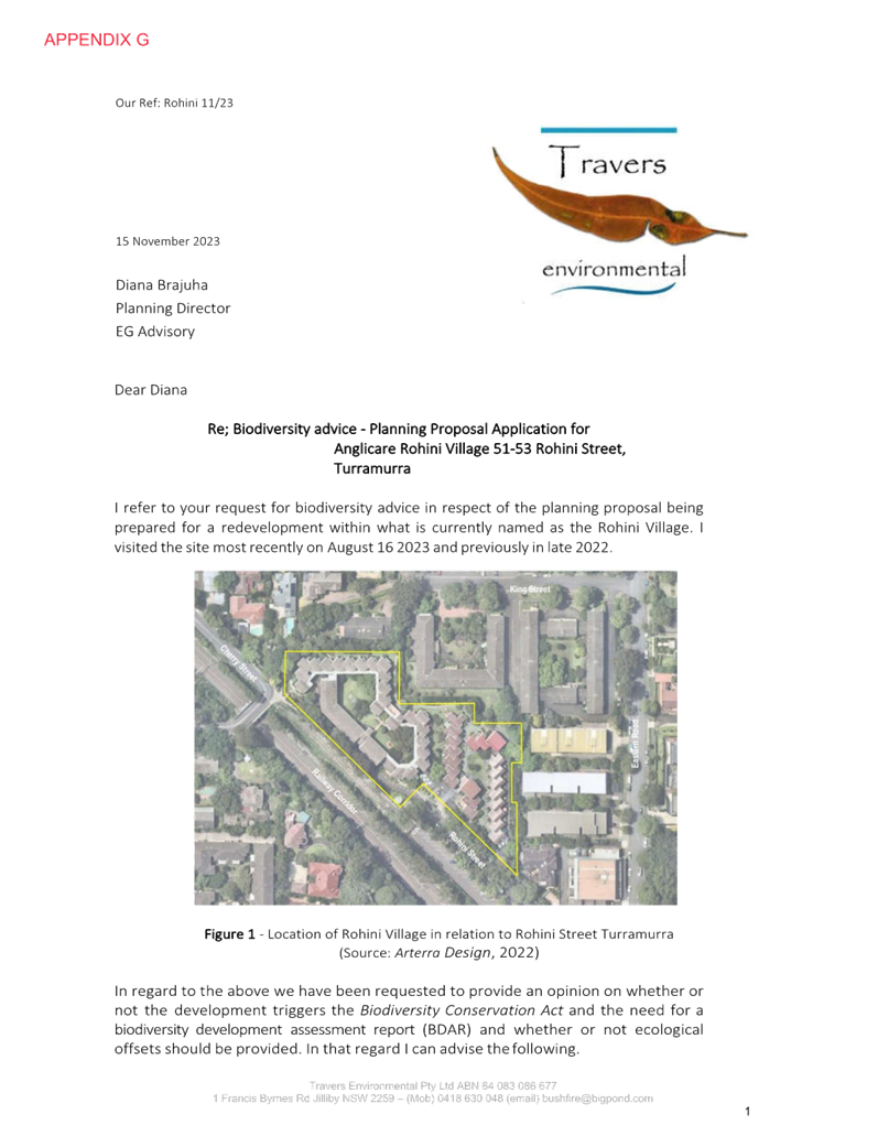
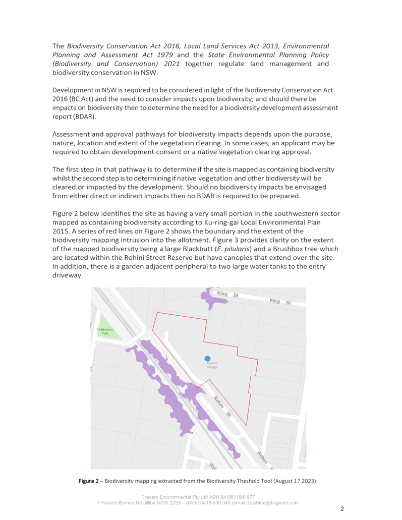
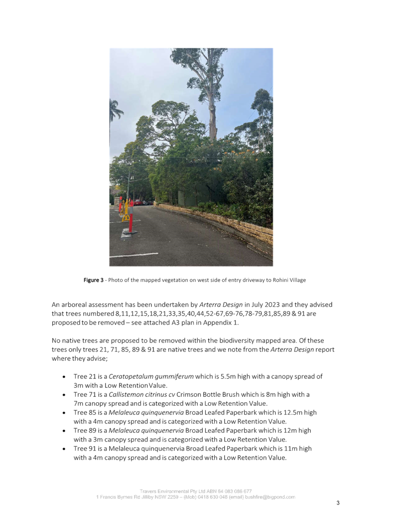
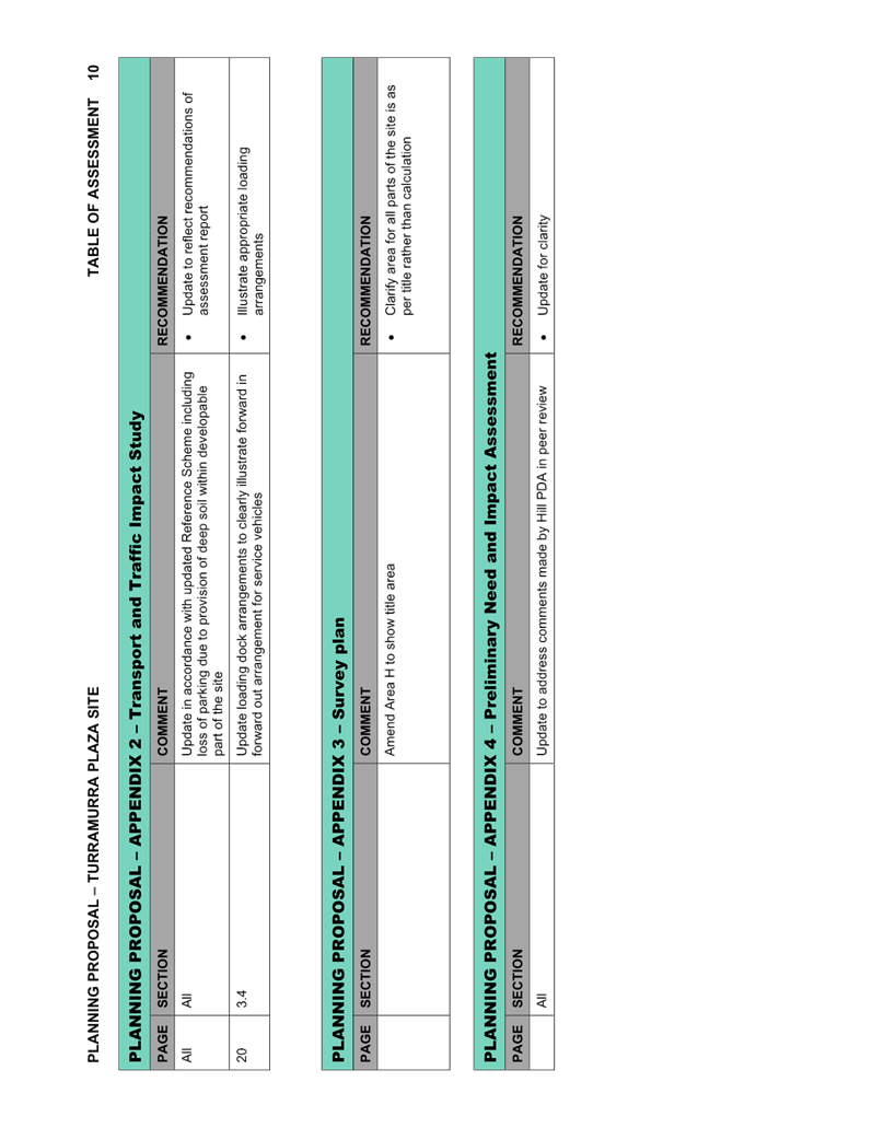
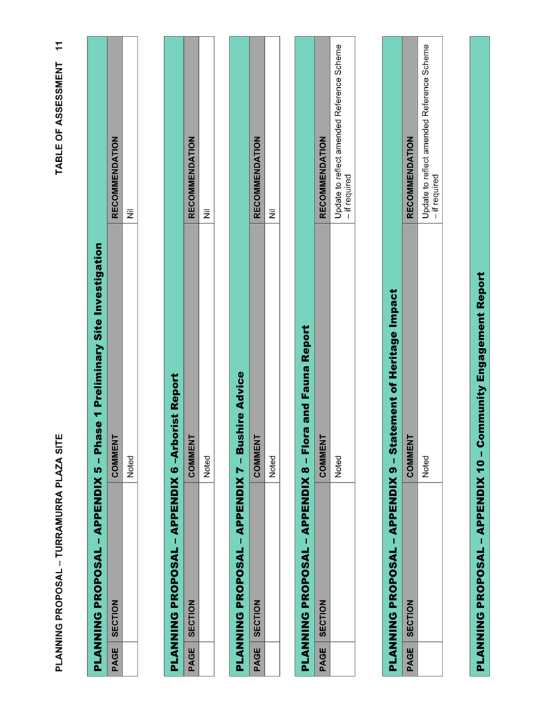
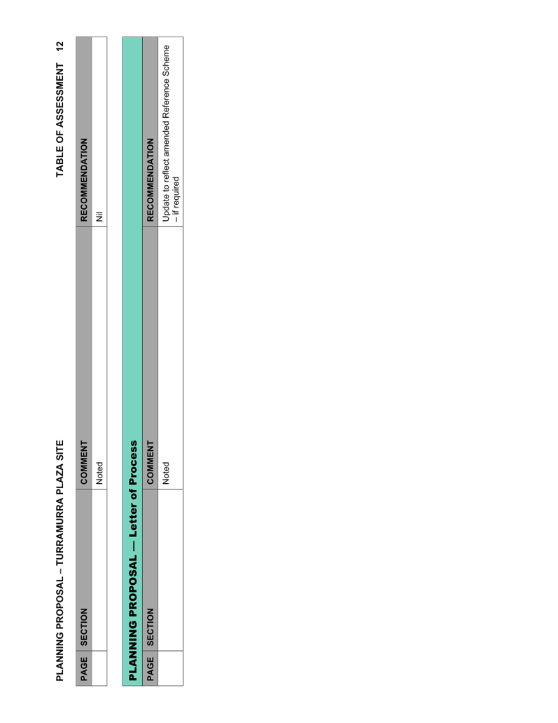
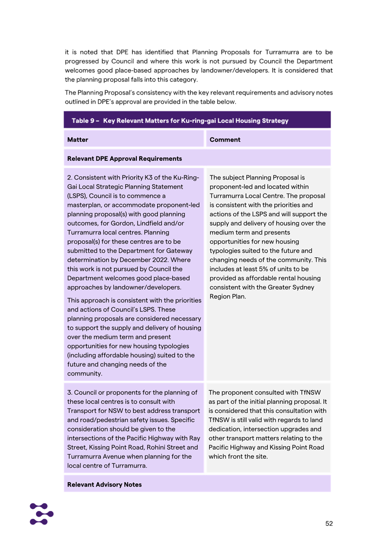
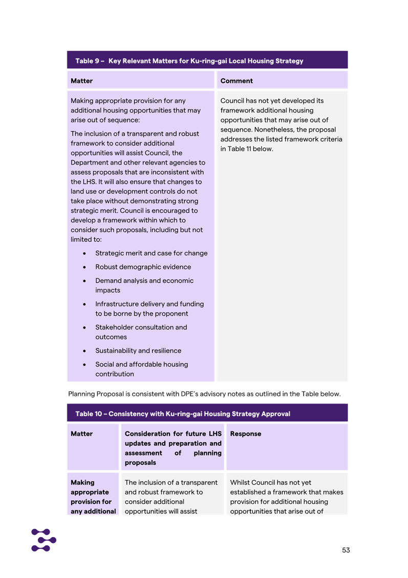
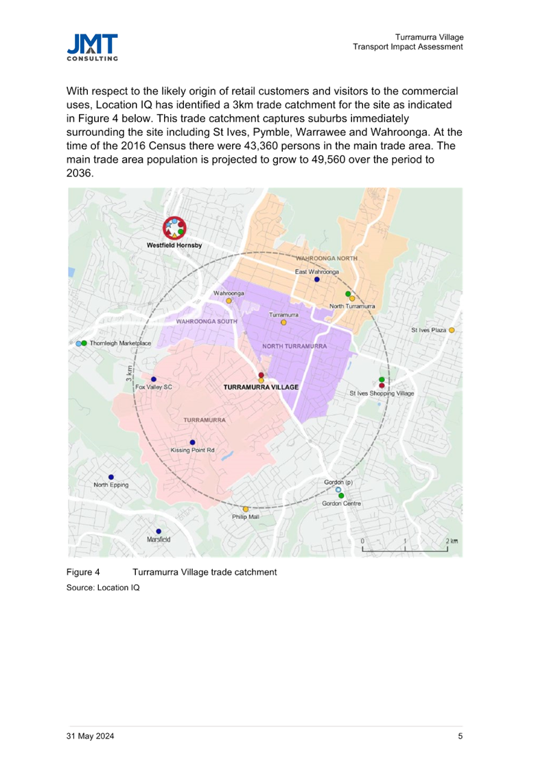
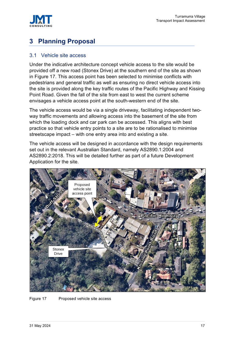
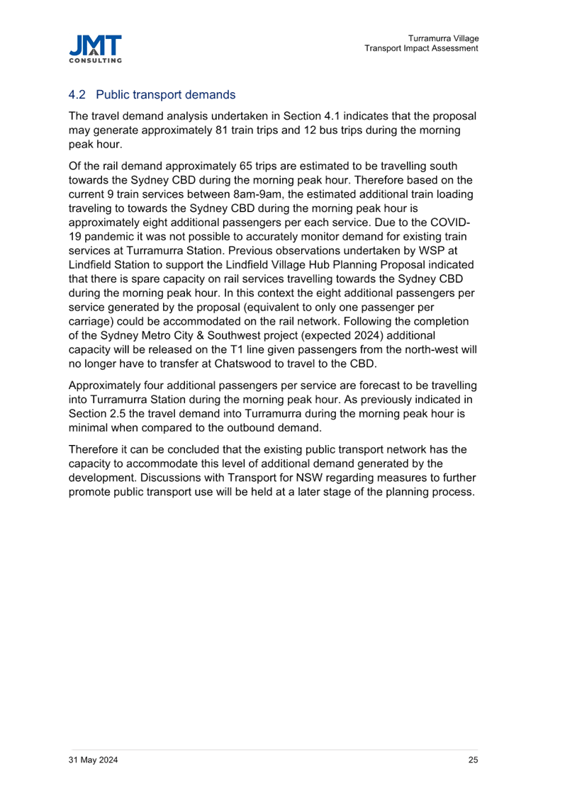
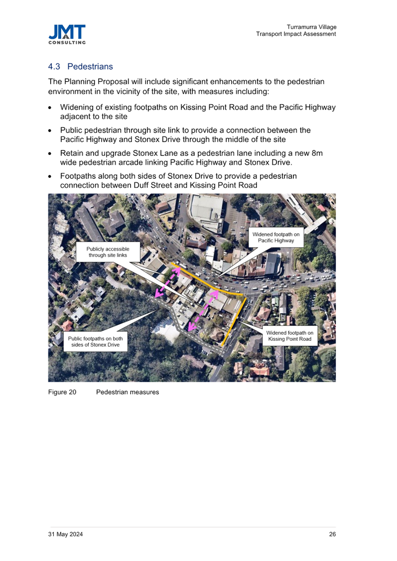
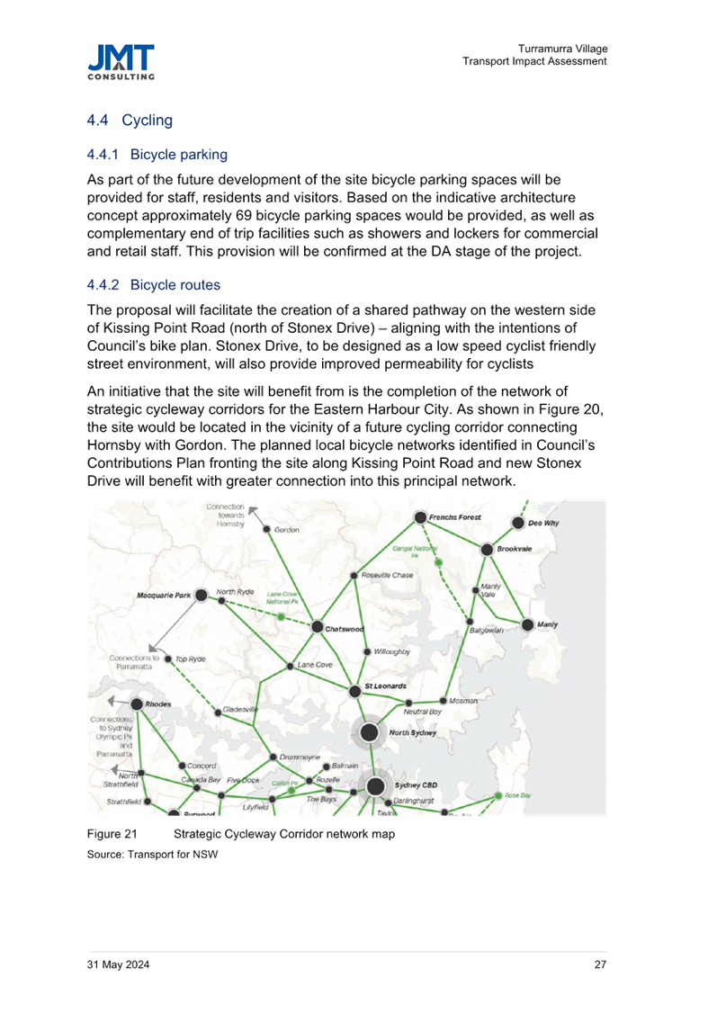
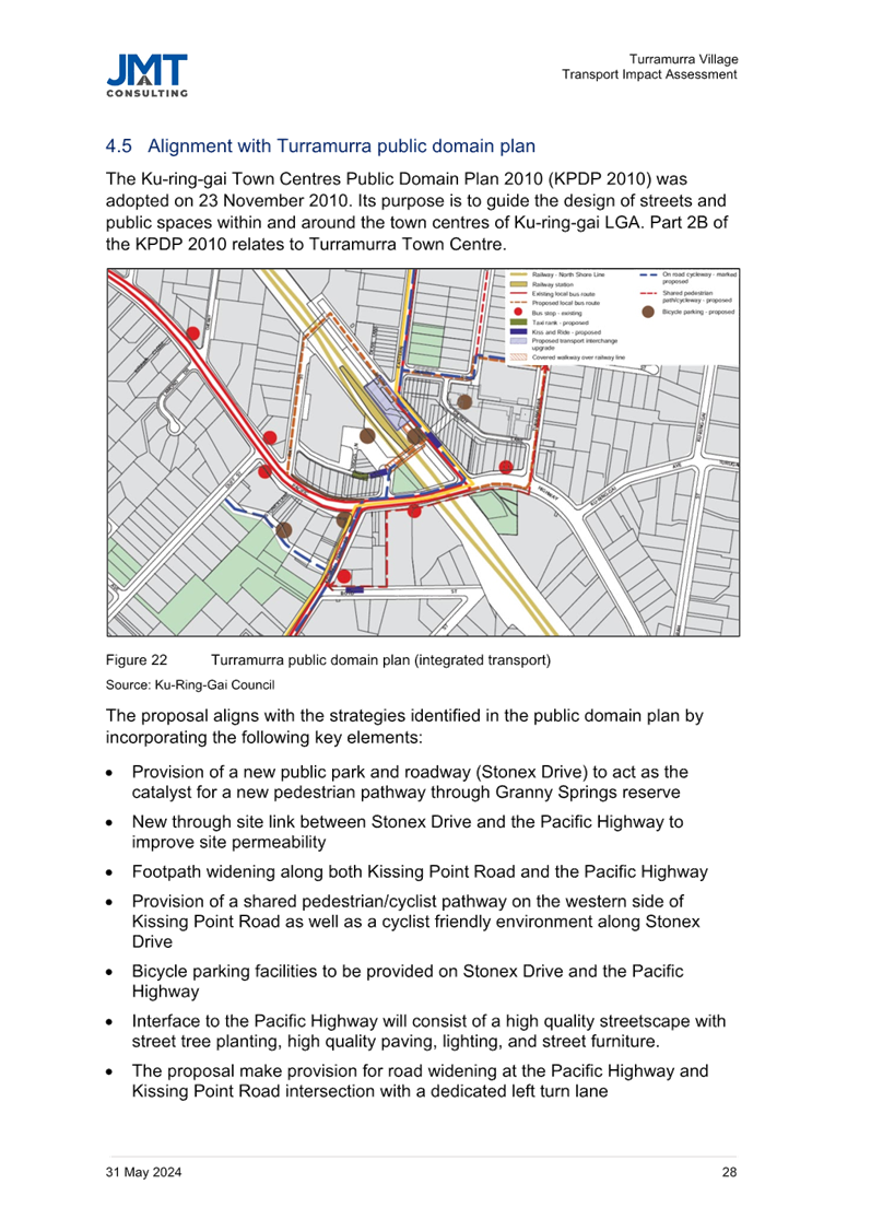
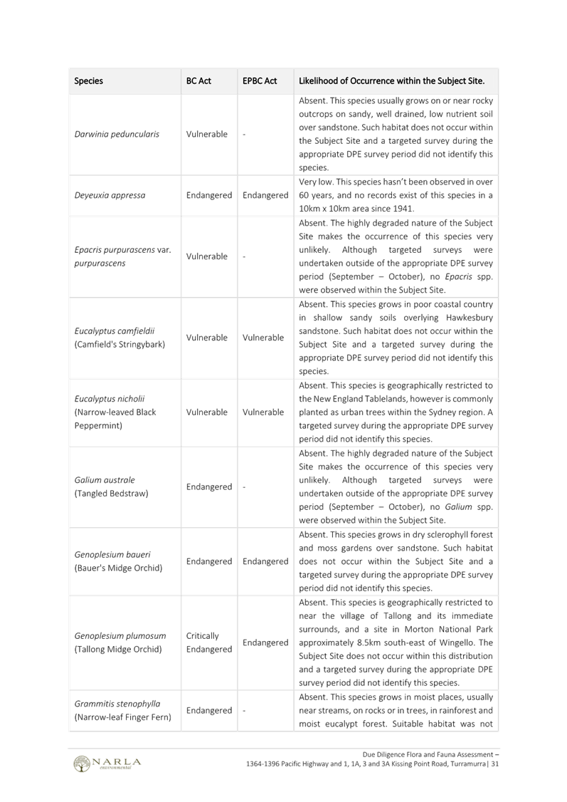
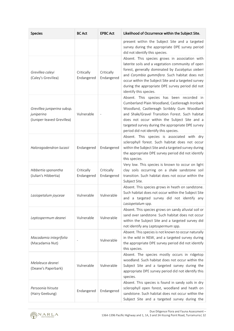
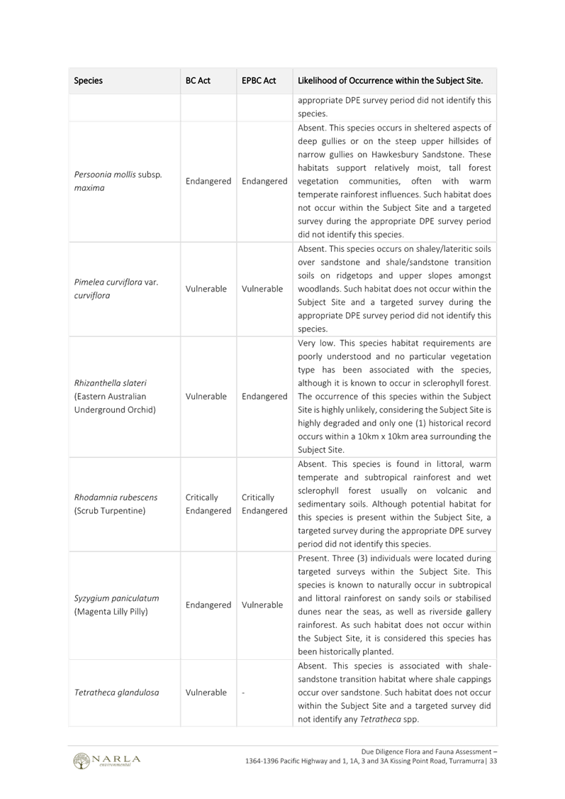
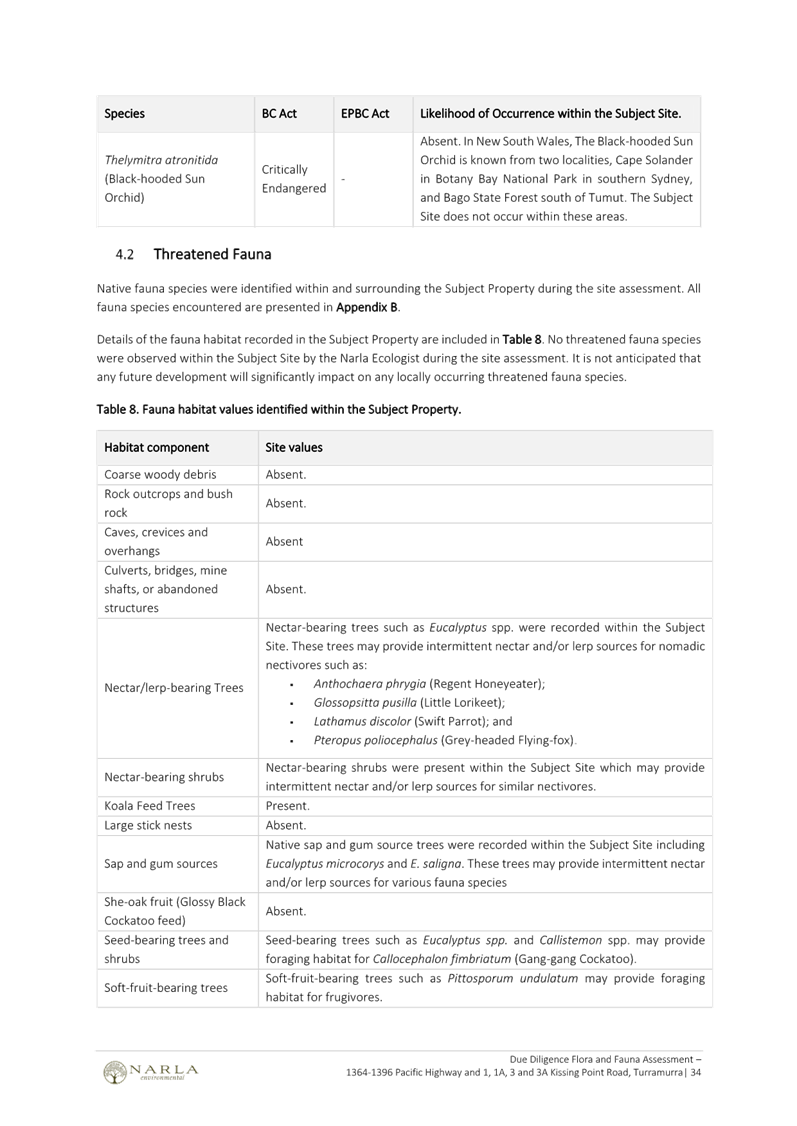
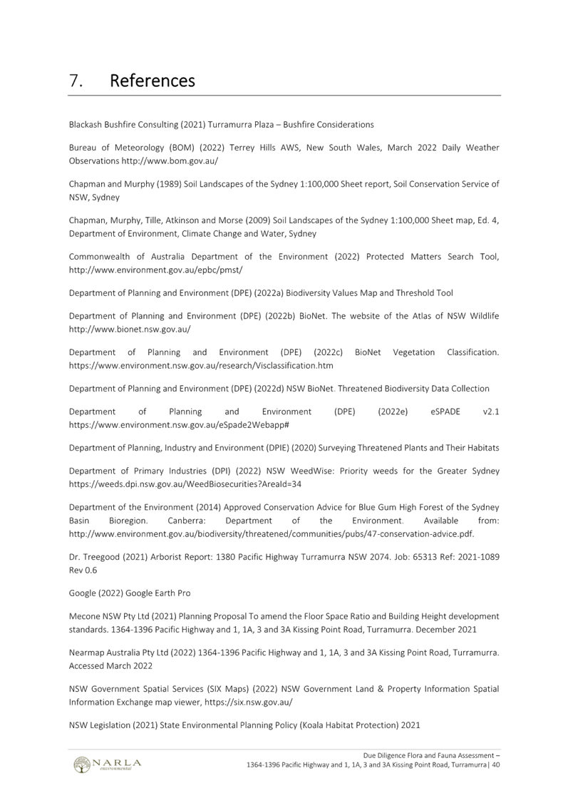
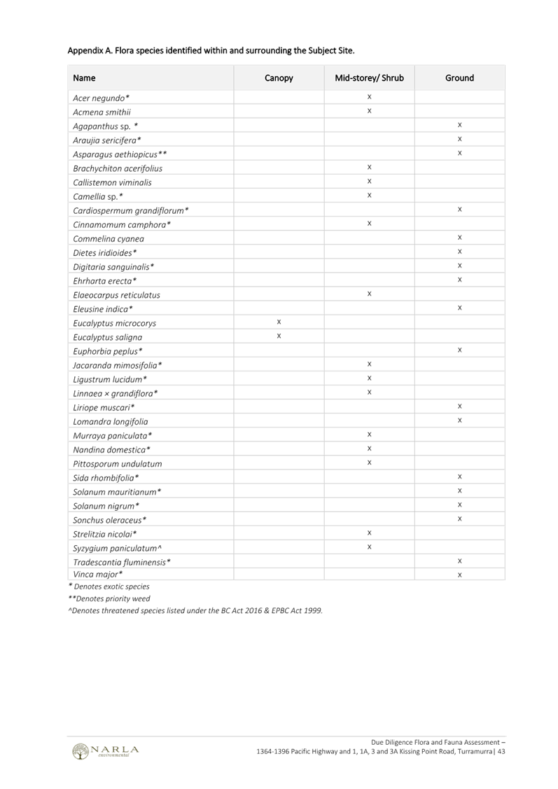
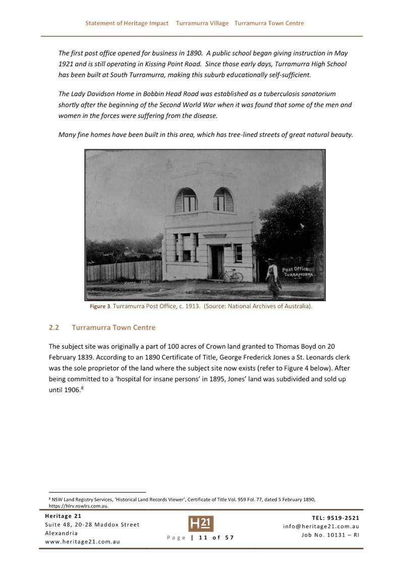
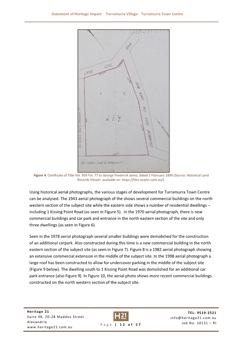
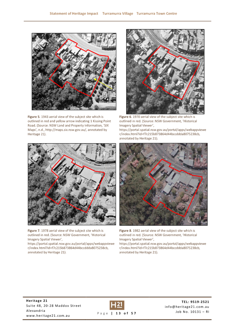
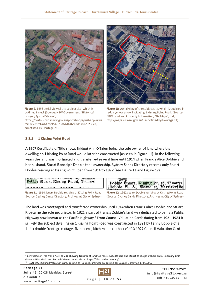
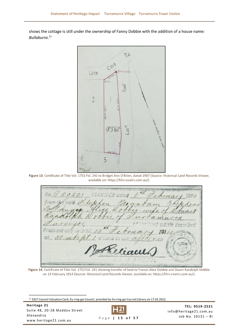
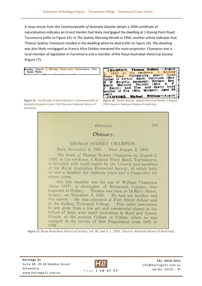
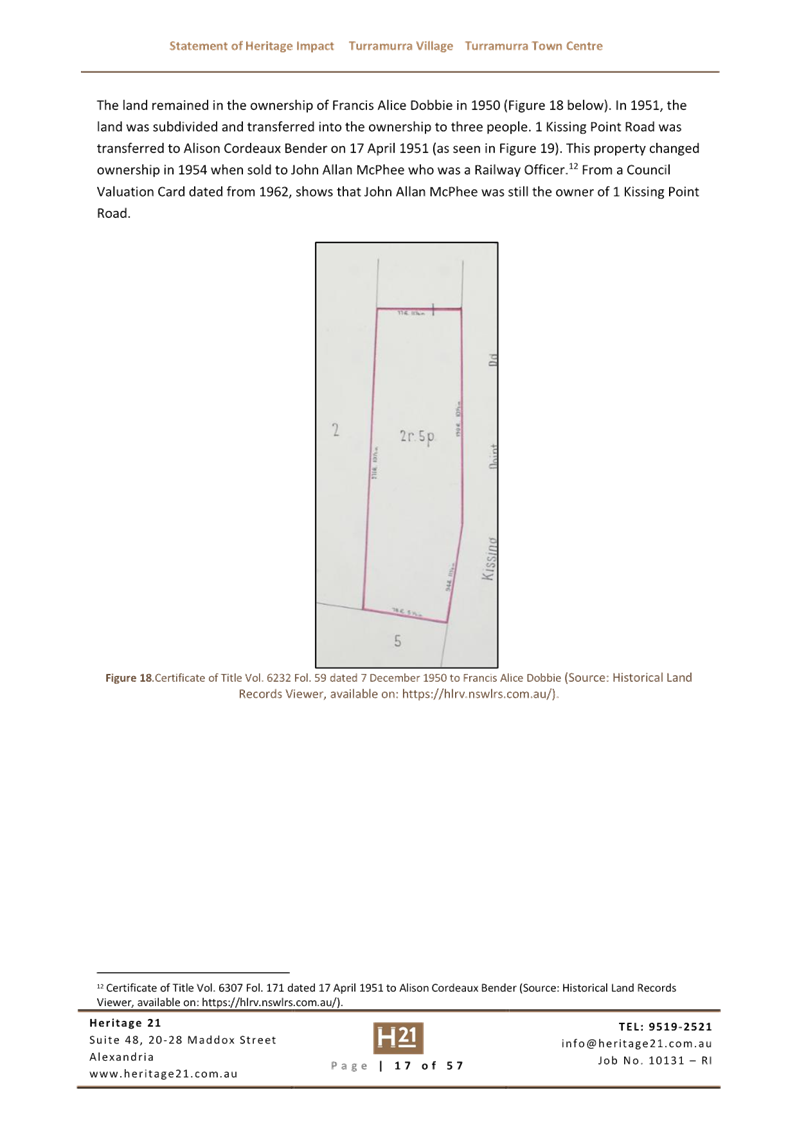
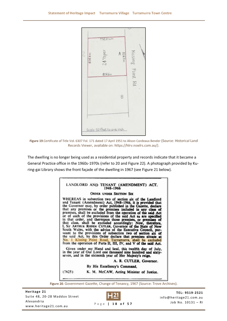
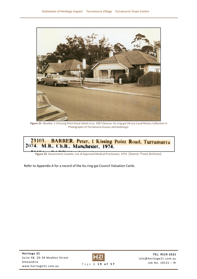
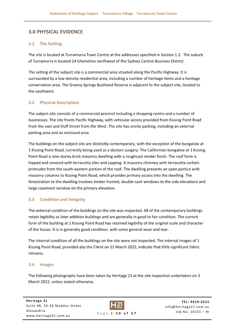
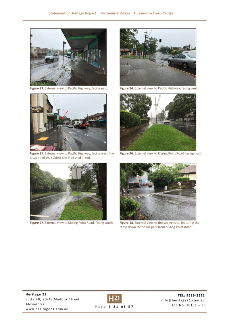
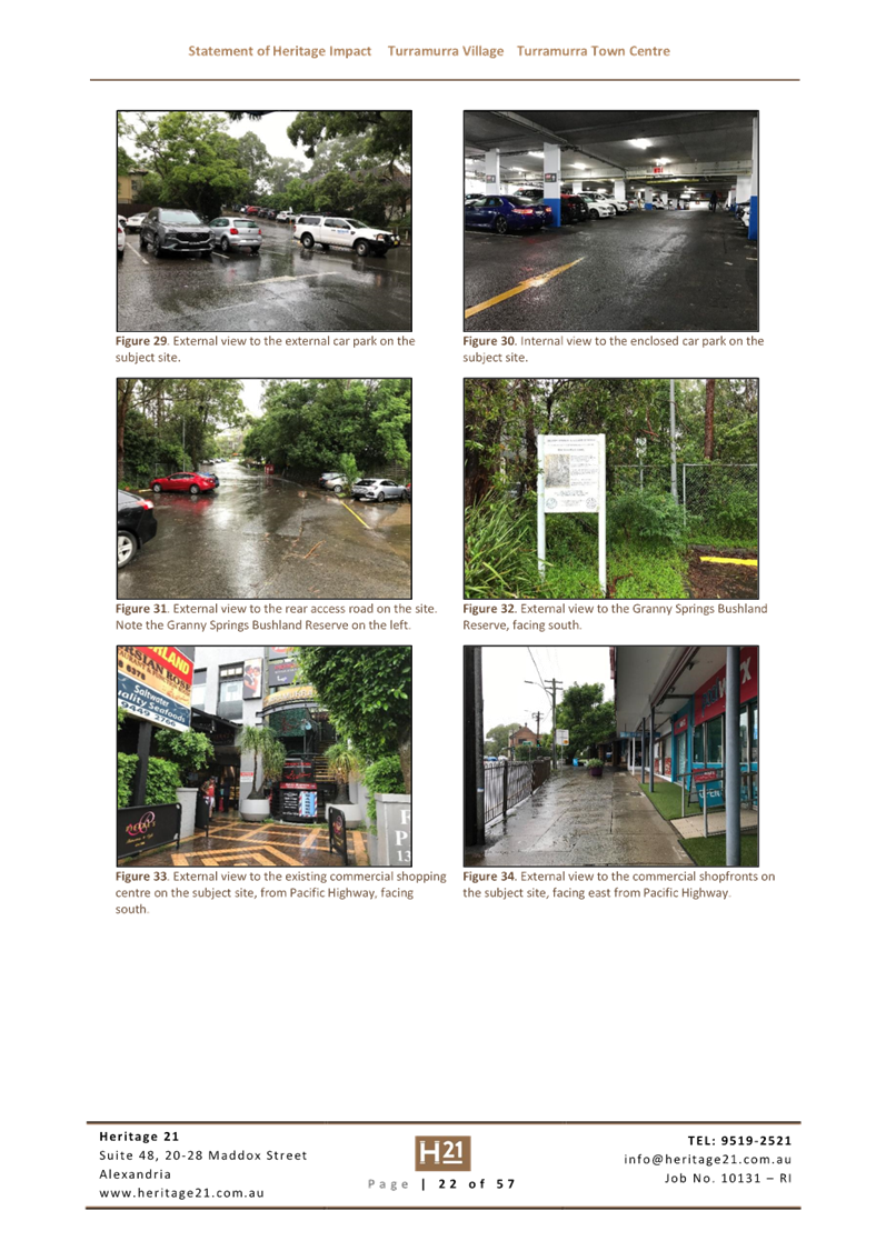
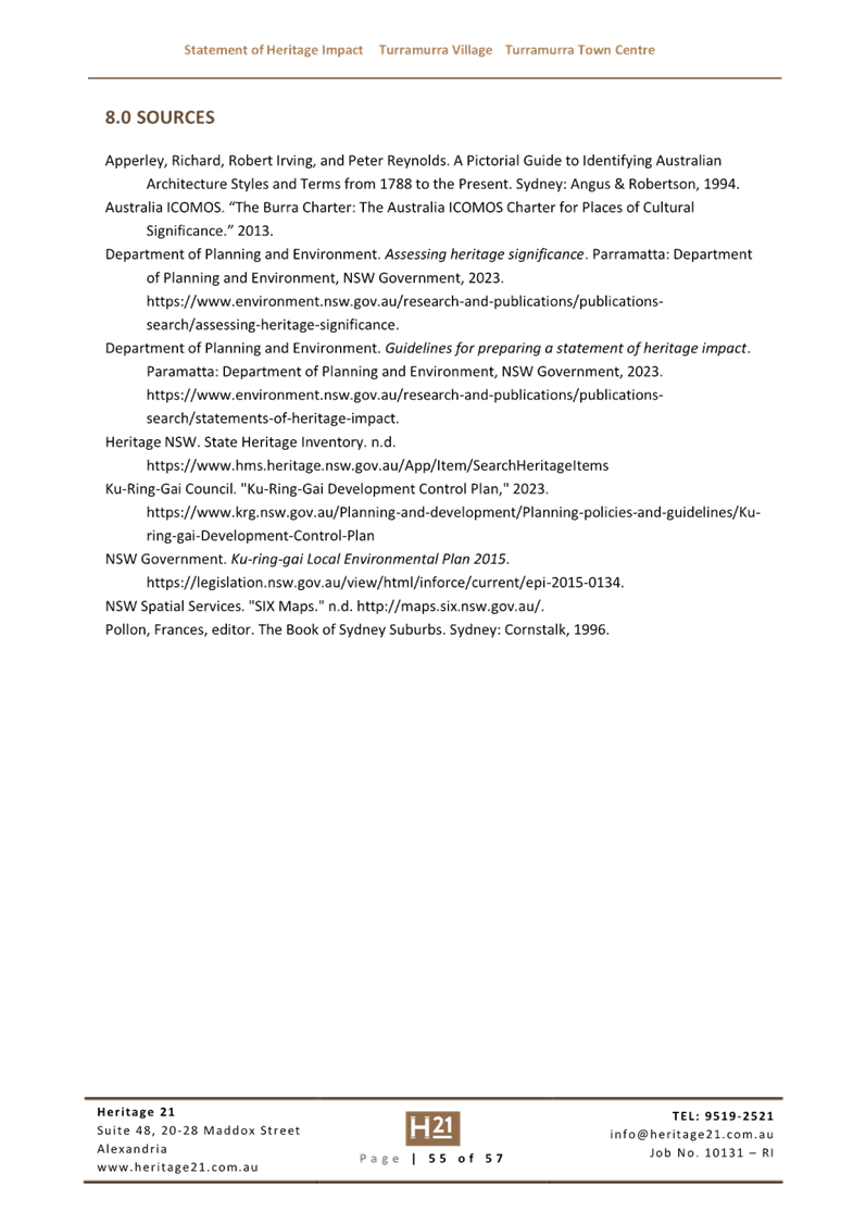
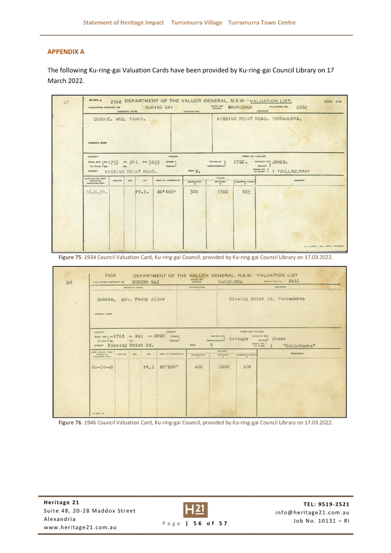
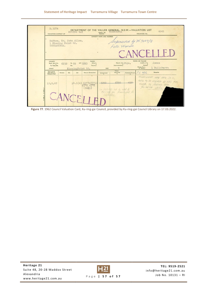
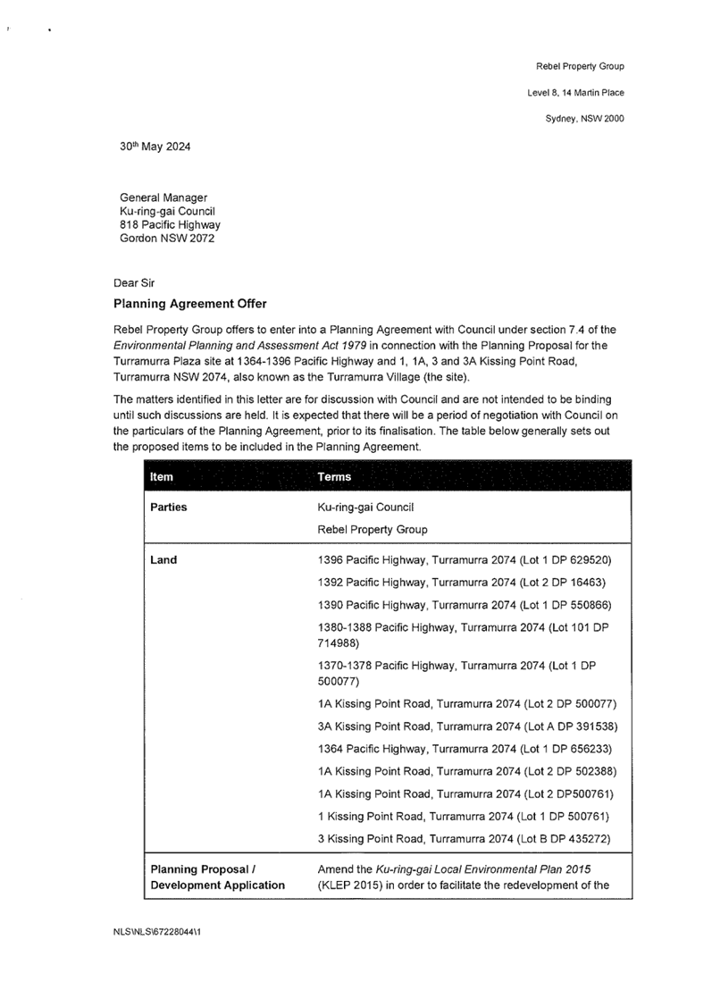
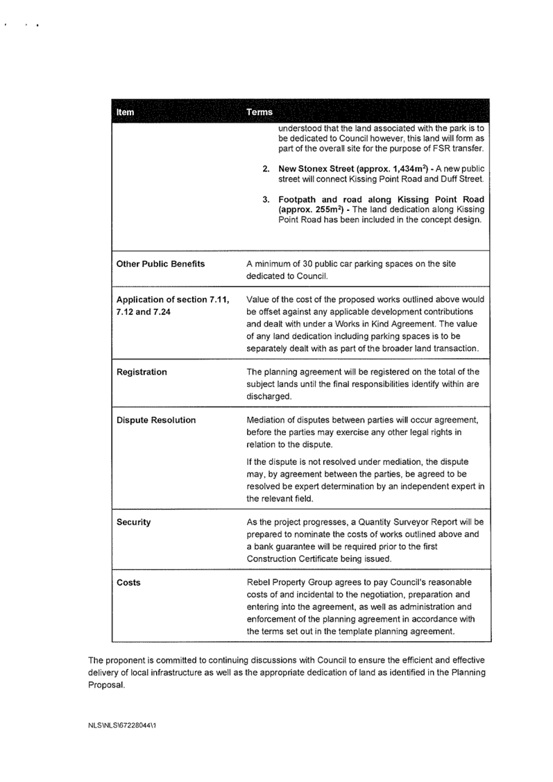
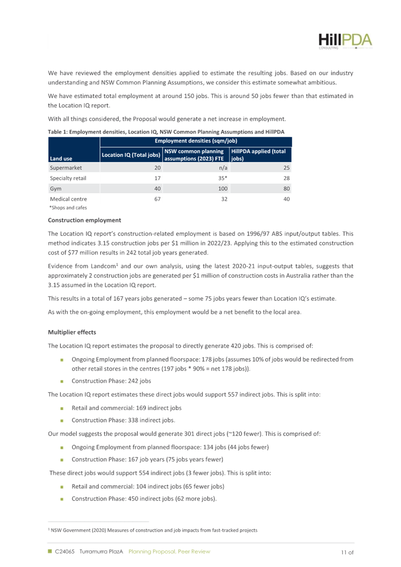
|
Ku-ring-gai
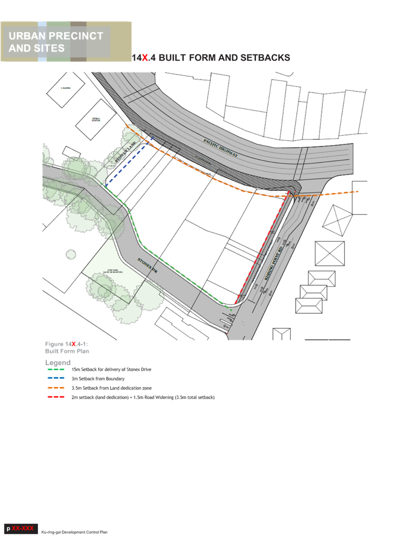
Local Planning Panel Meeting - 22 July 2024
|
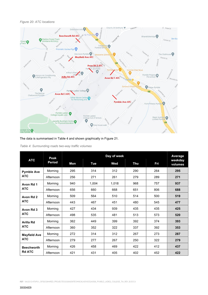
GB.2 / 1
|
|
|
|
|
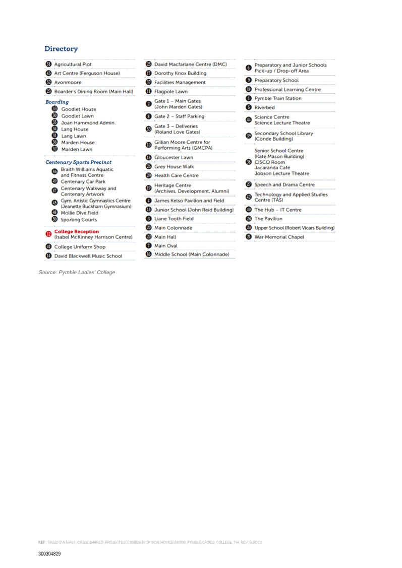
Item
GB.2
|
S13985
|
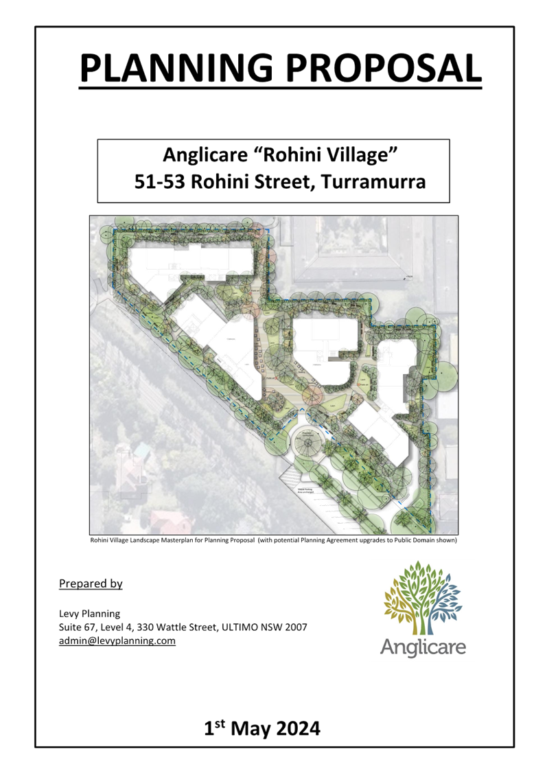
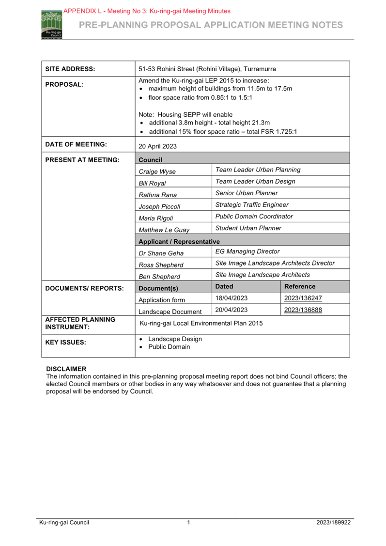
Planning Proposal
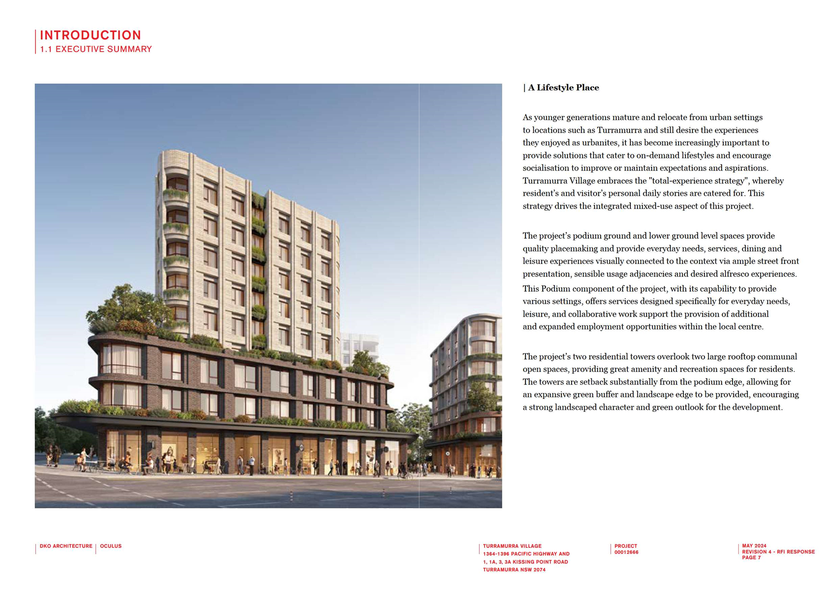
51-53 Rohini St, Turramurra (Anglicare)
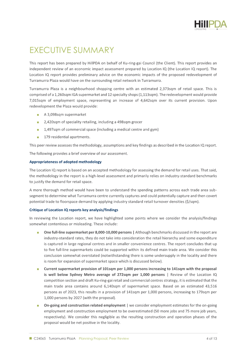
EXECUTIVE
SUMMARY
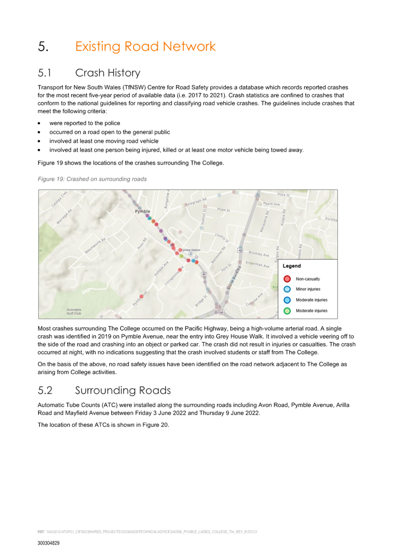
|
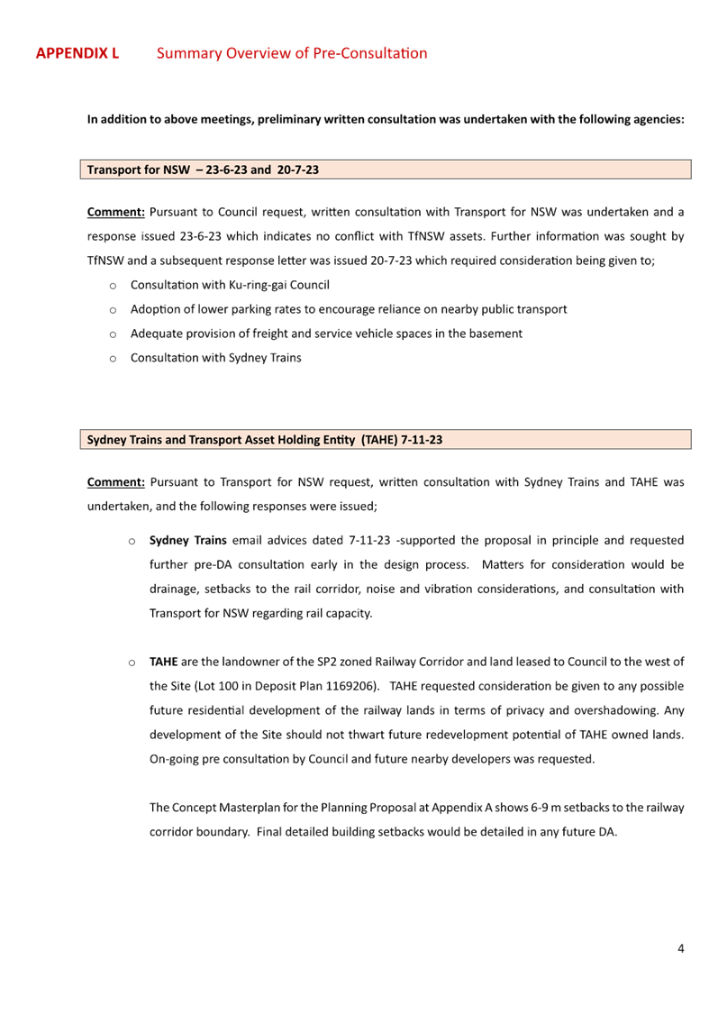
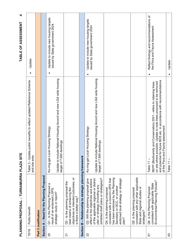
purpose of report:
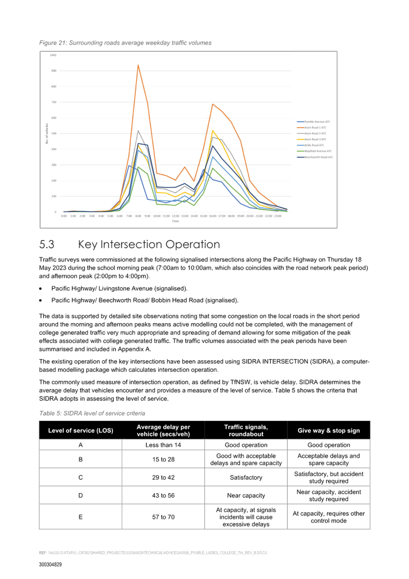
|
To refer the Planning Proposal
for 51-53 Rohini Street, Turramurra (Anglicare Village) to the KLPP for
advice as required by the Local Planning Panels Direction – Planning
Proposals issued by the Minister for Planning under Section 9.1 of the Environmental
Planning and Assessment Act 1979.
|
|
|
|
|
background:
|
The Planning Proposal was formally submitted to
Council for assessment on 26 September 2023. Following two adequacy checks,
the proposal was updated by Anglicare and re-submitted with fees.
The Planning Proposal seeks amendment to the Ku-ring-gai
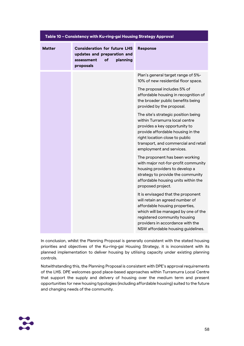
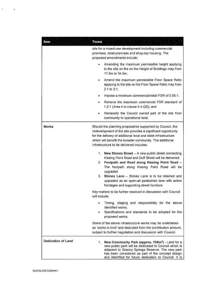
Local Environmental Plan 2015 to enable the following:
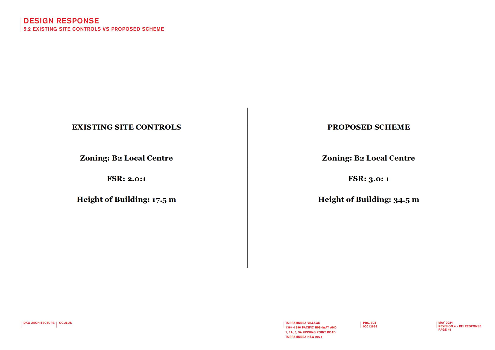
1. increase
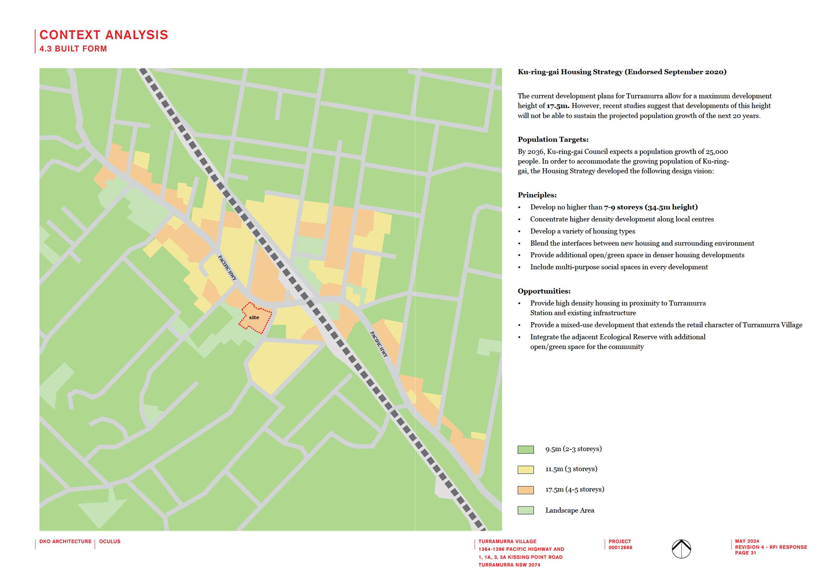
the maximum Floor Space Ratio (FSR) from 0.85:1 to 1.5:1 (the Housing SEPP
bonus provisions will result in a final FSR of 1.725:1);
2. increase
the maximum Height of Building from 11.5m to 17.5m (the Housing SEPP bonus
provisions will result in a final Height of 21.3m);
3. include
certain Local Provisions that allow the inclusion of a Café and a
Wellness Centre with an indoor pool.
The key objective of the Planning Proposal is to
facilitate the site’s redevelopment as it no longer meets design
standards for seniors housing, nor is it in line with current customer
expectations.
|
|
|
|
|
comments:
|
The Planning Proposal is generally supported; however,
a number of amendments are required to ensure its consistency with State and
Local Environmental Planning Instruments, and to make the proposal
transparent to the community on the outcomes it will deliver.
|
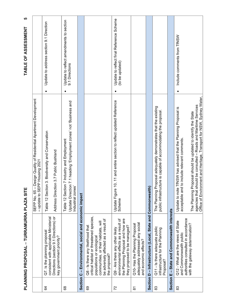
|
|
|
|
recommendation:
(Refer to the full Recommendation at the end of this
report)
|
That the KLPP advise Council
that it supports the Planning Proposal being submitted to the Department
of Planning, Housing and Infrastructure for a Gateway Determination subject
to the amendments stated in this Report and in the Table of Assessment at Attachment
A1.
|
Purpose of Report
To refer the Planning Proposal for 51-53 Rohini Street,
Turramurra (Anglicare Village) to the KLPP for advice as required by the Local
Planning Panels Direction – Planning Proposals issued by the Minister for
Planning under Section 9.1 of the Environmental Planning and Assessment Act
1979.
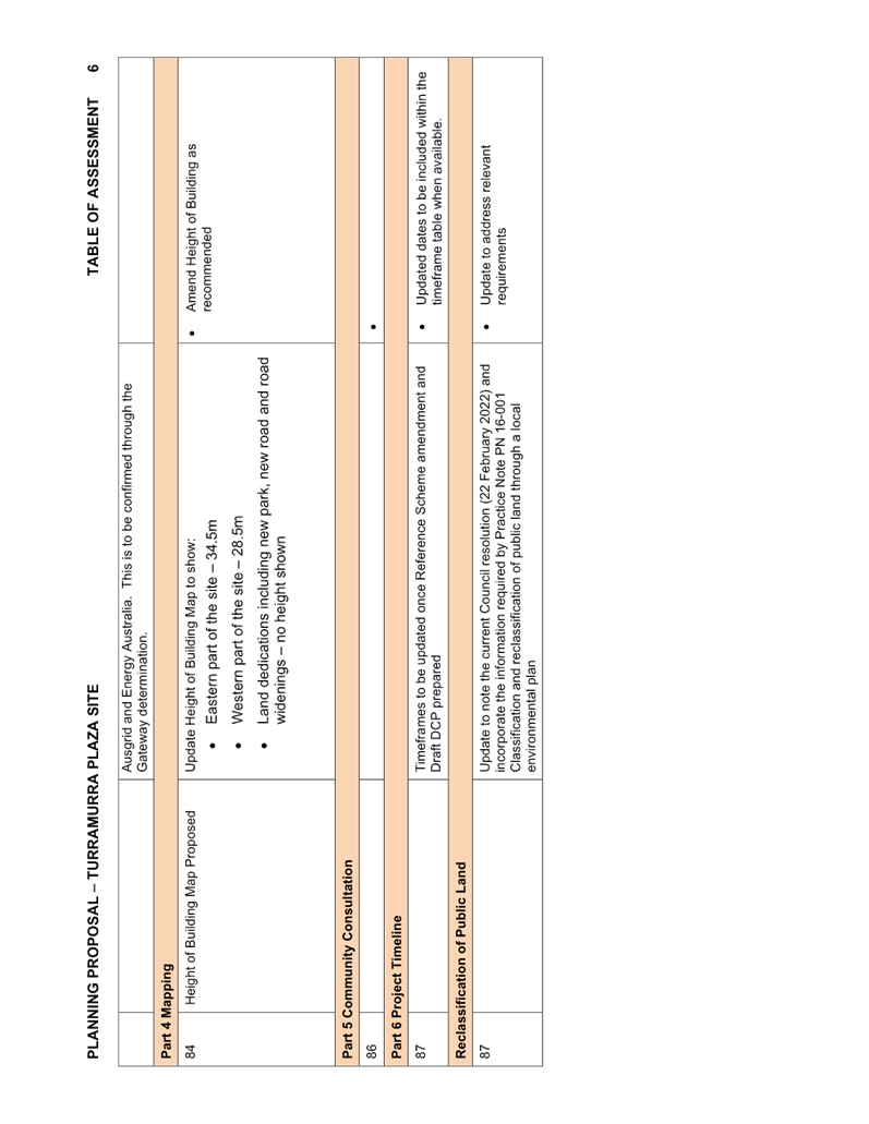
Background
On 26 September 2023 Council received a Planning Proposal for
land at 51–53 Rohini Street, Turramurra, known as the Anglicare Village
(housing for seniors).
The site is owned by the Anglican Community Services and
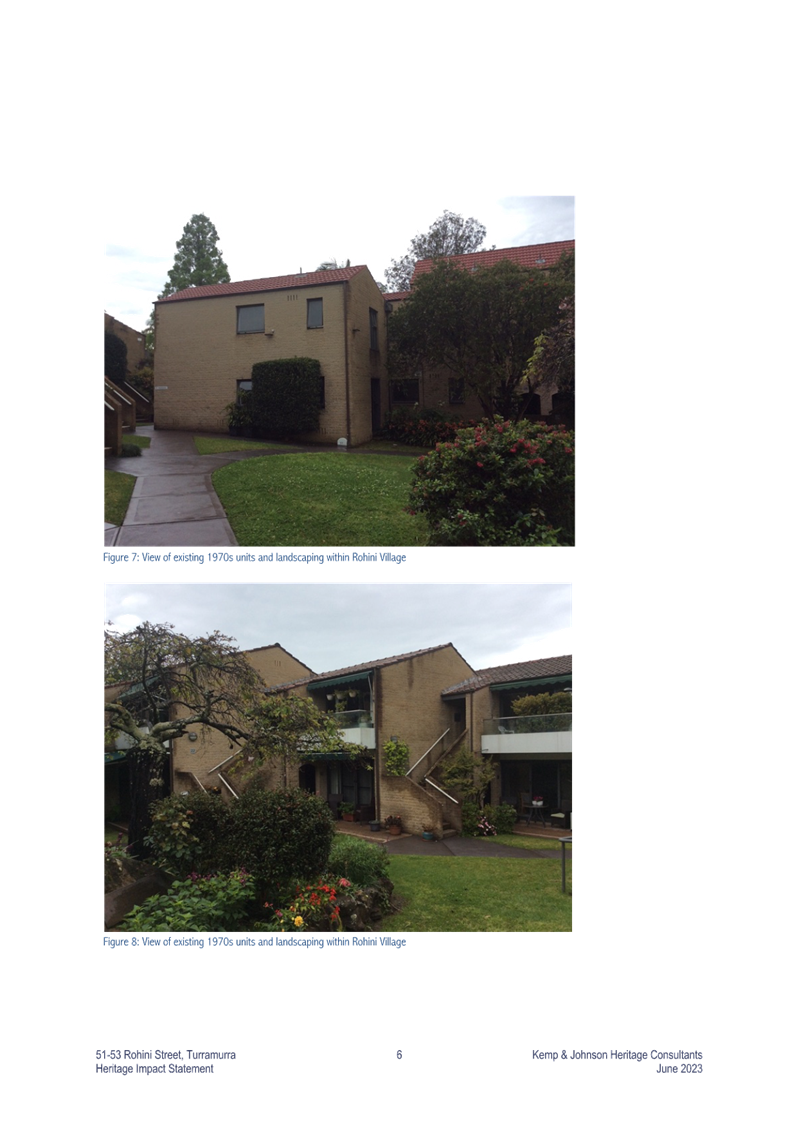
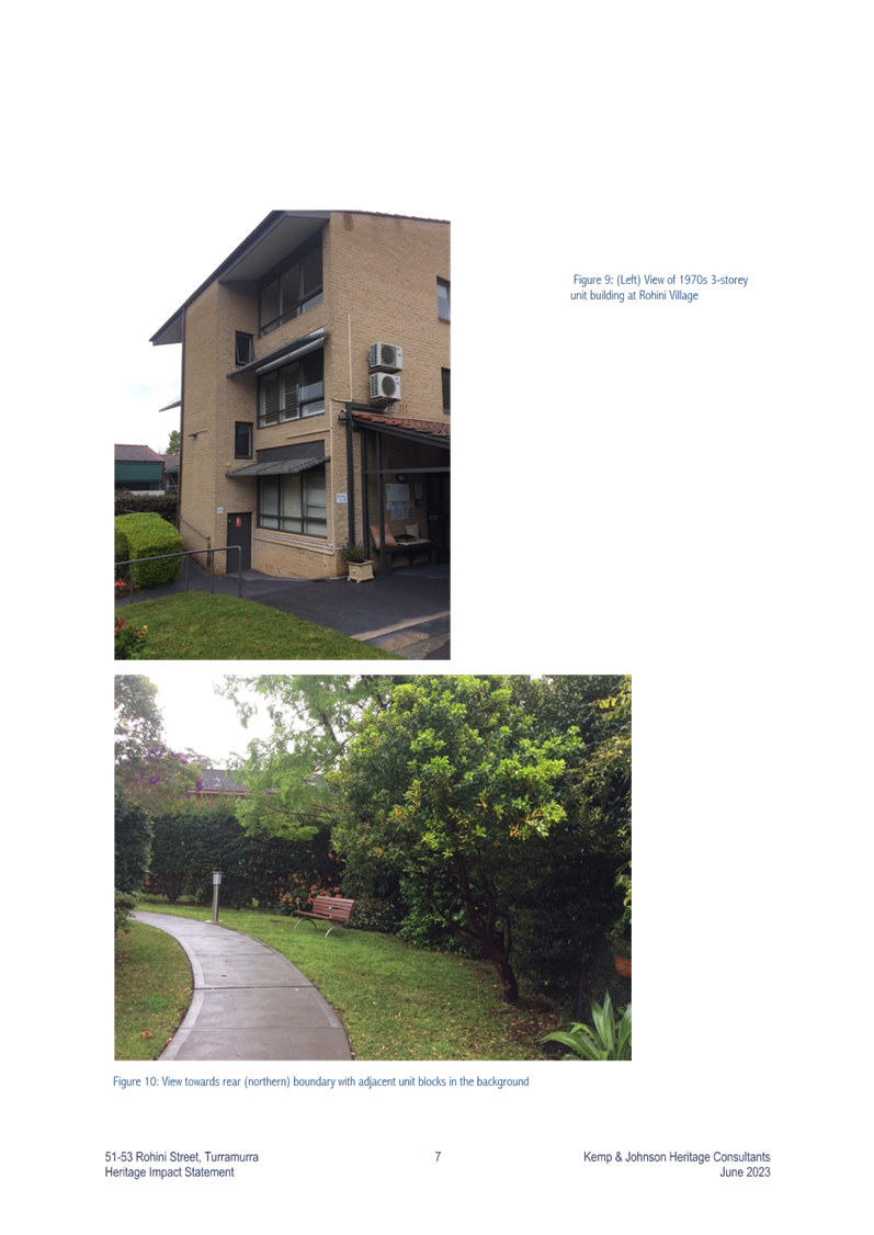
contains 110 existing senior’s independent living units, generally in a
2-3 storey unit and townhouse style development.
The proposal states that the
existing facility has been in operation since the late 1960s and requires
complete renewal as it no longer meets accessibility or design standards, nor
is it in line with customer expectations and current market demand for larger
sized units.
Adequacy checks on submitted
documents
The Planning Proposal was
formally submitted to Council for assessment on 26 September 2023. Two adequacy checks were conducted to ensure the proposal
complied with the Department of Planning and Environment’s LEP Making
Guideline August 2023, Council’s Meeting Notes from the two
pre-lodgement meetings held with the proponent and to ensure the proposal
provided sufficient justification to commence its assessment.
The adequacy checks were sent to
the proponent on 10 October 2023 and 28 February 2024.
Updated versions of the Planning Proposal responding to the
issues raised in the adequacy checks were submitted on 12 December 2023 and
again on 2 May 2024.
A number of the issues raised in the adequacy checks remain
outstanding and are now listed as part of the required amendments to enable the
Planning Proposal to progress to Gateway Determination. These include:
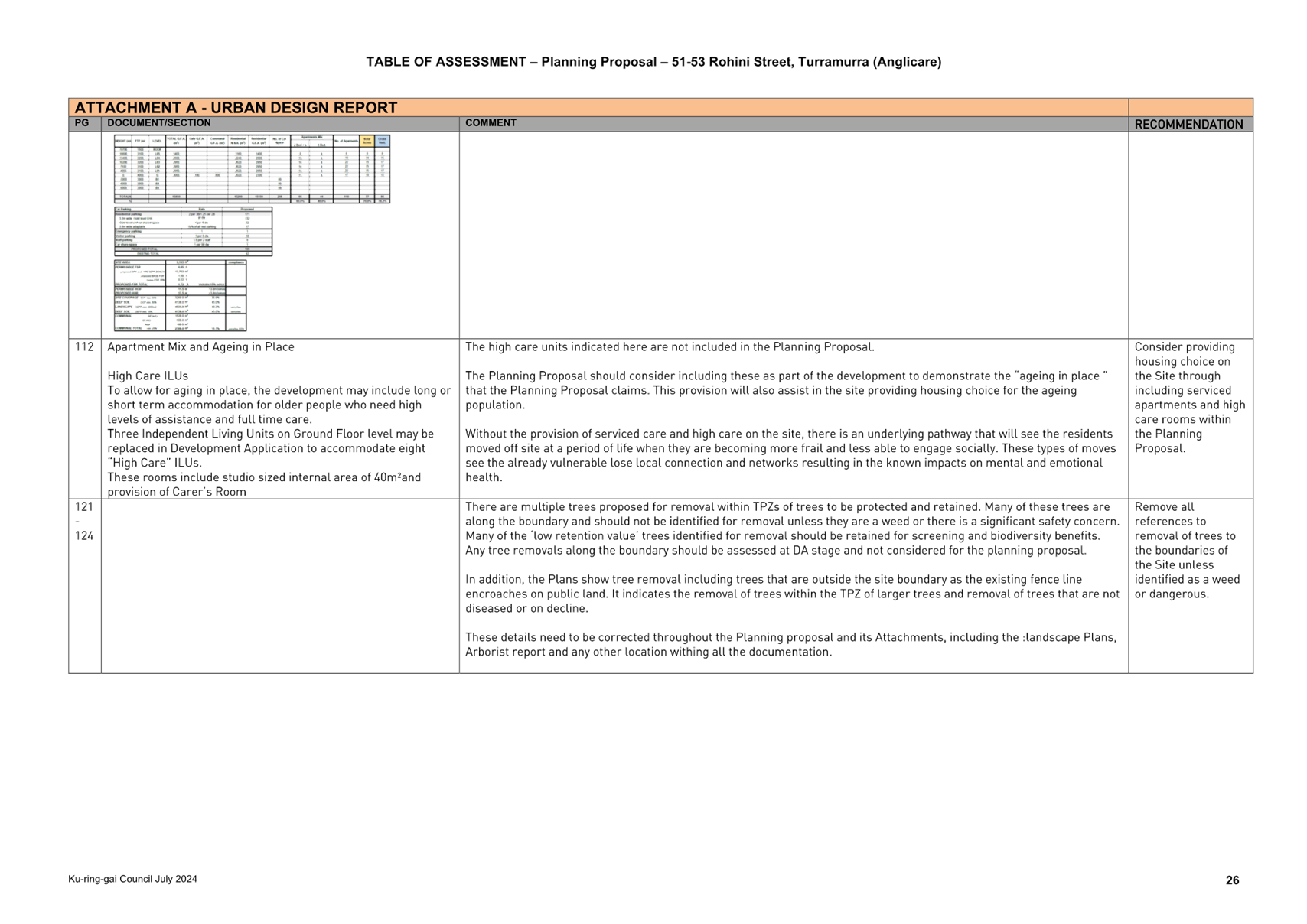
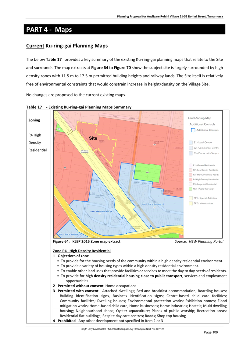
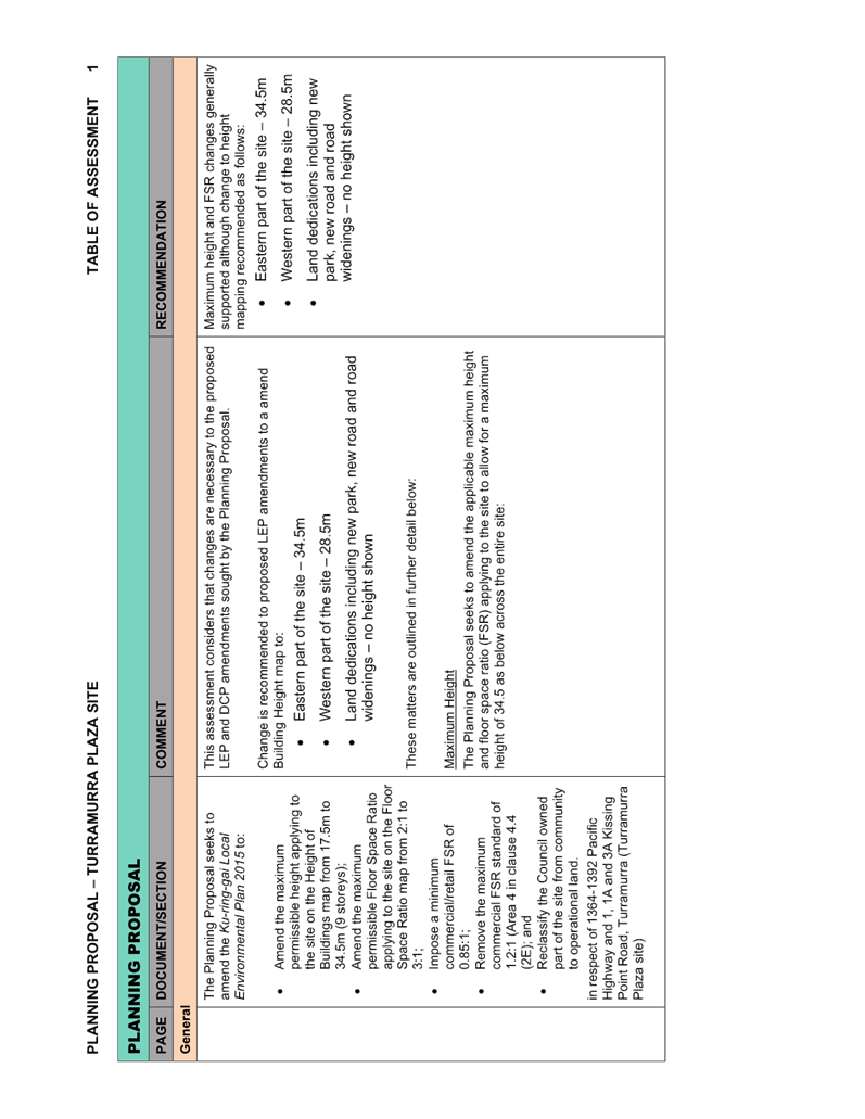
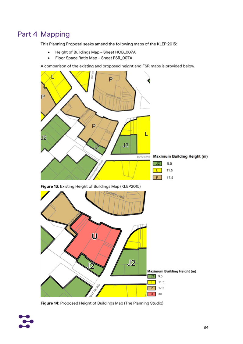
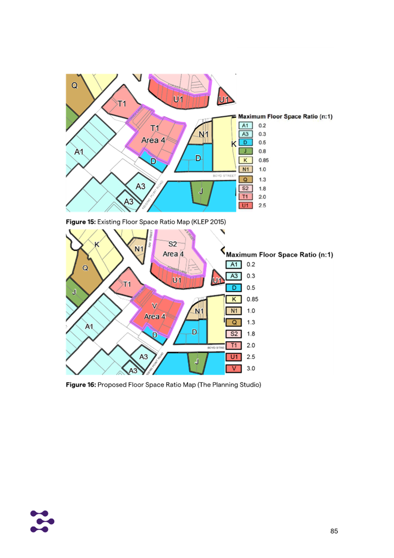
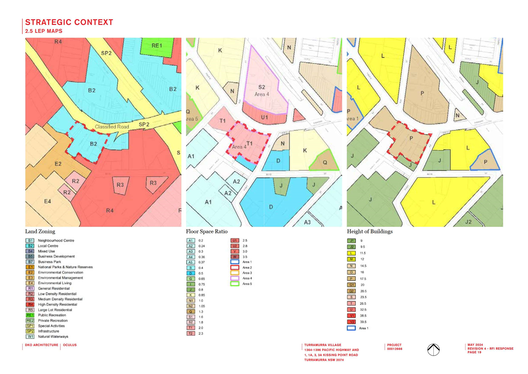
Mapping
· Amendment
of the KLEP Maps, not the Written Instrument, is required to deliver the
proposed Height and FSR standards.
· The proposed approach is highly irregular and not
consistent with LEP Practice note PN 08-001 - Height and floor space ratio.
Where an LEP contains Clause 4.3 – Height of buildings and/or Clause 4.4
– Floor space ratio, then heights and FSRs are to be specified on the
Height of Buildings Map and Floor Space Ratio Map respectively.
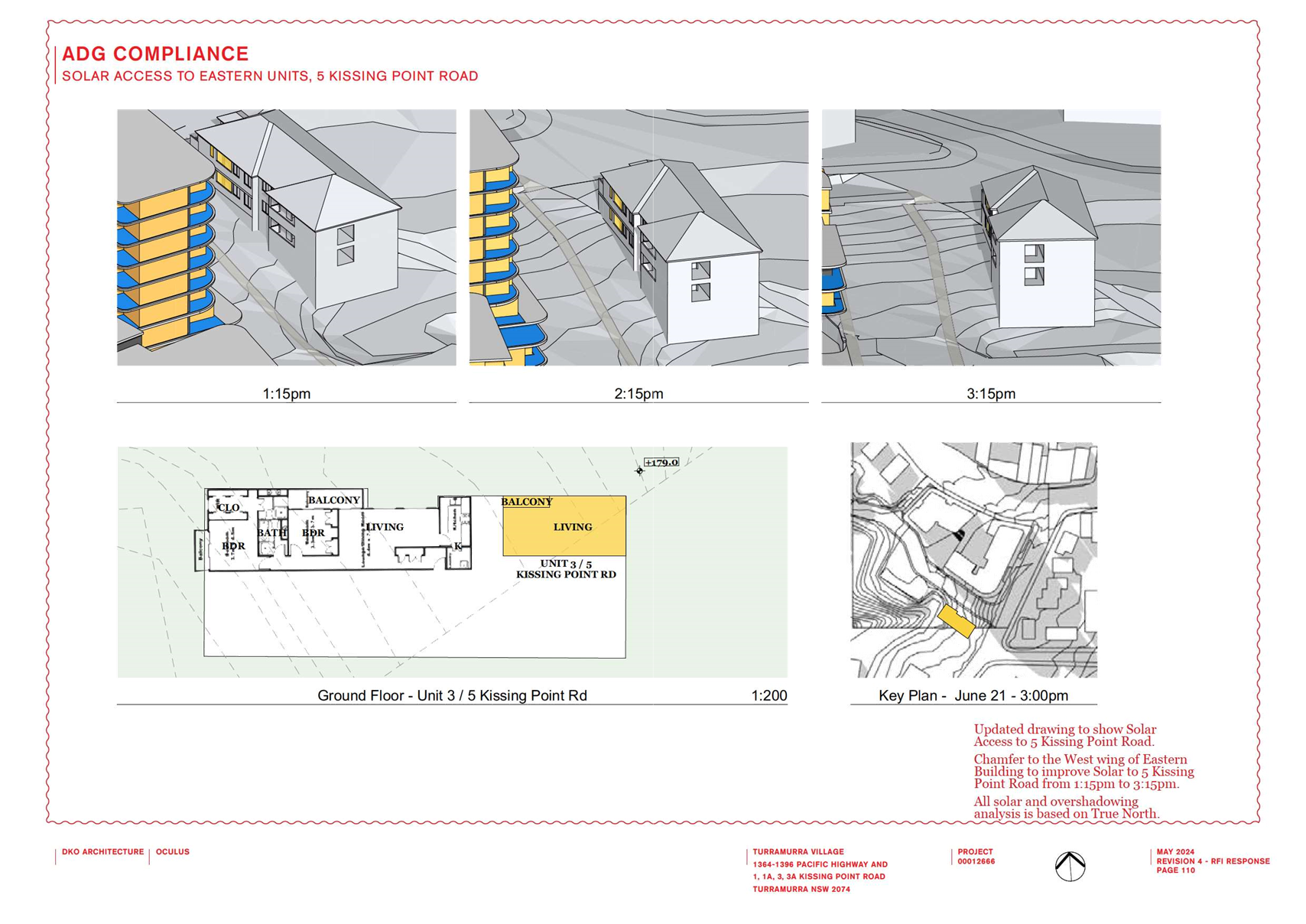
Shadow diagrams
· Remove
the multiple colours that make it difficult to understand the diagrams and
appear deceptive with lighter colours being used for the most impactful shadow
extents.
· There
is no hierarchy in shadow. People cannot differentiate between the shadow from
an 11.5m height and shadow from a 21.3m height building. Shadow is homogenous.
Use one colour to clearly show the extent and outline of the proposal’s
shadow for the total built form. These diagrams need to be easily understood by
the general public.
Planning Agreement
· The Letter of
Offer is to be a stand-alone document. The attached draft Planning Agreement is
to be removed. A draft cannot be created prior to Council agreeing to enter
into the Planning Agreement based on the Letter of Offer.
· The items listed
for consideration within the Letter must clearly explain the public benefit
proposed and not include items for the sole benefit of the development site.
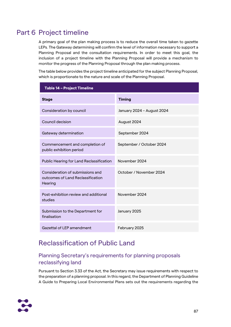
Formal assessment of the Planning Proposal commenced on 31
May 2024. To meet the timeframes stated in the LEP Making Guideline,
this matter must be reported to Council for determination by 29 August 2024;
with the next available meeting being the OMC 13 August 2024.
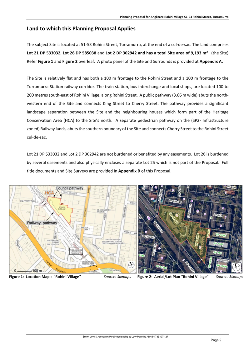
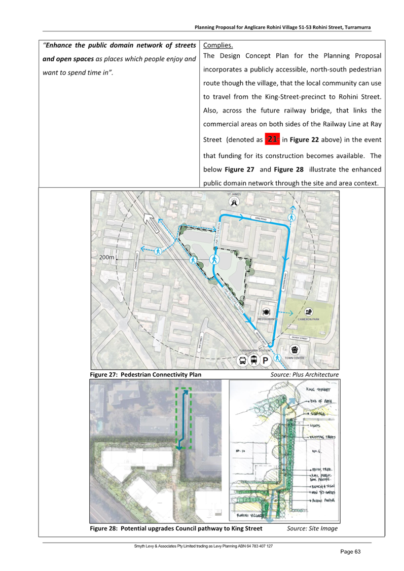
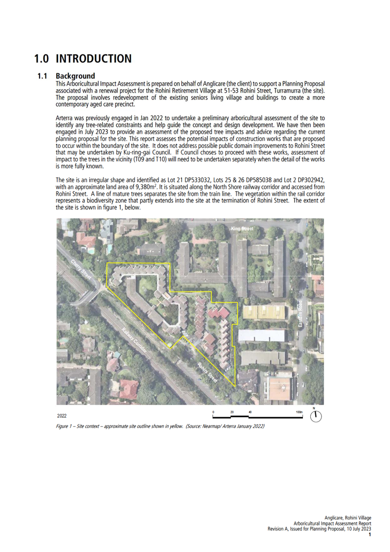
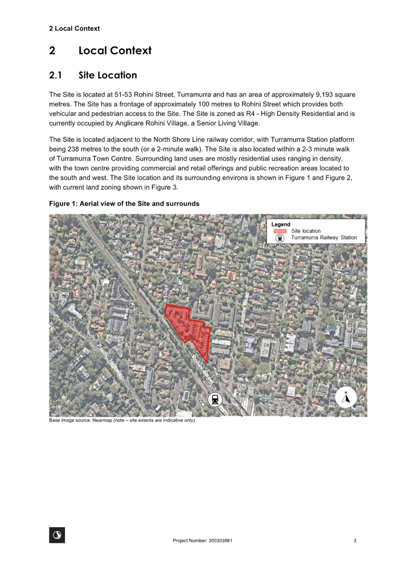
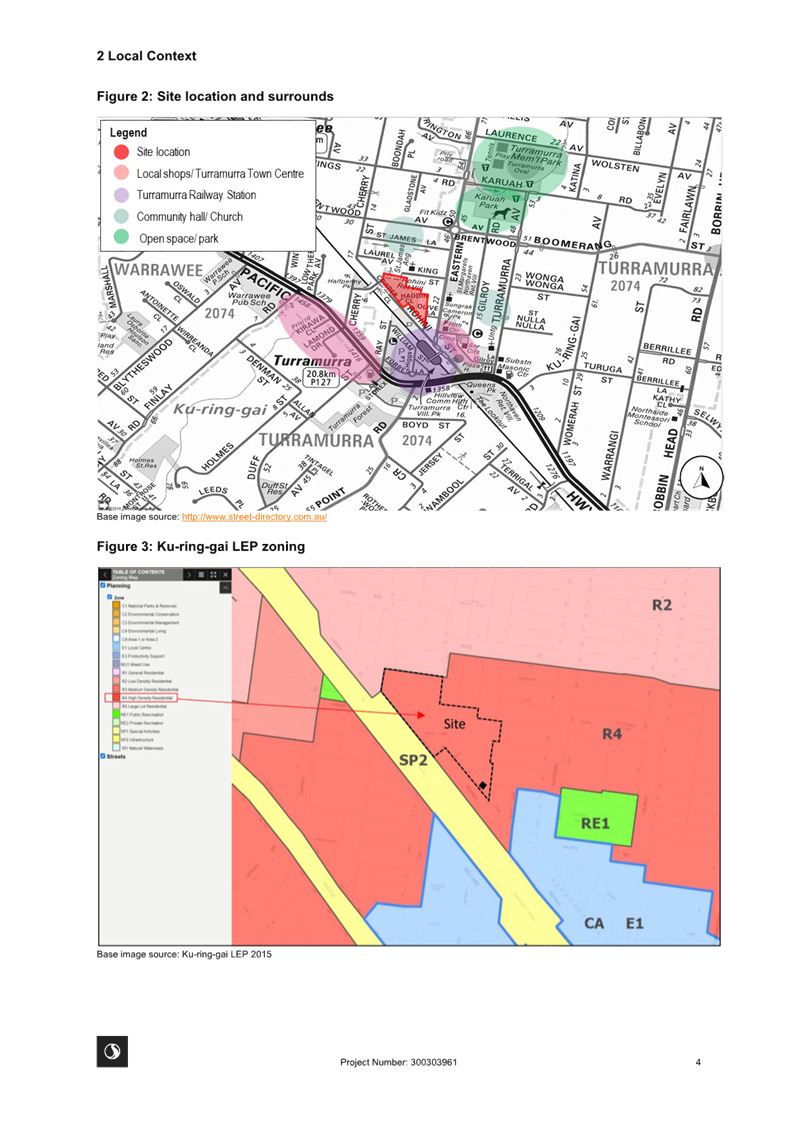
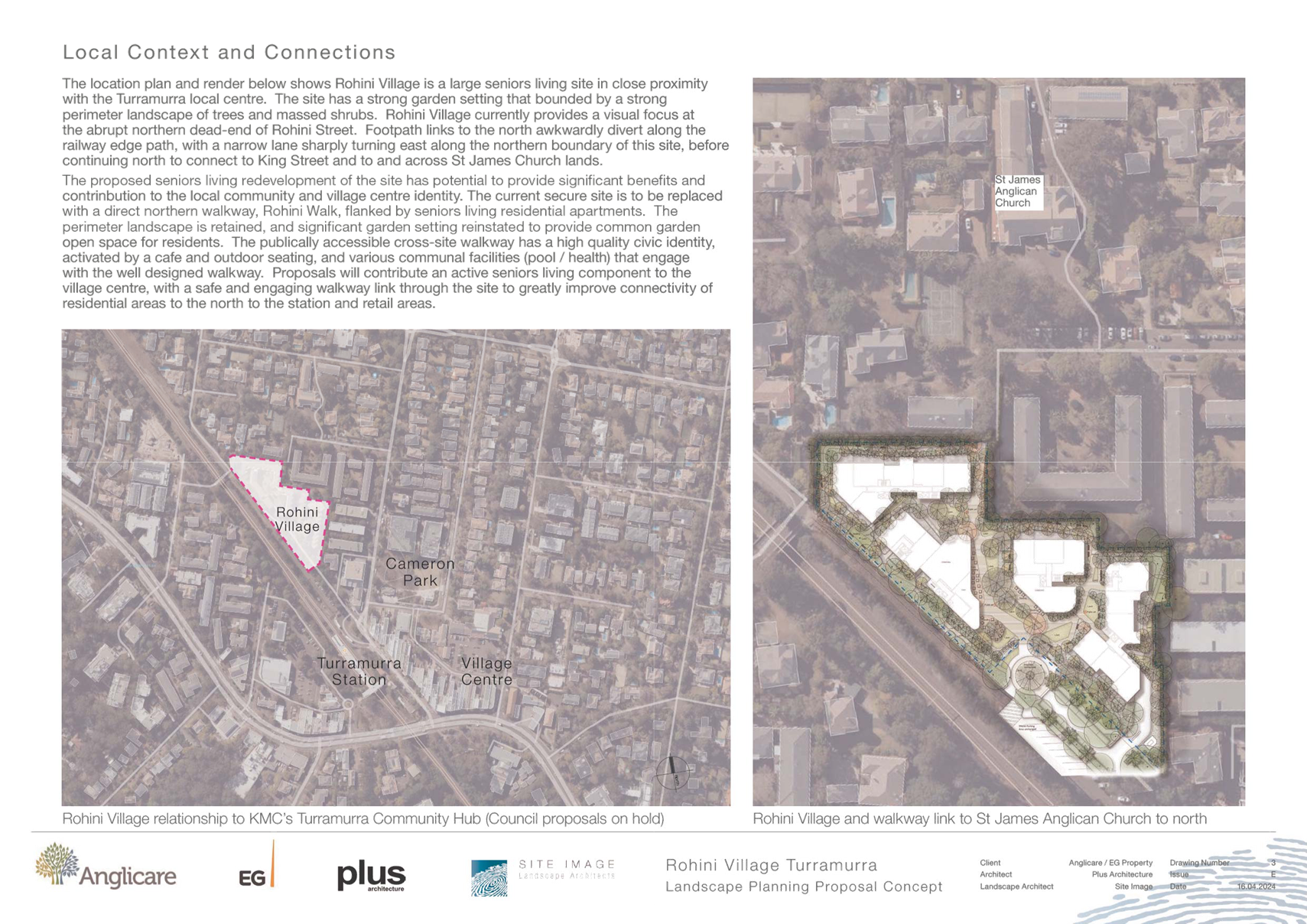
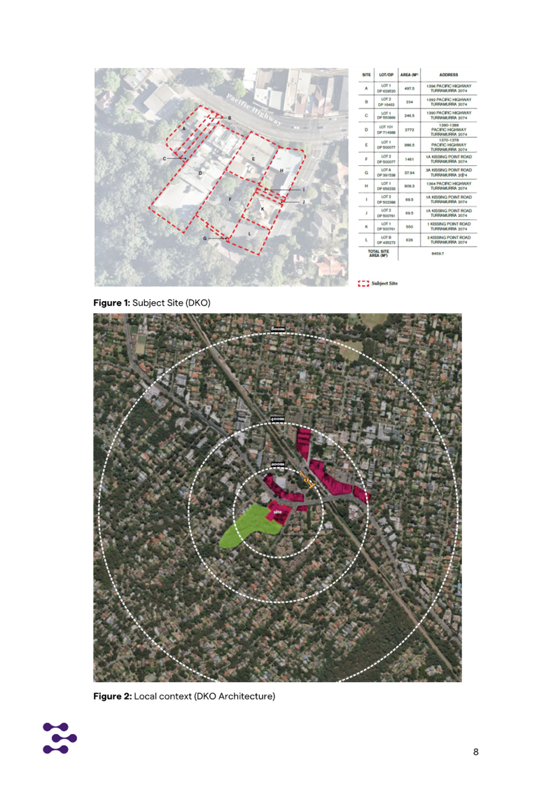
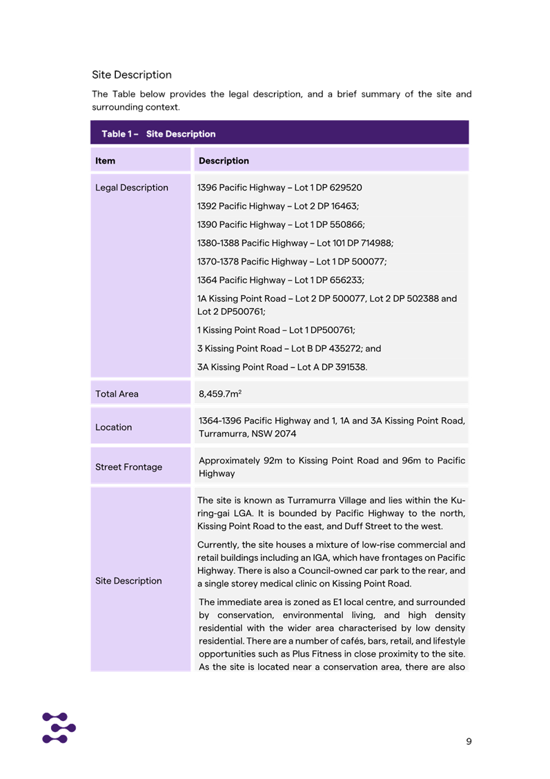
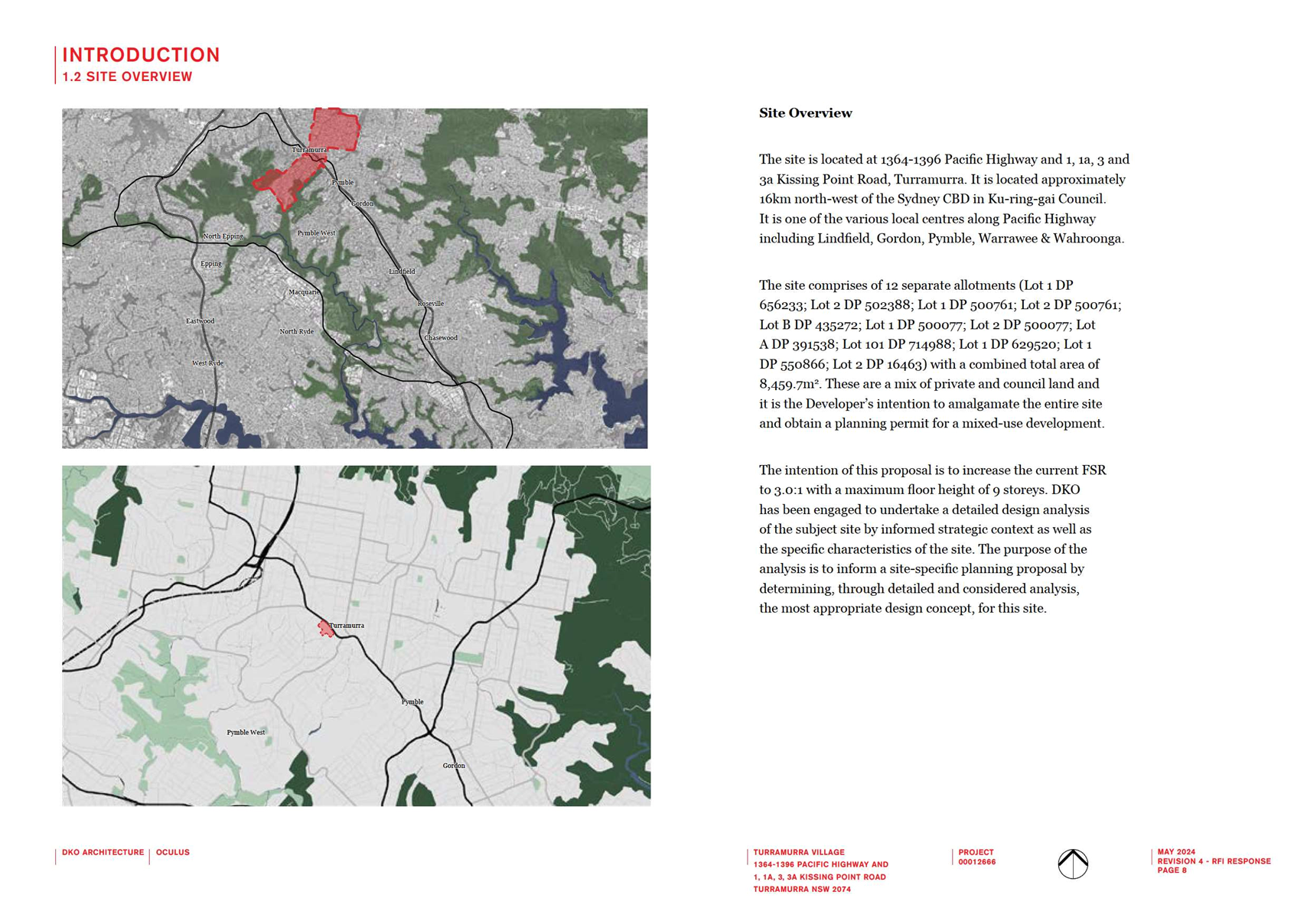
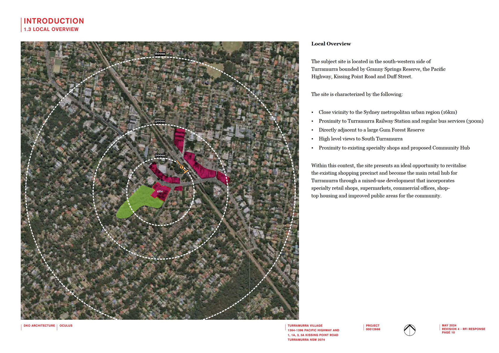
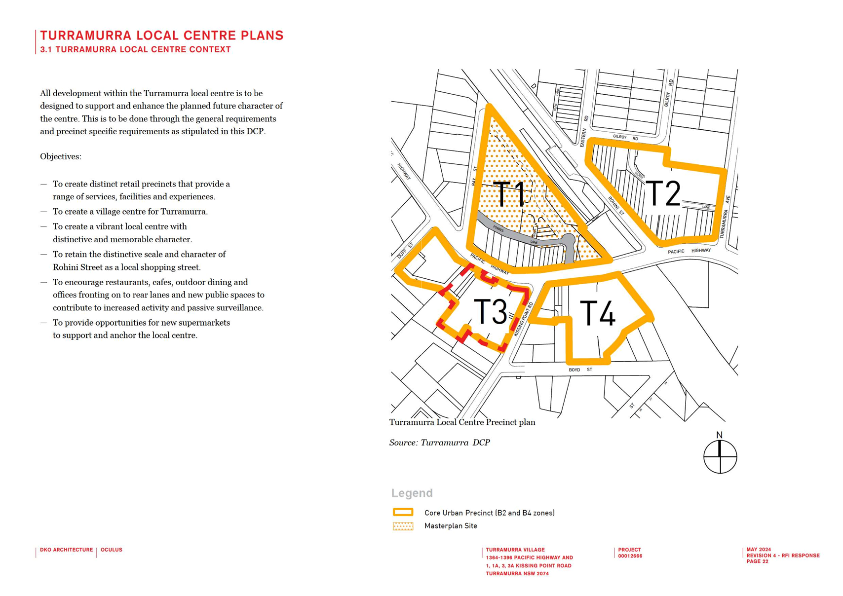
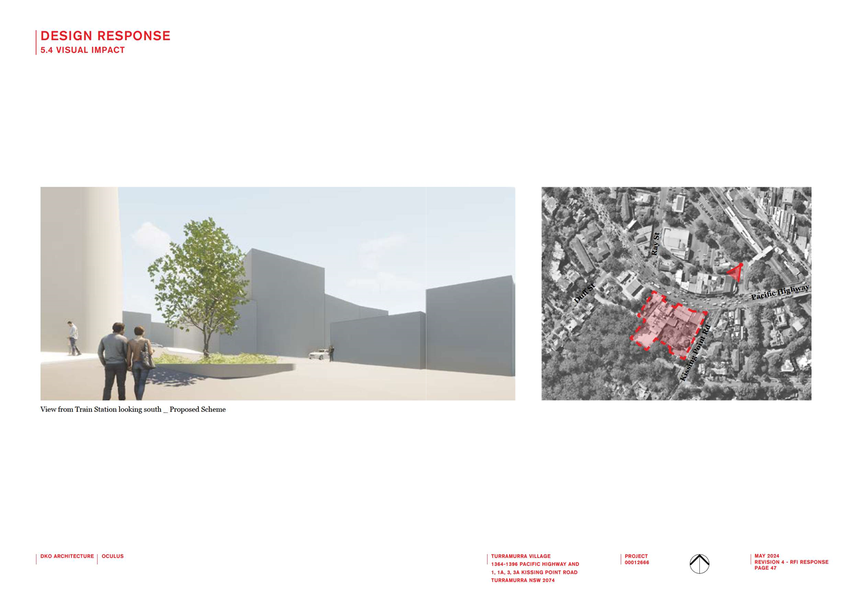
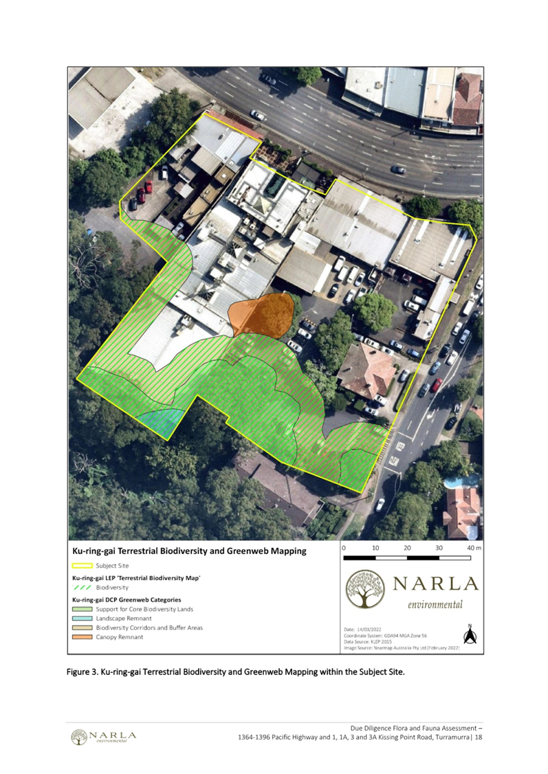
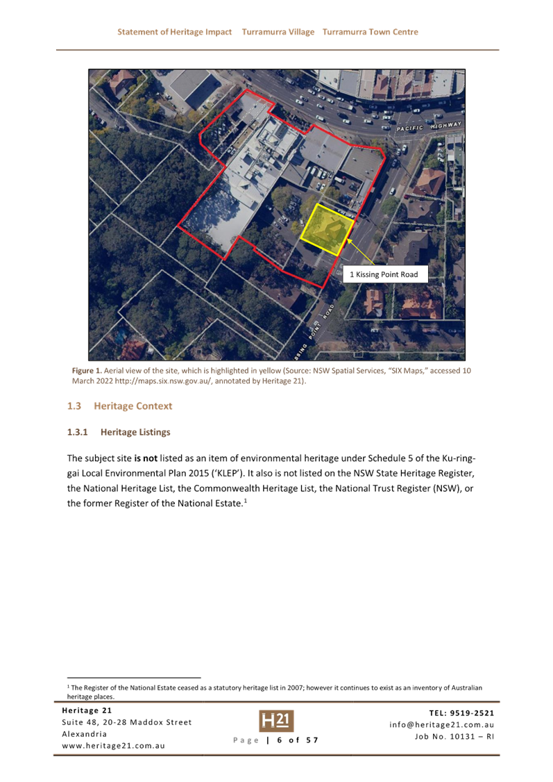
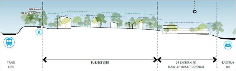
The Site
The land, subject of this Planning Proposal (the Site), is
located at 51-53 Rohini Street, Turramurra at the end of a cul-de-sac. It is
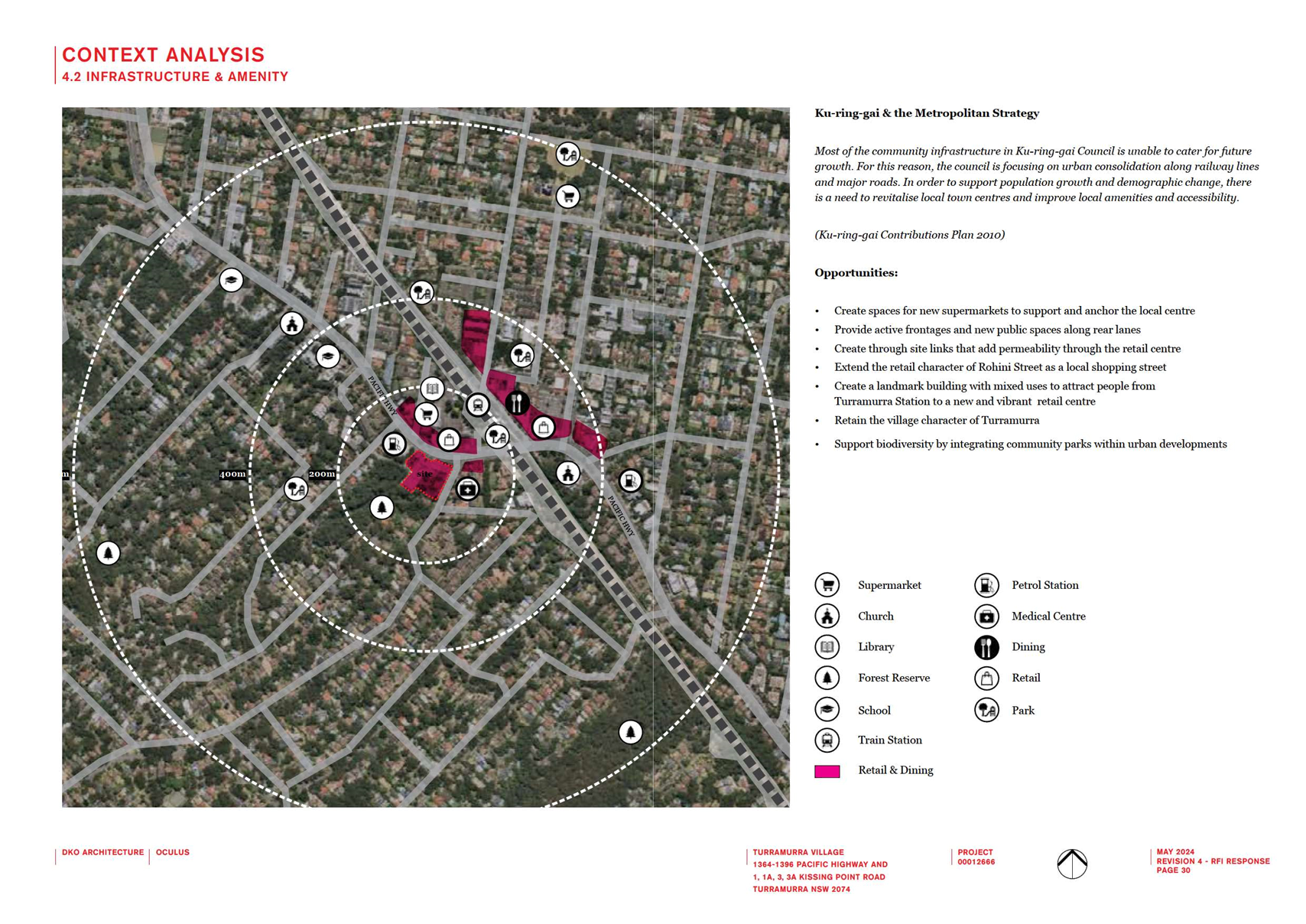
strategically located close to transport links, shops, services and local facilities
including parks, library and gymnasiums.
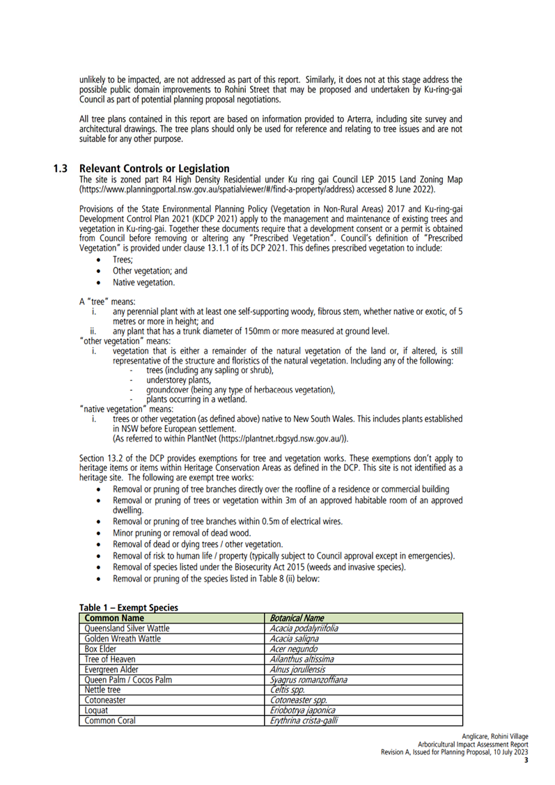
The site is triangular/irregular
in shape and adjoins the North Shore train line. The land is generally flat
with a fall of 4-7m across the site. The land is elevated and slopes down
towards the surrounding lands to the north, east and south.
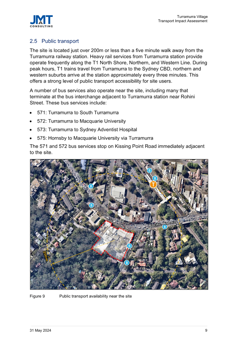
Turramurra train station, bus interchange and local shops
are located within walking distance, 100-200m, south-east of the Site along
Rohini Street. Trains and buses connect to other key local centres such as
Gordon, Lindfield, Chatswood and Hornsby. The Pacific Highway provides
vehicular access to the M1 freeway to the north, Ryde Road connecting to the M2
and M4 freeways linking the western suburbs, and Mona Vale Road connecting to
the Northern Beaches.
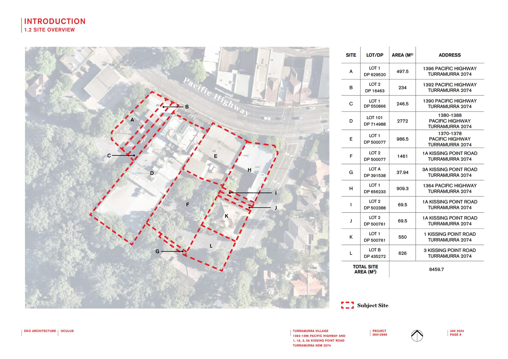
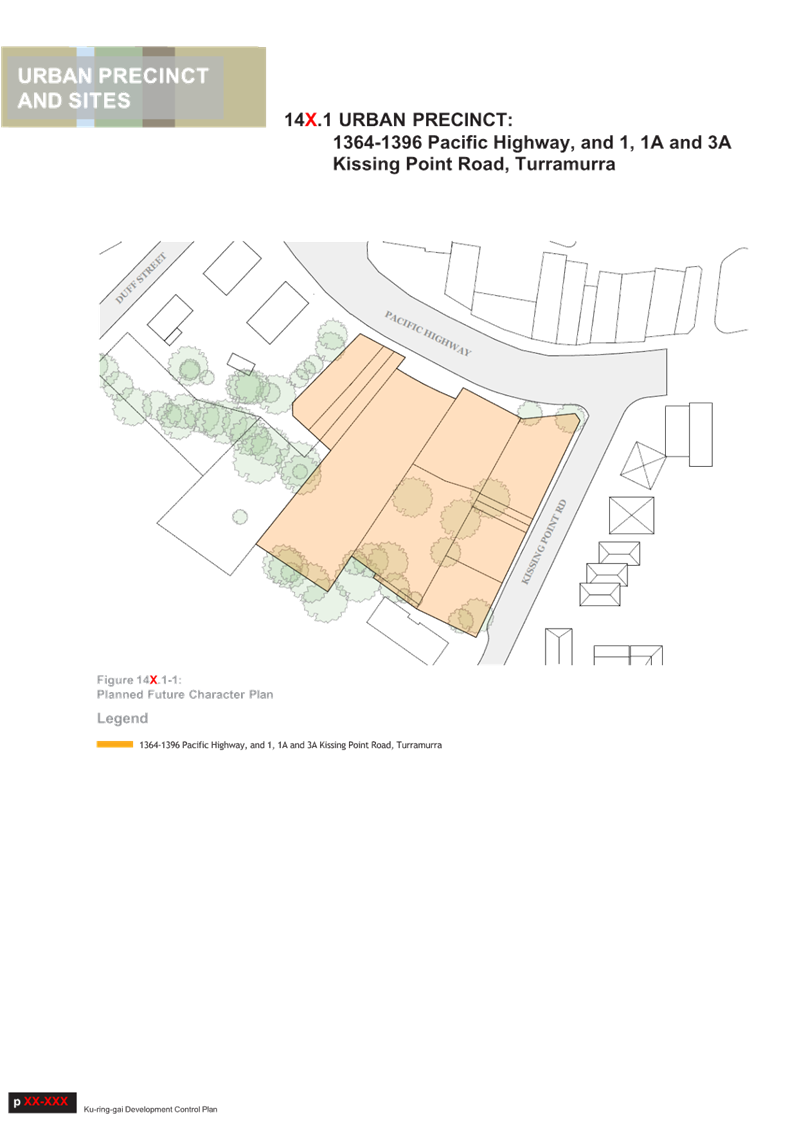
LOCATION MAP (PLUS Architecture)
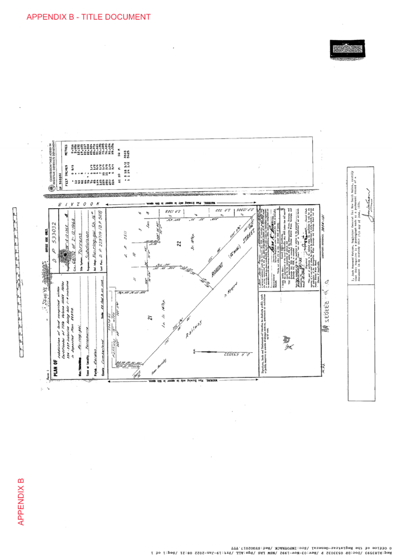
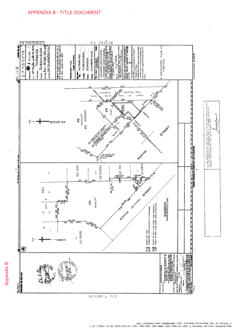
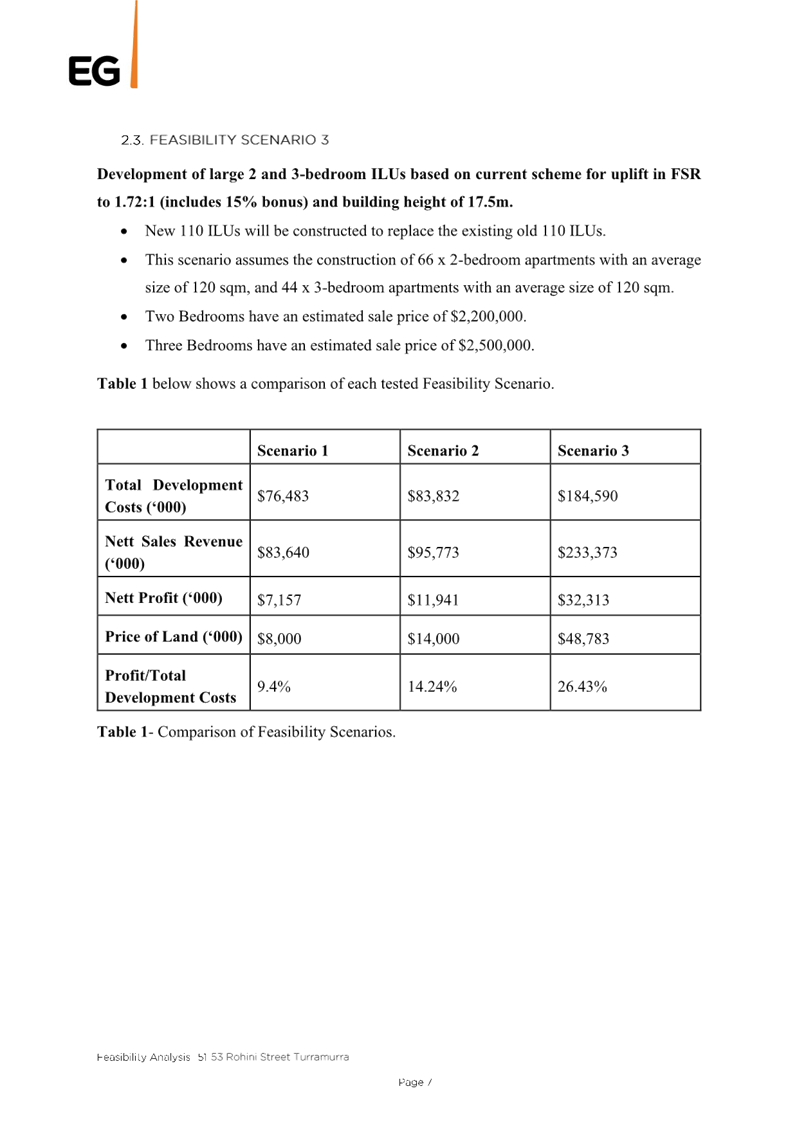
The Site comprises three lots with a total area of 9,193sqm:
· Lot
2 DP 302942
· Lot
21 DP 533032
· Lot
26 DP 585038
Lot 2 DP 302942 and Lot 21 DP 533032 are not burdened nor
benefited by any easements. Lot 26 DP 585038 is burdened by a right of way
along the south-east boundary (45m length and 3m width), and contains a
separate Lot 25 DP 585038 owned by Ausgrid (containing a sub-station). The
Planning Proposal does not seek to discharge any of the existing easements;
however, the Urban Design Report mentions this may occur at a later
date.
The Site has a 100 m frontage to Rohini Street and a 100 m
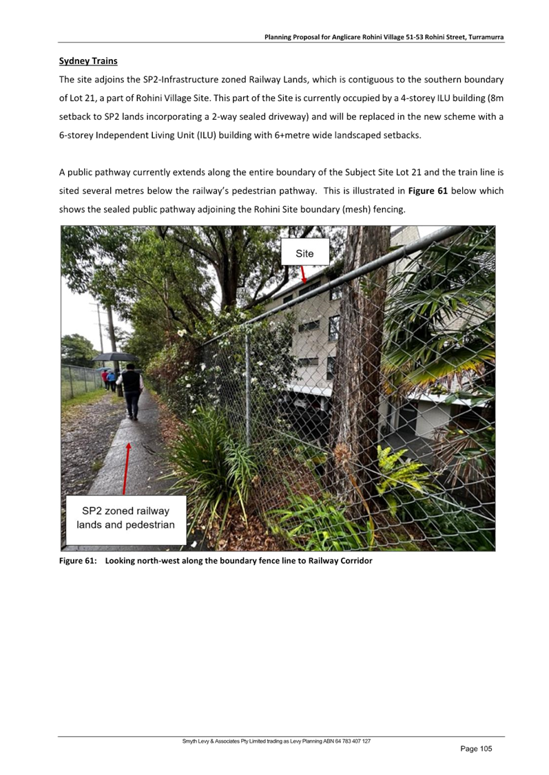
frontage to the Turramurra Station railway corridor.
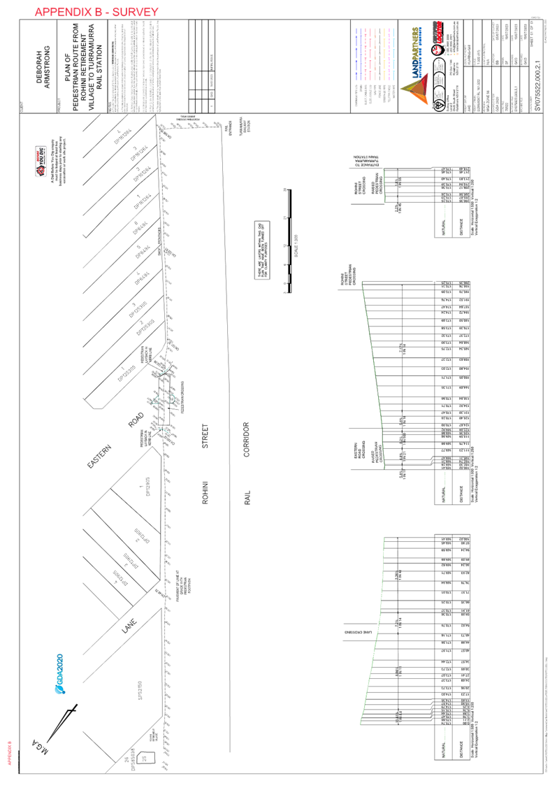
A public pathway on Council owned land abuts the
north-western end of the Site and connects Cherry Street to King Street. A
separate pedestrian pathway on the adjacent Transport for NSW (TfNSW) Railway
lands (zoned SP2- Infrastructure) abuts the south-western boundary of the Site,
connecting Cherry Street to the Rohini Street cul-de-sac.
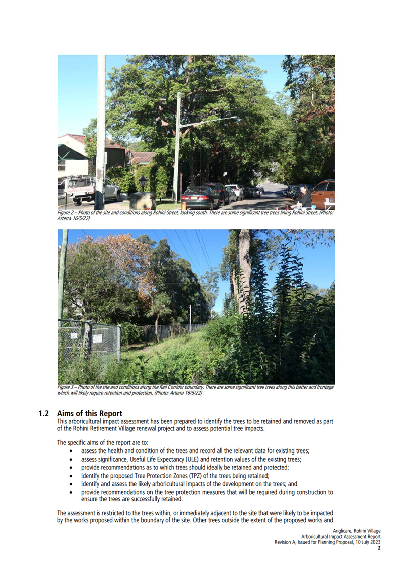
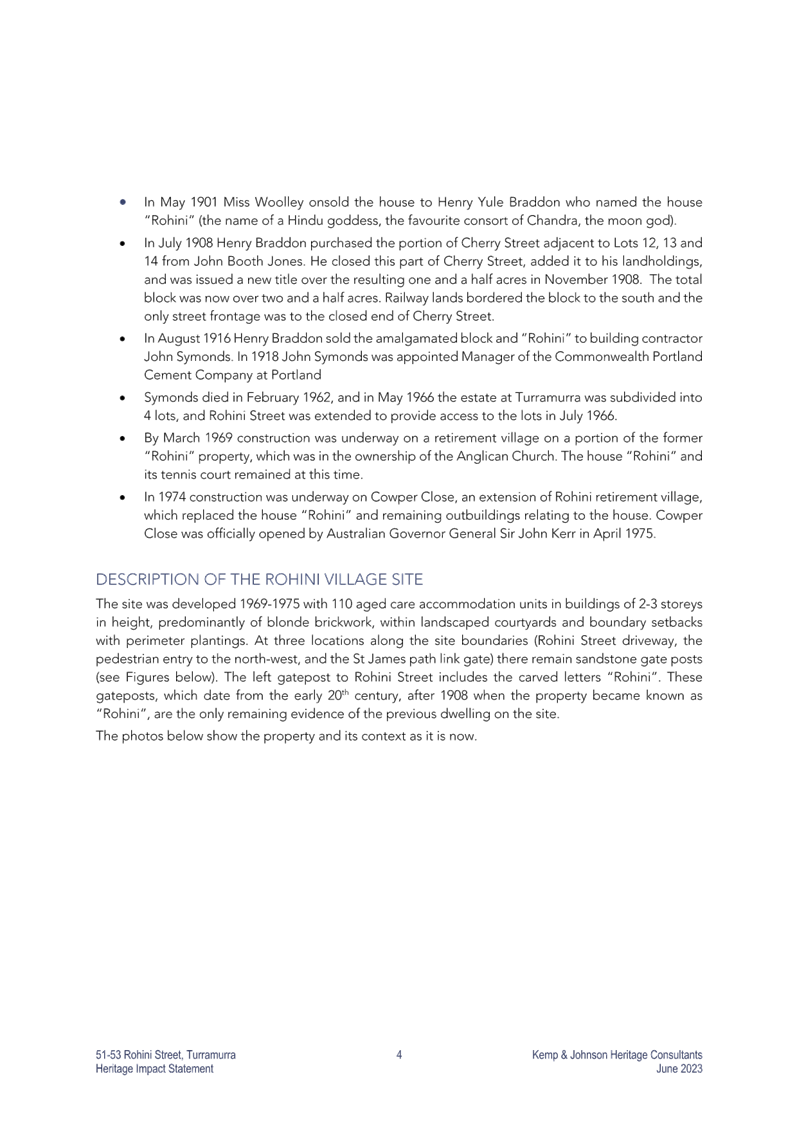
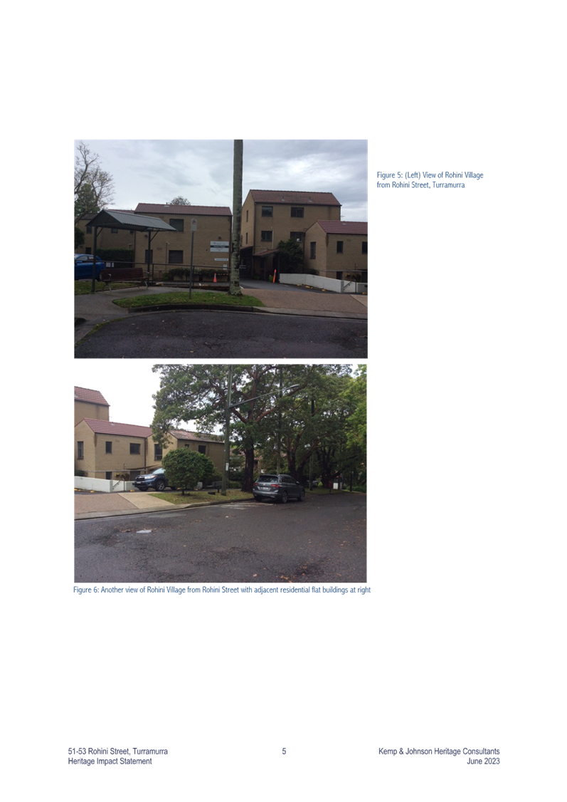
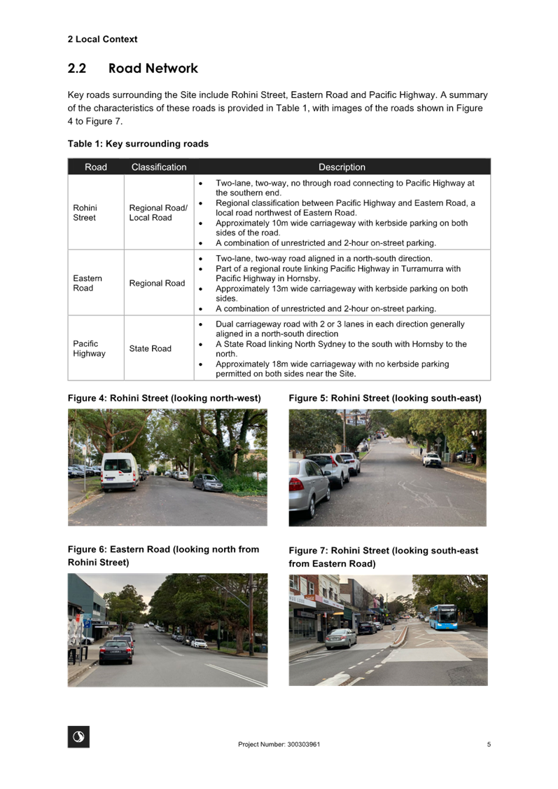
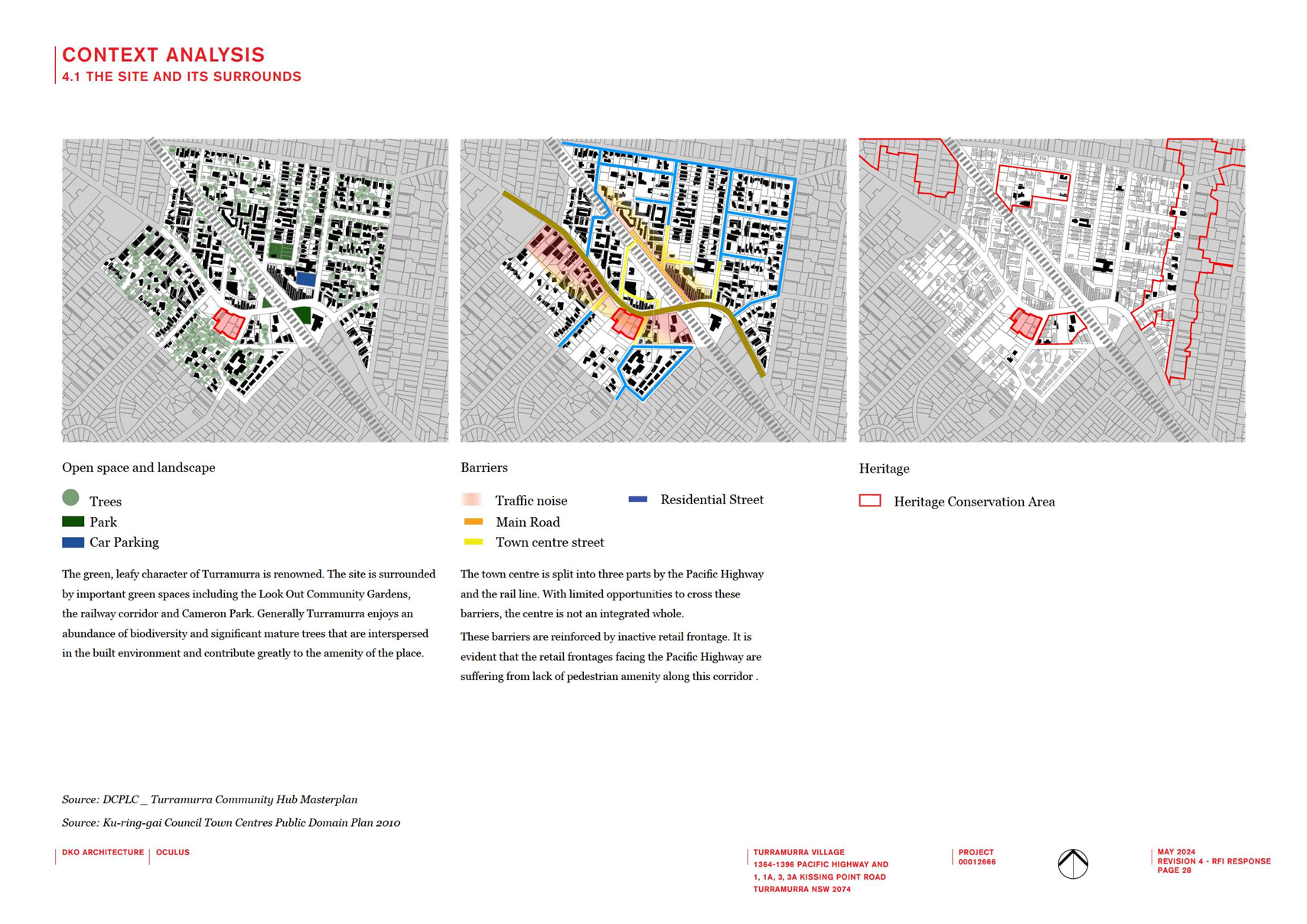
The site is surrounded by residential
development except along the Railway corridor. Adjacent development ranges from
one to three storey houses and apartment buildings. Heritage Conservation Area
C5 (Laurel Avenue/King Street Conservation Area) is located to the Site’s
north and mainly comprises single dwellings.
SITE
DETAILS – land ownership and use
ADJACENT
TO THE SITE: 1-3 storey residential development on neighbouring land and HCA C5
to the north
The Planning Proposal
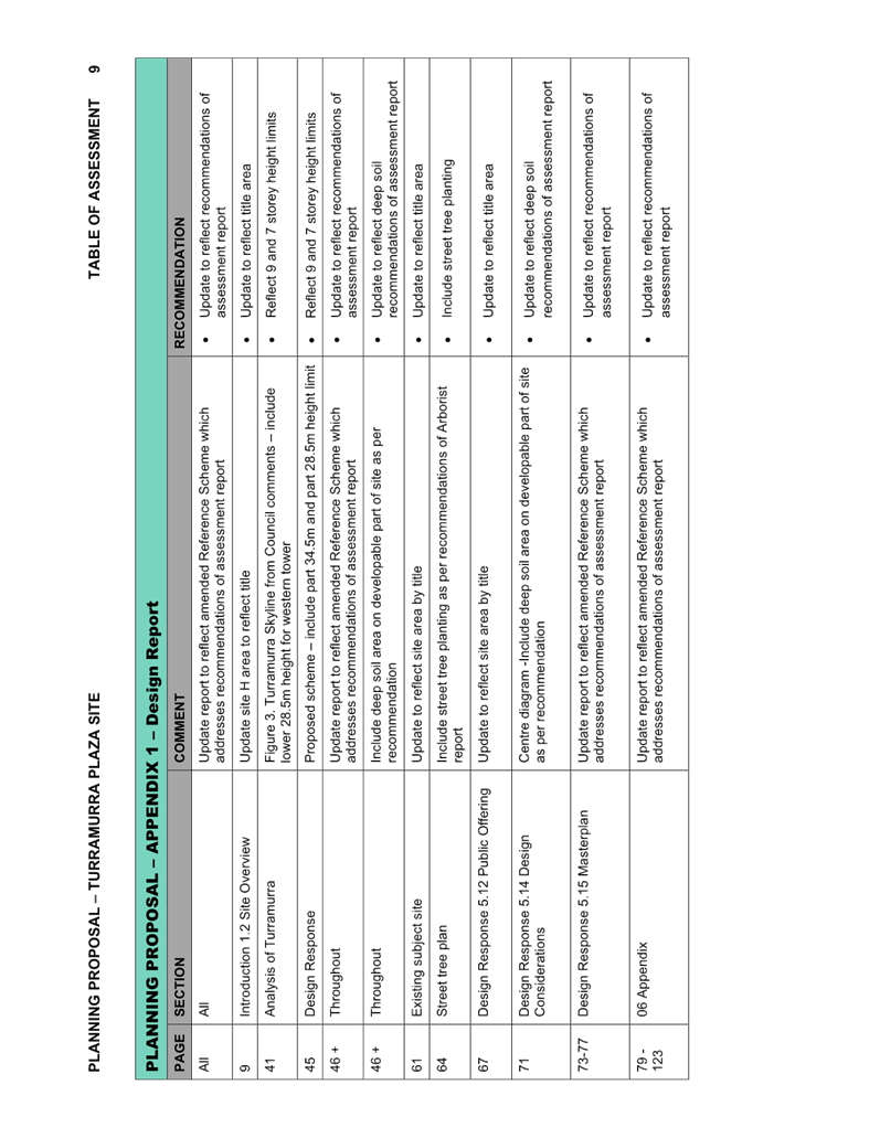
This Report presents the assessment of the Planning Proposal
with full details provided in the Table of Assessment at Attachment
A1.
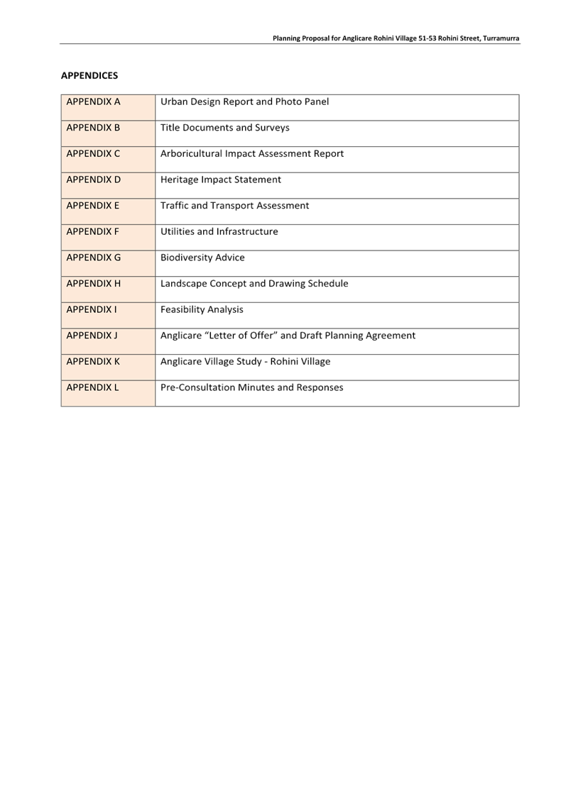
A copy of the proponent’s
Planning Proposal and its Appendices are included at Attachments
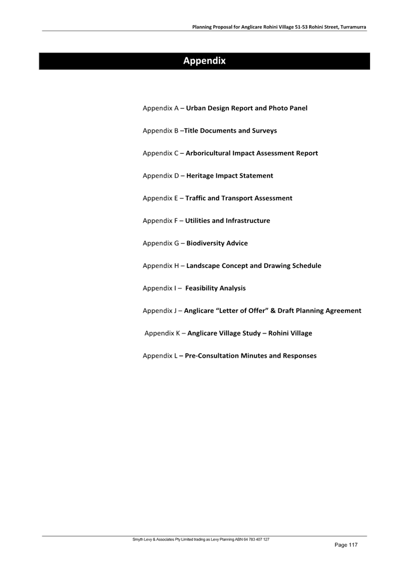
A2-A14 and comprise the following:
· Planning Proposal
Anglicare “Rohini Village” 51-53 Rohini Street, Turramurra
o Appendix A - Urban Design
Report and Site Photo Panel
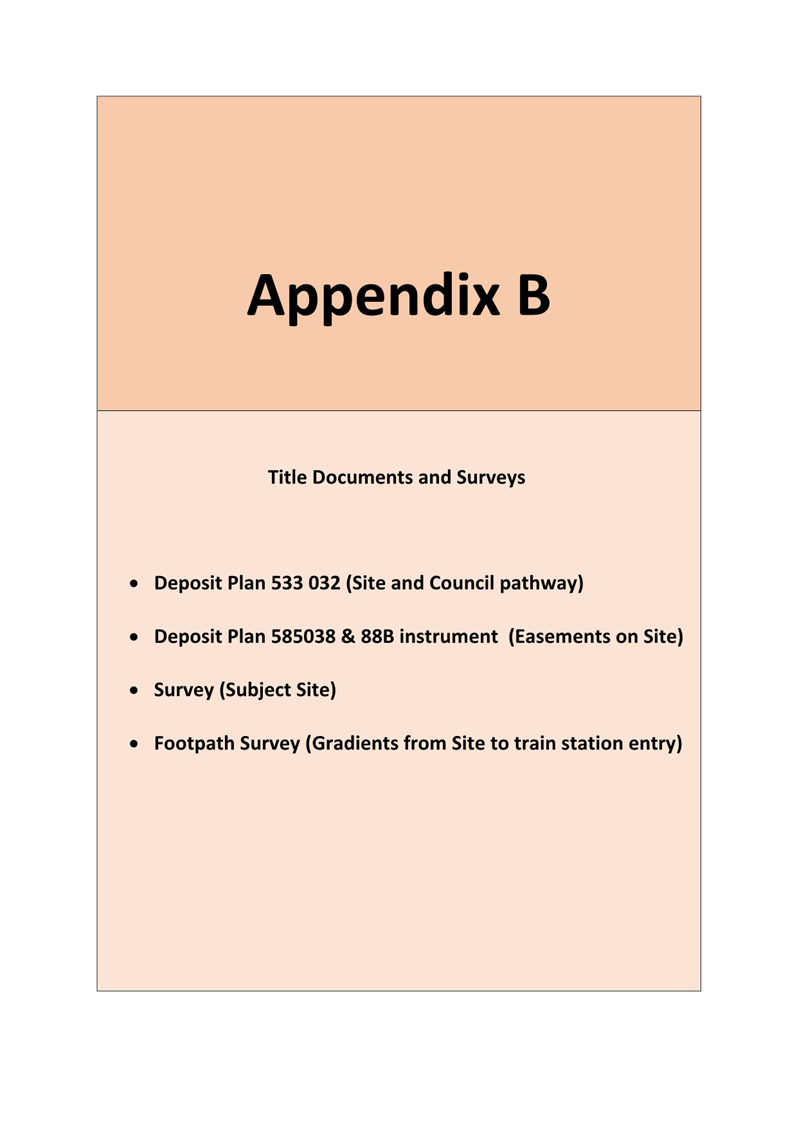
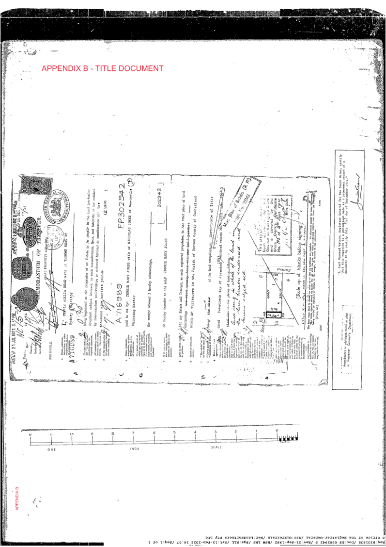
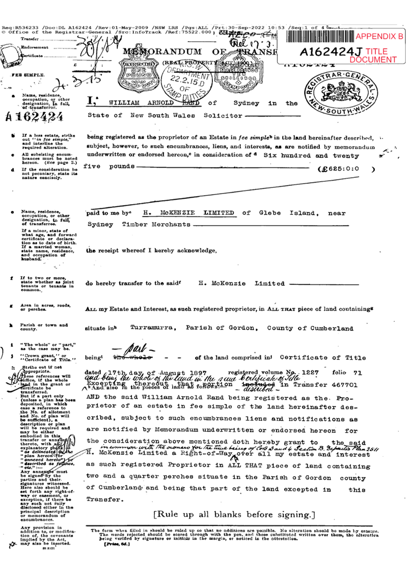
o Appendix B - Title Documents
& Surveys
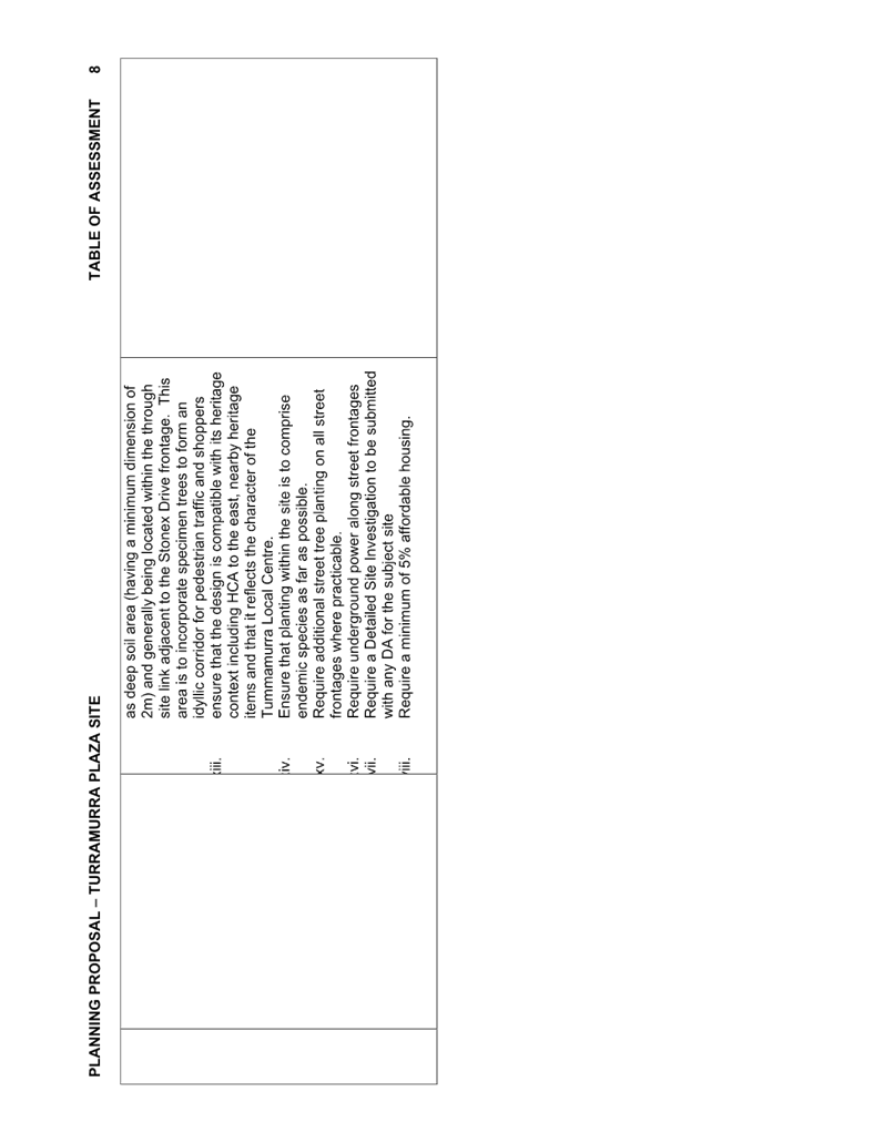
o Appendix C - Arboricultural
Impact Assessment Report
o Appendix D - Heritage Impact
Statement
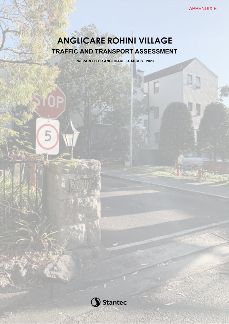
o Appendix E - Traffic &
Transport Assessment
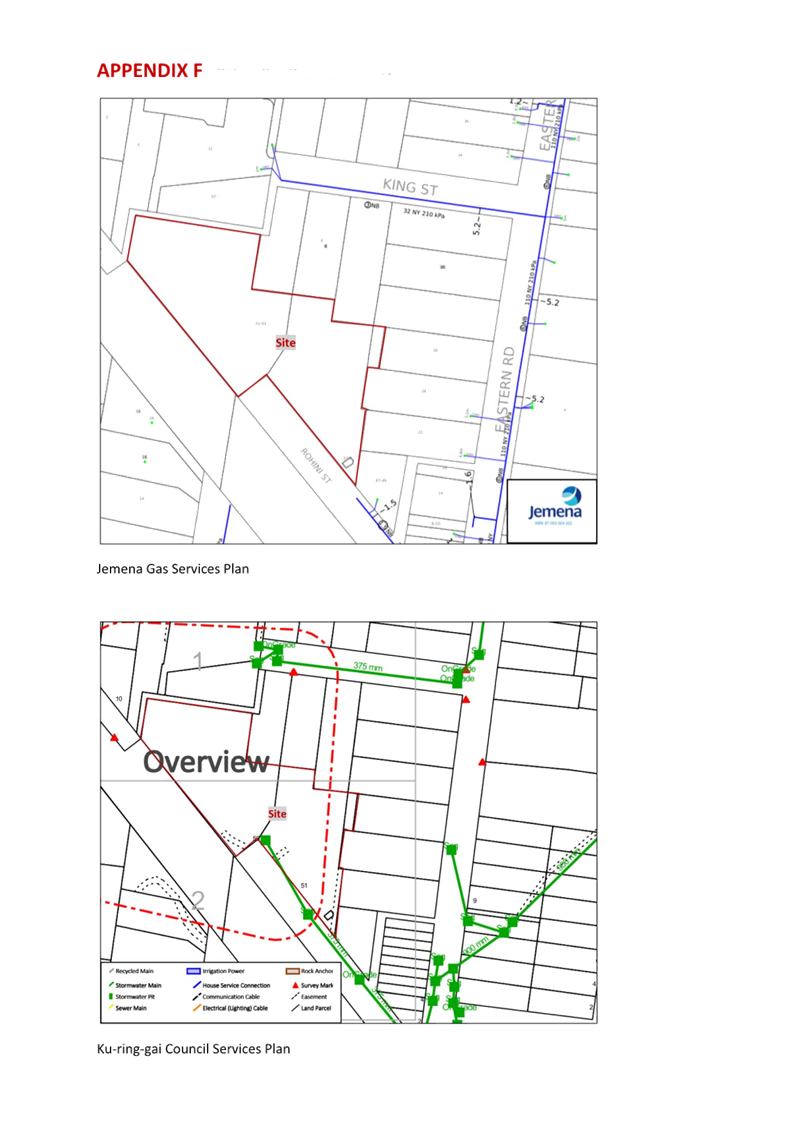
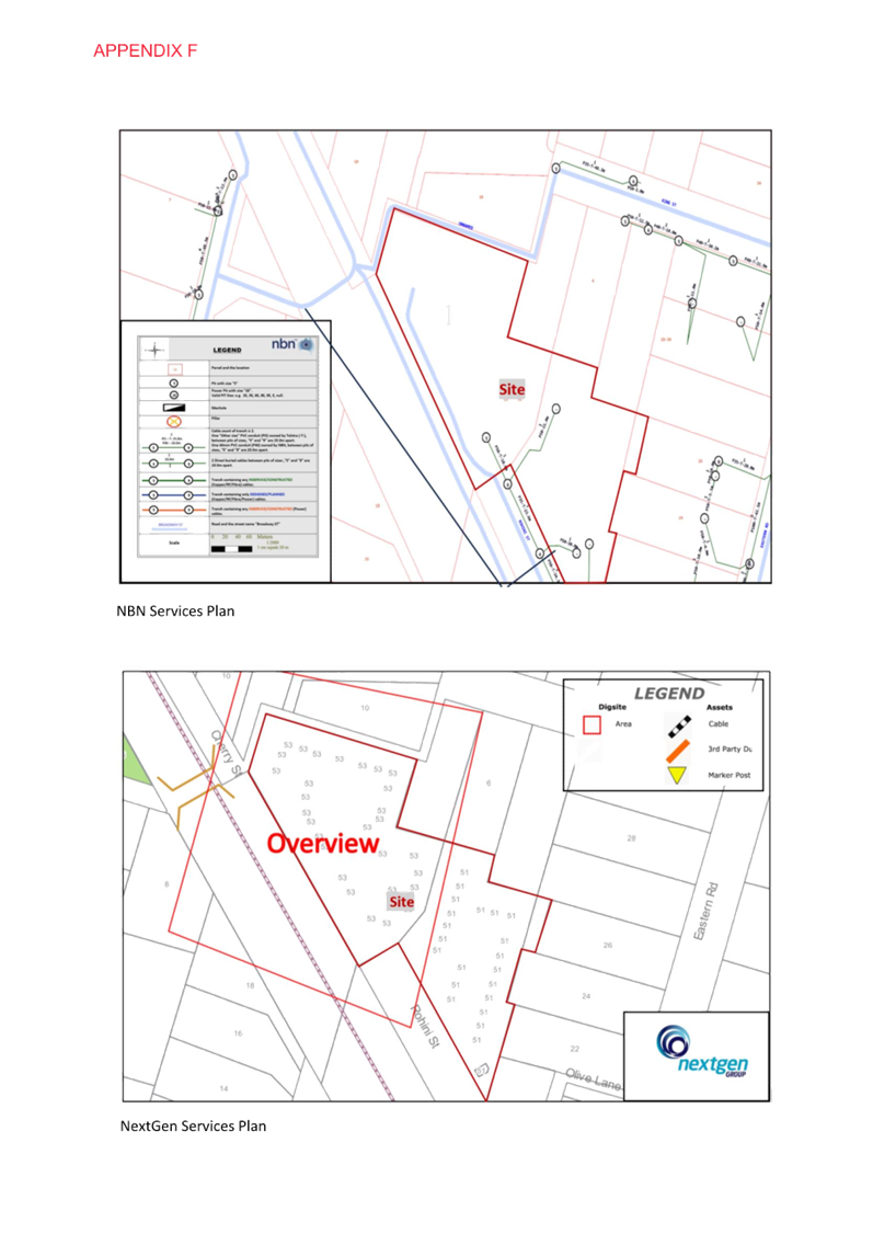
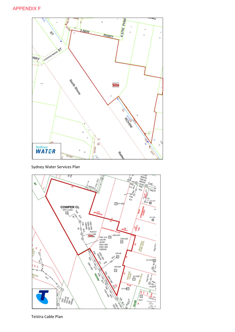
o Appendix F - Utility and
Infrastructure Plans
o Appendix G - Biodiversity
Advice
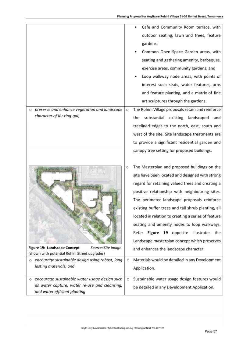
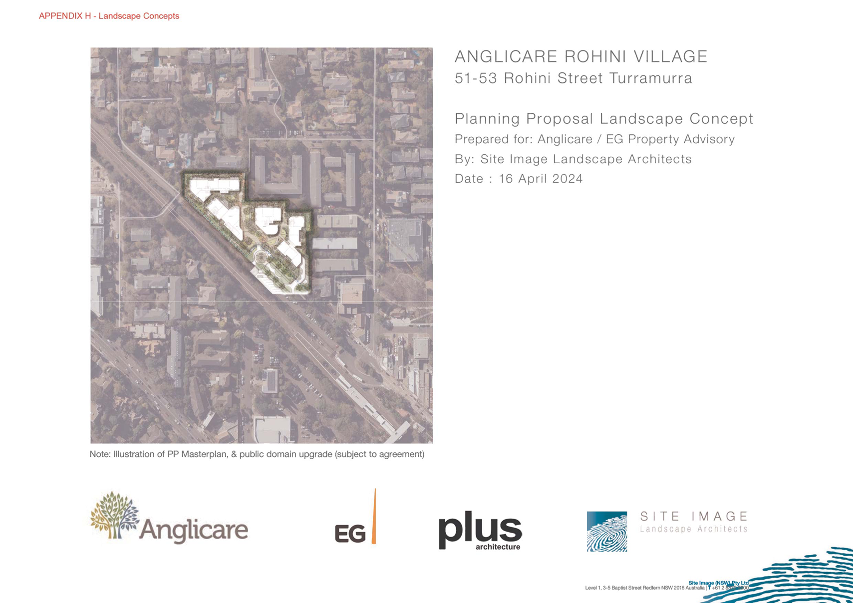
o Appendix H - Landscape Concept
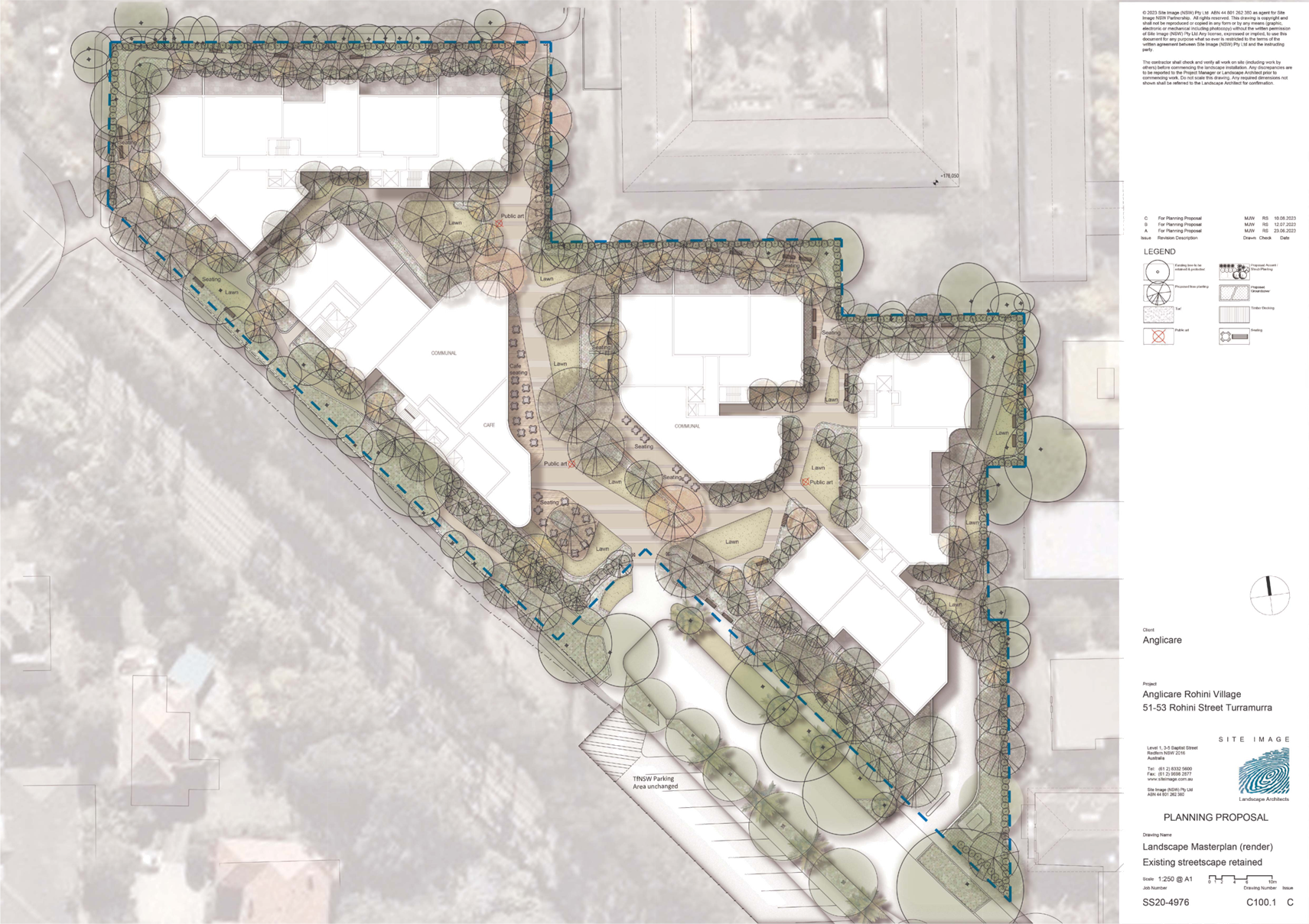
& Drawing Schedule
o Appendix I - Feasibility
Analysis
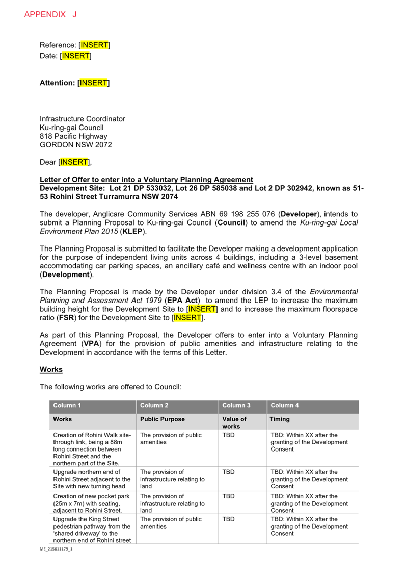
o Appendix J - Letter of Offer
and Draft Planning Agreement - Rohini Village
o Appendix K - Rohini Village
Study
o Appendix L - Pre-Consultation
Minutes and Responses
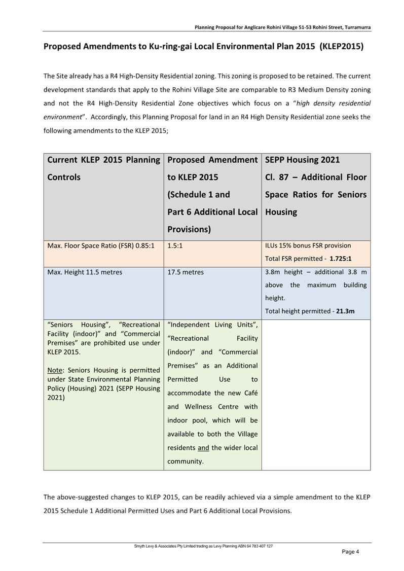
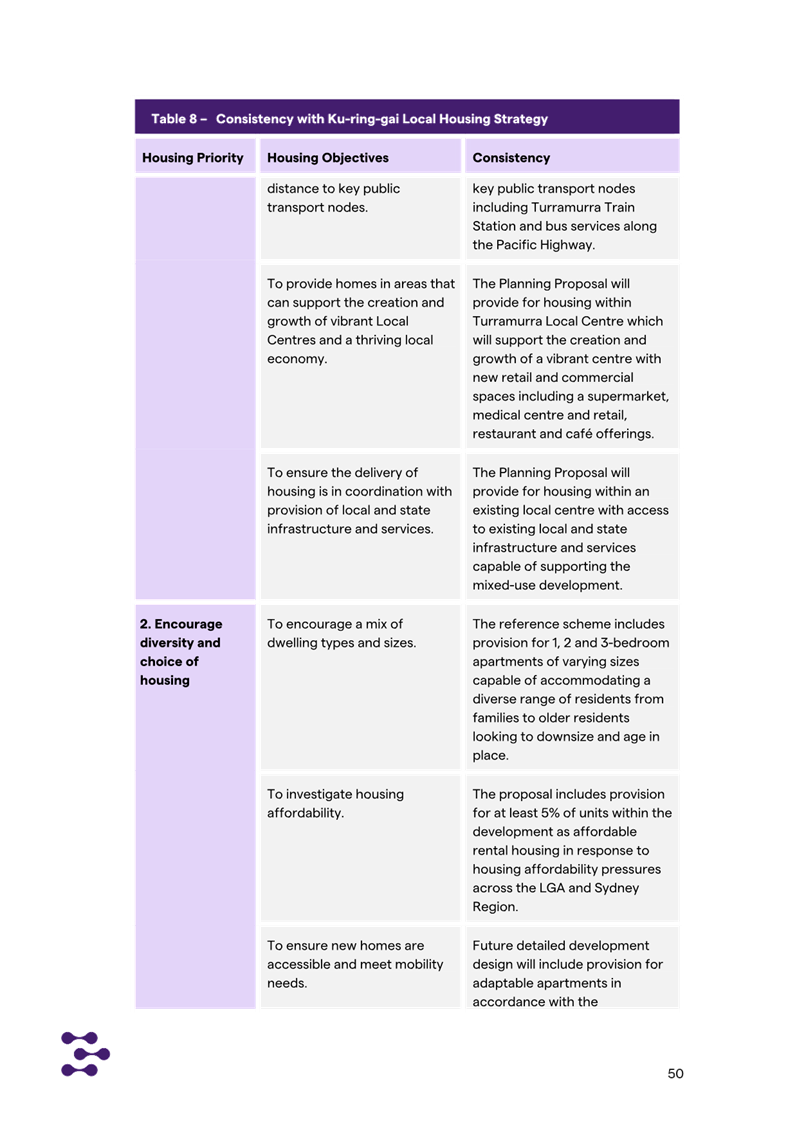
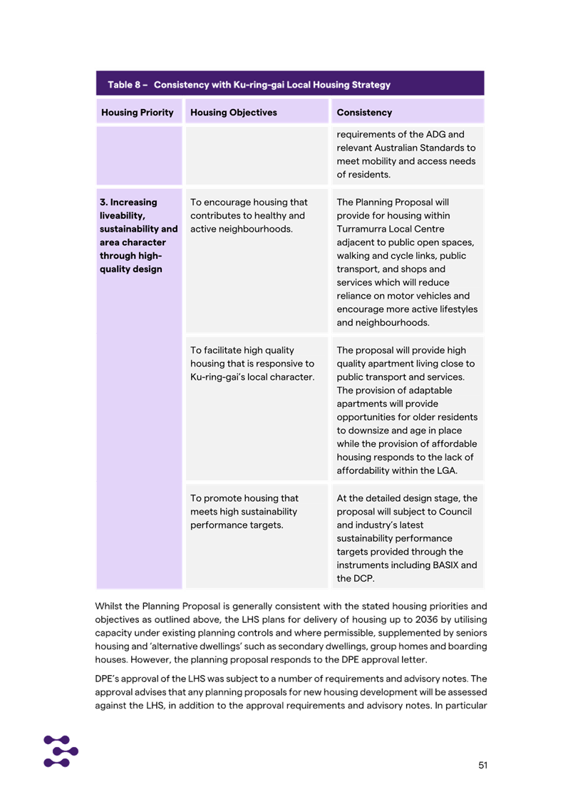
Planning Standards
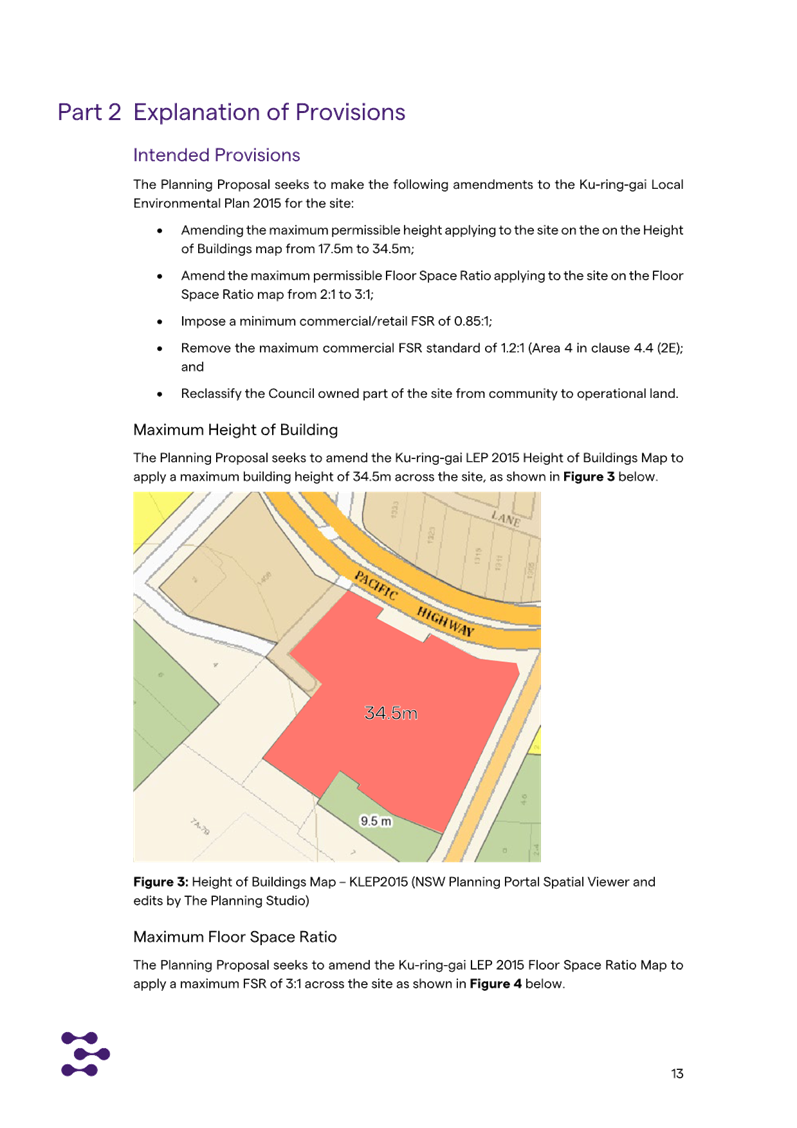
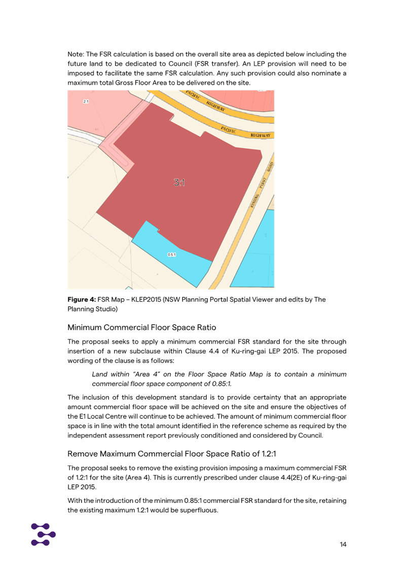
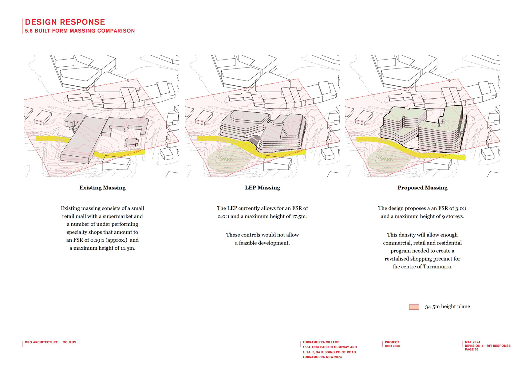
The Planning Proposal seeks to make the following amendments
to the Ku-ring-gai Local Environmental Plan 2015 (KLEP 2015):
1. increase
the maximum Floor Space Ratio (FSR) from 0.85:1 to 1.5:1 (the Housing SEPP
bonus provisions will result in a final FSR of 1.725:1);
2. increase the maximum Height of
Building from 11.5m to 17.5m/5 storey (the Housing SEPP bonus provisions will
result in a final Height of 21.3m/6 storey);
3. include
certain Local Provisions that allow the inclusion of a café (Commercial
use) and a wellness centre with an indoor pool (Recreational Facility (Indoor)
use).
Concept Design Standards
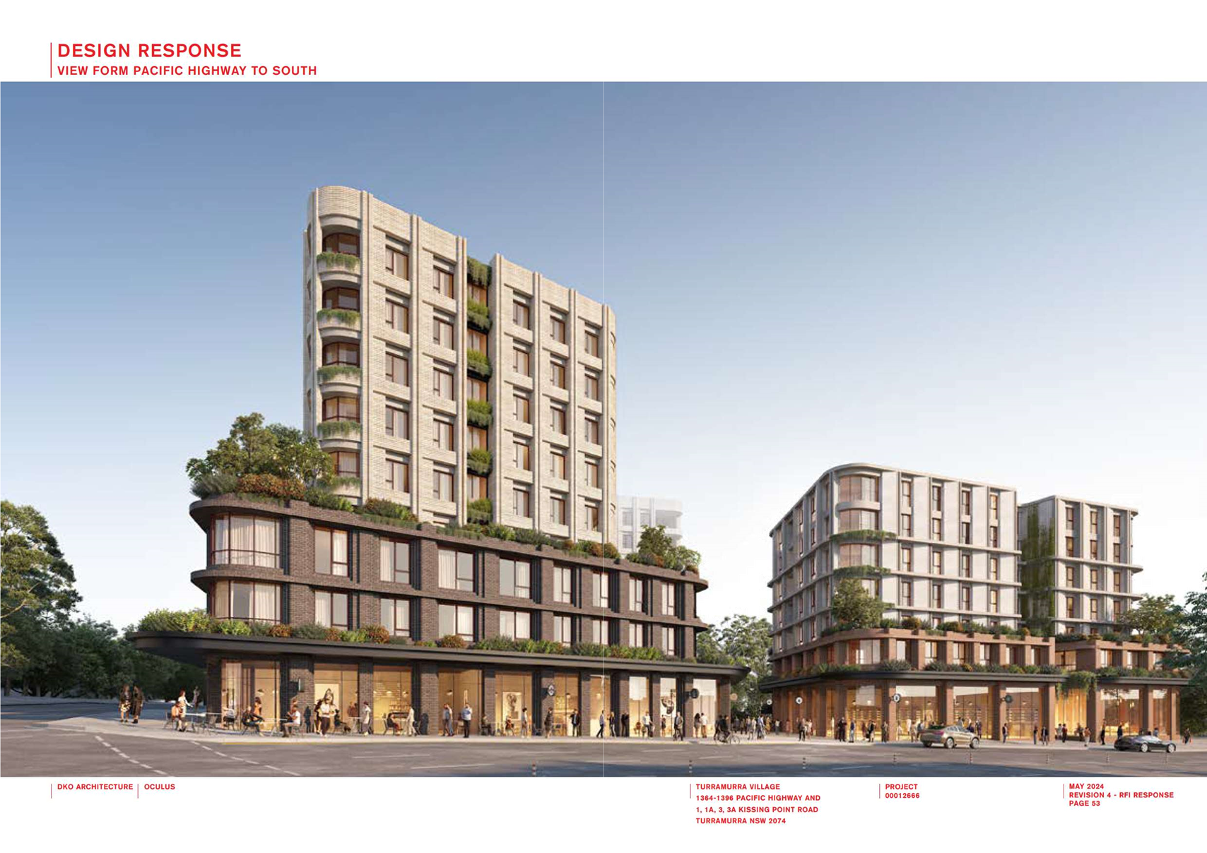
The Planning Proposal is supported by an Urban Design
Report prepared by Plus Architecture. This presents a concept design for
the site.
The purpose of the Urban Design Report concept design
is to demonstrate that a scheme which represents the proposed maximum Height,
FSR and Additional Uses can readily be accommodated on the site, and can comply
with applicable controls and requirements without resulting in any unreasonable
environmental impacts.
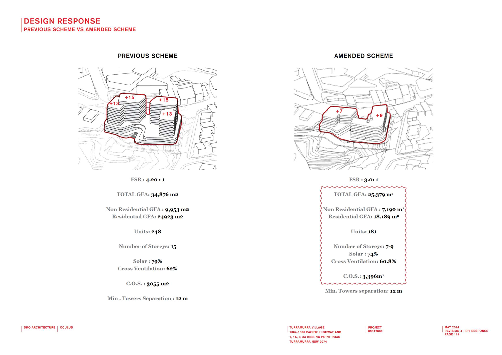
The key development parameters determining the concept
design are indicated in the below Table:
|
|
PROPOSED
STANDARDS
|
|
Site Area
|
· 9,193 m2
|
EXISTING
STANDARDS
|
|
Height
|
· 6 storey including the SEPP bonus
|
3 storey
|
|
FSR
|
· 1.725:1 including the SEPP bonus
|
0.85:1
|
|
Units
|
· 110 Independent
Living Units
66
x 2 bedroom units
44
x 3 bedroom units
|
110 Independent
Living Units
82 x 1 bedroom
units
24 x 2 bedroom
units
2 x 3 bedroom units
|
|
Other
facilities
|
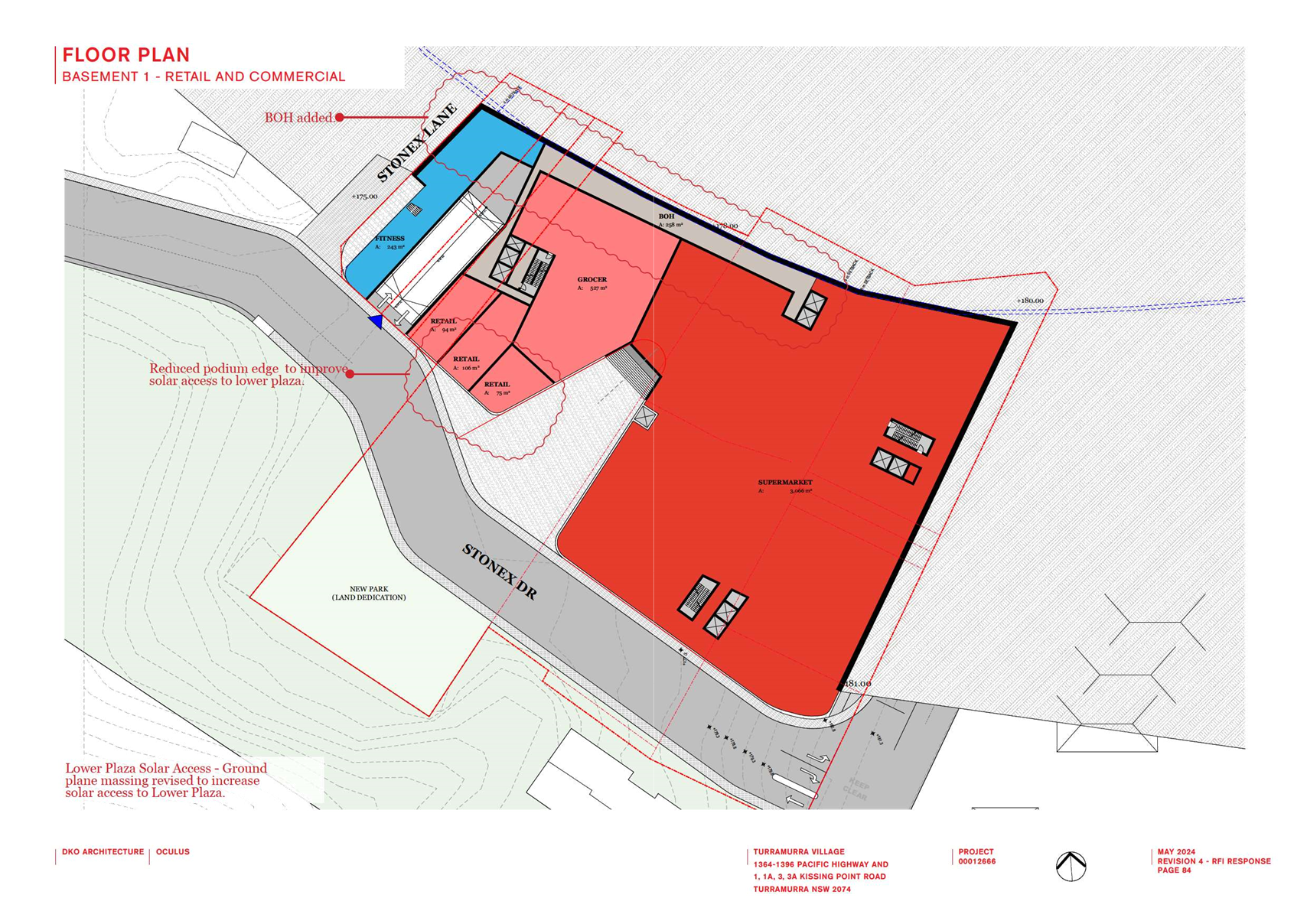
· 700sqm Internal
Communal Space (including 100sqm café)
Chapel,
pool, clinic, salon, library, café, multi-purpose space, communal
rooftop and ground level gardens.
Communal
open space 25% site area
|
Lounge areas,
library, clinic, salon, dining area, communal gardens, communal laundry
|
|
Car parking
|
· 2-3 level basement parking
· Total parking spaces – 199
Residential
parking - 171
Emergency
parking – 1
Visitor
parking – 18
Staff
parking – 8
Car
share space - 1
Note
– these standards are compliant with the SEPP (Housing) 2021
requirements
|
42 spaces
|
|
Gross Floor
Area
|
· Total: 15,850 sqm
|
|
Solar access
|
· 77/110 units achieve 2 hour solar access – 70%
· 22/110 units receive less than 2 hour solar access
· 11/110 receive
no solar access
Note – these standards
are compliant with the SEPP (Housing) 2021 requirements
|
|
Natural
ventilation
|
· 86/110 units have natural ventilation – 78%
· 24/110 units do
not have natural ventilation
Note – these standards
are compliant with the SEPP (Housing) 2021 requirements
|
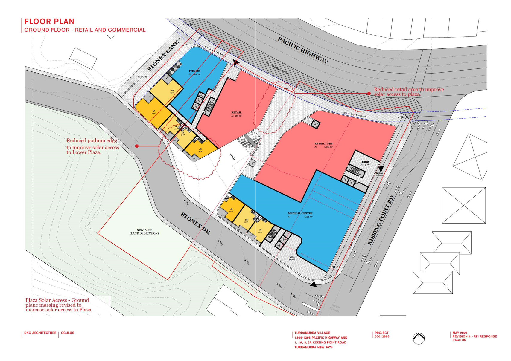
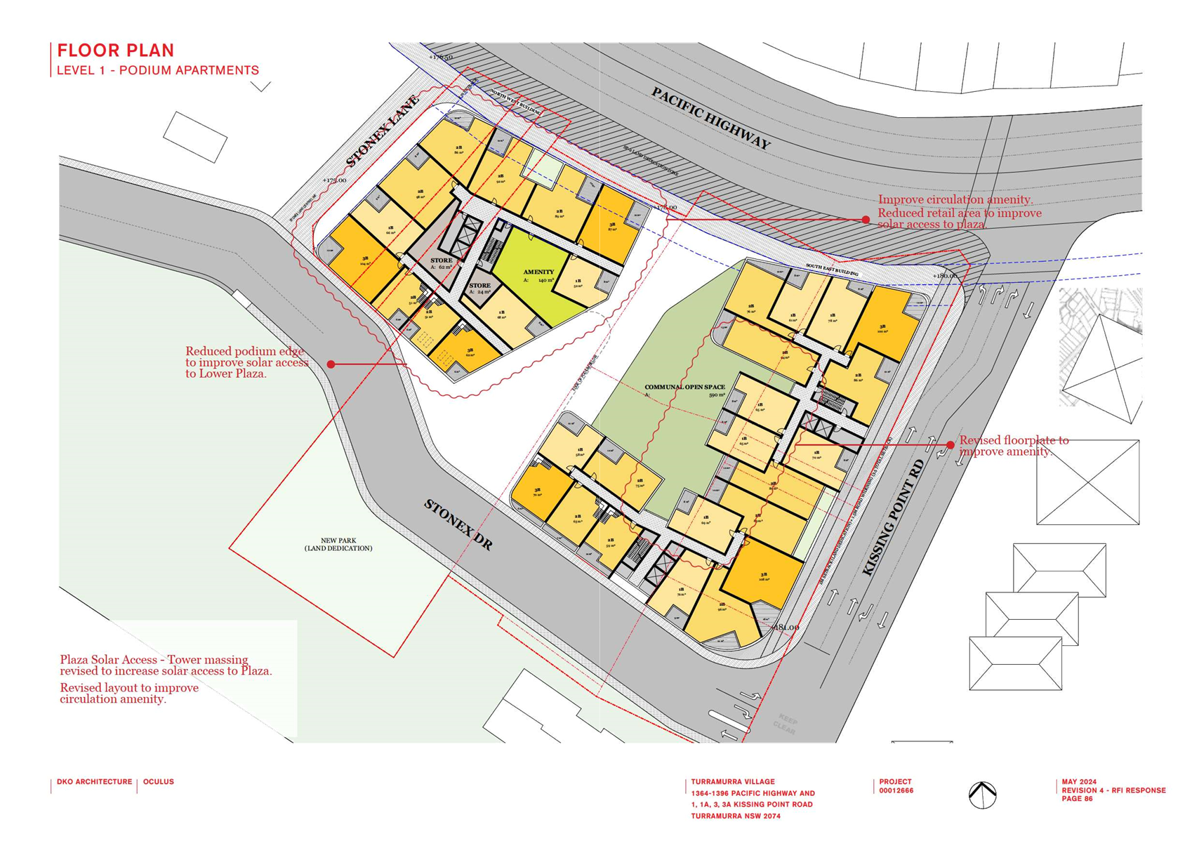
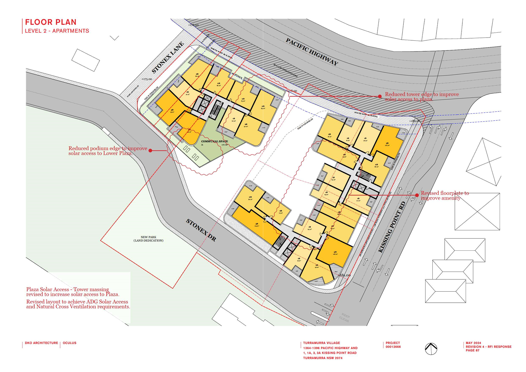
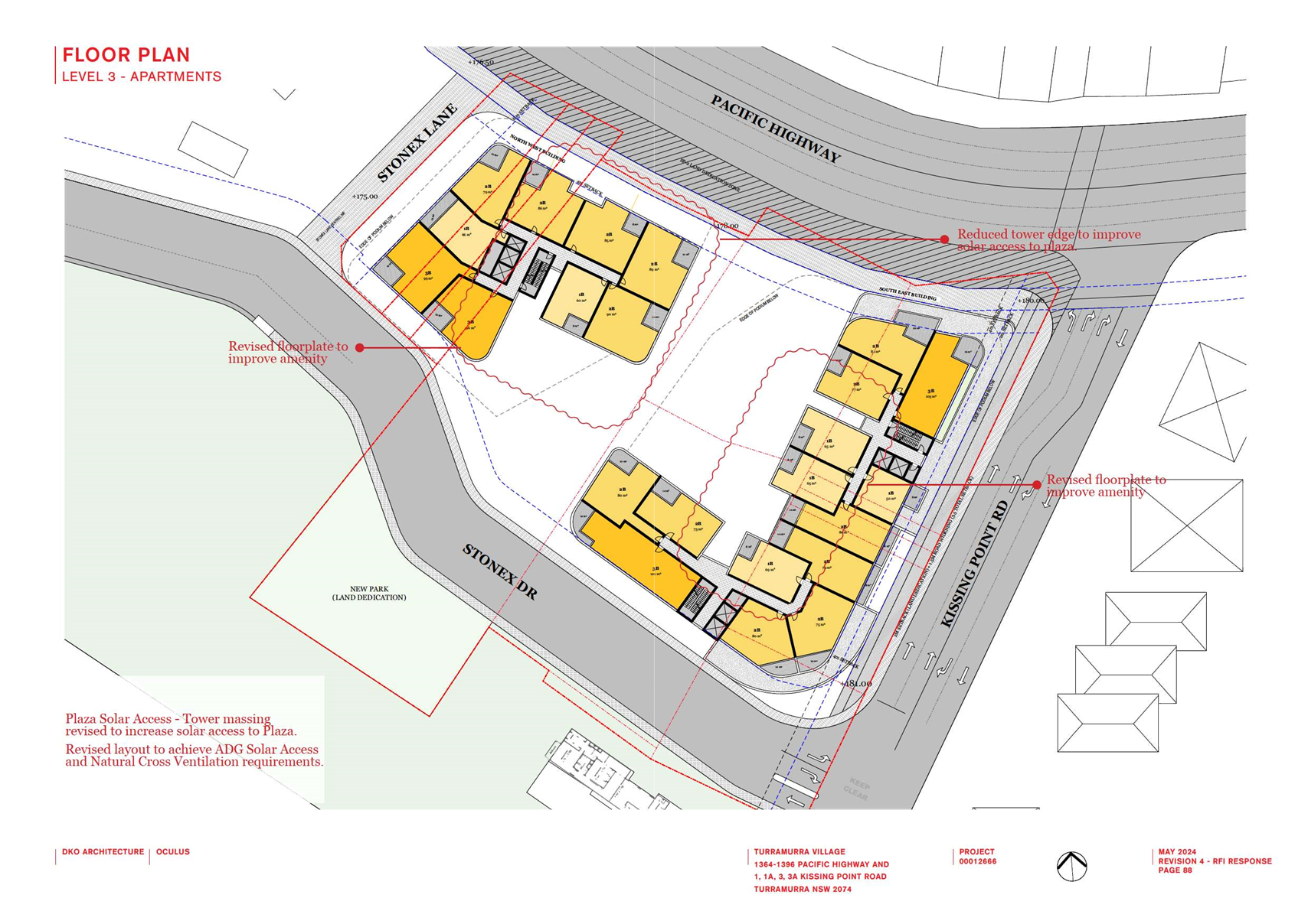
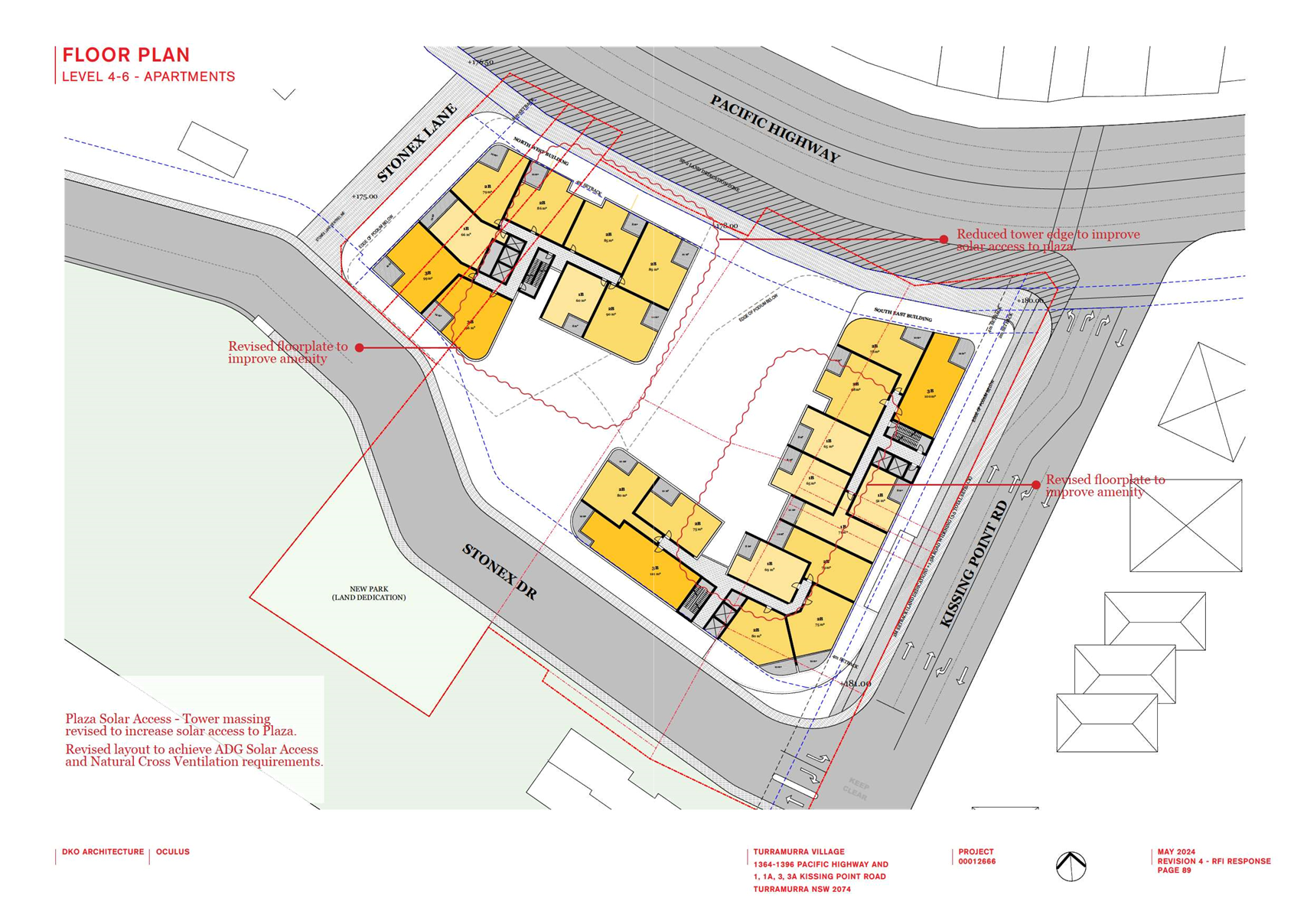
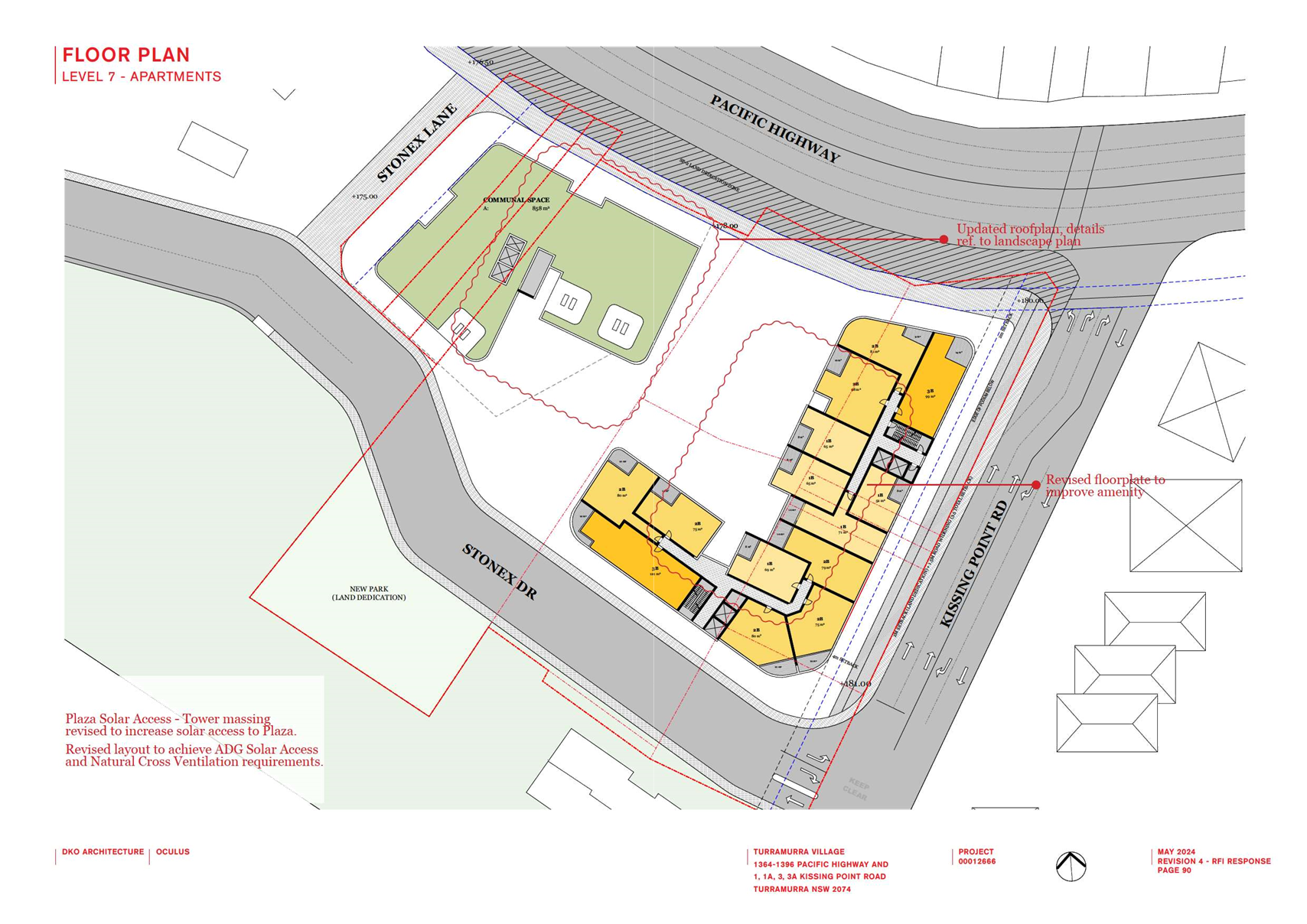
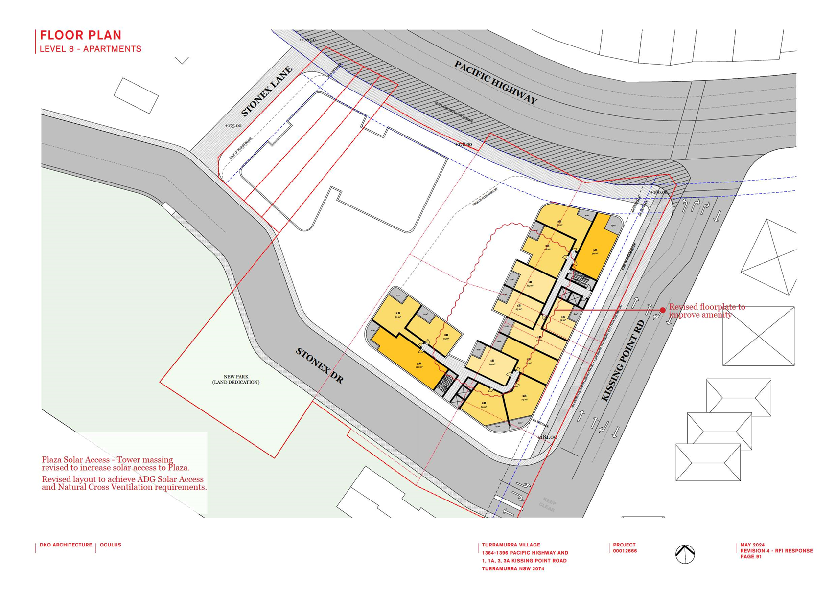
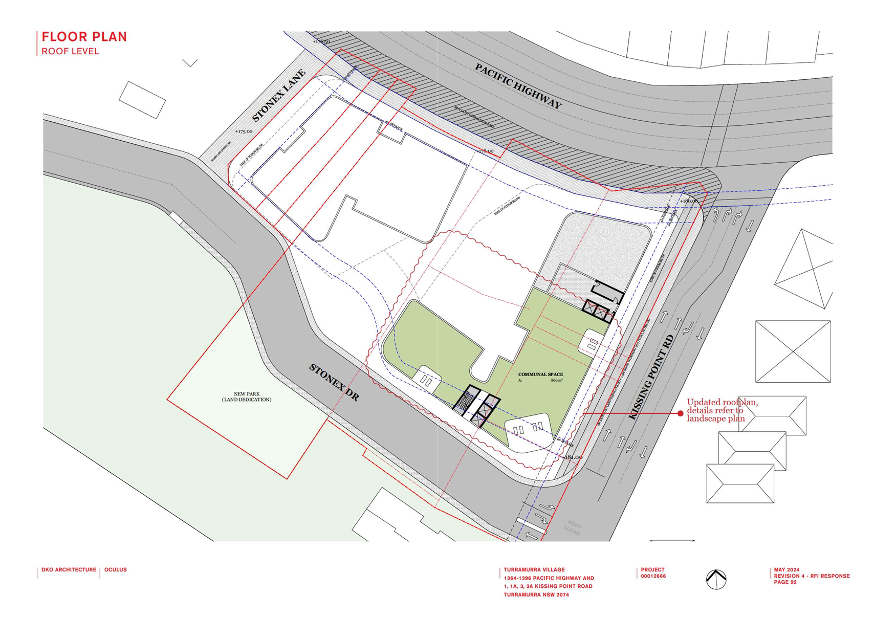
The proposed concept plan retains the same number of
independent living units (110), replacing the existing 2-3 storey mainly
townhouse style buildings with 6 storey apartment buildings.
The proposal augments the internal community facilities by
including a new café and wellness centre with swimming pool which are
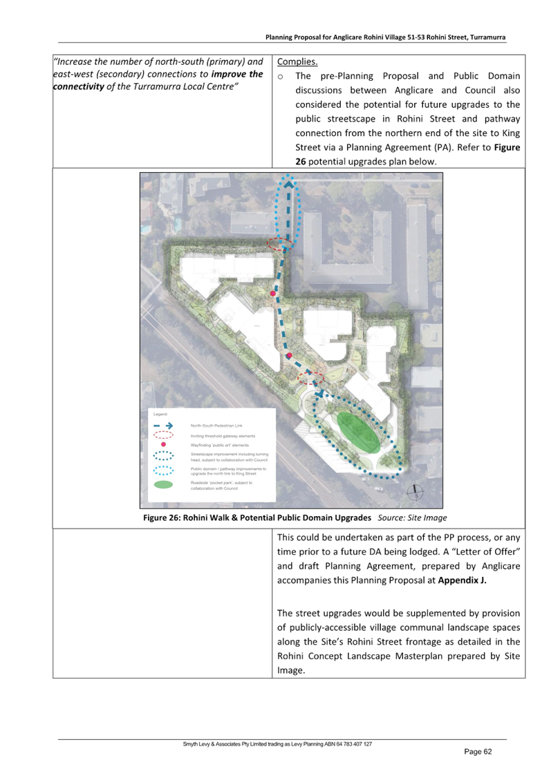
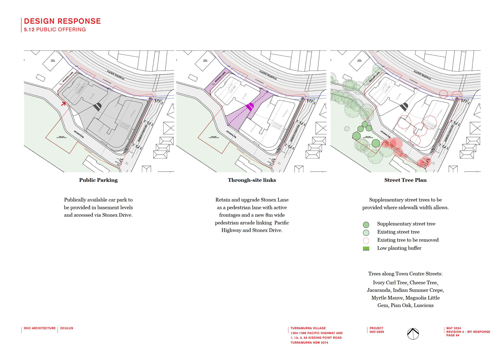
proposed to be opened to the general public. A clearer through-site link will
replace the existing informal access from Rohini Street to King Street and is
also proposed to be made open to the public via a Planning Agreement between
Council and the landowner.

EXISTING
AND PROPSED DEVELOPMENT PLAN (PLUS Architecture)
EXISTING
AND PROPSED DEVELOPMENT SECTIONS (PLUS Architecture)
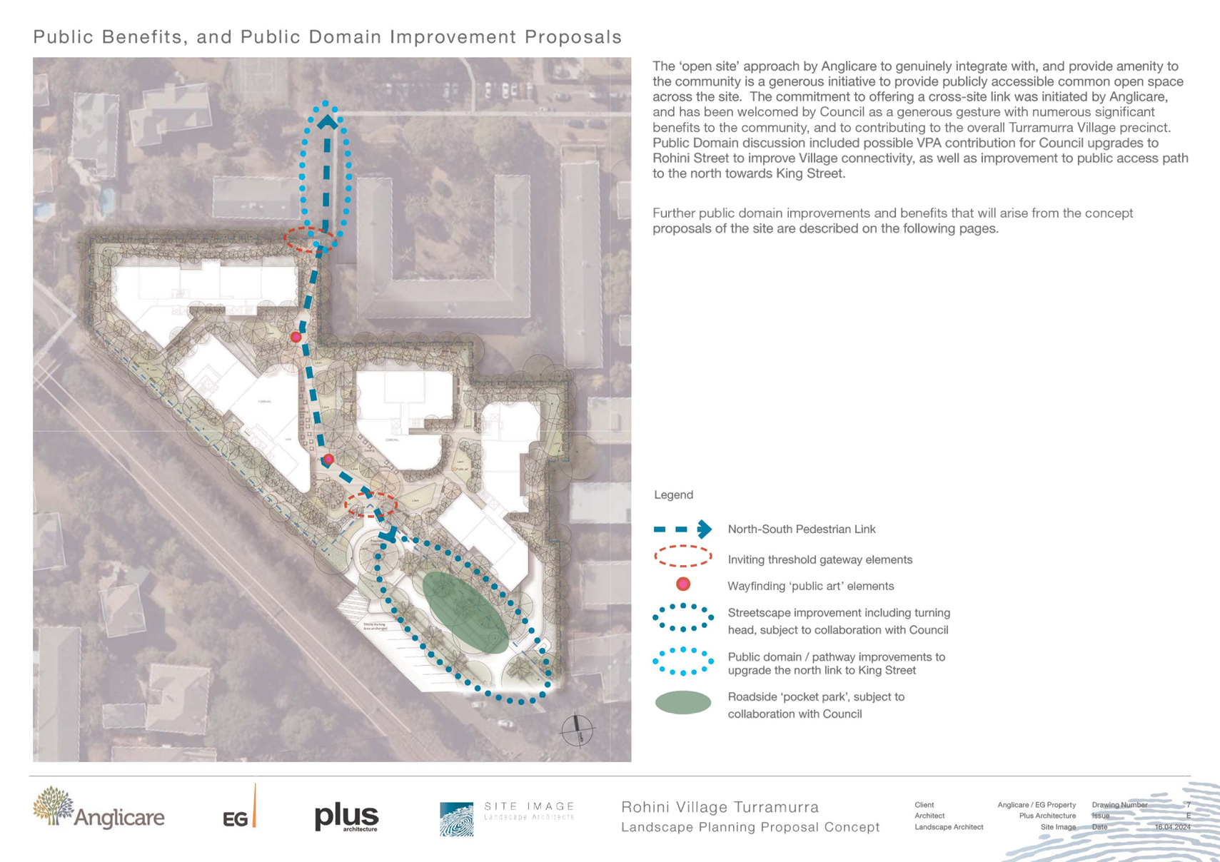
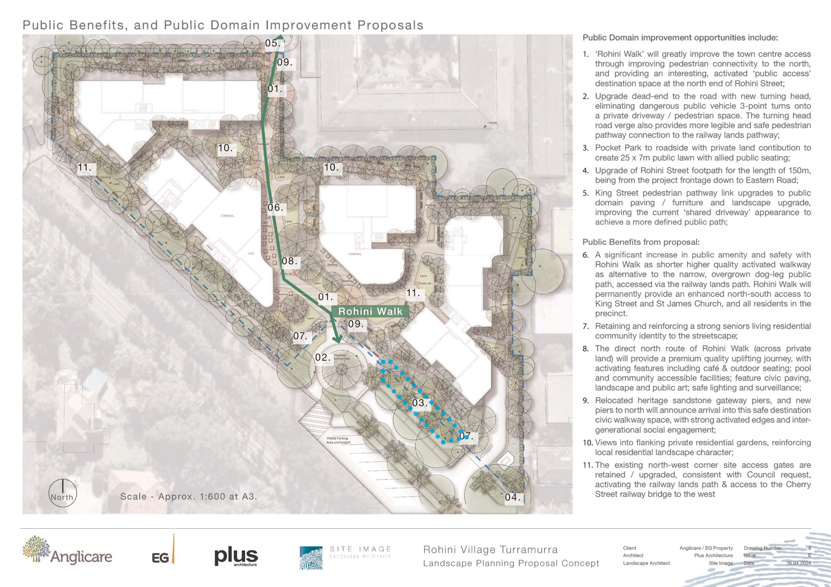
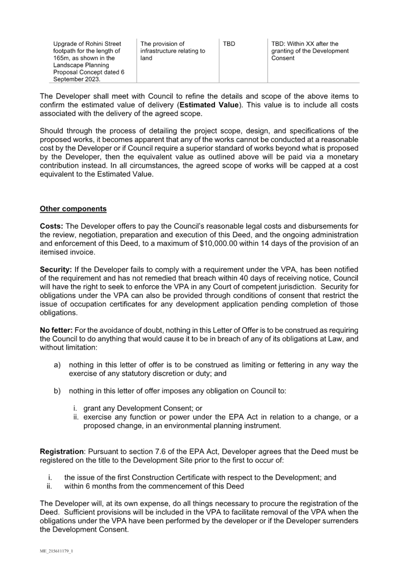
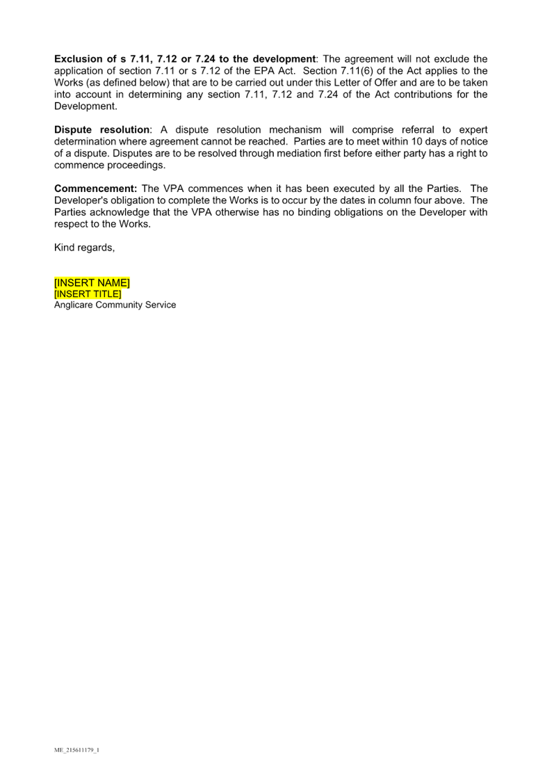
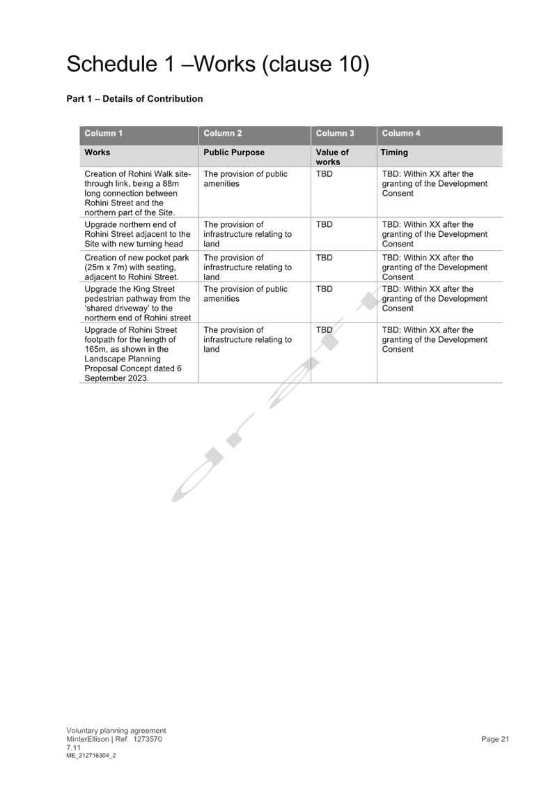
Public Benefit
The Planning Proposal is accompanied by a draft Letter of
Offer which seeks to negotiate the delivery of some items claiming public
benefit. Whilst the Letter of Offer is unclear and includes items not relevant
to the Letter but rather relevant in a subsequent agreement between parties,
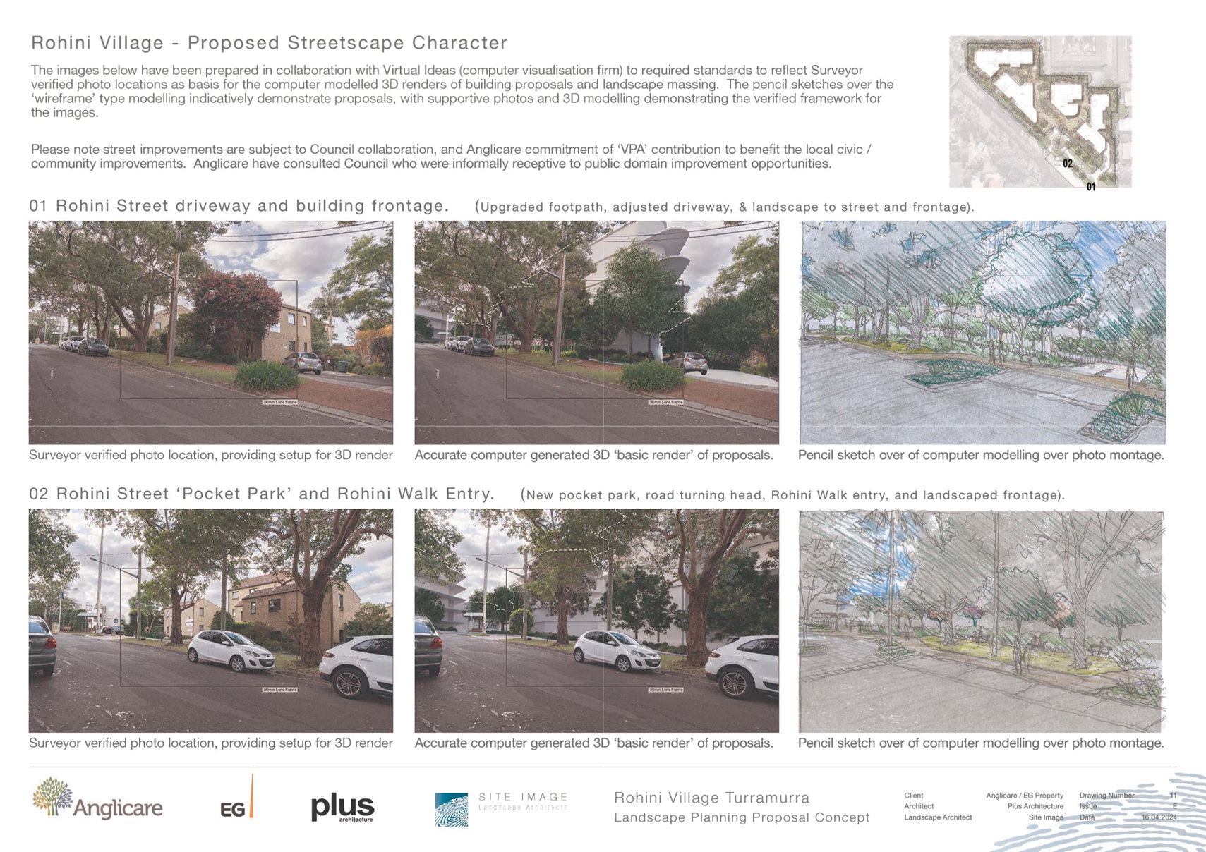
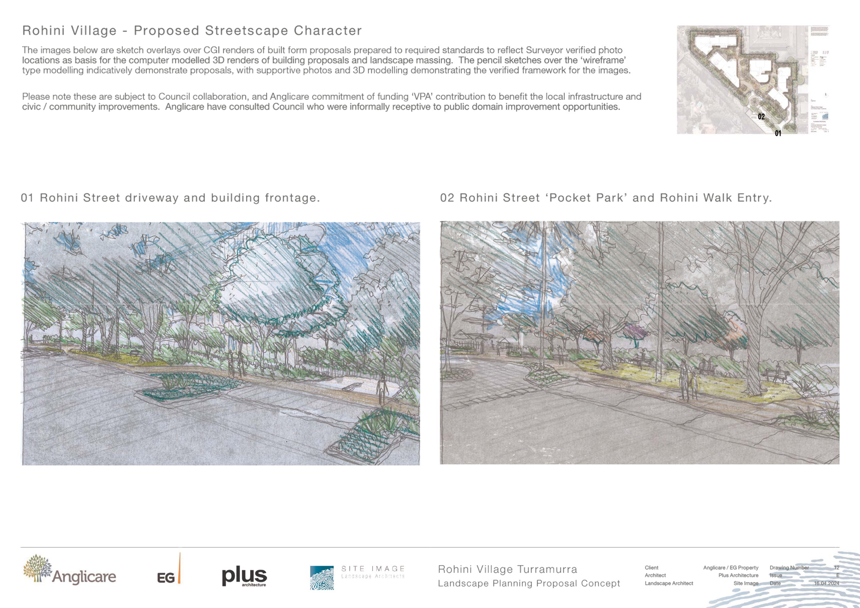
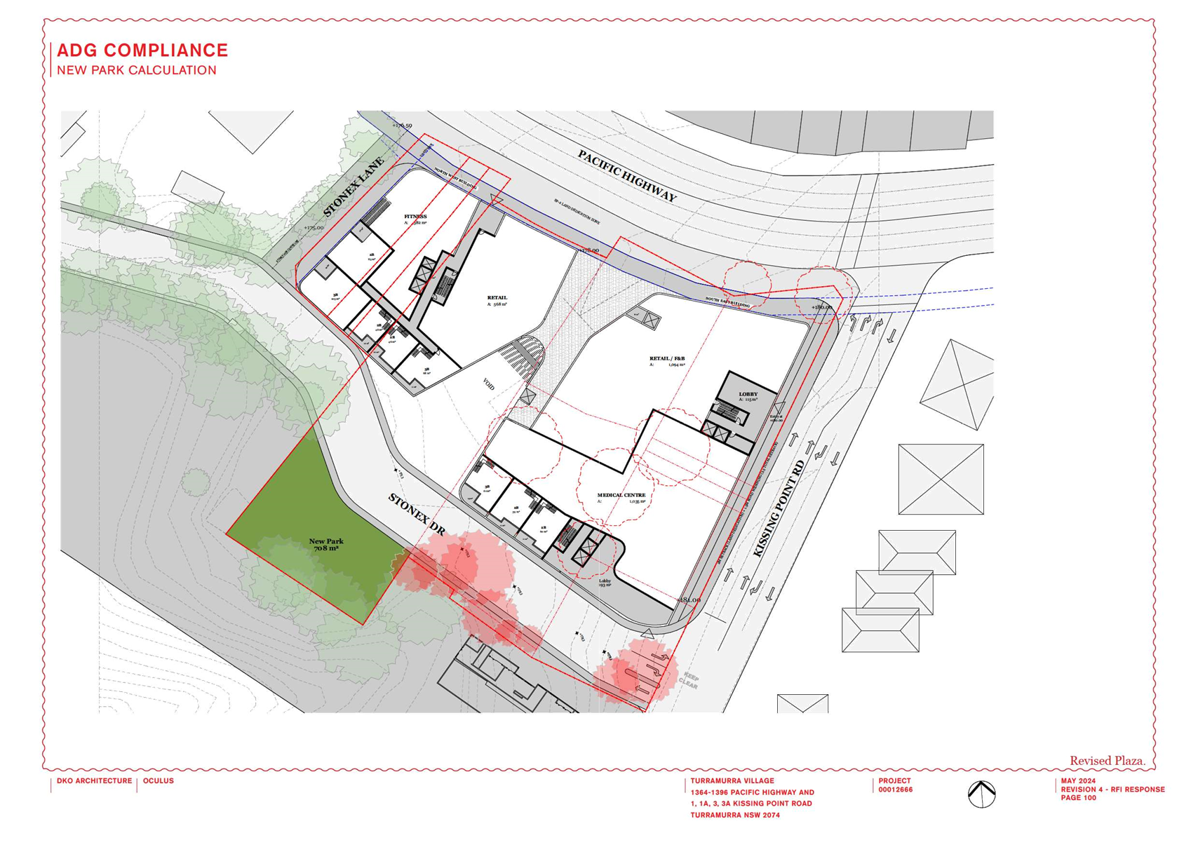
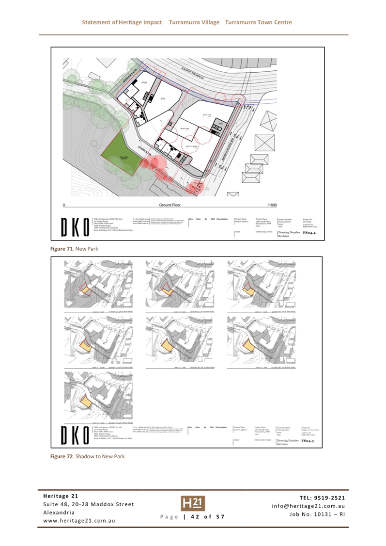
the following five items are noted as part of the offer:
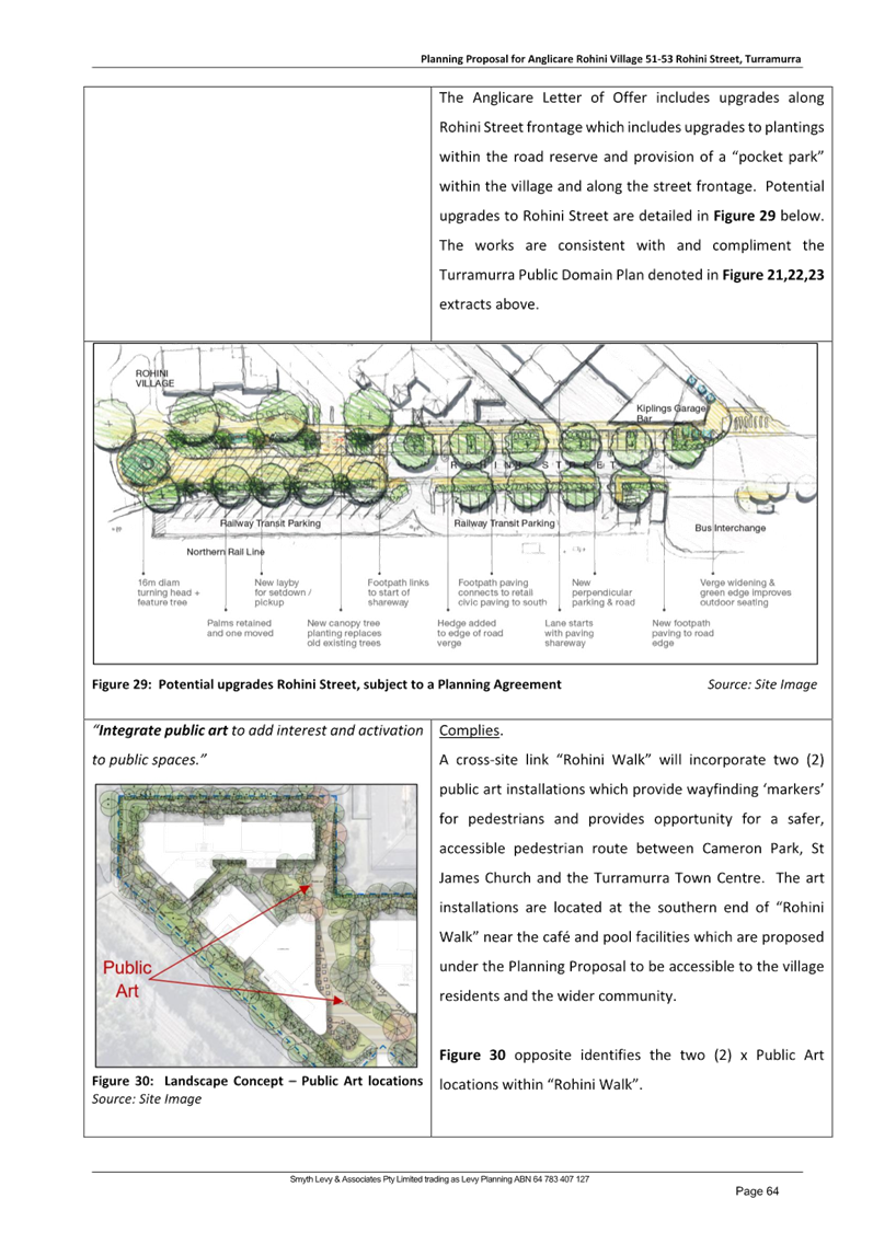
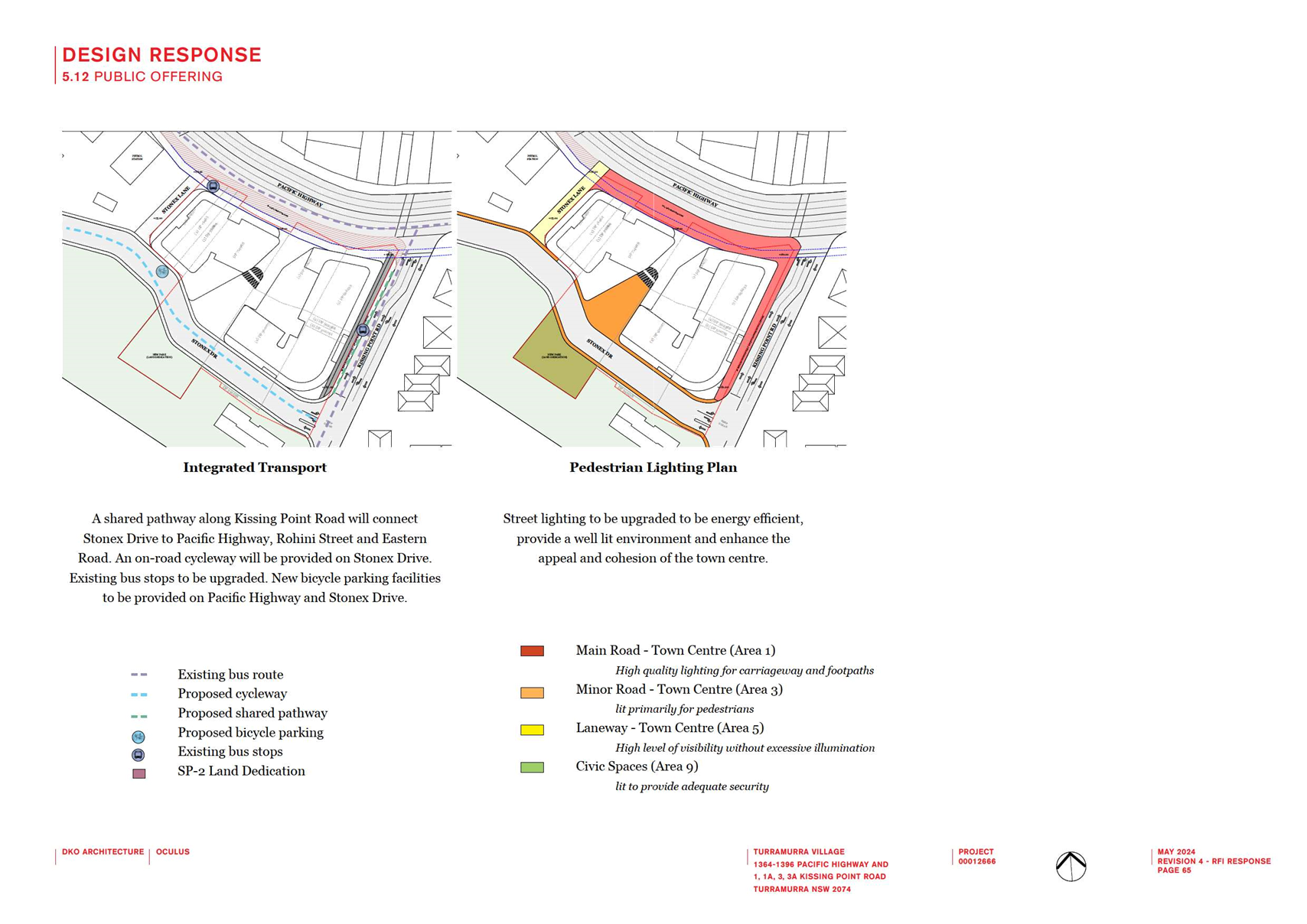
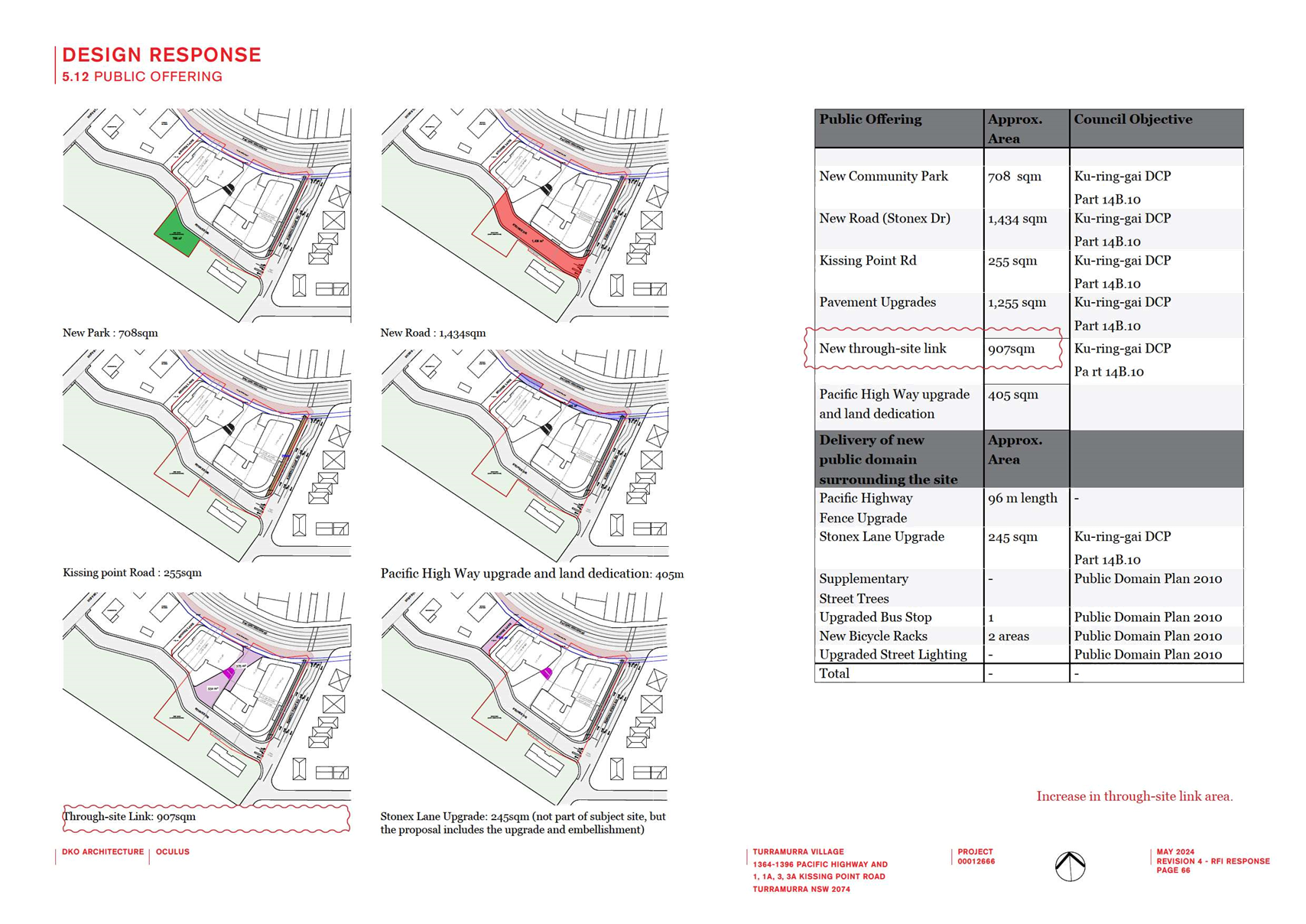
· Public access
across the site from Rohini Street to King Street via an 88m pathway labelled
Rohini Walk.
· Upgrades to the
turning circle at the end of Rohini Street directly adjacent to the Site.
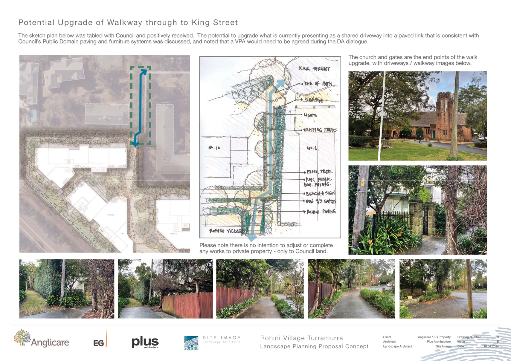
· Upgrade to part of
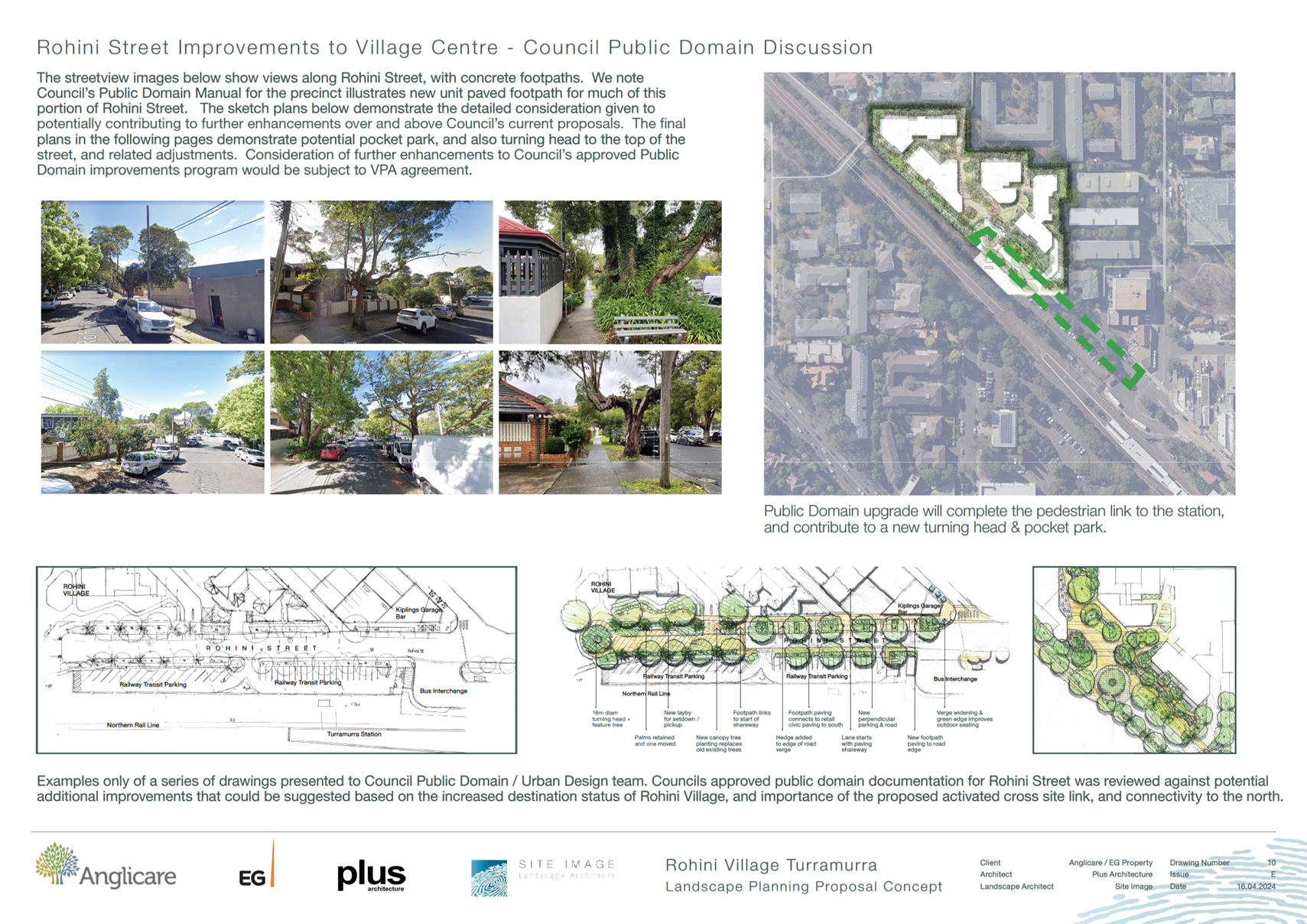
the footpath to the north-western side of Rohini Street (165m length).
· Upgrade to one
section of Council’s dog-leg footpath connecting Cherry Street to King
Street, the section from the end of the Site to King Street only.
· Creation of a
pocket park on the Site adjacent to Rohini Street, comprising a strip of land
25m length x 7m wide.
The Letter of Offer is discussed in detail, including
required amendments, at Attachment A1 to this Report. A summary of the
issues are presented in the below Table:
|
Amendments to the Offer
|
Reason
|
|
Column 1 of the Works Table within the Letter are the key
items indicating to Council what the subject of the Planning Agreement
negotiations will be.
The following item is to be removed from the Letter of
Offer as it conflicts with Council’s policy on provision of parks. The
plans may still be included in the Proponent’s landscape plans for
their front set-back area if they wish.
“Creation
of new pocket park (25m x 7m) with seating, adjacent to Rohini Street.”
The following item should be extended to
include the entirety of Council’s public footpath
abutting the Site, not just
one third of that footpath.
The negotiation process can determine if it is feasible to upgrade the whole
or part of the pathway.
”Upgrade
the King Street pedestrian pathway from the ‘shared driveway’ to the northern end of Rohini Street”
The following item should be considered
carefully given the complexities of upgrading road verges with crossovers into
multiple residential properties and underground services and associated
liabilities.
“Upgrade of Rohini Street footpath for the length of 165m, as shown in the Landscape Planning Proposal
Concept dated 6 September 2023.”
|
Request must not conflict with Council’s policies
and equitable consideration of provision of public facilities.
|
Progression of the Planning Proposal should not be construed
as concurrence with the proposed works outlined in the letter of offer or the
Draft Planning Agreement.
Comments
The aim of the Planning Proposal to increase height and FSR
and enable additional uses on the site to allow for the renewal of the Seniors
Housing on the site is supported; however, to make the Planning Proposal
acceptable for progression to Gateway Determination, a number of revisions are
required as stated in this Report and detailed at Attachment A1.
The Planning Proposal has been assessed against the
provisions of the Department of Planning, Housing and Infrastructure’s
‘Local Environmental Plan Making Guideline’ (August 2023)
and section 3.33 of the Environmental Planning and Assessment Act 1979.
A Planning Proposal must demonstrate that the proposed
amendments to a local environmental plan have strategic and site specific
merit. A detailed evidence-based assessment of the Planning Proposal and its
supporting studies has been conducted. In summary it has been concluded that
the Planning Proposal demonstrates sufficient evidence to demonstrate that the
proposal has strategic and site-specific merit subject to recommended
amendments. Accordingly, the Planning Proposal is supported in this
instance.
The following is a summary assessment of the key planning
issues and relevant merits associated with the Planning Proposal.
Strategic Merit
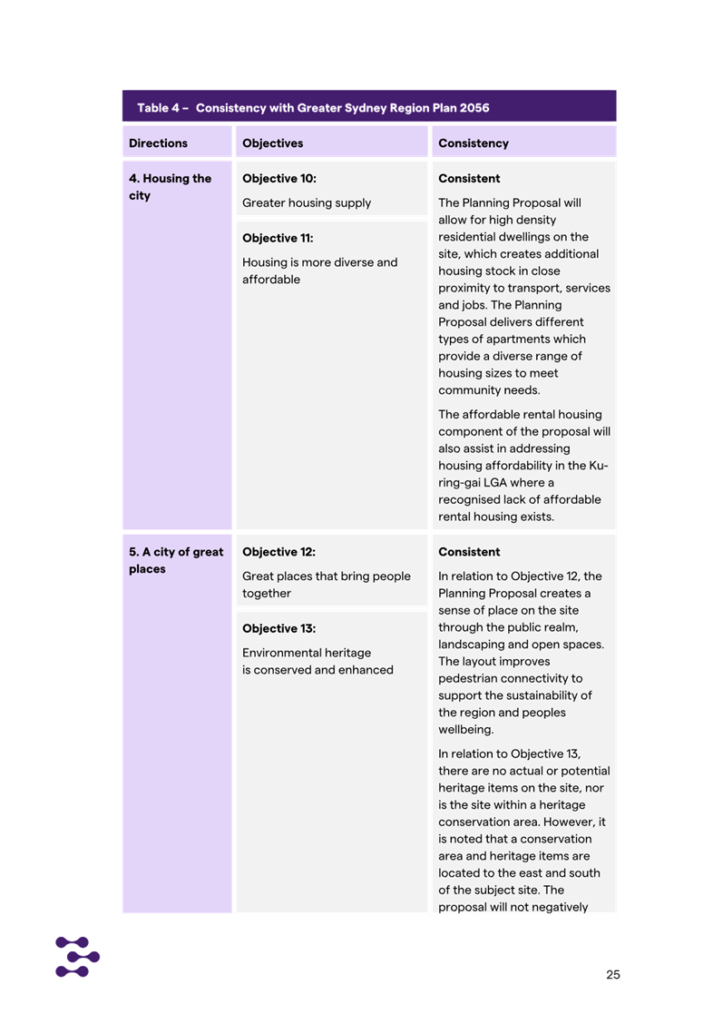
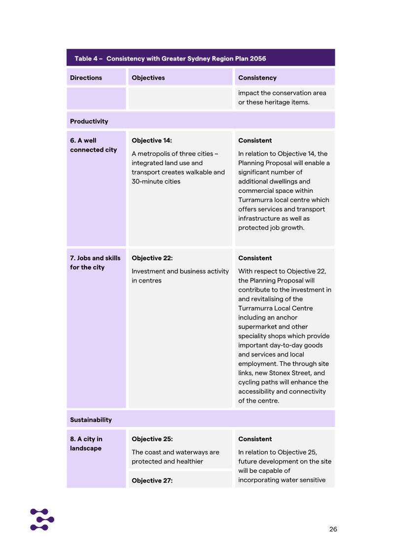
Regional Plan
The Planning Proposal is
generally consistent with a number of objectives of the Greater Sydney Region
Plan – A Metropolis of Three Cities, including:
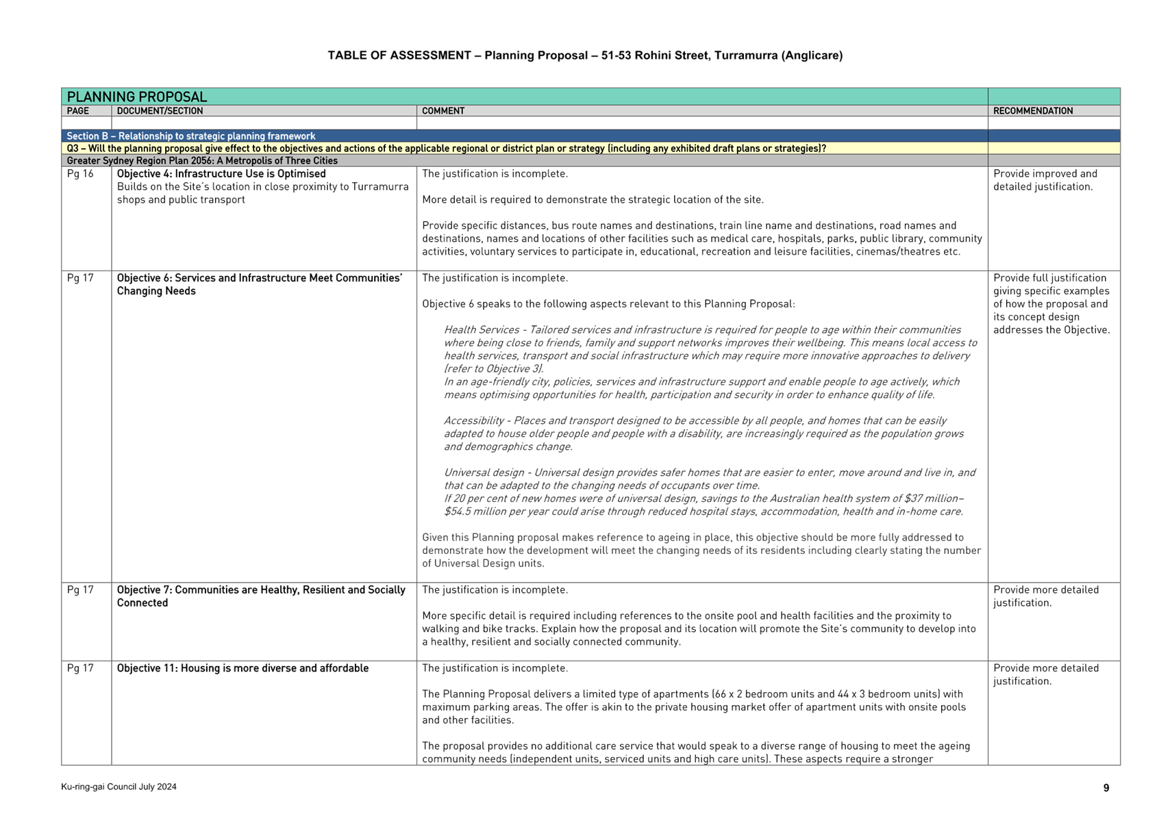
· Objective 4
– Infrastructure use is optimised
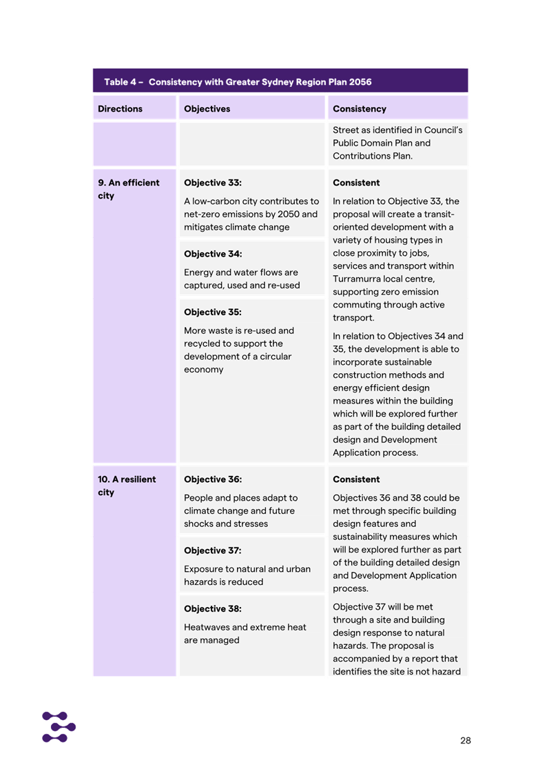
· Objective 6:
Services and Infrastructure Meet Communities’ Changing Needs
· Objective 7
– Communities are healthy, resilient and socially connected
· Objective 10
– Greater housing supply
· Objective 11
– Housing supply is more diverse and affordable
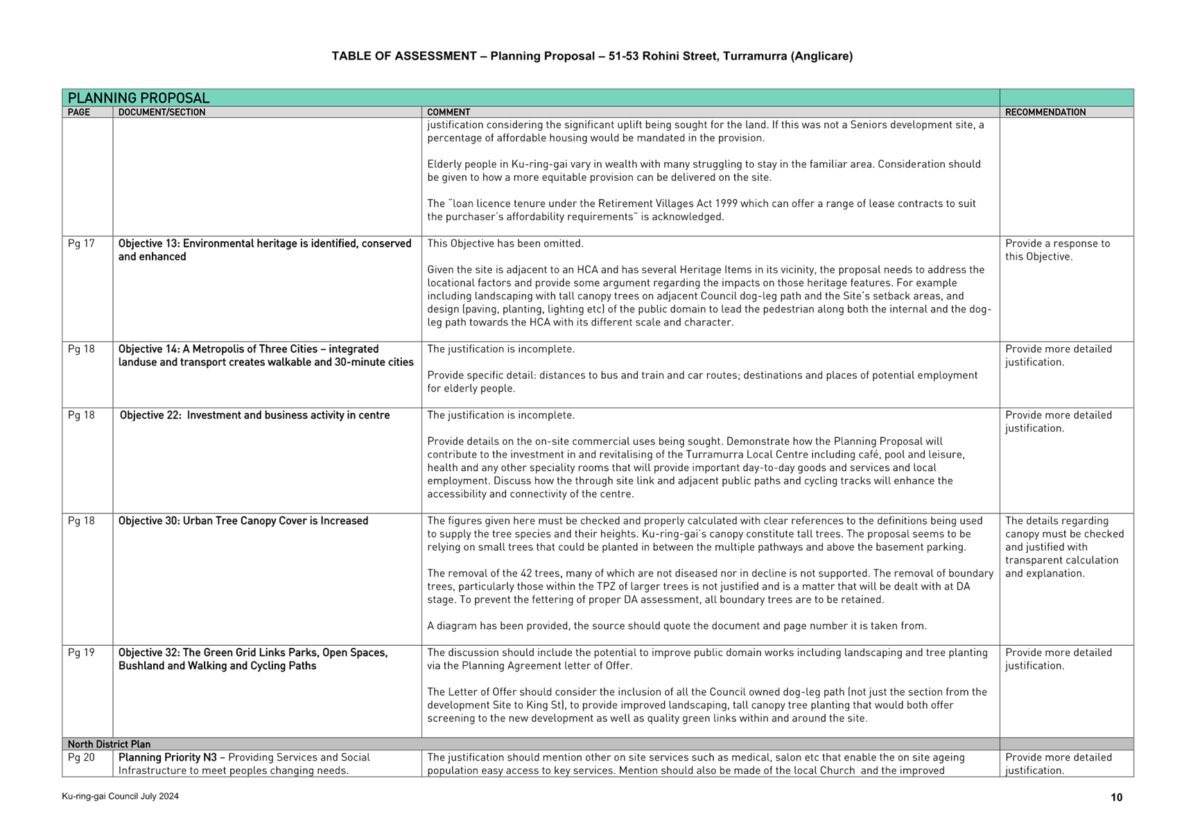
· Objective 13 -
Environmental heritage is identified, conserved and enhanced
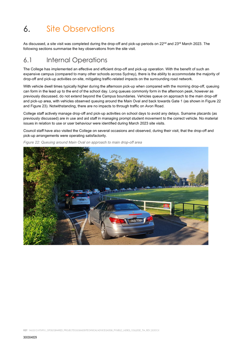
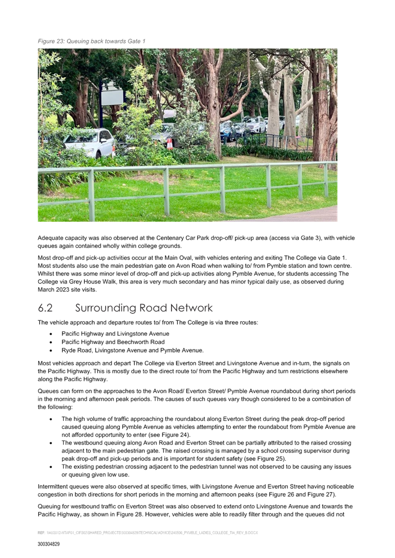
· Objective 14
– Integrated land use and transport creates walkable and 30 minute cities
· Objective 22
– Investment and business activity in centres
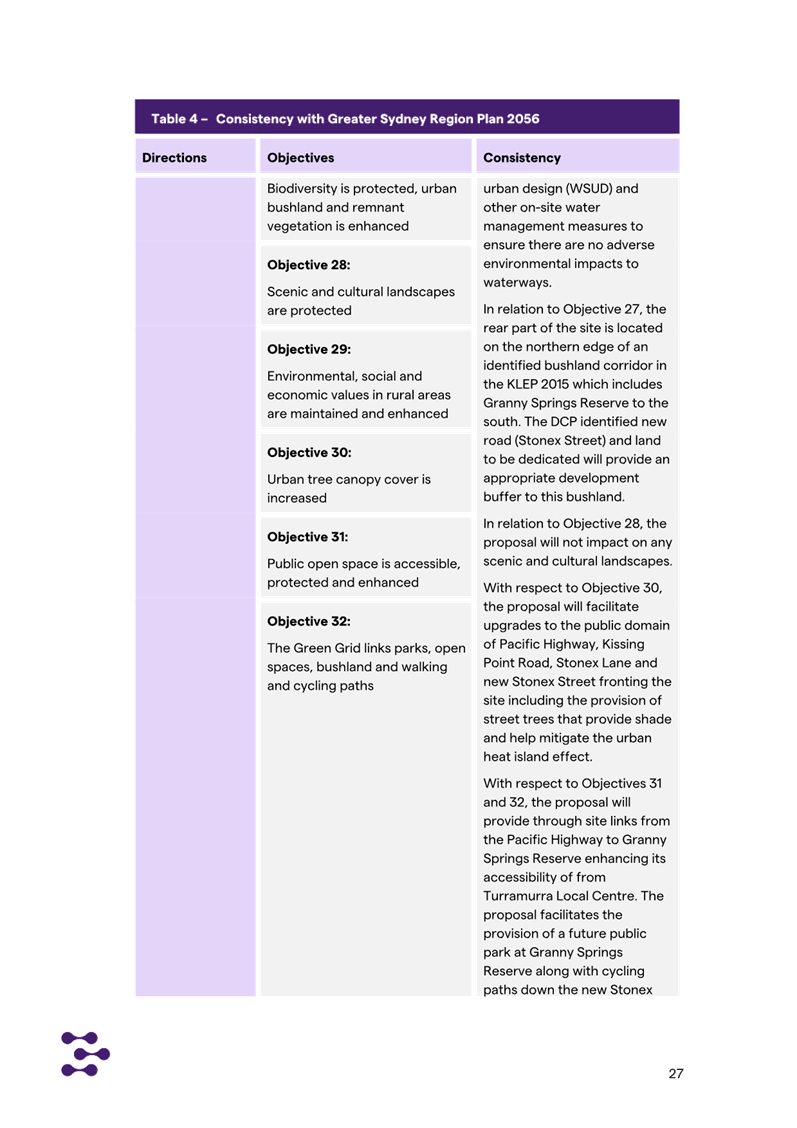
· Objective 27
– Biodiversity is protected, urban bushland and remnant vegetation is
enhanced.
· Objective 30:
Urban Tree Canopy Cover is Increased
· Objective 32: The
Green Grid Links Parks, Open Spaces, Bushland and Walking and Cycling Paths
Whilst the Planning Proposal indicates alignment, additional
information is required to fully justify the Planning Proposal against some of
these Objectives. The required additional information is noted at Attachment
A1.
A Metropolis of Three Cities outlines that
liveability incorporates access to housing, transport and employment as well as
social, recreational, cultural and creative opportunities. Improved
health, public transport and accessibility outcomes are achieved through the
provision of schools, recreation, transport, arts and cultural, community and
health facilities in walkable, mixed-use places co-located with social
infrastructure and local services. Mixed-use neighbourhoods close to centres
and public transport improve the opportunity for people to walk and cycle to
local shops and services. Enhancing the safety, convenience and accessibility
has many benefits, including healthier people, more successful businesses and
centres. The proposal is therefore consistent with these principles.
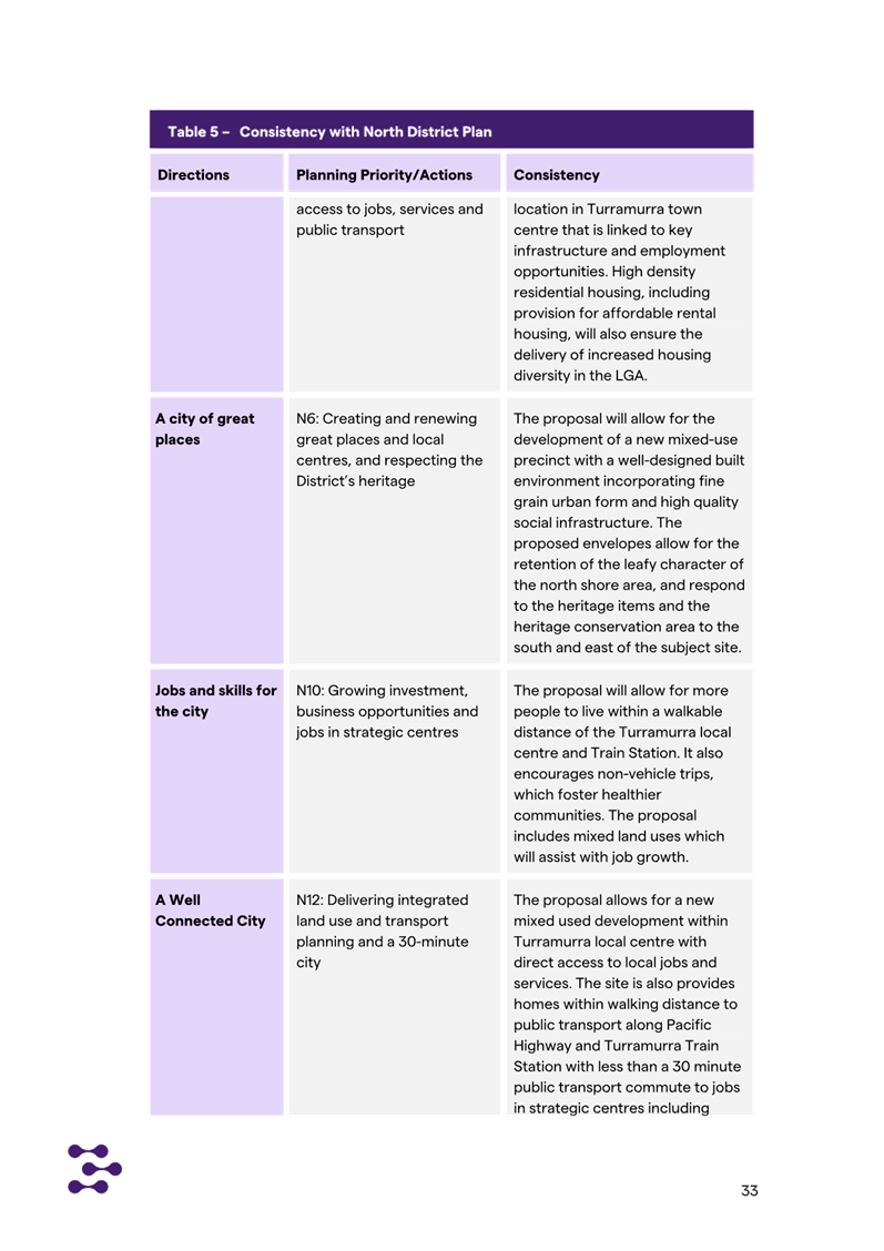
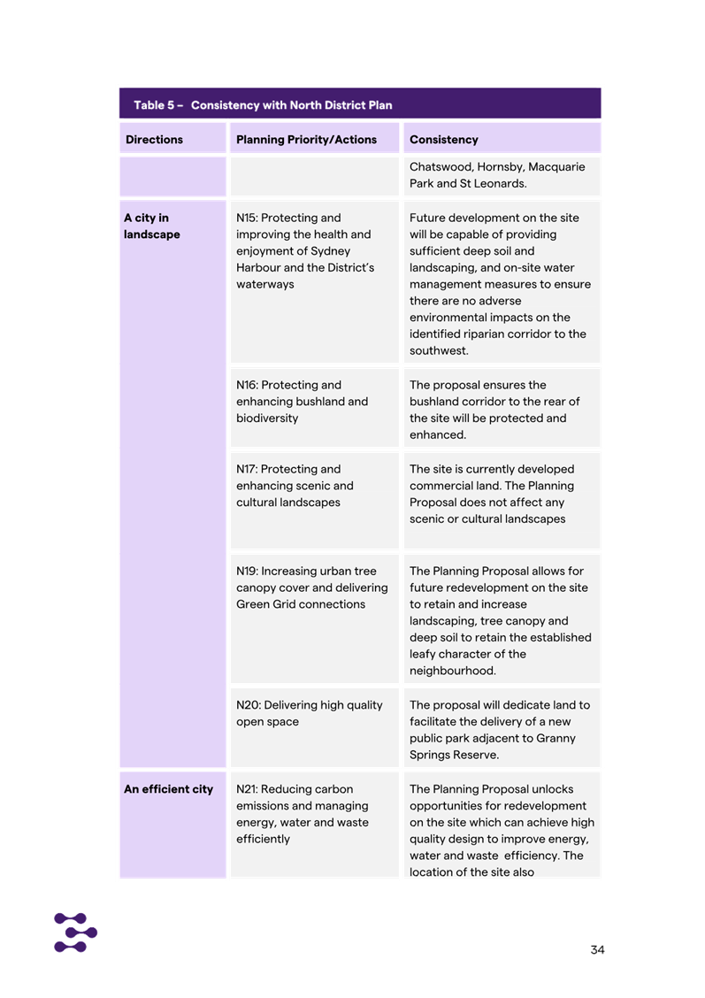
North District Plan
The North District Plan made in March 2018
highlights that the North District will continue to grow over the next 20 years
with demand for an additional 92,000 dwellings. The five-year target (to 2021)
for Ku-ring-gai is to provide an additional 4,000 dwellings.
Additional housing is to be provided in locations which are
linked to local infrastructure. The focus of growth is therefore on strategic
centres and areas close to transport corridors. Whilst the subject site is not
within a strategic centre it is in an area close to transport corridors
including the Pacific Highway (immediately adjacent) and the North Shore
Railway Line.
The Planning Proposal is consistent with the following
planning priorities of the North District Plan:
· Planning Priority
N1 – Planning for a city supported by infrastructure
· Planning Priority
N2 – Working through collaboration
· Planning Priority
N3 – Providing services and social infrastructure to meet people’s
changing needs
· Planning Priority
N4 - Fostering healthy, creative, culturally rich and socially connected
communities
· Planning Priority
N5 - Providing housing supply, choice and affordability, with access to jobs,
services and public transport
· Planning Priority
N6 - Creating and renewing great places and local centres, and respecting the
District’s heritage
· Planning Priority
N7 – Growing a stronger and more competitive harbour CBD
· Planning Priority
N8 – Eastern Economic Corridor is better connected and more competitive
· Planning Priority
N9 – Growing and investing in health and education precinct
· Planning Priority
N10 – Growing investment, business opportunities and jobs in strategic
centres
· Planning Priority
N11 – Retaining and managing industrial and urban services land
· Planning Priority
N12 – Delivering integrated land use and transport planning and a
30-minute city
· Planning Priority
N16 – Protecting and enhancing bushland and biodiversity
· Planning Priority
N17 – Protecting and enhancing cultural landscapes
· Planning Priority
N19 – Increasing urban tree canopy cover and delivering green grid
connections
· Planning Priority
N20 – Delivering high quality open space
Whilst the Planning Proposal indicates alignment, additional
information is required to fully justify the Planning Proposal against some of
these Priorities. The required additional information is noted at Attachment
A1.
The Planning Proposal will allow for the upgrade of the
existing 110 independent living units within the residential Seniors housing
including new commercial facilities (café and indoor swimming pool) open
to the general public. providing a new park, retail and commercial development
and approximately 180 new dwellings in a well-located site within the
Turramurra Local Centre, in close proximity to public transport and a major
transport route (Pacific Highway).
The co-location of residential dwellings, social
infrastructure and local services in centres provides for a more efficient use
of land and enhances the viability of the centres and public transport. The
proposal is therefore in accordance with the North District Plan strategy which
is to focus growth in areas close to public transport as well as within the
concept of a 30-minute city.
The Government recently (mid 2024) committed to building
377,000 new homes across the State in the next 5 years to align with the
National Housing Accord. As part of this it announced new housing targets by
LGA. The housing target identified by the State Government for Ku-ring-gai is
7,600 dwellings to be completed by 2029. The Planning Proposal is considered to
be consistent with this target and will maintain the existing 110 dwellings in
close proximity to existing infrastructure and services.
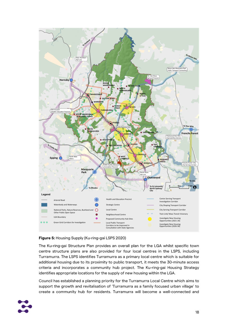
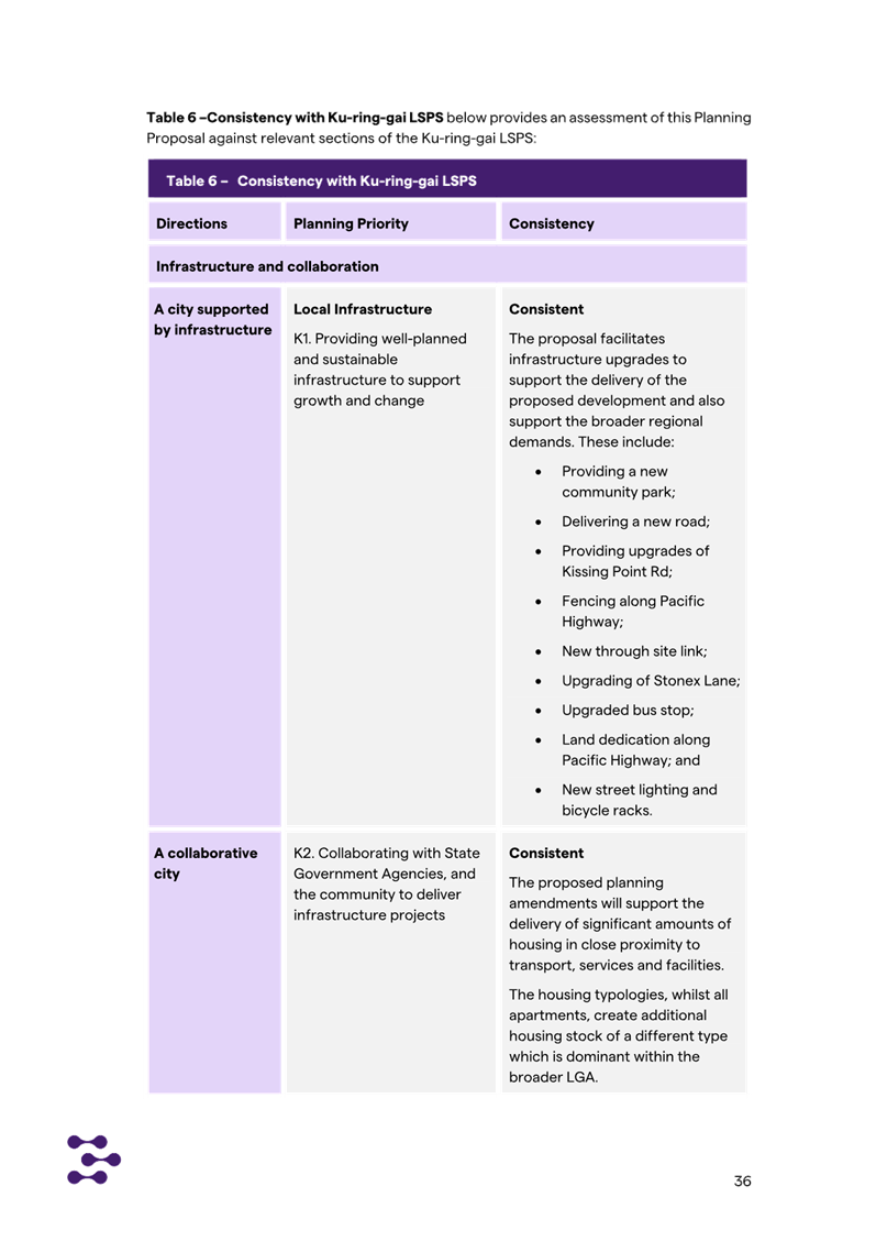
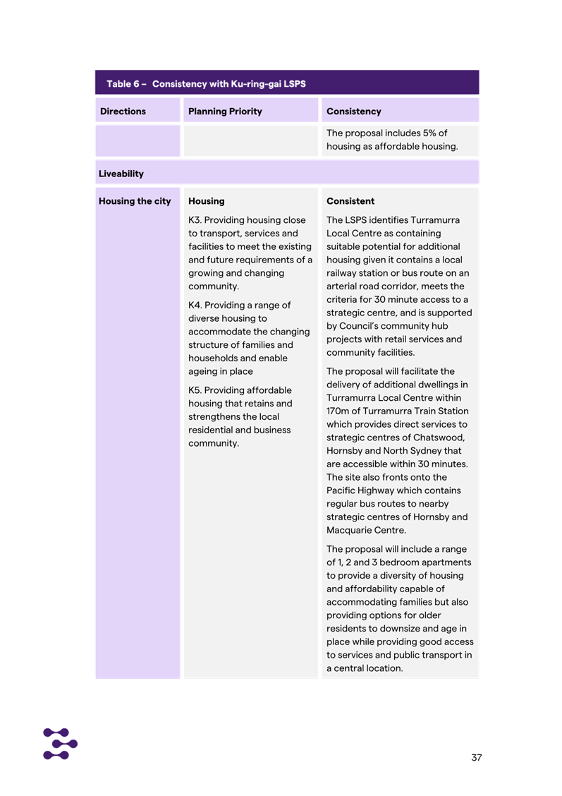
Local Strategic Planning
Statement
Council adopted its Local
Strategic Planning Statement (LSPS) on 17 March 2020. The LSPS draws
together the priorities and actions for future land use planning from
Council’s existing land use plans and policies and presents an overall
land use vision for Ku-ring-gai.
The Planning Proposal is consistent with relevant planning
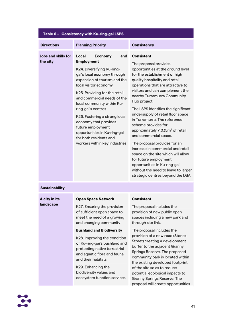
priorities of the LSPS including:
· K1 Providing well
planned and sustainable infrastructure to support growth and change
· K2 Collaborating
with State Government Agencies and the community to deliver infrastructure
projects
· K3 Providing
housing close to transport, services and facilities to meet the existing and
future requirements of a growing and changing community
· K4 Providing a
range of diverse housing to accommodate the changing structure of families and
households and enable ageing in place
· K5 Providing
affordable housing that retains and strengthens the local residential and
business community
· K6 Revitalising
and growing a network of centres that offer unique character and lifestyle for
local residents
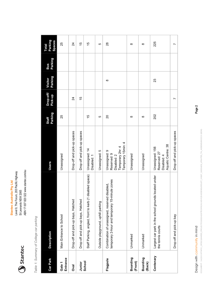
· K7 Facilitating mixed-use
developments within centres that achieve design excellence
· K10. Promoting
Turramurra as a family focused urban village
· K12 Managing
change and growth in a way that conserves and enhances Ku-ring-gai’s
unique visual and landscape character
· K13. Identifying
and conserving Ku-ring-gai’s environmental heritage
· K14. Providing a
range of cultural, community and leisure facilities to foster a healthy,
creative, culturally rich and socially connected Ku-ring-gai.
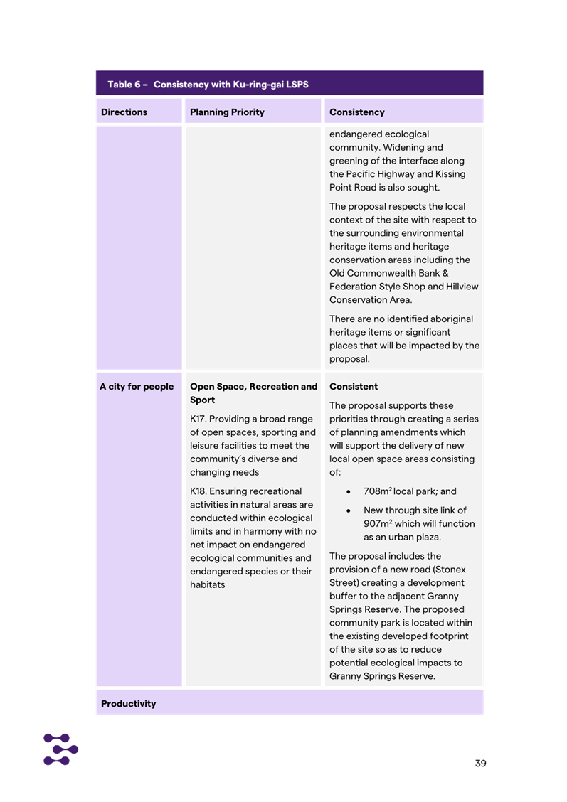
· K17 Providing a
broad range of open spaces, sporting and leisure facilities to meet the
community’s diverse and changing needs
· K18. Ensuring
recreational activities in natural areas are conducted within ecological limits
and in harmony with no net impact on endangered ecological communities and
endangered species or their habitats.
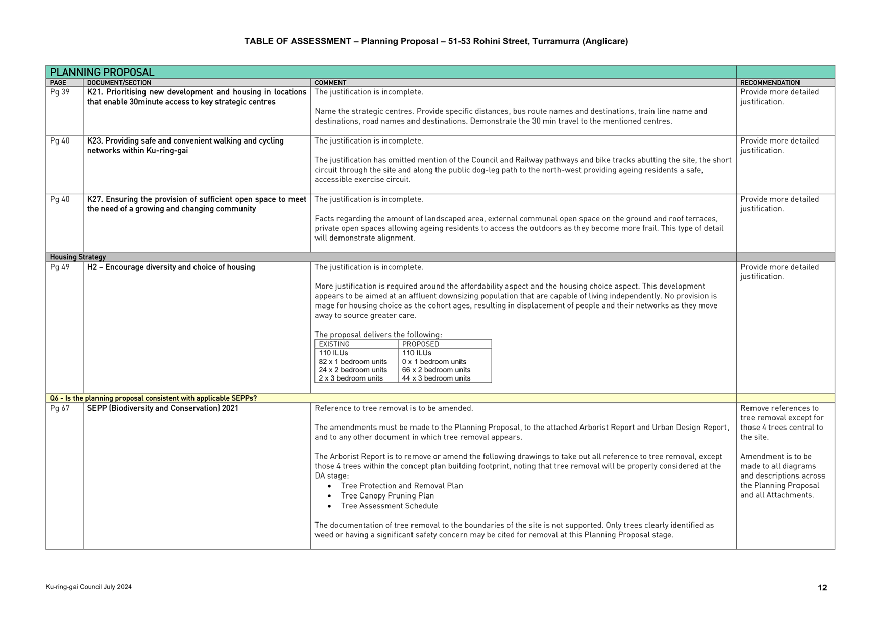
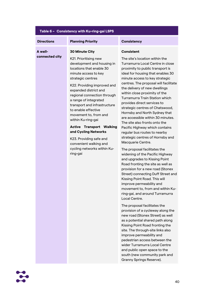
· K21 Prioritising
new development and housing in locations that enable 30 minute access to key
strategic centres
· K23 Providing safe
and convenient walking and cycling networks within Ku-ring-gai
· K25 Providing for
the retail and commercial needs of the local community within
Ku-ring-gai’s centres
· K26 Fostering a
strong local economy that provided future employment opportunities for both
residents and workers within key industries
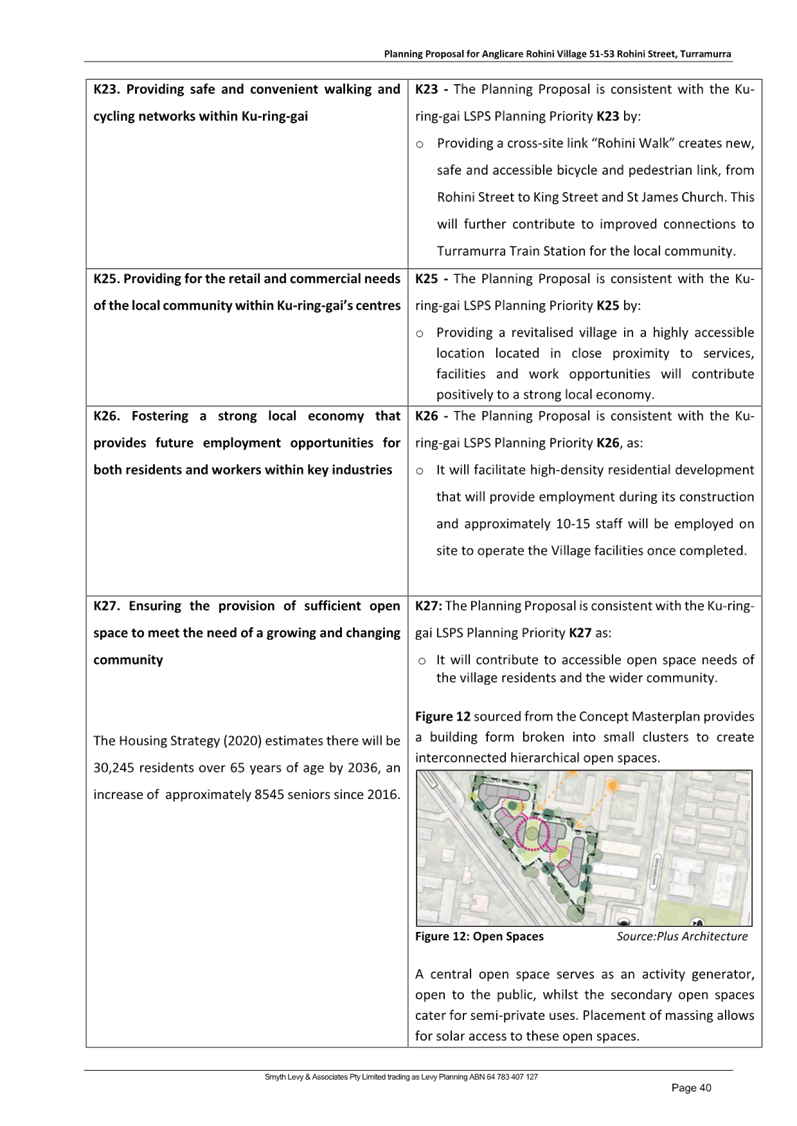
· K27 Ensuring the
provision of sufficient open space to meet the need of a growing and changing
community
· K29. Enhancing the
biodiversity values and ecosystem function services of Ku-ring-gai’s
natural assets
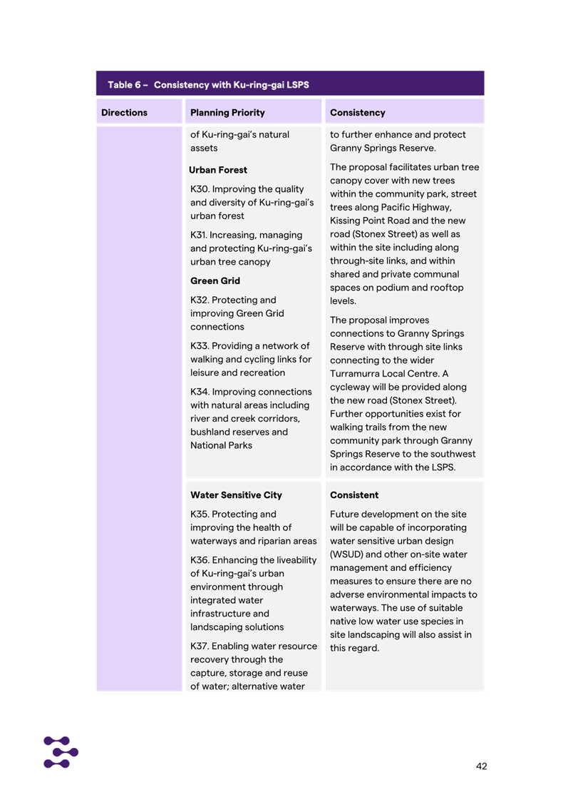
· K30. Improving the
quality and diversity of Ku-ring-gai’s urban forest
· K31 Increasing,
managing and protecting Ku-ring-gai’s urban tree canopy
· K32 Protecting and
improving Green Grid connections
· K33. Providing a
network of walking and cycling links for leisure and recreation
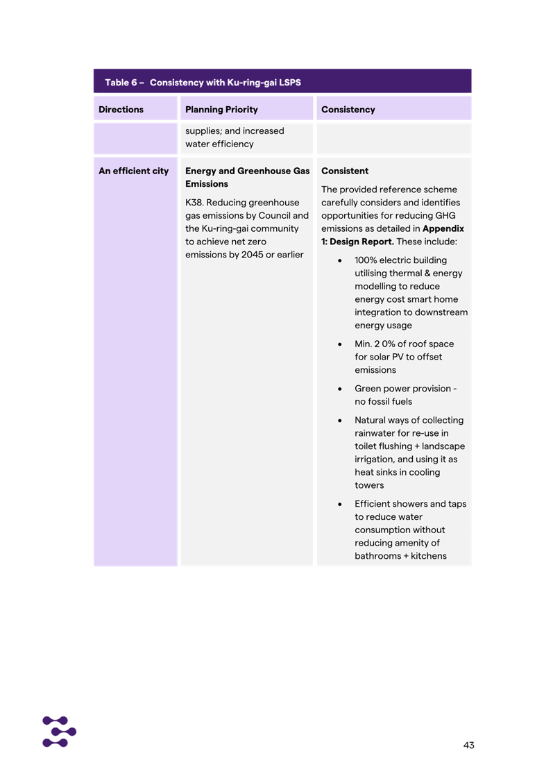
· K39. Reducing the
vulnerability, and increasing resilience, to the impacts of climate change on
Council, the community and the natural and built environment
· K40 Increasing
urban tree canopy and water in the landscape to mitigate the urban heat island
effect and create greener, cooler places
Whilst the Planning Proposal indicates alignment, additional
information is required to fully justify the Planning Proposal against some of
these Priorities. The required additional information is noted at Attachment
A1.
Having regard to the above it is considered that the
Planning Proposal is generally consistent with the LSPS as it provides for the
redevelopment of a site proximate to the Turramurra centre at a scale that is
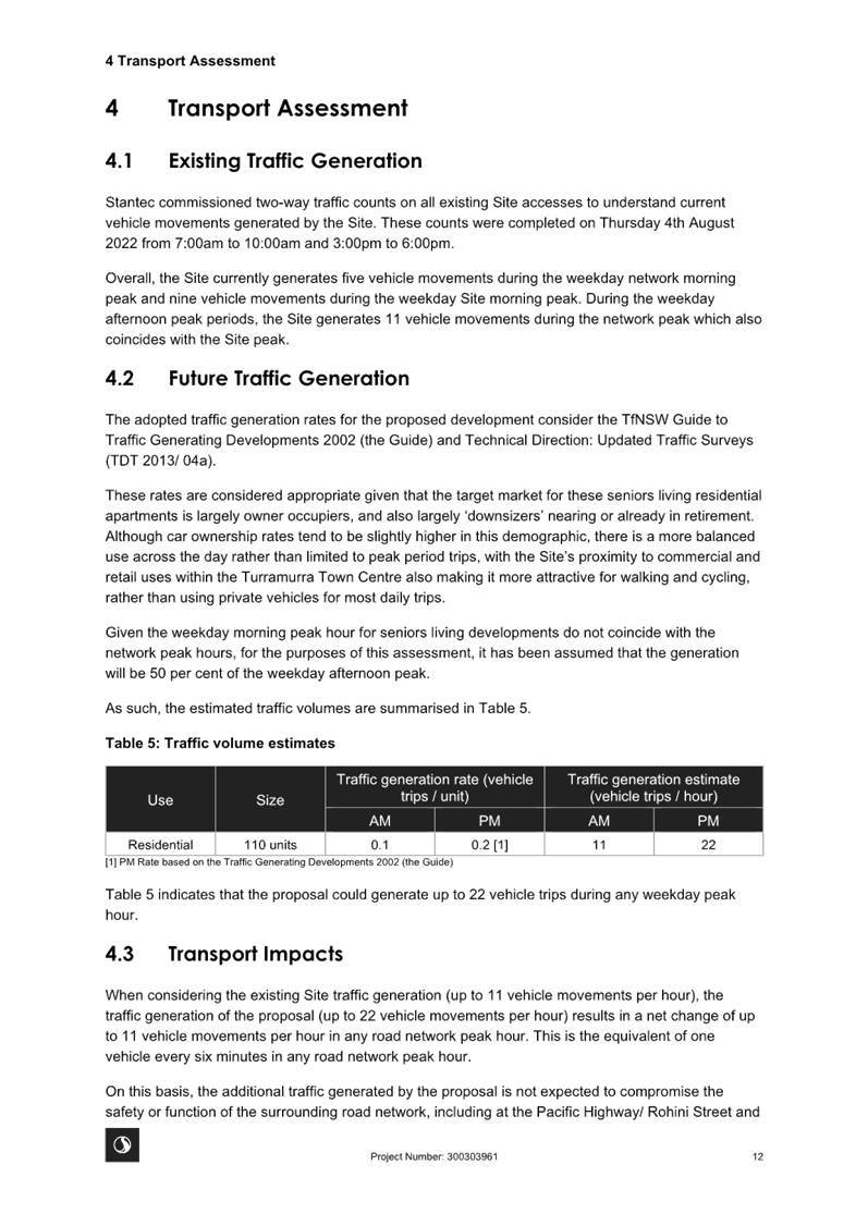
consistent with the priorities identified for the Turramurra Local Centre.
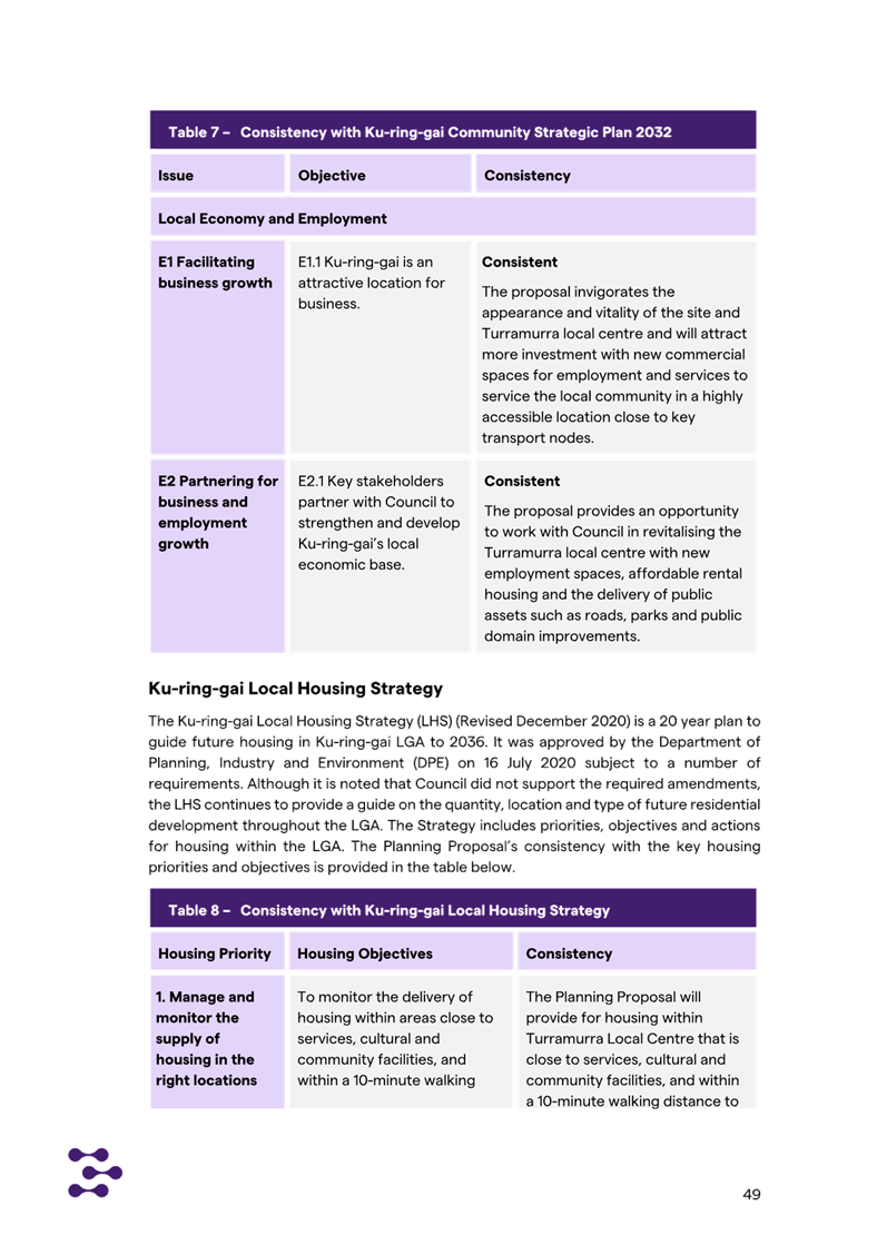
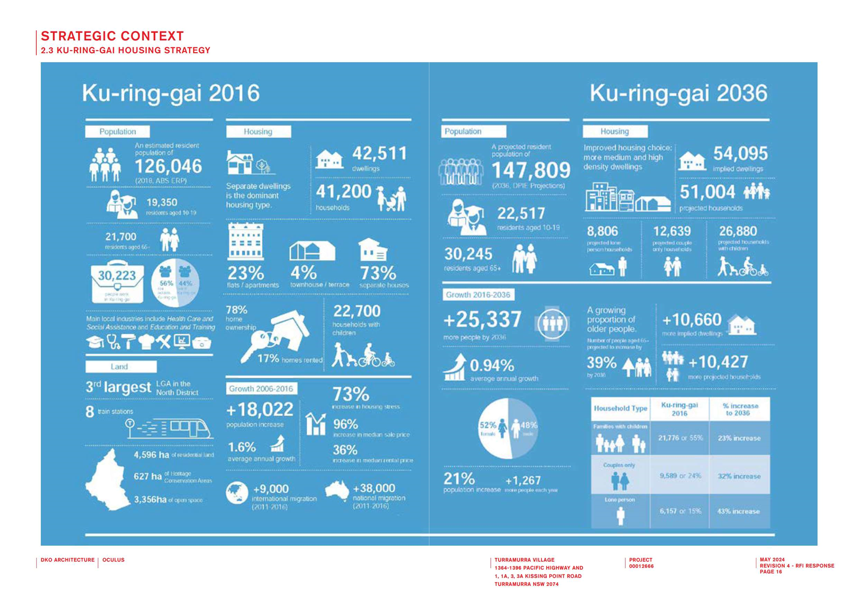
Local Housing Strategy
The revised Ku-ring-gai Housing Strategy to 2036 was adopted
by Council in December 2020. The purpose of the Strategy is to identify how
Council intends to respond to the Greater Sydney Region Plan and District Plan
and how it plans to deliver on housing targets. The Strategy identities that
the District Plan sets a target of 4,000 new dwelling in Ku-ring-gai for the 5
year period from 2016 to 2021 (Note: as outlined above this target has
recently been updated to 7,600 new dwellings by 2029). It notes that
more than half of the required housing supply quota has been met, with the
remaining amount fully deliverable through current development approvals and
existing capacity within the Ku-ring-gai Local Environmental Plans. It further
states that “this means that the 0 - 5 year housing supply target of
4,000 dwellings is achievable under Council’s existing planning policies
and no amendment to the Ku-ring-gai Local Environmental Plan is
necessary”. It goes on to state:
The Greater Sydney Commission
‘Letter of Support’ issued March 2020 for the Ku-ring-gai LSPS
outlined that the Housing Strategy is to show how Ku-ring-gai can meet an
indicative draft range of 3,000 – 3,600 dwellings for the 6-10 year
housing target. Correspondence from the Minister of Planning dated 8 September
2020 states ‘Ultimately, Council is responsible for deciding the number
of dwellings in its local housing supply target’ and ‘the target
discussed with the Greater Sydney Commission is not a legal requirement upon
Council by the Government.’
Ultimately the Housing Strategy then proposes to achieve an
increase in dwellings within the LGA to meet demand as required by the Greater
Sydney Region Plan and North District Plan through existing residual capacity
supplemented by seniors housing and alternative dwellings where permissible.
Council has not identified land for development uplift and does not consider
this necessary to meet the District Plan dwelling target obligations.
The subject Planning Proposal seeks to amend the planning
controls applying to the subject site to prevent the further loss in the number
of on-site dwellings. The numbers on the site have declined over the past years
due to amalgamation of vacant one-bedroom units into larger units to meet the
demand for multiple bedroom accommodation allowing family to visit the
residents. The prevention of loss of dwelling count on the site is consistent
with the Housing Strategy.
Whilst the Planning Proposal indicates alignment, additional
information is required to fully justify Priority H2 – Encourage
diversity and choice of housing. The required additional information is
noted at Attachment A1.
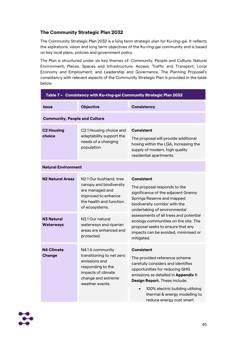
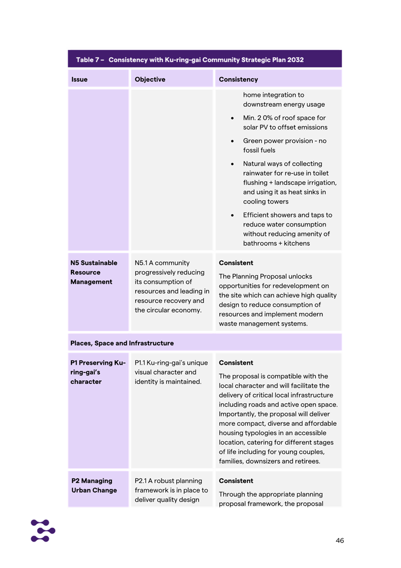
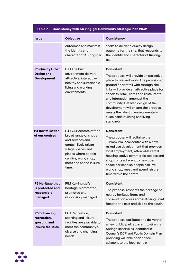
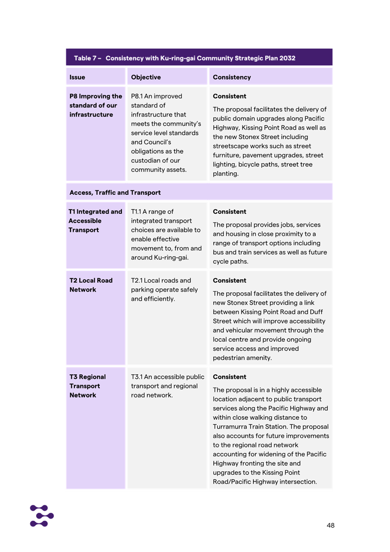
Community Strategic Plan –
Our Ku-ring-gai 2032 (28-6-2022)
The Planning Proposal is consistent with the Ku-ring-gai
Community Strategic Plan which is the long-term strategic plan for the future
of the Ku-ring-gai Local Government Area. It reflects the vision and
aspirations of the Ku-ring-gai community through long-term objectives that
address environmental, social, economic and civic leadership issues.
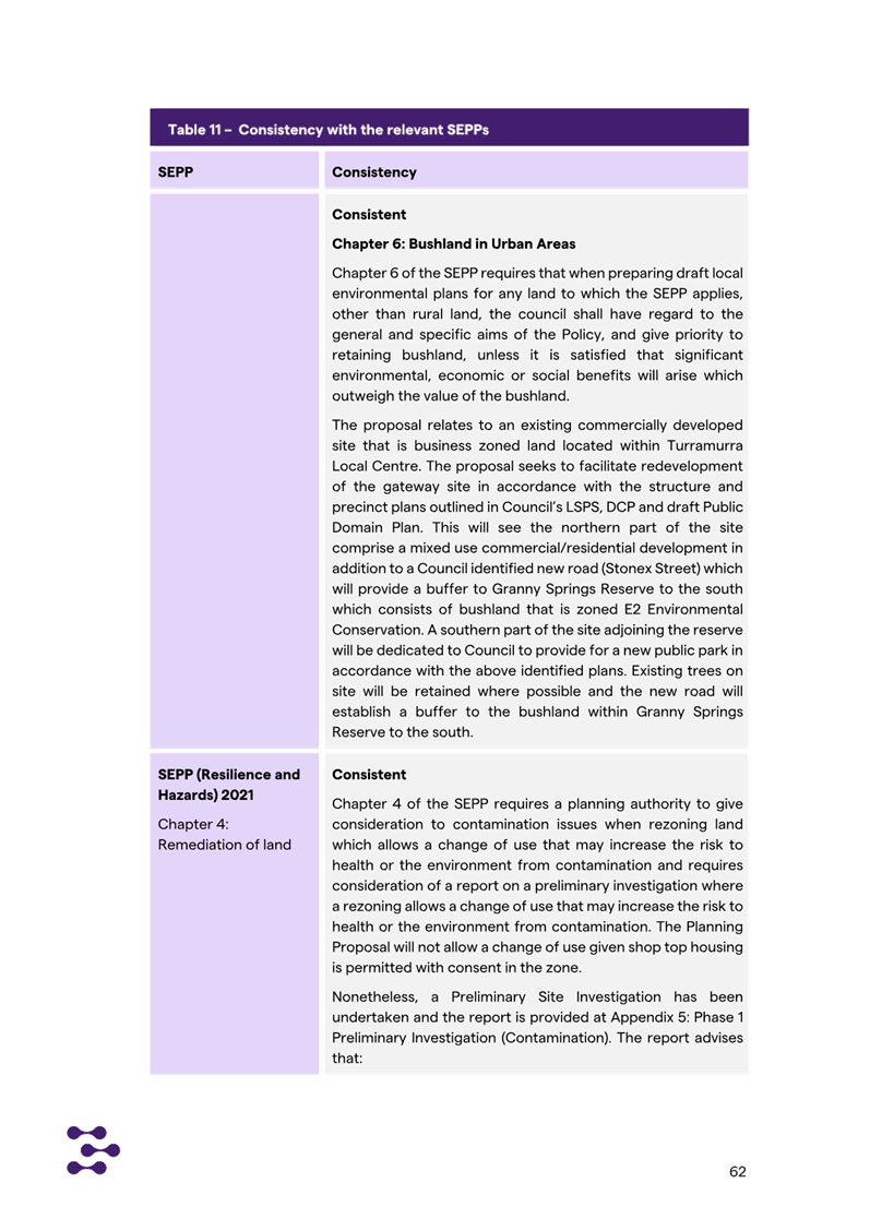
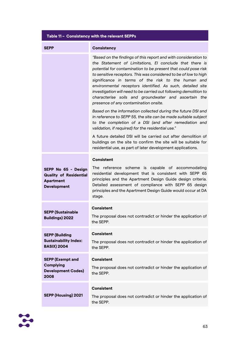
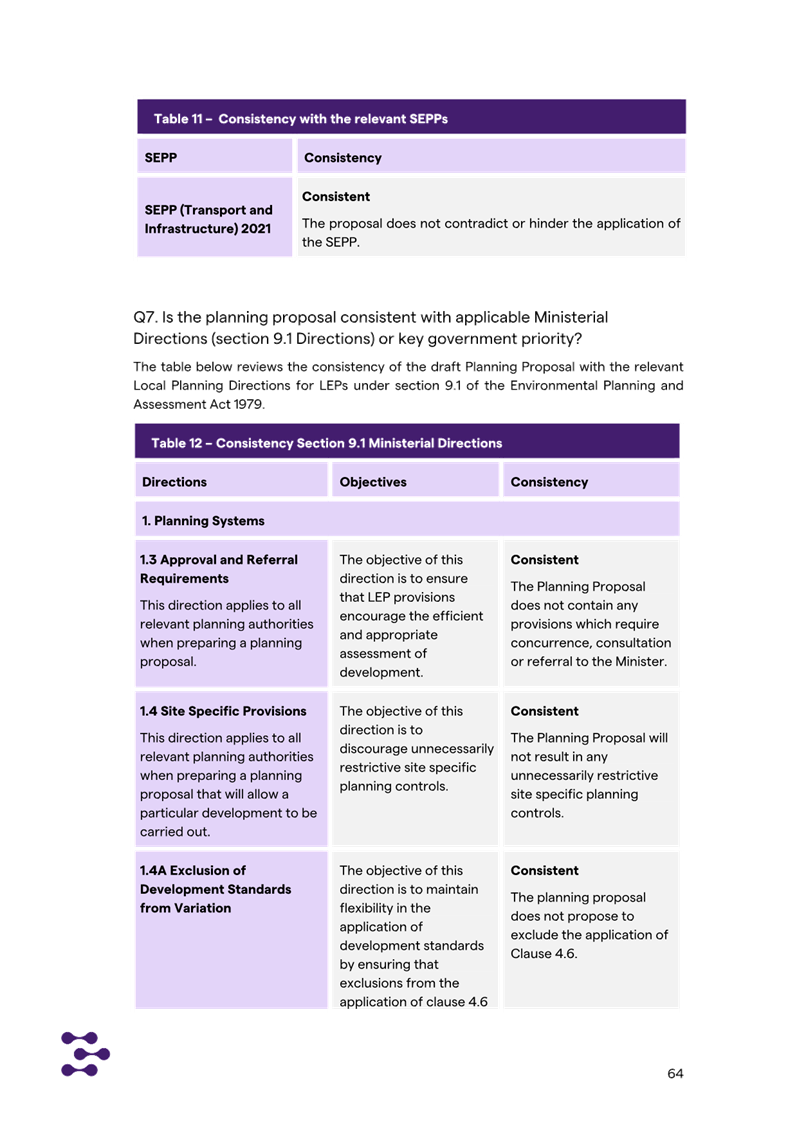
State Environmental Planning Policies (SEPPs) and
Ministerial Directions
Whilst the Planning Proposal is generally consistent with
the State Environmental Planning Polices (SEPPs) applicable to the site,
additional information and amendments are required to clarify and ensure
alignment with the following:
· SEPP (Biodiversity
and Conservation) 2021
· SEPP (Housing)
2021 – Seniors Housing
· SEPP (Housing)
2021 -Design Quality of Residential Flat Development & Apartment Design
Guide (ADG)
The required additional information is noted at Attachment
A1.
Other studies
The Planning Proposal has demonstrated consistency with the
following additional studies:
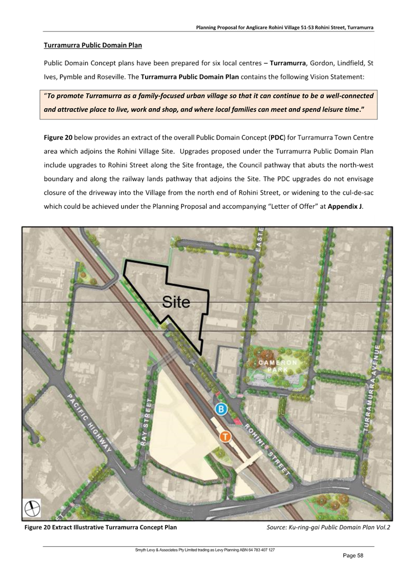
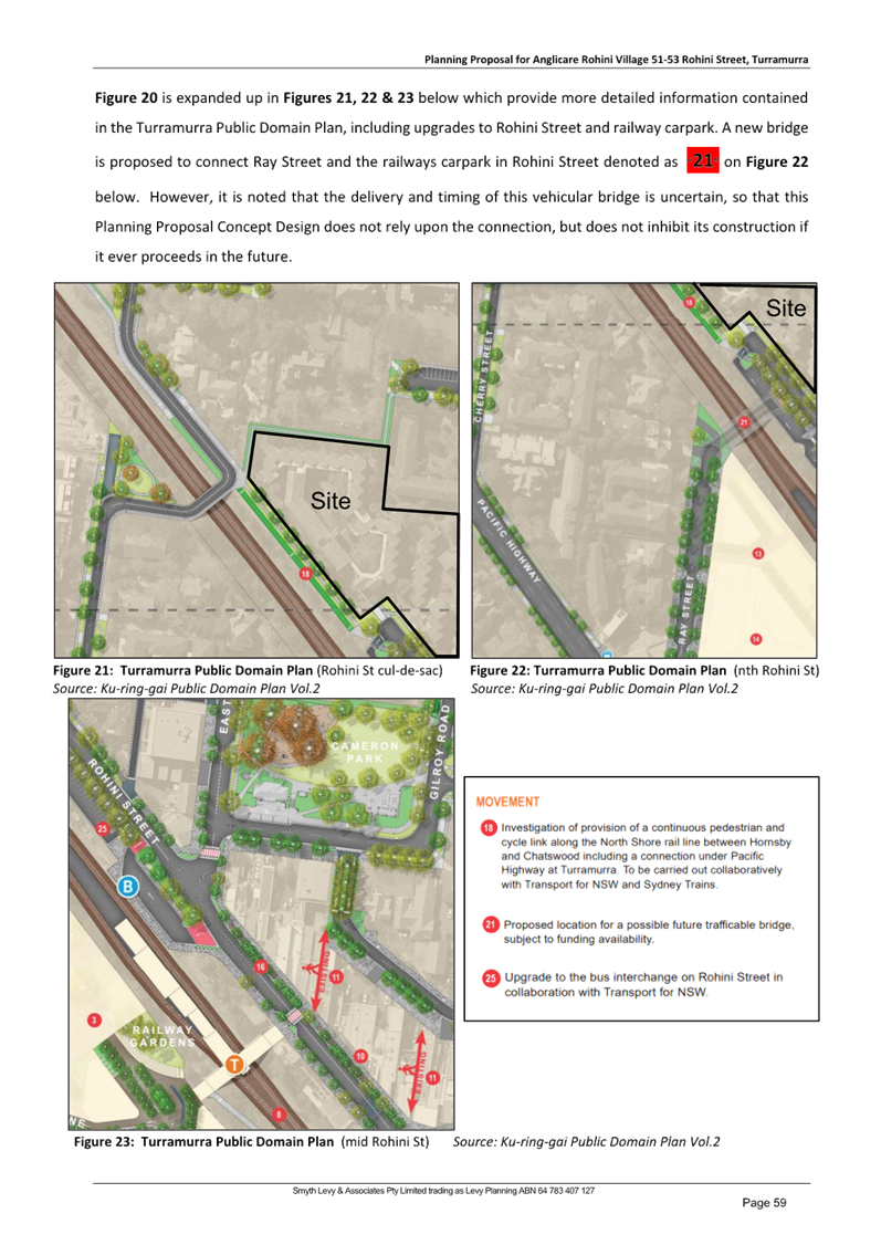
· Ku-ring-gai Public
Domain Plan (March 2022) including Turramurra Public Domain Plan
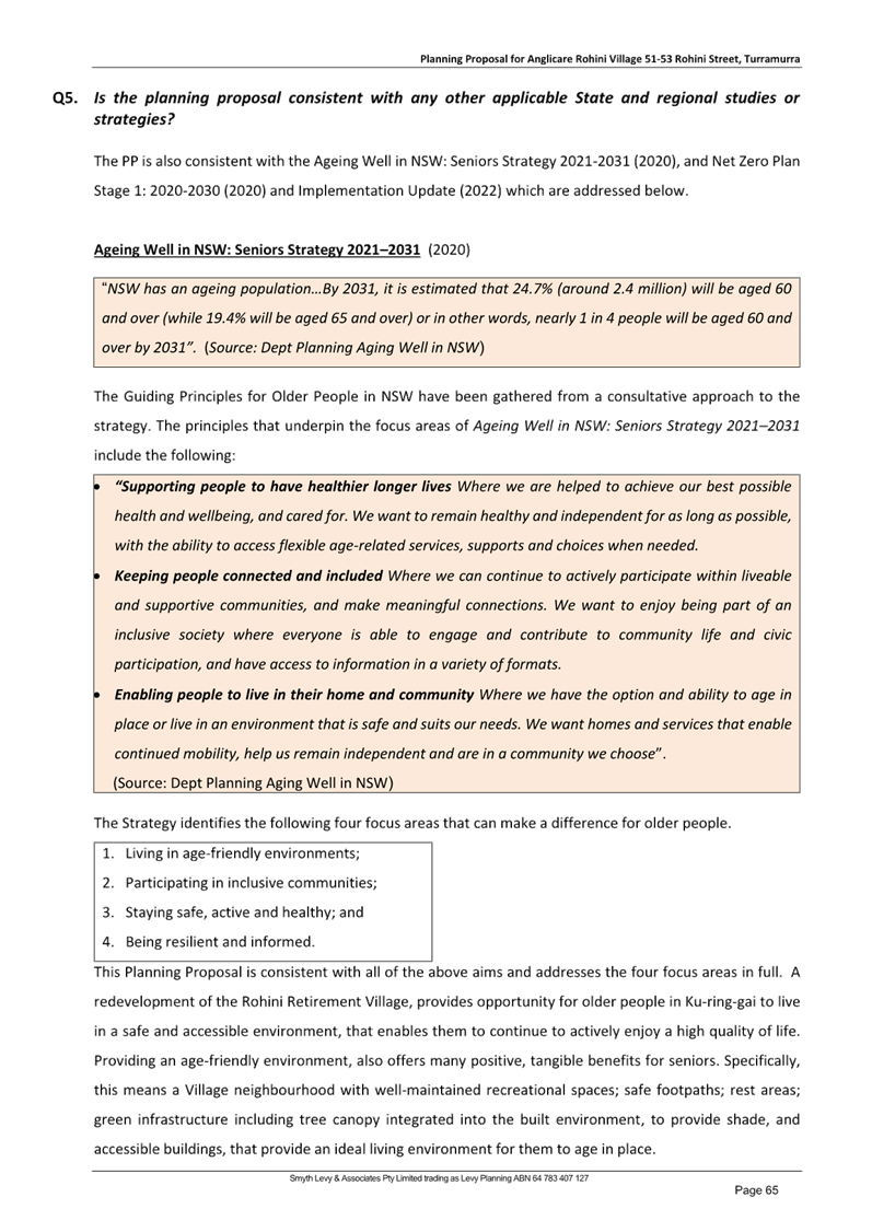
· Ageing Well in
NSW: Seniors Strategy 2021–2031 (2020)
Strategic Merit Assessment Summary
In accordance with the Department of Planning, Housing and
Infrastructure’s ‘Local Environmental Plan Making
Guideline’, a Planning Proposal is deemed to have strategic merit if
it:
· Gives effect to
the relevant regional plan outside of the Greater Sydney Region, the relevant
district plan within the Greater Sydney Region, and/or corridor/precinct plans
applying to the site. This includes any draft regional, district or
corridor/precinct plans released for public comment or a place strategy for a
strategic precinct including any draft place strategy; or
· Demonstrates
consistency with the relevant LSPS or strategy that has been endorsed by the
Department or required as part of a regional or district plan; or
· Responds to a
change in circumstances that has not been recognised by the existing planning
framework.
As outlined above it is considered that the Planning
Proposal is consistent with the objectives, priorities and strategies of both
the Greater Sydney Region Plan and the North District Plan. Further the
Planning Proposal is consistent with the broad intent for Turramurra outlined
in the LSPS and its supporting Centres Strategy. Further, the Planning Proposal
is considered to be consistent with the Council’s adopted Housing Strategy.
The site and its dwellings are well located with good access to infrastructure
and services. Accordingly, it is considered that the Planning Proposal
demonstrates strategic merit.
Site Specific Merit
The key objective of the Planning Proposal is to facilitate
the site’s redevelopment as it no longer meets design standards for
seniors housing, nor is it in line with current customer expectations. As such
the Planning Proposal seeks a significant uplift in standards as follows:
· increase the
maximum Floor Space Ratio (FSR) from 0.85:1 to 1.5:1 (the Housing SEPP bonus
provisions will result in a final FSR of 1.725:1);
· increase the
maximum Height of Building from 11.5m to 17.5m (the Housing SEPP bonus provisions
will result in a final Height of 21.3m).
It also seeks to include certain Local Provisions to enable
the operation of a Café and a Wellness Centre with an indoor pool.
To demonstrate that the proposed Height and FSR is
appropriate having regard to the site’s specific opportunities and
constraints, an Urban Design Report with a concept plan has been submitted with
the Planning Proposal request. The concept plan intends to demonstrate site-
specific merit. Other specialist Attachments to the Planning Proposal also
provide discussion and evidence of merit reflected in the Planning Proposal.
The Planning Proposal and its Attachments may be viewed at Attachments A2-
A14.
In general, the concept plan and the other specialist
reports demonstrate site specific merit; however, a number of clarifications
and amendments are sought prior to any progression of the Planning Proposal.
The required amendments to the Planning Proposal and its Attachments are
described in this Report and within the Table of Assessment at Attachment
A1.
Some of the key considerations requiring further detail and
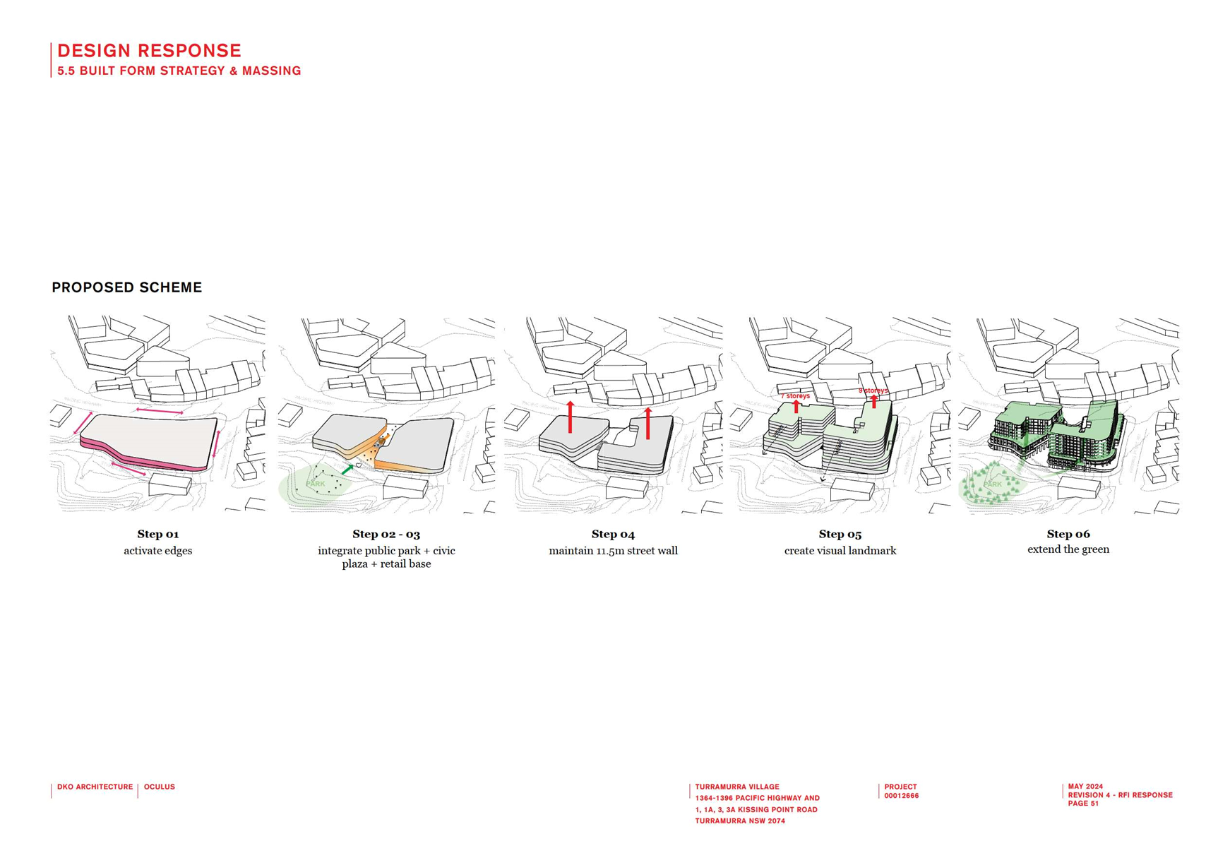
amendment include:
· Mechanism to
deliver the new Building Height and FSR
As indicated
in the below Table taken from the Planning Proposal, the Planning Proposal
seeks to make the amendment to the Building Height, FSR and Additional
Permitted Uses only through the KLEP Written Instrument with an Additional
Permitted Uses Map:
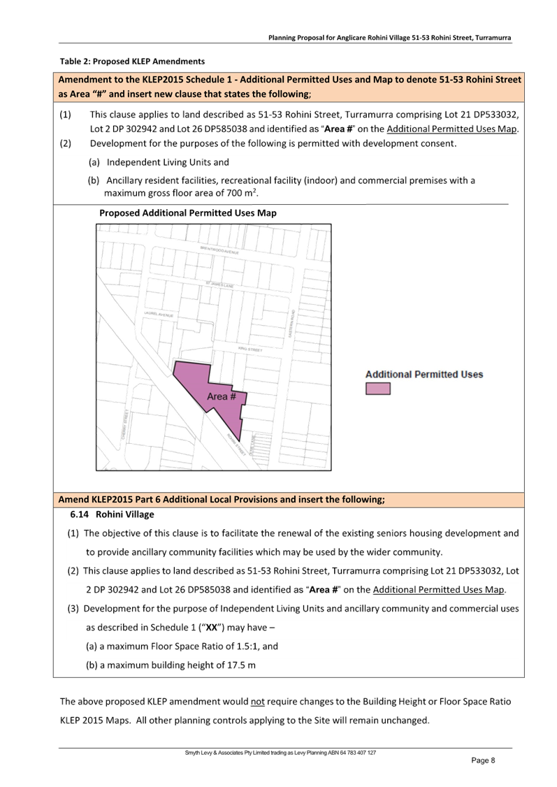
Table 2: Proposed KLEP
Amendments
|
Amendment to the KLEP2015 Schedule 1 - Additional
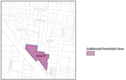
Permitted Uses and Map to denote 51-53 Rohini Street as Area “#”
and insert new clause that states the following;
|
|
(1) This clause
applies to land described as 51-53 Rohini Street, Turramurra comprising Lot
21 DP533032, Lot 2 DP 302942 and Lot 26 DP585038 and identified as “Area #”
on the Additional
Permitted Uses Map.
(2) Development
for the purposes of the following is permitted with development consent.
(a) Independent Living Units and
(b) Ancillary resident facilities, recreational facility (indoor)
and commercial premises with a maximum gross floor area of 700m2.
Proposed Additional Permitted Uses Map
|
|
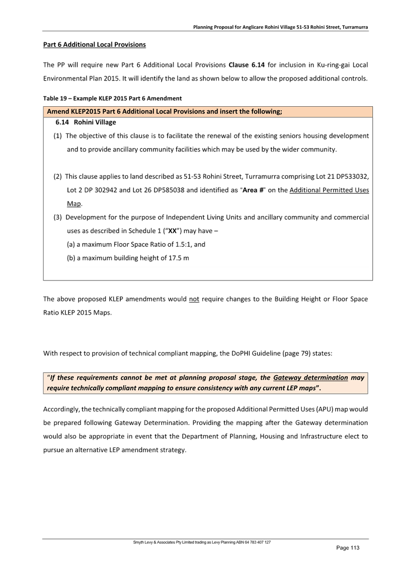
Amend KLEP2015 Part 6 Additional Local Provisions and
insert the following;
|
|
6.14 Rohini Village
(1)
The objective of this clause is to facilitate the renewal of the existing
seniors housing development and to provide ancillary community facilities
which may be used by the wider community.
(2)
This clause applies to land described as 51-53 Rohini Street, Turramurra
comprising Lot 21 DP533032, Lot 2 DP 302942 and Lot 26 DP585038 and
identified as
“Area #” on
the Additional
Permitted Uses Map.
(3)
Development for the purpose of Independent Living Units and ancillary
community and commercial uses as described in Schedule 1 (“XX”)
may have –
(a) a
maximum Floor Space Ratio of 1.5:1, and
(b) a maximum building
height of 17.5 m
|
|
The above proposed KLEP amendment would not require changes to
the Building Height or Floor Space Ratio KLEP 2015 Maps. All other
planning controls applying to the Site will remain unchanged.
|
There are a
number of issues associated with this approach as described below:
a. Independent Living Units
The proposal
lists “Independent Living Units” as an additional use. This must be
removed as it duplicates a use permitted by the SEPP (Housing) in the R4 zone.
LEP practice note, PN 11-002 - Preparing LEPs using the Standard Instrument:
standard zones states that “where the permissibility of certain land uses
is provided for under a relevant SEPP…, there is no need to include these
types of development in Standard Instrument LEPs”.
b. Additional Uses
The words
“Ancillary resident facilities” is not a defined use in the
Standard instrument definitions and therefore must be removed. The relevant
definitions to enable the required additional uses are as follows:
commercial premises means any of the following—
(a) business premises,
(b) office premises,
(c) retail premises.
recreation facility (indoor) means a building or place used
predominantly for indoor recreation, whether or not operated for the purposes
of gain, including a squash court, indoor swimming pool, gymnasium, table
tennis centre, health studio, bowling alley, ice rink or any other building or
place of a like character used for indoor recreation, but does not include an
entertainment facility, a recreation facility (major) or a registered club.
Ø Recommendation:
Therefore,
the wording requesting the additional uses should be corrected to the below
recommendation.
KLEP
2015 Schedule 1 Additional permitted
uses
Use of
certain land at 51-53 Rohini Street, Turramurra
· This clause applies to land at 51-53
Rohini Street, Turramurra, being Lot
21 DP533032, Lot 2 DP 302942 and Lot 26 DP585038.
· Development for the following purposes is
permitted with development consent.
- recreation
facility (indoor)
- commercial premises
· Development consent must not be granted
under this clause to development that results in the gross floor area of the
combined recreation facility (indoor) and commercial premises exceeding 700m2.
c. Additional Permitted Uses map
The Planning Proposal does not require an Additional Permitted
Uses map. The description of the site Lot and DP are sufficient to legally
identify the land and a list of additional uses is sufficient to attach those
uses to the site. A map is only useful for complex sites where further issues
are required to be addressed in additional clauses within the KLEP.
Ø Recommendation:
Remove the Additional Permitted Uses map.
d. Additional Local Provisions
The Planning Proposal seeks to make amendment to the FSR and
Height on the site via KLEP Part 6 Additional Local Provisions.
This approach is highly irregular and
not consistent with LEP Practice note PN 08-001 - Height and floor space
ratio. Where an LEP contains Clause 4.3 – Height of buildings and/or
Clause 4.4 – Floor space ratio, then heights and FSRs are to be specified
on the Height of Buildings Map and Floor Space Ratio Map respectively. Clause
4.4 does allow for a table to be used in conjunction with a map so that
separate FSRs may be set out depending on the mix of land uses.
The effect of the proposed local provision stipulated in
the Planning Proposal would be to allow only development for the purpose of Independent Living Units, and ancillary
community and commercial uses to achieve the proposed maximum FSR of 1.5:1 and
maximum Height of buildings of 17.5m. All other permitted uses on the site
would be restricted to the existing FSR of L: 0.85:1 and height of building of
K:11.5m.
There is no justification
in the Planning Proposal for the proposed variation of the development
standards to differentiate between the use of the site for Independent Living
Units plus ancillary community/commercial uses, and all other potential uses on
the site.
It would be assumed that
the potential bulk, scale and environmental impact of a seniors housing
development would be similar to that of an alternate use such as a residential
flat building. Therefore, if it is deemed that the site has the capacity to
accommodate the proposed FSR and height for a seniors housing use, then those
standards should apply to all permissible uses on the site.
Ø Recommendation:
Therefore, the proposed amendment to the Height and FSR must be
shown on the following KLEP maps:
1. Height of Building
Map
2. Floor Space Ratio
Map
All references to their inclusion within Part 6 Additional
Local Provisions are to be removed from the Planning Proposal and all its
Attachments.
· Building
Height and FSR – resultant development outcomes
The Planning
Proposal seeks to make the following amendments to the Ku-ring-gai Local
Environmental Plan 2015 (KLEP 2015) mapped standards:
1. increase the maximum Floor Space Ratio (FSR) from 0.85:1
to 1.5:1 (the Housing SEPP bonus provisions will result in a final FSR of
1.725:1);
2. increase the maximum Height of Building from 11.5m to
17.5m/5 storey (the Housing SEPP bonus provisions will result in a final Height
of 21.3m/6 storey);
The planning
proposal claims the increased standards will achieve the required compliance
with the below policy and guidance:
· SEPP
(Housing) 2021
· Seniors
Housing Design Guide 2023
· Apartment
Design Guide (ADG)
However, some
of the claims are questioned and further justifications, amendments,
clarifications and considerations must be addressed prior to the proposal being
progressed towards any Gateway Determination, and they are to demonstrate both
the said compliance and the integration of the development outcomes on a Site
located within Ku-ring-gai with its unique high quality environment and housing
provision.
Key to the
majority of the required amendments and considerations stated in Attachment
A1 is whether the proposed significant increase in FSR will enable
development on the site to be reflective of residential flat buildings within
Ku-ring-gai locality.
FSR
Considerations
The proposed
FSR of 1.5:1, which will be increased to 1.725:1 with the SEPP (Housing) bonus,
is inconsistent with the FSR that is generally applied to R4 (High Density
Residential) development in Ku-ring-gai - which has an FSR of 1.3:1 associated
with the 17.5m Height.
Similar sites
zoned R4 (High Density Residential) in this locality applying the FSR of 1.3:1
and Height of 17.5m standards have delivered buildings which demonstrate
cohesion with the Ku-ring-gai character of buildings within high quality
landscaped settings including tall canopy trees. The standards have been
calculated to ensure achievement of appropriate on and off site amenity,
including managing overlooking and over shadowing impacts to neighbouring
properties.
Given there is
the possibility that the site may be sold prior to development, if the new
landowner is not an aged housing provider, the site will be able to be
redeveloped as residential flat buildings consistent with the R4 (High Density
Residential) zoning. Having an FSR of 1.3:1, consistent with other R4 zoned
land in the area, will ensure any future non-Senior’s housing development
proposed for the site can achieve the same standards as other Residential Flat
Buildings within Ku-ring-gai.
The high FSR
sought by this Planning Proposal may be the reason the proposal appears to:
· not
achieve the clear (without paths) 6m dimensioned deep soil as required by the
ADG, and the associated delivery of tall canopy trees not identified for
delivery,
· provides
landscaped areas that again are dissected into small portions by multiple paths
and hardstands limiting the ability to provide large/ mass planting, and the
ability to provide communal garden areas and outdoor recreation/barbeque areas
for its Senior residents,
· delivers
units with no solar access and no natural ventilation,
· has
overshadowing impacts on the 2-3 storey properties to the south.
The Planning
Proposal states minimum compliance with the SEPP (Housing) 2021 requirements
but does not sufficiently consider the Ku-ring-gai locality and character, the
elevated position of the site exacerbating overlooking and overshadowing
impacts, and importantly, the nature of its residents that will increasingly
remain on the Site and in their apartments as they move into age related
frailty. These issues are required to be satisfied in accordance with the ADG
(including its sections on streetscape, local and neighbourhood character and
impacts) and the Seniors Housing Design Guide 2023.
The proposal
must demonstrate why the application of a 1.3:1 FSR with the added SEPP bonus
will not deliver the same number of units and commercial space whilst providing
improved outcomes on the site and to its neighbours.
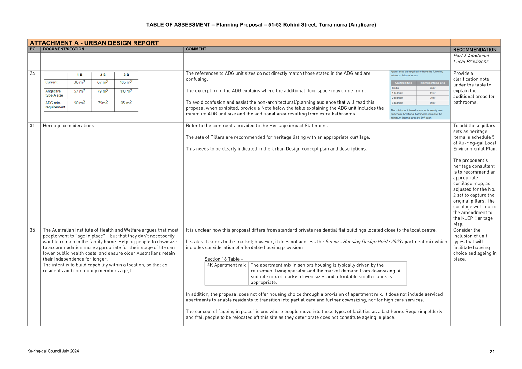
According to
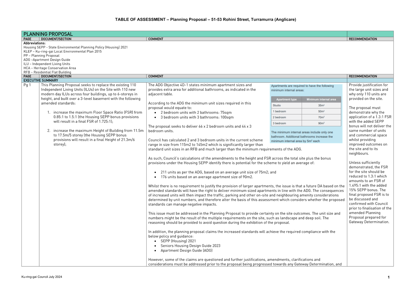
the ADG the minimum unit sizes required in this proposal would equate to:
· 2
bedroom units with 2 bathrooms: 75sqm
· 3
bedroom units with 3 bathrooms: 100sqm
The proposal seeks to deliver 66 x 2 bedroom units and 44 x
3 bedroom units.
Council has
calculated 2 and 3 bedroom units in the current scheme range in size from 115m2
to 145m2 which is significantly larger than standard unit sizes in an RFB and
much larger than the minimum requirements of the ADG.
As such,
Council’s calculations of the amendments to the height and FSR across the
total site plus the bonus provisions under the Housing SEPP identify there is
potential for the scheme to yield an average of:
· 211
units as per the ADG, based on an average unit size of 75m2; and
· 176
units based on an average apartment size of 90m2.
Whilst there
is no requirement to justify the provision of larger apartments, the issue is
that a future DA based on the amended standards will have the right to deliver
minimum sized apartments in line with the ADG. The consequences of increased
units will then impact the traffic, parking and other on-site and neighbouring
amenity considerations determined by unit numbers, and therefore alter the
basis of this assessment which considers whether the proposed standards can
manage negative impacts.
This issue
must be addressed in the Planning Proposal to provide certainty on the site
outcomes. The unit size and numbers might be the result of the multiple
requirements on the site, such as landscape and deep soil. The reasoning should
be provided to avoid question during the exhibition of the proposal.
Ø Recommendation:
Unless
sufficiently demonstrated, the FSR for the site should be reduced to 1.3:1
which amounts to an FSR of 1.495:1 with the added 15% SEPP bonus. The final
proposed FSR is to be discussed and confirmed with Council prior to
finalisation of the amended Planning Proposal prepared for Gateway
Determination.
· Provision
of housing choice and ageing in place.
The proposal comprises seeks to
delive110 independent living units as:
o 66
x 2 bedroom units
o 44
x 3 bedroom units.
The proposal does not offer
housing choice through a provision of apartment mix. It does not include
serviced apartments to enable residents to transition into partial care and
further downsizing, nor for high care services.
The concept of “ageing in
place” is one where people move into these types of facilities as a last
home. Requiring elderly and frail people to be relocated off this site as they
deteriorate does not constitute ageing in place.
Ø Recommendation:
Include housing choice and
options to address ageing in place, or fully justify why housing choice and
ageing in place is not supported on this site.
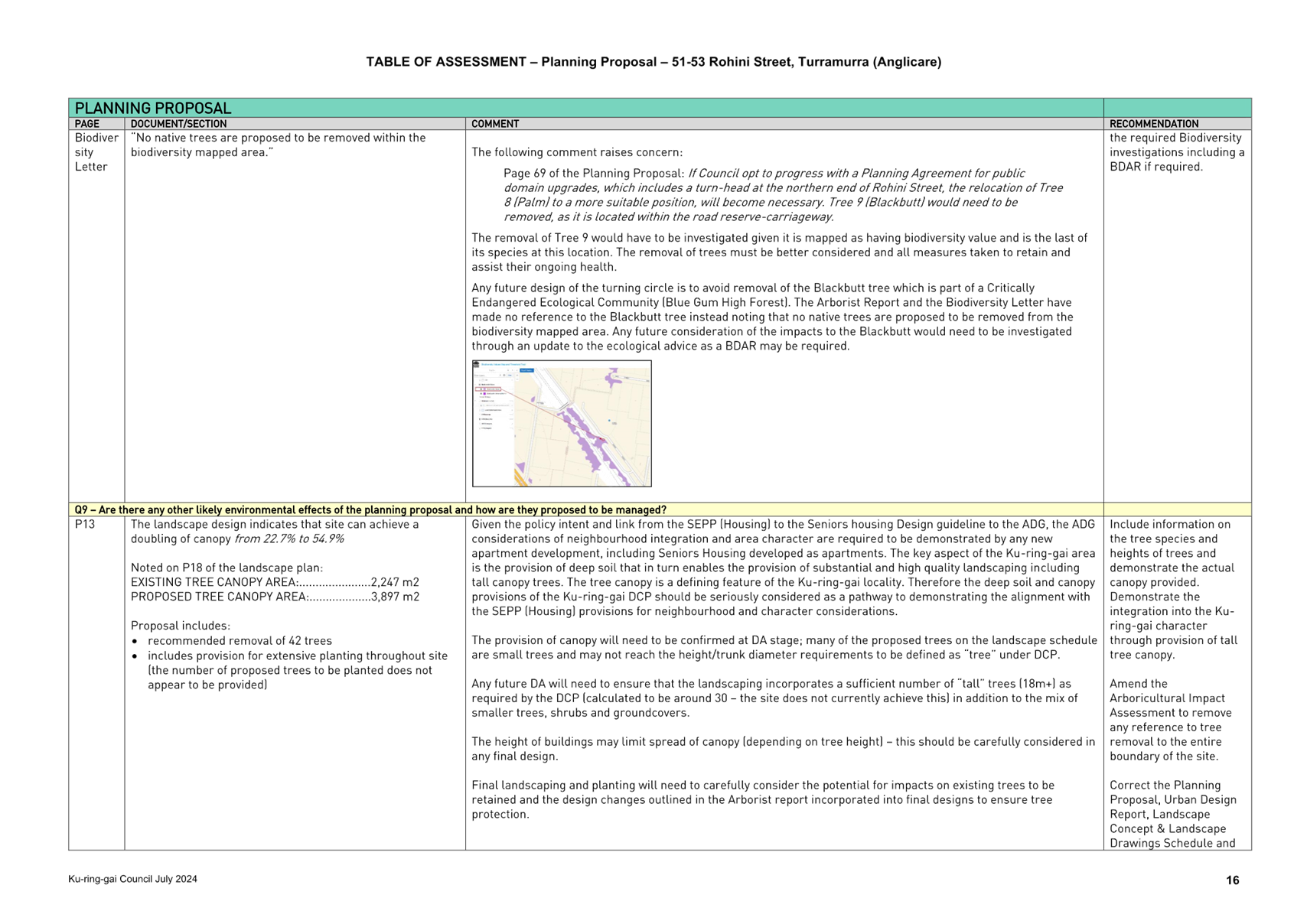
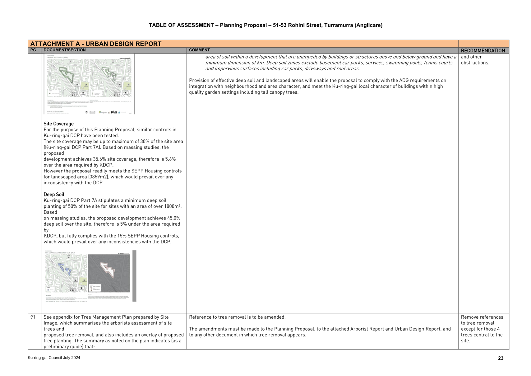
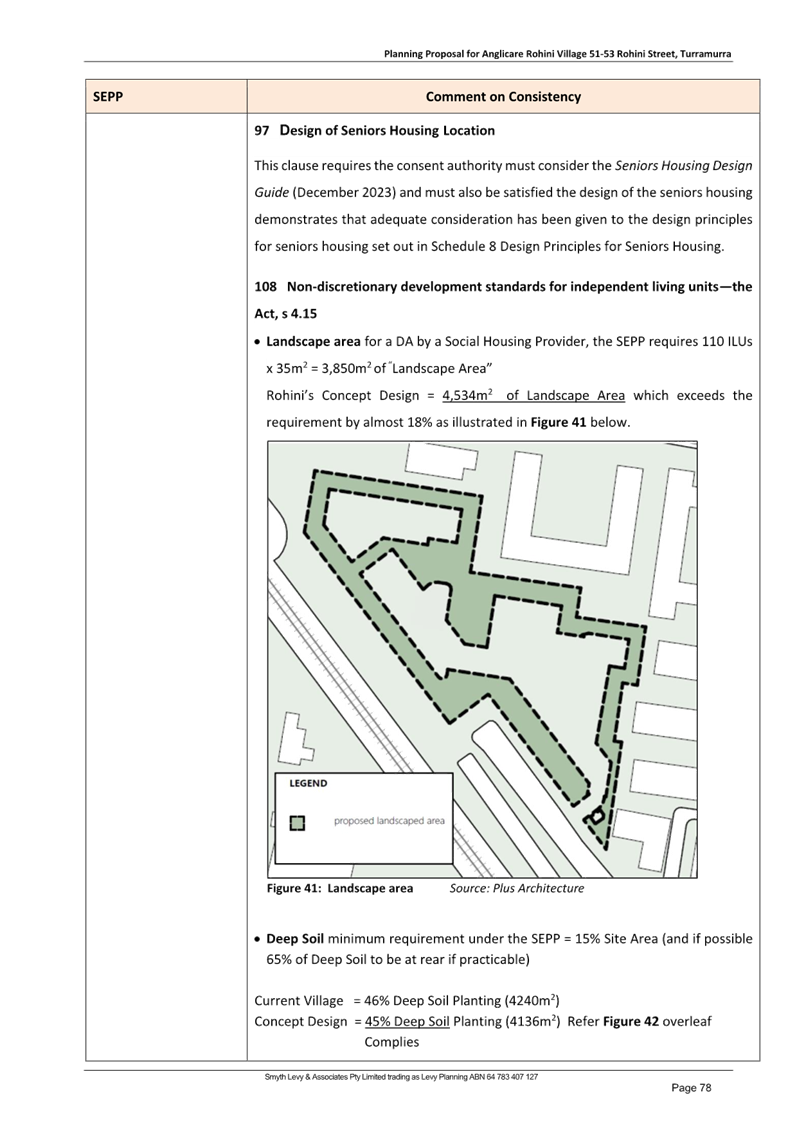
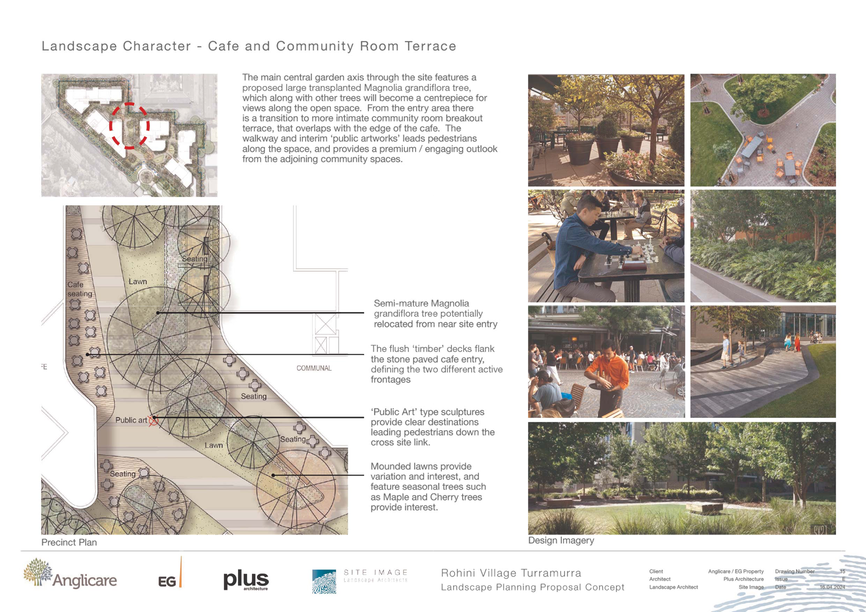
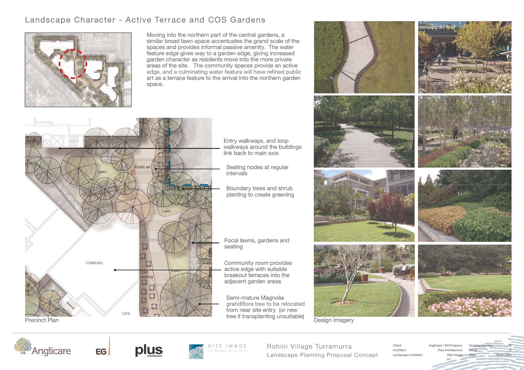
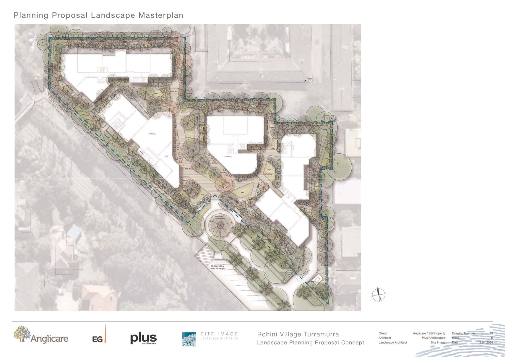
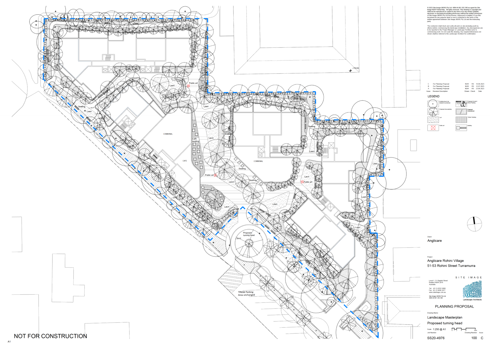
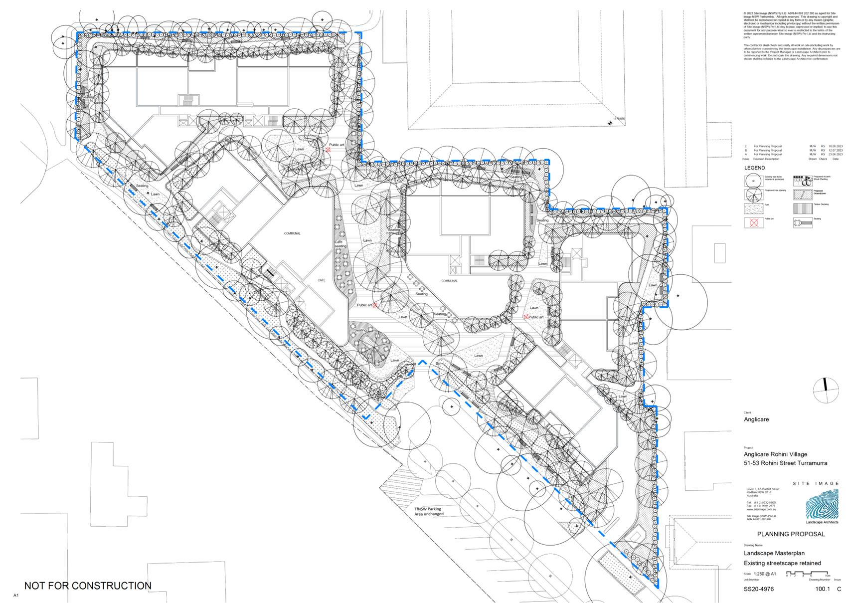
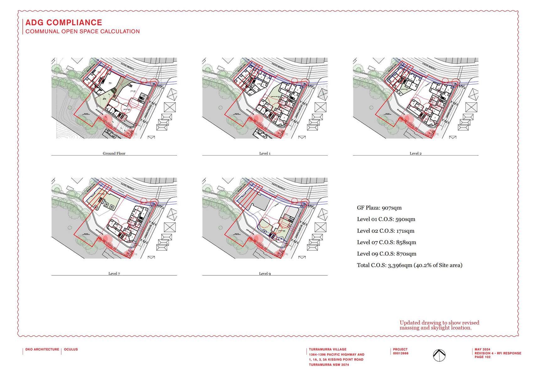
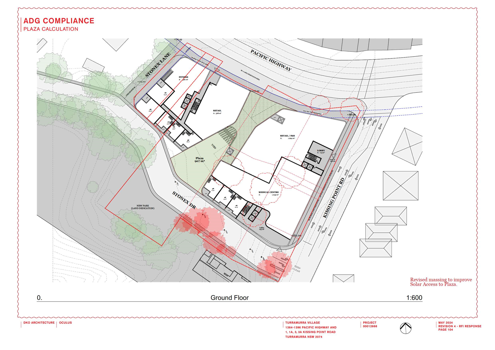
· Landscaped
area and deep soil area
The proposal
states compliance with the Landscape and Deep Soil requirements of the SEPP (Housing) 2021.
It is
noted that the SEPP (Housing) definitions do not exclude the pathways from the
calculation of landscaped area. The proposal has extensive hard surfaces/pathway
systems all around the buildings, including in the boundary setbacks, with
landscaping fitting into the remnant spaces. The ability for large and
significant planting, typical of the Ku-ring-gai area, within these relatively
small spaces is questionable.
Similarly,
while the SEPP (Housing) 2021 speaks of 3m dimensions for deep soil provision,
the SEPP (Housing) 2021 shows a clear policy intent that apartment buildings
are to align with the Apartment Design Guide (ADG) to ensure good
outcomes.
This
pathway is demonstrated in the Seniors Housing Design Guideline, related
to the SEPP, which includes a table at Part 4 -18.0 Alignment with
the Apartment Design Guide (ADG), directing
designers to the ADG standards. Therefore, the ADG definition, which requires a
6m minimum dimension for effective deep soil around RFBs must be applied to
this development. It is unclear if this has been done in the Urban Design
calculations.
Provision
of effective deep soil and landscaped areas will enable the proposal to comply with
the ADG requirements on integration with neighbourhood and area character, and
meet the Ku-ring-gai local character of buildings within high quality garden
settings including tall canopy trees.
Ø Recommendation:
Demonstrate the landscape and deep soil standards can deliver the
Ku-ring-gai landscape character, including a count and location of tall canopy
trees with specified height and canopy spread, noting the ground/deep soil
areas provided to sustain their growth and long term health.
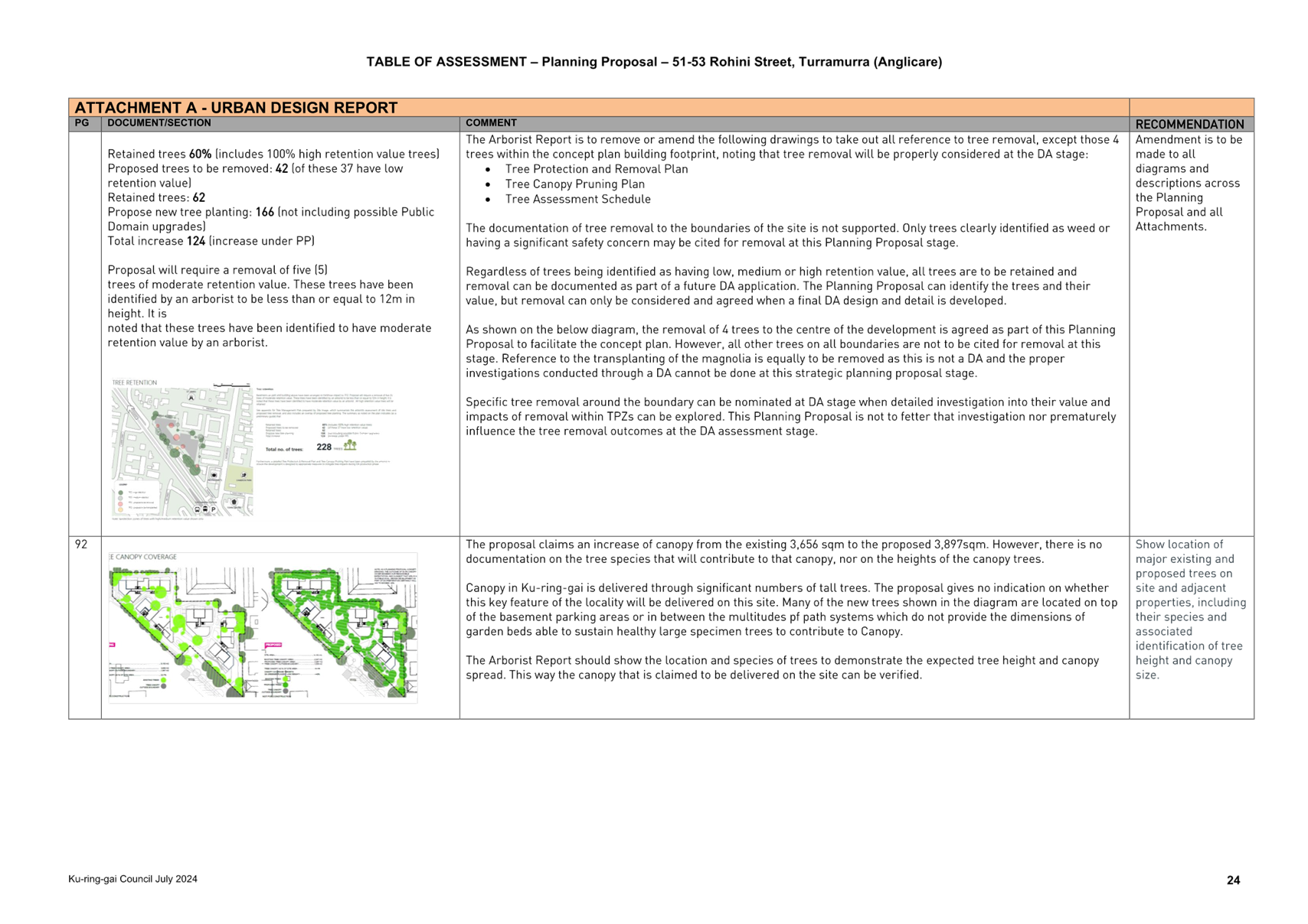
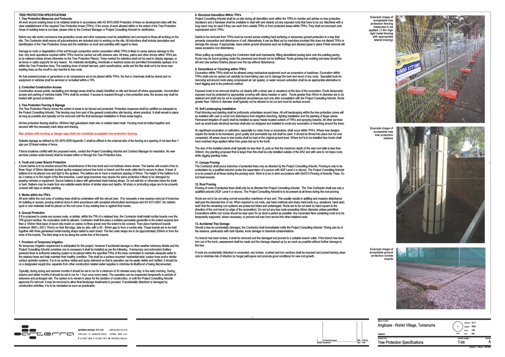
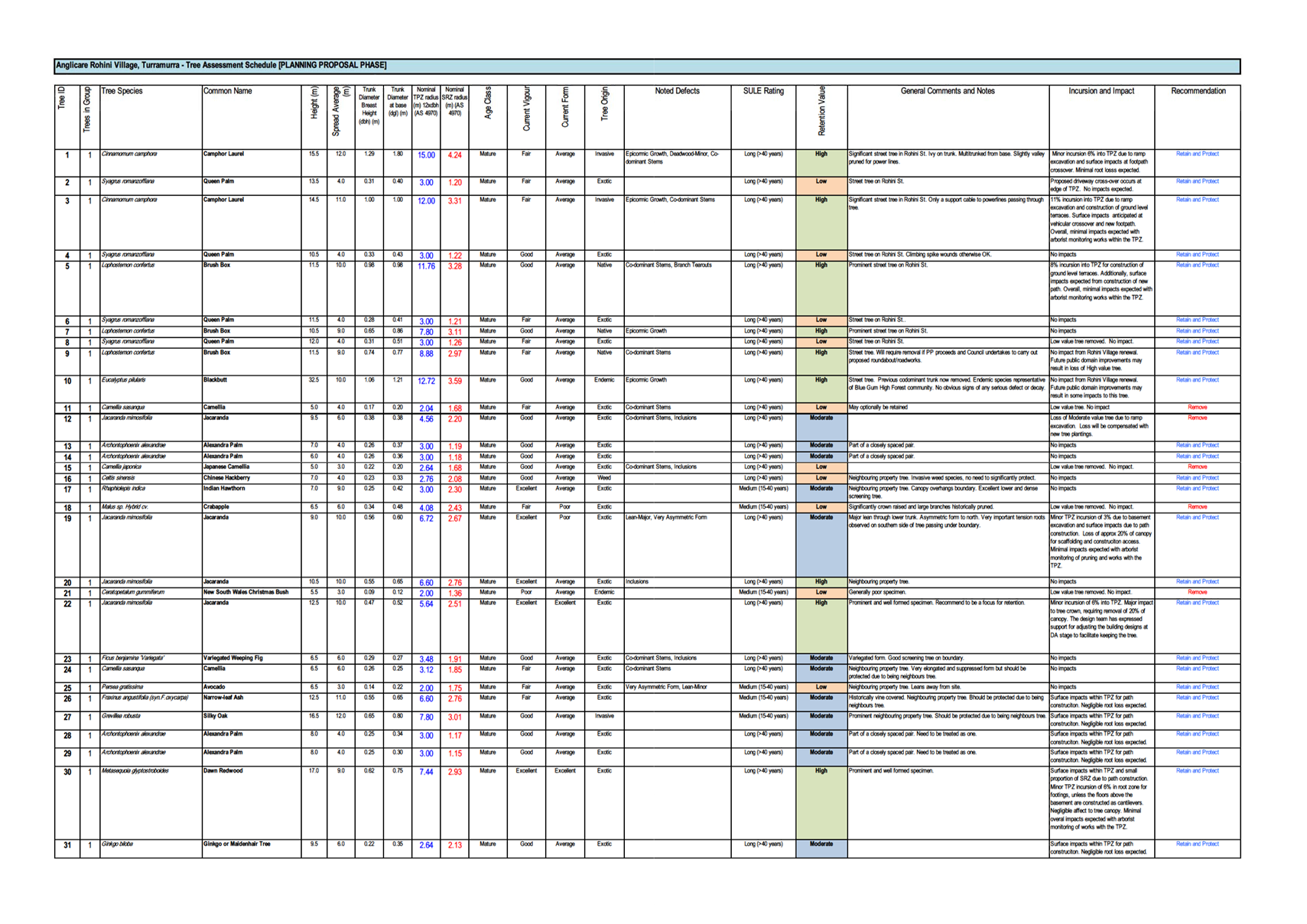
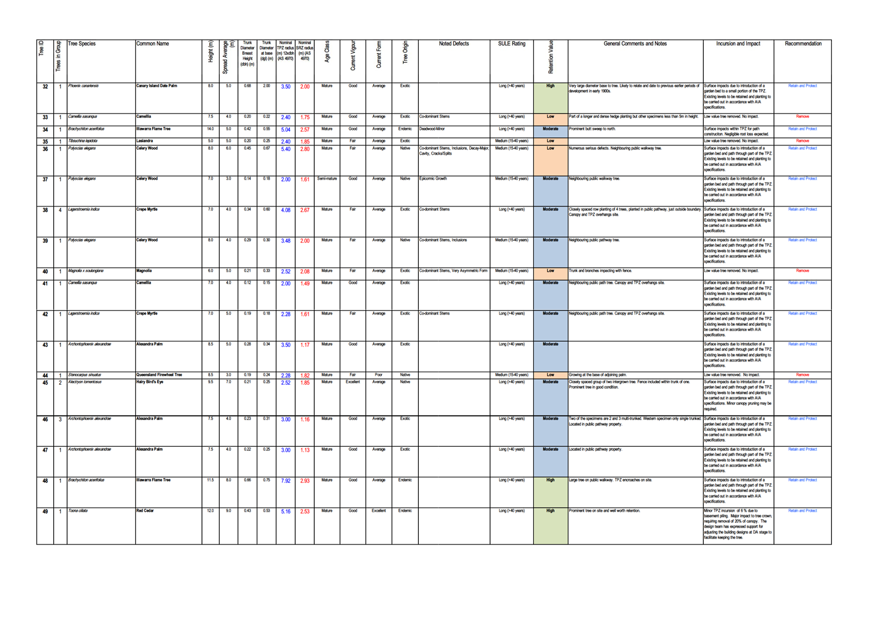
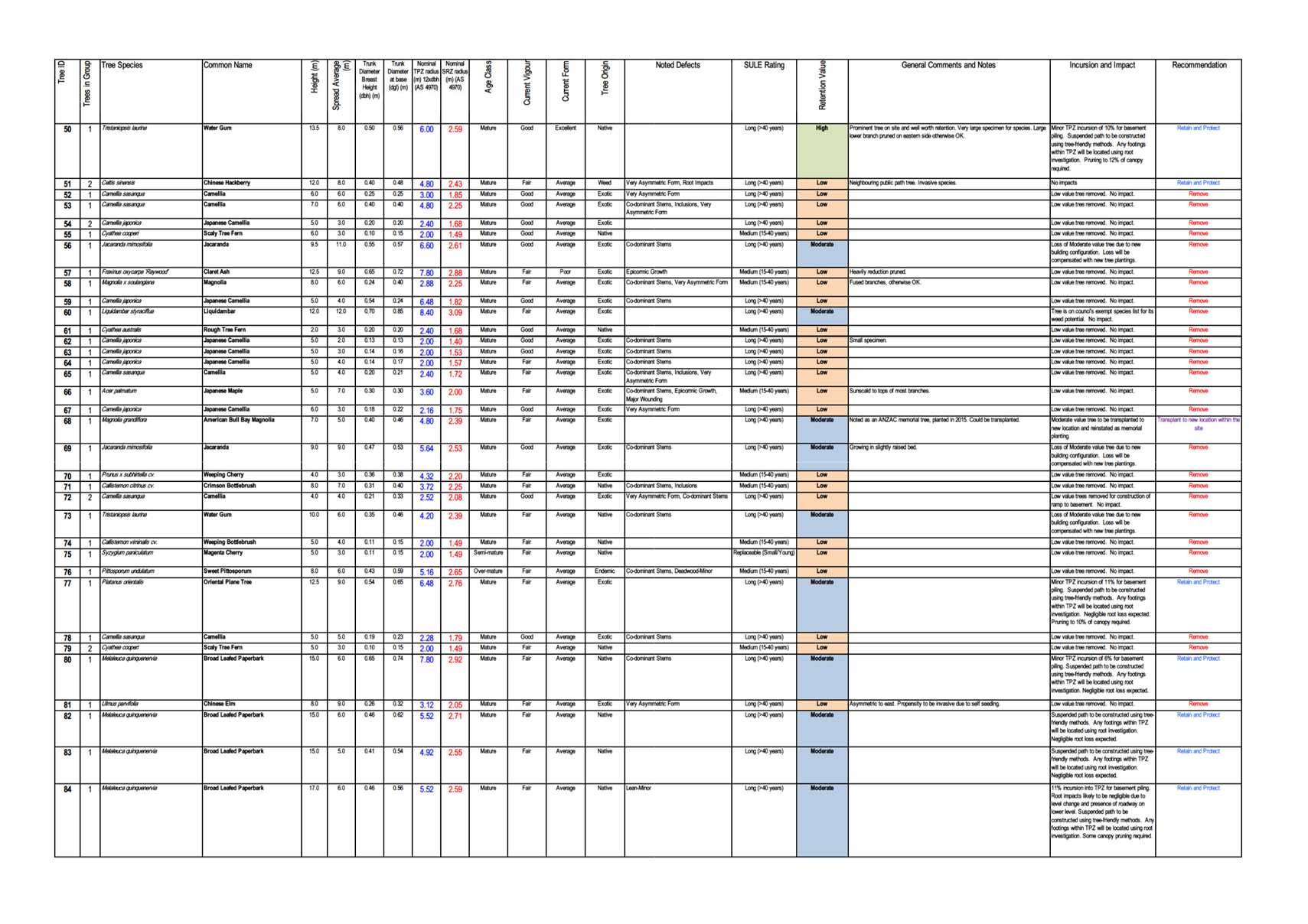
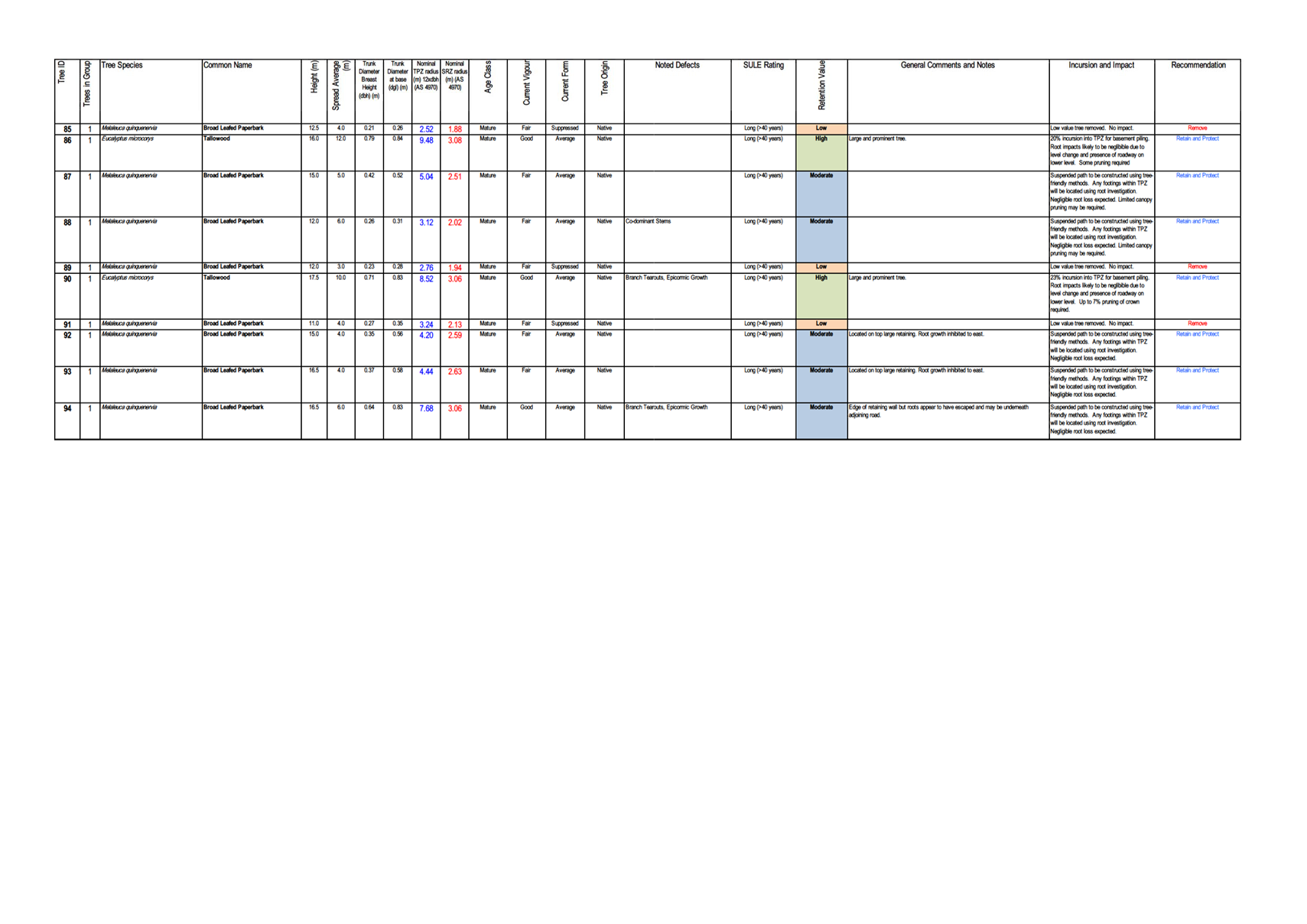
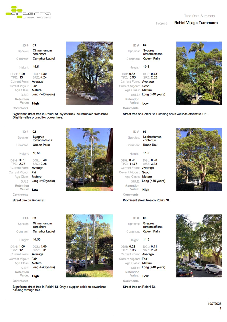
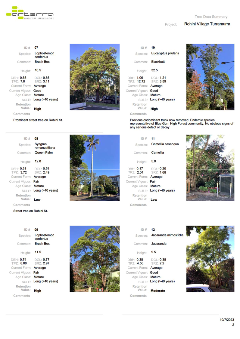
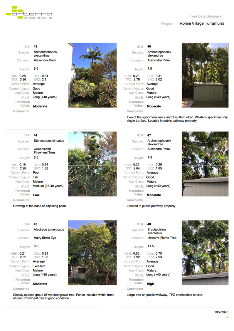
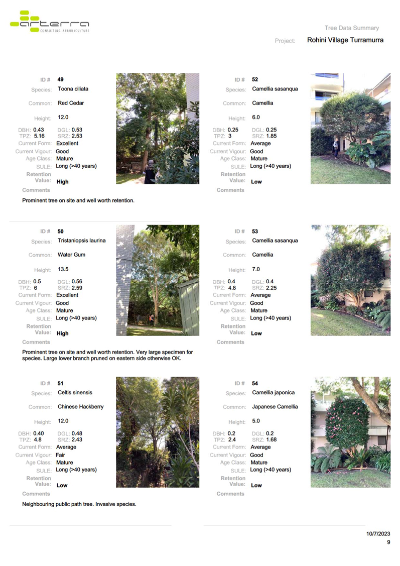
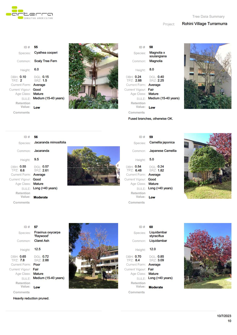
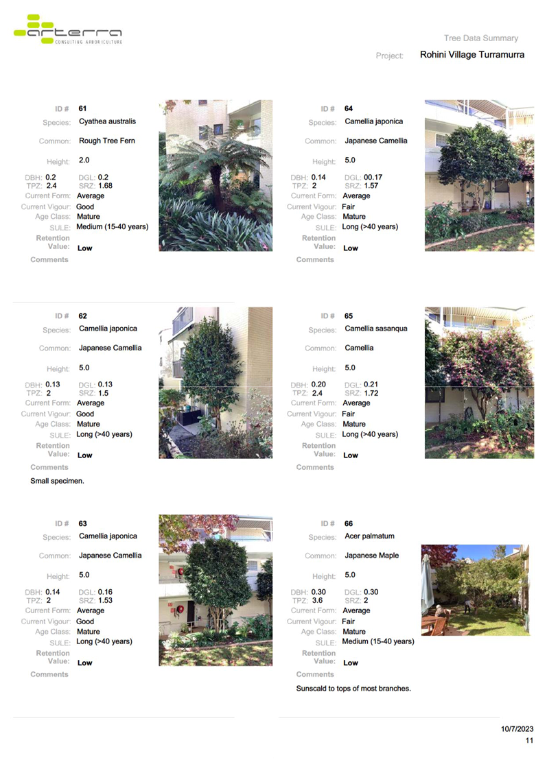
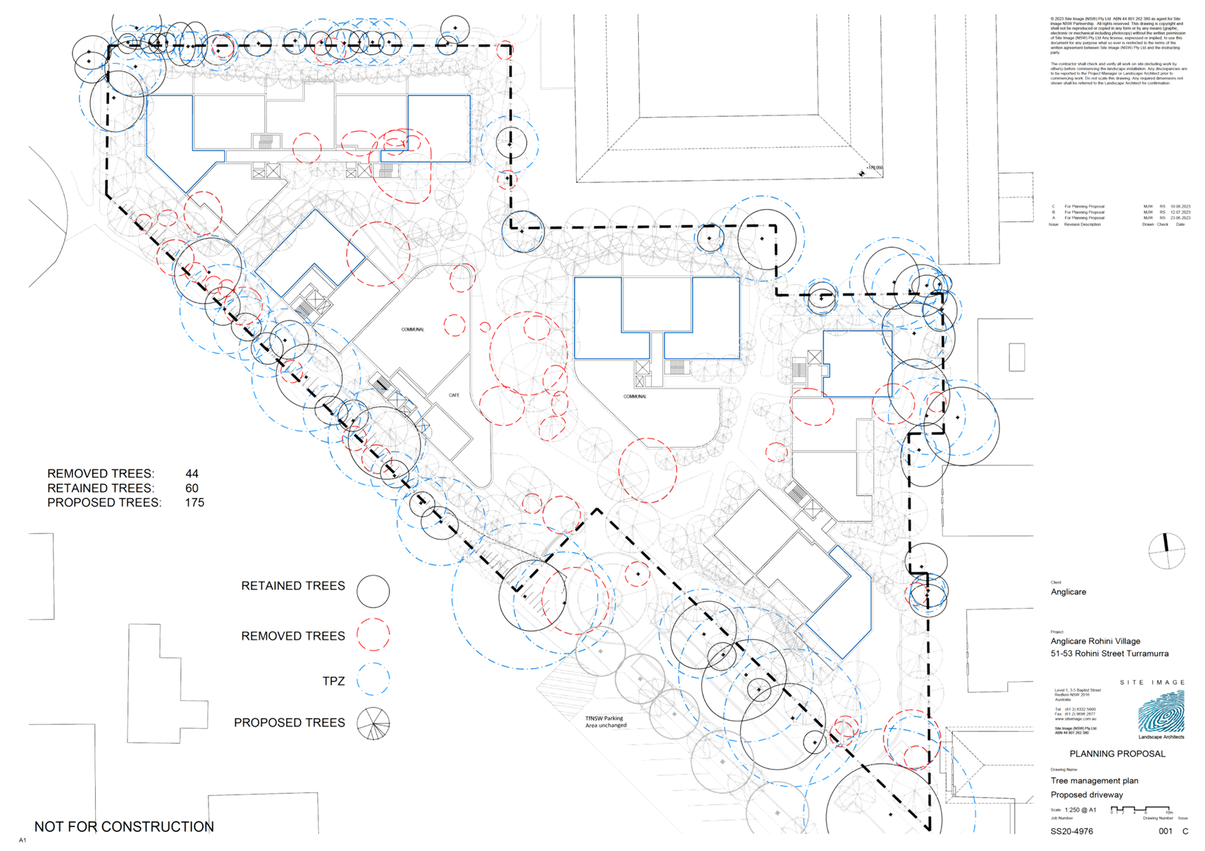
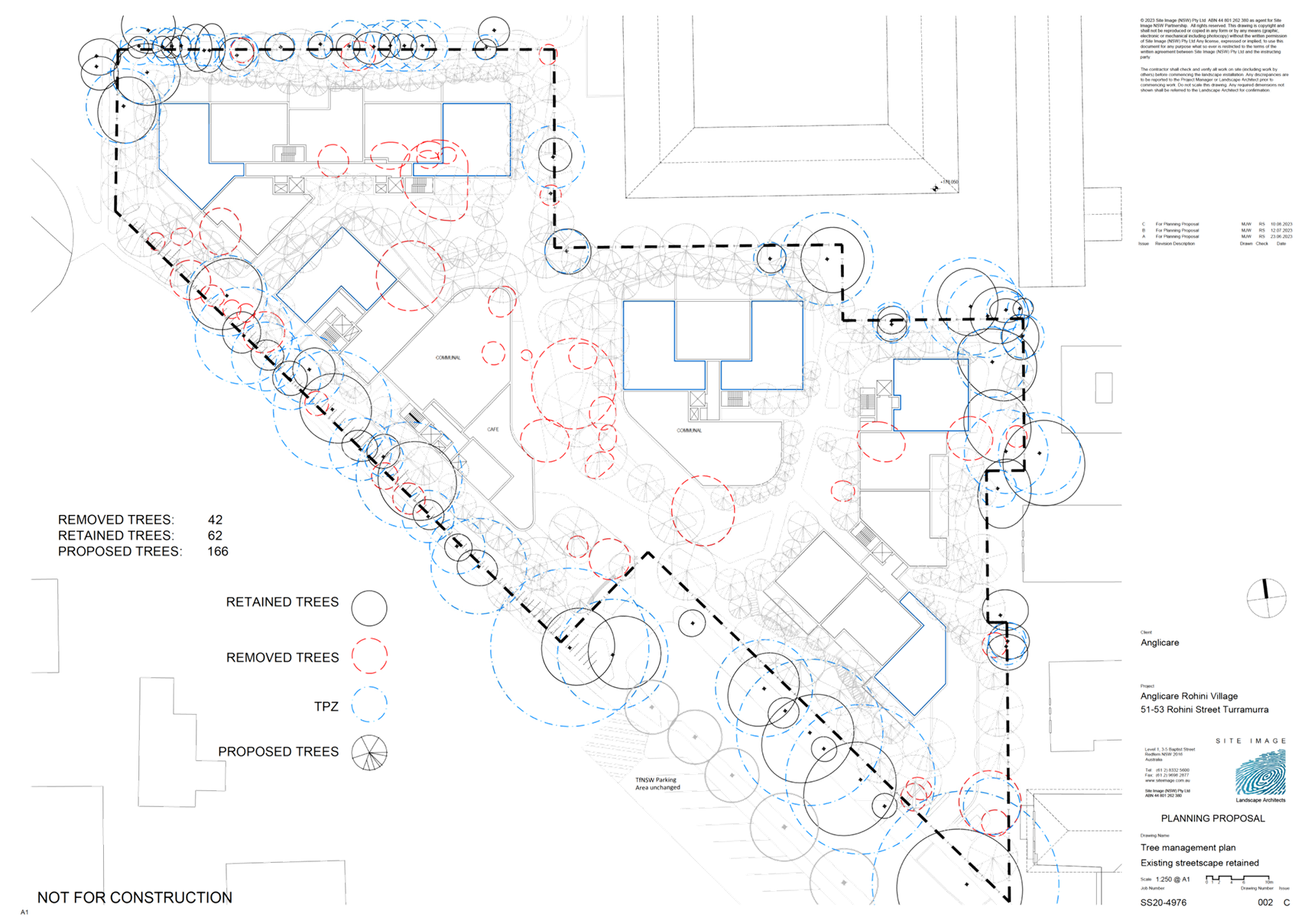
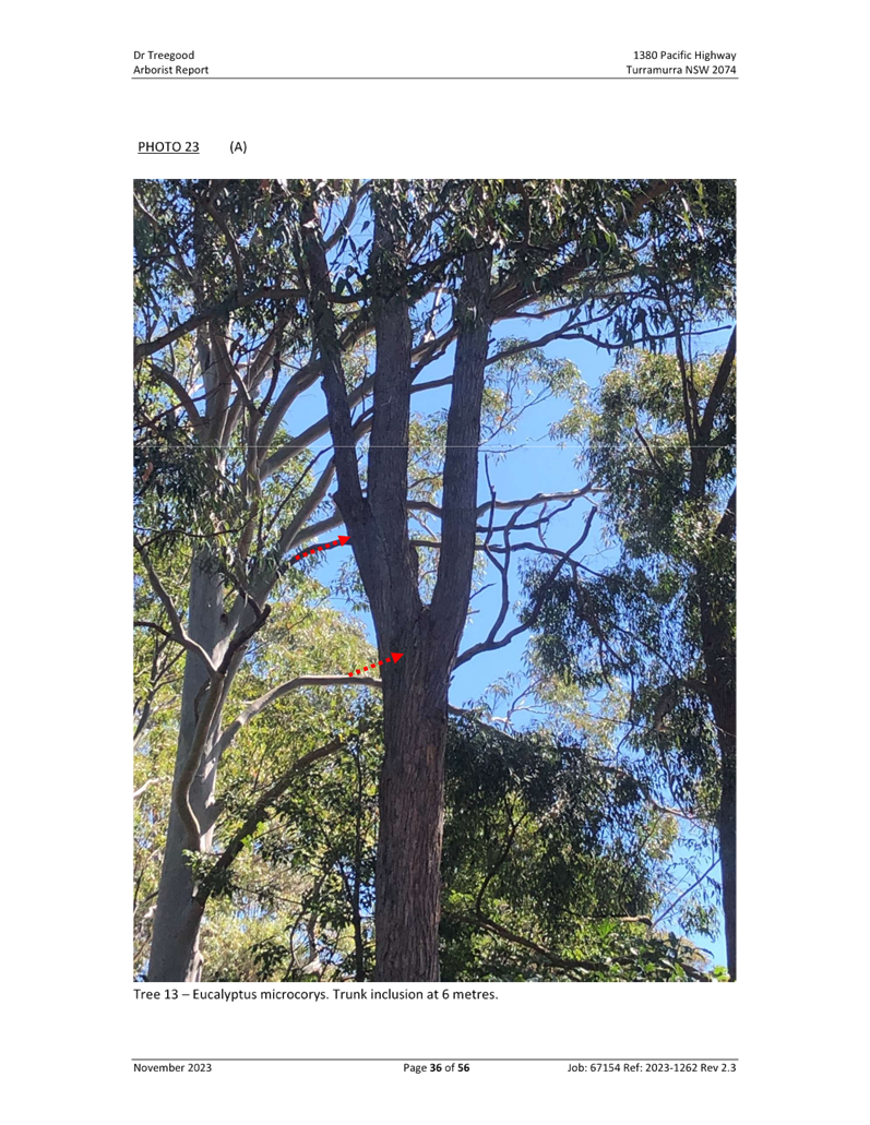
· Tree
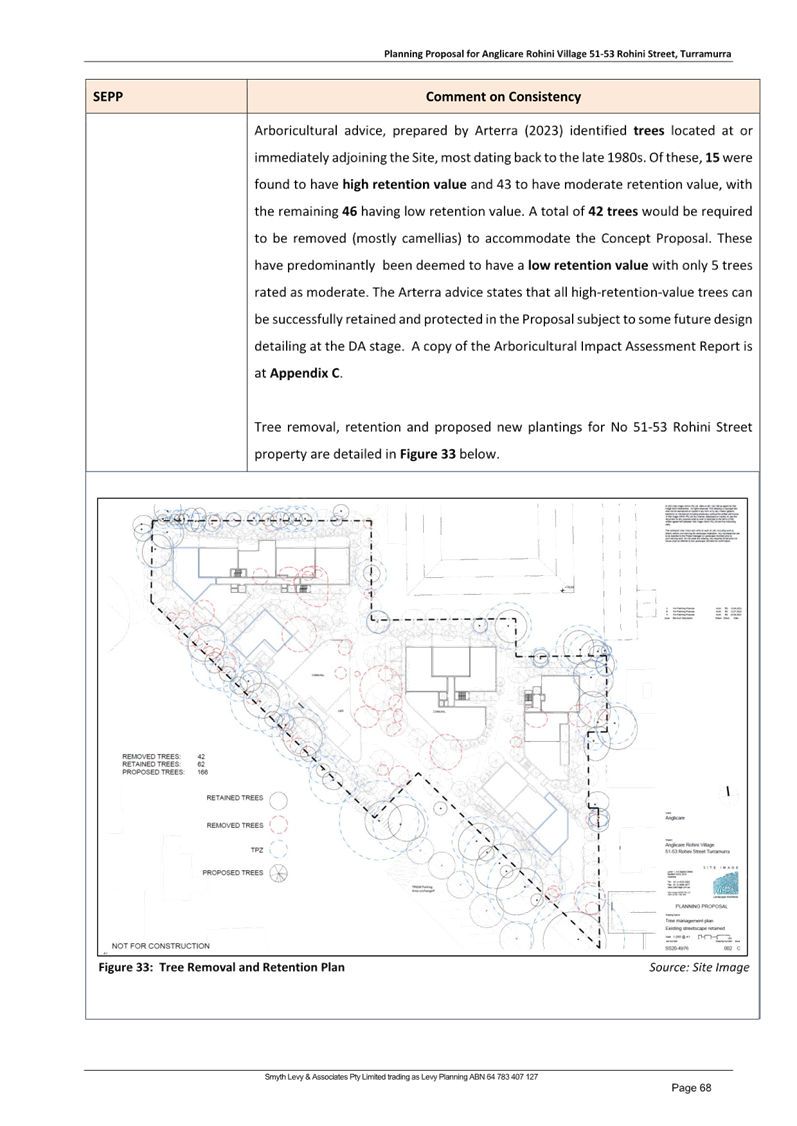
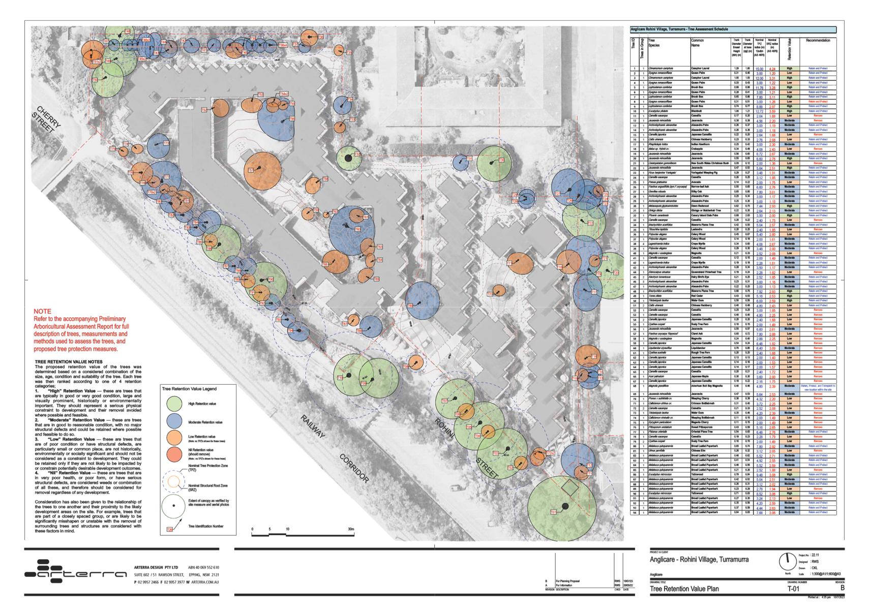
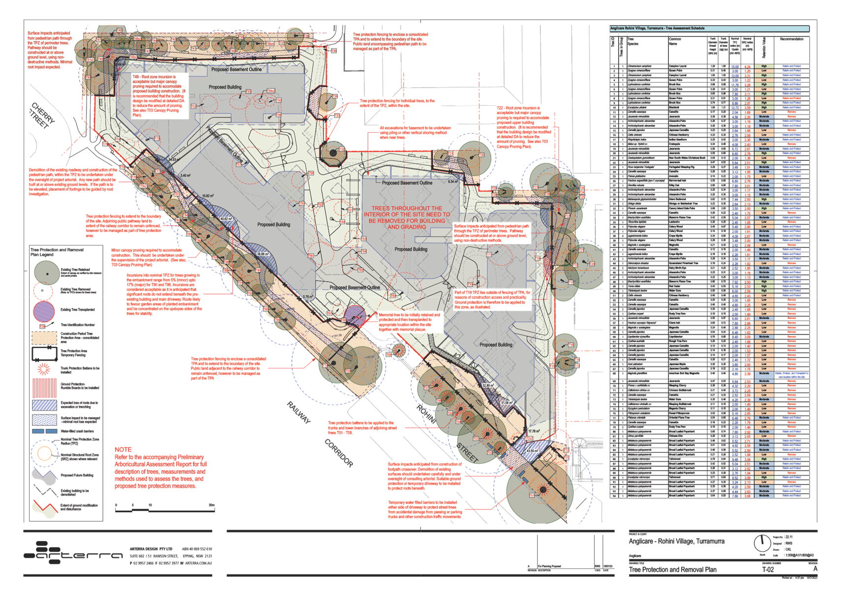
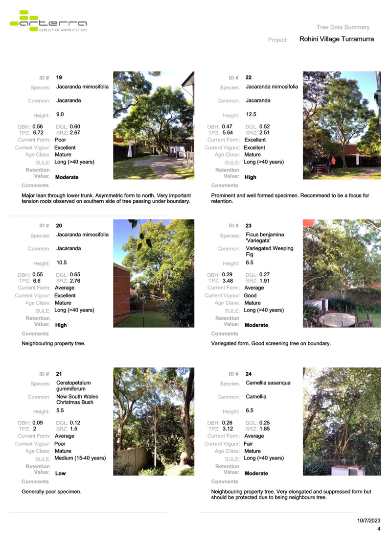
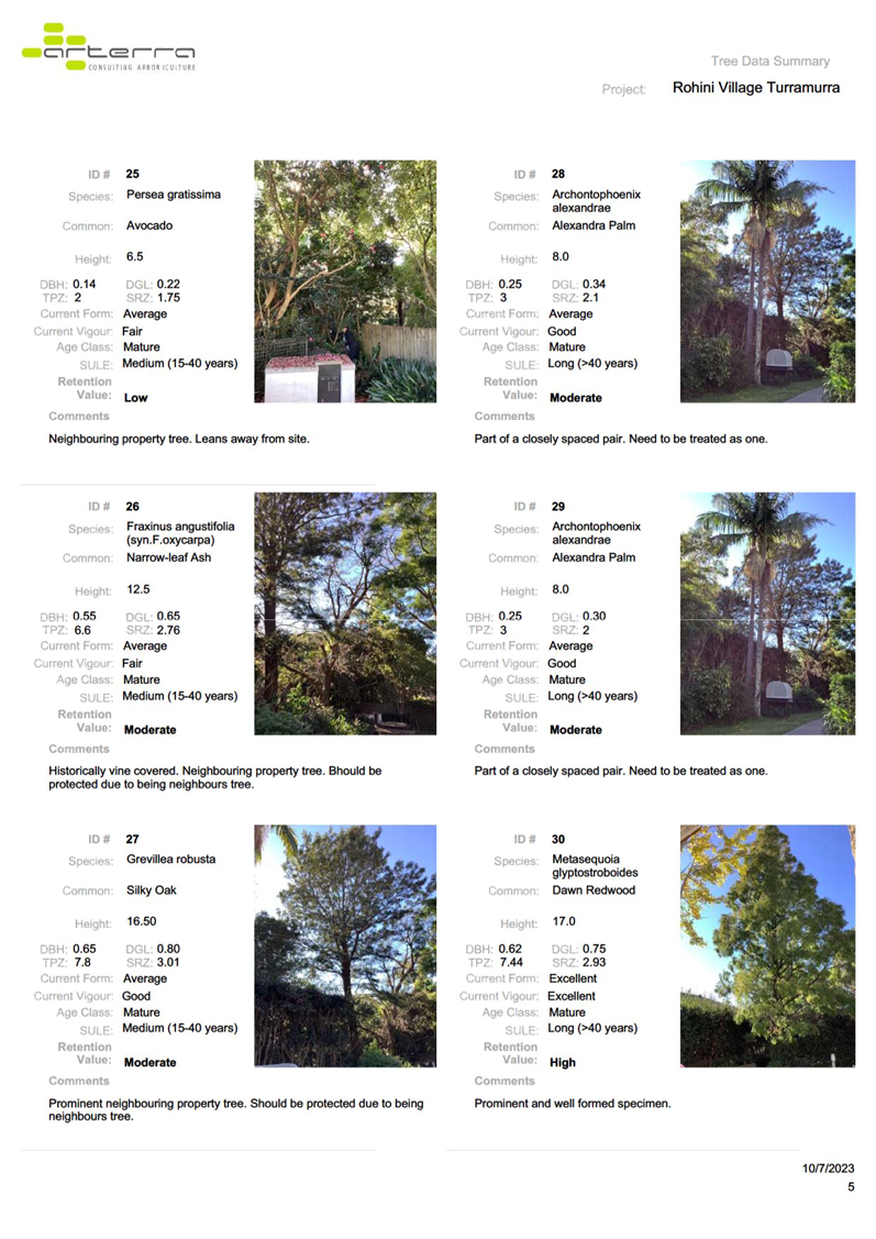
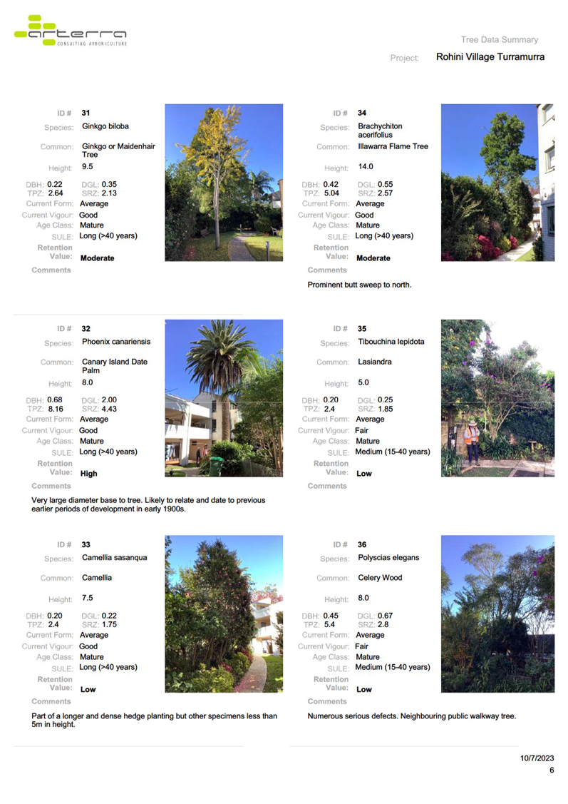
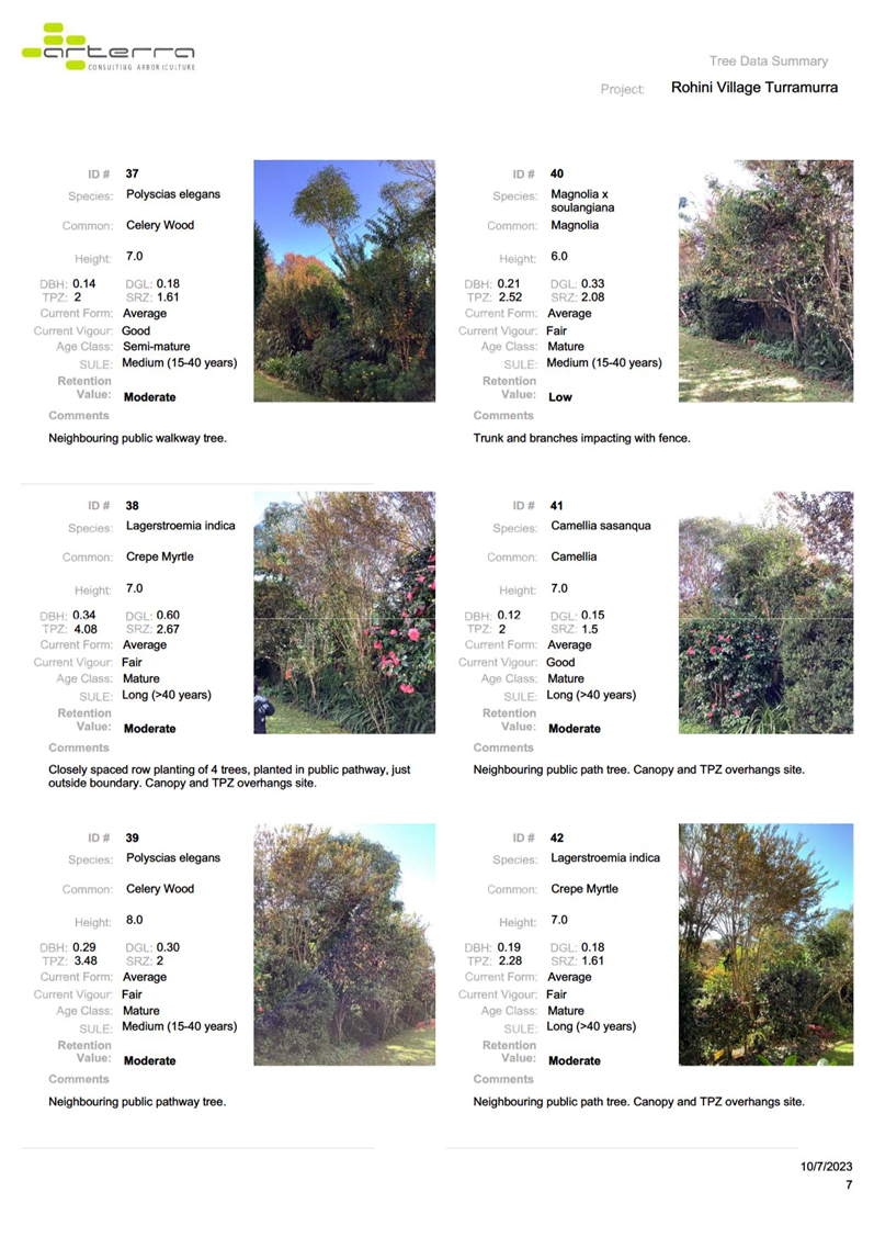
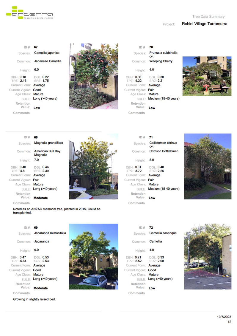
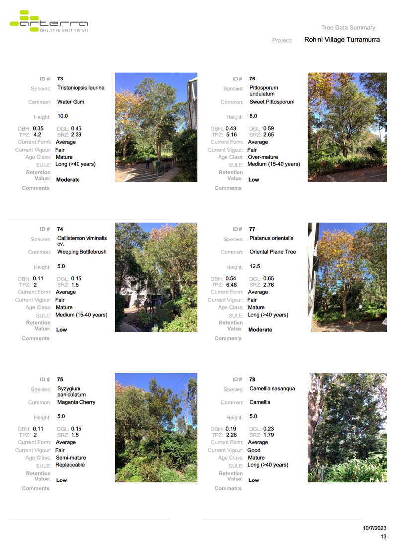
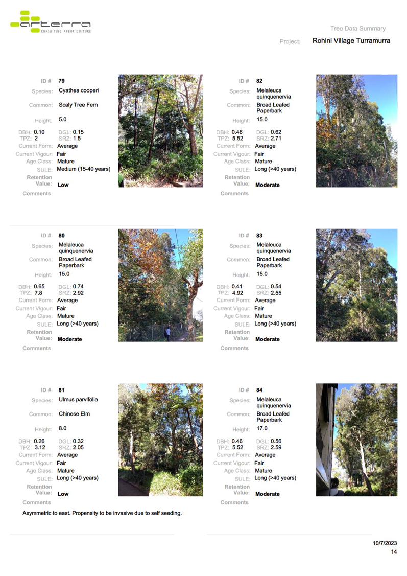
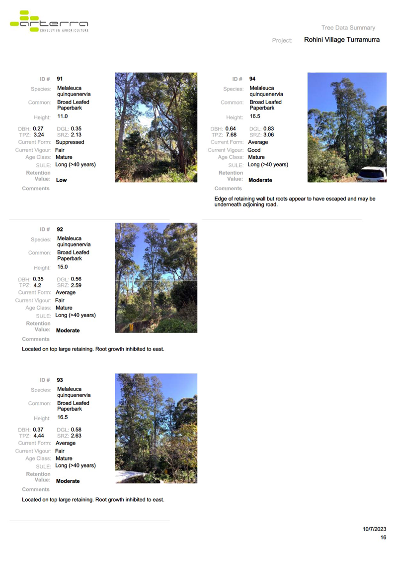
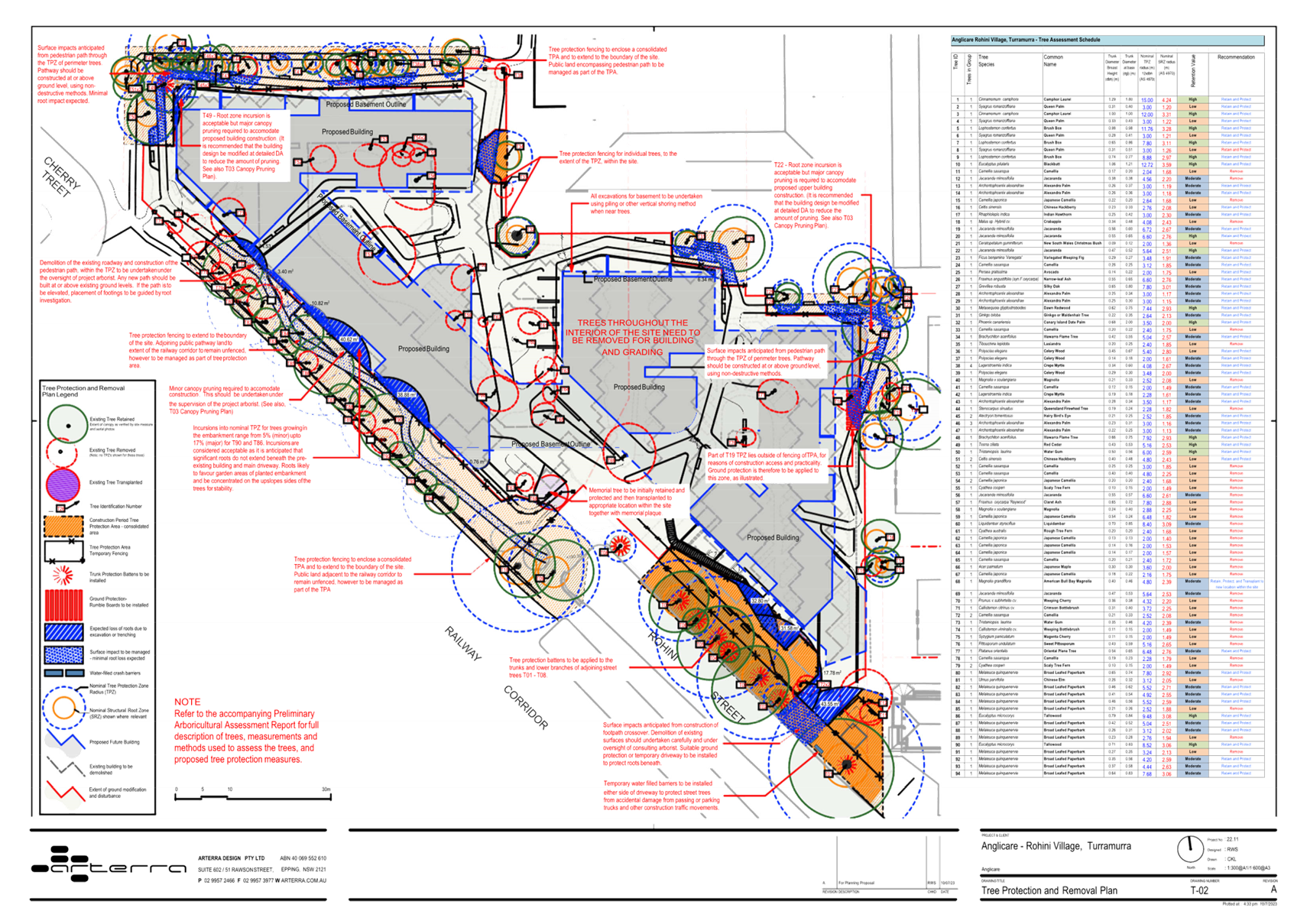
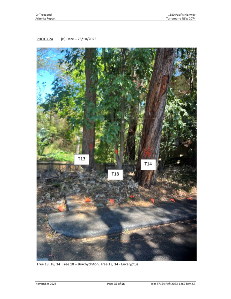
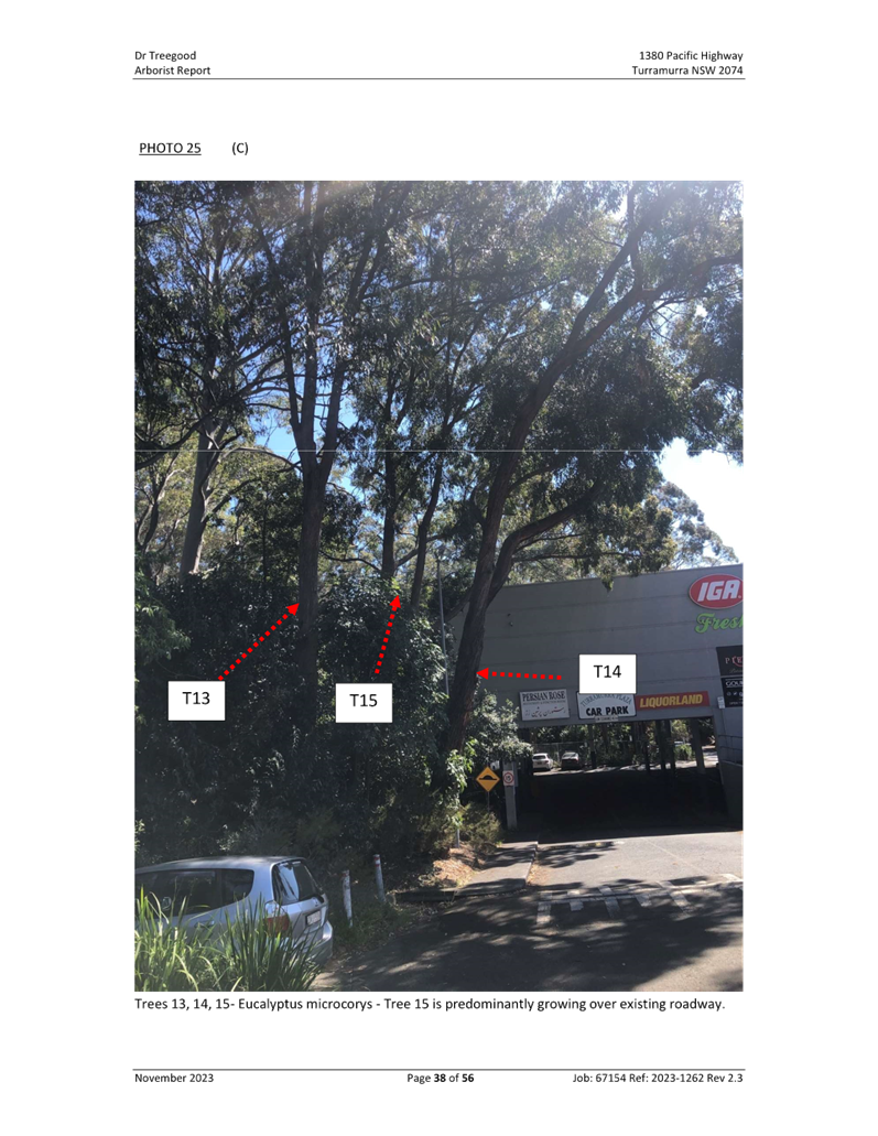
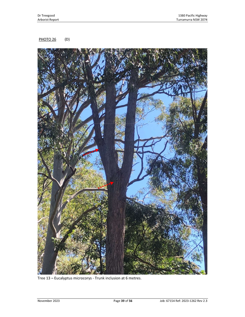
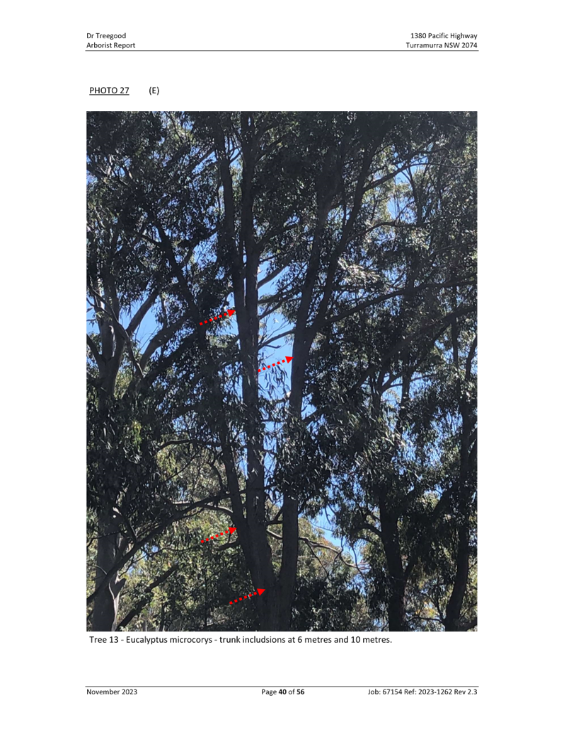
removal
The documentation of tree removal
to the boundaries of the site is not supported. Only trees clearly identified
as weed or having a significant safety concern may be cited for removal at this
Planning Proposal stage.
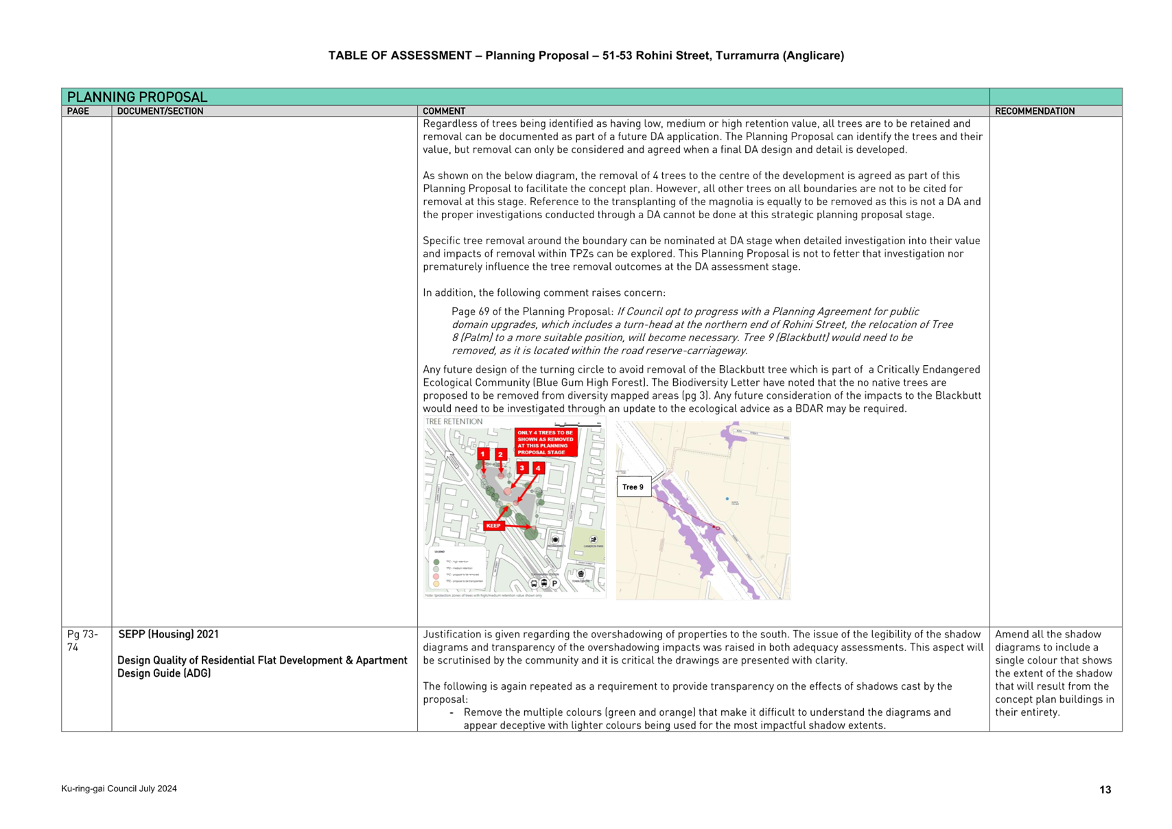
Regardless of trees being identified
as having low, medium or high retention value, all trees are to be retained and
removal can be documented as part of a future DA application. The Planning
Proposal can identify the trees and their value, but removal can only be
considered and agreed when a final DA design and detail is developed.
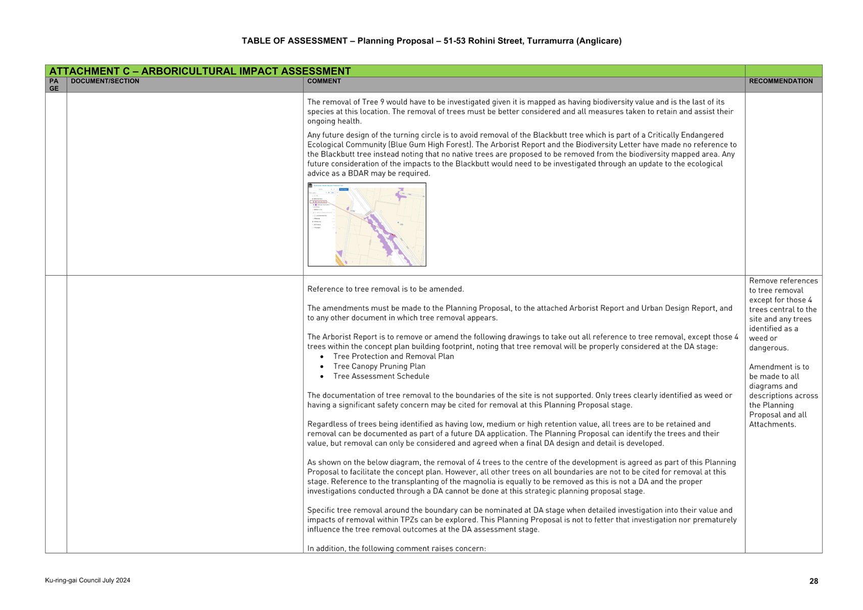
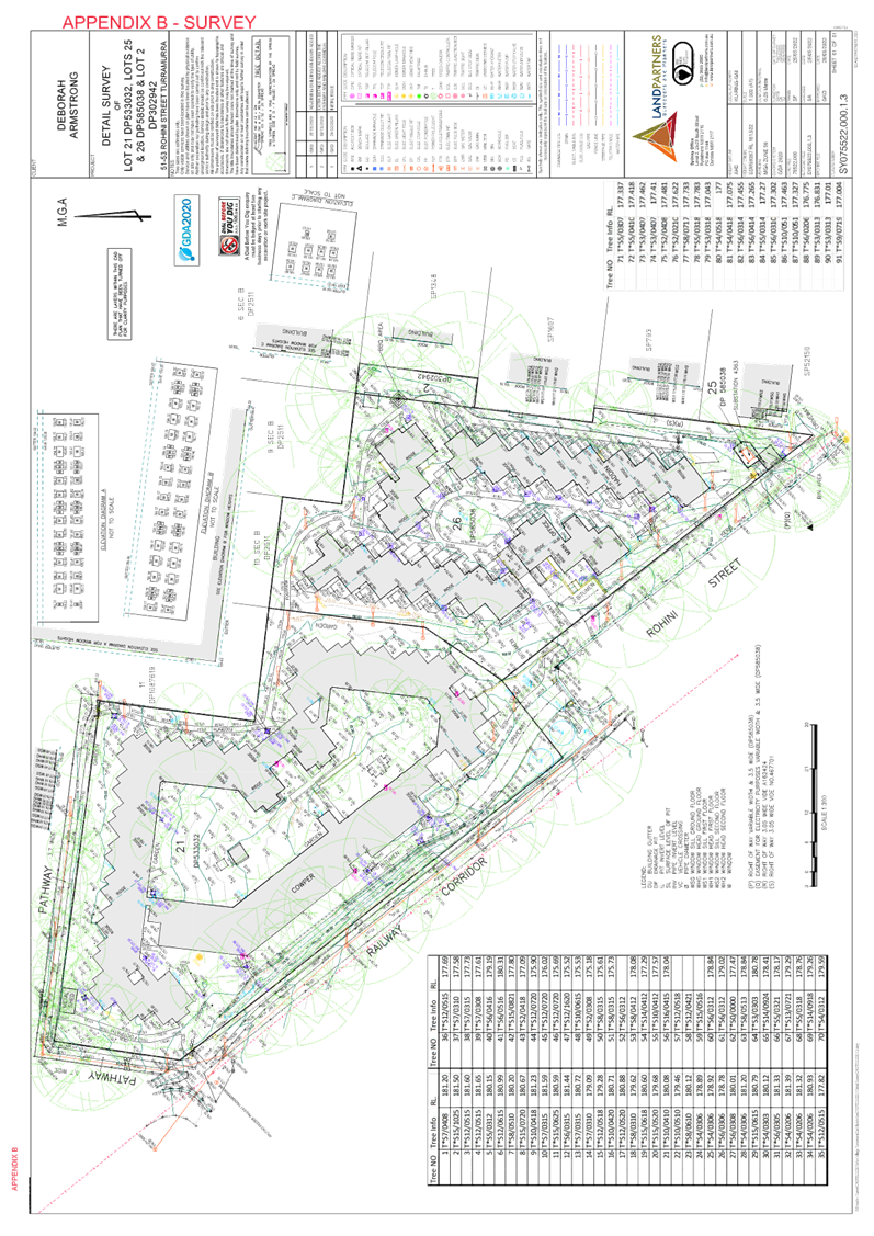
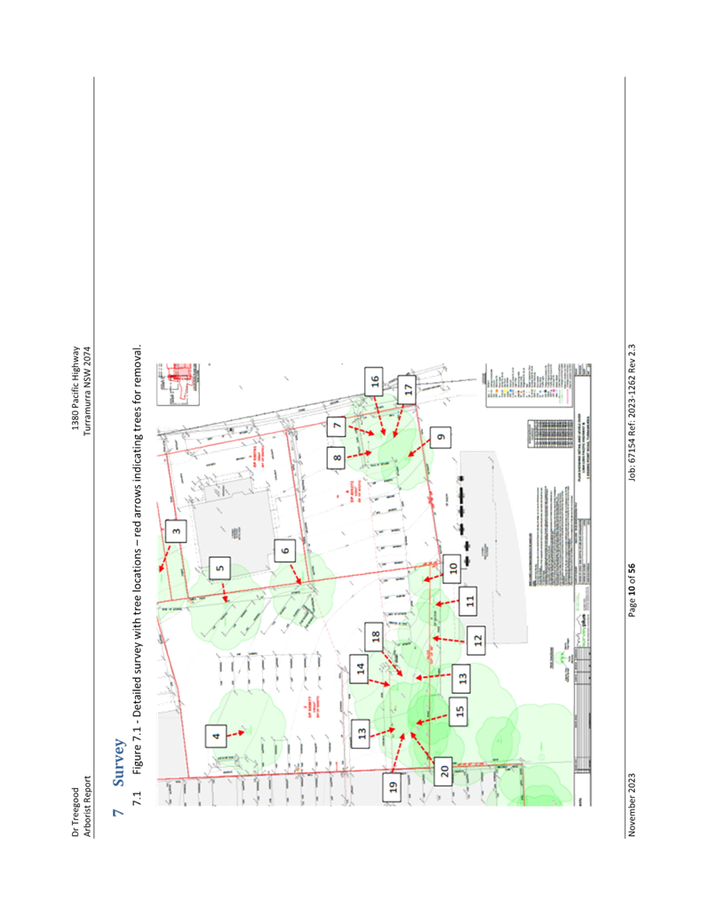
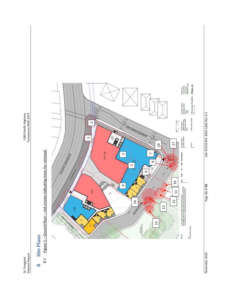
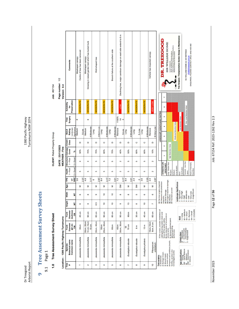
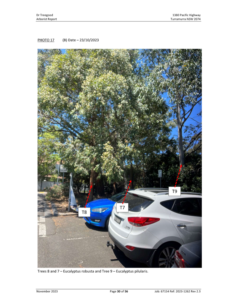
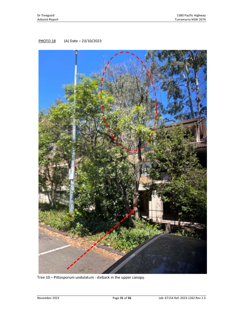
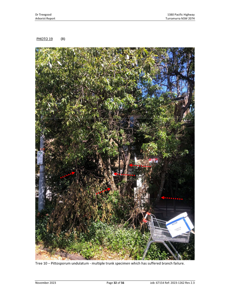
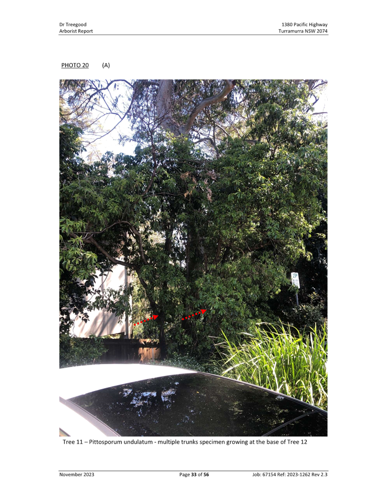
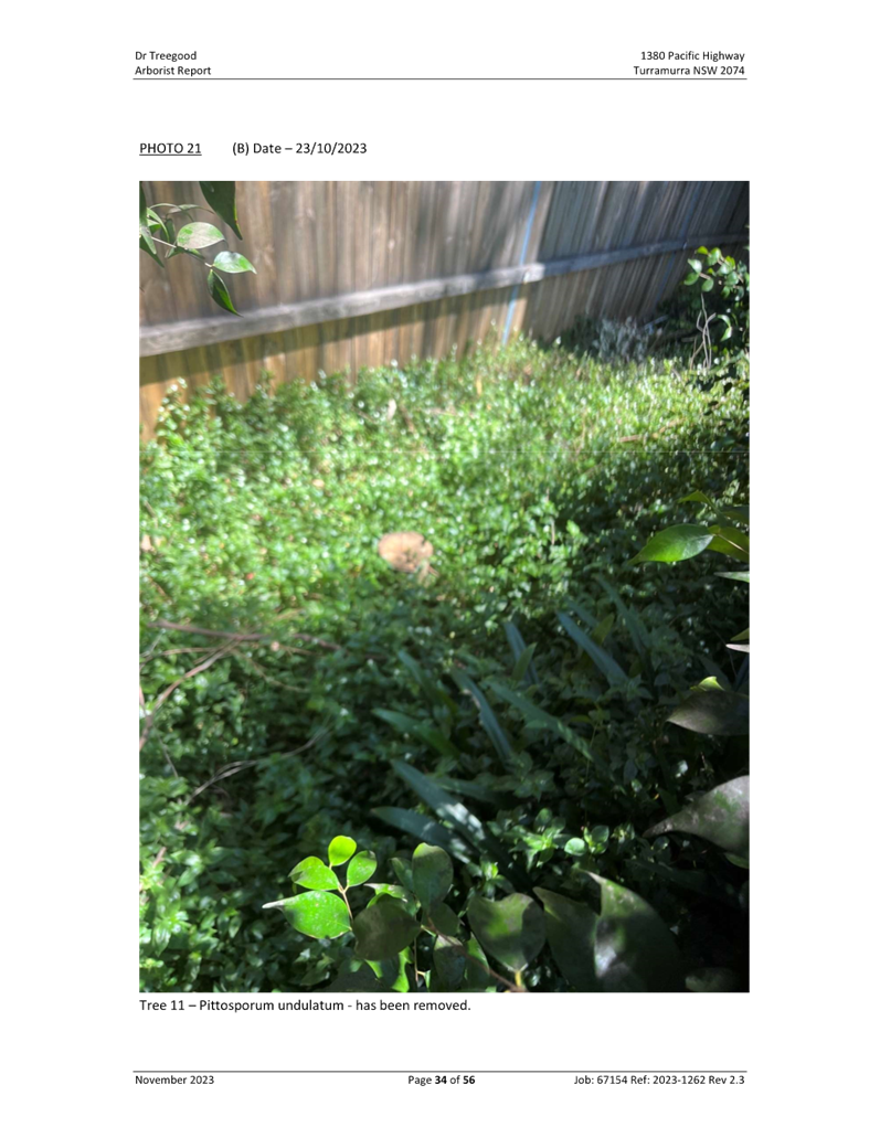
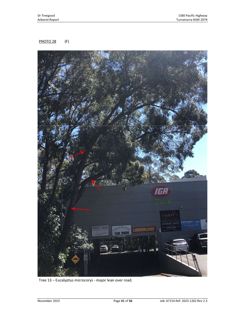
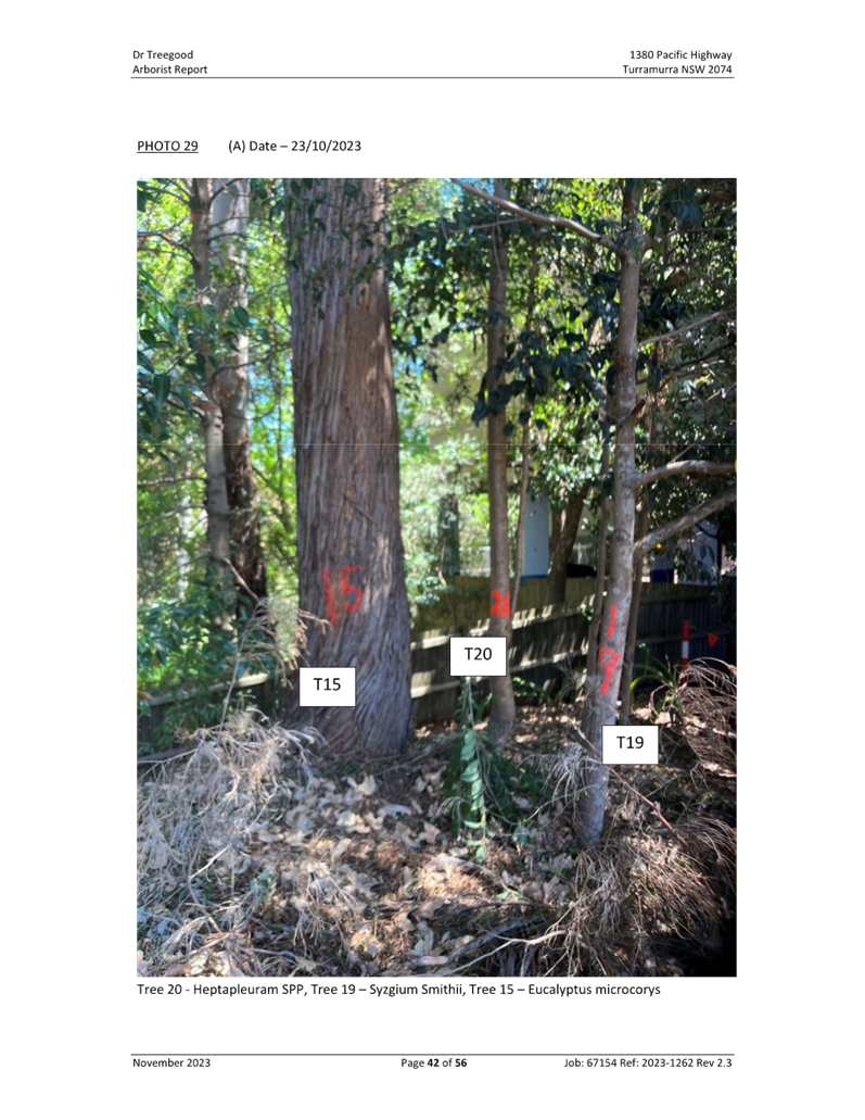
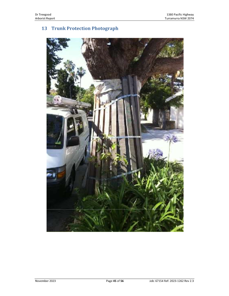
The removal of 4 trees to the
centre of the development is agreed as part of this Planning Proposal to
facilitate the concept plan as those trees are also identified in the Arborist
Report as having limited value. However, all other trees on all boundaries are
not to be cited for removal at this stage. Reference to the transplanting of
the Magnolia is equally to be removed as this is not a DA and the proper
investigations conducted through a DA cannot be done at this strategic planning
proposal stage.
Specific tree removal around the
boundary can be nominated at DA stage when detailed investigation into their
value and impacts of removal within retained tree TPZs can be explored.
This Planning Proposal is not to
fetter investigation nor prematurely influence the tree removal outcomes at the
DA assessment stage.
In addition, some inconsistent
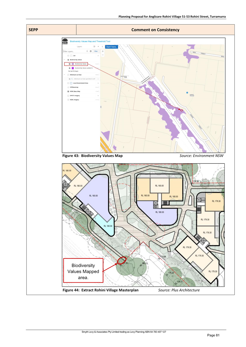
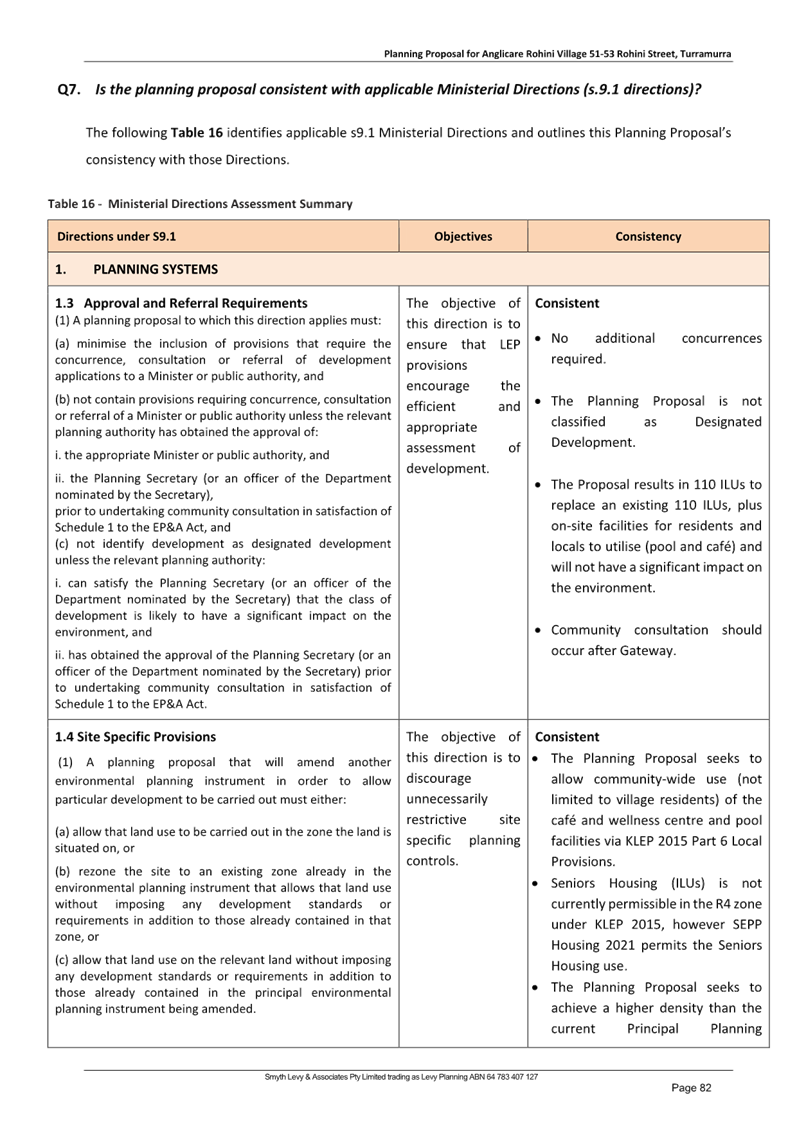
comment is made regarding the biodiversity mapped land (remnant Blue Gum High
Forest) and the impacts on the associated Blackbutt tree. These must be
corrected to stress the importance of protecting that single remnant tree.
Ø Recommendation:
Tree removal references are to be
limited to the stipulated 4 trees. All other references to tree removal is to
be removed to avoid fettering of the DA process and ability to influence tree
removal following proper analysis.
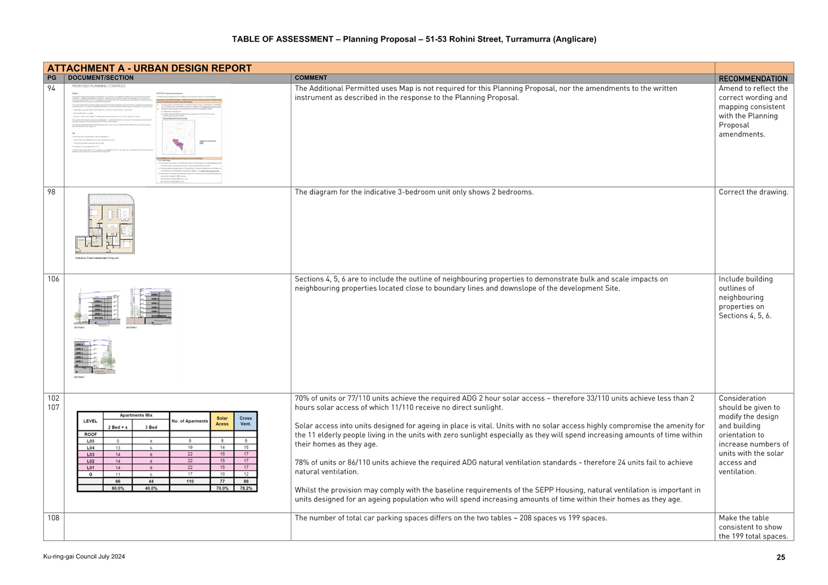
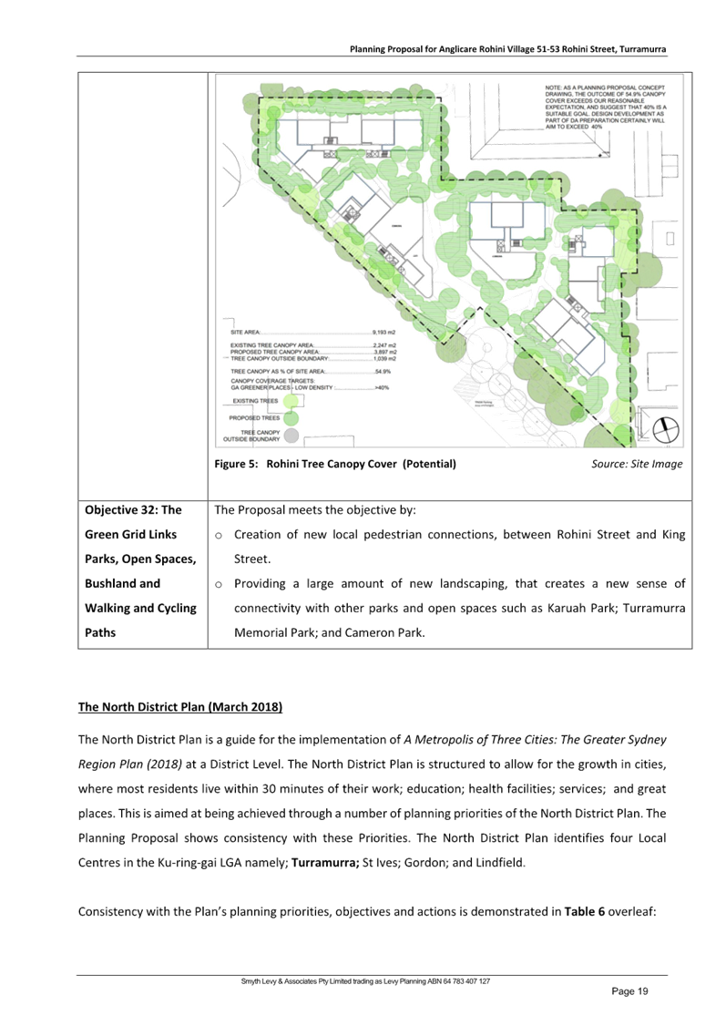
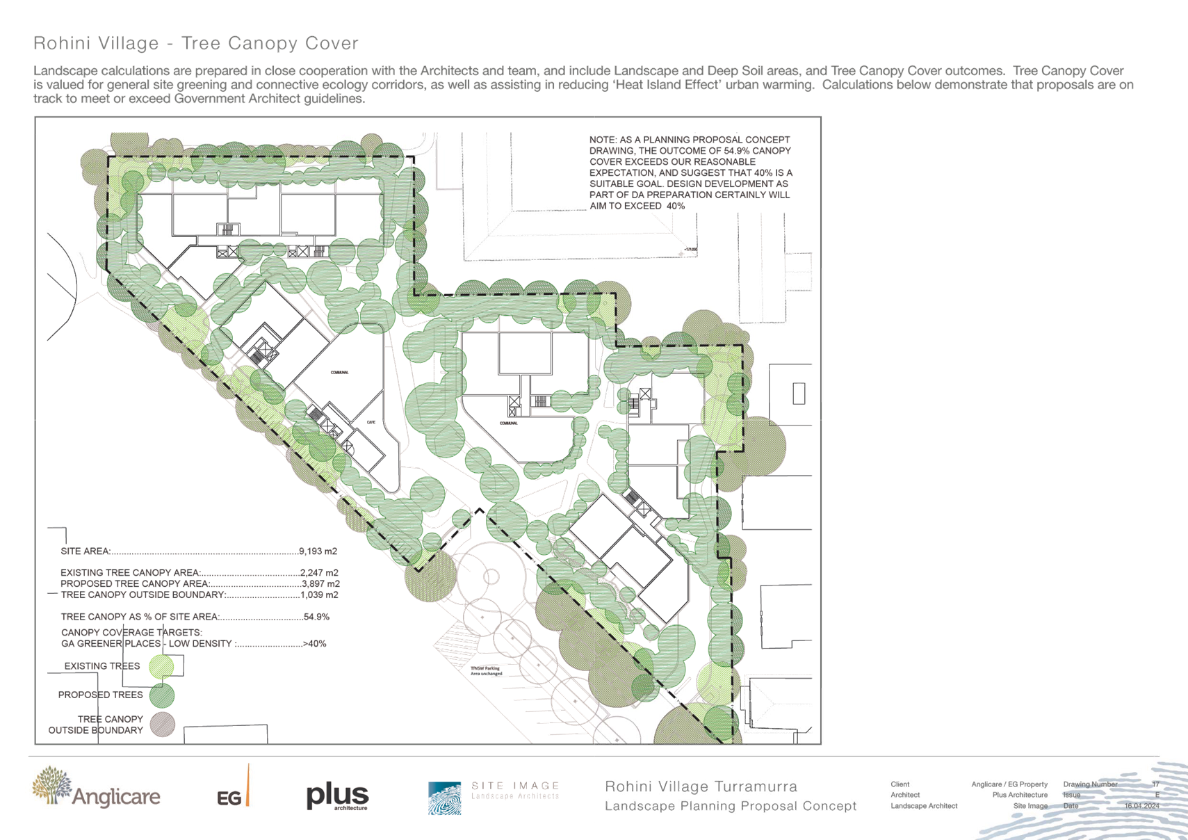
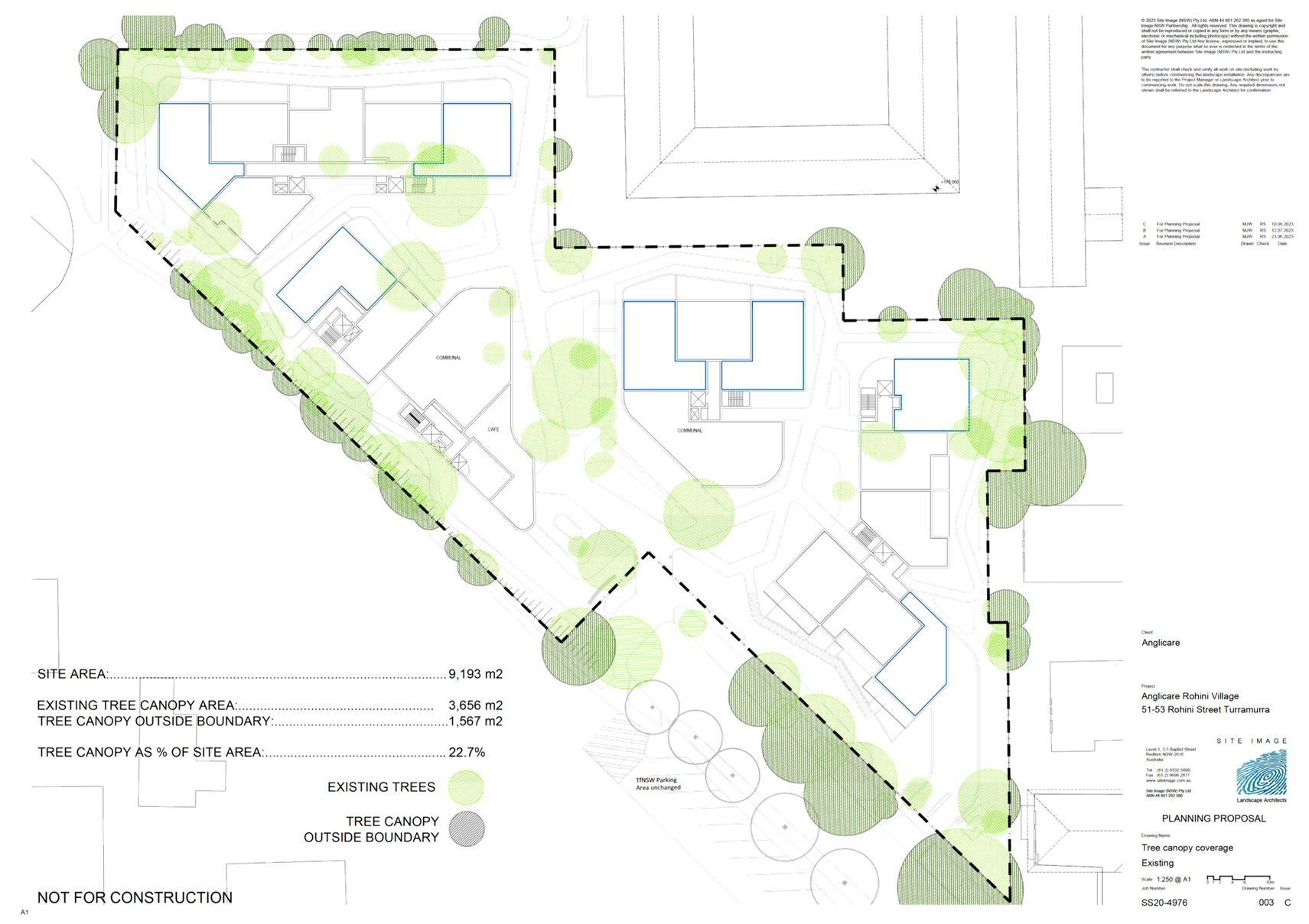
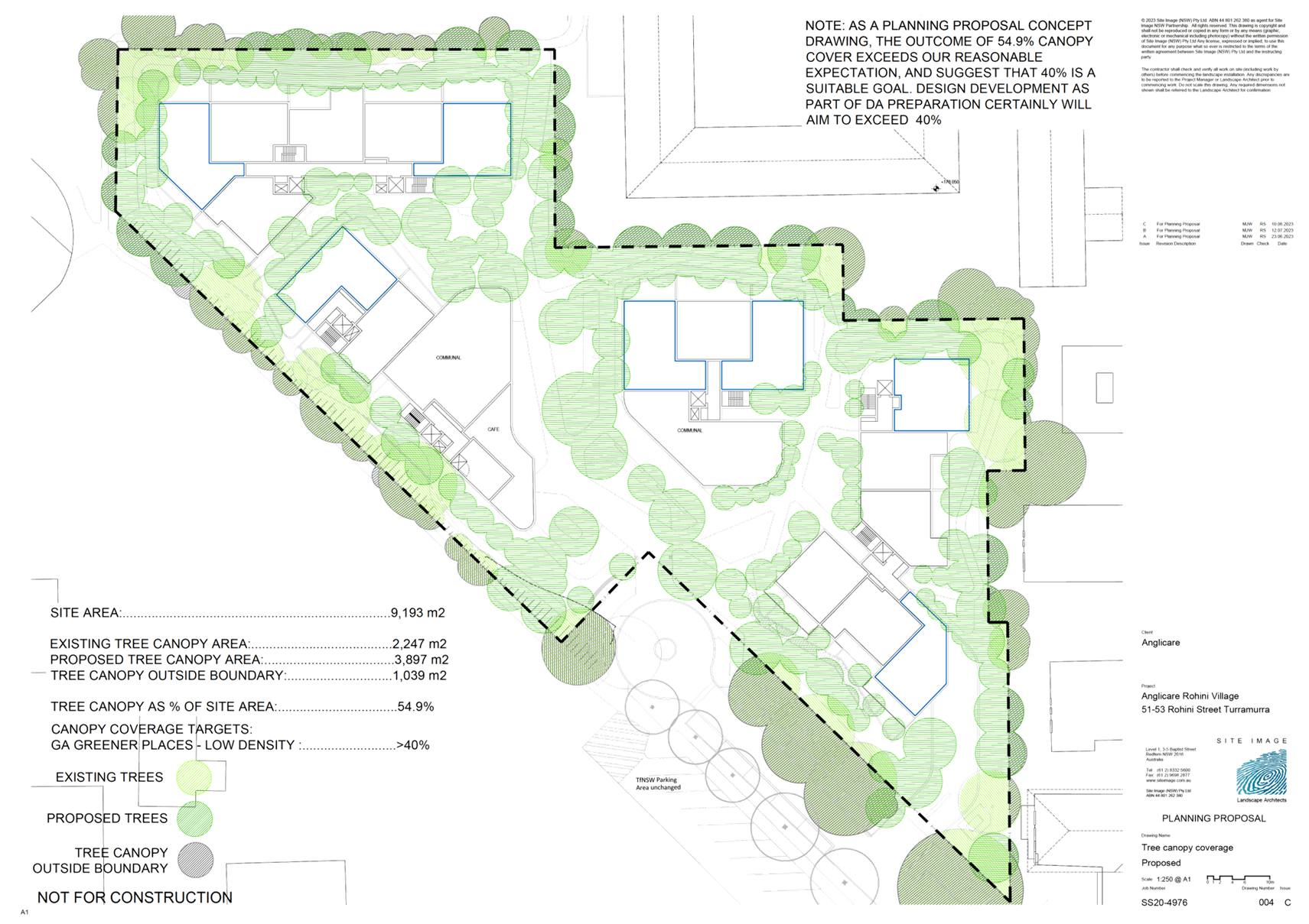
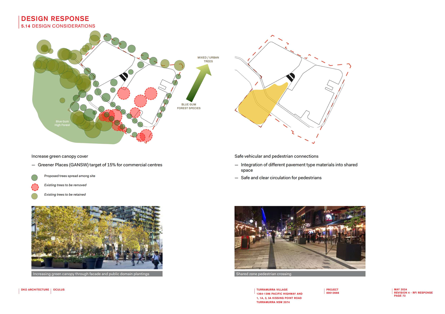
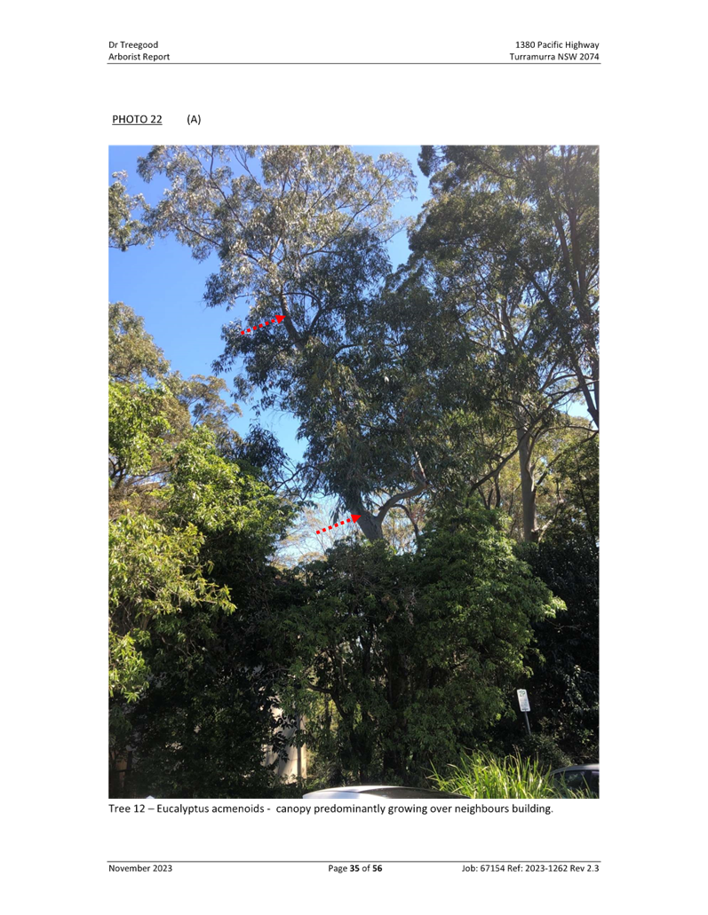
· Canopy
provision
The proposal claims an increase of
canopy from the existing 3,656 sqm to the proposed 3,897sqm. However, there is
no documentation on the tree species that will contribute to that canopy, nor
on the heights of the canopy trees.
Canopy in Ku-ring-gai is delivered
through significant numbers of tall trees. The proposal gives no indication on
whether this key feature of the locality will be delivered on this site. Many
of the new trees shown in the diagram are located on top of the basement
parking areas or in between the multitudes of path systems which do not provide
the dimensions of garden beds able to sustain healthy large specimen trees to
contribute to Canopy.
Ø Recommendation:
The proposal and its Arborist
Report requires details of the location and species of trees and demonstrate
the expected tree height and canopy spread. This way the canopy that is claimed
to be delivered on the site can be verified.
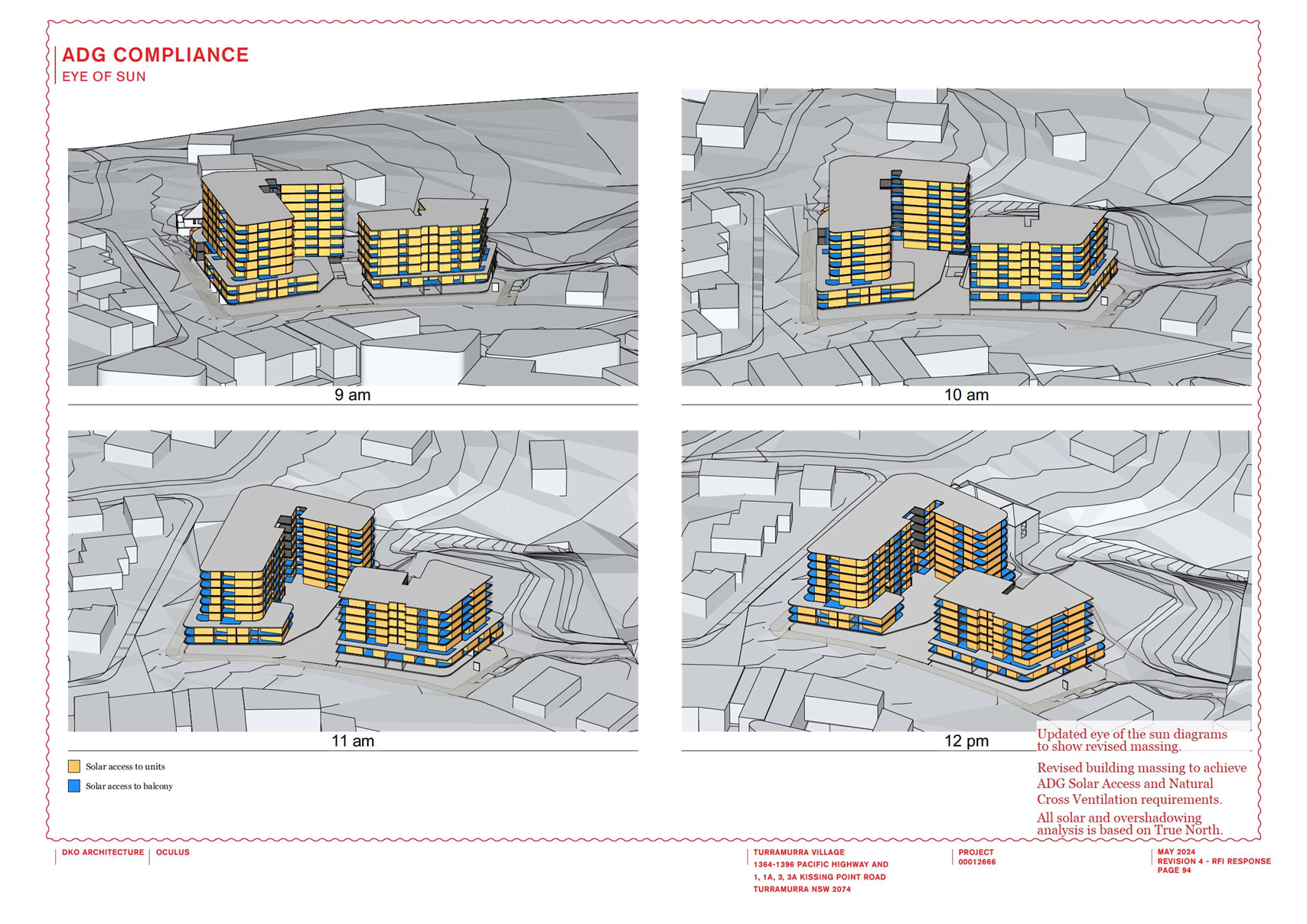
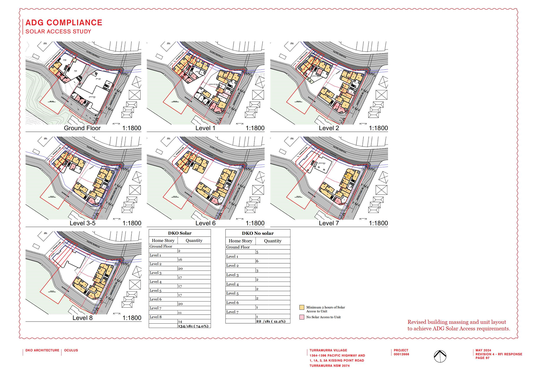
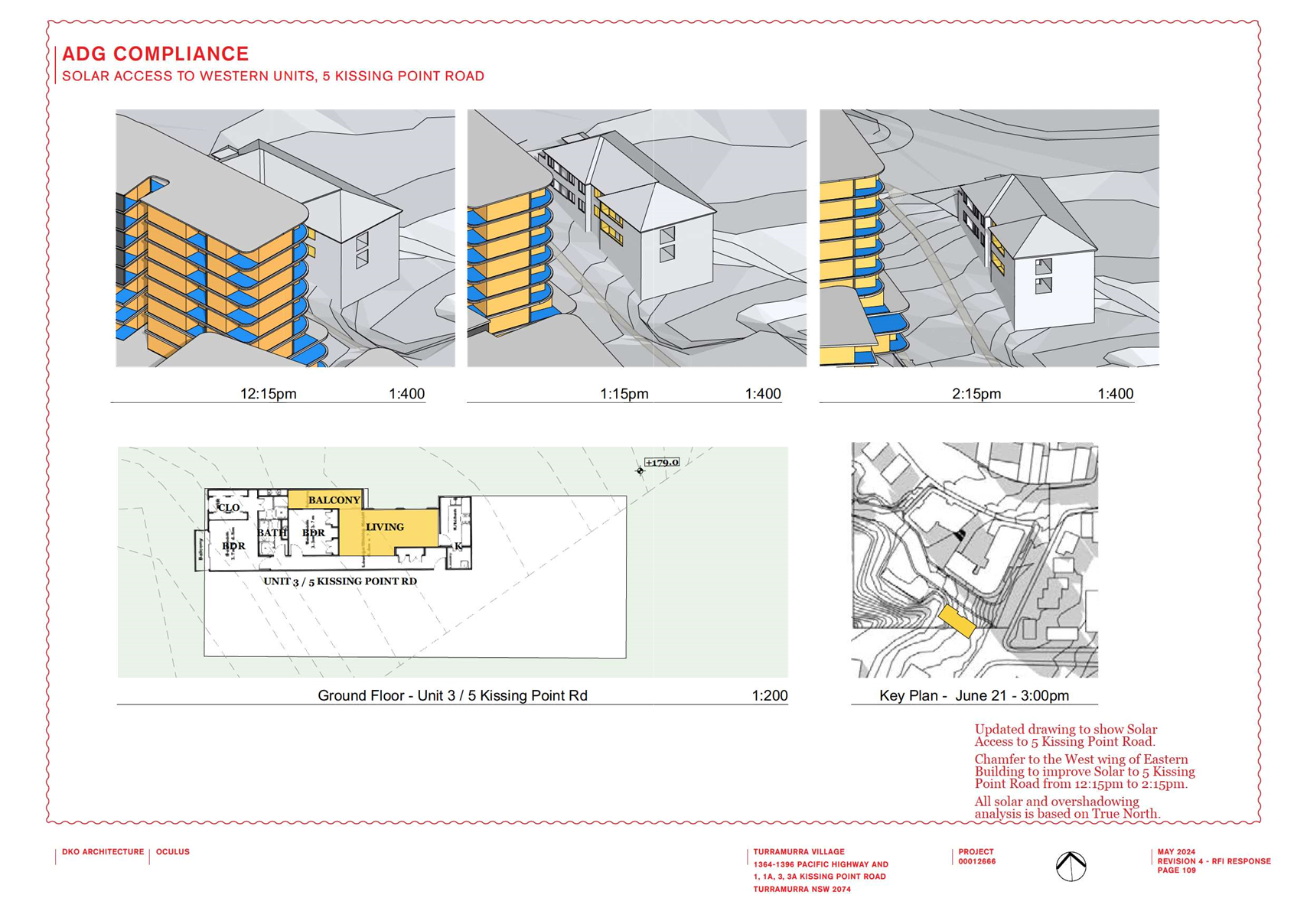
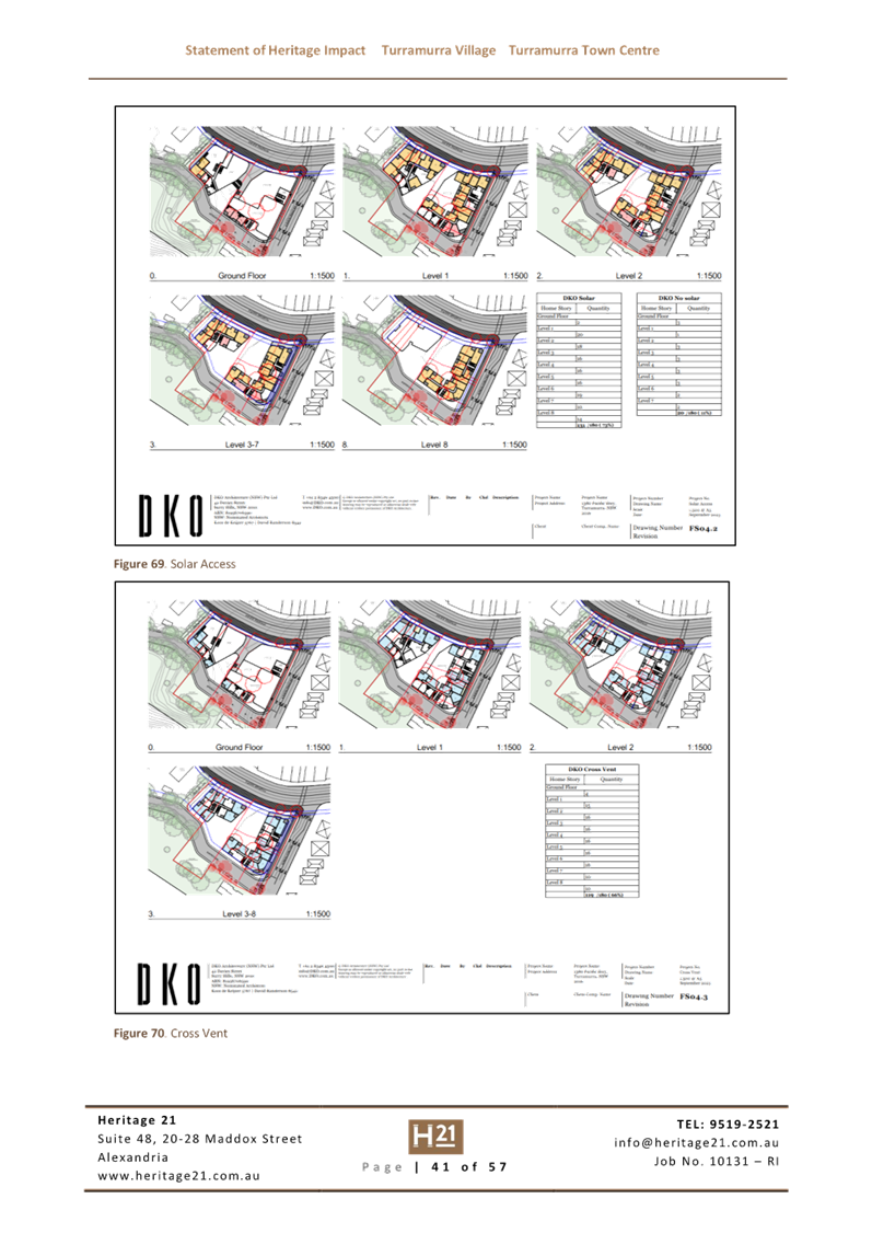
· Solar
access and natural ventilation
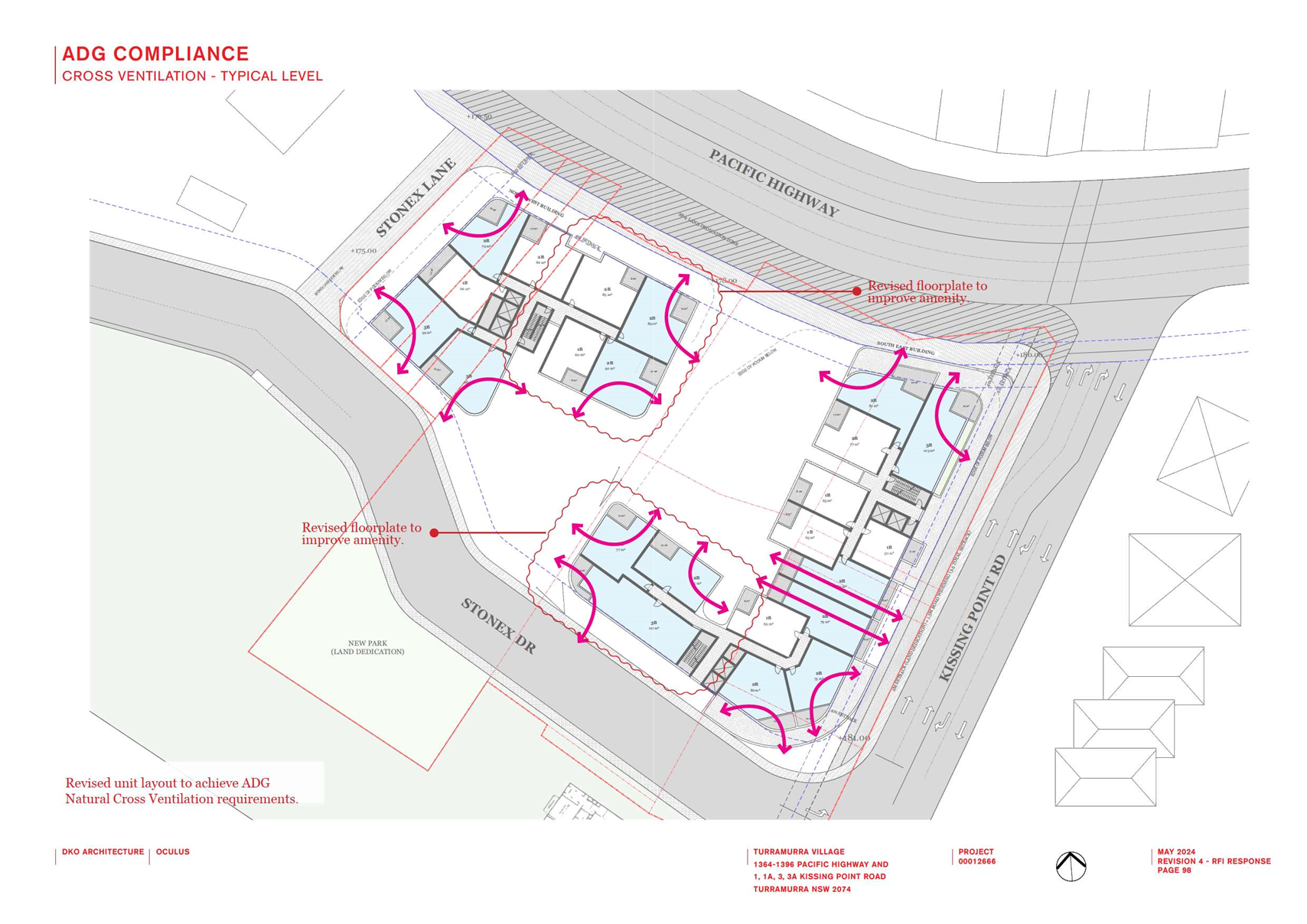
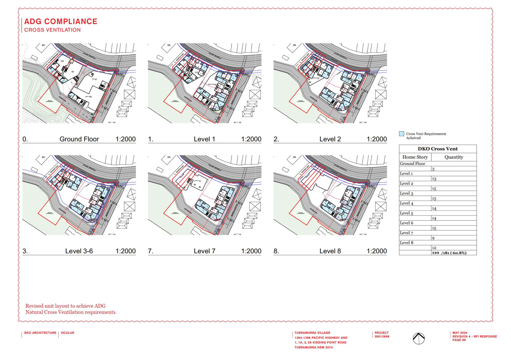
70% of units
or 77/110 units achieve the required ADG 2 hour solar access – therefore
33/110 units achieve less than 2 hours solar access of which 11/110 receive no
direct sunlight.
Solar access into units designed
for ageing in place is vital. Units with no solar access highly compromise the
amenity for the 11 elderly people living in the units with zero sunlight
especially as they will spend increasing amounts of time within their homes as
they age.
78% of units
or 86/110 units achieve the required ADG natural ventilation standards -
therefore 24 units fail to achieve natural ventilation.
Whilst the provision may comply
with the baseline requirements of the SEPP Housing, natural ventilation is
important in units designed for an ageing population who will spend increasing
amounts of time within their homes as they age.
Ø Recommendation:
Given the type of population this
Site will house (elderly and vulnerable frail people), consideration should be
given to modify the design and building orientation to increase numbers of
units with the solar access and ventilation.
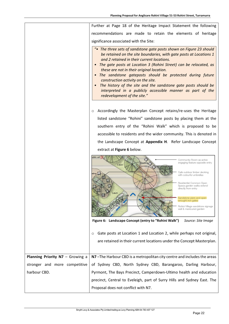
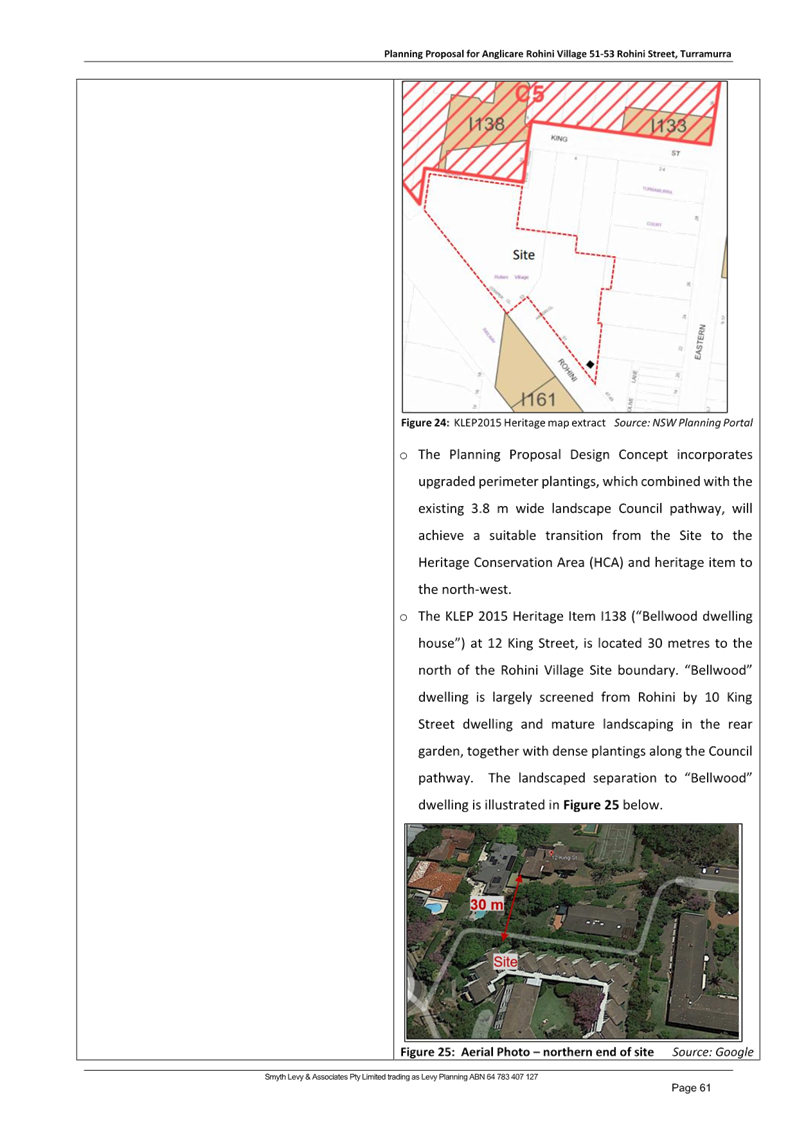
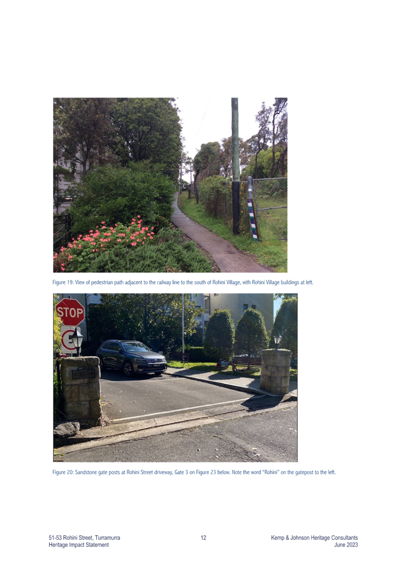
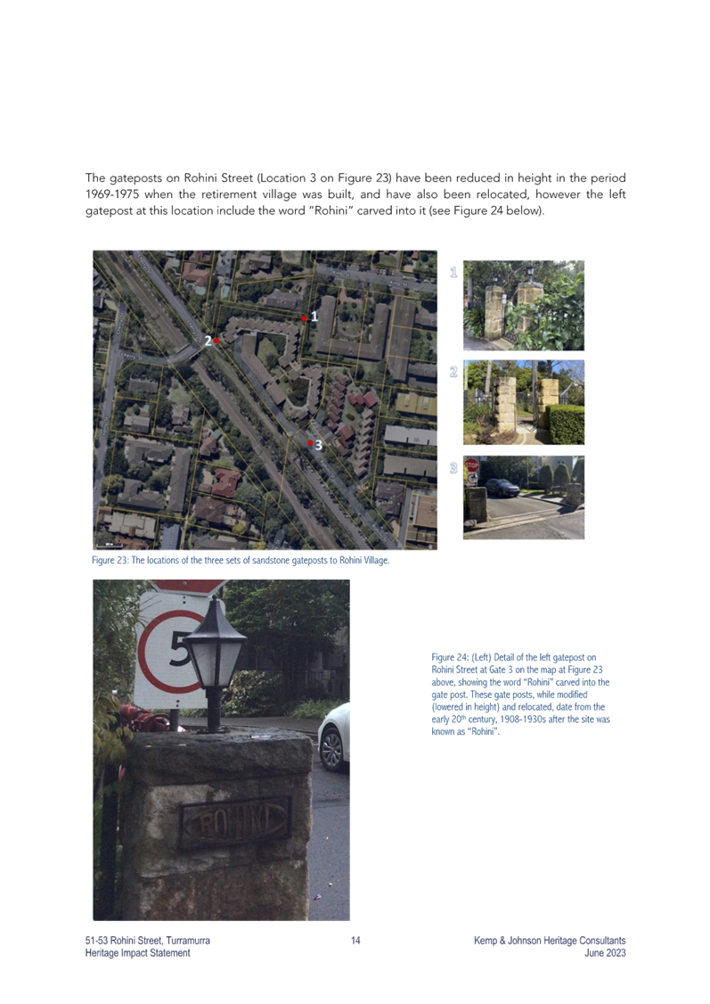
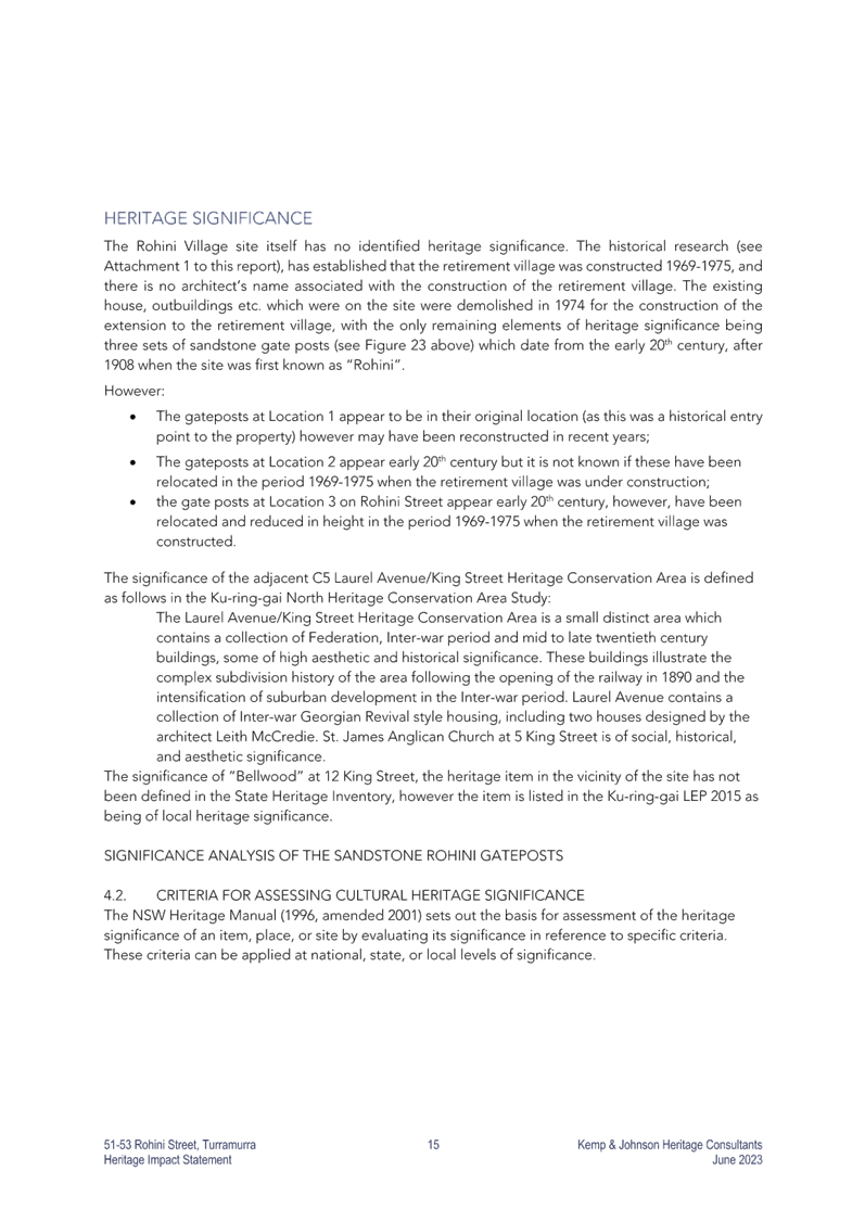
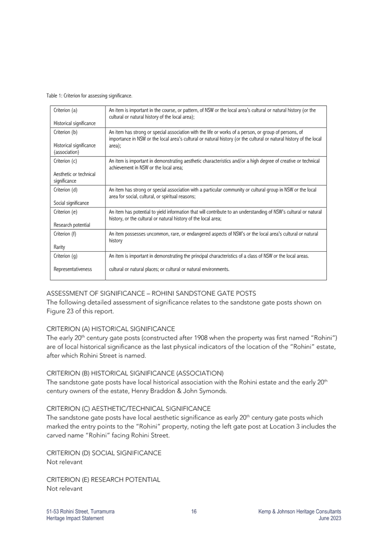
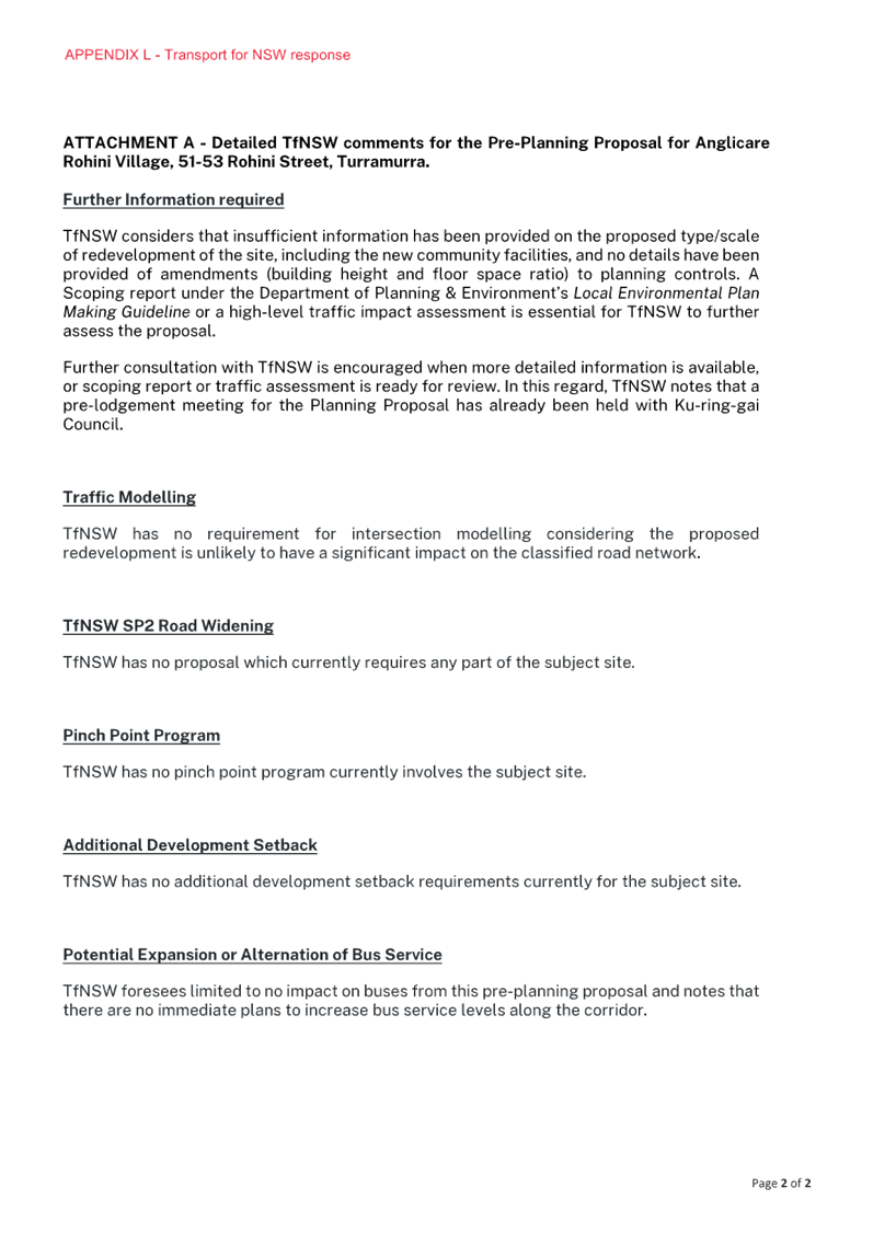
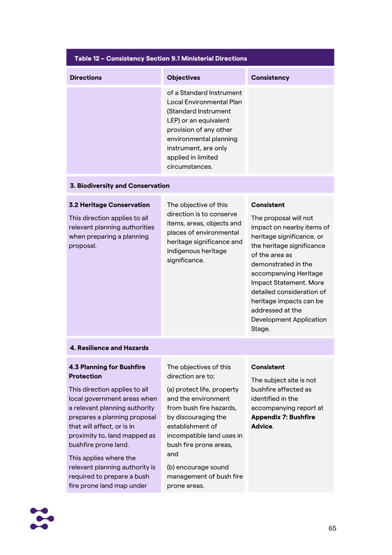
· Heritage
assessment
The Heritage Impact Statement,
attached to the planning proposal, makes recommendation to retain the pillars
as mentioned in the response to Ministerial 3.2. This is supported.
It is noted that the Rohini House
gates located on the site are currently listed in Schedule 5 of the KLEP
2015 (Item 161). However, the listing identifies the previous location of
the gates (Railway lands; Part Lot 1, DP 1129573) prior to their relocation
onto the grounds of Rohini Village.
It is noted that the original pair
for No. 2 is different to that photographed in Figure 23 in the Heritage Impact
Statement.
The second set of pillars shown in
Figure 23 of the Statement have three rather than two pillars, with the
original post and gate now in the garden bed to the side framing a vehicular
entrance, not shown in the photograph, and the third pillar a replica to form a
new pedestrian entrance.
The significance is with the
original pairs of pillars and associated gates, rather than the replica.
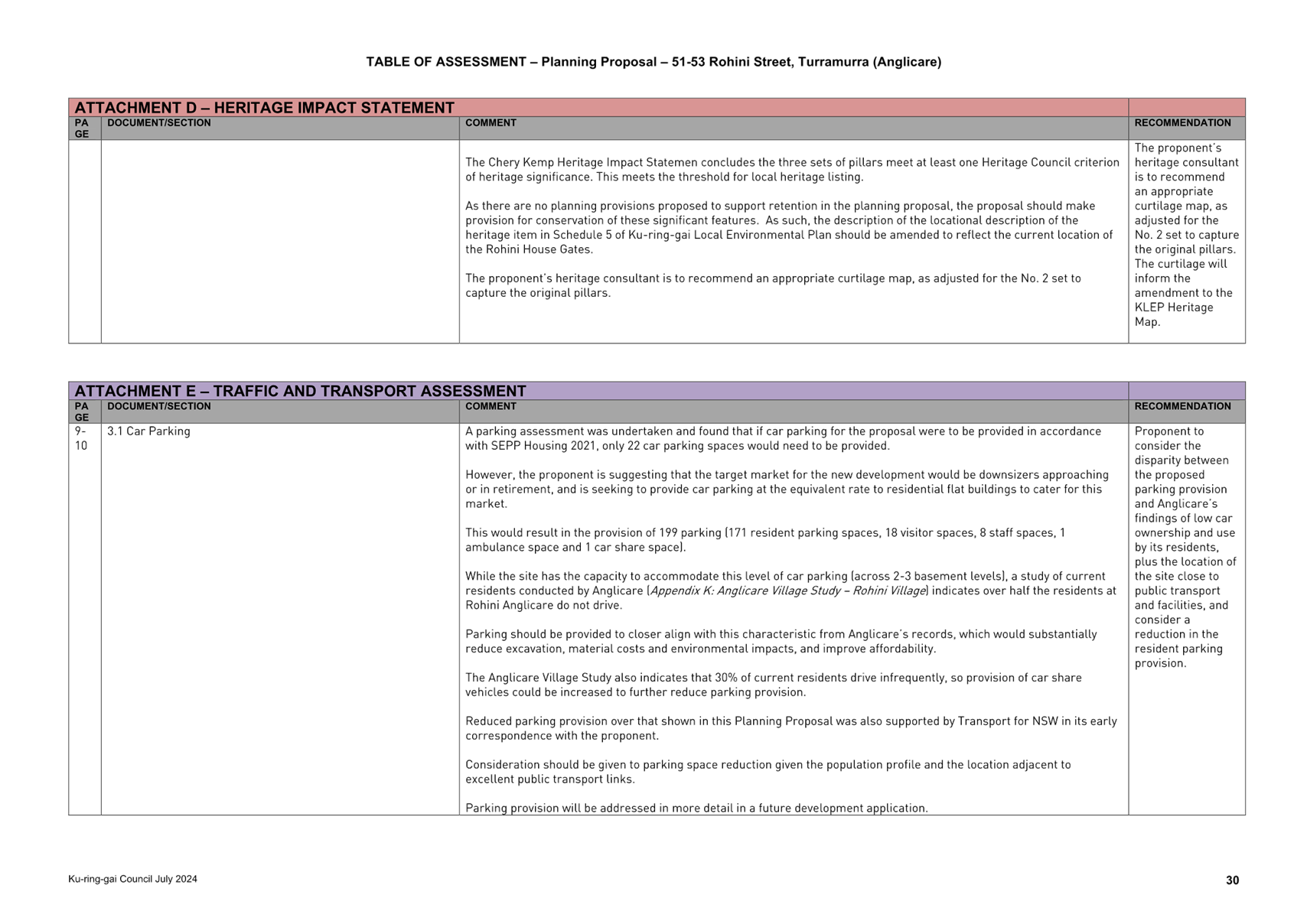
The Chery Kemp Heritage Impact
Statemen concludes the three sets of pillars meet at least one Heritage Council
criterion of heritage significance. This meets the threshold for local heritage
listing.
As there are no planning
provisions proposed to support retention in the Planning Proposal, the proposal
should make provision for conservation of these significant features by
inclusion of heritage listing in the subject planning proposal. As such, the
description of the locational description of the heritage item in Schedule 5 of
Ku-ring-gai Local Environmental Plan should be amended to reflect the current
location of the Rohini House Gates.
The proponent’s heritage
consultant is to recommend an appropriate curtilage map, as adjusted for the
No. 2 set to capture the original pillars.
Ø Recommendation:
The Planning Proposal is to amend
Schedule 5 of Ku-ring-gai Local Environmental Plan and the Heritage Map within
the KLEP 2015 to reflect the current location of the Rohini House Gates. The
proponent’s heritage consultant is to recommend an appropriate curtilage
map, as adjusted for the No. 2 set to capture the original pillars. The
curtilage will inform the required amendment to the KLEP Heritage Map.
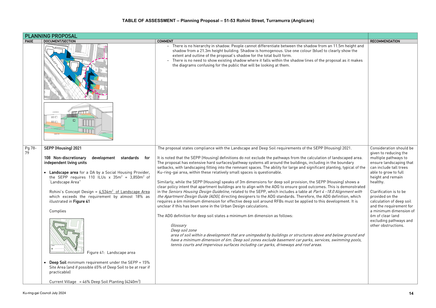
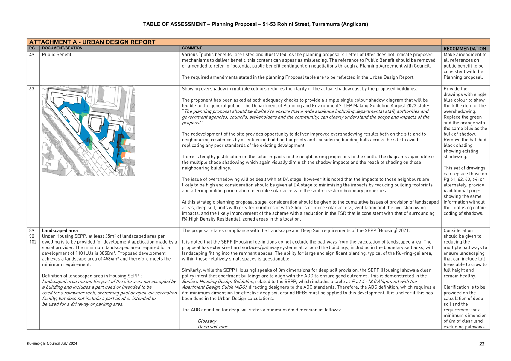
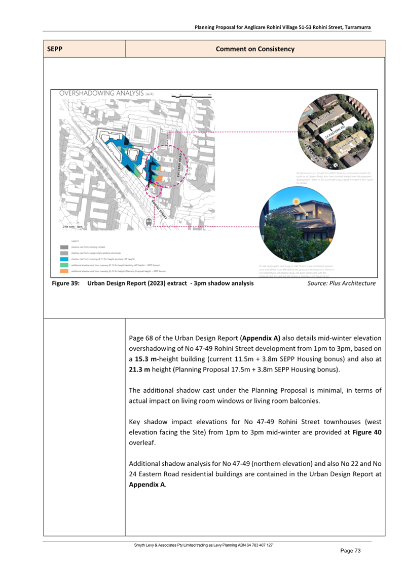
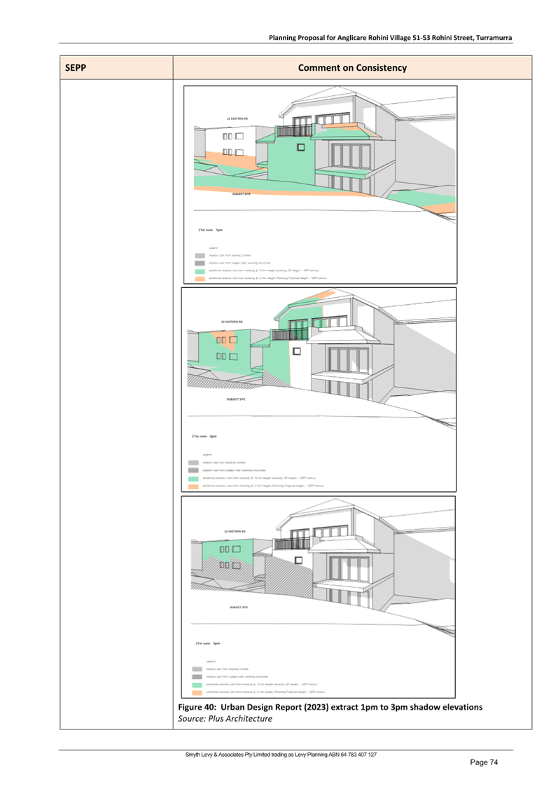
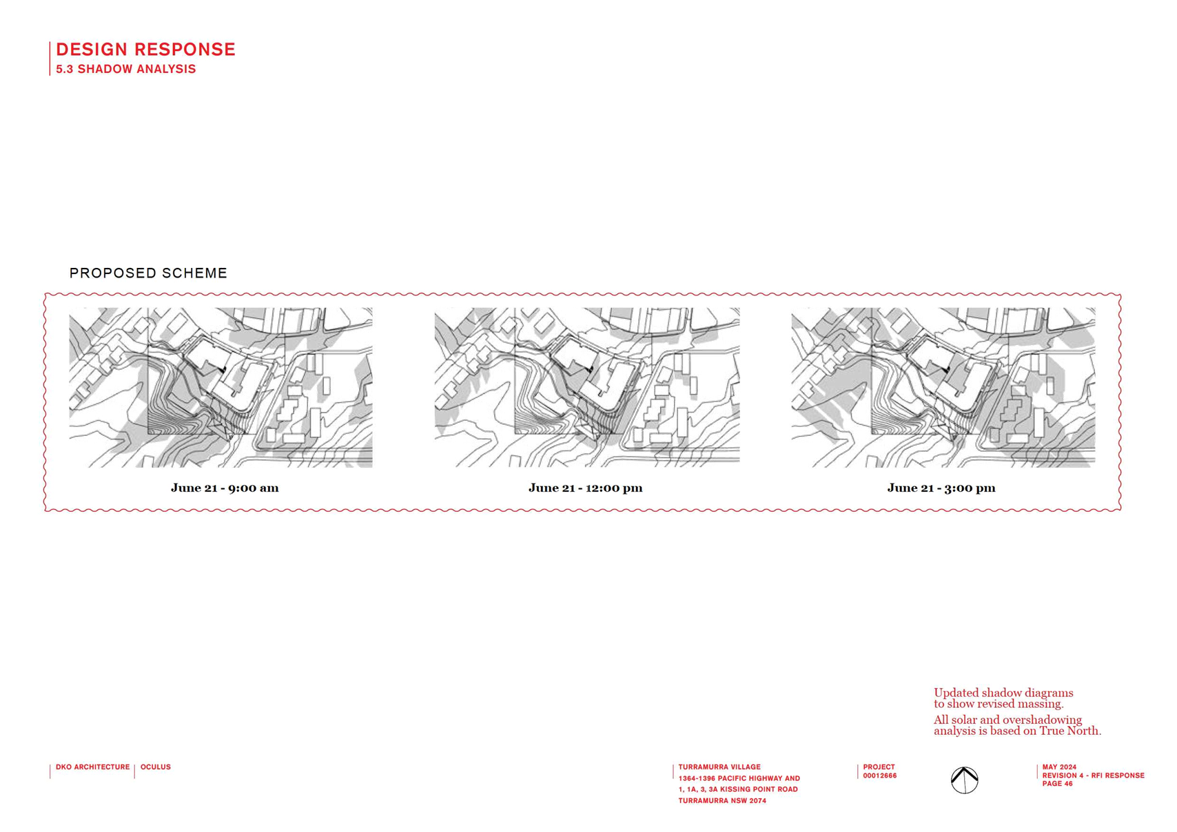
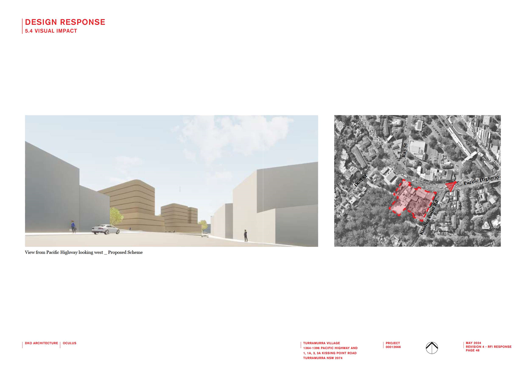
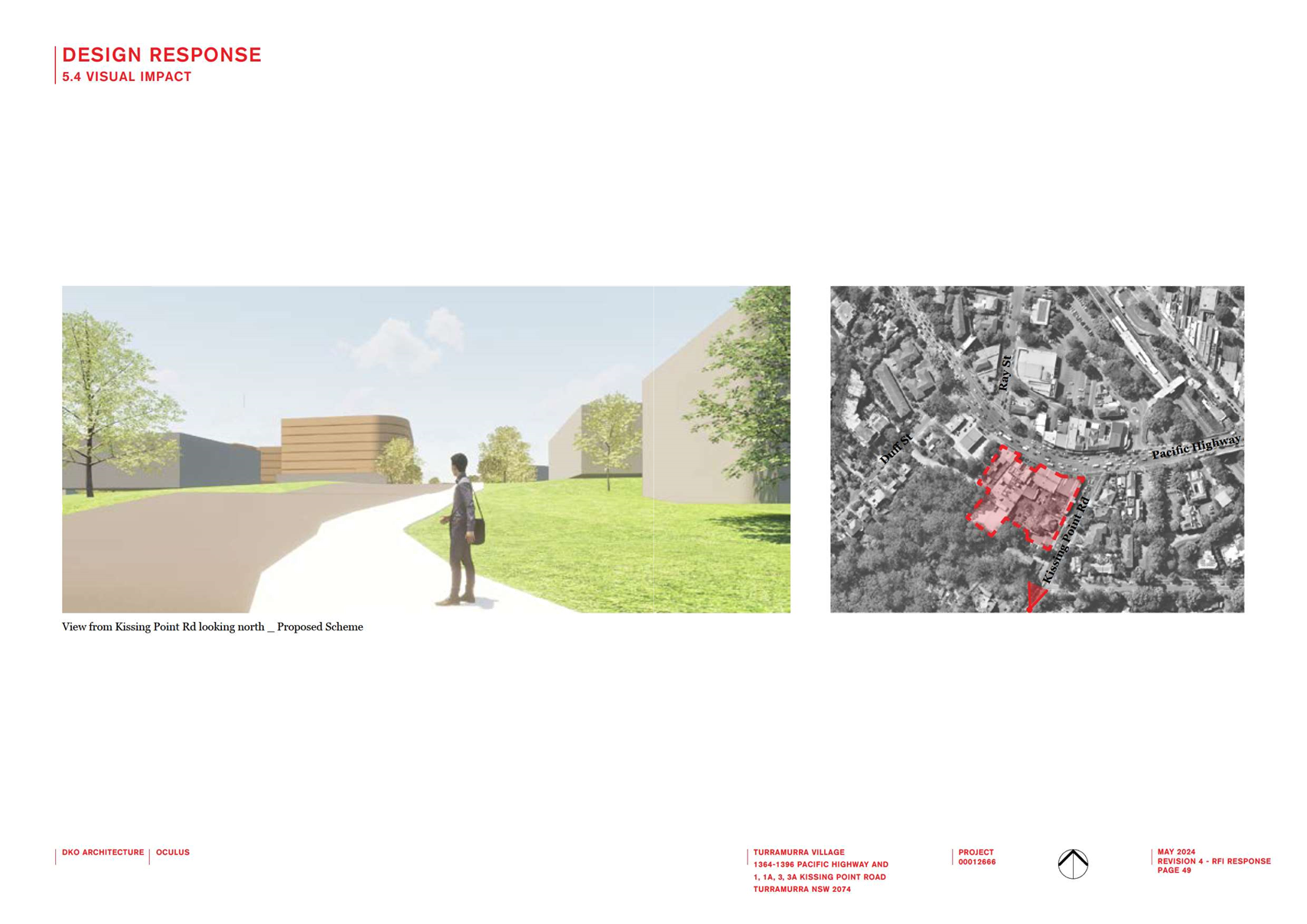
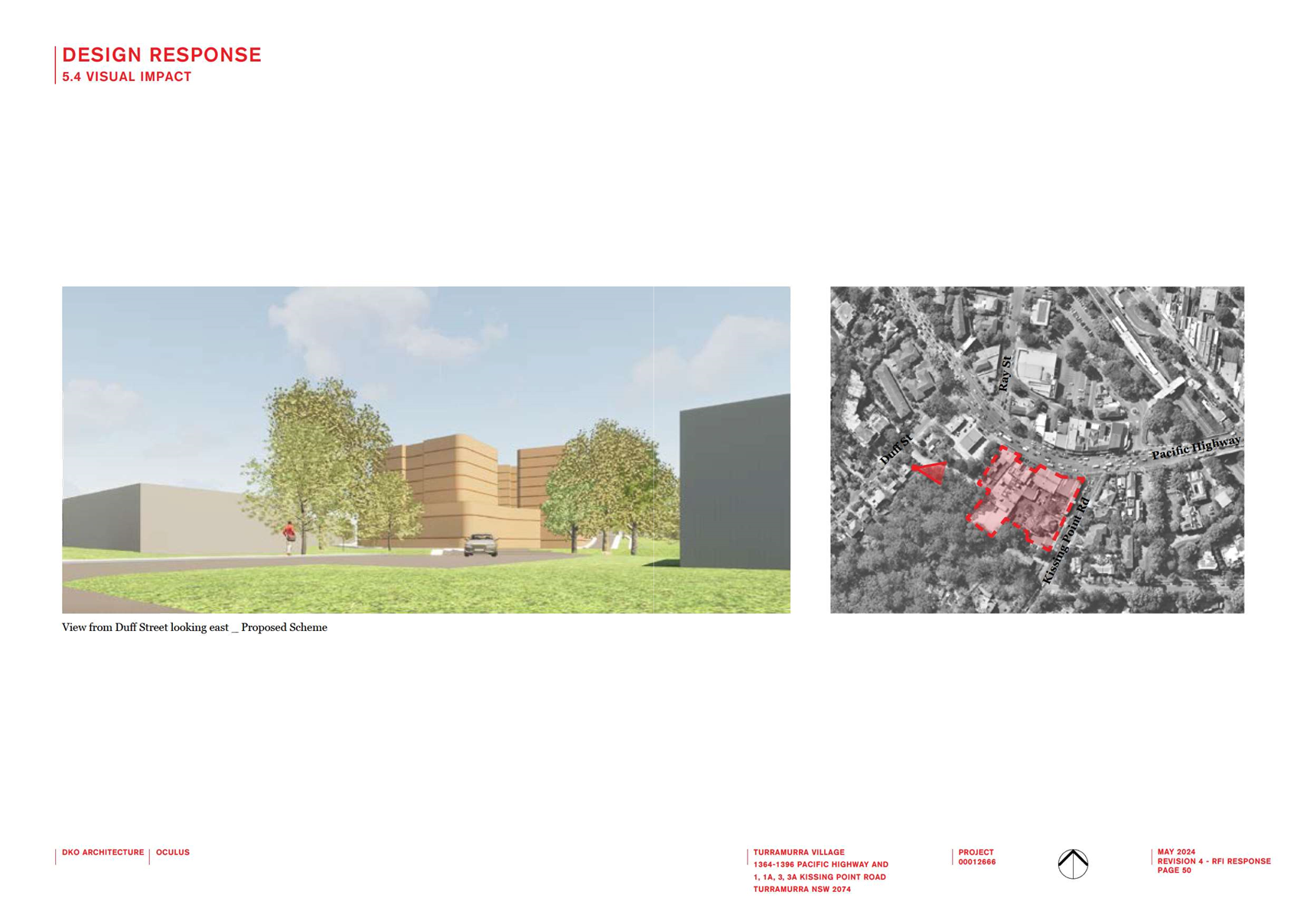
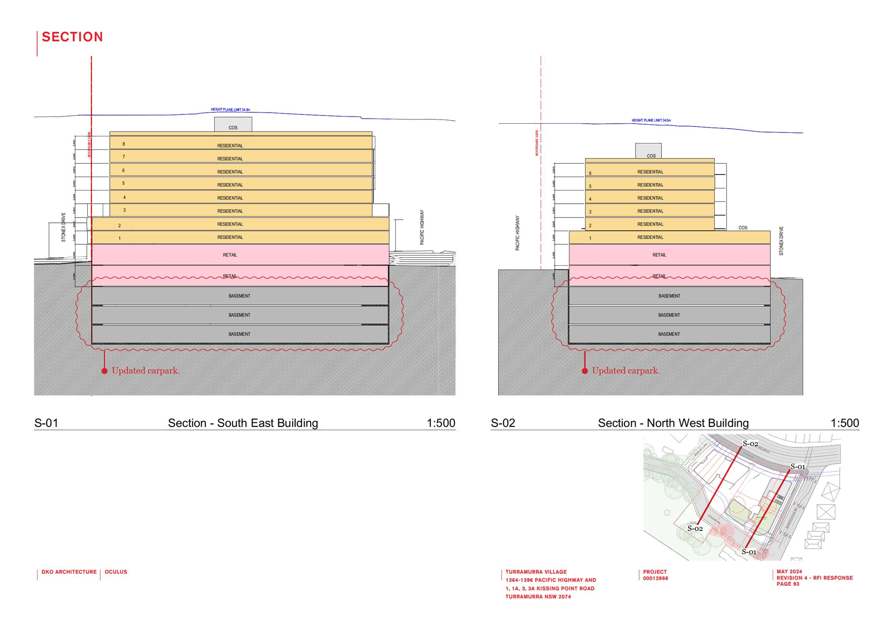
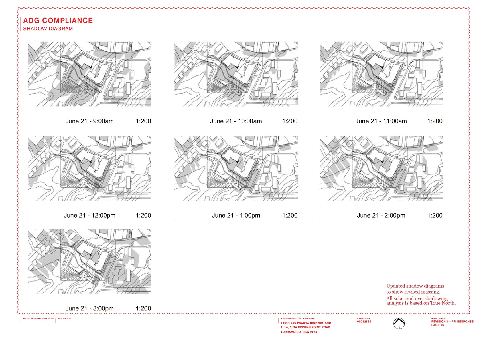
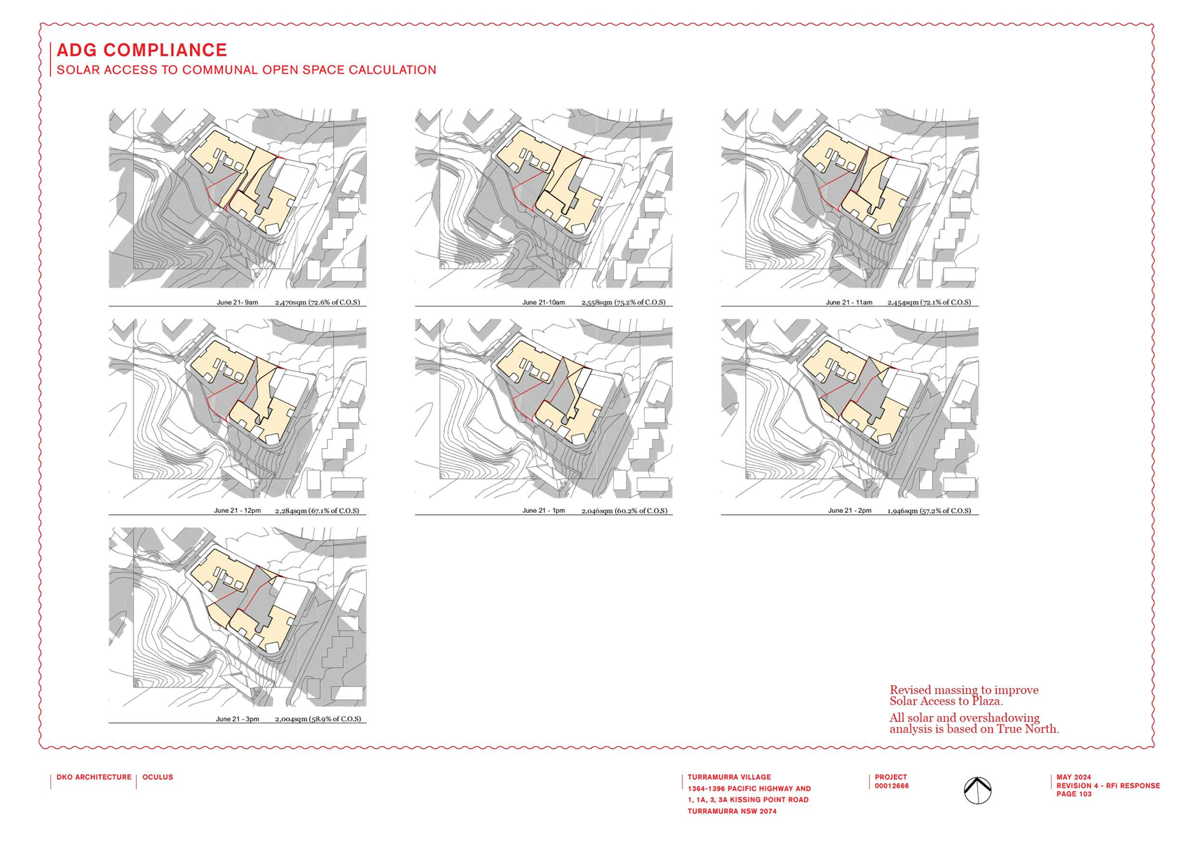
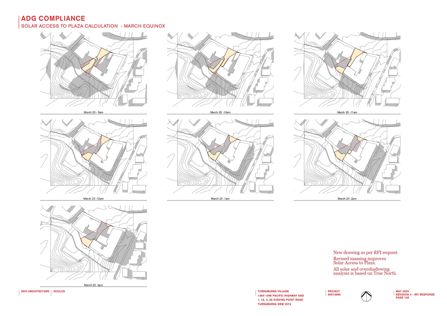
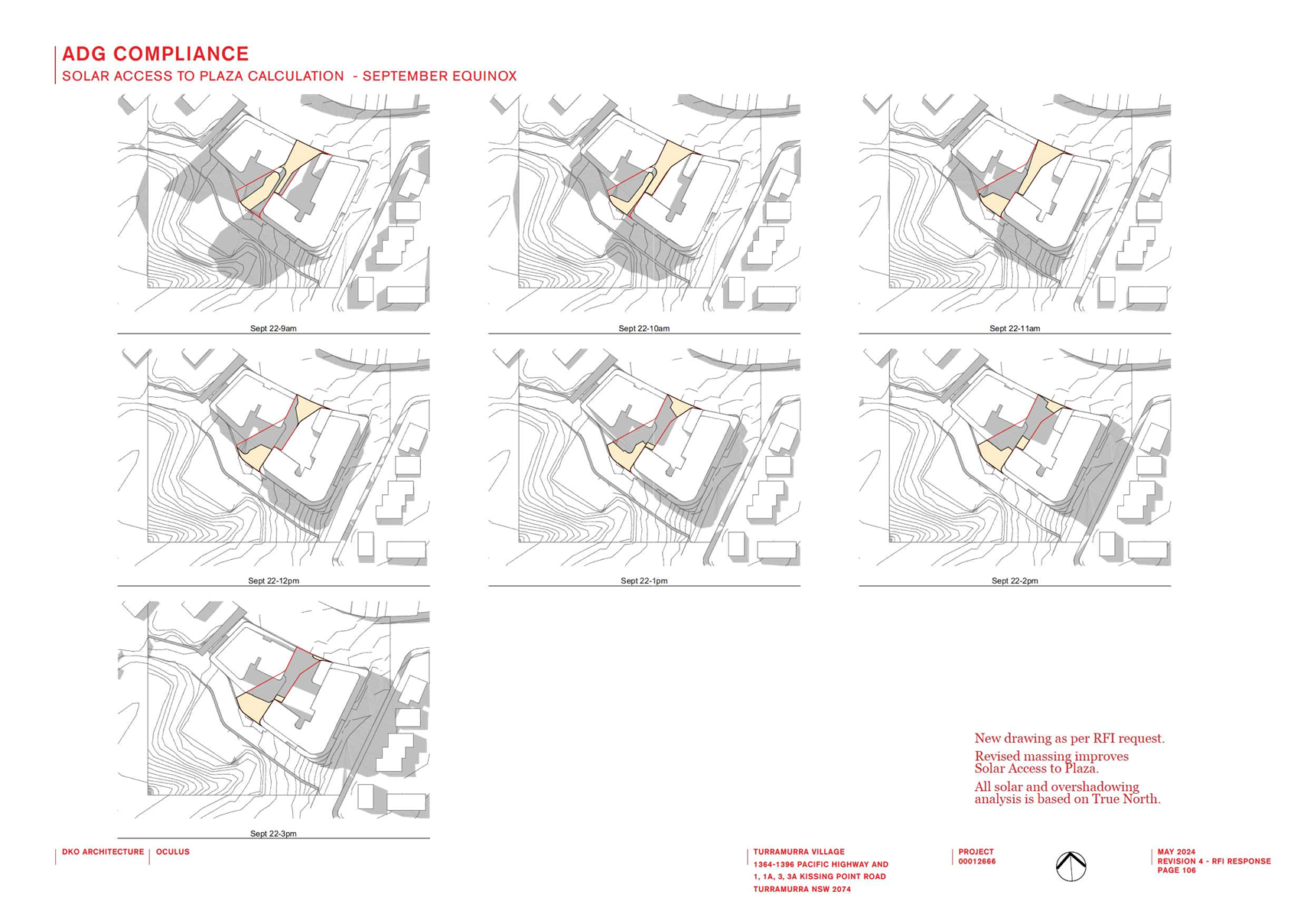
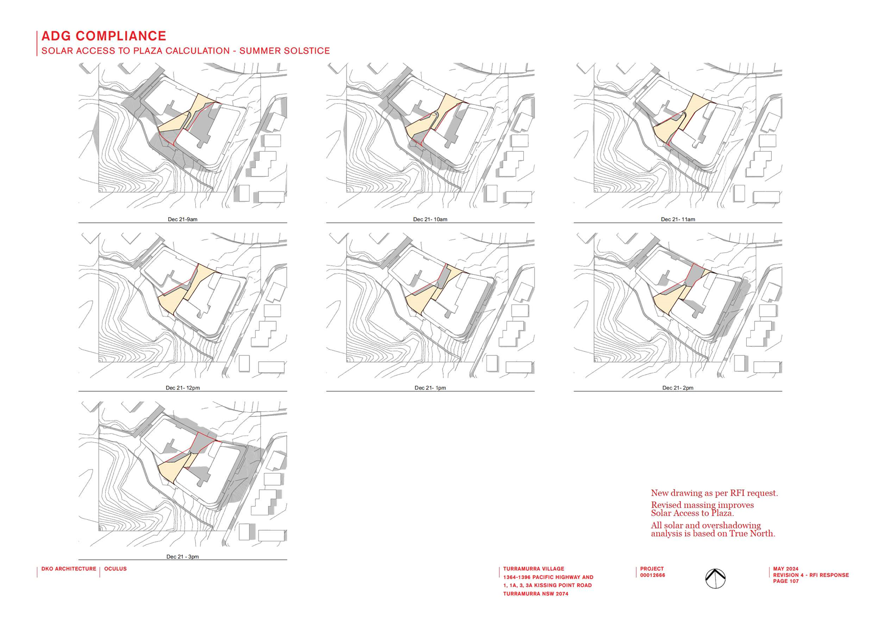
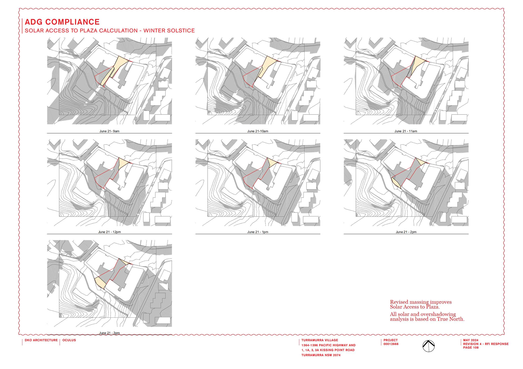
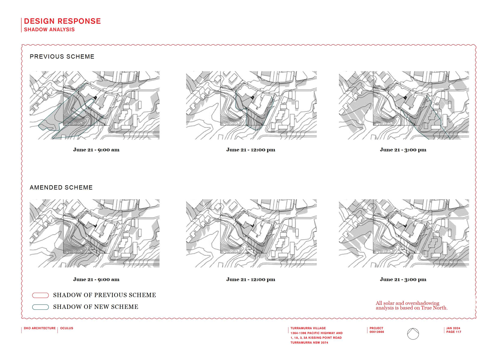
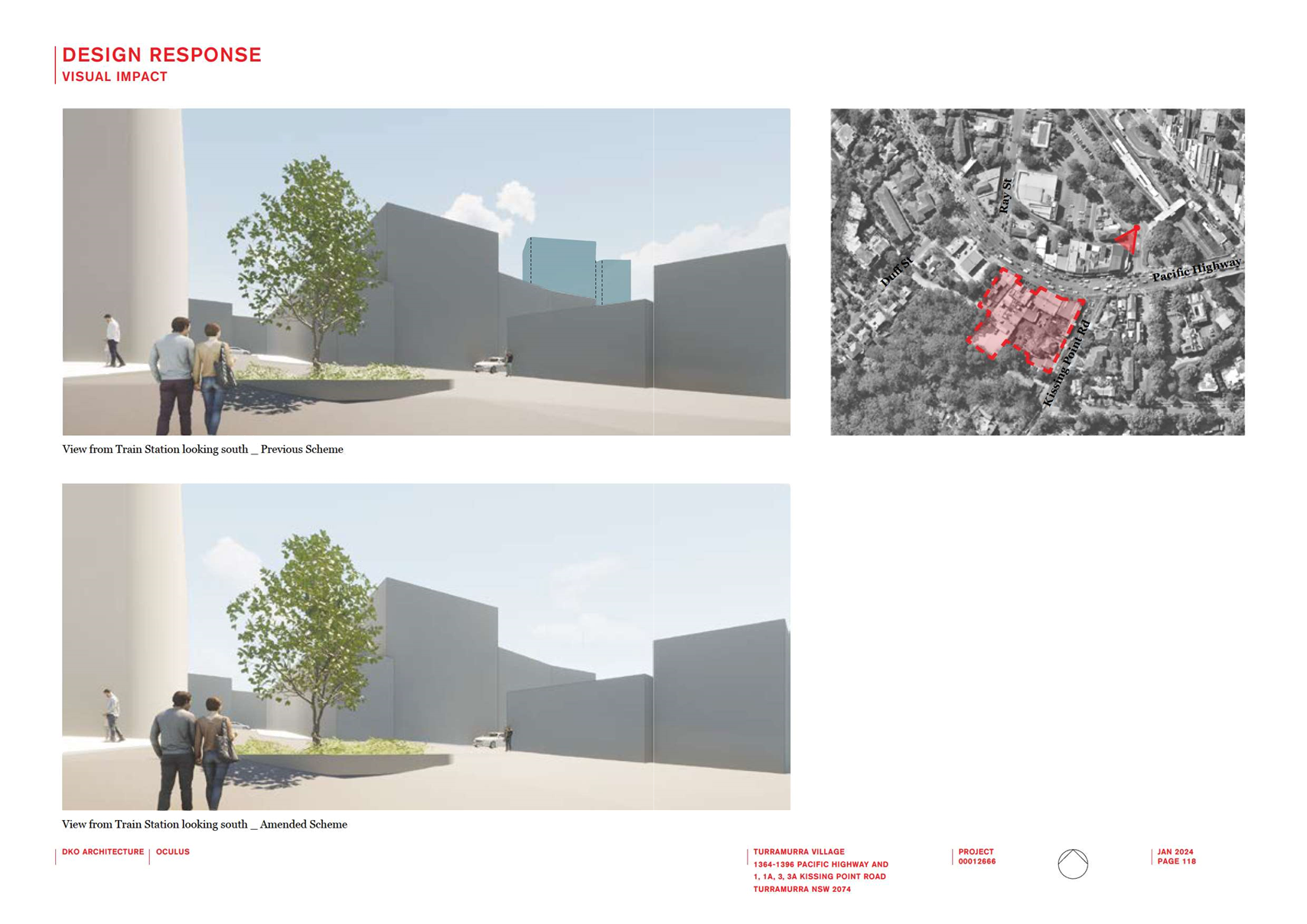
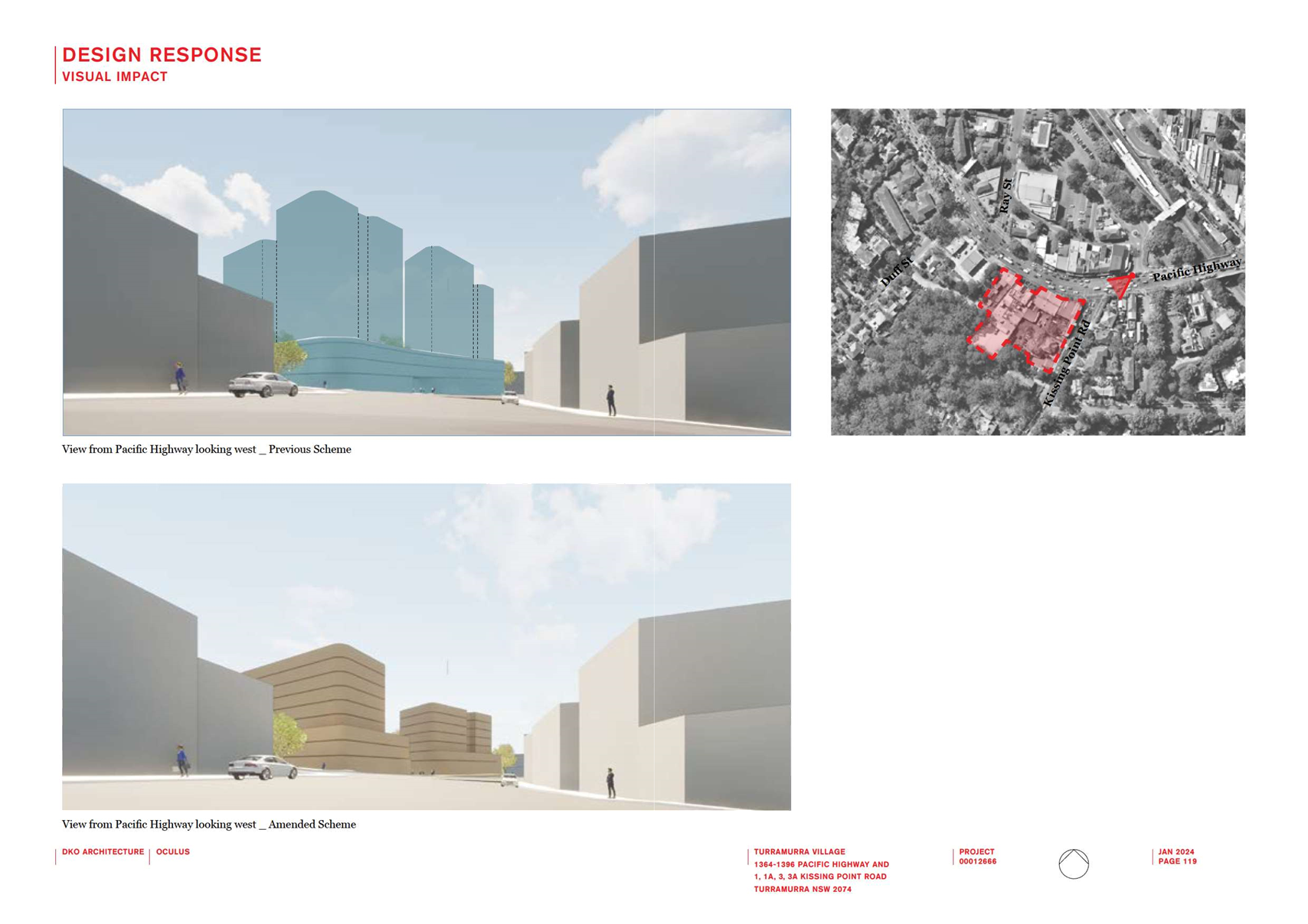
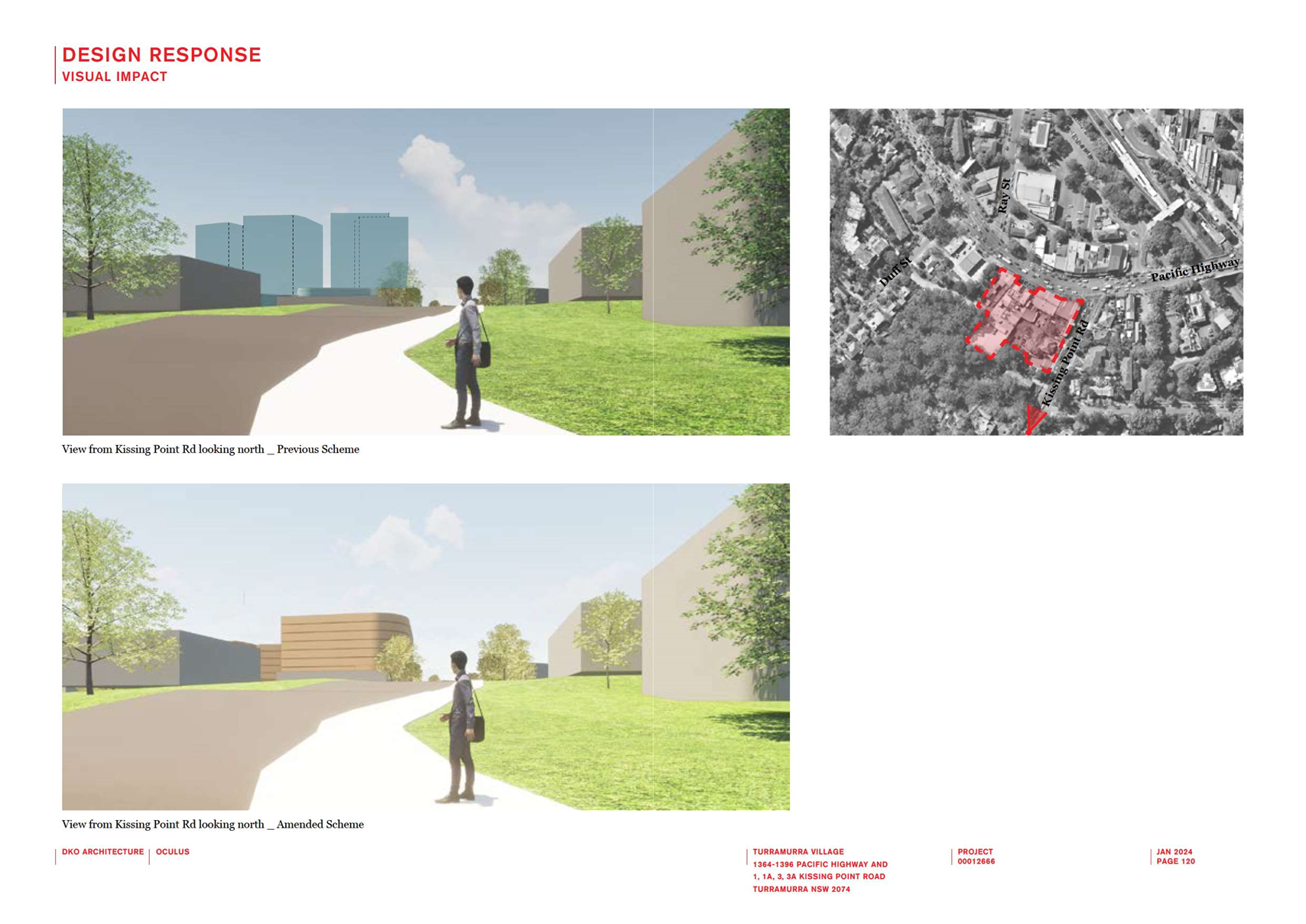
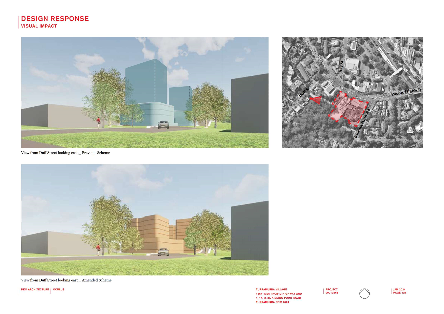
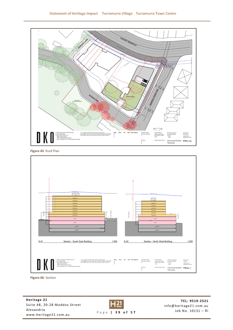
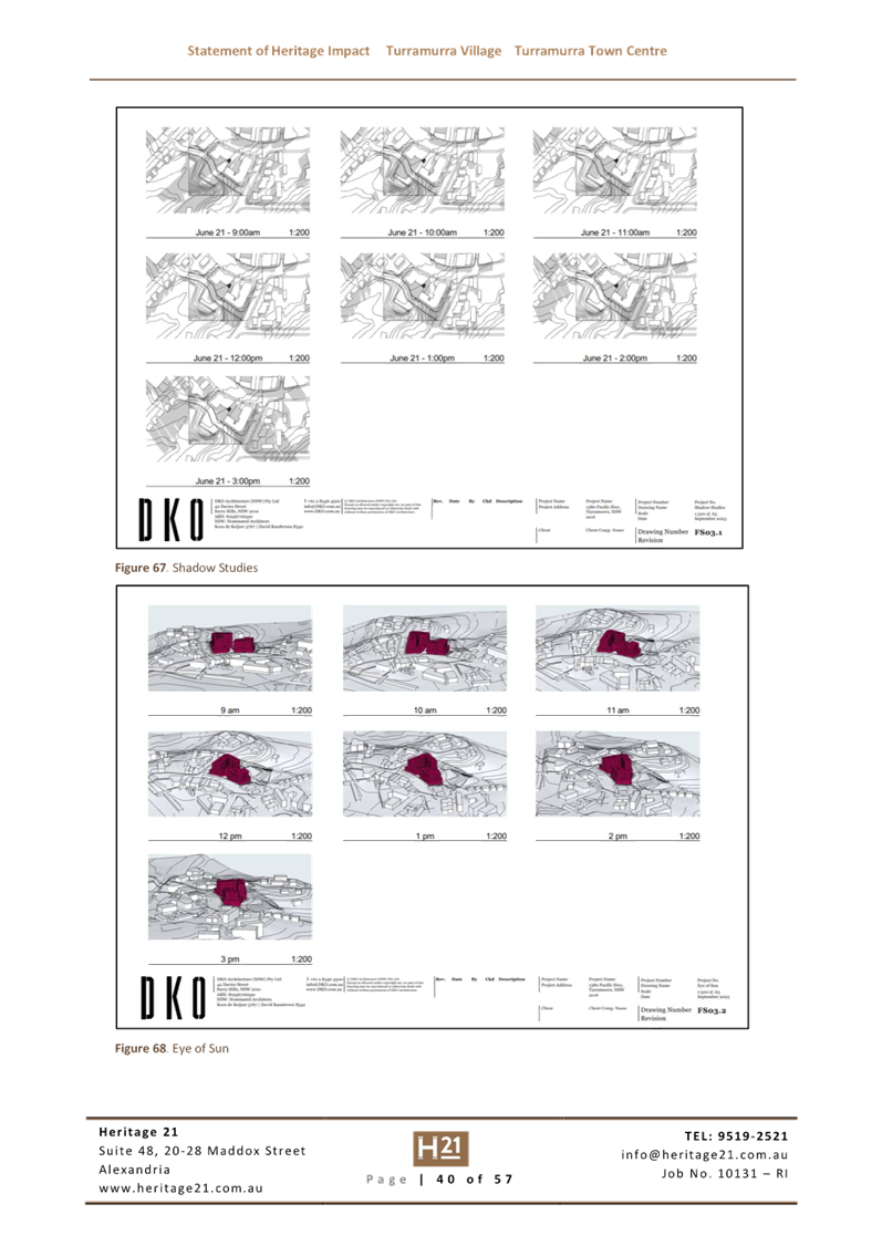
· Overshadowing
of neighbouring properties
The Planning Proposal’s
Urban Design Report includes investigation into overshadowing impacts on
adjacent properties. The diagrams indicate significant impact on properties to
the south of the proposal’s site.
The provided shadow diagrams
present the overshadowing in multiple colours which reduces the clarity of the
actual shadow cast by the proposed buildings. The use of lighter colours for
the extreme extents of the shadow diminish and disguise the shadows on the
adjacent development.
The proponent has been asked at
both adequacy checks to provide a simple single colour shadow diagram that will
be legible to the general public. The Department of Planning and
Environment’s LEP Making Guideline August 2023 states “The
planning proposal should be drafted to ensure that a wide audience including
departmental staff, authorities and government agencies, councils, stakeholders
and the community, can clearly understand the scope and impacts of the
proposal.” The shadow diagrams are required to be revised to show
only the predominant blue colour to all shadow cast by the proposed
development.
 The
redevelopment of the site provides opportunity to deliver improved
overshadowing results both on the site and to neighbouring residences by
orienteering building footprints and considering building bulk across the site
to avoid replicating any poor standards of the existing development.
The
redevelopment of the site provides opportunity to deliver improved
overshadowing results both on the site and to neighbouring residences by
orienteering building footprints and considering building bulk across the site
to avoid replicating any poor standards of the existing development.
There is lengthy justification on
the solar impacts to the neighbouring properties to the south. The diagrams
again utilise the multiple shade shadowing which again visually diminish the
shadow impacts and the reach of shading on those neighbouring buildings.
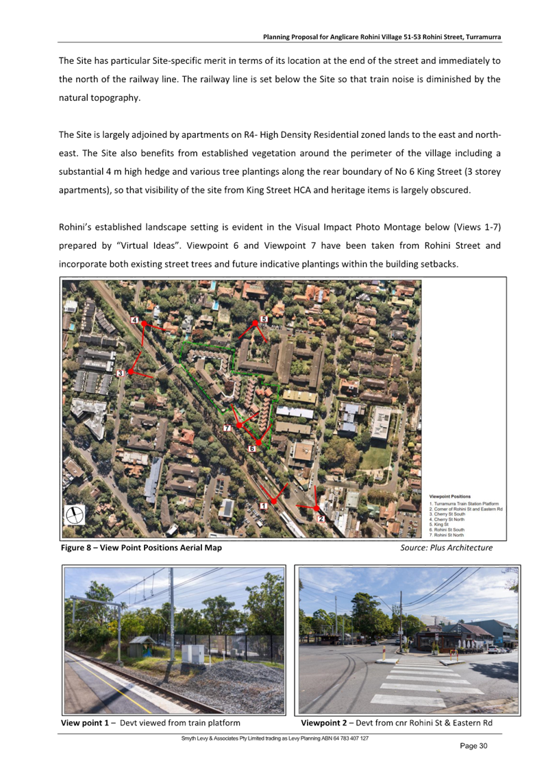
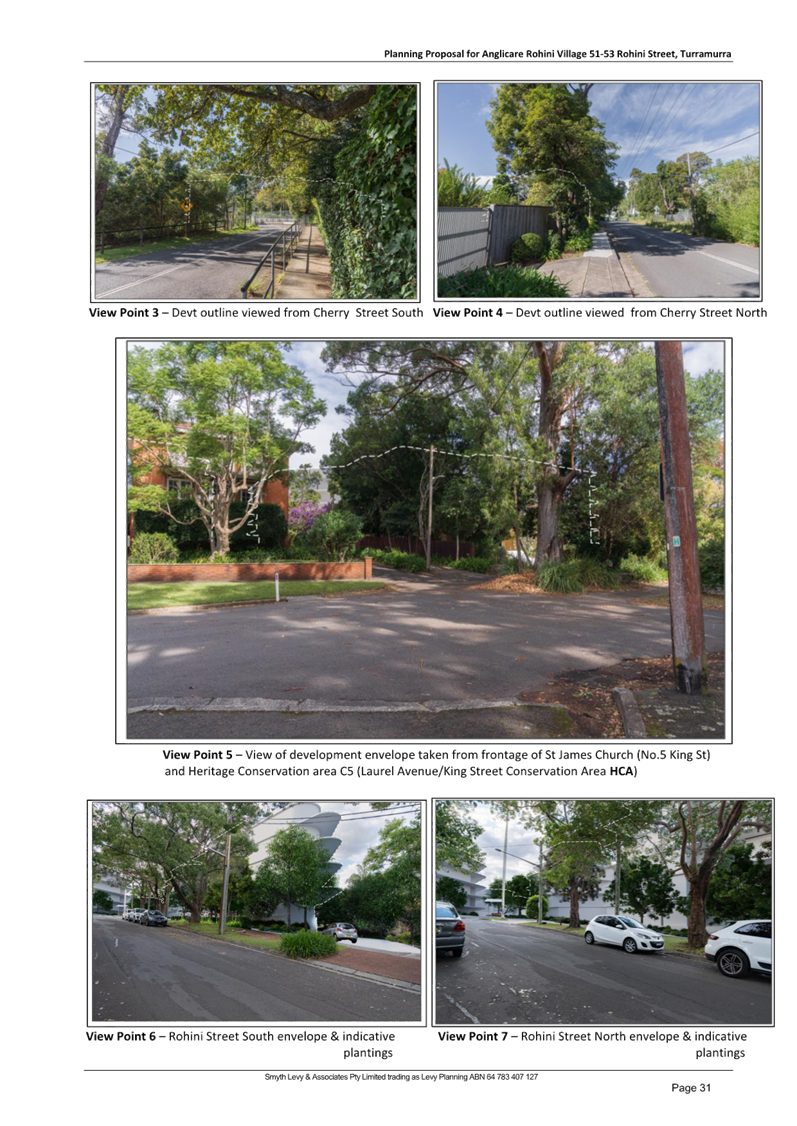
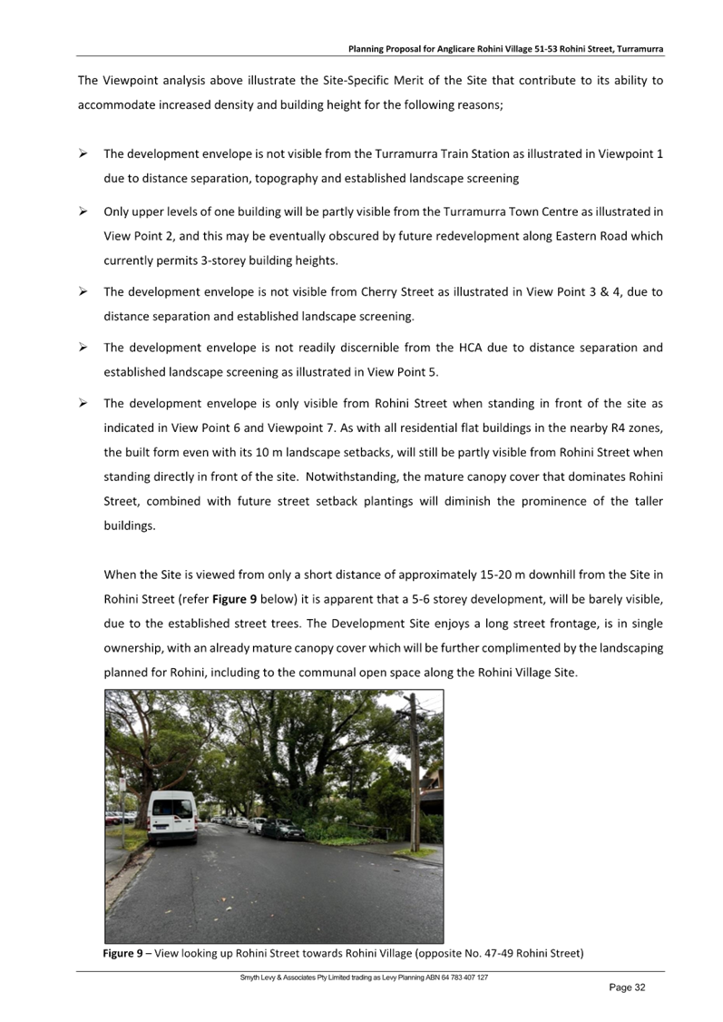
Shadow diagram (PLUS Architecture)
The issue of overshadowing will be
dealt with at DA stage, however it is noted that the impacts to those
neighbours are likely to be high and consideration should be given at DA stage
to minimising the impacts by reducing building footprints and altering building
orientation to enable solar access to the south- eastern boundary properties
Ø Recommendation:
Amend the shadow diagrams to
improve legibility for the general public. At this strategic Planning Proposal
stage, consideration should be given to the cumulative issues of provision of
landscaped areas, deep soil, units with greater numbers of with 2 hours or more
solar access, ventilation and the overshadowing impacts, and the likely
improvement of the scheme with a reduction in the FSR that is consistent with
that of surrounding R4(High Density Residential) zoned areas in this location.
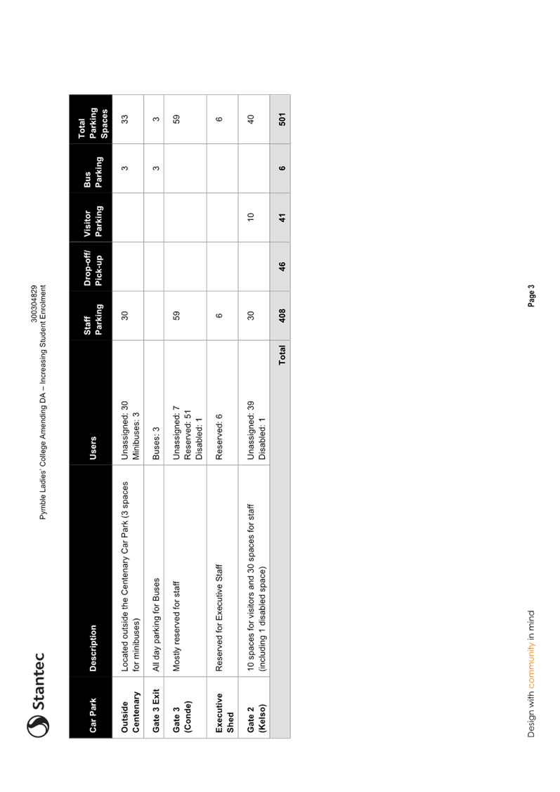
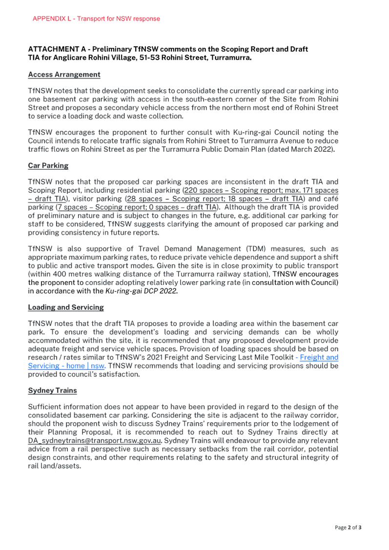
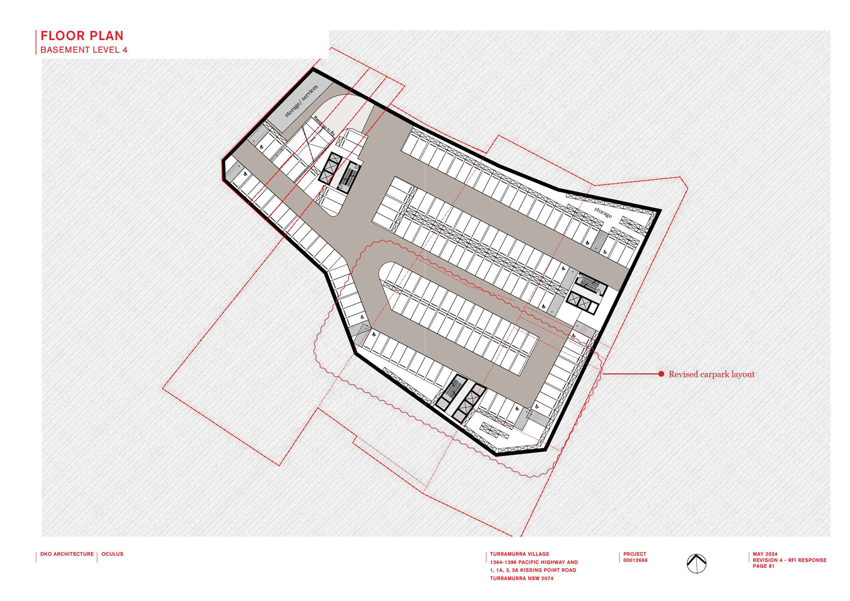
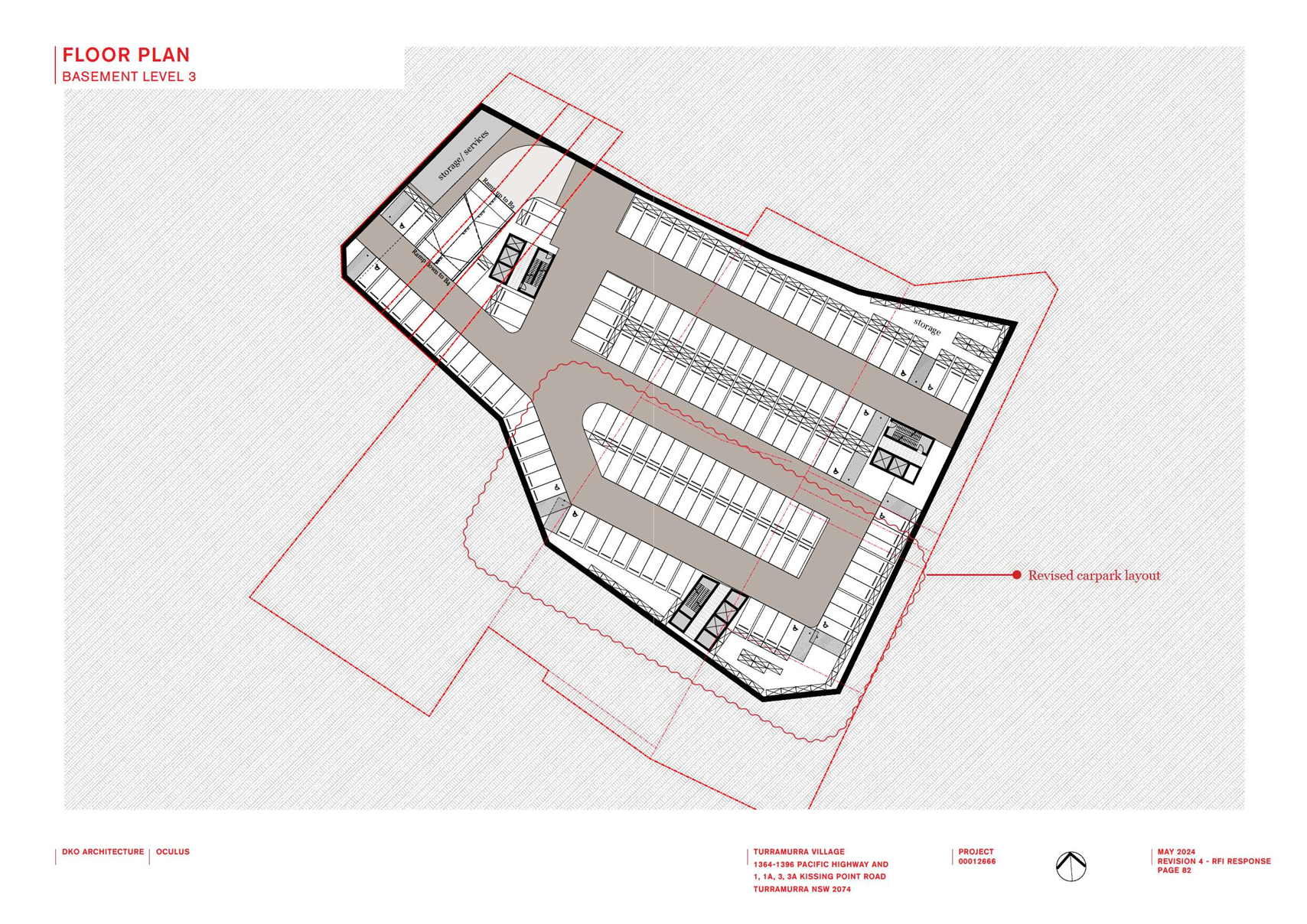
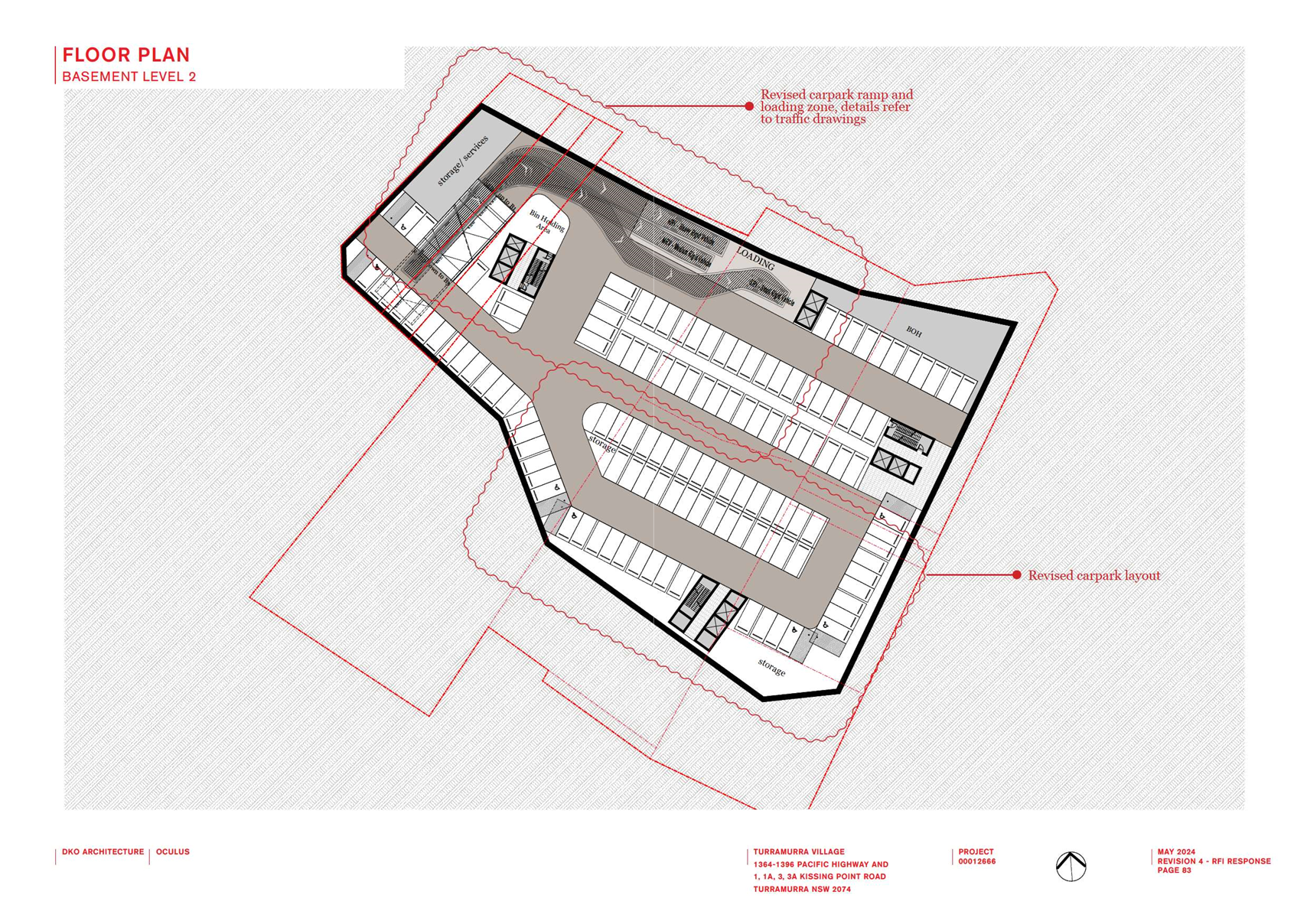
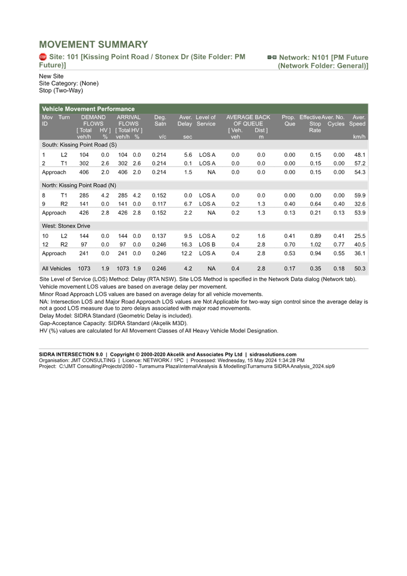
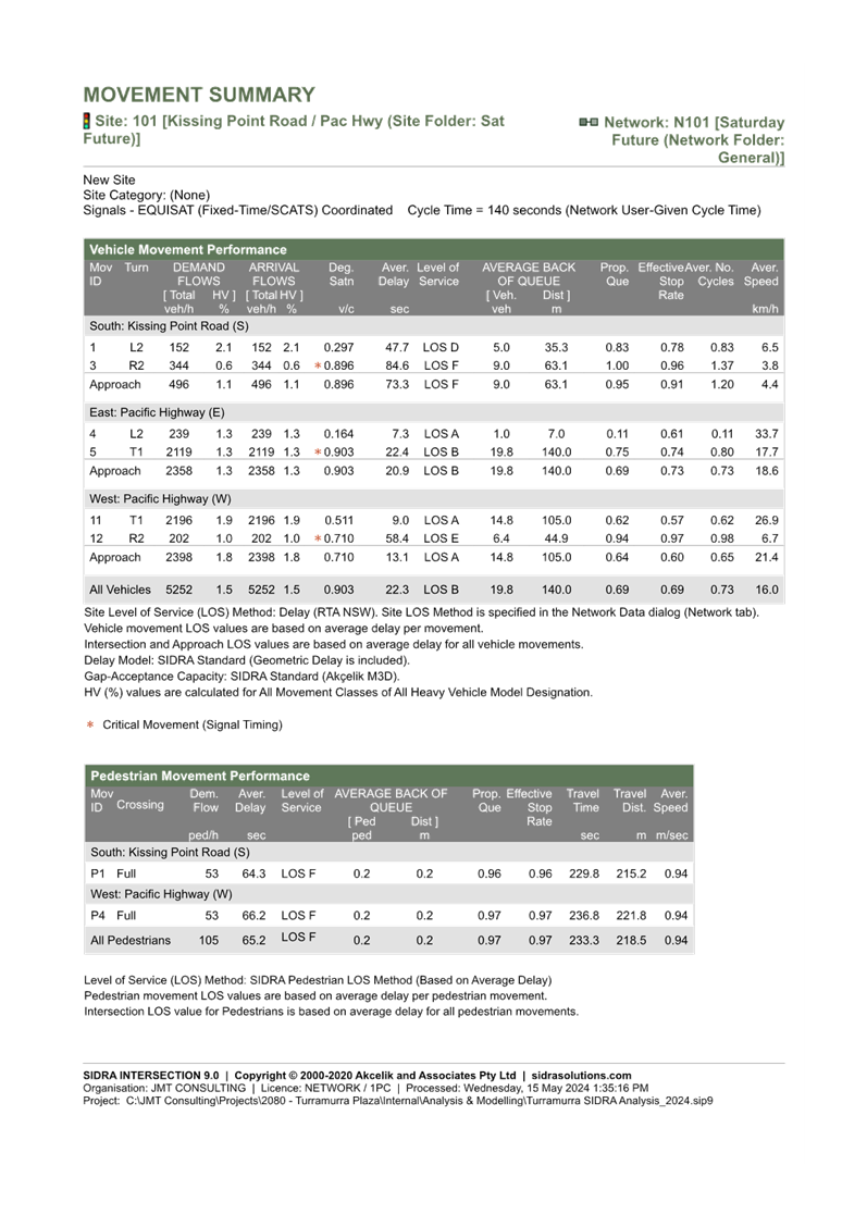
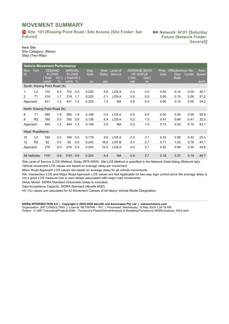
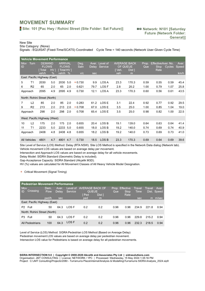
· Car
Parking
A parking
assessment was undertaken and found that if car parking for the proposal were
to be provided in accordance with SEPP Housing 2021, only 22 car parking spaces
would need to be provided as Anglicare is deemed to be a ‘social housing
provider’.
However, the
proponent is suggesting that the target market for the new development would be
downsizers approaching or in retirement, and is seeking to provide car parking
at the equivalent rate to residential flat buildings to cater for this market.
This would
result in the provision of 199 parking (171 resident parking spaces, 18 visitor
spaces, 8 staff spaces, 1 ambulance space and 1 car share space).
While the site
has the capacity to accommodate this level of car parking (across 2-3 basement
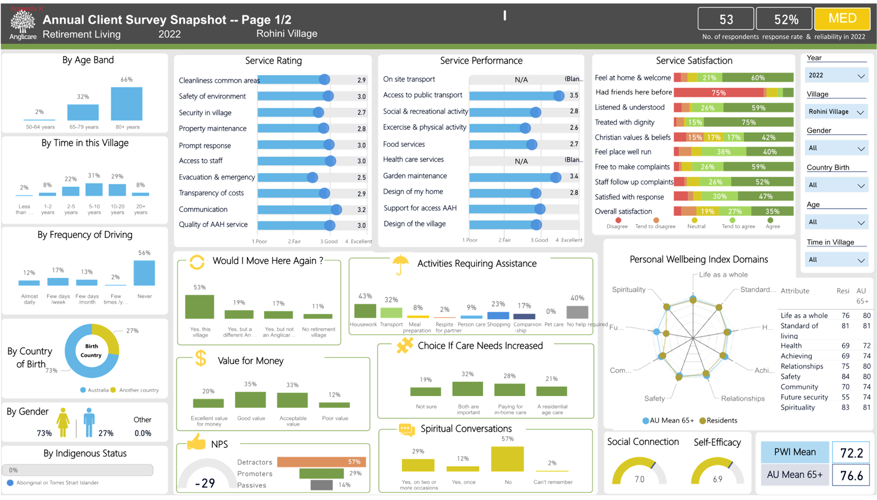
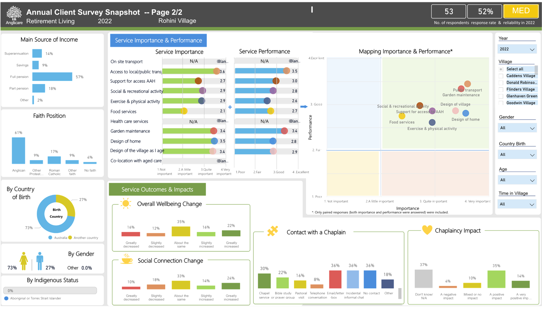
levels), a study of current residents conducted by Anglicare (Appendix K:
Anglicare Village Study – Rohini Village) indicates over half the
residents at Rohini Anglicare do not drive.
Parking should
be provided to closer align with this characteristic from Anglicare’s
records, which would substantially reduce excavation, material costs and
environmental impacts, and improve affordability.
The Anglicare
Village Study also indicates that 30% of current residents drive infrequently,
so provision of car share vehicles could be increased to further reduce parking
provision.
Reduced
parking provision over that shown in this Planning Proposal was also supported
by Transport for NSW in its early correspondence with the proponent.
Ø Recommendation:
Consideration
should be given to parking space reduction given the population profile and the
location adjacent to excellent public transport links.
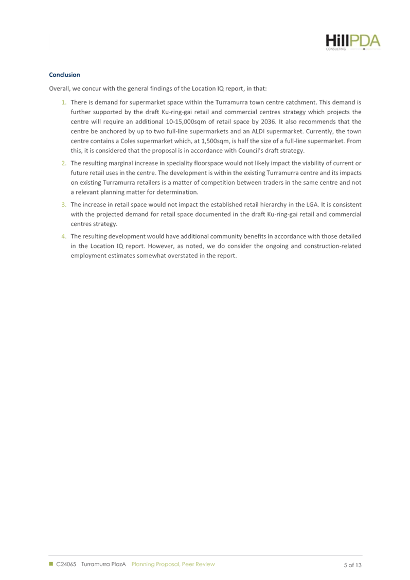
Notwithstanding the above issues requiring further
consideration, confirmation and amendment, and others noted within Attachment
A1 of this Report, the Planning Proposal is generally considered to have
Site Specific Merit contingent on the amendments required in this Report and
within Attachment A1.
Recommendations to Gateway Determination
Having regard to the above assessment it is recommended that
the Ku-ring-Gai Local Planning Panel advise Council that:
1. it
supports the Planning Proposal and recommends that Council submit the matter to
the Department of Planning, Housing and Infrastructure for a Gateway Determination
subject to the Planning Proposal and its Attachments being amended as stated in
this Report and within the Table of Assessment at Attachment A1, and including:
a. provision
of three new KLEP maps showing the proposed amendments:
i. Height
of Buildings Map
ii. Floor
Space Ration Map
iii. Heritage
Map
b. amendment
of the proposed FSR for the site to 1.3:1 (which amounts to an FSR of 1.495:1
with the added 15% SEPP bonus) unless further justification to address the
multiple issues arising from the proposed intensification of the site is agreed
with Council staff.
c. inclusion
of updated amendment to the Written Instrument
i. to
allow Additional Permitted Uses enabling a café and swimming pool on the
site – Schedule 1.
ii. to
amend the heritage listing of the sets of pillars on the site – Schedule
5.
2. it
recommends that the Proponent be advised of the above and directed to submit
the required amended Planning Proposal and its Appendices in accordance with
the recommendations above prior to the matter being referred to the Department
of Planning, Housing and Infrastructure for a Gateway Determination.
integrated planning and reporting
Theme 3 - Places, Spaces and
Infrastructure
|
Community Strategic
Plan Long Term Objective
|
Delivery Program
Term Achievement
|
Operational Plan
Task
|
|
P2.1 A robust planning framework is in place to deliver
quality design outcomes and maintain the identity and character of
Ku-ring-gai
|
P2.1.1 Land use strategies, plans and processes are in
place to effectively manage the impact of new development
|
Implement and monitor the Local Environmental Plans and
supporting Development Control Plans.
|
Governance Matters
The process for the preparation and implementation of
Planning Proposals is governed by the provisions contained in the Environmental
Planning and Assessment Act 1979 and the Environmental Planning and
Assessment Regulation 2000.
If Council fails to make a decision within 90 days (from the
commencement of the review of the application) or if Council makes a decision
to not support the Planning Proposal, the Proponent can make a request to the Department
of Planning, Housing and Infrastructure for a Rezoning Review.
Local Planning Panels Direction – Planning
Proposals issued by the Minister for Planning under Section 9.1 of the Environmental
Planning and Assessment Act 1979 requires Council to refer all Planning
Proposals prepared after 1 June 2018 to the Local Planning Panel for advice,
before it is forwarded to the Department of Planning, Housing and
Infrastructure for a Gateway Determination under Section 3.34 of the Environmental
Planning and Assessment Act 1979.
Risk Management
This is a Planning Proposal initiated by a private
landowner. Council should, to determine its position on the matter,
specifically consider whether the Planning Proposal should be sent to the Department
of Planning, Housing and Infrastructure for a Gateway Determination having regard
to the Local Planning Panel’s advice and decide whether to proceed to
public exhibition.
Council risks damage to its reputation if it does not
undertake strategic land use planning in an effective and timely manner.
Financial Considerations
The Planning Proposal was subject to the relevant
application fee under Council’s 2024/2025 Fees and Charges Schedule. The
cost of the review and assessment of the Planning Proposal is covered by this
fee.
Social Considerations
The Planning Proposal is considered to have positive social
benefits including the replacement of dated housing for Seniors that no longer
meets accessibility standards and current market demand. A Letter of Offer
accompanies the Planning Proposal seeking to enter agreement on the provision
of a new through site link and upgrades to the public domain.
Environmental Considerations
The potential environmental impacts of the Planning Proposal
have been considered in this assessment and it has been determined that the Planning
Proposal should be supported as it will not result in any significant adverse
environmental impacts and is suitable for the site, particularly when the
required amendments are included. The impacts of any specific development that
may occur on the site as a result of the proposal would be considered in detail
at the development application stage.
Community Consultation
In the event that the Planning Proposal is forwarded for a
Gateway Determination and granted a Gateway Determination by the Department of
Planning, Housing and Infrastructure, the Planning Proposal would be placed on
public exhibition in accordance with the requirements of the Gateway
Determination and the Department of Planning, Housing and
Infrastructure’s publication ‘A Guide to Preparing Local
Environmental Plans’.
The public exhibition would also be in accordance with the Ku-ring-gai
Community Participation Plan 2020.
Internal Consultation
The assessment of the Planning Proposal has included
consultation with Council’s Strategic Traffic Engineer, Heritage and
Biodiversity Officers. In addition, independent advice was provided in respect
to economic impacts and urban design as outlined herein. Council officers
attended the site inspection with the independent planning and urban design
consultants to provide a briefing. Specialist referrals are addressed within
the body of this report.
Summary
A Planning Proposal has been submitted for land at 51-53
Rohini St, Turramurra, also known as Anglicare Village. The proposal seeks to
make the following amendments to the KLEP 2015:
1. increase
the maximum Floor Space Ratio (FSR) from 0.85:1 to 1.5:1 (the Housing SEPP
bonus provisions will result in a final FSR of 1.725:1);
2. increase
the maximum Height of Building from 11.5m to 17.5m (the Housing SEPP bonus
provisions will result in a final Height of 21.3m);
3. include
certain Local Provisions that allow the inclusion of a Café and a Wellness
Centre with an indoor pool.
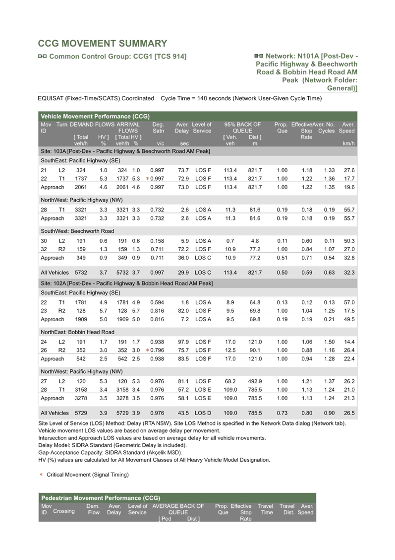
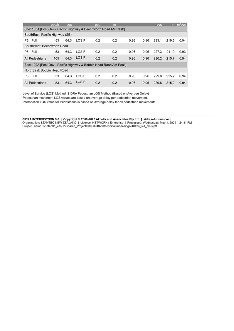
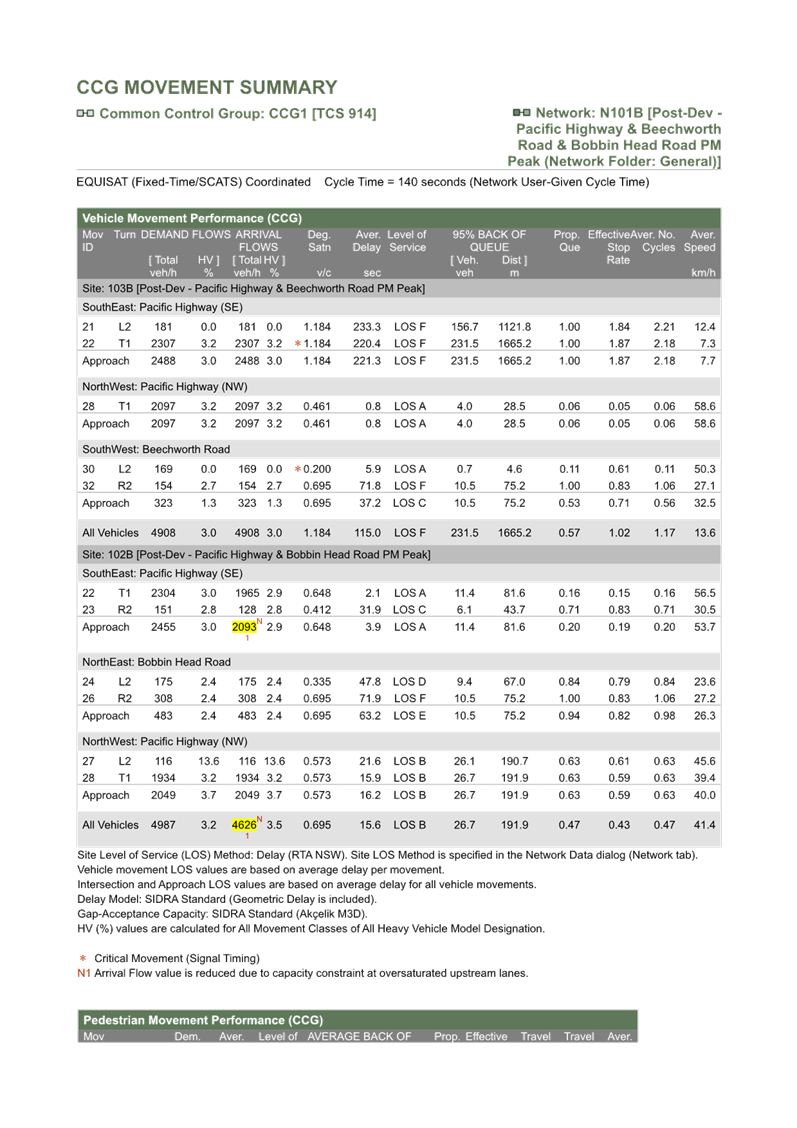
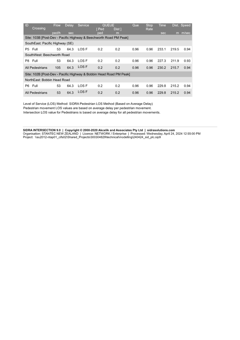
Assessment of traffic and transport, urban design, heritage
and biodiversity issues have been carried out by Council’s Strategic
Traffic Engineer, Urban Design, Heritage and Biodiversity Officers
respectively.
The assessment of the Planning Proposal, presented at Attachment
A1, has resulted in a number of required revisions.
All amendments noted in this Report and in Attachment
1 – Table of Assessment are to be made and returned to Council.
The key amendments to the Planning Proposal include:
· delivery
of the increased Height and FSR standards through mapping amendments consistent
with PN 11-002 - Preparing
LEPs using the Standard Instrument: standard zones and PN 08-001 - Height and floor space ratio, with
amendment to the Height and the FSR maps;
· unless
further justification to address the multiple issues arising from the proposed
intensification of the site is agreed with Council staff, replace the proposed
FSR 1.5:1 with FSR 1.3:1 (resulting in FSR 1.495:1 with the added 15% SEPP
bonus);
· amend
the heritage listing for the pillars on the site and include their location and
curtilage in an amendment to the KLEP 2015 Heritage Map;
· amend the KLEP
written Instrument to make provision for additional permitted uses in Schedule
1 and to describe the heritage listing in Schedule 5.
The assessment of the Planning Proposal finds the proposal
has sufficient strategic merit. The proposal indicates it has site specific
merit much of which is contingent on the required amendments presented in this
Report and in Attachment 1 – Table of Assessment
It is therefore recommended that the Ku-ring-gai Local
Planning Panel advise Council that:
1. it
supports the Planning Proposal and recommends that Council submit the matter to
the Department of Planning, Housing and Infrastructure for a Gateway
Determination subject to the Planning Proposal and its Attachments being
amended as stated in this Report and within the Table of Assessment at
Attachment A1, and including:
a. provision
of KLEP maps indicating the proposed amendments:
i. Height
of Buildings Map with maximum Height 17.5m.
ii. Floor
Space Ratio Map with maximum FSR 1.3:1 contingent on further detailed
information from the proponent.
iii. Heritage
Map listing of pillars and their curtilage.
b. inclusion
of updated amendment to the KLEP 2015 Written Instrument
i. to
allow Additional Permitted Uses enabling a café and swimming pool on the
site via amendment to Schedule 1;
ii. to
amend Heritage listing of the pillars via amendment to Schedule 5.
2. it
recommends that the Proponent be advised of the above and directed to submit
the amended Planning Proposal and its Appendices in accordance with the
recommendations of this Report and in Attachment 1 – Table of Assessment,
prior to the matter being referred to the Department of Planning, Housing and
Infrastructure for a Gateway Determination.
The Planning Proposal has been assessed against the
provisions of the Department of Planning, Housing and Infrastructure’s ‘Local
Environmental Plan Making Guideline’ and section 3.33 of the Environmental
Planning and Assessment Act 1979.
It is considered that the Planning Proposal demonstrates
sufficient strategic and site specific merit such that it should be submitted
to the Department of Planning, Housing and Infrastructure for a Gateway
Determination following amendments as outlined above and in the Table of
Assessment at Attachment A1.
Recommendation:
A. That
the Ku-ring-gai Local Planning Panel advises Council that, following amendments
to the Planning Proposal as outlined in this Report and the Table of Assessment
at Attachment A1, the Planning Proposal be submitted to the Department of
Planning, Housing and Infrastructure for a Gateway Determination.
|
Rathna Rana
Senior Urban Planner
|
Craige Wyse
Team Leader Urban Planning
|
|
Andrew Watson
Director Strategy & Environment
|
|
|
Attachments:
|
A1 ⇩ ⇩
|
Table
of Assessment - Planning Proposal - 51-53 Rohini Street, Turramurra
(Anglicare)
|
|
2024/171923
|
|
|
A2⇩
|
Planning
Proposal Anglicare “Rohini Village” 51-53 Rohini Street,
Turramurra
|
|
2024/174688
|
|
|
A3
|
Appendix
A - Urban Design Report and Site Photo Panel
|
Excluded
|
\\kmc\data\Apps\Infocouncil\Documents\2902\15769\2.
Appendix A - Urban Design Report and Site Photo Panel_1_Saved.pdf
|
|
|
A4⇩
|
Appendix
B - Title Documents & Surveys
|
|
2024/174686
|
|
|
A5⇩
|
Appendix
C - Arboricultural Impact Assessment Report
|
|
\\kmc\data\Apps\Infocouncil\Documents\2902\15769\4.
Appendix C - Arboricultural Impact Assessment Report_1.pdf
|
|
|
A6⇩
|
Appendix
D - Heritage Impact Statement
|
|
2024/174684
|
|
|
A7⇩
|
Appendix
E - Traffic & Transport Assessment
|
|
2024/174683
|
|
|
A8⇩
|
Appendix
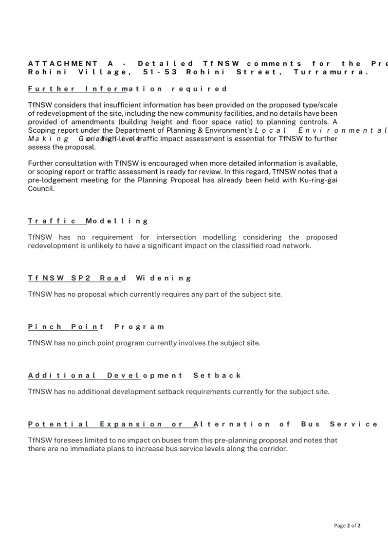
F - Utility and Infrastructure Plans
|
|
2024/174681
|
|
|
A9⇩
|
Appendix
G - Biodiversity Advice
|
|
2024/174680
|
|
|
A10⇩
|
Appendix
H - Landscape Concept & Drawing Schedule
|
|
\\kmc\data\Apps\Infocouncil\Documents\2902\15769\9.
Appendix H - Landscape Concept & Drawing Schedule_1.pdf
|
|
|
A11⇩
|
Appendix
I - Feasibility Analysis
|
|
2024/174677
|
|
|
A12⇩
|
Appendix
J - Letter of Offer and Draft Planning Agreement - Rohini Village
|
|
2024/174674
|
|
|
A13⇩
|
Appendix
K - Rohini Village Study
|
|
2024/174673
|
|
|
A14⇩
|
Appendix
L - Pre-Consultation Minutes and Responses
|
|
2024/174672
|
|
Ku-ring-gai
Local Planning Panel Meeting - 22 July 2024
|
GB.3 / 1
|
|
|
|
|
Item
GB.3
|
S14408
|
Planning Proposal for 1364-1396 Pacific
Highway and 1,1A and 3 Kissing Point Road, Turramurra
EXECUTIVE
SUMMARY
|
purpose of report:
|
To refer the Planning Proposal
for 1364-1396 Pacific Highway and 1, 1A, 3 and 3A Kissing Point Road,
Turramurra (Turramurra Plaza site) to the KLPP for advice as required by the
Local Planning Panels Direction – Planning Proposals issued by the Minister
for Planning under Section 9.1 of the Environmental Planning and
Assessment Act 1979.
|
|
|
|
|
background:
|
The Planning Proposal was formally submitted to
Council for assessment on 25 March 2024 following an adequacy test and the
payment of fees. The Planning Proposal has been assessed by an independent
planning consultant with advice from an independent urban design consultant
due to part of the site being in Council ownership. The Planning Proposal is
an amended scheme following refusal of a previous application by Council on
14 February 2023. The Proponent has indicated that the proposal has been
amended to have regard to comments made on the previous scheme and a new
planning proposal request submitted accordingly.
|
|
|
|
|
comments:
|
The revised Planning Proposal seeks to:
· Amend the
maximum permissible height applying to the site on the Height of Buildings
map from 17.5m to 34.5m;
· Amend the
maximum permissible Floor Space Ratio applying to the site on the Floor Space
Ratio map from 2:1 to 3:1;
· Impose a minimum
commercial/retail FSR of 0.85:1;
· Remove the
maximum commercial FSR standard of 1.2:1 (Area 4 in clause 4.4 (2E); and
· Reclassify the
Council owned part of the site from community to operational land.
|
|
|
|
|
recommendation:
(Refer to the full Recommendation at the end of this
report)
|
That the KLPP advise Council
that it supports the Planning Proposal being submitted to the Department
of Planning, Housing and Infrastructure for a Gateway Determination for the
reasons outlined in this report subject to amendments to the Height of
Buildings map, supporting Reference Scheme and Draft DCP amendment.
|
Purpose of Report
To refer the Planning Proposal for 1364-1396 Pacific Highway
and 1, 1A, 3 and 3A Kissing Point Road, Turramurra (Turramurra Plaza site) to
the KLPP for advice as required by the Local Planning Panels Direction –
Planning Proposals issued by the Minister for Planning under Section 9.1 of the
Environmental Planning and Assessment Act 1979.
Background
Council has engaged consultant MG Planning Pty Ltd (PO Box
197, Drummoyne NSW 1470) to conduct the assessment of the subject Planning
Proposal as Council is the landowner of part of the site (car park site). An
independent urban design assessment has also been prepared by Dr Michael
Zanardo of Studio Zanardo and independent economic and retail assessment
prepared by Hill PDA. Other assessments including biodiversity, natural areas,
heritage, traffic and transport, survey and infrastructure and have been
carried out internally by Council’s specialists.
A previous Planning Proposal request for the subject site
was submitted to Council by the same Proponent in May 2022. The request sought
to:
· Amend the maximum
permissible height applying to the site on the on the Height of Buildings map
from 17.5m (approx. 5 storeys) to 50m (approx. 15 storeys)
· Amend the maximum
permissible Floor Space Ratio applying to the site on the Floor Space Ratio map
from 2:1 to 4.2:1
· Impose a minimum
commercial/retail FSR of 1:1.
· Remove the maximum
commercial FSR standard of 1.2:1 (Area 4 in clause 4.4 (2E)), and
· Reclassify the
Council owned part of the site from community to operational land.
The matter was reported to Council in February 2023 with a
recommendation that the Council resolve not to submit the Planning
Proposal to the Minister for a Gateway Determination in accordance with section
3.34 of the Environmental Planning and Assessment Act 1979 as the
independent planning assessment concluded that the Planning Proposal did not
meet the established strategic or site specific merit tests primarily as it was
determined that:
a. the
proposed height and scale was inconsistent with the status of Turramurra in the
established Ku-Ring-Gai centres hierarchy
b. the
proposal would have an adverse impact on the environment, adjacent development
and the surrounding context and did not provide for a high quality development
on site, and
c. the
proposed height and scale was inconsistent with the site location which is
outside of the core redevelopment priority sites of the Turramurra local centre
(to the north of the Highway) and which is where the most intense development
in the centre is appropriately located.
Further the KLPP provided advice to Council recommending
that the Planning Proposal not be submitted to the Minister for a Gateway
Determination. On 14 February 2023 Council resolved to:
A. note
the advice of the KLPP in respect of the subject Planning Proposal
B. resolve
not to submit the Planning Proposal to the Minister for a Gateway Determination
in accordance with section 3.34 of the Environmental Planning and Assessment
Act 1979, and
C. advise
the Proponent accordingly.
Following refusal of the original Planning Proposal request
the Proponent advised that it has amended the proposal to address matters
raised in the assessment report. A new Planning Proposal was formally submitted
to Council on 25 March 2024 following test of adequacy and the payment of fees.
Following an initial review by the independent planning and urban design
consultants, issues were identified and a request for information letter issued
on 26 April 2024. Issues raised in the letter in respect of the Planning
Proposal include:
· Reference Scheme
non-compliance with:
o Apartment Design Guide (ADG) requirements
in respect of solar access to living rooms and private open space, natural
cross ventilation, number of units off a circulation core, solar access to the
lower plaza area and deep soil area
o Canopy cover requirements
o Requirements for loading /
unloading
· Solar impact to
neigbourbouring properties (residential flat building (RFB) at 5 Kissing Point
Road)
· Lack of a draft
site-specific Development Control Plan (DCP)
· Loading
arrangements and lack of updated SIDRA analysis, and
· Lack of Letter of
Offer in respect of public benefits albeit that the Planning Proposal
identified proposed dedications.
The Proponent submitted amended documentation to address the
issues raised in the RFI letter on 30 May 2024. The amended information
included:
· Revised Planning
Proposal Report
· Stand-alone
site-specific Development Control Plan
· Revised Design
Report (including Reference Scheme), and
· Transport Impact
Assessment.
Accordingly, a copy of the updated
Planning Proposal and relevant appendices is included at Attachments
A2-A12.
The Planning Proposal request seeks to make the following
amendments to the Ku-ring-gai Local Environmental Plan 2015 (KLEP 2015):
· Amend the maximum
permissible height applying to the site on the Height of Buildings map from
17.5m to 34.5m (9 storeys where the original PP request proposed 50m/15
storeys);
· Amend the maximum
permissible Floor Space Ratio applying to the site on the Floor Space Ratio map
from 2:1 to 3:1 (where the original PP request proposed 4.2:1);
· Impose a minimum
commercial/retail FSR of 0.85:1 (where the original PP request proposed 1:1);
· Remove the maximum
commercial FSR standard of 1.2:1 (Area 4 in clause 4.4 (2E)); and
· Reclassify the
Council owned part of the site from community to operational land.
As outlined
in the Planning Proposal request report prepared for the Proponent by The Planning
Studio, the proposed amendments to the KLEP 2015 are intended to “facilitate
the development of the site for a mixed-use development including commercial
premises, retail premises and shop-top housing.”
The Planning
Proposal report claims that the proposal will facilitate an exemplar mixed use
commercial/residential development within a Local Centre context that aligns
with, supports, and promotes key strategic planning priorities of State and
local government. It identifies that the objectives of the Planning Proposal
are:
· To
facilitate the redevelopment of the site in accordance with the relevant
principles of A Metropolis of Three Cities, the North District Plan,
Ku-ring-gai Local Strategic Planning Statement (LSPS), Ku-ring-gai Housing
Strategy, Turramurra Public Domain Plan and Ku-ring-gai Development Control
Plan.
· To
amend the KLEP 2015 to provide for the urban renewal of the subject site into a
lively mixed use precinct which will provide opportunities for supermarkets,
retail shops, commercial space, food and beverage offerings and residential
accommodation. This will be achieved through the implementation of new built
form controls including height and FSR, and a range of site specific
provisions.
· To
provide additional retail floor space in Turramurra Local Centre in response to
a large undersupply within the Ku-ring-gai LGA as identified in the Ku-ring-gai
LSPS and Preliminary Need and Impact Assessment.
· To
facilitate the provision of a full-line supermarket in the Turramurra main
trade area, and one that is underserviced in supermarket floor space provision
in comparison to the Sydney metropolitan average.
· To
provide site specific controls which will ensure an appropriate massing for the
site which reflects the strategic context of the site, while respecting the
immediate context and minimising potential amenity impacts on adjoining
neighbours, heritage items and conservation areas.
· To
assist in achieving State and local government’s housing targets and
address the lack of housing availability within the locality, including the
provision of affordable housing.
The intended
outcomes are stated as follows:
· To
provide additional employment in close proximity to public transport.
· To
provide higher density residential accommodation in a centre location in close
proximity to public transport, jobs and services.
· To
improve pedestrian permeability within and around the site with two through
site links.
· To
improve traffic flow within and around the site with a new road within the
southern boundary.
· To
create a village atmosphere through the provision of public open spaces which
promote social interaction within the community.
· To
protect the adjoining Granny Springs Reserve and ensure a well managed
interface to the Reserve.
· Be
respectful and exist harmoniously with the prevailing character of the area.
Reclassification
of public land
Among other matters the Planning Proposal seeks to
reclassify the Council owned part of the site from community to operational
land via an amendment to Schedule 4 of KLEP 2015. Council resolved to
reclassify the subject land by resolution on 16 March 2021. The Department of
Planning, Housing and Infrastructure’s Practice Note PN 16-001 (date 5
October 2016) sets out requirements for the classification and reclassification
of public land. Accordingly this Practice Note should be address in the
Planning Proposal prior to the matter being submitted for a Gateway
Determination.
Reference
Scheme
The Planning Proposal is supported by a Reference Scheme
prepared by DKO Architecture (Rev 4, May 2024) which comprises:
· Site area of
8,459.7m2
· Height maximum of
9 storeys
· 181 apartments
(including min. 5% affordable housing)
o 1 bedroom apartments –
31.5%
o 2 bedroom apartments –
50.8%
o 3 bedroom apartments –
17.7%
· GFA:
o Retail / commercial –
7,190m2
o Residential – 18,189m2
o Total – 25,379m2
· Maximum FSR
– 3:1
· Solar access
– 132 apartments (74%) achieve 2 hours direct sunlight in midwinter (21
June)
· Cross ventilation
– 108 apartments (60.8%) achieve
· Communal Open
Space – 3,400m2 on ground, Level 1, 2,7 and 9 (44% of site
area)
· Car parking
– 414 spaces (including 179 x residential spaces, 168 x retail spaces, 37
x commercial spaces and 30 x public spaces (in lieu of existing Council parking
spaces on site)
The purpose of the Reference Scheme is not to accurately
represent the final development but rather to demonstrate that a scheme which
represents the proposed maximum height and FSR can readily be accommodated on
the site and can comply with applicable controls and requirements without
resulting in any unreasonable environmental impacts.
Image 1 – Reference Scheme Masterplan (Source: Urban
Design Study, DKO Architecture, May 2024. Note: amendments shown in response
to preliminary RFI comments)
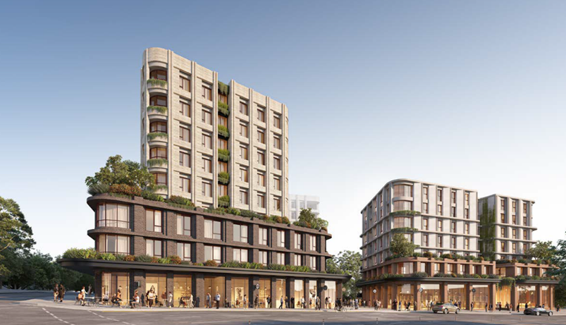
Image 2 – Reference Scheme artists impression from
Pacific Highway (Source: Urban Design Study, DKO Architecture, May 2024)
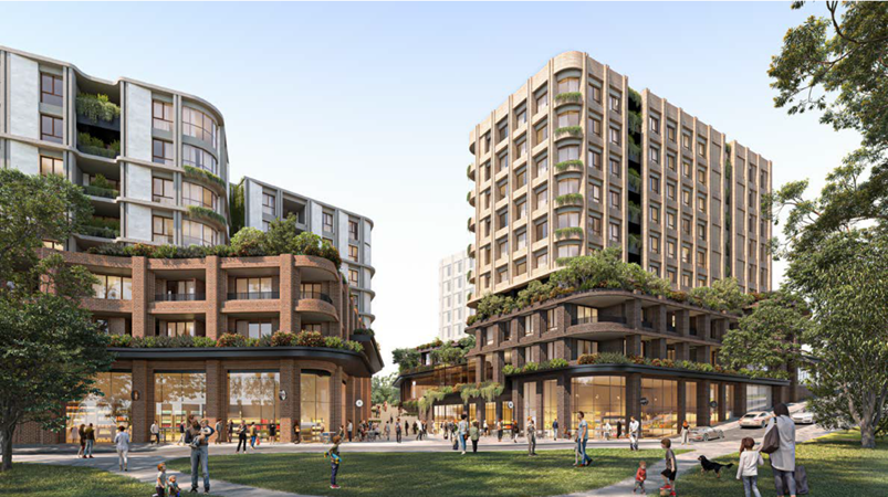
Image 3 – Reference Scheme artists impression from
Stonex Drive (Source: Urban Design Study, DKO Architecture, May 2024)

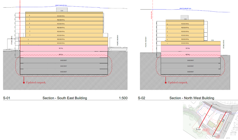
Image 4 – Reference Scheme sections (Source: Urban
Design Study, DKO Architecture, May 2024)
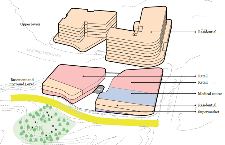
Image 5 – Design response proposed use diagram(Source:
Urban Design Study, DKO Architecture, May 2024)
The proposed public benefits of the Planning Proposal as
identified by the Proponent are as outlined below:
|
Proposed Public Benefits of
Planning Proposal
|
|
Item
|
Description
|
|
Land Dedication
(new road, new park, road widening)
|
2,915m2
|
|
New Community Park
|
708m2
|
|
New Road (Stonex Street)
|
1,434m2
|
|
Kissing Point Rd Upgrades
|
255m2
|
|
Pavement Upgrades
|
1,255m2
|
|
Pacific Highway land dedication
|
405m2
|
|
Pacific Highway Fence Upgrade
|
96m length
|
|
Public Parking
|
30 Council car spaces in basement
(Offsets existing Council car park spaces)
|
|
New through-site link
|
907m2
|
|
Stonex Lane Upgrade
|
245m2
|
|
Supplementary Street Trees
|
As per Public Domain Plan
|
|
Upgraded Bus Stop
|
1
|
|
New Bicycle Racks (on-street)
|
2 areas
|
|
Upgraded Street Lighting
|
Pacific Highway and Kissing Point Road
|
Site
Description and Local Context
The site is located in the Turramurra Local Centre to the
south of the Pacific Highway and on the corner of the Highway and Kissing Point
Road. It is approximately 130m to the south-west of Turramurra Station and has
frontage to the Pacific Highway and Kissing Point Road.
Turramurra Local Centre is largely characterised by its
early 20th Century federation houses, significant private gardens and
established large canopy trees, shop top housing in the retail heart of the
centre and prominent elevated topography. Turramurra’s topography
features two prominent ridges, with its urban centre focused along the higher
points. The elevated ridge-line topography creates opportunities for views into
and beyond the suburb, while dense tree canopies and deep valleys screen lower
density development. The main ridge rises from the south-east and runs
north-west, parallel to the Pacific Highway. The landscape falls steeply to the
west of this ridge. Falls to the north and east are relatively gentle.
The Pacific Highway and the North Shore rail line intersect
at Turramurra. The impact of the road and rail upon the locality is the
division of its centre into four constituent parts. The amenity and
accessibility of the centre is significantly affected by the Pacific Highway,
which carries almost 65,000 vehicles per day, and the rail corridor line which
both act as significant physical barriers whilst providing good transport
accessibility.


Image 6 – Turramurra Local Centre segment parts
(Source: LSPS)
For pedestrians and cyclists, the approach from the southern
catchment to the centre is met by a steep climb up to the ridge. There are only
3 pedestrian crossings within the Local Centre. They are at the Pacific
Highway’s intersection with Ray Street, Kissing Point Road and Rohini
Street. The result is that the railway and highway form a physical and
psychological barrier for pedestrians approaching the Local Centre from the
south. A pedestrian bridge across the Pacific Highway to improve connectivity
does not form part of the Planning Proposal. It is however understood that
Council has previously advised against such a proposal due to issues with
identifying an appropriate landing site on the northern side of the Highway.
The subject site is located in the southwestern quadrant of
the Local Centre and is irregular in shape with frontages to the Pacific
Highway and Kissing Pont Road (refer Image 7 below). A car park access road
(Stonex Drive) enters the site from the south east to the car parking area at
the rear of the north facing retail shops. The site is also connected via
Stonex Drive to Duff Street to the west.

Image 7 – Aerial photo, site outlined in red (Source:
Nearmap, image capture 7 April 2024)
The site is generally known as the Turramurra Plaza shopping
centre (and adjacent land) and has a combined area of approximately 8,397.94m2.
It comprises the following landholdings:
· 1396 Pacific
Highway (Lot 1 DP 629520) – private land
· 1392 Pacific
Highway (Lot 2 DP 16463) – private land
· 1390 Pacific Highway
(Lot 1 DP 550866) – private land
· 1380-1388 Pacific
Highway (Lot 101 DP 714988) – private land
· 1370-1378 Pacific
Highway (Lot 1 DP 500077) – private land
· 1364 Pacific
Highway (Lot 1 DP 656233) – private land
· 1A Kissing Point
Road (Lot 2 DP 500077, Lot 2 DP 502388 and Lot 2 DP500761) – Council land
· 1 Kissing Point
Road (Lot 1 DP500761) – private land
· 3 Kissing Point
Road (Lot B DP 435272) – Council land, and
· 3A Kissing Point
Road (Lot A DP 391538) – Council land.
as shown below:


Image 8 – Subject site (Source: DKO Urban Design
Report, May 2024. Note: Council owned land shown red) (Note: survey
shows H as having an area by DP of 847.5m2 and 909.3m2 by
calculation)
As noted in Image 8 above the Proponent has calculated the
site area according to the submitted survey plan via a mixed area calculation,
that is, primarily by title but in the case of Area H by measured calculation.
The survey states that Area H has an area of 847.5m2 by title but an
area of 909.3m2 by calculation, that is, a discrepancy of 61.8m2.
This means that the site is stated by the Proponent as having a total area of
8,459.64m2 whereas by title the area is actually 8,397.94m2.
Council has received advice in this respect from Pinnacle
Land Surveyors who has advised that it is a risk to accept a mixed area
calculation (especially in this application) and that the conservative approach
would be to accept the area by title for all parcels. Further they have advised
that calculating all the areas by title gives Council reliable legal grounds
for determining the site area and shifts risk to the ORG (Office of the
Registrar General) under the Torrens Assurance Fund. The advice states that the
foundational legal principle is that the title area is the point of truth for
the property area however, due to the old measurement and calculation methods,
that the title area often needs to be updated or corrected in older plans, and
the post-developed area can differ. The advice goes on to indicate that there
are certain circumstances where it might be more appropriate to assess the
application based on the calculated or surveyed area, but in order to do this
Council would require better certainty, and the developer needs to weigh up the
cost of this against the value gained. Having regard to the advice it is
considered that at this stage of the process Council should not accept the area
by calculation and accordingly the site area stated in the Reference Scheme is
overstated by 61.8m2.
Having regard to the above advice it is considered that the
site area should be taken to be 8,397.94m2 in accordance with title
details. Notwithstanding this discrepancy can be resolved at a later stage of
the process. Notably the Reference Scheme proposes a 3:1 FSR on the site with
an additional area of 61.8m2. This therefore equates to an
additional GFA of not more than 185.4m2 which in the context of a
development totalling in the order of 25,000m2 GFA is considered to
be unlikely to affect site suitability.
Of the total site area of 8,397.94m2 a total of
6,134m2 is in private ownership with the remaining 2,263.94m2
being public land owned by Council. The application seeks to amend Schedule 4
of KLEP 2015 to reclassify the Council owned land (1A, 3 and 3A Kissing Point
Road being Lot 2, DP 500077; Lot 2, DP 502388; Lot 2, DP 500761; Lot B, DP
435272; Lot A, DP 391538) from community to operational land in accordance with
the requirements of the Local Government Act 1993.
Surrounding development is as follows:
· North:
Directly to the north of the site is the Pacific Highway and across the highway
are a range of 1-3 storey buildings with retail, commercial and food &
beverage uses;
· East:
Directly to the east of the site is Kissing Point Road and across the road are
range of 2 storey commercial properties and 1-2 storey residential buildings
which form a heritage conservation area, and which also includes a number of
individual listed heritage items;
· West:
Directly to the west of the site is Stonex Lane with a petrol station further
to the west; and
· South:
Directly to the south is the Granny Springs Reserve which is a bushland that
contains some of the largest Blue Gum trees in the district and is home to the
threatened Powerful Owl. The Reserve is listed as an endangered ecological
community under the provisions of the NSW Threatened Species Act 1995
and is critically endangered under the Environmental Protection and
Biodiversity Act 1999. The site is also adjoined to the south by 5 Kissing
Point Road which is a small 3 storey residential flat building.

Image 9 – Site context (Source: Urban Design Report,
DKO Architecture, May 2024)
The site is zoned E1 Local Centre under Ku-ring-gai Local
Environmental Plan 2015.

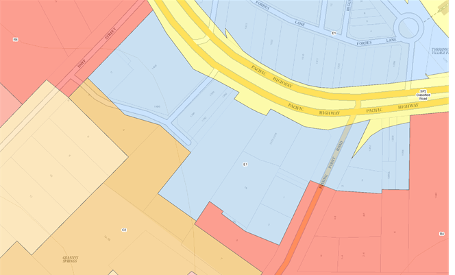
Image 10 – Zoning map extract KLEP 2015
The objectives of the E1 Local Centre zone are:
· To provide a
range of retail, business and community uses that serve the needs of people who
live in, work in or visit the area.
· To encourage
investment in local commercial development that generates employment
opportunities and economic growth.
· To enable
residential development that contributes to a vibrant and active local centre
and is consistent with the Council’s strategic planning for residential
development in the area.
· To encourage
business, retail, community and other non-residential land uses on the ground
floor of buildings.
Permitted land uses in the E1 Local Centre zone (with
development consent) include:
Amusement centres; Bed and breakfast accommodation; Boarding
houses; Centre-based child care facilities; Commercial premises;
Community facilities; Entertainment facilities; Function centres; Group homes
(permanent); Hotel or motel accommodation; Information and education
facilities; Light industries; Local distribution premises; Medical centres;
Oyster aquaculture; Places of public worship; Public administration buildings;
Recreation facilities (indoor); Respite day care centres; Service stations; Shop
top housing; Tank-based aquaculture; Veterinary hospitals; Water
reticulation systems; Any other development not specified in item 2 or 4
Notably residential accommodation is prohibited in the E1
Local Centre zone however ‘Shop top housing’ which is defined as
“one or more dwellings located above the ground floor of a building,
where at least the ground floor is used for commercial premises or health
services facilities” is permitted with consent. The Reference Scheme
which comprises a mixed use development of commercial / retail development with
residential above would therefore be permissible with consent.
Comments
The Planning Proposal has been assessed against the
provisions of the Department of Planning, Housing and Infrastructure’s ‘Local
Environmental Plan Making Guideline’ (August 2023) and section 3.33
of the Environmental Planning and Assessment Act 1979.
A Planning Proposal must demonstrate that the proposed
amendments to a local environmental plan have strategic and site specific
merit. A detailed evidence-based assessment of the Planning Proposal and its
supporting studies has been conducted. In summary it has been concluded that
the Planning Proposal demonstrates sufficient evidence to demonstrate that the
proposal has strategic and site-specific merit subject to recommended
amendments. Accordingly, the Planning Proposal is supported in this
instance.
The following is a summary assessment of the key planning
issues and relevant merits associated with the Planning Proposal.
Strategic Merit
Regional Plan
The Planning Proposal is generally consistent with a number
of objectives of the Greater Sydney Region Plan – A Metropolis of
Three Cities, including:
· Objective 4
– Infrastructure use is optimised
· Objective 7
– Communities are healthy, resilient and socially connected
· Objective 10
– Greater housing supply
· Objective 11
– Housing supply is more diverse and affordable
· Objective 14
– Integrated land use and transport creates walkable and 30 minute cities
· Objective 22
– Investment and business activity in centres, and
· Objective 27
– Biodiversity is protected, urban bushland and remnant vegetation is
enhanced.
A Metropolis of Three Cities outlines that
liveability incorporates access to housing, transport and employment as well as
social, recreational, cultural and creative opportunities. Improved
health, public transport and accessibility outcomes are achieved through the
provision of schools, recreation, transport, arts and cultural, community and
health facilities in walkable, mixed-use places co-located with social
infrastructure and local services. Mixed-use neighbourhoods close to centres
and public transport improve the opportunity for people to walk and cycle to
local shops and services. Enhancing the safety, convenience and accessibility
has many benefits, including healthier people, more successful businesses and
centres. The proposal is therefore consistent with these principles.
Turramurra is located within the
Eastern Harbour City and is identified as a local centre. The Plan sets the
principles for Housing Strategies to be prepared by councils for a local
government area or district and to be given effect through amendments to local
environmental plans. The principles note that among other matters housing
strategies should respond to amenity i.e. opportunities that improve amenity
including recreation, the public realm, increase walkable and cycle friendly
connections to centres. Further the Plan notes that the District Plans guide
housing strategies in particular in ensuring key aspects of development are
addressed, that is: capacity, viability, good design, environment, mix, supply,
affordable rental housing, local character, etc. As discussed in further
detail below it is considered that the proposal is consistent with the capacity
of the site and the local character and has demonstrated the achievement of
good design subject to recommended amendments.
Objective 12 of the Plan –
“Great Places that Bring People Together” provides that place-based
planning should be adopted to provide:
· Well-designed
built environment: great places are enjoyable and attractive, they are safe,
clean and flexible with a mix of sizes and functions.
· Social
infrastructure and opportunity: great places are inclusive of people of all
ages and abilities, with a range of authentic local experiences and
opportunities for social interaction and connections.
· Fine grain urban
form: great places are walkable of human scale, with a mix of land uses
including social infrastructure and local services at the heart of communities.
As outlined in detail below it is considered that the
proposal is consistent with this objective and the strategies which underpin it
as the Reference Scheme (subject to recommended amendments, which can be
addressed prior to the planning proposal being forwarded for a Gateway
approval) provides for a well-designed built environment that is attractive and
high amenity.
Objective 22 - Investment and business activity in centres
also points to the importance of local centres and a centres hierarchy. It notes
that:
The management of local
centres is best considered at a local level. Developing a hierarchy within the
classification of local centres should be informed by a place-based strategic
planning process at a council level including an assessment of how, broadly,
the proposed hierarchy influences decision-making for commercial, retail and
other uses.
As discussed in detail below, the proposed height and FSR is
generally consistent with the Ku-ring-gai Retail and Commercial Centres
Strategy which was noted (although not formally adopted) by Council in
December 2020. This Strategy identifies Gordon as the Ku-ring-gai
LGA’s major centre with Turramurra forming one of three lower order
primary local centres (St Ives, Lindfield and Turramurra). The proposed 34.5m
(maximum 9 storey) height limit is less than the height allowed in Gordon
(38.5m or approx. 10-11 storeys) which is intended, going forward, to be the
major centre. Further the maximum permitted height allowed elsewhere in
the other primary local centres is approximately 9 storeys as incorporated into
KLEP 2015 by the recent Lindfield Village Hub Planning Proposal (ranging from
29.5 to 36.5m but with an average of 34.5m). An allowance of an
additional 2.0m in height is considered appropriate in this instance given the
steepness of site slope. Accordingly, it is considered that the proposal is
consistent with Objective 22.
Having regard to the above it is considered that the
Planning Proposal is consistent with a number of objectives of the Greater Sydney
Region Plan and with the overall intent of the plan which is to provide for
high-quality development in appropriate locations consistent with the capacity
of the site and whilst ensuring a high level of design quality and amenity both
within the development and for existing neighbourhoods.
North District Plan
The North District Plan made in March 2018 highlights
that the North District will continue to grow over the next 20 years with
demand for an additional 92,000 dwellings. The five-year target (to 2021) for
Ku-ring-gai is to provide an additional 4,000 dwellings.
Additional housing is to be provided in locations which are
linked to local infrastructure. The focus of growth is therefore on strategic
centres and areas close to transport corridors. Whilst the subject site is not
within a strategic centre it is in an area close to transport corridors
including the Pacific Highway (immediately adjacent) and the North Shore
Railway Line.
The Planning Proposal is consistent with the following planning
priorities of the North District Plan:
· Planning Priority
N1 – Planning for a city supported by infrastructure
· Planning Priority
N4 - Fostering healthy, creative, culturally rich and socially connected
communities
· Planning Priority
N5 - Providing housing supply, choice and affordability, with access to jobs,
services and public transport
· Planning Priority
N12 – Delivering integrated land use and transport planning and a
30-minute city, and
· Planning Priority
N21 – Reducing carbon emissions and managing energy, water and waste
efficiently.
The Planning Proposal will allow for a mixed-use development
providing a new park, retail and commercial development and approximately 180
new dwellings in a well-located site within the Turramurra Local Centre, in
close proximity to public transport and a major transport route (Pacific
Highway). The co-location of residential dwellings, social infrastructure
and local services in centres provides for a more efficient use of land and
enhances the viability of the centres and public transport. The proposal is
therefore in accordance with the North District Plan strategy which is to focus
growth in areas close to public transport as well as with the concept of a
30-minute city.
In addition, the North District Plan also includes Planning
Priority N6 which seeks to create and renew great places and local centres, and
to respect the District’s heritage and local character. The
Planning Proposal seeks to provide for new planning controls (height and FSR)
that would result in development of the site consistent with the site’s
capacity, the role of the Turramurra Local Centre in the Retail and Commercial
Centres hierarchy, and in a manner that is considered to be compatible with the
existing and emerging character of the area. As represented in the submitted
Reference Scheme, the scale of the proposal generally demonstrates a high
quality development that provides for appropriate amenity to proposed
residential units and the proposed public space (plaza and new park).
Further Planning Priority N20 – Delivering high
quality open space would be achieved by the proposal. The Reference Scheme
submitted with the application illustrates that the proposed massing and built
form provides for a new plaza area and new public park which are identified as
key public benefits, and which will provide a high level of amenity. This
matter is discussed in further detail below. It is therefore considered
that the proposal is consistent with the relevant provisions of the North
District Plan.
The Government recently (mid 2024) committed to building
377,000 new homes across the State in the next 5 years to align with the
National Housing Accord. As part of this it announced new housing targets by
LGA. The housing target identified by the State Government for Ku-Ring-Gai is
7,600 dwellings to be completed by 2029. The Planning Proposal is considered to
be consistent with this target and will deliver 180 new dwellings in close
proximity to existing infrastructure and services.
Local Strategic Planning
Statement
Council adopted its Local Strategic Planning Statement
(LSPS) on 17 March 2020. The LSPS draws together the priorities and actions for
future land use planning from Council’s existing land use plans and
policies and presents an overall land use vision for Ku-ring-gai.
The Planning Proposal is consistent with relevant planning
priorities of the LSPS including:
· K1 Providing well
planned and sustainable infrastructure to support growth and change
· K2 Collaborating
with State Government Agencies and the community to deliver infrastructure
projects
· K3 Providing
housing close to transport, services and facilities to meet the existing and
future requirements of a growing and changing community
· K4 Providing a
range of diverse housing to accommodate the changing structure of families and
households and enable ageing in place
· K5 Providing
affordable housing that retains and strengthens the local residential and
business community
· K6 Revitalising
and growing a network of centres that offer unique character and lifestyle for
local residents
· K7 Facilitating
mixed-use developments within centres that achieve design excellence
· K12 Managing
change and growth in a way that conserves and enhances Ku-ring-gai’s
unique visual and landscape character
· K17 Providing a
broad range of open spaces, sporting and leisure facilities to meet the
community’s diverse and changing needs
· K21 Prioritising
new development and housing in locations that enable 30 minute access to key
strategic centres
· K22 Providing
improved and expanded district and regional connection through a range of
integrated transport and infrastructure to enable effective movement to, from
and within Ku-ring-gai
· K23 Providing safe
and convenient walking and cycling networks within Ku-ring-gai
· K25 Providing for
the retail and commercial needs of the local community within
Ku-ring-gai’s centres
· K26 Fostering a
strong local economy that provided future employment opportunities for both
residents and workers within key industries
· K27 Ensuring the
provision of sufficient open space to meet the need of a growing and changing
community
· K31 Increasing,
managing and protecting Ku-ring-gai’s urban tree canopy
· K32 Protecting and
improving Green Grid connections
· K34 Improving
connections with natural areas including river and creek corridors, bushland
reserves and National Parks
· K40 Increasing
urban tree canopy and water in the landscape to mitigate the urban heat island
effect and create greener, cooler places
The LSPS identifies the Planning Priority for Turramurra as
K10 - Promoting Turramurra as a family-focused urban village. The priority is
intended to support the growth and revitalisation of Turramurra Local Centre as
a community hub for local residents living in the north of Ku-ring-gai.
Turramurra is to become a well-connected and attractive place to live, work and
shop. The centre’s village atmosphere will be enhanced through the
provision of new parks and public spaces, as well as a new library and community
centre (to the north of the Highway), where local families can meet and spend
leisure time.
A key principle for the Centre (relevant to the subject
Planning Proposal) is to “Retain the low scale, fine grained character of
the main street shops on the Pacific Highway and Rohini Street” and to
“Encourage infill developments with fine grained commercial and retail
street frontages.” Further it identifies the priority for development as
below:
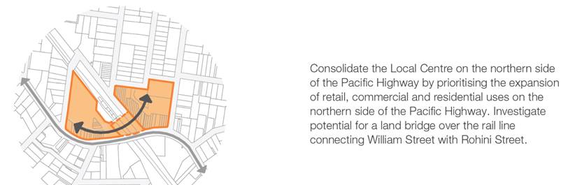
Image 11 – Local Centre consolidation priority
(Source: LSPS)
The LSPS identifies the need to consolidate the Turramurra
Local Centre on the northern side of the Pacific Highway by prioritising
expansion of uses in this location. It is therefore considered that the
highest density of development should be located in this area with adjacent
developments being of a lower scale and intensity. The revised scale of
the Planning Proposal which provides for a maximum height of 34.5m / 9 storeys
and FSR of 3:1 is consistent with this intent. It is anticipated that greater
height and FSR may be allowed to the north of the Highway in the future where
currently a maximum height of 17.5m and FSR of 2.5:1 is permissible.
The Turramurra Local Centre Structure Plan (refer Image 12
below) identifies the site as suitable for mixed use development with a key
landmark site identified in the centre of the site frontage to the north
adjacent to the bend in the Highway. Council documents are inconsistent in
respect of the location of the proposed landmark with the DCP identifying it on
the corner of Kissing Point Road and the Pacific Highway. The subject proposal
provides for a landmark building of 9 storeys on the corner of Kissing Point
Road and the Pacific Highway consistent with the DCP stepping down to 7 storeys
to the northwest. This is also consistent with the advice of the
independent urban designer who has advised that this scale of development is
appropriate to the site from an urban design perspective. The Structure Plan
also identifies a new road to the south of the site connecting Kissing Point
Road and Duff Street. The proposal is consistent with this requirement
providing for a new Stonex Drive in this location. Accordingly, the Planning
Proposal is considered to be generally consistent with the LSPS Structure Plan
and the site context.
Having regard to the above it is considered that the
Planning Proposal is generally consistent with the LSPS as it provides for the
redevelopment of a significant site within the Local Centre of a scale that is
consistent with the priorities identified for the Turramurra Local Centre.
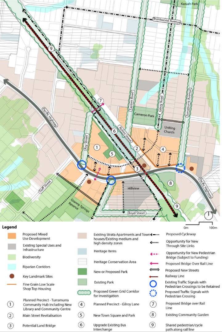
Image 12– Turramurra Local Centre Structure Plan
(Source: LSPS)
Local Housing Strategy
The revised Ku-ring-gai Housing Strategy to 2036 was adopted
by Council in December 2020. The purpose of the Strategy is to identify how
Council intends to respond to the Greater Sydney Region Plan and District Plan
and how it plans to deliver on housing targets. The Strategy identities that
the District Plan sets a target of 4,000 new dwelling in Ku-ring-gai for the 5
year period from 2016 to 2021 (Note: as outlined above this target has
recently been updated to 7,600 new dwellings by 2029). It notes that
more than half of the required housing supply quota has been met, with the
remaining amount fully deliverable through current development approvals and
existing capacity within the Ku-ring-gai Local Environmental Plans. It further
states that “this means that the 0 - 5 year housing supply target of
4,000 dwellings is achievable under Council’s existing planning policies
and no amendment to the Ku-ring-gai Local Environmental Plan is
necessary”. It goes on to state:
The Greater Sydney Commission
‘Letter of Support’ issued March 2020 for the Ku-ring-gai LSPS
outlined that the Housing Strategy is to show how Ku-ring-gai can meet an
indicative draft range of 3,000 – 3,600 dwellings for the 6-10 year
housing target. Correspondence from the Minister of Planning dated 8 September
2020 states ‘Ultimately, Council is responsible for deciding the number
of dwellings in its local housing supply target’ and ‘the target
discussed with the Greater Sydney Commission is not a legal requirement upon
Council by the Government.’
Ultimately the Housing Strategy then proposes to achieve an
increase in dwellings within the LGA to meet demand as required by the Greater
Sydney Region Plan and North District Plan through existing residual capacity
supplemented by seniors housing and alternative dwellings where permissible.
Council has not identified land for development uplift and does not consider
this necessary to meet the District Plan dwelling target obligations.
Accordingly, the subject Planning Proposal which seeks to
amend the planning controls applying to the subject site to create additional
capacity is inconsistent with the Housing Strategy which adopts a status quo
approach. However the State Government recently (mid 2024) released a new
housing target of 7,600 new dwellings in Ku-ring-gai LGA by 2029. The
Planning Proposal will assist in meeting this target delivering an additional
approx. 180 dwellings in a location close to existing infrastructure and
services.
Ku-ring-gai Retail and
Commercial Centres Strategy
The Ku-ring-gai Retail and Commercial Centres Strategy
was received and noted by Council in December 2020 although it should be noted
that it has not been formally adopted. The Strategy indicates that the
population of Ku-ring-gai is estimated to increase to 154,500 by 2036 which
will result in demand for an additional 37,100 sqm of retail floorspace.
Further it notes an existing undersupply of 35,000 sqm potentially increasing
to 58,000 sqm. The undersupply is noted to be mainly an undersupply of
supermarkets and lack of regional and sub-regional shopping centres in the LGA.
The Planning Proposal (as detailed in the Reference Scheme provides for 7,190m2
of retail and commercial floor space (5,538m2 of retail floorspace)
including a new supermarket which is consistent with the Strategy and that will
assist to meet the existing and future retail demand in the LGA. The existing
retail floor space on site is understood to be approximately 2,373m2 comprising
an IGA supermarket of approximately 1,260m2 and 12 specialty shops
totalling 1,113m2. Accordingly, the proposal represents an increase
in retail floor space of approximately 3,165m2 and 1,652m2
of commercial floor space. A full scale supermarket is also to be provided to
address the current undersupply.
As noted above the Strategy identifies Gordon as the
LGA’s major centre with Turramurra forming one of three lower order
primary local centres (St Ives, Lindfield and Turramurra). The proposed 34.5m
height limit is less than the height allowed in Gordon (38.5m) which is
intended to be the major centre for the LGA going forward. Further it is
generally consistent with the maximum permitted height allowed in the other
primary local centres being approximately 9 storeys as amended by the recent
Lindfield Village Hub Planning Proposal (ranging from 29.5 to 36.5m but with an
average of 34.5m ) (Amendment 28 to KLEP 2015 made on 22 March 2022).
Notably the additional 2m takes account of the slope of the site as advised by
the independent urban designer and is therefore considered appropriate given
the site circumstances. Clause 4.3 Height of buildings of KLEP 2015 includes
the following objective:
(a) to
ensure that the height of buildings is appropriate for the scale of the
different centres within the hierarchy of Ku-ring-gai centres.
The proposed height is consistent with the scale of
development envisaged within the Local Centre under the Ku-ring-gai centres
hierarchy and is also consistent with a key objective of the Height of
buildings development control under KLEP 2015.
The Centres Strategy recommends that Council investigate
increases in FSR and Building Heights within the B2 (now E1)Local Centre zones
to assist in meeting housing targets and to increase the viability of
development. Best practice planning dictates that this should be undertaken in
response to site circumstances and opportunities and constraints. The Planning
Proposal is considered to be consistent with the site capability and position
of Turramurra in the Centres hierarchy.
The Strategy also includes specific recommendations and
actions for each centre. For Turramurra it recommends:
· Improvement to
the attractiveness of the retail offering
· Address the
issues of deteriorating quality and escape expenditure
· Attract new
retailers with diversified offering to capture escape expenditure.
Redevelopment of the subject site is consistent with these
recommendations. The Strategy identifies key actions for the centre as follows:
· Provide
orientation of mixed use towards the Turramurra Hub and away from the Highway
· Investigate opportunity
for Council owned land in Gilroy Lane in conjunction with adjoining landowners
to deliver a new and revitalised retail precinct
· Council to
invest in infrastructure, streetscape, security and amenity.
In summary the recommendations include:
· Investigate
increases of FSR within the B2 Local Centre zone to facilitate redevelopment of
sites
· Investigate
9.5m Height of Building Control on Rohini Street, Turramurra to facilitate
additional development
· Gilroy road
prime for café/retail space - planning controls are restrictive
· Potential for
outdoor cinema in summer in the new park to foster entertainment in centre
· IGA area -
underdeveloped - restriction on commercial floorspace existing for adjoining
corner site
· Hub area has
restriction on commercial existing: Recommendation of deleting commercial
restriction
· Encourage
redevelopment of Pacific Highway shops northern side to face/activate the
laneway to the north.
Accordingly, it is clear that the proposal is consistent
with the Strategy as it will provide in the order of 7,190m2 of
retail and commercial floor space (5,538m2 of retail and 1,652m2
of commercial floorspace) and would enable a new full scale supermarket to be
delivered which will assist to meet the existing and future shortfall. The
Strategy recognises the need to potentially increase FSR’s in the
Turramurra Local Centre (and in particularly on the subject site which it
identifies as underdeveloped) to facilitate the redevelopment of sites. While
it places the focus for development on land to the north of the Pacific Highway
it also identified the need for redevelopment of the subject site. This is
particularly in relation to mixed use development and is consistent with the
LSPS (refer above). In the context of this strategic framework the Planning
Proposal amendments in terms of FSR are considered to be appropriately scaled
and justified.
State Environmental
Planning Policies (SEPPs) and Ministerial Directions
The Planning Proposal is generally consistent with other the
State Environmental Planning Polices (SEPPs) applicable to the site including
Chapter 4 Design of Residential Apartment Development of State Environmental
Planning Policy (Housing) 2021 which formerly comprised State Environmental
Planning Policy No. 65 – Design Quality of Residential Apartment
Development as outlined below. The Planning Proposal is also
generally consistent with the applicable Ministerial Directions (Section 9.1
Directions).
Strategic Merit
Assessment Summary
In accordance with the Department of Planning, Housing and
Infrastructure’s ‘Local Environmental Plan Making
Guideline’, a Planning Proposal is deemed to have strategic merit if
it:
· Gives effect to
the relevant regional plan outside of the Greater Sydney Region, the relevant
district plan within the Greater Sydney Region, and/or corridor/precinct plans
applying to the site. This includes any draft regional, district or
corridor/precinct plans released for public comment or a place strategy for a
strategic precinct including any draft place strategy; or
· Demonstrates
consistency with the relevant LSPS or strategy that has been endorsed by the
Department or required as part of a regional or district plan; or
· Responds to a
change in circumstances that has not been recognised by the existing planning
framework
As outlined above it is considered that the Planning
Proposal is consistent with the objectives, priorities and strategies of both
the Greater Sydney Region Plan and the North District Plan. Further the
Planning Proposal is consistent with the broad intent for Turramurra outlined
in the LSPS and its supporting Centres Strategy, the Centres Hierarchy and the
scale of development envisaged in the subject location in both the LSPS and the
Centres Strategy. Further while the Planning Proposal is considered to be
inconsistent with the Council’s adopted Housing Strategy it is consistent
with the State government’s recent housing target for the LGA and will
deliver approximately 180 additional new dwellings and thereby assist to meet
the LGA’s 7,600 dwelling target to 2029. These dwellings are well
located within a site that is ripe for redevelopment and that has good access
to infrastructure and services. Accordingly it is considered that the Planning
Proposal demonstrates strategic merit.
Site Specific Merit
The Planning Proposal seeks a significant uplift in height
(from 17.5 m / approx. 5 storeys as existing to maximum 34.5m / 9 storeys as
proposed) and FSR (2:1 to 3:1) on a site that is considered to be suitable for
redevelopment. To demonstrate that the proposed height
and FSR is appropriate having regard to the site’s specific opportunities
and constraints a Reference Scheme has been prepared and submitted with the
Planning Proposal request. The below generally assesses the Reference Scheme
which is intended to demonstrate site- specific merit.
Urban Design
As part of this independent assessment Dr Michael Zanardo of
Studio Zanardo was engaged to provide an urban design assessment of the
proposal. Studio Zanardo’s advice is provided in full at Attachment
A13. Studio Zanardo’s advice follows on from the advice prepared for
the previous Planning Proposal for the site which was recommended for refusal.
Notably it refers to issues raised and recommendations made in respect of that
former proposal and considered whether matters previously identified have been
satisfied and / or recommendations complies with.
In summary the Studio Zanardo advice concludes that the
Planning Proposal is generally supportable from an urban design perspective
albeit that a number of issues have been raised in respect of the submitted
Reference Scheme’s compliance with the Apartment Design Guide (ADG) and
the adequacy of the proposed Draft DCP amendment. Studio Zanardo has
concluded that the Planning Proposal as illustrated by the Reference Scheme is
generally appropriate and supportable, in respect of:
· Proposed Height of
Buildings – at 9 storeys for the eastern tower and 7 storeys for the
western tower although it has recommended a more nuanced approach to the LEP
Height of Buildings Map where the mapped maximum building height more closely
aligns with the proposed built form rather than a blanket height allowance of
34.5m across the entire site.
· Proposed Floor
Space Ratio – proposed 3:1 maximum FSR considered appropriate having
regard to the general scale of development as demonstrated by the Reference
Scheme and the capacity of the site.
· Requirements of
Ku-ring-gai DCP Part 14 Urban Precinct and Sites 14B Turramurra Local Centre
– proposal is considered to be consistent with the requirements of the
DCP including:
o the provision of the new
Stonex Drive at 15m in width
o site geometry
o Pacific Highway street wall
height (acceptable at 3 storeys for eastern 9 storey tower and 2 storey for the
western 7 storey tower
o Location of landmark building
(9 storeys) on the corner of Kissing Point Road and Pacific Highway
o Separation of built form into
two discrete towers over a single podium with an open to the sky through site
link with the two separate buildings capable of presenting with different
architectural expressions
o Providing for a built form
which meets the DCP requirement of “encouraging new infill development
along the Pacific Highway which respects the existing characteristics of the
street including the fine-grained character of the original subdivision,
setback, height and rhythm of facades, and is sympathetic to the materials and
detailing of the earlier facades”
· ADG compliance in
relation to:
o Provision of a minimum of 2
hours of solar access to neighbouring units at 5 Kissing Point Road
o Building separation across
Stonex Lane – required setbacks achieved (6m separation from centre line
of lane for lower 4 storeys proposed and 9m for the upper storeys as required)
o Units with no solar access
– maximum of 15% of units compliance achieved (13% proposed in Reference
Scheme).
However Studio Zanardo has raised outstanding concerns in
respect of:
· The tower
footprint size with the eastern tower being considered to be relatively large
(approximately 59m long) with no articulation along Kissing Point Road. Studio
Zanardo has identified that this tower footprint could be reduced and/or shaped
and/or articulated to reduce its massing.
· ADG non-compliance
in respect of:
o Solar access to the lower
pedestrian through site link area. The Reference Scheme provides some sunlight
to the lower through site link area only before 10am and after 2pm at mid winter.
This does not meet the ADG requirements for solar access to be provided year
round to public spaces. Further this does not meet the DCP intention for this
space described as ‘an ideal location for outdoor dining and cafes
overlooking the forest.’
o Deep soil area – The
proposed deep soil zone (with a minimum width of 2m) is approximately 785m2
(9% of the entire site area) (measured in CAD) and is located entirely on
the southern side of the new Stonex Street. All of these areas are to be
dedicated to Council. It is noted that the DCP states ‘In all cases,
where land dedication is required for a public purpose, such as a road or
walkway, the affected land is to be excluded from deep soil calculations…’
Therefore the proposal currently appears to provide no deep soil within the
non-affected site area. This does not meet the minimum 7% deep soil area
requirements of the ADG. There is considered to be potential for additional
deep soil on the northern side of the new Stonex Street. This aspect should be
given further design consideration in the indicative reference scheme. It is
noted that the dispensation to not meet the control is provided is for
situations where achieving the design criteria ‘may not be
possible’ and there is ‘limited or no space for deep soil at ground
level.’ From an urban design perspective, additional deep soil appears to
be possible on this site and there is additional space for deep soil at ground
level. The opportunity appears to be within the pedestrian through site link
area, perhaps with further adjustment of the car parking levels below. It is
desirable that this potential be explored.
o Units with a minimum of 2
hours solar access - Studio Zanardo has concluded that only 67% (122/181) of
units in the Reference Scheme meet the requirement of minimum 2 hours of solar
access where 70% is required. Units in question are identified as the northern
cross through units in the eastern tower which are impacted by the projecting
adjacent apartment, and some of the lower units in the eastern tower facing the
courtyard which are impacted by the upper levels of the western tower.
o Noise and ventilation of
habitable rooms – given location on the Pacific Highway the design needs
to address noise amenity impacts having regard to natural ventilation
requirements. This issue is not currently addressed in the Reference Scheme
o Units with natural cross
ventilation - Studio Zanardo has concluded that only 58% (105/181) of units in
the Reference Scheme provide natural cross ventilation requirement where 60% is
required. The units in question are identified as the single aspect units
facing north over the courtyard on the eastern tower, and the single aspect
units at the southeast corner facing east on the eastern tower at the lower
levels.
o Number of units off a
circulation core - Studio Zanardo has notes that the Reference Scheme proposes
up to 10 units off a single core in the eastern tower and 9 units in the
western tower where a maximum of 8 units is allowed under the ADG. While
Studio Zanardo acknowledges that the ADG otherwise allows up to 12 units off a
single core this is not appropriate in the current circumstance as sunlight and
natural ventilation requirements are not met (which may otherwise justify a
variation).
Notwithstanding these
matters Studio Zanardo has provided advice that “from an urban design
perspective, such amendments to the indicative reference scheme are considered
to be relatively straightforward to make such that compliance with the
Apartment Design Guide could be achieved whilst the proposed development yield
(gross floor area and floor space ratio) proposed in the planning proposal
continues to be appropriate”. Accordingly, it is considered that
amendments could be made to the Reference Scheme that would allow for
compliance with the identified ADG provisions without impacting on the
achievable development yield.
Studio Zanardo has also indicated, and it is agreed, that
the proposed site specific Draft DCP amendment as proposed by the Proponent is
inadequate and that the existing Part 14B Turramurra Local Centre should be
updated to reflect the Planning Proposal and key aspects of the Reference
Scheme. Additional provisions to the existing Part 14B should be included to:
· promote pedestrian
activity between Pacific Highway and the future park at the rear of the site
· ensure that new
development is appropriately sited and designed to manage amenity and visual
impacts to neighbouring residential properties
· provide active
frontages along the internal through site link
· ensure all service
and loading areas are to be located in the basement
· clarify the road
widening width of 1.5m to Kissing Point Road
· provide a 3m
setback along Stonex Lane
· require that the
pedestrian through site link should be open to the sky
· minimise opaque
and blank walls at ground level
· provide 30 car
spaces for public use within the basement of the future development
· require a minimum
level of articulation to tower footprint
· require a minimum
amount of solar access to the lower pedestrian through site link area, and
· require greater
minimum deep soil zone over the site.
Inconsistencies between the Reference Scheme and the
existing DCP provisions should also be rectified.
The advice provided by Studio Zanardo has informed the below
assessment. Further the following comments are made cognisant of the fact that
a Planning Proposal is not a development application and does not consider the
specific detailed matters for consideration under Section 4.15 of the Environmental
Planning and Assessment Act 1979. A Planning Proposal only relates to an
LEP amendment, and therefore needs to demonstrate that the proposed amendment
itself is acceptable, with any future detailed design to be assessed at the
later development application stage. The below also considers the draft site
specific DCP which has been submitted to provide development guidance for any
future development application in accordance with the Planning Proposal.
Housing SEPP Implications
The recent State Government
Transit Oriented Development (TOD) amendments to State Environmental Planning
Policy (Housing) 2021 (Chapter 5) allow a maximum height (where local planning
controls are not greater) of 22m for RFBs or 24m for shop top housing (or
approx. 6 storeys) in a Transport Oriented Development Area (i.e. within 400m
of a railway station) which includes the Ku-ring-gai LGA centres of Gordon,
Killara, Lindfield and Roseville.
Further the SEPP includes
in-fill affordable housing provisions including an FSR and / or height bonus of
up to 30% for projects that include residential development and provide at
least 10% of the gross floor area (GFA) as affordable housing. The height of
buildings bonus only applies to residential flat buildings and shop top
housing. The FSR and height of buildings bonuses are effectively double (up to
30%) the minimum required affordable housing component, which must be at least
10% of the development project.
Accordingly, notwithstanding
the proposed site-specific Planning Proposal and Reference Scheme there is
potential that additional FSR and/or height could be achieved on the subject
site via the Housing SEPP provisions. However, this applies across the board
and would be dependent on the provision of a substantial affordable housing
component. Accordingly assessment of this potential impact is not within the
scope of this assessment and would need to be determined on merit at the DA
stage.
Height
The Planning Proposal seeks to increase the permissible
maximum height across the entire site from 17.5m (approx. 5 storeys) to 34.5m
(maximum 9 storeys) while the Reference Scheme proposes two towers: one of 9
storeys (to the east) and one of 7 storeys (to the west). The proposed tower
heights are consistent with the advice provided by Studio Zanardo on the
original Planning Proposal (that sought a height of 50m) that was refused in
early 2023. Consistent with the commercial centres hierarchy the proposed maximum
height would be less than the maximum height allowable in Gordon, the
LGA’s major centre (38.5m) by 4m. Further it would be consistent
with the maximum height recently amended for the Lindfield Village Hub site
(ranging from 29.5 to 36.5m but with an average of 34.5m) with Lindfield being
equivalent in the centres hierarchy to Turramurra.
Studio Zanardo has previously advised that the proposed
34.5m (approx. 9 storey) height limit would allow for a compatible transition
to surrounding 5 to 3 storey development and accordingly it is suited to the
site context. Further in respect of the current scheme it has advised that the
proposed maximum is considered to be in alignment with the relevant KLEP2015
height of buildings objective which is to ‘ensure that the height of
buildings is appropriate for the scale of the different centres within the
hierarchy of Ku-ring-gai centres’ Studio Zanardo notes that as a point of
comparison, the proposed height of 34.5m is significantly greater (144%) than the
maximum building height of 24m for a building containing shop top housing in a
Transport Oriented Development Area (SEPP Housing), which is applicable
elsewhere in the Ku-ring-gai Local Government Area (Roseville, Lindfield,
Killara and Gordon). It therefore states that the proposed height should,
relative to this, not be considered conservative.
Image 13 Local Centres Extents Diagram – (Source:
Urban Design Report, DKO Architecture, May 2024
The Planning Proposal seeks to increase the height on the
site to result in a convex local centre profile as shown in Image 14 below.
This approach relies on adjacent sites also achieving an increase in height as
shown dotted which is possible having regard to the Housing SEPP provisions or
potential future LEP amendments. The proposed height provides for an acceptable
transition from 7 (west) or 9 (east) storeys to the existing allowable 5
storeys. It also allows for the potential that overtime that the land to the
north of the Pacific Highway, which is identified as the priority and focus for
the most intense development in the Turramurra Local Centre, will become the
ultimate highpoint in the centre consistent with Council’s articulated
strategy, outlined in both the LSPS and the Centres Strategy.
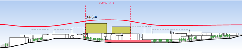
Image 14 Proposed Turramurra Skyline – (Source: Urban
Design Report, DKO Architecture, May 2024)
In summary it is considered that the Reference Scheme
submitted with the application generally demonstrates that a scheme of this
scale can readily be accommodated on site without resulting in unreasonable
environmental impacts and whilst achieving high amenity for the public domain,
neighbouring properties and the proposed residential apartments. As outlined
above some amendments to the Reference Scheme are considered to be required to
ensure compliance with ADG requirements however as advised by Studio Zanardo it
is considered that these amendments can be made without impacting the ultimate
GFA/FSR achievable on the site and thus the relevant proposed LEP provisions.
These amendments should however be made prior to the Planning Proposal being
forwarded for a Gateway approval.
It is also recommended that a more nuanced approach to
height be applied with the 34.5m height limit to be applied to the eastern part
of the site where the proposed 9 storey tower is intended (corner of Pacific
Highway and Kissing Point Road) and a reduced height limit of 28.5mapplied in
the north western part of the site (i.e. 6m less that the maximum) where the
site adjoins existing 2 storey development and where a maximum height of 3-5
storeys currently applies. This will ensure an appropriate transition and
future landmark tower on the corner site. It will also accentuate the fall in
the land along the Pacific Highway and relieve the monotony of the same tower
heights on the skyline, particularly if the sites to the north west on the
opposite side of Stonex Lane were to be redeveloped in a similar manner.
Further consistent with height mapping in the LEP the proposed height limits
should not be applied to the land proposed to be dedicated as road, park or
road reservation. It would also provide more certainty that the positive urban
design qualities of the proposal relating to the variances in height will be
delivered.
Floor Space Ratio
In terms of FSR a maximum FSR of 3:1 is proposed across the
site (including land to be dedicated as road, park etc.) where a maximum FSR of
2:1 currently applies (note: the original Planning Proposal request proposed an
FSR of 4.2:1). An estimated gross floor area of approximately 25,379m2
(equating to an FSR of 2.99:1 based on a site area of 8,459.7m2 in
accordance with the site survey) has been calculated given the proposed land
use mix illustrated in the Reference Scheme, as follows:
· GFA Residential =
18,189 m2
· GFA Retail /
Commercial = 7,190 m2
· Total = 25,379m2
/ site area 8,459.7m2 = approx. FSR 2.99:1
Consistent with the discussion above in relation to height,
the proposed FSR would be less than that allowable in the Gordon major centre
(at max. FSR 3.5:1) and consistent with that allowed in local centres
throughout the LGA. In general, FSRs of between 2:1 and 3:1 are allowed in
local centres throughout the LGA.
The Reference Scheme demonstrates that a scheme of this
scale can be accommodated on site without resulting in adverse environmental
impacts and whilst achieving high amenity for both the public domain and the
proposed residential apartments. Studio Zanardo has advised that from an urban
design perspective the proposed maximum FSR is appropriate however some
amendments are required to the Reference Scheme to ensure ADG compliance. It is
considered that these amendments can be made without impacting on the
ultimately GFA/FSR achievable on site and thus the relevant proposed LEP
provisions. The amendments should however be made prior to the Planning
Proposal being forwarded for a Gateway approval.
The Planning Proposal seeks to require a minimum retail /
commercial floor space of 0.85:1 where at present a maximum FSR of 1.2:1
applies to commercial development. The minimum retail / commercial floor space
is based on the Reference Scheme which provides for 7,190m2 GFA of
retail and commercial uses. This equates to an FSR of 0.855:1 (7,190m2/25,379m2
= 28.43% x 3:1 = 0.85:1:1). Accordingly, the proposed minimum is considered
appropriate. As noted by Studio Zanardo this amount of retail/commercial floor
space is appropriate for the site given design parameters and will not give
rise to pressure for GFA to be converted in the future from retail/commercial to
residential with poor amenity. Further it equates to an increase of 3,165m2
of retail floor space and 1,652m2 of commercial floor space over
existing. This will help to address the existing shortfall in retail floor
space in the LGA and will also enable the provision of a full scale supermarket
for which the area is currently undersupplied.
Compliance with Ku-ring-gai
DCP site specific provisions
Ku-ring-gai DCP Part 14B Turramurra Local Centre currently
applies to the subject site. The site is currently located within
Precinct T3 under the DCP (refer Image 15 below) where pedestrian through site
links and road dedications and upgrades are required.

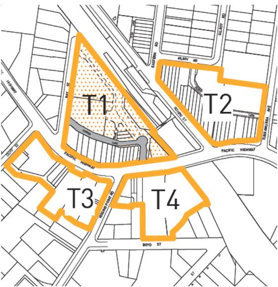
Image 15 Turramurra Local Centre Precinct Plan (Source:
Ku-ring-gai DCP Part 14B Turramurra Local Centre)
The Reference Scheme is generally in accordance with the DCP
provisions providing for the required through site links, pedestrian and road
upgrades and dedications, new park and new Stonex Drive as outlined below.
However amendments to the DCP provisions are recommended to reflect the
proposal, address inconsistencies and include additional requirements to guide
the final design. An assessment of the Reference Scheme against the site
specific DCP provisions is provided below.
|
Figure
|
Requirement
|
Reference
Scheme Compliance
|
|
14B.2 Public
Domain and Pedestrian Access
|
|
Figure 14B.2-1 excerpt
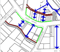
|
Site identified as:
· location of through site link to Pacific Highway
· location of modified road (Stonex Drive)
· continuous awnings on Pacific Highway and Kissing
Point Road frontages
|
Complies -
· included in Reference Scheme
· as above
· able to comply
|
|
14B.3 Proposed
Community Infrastructure
|
|
Figure 14B.3-1 excerpt
|
Requires:
|
Complies
· included in Reference Scheme
· No APZ required
· New dedicated left turn lane proposed
· Footpath embellishment proposed
Note:
Park dedication proposed but not construction and embellishment
|
|
14B.4 Setbacks
|
|
Figure 14B.4-1 excerpt
|
Requires:
· 2m setback on Kissing Point Road (plus land
dedication)
· Land dedication setbacks from Stonex Drive and
Pacific Highway
Note: where land dedication
is required for a public purpose, such as a road or walkway, the affected
land is to be excluded from deep soil calculations and included in setback
requirements
|
Complies
Complies – Note: dedications
not included in deep soil. Deep soil to be included in developable part of
site.
|
|
14B.5 Built
Form
|
|
Figure 14B.5-1 excerpt
|
Requires:
· Landmark building
· Primarily active frontage on Pacific Highway and
Kissing Point Road
· 3 storey wall height on Pacific Highway
· 4m setback above street wall height on Pacific
Highway
· Opposite Heritage Conservation Area on Kissing Point
Road
|
Complies
Complies
Complies for eastern tower,
2 storey on western tower – acceptable given reduced height
Complies
Complies – no adverse
heritage impact
|
|
14B.6 Building
Entries, Car Parking and Service Access
|
|
Figure 14B.6-1 excerpt
 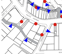
|
Requires:
· Pedestrian access off Pacific Highway and Kissing
Point Road
· Vehicular access off Stonex Drive
|
Complies
Complies
|
|
14B.7
Environmental Protection and Bushfire Protection
|
|
Figure 14B.7-1 excerpt
 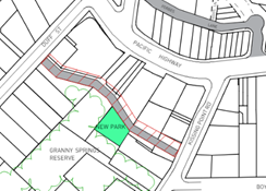
|
Requires:
· 15m buffer zone including width of new Stonex Drive
|
Complies – Stonex
Drive 15m wide (Note: Council environmental officer has noted “Granny
Springs Reserve not Bushfire Prone Land on Council’s Bushfire prone
land map)
|
|
14B.10 Precinct
T3: Kissing Point Road Retail Area
|
|
Planned Future
Character
Figure 14B.10-1
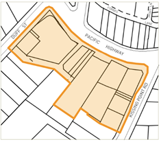
|
1. Development is to be designed to
support and enhance the planned future character as following:
iii) This precinct will
become the second retail hub for Turramurra offering a revitalised shopping
precinct incorporating speciality retail, a new supermarket, new shop-top
housing and improved public areas. Future development will be encouraged to
occur through land amalgamation and consolidation of the building footprint.
This will allow the construction of a new public street - “Stonex
Street” - behind the site to connect Kissing Point Road and Duff
Street. The new street will provide access to car parking and loading docks
as well as providing for local traffic circulation. The street will be
constructed within the existing development footprint and will function as a
bush fire Asset Protection Zone (APZ) as well as protection for Granny
Springs Reserve.
iv) Retail shops will form
an active edge to the Pacific Highway and Kissing Point Road. A new
supermarket and associated specialty retail will be provided below the
Pacific Highway level, and will open to “Stonex Street” at the
rear. This will be an ideal location for outdoor dining and cafes,
overlooking the forest.
|
Complies
Complies – include
DCP requirement to activate through site link
|
|
Public Domain and
Pedestrian Access
Figure 14B.10-2
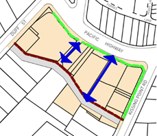
|
Requires:
2. Provide a new public street
(new street) linking Duff Street and Kissing Point Road
3. Provide an internal shopping
arcade linking the Pacific Highway and the new street.
4. Provide continuous awnings to
the Pacific Highway and Kissing Point Road.
5. Provide awnings to the new
street where ever possible
|
Complies
Complies
Complies
Does not comply – no
awnings proposed - acceptable
|
|
Proposed Community
Infrastructure
Figure 14B.10-3
|
Requires development to be
designed to support and compliment the provision of key community
infrastructure though the Contributions Plan, VPAs or other delivery
mechanism:
|
Complies – Non
binding public benefit offer provided which includes identified requirements
(refer below for further detail).
|
|
Setbacks
Figure 14B.10-4
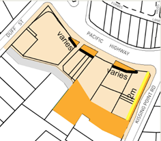
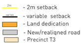
|
Requires zero setback with
below exceptions:
i) Properties
1A, 1 and 3 Kissing Point Road and 1364 Pacific Highway are to provide a 2m
setback to the Kissing Point Road frontage. The land is to be dedicated to
Council at no cost.
ii) Property 1A
Kissing Point Road is to provide rear setbacks to achieve a minimum 15m wide
right-of-way between the northern property boundary of No.7 Kissing Point
Road. The land is to be dedicated to Council at no cost.
iii) Property 1380-1388 is
to provide rear setbacks to achieve a minimum 15m wide right-of-way at the
rear of the property that connects with the existing road way to the west
from Duff Street and to the proposed road to the south-east from Kissing
Point Road. The land is to be dedicated to Council at no cost.
vi) Property 1380-1388 is to
provide an Asset Protection Zone on the site in accordance with Planning for
Bushfire Protection 2019 that does not encroach on Council’s reserve.
v) Properties
1364-1408 Pacific Highway are to have front setbacks in accordance with RMS
requirements.
|
Complies
Complies
Complies
Complies – although
APZ no longer applicable
Complies – confirmed
by letter from TFNSW dated 21 June 2024
|
|
Built Form
Figure 14B.10-5
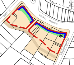
|
Requires buildings to be
designed in accordance with the following:
i) Create
consistent street wall of 3 storeys (11.5 metres) built parallel to the
street alignments of the Pacific Highway, Kissing Point Road, and Stonex
Lane.
ii) Provide a setback
of 4m to all levels above the street wall height along the frontages of the
Pacific Highway, Kissing Point Road and Stonex Lane.
iii) Provide active street
frontages to the Pacific Highway, Kissing Point Road and Stonex Lane. Active
street frontages are to be provided on the new street and Duff Street where
possible.
iv) Locate taller building
elements to the rear and western side of the precinct to minimise impacts on
adjoining residents and minimise visibility from areas to the east.
v) Design a
distinctive corner building with strong articulation addressing the Pacific
Highway and Kissing Point Road intersection.
vi) Design residential
development over the commercial podium to minimise the width of residential
facades facing the Bushfire Prone Areas.
vii) Provide generous landscaped
courtyards on the podium between buildings for residential amenity.
|
Complies although 2 storey
street wall for western tower as outlined above - acceptable
Complies
Complies
Does not comply –
proposed design preferable – amend DCP
Complies – 9 storeys
proposed at NE edge of site, 7 storeys at NW
Complies – bushfire
N/A
Complies
|
|
Building Entries, Car
Parking and Service Areas
Figure 14B.10-6

|
Requires:
1 Provide a new
public street at the rear of the site connecting Kissing Point Road and Duff
Street.
2 Vehicle access
to car parking, service and loading areas is to be provided via the new
street.
3 All service
access to the new street must be via Kissing Point Road. Access or exit via
Duff Street is prohibited.
4 Residential
foyers and lobbies are to be located on Stonex Lane, Kissing Point Road and
the Pacific Highway.
|
Complies
Complies
Complies
Complies
|
|
Environmental
Protection and Bushfire Protection
Figure 14B.10-7

|
Consideration must be given
to the following to ensure the development will not result in any disturbance
to the adjoining Blue Gum High Forest (BGHF):
5 A minimum 15m
buffer from the new building to the adjacent BGHF is to be provided in the
form of a new street.
6 New
development must not encroach on the adjoining bushland reserve. All new
development must be within the existing developed footprint (including roads,
car parks and other structures).
7 The new road
is to be built on an elevated structure to minimise impacts from earthworks.
8 Consultation
with an ecologist and an arborist is required during the design phase of this
process to minimise potential impacts on the bushland. Construction and
excavation or other disturbances will be limited to the currently disturbed
area (e.g. the existing car parks and building platforms).
9 The design of
the stormwater system for the development is to minimise impact on the
adjacent bushland and riparian lands.
10 Landscaping is to consist of
predominantly native plants of the Blue Gum High Forest community (where this
does not conflict with fire protection requirements).
Consideration must be given to the following to
address bushfire protection, including:
11 Provide an Asset Protection
Zone on the site in accordance with Planning for Bushfire Protection 2019
that does not encroach on Council’s reserve.
12 The profile and length of
buildings facing the bushland reserve is to be minimised so that the lowest
possible surface area is open to the fire front should a fire occur.
13 All building facades facing the
hazard require building construction standards to Level 3 as per AS3959. All
other facades require building construction standards to Level 2 as per
AS3959.
14 Entrance and exit points to
underground parking and service areas are to be provided via the new street.
Because the area will be subject to ember attack, radiated heat and smoke
during a bush fire, appropriate measures are required to ensure safe
evacuation during a fire.
15 To minimise the impacts of
wind-borne ember attack, landscaped gardens are to be separated from each
other by a minimum distance of 5m.
16 Garden beds that run up to a
building or are up against buildings, are to be avoided, especially where
they run beneath windows. Organic mulch should be avoided, with inorganic
mulches such as decorative pebbles preferred.
17 Tree plantings should not link
with those trees within the reserve nor should they form rows leading up to
buildings. ‘Fire retardant’ species should be considered for
inclusion.
18 A dedicated water supply for
fighting fires is required. The tanks are to be minimum capacity of 10,000
litres and each building is to have a separate tank. Installation of tanks at
ground level or below is preferred however they may be installed on upper
levels of building. Signage indicating the location of the outlets should be
prominent.
19 A deluge system designed to
spray water over of the building façade facing the bushland reserve is
required.
20 Air conditioning systems are to
be designed to be automatically switched off in a bushfire emergency, or
alternatively, have smoke scrubbers fitted.
21 All gas, water and electricity services
are to be sited below ground. Where they must be above ground then they are
to be sited on the opposite side of the buildings to the hazard.
|
Complies
Complies
Assess at DA stage
Assess at DA stage
Assess at DA stage
Assess at DA stage
N/A - land not
bushfire prone
As above – N/A
As above – N/A
Complies – bushfire
requirements N/A
As above – N/A
As above – N/A
As above – N/A
As above – N/A
|
Compliance with Apartment
Design Guide
As outlined above an assessment of the Reference Scheme
against the ADG requirements has been undertaken by Studio Zanardo which has
generally concludes that the proposal is appropriate. The following areas
of non compliance have been identified:
· Solar access to
the lower pedestrian through site link area. The Reference Scheme provides some
sunlight to the lower through site link area only before 10am and after 2pm at
mid winter. This does not meet the ADG requirements for solar access to be
provided year round to public spaces. Further this does not meet the DCP
intention for this space described as ‘an ideal location for outdoor
dining and cafes overlooking the forest.’
· Deep soil area
– The proposed deep soil zone (with a minimum width of 2m) is
approximately 785m2 (9% of the entire site area) (measured in CAD) and is
located entirely on the southern side of the new Stonex Street. All of these
areas are to be dedicated to Council. It is noted that the DCP states ‘In
all cases, where land dedication is required for a public purpose, such as a
road or walkway, the affected land is to be excluded from deep soil
calculations…’ Therefore the proposal currently appears to provide
no deep soil within the non-affected site area. This does not meet the minimum
7% deep soil area requirements of the ADG. There is considered to be potential
for additional deep soil on the northern side of the new Stonex Street. This
aspect should be given further design consideration in the indicative reference
scheme. It is noted that the dispensation to not meet the control is provided
is for situations where achieving the design criteria ‘may not be
possible’ and there is ‘limited or no space for deep soil at ground
level.’ From an urban design perspective, additional deep soil appears to
be possible on this site and there is additional space for deep soil at ground
level. The opportunity appears to be within the pedestrian through site link
area, perhaps with further adjustment of the car parking levels below. It is
desirable that this potential be explored.
· Units with a
minimum of 2 hours solar access - Studio Zanardo has concluded that only 67%
(122/181) of units in the Reference Scheme meet the requirement of minimum 2
hours of solar access where 70% is required. Units in question are identified
as the northern cross through units in the eastern tower which are impacted by
the projecting adjacent apartment, and some of the lower units in the eastern
tower facing the courtyard which are impacted by the upper levels of the
western tower.
· Noise and
ventilation of habitable rooms – given location on the Pacific Highway
the design needs to address noise amenity impacts having regard to natural
ventilation requirements. This issue is not currently addressed in the
Reference Scheme
· Units with natural
cross ventilation - Studio Zanardo has concluded that only 58% (105/181) of
units in the Reference Scheme provide natural cross ventilation requirement
where 60% is required. The units in question are identified as the single
aspect units facing north over the courtyard on the eastern tower, and the
single aspect units at the southeast corner facing east on the eastern tower at
the lower levels.
· Number of units
off a circulation core - Studio Zanardo has notes that the Reference Scheme
proposes up to 10 units off a single core in the eastern tower and .9 units in
the western tower where a maximum of 8 units is allowed under the ADG.
While Studio Zanardo acknowledges that the ADG otherwise allows up to 12 units
off a single core this is not appropriate in the current circumstance as
sunlight and natural ventilation requirements are not met (which may otherwise
justify a variation).
The Reference Scheme is otherwise consistent with the ADG
requirements notably including in respect of site separation distances, privacy
impacts, solar access to adjacent properties etc.
However having regard to the
identified non-compliances and the need for a Reference Scheme to demonstrate a
scheme consistent with the proposed LEP amendments which is of a high quality
design and which meets relevant requirements, it is recommended that the
Reference Scheme be amended to address the above non compliances prior to the Planning
Proposal being referred for a Gateway determination. It is however
considered that this can be done without impact the proposed LEP provisions but
that it is essential to ensure that non-compliances at the DA stage are not
argued on the basis of being pre-existing in the Reference Scheme.
Traffic and Parking
The Transport and Traffic Impact Assessment Report (TIA)
prepared by JMT Consulting (31 May 2024) provided with the Planning Proposal (Attachment
A4) includes an assessment of existing traffic conditions, proposed vehicle
site access arrangements, likely traffic generated by the proposal, parking
demand and proposed parking, vehicle loading and servicing arrangements,
pedestrian enhancements and bicycle parking provisions. In summary it concludes
that:
· Under the
indicative architecture concept vehicle access would be provided off a new road
(Stonex Drive) at the southern end of the site.
· The Planning
Proposal involves a number of enhancements to the existing road network
supporting the site including:
o Creation of Stonex Drive
– a new two-way public street which provides an east-west connection
between Kissing Point Road and Duff Street
o Enhancements to traffic
capacity along Kissing Point Road including extension of the right turn bay
into the site as well as a dedicated left turn bay from Kissing Point Road onto
the Pacific Highway
· The indicative
architecture concept contemplates approximately 550 (Note: reduced to 414 in
amended Reference Scheme) off-street parking bays which is consistent with
the current Ku-Ring-Gai Council DCP parking controls.
· The proposal would
retain a minimum of 30 public car parking spaces on the site dedicated to
Council.
· A key component of
the proposal is the dedication of land for the future widening of the Pacific
Highway by Transport for NSW – facilitating the removal of the existing
peak period tidal flow arrangements. This will result in a significantly
improved traffic outcome for Turramurra and the wider precinct.
· The site is
located in close proximity to various public transport facilities, including
Turramurra train station and nearby bus stops.
· Detailed traffic
modelling indicates that future development contemplated under the Planning
Proposal will not detrimentally impact the operation of the surrounding road
network. All intersections in the vicinity of the site are forecast to retain
their level of service when compared to current conditions.
· Secure bicycle
parking would be provided as a component of any future proposed development, in
line with rates specified in the Ku-Ring-Gai Council DCP.
· Travel demand
management measures have also been suggested to improve the mode share of
public transport and active transport. These items should be considered further
at detailed design stage.
Council’s Strategic Traffic Engineer has provided an
assessment of the Planning Proposal in respect of traffic and transport matters
and in particular the Transport Impact Assessment. In summary the advice
concludes that the Planning Proposal has the following favourable transport
aspects:
· A good
proportion of residents in the Statistical Area of the site use public
transport for their journeys to work, so the site is well positioned to
leverage off its proximity to transport services.
· The site is
located within 200m of Turramurra railway station, where frequent rail services
operate generally between Hornsby and Sydney CBD, providing good connections to
strategic centres. Sydney CBD will be within 30 minutes of the site once the
Chatswood-Sydenham extension to the Sydney Metro is operational later in 2024.
· Bus services at
the Turramurra station bus interchange provide connections to Hornsby, South
Turramurra, Sydney Adventist Hospital and Macquarie Park. There appears to be
sufficient capacity in rail and bus services and nearby bus stops to
accommodate passenger demand resulting from the Planning Proposal. The site is
well positioned to take advantage of improved bus services between Mona Vale
and Macquarie Park which are foreshadowed in Future Transport Strategy.
· There is a good
selection of retail, health/medical, recreational and community/cultural
facilities within 10 minutes’ walk of the site. Schools are generally
within walking distance or connected to the site by public transport.
· The local
cycling network in the area is modestly developed, providing a degree of local
and regional cycling connectivity particularly to the south towards Macquarie
Park and Macquarie University.
· Land
dedications along the Pacific Highway and Kissing Point Road frontages would
facilitate future road capacity upgrades.
The following transport constraints were also identified:
· It has not been
demonstrated how heavy vehicles could manoeuvre from on-site loading dock in
the basement to leave the car park in a forward direction.
· The car parking
assessment contemplates the retention of 30 existing Council public car parking
spaces. However, as the uses relying on the existing Council car parking would
be incorporated into the planning proposal (with its own parking provision),
the need to retain 30 spaces dedicated to Council should be reviewed.
· The potential
for a right turn ban imposed by Transport for NSW from Stonex Street into
Kissing Point Road would have impacts to residents along the alternative route
(Duff Street/Cornwall Avenue/Monteith Street) and may result in the desirable
maximum environmental capacity of those roads being reached.
· While the
Planning Proposal provides for land dedication for future road widening on
Pacific Highway to enable the tidal flow arrangements to be removed by
providing 3 traffic lanes in each direction, it is unclear whether this is
adequate for an 8-lane cross section.
Transport for NSW has also provided advice in respect of the
proposal and has advised generally as follows:
1 ….It
is noted that the current proposal makes provision for the dedication of land
along the frontage to the site along the Pacific Highway that enables future
widening of Pacific Highway, subject to future funding
2. TfNSW
notes and supports vehicular access to / from the site to be via Kissing Point
Road only.
3. Traffic
modelling appears to address TfNSW concerns with the following reiterated for
Council’s consideration:
• there
should be no significant impact to the operation of signals at Pacific Hwy /
Kissing Point Road intersection.
• Queuing
should not extend out of the right turn bay on Kissing Point Road into the site
blocking through traffic on Kissing Point Road.
• Maximum
queue lengths heading north on Kissing Point Road onto Pacific Highway do not
block the right turn bay into the site. This can potentially be mitigated by
installing/maintaining the 'Keep Clear' signage should queuing become an issue
in the future.
• Improvements
proposed at the Pacific Highway / Kissing Point Road intersection which
includes an extension of the southbound right turn bay into the site along
Kissing Point Road, a dedicated left turn bay from Kissing Point Road into
Pacific Highway as well as two dedicated right turn lanes will need further
refinement and more detailed discussions with TfNSW during the public
exhibition of the planning proposal.
4. The
proposed new rear road located at the southern end of the site, Stonex Drive,
should be designed as a shared zone and/or a low speed zone. It should not be
an activated lane but one that prioritises pedestrians although cars can use
it.
5. Bike
parking should be useful and accessible at street level and not designed to be
hidden in the underground parking area.
6. Future
development on the site should consider appropriate noise attenuation measures through
design measures, architectural treatments, setbacks, durable materials and / or
landscaping particularly along the site’s frontage to Pacific Highway to
mitigate future residents against road traffic and train station noise. Council
should be satisfied that any noise mitigation controls throughout the relevant
draft DCP is appropriately aligned with this requirement.
Accordingly, it is considered that from a traffic and
transport perspective the proposal is appropriate however there are a number of
site-specific issues that will need to be addressed at the DA stage including
loading dock arrangements and design of the adjacent road network noting that
TfNSW has provided advice that the proposal is generally acceptable.
Council’s traffic engineer has not raised any major issues with the
proposal and it has been supported by TfNSW. In respect of the retention
of the existing 30 council owned public car parking spaces this is a matter for
Council in its negotiations with the Proponent however notably these spaces
have been included in the traffic and parking assessment and are able to be
accommodated on site without resulting in any adverse traffic impacts. Noise
attenuation measures should also be included in the DCP to ensure that the
future development is appropriately designed to mitigate traffic and train
noise whilst providing natural ventilation and to ensure an appropriate level
of amenity to the future residents.
Economic Impact
A Need and Impact Assessment was submitted with the Planning
Proposal Request prepared by Location IQ (November 2023) (refer Attachment 6).
The assessment outlines:
· The regional and
local context of the site
· An overview of the
current site and the proposed development scheme
· The main trade
area to be served by supermarket-based retail facilities at Turramurra
· Main trade area
current and projected population and retail spending levels
· An overview of the
planning environment and centres hierarchy
· The potential for
additional supermarket floorspace at Turramurra, and
· The key benefits
of the proposed development.
In summary it concludes that the proposal is consistent with
the Ku-ring-gai Centres hierarchy and the draft Ku-ring-gai Retail and
Commercial Centres Strategy for the Turramurra Primary Local Centre. It notes
that this includes the provisions of a full-line supermarket and a limited
range of specialty shops. In terms of trading impacts on surrounding facilities
within and beyond the main trade area it concludes that the proposal would be unlikely
to affect the future viability of these centres. Further it identifies a range
of positive employment and consumer impacts including:
· The provision of a
wider range of retail facilities near residents’ homes
· Increased
convenience and price competition for residents
· Improved customer
amenity, design, and aesthetic for the residents by way of a new and modern
development
· Reduced travel
times
· Ongoing employment
generation including from retail and complementary non-retail components of the
development (conservatively estimated at net additional jobs are estimated at
178 across retail and commercial components)
· Creation of some
242 full-time, part time and temporary jobs in construction over the development
timeline, and
· Including
multiplier effects some 977 jobs created both directly and indirectly because
of the retail and commercial redevelopment of the site.
Hill PDA was engaged by Council to undertake a peer review
of the economic impact assessment. This advice (refer Attachment A14)
notes that the existing Turramurra Plaza (subject site) is a neighbourhood
shopping centre with an estimated 2,373m2 of retail space. It states
that this is comprised of a 1,260m2 IGA supermarket and 12 specialty
shops (1,113m2) and that proposed redevelopment would provide 7,015m2
(now amended to 7,190m2) of employment space, representing an
increase of 4,642m2 (now 4,817m2) over its current
provision. Upon redevelopment the report notes that the Plaza would provide:
· A 3,098m2
supermarket
· 2,420m2
of speciality retailing, including a 498m2 grocer
· 1,497m2
of commercial space (including a medical centre and gym)
· 179 residential
apartments.
As noted above these numbers vary marginally from the final
Planning Proposal Request as assessed herein however these minor changes do not
affect the report conclusions. The Hill PDA advice takes issue with some minor
matters in the Location IQ report however it generally concurs with the report
findings and ultimately concludes as follows:
1. There
is demand for supermarket space within the Turramurra town centre catchment.
This demand is further supported by the draft Ku-ring-gai retail and commercial
centres strategy which projects the centre will require an additional
10-15,000sqm of retail space by 2036. It also recommends that the centre be
anchored by up to two full-line supermarkets and an ALDI supermarket.
Currently, the town centre contains a Coles supermarket which, at 1,500sqm, is
half the size of a full-line supermarket. From this, it is considered that the
proposal is in accordance with Council’s draft strategy.
2. The
resulting marginal increase in speciality floorspace would not likely impact
the viability of current or future retail uses in the centre. The development
is within the existing Turramurra centre and its impacts on existing Turramurra
retailers is a matter of competition between traders in the same centre and not
a relevant planning matter for determination.
3. The
increase in retail space would not impact the established retail hierarchy in
the LGA. It is consistent with the projected demand for retail space documented
in the draft Ku-ring-gai retail and commercial centres strategy.
4. The
resulting development would have additional community benefits in accordance
with those detailed in the Location IQ report. However, as noted, we do
consider the ongoing and construction-related employment estimates somewhat
overstated in the report
It is therefore considered that the Planning Proposal is
appropriate having regard to economic impact considerations and will result in
additional community benefits.
Heritage
The subject site does not contain any heritage items however
is located to the west of the Hillview Heritage Conservation Area (HCA) across
Kissing Point Road to the east and a number of heritage items within. A
statement of heritage impact (SoHI) was submitted with the Planning Proposal
Request prepared by Heritage 21 (21 November 2023) (refer Attachment A11).
In summary the report concludes that the proposal would respect the heritage
significance of the subject site and heritage items and the Hillview HCA in the
vicinity and that:
· The proposal
would retain the commercial character of the Turramurra Town Centre;
· The proposed
contemporary design, through a high standard of architectural design, would
deliver a positive contribution to the streetscape, creating a distinction
between the new and the existing;
· The proposed
contemporary design is sympathetic to the significance of the heritage items
and HCA in the vicinity, as it would not replicate or imitate any significant
historic architectural details within the HCA and of the heritage items. The
proposed design is contemporary and would be a reflection of its time, which is
also keeping with the conservation principle of the Burra Charter;
· The proposed
design has considered a sympathetic stepped and curved form, greenery and muted
colour scheme which minimises the visual impact of the building height and
mass;
· The siting of
the proposed development would not impact significant view lines to and from
the heritage items and heritage conservation area in the vicinity; and
· The proposal
would involve the demolition of contemporary commercial buildings to
accommodate the new building footprint.
In respect of potential adverse impacts the SoHI notes that
demolition of the dwelling at 1 Kissing Point Road may have a detrimental
impact on the heritage significance and character of the area as the building
does attain representative significance at the local level as an intact example
of Inter-War residential buildings in the Californian Bungalow architectural
style within the Ku-Ring-Gai Local Government Area. Further the SoHI notes that
the building is a positive contribution to the Kissing Road streetscape. Given
that the building cannot be retained, Heritage 21 has recommended a
photographic archival study to document the style of the building and its
contributory characteristics to the local area. They advise that this would
mitigate any potential loss of heritage and streetscape character value.
Council’s heritage officer has reviewed the SoHI and
provided advice that that the proposal is acceptable from a heritage
perspective noting that there are no heritage items located on the site.
Archival recording of the existing California Bungalow at 1 Kissing Point Road
is recommended. This matter can be addressed via condition of any future
development consent. The referral notes that the site is visually removed from
the Heritage Conservation Area (and heritage items) across Kissing Point Road
to the east and that it is unlikely to obscure any views to or from the
precinct. The advice further notes that the proposal is also buffered from
heritage items to the south by the proposed new access road and that setbacks
are appropriate to ensure adverse heritage impacts are minimised. In relation
to design quality the referral notes the quality of the intended design albeit
at an early stage of development. In summary the heritage referral concludes
that:
· that the concept
can be supported from a heritage perspective
· that a development
control plan should be developed for the site with the assistance of a heritage
consultant to ensure that the relationship of the development to the adjoining
heritage assets is managed well and a high level of design quality is achieved
· photographic
Archival Recording of No 1 Kissing Point Road should be undertaken prior to its
demolition.
Biodiversity Impacts
The future development of the site in accordance with the
Planning Proposal will necessitate the removal of a number of trees and has the
potential to result in flora and fauna impacts. A due diligence flora and fauna
report was submitted with the Planning Proposal Request prepared by Narla
Environmental (November 2023) (refer Attachment A10). The report
note that two vegetation communities were present within the site: Blue Gum
High Forest and Urban Exotic/Native Vegetation. The Blue Gum High Forest
vegetation within the site conforms to the Biodiversity Conservation Act
2016 listed CEEC Blue Gum High Forest in the Sydney Basin Bioregion and the
EPBC Act listed CEEC Blue Gum High Forest of the Sydney Basin Bioregion.
The assessment also revealed one threatened flora species,
Syzygium paniculatum (Magenta Lilly Pilly) was located within the site. This
species has been historically planted as it is occurring outside of its natural
distribution. No other threatened flora species were present or likely to
occur. The report notes that it is not anticipated that any future development
will significantly impact on any locally occurring threatened flora species.
In respect of fauna minimal fauna habitat features were
identified within the site assessment. The site did not contain any significant
habitat features such as hollow-bearing trees; caves, crevices or overhangs;
coarse woody debris; or large stick-nests. While the site may provide sporadic
foraging habitat for threatened fauna species it was not anticipated that any
future development will significantly impact on any locally occurring
threatened fauna species.
The site was considered to have low ecological constraints,
mostly comprising existing hardstand and buildings. Other areas of low
ecological constraints were areas of Urban Exotic/Native Vegetation outside of
BV mapped areas. These areas had the lowest ecological values, including
minimal habitat values.
Areas mapped as moderate ecological constraints comprised of
Urban Exotic/Native Vegetation within BV mapped areas; Biodiversity Corridors
and Buffer Areas, and Canopy Remnant on the Greenweb Map; and Category 2
Riparian Land on the KLEP Riparian Lands and Watercourses Map. Additionally,
this comprises Blue Gum High Forest vegetation and Greenweb mapping components
that intersect the KDCP Turramurra Local Centre Precinct Plan. The removal of
any native vegetation within these areas has the potential to trigger the
Biodiversity Offset Scheme (BOS). In addition, a VMP may be required if any
proposed works are located within this zone.
Areas identified as high ecological constraints include
those areas mapped as comprising Blue Gum High Forest; and Support for Core
Biodiversity Lands and Landscape Remnant on the Greenweb map. The removal of
any native vegetation within these areas has the potential to trigger the BOS.
Future development applications will require the accompaniment of the appropriate
environmental assessments (BDAR or FFA). If the BOS is triggered, biodiversity
offsets may be required to offset the biodiversity impacts of any proposed
development within this area. In addition, a VMP may be required if any
proposed works are located within this zone.
Image 16 Ecological Constraints (Source: Narla
Environmental, Nov. 2023)
Overall, the Flora and Fauna Assessment concludes that the
planning proposal will not impact biodiversity in its current form and that any
future development applications will require appropriate environmental
assessments (FFA or BDAR), as well as the implementation of number of impact
mitigation strategies (such as a VMP) depending on the extent and scope of the
development.
Council’s Biodiversity Officer has reviewed the Flora
and Fauna report and advised that that the planning proposal does not raise any
significant issues noting that relevant matters will be considered at the DA
stage in accordance with relevant requirements.
Tree Removal
The Planning Proposal Request, and supporting Reference
Scheme, foreshadows the removal of all trees on site with the exception of
within the proposed new park as shown in Image 17 below. An Arborist
report prepared by Dr Treegood (Nov 2023) was submitted with the application
(refer Attachment A8). While noting that the removal of all trees is
required to accommodate the proposed development the report recommends:
· Stonex driveway
can be re landscaped with trees planted on either side of the driveway to form a
possible Ave.
· The Pacific
Highway frontage is to be modified to have a loading zone area and a greater
turning zone from Kissing Point Rd into the Pacific Highway. Trees one and two
fall within this footprint of major road improvements. I would make assumption
the power poles and overhead power lines would need to be removed and more than
likely would be transferred to underground power lines. This allows the ability
for possible tree planting along the footpath area and possible small landscape
areas in and around the trees as used scene used by Sydney City Council.
· The large area
in between the two retail areas in the centre of the site could be a
possibility for a new landscape area with specimen trees to form an idyllic
corridor for pedestrian traffic and shoppers.
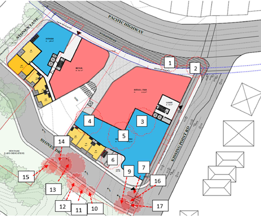
Image 17 Tree removal plan (Source: Dr Treegood, Nov, 2023)
Council’s Natural Areas Officer reviewed the Arborist
Report and provided advice that the recommendations of the Arborist report
should be addressed at the DA stage. Further the advice recommends:
· When relocating
power lines along Pacific Highway it would be ideal to put these power lines
underground to allow future tree planting with tree pruning is not required to
give power line clearance
· Replacement
plants to be endemic species as outlined within the report. Endemic plants may
not be suitable across all areas of the site, however suitable BGHF species
should be used, particularly in the proposed park and interface with Granny
Springs reserve
These recommendations should be included in the Draft DCP
provisions for the site. Subject to this recommendation it is considered that
the proposal is acceptable from a tree removal perspective on balance
notwithstanding the proposed tree loss, recommendations in relation to
additional deep soil on site and having regard to the public benefits of the
proposal.
Bushfire
A letter has been submitted with
the Planning Proposal Request prepared by Blackash (dated 25 October 2023)
(refer Attachment A9) in respect of bushfire hazard and risk. The advice
notes that the subject land behind the Village is not designated as bushfire
prone land (albeit that it previously was so identified) and as such, the
legislative triggers of section 4.46 of the Environmental Planning and
Assessment Act 1979 (EPA Act) and section 100B of the Rural Fires Act
1997 (RF Act) for the referral of any development to the NSW Rural Fire
Service (RFS) do not exist. Development of the site does not require a Bushfire
Safety Authority from the RFS. This matter was confirmed by Council’s
Natural Areas Officer. Notwithstanding it is noted that the proposed new Stonex
Drive provides for a 15m buffer zone to adjacent vegetation as previously
specified in the DCP provisions. Accordingly, it is considered that the
proposal is acceptable from a bushfire perspective.
Contamination
A Preliminary Site Investigation Report was submitted with
the Planning Proposal Request prepared by EI Australia (November 2023) (refer Attachment
A7). The report concludes that:
· Site
observations indicated there were not significant visual or olfactory evidence
of contamination, and no evidence of underground storage tanks or above ground
storage
· Investigation
of site history indicated that the site has been utilised as a commercial site
since before 1950, including sue as a dry cleaners and motor garage. There were
also several dry cleaners, petrol station and motor garages in close vicinity
to the site and located hydraulically up-gradient
· A review of the
historic aerial photography indicated that the immediate surrounding area of
the site have been predominantly commercial / residential since before 1943 to
date
· The subject
site was not included on the List of NSW Contaminated Sites Notified to the EPA
however two sites in the surrounding area associated with two service stations
were listed for contamination or regulation under the contaminated land
management act
· A search
through the record of notices for contaminated land indicated that the subject
site was free of statutory notices issues by the NSW EPA however several
records pertaining to sites nearby were discovered
· The site was
free of statutory notices and licencing agreements issues under the
Contaminated Land Management Act 1997 and Protection of the Environment
Operations Act 1997 however several records pertaining the nearby sites were
discovered.
Based on findings of this
report and with consideration of the Statement of Limitations, EI concludes
that there is potential for contamination to be present that could pose risks
to sensitive receptors. This was considered to be of low to high significance
in terms of risk to the human and environmental receptors identified. As such a
detailed site investigation (DSI) will be required following demolition to
characterise soils and groundwater and ascertain the presence of any contamination
onsite.
Based on the information
collected during the DSI and in reference to SEPP 2021, the site can be made
suitable subject to the completion of the DSI (and after remediation and
validation if required) for the residential use.
Council’s Natural Areas Officer reviewed the PSI and
provided advice that it is appropriate noting that a detailed site
investigation is to be submitted with any development application for the site
to confirm that the site will be suitable for the proposed use. Given that the
PSI concludes that the site can be made suitable for the proposed residential
use subject to the completion of the DSI and after remediation and validation
if required, this is considered appropriate and in accordance with the
requirements of Section 9.1 Ministerial Direction 4.4 Remediation of
Contaminated Land Council can be satisfied that the site can, and will, be made
suitable for the proposed use. For an abundance of caution a provision should
be included in the Draft DCP requiring the submission of Detailed Site
Investigation with any DA for relating to the site.
Public Benefits
A public benefit letter of offer was submitted by the
Proponent with the subject Planning Proposal Request. The letter of offer notes
that it is for discussion purposes only and is not intended to be binding. It
generally sets out the matters to be included in a planning agreement for the
site as follows:
|
Works
|
Additional infrastructure
to be delivered includes:
1. New Stonex Street – a new
public street connecting Kissing Point Road and Duff Street will be delivered
2. Footpath and Road along Kissing
Point Road – the footpath along Kissing Point Road will be upgraded
3. Stonex Lane – Stonex Lane
is to be retained and upgraded as an open-air pedestrian lane with active
frontages and supporting street furniture
Key matters to be further
resolved in discussions with Council will include:
• Timing, staging and
responsibility for the above identified works
• Specifications and
standards to be adopted for the proposed works.
Some of the above
infrastructure may be undertaken as ‘works in kind’ and deducted
from the contribution amount, subject to further negotiation and discussion
with Council.
|
|
Dedication of Land
|
1. New Community Park (approx.
708m2) – Land for a new public park will be dedicated to
Council which is adjacent to Granny Springs Reserve. The new park has been
considered as part of the concept design and identified for dedication to Council.
It is understood that the land associated with the park is to be dedicated to
Council, however this land will form as part of the overall site for the
purposes of FSR transfer.
2. New Stonex Street (approx.
1,434m2) – a new public street will connect Kissing Point Road and Duff
Street
3. Footpath and road along Kissing
Point Road (approx. 255m2) – the land dedication along Kissing Point
Road has been included in the concept design.
|
|
Other Public Benefits
|
A minimum of 30 public car
parking spaces on the site dedicated to Council.
|
|
Application of section
7.11, 7.12 and 7.24
|
Value of the cost of the
proposed works outlined above would be offset against any applicable
development contributions and dealt with under a Works In Kind Agreement. The
value of any land dedication including parking spaces is to be separately
dealt with as part of the broader land transactions.
|
Council’s Infrastructure Coordinator has provided
advice in respect of the submitted letter of offer. This advice is provided in
full below:
Proposal Planning Agreement
Background
The proponent initially
submitted a document entitled Letter of Process which outlined the general
timing of actions needed to support the project from an infrastructure delivery
viewpoint including land dedication, the local infrastructure to be delivered
as part of the site redevelopment and the proposed replacement of the current
at-grade council car parking spaces within the development. Among other
matters, an updated formal Letter of Offer was requested in the context of
comments previously made on the content and process.
State Government as a party
to the same planning agreement
The subject site is very
complex and incorporates a significant amount of council land as well as the
delivery of a number of items of public infrastructure as works-in-kind across
three of the major categories in the s7.11 contributions plan (open space, roadworks
and intersection upgrades and public domain works). It also requires land
dedication to the NSW State Government for the widening of the Pacific Highway
and the treatment of its intersection with Kissing Point Road. As such, and in
view of the complexity of coordinating the NSW State Government as a party to
an already complex council agreement involving the prospective sale of council
land, it was recommended that the proponent pursue a separate agreement with
the NSW State Government. The revised letter of offer accedes to this request
and removes the NSW State Government as a party together with the affected
works. This does not mean that an agreement will not still be required to be
made between the proponent and the NSW State Government; only that council will
not be responsible for its coordination and reduces the cost and staff
resources required from council for this matter.
Land Dedication
All land that is stripped of
its development potential by the transfer of FSR within the total site, is to
be dedicated to Council free-of-cost. This includes the land for the new park
adjoining Granny Springs Reserve at the rear of the site and (part) of the new
Stonex Street.
Council car parking
The Letter of Process refers to
the required reclassification of the current council car park from community to
operational land and that reclassification process is underway as part of the
planning proposal. The in-principle provision of a replacement 30 spaces of
public car parking has been discussed over the inception period of the project
from its earliest iteration in 2021. In each Letter of Offer, this proposed
public car parking is listed as “Other Public Benefits” to be
covered by the proposed Planning Agreement. It is presumed at this point that
this intended provision will take the form of stratum space to be dedicated to
council.
As Ku-ring-gai Council does not
levy for the provision of car parking, any value to be attributed to the
dedication of land or stratum space for public car parking must be taken into
consideration as part of the overall property transaction but the proposed
Planning Agreement can manage the logistics of this dedication. A final
decision on the inclusion or otherwise of council-owned car parking will need
to be made prior to the lodgement of a development application for the site. It
should be noted that the redevelopment of the site will be required to fully
cater for its own parking demand under the DCP and, as such, unlike the current
situation, additional car parking for the existing IGA and other business
fronting the Pacific Highway should no longer be required. A limited amount of
car parking along Stonex Street near the Duff Street intersection is also not
included within the site of the planning proposal.
The most recent letter of offer
does acknowledge that these parking spaces must be considered within the
context of the overall land transactions rather than as a contributions offset
but remain listed for delivery in the current offer.
Stonex Street
Stonex Street requires both
land dedication and construction. The required construction is located only
partially on the area that forms part of the subject site and partially
immediately adjoining the site, including directly behind part of the subject
site near the intersection with Stonex Lane; but the whole makes up a
continuous route providing direct vehicular access to the subject site from
both Duff Street and Kissing Point Road. There sems to be agreement in the
Letter of Offer that the Stonex Street as delivered will run from Duff Street
to Kissing Point Road (and renamed Stonex Drive to distinguish it from the
current alignment).
The dedication area cited in
the letter of offer is smaller in area that the works area for the full length
of Stonex Street (approximately 200 metres). The area for the works-in-kind is
not cited in the Letter of Offer. As it is not logical or practical to
construct / upgrade only that part of the road that is located on the
dedication land, as such, for the relief of any doubt, the Planning Agreement
needs to include separate sections for the delivery of the works-in-kind and
the dedication of land and the land area of the works, as distinct from the
dedication, should also be quantified.
It is understood that the
Planning Agreement will make provision for works-in-kind that it is not
practical to deliver other than concurrent with a construction phase, which
cannot commence until a decision to act on a development consent. The granting
of any development consent is also not fettered by the existence of this
planning agreement. While this is a fact in law, it should also be explicitly
understood and acknowledged by the proponent. No part of the existing area of
Stonex Street or Lane should be demolished or subjected to restricted access prior
to the formal commencement of the works that will trigger the delivery of the
new road.
Stonex Lane
Stonex Lane has a direct
connection to the property along the side boundary and provides pedestrian
access from the Pacific Highway to Stonex Street. Its upgrade is valued by the
s7.11 contributions plan however, offsets can only be up to the inflated value
of the baseline contributions plan (in today’s dollars). Additional work
may be undertaken at the applicant’s cost if they wish noting the direct
benefit to the presentation of the redevelopment.
Other works valued by the
Contributions Plan
Works surrounding the site and
valued by the s7.11 Contributions Plan are also open to discussion for possible
offsets as works-in-kind up to the inflated value within the baseline
contributions plan. Additional works may be undertaken with agreement but
cannot be offset.
References to Regional
Contributions under s7.24 (HAPs Contributions)
The Letter of Offer continue to
inappropriately refer to s7.24 as a contribution that can be offset.
Ku-ring-gai Council has no control, influence or management capacity in respect
of the NSW Government Housing and Productivity Contributions (HAPs) inclusive
of calculation and collection which are exclusively via the Planning Portal. No
local infrastructure provision will be offset against HAPs contributions. Nor
can Council enter into any agreement impacting Division 7.1 Subdivision 4
without Ministerial approval. Any agreement regarding HAPs must be exclusively
with the NSW State Government. The proposed Planning Agreement will not exclude
the application of s7.24 to the proposal nor include any agreement regarding
works being offset against it.
Registration on title,
dispute resolution, security and costs agreements
These are standard matters and
will be discussed and formalised within the Planning Agreement. A costs
agreement will need to be agreed at the engagement of council’s legal
team and prior to work officially commencing on the detailed planning
agreement.
This matter will be the subject of a separate report to
Council and has not been considered in this report.
Site Specific Merit
Assessment Summary
In accordance with the Department of Planning, Housing and
Infrastructure’s ‘Local Environmental Plan Making Guideline’,
a Planning Proposal is deemed to have site specific merit if it demonstrates
that the proposal is suitable for the site and the site is (or can be made)
suitable for the resultant development. It is to be assessed against the
following criteria:
Does the proposal give regard
and assess impacts to:
· the natural
environment on the site to which the proposal relates and other affected land
(including known significant environmental areas, resources or hazards)
· existing uses,
approved uses, and likely future uses of land in the vicinity of the land to which
the proposal relates
· services and
infrastructure that are or will be available to meet the demands arising from
the proposal and any proposed financial arrangements for infrastructure
provision:
As outlined above it is considered that the documentation
submitted subject to the recommended amendments adequately demonstrates that
the site is suitable for the Planning Proposal proposed controls as the
Reference Scheme submitted with the Planning Proposal will not result in any
significant adverse impacts and generally demonstrate that it is able to comply
with relevant controls and/or achieve a high quality, high amenity development.
Accordingly, it is considered that, subject to the recommended amendments, the
Planning Proposal demonstrates site specific merit.
Recommendations to Gateway Determination
Having regard to the above assessment it is recommended that
the Ku-ring-Gai Local Planning Panel advise Council that:
1. it
supports the Planning Proposal and recommends that Council submit the matter to
the Department of Planning, Housing and Infrastructure for a Gateway
Determination subject to:
a. amendments
to the proposed LEP Height of Building map that provide for:
i. two (2)
height limits across the developable part of the site being 34.5m in the
location of the proposed eastern tower (corner of Kissing Point Road and
Pacific Highway) and 28.5m for the remainder of the developable site including
the through site link and the western tower)
ii. No mapped
height in the location of the proposed new park, new Stonex Drive and areas
proposed to be dedicated for road widening (Pacific Highway and Kissing Point
Road)
b. amendments
to the Reference Scheme such that it demonstrates compliance with the Apartment
Design Guide and in particular addresses the following identified
non-compliances:
i. Improved
solar access to the lower pedestrian plaza area / through site link area to
comply with the ADG requirement that solar access be provided year round to
public spaces, to provide for a high level of comfort and amenity for
pedestrians and to enable use for outdoor dining throughout the year including
at lunch time in midwinter
ii. Incorporation
of a minimum of 7% of the developable part of the site (having an area of
approximately 5,636m2) as deep soil area (having a minimum dimension
of 2m) and generally being located within the through site link adjacent to the
Stonex Drive frontage.
iii. A
minimum of 70% of units to comply with the solar access requirement of 2 hours
of sunlight to balconies and living rooms between 9am and 3pm in mid-winter
(Note: units currently in question comprise the northern cross through units in
the eastern tower and some of the lower units in the eastern tower facing the
courtyard ).
iv. A minimum
of 60% of units to comply with natural cross ventilation requirement Note:
Note: units currently in question comprise single aspect units facing north
over the courtyard on the eastern tower, and single aspect units at the
southeast corner facing east on the eastern tower at the lower levels).
v. Design of
units to address noise amenity impacts and ventilation requirements to
habitable rooms given site affectation by traffic and rail noise.
vi. Subject
to resolution of (iii) and (iv) above compliance with the maximum number of
units off a circulation core in accordance with the ADG.
vii. Demonstrate
appropriate loading arrangements within the basement including provision of
entry and exit in a forward direction for service vehicles.
c. Preparation
of a Draft amendment to Ku-ring-gai DCP Part 14 Urban Precinct and Sites 14B
Turramurra Local Centre to reflect the subject Planning Proposal and key
aspects of the Reference Scheme and to incorporate additional provisions which:
i. promote
pedestrian activity between Pacific Highway and the future park at the rear of
the site
ii. ensure
that new development is appropriately sited and designed to manage amenity and
visual impacts to neighbouring residential properties
iii. provide
active frontages along the internal through site link
iv. ensure
all service and loading areas are to be located in the basement
v. clarify
the road widening width of 1.5m to Kissing Point Road
vi. provide a
3m setback along Stonex Lane
vii. require
that the pedestrian through site link should be open to the sky
viii. minimise
opaque and blank walls at ground level
ix. provide
30 car spaces for public use within the basement of the future development
x. require a
minimum level of articulation to tower footprints (i.e. maximum wall length)
xi. design
the lower pedestrian plaza area / through site link area to comply with the ADG
requirement that solar access be provided year round to public spaces, to
provide for a high level of comfort and amenity for pedestrians and to enable
use for outdoor dining throughout the year including at lunch time in midwinter
xii. require
a minimum of 7% of the developable part of the site (having an area of
approximately 5,636m2) as deep soil area (having a minimum dimension
of 2m) and generally being located within the through site link adjacent to the
Stonex Drive frontage. This area is to incorporate specimen trees to form
an idyllic corridor for pedestrian traffic and shoppers
xiii. ensure
that the design is compatible with its heritage context including HCA to the
east, nearby heritage items and that it reflects the character of the
Tummamurra Local Centre.
xiv. Ensure
that planting within the site is to comprise endemic species as far as
possible.
xv. Require
additional street tree planting on all street frontages where practicable.
xvi. Require
underground power along street frontages
xvii. Require
a Detailed Site Investigation to be submitted with any DA for the subject site.
xviii. Require
a minimum of 5% affordable housing.
d. amendment
of the Planning Proposal to address Department of
Planning, Housing and Infrastructure’s Practice Note PN 16-001 in respect
of the classification and reclassification of public land.
2. it
recommends that the Proponent be advised of the above and directed to submit an
amended Reference Scheme and Draft amendment to Ku-ring-gai DCP Part 14 Urban
Precinct and Sites 14B Turramurra Local Centre in accordance with the
recommendations above prior to the matter being referred to the Department of
Planning, Housing and Infrastructure for a Gateway Determination.
integrated planning and reporting
Theme 3 - Places, Spaces and
Infrastructure
|
Community Strategic
Plan Long Term Objective
|
Delivery Program
Term Achievement
|
Operational Plan
Task
|
|
P2.1 A robust planning framework is in place to deliver
quality design outcomes and maintain the identity and character of
Ku-ring-gai
|
P2.1.1 Land use strategies, plans and processes are in
place to effectively manage the impact of new development
|
Implement and monitor the Local Environmental Plans and
supporting Development Control Plans.
|
Governance Matters
The process for the preparation and
implementation of Planning Proposals is governed by the provisions contained in
the Environmental Planning and Assessment Act 1979 and the Environmental
Planning and Assessment Regulation 2000.
If Council fails to make a decision within 90 days (from the
commencement of the review of the application) or if Council makes a decision
to not support the Planning Proposal, the Proponent can make a request to the Department
of Planning, Housing and Infrastructure for a Rezoning Review.
Local Planning Panels Direction – Planning
Proposals issued by the Minister for Planning under Section 9.1 of the Environmental
Planning and Assessment Act 1979 requires Council to refer all Planning
Proposals prepared after 1 June 2018 to the Local Planning Panel for advice,
before it is forwarded to the Department of Planning, Housing and
Infrastructure for a Gateway Determination under Section 3.34 of the Environmental
Planning and Assessment Act 1979.
Risk Management
This is a Planning Proposal
initiated by a private landowner however affects land owned by Council and
accordingly has been assessed by an independent planner. Council should, to
determine its position on the matter, specifically consider whether the Planning
Proposal should be sent to the Department of Planning, Housing and
Infrastructure for a Gateway Determination having regard to the Local Planning
Panel’s advice and decide whether to proceed to public exhibition.
Council risks damage to its reputation if it does not
undertake strategic land use planning in an effective and timely manner.
Financial Considerations
The Planning Proposal was subject to
the relevant application fee under Council’s 2024/2025 Fees and Charges
Schedule. The cost of the review and assessment of the Planning Proposal is
covered by this fee.
Social Considerations
The Planning Proposal is considered
to have positive social benefits including the delivery of a new public park,
land dedications, pedestrian footpath and road upgrades, new roadway and
additional housing choice. In addition, it will provide for the replacement of
the existing Council owned 30 x public car parking spaces on site.
Environmental Considerations
The potential environmental impacts
of the Planning Proposal have been considered in this assessment and it has
been determined that the Planning Proposal should be supported as it will not
result in any significant adverse environmental impacts and is suitable for the
site. The impacts of any specific development that may occur on the site as a
result of the proposal would be considered in detail at the development
application stage.
Community Consultation
In the event that the Planning
Proposal is forwarded for a Gateway Determination, and granted a Gateway Determination
by the Department of Planning, Housing and Infrastructure, the Planning
Proposal would be placed on public exhibition in accordance with the
requirements of the Gateway Determination and the Department of Planning,
Housing and Infrastructure’s publication ‘A Guide to Preparing
Local Environmental Plans’.
The public exhibition would also be in accordance with the Ku-ring-gai
Community Participation Plan 2020.
Internal Consultation
The assessment of the Planning
Proposal has included consultation with Council’s Strategic Traffic
Engineer, Heritage and Biodiversity Officers. In addition, independent advice
was provided in respect to economic impacts and urban design as outlined
herein. Council officers attended the site inspection with the independent
planning and urban design consultants to provide a briefing. Specialist
referrals are addressed within the body of this report.
Summary
Council has engaged consultant MG Planning Pty Ltd (PO Box
197, Drummoyne NSW 1470) to conduct an independent assessment of this Planning
Proposal. Dr Michael Zanardo of Studio Zanardo was also engaged to provide an
independent urban design advice. Peer review of the economic impact assessment
was also undertaken by Hill PDA. Assessment of traffic
and transport, heritage and biodiversity issues have been carried out by
Council’s Strategic Traffic Engineer, Heritage and Biodiversity Officers
respectively.
A Planning Proposal has been submitted for the Turramurra
Plaza site (and adjacent land) which seeks to make the following amendments to
the KLEP 2015:
· Amend the maximum
permissible height applying to the site on the Height of Buildings map from
17.5m to 34.5m (9 storeys);
· Amend the maximum
permissible Floor Space Ratio applying to the site on the Floor Space Ratio map
from 2:1 to 3:1;
· Impose a minimum
commercial/retail FSR of 0.85:1;
· Remove the maximum
commercial FSR standard of 1.2:1 (Area 4 in clause 4.4 (2E)); and
· Reclassify the
Council owned part of the site from community to operational land.
The
assessment of the Planning Proposal has resulted in the recommendation that the
Ku-ring-Gai Local Planning Panel advise Council that:
1. it
supports the Planning Proposal and therefore recommends that Council submit the
matter to the Department of Planning, Housing and Infrastructure for a Gateway
Determination subject to:
a. amendments
to the proposed height of buildings mapping;
b. the
preparation of an amended Reference Scheme
c. the
preparation of revised Draft DCP amendment, and
d. amendment
of the Planning Proposal to address Department of
Planning, Housing and Infrastructure’s Practice Note PN 16-001 in respect
of the classification and reclassification of public land
in
accordance with the detailed recommendations outlined above.
2. It
recommends that that the Proponent be advised of the above and directed to
submit an amended Reference Scheme and Draft amendment to Ku-ring-gai DCP Part
14 Urban Precinct and Sites 14B Turramurra Local Centre in accordance with the
recommendations above prior to the matter being referred to the Department of
Planning, Housing and Infrastructure for a Gateway Determination.
The Planning Proposal has been
assessed against the provisions of the Department of Planning, Housing and
Infrastructure’s ‘Local Environmental Plan Making
Guideline’ and section 3.33 of the Environmental Planning and
Assessment Act 1979.
It is considered that the Planning Proposal demonstrates
sufficient strategic and site specific merit such that it should be submitted
to the Department of Planning, Housing and Infrastructure for a Gateway
Determination following amendments as outlined above and in the Table of
Assessment at Attachment A1.
Recommendation:
A. That the
Ku-ring-gai Local Planning Panel makes a recommendation to Council that
following amendment as outlined above the Planning Proposal be submitted to the
Department of Planning, Housing and Infrastructure for a Gateway Determination.
B. Should
a Gateway Determination be issued for public exhibition of the Planning
Proposal, the site-specific amendments to the Ku-ring-gai DCP Part 14 Urban
Precinct and Sites 14B Turramurra Local Centre as outlined in this report be
placed on public exhibition concurrent with the Planning Proposal.
|
Helena Miller
Director, MG Planning Pty Ltd
|
|
|
Attachments:
|
A1 ⇩ ⇩
|
Table
of Assessment
|
|
2024/231267
|
|
|
A2 ⇩ ⇩
|
Planning
Proposal prepared by The Planning Studio Final (May 2024)
|
|
2024/231302
|
|
|
A3⇩
|
Planning
Proposal Appendix 1 - Urban Design Study
|
|
C:\Temp\Attachments\Planning
Proposal Appendix 1 - Urban Design Study.pdf
|
|
|
A4⇩
|
Planning
Proposal Appendix 2 - Traffic and Transport Study
|
|
2024/231314
|
|
|
A5⇩
|
Planning
Proposal Appendix 3 - Survey Plan
|
|
2024/231318
|
|
|
A6⇩
|
Planning
Proposal Appendix 4 - Need + Impact Assessment (Economic)
|
|
2024/231340
|
|
|
A7
|
Planning
Proposal Appendix 5 - Preliminary Site Investigation (Contamination)
|
Excluded
|
C:\Temp\Attachments\Planning
Proposal Appendix 5 - Preliminary Site Investigation (Contamination) -
Turramurra Plaza(3).pdf
|
|
|
A8⇩
|
Planning
Proposal Appendix 6 - Arborist Report
|
|
2024/231352
|
|
|
A9⇩
|
Planning
Proposal Appendix 7 - Bushfire Advice
|
|
2024/231358
|
|
|
A10⇩
|
Planning
Proposal Appendix 8 - Flora and Fauna
|
|
2024/231360
|
|
|
A11⇩
|
Planning
Proposal Appendix 9 - Heritage
|
|
2024/231365
|
|
|
A12⇩
|
Planning
Proposal Appendix 10 - Letter of Offer
|
|
2024/231366
|
|
|
A13⇩
|
Urban
Design Review - Studio Zanardo
|
|
2024/231270
|
|
|
A14⇩
|
Economic
Impact Assessment Peer Review by Hill PDA
|
|
2024/189535
|
|
|
A15⇩
|
Draft
Site Specific DCP
|
|
2024/231370
|