Ordinary
Meeting of Council
TO
BE HELD ON Tuesday, 13 August 2024 AT 7:00PM
Level
3, Council Chamber
AgendA
** ** ** ** ** **
NOTE:
For Full Details, See Council’s Website –
https://www.krg.nsw.gov.au under the
link to business papers
The Livestream can be viewed here:
https://www.krg.nsw.gov.au/Council/Council-meetings/Council-meeting-live-stream
Disclaimer: All Ku-ring-gai Council Ordinary Meetings of
Council are livestreamed for on-demand viewing on the KRG website. Although
Council will do its best to ensure the public is excluded from the livestream,
Council cannot guarantee a person’s image and/or voice won’t be
broadcast. Accordingly, attendance at Council meetings is considered consent by
a person for their image and/or voice to be webcast. Council accepts no
liability for any damage that may result from defamatory comments made by
persons attending meetings. As per clause 15.21 of Council’s Code of
Meeting Practice, a person must not live stream or use an audio recorder, video
camera, mobile phone or any other device to make a recording or photograph of
the proceedings of a meeting of the council or a committee of the council without
the prior authorisation of the council.
In accordance with clause 3.23 of the Model Code of Meeting Practice,
Councillors are reminded of the oath or affirmation of office made under
section 233A of the Act, and of their obligations under the Council’s Code
of Conduct to disclose and appropriately manage conflicts of interest.
Please refer to
Part 4 of Council’s Code of Conduct for Pecuniary Interests and Part 5 of
Council’s Code of Conduct for Non-Pecuniary Interests.
The Oath or
Affirmation taken is as below:
Oath:
I [name of
Councillor] swear that I will undertake the duties of the office of
Councillor in the best interests of the people of the Ku-ring-gai Local
Government area and the Ku-ring-gai Council, and that I will faithfully and
impartially carry out the functions, powers, authorities and discretions vested
in me under the Local Government Act 1993 or any other Act to the best
of my ability and judgement.
Affirmation:
I [name of
Councillor] solemnly and sincerely declare and affirm that I will undertake
the duties of the office of Councillor in the best interests of the people of
the Ku-ring-gai Local Government area and the Ku-ring-gai Council, and that I
will faithfully and impartially carry out the functions, powers, authorities
and discretions vested in me under the Local Government Act 1993 or any
other Act to the best of my ability and judgement.
APOLOGIEs
DECLARATIONS OF INTEREST
Documents Circulated to Councillors
Confirmation of ATTACHMENTS to be
Considered in Closed Meeting
NOTE:
That in accordance with the provisions of Section 10 of the Local
Government Act 1993, all officers’ reports be released to the press and
public, with the exception of confidential attachments to the following General
Business reports:
GB.12 RFT12
- 2024 Leasing- Exercise Equipment Ku-ring-gai Fitness and Aquatic Centre
In accordance with 10A(2)(d)(i):
Attachment 1: RFT12-2024 Tender Evaluation Report Final
CONFIRMATION OF MINUTEs
Minutes
of Ordinary Meeting of Council 10
File: S02131
Meeting held 16 July 2024
Minutes numbered 137 to 157
minutes from the Mayor
Petitions
GENERAL BUSINESS
i.
The Mayor to invite Councillors to
nominate any item(s) on the Agenda that they wish to have a site inspection.
ii.
The Mayor to invite Councillors to
nominate any item(s) on the Agenda that they wish to adopt in accordance with
the officer’s recommendation allowing for minor changes without debate.
GB.1 Minutes of
Audit, Risk & Improvement Committee Meeting held on 13 June 2024 43
File: CY00458/12
To provide Council with the Minutes
from the Audit, Risk & Improvement Committee meeting held on 13 June 2024
for adoption.
Recommendation:
That the minutes from the Audit,
Risk & Improvement Committee meeting held on 13 June 2024 be adopted.
GB.2 Multicultural
Advisory Committee Meeting Minutes 12 June 2024 52
File: S04141
To
provide Council with the minutes from Multicultural Advisory Committee meeting
held on 12 June 2024.
Recommendation:
That Council receive and note the
minutes of the Multicultural Advisory Committee held on 12 June 2024.
GB.3 Sustainable
Recreation Advisory Group - Meeting Minutes 25 June 2024 59
File: S13163
That
Council receive and note the minutes from the Sustainable Recreation Advisory
Group (‘SRAG’) meeting held on 25 June 2024 and endorse the
recommendations within.
Recommendation:
That
Council receive and note the Sustainable Recreation Advisory Group minutes from
25 June 2024 and endorse the recommendations within.
GB.4 2024
Ku-ring-gai Council Emergency Relief Support Grant 66
File: FY00432/15
To advise Council of applications
received for the 2024 Ku-ring-gai Council Emergency Relief Support Grant, and
to recommend funding for eligible community organisations.
Recommendation:
That Council approve the
recommendations in this report for funding eligible community organisations.
GB.5 Prevention
of Violence against Women - Draft Action Plan 2024-2025 75
File: S08654
To provide Council with a
Prevention of Violence Against Women draft Action Plan 2024-2025.
Recommendation:
That Council adopt the Prevention
of Violence Against Women draft Action Plan 2024 – 2025.
GB.6 Analysis of
Land and Environment Court Costs - 4th Quarter 2023 to 2024 105
File: FY00623/7
To report legal costs in relation
to development control matters in the Land and Environment Court for the
quarter ended 30 June 2024.
Recommendation:
That the analysis of Land and
Environment Court costs for the year ended 30 June 2024 be received and noted.
GB.7 Carried
Forward Projects Expenditure - 2023/24 124
File: S09093/12
To seek endorsement from Council
to carry forward the attached list of 2023/24 projects into the current
financial year.
Recommendation:
That Council approve the attached
list of 2023/24 carried forward projects into the current financial year.
GB.8 Delivery
Program and Operational Plan: June 2024 Biannual Report 140
File: FY00382/16
To report to Council on the
progress of the Delivery Program and Operational Plan, for the period January
to June 2024.
Recommendation:
That the six month progress
review of the Delivery -Program and Operational Plan be received and
noted.
GB.9 Investment
Report as at 26 July 2024 278
File: FY00623/7
To present Council’s
investment portfolio performance for July 2024.
Recommendation:
That the summary of investments
performance for July 2024 be received and noted; and that the Certificate of
the Responsible Accounting Officer be noted and the report adopted.
GB.10 Local
Government NSW Annual Conference 2024 285
File: FY00581/10
To note key dates for the Local
Government NSW (LGNSW) Annual Conference 2024.
Recommendation:
That Council note the information
in this report.
GB.11 Project
Status Report - August 2024 288
File: FY00621/6
To provide Council with the
Project Status Report for May, June and July 2024.
Recommendation:
That Council receive and note the
Project Status Report for May, June and July 2024.
GB.12 RFT12 - 2024
Leasing- Exercise Equipment Ku-ring-gai Fitness and Aquatic Centre 294
File: S12433/5
To consider the results of the
formal tender process for the leasing of fitness equipment, both cardio and
strength equipment for the Ku-ring-gai Fitness & Aquatic Centre (KFAC).
Recommendation:
Council
accepts the 5-Year (60 Month) leasing term of Tenderer ‘A’ from the
attached RFT12-2024 Tender Evaluation report.
GB.13 Draft
Revised Planning Agreement Policy 2024 for Exhibition 298
File: S06198
To present the draft revised
Planning Agreement Policy to Council for approval to place on public
exhibition.
Recommendation:
That the draft revised Planning
Agreement Policy be placed on public exhibition for a minimum of 28 days and a
report be brought back to council at the close of the exhibition period.
GB.14 Planning
Proposal for 1364-1369 Pacific Highway and 1, 1a, 3 and 3a Kissing Point Road,
Turramurra 348
File: S14408
To refer the Planning Proposal
for 1364-1396 Pacific Highway and 1, 1A, 3 and 3A Kissing Point Road,
Turramurra (Turramurra Plaza site) to Ku-ring-gai Council to determine whether
to forward the matter to the Minister for a Gateway determination in accordance
with section 3.34 of the Environmental Planning and Assessment Act 1979.
Recommendation:
That Council resolve to forward
the Planning Proposal to the Department of Planning, Housing and Infrastructure
for a Gateway Determination in accordance with section 3.34 of the Environmental
Planning and Assessment Act 1979 subject to the recommendations contained
in this report.
GB.15 Planning
Proposal 51-53 Rohini St, Turramurra (Anglicare) 541
File: S13985
For Council to consider the
private Planning Proposal for 51-53 Rohini Street, Turramurra (Anglicare
Village).
Recommendation:
That Council supports the
Planning Proposal being submitted to the Department of Planning, Housing and
Infrastructure for a Gateway Determination subject to the amendments stated in
this Report and in the Table of Assessment at Attachment A1.
GB.16 Post
exhibition report for a planning agreement for the extension of Dorset Drive in
St Ives 741
File: S13761
To report to
council following the exhibition of the draft Planning Agreement for the
extension of Dorset Drive on 139 Rosedale Road St Ives as part of an approved
subdivision.
Recommendation:
To enter into the Planning
Agreement to give effect to the dedication of land and the extension of Dorset
Drive thereon on 139 Rosedale Road St Ives as part of an approved subdivision
under DA0109/23.
Extra Reports Circulated to Meeting
Motions of which due Notice has
been given
NM.1 Mona Vale to
Macquarie Park priority Bus Infrastructure 774
File: EM00043/7
Notice
of Motion from Councillor Kay dated 25 July 2024
Within the Ku-ring-gai Local
Strategic Planning Statement (2020), there is Ku-ring-gai Local Planning
Priority K3: Providing housing close to transport, services and facilities to
meet the existing and future requirements of a growing and changing community.
Actions within this Planning priority include implementing planning responses
in St Ives subject to infrastructure improvements (medium-long term). Future
growth in St Ives was subject to provision of priority bus infrastructure from
Mona Vale to Macquarie Park.
This is related to Ku-ring-gai
Local Planning Priority K22: Providing improved and expanded district and
regional connections through a range of integrated transport and infrastructure
to enable effective movement to, from and within Ku-ring-gai. Actions in this
Planning Priority include advocating to Transport for NSW to increase priority
and accelerate the delivery of infrastructure improvements identified in Future
Transport 2056 that connects Ku-ring-gai internally and with nearby centres,
including improvements to bus connections from Mona Vale to Macquarie Park, and
Dee Why to Chatswood (followed by Bus Rapid Transit).
Macquarie Park Strategic
Infrastructure and Services Assessment (SISA) Final Report (Greater Cities
Commission, 2022) identifies the proposal for Mona Vale to Macquarie Park
public transport improvements for rapid services, with a delivery timeframe of
2027-2035.
In September 2023, Transport for
NSW provided an update on the of future frequent bus services and Rapid Bus
Line between Mona Vale and Macquarie Park. TfNSW stated that it is planning a
frequent bus service which will operate between Mona Vale and Macquarie Park
(circa 2030) and then enhancing to a Rapid Bus Service (circa 2036) as
identified in Future Transport. However, these service improvements are
currently unfunded and the introduction of a Rapid B-Line service would be
required to go through a business case process to secure funding.
In late 2023 a Council submission
was made to TfNSW's Directions for On-Street Transit White Paper, advocating
for the accelerated implementation of the Mona Vale to Macquarie Park rapid bus
line. Following this, in a Summary of Actions in response to the NSW Bus
Industry Taskforce's second report, the NSW Government stated that TfNSW will
develop a Medium-Term Bus Plan in response to the Taskforce’s
recommendation for a focus on 10 high-quality rapid routes, 27 frequent routes
and other improvements to local services, but it is unclear if the Mona Vale -
Macquarie Park Rapid Bus Line forms part of the Plan. There has been no clarification
since the NSW budget was handed down in June.
The Macquarie Park TOD rezoning
proposal (NSW Government, 2024) – Infrastructure Delivery Plan references
the Macquarie Park SISA and identifies new strategic bus corridor and bus
priority facilities as being funded by primarily by State or Commonwealth
Budget Allocation and potentially by Housing and Productivity Contributions.
The infrastructure lists at the end of the Plan identify the delivery of Mona
Vale to Macquarie Park public transport improvements (Mona Vale - Macquarie
University Rapid route) by 2036. With the acceleration of development around
Macquarie Park and St Ives as a consequence of impending Low and Mid-rise SPP
policy changes, rapid bus services and between Mona Vale and Macquarie Park and
associated infrastructure are required in 2024, not 2036.
I move that:
A. Council
write to the Minister for Transport and the NSW Premier seeking to accelerate
the implementation of the proposal for Mona Vale to Macquarie Park public
transport improvements for rapid services.
B. That
Council write to the Shadow Minister for Transport and Roads and Infrastructure
and the Member for Davidson advising them of Council’s decision and
including a copy of this Notice of Motion as background.
Recommendation:
That the above Notice of Motion
as printed be adopted.
NM.2 Possible Dog
Park in Gordon 776
File: S13467
Notice of Motion from Councillor Lennon
dated 26 July 2024
Council’s 2024/2025
Operational Plan includes preparation of a masterplan for Pennant Park (the former Gordon Bowling Club site at 4 Pennant
Avenue, Gordon).
I move that staff investigate and
consult with residents about setting aside a small portion of Pennant Park (the
former Gordon Bowling Club at 4 Pennant Avenue, Gordon) to be an unleashed dog
area when preparing a masterplan for the site.
Recommendation:
That the above Notice of Motion
as printed be adopted.
BUSINESS WITHOUT NOTICE – SUBJECT TO CLAUSE 9.3 OF code
of meeting practice
Questions With Notice
InspectionS– SETTING OF TIME, DATE AND RENDEZVOUS
End of Term Thanks and Group Photo
** ** ** ** ** **
MINUTES OF Ordinary Meeting of Council
HELD ON Tuesday, 16 July 2024
|
Present:
|
The Mayor, Councillor S Ngai (Chairperson)
Councillors J Pettett & G Taylor (Comenarra Ward)
Councillors S Lennon & B Ward (Gordon Ward)
Councillor A Taylor (Roseville Ward)
Councillors C Kay & M Smith (St Ives Ward)
Councillors C Spencer & K Wheatley (Wahroonga Ward)
|
|
|
|
|
Staff Present:
|
General Manager (David Marshall)
Director Community (Janice Bevan)
Acting Director Corporate (Angela Apostol)
Director Development & Regulation (Michael Miocic)
Acting Director Operations (Peter Lichaa)
Director Strategy & Environment (Andrew Watson)
Corporate Lawyer (Jamie Taylor)
Manager Corporate Communications (Virginia Leafe)
Manager Governance and Corporate Strategy (Christopher M
Jones)
Acting Senior Governance Officer (Nicole Kratochvil)
|
|
|
|
The Meeting
commenced at 7:00PM
The Mayor offered the
Acknowledgement of Country and Prayer.
|
|
Apologies
File: S02194
Nil
|
DECLARATIONS
OF INTEREST
The Mayor
referred to the necessity for Councillors and staff to declare a Pecuniary
Interest/Conflict of Interest in any item on the Business Paper.
Cr A.Taylor
declared a non-significant, non-pecuniary interest in GB.3 – Ku-ring-gai
Council Sponsorship 2024-2025 due to his involvement in Ku-ring-gai Rotary. Cr
A.Taylor will remain in Chambers during debate on this item.
Cr A.Taylor declared
a non-significant, non-pecuniary interest in GB.4 – Status of Women's
Advisory Committee due to his involvement in an organisation managed by a
candidate for the Committee. Cr A.Taylor will remain in Chambers during debate
on this item.
Cr S. Lennon
declared a non-significant non-pecuniary interest in GB.1 – Heritage
Reference Committee meeting minutes of 6 June 2024 & 2024-25 Heritage Home
Grants Allocation due to his involvement in the Eryldene Trust.
Cr C.Kay
declared a non-significant, non-pecuniary interest in GB.3 – Ku-ring-gai
Council Sponsorship 2024-2025 due to her involvement in the St Ives Food and
Wine Festival. Councillor C.Kay will leave Chambers during debate on this item.
Cr B.Ward
declared a non-significant, non-pecuniary interest in GB.3 – Ku-ring-gai
Council Sponsorship 2024-2025 due to her involvement in Ku-ring-gai Rotary and
will remain in Chambers during debate on this item.
Mayor S.Ngai
declared a non-significant, non-pecuniary interest in GB.1 – Heritage
Reference Committee meeting minutes of 6 June 2024 & 2024-25 Heritage Home
Grants Allocation due to a personal connection with one of the applicants.
Mayor S.Ngai will leave Chambers during debate on this item.
Mayor S.Ngai declared a
non-significant, non-pecuniary interest in GB.3 – Ku-ring-gai Council
Sponsorship 2024-2025 as he has been made Honorary member of Ku-ring-gai Rotary
Club and will remain in Chambers during debate on this item.
DOCUMENTS
CIRCULATED TO COUNCILLORS
The Mayor referred to the
documents circulated in the Councillors’ papers and advised that the
following matters would be dealt with at the appropriate time during the
meeting:
|
Late Items:
|
MM.2 - Significant Sporting Achievements by Members of
the Ku-ring-gai Community
Report by Mayor Ngai dated 15 July 2024.
MM.3 - Housing Policy Updates (July 2024)
Report by Mayor Ngai dated 15 July 2024 with attachments.
|
|
Memorandums:
|
1.
Memorandum to Mayor, Councillors, General Manager and Directors from Director
Community dated 15 July 2024 Re: Questions taken on notice, asked by
Councillor Kay, at the 18 June 2024 Ordinary Meeting of Council.
2.
Memorandum to Councillors, Directors, Office of the Mayor and General
Manager from Manager Governance and Corporate Strategy dated 16 July 2024 Re:
LGNSW Annual Conference - Call for Motions.
3.
Memorandum to Mayor, Councillors, General Manager and Directors from Director
Community dated 16 July 2024 Re: Status of Women’s Advisory Committee.
|
|
137
|
CONFIRMATION
OF ATTACHMENTS TO BE CONSIDERED IN CLOSED MEETING
File: S02499/9
|
|
|
Resolved:
(Moved: Councillors
Smith/Ward)
That in accordance with the
provisions of Section 10 of the Local Government Act 1993, all
officers’ reports be released to the press and public, with the
exception of:
GB.2 EOI23-2024
- Panel of Code of Conduct Reviewers
In accordance with 10A(2)(d)(i):
Attachments 1 to 11
GB.3 Ku-ring-gai
Council Sponsorship 2024-2025
In accordance with 10A(2)(d)(i):
Attachments 1 to 19
GB.4 Status
of Women's Advisory Committee
In accordance with 10A(2)(a):
Attachment 1: Women’s Advisory Committee Submissions
Attachment 2: Women’s Advisory Committee selection
report
Attachment
3: Status of Women's Advisory Committee Assessment
Methodology
CARRIED
UNANIMOUSLY
|
CONFIRMATION
OF MINUTEs
|
138
|
Minutes
of Extraordinary Meeting of Council
File: S02131
|
|
|
Meeting held 4 June 2024
Minutes numbered 111 to 113
|
|
|
Resolved:
(Moved: Councillors
Wheatley/Lennon)
That Minutes numbered 111 to 113
circulated to Councillors were taken as read and confirmed as an accurate
record of the proceedings of the Meeting.
CARRIED UNANIMOUSLY
|
|
139
|
Minutes
of Ordinary Meeting of Council
File: S02131
|
|
|
Meeting held 18 June 2024
Minutes numbered 114 to 136
|
|
|
Resolved:
(Moved: Councillors
Wheatley/Lennon)
That Minutes numbered 114 to 136
circulated to Councillors were taken as read and confirmed as an accurate
record of the proceedings of the Meeting.
CARRIED UNANIMOUSLY
|
minutes
from the Mayor
|
140
|
Vale
Don Brew
File: CY00455/12
Vide: MM.1
|
|
|
It is my sad duty to inform my Council colleagues and the
Ku-ring-gai community of the passing of Don Brew, a noted campaigner for the
protection of local heritage and environment.
Don Brew was born in 1935 and was a lifelong resident of
Ku-ring-gai, residing for over 30 years in Wahroonga with wife Desley.
Following his retirement as a professional engineer Don
became interested in the conservation of Ku-ring-gai’s built and environmental
heritage.
He was a notable founding member of grassroots community
organisations such as the Burns, Braeside and Kintore Avenues Wahroonga Group
(BBK); the North Turramurra Action Group (NTAG) and the West Pymble Action
Group.
Don Brew helped set up the Ku-ring-gai Community Shed as a
way of getting male residents engaged with each other and the local community
through woodworking and other hands-on projects. He was also a longstanding
member of the Friends of Ku-ring-gai Environment Inc. (FOKE).
During the late 1990s Don provided valuable input to help
develop the Ku-ring-gai Council Residential Development Local Environment
Plan between 1999 and 2001.
As President of BBK between 2000 and 2005, Don became a
passionate advocate for preserving Wahroonga’s heritage. His advocacy
helped the Council create the Wahroonga Heritage Conservation Area.
This meant legal protection of heritage items such as
Craignairn’ by architect Howard Joseland, on the corner of Burns Road
and Cleveland Street Wahroonga. ‘Craignairn’ faced multiple
development proposals including a proposal for 21 apartments. In 2002,
Ku-ring-gai Council took on a legal challenge at the Land and Environment
Court to protect the property and won.
Don also led the BBK campaign to protect endangered Blue
Gum High Forest contained within the grounds of the heritage property of
‘Rippon Grange’, designed by renowned architect John Sulman and
Howard Joseland.
Other campaigns Don was involved in were to protect the
Holy Cross site in Burns Road Wahroonga, 14-18 Coonanbarra Road Wahroonga and
heritage homes along the Pacific Highway at Wahroonga.
In 2011 Don Brew founded another community group called
Building a Better Ku-ring-gai. He was a strong supporter of Friends of
Turramurra legal challenge in the same year against the NSW Planning
Minister's Ku-ring-gai Planning Panel’s proposal to rezone Ku-ring-gai.
Ultimately the state government withdrew this plan.
Don Brew will be remembered by those who knew him as a
fearless and dedicated campaigner against what he perceived to be
inappropriate development in Ku-ring-gai. On behalf of Council and the
Ku-ring-gai community I extend my deepest sympathies to his family and
friends.
|
|
|
Resolved:
(Moved: The Mayor, Councillor
Ngai)
A. That the Mayoral Minute be received and
noted.
B. That we stand for a minute’s silence
to honour Don Brew.
C. That the Mayor write to Don Brew’s
family and encloses a copy of the Mayoral Minute.
CARRIED UNANIMOUSLY
|
|
141
|
Significant
Sporting Achievements by Members of the Ku-ring-gai Community
File: S04856
Vide: MM.2
|
|
|
I am pleased to report on two significant sporting
achievements by young Ku-ring-gai community members.
Travis Bazzana
Travis Bazzana grew up in the Ku-ring-gai area, graduating
from Turramurra High School in 2020. As a junior, Travis was a keen
sportsman, including playing baseball for the Ku-ring-gai Stealers and Ryde
Hawks.
He also excelled in other sports including cricket, basketball
and rugby. Travis has spoken about how much he enjoyed growing up the
Ku-ring-gai LGA. Soon after leaving high school, Travis moved to the United
States to pursue a career as a professional baseball player.
He’s played two seasons with Oregon State University,
in 2022 and 2023. In 2023, Travis had the team’s best batting average,
securing 20 double runs and 11 home runs while also setting a team record of
36 stolen bases.
In June 2024, Travis was placed at the top of the Major
League Baseball (MLB) draft, which means he was considered the most valuable
prospect for major league teams.
I am happy to report that, yesterday, Travis was selected
as the first draft pick by the Cleveland Guardians MLB team. This means
Travis is now one step closer to reaching his dream of playing in the
world’s premiere baseball competition. It also means he is the first
Australian-born player to be drafted in the opening round of an MLB draft.
Matt Hunt
Last week, the CEO of Athletics NSW informed us that Matt
Hunt of Roseville will represent Australia in the 400m hurdles at the 2024
World Athletics Under 20s Championships in Lima, Peru from 27-31 August 2024.
Matt is a member of the University of Technology Sydney
Northern Suburbs Athletic Club.
Athletics NSW let us know that Matt has worked incredibly
hard to be selected for this team, through countless hours of training and
attending competitions around the country. It is also pleasing to note the
ongoing support from the athletics and local community for Matt and his
family, contributing to the required $6,000 team levy in order for him to
represent his country on the international stage.
|
|
|
Resolved:
(Moved: The Mayor, Councillor
Ngai)
That Council:
A. Congratulates
Travis Bazzana, his family, Turramurra High School and the Ku-ring-gai
Stealers baseball club for the tremendous achievement of Travis being
selected to play in the United States’ Major League Baseball
competition.
B. Formally
responds to the letter from Athletics NSW, congratulating Matt Hunt on his
selection in the Australian team at the 2024 World Athletics Under 20s
Championships.
C. Promotes
the achievements of both athletes on Council’s social media and
communication channels.
CARRIED UNANIMOUSLY
|
|
142
|
Housing
Policy Updates (July 2024)
File: S14427
Vide: MM.3
|
|
|
This Mayoral Minute provides an update on
local activity regarding the State Government’s housing policies since
the Ordinary Meeting of 18 June.
As this Mayoral Minute is longer than
those of prior months, I will draw attention to key actions required by
Council:
· From 1 July 2025, dual occupancies will be allowed in Ku-ring-gai
via private certifier Exempt and Complying CDCs. The default minimum lot size
for dual occupancies in the Exempt and Complying Development SEPP is 400 sqm
(for two dwellings). However Ku-ring-gai can update its Local Environment
Plan and Development Control Plan if it wishes to introduce a minimum lot
size that is more sympathetic to urban tree canopy, biodiversity, climate
resilience and heritage.
· From 1 July 2024, a Ministerial Statement of Expectations Order
requires all NSW Councils to improve their Development Application turnaround
times and update their local planning strategies in line with the
Department’s dwellings targets and SEPPs. If a Council’s
performance is not satisfactory, the Minister may appoint a planning
administrator or confer the function of council onto a Sydney district or
regional planning panel. As such, Ku-ring-gai should note the Ministerial
Statement and work towards delivering upon it.
Further detail below.
Transport Oriented Development
As of 13 May, landowners have been able
to lodge Development Applications within the Transport Oriented Development
(TOD) precincts of Gordon, Killara, Lindfield and Roseville with heights
ranging 22-24m and floor space ratio of 2.5:1. However as of 12 July, we have
not received any development applications (DAs) for TOD-related uplift in
these precincts.
We expect DAs for TOD-related uplift to start
coming in the next few months. The reason why we have not yet received any
DAs may be that it takes time to properly draw up the plans and commission
the relevant studies.
Real estate activity has been on the
rise. Some developers have actively been targeting individual lot owners with
high-pressure tactics and attempting to secure options for land at
below-market prices. This has been creating angst amongst portions of the
community, especially when some residents have succumbed. Other residents who
are not keen to be exploited by developers have banded together and are
attempting to sell as a group. However, the likelihood of achieving a sale at
their desired price is not yet known, with an influx of land at 37 TOD
precincts to be established within a year, limited availability of
construction workers, high construction costs, rising high interest rates,
and a fixed number of developers who are willing to take on the risks. In the
short term we are likely to see developers focus on higher-yielding below-market
options.
The legal action with the NSW Government
is ongoing and as previously noted, would not have been necessary had the
State Government provided a deferred commencement to Ku-ring-gai on the same
terms that it had offered to 12 other councils. With the cost of inaction
being far greater than the cost of legal action, we proceed under legal
advice to protect our ratepayers’ financial interests.
Another consequence of the State
Government’s unwillingness to collaborate has been the immediate impact
on Heritage Conservation Areas (HCAs) within each TOD precinct. While other
councils may have the opportunity to avoid the impacts through a
reasonable-length deferred commencement, this option was not given to
Ku-ring-gai on the multiple occasions that we requested it. To explore
options for saving our HCAs and mitigating the impacts on our urban canopy,
council staff continue to prepare different scenarios for each TOD precinct
and these will be consulted with the public around November of this year for
a council decision in February. From what I understand, NM4 proposes another
option for protecting our HCAs prior to February and will be considered later
tonight.
345 Pacific Highway Planning Proposal
At the Ordinary Meeting of Council on 18
June, Council resolved to support a planning proposal for this site with
building height 32 metres (9 storeys) and floor space ratio of 2.31:1. It
should be noted that this floor space ratio is less than the current TOD
controls of 2.5:1, so a developer would more likely opt for the TOD.
As part of Rezoning Review 2024-9, the
Sydney North Planning Panel had also met to discuss this planning proposal
and after an unusual delay of one fortnight, decided that the applicant
should come back with an updated urban design report to test a range of
building heights from 12 to 15 storeys before the panel makes a decision for
submitting to a Gateway determination [see attachment 1]. The interim record
of decision is ambiguous as to whether the planning panel has considered the
bottlenecking impacts on Pacific Highway.
Feedback to NSW Department of Planning
re: Low- and Mid-Rise Housing
On 21 May, Council resolved unanimously
as part of GB11 that Council:
B. Requests
a 12 -month deferral of the low- and mid -rise Housing SEPP from the
department upon agreeing reasonable 5 - year and 20 - year new-dwelling
targets as implied by the SEPP. The targets will form the basis of an update
to its Local Environment Plan over 12 months with the intent to match state
policy objectives while providing a superior and more environmentally
sensitive outcome for future residents.
F. Endorses
the exclusion of all town centres and stations from the Low and Mid-rise
Housing Policy as discussed in this report and specified in Attachment A3 -Feedback
form – Station and town centre precinct selections and Attachment A4
-Feedback form – Bushfire, Flood, and other hazards.
Council staff provided this feedback to
the Department of Planning on 22 May.
The Department responded with a letter on
03 July [see attachment 2]. The letter was silent on the issues raised by
Council, in other words it implied that:
· it did not support Council’s request for 20-year (or any
other form of long-term) housing targets;
· it did not support a 12-month deferral for planning towards a long
term target;
· it did not support the exclusion of any of the train stations from
the Low- and Mid-Rise Housing SEPP provisions; and
· the Low- and Mid-Rise Housing SEPP provisions will be implemented
as per the details on their website.
In the absence of housing targets, an
update to the LEP (beyond the TOD precincts) has not yet commenced.
Official Launch of Low- and Mid-Rise
Housing SEPP Provisions
From 28 June 2024 to 2 July 2024, the NSW
Department of Planning website was iteratively updated and corrected to
announce the implementation details of its anticipated Low- and Mid-Rise
Housing SEPP provisions.
The webpage [see attachment 3] attempts
to communicate what the policy is, however its wording is ambiguous and is
open to interpretation. In particular, there is mix-up of terminology
including two different uses of the word ‘stage’ as well as the
term ‘well-located’ being used in a manner that is contrary to
the National Housing Accord.
The implementation details are still
being clarified with the Department of Planning but at this point in time my
understanding is as follows:
· ‘Well-located’ areas
within 10 minutes’ walk or 800m walking distance of ‘station and
town centre’ precincts will not have any change until sometime in the
second half of 2024 (as part of ‘stage 2’). These changes will
involve apartment buildings, terraces, townhouses, and other forms of housing
with the specifics yet to be confirmed.
· Outside of the ‘well-located areas’, all R2 low-density residential zones in NSW with the exception
of areas such as bushfire and flood-prone zones will support dual occupancies
and semi-detached dwellings. These changes take effect 01 July 2024 (as part
of ‘stage 1’) and the dual occupancies will be approved via
private certifiers through Exempt and Complying Development.
o 13
local government areas including Ku-ring-gai are temporarily excluded from
the complying development pathway as they currently “lack controls for
dual occupancies, such as minimum lot sizes”. These councils have until
01 July 2025 to “consider appropriate controls for dual
occupancies”, after which the complying development pathway will be
turned back on with a minimum lot size of 400 sqm if these councils do not
establish relevant controls.
What this means for Ku-ring-gai
residents seeking to build dual occupancies
The majority of Ku-ring-gai residents who
own R2 low-density residential land that isn’t flood or bushfire-prone
will be able to build dual occupancies through a private certifier via the
Exempt and Complying Development SEPP from 01 July 2025.
The minimum lot size of such dual
occupancies in Ku-ring-gai is currently not specified. But for
‘well-located’ areas within 800m of stations and town centres,
there will be non-refusal standards and controls that will be revealed as
part of ‘stage 2’. As for those outside of
‘well-located’ areas, the minimum lot size will be the Exempt and
Complying Development SEPP’s default of 400 sqm (for two dwellings)
unless Ku-ring-gai updates its Local Environment Plan before 01 July 2025 to
introduce a larger value.
As such, it is in Ku-ring-gai’s
interest to update its Local Environment Plan and Development Control Plan
before 01 July 2025 if it wishes to establish appropriate controls for dual
occupancies that can protect our urban tree canopy, biodiversity, climate
resilience and heritage.
Ministerial Statement of Expectations
Order
On 01 July 2024 the Planning Minister
also made an Environmental Planning and Assessment (Statement of Expectations)
Order 2024 under section 9.6(9) of the Environmental Planning and
Assessment Act 1979 [see attachment 4].
The Statement of Expectations sets the
Minister’s performance expectations of each Council. If a
Council’s performance is not satisfactory, the Minister may appoint a
planning administrator or confer the function of council onto a Sydney
district or regional planning panel as per section 9.6(1)(b) of the Act.
The three performance areas of the
Statement of Expectations are:
· Development Assessment
o Preparing
assessment reports for regionally significant development applications within
an average of 250 days from lodgement
o Lodging
development applications within:
§ 14
days from submission (FY25)
§ 7 day
from submission (FY26+)
o Determining
development applications (including DAs by local planning panel) within an
average days from lodgement of:
§ 115
days (FY25)
§ 105
days (FY26)
§ 95
days (FY27)
§ 85
days (FY28+)
· Planning Proposals
o Support
the planning proposal process within the timeframes stated in the LEP Making
Guideline (August 2023).
· Strategic Planning
o Prepare
a Local Strategic Planning Statement and a Local Planning Strategy in line
with the Department’s standards, timeframes, dwelling provision
targets, and State Environmental Planning Policies.
As such, all Councils are expected to
improve their Development Application turnaround in the coming years and
update their Local Strategic Planning Statements to align with the
Department’s dwelling targets and SEPPs if they wish to maintain
control of their planning and development functions.
Of course, many Councils including
Ku-ring-gai already strive to lift perform in these three areas however we
face the realities of competing with the private sector and State Government
for appropriate talent. Councils are at a disadvantage in securing the
quality and volume of talent that we need as rates are pegged while
development assessment fees are regulated by the State and do not reflect the
cost of providing the service. Nevertheless, we are required to strive to
deliver on these expectations.
Delivering on the Ministerial
Expectations
On 3 July 2024 the Planning Minister
wrote to all Mayors regarding the updated Ministerial Statement of Expectations
Order [see attachment 5].
To assist with reducing DA timeframes and
delivering more homes, the NSW Government has announced the funding of
cadetships for planners in councils and the opening of a new TAFE course for
para-planning.
The NSW Government also expects
Artificial Intelligence to play a greater role in producing efficiencies, and
has committed to $5.6m of funding as part of an Early Adopter Grant Program,
however not all Councils that applied for the grant were successful in securing
first round funding.
|
|
|
Recommendation:
That Council:
A. Notes and receives this
Mayoral minute.
B. Staff review
Ku-ring-gai’s planning controls for dual occupancies (especially with
regard to minimum lot sizes) and report back to Council with the view of
updating the Local Environment Plan and Development Control Plan prior to 30
June 2025.
C. Notes the Ministerial
Statement of Expectations Order 2024 and will work towards delivering upon
it, with a report back to Council no later than December 2024 proposing a way
forward for meeting our strategic planning requirements.
The Motion was put and declared CARRIED
For the
Motion: The
Mayor, Councillor Ngai, Councillors Kay, Lennon, Smith, A. Taylor, G. Taylor,
Ward and Wheatley
Against
the Motion: Councillors
Pettett and Spencer
|
|
|
Resolved:
(Moved: The Mayor, Councillor
Ngai)
That Council:
A. Notes and receives this Mayoral minute.
B. Staff review Ku-ring-gai’s planning controls for
dual occupancies (especially with regard to minimum lot sizes) and report
back to Council with the view of updating the Local Environment Plan and
Development Control Plan prior to 30 June 2025.
C. Notes the Ministerial Statement of Expectations Order
2024 and will work towards delivering upon it, with a report back to Council
no later than December 2024 proposing a way forward for meeting our strategic
planning requirements.
For the Resolution: The
Mayor, Councillor Ngai, Councillors Kay, Lennon, Smith, A. Taylor, G. Taylor,
Ward and Wheatley
Against the Resolution: Councillors
Pettett and Spencer
CARRIED
|
PETITIONS
GENERAL
BUSINESS
|
143
|
EOI23-2024
- Panel of Code of Conduct Reviewers
File: S08447
Vide: GB.2
|
|
|
For Council to renew its Panel of Code of Conduct
Reviewers (Panel) in accordance with the Procedures for the Administration
of the Model Code of Conduct for Local Councils in NSW (the Procedures).
|
|
|
Resolved:
(Moved: Councillors Lennon/Smith)
That
Council appoint a Panel of Conduct Reviewers outlined in Attachment A11 to
this Report.
CARRIED UNANIMOUSLY
|
|
144
|
Investment
Report as at 30 June 2024
File: FY00623/6
Vide: GB.6
|
|
|
To present Council’s investment portfolio performance
for June 2024.
|
|
|
Resolved:
(Moved:
Councillors Lennon/Smith)
That:
A. The
summary of investments and performance for June 2024 be received and noted.
B. The
Certificate of the Responsible Accounting Officer be noted and the report adopted.
CARRIED UNANIMOUSLY
|
|
145
|
Environmental
Levy Grant Program - Round 26
File: CY00848
Vide: GB.8
|
|
|
To seek Council’s endorsement to fund round
twenty-six (26) of the Environmental Levy grants program.
|
|
|
Resolved:
(Moved: Councillors Lennon/Smith)
That Council:
A. Endorse the recommendations of the
Environmental Levy Grants Assessment Panels to fund twenty-one (21) projects
under round twenty-six (26) of the Environmental Levy grants program,
totalling $99,586.
B. Notes that the St Ives Community Garden Committee project for
Establishment of St Ives Community Garden at the expanded Bedes Forest
has 24 months to acquit that project.
CARRIED UNANIMOUSLY
|
|
146
|
Policy
Updates - Related Party Disclosure Policy, Contaminated Land Policy and the
Bushland Illegal Dumping and Encroachment Policy
File: CY00826/2
Vide: GB.9
|
|
|
To update three Council policies.
|
|
|
Resolved:
(Moved: Councillors
Lennon/Smith)
A. That
the following revised policy be approved by Council:
· Related Party Disclosures
B. That the following revised policies be exhibited for at
least 28 days and reported back to Council.
· Contaminated
Land Policy; and the
· Bushland Illegal Dumping and Encroachment Policy.
CARRIED UNANIMOUSLY
|
After having declared an
interest on item GB.1, the Mayor, Councillor Ngai and Councillor Lennon
withdrew from the chambers during discussion and did not vote on the matter.
Deputy Mayor Councillor Kay took the Chair.
|
147
|
Heritage
Reference Committee meeting minutes of 6 June 2024 & 2024-25 Heritage
Home Grants Allocation
File: CY00413/12
Vide: GB.1
|
|
|
For Council to consider the minutes from the previous Heritage
Reference Committee (‘HRC’) meeting held on 6 June 2024 and
HRC recommendations for the applications under the Heritage Home Grants (HHG)
program for 2024/25 and an IHO request.
|
|
|
Resolved:
(Moved: Councillors
Wheatley/Smith)
A. That Council
receive and note the HRC minutes at Attachment A1 from the meeting held on
6 June 2024.
B. That
Council approves the Heritage Home Grant funding as set out in Attachment A3.
C. That Council waives any
applicable minor works application fees required by successful grant
recipients to undertake projects approved for funding.
CARRIED UNANIMOUSLY
|
The Mayor
Councillor Ngai and Councillor Lennon returned to the chambers. The Mayor
Councillor Ngai resumed the Chair.
|
148
|
Doggy
Daycare
File: CY00445/12
Vide: NM.2
|
|
|
Notice
of Motion from Councillor Ngai dated 26 June 2024
We have people who would love to drop off their pets at
daycare while they attend work.
As a Council, we play a role in ensuring that there is an
environment that allows for such activities to occur in appropriate
locations. The Ku-ring-gai Local Environment Plan 2015 currently
permits ‘Animal boarding or training establishments’ in E3
Productivity Support and RE1 Public Recreation zones with consent. But it
is difficult for operators to secure such zoned land. Ku-ring-gai does have
E3 zones in the Pymble Business Park, but nowhere else. And it is unusual for
the private sector to acquire RE1 land.
I believe that we should consider updating our Local
Environment Plan (LEP) to also allow this activity to be permitted with
consent in E1 Local Centre and MU1 Mix Use zones. This will create
more opportunities for pet daycares to be established legally within
Ku-ring-gai’s borders.
I move that:
A. Council
staff investigate the feasibility (including any concerns) of allowing
‘Animal boarding or training establishments’ to be permitted with
consent in E1 Local Centre and MU1 Mixed Use zones.
B. Subject
to feasibility and the provision of appropriate controls, that staff report
back to Council within the next twelve months and as part of LEP housekeeping
on the opportunity to update the Ku-ring-gai Local Environment Plan 2015
to allow ‘Animal boarding or training establishments’ to be
permitted with consent in E1 Local Centre and MU1 Mixed Use zones.
Relevant changes to Council’s Development Control Plan should also be
considered.
|
|
|
Resolved:
(Moved: Councillors Ngai/Ward)
That:
A.
Council staff investigate the feasibility
(including any concerns) of allowing ‘Animal boarding or training
establishments’ to be permitted with consent in E1 Local Centre and
MU1 Mixed Use zones.
B. Subject to feasibility and the provision
of appropriate controls, that staff report back to Council within the next
twelve months and as part of LEP housekeeping on the opportunity to update
the Ku-ring-gai Local Environment Plan 2015 to allow ‘Animal
boarding or training establishments’ to be permitted with consent in E1
Local Centre and MU1 Mixed Use zones. Relevant changes to Council’s
Development Control Plan should also be considered.
CARRIED UNANIMOUSLY
|
|
149
|
Giving
residents choice in household energy
File: CY00441/12
Vide: NM.5
|
|
|
Notice
of Motion from Councillors Ngai and Greg Taylor dated 28 June 2024
Existing Net Zero Initiatives
At Ku-ring-gai, we encourage our
residents to transition to more energy efficient homes as part of our Net
Zero 2040 target.
Under our Energy Smart rebates program
(funded by the Environmental Levy), Council provides rebates for the
installation of the following:
- Solar PV or Battery storage – Up to $500
- Solar or electric hot water system – Up to $500
- Insulation – Up to $500
- Windows – Up to $500
This provides a financial incentive for residents to transition to more
energy efficient installations.
Under the Ku-ring-gai Development Control
Plan 6B.2(16), Council also requires all parking bays of future
multi-dwelling housing to be EV ready with design and construction (provision
for conduits, switchboards, electrical capacity etc.) to enable installation
of electric vehicle charging points that are linked to each individual
dwelling electricity meter.
While this stops short of mandating the
installation of electric vehicle charging points, it allows the option for
developers and residents should they choose to proceed without a costly
retrofit.
Further Opportunities for Net Zero
While many households currently cook with
gas, electric induction cooktops provide a healthier, faster and more cost
efficient alternative. In particular, there are links between gas cooktop
emissions and the development of asthma, and on this basis other councils
such as Waverley and Lane Cove have gone so far as to ban gas on health
grounds.
We respect the right for households to
cook with their fuel of choice, but believe that to be consistent with
existing policies we should make adjustments to Ku-ring-gai’s Energy
Smart rebate program and Development Control Plan (DCP) accordingly.
We, therefore, move that:
A. Council’s Energy
Smart rebate program be amended to also support up to $500 for the
installation of an electric induction cooktop.
B. Council staff investigate
updates to the Ku-ring-gai DCP to require new developments to provide
kitchens that are electric induction ready with design and construction
(provision for conduits, switchboards, electrical capacity etc) to enable
installation of induction cooktops that are linked to each individual
dwelling electricity meter. Staff are to report back to Council within the
next twelve months on the potential DCP housekeeping amendments.
C. As part of preparing the
DCP housekeeping amendments, Council staff will also consider additional
measures to improve environmental sensitivity and sustainability towards Net
Zero. In particular, the staff will consider the appropriateness of
incorporating elements such as:
i. controls from other council DCPs including Lane Cove
(Sustainability Review 2023) and Parramatta (6.8); and
ii. the possibility of allowing solar panels to be visible from the
street front in Heritage Conservation Areas.
|
|
|
Resolved:
(Moved: Councillors Ngai/G.
Taylor)
That:
A.
Council’s Energy
Smart rebate program be amended to also support up to $500 for the
installation of an electric induction cooktop.
B.
Council staff investigate
updates to the Ku-ring-gai DCP to require new developments to provide
kitchens that are electric induction ready with design and construction
(provision for conduits, switchboards, electrical capacity etc) to enable
installation of induction cooktops that are linked to each individual
dwelling electricity meter. Staff are to report back to Council within the
next twelve months on the potential DCP housekeeping amendments.
C.
As part of preparing the
DCP housekeeping amendments, Council staff will also consider additional
measures to improve environmental sensitivity and sustainability towards Net
Zero. In particular, the staff will consider the appropriateness of
incorporating elements such as:
i. controls from other council DCPs including
Lane Cove (Sustainability Review 2023) and Parramatta (6.8); and
ii. the possibility of allowing solar panels to be
visible from the street front in Heritage Conservation Areas.
CARRIED
UNANIMOUSLY
|
Councillor Wheatley departed from and returned to the
Meeting during discussion of this item.
After having declared an
interest on item GB.3, Councillor Kay withdrew from the chambers during
discussion and did not vote on the matter.
|
150
|
Ku-ring-gai
Council Sponsorship 2024-2025
File: FY00275/16
Vide: GB.3
|
|
|
To advise Council of sponsorship requests received
under Council’s Sponsorship Policy for 2024–2025, and to provide
recommendations for funding.
|
|
|
Motion:
(Moved: The Mayor, Councillor Ngai /Ward)
That Council approve the
following funding for the Events, Arts and Cultural and General Sponsorship
applications:
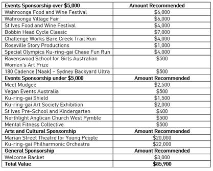
Amendment:
(Moved: Councillors Pettett/Lennon)
That Council approve the
following funding for the Events, Arts and Cultural and General Sponsorship
applications:
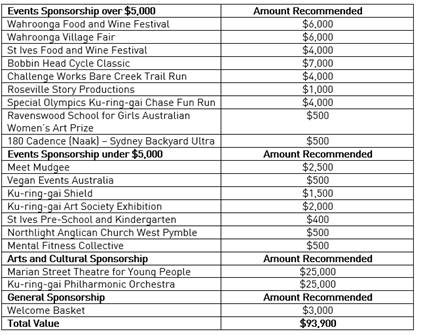
The
Amendment was put and declared CARRIED.
For the
Amendment: The
Mayor, Councillor Ngai, Councillors Lennon, Pettett, Smith, A.Taylor,
G.Taylor, Ward and Wheatley
Against
the Amendment: Councillor Spencer
The Amendment became the Motion. The Motion was put
and declared CARRIED
For the
Resolution: The
Mayor, Councillor Ngai, Councillors Lennon, Pettett, Smith, A.Taylor,
G.Taylor, Ward and Wheatley
Against
the Resolution: Councillor
Spencer
|
|
|
Resolved:
(Moved: Councillors
Pettett/Lennon)
That Council approve the following funding for the
Events, Arts and Cultural and General Sponsorship applications:
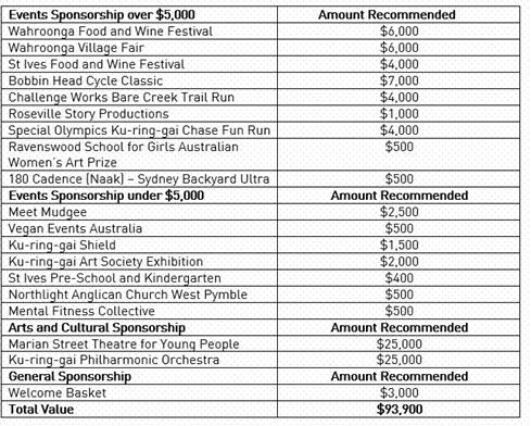
For the Resolution: The
Mayor, Councillor Ngai, Councillors Pettett, Lennon, Smith, A. Taylor, G.
Taylor, Ward and Wheatley
Against the Resolution: Councillor
Spencer
CARRIED
|
Councillor Kay returned to the chambers.
|
151
|
Status
of Women's Advisory Committee
File: S13683
Vide: GB.4
|
|
|
To provide Council with recommendations for 15 community
representatives to participate in the Status of Women’s Advisory
Committee.
|
|
|
Resolved:
(Moved: Councillors
Kay/Wheatley)
That:
A.
Council considers the recommendations
from the independent selection panel and appoints 15 community members to
participate in the Status of Women’s Advisory Committee.
B.
Council considers the recommendations
from the independent selection panel and appoints ten (10) reserves for the
Status of Women’s Advisory Committee.
C.
The Terms of Reference be updated to
provide for vacant positions on the committee to be filled by reserves, in
the order recommended by the assessment panel
D.
The Chairperson and Deputy Chairperson
of the Status of Women's Advisory Committee be appointed when the incoming
Council appoints Councillors to each of its advisory and reference
committees.
E.
Women on Council be included on the
Committee.
CARRIED UNANIMOUSLY
|
|
152
|
Improving
the accessibility and transparency of Public Forums - Changes to Code of
Meeting Practice
File: CY00438/12
Vide: GB.5
|
|
|
To propose amendments to the Ku-ring-gai Council Code
of Meeting Practice to allow for public forums to be recorded and webcast,
and for speakers to address Council via audio-visual link.
|
|
|
Motion:
(Moved: Councillors A.Taylor/Ward)
That:
A.
Council livestream public forums and amend the Code of Meeting
Practice to provide for public forums to be publicly broadcast but not
published on Council’s website.
B.
Public forums will always be held as a hybrid meeting,
unless the meeting is unable to be held physically in the Council Chamber in
which case it will be held by audio-visual link only, and amend the Code of
Meeting practice as in Attachment A3.
C.
That the draft Code of Meeting Practice be placed on public
exhibition for 28 days (noting that submissions will be accepted for up to 42
days).
D.
Council note that a report will be brought to Council after
exhibition summarising the public response and providing a final version of
the Code of Meeting Practice for consideration.
AMENDMENT:
(Moved: Councillors Kay/Spencer)
That Council:
A. Wishes to
webcast public forums and the amendments to the Code of Meeting Practice in
Attachment A2 be placed on public exhibition for 28 days (noting that
submissions will be accepted for up to 42 days).
B. Wishes for
public forums to always be held as a hybrid meeting, unless the meeting is
unable to be held physically in the Council Chamber in which case it will be
held by audio-visual link only and the amendments to the Code of Meeting
practice in Attachment A3 be placed on public exhibition for 28 days (noting
that submissions will be accepted for up to 42 days).
C.
Note that a report will be brought to Council after exhibition
summarising the public response and providing a final version of the Code of
Meeting Practice for consideration.
The Amendment was put and
declared CARRIED UNANIMOUSLY.
The Amendment became the Motion. The Motion was put
and declared CARRIED UNANIMOUSLY
|
|
|
Resolved:
(Moved: Councillors Kay/Spencer)
That Council:
A. Wishes
to webcast public forums and the amendments to the Code of Meeting Practice
in Attachment A2 be placed on public exhibition for 28 days (noting that
submissions will be accepted for up to 42 days).
B. Wishes
for public forums to always be held as a hybrid meeting, unless the meeting
is unable to be held physically in the Council Chamber in which case it will
be held by audio-visual link only and the amendments to the Code of Meeting
practice in Attachment A3 be placed on public exhibition for 28 days (noting
that submissions will be accepted for up to 42 days).
C. Note
that a report will be brought to Council after exhibition summarising the
public response and providing a final version of the Code of Meeting Practice
for consideration.
CARRIED UNANIMOUSLY
|
Councillor Smith departed from and returned to the
Meeting during discussion of this item.
|
153
|
Marian
Street Theatre Killara – Building Condition
File: S10577/5
Vide: GB.7
|
|
|
The purpose of this report is to advise Council on the
costs of the minimum repairs, maintenance, and other necessary works to
re-open the Marian Street Theatre as a functional theatre in the form it was
before closing, complying with current building code requirements.
|
|
|
Resolved:
(Moved: Councillors Lennon/Ward)
That:
1. Council notes the Hydromedial Consulting Group
Feasibility Report for Marian Street Theatre included in the papers for the
July 2024 ordinary council meeting, which suggested a range of approximately
$7 million to approximately $15 million for the likely costs of a minimalist
re-opening of the Marian Street Theatre.
2. Council affirms Council’s support for
Development Application DA 0144/20.
3. Council notes that Development Application DA
0144/20 requires substantial commencement by 19th August 2026 to remain
valid.
4. Staff report to Council on the likely costs
and timetable to redevelop the Marian Street Theatre in accordance with
Development Application DA 0144/20 and the actions to be taken to achieve
substantial commencement by 19th August 2026 in order to preserve the
development consent.
For the Resolution: The
Mayor, Councillor Ngai, Councillors Kay, Lennon, Smith, A. Taylor, G. Taylor,
Ward and Wheatley
Against the Resolution: Councillors
Pettett and Spencer
CARRIED
|
Motions
of which due Notice has been given
Councillors A.Taylor and Ward separately departed from
and returned to the Meeting during discussion of this item.
|
154
|
Sun
Protection for Spectators at Sporting Grounds
File: S07823
Vide: NM.1
|
|
|
Notice
of Motion from Councillors Lennon and Smith dated 26 June 2024
The primary cause of melanoma and other skin cancers is
prolonged exposure to ultraviolet radiation. While authorities have educated
people well on the need to wear hats and apply sunscreen lotion, keeping to
the shade wherever practicable also protects human skin from harm.
We, therefore, move:
That Council staff investigate and report to Council on
possible measures to ensure that all sporting grounds attracting spectators
in Ku-ring-gai have at least some shaded and sheltered area for spectators to
sit or stand.
|
|
|
Resolved:
(Moved: Councillors
Lennon/Smith)
That Council staff investigate
and report to Council on possible measures to ensure that all sporting
grounds attracting spectators in Ku-ring-gai have at least some shaded and
sheltered area for spectators to sit or stand.
CARRIED UNANIMOUSLY
|
|
155
|
Engagement
with First Nations People
File: S02414
Vide: NM.3
|
|
|
Notice
of Motion from Councillor Greg Taylor dated 27 June 2024
In April 2024 Council resolved to prepare a Reconciliation
Action Plan (RAP). The development and implementation of a RAP will
formally acknowledge the value of First Nations communities, their
fundamental connection to Country, and the nature of their living cultural
heritage associated with the Land.
As an early engagement, it is proposed that Council reach
out to First Nations people and hold a small gathering in the local
bushland. The purpose is to understand more about how Council can help
support and empower First Nations people and culture in the community; share
traditional fire knowledge with First Nations people, Council and possibly
other government agencies; improve contact and connection between local
First Nations community members and Council staff; explore the potential for
any future First Nations events that can be supported by Council; and explore
the potential for future cultural burning workshops and activities.
I, therefore, move:
That Council facilitate a gathering with First Nations
people in local bushland, as outlined in this Notice of Motion.
|
|
|
Resolved:
(Moved: Councillors G. Taylor/A.
Taylor)
That Council facilitate a
gathering with First Nations people in local bushland, as outlined in this
Notice of Motion.
For the Resolution: The
Mayor, Councillor Ngai, Councillors Pettett, Kay, Lennon, Smith, A. Taylor,
G. Taylor, Ward and Wheatley
Against the Resolution: Councillor
Spencer
CARRIED
|
Councillor G.Taylor departed from and returned to the
Meeting during discussion of this item.
|
156
|
Heritage
Conservation Areas Interim Heritage
File: S14571
Vide: NM.4
|
|
|
Notice
of Motion from Councillors Wheatley, Lennon and Smith dated 27 June 2024
The NSW Government’s Transit
Oriented Development SEPP is now in effect and has placed 23 Ku-ring-gai
heritage conservation areas at risk – all located within 400 metres of
Gordon, Killara, Lindfield and Roseville stations. These represent half the
total identified heritage conservation areas in Ku-ring-gai. These core areas
of fine historic houses and gardens embody the identity and living history of
Ku-ring-gai (and parts of the identity and living history of all Sydney)
that, if lost, cannot be replaced.
Within the 23 heritage areas, the TOD
SEPP has ‘upzoned’ approximately 410 historic sites, excluding
the surrounded 106 heritage items. This high number reflects that
approximately 30% of upzoned TOD sites in Ku-ring-gai are identified as heritage
conservation areas - or 40% heritage identified when counting the heritage
items surrounded by TOD sites.
As of 13 May 2024, development
applications can now be lodged for demolition and 7-storey apartments built
within these conservation areas. It is clear that property is being sold and
bought right now in these heritage conservation areas on the basis of
redevelopment to the maximum TOD standards, notwithstanding any heritage
considerations in the development application (DA) process.
No NSW Government provisions, information
or guidelines have demonstrated how the DA process can provide for inserting
7-storey apartments into established heritage areas in a way that retains the
value of existing historic houses and gardens and their resulting streetscapes.
At best, this creates uncertainty for both conservation and development. At
worst, this slates hundreds of historic buildings, gardens and many
streetscapes for demolition and irreversible change and/or many DAs for
refusal. In either case, the public and private cost for development and
heritage value is high.
The NSW Heritage Council’s
resolution on TOD recorded “considerable concern about the impact on
existing heritage conservation areas”. Council’s independent
heritage advisor for the housing changes, Lisa Trueman concluded “The
proposed changes would see widespread loss of significant buildings and their
settings, loss of historic subdivision patterns, changes to scale, form,
character, landscaping and significant streetscapes.”
The NSW Planning Minister has indicated a
willingness to consider alternative housing scenarios. Council has resolved
to investigate alternative scenarios for reporting in early 2025. However,
this planning is invalidated if sites are redeveloped for 7-storey apartments
in the meantime.
Interim Heritage Order
It is recommended that Council request
the NSW Minister for Heritage make an Interim Heritage Order for the land of
23 heritage conservation areas subject to the TOD SEPP to protect these
conservation areas under the Heritage Act 1977 while their heritage
significance is further assessed. Council cannot use its current delegation
to make an Interim Heritage Order in heritage conservation areas.
Council’s Heritage Reference
Committee considered a preliminary heritage assessment and supported this
action at its meeting of 6 June 2024.
As a temporary heritage listing, the IHO
would lapse after 6-12 months. While in effect, the IHO triggers the NSW
Heritage Council to assess development applications.
Conclusion
A blanket IHO – limited to the
Ku-ring-gai TOD sites – is a measured response to a blanket planning
process where heritage impacts are not resolved before development controls
are set.
This IHO will provide the necessary
short-term heritage protection for the affected sites while Council
investigates alternative planning for increasing housing that does factor in
heritage, amongst other relevant considerations and constraints. This is how
we can plan for increased housing with improved certainty.
While not your usual IHO for a potential
heritage site, this request is true to the origins and intent of the NSW
Heritage Act and IHO powers – to protect the significance of heritage
under threat. An IHO is essentially the modern-day Green Ban. This is once
again needed when history starts repeating itself with plans that ignore or
endanger heritage areas on a large scale.
This IHO is ultimately decided by the NSW
Minister for Heritage rather than Council. However, seeking an IHO will still
serve an important purpose – to better alert the community to the
heritage issue ahead of major decisions like transactions and applications
during a key phase of transition in the planning controls.
We, therefore, move:
That Council request the NSW Minister for
Heritage to make an Interim Heritage Order for the land of the 23 heritage
conservation areas in the Ku-ring-gai LGA subject to the Transit Orientated
Development SEPP to protect these conservation areas under the NSW Heritage
Act 1977 while their significance is assessed.
|
|
|
Motion:
(Moved: Councillors Wheatley/Lennon)
That Council request the NSW Minister for
Heritage to make an Interim Heritage Order for the land of the 23 heritage conservation
areas in the Ku-ring-gai LGA subject to the Transit Orientated Development
SEPP to protect these conservation areas under the NSW Heritage Act 1977
while their significance is assessed.
AMENDMENT:
(Moved: Councillors Pettett/Spencer)
That Council survey all residents within the 23 heritage conservation areas
(HCAs) and the Transit Orientated Development (TOD) precincts and gather
feedback on whether they support a blanket interim heritage order (IHO).
The
Amendment was put and declared LOST.
For the
Amendment: Councillors
Pettett and Spencer
Against
the Amendment: The Mayor, Councillor
Ngai, Councillors Kay, Lennon, Smith, A.Taylor, G.Taylor, Ward and Wheatley
Debate resumed on the Motion.
The Motion was put and declared CARRIED.
For the
Motion: The
Mayor, Councillor Ngai, Councillors Kay, Lennon, Pettett, Smith, A.Taylor,
G.Taylor, Ward and Wheatley
Against
the Motion: Councillor
Spencer
|
|
|
Resolved:
(Moved: Councillors Wheatley/Lennon)
That Council request
the NSW Minister for Heritage to make an Interim Heritage Order for the land
of the 23 heritage conservation areas in the Ku-ring-gai LGA subject to the
Transit Orientated Development SEPP to protect these conservation areas under
the NSW Heritage Act 1977 while their significance is assessed.
For the Resolution: The
Mayor, Councillor Ngai, Councillors Pettett, Kay, Lennon, Smith, A. Taylor,
G. Taylor, Ward and Wheatley
Against the Resolution: Councillor
Spencer
CARRIED
|
Councillor Wheatley departed from and returned to the
Meeting during discussion of this item.
|
157
|
Multicultural
Festival and Multicultural Inclusion Plan
File: S04141
Vide: NM.6
|
|
|
Notice
of Rescission from Councillors Alec Taylor, Ward, Smith and Wheatley
dated 28 June 2024
At the Ordinary Meeting of Council on 18 June 2024,
Council resolved to support a multicultural festival and prepare a
multicultural inclusion plan.
The resolution included applying to the NSW Government for
a grant of $50,000 towards the festival, as well as Council contributing
$15,000 to $30,000. The terms of the resolution may have created
uncertainty about the amount of funding available for the festival, due to
grant funding being a significant component. It is important to clarify
that Council is fully committed to a successful multicultural festival and to
provide certainty for the event planning, Council should underwrite the cost
up to $50,000. If a grant is received, a lesser contribution from
Council may be required.
In a third recommendation Council also passed a resolution
for the multicultural plan and festival to be inclusive (part C). The
intent of part C was to recognise that the festival and inclusion plan would
be inclusive of all cultures. On reflection the intent is implicit in the
inclusion plan and festival, and therefore the recommendation is
unnecessary.
We, therefore, move:
That the decision of Council on 18 June 2024 in relation
to item NM.3 Multicultural Festival and Multicultural Inclusion Plan be
rescinded and replaced with:
A. Ku-ring-gai
Council contributes up to $50,000 towards a Multicultural Festival. Council
will also apply to the New South Wales Government for relevant grant funding.
B. Council
develops a Multicultural Inclusion Plan in consultation with the local
community to ensure the plan reflects the diverse needs and perspectives of
the community.
|
|
|
Motion:
(Moved: Councillors A.Taylor/Wheatley)
That the decision of Council on 18 June 2024 in relation to item NM.3
Multicultural Festival and Multicultural Inclusion Plan be rescinded and
replaced with:
A. Ku-ring-gai
Council contributes up to $50,000 towards a Multicultural Festival. Council
will also apply to the New South Wales Government for relevant grant funding.
B. Council
develops a Multicultural Inclusion Plan in consultation with the local
community to ensure the plan reflects the diverse needs and perspectives of
the community.
AMENDMENT:
(Moved: Councillors Pettett/Spencer)
That the decision of Council on 18 June 2024 in relation
to item NM.3 Multicultural Festival and Multicultural Inclusion Plan be
rescinded and replaced with:
A.
Ku-ring-gai Council contributes up to $150,000 towards Multicultural
Festivals. Council will also apply to the New South Wales Government for
relevant grant funding.
B. Council
develops a Multicultural Inclusion Plan in consultation with the local
community to ensure the plan reflects the diverse needs and perspectives of
the community.
The Amendment was put and
declared LOST
For the
Amendment: Councillors
Kay and Pettett
Against
the Amendment: The Mayor, Councillor
Ngai, Councillors Lennon, Smith, Spencer, A.Taylor, G. Taylor, Ward and
Wheatley
Debate resumed on the Motion.
The Motion was put and declared CARRIED
For the
Motion: The
Mayor, Councillor Ngai, Councillors Kay, Pettett, Smith, Spencer, A. Taylor,
G. Taylor, Ward and Wheatley
Against
the Motion: Councillor
Lennon
|
|
|
Resolved:
(Moved: Councillors A.
Taylor/Wheatley)
That the decision of Council on
18 June 2024 in relation to item NM.3 Multicultural Festival and
Multicultural Inclusion Plan be rescinded and replaced with:
A. Ku-ring-gai Council contributes up to
$50,000 towards a Multicultural Festival. Council will also apply to the New
South Wales Government for relevant grant funding.
B. Council develops a Multicultural Inclusion
Plan in consultation with the local community to ensure the plan reflects the
diverse needs and perspectives of the community.
For the Resolution: The
Mayor, Councillor Ngai, Councillors Pettett, Kay, Smith, Spencer, A. Taylor,
G. Taylor, Ward and Wheatley
Against the Resolution: Councillor
Lennon
CARRIED
|
BUSINESS WITHOUT
NOTICE – SUBJECT TO CLAUSE 9.3 OF code of meeting practice
NIL
QUESTIONS WITH NOTICE
|
|
IN
RELATION TO THE NORTHERN SUBURBS FOOTBALL ASSOCIATION’S (NSFA) PROPOSED
DEVELOPMENT AT THE NORTH TURRAMURRA RECREATION AREA (NTRA)
File: S13633
Vide: QN.1
|
|
|
QUESTION:
Question from Councillor Spencer dated 27 June 2024
Over the course
of this term – between 2022 and 2024 – Council is in receipt of a
considerable number of questions (from residents) seeking clarification
as to whether the NSFA’s new “Home of Football,” – the NSFA administers
football for its 30 member clubs and 17,000 players during the winter season
across Northern Sydney – from the Harbour to the Hawkesbury, with
facilities as listed below, is actually suitable for what NTRA was zoned for:
Ground floor
· Three
players change rooms/wc with roller door for interconnection where required
· Coaches
changing rooms
· Male
and female public toilets
· Two
accessible toilet/change facilities
· Referees
change room
· Coaches
meeting room (space for 6)
· Physio
room
· Café
with seating (space to be leased and fit out by a separate entity)
· Office
block for 12 staff
· Kitchens
· Boardroom
· Waiting
room
· Lunch
room
· Meeting
room
· Av
Media room
· Gym
room
· Space
to be occupied by NSFA management team
FIRST FLOOR
· Stage
seating for 330 and standing 200 attendees
· Raised
corporate box with kitchenette and standing area
· Press
box a two-person media team (broadcasting claims).
QUESTION:
A. Would the General Manager clarify as
to whether the proposed NSFA development is classified as C4 or RE1?
To illustrate:
ZONE
C4 ENVIRONMENTAL LIVING
1. Objectives
of zone
· To
provide for low-impact residential development in areas with special
ecological, scientific or aesthetic values.
· To
ensure that residential development does not have an adverse effect on those
values.
· To
ensure development does not result in further fragmentation of ecological
communities, biodiversity corridors or other significant vegetation or
habitat.
· To
minimise direct and indirect risks to life, property and the environment from
bushfire events.
· To
ensure that development in this zone on land that adjoins land in Zone C1
National Parks and Nature Reserves or Zone C2 Environmental Conservation is
compatible with the objectives of those zones.
· To
enable other land uses that provide facilities or services to meet the day to
day needs of residents.
2. Permitted
without consent
Home occupations
3. Permitted
with consent
Bed and breakfast
accommodation; Community facilities; Dwelling houses; Environmental
facilities; Environmental protection works; Flood mitigation works;
Home-based child care; Home businesses; Home industries; Oyster aquaculture;
Pond-based aquaculture; Recreation areas; Roads; Secondary dwellings;
Tank-based aquaculture
4. Prohibited
Industries; Local
distribution premises; Service stations; Warehouse or distribution centres;
Any other development not specified in item 2 or 3
ZONE
RE1 PUBLIC RECREATION
1. Objectives
of zone
· To
enable land to be used for public open space or recreational purposes.
· To
provide a range of recreational settings and activities and compatible land
uses.
· To
protect and enhance the natural environment for recreational purposes.
· To
protect, manage and restore areas of high ecological, scientific, cultural or
aesthetic values.
2. Permitted
without consent
Environmental facilities;
Environmental protection works; Roads
3. Permitted
with consent
Animal boarding or training
establishments; Aquaculture; Bee keeping; Camping grounds; Car parks; Caravan
parks; Centre-based child care facilities; Community facilities; Emergency
services facilities; Flood mitigation works; Food and drink premises;
Forestry; Information and education facilities; Kiosks; Markets; Plant
nurseries; Recreation areas; Recreation facilities (indoor); Recreation
facilities (major); Recreation facilities (outdoor); Registered clubs;
Respite day care centres; Roadside stalls; Signage; Water recycling
facilities; Water supply systems
4. Prohibited
Any development not
specified in item 2 or 3
B. Would the General Manager publish
the answers to the above questions at the OMC of 16 June 2024?
ReSPONSE:
Answer: The land is zoned RE1 - Public Recreation
under the Ku-ring-gai LEP 2015.
Response from Director Strategy & Environment.
|
Inspections–
SETTING OF TIME, DATE AND RENDEZVOUS
NIL
The Meeting closed
at 10.02PM
The Minutes of the
Ordinary Meeting of Council held on 16 July 2024 (Pages 1 - 33) were confirmed
as a full and accurate record of proceedings on 13 August 2024.
__________________________ __________________________
General
Manager Mayor
/ Chairperson
|
Ordinary
Meeting of Council - 13 August 2024
|
GB.1 / 1
|
|
|
|
|
Item
GB.1
|
CY00458/12
|
Minutes of Audit, Risk & Improvement
Committee Meeting held on 13 June 2024
EXECUTIVE
SUMMARY
|
purpose of report:
|
To provide Council with the
Minutes from the Audit, Risk & Improvement Committee meeting held on 13
June 2024 for adoption.
|
|
|
|
|
background:
|
The
current Council Advisory/ Reference Committees Guideline (the
Guideline) was adopted by Council on the 11 January 2022.
Clause
3.7 (Minutes of Meetings) of The Guideline provides, in part, that:
The draft
minutes of a meeting will be circulated to committee members within 10
working days of the meeting. Members will be provided with 5 working days to
comment on the accuracy of the minutes and will subsequently be referred to
the Chair for approval to submit to Council as an accurate record of the
meeting. Once approved by the Chair, the minutes will be put to an Ordinary
Meeting of Council for adoption.
The
recommendations of a committee, so far as adopted by the Council at an
Ordinary Meeting of Council, are resolutions of the Council.
The minutes will also be placed on the agenda to be
noted at the subsequent committee meeting.
|
|
|
|
|
comments:
|
In accordance with the Guideline the draft minutes of
the Audit Risk & Improvement Committee meeting held on 21 March 2024 were
circulated to the committee members for comment after which they were
approved by the Chair. These are now provided to Council for adoption.
|
|
|
|
|
recommendation:
|
That the minutes from the Audit, Risk &
Improvement Committee meeting held on 13 June 2024 be adopted.
|
Purpose of Report
To provide Council with the Minutes from the Audit, Risk
& Improvement Committee meeting held on 13 June 2024 for adoption.
Background
The current
Council Advisory/ Reference Committees Guideline (‘The
Guideline’) was adopted by Council on the 11 January 2022.
Clause 3.7
(Minutes of Meetings) of The Guideline provides, in part, that:
The draft
minutes of a meeting will be circulated to committee members within 10 working
days of the meeting. Members will be provided with 5 working days to comment on
the accuracy of the minutes and will subsequently be referred to the Chair for
approval to submit to Council as an accurate record of the meeting. Once
approved by the Chair, the minutes will be put to an Ordinary Meeting of
Council for adoption.
The
recommendations of a committee, so far as adopted by the Council at an Ordinary
Meeting of Council, are resolutions of the Council.
Comments
In accordance with the Guideline the draft minutes of the
Audit Risk & Improvement Committee meeting held on 13 June 2024 were
circulated to committee members for comment after which they were approved by the
Chair.
These minutes are now provided to Council for adoption (Refer
Attachment A1).
integrated planning and reporting
Leadership and governance
|
Community Strategic
Plan Long Term Objective
|
Delivery Program
Term Achievement
|
Operational Plan
Task
|
|
The organisation is recognised and distinguished by its
ethical decision-making, efficient management, innovation and quality
customer service.
|
Integrated risk management, compliance and internal
control systems are in place to identify, assess, monitor and manage risks
throughout the organisation.
|
Manage, coordinate, support and facilitate the effective
operation of Council’s Internal Audit function.
|
Governance Matters
To improve governance and
transparency with respect to the operation of the Audit, Risk & Improvement
Committee.
Risk Management
There are no risk management
considerations associated with this report.
Financial Considerations
There is no financial impact
associated with this report.
Social Considerations
There are no social
implications associated with this report.
Environmental Considerations
There are no environmental
implications associated with this report.
Community Consultation
Not applicable.
Internal Consultation
Not applicable.
Summary
A copy of the minutes from
the Audit, Risk & Improvement Committee meeting held on 13 June 2024 are
attached for adoption.
Recommendation:
That the minutes from the Audit, Risk & Improvement
Committee meeting held on 13 June 2024 be adopted.
|
Jennie Keato
Manager People and Culture
|
|
|
Attachments:
|
A1 ⇩ ⇩
|
ARIC
Meeting Minutes - 13 June 2024
|
|
2024/245287
|
|
ATTACHMENT No: 1 - ARIC Meeting
Minutes - 13 June 2024
|
|
Item No: GB.1
|
|
Ordinary
Meeting of Council - 13 August 2024
|
GB.2 / 1
|
|
|
|
|
Item
GB.2
|
S04141
|
Multicultural Advisory Committee Meeting
Minutes 12 June 2024
EXECUTIVE
SUMMARY
Purpose of Report
To provide Council with the minutes from Multicultural
Advisory Committee meeting held on 12 June 2024.
Background
Council is required to consider and adopt the minutes of the
Multicultural Advisory Committee and to make them publicly available via Council’s
website. Multicultural Advisory Committee minutes have been confirmed by
Multicultural Advisory Committee members prior to them being presented to
Council.
Comments
The Multicultural Advisory
Committee minutes from the meeting held on 12 June 2024 are at (Attachment A1)
The following agenda items were
discussed at the meeting:
· Role of Council
Education Sessions – Korean residents
· Dementia Friendly
Communities project
· NSW Social
Cohesion Grants
· State of the
Ku-ring-gai Report
· Multicultural
Inclusion Plan
· Refugee Week
Celebrations
In accordance with the Terms of Reference, the draft minutes of the Multicultural
Advisory Committee meeting, held on 12 June 2024, were circulated to the
Committee members for comment, after which they were approved by the Chair.
These are now provided to Council for adoption.
integrated planning and reporting
Community, People and Culture
|
Community Strategic
Plan Long Term Objective
|
Delivery Program
Term Achievement
|
Operational Plan
Task
|
|
C3.1: A community where opportunities are provided for all
voices to be heard and where community stewardship, participation and
engagement is supported and promoted.
L3.1: The organisation is recognised and distinguished by
its ethical decision making, efficient management, innovation and quality
customer service.
|
C3.1.1 Enhance opportunities
for social interaction to
foster
community participation,
connectedness and a sense
of pride in the community and
local areas.
L3.1.2: Council’s
Governance
framework is developed to ensure probity and transparency
|
C3.1.1.3: Resource and
support volunteers by providing information, training and participation
opportunities and recognising their contribution to the community.
L3.1.2.1: Ensure that
Council and Committee Meetings are managed effectively and in accordance with
relevant legislation, codes and guidelines.
|
Governance Matters
The Multicultural Advisory
Committee operates within a framework prescribed by its Terms of Reference
consistent with Council’s Code of Conduct, confidentiality and record
management policies and procedures.
Risk Management
There are no risk management
considerations associated with this report.
Financial Considerations
The Committee is an Advisory Committee and does not have the
power to incur expenditure or to bind Council. There are no financial impacts
associated with this report.
Social Considerations
There are no social
implications associated with this report.
Environmental Considerations
There are no environmental
implications associated with this report.
Community Consultation
Not applicable.
Internal Consultation
Not applicable.
Summary
The Multicultural Advisory
Committee meeting was held on 12 June 2024. In accordance with the Terms of
Reference of the committee, the
draft minutes were circulated to the committee members for comment, after which
they were approved by the Chair.
The minutes are now provided
for Council to receive and note.
Recommendation:
That Council receive and note the minutes from the
Multicultural Advisory Committee meeting held on 12 June 2024.
|
Danny Houseas
Manager Community Development
|
Janice Bevan
Director Community
|
|
Attachments:
|
A1 ⇩ ⇩
|
20240507
MCAC Minutes
|
|
2024/238712
|
|
ATTACHMENT No: 1 - 20240507 MCAC
Minutes
|
|
Item No: GB.2
|

|
Ordinary
Meeting of Council - 13 August 2024
|
GB.3 / 1
|
|
|
|
|
Item
GB.3
|
S13163
|
Sustainable Recreation Advisory Group -
Meeting Minutes 25 June 2024
EXECUTIVE
SUMMARY
Purpose of Report
That Council receive and note the
minutes from the Sustainable Recreation Advisory Group (‘SRAG’)
meeting held on 25 June 2024 and endorse the recommendations within.
Background
Council is required to consider
minutes of the SRAG and make them available via Council’s website. SRAG
minutes are confirmed by SRAG members prior to being presented at the OMC.
Comments
The SRAG met on 25 June2024 and
discussed the following items:
· Strategic
Mountain Bike Linkages within the Northern Region
The Sustainable Recreation
Advisory Group make the following recommendations to Council:
a. That
the Sustainable Recreation Advisory Group notes the information provided.
b. That
staff investigate the process required to endorse an organisation or individual
to undertake a needs/feasibility study into a trail network in Ku-ring-gai.
· Ku-ring-gai
Council’s Reserve and Asset Closure Matrix for Fire Danger Ratings
The Sustainable Recreation
Advisory Group make the following recommendations to Council:
a. That
the Group notes the information provided.
b. That
Council staff include information regarding fire danger categories and
potential site closures when seasonally appropriate in Council’s
e-newsletter.
· Green
Grid update
The Sustainable Recreation
Advisory Group make the following recommendations to Council:
a. That
the Group notes updates in the Green Grid strategy and provides feedback on the
work to date.
b. That Council staff provide further
information on the Green Grid strategy’s impact on fauna.
c. That
the Group reviews routes during the public exhibition period.
· Project
updates
The Sustainable Recreation
Advisory Group make the following recommendations to Council:
a. That
the Group notes the information provided.
· Other
business
The Sustainable Recreation
Advisory Group make the following recommendations to Council:
a. Council
staff to update the Group on the tree hollow project with Sydney Wildlife
Rescue.
The minutes of the meeting have
been attached to this report as Attachment A1.
integrated planning and reporting
Theme
3: Places, Spaces and Infrastructure
|
Community Strategic
Plan Long Term Objective
|
Delivery Program
Term Achievement
|
Operational Plan
Task
|
|
Recreation, sporting and leisure
facilities are available to meet the community’s diverse and changing
needs.
|
A program is being implemented
to improve existing recreation, sporting and leisure facilities and
facilitate the establishment of new facilities.
|
Implement priority actions from
the Recreation in Natural Areas strategy.
|
Governance Matters
The
SRAG provides advice on sustainable recreation matters and assists with the
promotion, understanding and appreciation of natural areas. While not a
decision-making body, the group plays an important function in shaping
Ku-ring-gai's future. This advisory group is also an important link for
Council's communication with the community.
Risk Management
The
SRAG will help Council manage risk in regards to recreation in
Ku-ring-gai’s natural areas by providing knowledge and feedback to ensure
that recreation in natural areas is conducted in a safe, environmentally
sustainable and socially responsible manner.
Financial Considerations
There
are no specific financial implications arising from the creation and management
of the advisory group. Staff resources are dedicated to the group from
Environment & Sustainability.
Social Considerations
Participation
in recreational activities is an important contributor to mental health,
general well-being and quality of life, boosting self-esteem and personal
growth. The advisory group helps Council increase community participation in
recreation in natural areas in a safe, environmentally sustainable and socially
responsible manner.
Environmental Considerations
The
SRAG helps Council ensure recreation in natural areas is conducted in an
environmentally sustainable and socially responsible manner. Additionally, the
provision of recreation opportunities seeks to promote a sense of stewardship
within the community.
Community Consultation
The
SRAG helps Council ensure that recreation in natural areas is conducted in an
environmentally sustainable and socially responsible manner. The SRAG consists
of community members and facilitates ongoing consultation with the community.
Internal Consultation
The
SRAG is facilitated by Council staff. Where relevant, consultation with
other Departments may occur, in particular with Council’s staff in the
Operations Department.
Summary
Council
is required to consider the minutes of the SRAG and to make them available via
Council’s website. Minutes are confirmed by SRAG committee members prior
to being presented to Council.
Recommendation:
A. That Council receive and note the
Sustainable Recreation Advisory Group minutes of 25 June 2024 and endorse
the recommendations within:
1. That staff investigate the process
required to endorse an organisation or individual to undertake a
needs/feasibility study into a trail network in Ku-ring-gai.
2. That Council staff include
information regarding fire danger categories and potential site closures when
seasonally appropriate in Council’s e-newsletter.
3. That Council staff provide further
information on the Green Grid strategy’s impact on fauna.
4. That the Group reviews routes during
the public exhibition period.
5. Council staff to update the Group on
the tree hollow project with Sydney Wildlife Rescue.
|
Sybylla Brown
Natural Areas Program Leader
|
Sophia Findlay
Acting Manager Environment & Sustainability
|
|
Andrew Watson
Director Strategy & Environment
|
|
|
Attachments:
|
A1⇩
|
SRAG
Minutes 25 June 2024
|
|
2024/250521
|
Click or tap here to enter text.
|
ATTACHMENT No: 1 - SRAG Minutes
25 June 2024
|
|
Item No: GB.3
|
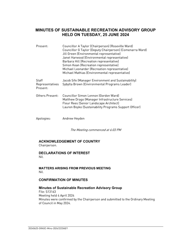
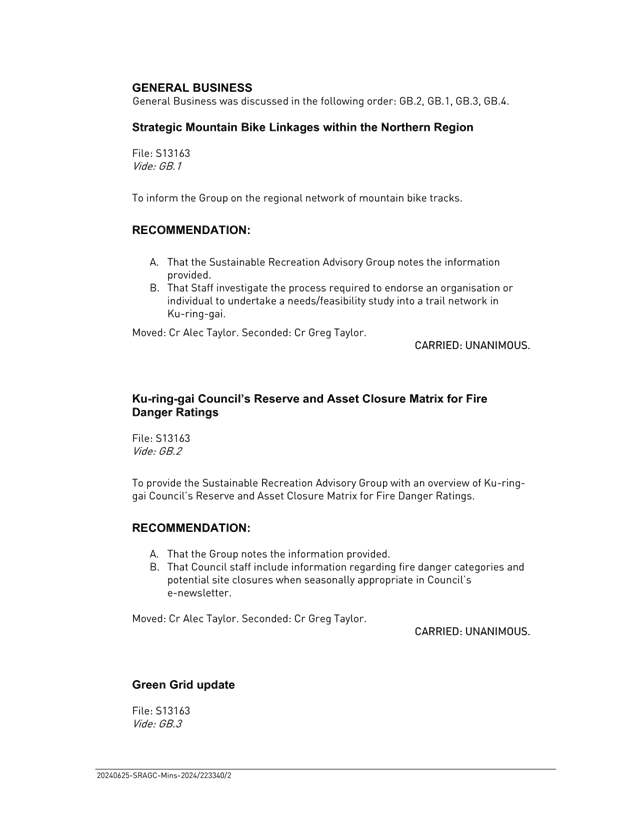
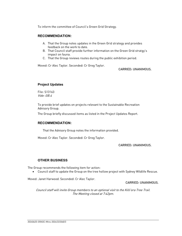
|
Ordinary
Meeting of Council - 13 August 2024
|
GB.4 / 1
|
|
|
|
|
Item
GB.4
|
FY00432/15
|
2024 Ku-ring-gai Council Emergency Relief
Support Grant
EXECUTIVE
SUMMARY
Purpose of Report
To advise Council of applications received for the 2024
Ku-ring-gai Council Emergency Relief Support Grant, and to recommend funding
for eligible community organisations.
Background
At the Ordinary Meeting of Council held on 20 February 2024,
Council resolved the following;
A. Create
a temporary priority funding area of Families and Individuals Experiencing
Financial Hardship in 2024 within the existing Ku-ring-gai Community Grants
Program.
B. Allocate
an additional $150,000 to the Ku-ring-gai Community Grants Program for the new
priority funding area.
C. Invite
eligible organisations already providing emergency relief in this area e.g.,
Catholic Care, Mission Australia, Salvation Army, and Lifeline, to apply for
funding.
D. Highlight
that this is a one-off increase to address the short-term issue in the current
year, and only Ku-ring-gai families and individuals experiencing financial
hardship are eligible to receive assistance.
CommEnts
The Emergency Relief Support Grant guidelines and parameters
were developed through a co-design process with established organisations
experienced in the delivery of emergency relief funding and services. The model
for distribution is aligned with emergency relief support delivery models used
by Commonwealth and NSW Government agencies.
To ensure equitable distribution
that is responsive to community demand, funding will be distributed as an
initial $20,000 grant to eligible organisations. Top-up funding of up to
$10,000 can be requested (until the funding pool has been exhausted), when an
organisation reaches a $5,000 threshold.
A robust monitoring and evaluation system has been developed
to support this temporary priority funding area. Successful grant recipients
will be required to provide regular reporting which includes expenditure and
details of what has been funded.
The grants assessment panel has recommended $80,000 for initial distribution to eligible community
organisations. Details of the applications, amount of funding recommended, and
comments on the assessment process can be found in (Attachment 1) of
this report.
The recommended organisations have the expertise, experience
and governance frameworks required to assess families and individuals and
ensure distribution of those funds to Ku-ring-gai residents only.
These organisations have well established accountability
structures in place which are crucial to ensuring transparency, efficiency, and
ethical use of funds. These structures also include clear policy frameworks,
legal and regulatory compliance, transparent application processes, financial
controls, performance monitoring and evaluation mechanisms.
The program was co-designed in partnership with the sector
to ensure best practice and appropriate distribution of funds. The recommended
distribution method for funding has been conferred with these organisations and
there is sector support for this model.
integrated planning and reporting
|
Community Strategic
Plan Long Term Objective
|
Delivery Program
Term Achievement
|
Operational Plan
Task
|
|
C1.1 An equitable and inclusive community that cares and
provides for its members
|
C1.1.1 Council’s policies, programs and advocacy
address the social and health needs of all age groups, reduce disadvantage
and address gaps in service provision.
|
Resource and support local initiatives and organisations
through the Ku-ring-gai Community Grants program.
|
Governance Matters
The 2024 Ku-ring-gai Emergency Relief Support Grants are
supported by guidelines, eligibility criteria and application and selection
process information.
Consistent with the Grants Administration and Sponsorships
Internal Audit report, the allocation meeting included independent panel
members along with Council officers, assessment decisions and funding
allocations were well documented, and conflict of interest disclosures were
made.
Risk Management
Distribution of emergency relief support grants includes a
variety of associated risks. The program was co-designed in partnership with
the sector to ensure best practice and appropriate distribution of funds.
Council identified organisations already established to deliver emergency
relief with existing robust accountability structures crucial to ensure
transparency, efficiency, and ethical use of funds. These structures also
included clear policy frameworks, legal and regulatory compliance, transparent
application process, financial controls, performance monitoring and evaluation
mechanisms.
Council has in place several risk mitigation processes,
including a formal funding agreement, reporting requirements and acquittal
process. Each organisation receiving funding must comply with the terms and
conditions of the program.
Financial
Considerations
Council
has committed $150,000 to create a temporary Emergency Relief priority
area. A total amount of $80,000 is proposed to be distributed to community
organisations initially, with top up funding requests of $10,000 to be
submitted by organisations if/when required, up to the maximum grant
allocation. Requests will be demand driven ensuring the funds are allocated
based on actual community need and full acquittal will be required for
additional funding.
Social
Considerations
Council recognised the current issue of
rising pressures relating to the cost of living and resolved to create an
additional and temporary priority funding area to support families and
individuals experiencing financial hardship within the existing Ku-ring-gai
Community Grants Program.
The 2024 Ku-ring-gai Council Emergency Relief Support Grants
are a temporary priority funding area developed to support needs of the
Ku-ring-gai residents with the current cost of living crisis.
Environmental
Considerations
There are no specific environmental considerations
associated with the Emergency Relief Support Grants.
Community
Consultation
The Ku-ring-gai Emergency Relief Support Grants were
promoted using the North Shore Times, social media, Council’s website and
direct mailout to community groups. The delivery methodology was co-designed
with community service sector representatives.
Internal
Consultation
The Corporate Department has
been consulted in the development of the conditions of funding and the writing
of this report.
Summary
Projects funded under the current
Ku-ring-gai Council Community Grants Program cover a range of target groups
including, children, young people, older people, people with disabilities and
people from culturally and linguistically diverse backgrounds.
In 2024 Council resolved to create a one-off priority
Emergency Relief Support funding area to assist in providing services to
community members experiencing financial hardship. Applications were sought
from services currently delivering emergency relief services and supports.
The additional
one-off Emergency Relief Support grants will enhance the capacity of community
organisations to provide much needed support services to people in Ku-ring-gai
experiencing financial hardship due to the current cost of living pressures.
A total of
$150,000 is available for the 2024 Ku-ring-gai Council Emergency Relief Support
Grants. The grants assessment panel has recommended an initial total of $80,000 for distribution to eligible community
organisations, with top up funding to be allocated in $10,000 increments on an
as needs basis.
Recommendation:
A. That Council approve incremental distribution of the
total $150,000 funding pool with initial $20,000 individual grants to the
following community organisations:
|
|
Name of Organisation
|
Amount Recommended
|
|
1
|
Salvation Army
|
$20,000
|
|
2
|
Catholic Care
|
$20,000
|
|
3
|
Lifeline Harbour to Hawkesbury Sydney Ltd
|
$20,000
|
|
4
|
St Vincent de Paul Society NSW
|
$20,000
|
B. That the General Manager
be authorised to distribute the remaining $70,000 in the funding pool to
be allocated through top up payments in $10,000 increments, as outlined in this
report.
|
Danny Houseas
Manager Community Development
|
Janice Bevan
Director Community
|
|
Attachments:
|
A1⇩
|
Attachment
1 - Emergency Relief Support Grant 2024 Assessment
|
|
2024/252123
|
|
ATTACHMENT No: 1 - Attachment 1
- Emergency Relief Support Grant 2024 Assessment
|
|
Item No: GB.4
|
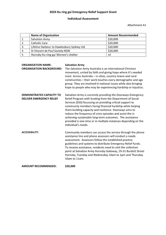
|
Ordinary
Meeting of Council - 13 August 2024
|
GB.5 / 1
|
|
|
|
|
Item
GB.5
|
S08654
|
Prevention of Violence against Women -
Draft Action Plan 2024-2025
EXECUTIVE
SUMMARY
|
purpose of report:
|
To provide Council with a
Prevention of Violence Against Women draft Action Plan 2024-2025.
|
|
|
|
|
background:
|
At the Ordinary Meeting of Council
held on 21 May 2024, Council resolved to develop a Prevention of Violence
Against Women Action Plan, with the draft plan to be presented to Council by
August 2024.
A working group comprising experts
from the Domestic Family Violence Sector was established to advise and inform
the draft action plan.
|
|
|
|
|
comments:
|
The draft Prevention of Violence Against Women Action
Plan is a strategic document that seeks to increase awareness and prevent
domestic, family, and sexual violence.
It identifies specific actions to be implemented over
the next 12 months, and a further commitment from Council to continue to work
towards these goals.
|
|
|
|
|
recommendation:
(Refer to the full
Recommendation at the end of this report)
|
That Council adopt the Prevention
of Violence Against Women draft Action Plan 2024 – 2025.
|
Purpose of Report
To provide Council with a Prevention of Violence Against
Women draft Action Plan 2024-2025.
Background
At Ordinary Meeting of Council held on 21 May 2024
Council resolved the following:
A. Council Develops
and implements an Action Plan to increase awareness and prevention of domestic,
family, and sexual violence.
B. That the draft
Violence Against Women Action Plan be aligned with State and Commonwealth
Government Violence Against Women Plans and be presented to Council for
endorsement by August 2024.
C. Embeds gender
equality and respect in Council and our community.
D. Marks Domestic
Violence Remembrance Day by holding or supporting an event in Ku-ring-gai.
E. That Council
allocates $100,000 to establish a grants program aimed at supporting frontline
services and local community group initiatives focused on preventing violence
against women in Ku-ring-gai.
Comments
An expert
working group was established to ensure comprehensive and informed involvement
and decision making in developing the draft Prevention of Violence Against
Women Action Plan (PVAWAP) (Attachment 1).
By convening
experts from diverse backgrounds, including community organisations, government
departments and agencies, and advocacy groups, the Council benefited from a
wide range of perspectives and expertise.
This
collaborative approach not only facilitated a thorough understanding of the
complexities of violence against women, but also ensured that the draft action
plan would be well-informed and responsive to the specific needs of the
community. Furthermore, the involvement of experts helped to build credibility
and support for the draft action plan, demonstrating a commitment to
evidence-based solutions and effective policy development.
The draft PVAWAP is a strategic document that outlines
organisational actions focused on domestic and family violence. The draft plan
focuses on increasing awareness, preventing family and domestic violence,
supporting victims, and assisting local organisations. It also involves
collaborating with informed individuals who have expertise and lived experience
to enhance safety and to end gender-based violence.
The working group acknowledged that the preparation of a 12-month draft action
plan is the first step. The draft PVAWAP commits to specific actions and
initiatives that are realistically achievable within this timeframe, while also
establishing the foundations for future plans with a longer time horizon, all
aimed at addressing domestic and family violence.
This includes a
focus on building relationships with stakeholders and developing a deeper
understanding of the current services and needs. It will also ensure that
Council’s ongoing responses and allocation of resources are meaningful
and sustainable.
The working group consisted
of experts from the domestic family violence (DFV) sector including active DFV
workers representing organisations that provide direct services and
representatives from NSW Police, the Department of Community and Justice, and
the NSW Multicultural Centre for Women’s and Family Safety.
The draft action plan
outlines Council’s intentions to address domestic and family violence in
the local area over the next 12 months. The draft plan aligns with State and
Commonwealth Government Violence Against Women plans and incorporates research
from existing local council action plans. It is structured around the key
priorities identified in the State and Commonwealth Government’s current
domestic and family violence plans.
National Plan to Reduce
Violence Against Women 2022 – 2032 National Plan to Reduce Violence against Women and their
Children (dss.gov.au)
NSW
Domestic and Family Violence Plan 2022 - 2027 https://dcj.nsw.gov.au/documents/service-providers/domestic-and-family-violence-services/NSW-Domestic-and-Family-Violence-Plan-2022-2027.pdf
The
four key priority areas identified are:
1. Prevention – Domestic and Family Violence
(DFV) is prevented through changes to attitudes, social norms, practices and
structures that underpin gender-based violence.
2. Early Intervention - People at risk of
experiencing or perpetrating DFV are identified early and provided with
effective support.
3. Sector Support and Development – The
local sector is supported to respond to the needs of victims and
perpetrators.
4. Resilience and Empowerment- People impacted by
domestic and family violence receive support to heal and recover.
The draft
action plan aims to demonstrate leadership both internally, within the
organisation, and externally through the community, while addressing a very
significant and sensitive issue. It builds on existing efforts to combat
domestic violence and seeks to gain a better understanding of the current
issues in the local area.
Input and
feedback were sought from the Prevention of Violence Against Women Action Plan
Working Group during a meeting on June 25, 2024. Following this, the draft
PVAWAP was revised and resubmitted for further feedback at a subsequent meeting
on July 8, 2024
The Prevention
of Violence Against Women Action Plan (2024-2025) Working Group consisted of:
· Angela
Whitby, Catholic Care, General Manager Integrated Services
· Angelica
Molina, Hornsby Ku-ring-gai Women's Shelter, Shelter Lead
· Anthony
Rigney, KYDS, CEO, Clinician Psychologist
· Catherine
Knox, Hornsby Ku-ring-gai Women's Shelter, Chair
· Danielle
Foley, KYDS, Clinician
· Elizabeth
Lovell, Lifeline, Chief Executive Officer
· Gulnara
Abbasova, SSI, Director, NSW Multicultural Centre for Women's and Family Safety
· Gesse,
Catholic Care, Specialist Lead DVRE
· Hana
Hallak ACM, Department of Communities and Justice, Community Liaison Officer
Multicultural Policy & Engagement, Office of the Deputy Secretary
· Michelle
Mathieson, NSW Police Force, Ku-ring-gai PAC, Hornsby Police Station. Detective
Inspector - Crime Manager
· Natasha
Doggett, NSW Police Force, Ku-ring-gai PAC, Hornsby Police Station, DV Team
Leader
· Phil
Shepherd, Ku-ring-gai Rotary, Psychotherapist.
· Uma
Menon, Ku-ring-gai Neighbourhood Centre, Women's Shed, Hornsby Ku-ring-gai DV
Network, NSW CALD Community Engagement Officer
The feedback
from the working group strongly supported the Council's initiative to develop a
Prevention of Violence Against Women Action Plan. It highlighted that violence
against women is a complex issue requiring long-term commitment and
collaboration among various community and government agencies.
integrated planning and reporting
Theme 1: Community, people and culture
Theme 6: Leadership
|
Community Strategic
Plan Long Term Objective
|
Delivery Program
Term Achievement
|
Operational Plan
Task
|
|
C3.1
An equitable, inclusive and
resilient
community that cares
and
provides for its residents and
embraces healthier
lifestyles.
C6.1
A community that feels safe
and
is equipped to respond to
risks
to life and property from
emergency
events.
L1.1 A shared long-term vision underpins strategic collaboration and
partnerships and builds leadership capacity.
|
C3.1.1:
Council’s policies,
programs
and advocacy address
the
social, information and health
needs
of all age groups, reduce
disadvantage
and address gaps in
service provision.
C6.1.1:
Programs are implemented
to
manage risks and impacts on
public safety.
L1.1.1:
The priorities of our
community,
as reflected in the
Community
Strategic Plan, inform
Council’s
policy development,
decision-making
and program
delivery.
|
C3.1.1.1:
Develop and implement effective plans, services and programs to proactively
address the changing needs of the community including
recommendations
and programs identified in Council’s Community Needs Analysis and
Children’s Services Needs Study.
C6.1.1.1:
Facilitate, resource and promote collaborative approaches to community safety
that prevent anti-social behaviour and support local crime prevention
initiatives.
L1.1.2.2:
Engage with government agencies, community groups and organisations in the
development and implementation of plans and policies.
|
Governance Matters
There are no specific governance considerations associated
with adoption of the draft Prevention of Violence Against Women Action Plan
(2024-2025).
Risk Management
There are no specific risk
management considerations associated with adoption of the draft Prevention of
Violence Against Women Action Plan (2024-2025).
Financial Considerations
Funding for specific events,
for example Domestic Violence Remembrance Day and International Women’s
Day events will be absorbed if possible, within existing budgets, and Council
staff will apply for grant funding where available.
Other costs associated with
the implementation of the plan will be prioritised, and should additional
funding be required, it will be sourced and allocated through regular budget
reviews.
Social Considerations
Council can play an important
leadership role in the prevention of domestic violence through the
implementation of the draft Prevention of Violence Against Women Action Plan
(2024-2025).
Addressing domestic violence
involves crucial social considerations, requiring strategic community
engagement and support. Stakeholders such as local service providers,
advocates, and government agencies play pivotal roles in ensuring a balanced
approach that actively seeks input and collaboration.
Creating a safe and
supportive environment for individuals affected by domestic violence
necessitates ongoing dialogue, education, and partnership-building to foster
effective intervention and support strategies.
By forging strong
partnerships with community organisations and government departments, Council
leverages collective expertise and resources to create impactful interventions
and support systems. This leadership not only demonstrates a commitment to
addressing domestic violence but also encourages broader community engagement
and advocacy, fostering a united front against this critical issue.
Environmental Considerations
There are no specific
environmental considerations associated with adoption of the draft Prevention
of Violence Against Women Action Plan.
Community Consultation
Recognising
the strategic importance and specialised nature of the domestic violence area,
the community engagement program was carefully designed to gather targeted
input from relevant stakeholders. This included representatives from local
service providers, advocates, government departments, and agencies, ensuring
balanced representation and actively soliciting crucial input from the sector
and potential partners in the PVAWAP’s implementation.
Internal Consultation
Internal consultation with
various Council Departments has occurred throughout the drafting of the draft
Prevention of Violence Against Women Action Plan (2024-2025). This included a
representative from Council’s People and Culture Business Unit
participating in the working group.
Summary
At the Ordinary Meeting of Council held on
21 May 2024, Council resolved to develop a Prevention of Violence Against Women
Action Plan, with a draft plan to be presented to Council by August 2024.
A working group comprising of experts from the Domestic
Family Violence Sector was established to advise and inform the draft action
plan that outlines Council’s intentions to address domestic and family
violence in the local area over the next 12 months.
The draft plan aligns with State and Commonwealth Government
Violence Against Women plans and incorporates research from existing local
council action plans. It is structured around the key priorities identified in
the State and Commonwealth Government’s current domestic and family
violence plans.
Recommendation:
That Council consider and adopt the draft Prevention of
Violence Against Women Action Plan (2024-2025).
|
Danny Houseas
Manager Community Development
|
Janice Bevan
Director Community
|
|
Attachments:
|
A1 ⇩ ⇩
|
DRAFT-
Prevention of Violence Against Women Action Plan
|
|
2024/254644
|
|
ATTACHMENT No: 1 - DRAFT-
Prevention of Violence Against Women Action Plan
|
|
Item No: GB.5
|
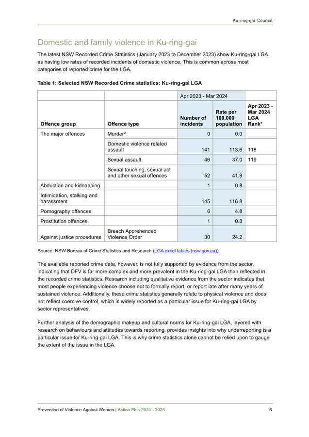


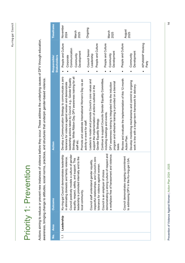
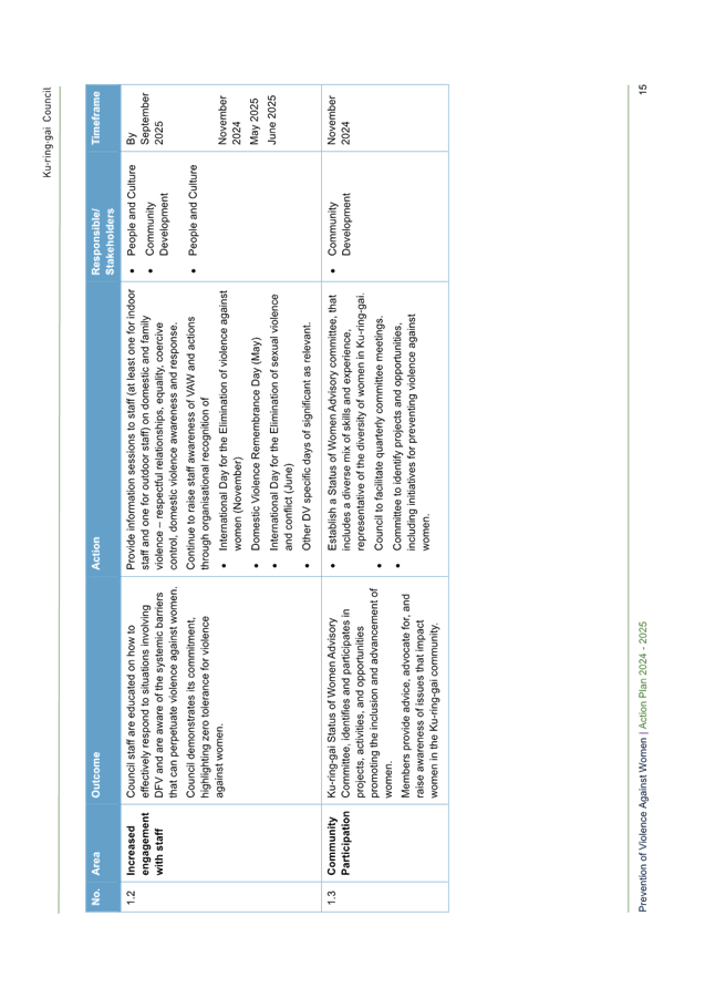
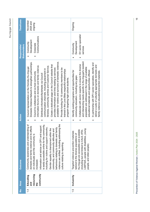
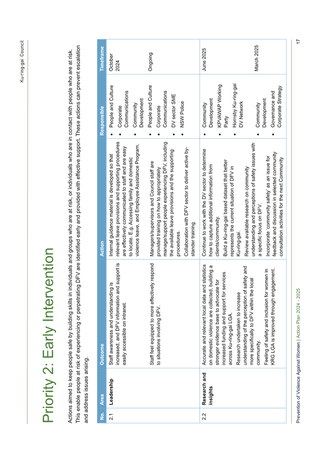
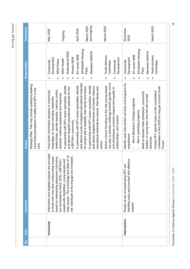
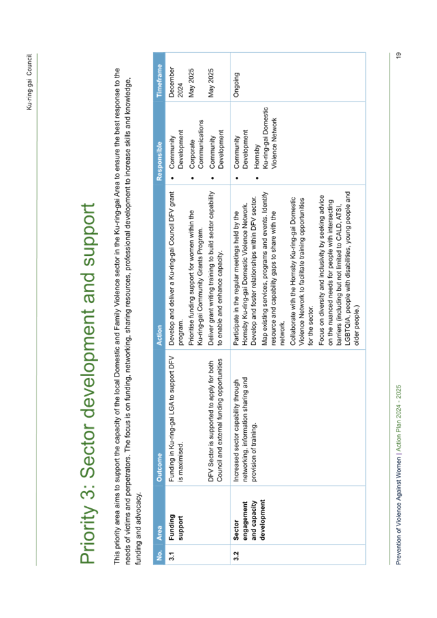
|
Ordinary
Meeting of Council - 13 August 2024
|
GB.6 / 1
|
|
|
|
|
Item
GB.6
|
FY00623/7
|
|
|
24 July 2024
|
Analysis of Land and Environment Court
Costs - 4th Quarter 2023 to 2024
EXECUTIVE
SUMMARY
Purpose of Report
To report legal costs in relation to development control
matters in the Land and Environment Court for the quarter ended 30 June 2024.
Background
A
person may commence proceedings in the Land and Environment Court in relation
to a development application which has either been refused by Council or is
deemed to have been refused (a development application is deemed to have been
refused if it has not been determined within a period of 40 days or such longer
period that may be calculated in accordance with the Act). An appeal may also
be commenced in relation to conditions of development consent and the issue of
building certificates and orders. Council is a respondent to such
proceedings.
Comments
Appeals
Lodged
In the quarter ended 30 June 2024 there were two new appeals
lodged with the Land and Environment Court. The number of appeals
received in prior years is as follows:
|
Financial year
|
Number of appeals
received (whole year)
|
|
2019/2020
|
25
|
|
2020/2021
|
13
|
|
2021/2022
|
18
|
|
2022/2023
|
36
|
|
2023/2024 (as at 30
June 2024)
|
15
|
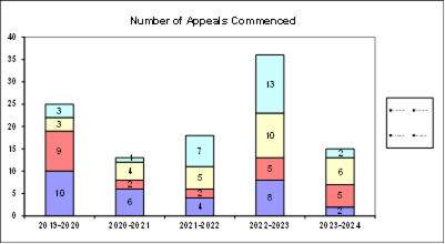
The appeals commenced during the quarter to 30 June 2024
concerned the following subject matter:
· Multi-dwelling
housing
· Single dwelling
Council was also in receipt of three appeals against
Development Control Orders and one appeal against the refusal of a Building
Information Certificate.
costs
For the quarter ended 30 June
2024, Council made payments of $1,183,240 on appeals and associated expenses in
relation to Land & Environment Court matters. This compares with the annual
budget of $1,338,800.
In addition to expenditure on appeals, a further amount of
$7,099 was spent in obtaining expert advice regarding development assessment
matters.
|
Land &
Environment Court Costs
2019/2020
- 2023/2024
|
|
Financial Year
|
Total Costs
|
1st quarter September
|
2nd quarter December
|
3rd quarter March
|
4th quarter June
|
|
2019/2020*
(25 appeals lodged)
|
$1,892,040
|
$417,046
|
$446,071
|
$543,218
|
$485,705
|
|
2020/2021*
( 13 appeals lodged)
|
$1,512,459
|
$356,735
|
$501,925
|
$278,510
|
$375,289
|
|
2021/2022 *
(18 appeals lodged)
|
$1,114,447
|
$402,328
|
$258,053
|
$226,500
|
$227,566
|
|
2022/2023
(36 appeals lodged)
|
$1,261,734
|
$324,397
|
$300,017
|
$474,367
|
$162,953
|
|
2023/2024
(15 appeals lodged)
|
$ 1,183,240
|
$381,788
|
$366,869
|
$204,835
|
$229,748
|
* Costs reported to Council in previous reports
The costs
incurred in the period to 30 June 2024 represent 88.38% of the annual budget of
$1,338,800.
The
commencement of appeals does not lie within the control of Council, however
there a number of factors that appear to influence the volume of appeals:
· Amendments to the Environmental Planning and Assessment
Act made in 2013 and then reintroduced in 2022 reduced the timeframe for
lodgement of an appeal from twelve months to six months. This had the
effect of applicants for more substantial and complex development proposals
lodging appeals for no other reason than as a mechanism to preserve early
appeal rights. The number of development applications received by Council in
recent periods has itself been high.
· In addition, the prospect of changing economic market
conditions in recent periods appears to have led to urgency on the part of
developers, with a particularly high number and proportion of appeals commenced
at an early stage on the basis of deemed refusal. As a result, Court
listings are currently heavily booked and long delays for several months for
the holding of both mediation conferences and hearings are occurring.
· Due to the abovementioned delays, the Court has
increasingly required parties to participate in without-prejudice meetings in
the meantime. These meetings have tended to result in additional
iterations of amended plans being provided by applicants during the appeal
process and therefore, additional costs.
· The additional pressure on application processing times
arising from the Statement of Expectations issued to all NSW councils by the
previous Minister for Planning in December 2021, which remains in force.
Notwithstanding
these factors, Council’s overall success rate in appeals has been high.
In
relation to costs recovered, the amount of $176,395 had been recovered at 30
June 2024 compared to an annual budget for costs recovered of $114,900.
Outcomes
At an early stage of each appeal, Council as respondent, is
required to file with the Court a Statement of Facts and Contentions outlining
the grounds which Council asserts as warranting refusal of a development, or
alternatively, that may be addressed by way of conditions of consent.
In cases
where issues raised by Council are capable of resolution by the provision by
the applicant of additional information or amendment of the proposal, it is the
Court’s expectation that this should occur. The Court’s
current practice of listing appeals for a preliminary mediation conference
before a Commissioner of the Court pursuant to section 34 of the Land &
Environment Court Act, strongly encourages this.
In this
context, any of three outcomes can be regarded as favourable, namely:
1. If the appeal is in relation to a
deemed refusal of an application which, upon assessment, is appropriate for
approval: that the development is determined by Council, allowing the
appeal to be discontinued by the applicant and avoiding as much as is
practicable the incurring of unnecessary legal costs;
2. If the issues raised by Council are
capable of resolution by the applicant providing further information, or
amending the proposal: that this occurs, so that development consent
should be granted, either by Council or the Court;
3. If the issues raised by Council are
either not capable of resolution or the applicant declines to take the steps
that are necessary to resolve them: that the appeal is either
discontinued by the applicant, or dismissed (refused) by the Court.
Three matters were concluded during the quarter. A
favourable outcome was achieved in all matters:
· one appeal was
upheld in relation to an amended proposal
· two appeals were
resolved by agreement in relation to an amended proposal.
As at 30 June 2024, there was a total of 13 matters
proceeding before the Court.
integrated
planning and reporting
Leadership & Governance
|
Community Strategic Plan Long Term Objective
|
Delivery Program
Term Achievement
|
Operational Plan
Task
|
|
L2.1 Council rigorously manages its financial
resources and assets to maximise delivery of
services.
|
Achieve financial sustainability targets
identified in the Long Term Financial
Plan.
|
Undertake quarterly reporting to Council on the financial
performance of the
organisation.
|
Governance Matters
Under
Section 428 of the Local Government Act 1993, Council is required to report
legal costs, and the outcome of each case in its Annual Report.
Risk Management
Quarterly reporting of legal
costs to Council together with information about the number, character and
outcomes of proceedings enable ongoing oversight of this area of
Council’s activity.
Financial Considerations
Land
& Environment Court legal costs form part of Council’s recurrent
operating budget.
Social Considerations
None undertaken or required.
Environmental Considerations
None undertaken or required.
Community Consultation
None undertaken or required.
Internal Consultation
This
report has been developed with input from Council’s Corporate Lawyer,
Director Corporate and Director Development & Regulation.
Summary
For the
period ended 30 June 2024, Council made payments of $1,183,240 on Land &
Environment Court appeals. This compares with the annual budget of $1,338,800.
|
Recommendation:
That the analysis of Land and Environment Court costs
for the year ended 30 June 2024 be received and noted.
|
|
Tony Ly
Financial Accounting Officer
|
Jamie Taylor
Corporate Lawyer
|
|
Michael Miocic
Director Development & Regulation
|
|
|
Attachments:
|
A1 ⇩ ⇩
|
Individual
Case Summary June 2024 - Land and Environment Court Costs
|
|
2024/255233
|
|
ATTACHMENT No: 1 - Individual
Case Summary June 2024 - Land and Environment Court Costs
|
|
Item No: GB.6
|

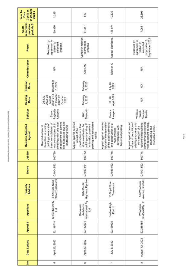
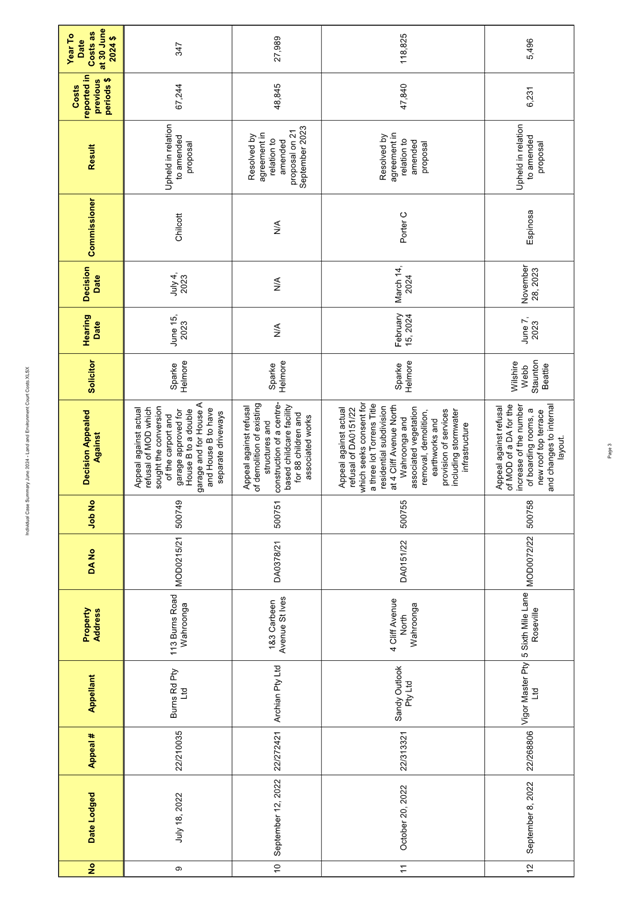
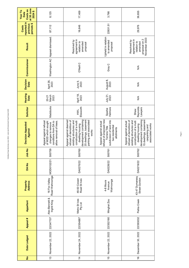

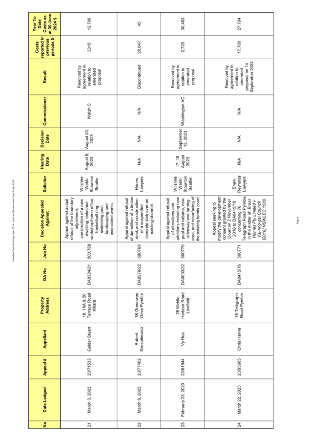
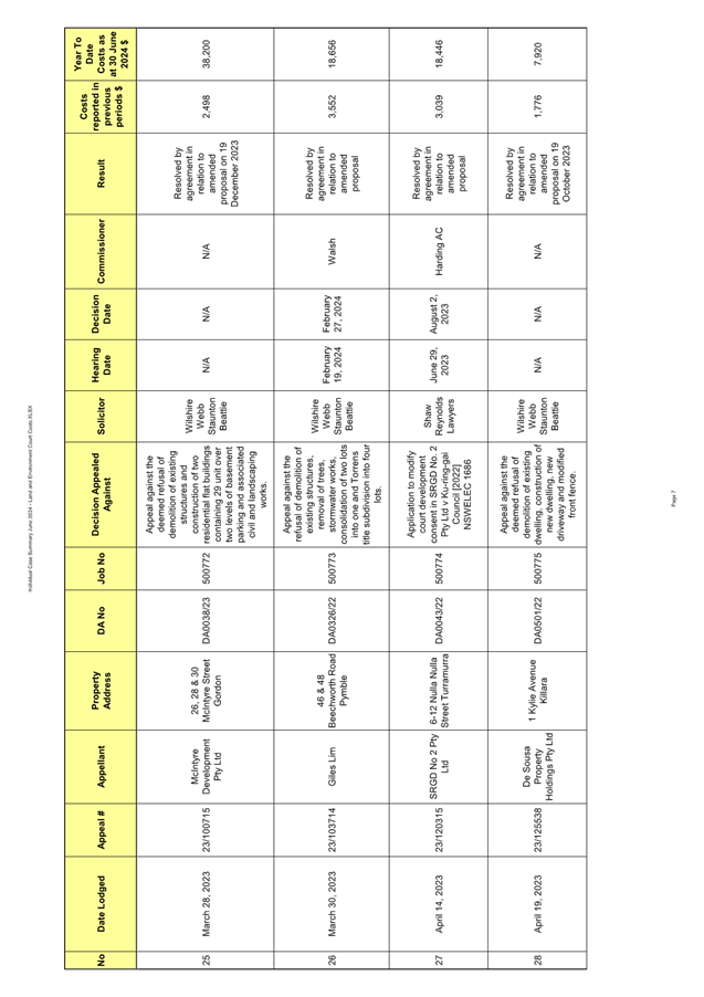
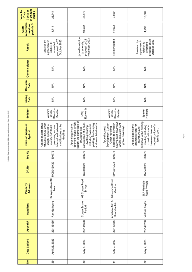
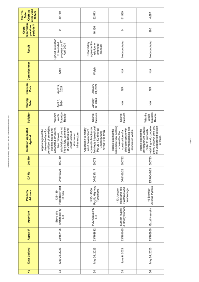
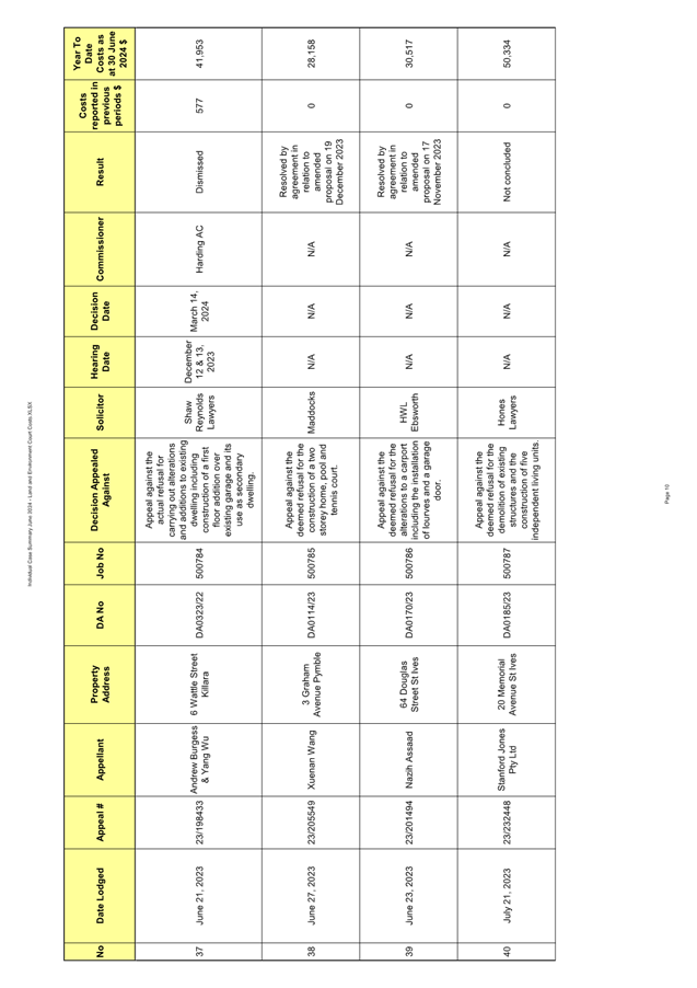
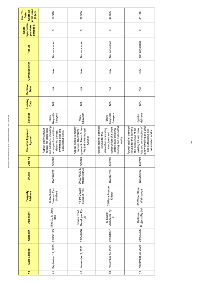
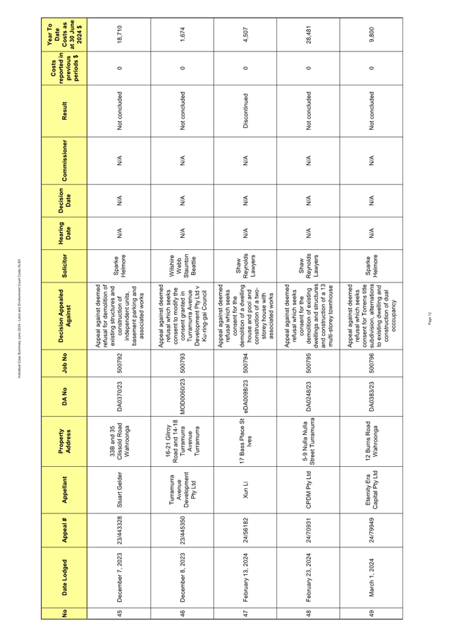
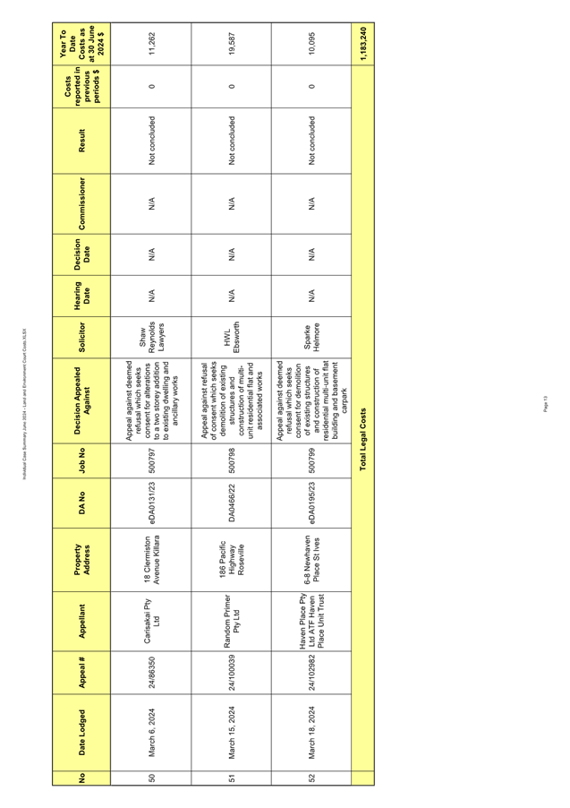
|
Ordinary
Meeting of Council - 13 August 2024
|
GB.7 / 1
|
|
|
|
|
Item
GB.7
|
S09093/12
|
|
|
25 July 2024
|
Carried Forward Projects Expenditure -
2023/24
EXECUTIVE
SUMMARY
Purpose of Report
To seek endorsement from Council to carry forward the
attached list of 2023/24 projects into the current financial year.
Background
The attached list of projects was originally included in the
2023/24 budget by formal resolution on 20 June 2023. Budgets
voted for some works have not been fully spent and accordingly are requested to
be carried forward into the current financial period.
Some projects were committed to be completed but work
concluded after year end. Consequently this money needs to be carried forward
to fund works completed and any work in progress at year end due to be
completed in the current financial year. Some projects are yet to commence.
Comments
The total requested carried
forward works is $62.5m funded from a combination of internal and external cash
reserves. These works were fully funded as part of the last financial year
budget, therefore the funding requirements for the proposed incomplete projects
are considered adequate and no additional funds are required.
Capital & Operational Projects Summary
Actual expenditure for
capital and operational projects for the period ending 30 June 2024 is $55.6m
against the annual revised budget of $119.3m, resulting in a variance of
$63.7m. The variance is largely due to incomplete projects which are proposed
to be carried forward including major projects
such as Indoor Basketball Courts at St Ives High School, Land Acquisitions, St
Ives Cultural and Environmental Education Centre.
The variance between the
remaining budget ($63.7m) and proposed carried forward expenditure ($62.5m) is
largely due to savings partly offset by budget allocated for projects funded
from capital grants not yet received.
The table and chart
below show the annual actual projects expenditure against annual revised budget
for the year ended 30 June 2024.
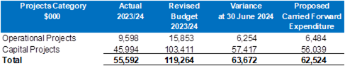
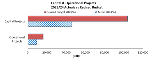
Proposed carried forward expenditure and funding sources
A detailed summary of all
proposed carried forward projects can be found in Attachment A1.
Budgets voted for some works had
not been fully spent as at 30 June 2024 and accordingly are requested to be
carried forward into the current financial year.
The total requested carried
forward works of $62.5m are funded from the following sources:
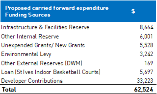
It is now proposed to seek approval to carry over budgets to
fund the incomplete works at 30 June
2024.
integrated
planning and reporting
Leadership & Governance
|
Community Strategic Plan Long Term Objective
|
Delivery Program
Term Achievement
|
Operational Plan
Task
|
|
L2.1 Council rigorously manages its financial resources
and assets to maximise delivery of services.
|
L2.1.2 Council’s financial services provide
accurate, timely, open and honest advice to the community.
|
Manages financial performance to achieve targets as
defined in the Long Term Financial Plan.
|
Governance
Matters
The Local Government (General)
Regulation 2005 Clause 211 requires a Council to hold a meeting each year for
the purpose of approving expenditure and voting money. At the end of each year
the votes of expenditure lapse, except as provided in Clause 211 of the Local
Government (General) Regulation 2005, whereby:
(3) All such approvals and votes lapse at the end
of a council's financial year. However, this subclause does not apply to
approvals and votes relating to:
(a) work carried out or
started, or contracted to be carried out, for the council, or
(b) any service provided, or
contracted to be provided, for the council, or
(c) goods or materials
provided, or contracted to be provided, for the council, or
(d) facilities provided or
started, or contracted to be provided, for the council,
before the end of the year
concerned, or to the payment of remuneration to members of the council's staff.
All carried
forward works, whether commenced or not, are presented to Council for approval.
Risk Management
Council is financially sound
which positions it well to deal with unforeseen events as they arise. Income
and expenditure is managed through the quarterly budget review process.
Although income cannot be directly controlled, it can be monitored and action
taken to mitigate potential financial or budgetary risk. Incomplete works
proposed to be carried forward from last financial year are fully funded and
therefore there is no risk or burden on the current year’s budget.
Financial
Considerations
The total amount proposed to be carried forward for
incomplete works is $62.5m. The budget allocation for the proposed projects is
funded from a combination of internal and external reserves. No additional
funds are required.
Social
Considerations
Not applicable.
Environmental
Considerations
Not applicable.
Community
Consultation
Not applicable
Internal Consultation
All departments have been
consulted in developing the list of attached carried forward expenditure. The
General Manager and Directors endorsed the list of carried forward expenditure.
Summary
|
Recommendation:
That Council approve the attached list of carried forward
expenditure from 2023/24 to the current financial year.
|
|
Angela Apostol
Acting Director Corporate
|
Mette Kofoed
Acting Manager Finance
|
|
Attachments:
|
A1 ⇩ ⇩
|
Carried
Forward Requests from 2023-24
|
|
2024/253911
|
|
ATTACHMENT No: 1 - Carried
Forward Requests from 2023-24
|
|
Item No: GB.7
|

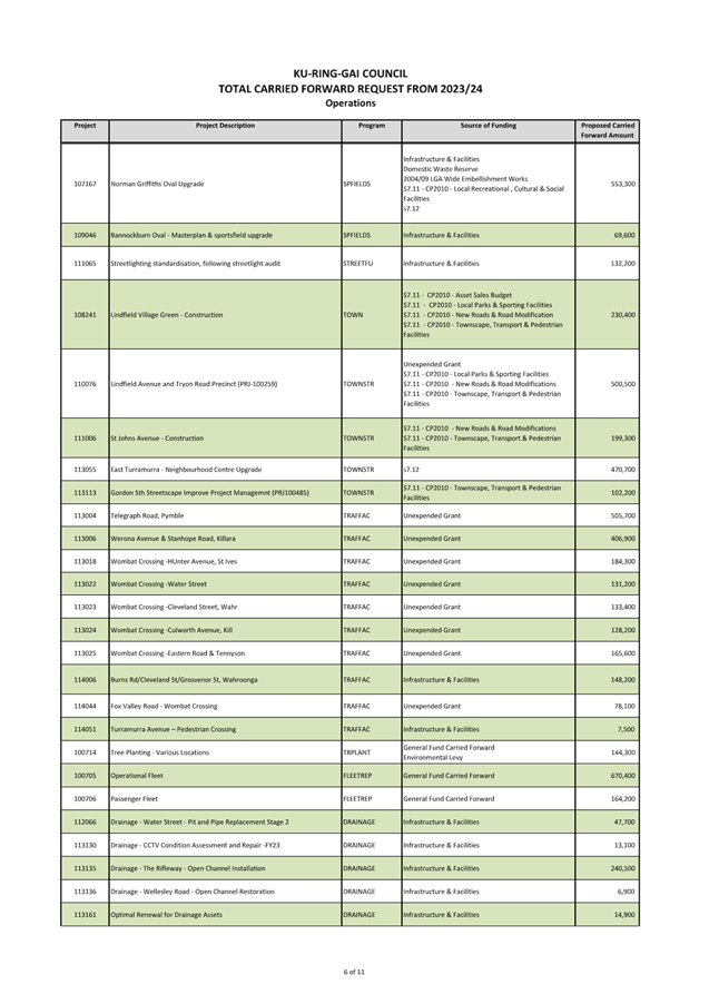

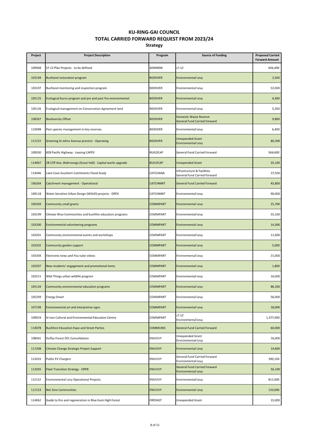
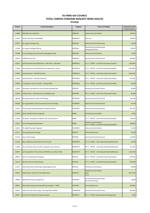
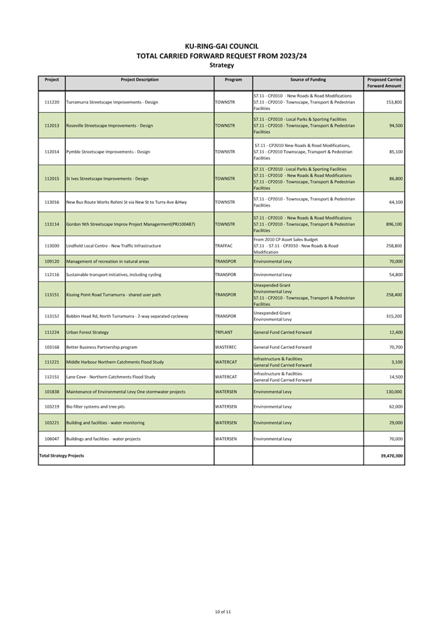
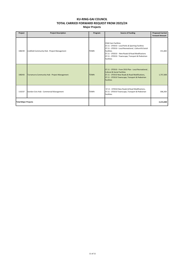
|
Ordinary
Meeting of Council - 13 August 2024
|
GB.8 / 1
|
|
|
|
|
Item
GB.8
|
FY00382/16
|
Delivery Program and Operational Plan:
June 2024 Biannual Report
EXECUTIVE
SUMMARY
Purpose of Report
To report to Council on the progress of the Delivery Program
and Operational Plan, for the period January to June 2024.
Background
The Delivery Program 2022-2026 was adopted by Council in
June 2022. To assist the community in understanding Council’s programs,
both the Delivery Program and annual Operational Plan are presented in the same
document.
A progress report on the Delivery Program and Operational
Plan must be presented to Council every six months under the Local Government
Act. This biannual report marks completion of the Delivery Program for this
term of Council.
Details of progress against term achievements and tasks for
the six-month period from January to June 2024 and performance indicators for
the twelve month period 2023 – 2024 are included in the report at Attachment
A1.
This report also includes overall percentage achievement
statistics, exception reporting for items behind schedule and data against
performance indicators presented under the six (6) themes in the Delivery Program
and Operational Plan.
All departments have provided comments and status updates
for the attached report.
Council has received quarterly budget reports during
2023-2024 to provide data on the financial position of Council in terms of its
income and expenditure, as well as the status of its adopted capital works
program. The March quarter budget review for 2023-2024 was reported to
Council’s Ordinary Meeting of 21 May 2024.
Results for five (5) financial performance indicators under
‘Theme 6 – Leadership’ are not available until completion of
the end of year financial review and external audit as part of the preparation
of Council’s 2023-2024 Financial Statements, due to be completed in
September 2024. The draft Statements will be presented to Council in October
2024 and included in Council’s Annual Report 2023-2024, to be published
in November.
Comments
The June biannual report (Attachment A1) presents the
organisation’s progress against term achievements, tasks and performance
indicators in the Delivery Program and Operational Plan.
Reasons for delays and remedial actions are provided for
term achievements and tasks behind schedule. Explanatory comments are provided
for performance indicators not achieved.
Summary of performance
The following table provides the summary of results at the
end of the reporting period:
|
Item
|
Green traffic light /tick
|
Amber traffic light
|
Red traffic light
|
White traffic light
|
|
Tasks
|
92.5%
|
6.5%
|
1%
|
1 task*
|
|
Term Achievements
|
94%
|
4.5%
|
1.5%
|
1 term achievement*
|
|
Performance Indicators (1 year) **
|
79%
achieved
|
-
|
21%
not achieved
|
|
|
* The task and term
achievement indicated with a white traffic light have not been included in %
performance calculations.
** Results for five (5)
financial performance indicators are not available until completion of the
end of year financial review and external audit. Those indicators have
not been included in % performance calculations.
|
Explanation of traffic lights/ticks
Green traffic light/tick – completed (tick) or
substantially completed at the time of reporting, with minimal work required to
complete.
Amber traffic light - behind schedule (delayed performance
progress with remedial action required)
Red traffic light - significantly behind schedule
(performance issues resulting in major delays, with actions to address issues
included)
White traffic light - Council resolved to not proceed or
place on hold, or work cannot progress as a direct result of Council’s decision.
Performance against term achievements
94% of term achievements were
progressing to schedule at the end of June 2024. This is a good result for the
second year of Council’s Delivery Program. The 3 term achievements behind
schedule and one term achievement significantly behind schedule were because of
the withdrawal of State government funding for the Lindfield Village Hub
commuter parking, uncertainty about future population growth and development
following the NSW government housing policy changes and delayed commencement of
planned service reviews.
The term achievement for the renewal of Marian Street
Theatre remained ‘on hold’ as a result of Council resolution.
Further information on the reasons for the delays and
remedial actions are included in the commentary for these term achievements.
Performance against one-year tasks
92.5% of Operational Plan tasks were completed or
substantially completed at end of June 2024, with 13 tasks behind schedule, 2
tasks significantly behind schedule and one task on hold due to Council
resolution. Despite the delayed tasks, the overall result is good and exceeds
Council’s target of 89%.
Further information on reasons for delays and remedial
actions are included in the commentary for tasks not completed or behind
schedule, indicating they will be substantially progressed or completed in 2024/25.
These tasks have been carried over and included in Council’s adopted
2024-2025 Operational Plan.
Performance against indicators
79% of performance indicators were achieved for the 2023/24
year with an additional number of indicators close to achieving their
target. This is a satisfactory result.
Challenges and key achievements
Challenges and key achievements for the six-month period
from January to June 2024 are summarised below. A summary of achievements
and challenges can be found under each theme in the June biannual report at Attachment
A1.
Challenges
· NSW
Government’s housing announcements and uncertainty about future
population growth and development in the local government area.
· Effects of
extended wet weather periods on outdoor recreational and sporting facility use
and capital works progress.
· Additional work
required to address environmental issues for certain projects.
· The withdrawal of
Transport for NSW commuter car park funding for the Lindfield Village Hub project,
which disrupted the orderly procurement process, delaying appointing a
developer.
Key achievements
Theme 1 – Community, people and culture
· Awarded Australia
Day Council Grant of $15,000, Multicultural NSW Grant of $10,000 and Aboriginal
Affairs NSW Grant $3,000.
· Planned and
delivered highly successful NSROC Gai-Mariagal Festival Launch
· Delivered expanded
events program for Australia Day, Lunar New Year Festival, Heritage Festival
and Gai-Mariagal Festival.
· Establishment of
Financial Hardship Grants Program and Violence Against Women Grants Program.
· Commenced work on
the development of Violence Against Women Action Plan in cooperation with
service providers, professional networks, government departments and police.
· The Volunteer Expo
attracted around 80 potential volunteers in all age groups. The Seniors Expo
provided a showcase and participation opportunity to 36 local community
organisations and groups which attracted around 90 visitors to their stalls.
· Senior’s programs
are reaching more older people, with new attendees making up around 15% of
attendees at each activity.
· Weekly attendance
at the St Ives Youth Hub has increased by 15% since last reporting period.
· The International
Women`s Day Forum featured over 20 representatives from local high schools.
These students participated in a pre-forum workshop, advocating for local
initiatives to improve gender equity and inclusion.
· Appointment of a
new Nursery Officer and improvements made to the community nursery grounds and
facilities.
· Access
improvements were carried out on facilities including Lindfield Seniors Centre,
Lindfield Resource Centre and Roseville Park Tennis Courts.
· Council was
awarded $312,315 from State Library New South Wales under the 2023/24 Public
Library Infrastructure Grant scheme. The funding is for the second stage of
refurbishment works of Gordon Library.
· Refugee Week
Celebration held in partnership with the Hornsby Ku-ring-gai Multicultural
Network.
· Successful certification
and implementation of revised Bushfire Prone Land mapping which was well
accepted by the community.
Theme 2 – Natural Environment
· Council received
funding from the Environmental Protection Authority ($197,000) for a food waste
grant.
· Presentation with
AUSMAP on microplastic management of synthetic sports fields at the 2024
Stormwater NSW conference in April.
· $47,000 in Energy
Smart rebates delivered to the community.
· Estimated
reduction in annual electricity consumption of 179.51 megawatt hours through
community actions.
· Water Smart
rebates provided to residents resulting in the installation of 4 rainwater
tanks with a total capacity of 18,000 litres.
· Council hosted a
stall at the NRMA Electric Vehicle Drive Day. Staff and members from the
Ku-ring-gai’s Net Zero Champions engaged with local residents.
· Collaborated with
several neighbouring and wider state Councils to share resources and advice on
building successful Net Zero community strategies.
· Council signed a Memorandum
of Understanding (MoU) with Sydney North Health Network to deliver street expos
over the next two (2) years to increase community preparedness and resilience.
· The threatened
Eastern Pygmy-Possum was recorded at four of 10 reserves monitored by staff and
volunteers in the north and east of the Ku-ring-gai LGA, including evidence of
breeding within one reserve.
· Successful
delivery of a diverse waste education programs including a chemical collection
event (76.05 tonnes diverted from landfill), the textiles collection program
(over 15 tonnes of clothing diverted from landfill), a resident composting
workshop, a teacher’s professional development day on composting in
schools, and roll out of the Veolia 'The Recoverables' Program to schools K-12.
Theme 3 – Places, spaces and
infrastructure
· Development of a
new street tree planting program involving engagement with residents and
strategic selection of locations for trees. Pilot program successfully
completed with 47 new trees planted in selected streets in Roseville.
· Provision of
accurate and timely information on the TOD and Low & Mid-Rise SEPPs to
Councillors and the community.
· 31 Council staff
completed the Aboriginal Site Awareness training with the Aboriginal Heritage
Office.
· Council`s new
heritage colours guide received positive feedback from the community and
professionals.
· Completed -
Primula Oval and Roseville Oval Sportsfield upgrades.
· Completion of the
District Park Landscape Masterplan Program.
· Progressed design
and construction of improvements to parks which incorporate accessible and
inclusive passive recreation facilities.
· Opening of the
Glade Oval amenities block.
· Completed upgrades
to the Gordon Pro Shop.
· Increased
visitation to the St Ives Showground & Ku-ring-gai Wildflower Garden.
· Drainage Asset
Management Plan and Open Space Asset Management Plan updates completed.
· Councils
Development Control Plan (DCP) was updated and adopted by Council. The
amendments include several new provisions to improve the design quality and
environmental performance of buildings.
· The priority area
tree inventory data capture project was completed and provides data on over
6,000 trees on Council land in key areas of the LGA including local centres and
parks.
· The Tiny Forest
planting day was undertaken in partnership with Earthwatch. Approximately 1,300
plants were put in by the community and local schools.
· Significant
progress has been made in implementing the Urban Forest Strategy including a
Tree Forum to inform residents of Council’s activities to protect and
increase the tree canopy and a community tree planting event aimed at promoting
benefits of trees and educating the community about supporting tree health.
· The Ku-ring-gai
Open Space and Recreation Needs Study was adopted by Council. The study will
inform long term planning for services and facilities to support community
recreation.
Theme 4 – Access, traffic and
transport
· Council
successfully secured additional funding of $248,000 from TfNSW towards the
Telegraph Road project (total funding received towards projects was $533,000).
· Council received
an offer of $470,000 funding from TfNSW for a new raised pedestrian crossing
and new footpaths near St Ives Primary/High School.
· Around 12 schools
registered to the Ride2School Day. Council actively promoted the event and
provided fresh fruit for participants, delivered free of charge to each school.
Letters of appreciation and photos of the event were sent to Council by some of
the schools.
· Council secured
$2.25M in funding from TfNSW to be utilised for the construction of footpaths
and pedestrian facilities over three financial years, from 2022/23 to 2024/25.
· Council completed
two traffic studies for a High Pedestrian Activity area in Grandview Street,
Pymble and Stanley Lane in St Ives with funding received from TfNSW ($30,000).
· Council completed
a traffic study for a High Pedestrian Activity Area on Eastern Road, Turramurra
with funding received from TfNSW ($11,000).
Theme 5 – Local Economy
· Major events were
delivered during the period at St Ives Showground including securing Foamfest
for a second year.
·
Destination NSW advised
visitation numbers have increased in the Ku-ring-gai local government area from
2018, based on a four year average.
Theme 6 – Leadership
· A revised
Resourcing Strategy, revised Delivery Program 2022-2026 and new Operational
Plan 2024-2025 were adopted following public exhibition.
· Organisational
wide customer service training was delivered to staff across Council.
· Increased
audiences receiving our news on Facebook and e-newsletters: Facebook has
increased to 16,792 (approx 4% growth in last 6 months); eNews has increased to
25,133 (39% growth in last 6 months).
· Effectively
communicated the NSW Housing Policy changes on Council’s website which
resulted in a high level of web traffic over the past 6 months.
· Successful
implementation of the EEO Management Plan and Gender Equality Strategy along
with other workforce related strategies and action plans.
· Expansion of the
Total Rewards and Recognition Program.
· Implementation of
the Succession Planning Strategy.
· Implementation of
the Gender Equality Strategy.
· Planned roll-out
of the 2024 Employee Opinion Survey on 1 July 2024.
· Council continued
to lobby the NSW and Federal governments on matters of importance to the local
area and local government generally, including housing policy changes,
proposing motions to the ALGA National General Assembly and a submission to the
Parliamentary Inquiry into local government funding.
· Fully executed
variation of licences/leases to extend eight KU Children`s Services tenancies
on improved commercial terms in accordance with updated valuation advice.
· Review and updates
to various asset management plans and associated financial strategies were
completed. A comprehensive review of drainage assets and buildings was
undertaken with positive financial outcomes.
integrated planning and reporting
Theme 6 – Leadership and Governance
|
Community Strategic
Plan Long Term Objective
|
Delivery Program
Term Achievement
|
Operational Plan
Task
|
|
L1.1: A shared long-term vision underpins strategic
collaboration and partnerships and builds leadership capacity.
|
L1.1.1: The priorities of our community, as reflected in
the Community Strategic Plan, inform Council’s policy development,
decision-making and program delivery.
|
L1.1.1.3: Provide regular reporting to the community on
performance and progress against Council’s Delivery Program and Operational
Plan.
|
Governance Matters
The NSW Division of Local
Government’s Integrated Planning and Reporting guidelines and Section 404
of the Local Government Act 1993 requires a progress report to be
presented to the Council on the principal activities detailed in the Delivery
Program and Operational Plan at least every six (6) months.
Risk Management
The preparation, reporting
and consideration by Council on the progress of the Delivery Program is
undertaken every 6 months.
Financial Considerations
There are no direct financial
considerations associated with the adoption of the recommendations contained
within this report. Final Audited Financial Statements for 2023-2024 will
be included as part of Council’s Annual Report 2023-2024 to be published
at the end of November 2024.
Environmental Considerations
There are no specific environmental impacts associated with
the preparation of this report.
Community Consultation
Although no specific community consultation was undertaken
for the preparation of this report, community engagement and consultation
played a significant role in the delivery of services, programs, projects and
actions as detailed in the biannual progress report.
Internal Consultation
All Departments have provided status updates and comments on
the progress of term achievements, performance indicators and tasks as provided
at Attachment A1.
Summary
This report provides progress results for one-year tasks and
four-year term achievements as well as yearly results for performance
indicators contained in the Delivery Program 2022-2026 and Operational Plan
2023-2024. At the end of the 2024 financial year 94% of term achievements were
reported as progressing satisfactorily, 92.5% of Operational Plan tasks were
reported as completed or substantially completed and 79% of performance
indicators were achieved for the 2023/24 year.
Results for five (5) financial performance indicators in the
Delivery Program will be available following completion of the end of year
financial review and external audit, which will be reported to Council in
September as part of the draft Financial Statements for 2023-2024.
Recommendation:
That the
report on the six monthly progress review of the Delivery Program and
Operational Plan for the period January to June 2024 be received and noted.
|
Helen Lowndes
Integrated Planning Coordinator
|
Christopher M Jones
Manager Governance & Corporate Strategy
|
|
Angela Apostol
Acting Director Corporate
|
|
|
Attachments:
|
A1 ⇩ ⇩
|
Delivery
Program 2022-2026 and Operational Plan 2023-2024 - June 2024 biannual report
- Council version
|
|
2024/249176
|
|
ATTACHMENT No: 1 - Delivery
Program 2022-2026 and Operational Plan 2023-2024 - June 2024 biannual report
- Council version
|
|
Item No: GB.8
|
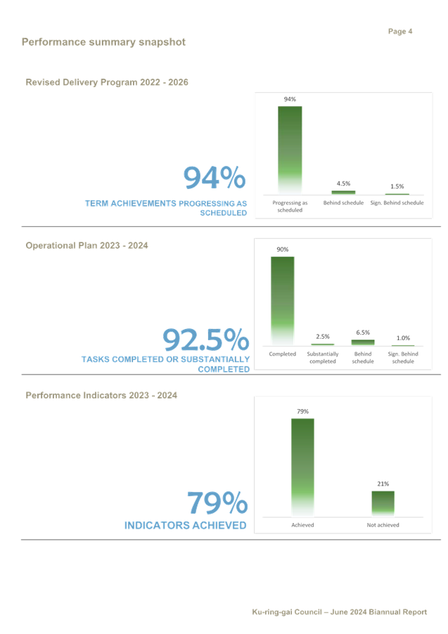
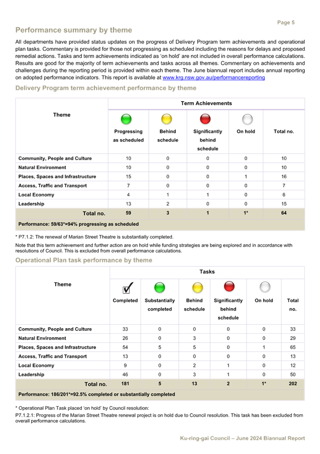
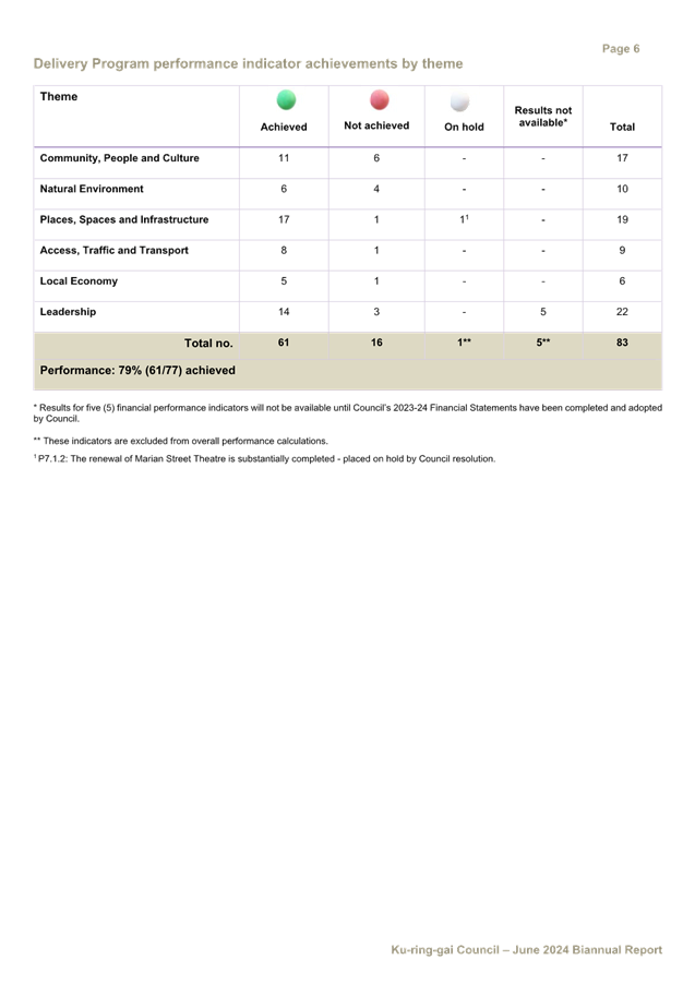
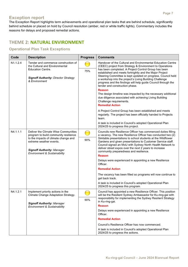
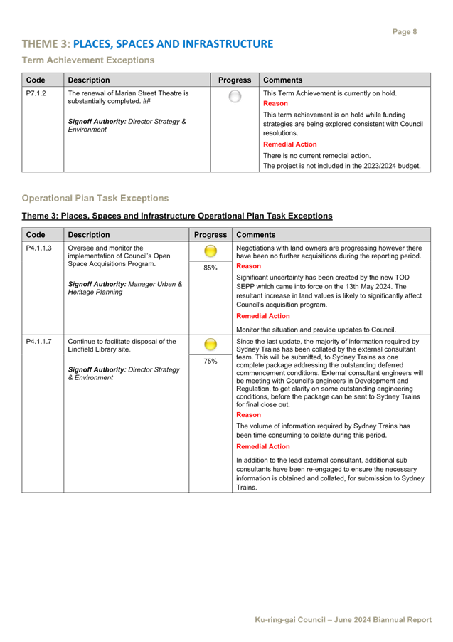
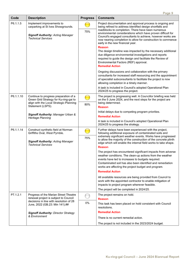
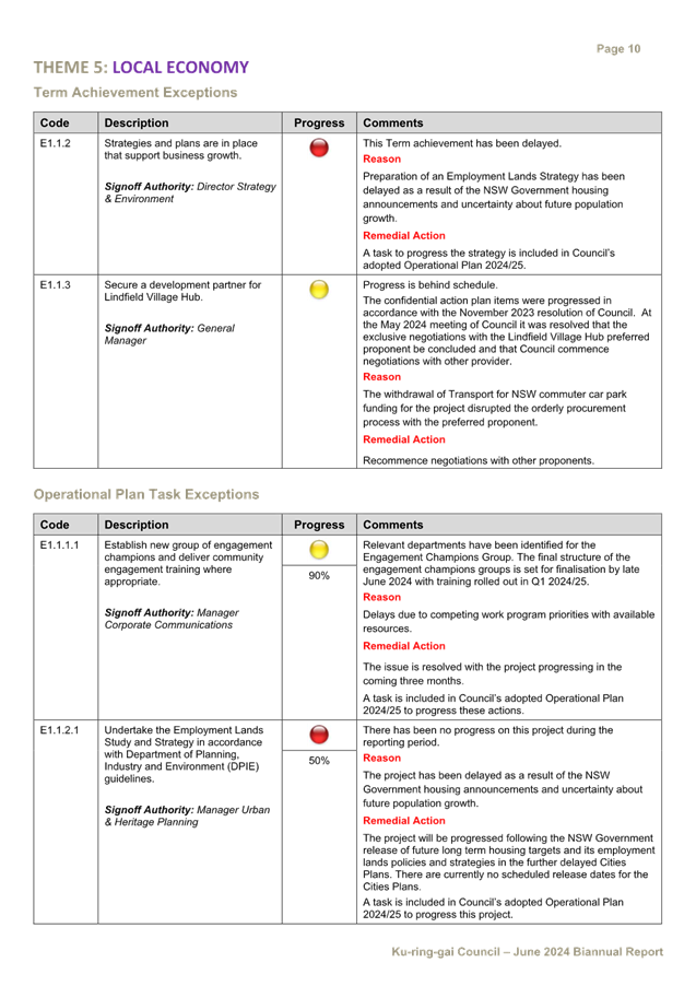
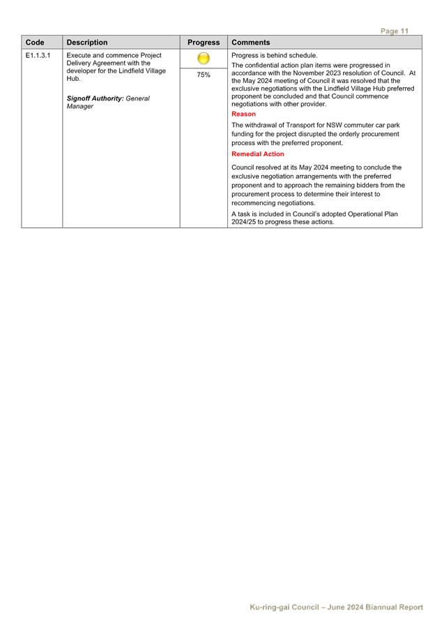

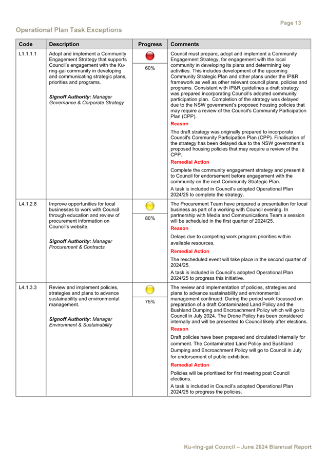
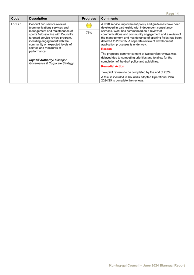

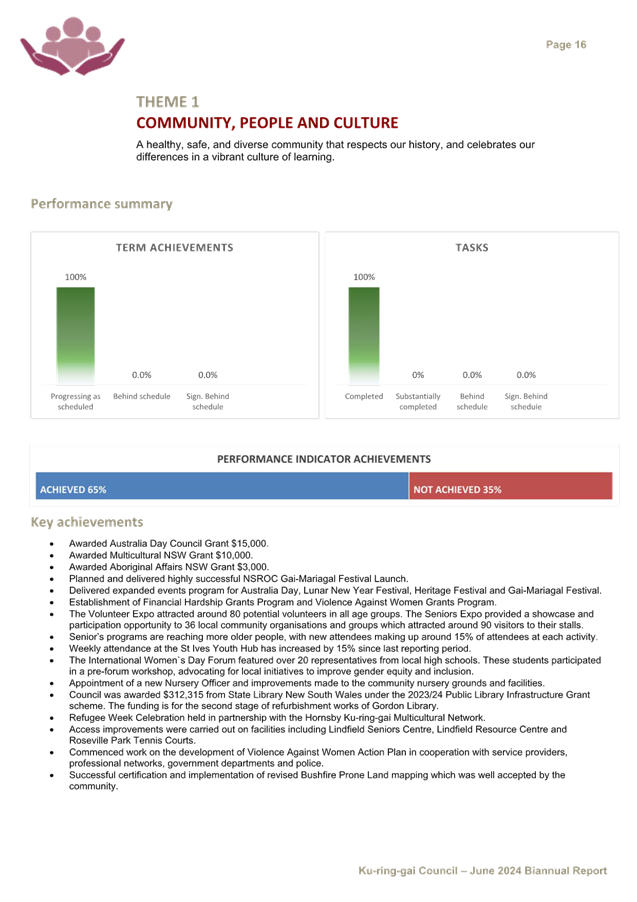
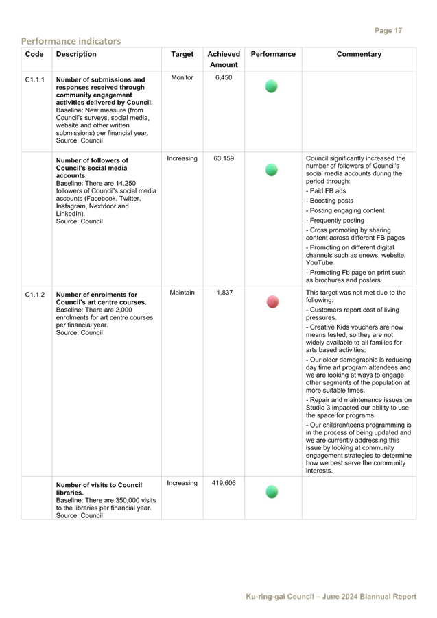
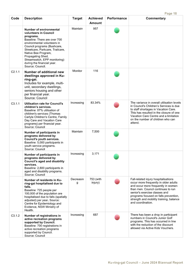
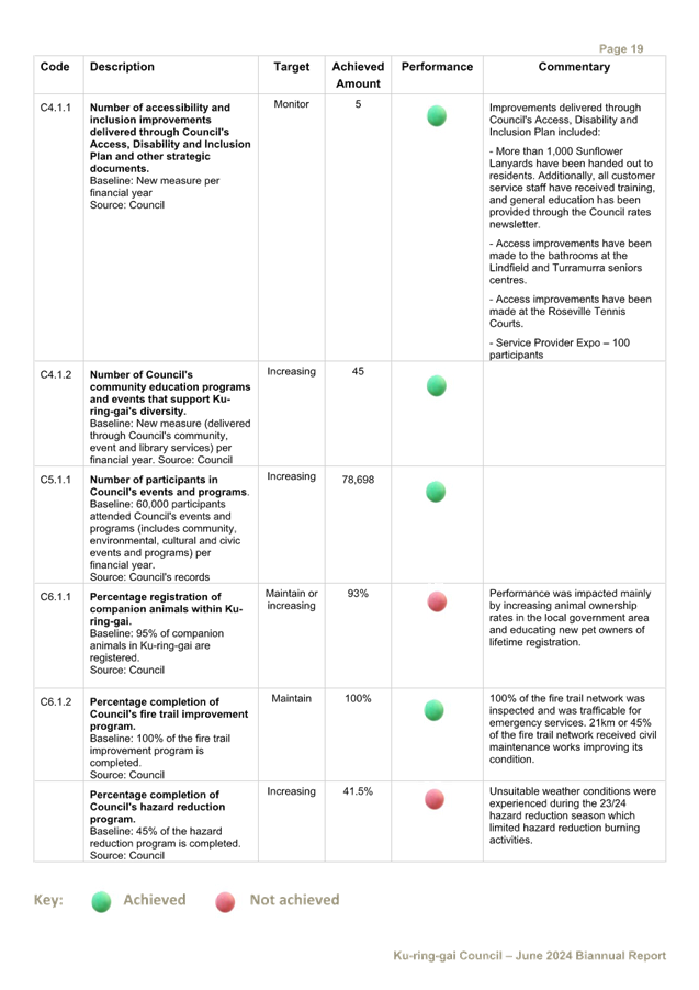

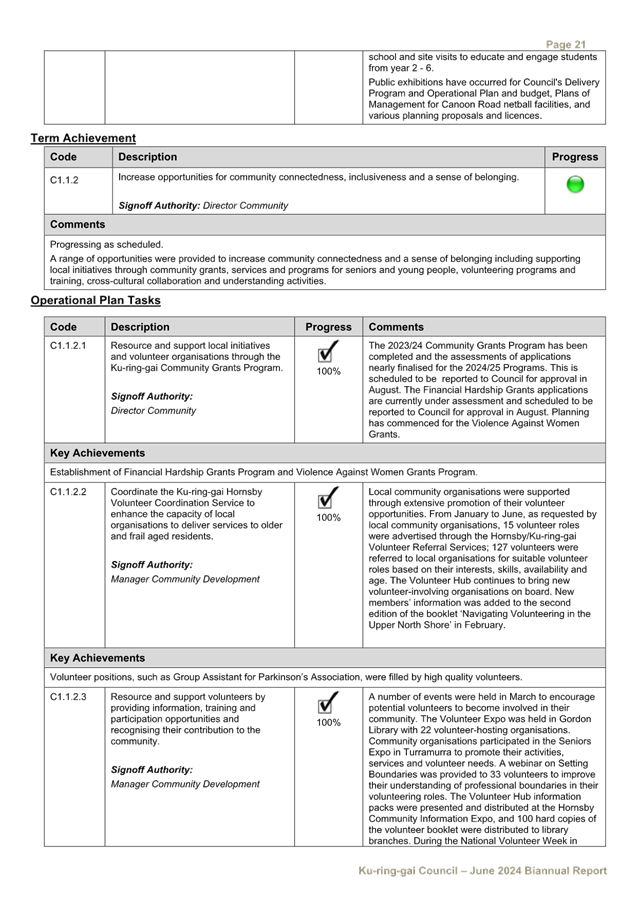
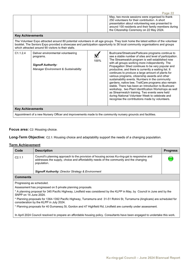
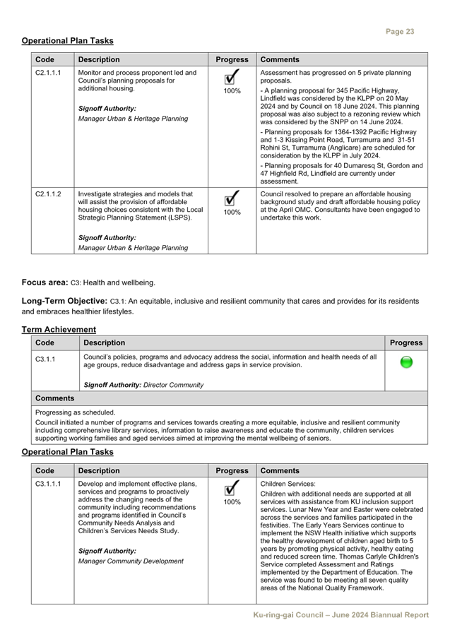
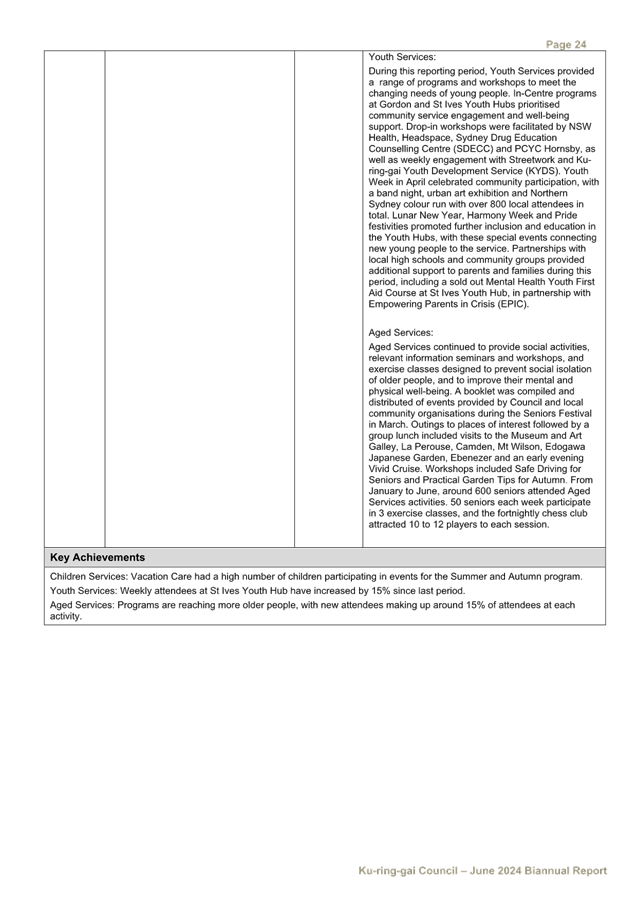
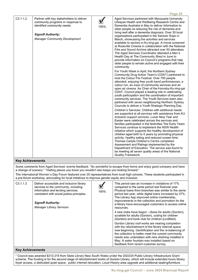
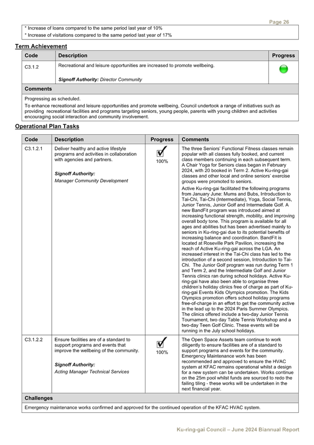
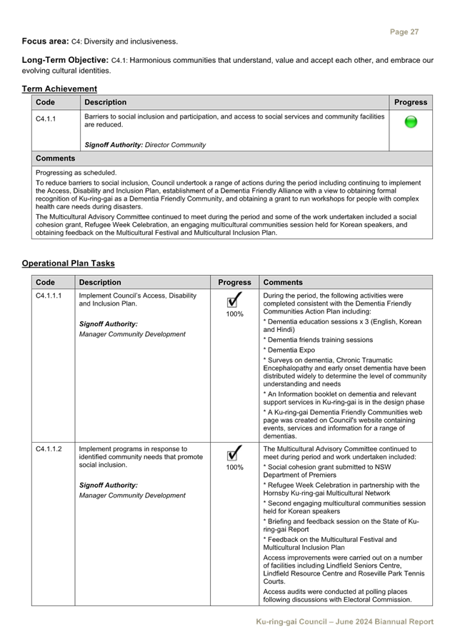
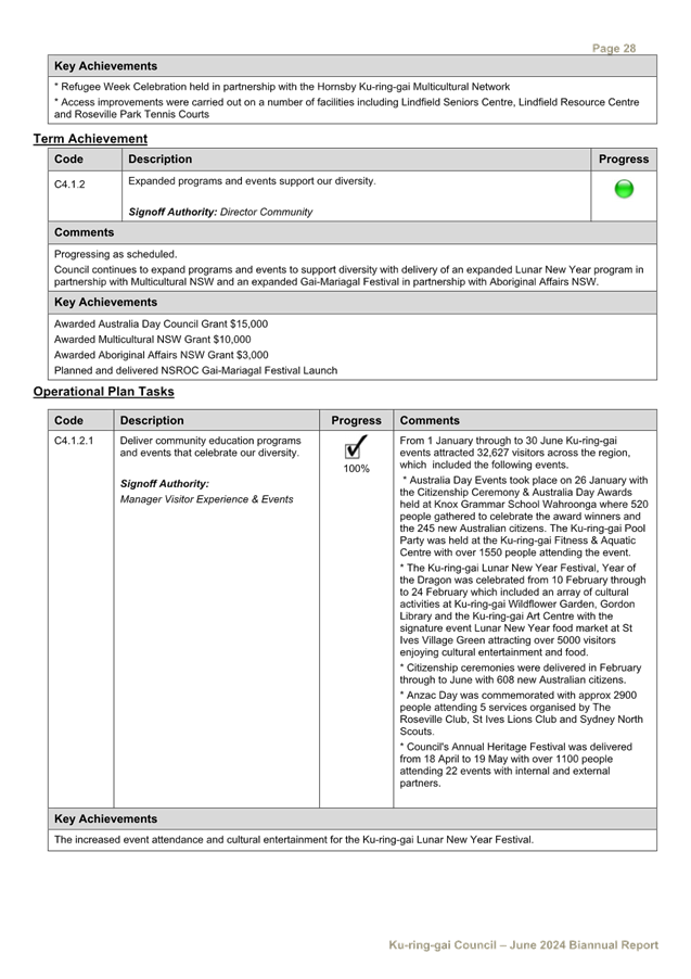
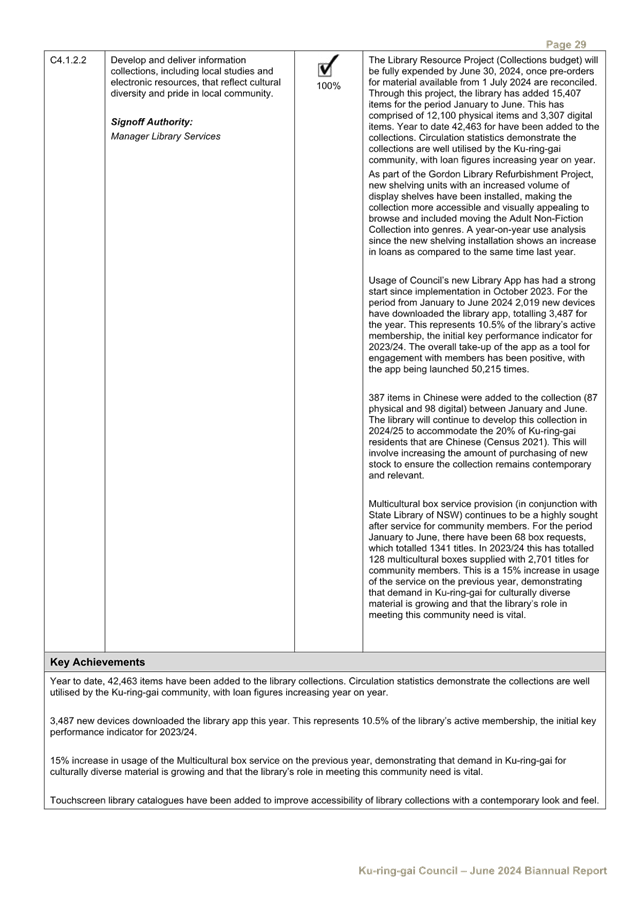
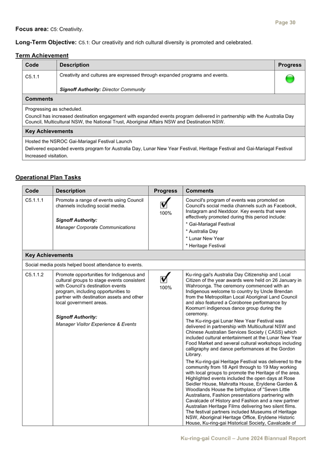
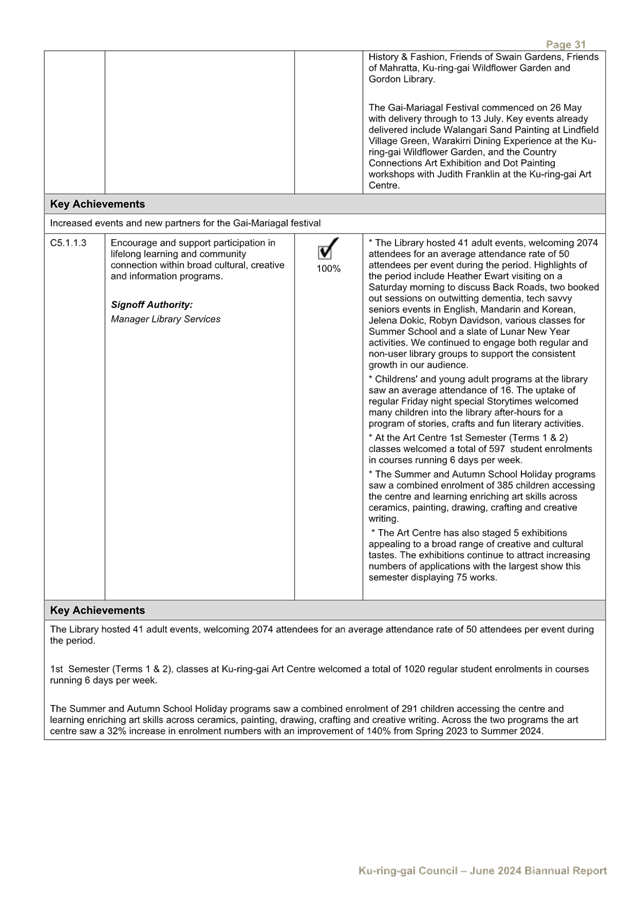

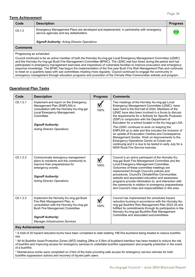
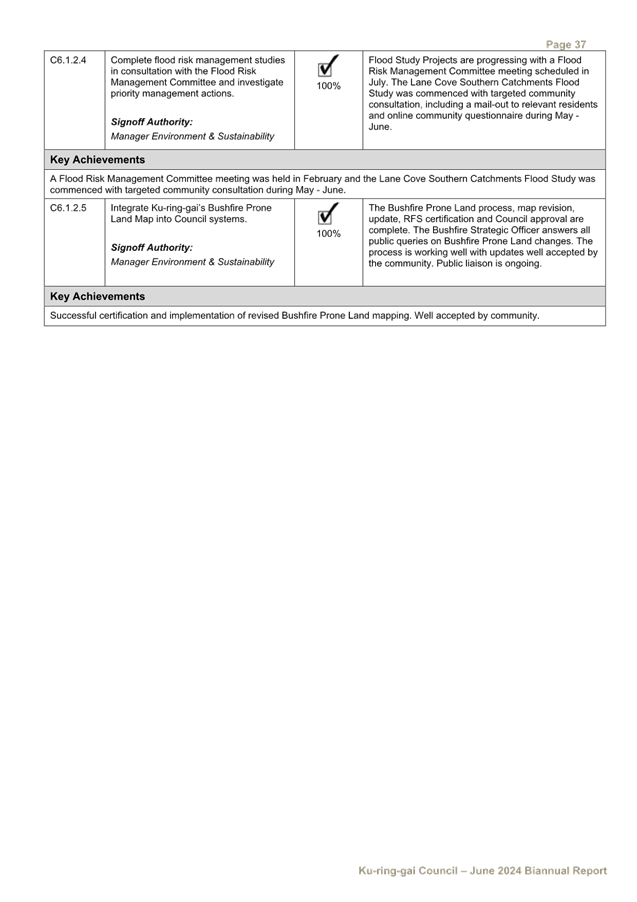
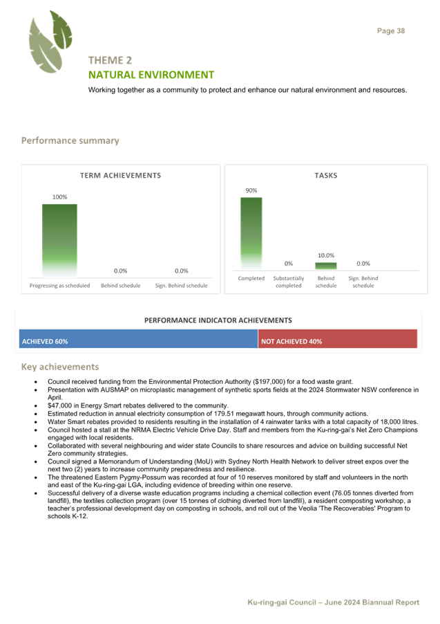
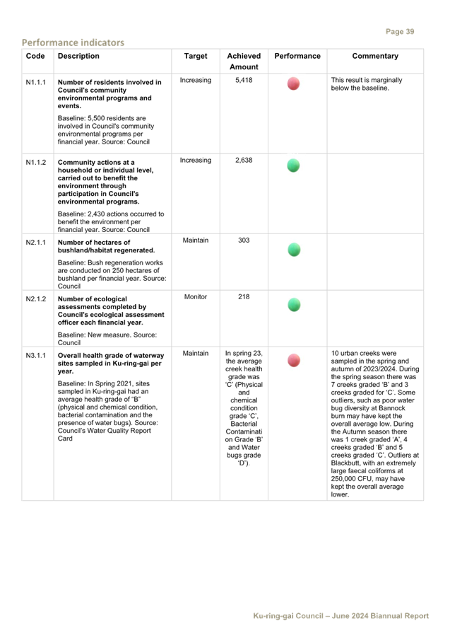
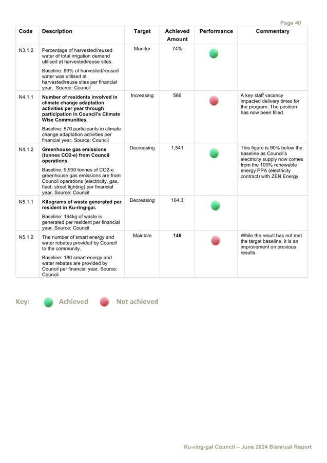
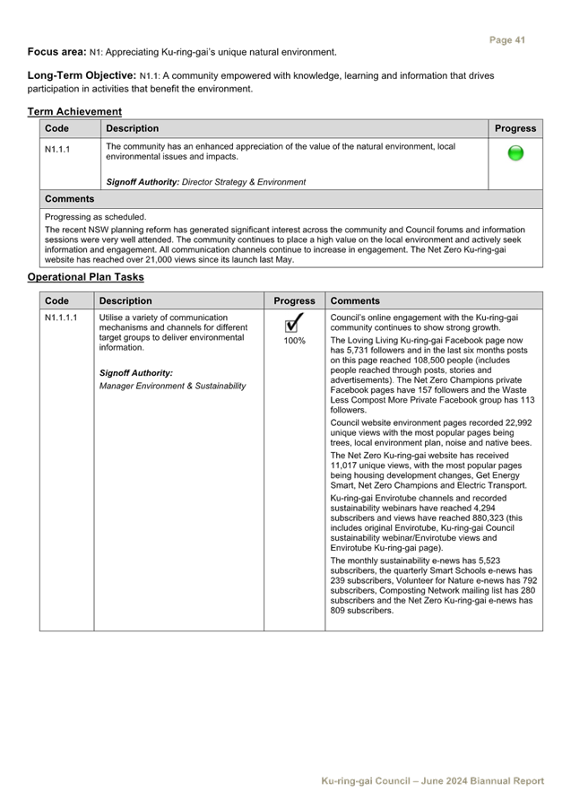
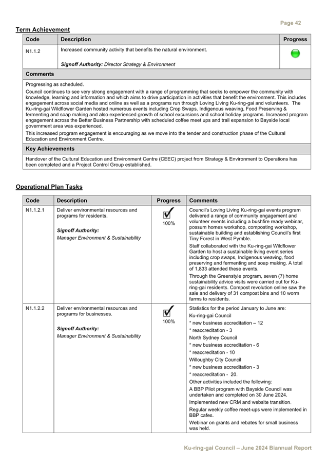
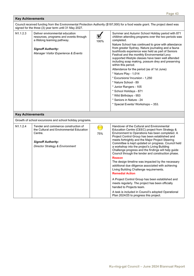
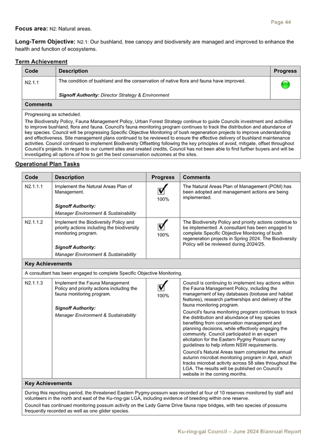
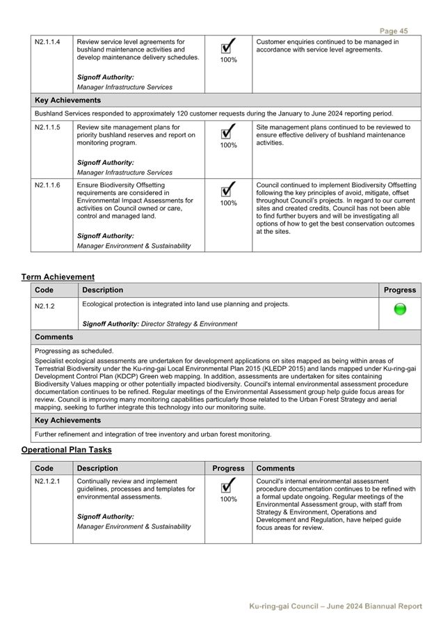
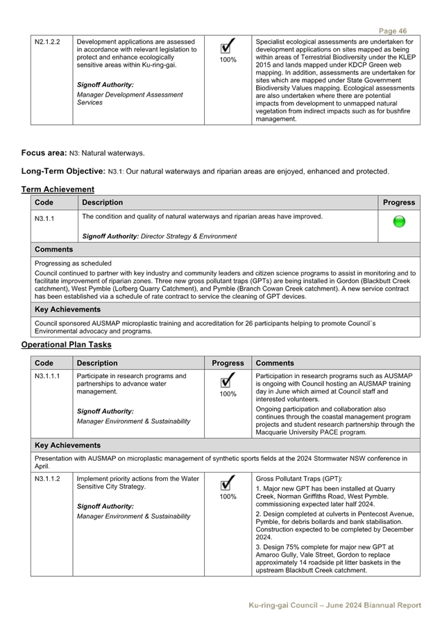
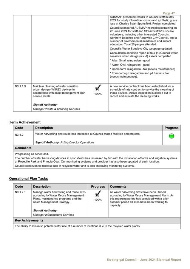
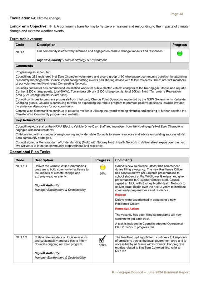
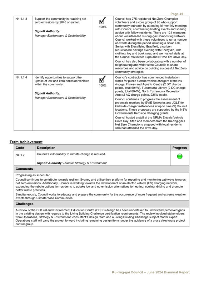
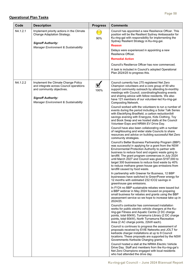
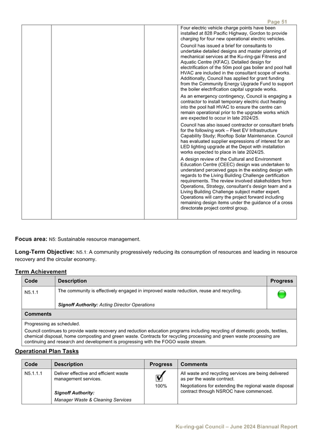
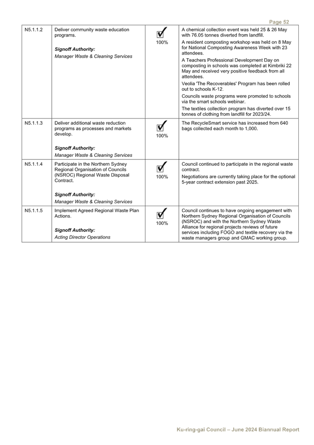
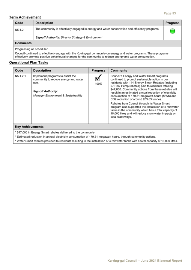
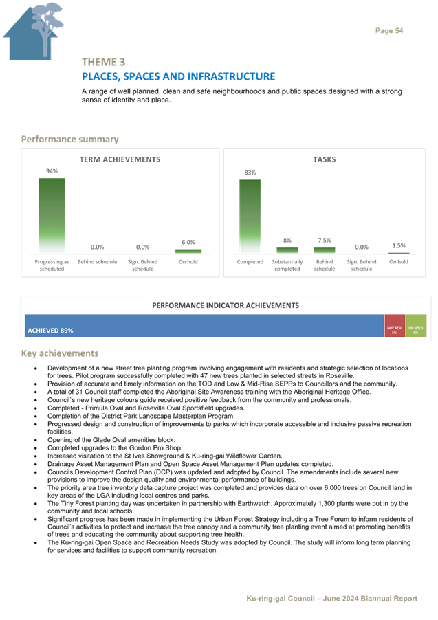
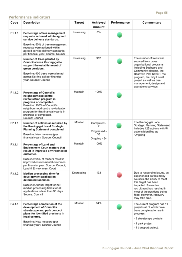
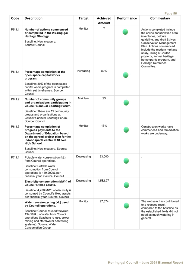
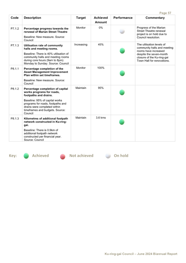
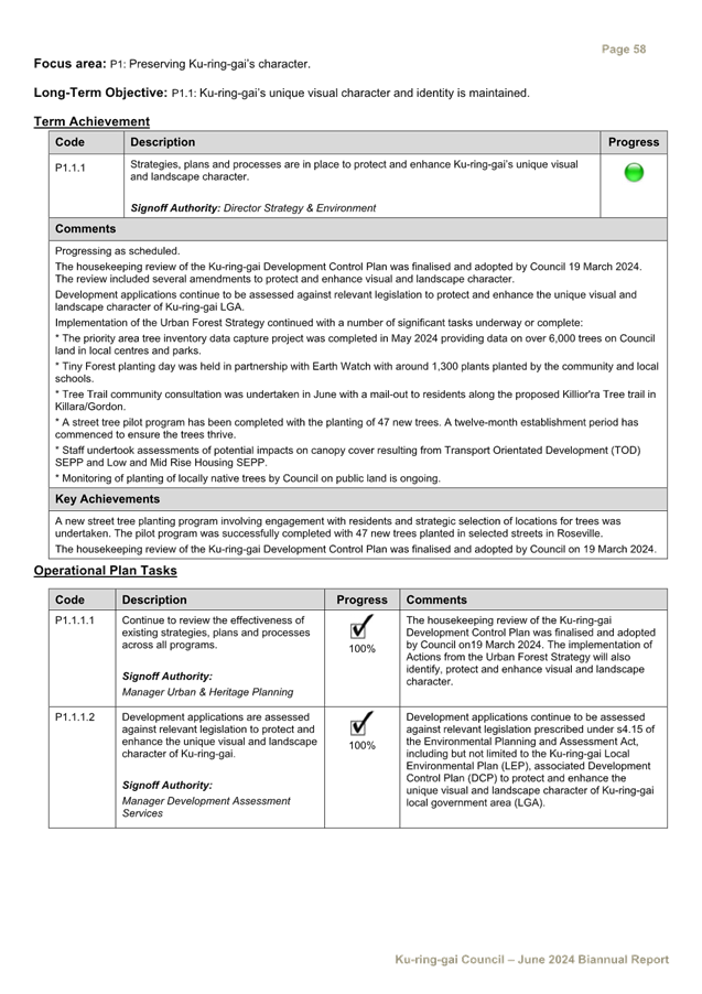
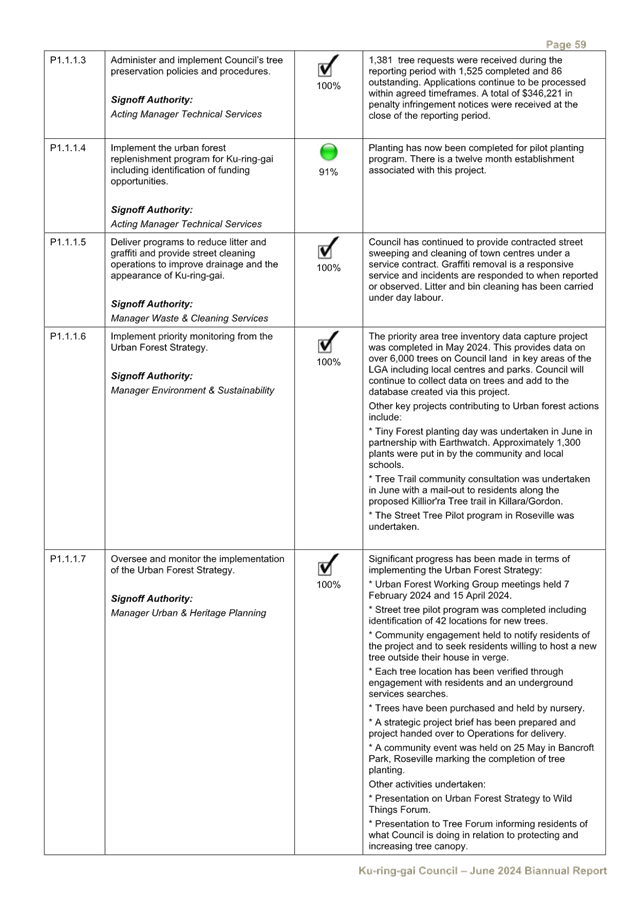
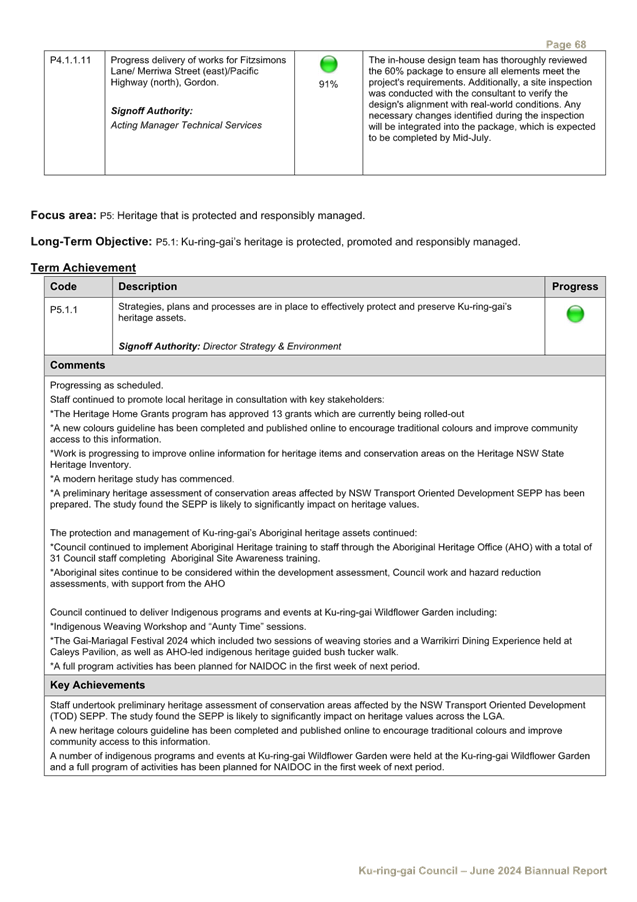
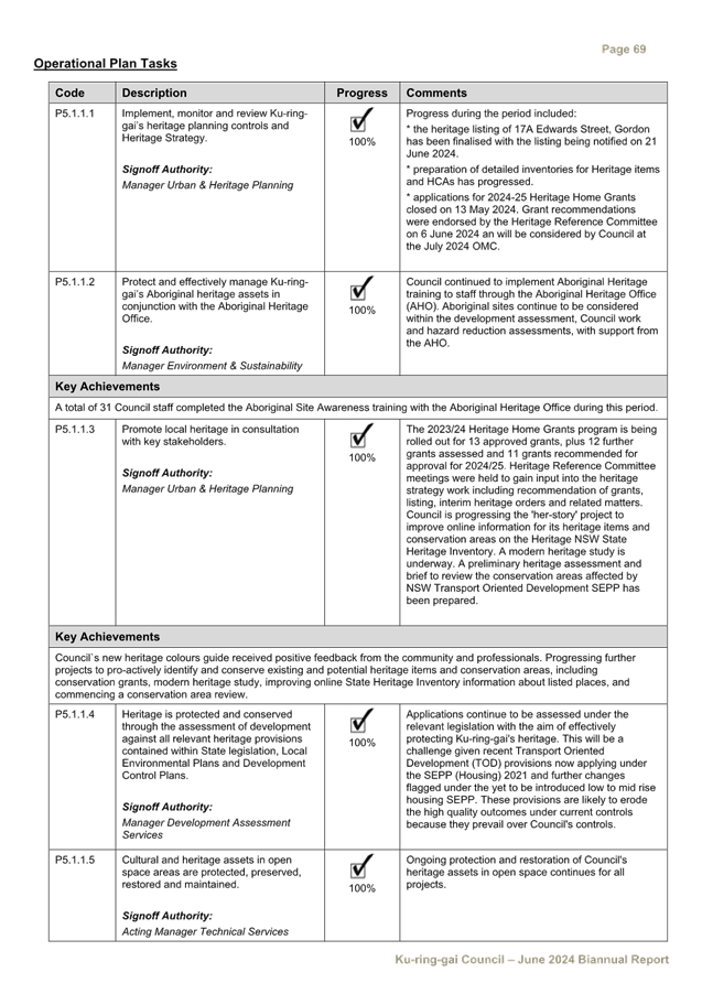
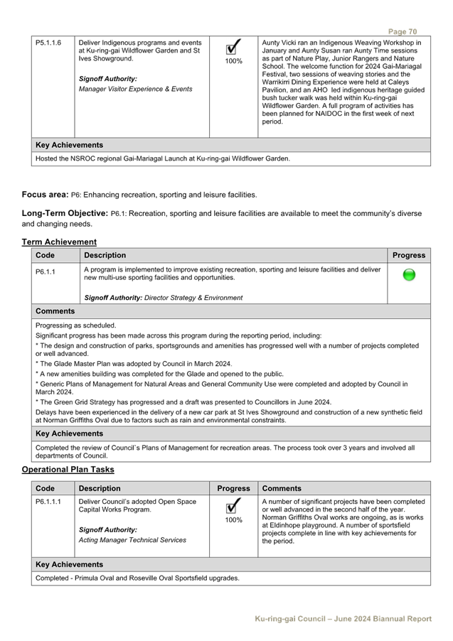
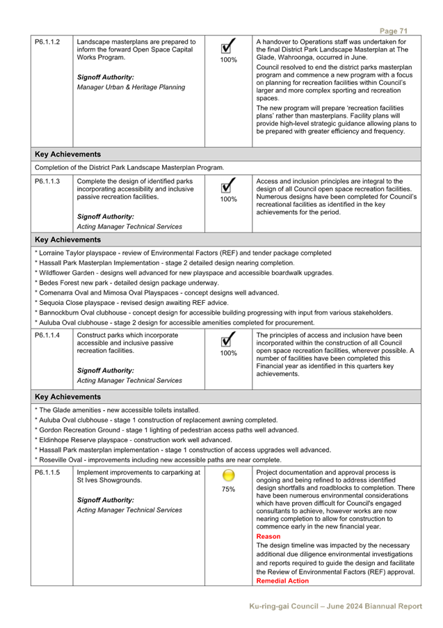

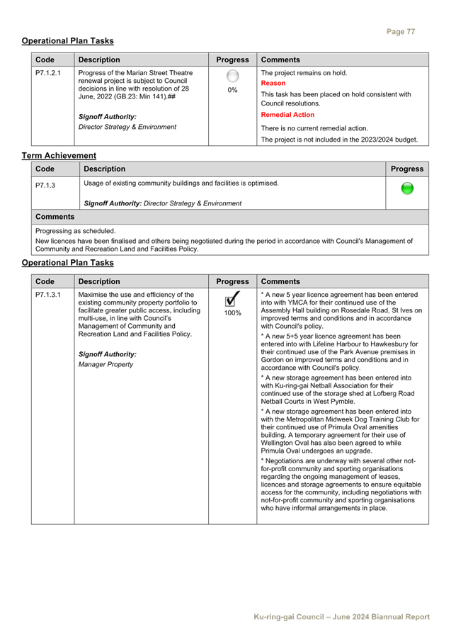
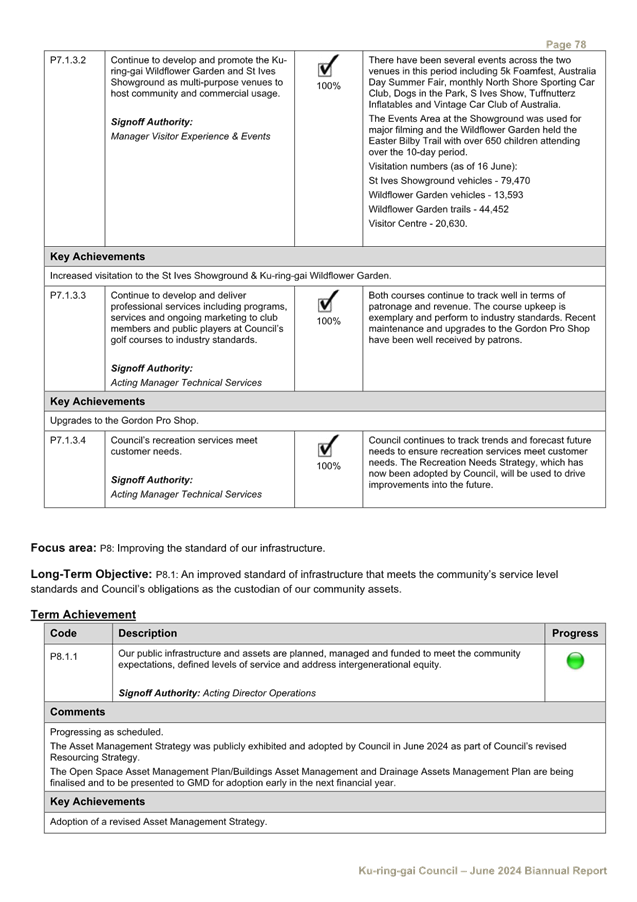
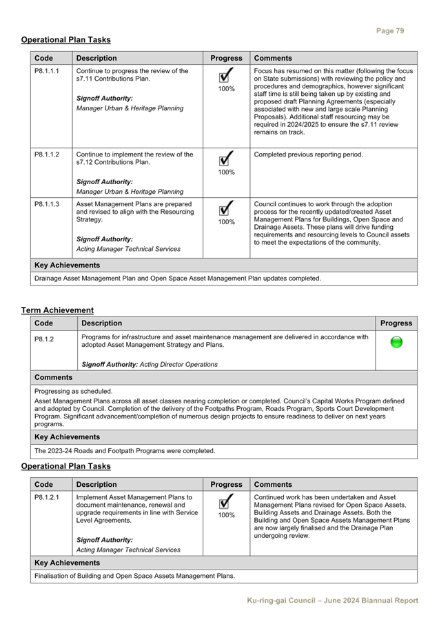
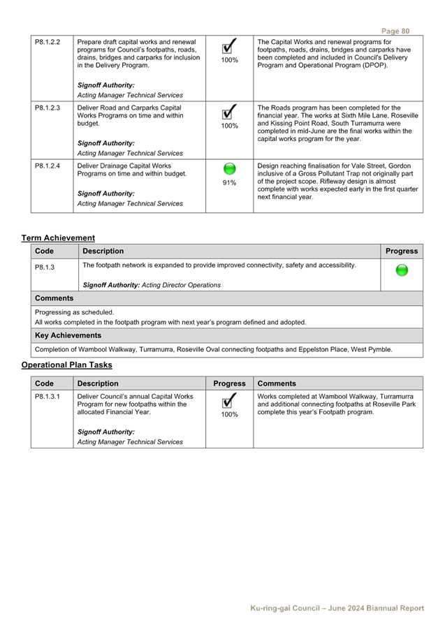
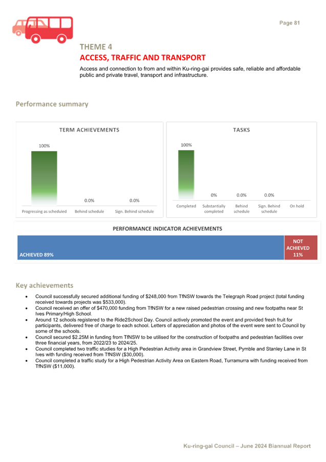
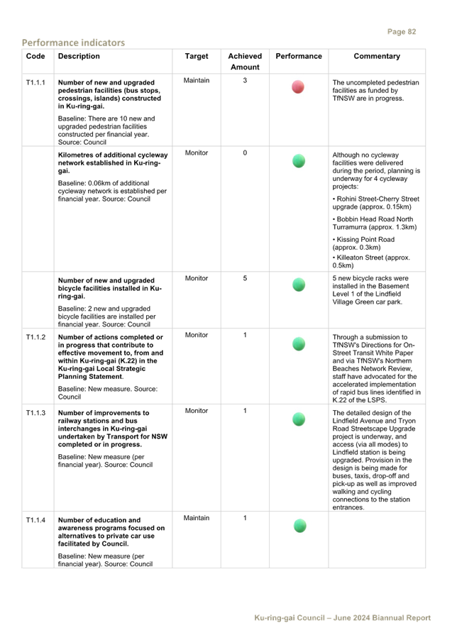
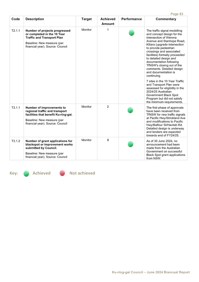
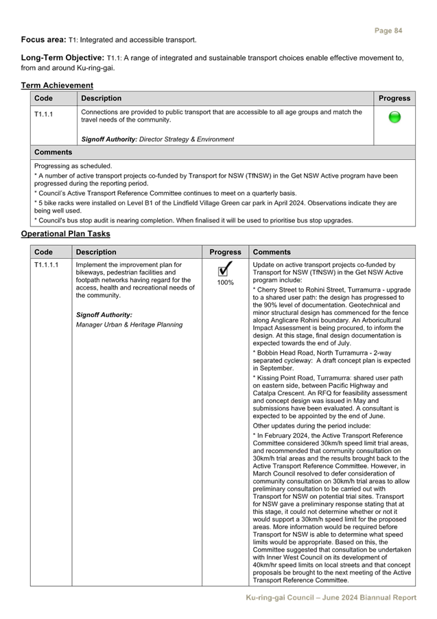
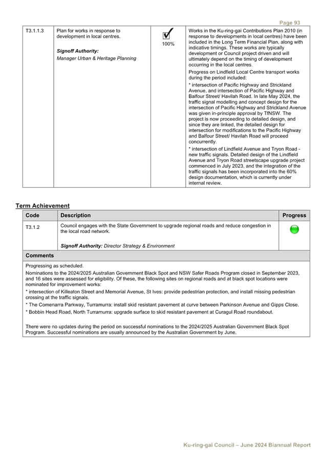
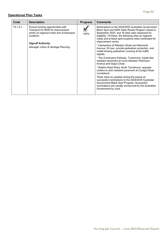
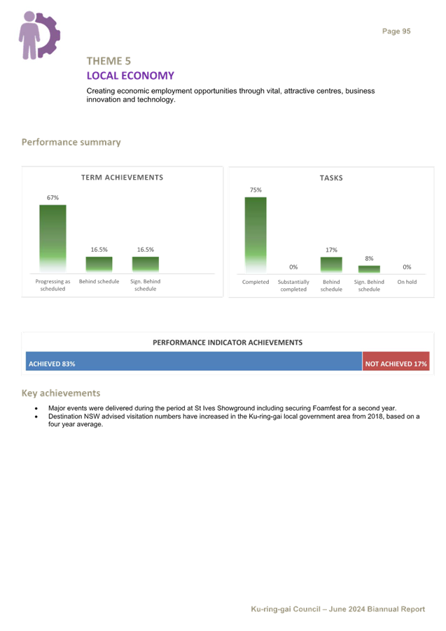
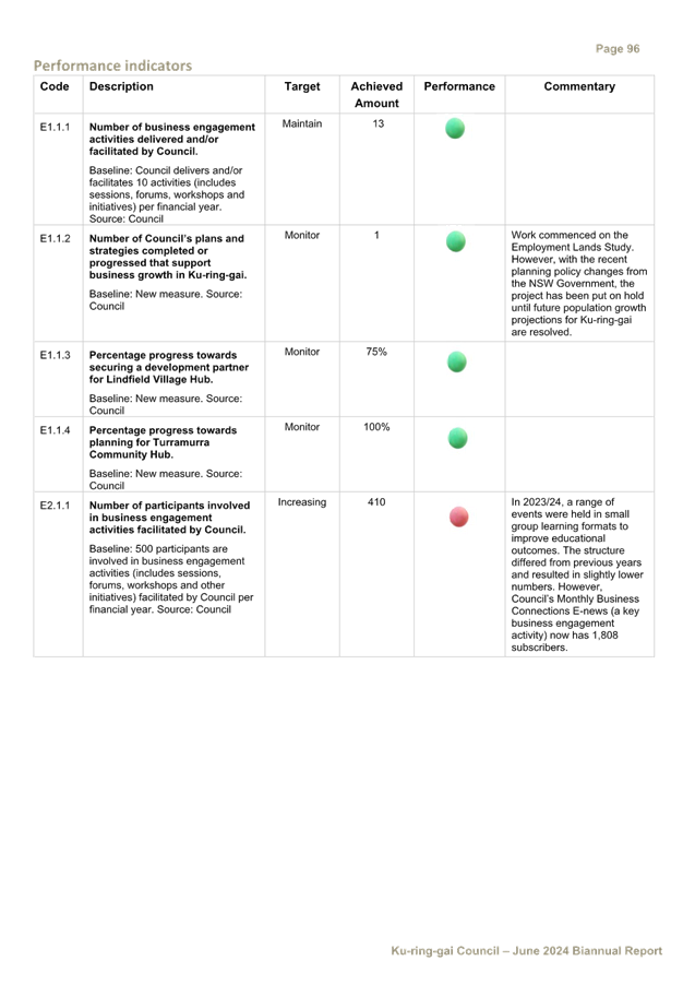
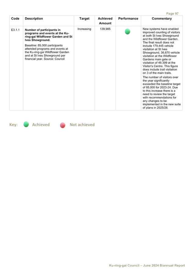
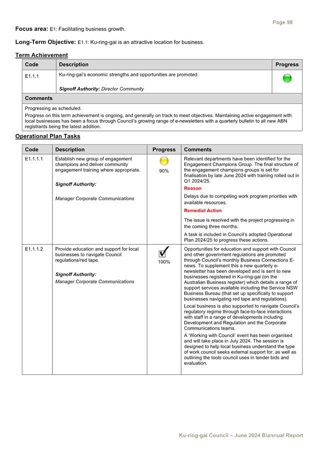
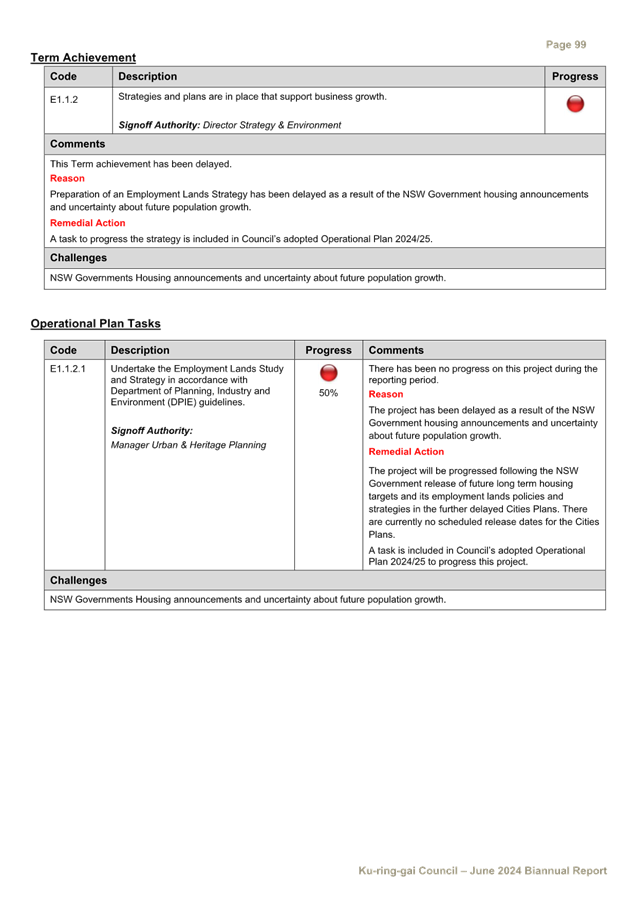
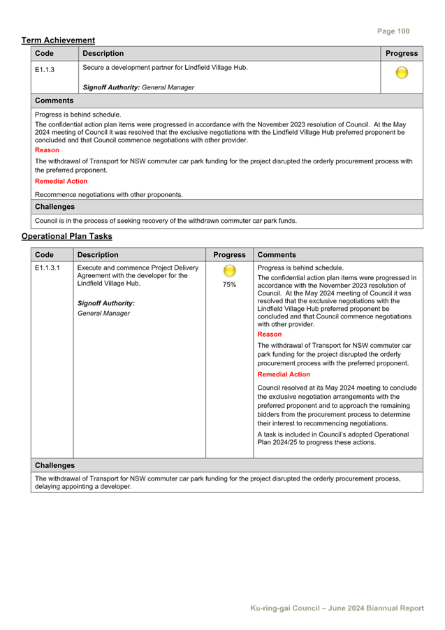
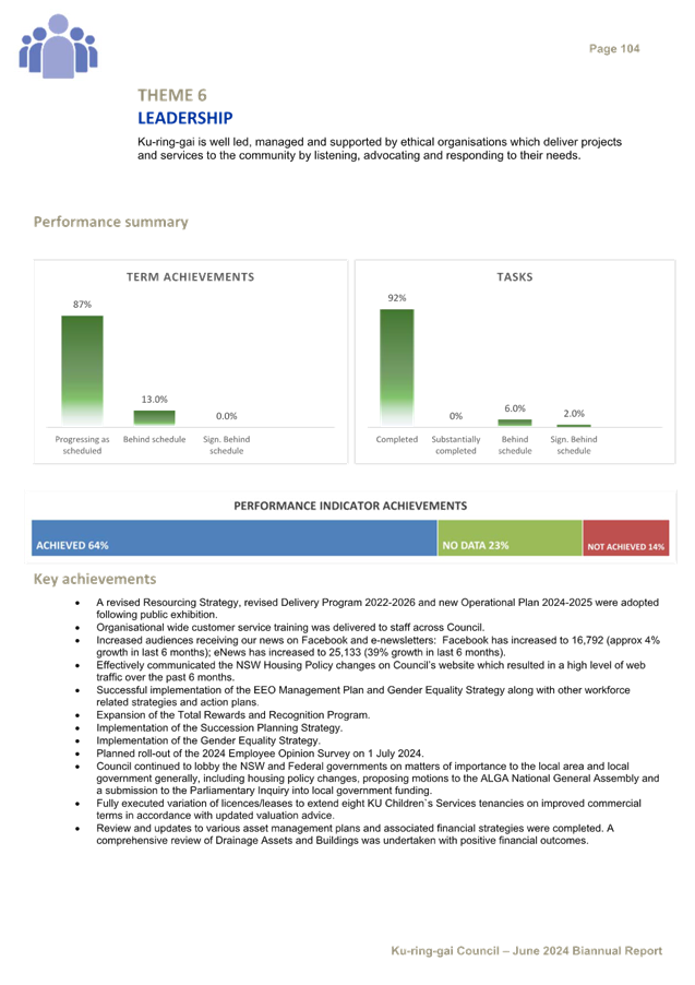

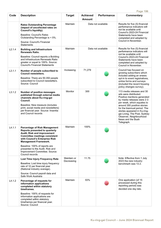
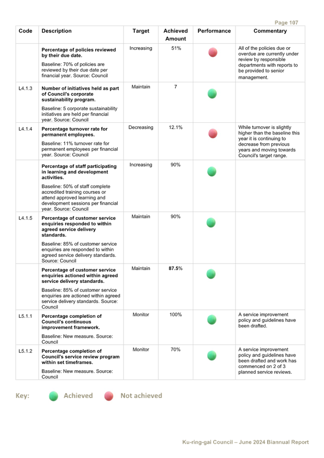
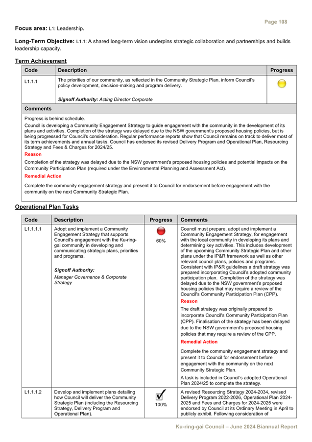
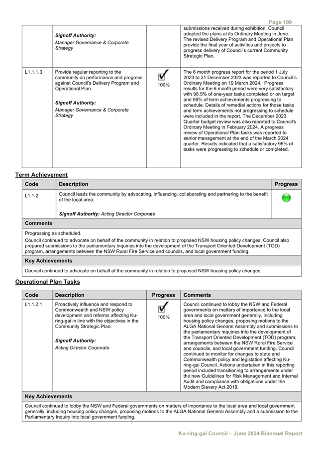

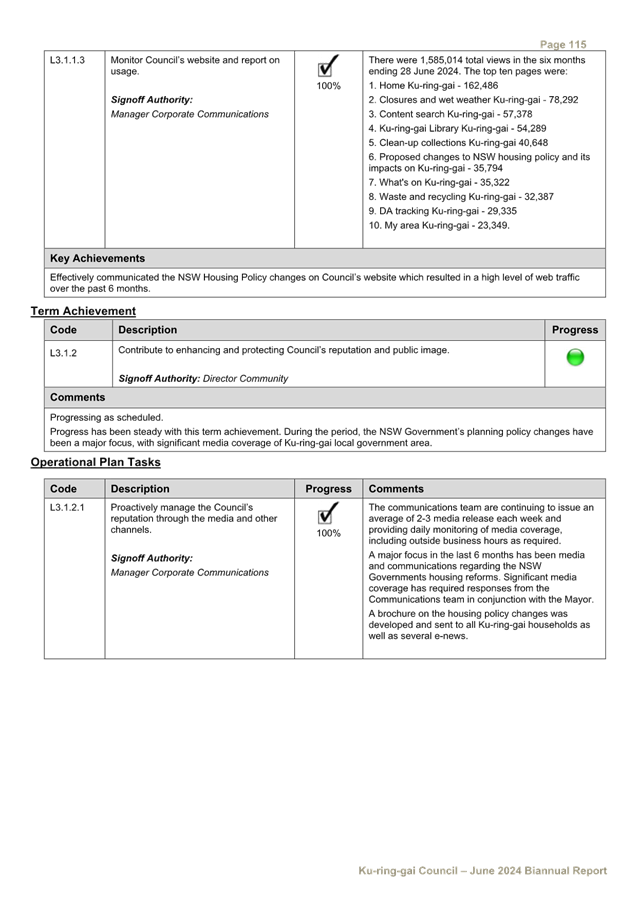
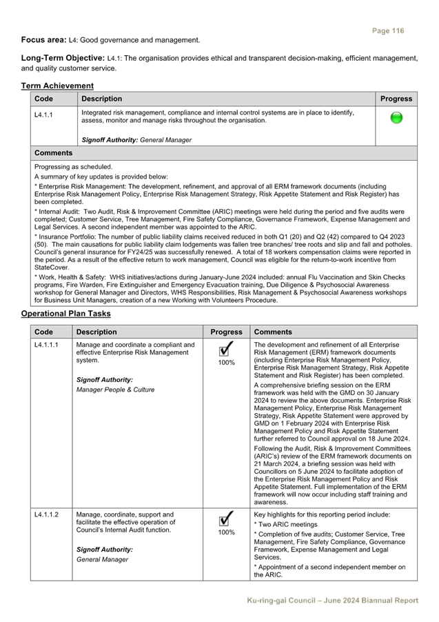
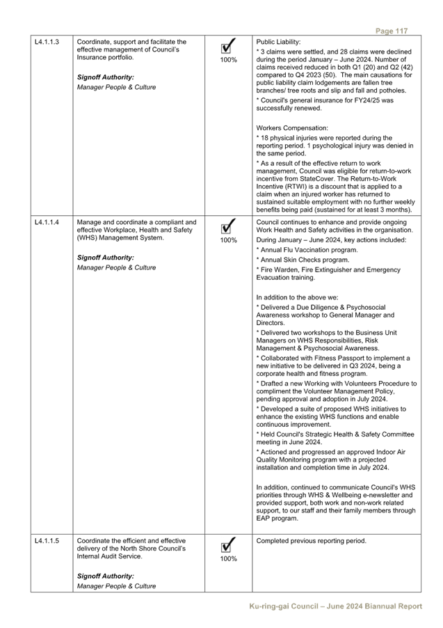
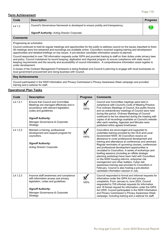
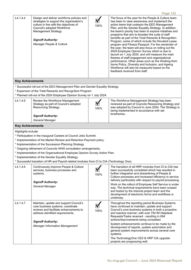
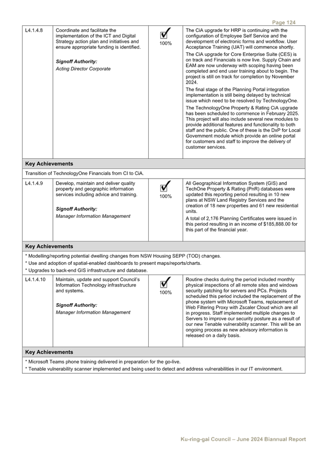
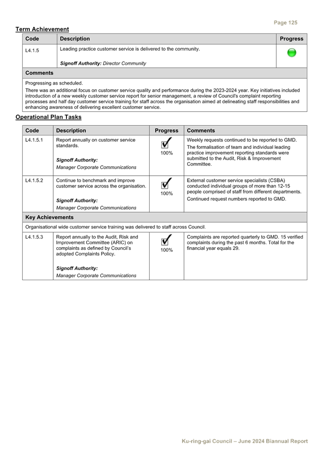
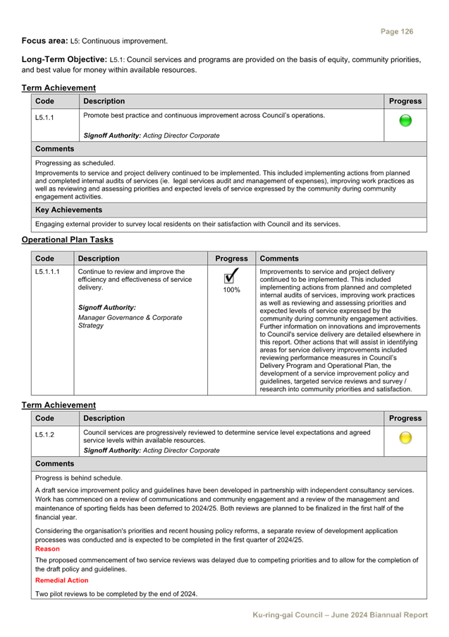
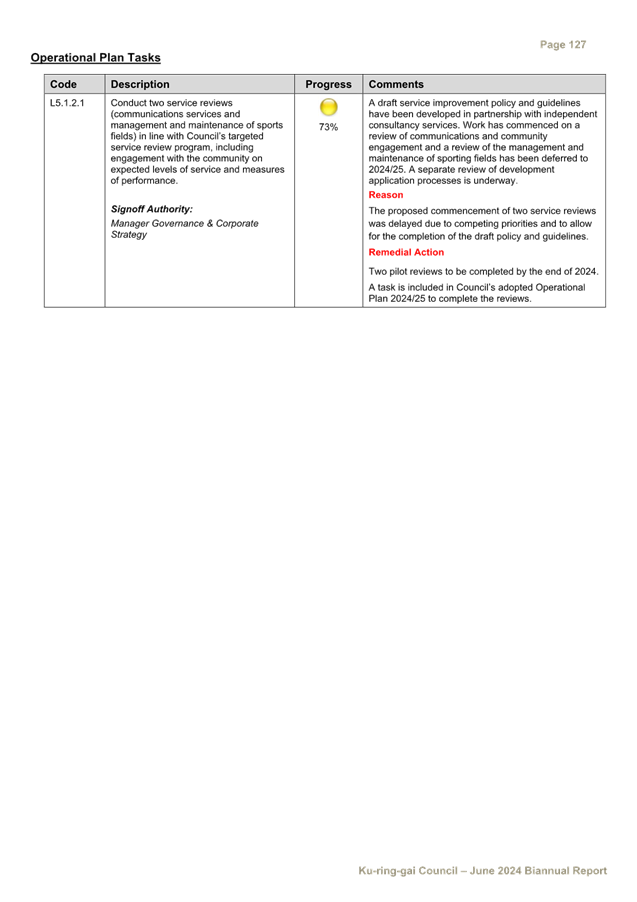

|
Ordinary
Meeting of Council - 13 August 2024
|
GB.9 / 1
|
|
|
|
|
Item
GB.9
|
FY00623/7
|
|
|
28 July 2024
|
Investment Report as at 26 July 2024
EXECUTIVE
SUMMARY
Purpose of Report
To present Council’s investment portfolio performance
for July 2024.
Background
Council’s investments are reported monthly to Council
in accordance with the Local Government Act 1993, the Local Government
(General) Regulation 2005 and Council’s Investment Policy.
Comments
Investment Portfolio Performance Snapshot
The table below provides the investments portfolio
performance against targets identified in Council’s Investment Policy as
well as other key performance indicators based on industry benchmarks.
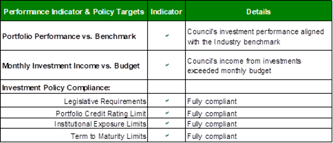
Cumulative
Investment Returns against Budget
The net return on investments for the financial year ending
26 July 2024 was $833,000, compared to the budget of $692,000, resulting in a
favourable year-to-date variance of $141,000, as shown in the table below. The
positive performance was mainly due to more competitive interest rates than
forecasted and a larger end-of-financial-year portfolio than anticipated.
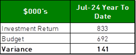
A comparison of the
cumulative investment returns against year-to-date budget is shown in the chart
below.
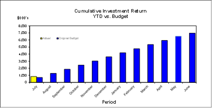
Cash
Flow and Investment Movements
Council’s total cash and
investment portfolio as at 26 July 2024 was $214,146,000
compared to $213,060,000 at the end of June 2024, a net cash inflow of
$1,086,000 mainly due to the first instalment of the
rates income.
During the month, three
investments matured, and three new investments were made.
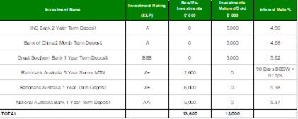
Investment
Performance against Industry Benchmark
Overall, the investment
performance in July was slightly above the industry benchmark.
The benchmark is specific to the
type of investment and the details are provided below. AusBond Bank Bill Index
is used for all Council’s investments.
Table 1 -
Investments Performance against Industry Benchmarks

Table 2
below provides a summary of all investments by type and performance during the
month.
Table 2 - Investments Portfolio Summary during July 2024
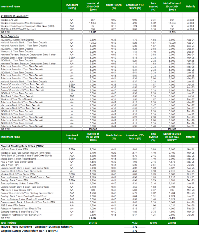
*
Weighted average returns.
**
Funds in at-call/short term accounts are working funds kept for the purpose of
meeting short term cash outflows. At-call investments portfolio is being
monitored on a regular basis to ensure funds are reinvested at higher rates
when opportunities arise, whilst also keeping and adequate balance for
short-term cash outflows.
***
Market Values as at 26 July 2024 were not available at the time of writing the
report.
Investment
by Credit rating and Maturity Profile
The allocation of
Council’s investments by credit rating and the maturity profile are shown
below:
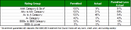
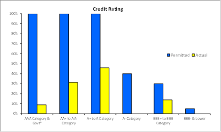
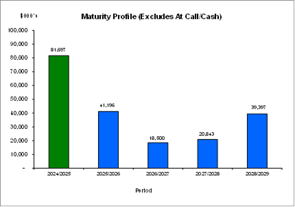
integrated
planning and reporting
Leadership & Governance
|
Community Strategic Plan Long Term Objective
|
Delivery Program
Term Achievement
|
Operational Plan
Task
|
|
L2.1 Council rigorously manages its financial resources
and assets to maximise delivery of services
|
Council maintains and improves its long term financial
position and performance
|
Continue to analyse opportunities to expand the revenue
base of Council
|
Governance
Matters
Council’s investments are made in accordance with the
Local Government Act (1993), the Local Government (General) Regulation 2005 and
Council’s Investment Policy.
Section 212 of the Local Government (General) Regulation
2005 states:
(1) The
responsible accounting officer of a council:
(a) must
provide the council with a written report (setting out details of all money
that the council has invested under section 625 of the Act) to be presented:
(i) if
only one ordinary meeting of the council is held in a month, at that meeting,
or
(ii) if
more than one such meeting is held in a month, at whichever of those meetings
the council by resolution determines, and
(b) must
include in the report a certificate as to whether or not the investment has
been made in accordance with the Act, the regulations and the council’s
investment policies.
(2) The report must be made up to
the last day of the month immediately preceding the meeting.
Risk
Management
Council manages the risk associated with investments by
diversifying the types of investment, credit quality, counterparty exposure and
term to maturity profile.
Council invests its funds in accordance with The Ministerial
Investment Order.
All investments are made with consideration of advice from
Council’s appointed investment advisor, CPG Research & Advisory.
Financial
Considerations
The budget for interest on investments for the financial
year 2023/2024 is $6,973,300. Of this amount approximately $3,564,300 is
restricted for the benefit of future expenditure relating to development
contributions, $1,349,200 transferred to the internally restricted
Infrastructure & Facility Reserve, and the remainder of $2,059,800 is
available for operations.
Social Considerations
Not applicable.
Environmental Considerations
Not applicable.
Community
Consultation
None undertaken or required.
Internal
Consultation
None undertaken or required.
Certification -
Responsible Accounting Officer
I hereby certify that the investments listed in the attached
report have been made in accordance with Section 625 of the Local Government
Act 1993, clause 212 of the Local Government General Regulation 2005 and
Council’s Investment Policy.
Summary
As at 26
July 2024:
· Council’s
total cash and investment portfolio is $214,146,000, an increase of $1,086,000
from the previous month.
· The
net return on investments for the financial year to the end of 26 July 2024 was
$833,000 against the budget of $692,000 giving a year-to-date favourable
variance of $141,000. The favourable variance is
mainly due to higher interest rates than budgeted.
|
Recommendation:
That:
A. The summary of investments and performance for July 2024 be
received and noted.
B. The Certificate of the Responsible Accounting Officer be
noted and the report adopted.
|
|
Tony Ly
Financial Accounting Officer
|
Mette Kofoed
Acting Manager Finance
|
|
Angela Apostol
Acting Director Corporate
|
|
|
Ordinary
Meeting of Council - 13 August 2024
|
GB.10 / 1
|
|
|
|
|
Item
GB.10
|
FY00581/10
|
Local Government NSW Annual Conference
2024
EXECUTIVE
SUMMARY
|
purpose of report:
|
To note key dates for the
Local Government NSW (LGNSW) Annual Conference 2024.
|
|
|
|
|
background:
|
The LGNSW Annual Conference will be held from 17 to 19
November 2024 at the Tamworth Regional Entertainment and Conference Centre.
All LGNSW member councils are invited to submit motions to the Annual
Conference.
|
|
|
|
|
comments:
|
A memo was circulated to Councillors before the July
meeting of Council requesting that any proposed motions be provided to the
General Manager. No motions have been received to date. A report will be
provided to the new Council in October to invite Councillors to attend the
conference.
|
|
|
|
|
recommendation:
|
That Council note the
information in this report.
|
Purpose of Report
To note key dates for the Local Government NSW (LGNSW)
Annual Conference 2024.
Background
The LGNSW Annual Conference will be held from 17 to 19
November 2024 at the Tamworth Regional Entertainment and Conference Centre. All
LGNSW member councils are invited to submit motions to the Annual Conference.
LGNSW is encouraging members to submit motions online as early
as possible before 15 August, to allow assessment of the motions and
distribution of the business paper before the conference. The latest date
motions can be accepted by LGNSW is 20 October.
The following motions have been submitted to the LGNSW Conference
this council term:
· Counselling
Support Services for Councillors (2022)
· Penalty
Increases for Illegal Tree Removal (2023)
· Reforming
the Private Certification System (2023)
· Setting
Development Assessment Fees in-line with Cost Recovery (2023)
The following motions have been submitted to the ALGA National
General Assembly:
· Setting
Development Assessment Fees in-line with Cost Recovery (2023)
· Building
community trust in the delivery of housing (2024)
· Voluntary
Withholding Tax on Councillor Allowances (2024)
Comments
A memo was circulated to Councillors before the July meeting
of Council requesting that any proposed motions be provided to the General
Manager. No motions have been received to date. This August meeting is the last
opportunity for Council to consider and endorse any proposed motions to the
Annual Conference.
A report will be provided to the new Council in October to
invite Councillors to attend the conference.
integrated planning and reporting
Leadership and Governance
|
Community Strategic Plan Long Term Objective
|
Delivery Program
Term Achievement
|
Operational Plan
Task
|
|
A shared long-term vision underpins strategic
collaboration and partnerships and builds leadership capacity
|
Council leads the community by advocating, influencing and
participating in policy development to the benefit of the local area.
|
Proactively influence and respond to Commonwealth and NSW
policy development and reforms affecting Ku-ring-gai in line with the
objectives in the Community Strategic Plan.
|
Governance Matters
By submitting motion to the
LGNSW Annual Conference, Councillors can participate in the key policy
initiatives of the local government association and further the strategic
capacity and policy position of local government. Participating in
strategic forums such as this is in line with Council’s strategic
direction of creating a shared long-term vision underpinned by strategic
collaboration and partnerships.
Risk
Management
Nil.
Financial
Considerations
Nil.
Social
Considerations
Nil.
Environmental
Considerations
Nil.
Community
Consultation
None required or undertaken.
Internal
Consultation
None required or undertaken.
Summary
The LGNSW Annual Conference will be held in November in
Tamworth. All LGNSW member councils are invited to submit motions. A report
will be provided to the new Council in October to invite Councillors to attend
the conference.
Recommendation:
That Council note the information in this report.
|
Christopher M Jones
Manager Governance & Corporate Strategy
|
|
|
Ordinary
Meeting of Council - 13 August 2024
|
GB.11 / 1
|
|
|
|
|
Item
GB.11
|
FY00621/6
|
Project Status Report - August 2024
EXECUTIVE
SUMMARY
|
purpose of report:
|
To provide Council with the
Project Status Report for May, June and July 2024.
|
|
|
|
|
background:
|
On 22 May 2018, a Notice of Motion was considered by
Council regarding the development of a monthly Project Status Report.
On 14 May 2019, Council resolved to extend the reporting
timeframe from monthly to a quarterly.
|
|
|
|
|
comments:
|
The Notice of Motion noted that while projects are
reported to Council and the community through a number of other reports, the
frequency of reporting is a more reliable and recurring method to update
Council and the community.
The report will be placed on Council’s website
following Council’s resolution.
|
|
|
|
|
recommendation:
|
That Council receive and note
the Project Status Report for May, June and July 2024.
|
Purpose of Report
To provide Council with the Project Status Report for May,
June and July 2024.
Background
On 22 May 2018, a Notice of Motion (NOM) was considered by
Council regarding the development of a monthly Project Status Report. As
a result, Council resolved the following;
A. That
a Capital and Operational Projects Report is to be tabled at an ordinary
meeting of council each month. The reporting will commence in FY19 with a
report for the period of July 2018.
B. That
the report should include any progress made in the month as well as a progress
summary for the financial year to date. Where there has been no progress in the
month, it is acceptable to acknowledge that nothing has progressed. And where a
project has yet to commence, it is acceptable to note the expected start date.
C. That
council staff may use their discretion in deciding whether any additional
columns of information should be presented.
D. That
the reported projects should include, but are not limited to, those that are
mentioned in Council’s Delivery Program and Operational Plan. For
brevity, council staff may choose to aggregate some projects or set a
reasonable threshold for reporting purposes.
E. That
the current and historical monthly reports should be easily found on the
Ku-ring-gai Council website (i.e. not just through searching council agenda
items). One possibility is to create a page for the monthly Capital and
Operational Projects Reports under “Current works and upgrades”.
F. That
after the first six months of the report, the Councillors and Directors should
discuss whether the frequency of the report should be adjusted.
On 14 May 2019, Council resolved to extend the reporting
timeframe from monthly to a quarterly report:
A. That
Council receive and note the Project Status Report for April 2019.
B. That
the Project Status Report be placed on Council’s website.
C. That
the reporting timeframe be changed from monthly to quarterly.
In accordance with Part C of the resolution of 22 May 2019,
the attached report is for the period February, March and April 2024
(Attachment A1).
Comments
Reporting on projects is currently undertaken through:
· Quarterly
Financial Reports;
· Bi-annual reports
on the progress of the Delivery Program & Operational Plan; and
· Annual Report.
The NOM noted that while projects are reported to Council
and the community through these statutory reports, the frequency of quarterly
reporting is a more reliable and recurring method to update Council and the
community.
The NOM guided the report structure and content for the
Project Status Report which Council staff has prepared based on the following
criteria:
· Capital projects
delivering community/public infrastructure;
· Threshold applied
to total budget per project – greater than or equal to $250k;
· No operational
projects are included; and
· Any specific
project that Councillors wish to be included in the report.
The report will be placed on Council’s website
following Council’s resolution.
integrated planning and reporting
Leadership & Governance
|
Community Strategic
Plan Long Term Objective
|
Delivery Program
Term Achievement
|
Operational Plan
Task
|
|
The organisation is recognised and distinguished by its
ethical decision-making, efficient management, innovation and quality
customer service.
|
Council's Governance framework is developed to ensure
probity and transparency.
|
Business papers and associated minutes are published in an
accurate and timely manner for public scrutiny and to encourage community
participation.
|
Governance Matters
The Project Status Report will be submitted to Council the
first meeting following the end of each quarter.
Risk Management
The Project Status Report is
not generated through Council’s corporate information and financial
systems. As such, it is reliant of key staff to provide input and to
critique.
Financial Considerations
There are no financial
implications associated with this report.
Social Considerations
The project status report
will be placed on Council’s website following Council’s resolution.
Environmental Considerations
Not applicable.
Community Consultation
Not applicable.
Internal Consultation
General Manager and
Directors, along with staff from Corporate, Operations and Strategy &
Environment have contributed to the structure and content of the Project Status
Report.
Summary
On 14 May 2019, Council resolved to extend the project
status reporting timeframe from monthly to quarterly.
The Project Status Report has been prepared based on the
following criteria:
· Capital projects
delivering community/public infrastructure;
· Threshold applied
to total budget per project – greater than or equal to $250k;
· No operational
projects are included; and
· Any specific
project that Councillors wish to be included in the report.
In accordance with Council’s resolution the attached
report is for the period May, June and July 2024.
|
Recommendation:
A. That
Council receive and note the Project Status Report for May, June and July 2024.
B. That
the Project Status Report be placed on Council’s website.
|
|
Peter Lichaa
Acting Director Operations
|
|
|
Attachments:
|
A1 ⇩ ⇩
|
Project
Status Report May - July 2024
|
|
2024/255734
|
|
ATTACHMENT No: 1 - Project
Status Report May - July 2024
|
|
Item No: GB.11
|
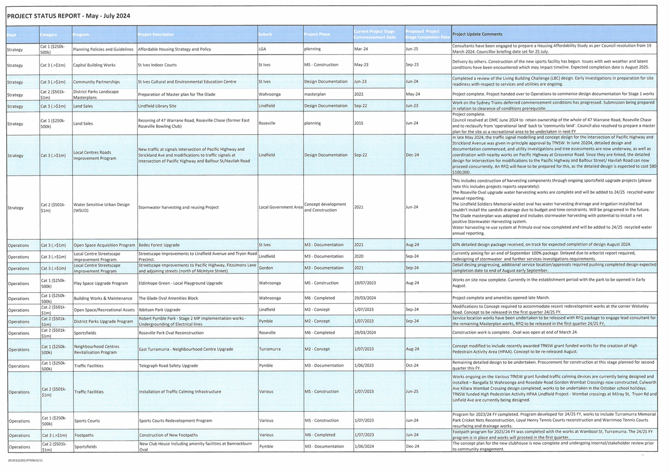
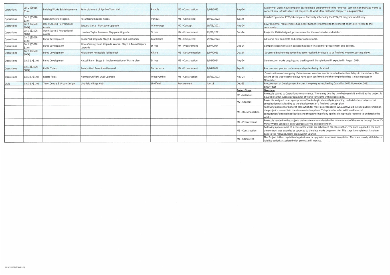
|
Ordinary
Meeting of Council - 13 August 2024
|
GB.12 / 1
|
|
|
|
|
Item
GB.12
|
S12433/5
|
RFT12 - 2024 Leasing- Exercise Equipment
Ku-ring-gai Fitness and Aquatic Centre
EXECUTIVE
SUMMARY
Purpose of Report
To consider the results of the formal tender process for the
leasing of fitness equipment, both cardio and strength equipment for the
Ku-ring-gai Fitness & Aquatic Centre (KFAC).
Background
The KFAC is currently managed by The Y N.S.W on behalf of
Council, in line with the current agreement which expires on 10 October 2024
and will be subject of a further 2-year extension to October 2026.
The current gym equipment at KFAC has reached its useful
life and requires renewal. Council is seeking to enter into a leasing agreement
with options up to 5 years, with payments made monthly over the agreed term.
Council reviewed The Y NSW’s proposal to upgrade the
gym equipment and agreed that Life Fitness, a manufacturer of gym equipment is
the logical choice. Hence the proposed lease agreement is for gym equipment
manufactured by Life Fitness.
All equipment will be located at KFAC within Bicentennial
Park, West Pymble.
Delivery and installation will be coordinated with all
relevant parties to ensure a smooth transition with minimal disruption to the
centre’s operations.
Comments
Council will enter the proposed leasing agreement for the
fitness equipment on the basis that if for any reason Council or The Y NSW
decides to terminate the contract for the management of the Ku-ring-gai Fitness
and Aquatic Centre before the end of the agreed management term, Council will
continue with the provision of this service. The funding for the lease of this
equipment sits within the operating budget for the centre.
At the time of closure of tenders on Tuesday, 7 May 2024,
Council received a total of four (4) submissions. Two (2) of the submitted
tenders were compliant with all procurement and governance requirements, two
(2) of the tenders were non-compliant and, in accordance with the requirements
of the Tender Evaluation Plan and were excluded from further consideration.
integrated planning and reporting
Theme3: Places, Spaces and Infrastructure.
|
Community Strategic
Plan Long Term Objective
|
Delivery Program
Term Achievement
|
Operational Plan
Task
|
|
P7.1: Multipurpose community buildings and facilities are
available to meet the community’s diverse and changing needs.
|
P7.1.3: Usage of existing community buildings and
facilities is optimised.
|
P7.1.3.4 Councils recreation services meet
customer’s needs.
|
Governance Matters
All submissions were recorded in accordance with
Council’s tendering policy. A Tender Evaluation
Panel consisting of staff from the Operations Department was
formed to assess the tenders
received. The evaluation considered:
• Conformity
of submission.
• Lump
sum and monthly fees.
• Capacity,
capability with suitably qualified staff.
• Experience.
• Availability
– Start Date, methodology and estimated duration of work.
• Work
Health and Safety (WHS) and Risk Management.
• Performance
and Financial Assessment.
Confidential attachments to this report include the list of
tenders received and the Tender
Evaluation Report and recommendation. The attachments are
considered to be confidential in
accordance with Section 10A (2)(d)(iii) of The Local
Government Act 1993 as they are considered
to contain commercial in confidence information.
Risk Management
The existing fitness equipment has reached its useful life
and requires replacement to ensure the Work Health and Safety (WHS) and other
risks to customers is managed.
So as to manage Council’s financial exposure, as part
of the evaluation process, tenderers were assessed on financial information and
costs as requested within the tender document. An independent Performance and
Financial Assessment was carried out on the preferred tenderer to ensure that
they were trading responsibly and had the financial capacity.
Financial Considerations
The KFAC has a recurrent budget of $8,500 per month to
accommodate the proposed monthly payments over the 5-year leasing agreement.
Social Considerations
On completion, the proposed work will provide a facility
which is in line with Council’s Community
Strategic Plan and long-term directions including
recreation, sporting and leisure facilities are available to meet the
community’s diverse and changing needs.
Environmental Considerations
There are no identified environmental considerations for
this report.
Community Consultation
The Y, N.S.W, as industry leaders in sports and fitness,
have provided recommendations into current and future trends in the fitness
industry.
Internal Consultation
N/A.
Summary
After reviewing the submissions, Council accepts the 5-Year
(60 Month) leasing term from CHG-Meridian Pty Ltd to provide the gym and
fitness equipment at KFAC.
Recommendation:
That, based on the evaluation assessment undertaken:
A. Council
accepts the tender submission from Tenderer “A” as preferred
Tenderer to provide the lease of the gym equipment for the term of 5 years at
the Ku-ring-gai Aquatic and Fitness Centre (KFAC).
B. The
General Manager be delegated the authority to execute all tender documents on
Council’s behalf in relation to the contract.
C. The
Seal of Council be affixed to all necessary documents.
D. All tenderers be advised
of Council’s decision in accordance with Clause 178 of the Local
Government Tendering Regulation.
|
Chris Houghton
Coordinator Parks & Recreational Assets
|
William Birt
Head of Design – Operations
|
|
Attachments:
|
A1
|
RFT12-2024
Tender Evaluation Report Final
|
|
Confidential
|
|
Ordinary
Meeting of Council - 13 August 2024
|
GB.13 / 1
|
|
|
|
|
Item
GB.13
|
S06198
|
Draft Revised Planning Agreement Policy
2024 for Exhibition
EXECUTIVE
SUMMARY
Purpose of Report
To present the draft revised Planning Agreement Policy to
Council for approval to place on public exhibition.
Background
Ku-ring-gai Council has had a formal adopted Planning
Agreement Policy since 2008. This policy provides guidelines and procedures for
the receipt, negotiation, content and execution of Planning Agreements
associated with Planning Proposals or Development Applications in Ku-ring-gai.
The policy has been reviewed several times since 2008 with the most recent
version having been adopted in 2019.
Comments
Since the 2019 review, the NSW
Department of Planning has issued revised guidelines (the 2021 Practice Note),
and then, as part of a broader review of all the practice notes guiding the
policy and management of Infrastructure Contributions, exhibited a further
revision, together with revised guidelines for s7.11 and s7.12 contributions,
over the holiday period 2023/2024.
Despite the latest exhibition closing in February 2024, it
is not clear when, or whether, the further revisions will be adopted. While it
would have been preferred that the latest iteration had been adopted prior to
finalising this review, council can still have regard to an exhibited draft
document as well as the updated and in effect 2021 Practice Note.
Additionally, there have been a number of Planning
Agreements associated with Development Applications prepared - and some
finalised - since the 2019 review and a number of Letters of Offer have also
been made associated with various Planning Proposals, which are associated with
requested changes to the statutory controls governing redevelopment on the
subject site. Some of these Letters of Offer have been of significant
complexity. This experience has further informed the review of the Planning
Agreement Policy, especially with regard to probity as virtually all
Ku-ring-gai’s prior experience with Planning Agreements were in relation
to the delivery of works-in-kind and/or land dedication in association with a
development application. A number of other councils have also updated their
Planning Agreement Policies since the 2021 guidelines, so the present review
also presented an opportunity to benchmark with other councils.
While minor reviews of the Planning Agreement Policy have,
in the past, been reported collectively with a number of other policies, the
extent of this more comprehensive review in 2024 together with the timing of
the recent NSW Government exhibition process, has justified a different
timeframe for this review.
Taking into account the above circumstances, the main
changes to the Planning Agreement Policy 2024 compared to the currently adopted
2019 version are:
· Updates to the
numbering of all references to the Environmental Planning and Assessment
Regulation 2021;
· Enhanced emphasis
on the need to establish a clear relationship between the proposed development
or planning proposal changes and the nature of the works proposed for probity
reasons;
· Annotation that
the primary purpose of a Planning Agreement cannot be value capture in
accordance with the Department of Planning Practice Note 2021;
· Statement that the
Letter of Offer must stand alone and must not have a pre-emptive draft Planning
Agreement integrated as part of the preliminary offer. This is to facilitate
the offer being reported to an OMC for the imprimatur of council to commence
negotiations and appoint a legal team (and reach a costs agreement), it being
inappropriate to place an entire draft planning agreement in the public domain
as an attachment if it has not yet been formally assessed by council officers;
· Further detail on
the provision for Affordable Housing in Planning Agreements including
references to the Transport Orientated Development SEPP and the Housing SEPP
and the operation of the Ministerial Direction;
· Clearer
distinction between works that are listed within an adopted contributions plan
and proposed to be delivered as works-in-kind and works that are not within the
works programme of an adopted contributions plan being offered as material
public benefits as this affects potential contributions offsets;
· References to the
NSW State Government Regional Housing and Productivity Contributions (HAPs)
effective from 1 October 2023 and emphasising that council cannot make
provision for offsets of these s7.24 contributions without Ministerial concurrence
or the Minister being a party to the agreement;
· Deletion of the
physical copy of Council’s Statement of Business Ethics and
insertion of the URL where the current version can be located;
· References to the
addition of Planning Agreements to the Planning Portal which became a
requirement in 2022/2023;
· Updated references
to formal costs agreements being agreed prior to formally commencing
negotiations to ensure all costs incurred are considered;
· Improved flowchart
of the process with an emphasis on meeting with council prior to lodging a
development application or planning proposal i.e. a formal pre-DA meeting or
pre-Planning Proposal meeting to ensure the earliest instigation of the
preliminary processes.
A change of cover is also suggested to integrate the
Planning Agreement Policy with the adopted and in-effect s7.12 Contributions
Plan. This suite of documents will be joined by the revised s7.11 contribution
plan in due course, and, potentially, a future affordable housing contributions
plan, so sharing a common cover theme helps links the suite of documents that
guide, manage and implement Part 7 of the Environmental Planning and Assessment
Act.
integrated planning and reporting
Theme Six: Leadership
|
Community Strategic Plan
Long Term Objective
|
Delivery Program
Term Achievement
|
Operational
Plan
Task
|
|
L4.1 The organisation
provides ethical and transparent decision making, efficient management and
quality customer service.
|
L4.1.2 Council’s
Governance framework is developed to ensure probity and transparency.
|
L4.1.2.4 Review policies to
support good decision making and compliance with hanging legislation and
guidelines.
|
Theme Three:
Places, Spaces and Infrastructure
|
Community Strategic Plan
Long Term Objective
|
Delivery Program
Term Achievement
|
Operational
Plan
Task
|
|
P8.1 An improved standard of infrastructure that meets the
community’s service level standards and Council’s obligations as
the custodian of our community’s assets.
|
P8.1.1 Our public infrastructure and assets are planned,
managed and funded to meet community expectations, defined levels of service
and address inter-generational equity
|
C6.1.2.1.2; C4.1.2.1.3
New public
infrastructure is planned to support new development and ensure that everyone
who lives and works in Ku-ring-gai continues to enjoy access to public
facilities.
|
Governance Matters
While the review of the
Planning Agreement Policy 2019 was nominally scheduled for late 2023, this
would have pre-empted the exhibition of revised guidelines by the NSW
Department of Planning, such exhibition taking place over the 2023/2024 holiday
period ending 23 February 2024. Additionally, in early 2024, several Letters of
Offer were received associated with draft Planning Proposals. Almost all
previous Letters of Offer at Ku-ring-gai have been associated with Development
Applications. This experience presented an opportunity to further inform the
Planning Agreement Policy going forwards. As such, while the review has
technically been delayed, the result is a better iterated policy that
references the updated Practice Note, recent policy changes relating to the
Planning Portal, and draws on direct experience with Letters of Offer to enter
into a Planning Agreement that have been associated with recent Planning
Proposals. The removal of the embedded Statement of Business Ethics and its replacement
with the URL where the latest copy is to be found was also a request of
Governance.
Risk Management
The draft Planning Agreement
Policy has been reviewed internally by the Urban Planning Team and legal review
was also sought by Council’s Corporate Lawyer.
Financial Considerations
Planning Agreements
facilitate the dedication of land and/or the delivery of works to council for
the purposes of enhancing public amenities and assets. While these may result
in future maintenance costs (on a case-by-case basis), the land and/or works
are generally essential infrastructure supporting development that council
would retain an onus to deliver. The future capacity to include Affordable
Housing is also likely to have a positive impact on Ku-ring-gai with the
capacity to support and retain essential workers. Whether or not Council has
direct involvement in the delivery and/or management of Affordable Housing will
be further explored as part of Council’s Affordable Housing Options Paper
and Policy which is currently under preparation.
Social Considerations
There are no direct social
considerations arising from the draft revised Planning Agreement Policy. Each
proposed Planning Agreement involves a bespoke assessment of social
considerations concurrent with the respective Planning Proposal or Development
Application with which it is associated. A planning agreement must be
associated with either a Planning proposal or a Development Application. All
draft planning agreements are formally exhibited for public comment as part of
the process.
Environmental Considerations
There are no direct
environmental considerations rising from the draft revised Planning Agreement
Policy. Each proposed Planning Agreement involves a bespoke assessment of
environmental considerations concurrent with the Planning Proposal or
Development Application with which it is associated. A planning agreement must
be associated with either a Planning proposal or a Development Application.
Community Consultation
The draft Planning Agreement
Policy 2024 is recommended for exhibition for public comment for a minimum of
28 days and then will be reported back to Council after the close of the
exhibition period. Until that time, the adopted Planning Agreement Policy 2019
will remain in place.
Internal Consultation
The draft Planning Agreement
Policy was considered by the regular meeting of the General Managers and
Directors prior to being reported to Council.
Summary
This report presents the
draft revised draft Planning Agreement Policy 2024, which is intended,
following public exhibition, and subsequent reporting back post-exhibition for
adoption, to replace the present adopted Planning Agreement Policy 2019. The
review incorporates revised practice notes, and recent experience arising from
applying the existing Planning Agreement Policy to Letters of Offer associated
with Planning Proposals.
Recommendation:
That the draft revised Planning Agreement Policy 2024 be
placed on public exhibition for a minimum of 28 days and, thence, be reported
back to Council at the close of the exhibition period.
|
Kate Paterson
Infrastructure Coordinator
|
Craige Wyse
Team Leader Urban Planning
|
|
Antony Fabbro
Manager Urban & Heritage Planning
|
Andrew Watson
Director Strategy & Environment
|
|
Attachments:
|
A1 ⇩ ⇩
|
Draft
Planning Agreement Policy (Exhibition Version)
|
|
2024/255890
|
|
ATTACHMENT No: 1 - Draft
Planning Agreement Policy (Exhibition Version)
|
|
Item No: GB.13
|
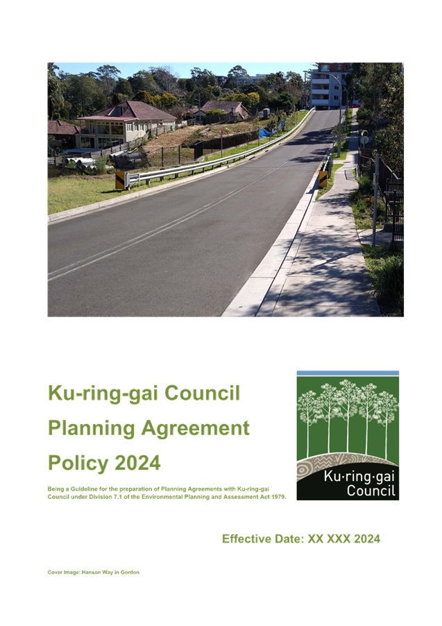

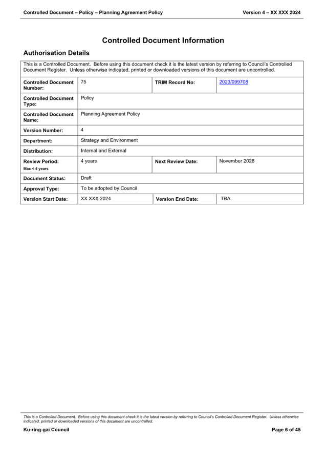
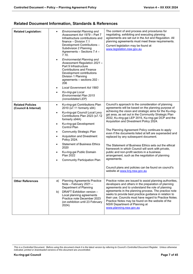
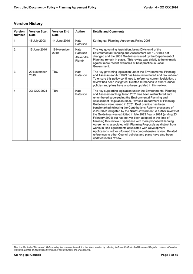
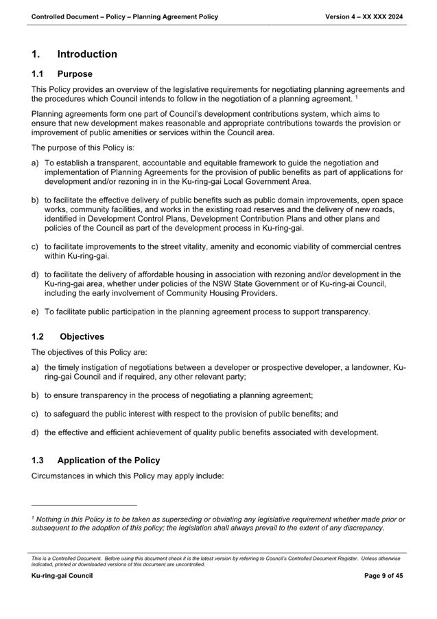


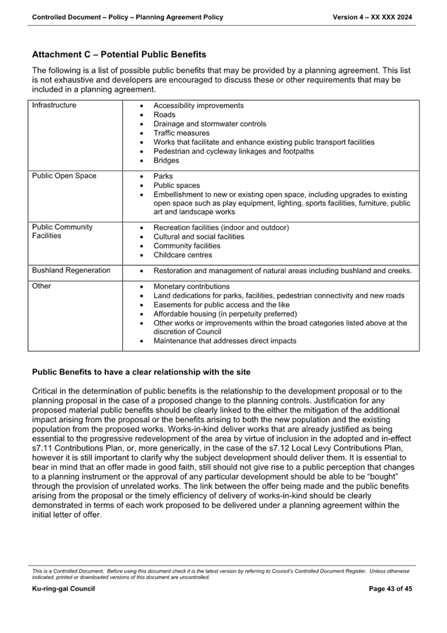
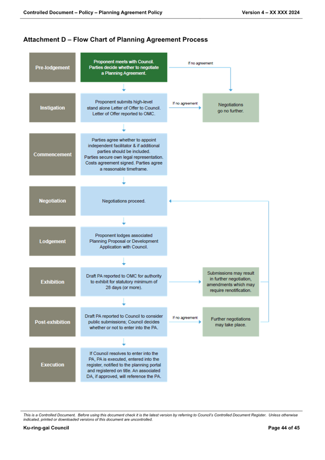

|
Ordinary
Meeting of Council - 13 August 2024
|
GB.14 / 1
|
|
|
|
|
Item
GB.14
|
S14408
|
Planning Proposal for 1364-1369 Pacific
Highway and 1, 1a, 3 and 3a Kissing Point Road, Turramurra
EXECUTIVE
SUMMARY
Purpose of Report
To refer the Planning Proposal for 1364-1396 Pacific Highway
and 1, 1A, 3 and 3A Kissing Point Road, Turramurra (Turramurra Plaza site) to
Ku-ring-gai Council to determine whether to forward the matter to the Minister
for a Gateway determination in accordance with section 3.34 of the Environmental
Planning and Assessment Act 1979.
Background
Council has engaged consultant MG Planning Pty Ltd to
conduct the assessment of the subject Planning Proposal as Council is the
landowner of part of the site (car park site). An independent urban design
assessment has also been prepared by Dr Michael Zanardo of Studio Zanardo
and independent economic and retail assessment prepared by Hill PDA. Other
assessments including biodiversity, natural areas, heritage, traffic and
transport, survey and infrastructure and have been carried out internally by
Council’s specialists.
A previous Planning Proposal request for the subject site
was submitted to Council by the same Proponent in May 2022. The request sought
to:
· Amend the maximum
permissible height applying to the site on the on the Height of Buildings map
from 17.5m (approx. 5 storeys) to 50m (approx. 15 storeys)
· Amend the maximum
permissible Floor Space Ratio applying to the site on the Floor Space Ratio map
from 2:1 to 4.2:1
· Impose a minimum
commercial/retail FSR of 1:1.
· Remove the maximum
commercial FSR standard of 1.2:1 (Area 4 in clause 4.4 (2E)), and
· Reclassify the
Council owned part of the site from community to operational land.
The matter was reported to Council in February 2023 with a
recommendation that the Council resolve not to submit the Planning
Proposal to the Minister for a Gateway Determination in accordance with section
3.34 of the Environmental Planning and Assessment Act 1979 as the
independent planning assessment concluded that the Planning Proposal did not
meet the established strategic or site specific merit tests primarily as it was
determined that:
a. the
proposed height and scale was inconsistent with the status of Turramurra in the
established Ku-Ring-Gai centres hierarchy
b. the
proposal would have an adverse impact on the environment, adjacent development
and the surrounding context and did not provide for a high quality development
on site, and
c. the
proposed height and scale was inconsistent with the site location which is
outside of the core redevelopment priority sites of the Turramurra local centre
(to the north of the Highway) and which is where the most intense development
in the centre is appropriately located.
Further the KLPP provided advice to Council recommending
that the Planning Proposal not be submitted to the Minister for a Gateway
Determination. On 14 February 2023 Council resolved to:
A. note
the advice of the KLPP in respect of the subject Planning Proposal
B. resolve
not to submit the Planning Proposal to the Minister for a Gateway Determination
in accordance with section 3.34 of the Environmental Planning and Assessment
Act 1979, and
C. advise
the Proponent accordingly.
Following refusal of the original Planning Proposal request
the Proponent advised that it has amended the proposal to address matters
raised in the assessment report. A new Planning Proposal was formally submitted
to Council on 25 March 2024 following test of adequacy and the payment of fees.
Following an initial review by the independent planning and urban design
consultants, issues were identified and a request for information letter issued
on 26 April 2024. Issues raised in the letter in respect of the Planning
Proposal include:
· Reference Scheme
non-compliance with:
o Apartment Design Guide (ADG)
requirements in respect of solar access to living rooms and private open space,
natural cross ventilation, number of units off a circulation core, solar access
to the lower plaza area and deep soil area
o Canopy cover requirements
o Requirements for loading /
unloading
· Solar impact to
neigbourbouring properties (residential flat building (RFB) at 5 Kissing Point
Road)
· Lack of a draft
site-specific Development Control Plan (DCP)
· Loading
arrangements and lack of updated SIDRA analysis, and
· Lack of Letter of
Offer in respect of public benefits albeit that the Planning Proposal
identified proposed dedications.
The Proponent submitted amended documentation to address the
issues raised in the RFI letter on 30 May 2024. The amended information
included:
· Revised Planning
Proposal Report
· Stand-alone
site-specific Development Control Plan
· Revised Design
Report (including Reference Scheme), and
· Transport Impact
Assessment.
Accordingly, a copy of the updated
Planning Proposal and relevant appendices is included at Attachments
A2-A12.
The Planning Proposal request seeks to make the following
amendments to the Ku-ring-gai Local Environmental Plan 2015 (KLEP 2015):
· Amend the maximum
permissible height applying to the site on the Height of Buildings map from
17.5m to 34.5m (9 storeys where the original PP request proposed 50m/15
storeys);
· Amend the maximum
permissible Floor Space Ratio applying to the site on the Floor Space Ratio map
from 2:1 to 3:1 (where the original PP request proposed 4.2:1);
· Impose a minimum
commercial/retail FSR of 0.85:1 (where the original PP request proposed 1:1);
· Remove the maximum
commercial FSR standard of 1.2:1 (Area 4 in clause 4.4 (2E)); and
· Reclassify the
Council owned part of the site from community to operational land.
As outlined in the Planning
Proposal request report prepared for the Proponent by The Planning Studio, the
proposed amendments to the KLEP 2015 are intended to “facilitate the
development of the site for a mixed-use development including commercial
premises, retail premises and shop-top housing.”
The Planning Proposal report
claims that the proposal will facilitate an exemplar mixed use
commercial/residential development within a Local Centre context that aligns
with, supports, and promotes key strategic planning priorities of State and
local government. It identifies that the objectives of the Planning Proposal
are:
· To
facilitate the redevelopment of the site in accordance with the relevant
principles of A Metropolis of Three Cities, the North District Plan,
Ku-ring-gai Local Strategic Planning Statement (LSPS), Ku-ring-gai Housing
Strategy, Turramurra Public Domain Plan and Ku-ring-gai Development Control
Plan.
· To
amend the KLEP 2015 to provide for the urban renewal of the subject site into a
lively mixed use precinct which will provide opportunities for supermarkets,
retail shops, commercial space, food and beverage offerings and residential
accommodation. This will be achieved through the implementation of new built
form controls including height and FSR, and a range of site specific
provisions.
· To
provide additional retail floor space in Turramurra Local Centre in response to
a large undersupply within the Ku-ring-gai LGA as identified in the Ku-ring-gai
LSPS and Preliminary Need and Impact Assessment.
· To
facilitate the provision of a full-line supermarket in the Turramurra main
trade area, and one that is underserviced in supermarket floor space provision
in comparison to the Sydney metropolitan average.
· To
provide site specific controls which will ensure an appropriate massing for the
site which reflects the strategic context of the site, while respecting the
immediate context and minimising potential amenity impacts on adjoining
neighbours, heritage items and conservation areas.
· To
assist in achieving State and local government’s housing targets and
address the lack of housing availability within the locality, including the
provision of affordable housing.
The intended outcomes are stated
as follows:
· To
provide additional employment in close proximity to public transport.
· To
provide higher density residential accommodation in a centre location in close
proximity to public transport, jobs and services.
· To
improve pedestrian permeability within and around the site with two through
site links.
· To
improve traffic flow within and around the site with a new road within the
southern boundary.
· To
create a village atmosphere through the provision of public open spaces which
promote social interaction within the community.
· To
protect the adjoining Granny Springs Reserve and ensure a well managed
interface to the Reserve.
· Be
respectful and exist harmoniously with the prevailing character of the area.
The Planning Proposal was
referred to the Ku-ring-gai Local Planning Panel for advice at its meeting of
22 July 2024 as required by the Local Planning Panels Direction –
Planning Proposals issued by the Minister for Planning under Section 9.1 of the
Environmental Planning and Assessment Act 1979. The KLPP supported the
Planning Proposal and advised as follows:
A. That
Ku-ring-gai Local Planning Panel makes a recommendation to Council that the
following Planning Proposal be submitted to the Department of Planning, Housing
and Infrastructure for a Gateway Determination.
B. Should
a Gateway Determination be issued for public exhibition of the Planning
Proposal, the site-specific amendments to the Ku-ring-gai DCP Part 14 Urban
Precinct and Sites 14B Turramurra Local Centre as outlined in this report, be placed
on public exhibition concurrent with the Planning Proposal.
C. That
Council authorise the General Manager to correct any minor anomalies of a
non-policy and administrative nature that may arise during the planning making
process.
In providing this advice the
KLPP endorsed the recommendations of the assessment report and concluded that
the Planning Proposal is consistent with the E1 zoning of the site, will
facilitate redevelopment of the site for appropriate uses, provides public
benefits and demonstrates strategic and site-specific merit.
A copy of the KLPP minutes
including resolution in relation to the Planning Proposal is provided at Attachment
A16.
Reclassification
of public land
Among
other matters the Planning Proposal seeks to reclassify the Council owned part
of the site from community to operational land via an amendment to Schedule 4
of KLEP 2015. Council resolved to reclassify the subject land by
resolution on 16 March 2021. The Department of Planning, Housing and Infrastructure’s
Practice Note PN 16-001 (date 5 October 2016) sets out requirements for the
classification and reclassification of public land. Accordingly, this
Practice Note should be address in the Planning Proposal prior to the matter
being submitted for a Gateway Determination.
Reference
Scheme
The Planning Proposal is supported by a Reference Scheme
prepared by DKO Architecture (Rev 4, May 2024) which comprises:
· Site area of
8,459.7m2
· Height maximum of
9 storeys
· 181 apartments
(including min. 5% affordable housing)
o 1 bedroom apartments –
31.5%
o 2 bedroom apartments –
50.8%
o 3 bedroom apartments –
17.7%
· GFA:
o Retail / commercial –
7,190m2
o Residential – 18,189m2
o Total – 25,379m2
· Maximum FSR
– 3:1
· Solar access
– 132 apartments (74%) achieve 2 hours direct sunlight in midwinter (21
June)
· Cross ventilation
– 108 apartments (60.8%) achieve
· Communal Open
Space – 3,400m2 on ground, Level 1, 2,7 and 9 (44% of site
area)
· Car parking
– 414 spaces (including 179 x residential spaces, 168 x retail spaces, 37
x commercial spaces and 30 x public spaces (in lieu of existing Council parking
spaces on site)
The purpose of the Reference Scheme is not to accurately
represent the final development but rather to demonstrate that a scheme which
represents the proposed maximum height and FSR can readily be accommodated on
the site and can comply with applicable controls and requirements without
resulting in any unreasonable environmental impacts.
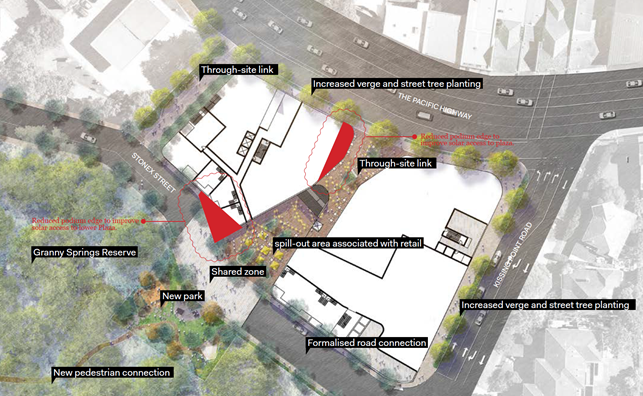
Image 1 – Reference Scheme Masterplan (Source: Urban
Design Study, DKO Architecture, May 2024. Note: amendments shown in response
to preliminary RFI comments)
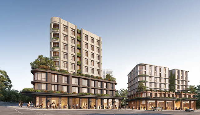
Image 2 – Reference Scheme artists impression from
Pacific Highway (Source: Urban Design Study, DKO Architecture, May 2024)
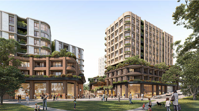
Image 3 – Reference Scheme artists impression from
Stonex Drive (Source: Urban Design Study, DKO Architecture, May 2024)

Image 4 – Reference Scheme sections (Source: Urban
Design Study, DKO Architecture, May 2024)
Image 5 – Design response proposed use diagram(Source:
Urban Design Study, DKO Architecture, May 2024)
The proposed public benefits of the Planning Proposal as
identified by the Proponent are as outlined below:
|
Proposed Public Benefits of
Planning Proposal
|
|
Item
|
Description
|
|
Land Dedication
(new road, new park, road widening)
|
2,915m2
|
|
New Community Park
|
708m2
|
|
New Road (Stonex Street)
|
1,434m2
|
|
Kissing Point Rd Upgrades
|
255m2
|
|
Pavement Upgrades
|
1,255m2
|
|
Pacific Highway land dedication
|
405m2
|
|
Pacific Highway Fence Upgrade
|
96m length
|
|
Public Parking
|
30 Council car spaces in basement
(Offsets existing Council car park spaces)
|
|
New through-site link
|
907m2
|
|
Stonex Lane Upgrade
|
245m2
|
|
Supplementary Street Trees
|
As per Public Domain Plan
|
|
Upgraded Bus Stop
|
1
|
|
New Bicycle Racks (on-street)
|
2 areas
|
|
Upgraded Street Lighting
|
Pacific Highway and Kissing Point Road
|
Site
Description and Local Context
The site is located in the Turramurra Local Centre to the
south of the Pacific Highway and on the corner of the Highway and Kissing Point
Road. It is approximately 130m to the south-west of Turramurra Station and has
frontage to the Pacific Highway and Kissing Point Road.
Turramurra Local Centre is largely characterised by its
early 20th Century federation houses, significant private gardens and
established large canopy trees, shop top housing in the retail heart of the
centre and prominent elevated topography. Turramurra’s topography
features two prominent ridges, with its urban centre focused along the higher
points. The elevated ridge-line topography creates opportunities for views into
and beyond the suburb, while dense tree canopies and deep valleys screen lower
density development. The main ridge rises from the south-east and runs
north-west, parallel to the Pacific Highway. The landscape falls steeply to the
west of this ridge. Falls to the north and east are relatively gentle.
The Pacific Highway and the North Shore rail line intersect
at Turramurra. The impact of the road and rail upon the locality is the
division of its centre into four constituent parts. The amenity and
accessibility of the centre is significantly affected by the Pacific Highway,
which carries almost 65,000 vehicles per day, and the rail corridor line which
both act as significant physical barriers whilst providing good transport
accessibility.


Image 6 – Turramurra Local Centre segment parts
(Source: LSPS)
For pedestrians and cyclists, the approach from the southern
catchment to the centre is met by a steep climb up to the ridge. There are only
3 pedestrian crossings within the Local Centre. They are at the Pacific
Highway’s intersection with Ray Street, Kissing Point Road and Rohini
Street. The result is that the railway and highway form a physical and
psychological barrier for pedestrians approaching the Local Centre from the
south. A pedestrian bridge across the Pacific Highway to improve connectivity
does not form part of the Planning Proposal. It is however understood that
Council has previously advised against such a proposal due to issues with
identifying an appropriate landing site on the northern side of the Highway.
The subject site is located in the southwestern quadrant of
the Local Centre and is irregular in shape with frontages to the Pacific
Highway and Kissing Pont Road (refer Image 7 below). A car park access road
(Stonex Drive) enters the site from the south east to the car parking area at
the rear of the north facing retail shops. The site is also connected via
Stonex Drive to Duff Street to the west.

Image 7 – Aerial photo, site outlined in red (Source:
Nearmap, image capture 7 April 2024)
The site is generally known as the Turramurra Plaza shopping
centre (and adjacent land) and has a combined area of approximately 8,397.94m2.
It comprises the following landholdings:
· 1396 Pacific
Highway (Lot 1 DP 629520) – private land
· 1392 Pacific
Highway (Lot 2 DP 16463) – private land
· 1390 Pacific
Highway (Lot 1 DP 550866) – private land
· 1380-1388 Pacific
Highway (Lot 101 DP 714988) – private land
· 1370-1378 Pacific
Highway (Lot 1 DP 500077) – private land
· 1364 Pacific
Highway (Lot 1 DP 656233) – private land
· 1A Kissing Point
Road (Lot 2 DP 500077, Lot 2 DP 502388 and Lot 2 DP500761) – Council land
· 1 Kissing Point
Road (Lot 1 DP500761) – private land
· 3 Kissing Point
Road (Lot B DP 435272) – Council land, and
· 3A Kissing Point
Road (Lot A DP 391538) – Council land.
as shown below:


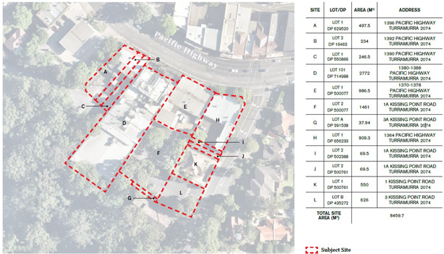
Image 8 – Subject site (Source: DKO Urban Design
Report, May 2024. Note: Council owned land shown red) (Note: survey
shows H as having an area by DP of 847.5m2 and 909.3m2 by
calculation)
As noted in Image 8 above the Proponent has calculated the site
area according to the submitted survey plan via a mixed area calculation, that
is, primarily by title but in the case of Area H by measured calculation. The
survey states that Area H has an area of 847.5m2 by title but an
area of 909.3m2 by calculation, that is, a discrepancy of 61.8m2.
This means that the site is stated by the Proponent as having a total area of
8,459.64m2 whereas by title the area is actually 8,397.94m2.
Council has received advice in this respect from Pinnacle
Land Surveyors who has advised that it is a risk to accept a mixed area
calculation (especially in this application) and that the conservative approach
would be to accept the area by title for all parcels. Further they have advised
that calculating all the areas by title gives Council reliable legal grounds
for determining the site area and shifts risk to the ORG (Office of the
Registrar General) under the Torrens Assurance Fund. The advice states that the
foundational legal principle is that the title area is the point of truth for
the property area however, due to the old measurement and calculation methods,
that the title area often needs to be updated or corrected in older plans, and
the post-developed area can differ. The advice goes on to indicate that there
are certain circumstances where it might be more appropriate to assess the
application based on the calculated or surveyed area, but in order to do this
Council would require better certainty, and the developer needs to weigh up the
cost of this against the value gained. Having regard to the advice it is
considered that at this stage of the process Council should not accept the area
by calculation and accordingly the site area stated in the Reference Scheme is
overstated by 61.8m2.
Having regard to the above advice it is considered that the
site area should be taken to be 8,397.94m2 in accordance with title
details. Notwithstanding this discrepancy can be resolved at a later stage of
the process. Notably the Reference Scheme proposes a 3:1 FSR on the site with
an additional area of 61.8m2. This therefore equates to an
additional GFA of not more than 185.4m2 which in the context of a
development totalling in the order of 25,000m2 GFA is considered to
be unlikely to affect site suitability.
Of the total site area of 8,397.94m2 a total of
6,134m2 is in private ownership with the remaining 2,263.94m2
being public land owned by Council. The application seeks to amend Schedule 4
of KLEP 2015 to reclassify the Council owned land (1A, 3 and 3A Kissing Point
Road being Lot 2, DP 500077; Lot 2, DP 502388; Lot 2, DP 500761; Lot B, DP
435272; Lot A, DP 391538) from community to operational land in accordance with
the requirements of the Local Government Act 1993.
Surrounding development is as follows:
· North:
Directly to the north of the site is the Pacific Highway and across the highway
are a range of 1-3 storey buildings with retail, commercial and food &
beverage uses;
· East:
Directly to the east of the site is Kissing Point Road and across the road are
range of 2 storey commercial properties and 1-2 storey residential buildings
which form a heritage conservation area, and which also includes a number of
individual listed heritage items;
· West:
Directly to the west of the site is Stonex Lane with a petrol station further to
the west; and
· South:
Directly to the south is the Granny Springs Reserve which is a bushland that
contains some of the largest Blue Gum trees in the district and is home to the
threatened Powerful Owl. The Reserve is listed as an endangered ecological
community under the provisions of the NSW Threatened Species Act 1995
and is critically endangered under the Environmental Protection and
Biodiversity Act 1999. The site is also adjoined to the south by 5 Kissing
Point Road which is a small 3 storey residential flat building.

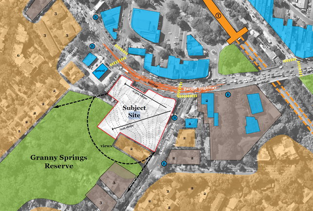
Image 9 – Site context (Source: Urban Design Report,
DKO Architecture, May 2024)
The site is zoned E1 Local Centre under Ku-ring-gai Local
Environmental Plan 2015.

Image 10 – Zoning map extract KLEP 2015
The objectives of the E1 Local Centre zone are:
· To provide a
range of retail, business and community uses that serve the needs of people who
live in, work in or visit the area.
· To encourage
investment in local commercial development that generates employment
opportunities and economic growth.
· To enable
residential development that contributes to a vibrant and active local centre
and is consistent with the Council’s strategic planning for residential
development in the area.
· To encourage
business, retail, community and other non-residential land uses on the ground
floor of buildings.
Permitted land uses in the E1 Local Centre zone (with
development consent) include:
Amusement centres; Bed and breakfast accommodation; Boarding
houses; Centre-based child care facilities; Commercial premises;
Community facilities; Entertainment facilities; Function centres; Group homes
(permanent); Hotel or motel accommodation; Information and education
facilities; Light industries; Local distribution premises; Medical centres;
Oyster aquaculture; Places of public worship; Public administration buildings;
Recreation facilities (indoor); Respite day care centres; Service stations; Shop
top housing; Tank-based aquaculture; Veterinary hospitals; Water
reticulation systems; Any other development not specified in item 2 or 4
Notably residential accommodation is prohibited in the E1
Local Centre zone however ‘Shop top housing’ which is defined as
“one or more dwellings located above the ground floor of a building,
where at least the ground floor is used for commercial premises or health
services facilities” is permitted with consent. The Reference Scheme
which comprises a mixed use development of commercial / retail development with
residential above would therefore be permissible with consent.
Comments
The Planning Proposal has been assessed against the
provisions of the Department of Planning, Housing and Infrastructure’s ‘Local
Environmental Plan Making Guideline’ (August 2023) and section 3.33
of the Environmental Planning and Assessment Act 1979.
A Planning Proposal must demonstrate that the proposed
amendments to a local environmental plan have strategic and site specific
merit. A detailed evidence-based assessment of the Planning Proposal and its
supporting studies has been conducted. In summary it has been concluded that
the Planning Proposal demonstrates sufficient evidence to demonstrate that the
proposal has strategic and site-specific merit subject to recommended
amendments. Accordingly, the Planning Proposal is supported in this
instance.
The following is a summary assessment of the key planning
issues and relevant merits associated with the Planning Proposal.
Strategic Merit
Regional Plan
The Planning Proposal is generally consistent with a number
of objectives of the Greater Sydney Region Plan – A Metropolis of
Three Cities, including:
· Objective 4
– Infrastructure use is optimised
· Objective 7
– Communities are healthy, resilient and socially connected
· Objective 10
– Greater housing supply
· Objective 11
– Housing supply is more diverse and affordable
· Objective 14
– Integrated land use and transport creates walkable and 30 minute cities
· Objective 22
– Investment and business activity in centres, and
· Objective 27
– Biodiversity is protected, urban bushland and remnant vegetation is
enhanced.
A Metropolis of Three Cities outlines that
liveability incorporates access to housing, transport and employment as well as
social, recreational, cultural and creative opportunities. Improved
health, public transport and accessibility outcomes are achieved through the
provision of schools, recreation, transport, arts and cultural, community and
health facilities in walkable, mixed-use places co-located with social
infrastructure and local services. Mixed-use neighbourhoods close to centres
and public transport improve the opportunity for people to walk and cycle to
local shops and services. Enhancing the safety, convenience and accessibility has
many benefits, including healthier people, more successful businesses and
centres. The proposal is therefore consistent with these principles.
Turramurra is located within the
Eastern Harbour City and is identified as a local centre. The Plan sets the principles
for Housing Strategies to be prepared by councils for a local government area
or district and to be given effect through amendments to local environmental
plans. The principles note that among other matters housing strategies should
respond to amenity i.e. opportunities that improve amenity including
recreation, the public realm, increase walkable and cycle friendly connections
to centres. Further the Plan notes that the District Plans guide housing
strategies in particular in ensuring key aspects of development are addressed,
that is: capacity, viability, good design, environment, mix, supply, affordable
rental housing, local character, etc. As discussed in further detail
below it is considered that the proposal is consistent with the capacity of the
site and the local character and has demonstrated the achievement of good
design subject to recommended amendments.
Objective 12 of the Plan –
“Great Places that Bring People Together” provides that place-based
planning should be adopted to provide:
· Well-designed
built environment: great places are enjoyable and attractive, they are safe,
clean and flexible with a mix of sizes and functions.
· Social
infrastructure and opportunity: great places are inclusive of people of all
ages and abilities, with a range of authentic local experiences and
opportunities for social interaction and connections.
· Fine grain urban
form: great places are walkable of human scale, with a mix of land uses
including social infrastructure and local services at the heart of communities.
As outlined in detail below it is considered that the
proposal is consistent with this objective and the strategies which underpin it
as the Reference Scheme (subject to recommended amendments, which can be
addressed prior to the planning proposal being forwarded for a Gateway
approval) provides for a well-designed built environment that is attractive and
high amenity.
Objective 22 - Investment and business activity in centres
also points to the importance of local centres and a centres hierarchy. It notes
that:
The management of local
centres is best considered at a local level. Developing a hierarchy within the
classification of local centres should be informed by a place-based strategic
planning process at a council level including an assessment of how, broadly,
the proposed hierarchy influences decision-making for commercial, retail and
other uses.
As discussed in detail below, the proposed height and FSR is
generally consistent with the Ku-ring-gai Retail and Commercial Centres
Strategy which was noted (although not formally adopted) by Council in
December 2020. This Strategy identifies Gordon as the Ku-ring-gai
LGA’s major centre with Turramurra forming one of three lower order
primary local centres (St Ives, Lindfield and Turramurra). The proposed 34.5m
(maximum 9 storey) height limit is less than the height allowed in Gordon
(38.5m or approx. 10-11 storeys) which is intended, going forward, to be the
major centre. Further the maximum permitted height allowed elsewhere in
the other primary local centres is approximately 9 storeys as incorporated into
KLEP 2015 by the recent Lindfield Village Hub Planning Proposal (ranging from
29.5 to 36.5m but with an average of 34.5m). An allowance of an
additional 2.0m in height is considered appropriate in this instance given the
steepness of site slope. Accordingly, it is considered that the proposal is
consistent with Objective 22.
Having regard to the above it is considered that the
Planning Proposal is consistent with a number of objectives of the Greater Sydney
Region Plan and with the overall intent of the plan which is to provide for
high-quality development in appropriate locations consistent with the capacity
of the site and whilst ensuring a high level of design quality and amenity both
within the development and for existing neighbourhoods.
North District Plan
The North District Plan made in March 2018 highlights
that the North District will continue to grow over the next 20 years with
demand for an additional 92,000 dwellings. The five-year target (to 2021) for
Ku-ring-gai is to provide an additional 4,000 dwellings.
Additional housing is to be provided in locations which are
linked to local infrastructure. The focus of growth is therefore on strategic
centres and areas close to transport corridors. Whilst the subject site is not
within a strategic centre it is in an area close to transport corridors
including the Pacific Highway (immediately adjacent) and the North Shore
Railway Line.
The Planning Proposal is consistent with the following planning
priorities of the North District Plan:
· Planning Priority
N1 – Planning for a city supported by infrastructure
· Planning Priority
N4 - Fostering healthy, creative, culturally rich and socially connected
communities
· Planning Priority
N5 - Providing housing supply, choice and affordability, with access to jobs,
services and public transport
· Planning Priority
N12 – Delivering integrated land use and transport planning and a
30-minute city, and
· Planning Priority
N21 – Reducing carbon emissions and managing energy, water and waste
efficiently.
The Planning Proposal will allow for a mixed-use development
providing a new park, retail and commercial development and approximately 180
new dwellings in a well-located site within the Turramurra Local Centre, in
close proximity to public transport and a major transport route (Pacific
Highway). The co-location of residential dwellings, social infrastructure
and local services in centres provides for a more efficient use of land and
enhances the viability of the centres and public transport. The proposal is
therefore in accordance with the North District Plan strategy which is to focus
growth in areas close to public transport as well as with the concept of a
30-minute city.
In addition, the North District Plan also includes Planning
Priority N6 which seeks to create and renew great places and local centres, and
to respect the District’s heritage and local character. The
Planning Proposal seeks to provide for new planning controls (height and FSR) that
would result in development of the site consistent with the site’s
capacity, the role of the Turramurra Local Centre in the Retail and Commercial
Centres hierarchy, and in a manner that is considered to be compatible with the
existing and emerging character of the area. As represented in the submitted
Reference Scheme, the scale of the proposal generally demonstrates a high
quality development that provides for appropriate amenity to proposed
residential units and the proposed public space (plaza and new park).
Further Planning Priority N20 – Delivering high
quality open space would be achieved by the proposal. The Reference Scheme
submitted with the application illustrates that the proposed massing and built
form provides for a new plaza area and new public park which are identified as
key public benefits, and which will provide a high level of amenity. This
matter is discussed in further detail below. It is therefore considered
that the proposal is consistent with the relevant provisions of the North
District Plan.
The Government recently (mid 2024) committed to building
377,000 new homes across the State in the next 5 years to align with the
National Housing Accord. As part of this it announced new housing targets by
LGA. The housing target identified by the State Government for Ku-Ring-Gai is
7,600 dwellings to be completed by 2029. The Planning Proposal is considered to
be consistent with this target and will deliver 180 new dwellings in close
proximity to existing infrastructure and services.
Local Strategic
Planning Statement
Council adopted its Local Strategic Planning Statement
(LSPS) on 17 March 2020. The LSPS draws together the priorities and actions for
future land use planning from Council’s existing land use plans and
policies and presents an overall land use vision for Ku-ring-gai.
The Planning Proposal is consistent with relevant planning
priorities of the LSPS including:
· K1 Providing well
planned and sustainable infrastructure to support growth and change
· K2 Collaborating
with State Government Agencies and the community to deliver infrastructure
projects
· K3 Providing
housing close to transport, services and facilities to meet the existing and
future requirements of a growing and changing community
· K4 Providing a
range of diverse housing to accommodate the changing structure of families and
households and enable ageing in place
· K5 Providing
affordable housing that retains and strengthens the local residential and
business community
· K6 Revitalising
and growing a network of centres that offer unique character and lifestyle for
local residents
· K7 Facilitating
mixed-use developments within centres that achieve design excellence
· K12 Managing
change and growth in a way that conserves and enhances Ku-ring-gai’s
unique visual and landscape character
· K17 Providing a
broad range of open spaces, sporting and leisure facilities to meet the
community’s diverse and changing needs
· K21 Prioritising
new development and housing in locations that enable 30 minute access to key
strategic centres
· K22 Providing
improved and expanded district and regional connection through a range of
integrated transport and infrastructure to enable effective movement to, from
and within Ku-ring-gai
· K23 Providing safe
and convenient walking and cycling networks within Ku-ring-gai
· K25 Providing for
the retail and commercial needs of the local community within
Ku-ring-gai’s centres
· K26 Fostering a
strong local economy that provided future employment opportunities for both
residents and workers within key industries
· K27 Ensuring the
provision of sufficient open space to meet the need of a growing and changing
community
· K31 Increasing,
managing and protecting Ku-ring-gai’s urban tree canopy
· K32 Protecting and
improving Green Grid connections
· K34 Improving
connections with natural areas including river and creek corridors, bushland
reserves and National Parks
· K40 Increasing
urban tree canopy and water in the landscape to mitigate the urban heat island
effect and create greener, cooler places
The LSPS identifies the Planning Priority for Turramurra as
K10 - Promoting Turramurra as a family-focused urban village. The priority is
intended to support the growth and revitalisation of Turramurra Local Centre as
a community hub for local residents living in the north of Ku-ring-gai.
Turramurra is to become a well-connected and attractive place to live, work and
shop. The centre’s village atmosphere will be enhanced through the
provision of new parks and public spaces, as well as a new library and
community centre (to the north of the Highway), where local families can meet
and spend leisure time.
A key principle for the Centre (relevant to the subject
Planning Proposal) is to “Retain the low scale, fine grained character of
the main street shops on the Pacific Highway and Rohini Street” and to
“Encourage infill developments with fine grained commercial and retail
street frontages.” Further it identifies the priority for development as
below:
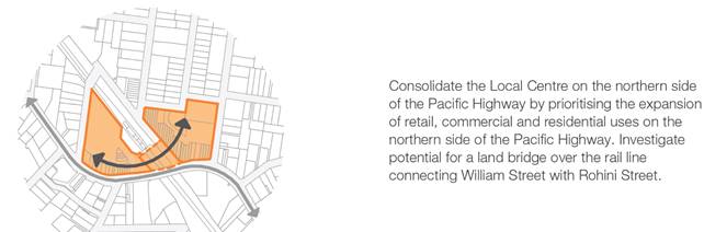
Image 11 – Local Centre consolidation priority
(Source: LSPS)
The LSPS identifies the need to consolidate the Turramurra
Local Centre on the northern side of the Pacific Highway by prioritising
expansion of uses in this location. It is therefore considered that the
highest density of development should be located in this area with adjacent
developments being of a lower scale and intensity. The revised scale of
the Planning Proposal which provides for a maximum height of 34.5m / 9 storeys
and FSR of 3:1 is consistent with this intent. It is anticipated that greater
height and FSR may be allowed to the north of the Highway in the future where
currently a maximum height of 17.5m and FSR of 2.5:1 is permissible.
The Turramurra Local Centre Structure Plan (refer Image 12
below) identifies the site as suitable for mixed use development with a key
landmark site identified in the centre of the site frontage to the north
adjacent to the bend in the Highway. Council documents are inconsistent in
respect of the location of the proposed landmark with the DCP identifying it on
the corner of Kissing Point Road and the Pacific Highway. The subject proposal
provides for a landmark building of 9 storeys on the corner of Kissing Point
Road and the Pacific Highway consistent with the DCP stepping down to 7 storeys
to the northwest. This is also consistent with the advice of the
independent urban designer who has advised that this scale of development is
appropriate to the site from an urban design perspective. The Structure Plan
also identifies a new road to the south of the site connecting Kissing Point
Road and Duff Street. The proposal is consistent with this requirement
providing for a new Stonex Drive in this location. Accordingly, the Planning
Proposal is considered to be generally consistent with the LSPS Structure Plan
and the site context.
Having regard to the above it is considered that the
Planning Proposal is generally consistent with the LSPS as it provides for the
redevelopment of a significant site within the Local Centre of a scale that is
consistent with the priorities identified for the Turramurra Local Centre.
Image 12– Turramurra Local Centre Structure Plan
(Source: LSPS)
Local Housing Strategy
The revised Ku-ring-gai Housing Strategy to 2036 was adopted
by Council in December 2020. The purpose of the Strategy is to identify how
Council intends to respond to the Greater Sydney Region Plan and District Plan
and how it plans to deliver on housing targets. The Strategy identities that
the District Plan sets a target of 4,000 new dwelling in Ku-ring-gai for the 5
year period from 2016 to 2021 (Note: as outlined above this target has
recently been updated to 7,600 new dwellings by 2029). It notes that
more than half of the required housing supply quota has been met, with the
remaining amount fully deliverable through current development approvals and
existing capacity within the Ku-ring-gai Local Environmental Plans. It further
states that “this means that the 0 - 5 year housing supply target of
4,000 dwellings is achievable under Council’s existing planning policies
and no amendment to the Ku-ring-gai Local Environmental Plan is
necessary”. It goes on to state:
The Greater Sydney Commission
‘Letter of Support’ issued March 2020 for the Ku-ring-gai LSPS
outlined that the Housing Strategy is to show how Ku-ring-gai can meet an
indicative draft range of 3,000 – 3,600 dwellings for the 6-10 year
housing target. Correspondence from the Minister of Planning dated 8 September
2020 states ‘Ultimately, Council is responsible for deciding the number
of dwellings in its local housing supply target’ and ‘the target
discussed with the Greater Sydney Commission is not a legal requirement upon
Council by the Government.’
Ultimately the Housing Strategy then proposes to achieve an
increase in dwellings within the LGA to meet demand as required by the Greater
Sydney Region Plan and North District Plan through existing residual capacity
supplemented by seniors housing and alternative dwellings where permissible.
Council has not identified land for development uplift and does not consider
this necessary to meet the District Plan dwelling target obligations.
Accordingly, the subject Planning Proposal which seeks to
amend the planning controls applying to the subject site to create additional
capacity is inconsistent with the Housing Strategy which adopts a status quo
approach. However the State Government recently (mid 2024) released a new
housing target of 7,600 new dwellings in Ku-ring-gai LGA by 2029. The
Planning Proposal will assist in meeting this target delivering an additional
approx. 180 dwellings in a location close to existing infrastructure and
services.
Ku-ring-gai Retail and
Commercial Centres Strategy
The Ku-ring-gai Retail and Commercial Centres Strategy
was received and noted by Council in December 2020 although it should be noted
that it has not been formally adopted. The Strategy indicates that the
population of Ku-ring-gai is estimated to increase to 154,500 by 2036 which
will result in demand for an additional 37,100 sqm of retail floorspace.
Further it notes an existing undersupply of 35,000 sqm potentially increasing
to 58,000 sqm. The undersupply is noted to be mainly an undersupply of
supermarkets and lack of regional and sub-regional shopping centres in the LGA.
The Planning Proposal (as detailed in the Reference Scheme provides for 7,190m2
of retail and commercial floor space (5,538m2 of retail floorspace)
including a new supermarket which is consistent with the Strategy and that will
assist to meet the existing and future retail demand in the LGA. The existing
retail floor space on site is understood to be approximately 2,373m2 comprising
an IGA supermarket of approximately 1,260m2 and 12 specialty shops
totalling 1,113m2. Accordingly, the proposal represents an increase
in retail floor space of approximately 3,165m2 and 1,652m2
of commercial floor space. A full scale supermarket is also to be provided to
address the current undersupply.
As noted above the Strategy identifies Gordon as the
LGA’s major centre with Turramurra forming one of three lower order
primary local centres (St Ives, Lindfield and Turramurra). The proposed 34.5m
height limit is less than the height allowed in Gordon (38.5m) which is
intended to be the major centre for the LGA going forward. Further it is
generally consistent with the maximum permitted height allowed in the other
primary local centres being approximately 9 storeys as amended by the recent
Lindfield Village Hub Planning Proposal (ranging from 29.5 to 36.5m but with an
average of 34.5m ) (Amendment 28 to KLEP 2015 made on 22 March 2022).
Notably the additional 2m takes account of the slope of the site as advised by
the independent urban designer and is therefore considered appropriate given
the site circumstances. Clause 4.3 Height of buildings of KLEP 2015 includes
the following objective:
(a) to
ensure that the height of buildings is appropriate for the scale of the
different centres within the hierarchy of Ku-ring-gai centres.
The proposed height is consistent with the scale of
development envisaged within the Local Centre under the Ku-ring-gai centres
hierarchy and is also consistent with a key objective of the Height of
buildings development control under KLEP 2015.
The Centres Strategy recommends that Council investigate
increases in FSR and Building Heights within the B2 (now E1)Local Centre zones
to assist in meeting housing targets and to increase the viability of
development. Best practice planning dictates that this should be undertaken in
response to site circumstances and opportunities and constraints. The Planning
Proposal is considered to be consistent with the site capability and position
of Turramurra in the Centres hierarchy.
The Strategy also includes specific recommendations and
actions for each centre. For Turramurra it recommends:
· Improvement to
the attractiveness of the retail offering
· Address the
issues of deteriorating quality and escape expenditure
· Attract new
retailers with diversified offering to capture escape expenditure.
Redevelopment of the subject site is consistent with these
recommendations. The Strategy identifies key actions for the centre as follows:
· Provide
orientation of mixed use towards the Turramurra Hub and away from the Highway
· Investigate opportunity
for Council owned land in Gilroy Lane in conjunction with adjoining landowners
to deliver a new and revitalised retail precinct
· Council to
invest in infrastructure, streetscape, security and amenity.
In summary the recommendations include:
· Investigate
increases of FSR within the B2 Local Centre zone to facilitate redevelopment of
sites
· Investigate
9.5m Height of Building Control on Rohini Street, Turramurra to facilitate
additional development
· Gilroy road
prime for café/retail space - planning controls are restrictive
· Potential for
outdoor cinema in summer in the new park to foster entertainment in centre
· IGA area -
underdeveloped - restriction on commercial floorspace existing for adjoining
corner site
· Hub area has
restriction on commercial existing: Recommendation of deleting commercial
restriction
· Encourage
redevelopment of Pacific Highway shops northern side to face/activate the
laneway to the north.
Accordingly, it is clear that the proposal is consistent
with the Strategy as it will provide in the order of 7,190m2 of
retail and commercial floor space (5,538m2 of retail and 1,652m2
of commercial floorspace) and would enable a new full scale supermarket to be
delivered which will assist to meet the existing and future shortfall. The
Strategy recognises the need to potentially increase FSR’s in the
Turramurra Local Centre (and in particularly on the subject site which it
identifies as underdeveloped) to facilitate the redevelopment of sites. While
it places the focus for development on land to the north of the Pacific Highway
it also identified the need for redevelopment of the subject site. This is
particularly in relation to mixed use development and is consistent with the
LSPS (refer above). In the context of this strategic framework the Planning
Proposal amendments in terms of FSR are considered to be appropriately scaled
and justified.
State Environmental
Planning Policies (SEPPs) and Ministerial Directions
The Planning Proposal is generally consistent with other the
State Environmental Planning Polices (SEPPs) applicable to the site including
Chapter 4 Design of Residential Apartment Development of State Environmental
Planning Policy (Housing) 2021 which formerly comprised State Environmental
Planning Policy No. 65 – Design Quality of Residential Apartment
Development as outlined below. The Planning Proposal is also
generally consistent with the applicable Ministerial Directions (Section 9.1
Directions).
Strategic Merit
Assessment Summary
In accordance with the Department of Planning, Housing and
Infrastructure’s ‘Local Environmental Plan Making
Guideline’, a Planning Proposal is deemed to have strategic merit if
it:
· Gives effect to
the relevant regional plan outside of the Greater Sydney Region, the relevant
district plan within the Greater Sydney Region, and/or corridor/precinct plans
applying to the site. This includes any draft regional, district or
corridor/precinct plans released for public comment or a place strategy for a
strategic precinct including any draft place strategy; or
· Demonstrates
consistency with the relevant LSPS or strategy that has been endorsed by the
Department or required as part of a regional or district plan; or
· Responds to a
change in circumstances that has not been recognised by the existing planning
framework
As outlined above it is considered that the Planning
Proposal is consistent with the objectives, priorities and strategies of both
the Greater Sydney Region Plan and the North District Plan. Further the
Planning Proposal is consistent with the broad intent for Turramurra outlined
in the LSPS and its supporting Centres Strategy, the Centres Hierarchy and the
scale of development envisaged in the subject location in both the LSPS and the
Centres Strategy. Further while the Planning Proposal is considered to be
inconsistent with the Council’s adopted Housing Strategy it is consistent
with the State government’s recent housing target for the LGA and will
deliver approximately 180 additional new dwellings and thereby assist to meet
the LGA’s 7,600 dwelling target to 2029. These dwellings are well
located within a site that is ripe for redevelopment and that has good access
to infrastructure and services. Accordingly it is considered that the Planning
Proposal demonstrates strategic merit.
Site Specific Merit
The Planning Proposal seeks a significant uplift in height
(from 17.5 m / approx. 5 storeys as existing to maximum 34.5m / 9 storeys as
proposed) and FSR (2:1 to 3:1) on a site that is considered to be suitable for
redevelopment. To demonstrate that the proposed height
and FSR is appropriate having regard to the site’s specific opportunities
and constraints a Reference Scheme has been prepared and submitted with the
Planning Proposal request. The below generally assesses the Reference Scheme
which is intended to demonstrate site- specific merit.
Urban Design
As part of this independent assessment Dr Michael Zanardo of
Studio Zanardo was engaged to provide an urban design assessment of the
proposal. Studio Zanardo’s advice is provided in full at Attachment
A13. Studio Zanardo’s advice follows on from the advice prepared for
the previous Planning Proposal for the site which was recommended for refusal.
Notably it refers to issues raised and recommendations made in respect of that
former proposal and considered whether matters previously identified have been
satisfied and / or recommendations complies with.
In summary the Studio Zanardo advice concludes that the
Planning Proposal is generally supportable from an urban design perspective
albeit that a number of issues have been raised in respect of the submitted
Reference Scheme’s compliance with the Apartment Design Guide (ADG) and
the adequacy of the proposed Draft DCP amendment. Studio Zanardo has
concluded that the Planning Proposal as illustrated by the Reference Scheme is
generally appropriate and supportable, in respect of:
· Proposed Height of
Buildings – at 9 storeys for the eastern tower and 7 storeys for the
western tower although it has recommended a more nuanced approach to the LEP
Height of Buildings Map where the mapped maximum building height more closely
aligns with the proposed built form rather than a blanket height allowance of
34.5m across the entire site.
· Proposed Floor
Space Ratio – proposed 3:1 maximum FSR considered appropriate having
regard to the general scale of development as demonstrated by the Reference
Scheme and the capacity of the site.
· Requirements of
Ku-ring-gai DCP Part 14 Urban Precinct and Sites 14B Turramurra Local Centre
– proposal is considered to be consistent with the requirements of the
DCP including:
o the provision of the new
Stonex Drive at 15m in width
o site geometry
o Pacific Highway street wall
height (acceptable at 3 storeys for eastern 9 storey tower and 2 storey for the
western 7 storey tower
o Location of landmark building
(9 storeys) on the corner of Kissing Point Road and Pacific Highway
o Separation of built form into
two discrete towers over a single podium with an open to the sky through site
link with the two separate buildings capable of presenting with different
architectural expressions
o Providing for a built form
which meets the DCP requirement of “encouraging new infill development
along the Pacific Highway which respects the existing characteristics of the
street including the fine-grained character of the original subdivision,
setback, height and rhythm of facades, and is sympathetic to the materials and
detailing of the earlier facades”
· ADG compliance in
relation to:
o Provision of a minimum of 2
hours of solar access to neighbouring units at 5 Kissing Point Road
o Building separation across
Stonex Lane – required setbacks achieved (6m separation from centre line
of lane for lower 4 storeys proposed and 9m for the upper storeys as required)
o Units with no solar access
– maximum of 15% of units compliance achieved (13% proposed in Reference
Scheme).
However, Studio Zanardo has raised outstanding concerns in
respect of:
· The tower
footprint size with the eastern tower being considered to be relatively large
(approximately 59m long) with no articulation along Kissing Point Road. Studio
Zanardo has identified that this tower footprint could be reduced and/or shaped
and/or articulated to reduce its massing.
· ADG non-compliance
in respect of:
o Solar access to the lower
pedestrian through site link area. The Reference Scheme provides some sunlight
to the lower through site link area only before 10am and after 2pm at mid
winter. This does not meet the ADG requirements for solar access to be provided
year round to public spaces. Further this does not meet the DCP intention for
this space described as ‘an ideal location for outdoor dining and cafes
overlooking the forest.’
o Deep soil area – The
proposed deep soil zone (with a minimum width of 2m) is approximately 785m2
(9% of the entire site area) (measured in CAD) and is located entirely on
the southern side of the new Stonex Street. All of these areas are to be
dedicated to Council. It is noted that the DCP states ‘In all cases,
where land dedication is required for a public purpose, such as a road or
walkway, the affected land is to be excluded from deep soil calculations…’
Therefore the proposal currently appears to provide no deep soil within the
non-affected site area. This does not meet the minimum 7% deep soil area
requirements of the ADG. There is considered to be potential for additional
deep soil on the northern side of the new Stonex Street. This aspect should be
given further design consideration in the indicative reference scheme. It is
noted that the dispensation to not meet the control is provided is for
situations where achieving the design criteria ‘may not be
possible’ and there is ‘limited or no space for deep soil at ground
level.’ From an urban design perspective, additional deep soil appears to
be possible on this site and there is additional space for deep soil at ground
level. The opportunity appears to be within the pedestrian through site link
area, perhaps with further adjustment of the car parking levels below. It is
desirable that this potential be explored.
o Units with a minimum of 2
hours solar access - Studio Zanardo has concluded that only 67% (122/181) of
units in the Reference Scheme meet the requirement of minimum 2 hours of solar
access where 70% is required. Units in question are identified as the northern
cross through units in the eastern tower which are impacted by the projecting
adjacent apartment, and some of the lower units in the eastern tower facing the
courtyard which are impacted by the upper levels of the western tower.
o Noise and ventilation of
habitable rooms – given location on the Pacific Highway the design needs
to address noise amenity impacts having regard to natural ventilation
requirements. This issue is not currently addressed in the Reference Scheme
o Units with natural cross
ventilation - Studio Zanardo has concluded that only 58% (105/181) of units in
the Reference Scheme provide natural cross ventilation requirement where 60% is
required. The units in question are identified as the single aspect units facing
north over the courtyard on the eastern tower, and the single aspect units at
the southeast corner facing east on the eastern tower at the lower levels.
o Number of units off a
circulation core - Studio Zanardo has notes that the Reference Scheme proposes up
to 10 units off a single core in the eastern tower and 9 units in the western
tower where a maximum of 8 units is allowed under the ADG. While Studio
Zanardo acknowledges that the ADG otherwise allows up to 12 units off a single
core this is not appropriate in the current circumstance as sunlight and
natural ventilation requirements are not met (which may otherwise justify a
variation).
Notwithstanding these
matters Studio Zanardo has provided advice that “from an urban design
perspective, such amendments to the indicative reference scheme are considered
to be relatively straightforward to make such that compliance with the
Apartment Design Guide could be achieved whilst the proposed development yield
(gross floor area and floor space ratio) proposed in the planning proposal
continues to be appropriate”. Accordingly, it is considered that
amendments could be made to the Reference Scheme that would allow for
compliance with the identified ADG provisions without impacting on the
achievable development yield.
Studio Zanardo has also indicated, and it is agreed, that
the proposed site specific Draft DCP amendment as proposed by the Proponent is
inadequate and that the existing Part 14B Turramurra Local Centre should be
updated to reflect the Planning Proposal and key aspects of the Reference
Scheme. Additional provisions to the existing Part 14B should be included to:
· promote pedestrian
activity between Pacific Highway and the future park at the rear of the site
· ensure that new
development is appropriately sited and designed to manage amenity and visual
impacts to neighbouring residential properties
· provide active
frontages along the internal through site link
· ensure all service
and loading areas are to be located in the basement
· clarify the road
widening width of 1.5m to Kissing Point Road
· provide a 3m
setback along Stonex Lane
· require that the
pedestrian through site link should be open to the sky
· minimise opaque
and blank walls at ground level
· provide 30 car
spaces for public use within the basement of the future development
· require a minimum
level of articulation to tower footprint
· require a minimum
amount of solar access to the lower pedestrian through site link area, and
· require greater
minimum deep soil zone over the site.
Inconsistencies between the Reference Scheme and the
existing DCP provisions should also be rectified.
The advice provided by Studio Zanardo has informed the below
assessment. Further the following comments are made cognisant of the fact that
a Planning Proposal is not a development application and does not consider the
specific detailed matters for consideration under Section 4.15 of the Environmental
Planning and Assessment Act 1979. A Planning Proposal only relates to an
LEP amendment, and therefore needs to demonstrate that the proposed amendment
itself is acceptable, with any future detailed design to be assessed at the
later development application stage. The below also considers the draft site
specific DCP which has been submitted to provide development guidance for any
future development application in accordance with the Planning Proposal.
Housing SEPP Implications
The recent State Government
Transit Oriented Development (TOD) amendments to State Environmental Planning
Policy (Housing) 2021 (Chapter 5) allow a maximum height (where local planning
controls are not greater) of 22m for RFBs or 24m for shop top housing (or
approx. 6 storeys) in a Transport Oriented Development Area (i.e. within 400m
of a railway station) which includes the Ku-ring-gai LGA centres of Gordon,
Killara, Lindfield and Roseville.
Further the SEPP includes
in-fill affordable housing provisions including an FSR and / or height bonus of
up to 30% for projects that include residential development and provide at least
10% of the gross floor area (GFA) as affordable housing. The height of
buildings bonus only applies to residential flat buildings and shop top
housing. The FSR and height of buildings bonuses are effectively double (up to
30%) the minimum required affordable housing component, which must be at least
10% of the development project.
Accordingly, notwithstanding
the proposed site-specific Planning Proposal and Reference Scheme there is
potential that additional FSR and/or height could be achieved on the subject
site via the Housing SEPP provisions. However, this applies across the board
and would be dependent on the provision of a substantial affordable housing
component. Accordingly assessment of this potential impact is not within the
scope of this assessment and would need to be determined on merit at the DA
stage.
Height
The Planning Proposal seeks to increase the permissible
maximum height across the entire site from 17.5m (approx. 5 storeys) to 34.5m
(maximum 9 storeys) while the Reference Scheme proposes two towers: one of 9
storeys (to the east) and one of 7 storeys (to the west). The proposed tower
heights are consistent with the advice provided by Studio Zanardo on the
original Planning Proposal (that sought a height of 50m) that was refused in
early 2023. Consistent with the commercial centres hierarchy the proposed maximum
height would be less than the maximum height allowable in Gordon, the
LGA’s major centre (38.5m) by 4m. Further it would be consistent
with the maximum height recently amended for the Lindfield Village Hub site
(ranging from 29.5 to 36.5m but with an average of 34.5m) with Lindfield being
equivalent in the centres hierarchy to Turramurra.
Studio Zanardo has previously advised that the proposed
34.5m (approx. 9 storey) height limit would allow for a compatible transition
to surrounding 5 to 3 storey development and accordingly it is suited to the
site context. Further in respect of the current scheme it has advised that the
proposed maximum is considered to be in alignment with the relevant KLEP2015
height of buildings objective which is to ‘ensure that the height of
buildings is appropriate for the scale of the different centres within the
hierarchy of Ku-ring-gai centres’ Studio Zanardo notes that as a point of
comparison, the proposed height of 34.5m is significantly greater (144%) than the
maximum building height of 24m for a building containing shop top housing in a
Transport Oriented Development Area (SEPP Housing), which is applicable
elsewhere in the Ku-ring-gai Local Government Area (Roseville, Lindfield,
Killara and Gordon). It therefore states that the proposed height should,
relative to this, not be considered conservative.
Image 13 Local Centres Extents Diagram – (Source:
Urban Design Report, DKO Architecture, May 2024
The Planning Proposal seeks to increase the height on the
site to result in a convex local centre profile as shown in Image 14 below.
This approach relies on adjacent sites also achieving an increase in height as
shown dotted which is possible having regard to the Housing SEPP provisions or
potential future LEP amendments. The proposed height provides for an acceptable
transition from 7 (west) or 9 (east) storeys to the existing allowable 5
storeys. It also allows for the potential that overtime that the land to the
north of the Pacific Highway, which is identified as the priority and focus for
the most intense development in the Turramurra Local Centre, will become the
ultimate highpoint in the centre consistent with Council’s articulated
strategy, outlined in both the LSPS and the Centres Strategy.
Image 14 Proposed Turramurra Skyline – (Source: Urban
Design Report, DKO Architecture, May 2024)
In summary it is considered that the Reference Scheme
submitted with the application generally demonstrates that a scheme of this
scale can readily be accommodated on site without resulting in unreasonable
environmental impacts and whilst achieving high amenity for the public domain,
neighbouring properties and the proposed residential apartments. As outlined
above some amendments to the Reference Scheme are considered to be required to
ensure compliance with ADG requirements however as advised by Studio Zanardo it
is considered that these amendments can be made without impacting the ultimate
GFA/FSR achievable on the site and thus the relevant proposed LEP provisions.
These amendments should however be made prior to the Planning Proposal being
forwarded for a Gateway approval.
It is also recommended that a more nuanced approach to
height be applied with the 34.5m height limit to be applied to the eastern part
of the site where the proposed 9 storey tower is intended (corner of Pacific
Highway and Kissing Point Road) and a reduced height limit of 28.5mapplied in
the north western part of the site (i.e. 6m less that the maximum) where the
site adjoins existing 2 storey development and where a maximum height of 3-5
storeys currently applies. This will ensure an appropriate transition and
future landmark tower on the corner site. It will also accentuate the fall in
the land along the Pacific Highway and relieve the monotony of the same tower
heights on the skyline, particularly if the sites to the north west on the
opposite side of Stonex Lane were to be redeveloped in a similar manner.
Further consistent with height mapping in the LEP the proposed height limits
should not be applied to the land proposed to be dedicated as road, park or
road reservation. It would also provide more certainty that the positive urban
design qualities of the proposal relating to the variances in height will be
delivered.
Floor Space Ratio
In terms of FSR a maximum FSR of 3:1 is proposed across the
site (including land to be dedicated as road, park etc.) where a maximum FSR of
2:1 currently applies (note: the original Planning Proposal request proposed an
FSR of 4.2:1). An estimated gross floor area of approximately 25,379m2
(equating to an FSR of 2.99:1 based on a site area of 8,459.7m2 in
accordance with the site survey) has been calculated given the proposed land
use mix illustrated in the Reference Scheme, as follows:
· GFA Residential =
18,189 m2
· GFA Retail /
Commercial = 7,190 m2
· Total = 25,379m2
/ site area 8,459.7m2 = approx. FSR 2.99:1
Consistent with the discussion above in relation to height,
the proposed FSR would be less than that allowable in the Gordon major centre
(at max. FSR 3.5:1) and consistent with that allowed in local centres
throughout the LGA. In general, FSRs of between 2:1 and 3:1 are allowed in
local centres throughout the LGA.
The Reference Scheme demonstrates that a scheme of this
scale can be accommodated on site without resulting in adverse environmental
impacts and whilst achieving high amenity for both the public domain and the
proposed residential apartments. Studio Zanardo has advised that from an urban
design perspective the proposed maximum FSR is appropriate however some
amendments are required to the Reference Scheme to ensure ADG compliance. It is
considered that these amendments can be made without impacting on the
ultimately GFA/FSR achievable on site and thus the relevant proposed LEP
provisions. The amendments should however be made prior to the Planning
Proposal being forwarded for a Gateway approval.
The Planning Proposal seeks to require a minimum retail /
commercial floor space of 0.85:1 where at present a maximum FSR of 1.2:1
applies to commercial development. The minimum retail / commercial floor space
is based on the Reference Scheme which provides for 7,190m2 GFA of
retail and commercial uses. This equates to an FSR of 0.855:1 (7,190m2/25,379m2
= 28.43% x 3:1 = 0.85:1:1). Accordingly, the proposed minimum is considered
appropriate. As noted by Studio Zanardo this amount of retail/commercial floor
space is appropriate for the site given design parameters and will not give
rise to pressure for GFA to be converted in the future from retail/commercial to
residential with poor amenity. Further it equates to an increase of 3,165m2
of retail floor space and 1,652m2 of commercial floor space over
existing. This will help to address the existing shortfall in retail floor
space in the LGA and will also enable the provision of a full scale supermarket
for which the area is currently undersupplied.
Compliance with Ku-ring-gai
DCP site specific provisions
Ku-ring-gai DCP Part 14B Turramurra Local Centre currently
applies to the subject site. The site is currently located within
Precinct T3 under the DCP (refer Image 15 below) where pedestrian through site
links and road dedications and upgrades are required.

Image 15 Turramurra Local Centre Precinct Plan (Source:
Ku-ring-gai DCP Part 14B Turramurra Local Centre)
The Reference Scheme is generally in accordance with the DCP
provisions providing for the required through site links, pedestrian and road
upgrades and dedications, new park and new Stonex Drive as outlined below.
However amendments to the DCP provisions are recommended to reflect the
proposal, address inconsistencies and include additional requirements to guide
the final design. An assessment of the Reference Scheme against the site
specific DCP provisions is provided below.
|
Figure
|
Requirement
|
Reference Scheme Compliance
|
|
14B.2 Public Domain and Pedestrian Access
|
|
Figure 14B.2-1 excerpt
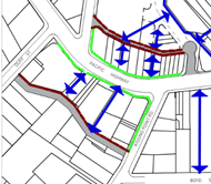

|
Site identified as:
· location of through site link to Pacific Highway
· location of modified road (Stonex Drive)
· continuous awnings on Pacific Highway and Kissing
Point Road frontages
|
Complies -
· included in Reference Scheme
· as above
· able to comply
|
|
14B.3 Proposed
Community Infrastructure
|
|
Figure 14B.3-1 excerpt
 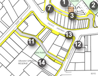
|
Requires:
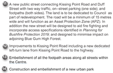
|
Complies
· included in Reference Scheme
· No APZ required
· New dedicated left turn lane proposed
· Footpath embellishment proposed
Note:
Park dedication proposed but not construction and embellishment
|
|
14B.4 Setbacks
|
|
Figure 14B.4-1 excerpt
 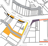
|
Requires:
· 2m setback on Kissing Point Road (plus land
dedication)
· Land dedication setbacks from Stonex Drive and
Pacific Highway
Note: where land dedication
is required for a public purpose, such as a road or walkway, the affected
land is to be excluded from deep soil calculations and included in setback
requirements
|
Complies
Complies – Note:
dedications not included in deep soil. Deep soil to be included in
developable part of site.
|
|
14B.5 Built
Form
|
|
Figure 14B.5-1 excerpt
|
Requires:
· Landmark building
· Primarily active frontage on Pacific Highway and
Kissing Point Road
· 3 storey wall height on Pacific Highway
· 4m setback above street wall height on Pacific
Highway
· Opposite Heritage Conservation Area on Kissing Point
Road
|
Complies
Complies
Complies for eastern tower,
2 storey on western tower – acceptable given reduced height
Complies
Complies – no adverse
heritage impact
|
|
14B.6 Building
Entries, Car Parking and Service Access
|
|
Figure 14B.6-1 excerpt
|
Requires:
· Pedestrian access off Pacific Highway and Kissing
Point Road
· Vehicular access off Stonex Drive
|
Complies
Complies
|
|
14B.7
Environmental Protection and Bushfire Protection
|
|
Figure 14B.7-1 excerpt
|
Requires:
· 15m buffer zone including width of new Stonex Drive
|
Complies – Stonex
Drive 15m wide (Note: Council environmental officer has noted “Granny
Springs Reserve not Bushfire Prone Land on Council’s Bushfire prone
land map)
|
|
14B.10 Precinct
T3: Kissing Point Road Retail Area
|
|
Planned Future
Character
Figure 14B.10-1
|
1. Development is to be designed to
support and enhance the planned future character as following:
iii) This precinct will
become the second retail hub for Turramurra offering a revitalised shopping
precinct incorporating speciality retail, a new supermarket, new shop-top
housing and improved public areas. Future development will be encouraged to
occur through land amalgamation and consolidation of the building footprint.
This will allow the construction of a new public street - “Stonex
Street” - behind the site to connect Kissing Point Road and Duff
Street. The new street will provide access to car parking and loading docks
as well as providing for local traffic circulation. The street will be
constructed within the existing development footprint and will function as a
bush fire Asset Protection Zone (APZ) as well as protection for Granny
Springs Reserve.
iv) Retail shops will form
an active edge to the Pacific Highway and Kissing Point Road. A new
supermarket and associated specialty retail will be provided below the
Pacific Highway level, and will open to “Stonex Street” at the
rear. This will be an ideal location for outdoor dining and cafes,
overlooking the forest.
|
Complies
Complies – include
DCP requirement to activate through site link
|
|
Public Domain and
Pedestrian Access
Figure 14B.10-2
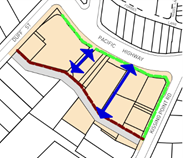
|
Requires:
2. Provide a new public street
(new street) linking Duff Street and Kissing Point Road
3. Provide an internal shopping
arcade linking the Pacific Highway and the new street.
4. Provide continuous awnings to
the Pacific Highway and Kissing Point Road.
5. Provide awnings to the new
street where ever possible
|
Complies
Complies
Complies
Does not comply – no
awnings proposed - acceptable
|
|
Proposed Community Infrastructure
Figure 14B.10-3
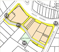
|
Requires development to be
designed to support and compliment the provision of key community
infrastructure though the Contributions Plan, VPAs or other delivery
mechanism:
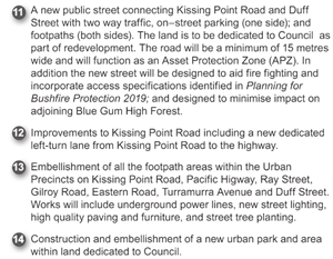
|
Complies – Non
binding public benefit offer provided which includes identified requirements
(refer below for further detail).
|
|
Setbacks
Figure 14B.10-4
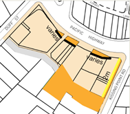
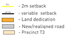
|
Requires zero setback with
below exceptions:
i) Properties
1A, 1 and 3 Kissing Point Road and 1364 Pacific Highway are to provide a 2m setback
to the Kissing Point Road frontage. The land is to be dedicated to Council at
no cost.
ii) Property 1A
Kissing Point Road is to provide rear setbacks to achieve a minimum 15m wide
right-of-way between the northern property boundary of No.7 Kissing Point
Road. The land is to be dedicated to Council at no cost.
iii) Property 1380-1388 is
to provide rear setbacks to achieve a minimum 15m wide right-of-way at the
rear of the property that connects with the existing road way to the west
from Duff Street and to the proposed road to the south-east from Kissing
Point Road. The land is to be dedicated to Council at no cost.
vi) Property 1380-1388 is to
provide an Asset Protection Zone on the site in accordance with Planning for
Bushfire Protection 2019 that does not encroach on Council’s reserve.
v) Properties
1364-1408 Pacific Highway are to have front setbacks in accordance with RMS
requirements.
|
Complies
Complies
Complies
Complies – although
APZ no longer applicable
Complies – confirmed
by letter from TFNSW dated 21 June 2024
|
|
Built Form
Figure 14B.10-5
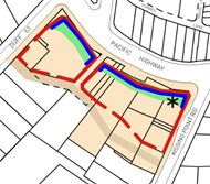

|
Requires buildings to be
designed in accordance with the following:
i) Create
consistent street wall of 3 storeys (11.5 metres) built parallel to the
street alignments of the Pacific Highway, Kissing Point Road, and Stonex
Lane.
ii) Provide a setback
of 4m to all levels above the street wall height along the frontages of the
Pacific Highway, Kissing Point Road and Stonex Lane.
iii) Provide active street
frontages to the Pacific Highway, Kissing Point Road and Stonex Lane. Active
street frontages are to be provided on the new street and Duff Street where
possible.
iv) Locate taller building
elements to the rear and western side of the precinct to minimise impacts on
adjoining residents and minimise visibility from areas to the east.
v) Design a
distinctive corner building with strong articulation addressing the Pacific
Highway and Kissing Point Road intersection.
vi) Design residential
development over the commercial podium to minimise the width of residential
facades facing the Bushfire Prone Areas.
vii) Provide generous landscaped
courtyards on the podium between buildings for residential amenity.
|
Complies although 2 storey
street wall for western tower as outlined above - acceptable
Complies
Complies
Does not comply –
proposed design preferable – amend DCP
Complies – 9 storeys
proposed at NE edge of site, 7 storeys at NW
Complies – bushfire
N/A
Complies
|
|
Building Entries, Car
Parking and Service Areas
Figure 14B.10-6
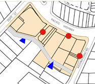

|
Requires:
1 Provide a new
public street at the rear of the site connecting Kissing Point Road and Duff
Street.
2 Vehicle access
to car parking, service and loading areas is to be provided via the new
street.
3 All service
access to the new street must be via Kissing Point Road. Access or exit via
Duff Street is prohibited.
4 Residential
foyers and lobbies are to be located on Stonex Lane, Kissing Point Road and
the Pacific Highway.
|
Complies
Complies
Complies
Complies
|
|
Environmental
Protection and Bushfire Protection
Figure 14B.10-7
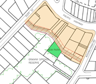

|
Consideration must be given
to the following to ensure the development will not result in any disturbance
to the adjoining Blue Gum High Forest (BGHF):
5 A minimum 15m
buffer from the new building to the adjacent BGHF is to be provided in the
form of a new street.
6 New
development must not encroach on the adjoining bushland reserve. All new
development must be within the existing developed footprint (including roads,
car parks and other structures).
7 The new road
is to be built on an elevated structure to minimise impacts from earthworks.
8 Consultation
with an ecologist and an arborist is required during the design phase of this
process to minimise potential impacts on the bushland. Construction and
excavation or other disturbances will be limited to the currently disturbed
area (e.g. the existing car parks and building platforms).
9 The design of
the stormwater system for the development is to minimise impact on the
adjacent bushland and riparian lands.
10 Landscaping is to consist
of predominantly native plants of the Blue Gum High Forest community (where
this does not conflict with fire protection requirements).
Consideration must be given to the following to
address bushfire protection, including:
11 Provide an Asset
Protection Zone on the site in accordance with Planning for Bushfire
Protection 2019 that does not encroach on Council’s reserve.
12 The profile and length of
buildings facing the bushland reserve is to be minimised so that the lowest
possible surface area is open to the fire front should a fire occur.
13 All building facades
facing the hazard require building construction standards to Level 3 as per
AS3959. All other facades require building construction standards to Level 2
as per AS3959.
14 Entrance and exit points
to underground parking and service areas are to be provided via the new
street. Because the area will be subject to ember attack, radiated heat and
smoke during a bush fire, appropriate measures are required to ensure safe
evacuation during a fire.
15 To minimise the impacts
of wind-borne ember attack, landscaped gardens are to be separated from each
other by a minimum distance of 5m.
16 Garden beds that run up
to a building or are up against buildings, are to be avoided, especially
where they run beneath windows. Organic mulch should be avoided, with
inorganic mulches such as decorative pebbles preferred.
17 Tree plantings should not
link with those trees within the reserve nor should they form rows leading up
to buildings. ‘Fire retardant’ species should be considered for
inclusion.
18 A dedicated water supply
for fighting fires is required. The tanks are to be minimum capacity of
10,000 litres and each building is to have a separate tank. Installation of
tanks at ground level or below is preferred however they may be installed on
upper levels of building. Signage indicating the location of the outlets
should be prominent.
19 A deluge system designed
to spray water over of the building façade facing the bushland reserve
is required.
20 Air conditioning systems
are to be designed to be automatically switched off in a bushfire emergency,
or alternatively, have smoke scrubbers fitted.
21 All gas, water and electricity
services are to be sited below ground. Where they must be above ground then
they are to be sited on the opposite side of the buildings to the hazard.
|
Complies
Complies
Assess at DA stage
Assess at DA stage
Assess at DA stage
Assess at DA stage
N/A - land not
bushfire prone
As above – N/A
As above – N/A
Complies – bushfire
requirements N/A
As above – N/A
As above – N/A
As above – N/A
As above – N/A
|
Compliance with Apartment
Design Guide
As outlined above an assessment of the Reference Scheme
against the ADG requirements has been undertaken by Studio Zanardo which has
generally concludes that the proposal is appropriate. The following areas
of non compliance have been identified:
· Solar access to
the lower pedestrian through site link area. The Reference Scheme provides some
sunlight to the lower through site link area only before 10am and after 2pm at
mid winter. This does not meet the ADG requirements for solar access to be
provided year round to public spaces. Further this does not meet the DCP
intention for this space described as ‘an ideal location for outdoor
dining and cafes overlooking the forest.’
· Deep soil area
– The proposed deep soil zone (with a minimum width of 2m) is
approximately 785m2 (9% of the entire site area) (measured in CAD) and is
located entirely on the southern side of the new Stonex Street. All of these
areas are to be dedicated to Council. It is noted that the DCP states ‘In
all cases, where land dedication is required for a public purpose, such as a
road or walkway, the affected land is to be excluded from deep soil
calculations…’ Therefore the proposal currently appears to provide
no deep soil within the non-affected site area. This does not meet the minimum
7% deep soil area requirements of the ADG. There is considered to be potential
for additional deep soil on the northern side of the new Stonex Street. This
aspect should be given further design consideration in the indicative reference
scheme. It is noted that the dispensation to not meet the control is provided
is for situations where achieving the design criteria ‘may not be
possible’ and there is ‘limited or no space for deep soil at ground
level.’ From an urban design perspective, additional deep soil appears to
be possible on this site and there is additional space for deep soil at ground
level. The opportunity appears to be within the pedestrian through site link
area, perhaps with further adjustment of the car parking levels below. It is
desirable that this potential be explored.
· Units with a
minimum of 2 hours solar access - Studio Zanardo has concluded that only 67%
(122/181) of units in the Reference Scheme meet the requirement of minimum 2
hours of solar access where 70% is required. Units in question are identified
as the northern cross through units in the eastern tower which are impacted by
the projecting adjacent apartment, and some of the lower units in the eastern
tower facing the courtyard which are impacted by the upper levels of the
western tower.
· Noise and
ventilation of habitable rooms – given location on the Pacific Highway
the design needs to address noise amenity impacts having regard to natural
ventilation requirements. This issue is not currently addressed in the
Reference Scheme
· Units with natural
cross ventilation - Studio Zanardo has concluded that only 58% (105/181) of
units in the Reference Scheme provide natural cross ventilation requirement
where 60% is required. The units in question are identified as the single
aspect units facing north over the courtyard on the eastern tower, and the
single aspect units at the southeast corner facing east on the eastern tower at
the lower levels.
· Number of units
off a circulation core - Studio Zanardo has notes that the Reference Scheme
proposes up to 10 units off a single core in the eastern tower and .9 units in
the western tower where a maximum of 8 units is allowed under the ADG.
While Studio Zanardo acknowledges that the ADG otherwise allows up to 12 units
off a single core this is not appropriate in the current circumstance as
sunlight and natural ventilation requirements are not met (which may otherwise
justify a variation).
The Reference Scheme is otherwise consistent with the ADG
requirements notably including in respect of site separation distances, privacy
impacts, solar access to adjacent properties etc.
However having regard to the
identified non-compliances and the need for a Reference Scheme to demonstrate a
scheme consistent with the proposed LEP amendments which is of a high quality
design and which meets relevant requirements, it is recommended that the
Reference Scheme be amended to address the above non compliances prior to the Planning
Proposal being referred for a Gateway determination. It is however
considered that this can be done without impact the proposed LEP provisions but
that it is essential to ensure that non-compliances at the DA stage are not
argued on the basis of being pre-existing in the Reference Scheme.
Traffic and Parking
The Transport and Traffic Impact Assessment Report (TIA)
prepared by JMT Consulting (31 May 2024) provided with the Planning Proposal (Attachment
A4) includes an assessment of existing traffic conditions, proposed vehicle
site access arrangements, likely traffic generated by the proposal, parking
demand and proposed parking, vehicle loading and servicing arrangements,
pedestrian enhancements and bicycle parking provisions. In summary it concludes
that:
· Under the
indicative architecture concept vehicle access would be provided off a new road
(Stonex Drive) at the southern end of the site.
· The Planning
Proposal involves a number of enhancements to the existing road network
supporting the site including:
o Creation of Stonex Drive
– a new two-way public street which provides an east-west connection
between Kissing Point Road and Duff Street
o Enhancements to traffic
capacity along Kissing Point Road including extension of the right turn bay
into the site as well as a dedicated left turn bay from Kissing Point Road onto
the Pacific Highway
· The indicative
architecture concept contemplates approximately 550 (Note: reduced to 414 in
amended Reference Scheme) off-street parking bays which is consistent with
the current Ku-Ring-Gai Council DCP parking controls.
· The proposal would
retain a minimum of 30 public car parking spaces on the site dedicated to
Council.
· A key component of
the proposal is the dedication of land for the future widening of the Pacific
Highway by Transport for NSW – facilitating the removal of the existing
peak period tidal flow arrangements. This will result in a significantly
improved traffic outcome for Turramurra and the wider precinct.
· The site is
located in close proximity to various public transport facilities, including
Turramurra train station and nearby bus stops.
· Detailed traffic
modelling indicates that future development contemplated under the Planning
Proposal will not detrimentally impact the operation of the surrounding road
network. All intersections in the vicinity of the site are forecast to retain
their level of service when compared to current conditions.
· Secure bicycle
parking would be provided as a component of any future proposed development, in
line with rates specified in the Ku-Ring-Gai Council DCP.
· Travel demand
management measures have also been suggested to improve the mode share of
public transport and active transport. These items should be considered further
at detailed design stage.
Council’s Strategic Traffic Engineer has provided an
assessment of the Planning Proposal in respect of traffic and transport matters
and in particular the Transport Impact Assessment. In summary the advice
concludes that the Planning Proposal has the following favourable transport
aspects:
· A good
proportion of residents in the Statistical Area of the site use public
transport for their journeys to work, so the site is well positioned to
leverage off its proximity to transport services.
· The site is
located within 200m of Turramurra railway station, where frequent rail services
operate generally between Hornsby and Sydney CBD, providing good connections to
strategic centres. Sydney CBD will be within 30 minutes of the site once the
Chatswood-Sydenham extension to the Sydney Metro is operational later in 2024.
· Bus services at
the Turramurra station bus interchange provide connections to Hornsby, South
Turramurra, Sydney Adventist Hospital and Macquarie Park. There appears to be
sufficient capacity in rail and bus services and nearby bus stops to
accommodate passenger demand resulting from the Planning Proposal. The site is
well positioned to take advantage of improved bus services between Mona Vale
and Macquarie Park which are foreshadowed in Future Transport Strategy.
· There is a good
selection of retail, health/medical, recreational and community/cultural
facilities within 10 minutes’ walk of the site. Schools are generally
within walking distance or connected to the site by public transport.
· The local
cycling network in the area is modestly developed, providing a degree of local
and regional cycling connectivity particularly to the south towards Macquarie
Park and Macquarie University.
· Land
dedications along the Pacific Highway and Kissing Point Road frontages would
facilitate future road capacity upgrades.
The following transport constraints were also identified:
· It has not been
demonstrated how heavy vehicles could manoeuvre from on-site loading dock in
the basement to leave the car park in a forward direction.
· The car parking
assessment contemplates the retention of 30 existing Council public car parking
spaces. However, as the uses relying on the existing Council car parking would
be incorporated into the planning proposal (with its own parking provision),
the need to retain 30 spaces dedicated to Council should be reviewed.
· The potential
for a right turn ban imposed by Transport for NSW from Stonex Street into
Kissing Point Road would have impacts to residents along the alternative route
(Duff Street/Cornwall Avenue/Monteith Street) and may result in the desirable
maximum environmental capacity of those roads being reached.
· While the
Planning Proposal provides for land dedication for future road widening on
Pacific Highway to enable the tidal flow arrangements to be removed by
providing 3 traffic lanes in each direction, it is unclear whether this is
adequate for an 8-lane cross section.
Transport for NSW has also provided advice in respect of the
proposal and has advised generally as follows:
1 ….It
is noted that the current proposal makes provision for the dedication of land
along the frontage to the site along the Pacific Highway that enables future
widening of Pacific Highway, subject to future funding
2. TfNSW
notes and supports vehicular access to / from the site to be via Kissing Point
Road only.
3. Traffic
modelling appears to address TfNSW concerns with the following reiterated for
Council’s consideration:
• there
should be no significant impact to the operation of signals at Pacific Hwy /
Kissing Point Road intersection.
• Queuing
should not extend out of the right turn bay on Kissing Point Road into the site
blocking through traffic on Kissing Point Road.
• Maximum
queue lengths heading north on Kissing Point Road onto Pacific Highway do not
block the right turn bay into the site. This can potentially be mitigated by
installing/maintaining the 'Keep Clear' signage should queuing become an issue
in the future.
• Improvements
proposed at the Pacific Highway / Kissing Point Road intersection which
includes an extension of the southbound right turn bay into the site along
Kissing Point Road, a dedicated left turn bay from Kissing Point Road into
Pacific Highway as well as two dedicated right turn lanes will need further
refinement and more detailed discussions with TfNSW during the public
exhibition of the planning proposal.
4. The
proposed new rear road located at the southern end of the site, Stonex Drive,
should be designed as a shared zone and/or a low speed zone. It should not be
an activated lane but one that prioritises pedestrians although cars can use
it.
5. Bike
parking should be useful and accessible at street level and not designed to be
hidden in the underground parking area.
6. Future
development on the site should consider appropriate noise attenuation measures through
design measures, architectural treatments, setbacks, durable materials and / or
landscaping particularly along the site’s frontage to Pacific Highway to
mitigate future residents against road traffic and train station noise. Council
should be satisfied that any noise mitigation controls throughout the relevant
draft DCP is appropriately aligned with this requirement.
Accordingly, it is considered that from a traffic and
transport perspective the proposal is appropriate however there are a number of
site-specific issues that will need to be addressed at the DA stage including
loading dock arrangements and design of the adjacent road network noting that
TfNSW has provided advice that the proposal is generally acceptable.
Council’s traffic engineer has not raised any major issues with the
proposal and it has been supported by TfNSW. In respect of the retention
of the existing 30 council owned public car parking spaces this is a matter for
Council in its negotiations with the Proponent however notably these spaces
have been included in the traffic and parking assessment and are able to be
accommodated on site without resulting in any adverse traffic impacts. Noise
attenuation measures should also be included in the DCP to ensure that the
future development is appropriately designed to mitigate traffic and train
noise whilst providing natural ventilation and to ensure an appropriate level
of amenity to the future residents.
Economic Impact
A Need and Impact Assessment was submitted with the Planning
Proposal Request prepared by Location IQ (November 2023) (refer Attachment 6).
The assessment outlines:
· The regional and
local context of the site
· An overview of the
current site and the proposed development scheme
· The main trade
area to be served by supermarket-based retail facilities at Turramurra
· Main trade area
current and projected population and retail spending levels
· An overview of the
planning environment and centres hierarchy
· The potential for
additional supermarket floorspace at Turramurra, and
· The key benefits
of the proposed development.
In summary it concludes that the proposal is consistent with
the Ku-ring-gai Centres hierarchy and the draft Ku-ring-gai Retail and
Commercial Centres Strategy for the Turramurra Primary Local Centre. It notes
that this includes the provisions of a full-line supermarket and a limited
range of specialty shops. In terms of trading impacts on surrounding facilities
within and beyond the main trade area it concludes that the proposal would be unlikely
to affect the future viability of these centres. Further it identifies a range
of positive employment and consumer impacts including:
· The provision of a
wider range of retail facilities near residents’ homes
· Increased
convenience and price competition for residents
· Improved customer
amenity, design, and aesthetic for the residents by way of a new and modern
development
· Reduced travel
times
· Ongoing employment
generation including from retail and complementary non-retail components of the
development (conservatively estimated at net additional jobs are estimated at
178 across retail and commercial components)
· Creation of some
242 full-time, part time and temporary jobs in construction over the development
timeline, and
· Including
multiplier effects some 977 jobs created both directly and indirectly because
of the retail and commercial redevelopment of the site.
Hill PDA was engaged by Council to undertake a peer review
of the economic impact assessment. This advice (refer Attachment A14)
notes that the existing Turramurra Plaza (subject site) is a neighbourhood
shopping centre with an estimated 2,373m2 of retail space. It states
that this is comprised of a 1,260m2 IGA supermarket and 12 specialty
shops (1,113m2) and that proposed redevelopment would provide 7,015m2
(now amended to 7,190m2) of employment space, representing an
increase of 4,642m2 (now 4,817m2) over its current
provision. Upon redevelopment the report notes that the Plaza would provide:
· A 3,098m2
supermarket
· 2,420m2
of speciality retailing, including a 498m2 grocer
· 1,497m2
of commercial space (including a medical centre and gym)
· 179 residential
apartments.
As noted above these numbers vary marginally from the final
Planning Proposal Request as assessed herein however these minor changes do not
affect the report conclusions. The Hill PDA advice takes issue with some minor
matters in the Location IQ report however it generally concurs with the report
findings and ultimately concludes as follows:
1. There
is demand for supermarket space within the Turramurra town centre catchment.
This demand is further supported by the draft Ku-ring-gai retail and commercial
centres strategy which projects the centre will require an additional
10-15,000sqm of retail space by 2036. It also recommends that the centre be
anchored by up to two full-line supermarkets and an ALDI supermarket.
Currently, the town centre contains a Coles supermarket which, at 1,500sqm, is
half the size of a full-line supermarket. From this, it is considered that the
proposal is in accordance with Council’s draft strategy.
2. The
resulting marginal increase in speciality floorspace would not likely impact
the viability of current or future retail uses in the centre. The development
is within the existing Turramurra centre and its impacts on existing Turramurra
retailers is a matter of competition between traders in the same centre and not
a relevant planning matter for determination.
3. The
increase in retail space would not impact the established retail hierarchy in
the LGA. It is consistent with the projected demand for retail space documented
in the draft Ku-ring-gai retail and commercial centres strategy.
4. The
resulting development would have additional community benefits in accordance
with those detailed in the Location IQ report. However, as noted, we do
consider the ongoing and construction-related employment estimates somewhat
overstated in the report
It is therefore considered that the Planning Proposal is
appropriate having regard to economic impact considerations and will result in
additional community benefits.
Heritage
The subject site does not contain any heritage items however
is located to the west of the Hillview Heritage Conservation Area (HCA) across
Kissing Point Road to the east and a number of heritage items within. A
statement of heritage impact (SoHI) was submitted with the Planning Proposal
Request prepared by Heritage 21 (21 November 2023) (refer Attachment A11).
In summary the report concludes that the proposal would respect the heritage
significance of the subject site and heritage items and the Hillview HCA in the
vicinity and that:
· The proposal
would retain the commercial character of the Turramurra Town Centre;
· The proposed
contemporary design, through a high standard of architectural design, would
deliver a positive contribution to the streetscape, creating a distinction
between the new and the existing;
· The proposed contemporary
design is sympathetic to the significance of the heritage items and HCA in the
vicinity, as it would not replicate or imitate any significant historic
architectural details within the HCA and of the heritage items. The proposed
design is contemporary and would be a reflection of its time, which is also
keeping with the conservation principle of the Burra Charter;
· The proposed
design has considered a sympathetic stepped and curved form, greenery and muted
colour scheme which minimises the visual impact of the building height and
mass;
· The siting of
the proposed development would not impact significant view lines to and from
the heritage items and heritage conservation area in the vicinity; and
· The proposal
would involve the demolition of contemporary commercial buildings to
accommodate the new building footprint.
In respect of potential adverse impacts the SoHI notes that
demolition of the dwelling at 1 Kissing Point Road may have a detrimental
impact on the heritage significance and character of the area as the building
does attain representative significance at the local level as an intact example
of Inter-War residential buildings in the Californian Bungalow architectural
style within the Ku-Ring-Gai Local Government Area. Further the SoHI notes that
the building is a positive contribution to the Kissing Road streetscape. Given
that the building cannot be retained, Heritage 21 has recommended a
photographic archival study to document the style of the building and its
contributory characteristics to the local area. They advise that this would
mitigate any potential loss of heritage and streetscape character value.
Council’s heritage officer has reviewed the SoHI and
provided advice that that the proposal is acceptable from a heritage perspective
noting that there are no heritage items located on the site. Archival recording
of the existing California Bungalow at 1 Kissing Point Road is recommended.
This matter can be addressed via condition of any future development consent.
The referral notes that the site is visually removed from the Heritage
Conservation Area (and heritage items) across Kissing Point Road to the east
and that it is unlikely to obscure any views to or from the precinct. The
advice further notes that the proposal is also buffered from heritage items to
the south by the proposed new access road and that setbacks are appropriate to
ensure adverse heritage impacts are minimised. In relation to design quality
the referral notes the quality of the intended design albeit at an early stage
of development. In summary the heritage referral concludes that:
· that the concept
can be supported from a heritage perspective
· that a development
control plan should be developed for the site with the assistance of a heritage
consultant to ensure that the relationship of the development to the adjoining
heritage assets is managed well and a high level of design quality is achieved
· photographic
Archival Recording of No 1 Kissing Point Road should be undertaken prior to its
demolition.
Biodiversity Impacts
The future development of the site in accordance with the
Planning Proposal will necessitate the removal of a number of trees and has the
potential to result in flora and fauna impacts. A due diligence flora and fauna
report was submitted with the Planning Proposal Request prepared by Narla
Environmental (November 2023) (refer Attachment A10). The report
note that two vegetation communities were present within the site: Blue Gum
High Forest and Urban Exotic/Native Vegetation. The Blue Gum High Forest
vegetation within the site conforms to the Biodiversity Conservation Act
2016 listed CEEC Blue Gum High Forest in the Sydney Basin Bioregion and the
EPBC Act listed CEEC Blue Gum High Forest of the Sydney Basin Bioregion.
The assessment also revealed one threatened flora species,
Syzygium paniculatum (Magenta Lilly Pilly) was located within the site. This
species has been historically planted as it is occurring outside of its natural
distribution. No other threatened flora species were present or likely to
occur. The report notes that it is not anticipated that any future development
will significantly impact on any locally occurring threatened flora species.
In respect of fauna minimal fauna habitat features were
identified within the site assessment. The site did not contain any significant
habitat features such as hollow-bearing trees; caves, crevices or overhangs;
coarse woody debris; or large stick-nests. While the site may provide sporadic
foraging habitat for threatened fauna species it was not anticipated that any
future development will significantly impact on any locally occurring
threatened fauna species.
The site was considered to have low ecological constraints,
mostly comprising existing hardstand and buildings. Other areas of low
ecological constraints were areas of Urban Exotic/Native Vegetation outside of
BV mapped areas. These areas had the lowest ecological values, including
minimal habitat values.
Areas mapped as moderate ecological constraints comprised of
Urban Exotic/Native Vegetation within BV mapped areas; Biodiversity Corridors
and Buffer Areas, and Canopy Remnant on the Greenweb Map; and Category 2
Riparian Land on the KLEP Riparian Lands and Watercourses Map. Additionally,
this comprises Blue Gum High Forest vegetation and Greenweb mapping components
that intersect the KDCP Turramurra Local Centre Precinct Plan. The removal of
any native vegetation within these areas has the potential to trigger the
Biodiversity Offset Scheme (BOS). In addition, a VMP may be required if any
proposed works are located within this zone.
Areas identified as high ecological constraints include
those areas mapped as comprising Blue Gum High Forest; and Support for Core
Biodiversity Lands and Landscape Remnant on the Greenweb map. The removal of
any native vegetation within these areas has the potential to trigger the BOS.
Future development applications will require the accompaniment of the
appropriate environmental assessments (BDAR or FFA). If the BOS is triggered, biodiversity
offsets may be required to offset the biodiversity impacts of any proposed
development within this area. In addition, a VMP may be required if any
proposed works are located within this zone.
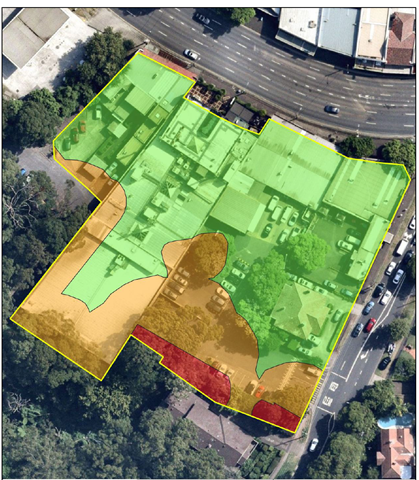
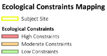
Image 16 Ecological Constraints (Source: Narla
Environmental, Nov. 2023)
Overall, the Flora and Fauna Assessment concludes that the
planning proposal will not impact biodiversity in its current form and that any
future development applications will require appropriate environmental
assessments (FFA or BDAR), as well as the implementation of number of impact
mitigation strategies (such as a VMP) depending on the extent and scope of the
development.
Council’s Biodiversity Officer has reviewed the Flora
and Fauna report and advised that that the planning proposal does not raise any
significant issues noting that relevant matters will be considered at the DA
stage in accordance with relevant requirements.
Tree Removal
The Planning Proposal Request, and supporting Reference
Scheme, foreshadows the removal of all trees on site with the exception of
within the proposed new park as shown in Image 17 below. An Arborist
report prepared by Dr Treegood (Nov 2023) was submitted with the application
(refer Attachment A8). While noting that the removal of all trees is
required to accommodate the proposed development the report recommends:
· Stonex driveway
can be re landscaped with trees planted on either side of the driveway to form
a possible Ave.
· The Pacific
Highway frontage is to be modified to have a loading zone area and a greater
turning zone from Kissing Point Rd into the Pacific Highway. Trees one and two
fall within this footprint of major road improvements. I would make assumption
the power poles and overhead power lines would need to be removed and more than
likely would be transferred to underground power lines. This allows the ability
for possible tree planting along the footpath area and possible small landscape
areas in and around the trees as used scene used by Sydney City Council.
· The large area
in between the two retail areas in the centre of the site could be a
possibility for a new landscape area with specimen trees to form an idyllic
corridor for pedestrian traffic and shoppers.
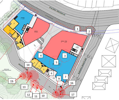
Image 17 Tree
removal plan (Source: Dr Treegood, Nov, 2023)
Council’s Natural Areas Officer reviewed the Arborist
Report and provided advice that the recommendations of the Arborist report
should be addressed at the DA stage. Further the advice recommends:
· When relocating
power lines along Pacific Highway it would be ideal to put these power lines
underground to allow future tree planting with tree pruning is not required to
give power line clearance
· Replacement
plants to be endemic species as outlined within the report. Endemic plants may
not be suitable across all areas of the site, however suitable BGHF species
should be used, particularly in the proposed park and interface with Granny
Springs reserve
These recommendations should be included in the Draft DCP
provisions for the site. Subject to this recommendation it is considered that
the proposal is acceptable from a tree removal perspective on balance
notwithstanding the proposed tree loss, recommendations in relation to
additional deep soil on site and having regard to the public benefits of the
proposal.
Bushfire
A letter
has been submitted with the Planning Proposal Request prepared by Blackash
(dated 25 October 2023) (refer Attachment A9) in respect of bushfire
hazard and risk. The advice notes that the subject land behind the Village is
not designated as bushfire prone land (albeit that it previously was so
identified) and as such, the legislative triggers of section 4.46 of the Environmental
Planning and Assessment Act 1979 (EPA Act) and section 100B of the Rural
Fires Act 1997 (RF Act) for the referral of any development to the NSW
Rural Fire Service (RFS) do not exist. Development of the site does not require
a Bushfire Safety Authority from the RFS. This matter was confirmed by
Council’s Natural Areas Officer. Notwithstanding it is noted that the
proposed new Stonex Drive provides for a 15m buffer zone to adjacent vegetation
as previously specified in the DCP provisions. Accordingly, it is considered
that the proposal is acceptable from a bushfire perspective.
Contamination
A Preliminary Site Investigation Report was submitted with
the Planning Proposal Request prepared by EI Australia (November 2023) (refer Attachment
A7). The report concludes that:
· Site
observations indicated there were not significant visual or olfactory evidence
of contamination, and no evidence of underground storage tanks or above ground
storage
· Investigation
of site history indicated that the site has been utilised as a commercial site
since before 1950, including sue as a dry cleaners and motor garage. There were
also several dry cleaners, petrol station and motor garages in close vicinity
to the site and located hydraulically up-gradient
· A review of the
historic aerial photography indicated that the immediate surrounding area of
the site have been predominantly commercial / residential since before 1943 to
date
· The subject
site was not included on the List of NSW Contaminated Sites Notified to the EPA
however two sites in the surrounding area associated with two service stations
were listed for contamination or regulation under the contaminated land
management act
· A search
through the record of notices for contaminated land indicated that the subject
site was free of statutory notices issues by the NSW EPA however several
records pertaining to sites nearby were discovered
· The site was
free of statutory notices and licencing agreements issues under the
Contaminated Land Management Act 1997 and Protection of the Environment
Operations Act 1997 however several records pertaining the nearby sites were
discovered.
Based on findings of this
report and with consideration of the Statement of Limitations, EI concludes
that there is potential for contamination to be present that could pose risks
to sensitive receptors. This was considered to be of low to high significance
in terms of risk to the human and environmental receptors identified. As such a
detailed site investigation (DSI) will be required following demolition to
characterise soils and groundwater and ascertain the presence of any
contamination onsite.
Based on the information
collected during the DSI and in reference to SEPP 2021, the site can be made
suitable subject to the completion of the DSI (and after remediation and validation
if required) for the residential use.
Council’s Natural Areas Officer reviewed the PSI and
provided advice that it is appropriate noting that a detailed site
investigation is to be submitted with any development application for the site
to confirm that the site will be suitable for the proposed use. Given that the
PSI concludes that the site can be made suitable for the proposed residential
use subject to the completion of the DSI and after remediation and validation
if required, this is considered appropriate and in accordance with the
requirements of Section 9.1 Ministerial Direction 4.4 Remediation of
Contaminated Land Council can be satisfied that the site can, and will, be made
suitable for the proposed use. For an abundance of caution a provision should
be included in the Draft DCP requiring the submission of Detailed Site
Investigation with any DA for relating to the site.
Public Benefits
A public benefit letter of offer was submitted by the
Proponent with the subject Planning Proposal Request. The letter of offer notes
that it is for discussion purposes only and is not intended to be binding. It
generally sets out the matters to be included in a planning agreement for the
site as follows:
|
Works
|
Additional infrastructure
to be delivered includes:
1. New Stonex Street – a new
public street connecting Kissing Point Road and Duff Street will be delivered
2. Footpath and Road along Kissing
Point Road – the footpath along Kissing Point Road will be upgraded
3. Stonex Lane – Stonex Lane
is to be retained and upgraded as an open-air pedestrian lane with active
frontages and supporting street furniture
Key matters to be further
resolved in discussions with Council will include:
• Timing,
staging and responsibility for the above identified works
• Specifications
and standards to be adopted for the proposed works.
Some of the above
infrastructure may be undertaken as ‘works in kind’ and deducted
from the contribution amount, subject to further negotiation and discussion
with Council.
|
|
Dedication of Land
|
1. New Community Park (approx.
708m2) – Land for a new public park will be dedicated to
Council which is adjacent to Granny Springs Reserve. The new park has been
considered as part of the concept design and identified for dedication to Council.
It is understood that the land associated with the park is to be dedicated to
Council, however this land will form as part of the overall site for the
purposes of FSR transfer.
2. New Stonex Street (approx.
1,434m2) – a new public street will connect Kissing Point Road and Duff
Street
3. Footpath and road along Kissing
Point Road (approx. 255m2) – the land dedication along Kissing Point
Road has been included in the concept design.
|
|
Other Public Benefits
|
A minimum of 30 public car
parking spaces on the site dedicated to Council.
|
|
Application of section
7.11, 7.12 and 7.24
|
Value of the cost of the
proposed works outlined above would be offset against any applicable
development contributions and dealt with under a Works In Kind Agreement. The
value of any land dedication including parking spaces is to be separately
dealt with as part of the broader land transactions.
|
Council’s Infrastructure Coordinator has provided
advice in respect of the submitted letter of offer.
This advice is provided in full below:
Proposal Planning Agreement
Background
The proponent initially
submitted a document entitled Letter of Process which outlined the general
timing of actions needed to support the project from an infrastructure delivery
viewpoint including land dedication, the local infrastructure to be delivered
as part of the site redevelopment and the proposed replacement of the current
at-grade council car parking spaces within the development. Among other
matters, an updated formal Letter of Offer was requested in the context of
comments previously made on the content and process.
State Government as a party
to the same planning agreement
The subject site is very
complex and incorporates a significant amount of council land as well as the
delivery of a number of items of public infrastructure as works-in-kind across
three of the major categories in the s7.11 contributions plan (open space,
roadworks and intersection upgrades and public domain works). It also requires
land dedication to the NSW State Government for the widening of the Pacific
Highway and the treatment of its intersection with Kissing Point Road. As such,
and in view of the complexity of coordinating the NSW State Government as a
party to an already complex council agreement involving the prospective sale of
council land, it was recommended that the proponent pursue a separate agreement
with the NSW State Government. The revised letter of offer accedes to this
request and removes the NSW State Government as a party together with the
affected works. This does not mean that an agreement will not still be required
to be made between the proponent and the NSW State Government; only that
council will not be responsible for its coordination and reduces the cost and
staff resources required from council for this matter.
Land Dedication
All land that is stripped of
its development potential by the transfer of FSR within the total site, is to
be dedicated to Council free-of-cost. This includes the land for the new park
adjoining Granny Springs Reserve at the rear of the site and (part) of the new
Stonex Street.
Council car parking
The Letter of Process refers to
the required reclassification of the current council car park from community to
operational land and that reclassification process is underway as part of the
planning proposal. The in-principle provision of a replacement 30 spaces of
public car parking has been discussed over the inception period of the project
from its earliest iteration in 2021. In each Letter of Offer, this proposed
public car parking is listed as “Other Public Benefits” to be
covered by the proposed Planning Agreement. It is presumed at this point that
this intended provision will take the form of stratum space to be dedicated to
council.
As Ku-ring-gai Council does not
levy for the provision of car parking, any value to be attributed to the
dedication of land or stratum space for public car parking must be taken into
consideration as part of the overall property transaction but the proposed
Planning Agreement can manage the logistics of this dedication. A final
decision on the inclusion or otherwise of council-owned car parking will need
to be made prior to the lodgement of a development application for the site. It
should be noted that the redevelopment of the site will be required to fully
cater for its own parking demand under the DCP and, as such, unlike the current
situation, additional car parking for the existing IGA and other business
fronting the Pacific Highway should no longer be required. A limited amount of
car parking along Stonex Street near the Duff Street intersection is also not
included within the site of the planning proposal.
The most recent letter of offer
does acknowledge that these parking spaces must be considered within the
context of the overall land transactions rather than as a contributions offset
but remain listed for delivery in the current offer.
Stonex
Street
Stonex
Street requires both land dedication and construction. The required
construction is located only partially on the area that forms part of the
subject site and partially immediately adjoining the site, including directly
behind part of the subject site near the intersection with Stonex Lane; but the
whole makes up a continuous route providing direct vehicular access to the
subject site from both Duff Street and Kissing Point Road. There sems to be
agreement in the Letter of Offer that the Stonex Street as delivered will run
from Duff Street to Kissing Point Road (and renamed Stonex Drive to distinguish
it from the current alignment).
The dedication area cited in
the letter of offer is smaller in area that the works area for the full length
of Stonex Street (approximately 200 metres). The area for the works-in-kind is
not cited in the Letter of Offer. As it is not logical or practical to
construct / upgrade only that part of the road that is located on the
dedication land, as such, for the relief of any doubt, the Planning Agreement
needs to include separate sections for the delivery of the works-in-kind and
the dedication of land and the land area of the works, as distinct from the
dedication, should also be quantified.
It is understood that the
Planning Agreement will make provision for works-in-kind that it is not
practical to deliver other than concurrent with a construction phase, which
cannot commence until a decision to act on a development consent. The granting
of any development consent is also not fettered by the existence of this
planning agreement. While this is a fact in law, it should also be explicitly
understood and acknowledged by the proponent. No part of the existing area of
Stonex Street or Lane should be demolished or subjected to restricted access
prior to the formal commencement of the works that will trigger the delivery of
the new road.
Stonex Lane
Stonex Lane has a direct
connection to the property along the side boundary and provides pedestrian access
from the Pacific Highway to Stonex Street. Its upgrade is valued by the s7.11
contributions plan however, offsets can only be up to the inflated value of the
baseline contributions plan (in today’s dollars). Additional work may be
undertaken at the applicant’s cost if they wish noting the direct benefit
to the presentation of the redevelopment.
Other works valued by the
Contributions Plan
Works surrounding the site and
valued by the s7.11 Contributions Plan are also open to discussion for possible
offsets as works-in-kind up to the inflated value within the baseline
contributions plan. Additional works may be undertaken with agreement but
cannot be offset.
References to Regional
Contributions under s7.24 (HAPs Contributions)
The Letter of Offer continue to
inappropriately refer to s7.24 as a contribution that can be offset.
Ku-ring-gai Council has no control, influence or management capacity in respect
of the NSW Government Housing and Productivity Contributions (HAPs) inclusive
of calculation and collection which are exclusively via the Planning Portal. No
local infrastructure provision will be offset against HAPs contributions. Nor
can Council enter into any agreement impacting Division 7.1 Subdivision 4
without Ministerial approval. Any agreement regarding HAPs must be exclusively
with the NSW State Government. The proposed Planning Agreement will not exclude
the application of s7.24 to the proposal nor include any agreement regarding
works being offset against it.
Registration on title,
dispute resolution, security and costs agreements
These are standard matters and
will be discussed and formalised within the Planning Agreement. A costs
agreement will need to be agreed at the engagement of council’s legal
team and prior to work officially commencing on the detailed planning
agreement.
This matter will be the subject of a separate report to
Council and has not been considered in this report.
Site Specific Merit
Assessment Summary
In accordance with the Department of Planning, Housing and
Infrastructure’s ‘Local Environmental Plan Making Guideline’,
a Planning Proposal is deemed to have site specific merit if it demonstrates
that the proposal is suitable for the site and the site is (or can be made)
suitable for the resultant development. It is to be assessed against the
following criteria:
Does the proposal give regard
and assess impacts to:
· the natural
environment on the site to which the proposal relates and other affected land
(including known significant environmental areas, resources or hazards)
· existing uses,
approved uses, and likely future uses of land in the vicinity of the land to
which the proposal relates
· services and
infrastructure that are or will be available to meet the demands arising from
the proposal and any proposed financial arrangements for infrastructure
provision:
As outlined above it is considered that the documentation
submitted subject to the recommended amendments adequately demonstrates that
the site is suitable for the Planning Proposal proposed controls as the
Reference Scheme submitted with the Planning Proposal will not result in any
significant adverse impacts and generally demonstrate that it is able to comply
with relevant controls and/or achieve a high quality, high amenity development.
Accordingly, it is considered that, subject to the recommended amendments, the
Planning Proposal demonstrates site specific merit.
Recommendations to Gateway Determination
Having regard to the above assessment it is recommended that
Council:
1. submit
the matter to the Department of Planning, Housing and Infrastructure for a
Gateway Determination subject to:
a. amendments
to the proposed LEP Height of Building map that provide for:
i. two (2)
height limits across the developable part of the site being 34.5m in the
location of the proposed eastern tower (corner of Kissing Point Road and
Pacific Highway) and 28.5m for the remainder of the developable site including
the through site link and the western tower)
ii. No mapped
height in the location of the proposed new park, new Stonex Drive and areas
proposed to be dedicated for road widening (Pacific Highway and Kissing Point
Road)
b. amendments
to the Reference Scheme such that it demonstrates compliance with the Apartment
Design Guide and in particular addresses the following identified
non-compliances:
i. Improved
solar access to the lower pedestrian plaza area / through site link area to
comply with the ADG requirement that solar access be provided year round to
public spaces, to provide for a high level of comfort and amenity for
pedestrians and to enable use for outdoor dining throughout the year including
at lunch time in midwinter
ii. Incorporation
of a minimum of 7% of the developable part of the site (having an area of
approximately 5,636m2) as deep soil area (having a minimum dimension
of 2m) and generally being located within the through site link adjacent to the
Stonex Drive frontage.
iii. A
minimum of 70% of units to comply with the solar access requirement of 2 hours
of sunlight to balconies and living rooms between 9am and 3pm in mid-winter
(Note: units currently in question comprise the northern cross through units in
the eastern tower and some of the lower units in the eastern tower facing the
courtyard ).
iv. A minimum
of 60% of units to comply with natural cross ventilation requirement Note:
Note: units currently in question comprise single aspect units facing north
over the courtyard on the eastern tower, and single aspect units at the
southeast corner facing east on the eastern tower at the lower levels).
v. Design of
units to address noise amenity impacts and ventilation requirements to
habitable rooms given site affectation by traffic and rail noise.
vi. Subject
to resolution of (iii) and (iv) above compliance with the maximum number of units
off a circulation core in accordance with the ADG.
vii. Demonstrate
appropriate loading arrangements within the basement including provision of
entry and exit in a forward direction for service vehicles.
c. Preparation
of a Draft amendment to Ku-ring-gai DCP Part 14 Urban Precinct and Sites 14B
Turramurra Local Centre to reflect the subject Planning Proposal and key
aspects of the Reference Scheme and to incorporate additional provisions which:
i. promote
pedestrian activity between Pacific Highway and the future park at the rear of
the site
ii. ensure
that new development is appropriately sited and designed to manage amenity and
visual impacts to neighbouring residential properties
iii. provide
active frontages along the internal through site link
iv. ensure
all service and loading areas are to be located in the basement
v. clarify
the road widening width of 1.5m to Kissing Point Road
vi. provide a
3m setback along Stonex Lane
vii. require
that the pedestrian through site link should be open to the sky
viii. minimise
opaque and blank walls at ground level
ix. provide
30 car spaces for public use within the basement of the future development
x. require a
minimum level of articulation to tower footprints (i.e. maximum wall length)
xi. design
the lower pedestrian plaza area / through site link area to comply with the ADG
requirement that solar access be provided year round to public spaces, to
provide for a high level of comfort and amenity for pedestrians and to enable
use for outdoor dining throughout the year including at lunch time in midwinter
xii. require
a minimum of 7% of the developable part of the site (having an area of
approximately 5,636m2) as deep soil area (having a minimum dimension
of 2m) and generally being located within the through site link adjacent to the
Stonex Drive frontage. This area is to incorporate specimen trees to form
an idyllic corridor for pedestrian traffic and shoppers
xiii. ensure
that the design is compatible with its heritage context including HCA to the
east, nearby heritage items and that it reflects the character of the
Tummamurra Local Centre.
xiv. Ensure
that planting within the site is to comprise endemic species as far as
possible.
xv. Require
additional street tree planting on all street frontages where practicable.
xvi. Require
underground power along street frontages
xvii. Require
a Detailed Site Investigation to be submitted with any DA for the subject site.
xviii. Require
a minimum of 5% affordable housing.
d. amendment
of the Planning Proposal to address Department of
Planning, Housing and Infrastructure’s Practice Note PN 16-001 in respect
of the classification and reclassification of public land.
2. Advise
the Proponent of the above and direct that it submit an amended Reference
Scheme and Draft amendment to Ku-ring-gai DCP Part 14 Urban Precinct and Sites
14B Turramurra Local Centre in accordance with the recommendations above prior
to the matter being referred to the Department of Planning, Housing and
Infrastructure for a Gateway Determination.
KU-RING-GAI LOCAL PLANNING PANEL ADVICE
As noted above, the matter was referred to the Ku-ring-gai
Local Planning Panel for advice on 22 July 2024 as required by the Local
Planning Panels Direction – Planning Proposals issued by the Minister for
Planning under Section 9.1 of the Environmental Planning and Assessment Act
1979. The KLPP supported the Planning Proposal and advised as follows:
A. That Ku-ring-gai
Local Planning Panel makes a recommendation to Council that the following
Planning Proposal be submitted to the Department of Planning, Housing and
Infrastructure for a Gateway Determination.
B. Should a Gateway
Determination be issued for public exhibition of the Planning proposal, the
site-specific amendments to the Ku-ring-gai DCP Part 14 Urban Precinct and
Sites 14B Turramurra Local Centre as outlined in this report, be placed on
public exhibition concurrent with the Planning Proposal.
C. That Council
authorise the General Manager to correct any minor anomalies of a non-policy
and administrative nature that may arise during the planning making process.
In providing this advice the
KLPP endorsed the recommendations of the assessment report and concluded that
the Planning Proposal is consistent with the E1 zoning of the site, will
facilitate development of the site for appropriate uses, provides public
benefits and demonstrates strategic and site-specific merit.
A copy of the
KLPP minutes including resolution in relation to the Planning Proposal is
provided at Attachment A16.
integrated planning and reporting
Theme 3 - Places, Spaces and Infrastructure
|
Community Strategic
Plan Long Term Objective
|
Delivery Program
Term Achievement
|
Operational Plan
Task
|
|
P2.1 A robust planning framework is in place to deliver
quality design outcomes and maintain the identity and character of Ku-ring-gai
|
P2.1.1 Land use strategies, plans and processes are in
place to effectively manage the impact of new development
|
Implement and monitor the Local Environmental Plans and
supporting Development Control Plans.
|
Governance Matters
The process for the preparation and
implementation of Planning Proposals is governed by the provisions contained in
the Environmental Planning and Assessment Act 1979 and the Environmental
Planning and Assessment Regulation 2000.
If Council fails to make a decision within 90 days (from the
commencement of the review of the application) or if Council makes a decision
to not support the Planning Proposal, the Proponent can make a request to the Department
of Planning, Housing and Infrastructure for a Rezoning Review.
Local Planning Panels Direction – Planning
Proposals issued by the Minister for Planning under Section 9.1 of the Environmental
Planning and Assessment Act 1979 requires Council to refer all Planning
Proposals prepared after 1 June 2018 to the Local Planning Panel for advice,
before it is forwarded to the Department of Planning, Housing and
Infrastructure for a Gateway Determination under Section 3.34 of the Environmental
Planning and Assessment Act 1979.
Risk Management
This is a Planning Proposal
initiated by a private landowner however affects land owned by Council and
accordingly has been assessed by an independent planner. Council should, to
determine its position on the matter, specifically consider whether the Planning
Proposal should be sent to the Department of Planning, Housing and
Infrastructure for a Gateway Determination having regard to the Local Planning
Panel’s advice and decide whether to proceed to public exhibition.
Council risks damage to its reputation if it does not
undertake strategic land use planning in an effective and timely manner.
Financial Considerations
The Planning Proposal was subject to
the relevant application fee under Council’s 2024/2025 Fees and Charges
Schedule. The cost of the review and assessment of the Planning Proposal is
covered by this fee.
Social Considerations
The Planning Proposal is considered
to have positive social benefits including the delivery of a new public park,
land dedications, pedestrian footpath and road upgrades, new roadway and
additional housing choice. In addition, it will provide for the replacement of
the existing Council owned 30 x public car parking spaces on site.
Environmental Considerations
The potential environmental impacts
of the Planning Proposal have been considered in this assessment and it has
been determined that the Planning Proposal should be supported as it will not
result in any significant adverse environmental impacts and is suitable for the
site. The impacts of any specific development that may occur on the site as a
result of the proposal would be considered in detail at the development
application stage.
Community Consultation
In the event that the Planning
Proposal is forwarded for a Gateway Determination, and granted a Gateway Determination
by the Department of Planning, Housing and Infrastructure, the Planning
Proposal would be placed on public exhibition in accordance with the
requirements of the Gateway Determination and the Department of Planning,
Housing and Infrastructure’s publication ‘A Guide to Preparing
Local Environmental Plans’. As recommended by the KLPP an amendment to
Ku-ring-gai DCP Part 14 Urban Precinct and Sites 14B Turramurra Local Centre in
respect of the subject land would also be exhibited concurrent with the
Planning Proposal.
The public exhibition would also be in accordance with the Ku-ring-gai
Community Participation Plan 2020.
Internal Consultation
The assessment of the Planning
Proposal has included consultation with Council’s Strategic Traffic
Engineer, Heritage and Biodiversity Officers. In addition, independent advice
was provided in respect to economic impacts and urban design as outlined
herein. Council officers attended the site inspection with the independent
planning and urban design consultants to provide a briefing. Specialist
referrals are addressed within the body of this report.
Summary
Council has engaged consultant MG Planning Pty Ltd (PO Box
197, Drummoyne NSW 1470) to conduct an independent assessment of this Planning
Proposal. Dr Michael Zanardo of Studio Zanardo was also engaged to provide an
independent urban design advice. A
peer review of the economic impact assessment was also
undertaken by Hill PDA. Assessment of traffic and transport,
heritage and biodiversity issues have been carried out by Council’s
Strategic Traffic Engineer, Heritage and Biodiversity Officers respectively.
A Planning Proposal has been submitted for the Turramurra
Plaza site (and adjacent land) which seeks to make the following amendments to
the KLEP 2015:
· Amend the maximum
permissible height applying to the site on the Height of Buildings map from
17.5m to 34.5m (9 storeys);
· Amend the maximum
permissible Floor Space Ratio applying to the site on the Floor Space Ratio map
from 2:1 to 3:1;
· Impose a minimum
commercial/retail FSR of 0.85:1;
· Remove the maximum
commercial FSR standard of 1.2:1 (Area 4 in clause 4.4 (2E)); and
· Reclassify the
Council owned part of the site from community to operational land.
The subject assessment concludes
that the Planning Proposal is supportable subject to amendments and that
recommends to Council that:
1. the
Planning Proposal be submitted to the Department of Planning, Housing and
Infrastructure for a Gateway Determination subject to:
a. amendments
to the proposed height of buildings mapping;
b. the
preparation of an amended Reference Scheme
c. the
preparation of revised Draft DCP amendment, and
d. amendment
of the Planning Proposal to address Department of
Planning, Housing and Infrastructure’s Practice Note PN 16-001 in respect
of the classification and reclassification of public land
in accordance with the detailed
recommendations outlined above.
2. the
Proponent be advised of the above and directed to submit an amended Reference
Scheme and Draft amendment to Ku-ring-gai DCP Part 14 Urban Precinct and Sites
14B Turramurra Local Centre in accordance with the recommendations above prior
to the matter being referred to the Department of Planning, Housing and
Infrastructure for a Gateway Determination.
This recommendation is in accordance
with the advice received from the Ku-ring-gai Local Planning Panel.
The Planning Proposal has been assessed against the
provisions of the Department of Planning, Housing and Infrastructure’s ‘Local
Environmental Plan Making Guideline’ and section 3.33 of the Environmental
Planning and Assessment Act 1979.
It is considered that the Planning Proposal demonstrates
sufficient strategic and site specific merit such that it should be submitted
to the Department of Planning, Housing and Infrastructure for a Gateway
Determination following amendments as outlined above and in the Table of
Assessment at Attachment A1.
Recommendation:
It is recommended that:
A. Council resolve, that following
amendment as outlined above, the Planning Proposal be submitted to the Department
of Planning, Housing and Infrastructure for a Gateway Determination
B. should
a Gateway Determination be issued for public exhibition of the Planning
Proposal, the site-specific amendments to the Ku-ring-gai DCP Part 14 Urban
Precinct and Sites 14B Turramurra Local Centre as outlined in this report be
placed on public exhibition concurrent with the Planning Proposal, and
C.
the Proponent be advised
accordingly.
|
Helena Miller
Director, MG Planning Pty Ltd
|
|
|
Attachments:
|
A1 ⇩ ⇩
|
Planning
Proposal Assessment Table - Turramurra Plaza Planning Proposal - MG Planning
|
|
2024/231267
|
|
|
A2⇩
|
Planning
Proposal prepared by The Planning Studio Final (May 2024) - Turramurra Plaza
|
|
2024/231302
|
|
|
A3
|
Planning
Proposal Appendix 1 - Urban Design Study - Turramurra Plaza
|
Excluded
|
2024/231308
|
|
|
A4
|
Planning
Proposal Appendix 2 - Traffic and Transport Study - Turramurra Plaza
|
Excluded
|
2024/231314
|
|
|
A5
|
Planning
Proposal Appendix 3 - Survey Plan - Turramurra Plaza
|
Excluded
|
2024/231318
|
|
|
A6
|
Planning
Proposal Appendix 4 - Need + Impact Assessment - Turramurra Plaza
|
Excluded
|
2024/231340
|
|
|
A7
|
Planning
Proposal Appendix 5 - Preliminary Site Investigation (Contamination) -
Turramurra Plaza
|
Excluded
|
2024/231324
|
|
|
A8
|
Planning
Proposal Appendix 6 - Arborist Report - Turramurra Plaza
|
Excluded
|
2024/231352
|
|
|
A9
|
Planning
Proposal Appendix 7 - Bushfire - Turramurra Plaza
|
Excluded
|
2024/231358
|
|
|
A10
|
Planning
Proposal Appendix 8 - Flora + Fauna - Turramurra Plaza
|
Excluded
|
2024/231360
|
|
|
A11
|
Planning
Proposal Appendix 9 - Heritage - Turramurra Plaza
|
Excluded
|
2024/231365
|
|
|
A12⇩
|
Planning
Proposal Appendix 10 - Amended Letter of Offer - Turramurra Plaza
|
|
2024/231366
|
|
|
A13⇩
|
Urban
Design Review - Studio Zanardo - Turramurra Plaza Planning Proposal
|
|
2024/231270
|
|
|
A14
|
Turramurra
Planning Proposal Economic impact assessment peer review - Final by Hill PDA
|
Excluded
|
2024/189535
|
|
|
A15⇩
|
Draft
Site Specific DCP - Turramurra Plaza
|
|
2024/231370
|
|
|
A16⇩
|
KLPP
22 July 2024 - Advice - Planning Proposal Pacific Highway Turramurra
|
|
2024/249953
|
|
ATTACHMENT No: 1 - Planning
Proposal Assessment Table - Turramurra Plaza Planning Proposal - MG Planning
|
|
Item No: GB.14
|
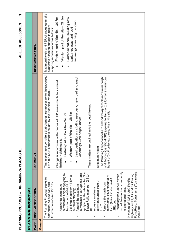
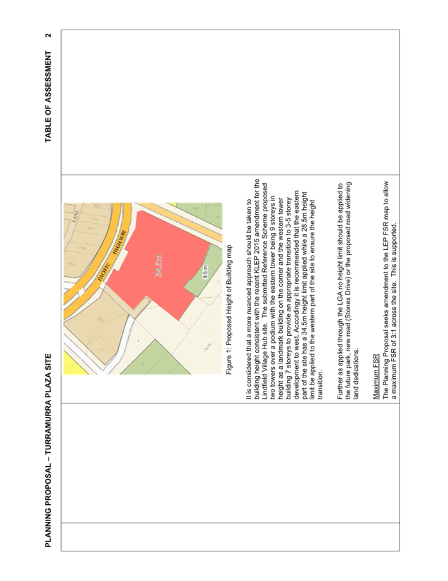
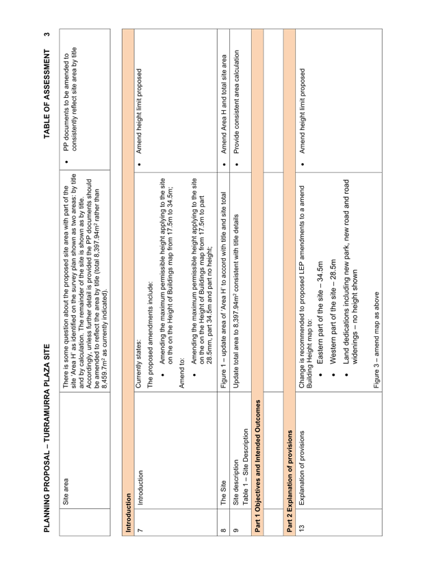
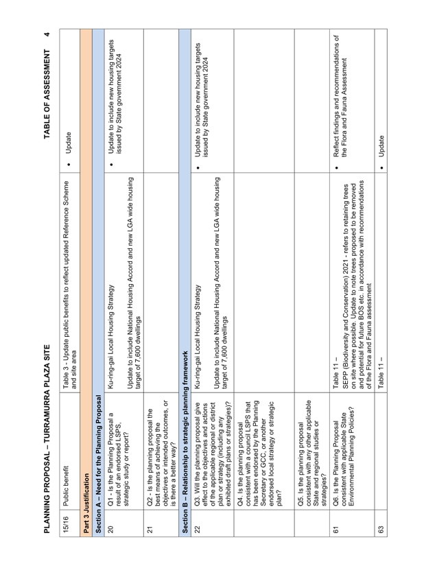
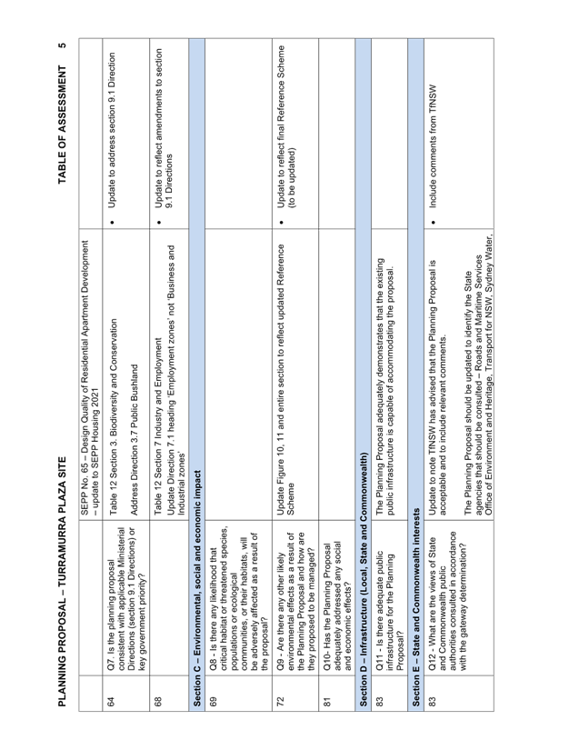
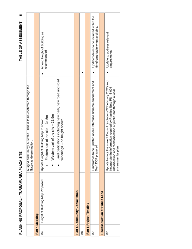
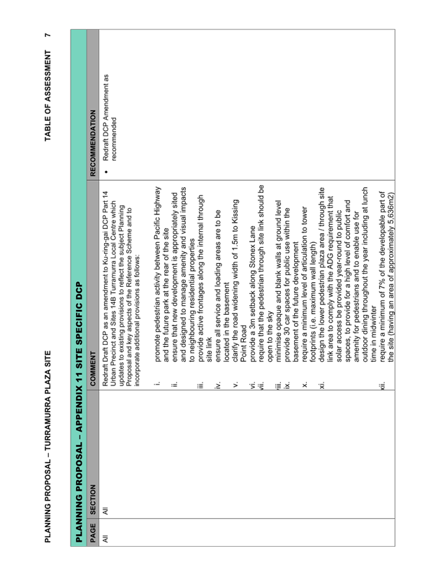
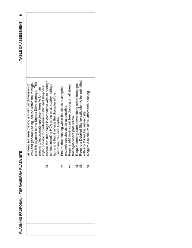
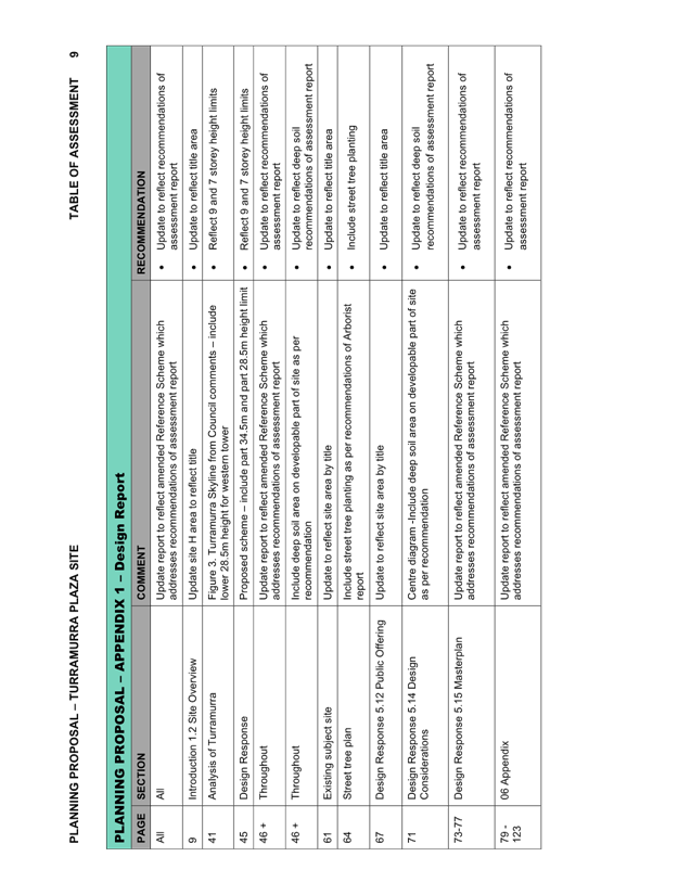
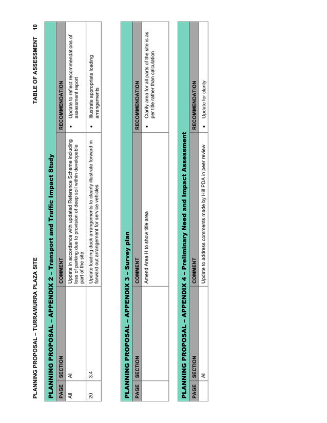
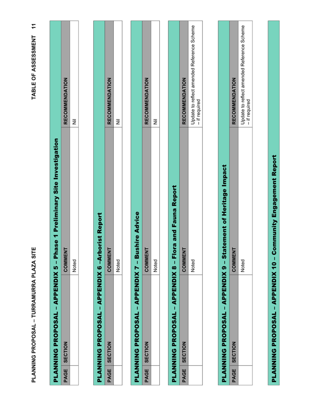
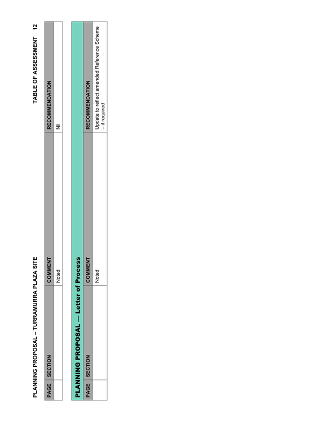
|
ATTACHMENT
No: 2 - Planning
Proposal prepared by The Planning Studio Final (May 2024) - Turramurra Plaza
|
|
Item No: GB.14
|
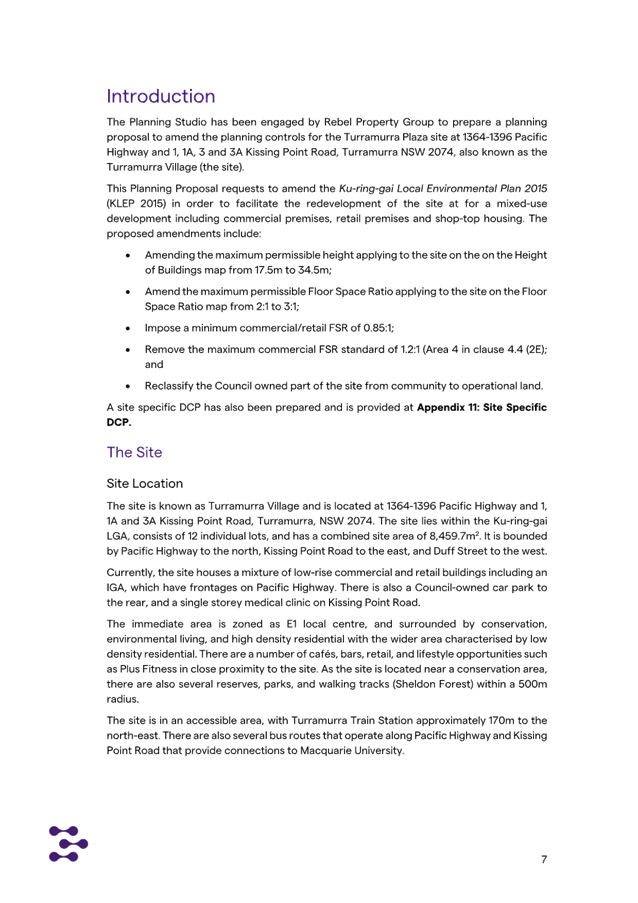
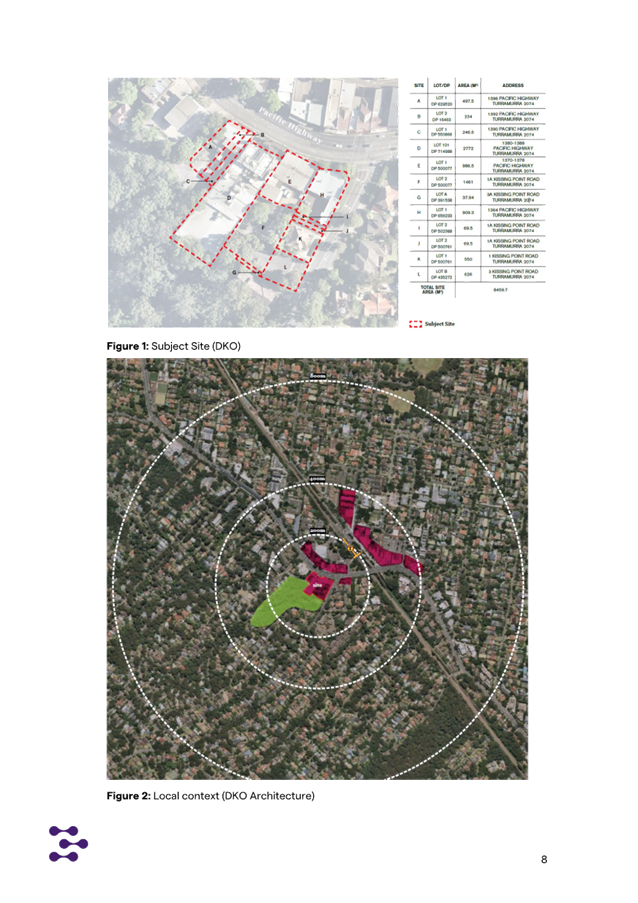
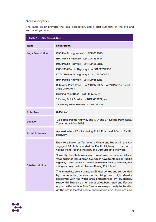
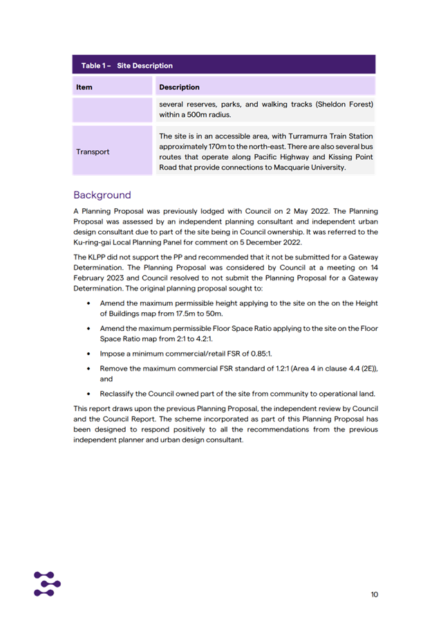

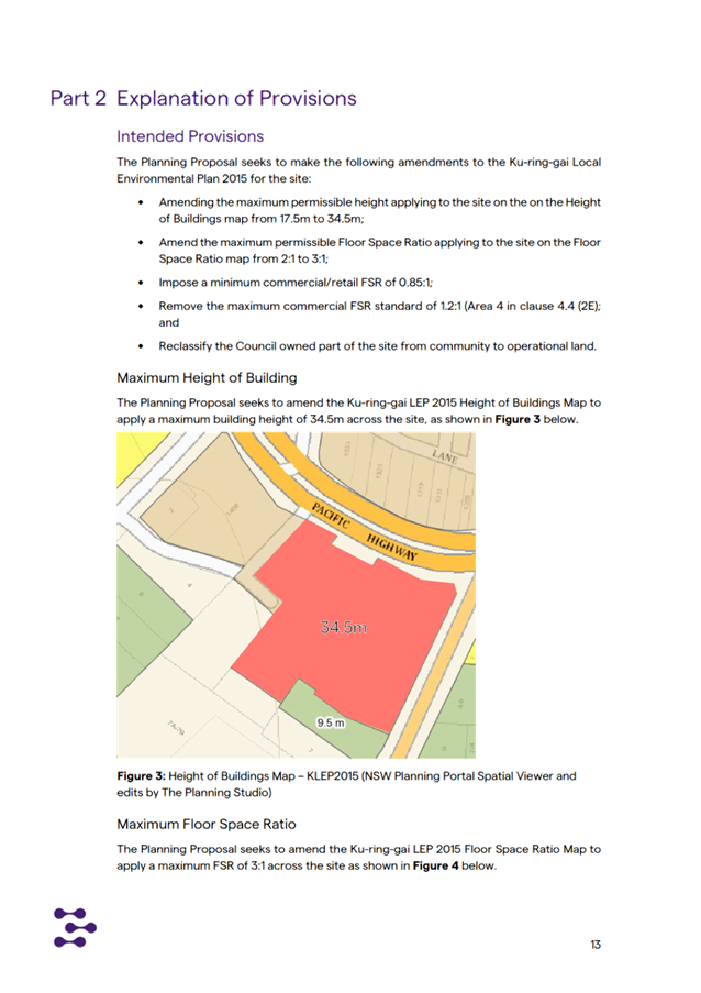

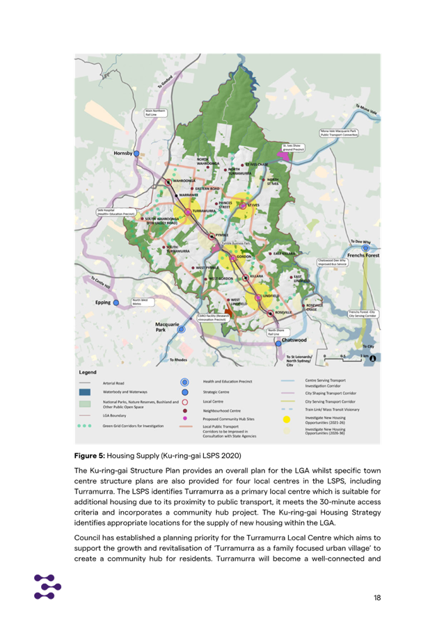
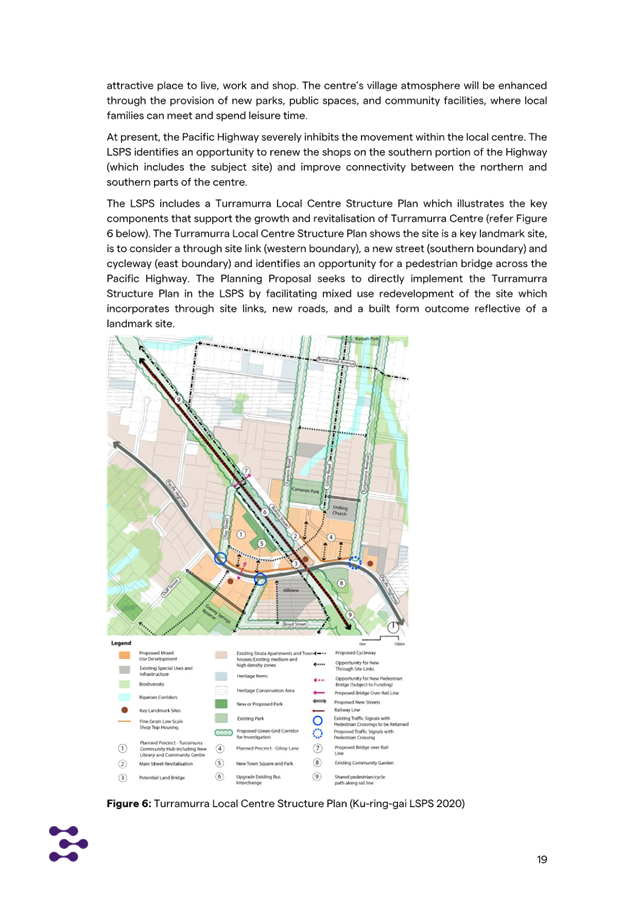
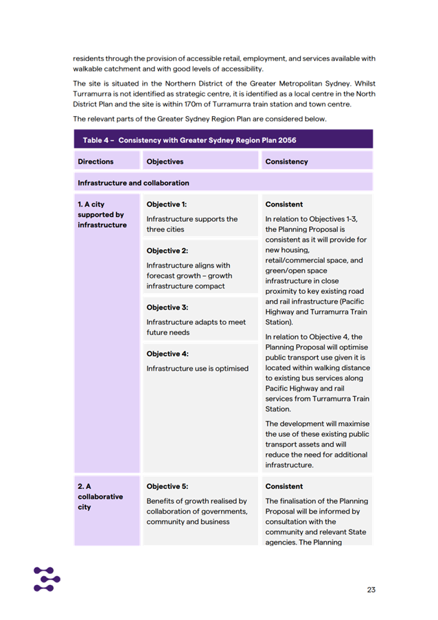
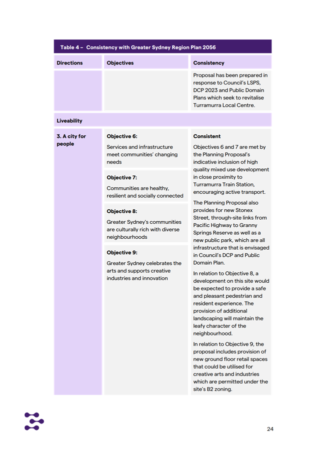
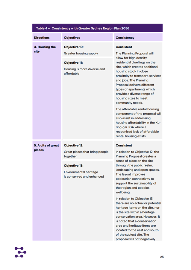
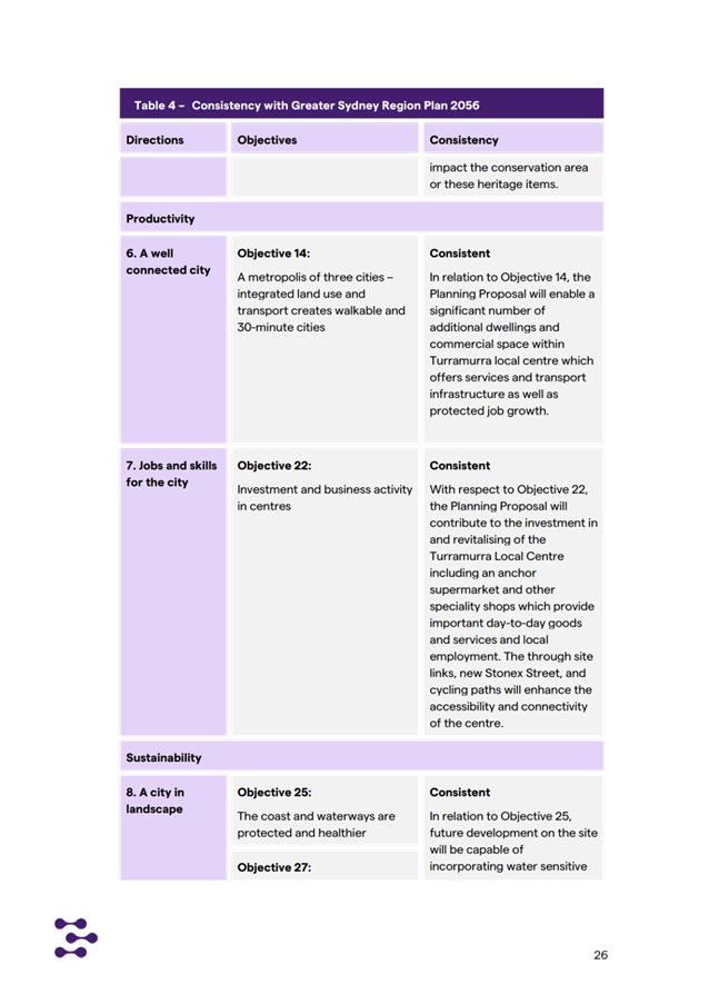
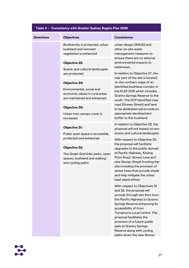
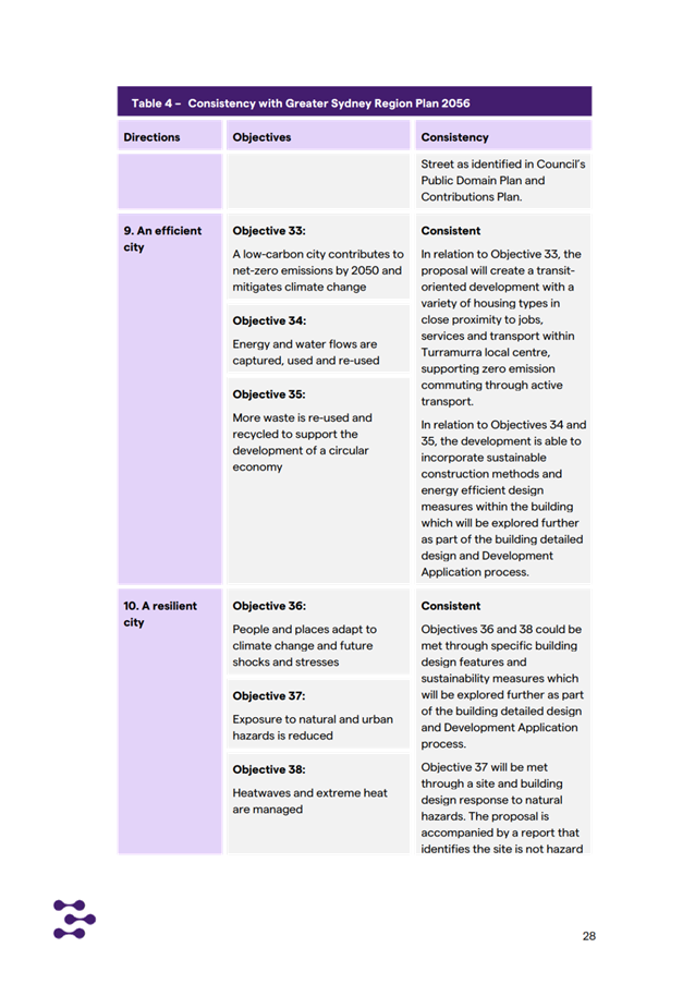
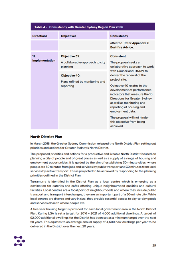
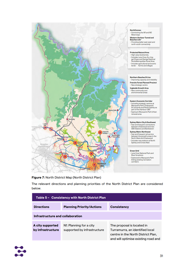
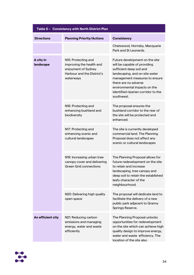
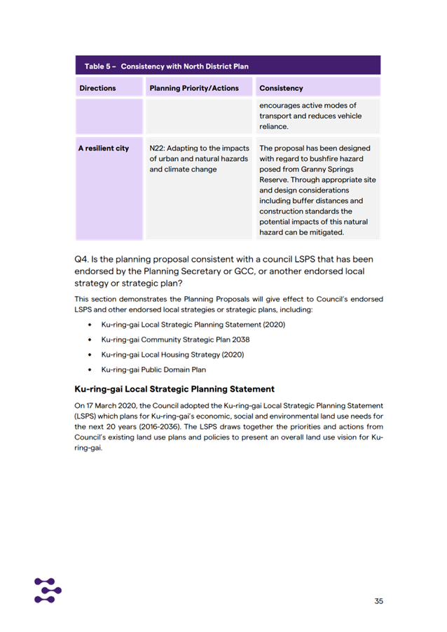
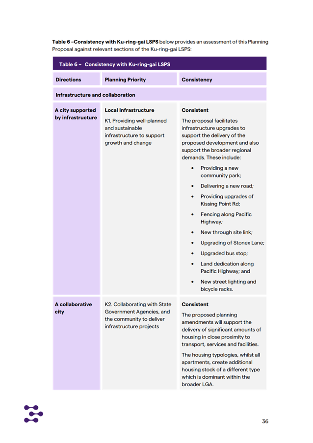
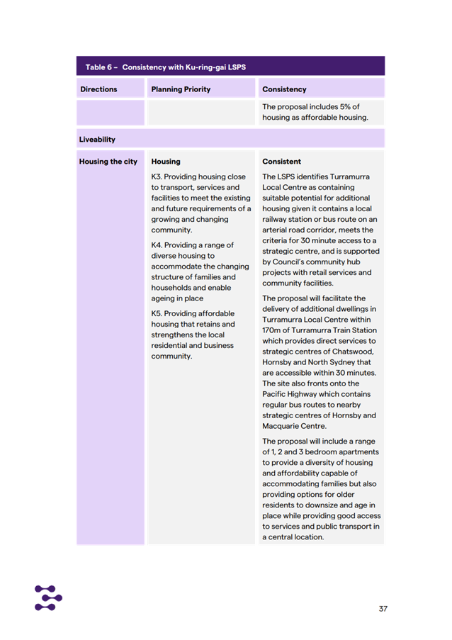
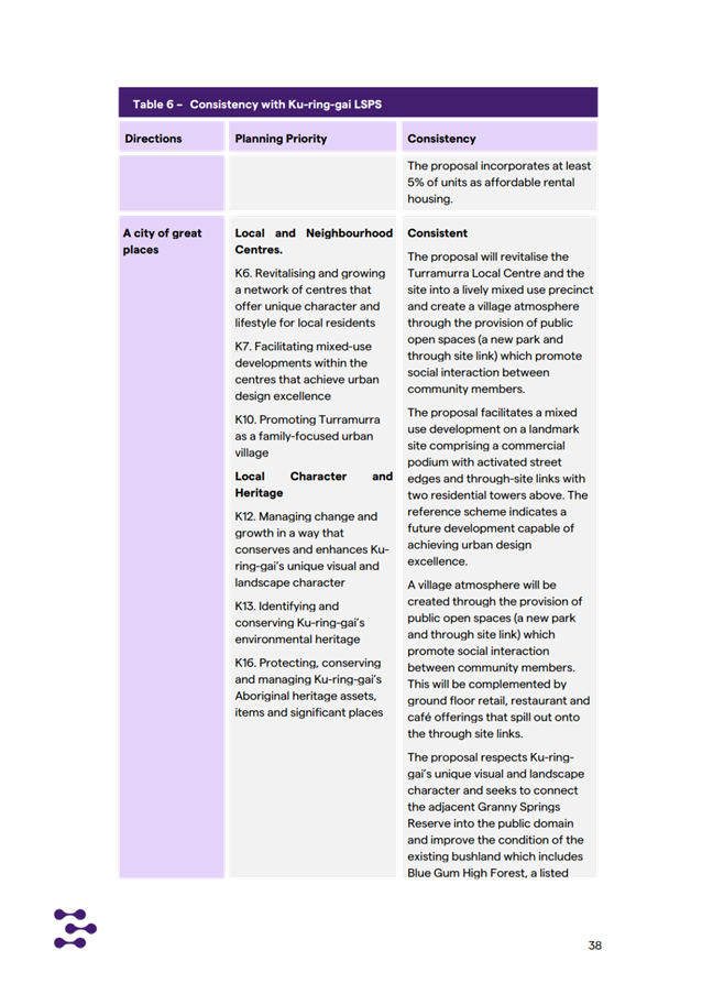
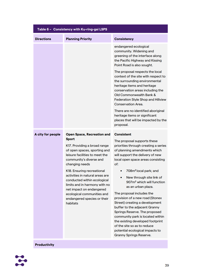
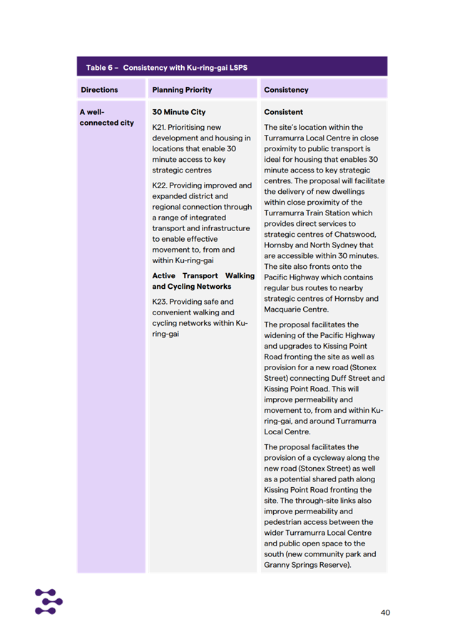
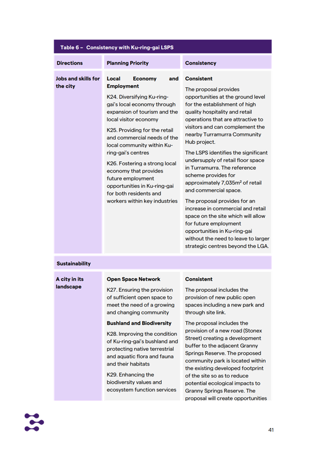
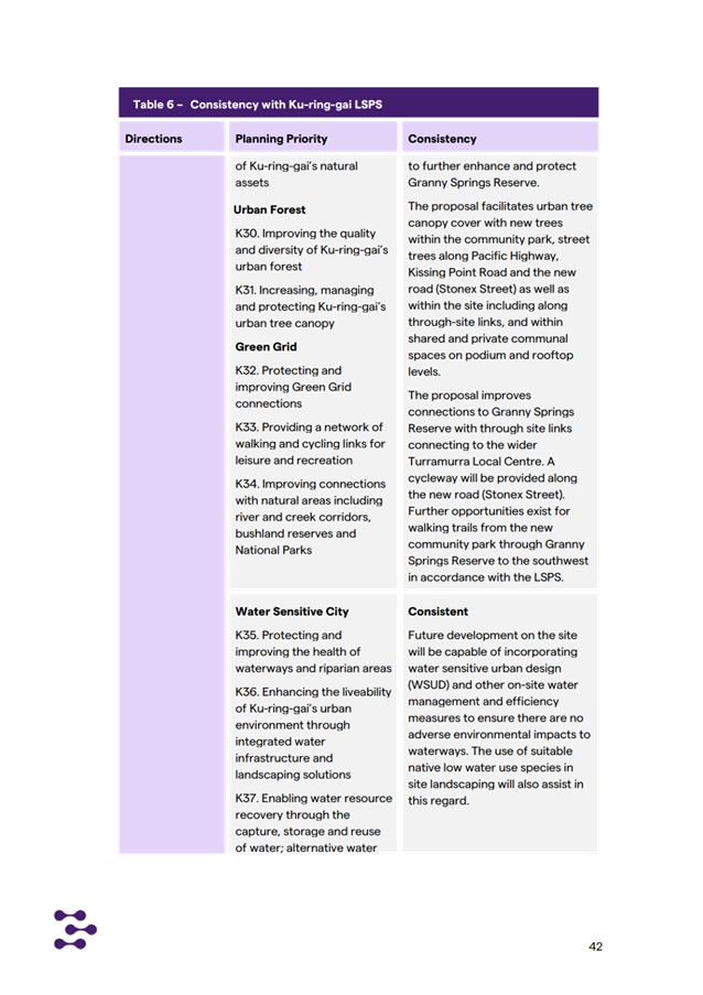
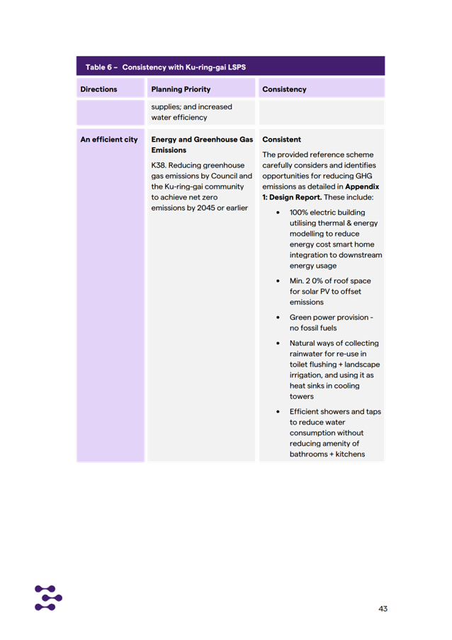
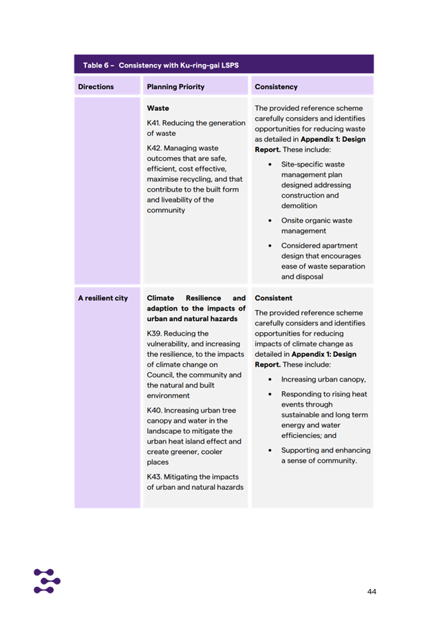
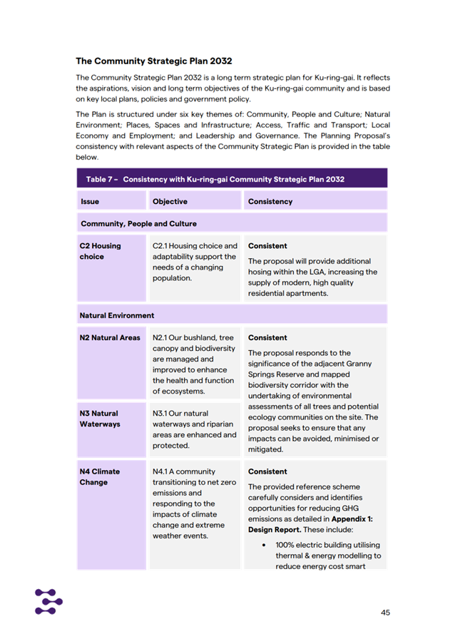
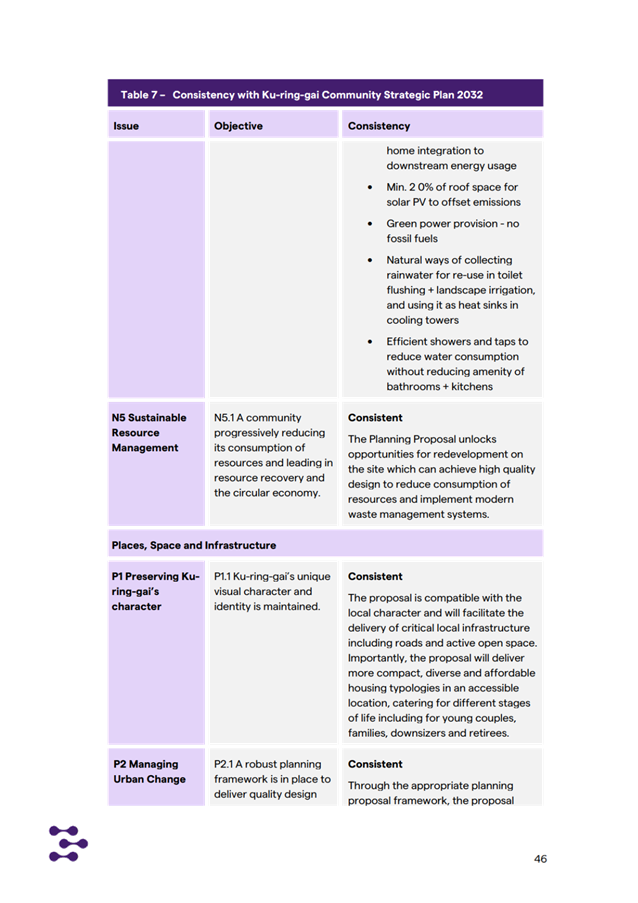
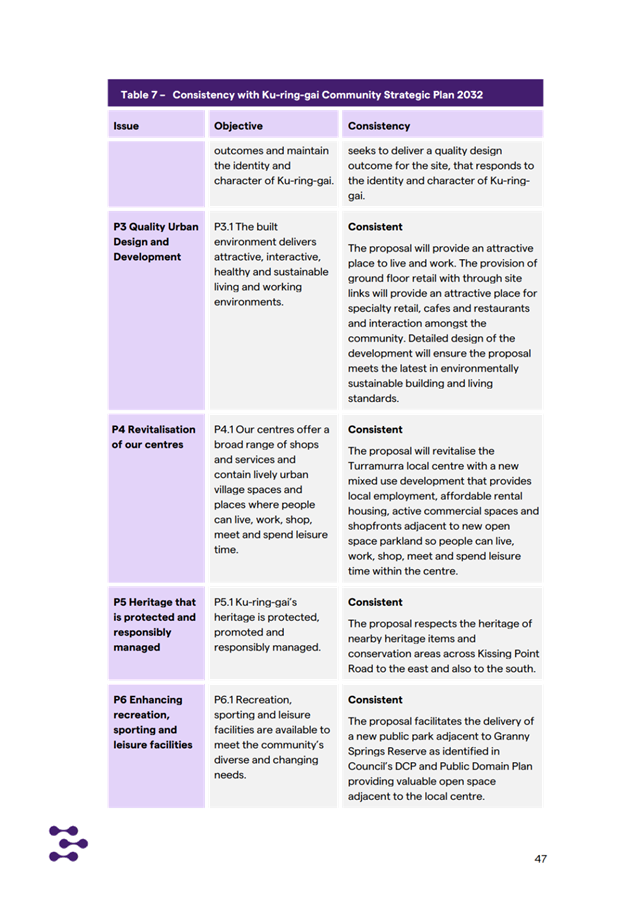
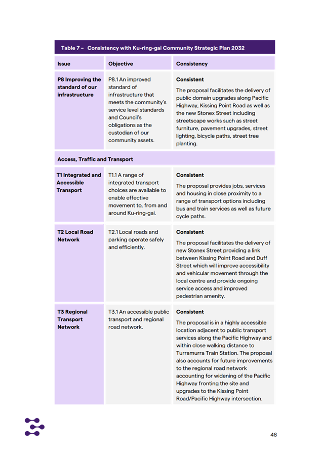
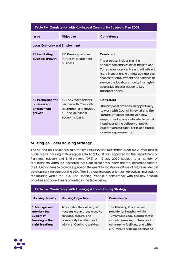
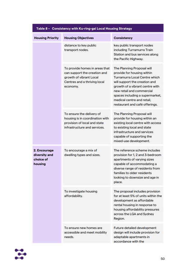
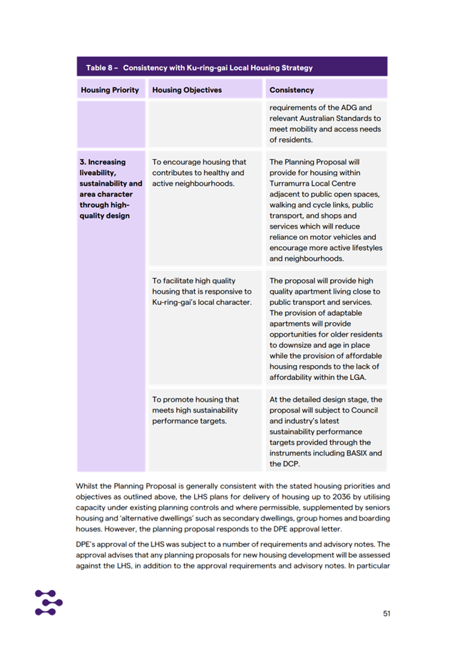
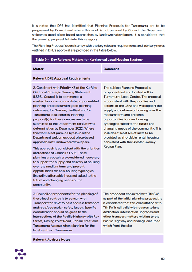
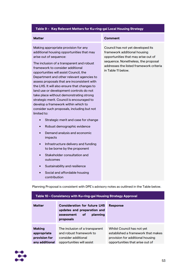
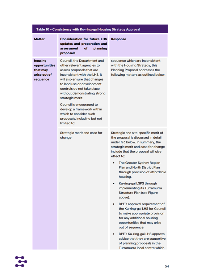
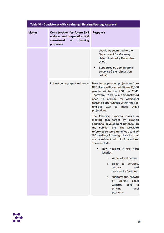
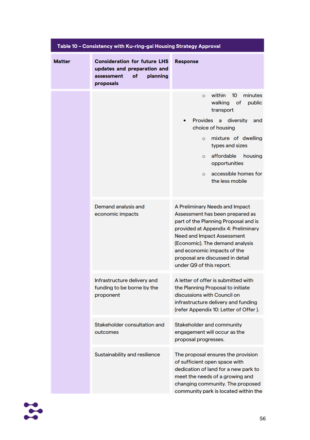
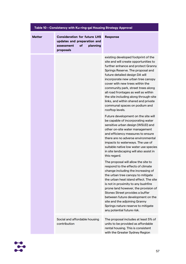
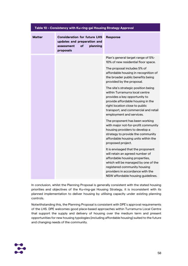
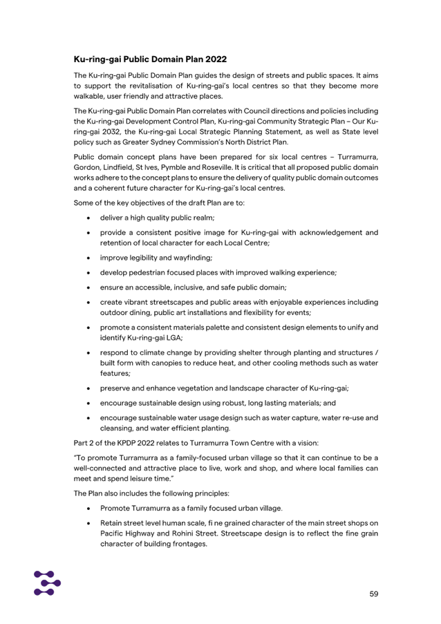
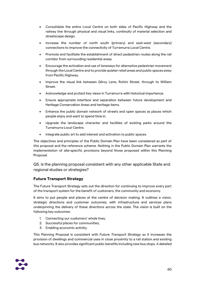
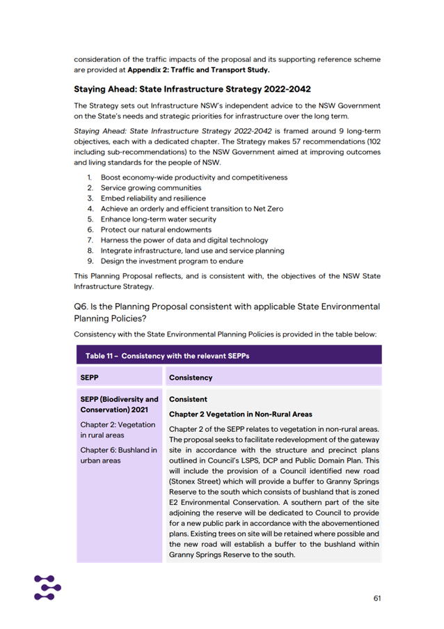
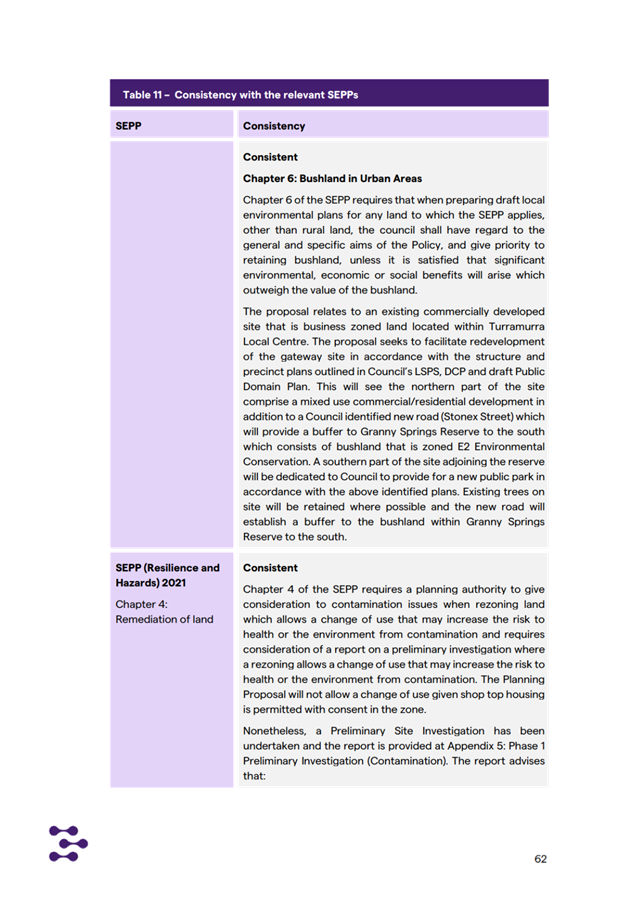
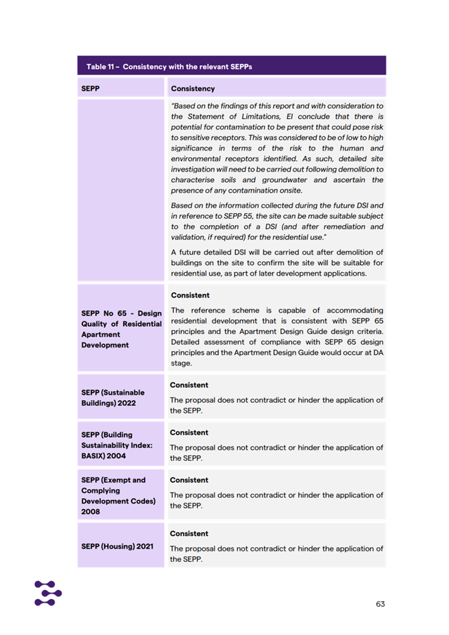
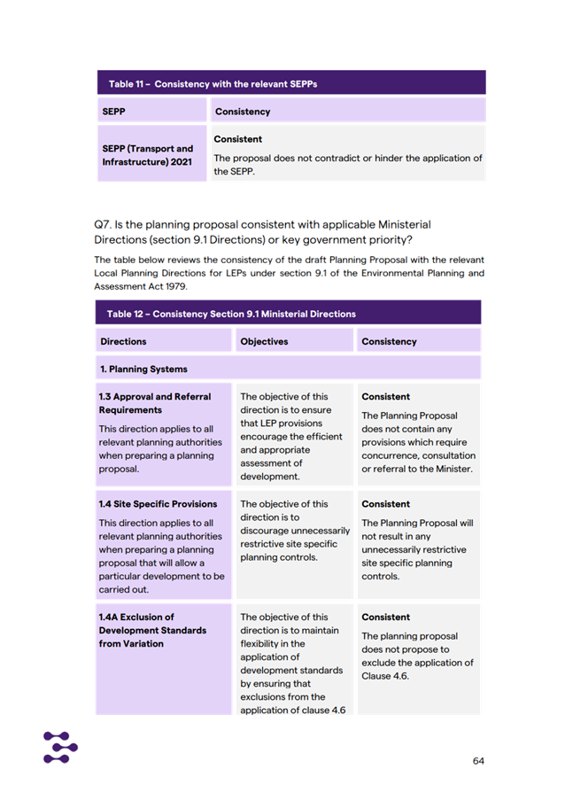
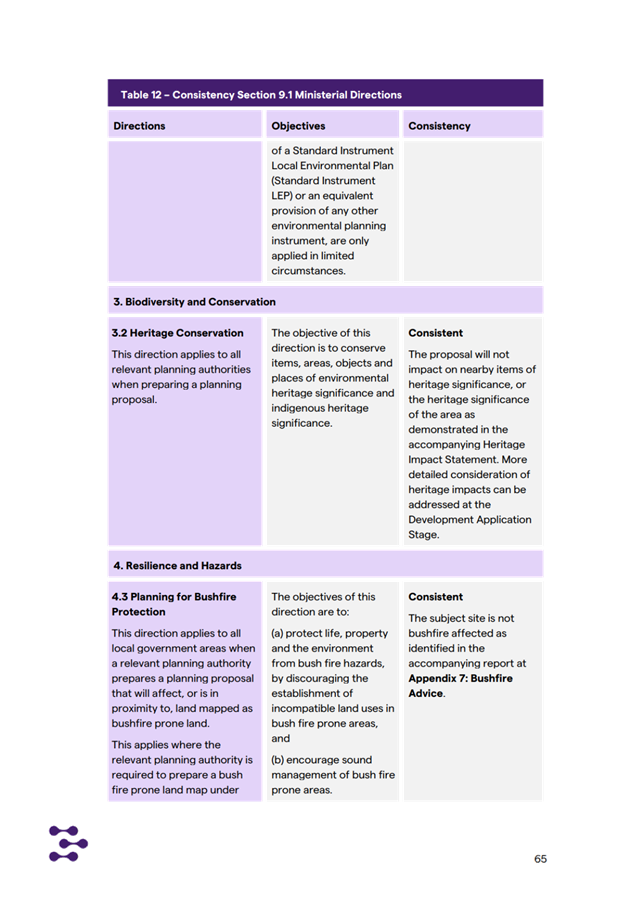
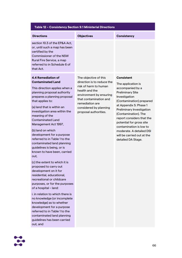
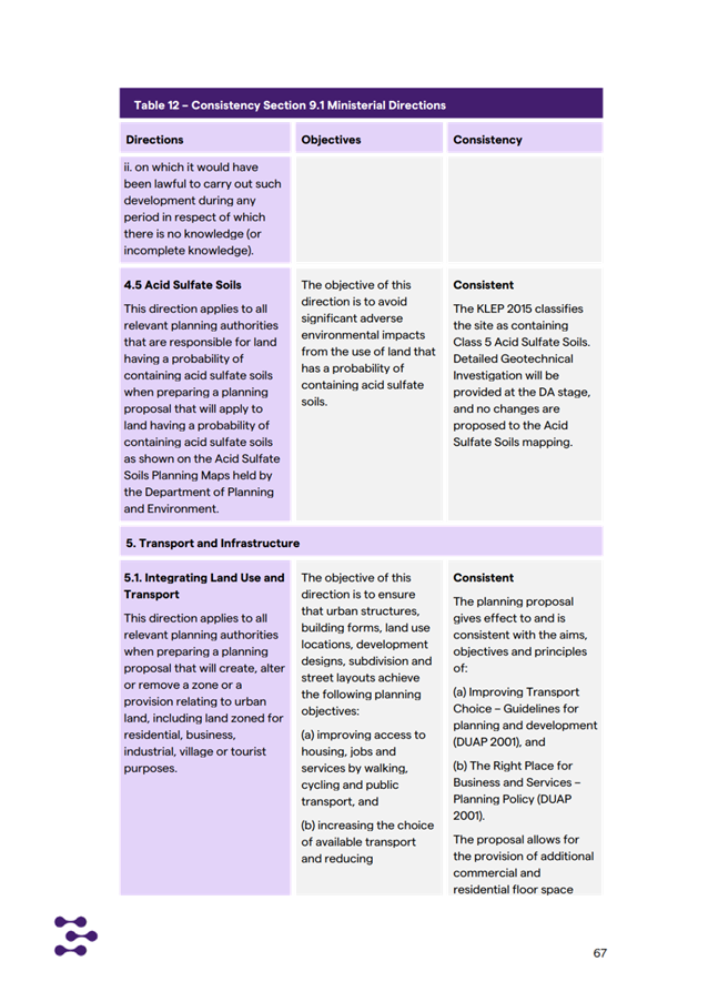
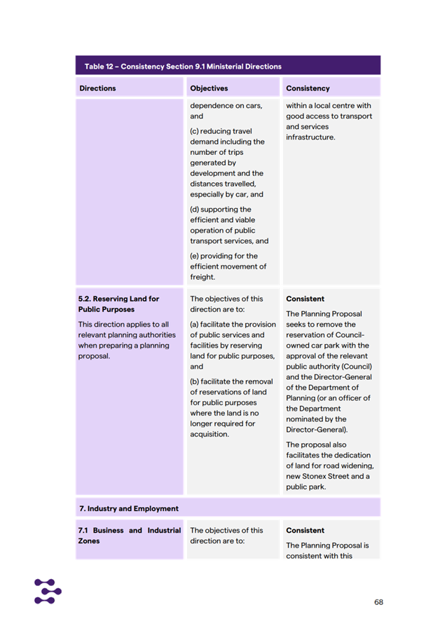
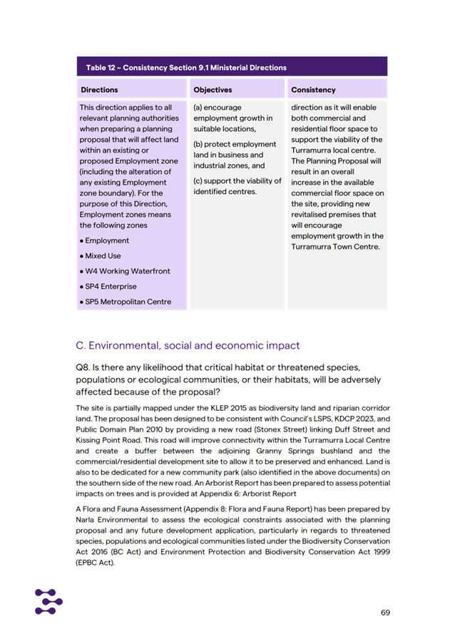
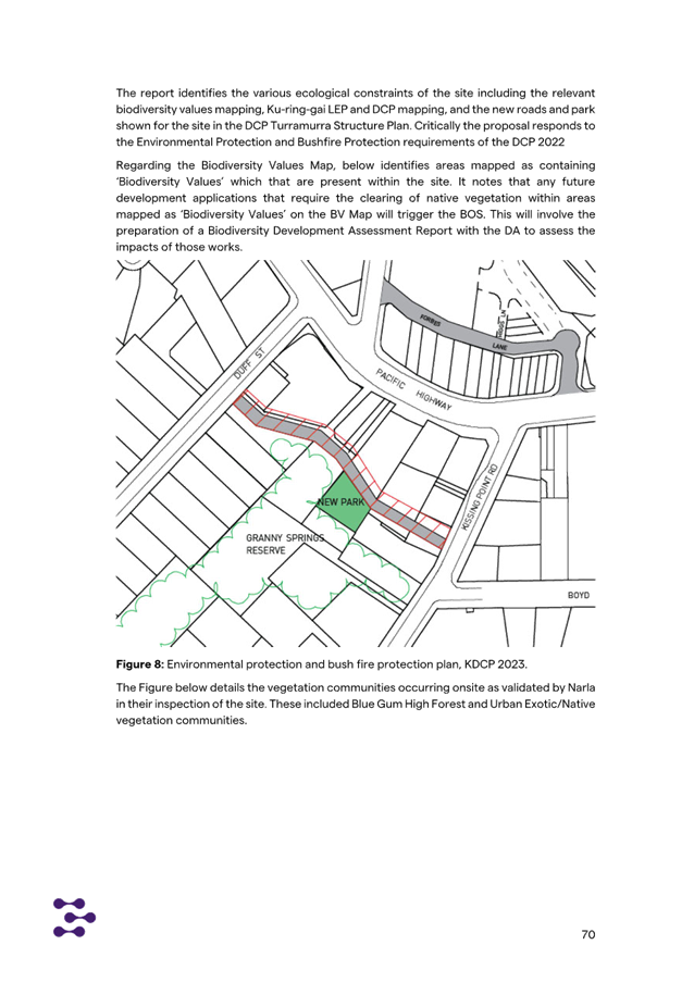
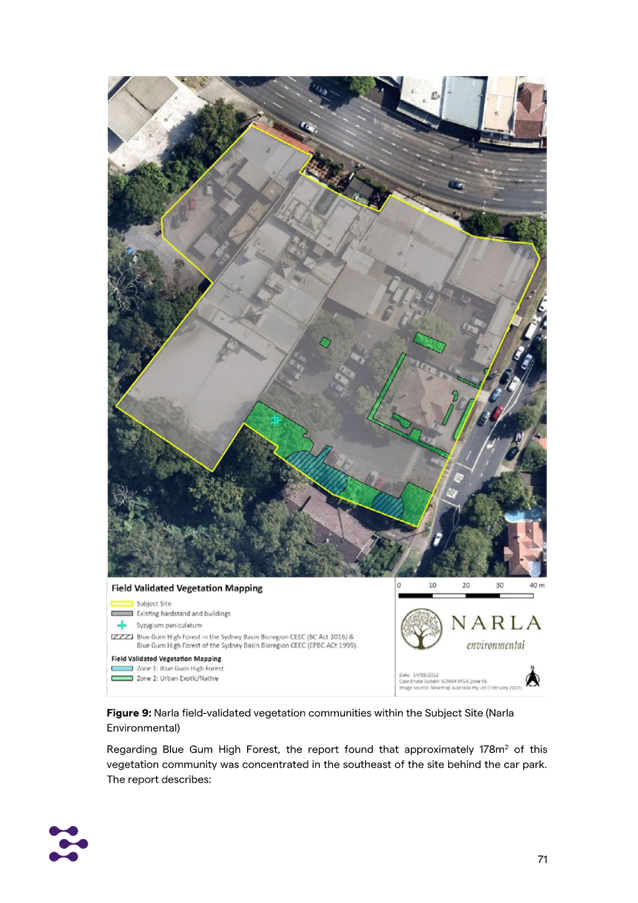
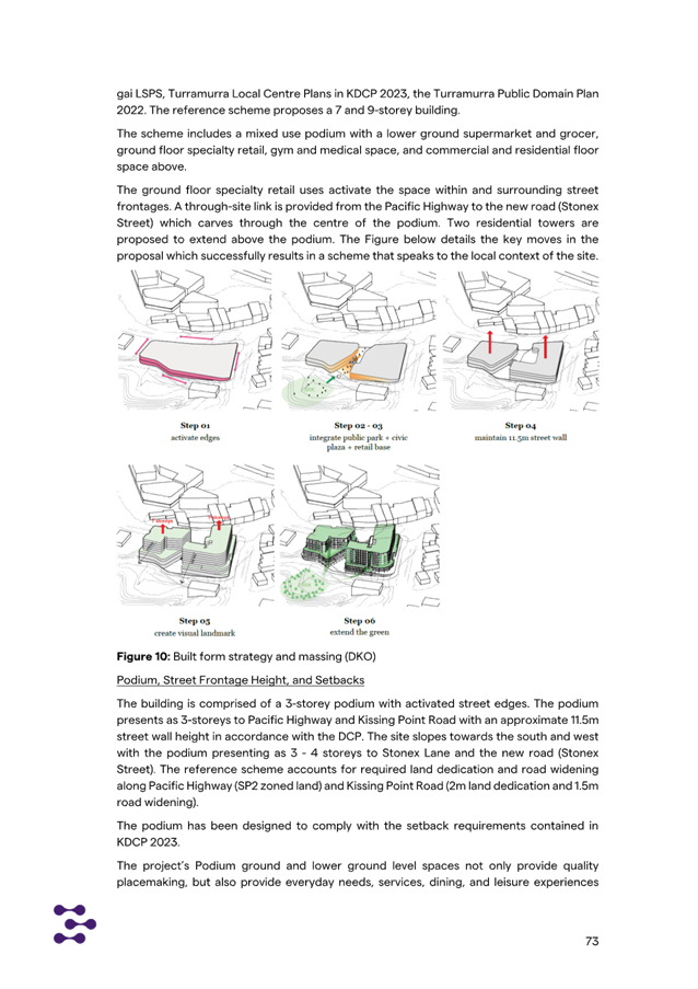
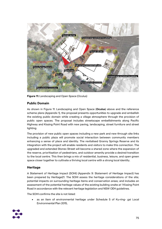
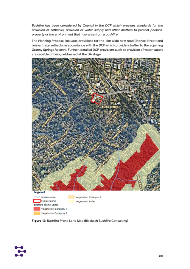
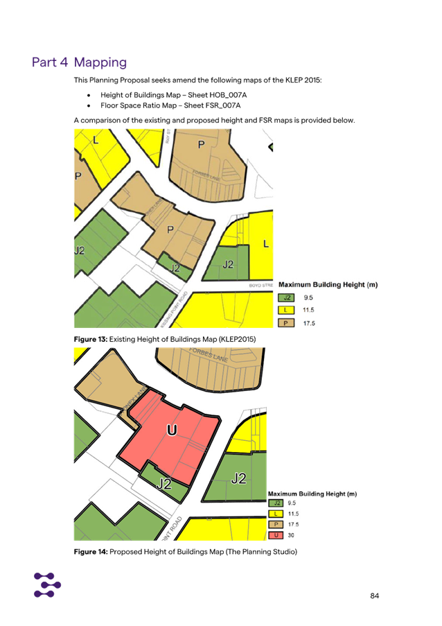

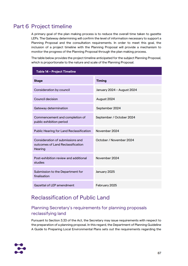
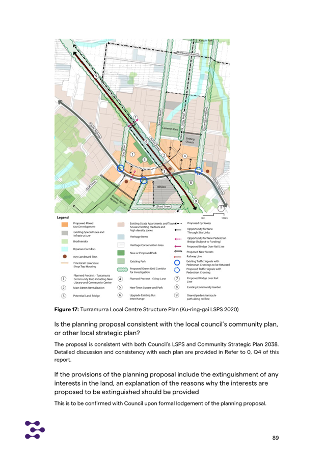
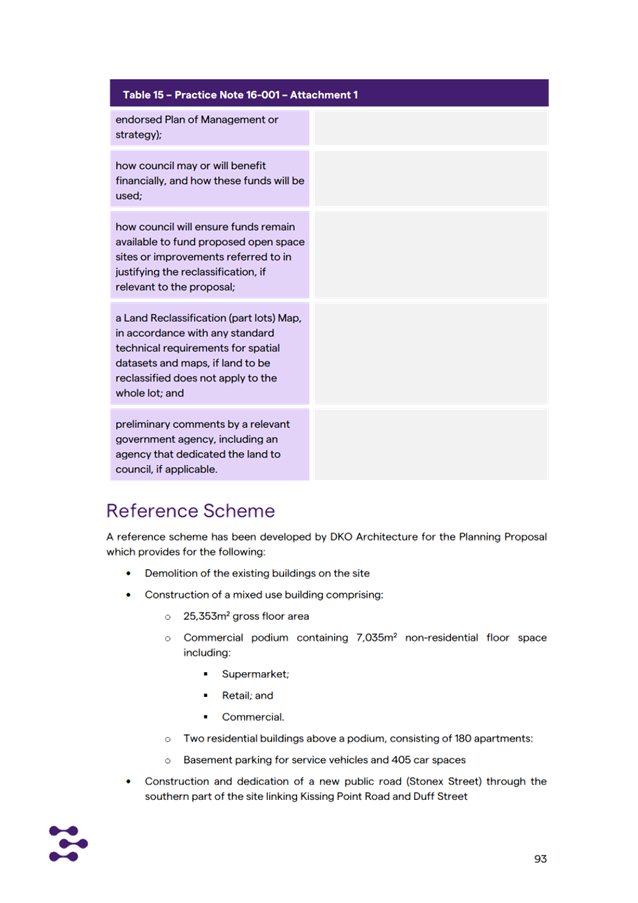
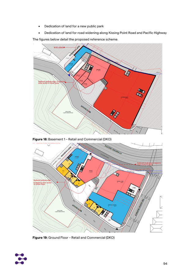
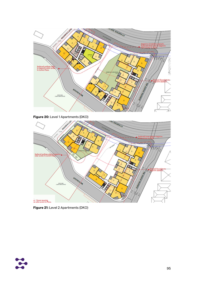
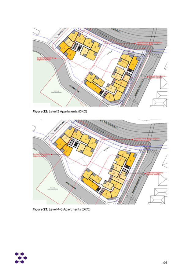
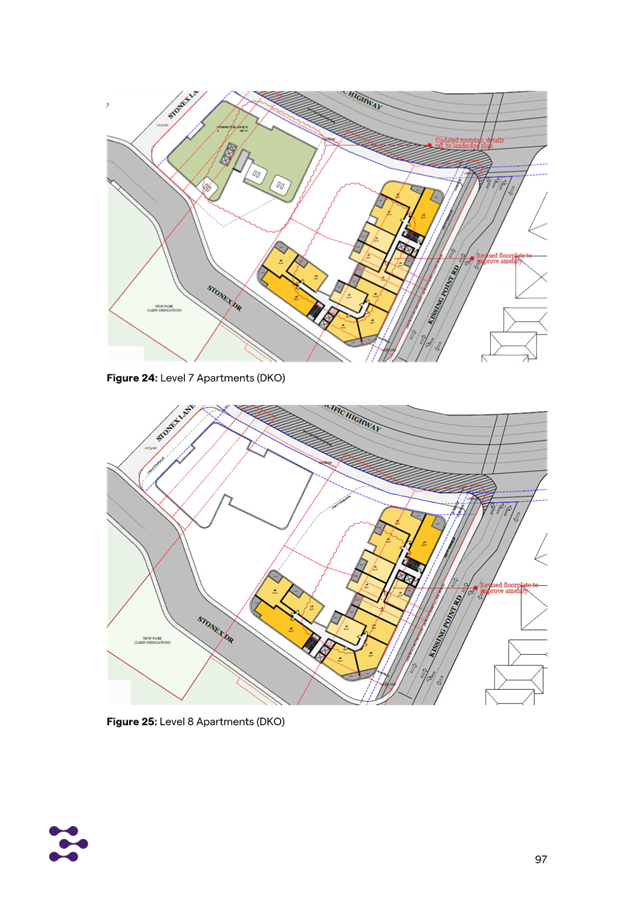
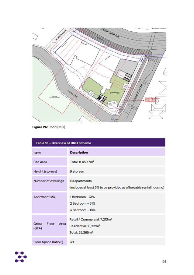
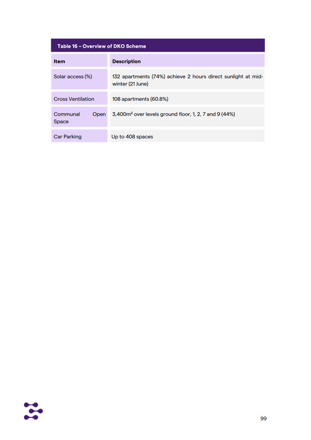
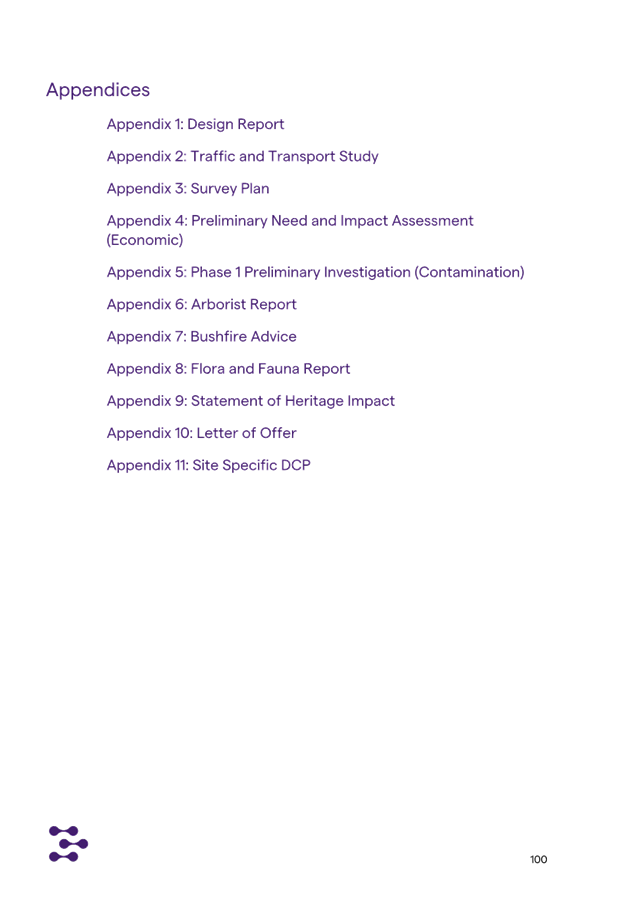
|
ATTACHMENT No: 12 - Planning
Proposal Appendix 10 - Amended Letter of Offer - Turramurra Plaza
|
|
Item No: GB.14
|
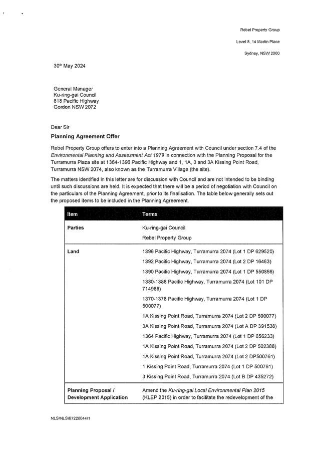
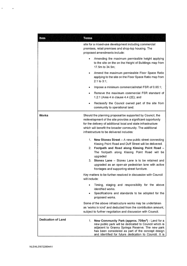
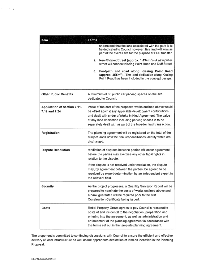

|
ATTACHMENT No: 13 - Urban Design
Review - Studio Zanardo - Turramurra Plaza Planning Proposal
|
|
Item No: GB.14
|
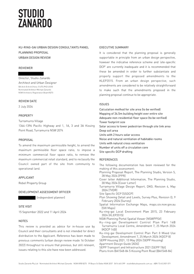
|
ATTACHMENT No: 15 - Draft Site Specific
DCP - Turramurra Plaza
|
|
Item No: GB.14
|
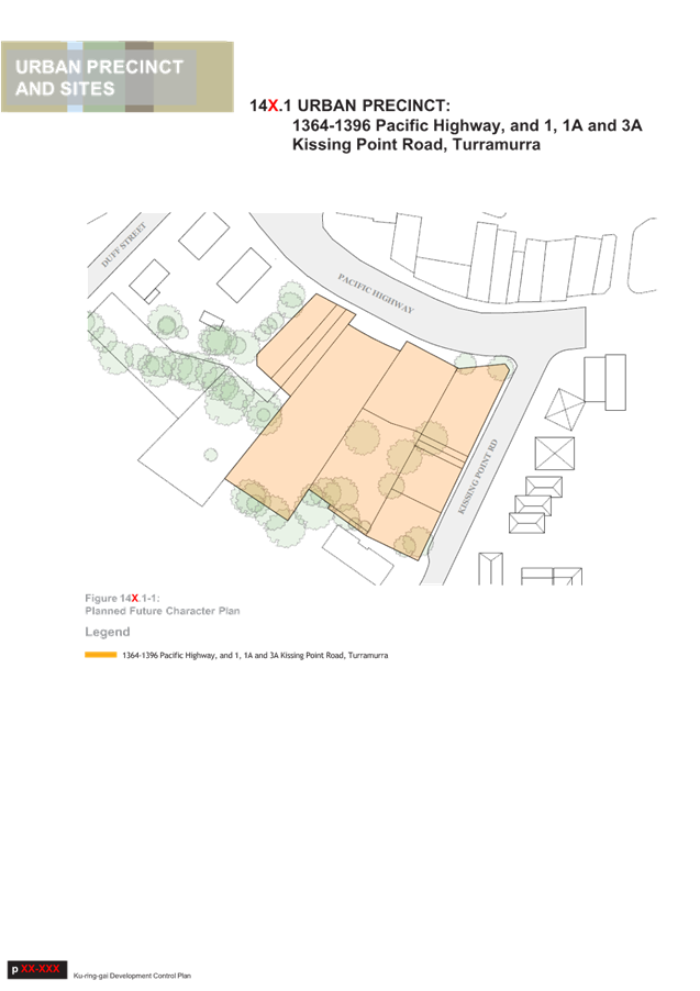
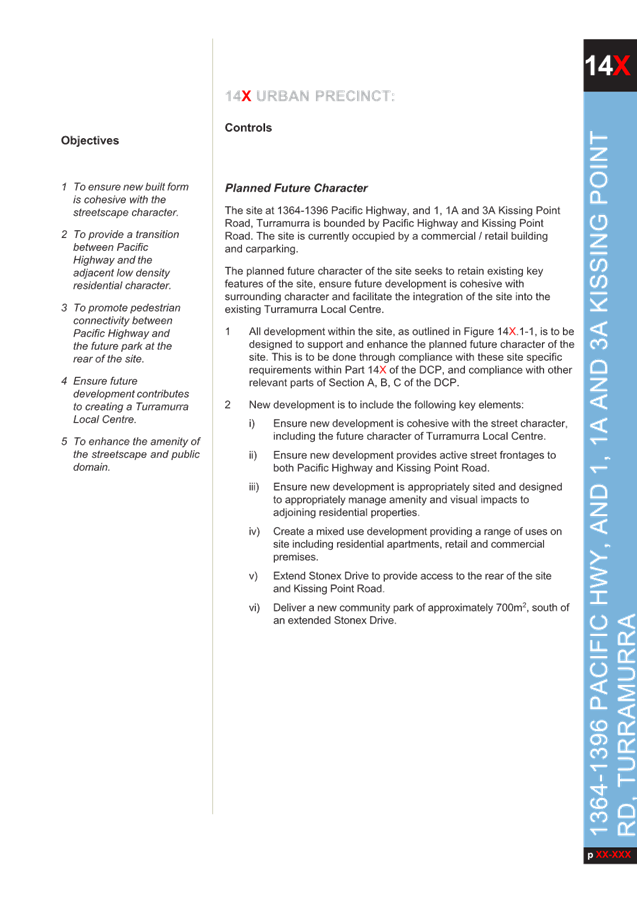
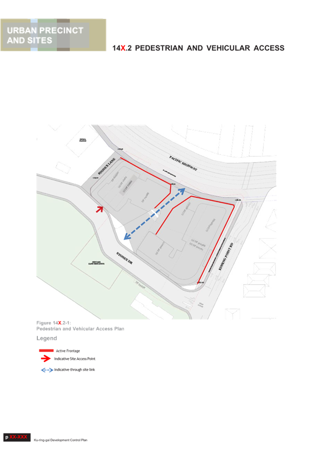

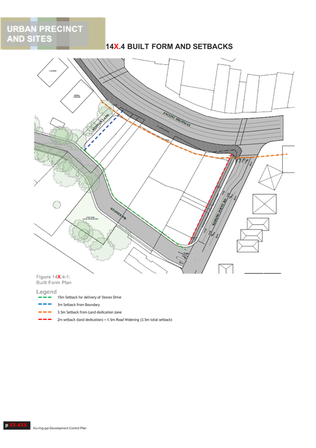

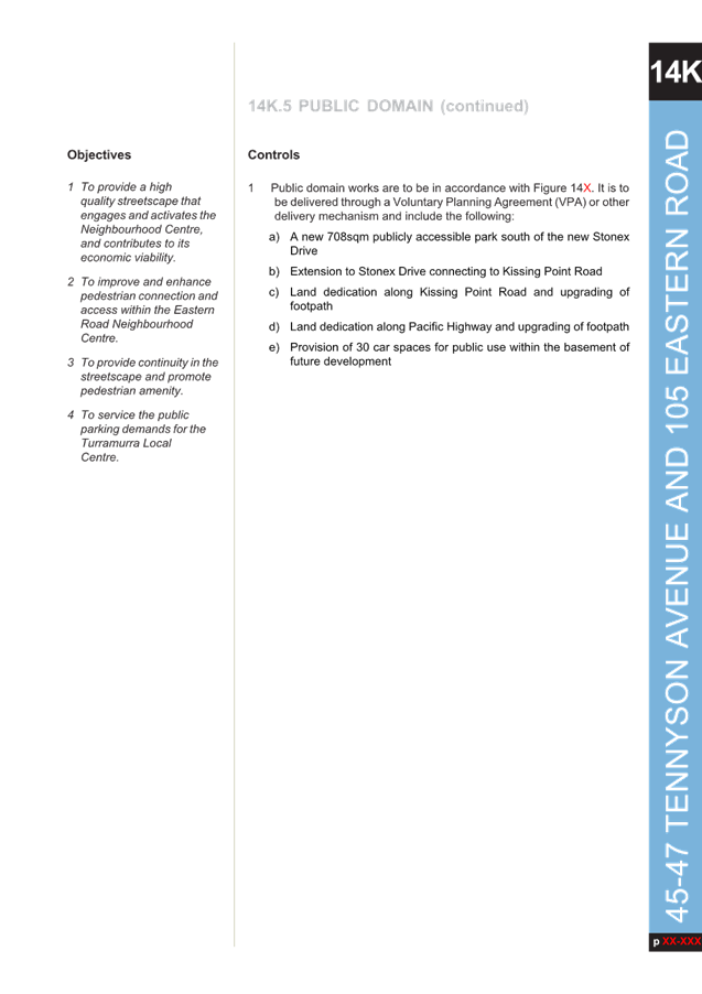

|
ATTACHMENT No: 16 - KLPP 22 July
2024 - Advice - Planning Proposal Pacific Highway Turramurra
|
|
Item No: GB.14
|
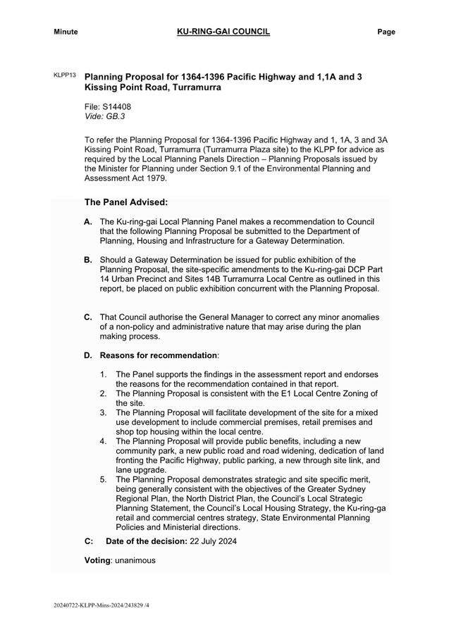
|
Ordinary
Meeting of Council - 13 August 2024
|
GB.15 / 1
|
|
|
|
|
Item
GB.15
|
S13985
|
Planning Proposal
51-53 Rohini St, Turramurra (Anglicare)
EXECUTIVE
SUMMARY
|
purpose of report:
|
For Council to consider the
private Planning Proposal for 51-53 Rohini Street, Turramurra (Anglicare
Village).
|
|
|
|
|
background:
|
The Planning Proposal was formally submitted to
Council for assessment on 26 September 2023. Following two adequacy checks,
the proposal was updated by Anglicare and re-submitted with fees.
The Planning Proposal seeks amendment to the Ku-ring-gai
Local Environmental Plan 2015 to enable the following:
· increase the maximum Floor
Space Ratio (FSR) from 0.85:1 to 1.5:1 (the Housing SEPP bonus provisions
will result in a final FSR of 1.725:1);
· increase the maximum Height of
Building from 11.5m to 17.5m (the Housing SEPP bonus provisions will result
in a final Height of 21.3m);
· include certain Local
Provisions that allow the inclusion of a Café and a Wellness Centre
with an indoor pool.
The key objective of the Planning Proposal is to
facilitate the site’s redevelopment as it no longer meets design
standards for seniors housing, nor is it in line with current customer
expectations.
The Planning Proposal was referred to the Ku-ring-gai
Local Planning Panel on 22 July 2024 for advice.
|
|
|
|
|
comments:
|
The Planning Proposal is generally supported; however,
a number of amendments are required to ensure its consistency with State and
Local Environmental Planning Instruments, and to make the proposal
transparent to the community on the outcomes it will deliver.
|
|
|
|
|
recommendation:
(Refer to the full Recommendation at the end of this
report)
|
That Council supports the
Planning Proposal being submitted to the Department of Planning, Housing and
Infrastructure for a Gateway Determination subject to the amendments stated
in this Report and in the Table of Assessment at Attachment A1.
|
Purpose of Report
For Council to consider the private Planning Proposal for
51-53 Rohini Street, Turramurra (Anglicare Village).
Background
On 26 September 2023 Council
received a Planning Proposal for land at 51–53 Rohini Street, Turramurra,
known as the Anglicare Village (housing for seniors).
The site is owned by the
Anglican Community Services and contains 110 existing senior’s
independent living units, generally in a 2-3 storey unit and townhouse style
development.
The proposal states that the
existing facility has been in operation since the late 1960s and requires
complete renewal as it no longer meets accessibility or design standards, nor
is it in line with customer expectations and current market demand for larger
sized units.
Adequacy checks on submitted
documents
The Planning Proposal was
formally submitted to Council for assessment on 26 September 2023. Two adequacy checks were conducted to ensure the proposal
complied with the Department of Planning and Environment’s LEP Making
Guideline August 2023, Council’s Meeting Notes from the two
pre-lodgement meetings held with the proponent and to ensure the proposal
provided sufficient justification to commence its assessment.
The adequacy checks were sent to
the proponent on 10 October 2023 and 28 February 2024.
Updated versions of the Planning Proposal, responding to the
issues raised, were submitted by the proponent on 12 December 2023 and again on
2 May 2024.
A number of the issues raised in the adequacy checks remain
outstanding and are now listed as part of the required amendments to enable the
Planning Proposal to progress to Gateway Determination. These include:
Mapping
· Amendment
of the KLEP Maps, not the Written Instrument, is required to deliver the
proposed Height and FSR standards.
· The proposed approach is highly irregular and not
consistent with LEP Practice note PN 08-001 - Height and floor space ratio.
Where an LEP contains Clause 4.3 – Height of buildings and/or Clause 4.4
– Floor space ratio, then heights and FSRs are to be specified on the
Height of Buildings Map and Floor Space Ratio Map respectively.
Shadow
diagrams
· To
enable the general public to understand the shadow diagrams, enlarge the
provided single colour small thumbnails of the shadow diagrams so they are
clearly seen and understood, remove the multiple colours on the provided larger
diagrams as the multiple colours make it difficult to understand the diagrams
and appear deceptive with lighter colours being used for the most impactful
shadow extents.
· There is no hierarchy in
shadow. People cannot differentiate between the shadow from an 11.5m height and
shadow from a 21.3m height building. Shadow is homogenous. Use one colour to
clearly show the extent and outline of the proposal’s shadow for the
total built form. These diagrams need to be easily understood by the general
public.
Planning
Agreement
· The Letter of Offer is
to be a stand-alone document. The attached draft Planning Agreement is to be
removed. A draft Planning Agreement cannot be created prior to Council agreeing
to enter into the Planning Agreement based on the Letter of Offer.
· The items listed for consideration
within the Letter of Offer must clearly explain the public benefit proposed and
not include items for the sole benefit of the development site.
Assessment Timeframes
Formal assessment of the Planning Proposal commenced on 31
May 2024. To meet the timeframes stated in the LEP Making Guideline,
this matter must be reported to Council for determination by 29 August 2024;
with the next available meeting being the OMC 13 August 2024. Failure to meet
this timeframe will enable the proponent to submit a Rezoning Review with the
Department of Planning, Housing and Industry (DPHI).
The Site
The land, subject of this Planning Proposal (the Site), is
located at 51-53 Rohini Street, Turramurra at the end of a cul-de-sac. It is
strategically located close to transport links, shops, services and local
facilities including parks, library and gymnasiums.
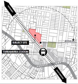
LOCATION MAP (PLUS Architecture)
The site is triangular/irregular
in shape and adjoins the North Shore train line. The land is generally flat
with a fall of 4-7m across the site. The land is elevated and slopes down
towards the surrounding lands to the north, east and south.
Turramurra train station, bus interchange and local shops
are located within walking distance, 100-200m, south-east of the Site along
Rohini Street. Trains and buses connect to other key local centres such as
Gordon, Lindfield, Chatswood and Hornsby. The Pacific Highway provides
vehicular access to the M1 freeway to the north, Ryde Road connecting to the M2
and M4 freeways linking the western suburbs, and Mona Vale Road connecting to
the Northern Beaches.
The Site comprises three lots with a total area of 9,193sqm:
· Lot
2 DP 302942
· Lot
21 DP 533032
· Lot
26 DP 585038
Lot 2 DP 302942 and Lot 21 DP 533032 are not burdened nor
benefited by any easements. Lot 26 DP 585038 is burdened by a right of way
along the south-east boundary (45m length and 3m width), and contains a separate
Lot 25 DP 585038 owned by Ausgrid (containing a sub-station). The Planning
Proposal does not seek to discharge any of the existing easements; however, the
Urban Design Report mentions this may occur at a later date.
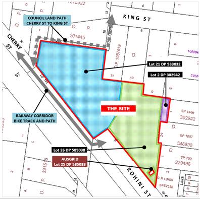
SITE
DETAILS – land ownership and use
The Site has a 100 m frontage to Rohini Street and a 100 m
frontage to the Turramurra Station railway corridor.
A public dog-leg pathway on Council owned land abuts
the north-western end of the Site and connects Cherry Street to King Street. A
separate pedestrian pathway on the adjacent Transport for NSW (TfNSW) Railway
lands (zoned SP2 Infrastructure) abuts the south-western boundary of the Site,
connecting Cherry Street to the Rohini Street cul-de-sac.
The site is surrounded by
residential development except along the railway corridor. Adjacent development
ranges from one to three storey houses and apartment buildings. Heritage
Conservation Area C5 (Laurel Avenue/King Street Conservation Area) is located
to the Site’s north and mainly comprises single dwellings.
ADJACENT
TO THE SITE: 1-3 storey residential development on neighbouring land and HCA C5
to the north
The Planning Proposal
This Report presents the assessment of the Planning Proposal
with full details provided in the Table of Assessment at Attachment
A1.
A copy of the proponent’s
Planning Proposal and its Appendices are included at Attachments
A2-A14 and comprise the following:
· Planning Proposal
Anglicare “Rohini Village” 51-53 Rohini Street, Turramurra
o Appendix A - Urban Design
Report and Site Photo Panel
o Appendix B - Title Documents
& Surveys
o Appendix C - Arboricultural
Impact Assessment Report
o Appendix D - Heritage Impact
Statement
o Appendix E - Traffic &
Transport Assessment
o Appendix F - Utility and
Infrastructure Plans
o Appendix G - Biodiversity
Advice
o Appendix H - Landscape Concept
& Drawing Schedule
o Appendix I - Feasibility
Analysis
o Appendix J - Letter of Offer
and Draft Planning Agreement - Rohini Village
o Appendix K - Rohini Village
Study
o Appendix L - Pre-Consultation
Minutes and Responses
Planning Standards
In general, the Planning Proposal seeks to make the
following amendments to the Ku-ring-gai Local Environmental Plan 2015 (KLEP
2015):
1. increase
the maximum Floor Space Ratio (FSR) from 0.85:1 to 1.5:1 (the Housing SEPP
bonus provisions will result in a final FSR of 1.725:1);
2. increase the maximum Height of
Building from 11.5m to 17.5m/5 storey (the Housing SEPP bonus provisions will
result in a final Height of 21.3m/6 storey);
3. include
certain Local Provisions that allow the inclusion of a café (Commercial
use) and a wellness centre with an indoor pool (Recreational Facility (Indoor)
use).
Concept Design Standards
The Planning Proposal is supported by an Urban Design
Report prepared by Plus Architecture. This presents a concept design for
the site.
The purpose of the Urban Design Report concept design
is to demonstrate that a scheme which represents the proposed maximum Height,
FSR and Additional Uses can readily be accommodated on the site, and can comply
with applicable controls and requirements without resulting in any unreasonable
environmental impacts.
The key development standards achieved in the concept design
are indicated in the below Table:
|
|
PROPOSED
STANDARDS
|
|
Site Area
|
· 9,193 m2
|
EXISTING
STANDARDS
|
|
Height
|
· 6 storey including the SEPP bonus
|
3 storey
|
|
FSR
|
· 1.725:1 including the SEPP bonus
|
0.85:1
|
|
Units
|
· 110 Independent
Living Units
66
x 2 bedroom units
44
x 3 bedroom units
|
110 Independent
Living Units
82 x 1 bedroom
units
24 x 2 bedroom
units
2 x 3 bedroom
units
|
|
Other
facilities
|
· 700sqm Internal
Communal Space (including 100sqm café)
Chapel,
pool, clinic, salon, library, café, multi-purpose space, communal
rooftop and ground level gardens.
Communal
open space 25% site area
|
Lounge areas,
library, clinic, salon, dining area, communal gardens, communal laundry
|
|
Car parking
|
· 2-3 level basement parking
· Total parking spaces – 199
Residential
parking - 171
Emergency
parking – 1
Visitor
parking – 18
Staff
parking – 8
Car
share space - 1
Note
– these standards are compliant with the SEPP (Housing) 2021
requirements
|
42 spaces
|
|
Gross Floor
Area
|
· Total: 15,850 sqm
|
|
Solar access
|
· 77/110 units achieve 2 hour solar access – 70%
· 22/110 units receive less than 2 hour solar access
· 11/110 receive
no solar access
Note – these standards
are compliant with the SEPP (Housing) 2021 requirements
|
|
Natural
ventilation
|
· 86/110 units have natural ventilation – 78%
· 24/110 units do
not have natural ventilation
Note – these standards
are compliant with the SEPP (Housing) 2021 requirements
|
|
Note: The
proponent states the concept design achieves the minimum standards of the
SEPP (Housing) 2021 and AS1428.1 Design for access and mobility.
|
The proposed concept plan retains the same number of
independent living units (110), replacing the existing 2-3 storey mainly
townhouse style buildings with 6 storey apartment buildings.
The proposal augments the internal community facilities by
including a new café and wellness centre with swimming pool which are
proposed to be opened to the general public. A clearer through-site link will
replace the existing informal access from Rohini Street to King Street and is
also proposed to be made open to the wider public via a Planning Agreement
between Council and the landowner.
PLANS -
EXISTING AND PROPSED DEVELOPMENT (PLUS Architecture)
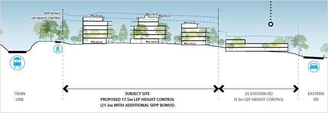
SECTIONS
- EXISTING AND PROPSED DEVELOPMENT (PLUS Architecture)
Public Benefit
The Planning Proposal is accompanied by a draft Letter of
Offer which seeks to negotiate the delivery of some items claiming public
benefit. Whilst the Letter of Offer is unclear and includes items not relevant
to the Letter but rather relevant in a subsequent agreement between parties,
the following five items are noted as part of the offer:
· Public access
across the site from Rohini Street to King Street via an 88m pathway labelled
Rohini Walk.
· Upgrades to the
turning circle at the end of Rohini Street directly adjacent to the Site.
· Upgrade to part of
the footpath to the north-western side of Rohini Street (165m length).
· Upgrade to one
section of Council’s dog-leg footpath connecting Cherry Street to King
Street, the section from the end of the Site to King Street only.
· Creation of a
pocket park on the Site adjacent to Rohini Street, comprising a strip of land
25m length x 7m wide.
The Letter of Offer is discussed in detail, including
required amendments, at Attachment A1 to this Report. A summary of the
issues are presented in the below Table:
|
Amendments to the Offer
|
Reason
|
|
Column 1 of the Works Table within the Letter are the key
items indicating to Council what the subject of the Planning Agreement
negotiations will be.
The following item is to be removed from the Letter of
Offer as it conflicts with Council’s policy on provision of parks. The
plans may still be included in the Proponent’s landscape plans for
their front set-back area if they wish.
“Creation
of new pocket park (25m x 7m) with seating, adjacent to Rohini Street.”
The following item should be extended to
include the entirety of Council’s public dog-leg footpath
abutting the Site, not just
one third of that footpath.
The negotiation process can determine what constitutes upgrade of the
pathway.
”Upgrade
the King Street pedestrian pathway from the ‘shared driveway’ to the northern end of Rohini Street”
The following items should be considered
carefully given the complexities of upgrading road verges with crossovers
into multiple residential properties and underground services and associated
liabilities.
“Upgrade of Rohini Street footpath for the length of 165m, as shown in the Landscape Planning Proposal
Concept dated 6 September 2023.”
“Upgrade
northern end of Rohini Street adjacent to the Site with new turning
head.”
|
Request must not conflict with Council’s policies
and equitable consideration of provision of public facilities.
|
Progression of the Planning Proposal should not be construed
as concurrence with the proposed works outlined in the Letter of Offer nor any
future Draft Planning Agreement.
Comments
Ku-ring-gai Planning Panel (KLPP)
The Planning Proposal for 51-53 Rohini Street, Turramurra
(Anglicare Village) has been referred to the KLPP for advice as required by the
Local Planning Panels Direction – Planning Proposals issued by the
Minister for Planning under Section 9.1 of the Environmental Planning and
Assessment Act 1979.
The KLPP considered the Planning Proposal on 22 July 2022
and advised the following:
A. The
Panel advises Council that, following amendments to the Planning Proposal as
outlined in the Report and the Table of Assessment at Attachment A1, the
Planning Proposal be submitted to the Department of Planning, Housing and
Infrastructure for a Gateway Determination.
That Council authorise the
General Manager to correct any minor anomalies of a non-policy and administrative
nature that might arise during the plan making process.
The Ku-ring-gai Local
Planning Panel recommends deletion of:
1(b) Floor Space Ratio Map
with maximum FSR 1.3:1 contingent on further detailed information from the
proponent as per page number 157 of the Assessment Report.
The Panel supports the
proponent’s FSR of 1.5:1.
B. Date
of decision: 22 July 2024
C. Reasons
for the recommendation:
1. The
Planning Proposal is consistent with the present R4 high density residential
zoning of the site.
2. The
Panel supports the findings in the assessment report and endorses the
recommendation in that report, subject to the deletion of 1(b) as per page
number 157 of the Assessment Report.
3. The
Panel concurs with the proponent’s preferred FSR of 1.5:1.
4. The
site is strategically located close to transport, shops, services and local
facilities.
5. The
Planning Proposal demonstrates strategic and site specific merit, including
being generally consistent with a number of planning objectives, including the
Greater Sydney Region Plan, the North District Plan, the Council’s Local
Strategic Planning Statement, the Council’s Community Strategic Plan, the
State Environmental Planning Policies and Ministerial directions.
6. The
proposal demonstrates a better urban design outcome than the existing
development on the site.
The proponent provided some additional information in
response to the KLPP report prepared by Council officers. Further information
was also received from Council’s Landscape and Ecology Officers. The
information and the KLPP’s advice have been incorporated into the final
recommendations presented in this Report and in the Table of Assessment at Attachment
A1.
Overview
The aim of the Planning Proposal to increase height and FSR
and enable additional uses on the site to allow for the renewal of the Seniors
Housing on the site is supported; however, to make the Planning Proposal
acceptable for progression to Gateway Determination, a number of revisions are
required as stated in this Report and detailed at Attachment A1.
The Planning Proposal has been assessed against the
provisions of the Department of Planning, Housing and Infrastructure’s
‘Local Environmental Plan Making Guideline’ (August 2023)
and section 3.33 of the Environmental Planning and Assessment Act 1979.
A Planning Proposal must demonstrate that the proposed
amendments to a Local Environmental Plan have strategic and site specific
merit. A detailed evidence-based assessment of the Planning Proposal and its
supporting studies has been conducted. In summary it has been concluded that
the Planning Proposal demonstrates sufficient evidence that the proposal has
strategic and site-specific merit subject to recommended amendments.
Accordingly, the Planning Proposal is supported in this instance.
The following is a summary assessment of the key planning
issues and relevant merits associated with the Planning Proposal.
Strategic Merit
Regional Plan
The Planning Proposal states
it is consistent with a number of objectives of the Greater Sydney Region
Plan – A Metropolis of Three Cities, including:
· Objective 4
– Infrastructure use is optimised
· Objective 6 -
Services and Infrastructure Meet Communities’ Changing Needs
· Objective 7
– Communities are healthy, resilient and socially connected
· Objective 10
– Greater housing supply
· Objective 11
– Housing supply is more diverse and affordable
· Objective 13 -
Environmental heritage is identified, conserved and enhanced
· Objective 14
– Integrated land use and transport creates walkable and 30 minute cities
· Objective 22
– Investment and business activity in centres
· Objective 27
– Biodiversity is protected, urban bushland and remnant vegetation is
enhanced.
· Objective 30 -
Urban Tree Canopy Cover is Increased
· Objective 32 - The
Green Grid Links Parks, Open Spaces, Bushland and Walking and Cycling Paths
Whilst the Planning Proposal indicates alignment, additional
information is required to fully justify the Planning Proposal against some of
these Objectives. The required additional information is noted at Attachment
A1.
A Metropolis of Three Cities outlines that
liveability incorporates access to housing, transport and employment as well as
social, recreational, cultural and creative opportunities. Improved
health, public transport and accessibility outcomes are achieved through the
provision of schools, recreation, transport, arts and cultural, community and
health facilities in walkable, mixed-use places co-located with social
infrastructure and local services.
Mixed-use neighbourhoods close to centres and public
transport improve the opportunity for people to walk and cycle to local shops
and services. Enhancing the safety, convenience and accessibility has many
benefits, including healthier people, more successful businesses and centres.
The proposal is therefore consistent with these principles.
North District Plan
The North District Plan, made in March 2018,
highlights that the North District will continue to grow over the next 20 years
with demand for an additional 92,000 dwellings. The five-year target (to 2021)
for Ku-ring-gai is to provide an additional 4,000 dwellings.
Additional housing is to be provided in locations which are
linked to local infrastructure. The focus of growth is therefore on strategic
centres and areas close to transport corridors. Whilst the subject site is not
within a strategic centre it is in an area close to transport corridors
including the Pacific Highway and the North Shore Railway Line.
The Planning Proposal states it is consistent with the
following planning priorities of the North District Plan:
· Planning
Priority N1 – Planning for a city supported by infrastructure
· Planning
Priority N2 – Working through collaboration
· Planning
Priority N3 – Providing services and social infrastructure to meet
people’s changing needs
· Planning
Priority N4 - Fostering healthy, creative, culturally rich and socially
connected communities
· Planning
Priority N5 - Providing housing supply, choice and affordability, with access
to jobs, services and public transport
· Planning
Priority N6 - Creating and renewing great places and local centres, and
respecting the District’s heritage
· Planning
Priority N7 – Growing a stronger and more competitive harbour CBD
· Planning
Priority N8 – Eastern Economic Corridor is better connected and more
competitive
· Planning
Priority N9 – Growing and investing in health and education
precinct
· Planning
Priority N10 – Growing investment, business opportunities and jobs in
strategic centres
· Planning
Priority N11 – Retaining and managing industrial and urban services land
· Planning
Priority N12 – Delivering integrated land use and transport planning and
a 30-minute city
· Planning
Priority N16 – Protecting and enhancing bushland and biodiversity
· Planning
Priority N17 – Protecting and enhancing cultural landscapes
· Planning
Priority N19 – Increasing urban tree canopy cover and delivering green
grid connections
· Planning
Priority N20 – Delivering high quality open space
Whilst the Planning Proposal indicates alignment, additional
information is required to fully justify the Planning Proposal against some of
these Priorities. The required additional information is noted at Attachment
A1.
The Planning Proposal will allow for the rebuild and upgrade
of the existing 110 independent living units on the site, including new
commercial facilities (café and indoor swimming pool) proposed to be
open to the general public on a well-located site close to the Turramurra Local
Centre, public transport and major road routes.
The co-location of residential dwellings, social
infrastructure and local services in centres provides for a more efficient use
of land and enhances the viability of the centres and public transport. The
proposal is therefore in accordance with the North District Plan which is to
focus housing density in areas close to public transport as well as within the
concept of a 30-minute city.
The Government recently (mid 2024) committed to building
377,000 new homes across the State in the next 5 years to align with the National
Housing Accord. As part of this, it announced new housing targets by LGA.
The housing target identified by the State Government for Ku-ring-gai is 7,600
dwellings to be completed by 2029. The Planning Proposal is considered to be
consistent with this target as it will maintain the existing 110 dwellings in
close proximity to existing infrastructure and services.
Local Strategic Planning
Statement
Council adopted its Local
Strategic Planning Statement (LSPS) on 17 March 2020. The LSPS draws together
the priorities and actions for future land use planning from Council’s
existing land use plans and policies and presents an overall land use vision
for Ku-ring-gai.
The Planning Proposal states it is consistent with relevant
planning priorities of the LSPS including:
· K1 Providing well
planned and sustainable infrastructure to support growth and change
· K2 Collaborating
with State Government Agencies and the community to deliver infrastructure
projects
· K3 Providing
housing close to transport, services and facilities to meet the existing and
future requirements of a growing and changing community
· K4 Providing a
range of diverse housing to accommodate the changing structure of families and
households and enable ageing in place
· K5 Providing
affordable housing that retains and strengthens the local residential and
business community
· K6 Revitalising
and growing a network of centres that offer unique character and lifestyle for
local residents
· K7 Facilitating
mixed-use developments within centres that achieve design excellence
· K10. Promoting
Turramurra as a family focused urban village
· K12 Managing
change and growth in a way that conserves and enhances Ku-ring-gai’s
unique visual and landscape character
· K13. Identifying
and conserving Ku-ring-gai’s environmental heritage
· K14. Providing a
range of cultural, community and leisure facilities to foster a healthy,
creative, culturally rich and socially connected Ku-ring-gai.
· K17 Providing a
broad range of open spaces, sporting and leisure facilities to meet the
community’s diverse and changing needs
· K18. Ensuring
recreational activities in natural areas are conducted within ecological limits
and in harmony with no net impact on endangered ecological communities and
endangered species or their habitats.
· K21 Prioritising
new development and housing in locations that enable 30 minute access to key
strategic centres
· K23 Providing safe
and convenient walking and cycling networks within Ku-ring-gai
· K25 Providing for
the retail and commercial needs of the local community within
Ku-ring-gai’s centres
· K26 Fostering a
strong local economy that provided future employment opportunities for both
residents and workers within key industries
· K27 Ensuring the
provision of sufficient open space to meet the need of a growing and changing
community
· K29. Enhancing the
biodiversity values and ecosystem function services of Ku-ring-gai’s
natural assets
· K30. Improving the
quality and diversity of Ku-ring-gai’s urban forest
· K31 Increasing,
managing and protecting Ku-ring-gai’s urban tree canopy
· K32 Protecting and
improving Green Grid connections
· K33. Providing a
network of walking and cycling links for leisure and recreation
· K39. Reducing the
vulnerability, and increasing resilience, to the impacts of climate change on
Council, the community and the natural and built environment
· K40 Increasing
urban tree canopy and water in the landscape to mitigate the urban heat island
effect and create greener, cooler places
Whilst the Planning Proposal indicates alignment, additional
information is required to fully justify the Planning Proposal against some of
these Priorities. The required additional information is noted at Attachment
A1.
Having regard to the above, it is considered that the
Planning Proposal is generally consistent with the LSPS as it provides for the
redevelopment of a site proximate to the Turramurra centre at a scale that is
consistent with the locality.
Local Housing Strategy
The revised Ku-ring-gai Housing Strategy to 2036 was
adopted by Council in December 2020. The purpose of the Strategy is to identify
how Council intends to respond to the Greater Sydney Region Plan and District
Plan and how it plans to deliver on housing targets.
The Housing Strategy identities that the District Plan sets
a target of 4,000 new dwelling in Ku-ring-gai for the 5 year period from 2016
to 2021 (Note: as outlined above this target has recently been updated to 7,600
new dwellings by 2029). It notes that more than half of the required housing
supply quota has been met, with the remaining amount fully deliverable through
current development approvals and existing capacity within the Ku-ring-gai
Local Environmental Plan 2015.
The Housing Strategy states that “this means that the
0 - 5 year housing supply target of 4,000 dwellings is achievable under
Council’s existing planning policies and no amendment to the Ku-ring-gai
Local Environmental Plan is necessary”. It goes on to state:
The Greater Sydney Commission
‘Letter of Support’ issued March 2020 for the Ku-ring-gai LSPS
outlined that the Housing Strategy is to show how Ku-ring-gai can meet an
indicative draft range of 3,000 – 3,600 dwellings for the 6-10 year
housing target. Correspondence from the Minister of Planning dated 8 September
2020 states ‘Ultimately, Council is responsible for deciding the number
of dwellings in its local housing supply target’ and ‘the target
discussed with the Greater Sydney Commission is not a legal requirement upon
Council by the Government.’
Ultimately the Housing Strategy proposes to achieve an
increase in dwellings within the LGA to meet demand, as required by the Greater
Sydney Region Plan and North District Plan, through existing residual capacity
supplemented by seniors housing and alternative dwellings where permissible.
Council has not identified land for development uplift and does not consider
this necessary to meet the District Plan dwelling target obligations.
The subject Planning Proposal seeks to amend the planning
controls applying to the subject site to prevent the further loss in the
existing 110 on-site dwellings. The numbers on the site have declined over the
past years due to amalgamation of vacant one-bedroom units into larger units to
meet the demand for multiple bedroom accommodation allowing family to visit the
residents. The prevention of loss of dwelling count on the site is consistent
with the Housing Strategy.
Whilst the Planning Proposal indicates alignment, additional
information is required to fully justify Priority H2 – Encourage
diversity and choice of housing. The required additional information is
noted at Attachment A1.
Community Strategic Plan – Our Ku-ring-gai 2032
(28-6-2022)
The Planning Proposal is consistent with the Ku-ring-gai
Community Strategic Plan which is the long-term strategic plan for the
future of the Ku-ring-gai Local Government Area. It reflects the vision and
aspirations of the Ku-ring-gai community through long-term objectives that
address environmental, social, economic and civic leadership issues.
State Environmental Planning Policies (SEPPs) and
Ministerial Directions
Whilst the Planning Proposal is generally consistent with
the State Environmental Planning Polices (SEPPs) applicable to the site,
additional information and amendments are required to clarify and ensure
alignment with the following:
· SEPP (Biodiversity
and Conservation) 2021
· SEPP (Housing)
2021 – Seniors Housing
· SEPP (Housing)
2021 -Design Quality of Residential Flat Development & Apartment Design
Guide (ADG)
The required additional information is noted at Attachment
A1.
Other studies
The Planning Proposal has demonstrated consistency with the
following additional studies:
· Ku-ring-gai
Public Domain Plan (March 2022) including Turramurra Public Domain Plan
· Ageing Well in
NSW: Seniors Strategy 2021–2031 (2020)
Strategic Merit Assessment Summary
In accordance with the Department of Planning, Housing and
Infrastructure’s ‘Local Environmental Plan Making
Guideline’, a Planning Proposal is deemed to have strategic merit if
it:
· Gives effect to
the relevant regional plan outside of the Greater Sydney Region, the relevant
district plan within the Greater Sydney Region, and/or corridor/precinct plans
applying to the site. This includes any draft regional, district or
corridor/precinct plans released for public comment or a place strategy for a
strategic precinct including any draft place strategy; or
· Demonstrates
consistency with the relevant LSPS or strategy that has been endorsed by the
Department or required as part of a regional or district plan; or
· Responds to a
change in circumstances that has not been recognised by the existing planning
framework.
As outlined above it is considered that the Planning
Proposal is consistent with the objectives, priorities and strategies of both
the Greater Sydney Region Plan and the North District Plan. Further, the
Planning Proposal is consistent with the broad intent for Turramurra outlined
in the LSPS and consistent with the Council’s adopted Housing Strategy.
The site and its dwellings are well located with good access to infrastructure
and services.
Accordingly, it is considered that the Planning Proposal
demonstrates strategic merit.
Site Specific Merit
The key objective stated in the Planning Proposal is to
facilitate the site’s redevelopment as it no longer meets design
standards for seniors housing, nor is it in line with current customer
expectations. As such the Planning Proposal seeks a significant uplift in
standards as follows:
· increase the
maximum Floor Space Ratio (FSR) from 0.85:1 to 1.5:1
(the Housing SEPP bonus
provisions will result in a final FSR of 1.725:1);
· increase the
maximum Height of Building from 11.5m to 17.5m
(the Housing SEPP bonus
provisions will result in a final Height of 21.3m).
It also seeks to include certain additional permitted uses
to enable the operation of a Café and a Wellness Centre with an indoor
pool.
To demonstrate that the proposed Height and FSR is appropriate,
having regard to the site’s specific opportunities and constraints, an
Urban Design Report with a concept plan has been submitted with the Planning
Proposal. The concept plan intends to demonstrate site specific merit. Other
specialist Attachments to the Planning Proposal also provide discussion and
evidence of merit in the Planning Proposal. The Planning Proposal and its
Attachments may be viewed at Attachments A2- A14.
In general, the Planning Proposal, its concept plan and the
other specialist reports demonstrate site specific merit; however, a number of
clarifications and amendments are sought prior to any progression of the
Planning Proposal.
The required amendments to the Planning Proposal and its
Attachments are described in this Report and within the Table of Assessment at Attachment
A1.
Some of the key considerations requiring further detail and
amendment include:
A. MECHANISM
TO DELIVER THE NEW BUILDING HEIGHT AND FSR
As indicated
in the below table taken from the Planning Proposal, the Planning Proposal
seeks to make the amendment to the Building Height, FSR and Additional
Permitted Uses only through the KLEP Written Instrument with an Additional Permitted
Uses Map:
Table 2: Proposed
KLEP Amendments (EXCERPT FROM PLANNING PROPOSAL)
|
Amendment to the KLEP2015 Schedule 1 - Additional
Permitted Uses and Map to denote 51-53 Rohini Street as Area “#”
and insert new clause that states the following;
|
|
(1) This clause
applies to land described as 51-53 Rohini Street, Turramurra comprising Lot
21 DP533032, Lot 2 DP 302942 and Lot 26 DP585038 and identified as “Area #”
on the Additional
Permitted Uses Map.
(2) Development
for the purposes of the following is permitted with development consent.
(a) Independent Living Units and
(b) Ancillary resident facilities, recreational facility (indoor)
and commercial premises with a maximum gross floor area of 700m2.
Proposed Additional Permitted Uses Map
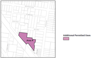
|
|
Amend KLEP2015 Part 6 Additional Local Provisions and
insert the following;
|
|
6.14 Rohini Village
(1)
The objective of this clause is to facilitate the renewal of the existing
seniors housing development and to provide ancillary community facilities
which may be used by the wider community.
(2)
This clause applies to land described as 51-53 Rohini Street, Turramurra
comprising Lot 21 DP533032, Lot 2 DP 302942 and Lot 26 DP585038 and
identified as
“Area #” on
the Additional
Permitted Uses Map.
(3)
Development for the purpose of Independent Living Units and ancillary
community and commercial uses as described in Schedule 1 (“XX”)
may have –
(a) a
maximum Floor Space Ratio of 1.5:1, and
(b) a maximum building
height of 17.5 m
|
|
The above proposed KLEP amendment would not require changes to
the Building Height or Floor Space Ratio KLEP 2015 Maps. All other planning
controls applying to the Site will remain unchanged.
|
There are a
number of issues associated with this approach as described below:
a. Independent Living Units
The proposal
lists “Independent Living Units” as an additional use. This must be
removed as it duplicates a use permitted by the SEPP (Housing) 2021 in
the R4 zone. LEP practice note, PN 11-002 - Preparing LEPs using the
Standard Instrument: standard zones states that
“where
the permissibility of certain land uses is provided for under a relevant
SEPP…, there is no need to include these types of development in Standard
Instrument LEPs”.
b. Additional Uses
The words
“Ancillary resident facilities” is not a defined use in the
Standard Instrument definitions and therefore must be removed. The relevant
definitions to enable the required additional uses are as follows:
commercial premises means any of the following—
(a) business premises,
(b) office premises,
(c) retail premises.
recreation facility (indoor) means a building or place used
predominantly for indoor recreation, whether or not operated for the purposes
of gain, including a squash court, indoor swimming pool, gymnasium, table
tennis centre, health studio, bowling alley, ice rink or any other building or
place of a like character used for indoor recreation, but does not include an
entertainment facility, a recreation facility (major) or a registered club.
|
Ø Recommendation:
The wording requesting the additional uses should be
corrected to the below recommendation.
KLEP 2015 Schedule 1 Additional permitted uses
Use of certain land
at 51-53 Rohini Street, Turramurra
· This clause applies to land at 51-53 Rohini Street,
Turramurra, being Lot 21 DP533032, Lot 2 DP 302942 and Lot 26 DP585038.
· Development for the following purposes is permitted with
development consent.
- recreation
facility (indoor)
- commercial
premises
· Development consent must not be granted under this clause
to development that results in the gross floor area of the combined recreation facility (indoor) and commercial premises exceeding 700m2.
|
c. Additional Permitted Uses map
The Planning Proposal does not require an Additional Permitted
Uses map. The description of the Site Lot and DP are sufficient to legally
identify the land, and a list of additional uses is sufficient to attach those
uses to the site. A map is only useful for complex sites where further issues
are required to be addressed in additional clauses within the KLEP.
|
Ø Recommendation:
Remove the Additional Permitted Uses map
|
d. Additional Local Provisions
The Planning Proposal seeks to make amendment to the FSR and
Height on the site via KLEP Part 6 Additional Local Provisions.
This approach is highly irregular and
not consistent with LEP Practice note PN 08-001 - Height and floor space
ratio. Where an LEP contains Clause 4.3 – Height of buildings and/or
Clause 4.4 – Floor space ratio, then heights and FSRs are to be specified
on the Height of Buildings Map and Floor Space Ratio Map respectively. Clause
4.4 does allow for a table to be used in conjunction with a map so that
separate FSRs may be set out depending on the mix of land uses.
The effect of the proposed local provision stipulated in
the Planning Proposal would be to allow only development for the purpose of Independent Living Units, and ancillary
community and commercial uses to achieve the proposed maximum FSR of 1.5:1 and
maximum Height of buildings of 17.5m. All other permitted uses on the site
would be restricted to the existing FSR of L: 0.85:1 and Height of building of
K:11.5m thus removing future flexibility of the land use.
There is no justification
in the Planning Proposal for the proposed variation of the development
standards to differentiate between the use of the site for independent living
units plus ancillary community/commercial uses, and all other potential uses on
the site.
It would be assumed that
the potential bulk, scale and environmental impact of a seniors housing
development would be similar to that of an alternate use such as a residential
flat building. Therefore, if it is deemed that the site has the capacity to
accommodate the proposed FSR and Height for a seniors housing use, then those
standards should apply to all permissible uses on the site.
|
Ø Recommendation:
The proposed amendment to the Height and FSR must be
shown on the following KLEP maps:
1. Height of Building Map
2. Floor Space Ratio Map
All references to their inclusion within “Part 6
Additional Local Provisions” are to be removed from the Planning
Proposal and all its Attachments.
|
B. BUILDING
HEIGHT AND FSR – RESULTANT DEVELOPMENT OUTCOMES
The Planning
Proposal seeks to make the following amendments to the Ku-ring-gai Local
Environmental Plan 2015 (KLEP 2015) mapped standards:
1. increase the maximum Floor Space Ratio (FSR) from 0.85:1
to 1.5:1
(the Housing
SEPP bonus provisions will result in a final FSR of 1.725:1);
2. increase the maximum Height of Building from 11.5m to
17.5m/5 storey
(the Housing
SEPP bonus provisions will result in a final Height of 21.3m/6 storey);
The Planning
Proposal claims the increased standards will achieve the required compliance
with the below policy and guidance:
· SEPP
(Housing) 2021
· Seniors
Housing Design Guide 2023
· Apartment
Design Guide (ADG)
However, some
of the claims are questioned and further justifications, amendments,
clarifications and considerations must be addressed prior to the proposal being
progressed towards any Gateway Determination, and they are to demonstrate both
the said compliance and the integration of the development outcomes on a Site
located within Ku-ring-gai with its unique high quality environment and housing
provision.
Key to the
majority of the required amendments and considerations stated in Attachment
A1 is whether the proposed significant increase in FSR will enable
development on the site to be reflective of residential flat buildings within
the Ku-ring-gai locality.
FSR
Considerations
The proposed
FSR of 1.5:1, which will be increased to 1.725:1 with the SEPP (Housing) bonus,
is inconsistent with the FSR that is generally applied to R4 (High Density
Residential) development in Ku-ring-gai - which has an FSR of 1.3:1 associated
with the 17.5m Height.
Similar sites
zoned R4 (High Density Residential) in this locality applying the FSR of 1.3:1
and Height of 17.5m standards have delivered buildings which demonstrate
cohesion with the Ku-ring-gai character of buildings within high quality
landscaped settings including tall canopy trees. The standards have been
calculated to ensure achievement of appropriate on and off site amenity,
including managing overlooking and over shadowing impacts to neighbouring
properties.
The Planning
Proposal does not clearly justify the increased 1.5:1 FSR in the following
areas:
· achievement
of the clear (without paths) 6m dimensioned deep soil as required by the ADG,
and the associated delivery of tall canopy trees not identified for delivery;
· whether
the landscaped areas that are dissected into small portions by multiple paths
and hardstands have the ability to provide large/ mass planting and ability to
provide communal garden areas and outdoor recreation/barbeque areas for its
senior residents;
· why it
has delivered units with no solar access and no natural ventilation;
· why
there is a single long building, rather than small footprint buildings, to the
south-east boundary to ameliorate overshadowing impacts on the 2-3 storey
properties to the south.
The Planning
Proposal states minimum compliance with the SEPP (Housing) 2021
requirements but does not sufficiently consider the Ku-ring-gai locality and
character, the elevated position of the site exacerbating overlooking and
overshadowing impacts, and importantly, the nature of its residents that will
increasingly remain on the site and in their apartments as they move into age
related frailty. These issues are required to be satisfied in accordance with
the Apartment Design Guide (ADG) and the Seniors Housing Design
Guide 2023 including sections on streetscape, local and neighbourhood
character and impacts.
According to
the ADG the minimum unit sizes required in this proposal would equate to:
· 2
bedroom units with 2 bathrooms: 75sqm
· 3
bedroom units with 3 bathrooms: 100sqm
The proposal seeks to deliver 66 x 2 bedroom units and 44 x
3 bedroom units.
Council has
calculated 2 and 3 bedroom units in the current scheme range in size from
115sqm to 145sqm which is significantly larger than standard unit sizes in a
residential flat building and much larger than the minimum requirements of the
ADG.
As such,
Council’s calculations of the amendments to the height and FSR across the
total site plus the bonus provisions under the Housing SEPP identify there is
potential for the scheme to yield an average of the below, noting that:
· 211
units as per the ADG, based on an average unit size of 75m2; and
· 176
units based on an average apartment size of 90m2.
Whilst there
is no requirement to justify the provision of larger apartments, the issue is
that a future DA based on the amended standards will have the right to deliver
minimum sized apartments. The consequences of increased units will then impact
the traffic, parking and other on-site and neighbouring amenity considerations
determined by unit numbers, and therefore alter the basis of this assessment
which considers whether the proposed standards can manage negative impacts.
This issue
must be addressed in the Planning Proposal to provide certainty on the site
outcomes. The unit size and numbers might be the result of the multiple
requirements on the site, such as landscape and deep soil. The reasoning should
be provided to avoid question during the exhibition of the proposal.
Commentary on the FSR - KLPP meeting and further
information from proponent:
· The
issue of the FSR was reported to the KLPP with a recommendation to reduce the
Planning Proposal’s 1.5:1 FSR. Key to the majority of the required
amendments and considerations stated in Attachment A1 is clarification
of calculations on the drivers for the proposed increase in FSR.
· The
only further information provided by the proponent is that the extra FSR will
enable provision of:
- the required 700sqm of communal
facilities and café, and
- 110 units that are compliant with seniors
housing standards and that meet current market demands.
· The
proposal is basically a residential development with some commercial type uses
mainly to facilitate the on-site residents. This is similar to other 17.5m high
residential flat buildings within Ku-ring-gai with FSR of 1.3:1, and which may
also contain a gym, pool and communal rooms for their residents, no additional
FSR is granted to those developments.
· The
Planning Proposal is not transparent on how they have calculated the proposed
FSR 1.5:1 and if they only seek to provide 110 units. While the increased FSR
is supported in principle, given the location of the site close to the
Turramurra Local Centre, the Planning Proposal must include the evidence/
calculations/ diagrams to support their position for the increased FSR.
· It is
unclear how the comparatively minimal commercial floor area, which sits at 4%
of the overall site, can drive up the requirement for the excess in FSR. As per
the below Table, Council’s calculations cannot verify the
proponent’s claims; therefore clarification from the proponent is
required to be inserted into the Planning Proposal.
|
TOTAL GFA:
15,850sqm
|
|
Residential
GFA – 110 independent living units
|
Commercial GFA – communal facilities and cafe
|
|
15,150sqm
|
700sqm
|
|
96%
|
4%
|
|
Proposed communal GFA component is
insignificant at approx 0.07:1 FSR. It has no major impact on overall FSR.
Proposed 1.5:1 FSR (1.725:1 FSR including
SEPP bonus) is driven by abnormally large apartments (avg 135sqm).
|
|
Table – Planning Proposal Residential and
Commercial Gross floor Area
|
· It is
unclear why the proposed FSR of 1.5:1 is required to achieve the same number
(110) units, with no increase to dwelling yield. Apart from saying the sizes
are market driven, there is no evidence attached on this statement.
· Anglicare’s
recently completed seniors housing units at the Gordon Quarter show units
(assumed to be compliant with all the required SEPP (Housing) and Australian
Standards) are significantly smaller than those proposed at Rohini Street, with
each 3 bedroom unit at Rohini Street being 25sqm larger than those at Gordon
Quarter.
· Council’s
calculations indicate if the FSR is reduced to the standard 1.3:1 (1.495:1
including the 15% bonus) and height to 21.3m (6 storey), the size of the units
reduces on average by 14sqm to 121sqm to retain the 110 unit yield. This is
still a very large apartment and is representative of other Anglicare
developments such as Gordon Quarter. A reduced 1.3:1 FSR and ILU’s with a
retained yield of 110 would still comply with the requirements of the SEPP Housing
Schedule 4 and AS1428.1.
|
UNIT SIZES
|
|
ADG
|
Planning Proposal
|
Recent Anglicare Gordon Quarter Units
(link)
|
|
2 bedroom/
2 bathroom
|
75sqm
|
115sqm
(66 units)
|
Advertised Unit sizes
(1 bathroom)
101sqm
|
Units with ADG
5sqm/additional bathroom
106sqm
|
|
3 bedroom/
3 bathroom
|
100sqm
|
145sqm
(44 units)
|
110sqm
|
120sqm
|
|
|
|
Yield: 110 units
|
|
Yield: 132 units
|
|
· Proposed units are larger than the recent
Gordon Quarter Anglicare units (SEPP and AS 1428 compliant).
· Proposed 2 bedroom/2 bathroom units each
have an extra 9sqm/unit.
· Proposed 3 bedroom/3 bathroom units each
have an extra 25sqm/unit.
|
|
Table – Planning
Proposal Low Dwelling Yield with Oversized Units
|
· The
key issue regarding the proposed oversized units, which appear to be driving up
the FSR to the proposed 1.5:1, is that:
- when a future Development Application
(DA) is submitted for the site, the landowner does not have to adhere to the
concept plan being presented here;
- it is possible for new plans to reduce
unit sizes to include a greater dwelling yield in the region of the
demonstrated 132 units, 22 extra units.
The Planning
Proposal states all minimal requirements under SEPP (Housing) 2021 and the
Apartment Design Guide are achieved for 110 units. The concern at this stage
are questions around:
· whether
the extra dwelling yield of 132 units, possible on the site under the current
FSR 1.5:1, will still be able to deliver the claimed compliance;
· what
will be the consequence of increased units on the on-site and neighbouring
amenity provisions including traffic, parking, solar access, ventilation,
landscape, deep soil, overshadowing and overlooking.
No evidence is
provided in the Planning Proposal nor its Appendices to verify the figures
stated for the majority of the above parameters, which are all claimed to be
compliant with SEPP (Housing) 2021, Apartment Design Guide and AS1428.1 – Design for Access and Mobility.
Notwithstanding the above, since the site is located
close to the Turramurra Local Centre and has good access to public transport
and other services and facilities, there is merit in the increased FSR to 1.5:1
(1.725:1 with SEPP bonus); however, modifications to
the concept plan are required to improve the strategic outcomes of the site and
to be consistent with the requirements of the Regional Plan, District Plan,
SEPPs, Ministerials and the age-related studies referenced in the Planning
Proposal.
|
Ø Recommendation following the KLPP
meeting:
The Urban Design Study is to include the following
amendments to the concept plan diagrams and demonstrate that the 1.5:1 FSR
and 17.5m Height can achieve compliance with the required standards of SEPP
(Housing) 2021, Seniors Housing Design Guide 2023, Apartment
Design Guide, AS 1428.1 Design for access and mobility :
· include the indicated 8 high care units and carer room to
result in 115 yield;
· incorporate the recommended design changes provided in
relation to T19, T22, T49 and T50 stated in the proposal’s Arboricultural
Impact Assessment;
· amend the single long building to the south-western
boundary to smaller footprint buildings that reduce overshadowing impacts to
the neighbouring properties;
· amend the building layouts to provide some solar access
to all units and remove units with zero sunlight.
The amendments must be reflected in the Planning Proposal
and across all Attachments.
|
C. PROVISION OF HOUSING
CHOICE AND AGEING IN PLACE.
The proposal comprises seeks to
delive110 independent living units as:
· 66
x 2 bedroom units
· 44
x 3 bedroom units.
The proposal does not offer
housing choice through a provision of apartment mix. It does not include
serviced apartments to enable residents to transition into partial care and further
downsizing, nor for high care services.
The concept of “ageing in
place” is one where people move into these types of facilities as a last
home. Requiring elderly and frail people to be relocated off this site as they
deteriorate does not constitute ageing in place.
Commentary
on Housing Choice and Ageing in Place - KLPP meeting and further information
from proponent:
· In
their response to the KLPP, the proponent pointed out the potential to provide
8 high care units on the site with carer accommodation, and the standard
practice of providing care services to residents in the standard units;
however, these are not included in the Planning Proposal and therefore do not
guarantee the delivery of housing choice, nor the opportunity for ageing in place.
· To
ensure the site offers housing choice and true ageing in place, the Planning
Proposal needs to be explicit in the provision of these two additional levels
of care in response to Objective 11 of the Greater Sydney Region Plan
and include them in the appropriate Appendices, noting that other required
standards must still achieve compliance.
|
Ø Recommendation following the KLPP
meeting:
Include reference to the provision of the following
within the body of the Planning Proposal and all Attachments:
· 8 high care units on the site with carer accommodation
(to be shown on all Urban Design drawings),
and
· in-home care services as required by residents.
|
D. LANDSCAPED AREA AND DEEP
SOIL AREA
The proposal
states compliance with the Landscape and Deep Soil requirements of the SEPP (Housing) 2021.
It is
noted that the SEPP (Housing) definitions do not exclude the pathways from the
calculation of landscaped area. The proposal has extensive hard surfaces/pathway
systems all around the buildings, including in the boundary setbacks, with
landscaping fitting into the remnant spaces. The ability for large and
significant planting, typical of the Ku-ring-gai area, within these relatively
small spaces is questionable.
Similarly,
while the SEPP (Housing) 2021 speaks of 3m dimensions for deep soil provision,
the SEPP (Housing) 2021 shows a clear policy intent that apartment buildings
are to align with the Apartment Design Guide (ADG) to ensure good
outcomes.
This
pathway is demonstrated in the Seniors Housing Design Guideline, related
to the SEPP, which includes a table at Part 4 -18.0 Alignment with
the Apartment Design Guide (ADG), directing
designers to the ADG standards. Therefore, the ADG definition, which requires a
6m minimum dimension for effective deep soil around Residential Flat Buildings
must be applied to this development. It is unclear if this has been done in the
urban design and landscape area calculations.
Provision
of effective deep soil and landscaped areas will enable the proposal to comply
with the ADG requirements on integration with neighbourhood and area character,
and meet the Ku-ring-gai local character of buildings within high quality
garden settings including tall canopy trees.
Commentary
on the Landscape Area and Deep Soil Area - KLPP meeting and further information
from proponent:
· In
their response to the KLPP, the proponent provided some further explanation on
landscape provisions; however no calculations nor diagrams were included to
verify the figures stated in the Planning Proposal. The proponent also disputes
the requirement to align with the Apartment Design Guide (ADG) standards
and sticks to the minimal compliances under the SEPP (Housing) 2021.
· The SEPP
(Housing) 2021 provides basic standards that apply across all densities
including low density, medium density and high density seniors housing. The
SEPP then refers to its Seniors Housing Design
Guideline which is explicit in the requirements for alignment with
the ADG for high density development.
· Council
has conducted further calculations, with assumptions, and derived numbers that
are different to those presented in the Planning Proposal documentation for
landscape and deep soil provisions.
· It is
unclear how the proponent has calculated the stated 4534sqm landscaped area.
Council’s calculations based on the current scheme find the following
varying landscape areas which differ from that stated in the Planning Proposal:
- approximately 3444 sqm (excluding all
paths/hardscape)
- approximately 4956 sqm (including all
paths/hardscape).
· It is unclear what areas the deep soil calculations have
included, particularly with regard to 6m wide areas that will enable the
planting of tall canopy trees. The Planting Strategy included in the Planning
Proposal attachments states tall tree species, but no indicative location is
provided in the landscape diagrams to ensure there is a match between the tall
trees and the deep soil.
|
Ø Recommendation following the KLPP
meeting:
Include
calculations/diagrams on the provided landscape and deep soil area figures:
· showing the assumptions/inclusions/exclusions that the
final figures are based on,
· giving clear indication where the deep soil areas will be
able to sustain tall canopy trees.
|
E. TREE
REMOVAL
The
documentation of tree removal to the boundaries of the site is not supported.
Only trees clearly identified as weed or having a significant safety concern
may be cited for removal at this Planning Proposal stage.
Regardless of trees being
identified as having low, medium or high retention value, all trees are to be
retained and removal can be documented as part of a future DA application. The
Planning Proposal can identify the trees and their value, but removal can only
be considered and agreed when a final DA design and detail is developed.
The removal of 4 trees to the
centre of the development is agreed as part of this Planning Proposal to
facilitate the concept plan as those trees are also identified in the Arborist
Report as having limited value. However, all other trees on all boundaries are
not to be cited for removal nor pruning at this stage. Reference to the
transplanting of the Magnolia is equally to be removed as this is not a DA and
the proper investigations conducted through a DA cannot be done at this
strategic planning proposal stage.
Specific tree removal around the
boundary can be nominated at DA stage when detailed investigation into their
value and impacts of removal within retained tree TPZs can be explored.
This Planning Proposal is not to
fetter investigation nor prematurely influence the tree removal outcomes at the
DA assessment stage.
In addition, some inconsistent
comment is made regarding the biodiversity mapped land (remnant Blue Gum High
Forest) and the impacts on the associated Blackbutt tree. These must be
corrected to stress the importance of protecting that single remnant tree.
Commentary
on Tree Removal - KLPP meeting and further information from proponent:
· The
proponent has provided further information clarifying some of the issues raised
on tree removal.
· Council
has now received further advice from specialist landscape and ecological officers
that the Planning Proposal must not fetter the DA process of investigation into
all tree removal, tree pruning and tree transplanting. Citing certain trees for
removal in the Planning Proposal is revised as Council is unable to investigate
and verify the stated conditions of those trees at this planning proposal
stage. Therefore, the Planning Proposal and its Appendices are to remove all
reference to any tree removal, tree pruning and tree transplanting.
|
Ø Recommendation following the KLPP
meeting:
All references to tree removal, tree pruning and tree
transplanting in the Planning Proposal and its Attachments are to be removed
to avoid fettering of the DA process and the ability for Council to conduct
proper and transparent investigation.
|
F. CANOPY PROVISION
The proposal claims an increase of
canopy from the existing 3,656 sqm to the proposed 3,897sqm. However, there is
no documentation on the tree species that will contribute to that canopy, nor
on the heights of the canopy trees.
Canopy in Ku-ring-gai is delivered
through significant numbers of tall trees. The proposal gives no indication on
whether this key feature of the LGA will be delivered on this site.
Many of the new trees shown in the
diagram are located on top of the basement parking areas or in between the
multitudes of path systems which do not provide the dimensions of garden beds
able to sustain healthy large specimen trees to contribute to tall tree canopy.
Commentary
on canopy - KLPP meeting and further information from proponent:
· The
proponent has provided further information stating trees and species type have
been included in the Planning proposal documentation. The Planting Strategy
included in the proponent’s Landscape Concept and Drawing Schedule names
trees, shrubs, and groundcover selected for the landscaping. It includes the
mature height and spread of these trees; however, it does not state the
location of the trees nor how many trees will be planted. The landscape
drawings show good planting outcomes but it is difficult to know what
proportion of the canopy will be small trees, medium trees, large trees. A key
feature of Ku-ring-gai is its canopy which includes distinctive tall trees both
endemic and exotic species.
· The
Planting Strategy list names 6 tree species that are 15m+ tall and 4 tree
species that are 18m+ tall but no indication of how many of these will be
planted and at what location.
· Detail
is still required to understand how many and where tall trees will be provided
to demonstrate that the deep soil areas are capable of enabling those species
to grow and remain healthy, particularly with the criss-cross of pathway
systems across the entire site. Without the actual numbers of trees and their
location, it is not possible to verify the
proponent’s claims of providing 3,897sqm of canopy.
|
Ø Recommendation following the KLPP
meeting:
The Planning Proposal
and its landscape and flora related Appendices require details of the numbers
and location of the tree species mentioned in the Planting Strategy and
demonstrate the calculation of the expected tree height and canopy spread.
This way the canopy that is claimed to be delivered on the site can be
verified.
|
G. SOLAR ACCESS AND NATURAL
VENTILATION
70% of units
or 77/110 units achieve the required ADG 2 hour solar access – therefore
33/110 units achieve less than 2 hours solar access of which 11/110 receive no
direct sunlight.
Solar access into units designed
for ageing in place is vital. Units with no solar access highly compromise the
amenity for the 11 elderly people living in the units with zero sunlight
especially as they will spend increasing amounts of time within their homes as
they age.
78% of units
or 86/110 units achieve the required ADG natural ventilation standards -
therefore 24 units fail to achieve natural ventilation.
Whilst the provision may comply
with the baseline requirements of the SEPP Housing, natural ventilation is
important in units designed for an ageing population who will spend increasing
amounts of time within their homes as they age.
|
Ø Recommendation:
Given the type of
population this Site will house (elderly and vulnerable frail people), the
concept design in the Urban Design Report is to be modified to increase
numbers of units with solar access and ventilation and reduce the 11 units
that will receive zero sunlight.
|
H. HERITAGE
ASSESSMENT
The Heritage Impact Statement,
attached to the planning proposal, makes recommendation to retain the pillars
as mentioned in the response to Ministerial 3.2. This is supported.
It is noted that the Rohini House
gates located on the site are currently listed in Schedule 5 of the KLEP
2015 (Item 161). However, the listing identifies the previous location of
the gates (Railway lands; Part Lot 1, DP 1129573) prior to their relocation
onto the grounds of Rohini Village.
It is noted that the original pair
for No. 2 is different to that photographed in Figure 23 in the Heritage Impact
Statement. The second set of pillars shown in Figure 23 of the Statement have
three rather than two pillars, with the original post and gate now in the
garden bed to the side framing a vehicular entrance, not shown in the
photograph, and the third pillar a replica to form a new pedestrian entrance.
The significance is with the
original pairs of pillars and associated gates, rather than the replica.
The Chery Kemp Heritage Impact
Statemen concludes the three sets of pillars meet at least one Heritage Council
criterion of heritage significance. This meets the threshold for local heritage
listing.
As there are no planning
provisions proposed to support retention in the Planning Proposal. The proposal
should make provision for conservation of these significant features by
inclusion of heritage listing in the Planning Proposal. As such, the
description of the locational description of the heritage item in Schedule 5 of
Ku-ring-gai Local Environmental Plan should be amended to reflect the current
location of the Rohini House Gates.
The proponent’s heritage
consultant is to recommend an appropriate curtilage map, as adjusted for the
No. 2 set to capture the original pillars.
|
Ø Recommendation:
The Planning Proposal is to amend Schedule 5 of
Ku-ring-gai Local Environmental Plan and the Heritage Map within the KLEP
2015 to reflect the current location of the Rohini House Gates. The
proponent’s heritage consultant is to recommend an appropriate
curtilage map, as adjusted for the No. 2 set to capture the original pillars.
The curtilage will inform the required amendment to the KLEP Heritage Map for
all 3 sets of pillars.
|
I. OVERSHADOWING
OF NEIGHBOURING PROPERTIES
The Planning Proposal’s
Urban Design Report includes investigation into overshadowing impacts on
adjacent properties. The diagrams indicate significant impact on properties to
the south of the proposal’s site.
The provided shadow diagrams
include very small thumbnails in a single colour and larger diagrams of the
same in multiple colours. These drawings are sufficient however the size of the
thumbnails are too small for most people to see/understand.
The multicoloured diagrams are a
good size but difficult to understand. The use of lighter colours for the
extreme extents of the shadow diminish and disguise the shadows on the adjacent
development.
The proponent has been requested
multiple times to provide the simple single colour shadow diagrams that will be
legible to the general public. The Department of Planning and
Environment’s LEP Making Guideline August 2023 states “The
planning proposal should be drafted to ensure that a wide audience including
departmental staff, authorities and government agencies, councils, stakeholders
and the community, can clearly understand the scope and impacts of the
proposal.”
The shadow diagrams are required
to be revised to show only a single colour to all shadow cast by the proposed
development. This can be produced by enlarging the monochrome thumbnail
diagrams so they are easily read.
The redevelopment of the site
provides opportunity to deliver improved overshadowing results both on the site
and to neighbouring residences by orienteering building footprints and
considering building bulk across the site to avoid replicating any poor
standards of the existing development.
There is lengthy justification on
the solar impacts to the neighbouring properties to the south. The diagrams
again utilise the multiple shade shadowing which again visually diminish the
shadow impacts and the reach of shading on those neighbouring buildings.
The issue of overshadowing will be
dealt with at DA stage, however it is noted that the impacts to the
south-eastern neighbours are likely to be high. The planning proposal’s
concept design should demonstrate it can minimise the impacts by reducing
building footprints and altering building orientation to enable solar corridors
that reduce the continuous bulk shadow to the south-eastern boundary properties.
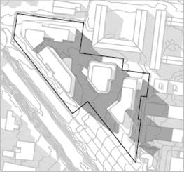
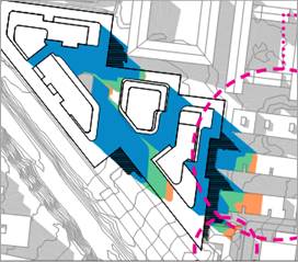
SHADOW
DIAGRAM MONOCHROME AND MULTICOLOURED (PLUS Architecture)
|
Ø Recommendation:
Amend the concept plans to reduce building footprints and
altering building orientation to reduce the continuous bulk shadow to the
south-eastern boundary properties at 47-49 Rohini St and 22, 24, 26 Eastern
Road, Turramurra.
Amend the shadow diagrams to improve legibility for the
general public by making the easily understood small monochrome thumbnails
the same size as the multicoloured diagrams.
|
J. CAR PARKING
A parking
assessment was undertaken and found that if car parking for the proposal were
to be provided in accordance with SEPP Housing 2021, only 22 resident car
parking spaces would need to be provided as Anglicare is deemed to be a
‘social housing provider’.
However, the
proponent is suggesting that the target market for the new development would be
downsizers approaching or in retirement, and is seeking to provide car parking
at the equivalent rate to residential flat buildings to cater for this market.
This results in the provision of 199 parking (171 resident parking spaces, 18
visitor spaces, 8 staff spaces, 1 ambulance space and 1 car share space).
While the site
has the capacity to accommodate this level of car parking (across 2-3 basement
levels), a study of current residents conducted by Anglicare attached to the
Planning Proposal (Appendix K: Anglicare Village Study – Rohini
Village) indicates over half the residents at Rohini Anglicare do not
drive.
Parking should
be provided to closer align with this characteristic from Anglicare’s
records, which would substantially reduce excavation, material costs and
environmental impacts, and improve affordability.
The Anglicare
Village Study also indicates that 30% of current residents drive infrequently,
so provision of car share vehicles could be increased to further reduce parking
provision.
Reduced
parking provision over that shown in this Planning Proposal was also supported
by Transport for NSW in its early correspondence with the proponent.
Commentary
on car parking provision - KLPP meeting and further information from proponent:
· The
proponent provided further information again stating the parking provisions are
compliant with the SEPP (Housing) 2021 and in line with market requirements.
· The
KLPP questioned the excessive parking provision given the location close to
public transport.
· It is again
noted that Anglicare’s own studies show their residents have low car
ownership.
|
Ø Recommendation following the KLPP
meeting:
Given the location of the site adjacent to train and bus
public transport and close to local shops and facilities, the population
profile and statistics from Anglicare showing low car ownership of aged
population, the car parking provision is to be substantially reduced to
reflect the strategic approach, both locally and at the State-level, on
parking provision close to transport hubs.
|
In conclusion
Notwithstanding the above
issues requiring further consideration, confirmation and amendment, and others
noted within Attachment A1 of this Report, the Planning Proposal is
generally considered to have Strategic Merit and Site Specific Merit contingent
on the amendments required in this Report and within Attachment A1.
|
Recommendations to progress
to Gateway Determination
Having regard to
· the assessment provided in this Report, and
· the Attachment A1 Table of Assessment,
and
· the advice provided by the KLPP,
it is recommended that Council:
1. supports
the Planning Proposal and recommends the matter progress to the Department of
Planning, Housing and Infrastructure for a Gateway Determination subject to
the Planning Proposal and its Attachments being amended as stated in this
Report and within the Table of Assessment at Attachment A1, and
including:
a. provision
of three new KLEP Maps showing the proposed amendments within Part 4 of the
Planning Proposal (showing existing and proposed maps with keys taken from
the Legislation website):
i. Height of
Buildings Map
ii. Floor Space
Ration Map
iii. Heritage Map
b. inclusion
of updated amendment to the KLEP Written Instrument
i. Schedule 1 - to
allow Additional Permitted Uses enabling a café and swimming pool on
the site.
ii. Schedule 5 - to amend
the heritage listing of the three sets of pillars on the site.
2. recommends
that the proponent be advised of the above and directed to submit the
required amended Planning Proposal and its Appendices, in accordance with the
recommendations of this Report and the Attachment A1 Table of
Assessment, prior to the matter being referred to the Department of Planning,
Housing and Infrastructure for a Gateway Determination.
|
integrated planning and reporting
Theme 3 - Places, Spaces and
Infrastructure
|
Community Strategic
Plan Long Term Objective
|
Delivery Program
Term Achievement
|
Operational Plan
Task
|
|
P2.1 A robust planning framework is in place to deliver
quality design outcomes and maintain the identity and character of
Ku-ring-gai
|
P2.1.1 Land use strategies, plans and processes are in
place to effectively manage the impact of new development
|
Implement and monitor the Local Environmental Plans and
supporting Development Control Plans.
|
Governance Matters
The process for the preparation and implementation of
Planning Proposals is governed by the provisions contained in the Environmental
Planning and Assessment Act 1979 and the Environmental Planning and
Assessment Regulation 2000.
If Council fails to make a decision within 90 days (from the
commencement of the review of the application), by 29 August 2024, or if
Council makes a decision to not support the Planning Proposal, the Proponent
can make a request to the Department of Planning, Housing and Infrastructure for
a Rezoning Review.
Local Planning Panels Direction – Planning
Proposals issued by the Minister for Planning under Section 9.1 of the Environmental
Planning and Assessment Act 1979 requires Council to refer all Planning
Proposals prepared after 1 June 2018 to the Local Planning Panel for advice,
before it is forwarded to the Department of Planning, Housing and
Infrastructure for a Gateway Determination under Section 3.34 of the Environmental
Planning and Assessment Act 1979.
Risk Management
This is a Planning Proposal initiated by a private
landowner. Council should determine its position on the matter and whether the
Planning Proposal should be sent to the Department of Planning, Housing and
Infrastructure for a Gateway Determination, having regard to the KLPP’s
advice and decide whether to proceed to public exhibition.
Council risks damage to its reputation if it does not
undertake strategic land use planning in an effective and timely manner.
Financial Considerations
The Planning Proposal was subject to the relevant
application fee under Council’s 2024/2025 Fees and Charges Schedule. The
cost of the review and assessment of the Planning Proposal is covered by this
fee.
Social Considerations
The Planning Proposal is considered to have positive social
benefits including the replacement of dated housing for Seniors that no longer
meets accessibility standards and current market demand. A Letter of Offer
accompanies the Planning Proposal seeking to enter agreement on the provision
of a new through site link and upgrades to the public domain.
Environmental Considerations
The potential environmental impacts of the Planning Proposal
have been considered in this assessment and it has been determined that the
Planning Proposal should be supported as it will not result in any significant
adverse environmental impacts and is suitable for the site, particularly when
the required amendments are included. The impacts of any specific development
that may occur on the site as a result of the proposal would be considered in
detail at the development application stage.
Community Consultation
In the event that the Planning Proposal is forwarded for a
Gateway Determination and granted a Gateway Determination by the Department of
Planning, Housing and Infrastructure, the Planning Proposal would be placed on
public exhibition in accordance with the requirements of the Gateway
Determination and the Department of Planning, Housing and Infrastructure’s
publication ‘A Guide to Preparing Local Environmental Plans’.
The public exhibition would also be in accordance with the Ku-ring-gai
Community Participation Plan 2020.
Internal Consultation
The assessment of the Planning Proposal has included consultation
with Council’s Strategic Traffic Engineer, Heritage, Biodiversity,
Contributions and Urban Design Officers. Council Officers attended a site
inspection. The referrals of specialist staff are included within this Report.
Summary
A Planning Proposal has been submitted for land at 51-53
Rohini St, Turramurra, also known as Anglicare Village. The proposal seeks to
make the following amendments to the KLEP 2015:
1. increase
the maximum Floor Space Ratio (FSR) from 0.85:1 to 1.5:1
(the Housing SEPP bonus
provisions will result in a final FSR of 1.725:1);
2. increase
the maximum Height of Building from 11.5m to 17.5m
(the Housing SEPP bonus
provisions will result in a final Height of 21.3m);
3. include
certain Local Provisions that allow the inclusion of a Café and a
Wellness Centre with an indoor pool.
Assessment of traffic and transport, urban design, public
benefit, heritage and biodiversity issues have been carried out by
Council’s Strategic Traffic Engineer, Urban Design, Contributions,
Heritage, Biodiversity, Landscape and Ecological Officers respectively.
The assessment of the Planning Proposal, presented at Attachment
A1, has resulted in a number of revisions being required.
All amendments noted in this Report and in Attachment
1 – Table of Assessment are to be made and returned to Council for
finalisation and forwarding for Gateway consideration. The key amendments to
the Planning Proposal include:
· delivery
of the increased Height and FSR standards through Mapping amendments consistent
with PN 11-002 - Preparing
LEPs using the Standard Instrument: standard zones and PN 08-001 - Height and floor space ratio, with
amendment to the Height and the FSR maps;
· amend
the heritage listing for the three sets of pillars on the site and include
their location and curtilage in an amendment to the KLEP 2015 Heritage Map;
· amend the KLEP
Written Instrument to make provision for Additional Permitted Uses in Schedule
1;
· amend the KLEP
Written Instrument to describe the heritage listing of the three sets of
pillars in Schedule 5;
· other amendments
as detailed in this Report and its Table of Assessment at Attachment A1.
|
The following is a summary of
all recommendations in this Report, noting that further recommendations are
provided at Attachment A1.
Ø The wording requesting the additional uses should be
corrected to the below recommendation.
KLEP 2015 Schedule 1 Additional permitted uses
Use of certain land
at 51-53 Rohini Street, Turramurra
· This clause applies to land at 51-53 Rohini Street,
Turramurra, being Lot 21 DP533032, Lot 2 DP 302942 and Lot 26 DP585038.
· Development for the following purposes is permitted with
development consent.
- recreation
facility (indoor)
- commercial
premises
· Development consent must not be granted under this clause
to development that results in the gross floor area of the combined recreation facility (indoor) and commercial premises exceeding 700m2.
Ø Remove the Additional Permitted Uses map.
Ø The proposed amendment to the Height and FSR must be
shown on the following KLEP maps:
1. Height of Building Map
2. Floor Space Ratio Map
All references to their inclusion within “Part 6
Additional Local Provisions” are to be removed from the Planning
Proposal and all its Attachments.
Ø The Urban Design Study is to include the following
amendments to the concept plan diagrams and demonstrate that the 1.5:1 FSR
and 17.5m Height can achieve compliance with the required standards of SEPP
(Housing) 2021, Seniors Housing Design Guide 2023, Apartment
Design Guide, AS 1428.1 Design for access and mobility :
· include the indicated 8 high care units and carer room to
result in 115 yield;
· incorporate the recommended design changes provided in
relation to T19, T22, T49 and T50 stated in the proposal’s Arboricultural
Impact Assessment;
· amend the single long building to the south-western
boundary to smaller footprint buildings that reduce overshadowing impacts to
the neighbouring properties;
· amend the building layouts to provide some solar access
to all units and remove units with zero sunlight.
The amendments must be reflected in the Planning Proposal
and across all Attachments.
Ø Include reference to the provision of the following
within the body of the Planning Proposal and all Attachments:
· 8 high care units on the site with carer accommodation
(to be shown on all Urban Design drawings),
and
· in-home care services as required by residents.
Ø Include calculations/diagrams on the provided landscape
and deep soil area figures:
· showing the assumptions/inclusions/exclusions that the
final figures are based on,
· giving clear indication where the deep soil areas will be
able to sustain tall canopy trees.
Ø All references to tree removal, tree pruning and tree transplanting in
the Planning Proposal and its Attachments are to be removed to avoid
fettering of the DA process and the ability for Council to conduct proper and
transparent investigation.
Ø The Planning Proposal and its landscape and flora related
Appendices require details of the numbers and location of the tree species
mentioned in the Planting Strategy and demonstrate the calculation of the
expected tree height and canopy spread. This way the canopy that is claimed
to be delivered on the site can be verified.
Ø Given the type of population this Site will house
(elderly and vulnerable frail people), the concept design in the Urban Design
Report is to be modified to increase numbers of units with solar access and
ventilation and reduce the 11 units that will receive zero sunlight.
Ø The Planning Proposal is
to amend Schedule 5 of Ku-ring-gai Local Environmental Plan and the Heritage
Map within the KLEP 2015 to reflect the current location of the Rohini House
Gates. The proponent’s heritage consultant is to recommend an
appropriate curtilage map, as adjusted for the No. 2 set to capture the
original pillars. The curtilage will inform the required amendment to the
KLEP Heritage Map for all 3 sets of pillars.
Ø Amend the concept plans to reduce building footprints and altering building orientation to reduce
the continuous bulk shadow to the south-eastern boundary properties at 47-49
Rohini St and 22, 24, 26 Eastern Road, Turramurra.
Amend the shadow
diagrams to improve legibility for the general public by making the easily
understood small monochrome thumbnails the same size as the multicoloured
diagrams.
Ø Given the location of
the site adjacent to train and bus public transport and close to local shops
and facilities, the population profile and statistics from Anglicare showing
low car ownership of aged population, the car parking provision is to be
substantially reduced to reflect the strategic approach, both locally and at
the State-level, on parking provision close to transport hubs.
|
The assessment of the Planning Proposal finds the proposal
has sufficient strategic merit. The proposal indicates it has site specific
merit much of which is contingent on the required amendments presented in this
Report and in Attachment 1 Table of Assessment
|
It is therefore recommended that
Council:
1. supports
the Planning Proposal and recommends the matter be forwarded to the
Department of Planning, Housing and Infrastructure for a Gateway
Determination subject to the Planning Proposal and its Attachments being
amended as stated in this Report and within the Table of Assessment at
Attachment A1, and including:
a. provision
of KLEP Maps indicating the proposed amendments as follows:
i. Height of
Buildings Map with maximum Height 17.5m.
ii. Floor Space
Ratio Map with maximum FSR 1.5:1.
iii. Heritage Map listing of pillars and their curtilage.
b. inclusion
of updated amendment to the KLEP 2015 Written Instrument as follows:
i. to allow
Additional Permitted Uses enabling a café and swimming pool on the
site via amendment to Schedule 1;
ii. to amend
Heritage listing of the pillars via amendment to Schedule 5.
2. recommends
that the Proponent be advised of the above and directed to submit the amended
Planning Proposal and its Appendices in accordance with the recommendations
of this Report and in Attachment 1: Table of Assessment, prior to the
matter being referred to the Department of Planning, Housing and
Infrastructure for a Gateway Determination.
|
The Planning Proposal has been assessed against the
provisions of the Department of Planning, Housing and Infrastructure’s ‘Local
Environmental Plan Making Guideline’ and section 3.33 of the Environmental
Planning and Assessment Act 1979.
It is considered that the Planning Proposal demonstrates
sufficient strategic and site specific merit such that it should be submitted
to the Department of Planning, Housing and Infrastructure for a Gateway
Determination following amendments as outlined in this Report and in the Table
of Assessment at Attachment A1.
Recommendation:
A. The
Planning Proposal be amended in accordance with the recommendations in this
Report and Table of Assessment (Attachment A1).
B. That
the amended Planning Proposal be submitted for a Gateway Determination in
accordance with section 3.34 of the Environmental Planning and Assessment
Act 1979.
C. That Council authorise
the Director of Strategy and Environment to correct any minor anomalies of a
non-policy and administrative nature that might arise during the plan making
process.
|
Rathna Rana
Senior Urban Planner
|
Craige Wyse
Team Leader Urban Planning
|
|
Antony Fabbro
Manager Urban & Heritage Planning
|
Andrew Watson
Director Strategy & Environment
|
|
Attachments:
|
A1⇩
|
Table
of Assessment - Planning Proposal - 51-53 Rohini Street, Turramurra
(Anglicare)
|
|
2024/252285
|
|
|
A2 ⇩ ⇩
|
Planning
Proposal Anglicare “Rohini Village” 51-53 Rohini Street,
Turramurra
|
|
2024/174688
|
|
|
A3
|
Appendix
A - Urban Design Report
|
Excluded
|
2024/174687
|
|
|
A4
|
Appendix
B - Title Documents & Surveys
|
Excluded
|
2024/174686
|
|
|
A5
|
Appendix
C - Arboricultural Impact Assessment Report
|
Excluded
|
2024/174685
|
|
|
A6
|
Appendix
D - Heritage Impact Statement
|
Excluded
|
2024/174684
|
|
|
A7
|
Appendix
E - Traffic & Transport Assessment
|
Excluded
|
2024/174683
|
|
|
A8
|
Appendix
F - Utility and Infrastructure Plans
|
Excluded
|
2024/174681
|
|
|
A9
|
Appendix
G - Biodiversity Advice
|
Excluded
|
2024/174680
|
|
|
A10
|
Appendix
H - Landscape Concept & Drawing Schedule
|
Excluded
|
2024/174678
|
|
|
A11
|
Appendix
I - Feasibility Analysis
|
Excluded
|
2024/174677
|
|
|
A12
|
Appendix
J - Letter of Offer - Planning Agreement
|
Excluded
|
2024/174674
|
|
|
A13
|
Appendix
K - Rohini Village Study
|
Excluded
|
2024/174673
|
|
|
A14
|
Appendix
L - Pre-Consultation Minutes and Responses
|
Excluded
|
2024/174672
|
|
ATTACHMENT No: 1 - Table of
Assessment - Planning Proposal - 51-53 Rohini Street, Turramurra
(Anglicare)
|
|
Item No: GB.15
|
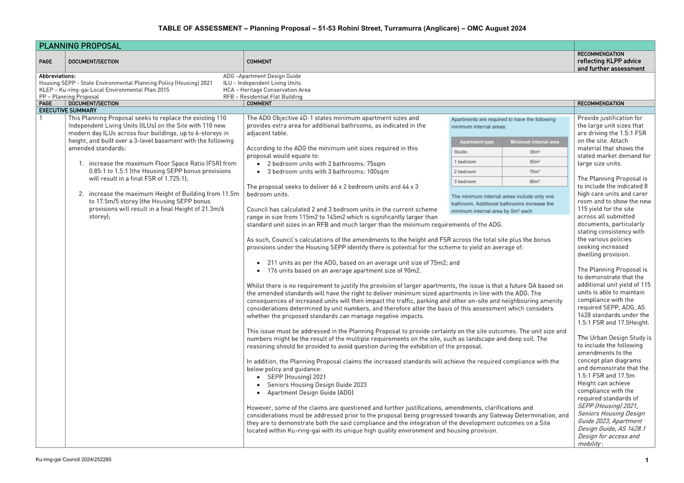
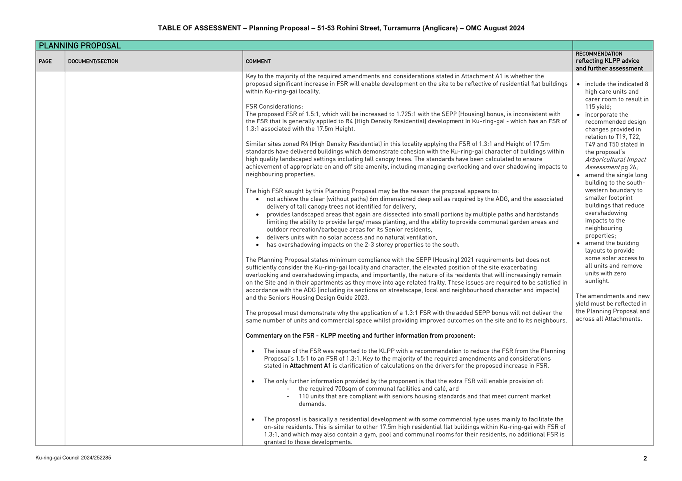
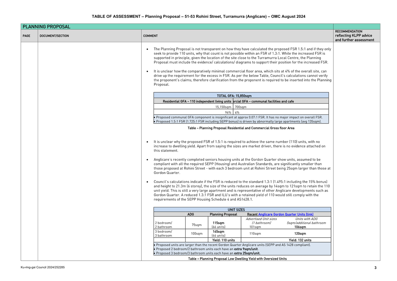
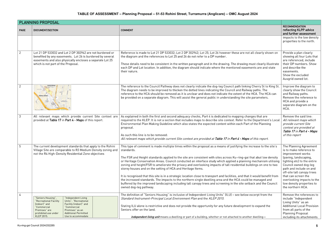
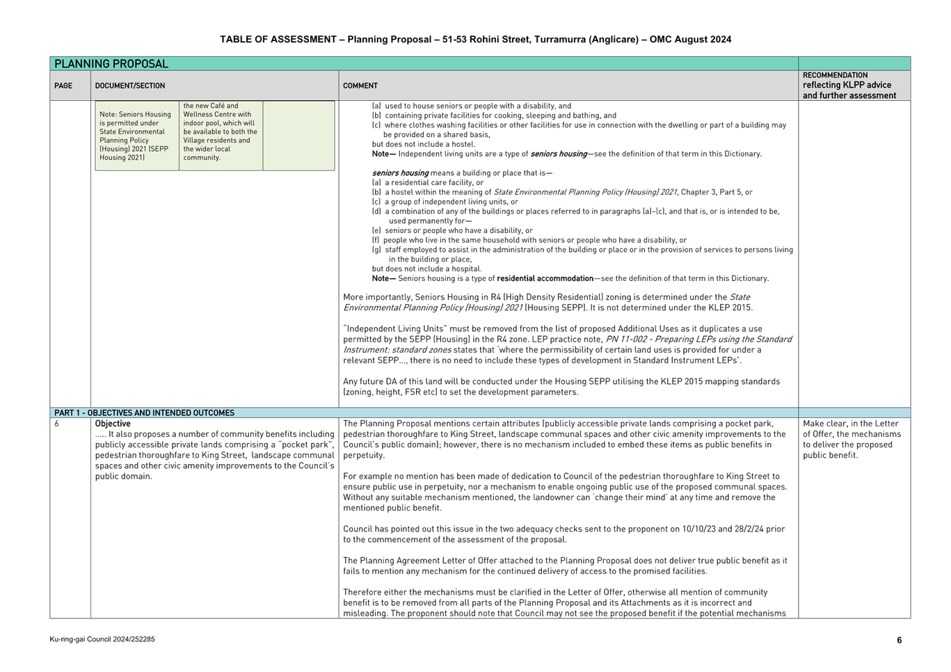
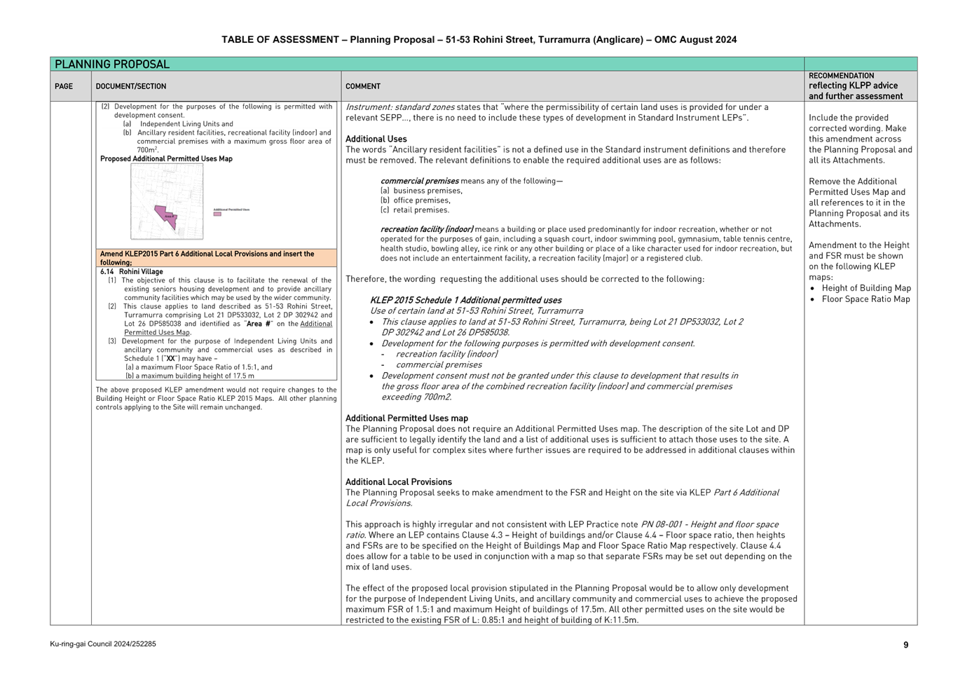
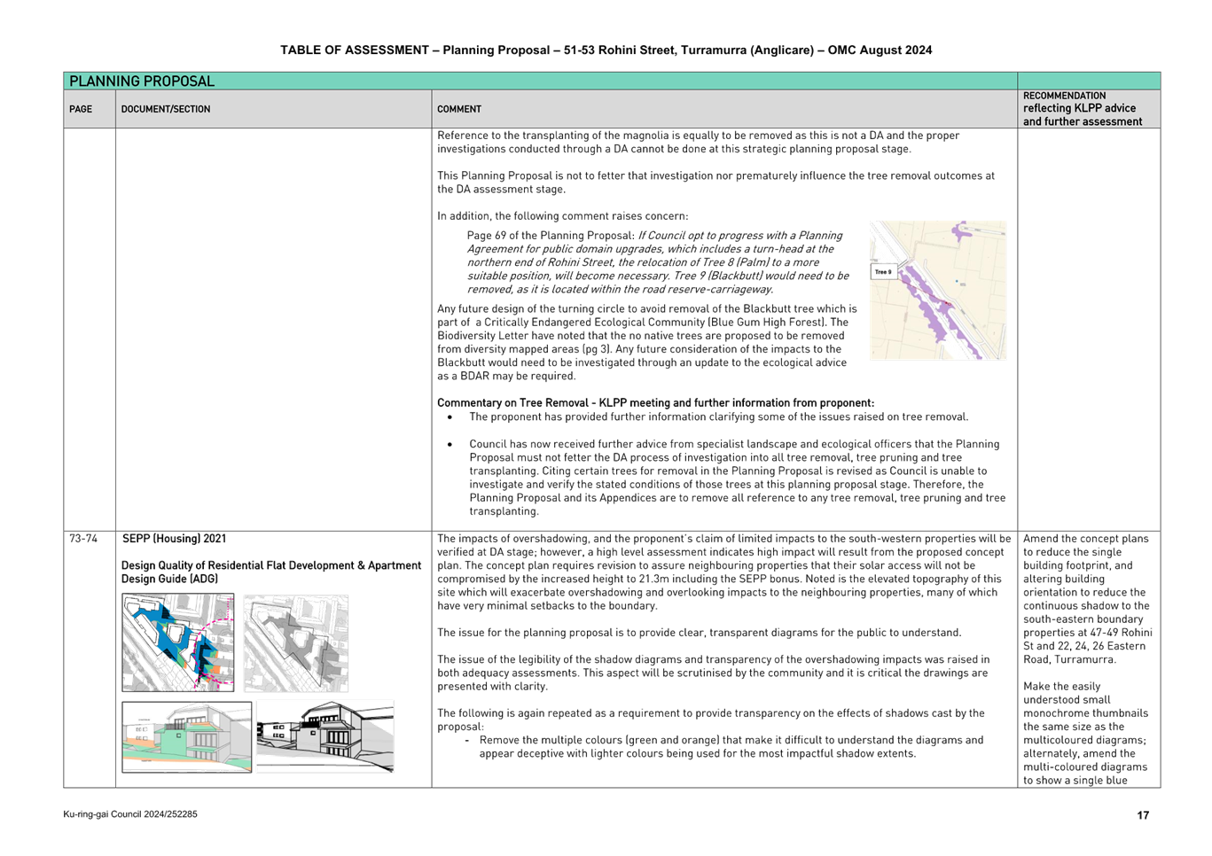
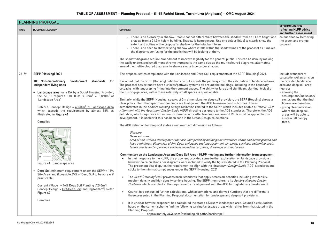
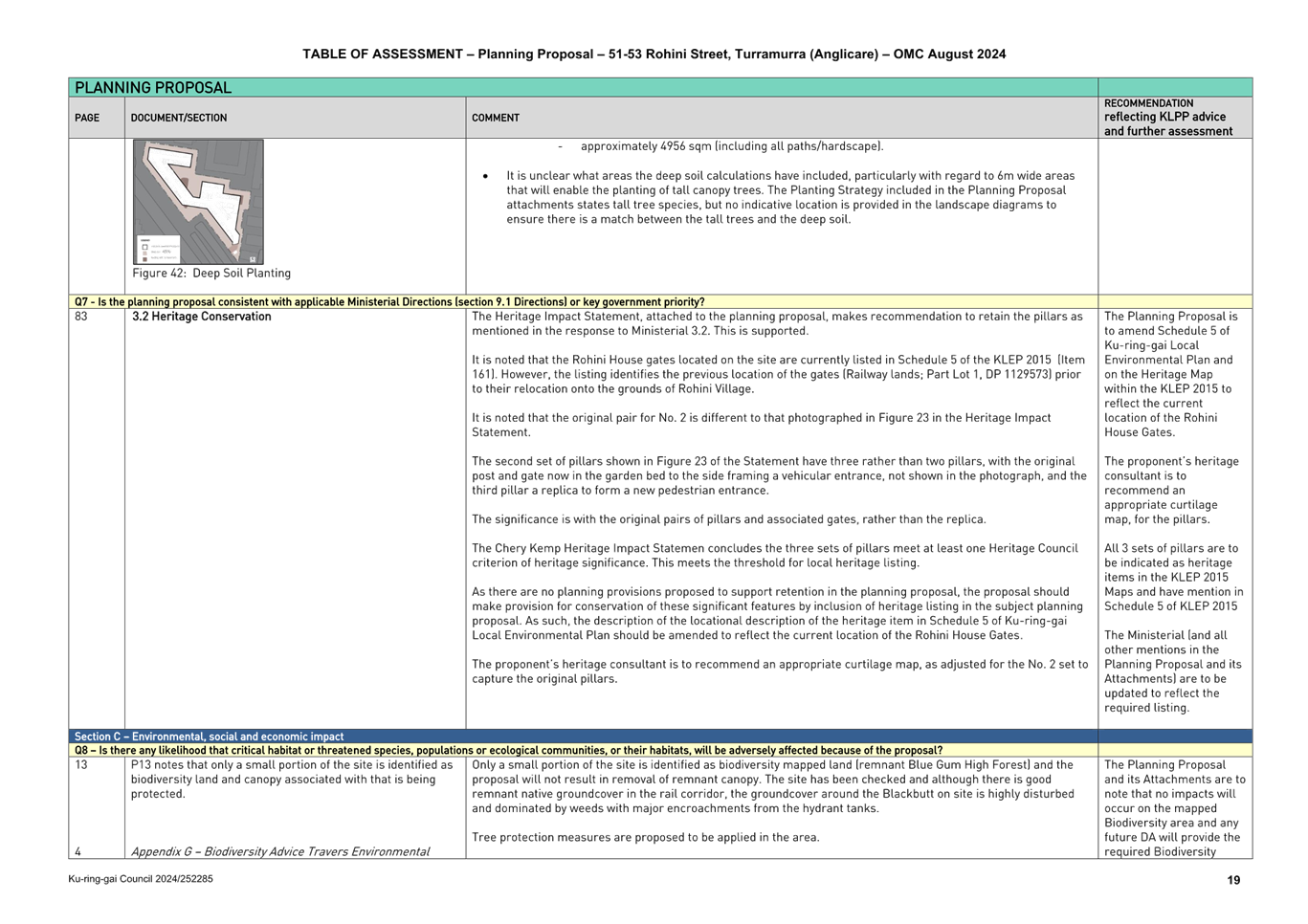
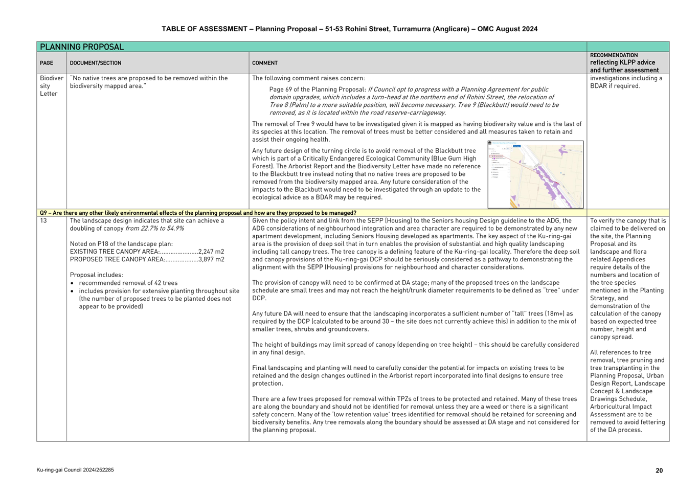
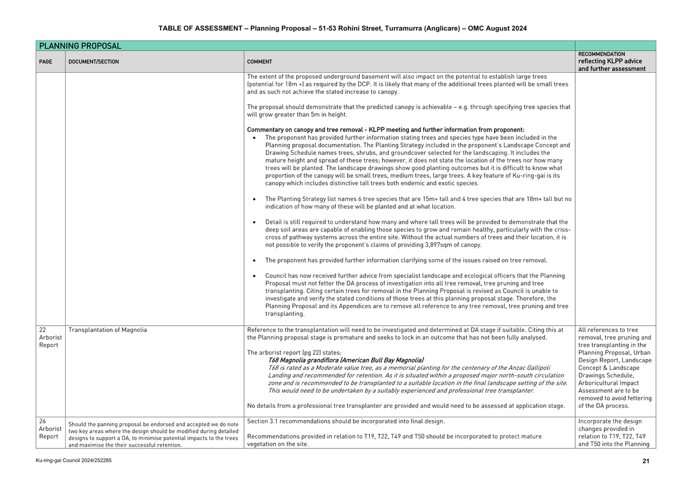
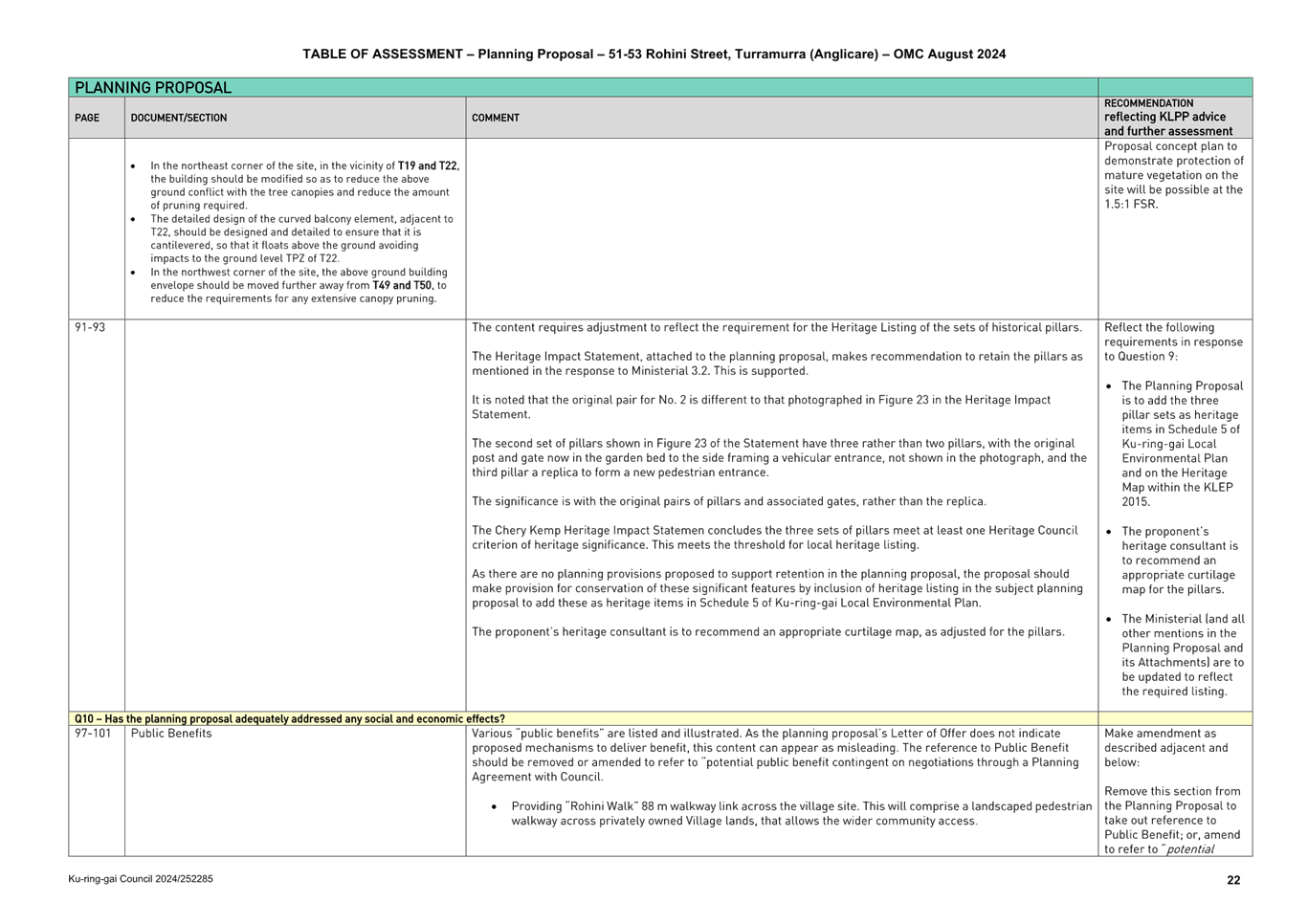
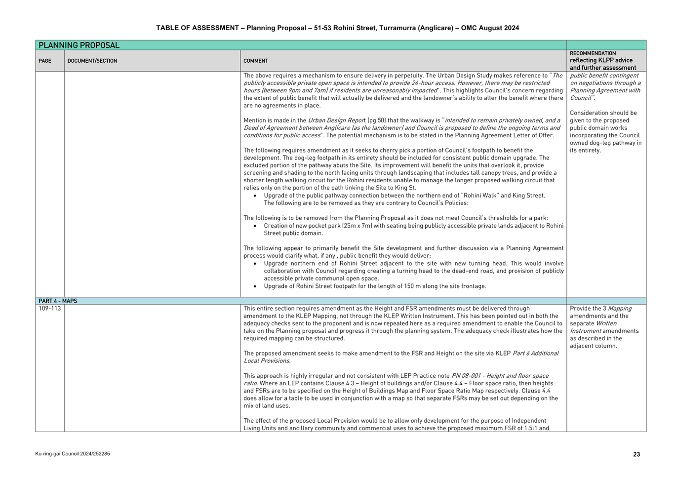
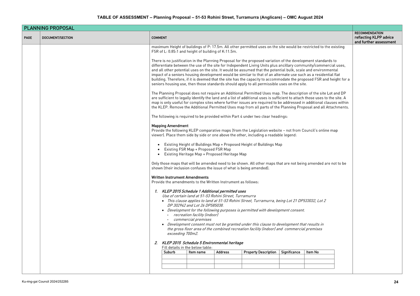
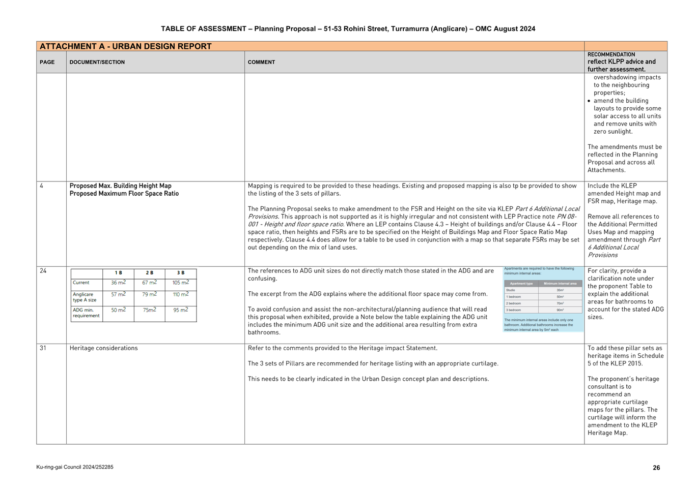
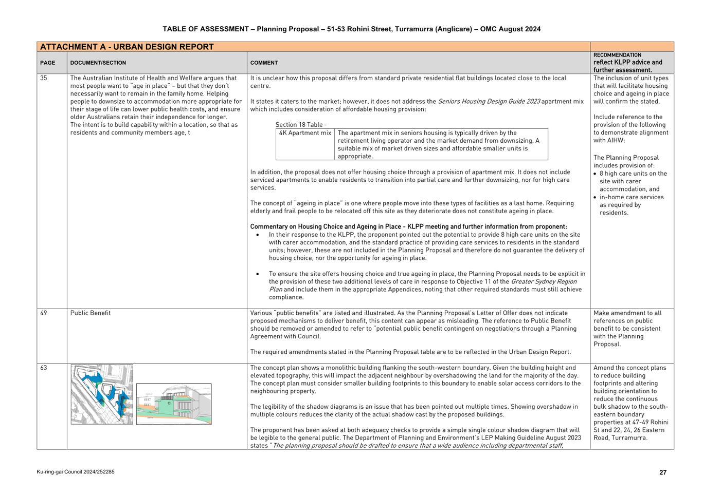
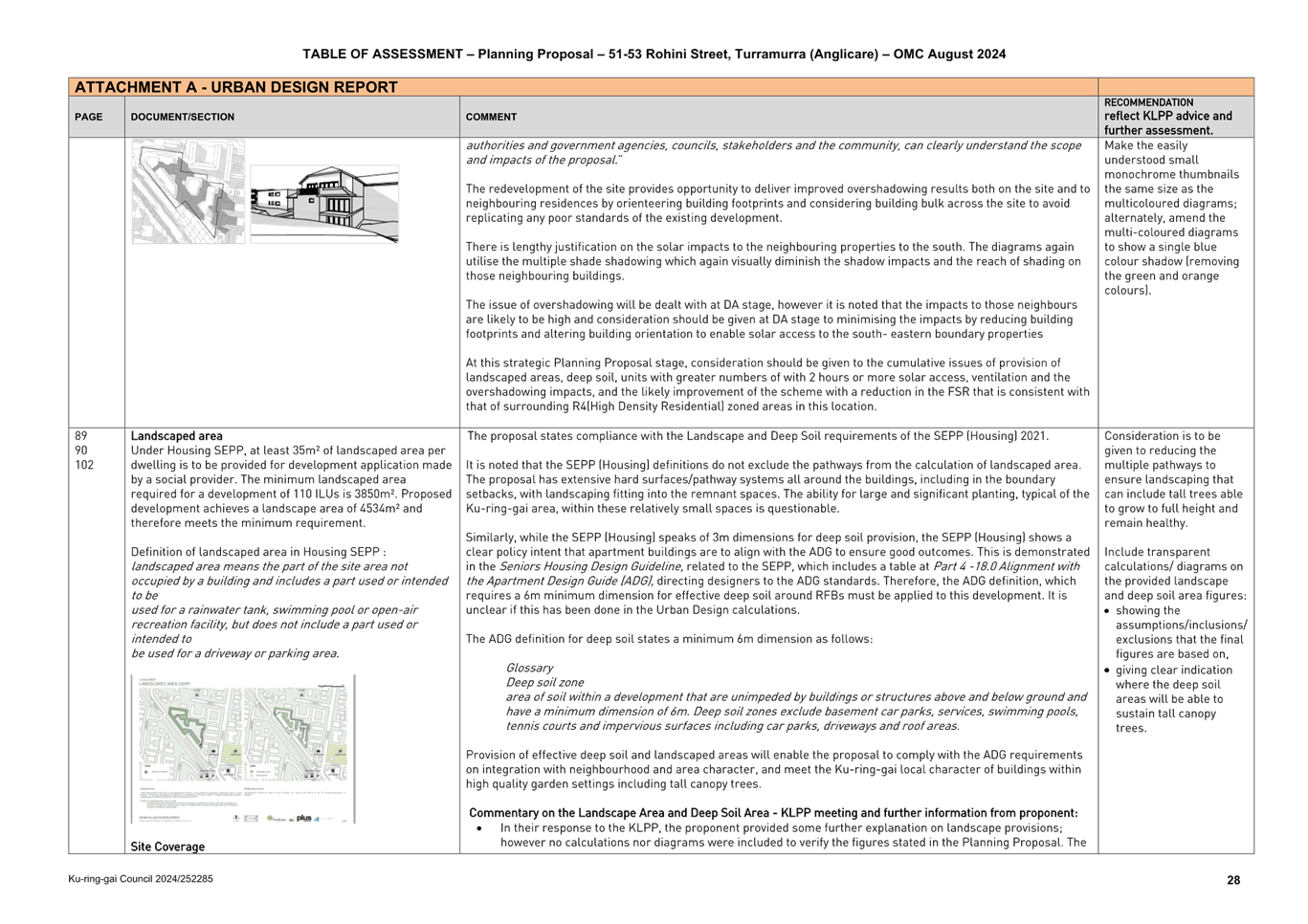
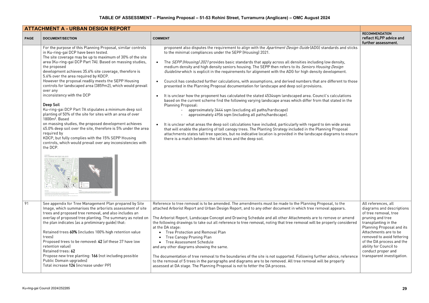
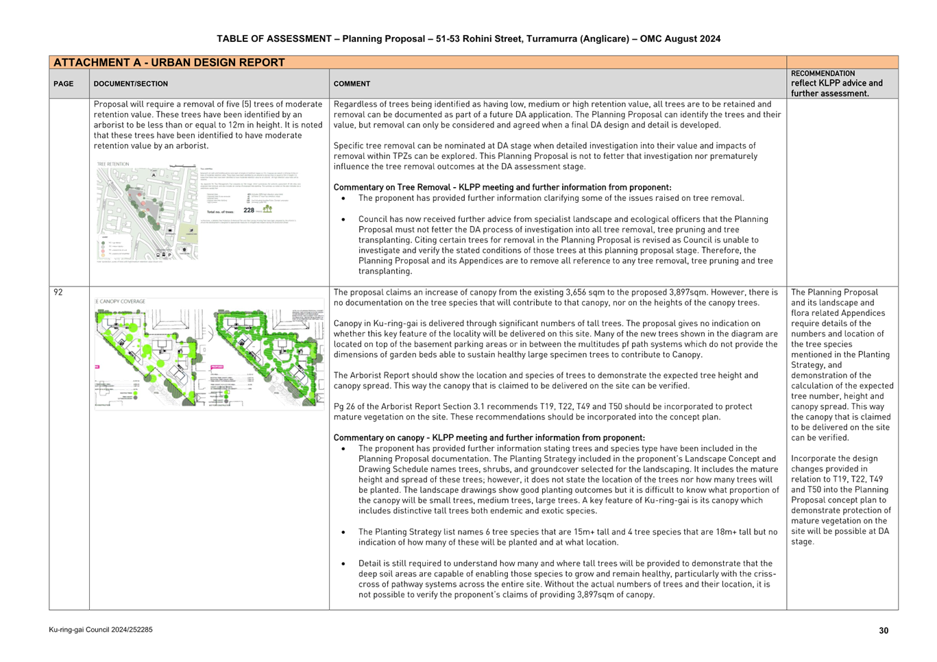
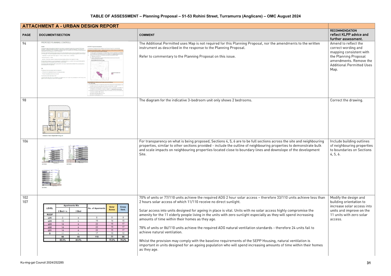
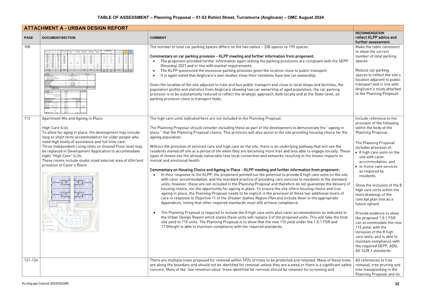
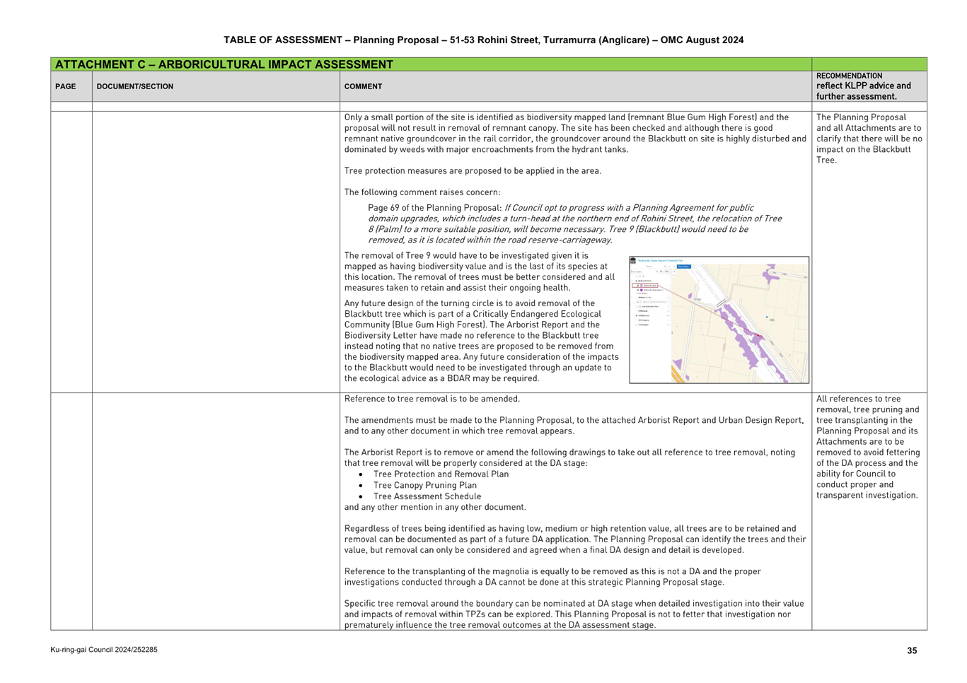
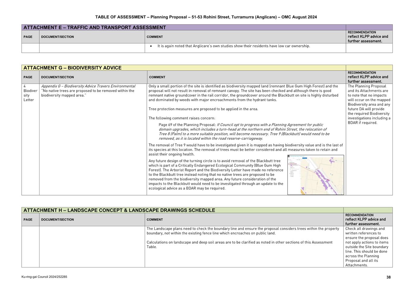
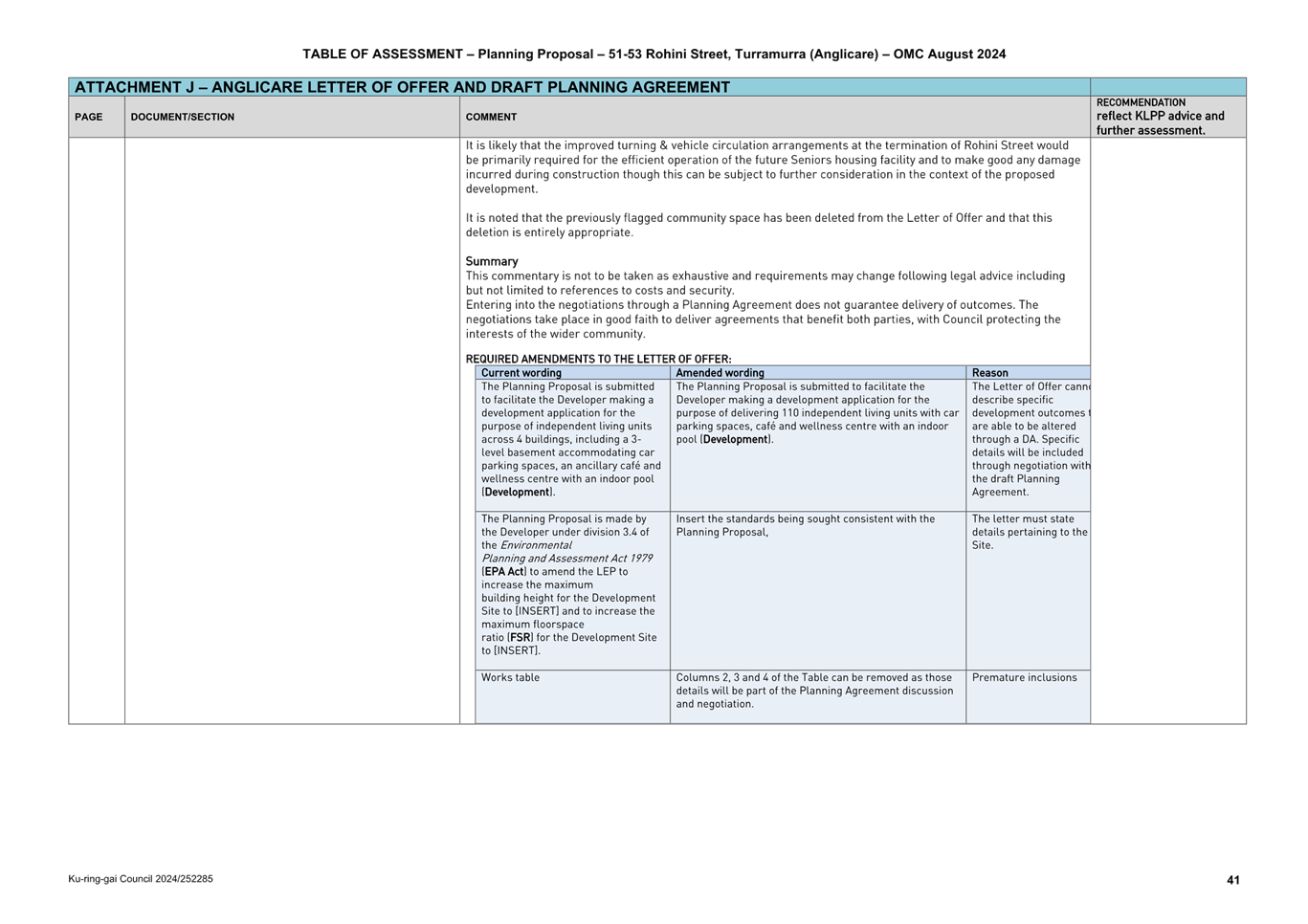
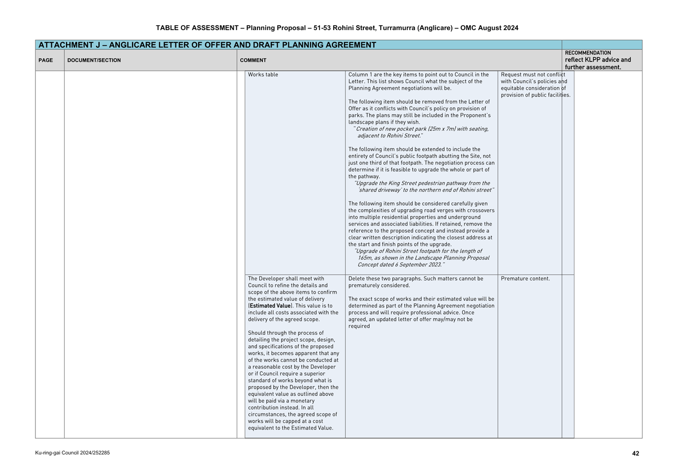
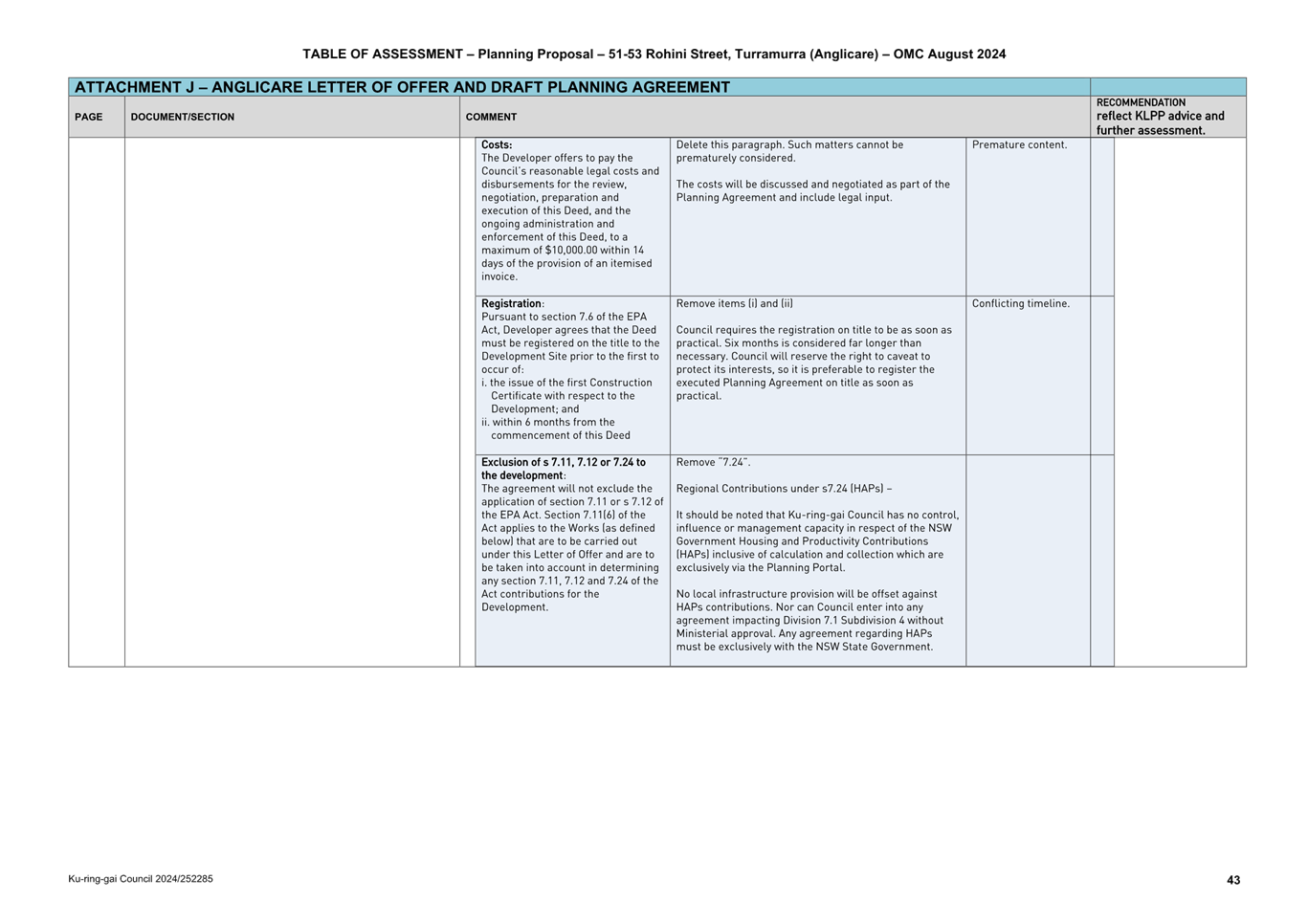
|
ATTACHMENT
No: 2 - Planning
Proposal Anglicare “Rohini Village” 51-53 Rohini Street,
Turramurra
|
|
Item No: GB.15
|
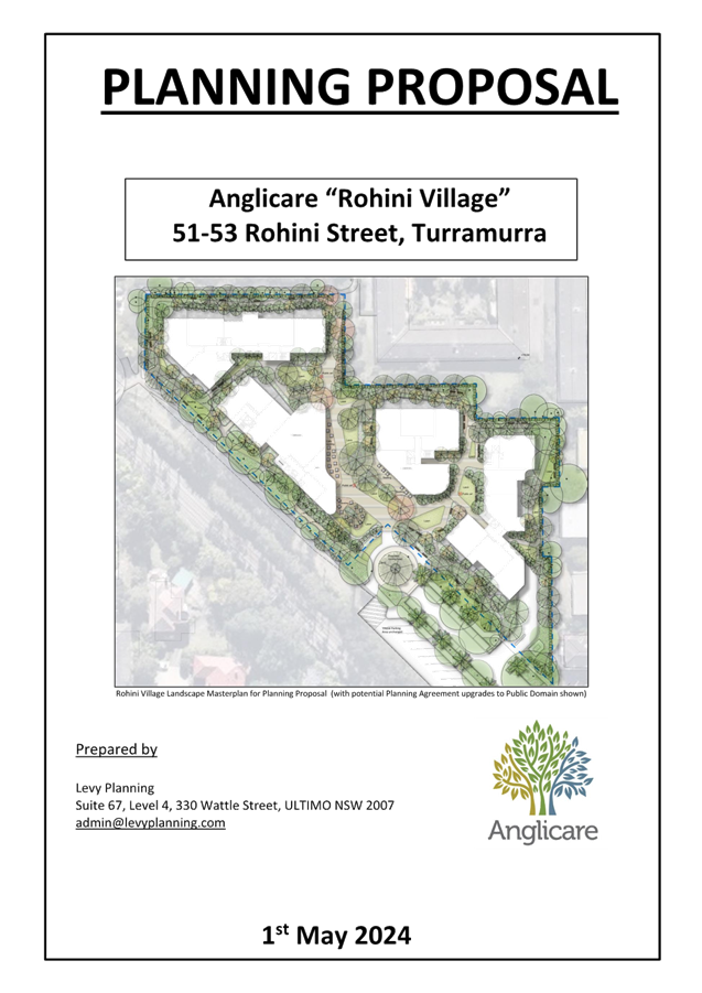
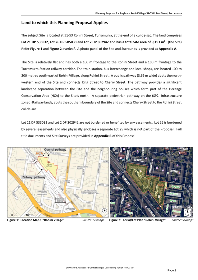
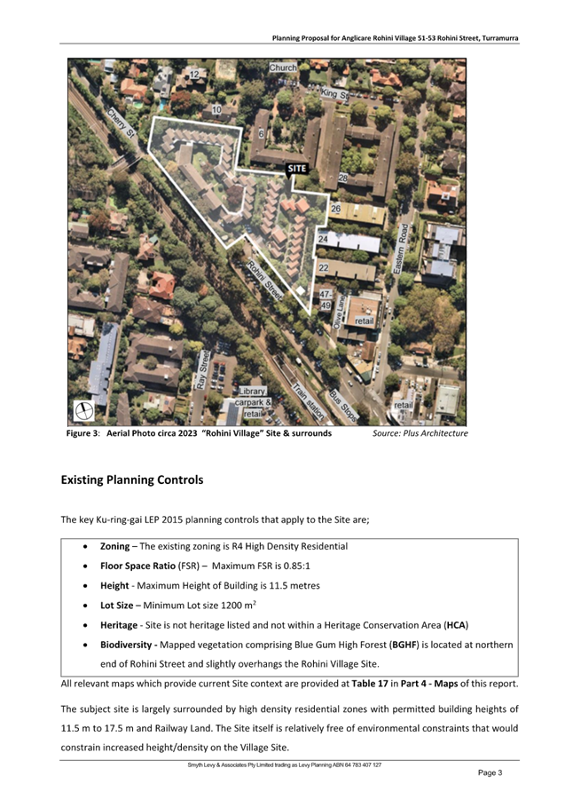
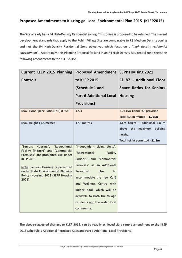
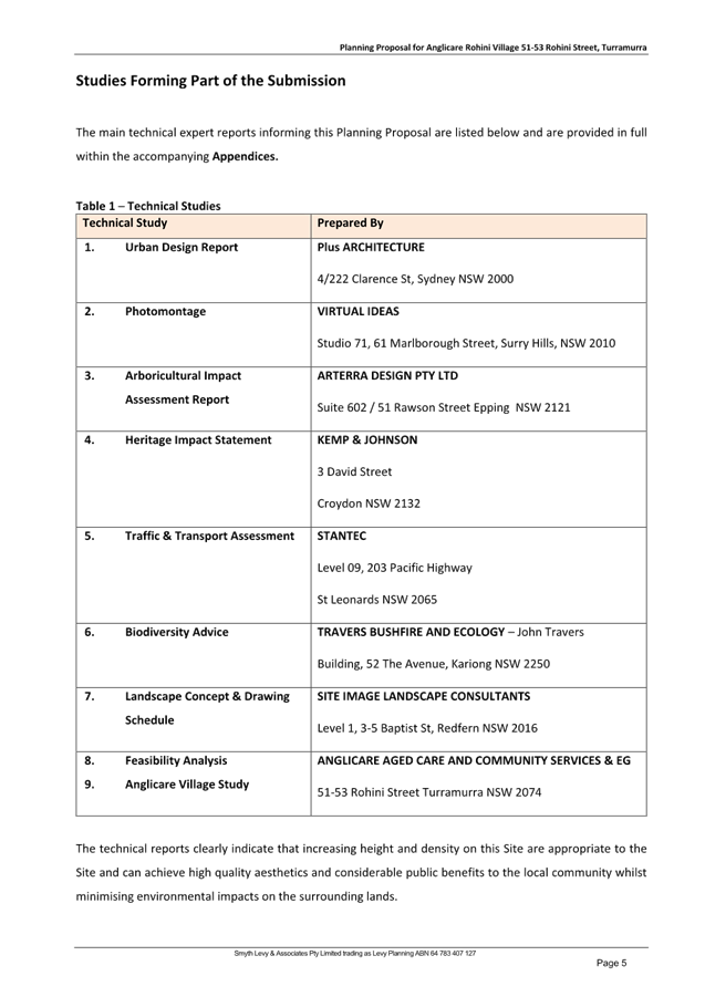
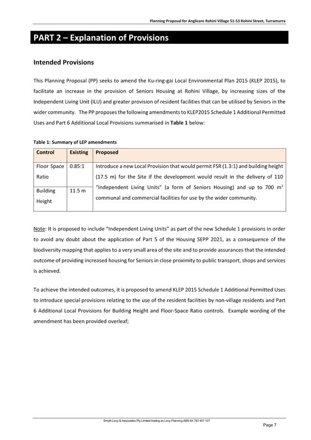
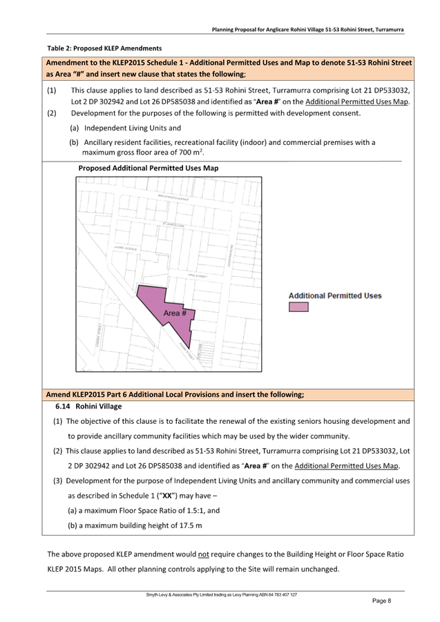
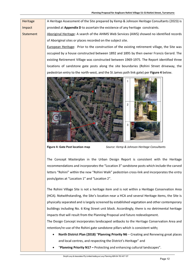
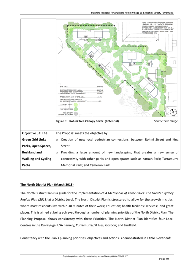
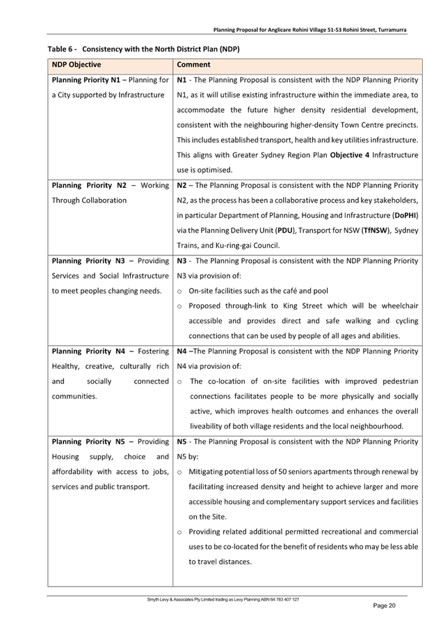
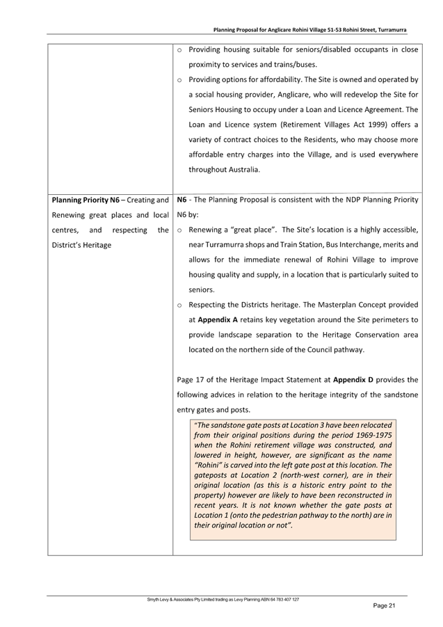
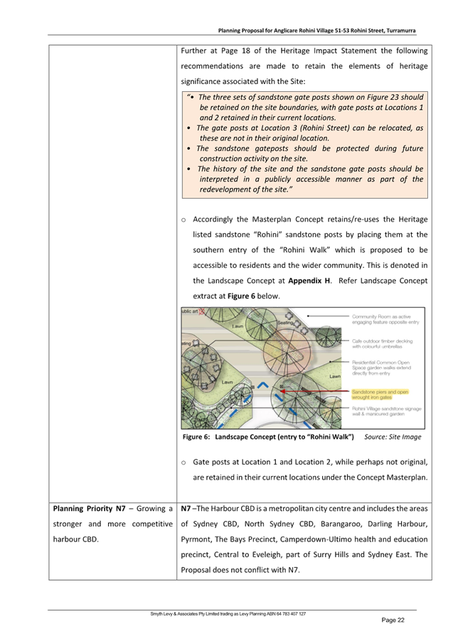
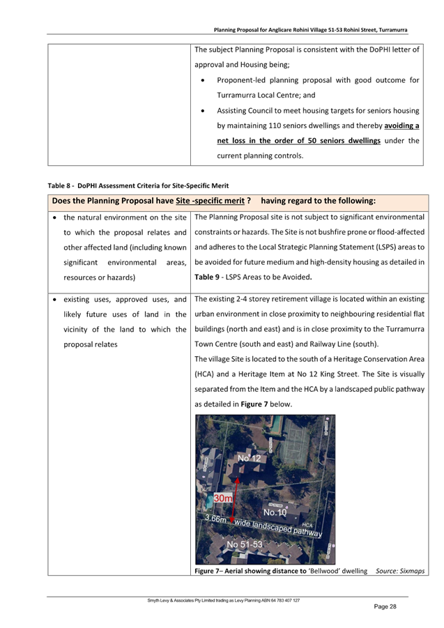
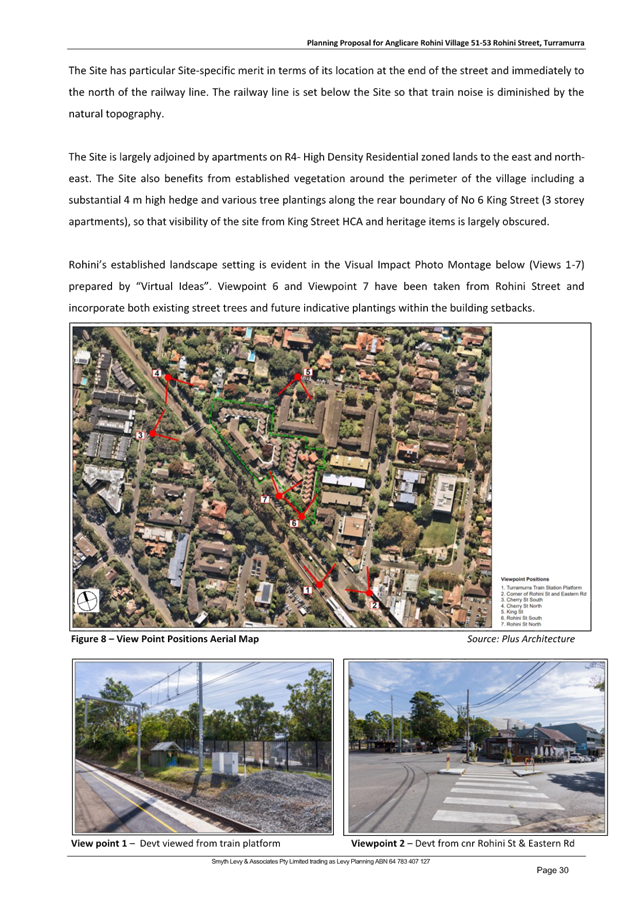
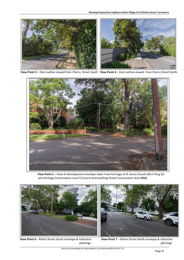
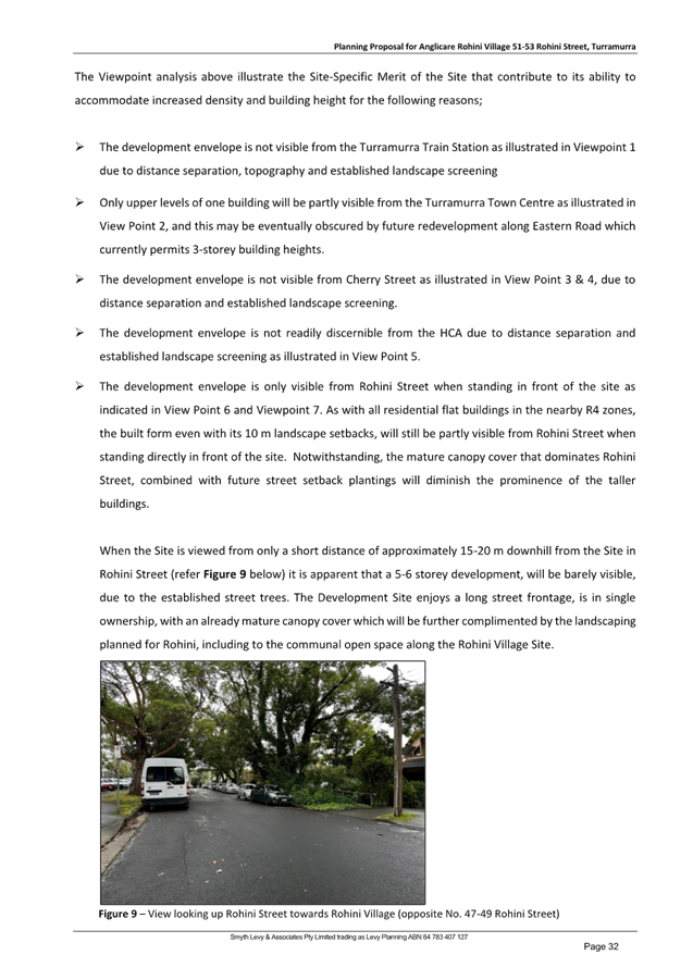

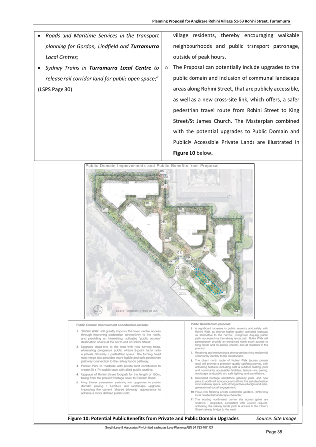
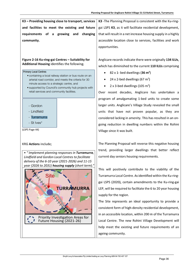
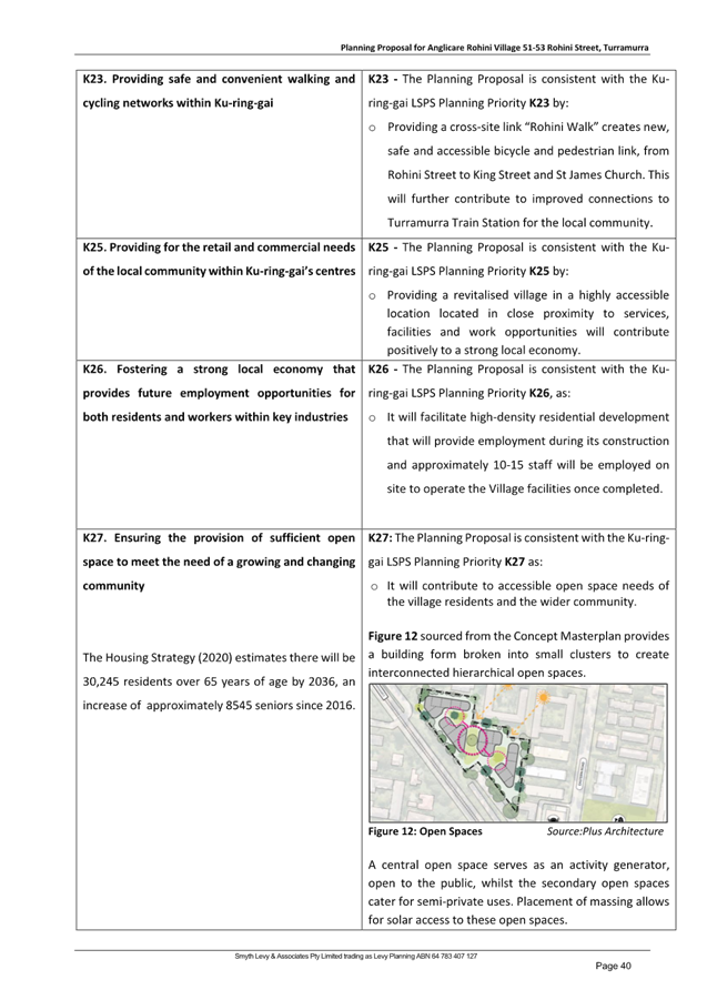
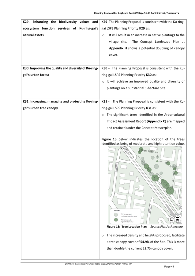

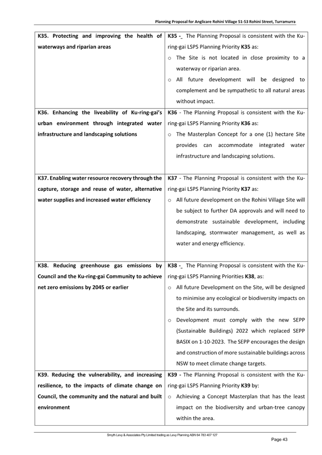
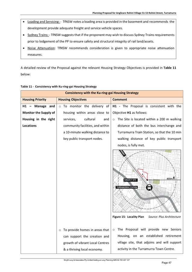
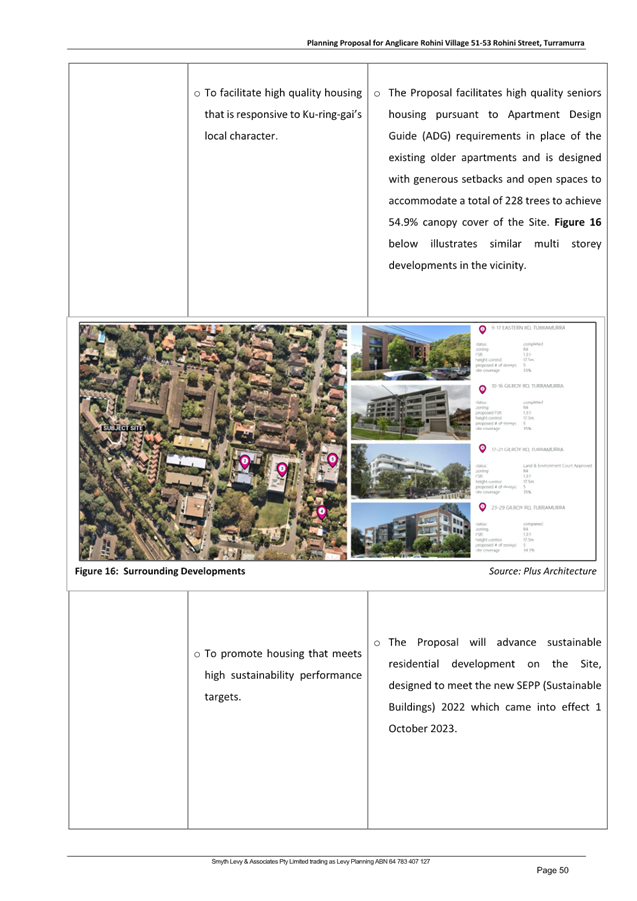
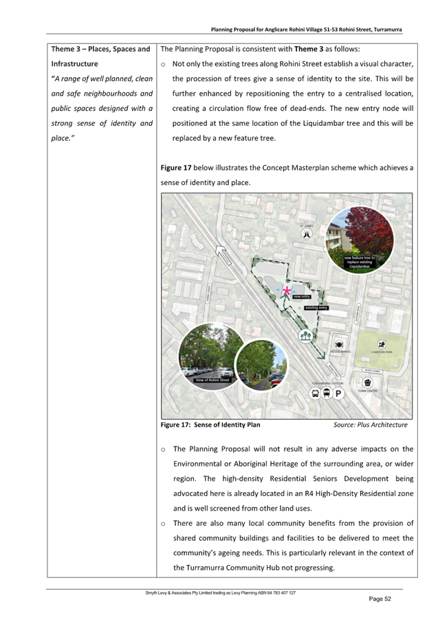
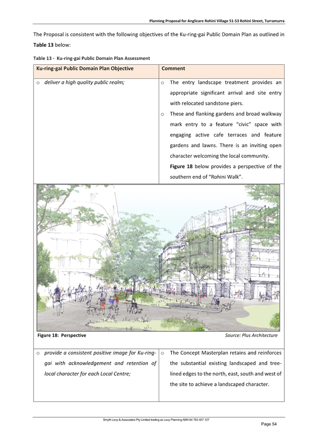
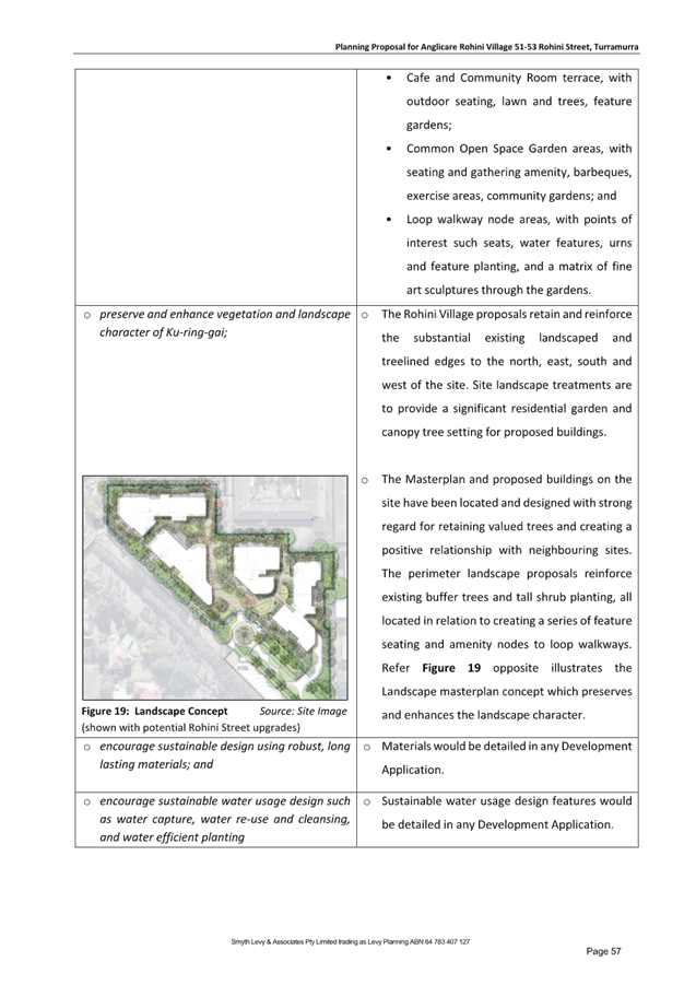
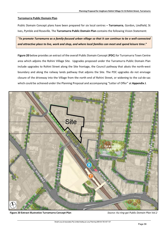
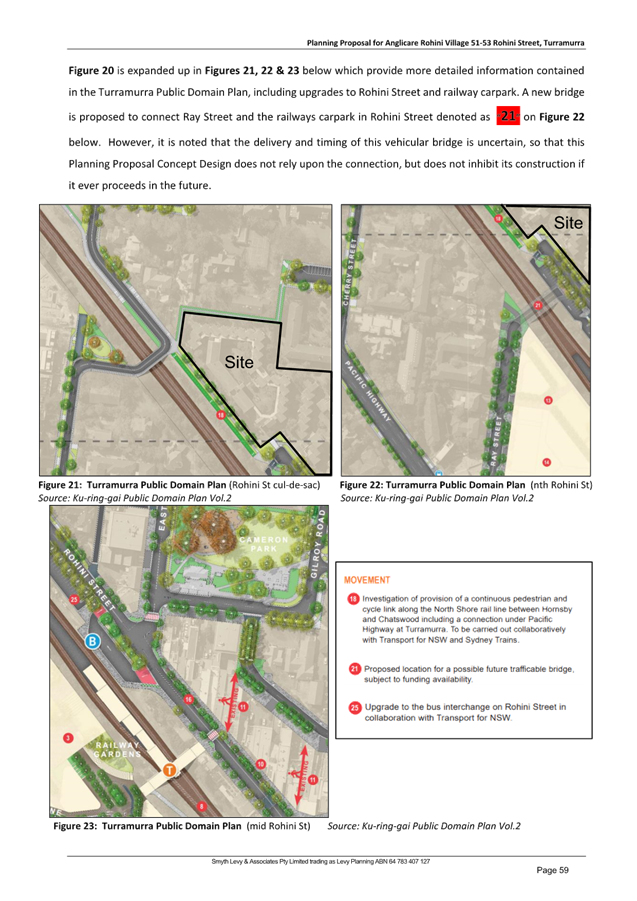
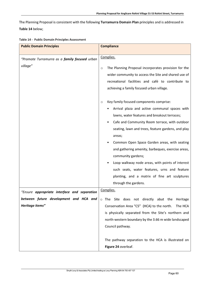
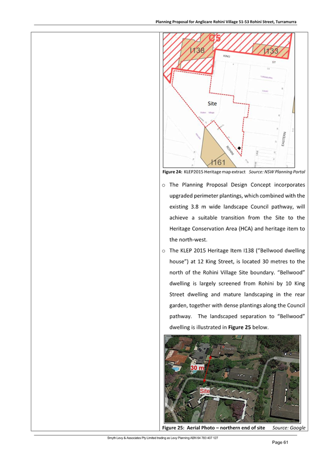
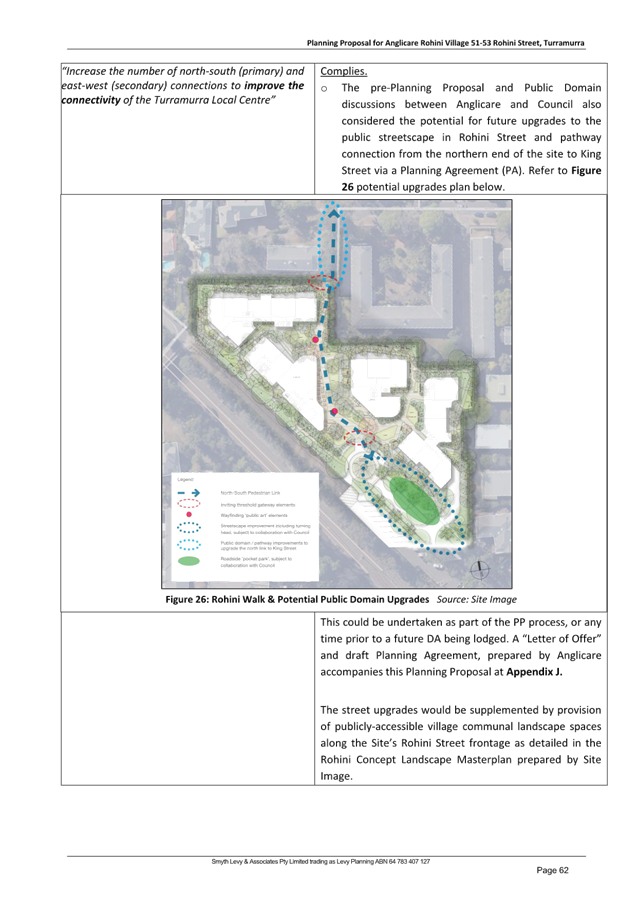
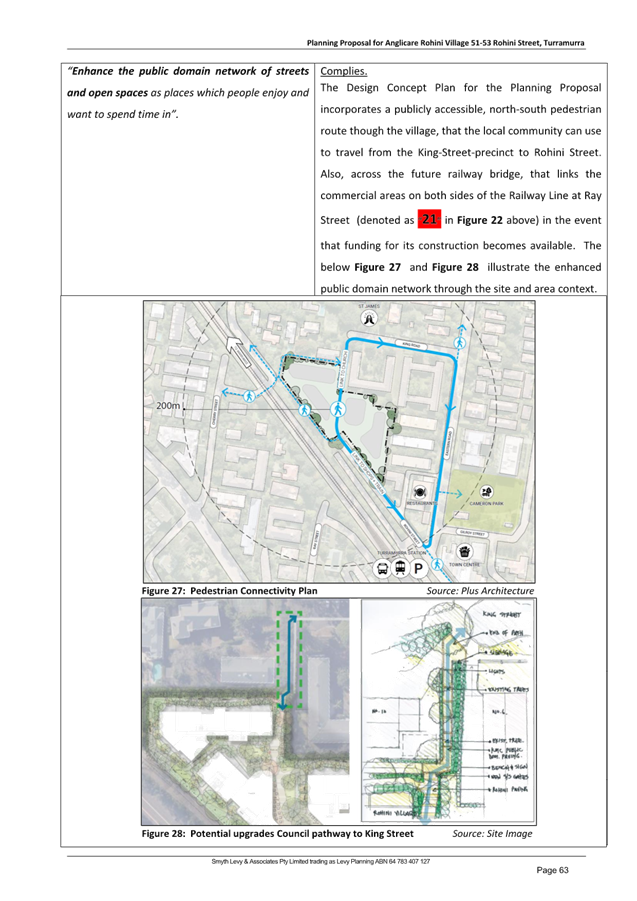
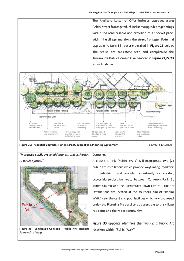
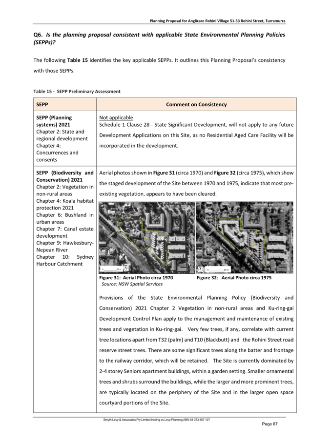
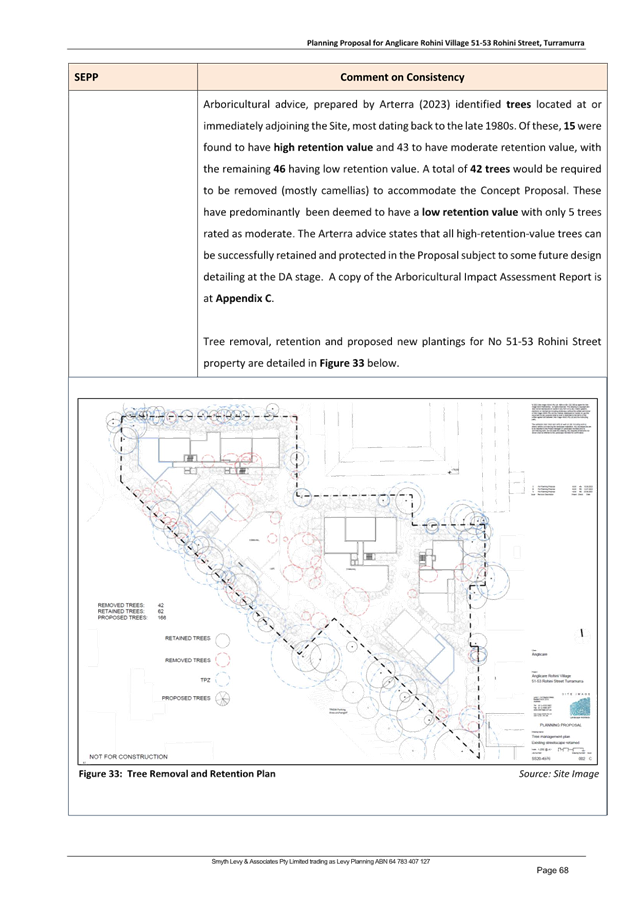
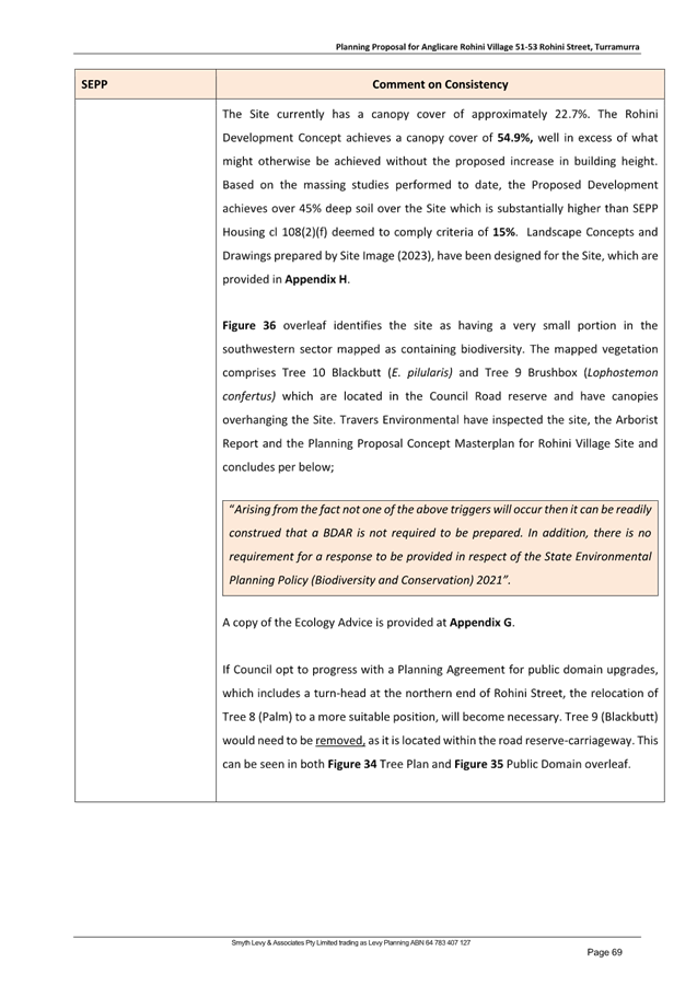
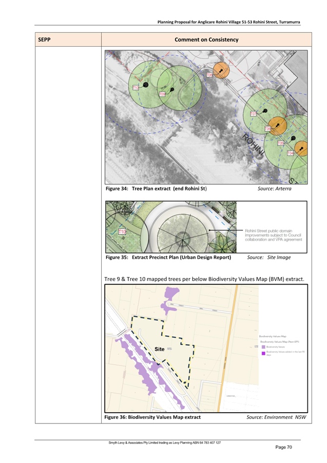
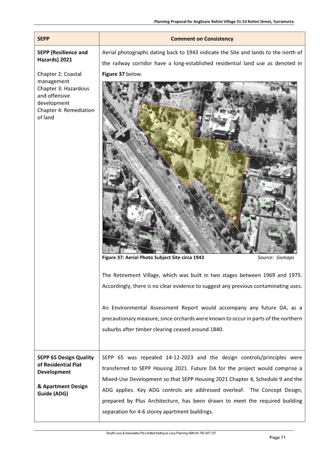
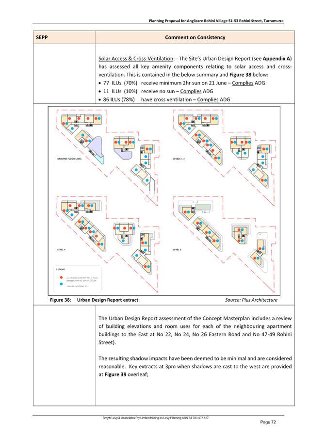
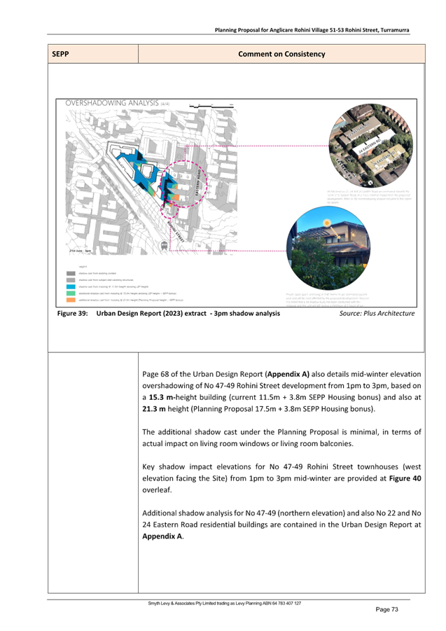
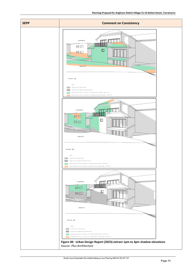
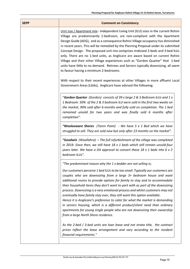
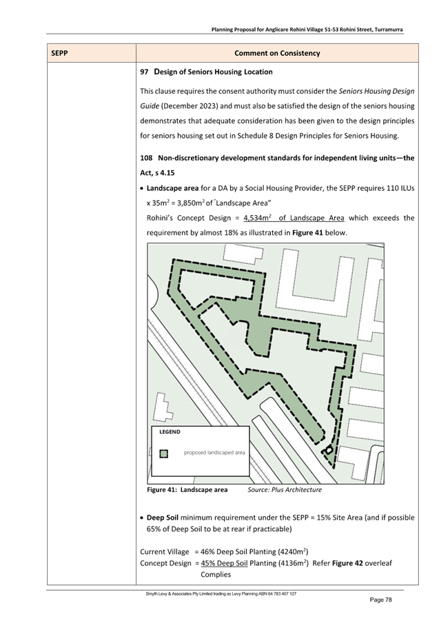
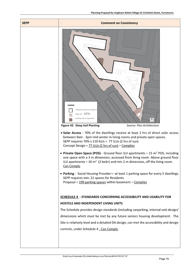
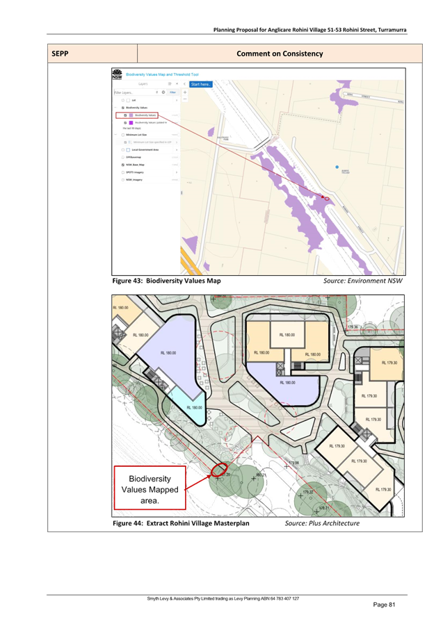
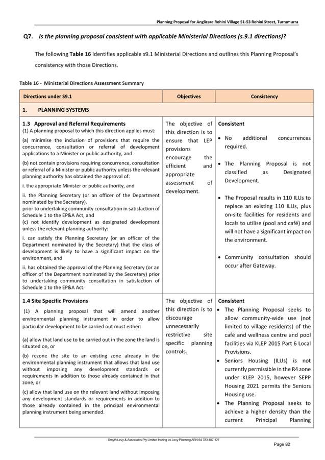
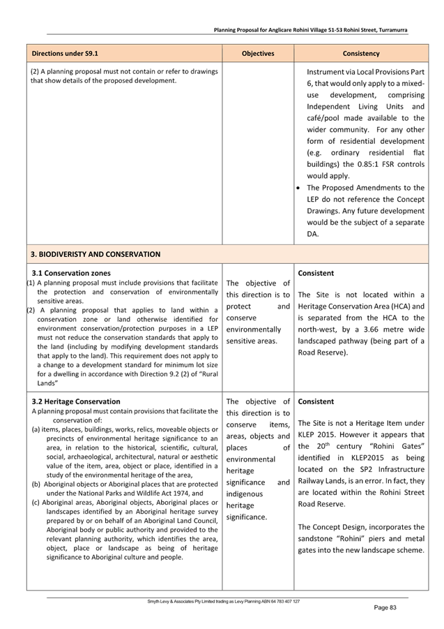
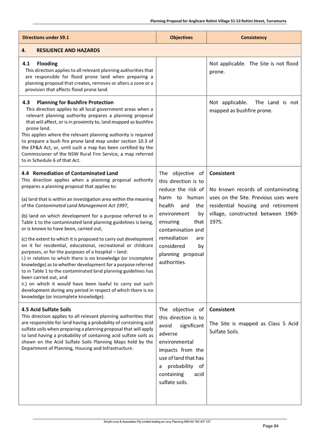
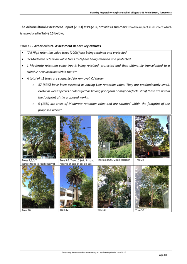
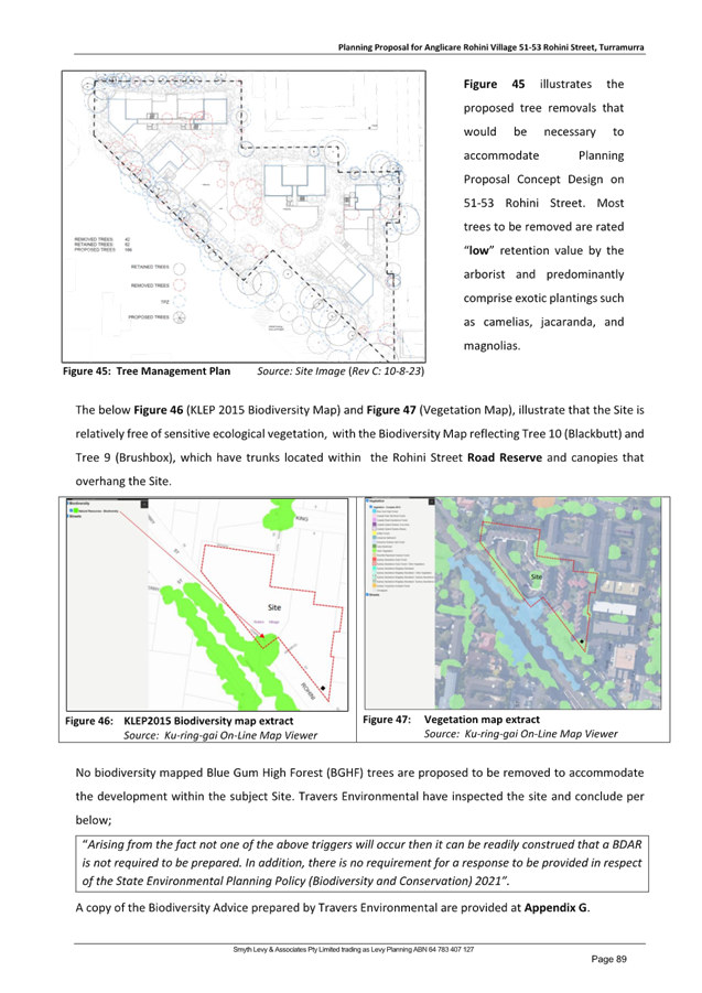
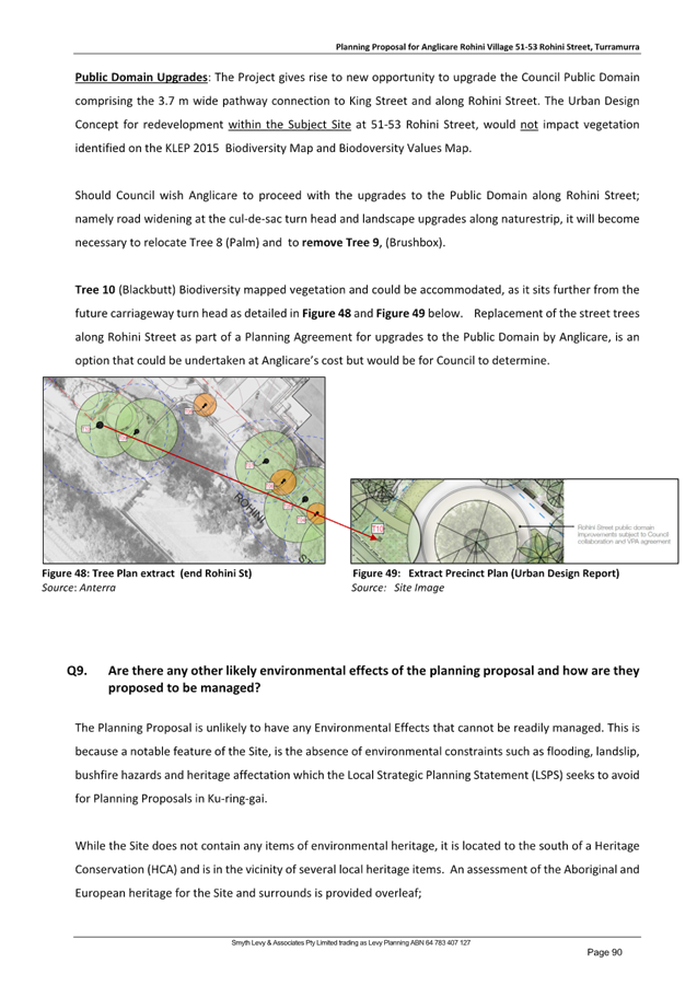
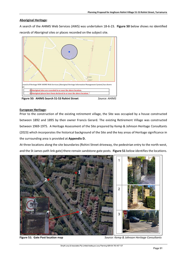
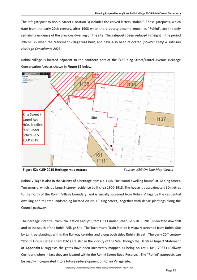
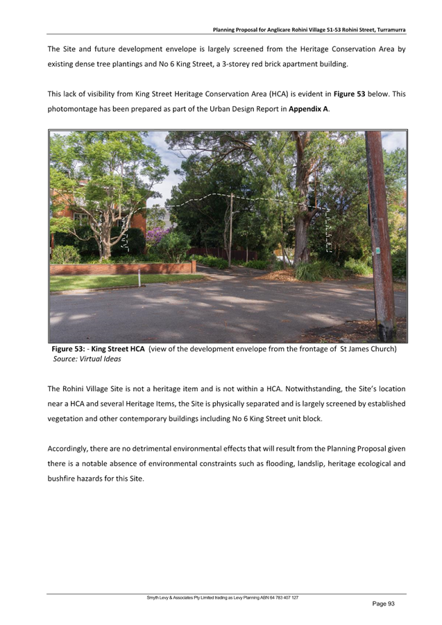
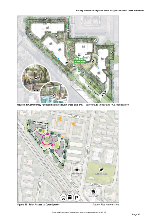
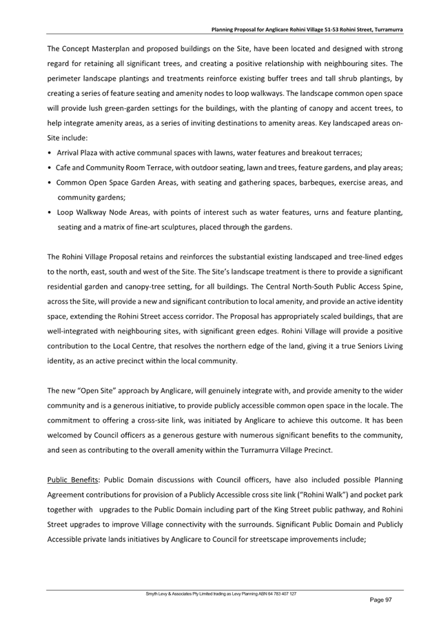
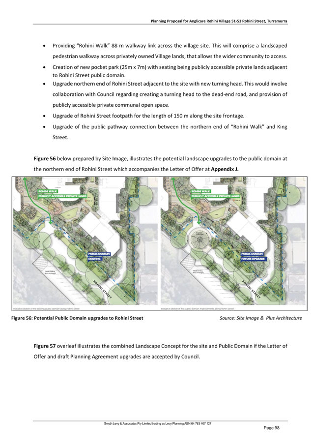
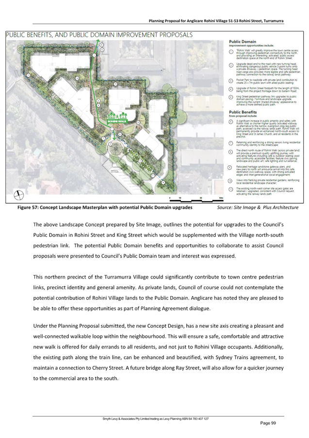
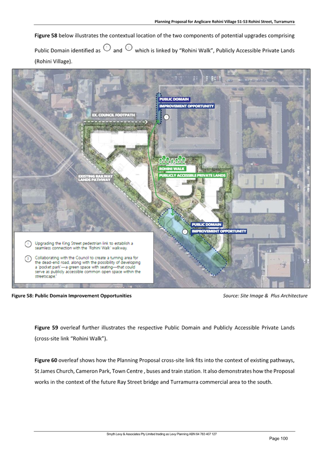
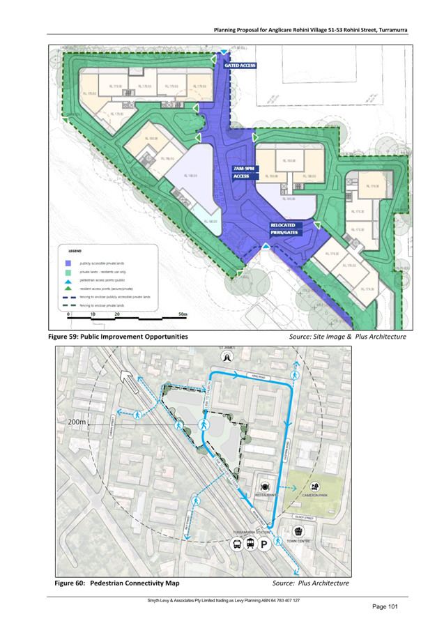
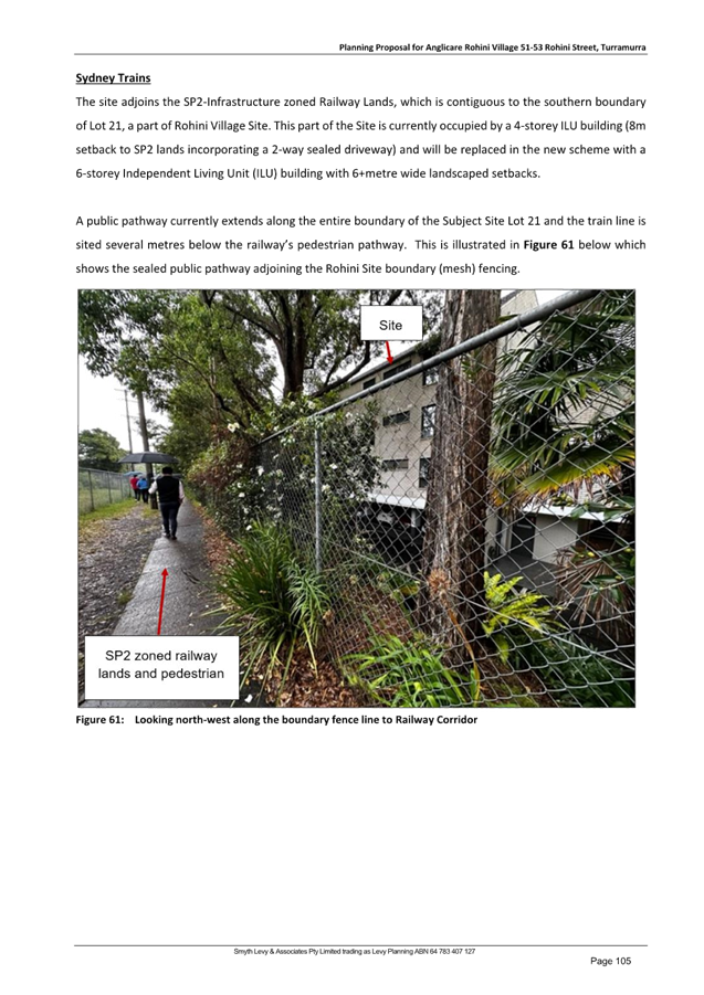
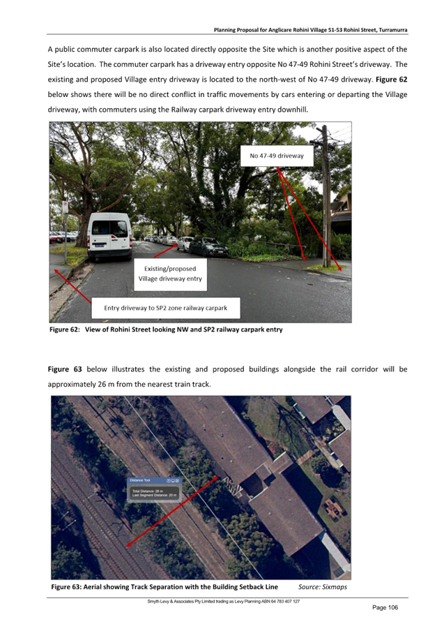
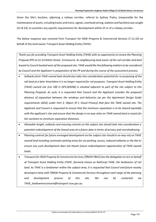
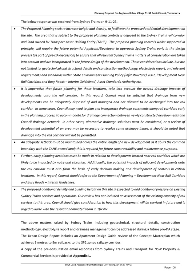
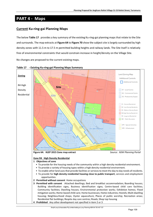
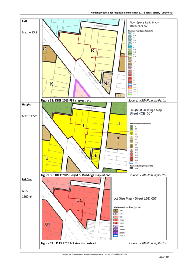
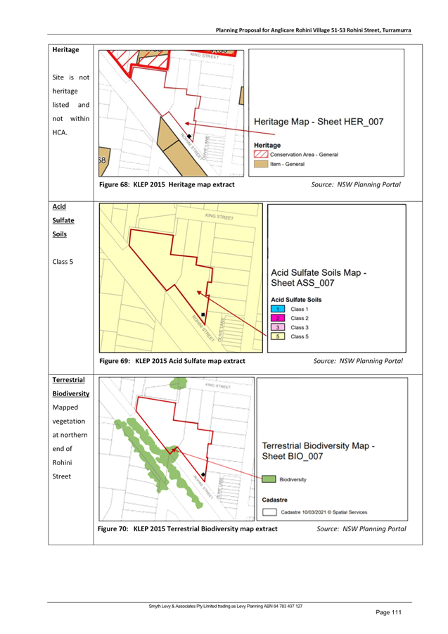
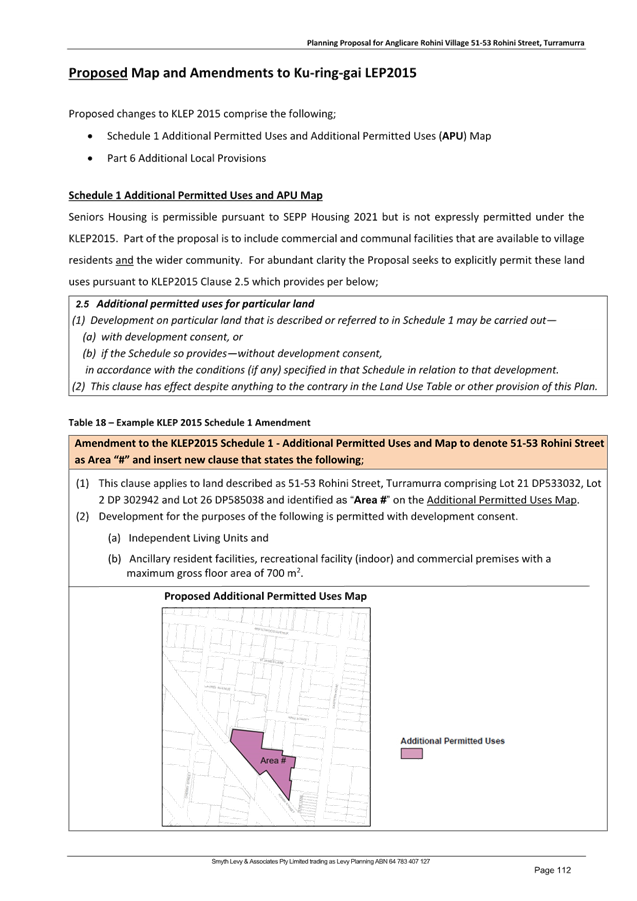
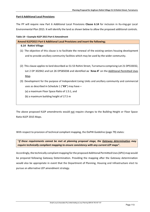
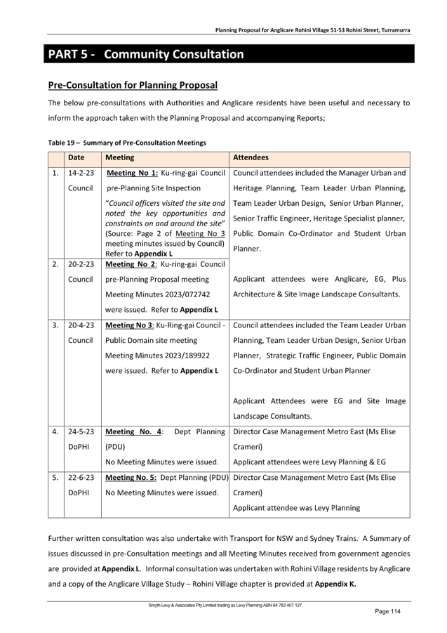
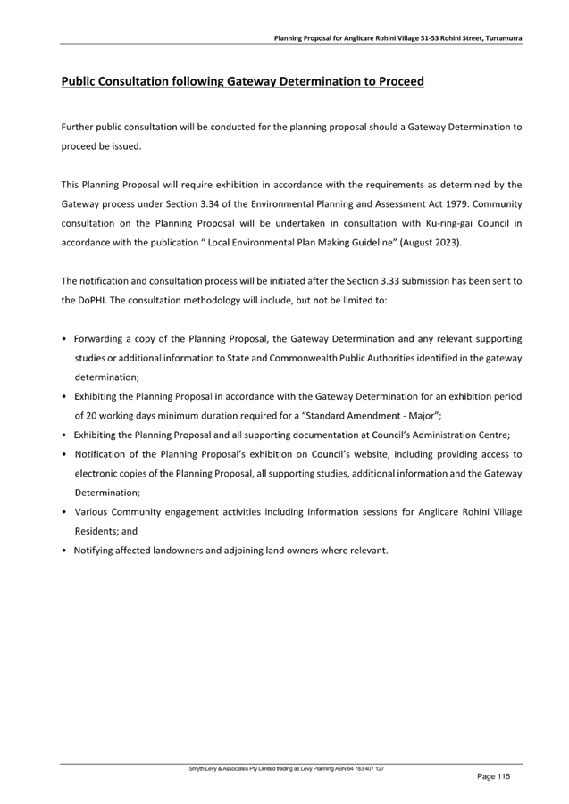
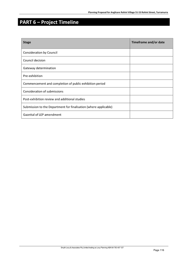
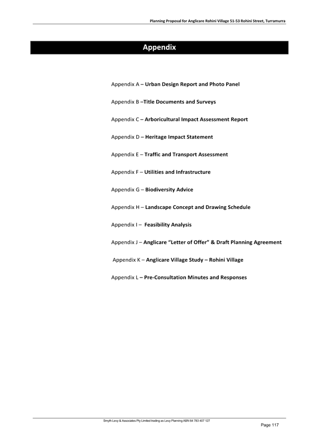
|
Ordinary
Meeting of Council - 13 August 2024
|
GB.16 / 1
|
|
|
|
|
Item
GB.16
|
S13761
|
Post exhibition report for a planning
agreement for the extension of Dorset Drive in St Ives
EXECUTIVE
SUMMARY
|
purpose of report:
|
To report to council following the exhibition of the
draft Planning Agreement for the extension of Dorset Drive on 139 Rosedale
Road St Ives as part of an approved subdivision.
|
|
|
|
|
background:
|
The six (6) lot subdivision of Lot X DP442469 at the
end of Dorset Drive, St Ives was the subject of a formal pre-Development
Application process followed by the lodgement of DA0109/23.
|
|
|
|
|
comments:
|
A deferred commencement development consent was
granted by the Land and Environment Court on 17 April 2024. The deferred
commencement condition relates to the progression of the planning agreement.
Lot X has been divested by the original owners and is now in the ownership of
the developer, Jun Chao Pty Ltd. The draft Planning Agreement has now been
exhibited in accordance with the legislative requirements and is returned to
Council for consideration.
|
|
|
|
|
recommendation:
(Refer to the full Recommendation at the end of this
report)
|
To enter into the Planning
Agreement to give effect to the dedication of land and the extension of
Dorset Drive thereon on 139 Rosedale Road St Ives as part of an approved
subdivision under DA0109/23.
|
Purpose of Report
To report to council following the exhibition of the draft
Planning Agreement for the extension of Dorset Drive on 139 Rosedale Road St
Ives as part of an approved subdivision.
Background
The proposed six (6) lot subdivision of Lot X DP442469 at
the southern end of the present northern part of Dorset Drive in St Ives was
the subject of a formal pre-Development Application process. Subsequently
DA0109/23 was lodged and was under assessment until April 2024.
Lot X was, at the time of lodgement, in the ownership of
Hobbytex Pty Ltd, which retains ownership of two larger blocks to the south of
Lot X. The subject Lot X has now been sold to Jun Chao Pty Ltd.
Following an appeal against the deemed refusal (permitted
after the DA has not been determined within a set period of time), a formal
hearing of the Land and Environment Court was held early in April 2024. The
Land and Environment Court determined the Development Application by way of a
deferred commencement consent on 17 April 2024.
The deferred commencement condition relates to the execution
of a proposed planning agreement in the terms of the letter of offer presented
by the developer who now owns the subject property at 139 Rosedale Road St
Ives. The development consent cannot operate until the deferred commencement
condition is satisfied.
Property Details
Lot X is the northernmost of three lots located between two
sections of Dorset Drive in St Ives. It has been sold into the ownership of Jun
Chao Pty Ltd and is a wholly separate property that is no longer part of the
larger Hobbytex estate. The two lots to the south of Lot X remain in the
ownership of Hobbytex Pty Ltd. Dorset Drive also exists to the south of these
properties. These lots to the south are currently zoned C4 Environmental Living
and Council staff are not aware of any currently active intentions on the part
of the property owners to the south at the present time, although it must be
noted that it is unlikely that such a large landholding in St Ives will remain
as its current use in perpetuity.
At the commencement of the pre-DA and Planning Agreement
processes in 2022, the land at 123-139 Rosedale Road was rated as a single
property but was made up of two existing allotments being Lot X in DP 442469
(8,625qsm) and Lot A in DP 346690 (2.42ha). In October 2023, the Valuer General
created two separate records for the property for valuation and rating purposes
and Council’s systems were also consequentially updated. This process
facilitated the property at Lot X being separately sold to the developer
effective from March 2024. This property is now known as 139 Rosedale Road St
Ives and is the only property affected by the development consent [DA0109/23]
and this draft planning agreement process.
The property now known as 123 Rosedale Road St Ives, is a
separate property of 2.42ha and is not part of these processes. The third
property to the south is 115-121 Rosedale Road St Ives being Lot 11 in DP
599537 (1.62ha). Both Lot 11 and Lot A remain in the ownership of Hobbytex Pty
Ltd and total just over 4ha in area.
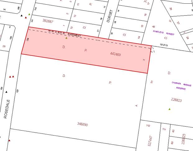
This change in property address, rating and ownership should
be borne in mind when viewing earlier reports and references in this process.
The draft planning agreement has been updated to the current address reference
being 139 Rosedale Road, St Ives. The Land and Environment Court consent for
DA0109/23 also references only 139 Rosedale Road St Ives.
The map above also shows the existing subdivision pattern in
Dorset Drive to the north of the subject property.
Comments
Public Exhibition
The
draft Planning Agreement was exhibited from Wednesday, 26 June 2024 to
Wednesday, 24 July 2024 (inclusive), which complies with the minimum of 28 days
for public comment to ensure openness and transparency. At the close of the
exhibition period eight (8) submissions had been received which have been
separately circulated to Councillors.
Two
submissions refer to the use of the Sydney Water easement to access
Huntley’s Forest at the rear of the properties fronting Dorset Drive.
Several of the submissions seem to misconstrue that the cul-de-sac proposed for
Dorset Drive and/or the creation of four residential housing lots fronting the
cul-de-sac (and two fronting Rosedale Road directly) is being proposed as part
of the Planning Agreement and/or that a through road is currently being
proposed.
The
Planning Agreement does not approve the subdivision or the extension of Dorset
Drive. The extension of Dorset Drive is already part of the approved
subdivision under DA0109/23 for the site as it is required in order for the new
lots to have a street address and vehicular access.
In
short, the approved road extension would still be constructed even if the
subdivision had been approved as a community title subdivision with the
cul-de-sac to be retained in private ownership, but it would not be a public
road in the manner of the rest of Dorset Drive. The dedication of the land on
which the cul-de-sac extension rests is the primary purpose of the Planning
Agreement and contributes to a better public outcome.
The
Planning Agreement requires and facilitates the dedication of the land on which
the extension of Dorset Drive rests into public ownership, because it is a
legal requirement for any land dedication where that land is not explicitly
identified and valued within an adopted contributions plan be facilitated by a
planning agreement. It also ensures that, because the cul-de-sac will come into
public ownership and be maintained by council, that it is constructed to the
appropriate standards and inspected during the course of construction to ensure
that it is; together with the provision of a defects liability period and a
maintenance period where the developer is required to rectify any faults that
become apparent. The detailed civil engineering design of the road is required
as part of the development consent as approved by the Land and Environment
Court on 17 April 2024.
The
potential for Dorset Drive to continue into any future subdivision of the lots
to the south is not currently being proposed. The sole purpose of ensuring that
the edge of the land dedication extends to the southern boundary of Lot X is to
retain that possibility into the future rather than effectively
terminating one potential outcome prematurely. If the southern lots ever do
become the subject of a formal subdivision proposal, that will be the
appropriate time to undertake further traffic studies and determine the most
appropriate road layout. The dedication area identified at Annexure A of the
Planning Agreement simply retains all future options.
Overview
of Submissions - Issues and comments
|
#
|
Matters raised
|
Comment
|
|
1
|
On-going use of the Sydney Water easement to maintain Huntleys
Forest.
|
The Sydney Water easement is not being extinguished and is shown
clearly on the approved plans associated with the DA. Sydney Water will be
further consulted prior to the issue of a Subdivision Works Certificate. It
should be noted that the DA was formally referred to Sydney Water shortly
after lodgement and the existence of the easement duly iterated at that time.
|
|
2
|
This is impacting Dorset Drive residents to benefit another
street; it will make the street busy and cause chaos.
|
The property that has its formal address as 139 Rosedale Road is
approved for a six (6) lot subdivision in an R2 zoned area. Two (2) lots will
front Rosedale Road directly. Four (4) lots will front the new cul-de-sac end
of Dorset Drive (two on either side). The subdivision reflects the existing
allotment pattern in Dorset Drive and Rosedale Road.
|
|
3
|
Construction traffic, accidents, emergency services access. A
safe place for children and rare example of a lovely neighbourhood being
destroyed for a developer. Residents of Dorset Drive will be heavily
impacted.
|
The approved DA is for four (4) residential lots fronting a new
cul-de-sac at the end of Dorset Drive (the other two (2) lots front Rosedale
Road directly and do not have access to Dorset Drive) reflecting the existing
pattern of subdivision in Dorset Drive. Emergency services (and garbage
trucks) will be able to turn around within the new cul-de-sac as distinct
from being restricted by the present dead end. This reduces the likelihood of
large vehicles reversing in Dorset Drive as it will be made easier to leave
the street in a forward direction. A Construction Traffic Management Plan
(CTMP) is required to be submitted to Council for approval prior to any work
commencing (Condition #20). The developer must also manage safety in the road
reserve (Condition #40).
|
|
4
|
Garbage trucks have to reverse back down Dorset Drive because
they are unable to turn around at the bottom of the street. Emergency
services find it difficult the access the end of the street. A through road
would be disastrous. Traffic management needed for construction phase. Sydney
Water’s easement used to access Huntleys Reserve.
|
The approved DA includes a cul-de-sac head so that garbage
trucks and emergency services vehicles will be able to turn around and leave
Dorset Drive in a forwards direction. A through road is not being proposed as
part of this Planning Agreement or the associated DA. The land dedication
extends to the southern boundary of 139 Rosedale Road simply in order to keep
that option open as a possibility for future consideration. There are
two properties totalling c.4ha between the two sections of Dorset Drive, as
such, any future subdivision of the whole would require extensive
site-specific masterplanning at some unknown point in the future. Sydney
Water’s easement is not being extinguished. Sydney Water will (again)
be consulted prior to the issue of a Subdivision Works Certificate and a s73
compliance certificate is also required as part of this process. (Condition
#27 & #63 of the approved DA). A Construction Traffic Management Plan
(CTMP) is required to be submitted to Council for approval prior to any work
commencing (Condition #20).
|
|
5
|
Lack of detail for construction traffic management.
|
The requirement for a Construction Traffic Management Plan
(CTMP) to be submitted to Council for approval prior to any work commencing
is Condition #20 of the approved Development Application. Roads Act approval
is Condition #26. Road Reserve safety is Condition #40. The primary purpose
of the Planning Agreement is to facilitate the dedication of the land and the
road thereon into public ownership.
|
|
6
|
A holistic plan for this multi-hectare site should be developed
including a comprehensive traffic management plan. Access roads during
construction must be provided for – recent single dwelling projects
have caused problems with construction traffic – all construction
traffic for this project should come from Rosedale Road. The intersection of
Shinfield & Dorset has restricted visibility (previously advised to
council).
|
Lot X at 139 Rosedale Road is 8,625sqm and is no longer part of
the Hobbytex landholding. It existed as a separate lot prior to this process
commencing. As such Council is obliged to assess this separate application on
its stand-alone merits. DA0109/23 was appealed as a deemed refusal and
approved by the Land & Environment Court on 17 April 2024. It is unknown
when, or even if, Hobbytex may wish to undertake planning for its
multi-hectare landholding and the development of this now separate site
cannot be required to wait for that event. There is no concrete proposal for
a through road, simply an annotation that this is one of many possibilities
that will eventually form part of a future masterplanning process of a
potential future subdivision layout on the Hobbytex lots. Retention of this
option affects the size and shape of the land dedication area on the subject
site so is duly referred to. There is a requirement for a Construction
Traffic Management Plan (CTMP) to be submitted to Council for approval prior
to any work commencing (Condition #20). The safety issues at the intersection
of Shinfield & Dorset cannot be addressed as part of a planning agreement
that simply facilitates land & road dedication, but the issue can (again)
be drawn to the attention of the traffic planners in council.
|
|
7
|
Supports the new turning circle, especially as an aid to
emergency and waste vehicles but concerned about construction traffic as even
single house renovations or landscaping works have impacted the street.
Concerned about future through traffic. Concerned about intersection of
Shinfield & Dorset with restricted visibility from parked vehicles and
morning glare. Clearly there is negative impact.
|
There is a requirement for a Construction Traffic Management
Plan (CTMP) to be submitted to Council for approval prior to any work
commencing (Condition #20). The safety issues at the intersection of
Shinfield & Dorset cannot be addressed as part of a planning agreement
that simply facilitates land & road dedication, but the issue can (again)
be drawn to the attention of the traffic planners in council.
The impacts mentioned arise from the approved development under
DA0109/23 and not directly from the planning agreement which only facilitates
the dedication of that land (and the road thereon) that is approved by that
consent, into public ownership.
|
|
8
|
Safety concerns for the residents of Dorset Drive during
construction. Concern regarding the drainage of the land due to the change in
topography as a result of the subdivision.
|
There is a requirement for a Construction Traffic Management
Plan (CTMP) to be submitted to Council for approval prior to any work
commencing (Condition #20) as well as on-going safety in the Road Reserve
during construction (Condition #40). Inter-allotment drainage is part of the
approved development consent. Further approval from Sydney Water is required
as part of the subdivision works. The civil engineering design of the road
extension must also address council drainage requirements.
|
While
a number of the issues raised cannot be addressed by a Planning Agreement that
simply facilitates the dedication of the land (and the road thereon) that forms
part of the approved subdivision of Lot X only, an overriding theme is the
significant concern regarding construction traffic during the process of the
subdivision works. Accordingly, it is recommended that the submissions made
during this exhibition, be provided internally to staff who will be involved in
the future assessment of a Construction Traffic Management Plan (CTMP) to
ensure these concerns are noted. It is not the role of this report to recommend
that construction traffic for this six (6) lot subdivision should access the
site solely from Rosedale Road, as this is a matter for separate detailed
assessment, but the issues raised by the residents of Dorset Drive should be a
matters for consideration for the future CTMP.
integrated planning and reporting
Theme Three:
Places, Spaces and Infrastructure
|
Community
Strategic Plan
Long Term Objective
|
Delivery
Program
Term Achievement
|
Operational Plan
Task
|
|
P2.1 A robust planning framework is in place to deliver
quality design outcomes and maintain the identity and character of Ku-ring-gai.
|
Strategies, plans and processes are in place to
effectively manage the impact of new development.
|
P8.1.1.1.1.1-2
Ku-ring-gai
Contributions Plan
2010 ensures new development contributes towards the cost of delivering supporting infrastructure.
|
|
P4.1 Our centres offer a broad
range of shops and services and contain lively urban village
spaces where people can
live, work, shop, meet and spend leisure time.
|
Plans to revitalise local centres are being progressively
implemented and achieve quality design outcomes in collaboration with key
agencies,
landholders and
the
community.
|
C6.1.2.1.2; C4.1.2.1.3
New public
infrastructure is planned to support new development and ensure that everyone
who lives and works in Ku-ring-gai continues to enjoy access to public
facilities.
|
|
P8.1 An improved standard of infrastructure that meets the
community’s service level standards and Council’s obligations as
the custodian of our community’s assets
|
Our public infrastructure and assets are planned, managed
and funded to meet community expectations, defined levels of service and
address inter-generational equity
|
C6.1.2.1.2; C4.1.2.1.3
New public
infrastructure is planned to support new development and ensure that everyone
who lives and works in Ku-ring-gai continues to enjoy access to public
facilities.
|
Governance Matters
The negotiation of this draft Planning Agreement has been
guided by Ku‑ring‑gai Planning Agreement Policy 2019.
The draft Planning Agreement has been prepared with input
from the Property Unit, Operations and the Corporate Lawyer. Council appointed
Wilshire Webb Staunton Beattie Lawyers to act on its behalf, the firm which
also had carriage of other Planning Agreements involving the dedication of land
for the expansion of the road reserve either for increased carriageway and / or
for pedestrian improvements. The developers / landowners of the site at 139
Rosedale Road St Ives also retained their own independent legal advisor.
Risk Management
Council has commissioned an external legal team to assist
with the drafting of the Planning Agreements. This legal firm has assisted
council with several prior matters of land dedication for public road reserves.
Financial Considerations
The dedication of the land at
the southern end of Dorset Drive (North) will extend the road reserve in front
of four (4) additional standard size allotment residential properties,
comparable to similar properties to the north that also front Dorset Drive (two
(2) allotments will also front Rosedale Road as part of this six (6) lot
subdivision). The approved subdivision will also provide a cul-de-sac and
turning facilities for larger vehicles such as garbage trucks and emergency
services. At present, Dorset Drive simply ends in a dead end without additional
turning space. This improved access for waste service vehicles is also a
benefit for the future delivery of these services in Dorset Drive.
The dedication will, after
the expiration of the maintenance and defects liability period, result in some
additional costs in the future over a relatively small area. However, this is
outweighed by the benefit of having the extended section of the public road in
public ownership.
Social Considerations
The dedication of the land on which rests an extension to
Dorset Drive with a cul-de-sac termination (under DA0109/23) into public
ownership and control is appropriate. That is the principal purpose of the
proposed Planning Agreement, is to facilitate that dedication and to ensure
Council’s requirements are met.
Any social considerations arising from the subdivisions
proposal itself were matters for the Development Application assessment rather
than the Planning Agreement.
Environmental Considerations
The draft Planning Agreement involves only the dedication of
land for the purpose of extending Dorset Drive and the logistics of the
delivery of the cul-de-sac. Environmental considerations are a core component
of the development assessment process for any application. The development
assessment process for the subject site has been completed. Consent was granted
by the Land and Environment Court on 17 April 2024.
Community Consultation
The
draft Planning Agreement was exhibited from Wednesday, 26 June 2024 to
Wednesday, 24 July 2024 (inclusive), which complies with the minimum of 28 days
for public comment to ensure openness and transparency. At the close of the
exhibition period eight (8) submissions had been received which have been
circulated to Councillors and commented on in the body of the report.
Internal Consultation
Staff members from Urban Planning, Operations, the Property
Unit and the Corporate Lawyer have been directly involved in this matter.
Council appointed Wilshire Webb Staunton Beattie Lawyers to act on their
behalf.
Summary
This report summarises the background to the draft Planning
Agreement for the dedication of land extending Dorset Drive St Ives onto 139
Rosedale Road St Ives as part of a now DA approved six (6) lot subdivision of
that site under DA0109/23 (LEC2023/00167405).
It is desirable that the road land be dedicated into public
ownership from the present end of Dorset Drive through to the property boundary
to the south to retain the possibility for future extension, subject to the
formal assessment, exhibition and reporting of any such application that may
eventuate. This is a component of the orderly redevelopment of land and ensures
access for services, including refuse and recycling and for emergency services.
It is emphasised that the land dedication extends to the
southern boundary of the lot only to retain the possibility of future
extension in the event that the larger land holdings to the south are
redeveloped at some time in the future. As previously noted, any such proposal
would be the subject of extensive future assessment, exhibition and reporting.
At present, staff are not aware of any concrete proposals to redevelop that
land holding though it must be noted that it is unlikely to remain as a rural
holding in perpetuity.
The primary purpose of the planning agreement is to achieve
the dedication of the land into public ownership and to manage the process of
the road delivery to ensure council’s standards are met and that council
retains security for the defects liability and maintenance period after its
completion. This is similar to the delivery of Hanson Way in Gordon by two of
the adjoining developments, though on a much smaller scale.
It is reiterated that the civil engineering design of the
road, construction traffic management plans and other concerns are matters for
the either the Development Application, the subdivision works approvals, Sydney
Water approvals and/or a future Construction Traffic Management Plan (CTMP).
These are not matters for inclusion in the Planning Agreement.
The draft Planning Agreement and Explanatory Note (page 22
of the draft Planning Agreement) is attached at Attachment A1 and it is
recommended that council proceed to enter into the planning agreement and to
take the necessary steps to execute it in order to facilitate council ownership
of the new area of road as a public road. A draft plan of subdivision showing
the land dedication area is included within the document at Annexure A.
Recommendation:
A. That
Council resolve to enter into the Planning Agreement with Jun Chao Pty Ltd as
specified in Attachment A1.
B. That
Council grant delegation to the General Manager and Mayor to execute the
Planning Agreement under the Common Seal.
C. That
delegation be granted to the General Manager, or his delegate, to make any
minor administrative changes or typographical corrections to the document to
protect Council’s interests, provided they do not alter the overall
intent.
D. That
the Planning Agreement register be updated to include the Planning Agreement
for the extension of Dorset Drive on 139 Rosedale Road St Ives upon the
execution of the Planning Agreement.
E. That
delegation be granted to the General Manager to give effect to the requirements
of the Planning Agreement after execution, as they apply to actions required of
the Council as particularised in the Planning Agreement.
F. That
Council authorises the General Manager and the Mayor to execute all
documentation associated with the foregoing transactions and conveyances,
including the fixing of the Common Seal, if required.
G. That
the public submissions arising from the exhibition of the draft Planning
Agreement be provided to staff involved in the assessment and approval of the
future Construction Traffic Management Plan (CTMP) especially with regard to
access to the site by construction traffic.
|
Kate Paterson
Infrastructure Coordinator
|
Craige Wyse
Team Leader Urban Planning
|
|
Andrew Watson
Director Strategy & Environment
|
|
|
Attachments:
|
A1 ⇩ ⇩
|
Draft
Planning Agreement 139 Rosedale Road and Dorset Drive St Ives
|
|
2024/251781
|
|
ATTACHMENT No: 1 - Draft
Planning Agreement 139 Rosedale Road and Dorset Drive St Ives
|
|
Item No: GB.16
|
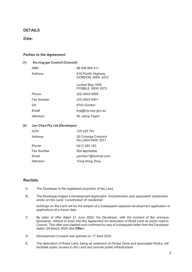
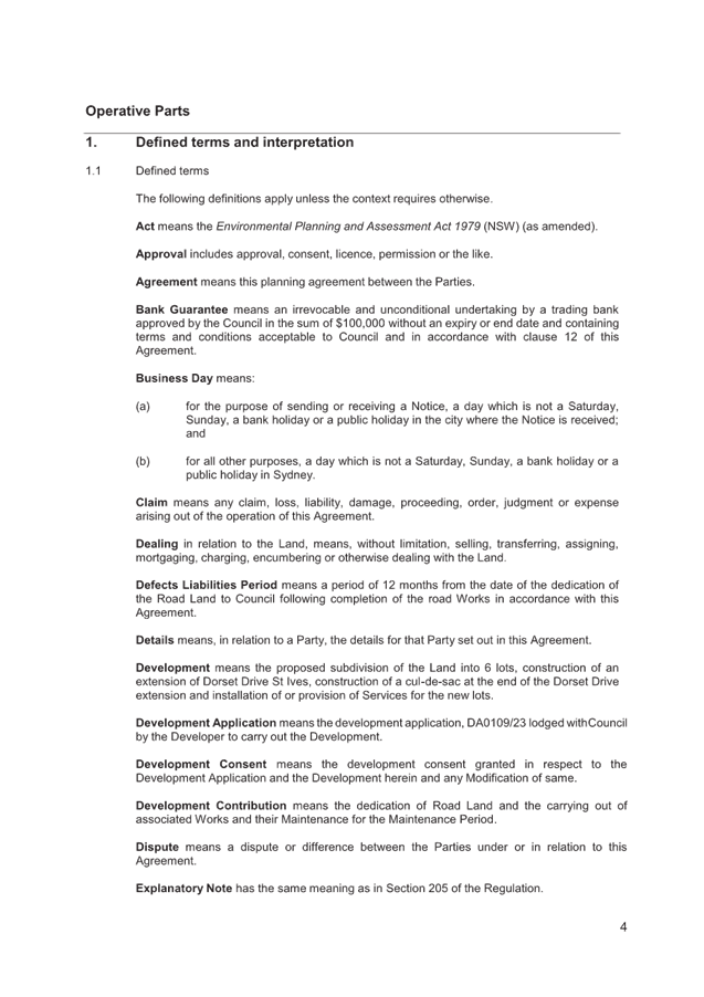
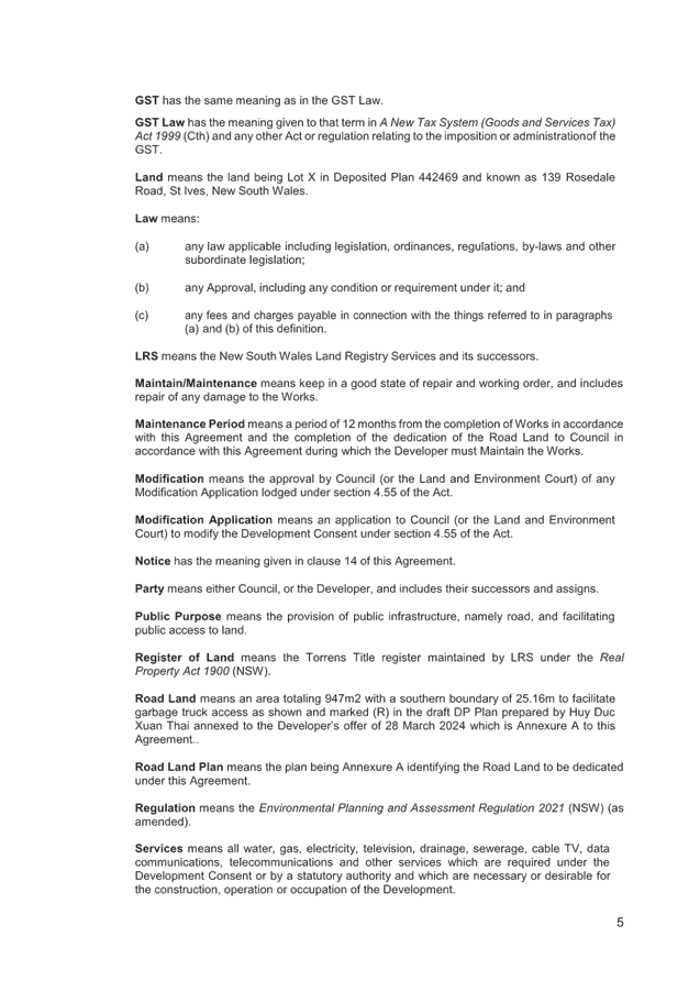
|
Ordinary
Meeting of Council - 13 August 2024
|
NM.1 / 1
|
|
|
|
|
Item
NM.1
|
EM00043/7
|
Mona
Vale to Macquarie Park priority Bus Infrastructure
Notice of Motion from Councillor Kay dated
25 July 2024
Within the Ku-ring-gai Local Strategic Planning Statement
(2020), there is Ku-ring-gai Local Planning Priority K3: Providing housing
close to transport, services and facilities to meet the existing and future
requirements of a growing and changing community. Actions within this Planning
priority include implementing planning responses in St Ives subject to
infrastructure improvements (medium-long term). Future growth in St Ives was
subject to provision of priority bus infrastructure from Mona Vale to Macquarie
Park.
This is related to Ku-ring-gai Local Planning Priority K22:
Providing improved and expanded district and regional connections through a
range of integrated transport and infrastructure to enable effective movement
to, from and within Ku-ring-gai. Actions in this Planning Priority include
advocating to Transport for NSW to increase priority and accelerate the
delivery of infrastructure improvements identified in Future Transport 2056
that connects Ku-ring-gai internally and with nearby centres, including
improvements to bus connections from Mona Vale to Macquarie Park, and Dee Why
to Chatswood (followed by Bus Rapid Transit).
Macquarie Park Strategic Infrastructure and Services
Assessment (SISA) Final Report (Greater Cities Commission, 2022) identifies the
proposal for Mona Vale to Macquarie Park public transport improvements for
rapid services, with a delivery timeframe of 2027-2035.
In September 2023, Transport for NSW provided an update on
the of future frequent bus services and Rapid Bus Line between Mona Vale and
Macquarie Park. TfNSW stated that it is planning a frequent bus service which
will operate between Mona Vale and Macquarie Park (circa 2030) and then
enhancing to a Rapid Bus Service (circa 2036) as identified in Future
Transport. However, these service improvements are currently unfunded and the
introduction of a Rapid B-Line service would be required to go through a
business case process to secure funding.
In late 2023 a Council submission was made to TfNSW's
Directions for On-Street Transit White Paper, advocating for the accelerated
implementation of the Mona Vale to Macquarie Park rapid bus line. Following
this, in a Summary of Actions in response to the NSW Bus Industry Taskforce's
second report, the NSW Government stated that TfNSW will develop a Medium-Term
Bus Plan in response to the Taskforce’s recommendation for a focus on 10
high-quality rapid routes, 27 frequent routes and other improvements to local
services, but it is unclear if the Mona Vale - Macquarie Park Rapid Bus Line
forms part of the Plan. There has been no clarification since the NSW budget
was handed down in June.
The Macquarie Park TOD rezoning proposal (NSW Government,
2024) – Infrastructure Delivery Plan references the Macquarie Park SISA
and identifies new strategic bus corridor and bus priority facilities as being
funded by primarily by State or Commonwealth Budget Allocation and potentially
by Housing and Productivity Contributions. The infrastructure lists at the end
of the Plan identify the delivery of Mona Vale to Macquarie Park public
transport improvements (Mona Vale - Macquarie University Rapid route) by 2036.
With the acceleration of development around Macquarie Park and St Ives as a
consequence of impending Low and Mid-rise SPP policy changes, rapid bus
services and between Mona Vale and Macquarie Park and associated infrastructure
are required in 2024, not 2036.
I move that:
A. Council
write to the Minister for Transport and the NSW Premier seeking to accelerate
the implementation of the proposal for Mona Vale to Macquarie Park public
transport improvements for rapid services.
B. That
Council write to the Shadow Minister for Transport and Roads and Infrastructure
and the Member for Davidson advising them of Council’s decision and
including a copy of this Notice of Motion as background.
Recommendation:
That the above Notice of Motion as printed be adopted.
|
Councillor Christine Kay
Councillor for St Ives Ward
|
|
|
Ordinary
Meeting of Council - 13 August 2024
|
NM.2 / 1
|
|
|
|
|
Item
NM.2
|
S13467
|
Possible
Dog Park in Gordon
Notice of Motion from Councillor Lennon
dated 26 July 2024
Council’s 2024/2025 Operational Plan includes
preparation of a masterplan for Pennant Park (the former
Gordon Bowling Club site at 4 Pennant Avenue, Gordon).
I move that staff investigate and consult with residents
about setting aside a small portion of Pennant Park (the former Gordon Bowling
Club at 4 Pennant Avenue, Gordon) to be an unleashed dog area when preparing a
masterplan for the site.
Recommendation:
That the above Notice of Motion as printed be adopted.
|
Councillor Simon Lennon
Councillor for Gordon Ward
|
|