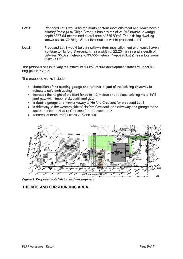
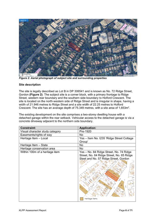
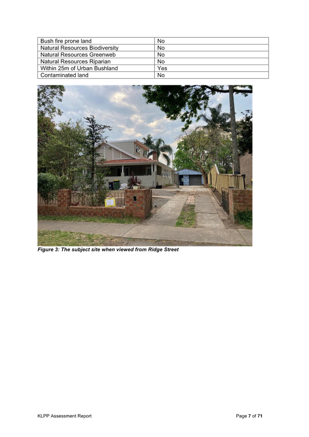
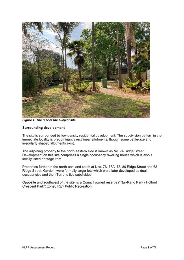
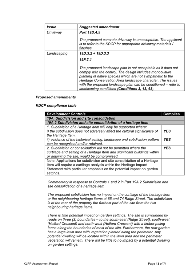
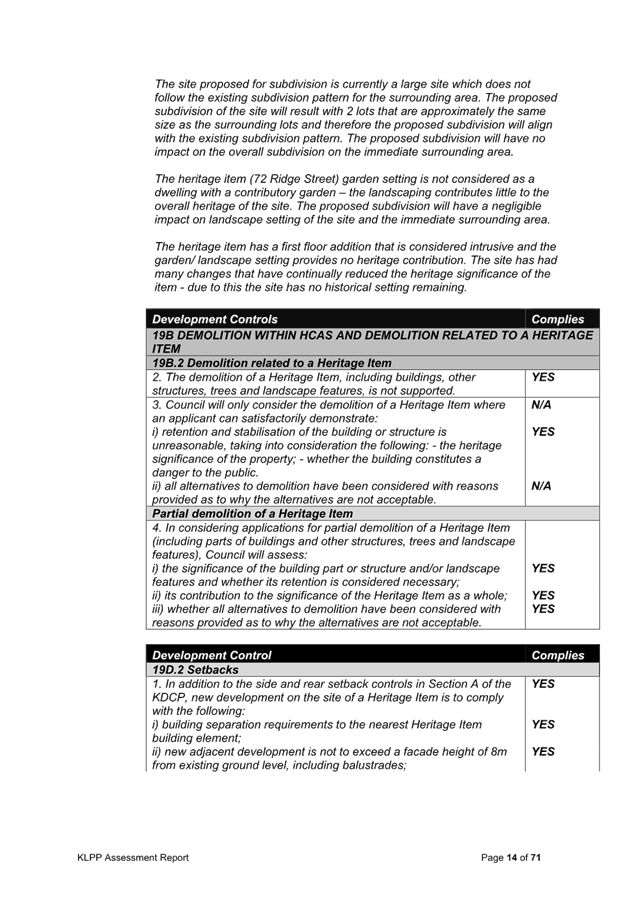
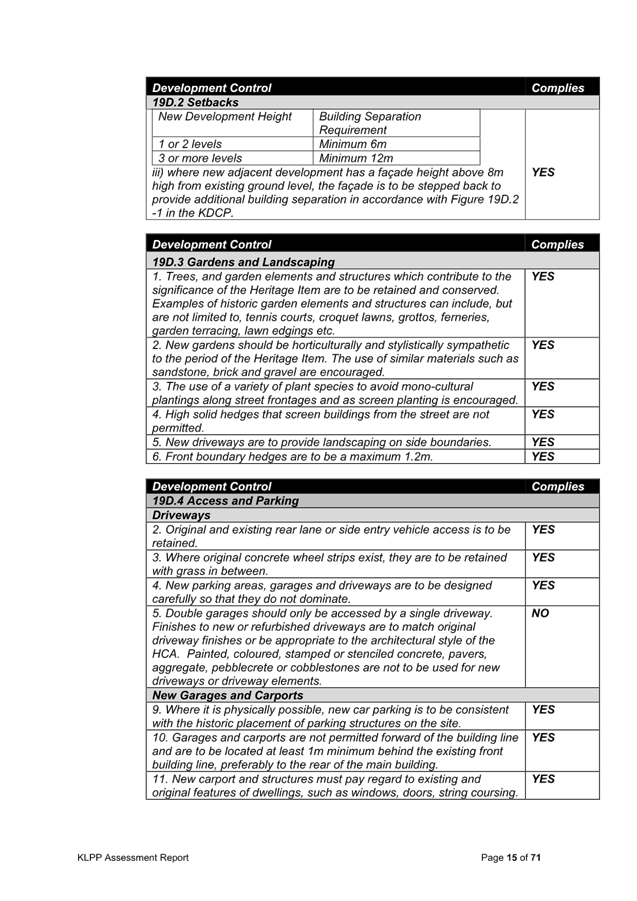
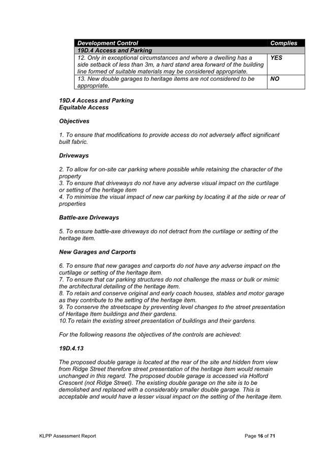
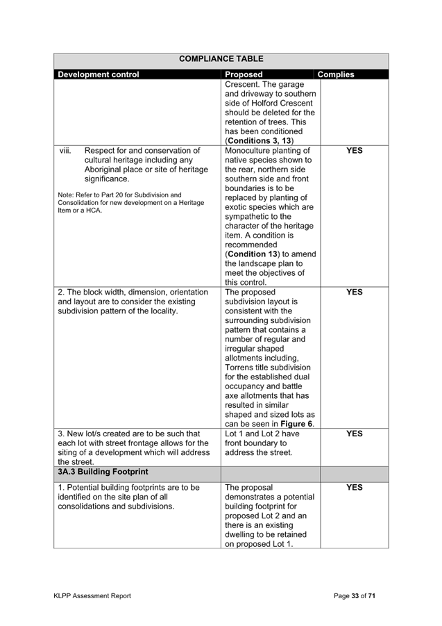
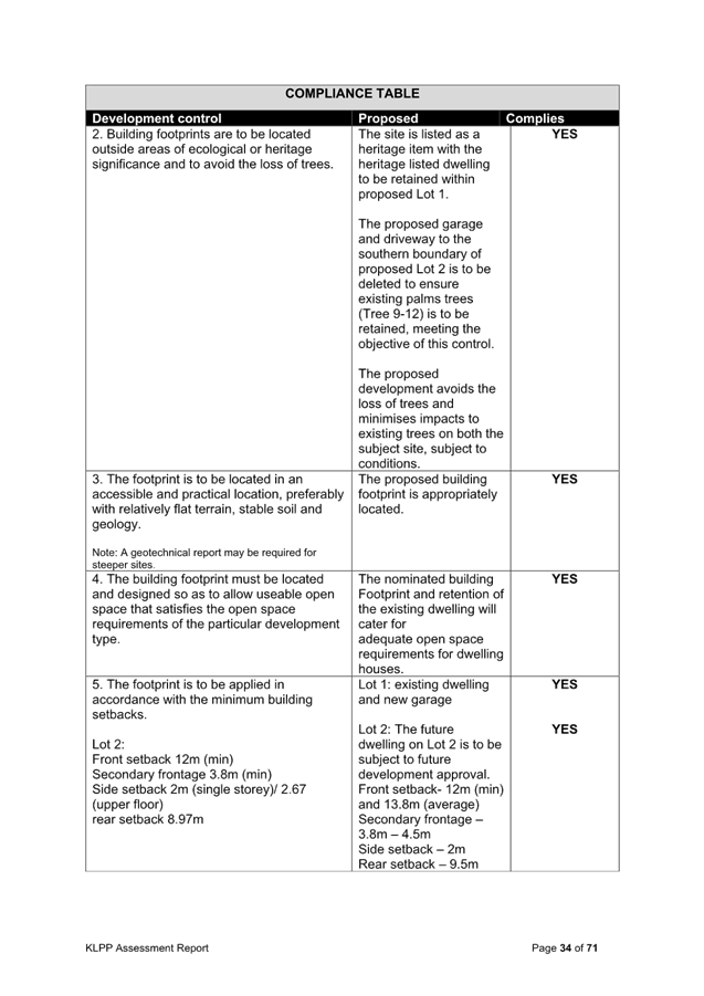
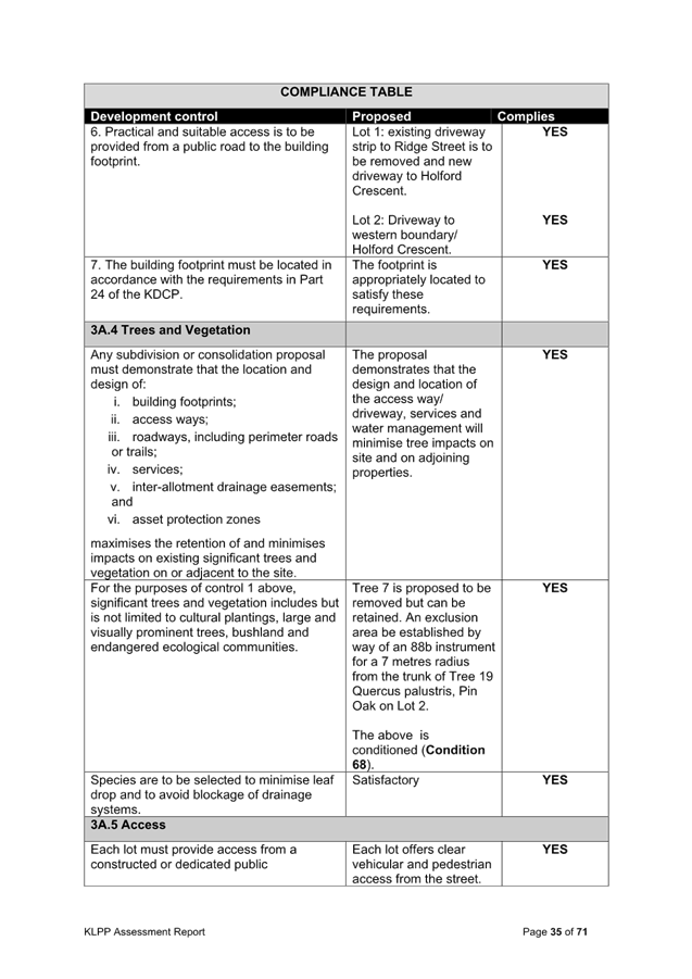
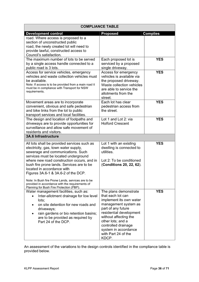
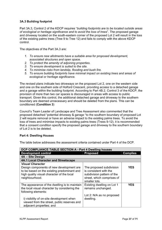
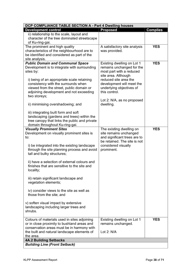
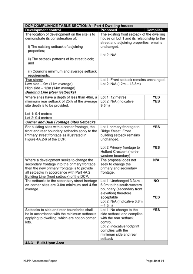
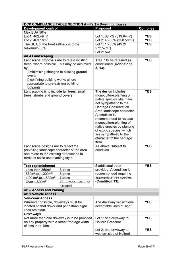
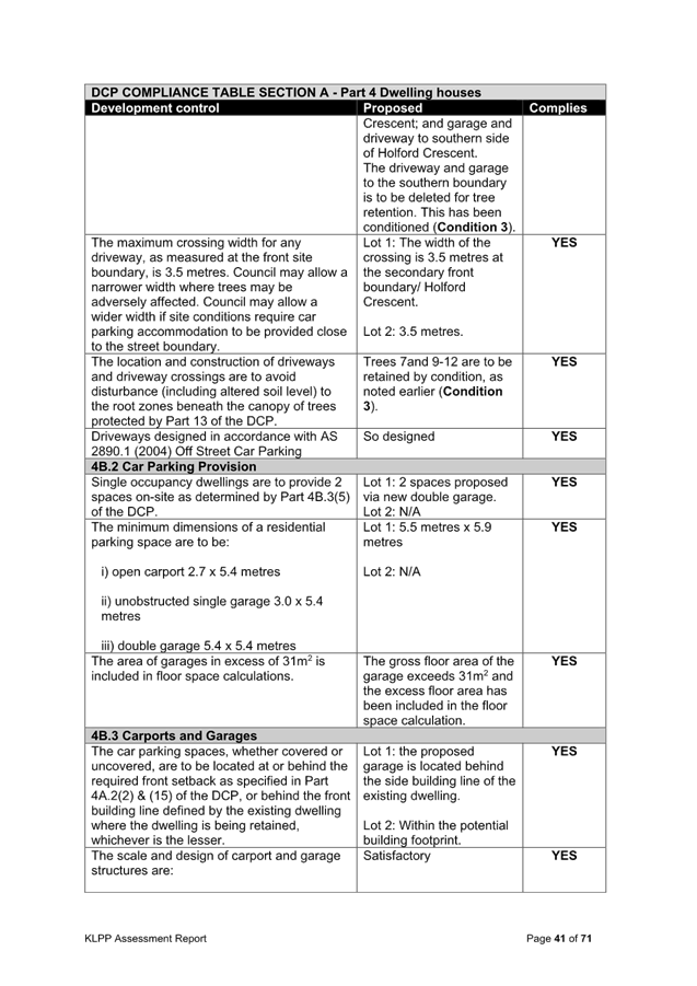
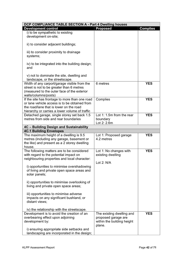
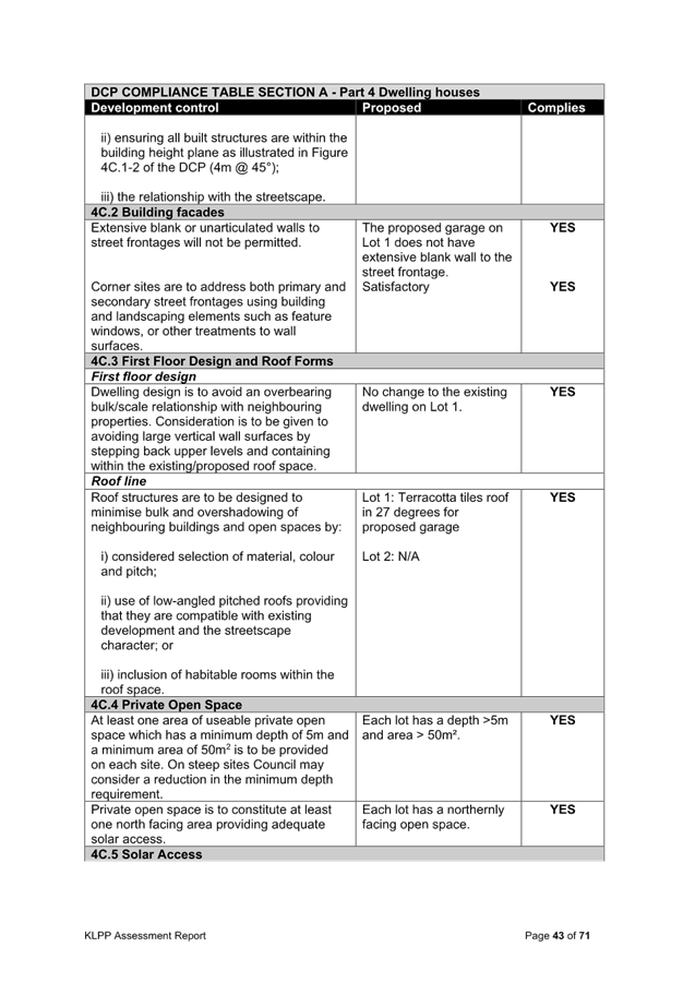
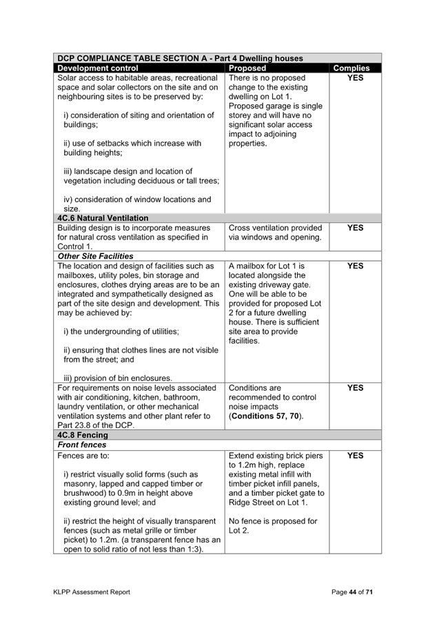
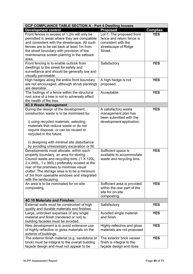
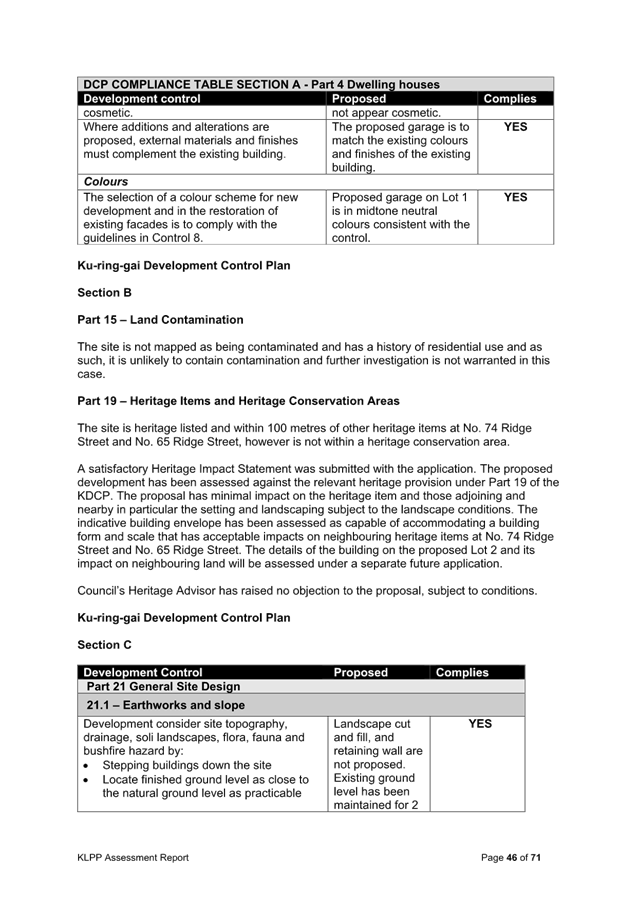
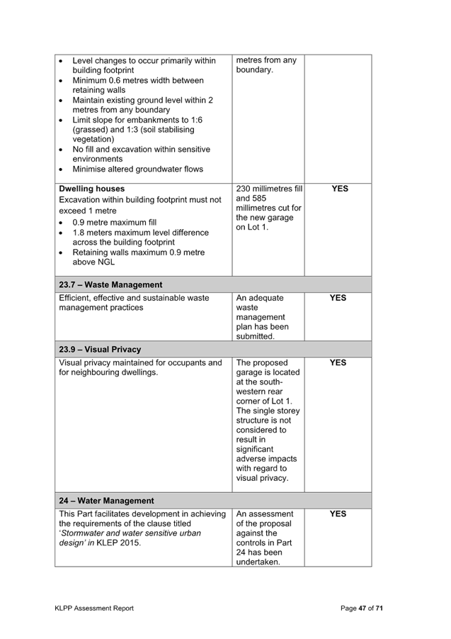
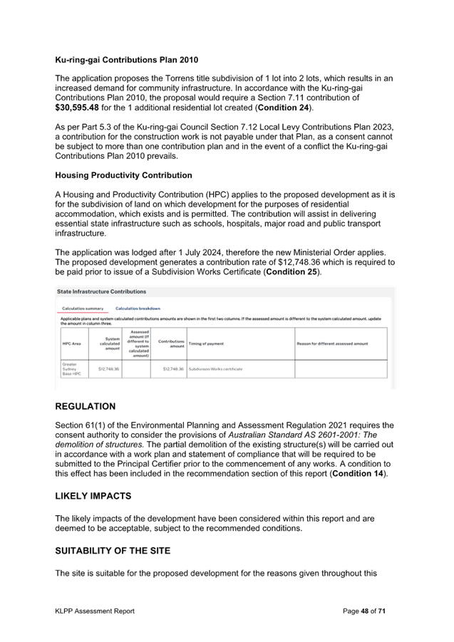
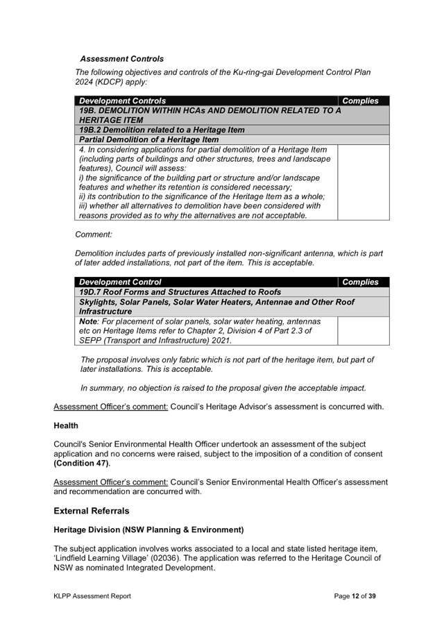
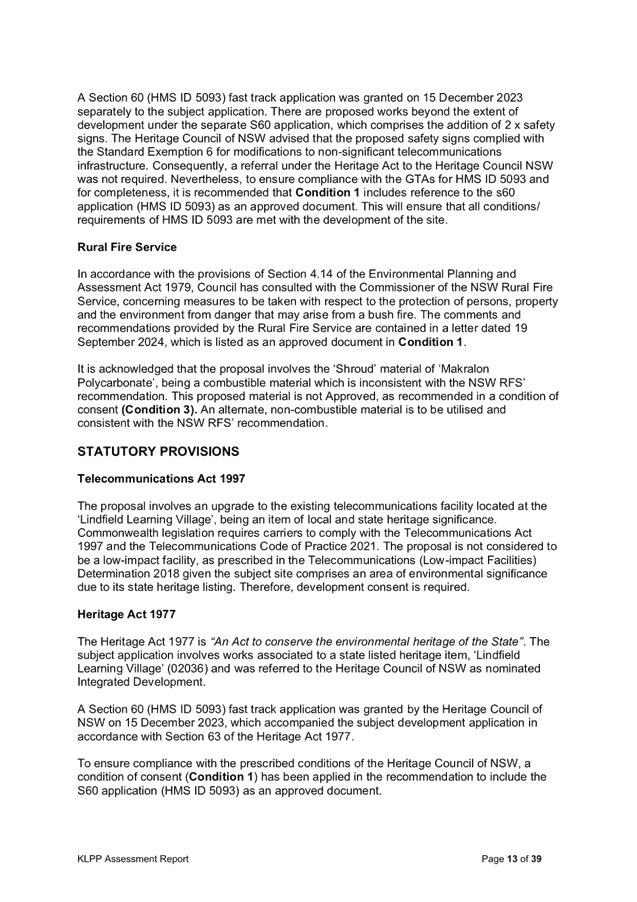
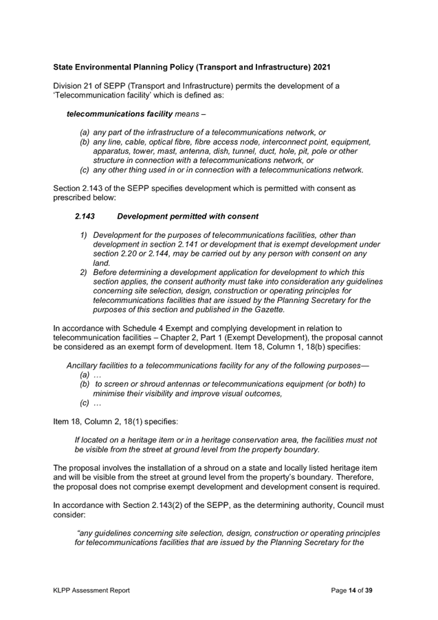
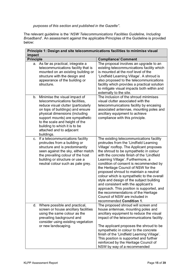
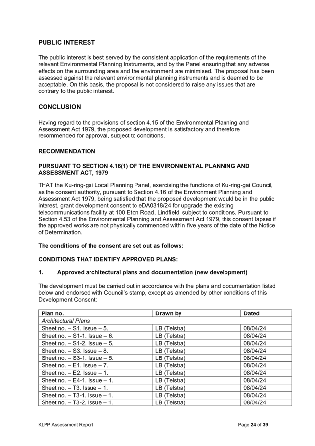
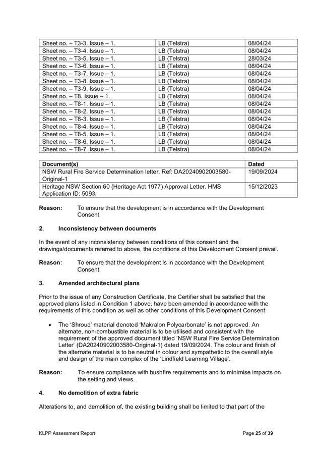
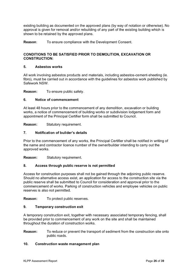
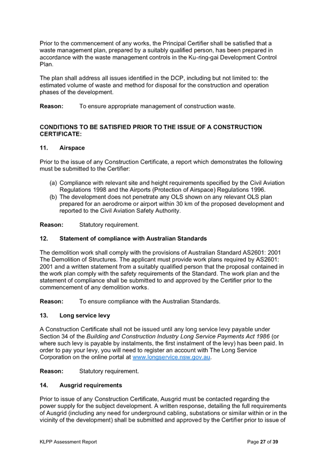
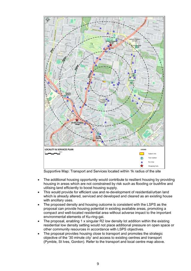
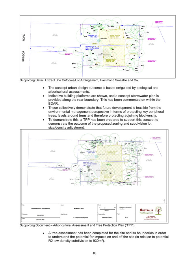
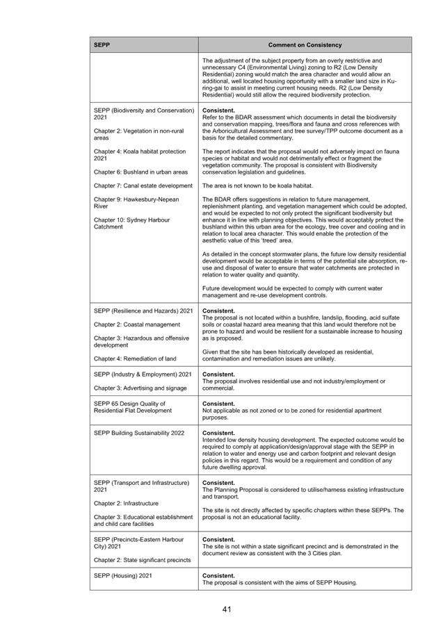
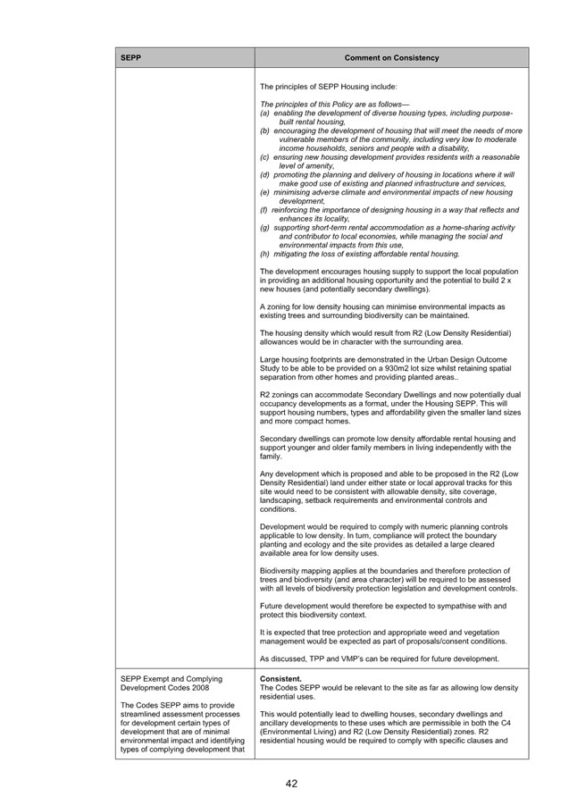
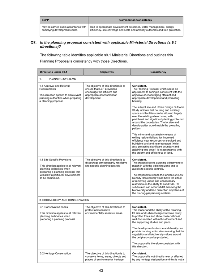
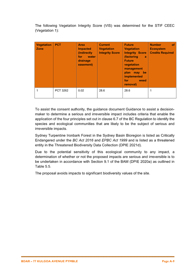
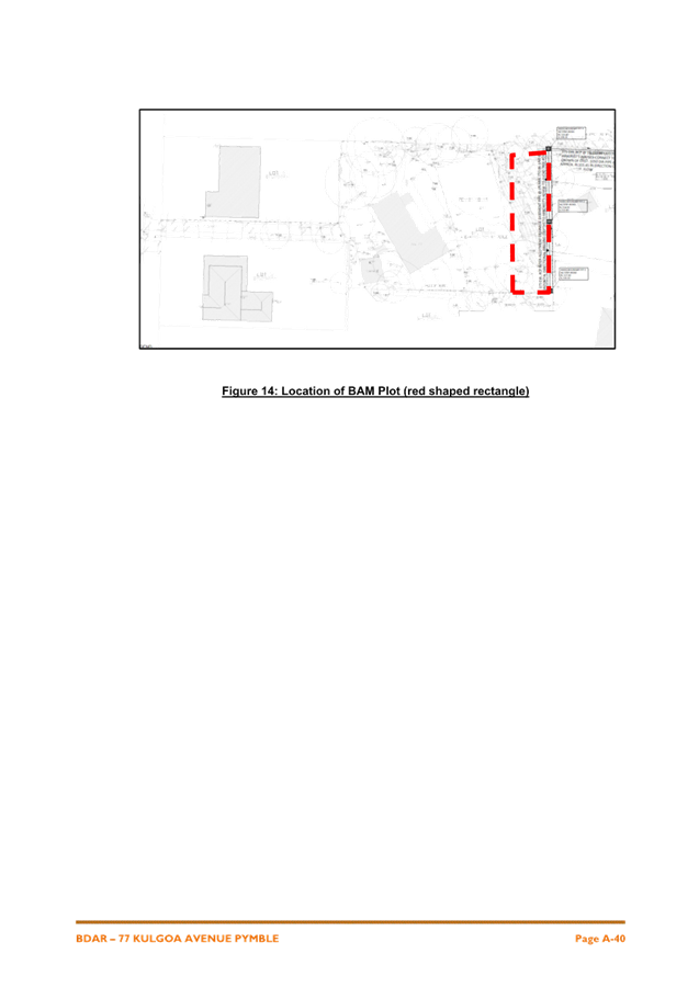
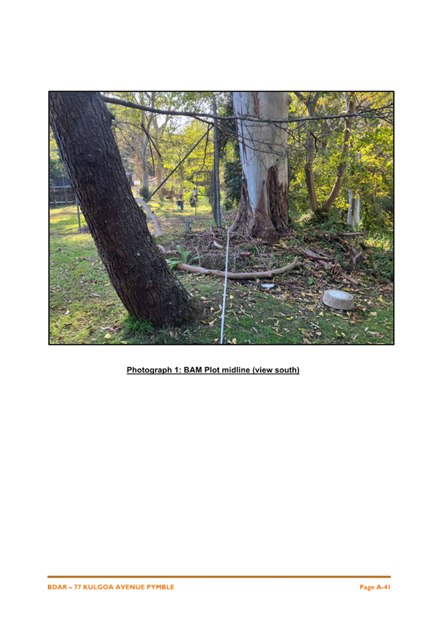
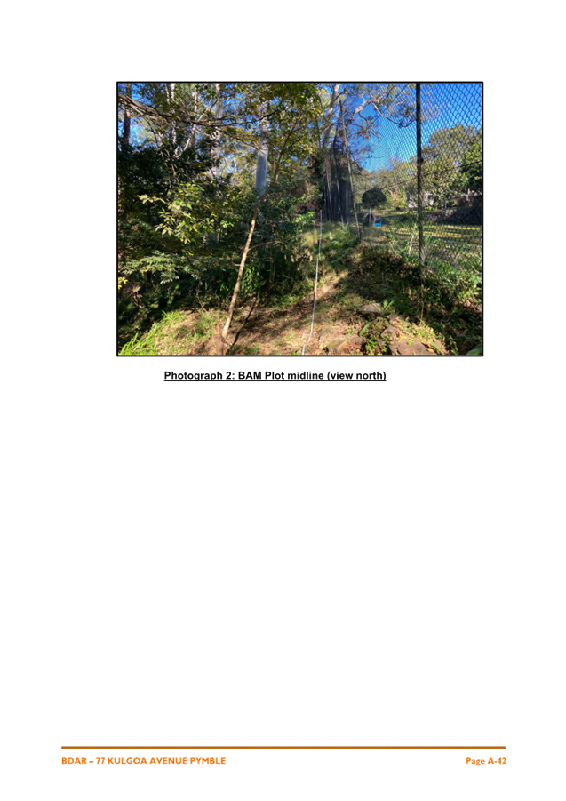
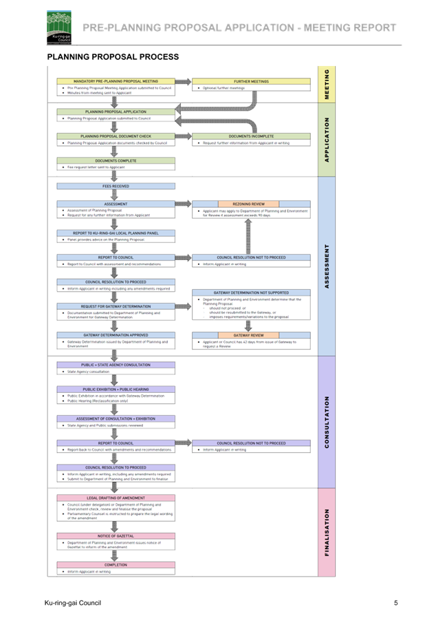
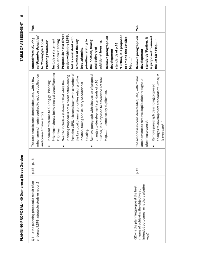
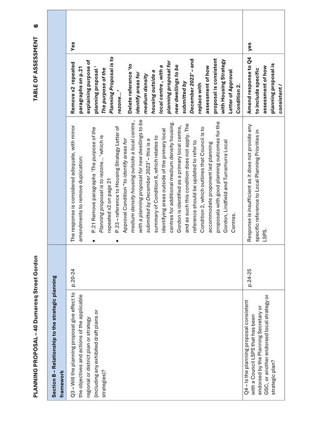
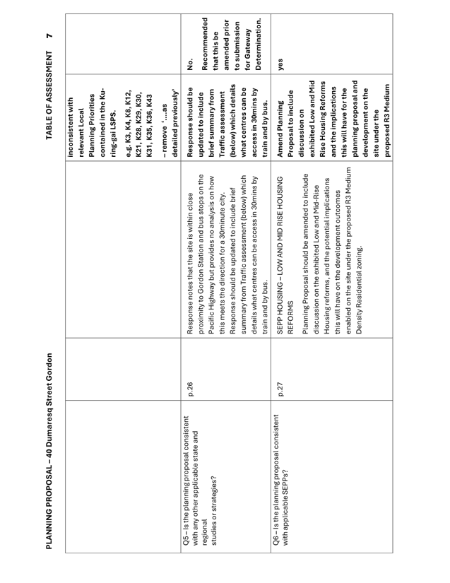
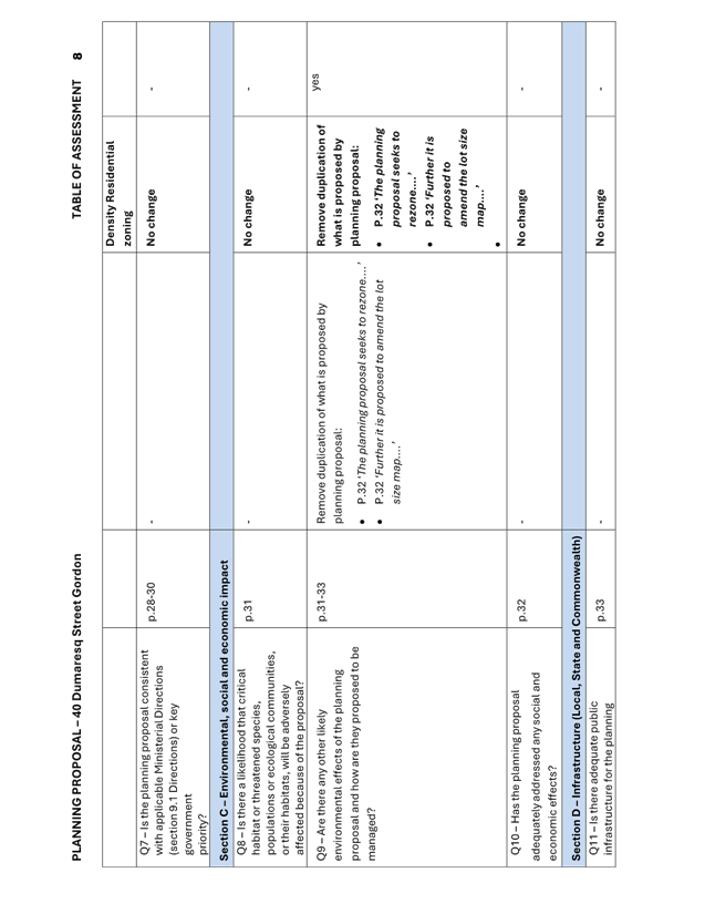
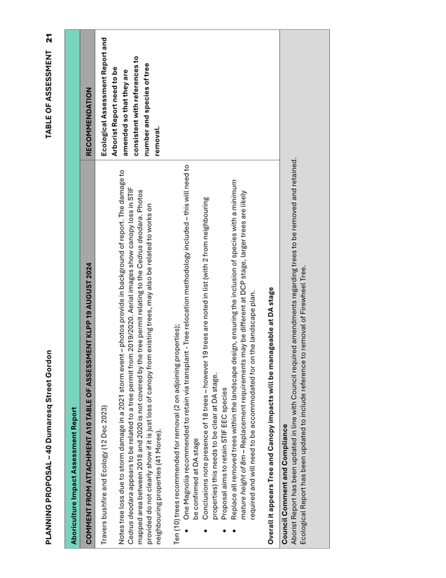
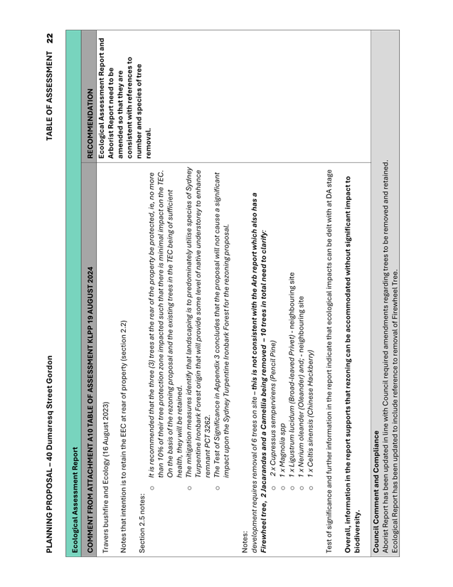
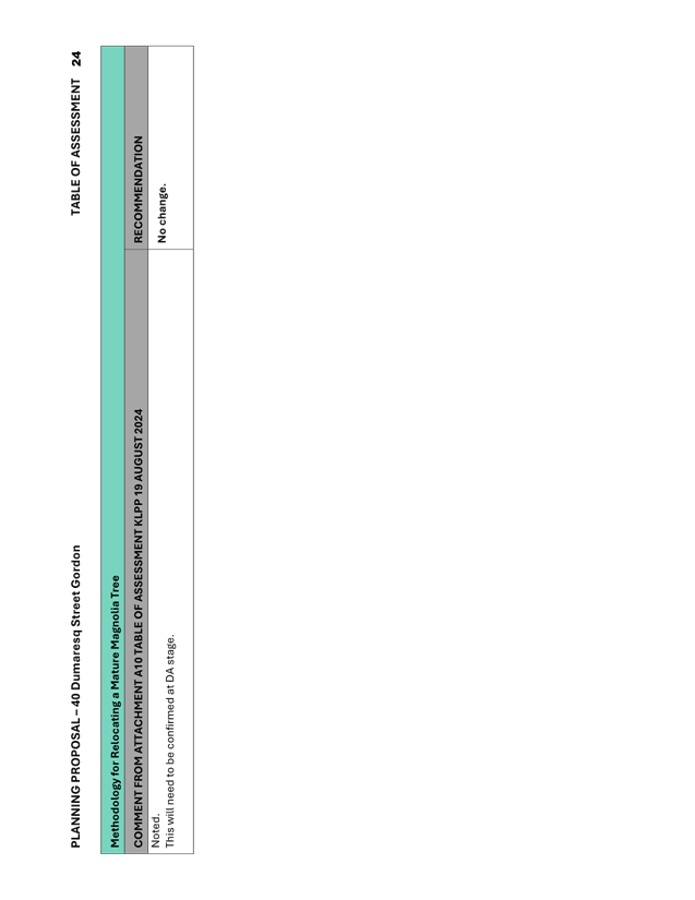
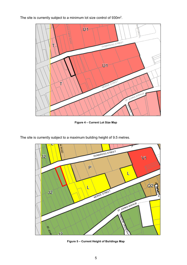
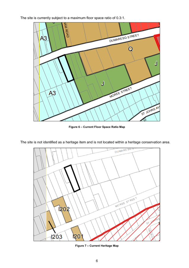
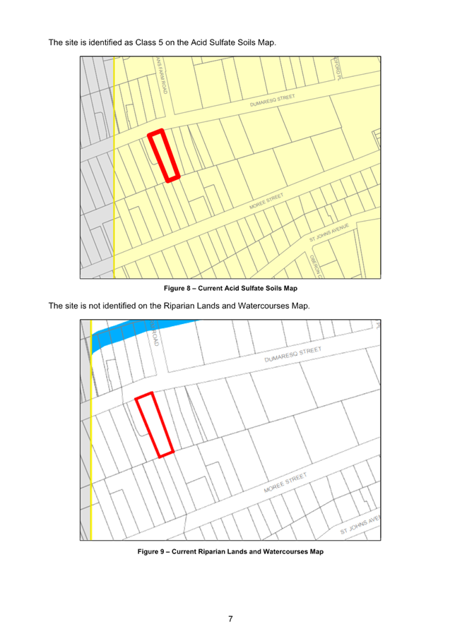
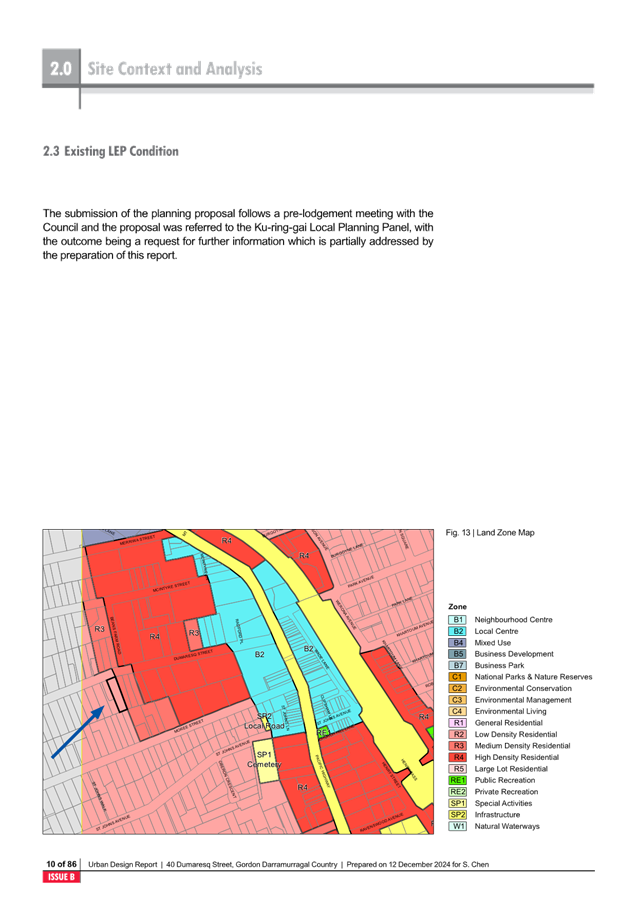
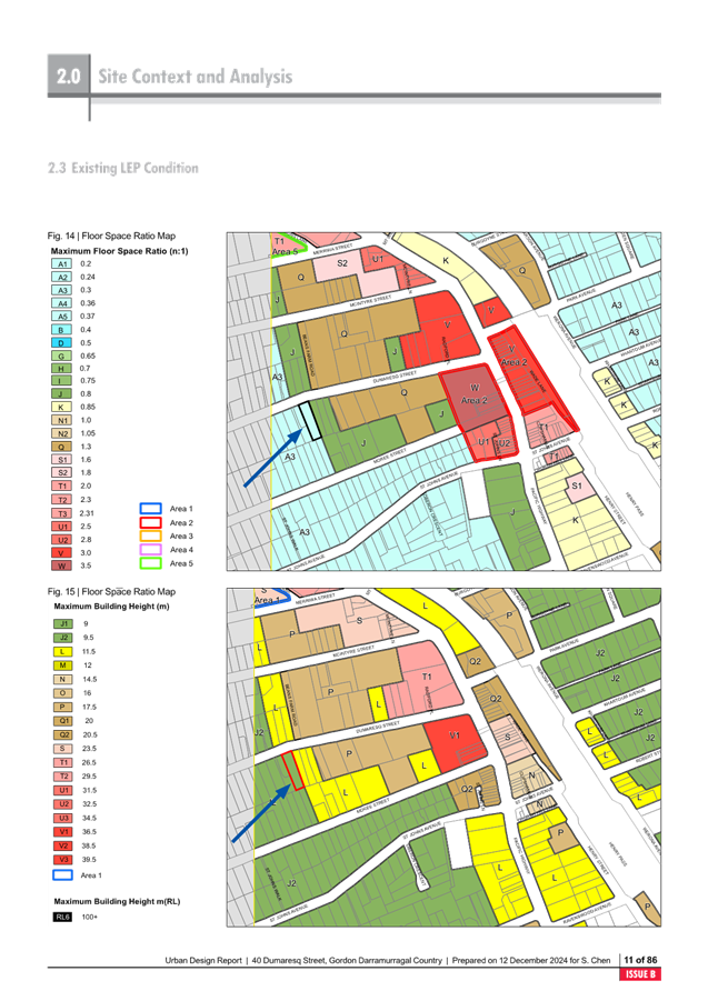
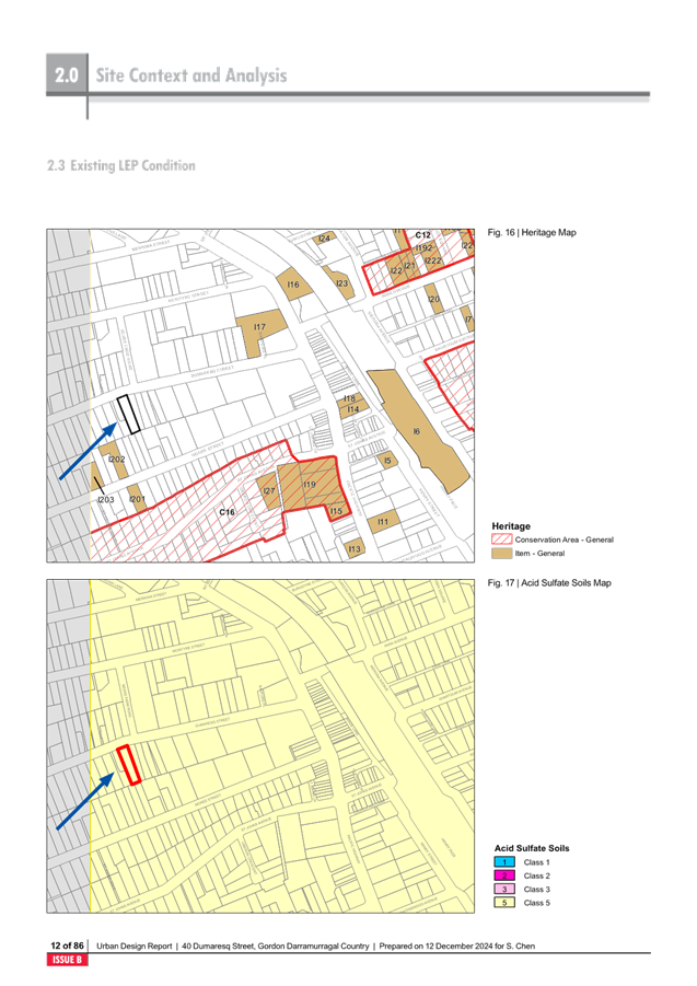
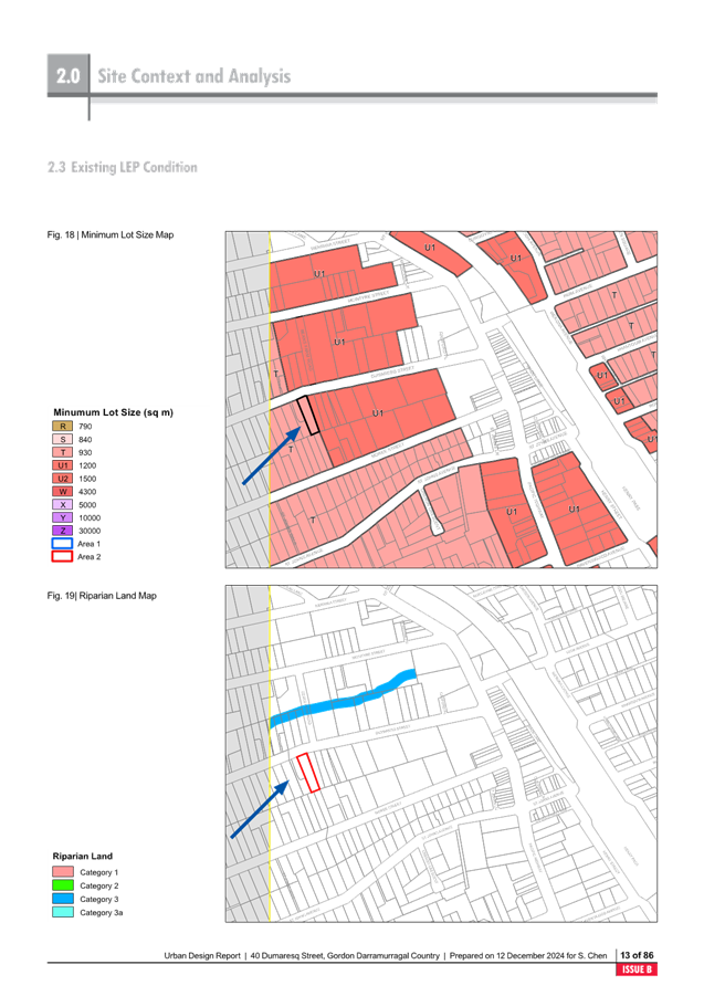
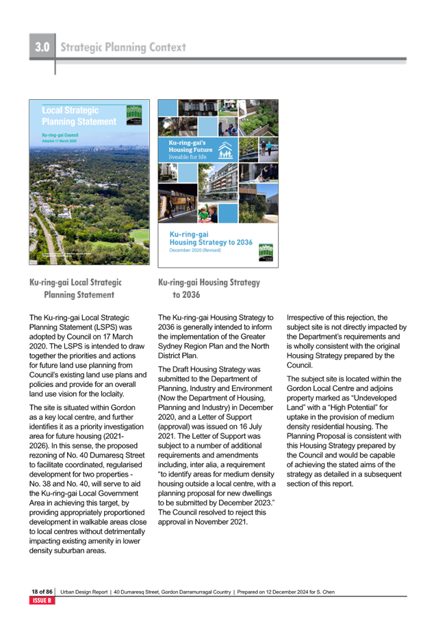
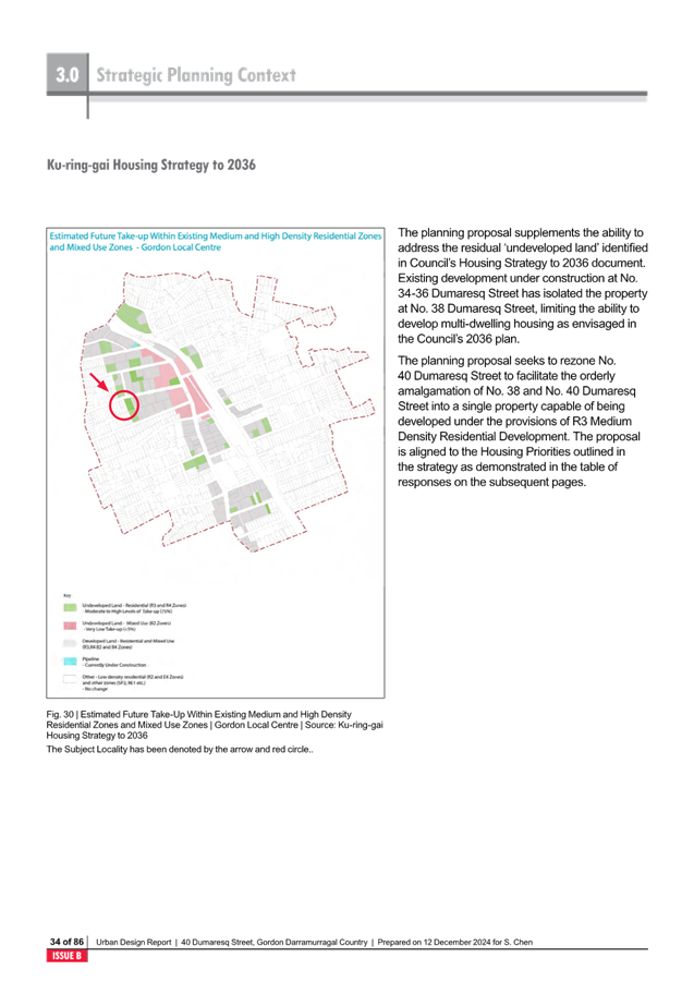
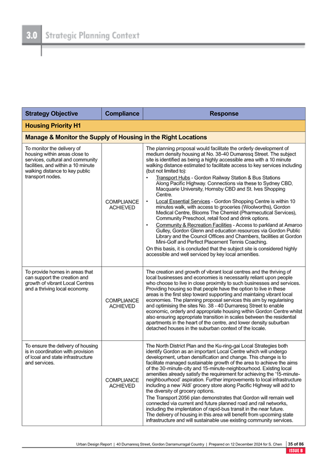
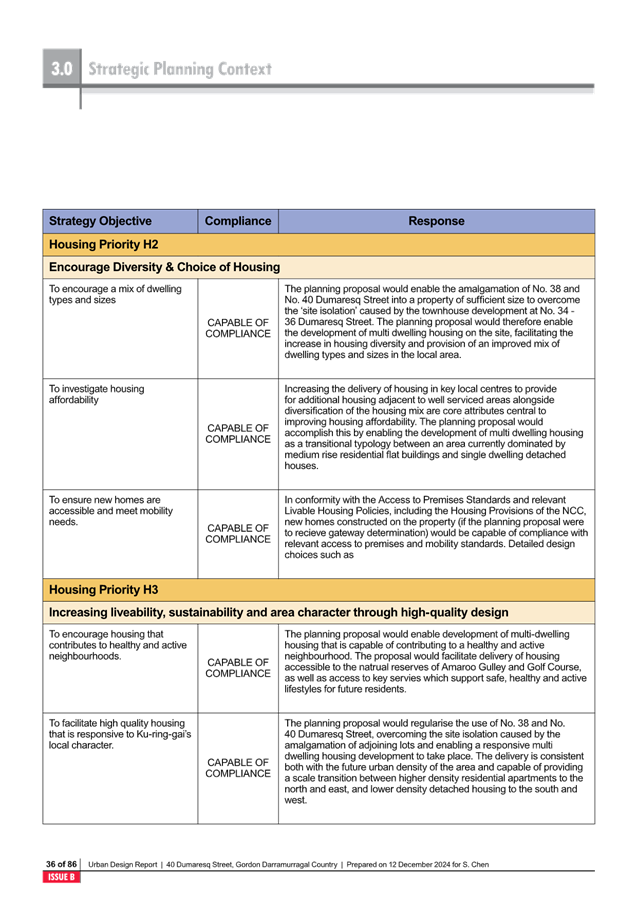
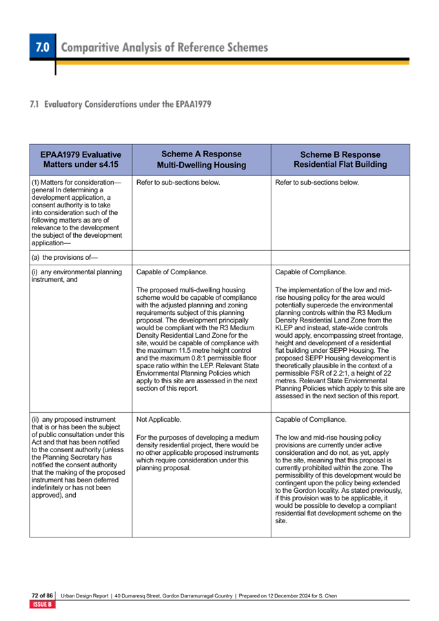
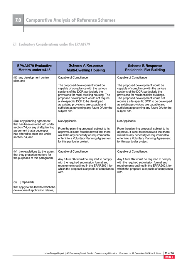
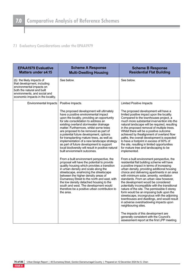
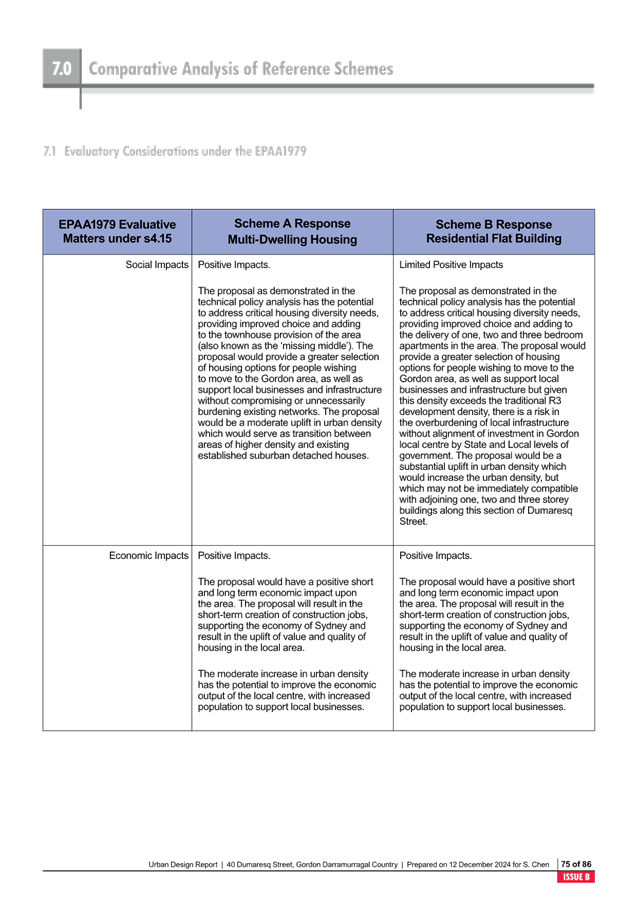
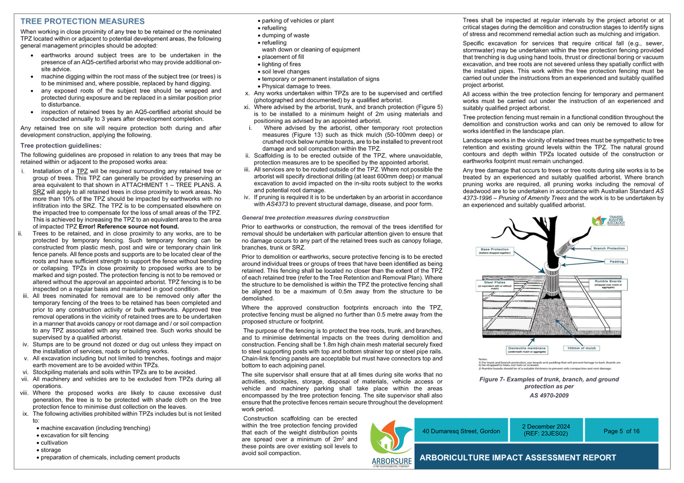
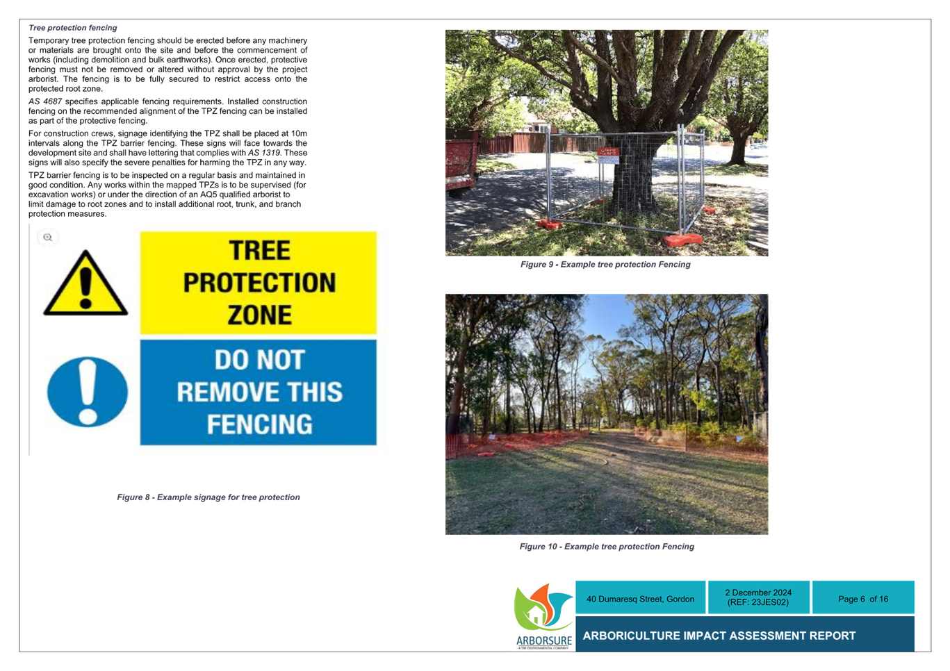
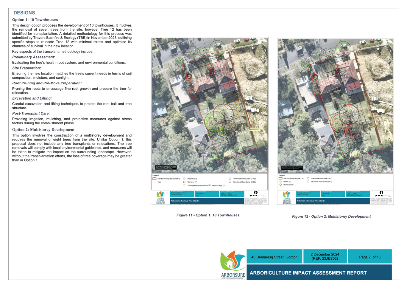
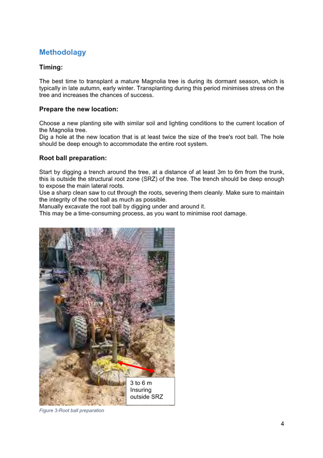
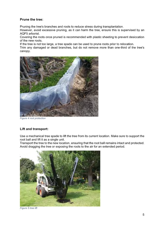
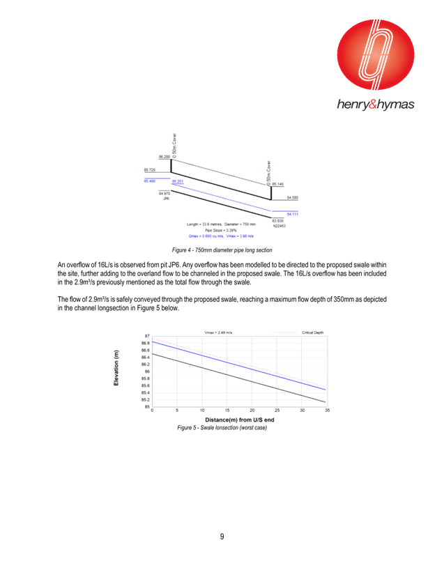
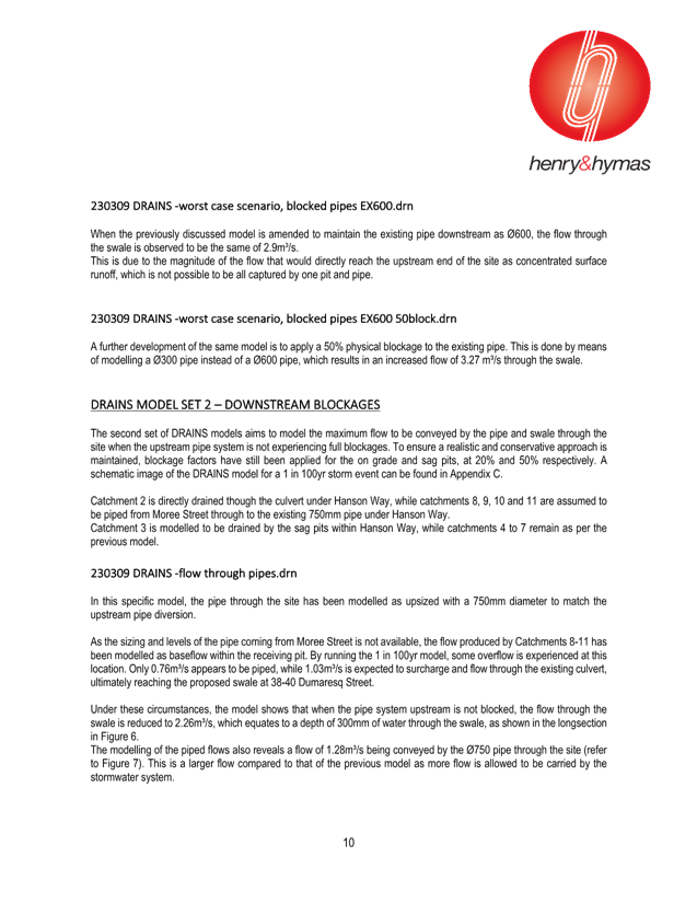
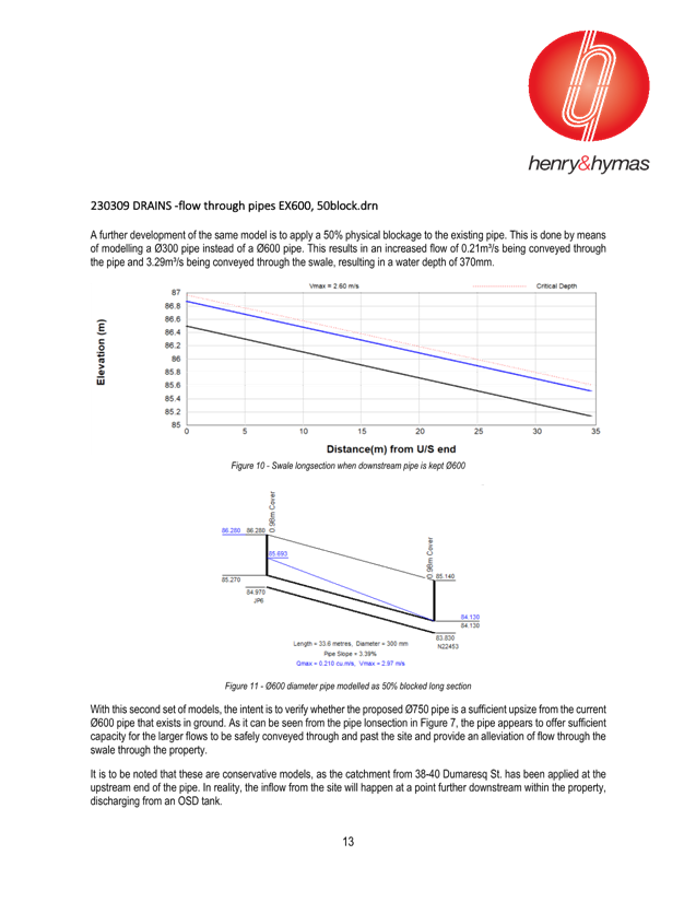
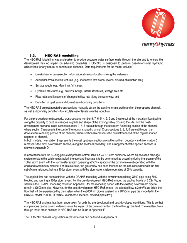
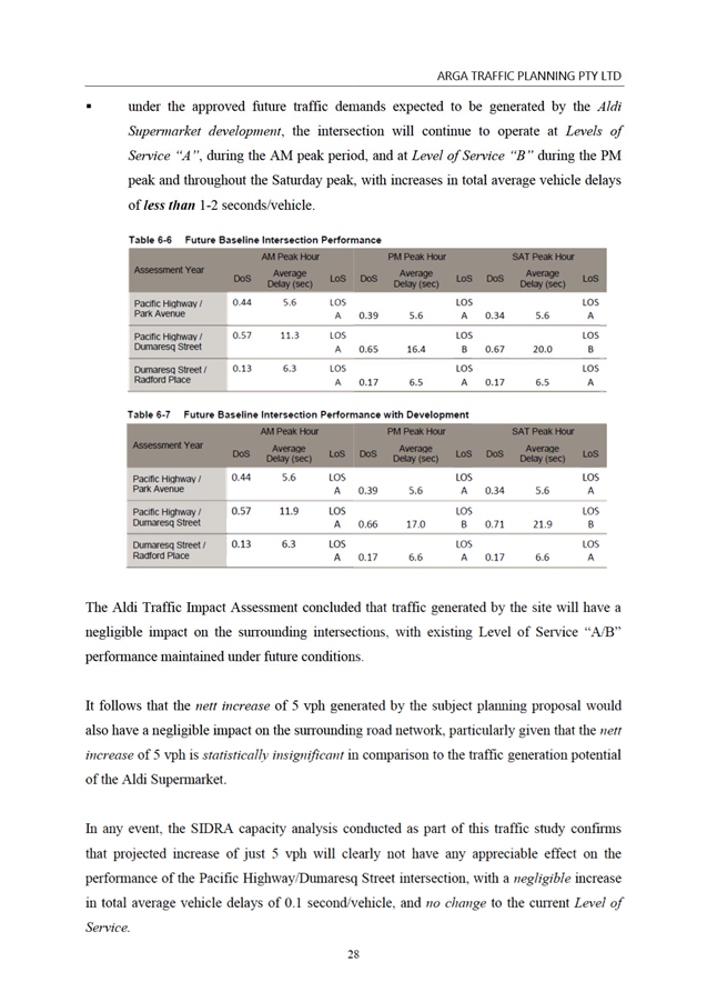
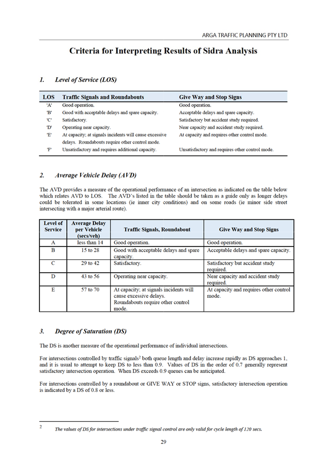
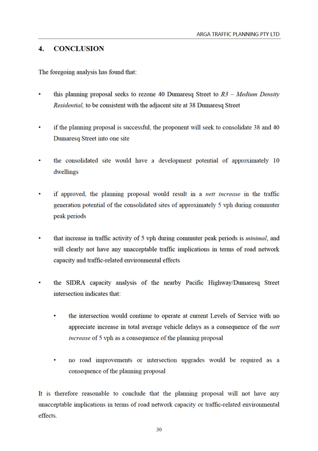
|
Ku-ring-gai
Local Planning Panel Meeting - 17 February 2025
|
GB.3 / 1
|
|
|
|
|
Item
GB.3
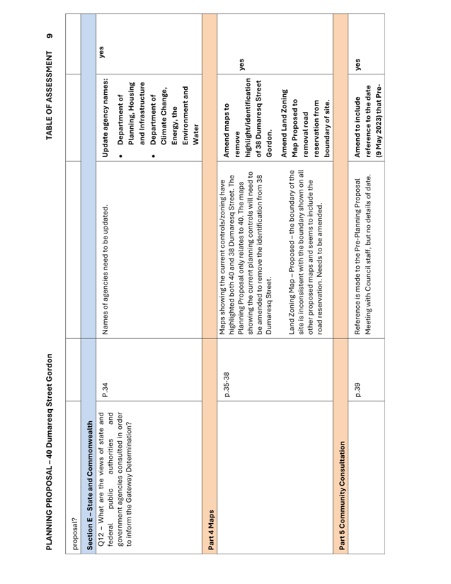
|
S14501
|
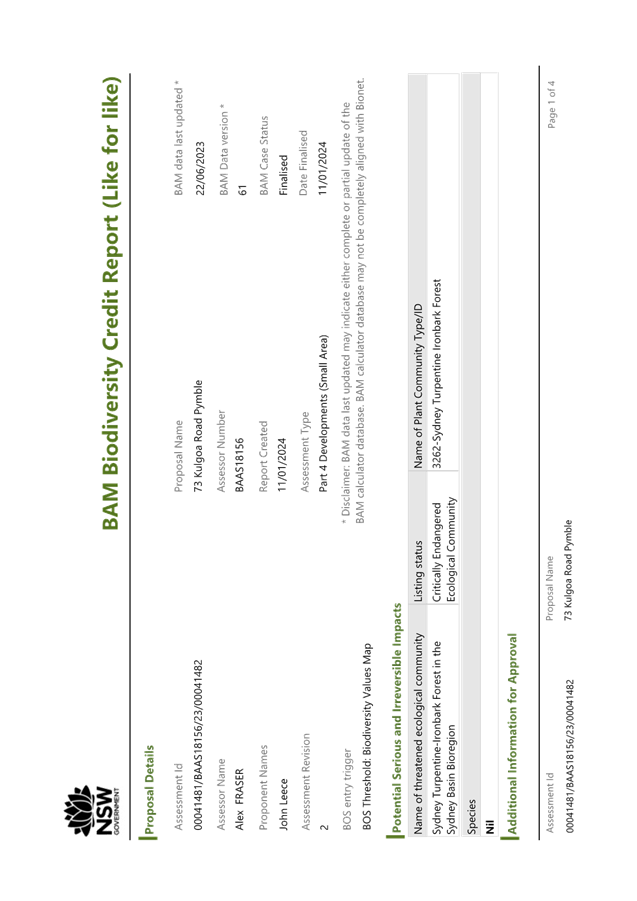
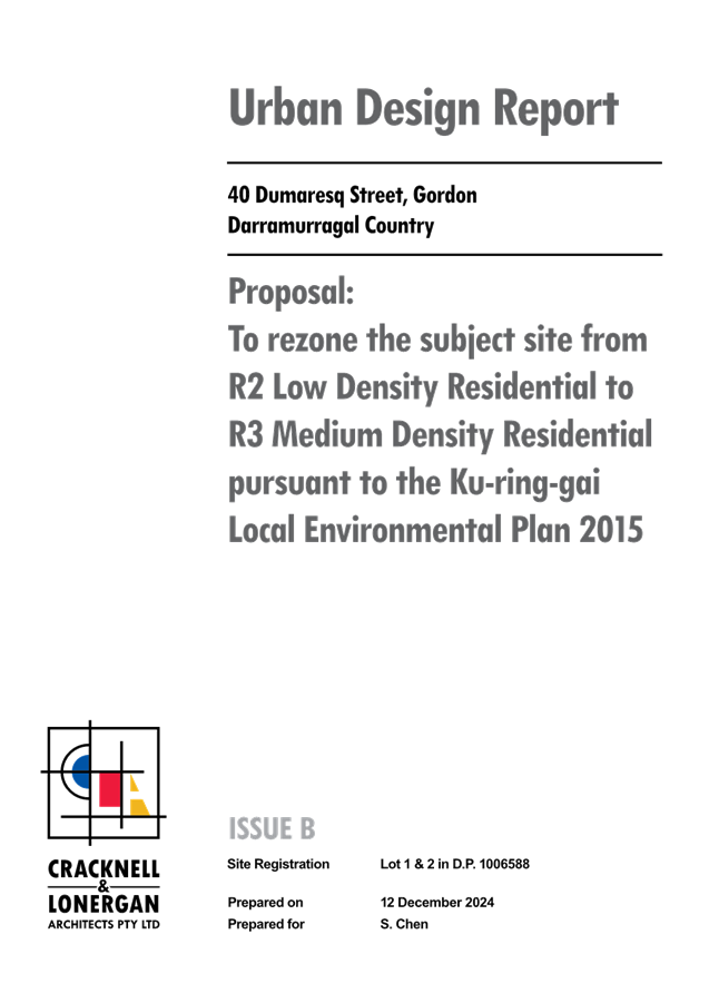
Planning Proposal for 77 Kulgoa Road
Pymble
EXECUTIVE
SUMMARY
Purpose of Report
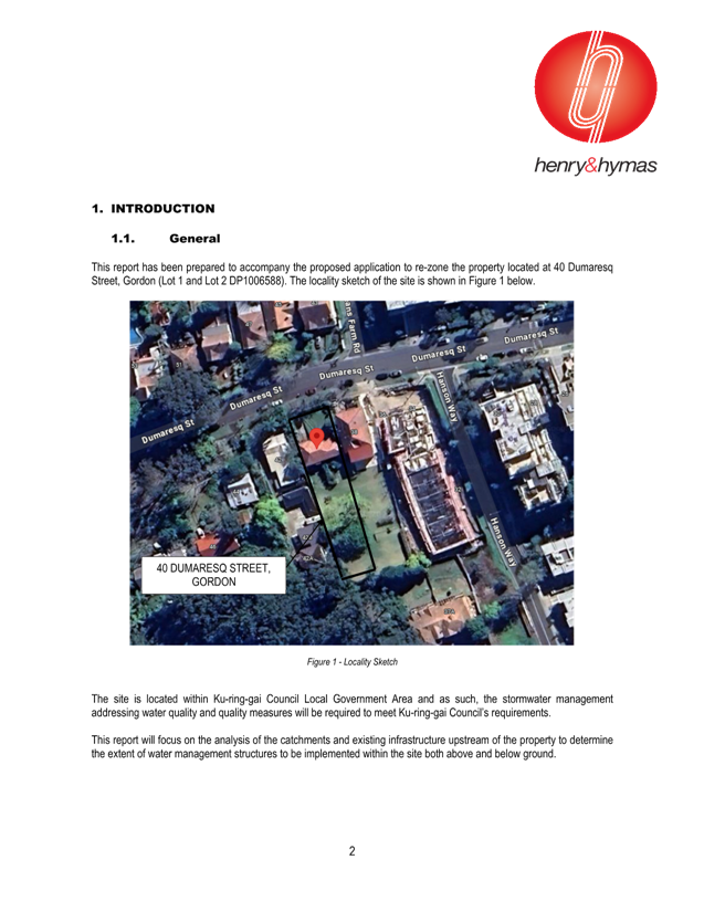
To refer the Planning Proposal for 77 Kulgoa Road, Pymble to
the KLPP for advice as required by the Local Planning Panels Direction –
Planning Proposals issued by the Minister for Planning under Section 9.1 of the
Environmental Planning and Assessment Act 1979.
Background
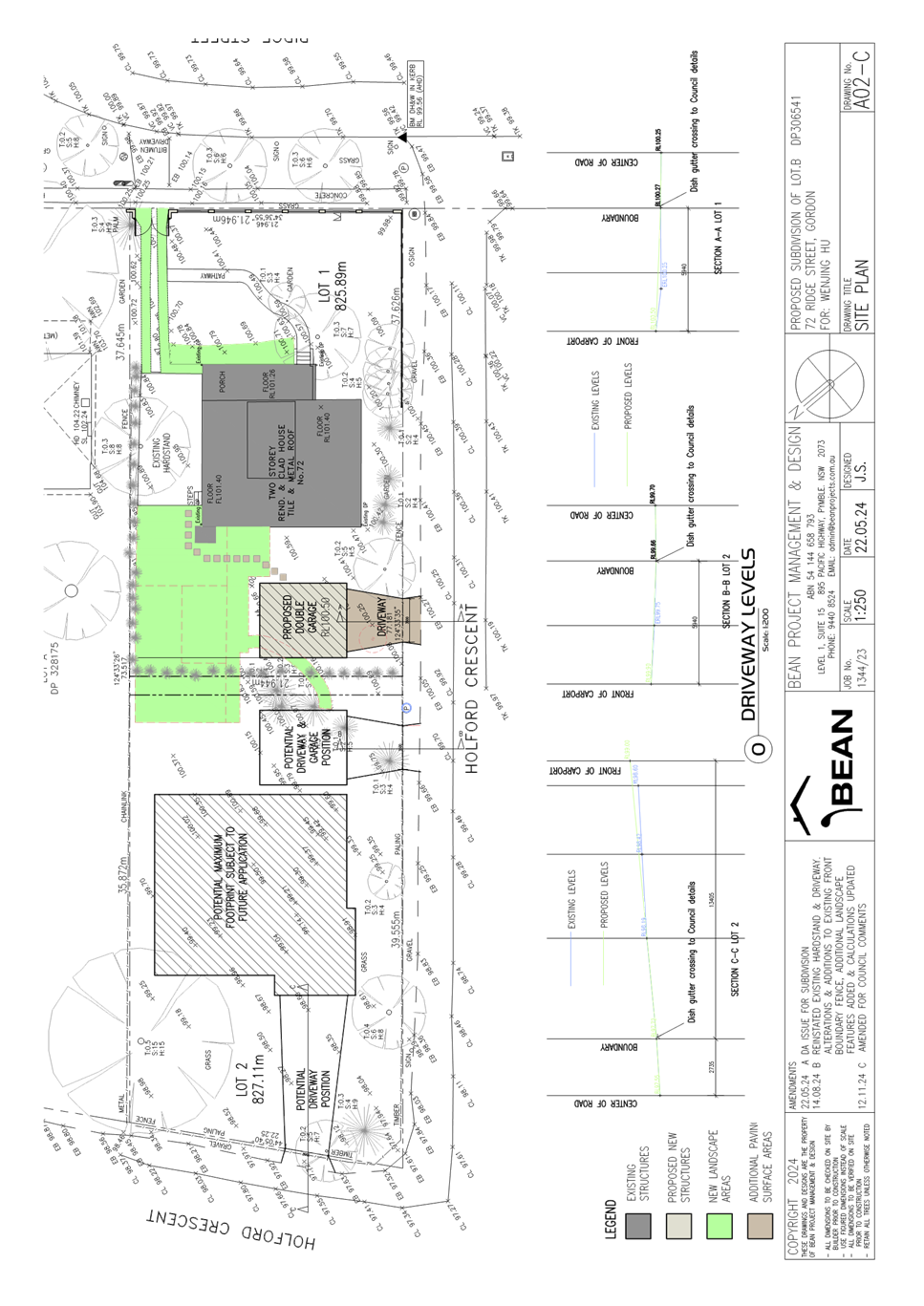
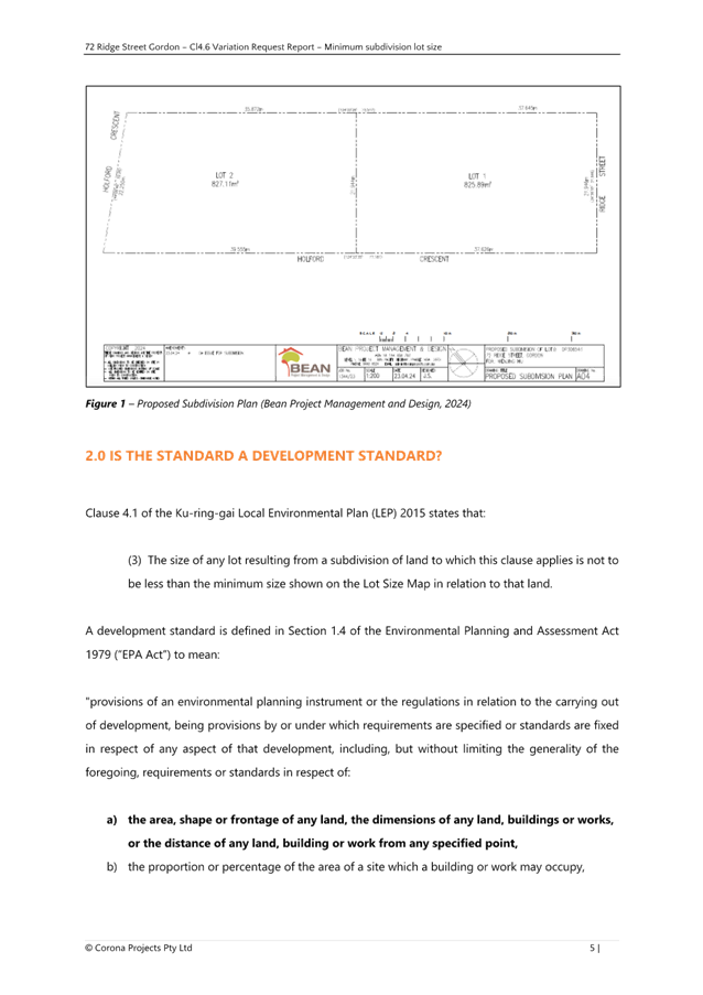
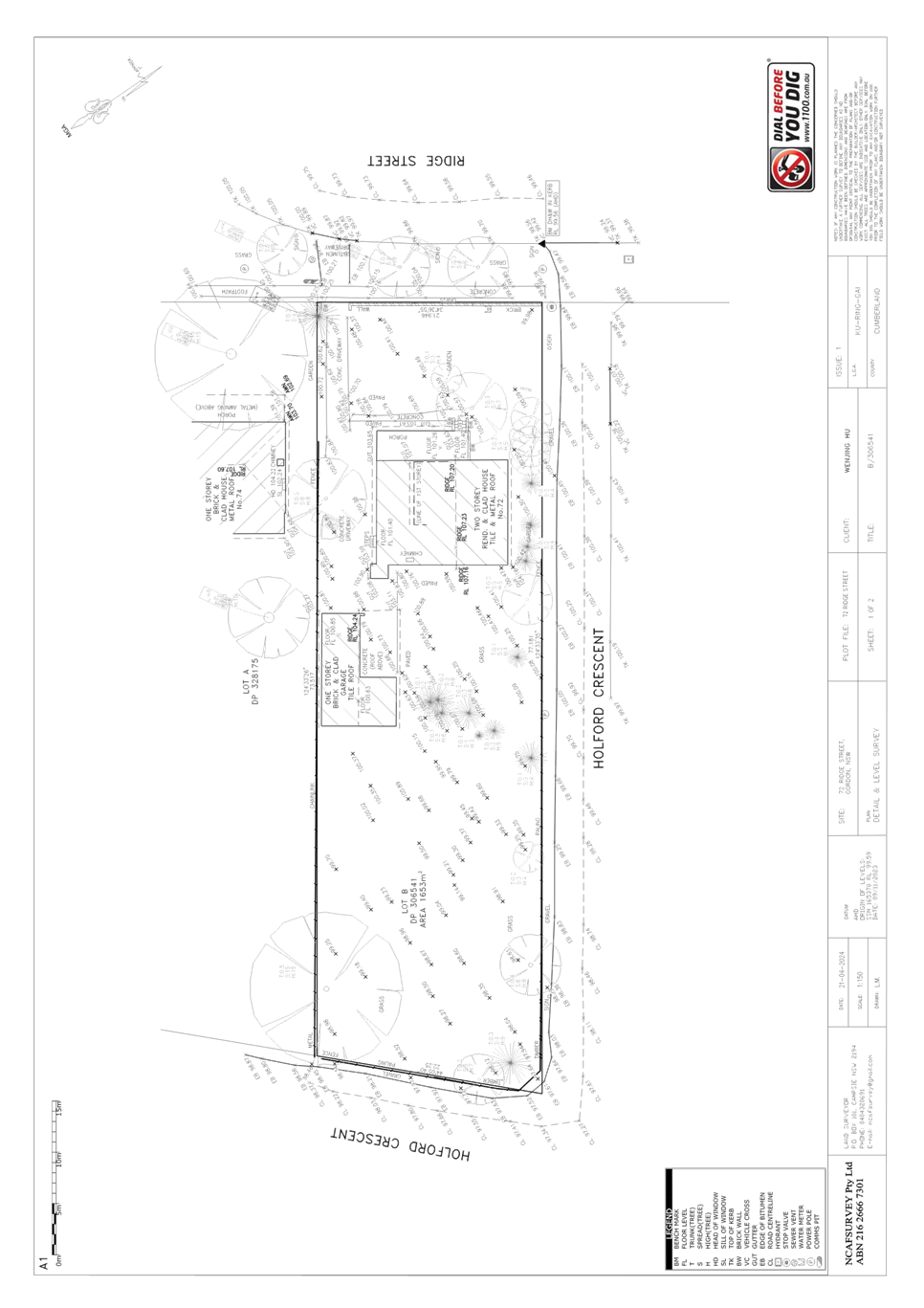
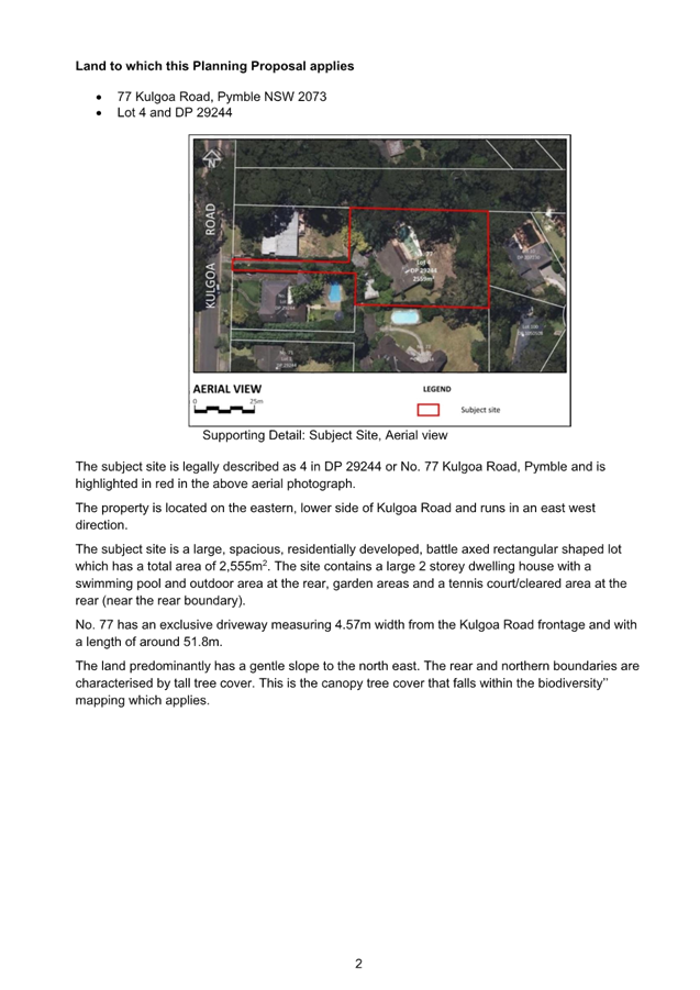
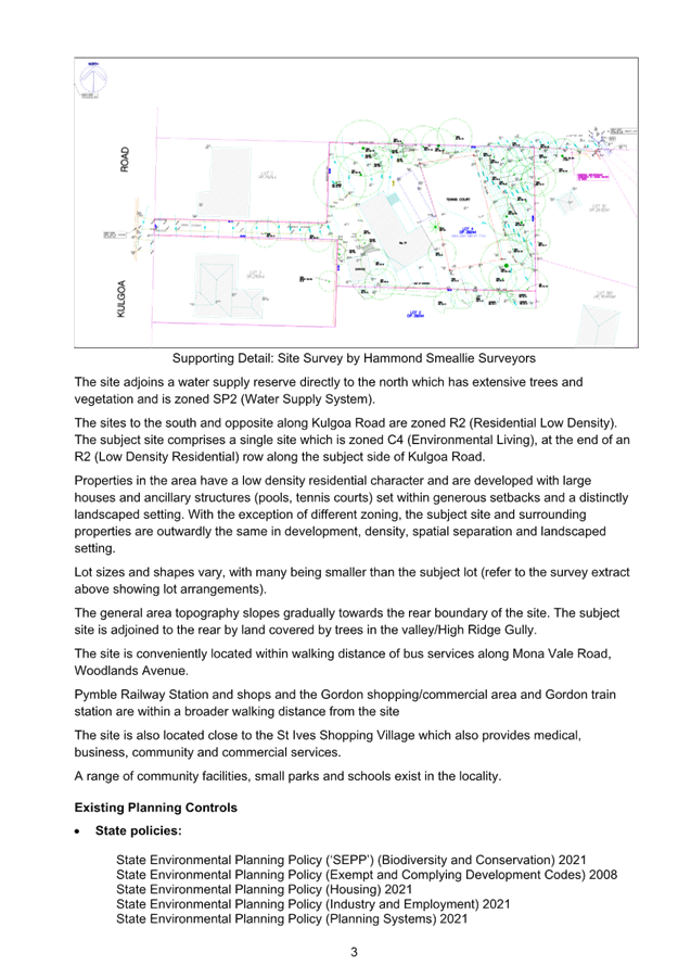
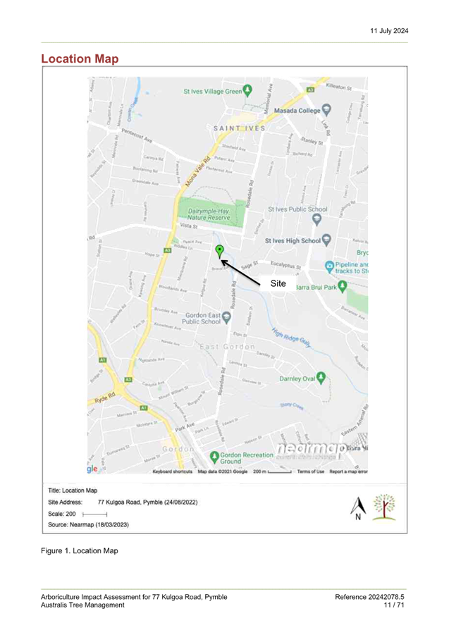
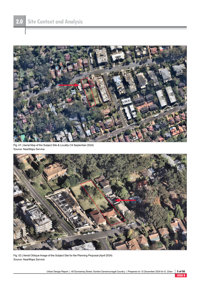
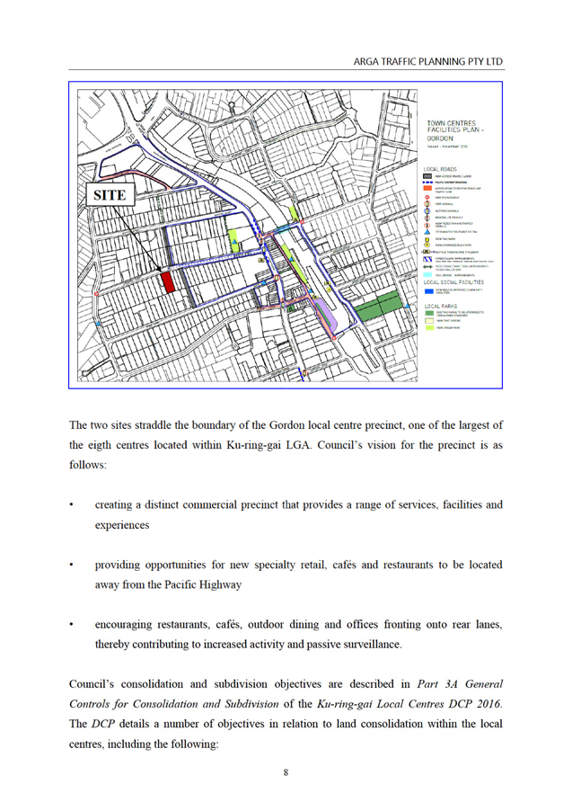
Site Description and Local Context
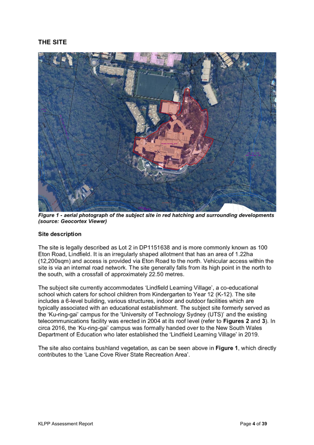
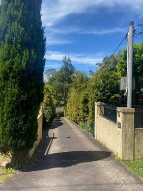
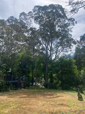
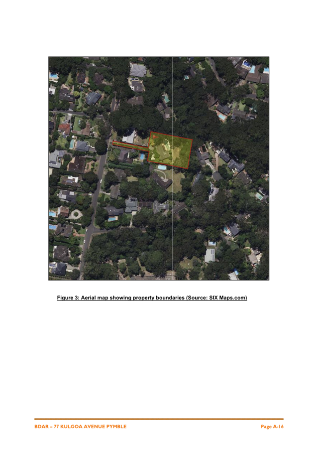
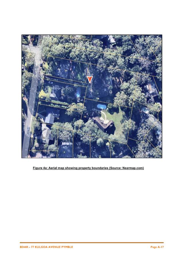
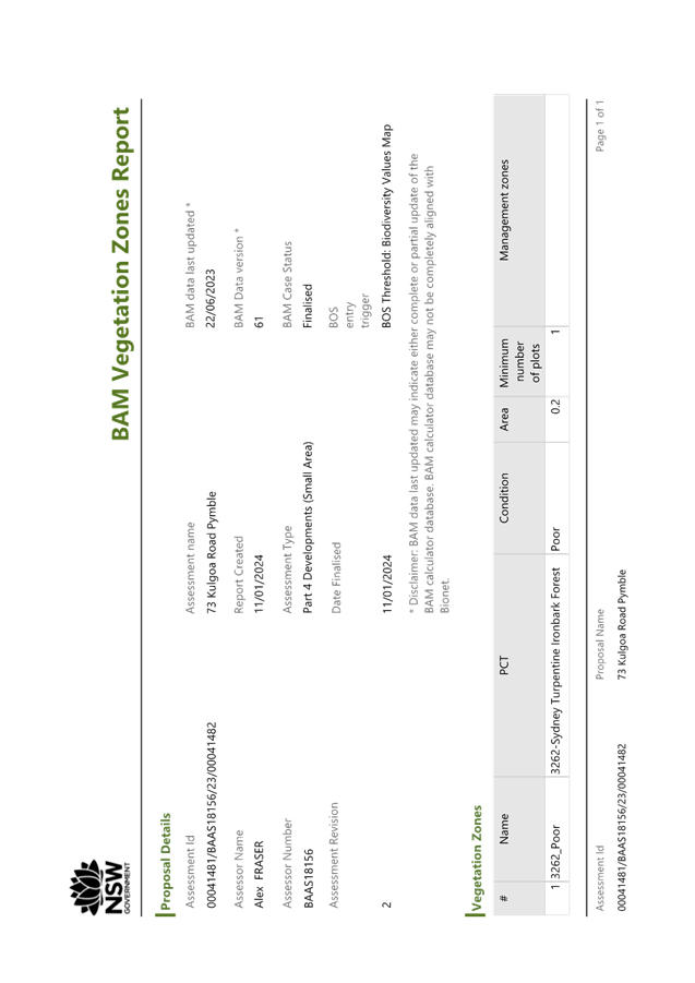
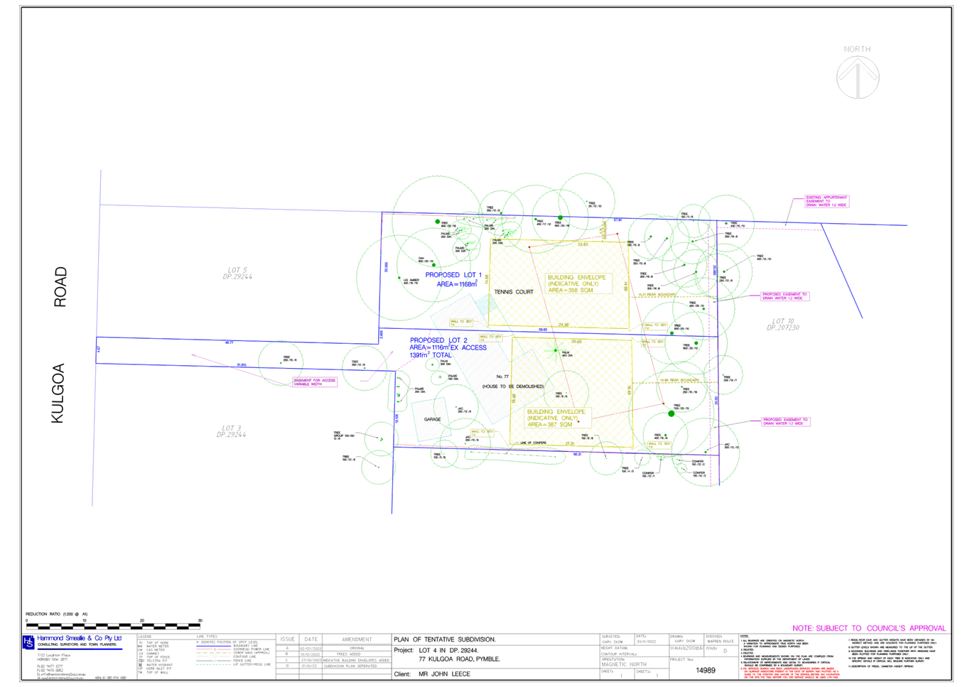
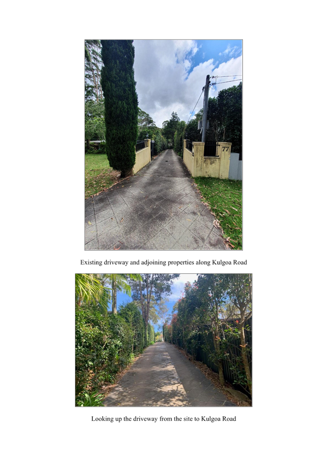
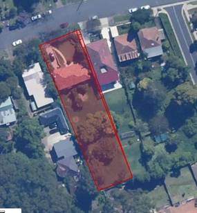
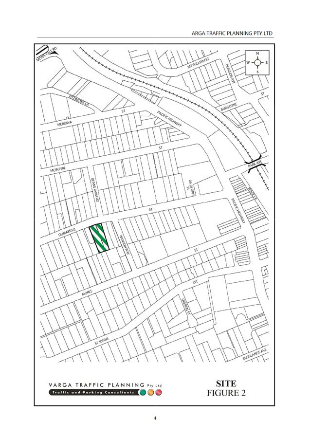
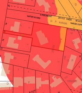
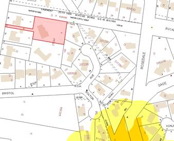
The site that is the subject of this Planning Proposal is 77
Kulgoa Road, Pymble (Lot 4, DP29244). The site is a battle-axe block, which has
a frontage of 4.6m to Kulgoa Road. The access handle is approximately 50m long.
The main portion of the site is generally rectangular in shape. The site has a
total area of 2555sqm.
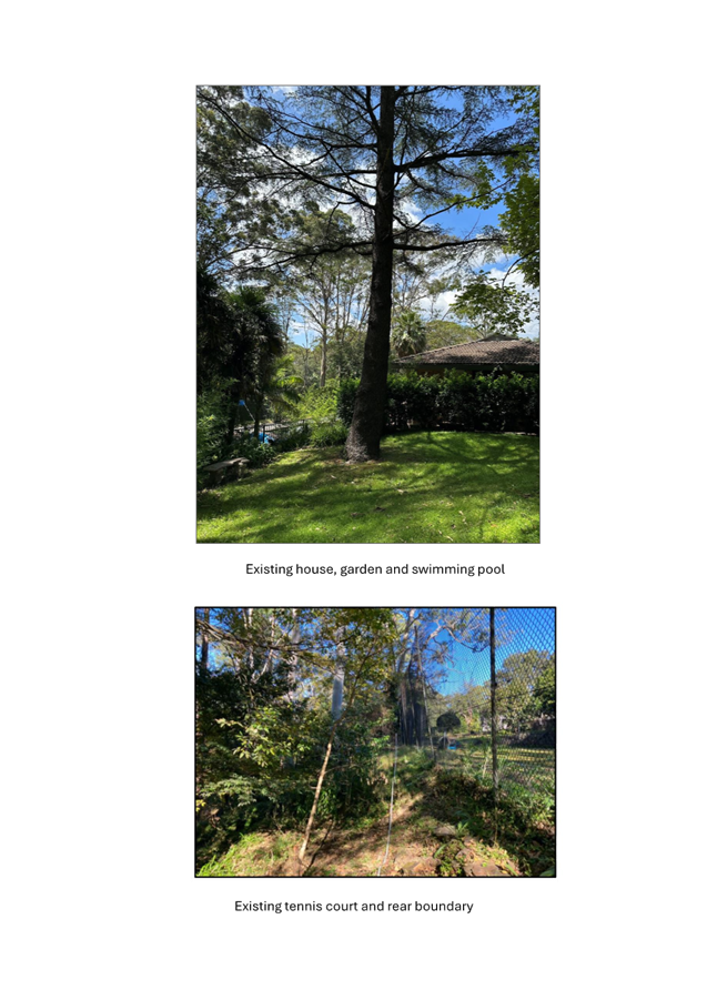
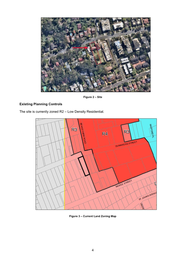
The site is currently zoned C4 Environmental Living under
KLEP 2015 and contains a part one/part two storey dwelling house with detached
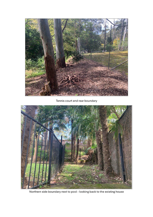
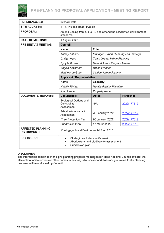
garage. The site also contains ancillary structures including a swimming pool
adjoining the house and tennis court is located on the eastern portion of the
site.
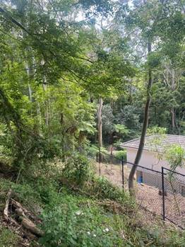
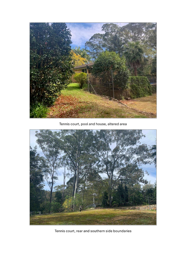
The portion of the site developed with the dwelling, garage
and ancillary swimming pool and tennis court is relatively flat. From the
eastern boundary of the tennis court the site falls steeply to the north-east.
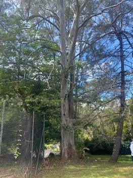
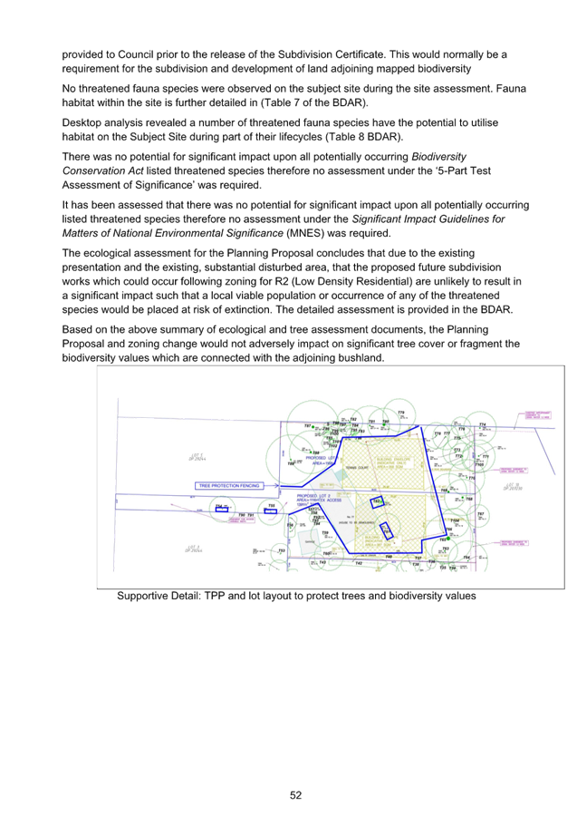
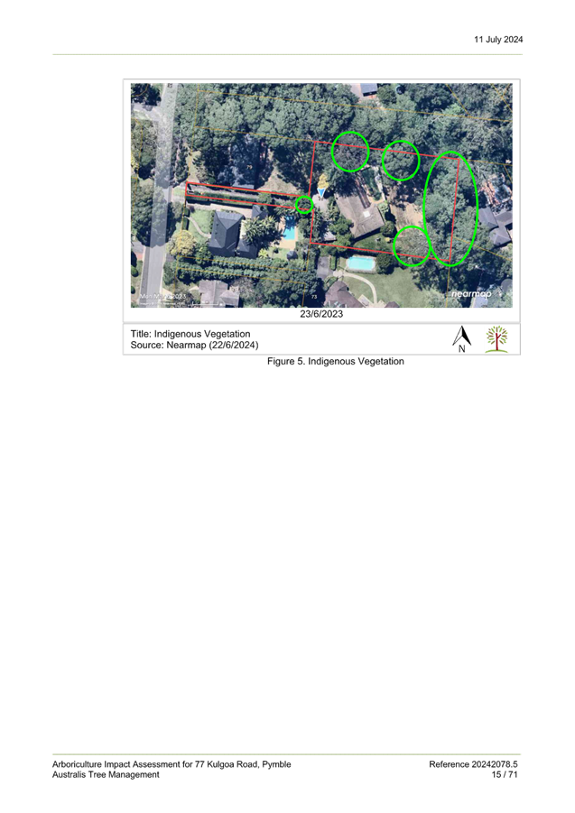
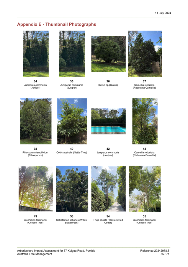
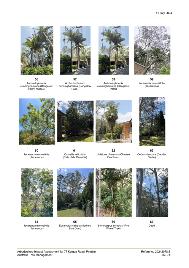
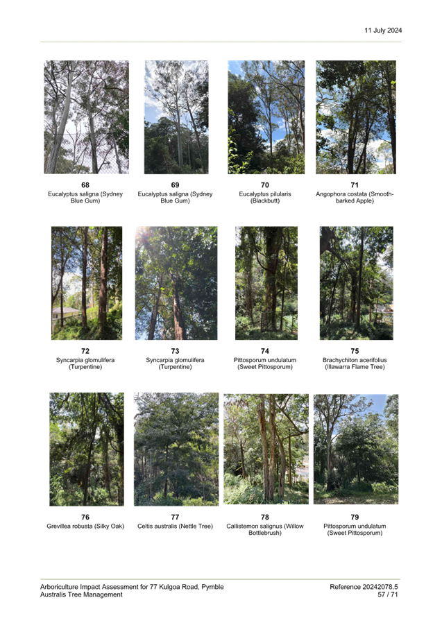
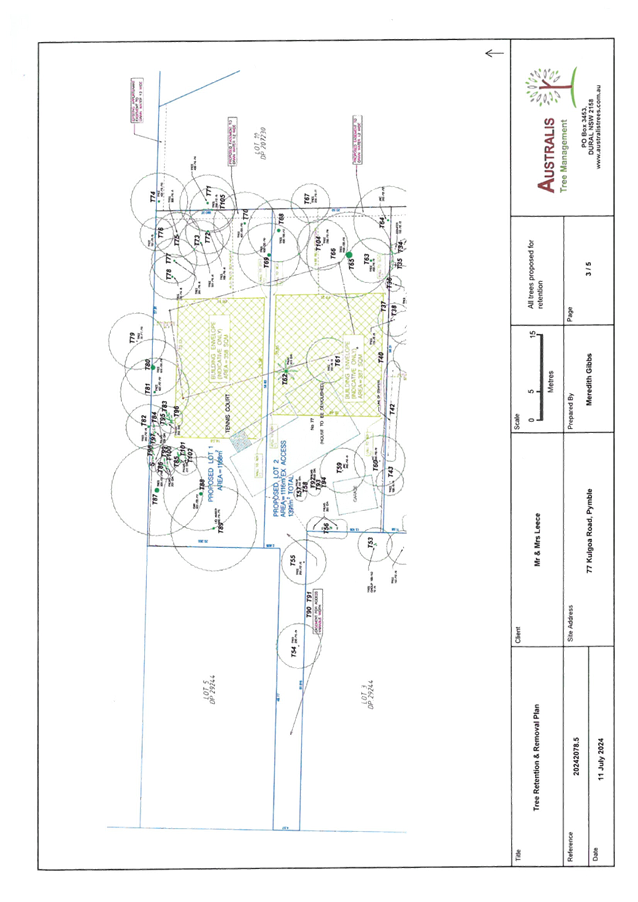
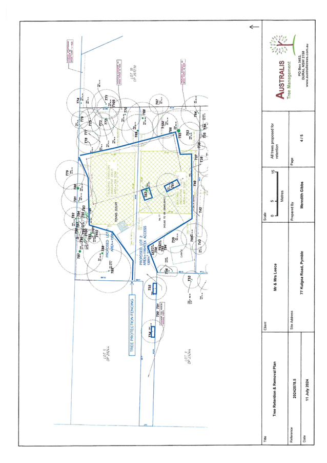
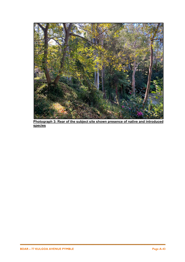
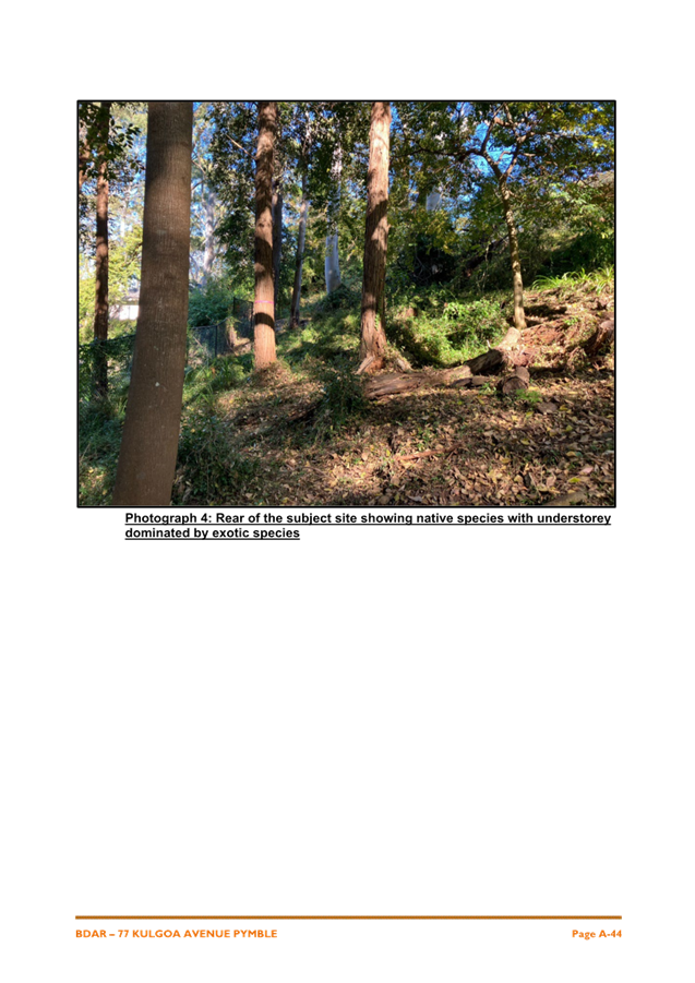
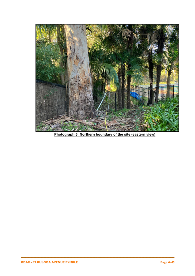
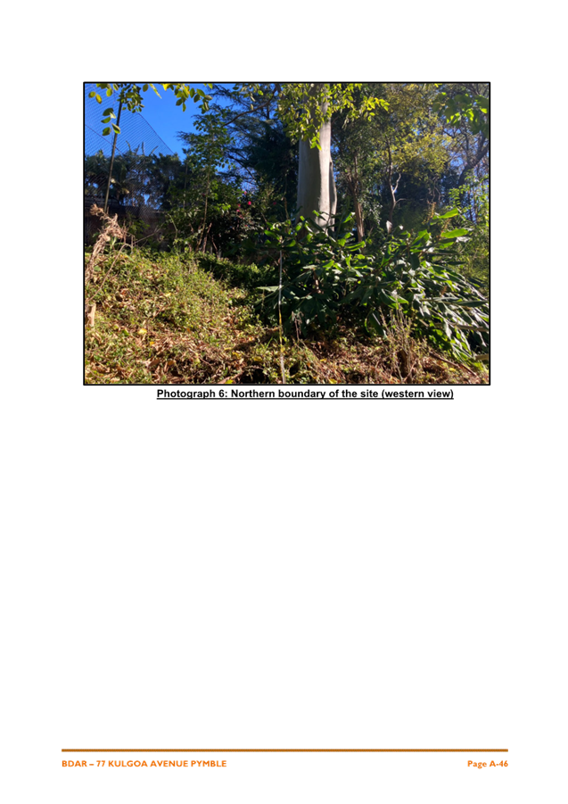
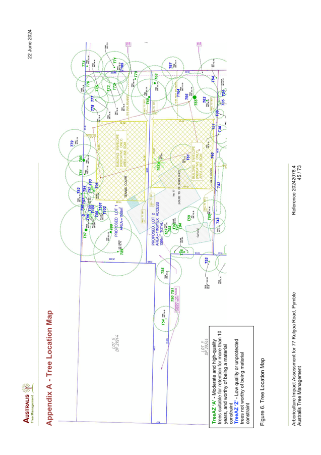
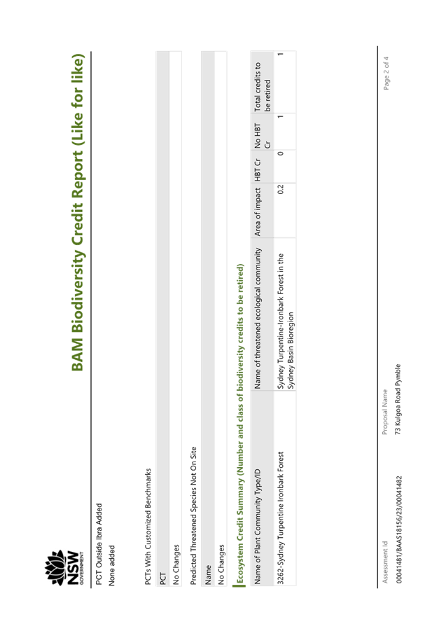
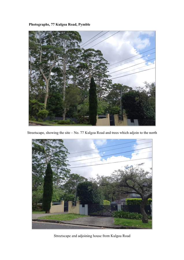
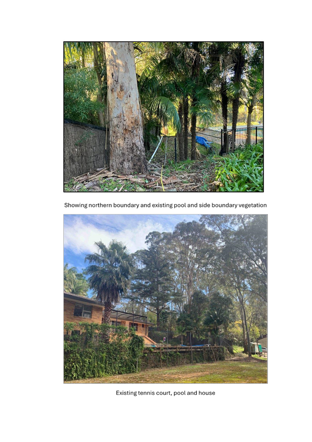
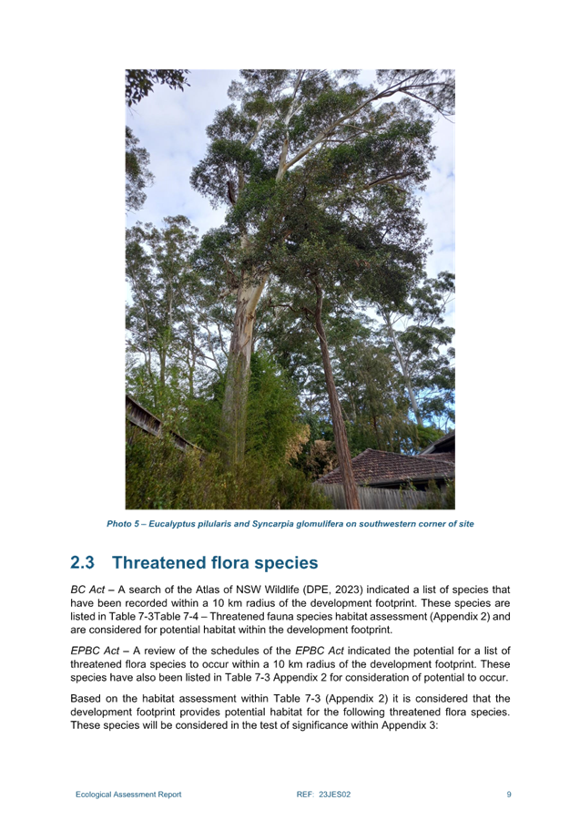
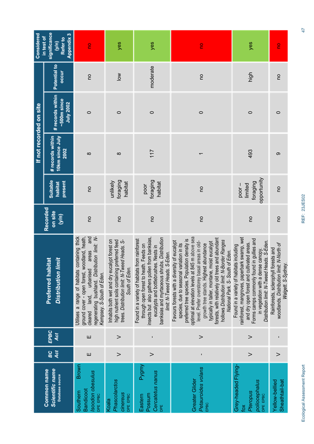
The perimeter of the site is vegetated with a mixture of
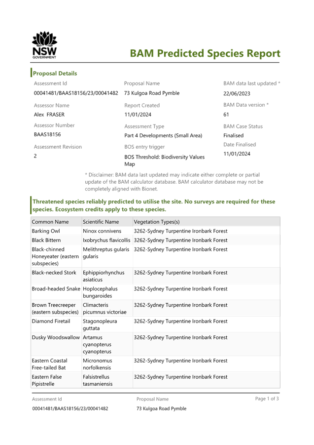
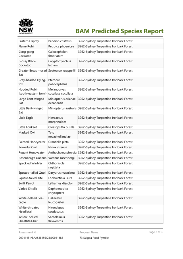
native and exotic trees. Remnant Sydney Turpentine Ironbark Forest (Critically
Endangered Ecological Community) canopy trees are located along the northern
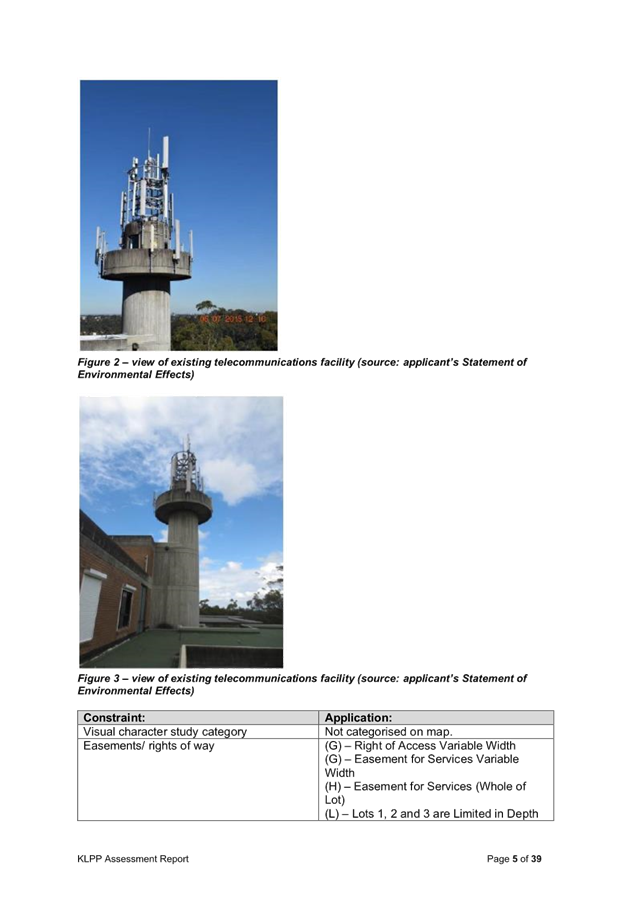
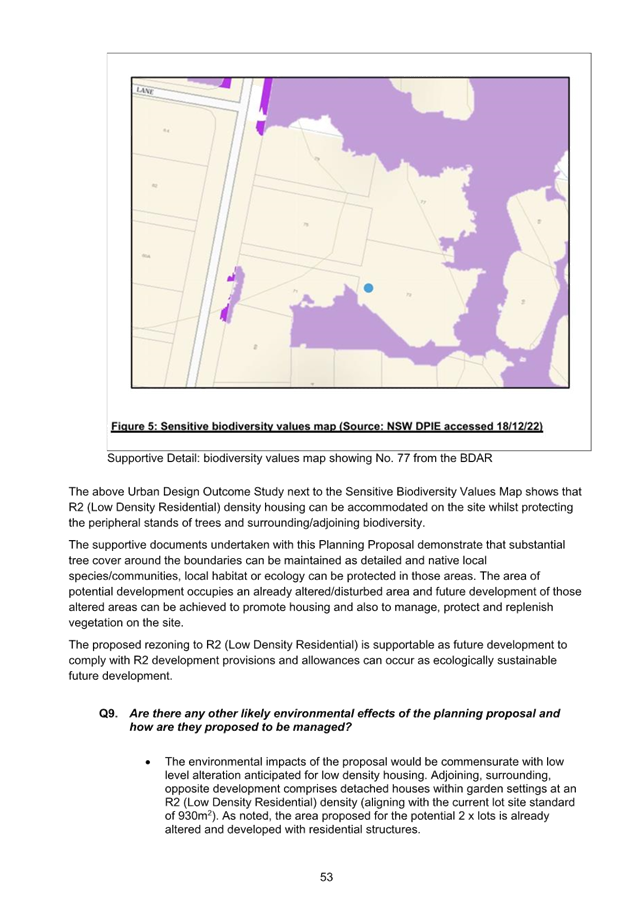
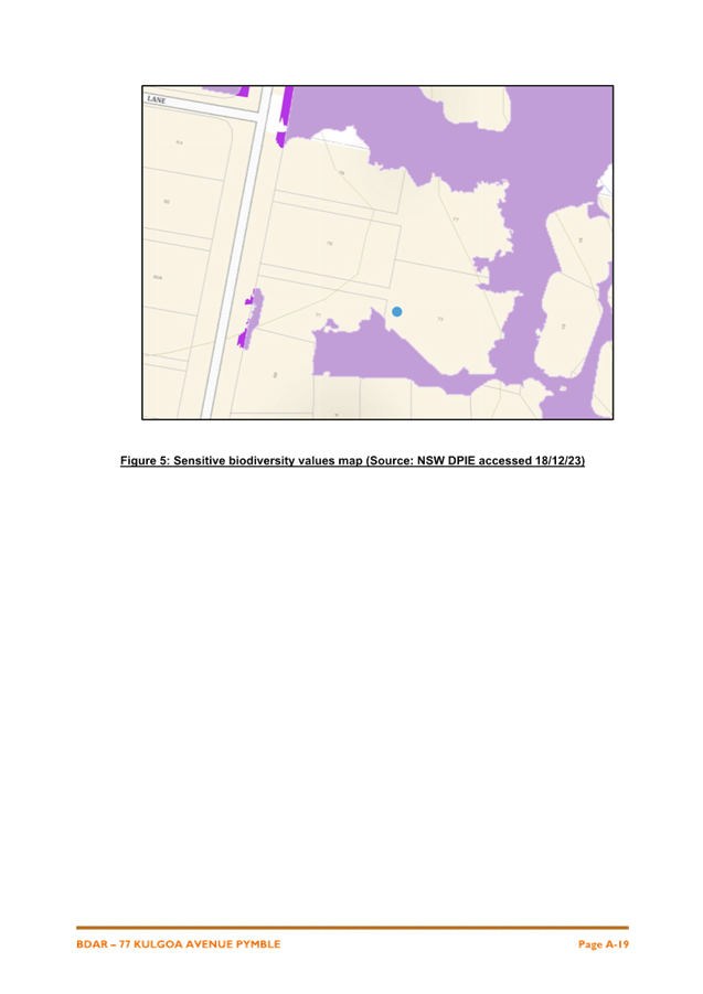
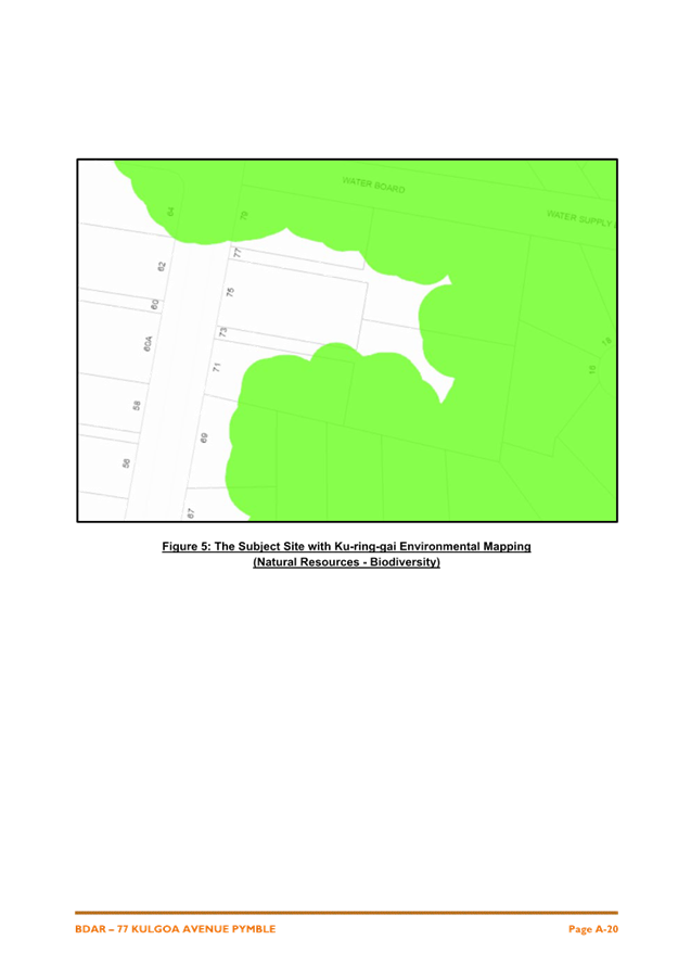
and eastern boundaries of the site. The subject site is mapped as containing
Biodiversity on the KLEP 2015 Biodiversity Map and mapped as Support for Core
Biodiversity Lands and Biodiversity Corridor and Buffer on the KDCP Greenweb
map. The subject site is not mapped as containing bushfire prone land.

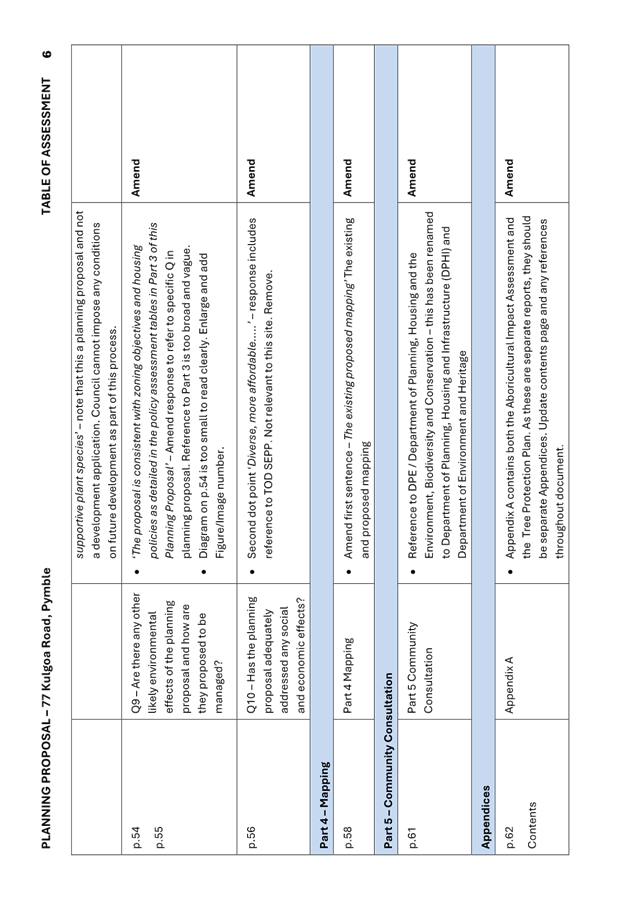
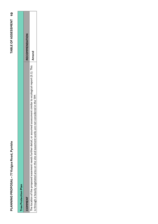
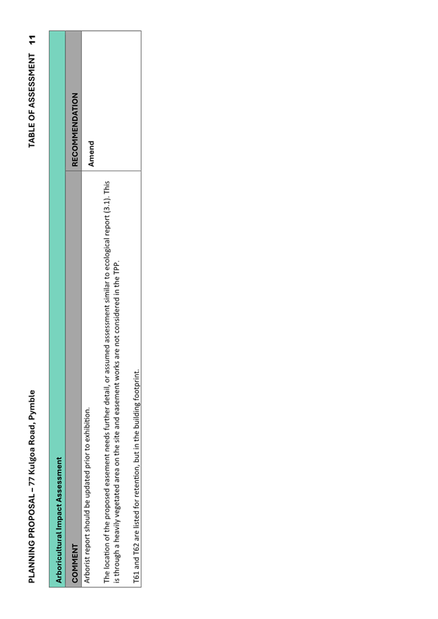
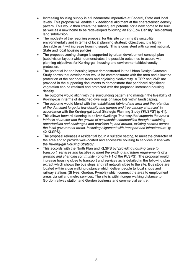
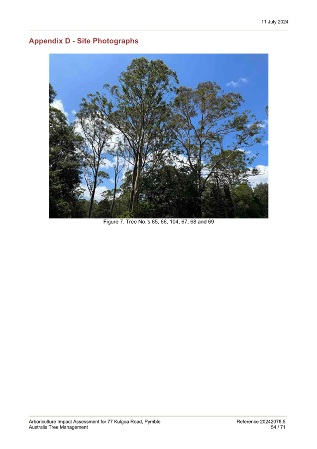
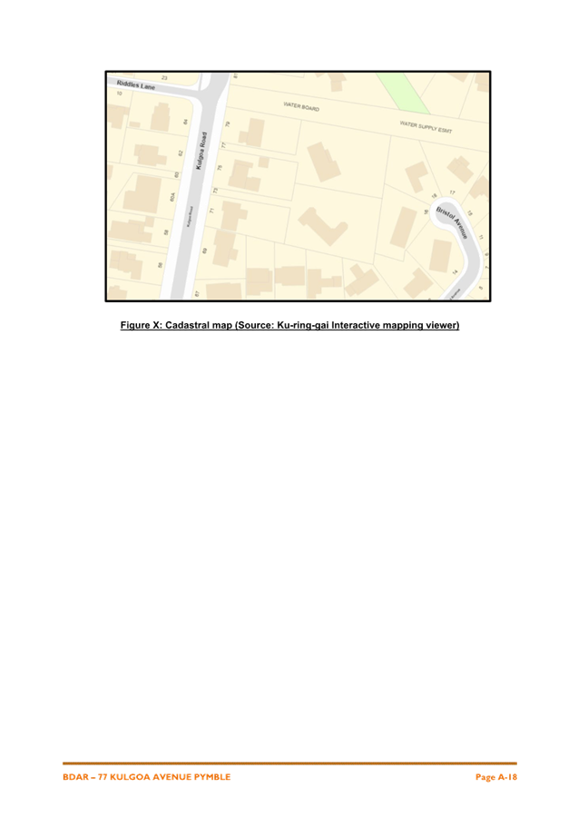
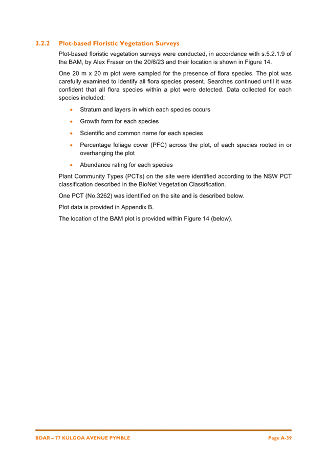
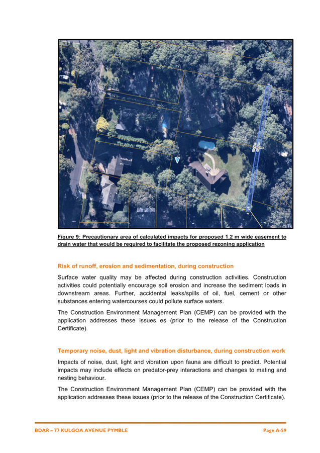
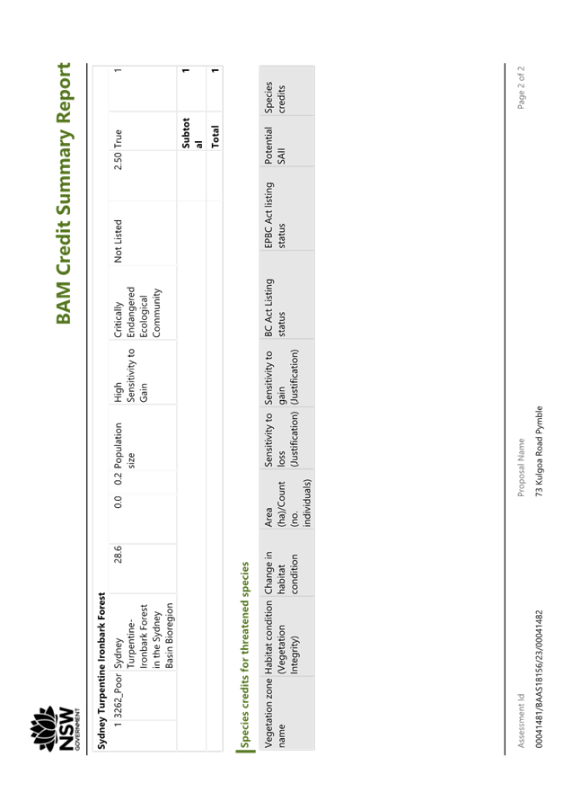
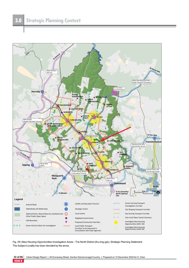
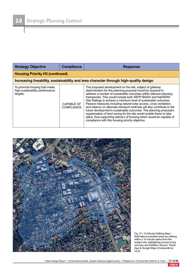
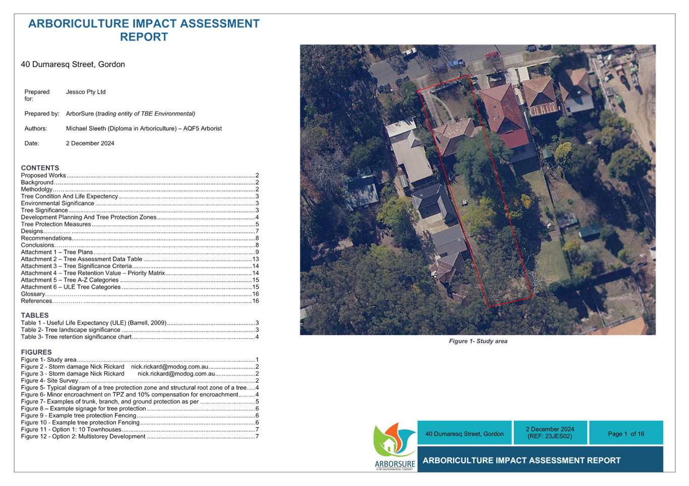
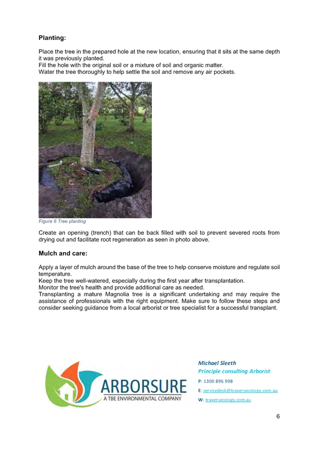
Image: Aerial 77 Kulgoa Road, Pymble
|
KLEP 2015
Biodiversity Mapping Extract
|
KDCP Greenweb
Mapping
Support for Core
Biodiversity Lands
Biodiversity
corridors and buffer
|
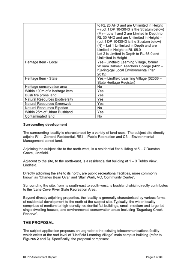
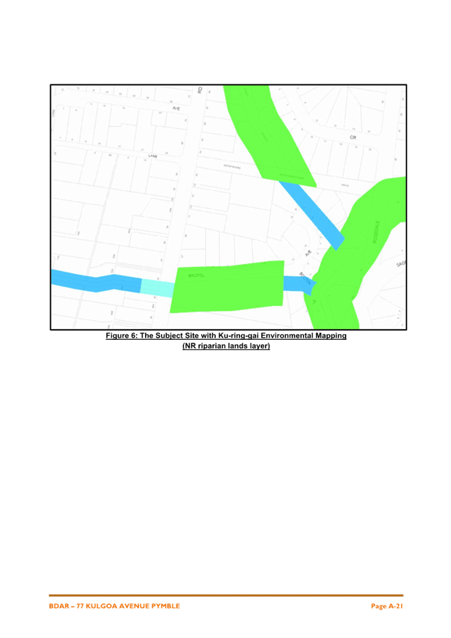
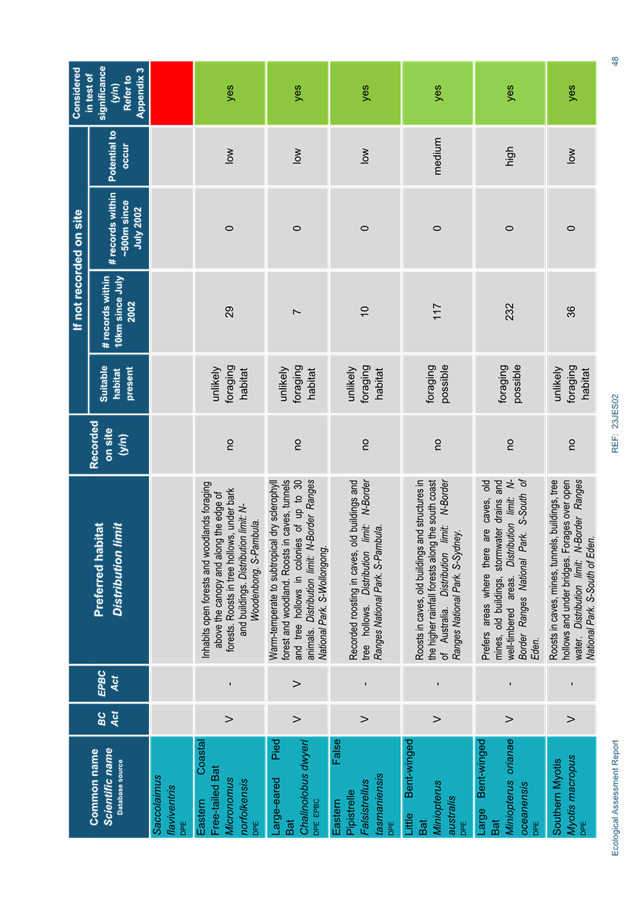
Adjacent to the northern boundary of the site are two long,
narrow pieces of land comprising:
· an easement for
water supply, zoned SP2 Infrastructure; and
· the Vista Street
Bushland Reserve zoned C2 Environmental Conservation and owned by Ku-ring-gai
Council.
The other surrounding sites are all residential, with those
sites adjoining the water supply easement and Bushland Reserve being zoned C4
Environmental Living, and all others being zoned R2 Low Density
Residential.
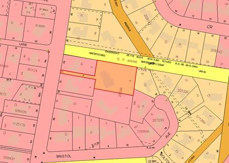
Image –
Zoning Map Extract 77 Kulgoa Road Pymble and surrounding sites
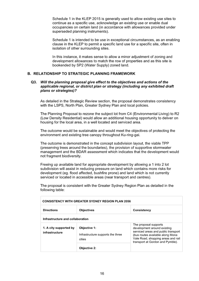
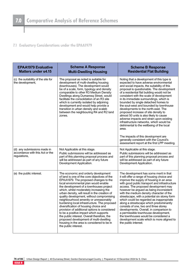
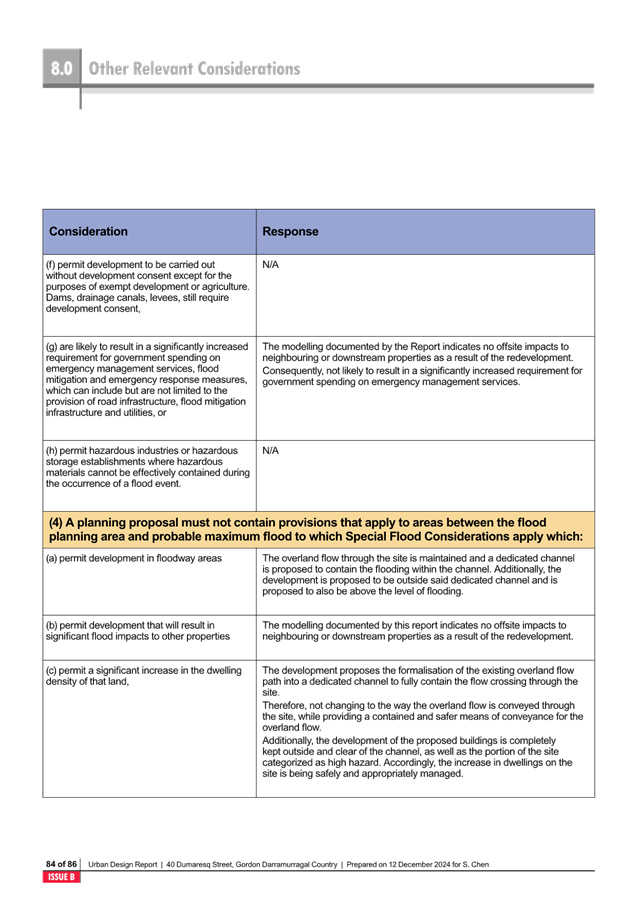
Comments
The Planning Proposal seeks to amend the Ku-ring-gai Local
Environmental Plan 2015 to rezone the site from C4 Environmental Living to R2
Low Density Residential and amend the development standards applying to the site
as follows:
|
KLEP 2015 – Zoning and
Development Standards – 77 Kulgoa Road, Pymble
|
|
|
Existing
|
Proposed
|
|
Zoning
|
C4 Environmental
Living
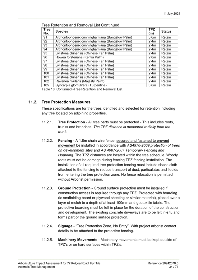
|
R2 Low Density
Residential
|
|
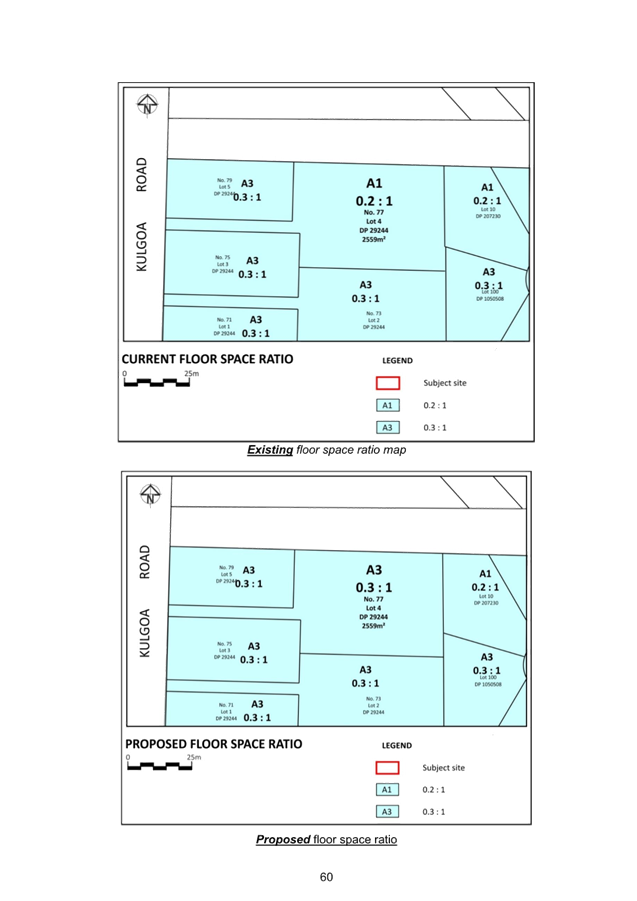
Floor Space Ratio
|
0.2:1 (mapped)
0.24:1 (Clause
4.3(2D)
|
0.3:1
|
|
Minimum Lot Size
|
1500sqm
|
930sqm
|
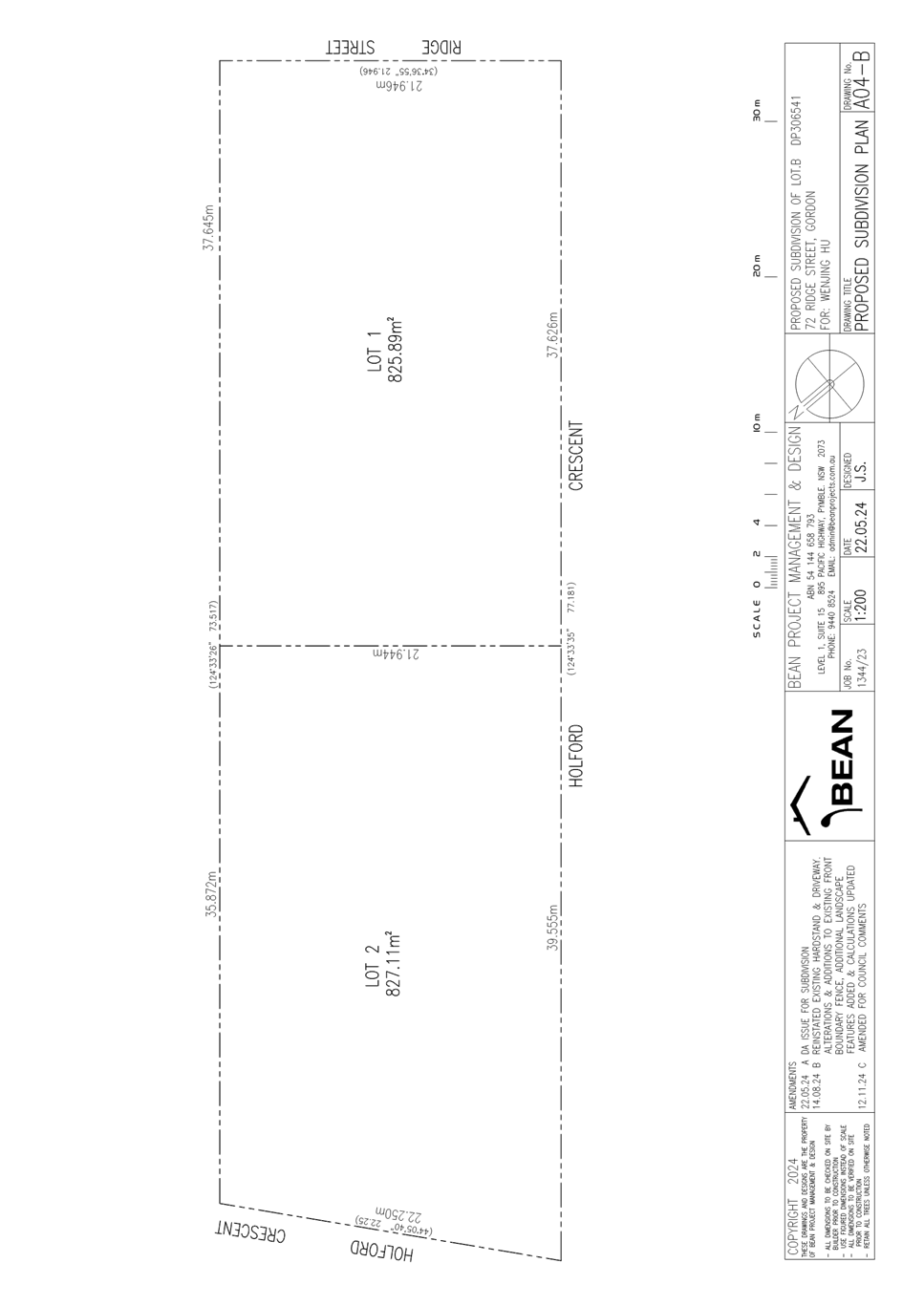
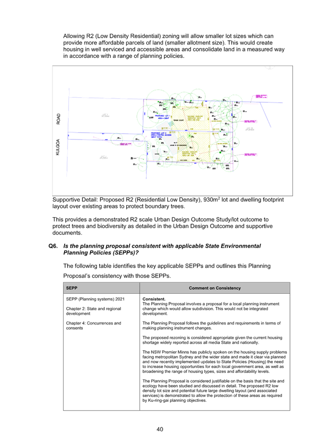
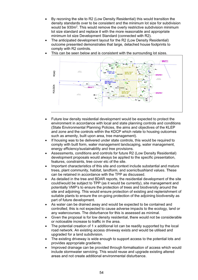
The intended outcome of the Planning Proposal is to rezone
the subject site and reduce the minimum lot size so that the site may be
subdivided into two lots of approximately 1168sqm and 1391sqm in size.
The subject site is in the same ownership as the adjoining
battleaxe lot, 73 Kulgoa Road which is zoned R2 Low Density Residential
Chronology
of Assessment
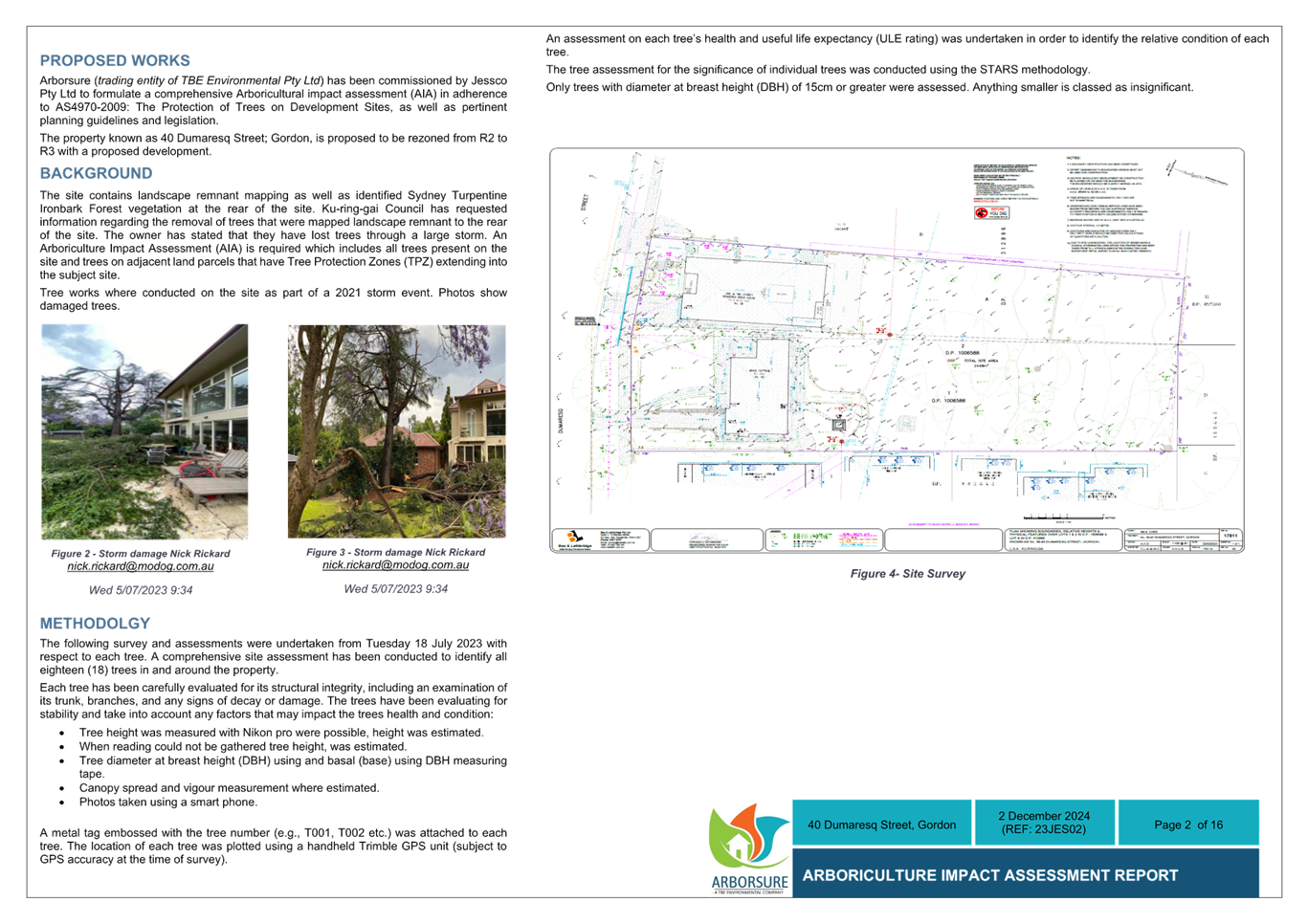
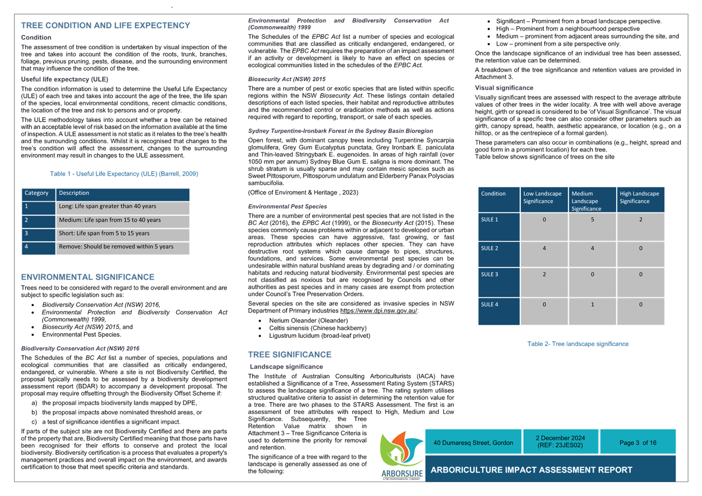
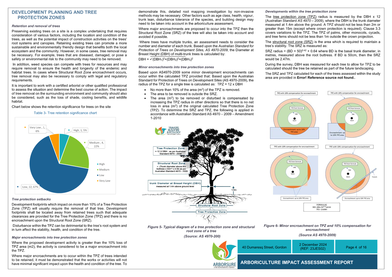
A pre-lodgement meeting was held on 1 August 2022. The
Planning Proposal was submitted on the Planning Portal on 6 February 2024. The
Planning Proposal was incomplete. Revised information was submitted on 11 July
2024 and 6 September 2024. Following the payment of fees, the Planning Proposal
was formally lodged and assessment commenced on 19 September 2024.
Merit
A Planning Proposal is not a
Development Application and does not consider the specific detailed matters for
consideration under Section 4.15 of the Environmental Planning and
Assessment Act 1979. A Planning Proposal only relates to an LEP amendment
and cannot be tied to a specific development. The proposed amendments need to
be acceptable as an outcome on the site regardless of the subsequent approval
or refusal of a future Development Application.
A Planning Proposal must demonstrate the site specific and
strategic merit of the proposed amendments.
The Planning Proposal and Appendices are included at Attachments
A2-A8.
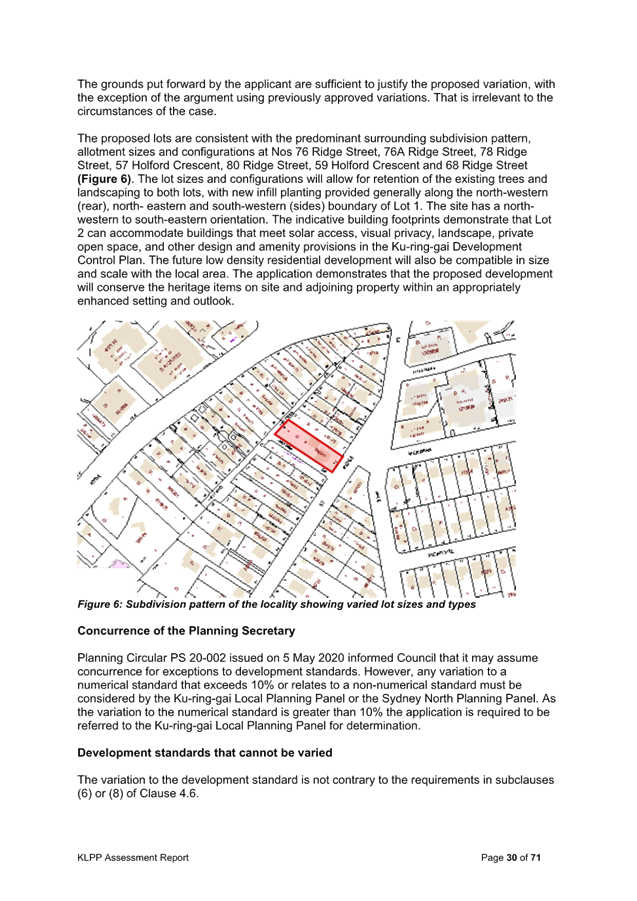
The following is an assessment of the relevant merits of the
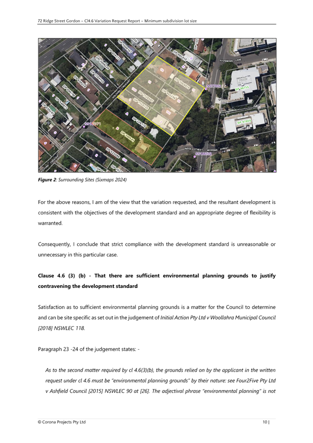
Planning Proposal:
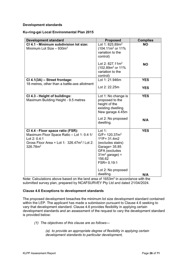
Site Specific Merit Assessment
Zoning
The Planning Proposal seeks to rezone the site from C4
Environmental Living to R2 Low Density Residential. The C4 Environmental Living
zone is a residential zone which provides for low impact residential
development in areas with special ecological, scientific or aesthetic values.
The main permitted land use for both the C4 Environmental Living zone and the
R2 Low Density Residential zone is ‘dwelling houses’, with both
zones also permitting secondary dwellings.
In considering the Planning Proposal, the reason for the C4
Environmental Living zoning applying to 77 Kulgoa has been investigated,
particularly given the similarity with the neighbouring battle axe site 73
Kulgoa Road which is zoned R2 Low Density Residential.
During the preparation of the Ku-ring-gai Local
Environmental Plan 2015 the C4 Environmental Living zone was applied to areas
‘where a combination of ecological values and risks support greater
restrictions on land uses and development’. At the time that the KLEP
2015 was prepared, the subject site was mapped as containing both biodiversity
values relating to the remnant Blue Gum High Forest / Sydney Turpentine
Ironbark Forest and as being Bushfire Prone Land category 1. As a result of
these factors, the site was zoned C4 Environmental Living.
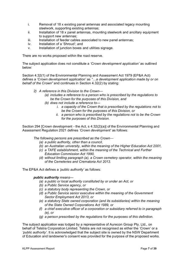
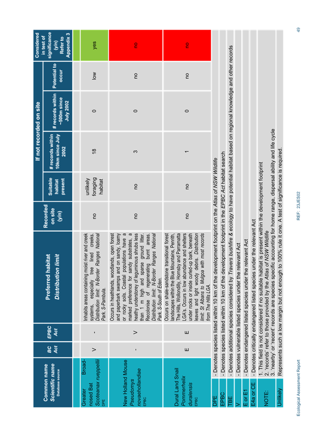
|
|
|
|
KLEP 2015
Biodiversity Map
|
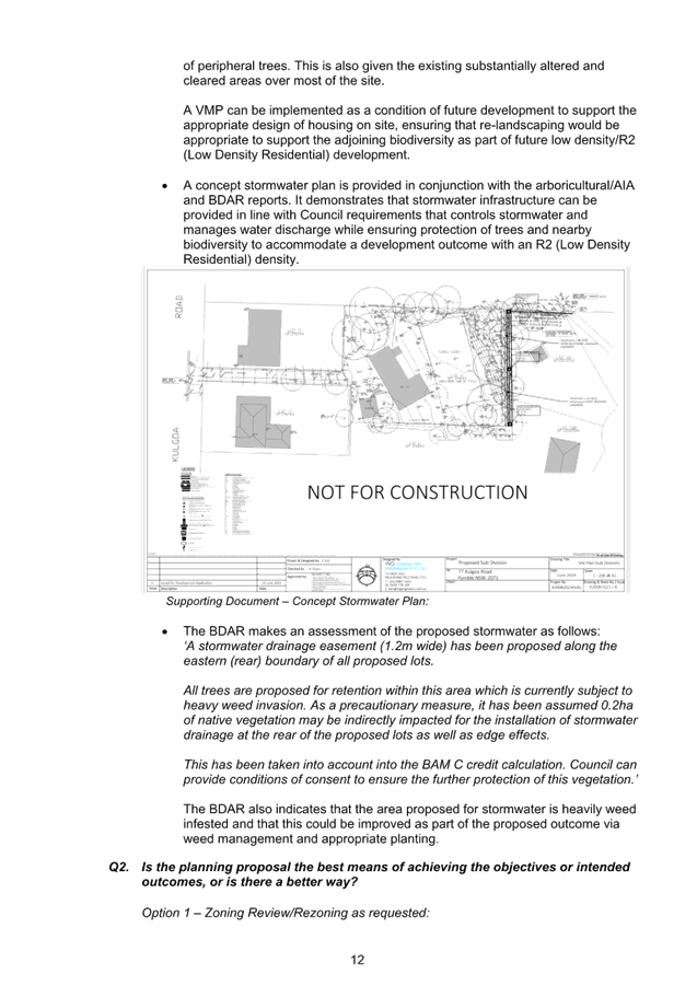
2008 Ku-ring-gai Bushfire Prone Land Map
Category 1 BFPL shown in orange
|
Subsequent to the C4 Environmental Living being put in place
in 2015, Council’s Bushfire Prone Land Map was updated in 2017. As part
of this update, the subject site was not identified as bushfire prone land. The
Bushfire Prone Land Map was again updated in 2024, which resulted in further
retreat of the bushfire prone land mapping in the surrounding area.
Since 2002 there have been 3 revisions of the Guide For
Bush Fire Prone Land Mapping (NSW Rural Fire Service). This guideline is
the basis for defining what land parcels are defined as being termed ‘bush
fire prone land’. The differences in the classification of the three
categories of Bush Fire Prone Land (and their associated buffers) and the
spatial delineation of the landscape in terms of bush fire hazard is due to the
refinement of the guidelines since 2002, particularly as to what spatial
arrangements of vegetation constitute a real hazard in terms of fire behaviour
and potential impact.
The latest version of the guideline gives details of how
vegetation (hazard) is assessed in terms of being/not being an area of Bush
Fire Prone Land. The vegetation exclusion ‘rules’ have
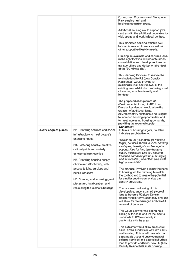
assisted in refining the mapping – in terms of actual hazard.
In the case of 77 Kulgoa Road, Pymble the bushland tracts of
Dalyrmple-Hay Nature Reserve (to the north) and High Ridge Creek Reserve (to
the southeast) are the nearest defined Category 1 and 2 hazard areas and with
the latest exclusion guidelines, smaller vegetation remnants and narrow
corridors are now not included as Bush Fire Prone Land.
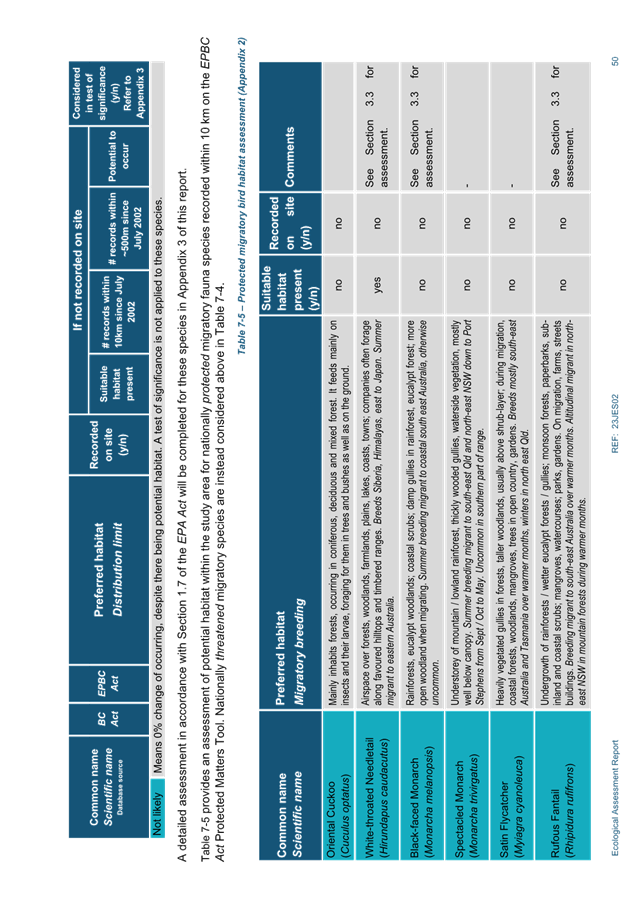
|
|
|
|
2017 Ku-ring-gai Bushfire Prone Lane Map
77 Kulgoa Road Pymble is no longer identified with any bushfire
prone land mapping
|
2024 Ku-ring-gai Bushfire Prone Land Map
Further retreat of bushfire prone land mapping from area surrounding
site.
|
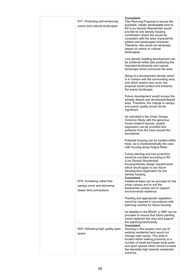
Given the current mapping attributes on the site and the
lack of a ‘combination’ of environmental values and risks,
it is reasonable to consider the proposed R2 Low Density Residential zone
appropriate, consistent with the zoning of the adjoining battle axe site 73
Kulgoa Road Pymble.
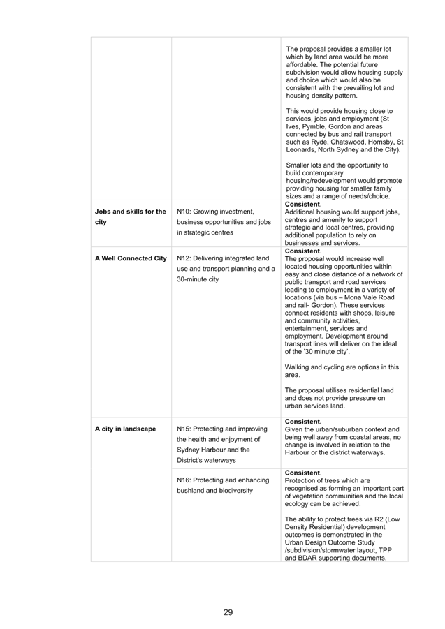
Low
and Mid-Rise Housing Policy – Dual Occupancy
On 1 July 2024 Stage 1 of the Low and Mid-Rise Housing (LMR)
SEPP commenced which:
· Permitted dual
occupancies and semi-detached dwellings on all R2 Low Density Residential zoned
land via a development application; and
· Switched off the
Complying Development pathway under the Codes SEPP until 1 July 2025 to allow
Councils to consider an evidence based minimum lot size for their local
government area. Failure to nominate a minimum lot size will result in the
automatic application of a 400sqm minimum lot size as per
As the Planning Proposal is seeking to rezone the site to R2
Low Density Residential, it must now be assumed that development for dual
occupancy is a permissible land use within the proposed zone.
The Complying Development pathway for dual occupancy under
the Codes SEPP does not apply to battle axe lots, so any development for dual
occupancy would have to be through a Development Application pathway.
Council is currently in the process of seeking feedback from
the community and the Department of Planning, Housing and Infrastructure on
potential options for a minimum lot size for dual occupancy development. Based
on the options the minimum lot size for dual occupancy on the subject site
could be between 1015sqm – 1075sqm.
Minimum Lot Size
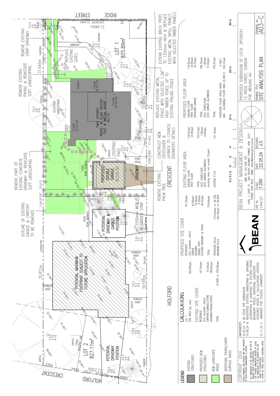
The Planning Proposal seeks to amend the minimum subdivision
lot size development standard applying to the site from 1500sqm to 930sqm. This
would enable the potential subdivision of the site into two (x2) lots. The
proposed 930sqm minimum lot size is consistent with the minimum lot size
applying to the adjoining R2 Low Density Residential zoned sites and is
considered appropriate.
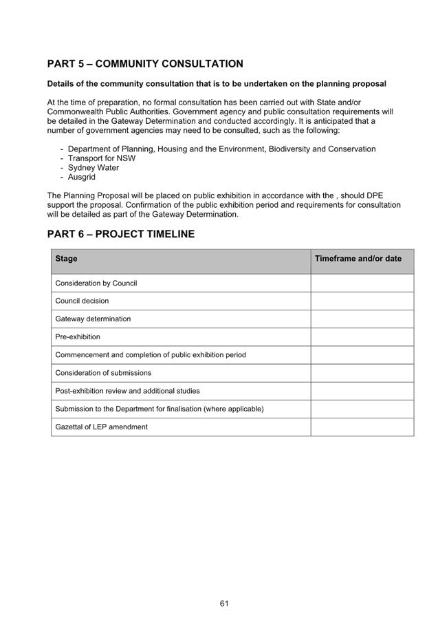
Floor Space Ratio
The Planning Proposal seeks to amend the mapped Floor Space
Ratio Development Standard applying to the site from 0.2:1 to 0.3:1.
Despite the mapped 0.2:1, Clause 4.4(2D) provides a slide
scale calculation for land zoned C4 Environmental Living which overrides the
mapped FSR. As the site is over 1,500sqm the calculation is ((250 + (0.15 x
site area))/site area :1, which equates to maximum FSR of 0.24:1 currently
applying to the site.
The proposed mapped Floor Space Ratio Development Standard
of 0.3:1 is consistent with the Floor Space Ratio development standard that
applies to the adjoining R2 Low Density Residential sites and is considered
appropriate. Also noting, that despite the mapped Floor Space Ratio Clause 4.4
(2A) will apply to land zoned R2 Low Density Residential. This clause provides
a sliding scale based on lot size.
|
More than 1,700 square metres
|
0.3:1
|
|
More than 1,000 square metres but not more than 1,700 square
metres
|
((170 + (0.2 × site area)) / site area):1
|
|
More than 800 square metres but not more than 1,000 square
metres
|
((120 + (0.25 × site area)) / site area):1
|
|
800 square metres or less
|
0.4:1
|
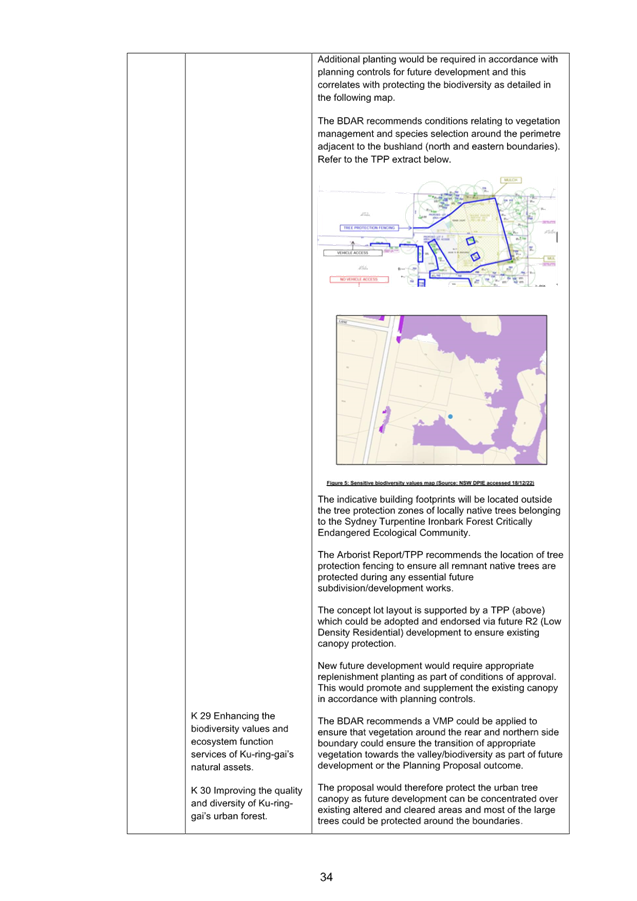
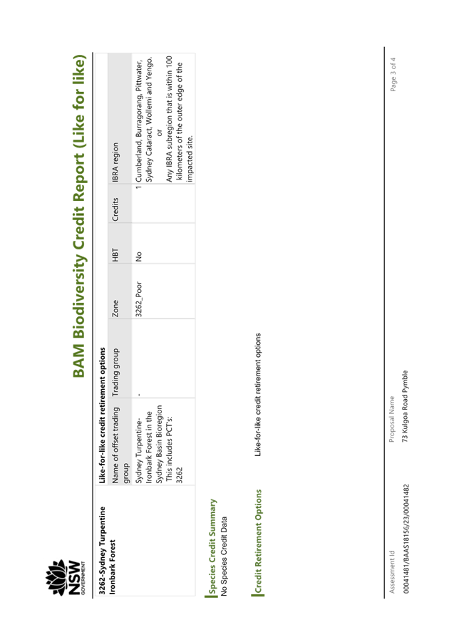
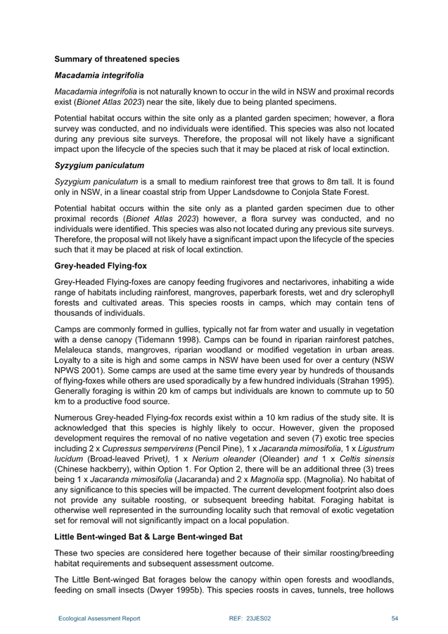
Biodiversity
The subject site is mapped on the KLEP 2015 Biodiversity Map
due to vegetation on the site being identified as Blue Gum High Forest / Sydney
Turpentine Ironbark Forest, (Critically Endangered Ecological Community), and
mapped as Support for Core Biodiversity Lands and Biodiversity Corridor and
Buffer on the KDCP Greenweb map.
The Planning Proposal does not seek to amend the current
biodiversity mapping. Accordingly, the KLEP 2015 Biodiversity mapping and
Clause 6.3, KDCP Greenweb mapping and controls, and CEEC protections will still
continue to apply to any proposed R2 Low Density Residential development on the
site. These protections should be manageable as the main biodiversity assets
are located towards the boundaries of the subject site.
Strategic Merit Assessment
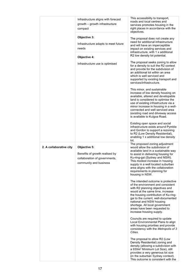
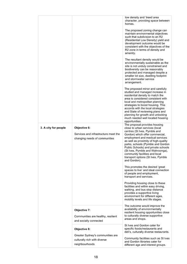
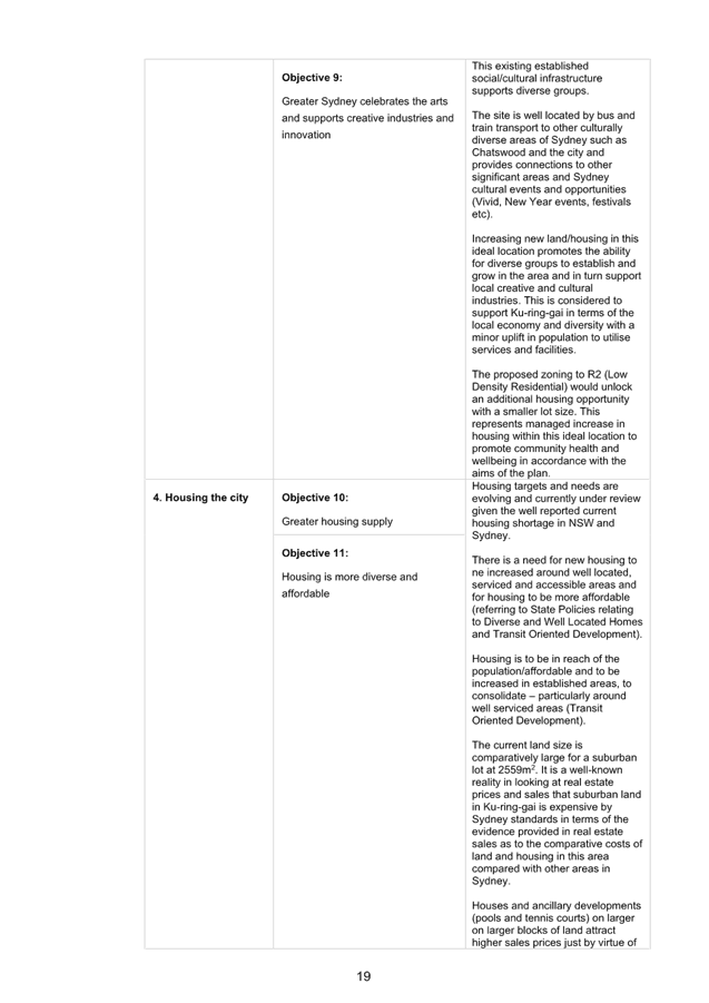
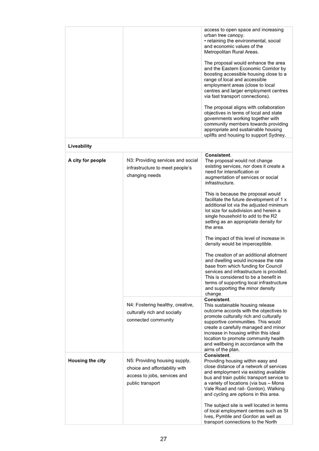
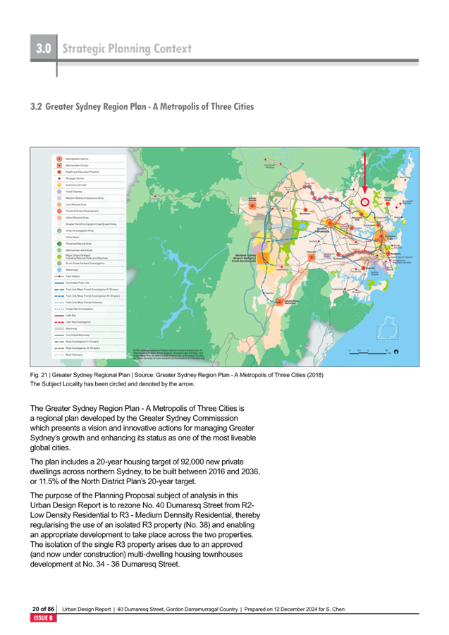
Greater Sydney Region Plan and North District Plan
The Planning Proposal is consistent with the objectives of
the Greater Sydney Region Plan – A Metropolis of Three Cities, in
particular:
· Objective 10.
Greater housing supply
· Objective 11.
Housing is more diverse and affordable
· Objective 27.
Biodiversity is protected, urban bushland and remnant vegetation is enhanced
The Planning Proposal is consistent with the planning
priorities of the North District Plan, in particular:
· Planning Priority
N5. Providing housing supply, choice and affordability, with access to jobs,
services and public transport
· Planning Priority
N16. Protecting and enhancing bushland and biodiversity
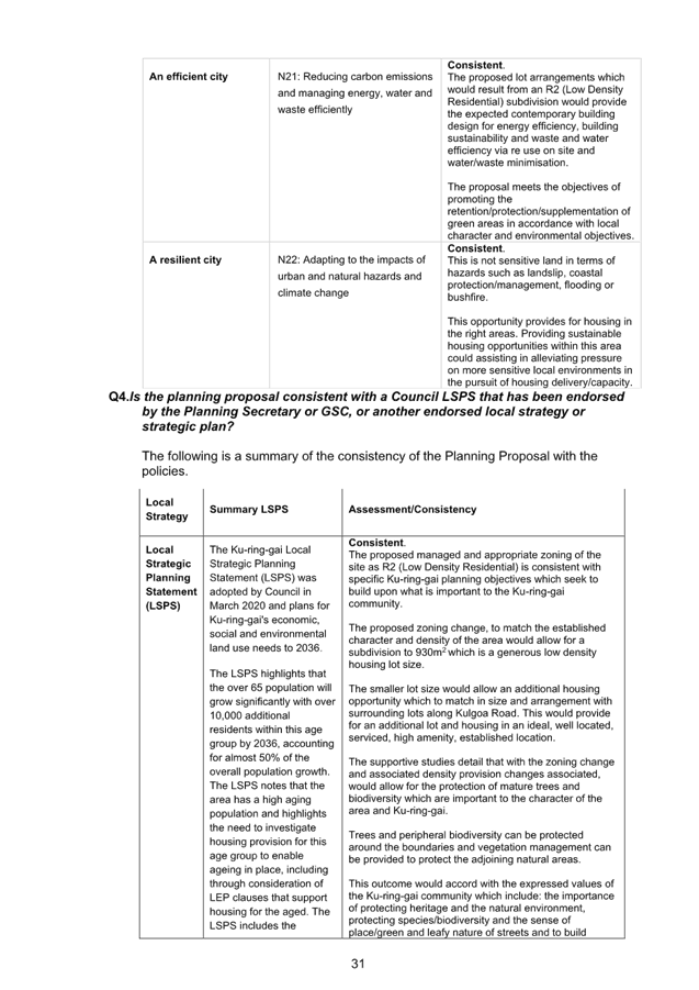
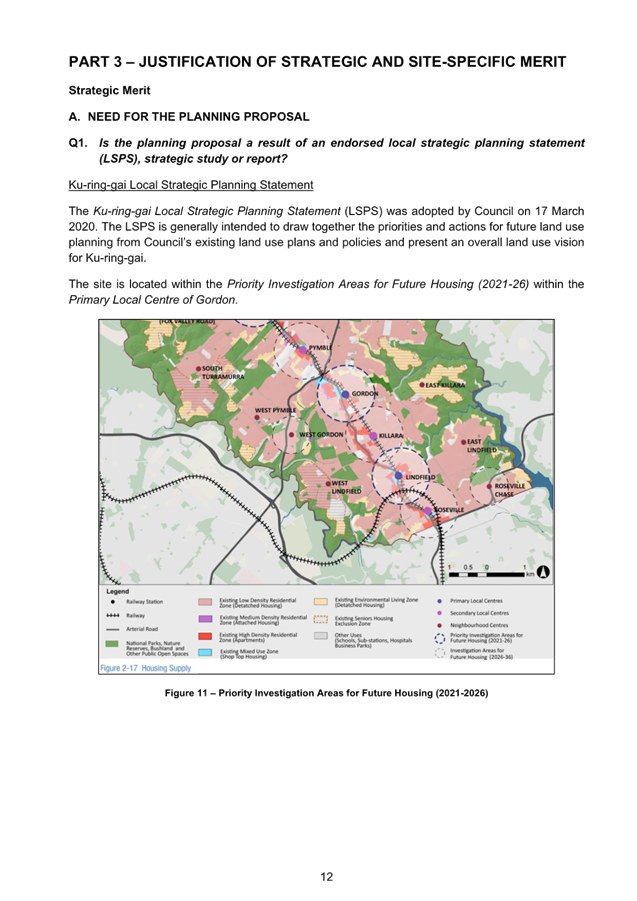
Ku-ring-gai Local Strategic Planning Statement
The Planning Proposal is consistent with the following local
planning priorities:
· K3. Providing
housing close to transport, services and facilities to meet the existing and
future requirements of a growing and changing community
· K4. Providing a
range of diverse housing to accommodate the changing structure of families and
households and enable ageing in place
· K12. Managing
change and growth in a way that conserves and enhances Ku-ring-gai’s
unique visual and landscape character
· K28. Improving the
condition of Ku-ring-gai’s bushland and protecting native terrestrial and
aquatic flora and fauna and their habitats
· K29. Enhancing the
biodiversity values and ecosystem function services of Ku-ring-gai’s
natural assets
· K31. Increasing,
managing and protecting Ku-ring-gai’s urban tree canopy
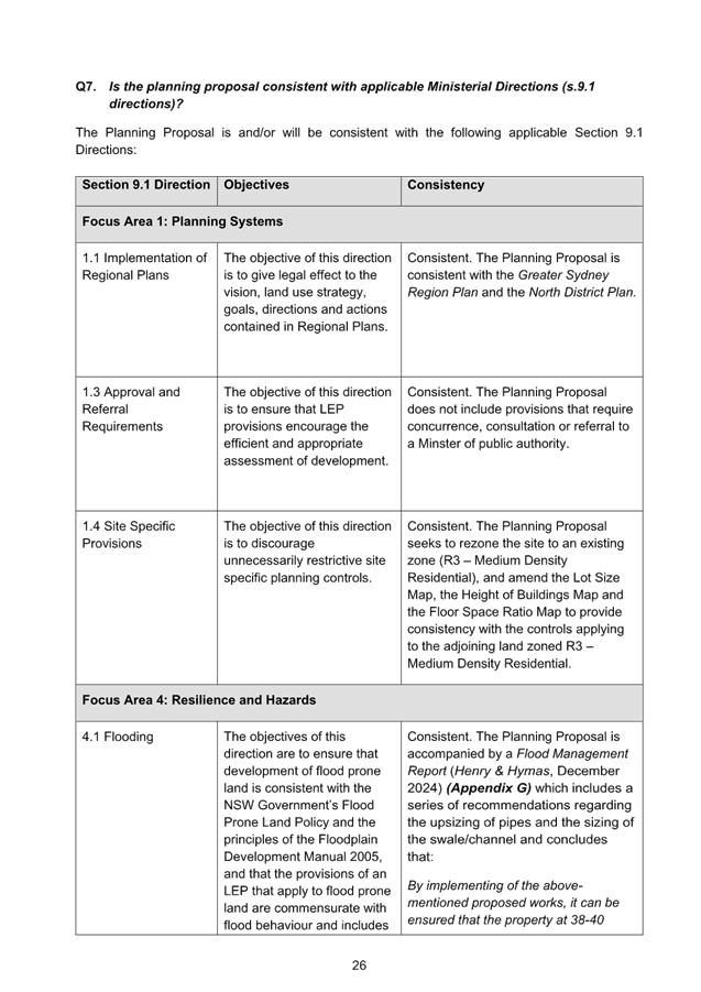
Section 9.1 Ministerial
Directions and State Environmental Planning Policies (SEPPs)
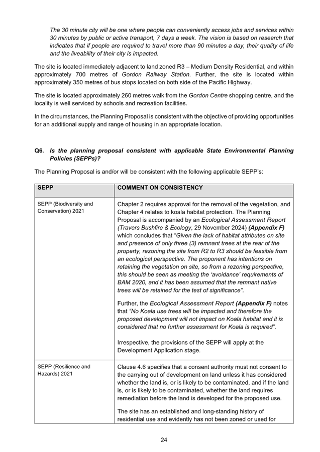
The Planning Proposal is not inconsistent with the State
Environmental Planning Policies (SEPPs) applicable to the site. Many of these
SEPPs contain detailed provisions and controls which would only apply at the
Development Application stage.
The Planning Proposal is consistent with the applicable s9.1
Ministerial Direction, specifically those relating to:
· 3.1 Residential
Zones
Amendments required to
Planning Proposal
The assessment of the
Planning Proposal has found that there are a number of amendments required to
the Planning Proposal and supporting studies in order to provide more clarity
prior to the public exhibition of the Planning Proposal. The amendments
are generally minor editorial in nature or requests for further clarification
in supporting studies and are required to ensure the Planning Proposal is in
accordance with the Local Environmental Plan Making Guideline (August
2023).
The table of amendments is included at Attachment A1 which
details the required amendments to be made to the Planning Proposal if Council
is to support it being submitted to the Department of Planning, Housing and
Infrastructure and proceed to public exhibition.
integrated planning and reporting
Theme 3: Places, Spaces and Infrastructure
|
Community Strategic
Plan Long Term Objective
|
Delivery Program
Term Achievement
|
Operational Plan
Task
|
|
P2.1 A robust planning framework is in place to deliver
quality design outcomes and maintain the identity and character of
Ku-ring-gai
|
P2.1.1 Land use strategies, plans and processes are in
place to protect existing character and effectively manage the impact of new
development
|
P2.1.1.2 Continue to review the effectiveness of existing
strategies, local environmental plans, development controls plans and
processes across all programs
|
Governance Matters
The process for the preparation and implementation of
Planning Proposals is governed by the provisions contained in the Environmental
Planning and Assessment Act 1979 and the Environmental Planning and
Assessment Regulation 2021.
Local Planning Panel’s Direction – Planning
Proposals issued by the Minister for Planning under Section 9.1 of the Environmental
Planning and Assessment Act 1979 requires Council to refer all Planning
Proposals prepared after 1 June 2018 to the Local Planning Panel for advice,
before the Planning Proposal is forwarded to the Minister for a Gateway
Determination.
Risk Management
This is a privately initiated
Planning Proposal. Council needs to determine its position on the matter as to
whether the Planning Proposal should proceed to Gateway Determination.
Financial Considerations
The Planning Proposal was subject to the relevant
application fee under Councils 2024/2025 Schedule of Fees and Charges. The cost
of the review and assessment of the Planning Proposal is covered by this fee.
Social Considerations
The amendments sought by the Planning Proposal would enable
the delivery of one additional residential lot with one additional dwelling
house to meet existing and future requirements of a growing and changing
community.
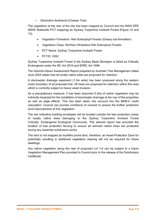
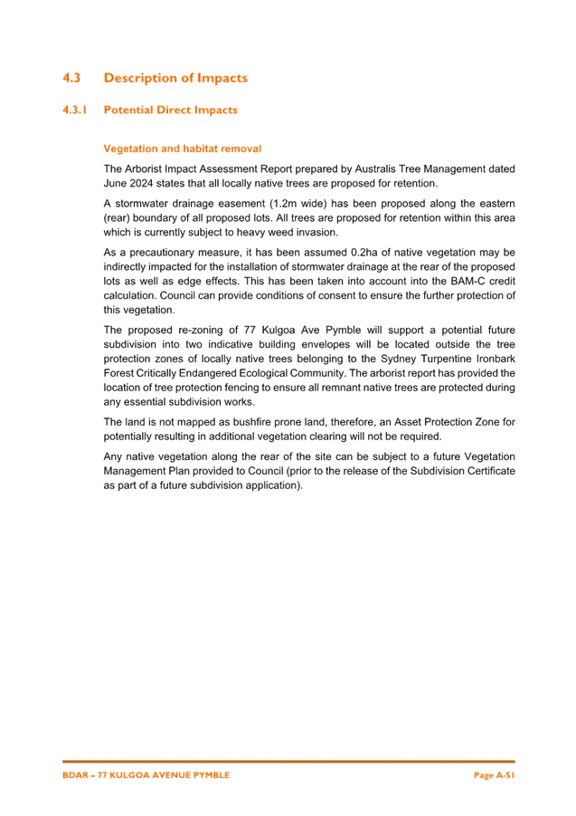
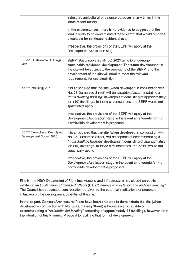
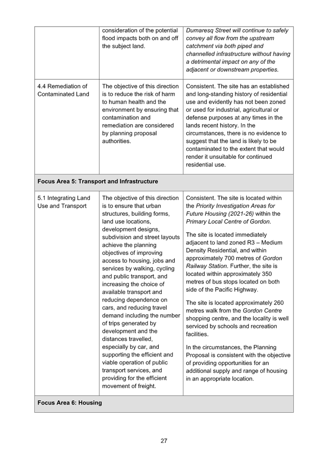
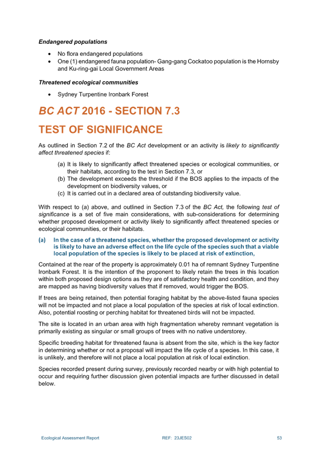
Environmental Considerations
Remnant Sydney Turpentine Ironbark Forest (Critically
Endangered Ecological Community) canopy trees are located along the northern
and eastern boundaries of the site. The subject site is mapped as containing
Biodiversity on the KLEP 2015 Biodiversity Map and mapped as Support for Core
Biodiversity Lands and Biodiversity Corridor and Buffer on the KDCP Greenweb
map.
It is considered that R2 Low Density Residential zoning is
appropriate for the site, and any future development will be required to comply
with the existing biodiversity protections of the KLEP, KDCP and CEEC. Future
low density residential development should be manageable on the site, noting
the main biodiversity assets are located towards the boundaries of the site.
Community Consultation
The Planning Proposal has not been subject to community
consultation. In the event that the Planning Proposal is issued a Gateway
Determination by the Department of Planning, Housing and Infrastructure the
Planning Proposal would be placed on statutory public exhibition in accordance
with the requirements of the Gateway Determination and Council’s
community participation plan.
Internal Consultation
The assessment of the Planning Proposal has involved
consultation and assessment with Council’s Natural Areas Team Leader.
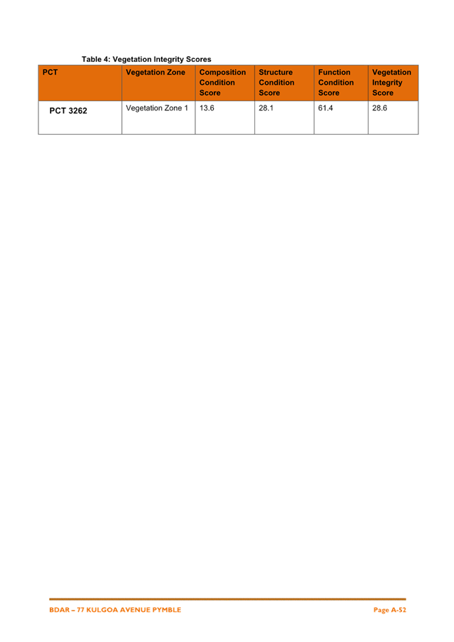
Summary
A Planning Proposal has been submitted for 77 Kulgoa Road,
Pymble which seeks to make the following amendments to the Ku-ring-gai Local
Environmental Plan 2015:
· Rezone
from C4 Environmental Living to R2 Low Density Residential;
· amend
mapped Floor Space Ratio development standard from 0.2:1 to 0.3:1; and
· amend
Minimum Lot Size development standard from 1500sqm to 930sqm.
The Planning Proposal has been assessed and found to have
sufficient strategic and site-specific merit to enable it to proceed to Gateway
Determination and public exhibition, subject to the amendments outlined in Attachment
A1.
Recommendation:
The Ku-ring-gai Local Planning
Panel advise Council that:
A. The
Planning Proposal, amended as per the Table of Amendments Attachment A1,
be submitted to the Department of Planning, Housing and Infrastructure for a
Gateway Determination.
|
Alexandra Plumb
Urban Planner
|
Craige Wyse
Team Leader Urban Planning
|
|
Antony Fabbro
Manager Urban & Heritage Planning
|
Andrew Watson
Director Strategy & Environment
|
|
Attachments:
|
A1 ⇩ ⇩
|
Table
of Amendments - Planning Proposal 77 Kulgoa Road Pymble
|
|
2025/006335
|
|
|
A2 ⇩ ⇩
|
Planning
Proposal 77 Kulgoa Road Pymble 21 August 2024 - PP-2024-1994
|
|
2025/006348
|
|
|
A3⇩
|
Appendix
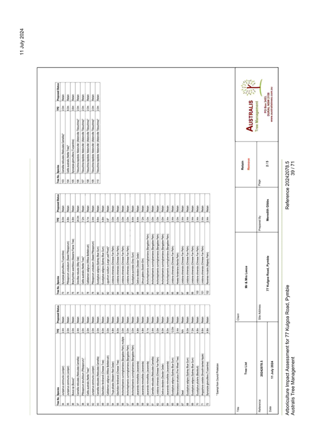
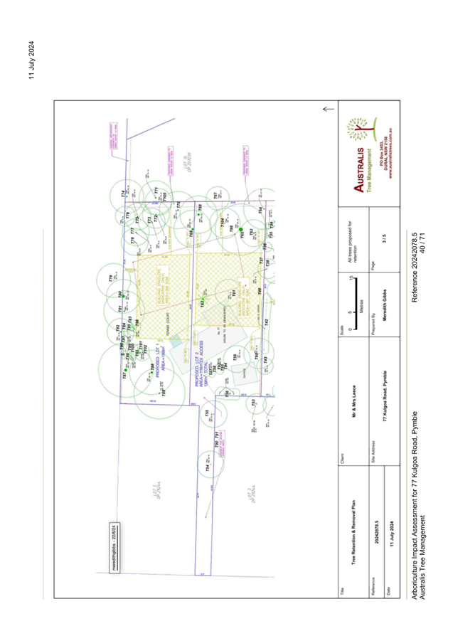
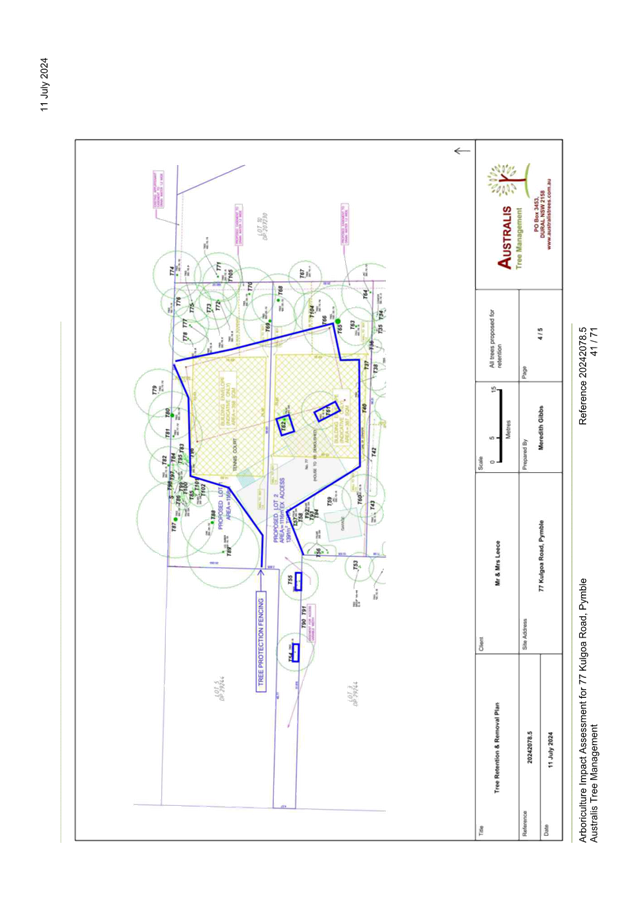
A - Aboricultural Report - 77 Kulgoa Road, Pymble
|
|
2025/006365
|
|
|
A4⇩
|
Appendix
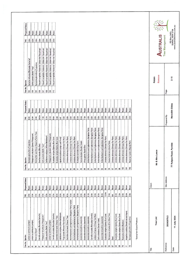
A - Tree Protection Plan - 77 Kulgoa Road Pymble
|
|
2025/008055
|
|
|
A5⇩
|
Appendix
B - Biodiversity Development Assessment Report (BDAR) - 77 Kulgoa Road,
Pymble
|
|
2025/006356
|
|
|
A6⇩
|
Appendix
C - Urban Design Outcome Study Plan of Subdivision R2 zone - 77 Kulgoa Road,
Pymble
|
|
2025/006351
|
|
|
A7⇩
|
Appendix
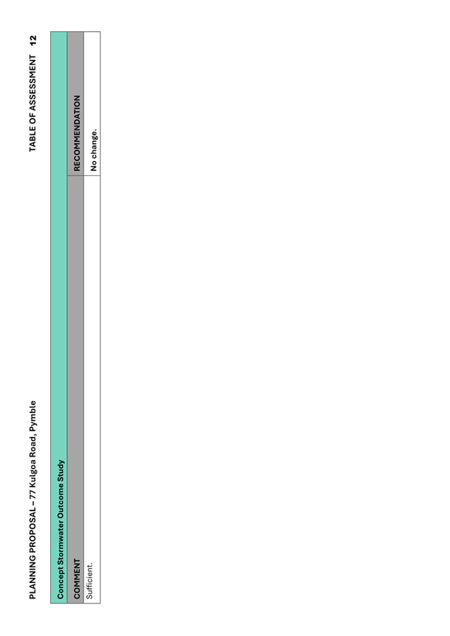
D - Concept Stormwater Outcome Study - 77 Kulgoa Road Pymble
|
|
2025/006361
|
|
|
A8⇩
|
Appendix
E - Site Photographs 77 Kulgoa Road Pymble
|
|
2025/006353
|
|
|
A9⇩
|
Appendix
D - Pre-Planning Proposal Meeting Minutes - 77 Kulgoa Road, Pymble
|
|
2025/006352
|
|
Ku-ring-gai
Local Planning Panel Meeting - 17 February 2025
|
GB.4 / 1
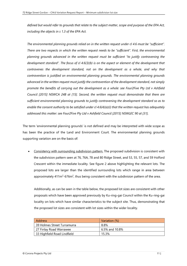
|
|
|
|
|
Item
GB.4
|
S14341
|
9 town
Planning Proposal for 40 Dumaresq Street
Gordon
EXECUTIVE
SUMMARY
Purpose of Report
To refer the Planning Proposal for 40 Dumaresq Street,
Gordon to the KLPP for advice as required by the Local Planning Panels
Direction – Planning Proposals issued by the Minister for Planning under
Section 9.1 of the Environmental Planning and Assessment Act 1979.
Background
Ku-ring-gai
Local Planning Panel 19 August 2024
The Planning Proposal was originally considered at the KLPP
19 August 2024. At this meeting it was decided:
A. That
consideration of the Planning Proposal be deferred to obtain further clarity on
the details of the proposal and that the Council officers prepare a further
report to the Panel in consultation with the Proponent.
B. The
Panel recommends that the proponent address the additional information and
matters identified by Council in Attachment 10 of the Assessment Report.
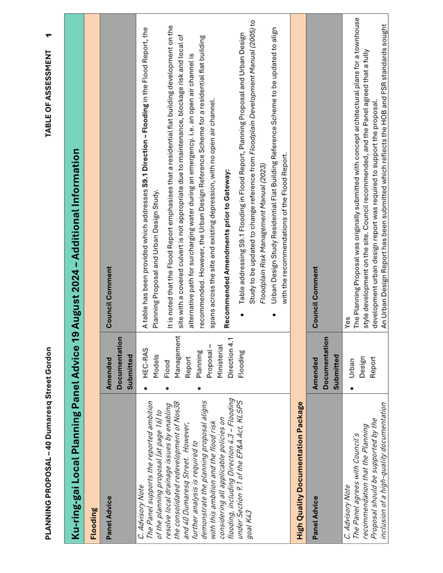
C. Advisory
Note:
The following matters should
be considered in a further assessment:
The Panel
supports the reported ambition of the planning proposal (at page 16) to resolve
local drainage issues by enabling the consolidated redevelopment of Nos38 and
40 Dumaresq Street. However, further analysis is required to demonstrate
the planning proposal aligns with this ambition and the flood risk considering
all applicable policies on flooding, including Direction 4.3 – Flooding
under Section 9.1 of the EP&A Act, KLSPS goal K43.
The
Panel agrees with Council’s recommendation that the Planning Proposal
should be supported by the inclusion of a high-quality documentation package
including a fully developed urban design report. Concept plans should
reflect the proposed land use, Height of Building (HOB) and Floor Space Ratio
(FSR) outcome sought for the combined site.
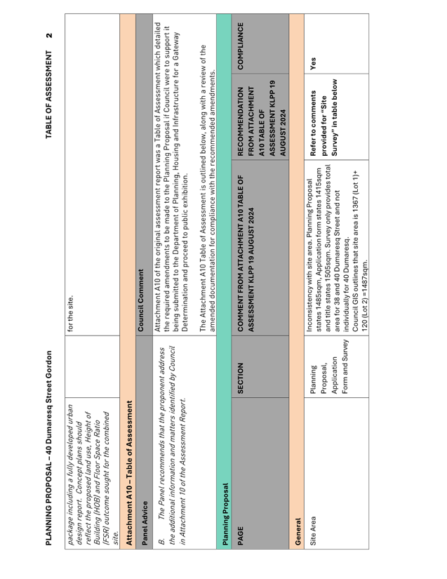
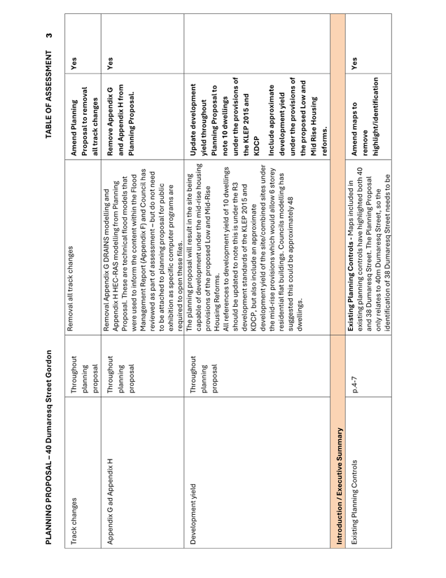
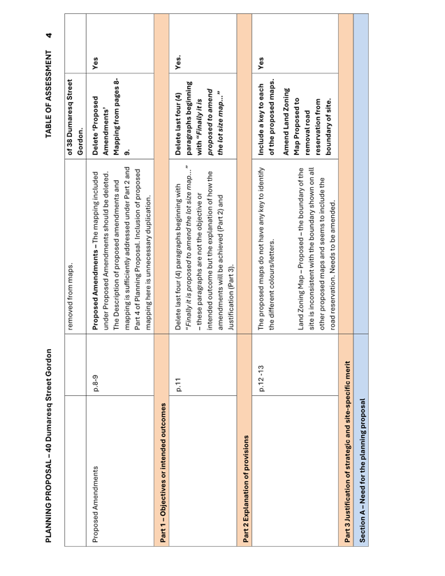
Following the deferral, the proponent submitted amended
documentation on 16 December 2024 to address the matters outlined in the Panels
advice. A table detailing the Panels advice from the KLPP meeting on 19 August
2024 and compliance with the required amendments is included at Attachment
A1.
This report has been updated to include consideration and
assessment of the amended documentation submitted.
Site
Description and Local Context
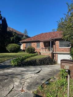
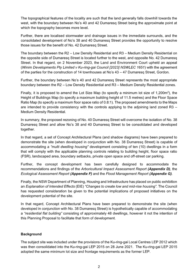
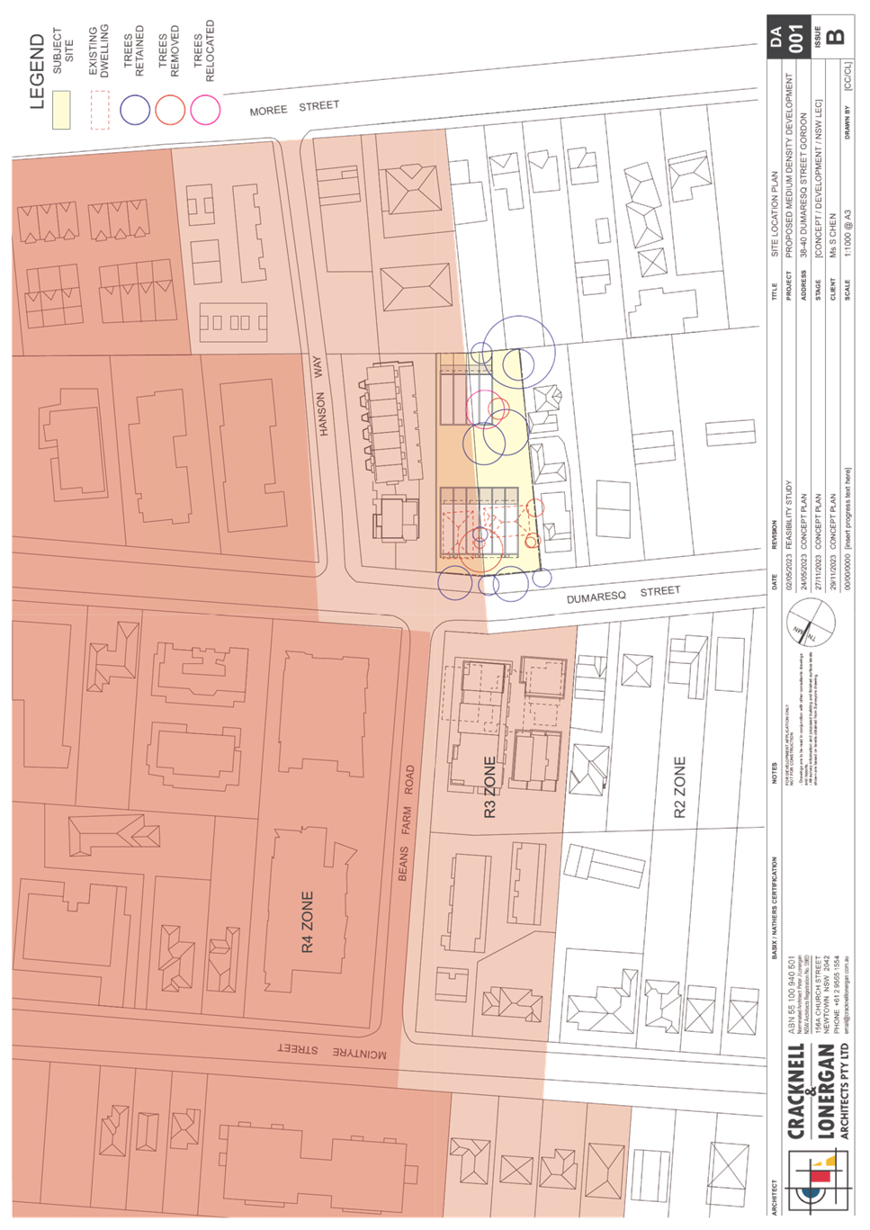
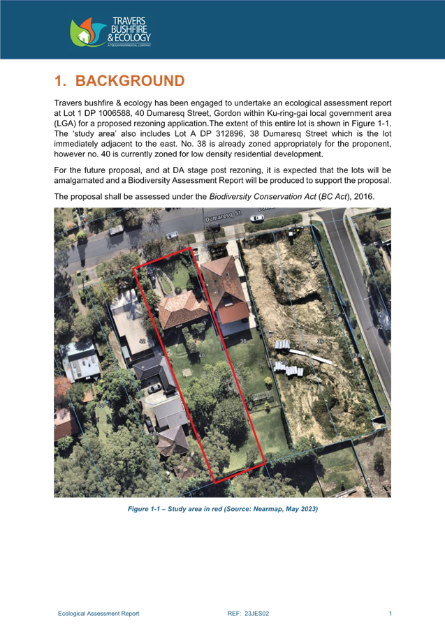
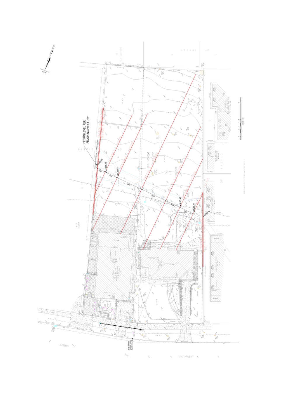
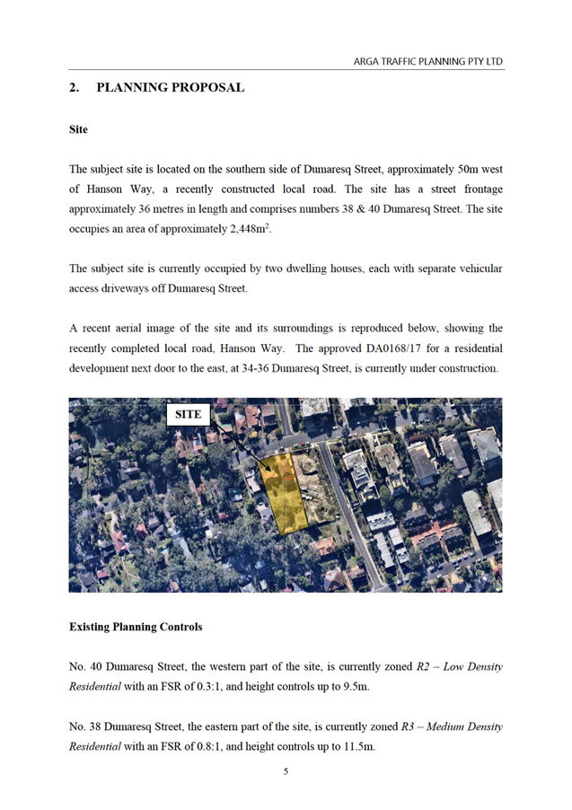
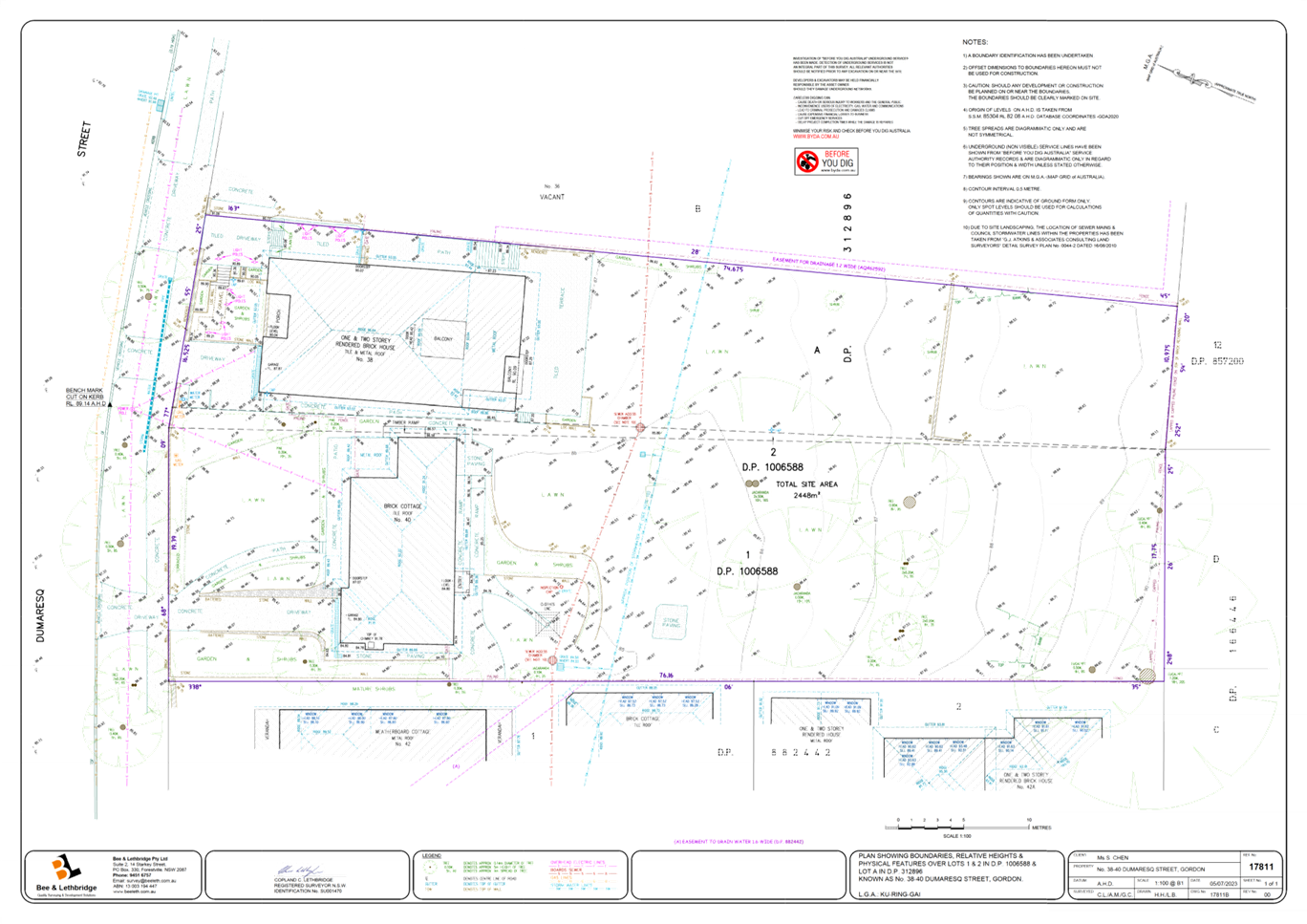
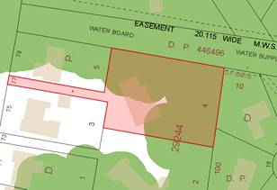
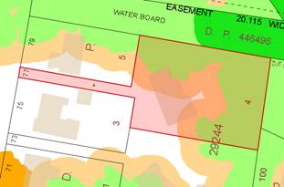
The site that is the subject of this Planning Proposal is 40
Dumaresq Street Gordon (Lot 1 DP1006588 and Lot 2 DP1006588). The site is
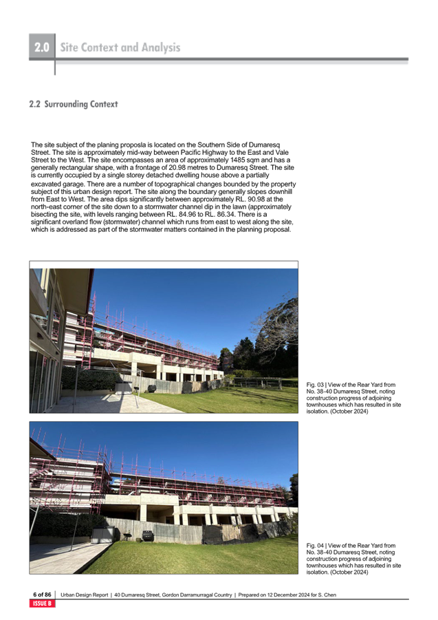
generally rectangular is shape with a frontage of approximately 20m to Dumaresq
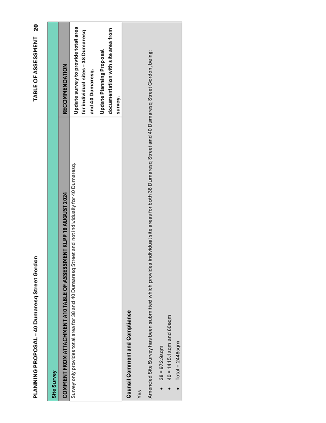
Street. Lot 1 has an area of 1415.1sqm and Lot 2 has an area of 60sqm. The site
has a combined area of 1475.1sqm.
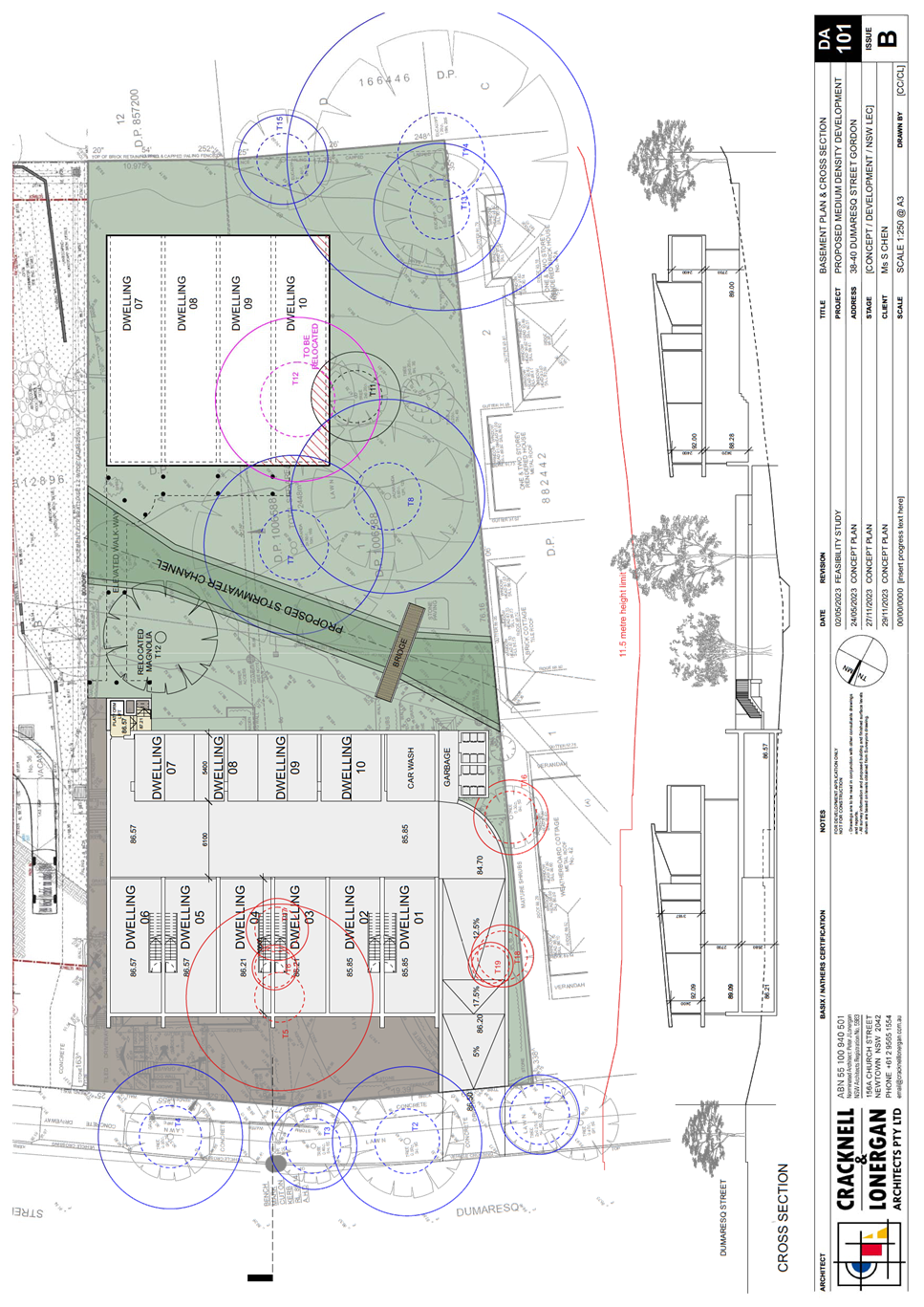
The site falls steeply from each corner of the lot towards a
low point approximately halfway along the western boundary. There is a
localised depression through the middle of the lot, which is known to provide
an overland flow path through the site for any runoff from the upstream
properties.
The site is currently zoned R2 Low Density Residential and
contains a part one, part two storey dwelling house, with vehicle access
provided on the western boundary to Dumaresq Street.
Image: 40 Dumaresq
Street, Gordon
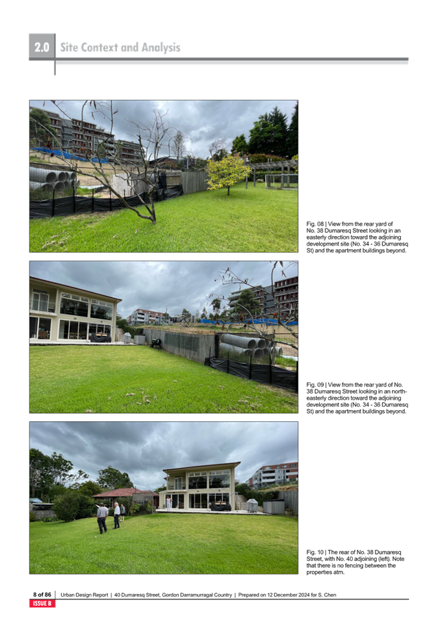
Adjacent to the subject site to the east is 38 Dumaresq
Street which currently comprises a single storey dwelling house, is in the same
ownership as the subject site and is zoned R3 Medium Density Residential.
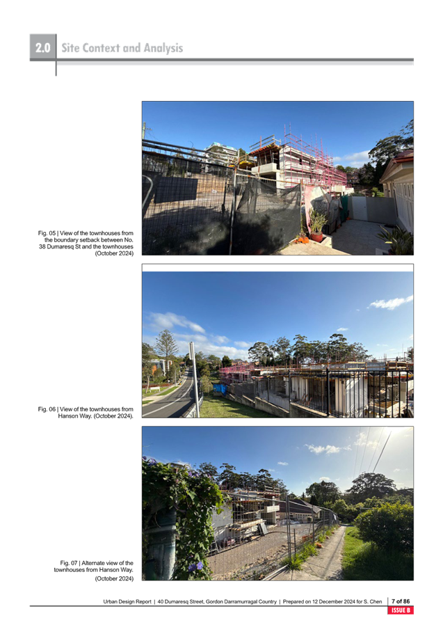
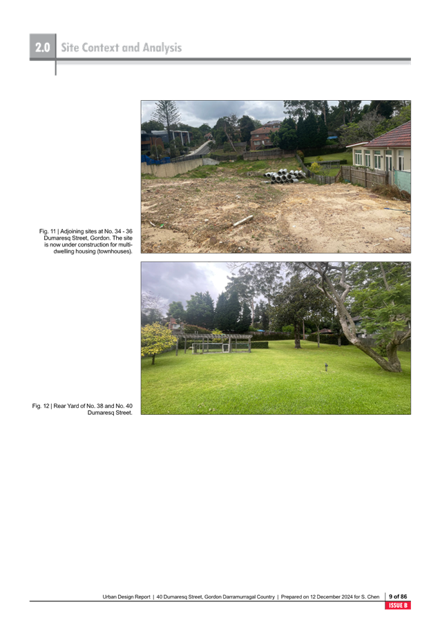
Further to the east on the corner of Dumaresq Street and
Hanson Way is 34-36 Dumaresq Street which is currently under construction for 9
townhouses which are 3 storeys in height. Dumaresq Street on the eastern side
of Hanson Way is zoned R4 High Density Residential and characterised 5-6 storey
residential flat buildings.
To the west of the site are low density residential
dwellings, and the streetscape is characterised by significant tree canopy and
vegetation.
Opposite the site are sites zoned R3 Medium Density
Residential, with Development Consent at 43-47 Dumaresq Street for 14
townhouses.
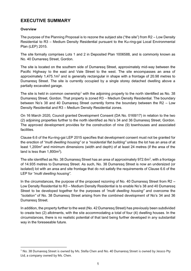
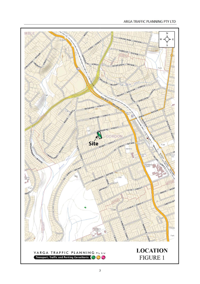
The subject site is located approximately 350m from the
Pacific Highway and the Gordon Centre. The site is located approximately 70m
from Gordon Glen, a small park on the opposite side of Dumaresq Street which
contains a playground and seating.
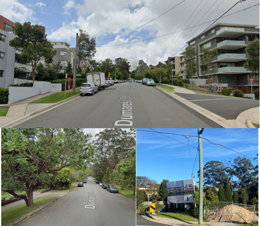
Image: Surrounding
context
Comments
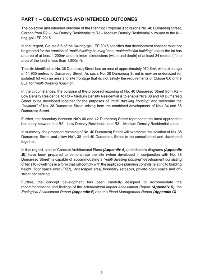
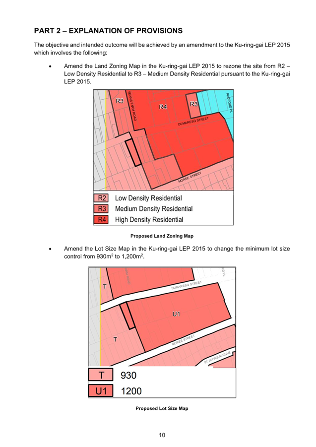
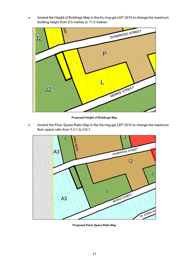
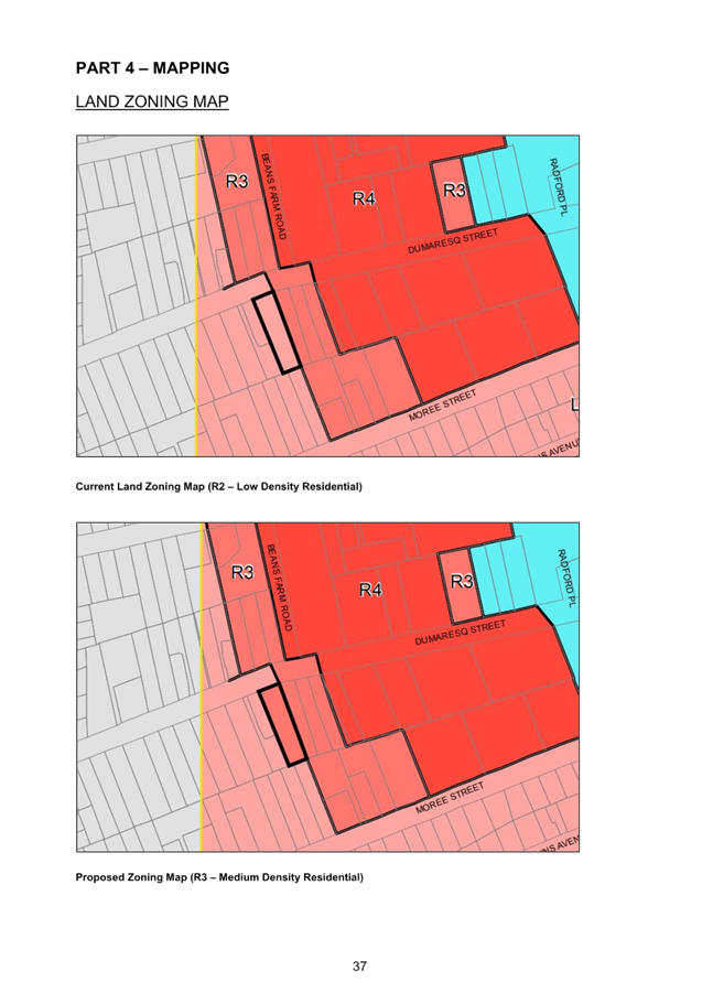
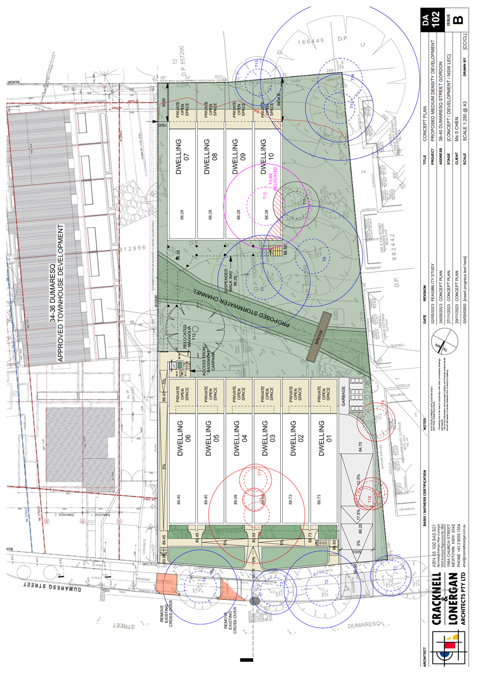
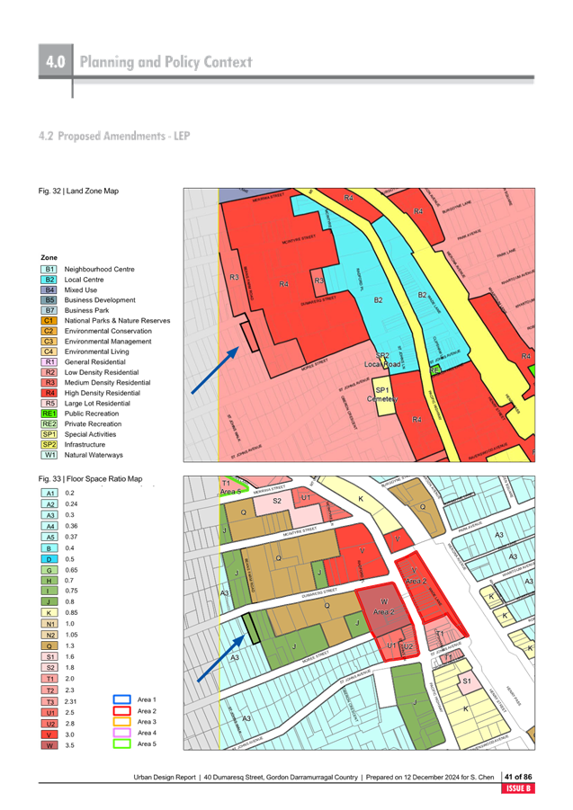
The Planning Proposal seeks to amend the Ku-ring-gai
Local Environmental Plan 2015 to rezone the site from R2 Low Density
Residential to R3 Medium Density Residential and amend the development
standards applying to the site as follows:
|
KLEP 2015 – Zoning and
Development Standards – 40 Dumaresq Street Gordon
|
|
|
Existing
|
Proposed
|
|
Zoning
|
R2 Low Density
Residential
|
R3 Medium Density
Residential
|
|
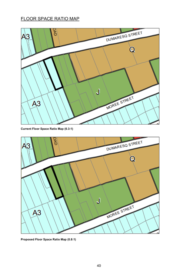
Floor Space Ratio
|
0.3:1
|
0.8:1
|
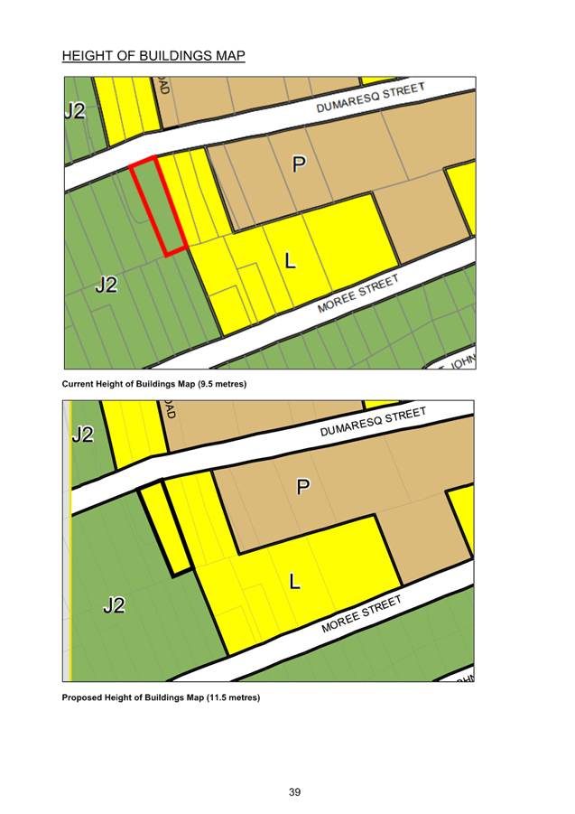
|
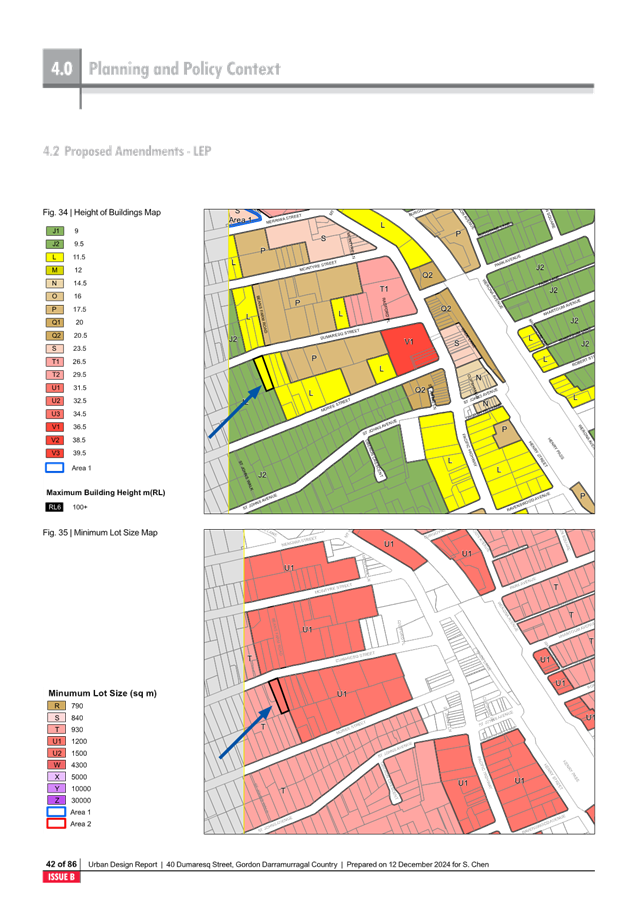
Height of Buildings
|
9.5m
|
11.5m
|
|
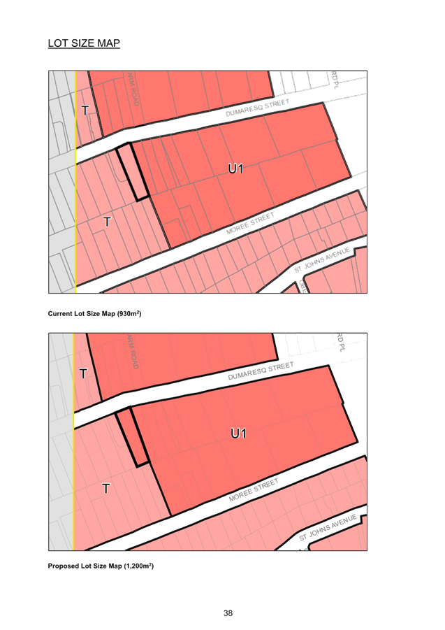
Minimum Lot Size
|
930sqm
|
1,200sqm
|
The objective of the Planning Proposal is to rezone the
subject site to R3 Medium Density Residential so that it may be consolidated
and developed together with 38 Dumaresq Street, which is in the same ownership.
This would overcome the isolated status of 38 Dumaresq Street.
Chronology of Assessment
A pre-lodgement meeting was
held on 9 May 2023. The Planning Proposal was submitted on the Planning Portal
on 18 October 2023. The Planning Proposal was incomplete. Revised information
was submitted on 11 December 2023 and 23 February 2023. Following the payment
of fees, the Planning Proposal was formally lodged and assessment commence on
28 March 2024.
Merit
A Planning Proposal is not a
Development Application and does not consider the specific detailed matters for
consideration under Section 4.15 of the Environmental Planning and
Assessment Act 1979. A Planning Proposal only relates to an LEP amendment
and cannot be tied to a specific development. The proposed amendments need to
be acceptable as an outcome on the site regardless of the subsequent approval
or refusal of any future Development Application.
A Planning Proposal must demonstrate the site specific and
strategic merit of the proposed amendments.
The Planning Proposal and Appendices are included at Attachment
A2-A11.
The following is an assessment of the relevant merits of the
Planning Proposal:
Site Specific Merit Assessment
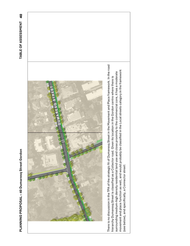
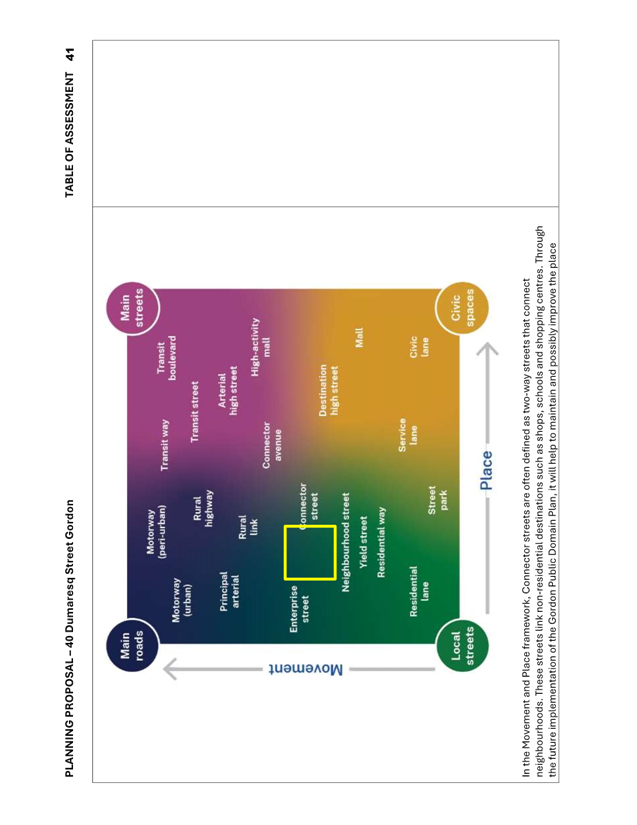
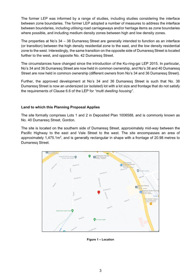
Zoning – History, Interface,
Isolation and Surrounding Context
The subject site is current
zoned R2 Low Density Residential and is the boundary of the transition from R3
Medium Density to R2 Low Density on the southern side of Dumaresq Street. To
the west downslope is also zoned R2 Low Density Residential and to the east is
zoned R3 Medium Density Residential. Further to the east (opposite side of
Hanson Way) up Dumaresq Street is zoned R4 High Density Residential.
The adjoining three (3) properties to the east – 38,
36, and 34 Dumaresq Street- are zoned R3 Medium Density Residential. During the
preparation of the Ku-ring-gai Local Environmental Plan (Local Centres) 2012
Council considered that these sites were highly impacted by overlooking, scale
and overshadowing from the adjoining high density residential development and
upzoned the three sites to R3 Medium Density Residential. It was considered
that the R3 Medium Density Residential zoning on these sites would enable site
amalgamation and the ability to achieve a comprehensive development that would
be able to mitigate the overlooking and scale impacts. It was envisioned that
38, 36 and 34 Dumaresq Street would be amalgamated as one development site.
Council has commonly used the application of the R3 Medium
Density Residential zone as an interface or transition zone between areas of
high density and low density. This approach results in a stepping down of
development density, so as not to have a poor interface of low density
adjoining high density development.
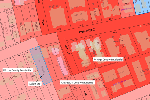
Image: Zoning
Context
While it was Council’s intentions that 34, 36 and 38
Dumaresq Street be redeveloped as one consolidated lot, Development Application
REV0005/19 was approved in 2020 for the construction of 9 townhouses on 34 and
36 Dumaresq Street. This approval and subsequent commencement of construction
has resulted in 38 Dumaresq Street now being considered an isolated site as it
does not meet the minimum lot size (1200sqm) or depth (24m) requirements for
multi dwelling housing under Clause 6.6 of the KLEP 2015, and therefore unable
to meet the full development potential of its R3 zoning. In granting the
approval, the issue of the isolation of 38 Dumaresq Street was the subject of
in-depth assessment, and it was demonstrated that there were numerous
negotiation attempts and reasonable offers made to the owner of 38 Dumaresq
Street.
A key justification within the Planning Proposal for the
rezoning of the subject site at 40 Dumaresq Street is to enable 38 and 40
Dumaresq Street which are currently in the same ownership to be developed
together for the purpose of ‘multi dwelling housing’ and overcome
the isolation of 38 Dumaresq Street. The proposed rezoning of the site to
R3 Medium Density Residential will allow for a better planning outcome on the
site by providing for the orderly and economic development of residential land
by allowing the site to be redeveloped with the adjoining property and overcome
the isolation, while maintaining the local character.

Image: Adjoining
isolated site and development site
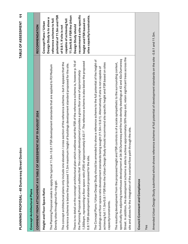
Height and Floor Space Ratio
The Planning Proposal seeks to apply a height of buildings
development standard of 11.5m (3 storey) to the subject site. This is the
typical height of buildings development standard that is applied to R3 Medium
Density zoned sites throughout Ku-ring-gai. The Planning Proposal seeks to
apply a Floor Space Ratio development standard of 0.8:1 to the subject site.
This is the typical Floor Space Ratio development standard that is applied to
R3 Medium Density zoned sites throughout Ku-ring-gai.
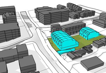
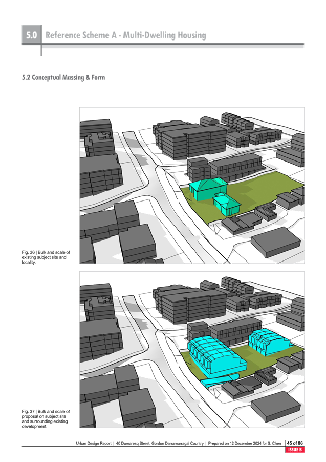
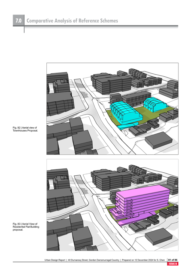
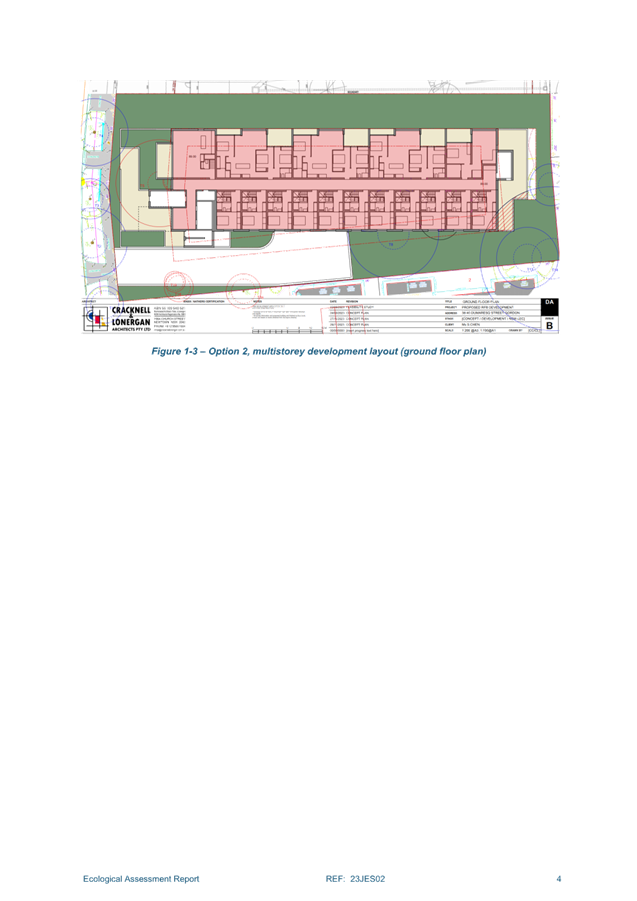
The Urban Design Study submitted includes a reference scheme
modelling the proposed height and floor space ratio development standards on
the site.
Image: Reference
Scheme Multi Dwelling Housing – Urban Design Study
The resulting development from the proposed height and FSR
controls is of a scale that is sympathetic to the surrounding context,
specifically the adjoining townhouse development at 34-36 Dumaresq and the
low-density dwellings at 42 and 42a Dumaresq Street. In addition, the
development scheme is able to achieve approximately 50% deep soil, retain
significant trees across the site and allows for the integration of the
overland flow path through the site.
Minimum
Lot Size
The Planning Proposal seeks to apply a minimum lot size
development standard of 1,200sqm to the subject site. This is the standard
minimum lot size development standard that is applied to R3 Medium Density
zoned sites throughout Ku-ring-gai, and this is consistent with the 1,200sqm
minimum lot size required under Clause 6.6 for the development of multi
dwelling housing in the R3 Medium Density.
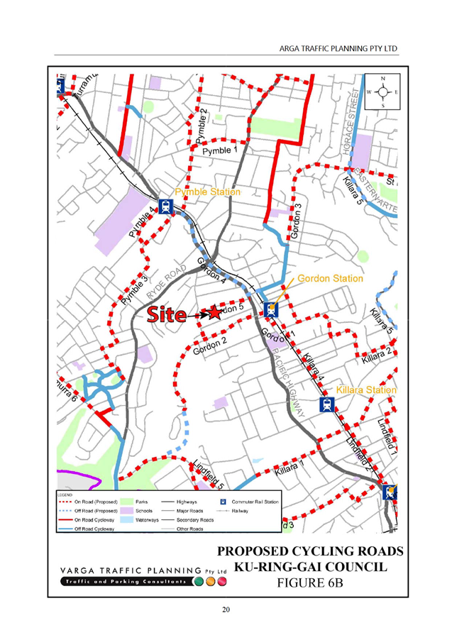
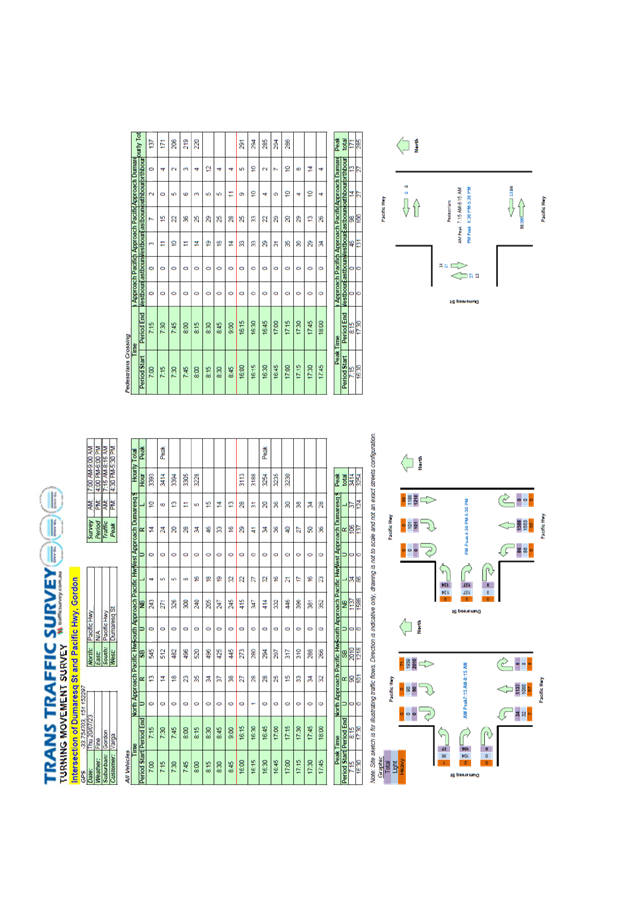
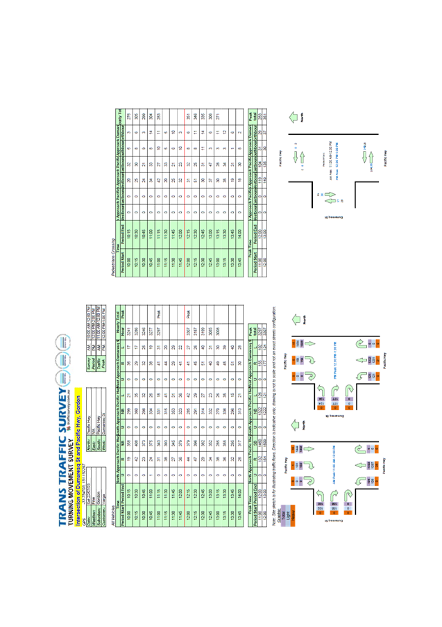
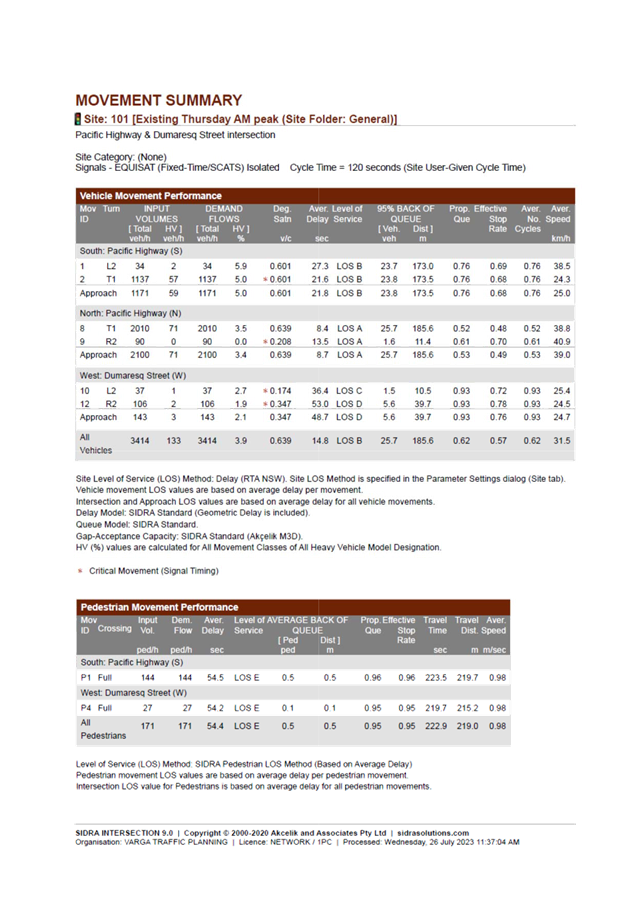
Traffic
and Transport
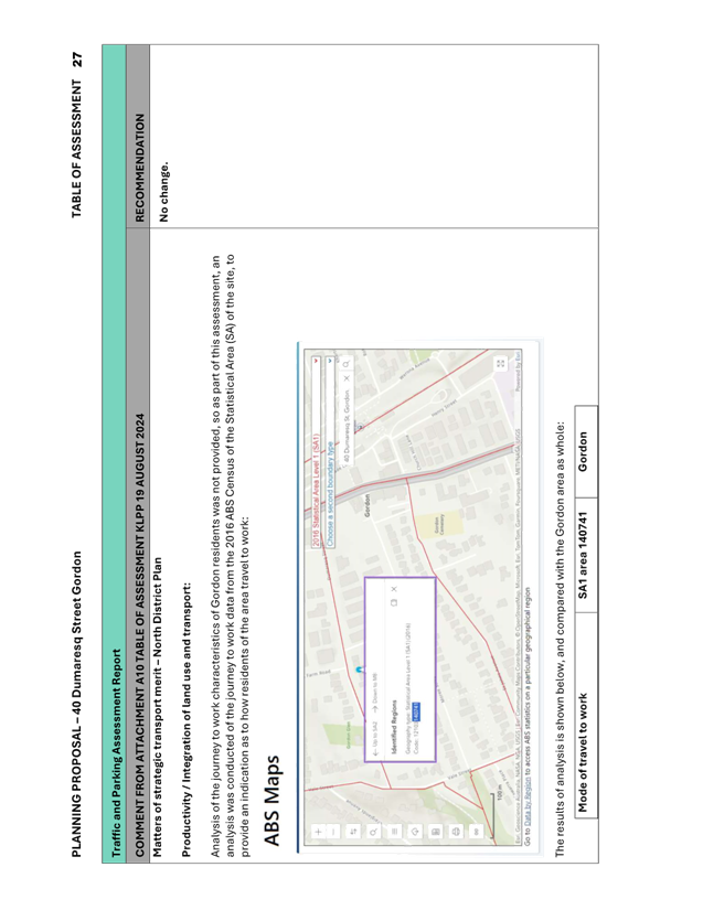
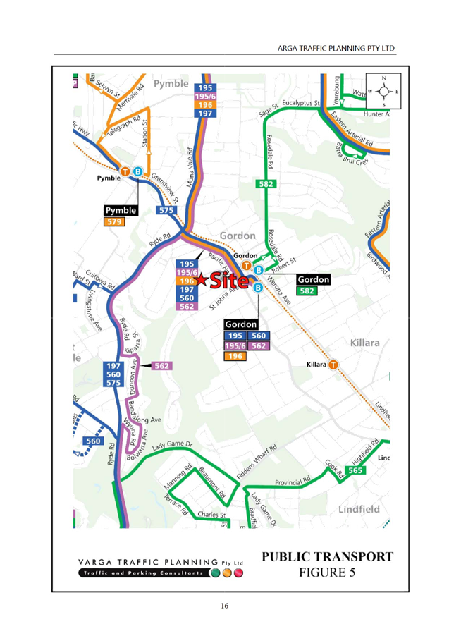
The Planning Proposal has the following favourable transport
aspects:
· Residents
in the Statistical Area of the site use public transport more for their
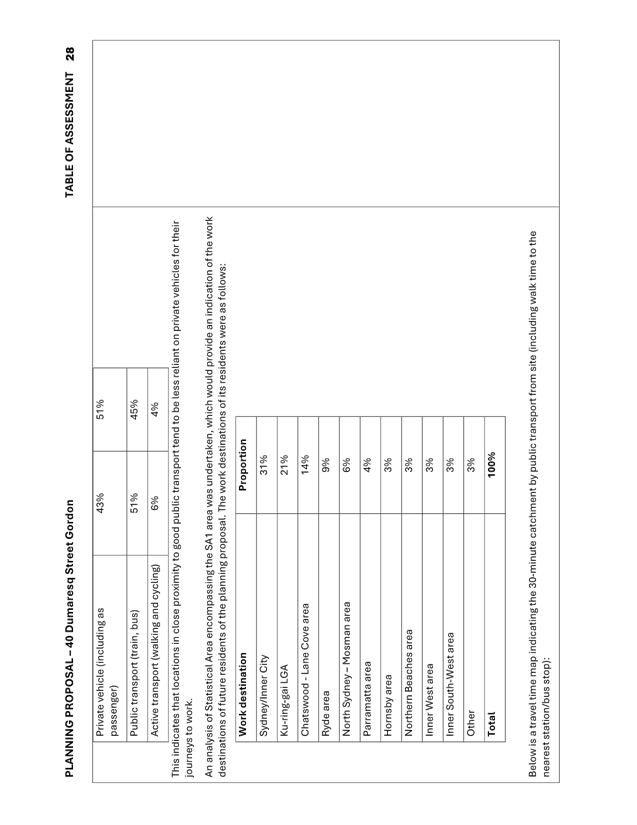
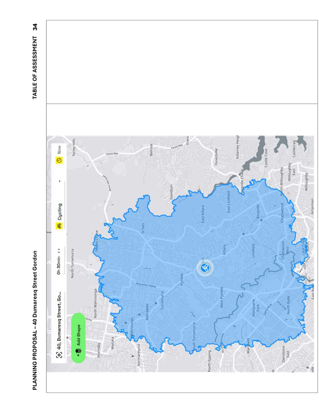
journeys to work than the Gordon suburb as a whole.
· Based
on the work destinations of current residents in nearby surrounding Statistical
Areas, nearby Strategic Centres are expected to be key work destinations for
future residents of the site.
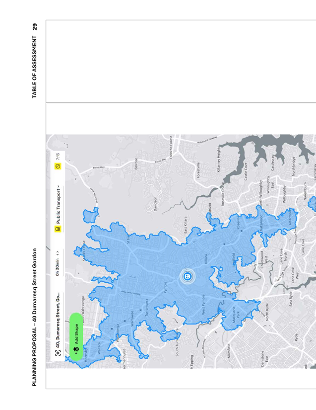
· The
site is located within 700m of Gordon station, which provides access to the
Sydney Trains and Sydney Metro network. The demand resulting from the Planning
Proposal is modest and unlikely to impact on train or platform capacity.
· The
site is well positioned to take advantage of the recent opening of the
Chatswood to Sydenham component of Sydney Metro, and future conversion to rapid
bus line of the existing express bus service from Chatswood to Dee Why, as well
as future frequent bus services between Mona Vale and Macquarie Park.
· There
is a good selection of retail, health/medical, leisure/recreational and
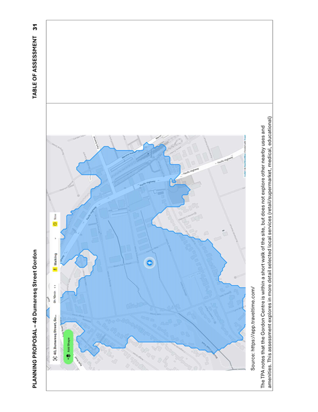
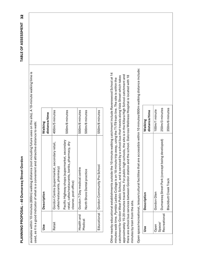
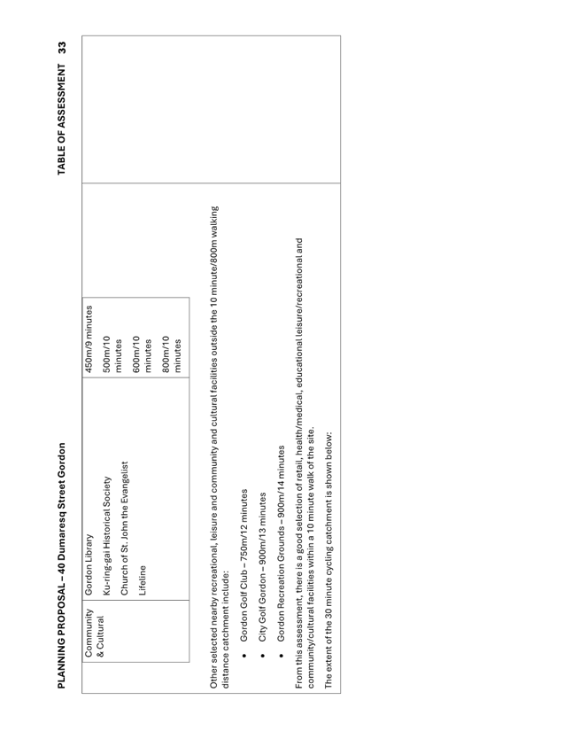
community/cultural facilities within a 10 minute walk of the site.
· Due to
the modest number of additional vehicle trips expected to be generated from the
site, the proposal is not expected to have significant additional impact on the
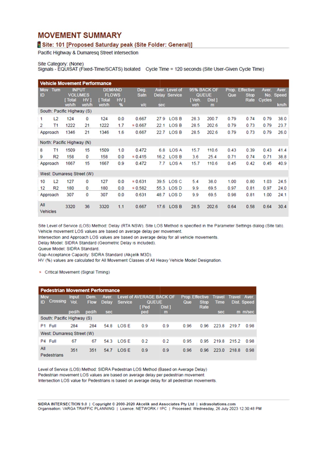
operation of the intersection of the Pacific Highway and Dumaresq Street.
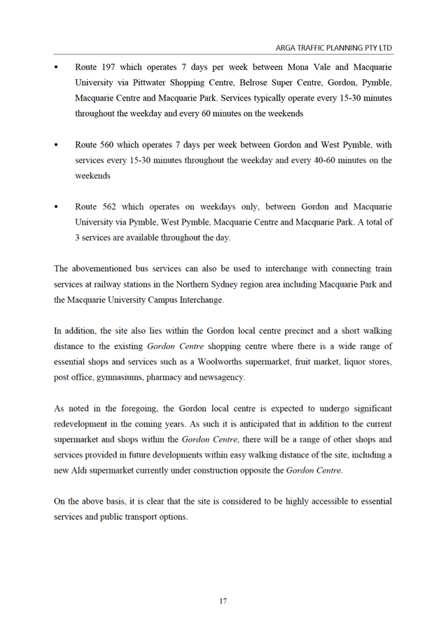
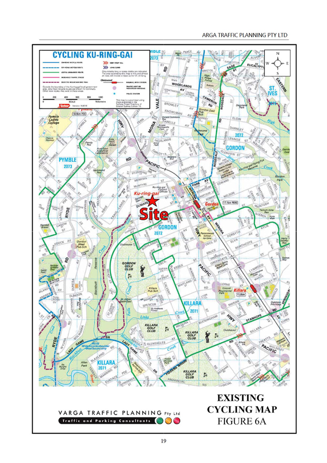
The following transport constraints were found with respect
to the Planning Proposal:
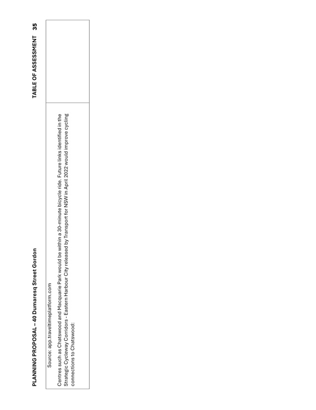
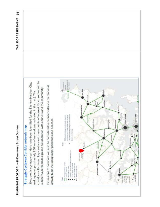
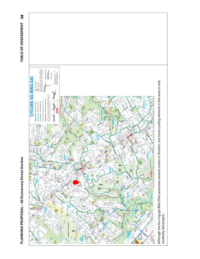
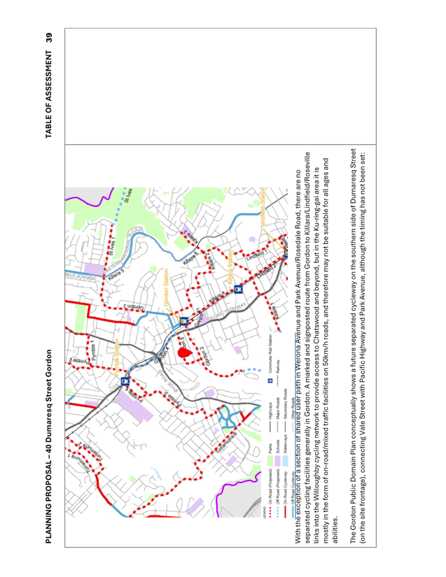
The local cycling network in the area is largely
underdeveloped, limiting local and regional cycling connectivity.
· Public
Primary and High Schools are not within walking distance, although this is
moderated somewhat by school buses that travel near the site.
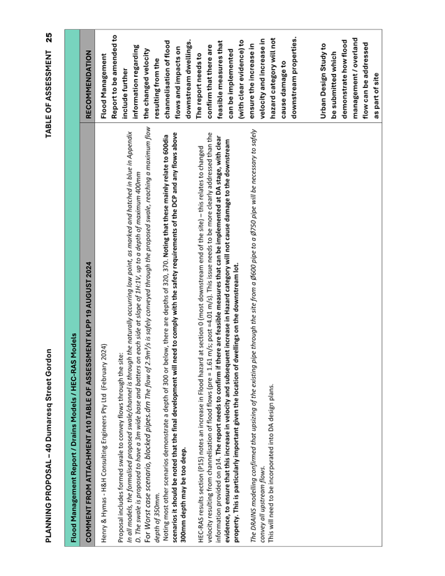
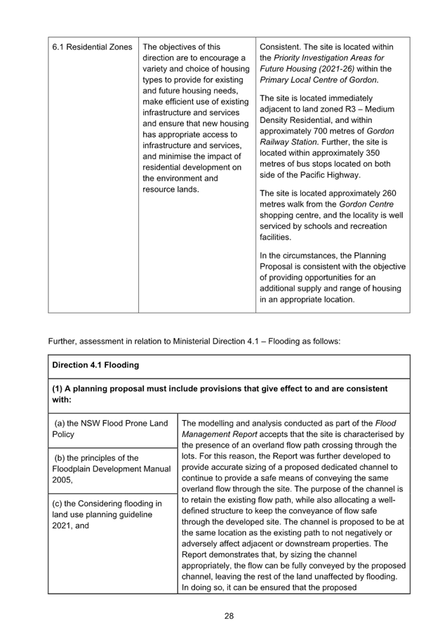
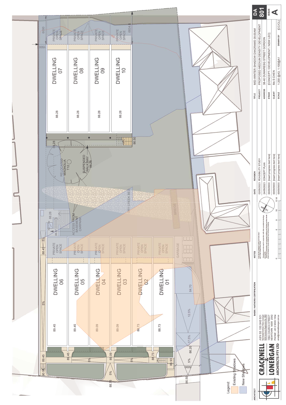
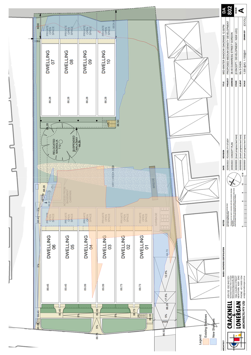
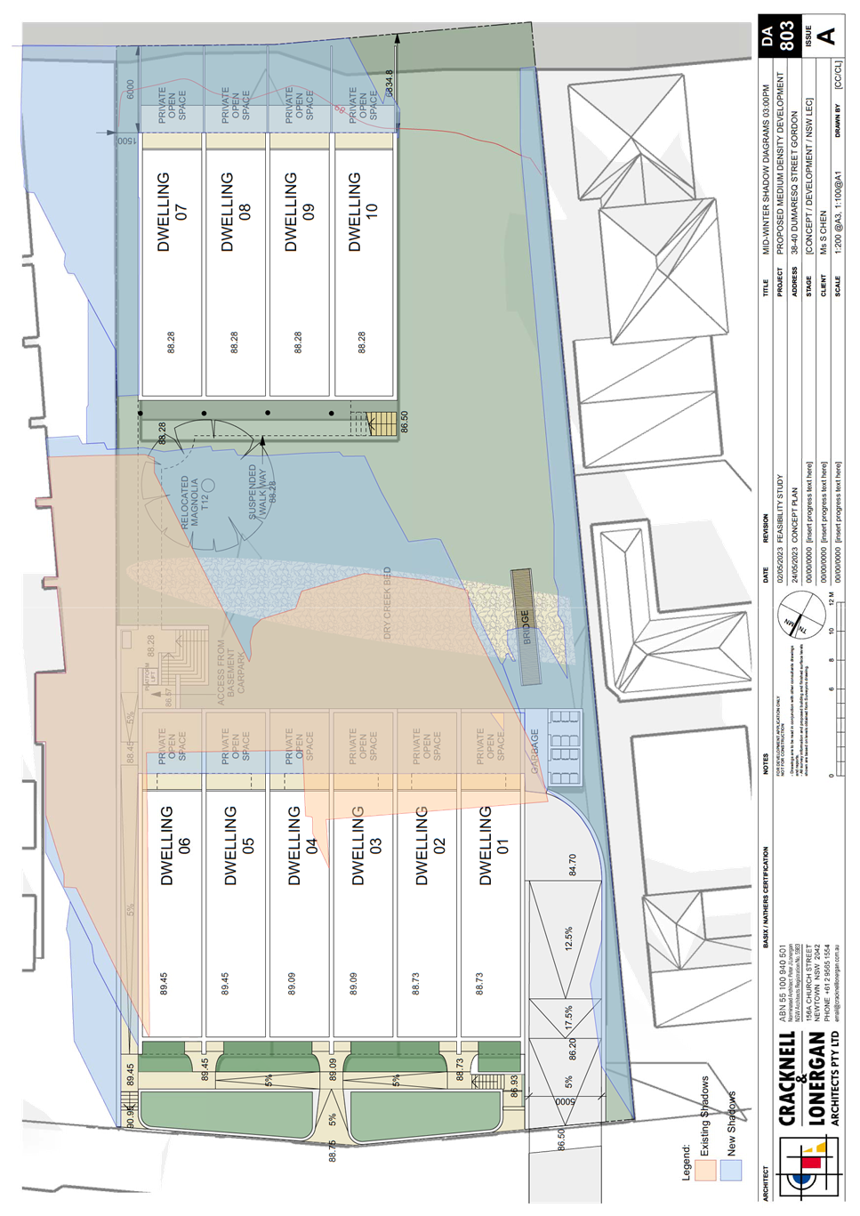
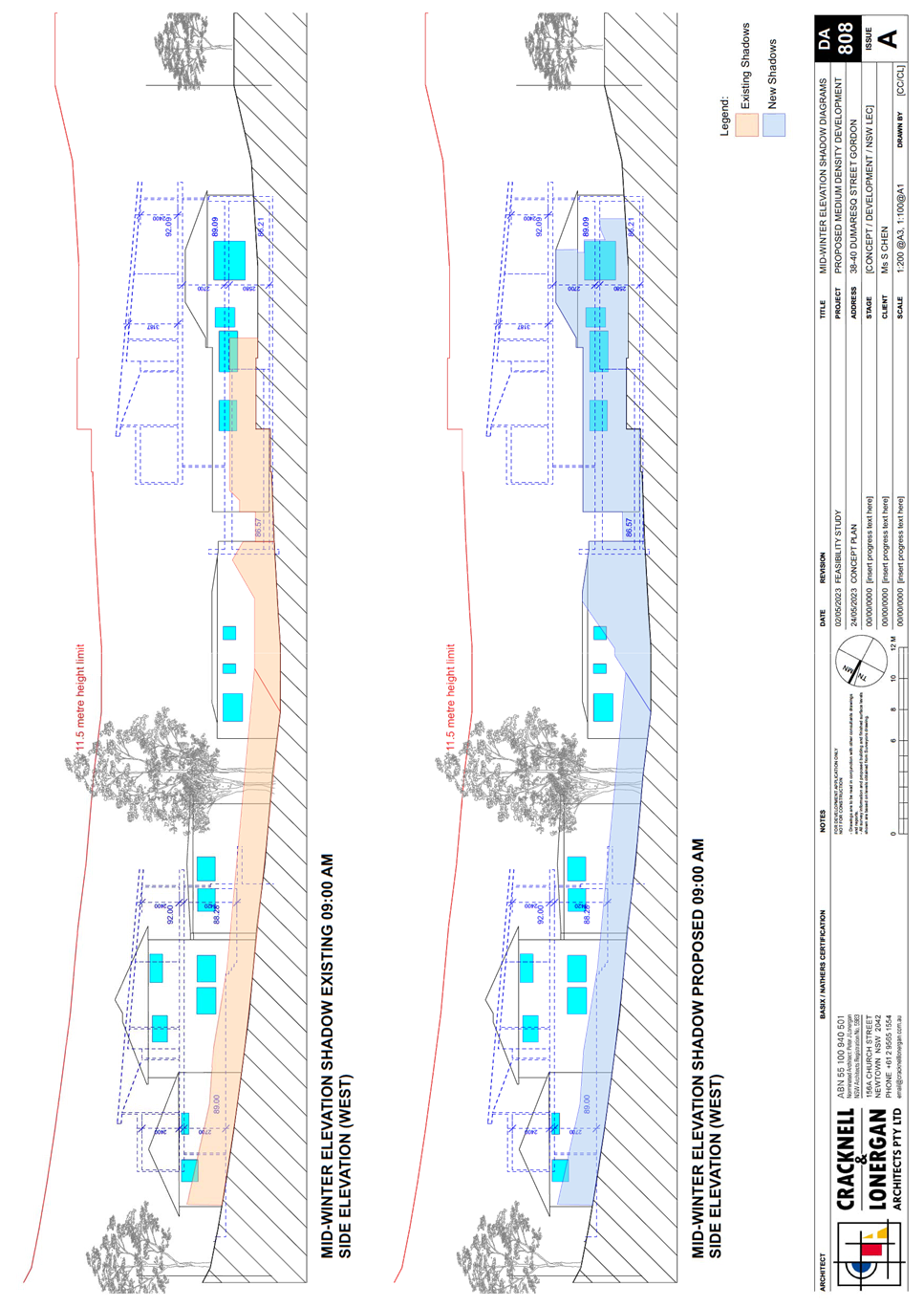
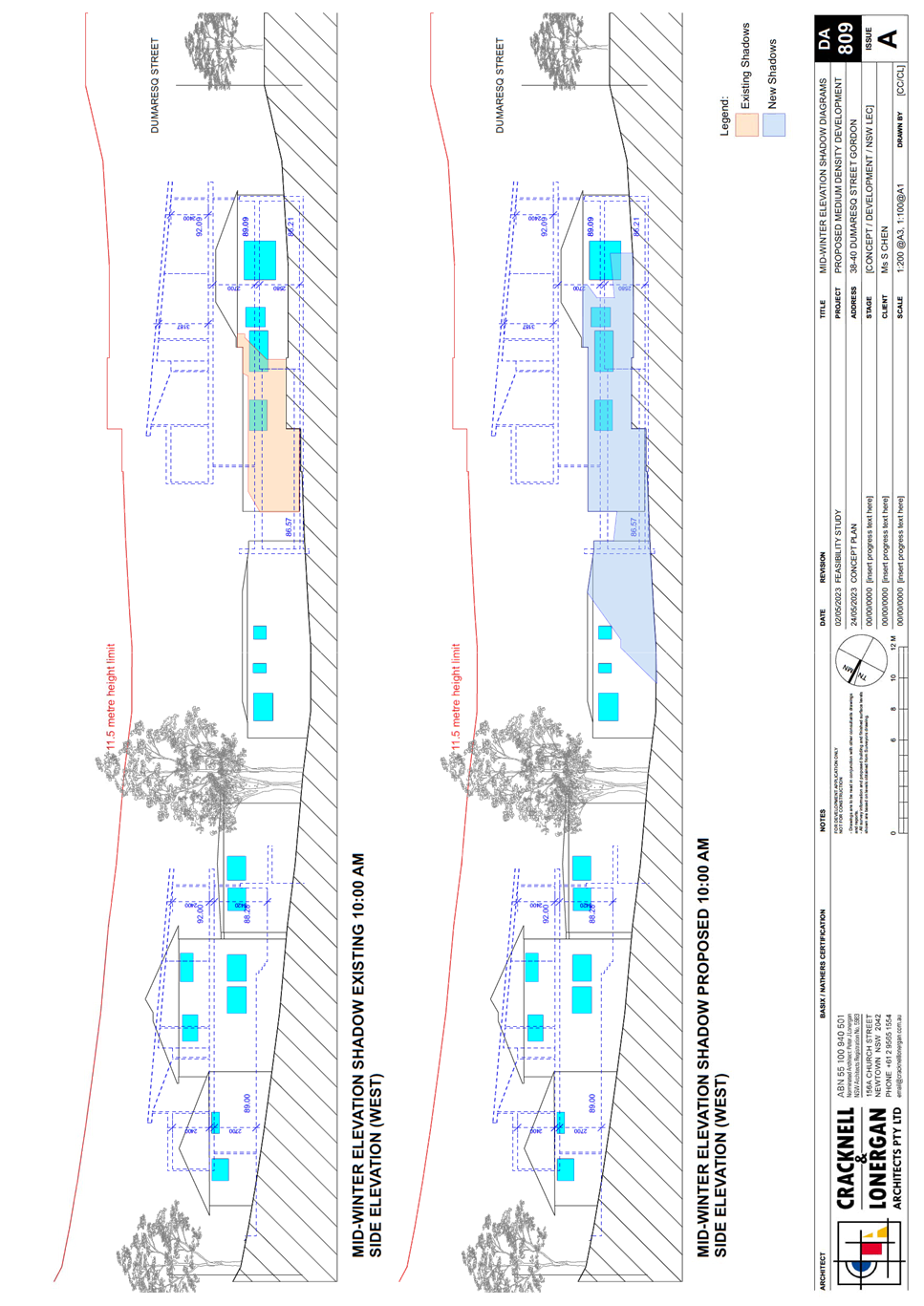
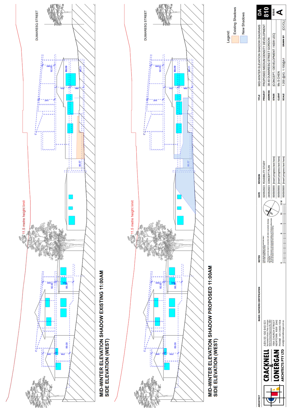
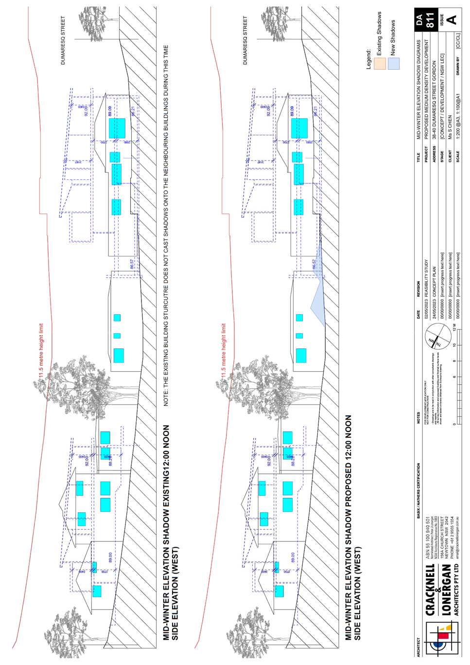
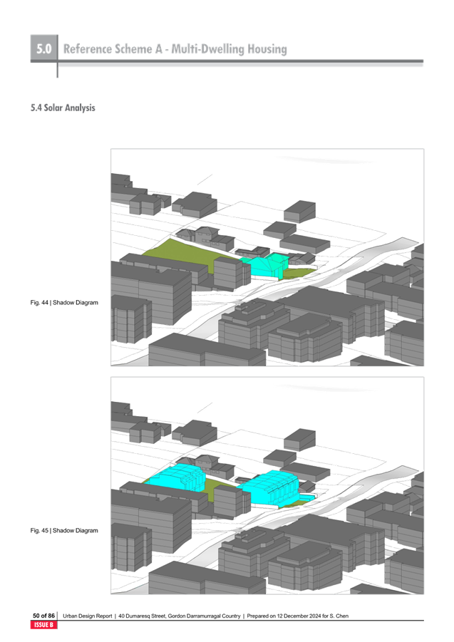
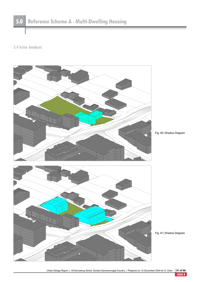
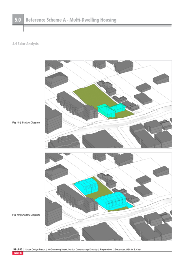
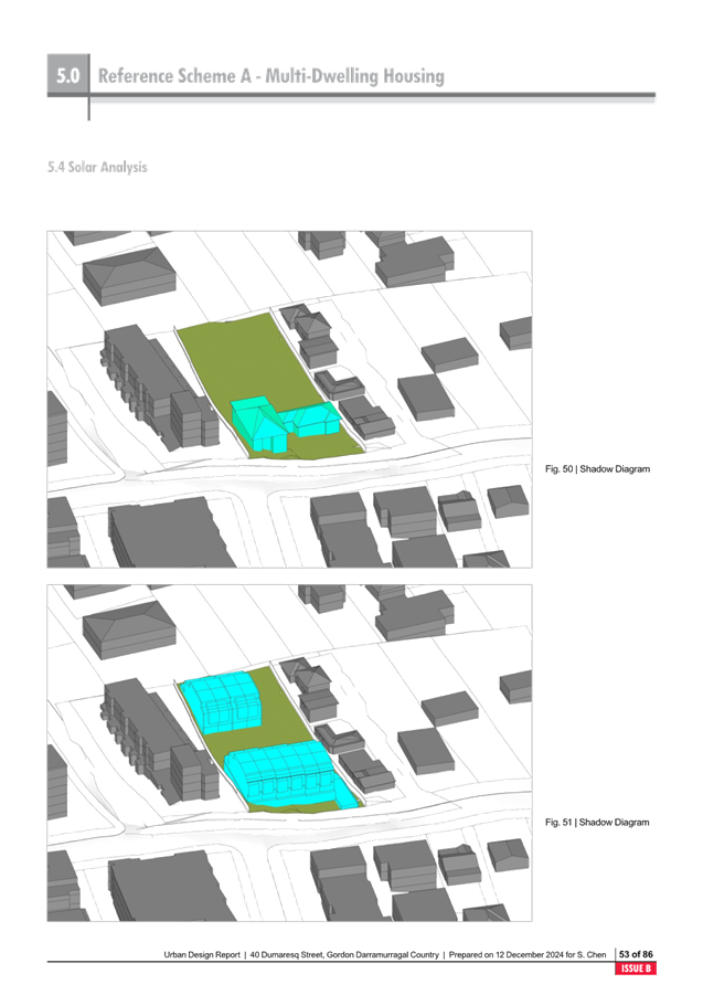
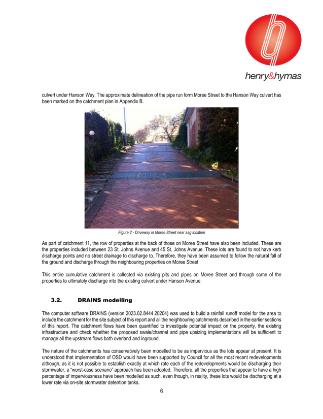
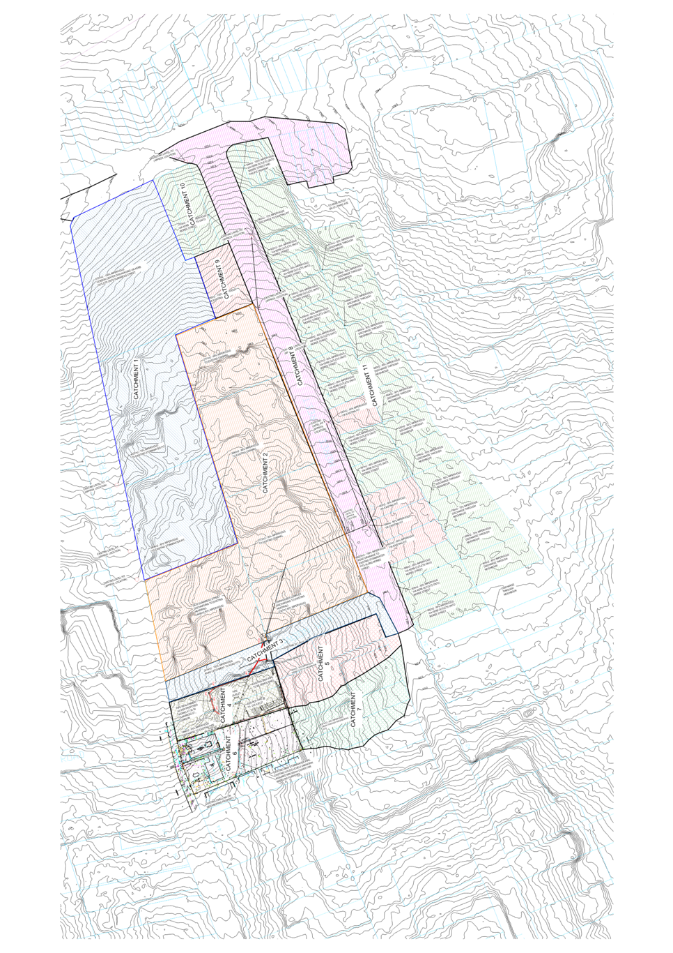
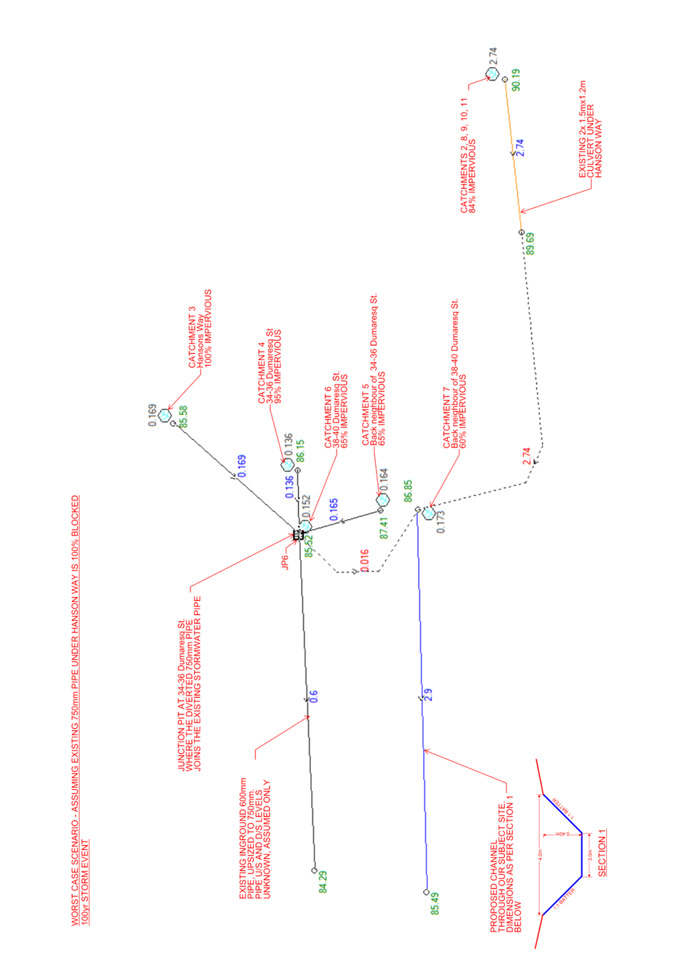
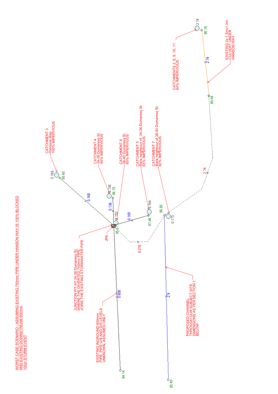
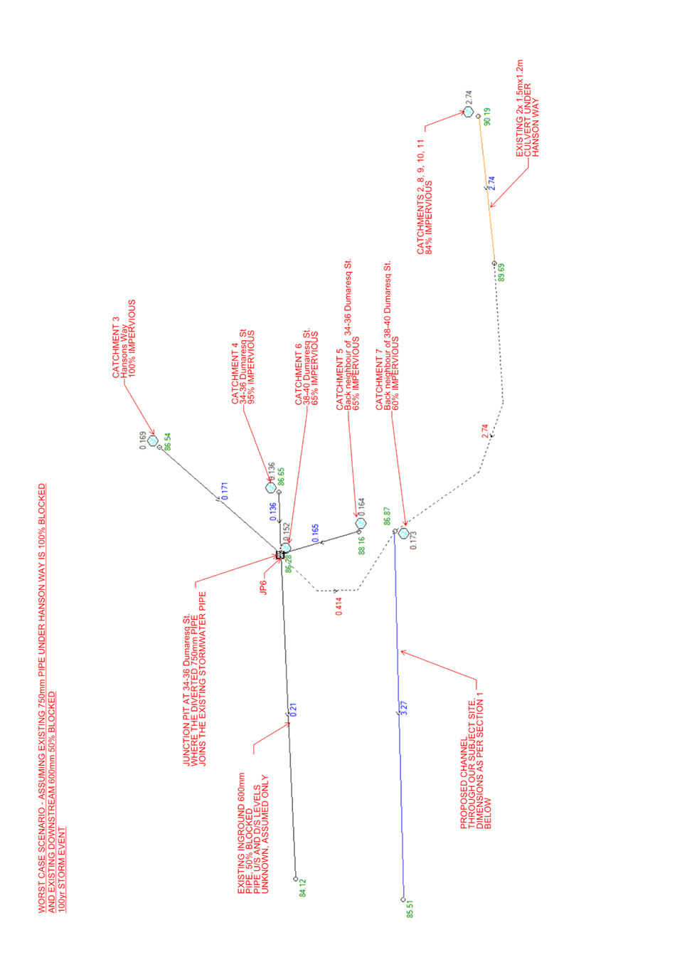
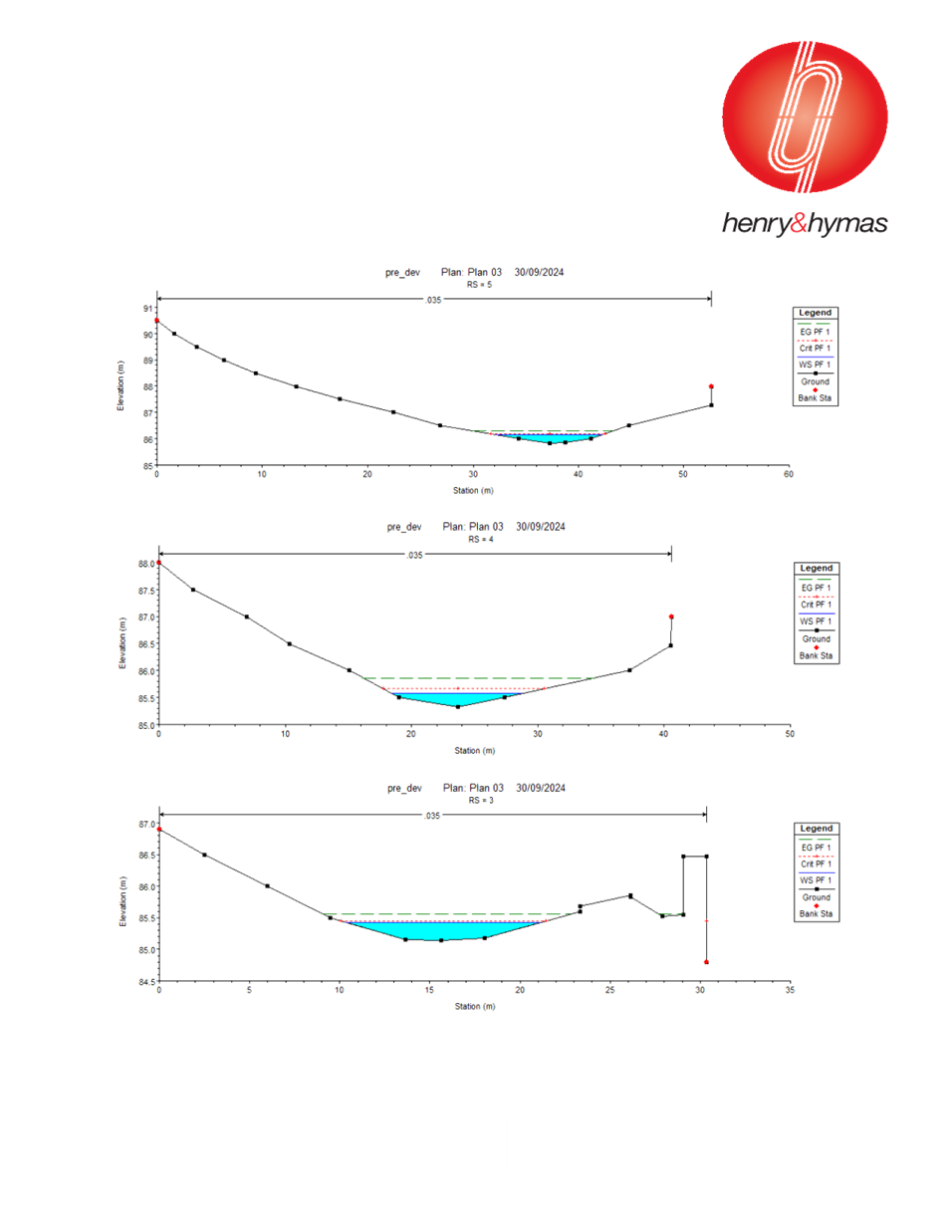
Flood
and Stormwater
The site has been identified as being impacted by the
Overland Flow Flood Planning Area, and in addition the owner has stated they
have experienced flooding from 34-36 Dumaresq Street. The Planning Proposal is
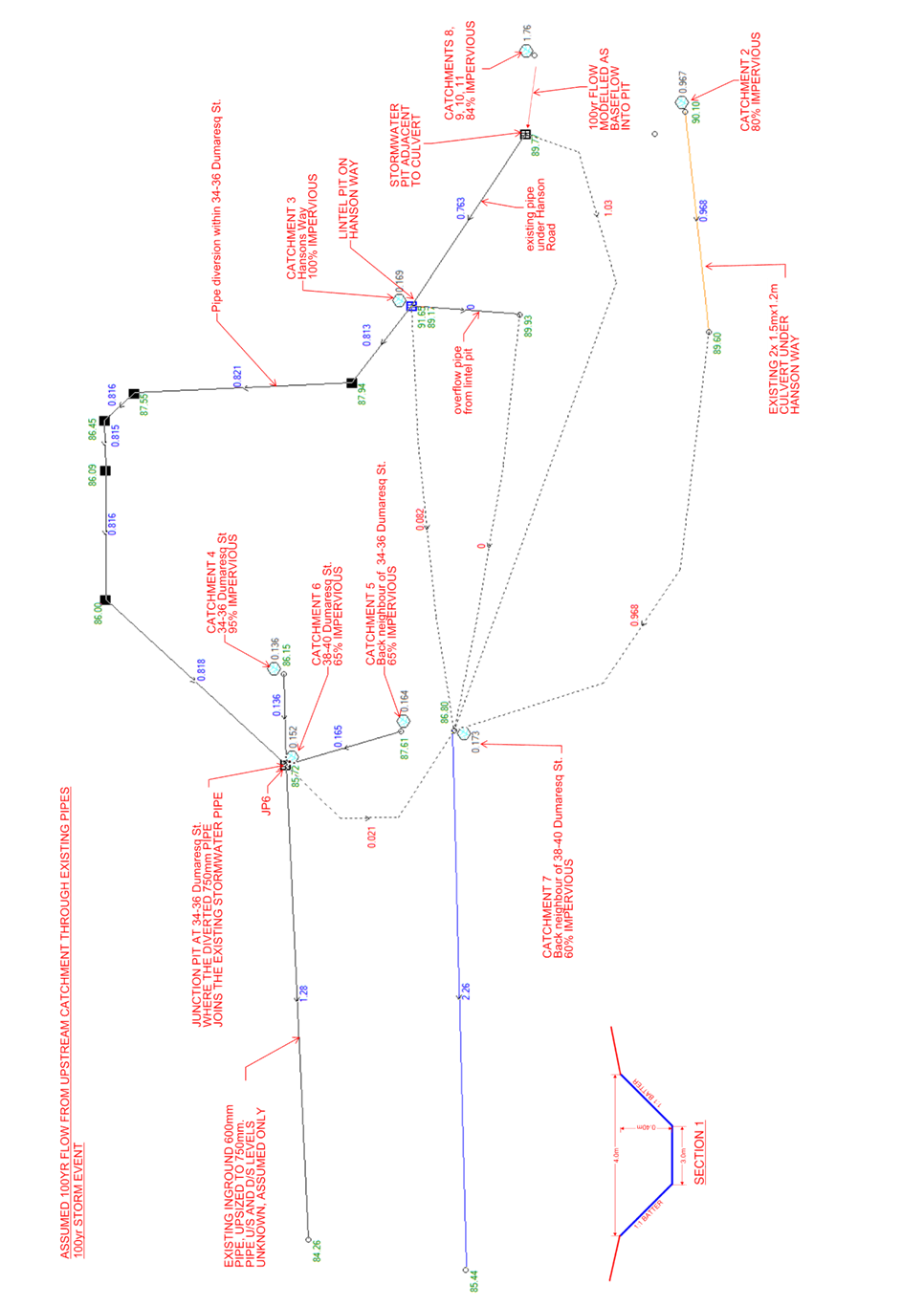
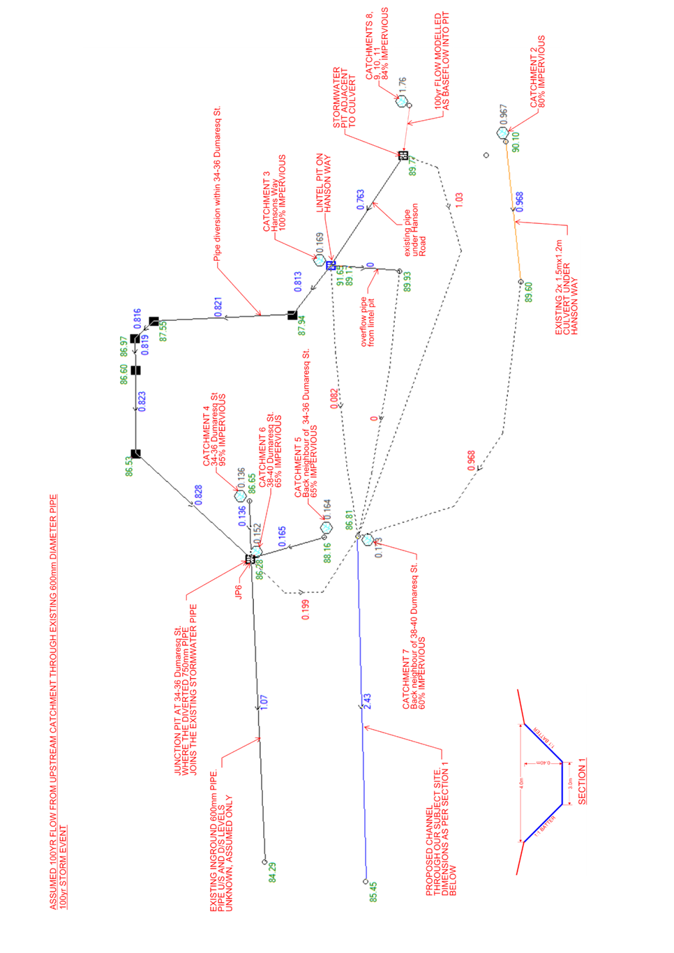
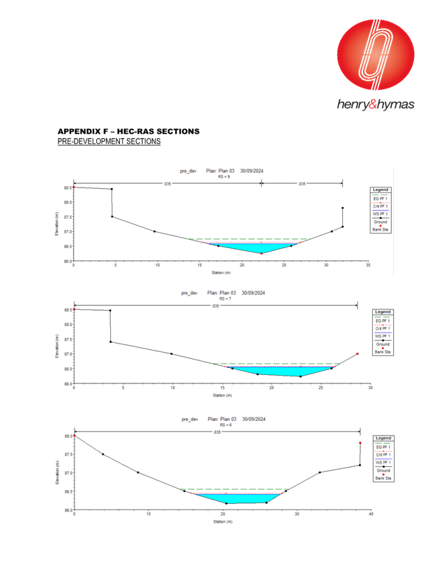
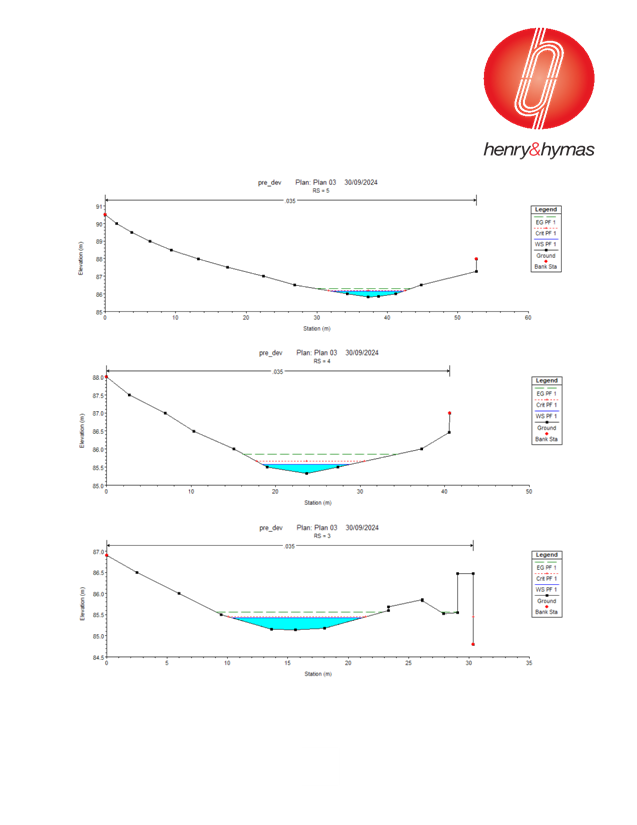
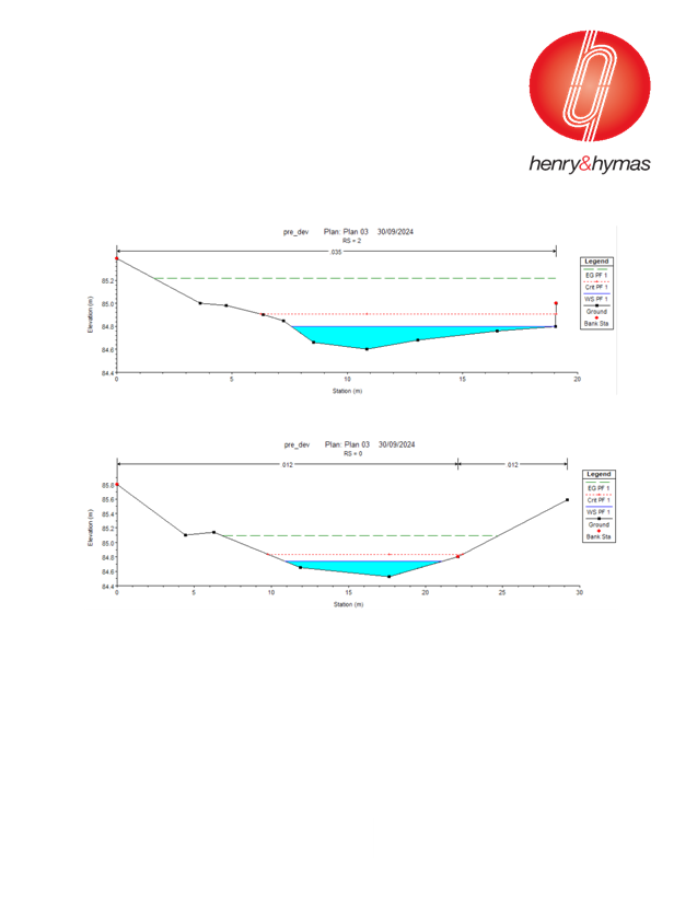
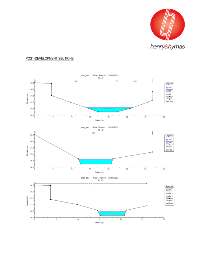
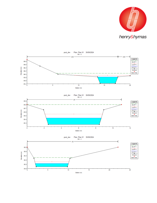
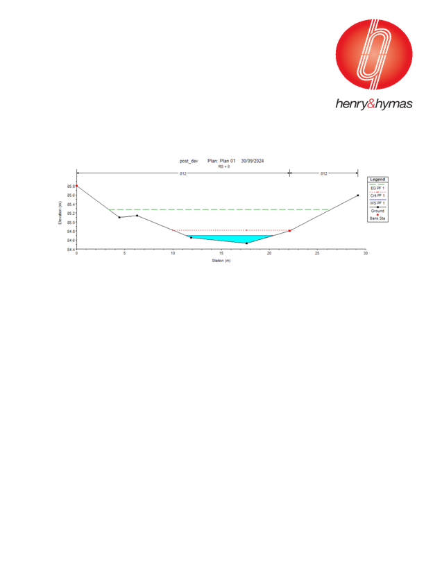
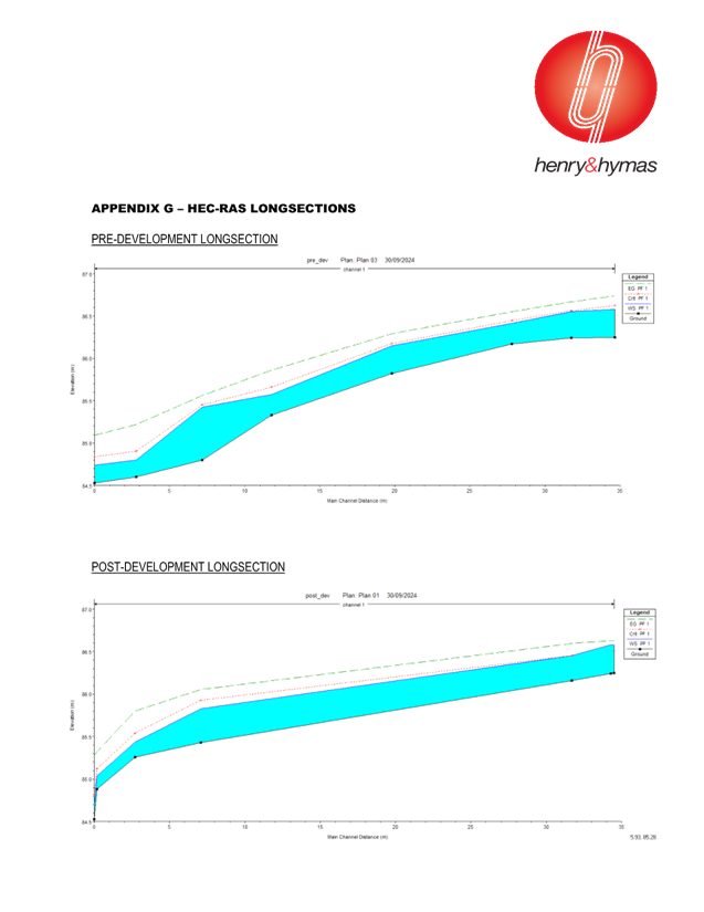
supported by a Flood Management Report, DRAINS and HEC-RAS modelling. The
report and modelling propose a swale/channel through the naturally occurring
low point on the site to convey the overland flow through the property.
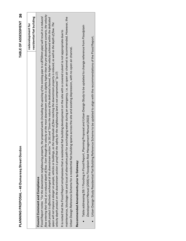
Flood Report notes “For
the downstream neighbouring property, the proposed works (including the
upsizing of the existing pipe to a Ø750mm pipe) will result in a reduced
flow entering their land, at a reduced depth of flow. Even though the velocity
at the most downstream section is slightly higher than the pre-development
scenario, the velocity depth product is effectively unchanged at this
downstream section.” (p.16) and “Given the nature of the
dedicated channel, the higher velocity achieved within the dedicated space will
not impose a danger on people, vehicles or buildings, as the magnitude of flow
reaching the downstream property is reduced, as well as the depth of flow. The
velocity depth product on the downstream section is proof that the safety for the
neighbouring land is not compromised.” (p.17)
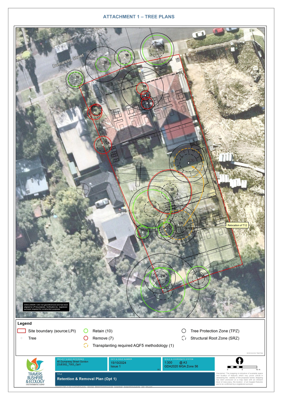
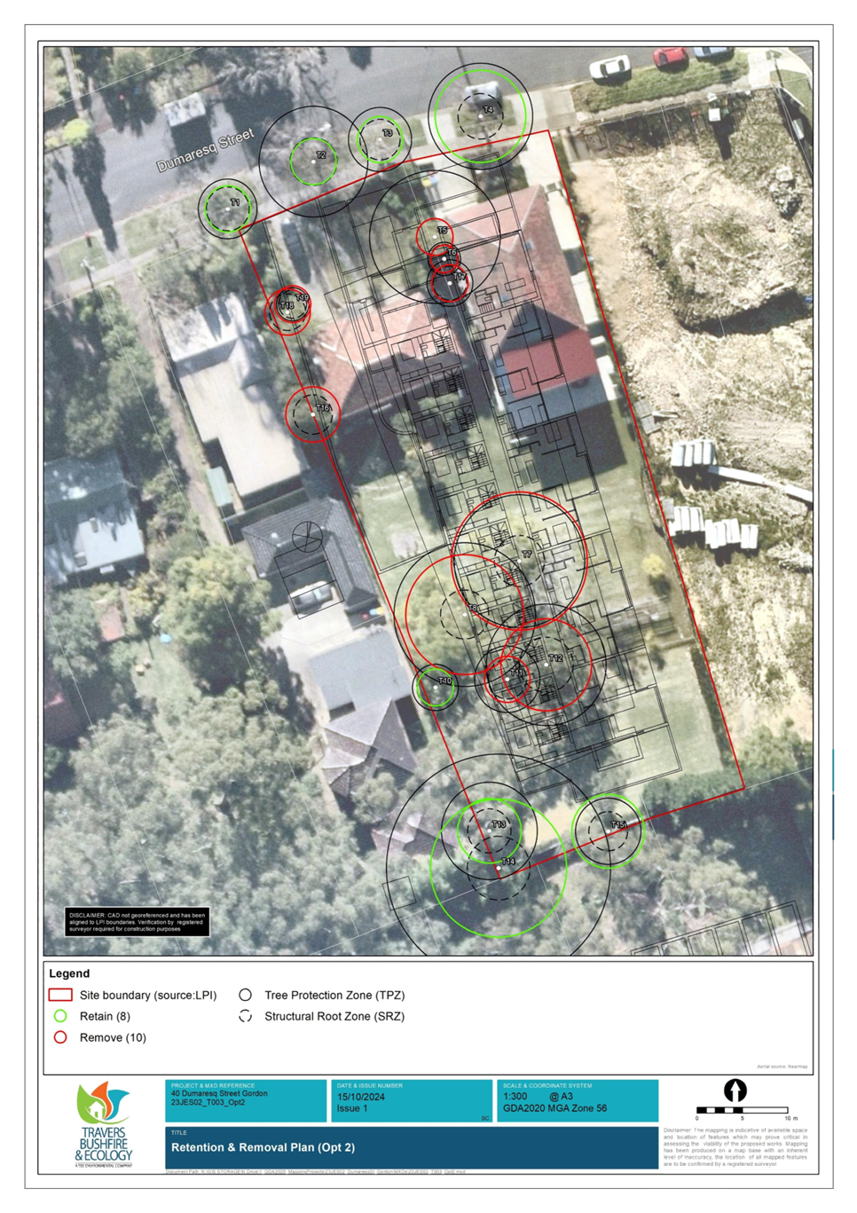
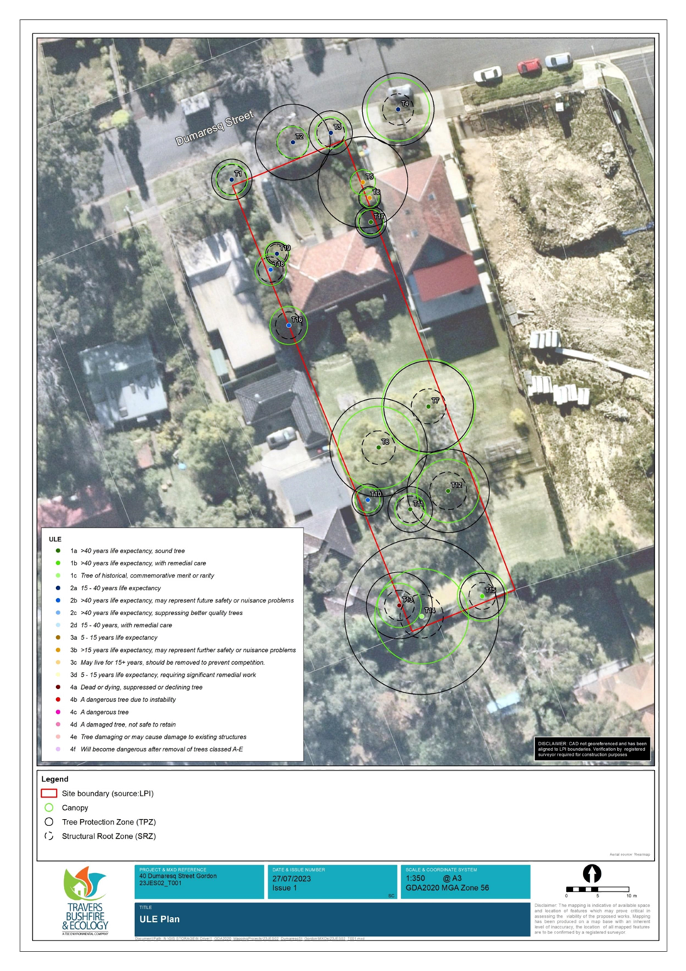
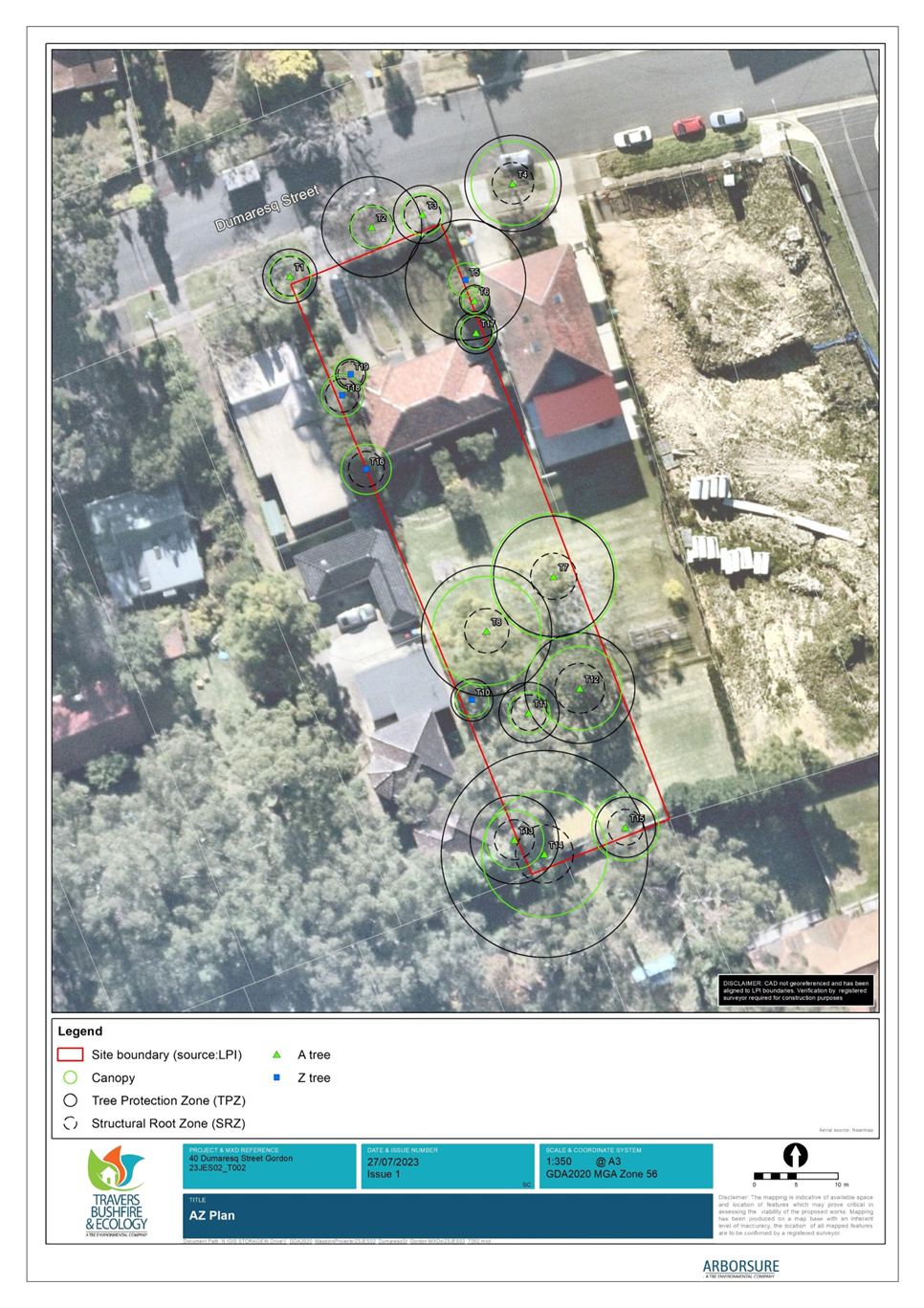
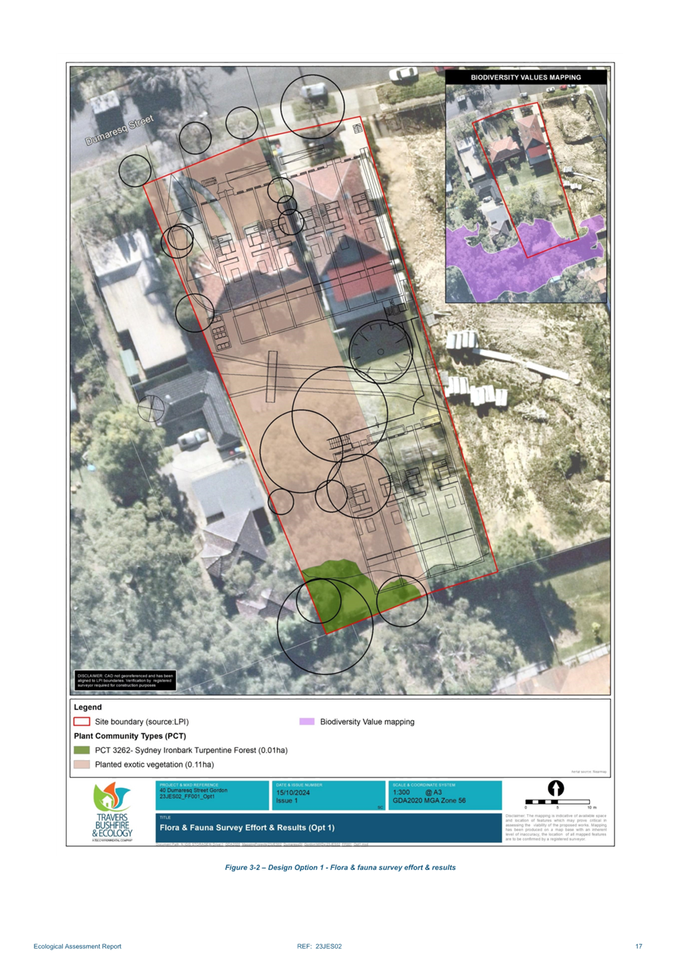
Biodiversity
The site contains Landscape
Remnant mapping as well as identified Sydney Turpentine-Ironbark Forest
vegetation at the rear of the site. The reference scheme and ecological reports
submitted with the Planning Proposal indicate that the STIF endangered ecological
community species can be retained, and that the rezoning can be accommodated
without significant impact to the biodiversity.
Strategic
Merit Assessment
Greater
Sydney Region Plan and North District Plan
The Planning Proposal is consistent with the objectives of
the Greater Sydney Region Plan – A Metropolis of Three Cities in
particular:
· Objective 4.
Infrastructure is optimised
· Objective 10.
Greater housing supply
· Objective 11.
Housing is more diverse and affordable
· Objective 14.
Integrated land use and transport creates walkable and 30-minute cities
A Metropolis of Three Cities outlines that
liveability incorporates access to housing, transport and employment, as well
as social, recreational, cultural and creative opportunities. Provision of
housing close to public transport and services and facilities improves the
opportunity for people to walk and cycle to local shops and services. The
proposal is consistent with these principles.
The Planning Proposal is consistent with the planning
priorities of the North District Plan, in particular:
· Planning Priority
N1. Planning for a city supported by infrastructure
· Planning Priority
N5. Providing housing supply, choice and affordability, with access to jobs,
services and public transport
· Planning Priority
N6. Creating and renewing great places and local centres, and respecting the
districts heritage
· Planning Priority
N12. Delivering integrated land use and transport planning and a 30-minute city
The Planning Proposal will allow for additional housing
supply in a location that enables good access via public transport to key
strategic centres such as Chatswood, St Leonards, Hornsby and Macquarie. The
Planning Proposal is in accordance with the North District Plan priorities to
focus housing in locations that support the 30 minute city and provide access
to jobs, services and public transport.
Ku-ring-gai
Local Strategic Planning Statement
The Planning Proposal is consistent with the following local
planning priorities:
· K3. Providing
housing close to transport, services and facilities to meet the existing and
future requirements of a growing and changing community
· K4. Providing a
range of diverse housing to accommodate the changing structure of families and
households and enable ageing in place
· K12. Managing
change and growth in a way that conserves and enhances Ku-ring-gai’s
unique visual and landscape character
· K21. Prioritising
new development and housing in locations that enable 30min access to key
strategic centres
· K28. Improving the
condition of Ku-ring-gai’s bushland and protecting native terrestrial and
aquatic flora and fauna and their habitats
The LSPS contains the overarching local planning priority
regarding the provision of housing close to transport, services and facilities,
and then provides additional specific detail about each centre and its
suitability for additional housing and timing. The LSPS sets out that Gordon
Local Centre is a Primary Centre as it contains a local railway station and bus
routes on an arterial road corridor and meets the criteria for 30 minute access
to a strategic centre, as well as being supported by retail services and
community facilities. The timing noted in the LSPS for future housing delivery
in 2021-2026, and 2026-2031. The Planning Proposal is consistent with these
provisions in the LSPS.
The Planning Proposal is consistent with the principles for
the location of additional housing as set out in the LSPS:
· Locate high
density housing types within a 10 min walk (800m radius) of Primary and
Secondary Local Centres
· Locate medium
density built forms and other housing types on interface and transition areas
where they function as a buffer between differing scale of building or
differing land use types
· In considering
areas for future medium and high density housing form, the following areas are
to be avoided:
o Heritage conservation areas.
o Areas of visual or aesthetic
quality and character.
o Areas within or affecting
scenic and cultural landscapes.
o Areas of intact tree canopy
where the built form does not sit under the canopy.
o Areas with multiple
constraints including steep topography.
o Areas with environmental
values.
o Areas that are bushfire prone
and with evacuation risk.
o Centres with limited transport
and service access until improvements are implemented.
The site that is the subject of the Planning Proposal is not
constrained by heritage, scenic or cultural landscape or bushfire prone land.
While the site does have intact tree canopy and environmental values, the site
has capacity to accommodate additional housing and ensure future development is
located outside of areas of environmental values.
Ku-ring-gai
Housing Strategy and Letter of Approval Conditions
Council’s adopted Ku-ring-gai Housing Strategy
provides all new dwellings to 2036 from capacity within the existing planning
controls and zoning. As the Planning Proposal is seeking to upzone the site and
amend the development controls to enable delivery of more housing on the site,
it is inconsistent with the Housing Strategy.
The amendments sought by the Planning Proposal will enable
the delivery of an addition 10 townhouse style dwellings on the site under the
R3 Medium Density zoning and provisions contained in the KLEP 2015 for multi
dwelling housing.
In approving the Ku-ring-gai Housing Strategy, the
Department of Planning, Industry and Environment issued a number of approval
conditions, one of which is:
2. Consistent
with Priority K3 of the Ku-ring-gai Local Strategic Planning Statement (LSPS),
Council is to commence a masterplan, or accommodate proponent-led planning
proposal(s) with good planning outcomes, for Gordon, Lindfield and/or
Turramurra local centres. Planning proposal(s) for these centres are to be
submitted to the Department for Gateway Determination by December 2022. Where
this work is not pursued by Council the Department welcomes good place-based
approaches by landowner/developers.
At OMC 16 November 2021 Council resolved to reject the
Housing Strategy conditions of approval. As Council has not committed to a work
program, the subject Planning Proposal submitted by the landowners is
consistent with the requirements of Condition 2. The Planning Proposal will
enable the provision of additional housing on the site in an area that is close
to public transport, services and community facilities.
Section 9.1 Ministerial Directions and
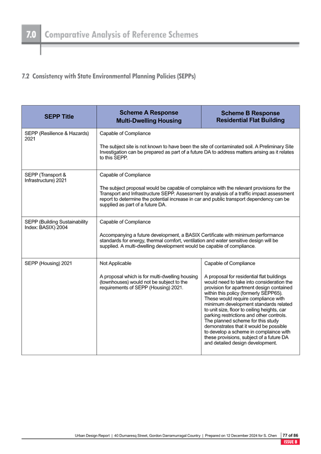
State Environmental Planning Policies (SEPPs)
The Planning Proposal is not inconsistent with the State
Environmental Planning Policies (SEPPs) applicable to the site. Many of these
SEPPs contain detailed provisions and controls which would only apply at the
Development Application stage. The Planning Proposal is consistent with the
applicable s9.1 Ministerial Direction, specifically those relating to:
· 3.1 Residential
Zones
· 3.4 Integration of
Land Use and Transport
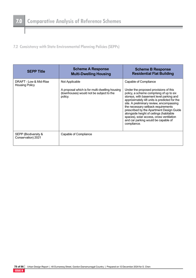
Low and
Mid-Rise Housing Policy
From 15 December 2023 – 23 February 2024, the NSW
Department of Planning, Housing and Infrastructure (DPHI) placed on exhibition
an Explanation of Intended Effect (EIE) ‘Changes to create low and
mid-rise housing’. Following the exhibition, DPHI released the Low
and Mid-Rise Housing Policy Refinement Paper (April 2024). The
following amendments are proposed to enable the delivery of additional low and
mid-rise housing within NSW and the Six Cities Region:
Low Rise – Terraces and Townhouses
On land zoned R2 (low density residential) within 800m of
station and nominated centres:
· terraces and
townhouses up to 9.5m high and FSR 0.7:1
· manor houses up to
9.5m high and floor space ratio 0.8:1.
On all land zoned R2 (low density residential)
· Dual occupancies
up to 9.5m high and FSR of 0.65:1, provided the minimum lot size is 450 square
metres and a minimum 12m in width.
Mid-rise Apartment Buildings and Shop-top Housing
On land zoned R4 (high density) and R3 (medium density)
within 400m of stations and nominated centres:
· Height:
o 22m high for residential flat
buildings
o 24m for shop top housing
o Maximum 6 storey
· Floor Space Ratio
of 2.2:1
On land within 400m-800m of stations and nominated centres:
· R3 (medium
density): up to 16m high (approx. 4 to 5 storey) apartments at a floor space
ratio of 2:1
Gordon local centre will be a nominated centre, and the
subject site is located within 800m of the E1 Local Centre zone. Accordingly,
the Low Rise provisions will apply to the subject site under the current R2 Low
Density Residential zoning, and the Mid-Rise provisions will apply should the
site be rezoned to R3 Medium Density Residential as sought by this Planning
Proposal.
The State Environmental Planning Policy (Housing) Amendment
(Dual Occupancies and Semi-detached Dwellings) 2024 (Amendment SEPP) commenced
on 1 July 2024. The DPHI has advised that the other low and mid-rise housing
reforms will commence sometime in 2025.
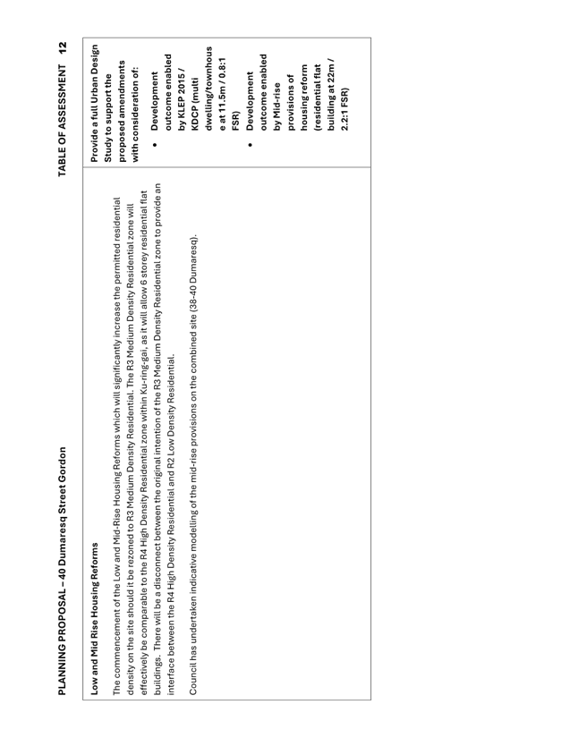
The commencement of the Low and
Mid-Rise Housing Reforms will have significant impact on the Planning Proposal
and outcomes on the site. Should the subject site be rezoned to R3 Medium
Density Residential as sought in this Planning Proposal, the site will be able
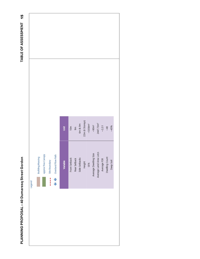
to be developed under the ‘Mid-rise’ provisions which permit a
residential flat building of 22m (6 storey) and an FSR of 2.2:1 (based on the
details contained in the Low and Mid-Rise Housing Policy Refinement Paper
April 2024).
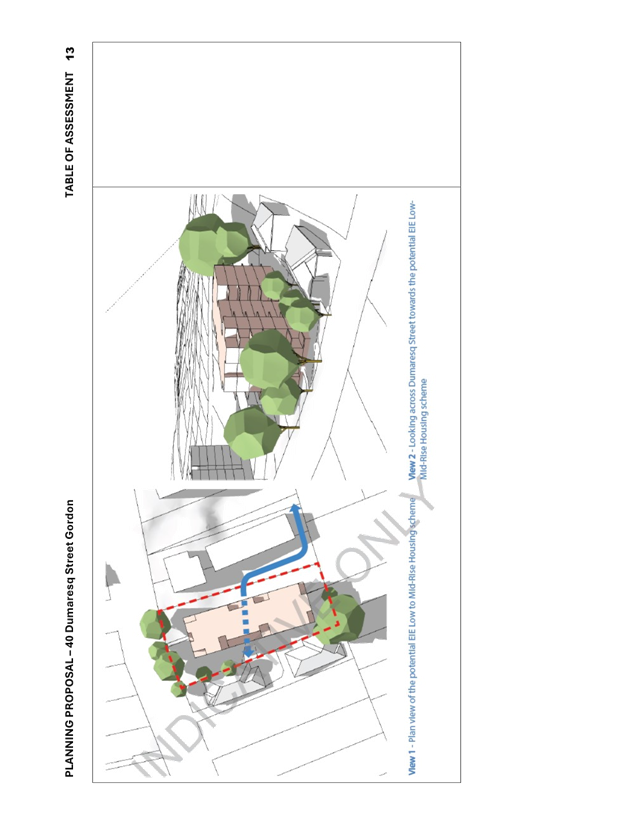
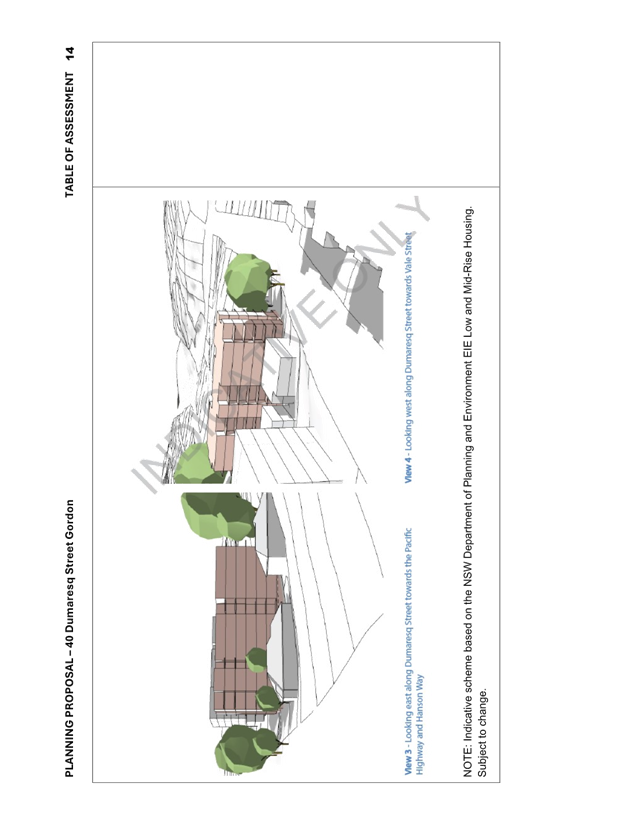
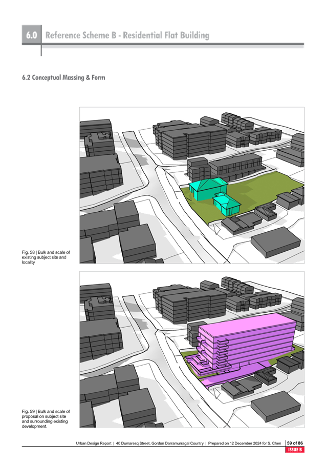
This will result in an
inconsistent pattern of development along Dumaresq Street, Gordon with the
transition from high density apartments at the top of Dumaresq Street, to
medium density townhouses on 34-36 Dumaresq Street and then back to high
density apartments on 38 Dumaresq Street and the subject site.
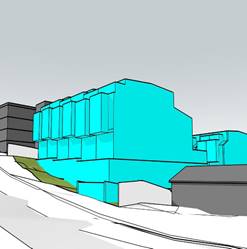
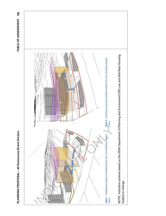
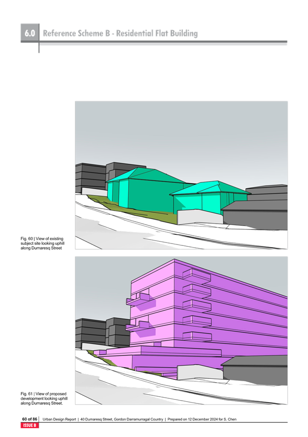
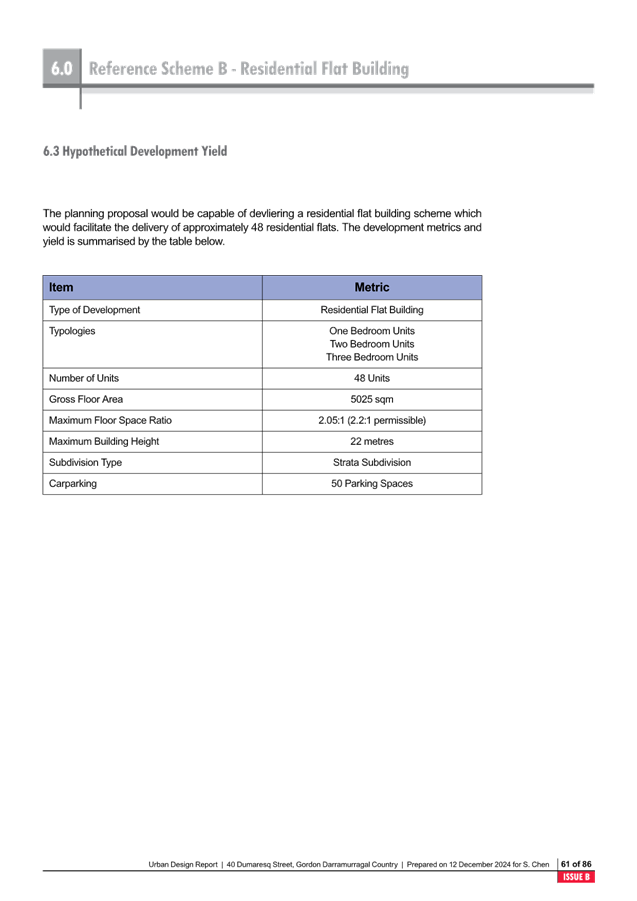
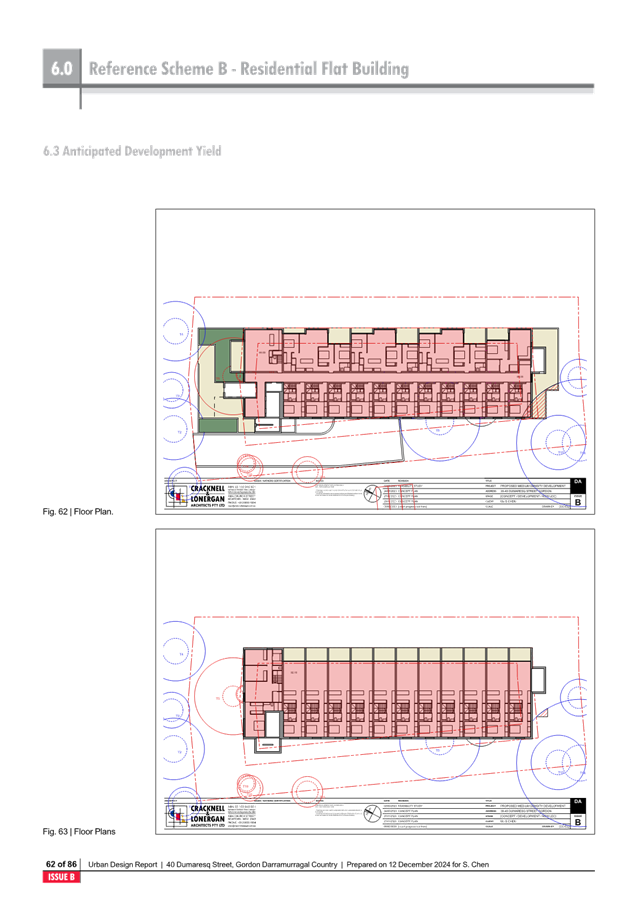
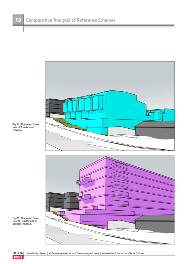
The amended Urban Design Study
includes a reference scheme for a 6 storey residential flat building on the
subject site under the provisions of the Low and Mid Rise Housing Policy.
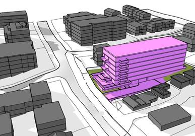
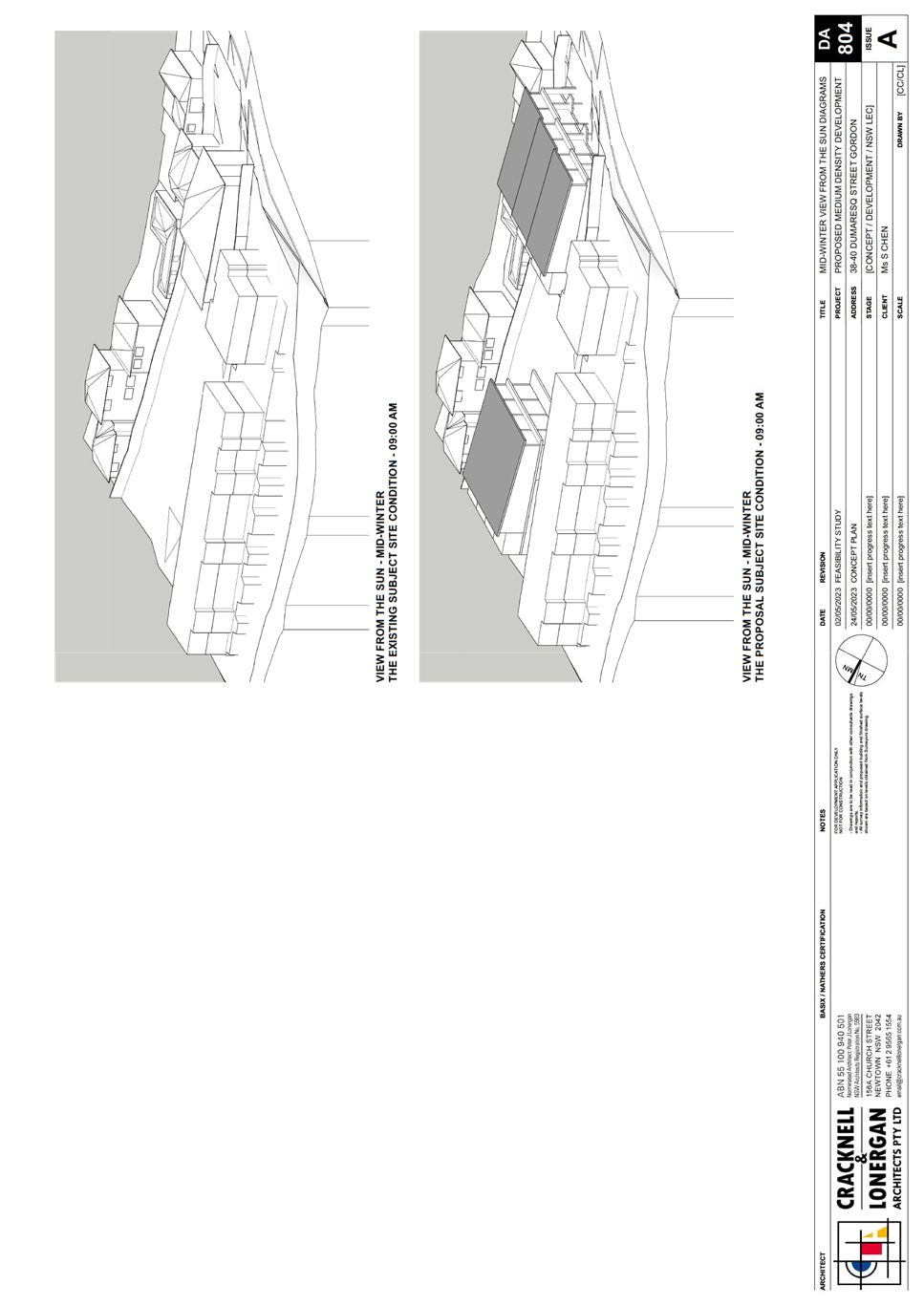
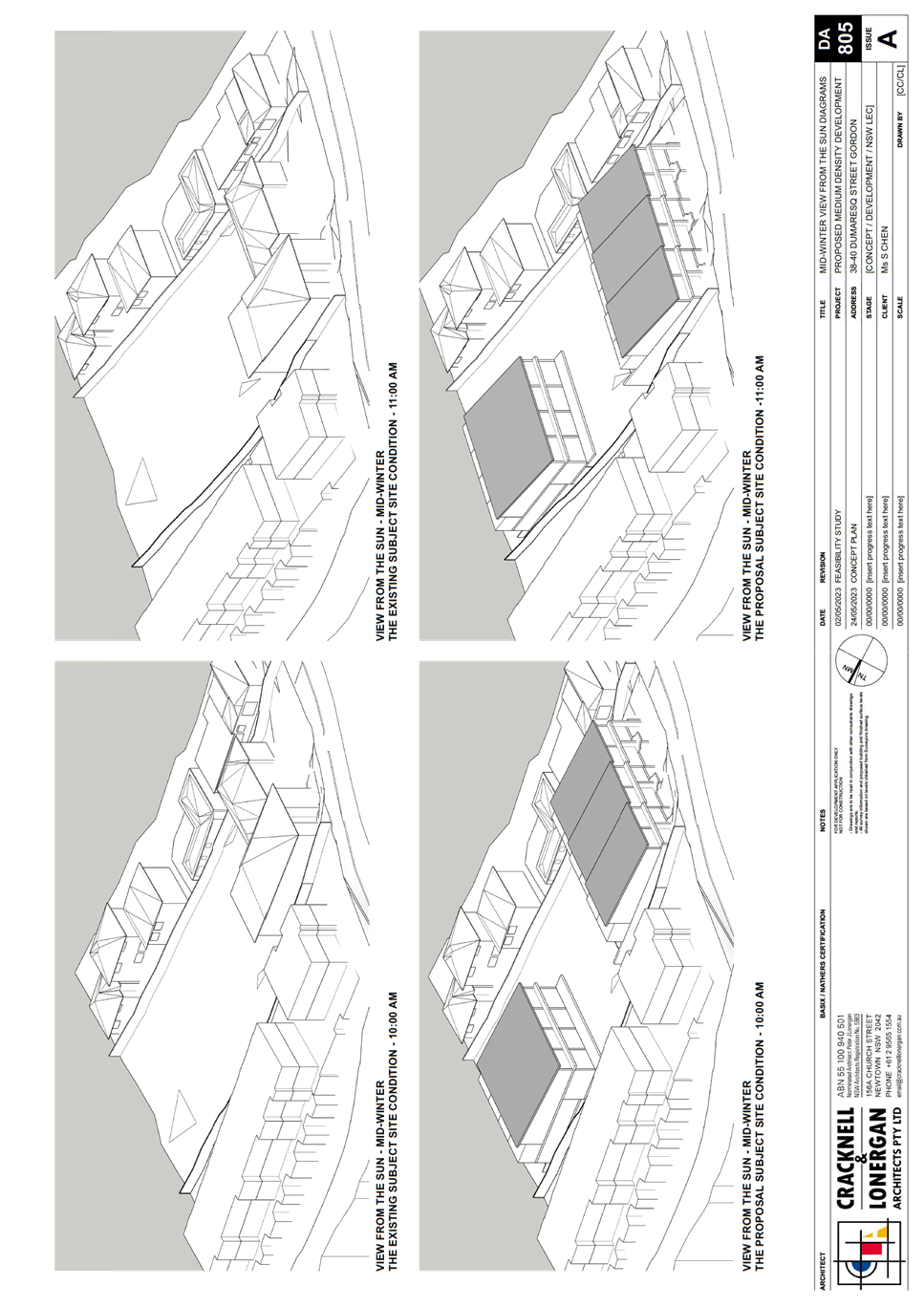
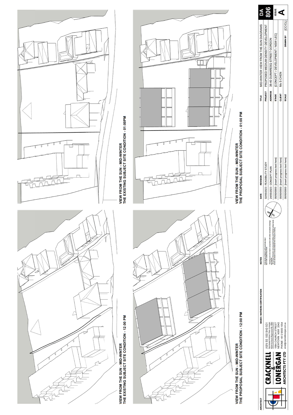
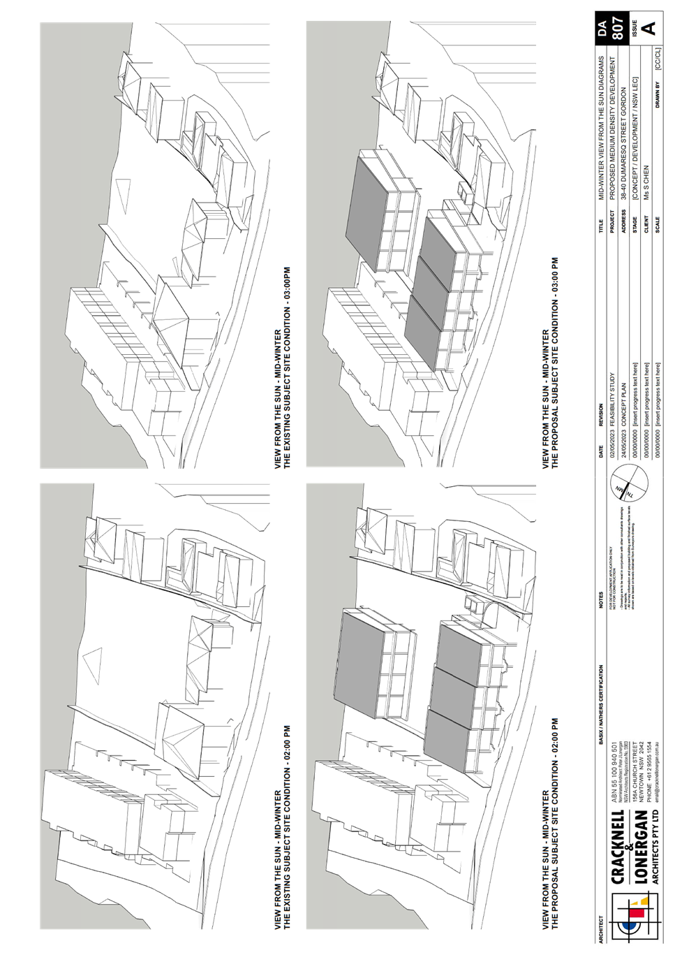
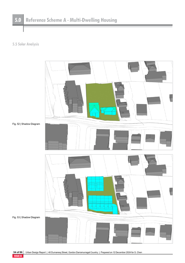
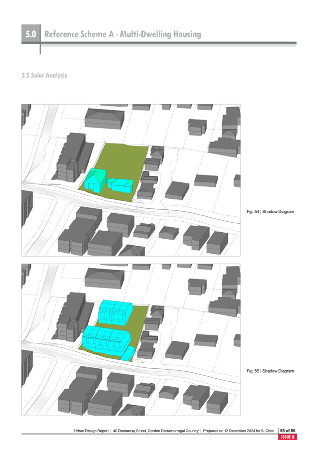
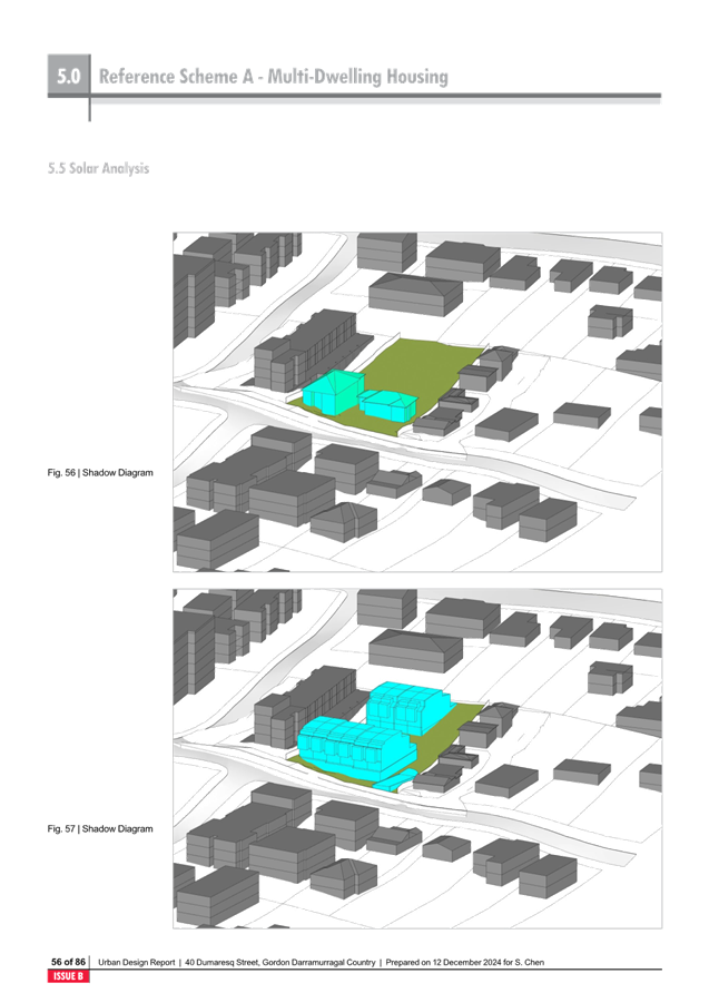
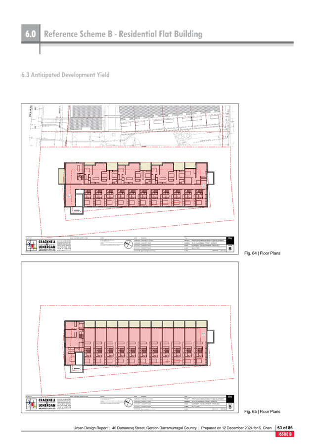
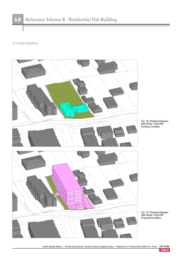
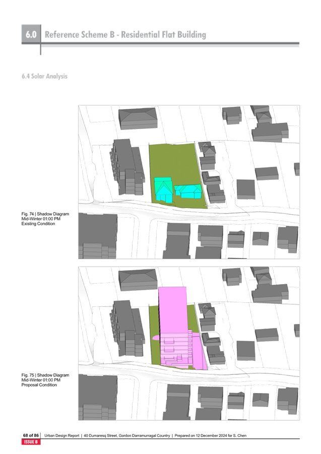
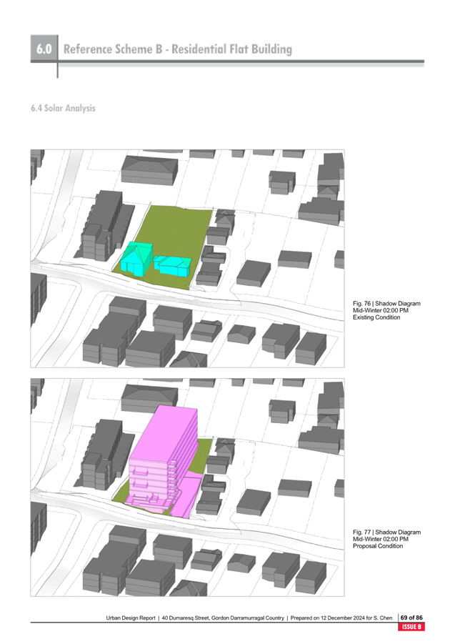
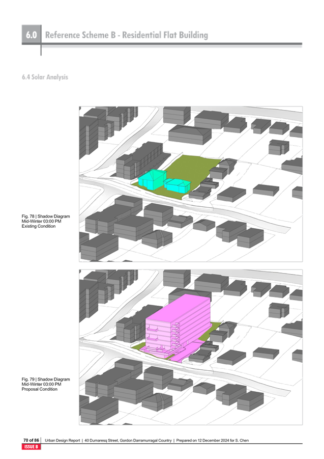
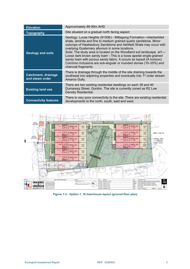
Image – Reference
Scheme B Residential Flat Building – Urban Design Study
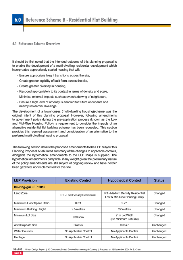
The R3 Medium Density Residential
zone will effectively be comparable to the R4 High Density Residential zone
within Ku-ring-gai, as it will allow 6 storey residential flat buildings.
There will be a disconnect between the original intention of the R3 Medium
Density Residential zone to provide an interface between the R4 High Density
Residential and R2 Low Density Residential.
There is considerable change in
height from the current controls (9.5m) in the KLEP 2015, to the 22m permitted
by the reforms.
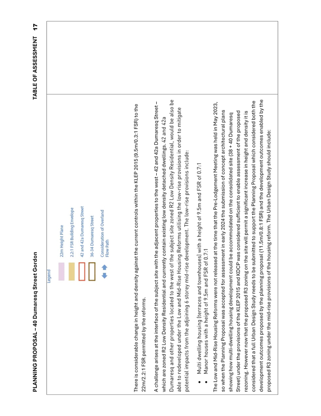
A challenge arises at the
interface of the subject site with the adjacent properties to the west –
42 and 42a Dumaresq Street – which are zoned R2 Low Density Residential
and currently contain existing low density detached houses. 42 and 42a Dumaresq
and other properties located to the west of the subject site zoned R2 Low
Density Residential, would also be able to be redeveloped under the Low and
Mid-Rise Housing Reforms utilising the low-rise provisions in order to mitigate
potential impacts from the adjoining 6 storey mid-rise development. The
low-rise provisions include:
· Multi dwelling housing (terraces and townhouses) with a
height of 9.5m and FSR of 0.7:1
· Manor houses with a height of 9.5m and FSR of 0.7:1
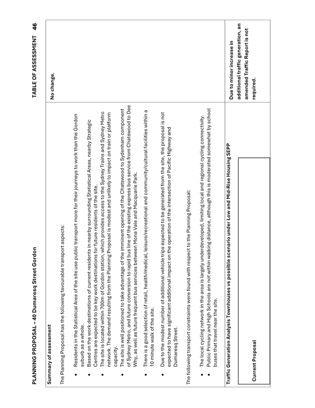
Council’s Strategic Traffic
Engineer has reviewed the weekday peak hour traffic generation from the R3
Medium Density Townhouse proposal vs the Mid-Rise 6 Storey apartment proposal.
|
Current Proposal
|
|
|
Peak Traffic
Generation
(vehicle trips
per hour)
|
Less Existing
Traffic Generation
(vehicle trips
per hour)
|
Net Peak
Hour Traffic Generation
(vehicle trips
per hour)
|
|
10 Townhouses
(0.65 trips per
dwelling)
|
7
|
2
|
5
|
|
Low-Mid Rise Scenario
|
|
48 Apartments
(0.19 trips per
dwelling)
|
10
|
2
|
8
|
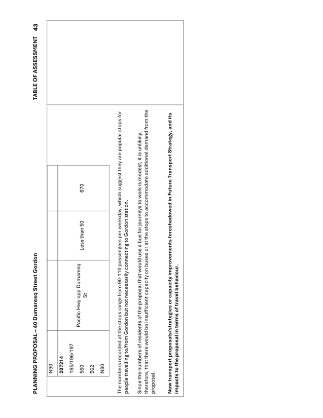
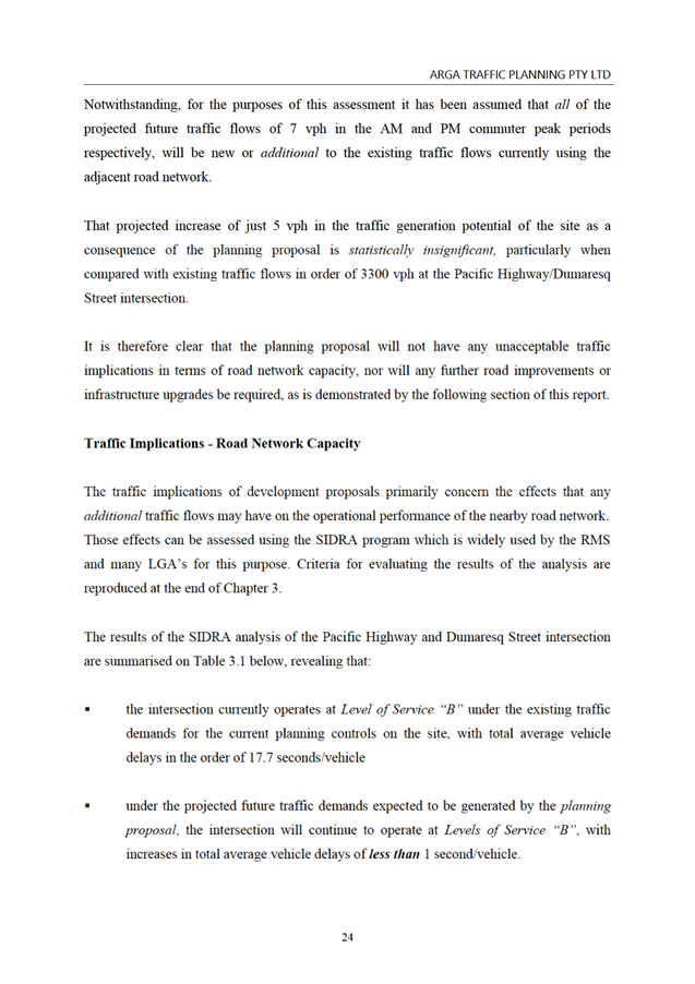
The impacts of the additional 3 trips during the peak hour
generated by the mid-rise scenario over the current proposal would not be
noticeable in any traffic modelling of nearby intersections.
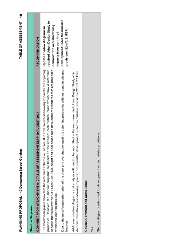
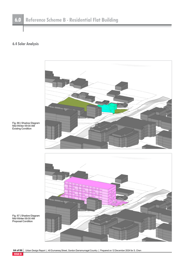
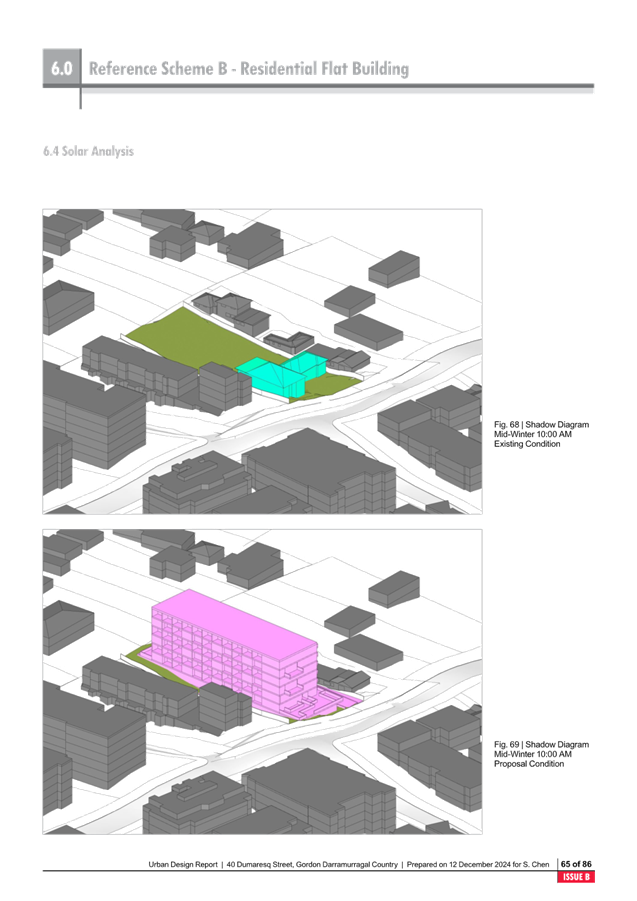
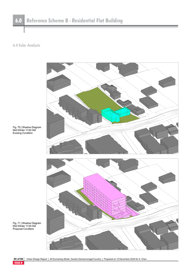
It is noted that the Flood Report emphasises that a
residential flat building development on the site with a covered culvert is not
appropriate due to maintenance, blockage risk and lack of alternative path for
surcharging water during an emergency. i.e. an open air channel is recommended.
However, the Urban Design Reference Scheme for a residential flat building
spans across the site and existing depression, with no open air channel.
It is recommended that prior to submission to Gateway Determination that the
Urban Design Study Residential Flat Building Reference Scheme to be updated to
align with the recommendations of the Flood Report, by showing an open air
channel.
Alternative
Scenarios to the TOD SEPP
On 8 May 2024 Council resolved to commence studies and
alternative scenarios around the four Transport Orientated Development
Precincts – of Gordon, Killara, Lindfield and Roseville. On
30 October 2024 Council resolved to place 5 scenarios on public
exhibition. The alternative scenarios examine different percentages of Heritage
Conservation Area protection, different building heights and different spread
and were placed on public exhibition from 15 November to 17 December 2024.
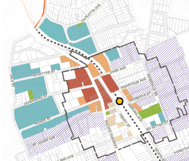
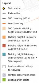
Scenario 3b – Preserve, Intensify and Expand looks at
preserving all HCA’s within 400m of stations and expanding the spread of
new dwellings from 400m to 800m. As part of this scenario building heights
ranging from 5-8 storeys are extended down Dumaresq Street, from Hansen Way to
Vale Street.
Image: Public Exhibition Version
Council Alternative Scenario 3b Gordon
Council will consider community feedback at a meeting in
March 2025. If there is support for a preferred scenario, Council may request
the NSW Government for approval to formally exhibit it to replace the TOD
policy. The exhibition will be a further opportunity for the public to comment.
Recommended
Amendments prior to Gateway Determination
It is recommended that prior to submission to Gateway
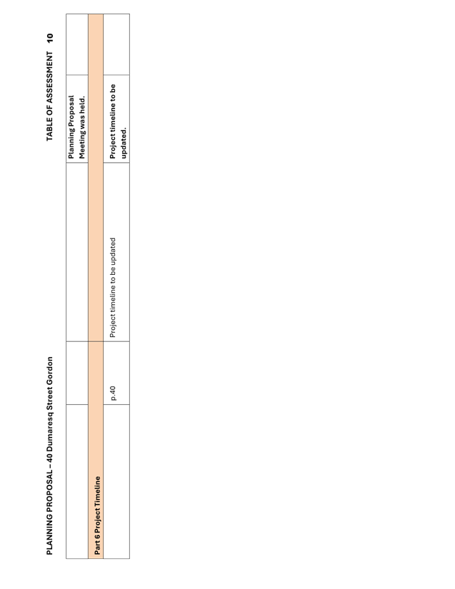
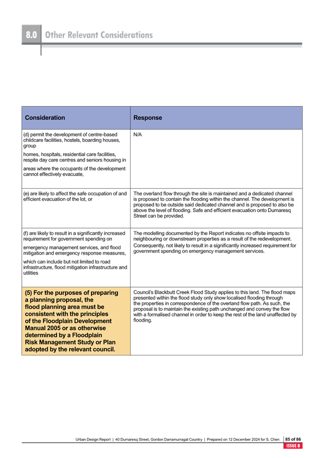
Determination that the Planning Proposal documentation be updated as follows:
· Table addressing
S9.1 Flooding in Flood Report, Planning Proposal and Urban Design Study to be
updated to change reference from Floodplain Development Manual (2005) to
Floodplain Risk Management Manual (2023)
· Urban Design Study
Residential Flat Building Reference Scheme to be updated to align with the
recommendations of the Flood Report, by showing an open air channel.
integrated planning and reporting
Theme 3: Places, Spaces and
Infrastructure
|
Community Strategic
Plan Long Term Objective
|
Delivery Program
Term Achievement
|
Operational Plan
Task
|
|
P2.1 A robust planning framework is in place to deliver
quality design outcomes and maintain the identity and character of
Ku-ring-gai
|
P2.1.1 Land use strategies, plans and processes are in
place to protect existing character and effectively manage the impact of new
development
|
P2.1.1.2 Continue to review the effectiveness of existing
strategies, local environmental plans, development control plans and
processes across all programs
|
Governance Matters
The process for the preparation and
implementation of Planning Proposals is governed by the provisions contained in
the Environmental Planning and Assessment Act 1979 and the Environmental
Planning and Assessment Regulation 2000.
Local Planning Panels Direction – Planning Proposals
issued by the Minister for Planning under Section 9.1 of the Environmental
Planning and Assessment Act 1979 requires Council to refer all Planning
Proposals prepared after 1 June 2018 to the Local Planning Panel for advice,
before the Planning Proposal is forwarded to the Minister for a Gateway
Determination under Section 3.34 of the Environmental Planning and Assessment
Act 1979.
Risk Management
This is a privately-initiated
Planning Proposal. Council needs to determine its position on the matter as to
whether the Planning Proposal should proceed to Gateway Determination.
Financial Considerations
The Planning Proposal was subject to
the relevant application fee under Council’s 2023/2024 Schedule of Fees
and Charges. The cost of the review and assessment of the Planning Proposal is
covered by this fee.
Social Considerations
The amendments to the height of buildings and floor space
ratio sought by the Planning Proposal would enable the delivery of new
dwellings in order to meet the existing and future requirements of a growing
and changing community:
· approximately 10 townhouse style dwellings on a
consolidated development site with the adjoining property 38 Dumaresq Street
under the proposed R3 Medium Density development standards of 0.8:1 and 11.5m
· approximately 48 apartments on a consolidated development
site with the adjoining property 38 Dumaresq Street under the provisions
contained in the Low and Mid-Rise Housing Reforms.
Environmental Considerations
The site has been identified
as being impacted by the Overland Flow Flood Planning Area, and in addition the
owner has stated they have experienced flooding from 34-36 Dumaresq Street.
The site contains Landscape
Remnant mapping as well as identified Sydney Turpentine-Ironbark Forest
vegetation at the rear of the site. The reference scheme and ecological reports
submitted with the Planning Proposal indicates that the STIF endangered ecological
community species can be retained, and that the rezoning can be accommodated
without significant impact to the biodiversity.
Community Consultation
In the event that the Planning
Proposal is issued a Gateway Determination by the Department of Planning,
Housing and Infrastructure the Planning Proposal would be placed on statutory
public exhibition in accordance with the requirements of the Gateway Determination,
and Council’s Community Participation Plan.
Internal Consultation
The assessment of the Planning Proposal has included
internal consultation with Council staff with expertise in planning, natural
areas, traffic and transport and Urban Design has informed the recommendations
of this Report.
Summary
A Planning Proposal has been
submitted for 40 Dumaresq Street Gordon. The Planning Proposal seeks to:
· Rezone from R2 Low
Density Residential to R3 Medium Density Residential
· Amend Height of
Buildings Development Standard from 9.5m to 11.5m
· Amend Floor Space
Ratio Development Standard from 0.3:1 to 0.8:1
· Amend Minimum Lot
Size Development Standard from 930sqm to 1,200sqm
The objective of the Planning Proposal is to rezone the
subject site to R3 Medium Density Residential so that it may be consolidated
and developed together with 38 Dumaresq Street, which is in the same ownership.
This would overcome the isolated status of 38 Dumaresq Street.
The rezoning to R3 Medium Density Residential and the
associated development standards which would enable a townhouse style
development are considered to demonstrate site specific and strategic merit.
The forthcoming Low and Mid-Rise Housing reforms complicate
the Planning Proposal as they will have significant impact on the development
outcomes on the site. Should the subject site be rezoned to R3 Medium Density
Residential as sought in this Planning Proposal, the site will be able to be
developed under the ‘Mid-rise’ provisions which permit a
residential flat building of 22m (6 storey) and an FSR of 2.2:1.
Recommendation:
That that Ku-ring-gai Local Planning Panel advise Council
that:
A. Prior
to submission to Gateway Determination that the Planning Proposal documentation
be updated as follows:
1. Table
addressing S9.1 Flooding in Flood Report, Planning Proposal and Urban Design
Study to be updated to change reference from Floodplain Development Manual
(2005) to Floodplain Risk Management Manual (2023)
2. Urban
Design Study Residential Flat Building Reference Scheme to be updated to align
with the recommendations of the Flood Report, by showing an open air channel.
B. That
the amended Planning Proposal be submitted for a Gateway Determination.
|
Alexandra Plumb
Urban Planner
|
Craige Wyse
Team Leader Urban Planning
|
|
Antony Fabbro
Manager Urban & Heritage Planning
|
|
|
Attachments:
|
A1 ⇩ ⇩
|
Review
Table Amended Documents KLPP - 40 Dumaresq Street Gordon
|
|
2024/366174
|
|
|
A2⇩
|
Planning
Proposal 40 Dumaresq Street Gordon (December 2024)
|
|
2025/022448
|
|
|
A3 ⇩ ⇩
|
Appendix
A - Concept Plans 40 Dumaresq Street Gordon
|
|
2024/255202
|
|
|
A4⇩
|
Appendix
B - Shadow Diagrams 40 Dumaresq Street Gordon
|
|
2024/255209
|
|
|
A5⇩
|
Appendix
C - Urban Design Report 40 Dumaresq Street Gordon
|
|
2025/022450
|
|
|
A6⇩
|
Appendix
D - Arboricultural Impact Assessment (December 2024) 40 Dumaresq Street
Gordon
|
|
2025/022444
|
|
|
A7⇩
|
Appendix
E - Tree Relocation Methodology (Magnolia Mature) - 40 Dumaresq Street,
Gordon
|
|
2024/213532
|
|
|
A8⇩
|
Appendix
F - 40 Dumaresq Street, Gordon - Ecological Assessment Report (29 Nov 2024)
|
|
2025/022445
|
|
|
A9⇩
|
Appendix
G - Flood Management Report (December 2024) 40 Dumaresq Street Gordon
|
|
2025/022447
|
|
|
A10⇩
|
Appendix
H - TRAFFIC REPORT 40 Dumaresq Street Gordon
|
|
2024/255220
|
|
|
A11⇩
|
Appendix
I - Site Survey - 40 Dumaresq Street, Gordon
|
|
2024/255238
|